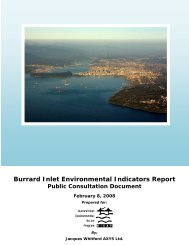
Consolidated Environmental Management Plan for Burrard Inlet ...
Consolidated Environmental Management Plan for Burrard Inlet ...
Consolidated Environmental Management Plan for Burrard Inlet ...

Create successful ePaper yourself
Turn your PDF publications into a flip-book with our unique Google optimized e-Paper software.
32<br />
<strong>Consolidated</strong> <strong>Environmental</strong> <strong>Management</strong> <strong>Plan</strong> <strong>for</strong> <strong>Burrard</strong> <strong>Inlet</strong> / Appendices<br />
The Inner Harbour<br />
<strong>Burrard</strong> <strong>Inlet</strong>’s Inner Harbour extends from the First<br />
to the Second Narrows, some 8.8 linear kilometres,<br />
with a mean depth of 21 meters and a maximum<br />
depth of 66 meters. The Inner Harbour is separated<br />
from the Outer Harbour by an 18-metre sill at First<br />
Narrows and from the Central Harbour by a 14.5-metre<br />
sill at Second Narrows. Its waters are well circulated,<br />
driven largely by tidal currents in the two narrows.<br />
Most of the <strong>Inlet</strong>’s industrial activity is concentrated<br />
here, and little if any of the original shoreline<br />
remains unaltered. The shores are characterized<br />
by marine and intermodal transport facilities and<br />
infrastructure including bulk and container terminals<br />
and the rail and road services that connect them<br />
to the rest of the continent. In some areas, such<br />
as Coal Harbour near Stanley Park and parts of<br />
the City of North Vancouver, redevelopment of the<br />
older industrial waterfront has created new high<br />
amenity residential and recreational areas.<br />
The Squamish Nation has three reserves on the<br />
Inner Harbour; one at the mouth of the Capilano<br />
River, one surrounding the mouth of Mosquito Creek<br />
and one at the mouth of the Seymour River.<br />
The Central Harbour<br />
<strong>Burrard</strong> <strong>Inlet</strong>’s Central Harbour consists of the area<br />
bounded by Second Narrows on the west, Admiralty<br />
Point some 7.8 kilometres to the east, and Turtle<br />
Head to the north. Thalweg depths range between<br />
17 and 65 metres. As <strong>for</strong> the Inner Harbour, the<br />
waters of the Central Harbour are well circulated,<br />
with fresh water input from the Seymour River<br />
and tidal exchange in the Second Narrows.<br />
Bordering North Vancouver District, the City of<br />
Burnaby and the Village of Belcarra, the harbour<br />
contains both modifi ed and natural shoreline.<br />
The Maplewood Wildlife Conservation Area is<br />
located on the north shore. The Tsleil-Waututh<br />
Nation has a reserve on the Central Harbour’s<br />
northern shore. Fisheries and Oceans Canada<br />
has established a Rockfi sh Conservation Area<br />
on the south shore of the Central Harbour.<br />
Port Moody Arm<br />
Port Moody Arm, the eastern most portion of <strong>Burrard</strong><br />
<strong>Inlet</strong>, is relatively shallow (average depth about 10<br />
m) and has relatively slow circulation with little direct<br />
freshwater infl ow. Most of its shores fall within the<br />
City of Port Moody. The Arm development is mostly<br />
suburban in nature, with some signifi cant industrial<br />
uses. Trails, parks and recreational marinas border<br />
much of the basin. The area includes the important<br />
recreational areas of Admiralty Park and Belcarra<br />
Regional Park. The eastern end of Port Moody Arm<br />
contains extensive tidal fl ats that have important<br />
habitat values <strong>for</strong> fi sh and wildlife. The 2009 <strong>Burrard</strong><br />
<strong>Inlet</strong> Habitat Inventory found Central Harbour and Port<br />
Moody Arm to host the majority of unaltered habitat.<br />
Indian Arm<br />
Indian Arm is the most pristine area of <strong>Burrard</strong> <strong>Inlet</strong>.<br />
It is a steep-sided, 30-kilometre long fjord that<br />
branches north from the Central Harbour east of<br />
the Second Narrows. It has a mean depth of about<br />
120 m, a maximum depth of 218 m, a 27 m deep<br />
sill at the entrance and steep mountain walls.<br />
Tsay Nuth Khaw Yum Provincial Park encompasses<br />
the shores of the northern part of Indian Arm fjord.<br />
This 6,821-hectare park encompasses old-growth<br />
<strong>for</strong>ests, several alpine lakes, a 50 m high waterfall<br />
(Granite Falls), a large alluvial fan, numerous creeks<br />
and the Indian River estuary. The Indian River<br />
estuary is a vital protected habitat <strong>for</strong> species of<br />
prawn, crab, salmon and waterfowl. Harbour seals<br />
also commonly frequent the area. Indian Arm Marine<br />
Provincial Park consists of Raccoon and Twin Islands.<br />
Fisheries and Oceans Canada has established<br />
Rockfi sh Conservation Areas in Indian Arm<br />
at Twin Islands and at Croker Island.<br />
The Indian River enters the extreme north end of<br />
Indian Arm and creates a marshy delta that attracts<br />
wildlife. The Tsleil-Waututh Nation has a reserve in<br />
the Indian River estuary at the head of Indian Arm.