Landmarke 8 engl_2007_Neu - Geopark Harz
Landmarke 8 engl_2007_Neu - Geopark Harz
Landmarke 8 engl_2007_Neu - Geopark Harz

You also want an ePaper? Increase the reach of your titles
YUMPU automatically turns print PDFs into web optimized ePapers that Google loves.
Selected Hotels<br />
1 2<br />
3 4<br />
5<br />
1 „Zum Klosterfischer“<br />
Blankenburg/Michaelstein<br />
www.klosterfischer.de<br />
(00493944) 351114<br />
2 Hotel „Der Kräuterhof“<br />
Drei Annen Hohne<br />
www.hotel-kraeuterhof.de<br />
(004939455) 840<br />
3 Waldgasthaus und Hotel<br />
"Drei Annen"<br />
Drei Annen-Hohne<br />
www.drei-annen.de<br />
T (004939455) 570-0<br />
4 Hotel Blocksberg<br />
Silstedt<br />
www.hotel-blocksberg.de<br />
T (00493943) 54710<br />
5 Hotel „Am Anger“<br />
Wernigerode<br />
www.hotel-am-anger.de<br />
T (00493943) 9232-0<br />
®<br />
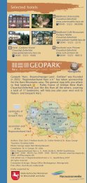
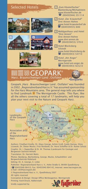
<strong>Geopark</strong> „<strong>Harz</strong> . Braunschweiger Land . Ostfalen“ was founded<br />
in 2002. „Regionalverband <strong>Harz</strong> e.V.“ has assumed sponsorship<br />
for the <strong>Harz</strong> Mountains area. The general map tells you where<br />
to find Landmark 8 The Wernigerode Castle. This flyer, like<br />
all the others covering a total of 17 landmarks, will help you<br />
plan your next visit to the Nature and <strong>Geopark</strong> <strong>Harz</strong>.<br />
Landmarks<br />
of the <strong>Geopark</strong>-<br />
<strong>Harz</strong><br />
Association area<br />
of the<br />
Regionalverband<br />
<strong>Harz</strong><br />
14<br />
Goslar<br />
Halberstadt<br />
3<br />
1 2<br />
8<br />
Wernigerode<br />
Quedlinburg<br />
4<br />
Osterode a.H.<br />
9 Aschersleben<br />
11<br />
13<br />
5<br />
15<br />
16 6 10<br />
Nordhausen<br />
7<br />
Sangerhausen<br />
12<br />
17<br />
Eisleben<br />
Schönebeck<br />
Bernburg<br />
Authors: Friedhart Knolle, Dr. Klaus George, Achim Groß, Guido Harnau, Silvia<br />
Lisowski, Dr. Dieter Mucke, Fritz Reinboth, Dr. Horst Scheffler & Dr. Rainer Schulz<br />
Graphic: Dr. I. Rappsilber & Dr. M. Thomae (Landesamt für Geologie und<br />
Bergwesen Sachsen-Anhalt)<br />
Translation: Dr. Harriett Watts<br />
Photos: Bandarau, Büchenberg, George, Mucke, Schauhöhlen- und<br />
Bergwerksbetrieb Rübeland<br />
Editing: Dr. K. George, C. Linke<br />
Publisher: Regionalverband <strong>Harz</strong> e. V., Hohe Straße 6, 06484 Quedlinburg<br />
( 00493946-96410, Fax: 00493946-964142, Internet: www.harzregion.de,<br />
e-mail: rvh@harzregion.de)<br />
© Regionalverband <strong>Harz</strong> e. V., Quedlinburg <strong>2007</strong><br />
All rights reserved<br />
Conception & Design: Design Office Werbeagentur, Wernigerode<br />
Printing: Koch-Druck, Halberstadt<br />
kindly supported by
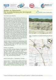
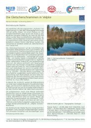
Natural Preserve<br />
Struvenburg near Benzingerode<br />
8<br />
Further east on the northern<br />
rim of the <strong>Harz</strong>- in the valley<br />
carved out by the river<br />
Hellbach through the<br />
Muschelkalk banks- lies<br />
Benzingerode. The transition<br />
from the <strong>Harz</strong> foreland to<br />
the <strong>Harz</strong> mountains is much<br />
in evidence here with<br />
differences in height of up<br />
to 300 meters. From the<br />
center of town we wander to<br />
the Struvenburg, site of a walled fortress probably stemming<br />
from the time of the Franks. (N51°50.083’; EO10°52.247’) It<br />
is already situated within the boundries of the nature reserve<br />
“Ziegenberg bei Heimburg". Especially along the southern<br />
incline, the dominant feature of the landscape is an Gentiano-<br />
Koelerietum mesoxerophytic grassland. Small old quarries<br />
primarily reveal a steep incline of strata from the Triassic,<br />
dipping towards the North- for the most part Lower Muschelkalk<br />
but partially on to Middle Keuper. In the quarries, the<br />
Schaumkalk banks of the Wellenkalk formation were most<br />
frequently sought and won. We can hike through the nature<br />
reserve along the path on the crest and return on the<br />
southside to our point of departure. Depressions lying to the<br />
south of the nature reserve are sinkholes, or old caved-in<br />
mining shafts from which gypsum has been won.<br />
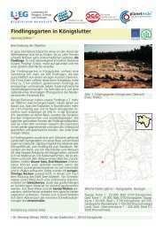
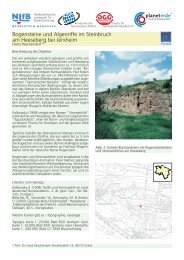
Legendary Stone Columns<br />
Menhirs by Benzigerode<br />
9<br />
Three giants once wanted to<br />
reach a decision through a<br />
competition of throwing<br />
stones as to which one of<br />
them was to receive a much<br />
courted farmgirl as his wife.<br />
But in the end, as they<br />
realized that the stones they<br />
had thrown were different<br />
in size, none of them could<br />
be declared the victor. The<br />
giants departed from one<br />
another in anger and left<br />
the region. What remained<br />
were the upright stone<br />
columns - the menhirs by<br />
Benzingerode. So much for<br />
the legend, but what is the<br />
true meaning of the stones, comprised of silificated Heimburg<br />
Sandstone and erected over 5,000 years ago? We do not<br />
know. In the course of archaeological excavations<br />
accompanying construction of the four-lane B6n, substantial<br />
evidence of a settlement in the Neolithic period was uncovered,<br />
included a hut for the dead in which ca. 40 people were buried<br />
in the time of the Bernburg Culture (3,400 to 2,800 b.c.).<br />
Travelling in either direction on the road B6n one can find<br />
information on these archaeological sites in the roadside rest<br />
stations “Regensteinblick” on both sides of the highway.
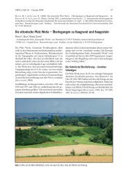
Spherical Bodies in Stone<br />
Limestone Concretions by<br />
Blankenburg<br />
10<br />
In the course of the construction of the<br />
B6n, one discovered in the Heimburg<br />
formation of the Upper Cretaceous<br />
spherically formed limestone concretions<br />
- calcareous sandstone concretions more<br />
resistant to erosive forces than the<br />
surrounding sandstone - which have now<br />
been stacked up along the B6n in large,<br />
conical piles.<br />
Mining in the Elbingerode Complex<br />
Show Mine Büchenberg<br />
11<br />
Leaving Heimburg we drive in the<br />
direction of Elbingerode and follow the<br />
signs to a mine now opened to visitors<br />
as an underground museum, Büchenberg.<br />
From the parking lot to the<br />
entrance (N51°47.478’; EO10°49.085’)<br />
is but a short walk. Visitors with problems<br />
walking or guests in wheelchairs<br />
can drive up to the entrance in their<br />
car. At the end of the pathway, our<br />
attention is captured by an iron trellis mast. It is the “Support<br />
No. 1“, which reawakens memories of the longest industrial<br />
cable railway in Europe. Since 1989, a 600 meter long stretch<br />
of the first level between the cable railway and the shaft No. 1<br />
(Rotenbergshaft) in the mine has been opened to the public.<br />
An exhibition in the foyer provides information on the geology<br />
of the area and the history of mining, ore extraction and<br />
smelting. The trip into the mine, accessible as well for wheelchair<br />
visitors, provides insights into the techniques of mining<br />
and ore winning from the last active period of the mine and<br />
offers glimpses of interesting types of ores in the foliated tuffs<br />
(Schalstein) which can be viewed on the tour around the shaft<br />
and in the orebody No. 5. Through activation of the starting<br />
mechanism of the industrial cable railway and a demonstration<br />
of the drills, overhead loader and a scraper at work, we are<br />
given a sense of the true atmosphere of the mine.<br />
Iron ore mining has been taking place in the proximity of<br />
Elbingerode since the 10th century, but, in matter of fact, it<br />
began at an even much earlier date. The primary metal ore<br />
won here was calcareous hematite. After the end of the war<br />
the <strong>Harz</strong> iron ore mines- Büchenberg and Braunesumpf - were<br />
an important source for GDR raw iron provisions. In the last<br />
period of mining, the most important ore minerals won here<br />
were magnetite, siderite and hematite with quartz additions.<br />
A mining information path, which guides visitors interested<br />
through the historical mining area, begins and ends at the<br />
museum mine. To the east of the museum we find a natural<br />
monument, the “Marmorpinge Hartenberg”, a mine hole<br />
where iron ore and limestone were won. Because of its cool<br />
and damp micro-climate, unusual ferns, moses and lichen<br />
continue to survive here.<br />
If one wishes, a combi-card for visitors can be purchased for<br />
a reduced price, permitting access to both the Rübeland dripstone<br />
caves (13) and the mining museum Büchenberg.<br />
Guided tours daily at 10 a.m., 12 p.m., 2 p.m. and 4 p.m.<br />
or by appointment.<br />
(004939454) 42 200<br />
www.schaubergwerk-buechenberg.de
Karst Springs, Gallery Mouth, Limestone Cave and<br />
Artesian Well<br />
From Jasperode into the<br />
Klostergrund<br />
12<br />
Flowing out of the limestone of the<br />
Braunesumpf anticline, a karst spring is<br />
located in Eggeröder Brunnen, also named<br />
Jasperode, a section of the town of<br />
Elbingerode. Unfortunately, the spring is<br />
enclosed in a building. Here, nevertheless, is<br />
the point of departure for a walking tour to<br />
three geopoints which are well worth visiting.<br />
We reach Jasperode by means of a forest<br />
road open to the public, which, northeast of<br />
Elbingerode, diverges from the road leading<br />
in the valley Drecktal to Heimburg at the<br />
“Drei-Herren-Stein". We look for a place to<br />
Stollenmundloch<br />
park the car and follow the hiking path in<br />
the direction of Blankenburg. At the fork in<br />
the path before the forest house, we take<br />
the valley trail leading to the left into the<br />
Klostergrund. After about 1 kilometer, to<br />
the left in the dark grey spilitic pillow lava,<br />
we suddenly encounter the open gallery<br />
mouth that provided a water conduit out of<br />
the former iron ore mines. (N51°47.147’;<br />
EO10°52.247’)<br />
Further down the valley we find a sign on an<br />
old spruce tree directing us into a side<br />
valley. It is only a few steps until we reach a<br />
vigorously bubbling karst spring, the “Volkmarsbrunnen".<br />
To the right, we discover in a<br />
Volkmarskeller<br />
limestone cliff after a short ascent the<br />
artificially enlarged cave “Volkmarskeller”<br />
(N51°47.287’; EO10°52.247’). The main<br />
room of this cave, today a dried-out etage in<br />
a system of caves, is situated on two parallel<br />
north-south running clefts, both dipping<br />
approximately 60 degrees westward. In the<br />
year 956 the cave was given to the imperial<br />
convent of Quedlinburg. In King OTTO’S<br />
document witnessing this donation there is<br />
mention of a "LUITBIRG", the woman who lived<br />
as a hermit in the cave around the year 850.<br />
A church “Michaelskirche” is also mentioned<br />
in connection with this site. Still to be found<br />
incised in the rock walls are two crosses of<br />
Schwefelquelle<br />
dedication. Later, a hermitage site for the<br />
legendary “Volksmar Brothers” (monks) was<br />
also located here. In 1146, the Zistensienser monks settled<br />
on the site. The foundations above the cave are probably the<br />
remains of this first cloister. Archaeological finds attest to<br />
the fact that already in this period iron ore was smelted in the<br />
bloomery furnaces at the Eggeröder Brunnen.<br />
Returning back into the Klostergrund valley, we continue to<br />
wander downhill. Approximately half the way to Cloister<br />
Michaelstein 9 we discover to our right an open drill hole<br />
(N51°47.925’; EO10°53.820) This hole came about in a test<br />
boring to determine where deposits of iron ore were to be<br />
found. The hole functions like an artesian well and periodically<br />
fills up with ground water rich in sulfur. We do not have much<br />
further to walk before arriving at the restaurant “Zum<br />
Klosterfischer” for a refreshing pause.
Geology of the Area<br />
Directly through the region of this landmark and the<br />
neighboring landmark to the east 9 runs the <strong>Harz</strong>nordrand<br />
Fault. Extending to the north are the sediments of the<br />
Subhercynian Cretaceous Basin, spreading out into the<br />
Landmark 14 . South of the <strong>Harz</strong>nordrand Fault begins the<br />
<strong>Harz</strong> basement block consisting of rocks from the Palaeozoic.<br />
From the oceanic sedimentation of the Devonian and the<br />
Lower Carbonifereous emerged slates and greywackes with<br />
partly embedded flinty slates and limestones.<br />
Approximately 300 million years ago, at the turn Lower/<br />
Upper Carboniferous, the Variscian Orogeny extended over<br />
what is today Europe, and these sediment rocks were folded<br />
and converted to slate. Later, the ocean was forced back.<br />
Portions of the earth’s crust melted and rose upwards as<br />
sour magma, until the intrusive bodies became stuck and<br />
cooled down. Thereby emerged, amongst other rocks, the<br />
Brocken Granite, which today as a result of the thrusting and<br />
erosion processes has reached the surface of the earth.<br />
Since the Upper Carboniferous, the <strong>Harz</strong> foldbelt has been<br />
eroded and, in the Upper Permian, for a time flooded by the<br />
Zechstein ocean. In the course of the “middle ages of the<br />
earth”, the Mesozoic, massive sediment layers developed on<br />
the folded <strong>Harz</strong> rocks - for the most part under the cover of<br />
the sea - such as clay, sandstone and limestone of the<br />
Triassic and the Cretaceous. Since the Jurassic, especially<br />
during the Cretaceous and further into the Tertiary, there<br />
rose in the wake of the Saxonian tektonics the half-horst of<br />
the <strong>Harz</strong> basement along a deep fault running northwestsoutheast<br />
for more than 3 kilometers, the <strong>Harz</strong>nordrand<br />
Fault. At the same time, mesozoic sediments north of the<br />
<strong>Harz</strong> basement were dragged upwards and turned in an<br />
upright position, so that their once horizontal stratification<br />
planes now stand vertically. For this reason, we find in this<br />
elevation zone before the <strong>Harz</strong>nordrand Fault rocks that<br />
were originally deposited over one another with varying<br />
degrees of resistance to erosion now lying next to one<br />
another, for example, the Muschelkalk of the Ziegenberg<br />
Wernigerode, the Horstberg, the Struvenberg and the<br />
Ziegenberg Heimburg- as well as the cretaceous sandstones<br />
of the Teufelsmauer and the Gegensteine in the Landmarks<br />
9 and 15 .<br />
Legends
8<br />
®<br />
<strong>Landmarke</strong> 8<br />
The<br />
Wernigerode Castle ®
High above the colorful town at the foot of the<br />
<strong>Harz</strong> mountains<br />
The Wernigerode Castle ® 1<br />
Poised on the Agnesberg stands the fairytalelike<br />
castle of Wernigerode. From here one has<br />
a magnificent view of the half-timbered town,<br />
the Brocken-Hohne-Massif and the northern<br />
foreland of the <strong>Harz</strong>.<br />
Once a medieval fortress erected to protect the<br />
passageway of the German emperor on his<br />
hunting expeditions, the castle now manifests<br />
itself in new attire. After the devastating<br />
ravages of the 30 Years War (1618 -1648), the<br />
work of reconstructing the fortress as a Baroque<br />
residence castle began under the Count ERNST<br />
OF STOLBERG-WERNIGERODE (1716 -1778). The<br />
ascent of the Count OTTO ZU STOLBERG-WERNIGERODE<br />
(1837-1896) to the position of the first Chief<br />
Administrator of the Prussian province of Hanover in 1867, then<br />
to that of Ambassador in Vienna and ultimately to the rank of<br />
Vice-Chancellor under OTTO VON BISMARK (1815- 1890) resulted in<br />
an additional refurbishing of the castle from 1862 to 1885. The<br />
architect CARL FRÜHLING JR. realized the final castle ensemble as it<br />
stands today, a building complex with portions that have been<br />
open to the public since 1930. In the course of two different<br />
visitation tours, 50 rooms can be viewed.<br />
As building material for the castle ensemble, work stones from<br />
the region were used. Already as one ascends to the castle,<br />
beautiful stromatolithes can be viewed in the the northern wall<br />
of the pleasure garten - bowl-shaped limestone configurations,<br />
produced by colony building cyanobacteria in the sea of the<br />
Lower Buntsandstein mixed with rogenstein, i.e. oolithic<br />
limestones comprised of tiny spheres which recall fish eggs.<br />
The gateway entrance house to the castle has a façade of yellow<br />
rogenstein which- frequently often in red varieties- along with<br />
reddish sandstones of the Buntsandstein constitute the principal<br />
building materials for the castle. For the circular walls, and<br />
somewhat less often for the towers as well as for ascending<br />
walls of the buildings, use was made of dark greywackes of the<br />
Agnesberg and black volcanic stone of the bedrocks of the <strong>Harz</strong><br />
mountains. The relative age of the building can be identified on<br />
the basis of the surface finishing of the natural freestones. In<br />
the early building phases, banked sandstone and limestone<br />
were the material primarily used, stones which were “split” in<br />
accordance with their banking and stacked vertically to their<br />
stratification, so that they display fracture-raw surfaces. In<br />
contrast, the rebuilt structures or portions of the building from<br />
the 19th century can be recognized through by the presence of<br />
sawed freestones with flat surfaces – especially in the employment<br />
of yellowish calcareous sandstone and, at certain locations, of<br />
rogenstein for bay windows, door and window frames, or for<br />
staircases. Less frequently- for example on the wall, of the large<br />
castle terrace to both sides of the porter’s tower- sawed stones<br />
from the freestone benches of the Muschelkalk formation were<br />
also used. On occasion, foreign freestones were employed, for<br />
example, the Belgium marble for the fireplace of the reception<br />
hall and the French limestone for the pulpit and altar of the<br />
castle church.<br />
Schloß Wernigerode GmbH<br />
(00493943) 553030 Fax: 553055<br />
May - Oct. daily 10 a.m. - 6 p.m.<br />
Nov. - Apr. Tue. - Fr. 10 a.m - 4 p.m.<br />
Sa., So., Holidays 10 a.m. - 6 p.m.<br />
www.schloss-wernigerode.de
In the Colorful Town at the Foot of the <strong>Harz</strong><br />
The <strong>Harz</strong> Museum Wernigerode<br />
2<br />
Since 1955, the building at Klint<br />
10, constructed in 1821 as a<br />
private residence, has housed a<br />
museum on its upper floor. The<br />
museum exhibition is divided over<br />
the two portions of the building<br />
into a natural science section and<br />
a section devoted to the history of<br />
the town. The <strong>Harz</strong> region is<br />
presented in the first portion of<br />
the permanent exhibition: fossils,<br />
minerals and rock samples document<br />
its geological development.<br />
The ores were the resources <strong>Harz</strong> Museum<br />
sought over thousands of years of<br />
mining operations, traces of which are still to be found at many<br />
locations in the region. The animal population of the <strong>Harz</strong> is<br />
very rich in its variety of species. In observance of principles of<br />
natural conservation, prepared examples of various animal<br />
species are presented in their respective life environments, and<br />
a map of nature reserves provides an overview of the location<br />
of areas of particular significance from an ecological<br />
standpoint.<br />
In the second portion of the exhibition, we find a profile of the<br />
history of Wernigerode extending all the way back to the 9th<br />
century. The development of handcrafts in the city, including<br />
that of the tin pourer and can manufacturer, is presented. In<br />
addition, the history and role of tourism in the city as well as<br />
the half-timbered architecture of Wernigerode are featured in<br />
the exhibition.<br />
In the garden before the Museum one can admire a particularly<br />
beautiful stromatolith. The <strong>Harz</strong> Library next door is one of the<br />
most important regional libraries in the area.<br />
Opening hours:<br />
Mo. – Sa. (incl. Holidays) 10 a.m. – 5 p.m.,<br />
(00493943) 654454<br />
www.wernigerode.de<br />
Touristinformation Wernigerode<br />
(00493943) 63 30 35<br />
www.wernigerode-tourismus.de<br />
Ice Age Memorial Stone,<br />
Wernigerode<br />
2<br />
Ice Age Memorial Stone<br />
Also worth visiting is the monument<br />
marking the end of the most southern<br />
pleistocene moraine in Wernigerode, a<br />
granite pillar south of the large parking<br />
place “Am Anger” at the corner of Rimbecker<br />
Street/Lindenallee (N51°50.231’;<br />
EO10°47.686’). It marks the so-called “Flint<br />
Line". The inland glaciers transported flint<br />
as we know it from the Baltic Sea up to this<br />
point, the end of the moraine.
State Garden Exhibition 2006<br />
The Geological Window -“Mineral<br />
Canyon“ Wernigerode<br />
3<br />
Under the motto “Experience<br />
<strong>Harz</strong> Views” the State Garden<br />
Exhibition of 2006 in Wernigerode<br />
created landscapes<br />
newly formed for this<br />
purpose. Amongst other<br />
features, a former waste<br />
depository between the<br />
“Kurtsteich” and the “Schreiberteich”<br />
was reshaped,<br />
including a “Mineral Canyon”<br />
which cuts through the area.<br />
Over the length of 48 meters,<br />
it contains a “geological Mineral Canyon<br />
window” with rocks and minerals that would be made manifest<br />
in a subterranean cut with a profile 15 kilometers long from<br />
the Lustberg near Schmatzfeld northwards over the Schlossberg<br />
Wernigerode, past the mining museums “Büchenberg” and<br />
“Drei Kronen und Ehrt” (Landmark 13) all the way to the<br />
Hahnekopf in the Bodetal by Rübeland to the south. This<br />
“window” provides us insights into the relationships of<br />
landscape forms, stones and geological structure as we<br />
consult the documentation on information panels while<br />
regarding the respective stone fragments ordered to the<br />
geological cut in each section of the “Mineral Canyon”.<br />
The first of the 24 sections contain the rocks of the northern<br />
<strong>Harz</strong> foreland: sandstone and marl from the Subhercynian<br />
Cretaceous Basin and those geological sediments of the<br />
Triassic and Permian which have been uplifted by the tectonic<br />
movements of the <strong>Harz</strong>nordrand Fault into their present<br />
vertical stance. In section 7, the Lower Carboniferous Kulm<br />
greywackes of the <strong>Harz</strong> basement border the Zechstein<br />
gypsum rocks of the foreland at the reconstructed <strong>Harz</strong>nordrand<br />
Fault. These rocks are followed by the Devonian and<br />
Carboniferous slates, greywackes and limestones of the<br />
Wernigerode formation with the typical alternation of slate and<br />
sedimentation structures in the individual tectonic blocks.<br />
The sections 15-23 contain typical vulcanites, ores and<br />
limestones of the Elbingerode Complex. Built into these are<br />
volcanic rocks from the Middle <strong>Harz</strong> veins which have broken<br />
their way through the <strong>Harz</strong> basement in Lower Permian<br />
Rotliegend. The facing portion of the wall contains two<br />
sections with rocks of the Brocken granite massif.<br />
®<br />
The map will assist you in planning your own personal<br />
georoute around the "Schloß Wernigerode". Tours under<br />
competent guidance can also be booked (contact: Dr. Steiger,<br />
Managing Director of the team of the <strong>Harz</strong> Mountains regional<br />
association’s geoguides, (00493944) 369085<br />
or e-mail: T_Steiger@gmx.de).<br />
“Regionalverband <strong>Harz</strong> e.V.” wishes you relaxing holidays and<br />
interesting insights into the geology and history of that part<br />
of Nature- and <strong>Geopark</strong> <strong>Harz</strong> which you have just been<br />
introduced to.<br />
Kartografie Verwaltungs-Verlag München, Licence No. 07-08-110<br />
Further city maps under www.stadtplan.net
Borders<br />
The Stapelburg Ruins<br />
4<br />
Already before the year 1306,<br />
the counts of Wernigerode<br />
erected the Stapelburg as a<br />
defence and customs control<br />
point on the royal road connecting<br />
their home castle with the<br />
important imperial city and<br />
mining metropolis of Goslar 3 .<br />
This fortress was pawned on<br />
numerous occasions and was<br />
then purchased by the diocese of<br />
Halberstadt. After a number of<br />
further changes in possession,<br />
the fortress landed once again as an inheritance in the<br />
Halberstadt diocese. It was not until the rule of Count CHRISTIAN<br />
ERNST OF STOLBERG-WERNIGERODE (1691 -1771) that, through<br />
negotiation of the Berlin Agreement, the fortress was acquired<br />
anew from the Halberstadt diocese as property in possession of<br />
the county of Wernigerode. A good five years later, King<br />
FRIEDRICH WILHELM I. OF PRUSSIA (1688-1740) reinstated through a<br />
final annulment of remaining territorial claims of the Halberstadt<br />
diocese (which in the meantime had become Prussian) the<br />
original connection of the Stapelburg with the county of<br />
Wernigerode. Today the Stapelburg ruins tower impressively<br />
over the town of the same name, which is well worth a visit. We<br />
can drive there via the old or the new B6 up to the church of<br />
Stapelburg. A short walk takes us up to the fortress hill with its<br />
beautiful fruit orchard meadows and a majestic lime tree, in<br />
whose shadow a bench invites the visitor to rest in the shade.<br />
The ruins are built with Upper Cretaceous limestones, marly<br />
rocks, sandstones, rogenstein and other rocks from the<br />
surroundings. (see Geopoint 1 )<br />
During the years of divided Germany, Stapelburg was situated<br />
in the so-called “protective belt” of the inner German border.<br />
This border ran through the middle of the mountain stream<br />
Ecker. It was here in the fall of 1989 that a passageway through<br />
the wall was opened to enable a large majority of the population<br />
in the East <strong>Harz</strong> to make their first visit to the West <strong>Harz</strong>.<br />
4<br />
5<br />
3<br />
2<br />
1<br />
6<br />
7<br />
9<br />
8<br />
10<br />
11<br />
12
Glassblower Workshop in Derenburg<br />
“<strong>Harz</strong>kristall” - Glass Manufacturer<br />
5<br />
The Derenburg glass manufacturer<br />
“<strong>Harz</strong>kristall” is one<br />
of the few glass blower<br />
workshops still in production<br />
in Germany. One of its concerns<br />
is the discovery of new<br />
means for communicating<br />
the secrets of glass production<br />
to visitors. The workshop<br />
itself, idyllically situated, has<br />
been in existence for over 60<br />
years, but only recently has it<br />
become an attraction for<br />
tourists. Visitors are initiated<br />
here into the history of the<br />
Glass Manufacture<br />
workshop and of glass manufacture.<br />
The well-guarded secrets of the production of this<br />
material and how it is fashioned are communicated in a stimulating<br />
manner. In a tour of the factory, the guests experience<br />
glass making in direct contact with the processes involved.<br />
After being introduced to the history of glass making, the<br />
visitor wanders into the actual production environment of the<br />
glassmaker and witnesses examples of perfect handcrafting<br />
under the guidance of specialists who are themselves rooted<br />
in this art. On many occasions the guests can blow glass<br />
themselves, thereby experiencing how much craft is demanded<br />
of the glass blowers. In a shop exhibition, glass products can<br />
be viewed and purchased. While the children romp on the<br />
playground, there is time for a quick visit to a small floodplain<br />
strock rest station on the river Holtemme, for viewing grey<br />
herons on the fields along with Red and Black Kites that wing<br />
their way through the air or perch on their resting trees before<br />
Derenburg and for a tour through the newly planted, park-like<br />
grounds of the factory, complete with a waterfall.<br />
Glasmanufaktur <strong>Harz</strong>kristall GmbH & Co. KG<br />
Im Freien Felde 5, D-38895 Derenburg<br />
Guides tours: daily between 10.30 a.m. - 3.30 p.m.<br />
(00493 94 53) 680-0, Fax -25<br />
www.harzkristall.de
A Steep Ascent: The <strong>Harz</strong>nordrand Thrust Zone<br />
The Horstberg<br />
6<br />
We leave Wernigerode on the<br />
old B6 in the direction of<br />
Blankenburg. At the city exit we<br />
see to the left the remains of an<br />
old roadway defence tower on<br />
the Horstberg. On the left, one<br />
can turn onto a field road.<br />
Here we park the car. Along the<br />
path on the crest we discover<br />
an old quarry which has been<br />
left open and exposed.<br />
(N51°50.470’; E010°49.434). Horstberg<br />
From the peak we have a glorious view over the <strong>Harz</strong> and into<br />
the Subhercyne Cretaceous Basin. The Horstberg manifests<br />
two linear hogback zones. The Terebratelbank of the Lower<br />
Muschelkalk well as the Trochitenkalk zone of the Upper<br />
Muschelkalk emerge as hogback structures. The sediment<br />
layers of Middle Muschelkalk positioned between the hogbacks<br />
consist of soft dolomitice limestones, which gave way more<br />
quickly to the forces of erosion and thus formed a depression.<br />
In the central portion of the quarry, the vertical position and<br />
overthrust of the strata in the <strong>Harz</strong>nordrand Fault can be<br />
observed. Here the Schaumkalk limestone beds of the<br />
Wellenkalk formations have been won in the old quarry. On the<br />
slope to the south, one discerns in the soil under cultivation<br />
the red-gray, in part blue tones of the Upper Buntsandstein.<br />
Returning from our little excursion to our car, we can cross the<br />
street and proceed to the clay pit of the former brick factory<br />
called “Heuer”. Here clay from the Middle and the Lower<br />
Buntsandstein has been won. The harder stratum along of the<br />
top of the rogenstein is thereby exposed to view. Only 50<br />
meters further to the south one already encounters rocks of<br />
the <strong>Harz</strong> Paleozoic.<br />
Zechstein Sinkholes and “<strong>Harz</strong>-Zacke”<br />
Wolfsholz and the<br />
Benzingerode Ledge<br />
7<br />
To the east lies the settlement<br />
Wolfholz (N51°50.065;<br />
EO10°50.492’). The small “waterholes",<br />
as they now exist, often<br />
came about as sinkholes from the<br />
underlying Permian gypsum rocks.<br />
These are hollowed-out forms in the<br />
landscape, ranging in shape from<br />
basins to funnels, into which the<br />
surface strata above the collapsed<br />
former underground gypsum caves<br />
has broken off. We find ourselves<br />
situated on the spur of the so-called<br />
Benzingerode Ledge. Because the<br />
<strong>Harz</strong>nordrand Fault does not run in<br />
a straight line, one calls the zigzag<br />
<strong>Harz</strong> projections in a northern Waterhole Wolfsholz<br />
direction “Zacken” (ledges), each<br />
followed by an indentation in a southern direction. Further<br />
ledges are the Schimmerwald Ledge between Stapelburg and<br />
Bad <strong>Harz</strong>burg (Landmark 3<br />
) and the Ermsleben Ledge<br />
(Landmark 15 ).