LM2 Neu 2007 English - Geopark Harz
LM2 Neu 2007 English - Geopark Harz
LM2 Neu 2007 English - Geopark Harz

You also want an ePaper? Increase the reach of your titles
YUMPU automatically turns print PDFs into web optimized ePapers that Google loves.
1<br />
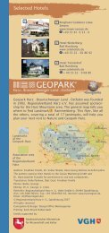
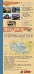
Selected hotels<br />
1 2<br />
3 4<br />
Hotel „Goldene Krone“<br />
Clausthal-Zellerfeld<br />
www.goldenekrone-harz.de<br />
: 0049 - 5323 - 9300<br />
14<br />
2<br />
3<br />
4<br />
Waldhotel Untermühle<br />
Clausthal-Zellerfeld<br />
www.untermuehle.harz.de<br />
0049 - 5323 - 983098<br />
Waldhotel Café-Restaurant<br />
Pixhaier Mühle<br />
Clausthal-Zellerfeld<br />
www.pixhaier-muehle.harz.de<br />
0049 - 5323 - 2215<br />
<strong>Harz</strong>hotel zum Prinzen<br />
Clausthal-Zellerfeld<br />
www.zum-prinzen.de<br />
0049 - 5323 - 96610<br />
<strong>Geopark</strong> “<strong>Harz</strong> . Braunschweiger Land . Ostfalen” was founded<br />
in 2002. “Regionalverband <strong>Harz</strong> e.V.” has taken sponsorship<br />
for the <strong>Harz</strong> Mountains area. The general map tells you where<br />
to find landmark 2 – Pulley Frame of Ottiliae Mine Shaft<br />
Clausthal-Zellerfeld. Just like this flyer all the others, covering<br />
a total of 17 landmarks, will help you plan your next visit to<br />
Nature- and <strong>Geopark</strong> <strong>Harz</strong>.<br />
Landmarks of<br />
the<br />
<strong>Geopark</strong> <strong>Harz</strong><br />
Goslar<br />
Halberstadt<br />
3<br />
1 2<br />
8<br />
Wernigerode Quedlinburg<br />
4<br />
Osterode a.H.<br />
9 Aschersleben<br />
11<br />
13<br />
5<br />
15<br />
association area<br />
16 6 10 17<br />
of the<br />
Regionalverband <strong>Harz</strong><br />
Nordhausen<br />
7 Sangerhausen<br />
12<br />
®<br />
Schönebeck<br />
Bernburg<br />
Eisleben<br />
Authors: Dipl.-Geol. Friedhart Knolle, Dr. Volker Wrede & Dr. Klaus George<br />
Translator: Dorothee Kahla<br />
Photos: George, Upper <strong>Harz</strong> Mining Museum<br />
Compilation: Dr. K. George, Ch. Linke<br />
Editor: Regionalverband <strong>Harz</strong> e. V., Hohe Straße 6, 06484 Quedlinburg<br />
( 0049 - 3946 - 96410, Fax: 0049 - 3946 - 964142, Internet: www.harzregion.de,<br />
Email: rvh@harzregion.de)<br />
2nd edited run, © Regionalverband <strong>Harz</strong> e. V., Quedlinburg <strong>2007</strong><br />
All rights reserved<br />
Conception & design: Design Office Werbeagentur, Wernigerode<br />
Print office: Koch-Druck, Halberstadt<br />
Kindly supported by:<br />
Niedersächsisches Ministerium<br />
für Wissenschaft und Kultur
Excursion to the Innerste Valley<br />
Stamp Mill Sand Hills<br />
We now leave Clausthal heading<br />
towards Bad Grund on B 242,<br />
following the course of Zell<br />
Creek down the valley. After<br />
approximately 2 km we reach<br />
the site of the former Clausthal<br />
lead mine, which goes back to<br />
Frankenscharrn Mill (founded in<br />
1554). The lead mine was in operation<br />
as late as 1967. After its<br />
closure the buildings were<br />
demolished. The melting of<br />
sulfurous ores for centuries was<br />
Valley of quarries and mines<br />
Greywacke quarries in the<br />
Innerste Valley<br />
10<br />
Smoke-damaged area near the<br />
former lead works<br />
responsible for an emission that polluted the vicinity of the<br />
mine and destroyed the vegetation to an extent that its<br />
recovery has been very slow. The bloom of the Calluna heath<br />
thriving on the contaminated hillsides may be considered<br />
“the most attractive inheritance” of the past. The high<br />
concentration of heavy metals of the stamp mill sand hills<br />
have polluted the floodplain sediments, since loose<br />
materials of the waste rock piles are washed into the<br />
Innerste river by heavy rains – this, too, is a legacy of the<br />
mining procedures in the <strong>Harz</strong> Mountains.<br />
11<br />
We leave B 242 at the confluence of the Zell Creek and the<br />
Innerste and drive towards the colliery house “Untere Innerste”.<br />
After about 500 meters ( N 51° 47,800’; E 010° 17,922’ ) on the<br />
right hand side there is a small quarry in which we find steeply<br />
inclined, coarse-grained to conglomeratic Culm Greywacke<br />
beds intercalated with layers of shale. The greywacke beds are<br />
interpreted as the result of submarine suspension currents<br />
which ran like avalanches from higher regions of the sea floor<br />
into deeper basins. This process produced impressive groove<br />
casts, which are preserved at the lower surfaces of the<br />
greywacke layers. The groove casts were caused by pebble<br />
stones or other objects carried along at the sea floor.<br />
Back on the country road we follow the course of the Innerste<br />
and drive towards Wildemann. Soon we see the head gear of<br />
the formerly independent mine “Bergwerkswohlfahrt” on the<br />
left hand side. We stop at<br />
the intersection to Wildemann<br />
and visit the<br />
“Jung’schen Steinbruch”<br />
(Jung’s Quarry), located<br />
on the right hand side of<br />
the road. Embedded in<br />
the greywacke and<br />
especially in the intercalated<br />
shales there are<br />
remains of Carboniferous<br />
plants, mainly horsetails<br />
(calamites).<br />
Jung's Quarry ("Jung’scher Steinbruch")
Show Mine I<br />
“19-Lachter-Stollen“ Wildemann<br />
Heading for Langelsheim in the<br />
Innerste Valley, we reach Wildemann.<br />
The local mines worked the western<br />
section of the “Zellerfelder Gangzug”<br />
(Zellerfeld Lode), the “Spiegelthaler<br />
Gang” and its westward extension,<br />
the “Hüttschentaler Gang”. In the<br />
latter, mining practically came to an<br />
end around 1760 and in 1803<br />
respectively. The mining of the<br />
“Zellerfelder Gangzug” continued<br />
approximately up to 1930. The “19-<br />
Lachter-Stollen” (gallery), which got<br />
started as early as 1551 and was used Ore car at “19-Lachter-Stollen”<br />
for both draining water and mining<br />
ore, is worth visiting. The mine and the gallery were operated<br />
until 1924; in 1970 a show mine was established in their<br />
place. The gallery with a length of 8.8 km was carved out by<br />
manual labour alone, merely by using hammer and chisel.<br />
You can explore 500 m of its effective length and get as deep<br />
as 100 m.<br />
Guided tours: daily at 11 am<br />
www.harztourismus.com<br />
Show Mine II<br />
Mine “Lautenthals Glück”<br />
12<br />
13<br />
We keep on driving down the<br />
valley to Lautenthal, a small<br />
mining town, which used to serve<br />
as the seat of the “Königliches<br />
Hüttenamt” (Royal Bureau of<br />
Metallurgy), subordinate to the<br />
“Oberbergamt Clausthal” (Chief<br />
Inspectorate Clausthal).<br />
Mining the “Lautenthaler Gangzug”<br />
continued until 1945. After<br />
that no other profitable ore bodies<br />
could be mined. The last mining<br />
activity, the recycling of stockpile<br />
materials with a high percentage<br />
of zinc, lasted until the late 1970s.<br />
The “Lautenthaler Silberhütte” (silver mine), where the silver<br />
of the lead ores processed at Clausthal was utilized, was<br />
operated until 1967.<br />
“Lautenthals Glück” with its show mine and mining museum<br />
is on the right hand side as you enter the small town. The<br />
“Lautenthaler Gangzug”, which the local mines were based<br />
upon, is an important fault. In the area of the Lautenthal<br />
deposits the lode was divided into several parallel veinlets,<br />
the so-called “Trümer” (stringers) which were heavily<br />
mineralized with galena and zinc blende. The whole<br />
sequence from the Middle Devonian to the Lower<br />
Carboniferous is well-visible along one of the hiking trails at<br />
the eastern bank of the Innerste river. Markers provide<br />
additional information.
Outcrop rich in fossils<br />
Quarry at the “Großen Trogtaler<br />
Berg”<br />
14<br />
We leave Lautenthal in a northward<br />
direction (towards Langelsheim)<br />
and take a left turn, following<br />
the country road towards<br />
Seesen. When the road reaches its<br />
highest elevation we drive onto<br />
the parking site “Sternplatz”. On<br />
foot we follow the hiking trail<br />
towards the “Luchsstein”, which<br />
commemorates the shooting of<br />
the last autochthonous lynx in the<br />
<strong>Harz</strong> Mountains. Before we reach<br />
it, we arrive a small abandoned<br />
quarry, seated in the southern<br />
slope of the “Großen Trogtaler<br />
Berg”. It exposes a section rich in<br />
Lower Carboniferous fossils,<br />
called “Posidonia Shale”. Among<br />
the fossils there are certain<br />
Quarry at the “Trogtaler Berg”<br />
bivalves (Posidonia becheri),<br />
goniatites and numerous other<br />
fossils. Gathering them from the<br />
solid bedrock is prohibited,<br />
whereas picking them up from<br />
the stockpile of the quarry is<br />
permitted. The strata are approximately<br />
335 million years old. The<br />
extensive folding of the Lower<br />
Carboniferous strata is unrecog-<br />
Fossil bivalves<br />
nisable in the quarry itself, but is visible about 100 m down<br />
the trail towards the “Luchsstein”.<br />
Inn on the shaft<br />
Maaßener Gaipel<br />
15<br />
Back to Lautenthal, in its<br />
centre we turn left to<br />
Hahnenklee-Bockswiese.<br />
The street leads uphill and<br />
is bounded by a large<br />
stockpile area. Where the<br />
stockpiles end we turn right.<br />
This curved road takes us<br />
back to a forest inn high<br />
above Lautenthal. From<br />
there we enjoy a lovely<br />
scenic view over the town.<br />
Right now we are standing Water wheel<br />
amidst an impressive mining scenery with adit entrances,<br />
waste heaps and perforated stones which are explained by<br />
markers next to the hiking trails. On the waste heaps you will<br />
mainly find zinc blende; but on some of them gathering is<br />
prohibited in order to avoid damage caused by erosion and to<br />
protect the rare vegetation growing on the heavy metal waste<br />
heaps.
Responsible for all of Northern Germany<br />
State Mining Inspectorate Clausthal-<br />
Zellerfeld<br />
The State Mining Inspectorate has its office<br />
at the old “Amtshaus” (originally seat of the<br />
Royal Hanover Mining and Forestry Inspectorate,<br />
later office of the Royal Prussian<br />
Mining Inspectorate and from 1943 – 1945 it<br />
accommodated the Reich Mining Inspectorate)<br />
in Clausthal, diagonally opposite the<br />
main building of the University (see No 5 ). It<br />
was this very building the king or his<br />
Landesbergamt<br />
ministers frequented when visiting the <strong>Harz</strong><br />
Mountains. On special occasions the Chief Inspector of Mines<br />
or his highest-ranking guest were paid respect by the miners.<br />
At dusk the dignitaries watched a procession from the<br />
building’s balcony: miners and workers paraded along the<br />
street, illuminating the area with their torches and pit lamps.<br />
After the great fire in 1725 the building was reconstructed<br />
from 1726 – 1730, and from 1904 – 1912 a wing was added<br />
to accommodate the inspectorate’s library and the invaluable<br />
450-year-old mining archive. Later it became the Mining<br />
Archive Clausthal and today it is a sub-office of the Main<br />
State Archive Hanover; for that purpose, a new, modern<br />
building was erected in the year 2000. In 2001 the oldestablished<br />
office was named “Landesbergamt” (State Mining<br />
Inspectorate). It is responsible for Lower Saxony, Schleswig-<br />
Holstein, Hamburg and Bremen, including the oil and gas<br />
production in the continental shelf of both the North Sea and<br />
the Baltic. As long as Germany was divided, it was even<br />
responsible for West Berlin.<br />
Geology of the Area<br />
The “Clausthaler Kulmfaltenzone” (Clausthal Culm Fold Belt)<br />
covers the largest part of the northwestern Upper <strong>Harz</strong><br />
Mountains (around landmark 2 ) and mainly consists of an<br />
interbedded sequence of greywacke and slates of the Lower<br />
Carboniferous Culm facies. They evolved without gap from<br />
the older Devonian sediments and were deposited in a marine<br />
basin; this was filled by submarine suspension currents<br />
originating from the neighbouring mainland. The cyclic grainsize<br />
grading of the sediments – the graded bedding – shows<br />
this process very clearly: first the heavier coarse material was<br />
deposited, gradually followed by lighter fine material,<br />
whereas clay minerals (which built up the shales) finished the<br />
cycle. Groove casts on the sea floor preserved over millions of<br />
years let us to reconstruct the direction of the turbidity<br />
currents. They came from a continental area south to southwest<br />
of the <strong>Harz</strong> Mountains. Remains of fossil plants in the<br />
sediments document the vegetation during the Lower<br />
Carboniferous.<br />
In the north-east the “Kulmfaltenzone” is cut by the Northern<br />
Boundary Fault of the <strong>Harz</strong> Mountains (landmark 3 ); in the<br />
south and in the west Upper Permian Zechstein unconformably<br />
onlaps the steep sequence of the “Kulmfaltenzone”, as to<br />
be seen at Geosite “Fuchshalle” (landmark 11<br />
).<br />
The “Kulmfaltenzone” was intensively folded during the<br />
Variscan Orogeny, i.e. about 300 million years ago. Tectonic<br />
faults run right across this folded zone parallel to the<br />
northern slope of the <strong>Harz</strong> Mountains, which are mounted by<br />
the mineral veins of the Upper <strong>Harz</strong> Mountains. The metal<br />
content of these veins was the base of intensive mining in the<br />
area of landmark 2 . Here mining and forestry have created<br />
a striking cultivated landscape.
Landmark 2<br />
Pulley Frame of<br />
Ottiliae Mine Shaft<br />
Clausthal-Zellerfeld<br />
®<br />
2
Upper <strong>Harz</strong> Mining Museum<br />
Ottiliae Mine Shaft<br />
Approaching Clausthal-Zellerfeld<br />
on B 242 from the west<br />
you will suddenly come across<br />
a steel pit head gear on your<br />
left hand side. It is the pulley<br />
frame of Ottiliae mine shaft,<br />
which is one of the bestknown<br />
mining monuments in<br />
the area. In 1876 it was<br />
manufactured in the Royal<br />
Central Forge at Clausthal and<br />
today it is one of the oldest Old mine railway<br />
still-existing shaft towers in<br />
Central Europe. Up to 1930, when mining in Clausthal-<br />
Zellerfeld came to an end, Ottiliae mine shaft was the central<br />
hoisting shaft in the district. Today the surface installations of<br />
this mine, named after “Berghauptmann” (Chief Inspector of<br />
Mines) Ernst Hermann Ottiliae, serve as a sub-office of the<br />
Upper <strong>Harz</strong> Mining Museum. The reinstalled hoisting engine<br />
and other mining machinery give evidence of the <strong>Harz</strong><br />
Mountains’ industrial history and document the mining<br />
technologies from about 1880 to the present day. You start<br />
your tour of the surface installations with an adventurous ride<br />
along the rebuilt 2.2 km haulage road on the mine railway with<br />
the help of which ore was transported from mine shaft “Kaiser<br />
Wilhelm II“ to mine shaft “Ottiliae“ during a period of<br />
underground reconstruction between 1900 and 1905. In the<br />
summer months, on weekends and public holidays, the train<br />
leaves from the old railway station “Alter Bahnhof“ (public<br />
library) to mine shaft “Ottiliae“ (N51°48.504’; E010°18.794’).<br />
Germany’s Oldest<br />
Mining Museum<br />
As early as 1892 Lower Saxony’s oldest and most important<br />
mining museum was founded. Located in Zellerfeld it gives you<br />
a complete idea of the development of mining in the Upper<br />
<strong>Harz</strong> Mountains from the Middle Ages to the end of the 19th<br />
century. The replica of a mine consists of an approximately<br />
250 m long gallery and original surface installations in the<br />
museum’s outdoor area. Germany’s last remaining horsecapstan,<br />
the only ore dressing plant with a stamp mill and the<br />
shaft house built in 1787 are impressive monuments of the<br />
history of mining. The main building with its 30 showrooms<br />
houses a collection of mining and<br />
cultural artifacts among which there are a<br />
number of famous models, an extensive<br />
collection of minerals and coins and a<br />
special exhibition of pit lamps. A display<br />
of mining tools and objects of everyday<br />
use add to the picture of a population<br />
whose sole source of subsistence for<br />
centuries consisted in mining. The<br />
museum offers a variety of educational<br />
and cultural programmes.<br />
Opening hours: 10 am to 5 pm<br />
0049 - 5323 - 98950<br />
1<br />
2<br />
View of the museum’s<br />
outdoor area
Mine Shaft “Kaiser Wilhelm II”<br />
Clausthal<br />
At the outskirts of the campus grounds of<br />
Clausthal University of Technology, mine<br />
shaft “Kaiser Wilhelm II” with Central<br />
Europe’s second oldest preserved iron<br />
head gear is situated close to “Erzstraße”.<br />
The tower was erected as a traditional twopost<br />
headframe in 1880. In 1930 “Kaiser<br />
Wilhelm II” was the last mine to be<br />
abandoned in Clausthal-Zellerfeld. Today,<br />
the surface installations are part of the<br />
depot of the “<strong>Harz</strong>wasserwerke”. Apart<br />
from the restored machinery storage<br />
building, the shaft house, the pithead bath<br />
and various other supply buildings you<br />
can view photogenic replicas of wooden Pulley frame of mine shaft<br />
"Kaiser Wilhelm II"<br />
water wheels on the pit grounds. An<br />
exhibition informs you about the water<br />
management in the Upper <strong>Harz</strong> Mountains.<br />
For further information see:<br />
www.oberharzerbergwerksmuseum.de<br />
The Complex Water Supply System in the Upper<br />
<strong>Harz</strong> Mountains<br />
Sperberhai Dam<br />
Without the sophisticated water management<br />
for mining in particular there would never<br />
have been any ore mining in the <strong>Harz</strong><br />
Mountains. The complex water supply system<br />
of today’s cultural monument called<br />
“Kulturdenkmal Oberharzer Wasserwirtschaftssystem”<br />
originated around Clausthal-<br />
Zellerfeld, Hahnenklee and Sankt Andreasberg<br />
in the year 1530. It consists of a network of<br />
approximately 700 kilometres of trenches,<br />
120 lakes and 30 kilometres of tunnels which<br />
served as an elaborate system for collecting,<br />
storing and transporting water, e.g. to operate<br />
both water wheels, hoisting loads, or pumping<br />
installations, which were needed to drain<br />
the pits.<br />
Sperberhai Dam<br />
Due to this complex network, water could even be transported<br />
over long distances, e.g. from the “Bruchberg” or the<br />
“Brockenfeld”, to Clausthal-Zellerfeld’s elevated areas. For<br />
that purpose, “Sperberhaier Damm” with a length of 940<br />
metres and a maximum height of 16 metres was built<br />
between 1732 and 1734. It parallels B 242 between the<br />
intersections of B 498 coming up from Osterode and leading<br />
to Altenau.<br />
“<strong>Harz</strong>wasserwerke GmbH” preserve and maintain this cultural<br />
monument. We can explore the lakes and trenches of the<br />
“Kulturdenkmal Oberharzer Wasserwirtschaftssystem” on our<br />
own, either by bike or on foot.<br />
For further information see:<br />
www.harzwasserwerke.de<br />
3<br />
4
Clausthal University of Technology<br />
GeoMuseum<br />
Research in the fields of<br />
geosciences has been an<br />
established tradition since the<br />
foundation of the former<br />
mining school (1775), which<br />
was later named Mining Academy<br />
(1864) and is now called<br />
Clausthal University of Technology.<br />
Its mineralogical collection<br />
of more than 120,000<br />
specimens has an international<br />
reputation. Among these, the<br />
collections of ores and nonmetallic<br />
minerals are outstanding<br />
– they provide the basis<br />
for comparative studies and are available for scientists all<br />
over the world. The part of the mineralogical collection which<br />
is open to the public is of interest not only to specialists; a<br />
visit can be recommended to everyone. The paleontological<br />
part of the exhibition shows important major steps within the<br />
evolution of life; the three-dimensional reconstructions of the<br />
largest fossil flying insects in life-size are unique. Another<br />
main focus is laid upon selected important fossils (e.g.<br />
ammonites and trilobites) found in the <strong>Harz</strong> Mountains area<br />
and its foreland. The exhibits regarding the Natural History of<br />
the <strong>Harz</strong> Mountains show parts of the entire 480 million years<br />
of geological development in this region. The GeoMuseum is<br />
housed in the main building of Clausthal University of<br />
Technology, Adolph-Roemer-Straße 2a.<br />
Opening hours:<br />
Tuesday, Wednesday and Friday 9.30 am - 12.30 pm<br />
Thursday 2.00 pm - 5.00 pm<br />
Sunday 10.00 am - 1.00 pm<br />
(except public holidays)<br />
Having left the main building of Clausthal University of<br />
Technology you will come across a monument on your left<br />
that commemorates “Bergamtsprofessor”<br />
Friedrich Adolph Roemer (1809-1869). In<br />
1882 it was dedicated to the famous paleontologist<br />
and founder of the Mining<br />
Academy by his students. Its base contains<br />
minerals and rocks characteristic of the<br />
<strong>Harz</strong> Mountains. A walk through the university’s<br />
campus grounds along “Feldgraben”<br />
takes you to the library which<br />
includes the so-called “Calvör’sche<br />
Bibliothek” (“Calvör’s Library”) – one of the<br />
academic libraries of the baroque era – and<br />
belongs to the most valuable cultural<br />
possessions of the <strong>Harz</strong> Mountains area.<br />
The “geological path” in front of the<br />
Institute of Geology and Paleontology<br />
Monument for A. Roemer<br />
gives you an impression of the main rocks<br />
of the <strong>Harz</strong> Mountains and, if desired, the paleontological<br />
and geological collections can be visited after prior<br />
arrangement.<br />
5<br />
Life-sized three-dimensional reconstruction<br />
of a giant insect of the Carboniferous<br />
period in Central Europe
Mining until 1812<br />
Lake Schalke ("Schalker Teich")<br />
Oberschulenberg<br />
We drive down to the Schalke Valley and park<br />
our car in Oberschulenberg (N51°49.812’;<br />
E010°23.928’). An information-board reveals<br />
that in this place the border between the<br />
Clausthal Culm Plateau and the Devonian<br />
Anticline of the <strong>Harz</strong> Mountains is cropping<br />
out. This border is marked by a mineralised<br />
tectonic fault, the Bockswiese Lodes, that<br />
runs over distance of 12 km from the Innerste<br />
Valley in the west to the Oker Valley in the<br />
east. Locally, there were ores in the fault, which were<br />
mined until 1907. South of the fault Lower<br />
Carboniferous sedimentary rocks, mainly slates, crop<br />
out as to be seen in sections along the gravel road<br />
parallel to the rivulet down to the “Mertenstal”. North of the<br />
fault you will see Devonian rocks such as sandstone, slates<br />
and a few limestone beds on your short walk around the<br />
“Schalker Teich”. The lower “Schalker Teich” was built between<br />
1729 and 1733 in order to supply the surrounding mines and<br />
stamp mills with water. On December 26, 1733 the dam<br />
broke; the resulting flood wave killed nine people and caused<br />
severe damage all over the Oker Valley. Shortly after the<br />
disaster the dam was quickly repaired. In case you do not<br />
want to spend too much time exploring the countryside you<br />
should follow the path leading to the right at the upper end<br />
of the row of houses. It takes you to two historical perforated<br />
stones which marked the border of the mining claims. A little<br />
ahead we reach the ore lode; next to this sterile lode<br />
consisting of quartz, fault pits indicate the course of the ore<br />
bodies. In the east the site is adjoined by the extensive dumps<br />
of Oberschulenberg. They became known for their secondary<br />
minerals yielding copper, zinc and lead, of which<br />
Schulenbergit was named after this collecting site.<br />
The convex dam<br />
Oker Valley Reservoir<br />
In the course of our excursion down<br />
into the valley we reach the Oker Valley<br />
Reservoir (N51°51.051’; E010°27.510’).<br />
On your left the bank of the road is<br />
partially formed by thick layers of Culm<br />
slate with well-exposed bedding planes.<br />
The dam is about 260 m long and<br />
represents an unusual construction: a<br />
Oker Valley Reservoir<br />
solid wall of 13 m height was erected on<br />
top of the convex dam, which is 55 m high and absorbs the<br />
pressure of the collected water towards the flanks of the<br />
valley. The geological situation made this construction<br />
necessary, because the greywacke in the higher parts of the<br />
flanks of the valley cannot withstand such forces, in contrast<br />
to the subjacent hardened contact-metamorphic slate.<br />
The amount of water which the reservoir can hold runs to a<br />
maximum of 47 mio m_. The water is released through either<br />
the bottom outlet or through a 1.7 km-long pressure tunnel<br />
which leads to the power station at Romkerhalle. A pleasure<br />
boat invites you to a trip on the reservoir.<br />
6<br />
Lower “Schalker<br />
Teich“<br />
7
Wild river valley<br />
Unteres Okertal<br />
The river has carved its meandering<br />
stream bed through a<br />
granite massif, thus forming<br />
characteristic gorges and a<br />
tremendous number of cliffs.<br />
The Oker Granite is a separate<br />
intrusive body and not the<br />
direct extension of the Brocken<br />
Pluton (landmark 4 ). At the end<br />
of the Variscan Orogeny<br />
during the Upper Carboniferous,<br />
the intrusion penetrated<br />
the folded complex.<br />
Granite, an extremely solid<br />
rock under unweathered conditions,<br />
is very resistant to the<br />
erosive power of water. Mainly<br />
caused by the heat of the<br />
magmatic body, the older De-<br />
Rabenklippe<br />
vonian and Lower Carboniferous sediments (which were penetrated<br />
by the intrusion, too) were altered and hardened<br />
through contact metamorphic reactions. Slate and limestone<br />
as well as the Lower Carboniferous greywacke were<br />
transformed into hard and splintery hornfels. The wide<br />
variety of rocks in the Oker Valley can be studied in a large<br />
number of outcrops.<br />
The steep western slope of the “Romkerhall“ syncline crops<br />
out well in the “Rabenklippe” (“Raven Cliff”)<br />
(N51°51.526’; E010°28.025’). In order to get to the cliff we<br />
follow the path starting at the parking site close to the power<br />
station at Romkerhalle. We reach our destination after a 300<br />
m walk uphill, parallel to B 498.<br />
Fantastic rock formations<br />
Granite cliffs of the “Käste”<br />
From the parking at the power station we<br />
climb the steep path on the left hand side<br />
of the Romkerhalle Cascade and take<br />
“Schöppenstedter Weg” – “Romkerkopfweg”<br />
– “Klippenweg” in direction towards<br />
the mountain inn “Käste” (about 3 km).<br />
Having passed a treeless section of<br />
“Klippenweg” - overgrown with broom and<br />
heath - we first reach the “Feigenbaumklippe”,<br />
where we encounter a cave formed<br />
by piled-up granite blocks.<br />
From the “Feigenbaumklippe” we enjoy a<br />
scenic view up to the Northern <strong>Harz</strong><br />
Foreland. Erosion has exposed the top<br />
layers of the Oker Granite. As typical of<br />
granite in our climate, spheroidal<br />
weathering gradually reduces the rock to<br />
smaller and smaller blocks which look like<br />
woolsacks and which are characteristic of<br />
Spheroidal<br />
weathering<br />
the Oker Granite, too. Weathering along the granite clefts has<br />
produced bizarre formations like the “Mausefalle” (Mousetrap),<br />
8<br />
9
which is the next cliff we<br />
reach walking along<br />
“Klippenweg”. Here a huge<br />
granite block keeps its<br />
balance on top of a<br />
relatively tiny rock. After we<br />
have passed the “Hexenküche”<br />
(Witch’s Kitchen) we<br />
finally reach the “Käste”<br />
cliffs (605m above sea<br />
level), which are located<br />
right next to the mountain<br />
inn. An exceptional rock<br />
formation is named “Der<br />
„Der Alte vom Berge“<br />
Alte vom Berge” (Old Man from the Mountain; N51°52.101’;-<br />
E010°28.985’)). A convenient path then leads us back to the<br />
Oker Valley via the so-called “Treppenstein” (Stair Rock) (ca. 5<br />
km). On top of the “Treppenstein” we find the ruins of a castle<br />
which can be compared to the one on the “Ilsestein” near<br />
Ilsenburg (landmark 4<br />
).<br />
14<br />
13 15<br />
12<br />
11<br />
10<br />
1<br />
5<br />
2<br />
3<br />
Verwaltungs-Verlag München, Lizenz-Nr. 03/09/92. Weitere Stadtpläne unter www.stadtplan.net<br />
This map will help you to plan your individual Georoute. Competent<br />
guided tours can be arranged, too (contact: Dr. STEIGER, Managing<br />
Director of the team of the <strong>Harz</strong> Mountains regional association’s<br />
geoguides, 0049-03944-369085 or e-mail: T_Steiger@gmx.de).<br />
“Regionalverband <strong>Harz</strong> e.V.” wishes you relaxing holidays and<br />
interesting insights into the geology and history of that part of<br />
Nature- and <strong>Geopark</strong> <strong>Harz</strong> which you have just been introduced to.<br />
6<br />
®<br />
4<br />
8<br />
7<br />
9