Geopark LM 3 Englisch 2007.indd - Geopark Harz
Geopark LM 3 Englisch 2007.indd - Geopark Harz
Geopark LM 3 Englisch 2007.indd - Geopark Harz

You also want an ePaper? Increase the reach of your titles
YUMPU automatically turns print PDFs into web optimized ePapers that Google loves.
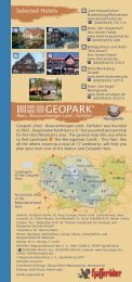
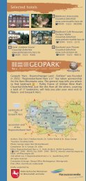
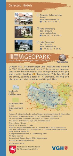
Selected Hotels<br />
1<br />
1 Ringhotel Goldener Löwe<br />
Seesen<br />
www.loewe-seesen.de<br />
+49 53 81- 9 33 - 0<br />
2<br />
2<br />
Hotel Winterberg<br />
Bad <strong>Harz</strong>burg<br />
www.solehotels.de<br />
+49 53 22 - 92 86 92<br />
3<br />
3<br />
Hotel Tannenhof<br />
Bad <strong>Harz</strong>burg<br />
www.solehotels.de<br />
+ 49 53 22 - 9 68 80<br />
®<br />
<strong>Geopark</strong> <strong>Harz</strong> . Braunschweiger Land . Ostfalen was founded<br />
in 2002. Regionalverband <strong>Harz</strong> e.V. has assumed sponsorship<br />
for the <strong>Harz</strong> Mountains area. The general map tells you<br />
where to find Landmark 3 Rammelsberg. This flyer, like all<br />
the others, covering a total of 17 landmarks, will help you<br />
plan your next visit to Nature and <strong>Geopark</strong> <strong>Harz</strong>.<br />
Landmarks<br />
of the<br />
<strong>Geopark</strong> <strong>Harz</strong><br />
Association area<br />
of the<br />
Regionalverband<br />
<strong>Harz</strong><br />
14<br />
Goslar<br />
Halberstadt<br />
Schönebeck<br />
3<br />
1 2<br />
8<br />
Wernigerode Quedlinburg<br />
4<br />
Osterode a.H.<br />
9 Aschersleben<br />
11<br />
13<br />
5<br />
15<br />
Bernburg<br />
16 6 10 17<br />
Nordhausen<br />
7 Sangerhausen Eisleben<br />
12<br />
Authors: Friedhart Knolle, Dr. Volker Wrede, Hans-Georg Dettmer & Achim Jahns<br />
The authors express their thanks to the Goslar Marketing GmbH and<br />
Dr. Hans-Joachim Franzke for permission to use text components.<br />
Translation: Holly Pankow, Dipl.-Geol. Friedhart Knolle<br />
Photos: Bothe, George<br />
Editing: Dr. K. George, C. Linke<br />
Publisher: Regionalverband <strong>Harz</strong> e. V., Hohe Straße 6, 06484 Quedlinburg<br />
(Fon +49 3946-96410, Fax: +49 3946-964142, Internet: www.harzregion.de,<br />
Email: rvh@harzregion.de)<br />
© Regionalverband <strong>Harz</strong> e. V., Quedlinburg 2007<br />
All rights reserved<br />
Conception & Design: Design Office Werbeagentur<br />
Printing: Koch-Druck Halberstadt<br />
Kindly supported by:<br />
Niedersächsisches Ministerium<br />
für Wissenschaft und Kultur
Iron ore<br />
Friederike Mine in Bündheim 8<br />
We drive back along the main road, turn off to<br />
the right and follow alongside the horse racing<br />
track until we arrive at Bündheim, a suburb of<br />
Bad <strong>Harz</strong>burg. We follow along the street further<br />
into town and then, in the long left curve, we turn<br />
right into the Silberbornstraße. At the end of the<br />
street we come to the game enclosure which is<br />
on the grounds of the former Friederike Iron Ore<br />
Mine. The street name “Grubenweg” (Mine Road)<br />
and a directional sign are a reminder of the<br />
mining history. Imbedded in the Lower Jurassic<br />
(Lias) clays are four ore deposits with a combined<br />
thickness of 20 metres. These ores are the product<br />
of weathering of dry land nearby (today the Ammonite<br />
<strong>Harz</strong> Mts.) which even in the Jurassic period lay<br />
above sea level. Ore precipitated in the coastal shore area.<br />
The ore deposits Peine-Salzgitter were also similarly formed,<br />
but originated in the Cretaceous period. The Friederike Mine<br />
was famous for its large ammonites; well preserved specimens<br />
can be found in the collection of the Goslar Museum,<br />
as well as others. The old colliery spoils have been levelled or<br />
are inside the game enclosure. There is also little left of the<br />
mine structures; only the linear subsidence areas with<br />
obvious depressions above the mining cavities are easily<br />
detectable.<br />
Distant views and salt springs<br />
Burgberg Bad <strong>Harz</strong>burg<br />
9<br />
Bad <strong>Harz</strong>burg was founded in 1894<br />
when the village of Neustadt became a<br />
township, taking its name from the<br />
nearby <strong>Harz</strong>burg Fortress, which was<br />
built around 1065 under HEINRICH IV as<br />
one of the first <strong>Harz</strong> imperial fortresses.<br />
With its favourable location on the<br />
steep Burgberg Mountain it became<br />
one of the most important fortresses<br />
of its time, playing a key role in the Burgberg Bad <strong>Harz</strong>burg<br />
Saxon Revolts and being plundered<br />
and destroyed in 1074. After reconstruction under OTTO IV it<br />
regained fame: the imperial insignia of the Holy Roman<br />
Empire were kept here. The death of OTTO IV in the fortress<br />
ended its role of importance. Still existing on the Großer Burgberg<br />
is the 57-metre deep fortress well. From the Canossa<br />
Column on the Burgberg there is a tremendous view out over<br />
the Northern <strong>Harz</strong> Border and the area of our previous excursion<br />
route as well as the <strong>Harz</strong> Foreland lying further to the<br />
north. Out of this the individual hillside ranges, formed by salt<br />
tectonics, such as the Harly Anticline (salt saddle) near<br />
Vienenburg with its former potassium mine, rise.<br />
Bad <strong>Harz</strong>burg is known today for its saltwater baths, fed by<br />
the springs originating in the <strong>Harz</strong>nordrand Thrust. A total of<br />
six curative and mineral water springs gush from the earth<br />
here. As early as 1569 a saline which continued operation<br />
until 1849 was erected here under Duke JULIUS VON BRAUNSCHWEIG.<br />
The salt springs were located near the centre of today’s town<br />
(street name Am alten Salzwerk, meaning “at the old salt<br />
works”). Thereafter the saline was converted into a saltwater<br />
spa, making use of the mineral water collected in various
shafts and boreholes for curative drinking and bathing treatments.<br />
To increase the output of mineral water, an 840 m<br />
deep well was drilled in the spa park in 1964/65. It first<br />
passed through layers of the <strong>Harz</strong> Paleozoic, then through the<br />
southwards sloping, inclined <strong>Harz</strong>nordrand Thrust and under<br />
that the inverted Upper Buntsandstein and Muschelkalk rocks.<br />
From the saliniferous Muschelkalk, 2% salt brine with a temperature<br />
of 30° C flows into the drilled well shaft. So Bad<br />
<strong>Harz</strong>burg has a thermal spring, as well!<br />
From the spa park in Bad <strong>Harz</strong>burg the Großer Burgberg is<br />
easily reached by funicular railway - and a visit to the Haus der<br />
Natur (Nature Visitor Centre) is also worthwhile. Using modern<br />
media the forest and Nationalpark <strong>Harz</strong> ecosystems are presented.<br />
The introduction to the environmental presentation is<br />
an overdimensional “nature library” which deals with the variety<br />
of animal and plant life in the <strong>Harz</strong>.<br />
Excursion to the west<br />
Grane Valley Reservoir<br />
10<br />
We leave Goslar heading west along the<br />
B 82, following the signs to the<br />
Granetalsperre (Grane Valley Reservoir).<br />
Doing so we cross through the gravel<br />
and pebble landscape of the Haar. The<br />
approximately 10 metre thick layer of<br />
Pleistocene gravel is easily apparent;<br />
the lowermost bed is material from the<br />
<strong>Harz</strong>, over it lies gravel containing nordic<br />
material which was transported by Granetalsperre<br />
glaciers from Scandinavia to the <strong>Harz</strong><br />
area. Gravel from here was used in construction of the Grane<br />
Reservoir. We arrive at Herzog-Julius-Hütte, a settlement<br />
which goes back to a smelting works where ore from the<br />
Rammelsberg has been smelted since the middle ages. Today<br />
arsenic, gallium, germanium, indium and other special<br />
metals for the semiconductor and IT industry are produced<br />
on the sites of the former smelting works. Up the hill to the<br />
right we come to the Grane Valley Reservoir Waterworks. The<br />
Grane River Dam was built from 1966 to 1969, primarily to<br />
retain drinking water. The exhibit entitled “Water, the special<br />
Resource” is worth a visit. The highlight of the exhibit is an<br />
8,000 litre aquarium where fish can be observed in an environment<br />
modelled after their natural habitat. From the winch<br />
house on the dam we enjoy the distant view of the <strong>Harz</strong><br />
Border, the North <strong>Harz</strong> Upthrow and the Innerste Synclinal<br />
Valley, which stretch to the forested ridge of the Salzgitter<br />
Anticline (salt saddle) in the background. This synclinal valley<br />
is the westernmost part of the Subhercynian Basin, that is the<br />
Cretaceous syncline structure lying before the <strong>Harz</strong> and following<br />
along the Northern <strong>Harz</strong> Edge.<br />
For further information: www.harzwasserwerke.de<br />
White cliffs along the Innerste<br />
Kanstein near Langelsheim<br />
11<br />
We drive back to the B 82n and further toward the west to the<br />
old smelting community of Langelsheim (exit Langelsheim<br />
Ost). On entering the community we turn right in the direction<br />
of Jerstedt. The small road brings us to the long geological<br />
profile of the Kanstein.
The undercut river bank of the<br />
Innerste River reveals the series of<br />
strata. The Cretaceous profile begins<br />
with the Hils Sandstone of the Lower<br />
Cretaceous, which lies here discordant<br />
on Upper Jurassic clays. After<br />
that, shallow strata of Minimus Clay<br />
and gravely, greyish-yellow speckled<br />
Flammenmergel follow. Following<br />
these are limestones of the Lower Kanstein<br />
Muschelkalk, which in turn are followed<br />
by Rotpläner and Turon limestones as well as Coniac<br />
beds. These were quarried in a large quarry to the right of the<br />
road, the Langelsheim Quarry of the Rohstoffbetriebe Oker<br />
GmbH & Co. If the strata have been steep to overtilted up to<br />
here, now the transition to nearly flat layering can be seen in<br />
the profile. Searching for fossils in the Kanstein quarry is worthwhile.<br />
It also offers a view of the fissuring and faulting<br />
system in the rocks of the area. Along the tectonic structures,<br />
movement of larger rock bodies occurred, and, intensified by<br />
the influence of tectonic caves, caused rockfall and continuing<br />
danger of landslides, making the relocation of the county road<br />
neces–sary. At the top of the Kanstein the remains of a<br />
Carolingian fortress were found.<br />
Lutter Basin 12<br />
Back in Langelsheim, we continue<br />
our drive in the direction of Seesen<br />
and soon reach the Lutter Basin.<br />
Framing this are, in the east, ranges<br />
of hills consisting predominately<br />
of Hils Sandstone, which in<br />
this area is particularly firmly formed<br />
and was formerly quarried<br />
extensively near Ostlutter. The Lutter Basin<br />
church in Lutter is an outstanding<br />
example of the local stonemasons’ craftsmanship. The forested<br />
ridge on the western edge of the Lutter Saddle consists,<br />
in contrast, of the hard limestone of the Lower Muschelkalk.<br />
To the south the <strong>Harz</strong> Palaeozoic closes the Lutter Basin. Here<br />
the <strong>Harz</strong>nordrand Thrust runs out within a short distance.<br />
Lutter became known through the Battle of Lutter on<br />
Barenberg which took place here in 1626. The imperial-ligistic<br />
troups under TILLY so completely defeated the army of the<br />
Danish King CHRISTIAN IV that they had to retreat to Holstein.<br />
Unsuccessful endeavours<br />
Kupferschiefer mining near<br />
Neuekrug-Hahausen<br />
13<br />
Near Hahausen we leave the B 82<br />
and drive along the B 248 in the<br />
direction of Seesen to the car park<br />
between Neuekrug and the junction<br />
with the county road to<br />
Bornhausen. We walk back along<br />
the bicycle path adjacent the road<br />
for 700 m, then left along the<br />
asphalt agricultural access road,<br />
Colliery spoils near Neuekrug
and, before reaching the railway<br />
bridge, along the grass-covered<br />
pathway. Here we meet the most<br />
northerly branch of the Zechstein<br />
Range, which accompanies the<br />
<strong>Harz</strong> along its southern side.<br />
Quite near the base of the<br />
Zechstein, Kupferschiefer (copper<br />
shale) occurs, the metal content<br />
of which formed the basis<br />
Kupferschiefer heap Neuekrug<br />
for mining in the Mansfeld and<br />
Sangerhausen mining areas (Landmark 12 ). Encouraged by<br />
the economical success here, attempts were made to also<br />
obtain Kupferschiefer ore. The geological situation and a too<br />
marginal metal content quickly lead to the failure of the New<br />
Mansfield Copper and Silver Mining Company. Left are the<br />
colliery spoils, on which one can find clumps of Zechsteinkalk<br />
and Kupferschiefer. Fossils of fish parts (Palaeoniscus freieslebeni)<br />
have also been found here.<br />
Sink holes and drinking water<br />
Water Trail Winkelsmühle<br />
14<br />
As we leave Seesen we turn right in<br />
the direction of Gasthaus Winkelsmühle.<br />
The Water Trail Winkelsmühle<br />
there leads us along an enjoyable<br />
walk through the beautiful sinkhole<br />
and lake landscape and to the nature<br />
protection area “Silberhohl” with its<br />
impressive large sinkhole. These sinkholes<br />
were formed by the local dissolving<br />
of the underground Zechstein<br />
gypsum which resulted in the incasion<br />
of the overlying Buntsandstein<br />
rocks. Many sinkholes are today filled<br />
with water.<br />
Winkelsmühle pond landscape<br />
Geo collection, pianos and tinware<br />
City Museum Seesen<br />
15<br />
We have now reached the end<br />
of the North <strong>Harz</strong> Border.<br />
Seesen was formerly called<br />
Sehusa (= Seehausen, roughly<br />
“pond community”). The ponds<br />
within the town area are now<br />
silted; remains of these water<br />
bodies, which resulted in part<br />
from sinkholes, can be found<br />
e.g. in the Schlossteich (castle Museum Seesen<br />
pond) behind the city museum.<br />
A visit to the museum is worthwhile, not only from a<br />
geological point of view. Besides the extensive mining, geo<br />
and mineral collection, piano construction is a main feature,<br />
as the Steinway & Sons Company originated in this area.<br />
Further exhibits deal with the tinwares industry in Seesen;<br />
HEINRICH ZÜCHNER produced around 1830 the first German tin<br />
can here, by hand.
3<br />
®<br />
Landmark 3<br />
Rammelsberg
Classic Geological Square Mile<br />
The westerly North <strong>Harz</strong> Border is quite rightly known as the<br />
“Classic Geological Square Mile” because here a nearly complete<br />
sequence from the Palaeozoic up to the most recent<br />
sedimentations are revealed in close proximity. There is an<br />
almost entirely unbroken chain of evidence of nearly 400<br />
million years of<br />
earth’s history - like<br />
nearly nowhere else<br />
in Middle Europe!<br />
The North <strong>Harz</strong><br />
Border bears the<br />
imprint of a large<br />
tectonic fault line on<br />
the middle of which<br />
Goslar, too, lies.<br />
Through the reverse<br />
fault of the <strong>Harz</strong><br />
over its foreland at<br />
the <strong>Harz</strong>nordrand<br />
Thrust, the strata<br />
were shoved up vertically<br />
from their<br />
horizontal position<br />
for more than 4,000<br />
m. Therefore along<br />
North <strong>Harz</strong> Geoprofile (according to Mohr)<br />
the <strong>Harz</strong> Border the lithologic sequence from the Mesozoic is<br />
accessible on the earth’s surface. So here rocks from<br />
Buntsandstein, Muschelkalk, Keuper, Jurassic as well as<br />
Upper and Lower Cretaceous occur; east of Bad <strong>Harz</strong>burg and<br />
west of Hahausen, Zechstein also shows outcrops. Most of<br />
the strata are rich in fossils and are or were exposed in<br />
numerous quarries, sand or clay pits. Many geological collections<br />
have specimens. Particularly worthy of mention are the<br />
collection in the Goslar Museum, which provides an excellent<br />
overall view of the geologic development of the North <strong>Harz</strong>,<br />
and the mineral collection in the World Cultural Heritage<br />
Rammelsberg with numerous specimens from the deposits of<br />
the Rammelsberg. Between Goslar and Bad <strong>Harz</strong>burg Devonian<br />
rocks butt the Mesozoic rocks of the <strong>Harz</strong> Border from the<br />
south. They form the broad structure of the Upper <strong>Harz</strong><br />
Devonian Saddle, in the core of which Lower Devonian sandstones<br />
and quartzites occur (Kahleberg Sandstone). From the<br />
west the Goslar Trough joins in; the 1,000 m thick Middle<br />
Devonian shales with diabases bear witness of submarine<br />
volcanic activity. Between the saddle and the trough, fissures<br />
broke open, through which metallic solutions rose. They formed<br />
ore sludges on the ocean floor, which later solidified into<br />
the ores of the Rammelsberg. The residual pollution of land<br />
and ground water and other environmental problems resulting<br />
from mining and the concurrent smelting, as well as the<br />
unique heavy metal vegetation and numerous reclamation<br />
attempts, are displayed in an exemplary manner - one could<br />
therefore also speak of the “Classic Square Mile of<br />
Environmental Geology”.
World Cultural Heritage I<br />
Rammelsberg Goslar<br />
1<br />
In contrast to the Upper <strong>Harz</strong> ore deposits,<br />
the Rammelsberg ore was formed on<br />
the ocean-floor together with the surrounding<br />
sediments. The orebodies lie overturned,<br />
that is to say “upside down” - a<br />
result of the folding of the <strong>Harz</strong> Mountains.<br />
The ores are rich in lead, zinc and copper<br />
as well as other elements, among which<br />
are cadmium, gold and silver. For the In the Rathstiefste Gallery<br />
mine owners of the past, the foremost<br />
interest was obtaining copper and silver,<br />
and later lead; modern mining concentrated<br />
on obtaining zinc and barite.<br />
The Old Orebody was probably discovered<br />
as early as the Bronze Age. Later- in<br />
the middle ages and early modern times<br />
– it provided the wealth of the German<br />
kings, the Dukes of Brunswick and the<br />
City of Goslar. During the high middle Rammelsberg banded ore<br />
ages the major emphasis was on argentine<br />
copper ore - so abundant that the<br />
Ottonian and Salian emperors built the<br />
largest of all their palatinates at the foot<br />
of the Rammelsberg. Commerce in metals<br />
secured the merchants of Goslar influence<br />
in the Hanseatic League. During the<br />
second period of prosperity in the<br />
Rammelsberg in the 16th century, however,<br />
the rights to the mines were taken by<br />
Geology tour<br />
the Dukes of Brunswick - to the detriment of the Goslar mine<br />
owners, but not to the detriment of mining.<br />
A final period of prosperity occurred in Rammelsberg mining<br />
in the 20th century, after optimal separation of the finely<br />
intergrown ore had been achieved. In 1988 the deposit was<br />
exhausted; mining and ore dressing operations were shut<br />
down. The Rammelsberg was the only ore mine works in the<br />
world which had been in continual operation for over 1000<br />
years. In 1992, together with the Old Town of Goslar, it was<br />
entered on the UNESCO World Cultural Heritage List.<br />
When visiting the WELTKULTURERBE RAMMELSBERG one<br />
encounters important mining monuments everywhere: mine<br />
dumps from the 10th century, the Rathstiefste Gallery (12 th<br />
c.), the Feuergezäher Vault (the oldest masonry-constructed<br />
underground mine room in Europe), the Maltermeister Tower<br />
(the oldest above ground structure of German mining), the<br />
Roeder Gallery (19th c.) with its water wheels, and many<br />
others. In four museum buildings permanent as well as changing<br />
exhibits covering the life and work of man, modern art<br />
- which open baffling approaches to the local work culture -<br />
as well as geology and mineralogy are presented.<br />
www.rammelsberg.de<br />
+49 53 21-75 00<br />
for English tours advance booking is required<br />
Open daily<br />
9:00 a.m – 6:00 p.m.<br />
(except Dec. 24. and 31.)
World Cultural Heritage II<br />
Old Town Goslar<br />
2<br />
Our Goslar visit<br />
begins at the Kaiserpfalz<br />
car park - from<br />
here there is a good<br />
view of the mighty<br />
Romanesque imperial<br />
palace. For centuries<br />
Goslar was<br />
the favourite court<br />
and residence of<br />
the travelling monarchs.<br />
In 1009 the<br />
first imperial diet in<br />
Goslar took place; the town remained an important centre of<br />
power of the German kings and emperors until 1253. At the<br />
same time a centre of Christian faith, the “Rome of the North”,<br />
arose here: 47 churches, chapels and monasteries delineated<br />
the town’s silhouette.<br />
Goslar’s narrow Old Town streets are a particular delight,<br />
where every house has its own history. The core of the Old<br />
Town was laid out in a compact square kilometre. In the<br />
midst of it, in a building typical of Goslar - a two-storied late<br />
Gothic structure - the Goslar Museum’s collections covering<br />
medieval and more recent town history, art and culture, geology<br />
and mineralogy of the<br />
<strong>Harz</strong> are presented. In an<br />
exhibit newly arranged in<br />
2006/2007 presenting the<br />
“classic geological square<br />
mile” an information center<br />
of the UNESCO <strong>Geopark</strong><br />
<strong>Harz</strong> - Braunschweiger Land<br />
- Ostfalen is integrated.<br />
The reconstruction of a<br />
1000 year old <strong>Harz</strong> smelting<br />
oven imparts information<br />
about historic smelting<br />
techniques. With these<br />
exponents the museum<br />
plays an important role as<br />
an information station of the <strong>Geopark</strong> <strong>Harz</strong>. Along with the<br />
neighbouring leather tanning mill it is to become part of<br />
further development of the “Museumsufer” in the next years.<br />
Opening hours Museum:<br />
Ap.- Oct. 10:00 a.m. - 5:00 p.m.<br />
Nov.- Mar.10:00 a.m. - 4:00 p.m.<br />
Daily except Monday<br />
www.goslar.de<br />
+49-5321-43394<br />
Imperial Palace<br />
Goslar Museum<br />
Erzbergwerk Rammelsberg & Altstadt Goslar<br />
UNESCO - WELTKULTURERBE<br />
WORLD HERITAGE · PATRIMOINE MONDIAL
Curious sandstone formations<br />
Klusfelsen Goslar<br />
The 20 metre high rock rib of the Klusfelsen is<br />
today hidden behind the home for the elderly at<br />
Petersberg 4, east of the Schützenplatz and near<br />
the Breites Tor (Broad Gate). It can be reached via<br />
the Osterfeld and Petersberg streets. We follow<br />
the signs for “Kluskapelle”.<br />
The Klusfelsen looks brown due to weathering –<br />
but it consists of coarse, porous, yellow Hils<br />
Sandstone which was formed in a shallow sea<br />
near the coastline in the Lower Cretaceous about<br />
110 million years ago and can reach thicknesses<br />
of nearly 100 m. The southerly coastline was<br />
only a few kilometres south of where the Klusfelsen<br />
stands today in the North <strong>Harz</strong> Region. Klusfelsen<br />
The Hils Sandstone is representative of a distinctive<br />
transgression of the Niedersachsen Basin. From the sediment<br />
structures, for example the cross bedding, it can be<br />
assumed that the prevailing ocean current flowed parallel to<br />
the coastline from northwest to southeast.<br />
The Hils Sandstone was formerly an important quarry stone,<br />
quarried mostly in the area of Langelsheim and Lutter am<br />
Barenberge to provide building stones for sacred architecture<br />
and for modelling of fine architectural elements. The pores of<br />
this sandstone are often incompletely filled with quartz<br />
cement, thus the stone tends to disintegrate which can lead<br />
to structural damage. The nearby classical geosites, the Ratssandgrube<br />
and the Osterfeld Brickyard, have unfortunately<br />
been demolished to a great extent. The outcrop line Petersberg<br />
(Upper Cretaceous) – Neue Ziegelei Osterfeld (Keuper –<br />
Buntsandstein) was a unique supraregional geoprofile.<br />
12<br />
14<br />
15<br />
13<br />
11<br />
10<br />
2<br />
1<br />
3<br />
4<br />
6<br />
5<br />
7<br />
8<br />
9<br />
Kartografie Verwaltungs-Verlag München, Licence No. 07-08-110<br />
Further city maps under www.stadtplan.net<br />
The map will assist you in planning your own personal georoute<br />
around the Rammelsberg. Tours under competent guidance can<br />
also be booked (Dr. Steiger, Managing Director of the team of<br />
the <strong>Harz</strong> Mountains regional association’s geogides,<br />
DR. STEIGER, +49 3944 - 36 90 85 or e-mail: T_Steiger@gmx.de).<br />
The Regionalverband <strong>Harz</strong> e. V. wishes you pleasant relaxing holidays<br />
and interesting insight into the geology and the history of the<br />
part of that Nature and <strong>Geopark</strong> <strong>Harz</strong> which you have just been<br />
introduced you.
Excursion to the east<br />
Sudmerberg and the industrial<br />
landscape around Oker<br />
From the Klusfelsen we drive toward<br />
Oker and soon see the broad<br />
Sudmerberg Mountain 4 with its transmission<br />
tower. We turn off to the left in<br />
the suburb of Sudmerberg, drive to a<br />
car park near the Schützenhaus building<br />
and climb the forest path to the<br />
top of the mountain, consisting of<br />
Upper Middle Santonian (Upper<br />
Cretaceous) sandstones. The discordances<br />
tell the geologist that the last<br />
important movements on the <strong>Harz</strong>nordrand<br />
Thrust took place here during the transition from<br />
Middle to Upper Santonian. The Santonian beds were built up<br />
of alternating stratifications of hard calcareous sandstone<br />
and softer clay. The yellow sandstone of the Sudmerberg in<br />
particular was quarried for use in construction of many buildings<br />
in the Goslar region - like the observation tower, from<br />
which, especially in the morning hours, one can enjoy a lovely<br />
view over Goslar with the sun on one’s back. Looking toward<br />
the <strong>Harz</strong> the settling basins of the former Lean Ore Dressing<br />
Works of the Rammelsberg Mine can be seen. We will stop<br />
there as we drive toward the east, passing under the railway<br />
bridge in Oker and turning right<br />
in the Stadtstieg and then going<br />
from the tennis courts up to the<br />
Bollrich airfield.<br />
Even after the closing of the ore<br />
dressing facilities the settling<br />
ponds have a function: In them<br />
the sedimentation of solid materials<br />
remaining after water treatment<br />
of the pit water from the<br />
former ore mines takes place.<br />
Depending on the amount of<br />
rainfall, up to 90,000 cubic<br />
metres of contaminated pit water<br />
per year is treated to avoid<br />
further pollution of the centurylong<br />
non-ferrous metal carrying<br />
Abzucht and Oker rivers.<br />
In the smelter community of<br />
Sudmerberg observation tower<br />
Oker, ores from the Rammelsberg<br />
have been smelted since<br />
the middle ages 5 . The non-fer-<br />
Oker industrial landscape<br />
rous metal smelting works in<br />
Oker-Harlingerode goes back to the Frau Marien Saiger<br />
Metallurgic Plant, founded in 1527. Today primary ores are<br />
no longer smelted here - the recycling plants treat materials<br />
from all over Europe. Looking over the industrial landscape<br />
the white wall of a gigantic geological outcrop attracts our<br />
interest: the Langenberg.<br />
5<br />
4
Vision Jura Park<br />
Oker limestone quarry<br />
6<br />
At the centre of Oker we turn to the left toward<br />
Bad <strong>Harz</strong>burg. The straight road takes us to<br />
the granite region of the Oker valley. Running<br />
parallel to the <strong>Harz</strong>burger Straße is the<br />
<strong>Harz</strong>nordrand Thrust, apparent in the steeply<br />
uplifted Adenberg – its rocks dating from the<br />
Lower Devonian. After several hundred metres<br />
we turn left in the direction of Harlingerode<br />
and reach the entry drive of the Kalkwerk Oker<br />
of the Rohstoffbetriebe Oker GmbH, at the<br />
west end of the Langenberg. The gigantic farstretching<br />
quarry faces of this quarry expose in<br />
the south flank of the Langenberg, steeply Oker limestone quarry<br />
over-tilted and dipping to the south, partly<br />
dolomitic limestones and marl limestones of the Upper<br />
Jurassic.<br />
The large Langenberg outcrop area provides a unique view of<br />
the strata sequence of the sediments tilted up along the<br />
<strong>Harz</strong>nordrand Thrust - it is a dominant landscape element.<br />
Especially the limestone is particularly rich in fossils. In recent<br />
years saurian bones have been discovered; this gave impetus to<br />
the planning of a Jura Park. To visit the quarry it is mandatory<br />
to announce your presence and obtain permission from the<br />
plant management to enter the site.<br />
A stop at the factory fence of the smelting<br />
works west of the county road makes it possible<br />
to study a well developed and most<br />
varied example of <strong>Harz</strong> heavy metal vegetation<br />
with Armeria halleri on heavy metal contaminated<br />
ground. The North <strong>Harz</strong> is a European<br />
major frequency area of plant families specially<br />
adapted to living on metallic soils - an intriguing<br />
environmental-geologic chapter of the<br />
Rammelsberg landmark.<br />
Armeria halleri<br />
www.okerkalk.de<br />
Quarz<br />
Elfenstein<br />
7<br />
Returning to the <strong>Harz</strong>burger Straße we continue in the direction<br />
of Bad <strong>Harz</strong>burg, turning off to the right at the Silberbornbad<br />
(car park). We walk across the grounds of the horse racing track<br />
and the manmade landscape of the stud farm pastures (worthy<br />
of protection) which stretch out over the Jurassic and Triassic<br />
strata hidden underground. We can see large quartzite blocks<br />
lying alongside the road (bicycle path R1). At the edge of the<br />
<strong>Harz</strong> we continue on foot in the same direction for another 600<br />
metres into the Gläsekental Valley. There on the right-hand<br />
side of the path we reach a small quarry in which a thick vein<br />
of quartz has been exposed: the Elfenstein Vein. It continues<br />
easterly upwards along the slope of the Elfenstein, where weathering<br />
has formed it into cliffs. This quartz vein was inclined<br />
in the wake of the Oker granite, therefore it must be of Late<br />
Upper Carboniferous origin. This makes its course even more<br />
interesting, as it runs parallel to the <strong>Harz</strong>nordrand Thrust for<br />
approximately three kilometres, thereby indicating that this<br />
tectonic drift already existed in the late Variscan Era. So the<br />
<strong>Harz</strong>nordrand Thrust occurs on a very old structure.