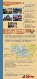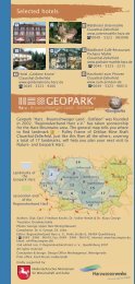
Geopark LM 3 Englisch 2007.indd - Geopark Harz
Geopark LM 3 Englisch 2007.indd - Geopark Harz
Geopark LM 3 Englisch 2007.indd - Geopark Harz

Create successful ePaper yourself
Turn your PDF publications into a flip-book with our unique Google optimized e-Paper software.
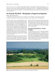
Curious sandstone formations<br />
Klusfelsen Goslar<br />
The 20 metre high rock rib of the Klusfelsen is<br />
today hidden behind the home for the elderly at<br />
Petersberg 4, east of the Schützenplatz and near<br />
the Breites Tor (Broad Gate). It can be reached via<br />
the Osterfeld and Petersberg streets. We follow<br />
the signs for “Kluskapelle”.<br />
The Klusfelsen looks brown due to weathering –<br />
but it consists of coarse, porous, yellow Hils<br />
Sandstone which was formed in a shallow sea<br />
near the coastline in the Lower Cretaceous about<br />
110 million years ago and can reach thicknesses<br />
of nearly 100 m. The southerly coastline was<br />
only a few kilometres south of where the Klusfelsen<br />
stands today in the North <strong>Harz</strong> Region. Klusfelsen<br />
The Hils Sandstone is representative of a distinctive<br />
transgression of the Niedersachsen Basin. From the sediment<br />
structures, for example the cross bedding, it can be<br />
assumed that the prevailing ocean current flowed parallel to<br />
the coastline from northwest to southeast.<br />
The Hils Sandstone was formerly an important quarry stone,<br />
quarried mostly in the area of Langelsheim and Lutter am<br />
Barenberge to provide building stones for sacred architecture<br />
and for modelling of fine architectural elements. The pores of<br />
this sandstone are often incompletely filled with quartz<br />
cement, thus the stone tends to disintegrate which can lead<br />
to structural damage. The nearby classical geosites, the Ratssandgrube<br />
and the Osterfeld Brickyard, have unfortunately<br />
been demolished to a great extent. The outcrop line Petersberg<br />
(Upper Cretaceous) – Neue Ziegelei Osterfeld (Keuper –<br />
Buntsandstein) was a unique supraregional geoprofile.<br />
12<br />
14<br />
15<br />
13<br />
11<br />
10<br />
2<br />
1<br />
3<br />
4<br />
6<br />
5<br />
7<br />
8<br />
9<br />
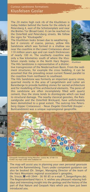
Kartografie Verwaltungs-Verlag München, Licence No. 07-08-110<br />
Further city maps under www.stadtplan.net<br />
The map will assist you in planning your own personal georoute<br />
around the Rammelsberg. Tours under competent guidance can<br />
also be booked (Dr. Steiger, Managing Director of the team of<br />
the <strong>Harz</strong> Mountains regional association’s geogides,<br />
DR. STEIGER, +49 3944 - 36 90 85 or e-mail: T_Steiger@gmx.de).<br />
The Regionalverband <strong>Harz</strong> e. V. wishes you pleasant relaxing holidays<br />
and interesting insight into the geology and the history of the<br />
part of that Nature and <strong>Geopark</strong> <strong>Harz</strong> which you have just been<br />
introduced you.