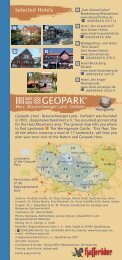
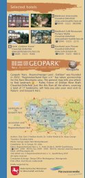
Geopark LM 3 Englisch 2007.indd - Geopark Harz
Geopark LM 3 Englisch 2007.indd - Geopark Harz
Geopark LM 3 Englisch 2007.indd - Geopark Harz

Create successful ePaper yourself
Turn your PDF publications into a flip-book with our unique Google optimized e-Paper software.
Iron ore<br />
Friederike Mine in Bündheim 8<br />
We drive back along the main road, turn off to<br />
the right and follow alongside the horse racing<br />
track until we arrive at Bündheim, a suburb of<br />
Bad <strong>Harz</strong>burg. We follow along the street further<br />
into town and then, in the long left curve, we turn<br />
right into the Silberbornstraße. At the end of the<br />
street we come to the game enclosure which is<br />
on the grounds of the former Friederike Iron Ore<br />
Mine. The street name “Grubenweg” (Mine Road)<br />
and a directional sign are a reminder of the<br />
mining history. Imbedded in the Lower Jurassic<br />
(Lias) clays are four ore deposits with a combined<br />
thickness of 20 metres. These ores are the product<br />
of weathering of dry land nearby (today the Ammonite<br />
<strong>Harz</strong> Mts.) which even in the Jurassic period lay<br />
above sea level. Ore precipitated in the coastal shore area.<br />
The ore deposits Peine-Salzgitter were also similarly formed,<br />
but originated in the Cretaceous period. The Friederike Mine<br />
was famous for its large ammonites; well preserved specimens<br />
can be found in the collection of the Goslar Museum,<br />
as well as others. The old colliery spoils have been levelled or<br />
are inside the game enclosure. There is also little left of the<br />
mine structures; only the linear subsidence areas with<br />
obvious depressions above the mining cavities are easily<br />
detectable.<br />
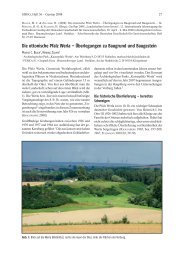
Distant views and salt springs<br />
Burgberg Bad <strong>Harz</strong>burg<br />
9<br />
Bad <strong>Harz</strong>burg was founded in 1894<br />
when the village of Neustadt became a<br />
township, taking its name from the<br />
nearby <strong>Harz</strong>burg Fortress, which was<br />
built around 1065 under HEINRICH IV as<br />
one of the first <strong>Harz</strong> imperial fortresses.<br />
With its favourable location on the<br />
steep Burgberg Mountain it became<br />
one of the most important fortresses<br />
of its time, playing a key role in the Burgberg Bad <strong>Harz</strong>burg<br />
Saxon Revolts and being plundered<br />
and destroyed in 1074. After reconstruction under OTTO IV it<br />
regained fame: the imperial insignia of the Holy Roman<br />
Empire were kept here. The death of OTTO IV in the fortress<br />
ended its role of importance. Still existing on the Großer Burgberg<br />
is the 57-metre deep fortress well. From the Canossa<br />
Column on the Burgberg there is a tremendous view out over<br />
the Northern <strong>Harz</strong> Border and the area of our previous excursion<br />
route as well as the <strong>Harz</strong> Foreland lying further to the<br />
north. Out of this the individual hillside ranges, formed by salt<br />
tectonics, such as the Harly Anticline (salt saddle) near<br />
Vienenburg with its former potassium mine, rise.<br />
Bad <strong>Harz</strong>burg is known today for its saltwater baths, fed by<br />
the springs originating in the <strong>Harz</strong>nordrand Thrust. A total of<br />
six curative and mineral water springs gush from the earth<br />
here. As early as 1569 a saline which continued operation<br />
until 1849 was erected here under Duke JULIUS VON BRAUNSCHWEIG.<br />
The salt springs were located near the centre of today’s town<br />
(street name Am alten Salzwerk, meaning “at the old salt<br />
works”). Thereafter the saline was converted into a saltwater<br />
spa, making use of the mineral water collected in various