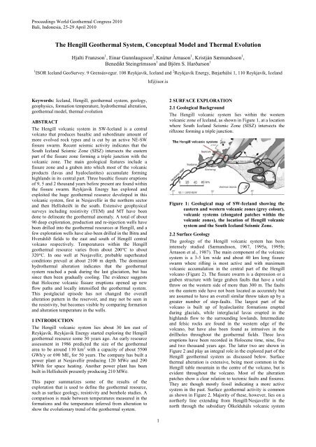
The Hengill Geothermal System, Conceptual Model and Thermal ...
The Hengill Geothermal System, Conceptual Model and Thermal ...
The Hengill Geothermal System, Conceptual Model and Thermal ...
You also want an ePaper? Increase the reach of your titles
YUMPU automatically turns print PDFs into web optimized ePapers that Google loves.
Proceedings World <strong>Geothermal</strong> Congress 2010<br />
Bali, Indonesia, 25-29 April 2010<br />
<strong>The</strong> <strong>Hengill</strong> <strong>Geothermal</strong> <strong>System</strong>, <strong>Conceptual</strong> <strong>Model</strong> <strong>and</strong> <strong>The</strong>rmal Evolution<br />
Hjalti Franzson 1 , Einar Gunnlaugsson 2 , Knútur Árnason 1 , Kristján Sæmundsson 1 ,<br />
Benedikt Steingrímsson 1 <strong>and</strong> Björn S. Harðarson 1<br />
1 ISOR Icel<strong>and</strong> GeoSurvey. 9 Grensásvegur. 108 Reykjavik, Icel<strong>and</strong> <strong>and</strong> 2 Reykjavík Energy, Bæjarhálsi 1, 110 Reykjavík, Icel<strong>and</strong><br />
hf@isor.is<br />
Keywords: Icel<strong>and</strong>, <strong>Hengill</strong>, geothermal system, geology,<br />
geophysics, formation temperature, hydrothermal alteration,<br />
geothermal model, thermal evolution<br />
ABSTRACT<br />
<strong>The</strong> <strong>Hengill</strong> volcanic system in SW-Icel<strong>and</strong> is a central<br />
volcano that produces basaltic <strong>and</strong> subordinate amount of<br />
more evolved rock types <strong>and</strong> is cut by an active NE-SW<br />
fissure swarm. Recent seismic activity indicates that the<br />
South Icel<strong>and</strong> Seismic Zone (SISZ) intersects the eastern<br />
part of the fissure zone forming a triple junction with the<br />
volcanic zone. <strong>The</strong> main geological features include a<br />
fissure zone <strong>and</strong> a graben into which most of the volcanic<br />
products (lavas <strong>and</strong> hyaloclastites) accumulate forming<br />
highl<strong>and</strong>s in its central part. Three basaltic fissure eruptions<br />
of 9, 5 <strong>and</strong> 2 thous<strong>and</strong> years before present are found within<br />
the fissure swarm. Reykjavik Energy has explored <strong>and</strong><br />
exploited the huge geothermal resource developed in this<br />
volcanic system, first in Nesjavellir in the northern sector<br />
<strong>and</strong> then Hellisheiði in the south. Extensive geophysical<br />
surveys including resistivity (TEM) <strong>and</strong> MT have been<br />
done to delineate the geothermal anomaly. A total of about<br />
90 deep exploration, production <strong>and</strong> re-injection wells have<br />
been drilled into the geothermal resources at <strong>Hengill</strong>, <strong>and</strong> a<br />
few exploration wells have also been drilled in the Bitra <strong>and</strong><br />
Hverahlíð fields to the east <strong>and</strong> south of <strong>Hengill</strong> central<br />
volcano respectively. Temperatures within the <strong>Hengill</strong><br />
geothermal resource varies from about 200°C to about<br />
320°C. In one well at Nesjavellir, probable superheated<br />
conditions prevail at about 2100 m depth. <strong>The</strong> dominant<br />
hydrothermal alteration indicates that the geothermal<br />
system reached a peak during the last glaciation, but has<br />
since then been gradually cooling. <strong>The</strong> evidence suggests<br />
that Holocene volcanic fissure eruptions opened up new<br />
flow paths <strong>and</strong> locally intensified the geothermal system.<br />
This postglacial episode has not changed the overall<br />
alteration pattern in the reservoir, <strong>and</strong> may not be seen in<br />
the resistivity, but becomes visible by comparing formation<br />
<strong>and</strong> alteration temperature in the wells.<br />
1 INTRODUCTION<br />
<strong>The</strong> <strong>Hengill</strong> volcanic system lies about 30 km east of<br />
Reykjavík. Reykjavik Energy started exploring the <strong>Hengill</strong><br />
geothermal resource some 50 years ago. An early resource<br />
assessment in 1986 predicted the size of the geothermal<br />
area to be around 110 km 2 with a capacity of about 5500<br />
GWh/y or 690 ME e for 50 years. <strong>The</strong> company has built a<br />
power plant at Nesjavellir producing 120 MWe <strong>and</strong> 290<br />
MWth for space heating. Another power plant has been<br />
built in Hellisheiði presently producing 210 MWe.<br />
This paper summarizes some of the results of the<br />
exploration that is used to define the geothermal resource,<br />
such as surface geology, resistivity <strong>and</strong> borehole studies. A<br />
comparison is made between temperatures measured in the<br />
formations <strong>and</strong> the temperature inferred from alteration to<br />
show the evolutionary trend of the geothermal system.<br />
2 SURFACE EXPLORATION<br />
2.1 Geological Background<br />
<strong>The</strong> <strong>Hengill</strong> volcanic system lies within the western<br />
volcanic zone of Icel<strong>and</strong>, as shown in Figure 1, at a location<br />
where South Icel<strong>and</strong> Seismic Zone (SISZ) intersects the<br />
riftzone forming a triple junction.<br />
Figure 1: Geological map of SW-Icel<strong>and</strong> showing the<br />
eastern <strong>and</strong> western volcanic zones (grey colour),<br />
volcanic systems (elongated patches within the<br />
volcanic zones), the location of <strong>Hengill</strong> volcanic<br />
system <strong>and</strong> the South Icel<strong>and</strong> Seismic Zone.<br />
2.2 Surface Geology<br />
<strong>The</strong> geology of the <strong>Hengill</strong> volcanic system has been<br />
intensely studied (Sæmundsson, 1967, 1995a, 1995b;<br />
Árnason et al., 1987). <strong>The</strong> main component of the volcanic<br />
system is a 3-5 km wide <strong>and</strong> about 40 km long fissure<br />
swarm where rifting is most active <strong>and</strong> with maximum<br />
volcanic accumulation in the central part of the <strong>Hengill</strong><br />
volcano (Figure 2). <strong>The</strong> fissure swarm is a depression or a<br />
graben structure with large graben faults that have a total<br />
throw on the western side of more than 300 m. <strong>The</strong> faults<br />
on the eastern side have not been located as accurately but<br />
are assumed to have an overall similar throw taken up by a<br />
greater number of step-faults. <strong>The</strong> largest part of the<br />
volcano is built up of hyaloclastite formations erupted<br />
during glacials, while interglacial lavas erupted in the<br />
highl<strong>and</strong>s flow to the surrounding lowl<strong>and</strong>s. Intermediate<br />
<strong>and</strong> felsic rocks are found in the western edge of the<br />
volcano, but have also been found as intrusives in the<br />
drillholes throughout the geothermal fields. Three lava<br />
eruptions have been recorded in Holocene time, nine, five<br />
<strong>and</strong> two thous<strong>and</strong> years ago. <strong>The</strong> latter two are shown in<br />
Figure 2 <strong>and</strong> play an integral role in the explored part of the<br />
<strong>Hengill</strong> geothermal system as discussed below. Surface<br />
thermal alteration is extensive, being most common in the<br />
<strong>Hengill</strong> table mountain in the centre of the volcano, but is<br />
evident throughout the volcano. Most of the alteration<br />
patches show a clear relation to tectonic faults <strong>and</strong> fissures.<br />
<strong>The</strong>y are though mostly fossil indicating a more active<br />
system in the past. Surface geothermal activity is common<br />
as shown in Figure 2. Majority of these, however, lies on a<br />
northerly line extending from <strong>Hengill</strong>/Nesjavellir in the<br />
north through the subsidiary Ölkelduháls volcanic system<br />
1
Franzson et al.<br />
called Hrómundartindur/Ölkelduháls to Hveragerði in the<br />
southeast.<br />
temperature dependent alteration minerals in drillholes, but<br />
the formation temperatures have though been variable as is<br />
discussed below.<br />
Figure 2: <strong>The</strong> <strong>Hengill</strong> volcanic system showing the<br />
topography, the faults related to the transform<br />
system (SISZ), <strong>and</strong> the post-glacial eruptive<br />
fissure swarm cutting the central volcano. <strong>The</strong><br />
Hellisheiði-Hverahlíð-Bitra <strong>and</strong> Nesjavellir maps<br />
refer to figures 11-16.<br />
2.3 Geophysical Exploration<br />
Several geophysical exploration methods have been used to<br />
define the structures <strong>and</strong> the characteristics of the<br />
geothermal system in <strong>Hengill</strong>, including Bouguer gravity<br />
survey (Þorbergsson et al., 1984; Árnason et al., 1987),<br />
aeromagnetic survey (Björnsson <strong>and</strong> Hersir, 1981), seismic<br />
refraction <strong>and</strong> passive seismic surveys (Pálmason, 1971;<br />
Fougler, 1984). <strong>The</strong> most informative exploration method<br />
in defining the geothermal reservoir prior to drilling is,<br />
however, resistivity. <strong>The</strong> methods used in the <strong>Hengill</strong> area<br />
include Schlumberger <strong>and</strong> dipole-dipole survey (Hersir,<br />
1980; Björnsson <strong>and</strong> Hersir, 1981). In 1987 the TEM<br />
method was applied, <strong>and</strong> to date some 280 TEM soundings<br />
have been made. Árnason et al. (2000) related the resistivity<br />
structures to variations in hydrothermal alteration, which<br />
appear to be of greater importance than the temperature<br />
variation. <strong>The</strong> low-temperature clay-rich outer margin of a<br />
high-T reservoir is characterized by low-resistivity <strong>and</strong> the<br />
underlying higher resistivity is associated with the<br />
formation of chlorite <strong>and</strong> less water-rich alteration mineral<br />
assemblage. Figure 3 shows a resistivity map at 850 m b.s.l.<br />
in the <strong>Hengill</strong> area where the high-resistivity core is shown<br />
as the cross-hatched area.<br />
Although the high-resistivity shows some relation to the<br />
dominant NNE-SSW alignment of the fissure swarm, a<br />
broad WNW-ESE structure crosses <strong>Hengill</strong> from Húsmúli<br />
in the west to Bitra <strong>and</strong> Hveragerði in the east. <strong>The</strong>se<br />
structures have been confirmed by the zonation of<br />
Figure 3: A resistivity map of the <strong>Hengill</strong> central<br />
volcano at 850 m b.s.l. showing variations in<br />
resistivity. <strong>The</strong> cross-hatched areas define high<br />
resitivity cores below low resistivity, <strong>and</strong> are<br />
interpreted to indicate alteration temperatures of<br />
over 230°C.<br />
<strong>Hengill</strong> is a very seismically active area, as would be<br />
expected from the dense fissure swarm <strong>and</strong> recent<br />
eruptions. Two kinds of tectonic activity seems to prevail in<br />
the <strong>Hengill</strong> area; dilationary rifting as exemplified by the<br />
fissure zone, <strong>and</strong> a transform component concentrated in<br />
the eastern part of <strong>Hengill</strong> <strong>and</strong> related to the SISZ. <strong>The</strong> last<br />
major earthquake episode associated with the <strong>Hengill</strong><br />
fissure swarm occurred in 1789 with a significant<br />
subsidence along the graben faults. Intense seismic activity<br />
occurred in 1991-2001 which appeared to associate with<br />
transform tectonic activity related to the South Icel<strong>and</strong><br />
Seismic Zone (SISZ). <strong>The</strong> activity appeared to concentrate<br />
along N-S <strong>and</strong> ENE-WSW lines, mostly in the eastern part<br />
of the <strong>Hengill</strong> area, as seen in Figure 2. A study of fracture<br />
pattern from aerial photographs has shown a similar<br />
combination of fracture directions (Khodayar <strong>and</strong> Franzson,<br />
2007). <strong>The</strong> <strong>Hengill</strong> volcanic system can therefore be<br />
considered to be located at a triple junction. This must<br />
affect permeability in the crust as discussed later.<br />
MT soundings were first employed in the area in 1976<br />
(Hersir, 1980), <strong>and</strong> then more comprehensively in more<br />
recent INTAS, I-GET <strong>and</strong> ISOR projects. <strong>The</strong>se data have<br />
been integrated with the available TEM data in order to<br />
construct a comprehensive map of resistivity from surface<br />
down to over 15 km depth (Árnason et al., 2009). Figures 4<br />
<strong>and</strong> 5 show the emergence of two conducting layers below<br />
4 km depth which lie in a WNW-ESE direction. <strong>The</strong><br />
shallower one extends from <strong>Hengill</strong> mountain towards<br />
Bitra. <strong>The</strong> true meaning of these low resistivity bodies are<br />
not clear, but some kind of fluids or even minor partial<br />
crustal melting is inferred. <strong>The</strong> presence of these shallow<br />
2
Franzson et al.<br />
low resistivity bodies have raised hopes for a zone of<br />
supercritical fluids that could be reached by conventional<br />
drilling.<br />
<strong>The</strong> depths of wells range from about 1000 m down to 3322<br />
m, the deepest well drilled in Icel<strong>and</strong>. While vertical wells<br />
dominate in the Nesjavellir field, directional wells are<br />
dominant in the newer geothermal fields, where up to four<br />
wells are drilled from each drill pad.<br />
<strong>The</strong> methods used to study the subsurface character of the<br />
geothermal system include analysis of drilling data, cutting<br />
samples, lithological logs, temperature <strong>and</strong> pressure data,<br />
fluid sampling <strong>and</strong> productivity data.<br />
A major effort is presently underway to study in more detail<br />
the geothermal reservoir in the southern part of <strong>Hengill</strong>.<br />
Figure 4: Resistivity at 5200 m b.s.l. as observed from<br />
TEM-MT surveys (Árnason et al., 2009). Black<br />
line indicates the alignment of cross-section<br />
shown in Figure 5.<br />
Figure 5: A NE-SW cross section showing low- <strong>and</strong><br />
high-resitivity structures down to 10 km depth.<br />
North-east end is to the right on the picture.<br />
3 SUB-SURFACE EXPLORATION<br />
3.1 Introduction<br />
<strong>The</strong> exploration drilling of the <strong>Hengill</strong> system started at<br />
Nesjavellir in 1965 with five wells <strong>and</strong> continued 1981-<br />
1985 with the drilling of 13 wells. Hot water production<br />
started in 1990 <strong>and</strong> power generation in 1998. Further 10<br />
wells have been drilled as step out <strong>and</strong> make up wells,<br />
along with a few shallower reinjection wells.<br />
Drilling exploration of the Hellisheiði field started with a<br />
well at Kolviðarhóll in 1986, <strong>and</strong> in 1990 a well in Bitra<br />
was drilled. A major exploration effort started in Hellisheiði<br />
in 2001 <strong>and</strong> to date 49 production type wells have been<br />
drilled in the area along with 14 reinjection wells, most of<br />
them deep (>2000 m). Three exploration wells have been<br />
drilled in the Bitra field <strong>and</strong> another five exploration wells<br />
in Hverahlíð. <strong>The</strong> location of the wells is shown in Figures<br />
10-16.<br />
3.2 Nesjavellir Field<br />
<strong>The</strong> subsurface geology <strong>and</strong> geothermal condition of the<br />
Nesjavellir reservoir has been studied in some detail (e.g.<br />
Franzson 1998, 2000, et.al. 1986, Steingrímsson et al.,<br />
1990). <strong>The</strong> results from those studies can be summarized as<br />
follows: A simplified geological cross-section (Figure 6)<br />
shows a dominant hyaloclastite accumulation down to<br />
about 400 m b.s.l.. below which lava accumulation<br />
dominates. This level has been interpreted as the start of the<br />
<strong>Hengill</strong> central volcano. A similar feature, but slightly<br />
deeper, has been found in the southern part of <strong>Hengill</strong><br />
volcano. A tentative age of 0.3 to 0.4 my has been put on<br />
this stratigraphic level, which constrains the age of the<br />
central volcano <strong>and</strong> provides a maximum age of the<br />
geothermal system. <strong>The</strong> intrusive rocks are basaltic dykes<br />
or sheets which become noticeable below about 800 m<br />
depth <strong>and</strong> increase up to 80-100% intensity below 2000 m<br />
depth. Shallow-dipping dioritic sheet-like intrusions are<br />
also found at various depths <strong>and</strong> they contribute<br />
substantially to the permeability in the field, along with the<br />
basaltic intrusions. Hydrothermal alteration has also been<br />
mapped in a considerable detail with respect to<br />
hydrothermal zonation, time evolution <strong>and</strong> fluid inclusions.<br />
<strong>The</strong> cross section in Figure 7 shows the shape of the<br />
temperature dependent alteration zones. <strong>The</strong>se show a clear<br />
relation to faults, a feeder to a hyaloclastite ridge <strong>and</strong><br />
possibly the feeders to the 5000 <strong>and</strong> 2000 y old volcanic<br />
fissures. <strong>The</strong> time relations of the hydrothermal mineral<br />
deposition into voids show a heating of the geothermal<br />
system <strong>and</strong> expansion to shallow levels culminating into the<br />
present alteration zones. However, calcite deposition is<br />
observed to overprint higher T alteration as the last mineral<br />
phase deposited in most parts of the area, especially in the<br />
upper region of the system. A number of fluid inclusion<br />
studies have been done on the alteration minerals, in<br />
particular the calcite. <strong>The</strong> calcite Th-temperatures show a<br />
range in most cases lower than expected from the alteration<br />
temperature zonation, which indicates that the geothermal<br />
system has been cooling in recent time. A comparison<br />
between the alteration temperatures <strong>and</strong> fluid inclusions on<br />
one h<strong>and</strong> <strong>and</strong> the present formation temperature on the<br />
other often shows a significant discrepancy.<br />
In places, the present formation temperature is significantly<br />
lower than inferred from the alteration <strong>and</strong> fluid inclusion<br />
data, with other locations being in equilibrium or giving<br />
higher temperatures than the alteration. This is shown<br />
schematically in Figure 7. It shows higher formation<br />
temperature along the same structures that controlled the<br />
highest alteration temperatures, <strong>and</strong> both are related to the<br />
location of the recent fissure eruptions. It is of interest to<br />
mention that an over pressurized aquifer was encountered at<br />
2150 m depth in well NJ-11, (see Figure 7), with a<br />
temperature surpassing the critical temperature. <strong>The</strong> zone<br />
showing formation temperatures above alteration<br />
temperatures seems to extend horizontally towards east at a<br />
3
Franzson et al.<br />
depth range of 600-1100 m b.s.l., <strong>and</strong> is controlled by<br />
aquifers connected to basaltic sills. Formation temperatures<br />
lower than alteration temperatures are at two depth levels<br />
on the eastern side; at 300-600 b.s.l. <strong>and</strong> 1400-1900 m b.s.l.<br />
Cooling is much more conspicuous in the western part of<br />
the area where temperatures are considerably lower than<br />
indicated by alteration in well NJ-12 down to 1400 m b.s.l.<br />
(c.f. Figure 7). <strong>The</strong> difference is even greater in the other<br />
two wells in Kýrdalur.<br />
intensified recently, probably related to the Holocene<br />
fissure eruptions of five <strong>and</strong> two thous<strong>and</strong> years.<br />
3.3 Bitra Field<br />
Three exploration wells have been drilled in the Bitra field<br />
which is located to the east of <strong>Hengill</strong> (e.g. Figure 14). <strong>The</strong><br />
geological features in the wells show a dominant succession<br />
of hyaloclastites, which have been interpreted as belonging<br />
mostly to the Hveragerði central volcano, the precursor to<br />
the <strong>Hengill</strong> volcanic system (Steingrímsson et al., 1997).<br />
<strong>The</strong> Bitra formation, a small lava shield, overlies a large<br />
part of the field, <strong>and</strong> has been dated from the onset of<br />
Holocene or about 13000 y.<br />
Figure 6: A simplified N-S geological cross-section<br />
through the Nesjavellir field, showing the<br />
distribution of lavas <strong>and</strong> hyaloclastite<br />
formations, <strong>and</strong> isolines of intrusion intensity<br />
(Franzson, 1998).<br />
Figure 7: An E-W cross section across the Nesjavellir<br />
field showing the alteration zones (separated by<br />
isolines) <strong>and</strong> a comparison between formation<br />
<strong>and</strong> alteration temperatures showing cooling,<br />
equilibrium, heating (dotted, yellow <strong>and</strong> gray<br />
shades) (Franzson, 2000).<br />
<strong>The</strong> interpretation of this data suggests strongly that the<br />
Nesjavellir system has been cooling gradually from the<br />
stage of maximum alteration, but geothermal activity<br />
Figure 8: Formation-, alteration- <strong>and</strong> fluid inclusion<br />
temperatures in well ÖJ-1 in Bitra field<br />
(Steingrímsson et al., 1997).<br />
Surface alteration is extensive in the Bitra area, some of it<br />
related to areas that are no longer hydrothermally active.<br />
Figure 8 shows the salient features of the alteration <strong>and</strong><br />
thermal condition in the field. <strong>The</strong> formation temperature<br />
shows low temperatures down to below 120 m where it<br />
increases to just under 200°C at 500 m depth. This is a large<br />
contrast to the alteration minerals, which indicate much<br />
higher temperatures. <strong>The</strong> two temperature curves conform<br />
well within the Bitra formation, but diverge in the<br />
underlying glacial tillite where the alteration curve<br />
increases to over 180°C as indicated by the appearance of<br />
quartz, with mixed-layer clay, chlorite <strong>and</strong> epidote at<br />
slightly deeper levels, while the formation temperature<br />
increases more gradually up to 200°C at 500 m depth. It<br />
appears obvious from the contrast in alteration that the<br />
intense high temperature activity occurred prior to the<br />
eruption of the Bitra formation. Furthermore, the formation<br />
of the high-temperature assemblage, confirmed by the fluid<br />
inclusion analysis, would imply a hydrostatic pressure<br />
equaling to a water table at least 150 m above the surface<br />
prior to the Bitra eruption. Such an environment could only<br />
be attained during a glacial interval where the water table<br />
would reside within a thick ice cover. Similar results are<br />
found in the other two wells in Bitra, indicating that the<br />
geothermal system in this region has been gradually cooling<br />
4
Franzson et al.<br />
during the glacial period <strong>and</strong> became moderately active<br />
when the Bitra lava shield erupted about 13000 y ago.<br />
3.4 Hellisheiði Field<br />
<strong>The</strong> main drilling in the Hellisheiði field started in 2001<br />
<strong>and</strong> to date 46 exploration/production wells <strong>and</strong> twelve<br />
deep reinjection wells have been drilled (Figures 14-16).<br />
<strong>The</strong> very intense drilling of wells has resulted in a limited<br />
time to do detailed research into the geological factors<br />
controlling the geothermal system. Reykjavik Energy has,<br />
however, started numerous studies <strong>and</strong> the picture of the<br />
geothermal system is rapidly becoming clearer (Franzson et<br />
al., 2005; Gunnarsson <strong>and</strong> Kristjánsson, 2003; Helgadóttir<br />
et al., 2010; Hardarson et al., 2010; Haraldsdóttir et al.,<br />
2010; Kiflom et al., 2010, <strong>and</strong> references therein). <strong>The</strong><br />
overall stratification in the field shows similar character as<br />
in Nesjavellir with hyaloclastite dominating down to 800-<br />
1000 m b.s.l. underlain by a more dominant lava sequence.<br />
This hyaloclastite/lava boundary lies somewhat deeper than<br />
found in Nesjavellir, which may indicate that the age of the<br />
central volcano is slightly older to the south, on the order of<br />
0.4 my. Intrusions are mostly fine-grained basalts, with<br />
subordinate amounts of more evolved rock types. A<br />
comparison of intrusive frequency between Nesjavellir <strong>and</strong><br />
Hellisheiði has not been done as yet, <strong>and</strong> may not be<br />
straight forward, as most of the Nesjavellir wells are<br />
vertical while the Hellisheiði ones are directional.<br />
Preliminary studies show, however, that intrusions become<br />
very common below about 2 km depth. <strong>The</strong>re are two main<br />
drilling targets in the Hellisheiði field. Firstly, the 2000 <strong>and</strong><br />
5000 y old volcanic fissures; the same geological target as<br />
in the Nesjavellir field to the north. Secondly, the large fault<br />
structures at the western edge of the <strong>Hengill</strong> graben. <strong>The</strong>se<br />
faults serve as major permeable structures of the<br />
hydrothermal system, <strong>and</strong> also as targets for reinjection<br />
wells. A similar fault system lies west of the explored part<br />
of the Nesjavellir system, but has not yet been drilled into.<br />
A few wells target the fault structures on the eastern margin<br />
of the <strong>Hengill</strong> graben.<br />
Figure 9: Temperature distribution in the <strong>Hengill</strong> area<br />
at about 1000 m depth interpolated from<br />
formation temperatures in wells (Björnsson,<br />
2007).<br />
<strong>The</strong> formation temperatures have been interpreted based on<br />
the well logs <strong>and</strong> on Figure 9 shows the temperature<br />
distribution at about 1000 m below sea level.<br />
Figure 10 shows a NE-SW cross-section along the fissure<br />
zone (c.f. Figure 2). A model of a single up-flow zone<br />
underlying the <strong>Hengill</strong> mountain with an outflow from that<br />
towards south into Hellisheiði <strong>and</strong> north towards<br />
Nesjavellir has been postulated, along with inflow of colder<br />
water from the outer margins resulting in convective<br />
mixing. This model is still being developed <strong>and</strong> discussed<br />
as new data are rapidly emerging, which may suggest a<br />
more complex solution.<br />
Skarðsmýrarfjall<br />
Stóri-<br />
Meitill<br />
Hellisheiði area<br />
300 kg/s<br />
180-190 °C<br />
Stóra-<br />
Reykjafell<br />
Innstidalur<br />
<strong>Hengill</strong><br />
? ? ?<br />
104 kg/s, 2150 kJ/kg, 140 MW<br />
Nesjavellir area<br />
30 35 40 45<br />
Distance (km)<br />
Figure 10: A NE-SW cross section of <strong>Hengill</strong> showing<br />
temperature distribution <strong>and</strong> an estimation of<br />
flow in the reservoir down to 2500 m b.l.s.<br />
(Björnsson, 2007).<br />
3.5 Hverahlíð Field<br />
<strong>The</strong> Hverahlíð geothermal field lies to the south of<br />
Hellisheiði (figures 14-16). Five exploration wells have<br />
been drilled there ranging in depth from 2000 to 2800 m<br />
(Níelsson <strong>and</strong> Franzson 2010). <strong>The</strong> first well was sited near<br />
to the only surface manifestation, the second one was sited<br />
to the west <strong>and</strong> directed into the most active part of the<br />
fissure swarm, <strong>and</strong> the third one was to explore the northern<br />
sector of the field. Hyaloclastites interpreted as evidence of<br />
highl<strong>and</strong>s <strong>and</strong> the existence of a central volcano, are<br />
dominant in the <strong>Hengill</strong> area. In Hverahlíð, on the other<br />
h<strong>and</strong>, lava successions are more dominant, indicating that<br />
the area is more distal to the central volcano. Temperature<br />
is among the highest in the southern part of the <strong>Hengill</strong>,<br />
where 320°C is observed at the base of the first well there,<br />
HE-21. <strong>The</strong> depth to the cap rock <strong>and</strong> temperature of the<br />
geothermal system increases towards west <strong>and</strong> north. <strong>The</strong><br />
completion of three wells in 2009 has given more<br />
comprehensive answers to the extent of the field, but is not<br />
dealt with here.<br />
4. THERMAL EVOLUTION<br />
4.1 Introduction<br />
<strong>The</strong> <strong>Hengill</strong> volcano is located, as are other active central<br />
volcanoes in Icel<strong>and</strong>, in a very dynamic environment.<br />
Magma is interpreted to provide the heat source to maintain<br />
the geothermal gradient <strong>and</strong> drive the geothermal system,<br />
<strong>and</strong> is periodically injected into relatively shallow crustal<br />
environment. <strong>The</strong>re is no seismic evidence of an underlying<br />
volcanic magma chamber in the roots of the <strong>Hengill</strong><br />
volcano at present. <strong>The</strong> fissure swarm is about 3-4 km wide<br />
in the <strong>Hengill</strong> area, but its activity shifts within these<br />
boundaries, causing permeability changes with time, both<br />
within the geothermal system, but perhaps more<br />
importantly, varying the ability of the overlying cold<br />
5
Franzson et al.<br />
groundwater systems to intrude on the geothermal system.<br />
<strong>The</strong> South Icel<strong>and</strong> Seismic Zone (SISZ) is an additional<br />
tectonic element that must influence permeability in at least<br />
the eastern part of the <strong>Hengill</strong> region. Magmatic activity<br />
<strong>and</strong> a potential heat source may also associate with the<br />
SISZ (Feigl et al., 2000). <strong>The</strong> effect of glaciation on<br />
groundwater/geothermal systems may perhaps be greatly<br />
underestimated, <strong>and</strong> one must bear in mind that the country<br />
has been covered by a thick ice-sheet for about 90% of its<br />
lifetime.<br />
4.2 Nesjavellir Field<br />
<strong>The</strong> integrated surface <strong>and</strong> borehole studies at Nesjavellir<br />
explain a number of features of the geothermal system<br />
(Franzson 1998, 2000). Firstly, it has shown the evolution<br />
of the geothermal system with time, gaining strength <strong>and</strong><br />
exp<strong>and</strong>ing to shallow levels, before showing effects of<br />
cooling throughout the system. Succeeding the cooling<br />
comes a renewed geothermal phase in a selected part of the<br />
geothermal system, evidenced by elevated temperatures at<br />
shallow to deep levels, possibly extending up to<br />
superheated temperatures. This renewed heating is not<br />
noticeably reflected in a change in the alteration zonation,<br />
which is an indication of its young age. <strong>The</strong> fact that the<br />
heating coincides with the location of the 5000 <strong>and</strong> 2000<br />
year old fissure eruption sites strongly suggests that the<br />
renewed heating may be due to these eruptions, either<br />
because highly permeable fractures associated with the<br />
feeder dykes opened new up- <strong>and</strong> outflow-paths for the<br />
geothermal fluid, <strong>and</strong>/or that the eruption emplaced a new<br />
heat source at depth within the <strong>Hengill</strong> volcano. In either<br />
case, this provides a time frame for the formation of<br />
hydrothermal alteration, i.e. that it may require more than<br />
5000 years to re-establish an alteration zone in equilibrium<br />
with in situ formation temperatures. <strong>The</strong> evidence from<br />
Bitra shows conclusively that the shallow <strong>and</strong> pervasive<br />
high temperature alteration was formed during the last<br />
glacial period, <strong>and</strong> prior to the eruption of the Bitra<br />
formation. One would therefore be tempted to speculate<br />
that the elevated high temperature alteration in Nesjavellir<br />
might also be derived from last glacial (15,000-120,000 y).<br />
If this conclusion is correct, it can be applied to the <strong>Hengill</strong><br />
as a whole. Furthermore, because it has been established<br />
that resistivity structures are dominantly related to<br />
alteration zonation rather than purely temperatures,<br />
resistivity surveys may not detect subsurface changes<br />
occurring in the last 5000 y or so. It is therefore proposed<br />
here that comparing formation temperatures with alteration<br />
temperatures is the best means to detect changes that have<br />
taken place in postglacial time, which is a short time on<br />
geological scale, but very long in terms of geothermal<br />
utilization.<br />
Figure 11: Nesjavellir field. A map showing the center of<br />
maximum subsidence, the 5000 <strong>and</strong> 2000 y old<br />
volcanic fissures <strong>and</strong> a comparison between<br />
formation temperature (Tf) <strong>and</strong> alteration<br />
temperature at caprock depth. (Ta) Red colour<br />
indicates Tf > Ta, green indicates Tf ~Ta <strong>and</strong><br />
blue Tf < Ta.<br />
Figures 11 to 13 show an estimate of the temperature<br />
difference between formation (Tf) <strong>and</strong> alteration (Ta) in the<br />
Nesjavellir field at three depth levels; at caprock level,<br />
around 1000 m <strong>and</strong> at about 1500 m depth. <strong>The</strong>se results<br />
are shown along with the location of the two postglacial<br />
basalt eruptions in the central part of the Nesjavellir.<br />
<strong>The</strong> Nesjavellir system shows, as discussed above, a<br />
bimodal temperature difference with the western part<br />
showing pronounced cooling, while heating is occurring on<br />
the eastern side of the volcanic fissures. It is suggested here<br />
that this may be caused by down-flow of colder<br />
groundwater along the most active part of the fissure-swarm<br />
west of the volcanic fissures, as shown in Figure 11. <strong>The</strong><br />
apparent cooling in the eastern part of the field at about<br />
1500 m depth may be related to cooler inflow along shallow<br />
dipping dioritic intrusive sheets.<br />
6<br />
Figure 12: Nesjavellir field. A comparison between<br />
formation temperature (Tf) <strong>and</strong> alteration<br />
temperature (Ta) at ~1000 m depth. Red colour<br />
indicates Tf > Ta, green indicates Tf ~Ta <strong>and</strong><br />
blue Tf < Ta.
Franzson et al.<br />
fracturing related to the SISZ. This thermal mining appears<br />
to be most effective at a depth range of ca 1400-2000 m.<br />
4.5 Hverahlíð Field<br />
<strong>The</strong> three wells in Hverahlíð field in the southern part of<br />
<strong>Hengill</strong> also show contrasts in formation <strong>and</strong> alteration<br />
temperatures as shown in Figures 14-16. Well 21, which is<br />
located near to the only thermal manifestation, shows<br />
consistently higher formation temperatures than the<br />
alteration, while well 26 shows lower formation<br />
temperatures in the three depth levels. Well 36, on the other<br />
h<strong>and</strong>, shows equilibrium at the depth of the caprock, a<br />
slightly higher formation temperatures at 1000 m depth, but<br />
then a pronounced temperature reversal below 1500 m<br />
depth. It is tempting to suggest that the thermal mining at<br />
the base of the well is related to the most active part of the<br />
fissure swarm as shown in Figure 16, similar to what has<br />
been proposed for Nesjavellir. <strong>The</strong> higher formation<br />
temperatures in the upper part of the system compared to<br />
the alteration temperatures, however, raises hopes that a<br />
relatively recent heating episode has occurred in that area,<br />
unrelated to the aforementioned volcanic fissures. That<br />
upflow channel has not yet been identified.<br />
Figure 13: Nesjavellir field. A comparison between<br />
formation temperature (Tf) <strong>and</strong> alteration<br />
temperature (Ta) at ~1500 m depth. Red colour<br />
indicates Tf > Ta, green indicates Tf ~Ta <strong>and</strong><br />
blue Tf < Ta.<br />
4.3 Bitra Field<br />
<strong>The</strong> much lower formation temperatures in Bitra, as<br />
compared to the alteration temperatures, are seen at all<br />
depths except in the easternmost well where the two<br />
temperatures are in equilibrium below 1500 m (Figures 14-<br />
16). It is tentatively suggested here that this very effective<br />
thermal mining is due to the combined permeability of the<br />
fissure-swarm <strong>and</strong> the superimposed fractures of the SISZ<br />
(c.f. Figure 2). It is also suggested that this thermal mining<br />
continues further west into the eastern part of<br />
Skarðsmýrarfjall.<br />
4.4 Hellisheiði Field<br />
Figures 14-16 show a similar relation between the<br />
differential temperature <strong>and</strong> the geological features in the<br />
Hellisheiði field. A recent heating occurs within the depth<br />
range of the caprock along the volcanic fissures (Figure 14).<br />
This heating is most pronounce at the southern slopes of<br />
Skarðsmýrarfjall, but is only vaguely detected in wells in<br />
central <strong>and</strong> eastern Skarðsmýrafjall. It is of interest that<br />
alteration temperatures at shallow levels seem to be higher<br />
than the present formation temperatures in the western part<br />
of the field. <strong>The</strong> deeper section in Figure 16 shows that a<br />
large part of the Skarðsmýrarfjall has suffered thermal<br />
mining (cooling), <strong>and</strong> only in a very localized part in<br />
between the 5000 <strong>and</strong> 2000 year old volcanic fissures do we<br />
still see evidence of formation temperatures higher than<br />
alteration temperatures. <strong>The</strong> thermal anomaly appears also<br />
to be present in Stóra Reykjafell further to the southwest. In<br />
general, thermal mining seems to be more pronounced in<br />
the eastern part of the Hellisheiði system <strong>and</strong> it is suggested<br />
that it may be due to higher permeability in that region<br />
compared to the area west of the volcanic fissures due to<br />
Figure 14: Hellisheiði, Bitra <strong>and</strong> Hverahlíð fields. A<br />
comparison between formation temperature (Tf)<br />
<strong>and</strong> alteration temperature (Ta) at ~cap rock<br />
depth. Red colour indicates Tf > Ta, green<br />
indicates Tf ~Ta <strong>and</strong> blue Tf < Ta.<br />
Figure 15: Hellisheiði, Bitra <strong>and</strong> Hverahlíð fields. A<br />
comparison between formation temperature (Tf)<br />
<strong>and</strong> alteration temperature (Ta) at ~1000 m<br />
depth. Red colour indicates Tf > Ta, green<br />
indicates Tf ~Ta <strong>and</strong> blue Tf < Ta.<br />
7
Franzson et al.<br />
Figure 16: Hellisheiði, Bitra <strong>and</strong> Hverahlíð fields. A<br />
comparison between formation temperature (Tf)<br />
<strong>and</strong> alteration temperature at ~1500 m depth.<br />
(Ta) Blue colour indicates Tf > Ta, green<br />
indicates Tf ~Ta <strong>and</strong> red Tf < Ta.<br />
4.6 Summary<br />
<strong>The</strong> main conclusion of this discussion is that the hightemperature<br />
system at <strong>Hengill</strong> seems to be controlled by<br />
three factors: 1) thermal mining by down-flow of shallow<br />
cold groundwater system, 2) inflow of lower temperature<br />
hydrothermal fluid <strong>and</strong> thermal mining of hotter rocks at a<br />
depth level of 1500-2000 m depth, <strong>and</strong> 3) a hot upflow from<br />
a deeper reservoir which is connected to the 5000 <strong>and</strong> 2000<br />
y old volcanic fissures. A separate upflow may exist in the<br />
neighborhood of well 21 in the Hverahlíð field. It is too<br />
early to postulate where that upflow lies, <strong>and</strong> this will have<br />
to wait until more drilling is completed in that area.<br />
5. CONCLUSIONS<br />
This paper summarizes some of the results of geothermal<br />
exploration in the <strong>Hengill</strong> volcanic system.<br />
Surface geothermal manifestations in the <strong>Hengill</strong> area are<br />
closely related to the fissure zone, the central volcano <strong>and</strong><br />
to the post-glacial volcanism.<br />
Resistivity surveys have identified a 110 km 2 thermal<br />
anomaly at 850 m depth <strong>and</strong> a low resistivity structure<br />
below 4 km depth.<br />
A comparison of the formation <strong>and</strong> alteration temperatures<br />
in the boreholes implies an evolution of the geothermal<br />
system where it apparently reaches a peak during the last<br />
glacial period <strong>and</strong> is succeeded by an overall gradual<br />
cooling during Holocene. This cooling is occurring either<br />
from above through the caprock of the system or along the<br />
tectonically most active part of the graben formation,<br />
preferentially at 1300-2000 m depth. Additional cooling is<br />
caused by the strong tectonic elements of the SISZ that<br />
enters the eastern part of the <strong>Hengill</strong> fissure swarm.<br />
<strong>The</strong> cooling is locally interrupted by a heating episode in<br />
the area around the 5000 <strong>and</strong> 2000 year old fissure<br />
eruptions that dissect the <strong>Hengill</strong> central volcano. This<br />
heating is postulated to be the result of renewed upflow<br />
channels along these fissures from the roots of the <strong>Hengill</strong><br />
geothermal reservoir <strong>and</strong>/or a replenished magmatic heat<br />
source for the geothermal system associated with the fissure<br />
eruptions.<br />
A separate high-temperature system is located in the<br />
Hverahlíð area to the south of <strong>Hengill</strong> central volcano. This<br />
system shows higher formation temperatures than alteration<br />
8<br />
in the upper part indicating a Holocene heating episode<br />
similar as found in <strong>Hengill</strong>. <strong>The</strong> source of that heating is<br />
still undefined.<br />
ACKNOWLEDGEMENT<br />
Permission from Reykjavik Energy to publish the data is<br />
acknowledged. Colleagues of ISOR <strong>and</strong> Reykjavik Energy<br />
are thanked for assistance in making this paper. <strong>The</strong> paper<br />
benefitted from constructive comments by Robert<br />
Zierenberg <strong>and</strong> Sveinbjörn Björnsson.<br />
REFERENCES<br />
Árnason, K.; Eysteinsson, H.; Hersir, G.P.: Joint 1D<br />
inversion of TEM <strong>and</strong> MT data <strong>and</strong> 3D inversion of<br />
MT data in the <strong>Hengill</strong> area SW-Icel<strong>and</strong>. Submitted to<br />
Geothermics April 2009.<br />
Árnason, K., Karlsdóttir, R., Eysteinsson, H., Flóvenz,<br />
Ó.G., Guðlaugsson, S.Th.: <strong>The</strong> resistivity structure of<br />
high-temperature geothermal systems in Icel<strong>and</strong>.<br />
Proceedings of the WGC 2000, Japan, 923-928.<br />
Árnason, K., Haraldsson, G.I., Johnsen, G.V., Þorbergsson,<br />
G., Hersir, G.P., Sæmundsson, K., Georgsson, L.S.,<br />
Rögnvaldsson, S.Th., Snorrason, S.P.: Nesjavellir-<br />
Ölkelduháls. Surface exploration in 1986. Orkustofnun<br />
report in Icel<strong>and</strong>ic, OS-87018/JHD-02, 112 pp, (1987)<br />
Björnsson, A., Hersir, G.P.: Geophysical Reconnaissance<br />
Study of the <strong>Hengill</strong> High-Temperature Area, SW-<br />
Icel<strong>and</strong>. <strong>Geothermal</strong> Resources Council, Trans. 5, 55-<br />
58, (1981)<br />
Björnsson, G.: Re-evaluation of the <strong>Hengill</strong> reservoir model<br />
<strong>and</strong> a simple evaluation of the productivity of new<br />
drilling areas. Reykjavik Energy Report, 3-2007, 65p.<br />
(in Icel<strong>and</strong>ic), (2007)<br />
Feigl, K.L., Gasperi, J., Sigmundsson, F., Rigo, A.: Crustal<br />
deformation near <strong>Hengill</strong> volcano, Icel<strong>and</strong> 1993-1998:<br />
Coupling between magmatic activity <strong>and</strong> faulting<br />
inferred from elastic modelling of satellite radar<br />
interferograms. Journ. Geophys. Res., Vol, 105, No.<br />
B11, 25.655-25.670, (2000)<br />
Foulger, G.R.: Seismological studies at the <strong>Hengill</strong><br />
geothermal area, SW Icel<strong>and</strong>. PhD thesis, University<br />
of Durham, 313 pp, (1984)<br />
Franzson, H.: Reservoir geology of the Nesjavellir hightemperature<br />
field in SW-Icel<strong>and</strong>. Proc. 19th Annual<br />
PNOC-EDC <strong>Geothermal</strong> Conference, Manila,<br />
Philippines, 13-20, (1998)<br />
Franzson, H., Kristjánsson, B.R., Gunnarsson, G.,<br />
Björnsson, G., Hjartarson, A., Steingrímsson, B.S.,<br />
Gunnlaugsson, E., Gíslason, G.: <strong>The</strong> <strong>Hengill</strong>-<br />
Hellisheiði geothermal field. Development of a<br />
conceptual geothermal model. Proceedings World<br />
<strong>Geothermal</strong> Congress 2005, Antalya, Turkey,<br />
Electronic version.<br />
Franzson, H.: Hydrothermal Evolution of the Nesjavellir<br />
High-Temperature <strong>System</strong>, Icel<strong>and</strong>, World <strong>Geothermal</strong><br />
Congress, (2000), Japan, May 28 - June 10, 2000 6<br />
Franzson, H., Guðmundsson, Á., Friðleifsson, G.Ó. <strong>and</strong><br />
Tómasson, J.: Nesjavellir high-T field, SW-Icel<strong>and</strong>.<br />
Reservoir geology. In: Fifth International Symposium<br />
on Water-Rock Interaction. Reykjavík, Icel<strong>and</strong>, p.210-<br />
213, (1986)<br />
Gunnarsson, G., Kristjánsson, B.R.: An assessment of<br />
intrusive intensity in lower part of wells HE-3 to HE-7
Franzson et al.<br />
at Hellisheidi. NEA-Report OS-2003/022 (in<br />
Icel<strong>and</strong>ic) (2003), 41 p.<br />
Haraldsdóttir, S.H., Franzson, H., Árnason, K., Eysteinsson,<br />
H., Einarsson, G.M., <strong>and</strong> Björnsson, H.: Comparison<br />
of down-hole <strong>and</strong> surface resistivity data from the<br />
Hellisheidi geothermal field, SW-Icel<strong>and</strong>, (2010)<br />
Hardarson, B.S., Einarsson, G.M., Kristjánsson, B.R.,<br />
Gunnarsson, G., Helgadóttir, H.M., Franzson, H.,<br />
Árnason, K., Ágústsson, K. <strong>and</strong> Gunnlaugsson, E.:<br />
<strong>Geothermal</strong> reinjection at the <strong>Hengill</strong> triple junction,<br />
SW Icel<strong>and</strong>. WGC-Bali, submitted, (2010)<br />
Helgadóttir, H.M., Snæbjörnsdóttir, S.Ó., Níelsson, S.<br />
Gunnarsdóttir, S.H., Matthíasdóttir, T., Harðarson,<br />
B.S., Einarsson, G.M. <strong>and</strong> Franzson, H.: Geology <strong>and</strong><br />
hydrothermal alteration in the reservoir of the<br />
Hellisheiði high temperature system, SW-Icel<strong>and</strong>.<br />
WGC, Bali, submitted, (2010)<br />
Hersir, G.P.: Electric <strong>and</strong> electromagnetic measurements<br />
across the Mid-Atlantic ridge in southwest Icel<strong>and</strong>,<br />
with special reference to the high temperature area of<br />
<strong>Hengill</strong>. Mag scient thesis, University of Aarhus,165<br />
pp, (1980)<br />
Khodayar, M. <strong>and</strong> Franzson, H.: Fracture pattern of<br />
Thjórsárdalur central volcano with respect to rift-jump<br />
<strong>and</strong> a migrating transform zone in S-Icel<strong>and</strong>. Journal<br />
of Structural Geology 29 (5), 898-912, (2007)<br />
Níelsson S., <strong>and</strong> Franzson, H.: Geology <strong>and</strong> hydrothermal<br />
alteration of the Hverahlíð HT-system, SW-Icel<strong>and</strong>.<br />
Proceedings World <strong>Geothermal</strong> Congress Bali<br />
Indonesia. Submitted, (2010)<br />
Þorbergsson, G., Magnússon, I.Þ., Gunnarsson, Á.,<br />
Johnsen, G.V., Björnsson, A.: Geodetic <strong>and</strong> gravity<br />
surveys in the <strong>Hengill</strong> area 1982 <strong>and</strong> 1983.<br />
Orkustofnun report in Icel<strong>and</strong>ic, OS-84003/VOD-03<br />
B, 58 pp, (1984)<br />
Pálmason, G.: Crustal structure of Icel<strong>and</strong> from explosion<br />
seismology, 40, Soc. Sci. Isl<strong>and</strong>ica, Reykjavík, 187 pp,<br />
(1971)<br />
Steingrímsson, B.S., Gudmundsson, A., Franzson, H., <strong>and</strong><br />
Gunnlaugsson, E.: Evidence of a supercritical fluid at<br />
depth in the Nesjavellir field. Proc. 15th Workshop on<br />
<strong>Geothermal</strong> Reservoir Engineering, Stanford<br />
University, 8 p, (1990)<br />
Steingrímsson, B.S., Tulinius, H., Franzson, H., Sigurðsson,<br />
Ó., Gunnlaugsson, E., <strong>and</strong> Gíslason, G.: Ölkelduháls<br />
well ÖJ-1. Drilling, research <strong>and</strong> production<br />
characteristics, (1997)<br />
NEA-report OS-97019, 182 p (in Icel<strong>and</strong>ic).<br />
Sæmundsson, K. 1967. Vulkanismus und Tektonik des<br />
<strong>Hengill</strong>-Gebietes in SW-Isl<strong>and</strong>. Acta Nat. Isl. 2, 7: 105<br />
p, (1967)<br />
Sæmundsson, K. 1995a. <strong>Hengill</strong>. Geological map (bedrock)<br />
1:5000. Published by Icel<strong>and</strong> GeoSurvey<br />
Sæmundsson, K. 1995b. <strong>Hengill</strong>. Map of thermal activity,<br />
alteration <strong>and</strong> hydrology. 1:25000. Published by<br />
Icel<strong>and</strong> GeoSurvey.<br />
9


