
You also want an ePaper? Increase the reach of your titles
YUMPU automatically turns print PDFs into web optimized ePapers that Google loves.
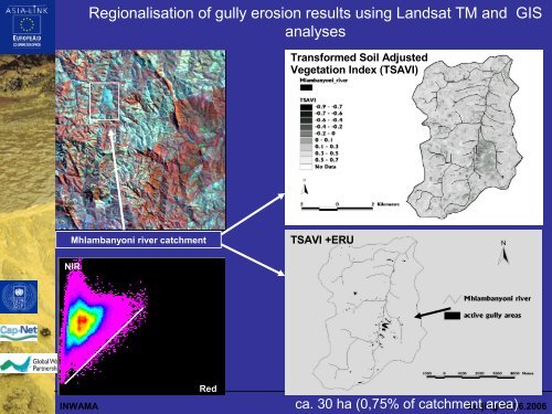
Regionalisation of <strong>gully</strong> <strong>erosion</strong> results using Landsat TM and GIS<br />
analyses<br />
Transformed Soil Adjusted<br />
Vegetation Index (TSAVI)<br />
Mhlambanyoni river catchment<br />
TSAVI +ERU<br />
NIR<br />
INWAMA<br />
Red<br />
ca. 30 ha (0,75% of catchment area)<br />
Beijing 06.06.2006