Buck Island Reef National Monument Geologic Resources Inventory
Buck Island Reef National Monument Geologic Resources Inventory
Buck Island Reef National Monument Geologic Resources Inventory

You also want an ePaper? Increase the reach of your titles
YUMPU automatically turns print PDFs into web optimized ePapers that Google loves.
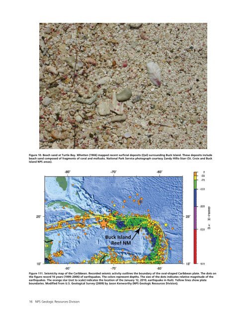
Figure 10. Beach sand at Turtle Bay. Whetten (1966) mapped recent surficial deposits (Qal) surrounding <strong>Buck</strong> <strong>Island</strong>. These deposits include<br />
beach sand composed of fragments of coral and mollusks. <strong>National</strong> Park Service photograph courtesy Zandy Hillis-Starr (St. Croix and <strong>Buck</strong><br />
<strong>Island</strong> NPS areas).<br />
Figure 111. Seismicity map of the Caribbean. Recorded seismic activity outlines the boundary of the oval-shaped Caribbean plate. The dots on<br />
the figure record 16 years (1999–2006) of earthquakes. The colors represent depths. The size of the dots indicates relative magnitude of the<br />
earthquakes. The orange star (not to scale) indicates the location of the January 12, 2010, earthquake in Haiti. Yellow lines show plate<br />
boundaries. Modified from U.S. <strong>Geologic</strong>al Survey (2009) by Jason Kenworthy (NPS <strong>Geologic</strong> <strong>Resources</strong> Division).<br />
16 NPS <strong>Geologic</strong> <strong>Resources</strong> Division