Lower Baraboo River - Wisconsin Department of Natural Resources
Lower Baraboo River - Wisconsin Department of Natural Resources
Lower Baraboo River - Wisconsin Department of Natural Resources

Create successful ePaper yourself
Turn your PDF publications into a flip-book with our unique Google optimized e-Paper software.
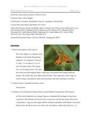
In addition to these special communities, the watershed is also home for a variety <strong>of</strong> rare plant<br />
and animal species including; 10 species <strong>of</strong> birds, 7 species <strong>of</strong> butterflies, 5 species <strong>of</strong><br />
dragonflies, 7 species <strong>of</strong> fish, 2 species <strong>of</strong> mayflies, 6 species <strong>of</strong> mussels, 42 plant species, 2<br />
species <strong>of</strong> snakes, 1 species <strong>of</strong> turtle, 4 species <strong>of</strong> mammals, 1 species <strong>of</strong> lizard and 1 species<br />
<strong>of</strong> snail. These plants and animals are also listed on the state’s <strong>Natural</strong> Heritage Inventory<br />
(NHI).<br />
The 5,043-acre Pine Island Wildlife Area is in the watershed and <strong>of</strong>fers opportunities for<br />
canoeing and boating on the <strong>Wisconsin</strong> <strong>River</strong> in addition to dog training, hiking, and fishing.<br />
Devil’s Lake State Park is also in the watershed.<br />
RIVERS AND STREAMS IN THE WATERSHED<br />
<strong>Baraboo</strong> <strong>River</strong><br />
The <strong>Baraboo</strong> <strong>River</strong> is a warm water sport fishery and canoe trail that is tributary to the<br />
<strong>Wisconsin</strong> <strong>River</strong>. The <strong>Baraboo</strong> <strong>River</strong> has historically had up to seven dams at one time along<br />
its entire length. Most <strong>of</strong> these dams were built to generate water power, although in the past<br />
years, they have been maintained mostly for recreational purposes. As a result <strong>of</strong> the habitat<br />
fragmentation and other problems caused by the dams on the river, the two miles <strong>of</strong> the river<br />
that flows through the City <strong>of</strong> <strong>Baraboo</strong> has been listed on the state’s list <strong>of</strong> impaired water.<br />
In the past few years, there has been a strong movement to remove these dams from the river<br />
and once again open the channel up for free migration by fish, open navigation for<br />
recreational purposes, and re-establishment <strong>of</strong> the free-flowing river. The City <strong>of</strong> <strong>Baraboo</strong> in<br />
the <strong>Lower</strong> <strong>Baraboo</strong> <strong>River</strong> Watershed was the home <strong>of</strong> three <strong>of</strong> these dams. All three dams<br />
have now been removed. Prior to the removal <strong>of</strong> the third dam in October 2001, the removal<br />
<strong>of</strong> the other two opened up 5 miles <strong>of</strong> rock riffles, which had a three-fold effect:<br />
1. Increased spawning area for walleye, sturgeon, suckers (and paddlefish if they can get<br />
around Prairie du Sac dam);<br />
2. Creation <strong>of</strong> a “food factory” for the fish on the rock riffle area;<br />
3. Opening up <strong>of</strong> natural, seasonal movement throughout the <strong>Baraboo</strong> <strong>River</strong> system.<br />
It is the hope <strong>of</strong> all <strong>of</strong> the partners involved that even greater effects will be seen in the river<br />
as a result <strong>of</strong> the restoration <strong>of</strong> the river to its free-flowing condition. Monitoring will be<br />
conducted to determine the overall impact <strong>of</strong> the removal <strong>of</strong> the dams on the river. A rare<br />
aquatic species has been found in the river in past surveys. As a result <strong>of</strong> the dam removals,<br />
the process has begun to take this segment <strong>of</strong> the river <strong>of</strong>f <strong>of</strong> the list <strong>of</strong> impaired water list.<br />
The Citizens for Waterfront Revitalization have received a <strong>River</strong> Planning Grant to develop a<br />
cooperative strategic plan for the <strong>Baraboo</strong> Rapids area <strong>of</strong> the river. This area is from the<br />
Highway 12 bridge in West <strong>Baraboo</strong> to the Highway 113 bridge east <strong>of</strong> the city. The plan<br />
will address some <strong>of</strong> the watershed-wide issues that affect the river. There is a USGS gauging<br />
station near <strong>Baraboo</strong>.<br />
<strong>Lower</strong> <strong>Baraboo</strong> <strong>River</strong> Watershed (LW21) 328
![Nature program winter schedule [PDF] - Wisconsin DNR](https://img.yumpu.com/22471254/1/190x245/nature-program-winter-schedule-pdf-wisconsin-dnr.jpg?quality=85)
![City of Middleton [PDF] - Wisconsin Department of Natural Resources](https://img.yumpu.com/22300392/1/190x245/city-of-middleton-pdf-wisconsin-department-of-natural-resources.jpg?quality=85)
![Wetland Conservation Activities [PDF] - Wisconsin Department of ...](https://img.yumpu.com/21975633/1/190x245/wetland-conservation-activities-pdf-wisconsin-department-of-.jpg?quality=85)
![Baraboo River Region[PDF] - Wisconsin Department of Natural ...](https://img.yumpu.com/21975619/1/190x245/baraboo-river-regionpdf-wisconsin-department-of-natural-.jpg?quality=85)