Regional synthesis report - icrisat
Regional synthesis report - icrisat
Regional synthesis report - icrisat

You also want an ePaper? Increase the reach of your titles
YUMPU automatically turns print PDFs into web optimized ePapers that Google loves.
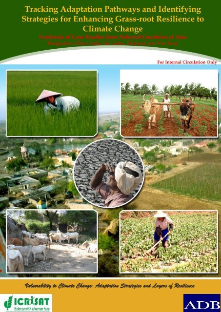
Tracking Adaptation Pathways and Identifying<br />
Strategies for Enhancing Grass-root Resilience to<br />
d<br />
Climate Change<br />
Synthesis of Case Studies from Selected Countries of Asia<br />
Bangladesh, China, India, Sri Lanka, Thailand, and Viet Nam<br />
For Internal Circulation Only<br />
Vulnerability to Climate Change: Adaptation Strategies and Layers of Resilience
REPORT<br />
Vulnerability to Climate Change: Adaptation Strategies and<br />
Layers of Resilience<br />
(RETA-6439)<br />
Tracking Adaptation Pathways and Identifying<br />
Strategies for Enhancing Grass-root Resilience to<br />
Climate Change<br />
Synthesis of Case Studies from Selected Countries of Asia<br />
(Bangladesh, China, India, Sri Lanka, Thailand and Viet Nam)<br />
Research Program on Markets, Institutions & Policies<br />
International Crops Research Institute for the Semi-Arid Tropics<br />
Patancheru 502 324, Andhra Pradesh, India<br />
June 2012<br />
Guizhou Academy<br />
of Agricultural<br />
Sciences (GZAAS)<br />
CHINA
Naveen P Singh<br />
Cynthia Bantilan<br />
Byjesh Kattarkandi<br />
MVR Murty
Country Project Team<br />
Country Team Co-ordinating Institute Project Members<br />
Bangladesh Centre for Policy Dialogue (CPD) Uttam Kumar Deb<br />
A K M Nazrul Islam<br />
Muhammad Al Amin<br />
Ashiqun Nabi<br />
Peoples’ Republic<br />
of China<br />
India<br />
Sri lanka<br />
Thailand<br />
Viet Nam - IAE<br />
Guizhou Academy of Agricultural<br />
Sciences (GZAAS)<br />
International Crop Research Institute<br />
for Semi- Arid Tropics (ICRISAT)<br />
Sri Lanka Council of Agricultural<br />
Research Policy (SCARP)<br />
Field Crop Research Institute (FCRI),<br />
Department of Agriculture<br />
Institute of Agriculture and<br />
Environment (IAE)<br />
Yin Dixin<br />
Cui Wei<br />
Tang Huabin<br />
Cynthia Bantilan<br />
Naveen P Singh<br />
B Venkateswarulu<br />
GGSN Rao<br />
VUM Rao<br />
Byjesh Kattarkandi<br />
MVR Murty<br />
Rupsha Banerjee<br />
M. Manikandan<br />
Frank Niranjan<br />
Wijaya Jayatilaka<br />
Pornparn Suddhiyam<br />
Nareeluck Wannasai<br />
Walaiporn Sasiprapa<br />
Chutima Koshawatana<br />
Praphan Prasertsak<br />
Benjamas Kumsueb<br />
Ratchada Pratcharoenwanich<br />
Dararat Maneechan<br />
Margaret C Yoovatana<br />
Kritsana Taveesakvichitchai<br />
Chanaporn Khumvong<br />
Pham Quang Ha<br />
Tran Van The<br />
Dang Thu Hien<br />
Nguyen Thi Hue<br />
Mai Van Trinh<br />
Li Chonghui<br />
Luo Hongjun
Table of Contents<br />
Acknowledgements ..................................................................................................... i<br />
Executive Summary .................................................................................................. iii<br />
List of Abbreviations .............................................................................................. xix<br />
Glossary ..................................................................................................................... xxi<br />
Introduction ................................................................................................................. 1<br />
Climate change and variability – Asian perspective ................................................... 3<br />
Climate change - Riding through poverty and food security .................................... 4<br />
Background of the project ......................................................................................... 6<br />
Objectives ............................................................................................................................ 7<br />
Formalizing concepts…………………………………………………………………….9<br />
Study approach and Methodology ............................................................................... 17<br />
Data sources and analysis............................................................................................... 19<br />
Quantitative assesment ................................................................................................... 21<br />
Prioritizing the target regions ........................................................................................ 23<br />
Qualitative Assessments................................................................................................. 26<br />
Analyzing economic impacts ......................................................................................... 29<br />
Future impacts of climate change on crop yield ........................................................ 30<br />
Project findings: Salient features .......................................................................... 31<br />
Synthesis of Climatic trends .................................................................................... 31<br />
Climate change projection – From bad to worse ........................................................ 50<br />
Need for micro level information/context ................................................................... 53<br />
Targeting climate change vulnerable regions ..................................................... 56<br />
Asia’s vulnerability to climate change ......................................................................... 56<br />
Assesing vulnerability in a developmental context .................................................. 56<br />
Farmer’s perception on Agriculture and climate variability............................ 66<br />
General characteristics of the study domains ............................................................. 69<br />
Dynamic changes in cropping patterns at micro level ............................................. 81<br />
Livestock developments in the study domains .......................................................... 92<br />
Historical evolution and current status of Input Markets ....................................... 97<br />
Development of output markets at micro level ....................................................... 101<br />
Dynamics of occupational portfolios in the villages .............................................. 107<br />
Farm income-Tracking diversification at micro level ............................................. 113<br />
Land management practices-what farmers are doing at micro level…………....121<br />
Farmer’s perception of climate variability ................................................................ 128<br />
Dynamics of Sources and availability of water for irrigation ............................... 136<br />
Sociological Perspectives .............................................................................................. 143<br />
Do the farmers perceive climate change or variability? ........................................ 143<br />
Constraints to adaptation and vulnerability ........................................................... 144<br />
Adaptive capacity and behaviour ............................................................................ 147<br />
Predicting future crop needs – results from simulation studies ................... 152<br />
Indian context .............................................................................................................. 152<br />
Viet Nam context......................................................................................................... 155<br />
Analyzing economic impact of climate change – Farm revenue ................... 156<br />
Adaptation measures - How the farmers are practicing at micro level ........ 160<br />
Constraints to adaptation as perceived by the farmers ................................... 172
Opportunities for mainstreaming adaptation and enhancing resiliency for<br />
Climate Change …………………………………………………………………..177<br />
Road map for action and way forward towards climate resilient agriculture<br />
in Asia…………………………………………………………..………………….181<br />
Summary and Conclusions………………………………………….…………..192<br />
References ................................................................................................................ 196<br />
Annexure .................................................................................................................. 205
List of Tables<br />
Table 1. Summary comparisonof people under stress globally and in Asia .................. 3<br />
Table 2. Developmental status of the study countries ....................................................... 4<br />
Table 3. Employment trend in agriculture as share of total employment, by region ... 5<br />
Table 4. Matrix of climate resilient levels of actions – the ideal, actual and desired<br />
actions ..................................................................................................................................... 12<br />
Table 5. Summary of Methodology .................................................................................... 17<br />
Table 6. Study countries, villages and number of households sampled……………...20<br />
Table 7. Data source and reference period from the study country .............................. 22<br />
Table 8. Indicators used to compute vulnerability to climate change ........................... 28<br />
Table 9. Trends in general climatic characteristics of selected countried in Asia<br />
(Country level) ........................................................................................................... 34<br />
Table 9(a-g). Climatic trends in selected study locations ................. 37, 40, 42, 45, 47, 49<br />
Table 10. Climate change projections for Asia (Project partner countries)* ................. 51<br />
Table 11. Socio-economic and natural resource indicators of the selected countries.. 57<br />
Table 12. Climate change vulnerability of selected study of Asia – A <strong>synthesis</strong> ......... 60<br />
Table 13. List of study villages in South, Southeast Asia and China............................. 68<br />
Table 13 (a-f). General characteristics of study villages in project partner<br />
countries…………….. .......................................................... 71,73, 75, 77, 78, and 80<br />
Table 14 (a-e).Cropping pattern trends and farmers perceptions in selected study<br />
locations ..................................................................................... 82, 85, 88, 89, and 90<br />
Table15(a-d).Farmers perception on dynamics of Livestock in Sri Lanka, Thailand,<br />
Viet Nam, and China…………………………......................................……94 and<br />
95<br />
Table 16(a-c). Dynamics of input markets in the project partner<br />
countries…………………………………………………………..….…98,99,and 100<br />
Table 17(a-c). Dynamics output markets in the project partner countries<br />
.......................................................................................................... .103, 104, and 106<br />
Table 18(a-e). Dynamics of occupation in the project partner countries<br />
............................................................................................ …107,108,110,111 and 112<br />
Table 19(a-e). Dynamics of sources of Income of farmers in the project partner<br />
countries ...................................................................... ….114, 115, 117, 119, and 120<br />
Table 20(a-c). Farmer’s perception on land management practices in the project<br />
partner countries ........................................................................ .…..122,125 and 127<br />
Table 21 (a-e). Farmer’s perception of climate variability in the project partner<br />
countries…... ...................................................................... 129, 130, 133, 134,and135<br />
Table 22(a-e). Farmer’s perception on sources of water availability in the selected<br />
countries under study……………………………….………..139,140,141, and 142<br />
Table 23.Recovery period of Various Groups w.r.t Climate Shock/Bad Year ........... 151<br />
Table 24. Impact of future changes in temperature (T), rainfall R and carbon dioxide<br />
(CO2) on the yield ................................................................................................................ 154<br />
Table 25. Predicted impact of climate change on crop productivity in Viet Nam .... 155<br />
Table 26.District wise impact of climate variables on the net revenue per ha for rice<br />
................................................................................................................................................ 156
Table 27. Marginal impact of climate variables on the net revenue from major crops<br />
in the districts of Andhra Pradesh in India .................................................................... 157<br />
Table 28. Marginal impact of climate variables on the net revenue of crops, rice and<br />
cassava in North East region of Thailand , year 2001-2008 ........................................... 159<br />
Table 29. Summarized information on adaptation strategies or initiatives adopted at<br />
different levels among the partner countries ................................................................. 162<br />
Table 30. Barriers to adaptation and reasons in Thailand ............................................. 174<br />
Table 31. Micro level constraints to adaptation in Viet Nam ....................................... 175<br />
Table 32. National initiative on climate change resilience ............................................ 182
List of Figures<br />
Figure 1. Conceptual framework for addressing climate change agenda. ..................... 8<br />
Figure 2. Framework explaining the influence on adaptive capacity to Climate<br />
Change at micro level (village). ............................................................................................ 9<br />
Figure 3. Levels of actions sketched out that have bearings on farmers’ potential to<br />
cope against the effects of climate changes. a) Levels of influence b) Levels of optimal<br />
actions. .................................................................................................................................... 11<br />
Figure 4. Divergence in the observed climate from macro to micro level in India. .... 54<br />
Figure 5. Divergence in the observed climate from macro to micro level in Thailand.<br />
.................................................................................................................................................. 55<br />
Figure 6. Trends in the number of districts of Andhra Pradesh and Maharashtra state<br />
falling under different vulnerability categories................................................................ 59<br />
Figure 7. <strong>Regional</strong> vulnerability to climate change in Sri Lanka (2007) ........................ 61<br />
Figure 8. <strong>Regional</strong> vulnerability to climate change in Bangladesh (2006) .................... 62<br />
Figure 9. <strong>Regional</strong> vulnerability to climate change in Thailand (2006)......................... 63<br />
Figure 10. Viet Nam’s region-wise vulnerability to climate change ............................. 64<br />
Figure 11. Location of study villages in South Asia, Southeast Asia and China ......... 67<br />
Figure 12. A framework for synthesizing adaptation strategies at ground level and<br />
enabling conditions ............................................................................................................. 160<br />
Boxes<br />
Box 1. Climate change impacts and adaptation ………………………………………….1<br />
Box 2. Linkages of vulnerability to climate change and poverty……………………….5<br />
Box 3: Responses from different classes of Indian SAT farmers…………………..…147<br />
Box 4: Adaptation constraints experienced by Indian SAT farmer…….…...…….…172
I. Acknowledgements<br />
This <strong>synthesis</strong> <strong>report</strong> is a key output of the project on “Vulnerability to Climate<br />
Change: Adaptation Strategies and Layers of Resilience”, supported by the Asian<br />
Development Bank (ADB) through RETA-6439 and coordinated by the Research<br />
Program on Market, Institution and Policy (RP-MIP) of the International Crop<br />
Research Institute for the Semi-Arid Tropics (ICRISAT). We are indebted to William<br />
Dar, Director General and other scientific, technical and administrative staff of the<br />
institute for their help and cooperation at each and every stage of project execution.<br />
We are thankful for the relentless support from our project partners: Central<br />
Research Institute for Dryland Agriculture (CRIDA), India, Indian Council for<br />
Agricultural Research (ICAR); Sri Lanka Council for Agricultural Research Policy<br />
(CARP); Centre for Policy dialogue (CPD), Bangladesh; Department of Agriculture<br />
(DOA), Thailand; Institute of Agriculture and Environment (IAE), Viet Nam; and<br />
Guizhou Academy of Agricultural Sciences (GAAS), China. The work has benefited<br />
from the active support of project teams from Bangladesh, China, India, Sri Lanka,<br />
Thailand and Viet Nam.<br />
We are also thankful to N.S. Jodha (ICIMOD, Nepal); K Palaniswami (IWMI, India);<br />
R. Mendhelson (Yale University, USA); GGSN Rao (CRIDA, ICAR); Mruthunjaya<br />
(NCAP, ICAR), Wijaya Jayatilaka (University of Peradeniya, Sri Lanka), KL<br />
Saharawat (ICRISAT, India), SVRK Prabhakar (IGES, Japan), Geetha Mohan<br />
(University of Tokyo, Japan) and others whom reviewed this manuscript and gave<br />
critical comments helped in improving this manuscript.<br />
We acknowledge and thank ADB and the supervisory team headed by Takashi<br />
Matsuao, Director; and Cindy Malvicini of Environment, Natural Resources and<br />
Agriculture Division, South Asia Department, for their continuous support and<br />
guidance.<br />
i
II. Executive Summary<br />
The recent 4th Assessment of the International Panel on Climate Change (IPCC)<br />
provides the latest revelations on the science, impacts, and potential measures to<br />
address climate change. Nevertheless, the state of knowledge that is available at the<br />
global level is far from comprehensive. Whereas there has been high focus on<br />
continental understanding, the same cannot be said at regional and sub-regional<br />
levels (INCAA 2010). The early action plans in response to growing awareness on<br />
the challenges of climate change, the governments worldwide, including those from<br />
developing countries, have strengthened confidence, capacity, knowledge, and<br />
experience to focus on agricultural production systems that are resilient to climate<br />
risks.<br />
Motivated by growing interests and building on available knowledge, the<br />
International Crops Research Institute for the Semi-Arid Tropics (ICRISAT) together<br />
with six countries in Asia undertook the challenge to “know in order to act” and<br />
implemented the project entitled “Vulnerability to Climate Change: Adaptation<br />
Strategies and Layers of Resilience “.<br />
Funded by the Asian Development Bank (ADB), this study is a comprehensive effort<br />
to analyze the vulnerability and adaptation strategies by farmers in the marginal<br />
regions of Asia in the context of a changing climate or increasing climate associated<br />
variability and risk. We hope the results will provide a basis for further suggestions<br />
on strategies and policies to reduce risk and vulnerability, build and strengthen<br />
adaptive capacity, to provide options for farmers to be able to cope better with the<br />
future climate change.<br />
This study focuses on the most vulnerable farmers in the semi-arid regions of Asia.<br />
Six countries participated and their major collaborating Institutes are as follows:<br />
Bangladesh<br />
China<br />
India<br />
Sri Lanka<br />
Thailand<br />
Viet Nam<br />
Center for Policy Dialogue (CPD)<br />
Guizhou Academy of Agricultural Sciences (GAAS)<br />
Central Research Institute for Dryland Agriculture (CRIDA)<br />
Council for Agricultural Research Policy (CARP)<br />
Chiangmai Field Crops Research Centre (CFCRC)<br />
Viet Nam Academy of Agricultural Sciences (VAAS)<br />
This <strong>report</strong> draws attention on four major components central to the agenda of<br />
climate change. The study is designed to realize four key outputs based on key<br />
research questions:<br />
1. In the context of climate change, based on a <strong>synthesis</strong> of knowledge derived from<br />
primary data analysis, ascertaining trends and variability that may affect crop<br />
productivity and hence livelihood: What is/are consistent across the study/target<br />
countries, and what is specific to each country based on a systematic investigation of<br />
the degree of climate change vulnerability?<br />
iii
2. The second component entails linking changes in climate and climate variability to<br />
crop yields, cropping pattern, income, and employment. Thus, enables the<br />
development of a coherent picture on the impact of climate change on livelihood.<br />
3. Third component attempts to verify validity of farmer’s experiential knowledge<br />
and perception against scientific knowhow based on climate-data analysis. To<br />
ascertain whether perception relating to climate change match reality; the<br />
perceptions of climate change and rainfall pattern are compared with actual data.<br />
4. The last component focuses on how household indigenous knowledge help<br />
communities to adapt and cope. Does perception on climate change translate to<br />
behavioral change or adaptive measures at the micro-level across the study<br />
countries? It combines and links the traditional, local, and indigenous knowledge on<br />
climate change with scientific knowledge on climate change.<br />
5. Based on the above, provide policy options to help government ensure that<br />
farmers’ are able to cope with the deleterious effects of climate change.<br />
This <strong>synthesis</strong> <strong>report</strong> summarizes key findings of the project. It systematically<br />
presents answers to the following queries:<br />
• Do we have coherent messages on trends from long-term time-series data on<br />
climate parameters, eg. Precipitation and minimum & maximum temperatures?<br />
• Do we see shifts in cropping patterns (annual/perennial, geographical)? If<br />
shifts exist, are they driven by: (i) market opportunities, (ii) changing consumer<br />
patterns, or (iii) biophysical elements or changes in climate?<br />
• Does crop and system diversification (especially dairy) seem to be a common<br />
resilience strategy?<br />
• Is off-farm income increasing in importance?<br />
• On livestock mix (including poultry): Does this reflect the changes in the need<br />
for traction power, demand for small/large ruminants, livestock mix (including<br />
poultry) increasing demand for chicken meat/eggs, or all of the above?<br />
• What is the importance of community collective action and kinship?<br />
• Is there market access for inputs and outputs?<br />
The grass root level elicitation of farmer’s perceptions at the micro level was<br />
undertaken in 22 villages/communes from marginal semi-arid environments in the<br />
six countries during 2009-2010. The summarized details of the <strong>report</strong> are presented<br />
in broad sections as follows:<br />
Climatic characteristics and Vulnerability to Climate Change<br />
As an initial step to understand climatic trends, long-term data sets were analyzed at<br />
various levels (country/regional/district) to ascertain the prevailing trends in these<br />
countries. The country-level analysis showed that the annual average temperature is<br />
rising significantly in all countries. Even though a majority of countries have not<br />
experienced substantial long-term trends (positive or negative) in rainfall, the<br />
variability in rainfall and occurrence of extreme events has increased in the recent<br />
iv
years. <strong>Regional</strong>-level analysis also followed a similar trend in temperature and<br />
rainfall. However, an exception is seen with a decreasing trend in rainfall and rainy<br />
days in the drought and flood-prone areas of Bangladesh, and Guizhou province of<br />
China. In India, the annual rainfall increased significantly in Andhra Pradesh and no<br />
significant trend was found in Maharashtra. Analysis at an even more disaggregated<br />
(district) level demonstrated some differences from aggregated level. In the districts,<br />
rising trends in temperature and increasing rainfall variability, i.e., change in onset<br />
of monsoon, intra-seasonal droughts, flood occurrence, high rainfall events, and<br />
higher probability of drought occurrence etc., are the main features.<br />
In Bangladesh, rainy days showed a decreasing trend in drought-prone regions and<br />
an increasing trend in flood-prone regions and in Viet Nam, rainfall increased<br />
significantly in Ninh Phuoc district over the years. In general, floods in Bangladesh<br />
and Thailand, droughts in India, Sri Lanka, and China and sea water intrusion in<br />
Viet Nam are some of the distinct climate-related issues of these countries.<br />
This project seeks to identify regions vulnerable to climate change in these targeted<br />
countries of South, Southeast Asia, and China. A comprehensive review of future<br />
climatic projections for these countries signaled that impact could be severe in the<br />
years to come. In most of these countries, annual rainfall is projected to increase in<br />
future; however, its distribution is not clear. Along with rainfall, temperature will<br />
rise significantly in the future and successive rise in sea levels threaten countries<br />
having long coastlines.<br />
Assessing climate change vulnerability in agriculture is essential in identifying<br />
regions most exposed to its impacts and targets such regions for building resilience<br />
against impacts of climate change. To characterize regions based on vulnerability to<br />
climate change, a detailed vulnerability analysis was carried out in these target<br />
countries. A set of agro-socio-economic indicators were used to classify regions<br />
based on their extent of vulnerability. Vulnerability analysis showed that the<br />
majority of districts in the Indian semi-arid tropical regions, southern districts of Sri<br />
Lanka (Seo et al. 2005), major flood- and drought-prone regions of Bangladesh,<br />
northeastern region of Thailand, majority of the districts of Viet Nam including the<br />
Mekong river delta (a major rice bowl) and arid and semi-arid northwestern region<br />
of China fall under the category of ‘vulnerable to highly-vulnerable’ to climate<br />
change. This analysis ascertains that all the semi-arid marginal regions of the South<br />
and Southeast Asian countries are highly vulnerable to climate change. There is also<br />
local variability within countries; hence there are areas in a country where risks of<br />
climate change are high, and low among others.<br />
Divergence in Macro and Micro- Level Information<br />
National climate-related policies and programs are often formulated using the<br />
aggregated/macro-level information, projections, modeled scenarios, etc. They<br />
seldom consider the micro-level context on response behaviour, existing situation,<br />
trends outlook, and coping capacity mainly due to lack of information.<br />
This study demonstrated as to how observed rainfall data varied at different levels<br />
(National→ State→District→Mandal/Tehsil→Village) in India and Thailand. A clear<br />
v
divergence of trend was distinctly visible and a huge disconnect between macro- and<br />
micro-level information on rainfall pattern was found. In most of the developing<br />
countries, absence of infrastructure for gathering information on micro-level context<br />
often limit the policy machinery to utilize macro-level information for formulating<br />
policies for micro-level impacts and thereby missing the targetted need based<br />
approach. This could only be overcome by acquiring micro/village-level information<br />
by institutionalizing an efficient mechanism for collecting, collating, and<br />
channelizing micro-level information especially related to weather/climate<br />
indicators so as policymakers can use them to formulate effective climate-related<br />
measures.<br />
Dynamic Changes in Cropping Patterns at Micro-level<br />
Across South and Southeast Asian countries, farmers are trying out new short<br />
duration varieties that are less water demanding. Farmers are also replacing water<br />
intensive crops with drought-tolerant cash crops to optimize their incomes as well as<br />
reduce their water needs. They are changing their crop calendar to adjust to the<br />
uncertainties of rainfall. These are the important common adaptations of farmers to<br />
address the increased variability and uncertainty in rainfall in the marginal rain-fed<br />
environments across the countries.<br />
Among the farmers in South Asian countries, those in rainfed regions of India have<br />
shifted from cereal cultivation to short-duration drought-tolerant or less water<br />
demanding crops such as soybean during the last four decades. In places where new<br />
irrigation potential has been created like canals in Shirapur, Maharashtra, sugarcane<br />
has replaced many other prevalent crops which increased incomes. Mixed cropping<br />
is being practiced in selected villages like Dokur and Kanzara in Andhra Pradesh as<br />
a measure to reduce the risk of income failure. Fodder crops such as maize, grasses,<br />
and fodder sorghum have gained importance of late as the dairy industry has started<br />
to grow in some villages like Aurepalle in Andhra Pradesh and Shirapur in<br />
Maharashtra.<br />
In Sri Lanka, cultivation of finger millets, black gram, and oil seeds have decreased<br />
in recent times, while fine cereals and vegetables are increasing. Cotton cultivation is<br />
decreasing in most of the villages. Cultivation of annual crops is being reduced in<br />
recent decades and farmers are shifting to perennial crops in rainfed villages like<br />
Mangalapura in Puttalam district. The shift to perennial crops in Mangalapura is<br />
mainly in response to increased uncertainty of rainfall as weatherproofing<br />
mechanisms like development of irrigation potential did not take place and farmers<br />
not being able to cope with crop losses. Hence, farmers perceived that perennial<br />
plants like cashew will fare better over time under these harsh rainfed environments.<br />
In Southeast Asian countries, rice is the main crop. In addition to rice, cassava is also<br />
grown as a main crop in Thailand both in upland and lowland villages. However, in<br />
recent times, the cultivated area of cassava is increasing at the expense of rice.<br />
vi
Farmers feel that even in the lowland and mid-lowlands villages, cassava provides a<br />
more stable yield where standing water does not accumulate. Traditional waterintensive<br />
crops like Kenaf/Roselle are slowly disappearing. In Viet Nam, hybrid<br />
maize is being replaced by inbred maize due to its low water requirements. In some<br />
communes, like Phuoc Nam in Ninh Thuan province, their rice-cultivated area has<br />
decreased drastically due to water unavailability. In coastal villages like in Phouc<br />
Dinh commune, farmers are switching to aquaculture due to saltwater intrusions. In<br />
the coastal areas where farmers perceived saltwater intrusions which altered soil<br />
properties, farmers shifted to aquaculture in their traditional rice lands over the last<br />
four decades. Boikunthapur district in Bangladesh and Phuoc Dinh commune in<br />
Ninh Thuan province in Viet Nam are examples of case areas on saltwater intrusion.<br />
The case of China’s southwest region, Guizhou province is different from other<br />
countries. The government is focusing on the development of irrigation<br />
infrastructure. The idea is to make agriculture climate proof by increasing irrigation<br />
potential. Farmers slowly replaced most of traditional crops such as cereals and<br />
oilseeds by vegetables and are now cultivating four vegetable crops a year in villages<br />
like Lucheba. By increasing crop intensity to 400%, farmers could amply increase<br />
profits.<br />
In the study domain, there have been significant changes in cropping pattern, crop<br />
and farm management, as well as enterprise diversification which was mostly driven<br />
by both price and non-price including changes in climate and dwindling irrigation<br />
potential, saltwater intrusion, and floods, among others. Adoption of improved<br />
varieties, short-duration cash crops, drought-tolerant crops, monoculture, and<br />
shifting method of rice cultivation are some of the major strategies adopted by the<br />
smallholder farmers.<br />
Livestock Developments as an Integral Part of Livelihood in the Study Domains<br />
Across the countries, farmers perceived increased mechanization of farm operations<br />
with time. This development saw a reduction in the number of bullocks and other<br />
farm animals involved in farm operations. One of the downsides is the reduction in<br />
the availability of organic manures for soil incorporation. In South Asia, i.e., India<br />
livestock is also an option for income diversification through milk production. The<br />
same is true for farmers in selected villages in Sri Lanka and India, which have<br />
diversified income from livestock rearing with milk production business. These<br />
villages have developed milk collection centers, and are on the path of<br />
commercializing their dairy outputs. Only one village in Sri Lanka where farmers<br />
involved in livestock rearing have decreased as early as from the seventies due to the<br />
lack of breeding improvement strategies. The decrease in livestock numbers in<br />
villages in recent times is attributed to decreased grazing land and poor maintenance<br />
of existing ones.<br />
In Southeast Asia, farmers in Thailand raise livestock for personal consumption and<br />
as insurance in the event of distress sale. In Viet Nam, cows and buffaloes are<br />
popular in villages; farmers rear them as an income source.<br />
vii
In China’s Guizhou province, cows and buffaloes are reared in villages like Lucheba<br />
and Dajiang for commercial purposes. Buffaloes are used for farm operations like<br />
tillage, etc. Farmers <strong>report</strong>ed perceived that buffalo numbers decreased in recent<br />
times mainly due to increased mechanization and introduction of mini-tractors and<br />
tillers. Farmers perceived that the number of goats increased in the mountainous<br />
areas like Dajiang village, thereby increasing the income of the farmers.<br />
Livestock rearing and earnings from livestock appeared to be an important<br />
cushioning occupation to supplement farmers’ income apart from crops. However,<br />
in Sri Lanka, the importance of livestock has decreased, possibly due to the lack of<br />
improved breeds and depleted natural resources, viz., grazing lands and water<br />
availability.<br />
Historical Evolution and Current Status of Input and Output Markets<br />
In South Asia during the seventies, input markets were still undeveloped at the<br />
village levels; farmers had to travel several kilometers to buy seed, fertilizers, and<br />
pesticides. Input markets and access to input markets in most of the villages in India<br />
only developed in recent times and most of the inputs are now available in most<br />
villages, except in a few, like Dokur and Kinkheda. In Sri Lanka, most of the input<br />
markets are still undeveloped in villages even now. Farmers have to travel a<br />
minimum of 10 kms to buy inputs. In Thailand, seeds and fertilizers are available in<br />
certain villages which experienced some level of development.<br />
Output markets to sell agricultural commodities like food grains, oilseeds, pulses,<br />
cotton and other crops, dairy, and livestock are not well-developed in India.<br />
Eventhough, there has been some improvement in the last several decades, farmers<br />
still have to transport their outputs to nearby markets some 10 to 32 kms away, on<br />
their own. These markets act as a cushion at times of stress in terms of access and<br />
availability. Similar situations were observed in Sri Lanka, Thailand, and Viet Nam.<br />
Farm Income-Tracking Diversification at Micro-level<br />
Farmers across South and Southeast Asian countries and China are diversifying their<br />
incomes within agriculture sector by expanding non-farm enterprise and other<br />
income sources. This diversification is mainly dictated by available opportunities,<br />
and by infrastructural and governance environments. Among South Asian countries,<br />
Indian farmers are keener in diversifying their income sources to reduce risk of<br />
income loss due to variability and uncertainty in rainfall and associated increased<br />
dry spells. Share of agricultural income to total income ranged from 57% to just 13%<br />
across the villages. Income from farm work varies between 3-16%; businesses from<br />
10-19%; livestock from 4-10% of total income. Out-migration and caste occupations<br />
are also income sources, albeit insignificant. In Bangladesh, mostly rice and<br />
aquaculture predominated in the region but lately with support from government<br />
they have started growing high value crops such as betel leaf, mango, litchi, etc. Sri<br />
Lankan farmers too have diversified sources of income but their major source of<br />
income is still agriculture, dairy and poultry, and non-farm sources. In Thailand,<br />
viii
depending on the water availability, farmers are growing water intensive crop i.e.<br />
roselle and comparatively less crop demanding crops viz., maize, cassava, sugarcane<br />
etc.<br />
In Viet Nam, farmer’s income from livestock is highest, between 26-60%, followed by<br />
crop production (10-23%) and salaried services and non-farm sectors (17-63%).<br />
Farmers in China have also diversified their income to cover the risks in agricultural<br />
production; share of income from crop production ranges from 52-54%; income from<br />
livestock 17-36% followed by non-farm income (9-31%). There is a marked shift<br />
towards non-farm source of income in all the study locations. Though non-farm<br />
income provides succor during crop failures, large-scale shift in acreage under<br />
staples will have consequential bearing on stabilizing prices of produce and hence<br />
on food security.<br />
Farmer’s Perception of Climate Variability<br />
Farmer’s perception of climate variability echoed many similar observations in all<br />
case study countries. Across all selected villages, farmers perceived that there was a<br />
decrease in annual rainfall and its distribution was erratic with evidence in decrease<br />
in number of rainy days. Farmers, except those from Sri Lanka, perceived a delay in<br />
the arrival of monsoon and an increase in the annual temperature. Sri Lankan<br />
farmers perceived an early arrival of Southwest and Northeast monsoons and also<br />
an increase in dry spells in both Yala and Maha agricultural seasons. In general,<br />
farmers’ perception about the variability was nearer to actual observations in recent<br />
times. They were able to recall their latest observations in the last two decades<br />
correctly. Rainfall has been highly variable across the years but district-level rainfall<br />
data does not reveal any decreasing trend of annual rainfall. In India, the actual<br />
mandal level-data representing the study villages like Dokur showed that there was<br />
a delay in the arrival of monsoon in the last two decades by about 10 days. Similarly<br />
there was a slight decrease in the number of rainy days. The actual temperature<br />
increased over time. These findings mostly concur with farmers’ perceptions. In<br />
Guizhou province of China, the actual annual rainfall increased by 2% in recent<br />
times and farmers also perceived an increase in the rainfall, but due to erraticness of<br />
the rainfall, the regions remains largely vulnerable. This study throws light on the<br />
fact that there is a need for rainfall data collection and its availability at village-level<br />
for micro-level planning. Hence, it was evident that there is congruence in the<br />
farmer’s perception about climatic indicators and professionals’ inferences through<br />
in depth analysis. Through these “schools of learning”, which are often touted as<br />
naïve and traditional, need-based adaptation strategies can be promoted and<br />
validated.<br />
Land Management Practices—what farmers are doing at micro-level?<br />
Land management measures using organic matter like green manuring and<br />
composting practice of incorporating crop residues into the soil decreased, while<br />
field bunding to conserve rainwater and creating drainage channels is followed to<br />
ix
varying degrees across villages in India and Sri Lanka. However in Thailand,<br />
mulching (not practiced much in India), green manuring, composting, and<br />
incorporating crop residues are popular in the upland villages, as seen in Tha Taeng<br />
and Nong Muang villages, where over 50% of farmers practice them. These practices<br />
are not popular with lowland farmers. The reason for incorporation of organic<br />
sources in upland soils in Thailand is due to government interventions in terms of<br />
imparting provision of training in organic agriculture to improve soil fertility and<br />
water holding capacity in these villages. Adoption of improved land management is<br />
a must for long-term sustainability; concerted efforts through different institutional<br />
innovations should be pursued in adopting these locally proven practices<br />
Dynamics of Sources and Availability of Water for Irrigation<br />
Water for irrigation is the single most important factor that will neutralize the risk of<br />
variability and uncertainty of rainfall. In the seventies, farmers across the villages in<br />
semi-arid regions of India were dependent on tanks and open wells for irrigation.<br />
During the nineties, selected villages (Kanzara, Shirapur, and Kinked) got<br />
infrastructure in terms of canals and surface water for cultivation to insulate crop<br />
production from uncertainty of rainfall. Similarly, tube wells were installed in the<br />
nineties, and significantly increased in recent decades, thereby exploiting<br />
groundwater. Farmers are aware that in these marginal environments, development<br />
of irrigation sources is the key driver of change. One adverse result of this<br />
development is that most of the open dug wells started drying up due to lowering of<br />
the ground water table. Many of the tanks also dried up due to reduced runoff from<br />
the catchments. Among the selected Indian villages for the study in the 1900’s; water<br />
resources development through government interventions in the form of incentives<br />
and investments in infrastructure took place. In Sri Lanka, most of the selected<br />
villages are rainfed, and very less area is irrigated and a few open wells and tanks<br />
are the sources of irrigation. Partial supplementary irrigation is practiced during the<br />
post rainy season.<br />
In Southeast Asia, irrigation is mainly through surface water from rivers, canals, and<br />
ponds in lowland villages in Thailand. Besides these, groundwater sources like open<br />
wells and tube wells cater to irrigation needs to a limited extent. The condition of<br />
lowland villages in Thailand is similar to those in India. By contrast, in the upland<br />
villages, very little land is irrigated and the few open wells and pond are the only<br />
sources of irrigation. But unlike Indian villages, the development of groundwater<br />
resources in Thailand through investment by farmers is no longer tenable as<br />
groundwater table has gone down significantly. In Viet Nam, canal systems, wells,<br />
and tanks are common in the villages and more than 80% of the irrigation needs are<br />
met from the canal system and the rest from open wells and tanks. The dependence<br />
on the canal system has increased in recent times. In China, one of the villages in<br />
southern Guizhou (Dajiang) has met 50% of its irrigation needs from collected water<br />
in about 500 small tanks and the rest of the area is irrigated by a pipeline system and<br />
a reservoir built in 2009. By contrast, another village, namely Lucheba in central<br />
Guizhou irrigates only 5% of its cultivated area through tanks and 33% is irrigated<br />
x
y pumping water from a nearby river. Overall, it can be observed that of late,<br />
traditional sources of irrigation have weakened not only due to low water tables but<br />
also due to the side effects of other factors viz., market, policy, governance structure,<br />
and demographic changes in China. Hence, there is a need to strengthen indigenous<br />
knowledge and traditional mechanisms especially for conserving natural resource<br />
base.<br />
Predicting Future Crop Needs- Results from Simulation Studies.<br />
Since crop growth is a complex phenomenon involving complex interactions<br />
between crops, weather, and soil, it is imperative to understand the effects of these<br />
factors and agronomic management on crop growth and productivity. This will aid<br />
in the development of promising technologies of crops/cultivar suitable to future<br />
conditionalities. An attempt was made in order to understand crop growth and<br />
yields under future weather conditions using CMS CERES-Sorghum 1 and<br />
CROPGRO 2 -Groundnut simulation models and future weather scenarios predicted<br />
by the UKMO-HADCM3 GCM 3 model for the SRES A1B 4 scenario. This was<br />
undertaken for the study districts in the semi-arid region of India for the years 2030,<br />
2050, and 2080. The long-term simulations of several scenarios predicted that<br />
productivity of both kharif and rabi (post-rainy) sorghum will decrease due to<br />
shortened life cycle (crop duration) and decreased crop growth owing to increased<br />
water and temperature stress. Progressive increase in climate change will decrease<br />
the crop duration of kharif sorghum by 11% in both studied locations (Akola<br />
(Maharashtra) and Mahabubnagar (Andhra Pradesh)) of India. Yield of sorghum is<br />
expected to decrease by 10-18% in 2080 under a scenario of increased temperature<br />
and rainfall, as well as elevated CO2; albeit some beneficial effects of elevated CO2<br />
are also foreseen. Productivity of groundnut is affected in the same way as that of<br />
sorghum, except that its crop duration may decrease or increase depending upon<br />
current temperatures of sites and future climate change. The traditional growing<br />
environments of groundnut in Anantapur district showed a potential yield reduction<br />
of 8%, 10%, and 13% in the years 2030, 2050, and 2080 when the combination of<br />
temperature and rainfall as well as increased CO2 are considered. For enhancing<br />
crop productivity in future climates, we need to develop sorghum and groundnut<br />
genotypes with a range in crop duration (short to long duration), and have highyield<br />
potential and tolerance to high temperature and drought stress. As different<br />
regions will be affected differently by climate change, the deployment of new<br />
genotypes will vary with target region. To cope with future climate changes, farmers<br />
must be provided with suitable cultivars developed with specific objectives and<br />
targeted towards specific locations. There are knowledge gaps on the physiological<br />
responses to extreme climatic parameters like high temperature on crops such as<br />
sorghum and maize (Porter and Semenov 2005), which limit the scope of the present<br />
1 Sorghum growth simulation modeling DSSAT (Decision Support System for Agro technology Transfer)<br />
2 Groundnut growth simulation model<br />
3 United Kingdom Meteorological Office – HADley Climate Model 3<br />
4 Special Report on Emission Scenario by the IPCC<br />
xi
simulation models. It was felt that there is a need to advance scientific<br />
understanding and generate long-term datasets in these areas.<br />
Climate Change Impacts on Net Farm Revenue – Indicative Economic Effects<br />
Economic impact analysis using Ricardian approach revealed the sensitive nature of<br />
climate on crop productivity. The marginal impact of climate on net income varied<br />
with location and crop. However, a rise in atmospheric temperature and reduction in<br />
rainfall during crop-growing season significantly affect productivity, thereby casting<br />
its shadow on revenue. In Andhra Pradesh, India, increase in temperature by 1°C<br />
during the main cropping season (southwest monsoon) is likely to reduce net<br />
income from rice crop by $US2.18/ha keeping the same level of technology and<br />
other management attributes; this has little effect on gross income after earnings<br />
from all crops are taken. These results corroborated other studies in Andhra Pradesh<br />
on rice. Over the years, there is a significant downward trend in rice cropped area in<br />
rainfed tract of this state; climate, especially date of onset of monsoon rainfall, is one<br />
of the major factors although reduction in rice acreage is also attributed to farm gate<br />
price instability in the last decade. Similar analysis from Thailand’s northeastern<br />
region also highlighted the negative impact of temperature rise during cropping<br />
season. In northeastern region of Thailand, an increase of 1°C will decrease net<br />
revenue by $US0.21-1.58/ha from major crops. Furthermore, it was observed that the<br />
1mm increase in rainfall enhances net revenue of crops, especially from rice and<br />
cassava by about $US 0.01- 0.1/ha which is significantly low. Similar exercise could<br />
not be undertaken in other countries due to paucity of data sets and inability of the<br />
research team to carry out the analysis in spite of the training etc.<br />
Adaptation Measures—How the farmers are practicing at micro-level?<br />
Adaptation to any change in the system is essential to sustain the productivity and<br />
profitability of farmers. Across South and Southeast Asian countries, farmers are<br />
shifting to short duration cultivars to cope with increased variability in rainfall and<br />
to adjust the crop calendars. Another common feature is the adoption of less water<br />
demanding cash crops to replace traditional coarse and fine cereals.<br />
Diversification of incomes is another strategy that the farmers are adapting across<br />
the countries to reduce their risk from rainfed crop production. There are other<br />
adaptation strategies that are specific to each country, and are governed by the<br />
contextual situations created by socio-economic environments as well as the<br />
government policies.<br />
Groundwater exploitation has rapidly increased in all Indian case villages in recent<br />
decades. Farmers perceive that on-demand water availability is the best way of<br />
adaptation as the risk associated with uncertainty of rainfall is neutralized by<br />
irrigation potential. Many farmers adapted improved seed varieties and shifted from<br />
cereal cultivation to less thirsty short-duration crops to short-duration cash crops<br />
mainly to reduce risk from uncertain rainfall and stabilize incomes. Mixed cropping<br />
xii
is practiced as an effective adaptation measure; this is an indigenous adaptation<br />
method most prevalent in rainfed areas with associated dry spells. This was elicited<br />
during farm-level investigation, particularly in villages such as Kinkheda and Dokur<br />
in India. This practice ensures some returns in the event of failure of monsoon or<br />
occurrence of drought.<br />
In Sri Lanka, farmers are shifting from annual crops to perennial drought-tolerant<br />
plantations like cashew, etc., particularly in rainfed villages where irrigation<br />
potential is not available to avoid the risk of crop failure. Farmers are also<br />
increasingly adopting short-duration and drought-tolerant varieties and hybrids,<br />
wherever available.<br />
Another important adaptation strategy is diversification of means of livelihood by<br />
marginal and small farmers. In Bangladesh, farmers are diversifying their incomes to<br />
reduce the risk associated with the vagaries of rainfall on agricultural production.<br />
Jute cultivation is being slowly replaced by pulses and vegetables to reduce water<br />
demand. Partial shifting from cultivation of cereals and oilseeds to short-duration or<br />
perennial cash crops like betel leaf is another adaptation strategy. In the flood-prone<br />
areas of Bangladesh, farmers are shifting from traditional rice growing to<br />
aquaculture activities to reduce risk and improve incomes. Better access to microfinance<br />
is also seen as an adaptation measure by farmers. Strengthening and<br />
maintaining kinship ties for aid in difficult times, is another adaptation strategy that<br />
farmers perceive as important.<br />
Among Southeast Asian countries, farmers in Thailand are diversifying their<br />
incomes to include sources from non-farm sector. They are shifting to less water<br />
demanding crops like cassava or short-duration crops like maize. They are changing<br />
crop management practices, like shifting from rice transplanting to broadcasting<br />
method, to reduce water demand. In lowland villages, delayed planting of rice to<br />
synchronize the delay in monsoon is becoming common. Replacing rice by cassava<br />
in marginal lowlands is seen as another adaptation strategy. Obtaining loans for<br />
investment to develop irrigation potential is followed by both small and large<br />
farmers alike. Soil improvement using organic matter and crop residues, is practiced<br />
by farmers in upland villages, which was introduced by the government to enable<br />
farmers to improve soil fertility and increase soil moisture retention. Increasing crop<br />
intensity to improve farm incomes is another measure practiced by resource-rich<br />
farmers. Upland farmers are shifting from growing Kenaf (Hibiscus cannabinus) to<br />
less water-intensive crops like cassava. Digging and deepening of wells for irrigation<br />
is another adaptation measure for conserving water.<br />
In Viet Nam, shift to less water demanding crops and investment in cash crops and<br />
increasing irrigation potential by large farmers and working as farm laborers to<br />
supplement the farm income (specially marginal and small farmers) are some of the<br />
adaptation measures followed by the farmers. Farmers in the coastal regions are<br />
shifting from crop cultivation to aquaculture. They are also diversifying into parttime<br />
business and salaried services to supplement income and reduce risk in<br />
xiii
agriculture; they also develop new water sources or improve existing ones for<br />
supplementary irrigation.<br />
In China, villagers are practicing unique adaptation measures. In a way, the<br />
government is shaping up these measures which include protection and increase in<br />
forest cover around the villages, saving power, developing several alternate<br />
renewable power sources, and enhancing infrastructure development. Construction<br />
of small water tanks and changing cropping system by increasing cropping intensity<br />
are some of the adaptation measures that the farmers are also practicing in China.<br />
The key findings on grassroots perspectives emanating from gender-based social<br />
analysis revealed that women faced particular constraints in their capacity to adapt<br />
to existing and predicted impacts of climate change. Yet many women are already<br />
adapting to the changing climate and are clear about their needs and priorities.<br />
Focus group meetings and participatory rural appraisals clearly showed that women<br />
in rural communities are adapting their practices in order to secure their livelihoods<br />
in the face of changes in the frequency, intensity, and duration of droughts and dry<br />
spells. The women who took part in the surveys described various adaptation<br />
strategies such as changing cultivation to drought-resistant crops, or to crops that<br />
can be harvested before drought, i.e., early maturing varieties.<br />
Asian Panorama of Micro-level Constraints to Adaptation<br />
Willingness to act together in the management and access to resources plays a vital<br />
role in increasing or decreasing community or individual capabilities; this goes a<br />
long way in determining resilience level of a community. A key constraint to<br />
adaptation was the lack of institutional arrangements for providing access to input<br />
and output markets. It was found that each farmer independently sold their produce<br />
at the prevailing market price to the trader. The reasons they cited were: (i) lack of<br />
storage facilities in villages and need for finances; as most farmers were<br />
smallholders, they had to sell their produce immediately after harvest, mostly<br />
distress sale; (ii) absence of own co-operative to help negotiate better prices; farmers<br />
lack collective action to create such a cooperative. There are other important<br />
constraints to adaptation perceived by farmers in different countries as discussed. In<br />
India, major constraints perceived by the farmers are unavailability of droughttolerant<br />
or improved varieties, lack of access to supplementary irrigation,<br />
unavailability of potential technologies, lack of capacity for crop diversification by<br />
marginal farmers, lack of access to credits against risk, absence of efficient cooperatives/associations<br />
tackling risks, lack of efficiency in governance, and lack of<br />
incentives to adopt soil and water conservation practices. In Bangladesh, farmers<br />
perceived inadequate infrastructure, lack of suitable seeds, inadequate irrigation<br />
facilities, lack of credit facility, and universal crop insurance as the major constraints<br />
to adaptation.<br />
In Thailand, farmers perceived that small farm sizes, lack of water resource in dry<br />
season, little innovation on alternative sources of income and lack of better crop<br />
xiv
management technologies are some of the major constraints to adaptation. In Viet<br />
Nam farmers perceived that some of the technologies available are ineffective, and<br />
subsidies are insufficient to make them inaccessible. Farmers felt that financing was<br />
available but for want of collateral, they were not able to access it. Low profits, high<br />
investment for adaptation, and higher risk of crop failures deter them from<br />
adaptation. In China, farmers perceived that lack of investment potential of farmers,<br />
lack of technological advancements in terms of varieties and management practices<br />
and power sources, infrastructural constraints and some constraints in effective<br />
policy are the major barriers to adaptation.<br />
Building Resilience at the Grassroots Level<br />
Overall, country-level studies on adaptation strategies present evidences to show<br />
farmers’ adaptation strategies which portray spatial and temporal diversity. These<br />
strategies are highly dynamic and have potential of including complementarities<br />
with agricultural development programs. In this regard, greater attention is needed<br />
on the following:<br />
• Understand and promote adaptation strategies at the grassroots level that integrate<br />
climate change concerns into development strategies<br />
• Learn and use the rationale (if not the form) of traditional adaptation measures as<br />
a part of the strategy<br />
• Reorient approaches of public programs as well as responsible agencies i.e.,<br />
practitioners and decision makers to implement the above<br />
As reiterated by Campbell et al. (2011), “pursuing early action activities will result in<br />
country-specific data and knowledge as well as experience with agricultural<br />
practices and policies that could inform long-term national strategies”. A strategy<br />
that brings together prioritized action, financial incentives, investment policies,<br />
institutional arrangements, tenure security, and aggregating mechanisms constitutes<br />
an important step in the transition to climate-smart agriculture.<br />
Conclusions<br />
The <strong>report</strong> is a comprehensive effort to understand and analyze the vulnerability to<br />
and impacts of climate change and the adaptation strategies of farmers in the<br />
selected regions. It is envisaged that the above issues centric to the agenda of climate<br />
change challenges in the marginal regions of Asia will be addressed well by<br />
providing suggestions on strategies and policies to reduce the vulnerability,<br />
strengthen adaptive capacity and adaptation opportunities, and increase options to<br />
farmers to better cope with impending climate change.<br />
To facilitate effective adaptation to climate change, it is important to recognize the<br />
uncertainties and information gaps in the micro-level spatial contexts. The study<br />
carried out in India and other partner countries had followed a comprehensive<br />
analytical framework for identifying the adaptation strategies for enhancing grass<br />
xv
oot level resilience to climate change. The selection of the targeted location in each<br />
country and the partnering institutions has had reflection on the information<br />
collected, analysis and its manifestation in addressing the micro level climate change<br />
research agenda. Bangladesh, India, Sri Lanka, Thailand and Viet Nam followed the<br />
unified framework, work plan and activities. Bangladesh and India has an added<br />
distinct advantage of corroborating the farmer’s perceptions and impact on<br />
livelihoods with the long term panel data sets. Selection of the Guizhou province in<br />
China and the partnering institution stems from the idea of following up on the<br />
similar RETA of adaptive research undertaken with ADB support by ICRISAT. The<br />
advantage and disadvantage in nature of selection of the locations and partners<br />
reflected in the results and discussion emanating from the country <strong>report</strong> and aptly<br />
covered in the ensuing sections of <strong>synthesis</strong> <strong>report</strong>. There is a crucial need for<br />
collection, analysis, and dissemination of reliable information on climate-response<br />
related variables (including farmers perceptions) in a diverse micro-level spatial<br />
contexts and preparation of area-specific inventories of indicative production and<br />
resource use options (possibilities) for dryland agriculture to match with the<br />
opportunities and constraints faced by the region.<br />
The search for indicative adaptation options for the above inventory should focus<br />
on:<br />
Prevailing farmers' practices in different areas with varying degree of<br />
vulnerability (e.g. water scarcity or aridity) and other environmental<br />
constraints;<br />
Agricultural R&D and location-specific scientific results;<br />
Formal and informal institutions and support systems including<br />
infrastructural changes with specific focus on success stories and visible<br />
failures (and their reasons); and<br />
Strengthening governance system that will ensure the best interest of the<br />
farmers and those most affected by climate change.<br />
These factors could help build an inventory of multiple and diverse options farmers<br />
could choose from and use depending on the varying climatic conditions in their<br />
micro level contexts. There is a further need to focus on the continued improvement<br />
of both technical studies and policy development as science-based understanding<br />
increases and their interrelationships and complexities become clearer. Study and<br />
analysis of social networks is one such methodological tool which will improve our<br />
understanding of the impacts of climate change and variability on the livelihoods of<br />
the poor.<br />
The insights from the six countries also clearly indicate that more research is needed<br />
on the adaptation strategies, particularly for small holders and women in the face of<br />
existing climate change impacts on agricultural productivity and food security,<br />
including how these are manifested in different contexts, like:<br />
What are the barriers to women's access to new technologies, extension<br />
services, and credit facilities?<br />
xvi
What aspects of their own agricultural knowledge have been overlooked and<br />
could contribute to effective adaptation?<br />
What are women already doing and what do they identify as their needs and<br />
priorities and possible solutions?<br />
Future adaptation and/or agriculture policies should explicitly draw on these<br />
insights and seek to better support these existing strategies. In order to design<br />
gender-sensitive adaptation as well as mitigation strategies, there is a need to know<br />
more about gender differences in the impacts of climate change, and locate existing<br />
knowledge on climate change, including local practices and indigenous knowledge.<br />
Data disaggregated by gender and in-depth qualitative studies on impacts, based on<br />
participatory approaches to data collection, are essential to furthering the adaptation<br />
agenda and ensuring it is both efficient and equitable.<br />
The overarching recommendation is to diagnose and understand farmer's adaptation<br />
strategies to climate variability with a focus on the dynamics of adaptations,<br />
implying search for and promoting approaches and options to harness the<br />
opportunities in the changing economic, technological and institutional<br />
opportunities, which may even exceed what farmers have been practicing in the<br />
subsistence-oriented, locally-focused contexts in the past. Dynamism, diversity and<br />
flexibility are essential for enhancement and reorientation of the capacities of the<br />
farmers and rural communities, as well as the institutional arrangements and<br />
innovations supporting them.<br />
xvii
xviii
List of Abbreviations<br />
ADB Asian Development Bank<br />
AfDB African Development Bank<br />
CCAFS Climate Change, Agriculture and Food security<br />
CCV Climate change and Variability<br />
CGIAR Consultative Group on International Agricultural Research<br />
CHR Central High Land<br />
CO2 Carbon dioxide<br />
CRIDA Central Research Institute for Dryland Agriculture<br />
DFID Department for International Development<br />
FAO Food and Agriculture Organization<br />
FGD Focus Group Discussion<br />
GHG Green House Gases<br />
HYV High Yielding Varieties<br />
ICAR Indian Council of Agricultural Research<br />
ICRISAT International Crop Research Institute for the Semi-Arid Tropics<br />
IDS Institute of Development Studies<br />
IITM Indian Institute of Tropical Meteorology<br />
IMD Indian Meteorological Institute<br />
IPCC Intergovernmental Panel for Climate Change<br />
KVK Krishi Vigyan Kendra<br />
MAI Moisture Adequacy Index<br />
MDG Millennium Development Goals<br />
MEA Millennium Ecosystem Assessment<br />
MIDC Maharashtra Industrial Development Corporation<br />
MRD Mekong River Delta<br />
NEM North East Mountainous<br />
NGO Non-Governmental Organization<br />
NRC National Research Centre<br />
NREGS National Rural Employment Guarantee Scheme<br />
NWM North West Mountainous area<br />
PDS Public Distribution System<br />
PRECIS Providing <strong>Regional</strong> Climates for Impacts Studies<br />
RRD Red River Delta<br />
SAT Semi-Arid Tropics<br />
SCR South Central Region<br />
SER South East Region<br />
SHG Self Help Groups<br />
SOC Soil Organic Carbon<br />
SWM Soil and Water Management<br />
TERI The Energy and Resource Institute<br />
UNDP United Nations Development Programme<br />
UNFCCC United Nations Framework Convention on Climate Change<br />
WMO World Meteorological Organization<br />
xix
Glossary<br />
Adaptation: Adjustment in natural or human systems in response to actual or<br />
expected climatic stimuli or their effects, which moderates harm or exploits<br />
beneficial opportunities. Various types of adaptation can be distinguished, including<br />
anticipatory and reactive adaptation, private and public adaptation, and<br />
autonomous and planned adaptation (IPCC).<br />
Adaptive Capacity: The ability of a system to adjust to climate change (including<br />
climate variability and extremes), to moderate potential damages, to take advantage<br />
of opportunities, or to cope with the consequences (IPCC).<br />
Biodiversity: The variety of living things on earth and their interactions with the<br />
environment. Scientists often categorize biodiversity into three components, i.e.,<br />
species, genes and ecosystems.<br />
Climate change adaptation strategy: This refers to a general plan of action for<br />
addressing the impacts of climate change, including climate variability and<br />
extremes. It may include a mix of policies and measures selected to meet the<br />
overarching objective of reducing the country’s vulnerability (UNDP).<br />
Climate: Average weather or pattern of weather in a given period of time.<br />
Climate Change: The change in climate attributed directly or indirectly to human<br />
activity that alters the composition of global atmosphere and which is in addition to<br />
natural variability observed over comparable time periods (UNFCCC).<br />
Drought: It is a normal, recurrent feature of climate that occurs in all climatic<br />
regimes and is usually characterized in terms of its spatial extension, intensity and<br />
duration. There is no uniform definition. Drought may be regarded as a period of<br />
abnormal dry weather sufficiently prolonged leading to lack of water so as to cause<br />
hydrological imbalance in the affected areas.<br />
Ecosystem: A dynamic complex of plants, animals and microorganisms and their<br />
non-living environment interacting as a unit.<br />
Exposure: The degree of climate stress upon a particular unit analysis; it may be<br />
represented as either long-term change in climate conditions, or by changes in<br />
climate variability, including the magnitude and frequency of extreme events<br />
(IPCC).<br />
Extreme weather event: An event that is rare within its statistical reference<br />
distribution at a particular place. Definitions of "rare" vary, but an extreme weather<br />
event would normally be as rare as or rarer than the 10 th or 90 th percentile. By<br />
definition, the characteristics of what is called "extreme weather" may vary from<br />
place to place. An "extreme climate event" is an average of a number of weather<br />
xxi
events over a certain period of time, an average which is itself extreme (eg. rainfall<br />
over a season) (IPCC).<br />
Flood: A flood is an overflow of an expanse of water that submerges land.<br />
Global warming: Greenhouse gases (GHGs) such as carbon dioxide, carbon<br />
monoxide and methane that are emitted into the atmosphere through human<br />
activities act such as blanket to heat, which escape from the surface of the earth.<br />
Institutions: Humanly created formal and informal mechanisms that shape social<br />
and individual expectations, interactions, and behavior (Ostrom, 1990).<br />
Institutional Access: degree to which households and different social groups in a<br />
given location are connected to institutions and have the ability to gain institutional<br />
benefits as a result of such connections.<br />
Mitigation: It is the reduction of anthropogenic greenhouse gas emissions or the<br />
enhancement of natural sinks through implementation of policies (IPCC 2007).<br />
Moisture Index (Im): This is a derived parameter from water balance analysis,<br />
which is defined as difference between annual humidity index (Ih = Water<br />
Surplus/Potential evapotranspiration *100) and annual aridity index (Ia = Water<br />
deficit /Potential evapotranspiration *100). It is a useful parameter to define the<br />
climate of a particular location.<br />
Resilience: Resilience is a tendency to maintain integrity when subject to<br />
disturbance (UNDP).<br />
Risk (climate-related): Is the result of interaction of physically defined hazards with<br />
the properties of the exposed systems – i.e., their sensitivity or (social) vulnerability.<br />
Risk can also be considered as the combination of an event, its likelihood, and its<br />
consequences – i.e., risk equals the probability of climate hazard multiplied by a<br />
given system’s vulnerability (UNDP).<br />
Sensitivity: Is the degree to which a system is affected, either adversely or<br />
beneficially, by climate related stimuli. The effect may be direct (eg. a change in crop<br />
yield in response to a change in the mean, range, or variability of temperature) or<br />
indirect (eg., damages caused by an increase in the frequency of coastal flooding due<br />
to sea level rise) (IPCC).<br />
Socio-economic vulnerability: Is an aggregate measure of human welfare that<br />
integrates environmental, social, economic and political exposure to a range of<br />
harmful perturbations.<br />
Social resilience: It is composed of components such as economic growth, stability<br />
and distribution of income, degree of dependency on natural resources, and<br />
xxii
diversity in the kind of activities/functions being performed within systems (Adger,<br />
2000).<br />
Vulnerability: The degree to which a system is susceptible to, or unable to cope<br />
with, adverse effects of climate change, including climate variability and extremes.<br />
Vulnerability is a function of the character, magnitude, and rate of climate variation<br />
to which a system is exposed, its sensitivity, and its adaptive capacity (IPCC).<br />
Vulnerability assessment: This identifies who and what is exposed and sensitive to<br />
change. A vulnerability assessment starts by considering the factors that make<br />
people or the environment susceptible to harm, i.e., access to natural and financial<br />
resources; ability to self-protect; support networks and so on (IPCC, 2001).<br />
Yala and Maha seasons: These are two cropping seasons of Sri Lanka Yala (south<br />
west monsoon season) and Maha (north east monsoon).<br />
xxiii
xxiv
Introduction<br />
Climate change is emerging as the biggest threat to livelihood sustainability of our<br />
times, posing an imminent danger to human security and development of human<br />
capabilities. Until recently, the center of attention has been on the actual or potential<br />
impact of climatic change and<br />
mitigation options. The focus is now<br />
shifting to the ways that different socioeconomic<br />
groups are attempting to<br />
cope and adapt to climate variability in<br />
particular and climate change in<br />
general. International developmental<br />
agencies are inclined towards<br />
improving their understanding of<br />
climate change science, impacts and<br />
mitigation of climate change at the<br />
Box 1: Climate Change Impacts and<br />
Adaptation<br />
“Adaptation is a vital part of a response to<br />
the challenge of climate change; it is the<br />
only means to reduce the now-unavoidable<br />
costs of climate change over the next few<br />
decades”<br />
Sir Nicholas Stern, 'The Stern Review' on economics of<br />
climate change, October 2006<br />
global and regional levels (ADB 2009). This focuses on the growing recognition that<br />
while climate change is inevitable, its effects can be largely extenuated with better<br />
understanding of adaptation and undertaking coping strategies.<br />
Global mean temperatures have been rising since the last century mainly due to<br />
greenhouse gas accumulation orchestrated mostly by anthropogenic activities. The<br />
main causes are the burning of fossil fuels (coal, oil and gas) to meet the increasing<br />
energy demand together with intensive agricultural production and deforestation.<br />
Along with temperature, the climate itself is perceived to be continuously changing<br />
all over the world. Due to its adverse impacts, climate change has always been a<br />
matter of great concern to the farming, scientific and developmental communities.<br />
Climatic extreme events together with increase in rates of change in climatic<br />
parameters could affect various sectors including water, agriculture, health, tourism,<br />
transport, energy and the likes. The Human Development Report (2008) states that<br />
climate change is one of the greatest challenges humanity faces and/or will be<br />
facing, and it is considered the world’s most vulnerable population who are<br />
immediately at risk. In the future, the climate change associated impacts are<br />
imminent with the anticipated vagaries of the weather. According to the latest<br />
Assessment Synthesis Report 4, AR4 (IPCC, 2007) the projected changes are<br />
summarized as follows:<br />
The surface air temperature increased worldwide and is greater at higher<br />
latitudes. Evidence of changes in natural ecosystems is being affected by regional<br />
climate changes, particularly temperature increases. Annual average temperature<br />
is projected to rise by 0.6-4.1 o C by the end of this century.<br />
Observed significant increase in precipitation in eastern parts of North and South<br />
America, Northern Europe, and Northern and Central Asia, but reduction in<br />
Sahel, the Mediterranean, Southern Africa and parts of South Asia.<br />
Likely increase in extreme weather conditions viz., heat waves, heavy<br />
precipitation, cyclone and very likely that precipitation will increase in higher<br />
latitudes and decrease in most sub-tropical land regions.<br />
1
The water resource sector due to changes in rainfall and increased<br />
evapotranspiration will be in crisis in major dry regions in mid-latitude,<br />
including the dry tropics. Thereby agriculture will be affected due to limited<br />
water availability. Africa and Asia due to a large population and low adaptive<br />
capacity are projected to be highly-vulnerable to climate change.<br />
The Intergovernmental Panel on Climate Change (IPCC) and various bodies have<br />
therefore defined both vulnerability and adaptation for better understanding of the<br />
relationships they share with climate change. The IPCC (2001) defines vulnerability<br />
as the degree to which the system is susceptible, or unable to cope with, adverse<br />
effects of stresses including climate variability and extremes. Vulnerability is a<br />
function of the character, magnitude, and rate of climate change and variation to<br />
which a system is exposed, its sensitivity, and its ability to adaptation or adaptive<br />
capacity. The Energy and Resources Institute (TERI) states that vulnerability vary<br />
across geographical scales, temporal scales, and must be addressed within complex<br />
and uncertain conditions and hence calls for interdisciplinary and multiple expertise<br />
(TERI, 2005). Adaptation, on the other hand, is defined by the IPCC (2001) as<br />
adjustments in ecological, social or economic systems in response to actual or<br />
expected stimuli and their effects or impacts. Hence, adaptation refers to changes in<br />
processes, practices and structures to moderate potential damages or to benefit from<br />
opportunities associated with climate change. On the similar lines, Department for<br />
International Development (DFID) defines adaptation as reducing the risks posed by<br />
climate change to people’s lives and livelihoods (IDS, 2006).<br />
Reducing vulnerability by an adaptation and mitigation process requires<br />
identification of different potential options that may be selected depending on the<br />
local contexts. It has been mentioned that “A wide array of adaptation options are<br />
available, but more extensive adaptation than is currently occurring is required to<br />
reduce vulnerability to climate change. There are barriers, limits and costs, which are<br />
not fully understood” in the latest version of the <strong>synthesis</strong> <strong>report</strong> (IPCC 2007).<br />
Nature, land, water and associated ecosystems are being degraded rapidly<br />
undermining food security and rural livelihoods. The expected realm of<br />
environmental and socio-economic challenges in the future and the desperate<br />
attempt to protect available valuable natural resources are highly sought (Tompkins<br />
and Adger, 2004). The United Nations has called for a comprehensive framework for<br />
action though the high level task force on global food security and called for<br />
addressing the climatic impacts threatening future food and nutritional security<br />
(United Nations 2011). The climate change processes and its effects are incremental<br />
and cumulative and affect the planets’ ability to sustain life. This have been a<br />
common problem, known for over half a century to the scientific elites, but not easily<br />
understood by common people or the environmental activists or policy makers 5 was<br />
not really successful in mobilizing mass support to call for effective controls.<br />
5 Highlighting the failure of mobilizing support for the Tokyo Protocol and related international instruments<br />
among law makers in developed as well as developing countries and the difficulty of the UN pushing<br />
environmental related conventions and follow up action by member governments.<br />
2
Climate Change and Variability – Asian Perspective<br />
Several coordinated studies including the research conducted by the climate Institute<br />
(Washington DC) with the cooperation of Asian countries and support from the<br />
Asian Development Bank (ADB), pointed out that the Asian continent is likely to be<br />
the hardest hit by the consequence of global warming and climate change (Table 1),<br />
leading to serious implication on the livelihood of poor farmers in the most<br />
vulnerable countries such as India, China, Sri Lanka, Bangladesh, Pakistan,<br />
Indonesia, Malaysia, Viet Nam and the Philippines, among others. Other studies also<br />
support similar findings on these countries. A coordinated study conducted by the<br />
Challenge Program on Climate Change, Agriculture and Food Security (Ericksen et<br />
al. 2011) identified future poverty hotspots as India, Bangladesh and other Southeast<br />
Asian countries. The South Asian region has been clearly grouped under chronically<br />
food insecure regions along with the African continent. In the future, these regions<br />
are expected to experience environmental changes viz., a 5% decline in the length of<br />
growing period, high temperature stress (>30 o C) and decrease in the crop growing<br />
days making farming a risky occupation. These impacts will pose a great challenge<br />
to the sustainability of livelihoods among the poor farmers of Asia who greatly<br />
depend on agriculture for their sustenance. Hence, the prognosis for Asia<br />
particularly for farmers and the poor are especially bleak. If this situation continues<br />
unabated, calling for awareness and engagement at all levels of stakeholders (Table<br />
1) is recommended.<br />
Table 1. Summary Comparison of People under Stress Globally and in Asia<br />
Indicators Global Observed and projected changes Asia<br />
Atmospheric<br />
Temperature<br />
The temperature has risen of about 0.2°C<br />
per decade globally. Moderate scenario<br />
(B2) project that temperature is likely to<br />
increase by 1.4-3.8°C in 2090-2099 from the<br />
base years of 1980-1999.<br />
For Asia including South Asia is 3.3°C<br />
in 2080-2099.<br />
Flood<br />
Millions of people will face the wrath of Coastal and mega delta regions in<br />
flood due to climate change and sea level South and Southeast Asian countries<br />
rise in the densely populated low lying are at high risk affecting<br />
mega deltas of Asia and Africa.<br />
Water resource Population pressure, land use change, By the 2050s, freshwater availability<br />
together with impacts of climate change is in Central, South, East and South-East<br />
expected to exacerbate the with increased Asia, particularly in large river basins,<br />
runoff and decreased water availability. is projected to decrease.<br />
Drought Globally, drought effected area has likely Precipitation has been decreasing,<br />
increased since the 1970s. Most of the especially in south Asia with related<br />
drought affected areas are projected to face impacts of livelihood, health, and<br />
greater stress and distress on livelihood natural resources<br />
and associated sectors such as agriculture,<br />
water energy and health will be adversely<br />
affected<br />
Crop<br />
Globally, the potential for food production Asia contributing major share of total<br />
productivity is likely to increase over a range of 1-3 o C worlds tropics and expected<br />
rise in temperature over the local average,<br />
above than a projected decrease.<br />
Sources:- IPCC Assessment <strong>report</strong> 4 (IPCC, 2007); World Resource Institute, 2012; United Nation, 2011b.<br />
3
Climate Change: Riding through Poverty and Food Security<br />
Among Asian countries, particularly in South and Southeast Asian regions are the<br />
poorest, having, only having low to medium ranking in the Human development<br />
index (HDI) (Human Development Report 2008). They are only next to sub-Saharan<br />
African countries. Climate-related disasters affected about 2 billion people in Asia,<br />
representing about 40% of the total population in these countries (FAO 2008). In the<br />
2000’s Asian countries including India, Bangladesh (Ahmed 2006), Pakistan and, Viet<br />
Nam have significant number of people were affected by various climatological and<br />
hydrological disasters such as Tsunami, Cyclones, Typhoons, Flood, Droughts,<br />
Landslides and Hurricanes among others.<br />
Agriculture, being the mainstay of the majority of people in Asia, any adverse<br />
impact on it will definitely affect their socio economic well-being, increasing poverty<br />
and reducing food security. Impacts caused by climate related risks affect directly<br />
the farming sector there by threatening the food security. Food security is affected in<br />
two areas: - (i) by way of diminished source of food supply and (ii) the reduced<br />
primary source of income. This is the case for around 40% of the world’s population<br />
and an estimated 65% of the Asian population. Hence, adverse impacts on the<br />
capacity of farmers to produce food will have profound impacts on rural livelihoods<br />
and food insecurity. According to the latest developmental statistics, on an average<br />
of 25-30% of the population are already below the poverty line (Table 2).<br />
Table 2:- Developmental status of the study countries<br />
Indicators India Sri Bangladesh Thailand Viet Nam China<br />
Lanka<br />
Ranking 134 97 146 103 128 101<br />
Development group MHD MHD LHD MHD MHD MHD<br />
GDP (2011)<br />
(‘000US$)<br />
Income index (Gross<br />
Net income per capita)<br />
1.4 2.8 0.7 4.9 1.4 5.4<br />
0.51 0.559 0.391 0.622 0.478 0.618<br />
%of population below<br />
poverty line*<br />
(Below US$ 1.25 PPP per<br />
41.6 7.0 49.6 10.8 13.1 15.9<br />
day (%)<br />
Number of<br />
undernourished<br />
population (millions)<br />
238 3.8 41.7 10.8 9.6 130.4<br />
(2005-2007)<br />
€ Source: - United Nations Development Programme (2011); FAO (2010); World Bank (2012).<br />
LHD – Low human development group; MHD – Medium human development group; * The values are latest<br />
estimates of countries by UNDP.<br />
The rural poor are affected by several extraneous issues over the years which act<br />
against the improvement of their socio-economic status. Among these factors, such<br />
as climate change or variability and associated changes have a direct impact. They<br />
4
also have indirect effects on rural livelihood and food security (Sanchez 2000). Many<br />
scientists argue that, the food insecure countries face insecurity not due to<br />
diminishing production but disparity in accessibility to quality food (FAO 2003).<br />
Global climate change projections now have a firm scientific basis, and there is a<br />
consensus among researchers of growing certainty that frequency of occurrence of<br />
extreme events are most likely to rise. This will lead to losses of productive assets,<br />
personal possessions, or even loss of life or livelihood. Low food security status of<br />
millions of people in disaster-prone areas of Asia will increase. The low income and<br />
most vulnerable populations are the ones who are expected to feel the effects of<br />
climate change, such as frequent incidence of extreme events and natural disasters.<br />
As the result, climate change is most likely to increase the vulnerability of poor<br />
farmers who are already struggling with land degradation, price hikes, and other<br />
social risks (ADB 2009).<br />
A recent study by the International Labour Organization (ILO, 2011) suggests that<br />
there will be significant differences between middle and low-income countries<br />
because of the way in which climate change affects agriculture-based livelihoods.<br />
Statistically, the phenomena of exodus of population from farm-based employment<br />
to non-agriculture are common globally in general and particularly in South and<br />
Southeast Asian countries (Table 3). According to several studies, climate change<br />
would reduce crop productivity<br />
especially in tropics or lower latitude<br />
and indirectly affecting the population<br />
associated with it directly or indirectly.<br />
Reduction in production will negatively<br />
impact on the farming sector<br />
threatening food security and<br />
livelihood. Identifying these perils there<br />
have been several scoping studies on<br />
impacts and the national and<br />
international initiatives against this<br />
challenge. Assessment of national<br />
action plans on climate change and<br />
implementation of this plan plausible<br />
way forward on future prospects of<br />
adaptation strategies (Adaptation<br />
Knowledge Platform, 2010a, 2010b)<br />
Box 2 - Poverty and vulnerability to climate<br />
change goes hand in hand<br />
The extreme climatic events & slow continuous<br />
change could be a major threat to the rural<br />
communities. The consequences could be direct<br />
and indirect impacting on agriculture, nutrition,<br />
health, socio-economic condition and natural<br />
resource base.<br />
(1) Direct impact: Severe and frequent climatic<br />
extremes will put more into vulnerable category<br />
or push down the order by adopting coping<br />
response strategy of selling/divestment of<br />
productive assets such as land or livestock.<br />
(2) Indirect: With climatic extremes or shocks<br />
makes the price to shoot up for essential<br />
commodities and there is also confusion in<br />
investment, innovation and development<br />
intervention in climate uncertainties.<br />
5
Table 3. Employment Trend in Agriculture as Share of Total Employment, by Region<br />
Region (%) 1997 2007 2009<br />
World 41.4 35.4 35.0<br />
Southeast Asia and the Pacific 48.8 45.0 44.3<br />
South Asia 59.4 53.5 53.5<br />
Source: -ILO (2011)<br />
FAO (2008) has identified different livelihood groups that needed special attention in<br />
the context of climate change, and these include<br />
Low-income groups in drought and flood-prone areas with poor food distribution<br />
and infrastructure and limited access during emergency<br />
Producers of crops that may not be sustainable under changing temperature and<br />
rainfall regimes<br />
(Box 2. Linkages of vulnerability to climate change and poverty)<br />
Low to middle-income groups in flood-prone areas who may lose homes, stored<br />
food personal possessions and means of obtaining their livelihood, particularly<br />
when water rises very quickly and with great force, or as in sea surges or flash<br />
floods.<br />
Over the years there has been improvement in the rural economy and also in<br />
implementing relief measures against climatic extremes and financing to overcome<br />
losses. However, climate change is expected to exacerbate the situation with<br />
increased frequency of extreme events in the long term. Hence, a clear strategy<br />
should be framed along with fiscal commitment, and should be development<br />
oriented to strengthen climate resilience of the rural economy and address root<br />
causes of vulnerability. It is important that social scientists and development<br />
supporters gear up for the upcoming challenges with the aim of promoting<br />
adaptations that are pro-poor and with a long term vision for effective prevention<br />
and mitigation (Heltberg et al. 2008; World Bank 2009, 2008).<br />
Several studies have been undertaken to gain insight on micro level opportunities<br />
and constraints, along with understanding how the farmer perceives the impact of<br />
climate change and variability and elasticity of degree of resilience among the<br />
farming strata. Although related studies have been undertaken in West Africa<br />
(Mertz et al. 2009), eastern Africa (Hisali, et al. 2011; Below et al. 2012) and southern<br />
Africa (Bunce, et al. 2010, Stringer, et al. 2009; Patt and Schroter 2008; Thomas et al.<br />
2007), South America (Simoes et al. 2010) similar studies should be done on Asian<br />
countries including sociological perspective of climate change. This is highly<br />
recommended to be successful to cope with climate change, particularly targeting<br />
the most vulnerable groups (Adger et al. 2005; Adger 2003). This <strong>synthesis</strong> attempts<br />
to capture the way rural folk are affected by climate change and understand their<br />
coping strategies and constraints faced. These field level insights and findings could<br />
be a stimulus to the policy makers in formulating programs for the target regions<br />
and improving and developing strategies against climatic risk.<br />
The global climate change watch mechanisms have been sounding alarm bells since<br />
6
the 1960’s warning of rising global temperatures due to greenhouse effects, rising sea<br />
levels, and changes in quantum, patterns and intensity in rainfall. There is concern<br />
that the most affected will be those most vulnerable i.e., the poor. The Asian region<br />
hosts 55% of the world’s population which is about 3.8 billion people. In Asia 62% of<br />
its people directly depend on agriculture, further 25-30% of the people live below the<br />
poverty lines. Increase in air temperature will have a negative effect on crop<br />
productivity and, yield as well as farm incomes. In Asia, a large number of people<br />
will be directly affected by their way of livelihoods and incomes due to their<br />
vulnerability. People with least resilience to withstand the adverse changes and<br />
climate shocks are the poor. Rising urban and elderly populations will further strain<br />
the countries, resulting in possible conflicts and political instability. On the other<br />
hand it is well known that at the village-level there is a vast pool of experimental<br />
and traditional knowledge that helps to survive, adapt to changes and continue with<br />
their lives.<br />
In this context, the key research problems the studies have addressed are as follows:<br />
1. What are the key climatic changes taking place in the Asian region? To what<br />
extent are the trends significant?<br />
2. What are the key changes taking place at the grass root level; as climate being<br />
a major driver of change?<br />
3. Do the changes inferred through analysis of climate data match with the<br />
experimental learning and shared knowledge of vulnerability with regard to<br />
the village communities?<br />
4. How do people respond to these changes with their acquired experiential<br />
knowledge and available institutional support?<br />
5. What measures and support will help to improve the resilience and coping<br />
mechanisms of vulnerable groups?<br />
Objectives<br />
The project is aimed 6 at providing science-based solutions with a pro-poor approach<br />
for adaptation of agricultural systems to climate change, for the rural poor and most<br />
vulnerable farmers in semi-arid regions of Asia, especially of India, Sri Lanka,<br />
Bangladesh, Thailand, Viet Nam and Peoples’ Republic of China (PRC). The overall<br />
objective of the project is to identify and prioritize regions most at risk and to<br />
develop gender-equitable agricultural adaptation and mitigation strategies as an<br />
6 As indicated in project proposal - Expected benefits from this project include: (a) Benefits to the poor sectormarginalized,<br />
vulnerable and different social groups will be better informed about climate change, adaptation<br />
and mitigation strategies, (b) Economic benefits-improved strategies for managing risk and vulnerabilities are<br />
expected to diversify sources of livelihood and alternative coping strategies through institutional innovations, (c)<br />
Environmental benefits-new policy, institutional and technological options are expected to lead to improved<br />
management of scarce water resources and reduced resource degradations through altered cropping patterns, (d)<br />
Capacity building- improved databases, information and training lead to enhanced capacity for policy research<br />
in the national programs.<br />
7
integral part of agricultural development in the most vulnerable areas. This research<br />
is done with a goal to improve innovations in agricultural institutions, crop and<br />
resource management, role of women, social capital and social networks (Adger,<br />
2003) in these study countries. The study takes into consideration the context<br />
variability among and within the countries cases and how best to analyze by<br />
identifying elements of an ideal governance framework where adaptation can be<br />
optimized. The descriptive frame work for addressing the climate change agenda is<br />
given below Figure 1.<br />
Figure 1. Conceptual framework for addressing climate change agenda.<br />
(Source: - Authors creation for harmonizing objectives and activities of the project)<br />
The project aims to generate valuable outputs that will have policy and livelihood<br />
impacts. It is also developing a useful information repository to inform policy<br />
decisions on critical issues affecting the future of agriculture and livelihoods in the<br />
rainfed SAT. For this to happen, a robust approach with reliable and in depth<br />
understanding with a minimum set of key information (Aggarwal, et al. 2010,<br />
Vincent, 2007). Hence this project pitches for enhanced information from different<br />
components of analysis, argumentation and advocacy (Adger and Vincent 2005;<br />
Kelly and Adger 2000).<br />
The key outputs of the project include, (a) an improved understanding of the<br />
climate variability (and other related factors) that may be influencing changes in<br />
cropping patterns, crop yields, structures of income and employment, and<br />
adaptation-coping strategies of the rural poor in SAT villages; (b) best practices and<br />
8
institutional innovations for mitigating the effects of climate change and other<br />
related shocks; and (c) strategies to address socioeconomic problems relating to<br />
changing weather patterns and availability of a range of initiatives for their<br />
alleviation.<br />
Formalizing concepts<br />
The framework presented below is developed to analyze the problem and present<br />
the research design to assess the situation and identify methods of adaptation<br />
(Figure 2). The process will enable us to present policy suggestions to the<br />
participating countries to follow-up on.<br />
(4) Local<br />
environment: RF<br />
Temperature<br />
Irrigation<br />
(3) Household<br />
economic<br />
robustness:<br />
Wealth / Savings /<br />
Assets<br />
Income Sources<br />
(2) Household<br />
social capital:<br />
Contacts, Status,<br />
Knowhow<br />
(6) Community<br />
cohesion<br />
Leadership<br />
CBO<br />
(5) Enabling<br />
environment<br />
(1) Farmers adaptive capacity.<br />
Vulnerability & resilience<br />
(7) Public<br />
policy frame<br />
(8) Local<br />
governance context<br />
(9) Externalities:<br />
Opportunities to migrate<br />
Information Contacts<br />
Figure 2. Inter-linkages explaining the influence on adaptive capacity to climate<br />
change at micro level (village).<br />
9
The climatic conditions continue to change. The continued greenhouse gas<br />
emissions, deforestation associated with urbanization, energy consumption and over<br />
reliance on non-renewable energy put the fragile environment balance at high risk.<br />
In the Asian region, large groups of people will be adversely affected if the present<br />
trends in climatic change continue. Increases in temperature, rainfall, and<br />
unpredictable nature manifested in extreme occurrences that are becoming more<br />
frequent, will affect the lives of millions of people. The ability to cope and adapt to<br />
these changes will depend on many factors. Most of these factors are beyond the<br />
scope of the realm of influence of local farmers in the region. The adaptive capacity if<br />
enhanced will enable them to cope with minimal state interventions. There will be<br />
considerable variability in the ability of farmers to adapt and adjust. The following<br />
figure places in perspective the important factors that have a bearing on the ability of<br />
farmers to cope. The conceptual model does not imply causation but visualizes<br />
relationships that were examined.<br />
Insights on impacts, section of population affected, extent of effects, changes in biophysical<br />
patterns, changes in socio-economic status etc., are to be gained through<br />
these analyses. The impacts could be experienced at different levels of influence i.e.,<br />
household, community and governance (Fig. 3), and at each level there should be<br />
effective mechanism in place to cope with climate change effects at different levels of<br />
aggregation. Households will respond differently to these changes. They will<br />
depend on the individual household, the community infrastructure, access and<br />
existing macro level policies and also on ground programs available. Identifying<br />
right indicators is always a challenge and varies with scales of interference and<br />
interaction (Vincent, 2007). We hypothesize that all the villages in the SAT are<br />
different from one another in bio-physical, socio-economical and available program<br />
meant to enhance their coping ability with available support, networks and reliefs<br />
(Yohe and Tol, 2002). However, our effort is to pick common threads of<br />
opportunities and constraints and to enable them to equip themselves against<br />
climate related risks. The response could be of different efficiencies a) at sub-optimal<br />
level at household, community or governance structures b) at optimal level, could<br />
respond effectively to climate change and related shocks and c) above optimal level.<br />
The developmental agencies should push communities to a higher level of capacity<br />
to respond optimally and to be resilient enough to cope with the expected climate<br />
changes.<br />
10
Levels of influence<br />
Levels of influence<br />
Figure 3. Levels of interventions sketched out that have bearings on farmers’<br />
potential to cope against the effects of climate changes. a) Levels of influence b) Levels<br />
of optimal actions<br />
A<br />
Household<br />
Resilience resilience to face<br />
climate change &<br />
shocks<br />
Community level<br />
Adaptive support to to<br />
climate change and<br />
shocks. Community<br />
cohesion & capacity<br />
Governance context<br />
Governance context<br />
Creates an enabling<br />
Creates an enabling<br />
environment for rational<br />
environment for rational<br />
decision making<br />
decision making<br />
Levels of Aggregation<br />
B<br />
11
Table 4:- Matrix of climate resilient levels of actions – the ideal, actual and desired actions*<br />
Level of actions Ideal Actual Desired<br />
Household<br />
<br />
Adequate wealth and assets to manage<br />
needs<br />
Sufficient social capital to mobilize<br />
resources, patronage or obtain knowhow<br />
Sufficient savings – income and or food<br />
Knowledgeable, competent to sustain<br />
livelihoods and adapt to context change<br />
Inadequate assets and wealth to<br />
meet basic needs<br />
Marginalized and<br />
disenfranchised<br />
No savings of food or income<br />
Limited world view and unable<br />
to adapt to changing situations<br />
Capacity to improve asset<br />
base to address needs in a<br />
sustainable manner<br />
Improve knowhow and<br />
competencies to deal with<br />
climate change and shocks.<br />
Community<br />
<br />
Country governance<br />
context<br />
<br />
* Identified and compiled from the study<br />
Cohesive & inclusive<br />
Effective leadership to mobilize community<br />
Differentiated to have required<br />
competencies to share skills and address<br />
common needs<br />
Available and access to markets to trade<br />
required goods and services<br />
Efficient service delivery system<br />
Responsive to local needs<br />
Inclusive and fair<br />
Ensure access to information and services<br />
in an equitable manner<br />
Effective principle of Subsidiarity<br />
on location<br />
Fragmented<br />
Leadership self-serving or nonrepresentative<br />
Low competency and skill base<br />
Low access to or prevalence of<br />
markets<br />
Ineffective service delivery<br />
system<br />
Non-responsive to local needs<br />
Directed towards selected<br />
audience<br />
Community interests and needs<br />
decided at the top<br />
Collective awareness of the<br />
need for community based<br />
efforts to mitigate climate<br />
change and shocks<br />
Individuals and groups<br />
engage in improving their<br />
collective capacity<br />
Regions adequately linked to<br />
the state service delivery<br />
system<br />
Strengthen local agency for<br />
decision making<br />
Effectiveness and efficiency<br />
improved to bridge any gaps<br />
in expectations and variability<br />
at local level<br />
12
Farmer’s adaptive capacity:<br />
With reference to Figure 2, multitude of agro-socio-economic factors contributes to<br />
the power to adapt to the crisis. Adaptation to the slow and extreme changes in the<br />
climate is necessary to ward off the negative consequences resulting from it. So, an<br />
adaptation is defined as a response to actual or expected climate stimuli or their<br />
effects, which moderates harmful effects or exploits beneficial opportunities. Various<br />
types of adaptation can be distinguished, including anticipatory and reactive<br />
adaptation, private or public adaptation and autonomous and planned adaptation.<br />
The capacity on the other hand is the ability of a system to adjust to change, to<br />
moderate potential damage, to take advantage of opportunities or to cope with<br />
consequences.<br />
Climate change and its effects are slow in manifestations. The three key indicators<br />
that this study used are: (i) rainfall (ii) temperature and (iii) climate shocks. The<br />
intensity and the onset of rainfall, and the number of days of rain have a bearing on<br />
the lives of farmers both in terms of addressing household and farming<br />
requirements. Farmers dependent on water for their cropping and livestock rearing<br />
will suffer losses if rainfall is insufficient. On the other hand, an increase in<br />
temperatures has been <strong>report</strong>ed worldwide, which only add to discomfort, but also<br />
evapotranspiration, thus affects crop productivity and moisture availability.<br />
Farmers may adopt a range of strategies and practices to cope with the changes they<br />
experience in their environment. These changes may be a reaction to experiential<br />
knowledge and may not necessarily be associated with a rational awareness of the<br />
complexities of the environment cycle. Adaptive strategies may be adopted at an<br />
individual farm household level or as collective efforts undertaken by villagers.<br />
The adaptive efforts may also be in terms of (i) changes in the technology adopted at<br />
the farms (ii) reallocation of resources at the household level i.e., savings, food<br />
stores, assets; and (iii) relocation to a new environment or diversifying the life base<br />
gain benefit from other opportunities (Table 4).<br />
Farmers Vulnerability / Resilience: A related concept that explains adaptability is<br />
farmer vulnerability defined as the degree of susceptibility to adverse changes.<br />
Vulnerability is a function of the character, magnitude and rate of change to which a<br />
system is exposed, its sensitivity and adaptive capacity. It is also the ability to cope<br />
with the external threats. The vulnerability to external negative stimuli such as<br />
climate changes and shocks will depend on several intra-household factors such as<br />
(i) household economic robustness, and (ii) household social capital.<br />
Household economic robustness: The ability to face any difficult situation in the<br />
village is often determined by the economic status of the farmer or the household. In<br />
the context of climate change or shocks, it is very plausible that the well-to-do<br />
farmers can adapt best and take care of their interests most effectively. Although the<br />
economic nexus is a key determinant, it also provides an opportunity to push<br />
13
forward a local agenda that ensures economic development of households in a more<br />
equitable manner. Thus with greater food reserves, savings and disposable wealth,<br />
more households will be capable of withstanding shocks and disasters associated<br />
with climate change. Diversifying income sources, i.e., not solely dependent on<br />
farming alone, will reduce risks and vulnerabilities.<br />
Household social capital: It is at the household level that the farmers will most likely<br />
adapt to any shocks or trends of climate change. It is here at the family level that the<br />
day-to-day livelihood decisions are taken. The level of knowhow will determine how<br />
effectively the family will react to any deleterious effects of climate change or<br />
associated shocks. The greater the knowledge and competencies, the greater the ease<br />
with which they will be able to adapt. The information related to climate change and<br />
shocks that are to be experienced, what is suggestive as reaction, what ways are<br />
known and are being suggested to the people, what support programs are available<br />
etc. will be accessible to people with contacts at relevant personnel and agencies. The<br />
social status and competencies of the farmers will also determine the ease at which<br />
they obtain the external support available.<br />
Enabling environment<br />
In modern times state formation is a parallel process to development. In all countries<br />
the writ of the state is becoming more dominant and pervasive. All countries are<br />
espoused to have a strong, accountable and effective state. The ability of farmers,<br />
community based organizations and local agencies to act effectively and in the<br />
interest of the local residents depends very much on the “space” created for such<br />
work. With increasing writ of the state being asserted in the periphery, most services<br />
will be delivered by the state minimizing the scope for local engagements. However,<br />
the state can also benevolently legislate local involvement of participation.<br />
Given the diversity and complexity of local situations, it is not practical or feasible to<br />
obtain total understanding of local situation. State planning cannot be done<br />
effectively from the center with minimum engagement of the periphery or the local<br />
communities or their representatives. The state should provide effective capacity<br />
development, resourcing and instituting a process that enables local participation to<br />
improve the validity and relevance of externally facilitated processes. These can<br />
include adaptation to climate change, livelihoods and taking preventive measures in<br />
preparation for deleterious effects of climate change or climate shocks.<br />
Public policy frame: Consistency, continuity and coherence are ensured by a clear<br />
policy frame. In the context of minimizing negative effects on farmers and<br />
marginalized communities due to climate change and related shocks, the interest in<br />
safeguarding the most vulnerable must be enshrined in clear policy commitments.<br />
Failure to do so will divert attention and deflect government and public interest. If<br />
not addressed effectively, future impacts will have negative consequences of a larger<br />
magnitude. It is therefore necessary to identify a policy frame that enable people’s<br />
participation, promote good governance, and investment in strategies and programs<br />
to minimize negative impact; such framework must be agreed upon and adopted.<br />
14
Community cohesion: Farm families live in the context of village communities, which<br />
are characterized by a web of social relationships. These relationships are economic,<br />
social, and historical. Caste, class, socio-economic status, gender, and age are wellknown<br />
dimensions along which communities are stratified. In the modern world,<br />
occupation, language, political affiliations and patronage, access to information and<br />
ICT, overseas capital flow due to migration, social contacts, among others, also add<br />
further dimensions to stratification. There are numerous ways in which communities<br />
are differentiated too. Differentiation by neighborhoods, institutional affiliations,<br />
occupations and membership in social groups such as professional and vocational<br />
associations, etc., makes communities complex. This complexity also provides a basis<br />
for cohesion and collective ethos. At a symbolic level, communities will have clear<br />
demarcation of territorial boundaries, names and other forms in which it develops<br />
identity. A cohesive community will be able to identify leaders, identify goals of<br />
collective interest, and steer these processes to achieve targets than those that may be<br />
fractioned and in conflict.<br />
Communities that have different organizations addressing the needs of its members<br />
strengthen the people’s sense of community and will be able to address the needs of<br />
the members more effectively. This in the context of climate change and the<br />
deleterious effects that villagers may have to face, a cohesive community led by wellinformed<br />
and well-meaning leaders will be able to address their needs more<br />
effectively than communities that are not cohesive and do not have effective<br />
leadership structure.<br />
Local environment: The need to adapt to climate change is felt due to the realization<br />
that the extremes of weather changes experienced at present are a result of long-term<br />
climate change. National-level aggregated data analysis show trends and changes.<br />
Some changes are significant while others may be more suggestive. There may be<br />
patterns emerging in terms of climate-related shocks that have catastrophic effects<br />
on people, property, and economies.<br />
However, given the wide variability in agro-ecological situations within each<br />
country and also among the countries, the need for location specificity in<br />
interventions is imperative. The trends and mean analysis may mask and distort<br />
what is experienced at the local level. The local changes must therefore be analyzed<br />
and compared with the national aggregates when drawing inferences, conclusions<br />
and recommendations.<br />
Another key factor that will have a bearing on the effects of climate change and<br />
availability of rainwater is human interventions in transmitting water from areas<br />
with an oversupply to areas with an undersupply. The ambitious Indian National<br />
River Linking Project (INRLP) 7 started in 2006, where waters from perennial rivers<br />
7<br />
The ambitious project of linking rivers aimed to reduce the damage of recurrent floods in the north and water<br />
shortages in the western and southern part of India. However, they have been oppositions from different group;<br />
15
are to be diverted to seasonal rivers was one of such initiatives proposed to be a<br />
solution to the specific problem in the future. When implemented the water balance<br />
situation in large tracts of now arid regions will change, and will have bearing on the<br />
utility of land for farming. Hitherto, uncultivable land due to climatic conditions of<br />
low rainfall will change drastically. This is an extreme example and there is need to<br />
examine more closely the local context when drawing inferences of climate trend<br />
and analysis is important.<br />
Local governance: The ability of farmers to cope and adapt to a great extent depends<br />
on the governance system that prevails in the localities and the connectivity to the<br />
national governance system (Agarwal, 2008). Practice of good governance or best<br />
practices by all governance bodies will result in the best alternatives of livelihoods<br />
provided to the people. An enabling environment for people to participate freely in<br />
governance ensures more positive outcomes such as reduction of poverty, famine,<br />
and economic development.<br />
In most Asian countries, there are governance structures permeating to the village<br />
level that enables people’s participation, such as the Panchayat Committees in India,<br />
the Pradeshiya Sabhas in Sri Lanka 8 , and other village development societies. These<br />
groups ensure that governance systems are close to the people. Engaging in these<br />
structures enables people to steer local development planning in key areas such as<br />
agriculture, livestock, infrastructure and community development, forestry, green<br />
practices, and disaster mitigation and management. The more engaged the agencies<br />
are at the local level, the more likely local needs are served.<br />
This is the principle of subsidiary, which is to enable decision making at the level<br />
where they have the greatest effect. Hence, an irrigation canal development project<br />
for a village is best undertaken at the local level where the beneficiaries are. If the<br />
local governance system is functioning well, then the principle of subsidiarity will<br />
apply at an optimal level. The climate change effects then can be better addressed<br />
with meaningful strategies specific to every locality, rather than blanket policies or<br />
programs. The programs and strategies must recognize this variability in terms of<br />
quality of governance system and extent of local participation. The conceptual ideal<br />
is where the principle of subsidiarity is applied fully under good governance.<br />
Externalities: All villages and households are interconnected in a wide web of socioeconomic<br />
relationships further enhanced today due to inroads in ICT that connects<br />
even the remotest human settlements. Thus with access to information, people can<br />
expand their world view and live in different locations to escape risky, violent, and<br />
unsustainable environments.<br />
The extent to which the externalities are optimally used will be dependent on the<br />
availability and access to information relating to the external contexts and<br />
currently this project is on hold and concerted studies are undertaken on assessing ecological, social, economic,<br />
environmental feasibility.<br />
8<br />
Lowest local governance structure in Sri Lanka.<br />
16
opportunities. This may be enhanced due to social contacts already available or<br />
through persons already in the new locations or via information trickling from<br />
others who are aware of such opportunities (Jackson 2005). Thus the above<br />
framework provides the direction and focus for investigation and analysis.<br />
Continuous crop or livestock failures, depletion of savings and assets, nonavailability<br />
of local support system and state patronage to cushion climate shocks<br />
will prompt many to leave their village and migrate 9 .<br />
Study approach and methodology<br />
This study involves six countries with varying institutional capacity for climate and<br />
socio-economic data collection and analysis.<br />
Table 5. Summary of Methodology<br />
Research outputs<br />
Methods<br />
1 Trends in:<br />
Rainfall Longitudinal data analysis of all six countries for last 40<br />
years. Using TRENDZ software of CRIDA, India. In each<br />
country the met / climate data were collected from all<br />
available government sources from met and agriculture<br />
departments.<br />
Temperature Longitudinal data analysis of all six countries for last 40<br />
years.<br />
Shifts in onset and conclusion of<br />
cropping seasons<br />
Occurrence of extreme events<br />
2 Vulnerability assessment: Identify<br />
regions and population that are at<br />
risk due to climate change<br />
3 Estimates of crop yield losses and<br />
productivity<br />
4 Economic climate change impact<br />
analysis<br />
5 Adaptation strategies<br />
At household level<br />
Collective<br />
Governance context changes<br />
Based on Rainfall data analysis<br />
Assessing linear trends and any deviations in Rainfall<br />
and Temperature<br />
Indexing drawing from – IPCC method – i.e., exposure,<br />
sensitivity and adaptive capacity. In each country<br />
depending on availability of data appropriate measures<br />
were used.<br />
Crop modeling was done for selected locations in India<br />
and Viet Nam.<br />
India – four locations (Mahabubnagar and Anantapur<br />
district in Andhra Pradesh; Akola and Solapur district of<br />
Maharashtra state; Viet Nam – 8 agro-ecological zones.<br />
Using Ricardian approach (Mendelsohn, et al. 1994) in<br />
Andhra Pradesh district of India and Northeast region of<br />
Thailand.<br />
House hold surveys in villages in the climate high risk<br />
locations in each country.<br />
Bangladesh (4 villages)<br />
India (6 villages)<br />
China (2 villages)<br />
Sri Lanka (4 villages)<br />
Thailand (4 villages)<br />
Viet Nam (2 villages)<br />
Survey of households based on two questionnaires –<br />
9 Migration can be classified as (i) step-up migration where the migrants will be able to improve their livelihoods<br />
(ii) step-down migration where the migrants for various reasons face a more difficult situation of reducing their<br />
quality of life due to the conduct of the host location 9 and (iii) where the migrants do not experience a difference.<br />
17
6 Understand the social dynamics of<br />
adaptation<br />
7 Catalogue of adaptation strategies<br />
that may be applied in Asian<br />
context<br />
8 Asia region and country specific<br />
policy briefs<br />
quantitative and qualitative<br />
Focus Group Discussion in each study village<br />
Key informants interviews<br />
While in all countries the locations were chosen from the<br />
semi-arid zones, in Bangladesh 2 villages were from<br />
flood prone areas.<br />
Drawn from the FGDs, household survey, key<br />
informants and published sources<br />
Policy inferences drawn from studies, reviewed by<br />
panels within the country and at a regional plenary<br />
session and finalized with in-country stakeholder<br />
participation.<br />
A summary of the methodology adopted for each of the key research outputs are<br />
presented below and are elaborated (Table 5). A systematic planned methodology<br />
was adopted for this study and it was uniformly followed for all the countries. Four<br />
rounds of training and coaching support were provided to the lead partner<br />
organization on: (i) climate data and socio-economic quantitative data analytical<br />
methods; (ii) geo-statistical environmental data analysis; (iii) qualitative data<br />
collection and analysis; (iv) crop-environmental modeling; and (v) econometric<br />
modeling to assess climatic impact on net revenue. This was undertaken to ensure<br />
uniformity in research processes and outputs among the six country cases. However,<br />
as datasets were limited in some country cases, findings for these countries are<br />
analyzed from a regional perceptive. The research approach encompasses all the<br />
three components of climate agenda: namely exposure, sensitivity, and adaptive<br />
capacity.<br />
The activities of the project include:<br />
1. Collection and analysis of secondary data on weather parameters, and on<br />
cropping patterns, incomes, employment, consumption levels, enterprise<br />
economics etc. from representative sample of target countries.<br />
2. Survey and comparison of farmers’ perceptions about climate change and<br />
variability compared with detailed trend analyses of long-term climate data<br />
from nearby stations.<br />
3. Assessment and analysis of past and present adaptation practices, using a social<br />
lens, along with biophysical lens to identify what works and what does not.<br />
4. Mapping alternate channels and institutional arrangements for strategies and<br />
mechanisms to mitigate the effects of climate change.<br />
5. Documentation of changes, if any, related to climate variability; and <strong>report</strong> of<br />
the cause-and-effect relationships between changes in cropping patterns and<br />
productivity levels, changes in weather parameters, length of growing period,<br />
policy changes and institutional innovations on the other, employing<br />
appropriate statistical tools.<br />
6. Preparing policy briefs and conducting policy workshops to advocate the<br />
necessary policy changes to alleviate poverty and reduce the impact of income<br />
shocks caused by weather aberrations.<br />
18
India and Bangladesh had a similar case, which boasts of long term panel data sets<br />
that complemented the analysis in capturing various dimensions of village<br />
dynamicity. Bangladesh agricultural economy is predominantly rice and aqua<br />
based, hence more information and related literature is captured on these facets<br />
than the water scarce phenomenon’s like drought in semi-arid environment. Sri<br />
Lanka, Thailand, Viet Nam undertook cross sectional analysis and were successful<br />
in eliciting the most of the information required to accomplish the objective of the<br />
study. For China, it was the continuation of the acquired experiences of adaptive<br />
research from RETA 5812 on water shed development. It was felt in the beginning<br />
that the good rapport of the team developed during implementation of previous<br />
RETA 5812 10 will aide in capturing the grass root information more effectively. But,<br />
inspite of the various training for capacity building some of the critical dimensions<br />
of crop simulation and estimating of economic impacts could not be captured due<br />
to:<br />
• Unavailability of minimum input datasets of the study region for carrying out<br />
this type of analysis using DSSAT (Decision support system for Agro-technology, a<br />
crop simulation model).<br />
• Even though, the country project members were given adequate capacity<br />
building through training and workshop by the experts on the respective fields; but<br />
they still lacked the required technical understanding and resource personnel to<br />
carry out certain analysis.<br />
India analysis was done comprehensively and similar template was followed in all<br />
other partner countries. ICRISAT had in-house technical competencies and could<br />
hone a great deal from its long term data on various variables and hence the <strong>report</strong><br />
had enough reflections and information of India than other countries.<br />
Data sources and analysis<br />
Both quantitative and qualitative data and related analytical methods were used to<br />
understand biophysical inter-linkages and social relationships with reference to<br />
drivers of change, i.e., using data available on socio-economic, institutional and<br />
political factors (Bryman, 2006).<br />
A detailed micro level survey was carried out for the identified region highly<br />
vulnerable to climate change in these study countries, and a representative sample of<br />
farm households in India, Bangladesh, Sri Lanka, China, Thailand and Viet Nam<br />
(Table 6) were surveyed for in-depth analysis. The historical weather data was<br />
collected from nearby weather stations and from secondary sources. Although the<br />
respondents’ perceptions on essential weather variables, the main focus was on<br />
rainfall related parameters. Respondents were asked as to how they are changing<br />
their crops and enterprises in response to the changes perceived about climate. The<br />
changes are noted and the climate was compared with the farmers’ perceptions.<br />
Further, perceptions of temperature, occurrence of extreme events and associated<br />
10 The Asian Development Bank supported regional technical assistance project (RETA 5812) to ICRISAT for a<br />
project on “Improving Management of Natural Resources for Sustainable Rainfed Agriculture” in 1999.<br />
http://www.<strong>icrisat</strong>.org/what-we-do/agro-ecosystems/ADB/introduction.htm.<br />
19
changes were recalled for recording. In the next stage of analysis, data on crops and<br />
cropping patterns, soil and water management practices and the reasons for changes<br />
in cropping patterns, income structures, expenditure patterns, employment<br />
structures etc., which were related to the possible changes in weather parameters,<br />
characteristics of the natural resource base, institutions, policies etc. in these<br />
countries were analyzed. In India, the new information gathered from this study was<br />
complemented by available village level longitudinal data as reference. This data set<br />
is a unique longitudinal panel data developed and digitized by the ICRISAT and has<br />
guided policy analysis on the dynamics of poverty and livelihoods, especially in<br />
marginalized and risky environments.<br />
Table 6. Study countries, villages and number of households sampled.<br />
Country Province/District Village chosen for study Number of<br />
households sampled<br />
for survey*<br />
South Asia<br />
India Andhra Pradesh/ Aurepalle 30<br />
Mahabubnagar 11<br />
Dokur 30<br />
Maharashtra/Akola Kanzara 30<br />
Kinkheda 30<br />
Maharashtra /Solapur Kalman 30<br />
Shirapur 30<br />
Sri Lanka Puttalam Mangalapura 50<br />
Anuradhapura Galahitiyagama 60<br />
Hambanthota Bata-Atha 50<br />
Mahagalwewa 50<br />
Bangladesh Mymensingh Nishaiganj 30<br />
Thakurgaon Boikunthapur 30<br />
Madaripur Paschim Bahadurpur 30<br />
Chaudanga Khudaikhali 30<br />
Southeast Asia<br />
Thailand Chok Chai Don Plai 40<br />
Nakorn Ratchasima Kudsawai 40<br />
Chatturat Tha Taeng 40<br />
Chaiyaphum Nong Muang 40<br />
Viet Nam Phuoc Nam Vu Bon 80<br />
Phuoc Dinh Nho Lam 80<br />
China<br />
China Guizhou Lucheba 30<br />
Guizhou Dajiang 30<br />
* Surveys done in each village; sample size were fixed based on the resource consideration and 5-10% of the total population<br />
(Households).<br />
A review of sociological literature on assessment and analysis of past and present<br />
adaptation practices and strategies by the poor and vulnerable was undertaken.<br />
Supporting policies and infrastructure required for large-scale adoption by the<br />
farmers were also assessed using qualitative assessments and social analysis using<br />
tools (eg. Participatory Rural Appraisal’s, wealth ranking, social mapping, case<br />
histories, venn diagrams, etc.) in order to elicit and document best practices and<br />
strategies in adapting to climate change including mapping institutional<br />
11 In India, climatic analysis at district level were done for four districts, however, further in-depth micro level<br />
analysis were done for three districts except Anantapur district of Andhra Pradesh state.<br />
20
arrangements. It helped in eliciting from the respondents to give their own<br />
interpretation of “why” and “how” the phenomenon was happening and ‘what’<br />
were they doing based on their understanding. This qualitative process hence helped<br />
generate explanations regarding the impact and the adaptations, the role of<br />
institutions, technology, participation and collective action that were grounded in<br />
the context of climate change. Based on the results of the analysis, the role of social<br />
institutions in adaptation processes, and mechanisms to mitigate the effects of<br />
climate change were identified. The findings helped to identify not only those who<br />
are most vulnerable (in terms of extent as well as magnitude) to climate change and<br />
its effects but also those who can adapt to climate change and how. This learning<br />
helped to identify the characteristics as well as the relationships and institutional<br />
access people have to deal with the external shocks.<br />
Capitalizing on existing information base that comprehensively characterizes SAT<br />
rural economies (eg. ICRISAT Village-Level Studies (VLS) (Walker and Ryan, 1990)<br />
(for India and Bangladesh) have helped in developing and designing long-term<br />
investment strategies for poverty reduction. The methodological approaches of the<br />
VLS include household and community surveys which was augmented by the use of<br />
meso/macro level data sets and micro-macro level modeling (DSSAT, and socioeconomic<br />
models, (for eg. IMPACT (Rosegrant et al. 2008)) statistical analysis and<br />
GIS tools. The methodology is underpinned by a conceptual framework that appeals<br />
to a modified livelihoods approach adapted to explain agricultural transformation in<br />
SAT Asia.<br />
Quantitative Assessments<br />
The data for the analysis of climatic characteristics was obtained through various<br />
governmental agencies and National Research Centers (Table 7). Weather data<br />
analyzed are on a daily and monthly basis from 1971-2010. The data period varied<br />
among the countries depending upon the data availability. Daily and monthly meso<br />
and micro level weather data has been collected for the selected locations from the<br />
above mentioned sources. The collected data was examined for quality and averaged<br />
(in the case of temperature) or cumulated (in the case of rainfall) to get weekly,<br />
monthly, seasonal and annual data. The weathercock, an Agro-climatic analysis<br />
software program (CRIDA 2009) program was used to obtain the different formats<br />
and analysis - rainy days (days with more than or equal to 2.5 mm rainfall),<br />
probability of weekly rainfall for different amounts (Markov Chain probability),<br />
meteorological and agricultural drought, extreme weather events (temperature and<br />
rainfall), water balance and length of growing period. Non-parametric Mann-<br />
Kendall test was performed for identifying the significance in seasonal and annual<br />
rainfall and temperature trends over the years using Trends-Toolkit software. Based<br />
on the deviation of annual rainfall from its long period average (LPA),<br />
meteorological drought has been classified in three categories: 10 to 25% less than<br />
LPA – Mild drought; 26 to 50% less than LPA – Moderate drought; >50% less than<br />
LPA – Severe drought; accordingly, probabilities of occurrence of different types of<br />
drought have been worked out.<br />
21
Table 7. Data source and reference periods from the study country<br />
Climatic Data sets*<br />
Vulnerability Indicators<br />
Country Data Source Data period Data source Data period<br />
India Agro-met Data-bank (CRIDA),<br />
Indian meteorological Department<br />
(IMD)’ Indian Institute of Tropical<br />
Meteorology ( IITM, Pune)<br />
1971-2010; Daily rainfall and<br />
atmospheric temperature data;<br />
district (4 nos.) and sub-divisional<br />
(mandal/tehsil) level of the districts<br />
Meso level data base, ICRISAT. India 1971-2008<br />
Sri Lanka<br />
Bangladesh<br />
Sri Lanka Meteorological<br />
Department<br />
Bangladesh Meteorological<br />
Department<br />
1976-2008; daily, monthly and annual<br />
climatic data for 120 stations<br />
1971-2008; daily and monthly rainfall<br />
data was collected for 27 stations and<br />
temperature for 19 locations.<br />
Thailand Thai Meteorological Department 1970-2008; for 120 stations across the<br />
country<br />
Viet Nam Phan Rang Meteorological station For Ninh Thuan province<br />
(Rainfall 1979-2008)<br />
Temperature 1993 -2008)<br />
China Guizhou Weather Bureau and local 1958-2008; Data on temperature and<br />
weather station<br />
rainfall<br />
* Climatic data sets period varied among countries depends on its availability<br />
Department of Census and Statistics, Department of<br />
Meteorology, Hector Kobbekaduwa Agrarian<br />
Research and Training Institute, Report of Labour<br />
Force Survey, Coastal Zone Management Plan,<br />
Coast Conservation Department, Sri Lanka<br />
Statistical Abstract,<br />
1977-2007<br />
Statistical Yearbook of Bangladesh, Labour force 1974-2006<br />
Survey Reports, Agricultural Sample Survey of<br />
Bangladesh, and Bangladesh Meteorological<br />
Department.<br />
Land development department, Meteorological 2006<br />
department, Royal forest department, Office of<br />
agricultural economics, Royal irrigation<br />
department, , Ministry of interior , National<br />
statistics office, National economic and social<br />
development board<br />
General statistical office, Viet Nam 2008<br />
- -<br />
22
Agricultural drought is defined as a period of four consecutive weeks with rainfall less<br />
than 50% of its normal during the weeks with normal rainfall of 5 mm or more from<br />
mid-May to mid-October (Government of India, 1976). Based on this, the probabilities<br />
of occurrence of agricultural droughts were worked out for the selected stations. The<br />
trends in length of growing season were analyzed based on Moisture Adequacy Index<br />
(MAI). The weekly climatic water balance analysis for the selected stations/locations,<br />
were worked out using Moisture Index as per the Thronthwaite and Mather (1955)<br />
method to identify the climatic shift.<br />
Prioritizing the target regions<br />
All study countries are grouped based on extent of vulnerability, from which regions<br />
will be prioritized and focused for an in-depth analysis. How far regions in this<br />
countries/region differ in terms of vulnerability to climatic-related hazards or change?<br />
A vulnerability analysis was undertaken for each of the countries to identify those<br />
regions that may be most adversely affected.<br />
Vulnerability – The conditions determined by physical, social, economic and<br />
environmental factors or process, which gives the degree of susceptibility of a<br />
community/region to the impact of climatic threats. Vulnerability is the key component<br />
in climate change research. This vulnerability assessment is helpful for developing and<br />
prioritizing regions of concerns and requires efficient channeling of major inputs and<br />
development-oriented research and to identify innovative models/strategies meant to<br />
reduce vulnerability and to pull regions/districts/countries away from risks.<br />
The majority views vulnerability as a residual of climate change impacts minus<br />
adaptations. This paper defines vulnerability as the range of changes in degrees and<br />
magnitude at which the system is prone to impact of climatic factors and extreme<br />
events. It is also the degree to which the exposure is susceptible to harm due to<br />
exposure to a perturbation or stress, and the ability (or lack thereof) of the exposure<br />
unit to cope, recover, or fundamentally adapt (become a new system or become extinct)<br />
(Kasperson et al. 2003, O’brien et al. 2004, Malone and Engle 2011) It can also be<br />
considered as the underlying exposure to damaging shocks, perturbation or stress,<br />
rather than the probability or projected incidence of those shocks themselves. The main<br />
purpose of analysis is to compute vulnerability to climate change of target countries in<br />
South and Southeast Asian countries. This exercise helped to identify, classify, and map<br />
the vulnerability in regions/provinces based on a set of multivariate longitudinal data<br />
sets.<br />
Vulnerability is a function of the character, magnitude and rate of climate variation.<br />
Vulnerability has three components: exposure, sensitivity and adaptive capacity. These<br />
three components are described as follows:<br />
i) Exposure can be interpreted as the direct danger (i.e., the stressor) and the<br />
nature and extent of changes to a region’s climate variables (eg. temperature,<br />
precipitation, extreme weather events). A rise in extreme events such as high<br />
23
temperature and, low precipitation will have effects on health and lives as well<br />
as associated environmental and economic impacts.<br />
ii) Sensitivity describes the human-environmental conditions that can worsen or<br />
ameliorate the hazard, or trigger an impact.<br />
iii) Adaptive capacity represents the potential to implement adaptation measures<br />
that help avert potential impacts. There are many opportunities to adaptive<br />
capacity such as better water management in times of drought, early warning<br />
systems for extreme events, improved risk management and various insurance.<br />
The first two components together represent the potential impact; adaptive capacity;<br />
this means the extent to which these impacts can be averted. Thus, vulnerability is<br />
potential impact (I) minus adaptive capacity (AC). Vulnerability (V) is mathematically<br />
represented as:<br />
V = ∫ (I-AC)<br />
Throughout the world, each country is facing new climatic challenges. Climate changes<br />
include higher global temperature, flood, drought, storm and sea level rise. This<br />
reviews the climate impacts, vulnerability, and adaptation capacity in South and<br />
Southeast Asia.<br />
Vulnerability Analysis<br />
The impact of climate change will not be similar in all parts of the region. There will be<br />
regional variations where some will be more vulnerable than others. This variability<br />
must be captured in order to target interventions in a rational manner. Therefore,<br />
vulnerability analysis is undertaken to identify high risk areas for prioritizing attention<br />
by policy makers and program intervention designers.<br />
A composite index was developed to assess vulnerability and used to rank economic<br />
performance of geographic regions. lyengar and Sudarshan's (1982) method or IPCC<br />
method was adopted to develop a composite index from multivariate data, and it was<br />
used to rank the regions/countries/districts in terms of their economic performance.<br />
This methodology is statistically sound and well suited for the development of<br />
composite index of vulnerability to climate change. A brief discussion of the<br />
methodology is given below.<br />
It is assumed that there are M regions /districts, K indicators of vulnerability<br />
and Xij =1,2,..Mij = 1,2,...K are the normalized scores. The level or stage of<br />
development of i th zone, yi is assumed to be a linear sum of Xij as<br />
y<br />
i<br />
K<br />
j 1<br />
w<br />
j<br />
x<br />
ij<br />
(0<br />
w<br />
1and<br />
K<br />
w j<br />
j 1<br />
1)<br />
are the weights.<br />
24
In lyengar and Sudarshan's method the weights are assumed to vary inversely as<br />
the variance over the regions in the respective indicators of vulnerability. That is, the<br />
weight W J is determined by<br />
Where c is a normalizing constant such that<br />
The choice of the weights in this manner would ensure that large variation in any one<br />
of the indicators would not unduly dominate the contribution of the rest of the<br />
indicators and distort inter regional comparisons. The vulnerability index so<br />
computed lies between 0 and 1, with 1 indicating maximum vulnerability and 0<br />
indicating no vulnerability at all.<br />
For classificatory purposes, a simple ranking of the regions based on the indices viz.,<br />
yi would be enough. However for a meaningful characterization of the different stages<br />
of vulnerability, suitable fractile classification from an assumed probability<br />
distribution is needed. A probability distribution which that is suitable for this<br />
purpose is the beta distribution, which is generally skewed and takes values in the<br />
interval (0, 1). This distribution has the probability density given by<br />
, 0, z, 1 and a, b >0.<br />
where β (a, b) is the beta function defined by<br />
The two parameters ‘a’ and ‘b’ of the distribution can be estimated and the beta<br />
distribution is skewed. Let (0,z1),(z1,z2),(z2,,z3),(z3,z4) and (z4,z1) be the linear intervals<br />
such that each interval has the same probability weight of 20%, These fractile intervals<br />
can be used to characterize the various stages of vulnerability.<br />
1. Less vulnerable if<br />
2. Moderately vulnerable if<br />
3. Vulnerable if<br />
4. Highly vulnerable if<br />
0 z 1<br />
z1 yi<br />
z<br />
z yi<br />
z y<br />
y i<br />
2<br />
2<br />
z 3<br />
3 i<br />
z 4<br />
Indicators and periodic data are specific for the analysis based on availability and<br />
completeness. The region considered for computing vulnerability varied with agroecological/state/district<br />
classification of study country (Table 8). For India, a set of 16<br />
indicators were used and 15, 13, 15, 15 for Thailand, Viet Nam, Sri Lanka and<br />
Bangladesh respectively.<br />
25
Qualitative Assessments<br />
To capture farmer’s perception on periodical changes in various bio-physical and socioeconomy<br />
of the rural population and trends in natural resource base, institutions,<br />
policies etc., surveys were conducted using detailed and diligently prepared structured<br />
questionnaire. The questionnaire had collected information on all key points linked<br />
with climate change, agriculture, socio-economic status and trend, collective actions,<br />
trends in natural resource base, perceptions, and anticipations. In addition, key<br />
informant interviews and focus group discussion (FGD) were conducted to corroborate<br />
the information from individual households. Interviews and FGD help attain<br />
comprehensive understanding of rural setup and current state of affairs, which<br />
supplement household survey information. For India and Bangladesh, long-term panel<br />
data was used which was obtained from a long-term project “Village Level Studies”<br />
(VLS). This is a classical study of ICRISAT, initiated in the mid-1970s. Longitudinal<br />
household level bio-physical and socio-economic data from 1975 onward are available<br />
for two different phases i.e., Generation I (1975-1985) and Generation II (2001-present)<br />
(ICRISAT, 2008).<br />
A combination of information gathering tools were used at village level to improve the<br />
validity of the FGDs. They included the following: (i) undertaking transect walks (ii)<br />
drawing time lines of key events and village level changes(iii)undertaking visualized<br />
wealth ranking of villagers (vi) visualizing institutional / actor mapping (v) resource<br />
mapping and (vi) constructing seasonal calendars. These tools were used by the<br />
participating villagers: A manual containing the knowhow developed by ICRISAT was<br />
used to train the facilitators who used these tools to elicit information from the villagers<br />
in all the participating countries.<br />
Social analysis were undertaken to explore, understand and identify various social<br />
facets of climate change and variability at the micro level. The analysis tried to answer<br />
critical questions of how farmers are responding to climate change or variability, and<br />
also how the individuals or groups who are most vulnerable adapt to effects of climate<br />
change. They also helped identify the adaptive capacities. This analysis is expected to<br />
provide information on behavioral changes among the households/groups that belong<br />
to different socio-economic based strata of rural households in South Asia, Southeast<br />
Asia and China.<br />
Purposive sampling was used to select farmers to elicit information to understand and<br />
identify perceptions of climate change and subsequent adaptation practices. The sample<br />
was separated into large, medium, and small farmers, landless labourers and women.<br />
The objective of the field visits was to understand the perceptions of the farmers in<br />
terms of the vulnerability to climate change and their adaptation strategies. Specific<br />
focus was also placed on the role of formal and informal institutions in facilitating<br />
adaptation practices. The methodology used for data collection was based on focus<br />
group discussions and a semi–structured questionnaire which was used as an interview<br />
guide to probe incidence of climate change and variability, vulnerability across groups,<br />
effects and impacts on agriculture and livelihoods as well as adaptation mechanisms.<br />
The respondents were mainly farmers and other key informants including local elders,<br />
26
teachers and elected officials. representative groups of women and men participated in<br />
the FGDs.<br />
Since adaptation is local, it is vital to understand the role of local institutions in<br />
facilitating improvements in adaptive capacities of the rural poor. Through focus group<br />
discussions, youth and women were interviewed to get an insight into the relevance of<br />
institutions in the villages providing adaptive capacities and resilience against<br />
vulnerability in general and climate change in particular. To understand how the<br />
community had been coping with climatic shocks in the past and what it could do as a<br />
future course of action, a mixed group of middle-aged and elderly farmers were<br />
interviewed who gave an account of the incidences of a particular climatic shock in a<br />
particular year, the effect it had on the village and how the village reacted to cope with<br />
the same. The heart of all the focus groups was however to understand the perceptions<br />
that the community has towards the entire phenomenon of climate change.<br />
27
Table 8. Indicators used to compute vulnerability to climate change *<br />
India<br />
[Andhra Pradesh and<br />
Maharashtra state]<br />
FR<br />
Thailand<br />
[Over all country plus the provinces in<br />
the North East]<br />
FR<br />
Viet Nam<br />
[Country level]<br />
Exposed area ( sq. km) ↑<br />
Geographic area (sq.km) ↑<br />
* Indicators were selected based on data availability; FR – Functional Relationship; The functional relationship input for different indicators is based on expert judgment from<br />
the respective country.<br />
FR<br />
Sri Lanka<br />
[25 districts of the country<br />
covering all 9 provinces]<br />
FR<br />
Bangladesh<br />
[Six Ecological zones]<br />
Exposure Change in Rainfall (%) ↑ Change in Rainfall (%) ↑ Change in rainfall (%) ↑ Flood and drought (Nos.) ↑ Density of population ↑<br />
(sq. km)<br />
Change in maximum<br />
↑ Change in Maximum<br />
↑ Change in maximum ↑ Maximum<br />
↑ Literacy rate (%) ↓<br />
Temperature ( o C)<br />
temperature ( o C)<br />
temperature ( o C)<br />
Temperature ( o C)<br />
Change in minimum<br />
↑ Change in minimum<br />
↑ Change in minimum ↑ Minimum<br />
↑<br />
Temperature ( o C)<br />
temperature ( o C)<br />
temperature ( o C)<br />
Temperature ( o C)<br />
Change in average ↑ Rain fall (mm) ↑ Annual rainfall (mm) ↑<br />
temperature ( o C)<br />
Sensitivity Percentage of cultivable waste ↓ Percentage of irrigated<br />
↓ Population<br />
↑ Vegetation degradation ↓ Maximum temperature ↑<br />
land to agriculture area<br />
density(pop/km 2 )<br />
(%)<br />
( o C)<br />
Percentage of gross area ↓ Total population<br />
↑ Overall poverty (% ↑ Total rural population per ↑ Minimum temperature ↑<br />
irrigated to gross area sown<br />
per unit area (pop/km 2 )<br />
population)<br />
Km 2 ( o C)<br />
Fertilizer use (t/ha) ↓ Percentage of forest area<br />
↓ Food poverty ( % ↑ No. of Small holdings ↑<br />
to land area<br />
population)<br />
Population density<br />
↑ Percentage of paddy land to<br />
↓ Km coastal lines/AEZ ↑ Area under major crops ↓<br />
(Persons/sq.km.)<br />
agricultural land<br />
(hectares)<br />
Percentage of small farmers ↑ Consumption of fertilizer<br />
↓<br />
Irrigation intensity of ↓<br />
for rice per unit area ( kg/ha)<br />
paddy (%)<br />
Percentage of Forest area ↓ Area under food crops ↓<br />
(Hectares)<br />
Adaptation<br />
Capacity<br />
Livestock (no.per ha) ↓ Literacy rate (Nos.) ↓ Rice Yield (t/ha) ↓ Literacy rate (%) ↓ Cropping intensity (%) ↓<br />
Percentage of rural<br />
agricultural laborers<br />
↓ Average farm size (ha) ↓ Food production<br />
(million ton/EAZ)<br />
Percentage of cultivators ↓ Percentage of people<br />
↑ Animal farm (N.<br />
below poverty line<br />
Farm/AEZ)<br />
Percentage of rural literates ↓ Amount of income generated<br />
↓ Percentage forest cover<br />
in particular province per capita<br />
/ AEZ area<br />
( Baht)<br />
Percentage of fodder area ↓ Amount of rice produced<br />
per hectare ( Kg/ha)<br />
Cereals production (tons/ha) ↓ Amount of cassava produced<br />
per hectare (kg/ha)<br />
Pulses production (tons/ha) ↓ Gross area comes under cultivation<br />
with reference to net<br />
area under cultivation (%)<br />
↓ Unemployment rate (%) ↓ Forest Area (acres) ↓<br />
↓<br />
↓<br />
Amount of paddy per<br />
hectare<br />
Number of farms engaged<br />
in agriculture<br />
↓ No. of enterprise (Nos.) ↓ Cropping intensity of<br />
paddy (%)<br />
↓<br />
Number of cows used for<br />
milk production<br />
↓<br />
FR<br />
↓ Irrigation intensity (%) ↓<br />
↑<br />
↓ Total employed (Nos.) ↓<br />
↓ Total labor force (Nos.) ↓<br />
Total self -employed<br />
(Nos.)<br />
Total day laborer (Nos.)<br />
↓<br />
↓<br />
28
Analysing economic impacts<br />
The Ricardian approach is a cross-sectional model applied to agricultural<br />
production. It takes into account how variations in the climate change affects the net<br />
revenue or land value. Following Mendelsohn et al. (1994), the approach involves<br />
specifying a net productivity function of the form<br />
R pi qi<br />
x, f , z,<br />
g pxx<br />
(1)<br />
where R p<br />
is the net revenue per hectare in the constant rupees, i is the market price<br />
q<br />
of crop i, i is output of the crop i, x is a vector of purchased inputs (other than<br />
land), f is a vector of climate variables, z is a set of abiotic variables, g is a set of<br />
p<br />
economic variables such as market access, literacy, population density etc, and x is<br />
a vector of input prices. The farmer is assumed to choose x to maximize the net<br />
revenues given the characteristics of the farm and market prices. Assuming a<br />
quadratic function for crop output, the standard Ricardian model is specified by the<br />
quadratic function<br />
R 0 1 f 2 f 5z<br />
6g<br />
2<br />
u<br />
(2)<br />
f<br />
where u is an error term and and are levels and quadratic terms for<br />
temperature and precipitation. The inclusion of quadratic terms for temperature and<br />
precipitation ensures non-linear shape of the response function between the net<br />
revenues and climate. Normally we expect that farm revenues will have a concave<br />
relationship with temperature. When the quadratic term has a positive sign , the net<br />
revenue function is U-shaped, but when the quadratic term is negative, the function<br />
is hill-shaped. As each crop has an optimal temperature at which it has a maximum<br />
growth, the function is expected to have a hill-shape. From the fitted equation, we<br />
can find the marginal impact of a climate variable on farm revenue. The marginal<br />
impacts are usually found at the mean level of the climate variable. Thus from<br />
equation (2) we have<br />
R<br />
f<br />
1 2<br />
Where f is the mean of the climate variable. This shows that the marginal effect of a<br />
particular climate variable is equal to the sum of i) coefficient of the linear term and<br />
ii)twice the product of the coefficient of the quadratic term multiplied by the mean<br />
level of the climate variable. The climate variables included in the model are season<br />
temperatures and their squares and season precipitations and their squares.<br />
MATLAB software package was used to fit the model.<br />
2<br />
f<br />
2<br />
f<br />
(3)<br />
29
Future impact of climate change on crop yield (India and Viet Nam)<br />
In India, We used the CMS CERES-Sorghum and CROPGRO-Groundnut models,<br />
which are a part of the DSSAT v4.5 (Jones et al., 2003) to study the impact of climate<br />
change factors and CO2 on the productivity of sorghum and groundnut,<br />
respectively. The major components of these models are vegetative and reproductive<br />
development, carbon balance, water balance and nitrogen balance. The model needs<br />
input of daily weather data (maximum and minimum temperatures, rainfall and<br />
solar radiation), crop and cultivar-specific parameters and soil profile data on<br />
physical and chemical properties to simulate the growth and development of crops.<br />
Growth and development is simulated using daily time step from sowing to<br />
maturity and ultimately it predict yield. The physiological processes that are<br />
simulated describe crop response to major weather factors and soil characteristics<br />
determining crop growth. The models also incorporate effects of increase in CO2<br />
concentration in the atmosphere on growth and yield of these crops by increasing<br />
photo<strong>synthesis</strong> or light use efficiency and reducing water loss via reduced leaf<br />
conductance. Therefore, the effects of changes in temperature, rainfall and CO2<br />
associated with climate change can be simulated. As the crop models do not<br />
incorporate simulation of biotic stresses (pests and diseases) and their affect on crop<br />
growth, the model simulated yields were free from such yield limiting factors. The<br />
only factors that the models considered were weather, soil and agronomic<br />
management of crops and their interaction on crop growth and yield.<br />
In Viet Nam, three categories of models were used to assess climate change impacts<br />
on crop production. This includes crop simulation models, hydrologic models, and<br />
river basin models. For river deltas, hydrodynamic models are applied to evaluate<br />
sea level rise effects on inundation and salinity intrusion, which affect the<br />
availability of cropland, especially rice land. Crop models simulate crop yields based<br />
on growing period weather condition, soil properties, crop genetic characteristics,<br />
and management. A process-based crop simulation model, WOFOST, and a semiempirical<br />
crop model are conjunctively used. WOFOST (Boogaard et al. 1998) is used<br />
to simulate potential yields under baseline and climate change scenarios. Relative<br />
potential yield changes due to increases of temperature and atmospheric CO2<br />
concentration are determined with simulated yields under baseline and climate<br />
change scenarios. These relative yield changes are taken by a semi-empirical hydrocrop<br />
model that simulates crop yield responses to water deficit, under rainfed and<br />
irrigated conditions. For irrigated condition, the hydro-crop model (Thurlow et al.<br />
2009) takes applied irrigation water from the river basin models. For rainfed<br />
condition, rainfall and soil moisture are the water input for crop evapotranspiration.<br />
30
Project findings: Salient features<br />
Synthesis of climatic trends<br />
In climate change studies, it is important to understand the long-term trends and<br />
changes in climatic variables. This could be an input in quantifying the impacts at<br />
various levels of analysis. Analyzing current climatic trends will improve our<br />
understanding of future climate change and variability affecting specific sectors/<br />
regions. This information will help in prioritizing research needs to increase capacity<br />
of rural farming communities to cope with the risk associated with climate change<br />
impacts (Howden et al. 2007; Morton 2007). It is an understood and accepted fact<br />
that climate is changing; but the extent it is changing in the study areas needs to be<br />
clarified. Analyzing country level climatic information will provide insights on<br />
trends of a country as a whole, but general characterization fail to represent diverse<br />
regional or local climatic conditions. The annual rainfall varied from 600mm in India<br />
to 5000mm in Bangladesh (Table 9). No significant trend was observed in annual<br />
rainfall in all these countries in the last 40-50 years. However, an increasing or<br />
decreasing trend at more aggregated (regional) level has been observed. Significant<br />
changes in the occurrence of extreme events viz., rainfall and high temperature<br />
events were observed. Analysis also indicated increase occurrence of droughts and<br />
floods during the recent years in all the target countries (Agrawala et al. 2003).<br />
India<br />
Average annual rainfall in the semi-arid regions of India varies from 600 to 1000<br />
mm. Most of the total annual rainfall (60-70%) is received during the southwest<br />
monsoon season (June-Sep). Annual average rainy days are ranged from 30-50 days<br />
in the major part of semi-arid regions of India. All India monsoon rainfall analysis<br />
showed no significant trend. However, in the West coast region, north Andhra<br />
Pradesh and northwestern India showed increasing trends while a decreasing trend<br />
observed over east Madhya Pradesh, northeast India and parts of Gujarat, and<br />
Kerala. Significant positive trends were observed in heavy rainfall events in the west<br />
coast and northwestern parts Peninsula (Maharashtra) (Goswami et al. 2006).<br />
Significant increasing trend is observed in annual and seasonal mean temperature,<br />
except during the southwest monsoon over India. Annual, post-monsoon, summer<br />
and winter season mean temperatures increased by 0.4, 0.9, 0.4 and 0.5°C<br />
respectively. No long-term trend was observed in the frequencies of occurrence of<br />
extreme events viz., droughts/floods.<br />
Average annual rainfall over Andhra Pradesh is 941 mm and varies from 500 mm in<br />
Anantapur district to 1200 mm in North coastal Andhra and northern Telangana<br />
regions. In Maharashtra, average rainfall is 1240 mm and it ranges from 600 mm in<br />
Ahmednagar district to 3300 mm in Ratnagiri district. Andhra Pradesh receives 68%<br />
of the total annual rainfall during southwest monsoon period and 89% in<br />
Maharashtra state. No significant trend in annual and seasonal rainfall in both the<br />
states except increasing trend was noticed in annual rainfall of Andhra Pradesh at<br />
5% significant level (96 mm during the 1971-2007 periods). Drought analysis of 140<br />
years rainfall data showed that the probability of occurrence of moderate drought is<br />
31
low in the state of Andhra Pradesh (4%) and high in Maharashtra (8%). Negligible<br />
probability is observed in Andhra Pradesh (1%) and no such cases were noted in<br />
Maharashtra in the case of severe drought. Length of growing season is lowest, (70<br />
days) in Anantapur region of Andhra Pradesh and 90 days in the southern part of<br />
Maharashtra. As it moves away from SAT region, the LGP (length of growing<br />
period) increases to a maximum of 180 days (Table 9a).<br />
Anantapur and Mahabubnagar district of Andhra Pradesh, Akola and Solapur in<br />
Maharashtra state are the selected target regions for in-depth analysis in SAT.<br />
Average annual rainfall is 573 mm (1973-2010) at Anantapur and the remaining three<br />
districts receive between 720 and 790 mm. Variability in annual rainfall is highest in<br />
Anantapur (35%) followed by Solapur (31%) and lowest in Mahabubnagar (25%). 73<br />
– 86% of annual rainfall is received from southwest monsoon season which is the<br />
main cropping season in three locations; except in Anantapur where about 60% of<br />
the annual rainfall is received from the southwest monsoon and 27% from the<br />
northeast monsoon period. No significant trend in annual and seasonal rainfall is<br />
observed in all the four locations except in Solapur where in summer rainfall showed<br />
an increasing trend at 10 % significant level. Lowest annual rainy days were noticed<br />
in Anantapur (34 days) followed by Akola (42 days), Solapur (44 days). The highest<br />
is in Mahabubnagar (52 days).<br />
In all the locations, annual mean maximum and minimum temperatures showed an<br />
increasing trend except in Akola where a declining trend in maximum temperature<br />
was observed (0.01°C / year). Highest rise in maximum annual temperature is seen<br />
in Anantapur (0.04°C/year), while Solapur (0.02°C/year) has the minimum<br />
temperature. Meteorological drought analysis indicated that the probability of<br />
occurrence of mild drought is more at Akola and Solapur (21%) followed by<br />
Mahabubnagar (16%) and least in Anantapur (13%). In the case of moderate drought,<br />
the highest probability is noticed in Solapur (23%) followed by Mahabubnagar (16%)<br />
and lowest is in Anantapur (13%), and Akola (13%).<br />
However, the occurrence of severe drought is approximately once in a 10 year<br />
period in Anantapur and with minimum probability in Akola and Solapur (3%). No<br />
severe drought was observed in Mahabubnagar. No trend in heavy rainfall events<br />
(>50mm /day) in all the locations. Extreme temperature events rose significantly<br />
with maximum temperature >40°C at Anantapur in the month of March and > 43 o C<br />
at Solapur in May.<br />
No significant trend was observed in Mahabubnagar in extreme events both in<br />
maximum and minimum temperature. However, decreasing trend in number of<br />
days with >42°C in the recent years was noticed in Akola. Length of growing period<br />
analysis revealed that the shortest growing season is observed in Anantapur (91<br />
days) < Solapur (148 days) < Mahabubnagar (154 days) < Akola (182). In the case of<br />
rainfall, no significant change, but variability is seen in all four locations. From the<br />
above analyses it can be concluded that the rainfall in relatively low in these region<br />
with high variability in quantum, distribution and onset. Rising temperature is<br />
evident with higher probability of meteorological and agricultural drought<br />
32
occurrence. In the recent years, increased variability in distribution and onset of<br />
monsoon is observed in targeted regions of SAT-India. Among the districts<br />
analyzed, Anantapur is the most vulnerable district with highly variable rainfall ,<br />
temperature and probability of drought and length of growing season and poor<br />
water balance. A comprehensive <strong>synthesis</strong> of climatic trends at regional level is in<br />
Annexure 1.<br />
33
Table 9. Trends in general climatic characteristics of selected countries in Asia (Country level)<br />
Climatic<br />
parameters<br />
Annual rainfall<br />
Annual rainfall<br />
trend<br />
Heavy rainfall<br />
frequency<br />
South Asia<br />
Southeast Asia<br />
India (SAT) Sri Lanka Bangladesh Thailand Viet Nam China<br />
Rainfall varies from<br />
600-1000 mm.<br />
No significant trend in<br />
annual and monsoon<br />
rainfall. However<br />
trends in regional<br />
pattern in monsoon<br />
rainfall in West coast,<br />
North Andhra Pradesh<br />
and northwest India<br />
and declining trend in<br />
east Madhya Pradesh,<br />
northeast India, parts of<br />
Gujarat and Kerala was<br />
noticed<br />
Significant rising trend<br />
in heavy rainfall events<br />
is observed in West<br />
coast and northwestern<br />
peninsula<br />
(Maharashtra).<br />
Average rainfall is 1861mm.<br />
and majority area receives<br />
1000 - 2000 mm and western<br />
part gets > 3000 mm.<br />
No significant decrease in<br />
annual rainfall but showing<br />
decreasing trend of<br />
minimum of 2 mm per year<br />
in Jaffna (Dry Zone) and<br />
maximum 17 mm per year in<br />
Kegalle (Wet Zone).<br />
However, recent analysis of<br />
annual average of rainfall<br />
over Sri Lanka decreased by<br />
about 7%, during the 1961-<br />
1990 period compared to<br />
1931-1960 period.<br />
Heavy rainfall and high<br />
intense rainfall, recent<br />
analysis for the period 1961-<br />
2008, shows that one day<br />
heavy rainfall increased in<br />
the western slope<br />
North and south eastern parts<br />
receives high rainfall (3000-5000<br />
mm) and western parts receives<br />
low rainfall (4000<br />
mm<br />
No significant trend in<br />
annual rainfall during<br />
the past 40 years.<br />
There was significant<br />
increasing trend in<br />
annual and summer<br />
(Feb-Apr) rainfall<br />
(p
Climatic<br />
parameters<br />
% contribution<br />
of seasonal<br />
rainfall to<br />
annual rainfall<br />
Annual Rainy<br />
days and its<br />
trend<br />
Annual<br />
temperature<br />
trend<br />
South Asia<br />
Southeast Asia<br />
India (SAT) Sri Lanka Bangladesh Thailand Viet Nam China<br />
70-80% of annual<br />
rainfall received during<br />
southwest monsoon<br />
season (June-Sep)<br />
except in Tamil Nadu<br />
and South coastal AP<br />
(51%).<br />
Annual rainy days<br />
varies from 30-50 days<br />
in major part of SAT<br />
region.<br />
Annual mean<br />
temperature shows an<br />
increasing (0.4°C) trend<br />
(1901-2003).<br />
60% of the annual rainfall is<br />
received from the<br />
southwest monsoon & 2nd<br />
Inter monsoon periods.<br />
Annual average number of<br />
rainy days in the Dry Zone<br />
is generally less than<br />
100days. Some parts of<br />
Hambantota and Puttalam<br />
Districts in the Dry Zone<br />
number of rainy days even<br />
go below 60. Number of<br />
rainy days in the<br />
Intermediate Zone ranges<br />
from 100 to 180 days, while<br />
it is around 180days or<br />
above in the Wet Zone<br />
districts of Sri Lanka<br />
Annual mean temperature<br />
increased by 0.2°C during<br />
1951-2006 Both Tmax and<br />
Tmin shows an increasing<br />
trend. Highest rise in Tmin<br />
and Tmax is in high ranges<br />
and coastal areas<br />
respectively.<br />
80% of the annual rainfall is received<br />
during summer (SWM-June to early<br />
Oct). Remaining 20% from other<br />
seasons.<br />
Increased in recent years (2001-02)<br />
when compared to long term average<br />
(1971-2000).<br />
Increasing trends in both Tmax and<br />
Tmin.<br />
42% of annual<br />
rainfall is<br />
received from late<br />
rainy (Aug-Oct)<br />
& 36% from early<br />
rainy season<br />
(May-Jul).<br />
Average annual<br />
rainy days is 128.<br />
Rainy days are<br />
more (51days)<br />
during late rainy<br />
season (Aug-Oct)<br />
& followed by 49<br />
days in early<br />
rainy (May-Jul).<br />
Annual mean<br />
minimum<br />
temperature<br />
showed slight<br />
increasing trend<br />
from decade<br />
1970s to decade<br />
2000s. Significant<br />
rise in both<br />
annual min. and<br />
max. temp.<br />
(p=0.01)<br />
- -<br />
Number of days<br />
with rain<br />
significantly<br />
increased in the<br />
North and<br />
reduced in<br />
South central<br />
coastal and<br />
Mekong River<br />
Delta<br />
Annual mean<br />
temperature is<br />
increasing at an<br />
average of<br />
0.15 0 C/decade<br />
-<br />
Annual mean<br />
temperature rose by<br />
about 1.1°C in the<br />
past 50 years<br />
35
showed<br />
South Asia<br />
Southeast Asia<br />
Climatic<br />
parameters India (SAT) Sri Lanka Bangladesh Thailand Viet Nam China<br />
Seasonal No significant trend in -. - Significant rising trend In some months All seasons<br />
showed highest increase<br />
had significant 0.3 0 C significant in spring<br />
temperature mean temperature<br />
in winter and late rain of summer, upward trend during<br />
trend<br />
during monsoon season.<br />
min. temp. (p=0.01) temperature 1951—2001 period.<br />
Northeast monsoon<br />
but all the 4 seasons increased by 0.1- Warming<br />
is<br />
(0.9°C) followed by<br />
increasing trend in<br />
and autumn, but it is<br />
winter (0.5°C) and<br />
max. temp. (p=0.01)<br />
very weak in summer.<br />
summer (0.4°C) during<br />
the period 1901-2003.<br />
High temp<br />
frequency<br />
Drought<br />
Length of<br />
growing period<br />
(LGP)<br />
- Both minimum and maximum ambient<br />
temperature has increased. The general<br />
warming trend is expected to increase the<br />
frequency of extremely hot days.<br />
No long-term trends in<br />
the frequencies of<br />
extreme droughts or<br />
floods during monsoon<br />
season. However,<br />
frequency of its<br />
occurrence has increased.<br />
Ranges from 70-120 days<br />
in SAT region.<br />
The increased frequency of dry periods<br />
and droughts are expected. Consecutive<br />
dry days are increasing in dry and<br />
intermediate zones in Sri Lanka.<br />
The Yala season is from March to August<br />
including First Inter-monsoon and<br />
southwest Monsoon, and Maha season is<br />
defined from October to February which<br />
includes second inter monsoon and<br />
northeast monsoon. With respect to<br />
rainfall pattern, year around cultivation is<br />
practiced.<br />
- - - Days with Tmin < 0°C<br />
is decreasing<br />
significantly since<br />
1950s. No significant<br />
increase trend in days<br />
with Tmax above<br />
35°C. But, some places<br />
of North China<br />
showed rising trend.<br />
- Only mild drought - Serious drought has<br />
experienced during the<br />
been experienced in<br />
last 40 years (12.5%)<br />
North China Plain<br />
with no moderate and<br />
and Northeast China<br />
severe drought<br />
frequently in the past<br />
probability<br />
50 years.<br />
- From 150-180 days From 110 to 60<br />
days for spring<br />
rice, 105 to140 for<br />
summer rice<br />
36
Table 9a. Climatic trends in the study districts of India<br />
Parameters Andhra Pradesh Maharashtra<br />
Anantapur District Mahabubnagar District Akola District Solapur District<br />
Annual rainfall 573 mm (1973-2010) 784 mm (1971-2010) 791 mm (1971-2010) 720 mm (1971-2010)<br />
Annual rainfall trend NS NS NS NS<br />
% contribution to annual<br />
rainfall<br />
SWM – 61%; NEM – 27%<br />
Summer – 12%<br />
SWM – 76%, NEM – 15%<br />
Winter – 1%, Summer – 8%<br />
SWM – 86%; NEM – 10% SWM – 73%; NEM – 17%<br />
Winter – 1%; Summer – 9%<br />
Seasonal rainfall trend NS NS NS NS only Summer RF –<br />
Increasing (10%level)*<br />
Annual rainy days 34 days 52 days 42 days 44 days<br />
Seasonal rainy days SWM -16, NEM-8 days;<br />
Winter – 2; Summer - 6<br />
SWM – 40 days; NEM – 7<br />
days; Winter – 0; Summer -5<br />
SWM – 34 days; NEM – 4 days<br />
Winter – 1; Summer - 3<br />
SWM – 25 days; NEM – 7 days;<br />
Summer – 8 days; Winter -3<br />
Annual mean<br />
temperature<br />
Tmax : 34 o C; Tmin : 21.7 o C Tmax : 33.3 o C; Tmin : 21.8 o C Tmax : 34.2 o C; Tmin : 19.4 o C Tmax : 34.0 o C; Tmin : 20.0 o C<br />
Annual mean<br />
temperature trend<br />
Seasonal mean max<br />
temperature and trend<br />
Seasonal mean min<br />
temperature and trend<br />
Tmax : Increasing (1%<br />
level)* (0.038 o C/year);<br />
Tmin : Increasing (NS);<br />
(0.001 o C/year)<br />
SWM –33.6 o C(5% level )<br />
Increasing (0.032 o C/year);<br />
NEM – 30.6 o C (1% level)*;<br />
Increasing (0.056 o C/year);<br />
Winter – 32.3 o C (1% level)*;<br />
Increasing (0.058 o C/year);<br />
Summer – 38.6 o C ; (10%<br />
level)*; Increasing (0.005<br />
o C)<br />
SWM – 23.6 o C (NS)<br />
Decreasing (-0.011<br />
o C/year); NEM – 19.2 o C<br />
(NS); Winter – 17.5 o C (NS);<br />
Summer – 24.3 o C (10%<br />
level)*Increasing<br />
Tmax : Increasing (5%<br />
level)*; (0.01 o C / year); Tmin<br />
: Increasing (1% level)*;<br />
(0.014 o C / year)<br />
SWM – 32.2 o C (NS)<br />
Decreasing (0.014 o C/year);<br />
NEM – 30.7 o C (1% level)*;<br />
Increasing (0.047 o C/year);<br />
Winter – 31.8 o C (1% level)*<br />
Increasing (0.025 o C/year);<br />
Summer – 38.5 o C (NS)<br />
Increasing (0.005 o C)<br />
SWM – 23.4 o C (1% level)*<br />
Increasing (0.012 o C/year);<br />
NEM – 19.1 o C (NS); Winter –<br />
18 o C (NS); Summer – 24.9 o C<br />
(1% level)* Increasing<br />
(0.02 o C/year)<br />
Tmax : Decreasing (5% level)*;<br />
(0.01 o C / year); Tmin :<br />
Increasing (5% level)*; (0.017 o C<br />
/ year)<br />
SWM – 33.1 o C (NS); NEM –<br />
31.6 o C (NS); Winter – 31.1 o C<br />
(NS); Summer – 40.2 o C (10%<br />
level)*; Decreasing<br />
(0.005 o C/year)<br />
SWM – 23.6 o C (1% level)*;<br />
Increasing (0.023 o C/year); NEM<br />
– 14.7 o C (NS); Winter – 12.6 o C<br />
(NS); Summer – 23 o C;<br />
Decreasing (0.02 o C/year)<br />
Tmax : Increasing (1% level)*<br />
(0.016 o C / year); Tmin :<br />
Increasing (5% level)*; (0.01 o C<br />
/ year)<br />
SWM – 32.9 o C (NS); NEM –<br />
31.4 o C (10% level)*; Increasing<br />
(0.031 o C/year); Winter – 32.3 o C<br />
(1% level)*; Increasing (0.025<br />
o C); Summer – 39.2 o C (5%<br />
level)* Increasing (0.005<br />
o C/year)<br />
SWM – 22.5 o C (1% level)*;<br />
Increasing (0.019 o C/year);<br />
NEM – 16.8 o C (10% level)*;<br />
Increasing (0.001 o C/year);<br />
Winter – 15.4 o C (NS) ; Summer<br />
– 23 o C (1% level)*; Increasing<br />
37
(0.02 o C/year) (0.02 o C/year)<br />
Meteorological drought<br />
probability<br />
Mild – 30%; Moderate –<br />
15%; Severe – 11%<br />
Mild – 16%; Moderate – 16%;<br />
Severe - Nil<br />
Mild – 44%; Moderate – 13%;<br />
Severe – 3%<br />
Mild – 21%; Moderate – 23%;<br />
Severe – 3%<br />
Extreme rainfall events > 25 mm / day - Increasing > 25 mm / day - Increasing > 25 mm / day – Increasing. > 25 mm / day - Increasing<br />
Especially during SWM period<br />
Extreme temperature<br />
events<br />
Tmax >40 o C<br />
Increasing (5% level)*<br />
No significant trend on high<br />
temperature events<br />
Decreasing trend (significant at<br />
1%)* was observed in frequency<br />
of occurrence of high<br />
temperature > 42 o C.<br />
Increasing trend (significant at<br />
5%) was observed in frequency<br />
of occurrence of high<br />
temperature >43 o C. Decreasing<br />
trend (significant at 5%)* was<br />
observed in frequency of<br />
occurrence of low temperature<br />
7 - 10 o C.<br />
Length of growing period Start – 35 week; End – 47<br />
week; Period – 13 weeks<br />
Start – 28 week; End – 49<br />
week; Period – 22 weeks<br />
Start – 26 week; End – 51 week;<br />
Period – 26 weeks<br />
Climate type Arid (No change) Semi-arid (No change) Semi-arid (No change) Semi-arid (No change)<br />
*Significant; SWM – Southwest monsoon; NEM – North east monsoon; NS – Non significant; Tmax – Maximum temperature; Tmin – Minimum temperature<br />
Start – 29 week; End – 48 week;<br />
Period – 20 weeks<br />
38
Sri Lanka<br />
The country’s annual average rainfall is 1861 mm. Most areas of the country receives<br />
1000 – 2000 mm and the western part gets >3000 mm of rainfall. Sri Lanka is divided<br />
into three regions based on rainfall viz., wet zone (total rainfall >2500 mm),<br />
intermediate zone (Total rainfall between 1750 - 2500 mm), and dry zone (Total<br />
rainfall < 2500 mm). Among the zones, dry zone is the most water stress vulnerable<br />
region in terms of water scarcity and drought. In Sri Lanka, 60% of the annual<br />
rainfall is received from the southwest monsoon (May-Sep) and the second inter<br />
monsoon (Oct-Nov) seasons. Temperature shows an increasing trend. Annual mean<br />
temperature has increased by 0.2°C during 1951-2006 and the increase has<br />
accelerated in recent years. Highest increase in minimum temperature is observed in<br />
high elevations and maximum temperature in the coastal areas.<br />
Angunakolapellessa in Hambantota district and Eluwankulama in Puttalam district<br />
from dry zone were selected for in-depth analysis (Table 9b). The annual average<br />
rainfall is 1136 mm (1977-2008) in Angunakolapellessa and little higher rainfall (1193<br />
mm) is received in Eluwankulama (1976-2008). Though not much difference exists in<br />
annual rainfall between the two locations, a difference exists in the seasonal rainfall.<br />
Angunakolapellessa received 65% of the annual rainfall from the southwest (May-<br />
Sep) monsoon and second inter (Oct-Nov) monsoon seasons, and the remaining 35%<br />
from the northeast and first inter monsoon periods. But, in Eluwankulama, 45% of<br />
the annual rainfall is received from the second inter monsoon and 23% from the<br />
northeast monsoon. Both annual mean maximum and minimum temperatures show<br />
an increasing trend in Eluwankulama. However, in Angunakolapellessa, a declining<br />
trend was prominent in mean maximum temperature up to 1997 and an increase<br />
from 1998 – 2008 and minimum temperature decreased till 1994 and has been rising<br />
from 1995 – 2008. Analysis of onset and withdrawal of rainy season indicated that<br />
there is no significant difference between these two locations. Probability of<br />
occurrence of mild drought is higher in Eluwankulam (24%) than<br />
Angunakolapellessa (22%) and moderate drought probability is almost the same in<br />
both locations (12-13%). In both the locations no severe drought is noticed. In the<br />
agricultural drought probability, in Yala season (Mar-Aug) 58-59% probability is<br />
seen during 36-42 meteorological weeks in both locations. But in Maha season (Sep-<br />
Feb), the highest probability (6%) is observed during 46-51 th meteorological weeks in<br />
Angunakolapellessa and it is 3% in Eluwankulama. The duration of crop growing<br />
season is around 48-50 weeks during the season in both the locations, indicating that<br />
year round cultivation is possible in the region. Water balance studies for the period<br />
1976-2008 revealed that both the locations come under dry sub-humid climate and<br />
there was declining tendency in moisture index values within the "dry sub-humid<br />
climate" type.<br />
39
Table 9b. Climatic trends in the targeted province of Sri Lanka<br />
Parameters<br />
Angunakolapellessa met. Station<br />
(Hambantota district)<br />
Annual rainfall 1136 mm (1977-2008) 1193 mm (1976-2008)<br />
Seasonal rainfall<br />
First Inter monsoon (Mar-Apr) – 175 mm; SWM<br />
(May-Sep) – 359 mm; Second Inter monsoon (Oct-<br />
Nov) – 373 mm; NEM (Dec-Feb) - 229 mm<br />
% contribution to annual<br />
rainfall<br />
Annual mean<br />
temperature trend<br />
Onset and withdrawal of<br />
rainy season<br />
(week number)<br />
Meteorological Drought<br />
Probability<br />
Agricultural Drought<br />
probability<br />
Length of growing season<br />
(no. of weeks per year)<br />
Climate type<br />
(Im – Index of moisture<br />
adequacy)<br />
First Inter monsoon (Mar-Apr) – 15 %; SWM (May-<br />
Sep) – 32%; Second Inter monsoon (Oct-Nov) –<br />
33%; NEM (Dec-Feb) - 20%<br />
Tmax – Decreasing up to 97, then rising from 1998-<br />
‘08; Tmin - Decreasing up to 94, then rising from<br />
1995-‘08<br />
Yala – Onset – 13; Maha – Onset – 42; Yala –<br />
Withdrawal - 23 Maha – Withdrawal - 5<br />
Mild – 22%; Moderate – 13% and Severe - Nil<br />
Yala –59% (36 – 42 week); Maha – 6% (46 – 51<br />
week)<br />
Im = - 28.4% (Dry sub humid); Im is declining<br />
within Dry sub humid type (1977-2008)<br />
48-50<br />
Eluwankulama met. Station<br />
(Puttalam district)<br />
First Inter monsoon (Mar-Apr) – 211 mm; SWM<br />
(May-Sep) – 180 mm; Second Inter monsoon (Oct-<br />
Nov) – 537 mm; NEM (Dec-Feb) - 265 mm<br />
First Inter monsoon (Mar-Apr) – 17%; SWM (May-<br />
Sep) – 15%; Second Inter monsoon (Oct-Nov) –<br />
45%; NEM (Dec-Feb) - 23%<br />
Tmax – Increasing ; Tmin - Increasing<br />
Yala – Onset – 13; Maha – Onset – 41; Yala –<br />
Withdrawal – 23; Maha – Withdrawal - 4<br />
Mild – 24%;; Moderate – 12% and Severe - Nil<br />
Yala – 58% (36 – 42 week); Maha – 3% (46 – 51<br />
week)<br />
Im = - 23.3% (Dry sub humid); Im is declining<br />
within Dry sub humid type (1976-2008)<br />
SWM-South monsoon; NEM- Northwest monsoon; Tmax – Maximum temperature; Tmin – Minimum temperature; Yala and Maha are cropping seasons of<br />
Sri Lanka.<br />
40
Bangladesh<br />
Annual average rainfall in Bangladesh is 2428 mm received on an average of 106<br />
days. The highest rainfall (3000-5000 mm/year) is received in the North and southeastern<br />
parts of the country, followed by the West central part, which receives the<br />
lowest rainfall (
Table 9c. Climatic trends in the targeted flood and drought prone regions of Bangladesh<br />
Parameters Flood prone Drought prone<br />
Nishaiganj<br />
(Mymensingh District )<br />
Paschim Bahadurpur<br />
(Madaripur District )<br />
Boikunthapur<br />
(Thakurgaon District )<br />
Kudhaikhali<br />
(Rajshahi District )*<br />
Annual rainfall trend Cyclic pattern since 1971 and Below normal since 2000 Decreasing since mid-1980’s Cyclic pattern since 1980’s<br />
declining in the late 1990’s<br />
Annual rainy days 106 103 89 86<br />
Rainy days trend<br />
Increasing (2%); (Comparing Increasing (3%) Decreasing (27% between 1971-2000 Decreasing (3%)<br />
1971-2000 and 2001-02)<br />
and 2001-02)<br />
Seasonal rainy days trend SWM: Increasing (9%); PM:<br />
Increasing (13%); Winter:<br />
Increasing (17%); Pre monsoon:<br />
SWM: Increasing (9%); PM: No<br />
change; Winter: Increasing<br />
(14%); Pre monsoon: Decline<br />
SWM: Decreasing (11%); PM:<br />
Decreasing (45%); Winter:<br />
Increasing (17%); Pre monsoon:<br />
SWM: Decreasing (6%); PM: No<br />
change; Winter: Decline (150%);<br />
Pre monsoon: Increasing (9%)<br />
Increasing (14%)<br />
(13%)<br />
Decline (43%)<br />
Annual mean temperature Tmax:30.0°C; Tmin: 20.7°C Tmax: 30.9 °C; Tmin: 21.2 °C Tmax: 30.0°C; Tmin: 19.7°C Tmax:31.0°C; Tmin: 20.5°C<br />
Annual mean temperature<br />
trend<br />
Tmax: Increasing (0.2°C); Tmin:<br />
Increasing (1.4°C)<br />
Tmax: Declining (0.5°C); Tmin:<br />
Increasing (0.4°C)<br />
Tmax: Declining (0.4°C); Tmin:<br />
Increasing (1.6°C)<br />
Tmax: Declining (0.2°C); Tmin:<br />
Increasing (1.6°C)<br />
Seasonal mean max<br />
temperature and trend<br />
Seasonal mean min<br />
temperature and trend<br />
SWM: 31.6 (IT – 2.3); PM: 31.5<br />
(DT – 0.3); Winter: 26.9 ((DT –<br />
0.2); Summer: 31.6 (DT – 0.8)<br />
SWM: 25.8 (IT – 0.9); PM: 24.4 (IT<br />
– 0.9); Winter: 14.4 ((IT – 1.8);<br />
Summer: 21.4 (IT – 1.7)<br />
SWM: 32.0 (DT – 0.7); PM: 32.2<br />
(DT – 0.5); Winter: 27.6 (DT –<br />
0.3); Summer: 33.4 (DT – 0.9)<br />
SWM: 25.8 (IT – 0.2); PM: 24.8<br />
(IT – 0.2); Winter: 14.9 ((IT –<br />
0.7), Summer: 22.4 (IT – 0.2)<br />
SWM: 32.2 (DT – 0.1); PM: 31.1 (IT –<br />
0.2); Winter: 26.1(DT – 0.5); Summer:<br />
32.3 (DT – 0.9)<br />
SWM: 25.7 (IT – 0.6); PM: 23.7 (IT –<br />
1.2); Winter: 12.8 (IT – 2.2); Summer:<br />
20.2 (IT – 1.8)<br />
SWM: 32.6 (IT – 0.1); PM: 31.7 (DT<br />
– 0.1); Winter: 26.8 (DT – 0.2);<br />
Summer: 34.4 (DT – 0.3)<br />
SWM: 26 (IT – 1.2); PM: 24.4 (IT –<br />
0.9); Winter: 13.7 (IT – 1.8);<br />
Summer: 21.6 (IT – 2.3)<br />
IT – Increasing trend; DT-Decreasing trend; SWM – South west monsoon; NEM – North east monsoon; Tmax – Maximum Temperature; Tmin – Minimum Temperature.<br />
*Note: For Khudaikali village, information was taken from the nearest meteorological station i.e., Rajshahi district<br />
42
Thailand<br />
Average annual rainfall of the country is 1564 mm, received in 128 days. Late rainy<br />
season (Aug-Oct) contributes to around 42% of annual rainfall, followed by 36%<br />
from early rainy season (May-Jul). Annual mean minimum temperature showed<br />
marginal increasing trend from 1970 to 2000. In the northeast region the annual<br />
rainfall varies from >2400 mm in eastern parts to 1000-1200 mm in western parts and<br />
annual average rainy days ranged from 100 to 139. Almost 80% of annual rainfall is<br />
received from May-Oct. Annual mean maximum and minimum temperature over<br />
this region ranges between 31.3 – 33°C and 19.7 – 22.5°C, respectively.<br />
Chatturat district of Chaiyaphum province and Chok Chai district of Nakhon<br />
Ratchasima province were selected for in-depth analysis (Table 9d). In this region,<br />
rainfall analysis using 39 years of data (1970-2008) indicated that Chok Chai district<br />
receives an average annual rainfall of 1087 mm and Chatturat district receives 1115<br />
mm per year. Both these districts get the major share (84-85 %) of annual rainfall<br />
from early and late rainy seasons (May-Oct). Annual and seasonal rainfall showed<br />
declining trend in Chok Chai district during 1970-2008, whereas in Chatturat district<br />
an increasing tendency is observed except in the early rainy season (May-July)<br />
during which a declining tendency was noticed (Limsakul et al. 2007; Manton et al.<br />
2001; Kwanyen 2000). Studies on length of growing season revealed that medium<br />
duration rice varieties can be cultivated in both the districts as the moisture regime is<br />
conducive for 19 – 21 weeks. In the case of field crops, length of growing season<br />
ranges from 25-27 weeks in both districts and crops like cotton can be cultivated. The<br />
length of growing season is two weeks longer in Chok Chai district than Chatturat<br />
district for both rice and field crops. This might be due to the Chok chai district<br />
receiving a little higher amount of rainfall during the winter season than Chatturat<br />
district.<br />
Viet Nam<br />
Viet Nam is a tropical country, and is considered one of the five Asian countries<br />
most vulnerable to climate change impacts. It was observed that annual rainfall is<br />
slightly increased. Nevertheless, increasing tendency in rainfall was noticed during<br />
rainy season and decreasing trend during dry season (Nguyễn 2007). Annual mean<br />
temperature has increased by 0.1°C per decade but it has risen to 0.3°C per decade<br />
during certain months.<br />
Ninh Thuan province in the southeast region of the country is semi-arid tropical<br />
areas which gets less than 700 mm rainfall per year (Table 9e). Phan Rang<br />
meteorological station which represents Phuoc Nam commune in Ninh Phuoc<br />
district receives normal annual rainfall of 763 mm (1979-2008). Around 58% annual<br />
rainfall is being received during rainy season (Sep–Nov) and remaining the 42%<br />
during dry season (Dec–Aug). Annual rainfall showed increasing trend at 10%<br />
probability level for the period 1980-2008 and no significant trend in seasonal<br />
43
ainfall. The variation of rainfall pattern showed that extreme events are likely to<br />
recur every decade. Conditional probability analysis for wet week showed that wet<br />
weeks (20mm rainfall/week) has 50% probability to last 10 weeks. This means<br />
farmers could raise only short-duration rainfed crops during the assured wet period<br />
of 10 weeks.<br />
The analysis of number of rainy days per year, indicated that at all seasons except<br />
autumn, rainy days showed rising trend. However, the trend is insignificant.<br />
Meteorological drought analysis of the last 30 years revealed that only 50% of years<br />
recorded either mild (8 years) or moderate (7 years) drought indicating that every<br />
second year is rainfall deficient which negatively affects agricultural production.<br />
Severe drought never occurred during the study period at this station. Marginal<br />
decline in annual mean maximum temperature was observed and minimum<br />
temperature showed an increasing tendency from 1993-2008. However, there is no<br />
significant trend over the years in maximum and minimum temperature. Crop<br />
growing period is short, starting from late August to December.<br />
44
Table 9d. Climatic trends of study regions in Thailand<br />
Parameters<br />
Chatturat district<br />
(Chaiyaphum province)<br />
Chok Chai district<br />
(Nakhon Ratchasima province)<br />
Annual rainfall 1123.6 mm (1970-2009) 1084.0 mm (1970-2009)<br />
Annual rainfall trend No significant trend No significant trend<br />
Seasonal rainfall<br />
Summer (Feb-Apr) – 153.1 mm; Early rain (May-<br />
July)- 404.6 mm; Late rain (Aug-Oct) – 540.7 mm;<br />
Winter (Nov-Jan) – 24.8 mm<br />
Summer (Feb-Apr) – 130.4 mm; Early rain<br />
(May-July)- 388.9 mm; Late rain (Aug-Oct) –<br />
526.7 mm; Winter (Nov-Jan) – 38.0 mm<br />
% contribution to annual<br />
rainfall<br />
Seasonal rainfall trend<br />
Summer (Feb-Apr) – 14 %; Early rain (May-July)-<br />
36%; Late rain (Aug-Oct) – 48%; Winter (Nov-Jan) –<br />
2%<br />
Summer (Feb-Apr) – no significant trend ; Early rain<br />
(May-July)- no significant trend; Late rain (Aug-Oct)<br />
– no significant trend; Winter (Nov-Jan) – no<br />
significant trend<br />
Summer (Feb-Apr) – 12 %; Early rain (May-<br />
July)- 36%; Late rain (Aug-Oct) – 49%;<br />
Winter (Nov-Jan) – 4%<br />
Summer (Feb-Apr) – no significant trend ;<br />
Early rain (May-July)- no significant trend;<br />
Late rain (Aug-Oct) – no significant trend;<br />
Winter (Nov-Jan) – no significant trend<br />
Annual rainy days 101 days 112 days<br />
Annual rainy day trend no significant trend no significant trend<br />
Annual max. and min.<br />
temperature<br />
Average annual Tmax = 32.7°C: Average annual<br />
Tmin = 22.6°C<br />
Average annual Tmax = 32.6°C: Average<br />
annual Tmin = 22.2°C<br />
Annual max. and min.<br />
temperature trend<br />
Tmax. and Tmin. showed significant increasing<br />
trend<br />
Tmax. and Tmin. showed significant<br />
increasing trend<br />
Seasonal max. and min.<br />
temperature<br />
Winter: average Tmax = 30.8°C Tmin = 18.1°C<br />
Summer: average Tmax = 36.3°C Tmin = 24.7°C<br />
Seasonal max. and min.<br />
temperature trend<br />
Winter: Tmax. and Tmin. had significant increasing<br />
trend; Summer: Tmax had significantly increasing<br />
Winter: average Tmax = 30.8°C Tmin =<br />
17.1°C<br />
Summer: average Tmax = 35.8°C Tmin =<br />
24.2°C<br />
Winter: both Tmax. and Tmin. had<br />
significantly increasing trend; Summer:<br />
45
trend but Tmin had no significant trend; Early rain:<br />
Tmax had no significant trend but Tmin showed<br />
significantly increasing trend; Late rain: both Tmax<br />
and Tmin showed significantly increasing trend<br />
Tmax had no significant trend but Tmin had<br />
sig. increasing trend; Early rain: both Tmax.<br />
and Tmin. had significantly increasing trend;<br />
Late rain: both Tmax and Tmin showed<br />
significantly increasing trend<br />
Drought Probability Mild – 23.6%; Moderate – 13.2% and Severe - Nil Mild – 16.2%; Moderate – 5.4% and Severe -<br />
Nil<br />
Heavy rainfall events No significant trend<br />
No significant trend<br />
(>90.1 mm/day)<br />
Extreme temperature events<br />
(days with maximum<br />
temperature higher than 40.0<br />
O C)<br />
No significant trend<br />
No significant trend<br />
No. of dry spells/year<br />
(the rainy season period of<br />
less than 1 mm of rainfall per<br />
day for 15 consecutive days<br />
or no rainfall in a day for 7<br />
consecutive days (unit:<br />
times/year)<br />
Length of growing period<br />
(weeks)<br />
No significant trend<br />
Tmax – Maximum Temperature; Tmin – Minimum Temperature.<br />
Start – Rice – 21; Field crops – 15; End - Rice – 40;<br />
Field crops – 40; Duration - Rice – 19; Field crops -<br />
25<br />
No significant trend<br />
Start – Rice – 19; Field crops – 15; End - Rice<br />
– 40; Field crops – 42; Duration - Rice – 21;<br />
Field crops - 27<br />
46
Table 9e. Climatic trends in the study region of Viet Nam<br />
Parameters<br />
Phan Rang Station<br />
(Ninh Phuoc district, Ninh Thuan Province)<br />
Annual rainfall 763 mm (1979-2008)<br />
Annual rainfall trend Increasing at 10% level of significance (1980-2008)<br />
Seasonal rainfall<br />
Dry season (Dec-Aug) – 320 mm; Rainy season (Sep-Nov) – 443 mm<br />
% contribution to annual rainfall Dry season (Dec-Aug) – 42%; Rainy season (Sep-Nov) – 58%<br />
Annual and seasonal rainy days<br />
Increased but non-significant<br />
Annual and seasonal temperature trend No significant trend in Tmax and Tmin temperature<br />
Drought<br />
Mild – 27%; Moderate – 23%; Severe - Nil<br />
Tmax – Maximum temperature; Tmin – Minimum Temperature<br />
47
China<br />
No long-term significant trend is observed in annual rainfall in China during the<br />
past 100 years. The annual precipitation trend over different regions in China from<br />
1956-2001 showed decreasing trend in Yellow River Basin and North China Plain<br />
and increasing trend in Yangtze Basin, southeast coastal region, and most parts of<br />
western China. In addition, frequency of heavy rainfall events increased in the<br />
Chang Jiang Basin causing heavy damage to agricultural crops by flooding.<br />
The climate characteristic of Guizhou province selected for the study falls under<br />
subtropical humid monsoon climate zone. There are 4 typical seasons in one year;<br />
namely spring from Mar to May, summer from June to July, autumn from Sep to<br />
Nov and winter form Dec to Feb of next year. In most parts of the province, the<br />
average temperature is around 15°C. The hottest month is July with a mean<br />
temperature of 22-25 °C and the coldest month is January with an average<br />
temperature about 3-6 °C. In a normal year, the main rainy season is from May-July.<br />
Analysis of surface air temperature shows that annual mean surface air temperature<br />
in China increases significantly, and the trends of change reach 0.22°C/decade for<br />
the time period of 1951-2001 and 0.08°C/decade during 1905-2001 respectively<br />
(Table 9f). Annual mean temperature has risen by 1.1°C in the past 50 years.<br />
Warming is more significant from the early 1980s and the temperature has kept<br />
rising steadily. Seasonal mean temperature for almost all seasons in 1951-2001 has<br />
been rising over the years. Warming is also significant in spring and autumn, but it<br />
is very weak in summer. In addition, cold nights (minimum temperature less than<br />
0°C declined significantly since 1950 but no trend was noticed in warm days (days<br />
with maximum temperature >35°C). Serious drought years have been experienced in<br />
the North Plain and northeast China frequently in the last 50 years in the country.<br />
48
Table 9f. Climatic trends in the study regions of China<br />
Parameters Dajiang village (Luodian county) Lucheba village (Pingba county)<br />
Annual rainfall 1150 mm 1279 mm<br />
Annual rainfall<br />
trend<br />
Increased by 33 mm (2.9%) between<br />
1959-1968 and 1999-2008<br />
Decreased by 45 mm (-3.6%) between<br />
1959-1968 and 1999-2008<br />
% contribution to Rainy season (May-Aug) – 67%<br />
annual rainfall<br />
Annual rainy days 150 192<br />
Rainy days trend Decreased by 22 days (-14.6%) between<br />
1959-1968 and 1999-2008<br />
Decreased by 11 days (-5.7%) between<br />
1959-1968 and 1999-2008<br />
Annual mean 19.7°C (1959-2008) 14.2°C (1959-2008)<br />
temperature<br />
Annual mean Increasing<br />
Increasing; 0.032°C/decade increased during 1958-2008;<br />
temperature trend 0.04°C/decade increased during 1959-2008<br />
Seasonal mean<br />
temperature<br />
Winter (Dec-Feb) – 11.4°C; Spring (Mar-May) -<br />
20.6°C; Summer (Jun-Aug) - 26.4°C; Autumn<br />
Winter (Dec-Feb) – 5.3°C; Spring (Mar-May) – 14.7°C;<br />
Summer (Jun-Aug) - 21.8°C; Autumn (Sep-Nov) – 14.9°C<br />
Seasonal mean<br />
temperature trend<br />
(Sep-Nov) – 20.3°C<br />
Winter (Dec-Feb) – Increasing 0.5°C (1959-2008);<br />
Spring (Mar-May) - Increasing 0.2°C (1959-2008;<br />
Summer (Jun-Aug) - Increasing 0.1°C (1959-<br />
2008); Autumn (Sep-Nov) – Increasing 0.4°C<br />
(1959-2008)<br />
Tmax – Maximum Temperature; Tmin – Minimum Temperature.<br />
Winter (Dec-Feb) – Increasing 1.1°C (1959-2008); Spring<br />
(Mar-May) - Decreasing 0.2°C (1959-2008); Summer (Jun-<br />
Aug) - Increasing 0.1°C (1959-2008); Autumn (Sep-Nov) –<br />
Increasing 0.4°C (1959-2008)<br />
49
Climate change projection – From bad to worse<br />
In the preceding analysis, we see a marginal change in rainfall and temperature over<br />
the last four decades among the six countries studied. However, within each country<br />
there was evidence that even in the past there is a significant change in some of the<br />
regions studied. For example, in Andhra Pradesh state of India, there is evidence of<br />
significant increase in temperature. There is also a reduction in total rainfall, but<br />
found to not to be statistically significant. What is more important is to find out what<br />
the future holds for these countries and its people in terms of climate change. Here<br />
we have relied on the expertise of renowned climate data analysts and forecasters.<br />
IPCC, is the authoritative body entrusted to undertake quantitative global climatic<br />
projections. Simulation output from different global climatic models from the IPCC<br />
Data Distribution Center and country <strong>report</strong>s on projections were the basis for the<br />
<strong>synthesis</strong>. The results showed that atmospheric temperature and associated rainfall<br />
variability will continue to rise in the years to come and will cause major impact on<br />
agriculture and other related sectors. The temperature increase will affect crop<br />
growth and productivity, thereby reducing yield. The temperature rise will also have<br />
negative consequences on physiological characteristic viz., crop duration, fruit<br />
setting, chilling requirement, pollination etc. Agriculture-based livelihood would<br />
face immediate risk of increased crop failure, loss of livestock and fish stocks,<br />
increasing water scarcities and production assets. According to the Millennium<br />
Ecosystem Assessment Report (WRI, 2005), potential climate change will impact nine<br />
other ecosystem, not just cultivation and that the nature of risk will increase and<br />
vary in the future.<br />
Rainfall projections of the study countries are positive and are encouraging for<br />
regions where rainfall is already scanty. However, the distribution of rainfall has to<br />
synchronize to maximize benefit from this increased projection. Atmospheric<br />
temperature is expected to rise in all the regions and extreme temperature events<br />
could increase in frequency. Between maximum and minimum temperature,<br />
minimum temperature rise will be significant over the years. The magnitude of<br />
changes in these countries is given in Table 10.<br />
The drastic changes in weather could pave the way for increased pests’ infestation,<br />
stunted growth, and low yield, adversely affecting rural communities, pushing them<br />
to extreme poverty. These populations have constrained capacities to adapt to<br />
climate change, particularly marginal groups who have limited resources and little<br />
access to power. This will have compounding effects on global food security and<br />
employment.<br />
Sadly, this information has been mostly held captive by the scientific, professional,<br />
and political elite groups, many of whom been apathetic and non-responsive over<br />
the decades to the imminent dangers that large segments of marginalized<br />
communities face. Those whose lives are most affected are not privy to this<br />
50
Table 10. Climate change projections for Asia (Project partner countries)*<br />
Climatic<br />
parameters<br />
Rainfall<br />
Temperature<br />
(Increment o C)<br />
South Asia<br />
Southeast Asia<br />
India Sri Lanka Bangladesh Thailand Viet Nam China<br />
Andhra Pradesh<br />
Southwest Monsoon Annual rainfall will No clear<br />
Annual : 8% (2021-2050) ; 10 % (2071-<br />
increase by 3.8% in 2030, information is<br />
2100); SWM : 6% (2021-2050); -6 %<br />
5.6% in 2050 and 9.7% in<br />
(2071-2100)<br />
2100 compared to<br />
baseline year<br />
Maharashtra<br />
Annual: 11% (2021-2050) ; 19% (2071-<br />
2100);SWM – 12% (2021-2050);13%<br />
(2071-2100)<br />
(Deviation from baseline average)<br />
Andhra Pradesh (Max)<br />
Annual – 1.7 (2021-2050); 3.6(2071-<br />
2100); SWM – 1.5 (2021-2050); 3.8<br />
(2071-2100)<br />
Maharashtra<br />
Annual – 1.8 (2021-2050); 3.4 (2071-<br />
2100); SWM – 1.4 (2021-2050); 3.2<br />
(2071-2100)<br />
Andhra Pradesh (Min)<br />
Annual – 2.1 (2021-2050) ; 4.5(2071-<br />
2100); SWM – 1.7 (2021-2050); 3.8<br />
(2071-2100)<br />
Maharashtra<br />
Annual – 2.2 (2021-2050) ; 4.5 (2071-<br />
2100); SWM – 1.5 (2021-2050);<br />
3.4 (2071-2100)<br />
rainfall will increase by<br />
173 mm in 2025, 402<br />
mm in 2050 and 1061<br />
mm in 2100 compared to<br />
baseline year. Northeast<br />
monsoon rainfall will<br />
increase by 23 mm in<br />
2025, 54 mm in 2050 and<br />
143 mm in 2100<br />
compared to baseline<br />
year.<br />
Annual<br />
mean<br />
temperature will increase<br />
by 0.4°C in 2025, 0.9°C<br />
in 2050, 1.6°C in 2075<br />
and 2.4°C in 2100<br />
compared to baseline<br />
year.<br />
Annual mean temperature<br />
will increase by 1°C in<br />
2030, 1.4°C in 2050 and<br />
2.4°C in 2100 compared<br />
to baseline year.<br />
available for the<br />
country as a<br />
whole but there<br />
are positive and<br />
negative<br />
projections<br />
depending on the<br />
region.<br />
By the middle of<br />
the 21st century<br />
(2045-2065),<br />
average monthly<br />
maximum<br />
temperature is<br />
expected to<br />
increase by 3ºC-<br />
4ºC and average<br />
monthly<br />
minimum<br />
temperature is<br />
expected to<br />
increase by over<br />
4ºC throughout<br />
the country.<br />
Annual<br />
rainfall will<br />
increase by<br />
1.6 to 14.6%<br />
by 2100<br />
when<br />
compared to<br />
1980-1999.<br />
At the end<br />
of century<br />
(2100)<br />
average<br />
annual<br />
temperature<br />
will increase<br />
between 1.1<br />
-1.9°C and<br />
2.1 -3.6°C.<br />
Annual<br />
rainfall will<br />
increase to<br />
611 mm<br />
during 2050<br />
when<br />
compared to<br />
1950-2000<br />
average of<br />
467 mm<br />
Annual<br />
mean<br />
temperature<br />
will increase<br />
by 2.6 o C in<br />
2050 over<br />
the base<br />
period<br />
average (<br />
1950-2000)<br />
Sea level rise (cm) 48 by end of the century - 30-100 by 2100 - 11.5 to 68 -<br />
by 2100<br />
Source: India : A1b scenario of HadCM3; NATCOM (2009), INCCA (2010); Sri Lanka: Samarasinghe, Director General of Meteorology, Sri Lanka Meteorological Department;<br />
Bangladesh: Agrawala et al., 2003; Thailand : Southeast Asia START regional Centre, Bangkok, 2010;China: ADB, 2009; Viet Nam: ISPONRE, 2009;SWM – South west monsoon,<br />
NEM – North east monsoon.<br />
51
information for various structural and socio-economic reasons. Moreover,<br />
institutions closely associated with the wellbeing and livelihood of people in rural<br />
areas seem to be disjointed and interventions and programs are not informed by<br />
climate change projections. Thus, a stronger connectivity between the information<br />
generated, inferences from climate change, and various state and non-state<br />
institutions at different levels, is needed to make meaningful use of relevant<br />
information for preventive and mitigatory actions against the impacts of climate<br />
change.<br />
52
Need for micro level information/Context<br />
Global climate change now seems a reality and a major challenge for agricultural<br />
production systems. Most policies to address these challenges are based on<br />
aggregated/macro-level information, projections, or modeled scenarios, which do not<br />
offer concrete contexts at micro-levels, for instance how dryland farmers respond by<br />
way of adaptation measures. Aggregated information often do not offer inspiring lead<br />
lines due to information gaps and uncertainties.<br />
This projects attempts to dovetail micro-level contexts with the macro-level contexts so<br />
as to downscale the approaches/information by way of focusing on regional and local<br />
landscape situations to develop regional policies. As an illustration, analysis was made<br />
from data on the rainfall pattern at different levels in India: National → State → District<br />
→ Mandal/Tehsil →Village level. The village-level rainfall information was obtained<br />
from the ICRISAT’s long-term panel data. The analysis could not be extended to other<br />
locations/countries due to paucity of datasets at local/micro-level. It was observed that<br />
rainfall recorded from macro to micro varied with an average coefficient of variation of<br />
26% over the years (1971-2010). This clearly demonstrates that there is wide difference<br />
in the observed rainfall at different levels (Fig. 4). Similar revelations were made in the<br />
case of Thailand, where rainfall comparison was made at three levels viz., Country →<br />
Region→ Provincial (Fig. 5), where divergence of trend was clearly visible and there is a<br />
huge disconnect between macro and micro-level information/rainfall pattern.<br />
However, the policy and program formulation rely heavily on macro-level information<br />
at aggregated level, i.e., national and regional, possibly due to absence of micro- level<br />
information having local contexts. This could result in varied impacts of policies and<br />
program and many a times they fail to achieve the intended outcome and even misses<br />
the targeted foci. With strong evidence from the study, it is imperative to collect,<br />
disseminate, and consider the collection/gathering of micro-level information as a<br />
crucial initial step in formulating climate sensitive policies with a specific target<br />
orientation (MacCarthy et al. 2001). This could be achieved only through<br />
institutionalizing an efficient mechanism for collecting, collating, and channelizing<br />
micro-level information especially related to weather/climate indicators to the policy<br />
machinery of the country.<br />
Here again the application of the principle of subsidiarity must be undertaken.<br />
Strengthening local institutional frameworks with engagement of the stakeholders<br />
therein using information in a rational manner to address local needs is the answer. The<br />
study undertaken in India and Thailand must be replicated in other locations to find<br />
more evidence in support of the approach to address climate change effects at local<br />
levels to identify the nuances experienced at local levels, which may be quite different<br />
from understandings derived from analysis at macro levels.<br />
53
Rainfall (mm)<br />
Rainfall (mm)<br />
Rainfall (mm)<br />
1971<br />
1972<br />
1973<br />
1974<br />
1975<br />
1976<br />
1977<br />
1978<br />
1979<br />
1980<br />
1981<br />
1982<br />
1983<br />
1984<br />
1985<br />
1986<br />
1987<br />
1988<br />
1989<br />
1990<br />
1991<br />
1992<br />
1993<br />
1994<br />
1995<br />
1996<br />
1997<br />
1998<br />
1999<br />
2000<br />
2001<br />
2002<br />
2003<br />
2004<br />
2005<br />
2006<br />
2007<br />
2008<br />
2009<br />
2010<br />
1500<br />
A<br />
Country<br />
District<br />
Village<br />
State<br />
Mandal/ Tehsil<br />
1200<br />
900<br />
600<br />
300<br />
0<br />
1800<br />
1500<br />
1200<br />
900<br />
600<br />
B<br />
Figure 4. Divergence in the observed climate<br />
from macro to micro-level (Country →<br />
State→District→Mandal/Tehsil→Village) in<br />
Indian SAT region (A) Aurepalle, AP (B)<br />
Kanzara & (C) Shirapur, Maharashtra, India<br />
300<br />
0<br />
1800<br />
1500<br />
C<br />
1200<br />
900<br />
600<br />
300<br />
0<br />
54
1970<br />
1971<br />
1972<br />
1973<br />
1974<br />
1975<br />
1976<br />
1977<br />
1978<br />
1979<br />
1980<br />
1981<br />
1982<br />
1983<br />
1984<br />
1985<br />
1986<br />
1987<br />
1988<br />
1989<br />
1990<br />
1991<br />
1992<br />
1993<br />
1994<br />
1995<br />
1996<br />
1997<br />
1998<br />
1999<br />
2000<br />
2001<br />
2002<br />
2003<br />
2004<br />
2005<br />
2006<br />
2007<br />
Rainfall (mm)<br />
1800<br />
Country Region Province 1 Province2<br />
1600<br />
1400<br />
1200<br />
1000<br />
800<br />
600<br />
400<br />
200<br />
0<br />
Figure 5: - Divergence in the observed climate from macro to micro level (Country → <strong>Regional</strong><br />
→Provincial) Chok chai province in Thailand.<br />
Several researchers have looked at climate change trends, drawn inferences and<br />
made recommendations on adaptation and mitigation strategies required to<br />
counteract expected deleterious effects. Studies generally look at the macro picture<br />
and draw inferences and apply them to the entire country or region. Our analysis<br />
clearly shows that this must be done with caution and with a clear understanding<br />
of the ground level variability and realities; and hence intra-country or<br />
intraregional differences in trends and impacts of climate related variables,<br />
understanding the intricacies of various drivers of change, rural socio-economic<br />
and political evolutionary pathways, rural infrastructure and their innate stress<br />
response behavior etc. are the necessary input to formulize strategies through<br />
policies and other support services (Smit and Pilifosova 2001).<br />
55
Targeting vulnerable regions to climate change<br />
Climate change vulnerability in the study domain<br />
From the aforesaid analysis and inferences drawn, it is necessary to examine more<br />
closely those regions and populations who are likely to be affected mostly by<br />
climate change. Asia is a vast region with significant variability in development and<br />
hence ability to cope with the deleterious effects of climate change. Climatic<br />
impacts are geographically specific and have wide range of consequences on<br />
livelihoods, food security (FAO 2008), as well as quality and quantity of food<br />
intake. Currently, Asian countries are facing water-related stress and are expected<br />
to intensify in the future due to repeated incidence of drought and variability of<br />
precipitation. Several studies have projected that Asia will be most affected due to<br />
water stress of 1,700 cubic meter per person per year in 2025 and even worse during<br />
the later period. Isolated studies on country-level climate change vulnerability and<br />
resilience have been undergone using varied methodologies for India (Brenkert and<br />
Malone, 2005., O’Brien et al, 2004)) and other South Asian countries. To understand<br />
the climate change vulnerability, we need to understand the socio-economic and<br />
environmental and natural resources contexts, which decide different dimensions<br />
of vulnerability such as poverty, gender issues, income inequality, environmental<br />
degradation, and resource access, among others.<br />
Assessing vulnerability in a developmental context<br />
One of the key findings of the Fourth Assessment of Working Group II of the IPCC<br />
is addressing non-climate stresses, which can increase vulnerability to climate<br />
change. Another finding is sustainable development can reduce vulnerability to<br />
climate change by enhancing adaptive capacity and increasing resilience.<br />
Developing countries have lesser capacity to adapt and more vulnerable to climate<br />
change damages, just as they are to other stresses. This condition is most extreme<br />
among the poorest people (IPCC 2001). Thus, understanding the underlying<br />
development context, which ultimately decides the extent of vulnerability, is<br />
important in climate change research.<br />
The table 11 shows the socio-economic and natural resources indicators of the<br />
selected countries with low development status as shown by low per capita GDP,<br />
lower HDI rank, low share of forest land, higher poverty incidence and a high share<br />
of agriculture in GDP. The core dimension of vulnerability comes from poverty.<br />
Poverty eradication is the primary objective of any development program in<br />
developing countries. About 907 million people, who are under nourished, live in<br />
developing countries. Of these, 65% live in only six countries: India, China, the<br />
Democratic Republic of Congo, Bangladesh, Indonesia, Pakistan and Ethiopia (FAO<br />
2008).<br />
56
Table 11. Socio-economic and natural resources indicators of the selected countries<br />
Indicators Bangladesh China India Sri Thailand Viet Nam<br />
Lanka<br />
Total land (1000 sq. km)-<br />
2009<br />
144 9600 3287 65.6 513.1 331.2<br />
Agricultural land (% to<br />
total land)- 2009<br />
Forest land (% to total<br />
land)- 2009<br />
Annual population<br />
growth, 2011 (%)<br />
GDP growth,<br />
(Annual, %) – 2007<br />
Share of Agriculture in<br />
GDP (%),2011<br />
People living on <<br />
$1.25/day(%)– 2010 ppp<br />
Human Development<br />
Index – 2011<br />
Source: FAOSTAT (2011), World Bank (2012) ; UNDP (2011)<br />
NA-Not available<br />
With a very large population and relatively slow progress in hunger reduction,<br />
nearly two-thirds of the world's hungry live in Asia (583 million in 2007). China<br />
and India together account for 42% of the chronically hungry people in the<br />
developing world (FAO, 2008).<br />
Synthesized information from the results of vulnerability analysis from the study<br />
countries are given in Table 12. The analysis further reinforces the need for<br />
targeting climate change impact mitigation and related policies and programs. A<br />
single encompassing formula will not be feasible, although region wide overview of<br />
collective action may be necessary. In this context, the intra country specific needs<br />
should be assessed in order to refine understanding to make locally relevant<br />
inferences, conclusions and recommendations.<br />
India<br />
63.5 54.5 54.73 39.8 38.5 31.0<br />
10.0 21.3 20.61 28.6 37.0 41.2<br />
1.2 0.5 1.4 1.0 0.6 1.0<br />
6.7 9.1 6.9 8.3 0.1 5.9<br />
18 9.0 17 14 12 20<br />
43.3 NA 32.7 NA 0.4 22.8<br />
146 101 134 97 103 128<br />
An important element to define priorities for implementing climate risk<br />
management actions, inform decisions and establish policy is the assessment of<br />
socio-economic vulnerabilities. This analysis has been extremely challenging to<br />
effectively link them to actual decisions and policies. A set of indicators were used<br />
for the analysis of vulnerability and these indicators were selected to cover multidimensional<br />
aspects of rural vulnerability. The districts of Andhra Pradesh and<br />
Maharashtra (major states of SAT-India), were taken as target region for index<br />
calculation. Analysis was done in these districts based on the given set of indicators<br />
57
and analysis of decadal trend. These districts were grouped under five major<br />
categories viz., less vulnerable, moderately vulnerable, vulnerable, highly<br />
vulnerable and very highly-vulnerable.<br />
Majority of the districts (>60%) in both Andhra Pradesh and Maharashtra fall under<br />
vulnerable to very highly-vulnerable category. During the decadal analysis 12 , the<br />
degree of vulnerability fluctuated greatly in both states, particularly, in<br />
Maharashtra, the number of districts accrued from vulnerable to very highly<br />
vulnerable groups (Figure 6).<br />
12 Decadal analysis was done for 1971, 1981, 1991 and 2001. The datasets for the year 2001 was taken as latest<br />
owing to unavailability of data such as population etc.<br />
58
Figure 6. Decadal trends in number of districts of Andhra Pradesh and Maharashtra<br />
state falling under different vulnerability categories.<br />
Maharashtra<br />
Andhra Pradesh<br />
Andhra Pradesh (N=19) Maharashtra (N=25)<br />
1971 1981 1991 2001 1971 1981 1991 2001<br />
Less Vulnerable 3 5 5 7 7 6 4 6<br />
Moderately Vulnerable 3 2 2 1 3 5 5 3<br />
Vulnerable 7 3 3 2 3 6 5 5<br />
Highly Vulnerable 3 6 6 4 6 3 5 6<br />
Very Highly Vulnerable 3 3 3 5 6 5 6 5<br />
Note: Data in the table indicates number of districts analyzed in the states of Andhra Pradesh and Maharashtra.<br />
The SAT region is generally considered vulnerable with scanty rainfall, population,<br />
crop production and other socio-economic factors of the rural poor. Even though<br />
index approach is very much valuable for studying trends within the same region;<br />
it is very likely to be less robust for comparing the vulnerability of different regions.<br />
The main reason is that the importance of a selected variable varies with the<br />
region’s information available at more disintegrated level (micro-level) and the<br />
location specific weights assigned for indicators. However, indexing will definitely<br />
provide information for tracking the regions where actions and policy level<br />
interventions are needed the most.<br />
59
Vulnerability to climate change<br />
Table 12. Climate change vulnerability of selected study countries of Asia – A <strong>synthesis</strong><br />
South Asia Southeast Asia China<br />
India Sri Lanka Bangladesh Thailand Viet Nam *<br />
1. Over the past 25 1. Most flood prone and tidal 1. Northeast region of 1. Out of eight agroecological<br />
years there is no prone districts are highly Thailand is highly<br />
zones,<br />
significant<br />
vulnerable<br />
vulnerable among other five zones are<br />
improvement in the 2. Vulnerability of coastal regions; and these regions comparatively ‘Very<br />
vulnerability status of districts has increased over the are drier compared to other Highly Vulnerable’<br />
the study districts of years.<br />
parts of the country. (NWM, RRD, CHR,<br />
Sri Lanka. Southern<br />
2. Twelve provinces in the SER, MRD) and<br />
districts are identified<br />
north east region falls under among other three<br />
as moderately to<br />
vulnerable, highly<br />
NCR, SCR are<br />
highly vulnerable<br />
vulnerable and very highly ‘Highly Vulnerable’<br />
2. The vulnerability<br />
vulnerable categories and the NEM is<br />
ranking fluctuated bidimensionally<br />
‘Vulnerable’.<br />
over<br />
2. Mekong river<br />
the years.<br />
delta, major rice<br />
bowl falls under<br />
very highly<br />
vulnerable zone.<br />
1. Most districts of<br />
Andhra Pradesh and<br />
Maharashtra falls<br />
under (Vulnerable,<br />
Highly vulnerable and<br />
very Highly<br />
vulnerable).<br />
2. The extent of<br />
vulnerability of<br />
districts varied over<br />
the decades.<br />
The highly<br />
vulnerable<br />
the arid and semiarid<br />
region of<br />
northwest (most<br />
parts of eastern<br />
Xinjiang,<br />
northern Qinghai,<br />
Gansu, Ningxia,<br />
Shaanxi, western<br />
Inner Mongolia); the<br />
Tibet-Qinghai<br />
plateau; the Karst<br />
uplands of<br />
southwest China<br />
(parts of Guizhou,<br />
Sichuan,<br />
Chongqing); and<br />
densely populated<br />
peri-urban coastal.<br />
Zones (IDRC and<br />
DFID, 2008)<br />
* NWM-North West Mountainous area; RRD- Red River Delta; CHR- Central High Land; SER- Southeast Region; MRD – Mekong River Delta; NCR- North Central Coast;<br />
SCR – South Central Coast; NEM- North East Mountainous ; ψ http://ehsjournal.org/http:/ehsjournal.org/michael-bittner/climate-change-vulnerability-country-rankingsmaplecroft/2010/<br />
60
Sri Lanka<br />
An overall vulnerability was assessed considering all the components contributing<br />
to overall vulnerability such as agriculture, climatic, demographic, occupational and<br />
geographic. It was evident from the analysis that in 1977, Northeastern districts were<br />
categorized as the most vulnerable districts and the Northwestern districts as the<br />
least vulnerable. In 1977, study districts of Puttalam, Hambantota, and<br />
Anuradhapura were categorized very highly-vulnerable. However, using IPCC<br />
method, mixed trends of transition in degree of vulnerability were observed for<br />
districts of Sri Lanka from less-vulnerable to high and vice versa. In 2007, among the<br />
22 districts analyzed only 10 were under moderately to less moderately vulnerable<br />
category and remaining 12 were vulnerable with varied degree. Considering the<br />
trends among the 3 study districts, Hambantota District was categorized as highly<br />
vulnerable in 1982 and it remained the same even in 2007(Fig. 7).<br />
Killinochi<br />
Mullathivu<br />
Mannar<br />
Vavuniya<br />
Trincomalle<br />
Anuradhapura<br />
Puttalam<br />
Potonnaruwa<br />
Battlicoloa<br />
Kurunegala<br />
Kandy<br />
Gampaha<br />
Kegalle<br />
Ampara<br />
Colombo<br />
Kalutara<br />
Galle<br />
Nuwara Ellya<br />
Ratnapura<br />
Badulla<br />
Moneragala<br />
Hambantota<br />
District<br />
Figure 7. <strong>Regional</strong> vulnerability to climate change in Sri Lanka(2007)<br />
61
Bangladesh<br />
Of the six zones to which the country is divided, the mixed, low-flood, flood zones of<br />
Bangladesh observed a substantial reduction in vulnerability status compared to<br />
other zones in the country. These changes could be mainly due to significant<br />
improvements in the life and livelihood activities across these ecological zones<br />
during the period of analysis, with access to better irrigation and agricultural inputs,<br />
and flourishing economic activities such as fisheries and poultry that significantly<br />
changed much of the rural economic structure. The remaining agro-ecological zones<br />
are gradually moving towards a highly vulnerable status. The incidence of flood in<br />
flood prone regions is recently decreasing but accompanied by increasing incidences<br />
of cyclones, salt intrusion in the coastal belts and incidences of drought-like<br />
situations in the non-flood prone zone where many of the river ecosystems are<br />
gradually losing their natural flow in the other zones (including non-flood zones) are<br />
observed (FAO 2004). District wise analysis using IPCC method, revealed that the<br />
majority of districts, irrespective of the zone they belong, were vulnerable over the<br />
years and are most likely to get worsen in the future, even though a few may show<br />
improvements in certain indicators, considering the projected climatic scenario and<br />
the socio-economic conditions (Fig. 8).<br />
PANCHAG AR<br />
LA LM ONIRHAT<br />
NILPHAM ARI<br />
THAK URG AO N Vulnerability Index 2006<br />
DINAJP URRA NGP UR<br />
KURIG RAM<br />
GAIBANDHA<br />
Less Vulnerable (0.00-0.20)<br />
Moderately Vulnerable (0.21-0.40)<br />
Vulnerable (0.41-0.60)<br />
Highly Vulnerable (0.61-0.80)<br />
Very Highly Vulnerable (0.81-1.00)<br />
JOY PURHAT<br />
SHERPUR<br />
JAMA LP UR<br />
NA OG AO N<br />
BOG RA<br />
NE TRA KONASUNAMG ANJ<br />
MYMENS ING H<br />
CHA PAI NAW ABG ANJ<br />
SYLHET<br />
RA JSHA HI<br />
NA TO R SIRAJ GA NJ TANG AIL<br />
KIS HO REG ANJHA BIG ANJ<br />
MOULVI B AZAR<br />
PABNA<br />
GAZIP UR<br />
NA RSING DI<br />
KUSHTIA<br />
BRAHMANB ARIA<br />
MEHERPUR<br />
MANIK GA NJ<br />
DHA KA<br />
RA JBA RI<br />
NA RAYANG ANJ<br />
CHUA DANGA<br />
JHENAIDAH<br />
MUNSHIG ANJ<br />
MAG URAFARIDPUR<br />
CO MILLA<br />
MADARIPUR SHARIA TPCHA UR NDPUR<br />
NA RAIL<br />
JESS ORE GO PALG ANJ<br />
FENI<br />
KHAG RACHHARI<br />
LA KSMIPUR<br />
BARIS AL<br />
PIRO JPUR<br />
JHALAKA TI<br />
NO AK HALI<br />
KHULNA BAG ERHAT<br />
SATKHIRA<br />
BHOLA<br />
BORGPATUAKHALI<br />
UNA<br />
CHITTAG O NG<br />
RA NGA MATI<br />
BANDARBA N<br />
CO X 'S BAZAR<br />
Figure 8. <strong>Regional</strong> vulnerability to climate change in Bangladesh (2006)<br />
62
Thailand<br />
In Thailand, the northeastern region is the poorest and most vulnerable to climate<br />
change. But within the northeastern region, the eastern provinces have the highest<br />
vulnerability index, i.e., Sakon Nakhon and Nakhon Phanom provinces in 2006<br />
(Figure 9). Fertilizer use, crop yield, irrigated area, and cropping intensity are major<br />
determinants and are negatively correlated to vulnerability. A declining<br />
vulnerability trend was observed from eastern to western provinces of the<br />
northeastern region. The two selected provinces for in-depth analysis were among<br />
the most drought-prone areas of the region.<br />
Figure 9. <strong>Regional</strong> vulnerability to climate change in Thailand (2006)<br />
Viet Nam<br />
Viet Nam is divided into eight agro-ecological zones from North to South, based on<br />
topography, climate, soil, geology and agronomy as: North East Mountainous Area<br />
(NEM); North West Mountainous Area (NWM); Red River Delta (RRD); North<br />
Central Coast (NCC); South Central Coast (SCC); Central High Land (CHR); South<br />
East Region (SER); Mekong River Delta (MRD).Total vulnerability index was<br />
computed based on the current datasets (2009) and climatic parameters. Analysis of<br />
aggregated data at regional level showed that five regions (RRD, NWM, SER, CHR,<br />
63
and MRD) are most vulnerable compared to other regions. The other two regions<br />
that are moderately vulnerable are NCC and SCC (Figure 10). The NEM falls in the<br />
vulnerable category. The sea level rise is an important indicator in computing<br />
vulnerability, which is not considered in this analysis especially for the zones<br />
bordered with coastal lines.<br />
Figure 10. Viet Nam’s regional vulnerability to climate change (2008)<br />
China<br />
China is the most populous country with a huge geographical area and diverse agroecological<br />
zones with regions highly vulnerable to natural disasters viz. earthquakes<br />
etc. Studies done on China’s vulnerability to climate change identifies climate<br />
change impacts on sea level rise, water availability, agricultural shifts, ecological<br />
disruptions and species extinctions, infrastructure at risk from extreme weather<br />
events (severity and frequency), and disease patterns are the major challenges in the<br />
future. The most vulnerable regions are the arid and semi-arid regions of northwest,<br />
64
and where a major sections of poor lives. The densely populated peri-urban and<br />
coastal zones are moderate to highly vulnerable.<br />
Identification of vulnerable regions through socio-economic indicators and to<br />
understand household level linkages to poverty is the next step. Household linkages<br />
at vulnerable regions need to be explored to understand how farmer perceived these<br />
changes of cropping pattern, income levels and output and input markets,<br />
diversification etc. Household level survey and analysis give a clear picture of what<br />
has been happening in terms of adaptation strategies to climate change.<br />
It is clear that the study countries in Asia are heterogeneous and the impact of<br />
climate change will vary from one location to other depending on various climatic<br />
conditions, as well as environmental and contextual factors. The latter will include<br />
historical, social, economic and governance status faced by the people and the<br />
institutional framework within which they function. The quality of life of people<br />
who have the ability to act in their interest greatly defined through acquired<br />
strengths and hence the coping people have. People’s sense of realities is acquired<br />
strength that is gained through life experiences, learning, and wealth and one’s own<br />
perceptions and values that will to a great extent provide the impetus to act. In the<br />
context of climate responsiveness, the values and perceptions that define their<br />
actions are of paramount importance to understand their adaptive behavior.<br />
65
Farmer’s perception on agriculture and climate variability<br />
Recent literature has highlighted that risks are meaningful, and their meanings are<br />
determined by perceptions influenced by socially-embedded beliefs and values (Adger<br />
2000). Hence decisions regarding risk are based on the way of life or world view of the<br />
individual, household or community (Parthasarathy 2009). Individuals and groups rank<br />
risks in terms of their probabilities, their own coping strategies, ability and the<br />
willingness of the state to help them adapt and survive various crisis and disasters<br />
(Parthasarathy 2009). The role of technology, institutions, individual behaviour and<br />
social capital is crucial in determining adaptation to a particular situation. Sen (1985)<br />
has argued that human development and security are possible only if an individual gets<br />
his/her due entitlements and in turn nurtures his or her capabilities to build up an<br />
adaptive capacity.<br />
Farmers have been facing the variability of rainfall and associated uncertainty in their<br />
rainfed crop production system from time immemorial. They have been continuously<br />
testing new crops and fine tuning their agriculture by practicing various adaptation<br />
measures. These autonomous adaptation measures are often in response to the real<br />
situations which are not the effect of a single variable. In fact they are usually complex<br />
and few or more factors are combined together like variability and uncertainty in<br />
rainfall, socio economic contexts, market complexities or government policies.<br />
Scientists and policymakers have identified climate change as a serious future threat<br />
that needs immediate corrective actions (CCAFS 2010). It is presumed that climate<br />
change will bring in increased variability in rainfall, increased temperatures, and more<br />
often increased frequency of climate extremes such as droughts and floods across the<br />
globe. Since there have been few studies on farmers’ perceptions of climate change<br />
(Mertz et al. 2009; Thomas et al. 2007; Bunce et al. 2010), this study used a Q 2 approach.<br />
Fieldwork focused on four basic questions:<br />
1. How do villagers perceive climate change?<br />
2. How do farmers respond to climate changes or climate variability?<br />
3. Which individuals or groups are most vulnerable?<br />
4. What kind of adaptive capacities do they have that will help build resilience<br />
to effects of climate change?<br />
The present global environment can be seen as a good panorama of climatic variants<br />
existing around us. Examining and understanding farmers reactions to the present<br />
adverse environmental conditions resulting from climate extremes and rainfall<br />
variabilities, it will provide insight on how people in other areas adversely affected by<br />
66
climate change must act, adapt and behave in order to successfully face the forthcoming<br />
climate change scenario.<br />
Figure 11. Location of study villages in South Asia, Southeast Asia and China<br />
67
Table 13. List of study villages in South, Southeast Asia and China<br />
Sl.No. Country Province/District Village Longitude Latitude<br />
South Asia<br />
1 India AP/Mahabubnagar Aurepalle 78.6163 16.8643<br />
2 India AP/Mahabubnagar Dokur 77.8500 16.5900<br />
3 India Maharashtra/Akola Kanzara 77.3500 20.6600<br />
4 India Maharashtra /Akola Kinkheda 77.3900 20.6400<br />
5 India Maharashtra /Solapur Kalman 75.6600 17.6800<br />
6 India Maharashtra /Solapur Shirapur 75.7200 17.8000<br />
7 Sri Lanka Puttalam Mangalapura 79.8353 8.0342<br />
8 Sri Lanka Anuradhapura Galahitiyagama 80.8167 8.6667<br />
9 Sri Lanka Hambanthota Bata-Atha 80.9014 6.1099<br />
10 Sri Lanka Hambanthota Mahagalwewa 81.0500 6.4000<br />
11 Bangladesh Mymensingh Nishaiganj 90.4026 24.7492<br />
12 Bangladesh Thakurgaon Boikunthapur 88.4590 26.0281<br />
13 Bangladesh Madaripur Paschim Bahadurpur 90.1500 23.2300<br />
14 Bangladesh Chaudanga Khudaikhali 88.8527 23.6430<br />
Southeast Asia<br />
15 Thailand Chok Chai Don Plai 102.1631 14.7322<br />
16 Thailand Nakorn Ratchasima Kudsawai 102.1927 14.6662<br />
17 Thailand Chatturat Tha Taeng 101.8456 15.5656<br />
18 Thailand Chaiyaphum Nong Muang 102.0155 15.5997<br />
19 Viet Nam Phuoc Nam Vu Bon 108.9134 11.4973<br />
20 Viet Nam Phuoc Dinh Nho Lam 109.0056 11.4136<br />
China<br />
21 China Guizhou Lucheba 106.2700 26.4200<br />
22 China Guizhou Dajiang 106.7210 25.6320<br />
68
The present study tries to understand farmer’s perceptions on various issues relating to<br />
agriculture and their adaptation strategies in India, Sri Lanka, and Bangladesh from<br />
South Asia, Thailand and Viet Nam from Southeast Asia and China. All the study<br />
villages are from marginal environments. The driest villages were Kalman and Shirapur<br />
from India and the rest of the four villages from India had 120 to 149 days of LGP. Nong<br />
Muang and upland village from Thailand and the two villages from Viet Nam have 150<br />
to 179 days of LGP. The remaining villages from Thailand and all the villages from Sri<br />
Lanka had under 180 to 219 days of LGP. All the villages from Bangladesh fall under<br />
the comfortable zone of more than 210 days of LGP (Figure 11 and Table 13).<br />
To capture farmer’s perception on periodical changes in various bio-physical and socioeconomic<br />
indicators and dynamics of natural resource use and management,<br />
institutions and policies etc. a detailed perception survey through a structured<br />
questionnaire was conducted. Representative samples of each group of farmers were<br />
drawn from the selected villages and their perceptions were recorded at interviews<br />
using the questionnaires. In addition, key informant interviews and focus group<br />
discussions (FGD) were conducted to corroborate the information acquired through<br />
individual surveys. Transect walks and other qualitative techniques were also used to<br />
supplement the information. In the case of India other unique data from the “Village<br />
level Studies” (VLS) - a classical longitudinal study of the ICRISAT initiated in the mid<br />
1970’s were also used for the set of six villages from India to enhance the understanding<br />
of the dynamics of agricultural development of the small holder farmers of the SAT<br />
region of India. The same template of the questionnaire and other methods were used<br />
in all the six countries comprising India, Sri Lanka, Bangladesh, Thailand, Viet Nam<br />
and China. The general characteristics of the study villages are presented in the<br />
following section.<br />
General Characteristics of the Study Locations<br />
India<br />
The selected villages belong to different districts of Andhra Pradesh and Maharashtra.<br />
These villages are Aurepalle & Dokur (Mahabubnagar district, Andhra Pradesh),<br />
Kanzara & Kinkheda (Akola district, Maharashtra) and Shirapur & Kalman (Solapur<br />
district, Maharashtra). The villages are different from one another in agro-ecological<br />
and socio-economic characteristic like climate, soil type, cropping pattern, average<br />
household size and occupation among others (Walker and Ryan 1990). The villages<br />
receive a minimum annual average rainfall of around 750mm and majority of<br />
precipitation is received during June to September. Kharif (June-October) and rabi<br />
(October- March) seasons are the major cropping seasons of the SAT region. Rabi crops<br />
are primarily irrigated with minimal rainfall received during this season. Atmospheric<br />
temperature frequently rises to >40°C during summer months (March-May) in all three<br />
69
districts. The major soil type of Aurepalle and Dokur is red soils and major crops grown<br />
in these villages are rice, sorghum, castor, cotton and other minor crops. The major soil<br />
type of Akola district is medium black soil and pigeon pea; cotton, green gram, and<br />
soybean are also important crops grown. The major soil type in Solapur district is heavy<br />
deep black cotton soil and the important crops in this district are pigeon pea, cotton,<br />
sugarcane, sunflower, and black gram. Furthermore, livestock is an important<br />
component of farming system mainly comprising cattle and goats in all these villages<br />
irrespective of districts they belongs to. The winter (rabi) crops are grown with the help<br />
of water drawn from a variety of sources like surface water (canal) or groundwater<br />
(wells, tube wells, etc.) (Table 13a).<br />
70
Table 13a. General characteristics of study villages in India<br />
Andhra Pradesh<br />
Maharashtra<br />
Villages Aurepalle Dokur Kanzara Kinkheda Shirapur Kalman<br />
Geographical locations 16.5 o N lat 77 o 50’E long 20.5 o N lat 77.2 o E long 18.32 o N lat 76.15 o E long<br />
Geographical area (ha) 1642 1371 600 527 1369 3087<br />
Net cropped area<br />
1224 351 482 442 859 1888<br />
(hectares )<br />
Irrigated area (ha) 245 41 65 18 714 398<br />
Average annual<br />
33.3 34.2 34.3<br />
maximum temperature<br />
( o C)<br />
Average annual<br />
21.8 19.4 20.5<br />
minimum temperature<br />
( o C)<br />
Rainfall (mm) 785 723 726<br />
Soil Type<br />
Shallow to medium alluvial Medium black clay soil (Vertisols)<br />
Deep Black soil (Vertisols)<br />
(Alfisols)<br />
Cropping seasons<br />
Kharif & Rabi<br />
Major crops Paddy, sorghum, castor, cotton Pigeon pea, cotton, green gram,<br />
Soybean<br />
Sorghum, sugarcane, pigeon pea, sunflower<br />
and chickpea<br />
Number of households 766 519 319 189 546 486<br />
Population 3562 2816 1427 876 1325 1127<br />
Main occupation of the<br />
villagers (% of<br />
population)<br />
Farming<br />
(70-80%)<br />
Farming<br />
(60-70%)<br />
Farming<br />
(75-85%)<br />
Farming<br />
(85%)<br />
Farming<br />
(50-60%)<br />
Farming<br />
(70%)<br />
Improved technologies<br />
partially adopted<br />
High yielding cultivar,<br />
fertilizers, tractors, power<br />
sprayers and threshers<br />
Note:*Kharif – (June-October); Rabi – (October – March)<br />
Hybrids, fertilizers, tractors, power<br />
sprayers and threshers. Combine<br />
harvester for different crops,<br />
Sprinkler and drip irrigation<br />
High yielding cultivar, fertilizers, tractors,<br />
power sprayers and threshers. Cross bred<br />
livestock and poultry<br />
71
Sri Lanka<br />
Three districts namely, Puttalam, Anuradhapura and Hambantota from the dry zone<br />
of Sri Lanka were chosen for the study. Mangalapura village from Puttalam,<br />
Galahitiyagama village from Anuuradhapura district and Mahagalawewa and Bata-<br />
Atha villages from Hambantota district were selected. All these villages represent<br />
marginal environments with rain-fed agriculture. Mangalapura has 394 households<br />
and Galahitiyagama has 344; and Bata Atha and Mahagalawewa have about 484 and<br />
225 households respectively. The average annual rainfall is around 1275 mm in<br />
Mangalpura and Galahitiyagama villages and in Bata-Atha and Mahagalawewa it is<br />
around 1234 mm. Average annual number of rainy days are 61 in Mangalpura and<br />
Galahitiyagama and 77 days in the other two villages i.e., Mahagalawewa and Bata-<br />
Atha. The average annual minimum temperature is 21 to 22 degrees in the villages<br />
and the maximum temperature is 34 degrees in Mangalapura and Galahitiyagama<br />
and about 31 degrees in Bata-Atha and Mahagalwewa. Major soils in these villages<br />
are Red and yellow Latosols and reddish brown earths.<br />
Mangalapura village is predominantly rainfed with very little irrigated area irrigated<br />
by tube wells. Anuradhapura village has a small area irrigated by tanks and open<br />
wells. Bata Atha has a small area irrigated by a canal and open wells and<br />
Mahagalawewa has small tanks and open wells. In general most of the area in the<br />
study villages is rainfed. Major crops grown in Mangalapura are Cowpea, Water<br />
melon, Green gram, Chili, Manioc and Cashew. Paddy, Maize, Foxtail Millet and<br />
Chilies are commonly grown in Galahitiyagama. Sesame, Maize and Finger Millet are<br />
the common crops in Bata Atha village. Rice, Sesame and Finger Millet are common<br />
in Mahagalawewa. Yala (Mar-Aug) and Maha (Oct-Feb) are the two main cultivation<br />
seasons in Sri Lanka. Modern technologies such as high yielding varieties, fertilizers,<br />
power sprayers, tractors, water pumps, agro-wells and tube-wells can be seen in<br />
Mangalapura village. High yielding varieties, fertilizers, power sprayers, tractors,<br />
threshers, and harvesters are some of the modern technologies used by the farmers of<br />
Galahitiyagama village. High yielding varieties, fertilizers, sprayers, tractors and<br />
threshers are used by the farmers in Bata-Atha village. High yielding varieties,<br />
fertilizers, power sprayers, tractors, threshers, harvesters, and water pumps are the<br />
modern technologies that are adapted by some of the farmers in Mahagalawewa<br />
village (Table 13b).<br />
72
Table 13b. General characteristics of study villages in Sri Lanka<br />
General features Puttalam district Anuradhapura district Hambantota district<br />
Mangalapura Galahitiyagama Bata-Atha Mahagalwewa<br />
Geographical locations 8 0 01’ N 79 0 55’ E 8 0 22’ N 80 0 28’ E 6 0 10’ N 81 0 10’ E 6 0 10’ N 81 0 10’ E<br />
Human population (no.) 1417 1179 1935 825<br />
Total number of households 394 344 484 225<br />
Average family size (no.) 3.6 3.4 4 3.7<br />
Gross cropped area (ha) 1820 168 342 610<br />
Literacy rate (%) 93.3 90.3 89 89<br />
Percent Below poverty line 22.3 24.4 32.4 32.4<br />
Average annual rainfall (mm)<br />
1275 _ 1234 1234<br />
(2001-2008)<br />
Annual average number of rainy days 61 - 77 77<br />
Average annual minimum<br />
21 - 22 22<br />
temperature ( 0 C)<br />
Average annual maximum<br />
34 - 31 31<br />
temperature ( 0 C)<br />
Soil type Red Yellow Latosol Reddish Brown Earth Reddish Brown Earth Reddish Brown<br />
Earth<br />
Sources of irrigation Tube wells Tank and wells Canal and wells Tank and wells<br />
Major crops grown<br />
Cowpea, Water melon, Green gram,<br />
Chili, Manioc, Cashew<br />
Paddy, Maize, Foxtail<br />
millet, Chili<br />
Sesame, Maize, Finger<br />
millet<br />
Paddy, Sesame,<br />
Finger millet<br />
Main occupation of the villagers<br />
Farming (60-70%) Farming (100%) Sea Fishing (60-70%) Farming (80-90%)<br />
(Percent of population)<br />
Cropping seasons<br />
*Yala & Maha<br />
Improved technologies partially<br />
adopted<br />
*Yala (Mar-Sep); Maha (Oct-Mar)<br />
High yielding varieties, fertilizers,<br />
power sprayers, tractors, water<br />
pumps, agro-wells, tube-wells<br />
High yielding varieties,<br />
fertilizers, power<br />
sprayers, tractors,<br />
threshers, harvesters<br />
High yielding<br />
varieties, fertilizers,<br />
sprayers, tractors,<br />
threshers<br />
High yielding<br />
varieties, fertilizers,<br />
power sprayers,<br />
tractors, threshers,<br />
harvesters, water<br />
pumps<br />
73
Bangladesh<br />
For the present study Khudiakhali village of Chuadanga district and Boikunthapur<br />
village of Thakurgaon district from the drought-prone zones and Nishaiganj village of<br />
Mymensingh district, and Paschim Bahadurpur village of Madaripur district from the<br />
flood-prone zones of Bangladesh were chosen to understand how farmers have been<br />
adapting to the increasing variability of rainfall.<br />
Drought-prone Villages: Of the two drought-prone villages, Boikunthapur, is located<br />
about 12 km away from the Thakurgaon district headquarters and about 360 km north<br />
from Dhaka. The village has largely a plain landscape. Most of the lands of the village<br />
are either high or medium high (46.5% high and 47.2% medium high) and the<br />
remaining 6.3% are low and very low lands. Two small rivers, named Tangon and<br />
Shenua, flow near the village. The village has about 35 families, mostly smallholder and<br />
medium farmers. Major soils in the village are Loamy. Aman and boro rice, vegetables,<br />
maize and pulses are the common crops. The other drought prone village, Khudiakhali<br />
of Chuadanga district is located about 200 km away from Dhaka city. The village is<br />
reside by approximately 33 households, comprising 4.5 members each, on an average.<br />
Agriculture provides the basis of livelihoods for 80% of the population of this village<br />
whilst the rest are engaged in the entrepreneurship and services sector. Boro and Aman<br />
rice, vegetables, maize, jute, and tobacco are the major crops grown in the village,<br />
although betel leaf production became hugely popular in the last decade and half due to<br />
high profitability and better marketing opportunity.<br />
Flood-prone Villages: Nishaiganj is located about 110 km north of Dhaka. The village has<br />
about 157 people, mostly engaged in farming or fisheries. The village in general has<br />
clayey, loamy, or sandy soils where Boro and Aman rice, jute and various common<br />
vegetables are grown. From the beginning of the year 2000, many farmers of the village<br />
have started aquaculture instead of rice and jute production. Fisheries can ensure better<br />
profitability in the face of declining rice and jute production due to changes in rainfall<br />
and its variability. Tube wells are the main source of irrigation. Paschim Bahadurpur, a<br />
flood-prone village, is located about eight kilometers west of Madaripur district sadar<br />
and 80 km Northwest of Dhaka. The village is mostly a plain-land. Farmers grow rice,<br />
jute, kalai (peas), masur (Red lentil), khesari (Lathyrus), peas, kalijira (Cumin), dhania<br />
(coridander), and vegetables, mostly for self-consumption (Table 13c). The villagers<br />
have to cross a two-km long earthen road, which becomes muddy during the rainy<br />
season and makes the lives of the villagers very difficult. Sometimes the villagers also<br />
use trawlers and boats to transport their produces to the local markets, during the rainy<br />
season. The village does not have access to electricity or any recognized educational<br />
institution.<br />
74
Table 13c. General characteristics of study villages in Bangladesh*<br />
Characteristics<br />
Flood Prone<br />
Drought Prone<br />
Mymensingh District Madaripur District Chuadanga District Thakurgaon District<br />
Nishaiganj Paschim Bahadurpur Khudiakhali Boikunthapur<br />
1987-<br />
88<br />
2000 2004 2010 1987-<br />
88<br />
200<br />
0<br />
200<br />
4<br />
201<br />
0<br />
1987-<br />
88<br />
2000 2004 201<br />
0<br />
1987-<br />
88<br />
2000 2004 201<br />
0<br />
Human population (no.) 114 138 160 157 68 168 162 170 106 132 135 132 114 138 136 140<br />
Total number of 20 30 32 35 19 30 30 34 20 30 30 33 20 30 31 35<br />
households<br />
Average family size 5.7 4.6 5 4.5 3.6 5.6 5.4 5 5.3 4.4 4.5 4 5.7 4.6 4.4 4<br />
Extreme poor (%) 45 33 12.5 5 10.5 36.7 23.3 15 50 10 10 7 35 23.3 13 10<br />
Soil type Clayey, Loamy, and Sandy Clayey -loam Clayey and Sandy loam Loamy<br />
Main sources of IM,<br />
ST LLP LL LL IM, STW ST ST STW ST ST ST<br />
irrigation<br />
DTW<br />
W<br />
P P STW<br />
W W<br />
W W W<br />
Major crops grown<br />
Cultivable area (in<br />
hectares)<br />
Average annual rainfall<br />
2001-08 (mm)<br />
Extinct or nearly extinct<br />
crops<br />
IM,<br />
LLP,<br />
DT<br />
W<br />
DTW,<br />
STW,<br />
LLP<br />
Boro, Aman, jute, and<br />
vegetables<br />
6.4 14.59 14.2<br />
2<br />
DT<br />
W,<br />
STW<br />
,<br />
LLP<br />
Linseed, arahar, shati, futi<br />
and local variety of banana.<br />
8.00 11.0<br />
8<br />
Aman, Boro, pluses,<br />
vegetables, spices, and<br />
jute<br />
13.42 14.0<br />
6<br />
IM- Indigenous method, DTW- Deep tube well, LLP- Low lift pump, STW- Shallow tube well.<br />
*The census details is based on the sampled households<br />
1859<br />
Indigo, betel leaf,<br />
watermelon.<br />
Betal leaf, Boro, Aman, Jute,<br />
maize, tobacco, vegetables<br />
15.0 6.5 9.5<br />
7<br />
11.4<br />
7<br />
Linseed, mustard seed,<br />
kaun and varieties of dal<br />
(pulse).<br />
Boro, Aman, maize, pulses,<br />
spices, vegetables<br />
13.0 17.9 26.<br />
5<br />
19.8<br />
3<br />
20.0<br />
Jute, barley and aus paddy.<br />
75
Thailand<br />
Chok Chai District in Nakhon Ratchasima Province and Chatturat District in<br />
Chaiyaphum Province in the northeast region representing dry areas in Thailand are<br />
chosen for the study. Don Plai (DP) and Kud Sawai (KS) villages in Chok Chai<br />
district are mainly villages with a majority in lowlands and with little irrigation from<br />
Lum Chae Dam, whereas Nong Muang (NM) and Tha Taeng (TT) villages from<br />
Chatturat district are mainly uplands with some irrigated areas from small and<br />
medium reservoirs that are not active in the dry season. These also have less paddy<br />
fields than the first two villages. Among the lowland villages, DP has a larger<br />
population with 266 households and KS village has 176 households. Upland villages<br />
NM and TT have 257 and 96 households, respectively. Lowland village DP is the<br />
largest with a geographical area of 1072 hectares and the smallest is the other<br />
lowland village with an area of 358 hectares. Net cropped area in DP and KS are 66%<br />
and 96% of total area, whereas in upland villages NM and TT net cropped area is 90%<br />
and 87%, respectively.<br />
In general, lowland villages have a higher irrigated area. DP has an irrigated area of<br />
50% and KS has 23%. The upland villages have very little irrigated area with NM and<br />
TT having only 3% and 16% irrigated areas respectively. Both the lowland villages<br />
are dominated by smallholder farmers, comprising 45% and 68% of households in DP<br />
and KS, respectively. In the upland villages, farmers with medium-sized landholding<br />
of 2-4 hectares of land dominate with NM and TT comprising 77% and 44% of<br />
households in the village. The average annual maximum temperature is around<br />
32.5°C and the average annual minimum temperature is around 22.1°C. The average<br />
annual rainfall is about 1086 mm in the lowland villages and about 1114 mm in the<br />
upland villages. Both these districts have bimodal rainfall distribution pattern and<br />
thus create two distinct rainy seasons. One, during May to July, can be called early<br />
rainy season and the other (Aug to Oct) can be called the late rainy season. Cassava,<br />
vegetables, and fruits are cultivated all year round. In the lowland villages during the<br />
early and late rainy season, rice, cassava, and vegetables are grown. In the upland<br />
villages, rice, cassava, vegetables, maize and banana are grown in TT and NM. Fruits<br />
like mango and coconut are also common. Kenaf was common in the past in both the<br />
villages but is now disappearing. New technological improvements such as tractors,<br />
threshers, and new improved varieties are penetrating the lowland villages. In the<br />
upland villages tractors, threshers, new improved varieties, and organic fertilizers are<br />
becoming common (Table 13d).<br />
76
Table 13d. General characteristics of study villages in Thailand<br />
Study villages Chok Chai District Chaiyaphum District<br />
Don Plai Kud Sawai Nong Muang Tha Taeng<br />
Demographic Population 1116 780 916 323<br />
features No. of household 266 176 257 96<br />
Gender(female : male) 1 : 1 1 : 1 1 : 1 1.3 : 1<br />
Education<br />
Mostly primary<br />
school<br />
Mostly primary<br />
school<br />
Mostly primary<br />
school<br />
Mostly primary<br />
school<br />
Main occupation (% of population) Agriculture 83% Agriculture 95% Agriculture 100% Agriculture 90%<br />
Geographical locations<br />
14.67 o N lat<br />
14.72 o N lat 102.13 o E 15.70 o N lat<br />
15.64 o N lat<br />
102.20 o E long long<br />
101.82 o E long<br />
101.74 o E long<br />
Geographic lowland lowland upland upland<br />
Geographical area (ha) 1,072 358 800 466<br />
Net cropped area (ha) 707 (66%) 342 (96%) 718 (90%) 405 (87%)<br />
% Irrigated area (of net cropped area) 50 23 3 16<br />
Landless HH (%) 11 12 3 5<br />
Small HH (0-2 ha) (%) 45 68 0 4<br />
Medium HH (2-4 ha) (%) 26 12 77 44<br />
Large HH (>4 ha) (%) 18 8 20 47<br />
Average annual maximum temperature ( o C) 32.5 32.6<br />
Average annual minimum temperature ( o C) 22.1 22.5<br />
Average annual rainfall 1970-2008 (mm) 1,086<br />
(Average increase 0.29 mm)<br />
1,114<br />
(Average decrease 0.023 mm)<br />
Cropping seasons<br />
Early rain (May-Jul) / late rain (Aug-Oct) / all year round (cassava, vegetables, trees)<br />
Major crops<br />
Rice, cassava,<br />
vegetables, fruit<br />
Rice, cassava,<br />
vegetables<br />
Rice, cassava, kenaf,<br />
maize, vegetables,<br />
Rice, cassava, vegetables,<br />
maize, kenaf, chilli,<br />
Improved technologies partially adopted<br />
Tractor, thresher, bioextract,<br />
new varieties<br />
Tractor, thresher, new<br />
varieties<br />
banana<br />
Tractor, thresher, bioextract,<br />
organic<br />
fertilizer, new varieties<br />
mango, coconut<br />
Tractor, thresher, bioextract,<br />
organic fertilizer,<br />
new varieties<br />
77
Viet Nam<br />
In Viet Nam, agricultural production is the important activity with the engagement of<br />
more than 73.41% of population. For this study, we selected Ninh Thuan province<br />
which is situated in the southeast region along the sea. Ninh Phuoc district was chosen<br />
in the Ninh Thuan province because of its predominantly semi-arid nature. In these<br />
districts, two communes, Phuoc Nam and Phuoc Dinh were selected and further two<br />
villages, one from each communes, namely Vu Bon village from Phuoc Nam commune<br />
and Son Hai village from Phuoc Dinh commune were selected for the study. The total<br />
geographical area in Vu Bon and Son Hai villages are 548 and 490 hectares, respectively.<br />
Net cropped area is 433 and 111 hectares in these villages. The average annual<br />
maximum and minimum temperatures are 31.7°C and 24.1°C. About 74% and 86% of<br />
the net cropped area is irrigated in Vu Bon and Son Hai villages. Average annual<br />
rainfall of the villages is 764 mm. Sandy and brown grey red soils dominate the villages.<br />
In Vu Bon, wet rice (July-Oct) and spring rice (Jan-May) are the main crop growing<br />
seasons. In Son Hai village, spring rice (Jan-Apr), summer rice (May-Sep) and autumn<br />
rice (Oct-Dec) are common growing seasons. Rice, maize, and beans are common crops<br />
in both villages. In addition, tobacco and some vegetables also are grown in Son Hai<br />
village. Drought tolerant varieties, fruit trees, and water conservation measures are<br />
favoured by the farmers of Vu bon. Aquaculture, goat and sheep rearing, and droughttolerant<br />
varieties are common in Son Hai village (Table 13e).<br />
Table 13e. General characteristics of study villages in Viet Nam<br />
Study villages<br />
Vu Bon village,<br />
Phuoc Nam commune<br />
Nho Lam village,<br />
Phuoc Dinh commune<br />
Geographical location 11 O 29’50,1”N, 108 O 54’48,4”E 11 O 24’48,9”N, 109 O 00’20,2”E<br />
Geographical area (ha) 548.0 490.0<br />
Net cropped area (ha) 433.0 111.0<br />
Irrigated areas (ha) 321.5 96.0<br />
Average annual maximum<br />
31.73 31.73<br />
temperature ( 0 C)<br />
Average annual minimum<br />
24.09 24.09<br />
temperature ( 0 C)<br />
Rainfall (mm) 764.0 764.0<br />
Soil type<br />
Grey soil, acrisol, semi-arid brown<br />
grey red soil<br />
Sandy soils, acrisol, semi-arid<br />
brown grey red soil<br />
Crop seasons<br />
Spring Rice (Jan-May)- Wet Rice (Jul.-<br />
Oct)<br />
Spring Rice (Jan-Apr)- Summer Rice<br />
(May-Sept)- Autumn rice (Oct.-<br />
Dec).<br />
Rice, maize, bean, tobacco<br />
Major crops<br />
Paddy, maize, bean, some vegetables,<br />
grape<br />
Number of household 491 277<br />
Main occupation (%) Farming (80-90) Farming (60-75)<br />
Improved technologies partially<br />
adopted<br />
Drought tolerance crops, water<br />
conservation, fruit tree, livestock<br />
Drought tolerant crops and tobacco,<br />
goat, sheep, aquaculture<br />
78
China<br />
In China, two counties namely, Pingba County from Central Guizhou and Luodian<br />
County from South Guizhou, were selected for the study. Pingba County has a general<br />
climate of subtropical monsoon zone with rainfall of 1100-1500 mm and the average<br />
temperature is 14-16℃. This area is dominated by mountains or hills. Only about 9.4%<br />
of area is flat or plain. The main crops in the county are rice, maize, rapeseed, wheat,<br />
tobacco, tea and some subtropical fruits. The second county selected is Luodian County<br />
from southern region of Guizhou province. The climate is subtropical monsoon with<br />
annual rainfall of 1200-1400 mm and temperature of 14-20℃. About 97.83% of land is<br />
mountainous or hilly and only 2.17% is plain or flat land. Main crops are rice, maize,<br />
rapeseed, wheat, sugarcane, and some tropical or subtropical fruits, such as orange,<br />
litchi, longan, and local banana. Soil types are red soils and yellow. One village from<br />
Pingba county namely Lucheba and another village from Luodian county namely<br />
Dajiang were selected for the study. Lucheba also has very little plain land and 340<br />
households live in the village. In Dajiang, 417 households are present. Lucheba has 73<br />
hectares of lowland and 93 ha of upland, whereas Dajiang has 80 hectares of lowland<br />
and 66.7 ha of upland. Lucheba has 0.49 and Dajiang has 0.35 hectares of farmland per<br />
household, respectively. In Lucheba, almost all farmland has irrigation potential and<br />
this is made possible by the state construction of reservoir and pipelines to supply<br />
water from 2009; irrigation reaches up to the farm gate of about 50% of the farmland.<br />
The remaining 50% of the area get supplementary irrigation by small tanks. In Dajiang,<br />
about 38% of the area is irrigated (Table 13f).<br />
In short, the twenty six villages from where detailed information was gathered revealed<br />
that farmers tilling the soil over many generations have adapted to the vagaries of<br />
weather patterns and seasons and made a living dependent on land. The exceptions are<br />
the two flood-prone villages chosen for the study in Bangladesh that experience more<br />
rainfall and water availability than the others. Due to availability of water, the types of<br />
agricultural enterprises also differ significantly. The level to which market penetration<br />
has occurred also varied distinctly. The availability of service delivery agencies also<br />
differ, some villages have access to state education and health services, and have<br />
motorable roads, while other villages do not. Hence the presence of state institutions<br />
reflects the levels of penetration of the governance system in the respective country.<br />
79
Table 13f. General characteristics of study villages in China<br />
Demographic<br />
features<br />
Geographical area<br />
(km 2 )<br />
Small HH(0-2 ha)<br />
(No.)<br />
Total farmland<br />
(ha)<br />
Average<br />
farmland/HH (ha)<br />
Average<br />
farmland/person<br />
(ha)<br />
Lucheba village (Central Guizhou) Dajiang Village (southern Guizhou)<br />
Population HH Male Female Labor Population HH Male Fema Labo<br />
le r<br />
1360 340 700 660 710 1785 417 803 984 750<br />
Karst hilly area (7.2) Karst mountainous area (12)<br />
340 417<br />
Paddy 73.3 80.0<br />
Upland 93.3 66.6<br />
0.49 0.35<br />
0.12 0.08<br />
80
Dynamic changes in cropping patterns<br />
As seen from the preceding overview of the study villages, there is great variability in<br />
the climatic conditions experienced as well as the types of cultivation undertaken by<br />
farmers. The level at which villages are integrated to the state will determine to a great<br />
extent the level to which the villages can benefit from information generated at the<br />
center, and the services presumably designed to benefit the people. A combination of<br />
the efficacy of the village level institutions, the environment, the community dynamics<br />
and household capacity will determine how effective the farmers are at making a living.<br />
Those who farm the land will adopt cropping patterns that “best fit” the farmers<br />
farming context.<br />
India<br />
Of the six villages studied, Kanzara is the most prosperous village. Traditionally,<br />
Kanzara village is in the cotton growing belt. Cotton has been grown in the village for<br />
centuries. Most of the farmers adopted BT Cotton, but soybean has fast replaced cotton<br />
after it was introduced in 2005 in the village; about 74% of the area during the kharif<br />
season is sown with soybean. Soybean is a cash crop and farmers are getting good<br />
remuneration from this crop. In the post-rainy season, wheat and vegetables are the<br />
main crops grown under irrigation. Shirapur is the next in rank in terms of prosperity.<br />
Traditionally, farmers used to grow, pigeon pea, sunflower, pearl millet, and sesame in<br />
the rainy season mostly as rainfed crops. With the improvement of irrigation facilities,<br />
along with the introduction of canals in 1996, farmers started shifting to cash crops and<br />
slowly abandoned food crops. The village now plants over 76% of cropped area with<br />
sugarcane. Fodder crops such as maize, grasses, and a little fodder sorghum gained<br />
importance of late as the dairy industry started to grow in the village. During the rabi<br />
season, farmers usually grow sorghum and wheat. Most of the area was used for<br />
sorghum cultivation during rabi in the 1970s and 80s. Even now, rabi season sorghum is<br />
the main crop for most of the farmers in Kalman.<br />
During the kharif season, pigeon pea was the main crop in the 1970s and it remains to a<br />
major crop, currently occupies around 66% of the cropped area. In the 1970s, groundnut<br />
and pulses like mungbean and blackgram were common during the rainy season.<br />
However in recent times, the cropped area under pulses and groundnut decreased<br />
while that of vegetables and maize increased along with improved irrigation facilities.<br />
Rabi is the major season in Kalman and sorghum is the most prevalent crop. Wheat,<br />
chickpea, and vegetables are also grown under irrigated condition. Kinkheda comes<br />
under the assured rainfall zone. During the 1970s, cotton and cotton-based mixed<br />
cropping were dominant; groundnut and sunflower were other commonly grown crops<br />
in the village along with sorghum. But groundnut and sunflower almost disappeared in<br />
recent times. This is mainly due to wild pig menace. At present, soybean is the<br />
dominant crop and more than 50% of the cropped area in kharif is sown with soybean<br />
81
Table 14a. Cropping Pattern in selected villaged in Andhra Pradesh and Maharashtra states of India<br />
% of total<br />
cropped area<br />
Aurepalle Dokur Kanzara Kinkheda Shirapur Kalman Aurepalle Dokur Kanzara Kinkheda Shirapur Kalman<br />
Kharif<br />
Cotton 73 3 8 5<br />
Castor + pigeon 6 24<br />
pea<br />
Paddy 14 52 51 40<br />
Maize 13 7 6 4<br />
Sorghum +<br />
3 4 4<br />
pigeon pea<br />
Pearl millet +<br />
1<br />
pigeon pea<br />
Maize 1<br />
Vegetables 1 8 10 5 30 13 5<br />
Soybean +<br />
34<br />
pigeon pea<br />
Cotton + Pigeon<br />
20<br />
pea<br />
Cotton + Green<br />
10<br />
gram + pigeon<br />
pea<br />
Pigeon pea 1 11 6 3 65<br />
Ground nut 2 21 60<br />
Soya bean 74 20 1<br />
Green gram 5 4<br />
Sunflower 6 13 3<br />
Black gram 3 3<br />
Sugarcane 75 21<br />
Wheat 67 50 7 4<br />
Sorghum 70 76<br />
Safflower 1<br />
Chickpea 37 2 5<br />
Other pulses 5<br />
Others 6 4 3 5 3 3<br />
Rabi<br />
82
as an intercrop with pigeonpea or soybean as a sole crop. The rapid spread of soybean<br />
is because of high prices offered to the produce (market-driven), less labor requirement,<br />
and most importantly, since it is a shorter duration crop. It is easier to have wheat as a<br />
second crop.<br />
Wheat, chickpea, and vegetables are the common crops during rabi season in the<br />
irrigated areas. Farmers in Aurepalle used to grow sorghum, pearl millet and some<br />
pulses in their fields until the 1970s and paddy was grown around the wells. With time,<br />
cropping pattern has changed and now cotton has taken over of about 73% of cropped<br />
area in kharif. With the introduction of bore wells, paddy areas have increased and now<br />
occupy around 14% of the cropped area. Irrigated paddy cultivation is dominant in rabi<br />
season. Groundnut, sunflower, and maize are also grown during rabi season in the<br />
irrigated areas. Farmers in Dokur used to grow paddy in the irrigated situation;<br />
sorghum, groundnut, and pigeonpea are grown under rainfed situation during the<br />
rainy season in the 1970s. From 2000, farmers started castor cultivation due to<br />
uncertainty in rainfall and slowly castor cultivation increased with time. At present<br />
about 56% of cropped area is with paddy and the second most important crop is castor.<br />
Cotton cultivation along with sorghum was reduced with time (Table 14a).<br />
Sri Lanka<br />
Yala and Maha are the two major cultivating seasons in Sri Lanka. Yala season starts in<br />
March and ends in August, while Maha season starts in September and ends in<br />
February. Yala season gets rain from the southwest monsoon and Maha season gets rain<br />
from the northeast monsoon.<br />
In Galahitiyagama village, farmers <strong>report</strong>ed that cultivated areas for finger millet, black<br />
gram, and sesame have decreased over time, whereas those for okra, maize, paddy, and<br />
other crops (fruits) have increased in Yala season. In Maha season, cultivated area for<br />
paddy and foxtail millet has increased while those for chili, onion, finger millet, green<br />
gram, black gram, maize, and mustard were reduced. Average yield of chili, onion,<br />
finger millet, maize, okra, groundnut, and paddy have increased in Yala season.<br />
Average yields of chili, onion, finger millet, and green gram were reduced in Maha<br />
season.<br />
In Mangalapura village, most of the farmers are following rainfed farming and<br />
irrigation facilities are almost non-existent. During the last four decades, most<br />
cultivated area for annual crops have decreased. Farmers were discouraged as yield of<br />
most of the annual crops reduced and sometimes crops failed due to spells of drought.<br />
The result is that over the last few decades farmers increased the area of perennial<br />
crops. In particular, the drought tolerant species like cashew was favored by farmers.<br />
83
In Mahagalwewa village, over the period in the Yala season, cotton cultivation has<br />
decreased. Cultivated area for crops, such as finger millet, green gram, and cowpea has<br />
decreased. Paddy cultivation increased from 36% in the seventies to 41.4% in recent<br />
decades. In Maha season, more areas were used to grow crops in the recent years,<br />
particularly paddy, increasing from 31-44% of total area. Cotton cultivation disappeared<br />
in the recent times from as much as 17% of the area in the seventies.<br />
In Bata Atha village, cultivated area of finger millet, green gram, sesame, maize and<br />
paddy declined while the area of cowpea and cashew increased in the Yala season.<br />
Average yields of chili, cowpea, groundnut, sesame, and tomato declined in the Yala<br />
season (Table 14b).<br />
84
Table 14b. Cropping pattern and farmer’s perception in the study villages of Sri Lanka<br />
Cropping Pattern<br />
Farmers Perception*<br />
Crop Galayihitiyagama Mahagalwewa Bata-Atha Galayihitiyagama Mahagalwewa Bata-Atha<br />
1970(%) 2008(%) 1970(%) 2008(%) 1970(%) 2008(%)<br />
Chilli 27.8 6 2 1.2 12.4 19.6 MD MID MII<br />
Onion 5.6 0.9 - - - - MID - -<br />
Finger millet 16.7 12 14.3 8.9 7.4 11.8 MID MID MII<br />
Black gram 2.2 0 - - - - MID - -<br />
Maize 1.1 6 0.4 3 6.2 9.8 MII MII MII<br />
Okra 0 3 - - - - MII - -<br />
Groundnut 0 0.3 - - 0 0 MII - NC<br />
Sesame 5.6 0 10.2 11.8 18.6 29.4 MID MII MII<br />
Pumpkin 2.2 0 - - - - MID - -<br />
Paddy 33.3 65.9 36.7 41.4 31.1 49 MI MII MII<br />
Other 5.6 6 20.4 17.8 8.7 13.7 MII MID MII<br />
Cotton - - 2 1.2 - - - MID -<br />
Green gram - - 6.1 3 2.5 3.9 - MID MII<br />
Cowpea - - 6.1 5.9 0 0 - MID NC<br />
Cashew - - 0.8 1.2 0 0 - MII NC<br />
Manioc - - 0.8 3 6.2 9.8 - MII MII<br />
Tomato - - 2 3 6.8 10.8 - MII MII<br />
85
Crops Galahitiyagama Mahagalwewa Galahitiyagama Mahagalwewa<br />
Cropping pattern<br />
1970 2008 1970 2008<br />
Farmers Perception<br />
Chilli 1.6 1.1 2.2 1.7 MID MID<br />
Onion 1.6 0.3 - - MID<br />
Finger Millet 8.5 2.2 12.3 13.2 MID MII<br />
Green gram 6.4 1.6 10 10.3 MID MII<br />
Cowpea 0.5 0.5 - - NC -<br />
Black gram 1.1 0.5 - - MID -<br />
Sesame 0.5 0.5 13.4 18.8 NC MII<br />
Ground nut 0.5 0.5 0.6 0.9 NC MII<br />
Pumpkin 1.1 1.1 NC -<br />
Paddy 39.4 48.7 31.2 44.5 MII MII<br />
Maize 33 32.8 4.5 3.4 MID MID<br />
Foxtail millet 4.8 9.8 - - MII -<br />
Mustard 0.5 0 - - MID -<br />
Other 0.5 0.2 6.7 5.1 MID MID<br />
Cotton - - 17.8 0 - MID<br />
Manioc - - 0.2 0.3 - MII<br />
Papaya - - 1.1 1.7 - MII<br />
Tomato - - - - - -<br />
Note: NC=No Change, MI=Major Increase, MII=Minor Increase, MD=Major Decrease, MID=Minor Decrease,<br />
.* major decrease (>20% decrease), minor decrease (
Bangladesh<br />
Drought-prone Villages<br />
Rice is the main crop in Boikunthapur village. Almost 76% of the area is under rice<br />
cultivation. It usually follows double-cropping system for boro and aman rice. Rice,<br />
maize, and other vegetables are the major crops. Boro rice cultivation is done by<br />
ground-water irrigation, mostly using shallow water-pumps, whereas aman cultivation<br />
is rainfed. Farmers used to produce Aus paddy but now shifted to Boro rice cultivation.<br />
Wheat was a popular crop in the village but is slowly being replaced by maize in recent<br />
years as it is a longer duration crop. Maize can be produced with less water supply.<br />
Demand for maize is increasing day-by-day.<br />
In Khudiakhali, the lowlands are generally used for rice cultivation, whereas betel leaf<br />
is increasingly being grown in both low- and semi-high lands (about 40% of the village<br />
lands are currently under betel leaf cultivation). Even within rice production, the share<br />
of Boro paddy has been increasing and the traditional Aus cultivation has been reduced<br />
over the years. Tobacco is also getting popular in recent years. Most of the ricecultivated<br />
lands follow a double-cropping system (Boro and Aman). Along with these,<br />
jute, maize, and vegetables are also grown in the village. Aus rice, mustard, and pulses<br />
like masur (Red lentil), and chola (chickpea) are now rarely grown due to lowproductivity<br />
and less- profitability. In Khudiakhali, overall irrigated lands have<br />
increased from mere 11.07% in 1988 to 99.15% in 2004.<br />
Flood-prone Village<br />
Major agricultural activities at Nishaiganj village comprise fisheries and traditional<br />
agricultural activities like growing rice, jute, and vegetables. Among the most popular<br />
crops, rice is the dominant one grown in the lowlands. Farmers follow a double<br />
cropping system. Both Boro and Aman rice are grown. Boro rice is dependent on<br />
irrigation, mostly groundwater. Jute used to be popular but currently not commonly<br />
grown because of expansion of other crops and fisheries and lack of water bodies for<br />
retting. Vegetables like brinjal, pumpkin, tomato, and papaya are also grown. Cereal<br />
production is decreasing gradually. During the last fifteen years, fisheries have<br />
occupied lands suitable for rice cultivation. Jute and cereals have decreased<br />
significantly in the village. These changes have been highly facilitated by availability of<br />
inputs and easy marketing facilities along with exchange of knowledge about fish<br />
cultivation.<br />
In Paschim Bahadurpur village, rice is a dominant crop. In addition, farmers produce<br />
masur (Red lentil), khesari (Lathyrus), pea, kalijira(Black cumin), dhania (Coridander),<br />
and vegetables mainly for self-consumption. Aman and Boro rice comprises 90% of total<br />
87
cereal production in the village. Earlier jute was a prominent crop but from late 1990s,<br />
farmers started to shift to rice and other crops due to lower profitability of jute. About<br />
40% of farmers in the village are tenants. Pump owners for irrigation generally get onethird<br />
of the total produce while the remaining two thirds are distributed<br />
proportionately among owners and tenants. In such case of share-cultivation system,<br />
input costs are generally borne by all the parties.<br />
Thailand<br />
Average size of the landholdings varied from about 2 ha in village Kud Sawai (KS) to<br />
about 4.8 ha in Tha Taeng (TT) and 4 ha in Don Plai (DP). Villages DP and KS have<br />
more lowland and villages Nong Muang (NM) and TT have more of upland. In the<br />
villages DP and KS the area under rice is more that in villages of NM and TT. NM and<br />
TT being upland villages, more area is under cassava. In the upland village NM during<br />
the seventies 60% of the area was under rice. But in recent times rice area reduced from<br />
60 to 31% and the cassava area increased from 30 to 49%. The rest of the area is<br />
diversified and is grown to horticultural crops. In village DP, medium and large-scale<br />
farmers diversified into cassava, and now almost all the medium and large-scale<br />
farmers grow this crop. It is the large-scale and medium farmers who are able to take<br />
advantage of the energy demand and the associated market advantage of the cassava<br />
villages of Thailand. It is interesting to note that roselle is a crop that yields fiber. It is a<br />
water intensive crop; more particularly, water is needed for extraction of fiber. In the<br />
seventies most of the villages, particularly KS, NM and TT, were growing this crop but<br />
during the nineties and more recently, the crop is not cultivated any more. (Table 14c).<br />
Table 14c. Cropping Pattern in the study villages of Thailand<br />
villages 1975-76 2007-08<br />
Average size Proportion Proportion of Average size Proportion Proportion of<br />
of<br />
area under rice: cassava: of<br />
area under rice: cassava:<br />
landholding food grain other crops landholding food grain other crops<br />
(ha)<br />
production growing area (ha)<br />
production growing area<br />
(%) (%)<br />
(%)<br />
(%)<br />
Don Plai NA * NA 25 : 75: 00 4.0 65 51 : 28: 21<br />
Kudsawai NA NA 70 : 30: 00 2.0 70 60 : 40: 00<br />
Nong<br />
NA NA 60 : 30: 10 3.1 28 31 : 49: 20<br />
Muang<br />
Tha Taeng NA NA 20 : 43: 27 4.8 20 23 : 66: 11<br />
* Not Available<br />
88
Upland Villages<br />
Village Nong Muang, Kenaf /Roselle used to be a popular crop in the seventies and<br />
nineties but in recent times most of the farmers gave it up. Particularly the small and<br />
medium farmers stopped growing it. This is mainly because Kenaf processing is water<br />
intensive and farmers started realizing the importance of water. Similarly in TT village<br />
Kenaf growing stopped in the recent decades. Growing cassava increased with time by<br />
all categories of the farmers in the village. Almost all the small, medium and large<br />
farmers grow cassava in past of their lands in the recent times.<br />
Viet Nam<br />
In the Phuoc Nam commune, hybrid maize area reduced with time, and was more<br />
recently replaced by inbred local maize varieties. Hybrid maize went down to 5%in the<br />
area, and inbred maize area increased from 3% to 15%. Rice area decreased from 53% to<br />
about 19% due to lack of sufficient water and uncertain dry spells. Farmers have<br />
switched over to neem tree cultivation in a limited way. In the Phuoc Dinh commune,<br />
rice area is very small and farmers switched over to aquaculture twenty years ago.<br />
Tobacco and legumes occupy a significant area, and about 27% of the area is under<br />
tobacco and 13% is under legumes. Increase in aquaculture in recent years is seen as an<br />
adaptive measure as some of the areas were affected by salt intrusion. Farmers started<br />
aquaculture in such areas (Table 14d).<br />
Table 14d. Cropping pattern and farmer’s perception in the study villages of Viet Nam<br />
Commune Phuoc Nam (%) Phouc Dinh (%) Phuoc<br />
Nam<br />
Phouc<br />
Dinh<br />
Crop 2007 2008 2009 2007 2008 2009 Farmer's Perception<br />
Paddy 53.6 17.4 19.4 0.7 0.7 0.7 MD NC<br />
Hybrid maize 7.8 8.4 5.2 1 1 0.7 MID MID<br />
Bred-maize 3.2 9 14.9 6.5 4 3 MII MID<br />
Red-onion 3.7 7.4 11.7 3.5 1.9 2 MII MID<br />
Legume 11 3.2 2.3 13.7 14.3 13.1 MID MID<br />
Vegetable 6.7 16.9 10.3 3.9 2.9 2.2 MII MID<br />
Sesame 2.8 5.3 2.5 4.3 3.1 2.8 MID MID<br />
Sorghum 1.3 2.1 3.3 1.5 2.3 1.3 MII MID<br />
Grapes 8.1 15.2 15.7 3.1 2.1 2.3 MII MID<br />
Tobacco 0.2 0 0 20.7 27.6 27.5 MID MII<br />
Watermelon 1.7 2.7 1.5 3.6 2.5 2.5 MID MID<br />
Fruit 0 0 0 2.1 1.4 1.3 NC MID<br />
Neem 0 12.5 13.1 0 0.8 1.1 MII MII<br />
Jatropha 0 0 0 0 1.9 1.9 NC MII<br />
Xi-ro 0 0 0 5.6 7.2 7.5 NC MII<br />
Aquaculture 0 0 0 29.9 26.4 30.2 NC MII<br />
Note: NC=No Change, MI=Major Increase, MII=Minor Increase, MD=Major Decrease, MID=Minor Decrease, FP= farmers<br />
perception cropping pattern change; * Major decrease (>20% decrease), minor decrease (
China<br />
In Lucheba village there used to be two crops a year in earlier decades. It used to be<br />
rice-oilseeds or corn-oilseeds cropping system. It gradually changed to three crops a<br />
year with the addition of vegetables. The latest trends show that the cropping intensity<br />
further increased tremendously. By 2009 about 72% of the area shifted to vegetables and<br />
the current year saw disappearance of all the other crops. At present, farmers can<br />
harvest four crops a year of vegetables. In Dajiang village, farmers still grow rice and<br />
maize in the rainy season on 26 and 58% of the land. In about 7% of their land maize+<br />
soybean is grown as mixed crops. This is a good adaptation practice to minimize risk of<br />
yield loss due to prolonged dry spells. In the dry season about 32% of the area is sown<br />
with winter vegetables and this area used to be sown with oilseeds or kept fallow.<br />
Farmers are increasing the cropping intensity or switching to more profitable/cash<br />
crops such as vegetables (Table 14e).<br />
Table 14e. Cropping Pattern and farmer’s perception in study villages of China - 2009<br />
Lucheba village (central Guizhou) Dajiang Village (southern Guizhou)<br />
Crops Area (%) Magnitude of change* Area (%) Magnitude of change*<br />
Rainy season<br />
Paddy 3.6 MD 26.2 NC<br />
Maize 32.0 MD 58.2 MD<br />
Sweet Potato 2.0 MD 0.7 NC<br />
Groundnut 1.4 MII 0.7 MII<br />
Maize +soybean 12.0 MD 7.2 MD<br />
Maize + oilseed 20.0 MD - -<br />
Winter season<br />
Wheat 4.0 MD 0.7 MID<br />
Oil seed 20.0 MD 0.7 MID<br />
Potato 6.8 MD - -<br />
Green manure 12.0 MD - -<br />
Feed crops 4.8 MI 0.1 MII<br />
Tea 12.0 MD - --<br />
Vegetables (total) 72.0 MI 32.8 MI<br />
Tomato 13.6 MI - -<br />
Chillie 40.0 MI 18.2 MI<br />
Chinese Cabbage 16.0 MI - -<br />
Cucumber 2.0 MI - -<br />
Cowpea 1.4 MI - -<br />
Kidney Bean - - 3.6 MI<br />
Soybean (vegetable) - - 7.3 MI<br />
Fresh Maize - - 3.6 MI<br />
Note: NC=No Change, MI=Major Increase, MII=Minor Increase, MD=Major Decrease, MID=Minor Decrease, FP= farmers<br />
perception on cropping pattern change. * Major decrease (>20% decrease), minor decrease (
These village studies have provided insights to the present situation with regard to<br />
cropping patterns and how they have changed over time. The changes are associated<br />
with several factors, including the changes in rainfall, availability of markets, prices as<br />
well as new technologies and support systems. These changes include (i) complete<br />
change of crops, i.e., seasonal as well as in some instances, perennial or semi-perennial<br />
crops, abandoning traditionally cultivated crops, (ii) adopting mixed cropping systems<br />
(iii) increasing cropping intensity, (iv) growing shorter duration crops, (v) adopting<br />
new enterprises such as aquaculture, (vi) using devices to increase water availability<br />
such as water pumps. Depending on the context, agronomic, environmental,<br />
institutional and governance, farmers adopt a range of practices to adapt to situations<br />
for sustainable living. Some of these changes can be attributed to climate changes while<br />
others are due to other contextual factors and their interactions. Unraveling these<br />
relationships requires analysis to identify the factors attributable to the adaptation<br />
strategies such as changes in cropping patterns.<br />
91
Livestock developments in the study location<br />
Farming systems (and adjusting to them) provide opportunities for farmers to adapt to<br />
climate related changes that impact their livelihoods. Although not pervasive in all the<br />
study villages in Asia, many benefits are expected from livestock keeping. Livestock<br />
raising and management is crucial for an efficient utilization of farm outputs. Mixed<br />
crop-livestock systems are increasingly seen as a sustainable and environment friendly<br />
adaptation strategy that conserves the resources efficiently, maximizes profits and is a<br />
promising option for the farmers, especially the resource poor farmers (Thornton, et al.<br />
2011). The following section deals with the livestock situation in the study villages.<br />
India<br />
In all the study villages, the population of local indigenous cows decreased with time.<br />
These cattle are low producers of milk. Farmers perceived a decrease in the population<br />
of the bullocks, which might be due to increased mechanization of farm activities.<br />
Aurepalle<br />
There was no change in the population of cross-bred cows and at present the village has<br />
about 420 exotic cows. The population of buffaloes decreased probably due to pressure<br />
and poor management of the grazing lands. At present there are 872 buffaloes in the<br />
village. The livestock in the village is dependent on grazing on the common grazing<br />
lands. Farmers perceive 30% of the feed requirement of the local cows and buffaloes is<br />
met through grazing. The rest of their diet comes from stall feeding. Farmers also<br />
perceived a decrease in the population of goats and sheep over time, indicating a<br />
possible degradation of common grazing lands over the period, as the animals are<br />
completely dependent on grazing.<br />
Dokur<br />
The population of buffaloes saw a major increase and at present there are about 145<br />
buffaloes in the village. In 2008, decrease in the population of goats and sheep with time<br />
was observed in the village.<br />
Kanzara<br />
These cows were dependent on grazing for 75% of their feed requirement. There are<br />
only 11 exotic cows in the village and very few buffaloes are present in the village now.<br />
Kinkheda<br />
92
Farmers perceived a decrease in the population of the bullocks, which might be due to<br />
increased farm mechanization . There are only 6 exotic cows in the village and only 20<br />
buffaloes. Farmers perceive that about 70% of the feed requirement of local cows is<br />
dependent on grazing. About 60% (for bullocks) and 50% (for buffalos) feed<br />
requirement is met by grazing. This indicates that relatively more stall feeding and<br />
supplementation with concentrates etc., is done for buffaloes and bullocks as compared<br />
to local cows. However, there is a scope for improving the milk yield by improving feed<br />
management. Goats are reared entirely by grazing in the common lands.<br />
Shirapur<br />
The population of cross-bred cows is more in this village and there are about 219 crossbred<br />
cows here. Buffaloes are also present in large numbers and at present there are 189<br />
buffaloes in the village. The population of buffaloes is increasing due to the improved<br />
markets for milk in the village. Farmers also perceived a decrease in the population of<br />
goats over the years.<br />
Kalman<br />
There are about 190 improved cross-bred cows in the village. This is a good number<br />
among the study villages and the farmers in the village are trying to improve milk yield<br />
and dairy incomes. Buffaloes are present in good numbers in the village and at present<br />
there are 155 buffaloes here. The population of buffaloes decreased probably due to<br />
grazing pressure and poor management of the grazing lands. Farmers also perceived a<br />
decrease in the population of goats and an increase in the sheep numbers with time.<br />
Farmers felt that 75% of the feed of buffaloes and 70% of feed for local cows comes<br />
from grazing. Goats are 100% dependent on grazing. About 90% of the feed<br />
requirement of sheep comes from grazing.<br />
93
Sri Lanka<br />
Dairy farming is a better option for efficient resource utilization and improved income<br />
(Shirapur village, Maharashtra, India)<br />
In Galahitiyagama village the present survey shows that there are about 185 cows and<br />
140 buffaloes. There are also about 80 goats and 210 poultry in this village. Farmers<br />
perceived that there was a major increase in the population of livestock from the 1970s<br />
to 2008. Of the studied villages, this is the only village where the livestock population<br />
increased with time. The other villages showed a decrease in the population of<br />
livestock. In Mangalapura there are about 180 cows and no buffaloes. There are about<br />
37 pigs and poultry numbers crossed 1000. Farmers perceived that there was a major<br />
decrease in all these livestock numbers with time, except for the goat population, which<br />
saw an increase. Farmers perceived that there was no goat rearing in the past in the<br />
village. The scenario is most striking in Bata-Atha village. During the seventies there<br />
were about 2500 cows and 1750 buffaloes in the village. Farmers perceived a drastic<br />
reduction in their numbers, and by 2008 there were only 30 cows and 58 buffaloes in the<br />
village.<br />
Although farmers were aware about the services such as vaccination, medicines and<br />
artificial insemination, the actual service they received was marginal, which could be<br />
one of the reasons for the neglect of livestock. Most of the farmers who carried out<br />
livestock activities in a limited scale have not used the inputs brought from markets.<br />
Whatever was available was fed to the livestock and the livestock was dependent on<br />
common grazing sources. Perhaps the absence of milk societies and collection centers<br />
and the low demand for milk products may be a reason for arriving at such a situation.<br />
Poultry based activities are also on a very small scale, only for household needs of eggs.<br />
Most of the dairy output was for household consumption (Table 15a).<br />
Table 15a. Farmers’ perception on dynamics of livestock in the study villages of Sri<br />
Lanka<br />
Galahitiyagama Mangalapura Bata-Atha<br />
Livestock population (no) 2008 FP* 2008 Perception 2008 FP*<br />
Cattle 185 MI 181 MD 30 MD<br />
Buffaloes 140 MI 0 MD 58 MD<br />
Goat 80 MI 76 MII - -<br />
Poultry 210 MI 1040 MD - -<br />
Pig - - 37 MD - -<br />
94
Note: NC=No Change, MI=Major Increase, MII=Minor Increase, MD=Major Decrease, MID=Minor Decrease, FP= farmers<br />
perception on trends in livestock population.* major decrease (>20% decrease), minor decrease (
Note: NC=No Change, MI=Major Increase, MII=Minor Increase, MD=Major Decrease, MID=Minor Decrease, FP= farmers<br />
perception on trends in livestock population.* major decrease (>20% decrease), minor decrease (
Historical evolution and current status of input markets<br />
Farmers’ adaptive behavior is closely related to the types of farming practices they<br />
adopt. Cropping patterns, livestock rearing and diversifying income sources are general<br />
strategies. Changing the crops they grow, livestock they rear will require a complete<br />
change in the types of inputs, they require and a change in the markets in order to sell<br />
their products. A well-functioning and fair market operating at close proximity to the<br />
villages will enable them to optimize enterprise restructure provided other<br />
requirements are met.<br />
Availability of inputs and the distance the farmer has to travel to access these inputs or<br />
in other words, the distance of the input markets as well as the access and availability of<br />
output markets are crucial for the farmers to choose the crops that he grows. The<br />
following is an analysis of the situation in the study villages, based primarily on<br />
farmers perceptions.<br />
India<br />
Farmers of Aurepalle village perceived that seeds have been available in the village<br />
from 1970 onwards. However, fertilizer, agrochemical and fodder markets were 10 kms<br />
away till 1990, but during the last decade all these are available in the village, indicating<br />
a major improvement over time. In Dokur, seeds have been available in the village from<br />
1970 onwards. Fertilizer, agrochemical and fodder markets are 7 kms away at<br />
Devarkadra, the mandal headquarters. In Kanzara village, seeds have not been<br />
available in the village from 1970 onwards and the nearest markets are 10 kms away.<br />
Similarly fodder markets are 10 kms away from the village. Fertilizers and<br />
agrochemicals were available at around 10 kms from the village till the nineties. During<br />
the last decade there was a major improvement and these commodities are now<br />
available in the village. In Kinkheda the markets for seeds, fertilizers, agrochemicals<br />
and livestock feed are not available in the village. The situation did not change over the<br />
years. Seed, fertilizer, agrochemical and fodder markets were 12 kms away from the<br />
village. In Shirapur village, farmers perceived that important inputs like seeds,<br />
fertilizers and agrochemicals are not available in the village. For these inputs farmers<br />
used to go to markets that are 12 kms away during seventies and nineties. At present<br />
new markets have emerged 3 kms away from the village. In Kalman village, inputs such<br />
as seeds, fertilizers, agrochemicals and cattle feed were available in markets that were<br />
15 kms away from the village. There was a major improvement over time and now they<br />
are available in the village (Table 16a).<br />
97
Table 16a. Dynamics of input markets in the study villages of India<br />
Access in the village (Yes/No)<br />
If No, Distance from the village (Km)<br />
Aurepalle 1970 1990 2008 1970 1990 2008<br />
Seed Yes Yes Yes 0 0 0<br />
Fertilizers No No Yes 10 10 0<br />
Agrochemicals No No Yes 10 10 0<br />
Cattle feed No No Yes 10 10 0<br />
Shirapur<br />
Seed No No No 12 12 3<br />
Fertilizers No No No 12 12 3<br />
Agrochemicals No No No 12 12 3<br />
Cattle feed Yes Yes Yes 0 0 0<br />
Kanzara<br />
Seed No No No 10 10 10<br />
Fertilizers No No Yes 10 10 0<br />
Agrochemicals No No Yes 10 10 0<br />
Cattle feed No No No 10 10 10<br />
Dokur<br />
Seed Yes Yes No 0 0 7<br />
Fertilizers No No No 7 7 7<br />
Agrochemicals No No No 7 7 7<br />
Cattle feed No No No 7 7 7<br />
Kinkheda<br />
Seed No No No 12 12 12<br />
Fertilizers No No No 12 12 12<br />
Agrochemicals No No No 12 12 12<br />
Cattle feed No No No 12 12 12<br />
Kalman<br />
Seed No No Yes 15 15 0<br />
Fertilizers No No Yes 15 15 0<br />
Agrochemicals No No Yes 15 15 0<br />
Cattle feed No No Yes 15 15 0<br />
Sri Lanka<br />
Most villages in the vulnerable regions in Sri Lanka are not in the developmental pathway<br />
as far as agriculture is concerned. Infrastructure is the key to development of any sector<br />
including agriculture. Most of the villages are neglected and even access to seed or seed<br />
shops are available in a radius of 10 to 30 kms from the village, except in Mahagalawewa,<br />
where the seeds are available within the village. Generally, in all four villagers, the<br />
farmers have to travel outside the village to obtain farming inputs. The situation is the<br />
same for inputs like fertilizers, agro-chemicals or cattle feed. Farmers have to face<br />
considerable hardships to have access to these inputs, and this is probably an impediment<br />
to effective adaptation of improved management practices in agriculture (Table 16b).<br />
98
Table 16b. Accessibility of input markets in the study villages in Sri Lanka, distances in km<br />
estimated by villagers<br />
Distance(Km) Galahitiyagama Mangalapura Mahagalwewa Bata-Atha<br />
Input 1970 1990 2008 1970 1990 2008 1970 1990 2008 1970 1990 2008<br />
Seed V 0-20 0-20 10-30 10-30 10-30 V V V 0-10 0-10 0-10<br />
Fertilizer 0-20 0-20 0-20 10-30 10-30 10-30 0-15 0-15 0-15 0-10 0-10 0-10<br />
Agro Chemicals 0-20 0-20 A 10-30 10-30 10-30 0-15 0-15 0-15 0-10 0-10 0-10<br />
Cattle feed 0-20 - A 10-30 10-30 10-30 0-15 0-15 0-15 0-10 0-10 0-10<br />
Others(Machineries) - - - 10-30 V V - - - - - -<br />
Note: V = In the village<br />
Thailand<br />
There were no shops in DP village to sell inputs in the seventies. More recently, 3 shops<br />
came up in the village that sells all the inputs like seed, fertilizers and agro-chemicals. For<br />
cattle feed, the farmers still have to go up to 7 kms to buy it. KS village has a shop selling<br />
fertilizers that came up recently, but farmers have to go and buy seed, agrochemicals and<br />
cattle feed from some distance away. Farmers in NM village have to go and buy inputs in<br />
the nearby markets that are 9 to 21 kms away. In another upland village, TT farmers had<br />
to travel 15 kms to get seed, fertilizers and other inputs during the seventies to nineties.<br />
Recently the village saw the coming up of shops that sell seed and fertilizers. However,<br />
the situation is still difficult for agro-chemicals or cattle feed (Table 16c).<br />
99
Table 16c. Trends in accessibility of input markets in the study villages of Thailand<br />
Distance(km) Don Plai Kud Sawai Non Muang Tha Taeng<br />
Items Distance From the Distance from the village(km) Distance from the village((km) Distance from the village(km)<br />
Village (km)<br />
1970 1990 2008 1970 1990 2008 1970 1990 2008 1970 1990 2008<br />
Seed 7 7 0 - - 28 B B 21 15 15 0<br />
Fertilizers 7 7 0 - - 6 NU NU 9-21 15 15 0<br />
Agro Chemicals 7 7 0 - 2 2 NU NU 9-21 15 15 15<br />
Cattle feed 7 7 7 - - 5 NU NU 2 15 15 15<br />
Note: NU=Not used, B-Borrowed.<br />
100
Development of output markets at micro level<br />
Availability and accessibility of markets for selling their produce is an important factor in<br />
achieving maximum returns. It is the availability of the markets that largely influences the<br />
farmer’s decisions in choosing the specific crop that they grows. The following section<br />
deals with the farmer’s perception of the availability and types of transactions that the<br />
farmers make regarding their agricultural outputs in the study villages.<br />
India<br />
Andhra Pradesh<br />
Farmers in Aurepalle and Dokur villages stated that food grains and pulses and oil seeds<br />
were sold in the villages during the seventies but with time and farmers they also started<br />
selling in the markets available 10 kms away (Table 17a). Food grains and pulses were<br />
sold mainly to fellow farmers, whereas oilseeds were sold to local agents. Vegetables were<br />
sold in the village till 1990, but during the last decade they also started selling in the<br />
nearby market 10 kms away. They sold mostly to fellow farmers and local retailers. Milk is<br />
sold in the village to retailers. Live animals are sold in the village and nearby market 7-10<br />
kms away in both the study villages. They were mostly sold to fellow farmers during<br />
seventies and in recent times local agents also started buying them. Poultry and eggs and<br />
forest produce are sold in the village mostly to local farmers and retailers. In general,<br />
markets do exist both in the village and at a distance of 10 kms away from the village.<br />
Maharashtra<br />
In Kanzara, Kinkheda, Shirapur and Kalman, farmers perceived that food grains and<br />
pulses and oilseeds were sold in the village and nearby markets 10-15 kms away from<br />
seventies till now. Food grains and pulses were sold mainly to fellow farmers, whereas<br />
oilseeds were sold to local agents. Other agricultural commodities are sold in the village<br />
and nearby markets, which are 10 -12 kms away (Table 17a). They sold these commodities<br />
to local agents and retailers. In earlier periods they sold the milk at a distance of 10-12 kms<br />
from the village, but since the nineties they sell the milk in the village to retailers. Live<br />
animals are sold in the village and in a nearby market 10-12 kms away. They were mostly<br />
sold to fellow farmers during the seventies, and in recent times local agents also started<br />
buying the produce. Poultry, eggs and non-timber forest produce are sold in the village<br />
mostly to local farmers and retailers, and recently local agents have also started buying the<br />
forest produce. In general, markets are located 10-12 kms away from the village.<br />
101
A typical village market in Shirapur village, Maharashtra, India<br />
Local agents purchase oilseeds from the farmers. Vegetables are sold in the village as well<br />
as in the nearby markets at a distance of 12 kms. Vegetables are sold to fellow farmers and<br />
retailers. Milk has been sold in the village to retailers since the seventies. Live animals are<br />
sold in the village and at nearby markets that are 12 kms away. They were mostly sold to<br />
fellow farmers during the seventies, and since the nineties, local agents also started buying<br />
them. Poultry and eggs and non-timber forest produce are sold in the village mostly to<br />
local farmers and retailers. In general, markets did exist in the village but formal markets<br />
were available at a distance of 12 kms from the village.<br />
102
Table 17a. Periodical changes in accessibility of output markets in the study villages in India (Kms from village)<br />
Kanzara Shirapur Aurepalle<br />
Ave. dist. to sale point(Km) Ave. dist. to sale point(Km) Ave. dist. to sale point(Km)<br />
1970 1990 2008 1970 1990 2008 1970 1990 2008<br />
Food grains & 10 10 10 12 12 12 0 10 10<br />
Pulses<br />
Oil seeds 10 10 10 12 12 12 10 0 0<br />
Vegetables 0 10 10 12 12 30 0 0 10<br />
Other<br />
10 10 10 12 12 12 10 10 10<br />
agricultural<br />
commodities<br />
Milk 10 0 0 0 0 0 0 0 0<br />
Live animals 10 10 10 1 1 1 0 10 10<br />
Poultry & eggs - 0 0 0 0 0 0 0 0<br />
Forest products N.A. N.A. N.A. 0 0 0<br />
Kalman Kinkheda Dokur<br />
Ave. dist. to sale point(Km) Ave. dist. to sale point(Km) Ave. dist. to sale point(Km)<br />
1970 1990 2008 1970 1990 2008 1970 1990 2008<br />
Food grains 15 15 0/15 12 12 12 0 0 7<br />
& Pulses<br />
Oil seeds 15 15 15 12 12 12 0 0 7<br />
Vegetables 35 35 35 12 12 12<br />
Other<br />
15 15 15 12 12 12 NA NA NA<br />
agricultural<br />
commodities<br />
Milk - - - 12 12 12 0 0 7<br />
Live animals 35 15 15 12 12 12 7 7 7<br />
Poultry & eggs 0 0 0 1 1 1 - - -<br />
103
Sri Lanka<br />
In Galahitiyagama, during the seventies, farmers travelled up to 20 kms to sell their<br />
outputs. During the nineties oilseeds and vegetables were sold in the village itself. In<br />
recent times almost all the outputs of the farmers are being sold in the village. This is<br />
mainly due to the arrival of the wholesalers in the village and agents also are active in<br />
buying the outputs from the farmers. In Mangalapura village during the seventies most<br />
of the outputs were sold 30 kms away in Puttalam town by the farmers, and in recent<br />
times wholesalers have been appearing in the village to buy the outputs from the<br />
farmers. In Mahagalawewa the situation has not changed much since the seventies.<br />
Most of the outputs of the farmers are being sold at a distance of 10 kms from the<br />
village even now. except for poultry and dairy products. The situation is in Bata-Atha<br />
village. Dairy and poultry products were sold by the farmers in the village, but most of<br />
the other outputs like cereals, pulses, oilseeds and other agricultural commodities are<br />
sold at a distance of 10 kms from the village. In general, in most of the villages the<br />
farmers have to travel away from the village to a distance of 10 to 30 km to sell their<br />
produce. Infrastructure for output markets are not well developed even in the recent<br />
times. Well-developed infrastructure will help the farmers to plan their strategies of<br />
crop production in advance, as it reduces the risk and uncertainty of marketing (Table<br />
17b).<br />
Table 17b. Trends in accessibility of output markets in study villages of Sri Lanka,<br />
proximity in km.<br />
Average distance (Km) Galahitiyagama Mahagalwewa Bata-Atha<br />
Output 1970 1990 2008 1970 1990 2008 1970 1990 2008<br />
Food grains and pulses 0-20 0-20 A 0-10 0-10 0-10 0-10 0-10 0-10<br />
Oil seeds 0-20 A A 0-10 0-10 0-10 0-10 0-10 0-10<br />
Vegetables 0-20 A A 0-10 0-10 0-10 A A 0-10<br />
Maize 0-20 0-20 A - - - - - -<br />
Other agricultural commodities 0-20 0-20 A 0-10 0-10 0-10 0-10 0-10 0-10<br />
Milk A A A A A A A A A<br />
Live animals A A A A 0-10 A A A -<br />
Poultry and eggs A A - - A - A A A<br />
Cotton - - - A A A - - -<br />
Gingelly - - - 0-10 0-10 0-10 0-10 0-10 0-10<br />
Note: A= In the Village<br />
Thailand<br />
Rice is sold in the village itself to the mills in the recent times, cassava is sold at a<br />
distance of 25 kms in Don Plai village and sugarcane is sold at a distance of 40 kms to<br />
the sugar factories. In Kud Sawai rice and cassava are sold at a distance of 3 to 28 kms<br />
from the village by the farmers to mills and wholesalers. In Nong Muang, rice is sold at<br />
104
a distance of 2 to 21 kms from the village and cassava were sold at a distance of 21 kms<br />
from the village during the seventies and nineties, and in recent times cassava is being<br />
sold at a distance of 7 kms where mills have come up. In Tha Taeng, rice is being sold at<br />
a distance of 15 kms and cassava is being sold at distance of 20 kms from the village.<br />
Sugarcane is being sold at a distance of 60 kms from the village to a sugar factory. Most<br />
of the other products are being sold at a distance of 15 kms. Kud sawai and Tha Taeng<br />
villages are mostly rainfed and upland in nature and markets are also not developed<br />
well around these villages, so farmers often have to travel 15 to 20 kms to sell their<br />
products (Table 17c).<br />
The means to dispose of produce at a reasonable price at close proximity to the farm is a<br />
great advantage and helps to minimize transport and storage costs for farmers. With<br />
income enhancement it is probable that the adaptive capacity will improve. The<br />
availability of markets at close proximity and the relationship between incomes and<br />
ability to adapt to climate change is for the most part a complex causal relationship. The<br />
qualitative analysis clearly indicates the benefits of markets being at the “door step” as<br />
opposed to being far away. The availability of local markets greatly enhances the<br />
income earning capacities, thereby helping to mitigate climate shocks.<br />
105
Table 17c. Accessibility of output markets in the study villages of Thailand.<br />
Don Plai Kud Sawai Nong Muang Tha Taeng<br />
Output market Distance from the village (Km) Distance from the village(Km) Distance from the village(Km) Distance from the village(Km)<br />
Items 1970 1990 2008 1970 1990 2008 1970 1990 2008 1970 1990 2008<br />
Rice - - - 3-28 3-28 3-28 2-21 2-21 2-21 15 15 15<br />
Cassava 25 12 25 5-27 5-27 5-27 21 21 7 20 20 20<br />
Chilli - - - - - - - - - 15 15 15<br />
Sugarcane - - 40 - - - - - 100 60 60 60<br />
Maize - - - - - - - - - 15 15 15<br />
Cow (live animal) - - - - - - - - 7 - - -<br />
Chicken - - - - - - - - 7 15 15 15<br />
Wild vegetables - - - - - - - - 21 15 15 15<br />
and mushrooms<br />
Vegetables<br />
(Mint, Basil, Brassica)<br />
- - - - - - - - - - - 15<br />
106
Dynamics of occupational portfolios in the villages<br />
Accessing markets for different agricultural inputs and services as well as supplying<br />
different produce indicates a well differentiated village economy and diverse social<br />
relationships and networks that are likely to withstand climate shocks and changes.<br />
Such a situation also implies a higher level of development of the village economy, and<br />
reflects the presence of related institutions and various state agencies as well as<br />
regulatory bodies in the infrastructure. Farmers with multiple income sources are an<br />
indication of higher socio-economic status and also have the ability to deal with risks.<br />
The village level analysis examines this situation to draw appropriate inferences.<br />
India<br />
Information about the occupation will give insights to farmer’s income sources. The<br />
share of agriculture in the occupational basket varied from just 21% in Dokur to 27% in<br />
Aurepalle village of Andhra Pradesh in 2007. Farm work has a share of 2% in Aurepalle<br />
to 18% in Dokur. The level of migration is as high as 30% in Dokur. The share of<br />
livestock and sheep rearing varied from 2% in Aurepalle to 5% in Dokur. Non-farm<br />
work varied from 6% in Dokur to 16% in Aurepalle. In general the occupations are not<br />
dominated by agriculture-based activities anymore. There is an element of<br />
diversification that is visible (Table 18a).<br />
18a. Trends in occupational differentiation in the study villages of India*<br />
Aurepalle (%) Dokur (%)<br />
2001 2007 2001 2007<br />
Agriculture 36.0 27.0 18.0 21.0<br />
Farm work 6.0 2.0 11.0 18.0<br />
Business 5.0 5.0 2.0 2.0<br />
Caste occupation 11.0 2.0 3.0 5.0<br />
Regular job 5.0 7.0 4.0 3.0<br />
Migration 11.0 13.0 37.0 30.0<br />
Livestock and sheep rearing 5.0 2.0 5.0 5.0<br />
Non-farm work 6.0 16.0 6.0 6.0<br />
Others 15.0 26.0 14.0 10.0<br />
In the four villages chosen for the study there are several changes in the types of<br />
agricultural activities undertaken within the reference periods of 1970 - 2008 (Table<br />
18b).<br />
Fine cereal based farming ranged from 8.6% to as low as 1% among the villages of<br />
Akola district. Coarse cereal based farming ranged from 5.6% to 1% in 2008 in this<br />
district. Coarse cereals have decreased in this district from their levels in the seventies.<br />
107
Pulse cultivation ranged from 10% to 6.2%. Pulse cultivation in this district was almost<br />
at the same level during the last four decades. Oilseed cultivation ranged from 8%to<br />
zero among the villages of Akola district. Cotton cultivation ranged from 11 to 6%.<br />
Cotton cultivation decreased drastically from their levels of the seventies. Dairy farming<br />
as an occupation varied up to 2.3%. Goat and sheep rearing varied from a minimal level<br />
to 4.7%. About 14 to 18% of the occupation was through agricultural labor in this<br />
district. There was a reduction of this fraction in the occupational basket from the<br />
seventies level. About 3.9 to 6.7% comes from business. Contribution of service varied<br />
from 1% to as high as 11% in Akola district. Villages in Solapur district had very little<br />
fine cereal cultivation. Coarse cereal cultivation varied from 11 to 12.7%. The cultivation<br />
of coarse cereals decreased from their levels in the seventies. Pulse cultivation varied<br />
from 2 to 10.9%. Sugarcane cultivation is prominent in one of the villages of this district.<br />
Contribution of dairy farming varied from 4.7 to 5.9% in this district. A growth in the<br />
dairy sector was observed in the last four decades. Contribution of agricultural labor<br />
varied from 6.9 to 17.8%. Contribution of business varied from 12.4 to 7.4%. The<br />
contribution of business has increased over the years in this district. The share of<br />
salaried service varied from 8.4 to 23%. This share has increased significantly during the<br />
last four decades (Table 18b).<br />
.<br />
Part-time business to cover the risks associated with agriculture<br />
(Petty shops in Aurepalle village in Andhra Pradesh, India)<br />
108
Table 18b. Trends in the distribution of population in agriculture enterprises in the<br />
study villages of India<br />
Persons engaged in different agriculture enterprises (%)<br />
Shirapur Kanzara Kinkheda Kalman<br />
Farm 1970 1990 2008 1970 1990 2008 1970 1990 2008 1970 1990 2008<br />
Fine cereal based farming 2.4 1.8 1.9 1.5 5.8 8.6 0.9 2.8 1.0 3.7 3.2 1.2<br />
Coarse cereal based farming 33.0 25.1 11.0 7.3 6.8 1.0 12.2 12.8 5.6 15.2 14.4 12.7<br />
Vegetables 1.6 1.8 1.3 0.8 2.6 0.0 0.3 0.3 0.3 0.0 0.0 0.0<br />
Pulses cultivation 7.0 3.6 2.0 5.7 11.2 6.2 10.4 10.2 10.2 10.8 11.0 10.9<br />
Oilseeds cultivation 3.4 1.4 0.2 4.4 1.3 8.1 3.8 0.5 0.0 0.0 1.7 1.2<br />
Cotton cultivation 0.0 0.4 0.0 19.5 20.3 6.1 27.3 28.3 11.5 0.0 0.0 0.0<br />
Sugarcane 0.0 0.0 11.4 0.0 0.9 0.0 0.0 0.0 0.0 0.0 0.0 0.0<br />
Dairy 2.9 5.2 5.9 0.3 0.5 0.3 2.3 1.8 2.3 1.8 2.6 4.7<br />
Goat/Sheep farming 5.7 5.6 4.4 0.9 1.9 1.5 4.9 4.7 4.7 0.3 0.3 0.5<br />
Agricultural labor 17.7 18.9 17.8 44.5 30.5 18.2 28.8 22.6 14.0 24.4 12.7 6.9<br />
Others (Farm) 3.7 3.2 2.2 0.0 0.0 8.0 0.0 0.8 28.5 0.0 0.0 0.0<br />
Business 5.8 8.8 12.4 0.0 4.6 3.9 2.4 3.2 6.7 11.5 9.5 7.4<br />
Service 6.1 15.2 23.2 0.0 1.2 1.0 6.7 13.2 11.7 13.1 21.0 8.4<br />
Out migration 0.0 0.0 0.0 0.6 0.0 0.7 0.0 0.0 0.3 2.8 0.0 0.0<br />
Others (Non-farm) 10.7 9.0 6.4 14.6 12.8 36.5 0.0 0.0 3.5 16.4 23.6 45.4<br />
Sri Lanka<br />
Fine and coarse cereals find a prominent place in all the villages, except in Mangalapura<br />
where coarse cereals are not popular with the farmers. Vegetable and pulse cultivation<br />
was important to the farmers in all the villages as more than 50% responded across the<br />
villages. (Table 18c) Oilseed cultivation found favor with majority of the farmers in<br />
Mahagalawewa and Bata-Atha villages. During the seventies about 38% of the farmers<br />
were into cotton cultivation, but in recent times they discontinued it. Many of the<br />
farmers also diversified into fruit cultivation in Mangalapura and Bata-Atha villages. A<br />
sizable number of farmers were into coconut and cashew cultivation in Mangalapura<br />
village. Dairy farming is important for Galahitiyagama village as more than 40% of the<br />
farmers said that they are into cattle rearing. Goat and poultry farming were marginally<br />
present and less than 10% of the farmers follow it in all the villages except<br />
Mahagalawewa. These are only for self-consumption. Working as a farm laborer was a<br />
part of the occupation portfolio of most of the farmers. More than 30% of the farmers<br />
<strong>report</strong>ed this to be true in the seventies in Galahitiyagama and Mangalapura villages.<br />
Even in recent times about 25 and 28% of the farmers perceived it. In Bata Atha village<br />
more than 45% of the farmers are working as farm labor in recent times.<br />
109
Table18c. Farmer’s perception and trends in distribution of different agricultural enterprises in the study villages of Sri<br />
Lanka<br />
Galahitiyagama Mangalapura Mahagalwewa Bata-Atha<br />
Primary<br />
Percentage of Farmer FP* Percentage of Farmer FP* Percentage of Farmer FP* Percentage of Farmer FP*<br />
Occupation<br />
Involved<br />
Involved<br />
Involved<br />
Involved<br />
Agriculture 1970 1990 2008 1970 1990 2008 1970 1990 2008 1970 1990 2008<br />
Fine cereal based<br />
farming<br />
98 100 98 NC 56 38 14 MD 88 88 82 MID 40 40 30 MID<br />
Coarse cereal<br />
based farming<br />
90 95 97 MII 14 2 4 MID 70 70 68 MID 60 58 36 MD<br />
Vegetable<br />
cultivation<br />
85 82 65 MD 92 66 52 MD 48 48 40 MID 60 62 50 MID<br />
Pulses cultivation 60 57 47 MID 84 54 30 MD 48 48 40 MID 60 62 50 MID<br />
Oilseed cultivation 20 17 18 MID 16 8 6 MID 58 62 62 MII 82 84 46 MD<br />
Cotton cultivation - - - - 6 2 0 MID 38 8 0 MD 0 0 0 -<br />
Fruits 7 5 8 MII 60 62 70 MII 14 14 16 MID 30 38 42 MII<br />
Coconut<br />
cultivation<br />
- - - - 32 32 40 MII - - - - - - - -<br />
Cashew<br />
cultivation<br />
- - - - 46 66 84 MI - - - - - - - -<br />
Dairy 62 40 40 MD 8 10 10 MII 16 10 4 MID 10 6 0 MID<br />
Goat farming 13 7 7 MID 12 10 6 MID 0 0 2 MII 6 4 0 MID<br />
Poultry 20 7 5 MID 22 20 16 MID - - - - 14 8 2 MID<br />
Bee keeping 2 0 0 MID 8 2 2 MID - - - - 2 2 2 NC<br />
Labor 35 33 25 MID 36 36 28 MID 0 2 4 MII 10 36 46 MI<br />
Business 5 7 7 MII 10 16 18 MII 2 6 8 MII 12 24 24 MII<br />
Service 7 15 27 MI 34 38 38 MII 2 2 2 NC 0 4 6 MII<br />
Out migration 3 8 23 MI 2 4 30 MI 4 6 6 MII 4 8 8 MII<br />
Note: NC=No Change, NU=Not used, MI=Major Increase, MII=Minor Increase, MD=Major Decrease, MID=Minor Decrease, FP= farmers perception on trends in agricultural<br />
enterprises.<br />
* Major decrease (>20% decrease), minor decrease (
Thailand<br />
More than 90% of the farmers are in agricultural production in most of the villages. In<br />
Don Plai about 83% of the farmers are in agricultural production. About 25% of the<br />
farmers in Don Plai and 33% in Kud Sawai responded as working as farm labor. In the<br />
upland villages of Nong Muang and Tha Taeng 58 and 48% of the farmers work as farm<br />
labour at some point. These numbers are more in the uplands as the upland farmers<br />
need income diversification due to higher risk and uncertainty in agricultural<br />
production.<br />
Very few farmers are partly working as labor in the non-farm sector in all the villages.<br />
About 3 to 13% of the farmers are also into part time business in these villages. Farmers<br />
perceived that there was a major increase in these activities in the recent times. A<br />
fraction of the farmers ranging from 3 to 8% have salaried occupations as a fraction of<br />
their occupational basket. They perceived that these numbers increased over time.<br />
About 33% of the farmers indicated that they are also into temporary out migration to<br />
enhance their incomes in all the villages except in Tha Taeng (Table 18d).<br />
Table 18d. Farmer’s perception on changes in occupations in the study villages of<br />
Thailand-2008<br />
Primary occupation Don Plai Kud Sawai Nong Muang Tha Taeng<br />
% FP* % FP* % FP* % FP*<br />
Agriculture 83 MII 95 MII 10 MII 90 MII<br />
0<br />
Labor<br />
-Agricultural Labor<br />
-General Labor<br />
-Factory Labor<br />
25<br />
5<br />
-<br />
MD<br />
NC<br />
-<br />
33<br />
10<br />
-<br />
MD<br />
MI<br />
NC<br />
58<br />
3<br />
0<br />
MD<br />
MID<br />
NC<br />
48<br />
3<br />
0<br />
MD<br />
MI<br />
MD<br />
Business 8 MI 13 MI 3 MI 5 MI<br />
Service 5 MI 8 MD 5 MI 3 MI<br />
Others -Out migration<br />
- Sale of fuel wood, forest<br />
products<br />
33<br />
5<br />
MI<br />
MD<br />
Note: NC=No Change, NU=Not used, MI=Major Increase, MII=Minor Increase, MD=Major Decrease, MID=Minor Decrease, FP=<br />
farmers perception on occupational.<br />
* Major decrease (>20% decrease), minor decrease (
China<br />
China is different from the rest of the Asian countries. Here occupational diversification<br />
is restricted by governmental policies. Everybody has to register at the location of their<br />
stay and it is not be much possible to move geographically for livelihood earnings<br />
except few instances of labour migration. This reduces the chances of diversification<br />
and building a diversified occupational basket in the villages. However the adaptation<br />
strategy of the farmers is to intensify crop production and climate proof their<br />
agriculture by increasing the irrigation potential. Lucheba experienced this through the<br />
development of a reservoir and piped water supply at the farm gate (Table 18e).<br />
The occupational diversity picture that emerges from the study villages is very clear. In<br />
the South Asian villages especially in India and Sri Lanka, agriculture has ceased to be<br />
the mainstay of the rural family. Wage labour, state employment, and migration have<br />
added more sources of incomes to the households. However, in Thailand and China in<br />
the study villages, people mostly remain farmers. However, in China, due to state<br />
control, villagers find it difficult to migrate or change their occupations compared to<br />
other countries. Diversifying income may be a strategy that has developed over time<br />
facilitated by the institutional environment to adapt to the changing context of life to<br />
ensure required levels of incomes for survival and meet changing family needs and<br />
aspirations.<br />
Table 18e. Occupational trends of study villages of China - 2008<br />
Primary Occupation<br />
Lucheba Village<br />
(central Guizhou)<br />
Dajiang Village<br />
(southern Guizhou)<br />
Agriculture 68 70<br />
Labor 8 15<br />
Business 18 12<br />
Service 2 1<br />
Caste - -<br />
Others 4 2<br />
*values are in %.<br />
112
Farm Income - tracking diversification at micro level<br />
Occupation diversification is closely related to income diversity. It was observed that in<br />
the study villages in India and Sri Lanka, there is considerable diversity of sources of<br />
incomes. The diversity of occupations and sources of income are closely associated with<br />
market penetration and the presence of various state institutions. In the South Asian<br />
countries the situation is similar, especially in India and Sri Lanka, whereas in Thailand<br />
and China the income sources are fewer while agriculture remains the main source of<br />
income. Diversifying the sources of income indicates a reduction in risk and<br />
vulnerability.<br />
India<br />
It is important to understand the income sources / portfolio of the farmers to appreciate<br />
the measures that farmers adopt in response to the ground situation. The proportion<br />
of income from agriculture in the income portfolio of the farmers remains important.<br />
During the last four decades farmers have diversified their incomes into non-farm<br />
sources to reduce their exposure to the risk of climatic uncertainties. In Aurepalle it<br />
came down from 59 to 42%. In Dokur the share of agriculture in the income portfolio is<br />
the lowest and is only 28% at present. The story of Dokur village in Mahabubnagar<br />
district of Andhra Pradesh is a case of natural resource degradation. During the<br />
seventies farmers derived 96% of their income from Agriculture and by 2007 the<br />
contribution of Agriculture came down to as low as 28%. Income from non-farm<br />
sources in this village increased from just 3% in the seventies to as high as 58% in 2007.<br />
This increased dependence on non-farm sources is mainly due to increased variability<br />
in rainfall and associated yield losses.<br />
Most of the natural resources such as ground water were over exploited for a decade in<br />
the nineties and the result was the drying up of common resources like tanks and ponds<br />
as well as dug wells. These developments drove the farmers towards adaptation<br />
measures such as going for the non-farm sources such as petty part time business,<br />
salaried incomes, non-farm labour earnings etc. In Dokur family income contributions<br />
from migration has also shot up with time. Shirapur village has seen the development<br />
of irrigation facilities through the construction of a canal and a dam. As a result farmers<br />
adapted the growing of cash crops and sugarcane is grown on more than 70% of the<br />
area. In Shirapur village 83% of income was from agriculture sector in the seventies. It<br />
came down to 59% by 2007. During the same period, income from non-farm sources<br />
shot up from 17 to as high as 37%. Almost 89% of the income was derived from<br />
Agriculture in seventies in Kalman village but farmers have diversified their income<br />
sources during the last several decades and in 2007 their income from Agriculture<br />
decreased to just 41%. During the same period income from Non-farm sources<br />
113
increased from just 10% in seventies to as high as 55% in 2007. In Kanzara income from<br />
agriculture decreased from 87% in seventies to 66% in 2007. During the same period<br />
non-farm income increased from 12 to 26%. In Kinkheda Income from Agriculture<br />
decreased from 96 to 61% by 2007. This coincided with the increase of non-farm income<br />
from 4 to 35% by the year 2007. In recent times farmers have diverse income portfolios<br />
where they diversified into Business and non-farm activities apart from diversification<br />
within the agriculture sector. The trend is similar in all the villages. In general farmers<br />
are diversifying their income portfolio and they see this trend as an essential adaptation<br />
measure to address the increasing risks in agriculture due to variability in rainfall and<br />
associated risks of crop loss or failure due to soil moisture stress in rainfed agriculture<br />
(Table 19a).<br />
Table 19a: Dynamics of income sources of farmers in the study villages of India<br />
Income source (%) Aurepalle Dokur Shirapur Kalman Kanzara Kinkheda<br />
1975 2007 1975 2007 1975 2007 1975 2007 1975 2007 1975 2007<br />
Agriculture 59 42 96 28 83 59 89 41 87 66 96 61<br />
Non-farm 11 41 3 58 17 37 10 55 12 26 4 35<br />
Caste occupation 29 13 1 5 - 1 1 2 1 1 - 2<br />
Govt. welfare programs - 4 - 3 - 2 - - - 3 - 2<br />
Others - 1 - 5 - 1 - 3 - 3 - -<br />
Diversify occupation into non-farm labor to reduce the risk of uncertainty in farm income.<br />
(Kinkheda village in Maharashtra, India)<br />
114
Sri Lanka<br />
Farmers perceived that the proportion of income from cereal based farming in their<br />
agricultural income had increased with time. During the seventies vegetable cultivation<br />
had a share of 45% in the total agricultural incomes and in the recent times it has<br />
decreased to 16.9%. This is mainly due to reduced irrigation sources and the village<br />
tanks which were a source of supplementary irrigation are drying up frequently due to<br />
insufficient runoffs. In recent times farmers have diversified their incomes into nonfarm<br />
sectors and business, and outward migration and earnings from service are the<br />
major sources of diversification. Recently, income diversification has reduced the risk of<br />
rainfall variability through reduced dependence on agricultural incomes. This is seen as<br />
an effective adaptation measure by the farmers (Table 19b).<br />
Table 19b. Changes in income sources of farmers in a study village of Sri Lanka<br />
Galayitiyagama Village<br />
Percentage (%)<br />
Crop/Livestock activity 1970 2008<br />
Cereal Based Farming 28.0 50.2<br />
Vegetable cultivation 45.2 16.9<br />
Pulses Cultivation 18.7 22.3<br />
Oilseeds cultivation 6.1 7.9<br />
Dairy 0.7 1.7<br />
Goat Farming 0.8 0.8<br />
Poultry 0.4 0.3<br />
115
Thailand<br />
Farmers have responded to the circumstances and diversified and changed their income<br />
sources over time. Depending on the resource availability different groups of farmers<br />
responded and adapted differently. In the lowland village of Don Plai, landless farmers<br />
used to earn more than 97% of their income from cattle farming during the seventies. In<br />
recent times they completely abandoned cattle rearing and started cultivating rice as<br />
tenants. Similarly smallholder farmers were also relying heavily on cattle in the<br />
seventies and nineties but in the recent decades their incomes are mostly derived from<br />
rice and vegetable cultivation. For the medium and large-scale farmers the situation<br />
was similar during the seventies but in the recent decades their major share of income<br />
stems from cassava cultivation followed by rice. In another lowland village Kud Sawai<br />
the landless farmers were not dependent on cattle during the seventies. But in the<br />
recent times most of the farmers diversified into incomes from cassava and rice<br />
growing, while large-scale and medium farmers derive a small part of their income<br />
from poultry. Most of their agricultural income arises from cassava and rice. In the<br />
upland village of Non Maung large farmers diversified incomes into cassava and rice<br />
and in recent times derive 20% from cassava and 11% from rice. About 50% of their<br />
income comes from cattle. And medium farmers derive 38 and 36% from cassava and<br />
rice and about 22% from cattle. In another upland village Tha Taeng cattle is not a<br />
prominent income source but in the recent times medium and large farmers derive<br />
some income from it. Large-scale farmers derive 71% of their incomes from vegetable<br />
cultivation and medium farmers get about 21% of their income from vegetables.<br />
Cassava gives 12 and 24% of the incomes for large and medium farmers. In general<br />
incomes from rice form a major share in the lowland villages and other crops like<br />
cassava form a major share in the upland villages. Farmers in all the villages diversified<br />
their agricultural income in the recent times (Table 19c).<br />
116
Table 19c. Changes in income sources of farmers among different land holding categories in the study villages of Thailand<br />
Farmer group Landless Small Medium Large<br />
Percentage (%) 1970 1990 2008 1970 1990 2008 1970 1990 2008 1970 1990 2008<br />
Don Plai<br />
Rice 3.0 26.0 100.0 21.0 50.0 82.0 80.0 32.0 37.0 19.0 28.0 42.0<br />
Sugarcane - - - - - - - - - - 7.0 2.0<br />
Maize - 2.0 - 5.0 - - - - - 5.0 2.0 -<br />
Cassava - - - - 47.0 0.0 20.0 33.0 55.0 15.0 35.0 42.0<br />
Fruit crops - - - - - - - 13.0 - - 5.0 -<br />
Vegetables+herbs - - - - - 16.0 - - - - - -<br />
Trees - - - - - - - - - - - -<br />
Others (neem etc.) - - - 2.0 - - - - 8.0 5.0 5.0 -<br />
Cows 97.0 72.0 - 73.0 2.0 - - 22.0 - 54.0 12.0 11.0<br />
Poultry - - - - 1.0 - - - - 3.0 6.0 2.0<br />
Fisheries - - - - - 2.0 - - - - - -<br />
Kudsawai - - - - - - - - - - - -<br />
Rice - 26.0 46.0 28.0 35.0 62.0 39.0 35.0 83.0 27.0 28.0 41.0<br />
Sugarcane - - - - - - - - - - - -<br />
Maize - - - - - - - - - - - -<br />
Cassava 100.0 5.0 54.0 4.0 20.0 22.0 4.0 4.0 - 12.0 29.0 58.0<br />
Fruit crops - - - - - - - - 2.0 - - -<br />
Vegetables+herbs - - - - - - - - 9.0 - - -<br />
Trees - - - - - - - - - - - -<br />
Others (neem etc.) - - - 9.0 - - - - - - - -<br />
Cows - 69.0 - 59.0 46.0 14.0 57.0 61.0 - 60.0 42.0 -<br />
Poultry - - - - - 2.0 - - 6.0 1.0 1.0 1.0<br />
Nong Muang - - - - - - - - - - - -<br />
Rice - - - - - 12.0 36.0 39.0 38.0 4.0 7.0 11.0<br />
Sugarcane - - - - - - - - 4.0 - 2.0 4.0<br />
Maize - - - - - - - - - - 2.0 1.0<br />
Cassava - - - 11.0 23.0 39.0 19.0 41.0 36.0 3.0 7.0 20.0<br />
Fruit crops - - - - - - - - - - 1.0 2.0<br />
117
Vegetables+herbs - - - - - 12.0 10.0 8.0 1.0 3.0 3.0 4.0<br />
Trees - - - - - - - - - - - 8.0<br />
Others (neem etc.) - - - 89.0 21.0 - 18.0 12.0 - 4.0 4.0 -<br />
Cows - - - 0.0 56.0 38.0 18.0 0.0 22.0 86.0 75.0 50.0<br />
Poultry - - - - - - - - - - - -<br />
Fisheries - - - - - - - - - - - -<br />
Tha Taeng - - - - - - - - - - - -<br />
Rice 97.0 - - 3.0 - - 2.0 2.0 11.0 6.0 4.0 5.0<br />
Sugarcane - - - - - - - - - 3.0 - -<br />
Maize - - - - - - - 4.0 14.0 33.0 8.0 6.0<br />
Cassava 3.0 - 30.0 - - 27.0 5.0 6.0 24.0 19.0 19.0 12.0<br />
Fruit crops - - - - - - 1.0 - - - - 1.0<br />
Vegetables+herbs - - 70.0 - - 73.0 - 15.0 21.0 5.0 40.0 71.0<br />
Trees - - - - - - - - - - - -<br />
Others (neem etc.) - - - 10.0 - - 60.0 39.0 5.0 16.0 7.0 3.0<br />
Cows - - - 87.0 - - 33.0 34.0 23.0 15.0 22.0 2.0<br />
Poultry - - - - - - - - - 2.0 - -<br />
Fisheries - - - - - - - - - - - -<br />
.<br />
118
Viet Nam<br />
Farmers in rainfed areas in Viet Nam diversified their income sources. The share of<br />
income from crop production increased from 10% during the nineties to about 22% in<br />
recent times. This income mainly came from the cultivation of the food crops, cotton,<br />
grapes and other crops. Income from livestock activities from cattle and poultry<br />
increased rapidly from 26% in the nineties to about 61% in recent times. In the recent<br />
times 18% of the income came from salaried service and other non-farm sources. In<br />
general income diversification is seen among the farmers as a measure to reduce risk of<br />
uncertainty in rainfall on agriculture (Table 19d). The data confirmed presence of trend<br />
in crop diversification from traditional food crops to more high value crops viz. grapes<br />
cotton, vegetables etc.<br />
Table 19d. Dynamics of sources of income of farmers in the study villages of Viet Nam<br />
Phuoc Nam Commune<br />
1990 2008 FP*<br />
Income sources % %<br />
Crop Production 10.3 21.8 MII<br />
a) Food crops 39.0 28.6 MID<br />
b) Cotton 4.6 0.0 MID<br />
c)Grape 56.0 65.0 MII<br />
d)Other crops 0.4 6.4 MII<br />
Live stock 25.9 60.6 MI<br />
a) Cattle 2.0 0.8 MID<br />
b) Poultry 98.1 99.2 MII<br />
Services and other sources 63.8 17.6 MD<br />
Total 100.0 100.0<br />
Note: NC=No Change, NU=Not used, MI=Major Increase, MII=Minor Increase, MD=Major Decrease, MID=Minor Decrease, FP=<br />
farmers perception on changes in income sources.<br />
* Major decrease (>20% decrease), minor decrease (
income from the share of livestock decreased from 48 to 36% and off-farm income<br />
increased from just 6% to about 29% in the last twenty years. In general income<br />
diversification among the farmers of marginal areas in China took place with an<br />
increased share coming from non-farm income (Table 19e).<br />
Table 19e. Changes in the sources of income of farmers in the study villages of China<br />
Total Income share Lucheba (30 households) Dajiang (30 households)<br />
(%)<br />
20 years ago 2008 20 years ago 2008<br />
Farm Income 54.5 51.7 45.8 35.5<br />
Animal Breeding Income 36.4 17.3 47.9 35.9<br />
Off-farm Income 9.1 30.9 6.3 28.6<br />
Total 100.0 100.0 100.0 100.0<br />
Farming continues to be major source of income<br />
(A study village in China)<br />
120
Land management practices - What farmers are doing at micro level<br />
Soil management practices that improve the water holding capacity of the soil and<br />
conserve soil moisture are important adaptation measures against variability in rainfall<br />
in rainfed agriculture. Practices such as organic matter incorporation through green<br />
manure, composting as well as incorporating crop residues and mulching will improve<br />
soil properties and serve as moisture conserving measures.<br />
India<br />
Aurepalle<br />
Several soil management measures to conserve moisture and improve soil quality were<br />
listed and discussed with the farmers to their perceptions and adaptation status of these<br />
measures. More than 30% of the farmers in the village used green manure and<br />
incorporated crop residues in the soil during the early period but there is a major<br />
decrease in the practice during recent years. (Table 20a) Similarly composting was<br />
followed by more than 70% of the farmers during the early period from 1970 to 1990 but<br />
there is a major decrease in the farmers using compost and only a little above 20% of the<br />
farmers are using compost now. Farmers in the village are aware of conservation tillage<br />
but very few farmers practice it. Keeping the land fallow was practiced by more than<br />
20% of the farmers earlier but in recent times very few people leave the land fallow for<br />
one season in the recent times. Minimal tillage is being practiced by about 18% of the<br />
farmers. One of the major factors that emerge out of this information is that organic<br />
inputs to the soil reduced over the years and this is adversely affecting the soil and<br />
subsequently this will lead to unsustainable productivity growth.<br />
Dokur<br />
About 7% of the farmers used green manure during the seventies and a major decrease<br />
was observed during the recent decade (Table 20a). Farmers in the village are aware of<br />
conservation tillage but very few farmers practice it. Keeping the land fallow was<br />
practiced by 3% of the farmers during the seventies and it increased slightly in recent<br />
times. The practice of bunding the field has increased recently. One of the major factors<br />
that emerge out of this information is that most of the farmers were not aware of<br />
organic input methods to the soil and whatever meager measures were followed earlier<br />
were reduced over the years This is adversely affecting the soil and subsequently this<br />
will lead to unsustainable productivity growth.<br />
121
Table 20a. Farmer’s perception on land management practices in the study villages of India<br />
Practices<br />
Kanzara Shirapur Aurepalle Kalman Kinkheda Dokur<br />
FP*<br />
FP<br />
FP<br />
FP<br />
FP<br />
Household<br />
practicing (%)<br />
Household<br />
practicing<br />
(%)<br />
1970- 1990-<br />
Household<br />
practicing<br />
(%)<br />
1970- 1990-<br />
Household<br />
practicing<br />
(%)<br />
1970- 1990-<br />
Household<br />
practicing<br />
(%)<br />
1970- 1990-<br />
Household<br />
practicing<br />
(%)<br />
1970- 1990-<br />
1970- 1990-<br />
90 08<br />
90 08<br />
90 08<br />
90 08<br />
90 08<br />
90 08<br />
Mulching - - - 0 23 MI - - - 0 30 MI - - - - - -<br />
Green manuring - - - 20 8 MID 33 0 MD 10 25 MII - - -- 7 2 MID<br />
Composting 74 23 MD 80 60 MD 74 23 MD 70 40 MD 80 40 MD - - -<br />
Incorporating 10 38 MI 20 55 MI 32 6 MD 45 65 MII 10 38 MI - - -<br />
crop residue<br />
Conservation 2 10 MII - - - 1 3 MII 60 90 MI 2 10 MII 6 4 MID<br />
tillage practices<br />
Bunding 12 65 MI 80 100 MI 8 28 MI 10 30 MI 12 65 MI 7 20 MII<br />
Fallow 28 5 MD 28 5 MD 30 5 MD 28 5 MD 3 6 MII<br />
Fallow strips - - - - - - - - - - - - -<br />
Drainage<br />
10 60 MI 70 25 MD 1 2 MII - - - 10 60 MI 13 23 MII<br />
channels<br />
Contour ridges 0 10 MII - - - 0 0 NC - - - 0 10 MII - - -<br />
Zero tillage - - - - - 2 10 MII - - - - - - - - -<br />
Minimal tillage - - - - - 4 18 MII - - - - - -<br />
Agro-forestry - - - - - - - - - - - - - - -<br />
Wind barriers/ 15 5 MID 18 28 MII - - - - - - 15 5 MID - - -<br />
alley cropping<br />
Planting grasses/ - - - 5 8 MII 0 8 MII - - - - - - - - -<br />
savanna grasses<br />
Constructing - - - - - - 2 9 MII - - - - - - 1 6 MII<br />
stone walls<br />
Plantation of - - - - - 0 3 MII - - - - - - 0.1 1 MII<br />
shrubs and trees<br />
Note: NA=Not available, NC=No Change, MI=Major Increase, MII=Minor Increase, MD=Major Decrease, MID=Minor Decrease, FP= farmers perception on land management<br />
practices.<br />
* Major decrease (>20% decrease), minor decrease (
Kanzara<br />
Farmers are aware of mulching, use of green manure and composting to conserve<br />
moisture and improve soil fertility. These practices saw a major decrease over time.<br />
They are also aware of the practice of incorporating crop residues into the soil. This<br />
practice saw a major increase over time. One of the factors that emerged out of this<br />
information is that organic inputs to the soil reduced over the years and this is<br />
adversely affecting the soil. Bunding the field and preparing the drainage channels have<br />
seen a major increase and more than 70% of the farmers are following them (Table 20a).<br />
Kinkheda<br />
Farmers perceived that the practice of mulching and using green manure decreased<br />
with time. They felt that composting was followed by about 80% of the farmers during<br />
the early period from 1970 to 1990, but there is a major decrease in the farmers’ use of<br />
compost, and only 40% of the farmers are using compost now. Incorporation of crop<br />
residues was followed by 10% of the farmers during the first period (1970-1990)(Table<br />
20a), and with time more farmers started following this in recent times more than 35%<br />
of the farmers practice this measure. Farmers felt that 10% of the farmers follow<br />
conservation tillage. The practice of bunding was practiced by just 12% of the farmers<br />
earlier; this practice found increased acceptance and 65% of the farmer’s now bund their<br />
fields. The practice of keeping the fields fallow has reduced. Now more farmers are<br />
using drainage channels.<br />
Shirapur<br />
Mulching was non-existent during seventies to nineties, but recently gained favor with<br />
farmers, and they perceive that about 23% of the farmers practice it. Use of green<br />
manure saw a major decrease with time, and barely less than 10% of the farmers follow<br />
it these days. (Table 20a). Farmers perceived that more than 80% of the farmers<br />
followed composting in the early periods and they felt that there is a major decrease in<br />
the farmers following the practice now. Incorporating crop residue has increased over a<br />
period of time and they felt that about 55% of farmers follow this practice now. Farmers<br />
are not aware of practices like contour ridges, zero tillage, minimal tillage and<br />
agroforestry. Farmers perceive that bunding was a common practice even during<br />
earlier periods from the seventies to the nineties, with about 80% of the farmers<br />
following it. In the recent times there was a major increase in the farmers following it<br />
and almost every farmer is following it now. One of the major factors that emerge from<br />
this information is that organic inputs to the soil might have reduced over the years and<br />
this is adversely affecting the soil.<br />
123
Kalman<br />
Mulching was not practiced during period (1970-1990). (Table 20a). In recent times this<br />
practice increased and the farmers perceive that about 30% of the farmers use it. Use of<br />
green manure also increased in recent times and about 25% of the farmers practice it<br />
now. Composting was followed by a large number of farmers in the earlier period.<br />
There was a reduction in the farmers practicing it in the recent times and now only 40%<br />
of the farmers follow it. The practice of incorporating crop residues has increased in the<br />
recent times. More farmers follow conservation tillage practices now. Most of the<br />
farmers are aware of bunding and farmers perceive that this practice saw a major<br />
increase over time and about 30% farmers practice it now. Farmers using drainage<br />
channels decreased over time and farmers perceive that only 10% of the farmers<br />
practice it now.<br />
Sri Lanka<br />
In Galahitiyagama, the practice of mulching, use of green manure, composting,<br />
incorporating crop residues in soil, conservation tillage practices and drainage channels<br />
have increased during the period of study. The majority of the farmers said that they<br />
are practicing bunding of their fields. According to majority of respondents, awareness<br />
on all the practices have increased from 1970 to 2008. In Mangalapura farmers<br />
perceived that among the land management practices, mulching, use of green manure,<br />
composting and incorporating crop residue and to some extent bunding their fields saw<br />
a minor increase over the period from 1970 to 2008. Other practices were not common<br />
with the farmers. In Mahagalwewa, mulching, use of green manure, composting,<br />
bunding, and drainage channels saw a minor increase during the period from 2007 to<br />
2008. Similar trends were seen in Bata-Atha village (Table 20b).<br />
124
Table 20b. Farmer’s perception on land management practices in the study villages of<br />
Sri Lanka<br />
Land Management Practices Galahitiyagama Magalapura Mahagalwewa Bata-Atha<br />
Mulching MII MII MII MII<br />
Green Manuring NC MII MII MII<br />
Composting MII MII MII MII<br />
Incorporating crop residue MII MII NC NC<br />
Conservation tillage practices MII NC MII MII<br />
Bunding MII NC MII MII<br />
Fallow NC NC NC MD<br />
Fallow Strips NC NC NC MD<br />
Drainage channels MII NC MII MII<br />
Contour ridges NC NC MII MII<br />
Zero tillage NC NC - NC<br />
Minimal tillage NC NC MII NC<br />
Agro- forestry MII MII MII MII<br />
Wind barriers/alley cropping NC NC - NC<br />
Planting grasses/Sawana grasses NC NC MII NC<br />
Construction of stone walls NC NC MII MII<br />
Plantation of shrubs and trees NC NC MII MII<br />
Note: NC=No Change, MI=Major Increase, MII=Minor Increase, MD=Major Decrease, MID=Minor Decrease, FP= farmers<br />
perception on land management practices.<br />
* Major decrease (>20% decrease), minor decrease (
Thailand<br />
Farmers in upland villages, particularly those with the least possibility of irrigation, as<br />
seen in Tha Taeng village, are increasingly adapting organic matter incorporation<br />
measures in the recent decades as compared to the 1970's. More than 60% farmers are<br />
practicing these measures. In the lowland villages, due to the land position, moisture<br />
gets accumulated in the rainy season and more often standing water also accumulates<br />
in these soils. Villages that have predominantly lowlands, farmers seem to prefer<br />
methods that will store the rainwater in their fields. This can be seen through the fact<br />
that 80 and 67% of the farmers in Don Plai and Kud Sawai villages practice bunding in<br />
the last few decades. Incorporating crop residues is followed by about 42 and 31% of the<br />
farmers in DP and KS villages in the recent decades. Farmers perceived that only 19 and<br />
18% of the farmers followed this during the seventies. In DP village composting<br />
practice increased from 26% during the seventies to 42% in the recent decades. In<br />
comparison all these practices are followed by a higher number of farmers in the<br />
upland villages of NM and TT (Table 20c).<br />
Among the sample villages studied, a range of practices in land management were<br />
observed as adaptation strategies to the low or uncertain availability of water for<br />
agricultural purposes. The practices varied due to the level of dependency on rainfall<br />
and the types of practices adopted reflecting in the differences of farmer experiential<br />
knowledge, access to information and penetration of scientific / technical knowledge to<br />
the villages.<br />
126
Table 20c. Trends in land management practices in the study villages of Thailand<br />
Households Practicing*<br />
1970-1990 1990-2008<br />
Practices (%) Don Plai Kud Sawai Non Muang Tha Taeng Don Plai Kud Sawai Non Muang Tha Taeng<br />
Mulching 6 11 4 34 16 17 9 40<br />
Use of green manuring 10 2 4 9 18 8 7 25<br />
Composting/Manuring 26 43 21 52 42 16 50 59<br />
Incorporating crop residue 19 18 33 34 42 31 46 64<br />
Conservation tillage practices 18 34 41 46 31 40 47 60<br />
Bunding 74 62 74 66 80 67 74 74<br />
Fallow 44 66 60 60 38 60 60 65<br />
Drainage channels 53 53 59 70 71 65 59 80<br />
Contour ridges 11 7 2 11 12 6 3 13<br />
Zero tillage 5 13 5 5 3 5 4 0<br />
Minimal tillage 22 36 27 38 32 32 29 27<br />
Agro-forestry 17 5 8 24 14 8 9 28<br />
Wind barriers/alley cropping 3 1 5 15 4 2 9 14<br />
Planting grasses/Sawana grasses 0 8 7 19 2 5 9 20<br />
Construction of stone walls 0.3 0.7 0.7 0.6 1 10 3 8<br />
Plantation of shrubs and trees 23 24 22 27 19 25 26 23<br />
* Total number of households sampled in each village is 40.<br />
127
Farmer’s perception of climate variability<br />
Farmers have been devising and practicing various adaptation measures in response to<br />
adverse and unpredictable climatic variability like erratic rainfall, as well as moderate<br />
and severe droughts and several other socio-economic shocks such as market<br />
movements or absence of supportive institutions. The following section deals with the<br />
farmer’s perception of climatic variability during the last four decades. Farmers<br />
knowledge of the environment is based on individual as well as their collective<br />
experiences. Gathered through the household surveys and FGDs, as perceptions, this<br />
information is the basis on which they will decide their adaptation strategies to short<br />
term weather situations and long term climate change.<br />
India<br />
Farmers in all the villages had similar perceptions about climate variability. When<br />
asked about their observation on the behavior of the weather elements, farmers<br />
perceived that the quantum of rainfall decreased over the last few decades, arrival of<br />
southwest monsoon progressed during period 1 (1970-1990) and delayed during period<br />
2 (1990-2008). Distribution of rainfall was perceived to be skewed during period-1 and<br />
erratic during period 2. Farmers perceived that there was an increase in temperature<br />
during period 1970-‘90 and a major increase in temperature during period 1990-2008<br />
(Table 21a).<br />
128
Table 21a. Majority of sampled SAT-Indian farmers’ perceptions on climate variability in the study villages of India<br />
Villages Rainfall Temperature Intensity<br />
of rainy days<br />
1970-1990 1990-2008 1970-<br />
1990<br />
Arrival of<br />
monsoon<br />
Distribution of<br />
rainfall<br />
1990-2008 1970-1990 1990-2008 1970-1990 1990-2008 1970-1990 1990-2008<br />
Kanzara MID MD MII MI MID MD On time Delayed Less Erratic<br />
erratic<br />
Shirapur MID MD NC MI MID MD On time Delayed Uniform Erratic<br />
Aurepalle MID MD MII MI MID MD On time Delayed Less<br />
erratic<br />
Kalman MII MID MID MII MII MID On time Delayed Less<br />
erratic<br />
Kinkheda MID MD NC MII MID MD On time Delayed Less<br />
erratic<br />
Dokur MID MD MII MI MID MD Delayed Delayed Less<br />
erratic<br />
Note: NC=No Change, MI=Major Increase, MII=Minor Increase, MD=Major Decrease, MID=Minor Decrease, FP= farmers perception on climatic variability.<br />
* Major decrease (>20% decrease), minor decrease (
Sri Lanka<br />
Farmers perceived that there was a decrease in annual rainfall, intensity of rainfall,<br />
number of rainy days, early arrival of southwest and northeast monsoons and an<br />
increase in the duration of dry spells both in Yala and Maha cultivation seasons in all<br />
the villages. Farmers perceived that the annual temperature had increased. The<br />
perception is the same in all the villages (Table 21b).<br />
Table 21b. Farmer’s perception of climate variability in the study villages of Sri Lanka<br />
Yala & Maha Seasons<br />
Galahitiyagama Mangalapura Mahagalwewa Bata-Atha<br />
Climatic Variability 1970-<br />
2000<br />
2000-<br />
2008<br />
1970-<br />
2000<br />
2000-<br />
2008<br />
1970-<br />
2000<br />
2000-<br />
2008<br />
1970-<br />
2000<br />
2000-<br />
2008<br />
Quantum of Rainfall NC MID NC MID MID MID MID MID<br />
Intensity of Rainfall NC MID NC MID MID MID MID MID<br />
Distribution of Rainfall NC MID NC MID MID MID MID MID<br />
Number of rainy days NC MID NC MID MID MID MID MID<br />
Arrival of Monsoons- NC MID NC MID MID MID MID MID<br />
Northeast<br />
Arrival of Monsoons- NC MID NC MID MID MID MID MID<br />
Southwest<br />
Rainfall outside the rainy NC MII NC MII MII MII MID MII<br />
season<br />
Onset of Rainfall NC MID NC MID MID MID MID MID<br />
Withdrawal of Rainfall NC MID NC MID MID MID MID MII<br />
Longer dry spells NC MII NC MII MID MII MII MII<br />
Temperature (hotter or<br />
colder)<br />
NC MII NC MII MII MII MII MII<br />
Note: NC=No Change, MI=Major Increase, MII=Minor Increase, MD=Major Decrease, MID=Minor Decrease, FP= farmers<br />
perception on climatic variability.<br />
* Major decrease (>20% decrease), minor decrease (
Bangladesh<br />
Drought-prone Villages<br />
Farmers perceived that in Boikunthapur the onset of the rainy season has gradually<br />
been getting delayed, which induced many farmers to try non-traditional crops like<br />
maize in place of wheat. The village has in some cases experienced rainfalls in the offseasons<br />
too. Farmers perceived that in Khudiakhali rainfall quantum and the number of<br />
rainy days have declined (one third on an average) in the village. In addition, the<br />
farmers observed that incidences of rainfall in the off- season has become less in recent<br />
years. Normal onset of the rainy season is getting delayed by about a month in . The<br />
village, as a result of its semi-high topography, has faced only a few events of floods<br />
and none of them in recent years. The last time that flood submerged the village was in<br />
2004. Farmers in Boikunthapur and its neighboring villages felt that summer is now<br />
becoming hotter and temperature in the winter is falling along with very thick fogs and<br />
mists. General observations by the farmers in Khudiakhali, are that average<br />
temperature has been rising during the summer over the last three decades. Since the<br />
last 5 to 6 years, the degree of rising temperature has been quite high. Over the last<br />
decade, drought spells have increased in the area. With such combination of<br />
temperature rise, inadequate rainfall and resulting drought, water level of the river has<br />
decreased in the dry season and people are forced to use diesel operated water pumps<br />
to cultivate betel leaf and other crops, which also increase their production costs. Local<br />
people observed that the water depth of the river is at the lowest level in the decade.<br />
The groundwater and other surface water sources have also depleted.<br />
Flood-prone Villages<br />
In Paschim Bahadurpur farmers perceive that the intensity and frequency of rainfall has<br />
decreased significantly for the last 30-35 years. The villagers said that the extent of<br />
rainfall in the dry season has decreased remarkably in the last ten years. They think that<br />
the on-set of the rainy season is gradually getting delayed and the duration is also<br />
getting shorter. According to the villagers, number of rainy days is decreasing over the<br />
years. Farmers in Nishaiganj felt that average maximum temperature is increasing over<br />
the last 10-12 years and the average minimum temperature is increasing, although not<br />
very significantly. The villagers from Paschim Bahadurpur observed that temperature is<br />
gradually getting warmer every passing year.<br />
131
Thailand<br />
The actual annual rainfall increased by 3.4% during 1970-1990 and decreased by 3.6%<br />
for the lowland villages of Don Plai and Kud Sawai. The actual values for both the<br />
villages are the same because the data is from a single meteorological station<br />
representing both the villages. Farmers perceived that the annual rainfall saw a minor<br />
increase in both the periods in Don Plai and farmers in Kud Swai perceived a minor<br />
decrease. The actual annual rainfall in the upland villages saw a decrease in the first<br />
period and an increase of 3.5% in the second period. Farmers in both the villages<br />
perceived the annual rainfall to witness a minor decrease in both the periods. The actual<br />
annual temperature decreased by 0.81 in the first period and increased by 0.88 degrees<br />
centigrade from 1990 to 2008. Farmers perceived it as a minor and major increase in<br />
both the periods. It may not have been in great magnitude but the farmers perceived<br />
correctly about the latest period. The actual annual temperature in the upland villages<br />
of Nong Muang and Tha Taeng decreased by 0.81 degrees in the first period and<br />
increased by 0.91 degrees centigrade in the latest period. Farmers perceived it as a<br />
major increase in the first and second periods. If not the magnitude the trend in the<br />
latest period was correctly perceived by the farmers. The actual arrival of the monsoon<br />
was earlier by 3.1% in the first period and late by 1.6% in the later period. Farmers<br />
perceived that there was no change in the first period and a major delay in the second<br />
period. Disregarding the magnitude the farmers correctly perceived the change in the<br />
onset of monsoon in the latest period. In general, farmer’s perception about the<br />
variability was nearer to the actual observations in the recent period. They were able to<br />
recall their latest observations in the recent two decades correctly (Table 21c).<br />
132
Table 21c. Farmer’s perception of climate variability in the study villages of Thailand<br />
Change in actual<br />
annual rainfall (%)<br />
Change in actual<br />
annual temperature (%)<br />
Average actual<br />
deviation of monsoon (%)<br />
Don Plai Kud Sawai Nong Muang Tha Taeng<br />
1970-<br />
1990<br />
1990-<br />
2008<br />
FP* 1970-<br />
1990<br />
1990-<br />
2008<br />
FP 1970-<br />
1990<br />
1990-<br />
2008<br />
FP 1970-<br />
1990<br />
1990-<br />
2008<br />
FP<br />
3.4 -3.6 MID 3.4 -3.6 MID -3.3 3.5 MII -3.3 3.5 MID<br />
-0.81 0.88 MII -0.81 0.88 MII -0.85 0.91 MII -0.85 0.91 MII<br />
-3.1 1.6 MII -3.1 1.6 MII -2.4 -0.5 MII -2.4 -0.5 MII<br />
Note: NC=No Change, MI=Major Increase, MII=Minor Increase, MD=Major Decrease, MID=Minor Decrease, FP= farmers perception on climatic<br />
variability.<br />
* Major decrease (>20% decrease), minor decrease (
Viet Nam<br />
Data is available from only one meteorological station to represent both the villages.<br />
Rainfall increased by 14.8% from 1970 to 1990 (period-1) and by 28.3% during the<br />
1990-2008(period-2). Farmers perceived that the annual rainfall saw a major increase<br />
during the first and second periods. The actual number of rainy days in the first<br />
period decreased by 9.4% and during the second period the number of rainy days<br />
increased by 1.7%. Farmers perceived a minor increase in the number of rainy days<br />
in the first period and a minor decrease in the second period in Vu Bon village. In<br />
Nho Lam village, farmers perceived a minor increase in the first period and a major<br />
decrease in the second period. In both cases the farmers were not able to perceive the<br />
reality. The reasons need to be clarified through further interpretation. The actual<br />
change in annual temperature saw a decrease by 1.5 degrees centigrade. Farmers<br />
perceived that there was a minor increase in the temperature during the second<br />
period. In general there was a deviation of the farmer’s perception and actual<br />
observation (Table 21d). The differences between farmers’ experiential knowledge<br />
and perceptions compared with the inferences drawn from meteorological data need<br />
more analysis to identify the reasons for the divergence. The local variability in<br />
climate data compared to those collected at a single point needs closer examination.<br />
Further, the reliability and validity of information collected must also be closely<br />
examined.<br />
Table 21d. Farmer’s perception of climate variability in the study villages of Viet<br />
Nam<br />
Change in actual<br />
annual rainfall (%)<br />
Change in actual<br />
day with rains (%)<br />
Change in perception<br />
in rainy day*<br />
Change in actual<br />
annual temperature (%)<br />
Vu Bon Village<br />
Nho Lam Village<br />
1970-<br />
1990<br />
1990-2008 FP* 1970-1990 1990-<br />
2008<br />
FP<br />
14.8 28.3 MII 14.8 28.3 MI<br />
-9.4 1.7 MID -9.4 1.7 MD<br />
1 -1 MID 1 -2 MD<br />
- -1.5 MII - -1.5 MID<br />
Note: NC=No Change, MI=Major Increase, MII=Minor Increase, MD=Major Decrease, MID=Minor Decrease, FP= farmers<br />
perception on climatic variability.<br />
* Major decrease (>20% decrease), minor decrease (
the farmers perceived it as an increase of 5%. In Dajiang village the actual annual<br />
temperature decreased by 3% in recent times, whereas the farmers perceived it as an<br />
increase of 5% (Table 21e). In all of the study locations the farmers’ experiences of<br />
long term trends matched the findings of the climate data analysis. Their ability to<br />
recall key extreme events also matched the data recorded for the past forty years in<br />
the respective countries.<br />
Table 21e. Climate variability in the study villages in the study villages of China<br />
Change in perception and<br />
actual climate<br />
Change in actual<br />
annual rainfall (mm)<br />
Change in perceptual<br />
annual rainfall (%)<br />
Change in actual<br />
annual<br />
temperature (%)<br />
Change in perceptual<br />
annual temperature<br />
(%)<br />
Change in GWL<br />
Average actual deviation<br />
of monsoon (%)<br />
(May-Sep)<br />
Perceptual deviation<br />
of monsoon<br />
Lucheba Village<br />
(Central Guizhou)<br />
Dajiang Village<br />
(Southern Guizhou)<br />
1970-90 1991-2008 1970-90 1991-2008<br />
1274 1299+2% 1147 11.57+0.9%<br />
0 -5 0 5<br />
14.13 14.35 20.1 19.5<br />
0 5 0 5<br />
Not Known<br />
72.69 75.09 74.26 74.11<br />
Progressed Delayed Progressed Delayed<br />
135
Dynamics of sources and availability of water for irrigation<br />
Water is the most important input in crop production. To insulate crop production<br />
from the uncertainties of rainfall, the role of alternate sources of water is critical.<br />
Common property sources such as tanks and ponds mostly depend on the rainfall<br />
runoff or the catchment area to fill up. Other private sources such as open wells and<br />
tube wells tap the ground water to cater to the needs of irrigation. Sustainable<br />
management of groundwater resources is critical to long term use of these resources.<br />
India<br />
Aurepalle<br />
Tank irrigation was common during the 1970s and 80s. The perception varied from<br />
10% as perceived by large-scale farmers, to 18% as perceived by marginal farmers as<br />
those dependent on irrigation. Since the 1900s there has not been water in the tanks<br />
to irrigate, and the tanks dried up. Over time, the catchment area farmers started<br />
following water conservation measures like bunding their fields. The result is that<br />
rainfall runoff is considerably reduced and there is almost no water that comes into<br />
the tank. In addition, rainfall intensity decreased, which resulted in reduced runoff<br />
(Mohan Rao Personal communication). Open wells in the village were the major<br />
source of irrigation during the 1970s. Perception varied from 82% by marginal<br />
farmers to as high as 90% by large-scale farmers and those dependent on irrigation<br />
wells. During the nineties perception about the irrigated area catered to by the wells<br />
was more consistent between the groups of farmers. In the recent decade perception<br />
varied from 5 to 6%. Use of wells came down drastically in the recent decade and<br />
only about 5% of the irrigated area is catered to by open wells. This is mainly<br />
because the ground water table has receded drastically due to over exploitation, and<br />
as a result most of the wells dried up. During the seventies ground water<br />
exploitation by deep tube wells was non-existent, but in the recent decade there was<br />
an enormous increase in the number of tube well sunk in the village, and more than<br />
90% of the irrigated area is being irrigated by tube wells. (Table 22a).<br />
Dokur<br />
Dokur village has a bigger tank than Aurepalle and the command area of the tank<br />
used to be more than 400 acres. Tank irrigation was very important during the 1970s<br />
and 80s; 62 to 74% of the area is catered by the tanks. During the nineties the area<br />
catered to by tanks came down drastically and farmer’s estimate this to be about 17<br />
to 30%. During the recent decades tanks are no more used for irrigation by the<br />
farmers. The catchment area of the tanks was obstructed over the period. Farmer’s<br />
perception about the proportion of irrigated area catered to by open wells during the<br />
seventies varied from about 34 to 23% area. All groups of farmers perceived that the<br />
importance of open wells has increased and that more of the irrigated area was<br />
catered to by open wells during the nineties. This increased dependence on wells<br />
136
coincided with the decrease in tank irrigation. In the recent decade the area irrigated<br />
by wells has decreased drastically. This is mainly because the ground water table has<br />
receded drastically due to over exploitation, and as a result most of the wells dried<br />
up. In the nineties farmers across different groups perceived that about 8 to 13% of<br />
the irrigated area was catered to by tube wells. During the recent decade there was<br />
an enormous increase in the numbers of tube well in the village and farmers<br />
perceived that more than 85 to 93% of the irrigated area is being irrigated by tube<br />
wells. (Table 22a).<br />
Kanzara<br />
The irrigation canal is the major source of water in this village. Farmers perceive that<br />
about 54 to 57% of the irrigated area is watered by canal irrigation. During the last<br />
decade all categories of farmers perceived that more than 62% of irrigated area was<br />
provided water by the canals. During the seventies open wells were the only source<br />
of irrigation and all the farmers expressed this. During the nineties 42 to 46%<br />
irrigated area was perceived to be catered to by open wells. Farmers perceived that<br />
the number of open wells increased from 46 in seventies to 108 at present. However,<br />
in the course of time, about 73 wells dried up. For all practical purposes, the<br />
numbers of functional wells remain similar throughout the period. During the last<br />
decade farmers started installing tube wells. Farmers perceive that only 5 to 6% of<br />
the irrigated area is catered to by tube wells. (Table 22a).<br />
Kinkheda<br />
From the 1990s the canal has been a major source of irrigation for this village.<br />
Farmers perceived that the proportion of the irrigated area watered from the canal<br />
during the nineties varied from 90 to 92%. During the early nineties canal water was<br />
available even during post-rainy season (rabi). Wells in the village also contribute to<br />
irrigation in the village. The number of open wells increased with time and now<br />
about 42 wells are present in the village. Irrigation by canal water is restricted to the<br />
fields that are geographically situated around the canal. But irrigation by wells has<br />
the advantage of catering to the water needs of the fields irrespective of their<br />
geographical location. Due to the adverse water situation, about 15 open wells have<br />
already dried up. Farmers perceive that wells were the only source for irrigation in<br />
the seventies. With the advent of the canal farmers felt that the proportion of<br />
irrigated area catered to by the wells decreased and in nineties it was perceived to be<br />
8 to 10% by different groups of farmers. These numbers slightly increased during the<br />
recent decade and so have the number of wells in the village. Farmers perceive that<br />
recently only two bore wells were installed in the village and only large-scale<br />
farmers expressed that about 1% of the irrigated area is catered to by the tube wells.<br />
(Table 22a).<br />
Shirapur<br />
A canal was constructed in the village during the nineties, which serves as a major<br />
source of irrigation. In the recent decade all the groups of farmers expressed that the<br />
137
irrigated area catered to by canals increased. It varied from 32 to 36%. Wells in the<br />
village were an important source of irrigation during the seventies. It catered to<br />
about 95 to 98% of the irrigated area. With the arrival of the canal, irrespective of the<br />
group of farmers, all the farmers perceived that the share of wells in irrigation<br />
decreased during the nineties. It varied from 34 to 50%. During the seventies ground<br />
water exploitation using deep tube wells was very limited. In the nineties perception<br />
about the irrigated area catered to by bore wells varied from 23 to 37%. At present a<br />
drastic lowering of the ground water table in the village and the first casualty is the<br />
drying up of the village open wells. (Table 22a).<br />
Check dam and canals in 1990’s opened the way for surface water use to climate proof agriculture in<br />
Shirapur village, Maharashtra, India<br />
Kalman<br />
Farmers perceive that almost the entire irrigation needs of the village were taken<br />
care of by the wells during the 1970s. In recent times alternate sources of water and<br />
the contribution of water from the wells to irrigate came down to about 50% despite<br />
the fact that the number of open wells increased over time. This is mainly because<br />
the ground water table has receded drastically due to over exploitation and as a<br />
result most of the wells dried up or else the yield from open wells reduced. In the<br />
nineties all groups of farmers felt that about 10 to 13% of the irrigated area was<br />
catered to by the tube wells. During the last decade there was an enormous increase<br />
in the tube well numbers in the village. Farmer’s perception of the proportion of<br />
irrigated area catered to by tube wells varied from 40 to 50%. This increase in the use<br />
of tube wells is leading to over exploitation of the ground water in an unsustainable<br />
way and the result is a drastic lowering of the ground water table in the village.<br />
Farmers are drilling deeper and deeper for the exploration of ground water through<br />
installation of new tube wells (Table 22a).<br />
138
Table 22a. Periodical trends in water availability in study villages of India<br />
Farmers Category<br />
Kanzara Marginal Small Medium Large<br />
Canal Area irrigated (%) 1970 0 0 0 0<br />
1990 56 56 57 54<br />
2008 65 62 67 63<br />
Wells Area irrigated (%) 1970 100 100 100 100<br />
1990 42 44 43 46<br />
2008 29 31 27 32<br />
Tube wells Area irrigated (%) 1970 0 0 0 0<br />
1990 1 0 0 0<br />
2008 6 6 5 5<br />
Shirapur<br />
Canal Area irrigated (%) 1970 0 0 0 0<br />
1990 29 29 28 27<br />
2008 33 32 36 36<br />
Wells Area irrigated (%) 1970 95 95 95 98<br />
1990 34 42 36 50<br />
2008 30 34 29 40<br />
Tube wells Area irrigated (%) 1970 5 5 5 2<br />
1990 37 29 36 23<br />
2008 37 33 36 24<br />
Aurepalle<br />
Tank Area irrigated (%) 1970 18 15 15 10<br />
1990 0 0 0 0<br />
2008 0 0 0 0<br />
Wells Area irrigated (%) 1970 82 85 85 90<br />
1990 86 83 84 85<br />
2008 6 6 6 5<br />
Tube wells Area irrigated (%) 1970 0 0 0 0<br />
1990 14 18 16 15<br />
2008 94 95 94 95<br />
Kalman<br />
Wells Area irrigated (%) 1970 100 100 100 100<br />
1990 87 88 90 90<br />
2008 50 52 60 60<br />
Tube wells Area irrigated (%) 1970 0 0 0 0<br />
1990 13 12 10 10<br />
2008 50 48 40 40<br />
Kinkheda<br />
Canal Area irrigated (%) 1970 0 0 0 0<br />
1990 90 92 92 90<br />
2008 90 89 89 89<br />
Wells Area irrigated (%) 1970 100 100 100 100<br />
1990 10 8 8 10<br />
2008 10 11 11 10<br />
Dokur<br />
Tank Area irrigated (%) 1970 65 75 74 72<br />
1990 29 20 30 23<br />
2008 0 1 0 0<br />
Wells Area irrigated (%) 1970 35 24 26 24<br />
1990 63 66 59 67<br />
2008 13 14 7 8<br />
Tube wells Area irrigated (%) 1970 0 0 0 0<br />
1990 8 13 11 10<br />
2008 87 85 93 92<br />
139
Sri Lanka<br />
Most of the villages in the marginal environments in Sri Lanka are rainfed and quite<br />
often there is no other source of irrigation. An irrigation canal is present in<br />
Mahagalwewa village and a majority of the farmers felt that there was no change in<br />
the quantum of water used for irrigation from the canal in the last 4 decades.<br />
Irrigation from the wells was partially sufficient in Galahitiyagama. Tube wells were<br />
not present in Galahitiyagama and very few were present in Mahagalwewa and they<br />
were insignificant. In general, irrigation infrastructure, whether collective or private,<br />
was very limited in these villages and their potential was limited. Since most of their<br />
agriculture is rainfed, farmers are prone to high risk of uncertainty in rainfall, which<br />
has led to increased exposure to spells of water stress and crop loss (Table 22b).<br />
Table 22b. Farmer’s perception on sources of water availability in study villages of<br />
Sri Lanka<br />
Galahitiyagama<br />
Mahagalwewa<br />
Sources 1970 2008 1970 2008<br />
Canal - - No change No change<br />
Tank<br />
Partially Partially No change No change<br />
sufficient sufficient<br />
Wells Not Practiced No change No change Totally<br />
insufficient<br />
Tube Wells Not Practiced Not Practiced No change No change<br />
Water Sheds/ Not Practiced Not Practiced No change No change<br />
Ponds<br />
Others<br />
(Tap Water)<br />
- - Not<br />
Practiced<br />
No change<br />
Supplementary water source in a village in Puttalam district, Sri Lanka<br />
140
Thailand<br />
There are various sources available for irrigation in the villages in Thailand. The<br />
river is one of the major sources across the villages. In low land villages like Don Plai<br />
and Kud Sawai the river is close to the fields. In the upland villages like Nong<br />
Muang, the river is situated but at a distance from the village and the fields. Only<br />
very few farms located at the boundary of the village have some access to the river<br />
water for irrigation. During the recent times farmers using water from rivers varied<br />
from 57% in Kud Sawai to 24% in Nong Muang. Farmers accessing water from the<br />
irrigation canal varied from as high as 87.6% in Don Plai to 6% in Nong Muang. In<br />
the upland villages like Nong Muang and Tha Taeng, tube wells, wells and tanks are<br />
not important for irrigation. Water sources like these that use either ground water or<br />
runoff have not been explored. Very little area is irrigated in the upland villages and<br />
due to the topography of most of the land; water does not get accumulated even in<br />
the rainy season (Table 22c).<br />
Table 22c. Trends in available water sources in the study villages of Thailand<br />
Tank 1.3 2.5 16.2 0.0 4.5 7.0 2.3 2.3 4.1 0.0 0.0 3.1<br />
Wells 9.4 4.8 3.2 12.6 12.6 1.5 9.3 9.3 7.3 7.0 6.7 6.1<br />
Tube wells 19.4 13.3 5.5 8.9 14.6 11.0 8.0 8.1 0.6 10.1 13.1 7.1<br />
Pond 31.9 30.9 17.4 26.6 36.8 42.7 27.3 34.8 39.6 23.3 24.9 19.8<br />
*% of sampled households<br />
Viet Nam<br />
Don Plai Kud Sawai Nong Muang Tha Taeng<br />
Sources* 1970 1990 2008 1970 1990 2008 1970 1990 2008 1970 1990 2008<br />
River 50.6 45.7 34.7 47.0 53.8 57.1 18.4 19.5 24.6 44.5 46.4 43.4<br />
Irrigation canal 1.2 8.9 87.6 6.3 25.8 36.7 0.0 1.7 6.3 5.1 13.0 25.9<br />
The studied villages represent marginal environments in Viet Nam. Both Vu Bon<br />
and Nho Lam villages have a canal system for irrigation. It can be seen that in both<br />
the villages the percentage of area irrigated increased with time. The main source of<br />
irrigation in both the villages was the canal system. In Vu Bon village during the<br />
nineties some wells came up and about 10% of the area is irrigated by the wells. It<br />
seems that even though the data shows that there was a decrease in rainfed area<br />
with time in both the villages, in reality farmers seem to abandon the rainfed area<br />
and stopped cultivating it, and the statistics did not take into consideration the<br />
rainfed area to estimate the percentage of area irrigated in the recent times. (Table<br />
22d).<br />
141
Table 22d. Trends in available water sources in the study villages of Viet Nam*<br />
Vu Bon Village Nho Lam Village<br />
Item Area Irrigated (%)<br />
1970 1990 2008 1970 1990 2008<br />
Canal System 50.0 75.0 85.0 40.0 60.0 80.0<br />
Tanks - - - - 10.0 10.0<br />
Wells - 10.0 15.0 - - -<br />
Tube Wells - - - - - -<br />
Water shed/pond - - - - 10.0 10.0<br />
Rainfed 50.0 15.0 0.0 60.0 30.0 10.0<br />
China<br />
The selected villages represent marginal environments in China. From the seventies<br />
and until recently, most of the crop lands were dependent on rainfall in both the<br />
villages. In 2009 the government built a large reservoir near Lucheba village and<br />
started supplying water directly to the agricultural farms in Lucheba through a<br />
pipeline from the reservoir and water tanks near the farms, and then by supplying<br />
water from the tanks through pipelines to the fields. Through this system, at present<br />
50% of the area is being irrigated and the remaining 50% of the area is being<br />
irrigated by tanks. In Dajiang village about 5% of the area is irrigated by tanks and<br />
about 32% of the area is irrigated by pumping water from the rivers. This way the<br />
lowlands and flat lands are being irrigated. In general, the villages are seeing a<br />
development of irrigation infrastructure and this is a good adaptation measure to<br />
insulate agriculture from the uncertainties of rainfall and associated dry spells<br />
during the crop season (Table 22e).<br />
Table 22e. Existing sources of water availability in the study villages of China<br />
Lucheba Village (central Guizhou) Dajiang Village(southern Guizhou)<br />
ha % of total farmland ha % of total farmland<br />
Tank 80 50.0 10 5.5<br />
Pipe irrigation<br />
system<br />
80 50.0 112.8 61.7<br />
Pump Irrigation - - 60 32.8<br />
Water is the most important resource that determines production and sustainability<br />
of livelihoods. A range of local and external sources of water are seen around the<br />
villages. Some do not have access to any form of water other than ground water that<br />
gets depleted during a severe drought. On the other hand, through state intervention<br />
many villages are provided with water through tanks, canals and wells. Most<br />
villagers perceive state sponsored water supply schemes both for home use and<br />
irrigation as the most suitable and reliable source.<br />
142
Sociological Perspectives<br />
India<br />
The following study was made in semi-arid villages of India to bring out the<br />
sociological perspective of different groups and communities in the villages, and to<br />
distil their views and understand the following: a) their perceptions on climate<br />
change; b) vulnerability and adaptation capacity based on their perceptions; and c)<br />
adaptation strategies and the associated constraints emerging at the technological,<br />
institutional and the socio-economical level of the farmers in the SAT.<br />
For this study, purposive sampling was used to understand and identify perceptions<br />
of climate change and subsequent adaptation practices. The sample was separated<br />
into large-scale, medium, and smallholder farmers, landless labourers and women.<br />
The rationale for this categorization was that each group had different levels of<br />
vulnerability and adaptive capacities based on their resource base. Focus group<br />
discussions (FGD) and individual interviews were carried out with all categories of<br />
farmers, landless labourers and women using semi-structured questionnaires.<br />
Among the farming group, sufficient care was taken to interact separately with the<br />
first (older) and the second (younger) generation farmers in order to appreciate the<br />
differences and similarities in their perceptions and adaptation behaviour. The<br />
information gathered was triangulated by means of narratives, timelines and<br />
transect walks. A total of 21 FGDs, and 52 individual interviews were conducted.<br />
The analysis process, based on grounded theory, helped to tap the diverse<br />
perspectives of different groups and provide insights and develop an in-depth<br />
understanding of the issue by probing, clarifying and listening to stakeholders talk<br />
about the topic in their own words. Grounded theory is a well-established<br />
qualitative method for developing theories and conceptual frameworks in a way that<br />
is both inductive and deductive based on long-term fieldwork (Strauss and Barney,<br />
1967). The process was iterative where attempts were made to keep clarifying the<br />
understanding of climate change among the respondents. It gave the freedom to the<br />
respondents to give their own interpretation of “why” and “how” the phenomenon<br />
was happening and “what” they were doing based on their understanding. Key<br />
issues that emerged during the first round of data collection were incorporated into<br />
the analytical framework and further rounds of elicitation carried out to gain a<br />
deeper understanding of the subject. This process helped generate explanations<br />
regarding the impact and the adaptations, the role of institutions, technology,<br />
participation and collective action that were grounded in the context of climate<br />
change.<br />
a) Do the farmers perceive climate change or variability<br />
The farmers perceive climate variability rather than climate change. Analysing these<br />
villages it was found that the effects of climate variability were most felt in the<br />
143
villages of Kanzara and Kinkheda in Maharashtra and Dokur in Andhra Pradesh. In<br />
the case of the two villages of Maharashtra, the farmers were increasingly beginning<br />
to feel the variability in climate over the past five years. There was consensus on this<br />
account in Dokur, which was already grappling with drought conditions for the last<br />
18 years. Farmers felt that there had been an increase in temperatures. The farmers<br />
also perceived that there have been significant variations in the quantum and<br />
distribution of rainfall over the years. They believed that the rainfall was more<br />
intense, with fewer rainy days, and an extremely erratic distribution. It was claimed<br />
that as compared to the 1970s, when the number of rainfall days were 68 on an<br />
average, it had currently reduced to an average of 45 days across the six villages 13<br />
Most of the respondents expressed concern about the off-season rains in the months<br />
of May, September and November, that were becoming common in these parts<br />
including the villages of Aurepalle, Shirapur and Kalman. For the villagers, the fact<br />
that the months of June, July and August did not bring much rain both in quantum<br />
and distribution especially in the past five – six years indicated that climate had<br />
become more variable, rather than suggesting a consistent change.<br />
b) Constraints to adaptation and vulnerability<br />
The Capability Approach states that one of the factors that influence a person’s or<br />
group’s capabilities to adapt, is the variations in social climate. Simply put, it means<br />
that the conversion of resources into function is influenced by social and institutional<br />
conditions. According to the approach, wealth or resources alone cannot act as a<br />
good indicator for judging an individual’s capacity to adapt rather it depends a lot<br />
on actual opportunities that a person has than the means (Sen, 1985, 1999;<br />
Nussbaum, 2000).The actual opportunities could be in the form of financial access,<br />
infrastructure facilities, education and learning, new technologies and practices,<br />
social relations and institutions. The adequate utilization of these depends to a large<br />
extent on the implementation will and efficiency of the local administration along<br />
with the conditioning of socio-cultural factors. The adaptive capacities of individuals<br />
or groups are thus influenced by these factors which in turn constrains their<br />
capabilities. For instance, in the case of Dokur, the watershed program that was<br />
started by the government in 1999 was seen as a positive step in water conservation.<br />
However, it was stopped in 2003 without any follow-up to revive it. The community<br />
attributed these failures in assistance to the lack of political will and prevalent<br />
corruption in the existing system; accentuating that there is a close relationship of<br />
risk to power. Groups that have less power and lack of access to resources are unable<br />
to determine public perceptions as to what constitutes risk. As a result, public policy<br />
responses are shaped by those who are powerful, and policies rarely reflect the<br />
needs of the less powerful and articulate sections (Tierney 1994). As an example, the<br />
respondents in all the six villages and especially Shirapur complained that there was<br />
a dearth in the formal information sources and the guidance in terms of the kind of<br />
13 The perception of the farmers’ seemed quite accurate as this information was confirmed by the first generation<br />
ICRISAT resident investigators working in these villages. In addition, the climatic data obtained from the<br />
district level concurred with the description of the years of the extreme events by the farmers.<br />
144
seeds available, shorter duration varieties which were both drought resistant and yet<br />
profitable to grow. There was a need expressed as the respondents believed that<br />
because of lack of government’s initiatives in this regard, most people were ignorant<br />
and were continuing farming practices without being aware of what they were<br />
using. The respondents of Shirapur mentioned that the canal was an important<br />
source of irrigation for them; however there were complaints of malpractices and<br />
mismanagement of the water distribution when it came to the village. The influence<br />
of the central authorities was most often conflicting with the needs of the locals,<br />
which was influencing the water being diverted for industrial use. The issue of poor<br />
governance emerged very strongly in Kanzara with respect to the functioning of the<br />
Gram Panchayat, as it was considered to be of very little service to them when it<br />
came to agricultural aid, especially during climatic shocks. This was a common<br />
observation in all the six Indian SAT villages. However, the respondents of<br />
Aurepalle and Shirapur pointed out that the probable reason was the limited<br />
resource base that the Gram Panchayat had access to, which did not allow them to<br />
aid the farmers adequately. The labourers accused the Gram Panchayat of being<br />
inefficient regarding the implementation of the National Rural Employment<br />
Guarantee Scheme (MGNREGS). A similar concern was shared in Kinkheda<br />
regarding the implementation of one of the government schemes called The Pradhan<br />
Mantri Gram Rojgaar Yojana 14 (Prime Minister’s package for rural employment). The<br />
respondents felt that even though the written formalities were complete, the scheme<br />
was yet to be put into practice. The medium group of farmers, especially in the<br />
villages of Kanzara, Shirapur and Aurepalle, felt that lopsided preferences of the<br />
government were an impediment in working better preparing to meet the challenge<br />
of the increasing climatic variability.<br />
With regards to formal financial accessibility, other than in Aurepalle, none of the<br />
villages under the study had microfinance institutions or private bank<br />
establishments. In addition, the need for a co-lateral, negative attitude of the bank<br />
and co-operative officials towards smallholder farmers, labourers and women,<br />
emerged as deterrents towards approaching these formal institutions for aid. This<br />
has led to a high dependence on private moneylenders in the villages and higher<br />
incidence of exploitation of smallholder farmers and landless laborers while<br />
obtaining credit. Though most of the women relied on their self-help groups (SHGs)<br />
for credit and savings, it was observed that the SHGs were running and being<br />
managed better in the AP villages as compared to the Maharashtra villages. The<br />
Public Distribution System (PDS) no doubt had emerged as one of the most<br />
important institutions contributing to adaptive capacity in all the villages. However<br />
the point of concern on certain occasions was the quality of the food grains that were<br />
made available in the shop. Since there were limited or practically had no choice on<br />
getting subsidized food, the community was accepting what was on offer. It was<br />
interesting to note however, that in Kinked, the smallholder farmers and the laborers<br />
14 The program with an objective to provide additional employment wages in rural area in India. This targets the<br />
nature, creation of community assets with special emphasis on women, schedule casts, scheduled tribes and<br />
parents of children withdrawn from hazardous occupation.<br />
145
complained that the large-scale and medium farmers were getting the food grains at<br />
subsidized rates due to the non-transparent manner in which the local government is<br />
distributing the Below Poverty Line (BPL) cards, issued by the central government 15 .<br />
The willingness to act together and collectively towards management and access to<br />
resources, plays a vital role in increasing or decreasing community or individual<br />
capabilities, which goes a long way in determining the resilience level of the<br />
community. A key constraint to adaptation was the lack of institutional<br />
arrangements for providing access to input and output markets. The reasons they<br />
cited were, i) the lack of storage facilities in the villages and the need for finances; as<br />
most of the farmers were not very rich, they had to sell their produce immediately<br />
after harvest; ii) most importantly they did not have a co-operative of their own with<br />
the help of which they could negotiate better prices for themselves. The reason for<br />
the absence of the co-operative and storage facilities was attributed to the lack of<br />
collective will to create one. A noticeable practice of dairy farming was done in<br />
majority of villages viz., Aurepalle, Dokur and Kanzara. However in Kanzara the<br />
respondents shared that as an alternate livelihood, it was taking time to be accepted<br />
because of the requirement of high investments for the care and maintenance of the<br />
animals. In addition, the lack of disposition to work collectively had prevented the<br />
villagers from starting a milk co-operative. Similarly, though a co-operative had<br />
already started in Dokur, there were complaints of insincerity and lack of<br />
commitment from the community as the reasons for its failure in the past. In all the<br />
villages it was pointed out that the commonality regarding collective action was the<br />
coming together for a wedding, funeral or festivals, which were as part of the<br />
cultural and social norms that a community is bound to. However, in Kalman,<br />
Kanzara and Shirapur, some form of collective action existed among the farmers for<br />
the maintenance of the irrigation canals; otherwise it would hamper water supply to<br />
the fields. Barriers to collective action in the villages were cited as mutual distrust<br />
and the fear of exclusion and dominance of particular groups.<br />
In all the six villages, the small farmers and labourers emerged as the most<br />
vulnerable group. In case of Aurepalle, although becoming a farm servant was<br />
supposed to be a livelihood option for smallholder farmers, it appeared as one of the<br />
significant reasons for higher vulnerability among them as they got bound to the<br />
farmers who they were working for. In Kalman and Kinkheda, the lack of access to<br />
formal financial sources and inadequate information about the schemes and benefits<br />
available made the laborers and the smallholders dependent on middlemen and the<br />
moneylenders who most often than not were misleading them into farming and nonfarming<br />
practices that were detrimental to their livelihoods, making them<br />
susceptible to future climatic shocks. In the case of Kanzara there is a strong<br />
possibility that the medium farmers will be the next group to slip into the high risk<br />
category as this group appears to depend purely on its own resource base without<br />
15 It was claimed that the local government had been distributing the BPL cards to the non BPL group; as a result<br />
of which they were benefiting from the same The BPL members on the other hand were being forced to buy the<br />
grains at a regular price without any subsidies.<br />
146
any external help from the local government structure. In Dokur, on the other hand,<br />
respondents were unanimous that dryland farmers were the most vulnerable group,<br />
because their yields are continually affected unless there was adequate rain at the<br />
right time and the right amount. However, they did agree that the labourers, though<br />
migrating, were also equally vulnerable as they depended a lot on the farm labour,<br />
which was dependent on the harvest that the farmers received.<br />
c) Adaptive capacity and behavior<br />
In the villages of SAT India, though the farmers displayed significantly higher levels<br />
of adoption of new technologies 16 , some of the farmers spoken to in the study<br />
villages practiced certain methods that were learnt as part of the farming practices<br />
over time.<br />
Box 3: Responses from different strata of SAT- farmers in the study villages of India<br />
School Teacher (Kalman)<br />
When the rains come and it is time for sowing, everyone and all the farmers are in a rush to sow the seeds in<br />
the fields. My father always tells me to wait for a few days before I should sow. On asking the reason he told<br />
me that the incidence of birds and other creatures eating the seeds are higher during the first few days so it is<br />
always better to wait a few days and sow after the farmers have sown.<br />
Second Generation Farmer (Kalman)<br />
Sorghum, the moment it reaches 2-3 feet, the farmers start watering the crops and as a result of which the<br />
stalks become thick and heavy and are not conducive for fodder. We do not buy fodder, we use the stalks of<br />
the sorghum to feed our cattle and if the stalks are too thick then the animals don’t eat them. But if they are<br />
small and thin then they eat them. So we keep the stalks thin and small so we use less water. Also if the<br />
stalks are big in size and if some uncalled for rains come then the pods tend to fall off easily which doesn’t<br />
happen if the plant is short and thin in size<br />
Second Generation Farmer (Kanzara)<br />
I don’t burn my fields after the harvesting of wheat. The reason why I don’t burn my land but till it instead,<br />
even though it takes more effort, is because the fertility of the soil gets compromised if burnt. I let the natural<br />
heat burn the remains of the wheat post harvesting during the summers as the stubs of the wheat plant is<br />
rich in silicon which is good for the soil<br />
It was claimed that the rate of migration among the labourers had increased by 30-<br />
40% because of persistent droughts. The large scale farmers were still actively<br />
involved in agricultural activities though members of their families were migrating<br />
outside the village to look for work as a supporting livelihood strategy. Some of the<br />
existing dairy farmers had started the process of creating a milk co-operative by<br />
collecting and disseminating information among fellow members and looking<br />
forward to the organization being a representation of both men and women milk<br />
producers 17 . In the case of Kanzara the instances of in-migration were more than the<br />
instances of out- migration. The construction of the airport near Aurepalle and the<br />
presence of industries like the sugar factory and the Maharashtra Industrial<br />
Development Corporation (MIDC) in Shirapur, had led to traditional coping<br />
16 New technologies are defined as those technologies which have been introduced to them at some point after<br />
the 1950s in India. They include the tractors, fertilizers and pesticides and the more recent hybrid and the short<br />
duration seeds.<br />
17 There is a milk co-operative which is about 5 kms away from the village. The milk is sold to the nearby hotels<br />
@ Rs.15/- to Rs.12/- per liter depending on the fat content. The quality of milk is measured based on its fat<br />
content. The villagers sell the milk directly even to those traders who come from the cities.<br />
147
strategies being integrated through diversification of occupations. There was<br />
temporary migration taking place to the nearby airport village, nearby towns and<br />
the city of Hyderabad, Solapur, Pune and Mumbai. This was especially true in the<br />
case of the poor or smaller farmers and the youth who did not mind leaving their<br />
farms to pursue other sources of income even during normal years. Often they<br />
joined existing people who had earlier left their villages over a given period of time.<br />
In the case of Shirapur, some of the respondents had government jobs with fixed<br />
salaries. Both the villages displayed the trend of starting small businesses through<br />
petty shops and accessories or roadside hotels either in the village itself or on the<br />
outskirts. Like in Shirapur, in Kalman, the rate of migration was more to cities like<br />
Pune and Mumbai predominantly among the youth. The reasons were access to<br />
transport and better wages being paid outside the village as compared to within the<br />
village for the labour work 18 . The migrations were mostly short term especially in<br />
the event of a loss suffered due to a climatic shock (drought).<br />
In the Maharashtra villages, it was seen that the farmers in Kanzara and Kinkheda<br />
had taken to adoption of new, high yielding varieties and short duration crops. The<br />
diversification had taken place mainly towards soybean and vegetable growing like<br />
coriander, spinach and onions as their growing periods were relatively shorter as<br />
compared to food crops. The short growing period allowed the farmers to use the<br />
fields to grow more crops both in the rabi and kharif season, and further the high<br />
price of soybean that they were getting in the market. An interesting observation<br />
was that some of the farmers had used the delayed and less rains to their advantage<br />
by intensifying growing cultivation of vegetables like brinjal and cucumber, which<br />
grew well under the mentioned conditions. Some of the farmers continued to grow<br />
cotton in spite of water shortage as they believed that it was still the most<br />
commercially viable choice at their disposal. In Shirapur, it was claimed that the<br />
presence of irrigation had reduced the impacts of climate change on agriculture,<br />
though efficiency of water usage needed to be improved. The majority of farmers<br />
had diversified into growing sugarcane for the last 8-10 years. Among the food<br />
crops, pigeon pea and sorghum were grown for subsistence. There were about 3-4%<br />
of the farming community who had diversified into horticultural produce, though<br />
the production of grapes had drastically reduced as it was found to be highly<br />
susceptible to the erratic climatic conditions. In Kalman, some of the medium scale<br />
farmers were exploring possibilities of poultry farming. Many farmers were<br />
diversifying into growing drumsticks, tomatoes and onions as they were not only<br />
less water consuming but also gave good returns in the market. The commonalities<br />
in case of Aurepalle and Dokur were in the shift that the farmers had made to short<br />
duration paddy seeds 19 since 1995. It was interesting to note though that in<br />
Aurepalle, despite this shift along with sunflower and maize, they were continuing<br />
to grow groundnut and BT cotton. The government provided subsidies on drip<br />
18 In the village it is Rs.70 per day but outside the village in the nearby areas or village it is Rs. 80/- on a daily<br />
basis for work like road construction work, laying bricks and even maintenance and expanding of the canal work<br />
19 Unlike the traditional paddy seeds which took almost six months to get ready for harvesting, these seeds<br />
would mature and be ready for harvesting in less than four months.<br />
148
irrigation system to grow groundnut and encouraged the farmers to get back into<br />
groundnut growing even though it was water intensive. Like in Kanzara, since BT<br />
cotton was perceived to be the most commercially viable crop, most of them had<br />
shifted to allocating certain parts of their farms to growing cotton.<br />
A common observation across all the six villages, irrespective of the differences in<br />
soils, was that most of the farmers were experimenting depending on the resilience<br />
of the crop in terms of what worked and what did not; examples of the same were<br />
the short duration pigeonpea and sorghum seeds. It should be noted however, that<br />
most of the farmers interviewed acknowledged that in addition to climatic<br />
conditions, the reasons for diversifying were the commercial values received for the<br />
crops in the market. Particularly worth mentioning were the strong sense of<br />
awareness among the farmers regarding the conservation of water and the need for<br />
water harvesting to raise the depleting water tables. The villagers in Dokur felt that<br />
the revival of the watershed project which was suspended in 2003, would go a long<br />
way in solving water shortage problems at least with respect to farming. The<br />
suggestion of pricing of water to ensure optimal use of the same in Shirapur was<br />
evidence enough of the consciousness for the requirement of judicious usage of<br />
water.<br />
The role of institutions is significant in increasing adaptive capacities was observed<br />
across the six villages. It was observed that the government programs in the Andhra<br />
Pradesh villages; Aurepalle and Dokur were running more efficiently than they were<br />
in the four Maharashtra villages. Most of them were quite useful to most members of<br />
the village particularly to the labourers and smallholder as compared to the ones in<br />
Akola and Solapur. The government had appointed two people from each village as<br />
Aadarsh Raitu (Ideal Farmers) for Rs.1000/- (US$ 20) per month to serve as<br />
government’s agents in the village to inform the community on the subsidies and<br />
schemes regarding agriculture. Particularly worth noting was, though the labourers<br />
and the small farmers completely relied on the Mahatma Gandhi National Rural<br />
Employment Guarantee Scheme (MGNREGS) and the Public Distribution System<br />
(PDS), the medium scale farmers were using and benefiting from the same. It can<br />
also be assumed that the community themselves, irrespective of socio-economic<br />
status, has acquired the use of government programs as a long term adaptation<br />
strategy. Though there were governance and accountability issues particularly in the<br />
Akola villages of Maharashtra, the small farmers were nevertheless making use of<br />
the subsidies given by the government in an attempt to increase their resource base<br />
by digging wells and using fertilizers for their fields, though they were also<br />
preparing to migrate out if the climatic situations got worse. The main role of<br />
government assistance claimed for the labourers and the smallholders farmers had<br />
been the provision of support programs like the PDS and the MGNREGS as an aid<br />
towards building the adaptive capacities of the mentioned groups against risks<br />
including climatic shocks. It was for reasons such as these that the farmers did not<br />
mind depending on the input supplier for advice on the varieties available and if the<br />
variety was high yielding, short duration as well as drought resistant it worked in<br />
favour of the farmers. In the Akola villages, the second generation farmers were also<br />
quite forthcoming when it came to asking for advice from the Krishi Vigyan Kendra<br />
149
(KVKs), which are the agricultural extension service providers designated by the<br />
Government of India. However, there was no mention of seeking any form of<br />
assistance from the KVKs in the remaining four villages. An interesting observation<br />
made in the six villages was that in spite of the uncertainty of rainfall and the<br />
potential threat of climate variability increasing in the coming years; the first<br />
generation farming community still preferred agriculture over any other form of<br />
livelihood. Though crop insurance was not very popular among the farmers because<br />
of the lack of understanding of the implementation process, it was acknowledged by<br />
the respondents that it was a good mechanism against the variability of climate. The<br />
farmers who had taken crop insurance in Maharashtra villages in the last six years<br />
had done so as a possible safety against the increasing erratic and uncertainty of the<br />
weather conditions.<br />
Women across the study villages were totally dependent on the SHGs not only for<br />
financial assistance but as a platform to negotiate access to technology and credit,<br />
especially in the Mahabubnagar villages; in the case of Shirapur and Kalman it was<br />
more for acquiring credit for non-farming activities like meeting household expenses<br />
and starting petty business; whereas in Kanzara and Kinkheda the credit was used<br />
for farming activities. This reliance on SHGs was in spite of the fact that they were<br />
not running as efficiently as they should be, as compared to Dokur and Aurepalle<br />
villages. Dairy farming was emerging as a potential source of livelihood in the study<br />
villages; in the case of Shirapur, a particular entrepreneur in the village who had<br />
established a milk dairy for collective marketing was offering loans to the small<br />
farmers which were paid back through delivery of milk.<br />
Though the co-operatives were not so multidimensional in the six SAT-Indian<br />
villages, they played a vital role in financial assistance for the farming community.<br />
The medium scale farmers especially, depended on the co-operatives for financial<br />
aid as compared to the women who relied completely on their SHGs for any<br />
financial assistance, be it for farming or non-farming purposes. For information the<br />
second generation farmers in Kanzara were forthcoming about approaching the<br />
KVKs, unlike the first generation farmers, though the first choice for counsel on<br />
agricultural inputs and crop variety was ICRISAT. It was established in all the<br />
villages that social capital was an important factor when it came to the adaptive<br />
capacity of a group or individual. It was established in all six villages that social<br />
capital was an important factor when it came to the adaptive capacity of a group or<br />
individual as, i) it was a source of finding livelihoods on migration to the cities and<br />
other places outside the villages, and ii) when there was a bad year or a climatic<br />
shock, the first reaction had always been to approach their most trusted people who<br />
could be in the form of friends, relatives, parents and even local moneylenders.<br />
When asked about the recovery period from a climatic shock, the respondents were<br />
of the opinion that the average time frame was at least two years for a farming<br />
community and three-four years for a non-farming community, assuming that the<br />
year following the climatic shock was a favourable one (Table 23).<br />
Drawing from the studies carried out in the six countries, the key (i) adaptation<br />
measures adopted by the villages and enabled by state agencies, (ii) main constraints<br />
150
faced by farmers and agencies, and the (iii) opportunities for optimizing adaptation<br />
were synthesized. This <strong>synthesis</strong> provides the information base from which key<br />
conclusions are drawn and policy directives recommended.<br />
Table 23. Recovery period of Various Groups w.r.t Climate Shock/Bad Year<br />
Category of Respondents<br />
Time Span to recover*<br />
Dokur Kanzara Aurepalle Shirapur<br />
Big Farmer 2-3 1-2 1-2 1-2<br />
Medium Farmer 2-3 2-3 2-3 3-4<br />
Small Farmer 3-4 4-5 2-3 3-4<br />
Laborers 3-4 3-4 2-3 3-4<br />
Women<br />
Dependent on<br />
Household<br />
Dependent on<br />
Household<br />
*This is assuming only if the following year is a normal year or a favorable year<br />
Source: Farmer FGDS in Kanzara and Dokur 2009<br />
Dependent on<br />
household<br />
Dependent on<br />
household<br />
The preceding sections highlighted important micro level findings of the project on<br />
the farmers perceptions on various issues such as the farmers perceptions on climate<br />
variability and in response to the key changes that the farmers have introduced in<br />
their cropping patterns; the development of input markets and how the farmers are<br />
affected;, the status of output markets and farmers perception on marketing their<br />
outputs; the options that the farmers have in diversifying into livestock and the way<br />
the farmers are using them; the path of diversification of incomes of farmers with<br />
time and how farmers have been doing in the practice of better soil management<br />
practices over the last four decades; and other issues. The following sections bring<br />
out key adaptations that the farmers have been practicing in the last four decades<br />
and the farmers’ perceptions on the constraints to adaptations in India, Sri Lanka,<br />
Bangladesh in South Asia, and Thailand and Viet Nam in Southeast Asia and China.<br />
151
Predicting future crop needs - results from simulation studies<br />
A range of crops in various combinations and rotations are grown in villages in the<br />
semi-arid regions of Asia. The scientific evidence and farmers’ experiential<br />
knowledge articulated as perceptions indicate clearly the prevalence of long-term<br />
trends in climate change. Due to the manner in which nations are carved out of<br />
geographically contiguous regions, often analysis does not match eco-systems or<br />
agro-climatic conditions, territories that could have similar climatic experiences. On<br />
the other hand, when predicting accurately the impact of changes on moisture<br />
availability and temperature on crop productivity what can be done are micro-level<br />
studies from which inferences may be drawn to homogeneous regions? Simulations<br />
require long term reliable data. Such data are not available except for a few locations.<br />
Indian Context<br />
To understand the impact of future climate change on the crop production,<br />
simulation modeling is an important tool. Crop growth simulation models will<br />
dynamically simulate the crop growth and yield of any specific crop under a given<br />
set of weather, soil and crop parameters that are user defined. In an attempt to<br />
understand the crop growth and yields in the study locations in India under future<br />
weather conditions, CMS CERES-Sorghum and CROPGRO-Groundnut models,<br />
which are a part of the DSSAT v4.5 (Jones et al., 2003) were used to simulate kharif<br />
and post-rainy sorghum and groundnut yields. The major components of these<br />
models are vegetative and reproductive development, carbon balance, water balance<br />
and nitrogen balance. The models need input of daily weather data (maximum and<br />
minimum temperatures, rainfall and solar radiation), crop- and cultivar-specific<br />
parameters and soil profile data on physical and chemical properties. The models<br />
simulate growth and development using daily time step from sowing to maturity,<br />
and ultimately predict yield. Cultivar-specific coefficients (genetic coefficients) for<br />
sorghum, crop variety CSV 15 and for groundnut JL 24 were used as inputs to the<br />
models to simulate their growth and yield in the targeted environments. Crop yields<br />
were simulated for 40 and 80 kg/ha of nitrogen for sorghum during kharif season in<br />
Mahabubnagar (Andhra Pradesh) and Akola (Maharashtra), and 40 kg/ha of<br />
nitrogen during rabi season in Solapur (Maharashtra) district of India. In case of<br />
groundnut the crop was simulated for the kharif season in Anantapur district of<br />
Andhra Pradesh with an input nitrogen of 18 kg/ha. These simulations were carried<br />
out in Mahabubnagar and Anantapur districts in the state of Andhra Pradesh, and<br />
Akola and Solapur district in Maharashtra.<br />
The baseline climate data as well as the future projected climate data values of<br />
maximum and minimum temperatures and rainfall predicted by the UKMO-<br />
HADCM3 GCM model for the SRES A1B scenario for the study districts in India for<br />
2030, 2050 and 2080 were collected from the CIAT portal and used for the study as<br />
inputs to the model.<br />
152
To understand the impact of climate change, long-term simulations for four different<br />
scenarios for two crops and four districts were performed. They are, a) Baseline<br />
weather data without climate change; b) Weather data of 1980-2010 period without<br />
climate change; c) Baseline weather data with projected changes in temperature (T)<br />
and rainfall (R) incorporated; and d) Baseline weather data with projected changes in<br />
T, R and CO2 incorporated. This study brought out the following points.<br />
Sorghum: Productivity of both kharif and rabi (post-rainy) sorghum will decrease by<br />
shortening of its life cycle (crop duration) and decreased crop growth due to<br />
increased water and temperature stress. If this is associated with an increase in CO2<br />
with climate change, it will minimize the yield reductions (Table 24). Progressive<br />
increase in the climate change decreased the crop duration of kharif sorghum by 11%<br />
in both the locations. The yields decreased by 18% in Mahabubnagar and 10% in<br />
Akola district by the year 2080 in a scenario where the effects of increased<br />
temperature, rainfall as well as elevated CO2 are taken into consideration. In fact,<br />
there was actually some beneficial effect due to the elevated CO2.<br />
Groundnut: Productivity of groundnut is also affected in the same way as that of<br />
sorghum, except that its crop duration will decrease or increase depending upon the<br />
current temperatures of the sites and future climate change. At both Mahabubnagar<br />
and Anantapur sites the crop duration somewhat increased with climate change<br />
because of the resultant above optimum mean temperatures (>28 o C), which slowed<br />
down phenological development in groundnut. Increase in CO2 with climate change<br />
will be more beneficial to groundnut than to sorghum, and its benefit could be as<br />
high as 24% increase in pod yield with climate change (Table 24). In spite of the<br />
beneficial effect of CO2 groundnut yields will be adversely affected because of direct<br />
and indirect effects of high temperatures and increased water stress. The traditional<br />
growing environments in Anantapur showed a potential reduction of 8, 10 and 13%<br />
in the yields in the years 2030, 2050 and 2080 when the combination of temperature<br />
and rainfall, as well as increased CO2 are considered. In Mahabubnagar district a<br />
small benefit due to the increase in CO2 can be seen.<br />
It is concluded in the business as usual scenario that climate change impact on food<br />
crop productivity is imminent in South Asia (DFID, 2011), and to enhance crop<br />
productivity in the future climates we will need sorghum and groundnut genotypes<br />
with a range in crop duration (short to long duration) with high yield potential and<br />
tolerance to high temperature and drought stress (Craufurd and Wheeler 2009;<br />
Challinor et al. 2007). As different regions will be affected differently by climate<br />
change, the deployment of new genotypes will vary with the target region. The<br />
study has also shown that agronomic management, especially the dates of sowing<br />
and nutrient management, will have to be reworked to optimize the yields towards<br />
higher productivity.<br />
These studies suggest the importance of simulations for other crops and locations in<br />
order to assess future trends in production levels. Such estimates can provide<br />
153
objective information of greater accuracy for planning effective mitigation to prepare<br />
for crop yield losses. It will to be correct simply to extrapolate these estimates to the<br />
national extents cultivated or total yields <strong>report</strong>ed without considering the local<br />
variability in cultivation contexts.<br />
Table 24:- Impact of future changes in temperature (T), rainfall R and carbon dioxide (CO2)<br />
on the yield<br />
Time period Climate change Maturity Grain Yield<br />
(% Change)<br />
Days Change N = 40kg/ha N = 80kg/ha<br />
Kharif Sorghum in Mahabubnagar<br />
1980-2010 Nil 110 3038 (kg/ha) 3586 (kg/ha)<br />
2030 T + R 106 -4 -8 -12<br />
2030 T + R +CO2 106 -4 -6 -9<br />
2050 T + R 103 -7 -15 -21<br />
2050 T + R +CO2 103 -7 -10 -15<br />
2080 T + R 99 -11 -24 -32<br />
2080 T + R +CO2 99 -11 -18 -25<br />
Kharif Sorghum in Akola<br />
1980-2010 Nil 111 3765 (kg/ha) 4305 (kg/ha)<br />
2030 T + R 107 -4 -6 -5<br />
2030 T + R +CO2 107 -4 -4 -3<br />
2050 T + R 104 -7 -11 -11<br />
2050 T + R +CO2 104 -7 -7 -7<br />
2080 T + R 101 -10 -15 -18<br />
2080 T + R +CO2 101 -10 -10 -11<br />
Rabi Sorghum in Solapur<br />
1980-2010 Nil 109 1556 -<br />
2030 T + R 103 -6 -7 -<br />
2030 T + R +CO2 103 -6 -3 -<br />
2050 T + R 99 -10 -14 -<br />
2050 T + R +CO2 99 -10 -5 -<br />
2080 T + R 95 -14 -22 -<br />
2080 T + R +CO2 95 -14 -11 -<br />
Groundnut in Anantapur<br />
1980-2010 Nil 108 1354 -<br />
2030 T + R 108 0 -18 -<br />
2030 T + R +CO2 108 0 -8 -<br />
2050 T + R 109 1 -24 -<br />
2050 T + R +CO2 109 1 -10 -<br />
2080 T + R 112 4 -31 -<br />
2080 T + R +CO2 112 4 -13 -<br />
Drawing from the studies carried out in the six countries, the key, (i) measures<br />
adopted by the villages and enabled by state agencies (ii) main constraints faced by<br />
farmers and agencies and the (iii) opportunities for optimizing adaptation were<br />
154
synthesized. This <strong>synthesis</strong> provides the information base from which key<br />
conclusions are drawn and policy directives recommended.<br />
Viet Nam context<br />
Using an integrated modeling framework, the impacts of climate change on water<br />
resources, especially availability of water, and the yields and production of major<br />
crops Ψ in Viet Nam were computed. Crop simulations indicated that temperature<br />
rise is the main factor that causes crop yield decline in Viet Nam under the climate<br />
change conditions. This is primarily due to the situation that some crops already<br />
grow near or above their optimal thermal ranges. Yield reductions varied widely<br />
across crops and agro-ecological zones and under different climate change scenarios.<br />
For rice, the worst yield reductions are about 12% in the Mekong River Delta and<br />
about 24% in the Red River Delta (Table 25). Across zones, Central Highlands tend to<br />
have the highest crop yield decline under the studied climate change scenarios.<br />
Country-wide, rice yield decreases between 10% and 20% in 2050 with and without<br />
CO2 fertilization. By 2050, climate change might reduce annual rice production by<br />
3.1 to nearly 6.7 million metric tons. Sea level rise can seriously affect rice production<br />
in the Mekong River Delta. By 2050, nearly 0.5 million ha of rice cultivation area may<br />
be lost due to increased inundation and salinity intrusion. This can result in a rice<br />
production loss of about 2.7 million metric tons, accounting for more than 14% of the<br />
Mekong Delta’s present rice production or more than 7% of national rice production<br />
in 2007 (Zhu T and Van Trinh 2010).<br />
Table 25. Predicted impact of climate change on crop productivity in Viet Nam*<br />
Agro-ecological<br />
Region / River<br />
Basin<br />
Projected features of<br />
the future climate (2050)<br />
Annual<br />
Temperature (°C)<br />
Annual<br />
Rainfall (%)<br />
Quantifying impacts on<br />
crop yield (%)<br />
Rice<br />
Other crops ψ<br />
Northwest 1.3 to 2.2 -12.7 to 19.4 -11.1 to -28.2 -5.9 to -23.5<br />
Northeast 1.3 to 2.2 -11.8 to 13.5 -4.4 to -39.6 -2.7 to -38.3<br />
Red River Delta 1.3 to 2.2 -9.2 to 10.1 -7.2 to -32.6 -4.1 to -32.9<br />
North Central 1.4 to 2.0 -7.0 to 10.0 -7.2 to -32.6 -4.1 to -32.9<br />
Coast<br />
South Central 0.9 to 1.6 -9.7 to 5.7 -8.4 to -27.0 -4.0 to -20.9<br />
Coast<br />
Central Highland 0.9 to 1.6 -5.6 to 6.0 -11.1 to -42.0 -7.5 to -45.8<br />
Southeast 1.0 to 1.5 -5.0 to 6.3 +4.3 to -8.8 -3.0 to -22.7<br />
Mekong River<br />
Delta<br />
1.0 to 1.5 -6.3 to 6.3 -6.3 to 12.0 -3.4 to -26.5<br />
* Range of possible impacts on yield.<br />
Ψ<br />
Major crops includes Maize, cassava, sugarcane, coffee and vegetables<br />
155
Analyzing economic impact of climate change – farm revenue<br />
a) Impact of climate change on net revenue of rice and other major crops in<br />
Andhra Pradesh, India<br />
The present study is aimed to quantify the impact of climate change on agriculture<br />
in Andhra Pradesh districts of India by employing the Ricardian modeling approach.<br />
The study focused on the changes in net revenue of a) paddy crop and b) major 14<br />
crops (Appendix 3) due to change in climate variables. The dataset for the present<br />
study included three types of panel data i) climatic ii) crops area and production and<br />
iii) socio-economic. The study included 14 major crops grown in over 20 districts of<br />
Andhra Pradesh for 39 years during the period 1970-2008. The climatic variables<br />
included the temperature and precipitation during the four seasons, viz., south west,<br />
north east, winter (Jan-Feb) and post-winter (Mar-May). Crop variables included<br />
were area and production under each crop. The technological variables were<br />
fertilizer consumption (N, P, K), density of tractors and pump sets etc. These data<br />
were collected from various government department published sources. Other socioeconomic<br />
variables including demographic and infrastructural variables were used<br />
as control variables in the model.<br />
Table 26: District wise marginal impact of climate variables on the net revenue per ha for<br />
rice (US$/ha)<br />
Region* TSW TNE TW THW RSW RNE RW RHW<br />
Adilabad M -1.94 M -0.77 P 2.90 P 0.20 M -0.01 M 0.00 P -0.01 P 0.01<br />
Anantapur -4.20 -0.50 2.87 3.37 -0.01 0.00 -0.02 0.01<br />
Chittoor -3.03 -0.65 2.94 4.03 -0.01 -0.01 -0.01 0.01<br />
Cuddapah -2.88 -1.04 2.85 2.29 -0.01 0.00 -0.02 0.01<br />
East Godavari -1.16 -2.96 2.86 2.64 -0.01 0.00 -0.01 0.01<br />
Guntur -0.83 -2.92 2.78 1.12 -0.01 0.00 -0.01 0.01<br />
Hyderabad -2.56 -1.65 2.82 0.92 -0.01 0.00 -0.01 0.01<br />
Karimnagar -2.44 -0.59 2.90 1.05 -0.01 0.00 -0.01 0.01<br />
Khammam -1.26 -2.77 2.81 1.08 -0.01 0.00 -0.01 0.01<br />
Krishna -1.01 -2.87 2.81 2.11 -0.01 0.00 -0.01 0.01<br />
Kurnool -2.22 -2.32 2.74 0.62 -0.01 0.00 -0.02 0.01<br />
Mahabubnagar -2.47 -2.19 2.76 0.55 -0.01 0.00 -0.02 0.01<br />
Medak -3.22 -0.70 2.87 1.20 -0.01 0.00 -0.01 0.01<br />
Nalgonda -2.52 -1.13 2.87 1.54 -0.01 0.00 -0.01 0.01<br />
Nellore -0.67 -2.88 2.78 1.48 -0.01 -0.01 -0.01 0.01<br />
Nizamabad -3.06 -1.07 2.86 0.81 -0.01 0.00 -0.01 0.01<br />
Srikakulam -3.59 -0.06 3.08 6.27 -0.01 0.00 -0.01 0.01<br />
Visakhapatna -1.95 -1.84 2.92 3.31 -0.01 0.00 -0.01 0.01<br />
m Warangal -1.73 -1.98 2.83 0.72 -0.01 0.00 -0.01 0.01<br />
West Godavari -0.87 -3.15 2.82 2.53 -0.01 0.00 -0.01 0.01<br />
Total -2.18 -1.70 2.85 1.89 -0.01 0.00 -0.01 0.01<br />
*TSWM: Temperature south west monsoon; TNEM: Temperature north east monsoon; TWP: Temperature Jan-<br />
Feb; THWP: Temperature Mar-May; RSWM: South west monsoon precipitation; RNEM: North east monsoon<br />
rainfall; RWP: Rainfall Jan-Feb; RHWP: Rainfall Mar-May.<br />
156
The analysis revealed that the south west and north east monsoon temperatures<br />
have a decreasing effect on the net revenue across all the districts, though impact<br />
varied across the districts and the differential impacts depend on the location (Table<br />
26). At aggregated level, for instance, in Andhra Pradesh, one degree rise in<br />
temperature during the southwest monsoon resulted in decrease of US$2.18 per ha.<br />
Similarly temperature rise during northeast monsoon will have the maximum<br />
adverse effect in the West Godavari Region, which is predominantly a rice growing<br />
region with an impact of US$3.17 per ha. However, temperature has a positive effect<br />
on rice crop net revenue during the remaining two seasons. In the case of rainfall,<br />
southwest and northeast monsoons too have a negative effect, but the impacts were<br />
not substantial.<br />
Table 27: - Marginal impact of climate variables on the net revenue from major<br />
crops ψ in districts of Andhra Pradesh, India (US$/ha)<br />
Region TSW TNE TW THW RSW RNE RW RHW<br />
Adilabad M 0.71 M 0.03 P 0.58 P 0.19 M 0.01 M 0.01 P 0.04 P 0.01<br />
Anantapur -5.54 0.09 -0.08 1.59 0.02 0.00 0.05 0.01<br />
Chittoor -2.31 0.06 1.57 1.88 0.02 0.00 0.04 0.01<br />
Cuddapah -1.89 -0.02 -0.49 1.11 0.02 0.00 0.05 0.01<br />
East Godavari 2.88 -0.42 -0.33 1.26 0.01 0.00 0.04 0.01<br />
Guntur 3.77 -0.41 -1.95 0.59 0.02 0.00 0.04 0.01<br />
Hyderabad -1.00 -0.15 -1.13 0.50 0.01 0.01 0.04 0.01<br />
Karimnagar -0.69 0.07 0.75 0.56 0.01 0.01 0.04 0.01<br />
Khammam 2.60 -0.38 -1.26 0.57 0.01 0.01 0.04 0.01<br />
Krishna 3.28 -0.40 -1.28 1.03 0.01 0.00 0.04 0.01<br />
Kurnool -0.08 -0.29 -2.82 0.37 0.02 0.01 0.05 0.01<br />
Mahabubnagar -0.75 -0.26 -2.43 0.34 0.02 0.01 0.05 0.01<br />
Medak -2.83 0.05 0.07 0.63 0.01 0.01 0.04 0.01<br />
Nalgonda -0.90 -0.04 -0.04 0.78 0.02 0.01 0.04 0.01<br />
Nellore 4.22 -0.40 -1.96 0.75 0.02 0.00 0.04 0.01<br />
Nizamabad -2.39 -0.03 -0.15 0.45 0.01 0.01 0.04 0.01<br />
Srikakulam -3.86 0.18 4.58 2.87 0.01 0.00 0.04 0.01<br />
Visakhapatna 0.67 -0.19 1.20 1.56 0.01 0.00 0.04 0.01<br />
m Warangal 1.28 -0.22 -0.86 0.42 0.01 0.01 0.04 0.01<br />
West Godavari 3.68 -0.46 -1.08 1.22 0.01 0.00 0.04 0.01<br />
Total 0.04 -0.16 -0.36 0.93 0.01 0.00 0.04 0.01<br />
*TSWM: Temperature south west monsoon; TNEM: Temperature north east monsoon; TWP: Temperature Jan-<br />
Feb; THWP: Temperature Mar-May; RSWM: South west monsoon precipitation; RNEM: North east monsoon<br />
rainfall; RWP: Rainfall Jan-Feb; RHWP: Rainfall Mar-May.<br />
ψThe major crop includes<br />
157
Further, it can be deduced that most of the marginal effects of temperature during<br />
the first three seasons are negative; implying that one unit increase in the respective<br />
climate variables will decrease the net revenues. For example, southwest monsoon<br />
temperature and Jan-Feb temperature have a strong negative impact on many<br />
districts. Anantapur district has the most negative marginal net return of US$5.54<br />
during the southwest monsoon season (Table 27). Rainfall in all seasons had positive<br />
marginal impacts in all districts even though they are small. The analysis revealed<br />
that climate variables do have significant negative effects on crop revenue for<br />
Andhra Pradesh districts, a major state falling under the semi-arid zone of India.<br />
Among the climate variables, the southwest monsoon season temperature and<br />
rainfall seem to have a significant effect on crops. The impacts were not uniform<br />
across the districts. The impact was profound in Anantapur district for rice and all<br />
the major crops. It is hoped that these findings will help policy makers, planners and<br />
extension workers to formulate suitable adaptation strategies relating to technology,<br />
crop management practices and other related strategies to nullify the negative effects<br />
of climate variables on agricultural production.<br />
b) Impact of climate change on farm revenue in northeastern region of Thailand<br />
An economic analysis on the impact of climatic variables on net revenue from major<br />
crops (rice, cassava, maize, mungbeans, etc.), and also an analysis specifically for rice<br />
and cassava, were done for the northeastern region of Thailand. These two crops,<br />
i.e., Cassava and rice, are major crops cultivated in this region. Ricardian approach<br />
(Mendelsohn et al. 1994) was adopted as the framework for analysis. Climatic and<br />
socio-economic data were collected from all 19 provinces constituting the northeast<br />
region of Thailand. The analysis showed that relationship between climate<br />
(especially rainfall) and crop net revenue varied in crop types and seasonality.<br />
Increasing rainfall in winter will be harmful for crop production because it is the<br />
period of harvesting. However, high rainfall in summer is beneficial. It is also found<br />
that the relationship of rainfall on crop and the resultant net revenue from rice in<br />
early rainy season is a hill shaped curve since excess rainfall can cause flooding and<br />
crop damage. The overall econometric results showed that the effect of coefficients of<br />
climatic variables is statistically significant with non-linear relationships. The<br />
negative impacts of temperature on net revenue rise with increase in annual<br />
temperature. The estimates highlighted that an overall rise in temperature by 1°C<br />
will reduce the net revenue by US$0.21 to US$ 1.58/ha (Table 28). Furthermore, 1mm<br />
rise in rainfall enhances the net revenue by US$0.001 - 0.01/ha. The impact of<br />
temperature on cassava is higher than rice, and cassava has a slightly better<br />
advantage from increased rainfall than rice.<br />
158
Table 28. Marginal Impact of Climate Change on Net Revenue @ of major crops, rice<br />
and cassava in the Northeast Region of Thailand, Year 2001-2008.<br />
Climatic Factors<br />
Marginal Net<br />
Revenue Of major Crops ψ<br />
Marginal Net<br />
Revenue Of Rice<br />
Marginal Net<br />
Revenue Of Cassava<br />
Winter Temperature( o C) -1.29 -0.95 -1.64<br />
Summer Temperature( o C) 0.72 1.72 1.3<br />
Early Rain Temperature ( o C) -0.41 -0.02 -0.99<br />
Late Rain Temperature( o C) -0.61 -0.95 0.61<br />
Overall Temperature -1.58 -0.21 -0.72<br />
Winter Rainfall(mm.) -0.01 -0.01 -0.06<br />
Summer Rainfall(mm.) 0.004 0.01 0.004<br />
Early Rain Rainfall(mm.) 0.01 0.001 0.06<br />
Late Rain Rainfall(mm.) 0 -0.005 -0.001<br />
Overall Rainfall 0.01 0.001 0.004<br />
@US$/ha; ψ Crops includes rice, maize, mungbeans, cassava, sugarcane, millet, oil palm, soybeans, groundnuts,<br />
coconuts, sesame, castor beans, garlics, shallots, onions, potatoes, chillies, tomatoes, baby corn, pineapples,<br />
longans, rambutans, durians, mangosteens, lichees, tangerines, longkongs, guavas, lemons, bananas, coffee, para<br />
rubber, pepper, tobacco, and orchids.<br />
159
Adaptation measures - how the farmers are practicing at micro level<br />
A summary of the adaptation measures is presented below, drawing from the<br />
conceptual frame presented. The summarizing is at the four levels of action required,<br />
i.e., household, community and national (macro)<br />
Global Context: International<br />
Stakeholders<br />
National:<br />
Governmental<br />
Community<br />
House<br />
holds<br />
Figure 12: A framework for synthesizing adaptation strategies at ground level and enabling<br />
conditions.<br />
The strategies adopted at the house holds level are a result of several factors as<br />
presented in the conceptual model elaborated in Figure 12.<br />
It is well known and widely accepted that farmers are rational and also conservative,<br />
and the majority are risk aversive. The prevailing array of practices adopted by<br />
farmers in each village is unique and specific to the location, with some<br />
commonalities in the regions. The practices adopted at present are a result of the<br />
following factors:<br />
At the household level:<br />
i. Intergenerational knowledge transfer based on primarily experiential<br />
learning<br />
ii. Household resource base – savings, assets, wealth, skills and<br />
competencies, social contacts<br />
Community Level:<br />
i. Leadership<br />
ii. Collective ethos guiding action for community interests<br />
iii. Groups addressing common needs<br />
iv. Penetration of external agencies<br />
160
v. Resource base – land, water, forests, infrastructure<br />
National / Governmental:<br />
i. State agencies with extended mandates to the periphery<br />
ii. Supporting legislation and institutions that enable households and<br />
communities to act considering local context<br />
iii. Resource transfer to periphery<br />
Global / <strong>Regional</strong><br />
i. International agreements and conventions<br />
ii. Interagency programs<br />
iii. <strong>Regional</strong> initiative and programs<br />
The situation in each of the countries and study locations is elaborated below and a<br />
template summarizing specific adaptation strategies classified by levels of action are<br />
presented in Table 29.<br />
161
Table 29:- Summarized information on adaptation strategies or initiatives adopted at different level among the partner countries<br />
Sl. No. Adaptation strategies adopted at different level of organization India Sri Lanka Bangladesh Thailand Viet Nam China<br />
Household level:<br />
1 Intergenerational knowledge transfer based on primarily<br />
experiential learning:<br />
Adopt improved varieties and short duration crops √ √ √<br />
Substitute cash crops for cereals √ √<br />
Drought tolerant crops i.e., cotton, sorghum √ √<br />
Dug tube wells to supplement water supply. √ √<br />
Adaptation improved short varieties duration crops<br />
√<br />
Reduce high water requiring rice cultivation.<br />
√<br />
Adopt mixed cropping including glow water required crops<br />
√<br />
√<br />
i.e., castor and pigeon pea<br />
Shifting to mono-cropping of soybeans<br />
√<br />
Increase sugar cane or other high value cultivation (canal irrigation) √ √<br />
Delayed cultivation to conserve rain water<br />
√<br />
Income diversification (Dairy, fish farming) √ √ √ √<br />
Wheat cultivation during rabi with supplementary irrigation<br />
√<br />
Change from seasonal to perennial crops<br />
Changing traditional / seasonal crops to short duration cash<br />
crops/high value cops<br />
Farm mechanization<br />
Adaptation of hybrid varieties<br />
Work as labour<br />
Diversification to non-farm income source √ √<br />
Migration √ √<br />
Enriching soil fertility through organic amendments (organic manure,<br />
√<br />
√<br />
√<br />
√<br />
√<br />
√<br />
√<br />
162
2 Household resource base – savings, assets, wealth, skills<br />
and competencies, social contacts<br />
Reduction of personal expenses √ √<br />
Community Level<br />
3 Leadership √ √<br />
4 Collective ethos guiding action for community interests<br />
reflected in groups addressing common interests;<br />
Establish self-help micro-credit groups. √ √ √<br />
Kinship support systems √ √<br />
5 Penetration of external agencies<br />
Establishing milk collecting centers<br />
6 Resource base – land, water, forests, infrastructure<br />
National/Governmental<br />
7 State agencies with extended mandates to the periphery √ √ √<br />
√<br />
8 Supporting legislation and institutions that enables household<br />
and communities to act considering local context<br />
√<br />
9 Resource transfer to periphery<br />
Input subsidies during peak requirement periods √ √<br />
Global / <strong>Regional</strong><br />
10 International agreements and conventions √ √ √ √ √ √<br />
12 <strong>Regional</strong> initiatives and programs √ √ √ √ √ √<br />
√<br />
163
India<br />
Adaptation measures exercised by the farmers in the six villages shown below are<br />
elicited from interactions with the farmers through various means. Most of these<br />
adaptation measures are autonomous and the farmers chose them to address the<br />
changing situations, and it may not necessarily be due to climate variability but quite<br />
often a complex situation arising out of a combination of reasons.<br />
Aurepalle<br />
Dokur<br />
‣ Adaptation of improved varieties and short duration crops and varieties.<br />
‣ Farmers slowly went for cash crops in the place of cereals as an adaptation<br />
measure. At present dominated by cotton cultivation on more than 70% of the<br />
area.<br />
‣ During the last decade farmers in the village rapidly formed as many as 45<br />
various self-help groups (SHGs). Notable among them are a few micro<br />
finance groups to get easy access to capital for their farm inputs and other<br />
needs. This is a viable adaptation strategy to the increasing risk of agriculture.<br />
‣ In the recent decade three new milk collection centers came up in the village<br />
and this is seen as evidence that an increased diversification of incomes away<br />
from the traditional crop production is an adaptive measure that will reduce<br />
the risk of income loss due to increased variability of rainfall and droughts.<br />
‣ Water for "on demand irrigation" eliminates the risk associated with the<br />
variability in rainfall. Farmers recognize this as an important adaptation<br />
measure. The recent decade saw the rapid increase in the tube well numbers<br />
in the village. At present there are about 212 tube wells in the village. Over<br />
the decades exploitation of ground water has rapidly increased.<br />
‣ Adaptation of improved varieties and short duration crops and varieties.<br />
‣ Dokur has more than 50% of area growing rice. The rice area decreased with<br />
time and more drought tolerant crops like castor are adopted by farmers in<br />
the village.<br />
‣ Mixed cropping is adopted and at present castor + pigeonpea is one of the<br />
mixed cropping systems that the farmers practice in this village.<br />
‣ In the recent decade 15 various farmer associations and 32 self-help groups<br />
including micro-finance groups came up in the village and they are seen as<br />
effective adaptation strategy to cope with the risk from increasing rainfall<br />
variability, and droughts.<br />
‣ In the recent decade the farmer’s incomes diversified and a new milk<br />
collection center came up in the village. The recent decade saw the rapid<br />
increase in the tube well numbers in the village and at present there are about<br />
164
Shirapur<br />
220 tube wells in the village. Over the decades exploitation of ground water<br />
has rapidly increased.<br />
‣ Adaptation of improved varieties and short duration crops.<br />
‣ Farmers in Shirapur have chosen sugarcane and now it is grown on more<br />
than 70% of their lands. This gives assured cash incomes a ready market, due<br />
to the sugar mills that came up near the village.<br />
‣ About 70% of the rainfed area is sown with sorghum in the post rainy season<br />
with no crops grown on these lands during the rainy season to allow it to<br />
conserve moisture during the rainy season. Post rainy season sorghum is<br />
grown on residual and stored soil moisture.<br />
‣ In the recent decade, as many as 15 self-help groups came up in the village to<br />
cope with the risk from increasing rainfall variability and droughts.<br />
‣ Farmers in this village see dairy activities as diversification of incomes and as<br />
an adaptive measure to reduce the exposure to increased risk of rainfall<br />
variability and droughts.<br />
‣ The recent decade saw the rapid increase in the tube well numbers, and at<br />
present there are about 350 tube wells in the village. Over the decades<br />
exploitation of ground water has rapidly increased.<br />
Kalman<br />
‣ Adaptation of Improved varieties and short duration crops.<br />
‣ Most of the farmers grow pigeonpea under rainfed conditions during the<br />
rainy season. They have adapted improved short duration cultivars.<br />
‣ More than 70% of the cropped area is sown with sorghum during the post<br />
rainy season as it can grow on the residual soil moisture.<br />
‣ In the recent decade as many as 39 self-help groups came up in the village as<br />
an effective adaptation strategy to cope with the risk from increasing rainfall<br />
variability and droughts.<br />
‣ The recent decade saw an increased number of milk collection centers and a<br />
new milk cooperative in the village. Farmers see the diversification of incomes<br />
into dairying and others as an adaptive strategy to cope with the risk of<br />
depleted incomes due to increased variability of rainfall and droughts.<br />
‣ The recent decade saw rapid increase in the tube well numbers, and at present<br />
there are about 160 tube wells in the village. Over the decades exploitation of<br />
ground water has rapidly increased.<br />
165
Kinkheda<br />
‣ Adaptation of improved varieties and short duration crops<br />
‣ To address the variability of rainfall, majority of the farmers grow mixed<br />
crops to reduce their risks of crop failure. More than 60% of the area in the<br />
rainy season is under mixed crops of soybean and pigeonpea or cotton and<br />
pigeonpea.<br />
‣ Wheat is grown on the lands with supplementary irrigational facilities during<br />
the rabi season.<br />
‣ In the recent decade as many as 11 self-help groups came up in the village as<br />
an effective adaptation strategy to cope up with the risk of increasing rainfall<br />
variability and droughts.<br />
‣ Farmers recognize the importance of irrigation in reducing the risk of<br />
variability of rainfall. Exploitation of ground water is not so rapid in this<br />
village.<br />
Kanzara<br />
‣ Adaptation of improved varieties and short duration crops.<br />
‣ Farmers changed from growing sorghum and cotton and slowly shifted to<br />
growing soybean. At present soybean is grown as a sole crop as well as mixed<br />
crop on more than 70% of the area in the village. Farmers chose modern short<br />
duration and drought tolerant soybean varieties to increase their income.<br />
‣ As many as 4 different farmers associations and 14 self-help groups came up<br />
in the village in the recent decades and farmers see them as an effective<br />
adaptation measure to cope with the risk associated with the increasing<br />
rainfall variability and droughts.<br />
‣ The recent decade saw an increase in the milk cooperative in the village and<br />
farmers see it as an adaptive measure to address the increased risk due to<br />
increased rainfall variability and droughts.<br />
‣ In this village there was a rapid expansion of the number of open wells in the<br />
recent decade (about 108 at present) irrigation is seen as an important<br />
adaptation measure by the farmers.<br />
Sri Lanka<br />
Major adaptation strategies followed in the villages to reduce the risk of variability<br />
in rainfall are as follows.<br />
Mangalapura Village<br />
‣ Change from seasonal crop cultivation to perennial crop cultivation,<br />
‣ Providing subsidy to input requirements.<br />
‣ Use of short duration varieties, hybrids and drought tolerant varieties.<br />
166
‣ Establishment or strengthening of kinship ties.<br />
‣ Diversification of means of livelihood by marginal and small farmers.<br />
Gaalahitiyagama Village<br />
‣ Changing from traditional crops to short duration cash crops is a major<br />
adaptation.<br />
‣ Adapted a short duration hybrid maize variety (Pacific) as a cash crop.<br />
‣ Input subsidies at the peak requirement period.<br />
‣ Introduction of mechanization and adaptation of hybrid varieties.<br />
‣ Establishing kinship ties to aid at difficult times.<br />
Bata-Atha village<br />
‣ Input subsidies provided at the peak requirement period for cultivation.<br />
‣ Diversification of means of livelihoods by marginal and smallholder farmers.<br />
‣ Shifting from seasonal crop cultivation to short term cash crops.<br />
Bangladesh<br />
Adaptation to climate change is seen as a strategy to face changes in climatic<br />
variables and minimize their impacts on the life and livelihood activities. Adaptation<br />
measures are usually taken to address the uncertainties in the weather elements such<br />
as rainfall. Farmers at the micro level have been facing these rainfall variabilities<br />
from season to season. They are adjusting their agriculture to best address the<br />
variability. This study tried to capture the farmer’s adaptation measures in the<br />
marginal environments.<br />
Drought Prone Villages<br />
Boikunthapur and Khudaikhali Villages<br />
‣ Farmers are turning to irrigation based Boro rice and maize cultivation to<br />
address rainfall variability.<br />
‣ Jute cultivation saw a major decline due to uncertainties in rainfall and nonavailability<br />
of water bodies for jute retting.<br />
‣ Traditional crops like mustard and other cereals are on the decline.<br />
‣ Temporary migration of smallholder and marginal farmers is increasing.<br />
‣ Contribution of income from non-farm activities is increasing.<br />
‣ Cultivation of traditional cereals and oilseeds were partly replaced by betel<br />
leaf cultivation.<br />
167
Flood prone villages<br />
Nishiagunj Village<br />
‣ Farmers have diversified with fish cultivation or aquaculture in their fields.<br />
‣ Traditional cultivation of rice got reduced and fish cultivation replaced most<br />
of the rice cultivation.<br />
‣ Jute cultivation has declined drastically in the recent times.<br />
Paschim Bahadurpur Village<br />
‣ Farmers are no more cultivating jute as it needs plenty of water for<br />
processing.<br />
‣ Jute is replaced by several pulses, vegetables and tobacco.<br />
‣ Wheat cultivation has also declined due to farmer’s perception that the winter<br />
duration has decreased.<br />
‣ Due to increased rainfall variability, Aus rice cultivation has declined.<br />
‣ Better access to micro-finance is seen as another adaptation measure by the<br />
farmers.<br />
‣ Improved mechanization in recent times.<br />
Thailand<br />
Lowland villages<br />
Migration was very high in Don Plai village during the severe drought of 1981-82 the<br />
most unforgettable tragedy to the farmers of DP village. They recollect that all the<br />
able bodied villagers left the village leaving the very young and old in the village.<br />
The entire rice crop was lost.<br />
Adaptation measures that the farmers of DP and KS villages followed over the years<br />
that came up during the FGDs are shown below.<br />
‣ Decreased their personal expenses.<br />
‣ Medium and large land holders store rice for their own consumption instead<br />
of selling in the markets.<br />
‣ Temporary migration in times of extreme events.<br />
‣ Income diversification through handicraft making (in KS village) and<br />
working as factory labor.<br />
‣ Grow less water-demanding crops such as cassava, or short duration crops<br />
like maize.<br />
‣ Delayed planting of rice<br />
168
‣ Change from transplanting to broadcasting of rice<br />
‣ Shift cassava growing to marginal lowlands to prevent the effect of longer dry<br />
spells.<br />
‣ Small and large farm holders access loans to invest in better inputs and<br />
irrigation.<br />
‣ Soil improvement using organic matter and crop residues.<br />
‣ Increasing crop intensity as the irrigation potential has improved due to<br />
construction of canals.<br />
Farmers’ adaptation strategies in the upland villages<br />
‣ Farmers reduced their personal expenses.<br />
‣ They sometimes borrow money from their friends and relatives.<br />
‣ Digging and deepening wells in the village.<br />
‣ Change from transplanting to broadcasting rice.<br />
‣ Growing Kenaf/Roselle was stopped due to less availability of water for<br />
processing.<br />
‣ Increased irrigation facilities on a fraction of land encouraged sugarcane<br />
growing as a cash crop. Switched to short duration crops like maize.<br />
‣ Income diversification from non-farm sources like silk weaving etc.<br />
‣ Access to loans from coop-societies and banks to invest in agriculture.<br />
‣ Soil improvement through organic inputs and incorporation of crop residues.<br />
‣ Increasing crop intensity through growing vegetables (TT village).<br />
Viet Nam<br />
Farmers in both Phuoc Nam and Phuoc Dinh communes have followed the<br />
adaptation measures described below.<br />
‣ Shift to less water demanding crops<br />
‣ Investments to establish cash crops and on increased irrigation infrastructure<br />
by large farmers<br />
‣ Diversification into livestock, especially poultry, for reducing risk<br />
‣ Improving water sources by deepening wells, desilting ponds and tanks.<br />
‣ Shift to aquaculture in Phuoc Dinh commune.<br />
‣ Working as farm labor to supplement the farm income (specially marginal<br />
and smallholder farmers)<br />
169
China<br />
‣ Diversifying into part time business and salaried service to supplement<br />
income.<br />
Among all the countries, China has a different path and the government has a<br />
decisive role in the farmers’ adaptation measure. In the rest of the countries, most of<br />
the adaptation measures that the farmers have implemented are autonomous. In the<br />
case of Chinese farmers almost all the adaptation measures are guided by the<br />
government and seem to go towards climate smart measures. The following are<br />
some of them that have evolved from the study.<br />
Protect and increase the forest cover around the villages<br />
Government planned to transform around 60% of the land around Lucheba and<br />
Dajiang villages into forests. Now the forest coverage is close to 40% around<br />
Lucheba and 20% around Dajiang. It was estimated that one growing tree could<br />
absorb 18.3 kg of CO2/annum. If there is roughly 2t of CO2 emission per farmer in<br />
one year, to balance that 110 trees, or 0.13 hm 2 of forest land is estimated to be<br />
needed. Based on these calculations the government is planning an afforestation<br />
drive.<br />
Saving power and developing several alternate renewable power sources.<br />
Installation of biogas tanks: The government estimates that one tank could save 700<br />
kwh of electric power per year if one hour of biogas per day is used. By that it could<br />
reduce 1.5 ton of CO2 emission, which is estimated as equal to single farmer’s carbon<br />
emission. About 75% of the households are covered by biogas installations.<br />
‣ Saving power by installing power efficient lamps.<br />
‣ Reduction in the use of coal.<br />
‣ Reduction in the use of firewood.<br />
‣ Saving gasoline in farm operations.<br />
‣ Using solar power.<br />
Government is taking initiatives in the implementation of all the above measures.<br />
Enhancing infrastructure development<br />
Government is improving the infrastructure for irrigation.<br />
An irrigation and drainage system has been developed by the government in<br />
Lucheba village to supply water through a pipeline to the farm gates in the<br />
village<br />
170
Increase and improve the farm mechanization to increase cropping intensity<br />
Construction of small water tanks<br />
About 300-400 small water tanks (store 4~6 m 3 water) were constructed in<br />
Lucheba village since 2003, which provide water for supplementary<br />
irrigation for the crops.<br />
Changing cropping system by increasing the cropping intensity.<br />
Farmers have increased cropping intensity by shifting from traditional cereal<br />
production to vegetable cultivation and taking three to four crops in a year.<br />
171
Constraints to adaptation as perceived by the farmers<br />
Adaptation to any change in the system is essential to sustain the productivity and<br />
profitability for the farmers. Usually, the changes in the system be it physical,<br />
economical, sociological or political, do not come as an isolated phenomenon specific to<br />
that field. In a real situation the changes are usually manifested in a complicated way.<br />
Quite often there will be a combination of changes ranging from physical to economic<br />
to administrative. Farmers usually go for autonomous adaptations in response to these<br />
complex changes keeping in view their adaptive capacities and optimizing their<br />
resources. Quite often the disadvantaged sections like marginal and smallholder<br />
farmers are kept away from adapting such measures due to several constraints. The<br />
following are some of the identified constraints across the villages in each country and<br />
across the selected countries in Asia.<br />
India<br />
The interactions with the farmers in the study villages and longitudinal panel data<br />
highlighted the following constraints faced by the farmers in adaptation of suitable<br />
measures.<br />
Box 4: Adaptation constraints experienced by Indian SAT farmers<br />
Field level<br />
Non-availability of drought varieties<br />
Difficulty in supplementary irrigation<br />
Farm Level<br />
Lack of access to information on climate<br />
non-availability of potential technologies including improved varieties<br />
No capacity for crop diversification<br />
Institutional Level<br />
Access to credits against risk<br />
Efficient co-operatives/association tackling risks<br />
Efficient governance<br />
Lack of incentives to adopt soil and water conservation practices<br />
Lack of efficient market access to the produce<br />
Technological level<br />
Decreased ground water availability<br />
Lack of improved technology to recharge ground water<br />
Lack of water efficient crop varieties.<br />
Lack of information on Water efficient crops<br />
Social Level<br />
Labor shortage<br />
Population increase<br />
Fragmentation of farms<br />
Lack of collective approach<br />
More efficient infrastructure viz., roads, hospitals, veterinary clinics etc.<br />
Economic level<br />
Lack of availability of non-farm income during drought period<br />
172
Bangladesh<br />
About the possible adaptation measures against climatic vulnerabilities most of the<br />
respondents have <strong>report</strong>ed some barriers to adaptation. There have been studies<br />
identifying the policies to improve the resilience in Bangladesh (Khatun and Nazrul<br />
Islam 2010) through policy suggestions. Constraints identified from the studies from<br />
Bangladesh are listed below:<br />
Inadequate infrastructure<br />
Poor infrastructure is the major obstacle to adaptation. Better roads and<br />
communication facilities and marketing opportunities are identified as important<br />
drivers of adaptation.<br />
Lack of suitable seeds<br />
To minimize the negative consequences of droughts, floods and water-logging, soil<br />
salinity and salt intrusion, climate-tolerant seeds are considered very effective. To<br />
adapt to such adversities new varieties of crops should be made available for the<br />
farmers.<br />
Inadequate irrigation facilities<br />
Rainfall variability has forced farmers to depend more on irrigation for cultivation.<br />
But inadequate irrigation facilities are a major concern. Due to non-availability of<br />
water farmers have restrained themselves from rice (mostly aus variety), jute or<br />
cereal cultivation in many villages. According to the villagers, improved irrigation<br />
facilities (using ground or surface water) can enhance their adaptation capacity and<br />
increase their productivity.<br />
Lack of credit facilities<br />
Several NGOs and Micro Finance Institutes such as BRAC 20 , Grameen Bank 21 , ASA 22<br />
and other local NGOs are currently working in rural Bangladesh and provide microcredits.<br />
But no NGO provides credit to cope with the climate extremes, floods or<br />
drought. Due to the lack of institutional credit, after the incidence of climatic<br />
catastrophe the villagers had to take loans from informal channels, which leave them<br />
in perpetual debt traps.<br />
Crop insurance<br />
According to the farmers, introduction of crop insurance system may help them<br />
reduce the climate related risks. Although the government has given permission to<br />
privately own enterprises to set up ‘crop insurance’ schemes, there is a need to take<br />
the initiatives comprehensively to cover most vulnerable areas of the country.<br />
20 BRAC, based in Bangladesh, is (as of May 2010) the world's largest non-governmental development<br />
organization; Bangladesh Rural Advancement Committee.<br />
21 Grameen Bank is a microfinance organization and community development bank in Bangladesh that makes<br />
small loans to the without collateral.<br />
22 A NGO based in Bangladesh for micro credits; Association for Social Advancement.<br />
173
Lack of agriculture extension services<br />
The local agriculture officer generally does not visit villages to provide expert<br />
suggestions to farmers on better adaptation practices that can be easily adapted by<br />
the farmers. It is very important to strengthen and make available proper extension<br />
services at village-level to undertake and implement adaptation policies successfully.<br />
Thailand<br />
Based on the interactions with the farmers and the farmers’ perceptions on adaptive<br />
capacities, the following barriers were identified that need to be addressed for<br />
creating an enabling environment for adaptation to change (Table 30) (Adaptation<br />
Knowledge Platform, 2010a).<br />
Table 30. Barriers to adaptation and reasons in Thailand<br />
Barriers to adaption<br />
Don Plai<br />
Recommended adaptation strategies not<br />
within priority needs of farmers eg.<br />
producing compost<br />
Small landholding farmers<br />
Kud Sawai<br />
Many small landholding farmers<br />
Most cropping areas are very low flood plain<br />
Hard to adopt new methods or<br />
recommendation in improving soil fertility<br />
eg. compost and bio-fertilizer production and<br />
usage<br />
Nong Muang<br />
Lack of water source in the dry season<br />
Lack of better crop production technology<br />
especially for rice which needs more water<br />
eg., drought tolerant varieties<br />
Little innovation on alternate sources of<br />
income in the village<br />
Tha Taeng<br />
Hard to adopt new methods or<br />
recommendation in agriculture and need<br />
successful evidence<br />
Large farm holders ignore onset of rainfall in<br />
planning to grow crops but more<br />
consideration is given to crop types and land<br />
suitability<br />
Reasons<br />
Income generation activities most important<br />
Lesser opportunity to change cropping<br />
pattern<br />
Less opportunity to change cropping pattern<br />
and cost limitation<br />
A few rice varieties available and suitable for<br />
both area and market needs<br />
Lack of knowledge and not realize the<br />
importance of soil improvement<br />
The village and growing areas are higher than<br />
natural river (Chee River) and the existing<br />
water sources have not recovered after the<br />
rainy season<br />
Deep ground water level<br />
No access to seed supply and technology<br />
Temporary migration is easier as the road is<br />
in the village<br />
Too risky to lose income<br />
Got used to the former practice<br />
Having large areas provides easy decision<br />
making in growing various types of crops<br />
without awareness of climate variability<br />
174
Viet Nam<br />
Discussions with farmer groups, local authorities in Phuoc Nam and Phuoc dinh<br />
communes highlighted the following constraints to adaptation by the farmers (Table<br />
31).<br />
Table 31. Micro level constraints to adaptation in Viet Nam<br />
Barrier<br />
Technical<br />
Financial<br />
Social<br />
Economical<br />
Institutional<br />
Reasons<br />
Technologies are available but the farmers were not able to afford<br />
them, some are not effective, and lack of subsidies makes them<br />
inaccessible.<br />
Financing is available but due to lack of collateral for borrowing<br />
farmers are not able to use them.<br />
Low education level, small farm sizes, remote and inaccessible<br />
areas<br />
Low profits, high investment for adaptation, higher risk of crop<br />
failures.<br />
Little or no attention to smallholder farmer<br />
China<br />
Barriers to adaptation<br />
China is still a developing country. In poor areas, especially in rural areas, farmers<br />
still live under low standards of living. For them ecosystem protection and<br />
perception of climate change are not high priorities. So there is a need to create<br />
awareness among the farmers on climate change and related implications, adapt and<br />
take appropriate action to mitigate climate change.<br />
There are still some conflicts between agri-production and ecosystem protection,<br />
such as to open sloping wasteland, increase runoff and soil erosion, increased goat<br />
numbers on hilly and marginal lands that increases grazing pressures and destroy<br />
young trees and grasses, and cause heavy erosion.<br />
Economic Barriers<br />
Farmers’ income is still at a low level, and they do not want to invest in adoption<br />
measures. A lot of financing is needed for rural development, rural infrastructure<br />
construction, transportation, communication, power supply and technical support<br />
and so on. This would be a long time development. This means rural development<br />
will have to take place gradually.<br />
Technological Barriers<br />
Technological advancements such as new drought tolerant crop varieties, modern<br />
water saving management technologies new environmental friendly power sources<br />
and power saving technologies are needed by the farmers.<br />
175
Infrastructural barriers<br />
Rural roads, water supply and drain system, rural communication, drinking water<br />
system, ecosystem protection and agricultural machinery need to be developed.<br />
Barriers in policy<br />
Government policy still plays important roles in rural development in China. To<br />
mitigate impact of climate change, policies are needed to adjust to suit the changed<br />
situation. For example, it was suggested that the biogas tank project is no longer<br />
needed for addition of new tanks in the two villages. There is a need to repair and<br />
manage them. But government funds are allocated to construct new tanks. The "Save<br />
power lamp" project needs more support in rural areas and needs more subsidies in<br />
rural areas than in cities. For the solar water heater project, only 13% of government<br />
funds are allocated, which is not enough. Installation of solar water heater in rural<br />
areas is much easier than cities because the farmers’ have independent houses as<br />
dwelling units.<br />
Farmers perceived that afforestation needs more protection, needs to make<br />
clarifications on such forest ownership and needs to improve planting technology<br />
and planting quality.<br />
176
Opportunities for mainstreaming adaptation and enhancing resiliency for climate<br />
change<br />
The following section details various options that will empower farmers by<br />
enhancing the income and livelihoods and cushion them from various shocks and<br />
weather aberrations. These opportunities emerged from understanding the<br />
perceptions of the farmers that were elicited in the 26 study villages across South<br />
Asia, Southeast Asia and China. Though enumerated under each of the countries<br />
that participated in the study, the list may be considered as a menu of options for<br />
further assessment, modification and adoption by any entity.<br />
India<br />
Development and diffusion of drought tolerant and short duration crop<br />
cultivars.<br />
Common property resources (CPRs) like tanks may be revived by collective<br />
action and suitable incentives for proper management and facilitating the<br />
flow of runoff into them.<br />
Advance information on the weather will help the farmers to implement<br />
timely management options and minimize losses due to adverse events. More<br />
accurate crop-weather advisories will help the farmers achieve this.<br />
Weather/crop insurance programs shall effectively help in tackling climate<br />
risks.<br />
Weather based agro-advisories at the micro level are to be planned. This<br />
would help to gear up to take protective measures in the future<br />
Crop planning for all good/bad weather situation be made, which would act<br />
as a ready reckoning to take decisions<br />
Diversify and improve income sources through livestock using adaptable<br />
breed through efficient management<br />
Improved technologies like new crops that will be more profitable, shorter in<br />
duration and require less water; improved water and crop management<br />
options will help the farmers to stabilize their production.<br />
Farmers, and particularly the smallholder and marginal farmers, are given<br />
credit/loan on easy terms and a high subsidy be given on the interest that<br />
they have to pay on the loans. This will help the resource poor farmers to<br />
succeed in practicing suitable adaptation measures.<br />
Establishment of efficient co-operatives and associations/groups to tackle the<br />
critical needs of farmers like resource mobilization, marketing their outputs<br />
and efficient natural resource management.<br />
The present governance structures that monitor and administer the welfare<br />
activities are perceived by farmers to be more bureaucratic and difficult to<br />
approach and less transparent. There is a need to reform them for smooth<br />
flow of funds and information to the farmers.<br />
Soil and water conservation practices are important in bringing long-term<br />
sustainability of the systems. But the immediate gains for the farmers are not<br />
visible. Farmers must be given incentives to adopt such practices.<br />
177
Bangladesh<br />
Market access for the outputs of the farmers is not direct for many villages.<br />
Usually either the local agents act or the farmers have to go a long distance<br />
with their produce. A better access will help the farmers in earning more<br />
margins.<br />
Suitable technologies should be made available to the farmers that will reduce<br />
the water use at the present levels. Farmers are facing a drastic reduction of<br />
ground water levels and suitable technologies that will reduce field water<br />
losses will help the farmers to reduce their water use.<br />
Suitable technologies to improve water productivities of the crops and<br />
development of cultivars that are less water demanding are made available to<br />
farmers.<br />
Building road connectivity, markets and information gateways to assist<br />
farmers.<br />
Creating institutional arrangements to encourage farmers towards collective<br />
action in management and use of natural resources (Shiferaw et al. 2009)<br />
Creating opportunities in the non-farm sector in and around the villages to<br />
help the farmers diversify their incomes.<br />
Farmers identified the need for better infrastructure such as roads, marketing<br />
infrastructure<br />
Development and diffusion of new varieties that are drought tolerant, short<br />
duration in nature, flood tolerant rice cultivars and salinity tolerant cultivars<br />
Farmers perceive that improved and increased irrigation potential through<br />
surface and groundwater sources will improve their production sustainability<br />
and productivity.<br />
At present credit facility is not available to cover the risk of extremes like<br />
droughts and floods. This is leading the farmers into perpetual debt traps.<br />
Creating easy access to credit and a high component of subsidy on the interest<br />
will help the resource poor farmers.<br />
Farmers feel that crop insurance will help them cover the risks but the present<br />
scheme of crop Insurance is with the private players and the farmers perceive<br />
that it is not universal in its coverage. A universal Crop Insurance scheme will<br />
help the farmers.<br />
A better extension infrastructure that will improve the access by farmers<br />
should be transparent and proactive in their reach to the farmers in every<br />
village and particularly the most vulnerable villages. The local knowledge on<br />
adaptation strategies on income diversification, floating garden, duck rearing,<br />
constructions of canal and embankment (non-farm labour) etc. (Anik, et al.<br />
2012; Nargis and Hossain 2006)<br />
178
Thailand<br />
Viet Nam<br />
Farmers do not adopt practices like organic matter incorporation due to lack<br />
of immediate returns. A suitable incentive mechanism must be in place to<br />
motivate farmers to adopt such practices that will help in enhancing soil<br />
fertility and improve water holding capacities of soil.<br />
Farmers perceive that their landholdings are small and the risk associated<br />
with new adaptation practices deter them from accepting change. Suitable<br />
technology demonstrations on the farmers field will help in improving<br />
farmers knowledge and help in their decision making process.<br />
Development of rice varieties that are flood tolerant with local characters are<br />
needed for lowlands.<br />
The upland villages need drought tolerant short duration rice varieties as well<br />
as water harvesting technologies that will help in increasing supplementary<br />
irrigation potential.<br />
Innovations in alternate sources of income that will help the farmers to<br />
diversify their incomes are needed.<br />
Subsidies to the farmers to better adapt technologies like improved varieties<br />
etc. will help the resource poor farmers particularly the smallholder farmers.<br />
Farmers feel that fine tuning the technologies to be location specific will help<br />
in better adaptation.<br />
Farmers do not have access to credit through formal channels due to the<br />
reason that collaterals are a precondition for loans. Access to loans on easy<br />
terms and a subsidy on the interest on loans will help the farmers to go for a<br />
higher rate of adaptation.<br />
It is perceived that the smallholder farmers are neglected by the system<br />
because they are resource poor and usually are not able to get into the<br />
mainstream to be able to afford availing any incentive. Preconditions for<br />
availing any type of benefits should be relaxed liberally in case of smallholder<br />
farmers, so that they are able to get the necessary help.<br />
Better training facilities to improve knowhow on climate change and<br />
adaptation.<br />
Farmers feel that lower profits and higher risk of crop failures due to<br />
uncertainty in rainfall discourage them from investing in crop production. It<br />
will be appropriate to introduce crop insurance schemes and subsidize the<br />
premiums of resource poor smallholder farmers. This will help them in<br />
getting assured that in the event of a crop failure a minimum return is<br />
guaranteed and they will be able to venture into practicing better adaptation<br />
practices.<br />
179
China<br />
Development and introduction of new drought tolerant varieties and water<br />
saving technologies will help the farmers in better adaptation.<br />
Developing alternate sources of power and subsidizing it for the farmers will<br />
help in adapting climate friendly technology by the farmers.<br />
Providing water supply and drainage systems, better agricultural machinery<br />
on subsidized terms and ecosystem protection methods on state subsidies will<br />
help the farmers.<br />
180
Road Map for Action and Way Forward Towards Climate Resilient<br />
Agriculture in Asia<br />
Background<br />
Ensuring sufficient food for the ever increasing global population through improved<br />
productivity and increased resource use efficiency continues to be a key challenge in<br />
this century. Since the competition for natural resources like water and land is<br />
increasing, compounded by the challenge of climate change and associated<br />
variability of weather and its impact on agriculture, the challenge appears to be even<br />
more daunting (Shiferaw and Bantilan, 2004). The global community must produce<br />
more using less natural resources under uncertain climate conditions in agriculture.<br />
Agriculture production systems are also to be environment friendly by reducing<br />
carbon emissions. Indeed this is a daunting task. To achieve this task of paving the<br />
way for a "climate smart agriculture", several measures must be taken, including<br />
enabling policies, institutions and infrastructure in place, and farm communities<br />
better informed and empowered with necessary resources. As a response to impacts<br />
of climatic extremes and the initiatives to tackle the expected impacts countries have<br />
come up with strategies and plans eg, India (NAPCC 2008; NATCOM, 2009),<br />
Bangladesh (BCCSAP, 2009; NAPA, 2005), Sri Lanka (NCCASS, 2010; NATCOM<br />
2000), Thailand (MONRE 2008b), Viet Nam (MONRE 2008a) and China (NCCP<br />
2007). However, these strategies and plans are not properly oriented to cater to the<br />
regional or local specific needs. These programs may be implemented with a<br />
downstream approach to have maximum response where the targeted stakeholders<br />
receive maximum benefits (Table 32).<br />
The ADB-funded project on “Vulnerability to Climate Change: Adaptation Strategies<br />
and Layers of Resilience” builds its strength from the grassroots and a need based<br />
approach that it has followed in providing science-based solutions and pro-poor<br />
approaches for adaptation of agricultural systems to climate change for the most<br />
vulnerable people in semi-arid regions of Asia. The project had envisioned the<br />
identification and prioritization of the sectors most at risk and development of<br />
gender equitable agricultural adaptation and mitigation strategies including ‘best fit’<br />
technologies as an integral part of agricultural development in the most vulnerable<br />
areas (Smit and Pilifosova, 2001). The climate characteristics were studied in detail,<br />
vulnerable regions identified and farmer’s responses were elicited from villagers. It<br />
is essential that the future needs of the farmers in Asia to successfully implement<br />
adaptation measures against climate change/variability, and to improve agricultural<br />
productivity and incomes of the farmers, be addressed.<br />
181
Table 32. National Initiatives on climate change resilience<br />
Country<br />
Initiatives<br />
Bangladesh Submitted the initial national communication in 2002 to UNFCCC 23 .<br />
The National climate change strategy and action plan was drafted in<br />
2008. It constitutes a) food security, social protection and health b)<br />
Comprehensive disaster management c) Infrastructure d) Research and<br />
knowledge management e) Mitigation and low carbon development f)<br />
Capacity building and institutional strengthening.<br />
National Plan for Disaster Management released in 2010.<br />
India Submitted First National communication to UNFCCC in 2004 and<br />
second national communication in 2012.<br />
National action plan on Climate change (NAPCC) was released in<br />
2008. It identifies eight missions in the area of Solar Energy, Enhanced<br />
Energy Efficiency, Sustainable Agriculture, Sustainable Habitat, Water,<br />
Himalayan Ecosystem, Increasing forest cover and Strategic<br />
Knowledge on Climate Change.<br />
ICAR has launched a major project entitled, National Initiative on<br />
Climate Resilient Agriculture (NICRA) during 2010-’11 in the 11 th<br />
national plan in conjunction with the proposed NAPCC.<br />
To achieve coherence between strategies and action at national and<br />
state level. State level action plan on climate change (SAPCC) were<br />
drafted to enable to address existing and future climate risks and<br />
vulnerability. 14 out of 28 states have drafted SAPCC and further<br />
planning is underway towards implementation.<br />
People’s Initial national communication to UNFCCC was submitted in 2004.<br />
Republic of The country issues national action plan to address climate change in<br />
China (PRC) 2007.<br />
Sri Lanka Submitted first national communication in 2000 and second in 2012 to<br />
UNFCCC.<br />
In 2010, a National Climate Change Adaptation Strategy for Sri Lanka<br />
(2011 to 2016) was drafted with a definite framework for action.<br />
Thailand Submitted first national communication in 2000 and second in 2011 to<br />
UNFCCC.<br />
In 2008, Thailand’s strategic plan on climate change released underling<br />
the proposal of 6 strategies to tackle climate change. Capacity building,<br />
Promoting GHG mitigation activities, supporting research and<br />
development, Raising awareness and public participation, Building<br />
research capacity, supporting international cooperation are the<br />
strategies drafted to address its impacts.<br />
Viet Nam Submitted first national communication in 2003 and second in 2010 to<br />
UNFCCC. The national action plan on climate change (2012-2020) was<br />
approved in 2012.<br />
23 United Nations Framework Convention on Climate Change; Parties to the Convention must submit national<br />
<strong>report</strong>s (national communication) on national circumstances and other details on the implementation of the<br />
Convention to the Conference of the Parties (COP).<br />
182
The project has successfully collected and analyzed primary data from 22 villages<br />
from six countries across Asia along with secondary data to understand climatic<br />
variability, farmers’ perceptions and vulnerability to climate change. Keeping in<br />
view the results and future needs of the farmers in these countries to successfully<br />
implement the adaptation measures to address climate change and improve<br />
agriculture productivity and incomes, certain strategic measures are to be in place.<br />
An attempt was made to pull together all the necessary aspects for action to achieve<br />
the above goal. The set of actions were grouped under different categories, a)<br />
policies and strategies, b) tools and technologies, c) Financing for transformational<br />
change and d) partnerships for smart agriculture. The following list is indicative and<br />
is neither exhaustive nor specific. The idea is to suggest policies/strategies to create an<br />
enabling environment for the farmers in South and Southeast Asia to address climate<br />
variability and also to address socioeconomic problems resulting from changing<br />
weather patterns.<br />
a) Policies and strategies to minimize climate change impacts for a<br />
"Climate Smart Agriculture"<br />
It is very important that all the initiatives that are considered to address adaptation<br />
and mitigation to climate change must be integrated with government policies that<br />
address agriculture, food production (Klein et al. 2005) and livelihood. This will<br />
ensure effective mainstreaming. The measures identified should be sustainable<br />
based on location specificity and adaptation gains.<br />
Integration of climate change initiatives (such as NAPAs’ 24 , NAPCC 25 ,<br />
NICRA 26 , NDMA 27 etc.) with the national agricultural<br />
policies/programs (food security, disaster management, natural<br />
resource conservation technology adoption, livelihood enhancement<br />
etc.) to encourage rural communities to concede to proposed<br />
adaptation measures to address climate change impacts.<br />
Response to climatic shock may not be good, but identifying these and work towards<br />
improving their capacity to adopt these during the time of climatic emergencies<br />
(Eriksen et al., 2011). There is a need to implement measures that will enable the<br />
farmers to invest in adaptation measures (short duration varieties, soil and water<br />
conservation technologies, crop management practices, replenishing the feed and<br />
fodder management etc) to mitigate the negative climate change effects. An example<br />
24 National Adaptation Programs of Action identifies priority activities that respond to their urgent and<br />
immediate needs to climate change by which further delay would increase vulnerability and/or costs in the<br />
future<br />
25 National Action Plan on Climate change<br />
26 National Initiatives for Climate Resilient Agriculture<br />
27 National Disaster Management Authority<br />
183
can be to encourage farmers by giving subsidies on interest on loans for<br />
implementing adaptation measures. Subsidies on weather based crop insurance – a<br />
measure to tackle the climate risks associated with extreme weather events.<br />
Development of strong collective initiatives such as co-operative movements will<br />
improve economic status and help facing climate shocks.<br />
Prioritizing regions of climate change vulnerability in arid and semiarid<br />
tropics; preparation and implementation of comprehensive<br />
district-wise (local level) agriculture and livelihood contingency<br />
plans 28 of actions for effectively managing the climate risk.<br />
From meso-level data analysis, the regions vulnerable to long-term climate change<br />
need to be identified. <strong>Regional</strong> crop-contingency plans i.e., district-wise, which will<br />
be a response to anticipated climate change developed on an annual basis, with<br />
sufficient flexibility. In all study countries, regional level plans exists and identifying<br />
vulnerable sectors and regions is a pre-requisite. (For example in Viet Nam master<br />
plan in response to climate change in Ninh Thuan and Ninh Phuoc district were<br />
drafted with rounds of revision and prioritization exercises).<br />
Encourage crop and livelihood diversification 29 and ensure rural<br />
income flow; managing the common property resources (ponds, wells,<br />
tanks, grazing land, etc.) judiciously by community participation<br />
enabling long term sustainability.<br />
Increasing dry spells in the wet seasons; delayed monsoons and other climate<br />
change related effects require tailoring a location specific cropping calendar and<br />
developing suitable crop management techniques through research and interaction<br />
with the farmers.<br />
The farming income is not considered sufficient to cover the increasing risks due to<br />
uncertainty and variability in rainfall and occurrences of extreme events like<br />
droughts floods etc. Farmers are increasingly looking for diversification to high<br />
value crops and other income generating enterprises from traditional agriculture to<br />
cushion the risk associated with agricultural production and income loss. Farmers<br />
need an enabling environment that creates or assists in innovation by the farmers to<br />
diversify their income sources. This could be achieved through rural developmental<br />
agencies. Hence, revamping of rural developmental agencies such as SFDA 30 ,<br />
DRDA 31 focused towards small farmers in India, policies on sustainable<br />
development 32 , livestock production 33 , irrigation 34 and fisheries & aqua cultural<br />
28 Includes state/district level contingency plans, disaster management plans and other reliefs.<br />
29 Enable opportunities to diversify more into high value crops, livestock and other non-farm income sources.<br />
30 Small Farmer Development Agency<br />
31 District level Rural Development Agency<br />
32 Decision No 153/2004/QĐ-TTg, on Direction of Sustainable Development in Viet Nam.<br />
184
development etc in Viet Nam and its programs is a must in all the countries of study.<br />
In India, evoking the focus of these rural development agencies to farm and nonfarm<br />
evenly is a must.<br />
Support to implement pasture conservation and better feed and fodder<br />
management 35 approaches for improved productivity of livestock,<br />
fisheries, poultry and other enterprises.<br />
There is a need to improve feed and fodder management to enhance fodder quality<br />
and availability to improve livestock productivity. Cereal based systems particularly<br />
coarse cereals are slowly being replaced with other cash crops in villages in India,<br />
China, Bangladesh, Thailand, Sri Lanka and Viet Nam. As a result the availability of<br />
dry fodder to feed the livestock population has become an issue. Options for<br />
improved fodder management and availability will ensure a healthy development of<br />
livestock sector in the villages for the farmers to diversify their income options.<br />
There are several state/district/national level livestock/poultry/fisheries programs<br />
officially being implemented in the region, however, time have come to relook the<br />
impacts of these programs & policies on livelihood and ensuring better effectiveness<br />
and efficiency.<br />
Ensure equitable in access of government support/relief programs such<br />
as Antyodaya 36 program, food security programs in India, VGF 37<br />
program, CIP etc in Bangladesh etc. 38 This programs focusses on food<br />
security, agricultural and enterprise subsidies, rural finances, poverty<br />
reduction programs, technology adoption support etc.<br />
All groups of farmers must be able to get loans under easy conditions. This will<br />
enable small and disadvantaged farmers to implement adaptation measures to<br />
address climate change. This is true only if there is no recurrence of drought in this<br />
period. In reality droughts recur in the time span and many of these farmers fall into<br />
perpetual debt traps. Access to finance on easy terms and highly subsidized interest<br />
will help them come out of the debts.<br />
Support in terms of subsidies must be given for choosing adaptation measures and<br />
innovative technologies to address climate change impacts as well as productivity<br />
improving measures of watersheds, integrated water and nutrient management<br />
33 Decision No 10/2008/QĐ-TTg on Strategy of Livestock Production Development up to 2020.<br />
34 Decision No 1590/QĐ-TTg on Strategy of Irrigation Development up to 2020.<br />
35 Programs/schemes on dairy development; development of small ruminants; fodder and feed development;<br />
livestock entrepreneur programs etc.; In India, the concerns of demand for fodder and pasture are on with 12 th<br />
plan call for rehabilitation of pasture and fodder resource on the country. The National livestock development<br />
board and other public livestock enterprises in Sri Lanka.<br />
36 Schemes under the program included land allotment, agriculture and land development, animal husbandry,<br />
village and cottage industries, wage employment, old age pension and housing subsidy, etc.<br />
37 Vulnerable Group Feeding program<br />
38 Government of Bangladesh’s country investment plan (CIP). This CIP has identified 6 focus areas to continue<br />
their effort to achieve Millennium Development Goals (MDG).<br />
185
options for efficient use of resources like land, water etc. as well as any other inputs.<br />
This is mainly because farmers in vulnerable areas do not have any social safety nets<br />
and require support to sustain and continue crop production. Easy access to support<br />
mechanisms like government interventions in terms of knowledge flow and/or<br />
financing options might help.<br />
Strengthen and empower the final beneficiary i.e., farmers to make them<br />
meaningful partners. Supplement their traditional/experiential<br />
knowledge with valid scientific knowhow and technology options,<br />
engage them more meaningfully in climate information management<br />
systems, provide incentives to farmers to adopt natural resource<br />
conservation measures and support to improve the existing indigenous<br />
technologies that are eco-friendly.<br />
Although the farmers had a wealth of information and experience in dealing with<br />
climate change variability and the harsh realities of moisture stress, they were still<br />
lacking in knowledge on accessing information and taking optimum use of services<br />
provided by the governments. Often they are unaware of their entitlements, reliefs<br />
on offer and other government support programs and thus fall prey to ignorance<br />
and consequences of extreme climate conditions. In vulnerable areas, farmers also<br />
lacked social capital and the organizational capabilities. They are often passive<br />
suppliers of information to the state and research establishments, but not integrated<br />
as valuable and active stakeholders in the climate change debates or intervention<br />
programs. The concept of “climate change schools” could have sufficient potential<br />
for sharing information and knowledge (indigenous knowledge) etc. The weather<br />
data collected at local levels once synthesized centrally, must go back to the farmers<br />
as useful outputs, so that they can and are assisted to make effective use of<br />
inferences drawn. The study also call for strengthening extension program and<br />
institutionalizing effective mechanism of information dissemination through<br />
Agricultural Technology Centre (KVK 39 , ATMAs’ 40 in India) in every<br />
block/mandal/sub-country level.<br />
Prioritize investment in training officials, extension and local<br />
development workers to make them more effective change agents in<br />
assisting farmers and strengthening institutions to improve climate<br />
adaptation capacity at local levels.<br />
Officials’ responsible for the farmers’ socio-economic well-being may be educated on<br />
climate change and mitigation through a series of awareness programs. Such<br />
programs may be conducted at the village level and required incentives need to be<br />
provided. To illustrate, it is observed that the Common Property Resources (CPRs)<br />
39 Krishi Vigyan Kendra’ is a district level institution engaged in transfer of latest agricultural technologies to the<br />
end users for bridging the gap between production and productivity<br />
40 Agricultural Technology Management Agencies in addressing the constraints faces by extension system<br />
186
like grazing lands have degraded over the last several decades due to lack of<br />
collective action in managing them. It will be appropriate for extension officials to<br />
educate the farmers on low moisture availability in their eco-system and the way to<br />
mitigate the problem. Necessary to emphasize on capacity building for the<br />
government employees dealing with farmers problems in particular and agriculture<br />
in general. The lack of needed competitiveness in understanding climate change<br />
related implications and experience is highly recommended for all the partner<br />
countries particularly for Viet Nam and Thailand. Moreover, various stakeholders<br />
involved in nation building through agriculture development are not well aware<br />
about global policies, decisions and other related information.<br />
b) Tools, technologies and infrastructure for "Climate Smart<br />
Agriculture"<br />
Increasing the density of weather observatories; establishing rain<br />
gauges at village level; enabling access and efficient management of<br />
weather related information (Remote sensing and GIS) and repository.<br />
Weather especially rainfall is variable across the regions. Analysis of single station<br />
data may not represent the accurate climate resources. Micro level weather data<br />
analysis using micro level data showed a decreasing trend in the rainfall compared<br />
to the positive trends at a district level. This feature was observed in two selective<br />
project locations in India and Thailand. Village level rainfall observations are<br />
important in characterizing the environment at micro level. Therefore, there is a<br />
need to increase the density of network of weather stations for better interpretation<br />
of variability of weather parameters and for accurate planning for improved and<br />
sustainable agricultural production.<br />
Typhoons and flash floods as well as drought events are common in the Asian<br />
countries. In the event of increased frequencies of extreme weather events,<br />
agricultural production gets affected considerably. The best way to reduce the<br />
impact is to prepare the farmer well in advance to manage the situation in order to<br />
minimize the losses. Weather-based agro advisories benefit the farming community<br />
in ensuring effective agricultural operations. In spite of best efforts to alert the<br />
farmers, extreme weather events often causes huge losses subjecting the farmer to<br />
extreme hardships. To save the farmer from the weather hazards, weather insurance<br />
is quite beneficial. To cope with disasters such as typhoons, flash foods or droughts,<br />
identification of geographical boundaries for such events followed by preparation of<br />
regional crop-contingency plans must be put in place. These will form readyreckoners<br />
to meet out any eventuality. They should be prepared to meet out the<br />
year-to-year variability. Modern tools such as ‘Remote Sensing and GIS’ should<br />
provide an excellent opportunity to analyze spatial land use and land cover changes<br />
187
to climate change. There have been initiatives 41 from the government on this front in<br />
the study countries to improve the infrastructure and database on climate<br />
information and to use advanced methods.<br />
Institutionalize continuous mechanism to collect and collate micro<br />
level information (climate, crops, socio-economic, natural resources<br />
etc.) and efficiently transmitted to be used as an input in formalizing<br />
macro level policies<br />
Most of the macro level policies are formulated with inputs from aggregated level.<br />
The aggregated information and existing micro level information could be highly<br />
diverse. There is a pressing need of having micro level information on climate, crops,<br />
socio-economics, natural resources, governance, trends and efficiencies etc.<br />
especially in the context of climate change issues. Micro level information need to be<br />
collected and collated to be accessed and used by various national/regional,<br />
governmental/non-governmental and other developmental agencies for efficient<br />
planning.<br />
Blending of farmers’ traditional/indigenous knowledge on resource<br />
conservation, coping strategies etc. and with advanced technological<br />
interventions (varieties, crop management, community resource<br />
conservation, rainwater harvesting and storage etc.) for coping<br />
against climate change and associated stress<br />
Farmers have inherited the knowledge of managing and understanding the climate<br />
through their ancestors. Hence, there is a need to utilize this ancient wisdom 42 along<br />
with modern knowhow. For effective utilization of the modern technologies,<br />
combining traditional knowledge may improve the reliability and acceptability.<br />
Encourage investment in research and development of locally<br />
adaptable crops, management practices, input sources etc., Decision<br />
support systems (DSS) and models for analyzing the impacts of<br />
climate change and mitigation strategies in the semi-arid tropics in<br />
view of future climate scenarios<br />
With the changes and increasing variability of weather patterns, and introduction of<br />
new crops and varieties, the pest and disease behavior is likely to be altered in any<br />
given location. There is a need to identify such location and crop specific pest and<br />
41 In India, Indian meteorological department (IMD), and allied department are greatly involved in enhancing<br />
weather information by improving weather station density across the country.<br />
42 On weather prediction, water conservation and storage, cultivation practices viz., organic farming, natural<br />
pesticides etc.<br />
188
disease incidence and approaches to manage such situations developed. For example<br />
in Maharashtra (India), introduction of sugarcane in Shirapur and soybean in<br />
Kanzara and improved and short duration pigeon pea in Kalman villages brought in<br />
new diseases and pests that needed different management practices from the<br />
normal. Improved on-farm water harvesting and water conservation measures are<br />
useful in rainfed agriculture, similarly improved technologies like drip irrigation<br />
and precision timing of irrigation will reduce the risk associated with the variability<br />
of rainfall (Rockstorm et al. 2010; Lundqvist and Falkenmark 2010; Barron et al.<br />
2010).<br />
Incorporating organic matter or mulching to increase the water holding capacity of<br />
soils, in-situ water storage using different devices are time tested measures adopted<br />
by farmers such as cover cropping, mulching, composting etc. The different<br />
techniques adopted by farmers in the region provide an array of options for field<br />
validation in other countries and subsequent adoption.<br />
Encourage adoption of location specific conservation techniques<br />
(cover cropping, in situ moisture conservation, rain water harvesting,<br />
ground water recharge techniques, locally adapted cropping mixture<br />
etc.) for water efficient agriculture and demonstration of these<br />
available technologies 43 in the farmers’ field.<br />
Incentives or support must be given for choosing adaptation measures and<br />
innovative technologies to address climate change impacts as well as productivity<br />
improving measures for efficient use of resources like land, water etc. as well as any<br />
other inputs. For example modern technology and external support by government<br />
in India and also non-government organizations in Sri Lanka and Bangladesh helped<br />
the farmers in many villages to harvest groundwater through agro wells and tube<br />
wells. In the recent decades there has been a rapid, uncontrolled expansion in the<br />
number of tube wells in many villages resulting in the receding of the ground water<br />
table. Such "tragedy of the commons" should be avoided through collective action,<br />
regulation by external agencies or systems of incentives and disincentives. The<br />
ground situation is sometimes aggravated due to low levels of education of farmers.<br />
This acts as a barrier to preventing over-harvesting of ground water as practiced in<br />
Ninh Thuan province in Thailand. Thus improving the knowledge of farmers may<br />
be a first step before adopting other measures. Thus calls for sensitivity to local<br />
socio-economic contexts when addressing mitigatory measures.<br />
43 Support in soil and water conservation, soil health, irrigation, fertilizer etc.<br />
189
Managing climate risks effectively through weather-based agroadvisories,<br />
and developing equally accessible innovative weather<br />
insurance products 44 .<br />
In the event of increased frequencies of extreme weather events, agricultural<br />
production gets affected considerably. The best way to reduce the impact is to<br />
prepare the farmer well in advance to manage the situation in order to minimize the<br />
losses. Weather-based agro advisories come in a big way to benefit the farming<br />
community on timely agricultural operations. In spite of the best efforts to alert the<br />
farmers, extreme weather events often cause huge losses subjecting the farmer to<br />
extreme hardships and weather insurance can be an effective strategy to offset the<br />
losses. In order to prepare the weather insurance products for different agro climatic<br />
regions, research efforts on crop-weather relations need to be strengthened.<br />
Harnessing non-conventional energy 45 sources in agriculture and other<br />
allied sectors<br />
The use of non-conventional sources of energy, such as bio-fuels, solar energy and<br />
wind power in agricultural operations is very limited where there is more effective<br />
state interventions such as in the case of China, successful interventions in the rural<br />
areas has been possible, with high levels of adoption. In order to reduce the GHG<br />
emissions from the different sources, more research is required to estimate the<br />
emission levels and on measures to restore the balance.<br />
c) Financing and partnerships for transformational change<br />
Enabling environment to attract public and private finances to invest<br />
in "Climate Smart Agriculture"<br />
Increasing the level of state financing for promoting climate smart agriculture is a<br />
priority, considering the long term goals of minimizing food insecurity, reducing<br />
carbon emissions and mitigating climate change effects. Public investment in the<br />
field of agriculture research and development must be increased. The focus should<br />
be to invest in tools and technologies as well as policies. For example, the National<br />
Initiative for Climate Resilient Agriculture (NICRA) is a major research and capacity<br />
building national project launched by the Government of India and ICAR to develop<br />
location specific tools and technologies and capacity building.<br />
44 Weather based insurance schemes; government support through subsidies on premium. When weather indices<br />
are differ from the guaranteed indices of major crops a payment equal to the deviation/shortfall is payable to all<br />
insured farmers.<br />
45 The progressing demand and initiatives by the respective governments are existed. These are well highlighted<br />
in the related policies and strategies, National action plans etc.<br />
190
Encouraging the role of the non-governmental organizations, public<br />
and philanthropic organizations for enhancing adaptation<br />
preparedness among the local community.<br />
Along with the government efforts, NGOs are also important for the development of<br />
the rural community. For example in Thailand, Oxfam has undertaken some work<br />
on climate change adaptation with local communities in Yasothan province and in<br />
BRAC in Bangladesh.<br />
There is a need to generate partnerships between public funding and financing from<br />
foundations and charitable private institutions for investment into smart agriculture<br />
promotion (Vermeulen et al. 2012; Vogel et al. 2007). Many NGO and other research<br />
organizations funded by various societies and trusts have been doing commendable<br />
job in various sectors. Their involvement in conducting research to manage climate<br />
change threats may be encouraged and enabling environment must be created.<br />
Forging international/regional partnerships for developing tools and<br />
technologies adaptable to suit local requirement through pooling<br />
finance and intellectual resources<br />
International partnerships among neighboring countries that share similar ecosystems<br />
as well as similar agricultural practices might be useful in sharing financial<br />
and intellectual resources to develop appropriate tools and technologies 46 . The<br />
technologies generated at various locations in the world may be collected and<br />
identified for its suitability to other regions. The SAARC 47 being a potential platform<br />
for cooperation and exchange of tools, technologies, skills, finance and other related<br />
resources to combat climate change and enhancing resilience in south Asia. Similar<br />
platform could be entertained in Southeast Asia and China.<br />
46 Drought, flood and salt tolerance varieties, robust methodologies to predict climate change impacts, resource<br />
conservation technologies, innovative safety nets etc.<br />
47 South Asian Association for <strong>Regional</strong> Cooperation (SAARC) with an objective of providing promotion of<br />
economic and social progress, cultural development within the south Asia region.<br />
191
Summary and Conclusions<br />
The primary focus of the study was to look at the farmers adaptation strategies<br />
against climatic variability. Based on the evidence and understanding of the farmers,<br />
traditional and current adaptation strategies against weather variability were<br />
identified. The <strong>report</strong> has attempted to document some indicative possibilities to<br />
substantiate the global agenda on climate change. Current policies are resonating a<br />
disconnect since they are aggregative, top down, highly macro level studies. They<br />
are often coupled with uncertainties and information gaps, thereby vitiating or<br />
obstructing the adaptation or mainstream into the policies/programs affecting the<br />
marginal environments in the developing world.<br />
As a prelude, the <strong>report</strong> delved on climatic characteristics at a fairly micro level,<br />
corroborated the same with the village level data sets drawn from the longitudinal<br />
panel maintained at ICRISAT and Bangladesh. The utility of long term panel was<br />
heightened by the extent, identification and facilitation of effective adaptation to<br />
climate change in the micro level context since the impacts are felt at local/<br />
landscape/village level. Further, in order to prioritize the region/sectors and<br />
thereby various programs and management’s action/ informed decisions the<br />
vulnerability analysis was undertaken not only with just climatic indicators, but the<br />
critical indicators reflecting the adaptive capacity and sensitivity were incorporated<br />
across six countries in Asia. The approach, holistic in nature was the first of its kind<br />
revealing the targeting approach at a fairly micro level, i.e., provincial level. It is<br />
anticipated that the approach will suitably aide in characterizing and targeting the<br />
poor and marginal environments from socio economic perspective.<br />
The global community has recognized climate change as a potential threat to human<br />
survival. The impacts of climate change are not spatially similar and Asia’s rural<br />
poor are more challenged by its consequences. Along with the African continent,<br />
Asia is also rated as highly vulnerable to climatic changes. This six country regional<br />
<strong>synthesis</strong> <strong>report</strong> has tracked the climatic trends, identified vulnerable regions to<br />
climate change and undertaken a quantitative and qualitative analysis of farmers’<br />
perception, adaptation strategies, and constraints faced. The analysis has helped<br />
identify a set of recommendations. These recommendations may be integrated into<br />
the country specific policies for climate resilient agriculture and rural households.<br />
Climate trends were analyzed at country and regional level which reiterated an<br />
increasing atmospheric temperature and high rainfall variability. Regions or<br />
locations experienced frequent occurrence of extreme events viz., droughts, floods<br />
etc. However, these were often not captured in the country level analysis. Very high<br />
variability in distribution of rainfall was observed with no drastic reduction of<br />
quantum of rainfall in the study regions. For five countries climate vulnerable<br />
regions were identified and the most vulnerable demarcated. The villages for indepth<br />
study were chosen from the most vulnerable regions.<br />
192
The detailed village studies undertaken in the 22 locations, provides a<br />
comprehensive understanding of farmers perceptions of climate change and how<br />
they have adapted to climate variability. They have successfully faced the extremes<br />
and adapted to the situations faced on location and also migrated as a means of<br />
survival. The climate shocks are compounded by other institutional failures or<br />
weaknesses such as those related to markets, information, regulations and state<br />
support schemes. Infrastructure, technology, supportive policies, market intrusion<br />
etc. have also helped farmers cope. In general farmers have been changing the<br />
farming systems, crops cultivates, invested in livestock or fisheries, adopted diverse<br />
methods to conserve moisture, managed savings, diversified incomes, relied on<br />
external support, etc. in order to adapt to the extremes and variability of climate<br />
conditions. In India, Bangladesh, Sri Lanka and Thailand, the total precipitation,<br />
duration of the seasons have been perceived to be changed for the worst. Farmers<br />
have experienced an increased temperature which matched the findings of the<br />
meteorological data analysis. Salt water intrusion is also a common problem<br />
experienced in Bangladesh and Viet Nam.<br />
Delaying commencement of land preparation and cultivation is a strategy adopted<br />
by farmers to adapt to the situation faced by the delayed monsoons. In some<br />
locations complete crop substitution is also practiced as in the case of Bangladesh<br />
where villagers have given up wheat for maize. Continuous water stress is handled<br />
by farmers by shifting from seasonal crops to perennial tree crops such as cashew<br />
(eg. Sri Lanka) that grow under water stress conditions.<br />
Farmers in the coastal areas have shifted from agriculture to aquaculture to adapt to<br />
flooding and also salt water intrusion. This was seen in Bangladesh and Viet Nam<br />
study villages.<br />
Expanding non-farm sources of income ranging from wage work to regular<br />
employment is a common strategy adopted by many in all countries other than<br />
China to cope with the long term uncertainties of rainfall. Expanded off farm<br />
incomes is in the range of 20-60% of total incomes according to the study.<br />
Where the state service institutional system is well developed and spread,<br />
developing irrigation infrastructure enables farmers respond in an extremely<br />
positive manner. In the case of China a 400% increase in cropping intensity has been<br />
<strong>report</strong>ed due to improved irrigation to remote villages in vulnerable rural areas.<br />
Efficient state intervention has also enabled farmers to adopt renewable energy<br />
sources at household level and for communities to undertake afforestation as a<br />
carbon fixing project having major macro environmental implications.<br />
Irrespective of the wealth of farmers, longitudinal sociological studies done in Indian<br />
villages showed that it takes anywhere between 1 to 4 years to recover from the<br />
impact of the droughts. Poor farmers take the maximum period of time to recover.<br />
The SAT region is witnessing droughts recurrences at a shorter span than in the past.<br />
193
Poor and marginal farmers get into perpetual debt traps in these vicious cycles of<br />
drought recurrences in these marginal environments.<br />
Certain limitations which need to be addressed are presented below:<br />
(a) There is a crucial need for collection, analysis and dissemination of reliable<br />
information on climate-response related variables (including farmer’s perceptions) in<br />
diverse micro-level spatial contexts;<br />
b) Preparation of area-specific inventories of indicative production and resource<br />
use options (possibilities) for dryland agriculture to match with the opportunities<br />
and constraints;<br />
c) The search for indicative adaptation options (Fraser, 2007) for the above inventory<br />
should focus on (i) prevailing farmer's practices in different areas with varying<br />
degrees of vulnerability (eg. water scarcity or aridity) and other environmental<br />
constraints; (ii) agricultural R&D and location specific scientific results; (iii) formal<br />
and informal institutions and support systems including infrastructural changes<br />
with specific focus on success stories and visible failures.<br />
d) The first three factors above should help in building an inventory of multiple and<br />
diverse options out of which farmers would have the flexibility to choose and use<br />
depending on the varying climatic conditions in their micro level contexts.<br />
e) The overarching suggestion incorporating points (a) to (d) is to diagnose and<br />
understand farmers’ adaptation strategies against climate variability with a focus on<br />
the dynamics of adaptations, and improving resilience to change.<br />
The present study brought forth many observations that show that the farmers<br />
across Asia have demonstrated autonomous adaptation to the complex combination<br />
of physical, economic, social and political environment. This study has identified the<br />
most vulnerable sections of the farming community that are not able to cope equally<br />
well compared to relatively resource rich farmer groups. In order to address the<br />
issues brought out by the grass root level insights, the formulation of appropriate<br />
recommendations have been made. The array of interventions developed by farmers<br />
as farm level technologies need to be scientifically evaluated and up-scaled for wider<br />
adoption facilitated by the state.<br />
This will enable the government to (a) create an conducive environment for the<br />
farmers to absorb adaptation strategies, (b) develop technological inputs and tools as<br />
appropriate adaptation measures, (c) create and strengthen the existing institutional<br />
infrastructure to assist the farmers towards an equitable adaptive capacity and (d)<br />
streamline the governance structures to smoothen the flow of information and<br />
resources to the farmers and be responsive to their needs.<br />
The implementation of the above overarching suggestions highlighting dynamism,<br />
diversity and flexibility would need both enhancement and reorientation of the<br />
capacities of the farmers and rural communities, as well as the institutional<br />
arrangements and innovations supporting them. There should also be an effort<br />
194
directed at strengthening collective actions and formal and informal networks to<br />
ensure equity (Rodima-Taylor et al. 2011a, 2011b)<br />
Stemming from the grass root and need based approach, the study elicited the<br />
farmer’s perception and practices, their natural resource base, current and potential<br />
adaptation practices in the form of adjustment in their farming and non-farming<br />
systems and practices. In order to ameliorate the local level constraints, strategies to<br />
respond to climate change/variability must be mainstreamed into the development<br />
agendas of all countries keeping the following aspects in mind.<br />
1. Adaptation strategies should incorporate diversification as a key element in<br />
terms of interventions as well as systemic support - (i) local level efforts<br />
(horizontal) at information management and institutional coordination as<br />
well as (ii) working with national level bodies and aggregates (vertical).<br />
2. Since income sources, options, and opportunities to adapt are increasingly<br />
recognized as vital, adaptation strategies must to have a strong dynamic<br />
orientation thus recognize as requiring continuous change.<br />
3. In keeping with the emerging evidence on convergence between development<br />
and adaptation processes, adaptation should be an integral part of<br />
development strategies 48 .<br />
4. Requisite space for grass root level understanding of adaptation strategies<br />
help in better and pragmatic bottom up approaches. This understanding is<br />
reinforced by details from field studies (eg. ICRISAT VLS panel data).<br />
5. Adaptations to be effective not only call for individual household level<br />
understanding and capacities, but a strong element of collective action and<br />
institutional support on the one hand and proactive approach of the formal<br />
public and private agencies.<br />
6. Encouraging conservation of community resources through appropriate<br />
support and imparting timely awareness and logistics to enhance adaptation.<br />
7. Finally, the development policies for diverse agro-climatic regions need to<br />
have explicit and effective support for integrated adaptation strategies. The<br />
purpose of this study is also to sensitize and induce the same.<br />
48 Suggested by Halsnaes and Verhagen (2007).<br />
195
References<br />
Adaptation Knowledge Platform. 2010a. Scoping assessment for national<br />
implementation in Thailand. <strong>Regional</strong> climate change adaptation knowledge<br />
platform for Asia. P. 36.<br />
Adaptation Knowledge Platform. 2010b. Scoping assessment on climate change<br />
adaptation in Viet Nam. <strong>Regional</strong> climate change adaptation knowledge platform for<br />
Asia. P. 20.<br />
ADB. 2009. Building Climate Resilience in agriculture sector in Asia and the Pacific.<br />
International Food Policy Research Institute. Asian Development Bank. P. 304<br />
Adger, W.N. 1999. Social Vulnerability to Climate Change and Extremes in Coastal<br />
Viet Nam, World Development. 2: 249-269.<br />
Adger, W.N. 2000.‘Social and Ecological Resilience: Are They Related?’ Progress in<br />
Human Geography . 24.3: 347–64.<br />
Adger, W.N. 2003. Social capital, collective action, and adaptation to climate change.<br />
Economic geography. 79(4): 387-404.<br />
Adger, W.N., Arnell, N.W., and Tompkins, E.L. 2005. Successful adaptation to<br />
climate change across scales. Global environmental Change. 15: 75-86.<br />
Adger, W.N., and Vincent, K. 2005. Uncertainty in adaptive capacity. Geosciences .<br />
337:399-410.<br />
Agrawal, A. 2008. The Role of Local Institutions in Adaptation to Climate Change.<br />
International Forestry Resources and Institutions Program Working Paper 081-3.<br />
Aggarwal, P.K., Baethegan, W.E., Cooper, P., Gommes, R., Lee, B., Meinke, H.,<br />
Rathore, L.S., and Sivakumar, M.V.K. 2010. Managing climatic risks to combat land<br />
degradation and enhance food security: Key Information Needs. Procedia<br />
Environmental Sciences. 1 (2010) 305-312.<br />
Agrawala, S., Ota, T., Ahmed, A.U., Smith, J., and Aalst, M.V. 2003. “Development<br />
and Climate Change in Bangladesh: Focus on Coastal Flooding and the<br />
Sunderbans”, Organization for Economic Co-operation and Development (OECD),<br />
Paris.<br />
Ahmed, A.U. 2006. “Bangladesh: Climate Change Impacts and Vulnerability—A<br />
Synthesis”, Climate Cell, Department of Environment, Government of Bangladesh.<br />
Anik, S.I., Sayed, M.A. and Khan, A. 2012. Climate change adaptation through local<br />
knowledge in the north easter region of Bangladesh. Mitigation and Adaptation<br />
strategies for Global Change. DOI 10.1007/s11027-011-9350-6<br />
Strauss, A. L., and Barney, G.G. 1967. Discovery of grounded theory: Strategies for<br />
Qualitative Research Hawthorn New York.<br />
Barron, J., Enfors, E., Cambridge, H. and Moustapha, A. 2010. Coping with rainfall<br />
variability in semi-arid agro-ecosystems: implications on catchment scale water<br />
196
alances by dry spell mitigation strategies among small-scale farmers in Niger.<br />
International journal of water resources development. 26(4): 543-559.<br />
Below, T.B., Mutabazi, K.D., Kirschke, D., Franke, C., Sieber, S., Siebert, R. and<br />
Tscherning, K. 2012. Can farmers’ adaptation to climate change be explained by<br />
socio-economic household-level variables? Global Environmental Change 22(1):<br />
223:235.<br />
BCCSAP. 2009. “Bangladesh Climate Change Strategy and Action Plan 2009”,<br />
Ministry of Environment and Forests, Government of Bangladesh (GoB).<br />
Boogaard, H. L., Van Diepen, C. A., Roetter, R. P., Cabrera, J. M. C. A. and Van<br />
Laar, H. H., 1998. WOFOST 7.1 User’s guide for the WOFOST 7.1 crop growth<br />
simulation model and WOFOST Control Center 1.5. Alterra, Wageningen, The<br />
Netherlands. 143 pp.<br />
Brenkert, A.L., and Malone, E.L. 2005. Modeling vulnerability and resilience to<br />
climate change: A case study of India and Indian States. Climatic Change. 72:57-102.<br />
Bunce, M., Rosendo, S., and Brown, K. 2010. Perceptions of climate change, multi<br />
stressors and livelihoods on marginal African coasts. Environment, Development<br />
and Sustainability, 12:407–440<br />
Bryman, A. 2006. Integrating qualitative and quantitative research: How it is done?<br />
Qualitative Research, 6(1):97-113.<br />
CCAFS. 2010. Annual <strong>report</strong>. World’s largest coalition of researchers on climate<br />
change, agriculture and food security gears up! CGIAR challenge program on<br />
Climate Change, Agriculture and Food Security (CCAFS).<br />
Campbell, B., Mann, W., Meléndez-Ortiz, R., Streck C., and Tennigkeit, T. 2011.<br />
Agriculture and climate change: A scoping <strong>report</strong>. Washington, D.C.: Meridian<br />
Institute<br />
Challinor, A.J.,Wheeler, T.R.,Craufurd, P.Q., Ferro, C.A.T. and Stephenson, D.B.<br />
2007. Adaptation of crops to climate change through genotypic responses to mean<br />
and extreme temperatures. Agriculture, Ecosystems and Environment. 119: 190–204.<br />
Craufurd, P.Q., and Wheeler,T.R. 2009. Climate change and the flowering time of<br />
annual crops. Journal of Experimental Botany, 60 (9) : 2529–2539.<br />
CRIDA. 2009. Manual on agro-climatic analysis. Central Research Institute for rainfed<br />
agriculture, Santosh Nagar, Andhra Pradesh. India. 116p.<br />
DFID. 2006. Eliminating World Poverty: making governance work for the poor.<br />
White Paper on International Development. Department for International<br />
Development, London.<br />
DFID. 2011. What are the projected impacts of climate change on food crop<br />
productivity in Africa and South Asia? DFID Systematic Review. Cranfield<br />
University Edition.<br />
197
EM-DAT. 2011. Emergency events database (flood, droughts, storms etc.)<br />
www.emdat.be/database/CountryProfile/countryprofile.php (Accessed on August<br />
2011)<br />
Ericksen, P., Thornton, P., Notenbaert, A., Cramer, L., Jones, P., and Herrero, M.<br />
2011. Mapping hotspots of climate change and food security in the global tropics.<br />
CCAFS Report No. 5. CGIAR Research program on climate change, Agriculture and<br />
food security (CCAFS). Copenhagen, Denmark. Available online at :<br />
www.ccafs.cgiar.org.<br />
Eriksen, S., Aldunce, P., Bahinipati, C. S., D’almeida, T., Molefe, J. I.,<br />
Nhemachena, C., O'brien, K., Olorunfemi, F., Park, j., Sygna, L., and Ulsrud, K.<br />
2011. When not every response to climate change is a good one: identifying<br />
principles for sustainable adaptation. Climate and Development, 3, 7-20.<br />
F.A.O. 2004. Baseline Report on Agro-economic and social vulnerability assessment.<br />
Bangladesh food insecurity and vulnerability information and mapping systems<br />
(FIVMS). P. 66.<br />
FAO. 2003. Conceptual framework for national, agricultural, rural development, and<br />
food security strategies and policies, by Stamoulis, K. and Zezza, A. Rome.<br />
FAO. 2008. Climate Change and Food Security: A Framework Document. Food and<br />
Agriculture organization of the United Nations. Rome.<br />
FAO. 2010. The State of Food Insecurity in the World. Addressing food insecurity in<br />
protracted crises. Food And Agriculture Organization of the United Nations. Rome.<br />
FAO. 2012. FAOSTAT Statistical data base. http://faostat.fao.org/ (Accessed on<br />
May 2012)<br />
Fraser, E.D.G. 2007. Travelling in antique lands: using past famines to develop an<br />
adaptability/resilience framework to identify food systems vulnerable to climate<br />
change. Climatic Change. 83:495-514.<br />
Gandhi, BVJ. 2008. The unheard voices: Poverty dynamics in rural India, Insights<br />
from Maharashtra and Andhra Pradesh. Human Development Network, Social<br />
Protection Unit (HDNSP) consultancy <strong>report</strong>. Washington DC, USA: The World<br />
Bank. 40 pp.<br />
Goswami, B.N., Venugopal, V., Sengupta, D., Madhusoodanan, M. S., and Xavier,<br />
K. 2006. Increasing Trend of Extreme Rain Events Over India in a Warming<br />
Environmental Science.314.<br />
Govt. of India . 1976. Report of the National Commission on Agriculture on Forest<br />
Policy. Ministry of Agriculture, New Delhi, 1976.<br />
Halsnaes, K., and Verhagen, J. 2007. Development based climate change adaptation<br />
and mitigation-conceptual issues and lessons learned in studies in developing<br />
countries. Mitigation and Adaptation Strategies for Global Change. 12:665–684.<br />
198
Heltberg, R., Jorgenson, S. and Seigal , P. 2008. “Addressing Human Vulnerability<br />
to Climate Change: Towards a no regrets approach” World Bank, Washington D.C.<br />
http://ssrn.com/abstract=1158177<br />
Hisali, E., Birungi, P., and Buyinza, F. 2011. Adaptation to climate change in<br />
Uganda: Evidence from micro level data. Global environmental change 21(4): 1245-<br />
1261.<br />
Howden, S., Soussana, J., Tubiello, F., Chhetri, N., Dunlop, M. and Meinke, H.<br />
2007. Adapting agriculture to climate change. Proceedings of the National Academy<br />
of sciences 104(50) 19691.<br />
Human Development Report. 2008. The Human development <strong>report</strong> 2008. Fighting<br />
climate change: Human solidarity in a divided world. United Nations Development<br />
Programme. http://hdr.undp.org/en/<strong>report</strong>s/global/hdr2007-8/<br />
ICRISAT. 2008. Village Dynamics in South Asia. International Crop Research<br />
Institute for the Semi- Arid Tropics (ICRISAT). http://www.<strong>icrisat</strong>.org/vlsmip/vls_welcome.htm.<br />
IDRC and DFID. 2008. Climate Adaptation in Asia: Knowledge Gaps and Research<br />
Issues in China. The full <strong>report</strong> of the China Team. P 48.<br />
IDS. 2006. Overcoming the barriers: Mainstreaming climate change adaptation in<br />
developing countries. Institute of development studies. Tear fund climate change<br />
briefing paper 1.<br />
ILO. 2005. On the evolution of employment structure in developing countries, By<br />
Majid, N. Employment Strategy Papers No. 18.<br />
ILO. 2011. Global employment trends 2011. A challenge of job recovery.<br />
International labour organization. Geneva, Switzerland. 107 pp.<br />
INCCA. 2010. Indian Network for Climate Change Assessment. Report 2. Climate<br />
Change and India: A 4x4 Assessment - A sectoral and <strong>Regional</strong> Analysis for 2030s,<br />
Ministry of Environment and Forest, Government of India. November 2010. Page<br />
164.<br />
IPCC. 2001. Climate Change 2001: Impacts, Adaptation and Vulnerability. IPCC<br />
Third Assessment Report, Cambridge University Press.<br />
IPCC. 2007. Climate Change 2007: Climate Change Impacts, Adaptation and<br />
Vulnerability. Synthesis Report. Summary for Policymakers, Inter-Governmental<br />
Panel on Climate Change.<br />
ISPONRE. 2009. Viet Nam Assessment Report on Climate Change. Institute of<br />
Strategy and Policy on Natural Resources and Environment, HaNoi.127p.<br />
Iyengar, N.S., and Sudarshan, P. 1982. ‘A Method of Classifying Regions from<br />
Multivariate Data’, Economic and Political Weekly, Special Article: 2048-52.<br />
Jackson, W.A. 2005. Capabilities, culture and social structure. Review of social<br />
economy. 63(1): 101-124.<br />
199
Jones, J.W.G., Hoogenboom, G., Porter, C.H, Boote, K.J., Batchelor, W.D., Hunt,<br />
L.A., Wilkens, P.W., Singh, U., Gijsman, A.J., and Ritchie, J.T. 2003 The DSSAT<br />
cropping system model. Eur. J. Agronomy 18, 235-265.<br />
Kasperson, J.X., Kasperson, R.E., Turner, B.L., Hsieh, W., and Schiller, A. 2003.<br />
Vulnerability to Global Environmental Change. In: A. Diekman, T. Dietz, C.C. Jaeger<br />
and E.A. Rosa (Editors), The Human Dimensions of Global Environmental Change.<br />
MIT Press, Cambridge, MA.<br />
Kelly, P.M., and Adger, W.N. 2000. Theory and practice in assessing vulnerability to<br />
climate change and facilitating adaptation. Climatic Change 47: 325–352.<br />
Khatun, Fahmida, and Nazrul Islam, A.K.M. 2010. “Policy Agenda for Addressing<br />
Climate Change in Bangladesh: Copenhagen and Beyond”, CPD Occasional Paper<br />
No. 88, Centre for Policy Dialogue, Dhaka.<br />
Klein, R.J.T., Schipper, L.E.F., and Dessai, S. 2005. Integrating mitigation and<br />
adaptation into climate and development policy: three research questions.<br />
Environmental science and policy. 579-588.<br />
Kwanyen, B. 2000. Comparative study of rainfall change in the north of Thailand. In<br />
Proceedings of the International Conference on The Chao Phraya Delta: Historical,<br />
Development, Dynamics and Challenges of Thailand Rice Bowl. December 2000.<br />
Kasetsart University.<br />
Limsakul, A., Sangchan, L., and Boonchon, S. 2007: Spatio-temporal changes in<br />
total annual rainfall and the annual number of rainy days in Thailand. Journal of<br />
Environmental Research. 29: 1-21.<br />
Lundqvist J. and Falkenmark, M. 2010. Adaptation to Rainfall variability and<br />
unpredictability: New Dimensions of old challenges and opportunities. Water<br />
resources development 26(4): 595-612.<br />
MacCarthy, J.J., Canziani, O.F., Leary, N.A., Dokken, D.J., and White, K.S. 2001.<br />
Climate Change 2001: Impacts, Adaptation, and Vulnerability. Cambridge<br />
University Press, Cambridge.<br />
Malone, E.L., and Engle, N.L. 2011. Evaluating regional vulnerability to climate<br />
change: purposes and methods. WIREs Climate Change 2(3): 462–474.<br />
Manton, M. J., Della-Marta, P. M., Haylock, M. R., Hennessy, K. J., Nicholls, N.,<br />
Chambers, L. E., Collins, D. A., Daw, G., Finet, A., Gunawan, D., Inape, K., Isobe,<br />
H., Kestin, T. S., Lefale, P., Leyu, C. H., Lwin, T., Maitrepierre, L., Ouprasitwong,<br />
N., Page, C. M., Pahalad J., Plummer, N., Salinger, M. J., Suppiah, R., Tran, V. L.,<br />
Trewin, B., Tibig, I., and Yee, D. 2001. Trends in extreme daily rainfall and<br />
temperature in Southeast Asia and the South Pacific: 1961-1998. International Journal<br />
of Climatology. 21, 269-284.<br />
Mendelsohn, R., Nordhaus, W.D., and Shaw, D. 1994. “The impact of global<br />
warming on agriculture: A Ricardian analysis”. American Economic Review. 84: 753-<br />
771.<br />
200
Mertz, O., Mbow, C., Reenberg, A., and Diouf, A. 2009. Farmer’s perceptions of<br />
climate change and agricultural strategies in rural Sahel. Environmental<br />
Management 43:804-816.<br />
MONRE. 2008a. National target program to respond to Climate Change.<br />
Government of Viet Nam. P. 111.<br />
MONRE. 2008b. Thailand’s strategic plan on Climate Change. Government of<br />
Thailand.<br />
Morton, J. 2007. The impact of climate change on small holder and subsistence<br />
agriculture. Proceedings of the National Academy of Sciences, 104(50), 19680.<br />
Nargis, N. and Hossain, M. 2006. Income dynamics and pathways out of rural<br />
poverty in Bangladesh, 1988-2004. Agricultural Economics 35: 425-435.<br />
NAPA. 2005. “National Adaptation Programme of Action (NAPA)”, Ministry of<br />
Environment and Forests, Government of the People’s Republic of Bangladesh<br />
(GOB), Dhaka. pp.48.<br />
NAPCC. 2008. National action plan on Climate Change. Government of India, Prime<br />
minister’s council on climate change. P. 59. http//:pmindia.nic.in/pg01-52.pdf.<br />
NATCOM. 2009.India’s National Communication to UNFCCC. Data Extraction tool<br />
for <strong>Regional</strong> Climate Scenario (PRECIS) for India. Ministry of Environment and<br />
Forests, Government of India.<br />
NATCOM.2000. Initial National Communication under the United Nations<br />
framework convention on Climate Change, Sri Lanka<br />
NCCASS. 2010. National Climate Change Adaptation Strategy for Sri Lanka 2011-<br />
2016. Strengthening Capacity for Climate Change Adaptation. Climate Change<br />
Secretariat. Ministry of Environment. Government of Sri Lanka.<br />
NCCP. 2007. China’s National climate change programme. National development<br />
and reform commission. People’s republic of China.<br />
Nguyễn, N.D. 2007. Biến đổi khí hậu. Hà Nội: Nhà xuất bản khoa học kỹ thuật.<br />
Nussabaum, M. 2000. Women and Human Development, Cambridge: Cambridge<br />
University press. United Kingdom.<br />
Nyong, A., Adesina, F., and lasha, B.O. 2007. The value of indigenous knowledge in<br />
climate change mitigation and adaptation strategies in the African Sahel. Mitigation<br />
and Adaptation Strategies for Global Change .12:787–797.<br />
O’Brien, K., Leichenko, R., Kelkar, U., Venema, H., Aandahl, G., Tompkins, H.,<br />
Javed, A., Bhadwal, S., Barg, S., Nygaard, L., and West, J. 2004. Mapping<br />
vulnerability to multiple stressor: climate change and globalization in India. Global<br />
Environmental Change 14: 303-313.<br />
Ostrom, E. 1990. Governing the commons: The evolution of institutions for collective<br />
action. Cambridge: Cambridge University Press.<br />
201
Parthasarathy, D. 2009. Social and Environmental Insecurities in Mumbai: Towards<br />
a sociological perspective on vulnerability, South African Review of Sociology, 40, 1,<br />
2009.<br />
Patt, A.G. and Schroter, D. 2008. Perceptions of climate risk in Mozambique:<br />
Implications for the success of adaptation strategies. Global Environmental Change<br />
18:458-467.<br />
Pawson. 2006. Evidence based policy – a realistic perspective. SAGE publication.<br />
California.<br />
Porter, J.R. and Semenov, M.A. 2005. Crop responses to climatic variation.<br />
Philosophical Transactions of The Royal Society B. 360: 2021-2035<br />
Rockstrom, J., Karlberg, O., Wani, S.P., Barron, J., Hatibu, N., Oweis, T.,<br />
Bruggeman, A., Farahani, J. and Qiang, Z. 2010. Managing water in rainfed<br />
agriculture—The need for a paradigm shift. Agricultural Water Management .97<br />
:543–550.<br />
Rodima-Taylor, D. 2011a. Social innovation and climate adaptation: Local collective<br />
action in diversifying Tanzania. Applied Geography: 1-7.<br />
Rodima-Taylor, D., Olwig, M.F., and Chhetri, N. 2011b. Adaptation as innovation,<br />
innovation as adaptation: An institutional approach to climate change. Applied<br />
Geography 1-5.<br />
Rosegrant, M.W., Ringler, C., Msangi, S., Suler, T.B., Zhu, T., and Cline, S.A. 2008.<br />
International Model for Policy Analysis of Agricultural Commodities and Trade<br />
(IMPACT): Model Description. International Food Policy Research Institute.<br />
Washington. USA.<br />
Sanchez, P.A.2000. Linking climate change research with food security and poverty<br />
reduction in the tropics. Agriculture, Ecosystems and Environment .82 :371–383.<br />
Sen, A. 1999. Development as Freedom. New York: Anchor Books.<br />
Sen, A. 1985. Commodities and capabilities. Amsterdam: North Holland<br />
Seo, S.N.N., Mendelsohn, R., and Munasinghe, M. 2005. Climate change and<br />
agriculture in Sri Lanka: a Ricardian valuation. Environmental and Development<br />
Economics 10:581-596.<br />
Shiferaw, B., and Bantilan, M.C.S. 2004. Agriculture, rural poverty and natural<br />
resource management in less favored environments: Revisiting challenges and<br />
conceptual issues. Food, Agriculture & Environment . 2 (1) : 328-339.<br />
Shiferaw, B.A., Okello, J., and Reddy, R.V. 2009. Adoption and adaptation of<br />
natural resource management innovations in smallholder agriculture: reflections on<br />
key lessons and best practices. Environment, Development and Sustainability.<br />
11:601–619.<br />
Simeaos, A. F., Kligerman, D.C., Rovere, E.L., Maroun, M.R., Barata, M.,<br />
Obermaier, M. 2010. Enhancing adaptive capacity to climate change: The case of<br />
202
small holder farmers in the Brazilian semi-arid region. Environmental Science &<br />
Policy 13(8):801-808.<br />
Smit, B., and Pilifosova, O. 2001: Adaptation to Climate Change in the Context of<br />
Sustainable Development and Equity. Contribution of the Working Group to the<br />
Third Assessment Report of the Intergovernmental Panel on Climate Change,<br />
Cambridge University Press, Cambridge, UK: 879-912.<br />
Stringer, L.C., Dyer, J.C., Reed, M.S., Dougill, A.J., Twyman, C. and Mkwambisi,<br />
D. 2009. Adaptations to climate change, drought and desertification: local insights to<br />
enhance policy in southern Africa. Environmental Science & Policy. 12(7): 748:765.<br />
TERI. 2005. Adaptation to Climate Change in the Context of Sustainable<br />
Development, Background paper, The Energy and Resources Institute (TERI), New<br />
Delhi, India<br />
Thomas, D.S.G., Twyman, C., Osbahr, H., and Hewitson, B. 2007. Adaptation to<br />
climate change and variability: farmer responses to intra-seasonal precipitation<br />
trends in South Africa. Climatic Change. 83: 301-322<br />
Tompkins, E., Adger, W.N. 2004. Does adaptive management of natural resources<br />
enhance resilience to climate change? Ecology and Society. vol. 9(2):10-23.<br />
Thornthwaite, C.S., and Mather, J.R. 1955. The water balance. Publications in<br />
climatology. Vol. VIII. No. 1. Drexel Institute of Technology, Laboratory of<br />
Climatology, New Jersey.<br />
Thornton, P.K., Herrero, M., and Jones, P.G. 2011. Adaptation to climate change in<br />
mixed crop-livestock farming systems in developing countries. Edited by Dinar, A.<br />
and Mendelsohn, R., In Handbook on climate change and agriculture. P. 402.<br />
Thurlow, J., T. Zhu and X. Diao. 2009. The impact of climate variability and change<br />
on economic growth and poverty in Zambia. IFPRI Discussion Paper 890.<br />
Washington, D.C. International Food Policy Research Institute (IFPRI)<br />
http://www.ifpri.org/sites/default/files/publications/ifpridp00890.pdf<br />
Tierney, K.J. 1994 Sociology’s Unique Contribution to the Study of Risk. Paper<br />
presented at the 13th World Congress of Sociology. July 18-23,1994. Bielefeld,<br />
Germany<br />
UNDP 2011. United Nations Development Programme.<br />
http://hdr.undp.org/en/statistics/. Accessed date - August 2011.<br />
United Nations. 2011a. Food and nutrition security: comprehensive framework for<br />
action. Summary of the updated comprehensive framework for action. United<br />
Nations high level task force on global food security. P. 25.<br />
United Nations. 2011b. International Decade for action. Water for Life, 2005-2015.<br />
http://www.un.org/waterforlifedecade/scarcity.shtml<br />
Vermeulen, S., Zougmore, R., Wollenberg, E., Thornton, P., Nelson, G.,<br />
Kristjanson, P., Kinyangi, J., Jarvis, A., Hansen, J., Challinor, A., Campbell, B. and<br />
Aggarwal, P.K. 2012. Climate change, agriculture and food security: a global<br />
203
partnership to link research and action for low-income agricultural producers and<br />
consumers. Current opinion in environmental sustainability. 4(1): 128-133.<br />
Vincent K. 2007. Uncertainty in adaptive capacity and importance of scale. Global<br />
Environmental Change 17:12-24.<br />
Vogel, C., Moser, S.C., Kasperson, R.E. and Dabelko, G.D. 2007. Linking<br />
vulnerability, adaptation, and resilience science to practice: Pathways, players, and<br />
partnerships. Global environmental change 17: 349-364.<br />
Walker, T., and Ryan, J. 1990. Village and household economies in India's semi-arid<br />
tropics., Johns Hopkins University Press, Baltimore, MD. pp 394.<br />
WDR. 2010. World Development Report. Development and Climate Change. The<br />
World Bank. p. 417.<br />
World Bank. 2012. The World Bank. http://data.worldbank.org/<br />
World Bank. 2009. South Asia: Climate change strategy.<br />
World Bank 2008. Climate Change Impacts in Drought and Flood affected areas:<br />
case studies in India. pp 148.<br />
WRI 2005. Millennium Ecosystem Assessment <strong>report</strong>. 2005. World Resource<br />
Institute, Washington, DC 20002 USA.<br />
WRI 2012. World Resource Institute, http://www.wri.org/<br />
Yohe, G., and Tol, R.S.J. 2002. Indicators of social and economic coping capacitymoving<br />
toward a working definition of adaptive capacity. Global environmental<br />
change 12:25-40.<br />
Zhu, T., and van Trinh, M. 2010. Climate change impacts on agriculture in Viet<br />
Nam. International Conference on Agricultural risk and food security 2010. Procedia<br />
Agriculture.<br />
204
Annexure<br />
Annexure 1.<strong>Regional</strong> climatic trends in the targeted countries of South Asia<br />
South Asia<br />
Southeast Asia<br />
Country India Sri Bangladesh Thailand Viet Nam China<br />
Lanka<br />
Region name Andhra Pradesh and Dry zone Flood prone<br />
Northeastern region Ninh Thuan Guizhou<br />
Maharashtra States<br />
(Mymensingh and<br />
Province province<br />
Madaripur) and drought<br />
prone (Thakurgaon and<br />
Rajshahi)<br />
Annual rainfall<br />
trend<br />
Seasonal RF<br />
trend<br />
Annual rainy<br />
days trend<br />
Annual<br />
temperature<br />
trend<br />
Annual rainfall of AP<br />
increased significantly<br />
of about 96 mm during<br />
1871 – 2010 period. No<br />
significant trend is<br />
observed in Maharashtra<br />
state.<br />
No significant trend was<br />
noticed in both the<br />
states of Andhra<br />
Pradesh and<br />
Maharashtra.<br />
- Decreasing trend is<br />
noticed in drought prone<br />
areas and in flood prone<br />
areas.<br />
No significant trend<br />
in annual rainfall<br />
showed in the past<br />
40 years.<br />
- - No significant trend<br />
was noticed in<br />
winter, early and late<br />
rainfall but<br />
significant<br />
increasing trend was<br />
observed in summer<br />
(p
temperature<br />
trend<br />
Length of<br />
growing period<br />
Lowest growing period<br />
(< 10 weeks) is<br />
observed in Anantapur<br />
region and highest (> 25<br />
weeks) in north coastal<br />
Andhra.<br />
Lowest growing period<br />
(90 days) is noticed in<br />
south part and highest<br />
(150-180 days) in<br />
western and eastern<br />
parts of the State.<br />
Growing period is<br />
around 120-150 days in<br />
central parts of the state.<br />
winter (1.6°C in 39<br />
years) and late rain<br />
(1.1°C) but no<br />
significant trend in<br />
summer and early<br />
rain. Tmin showed<br />
significant rise in all<br />
4 seasons, winter by<br />
1.8°C, summer by<br />
0.96 °C, early rain<br />
by 0.69°C, late rain<br />
by 0.86°C in 39<br />
years.<br />
- - - LGP range from<br />
110-140 days for<br />
spring rice, 105-<br />
110 for summer<br />
rice<br />
temperature showed<br />
an increasing trend in<br />
autumn (0. 2°C) and<br />
in winter (0.5°C).<br />
Decreasing trend was<br />
seen in spring (0.3°C)<br />
and in summer (0.<br />
1°C).<br />
-<br />
206
Annexure 2. Social and resource map of Indian study villages<br />
Sources : BVJ Gandhi, 2008<br />
207
Sources: BVJ Gandhi, 2008<br />
208
Kinkheda Social Map<br />
Kinkheda Resource map<br />
209
Annexure 3. Social and resource maps of Sri Lanka study villages<br />
Social map of Mangalapura<br />
Resource map of the Mangalapura<br />
210
Social map of the Galahitiyagama<br />
Resource map of the Galahitiyagama<br />
Social map of the Mahagalwewa<br />
Resource map of the Mahagalwewa<br />
211
Social map of the Bata-Atha<br />
Resource map of the Bata-Atha<br />
212
Annexure 4. Social and resource map of Thai villages<br />
Social and resource map of Don Plai (DP) village, Chok Chai district, Nakhon<br />
Ratchasima Province.<br />
213
Social and resource map of Kud Sawai (KS) village, Chok Chai district,Nakhon<br />
Ratchasima Province.<br />
214
Social and resource map of Nong Muang (NM) village, Chatturat district,<br />
Chaiyaphum Province.<br />
215
Social and resource map of Tha Taeng (TT) village, Chatturat district, Chaiyaphum<br />
Province.<br />
216
Annexure 5. Social map of Viet Nam study villages<br />
Social map of selected village in Phuoc Nam commune, Ninh Phuoc district, Ninh Thuan province<br />
217
Social map of selected village in Phuoc Dinh commune, Ninh Phuoc district, Ninh Thuan province<br />
218
Annexure 6:- The crop wise area distribution in Andhra Pradesh & climate reponse curves<br />
The Major crop and the area grown in Andhra Pradesh during the period 1970-2008<br />
Sl.No. Crop (Andhra Pradesh) Average area in ha.<br />
1 Rice (paddy) 3685<br />
2 Sorghum 1428<br />
3 Pearl millet 305<br />
4 Maize 398<br />
5 Finger millet 177<br />
6 Chickpea 159<br />
7 Pigeonpea 317<br />
8 Other Pulses 1117<br />
9 Groundnut 1744<br />
10 Sesamum 166<br />
11 Castor 280<br />
12 Other Oilseeds 2514<br />
13 Sugarcane 209<br />
14 Cotton 698<br />
219
220
About Project<br />
Vulnerability to Climate Change: Adaptation Strategies and<br />
Layers of Resilience (ADB RETA: 6439)<br />
Aim<br />
to provide science-based solutions and pro-poor approaches for adaptation of<br />
agricultural systems to climate change for the rural poor and most vulnerable<br />
farmers in semi-arid regions<br />
Expected outputs<br />
• Improved understanding of climate variability and adaptation-coping strategies of<br />
the rural poor<br />
• Best practices and institutional innovations for mitigating the effects of climate<br />
change<br />
• Strategies to address socioeconomic problems relating to changing weather<br />
patterns and availability of a range of initiatives for their alleviation<br />
221