
Create successful ePaper yourself
Turn your PDF publications into a flip-book with our unique Google optimized e-Paper software.
Unione Europea Repubblica Italiana Regione Veneto Provincia di Belluno<br />
ITALO ZANDONELLA<br />
CALLEGHER<br />
Cofinanziato nell’ambito dell’Iniziativa Comunitaria Interreg IIIA Italia/Austria 2000 - 2006<br />
Fondo FESR (Cod.Progetto VEN222014)
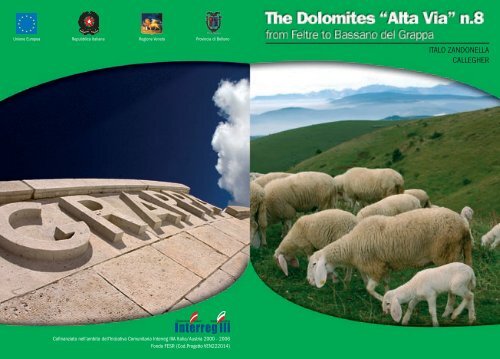
ITALO ZANDONELLA CALLEGHER<br />
The Dolomites “Alta Via” n.8<br />
or “Degli Eroi”<br />
created by Italo zandonella Callegher in the 1972<br />
High Mountain and War Routes<br />
from Feltre to Bassano del Grappa
cover:<br />
near Cima Grappa toward west<br />
inside cover:<br />
first snow<br />
back cover:<br />
“Gloria a voi soldati del Grappa”<br />
2005© Provincial Administration of Belluno<br />
TOURISM, AGRITOURISM AND PRODUCTIVE ACTIVITIES SECTOR<br />
Services, communication and promotion<br />
Via Psaro, 21 - 32100 Belluno<br />
www.infodolomiti.it<br />
edition completely revised and updated by<br />
Italo Zandonella Callegher<br />
Photos Manrico Dell’Agnola<br />
Graphics Evidenzia<br />
Printed by Linea Grafica<br />
General notes<br />
The idea of marking out an Alta Via on the Massiccio del Grappa,<br />
so morphologically different from the famous Dolomites, came to<br />
Italo Zandonella Callegher when he published the article “Scopriamo<br />
(let’s discover) La Valle di Schievenìn”, in “Lo Scarpone” on the 1st of<br />
September 1972.<br />
The aim of the article was to bring to the public’s attention these<br />
undiscovered mountains, and to reveal the hidden beauties of a<br />
mountain range which is not Dolomite, it is true, but is equally and<br />
extraordinarily complex and interesting.<br />
Years earlier the same author had already “discovered”, together<br />
with a few others, the excellent opportunities for climbing that the<br />
bottom of valley walls had to offer even to the finest of mountaineers,<br />
especially in the Valle di Schievenìn, where a well-known rock climbing<br />
training ground is still in function, and is almost too popular.<br />
These mountains, hardly touched upon and practically ignored<br />
by those who travelled along the Piave or Brenta or Cismón valleys,<br />
could, he believed, offer much more than old sentimental memories<br />
of the Great War. This Pre-alpine world had - and still has - everything:<br />
rock walls, forests, paths of peace time and war time, alpine<br />
huts, log cabins, rare flora and splendid fauna; almost like a “real”<br />
mountain. So why not bring it to the attention of all those hikers of<br />
all kinds who are always looking for new suggestions?<br />
And thus was created the Alta Via degli Eroi (of heroes), to which<br />
the Tourism Sector of the Provincial Administration of Belluno gave<br />
the name of Alta Via delle Pre-Dolomiti number 8.<br />
It is this Tourism Sector that we have to thank for the present<br />
publication, which aims to promote the local mountains and tries to<br />
provide hikers with the most up-to-date information possible.<br />
The text which follows is taken partly from the volumes “Alta Via<br />
degli Eroi, da Feltre a Bassano del Grappa”, “Sentieri Ferrate Arrampicate<br />
sul Massiccio del Grappa - Alta Via degli Eroi” and “Alta Via n.8 delle<br />
THE DOLOMITES “ALTA VIA” N.8 OR “DEGLI EROI” 3
Dolomiti”, all by Italo Zandonella Callegher, published respectively<br />
in 1975 and 1986 by Tamari Editori and in 1992 by the Provincial<br />
Administration of Belluno. Thanks are due to the editors for their<br />
kind permission.<br />
No significant changes have been made to the original route from<br />
the previous editions. Some places of shelter (the alpine huts, for<br />
instance), which in the past were in poor condition, or even falling<br />
down, have been improved, but it is still wise to have a tent or a sleeping<br />
bag with you. These “travelling companions” will allow you to<br />
stop off wherever you please and enjoy complete independence.<br />
The itinerary is described in the Feltre - Bassano direction and<br />
links the Piave valley with the Brenta valley through the Massiccio<br />
del Grappa and the provinces of Belluno, Treviso and Vicenza. It runs<br />
from north-east to south-west and is 30 kilometres long as the crow<br />
flies and about 51km on paths or silvopastoral roads; to this distance<br />
must be added some five kilometres on the tarmac road from Feltre<br />
Railway Station to Porcén and some 7km from the bottom of the Valle<br />
di Santa Felicita to the centre of Bassano del Grappa; so the total on foot<br />
is about 63 kilometres.<br />
The route, excluding the climb of the first day and the long<br />
descent of the last day, remains at an altitude which varies from a<br />
minimum of the 1440m of the Forcella (saddle) Bassa to a maximum<br />
of the 1775m of the Monte Grappa.<br />
The most panoramic route, if you choose the high itinerary, runs<br />
on the line of crest of the Monte Tomàtico, Monte Santo, Monte Sassumà,<br />
Monte Peùrna, Monte Paiòn, Colle Crodarotta, Monte d’Avién, Sasso delle<br />
Capre, Monte Fontanasecca, Monti Salaròli (or Solaròli), Col dell’Orso,<br />
Monte Casonét, Monte Grappa.<br />
The whole route is marked, but sometimes the signs can be difficult<br />
or impossible to see as a result of bad weather, making the itinerary<br />
somewhat difficult in foggy weather (which is frequent).<br />
In mountaineering terms, the difficulties are quite elementary.<br />
Only the Sentiero (path) CAI Montebelluna (from Malga Paòda to Malga<br />
Val Duméla), quite literally dug out ex novo with pick-axes and spades<br />
by the author and his CAI volunteer friends 30 years ago, could<br />
be difficult for the less experienced when crossing the various very<br />
steep pale rock formations and on the Cengia di Prada, covered with<br />
long thin grass which is particularly tricky and slippery, and on the<br />
stretch equipped with fixed ropes at the Forcella d’Avién.<br />
The time required has been estimated quite generously, taking into<br />
account the need to carry a rucksack with a tent and a sleeping bag.<br />
This Alta Via, like its more famous sister trails, is a long trip which<br />
can be divided up into daily stages, in this case four, but it is up to the<br />
hiker to decide whether to shorten it, keep to it or lengthen it, depending<br />
on personal taste, ability, training and interest in the route.<br />
The only real refuge on the route is the Rifugio Bassano at the Cima<br />
Grappa, 1745m, also known as Casa Armata del Grappa. At the end of<br />
the other stages you will find only old, restructured malghe (mountain<br />
huts), which may well be very romantic, but certainly do not offer<br />
the comforts you would expect from a refuge in the Dolomites. This<br />
is why it is advisable to take a tent, a sleeping bag and a lightweight<br />
roll-up mattress, and of course, food and water.<br />
It goes without saying that this Alta Via is suitable particularly for<br />
those who are nostalgic about the “old days”, the old way of experiencing<br />
the mountain, i.e. when the altimeter and the compass were<br />
used to find one’s way around in the fog, and when no-one was ever<br />
without water and food supplies and something to keep warm.<br />
The basic route follows paths that are not particularly difficult for<br />
an experienced hill-walker; in addition, passages or stretches that are<br />
a little rough are always equipped. Some stages are very steep on the<br />
way up, others on the way down.<br />
Here and there where the mountain has remained as it was in<br />
pioneer times and where only the chamois live undisturbed, there<br />
are more difficulties. These are more or less of a psychological nature<br />
due to isolation, extreme gradients, harsh surroundings, lack of water,<br />
complete silence and the fog that often forms quickly and envelops<br />
the surroundings! In any case, this Alta Via, like its sister trails more or<br />
less close by, passes through places which are truly extraordinary and<br />
unique, in the wild environment south of the Dolomiti Bellunesi.<br />
4 FROM FELTRE TO BASSANO DEL GRAPPA THE DOLOMITES “ALTA VIA” N.8 OR “DEGLI EROI” 5
To suit the tastes of more expert hikers, some alternatives to the<br />
classic route are suggested. Some of these variants are more technical<br />
and gratifying hikes, others are just to take you from one place to<br />
another, to “escape” or move off the main itinerary.<br />
To reach the Alta Via from the bottom of the valley, below are<br />
suggested some interesting connections, but many others can be<br />
“invented”, with an intelligent use of the topographical map.<br />
We feel obliged to point out that some authors have modified<br />
the original sequence of the route, adapting it to their own personal<br />
taste, and here and there modifying the original route; we have preferred<br />
to remain faithful to “the old days”, even if this means that<br />
some stages (for example the last) might seem more logical following<br />
a direct (but less interesting) route. The Alta Via could be shortened<br />
by joining up one or more routes, but this would turn it into a competition<br />
and this is not in line with the intention of this guide, which<br />
recommends a calm, relaxing and enjoyable pace.<br />
Also in this case, in comparison with Italo Zandonella Callegher’s<br />
guides, we have also made some changes to the original route, particularly<br />
in the cases where some stop-off points have disappeared<br />
and others have been created. Some minor updates have been made<br />
to the original route, because during the last few years, there have<br />
been some morphological changes, as well as changes as a result of<br />
interventions carried out by the organisations responsible for maintaining<br />
and equipping the various stages of the route, and some<br />
silvopastoral roads have been added to the old network of paths.<br />
Having said this, nothing has been taken away from the originality<br />
of the work and the idea; if anything there has been a willingness to<br />
improve on and to further define it.<br />
Recommended period<br />
Normally the itinerary is practicable until the end of October, but<br />
only when there is no snow. October, however, should be the ideal<br />
month for stable weather conditions, visibility, clarity and the absence<br />
of “crowds”, but nowadays much has changed and autumn is not<br />
always sunny. Just remember that in this period the malghe (alpine<br />
huts) are closed, although if you have a tent with you this shouldn’t<br />
be a huge problem.<br />
Embarking upon the Sentiero (path) CAI Montebelluna when there<br />
is snow is absolute madness, because there is a grave danger of<br />
snow-slides, as the path runs high up on the very steep slopes of the<br />
Val di Prada and the Val Sassumà.<br />
Finally, bear in mind that the only real refuge-hotel, the one on the<br />
top of the Monte Grappa, is open from May until the 4th of November.<br />
Therefore, to tackle this Alta Via, we repeat, it is essential to have a<br />
tent and a sleeping bag, or resign yourself to making do with the<br />
spartan shepherds’ shelters along the route.<br />
Many hikers are attracted to this Alta Via because, if tackled with<br />
the appropriate spirit, it offers the peculiar pleasures of the oldfashioned<br />
way of exploring the mountains.<br />
Useful advice for hikers<br />
Precautions - Equipment<br />
The network of paths used by the Alta Via number 8 allows hikers<br />
to access various zones at the heart of the Dolomite groups where<br />
they can experience extraordinary walks at altitude. As the paths<br />
can be very tiring at times and conducted above 1700 metres, experience,<br />
good equipment, sure footing, absence of vertigo and good<br />
physical condition are indispensable to ensure safety. Often dangers<br />
are undervalued in the mountains: a rapid change in weather, an<br />
unexpected storm, a premature snowfall, an icy patch of ground,<br />
fast-moving rivers….can all turn a pleasant, light-hearted trip into<br />
a ordeal, even on well-marked stretches of path. Good self-control<br />
can be indispensable. A fundamental condition for trekking along<br />
the “Alta Via” paths is good weather! Therefore you should find out<br />
weather conditions first from the available sources (Arraba Weather<br />
Station, TV, Radio etc.) Finally, hikers should be equipped with a<br />
good mountain kit (nowadays thousands of products of various styles,<br />
colours and technical specialities are available on the market),<br />
with several vital changes, warm, waterproof clothing; good quality<br />
6 FROM FELTRE TO BASSANO DEL GRAPPA THE DOLOMITES “ALTA VIA” N.8 OR “DEGLI EROI” 7
climbing boots and socks, as well as all those other little bits and<br />
pieces that a good hiker’s experience advises.<br />
It is a good idea to carry some medicine and first aid equipment<br />
with you, especially painkillers, Vitamin C, supplements, plasters,<br />
gauze, bandages….and never forget to bring water.<br />
If, despite the above precautions, an accident should happen (a<br />
slip, a twist, a fracture, an injury from falling rocks, a lightning<br />
strike, vertigo, etc), try not to panic and follow the indications in the<br />
following chapter where possible.<br />
Alpine rescue service<br />
(by Fabio Bristot, Director of the CNSAS, Veneto Region)<br />
In this section, the C.N.S.A.S.<br />
(National Corporation of Alpine and<br />
Speleological Rescue) would like to<br />
explain what the institutional aims of<br />
the organisation are: i.e. what Alpine<br />
Rescue is and what it does.<br />
We also offer some information<br />
and advice, as well as providing some<br />
other tips.<br />
Although not yet perfect, this piece of work is a first step towards<br />
promoting a new culture of the mountains, based on safety and prevention<br />
and also on a few procedures to adopt in case of necessity.<br />
What is the C.N.S.A.S.?<br />
The National Corporation of Alpine and Speleological Rescue<br />
is a special section of the Italian Alpine Club whose members, all<br />
Volunteers Technicians, have the specific task of rescuing people<br />
who are injured or in danger both in an efficient and quick way.<br />
This can include the recovery of bodies when necessary and searching<br />
for people who are lost in difficult to get areas, (not always at<br />
altitude), which requires the work of personnel specialised in both<br />
mountaineering techniques and mountain rescue.<br />
The Italian law n. 74/2001 officially recognises the work of the<br />
C.N.S.A.S. as having a function of public activity and service.<br />
As a result of this official legislative definition, Alpine Rescue has<br />
strong links with the Italian National Health Service and with Pieve<br />
di Cadore’s S.U.E.M. 118 EMERGENCY SERVICE a close working<br />
synergy has been created in the last fifteen years, which has become<br />
more and more consolidated up to the point where it has been<br />
institutionalised with a specific convention and operative protocol<br />
within the various intervention sections.<br />
The C.n.s.a.s.Technical Staff guarantee 24 Hr, year-round (particularly<br />
in the summer months) service, with on-going training and<br />
compulsory drills on the rock face (with or without helicopter ), on<br />
snow, avalanches and ice falls, search and rescue, evacuation from<br />
cable cars, first aid techniques and general logistic problems (radio<br />
and communication, operation planning etc.)<br />
Both Law 74/01 and in particular also Law 298/02 entrust the<br />
C.n.s.a.s. staff with the task of primary rescue in the mountains, in<br />
caves and in hostile or difficult to reach environments. The C.n.s.a.s.<br />
is also responsible for rescue coordination when there are other<br />
State or Civil Protection organisations involved, except in the case<br />
of large emergencies or calamities.<br />
Where does the C.N.S.A.S. operate?<br />
The C.N.S.A.S. normally operates in so-called hostile environments<br />
and in all inaccessible areas of the district. This does not only<br />
mean - as is generally believed - areas such as cliff faces or vie ferrate<br />
(equipped paths), but also and above all snowfields and glaciers, ice<br />
falls, avalanches, cable cars, ski slopes, caves, ravines, gorges and<br />
gullies, rivers and all other types of environment, not necessarily<br />
at high altitude (hills, woods, etc.), that due to difficulty of access<br />
or movement , or in special weather conditions, require the work of<br />
qualified personnel with expertise in all areas of mountaineering<br />
and speleological techniques and rescue.<br />
8 FROM FELTRE TO BASSANO DEL GRAPPA THE DOLOMITES “ALTA VIA” N.8 OR “DEGLI EROI” 9
Prevention<br />
Aside from the above factors, which require a strong presence in<br />
the area in order to guarantee primary rescue, the C.N.S.A.S.<br />
also has a precise obligation to guarantee accident prevention.<br />
For this reason the brief notes below, (although they seem obvious,<br />
our experience year in year out shows they are often ignored), aim to<br />
supply some points to consider.<br />
Basic rules for improved safety in the mountains and<br />
other hostile environments.<br />
Never underestimate the dangers and risks associated with<br />
any type of activity connected to the mountains and to hostile<br />
environments in general (mountaineering, speleology,<br />
skiing, mountain biking, hunting, mushroom picking, hanggliding<br />
and parachuting etc.): the rapid changes in weather,<br />
the difficulty of the route, walking time, etc.<br />
Good mental-physical condition and adequate preparation<br />
and training for the task to be undertaken are essential<br />
Avoid attempting routes that are beyond your technical<br />
ability and physical and mental preparation.<br />
Never walk alone, whenever possible be accompanied<br />
and/or advised by qualified organisations (Alpine Guides,<br />
C.A.I. and C.N.S.A.S. Stations).<br />
Obtain adequate information about the route’s features and<br />
difficulty as well as the area in general. Study in advance all<br />
necessary information regarding destination or route, using<br />
the appropriate guides and maps.<br />
Always leave precise information about where you are<br />
going and which route you intend to take, using visitors<br />
books in huts and bivouacs when appropriate.<br />
Find out the weather conditions in advance, especially the<br />
local forecast.<br />
Bring adequate footwear and clothing: avoid wearing<br />
training shoes and shoes with smooth soles; bring warm<br />
clothing, anorak and a change of underwear.<br />
Bring a head torch, food which is light and easily absorbed<br />
by the body and extra fluids (preferably water with perhaps<br />
added saline integrators).<br />
Bring a small first aid kit.<br />
Basic rules on how to behave in the event of an accident<br />
Stay calm and do not act impulsively.<br />
Evaluate the general situation (environment) and the<br />
specific situation (the accident). Try to identify actual and<br />
possible dangers.<br />
Immediately adopt measures to avoid and prevent further<br />
risks.<br />
Call S.U.E.M. 118. for help immediately. If this is not possible<br />
use the following intermittent visual signalling method: 6<br />
times a minute - once every 10 seconds - pause for 1 minute,<br />
then repeat the operation until you are sure you have been<br />
seen; or use any other system to mark your presence.<br />
How to alert S.U.E.M. 118/C.N.S.A.S.<br />
To request an intervention by C.N.S.A.S., you must always dial<br />
118 and follow the advice below.<br />
General instructions to follow when you call 118<br />
Supply precise information about the injured person/s<br />
(name, surname, residence) and the telephone number from<br />
which you are calling.<br />
Give details on the location of the accident or visual<br />
references that can help easily identify the spot.<br />
Give a brief summary of the accident stating the time it<br />
happened.<br />
Specify the number of injured and their condition.<br />
10 FROM FELTRE TO BASSANO DEL GRAPPA THE DOLOMITES “ALTA VIA” N.8 OR “DEGLI EROI” 11
Describe the weather conditions, especially visibility.<br />
Highlight any obstacles in the area with particular reference<br />
to power lines and cables, chair lifts and ski lifts and any other<br />
overhanging cables that could get in the way.<br />
Give any other information that could aid the operation<br />
(people present, particular difficulties etc.)<br />
Interventions for injured persons or persons in a situation of danger<br />
As for previous point 1.<br />
Supply the exact location of the accident or where the injured<br />
can be found (mountain group, slope, path, via ferrate, valley,<br />
gully, ledge, crest, gorge, etc).<br />
Mention the presence of any other people who were present<br />
at the accident and, in particular, if they are able to collaborate<br />
(Alpine Guides, C.N.S.A.S. staff, etc.).<br />
Interventions for injured persons or persons in a situation of danger<br />
As for previous point 1<br />
Specify date and time of departure.<br />
Describe the method of transport used (i.e. Car: number<br />
plate, model, colour etc.).<br />
Indicate destination and chosen route and/or probable or<br />
possible fixed objectives (hill walking, climbing etc.).<br />
Give the number of companions and their hill-walking or<br />
mountaineering abilities and experience.<br />
Describe clothing (paying attention to colour and material)<br />
and supplies carried.<br />
Inform of any problems: psychological- physical - family<br />
- social -etc.<br />
Supply information already given to other organisations<br />
(including C.N.S.A.S.).<br />
Supply any other useful information regarding the<br />
subject(s), location and general environmental conditions.<br />
Interventions in cases of avalanche<br />
Information on the identity of the person(s) involved.<br />
Give the exact or presumed number of people swept away<br />
or buried.<br />
Specify the brand and model of A.R.V.A. apparatus and/or<br />
other search technology.<br />
Identify the presence of any witnesses able to give an exact<br />
account of what happened:<br />
- If a visual-auditory- A.R.V.A., search has been carried out;<br />
- Provide a brief description of the avalanche (size and<br />
characteristics) and the exact point where the people<br />
were swept away and/or disappeared (right, left, high,<br />
low etc.);<br />
- subjects already extracted and their position;<br />
- other information and details that might help the<br />
intervention.<br />
International mountain rescue signals<br />
International mountain rescue signals are still the same today<br />
as they were in the past, and often the only means possible in the<br />
immensity of the mountains is sending a visual or acoustic signal<br />
6 times per minute, at regular intervals, and then every 10 seconds.<br />
Pause for a minute and repeat the same signal until you receive a<br />
response. This is done three times in a minute at a distance of 20<br />
seconds in a visual or audible way. By acoustic we mean shouting or<br />
whistling or any other perceptible noises; by visual signals we mean<br />
waving handkerchiefs, items of clothing or mirror signals; at night<br />
you can use a torch or, if possible, a fire (obviously with caution,<br />
especially if you are in a wooded area). Over the last few years the<br />
ever more frequent use of helicopters by Alpine Rescue has rendered<br />
new signalling methods necessary. Colourful sleeping bags or<br />
anoraks spread out on the ground or marks in the snow can help<br />
you be located from above. The SOS rescue sign can be made with<br />
letters that are about 2m high using contrasting stones placed on the<br />
ground, or footprints in the snow.<br />
12 FROM FELTRE TO BASSANO DEL GRAPPA THE DOLOMITES “ALTA VIA” N.8 OR “DEGLI EROI” 13
In order to be seen from above, i.e. by helicopter, you need to<br />
make the following signals with your arms or with lights at night:<br />
Lift and spread out both<br />
arms<br />
Green light<br />
Lift and spread out left<br />
arm<br />
Right arm pointing down<br />
Red light<br />
-Yes, to the pilot’s questions.<br />
-Land here<br />
-Help is needed<br />
-No, to the pilot’s questions.<br />
-Don’t land here.<br />
-No help needed<br />
path number in black. Along paths that require more frequent<br />
signs, in between those above, you can find simple<br />
red or red and white signs and iron pales.<br />
c) Wooden chart signs on fixed poles (old types in metal).<br />
The coordination of signposts on the busy network of mountain<br />
paths in the Veneto Region is constantly monitored, sector by sector.<br />
Where the triangles, path signs and charts are found to be in poor<br />
condition (unfortunately also as a result of vandalism!) and thus<br />
difficult or impossible to see, the hiker should pay careful attention<br />
to the indications set out in this guide.<br />
However, an attentive walker should not have problems of orientation<br />
if they constantly refer to the excellent maps now available on<br />
the market, to this booklet and/or other systematic publications, or<br />
put into practice information obtained by asking the refuge managers<br />
along the route when necessary.<br />
When giving the helicopter instructions to land, keep the following<br />
in mind: with arms outspread, remain still at the edge of<br />
the landing place; where possible the area surrounding the landing<br />
place should be clear of obstacles up to a space of 20x20 metres.<br />
TAKE NOTE! Don’t move away until the rotor blades have<br />
stopped: you are an important fixing point for the pilot.<br />
Any items of clothing laid on the floor to help the pilot should<br />
be held down with stones to protect against the strong airflow<br />
given off by the helicopter’s blades!<br />
Difficulty scale<br />
T, for tourists, i.e presenting only elementary difficulties<br />
E, for hikers<br />
EE, for expert hikers<br />
EEA, for expert hikers with via ferrata equipment<br />
A, for climbers<br />
Route signs<br />
Everywhere along the route, the hiker can find three types of signs<br />
at all the main points:<br />
a) Red triangle with the Alta Via number inside (in this case<br />
8); this type of sign is less common than the following:<br />
b) Path sign consisting of two horizontal red stripes with<br />
a white stripe in the middle on which you can find the<br />
14 FROM FELTRE TO BASSANO DEL GRAPPA THE DOLOMITES “ALTA VIA” N.8 OR “DEGLI EROI” 15
The route<br />
Technical details<br />
Departure Point:<br />
Feltre Railway Station, 256m<br />
Arrival Point:<br />
Bassano, 130m<br />
Walking days: 4<br />
Route Length:<br />
about 63 kilometres<br />
Refuges on the main route: 1<br />
Malghe on the main route: 5<br />
Refreshments on the way: 6<br />
Longest stretch:<br />
the 2nd, 8 hours, from Malga Pàoda to Malga Val Dumèla<br />
Shortest stretch:<br />
the 3rd, 5 hours, from Val Duméla to the Rifugio Bassano<br />
Total time required (excluding variants): about 25 hours<br />
Difficulty:<br />
T, E and EE , brief stretch of EEA<br />
Total gradient in ascent:<br />
about 3100 metres<br />
Total gradient in descent:<br />
about 3200 metres<br />
Maximum gradient in ascent: 1340m, first day, Feltre - Monte Tomàtico<br />
Maximum gradient in descent: 1615m, fourth day, Cima Grappa - Bassano<br />
Maximum altitude:<br />
Rifugio Bassano at Cima Grappa 1745m<br />
Minimum altitude:<br />
Bassano, 130m<br />
Group involved:<br />
Massiccio del Grappa<br />
Refuge open:<br />
from the end of May to the beginning of November<br />
Signs:<br />
Good<br />
Recommended Maps<br />
Carte I.G.M. 1:25.000<br />
Feltre sheet 22, II, SE; Seren del Grappa sheet 37, I, NE;<br />
Cavaso del Tomba sheet 37, I, SE; Monte Grappa sheet 37, I, SO;<br />
Bassano sheet 37, II, NO<br />
Canale del Brenta,CAI di Bassano (only the last stage)<br />
Map 1:30.000<br />
-Il Massiccio del Grappa i sentieri, Comunità Montana Brenta, Grappa, Feltrino<br />
(good, with the whole route)<br />
-Colli Asolani-Grappa-Tomba, Zanetti (only the last stage)<br />
Map 1:50.000<br />
-Le Vette, Monte Grappa, Pilotto, Feltre (the whole route)<br />
-Altopiano di Asiago, Kompass<br />
Description of the walks<br />
Day One<br />
From Feltre to the Malga Pàoda via Monte Tomàtico<br />
Gradient: in ascent 1340m; in descent 420m<br />
Length: about 15km<br />
Time required: 6 hours on foot from Feltre<br />
Path: n.841<br />
Difficulty: T, E<br />
You can get to Feltre with the Padova-Calalzo rail line, or the SS 348<br />
or 50 roads.<br />
Porcén, 390 m, departure point of the Alta Via degli Eroi n.8, is less<br />
than five kilometres of tarmac road away from Feltre. You can walk<br />
along the road in little more than an hour, or, better still, take a taxi<br />
or public transport (information at the station).<br />
The beautiful city of Feltre, historical and industrious, is situated north of<br />
Monte Tomàtico, and is an important road link and railway station.<br />
Within the ancient city walls you can find splendid medieval and renaissance<br />
monuments of great artistic and architectural interest, some of which have<br />
frescoes by Lorenzo Luzzo (15th century), known as “Il Morto da Feltre” (Dead<br />
Man from Feltre).<br />
The old town is superb: Largo Panfilo Castaldi leads to the 16th century<br />
Porta Imperiale (Imperial Gate) - with the headquarters of the Feltre Section of<br />
the Italian Alpine Club above it - after which is the delightful Via Mezzaterra, overlooked<br />
by numerous 16th century houses; Piazza Maggiore, partially surrounded<br />
by porticoes and important buildings; Chiesa di San Rocco (St. Rocco’s Church),<br />
with a wonderful lombardesque fountain dating from 1520; the Torre dell’Orologio<br />
(Clock Tower), and the Castello di Feltre (Feltre Castle). At the centre of<br />
the square there is a column with the Leone di San Marco (Lion of St. Mark),<br />
and the monuments to Vittorino da Feltre and Panfilo Castaldi; on the left side,<br />
Palazzo Guarnieri (Guarnieri Palace), by Segusini.<br />
16 FROM FELTRE TO BASSANO DEL GRAPPA THE DOLOMITES “ALTA VIA” N.8 OR “DEGLI EROI” 17
Departure at dawn from the Tomàtico<br />
Incorporated into the square is the Piazzetta delle Biade (Forage Square), with<br />
the monumental Palazzo del Municipio (Town Hall Building), in Palladian style.<br />
Moving onwards, you come to Via Lorenzo Luzzo, flanked by renaissance<br />
buildings, in which, just before the medieval Porta Oria (Oria Gate), you will find<br />
the Museo Civico (Municipal Museum), which houses archaeological collections,<br />
weapons, sculptures, historical relics and paintings by the “Morto da Feltre”,<br />
Gentile Bellini and other artists of the Veneto school.<br />
A steep street goes down to the Borgo, after which, on the right, is the<br />
Chiesa di Ognissanti (All Saints’ Church), an ancient construction in the vestry<br />
of which you can admire Luzzo’s masterpiece, the Trasfigurazione e SS. Antonio<br />
e Lucia (Christ is in white on a white background).<br />
Also extremely interesting: Cattedrale di San Pietro (St. Peter’s Cathedral),<br />
with its 15th century bell tower, in the capitular archive of which there is a<br />
Byzantine Cross, in boxwood, dating from 542; Chiesa di Santa Maria degli<br />
Angeli, Chiesa di San Giacomo Maggiore, the Galleria di Arte Moderna (Modern<br />
Art Gallery), and the splendid, unique Museo Rizzarda, which contains superb<br />
masterpieces in wrought iron.<br />
Tennis. Rifle Range. Riding School in Vincheto di Cellarda. Ice palace.<br />
Skating rink in Anzù. Hospital. Clinic. Banks. 1 - 4 star hotels. Tourist information<br />
office in Piazza Trento e Trieste, 9.<br />
To get to Porcén on foot from Feltre railway station, follow the<br />
tarmac road for about 800m eastwards. After the bridge over the<br />
Torrente Colméda, take the road to the left which after about 200m<br />
leads to a fork. Continue on the left until a crossroads. Straight on<br />
south, slightly upwards. Another fork. Continue right in the direction<br />
of the Villa San Giuseppe. Just before Tomo, immediately after a<br />
shrine near the church, turn right (west) and follow the tarmac road<br />
until the centre of Porcén, 390m, a charming little village at the foot<br />
of the northern side of Monte Tomàtico and north-western border of<br />
the Massiccio del Grappa.<br />
Just after the church and the little square of Porcén, on the left<br />
(south), go along the Via Monte Tomàtico for about 150m until you<br />
come to a manor house, 430m; signpost for the Alta Via and the<br />
Monte Tomàtico.<br />
About 1 hour from Feltre.<br />
18 FROM FELTRE TO BASSANO DEL GRAPPA THE DOLOMITES “ALTA VIA” N.8 OR “DEGLI EROI” 19
The Burèl and the schiara from Monte Tomàtico<br />
20 FROM FELTRE TO BASSANO DEL GRAPPA THE DOLOMITES “ALTA VIA” N.8 OR “DEGLI EROI” 21
Follow the little road on the right of<br />
the manor house (last water; stock up),<br />
straight on towards the wooded cone of<br />
the Tomàtico, until a fork which you will<br />
meet after the bend at an altitude of c.<br />
530m. Leave the little road (which goes<br />
onto the northern slopes of Monte Santo),<br />
and take path n.841 to the left (south).<br />
After a bend at La Croce, return south<br />
and go up a grassy mountain-side, at an<br />
altitude of about 700m, then a few hairpin<br />
bends will take you close to a little<br />
casèra (hut). Still in the wood, go up<br />
until you touch the Sfaldèr, 1020m, and<br />
then the Casère Peruzzat, 1160m, from<br />
where you cross, half-way up, the steep<br />
side which looks onto the Val del Fieno.<br />
Keep on the mule-track, going up to<br />
cross the thick beech-wood which lies<br />
under the rib of Monte Tomàtico. From<br />
the locality of Casère dai Ton, 1489, go<br />
up through the field until you come to a<br />
crest at 1505m, from where you can see<br />
the cross on the peak of Monte Tomàtico.<br />
Follow the easy, rounded crest northwards<br />
and go slightly down to a wide,<br />
grassy saddle. Here a good path takes<br />
off which goes down into the basin<br />
beneath, where you can already see the<br />
Malga Curto at Pradalón.<br />
If the weather is good, it is best to<br />
go up in about 20 minutes to the large<br />
Cross on the peak of the Monte Tomàtico,<br />
1508m, from where, weather permitting,<br />
there is a superb view over the circle of<br />
the Dolomites, the Feltrino valley and<br />
in particular the city of Feltre, the Prealpi<br />
Venete, the Montello and right on down to the Venetian Lagoon.<br />
4 hours from Porcén<br />
5 hours from Feltre.<br />
Once back on the grassy saddle, go down, in about 30 minutes,<br />
first to the east, then south along some hairpin bends, until you reach<br />
Malga Curto, 1320m.<br />
If you like, you can end Day One here, where you will find the<br />
cordial welcome of the malgari (malga managers), good people from<br />
the village below, and also a few beds. You can also find shelter in the<br />
spartan, but romantic, rural building, using a sleeping bag, just like<br />
the “heroes of the mountain” of old. Refreshment available.<br />
However, stopping off here has the disadvantage of rendering even<br />
longer the already long Day Two (8 hours), which should instead start<br />
out from Malga Pàoda, excellently renovated, less than an hour’s easy,<br />
comfortable walk from here.<br />
From Malga Curto at Pradalón, continue south until the nearby<br />
pastureland saddle from where, through grass and underbrush, you<br />
come to the underlying path which enters into the broadleaf wood<br />
and runs at altitude, or with gentle ups and downs, until the large<br />
pastureland clearing with the Malga Pàoda, 1181m, currently (spring<br />
2005) being definitively restructured.<br />
5 hours from Porcén<br />
6 hours from Feltre.<br />
The clearing is an excellent panoramic balcony over the Piave<br />
valley (through which the SS348 road runs), and the heights of the<br />
Cesén. Ideal stop-off point in monastic style.<br />
Here you will find the old shepherds’ building known as Malga<br />
Pàoda, open from June to the end of September, currently undergoing<br />
complete renovation (spring 2005) of the malgaro’s home itself, of the<br />
ex-stable and the charming veranda which at one time was used for<br />
cheese making.<br />
The plan of “Veneto Agricoltura” (32010 Spert d’Alpago, Pian<br />
Cansiglio, BL, 0438 58 17 57) envisages that the malgaro’s dwelling<br />
22 FROM FELTRE TO BASSANO DEL GRAPPA THE DOLOMITES “ALTA VIA” N.8 OR “DEGLI EROI” 23
In the foreground, on the right, Monte Tomàtico and crest until<br />
Monte Santo. In the background, the Pelmo<br />
should have, on one side, a kitchen with fireplace, a bathroom with<br />
shower, a small room with a washbasin and a little attic bedroom for<br />
the malgaro, and, on the other side, a little room, always open, which<br />
could put up 4-5 hikers. All of this is still to be defined, also in the<br />
light of new future management which contemplates offering an<br />
agriturismo service.<br />
The veranda, should, however, serve as a panoramic gallery and<br />
a stop-off and refreshment point (contemplated for the near future,<br />
as mentioned above) for hikers. Underneath there is space for the<br />
installation of a lighting system and a cellar store-room.<br />
In the building immediately north of the veranda, the renovation<br />
of which should be completed by the end of 2005, the idea is to<br />
have a milking parlour and a cheese factory, because it is envisaged<br />
that some thirty milk cows- and perhaps also some sheep - will be<br />
brought up to the summer pasture, and that some typical dairy products<br />
such as the cheese Bastardo del Grappa and formài morlàc will<br />
be made.<br />
There is a third stage which should be completed with the reconstruction<br />
of the pendàna, i.e. the stable for the animals, currently in<br />
ruins, not far from the malga itself, on the path towards the Tomàtico.<br />
All the above should ensure simple, basic hospitality (food and<br />
shelter), also to hikers on the Alta Via 8 who until now could only<br />
find the ruins of the old shepherds’ hut.<br />
Unfortunately, “should” is very much the operative word, since<br />
24 FROM FELTRE TO BASSANO DEL GRAPPA THE DOLOMITES “ALTA VIA” N.8 OR “DEGLI EROI” 25
we all know how difficult it is to find “brave” entrepreneurs ready to<br />
launch into an adventure which is undoubtedly very romantic, but<br />
not very profitable. To this difficulty must be added the lack of water<br />
and the consequent problems of logistics and hygiene.<br />
So the moral of the tale is, as pointed out in previous guides: be<br />
independent; don’t set out without a sleeping bag (or, even better, a<br />
tent) and without food and water supplies.<br />
You will find plenty of space to pitch your tent on the edge of the<br />
pastureland, with views over the valley.<br />
If you should manage to find a hot meal and a bed, so much the<br />
better, but don’t count on it.<br />
Connection 1<br />
From Ciladón to Malga Pàoda<br />
Rather than variants in the true sense of the word, what you will<br />
find below are links between the bottom of the valley and the Alta Via<br />
degli Eroi n.8.<br />
In this case they are also shortcuts which will allow you to avoid<br />
the first stage.<br />
From Quero, a little tarmac road takes you to Ciladón, 5km away,<br />
650m; 1,15 hour on foot.<br />
From here, follow the new silvopastoral road which takes you onto<br />
the dirt-track road which comes up from Prada.<br />
On the saddle where the roads meet, a parking area is planned so<br />
that cars do not reach the nearby malga.<br />
Cutting across the pastureland mountainside in the direction of the<br />
Tomàtico, you soon reach the Malga Pàoda.<br />
1,45 hours from Ciladón<br />
Connection 2<br />
From Prada to Malga Pàoda<br />
From Schievenìn, go up the tarmac road until the last houses of the<br />
delightful Val di Prada; restaurant (booking required), c.700m.<br />
From here starts the new dirt-track road which first cuts through the<br />
valley and then, with a few easy zigzags leads to the saddle where you<br />
meet the road which comes from Ciladón. Cut across the pastureland<br />
side and after a large bend, you will reach the Malga Pàoda.<br />
1,30 hours from Prada.<br />
Day Two<br />
Towards Valdumela<br />
From the Malga Pàoda to the Malga Val Duméla along<br />
the Sentiero CAI Montebelluna<br />
Gradient: in ascent 780m; in descent 790m (including ups and downs)<br />
Length: about 15km<br />
Time required: 8 hours<br />
Path: n.847<br />
Difficulty: EE, brief stretch of EEA<br />
This is the most interesting stage of the whole route, the longest<br />
and the only one which might present some slight technical difficulties.<br />
The passage across the Forcella Alta is compulsory, but you<br />
26 FROM FELTRE TO BASSANO DEL GRAPPA THE DOLOMITES “ALTA VIA” N.8 OR “DEGLI EROI” 27
can reach it either from Variant 3 (not very often used, not very well<br />
marked, but logical), or from the Sentiero CAI Montebelluna (recommended,<br />
attractive, a little more difficult).<br />
Variant 1<br />
On the crest via Monte Santo and Monte Sassumà<br />
From the Malga Pàoda Following weak traces go directly and steeply<br />
up north-west onto the bleak Monte Pàoda, 1370m, from where<br />
you reach the watershed crest, grassy and very panoramic, 1535m<br />
(see photo p.26-27). Now continue left (south-west; while to the<br />
right, north-east, you go up to Monte Tomàtico.) passing via Monte<br />
Santo, 1538m, and the Cima Sassumà, 1510m, from the top of which<br />
you go down very steeply to the Forcella Alta, 1222m, where you join<br />
up again with the original track of the Alta Via n.8, i.e. the Sentiero<br />
CAI Montebelluna.<br />
About 2,30 hours from Malga Pàoda.<br />
Along the Sentiero CAI Montebelluna, i.e. the original<br />
itinerary<br />
Highly recommended in normal conditions, but absolutely not<br />
to be tackled in the event of snow.<br />
Less panoramic than Variant 1, but decidedly more varied and<br />
less tiring, the Sentiero CAI Montebelluna is kept in good condition<br />
(since the seventies, when it was designed, traced out and literally<br />
carved out with a pick-axe by the author of this guide, together<br />
with some faithful, hard-working friends) by some volunteers of the<br />
Montebelluna Section of the CAI, to which, precisely for this reason,<br />
the path was dedicated when the first guide was published in 1975.<br />
Despite the careful maintenance, you might find that some<br />
stretches are rather difficult, as a result of the peculiar conformation<br />
of the ground, the lavish vegetation typical of the Pre-Alps,<br />
small landslips, or persistent, heavy rain.<br />
It is in any case advisable to cover this whole horseshoe around<br />
the Valle di Schievenìn with a minimum of caution, especially in the<br />
presence of fog or ice.<br />
From Malga Pàoda, go up for about a hundred metres in the<br />
direction of signpost. From here, at a boulder, a trace goes up<br />
towards the crest along which Variant 1 runs.<br />
Instead of following this trace, turn immediately left (west; path<br />
847; signs; T- shaped coloured iron peg just after that), following<br />
traces in the grass, at altitude, until you reach a grassy promontory.<br />
Go up a little and then, along a thin path, cross a very steep<br />
little concave valley, covered with slippery weeds (children and<br />
beginners will need help here) until you come to a boulder with<br />
the ruins of a tiny, old rural building. From here, go up over rocks<br />
and grass to a hollow, 1255m, and follow to the right, in descent,<br />
a strip of yellow rocks near a characteristic rock mushroom. You<br />
will soon reach the bottom of the spur, then go up a steep erosion<br />
channel and take a trace on a ledge which leads left until you are<br />
under large rock ceilings with flora typically found around ruins,<br />
an old shelter for cattle; possibility of shelter.<br />
Now go down for a bit, cross to<br />
the right and some ups and downs<br />
will take you to the top of the Val<br />
di Prada, the few houses of which<br />
can be seen much further down.<br />
Opposite you find a rock tower<br />
known as la guselèta, the little needle,<br />
which you reach crossing diagonally<br />
and then zigzagging up<br />
until you touch upon it, just where<br />
it forms a yellow niche, which can<br />
offer shelter (in days gone by the<br />
local farmers set up camp here<br />
during the hay season).<br />
Just beyond here is the Castèl<br />
di Prada, the great fortress of rock<br />
and vegetation, which looks out<br />
over the valley. A good path leads<br />
up to it and from here you take the<br />
crest which crosses it at 1259m.<br />
28 FROM FELTRE TO BASSANO DEL GRAPPA THE DOLOMITES “ALTA VIA” N.8 OR “DEGLI EROI” 29
On the equipped stretch after Forcella Bassa<br />
Particularly in poor weather conditions, the long Cengia di Prada<br />
must be tackled with caution, because the mixed soil and grass<br />
surface can be slippery, and there is also the risk of tripping over<br />
roots and branches.<br />
First through a little wood, then the easy rock barriers, the path,<br />
well traced, reaches a sloping gallery towards the large leap and<br />
turns decisively right along a lofty ledge, where you should be<br />
careful of the slippery weeds underfoot. After crossing the slope<br />
beneath the rocks, you will soon come onto a saddle, 1260m, in a<br />
splendid wood of young fir-trees. From here you can see the top of<br />
the Val Sassumà, the Parete Gialla (yellow wall), the new little wood<br />
which protects the renovated Malga Zavàte-Sassumà and, just a little<br />
further on, the Forcella Alta.<br />
Connection 3<br />
From this wooded saddle you can go down for about 100 metres<br />
(Cengia di Prada side) and come to a hunters’ shelter with a tin roof<br />
blocked by large boulders. Nearby there is a little pòsa, a pond with<br />
rainwater used for watering cattle). An excellent, well-maintained<br />
path zigzags comfortably down, among the crown of trees, until the<br />
houses and the restaurant of the Val di Prada.<br />
1,30 hours from the saddle, in descent, about 2 hours in ascent.<br />
From the saddle, 1260m, go down through the wood, cross the top<br />
part of the Val Sassumà, pass under the little towers of Monte Santo<br />
and just after you go round the Parete Gialla, you reach Malga Zavàte-<br />
Sassumà (in the documents of “Veneto Agricoltura”, you will also find<br />
it called Stalla Zavàte), 1123m, in an excellent, bucolic setting. The current<br />
managers question the name “Zavàte”, an historical name used<br />
in the IGM maps which is not invented.<br />
Owned by “Veneto Agricoltura” (Pian Cansiglio, tel 0438 58 17 57), and<br />
currently (2005) managed by a family from Schievenìn (which for some years<br />
has been making the long-abandoned pasture operative again, with about 10<br />
head of cattle), the section of the Malga Zavàte-Sassumà where the malgaro<br />
lives was renovated in 2002 ; for the stable next to it the organization is now<br />
30 FROM FELTRE TO BASSANO DEL GRAPPA THE DOLOMITES “ALTA VIA” N.8 OR “DEGLI EROI” 31
Malga Curto<br />
Malga Sassumà-Zavàte<br />
Malga Pàoda<br />
Malga Val Dumèla<br />
Malga Fontanasecca<br />
Rif. Bassano<br />
Main road<br />
Secondary road<br />
Refuge<br />
Bivouac<br />
Alta Via route<br />
Variant route<br />
Peak, mountain, range<br />
Water, basin<br />
Village, town<br />
Pass or saddle<br />
Mountain hut
Manuela) appears, high up.<br />
From here the old mule-track almost disappears among the<br />
bushes or has been wiped out by the road. It is best to follow the<br />
road, because the path which used to pass alongside the characteristic<br />
and rather gloomy Casa degli Spiriti which backs onto the large<br />
yellow rock above is not easy to find and to follow, and besides,<br />
the new owners (a Cultural Association from Noale, in the province<br />
of Venice, which has renovated the two buildings) have practically<br />
closed off the original passage.<br />
A brief, final stretch of the new road will take you to the Malga<br />
Zavàte-Sassumà.<br />
About 1,45 hours from the bottom of the valley.<br />
The Tegozzo in Val di Schievenin<br />
contemplating a plan to bring sheep and cows up to the summer pasture.<br />
Open from the beginning of June until the end of September, the malga<br />
has a room used as a kitchen-dining room, and a bedroom under the beams.<br />
It does not currently offer accommodation or food, but in case of necessity the<br />
hiker will find a friendly welcome here.<br />
A silvopastoral road comes up from the bottom of the Valle di Schievenìn,<br />
through the Val Sassumà. Until 30 years ago there was hardly any vegetation in<br />
this valley; today it is overgrown.<br />
Connection 4<br />
A little tarmac road crosses Schievenìn and goes towards the<br />
Palestra di Roccia (rock climbing training ground), then reaches the<br />
mouth of a ravine when then opens out, higher up, into the Val<br />
Sassumà ; signposts ; path n.842.<br />
Go up the ravine at the side of the little torrent, which is dry in<br />
summer, until you reach the new road and the Casa da Nani, where<br />
the valley opens out and the dynamic, slim Campanilón (Campanile<br />
You can also reach the Malga Zavàte-Sassumà from the new silvopastoral<br />
road.<br />
The little tarmac road, after the ravine where path n.842 starts,<br />
continues at the bottom of the valley, goes past an abandoned house,<br />
passes the Grotta di Santa Barbara (which is a little higher up, on your<br />
left as you go up), and ends just beyond an esplanade-parking area,<br />
at about 550m, from where vehicular traffic is forbidden to continue.<br />
Picnic area.<br />
Keeping to the dirt-track road, go up the Val d’Inferno a little, then<br />
turn right and you will come to a saddle with an abandoned house,<br />
from where, going slightly down, you enter the Val Sassumà, towards<br />
the Casa da Nani.<br />
Now the road goes up the wide valley in easy, regular bends, passes<br />
by the last houses - one has been renovated, the others apparently<br />
abandoned - and by the side on the left of a large rock wall goes up<br />
to the Malga Zavàte-Sassumà.<br />
1,45 hours from Santa Barbara - parking area.<br />
From the Malga Zavàte Sassumà (signs; board), go east, passing<br />
above the large pòsa (hollow filled with water) immersed in the<br />
forest, cross the pasture on a good path, then go up a little steeply<br />
until you come to a rib. Then there is a traverse which leads to a tiny<br />
spring right on the path, then, in a short time, you reach the marked<br />
Forcella Alta. 1222m; signpost.<br />
2,30 hours from the Malga Pàoda.<br />
34 FROM FELTRE TO BASSANO DEL GRAPPA THE DOLOMITES “ALTA VIA” N.8 OR “DEGLI EROI” 35
From the Forcella Alta to the Forcella Bassa is only about 30 minutes’<br />
walk, but the peculiar conformation of the terrain to the (clayey,<br />
with trees, humid, a little gloomy), requires good concentration and<br />
careful attention to the signs.<br />
After going over the Forcella Alta, go immediately south-west,<br />
going slightly downwards diagonally in the thick of the wood along<br />
somewhat slippery and treacherous ground.<br />
Just under the crest, to the north, you can easily see the dirt-track<br />
road which comes up from Seren del Grappa and ends just beyond<br />
here, to the north.<br />
Taking care not to lose track of the signs, especially in foggy weather,<br />
keep crossing constantly under the wooded crest beyond which<br />
sweep down the rocks which overlook the valley of Schievenìn. At a<br />
certain point you will come to a retaining wall, built during the war,<br />
near a lofty little saddle, which is impassable ; signs of fires or bivouacs.<br />
From here, go up a bit along a rib, cross a little wood with some orientation<br />
difficulties (pay attention to the signs)and begin the long, steep<br />
descent on sharp zigzags which eventually lead to the Forcella Bassa,<br />
1044m, the lowest point of the traverse. Signposts ; signs.<br />
Immediately north-west of the saddle, about ten metres below,<br />
passes the dirt-track road which comes from Seren del Grappa, the<br />
western branch of which ends just beyond Pra Peùrna.<br />
Connection 5<br />
Obviously, as well as by the dirt-track road from Seren del Grappa,<br />
you can also reach the Forcella Bassa coming up through the Val d’Inferno,<br />
i.e. starting out from the bottom of the Valle di Schievenìn, where<br />
the tarmac road ends (parking area) and the dirt-track road begins<br />
for Malga Zavàte-Sassumà ; c.550m; path n.848.<br />
Follow the dirt-track road a bit, and then go left (signs, cairn), in<br />
the narrow wooded valley, going up hairpin bends. After an easy<br />
stretch you come to a spring, pass the torrent and start to go steeply<br />
and tiringly up along good traces of a path in the coppice wood,<br />
inside a sort of channel of vegetation, until you come to a spur of<br />
rocks and grass.<br />
Fojaròl del Conte in Val Dumèla.<br />
In the background, Monte Sassumà and Monte Santo<br />
From here, continue right, high up on the wild valley, on the path<br />
which you can just see on the very steep rock formation which crosses<br />
for a long stretch (not for those who suffer from dizziness), then<br />
goes up again a little and finally leads to the Forcella Bassa, 1044m,<br />
where it meets the main route.<br />
About 2 hours from the parking area.<br />
From the saddle, follow path n.847 which goes up a steep field<br />
and reaches an altitude of 1116m, where a trace continues south-west<br />
through the wood and goes onto a grassy-wooded shelf.<br />
Cross the wood halfway up the mountainside until you come to a<br />
small, characteristic saddle between two boulders, under the strip of<br />
yellow rocks of the Monte Peùrna. Go up the rib following faint traces<br />
and entering into a fairly delicate terrain. The path, in fact, now<br />
runs along narrow ledges above the crags, keeping on the edge of<br />
the crest, sometimes on very steep grassy and rocky slopes. Be very<br />
careful in the event of rain, snow or ice. Do not in any circumstances<br />
leave the trace marked.<br />
You will now see a strange natural window which opens out<br />
onto a spur ; go up to it and pass over it. Keeping at altitude under<br />
36 FROM FELTRE TO BASSANO DEL GRAPPA THE DOLOMITES “ALTA VIA” N.8 OR “DEGLI EROI” 37
the main crest, you touch on another saddle, high on the Valle dello<br />
Stizzón, to the north-west and the Val Perisèlla to the south-east.<br />
The thin path turns abruptly south and goes round a tower, and<br />
then just after that goes back onto the crest which leads to the top of a<br />
rock spur. Go down the crest decisively, on the Schievenìn side, conquering<br />
some rock leaps , which are made easier by fixed metal ropes.<br />
After the very steep slope you reach a saddle and from here<br />
begins a lofty ledge, 70cm wide, exposed, slightly in ascent, equipped,<br />
which cuts across a rock face on the side of the Stizzón.<br />
Beyond the ledge, go into the wood (c.1100m), go up it, go over<br />
the saddle to the east and you come to the top of a rock spike.<br />
Go down the opposite crest towards another saddle; from here, go<br />
up steeply and tiringly on the head of a tower, c.1120m. Follow the<br />
little crest again, then go into the wood and you will soon reach the<br />
mule-track which leads immediately to the Forcella d’Avién, c.1100m,<br />
where there is a little emergency shelter made of cement.<br />
Connection 6<br />
This stretch of the Alta Via n.8 can be reached either from the Valle<br />
di Schievenìn going up along the Val della Storta, or from Seren del<br />
Grappa starting out from Ponte d’Avién.<br />
From the Palestra di Roccia di Schievenìn, at Cave di Pietra, c.436m<br />
(signpost for Colle Crodarotta), path n.839 begins, which goes up the<br />
beautiful, wild valley for a while and leads to the Forcella d’Avién,<br />
1100m, where it enters onto the Alta Via.<br />
2 hours from Schievenìn.<br />
From Seren del Grappa follow the little tarmac road which goes up<br />
the Valle dello Stizzón towards the village of Chiesa Nuova San Luigi.<br />
At Ponte d’Avién, 437m, path n.843 begins. Follow the path eastwards<br />
until Pian de Giacón, then go south-east, passing by the Casère Checco<br />
di Conte, 891m. From here, going round the Colle Crodarotta to the<br />
west, you reach the Forcella d’Avién, 1100m, where you meet the Alta<br />
Via coming from the north.<br />
2 hours from Ponte d’Avién.<br />
Inside a Fojaròl in the Grappa Area<br />
From the Forcella d’Avién, follow to the south the convenient path in<br />
the wood until you come to a saddle where the path becomes a wide<br />
wartime mule-track and, running under the head of Val della Storta,<br />
passes a gallery and other war ruins. From here, remaining at altitude,<br />
the mule-track will soon take you to the Fojaròl del Conte (these days it<br />
is sometimes called Fojaròl di Giovanni, but historically, on the old maps,<br />
it figures as Fojaròl del Conte).<br />
Fojaròl is a typical rural construction of the Grappa area, extremely<br />
rare today, with the roof covered with beech branches and leaves. (fòja<br />
= leaf in the local dialect).<br />
Just after the fojaròl, you enter into what used to be a large expanse<br />
of pasture, at the northern edges of which is the Malga Val Duméla,<br />
1169m.<br />
8 hours from the Malga Pàoda.<br />
38 FROM FELTRE TO BASSANO DEL GRAPPA THE DOLOMITES “ALTA VIA” N.8 OR “DEGLI EROI” 39
The Malga Val Duméla, the second stop-off point, lies in a very romantic position,<br />
but it certainly offers nothing like the comforts of a typical alpine refuge.<br />
After years of complete neglect, some farmers from Covolo di Pederobba<br />
(Treviso) have brought about a dozen beef cattle up to pasture. The malga is open<br />
from June to the end of September.<br />
It consists of a large stable for animals and a hut for the malgaro, with a<br />
kitchen, bathroom and closet on the ground floor and two bedrooms on the first<br />
floor. For the moment its function is not to offer food and accommodation, but, as<br />
always in this area, no-one will ever be turned away in case of need.<br />
Plenty of room to pitch a tent in the clearing around the malga. Cistern water<br />
(rainwater, drinkable only after boiling).<br />
Connection 7<br />
You can also reach the Val Duméla by path n.845 which leaves from<br />
Schievenìn at the bridge over the Tegòrzo torrent, 301. after crossing<br />
the torrent, start going up towards the Case Fobba. After passing the<br />
plateau at 463m with the Case Fobba, go quite steeply up the fields,<br />
keeping to the good path n.845, pass a little house, then another<br />
which backs onto the rock, and then you reach the Forcella di San<br />
Daniele, 624m, between the Tegòrzo basin and the Calcìno basin.<br />
Constantly in ascent, the path goes round the Colle Fornèl, goes up<br />
with some sharp bends and leads on to the head of the Val Maòr.It<br />
crosses a fine wood on a moderate slope and goes into the Due Valli,<br />
1100m, where it meets the Alta Via degli Eroi n.8. Finally, a brief ascent<br />
will take you to the clearing of the Val Duméla and the malga of the<br />
same name, 1169m.<br />
2,30 hours from Schievenìn.<br />
Typical rainwater hollow (Pósa) under Monte Grappa<br />
40 FROM FELTRE TO BASSANO DEL GRAPPA THE DOLOMITES “ALTA VIA” N.8 OR “DEGLI EROI” 41
Day Three<br />
From the Malga Val Duméla to the Rifugio Bassano<br />
via Col dell’Orso<br />
Gradient: in ascent 830m; in descent 2600m<br />
Length: about 13km<br />
Time required: 5 hours<br />
Path: n.845, dirt-track road, 843, 156<br />
Difficulty: EE<br />
From the Malga Val Duméla the new silvopastoral road goes down<br />
towards the south and crosses the pasture flanked on the eastern side<br />
by the steep wooded and rocky formations of the Valle di Schievenìn<br />
and on the western side by the blooming forest of young conifers.<br />
In about twenty minutes, the road, which after a bit leaves the old<br />
mule-track, reaches the entrance to the Val Cinespa and goes up it.<br />
You can follow the tedious road to get to Cinespa, but you can<br />
also - and we advise that you do - remain on path n.845 which goes<br />
down a little until it touches upon the locality known as Le Due Valli,<br />
at c.1075m.<br />
After leaving the 845 which goes down to Schievenìn across the<br />
Forcella di San Daniele, turn sharply right (south-west), pass by the<br />
abandoned memorial stone ( which recalls the sacrifice made by the<br />
partisans of the Brigata Matteoti, who fell in September 1944 , here<br />
remembered by Commander Livio Morello “Neri” and the survivors),<br />
and go up the wooded Val Cinespa until you come back onto<br />
the new road near the Malga Cinespa, 1218m, the ruins of which “cry<br />
out for revenge”. A part of the building has been restored by local<br />
hunters, the rest is still waiting for a miracle to happen.<br />
1 hour from Val Duméla.<br />
From here the branch of the dirt-track road which goes south-west<br />
reaches the Malghe Valderóa, Domadór, Casón del Sol, Casón delle Mure<br />
in the Val delle Mure, the heart of the Grappa area. The other goes up<br />
to the Malga Fontana Secca.<br />
If you stay on the right branch of the road (which from Le Due Valli<br />
to Fontana Secca - or Fontanasecca - is not numbered), you go up to the<br />
west through the ancient pastureland, today covered in vegetation,<br />
come out from the wood and, after a few easy bends (or after following<br />
the shortcut through the sparse pastureland where there was<br />
a tiny spring under a rock) you will come to the Malga Fontana Secca,<br />
1461m, south-west of the historic Monte Fontana Secca.<br />
2 hours from Val Duméla.<br />
Variant 2<br />
Via the Malga Col de Spadaròt<br />
From the Malga Val Duméla, take path n.843 which goes up to the<br />
south-west, goes into the beech and fir wood and reaches the rib at<br />
1372m from where, heading south, reaches the remains of the Malga<br />
Col de Spadaròt, 1402m, in a splendid, panoramic position halfway up<br />
the Monte Fontana Secca and site of an ancient, gloomy legend.<br />
Continuing for a bit southwards and then westwards, along a<br />
good path almost at altitude, you pass by the pósa, a water-filled<br />
hollow for cattle to drink from, and you soon reach the small rib with<br />
the Malga Fontana Secca, 1461m.<br />
About 2 hours from Val Duméla<br />
The Malga Fontana Secca is situated in a beautiful place, solitary and wild,<br />
surrounded by mountains which, although of modest structure, were historically<br />
important in WW1.<br />
Partially restored, privately owned, it does not offer food or shelter except in<br />
emergencies, as is the case all over the Massiccio del Grappa.<br />
Currently taken care of by some volunteers, the malga was for years the<br />
workplace and home of a heroic malgaro, last in a long line of strong mountain<br />
people : Abramo di Schievenìn, known as “Zavàte”.<br />
From Fontana Secca, go south along path n.843, go past the large<br />
pósa, and then go moderately up to the Forcella dei Salaròli (or Solaròli),<br />
known also as Sella del Valderóa, c.1470m<br />
42 FROM FELTRE TO BASSANO DEL GRAPPA THE DOLOMITES “ALTA VIA” N.8 OR “DEGLI EROI” 43
Val de le Mure with the Salaròli crest - Col dell’Orso.<br />
In the background, the Dolomites<br />
44 FROM FELTRE TO BASSANO DEL GRAPPA THE DOLOMITES “ALTA VIA” N.8 OR “DEGLI EROI” 45
From the saddle, take path 156 which the goes up to the right (west)<br />
along the steep ridge scattered with stones until you reach an altitude<br />
of 1670m, leaving on the right, beyond a little saddle, Monte Salaròlo,<br />
1625m, the lowest point of the Salaròli.<br />
On the ravaged peak, 1670m, exceptionally well fortified by the<br />
Austrians during the war, there is a little iron cross with a memorial<br />
stone at the base in memory of the Val Toce, Val d’Aosta and Levanna<br />
battalions.<br />
Continuing along the panoramic crest you reach an altitude of<br />
1676m, known as Monte Salaròli, on which, from June to October 1918<br />
fierce battles raged, in memory of which there is an iron cross without<br />
engravings.<br />
Still on the crest, with immense views from all sides, you reach<br />
1666m, 1675m and 1659m, on uncomfortable but easy ground, passing<br />
by trenches, the remains of shelters, bomb holes and crushed stone.<br />
When you come onto Col dell’Orso, 1679m, you can look out over the<br />
valleys below and you cannot but remember the Italian solders who<br />
gave their lives here in November 1917 and June 1918.<br />
Along more or less comfortable traces you reach Monte Casonét,<br />
1614m, from where you continue south west along the trenches at<br />
1560m and 1540m, moving slightly away from the crest towards east<br />
until you reach the Croce (cross) di Valpore at about 1530. Now you go<br />
up slightly to 1580 until the notch of the Croce dei Lebi, 1571m.<br />
Along the crest you come to a woodland area, then enter the large<br />
bend of the military road, with the Casón dei Lebi in sight. Following<br />
the road comfortably, slightly in ascent, you go onto the head of the<br />
Val Vecchia, where you can find the historic military weapon pits which<br />
form part of the side arms of the Galleria Vittorio Emanuele III,<br />
You soon reach the Rifugio Bassano (or Casa “Armata del Grappa”),<br />
1745m, just 30 metres under the peak of the Monte Grappa.<br />
5 hours from the Malga Duméla.<br />
The Rifugio Bassano, the only refuge on the Alta Via n.8, is situated on the<br />
western spur of Monte Grappa and is owned by the Italian State and privately<br />
managed. A robust, squat, brick construction, it has two floors and is usually<br />
open from the end of May until the 4th of November. Basic hotel services,<br />
sleeps about ten. Tel : 0423 53101.<br />
Variant 3<br />
Via Val delle Mure<br />
An attractive, varied and bucolic variant, with superb flora ; particularly<br />
useful if you prefer not to tackle the crest, or especially in<br />
the event of bad weather.<br />
All the malghe in Val delle Mure can offer food and provisions, and<br />
even shelter.<br />
From the Malga Val Duméla to the Malga Fontana Secca and the<br />
Forcella dei Salaròli, as for Day Three in about 2,30 hours.<br />
Go over the Forcella dei Salaròli and easily down south-west until<br />
you come to the Malga Salaròl, 1485m, after passing by two war<br />
caves, partly in ruins. Over patches of grass and then coppice wood,<br />
you come to the Casón del sol, 1275m, in a pleasant position and operative<br />
; possibility of refreshment.<br />
You can reach here also from the Val Cinespa, after passing by the<br />
Malga Valderóa and the Malga Domadór.<br />
A good road will take you to the Casón delle Mure, 1308, also operative<br />
and welcoming.<br />
Above you can see the Rifugio Bassano. It can be reached easily by<br />
following the military road which runs through the fields and reaches<br />
the basin with the Crocifisso (Crucifix) del Pian de la Bala, 1381m,<br />
from where you can continue to the right (west) the road which goes<br />
up to the Malga Val Vecchia, 1542m, and then path n.151 which passes<br />
through an area rich in flora and fauna (you may even meet the odd<br />
chamois ) and leads to the Rifugio Bassano.<br />
Or, from Pian de la Bala, continue along the military road to the<br />
south until the fork at 1401m where path n.151 takes off on the right<br />
(west) and goes directly up to the Malga Val Vecchia and then continues<br />
on to the Rifugio Bassano.<br />
About 2,30 hours from the Forcella dei Salaròli, in both cases.<br />
5 hours from the Malga Val Duméla.<br />
46 FROM FELTRE TO BASSANO DEL GRAPPA THE DOLOMITES “ALTA VIA” N.8 OR “DEGLI EROI” 47
The Sacrarium on the peak of Monte Grappa<br />
Connections<br />
Many connections with the main itinerary, which here goes over the<br />
crest of the Salaròli, are possible, and more or less easy. For a description<br />
of these links, you can refer to the specialized guides mentioned<br />
in the Bibliography, but the main links are indicated below:<br />
1- From Seren del Grappa to the Cima Grappa through the Val<br />
delle Bocchette<br />
2- From Fietta through the Val delle Munèghe on path n.125 then<br />
path n.109 until the Grappa area ; or from Fietta via San Liberale<br />
on path 151 until Pian de la Bala.<br />
3- From Pian de la Bala to Cima Grappa along the Strada Militare di<br />
Arrocamento (Military Communication Line)<br />
4- From San Liberale to Boccaór and Pian de la Bala along the Percorso<br />
Attrezzato (Equipped Route) “Sass Brusai” and path n.152<br />
5- From San Liberale to the Rifugio Bassano along the Percorso<br />
Attrezzato “Nico Gusella<br />
6- From Cismón del Grappa through the Val Goccia with path n.13<br />
There are many other options, both coming up from the southern<br />
sector or the northern sector of the Monte Sacro alla Patria.<br />
What to see on the top of the<br />
Monte Grappa<br />
The Memorial Chapel<br />
On the large rib of the Monte Grappa, which runs from north to<br />
south at an altitude of 1754m to 1775m, you will find a superb piece<br />
of work: the Monumental Cemetery.<br />
Built in 1935 to contain the remains of the Fallen from 1917-1918,<br />
it was designed by the architect Greppi and the sculptor Castiglioni<br />
from Milan.<br />
In the large square there are two flagpoles with a bronze plinth<br />
carrying the insignias of all the Forces which took part in the battles<br />
on the Grappa.<br />
Here the Cimitero degli Italiani (Cemetery of the Italians) begins,<br />
48 FROM FELTRE TO BASSANO DEL GRAPPA THE DOLOMITES “ALTA VIA” N.8 OR “DEGLI EROI” 49
In the Centre, the Vette Feltrine with the Pale di San Martino.<br />
In the background, views of the Cima Grappa<br />
with five semicircular rows for the burial niches, each of which<br />
bears a bronze plaque with the name, rank and decorations of the<br />
soldier. In each one of the larger niches are the remains of 100 unknown<br />
soldiers. There are 2283 soldiers identified by name, 10,332<br />
unknown soldiers, which gives an idea of the slaughter perpetrated<br />
on the Monte Grappa, and of why “Tu sei la mia Patria” (You are my<br />
homeland) is still sung today, without rhetoric. “Tu sei la mia Patria”<br />
is also written in large letters on the Portale (gate) di Roma, at the end<br />
of the Via Eroica.<br />
The Alta Via degli Eroi n.8 is dedicated to all the Fallen, be they Italian,<br />
Austro-Hungarian or from other nations - no distinction is made.<br />
The tomb of Gen. Giardino, commander of the Armata del Grappa<br />
from April 1918 and buried here according to his last wishes, is on<br />
the fifth row, together with that of his wife Margherita. The phrase<br />
“Gloria a Voi Soldati del Grappa” (Glory to You, Soldiers of the Grappa)<br />
is written in large letters above the tomb of the General.<br />
At the top is the Sacello della Madonnina del Grappa (The Votive<br />
Chapel of Our Lady of the Grappa), damaged by Austrian grenades<br />
on the 14th of May 1918 and decorated with a war medal. Inside the<br />
chapel is the altar donated by Pope Benedict XV, the Via Crucis del<br />
Castiglioni and the bronze bust of Saint Pious X, placed there on the<br />
4th of August 1951 on the 50th anniversary of the ascent of the then<br />
Patriarch of Venice to the peak of the mountain.<br />
Leading out of the cemetery is the Via Eroica, a broad, long esplanade<br />
of 300 metres flanked by 14 boundary stones carved with the<br />
names of places which became famous during the war. At the end of<br />
the Via Eroica is the Portale di Roma. From the Portale di Roma you can<br />
enter the museum, a large exhibition room 350 m sq with three aisles,<br />
not always open as a result of leaks and other problems. Above is the<br />
large panoramic terrace with a large topographical bronze plaque.<br />
50 FROM FELTRE TO BASSANO DEL GRAPPA THE DOLOMITES “ALTA VIA” N.8 OR “DEGLI EROI” 51
Cima Grappa with the Sacrarium<br />
Behind the museum, facing north, is the Cimitero Austro-Ungarico<br />
(Austro-Hungarian Cemetery), with two circles and burial niches<br />
closed with bronze slabs. There are only 295 soldiers identified by<br />
name, and over 10,000 are unknown soldiers.<br />
A total of 2578 identified soldiers and 20,332 unknown soldiers<br />
have found their final resting place up here.<br />
Galleria Vittorio Emanuele III<br />
A grandiose, stunning military construction, designed and built<br />
between January and June 1918 to strengthen the line of defence<br />
on the Grappa. It was built by the Engineering Corps of the Gruppo<br />
Lavoratori (Working Group) Gavotti (so called after their captain and<br />
foreman), with 600 men, 200 days of non-stop work, 8 drills and 8<br />
jackhammers.<br />
The Battaglia (Battle) di Solstizio, 15th June 1918, served as a test for<br />
the structure, and the extraordinary results obtained proved those<br />
who had decided to undertake such a massive project had been<br />
right. In one single day over 30,000 artillery shots rained down on<br />
the enemy, with devastating results.<br />
The central corridor of the gallery, which starts from Piazzale<br />
Milano and reaches the Nave, is over 1500m long; numerous side<br />
arms lead to the embrasures, the machine-gun pits, the exits and<br />
the observation points, making a total of some 5132m of tunnels - a<br />
gigantic construction indeed.<br />
In the gallery were positioned 23 batteries with 92 cannons of<br />
calibre 64, 70, 75 and 105mm, as well as 70 machine-gun pits. Six<br />
photoelectrical cells were prepared, as well as electricity and lighting<br />
systems, ventilators, anti-gas devices, water tanks, provisions deposits,<br />
ammunition deposits, look-out points, telephones and logistic<br />
services of various kinds, to guarantee self-sufficiency for at least a<br />
fortnight.<br />
A large stretch of the Galleria Vittorio Emanuele III is illuminated<br />
and open to visitors, and you can admire a good number of underground<br />
weapon pits with 1906 model cannon batteries, machine-gun<br />
pits, exits, observation points. A large plastic model and some stone<br />
plaques illustrate the formidable defence organization.<br />
52 FROM FELTRE TO BASSANO DEL GRAPPA THE DOLOMITES “ALTA VIA” N.8 OR “DEGLI EROI” 53
War gallery at Cima Grappa on the military communication line<br />
Day Four<br />
From the Rifugio Bassano to Bassano del Grappa<br />
through the Val dei Lebi and the Val di Santa Felicita<br />
Gradient: in descent 1615m<br />
Length: about 20km<br />
Time required: about 6 hours<br />
Path: n.80<br />
Difficulty: E, T<br />
You can go take a lift or a taxi down to Bassano, or “invent” a route<br />
of your own, map in hand, but to bring your Alta Via trip to an end<br />
on foot, in a genuine and “triumphal” manner, the best solution is<br />
the following:<br />
From the Rifugio Bassano, 1745m, follow the Strada Cadorna south,<br />
passing high above the Casón d’Ardósa and leaving to the right (west)<br />
the Caserma (Barracks) Milano and the war cemetery.<br />
The original route of the Alta Via degli Eroi n.8 continues along<br />
road n.141 for about 2.7km until the fork at 1446m where it continues,<br />
after the Monte Pèrtica, through the Feltrina valley.<br />
From the fork it goes down along the Strada Cadorna for about<br />
another kilometre, and then, just after the Casón di Méda, takes the little<br />
road which, at 1483m, goes off to the south-east. This road goes along<br />
the head of the Val delle Foglie, slightly in descent through ample pastureland.<br />
After a bend it goes more steeply and tortuously down to the<br />
south-west (military ruins and war gallery) to an altitude of 1385m,<br />
where, with a wide, marked bend, it turns abruptly north-east, then<br />
east, entering halfway up the mountainside into the Val di Poise at the<br />
Malga Selva, 1342m, in beautiful, wild, green, restful surroundings.<br />
You can get here directly from the Cemetery by taking, from<br />
Piazzale Milano, the path n.80 to the south, which ignores the 141<br />
road, just crossing it at 1647m, then goes towards the Monte Meda,<br />
beyond which it goes down to the Casèra Pellizzari and then to the<br />
Malga Selva.<br />
54 FROM FELTRE TO BASSANO DEL GRAPPA THE DOLOMITES “ALTA VIA” N.8 OR “DEGLI EROI” 55
Along the little road or path n.80 , go down between the Boscón to<br />
the east and the Bosco Piai to the west, entering the Valle dei Lebi on<br />
the Strada Militare di Arrocamento.<br />
At an altitude of 1066m, take the little road which takes off southwards,<br />
and go down to 958m, where, on the right (west), path<br />
n.80 starts out and goes down southwards towards the Valle di Santa<br />
Felicita, meeting at 698m path n.70 coming from Casa Pianàro.<br />
From 1066m you can continue on the original route to the west<br />
(Strada Militare di Arrocamento) until you come to Casa Pianàro, 980m,<br />
and from here take path n.70 to the south which also goes down into<br />
the Valle di Santa Felicita, meeting path n.80 at 698m.<br />
The path, which is quite comfortable, goes down a few bends on<br />
the orographical right of the valley, at some points cut into the rock,<br />
above the dry bed of the torrent.<br />
From the top of a gallery you can finally see the bottom of the Valle<br />
di Santa Felicita with its fine Palestra di Roccia.<br />
Now go down steeply until you come to a rock face covered with<br />
grass at the foot of which is the start of a steep, impervious erosion<br />
channel known as lo Scalón, surrounded by high rock barriers<br />
(spring). Go along the little path, initially at the bottom of the channel,<br />
until you reach the Palestra. 420m, from the “funnel” of which<br />
you come out along a little road on the left of the gravel. After about<br />
one and a half kilometres you come to the Trattoria alla Mena (hotel),<br />
where climbers have found shelter and refreshment for as long as<br />
anyone can remember.<br />
Until here, about 4 hours from the Rifugio Bassano<br />
From the trattoria to the centre of Bassano del Grappa, where the<br />
Alta Via degli Eroi n.8 ends, there are about 7km of excellent tarmac<br />
road, which, as it is quite busy, is quite boring to walk along.<br />
Within its mediaeval walls, Bassano del Grappa, 130m, one of the most<br />
beautiful, historic and industrious cities in the Veneto region, has a superblyconserved<br />
historical centre with old porticoes, renaissance buildings, houses<br />
with frescoes; it is an art lover’s paradise.<br />
Among the marvels of Bassano are the Castello (castle), the Madonna<br />
della Salute, Palazzo Pretorio (magistrate’s palace), the Torre (tower) di<br />
San Ivano, the Chiostro del Museo (cloister of the museum) in the ancient<br />
Convento di San Francesco, where you can find the lapidary collection and the<br />
frescoes of Battista da Vicenza, 15th century, and the Pinacoteca (art gallery)<br />
with the paintings of Jacopo, Francesco, and Leandro da Bassano, 16th century,<br />
of Giambono, Guariento, Vivarini, etc., as well as numerous works from the<br />
17th and 18th century by Maffei, Riccio, Tièpolo,Piazzetta, Longhi, Magnasco<br />
and sculptures by Canova and various drawings.<br />
Also interesting is the Raccolta (collection) Remondiana of popular engravings<br />
from the Calcografia (copper-plate press) Bassanese Remondini of the<br />
17th-19th century, as well as Roman material, coins, medals, ceramics….<br />
Rather characteristic too are the Case Compostella, Brocchi, Vittorelli,<br />
Guadagnini, Cerato, Ca’ Vecchia and the Palazzo Municipale (town hall), all<br />
examples of local architecture of the sixteenth and seventeenth centuries.<br />
The Casa di Lazzaro Bonamico dates back to the 15th century. Ca’ Priuli and<br />
Ca’ Angaran have Palladian lines. The 18th century is represented by Villa<br />
Rezzonico and Villa Gradenigo; the early 17th century by Palazzo Bonaguro;<br />
Palazzo Sturm is from the 18th century; the Duomo (cathedral) dates back to<br />
the 15th century, but it has been modified several times. The Tempio Votivo<br />
(votive temple) houses the remains of 6000 soldiers killed in WW1.<br />
However, the real symbol of Bassano is the Ponte (bridge) degli Alpini, with<br />
almost 800 years of history; its official “date of birth” is 1209. It has collapsed,<br />
been destroyed and rebuilt many times during its history. The river Brenta<br />
has never been very kind to the bridge; in 1450 and 1490, for example, it was<br />
swept away by the Brenta. Then, in 1511 it was set fire to by Palisse; in 1520<br />
it collapsed, and again in 1526, 1567 and finally in 1726, as a result of old<br />
age; in 1748 it came down once more; in 1813 Beauharnais blew it up.<br />
In 1915 the Austrian grenades did not even touch it and this is the origin<br />
of the legend according to which “that bridge won the war”, and the reason<br />
it was named Ponte degli Alpini. The Alpini troops, in 1948, after the bridge<br />
had been rebuilt again, felt obliged to “christen” it with a fine bottle of the<br />
famous local grappa. Good facilities for tourists and quality accommodation<br />
with numerous excellent hotels, restaurants, guesthouses, trattorie and typical<br />
establishments. Travel agencies, tourist agencies, various services. CAI<br />
Section; Touring Club; railway station with the romantic little train to and from<br />
Trent, called “su e giù per la Valsugana”<br />
56 FROM FELTRE TO BASSANO DEL GRAPPA THE DOLOMITES “ALTA VIA” N.8 OR “DEGLI EROI” 57
Bibliography (in order of publication)<br />
SAGLIO SILVIO, Guida da Rifugio a Rifugio-Prealpi Venete, CAI-TCI,<br />
1961<br />
CELOTTO ANTONIO, Monte Grappa, Minchio, Bassano, 1966<br />
CAI BASSANO, Nel 75° di Fondazione, Nuova Stampa , 1967<br />
LLA CALLEGHER ITALO, Scopriamo la Val di Schievenin, Lo Scarpone, 1<br />
settembre 1972<br />
ZANDONELLA CALLEGHER ITALO, Valle di Schievenin, Le Alpi Venete, N<br />
1972<br />
ZANDONELLA CALLEGHER ITALO, Alta Via degli Eroi, Tamari, 1975<br />
ZANDONELLA CALLEGHER ITALO, 50 Escursioni in Val di Piave, Tamari,<br />
1976<br />
GAROBBIO AURELIO, Alpi e Prealpi, mito e realtà, Grappa e Feltrino,<br />
Alfa, 1977<br />
ZANDONELLA CALLEGHER ITALO, Racconti della Val di Piave,<br />
Priuli&Verlucca, 1978<br />
ZANDONELLA CALLEGHER ITALO, Il Massiccio del Grappa, trionfo della<br />
solitudine, Ghedina, 1981<br />
SCANDELLARI ARMANDO, Canale del Brenta, Tamari, 1981<br />
CAI BASSANO, Il Grappa, patrimonio ambientale, 1985<br />
HÜSSLER EUGEN, Guida alle ferrate dall’Adamello al Brenta, Denzel-<br />
Frasnelli, 1985<br />
ZANDONELLA CALLEGHER ITALO, Massiccio del Grappa e Alta Via degli<br />
Eroi, Tamari, 1986<br />
AA. VV., Monte Grappa da scoprire, C.M. del Grappa, 1989<br />
CARARO-GRANDESSO-SAURO, Incontri con il Grappa 1, Moro 1989<br />
BUSNARDO GIUSEPPE, Escursioni nel Massiccio del Grappa, Cierre, 1991<br />
SCANDELLARI ARMANDO, Monte Grappa, guida escursionistica,<br />
Nuovedizionidolomiti, 1991<br />
ZANDONELLA CALLEGHER ITALO, Alta Via n. 8 delle pre-Dolomiti, Amm.<br />
Prov. Belluno, 1992<br />
BUSNARDO-LASEN, Incontri con il Grappa 2, Moro, 1994<br />
ZANDONELLA CALLEGHER ITALO, Dolomiti, Amm. Prov. Belluno, 1995<br />
FOTOGRUPPO, Escursioni tra il Grappa e il Cesén, DBS, 1997<br />
MASUTTI L., Incontri con il Grappa 3, Moro 1998<br />
VAROTTO M., Il paesaggio dell’abbandono nel Massiccio del Grappa<br />
nord or., CAI Terre Alte, 1999<br />
Maps<br />
I.G.M. maps 1:25.000<br />
SHEET 22, II, SE- Feltre;<br />
SHEET 37, I, NE - Seren del Grappa;<br />
SHEET 37, I, SE - Cavaso del Tomba;<br />
SHEET 37, I, SO - Monte Grappa<br />
SHEET 37, II, NO - Bassano<br />
Map 1:25.000<br />
CAI DI BASSANO - Canale del Brenta (only the last stage)<br />
Map 1:30.000<br />
COMUNITÀ MONTANA BRENTA - Il Massiccio del Grappa i sentieri, Grappa,<br />
Feltrino (good, with the whole route)<br />
ZANETTI - Colli Asolani - Grappa - M. Tomba (only the last stage)<br />
Map 1:50.000<br />
PILOTTO - Le Vette, Monte Grappa, Feltre (the whole route)<br />
KOMPASS - Altopiano di Asiago<br />
58 FROM FELTRE TO BASSANO DEL GRAPPA THE DOLOMITES “ALTA VIA” N.8 OR “DEGLI EROI” 59
Index<br />
General notes .................................................................................pag. 3<br />
Recommended period ...................................................................pag. 6<br />
Useful advice for hikers<br />
Precautions - Equipment ...............................................................pag. 7<br />
Alpine rescue service<br />
What is the C.N.S.A.S.? ................................................................pag. 8<br />
Where does the C.N.S.A.S. operate? .............................................pag. 9<br />
Prevention<br />
Basic rules for improved safety in the mountains<br />
and other hostile environments. ....................................................pag. 10<br />
Basic rules on how to behave in the event of an accident ..............pag. 11<br />
How to alert S.U.E.M. 118/C.N.S.A.S. ..........................................pag. 11<br />
International mountain rescue signals ...........................................pag. 13<br />
Route signs ..................................................................................pag. 14<br />
Technical details .............................................................................pag. 16<br />
Description of the walks<br />
Day One<br />
From Feltre to the Malga Pàoda via Monte Tomàtico ......................pag. 17<br />
Connection 1<br />
From Ciladón to Malga Pàoda .......................................................pag. 26<br />
Connection 2<br />
From Prada to Malga Pàoda ..........................................................pag. 26<br />
Day Two<br />
From the Malga Pàoda to the Malga Val Duméla<br />
along the Sentiero CAI Montebelluna .............................................pag. 27<br />
Variant 1<br />
On the crest via Monte Santo and Monte Sassumà .......................pag. 28<br />
Along the Sentiero CAI Montebelluna, i.e. the original itinerary .......pag. 28<br />
Connection 3 ...................................................................................pag. 31<br />
Connection 4 ...................................................................................pag. 34<br />
Connection 5 ...................................................................................pag. 36<br />
Connection 6 ...................................................................................pag. 38<br />
Connection 7 ...................................................................................pag. 40<br />
Index<br />
Day Three<br />
From the Malga Val Duméla to<br />
\the Rifugio Bassano via Col dell’Orso ...............................................pag. 42<br />
Variant 2<br />
Via the Malga Col de Spadaròt .....................................................pag. 43<br />
Variant 3<br />
Via Val delle Mure ........................................................................pag. 47<br />
Connections .....................................................................................pag 48<br />
What to see on the top of the Monte Grappa<br />
The Memorial Chapel ....................................................................pag. 49<br />
Galleria Vittorio Emanuele III .........................................................pag. 52<br />
Day Four<br />
From the Rifugio Bassano to Bassano del Grappa<br />
through the Val dei Lebi and the Val di Santa Felicita ....................pag. 55<br />
Bibliography ....................................................................................pag. 58<br />
Maps ................................................................................................pag. 59<br />
60 FROM FELTRE TO BASSANO DEL GRAPPA THE DOLOMITES “ALTA VIA” N.8 OR “DEGLI EROI” 61
Refuge stamps<br />
Refuge stamps<br />
62 FROM FELTRE TO BASSANO DEL GRAPPA THE DOLOMITES “ALTA VIA” N.8 OR “DEGLI EROI” 63
Information<br />
Provincial Administration - Belluno<br />
Tourism Sector - Communication and Promotion Service<br />
Via Psaro, 21 - 32100 Belluno<br />
Tel. +39 0437 94 00 84 - fax +39 0437 940073<br />
mail@infodolomiti.it - www.infodolomiti.it<br />
Provincial Tourist Office - Feltre<br />
Piazza Trento e Trieste, 9 - 32032 Feltre<br />
Tel. +39 0439 25 40 - fax +39 0439 2839<br />
feltre@infodolomiti.it - www.infodolomiti.it<br />
Tourist Office - Bassano<br />
Largo Corona d’Italia, 35 - 36061 Bassano del Grappa<br />
Tel. +39 0424 52 43 51 - fax +39 0424 515301<br />
iat.bassano@provincia.vicenza.it,<br />
www.vicenzae.org - www.provincia.vicenza.it<br />
For any other information you might require regarding the Alta Via n.8,<br />
see the Tourism sector of the Province of Belluno.<br />
For serious problems or information, you can also contact the Italian<br />
Alpine Club Sections of Feltre, Bassano del Grappa and Montebelluna,<br />
keeping in mind that the CAI members are volunteers and are not often<br />
present during office hours in the relevant Administration sections.<br />
64 FROM FELTRE TO BASSANO DEL GRAPPA
Italian<br />
Alpine Club Sections<br />
Feltre<br />
Porta Imperiale, 3 - 32032 Feltre (BL)<br />
Tel. +39 0439 8 11 40<br />
Bassano del Grappa<br />
Via Schiavonetti, 26 - 36061 Bassano del Grappa (VI)<br />
Tel. +39 0424 2 20 96<br />
Montebelluna<br />
C/o Villa Pisani Biadene - 31044 Montebelluna<br />
Tel. +39 0423 60 53 37