Copertina inglese.indd - Dolomiti
Copertina inglese.indd - Dolomiti
Copertina inglese.indd - Dolomiti

You also want an ePaper? Increase the reach of your titles
YUMPU automatically turns print PDFs into web optimized ePapers that Google loves.
From the Passo Tre Croci to the Rifugio Vandelli, as for Day Two.<br />
7 hours from Carbonìn ; about 8 hours from the Hotel Tre Cime di<br />
Lavaredo<br />
Day three<br />
From the Rifugio Vandelli to San Vito di Cadore<br />
Gradient: 600m in ascent, 1505m in descent<br />
Length: about 18 kilometres<br />
Time required: 7 hours<br />
Path: n. 215, 216, 223, 214, 426<br />
Difficulty: EE, briefly EEA<br />
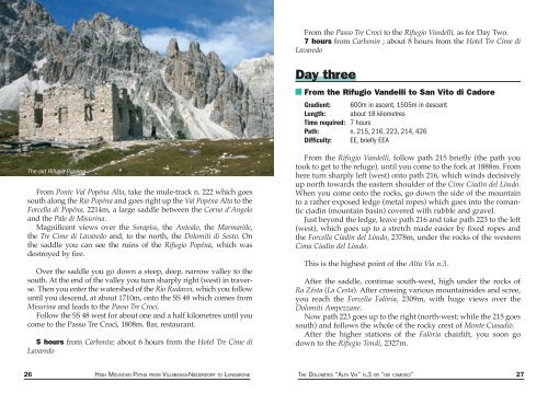
The old Rifugio Popèna<br />
From Ponte Val Popéna Alta, take the mule-track n. 222 which goes<br />
south along the Rio Popéna and goes right up the Val Popéna Alta to the<br />
Forcella di Popéna, 2214m, a large saddle between the Corno d’Angolo<br />
and the Pale di Misurina.<br />
Magnificent views over the Sorapìss, the Antealo, the Marmaròle,<br />
the Tre Cime di Lavaredo and, to the north, the <strong>Dolomiti</strong> di Sesto. On<br />
the saddle you can see the ruins of the Rifugio Popéna, which was<br />
destroyed by fire.<br />
Over the saddle you go down a steep, deep, narrow valley to the<br />
south. At the end of the valley you turn sharply right (west) in traverse.<br />
Then you enter the watershed of the Rio Rudavoi, which you follow<br />
until you descend, at about 1710m, onto the SS 48 which comes from<br />
Misurina and leads to the Passo Tre Croci.<br />
Follow the SS 48 west for about one and a half kilometres until you<br />
come to the Passo Tre Croci, 1808m. Bar, restaurant.<br />
5 hours from Carbonìn; about 6 hours from the Hotel Tre Cime di<br />
Lavaredo<br />
From the Rifugio Vandelli, follow path 215 briefly (the path you<br />
took to get to the refuge), until you come to the fork at 1888m. From<br />
here turn sharply left (west) onto path 216, which winds decisively<br />
up north towards the eastern shoulder of the Cime Ciadìn del Lòudo.<br />
When you come onto the rocks, go down the side of the mountain<br />
to a rather exposed ledge (metal ropes) which goes into the romantic<br />
ciadìn (mountain basin) covered with rubble and gravel.<br />
Just beyond the ledge, leave path 216 and take path 223 to the left<br />
(west), which goes up to a stretch made easier by fixed ropes and<br />
the Forcella Ciadìn del Lòudo, 2378m, under the rocks of the western<br />
Cima Ciadìn del Lòudo.<br />
This is the highest point of the Alta Via n.3.<br />
After the saddle, continue south-west, high under the rocks of<br />
Ra Zésta (La Cesta). After crossing various mountainsides and scree,<br />
you reach the Forcella Falòria, 2309m, with huge views over the<br />
<strong>Dolomiti</strong> Ampezzane.<br />
Now path 223 goes up to the right (north-west; while the 215 goes<br />
south) and follows the whole of the rocky crest of Monte Ciasadiò.<br />
After the higher stations of the Falòria chairlift, you soon go<br />
down to the Rifugio Tondi, 2327m.<br />
26 HIGH MOUNTAIN PATHS FROM VILLABASSA-NIEDERDORF TO LONGARONE THE DOLOMITES “ALTA VIA” N.3 OR “DEI CAMOSCI” 27