

Detailed Project Report - Commissionerate of Rural Development ...
Detailed Project Report - Commissionerate of Rural Development ...
Detailed Project Report - Commissionerate of Rural Development ...

You also want an ePaper? Increase the reach of your titles
YUMPU automatically turns print PDFs into web optimized ePapers that Google loves.
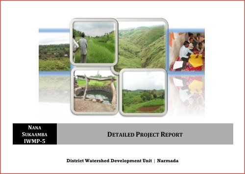
NANA<br />
SUKAAMBA<br />
IWMP-5<br />
DETAILED PROJECT REPORT<br />
District Watershed <strong>Development</strong> Unit | Narmada
1.1 <strong>Project</strong> Background ....................................................................................................................................................................................................................................................... 12<br />
Table no.1: Basic project information ............................................................................................................................................................................................................................ 12<br />
1.2 Need <strong>of</strong> Watershed <strong>Development</strong> Programme ................................................................................................................................................................................................... 14<br />
Table no.3: Watershed information ........................................................................................................................................................................................................................... 16<br />
1.3 Other developmental projects/schemes running in the <strong>Project</strong> area ........................................................................................................................................................ 17<br />
Table no.4: <strong>Development</strong>al programmes running in the project area: ........................................................................................................................................................ 17<br />
Table no. 5: Previous Watershed programmes in the project area ............................................................................................................................................................... 18<br />
2.1. <strong>Project</strong> Implementing Agency ............................................................................................................................................................................................................. 21<br />
2.2 About <strong>Project</strong> Implementing Agency, Rajpipla (Narmada)........................................................................................................................................................ 21<br />
2.2.1 The organization and its objectives: .............................................................................................................................................................................................................. 21<br />
2.3 SWOT Analysis <strong>of</strong> the DWDU: ................................................................................................................................................................................................................ 21<br />
Table no. 6: PIA: ................................................................................................................................................................................................................................................................. 22<br />
Table no. 7: Staff at PIA level: ........................................................................................................................................................................................................................................ 23<br />
3.1.1 Land use pattern: ........................................................................................................................................................................................................................................................ 25<br />
8: Land use pattern: .......................................................................................................................................................................................................................................................... 25<br />
3.1.2 Soil and topography: .................................................................................................................................................................................................................................................. 26<br />
Table no. 9: Soil type and topography: ...................................................................................................................................................................................................................... 26<br />
Table no. 10: Flood and drought condition: ............................................................................................................................................................................................................ 28<br />
District Watershed <strong>Development</strong> unit Narmada Page 2
Table no. 11: Soil Erosion ............................................................................................................................................................................................................................................... 28<br />
Table no. 11.2: Soil Salinity/Alkalinity (Salinity ingress) .................................................................................................................................................................................. 29<br />
Table no.12: Climatic conditions ................................................................................................................................................................................................................................. 29<br />
Table no. 13: Physiography and relief ....................................................................................................................................................................................................................... 30<br />
3.1.3 Land and Agriculture: ................................................................................................................................................................................................................................................ 30<br />
Table no. 14: Land ownership details ........................................................................................................................................................................................................................ 30<br />
Table no. 15: Agriculture ................................................................................................................................................................................................................................................ 31<br />
Table no. 16: Irrigation .................................................................................................................................................................................................................................................... 32<br />
Table no. 17: Crop details: .............................................................................................................................................................................................................................................. 33<br />
3.1.4 Livestock: ................................................................................................................................................................................................................................................................... 35<br />
Table no. 18: Livestock .................................................................................................................................................................................................................................................... 35<br />
Table no. 19 : Drinking water ....................................................................................................................................................................................................................................... 36<br />
Table no. 20: Details <strong>of</strong> Common Property Resources ........................................................................................................................................................................................ 37<br />
3.2. Socio-Economic Pr<strong>of</strong>ile ................................................................................................................................................................................................................................................ 38<br />
3.2. Socio-Economic Pr<strong>of</strong>ile ................................................................................................................................................................................................................................................ 38<br />
3.2.1 Demographic Status: ............................................................................................................................................................................................................................................. 38<br />
Table no. 21: Demographic information ................................................................................................................................................................................................................... 38<br />
Table no. 22: Literacy rate ............................................................................................................................................................................................................................................. 39<br />
Migration Pattern: ............................................................................................................................................................................................................................................................. 39<br />
District Watershed <strong>Development</strong> unit Narmada Page 3
Infrastructure facilities: .................................................................................................................................................................................................................................................. 41<br />
Table no. 26: Facilities / HH assets ............................................................................................................................................................................................................................. 42<br />
3.3. Livelihood pattern: ........................................................................................................................................................................................................................................................ 43<br />
Table no. 27: Per capita Income ................................................................................................................................................................................................................................... 43<br />
Dependence on Common Property Resource ............................................................................................................................................................................................................. 44<br />
Table no.28: Dependence on Forest/CPR ................................................................................................................................................................................................................ 44<br />
Table no. 29: Livelihood pattern (Occupational distribution) ......................................................................................................................................................................... 45<br />
3.4. Comparative data <strong>of</strong> the crop productivity <strong>of</strong> the area: project area vs. District vs. State vs. Country vs. World: .................................................................. 46<br />
3.4. Comparative data <strong>of</strong> the crop productivity <strong>of</strong> the area: project area vs. District vs. State vs. Country vs. World: ...... Error! Bookmark not defined.<br />
The Nana Sukaamba project area ................................................................................................................................................................................................................................ 51<br />
Watershed Activities ....................................................................................................................................................................................................................................... 54<br />
4.1. Scientific Planning: ........................................................................................................................................................................................................................................................ 54<br />
Table no. 30: Details <strong>of</strong> Scientific Planning and Inputs in IWMP projects ................................................................................................................................................... 59<br />
4.2. Institution building ....................................................................................................................................................................................................................................................... 60<br />
Table no. 31: Watershed Committee details[dediyapada] ................................................................................................................................................................................ 61<br />
Table no. 31.1 Watershed Committee details [Timbapada] ............................................................................................................................................................................. 62<br />
Table no. 31.2 Watershed Committee details [Gajargota]................................................................................................................................................................................. 63<br />
Table no. 31.3 Watershed Committee details [Pipla].......................................................................................................................................................................................... 64<br />
Table no. 31.4 Watershed Committee details [Bor] ............................................................................................................................................................................................. 65<br />
District Watershed <strong>Development</strong> unit Narmada Page 4
Table no. 31.5 Watershed Committee details [Ghantoli] ................................................................................................................................................................................... 66<br />
Table no. 31.6 Watershed Committee details [Rakhaskundi].......................................................................................................................................................................... 67<br />
Table no. 31.7 Watershed Committee details [Nana Sukaamba] .................................................................................................................................................................... 68<br />
Table no. 31.8 Watershed Committee details [Navagam (Dedi)] ................................................................................................................................................................... 69<br />
Table no. 31.9 Watershed Committee details [Nivalda].................................................................................................................................................................................... 70<br />
Table no. 31.10 Watershed Committee details [Besna] ..................................................................................................................................................................................... 71<br />
Table no. 31.11 Watershed Committee details [Bogaj] ...................................................................................................................................................................................... 72<br />
Table no. 32: SHG details ................................................................................................................................................................................................................................................ 73<br />
Table no. 32: SHG details ................................................................................................................................................................................................................................................ 73<br />
User Group: .............................................................................................................................................................................................................................................................................. 75<br />
Table no. 33: UG detail ..................................................................................................................................................................................................................................................... 75<br />
4.3. Physical activities to be undertaken under IWMP 1 (Nanasukaamba) .................................................................................................................................................... 76<br />
4.3.1 Entry Point activity (EPA) ................................................................................................................................................................................................................................... 76<br />
Table no.34: Entry point activities (EPA) (All financial figures in lakh Rs.) ............................................................................................................................................... 76<br />
Table no.34.1: Convergence under entry point activities (EPA) (All financial figures in lakh Rs.) .................................................................................... 78<br />
4.3.2. Watershed <strong>Development</strong> Works: .................................................................................................................................................................................................................... 84<br />
Table no.36: Activities related to Surface water resources in the project areas (all financial figures in lakh Rs.) ..................................................................... 85<br />
Table no. 36 .1:.................................................................................................................................................................................................................................................................... 90<br />
Table no. 38: Activities related to livelihoods by Self Help Groups (SHGs) in the project areas ........................................................................................................ 93<br />
District Watershed <strong>Development</strong> unit Narmada Page 5
Table no. 38.2: Animal husbandry .............................................................................................................................................................................................................................. 96<br />
Table no. 39: Other activities <strong>of</strong> watershed works phase – Proposed target ............................................................................................................................................. 97<br />
Table no.40: Details <strong>of</strong> engineering structures in watershed works*........................................................................................................................................................... 97<br />
Table No. 40.1: Technical Specification <strong>of</strong> stone bund (Pipla village: Survey no.174,173,96,146,152,15,95,101,118,126) ................................................... 98<br />
Table No. 40.2: Technical Details <strong>of</strong> Continuous Contour Trenches (CCT) in Gajargota (Survey no.(C.N)137,91) .................................................................... 98<br />
Table No 40.3 Quantity Calculation: CCT ................................................................................................................................................................................................................. 99<br />
Table no 40.5: Quantity Calculation <strong>of</strong> Continous Contour trench ............................................................................................................................................................. 100<br />
Nala banding ......................................................................................................................................................................................................................................................................... 101<br />
Table no 40.6: Technical details <strong>of</strong> Nala banding on Survey no. (137,91) (Village Gajarghota) .................................................................................................... 101<br />
Table no 40.7: Quantity details <strong>of</strong> Nala banding on Survey no. (137,91) (Village Gajarghota) .................................................................................................... 101<br />
Table no 40.8: Technical details <strong>of</strong> Check dam no.1 on survey no. 179 (village: Pipla)...................................................................................................................... 102<br />
Table no 40.9: Quantity Calculation <strong>of</strong> Check dam on survey no. 179 (village: Pipla) ........................................................................................................................ 102<br />
Table no 40.10: Technical details <strong>of</strong> check dam No. 2 on Survey no.235 (Village:Nivalda) .............................................................................................................. 103<br />
Table no 40.11: Quantity Calculation <strong>of</strong> Check dam No. 2 on Survey no.235 (Village:Nivalda) ...................................................................................................... 103<br />
Table no 40.12: Technical details <strong>of</strong> check dam No. 3 on Survey no.(CN)235 (Village:Bore) .......................................................................................................... 104<br />
Table no 40.13: Quantity Calculation <strong>of</strong> Check dam No. 3 on Survey no.(CN)235 (Village:Bore) .................................................................................................. 104<br />
Table no 40.14: Technical details <strong>of</strong> Gabion structure survey no.91, 96,112,120,129,177 (Village: Bogaj) .............................................................................. 105<br />
Table no 40.15: Quantity Calculation <strong>of</strong> Gabion structure Compartment no: 437 (Village: Olgam) .............................................................................................. 106<br />
Table no 40.16: Technical details <strong>of</strong> Check wall on Survey no. 12, 20, 21, 23, 38(Village: Rakaskundi) ..................................................................................... 106<br />
District Watershed <strong>Development</strong> unit Narmada Page 6
Table no 40.17: Quantity Calculation <strong>of</strong> Check wall Survey no. 12, 20, 21, 23, 38(Village: Rakaskundi) .................................................................................... 107<br />
Table No. 40.18: Technical Details <strong>of</strong> Check wall No2 on Survey no.130, 204,177,184 (Village: Ghatoli) .................................................................................. 107<br />
Table No. 40.19, Quantity Excavation for Check wall No2 on Survey no. 130,204,177,184 (Village: Ghatoli) .......................................................................... 108<br />
Table no.41: Details <strong>of</strong> activities connected with vegetative cover in watershed works ................................................................................................................... 108<br />
Table No. 41.1: Technical Details <strong>of</strong> Afforestation Activities ........................................................................................................................................................................ 108<br />
Table No. 41.2: Cost Estimation for afforestation .............................................................................................................................................................................................. 110<br />
activity ................................................................................................................................................................................................................................................................................ 111<br />
Table no.42: Details <strong>of</strong> allied / other activities ................................................................................................................................................................................................... 111<br />
Production System-1: Cement pole making (Primary model for cement pole making) ..................................................................................................................... 112<br />
Table no: 34.1, Cost <strong>of</strong> Cement pole making ........................................................................................................................................................................................................ 113<br />
Table No. 34.1.2 Total cost for 500 cement pole ................................................................................................................................................................................................ 114<br />
Table No. 34.1.3, Revenue and return Details. .................................................................................................................................................................................................... 114<br />
Table No. 35.3, Revenue and return Details. ........................................................................................................................................................................................................ 116<br />
Production system: 3 Vegetable (Bottle guard) Production .............................................................................................................................................................................. 117<br />
Advantage <strong>of</strong> vegetable production: ............................................................................................................................................................................................................................ 117<br />
Limitation <strong>of</strong> vegetable production: ............................................................................................................................................................................................................................ 118<br />
Table no: 36.1, Cost <strong>of</strong> cultivation for bottle guard production ................................................................................................................................................................... 119<br />
Table No. 36.2. Initial investment for fodder bank ............................................................................................................................................................................................ 119<br />
Table No. 36.3, Revenue and return Details. ........................................................................................................................................................................................................ 119<br />
District Watershed <strong>Development</strong> unit Narmada Page 7
Production System - 4: Vermicompost unit for Nanasukaamba ...................................................................................................................................................................... 120<br />
Table: 37.1: Model for A Vermi-compost Unit ..................................................................................................................................................................................................... 123<br />
Table No.37.2: Returns from vermicomposting ................................................................................................................................................................................................. 123<br />
Table no.43: Details <strong>of</strong> activities in the CPRs in the project areas ............................................................................................................................................................... 124<br />
4.4. Capacity Building: ....................................................................................................................................................................................................................................................... 124<br />
Table: 37.3 Model for A poly house ......................................................................................................................................................................................................................... 126<br />
Table No.37.4: Returns from polyhouse ................................................................................................................................................................................................................ 128<br />
Table No.37.4: Modal for mandap decoration ..................................................................................................................................................................................................... 129<br />
Table No.37.5: Modal for Nursery raising ............................................................................................................................................................................................................. 131<br />
Table No.37.6: Revenue and return detail <strong>of</strong> nursery ...................................................................................................................................................................................... 132<br />
Table no. 44: Capacity Building Institution: ......................................................................................................................................................................................................... 133<br />
Table no. 45: Capacity Building plan:...................................................................................................................................................................................................................... 134<br />
Table no.46: Information, education and Communication Activities: ....................................................................................................................................................... 134<br />
Budgeting .......................................................................................................................................................................................................................................................... 136<br />
Table no. 47: Budget at a glance ............................................................................................................................................................................................................................... 136<br />
Table no. 48: Village component wise budget available under IWMP ....................................................................................................................................................... 137<br />
Table no. 49: Village wise gap in funds requirement ....................................................................................................................................................................................... 138<br />
Table no.50: Details <strong>of</strong> Convergence <strong>of</strong> IWMP (Watershed development work) with other Schemes ......................................................................................... 139<br />
Table no.50.1: Details <strong>of</strong> Convergence <strong>of</strong> IWMP (Livelihood& Production system) with other Schemes ................................................................................... 144<br />
District Watershed <strong>Development</strong> unit Narmada Page 8
6.1 Expected Outcomes..................................................................................................................................................................................................................................................... 151<br />
6.1.1 Employment .......................................................................................................................................................................................................................................................... 151<br />
Table no. 52: Employment in <strong>Project</strong> area ............................................................................................................................................................................................................ 151<br />
6.1.2. Migration ................................................................................................................................................................................................................................................................ 152<br />
Table no. 53: Details <strong>of</strong> seasonal migration from <strong>Project</strong> area ..................................................................................................................................................................... 152<br />
Table no. 54: Details <strong>of</strong> average ground water table depth in the project areas (in meters) ........................................................................................................... 154<br />
Drinking water ................................................................................................................................................................................................................................................................. 154<br />
Table no. 55: Status <strong>of</strong> Drinking water ................................................................................................................................................................................................................... 154<br />
6.1.5 Crops ......................................................................................................................................................................................................................................................................... 155<br />
Table no. 56: Details <strong>of</strong> crop area and yield in the project area ................................................................................................................................................................... 156<br />
6.1.6 Horticulture ........................................................................................................................................................................................................................................................... 156<br />
Table no. 57: Area under horticulture .................................................................................................................................................................................................................... 156<br />
1.7 Vegetative cover ...................................................................................................................................................................................................................................................... 157<br />
Table no. 58: Forest/vegetative cover ................................................................................................................................................................................................................... 157<br />
6.1.8 Livestock ................................................................................................................................................................................................................................................................. 158<br />
Table no. 59: Details <strong>of</strong> livestock in the project areas (for fluids please mention in litres, for solids please mention in kgs. and income in Rs.) ...... 158<br />
Table no. 60: Backward-Forward linkages ........................................................................................................................................................................................................... 159<br />
Logical Framework Analysis .......................................................................................................................................................................................................................................... 160<br />
7 Quality and Sustainability Issues .......................................................................................................................................................................................................... 166<br />
District Watershed <strong>Development</strong> unit Narmada Page 9
7.1 Plans for Monitoring and Evaluation ................................................................................................................................................................................................................... 166<br />
7.2 Plans For <strong>Project</strong> management: ............................................................................................................................................................................................................................. 167<br />
7.3 Watershed <strong>Development</strong> Fund: ............................................................................................................................................................................................................................. 167<br />
7.4 User Charges:................................................................................................................................................................................................................................................................. 167<br />
8.Maps..................................................................................................................................................................................................................................................................189<br />
District Watershed <strong>Development</strong> unit Narmada Page 10
CHAPTER -1<br />
PROJECT BACKGROUND<br />
District Watershed <strong>Development</strong> unit Narmada Page 11
1.1 <strong>Project</strong> Background<br />
Nanasukaamba (IWMP-5) project is located in Dadiyapada Taluka, Narmada District <strong>of</strong> Gujarat state. The project is a cluster <strong>of</strong> Seven microwatersheds<br />
with 5D1A5c1d, 5D1A5c1f, 5D1A5c1h, 5D1A5c2c, 5D1A5cle, 5D1A5c1g, 5D1A5c1j being their respective codes. The watershed includes<br />
Fourteen village <strong>of</strong><br />
Nanasukaamba,Timbapada,Dadiyapada,Nivalda,Ghankhater,Katankhadi,Bore,Bogaj,Ghantoli,Kismor,Navgam(Dediyapada),Rakaskundi,Pipla,Basana.<br />
The total project area <strong>of</strong> the watershed is about 4854 Ha, <strong>of</strong> which 4854 Ha has been undertaken to be treated under Integrated Watershed<br />
Management Programme (IWMP) starting year 2009-10.<br />
Table no.1: Basic project information<br />
Sl<br />
No.<br />
Name <strong>of</strong><br />
the<br />
project<br />
Name<br />
Villages<br />
Census<br />
code<br />
Gram<br />
Panchayats<br />
Taluka District Area <strong>of</strong><br />
the<br />
project<br />
Area<br />
proposed<br />
to be<br />
treated<br />
Total<br />
project<br />
cost(Rs.<br />
in lakh)<br />
PIA<br />
1<br />
Nana<br />
Sukaamba<br />
01532800 Mota Sukaamba Dediyapada Narmada 1956 179.10 ha 2014920<br />
2<br />
Timbapada<br />
01527500 Dediyapada Dediyapada Narmada<br />
238.30<br />
ha<br />
2859600<br />
3<br />
Nana<br />
Sukaamba<br />
Dediyapada<br />
01536100 Dediyapada Dediyapada Narmada 582.70 ha 6992400<br />
Forest<br />
Departmentr,Narmada<br />
4<br />
Nivalda<br />
01534800 Nivalda Dediyapada Narmada 595.20 ha 7142400<br />
5 Gajargota 01535900 Ghatoli Dediyapada Narmada 549.60ha 6595200<br />
District Watershed <strong>Development</strong> unit Narmada Page 12
6<br />
Katakankhadi<br />
01536800 Ghatoli Dediyapada Narmada 222.40ha 2668800<br />
7<br />
Bore<br />
01536200 Ghatoli Dediyapada Narmada 360.50ha 4326000<br />
8<br />
Bogaj<br />
01536500 Kolivada Dediyapada Narmada 81.90ha 5182800<br />
9<br />
Ghatoli<br />
01534600 Ghatoli Dediyapada Narmada 236.20ha 8834400<br />
10<br />
Kismor<br />
01536600 Ghatoli Dediyapada Narmada 93.00ha 1116000<br />
11<br />
Navagam(Dedi)<br />
01537100 Navagam[Dedi] Dediyapada Narmada 386.80ha 4641600<br />
12<br />
Rakaskundi<br />
01532600<br />
Ghatoli<br />
Dediyapada Narmada 149.70ha 1796400<br />
13<br />
Pipala<br />
01529100 Besana Dediyapada Narmada 552.20ha 6626400<br />
14<br />
Besana<br />
01525900<br />
Besana<br />
Dediyapada Narmada 626.40ha 7516800<br />
District Watershed <strong>Development</strong> unit Narmada Page 13
1.2 Need <strong>of</strong> Watershed <strong>Development</strong> Programme<br />
Watershed <strong>Development</strong> Programme is prioritised on the basis <strong>of</strong> thirteen parameters namely Poverty Index, Percentage <strong>of</strong> SC/ST, Actual<br />
wages, Percentage <strong>of</strong> small and marginal farmers, Ground water status, Moisture Index, Area under rain fed agriculture, Drinking water situation in<br />
the area, Percentage <strong>of</strong> the degraded land, Productivity potential <strong>of</strong> the land, Continuity <strong>of</strong> another watershed that has already developed/treated,<br />
Cluster approach for plain or for hilly terrain. Based on these thirteen parameters a composite ranking was given to Nanasukaamba Watershed project<br />
as given in table no. 2.<br />
The total number <strong>of</strong> families under BPL is 2693 (79%), which is less than 80 per cent <strong>of</strong> the total households <strong>of</strong> the village. Hence a score <strong>of</strong> 7.5<br />
is allotted. The percentage <strong>of</strong> schedule castes in the village is 100 per cent to the total population; hence a score <strong>of</strong> 10 was allotted. More than 60 per<br />
cent <strong>of</strong> the farmers are small and marginal by nature and the actual wages earned by the labour is less than the minimum wages hence a composite<br />
rank <strong>of</strong> 5, 3 and 5 are allotted respectively.<br />
The soil type is black cotton and production <strong>of</strong> the land can be significantly enriched with the availability <strong>of</strong> timely irrigation. Cluster approach<br />
was followed taking into consideration ten micro-watersheds covering a total area <strong>of</strong> 5038.1 Ha. All the parameters taken together give a cumulative<br />
score <strong>of</strong> 107.5 to the watershed (reference Table 2.1 below).<br />
Table no. 2: Weightage <strong>of</strong> the project<br />
<strong>Project</strong><br />
name<br />
IWMP 5<br />
<strong>Project</strong><br />
type<br />
other<br />
Weightage<br />
i ii iii iv v vi vii viii ix x xi xii Xiii<br />
7.5 10 5 5 3 10 10 7 10 10 15 15 NA<br />
District Watershed <strong>Development</strong> unit Narmada Page 14
S.<br />
Maximum<br />
Criteria<br />
No.<br />
score<br />
Ranges & scores<br />
I Poverty index (% <strong>of</strong> poor to<br />
population)<br />
10 Above 80 % (10) 80 to 50 % (7.5) 50 to 20 % (5) Below 20<br />
% (2.5)<br />
ii % <strong>of</strong> SC/ ST population 10 More than 40 % (10) 20 to 40 % (5) Less than 20 % (3)<br />
iii Actual wages 5 Actual wages are<br />
significantly lower than<br />
minimum wages (5)<br />
Actual wages are equal<br />
to or higher than<br />
minimum wages (0)<br />
iv % <strong>of</strong> small and marginal 10 More than 80 % (10) 50 to 80 % (5) Less than 50 % (3)<br />
farmers<br />
V Ground water status 5 Over exploited (5) Critical (3) Sub critical (2) Safe (0)<br />
vi Moisture index/<br />
DPAP/ DDP Block<br />
15 -66.7 & below (15)<br />
DDP Block<br />
-33.3 to -66.6 (10)<br />
DPAP Block<br />
0 to -33.2 (0)<br />
Non DPAP/ DDP Block<br />
vii Area under rain-fed<br />
15 More than 90 % (15) 80 to 90 % (10) 70 to 80% (5) Above 70<br />
agriculture<br />
viii Drinking water 10 No source (10) Problematic village<br />
(7.5)<br />
ix Degraded land 15 High – above 20 % (15) Medium – 10 to 20 %<br />
(10)<br />
X Productivity potential <strong>of</strong><br />
the land<br />
xi<br />
Contiguity to another<br />
watershed that has already<br />
been developed/ treated<br />
15 Lands with low<br />
production & where<br />
productivity can be<br />
significantly enhanced<br />
with reasonable efforts<br />
(15)<br />
10 Contiguous to previously<br />
treated watershed &<br />
contiguity within the<br />
microwatersheds in the<br />
Lands with moderate<br />
production & where<br />
productivity can be<br />
enhanced with<br />
reasonable efforts (10)<br />
Contiguity within the<br />
microwatersheds in the<br />
project but non<br />
contiguous to<br />
Partially covered (5)<br />
Low- less than 10 % <strong>of</strong><br />
TGA (5)<br />
Lands with high<br />
production & where<br />
productivity can be<br />
marginally enhanced<br />
with reasonable<br />
efforts (5)<br />
Neither contiguous to<br />
previously treated<br />
watershed nor<br />
contiguity within the<br />
% (Reject)<br />
Fully<br />
covered<br />
(0)<br />
District Watershed <strong>Development</strong> unit Narmada Page 15
xii<br />
xiii<br />
Cluster approach in the<br />
plains (more than one<br />
contiguous microwatersheds<br />
in the project)<br />
Cluster approach in the<br />
hills (more than one<br />
contiguous microwatersheds<br />
in the project)<br />
project (10)<br />
15 Above 6 micro-watersheds<br />
in cluster (15)<br />
15 Above 5 micro-watersheds<br />
in cluster (15)<br />
previously treated<br />
watershed (5)<br />
4 to 6 microwatersheds<br />
in cluster (10)<br />
3 to 5 microwatersheds<br />
in cluster (10)<br />
microwatersheds in<br />
the project (0)<br />
2 to 4<br />
microwatersheds in<br />
cluster (5)<br />
2 to 3<br />
microwatersheds in<br />
cluster (5)<br />
Total 150 150 90 41 2.5<br />
Table no.3: Watershed information<br />
Name <strong>of</strong> the project No. <strong>of</strong> watersheds to be treated Watershed code Watershed regime/type/order<br />
IWMP -5 7<br />
5D1A5c1d, 5D1A5c1f,<br />
5D1A5c1h, 5D1A5c2c,<br />
5D1A5c1e, 5D1A5c1g, 5D1A5c1j,<br />
Mini Watershed<br />
District Watershed <strong>Development</strong> unit Narmada Page 16
1.3 Other developmental projects/schemes running in the <strong>Project</strong> area<br />
This Nanasukaamba project has been on top priority <strong>of</strong> a number <strong>of</strong> developmental projects. These programmes are Mahatma Gandhi National <strong>Rural</strong><br />
Employment Guarantee Scheme (MGNREGS),Total Sanitation Campaign (TSC), Swarnajayanti Gram Swarojgar Yojana (SGSY), Indira Awas Yojana<br />
(IAY) and Sardar Awas Yojana (SAY).<br />
Table no.4: <strong>Development</strong>al programmes running in the project area:<br />
S<br />
no<br />
Name <strong>of</strong> the<br />
programme/scheme<br />
1 MGNREGS<br />
2 IAY<br />
Sponsoring<br />
agency<br />
<strong>Rural</strong><br />
<strong>Development</strong><br />
Dept.<br />
<strong>Rural</strong><br />
<strong>Development</strong><br />
Dept.<br />
Objectives <strong>of</strong> the<br />
programme/scheme<br />
Year <strong>of</strong> commencement<br />
Villages<br />
covered<br />
Estimated<br />
number <strong>of</strong><br />
beneficiaries<br />
Employment 2009 12 1260Household<br />
Housing 2004-05 11 220<br />
3 TSC Central Govt. Toylet 2006-07 11 1178<br />
District Watershed <strong>Development</strong> unit Narmada Page 17
Table no. 5: Previous Watershed programmes in the project area<br />
In project area IWMP is the first watershed programme.<br />
S.<br />
N<br />
o<br />
<strong>Project</strong><br />
name<br />
Year<br />
started<br />
1 - -<br />
2 - -<br />
3 - -<br />
4 - -<br />
5 - -<br />
6 - -<br />
Name <strong>of</strong><br />
villages<br />
No. Of<br />
micro<br />
watershed<br />
Watershed<br />
codes<br />
Area<br />
under<br />
treatment<br />
Funding<br />
source<br />
Nodal<br />
agency<br />
PIA<br />
Total cost<br />
Expenditure<br />
incurred up<br />
to start <strong>of</strong><br />
IWMP<br />
% financial<br />
completion<br />
% physical<br />
completion<br />
Nana<br />
Sukaamba - - - - - - - - - -<br />
Timbapada<br />
Dediyapada<br />
Nivalda<br />
Gajargota<br />
- - - - - - - - - -<br />
- - - - - - - - - -<br />
- - - - - - - - - -<br />
- - - - - - - - - -<br />
Katakankha<br />
di - - - - - - - - - -<br />
7 - -<br />
8 - -<br />
9 - -<br />
10 - -<br />
Bore<br />
Bogaj<br />
Ghatoli<br />
Kismor<br />
- - - - - - - - - -<br />
- - - - - - - - - -<br />
- - - - - - - - - -<br />
- - - - - - - - - -<br />
District Watershed <strong>Development</strong> unit Narmada Page 18
11 - -<br />
Navagam<br />
(Dedi) - - - - - - - - - -<br />
12 - -<br />
13 - -<br />
14 - -<br />
Rakaskundi<br />
Pipala<br />
Besana<br />
- - - - - - - - - -<br />
- - - - - - - - - -<br />
- - - - - - - - - -<br />
District Watershed <strong>Development</strong> unit Narmada Page 19
CHAPTER – 2<br />
PROJECT IMPLEMENTING AGENCY<br />
District Watershed <strong>Development</strong> unit Narmada Page 20
2.1. <strong>Project</strong> Implementing Agency<br />
The <strong>Project</strong> Implementing Agencies (PIA) is selected by an appropriate mechanism by Gujarat State Watershed Management Agency (GSWMA), the<br />
State Level Nodal Agency (SLNA) for Integrated Watershed Management Programme (IWMP) in Gujarat. The PIAs are responsible for implementation<br />
<strong>of</strong> watershed project. These PIAs may include relevant line departments, autonomous organizations under State/ Central Governments,<br />
Government Institutes/ Research bodies, Intermediate Panchayats, Voluntary Organizations (VOs).The PIA for Nanasukaamba watershed <strong>Project</strong> is<br />
Line Department Rajpipla (Narmada).<br />
2.2 About <strong>Project</strong> Implementing Agency, Rajpipla (Narmada)<br />
2.2.1 The organization and its objectives:<br />
PIA <strong>of</strong> the Nana sukaamba project is Rajpipla East Forestry Division. The Deputy Conservator <strong>of</strong> Forest (DCF) is the head <strong>of</strong> division. PIA has<br />
dedicated and experienced staff comprising one Range Forest Officer (Nodal <strong>of</strong>ficer) and a watershed development team <strong>of</strong> civil engineer,<br />
agriculture expert and community mobiliser, Data Entry Operator, surveyor, and accountant. The objective <strong>of</strong> the PIA is supervising, planning,<br />
implementing, documenting and promoting watershed development projects and related developmental activities at project level as per<br />
guidelines. This also submits the documents at the district level. The DWDU, Narmada is not working as a PIA for any IWMP projects.<br />
2.3 SWOT Analysis <strong>of</strong> the DWDU:<br />
Strength:<br />
(1) Dedicated and experienced staff and a multidisciplinary team<br />
(2) Independent District Level Nodal Agency.<br />
District Watershed <strong>Development</strong> unit Narmada Page 21
(3) Strong linkages with national and state level institutions, agricultural universities, South Gujarat University and NGOs for capacity building and<br />
technical guidance<br />
(4) Scientific planning in watershed projects with the help <strong>of</strong> BISAG, Gandhinagar,<br />
(5) District level monitoring, coordination & Co-operation Committee<br />
Weakness:<br />
(1) Lack <strong>of</strong> permanent staff.<br />
(2) Total project area is Tribal<br />
Opportunities:<br />
(1) A number <strong>of</strong> different other development schemes <strong>of</strong> the government are running; so, there can be horizontal integration and convergence <strong>of</strong><br />
programmes<br />
(2) Better financial provision under IWMP<br />
(3) Usage <strong>of</strong> new ICT tools like GIS, GPS<br />
Threats:<br />
(1) Rainfall being very scarce and unreliable in the project area, the activities planned to be taken up may yield limited impact<br />
(2) Irregularities in fund flow can derail the smooth functioning<br />
(3) Lack <strong>of</strong> contribution and cooperation from local people<br />
(4) Low literacy rate in the project are<br />
Table no. 6: PIA:<br />
Sl. No. Names <strong>of</strong> project Details <strong>of</strong> PIA<br />
1<br />
IWMP-5<br />
Nana sukaamba <strong>Project</strong><br />
(i) Type <strong>of</strong> organization PIA (<strong>Project</strong> Implementing Agency)<br />
(ii) Name <strong>of</strong> organization East forest division Rajpipla<br />
(iii) Designation & Address DFO East division Vadiya palace<br />
(iv) Telephone 224647<br />
(v) Fax 220896<br />
District Watershed <strong>Development</strong> unit Narmada Page 22
(vi) E-mail dcfrajpiplaeast@gmail.com<br />
Table no. 7: Staff at PIA level:<br />
Monthly<br />
S.<br />
Name Age Sex Designation Qualification Experience Job assigned remuneration<br />
no<br />
(Rs)<br />
1. Dr.Shashi Kumar 31 M DFO PhD (Horticulture) 2 Monitoring 50000.00<br />
2. D.T Patel 50 M RFO Bsc (Agriculture) 25 <strong>Project</strong> <strong>of</strong>ficer 43000.00<br />
3.<br />
Vasava Ishwar 35 M WDT(Agriculture) BRS(Agri) 10Years Agriculture<br />
8000.00<br />
<strong>Development</strong><br />
4.<br />
Mimla 33 F WDT(Community<br />
BRS 6Years Community 8000.00<br />
Mob.)<br />
Mobilization<br />
5. Vasava Indravardan 28 M WDT (Surveyor) ITI (Surveyor) 7 Survey 6.0<br />
7. Bankar Sachin 23 M WDT.Eng Diploma Civil 1 Years Technical 80000<br />
District Watershed <strong>Development</strong> unit Narmada Page 23
CHAPTER – 3<br />
BASIC INFORMATION OF THE PROJECT AREA<br />
District Watershed <strong>Development</strong> unit Narmada Page 24
3.1. Geography and Geo-hydrology<br />
3.1.1 Land use pattern:<br />
The net geographical area <strong>of</strong> Nanasukaamba watershed is about 4854 ha out <strong>of</strong> which 55% is forest area. About 26% <strong>of</strong> land is under<br />
agriculture which is rain-fed and irrigated; mainly Rabi and kharib crops are taken. About 14% <strong>of</strong> the total land is classified under wasteland <strong>of</strong> which<br />
80 percent is cultivable and rest is uncultivable. The watershed consists <strong>of</strong> bamboo which is a main livelihood source in project area.<br />
8: Land use pattern:<br />
S. No.<br />
Names <strong>of</strong><br />
villages<br />
Geographical Area<br />
<strong>of</strong> the village (ha)<br />
Forest Area<br />
(ha)<br />
Land under<br />
agricultural use<br />
(ha)<br />
Rain-fed<br />
area (ha)<br />
Permanent<br />
pastures (ha)<br />
Cultivable<br />
(ha)<br />
Wasteland<br />
Non-cultivable<br />
(ha)<br />
1 Nana<br />
Sukaamba<br />
Timbapada<br />
2<br />
Dediyapada<br />
3<br />
Nivalda<br />
4<br />
Katakankhadi<br />
5<br />
Bore<br />
6<br />
Bogaj<br />
7<br />
Ghatoli<br />
8<br />
Kismor<br />
9<br />
429.10 171.50 204.00 194.00 0.00 36.70 16.90<br />
238.30 - 177.20 163.20 0.00 17.80 43.20<br />
582.70 - 265.00 228.00 0.00 77.80 240.00<br />
595.20 16.00 350.40 350.40 0.00 212.40 16.50<br />
549.60 222.40 0.00 0.00 0.00 0.00 0.00<br />
360.50 360.50 0.00 0.00 0.00 0.00 0.00<br />
431.90 16.70 318.00 318.00 0.00 71.70<br />
25.50<br />
736.20 305.70 269.70 269.70 0.00 27.20 134.00<br />
93.00 93.00 0.00 0.00 0.00 0.00<br />
District Watershed <strong>Development</strong> unit Narmada Page 25
10<br />
Navagam(Dedi)<br />
386.80 31.90 303.10 303.10 0.00 6.00 45.80<br />
11<br />
Rakhskundi<br />
149.70 20.90 95.10 85.10 0.00 11.70 22.00<br />
12<br />
Pipala<br />
552.20 149.00 400.10 400.10 0.00 3.00 0.00<br />
13<br />
Besansa<br />
626.40 191.80 400.10 400.10 0.00 26.20 8.40<br />
14 Gajargota 549.60 200<br />
3.1.2 Soil and topography:<br />
Nanasukaamba watershed project (IWMP5) falls under South Gujarat Agro Climatic Zone. The soil is mainly deep black and clay. The soil is brown to<br />
black in surface colour. The depth <strong>of</strong> soil is moderate to deep about 25 to 75 cm.The annual rainfall is 1100 mm. The predominant texture <strong>of</strong> soil is<br />
loamy and clay. The soil fertility is average with low contain <strong>of</strong> nitrogen, phosphorus and potash. The topography <strong>of</strong> the area is moderate ranging from<br />
0-15% slope.<br />
Table no. 9: Soil type and topography:<br />
S. No.<br />
Name <strong>of</strong> the Agro-climatic zone<br />
covers project area<br />
Area in ha<br />
Names <strong>of</strong> the<br />
villages<br />
a)Type<br />
Major soil types<br />
b) Area in ha<br />
Topography<br />
1<br />
179.10 Nana Sukaamba Black Cotton soil 1456<br />
Black Cotton soil<br />
South Gujarat Agro climatic<br />
2 238.30 Timbapada<br />
zone<br />
Black Cotton soil<br />
3 582.70 Dediyapada<br />
Flat to moderate<br />
slope<br />
District Watershed <strong>Development</strong> unit Narmada Page 26
4 595.20 Nivalda<br />
5 222.40 Katkankhadi<br />
6 360.50 Bore<br />
7 81.90 Bogaj<br />
8 236.20 Ghatoli<br />
9 93.00 Kismor<br />
10 386.80 Navagam(Dedi)<br />
11 149.70 Rakhskundi<br />
12 552.20 Pipala<br />
13 626.40 Besana<br />
14 549.60 Gajargota<br />
Black Cotton soil<br />
Black Cotton soil<br />
Black Cotton soil<br />
Black Cotton soil<br />
Black Cotton soil<br />
Black Cotton soil<br />
Black Cotton soil<br />
Black Cotton soil<br />
Black Cotton soil<br />
Black Cotton soil<br />
Black Cotton soil<br />
District Watershed <strong>Development</strong> unit Narmada Page 27
Table no. 10: Flood and drought condition:<br />
S.No Village Flood (Incidence) Drought (Incidence)<br />
1 Nana Sukaamba Nil Once in 5 Years<br />
2 Timbapada Nil<br />
Once in 5 Years<br />
3 Dediyapada Nil<br />
4 Nivalda Nil<br />
5 Katkankhadi Nil<br />
6 Bore Nil<br />
7 Bogaj Nil<br />
8 Ghatoli Nil<br />
9 Kismor Nil<br />
10 Navagam(Dedi) Nil<br />
11 Rakhskundi Nil<br />
12 Pipala Nil<br />
13 Besana Nil<br />
14 Gajargota Nil<br />
Table no. 11: Soil Erosion<br />
Cause Type <strong>of</strong> erosion Area affected (ha)<br />
Water erosion<br />
Run <strong>of</strong>f<br />
(mm/ year)<br />
Once in 5 Years<br />
Once in 5 Years<br />
Once in 5 Years<br />
Once in 5 Years<br />
Once in 5 Years<br />
Once in 5 Years<br />
Once in 5 Years<br />
Once in 5 Years<br />
Once in 5 Years<br />
Once in 5 Years<br />
Once in 5 Years<br />
Once in 5 Years<br />
Average soil loss (Tonnes/<br />
ha/ year)<br />
a Sheet 1553 50-60% -<br />
District Watershed <strong>Development</strong> unit Narmada Page 28
Rill 1942<br />
c Gully 388<br />
Sub-Total 3883<br />
Wind erosion 0 NA<br />
Total 3883<br />
Table no. 11.2: Soil Salinity/Alkalinity (Salinity ingress)<br />
Name <strong>of</strong> the project Survey Number Soil pH<br />
Type <strong>of</strong> Salinity<br />
(Inherent/Ingress)<br />
Nana Sukaamba 7.4 Inherent<br />
Table no.12: Climatic conditions<br />
Sl. No. Year Rainfall (in mm)<br />
Temperature (˚C)<br />
Highest intensity <strong>of</strong> Rainfall (mm<br />
Max.<br />
Min.<br />
in a day)<br />
1 2004 1130.25 42 27 200<br />
2 2005 1178.00 42.5 27 190<br />
3 2006 1604.00 43 28 210<br />
4 2007 1389.50 44 27.5 200<br />
5 2008 1146.25 43 28 180<br />
6 2009 822.25 44 27 210<br />
The average rainfall <strong>of</strong> this area is about 1100 mm (from past five year data) with a highest intensity <strong>of</strong> 200 mm within span <strong>of</strong> a day. This<br />
uneven distribution is leading to run<strong>of</strong>f <strong>of</strong> soil every year.<br />
District Watershed <strong>Development</strong> unit Narmada Page 29
Table no. 13: Physiography and relief<br />
<strong>Project</strong> name Elevation(MSL) Slope range (%) Major streams<br />
Nana Sukaamba 171.4meters 0-20 % Dhamankhadi,Karjan<br />
3.1.3 Land and Agriculture:<br />
The average land holding is about 0.37 ha ranging from 0.150 to 0.720 ha. Lack <strong>of</strong> irrigation source forces the majority <strong>of</strong> the farmers to<br />
migrate to ensure their livelihood. This affects directly the demographic pr<strong>of</strong>ile <strong>of</strong> the village. The major crops cultivated by the farmers are Rice<br />
(paddy), Sorghum, Cotton, Pigonpea and Wheat. Farmers take crops according to mansoon. The land conservation measures such as Check dams and<br />
farm bunds in the area will help them to increase cropping intensity <strong>of</strong> project area.<br />
Table no. 14: Land ownership details<br />
S No<br />
Village<br />
Nana sukaamba<br />
1<br />
Dadiyapada<br />
2<br />
Nivalda<br />
3<br />
Gajargota<br />
4<br />
Katankhadi (Ujjad)<br />
5<br />
Bore<br />
6<br />
Bogaj<br />
7<br />
Ghatoli<br />
8<br />
Kismor<br />
9<br />
Navagam(Dadiyapada)<br />
10<br />
Total owned land (in ha)<br />
Gen OBC SC ST<br />
0 0 0 169.18<br />
0 0 0 186<br />
0 0 0 106.8<br />
0 0 0 95.6<br />
0 0 0 0<br />
0 0 0 18.2<br />
0 0 0 148.4<br />
0 0 0 2.4<br />
0 0 0 0<br />
0 0 0 169.18<br />
District Watershed <strong>Development</strong> unit Narmada Page 30
11<br />
12<br />
13<br />
14<br />
Rakaskundi<br />
Pipla<br />
Basana<br />
Timbapada<br />
0 0 0 38.15<br />
0 0 0 24.6<br />
0 0 0 162.64<br />
0 0 0 54.84<br />
Table no. 15: Agriculture<br />
S.No Village Net sown area(ha)<br />
One time Two times Three times<br />
1<br />
Nana sukaamba<br />
282.8 20.8<br />
2<br />
Dadiyapada<br />
173 19<br />
3<br />
Nivalda<br />
92 11.4 9.2<br />
4<br />
Gajargota<br />
109.8 85.3<br />
5<br />
Katankhadi (Ujjad)<br />
0 0<br />
6<br />
Bore<br />
16.5 2.2<br />
7<br />
Bogaj<br />
178.12 22.0<br />
8<br />
Ghatoli<br />
2 0<br />
9<br />
Kismor<br />
0 0 0<br />
10<br />
Navagam(Dadiyapada)<br />
282.8 20.8<br />
11<br />
Rakaskundi<br />
216.81 18.72 4.89<br />
12<br />
Pipla<br />
23.60 15.2<br />
District Watershed <strong>Development</strong> unit Narmada Page 31
13<br />
14<br />
Basana<br />
Timbapada<br />
178.04 15.74<br />
26.5 22.2<br />
Table no. 16: Irrigation<br />
S<br />
No<br />
1<br />
2<br />
3<br />
4<br />
5<br />
6<br />
7<br />
8<br />
9<br />
10<br />
11<br />
12<br />
Village<br />
Nana sukaamba<br />
Dadiyapada<br />
Nivalda<br />
Gajargota<br />
Katankhadi (Ujjad)<br />
Bore<br />
Bogaj<br />
Ghatoli<br />
Kismor<br />
Navagam(Dadiyapada)<br />
Rakaskundi<br />
Pipla<br />
Source 1 : Canal Source 2 : Check dam / Pond Source 3 : Well<br />
Availability<br />
Gross Availability<br />
Gross Availability<br />
Net area<br />
Net area<br />
Net area<br />
months<br />
area months<br />
area months<br />
Gross<br />
area<br />
0 0 0 0 0 0 6 Months 20 hec 40 hec<br />
0 0 0 0 0 0 7 Months 120 hec 120 ha<br />
0 0 0 0 0 0 6 Months 40 hec 50 hec<br />
0 0 0 0 0 0 6 Months 60 ha 60 hec<br />
0 0 0 0 0 0 5 Months 45 ha 60 hec<br />
0 0 0 0 0 0 6 Months 24 hec 40 hec<br />
0 0 0 0 0 0 7 Months 80 ha 80 hec<br />
0 0 0 0 0 0 6 Months 95 ha 120 hec<br />
0 0 0 0 0 0 6 Months 40 ha 60 hec<br />
0 0 0 0 0 0 7 Months 20 ha 20 hec<br />
0 0 0 0 0 0 5 Months 64 ha 70 hec<br />
0 0 0 0 0 0 6 Months 65 ha 70 hec<br />
District Watershed <strong>Development</strong> unit Narmada Page 32
13<br />
14<br />
Basana<br />
Timbapada<br />
0 0 0 0 0 0 0 0 0<br />
0 0 0 0 0 0 0 0 0<br />
Table no. 17: Crop details:<br />
S.No Village Kharif (Monsoon)<br />
Cotton<br />
Area<br />
Production Productivity<br />
Area (ha)<br />
(ha)<br />
(000’kg)<br />
(kg/ha)<br />
Nana sukaamba<br />
1<br />
2<br />
3<br />
4<br />
5<br />
6<br />
7<br />
8<br />
9<br />
10<br />
11<br />
12<br />
13<br />
Dadiyapada<br />
Nivalda<br />
Gajargota<br />
Katankhadi (Ujjad)<br />
Bore<br />
Bogaj<br />
Ghatoli<br />
Kismor<br />
Navagam(Dadiyapada)<br />
Rakaskundi<br />
Pipla<br />
Basana<br />
Rice<br />
Production<br />
(000’kg)<br />
Productivity<br />
(kg/ha)<br />
282.8 356 316 169.18 256 325<br />
125 95 123 76 96 115<br />
94 157 245 89 145 241<br />
59.2 165 189 66.3 158 176<br />
0 0 0 0 0 0<br />
14 56 75 9.5 46 59<br />
152.8 251 235 140.6 234 221<br />
2.5 15 6 2 12 4<br />
0 0 0 0 0 0<br />
142.5 259 105 136.2 221 103<br />
275 323 303 153 236 213<br />
21 89 115 18.5 76 102<br />
111.2 196 202 110.2 199 216<br />
District Watershed <strong>Development</strong> unit Narmada Page 33
14<br />
Timbapada<br />
32 96 110 26 84 96<br />
Sl no Village Rabi (Winter)<br />
Paddy<br />
1<br />
2<br />
3<br />
4<br />
5<br />
6<br />
7<br />
8<br />
9<br />
10<br />
11<br />
Nana sukaamba<br />
Dadiyapada<br />
Nivalda<br />
Gajargota<br />
Katankhadi (Ujjad)<br />
Bore<br />
Bogaj<br />
Ghatoli<br />
Kismor<br />
Navagam(Dadiyapada)<br />
Rakaskundi<br />
Juvar<br />
Area (ha) Production (000’kg) Productivity (kg/ha) Area (ha) Production (kg)<br />
Productivity<br />
(kg/ha)<br />
75.5 139 210 59 189 256<br />
9.6 85 82 8.9 79 69<br />
46 131 140 38 121 139<br />
52.2 140 129 46 132 119<br />
0 0 0 0 0 0<br />
5.5 26 16 0 0 0<br />
146.3 249 239 139 238 220<br />
3 18 9 2.3 14 8.9<br />
0 0 0 0 0 0<br />
121.88 215 126 115.5 194.5 115<br />
225 213 209 215 202 199<br />
District Watershed <strong>Development</strong> unit Narmada Page 34
12<br />
13<br />
14<br />
Pipla<br />
Basana<br />
Timbapada<br />
10.1 100 85 9 96 75<br />
99.6 197 119 89 182 115<br />
15 116 95 12 99 84<br />
3.1.4 Livestock:<br />
The Nanasukaamba project area has 853 cows, 459 buffaloes, 1659 bullocks, 186 goats and 20 sheep. Majority <strong>of</strong> Vasava, Tadvi, and Patel community<br />
depends on Cows and Buffalos rearing for their livelihood. Cows and buffaloes are <strong>of</strong> local breed.<br />
Sl<br />
no<br />
1<br />
2<br />
3<br />
4<br />
5<br />
6<br />
7<br />
8<br />
Table no. 18: Livestock<br />
Village Buffalo(Lit/annum) Cow(Lit/annum)<br />
Total Milk<br />
(Buffalo+Cow)<br />
Goat Sheep Bullock Hen Others<br />
No milk No Milk (Lit/annum) No Milk Camel<br />
Nana sukaamba<br />
37 280 145 457 737 4 0 0 278 0 88<br />
Dadiyapada<br />
53 100 36 70 170 40 26 1 120 0 6<br />
Nivalda<br />
114 246 132 129 375 6 0 0 76 0 69<br />
Gajargota<br />
35 185 95 126 311 24 15 0 255 0 39<br />
Katankhadi (Ujjad)<br />
0 0<br />
0<br />
0 0 0 0 0 0 0 0<br />
Bore<br />
2 25 16 45 70 0 0 0 8 0 7<br />
Bogaj<br />
56 98 160 187 285 50 35 10 278 0 83<br />
Ghatoli<br />
1 15 3 36 51 4 0 0 21 0 13<br />
District Watershed <strong>Development</strong> unit Narmada Page 35
9<br />
10<br />
11<br />
12<br />
13<br />
14<br />
Kismor<br />
Navagam(Dadiyapada)<br />
Rakaskundi<br />
Pipla<br />
Basana<br />
Timbapada<br />
0 0 0 0 0 0 0 0 0 0 0<br />
37 157 145 464 621 4 0 0 278 0 88<br />
17 105 27 150 255 24 30 0 52 0 22<br />
4 35 5 39 74 0 0 0 29 0 7<br />
60 520 66 345 865 30 25 0 208 0 45<br />
43 23 0 0 15 56 0 36<br />
Table no. 19 : Drinking water<br />
Sl no Village Ground water table (m) Source <strong>of</strong> drinking water Availability in months Quality<br />
1 Nana Sukaamba 13 Well,Handpump 12 Good<br />
2 Timbapada 11 Well,Handpump 12 Good<br />
3 Dediyapada 14 Well,Handpump 12 Good<br />
4 Nivalda 13 Well,Handpump 12 Good<br />
5 Katkankhadi 12 Well,Handpump 12 Good<br />
6 Bore 09 Well,Handpump 12 Good<br />
7 Bogaj 14 Well,Handpump 12 Good<br />
8 Ghatoli 11 Well,Handpump 12 Good<br />
9 Kismor 09 Well,Handpump 12 Good<br />
10 Navagam(Dedi) 12 Well,Handpump 12 Good<br />
11 Rakhskundi 15 Well,Handpump 12 Good<br />
12 Pipala 13 Well,Handpump 12 Good<br />
13 Besana 09 Well,Handpump 12 Good<br />
14 Gajargota 11 Well,Handpump 12 Good<br />
District Watershed <strong>Development</strong> unit Narmada Page 36
S.<br />
No.<br />
Table no. 20: Details <strong>of</strong> Common Property Resources<br />
Names <strong>of</strong><br />
project<br />
Nanasukaamba<br />
CPR<br />
Particulars<br />
Wasteland/ degraded land<br />
Pastures<br />
Orchards<br />
Village Woodlot<br />
Forest<br />
Village Ponds/ Tanks<br />
Community Buildings<br />
Weekly Markets<br />
Permanent markets<br />
Temples/ Places <strong>of</strong> worship<br />
Others (Pl. specify)<br />
Total Area (ha)<br />
Area owned/ In possession <strong>of</strong><br />
Govt.<br />
Any other<br />
Pvt. persons (Specify PRI<br />
(Pl. Specify)<br />
dept.)<br />
Dediyapada<br />
Area available for treatment (ha)<br />
Pvt.<br />
persons<br />
Govt.<br />
(Specify<br />
dept.)<br />
PRI<br />
Any other<br />
(Pl. Specify)<br />
District Watershed <strong>Development</strong> unit Narmada Page 37
3.2. Socio-Economic Pr<strong>of</strong>ile<br />
3.2.1 Demographic Status:<br />
Nanasukaamba watershed project has a total <strong>of</strong> 3396 households with a population <strong>of</strong> 21762 (as per base-line survey) out <strong>of</strong> which 11317 are<br />
male and 10503 female. Nanasukaamba project has 100% ST population. The sex ratio is 985 female to 1000 male. There are 2693 BPL families. The<br />
average family size is 6. The literacy rate is very low i.e. 56 per cent; male literacy rate is 66 per cent (<strong>of</strong> total male population) and female literacy rate<br />
is as low as 45 per cent (<strong>of</strong> total female population). 102 people are graduate in project area. The major castes in the project area are vasava and talvi<br />
(ST). Majority <strong>of</strong> population is involved in agriculture and animal husbandry.<br />
Table no. 21: Demographic information<br />
S no Village Population Population SC ST<br />
Total Male Female Total Male Female % Total Male Female<br />
1.<br />
Nana<br />
Sukaamba<br />
971 487 484 971 0 0 971 487 484<br />
2. Timbapada 707 365 342 707 0 0 707 365 342<br />
3. Dediyapada 8475 4533 3942 8475 375 187 4.4 4341 2384 1957<br />
4. Nivalda 2260 1169 1091 2260 2260 1169 1091<br />
5. Katkankhadi UJJl UJJl UJJl UJJl UJJl UJJl Ujjl UJJl UJJl UJJl<br />
6. Bore 66 37 29 66 0 0 66 37 29<br />
7. Bogaj 1090 577 571 1090 0 0<br />
1090<br />
577 571<br />
8. Ghatoli 1846 945 901 1846 0 0 1846 945 901<br />
9. Kismor UJJl UJJl UJJl UJJl UJJl UJJl Ujjl UJJl UJJl UJJl<br />
10. Navagam(Dedi) 2003 1025 978 2003 0 0 2003 1025 978<br />
11. Rakhskundi 539 257 282 539 0 0 539 257 282<br />
12. Pipala 967 487 480 967 0 0 967 487 480<br />
13. Besana 1353<br />
680<br />
673 1353 0 0 1353<br />
680<br />
673<br />
14. Gajargota 1485 755 730 1485 0 0 1485 755 730<br />
District Watershed <strong>Development</strong> unit Narmada Page 38
Table no. 22: Literacy rate<br />
Sl no<br />
Village<br />
Literacy<br />
Total % Male % Female %<br />
1 Nana Sukaamba 352 249 103<br />
2 Timbapada 426 267 159<br />
3 Dediyapada 5831 3426 2405<br />
4 Nivalda 1471 850 621<br />
5 Katkankhadi - - -<br />
6 Bore 33 23 10<br />
7 Bogaj 567 370 197<br />
8 Ghatoli 745 506 239<br />
9 Kismor - - -<br />
10 Navagam(Dedi) 899 595 304<br />
11 Rakhskundi 201 130 71<br />
12 Pipala 479 308 171<br />
13 Besana 479 320 159<br />
14 Gajargota 652 408 244<br />
Migration Pattern:<br />
People migrate during summer season to different parts <strong>of</strong> the state like Surat, Baroda, and Ahamdabad as daily wagers, agricultural labours and<br />
construction workers.<br />
Table no. 23: Migration details<br />
Sl no<br />
Village<br />
Total<br />
population<br />
Migration<br />
Total Male Female<br />
1 Nana Sukaamba 971 68 50 18<br />
2 Timbapada 707 49 30 19<br />
Up to 3<br />
months<br />
Migration by months<br />
3-6 months<br />
More than 6<br />
months<br />
Main reason<br />
for migration<br />
Income<br />
during<br />
migration /<br />
month<br />
Rs<br />
3000/month<br />
Rs<br />
3000/month<br />
3 Dediyapada 8475 593 300 193 Rs<br />
District Watershed <strong>Development</strong> unit Narmada Page 39
3000/month<br />
4 Nivalda 2260 158 102 56<br />
Rs<br />
2000/month<br />
5 Katkankhadi UJJl -<br />
Rs<br />
3000/month<br />
6 Bore 66 5 4 1<br />
Rs<br />
4000/month<br />
7 Bogaj 1090 76 61 25<br />
Rs<br />
4500/month<br />
8 Ghatoli 1846 129 103 26<br />
Rs<br />
3000/month<br />
9 Kismor UJJl -<br />
Rs<br />
5000/month<br />
10 Navagam(Dedi) 2003 140 104 36<br />
Rs<br />
5000/month<br />
11 Rakhskundi 539 38 22 16<br />
Rs<br />
2000/month<br />
12 Pipala 967<br />
68 40 28 Rs<br />
4000/month<br />
13 Besana 1353<br />
95 72 23 Rs<br />
5000/month<br />
14 Gajargota 1485<br />
44 32 12 Rs<br />
4000/month<br />
Table no. 24: Poverty<br />
S no<br />
Village<br />
Total BPL<br />
Household<br />
BPL<br />
0-16 16-20 Total<br />
1<br />
Nana<br />
Sukaamba<br />
184 120 64<br />
2 Timbapada 82 50 32<br />
3 Dediyapada 830 652 178<br />
4 Nivalda 190 162 28<br />
5 Katkankhadi Ujjl Ujjl Ujjl<br />
% <strong>of</strong> BPL HH Total Land less HH % <strong>of</strong> land less HH<br />
District Watershed <strong>Development</strong> unit Narmada Page 40
6 Bore 15 05 10<br />
7 Bogaj 201 174 27<br />
8 Ghatoli 323 294 29<br />
9 Kismor Ujjl Ujjl Ujjl<br />
10 Navagam(Dedi) 161 50 111<br />
11 Rakhskundi 94 40 54<br />
12 Pipala 221 125 96<br />
13 Besana 159 24 135<br />
14 Gajargota 233 21 212<br />
15<br />
Infrastructure facilities:<br />
Nanasukaamba watershed is well connected with Dediyapada Taluka with pucca roads. The mostly villages have electricity connectivity. Nearly 75 per<br />
cent <strong>of</strong> households in the village have their personal electric meters. All village has a primary school with all facilities like computers. For middle and<br />
higher secondary education, the students have to go to Dediyapada Taluka which is about 14 kilometres away. This also contributes to lower<br />
education level <strong>of</strong> the people.<br />
Table no. 25: Village infrastructure<br />
S<br />
no<br />
Village<br />
Pucca<br />
road<br />
to the<br />
village<br />
(Y/N)<br />
Schools<br />
LP UP HS<br />
Colleges<br />
(Number)<br />
Post<br />
Office<br />
(Distance)<br />
Banks<br />
(Number)<br />
Distance<br />
from<br />
nearest<br />
market<br />
yard<br />
Milk<br />
collection<br />
centre<br />
(Number)<br />
Milk<br />
cooperative<br />
(Number)<br />
Other<br />
cooperatives<br />
/ CBIs<br />
(Number)<br />
Any other<br />
institution<br />
1<br />
Nana<br />
Sukaamba<br />
Y Y N N N 7 km N 7 km N N N -<br />
2 Timbapada Y Y Y N N 2 km N 2 km N N N -<br />
3 Dediyapada Y Y Y Y Y Y Y 0 km Y Y N -<br />
4 Nivalda Y Y Y Y N 2 km N 2 km Y Y N -<br />
5 Katkankhadi Ujjl Ujjl Ujjl Ujjl Ujjl Ujjl Ujjl Ujjl Ujjl Ujjl Ujjl Ujjl<br />
District Watershed <strong>Development</strong> unit Narmada Page 41
6 Bore Y N N N N 8 km Y 8 km N N N -<br />
7 Bogaj Y Y N N N 9 Km N 9 km N N N -<br />
8 Ghatoli Y Y Y N N 10 km N 10 km N N N -<br />
9 Kismor Ujjl Ujjl Ujjl Ujjl Ujjl Ujjl Ujjl Ujjl Ujjl Ujjl Ujjl Ujjl<br />
10 Navagam(Dedi) Y Y N N N 4 km N 4 km N N N -<br />
11 Rakhskundi Y Y N N N 7 km N 7 km N N N -<br />
12 Pipala Y Y N N N 5 km N 5 km N N N -<br />
13 Besana Y Y N N N 4 km N 4 km N N N -<br />
14 Gajargota Y Y N N N 10 km N 10 km N N N -<br />
Table no. 26: Facilities / HH assets<br />
Sl<br />
no<br />
1<br />
2<br />
3<br />
4<br />
5<br />
6<br />
7<br />
8<br />
9<br />
Village<br />
Nana sukaamba<br />
Dadiyapada<br />
Nivalda<br />
Gajargota<br />
Katankhadi (Ujjad)<br />
Bore<br />
Bogaj<br />
Ghatoli<br />
Kismor (Ujjad)<br />
HHs with<br />
electricity<br />
HHs with<br />
safety<br />
latrines<br />
HHs with phones<br />
HHs with vehicle<br />
Land line Mobile 2-wheeler 4-wheeler<br />
HHs with<br />
TV set<br />
HHs with<br />
cooking<br />
gas<br />
HHs with<br />
Drinking<br />
water<br />
263 14 N 16 23 N 26 N 23 5<br />
280 145 N 140 35 5 125 4 N 15<br />
272 156 N 155 33 5 165 N N 30<br />
289 N N N N N N N N N<br />
0 0 0 0 0 0 0 0 0 0<br />
20 N N 4 4 N 5 N N 1<br />
225 N N 21 6 2 9 N N 2<br />
31 N N N 1 N 1 N N N<br />
0 0 0 0 0 0 0 0 0 0<br />
HHs<br />
with<br />
fridge<br />
District Watershed <strong>Development</strong> unit Narmada Page 42
10<br />
11<br />
12<br />
13<br />
14<br />
Navagam(Dadiyapada)<br />
Rakaskundi<br />
Pipla<br />
Basana<br />
Timbapada<br />
240 13 N 25 29 2 22 N N 1<br />
91 N N 1 3 1 4 N N N<br />
143 N N N N N N N N N<br />
116 N N 17 4 2 4 N N N<br />
85 N N 10 7 3 7 N N N<br />
3.3. Livelihood pattern:<br />
The villagers earn their livelihood from animal husbandry and agriculture and during lean seasons they migrate for daily wage labourers in<br />
Rajpipla, Baroda, and Baruch and as agriculture labour in other parts <strong>of</strong> the state. Another major occupation <strong>of</strong> the people is Basket making and leaf<br />
plates making using the raw material which they collect from the community land or forest.<br />
Table no. 27: Per capita Income<br />
S No Village Agriculture (in Rs.) Animal husbandry Casual labour Others (in Rs.) Total (in Rs.)<br />
(in Rs.)<br />
(In Rs.)<br />
1 Nana sukaamba 4450 484 3400 1000 9320<br />
2 Dadiyapada 4320 508 1456 1843 8127<br />
3 Nivalda 5320 1020 1846 1914 10100<br />
4 Gajargota 4940 1008 2140 2450 10538<br />
5 Katankhadi (Ujjad) 3945 903 2643 2189 9671<br />
District Watershed <strong>Development</strong> unit Narmada Page 43
6 Bore 3120 432 2002 2358 7912<br />
7 Bogaj 4234 1121 1656 1478 11189<br />
8 Ghatoli 3214 406 1123 1678 6421<br />
9 Kismor (Ujjad) 4636 1209 2176 1456 9477<br />
10 Navagam(Dadiyapada) 2145 904 1485 1524 6057<br />
11 Rakaskundi 4342 1026 6263 0 11631<br />
12 Pipla 5256 826 1320 2140 9542<br />
13 Basana 00 00 Ujjal 00 00<br />
14 Timbapada 00 00 Ujjal 00 00<br />
Dependence on Common Property Resource<br />
Nanasukaamba watershed has more forest area. So people use bamboo for basket making and most <strong>of</strong> villagers collect gum from forest area.<br />
<strong>Project</strong> area has sufficient grazing land and community land.<br />
Table no.28: Dependence on Forest/CPR<br />
Sl no<br />
1<br />
Village<br />
Nana sukaamba<br />
Bidi making<br />
Mahua making<br />
% sells Income (Rs) % sells Income<br />
Total income (Rs)<br />
2<br />
Dadiyapada<br />
3<br />
Nivalda<br />
District Watershed <strong>Development</strong> unit Narmada Page 44
4<br />
5<br />
6<br />
7<br />
8<br />
9<br />
10<br />
11<br />
12<br />
13<br />
14<br />
Gajargota<br />
Katankhadi (Ujjad)<br />
Bore<br />
Bogaj<br />
Ghatoli<br />
Kismor (Ujjad)<br />
Navagam(Dadiyapada)<br />
Rakaskundi<br />
Pipla<br />
Basana<br />
Timbapada<br />
Sl<br />
no<br />
1<br />
2<br />
3<br />
4<br />
Table no. 29: Livelihood pattern (Occupational distribution)<br />
Village<br />
Nana sukaamba<br />
Dadiyapada<br />
Nivalda<br />
Gajargota<br />
Total<br />
workforce<br />
Agriculture<br />
Animal<br />
husbandry<br />
(AH)<br />
Agriculture +<br />
AH<br />
Casual<br />
labour<br />
Services<br />
Handicraft<br />
210 78 52 50 42 01 0<br />
400 350 200 250 450 100 0<br />
315 247 133 130 17 16 0<br />
310 133 174 130 189 06 0<br />
District Watershed <strong>Development</strong> unit Narmada Page 45
5<br />
6<br />
7<br />
8<br />
9<br />
10<br />
11<br />
12<br />
13<br />
14<br />
Katankhadi (Ujjad)<br />
Bore<br />
Bogaj<br />
Ghatoli<br />
Kismor (Ujjad)<br />
Navagam(Dadiyapada)<br />
Rakaskundi<br />
Pipla<br />
Basana<br />
Timbapada<br />
370 134 110 108 74 06 0<br />
228 138 113 110 42 09 0<br />
75 29 28 26 05 08 0<br />
35 08 31 08 49 01 0<br />
54 20 33 20 17 01 0<br />
115 37 45 32 36 01 0<br />
228 138 113 110 42 09 0<br />
75 29 28 26 05 08 0<br />
3.4. Comparative data <strong>of</strong> the crop productivity <strong>of</strong> the area: project area vs. District vs. State vs. Country vs. World:<br />
“The term productivity in general means the total output per unit <strong>of</strong> factor input. For example land productivity means output per hectare <strong>of</strong><br />
land. Productivity is an average and is calculated by dividing the total output <strong>of</strong> a particular crop by the total cultivated area under that crop.”<br />
Data are made available by the Baseline survey (for Nana sukaamba <strong>Project</strong>), Handbook <strong>of</strong> Agriculture, ICAR publication 2006(For Gujarat and<br />
India), and Dept. <strong>of</strong> Agriculture (for Narmada). The results indicate that Nana Sukaamba project has low productivity compared to world, India,<br />
Gujarat and Narmada. The productivity is low not only because that the land is unproductive or the farmer’s lack the skills to manage their crop but<br />
also due lack to <strong>of</strong> source <strong>of</strong> irrigation and scarcity <strong>of</strong> rain.<br />
District Watershed <strong>Development</strong> unit Narmada Page 46
Farmers mainly grow cotton, wheat, Rice, Rice. So farmers grow crop according to the rainfall. In case <strong>of</strong> low rainfall they go for sorghum,<br />
castor, and pearl millet.<br />
The world productivity <strong>of</strong> cotton is 526 kg/ha. In India productivity <strong>of</strong> 764 kg/ha. Gujarat productivity <strong>of</strong> about 633 kg/ha. Narmada district has very<br />
good productivity700 kg /ha. The Nana Sukaamba project area has only 400 kg/ha productivity. It is low compare to district, State, India and world.<br />
The world and India productivity <strong>of</strong> Rice are 2800 kg,2100 kg per hectare respectively.Gujarat is a major Rice producing state in India with the<br />
productivity <strong>of</strong> 1673kg/ha.Rice productivity <strong>of</strong> Narmada is 1305 kg/ha and Nana Sukaamba village has very poor productivity with 350Kg/ha.<br />
District Watershed <strong>Development</strong> unit Narmada Page 47
The world and India productivity <strong>of</strong> Wheat are 2717 kg,2700 kg per hectare respectively.Gujarat is a major Wheat producing state in India<br />
with the productivity <strong>of</strong> 2423kg/ha.Wheat productivity <strong>of</strong> Narmada is 2067 kg/ha and Nana Sukaamba village has very poor productivity with 620<br />
Kg/ha.<br />
District Watershed <strong>Development</strong> unit Narmada Page 48
The world and India productivity <strong>of</strong> Groundnut are 1554 kg,1150 kg per hectare respectively.Gujarat is a major Groundnut producing state in<br />
India with the productivity <strong>of</strong> 1367kg/ha.Groundnut productivity <strong>of</strong> Narmada is 1343 kg/ha and Nana Sukaamba project has very poor productivity<br />
with 510 Kg/ha.<br />
District Watershed <strong>Development</strong> unit Narmada Page 49
The world and India productivity <strong>of</strong> Sorghum are 1554 kg,1150 kg per hectare respectively.Gujarat is a major Sorghum producing state in<br />
India with the productivity <strong>of</strong> 1367kg/ha.Sorghum productivity <strong>of</strong> Narmada is 1343 kg/ha and Nana Sukaamba project has very poor productivity<br />
with 420 Kg/ha.<br />
District Watershed <strong>Development</strong> unit Narmada Page 50
The Nana Sukaamba project area has low productivity because <strong>of</strong> the following reasons:<br />
i) Full dependence on monsoon:<br />
Nana Sukaamba <strong>Project</strong> is dependent on monsoon. Water is essential input in agriculture. Due to the absence <strong>of</strong> proper irrigation facility,80%<br />
<strong>of</strong> the total cultivated area depends on the uncertain monsoon. Therefore, the suceess or failure <strong>of</strong> the monsoon determines the success or<br />
failure <strong>of</strong> agriculture production.The rainfall is unreliable due to two factors: untimely and inadequate.<br />
ii)<br />
Low use <strong>of</strong> fertilizer per unit cropped area:<br />
Farmers do not use sufficient fertilizer due to lack <strong>of</strong> water, scarcity <strong>of</strong> fertilizer in market and insufficient money for fertilizer. Many a times<br />
they don’t get fertilizer at the right time.<br />
District Watershed <strong>Development</strong> unit Narmada Page 51
iii)<br />
Traditional farming methods:<br />
This also leads to low productivity. There is a lot <strong>of</strong> ignorance about the use <strong>of</strong> new farming methods and technologies such as multiple<br />
cropping. They don’t use FYM and other input in a proper way; that is why they don’t get 100% output. So these factors contribute to low<br />
productivity.<br />
iv)<br />
Lack <strong>of</strong> adequate farm machinery:<br />
Even today a large number <strong>of</strong> farmers in Nana Sukaamba use wooden ploughs and bullocks. They don’t have adequate machinery like seed drill.<br />
So, old machineries take more time in tillage practices.<br />
v) Lack <strong>of</strong> finances for farmers:<br />
In Nana Sukaamba most <strong>of</strong> the farmers are marginal and small. They do not have enough money to buy good quality seeds, machinery and<br />
other inputs.<br />
vi)<br />
Lack <strong>of</strong> good quality seeds and fertilizers:<br />
Good quality seed, fertilizer and pesticide are important factor in agriculture productivity. The use <strong>of</strong> good quality leads to higher land<br />
productivity. In Nana Sukaamba, however, there are two limitations in the use <strong>of</strong> fertilizer. First these fertilizers are most useful in irrigated<br />
condition. But in Nana Sukaamba 100 per cent <strong>of</strong> land depend on rainfall. In Nana Sukaamba mostly farmers use nitrogenous fertilizers<br />
especially urea. This has resulted in disproportionate use <strong>of</strong> fertilizer depleting the quality <strong>of</strong> land.<br />
vii)<br />
Lack <strong>of</strong> other facilities such as storage and marketing:<br />
5-10% <strong>of</strong> agriculture product damage after harvesting due to scarcity <strong>of</strong> proper storage and proper market for sale. So he sells to local traders<br />
at the low prices. Farmers mainly face proper means <strong>of</strong> transportation and roads. And second problem is farmers don’t have proper storage<br />
facilities.<br />
District Watershed <strong>Development</strong> unit Narmada Page 52
CHAPTER – 4<br />
WATERSHED ACTIVITIES<br />
District Watershed <strong>Development</strong> unit Narmada Page 53
Watershed Activities<br />
Watershed management as a strategy has been adopted by Government <strong>of</strong> India especially in the rain-fed regions <strong>of</strong> semi-arid tropics. These<br />
regions are characterized by low and undependable rain, low soil fertility, poor infrastructure development, low literacy and high incidence <strong>of</strong><br />
migration. Several studies have identified that there is a dire need <strong>of</strong> a systematic and scientific approach to deal with watershed development. The<br />
common guidelines generate a fresh and flexible framework for the next generation watershed development.<br />
4.1. Scientific Planning:<br />
i) Cluster Approach<br />
This envisages a broader vision <strong>of</strong> Geo-hydrological unit which involves treating a cluster <strong>of</strong> micro-watershed. The Nanasukaamba<br />
<strong>Project</strong> consists <strong>of</strong> ten- watersheds namely5D1A6d1f, 5D1A6d1a, 5D1A6c3b, 5D1A6d1d, 5D1A6d1b, D1A6b3b as their respective codes.<br />
Further Nanasukaamba watershed project is in continuation with other watershed projects namely Nanasukaamba, chikda, Nanasukaamba,<br />
Khopi <strong>Project</strong>s this gives an element <strong>of</strong> continuation <strong>of</strong> the programme.<br />
ii) Base line Survey<br />
To access the impact <strong>of</strong> any watershed development programme a detailed baseline survey has to be conducted. This acts a benchmark<br />
for any intervention during and post implementation <strong>of</strong> any development programme. A detailed baseline survey was undertaken which<br />
involved household census survey, Bio-physical survey and Village level data collection from Talati –cum mantri. Household census survey<br />
includes a detailed questionnaire which was been filled by visiting each and every household in the village. This gave in the details <strong>of</strong> the<br />
demographic pr<strong>of</strong>ile <strong>of</strong> the village, the literacy percentage, SC/ST population, number <strong>of</strong> BPL household, cattle population, net consumption<br />
rate in the village, average milk production <strong>of</strong> the cattle and various schemes running and their benefits<br />
Bio-physical survey was undertaken to identify various natural resources available in the village. It included the soil typology, well in the<br />
area, crop taken in the field, Cropping pattern, fertilizer used and various sources <strong>of</strong> irrigation in the field.<br />
District Watershed <strong>Development</strong> unit Narmada Page 54
iii)<br />
Participatory <strong>Rural</strong> Appraisal (PRA)<br />
Figure:1 Social mapping<br />
District Watershed <strong>Development</strong> unit Narmada Page 55
Figure:2 Transect walk for ground truth<br />
District Watershed <strong>Development</strong> unit Narmada Page 56
Figure: 3 Village mapping<br />
District Watershed <strong>Development</strong> unit Narmada Page 57
The past experience <strong>of</strong> watershed has given tremendous input to focus on creating accountability <strong>of</strong> the stakeholders towards the<br />
programme. This has created an emphasis to include all the stakeholder communities and their local and indigenous Technological Knowledge<br />
(ITK) while planning for any activity. Participatory approach provides a new path for planning, implementing, monitoring and post- withdrawal<br />
activities with a complete accountability <strong>of</strong> the stakeholders. Various PRA techniques like resource mapping, social mapping, and season<br />
calendars were used to understand the physical and social orientation <strong>of</strong> the village in general and watershed in specific. These tools put the<br />
villagers in ease than the complicated questionnaires. Various tools like Matrix ranking, Venn Diagram were used to identify various local<br />
vegetations (apt for afforestation) , Fodders crops , various institution and their significance in the life <strong>of</strong> the farmers<br />
iv) Use <strong>of</strong> GIS and Remote sensing for planning<br />
Use <strong>of</strong> various high science tools has been promoted at various stages <strong>of</strong> watershed development.<br />
a) Prioritization<br />
Geographical Information System (GIS) has been used for prioritization process. Various layer maps were created like Geo-morphological,<br />
Soil, BPL Population, SC/ST population, Ground water Status, Drinking water situation Slope percent. These were all given proper weightage<br />
according to the DoLR specification. This helped in prioritization <strong>of</strong> various watershed areas.<br />
b) Planning<br />
An action plan matrix was formulated by State Level Nodal Agency (SLNA) taking into account various features like the slope percent, soil<br />
Depth, Soil Texture, Soil erosion in the area for wasteland, forest land and agricultural land. Global positioning System (GPS) was used to<br />
identify each and every water conservation structures available in the project area. This was used to create a map. Contour Map <strong>of</strong> vertical<br />
interval <strong>of</strong> 1 meter at a scale <strong>of</strong> 1:8000 was used for identifying various locations for soil and water conservation structures.<br />
c) Hydrological modelling<br />
District Watershed <strong>Development</strong> unit Narmada Page 58
Hydrology modelling technique was used for locating drainage, stream length, flow direction, sink, Flow accumulation. This model overlaid<br />
over cadastral map to calculate the catchment area <strong>of</strong> each structures like the check dam etc. This has helped to remove the human error which<br />
generally occurs while calculating the catchment area <strong>of</strong> a check dam.<br />
Table no. 30: Details <strong>of</strong> Scientific Planning and Inputs in IWMP projects<br />
S. No. Scientific criteria/ inputs used<br />
Whether scientific criteria was<br />
used<br />
(A) Planning<br />
Cluster approach<br />
Yes<br />
Whether technical back-stopping for the project has been arranged? If yes, mention the name <strong>of</strong> the<br />
Institute<br />
Baseline survey<br />
Yes<br />
Hydro-geological survey<br />
Yes<br />
Contour mapping<br />
Yes<br />
Participatory Net Planning (PNP)<br />
Yes<br />
Remote sensing data-especially soil/ crop/ run-<strong>of</strong>f cover<br />
Ridge to Valley treatment<br />
Online IT connectivity between<br />
(1) <strong>Project</strong> and DRDA cell/ZP Yes<br />
(2) DRDA and SLNA Yes<br />
(3) SLNA and DoLR Yes<br />
Availability <strong>of</strong> GIS layers<br />
1. Cadastral map Yes<br />
2. Village boundaries Yes<br />
3. Drainage Yes<br />
4. Soil (Soil nutrient status) Yes<br />
5. Land use Yes<br />
6. Ground water status Yes<br />
7. Watershed boundaries Yes<br />
8. Activity Yes<br />
District Watershed <strong>Development</strong> unit Narmada Page 59
Crop simulation models #<br />
No<br />
Integrated coupled analyzer/ near infrared visible spectroscopy/ medium spectroscopy for high<br />
speed soil nutrient analysis<br />
No<br />
Normalized difference vegetation index (NDVI)#<br />
No<br />
Weather Station<br />
(B) Inputs<br />
No<br />
1. Bio-pesticides No<br />
2. Organic manures Yes<br />
3. Vermicompost Yes<br />
4. Bio-fertilizer Yes<br />
5. Water saving devices Yes<br />
6. Mechanized tools/ implements Yes<br />
7. Bio-fencing Yes<br />
8. Nutrient budgeting No<br />
9. Automatic water level recorders & sediment samplers No<br />
Any other (please specify)<br />
4.2. Institution building<br />
i) Watershed Committee (WC)<br />
It is a committee that is constituted by Gram Sabha to implement the watershed project with technical support <strong>of</strong> WDT in the village. This<br />
committee is registered under society Registration Act 1860. The Gram Sabha <strong>of</strong> the village selects the chairman <strong>of</strong> the watershed committee with<br />
the secretary who will be a paid functionary. A watershed Committee was formed accordingly in Nanasukaamba project villagewise. Capacity<br />
building training to the watershed committee is given by WDT.<br />
The watershed committee has a pivotal role to play during and after the project implementation period.<br />
District Watershed <strong>Development</strong> unit Narmada Page 60
Table no. 31: Watershed Committee details[dediyapada]<br />
Sl.<br />
No.<br />
1<br />
2<br />
Names <strong>of</strong><br />
WCs<br />
Date <strong>of</strong><br />
Registration<br />
as a Society Name Designation M/F SC ST SF MF LF<br />
Under<br />
progress<br />
Vasava<br />
Bhadurbhai<br />
Rupsingbhai President M 1<br />
VasavaSanjaybhai<br />
Rayajibhai Secretary M 1 1<br />
Landless<br />
UG SHG GP<br />
Any<br />
other<br />
Educational<br />
qualification<br />
Function/s<br />
assigned#<br />
3 Member F 1 1 1<br />
Vasava Sitaben<br />
4<br />
Veersingbhai Member F 1 1<br />
Vasava<br />
Jamnaben<br />
5<br />
Gangarambhai Member F 1<br />
Vasava Saviben<br />
6<br />
Mahendrbhai Member M<br />
Vasava<br />
Huniyabhai<br />
7<br />
Hadiyabhai Member M<br />
Vasava<br />
Abhesingbhai<br />
8<br />
Deepsingbhai Member M<br />
Vasava<br />
Raysingbhai<br />
9<br />
Nanjibhai Member M<br />
Vasava<br />
Fetasingbhai<br />
10<br />
11<br />
Dediyapada<br />
Watershed<br />
committee<br />
Hera Member<br />
Secretary<br />
F<br />
M<br />
District Watershed <strong>Development</strong> unit Narmada Page 61
Table no. 31.1 Watershed Committee details [Timbapada]<br />
Sl.<br />
No.<br />
1<br />
2<br />
Names <strong>of</strong><br />
WCs<br />
Date <strong>of</strong><br />
Registration<br />
as a Society Name Designation M/F SC ST SF MF LF<br />
Under<br />
progress<br />
Vasava<br />
Narasinhbhai<br />
Govindbhai President M 1<br />
Vasava<br />
Baratbhai<br />
Narasing Secretary M 1 1<br />
Landless<br />
UG SHG GP<br />
Any<br />
other<br />
Educational<br />
qualification<br />
Function/s<br />
assigned#<br />
3 Member F 1 1 1<br />
Vasava<br />
Anandiben<br />
4<br />
Viththalbhai Member F 1 1<br />
Vasava<br />
Rekhaben<br />
5<br />
Fulsinhbhai Member F 1<br />
Vasava<br />
Urmilaben<br />
6<br />
Satishbhai Member M<br />
Vasava<br />
Amarsinhbhai<br />
7<br />
Fatesinhbhai Member M<br />
Vasava<br />
Arvindbhai<br />
8<br />
Bhailal Member M<br />
Vasava<br />
Shanubhai<br />
9<br />
Ramsinh Member M<br />
Vasava<br />
10<br />
11<br />
Mahendrabhai<br />
Timbapada<br />
Huniyabhai<br />
Watershed<br />
committee<br />
Member<br />
Secretary<br />
F<br />
M<br />
District Watershed <strong>Development</strong> unit Narmada Page 62
Table no. 31.2 Watershed Committee details [Gajargota]<br />
Sl.<br />
No.<br />
1<br />
2<br />
Names <strong>of</strong><br />
WCs<br />
Date <strong>of</strong><br />
Registration<br />
as a Society Name Designation M/F SC ST SF MF LF<br />
Under<br />
progress<br />
Vasava<br />
Dipsingbhai<br />
Gambhirbhai President M 1<br />
Vasava<br />
Ramsingbhai<br />
Dhediyabhai Secretary M 1 1<br />
Landless<br />
UG SHG GP<br />
Any<br />
other<br />
Educational<br />
qualification<br />
Function/s<br />
assigned#<br />
3 Member F 1 1 1<br />
Vasava Puspaben<br />
4<br />
Harisingbhai Member F 1 1<br />
Vasava Resmaben<br />
5<br />
Mukeshbhai Member F 1<br />
Vasava Ratanbhai<br />
6<br />
Tuliyabhai Member M<br />
Vasava Jayntibhai<br />
7<br />
Kalidasbhai Member M<br />
Vasava<br />
Gambhirbhai<br />
8<br />
Fatesingbhai Member M<br />
Vasava<br />
Rameshbhai<br />
9<br />
Somabhai Member M<br />
Vasava<br />
10<br />
11<br />
Narsingbhai<br />
Gajargota<br />
Hirabhai<br />
Watershed<br />
committee<br />
Member<br />
Secretary<br />
F<br />
M<br />
District Watershed <strong>Development</strong> unit Narmada Page 63
Table no. 31.3 Watershed Committee details [Pipla]<br />
Sl.<br />
No.<br />
1<br />
2<br />
Names <strong>of</strong><br />
WCs<br />
Date <strong>of</strong><br />
Registration<br />
as a Society Name Designation M/F SC ST SF MF LF<br />
Under<br />
progress<br />
Vasava Vinodbhai<br />
Bhayjibhai President M 1<br />
Vasava<br />
Manojbhai<br />
Parsingbhai Secretary M 1 1<br />
Landless<br />
UG SHG GP<br />
Any<br />
other<br />
Educational<br />
qualification<br />
Function/s<br />
assigned#<br />
3 Member M 1 1 1<br />
Vasava<br />
Surnandaben<br />
4<br />
Naginbhai Member F 1 1<br />
Vasava Aashaben<br />
5<br />
Manojbhai Member F 1<br />
Vasava Isverbhai<br />
6<br />
Tuliyabhai Member M<br />
Vasava<br />
Sursingbhai<br />
7<br />
Janiyabhai Member M<br />
Vasava<br />
Ramsingbhai<br />
8<br />
Damaniyabhai Member M<br />
Vasava<br />
Gamiyabhai<br />
9<br />
Aatiyabhai Member M<br />
Vasava<br />
10<br />
11<br />
Tuliyabhai<br />
Pipla<br />
Oliyabhai<br />
Watershed<br />
committee<br />
Member<br />
Secretary<br />
M<br />
M<br />
District Watershed <strong>Development</strong> unit Narmada Page 64
Table no. 31.4 Watershed Committee details [Bor]<br />
Sl.<br />
No.<br />
1<br />
2<br />
Names <strong>of</strong><br />
WCs<br />
Date <strong>of</strong><br />
Registration<br />
as a Society Name Designation M/F SC ST SF MF LF<br />
Under<br />
progress<br />
Vasava Jesingbhai<br />
Nagriyabhai President M 1<br />
Vasava<br />
Kuvarjibhai<br />
Limjibhai Secretary M 1 1<br />
Landless<br />
UG SHG GP<br />
Any<br />
other<br />
Educational<br />
qualification<br />
Function/s<br />
assigned#<br />
3 Member M 1 1 1<br />
Vasava Surtaben<br />
4<br />
Kashirambhai Member F 1 1<br />
Vasava Ritaben<br />
5<br />
Govindbhai Member F 1<br />
Vasava<br />
Ratilalbhai<br />
6<br />
Narsingbhai Member M<br />
Vasava<br />
Rajendrabhai<br />
7<br />
Gulsingbhai Member M<br />
Vasava<br />
Rameshbhai<br />
8<br />
Narsingbhai Member M<br />
Vasava<br />
Chunilalbhai<br />
9<br />
Govindbhai Member M<br />
Vasava<br />
10<br />
11<br />
Ramilaben<br />
Bor<br />
Govindbhai<br />
Watershed<br />
committee<br />
Member<br />
Secretary<br />
M<br />
M<br />
District Watershed <strong>Development</strong> unit Narmada Page 65
Table no. 31.5 Watershed Committee details [Ghantoli]<br />
Sl.<br />
No.<br />
1<br />
2<br />
Names <strong>of</strong><br />
WCs<br />
Date <strong>of</strong><br />
Registration<br />
as a Society Name Designation M/F SC ST SF MF LF<br />
Under<br />
progress<br />
Vasava<br />
Amsingbhai<br />
Nagariyabhai President M 1<br />
Vasava<br />
Maganbhai<br />
Hidabhai Secretary M 1 1<br />
Landless<br />
UG SHG GP<br />
Any<br />
other<br />
Educational<br />
qualification<br />
Function/s<br />
assigned#<br />
3 Member M 1 1 1<br />
Vasava Vastiben<br />
4<br />
Karansingbhai Member F 1 1<br />
Vasava<br />
Champaben<br />
5<br />
Ramjibhai Member F 1<br />
Vasava<br />
Manilalbhai<br />
6<br />
Pohnabhai Member M<br />
Vasava<br />
Rameshbhai<br />
7<br />
Shantilalbhai Member M<br />
Vasava<br />
Damaniyabhai<br />
8<br />
Dedhiyabhai Member M<br />
Vasava<br />
Parsingbhai<br />
9<br />
Chhedalbhai Member M<br />
Vasava<br />
10<br />
11<br />
Gamiyabhai<br />
Ghantoli<br />
Virlabhai<br />
Watershed<br />
committee<br />
Member<br />
Secretary<br />
M<br />
M<br />
District Watershed <strong>Development</strong> unit Narmada Page 66
Table no. 31.6 Watershed Committee details [Rakhaskundi]<br />
Sl.<br />
No.<br />
1<br />
2<br />
Names <strong>of</strong><br />
WCs<br />
Date <strong>of</strong><br />
Registration<br />
as a Society Name Designation M/F SC ST SF MF LF<br />
Under<br />
progress<br />
Vasava<br />
Gurajibhai<br />
Narsingbhai President M 1<br />
Vasava<br />
Jagdishbhai<br />
Shantilalbhai Secretary M 1 1<br />
Landless<br />
UG SHG GP<br />
Any<br />
other<br />
Educational<br />
qualification<br />
Function/s<br />
assigned#<br />
3 Member M 1 1 1<br />
Vasava<br />
Savitaben<br />
4<br />
Rupsingbhai Member F 1 1<br />
Vasava Revaben<br />
5<br />
Bahadurbhai Member F 1<br />
Vasava Keluben<br />
6<br />
Ratilalbhai Member M<br />
Vasava<br />
Amarsingbhai<br />
7<br />
Nanabhai Member M<br />
Vasava<br />
Ramsingbhai<br />
8<br />
Sapatiyabhai Member M<br />
Vasava<br />
Dipsingbhai<br />
9<br />
Nanderiyabhai Member M<br />
Vasava<br />
10<br />
11<br />
Fatesingbhai<br />
Rakhaskundi<br />
Okaliyabhai<br />
Watershed<br />
committee<br />
Member<br />
Secretary<br />
M<br />
M<br />
District Watershed <strong>Development</strong> unit Narmada Page 67
Table no. 31.7 Watershed Committee details [Nana Sukaamba]<br />
Sl.<br />
No.<br />
1<br />
2<br />
Names <strong>of</strong><br />
WCs<br />
Date <strong>of</strong><br />
Registration<br />
as a Society Name Designation M/F SC ST SF MF LF<br />
Under<br />
progress<br />
Vasava<br />
Amsingbhai<br />
Vestabhai President M 1<br />
Vasava<br />
Narsingbhai<br />
Debabhai Secretary M 1 1<br />
Landless<br />
UG SHG GP<br />
Any<br />
other<br />
Educational<br />
qualification<br />
Function/s<br />
assigned#<br />
3 Member M 1 1 1<br />
Vasava Kuntaben<br />
4<br />
Dalsukhbhai Member F 1 1<br />
Vasava<br />
Samsheriben<br />
5<br />
Maganbhai Member F 1<br />
Vasava Kuntaben<br />
6<br />
Harisingbhai Member M<br />
Vasava Punabhai<br />
7<br />
Nagariyabhai Member M<br />
Vasava<br />
Parsingbhai<br />
8<br />
Gimbabhai Member M<br />
Vasava<br />
Raysingbhai<br />
9<br />
Ramjibhai Member M<br />
Vasava<br />
NanaSuka<br />
Narsingbhai<br />
10 Amba<br />
Ratilalbhai Member M<br />
Watershed<br />
11 committee<br />
Secretary M<br />
District Watershed <strong>Development</strong> unit Narmada Page 68
Table no. 31.8 Watershed Committee details [Navagam (Dedi)]<br />
Sl.<br />
No.<br />
1<br />
2<br />
Names <strong>of</strong><br />
WCs<br />
Date <strong>of</strong><br />
Registration<br />
as a Society Name Designation M/F SC ST SF MF LF<br />
Under<br />
progress<br />
Vasava<br />
Amsingbhai<br />
Naykabhai President M 1<br />
Vasava<br />
Fatesingbhai<br />
Dheriyabhai Secretary M 1 1<br />
Landless<br />
UG SHG GP<br />
Any<br />
other<br />
Educational<br />
qualification<br />
Function/s<br />
assigned#<br />
3 Member M 1 1 1<br />
Vasava<br />
Parvatiben<br />
4<br />
Mahendrabhai Member F 1 1<br />
Vasava Lilaben<br />
5<br />
Amsingbhai Member F 1<br />
Vasava<br />
Premilaben<br />
6<br />
Amsingbhai Member F<br />
Vasava<br />
Dhanjibhai<br />
7<br />
Kotiyabhai Member M<br />
Vasava<br />
Dineshbhai<br />
8<br />
Dheliyabhai Member M<br />
Vasava<br />
Harishbhai<br />
9<br />
Ramabhai Member M<br />
Vasava<br />
Navagam<br />
Champaben<br />
10 {Dedi}<br />
Somjibhai Member M<br />
Watershed<br />
11 committee<br />
District Watershed <strong>Development</strong> unit Narmada Page 69
Table no. 31.9 Watershed Committee details [Nivalda]<br />
Sl.<br />
No.<br />
1<br />
2<br />
Names <strong>of</strong><br />
WCs<br />
Date <strong>of</strong><br />
Registration<br />
as a Society Name Designation M/F SC ST SF MF LF<br />
Under<br />
progress<br />
Vasava Shantilal<br />
Butalbhai President M 1<br />
Vasava<br />
Dharmsingbhai<br />
Ramsingbhai Secretary M 1 1<br />
Landless<br />
UG SHG GP<br />
Any<br />
other<br />
Educational<br />
qualification<br />
Function/s<br />
assigned#<br />
3 Member M 1 1 1<br />
Vasava Babitaben<br />
4<br />
Ratanbhai Member F 1 1<br />
Vasava<br />
Damaniyabhai<br />
5<br />
Mansingbhai Member M 1<br />
Vasava<br />
Mineshbhai<br />
6<br />
Bharjibhai Member M<br />
Vasava<br />
Dineshbhai<br />
7<br />
Amsingbhai Member M<br />
Vasava<br />
Margiyabhai<br />
8<br />
Ubdiyabhai Member M<br />
Vasava<br />
Ramsingbhai<br />
9<br />
Margiyabhai Member M<br />
10<br />
Nivalda<br />
Watershed<br />
committee<br />
Vasava<br />
Narsinhbhai<br />
Vagdiyabhai Member M<br />
District Watershed <strong>Development</strong> unit Narmada Page 70
Table no. 31.10 Watershed Committee details [Besna]<br />
Sl.<br />
No.<br />
1<br />
2<br />
Names <strong>of</strong><br />
WCs<br />
Date <strong>of</strong><br />
Registration<br />
as a Society Name Designation M/F SC ST SF MF LF<br />
Under<br />
progress<br />
Vasava Singabhai<br />
Kathudiyabhai President M 1<br />
Vasava Jesingbhai<br />
Devjibhai Secretary M 1 1<br />
Landless<br />
UG SHG GP<br />
Any<br />
other<br />
Educational<br />
qualification<br />
Function/s<br />
assigned#<br />
3 Member M 1 1 1<br />
Vasava Dhaniben<br />
4<br />
Gambhirbhai Member F 1 1<br />
Vasava Jethabhai<br />
5<br />
Mirabhai Member M 1<br />
Vasava<br />
Kashiyabhai<br />
6<br />
Pohnabhai Member M<br />
Vasava<br />
Rajendrabhai<br />
7<br />
Hirabhai Member M<br />
Vasava<br />
Bharjibhai<br />
8<br />
Oliyabhai Member M<br />
Vasava<br />
Rajeshbhai<br />
9<br />
Oliyabhai Member M<br />
10<br />
11<br />
Vasava Arjunbhai<br />
Besna<br />
Huniyabhai<br />
Watershed<br />
committee<br />
Member M<br />
District Watershed <strong>Development</strong> unit Narmada Page 71
Table no. 31.11 Watershed Committee details [Bogaj]<br />
Sl.<br />
No.<br />
1<br />
2<br />
Names <strong>of</strong><br />
WCs<br />
Date <strong>of</strong><br />
Registration<br />
as a Society Name Designation M/F SC ST SF MF LF<br />
Under<br />
progress<br />
Vasava<br />
Hadiyabhai<br />
Nanjibhai President M 1<br />
Vasava<br />
Ganeshbhai<br />
Rayjibhai Secretary M 1 1<br />
Landless<br />
UG SHG GP<br />
Any<br />
other<br />
Educational<br />
qualification<br />
Function/s<br />
assigned#<br />
3 Member M 1 1 1<br />
Vasava<br />
Vidhyaben<br />
4<br />
Arvindbhai Member F 1 1<br />
Vasava<br />
Jasvantaben<br />
5<br />
Gambhirbhai Member F 1<br />
Vasava<br />
Jyotsanaben<br />
6<br />
Mukeshbhai Member F<br />
Vasava Isverbhai<br />
7<br />
Muljibhai Member M<br />
Vsasava<br />
Ravindrabhai<br />
8<br />
Amsingbhai Member M<br />
Vasava<br />
Gambhirbhai<br />
9<br />
Mithiyabhai Member M<br />
Vasava<br />
10<br />
11<br />
Shankarbhai<br />
Bogaj<br />
Sursingbhai<br />
Watershed<br />
committee<br />
Member M<br />
District Watershed <strong>Development</strong> unit Narmada Page 72
Table no. 32: SHG details<br />
Self Help Groups are motivated, small homogenous groups organized together through credit and thrift activities. Self help group initiative especially<br />
for women help uplift their livelihood. Generally self help groups include landless and poor women.<br />
Before formation <strong>of</strong> the SHGs, during PRA activities, Focussed Group Discussions (FGDs) were held with the women, which came up with the<br />
following observations:<br />
a) Lack <strong>of</strong> proper credit facilities due to low intervention <strong>of</strong> formal financial credit institution.<br />
b) Excessive exploitation <strong>of</strong> weaker section by money lenders<br />
c) Lack <strong>of</strong> attitude for saving among poor people<br />
d) Lack <strong>of</strong> knowledge on credit and thrift activity and banking.<br />
With a detailed discussion with some <strong>of</strong> the local NGOs working in the area like AKRSP, it was planned to have some capacity building training<br />
regarding SHG activities. It was also proposed to have some livelihood activities which will promote women empowerment.<br />
S. No.<br />
Table no. 32: SHG details<br />
With<br />
only<br />
Total no. <strong>of</strong> registered SHGs<br />
With only<br />
Women<br />
With<br />
both<br />
Total<br />
members<br />
No. <strong>of</strong> members<br />
No. <strong>of</strong> SC/ST in each<br />
category<br />
No. <strong>of</strong> BPL in each<br />
category<br />
Categories M F Total M F Total M F Total<br />
District Watershed <strong>Development</strong> unit Narmada Page 73
Men<br />
1 0 25 0 270<br />
(i) Landless 50 50 50 50<br />
(ii) SF 110 110 110 110<br />
(iii) MF 85 85 85 85<br />
(iv) LF 25 25 25 25<br />
Total 0 25 0 270 270 270 270 270<br />
District Watershed <strong>Development</strong> unit Narmada Page 74
User Group:<br />
User Groups are normally formed to manage an activity or asset created under the programme on a long term basis. The user group collect user<br />
charges from their members, oversee the works and manage the benefits.<br />
It was decided that each group would formulate certain internal rules and have a feeling <strong>of</strong> ownership with community spirit.<br />
Table no. 33: UG detail<br />
No. <strong>of</strong> SC/ST in each No. <strong>of</strong> BPL in each<br />
Total no. <strong>of</strong> UGs<br />
No. <strong>of</strong> members<br />
S. No.<br />
category<br />
category<br />
Men Women Both Total Categories M F Total M F Total M F Total<br />
(i)Landless 40 15 60 40 15 60<br />
1 210 70 280<br />
(ii) SF 100 23 128 100 23 128<br />
(iii) MF 45 20 75 45 20 75<br />
(iv) LF 25 5 40 25 5 40<br />
Total 210 70 280 210 70 280 210 70 280<br />
District Watershed <strong>Development</strong> unit Narmada Page 75
4.3. Physical activities to be undertaken under IWMP 5 (Nanasukaamba)<br />
4.3.1 Entry Point activity (EPA)<br />
EPA activities are taken up under watershed projects to build a rapport with the village community at the beginning <strong>of</strong> the project; generally, certain<br />
important works which are in urgent demand <strong>of</strong> the local community are taken up. A group Discussion was conducted with watershed <strong>Development</strong><br />
Committee regarding the EPA activity, it was conveyed to the WC that an amount <strong>of</strong> Rs. 23.30 Lakh was allotted for EPA activity, which was 4 per cent<br />
<strong>of</strong> total allocated budget. The villagers discussed various activities which they felt is important but after a brief discussion it was conveyed to them<br />
that only those activities can be taken, which revive the common natural resources. It was also taken into priority that there should be an instrument<br />
<strong>of</strong> convergence which will result in sustainability <strong>of</strong> activities.<br />
Table no.34: Entry point activities (EPA) (All financial figures in lakh Rs.)<br />
S. No. Names <strong>of</strong> Villages Amount earmarked for EPA Entry Point Activities planned<br />
Estimated cost(Rs. in<br />
Lakh)<br />
1 Nana sukaamba 0.86 Hand pump repairing (3) 0.15<br />
Desilting Of Check Dam 0.15<br />
Fencing with plantation& shade in Smashan 1.0<br />
2 Timbapada 1.14 Hand pump repairing (5) 0.25<br />
Protection wall (30m) 0.80<br />
Fencing Of Anganvadi 0.50<br />
600 mt. Pipeline for drinking water 0.50<br />
3 Dadiyapada 2.80<br />
4 Nivalalda 2.86<br />
Pipeline Repairing for Drinking Water (800 Mt) 1.50<br />
3 HP Single phase motor (New) 0.30<br />
Water Stand (New) 0.40<br />
Computer training for youth with surrounding villages (60) 0.60<br />
Two animal water trough Repairing 0.25<br />
Protection wall (60 m) 1.5<br />
District Watershed <strong>Development</strong> unit Narmada Page 76
5 Gajarghota 2.64<br />
6 Bore 1.73<br />
7 Ghatoli {1.13+0.45} = 1.58<br />
8 Bogaj {1.07+0.39} = 1.46<br />
9 Rakaskundi 0.72<br />
10 Pipla 2.65<br />
Fencing in aaganvadi with plantation 0.30<br />
Filter plant in school 0.31<br />
Demonstration <strong>of</strong> mineral mixture 0.31<br />
Hand pump repairing (5) 0.25<br />
Well Recharge & Desilting (Community) 0.25<br />
Protection wall (30 m) 0.80<br />
Hand pump repairing (5) 0.25<br />
Computer training for youth (50) 0.50<br />
Books for school library 0.09<br />
One animal water trough Repairing 0.10<br />
Desilting Of Check Dam 0.20<br />
Animal health camp 0.20<br />
Demonstration Of Mineral mixture 0.50<br />
Electric Motor And Pipeline repairing 0.20<br />
Hand pump repairing (3) 0.15<br />
Books and Almari for school 0.18<br />
Anganvadi Fencing, Plantation & Repairing 1.20<br />
Protection wall (80 m) 1.5<br />
Pipeline (New) & Electric Motor Repairing 0.50<br />
Fencing and Shade in shamshan 0.50<br />
Animal health camp with mineral mixture demonstration 0.40<br />
Fencing in school 0.30<br />
Well recharge (10) 0.80<br />
Hand pump repairing (5) 0.25<br />
Fencing &plantation in shamshan 0.35<br />
One animal water trough Repairing 0.10<br />
Well recharge (10) 0.80<br />
Pipeline Repairing 0.10<br />
Protection wall (30m) 0.80<br />
200 mt. pipeline 0.20<br />
Hand pump repairing (6) 0.30<br />
Fencing and plantation in aaganvadi 0.50<br />
Desilting Of Check Dam 0.20<br />
District Watershed <strong>Development</strong> unit Narmada Page 77
Fencing And Plantation In Shamasan 0.65<br />
Water Filter Plant In School 0.35<br />
Demonstration <strong>of</strong> nursery with drip 1.5<br />
11 Basana 3.01<br />
Hand pump repairing (5) 0.25<br />
Deeping <strong>of</strong> Pond 1.50<br />
Bore Electrical motor repairing 0.10<br />
Shade & Plantation in shamshan 0.50<br />
12 Navagam 1.86 Protection wall (50 m) 1.5<br />
Animal health camp with mineral mixture 0.40<br />
Filter plant in school with sintex tank 0.50<br />
Bore Electrical motor repairing 0.10<br />
13 Kishmor<br />
Fund Transfer in<br />
Ghatoli<br />
UZZAD<br />
14 Katankhadi<br />
Fund Transfer in<br />
Bogaj<br />
UZZAD<br />
Table no.34.1: Convergence under entry point activities (EPA) (All financial figures in lakh Rs.)<br />
S. No. Village<br />
Activity to be<br />
carried out<br />
Fund made<br />
available to IWMP<br />
due to<br />
convergence (Rs.<br />
in lakh)<br />
Scheme with<br />
which<br />
convergence took<br />
place<br />
Reference no. <strong>of</strong><br />
activity/ task/<br />
structure in DPR<br />
Level at which<br />
decision for<br />
convergence was<br />
taken<br />
District Watershed <strong>Development</strong> unit Narmada Page 78
1. Nana sukaamba<br />
Hand pump<br />
repairing (3)<br />
0.44 NAREGA Fencing with<br />
plantation& shade<br />
in Smashan<br />
District level<br />
Desilting Of Check<br />
Dam<br />
Fencing with<br />
plantation& shade<br />
in Smashan<br />
District level<br />
District level<br />
District level<br />
District level<br />
2. Timbapada Hand pump<br />
repairing (5)<br />
Protection wall<br />
(30m)<br />
Fencing Of<br />
Anganvadi<br />
600 mt. Pipeline<br />
for drinking water<br />
3. Dadiyapada Pipeline Repairing<br />
for Drinking Water<br />
(800 Mt)<br />
3 HP Single phase<br />
motor (New)<br />
Water Stand (New)<br />
Computer training<br />
for youth with<br />
surrounding<br />
villages (60)<br />
0.91 NAREGA Protection Wall District level<br />
District level<br />
District level<br />
0 District level<br />
District level<br />
District level<br />
District level<br />
District level<br />
District Watershed <strong>Development</strong> unit Narmada Page 79
4. Nivalalda Two animal water<br />
trough Repairing<br />
Protection wall (60<br />
m)<br />
Fencing in<br />
aaganvadi with<br />
plantation<br />
Filter plant in<br />
school<br />
Demonstration <strong>of</strong><br />
mineral mixture<br />
Hand pump<br />
repairing (5)<br />
Well Recharge &<br />
Desilting<br />
(Community)<br />
5. Gajarghota Protection wall (30<br />
m)<br />
Hand pump<br />
repairing (5)<br />
Computer training<br />
for youth (50)<br />
Books for school<br />
library<br />
One animal water<br />
trough Repairing<br />
Desilting Of Check<br />
Dam<br />
Animal health<br />
camp<br />
Demonstration Of<br />
Mineral mixture<br />
6. Bore Electric Motor And<br />
Pipeline repairing<br />
0.31 WASMO Filter plant i school District level<br />
District level<br />
District level<br />
District level<br />
District level<br />
0.00 District level<br />
District level<br />
District level<br />
District level<br />
District level<br />
District level<br />
District level<br />
0.00 District level<br />
District Watershed <strong>Development</strong> unit Narmada Page 80
Hand pump<br />
repairing (3)<br />
Books and Almari<br />
for school<br />
Anganvadi Fencing,<br />
Plantation &<br />
Repairing<br />
7. Ghatoli Protection wall (80<br />
m)<br />
Pipeline (New) &<br />
Electric Motor<br />
Repairing<br />
Fencing and Shade<br />
in shamshan<br />
8. Bogaj Animal health<br />
camp with mineral<br />
mixture<br />
demonstration<br />
Fencing in school<br />
Well recharge (10)<br />
Hand pump<br />
repairing (5)<br />
9. Rakaskundi Fencing<br />
&plantation in<br />
shamshan<br />
One animal water<br />
trough Repairing<br />
Well recharge (10)<br />
Pipeline Repairing<br />
District level<br />
District level<br />
0.92 NAREGA Protection wall District level<br />
District level<br />
District level<br />
District level<br />
0.29 NAREGA Well Recharge District level<br />
District level<br />
District level<br />
0.63 NAREGA Well Recharge District level<br />
District level<br />
District level<br />
District level<br />
District Watershed <strong>Development</strong> unit Narmada Page 81
10. Pipla<br />
Protection wall<br />
(30m)<br />
200 mt. pipeline<br />
Hand pump<br />
repairing (6)<br />
Fencing and<br />
plantation in<br />
aaganvadi<br />
Desilting Of Check<br />
Dam<br />
Fencing And<br />
Plantation In<br />
Shamasan<br />
Water Filter Plant<br />
In School<br />
11. Basana Demonstration <strong>of</strong><br />
nursery with drip<br />
Hand pump<br />
repairing (5)<br />
Deeping <strong>of</strong> Pond<br />
Bore Electrical<br />
motor repairing<br />
0.35 WASMO Water filter plant in<br />
school<br />
District level<br />
District level<br />
District level<br />
District level<br />
District level<br />
District level<br />
District level<br />
0.34 NAREGA Deeping <strong>of</strong> pond District level<br />
District level<br />
District level<br />
District level<br />
District level<br />
12. Navagam<br />
Shade & Plantation<br />
in shamshan<br />
Protection wall (50<br />
m)<br />
Animal health<br />
camp with mineral<br />
mixture<br />
1.14 WASMO Filter plant in District level<br />
school with syntax<br />
tank<br />
NAREGA Protection Wall District level<br />
District level<br />
District Watershed <strong>Development</strong> unit Narmada Page 82
Filter plant in<br />
school with sintex<br />
tank<br />
Bore Electrical<br />
motor repairing<br />
District level<br />
District level<br />
District level<br />
District Watershed <strong>Development</strong> unit Narmada Page 83
4.3.2. Watershed <strong>Development</strong> Works:<br />
Figure: 3 Biophysical and site selection<br />
District Watershed <strong>Development</strong> unit Narmada Page 84
Watershed development works are to be done during second phase <strong>of</strong> watershed project. A multi-tier ridge to valley sequence approach should be<br />
approached towards implementation <strong>of</strong> watershed development projects. A net budget <strong>of</strong> 50 percent is allotted for this work.<br />
Ridge Area Treatment Plans:<br />
It is very important to treat the ridge as this is where the major water resources originate. This involves mainly hilly and forest region in<br />
Nanasukaamba watershed. For the ridge area treatment <strong>of</strong> Nanasukaamba watershed following structure are been Proposed after interaction between<br />
the watershed committee, Range Forest Officer (RFO) and other field staff <strong>of</strong> forest.<br />
1. Stone Banding<br />
2. Continuous Contour Trenches (CCT)<br />
3. Check dam<br />
4. Gabion structure<br />
5. Nala banding<br />
6. Percolation tank<br />
1. Stone Bunding<br />
A bund constructed out <strong>of</strong> stone along the contour or across the stream is called as stone wall. It is adopted where the water velocity is high and<br />
where basically stone <strong>of</strong> radius 100-150 mm is available. It helps in:<br />
· Control <strong>of</strong> erosion by reducing the slope <strong>of</strong> the cultivated land<br />
· Increasing the infiltration <strong>of</strong> rainwater<br />
S.<br />
No.<br />
Table no.36: Activities related to Surface water resources in the project areas (all financial figures in lakh Rs.)<br />
Proposed target<br />
Village name Type <strong>of</strong> structures<br />
Construction <strong>of</strong> new structures<br />
Total target<br />
District Watershed <strong>Development</strong> unit Narmada Page 85
1 Nana Sukaamba<br />
No.<br />
Area to be<br />
irrigated<br />
(ha)<br />
Storage<br />
capacity(lit)<br />
Estimated<br />
cost(in lakh)<br />
Area to be<br />
irrigated<br />
(ha)<br />
Storage<br />
capacity<br />
Estimated<br />
cost(in lakh)<br />
(i) Continuous contour trench<br />
(CCT)<br />
1500 1.5 1.5<br />
(ii) Check dam (1)(Repairing) 1 6 12000 1.0 6 12000 1.0<br />
(iii) Farm banding and Land<br />
levelling<br />
20 10000 4.0 20 10000 4.0<br />
(iv)Pond deeping 1 15 12000 1.5 15 12000 1.5<br />
(v) Check wall (8) 8 20 20000 4.0 20 20000 4.0<br />
(vi) Nala banding 20 20 15000 1.0 20 15000 1.0<br />
Total 1530 81 69000 13 81 69000 13<br />
2. Timbapada (i)Check dam 1 15 20000 7.0 1 15 20000<br />
(ii)Check wall 6 12 30000 2.0 6 12 30000<br />
(iii)Gabion structure 7 8.5 10000 3.5 7 8.5 10000<br />
(iv) Farm banding &Land<br />
levelling<br />
4.0<br />
Total 14 35.5 60000 16.5 35.5 60000 16.5<br />
3. Dadiyapada (i) Check dam 2 20 20000 17.0 20 20000 17.0<br />
(ii) Continuous contour<br />
trench<br />
4000 5000 1.0 5000 1.0<br />
(iii)Check wall 10 40 16000 5.0 40 16000 5.0<br />
(iv) Farm banding &Land<br />
levelling<br />
8.0 8.0<br />
(v) Deeping <strong>of</strong> pond 1 10 20000 2.0 10 20000 2.0<br />
(vi)Repairing <strong>of</strong> Check dam 3 30 30000 6.0 30 30000 6.0<br />
(vii)Gabion structure 15 30 20000 7.0 30 20000 7.0<br />
Total 4031 130 111000 46 130 111000 46<br />
District Watershed <strong>Development</strong> unit Narmada Page 86
4. Nivalda (i)Check dam 1 20 15000 15.0 20 15000 15.0<br />
(ii) Check wall 13 25 30000 8.0 25 30000 8.0<br />
(iii) Gabion structure 13 20 20000 7.0 20 20000 7.0<br />
(iv) Farm banding &Land<br />
levelling<br />
3.0 3.0<br />
(v) Stone banding 14 15 15000 1.0 15 15000 1.0<br />
(vi) Continuous contour<br />
trench<br />
7000 2.0 2.0<br />
Total 7041 80 80000 36 80 80000 36<br />
5. Gajargota (i) Continuous contour trench 15000 3.0 3.0<br />
(ii)Nala banding<br />
2000<br />
CMT<br />
15 10000 2.4 15 10000 2.4<br />
(iii)Check dam 1 20 30000 10.0 20 30000 10.0<br />
(iv)Check dam repairing 3.0 25 20000 7.0 25 20000 7.0<br />
(V)Check wall 7 15 40000 4.0 15 40000 4.0<br />
(vi) Gabion structure 8.0 5 30000 5.0 5 30000 5.0<br />
(vii) ) Farm banding &Land<br />
levelling<br />
4.0 4.0<br />
Total 15019 80 130000 35.4 80 130000 35.4<br />
6. Bore (i)Check dam 1 25 40000 25.0 25 40000 25.0<br />
(ii) Check wall 2 8 20000 1.0 8 20000 1.0<br />
(iii)CCT & Bottling 2000 4.0 4.0<br />
(iv)Nala banding 1500CMT 2.0 2.0<br />
(v)Farm banding Land<br />
levelling<br />
2.0 2.0<br />
Total 2003 33 60000 34 33 60000 34<br />
7. Ghatoli (i) Continuous contour trench 10000 2.0 2.0<br />
(ii)Village pond 1 20 50000 6.0 20 50000 6.0<br />
(iii) Farm banding Land<br />
levelling<br />
8 4.0 4.0<br />
District Watershed <strong>Development</strong> unit Narmada Page 87
(iv)Check wall 3 15 15000 6.0 15 15000 6.0<br />
Total 10012 35 20000 18.0 35 20000 18.0<br />
8. Bogaj (i) Continuous contour trench 1000 1.0 1.0<br />
(ii)Check wall 8 20 50000 4.0 20 50000 4.0<br />
(iii)Well recharge structure 4 15 30000 1.0 15 30000 1.0<br />
(iv)Gabion structure 6 10 20000 3.0 10 20000 3.0<br />
(v) Farm banding &Land<br />
levelling with border<br />
2.0 2.0<br />
plantation<br />
(vi)Stone banding 7 7 15000 0.50 7 15000 0.50<br />
Total 1025 52 115000 11.5 52 115000 11.5<br />
9. Rakaskundi (i) CCT & Bamboo plantation 1000 2.0 2.0<br />
(ii)Check wall 7 20 70000 3.0 20 70000 3.0<br />
(iii) Gabion structure 5 15 30000 3.0 15 30000 3.0<br />
(iv) Well recharge structure 5 20 50000 1.0 20 50000 1.0<br />
(v) Farm banding &Land<br />
levelling<br />
3.0 3.0<br />
Total 1017 55 150000 12.0 55 150000 12.0<br />
10. Pipla (i)Continuous contour trench 20000 2.0 2.0<br />
(ii)Check dam 1 15 30000 20.0 15 30000 20.0<br />
(iii)Check wall 7 20 40000 5.0 20 40000 5.0<br />
(iv)Farm banding &Land<br />
levelling<br />
5.0 5.0 5.0<br />
(v) Stone banding 47 25 50000 2.5 25 50000 2.5<br />
(vi) Gabion structure 10 25 50000 3.5 25 50000 3.5<br />
Total 20070 85 170000 38 85 170000 38<br />
11. Basana (i) CCT & Bottling 10000 5.0 5.0<br />
(ii) Check dam 1 20 25000 20.0 20 25000 20.0<br />
(iii) Check wall 13 40 100000 7.0 40 100000 7.0<br />
District Watershed <strong>Development</strong> unit Narmada Page 88
(iv)Gabion structure 20 30 120000 5.0 30 120000 5.0<br />
(v)Farm banding and land<br />
levelling<br />
4.0 4.0<br />
Total 10034 90 245000 41 90 245000 41<br />
12. Navagam (i)CCT 5000 1.0 1.0<br />
(ii)Check dam repairing 4 35 80000 10.0 35 80000 10.0<br />
(iii)Check dam 1 20 30000 17.0 20 30000 17.0<br />
(iv)Gabion structure 7 10 50000 2.5 10 50000 2.5<br />
(v) Check wall 7 15 80000 3.5 15 80000 3.5<br />
(vi)Stone banding 19 5 70000 2.0 5 70000 2.0<br />
(vii)Farm banding & Land<br />
levelling<br />
2.0 2.0<br />
Total 5038 85 310000 38 85 310000 38<br />
13. Kismor (i)Stone banding 11 5 8000 1.0 5 8000 1.0<br />
(ii)Check wall 7 15 15000 3.5 15 15000 3.5<br />
(iii)Check dam repairing 2 30 40000 5.0 30 40000 5.0<br />
Total 20 50 63000 9.5 50 63000 9.5<br />
14. Katankhadi (i)CCT 10000 1.0 1.0<br />
(ii) Check dam repairing 5 80000 20 5.0 80000 20 5.0<br />
(iii)Check wall 6 60000 15 3.0 60000 15 3.0<br />
(iv)Gabion structure 13 80000 10 6.5 80000 10 6.5<br />
(v)Stone banding 10 40000 5 0.50 40000 5 0.50<br />
Total 10034 260000 50 16 260000 50 16<br />
A forestation will be done on 10 hectare in Nivalda village (Cost: 7.0 Lakh)<br />
District Watershed <strong>Development</strong> unit Narmada Page 89
Table no. 36 .1:<br />
S. No. Village name Type <strong>of</strong> structures`<br />
Survey name<br />
1 Nana Sukaamba (i) Continuous contour trench (CCT) Compartment no.74<br />
(ii) Check dam (1)(Repairing) 112/10<br />
(iii) Farm banding and Land levelling 72,73,76,75,68,29,37,32<br />
(iv)Pond deeping<br />
Near 2 survey no<br />
(v) Check wall (8) 86/3,89,90,28,22,C.N 75<br />
(vi) Nala banding 77,70,53<br />
2. Timbapada (i)Check dam 83<br />
(ii)Check wall 62,63,37,41<br />
(iii)Gabion structure 63,52,3/1,84/3,18,4/3<br />
(iv) Farm banding &Land levelling 62,65<br />
3. Dadiyapada (i) Check dam 104,223<br />
(ii) Continuous contour trench CN 20<br />
(iii)Check wall<br />
104,108,133/1,132,127,91/2,75/b,63,244,74<br />
(iv) Farm banding &Land levelling 136,152,106,132,128<br />
(v) Deeping <strong>of</strong> pond<br />
Sn<br />
(vi)Repairing <strong>of</strong> Check dam 104,223<br />
(vii)Gabion structure<br />
156,158,153,152,108,131,127,128,93,85,244,74,117b<br />
4. Nivalda (i)Check dam 235<br />
(ii) Check wall 158,171,178,184,21,103,105,71,62,122<br />
(iii) Gabion structure 170,225,183,102,185,215,88,99,70,74,61<br />
District Watershed <strong>Development</strong> unit Narmada Page 90
(iv) Farm banding &Land levelling 158,139,170,171,178,225,184<br />
(v) Stone banding 184,186,213,135,130,137,99,98,116,9,120,121,122<br />
(vi) Continuous contour trench<br />
SN<br />
5. Gajargota (i) Continuous contour trench 137,91<br />
(ii)Nala banding<br />
Sn<br />
(iii)Check dam<br />
Sn<br />
(iv)Check dam repairing 20,23<br />
(V)Check wall 180,163,21,62,11,70,145,<br />
(vi) Gabion structure 179,164,19,68,146,96,108,114<br />
(vii) ) Farm banding &Land levelling<br />
42,171,152,148/b,158,160,87,176,173<br />
6. Bore (i)Check dam Cn345<br />
(ii) Check wall<br />
Cn345,346<br />
(iii)CCT & Bottling<br />
Cn345,346<br />
(iv)Nala banding<br />
Cn345,346<br />
(v)Farm banding Land levelling<br />
Cn345,346<br />
7. Ghatoli (i) Continuous contour trench 137,56<br />
(ii)Village pond<br />
Cn<br />
(iii) Farm banding Land levelling 25,34,146,169,165,172,163,152,148<br />
(iv)Check wall 130,204,177,184<br />
8. Bogaj (i) Continuous contour trench 6/1b<br />
(ii)Check wall 80,96,112,26,28,38,6/1<br />
(iii)Well recharge structure 120,93,72,12/3<br />
(iv)Gabion structure 91,96,112,120,129,177<br />
(v) Farm banding &Land levelling with border<br />
plantation<br />
140,76,44,16,35<br />
District Watershed <strong>Development</strong> unit Narmada Page 91
(vi)Stone banding 83,97,117,21,27,32<br />
9. Rakaskundi (i) CCT & Bamboo plantation 53<br />
(ii)Check wall 12,20,21,23,38<br />
(iii) Gabion structure 37,26,25,24,22,20,<br />
(iv) Well recharge structure 23,45,29,15,54<br />
(v) Farm banding &Land levelling 51,55,41,11,9<br />
10. Pipla (i)Continuous contour trench Cn<br />
(ii)Check dam 179<br />
(iii)Check wall 104,106,93,318,<br />
(iv)Farm banding &Land levelling 83,114,137,90,163<br />
(v) Stone banding 174,173,96,146,152,15,95,101,118,126<br />
(vi) Gabion structure 97,147,179,174,<br />
11. Basana (i) CCT & Bottling Cn<br />
(ii) Check dam 320<br />
(iii) Check wall 39,12/12,181/1<br />
(iv)Gabion structure 39,43,173,76,174/1,174/2,62,12/17,144/1<br />
(v)Farm banding and land levelling 103,108,123,154,28,132,141<br />
12. Navagam (i)CCT Cn<br />
(ii)Check dam repairing 72,205,29,11<br />
(iii)Check dam 46<br />
(iv)Gabion structure 49,77,179,154,183,122,161<br />
(v) Check wall 161,86,79,46,29,120,28<br />
(vi)Stone banding 135,139,124,88,28,29,25,20,30,45,49<br />
(vii)Farm banding & Land levelling 86,101,179,159,1,177,184<br />
13. Kismor (i)Stone banding CN.347<br />
District Watershed <strong>Development</strong> unit Narmada Page 92
(ii)Check wall CN. 347<br />
(iii)Check dam repairing CN. 347<br />
14. Katankhadi (i)CCT<br />
CN. 348<br />
(ii) Check dam repairing<br />
CN. 348<br />
(iii)Check wall<br />
CN. 348<br />
(iv)Gabion structure<br />
CN. 348<br />
(v)Stone banding<br />
CN. 348<br />
Table no. 38: Activities related to livelihoods by Self Help Groups (SHGs) in the project areas<br />
S. No.<br />
Names <strong>of</strong><br />
Villages<br />
Name <strong>of</strong> activity<br />
Major activities <strong>of</strong> the SHGs<br />
No. <strong>of</strong> SHGs involved<br />
Average estimate cost per SHG(in<br />
Rs. Approx)<br />
Structure Crimper For<br />
Vegetable Production<br />
2 UG 1.00<br />
1 Nana Sukaamba<br />
Agarbatti Making Unit 1 SHG 0.30<br />
Paddy Thrasing Machine 1 UG 0.75<br />
Instrument for catering 1 UG 0.89<br />
Vegetable production(1hec) 1 UG 2.00<br />
Mandap decoration system 1 UG 1.50<br />
2 Timbapada Floor meal 0.50<br />
Vegetable Production 1.58<br />
Musical Instrument For<br />
Bhajan Mandal<br />
1.00<br />
Poly House –Vegetable<br />
Poduction<br />
7.00<br />
Plantation <strong>of</strong> Grafted mango 1.50<br />
District Watershed <strong>Development</strong> unit Narmada Page 93
3 Dediyapada Poultry farm 2.00<br />
Vermi composting Unit 1 SHG 3.00<br />
Fruit Orchard 4.00<br />
Zerox and internet center 1.0<br />
Cement Article 1.50<br />
4 Tea& Nasta center 1 SHG 1.00<br />
Nivalda Vegetable Production 3.00<br />
Structure Crimper For<br />
Vegetable Production<br />
2.00<br />
Fruit Orchard With Fancing 4.00<br />
Nursery Raising 2.00<br />
Detergent Powder Making<br />
Unit<br />
1.00<br />
Leaf plates production 0.75<br />
5. Gajargota Tea & Nasta center 1.00<br />
Papaiya With Drip<br />
Irrigation( 1 Ha.)<br />
3.00<br />
Plantation <strong>of</strong> Grafted mango 1.50<br />
Bamboo Plantation with<br />
Fancing & Drip Irrigation<br />
1.50<br />
Vegetable Production 2.00<br />
Structure Crimper For<br />
Vegetable Production<br />
2.00<br />
Vermi composting Unit 2.00<br />
Rice thrashing machine 0.50<br />
Cement Article 1.50<br />
6 Bore Animal Unit 1.50<br />
Oil extraction unit 1.00<br />
Vegetable Production with<br />
Drip & Irrigation<br />
5.00<br />
Vermi composting Unit 1.00<br />
Mandap decoration 1.5<br />
7 Ghatoli Sieving machine (3) 0.50<br />
Detergent Powder & Shop 0.50<br />
District Watershed <strong>Development</strong> unit Narmada Page 94
Making Unit<br />
Agarbatti Making Unit 0.30<br />
Plantation <strong>of</strong> Grafted mango 1.50<br />
Bamboo Plantation ( 2 Ha) 2.00<br />
Papad Making Unit 1.00<br />
8 Bogaj Floor meal Machine unit 0.50<br />
Vegetable Production 2.00<br />
Rice thrashing machine 0.50<br />
Fish Production 1.50<br />
Nursery Raising 1.50<br />
9 Rakhaskundi Plantation <strong>of</strong> Grafted mango 1.00<br />
Floor meal Machine unit 0.50<br />
Vegetable Production 1.50<br />
Vermi composting Unit 2.00<br />
10 Pipala Animal Unit 3.00<br />
Vegetable Production 2.00<br />
Floor meal Machine unit 1.00<br />
Detergent Powder Making<br />
Unit<br />
0.50<br />
Plantation <strong>of</strong> Grafted mango 2.00<br />
Pickle making unit 0.50<br />
Medicine Plantation with<br />
Drip Irrigation<br />
4.50<br />
Fish Production 1.00<br />
11 Besana Floor meal Machine unit 1.00<br />
Rice thrashing machine 0.50<br />
Vegetable Production with<br />
Drip & Irrigation<br />
3.00<br />
Plantation <strong>of</strong> Grafted mango 2.00<br />
Vermi composting Unit 2.50<br />
Fruit Orchard With Fancing<br />
& Drip Irrigation<br />
4.50<br />
Rice thrashing & Floor meal<br />
unit<br />
1.00<br />
District Watershed <strong>Development</strong> unit Narmada Page 95
12 Navagam Vegetable Production 2.00<br />
Mandap Decoration System 1.50<br />
Plantation <strong>of</strong> Grafted mango 1.50<br />
Vermi composting Unit 2.00<br />
13<br />
Kishmor Uzzad Fund Transfer in Ghatoli<br />
14<br />
Katankhadi Uzzad Fund Transfer in Bogaj<br />
Table no. 38.2: Animal husbandry<br />
Sr.No Village Animal unit (Cow/ Buffaloes)<br />
1 Nana Sukaamba 2.40<br />
2 Timbapada 2.50<br />
3 Dediyapada 1.50<br />
4 Nivalda 2.38<br />
5 Katkankhadi<br />
6 Bore 1.5<br />
7 Bogaj 3.0<br />
8 Ghatoli 3.0<br />
9 Kismor<br />
10 Navagam(Dedi) 3.0<br />
11 Rakhskundi 1.0<br />
12 Pipala 3.0<br />
13 Besana 3.0<br />
14 Gajargota 1.50<br />
District Watershed <strong>Development</strong> unit Narmada Page 96
Table no. 39: Other activities <strong>of</strong> watershed works phase – Proposed target<br />
S.<br />
No.<br />
Name <strong>of</strong><br />
<strong>Project</strong><br />
Ridge area<br />
treatment<br />
Nursery<br />
raising<br />
Land<br />
development<br />
Crop<br />
demonstrations<br />
(in<br />
(in (in (in<br />
ha) (in lakh) ha) lakh) ha)<br />
Nanasukaamba 50 40<br />
Fodder Land<br />
development<br />
(in<br />
lakh) (in ha) (in lakh) (in ha) (in lakh)<br />
Total Estimated cost (Rs.<br />
In lakhs)<br />
Table no.40: Details <strong>of</strong> engineering structures in watershed works*<br />
S. No. <strong>Project</strong> name Name <strong>of</strong> structures<br />
Continuous Contour<br />
trench(CCT)<br />
Staggered continuous trench<br />
Type <strong>of</strong> treatment<br />
(ii) Drainage<br />
(i) Ridge<br />
area (R)<br />
line<br />
(D)<br />
(iii)<br />
Land dev. (L)<br />
(i)<br />
Private<br />
Type <strong>of</strong> land<br />
(iii) Others<br />
(ii)<br />
Community<br />
(pl.<br />
specify)<br />
Executing<br />
agency<br />
(i) UG<br />
(ii)SHG<br />
(iii) Others (pl.<br />
specify)<br />
Target<br />
No. <strong>of</strong> units Estimated cost (Rs. in<br />
(No./ cu.m./ lakh)<br />
rmt)<br />
86500RM<br />
T<br />
0 RMT<br />
M W O T<br />
Expected<br />
month & year<br />
<strong>of</strong> completion<br />
(mm/yyyy)<br />
Nanasukaam<br />
ba<br />
(IWMP5)<br />
Stone banding 108<br />
Gabion structure 109<br />
Check wall 90<br />
Check dam 10<br />
Percolation Tank 0<br />
Nala bunding<br />
4000 CMT<br />
District Watershed <strong>Development</strong> unit Narmada Page 97
Total<br />
Table No. 40.1: Technical Specification <strong>of</strong> stone bund (Pipla village: Survey no.174,173,96,146,152,15,95,101,118,126)<br />
Particulars Value Units<br />
Top width <strong>of</strong> bund 47 1200m<br />
Bottom width <strong>of</strong> Bund 1m.<br />
Depth above ground level<br />
1.5m.<br />
Depth <strong>of</strong> Foundation m.<br />
Cross section <strong>of</strong> bund<br />
sq. M<br />
Proposed Area<br />
ha.<br />
Table No. 40.2: Technical Details <strong>of</strong> Continuous Contour Trenches (CCT) in Gajargota (Survey no.(C.N)137,91)<br />
Particulars Value Units<br />
Trench Length m.<br />
Trench Width 15000RMT M<br />
Trench Depth m.<br />
No. Of Trenches Per ha.<br />
1000nos.<br />
Proposed Area<br />
ha.<br />
District Watershed <strong>Development</strong> unit Narmada Page 98
Table No 40.3 Quantity Calculation: CCT<br />
S.<br />
No. Description Unit<br />
1 Layout <strong>of</strong> Contour Lines<br />
2 General Work<br />
Clearing bushes / Dag Belling<br />
3 Earth Work<br />
N<br />
Lengt<br />
h<br />
Widt<br />
h<br />
Dept<br />
h<br />
Quanti<br />
ty<br />
o. (M.) (M.) (M..) (Cum)<br />
Met<br />
er 5.5 1 1.5 7.5<br />
Met<br />
er<br />
Earth work in excavation in foundation/trench upto 1.5 meter depth. Compaction <strong>of</strong> bottom,<br />
correction <strong>of</strong> sides, refilling <strong>of</strong> blank spaces with soil and disposal <strong>of</strong> remaining soil upto 50mr.<br />
a) In ordinary/s<strong>of</strong>t soil<br />
b) In hard soil/clay/murrum<br />
c) Fragmented rock<br />
d) ordinary rock<br />
4 Vegetative Work<br />
Sowing <strong>of</strong> seed on the constructed ridge<br />
Cu.<br />
m.<br />
Cu.<br />
m.<br />
Cu.<br />
m.<br />
Cu.<br />
m.<br />
Cu.<br />
m.<br />
Met<br />
er<br />
District Watershed <strong>Development</strong> unit Narmada Page 99
5 Supply <strong>of</strong> Stylo/Dhaman Seed @ 10 gm/Meter in two lines Kg<br />
Overseeding <strong>of</strong> grasses in between two furrows including seed treatement and pallet making etc.<br />
6 complete @ 10 kg/ha<br />
Kg<br />
Table No 40.4: Technical Details <strong>of</strong> Continuous Contour trench (Village: Pipla)<br />
Particulars Value Units<br />
Trench Length m.<br />
Trench Width 20000RMT M<br />
Trench Depth m.<br />
No. Of Trenches Per ha.<br />
1000nos.<br />
Proposed Area<br />
ha.<br />
Table no 40.5: Quantity Calculation <strong>of</strong> Continous Contour trench<br />
S.<br />
No. Description Unit<br />
1 Layout <strong>of</strong> Contour Lines<br />
2 General Work<br />
Clearing bushes / Dag Belling<br />
3 Earth Work<br />
N<br />
Lengt<br />
h<br />
Widt<br />
h<br />
Dept<br />
h<br />
Quanti<br />
ty<br />
o. (M.) (M.) (M..) (Cum)<br />
Met<br />
er 5.5 1 1.5 7.5<br />
Met<br />
er<br />
Earth work in excavation in foundation/trench upto 1.5 meter depth. Compaction <strong>of</strong> bottom, Cu.<br />
correction <strong>of</strong> sides, refilling <strong>of</strong> blank spaces with soil and disposal <strong>of</strong> remaining soil upto 50mr. m.<br />
Cu.<br />
a) In ordinary/s<strong>of</strong>t soil<br />
m.<br />
Cu.<br />
b) In hard soil/clay/murrum<br />
m.<br />
c) Fragmented rock Cu.<br />
District Watershed <strong>Development</strong> unit Narmada Page 100
d) ordinary rock<br />
4 Vegetative Work<br />
Met<br />
Sowing <strong>of</strong> seed on the constructed ridge<br />
er<br />
5 Supply <strong>of</strong> Stylo/Dhaman Seed @ 10 gm/Meter in two lines Kg<br />
6<br />
Overseeding <strong>of</strong> grasses in between two furrows including seed treatement and pallet making etc.<br />
complete @ 10 kg/ha<br />
m.<br />
Cu.<br />
m.<br />
Kg<br />
Nala banding<br />
Table no 40.6: Technical details <strong>of</strong> Nala banding on Survey no. (137,91) (Village Gajarghota)<br />
Particulars Value Units<br />
Structure Length<br />
2000 cmt<br />
Structure Height<br />
1m<br />
Upstream Slope -<br />
Downstream Slope -<br />
Bund Top Width<br />
M<br />
Structure Base Width<br />
M<br />
Structure Cross Section<br />
Sqm<br />
Table no 40.7: Quantity details <strong>of</strong> Nala banding on Survey no. (137,91) (Village Gajarghota)<br />
S. No. Description Unit No. <strong>of</strong> Structures Length (M.) (SqM.) Cross Section (Cu. M.)<br />
1 General Work<br />
District Watershed <strong>Development</strong> unit Narmada Page 101
Clearing bushes / Dag Belling 10 to 20 cm deep M 2000cmt<br />
2 Works<br />
Construction Nala band<br />
Cum<br />
a) ordinary soil Cum<br />
b) hard soil Cum<br />
Table no 40.8: Technical details <strong>of</strong> Check dam no.1 on survey no. 179 (village: Pipla)<br />
Particulars Value Units<br />
Structure Length<br />
30 m<br />
Structure Height<br />
4 m<br />
Upstream Slope -<br />
Downstream Slope -<br />
Bund Top Width<br />
M<br />
Structure Base Width<br />
M<br />
Structure Cross Section<br />
Sqm<br />
Table no 40.9: Quantity Calculation <strong>of</strong> Check dam on survey no. 179 (village: Pipla)<br />
S. No. Description Unit No. <strong>of</strong> Structures Length (M.) (SqM..) Cross Section (Cu. M.)<br />
1 General Work 1 30<br />
Clearing vegetation<br />
M<br />
2 Dam Work<br />
District Watershed <strong>Development</strong> unit Narmada Page 102
Construction <strong>of</strong> Check dam Cum<br />
a) ordinary soil Cum<br />
b) hard soil Cum<br />
Table no 40.10: Technical details <strong>of</strong> check dam No. 2 on Survey no.235 (Village:Nivalda)<br />
Particulars Value Units<br />
Structure Length<br />
20 m<br />
Structure Height<br />
2 M<br />
Upstream Slope -<br />
Downstream Slope -<br />
Bund Top Width<br />
M<br />
Structure Base Width<br />
M<br />
Structure Cross Section<br />
Sqm<br />
Table no 40.11: Quantity Calculation <strong>of</strong> Check dam No. 2 on Survey no.235 (Village:Nivalda)<br />
S. No. Description Unit No. <strong>of</strong> Structures Length (M.) (SqM..) Cross Section (Cu. M.)<br />
1 General Work 1 20<br />
Clearing bushes / Dag Belling 2.5 to 5.00 cm deep<br />
M<br />
2 Earth Work<br />
Construction <strong>of</strong> Check dam up to 2.5 m height<br />
Cum<br />
District Watershed <strong>Development</strong> unit Narmada Page 103
a) ordinary soil Cum<br />
b) hard soil Cum<br />
Table no 40.12: Technical details <strong>of</strong> check dam No. 3 on Survey no.(CN)235 (Village:Bore)<br />
Particulars Value Units<br />
Structure Length<br />
32 m<br />
Structure Height<br />
2 M<br />
Upstream Slope -<br />
Downstream Slope -<br />
Bund Top Width<br />
M<br />
Structure Base Width<br />
M<br />
Structure Cross Section<br />
Sqm<br />
Table no 40.13: Quantity Calculation <strong>of</strong> Check dam No. 3 on Survey no.(CN)235 (Village:Bore)<br />
S. No. Description Unit No. <strong>of</strong> Structures Length (M.) (SqM..) Cross Section (Cu. M.)<br />
1 General Work 1 20<br />
Clearing bushes / Dag Belling 2.5 to 5.00 cm deep<br />
M<br />
2 Earth Work<br />
Construction <strong>of</strong> Check dam up to 2.5 m height<br />
Cum<br />
a) ordinary soil Cum<br />
b) hard soil Cum<br />
District Watershed <strong>Development</strong> unit Narmada Page 104
Table no 40.14: Technical details <strong>of</strong> Gabion structure survey no.91, 96,112,120,129,177 (Village: Bogaj)<br />
Particulars Value Units<br />
Structure Length<br />
60m<br />
Structure Height 1.5m<br />
Upstream Slope -<br />
Downstream Slope -<br />
Bund Top Width<br />
M<br />
Structure Base Width<br />
M<br />
Structure Cross Section<br />
Sqm<br />
District Watershed <strong>Development</strong> unit Narmada Page 105
Table no 40.15: Quantity Calculation <strong>of</strong> Gabion structure Compartment no: 437 (Village: Olgam)<br />
S. No. Description Unit No. <strong>of</strong> Structures Length (M.) (SqM...) Cross Section (Cu. M.)<br />
1 General Work 6 60<br />
Clearing bushes and clear surface and make a stone surface M<br />
2 Pond Work<br />
Construction <strong>of</strong> Village pond with stone,bricks,and cement Cum<br />
a) ordinary soil Cum<br />
b) hard soil Cum<br />
Table no 40.16: Technical details <strong>of</strong> Check wall on Survey no. 12, 20, 21, 23, 38(Village: Rakaskundi)<br />
Particulars Value Units<br />
Structure Length<br />
8m<br />
Structure Height<br />
1m<br />
Upstream Slope -<br />
Downstream Slope -<br />
Bund Top Width<br />
M<br />
Structure Base Width<br />
M<br />
Structure Cross Section<br />
Sqm<br />
District Watershed <strong>Development</strong> unit Narmada Page 106
Table no 40.17: Quantity Calculation <strong>of</strong> Check wall Survey no. 12, 20, 21, 23, 38(Village: Rakaskundi)<br />
S. No. Description Unit No. <strong>of</strong> Structures Length (M.) (SqM..) Cross Section (Cu. M.)<br />
1 General Work 5 43<br />
Clearing bushes<br />
M<br />
2 Earth Work<br />
Construction <strong>of</strong> Check wall (dry <strong>of</strong> moist) excavation Cum<br />
a) ordinary soil Cum<br />
b) hard soil Cum<br />
Table No. 40.18: Technical Details <strong>of</strong> Check wall No2 on Survey no.130, 204,177,184 (Village: Ghatoli)<br />
Particulars<br />
Value<br />
Wall Length 15M.<br />
Width 5M.<br />
Total Wall Length For Proposed Area M.<br />
Top Width<br />
1.5M.<br />
Side Slope<br />
Height M.<br />
Base Width M.<br />
Cross-Section <strong>of</strong> Check wall<br />
SqM.<br />
District Watershed <strong>Development</strong> unit Narmada Page 107
Table No. 40.19, Quantity Excavation for Check wall No2 on Survey no. 130,204,177,184 (Village: Ghatoli)<br />
Sr.<br />
No<br />
Description Unit Quantity<br />
1 General Work 12 9<br />
Clearing bushes and dig<br />
M<br />
2 Earth Work<br />
Construction <strong>of</strong> <strong>of</strong> Check wall<br />
Cum<br />
a) ordinary soil Cum<br />
b) hard soil Cum<br />
S.<br />
No.<br />
Table no.41: Details <strong>of</strong> activities connected with vegetative cover in watershed works<br />
Name <strong>of</strong> village<br />
Name <strong>of</strong> structure/<br />
work<br />
Type <strong>of</strong> treatment<br />
(i)<br />
Ridge<br />
area<br />
(R)<br />
(ii)<br />
Drainage<br />
line<br />
(D)<br />
(iii)<br />
Land<br />
dev.<br />
(L)<br />
(i)<br />
Private<br />
Type <strong>of</strong> land<br />
(ii)<br />
Community<br />
(iii)<br />
Others<br />
(pl.<br />
specify)<br />
Executing<br />
agency<br />
(i) UG<br />
(ii)SHG<br />
(iii) Others<br />
(pl. specify)<br />
Area<br />
(ha)<br />
No. <strong>of</strong><br />
plants<br />
Target<br />
Estimated<br />
cost<br />
(Rs. in<br />
lakh)<br />
Afforestation UG 3000 25<br />
Plantation/Grass<br />
Seeding(SCT,BCT)<br />
Fodder<br />
Nursery raising UG 20 35<br />
Total 500 UG 20 3000 60<br />
Expected<br />
month &<br />
year <strong>of</strong><br />
completion<br />
(mm/ yyyy)<br />
Table No. 41.1: Technical Details <strong>of</strong> Afforestation Activities<br />
Particulars<br />
Crop Name<br />
Plant To Plant Spacing<br />
Value<br />
Ailanthus<br />
10M<br />
District Watershed <strong>Development</strong> unit Narmada Page 108
Row to Row Spacing<br />
3M<br />
Pit Length<br />
2M<br />
Pit Width<br />
M<br />
Pit Depth<br />
1M<br />
No. <strong>of</strong> Plants<br />
Nos.<br />
Plantation Area<br />
ha.<br />
No. <strong>of</strong> Plants per ha<br />
Nos.<br />
Gap Filling %<br />
District Watershed <strong>Development</strong> unit Narmada Page 109
Table No. 41.2: Cost Estimation for afforestation<br />
District Watershed <strong>Development</strong> unit Narmada Page 110
activity<br />
S.<br />
Description No. Lengt Width Depth Unit Quantity Rate Amount<br />
No.<br />
h (m.) (m.) (m.)<br />
1 Digging <strong>of</strong> pits for plants in Ordinary murum 1 1 1 Cum<br />
2<br />
Plants samplings for plantation in Govt. pasture area, sampling<br />
not less than 30 cm. height<br />
Nos.<br />
3 Transportation <strong>of</strong> plants from nursery to camp site up to 5Km Nos.<br />
4 Loading and unloading <strong>of</strong> plants Nos.<br />
5<br />
Rehandling <strong>of</strong> plants from camp site to actual planting site upto<br />
200m.<br />
Nos.<br />
6 Cost <strong>of</strong> fertiliser & insecticides incl. application Nos.<br />
7 Weeding and Hoeing two times (Twice in year) Nos.<br />
Table no.42: Details <strong>of</strong> allied / other activities<br />
In animal husbandry PIA will provide 70 improved animal breed for landless farmers. Farmers will contribute 20% <strong>of</strong> total cost.<br />
S.<br />
No.<br />
Name <strong>of</strong> <strong>Project</strong> Name <strong>of</strong> activity Type <strong>of</strong> land<br />
Executing<br />
agency<br />
Target<br />
District Watershed <strong>Development</strong> unit Narmada Page 111
Nanasukaamba<br />
(i) Private<br />
(ii)<br />
Community<br />
(iii)<br />
Others (pl.<br />
specify)<br />
(i) UG<br />
(ii)SHG<br />
(iii) Others<br />
(pl. specify)<br />
Crop demonstration<br />
Backyard poultry<br />
Small ruminants<br />
Animal Husbandry 70 Unit UG<br />
Animal camp<br />
Composting<br />
Animal Nutrient<br />
Vegetable production<br />
Total <strong>of</strong> Livelihood intervention<br />
Fodder bank (Grass+bamboo)<br />
Vermicomposting<br />
Cement pole making<br />
Leaf plates making<br />
Milk collection centre<br />
SHG revolving fund<br />
Estimated<br />
cost<br />
(Rs. in<br />
lakh)<br />
Expected<br />
month & year<br />
<strong>of</strong><br />
completion<br />
(mm/yyyy)<br />
Total <strong>of</strong> the Production system intervention<br />
Production System-1: Cement pole making (Primary model for cement pole making)<br />
In project area demand <strong>of</strong> cement pole is very huge because most <strong>of</strong> people made house with cement pole.So we have taken a production system for<br />
cement pole.Two SHG will be required for cement pole production.<br />
District Watershed <strong>Development</strong> unit Narmada Page 112
Table no: 34.1, Cost <strong>of</strong> Cement pole making<br />
Cost Detail<br />
A. Fixed cost<br />
-Cost for machinery 50,000<br />
-Water supply tank and facilities<br />
50,000 Rs<br />
Total fixed cost 1,00000<br />
B.Variable Cost<br />
-Sand requirement 55 kg (1 pole)<br />
20Rs<br />
-Concrete requirement 20 kg for one pole (1pole)<br />
140 Rs<br />
-Iron (6mm) requirement 10 kg with banding wire (1 pole)<br />
380 Rs<br />
-Cement requirement (1 pole)<br />
125 RS<br />
-Oil requirement for one pole (250 gm)<br />
10 Rs<br />
-Labour charges (2 mandays)<br />
150 Rs<br />
Total variable cost 815<br />
C. Depreciation cost (5%) 5000<br />
Unit cost<br />
District Watershed <strong>Development</strong> unit Narmada Page 113
Table No. 34.1.2 Total cost for 500 cement pole<br />
D. Total Cost for 500 cement pole making<br />
Rs 815*1 cement pole=815<br />
815 Rs*500 cement pole=407500+5000=412500<br />
Table No. 34.1.3, Revenue and return Details.<br />
S. No Return Details Cost (in Rs.)<br />
1 Cost <strong>of</strong> 500 Cement pole 815*500+5000=412500<br />
2. Cost for one pole 412500/500=825<br />
3. selling price for 1 cement pole Rs. 1010 Rs<br />
4. Net selling price Rs.1010 Rs*500=505000<br />
5. Net pr<strong>of</strong>it (Net selling price –total cost) 505000 Rs-412500=92500 Rs<br />
Production System: 2 Leaf plates making (Primary model for leaf plates making)<br />
The dona-pattal-making machine will be provided the group. They will be making dona-pattal manually. Use <strong>of</strong> machine will be improved quality and<br />
increased sale in the market.<br />
MATERIALS<br />
Paper, Dried Banana leaves, Dried Bauhinia Vahili leaves (Hindi: Kachnar), Areca leaf sheath, Dried Butea Frondoza leaves (Hindi: Palash).<br />
WORKING<br />
District Watershed <strong>Development</strong> unit Narmada Page 114
The dry leaves are washed and s<strong>of</strong>tened by soaking in water for 10 to 30 minutes the length <strong>of</strong> time depends on the type <strong>of</strong> leaves 6E their dryness) and again<br />
dried until they become pliable. The correct point <strong>of</strong> dryness is reached when the leaf does not crack when folded to 180 degrees, across the grain. All parts<br />
<strong>of</strong> the leaf, more than 3 mm thick are cut <strong>of</strong>f. The energy regulator is set to maintain the male die temperature at about 150 0 C.<br />
The leaf <strong>of</strong> adequate size is symmetrically placed on the base plate above the die-opening and the foot pedal is pressed down. As it lowers, the holding plates<br />
keep the leaf in position.<br />
The pedal is lowered further holding the leaf/leaves in this position for a short period (5-10 seconds for a thin leaf and 20-30 seconds for materials like areca<br />
sheath), not only dries and sets the leaf in the shape <strong>of</strong> the die but also destroys the surface micro-organisms, thus making it hygienic.<br />
By pressing the pedal with a jerk, the cutter incorporated in the machine trims the edges <strong>of</strong> the leaves. When the pressure on the pedal is withdrawn, the leaf<br />
cup is ready and could be lifted out by hand. Instead <strong>of</strong> one leaf, a combination <strong>of</strong> leaves and paper (or a polythene sheet) can be fed into the machine<br />
without any change in the procedure.<br />
When using thicker and stiffer materials like areca sheath, the pressure on the holding plates may have to be increased by placing weight-blocks, above the<br />
stopper bushes <strong>of</strong> the plate studs. An operator using this machine can therefore produce 250 to 300 cups/dishes per hour from thin leaves or their<br />
combinations and about 100 cups/dishes from thicker material. A team <strong>of</strong> one skilled and one unskilled worker can earn about Rs.60 per day.<br />
Table 35.1: Production system for Leaf plates (Dona-Pattals)<br />
Cost Detail<br />
A. Fixed cost<br />
-Cost for machinery<br />
20,000 Rs<br />
- Total fixed cost 20,000 Rs<br />
B.Variable Cost<br />
Unit cost<br />
-Cost for leaf for 100 leaf plates<br />
-Cost for cotton bundle for 100 leaf plates<br />
-Electricity cost for 100 leaf plates<br />
-Labour charges for 100 leaf plates<br />
-Transportation cost for 100 leaf plates<br />
-Packaging cost for 100 leaf plates<br />
15Rs<br />
10 Rs<br />
5 Rs<br />
15 RS<br />
2 Rs<br />
2 Rs<br />
District Watershed <strong>Development</strong> unit Narmada Page 115
Total cost for 100 leaf plates 49<br />
C. Depreciation cost (5%) 1000<br />
Table 35.2<br />
D. Maximum production in a day (500 leaf plates) Cost 245 Rs<br />
E. Production in 300 days (500*300) 150000 73500 RS<br />
Table No. 35.3, Revenue and return Details.<br />
S. No Return Details Cost (in Rs.)<br />
1 Total Cost <strong>of</strong> 150000 Leaf plates (73500+C) 73500+1000=74500RS<br />
2. selling price for 150000 Leaf plates(750 Rs/1000 leaf plates) Rs. 112500<br />
4. Net selling price Rs.112500<br />
5. Net pr<strong>of</strong>it (Net selling price –total cost) 112500-74500= 38000 Rs<br />
Technical Support/Assistance:<br />
To ensure proper technical support for leaf plates making and smooth functioning <strong>of</strong> activities the required technical assistance may be taken from<br />
Krishi Vigyan Kendra (KVS), Dept. <strong>of</strong> Agriculture, Dairy and DWDU.<br />
Advantages:<br />
The importance <strong>of</strong> a Leaf plates can be well understood. The Leaf platess will provide much needed relief and self-reliance to poor in the village<br />
especially in drought condition. Specifically, the advantages are:-<br />
‣ Raw material locally available<br />
District Watershed <strong>Development</strong> unit Narmada Page 116
‣ It will reduce migration during drought condition.<br />
‣ Farmers can purchase and sale <strong>of</strong> Leaf plates at village level, thus doing away with costs incurred by them to carry out these transactions at the<br />
city market.<br />
‣ It can reduce in overall market prices <strong>of</strong> Leaf plates during the marriage season.<br />
‣ Increase employment opportunities at the village level associated with the sale, purchase <strong>of</strong> leaf plates.<br />
Production system: 3 Vegetable (Bottle guard) Production<br />
Advantage <strong>of</strong> vegetable production:<br />
Vegetables produce more biomass per unit area and fetch more prices per unit production so are more economical to grow.<br />
As vegetables are generally short duration crops, these are suitable for mixed, companion and intercropping. For example, some <strong>of</strong> the varieties <strong>of</strong><br />
okra, radish, brinjal, chilli, and tomato are ready for harvesting within 45 to 60 days after sowing/ planting. This results in high cropping intensity and<br />
higher income per unit area.<br />
In Narmada, a big portion <strong>of</strong> farmers falls in marginal categories. Vegetable growing is suitable for small and marginal farmers.<br />
A number <strong>of</strong> vegetables can be grown successfully as intercrop along with trees. Crop suitable for growing at early stages <strong>of</strong> planting <strong>of</strong> orchard are<br />
potato, okra, tomato, brinjal, sweet potato, peas and onion etc. For later stages crops that can be taken are Chilli, Palak and ginger. This way a farmer<br />
gets more pr<strong>of</strong>it from his forest plantation.<br />
Because <strong>of</strong> involvement <strong>of</strong> labour, it is source <strong>of</strong> intensive employment.<br />
District Watershed <strong>Development</strong> unit Narmada Page 117
Limitation <strong>of</strong> vegetable production:<br />
Adopting vegetable growing as business has some limitations also. These limitations are:<br />
As vegetables are perishable in nature, they need either very quick disposal (which causes glut in season) or proper processing (which is still lacking<br />
in our country). India is worlds' second largest producer but 35% <strong>of</strong> produce is lost due to poor post harvest management.<br />
Vegetables have very specific handling and storing requirements if their quality and freshness has to be maintained. Moreover, each product<br />
needs to be stored at specified temperature and humidity levels. Single chamber potato stores are not capable <strong>of</strong> sufficing such requirements.<br />
Multi-chamber, multi-product cold stores are more suited for storing horticulture produce. Realizing the need, the national horticulture board<br />
has brought out a number <strong>of</strong> schemes that promote multi- product multi-chamber cold stores. The board not only provides grants for creation<br />
<strong>of</strong> new cold stores, but also for expansion and modernization <strong>of</strong> the existing ones. Cold stores, coupled with cold chain infrastructure would<br />
provide the much-needed boost to the sector. Cold chains too are an essential part <strong>of</strong> managing transfer <strong>of</strong> both the raw material as well as the<br />
processed products from one place to another. Cold stores without the support <strong>of</strong> adequate cold chain infrastructure lose their significance as<br />
the quality <strong>of</strong> even a well-preserved raw material or processed product will deteriorate if not handle properly while transporting. Today cold<br />
chains are required right from the farm gate till the end product reaches the consumer. Other infrastructure issues like roads, power and<br />
transportation etc. also need to be addressed to prevent post harvest losses <strong>of</strong> vegetables.<br />
Processing could have been an excellent remedy, but only 2% <strong>of</strong> produce is processed. Present vegetable and fruit processing industry is<br />
extremely decentralized. Around 70% <strong>of</strong> total processing unit fall under cottage industry. India's share in international food trade is a<br />
minuscule 1.5%.<br />
Marketing <strong>of</strong> vegetables is not very well organized in our country. It is dominated by more numbers <strong>of</strong> retailers and the price received by<br />
farmers is very less.<br />
Proper techniques <strong>of</strong> packaging in vegetable are still lacking. An overview <strong>of</strong> status <strong>of</strong> packaging in our country shows that about 30 per cent <strong>of</strong><br />
the marketable vegetables perish due to improper post harvest management.<br />
Sufficient quantity <strong>of</strong> HYVS is not available.<br />
Lack <strong>of</strong> knowledge among farmers regarding scientific cultivation practices <strong>of</strong> vegetables.<br />
District Watershed <strong>Development</strong> unit Narmada Page 118
Table no: 36.1, Cost <strong>of</strong> cultivation for bottle guard production<br />
Cost Detail<br />
Unit cost<br />
1. Cost for tillage 4.5 hour*4 hec*500 Rs= 9000Rs<br />
2. Cost for seed 4 kg seed *4 hec *1500= 24000Rs<br />
3. Cost for fertilizer 12,000 Rs<br />
4. Cost for irrigation 5,000 Rs<br />
5. Depreciation cost <strong>of</strong> C1. (5%) 10000 Rs<br />
6.Harvesting cost<br />
5000Rs<br />
Total cost 4 hec Rs. 65,000<br />
Table No. 36.2. Initial investment for fodder bank<br />
A.<br />
Total Cost for bottle guard production (For 1 year) Table<br />
no.34.2<br />
Rs. 60,000<br />
B. C1.Fencing + Drip system + Small shed + Other tools. Rs.300000<br />
C.<br />
Required labour for production unit management<br />
(3 person @2000 per month for each)<br />
Rs.60,000<br />
D. Total initial cost Rs.420000<br />
Table No. 36.3, Revenue and return Details.<br />
S. No Return Details Cost (in Rs.)<br />
1 Cost <strong>of</strong> bottle guard Per Kg<br />
= 360000/52000<br />
6.92 Rs/kg<br />
2. Selling Price <strong>of</strong> bottle guard Rs 10 /Kg<br />
3. Net selling Price Rs. 520000<br />
4. Net Pr<strong>of</strong>it Rs 160000<br />
District Watershed <strong>Development</strong> unit Narmada Page 119
Production System - 4: Vermicompost unit for Nanasukaamba<br />
One <strong>of</strong> the important occupations <strong>of</strong> the villagers is animal husbandry. At present, the animal waste is not used by the villagers as agricultural input. If<br />
the farmers start realising the benefits <strong>of</strong> compost and vermicompost in particular, the productivity <strong>of</strong> their land can increase manifold. As part <strong>of</strong><br />
direct livelihood support, the villagers (mainly land less) are going to receive cows, buffaloes and small ruminants. These animals in turn are going to<br />
produce more waste, which can be used to prepare vermicompost.<br />
It is planned that a vermicompost unit by another SHG would be supported by the project. The SHG members, with the help <strong>of</strong> hired manpower, can<br />
collect animal-dung. They would process this dung to prepare vermicompost and sell it to the farmers in the village or outside, as per demand.<br />
The process <strong>of</strong> composting crop residues using earthworms comprise spreading the agricultural wastes and cow dung in layers <strong>of</strong> 1.5 m wide and 0.9<br />
m high beds <strong>of</strong> required length. Earthworms are introduced in between the layers @ 350 worms per m 3 <strong>of</strong> bed volume. The beds are maintained at<br />
about 40 - 50% moisture content and a temperature <strong>of</strong> 20 - 30 o C by sprinkling water over the beds. The earthworms being voracious eaters consume<br />
the biodegradable matter and give out a part <strong>of</strong> the matter as excreta or vermi-castings. The vermi-casting containing nutrients are rich manure for<br />
the plants.<br />
About The Worms<br />
Eisenia fetida, Eudrilus eugeniae, and Perionyx excavatius are some <strong>of</strong> the species for rearing to convert organic wastes into manure. The worms feed<br />
on any biodegradable matter ranging from coir waste to kitchen garbage and Vermicomposting units are ideally suited to locations / units with<br />
generation <strong>of</strong> considerable quantities <strong>of</strong> organic wastes. One earthworm reaching reproductive age <strong>of</strong> about six weeks lays one egg capsule<br />
(containing 7 embryos) every 7 - 10 days. Three to seven worms emerge out <strong>of</strong> each capsule. Thus, the multiplication <strong>of</strong> worms under optimum<br />
growth conditions is very fast. The worms live for about 2 years. Fully grown worms could be separated and dried in an oven to make 'worm meal'<br />
which is a rich source <strong>of</strong> protein (70%) for use in animal feed.<br />
Use<br />
District Watershed <strong>Development</strong> unit Narmada Page 120
Vermi compost has more nutrient compare to other manures and fertilizer; so, by the use <strong>of</strong> vermicompost we can reduce use <strong>of</strong> chemical fertilizer.<br />
Vermicompost not only supply nutrient but also improve quantity <strong>of</strong> hormones for plant growth, improves the soil structure leading to increase in<br />
water and nutrient holding capacities <strong>of</strong> soil.<br />
Components <strong>of</strong> a commercial unit<br />
Sheds<br />
Nana suka amba has high temperature in summer; so, a shed structure is needed for the vermicompost unit. It can be made by the use <strong>of</strong> concrete<br />
pillars. While designing the sheds adequate room has to be left around the beds for easy movement <strong>of</strong> the labourers attending to the filling and<br />
harvesting the beds.<br />
Vermi-beds<br />
Scientific bed side is 75 cm - 90 cm thick depending on the provision <strong>of</strong> filter for drainage <strong>of</strong> excess water. The whole bed area should be above the<br />
ground. The bed should have a uniform height over the entire width to the extent possible to avoid low production owing to low bed volumes. The<br />
proper bed width should not be more that 1.5 m to allow easy access to the centre <strong>of</strong> the bed.<br />
Land<br />
About 125 square meter <strong>of</strong> land will be required to set up a vermin compost production unit in Nana suka amba village. It should have at least 2-3<br />
sheds each <strong>of</strong> about 180-200 sq.ft. It should have a good watering arrangement and other equipments as required because moisture is very essential<br />
for vermicompost production.<br />
Seed Stock<br />
This is very important thing because worms multiply at the rate <strong>of</strong> 350 worms per m 3 <strong>of</strong> bed space over a period <strong>of</strong> 6 month to a year.<br />
District Watershed <strong>Development</strong> unit Narmada Page 121
Fencing<br />
The entire area has to be fenced to prevent the animals and other unwanted elements. These could be estimated based on the length <strong>of</strong> the periphery<br />
<strong>of</strong> the farm.<br />
Water Supply System<br />
50% moisture content has to be maintained all the time. Water for the purpose would come from a well nearby.<br />
Machinery<br />
Farm machinery and implements are required for cutting the raw material in small pieces, conveying shredded raw material to the vermi-sheds,<br />
loading, unloading, collection <strong>of</strong> compost, loosening <strong>of</strong> beds for aeration, shifting <strong>of</strong> the compost. Costs <strong>of</strong> providing necessary implements and the<br />
machinery have to be included in the project cost.<br />
Estimate for a vermicompost unit:<br />
<br />
Requirement <strong>of</strong> nitrogen for 1 hectare Bottle guard production=70 kg.<br />
1.6% N available in vermin compost .<br />
<br />
<br />
<br />
<br />
70 kg N fulfil by the use <strong>of</strong> 70/1.6*100= 4375 kg vermicompost (4.3 ton).<br />
Need <strong>of</strong> vermicompost to fulfill the requirement <strong>of</strong> nitrogen for 4 hectare 4.3*4 =17.2 (17 ton).<br />
25 kg phosphorus required for 1 hectare Bottle guard production.<br />
Requirement <strong>of</strong> phosphorus for 4 hectare fodder production 4*25=100 kg.<br />
District Watershed <strong>Development</strong> unit Narmada Page 122
One compost cycle need 45 days so we need 8 cycle for 64 ton vermin compost production.<br />
Table: 37.1: Model for A Vermi-compost Unit<br />
S. No Particulars Quantity Rate (Rs.) Amount (Rs.)<br />
1 Wooden ballies (3 m long) 20 50 1000<br />
2 Wooden (4 m long) 25 60 1500<br />
3 Shade mats for covering the ro<strong>of</strong> 125 25 3125<br />
4 Binding wire for tying wooden ballies & mats 20 Kg 50 1000<br />
5 Labour charges for erection <strong>of</strong> sheds 20 100 2000<br />
6 Shovels, spades, crowbars, iron baskets, 2500<br />
7 Weighing scale (100 kg capacity) 1 2000 2000<br />
8 Cow dung 8 ton 800 6400<br />
9 Worms @ 3 kg per ton 24 kg 80 1920<br />
10<br />
Formation <strong>of</strong> vermin bed with agro-waste, cow dung<br />
and worms<br />
18 bed 250 4500<br />
11 Miscellaneous<br />
Total cost<br />
25945 Rs.<br />
Cost for 8 cycles<br />
Rs.207560<br />
Table No.37.2: Returns from vermicomposting<br />
Benefits<br />
1. Sale <strong>of</strong> vermin compost <strong>of</strong> 64 tones @ Rs.3800/- per ton 64*3800=243200 Rs<br />
2. Sale <strong>of</strong> worms @ 5 kg per ton <strong>of</strong> compost and Rs. 50 per kg 320*50=16000 Rs<br />
District Watershed <strong>Development</strong> unit Narmada Page 123
Total<br />
Net benefit<br />
Rs/-259200<br />
259200-207560=51640 Rs/-<br />
Table no.43: Details <strong>of</strong> activities in the CPRs in the project areas<br />
Target<br />
S. No.<br />
Name(s) <strong>of</strong> the<br />
<strong>Project</strong><br />
CPR particulars<br />
Activity proposed<br />
Target area under the<br />
activity (ha)<br />
Estimated expenditure<br />
(Rs.)<br />
Expected no. <strong>of</strong><br />
beneficiaries<br />
1 Nanasukaamba Waste land<br />
4.4. Capacity Building:<br />
Grass+bamboo<br />
production,Vegetable<br />
production,Mango<br />
grafting plantation<br />
168 64 1150 household<br />
Capacity Building is the process <strong>of</strong> assisting the group or individuals to identify and address issues and gain the insights, knowledge and<br />
experience needed to solve problems and implement change.<br />
There is a realization in the development sector that there is a need to appraise the success <strong>of</strong> development interventions by going beyond the<br />
conventional development targets and measures <strong>of</strong> success (e.g. in the form <strong>of</strong> commodities, goods and services) to take into account improvements to<br />
human potential. Capacity building <strong>of</strong> stakeholders is also increasingly viewed as an important factor in developmental projects that involve<br />
participation <strong>of</strong> stakeholders at all levels for effective implementation <strong>of</strong> projects.<br />
Scope <strong>of</strong> capacity building at Nanasukaamba project area<br />
<br />
<br />
<br />
Alternative Land Use Plan<br />
Scientific technique <strong>of</strong> Soil and Moisture conservation<br />
Improved and Scientific agriculture practices<br />
District Watershed <strong>Development</strong> unit Narmada Page 124
Vegetable production and Management<br />
Afforestation<br />
Meteorological Information<br />
Dairy <strong>Development</strong> and Management<br />
<strong>Rural</strong> Craft<br />
Income Generation Activities<br />
o Stiching<br />
o Food Processing<br />
o Post Harvest management practices<br />
Production System: 5 Flower productions in poly house<br />
Why Greenhouses or poly house<br />
1. Socio-economic consideration<br />
As a pr<strong>of</strong>ession, agriculture is not attractive for the educated youth, which is partly due to the drudgeries associated with field work. To motivate the<br />
educated youth agriculture has to be developed to be a remunerative and drudgery-less industry as competitive as any other industry using agro<br />
technologies like greenhouse. Then only a sense <strong>of</strong> pride will be associated with agriculture. This is especially true for the NEH region where<br />
percentage <strong>of</strong> literacy among<br />
2. Geographical consideration<br />
The topography <strong>of</strong> NEH region is not uniform. Some <strong>of</strong> the areas are inaccessible as well as inhospitable where normal cultivation is not possible. To<br />
cater the needs <strong>of</strong> the population in the inaccessible areas greenhouse cultivation could be an answer. There is very good and sustainable demand for<br />
fresh vegetables around the cities and towns.<br />
5.1 Benefits <strong>of</strong> green house technology:<br />
The benefits which can be derived from the green house cultivation are as follows:<br />
1. Environment control allows raising plants anywhere in the world at any time <strong>of</strong> the year i.e. crops could be grown under the inclement climatic<br />
conditions when it would not be otherwise possible to grow crops under the open field conditions.<br />
District Watershed <strong>Development</strong> unit Narmada Page 125
2. The crop yields are at the maximum level per unit area, per unit volume and per unit input basis.<br />
3. The control <strong>of</strong> the microcosm allows the production <strong>of</strong> higher quality products which are free from insect attack, pathogens and chemical residue.<br />
4. High value and high quality crops could be grown for export markets.<br />
5. Income from the small and the marginal land holdings maintained by the farmer can be increased by producing crops meant for the export markets.<br />
6. It can be used to generate self employment for the educated rural youth in the farm sector.<br />
5.2 Market Identification:<br />
In India, floriculture is being viewed as a high growth industry. Commercial floriculture is becoming important from the export angle. Anthurium is an<br />
important floricultural crop in the international cut flower trade. There is a vast market potential for the high quality anthurium flowers and a<br />
vegetable produced under polyhouses.Devmogra is a local market for cut flowers.<br />
Table: 37.3 Model for A poly house<br />
ABSTRACT<br />
QTY ITEM RATE PER AMOUNT<br />
15.00cmt Item no 1 Excavation for foundation in 60 Cmt 900<br />
hard murrum up to 1.50 mt depth including<br />
sorting out and disposting the excavated<br />
stuff with 50 mt lead and lift etc complete.<br />
(SOR P 35/11b)<br />
3 item no 2 Providing and laying C C 1:4:8 in 1784 5352<br />
foundation using 40mm size brick bats aggregate<br />
including ramming curing etc compted<br />
I.8.5.3.3 a<br />
District Watershed <strong>Development</strong> unit Narmada Page 126
12 Item no 3 Providing and fixing cement 2738 32856<br />
concrete 1:2:4 using 20mm size stone<br />
aggregate including curing finishing excluding<br />
the cost <strong>of</strong> form work for mass concrete<br />
foundation.(SOR P 39/I 10A)<br />
R,MT Item no 4 Providing and fixing galvanized mild<br />
steel tube medium grade <strong>of</strong> following nominal<br />
dia meter including fitting clamps etc complate<br />
(SOR P 13/1171 )<br />
425 20MM 118 R.mt 50150<br />
300 25MM 169 50700<br />
550 32MM 213 117150<br />
325 40MM 256 83200<br />
315 50MM 330 103950<br />
205 65MM 413 84665<br />
171.00<br />
Kg Item no 5 steel work welded in built up section 57 Kg 9747<br />
and framed work including cutting hosting<br />
fixing in position and applying a priming coat<br />
<strong>of</strong> read lead paint etc coplete.<br />
(SOR P 69/12A)<br />
8.00<br />
Sq.mt Item no 6 Providing and fixing alumnium 1250 Smt 17978<br />
section door with 50 x 40 mm rectangular pipe<br />
frame with 40x40 mm rectangular shutter door<br />
section in vertical and top bottom and middle<br />
horizontal frame including 4 mm thick<br />
transparent glass shutter with fittinfs etc. M R<br />
45.40<br />
Smt Item no 7 providing and fixing 40Cm wide GI 396 Smt 17978<br />
plain Sheet for Gutter <strong>of</strong> approved quality<br />
including fixing and placing in position with<br />
District Watershed <strong>Development</strong> unit Narmada Page 127
necessary fitting and accessories in line and<br />
level as directed . M R<br />
2000.00<br />
Smt Item no 8 Providing and fixing 200 Micron U V 72.8 Smt 145600<br />
S Plastic films <strong>of</strong> approved ISI quality including<br />
fittings tightening and fixing in line and level<br />
as directed M R<br />
1500.00<br />
Smt Item no 9 Providing and fixing AGRO NET <strong>of</strong> 20 Smt 30000<br />
approved quality including fitting and tightening<br />
in line and level . With all fitting etc complete.<br />
M R<br />
800.00<br />
Rmt Item no 10 Providing and fixing Aluminium 78 R.mt 62400<br />
Gripper for fitting <strong>of</strong> plastic sheet with all<br />
necessary fitting etc complete. M R<br />
Total Rs 812626<br />
Table No.37.4: Returns from polyhouse<br />
B. Cost <strong>of</strong> equipments & implements<br />
S.no Items Cost<br />
Spades, forks, knives,<br />
1 Khurpis, secateurs etc. 4000<br />
2 Water pipes, water canes,buckets, etc. 3500<br />
3 Sprayers 5000<br />
Total - B 12500<br />
District Watershed <strong>Development</strong> unit Narmada Page 128
C.Goat pro<strong>of</strong> fencing (For 0.5 acre plot,650 running feet) Rs 20000<br />
D.Cost <strong>of</strong> flower<br />
production<br />
S.no Items Cost<br />
1 Cost <strong>of</strong> plantation material 10000<br />
2 Labour charges for maintinance 5000<br />
3 Application <strong>of</strong> manure & fertilizer 10000<br />
4 Cost <strong>of</strong> sowing 2000<br />
5 Watering 10000<br />
6 Interculture 5000<br />
7 Plant protection 10000<br />
8 Transportation cost 10000<br />
9 Cost <strong>of</strong> micro irrigation 50000<br />
Total-D 112000<br />
Total initial cost=812626+12500+20000+112000=957126<br />
Total flower production=150000*5=750000<br />
Net pr<strong>of</strong>it=750000-384500=365500<br />
Livelihood intervention 6: Mandap decoration<br />
Table No.37.4: Modal for mandap decoration<br />
Mandap decoration<br />
S.no<br />
Item<br />
1 Stage with chair 30000 Rs<br />
2 Cloth for mandap (20*30) 7000 Rs<br />
District Watershed <strong>Development</strong> unit Narmada Page 129
3 Jool for decoration (100 ') 2500 Rs<br />
4 Decoration items 10000 Rs<br />
5 Bamboo (35) 3500Rs<br />
6 generator machine 35000 Rs<br />
7 Mike set with stand and DVD player(Speaker) 30000Rs<br />
8 Tubelight(10) 2000Rs<br />
9 Wire for electrical work 2000 Rs<br />
10 Gate 15000Rs<br />
11 Joomer (10 nag) 15000Rs<br />
12 Colouring buld and series 2000Rs<br />
13 Binding material 1000Rs<br />
B.Variable<br />
cost<br />
S.no Item Cost<br />
1 Transporatation cost 25000Rs<br />
2 Labour charges 10000Rs<br />
3 Maintinance cost 10000Rs<br />
Total<br />
cost:A+B<br />
200000 Rs<br />
Total benefit 4000*100 400000Rs<br />
Net pr<strong>of</strong>it 400000-200000 200000Rs<br />
Production System: 7. Nursery raising<br />
District Watershed <strong>Development</strong> unit Narmada Page 130
Almost all vegetables crops are propagated by seeds, except a few like sweet potatoes, asparagus, garlic, potato, which does better if propagated<br />
vegetatively. Among the vegetable crops which are propagated by seeds, most <strong>of</strong> them like cucurbits, beans, peas, radish, turnip, carrots and leafy<br />
vegetables are sown directly in the fields. Other vegetables like cabbage, cauliflower, tomato, onion, chilli etc. are first sown in nursery-beds where<br />
seedlings are raised and then transplanted. A nursery could be considered as a location where plants are cared for during the early stages <strong>of</strong> growth,<br />
providing optimum conditions for germination and subsequent growth, until they are strong enough to be planted out in their permanent place.<br />
Importance/Advantages <strong>of</strong> nursery raising in vegetable production<br />
1: It is convenient to look after the tender seedlings.<br />
2: Eliminates the problem <strong>of</strong> emergence in difficult soils.<br />
3: Weed control easy<br />
4: Can achieve close to 100% plant population<br />
5: Shorter cropping cycle therefore can get earlier planting and harvest<br />
6: Reduced field management costs<br />
7: More uniform crop possible<br />
8: Higher yield possible<br />
9: More optimal use <strong>of</strong> expensive hybrid seeds.<br />
Factors to be considered for raising nursery<br />
1: Location <strong>of</strong> the nursery<br />
2: Near the farm house<br />
3: Well exposed to the sun but protected against severe heat<br />
4: Well protected against animal damage, strong winds.<br />
Table No.37.5: Modal for Nursery raising<br />
Sr. Item wise details <strong>of</strong> work Labour Materials Total<br />
1 Collection <strong>of</strong> seeds,soil,FYM,water, 7180 680 7860<br />
nursery channel and fertilizer<br />
2 Cost <strong>of</strong> poly pots 0 5000 5000<br />
3 Preparation <strong>of</strong> nursery beds,filling <strong>of</strong> polypots 8000 0 8000<br />
District Watershed <strong>Development</strong> unit Narmada Page 131
Sowing <strong>of</strong> seeds etc.<br />
4 Watering,Weeding,Shifting,Fertilizer,Insecticide 10000 1200 11200<br />
application etc.Nov.To March<br />
5 Watering,Weeding,Shifting,Fertilizer,Insecticide 7000 1000 8000<br />
application etc.April To July<br />
6 Grafting charges 20000 5000 25000<br />
7 Transporation 3000 8000 11000<br />
8 Overhead 5000 0 5000<br />
T0tal 60180 20700 81060<br />
Table No.37.6: Revenue and return detail <strong>of</strong> nursery<br />
B. Cost <strong>of</strong> equipments & implements<br />
S.no Items<br />
Cost<br />
1<br />
Spades, forks, knives,<br />
Khurpis, secateurs etc. 4000<br />
2 Water pipes, water canes,buckets, etc. 3500<br />
3 Sprayers 5000<br />
Total - D 12500<br />
C.Goat pro<strong>of</strong> fencing (For 0.5 acre plot,650<br />
running feet) Rs 20000<br />
D. Supervision-cum sales man (2200 Rs/month) Rs 26500<br />
E. Cost for green house for .5 acre (650 running<br />
feet) Rs 60000<br />
District Watershed <strong>Development</strong> unit Narmada Page 132
Total cost=2,000,00 Rs<br />
Selling price=12000 seedling*30=360000 Rs<br />
Net pr<strong>of</strong>it=3,600,00-200000=1,60000 Rs<br />
Table no. 44: Capacity Building Institution:<br />
S. No.<br />
1<br />
2<br />
Name <strong>of</strong> the<br />
Training<br />
Institute<br />
Krishi<br />
Kendra<br />
Vigyan<br />
Full Address with<br />
contact no., website<br />
& e-mail<br />
Dediyapada,Narmada<br />
Type <strong>of</strong><br />
Institute#<br />
Research<br />
Institutes<br />
Navsari Agril.<br />
University Navsari University<br />
3 AKRSP Baruch NGO<br />
4 BISAG Gandhinagar<br />
Space<br />
application<br />
Area(s) <strong>of</strong><br />
specialization$<br />
Agriculture/<br />
Horticulture/<br />
Animal<br />
Husbandry<br />
Agriculture/<br />
Horticulture/<br />
Animal<br />
Husbandry<br />
Capacity<br />
Building<br />
Remote<br />
Sensing<br />
Accreditation<br />
details<br />
Reference Year<br />
Trainings<br />
No. <strong>of</strong><br />
trainings<br />
assigned<br />
No. <strong>of</strong> trainees<br />
to be trained<br />
GoI 2012-2014 3 350<br />
GoI 2012-2014 3 180<br />
Society Reg.<br />
Act<br />
2011-2012 2 350<br />
GoG 2010-2015 3 10<br />
District Watershed <strong>Development</strong> unit Narmada Page 133
Table no. 45: Capacity Building plan:<br />
S. No. <strong>Project</strong> <strong>Project</strong> Stakeholders<br />
Total no. <strong>of</strong><br />
persons<br />
No. <strong>of</strong><br />
persons<br />
to be<br />
trained<br />
No. <strong>of</strong> training<br />
programmes<br />
Estimated cost(in lakh)<br />
PIA 5 5 4 35000<br />
WDTs 3 3 4 20400<br />
1 Nana Sukaamba<br />
UGs 600 600 1 550000<br />
SHGs 450 450 1 585000<br />
WCs 16 16 1 257812<br />
Table no.46: Information, education and Communication Activities:<br />
S. No. Activity Executing agency Estimated expenditure (Rs.)<br />
1 Street plays Local Drama Groups 15000<br />
2 Video shows Forest Department, Narmada 15000<br />
3 Pamphlets and posters Forest Department, Narmada 10000<br />
4 Banners, Hoardings Forest Department, Narmada 15000<br />
Outcome<br />
(may quantify, wherever possible)<br />
Awareness for the importance <strong>of</strong><br />
watershed project<br />
District Watershed <strong>Development</strong> unit Narmada Page 134
CHAPTER – 5<br />
BUDGETING<br />
District Watershed <strong>Development</strong> unit Narmada Page 135
Budgeting<br />
The first step in budgeting is dividing the cost <strong>of</strong> the project into various component s as detailed in the common guidelines and done accordingly in<br />
table no. 47. It helps us in further identifying activities under different components and allocate appropriate funds.<br />
Table no. 47: Budget at a glance<br />
Net <strong>Project</strong> Cost<br />
Budget Component<br />
Cost requirement<br />
58248000<br />
-Administrative Costs 5824800<br />
-Monitoring 582480<br />
-Evaluation 582480<br />
Preparatory phase:<br />
-Entry point activities 2329920<br />
-Institution and capacity building 2912400<br />
-<strong>Detailed</strong> <strong>Project</strong> <strong>Report</strong> (DPR) 582480<br />
Watershed Works Phase:<br />
-Watershed <strong>Development</strong> works, 29124000<br />
District Watershed <strong>Development</strong> unit Narmada Page 136
-Livelihood activities for the asset less persons, 5824800<br />
-Production system and micro enterprises 7572240<br />
Consolidation Phase 2912400<br />
Total 58248000<br />
Sl<br />
no<br />
Table no. 48: Village component wise budget available under IWMP<br />
Village<br />
Activity<br />
EPA Institution and CB DPR Watershed<br />
development<br />
Work<br />
Livelihood<br />
for asset<br />
less<br />
Production<br />
system and<br />
Microenterprises<br />
Consolidation<br />
1 Nana Sukaamba 85968 107460 21492 1074600 214920 279396 107460 1891296<br />
2 Timbapada 114384 142980 28596 142980 285960 371748 142980 1229628<br />
3 Dediyapada 279696 349620 69924 3496200 699240 909012 349620 6153312<br />
4 Nivalda 285696 357120 71424 3571200 714240 928512 357120 6285312<br />
5 Katkankhadi 106750 133440 26688 1334400 266880 346944 133440 2348552<br />
6 Bore 173040 216300 43260 2163000 432600 562380 216300 3806880<br />
7 Bogaj 49312 49140 9828 491400 98280 127764 49140 874864<br />
8 Ghatoli 113376 141720 28344 1417200 283440 368472 141720 2494272<br />
9 Kismor 44640 55800 11160 558000 111600 145080 55800 982080<br />
District Watershed <strong>Development</strong> unit Narmada Page 137<br />
Total
10 Navagam(Dedi) 185664 232080 46416 2320800 464160 603408 232080 4084608<br />
11 Rakhskundi 71856 89820 17964 898200 179640 233532 89820 1580832<br />
12 Pipala 265056 331320 66264 3313200 662640 861432 331320 5831232<br />
13 Besana 300672 375840 75168 3758400 751680 977184 375840 6614784<br />
14 Gajargota 106752 133440 26688 1334400 266880 346944 133440 2348544<br />
Table no. 49: Village wise gap in funds requirement<br />
S. No. Village Total cost requirement Total funds available under<br />
IWMP<br />
1<br />
Nana Sukaamba<br />
2164000<br />
1655000<br />
2<br />
Timbapada<br />
2513000<br />
2202000<br />
3<br />
6880000<br />
Dediyapada<br />
5384000<br />
4<br />
6260000<br />
Nivalda<br />
5500000<br />
5<br />
Katkankhadi<br />
1600000 (Only for watershed)<br />
1334000<br />
6<br />
4573000<br />
Bore<br />
3331000<br />
7<br />
2400000<br />
Bogaj<br />
1477000<br />
8<br />
2980000<br />
Ghatoli<br />
2484000<br />
9<br />
950000(Only for watershed)<br />
Kismor<br />
558000<br />
10<br />
5200000<br />
Navagam(Dedi)<br />
3575000<br />
11<br />
Rakhskundi<br />
1885000<br />
1383000<br />
12<br />
5650000<br />
Pipala<br />
5102000<br />
Gap in funds requirement<br />
509000<br />
311000<br />
1496000<br />
760000<br />
266000<br />
1242000<br />
698000<br />
496000<br />
392000<br />
1625500<br />
502000<br />
548000<br />
District Watershed <strong>Development</strong> unit Narmada Page 138
13<br />
14<br />
Besana<br />
Gajargota<br />
6184000<br />
5390000<br />
5787000<br />
5079000 311000<br />
397000<br />
Table no.50: Details <strong>of</strong> Convergence <strong>of</strong> IWMP (Watershed development work) with other Schemes<br />
S. No. Village<br />
1 Nana Sukaamba<br />
Activity to be<br />
carried out<br />
(i) Continuous<br />
contour trench<br />
(CCT)<br />
(ii) Check dam<br />
(1)(Repairing)<br />
(iii) Farm banding<br />
and Land levelling<br />
(iv)Pond deeping<br />
(v) Check wall (8)<br />
(vi) Nala banding<br />
Fund made<br />
available to IWMP<br />
due to<br />
convergence (Rs.<br />
in lakh)<br />
Scheme with<br />
which<br />
convergence took<br />
place<br />
Reference no. <strong>of</strong><br />
activity/ task/<br />
structure in DPR<br />
Level at which<br />
decision for<br />
convergence was<br />
taken<br />
2.25 NREGA District level<br />
District level<br />
District level<br />
District level<br />
District level<br />
District level<br />
District level<br />
2. Timbapada<br />
(i)Check dam<br />
(ii)Check wall<br />
(iii)Gabion<br />
structure<br />
(iv) Farm banding<br />
&Land levelling<br />
2.20 District level<br />
NREGA<br />
District level<br />
District level<br />
District level<br />
District Watershed <strong>Development</strong> unit Narmada Page 139
3. Dadiyapada<br />
4. Nivalda<br />
5. Gajargota<br />
(i) Check dam<br />
(ii) Continuous<br />
contour trench<br />
(iii)Check wall<br />
(iv) Farm banding<br />
&Land levelling<br />
(v) Deeping <strong>of</strong><br />
pond<br />
(vi)Repairing <strong>of</strong><br />
Check dam<br />
(vii)Gabion<br />
structure<br />
(i)Check dam<br />
(ii) Check wall<br />
(iii) Gabion<br />
structure<br />
(iv) Farm banding<br />
&Land levelling<br />
(v) Stone banding<br />
(vi) Continuous<br />
contour trench<br />
(i) Continuous<br />
contour trench<br />
(ii)Nala banding<br />
District level<br />
11.04 District level<br />
District level<br />
NREGA<br />
District level<br />
District level<br />
District level<br />
District level<br />
District level<br />
District level<br />
7.89 District level<br />
District level<br />
NREGA<br />
District level<br />
District level<br />
District level<br />
District level<br />
District level<br />
2.42 NREGA District level<br />
District level<br />
District Watershed <strong>Development</strong> unit Narmada Page 140
6. Bore<br />
(iii)Check dam<br />
(iv)Check dam<br />
repairing<br />
(V)Check wall<br />
(vi) Gabion<br />
structure<br />
(vii) ) Farm<br />
banding &Land<br />
levelling<br />
(i)Check dam<br />
(ii) Check wall<br />
(iii)CCT & Bottling<br />
(iv)Nala banding<br />
(v)Farm banding<br />
Land levelling<br />
District level<br />
District level<br />
District level<br />
District level<br />
District level<br />
District level<br />
12.37 District level<br />
District level<br />
NREGA<br />
District level<br />
District level<br />
District level<br />
District level<br />
7.<br />
Ghatoli<br />
(i) Continuous<br />
contour trench<br />
(ii)Village pond<br />
(iii) Farm banding<br />
Land levelling<br />
(iv)Check wall<br />
3.83 District level<br />
District level<br />
NREGA<br />
District level<br />
District level<br />
District level<br />
District Watershed <strong>Development</strong> unit Narmada Page 141
District level<br />
(i) Continuous<br />
contour trench<br />
(ii)Check wall<br />
6.59 District level<br />
District level<br />
8.<br />
Bogaj<br />
(iii)Well recharge<br />
structure<br />
(iv)Gabion<br />
structure<br />
(v) Farm banding<br />
&Land levelling<br />
with border<br />
plantation<br />
(vi)Stone banding<br />
NREGA<br />
District level<br />
District level<br />
District level<br />
District level<br />
District level<br />
(i) CCT & Bamboo<br />
plantation<br />
(ii)Check wall<br />
3.02 NREGA District level<br />
District level<br />
9.<br />
Rakaskundi<br />
(iii) Gabion<br />
structure<br />
(iv) Well recharge<br />
structure<br />
(v) Farm banding<br />
&Land levelling<br />
District level<br />
District level<br />
District level<br />
District level<br />
10. Pipla<br />
(i)Continuous<br />
contour trench<br />
(ii)Check dam<br />
(iii)Check wall<br />
4.87 NREGA District level<br />
District level<br />
District level<br />
District Watershed <strong>Development</strong> unit Narmada Page 142
(iv)Farm banding<br />
&Land levelling<br />
(v) Stone banding<br />
District level<br />
District level<br />
(vi) Gabion<br />
structure<br />
District level<br />
3.42 NREGA District level<br />
(i) CCT & Bottling<br />
District level<br />
11.<br />
Basana<br />
(ii) Check dam<br />
(iii) Check wall<br />
District level<br />
District level<br />
(iv)Gabion<br />
structure<br />
(v)Farm banding<br />
and land levelling<br />
District level<br />
District level<br />
14.79 NREGA District level<br />
12. Navagam<br />
(i)CCT<br />
(ii)Check dam<br />
repairing<br />
(iii)Check dam<br />
(iv)Gabion<br />
structure<br />
(v) Check wall<br />
(vi)Stone banding<br />
(vii)Farm banding<br />
& Land levelling<br />
13. Kismor (i)Stone banding<br />
District level<br />
District level<br />
District level<br />
District level<br />
District level<br />
District level<br />
District level<br />
3.92 NREGA District level<br />
District Watershed <strong>Development</strong> unit Narmada Page 143
14. Katankhadi<br />
(ii)Check wall<br />
(iii)Check dam<br />
repairing<br />
(i)CCT<br />
(ii) Check dam<br />
repairing<br />
(iii)Check wall<br />
(iv)Gabion<br />
structure<br />
(v)Stone banding<br />
District level<br />
District level<br />
2.66 NREGA District level<br />
District level<br />
District level<br />
District level<br />
District level<br />
Table no.50.1: Details <strong>of</strong> Convergence <strong>of</strong> IWMP (Livelihood& Production system) with other Schemes<br />
S. No. Village<br />
Activity to be<br />
carried out<br />
1. Nana Sukaamba Structure Crimper<br />
For Vegetable<br />
Production<br />
Agarbatti Making<br />
Unit<br />
Paddy Thrasing<br />
Machine<br />
Instrument for<br />
catering<br />
Fund made<br />
available to IWMP<br />
due to<br />
convergence (Rs.<br />
in lakh)<br />
Scheme with<br />
which<br />
convergence took<br />
place<br />
2.40 Agriculture<br />
department<br />
Reference no. <strong>of</strong><br />
activity/ task/<br />
structure in DPR<br />
Level at which<br />
decision for<br />
convergence was<br />
taken<br />
District level<br />
District level<br />
District level<br />
District level<br />
District Watershed <strong>Development</strong> unit Narmada Page 144
Vegetable<br />
production(1hec)<br />
2. Timbapada Mandap decoration<br />
system<br />
Floor meal<br />
District level<br />
0 District level<br />
District level<br />
Vegetable<br />
Production<br />
Musical Instrument<br />
For Bhajan Mandal<br />
3. Dediyapada Poly House –<br />
Vegetable<br />
Poduction<br />
Plantation <strong>of</strong><br />
Grafted mango<br />
Poultry farm<br />
Vermi composting<br />
Unit<br />
Fruit Orchard<br />
3.92 National<br />
horticulture<br />
mission<br />
District level<br />
District level<br />
District level<br />
District level<br />
District level<br />
District level<br />
District level<br />
4. Nivalda<br />
Zerox and internet<br />
center<br />
Cement Article<br />
Tea& Nasta center<br />
Vegetable<br />
Production<br />
Structure Crimper<br />
For Vegetable<br />
Production<br />
District level<br />
0 District level<br />
District level<br />
District level<br />
District level<br />
District Watershed <strong>Development</strong> unit Narmada Page 145
Fruit Orchard With<br />
Fancing<br />
Nursery Raising<br />
Detergent Powder<br />
Making Unit<br />
5. Gajargota Leaf plates<br />
production<br />
Tea & Nasta center<br />
0.58 National bamboo<br />
mission<br />
District level<br />
District level<br />
District level<br />
District level<br />
District level<br />
6. Bore<br />
Papaiya With Drip<br />
Irrigation( 1 Ha.)<br />
Plantation <strong>of</strong><br />
Grafted mango<br />
Bamboo Plantation<br />
with Fancing &<br />
Drip Irrigation<br />
Vegetable<br />
Production<br />
Structure Crimper<br />
For Vegetable<br />
Production<br />
Vermi composting<br />
Unit<br />
Rice thrashing<br />
machine<br />
Cement Article<br />
Animal Unit<br />
0.05 Agriculture<br />
department<br />
District level<br />
District level<br />
District level<br />
District level<br />
District level<br />
District level<br />
District level<br />
District level<br />
District level<br />
Oil extraction unit<br />
District level<br />
District Watershed <strong>Development</strong> unit Narmada Page 146
7. Ghatoli<br />
8. Bogaj<br />
Vegetable<br />
Production with<br />
Drip & Irrigation<br />
Vermi composting<br />
Unit<br />
Mandap decoration<br />
Sieving machine<br />
(3)<br />
Detergent Powder<br />
& Shop Making<br />
Unit<br />
Agarbatti Making<br />
Unit<br />
Plantation <strong>of</strong><br />
Grafted mango<br />
Bamboo Plantation<br />
( 2 Ha)<br />
Papad Making Unit<br />
Floor meal<br />
Machine unit<br />
Vegetable<br />
Production<br />
Rice thrashing<br />
machine<br />
Fish Production<br />
0.21 National bamboo<br />
mission<br />
0.10 Agriculture<br />
department<br />
District level<br />
District level<br />
District level<br />
District level<br />
District level<br />
District level<br />
District level<br />
District level<br />
District level<br />
District level<br />
District level<br />
District level<br />
District level<br />
9. Rakhaskundi<br />
Nursery Raising<br />
Plantation <strong>of</strong><br />
Grafted mango<br />
1.37 National<br />
horticulture<br />
District level<br />
District level<br />
District Watershed <strong>Development</strong> unit Narmada Page 147
Floor meal<br />
Machine unit<br />
Vegetable<br />
Production<br />
10. Pipala Vermi composting<br />
Unit<br />
Animal Unit<br />
Vegetable<br />
Production<br />
Floor meal<br />
Machine unit<br />
Detergent Powder<br />
Making Unit<br />
Plantation <strong>of</strong><br />
Grafted mango<br />
Pickle making unit<br />
mission<br />
0.26 Agriculture<br />
department<br />
District level<br />
District level<br />
District level<br />
District level<br />
District level<br />
District level<br />
District level<br />
District level<br />
District level<br />
11. Besana<br />
Medicine<br />
Plantation with<br />
Drip & Irrigation<br />
Fish Production<br />
Floor meal<br />
Machine unit<br />
Rice thrashing<br />
machine<br />
Vegetable<br />
Production with<br />
Drip & Irrigation<br />
Plantation <strong>of</strong><br />
Grafted mango<br />
0.21 National<br />
horticulture<br />
mission<br />
District level<br />
District level<br />
District level<br />
District level<br />
District level<br />
District level<br />
District Watershed <strong>Development</strong> unit Narmada Page 148
Vermi composting<br />
Unit<br />
Fruit Orchard With<br />
Fancing & Drip<br />
Irrigation<br />
12. Navagam Rice thrashing &<br />
Floor meal unit<br />
Vegetable<br />
Production<br />
Mandap<br />
Decoration System<br />
Plantation <strong>of</strong><br />
Grafted mango<br />
Vermi composting<br />
Unit<br />
0.32 National<br />
horticulture<br />
mission<br />
District level<br />
District level<br />
District level<br />
District level<br />
District level<br />
District level<br />
District level<br />
District Watershed <strong>Development</strong> unit Narmada Page 149
CHAPTER - 6<br />
EXPECTED OUTCOMES<br />
District Watershed <strong>Development</strong> unit Narmada Page 150
6.1 Expected Outcomes<br />
6.1.1 Employment<br />
The project plans for cre Employment has always been a problem in the <strong>Project</strong> area. The principal occupations <strong>of</strong> the people are dry land agriculture,<br />
animal husbandry and casual labour work. However, rain fall being average and erratic, agriculture suffers, i.e. at best they can take only a single crop,<br />
which keeps them partially engaged for about 4 months. Lack <strong>of</strong> fodder makes animal husbandry very difficult too. So, animal husbandry does not<br />
keep them engaged full time. Thus the people mainly depend upon casual labour, either in the village itself or outside it.<br />
ation <strong>of</strong> both wage employment and self employment opportunities. Wage employment would be created by engaging people in watershed physical<br />
works like construction <strong>of</strong> earthen bunds, farm bunds, village pond, plantation, etc. Self employment would be created by providing the people with<br />
cash support in the form <strong>of</strong> direct livelihood activities like agriculture, animal husbandry and enterprise development.<br />
S.<br />
NO.<br />
1<br />
Table no. 52: Employment in <strong>Project</strong> area<br />
Names <strong>of</strong><br />
Villages<br />
Wage employment<br />
Self employment<br />
No. <strong>of</strong> mandays No. <strong>of</strong> beneficiaries No. <strong>of</strong> beneficiaries<br />
SC ST Others Women Total SC ST Others Women Total SC ST Others Women Total<br />
Nana<br />
Sukaamba 0 6797 0 3195 6797 0 971 0 456 971 0 194 0 91 194<br />
2<br />
3<br />
4<br />
5<br />
Timbapada<br />
Dadiyapada<br />
Nivalda<br />
Gankhatre<br />
0 4893 56 2326 4949 0 699 8 332 707 0 140 2 66 141<br />
2625 30387 26313 27883 59325 375 4341 3759 3983 8475 75 865 752 797 1695<br />
0 14588 1232 7435 15820 0 2084 176 1062 2260 0 417 35 212 452<br />
28 4319 56 2069 4403 4 617 8 296 629 1 123 2 59 126<br />
District Watershed <strong>Development</strong> unit Narmada Page 151
6<br />
Katkankhadi<br />
0 1246 0 586 1246 0 178 0 84 178 0 36 0 17 36<br />
7<br />
Bore<br />
0 462 0 217 462 0 66 0 31 66 0 13 0 6 13<br />
8<br />
Bogaj<br />
0 7455 175 3586 7630 0 1065 25 512 1090 0 213 5 102 218<br />
9<br />
Ghotoli<br />
112 12600 210 6073 12922 16 1800 30 868 1846 3 360 6 174 369<br />
10<br />
Kismore<br />
0 2037 0 957 2037 0 291 0 137 291 0 58 0 27 58<br />
11 Navgam 0 13937 84 6590 14021 0 1991 12 941 2003 0 398 2 188 401<br />
12<br />
Rakaskundi<br />
0 3773 0 1773 3773 0 539 0 253 539 0 108 0 51 108<br />
13<br />
Pipla<br />
0 6755 14 3181 6769 0 965 2 454 967 0 193 0 91 193<br />
14<br />
Basana<br />
0 9443 28 4451 9471 0 1349 4 636 1353 0 270 1 127 271<br />
6.1.2. Migration<br />
On account <strong>of</strong> agriculture and animal husbandry providing only part time employment for some part <strong>of</strong> the year, the people migrate for a better half<br />
<strong>of</strong> the year for wage labour. In project area more than 60 percent area comes under forest and people collect grass and fodder from forest but it is not<br />
sufficient. So people migrate in Surat,Baruch,Baroda Etc<br />
Employment opportunities in the local area as mentioned above will ensure lessening seasonal migration from the area.<br />
Table no. 53: Details <strong>of</strong> seasonal migration from <strong>Project</strong> area<br />
Sl. No. Names <strong>of</strong> villages No. <strong>of</strong> persons migrating No. <strong>of</strong> days per year <strong>of</strong> migration<br />
Pre-project Expected post project Pre-project Expected post project<br />
1 Nana Sukaamba 68 54 90 30<br />
District Watershed <strong>Development</strong> unit Narmada Page 152
2<br />
Timbapada<br />
49 40 120 60<br />
3<br />
Dadiyapada<br />
593 475 60 00<br />
4<br />
Nivalda<br />
158 127 90 30<br />
5<br />
Gankhatre<br />
44 35 120 60<br />
6<br />
Katkankhadi<br />
12 10 80 30<br />
7<br />
Bore<br />
5 4 120 60<br />
8<br />
Bogaj<br />
76 61 60 30<br />
9<br />
Ghotoli<br />
129 103 80 30<br />
10<br />
Kismore<br />
20 16 90 30<br />
11 Navgam 140 112 120 60<br />
12<br />
Rakaskundi<br />
38 30 150 60<br />
13<br />
Pipla<br />
68 54 90 30<br />
14<br />
Basana<br />
95 76 90 30<br />
6.1.3 Ground water table<br />
Rainfall has been scanty but demand for ground water has been increasing all the time. The ground water table thus has depleted over the years.<br />
Presently it stands at 28 m.<br />
District Watershed <strong>Development</strong> unit Narmada Page 153
Proper water harvesting structures and percolation tanks would go a long way in increasing water table depth from 28 m in the pre-project level to 25<br />
m in the post project period.<br />
Table no. 54: Details <strong>of</strong> average ground water table depth in the project areas (in meters)<br />
S. No. Nanasukaamba <strong>Project</strong> Sources Pre-<strong>Project</strong> level<br />
Expected Increase/decrease<br />
(Post- <strong>Project</strong>)<br />
Open wells 13 m -4<br />
1 Nana Sukaamba<br />
Bore wells NA NA<br />
Others (specify) - -<br />
Drinking water<br />
There is not a big problem <strong>of</strong> drinking water in project area. But quality <strong>of</strong> drinking water is not satisfactory.<br />
As a result <strong>of</strong> the watershed activities, it is expected that the quantity and quality <strong>of</strong> drinking water would improve.<br />
S.<br />
No.<br />
1<br />
2<br />
3<br />
Table no. 55: Status <strong>of</strong> Drinking water<br />
Names <strong>of</strong><br />
Villages<br />
Nana Sukaamba<br />
Timbapada<br />
Dadiyapada<br />
4 Nivalda<br />
Availability <strong>of</strong> drinking water<br />
Quality <strong>of</strong> drinking water<br />
(no. <strong>of</strong> months in a year)<br />
Pre-project Expected Post project Pre-project Expected Post-project<br />
7-8 Months 12 Months Potable<br />
Potable<br />
Comments<br />
District Watershed <strong>Development</strong> unit Narmada Page 154
Gankhatre<br />
5<br />
Katkankhadi<br />
6<br />
Bore<br />
7<br />
Bogaj<br />
8<br />
Ghotoli<br />
9<br />
Kismore<br />
10<br />
11 Navgam<br />
Rakaskundi<br />
12<br />
Pipla<br />
13<br />
Basana<br />
14<br />
Nana Sukaamba<br />
15<br />
Timbapada<br />
16<br />
6.1.5 Crops<br />
All this can change with the integrated land and water management during the watershed project. Soil moisture will be increased and rain water also<br />
help percolate sweet water underground. This will help in additional area coming under cultivation and increasing productivity too. The farmers can<br />
take more than one season <strong>of</strong> crops. Different varieties <strong>of</strong> crops can be taken.<br />
District Watershed <strong>Development</strong> unit Narmada Page 155
Table no. 56: Details <strong>of</strong> crop area and yield in the project area<br />
Pre-project<br />
Expected Post-project<br />
Name <strong>of</strong> <strong>Project</strong><br />
Name <strong>of</strong> crops<br />
Area<br />
(ha)<br />
Average Yield (Qtl) per ha.<br />
Area<br />
(ha)<br />
Average Yield per ha<br />
(qtl)<br />
Nanasukaamba<br />
Kharif<br />
Rice 3.5 7<br />
Cotton 3.2 6<br />
Sorghum 4 8<br />
Rabi<br />
Wheat 6 11<br />
Zaid<br />
Sorghum (fodder) 120 220 (fodder)<br />
Village total<br />
<strong>Project</strong> total<br />
6.1.6 Horticulture<br />
Table no. 57: Area under horticulture<br />
S. No. Name <strong>of</strong> Village Existing area under horticulture (ha)<br />
1<br />
2<br />
3<br />
Nana Sukaamba<br />
Timbapada<br />
Dadiyapada<br />
4 Nivalda<br />
Area under horticulture proposed to be<br />
covered through IWMP<br />
District Watershed <strong>Development</strong> unit Narmada Page 156
Gankhatre<br />
5<br />
Katkankhadi<br />
6<br />
Bore<br />
7<br />
Bogaj<br />
8<br />
Ghotoli<br />
9<br />
Kismore<br />
10<br />
11 Navgam<br />
Rakaskundi<br />
12<br />
Pipla<br />
13<br />
Basana<br />
14<br />
1.7 Vegetative cover<br />
There is Maximum area under tree cover. The project has more than 60 percent forest area. Trees like Teak and eucalyptus are seen just here and<br />
there. It is planned that more than 50 ha land to be covered under new plantation.<br />
Table no. 58: Forest/vegetative cover<br />
S. No. Name <strong>of</strong> Village Existing area under tree cover (ha) Area under tree cover proposed<br />
1<br />
Nana Sukaamba<br />
2<br />
Timbapada<br />
District Watershed <strong>Development</strong> unit Narmada Page 157
Dadiyapada<br />
3<br />
Nivalda<br />
4<br />
Gankhatre<br />
5<br />
Katkankhadi<br />
6<br />
Bore<br />
7<br />
Bogaj<br />
8<br />
Ghotoli<br />
9<br />
Kismore<br />
10<br />
11 Navgam<br />
Rakaskundi<br />
12<br />
Pipla<br />
13<br />
Basana<br />
14<br />
6.1.8 Livestock<br />
The <strong>Project</strong> has quite a good <strong>of</strong> livestock population. These include cows, bullocks, buffaloes, goats. The interventions like provision <strong>of</strong> good quality<br />
cows and buffaloes, the establishment <strong>of</strong> fodder bank (Agro forestry) and other such related activities would spur up the dairy development in the<br />
<strong>Project</strong>. It is expected that the post project period would see a substantial increase in livestock population and yield from them.<br />
S. No.<br />
Table no. 59: Details <strong>of</strong> livestock in the project areas (for fluids please mention in litres, for solids please mention in kgs. and income in Rs.)<br />
Name <strong>of</strong><br />
project<br />
Type <strong>of</strong> Animal<br />
Pre-<strong>Project</strong><br />
Expected Post-project<br />
No. Yield Income No. Yield Income<br />
Remarks<br />
District Watershed <strong>Development</strong> unit Narmada Page 158
1 Nanasukaamba<br />
Milch-animals<br />
Cow(per animal/day) 853 3.5 50 1200 7 70<br />
Buffalo(per animal/day) 459 2.5 45 900 6 60<br />
Draught Purpose animals<br />
Camel 00 -<br />
Animals for other purpose 1659<br />
Goat (Meat: Rs/kg) 186 110 100 500 105<br />
Sheep (Meat: Rs/kg)) 00<br />
Linkages The direct livelihood activities need good forward and backward support. Without such support system the activities may fail to deliver the<br />
desired results. These linkages would involve credit, machinery, input supply, marketing, etc.<br />
Table no. 60: Backward-Forward linkages<br />
S. No. <strong>Project</strong> Type <strong>of</strong> Marketing Facility Pre-project (no.) During the project (no.) Post-project (no.)<br />
Backward linkages<br />
Seed certification<br />
Seed supply system 3 3<br />
Fertilizer supply system<br />
Pesticide supply system<br />
Credit institutions - Bank-2 Bank-2<br />
Water supply<br />
1 Nanasukaamba<br />
Extension services KVK KVK<br />
Nurseries 4 4<br />
Tools/machinery suppliers -<br />
Price Support system<br />
Labour<br />
Any other (please specify)<br />
Forward linkages<br />
Harvesting/threshing machinery<br />
Storage (including cold storage)<br />
District Watershed <strong>Development</strong> unit Narmada Page 159
Logical Framework Analysis<br />
Road network<br />
Transport facilities<br />
Markets / Mandis<br />
Collective marketing<br />
system<br />
Leaf plates/Papad<br />
Agro and other Industries<br />
making/Vegetable<br />
production, Cement<br />
1<br />
articles making etc<br />
Milk and other collection centres Milk collection centre-6 6<br />
Labour<br />
Any other (please specify)<br />
Fodder<br />
bank(Grass+Bamboo)<br />
5<br />
Vermi-compost unit-1 7<br />
Animal vitamins (170)<br />
Components Activities Outputs Effect Impact<br />
Village<br />
Institution<br />
Formation<br />
Strengthening<br />
Village<br />
Institutions<br />
§ Formation <strong>of</strong> Watershed Committee,<br />
User Group<br />
§ Organise training and awareness<br />
programme for Village institutions<br />
§ One Watershed<br />
Committee each village<br />
§ Number <strong>of</strong> User group<br />
depending on the coverage <strong>of</strong><br />
particular intervention<br />
§ awareness camps to be<br />
organised.<br />
§ <strong>Project</strong> can be<br />
implemented and managed<br />
in a democratic and<br />
participatory way ensuring<br />
equity.<br />
§ Quality <strong>of</strong><br />
management <strong>of</strong> common<br />
resources improved.<br />
Collective marketing<br />
system<br />
Animal vitamins<br />
(700 lt)<br />
§ Unity and<br />
prosperity in the<br />
village management.<br />
§ People's<br />
Participation and<br />
positive perception<br />
towards the<br />
programme<br />
§ Capacity building workshops and<br />
exposure visits User Group and Watershed<br />
Committee<br />
§ trainings and exposure<br />
visits UGs and WCs to be held<br />
§ Quality <strong>of</strong><br />
distribution <strong>of</strong> benefits<br />
between people improved.<br />
District Watershed <strong>Development</strong> unit Narmada Page 160
§ Failitating and monitoring the<br />
functioning <strong>of</strong> UGs and WCs<br />
§ Strengthen linkages between UGs and<br />
WCs and Panchayat Institutions.<br />
§ Gender sensitisation <strong>of</strong> UGs and WCs<br />
to increase inclusiveness <strong>of</strong> samuh decisionmaking.<br />
§ Sensitise village communities to<br />
involve children and youth in development.<br />
§ Capacity building<br />
workshops to be organised<br />
§ 1 Federations <strong>of</strong> UGs<br />
and WC to be formed.<br />
§ Increased awareness<br />
amongst women about<br />
village resources.<br />
§ Women<br />
participation enhanced in<br />
decision-making <strong>of</strong> GVCs.<br />
§ Involvement <strong>of</strong><br />
youth and children in<br />
village development<br />
increased.<br />
Fund<br />
Management<br />
§ Improve management and utilisation<br />
<strong>of</strong> UGs and WCs.<br />
§ UGs and WCs operating<br />
bank account and managing<br />
resources on their own<br />
§ Purpose, frequency<br />
and volume <strong>of</strong> use <strong>of</strong> the<br />
fund enhanced.<br />
Ecological<br />
Restoration<br />
§ Prepare communities to explore<br />
other sources <strong>of</strong> income for UGs and WCs.<br />
§ Protection, treatment and<br />
regeneration <strong>of</strong> common and private lands<br />
§ Common and private<br />
lands to be brought under new<br />
plantations and agro-hortiforestry<br />
like Neem, Adusa,<br />
prosopis, Banyan and Peepul<br />
§ Volume <strong>of</strong> funds<br />
generated for UGs and WCs<br />
from other sources <strong>of</strong><br />
income increased.<br />
§ Fodder availability<br />
from common and private<br />
lands increased.<br />
§ Better<br />
Ecological order in<br />
the area<br />
§ Protection, treatment and<br />
regeneration <strong>of</strong> forest lands<br />
§ Forest lands to be<br />
brought under new<br />
plantations and protection<br />
§ Accessibility to<br />
common and forest lands<br />
increased with removal <strong>of</strong><br />
encroachments and<br />
resolution <strong>of</strong> conflicts.<br />
§ Increase in the<br />
proportion <strong>of</strong><br />
households having<br />
more security <strong>of</strong><br />
fodder<br />
District Watershed <strong>Development</strong> unit Narmada Page 161
§ Plantation <strong>of</strong> fruits and forest species § Trainings, exposure<br />
visits and meetings to be<br />
organised for communities,<br />
village volunteers and staff<br />
§ Reduction in<br />
drudgery <strong>of</strong> fodder<br />
and fuel collection,<br />
especially women<br />
§ Impart trainings, conduct meetings<br />
and organise exposure visits for<br />
communities, village volunteers and staff to<br />
effectively plan, execute and monitor<br />
activities<br />
§ Identification and promotion <strong>of</strong> nontimber<br />
forest produce based income<br />
generation activities<br />
§ Income generation<br />
intervention promoted<br />
Rainfed Area<br />
<strong>Development</strong><br />
§ Treatment <strong>of</strong> land through improved<br />
soil and moisture conservation practices on<br />
watershed basis<br />
§ Land to be brought<br />
under improved soil moisture<br />
conservation practices<br />
§ Improved<br />
productivity <strong>of</strong> treated land<br />
§ Increase in<br />
proportion <strong>of</strong><br />
households having<br />
more security <strong>of</strong> food<br />
§ Promotion <strong>of</strong> good agricultural<br />
practices- horticulture, improved crop and<br />
vegetable<br />
§ Good agricultural<br />
practices to be promoted<br />
§ Increased<br />
availability <strong>of</strong> water in<br />
wells<br />
§ Organic farming to be<br />
promoted<br />
§ Fodder banksto be<br />
established<br />
§ Increase in annual<br />
agriculture production<br />
§ Farmers adopt<br />
organic farming practices<br />
§ Increase in<br />
contribution <strong>of</strong><br />
agricultural income<br />
to the household<br />
income<br />
§ Promotion <strong>of</strong> organic farming<br />
practices<br />
§ Agriculture based<br />
livelihood income generation<br />
activities to be promoted<br />
§ Fodder security <strong>of</strong><br />
farmers enhanced.<br />
District Watershed <strong>Development</strong> unit Narmada Page 162
§ Formation <strong>of</strong> Fodder banks to<br />
increase fodder security and promote dairy<br />
development among communities<br />
§ Water harvesting<br />
structures to be constructed<br />
§ Increase availability<br />
<strong>of</strong> water for 9 to 12 months<br />
§ Identification and promotion <strong>of</strong> agriproduce<br />
based income generation activities<br />
like grading, processing and packaging.<br />
§ Drip Irrigation facilities<br />
to be distributed among<br />
farmers<br />
§ Increased<br />
availability <strong>of</strong> water for<br />
livestock<br />
§ Promotion <strong>of</strong> better Irrigation<br />
practices like drip irrigation<br />
§ Impart trainings, conduct meetings<br />
and organise exposure visits <strong>of</strong><br />
communities, village volunteers and staff to<br />
effectively plan, execute and monitor<br />
activities<br />
§ Approx 15000 person<br />
days <strong>of</strong> employment to be<br />
generated<br />
§ Trainings, exposure<br />
visits and meetings to be<br />
organized for communities,<br />
village volunteers and staff<br />
§ Availability <strong>of</strong><br />
irrigation water established<br />
§ Farmers take two<br />
crops in a year<br />
§ Increase in<br />
agricultural productivity <strong>of</strong><br />
land<br />
§ Availability <strong>of</strong><br />
drinking water enhanced<br />
Women’s<br />
Socio-political<br />
and economic<br />
empowerment<br />
§ Formation & Strengthening <strong>of</strong><br />
women’s SHG groups<br />
§ Women’s SHG groups to<br />
be formed<br />
§ Enhanced capacities<br />
<strong>of</strong> leaders <strong>of</strong> women's<br />
group in taking initiatives<br />
to solve problems at<br />
different levels.<br />
§ Position <strong>of</strong><br />
women in household,<br />
community, society<br />
(politically, socially<br />
and economically) as<br />
perceived by women<br />
and community at<br />
large<br />
District Watershed <strong>Development</strong> unit Narmada Page 163
§ Capacity building <strong>of</strong> womenfolk § Federation <strong>of</strong> Women’s<br />
SHGs to be formed<br />
§ Capacity building <strong>of</strong> SHG leaders and<br />
accountants<br />
§ Linking SHGs with external financial<br />
institutions<br />
§ Trainings to be<br />
conducted for preparation <strong>of</strong><br />
woollen products from sheep<br />
and goats<br />
§ Improved access to<br />
credit for livelihood<br />
purposes.<br />
§ Increased household<br />
income.<br />
§ Performance<br />
enhancement <strong>of</strong><br />
SHGs in terms <strong>of</strong><br />
participation,<br />
decision-making,<br />
leadership and fund<br />
management.<br />
§ Equality &<br />
Equity in gender<br />
relations at home<br />
(decision making,<br />
expenditure,<br />
children’s education,<br />
health)<br />
District Watershed <strong>Development</strong> unit Narmada Page 164
CHAPTER -7<br />
QUALITY AND SUSTAINABILITY ISSUES<br />
District Watershed <strong>Development</strong> unit Narmada Page 165
7 Quality and Sustainability Issues<br />
7.1 Plans for Monitoring and Evaluation<br />
A Web-based GIS System is being developed for monitoring and evaluating the project in its planning & implementation phases. The system<br />
would be available on a public domain and can be accessed by all the stakeholders <strong>of</strong> the project. The system shows the entire state <strong>of</strong> Gujarat and all<br />
<strong>of</strong> those areas selected over the next 18 years. Filtering allows the user to zoom onto one particular project. Details related to soil type, Land-use<br />
classification, inhabitation etc., can be obtained village-wise. Furthermore, survey-number wise details related to ownership, irrigation source, yield<br />
etc., can also be accessed by the users <strong>of</strong> the system. This system is being used for pooling up the details obtained from the DPR. In other words, the<br />
DPR is made available online in the form <strong>of</strong> a database which will help the stakeholders know areas <strong>of</strong> importance viz., already treated areas/historical<br />
works in the area, proposed areas for treatment etc., for further treatment and planning. The system would also show the satellite imageries <strong>of</strong> various<br />
years from the project inception stage to the project closing stages. This allows the user to evaluate the effectiveness <strong>of</strong> the treatment and thereby plan<br />
corrective measures for the project area. The system would serve as an aiding tool to the planners and evaluators for judging the efficacy <strong>of</strong> the<br />
project.<br />
Yet another component <strong>of</strong> the Web-based GIS system is the Mobile based Monitoring & Evaluation System, which will help the ground staff alias<br />
WDTs (Watershed <strong>Development</strong> Team) to transmit information from the ground level to the central server. Also, any higher-up <strong>of</strong>ficial in charge <strong>of</strong> the<br />
project can obtain information regarding the project area on their mobile phone by means <strong>of</strong> an SMS. The system works in the following manner. The<br />
WDT equipped with a GPS instrument marks the latitude-longitude information <strong>of</strong> various treatment areas during the DPR. The probable sites are<br />
then transferred onto the central server. During the works phase, any progress in the treatment areas is reported to the server by means <strong>of</strong> an SMS by<br />
the WDT. Similarly, any nodal <strong>of</strong>ficer or higher-up <strong>of</strong>ficial can view the progress in a project by means <strong>of</strong> summarized reports generated over frequent<br />
periods <strong>of</strong> time.<br />
District Watershed <strong>Development</strong> unit Narmada Page 166
7.2 Plans For <strong>Project</strong> management:<br />
The <strong>Project</strong> management <strong>of</strong> any watershed programme is very important. It mainly depends upon the community organisation and the village<br />
level institutes.In Nana suka amba , watershed committee and various user group have been formulated for post project operation and maintenance <strong>of</strong><br />
assets created during project period. Major emphasis will be on equity and sustainable benefit <strong>of</strong> the project even after implementation stage. A<br />
proper link-up will be built during project period with various institutes and capacity building organisation. They will act as a major kingpin during<br />
post implementation for scaling up the successful experience during project.<br />
7.3 Watershed <strong>Development</strong> Fund:<br />
The major source <strong>of</strong> financial assistance after post implementation period is watershed <strong>Development</strong> Fund. The contribution <strong>of</strong> it will comes<br />
mainly fund the following:<br />
7.4 User Charges:<br />
Various user groups will be formed in village. These user groups will collect user charges according to the designated rules formed during the<br />
formation <strong>of</strong> user group. These funds will be transferred to the WDF funds as per these formulated rules. The secretary <strong>of</strong> watershed committee (WC)<br />
shall maintain the records <strong>of</strong> the following.<br />
District Watershed <strong>Development</strong> unit Narmada Page 167
CHAPTER -8<br />
MAPS<br />
District Watershed <strong>Development</strong> unit Narmada Page 168
District Watershed <strong>Development</strong> unit Narmada Page 169
District Watershed <strong>Development</strong> unit Narmada Page 170
District Watershed <strong>Development</strong> unit Narmada Page 171
District Watershed <strong>Development</strong> unit Narmada Page 172
District Watershed <strong>Development</strong> unit Narmada Page 173
District Watershed <strong>Development</strong> unit Narmada Page 174
District Watershed <strong>Development</strong> unit Narmada Page 175
District Watershed <strong>Development</strong> unit Narmada Page 176
District Watershed <strong>Development</strong> unit Narmada Page 177
District Watershed <strong>Development</strong> unit Narmada Page 178
District Watershed <strong>Development</strong> unit Narmada Page 179
District Watershed <strong>Development</strong> unit Narmada Page 180
District Watershed <strong>Development</strong> unit Narmada Page 181
District Watershed <strong>Development</strong> unit Narmada Page 182
District Watershed <strong>Development</strong> unit Narmada Page 183
District Watershed <strong>Development</strong> unit Narmada Page 184
District Watershed <strong>Development</strong> unit Narmada Page 185
District Watershed <strong>Development</strong> unit Narmada Page 186
District Watershed <strong>Development</strong> unit Narmada Page 187
District Watershed <strong>Development</strong> unit Narmada Page 188


