Flora & Fauna Survey & Ecological Assessment (pdf. 5MB)
Flora & Fauna Survey & Ecological Assessment (pdf. 5MB)
Flora & Fauna Survey & Ecological Assessment (pdf. 5MB)

You also want an ePaper? Increase the reach of your titles
YUMPU automatically turns print PDFs into web optimized ePapers that Google loves.
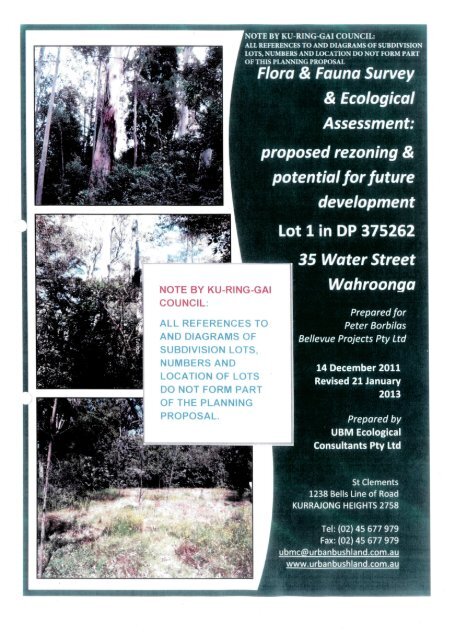
NOTE BY KU-RING-GAI COUNCIL: ALL REFERENCES TO AND DIAGRAMS OF SUBDIVISION<br />
LOTS, NUMBERS AND LOCATION DO NOT FORM PART OF THIS PLANNING PROPOSAL<br />
<strong>Flora</strong> & <strong>Fauna</strong> <strong>Survey</strong> & <strong>Ecological</strong> <strong>Assessment</strong>s – 35 Water Street Wahroonga<br />
Executive Summary<br />
NOTE BY KU-RING-GAI COUNCIL:<br />
ALL REFERENCES TO AND DIAGRAMS OF SUBDIVISION LOTS, NUMBERS<br />
AND LOCATION DO NOT FORM PART OF THIS PLANNING PROPOSAL<br />
Background: UBM <strong>Ecological</strong> Consultants (‘UBM’) has been retained by the Proponent Mr Peter Borbilas of<br />
Bellevue Projects Pty Ltd undertake ecological investigations in support of a Planning Proposal application to<br />
Ku-ring-gai Council to rezone the Subject Property Lot 1 in DP 375262 at 35 Water Street Wahroonga from<br />
5(a) Special Uses (Hospital) to E4 Environmental Living Zone.<br />
Ku-ring-gai Council is in the process of preparing a new Principal Local Environmental Plan (‘LEP’) to replace<br />
the Ku-ring-gai Planning Scheme Ordinance (‘KPSO’). The draft LEP has not yet been exhibited, however it is<br />
understood that it is proposed to rezone the Subject Property part R2 Low Density Residential and part E4<br />
Environmental Living. When the draft LEP is finalised and gazetted, the proposed E4 Environmental Living<br />
Zone for the Subject Property would be subsumed into the new LEP.<br />
The existing zoning of the land allows for ‘hospitals’ but does not allow residential subdivision. The E4<br />
Environmental Living Zoning would permit limited residential development, subject to a minimum Lot size of<br />
2,000 m 2 , the conservation of the ecological heritage values of the site and retention of neighbourhood<br />
character and amenity (Ingham Planning 2013).<br />
Two thirds of the Subject Property has been identified by Ku-ring-gai Council (Draft LEP 218) as part of a<br />
larger area considered to have biodiversity significance. This assessment is based on the presence of the<br />
‘critically endangered’ Blue Gum High Forest (‘BGHF’) on the Subject Property; represented predominantly<br />
by stands of remnant trees - Sydney Blue Gum (E. saligna). However, there is sufficient land outside the<br />
primary ecological conservation areas and the primary heritage curtilage of Rippon Grange to enable the<br />
creation of a small number of residential lots. A limited residential development of the site in this manner<br />
will have significantly less heritage, ecological and neighbor impacts than the large hospital buildings that<br />
have been approved over a substantial portion of the site.<br />
The current Report has been prepared at the request of the Proponent and assesses the conservation<br />
significance of the native vegetation known to occur within the Subject Property in regards to the current<br />
State and Commonwealth environmental legislation. The potential impacts of the current rezoning<br />
application and of any future limited development on the Subject Property have also been considered.<br />
The presence of remnant BGHF within the Subject Property established by previous workers is confirmed.<br />
The extent of this ecological community on the Property has been determined by the NSW Land &<br />
Environment Court (Proceedings 11193 of 2006) to be 6,350 sq metres (0.635 ha), and this area has been<br />
adopted in this Report (see Figure 1.3).<br />
The remnant BGHF in the Subject Property now comprises individuals and small stands of native canopy<br />
trees over a predominantly exotic/weedy understorey. These areas are hereafter described in this <strong>Ecological</strong><br />
Report as ‘BGHF Habitat’ in order to distinguish the vegetation from a viable BGHF ‘ecological community’,<br />
which is typically floristically diverse and structurally intact (see Final Determination TSC Act, Appendix 1).<br />
Given the considerable number of flora and fauna surveys which have been conducted for the whole of the<br />
2.1318 hectares of the larger Subject Property since 2005 (see Section 6 References), it was not considered<br />
UBM <strong>Ecological</strong> Consultants Pty Ltd<br />
Page i
<strong>Flora</strong> & <strong>Fauna</strong> <strong>Survey</strong> & <strong>Ecological</strong> <strong>Assessment</strong>s – 35 Water Street Wahroonga<br />
necessary to replicate these earlier studies. This Report therefore focuses on the conservations significance<br />
of those parts of the Subject Property which may be the subject of a future development application – i.e.<br />
area substantially outside the mapped BGHF Habitat, as determined by the Land and Environment Court<br />
(2006).<br />
It is proposed to retain historic Rippon Grange, its curtilage and part of the culturally significant gardens.<br />
The house will be restored and used as a family residence. However, there are two (2) areas outside<br />
potentially suitable for environmentally sensitive limited future residential development.<br />
Area 1 is located in the south-western part of the Subject Property wholly outside the area mapped as BGHF<br />
Habitat (see Figure 1.3).<br />
Area 2 is located in the south-eastern corner of the Property, with part of this area abutting the mapped<br />
Core BGHF Habitat area (see Figure 1.3). <strong>Ecological</strong> investigations presented in this Report focus on the<br />
natural conservation values of Area 2, likely to be subject of a future limited development application.<br />
Results – <strong>Flora</strong>: A total of 170 flora species was recorded for the eight (8) transects established in four (4)<br />
Subject Sites in the south-eastern corner of the Subject Property and described in this Report as Area 2 (see<br />
Figure 1.3). A total of 220 flora species was recorded in the 11 quadrats established in the nearby BGHF<br />
Habitat Area (see Section 3.3).<br />
More introduced species than natives were recorded throughout the area surveyed. Approximately 75% (in<br />
8 transects) and 79% (in 11 quadrats) recorded were horticultural introductions, non-indigenous native<br />
species (i.e. planted specimens) or weeds. Thirteen (13) plants recorded Sites are declared as ‘noxious<br />
weeds’ in Ku-ring-gai Local Government Area.<br />
Under the draft concept design (see Figure 1.4), the potential loss of BGHF Habitat in the proposed future<br />
development area has been calculated at 173 sq metres, which is only 2.74% of the total area of BGHF extant<br />
within the Subject Property. Eleven (11) BGHF trees are likely to be removed or otherwise impacted under<br />
the development proposal.<br />
Results – <strong>Fauna</strong>:<br />
Previous surveys have identified a total of 24 native birds, six (6) native mammals, four (4) reptiles and two<br />
(2) amphibians within or nearby the Subject Property. Of these, the Gang-gang Cockatoo and Grey-headed<br />
Flying-fox are listed under the TSC and/or EPBC Acts.<br />
By the completion of the current field survey (May/June 2012), eight (8) bird species were detected within,<br />
adjacent to, or flying over the Subject Property; the latter identified by their distinctive calls as well as<br />
observation (Table 4.2). The Powerful Owl (Ninox strenua) is listed as ‘vulnerable’ under the TSC Act and was<br />
heard calling from outside the Subject Property during nocturnal surveys.<br />
Two (2) native mammalian species were observed on the Subject Property; the Common Ringtail Possum<br />
(Pseudocheirus peregrines) and Swamp wallaby (Wallabia bicolour).<br />
Three (3) species listed under the TSC and/or EPBC Acts have been recorded in the vicinity or flying over the<br />
Subject Property during field investigations. Although not observed within the Subject Property, there are<br />
UBM <strong>Ecological</strong> Consultants Pty Ltd<br />
Page ii
<strong>Flora</strong> & <strong>Fauna</strong> <strong>Survey</strong> & <strong>Ecological</strong> <strong>Assessment</strong>s – 35 Water Street Wahroonga<br />
some suitable resources available for these species. Therefore, the Seven-part Test of Significance has been<br />
applied under the precautionary principle for the following species:<br />
Grey-headed Flying-fox (Pteropus poliocephalus)<br />
Gang-gang Cockatoo (Callocephalon fimbriatum)<br />
Powerful Owl (Ninox strenua)<br />
These <strong>Assessment</strong>s (see Section 4.5) have indicated that there would be NO SIGNIFICANT IMPACT on any of<br />
the threatened species listed above as the result of the Planning Proposal.<br />
Conclusions & Recommendations:<br />
Future development in Area 2 may have some minor impact on the mapped Core BGHF Habitat, depending<br />
on project design; these being limited to parts of potential Lots 3 and 4 in Area 2. The remaining potential<br />
Lots 2 and 5 are located wholly outside the mapped BGHF (see Figure 1.4).<br />
There is however, an opportunity to redesign the limited development in Area 2 so that no area of BGHF<br />
Habitat is impacted. This will be addressed if and when the current proposal rezoning is approved, and<br />
before a development application is submitted. However, for the purposes of the current Report, the draft<br />
concept subdivision plan which considers the potential to establish three (3) Lots in Area 2 will b considered<br />
(see Figure 1.4).<br />
If the subdivision proposal is adopted as envisaged in the subdivision concept plan accompanying the<br />
Planning Proposal, there is likely to be a loss of 173 sq metres of modified BGHF Habitat from Area 2. This<br />
represents a loss of 2.74 % of the total area of BGHF Habitat in the Subject Property (@ 6,530 sq metres).<br />
Accordingly the Seven-part Test of Significance has been undertaken as per Section 5A of the NSW<br />
Environment Planning & <strong>Assessment</strong> Act 1979 (see Section 3.6).<br />
This <strong>Assessment</strong> has concluded that the loss of 173 sq metres out of a total area of 6,350 sq metres of BGHF<br />
Habitat in the Subject Property (2.74%) is not ‘significant’ in terms of the legislation, and therefore it will not<br />
be necessary to refer the matter to the Minister for Environment & Heritage for future consideration in a<br />
Species Impact Statement relating to flora issues 1 .<br />
It should however, be noted that the loss of 2.74% of BGHF under the future subdivision proposal compares<br />
favourably with the 4.9% loss of this community which would have occurred under the approved Hospital<br />
development. Under the future subdivision proposal envisaged in the subdivision concept<br />
planaccompanying the Planning Proposal, 6,177 sq metres of BGHF would be retained, rehabilitated and<br />
appropriately managed. This compares to only 6,034 sq metres of the community which would have been<br />
retained under the Hospital development proposal (a net gain of 143 sq metres)<br />
1 Note that a Species Impact Statement was prepared in support of the earlier approved hospital development<br />
(Cumberland Ecology 2007). This SIS considered impacts to a significantly larger area of BGHF Habitat than the current<br />
draft Proposal.<br />
UBM <strong>Ecological</strong> Consultants Pty Ltd<br />
Page iii
<strong>Flora</strong> & <strong>Fauna</strong> <strong>Survey</strong> & <strong>Ecological</strong> <strong>Assessment</strong>s – 35 Water Street Wahroonga<br />
It is however, recommended that the loss of 173 sq metres of BGHF, although small, should be ‘offset’<br />
against a restoration and management program to rehabilitate the remaining Core BGHF within the Subject<br />
Property.<br />
A Vegetation Management Plan for the restoration and management of BGHF Habitat at 35 Water Street has<br />
been prepared (UBM 2007); approved by DECCW/OEH, and adopted by Ku-ring-gai Council. This Plan<br />
provides for bush regeneration works over a period of at least five (5) years and will guide on-ground<br />
bushland restoration and rehabilitation works in the area mapped as Core and Non-Core BGHF Habitat. This<br />
Plan includes those areas of BGHF Habitat which intrude marginally into possible new Lots 3 and 4, inArea 2.<br />
Scientific Licence 132C for the purposes of science, education or conservation under the National Parks &<br />
W8ldlife Act 1979 has been obtained from the Office of Environment & Heritage (OEH) to provide for the<br />
implementation of works. However to date, no works under this Plan have been undertaken. Scientific<br />
License 132C is currently in the name of the previous landowner Waterbrook Pty Ltd, so it will be necessary<br />
to apply to the Licensing Division of OEH to reissue the License in the name of the current landowner<br />
Bellevue Projects Pty Ltd. All other licence conditions will remain unchanged.<br />
Further, it is also recommended that those parts of the Subject Lots located outside the Development Zone<br />
(i.e. house footprints and driveways) and adjoining the Core BGHF (as mapped) be rehabilitated and<br />
thereafter maintained as closely as possible in a ‘near natural’ condition.<br />
It is considered that the implementation of the adopted Vegetation Management Plan (UBM 2007) for the<br />
remaining 1,677 sq metres of BGHF Habitat in the Subject Property, and the rehabilitation of the simplified<br />
and modified BGHF adjoining the Core BGHF (as mapped) will serve to provide an adequate ‘offset’ for the<br />
loss of~173 sq metres of BGHF in the Area 2 potential development area.<br />
Further, the loss of only 2.74% of BGHF Habitat within the Subject Property is well within the maximum 5%<br />
loss for BGHF proposed by Dr P. Smith as an expert witness appearing in the Land and Environment Court<br />
and adopted by the Court (Proceedings 11193 of 2006).<br />
Similarly, the loss of a small area (173 sq metres) of habitat which could potentially be utilised by the<br />
threatened species, the Grey-headed Flying-fox, Gang Gang Cockatoo and Powerful Owl is not considered to<br />
be significant to the species, populations or habitats.<br />
The Planning Proposal and potential future subdivision, as envisaged by the concept plan submitted with the<br />
Planning Proposal, will result in the restoration of historic Rippon Grange, its gardens and arboretum, and<br />
allow for the conservation and future management of the critically endangered BGHF on the Subject<br />
Property.<br />
.<br />
UBM <strong>Ecological</strong> Consultants Pty Ltd<br />
Page iv
<strong>Flora</strong> & <strong>Fauna</strong> <strong>Survey</strong> & <strong>Ecological</strong> <strong>Assessment</strong>s – 35 Water Street Wahroonga<br />
Table of Contents<br />
1 INTRODUCTION .................................................................................................................... 1<br />
1.1 Background Information ......................................................................................................................... 1<br />
1.2 Site History .............................................................................................................................................. 3<br />
1.3 The Development Proposal ..................................................................................................................... 5<br />
1.4 Relevant Legal and Planning Policies .....................................................................................................10<br />
2 SITE DESCRIPTION ............................................................................................................... 13<br />
2.1 Location and Setting ..............................................................................................................................13<br />
2.2 Physical Environment ............................................................................................................................15<br />
2.3 Biological Environment ..........................................................................................................................17<br />
2.3.1 Vegetation Community Mapping ...................................................................................................17<br />
2.3.2 Blue Gum High Forest in the Subject Property ...............................................................................18<br />
3 FLORA ASSESSMENT ........................................................................................................... 20<br />
3.1 Methods ................................................................................................................................................20<br />
3.1.1 Literature Review ...........................................................................................................................20<br />
3.1.2 Field <strong>Survey</strong> ....................................................................................................................................21<br />
3.1.3 Mapping and Photography .............................................................................................................22<br />
3.2 Limitations to <strong>Ecological</strong> Field <strong>Survey</strong>s ..................................................................................................22<br />
3.3 Field <strong>Survey</strong> Results ...............................................................................................................................25<br />
3.3.1 Vegetation Communities ................................................................................................................25<br />
3.3.2 Indigenous <strong>Flora</strong> Species ................................................................................................................25<br />
3.3.3 Threatened Species ........................................................................................................................27<br />
3.3.4 Introduced <strong>Flora</strong> Species ................................................................................................................28<br />
3.4 Description of the Vegetation in the BGHF Habitat Area ......................................................................29<br />
3.5 Description of the Vegetation in the Proposed Subdivision Area .........................................................32<br />
3.6 <strong>Assessment</strong>s of Significance – <strong>Flora</strong> ......................................................................................................39<br />
3.6.1 Commonwealth Legislative Considerations for the Critically Endangered <strong>Ecological</strong> Community<br />
‘Blue Gum High Forest’ ...............................................................................................................................39<br />
3.6.2 NSW Legislative Considerations for the Critically Endangered <strong>Ecological</strong> Community Blue Gum<br />
High Forest ..................................................................................................................................................39<br />
4 FAUNA ASSESSMSENT ......................................................................................................... 45<br />
UBM <strong>Ecological</strong> Consultants Pty Ltd<br />
Page v
<strong>Flora</strong> & <strong>Fauna</strong> <strong>Survey</strong> & <strong>Ecological</strong> <strong>Assessment</strong>s – 35 Water Street Wahroonga<br />
4.1 Overview ................................................................................................................................................45<br />
4.2 <strong>Fauna</strong> Methods ......................................................................................................................................45<br />
4.3 Limitations to <strong>Fauna</strong> Field <strong>Survey</strong>s ........................................................................................................47<br />
4.4 <strong>Survey</strong> Results ........................................................................................................................................48<br />
4.4.1 <strong>Fauna</strong> Species Recorded .................................................................................................................48<br />
4.4.2 <strong>Fauna</strong> Habitat <strong>Assessment</strong> .............................................................................................................49<br />
4.4.3 Threatened <strong>Fauna</strong> <strong>Assessment</strong> ......................................................................................................50<br />
4.5 <strong>Assessment</strong>s of Significance - <strong>Fauna</strong> .....................................................................................................62<br />
5 CONCLUSIONS & R ECOMMENDATIONS .............................................................................. 71<br />
6 REFERENCES ....................................................................................................................... 73<br />
7 APPENDICES ....................................................................................................................... 76<br />
List of Figures<br />
Figure 1.1: Regional Positioning of the Subject Property ..................................................................................... 2<br />
Figure 1.2: Extent of the Blue Gum High Forest in the Subject Property (UBM 2007) ........................................ 4<br />
Figure 1.3: draft Concept Plan of Proposed 5-Lot Subdivision (courtesy Tanner Architects 2012) ..................... 8<br />
Figure 1.4: draft Concept Plan of Subdivision showing Location of 4 new Lots in Area 2 (Tanner Arcthitects<br />
2011) ..................................................................................................................................................................... 9<br />
Figure 2.1: Soil Landscapes of the Subject Property & Environs (per Chapman & Murphy 1989) ....................16<br />
Figure 2.2: Vegetation mapping (NPWS 2002) ...................................................................................................19<br />
Figure 2.3: Vegetation mapping (SCIVI) by Tozer et al. 2010 .............................................................................19<br />
Figure 3.1: Approximate location of the 11 quadrats established within the BGHF Habitat Area (UBM<br />
May/June 2012) ..................................................................................................................................................26<br />
Figure 4.1: Distance Nearby BGHF Bushland from Subject Property .................................................................50<br />
List of Tables<br />
Table 1.1: Summary of Environmental Policies, Planning & Legislative Requirements * ..................................10<br />
Table 2.1: Site Definition for the Subject Property ............................................................................................14<br />
Table 2.2: Physical Features of the Subject Property & Environs ......................................................................15<br />
Table 3.1: <strong>Flora</strong> Species of State or National Conservation Significance occurring in the Region .....................27<br />
Table 3.2: Introduced flora species declared as ‘noxious weeds’ in Ku-ring-gai LGA and recorded in the<br />
Subject Property .................................................................................................................................................28<br />
UBM <strong>Ecological</strong> Consultants Pty Ltd<br />
Page vi
<strong>Flora</strong> & <strong>Fauna</strong> <strong>Survey</strong> & <strong>Ecological</strong> <strong>Assessment</strong>s – 35 Water Street Wahroonga<br />
Table 3.3: Condition of vegetation in 11 quadrats established in the BGHF Habitat Area ................................31<br />
Table 3.4: Summary of BGHF Issues in the Proposed Development Subject Sites, Lots 2, 3, 4 and 5 ...............37<br />
Table 3.5: Trees described in the Final Determination as BGHF species ...........................................................38<br />
Table 4.1: Summary of surveys conducted and weather conditions .................................................................45<br />
Table 4.2: Native species identified during current field surveys ......................................................................48<br />
Table 4.3: Likelihood of occurrence categories ..................................................................................................51<br />
Table 4.4: Threatened <strong>Fauna</strong> Speices recorded in the Locality and Region .......................................................52<br />
List of Appendices<br />
APPENDIX 1: Final Determination – Blue Gum High Forest ...............................................................................76<br />
APPENDIX 2: <strong>Flora</strong> List Recorded for in the eight (8) transects established in the Subject Sites: proposed Lots<br />
2, 3, 4 and 5 at 35 Water Street Wahroonga .....................................................................................................81<br />
APPENDIX 3: List of <strong>Flora</strong> Species Recorded in the 11 quadrats established in the BGHF Habitat Area ...........92<br />
APPENDIX 4: <strong>Fauna</strong> occurring in the Region (OEH 2012) and recorded on the Subject Property from all<br />
studies ..............................................................................................................................................................102<br />
APPENDIX 5: List of Trees to be removed or impacted for proposed subdivision (source Tree Wise Men<br />
(Australia) Pty Ltd October 2011) .....................................................................................................................115<br />
UBM <strong>Ecological</strong> Consultants Pty Ltd<br />
Page vii
<strong>Flora</strong> & <strong>Fauna</strong> <strong>Survey</strong> & <strong>Ecological</strong> <strong>Assessment</strong>s – 35 Water Street Wahroonga<br />
Certification<br />
I, Judith Rawling Managing Director of UBM <strong>Ecological</strong> Consultants Pty Ltd hereby state that this Report,<br />
which comprises a revised <strong>Flora</strong> and <strong>Fauna</strong> <strong>Survey</strong> and <strong>Ecological</strong> <strong>Assessment</strong>, has been prepared in support<br />
of a proposed rezoning of land known as Lot 1 in DP 375262 at 35 Water Street Wahroonga. This Report also<br />
considers the potential impacts of any future development on areas outside the mapped Blue Gum High<br />
Forest known to occur within the Subject Property.<br />
The nature of the remnant native vegetation on this site has been determined with reference to its<br />
conservation significance and status under the current State and Commonwealth environmental legislation.<br />
The UBM project team charged with preparing this Report were:<br />
• Judith Rawling (BA,DipEd,DipEnv.Stud.MEnvSt)<br />
• David Thomas Consultant Botanist<br />
• Rebecca Carman (BSc,MPhil,PGDipWldMgt)<br />
Disclaimer<br />
The preparation of this Report has been in accordance with the brief provided by the Client and has relied<br />
upon the data and results collected at or under the times and conditions specified in the Report. All findings,<br />
conclusions or recommendations contained within the Report are based only on the aforementioned<br />
circumstances.<br />
The Report has been prepared for use by the Client Bellevue Projects, and no responsibility for its use by<br />
other parties is accepted by UBM <strong>Ecological</strong> Consultants Pty Ltd 2 .<br />
Draft Report 14 June 2012<br />
Revision 21 January 2013<br />
Judith Rawling<br />
BA,DipEd,DipEnvStud,MEnvStud<br />
Managing Director UBM <strong>Ecological</strong> Consultants<br />
Member Executive Council ECA (NSW) , Member AIB, MESA, MEIANZ<br />
2 Copyright © UBM <strong>Ecological</strong> Consultants Pty Ltd January 2013<br />
UBM <strong>Ecological</strong> Consultants Pty Ltd<br />
Page viii
<strong>Flora</strong> & <strong>Fauna</strong> <strong>Survey</strong> & <strong>Ecological</strong> <strong>Assessment</strong>s – 35 Water Street Wahroonga<br />
Definitions<br />
BGHF – Blue Gum High Forest, a Critically Endangered <strong>Ecological</strong> Community listed under the Schedules of<br />
the NSW Threatened Species Conservation Act 1995 and Commonwealth Environment Protection &<br />
Biodiversity Conservation Act 1999<br />
Council / KC–Ku-ring-gai Council<br />
EEC – Endangered <strong>Ecological</strong> Community – as determined by the NSW Scientific Committee and described<br />
as–a community facing a risk of extinction in the immediate future, as listed under State and/or<br />
Commonwealth threatened species legislation<br />
CEEC - Critically Endangered <strong>Ecological</strong> Community – as determined by the Scientific Committee and<br />
described as a community facing an extremely high risk of extinction in the immediate future, as listed under<br />
State and/or Commonwealth threatened species legislation<br />
Characteristic vs. Diagnostic Species - Characteristic species are those typically found in the subject plant<br />
community but which may also be found in a number of other plant communities, e.g. Pittosporum<br />
undulatum, Microlaena stipoides, Pratia purpurascens, Dichondra repens, Entolasia spp, Oplismenus spp etc.<br />
Diagnostic species are those that indicate the type of plant community present and which are usually limited<br />
to the subject community or to a narrow range of communities which have similar or related habitat<br />
requirements. Examples might be Blue Gums indicating BGHF, Sydney Turpentine indicating Sydney<br />
Turpentine Ironbark Forest, Grey Box indicating Cumberland Plain Woodland or Shale Gravel Transition<br />
Forest. Some commonly occurring species are characteristic of quite a few plant communities,<br />
DECCW – NSW Department of Environment, Climate Change and Water (formerly ‘DECC’). Now the Office of<br />
Environment & Heritage (‘OEH’) within the Department of Premier & Cabinet.<br />
Direct Impacts are those that directly affect the habitat and individuals. They include, but are not limited to,<br />
death through predation, trampling, poisoning of the animal/plant itself and the removal of suitable habitat.<br />
Indirect Impacts occur when project-related activities affect species, populations or ecological communities<br />
in a manner other than direct loss. Indirect impacts can include loss of individuals through starvation,<br />
exposure, predation by domestic and/or feral animals, loss of breeding opportunities, loss of shade/shelter,<br />
deleterious hydrological changes, increased soil salinity, erosion, inhibition of nitrogen fixation, weed<br />
invasion, fertiliser drift, or increased human activity within or directly adjacent to sensitive habitat areas.<br />
<strong>Ecological</strong> Community – described as an assemblage of species occupying a particular area at a particular<br />
time, e.g. as set out in the Final Determinations of the Scientific Committee<br />
EPBC Act – Commonwealth Environment Protection & Biodiversity Conservation Act 1999<br />
Habitat – an area or areas occupied, or periodically or occasionally occupied by a species, population or<br />
ecological community, and including any biotic or abiotic components present.<br />
UBM <strong>Ecological</strong> Consultants Pty Ltd<br />
Page ix
<strong>Flora</strong> & <strong>Fauna</strong> <strong>Survey</strong> & <strong>Ecological</strong> <strong>Assessment</strong>s – 35 Water Street Wahroonga<br />
LGA – Local Government Area – here Ku-ring-gai<br />
Locality – generally, an area within 1-2 kilometres of the Study Area<br />
NPWS – former National Parks & Wildlife Unit of DECCW<br />
Region – area within 10 km of the Subject Property/Study Area<br />
SCIVI – Southeast NSW Native Vegetation Classification and Mapping by Tozer et al. 2010 for the former<br />
NSW Department of Environment and Climate Change (DECCW) 3 .<br />
Subject Property –existing Lot 1 in DP 375262 at 35 Water Street, Water Street @ 21,318 sq metres (2.1318<br />
hectares) in size and formerly known as Rippon Grange; and latterly as the John Williams Respite Care<br />
Centre or Hospital.<br />
Subject Sites – refers to the area directly affected by the draft concept subdivision proposal i.e. proposed<br />
new Lots 2 (Area 1), 3, 4 and 5 (Area 2) within the Subject Property.<br />
Study Area means the Subject Site and any additional areas which are likely to be affected by the Proposal,<br />
either directly or indirectly. The Study Area extends as far as necessary to take all potential impacts into<br />
account.<br />
TSC Act – NSW Threatened Species Conservation Act 1995<br />
UBM – UBM <strong>Ecological</strong> Consultants Pty Ltd: formerly trading as Urban Bushland Management Consultants<br />
(‘UBMC’)<br />
WoNS – Weed of National Significance<br />
3 Reference: Tozer, M.G., Turner, K., Simpson, C., Keith, D.A., Beukers, P., MacKenzie, B., Tindall, D. & Pennay, C. (2010). Native<br />
vegetation of southeast NSW: a revised classification and map for the coast and eastern tableland, in Cunninghamia 11 (3)<br />
UBM <strong>Ecological</strong> Consultants Pty Ltd<br />
Page x
<strong>Flora</strong> & <strong>Fauna</strong> <strong>Survey</strong> & <strong>Ecological</strong> <strong>Assessment</strong>s – 35 Water Street Wahroonga<br />
1 INTRODUCTION<br />
1.1 Background Information<br />
UBM <strong>Ecological</strong> Consultants (‘UBM’) has been retained by the Proponent Mr Peter Borbilas of Bellevue<br />
Projects Pty Ltd undertake ecological investigations in support of a Planning Proposal application to Ku-ringgai<br />
Council to rezone the Subject Property Lot 1 in DP 375262 at 35 Water Street Wahroonga from 5(a)<br />
Special Uses (Hospital) to E4 Environmental Living Zone.<br />
Ku-ring-gai Council is in the process of preparing a new Principal Local Environmental Plan (‘LEP’) to replace<br />
the Ku-ring-gai Planning Scheme Ordinance (‘KPSO’). The draft LEP has not yet been exhibited, however it is<br />
understood that it is proposed to rezone the Subject Property part R2 Low Density Residential and part E4<br />
Environmental Living. When the draft LEP is finalised and gazetted, the proposed E4 Environmental Living<br />
Zone for the Subject Property would be subsumed into the new LEP.<br />
The existing zoning of the land allows for ‘hospitals’ but does not allow for residential subdivision. The E4<br />
Environmental Living Zoning would permit limited residential development, subject to a minimum Lot size of<br />
2,000 m 2 , the conservation of the ecological heritage values of the site and retention of neighbourhood<br />
character and amenity (Ingham Planning 2013).<br />
Two thirds of the Subject Property Lot 1 has been identified by Ku-ring-gai Council (Draft LEP 218) as part of<br />
a larger area considered to have ‘biodiversity significance’. This assessment is based on the presence of the<br />
‘critically endangered’ Blue Gum High Forest (‘BGHF’) on the Subject Property: this community represented<br />
predominantly by stands of remnant Sydney Blue Gum (E. saligna) canopy trees. However, there is sufficient<br />
land on the Subject Property outside the primary ecological conservation areas and the primary heritage<br />
curtilage of Rippon Grange to enable creation of a small number of residential lots.<br />
The presence of remnant BGHF within the Subject Property established by previous workers is confirmed.<br />
The extent of this ecological community on the Property has been determined by the NSW Land &<br />
Environment Court (Proceedings 11193 of 2006) to be 6,350 sq metres (0.635 ha), and this area has been<br />
adopted in this Report (see Figure 1.2).<br />
Given the considerable number of flora and fauna surveys undertaken for the whole of the 2.1318 hectares<br />
of the Subject Property since 2005, it was not considered necessary to replicate these earlier studies,<br />
especially for those areas mapped as Core BGHF. This Report therefore focuses on the conservation<br />
significance of those parts of the Subject Property which may be the subject of a future development<br />
application – i.e. areas outside the mapped Core BGHF, as determined by the Land and Environment Court<br />
(2006).<br />
The current Report- <strong>Flora</strong> and <strong>Fauna</strong> <strong>Survey</strong> and <strong>Ecological</strong> <strong>Assessment</strong>s for Blue Gum High Forest at 35<br />
Water Street Wahroonga – will, where applicable, update and expand the findings of a number of earlier<br />
surveys and reports prepared for the Subject Property; these earlier reports having been undertaken on<br />
behalf of former Department of Commerce and latterly, the former owners Waterbrook Pty Ltd (see Section<br />
3.1.1 and Section 6 References) for a list of previous reports).<br />
UBM <strong>Ecological</strong> Consultants Pty Ltd Page 1
<strong>Flora</strong> & <strong>Fauna</strong> <strong>Survey</strong> & <strong>Ecological</strong> <strong>Assessment</strong>s – 35 Water Street Wahroonga<br />
<strong>Ecological</strong> investigations and <strong>Assessment</strong>s will be undertaken in accordance with the requirements of the<br />
NSW Threatened Species Conservation Act 1995 and Commonwealth Environment Protection & Biodiversity<br />
Conservation Act 1999. The potential impacts of the current rezoning application and of any future limited<br />
development of the Subject Property will also be considered.<br />
The regional positioning of the Subject Property is shown on Figure 1.1.<br />
Figure 1.1: Regional Positioning of the Subject Property Rippon Grange<br />
UBM <strong>Ecological</strong> Consultants Pty Ltd Page 2
<strong>Flora</strong> & <strong>Fauna</strong> <strong>Survey</strong> & <strong>Ecological</strong> <strong>Assessment</strong>s – 35 Water Street Wahroonga<br />
1.2 Site History<br />
The Subject Property (Lot 1 in DP 375262) is part of a historic property known as Rippon Grange. The<br />
Property is 2.1318 hectares in size, with frontages to Water Street and Young Street and is located within the<br />
fully developed residential suburb of Wahroonga. The Property is currently zoned Special Uses 5(a) Hospital<br />
Rippon Grange was constructed as a two (2) storey private dwelling in 1898 and is the main building on the<br />
Subject Property, although a number of significant outbuildings and important landscape elements remain in<br />
situ. Rippon Grange has been classified by the National Trust of Australia (NSW), and it is also listed as an<br />
‘Indicative Place’ on the Australian Heritage Commission’s Register of the National Estate.<br />
In the early 1950s, Rippon Grange was donated to the NSW State government for use as a Hospital,-and it<br />
continued to serve this function - latterly as the John Williams Respite Care Centre - until 2002 when it was<br />
declared ‘surplus to needs’.<br />
In 2005, the State Property Unit of the NSW Department of Commerce commissioned a preliminary<br />
investigation of ecological issues and an opportunities and constraints study (UBMC February 2005), which<br />
identified the presence of ~2,600 sq metres (0.26 ha) of simplified and modified Blue Gum High Forest on<br />
the Property.<br />
On June 30 2005, the Subject Property was acquired by Waterbrook Pty Ltd with the intention of<br />
redeveloping the Property under State Environmental Planning Policy (Senior Living) 2004. Subsequent<br />
ecological surveys carried out on behalf of Waterbrook (UBMC February 2006) confirmed the findings of the<br />
earlier ecological investigations. At that time, Blue Gum High Forest in the Sydney Basin Bioregion was listed<br />
under the Schedules of the NSW Threatened Species Conservation Act 1995 (hereafter ‘TSC Act’) as an<br />
‘Endangered <strong>Ecological</strong> Community’, and as ‘Threatened’ under the Commonwealth Environment Protection<br />
of Biodiversity Conservation Act 1999 (hereafter ‘EPBC Act’).<br />
Since the acquisition of the Subject Property by Waterbrook in mid-2005, the ecological status of the Blue<br />
Gum High Forest has been reviewed by the NSW Scientific Committee established under the TSC Act; with<br />
this community now being declared as a Critically Endangered <strong>Ecological</strong> Community (‘CEEC’)’ (see Final<br />
Determination 20 April 2007, Appendix 1). Of most import, the criteria for identifying the Blue Gum High<br />
Forest ecological community were also amended, thus providing for a larger proportion of the Subject<br />
Property to be reclassified as BGHF.<br />
As the result of these changes to the legislation, Ku-ring-gai Council and the then-National Parks & Wildlife<br />
Group of the Department of Environment & Climate Change 4 (‘DECCW’) required Waterbrook to review and<br />
reassess the extent of the remnant BGHF extant at 35 Water Street, Wahroonga.<br />
Subsequent investigations by Smith & Smith on behalf of Ku-ring-gai Council (December 2006) then revised<br />
the area of BHGF extant on the Subject Property from the original 2,600 sq metres (0.26 ha) mapped by<br />
UBMC (2005) to 6,350 sq metres (0.64 ha) (see Figure 1.2).<br />
4 DECCW is now the Office of Environment & Heritage within the Department of Premier & Cabinet.<br />
UBM <strong>Ecological</strong> Consultants Pty Ltd Page 3
<strong>Flora</strong> & <strong>Fauna</strong> <strong>Survey</strong> & <strong>Ecological</strong> <strong>Assessment</strong>s – 35 Water Street Wahroonga<br />
The method used by Smith & Smith (2006) to determine the extent of the BGHF at Rippon Grange was to<br />
draw a line around the outside canopy line of each of the large Sydney Blue Gums (Eucalyptus saligna) on<br />
the Property and to call this area BGHF, regardless of the nature of the understorey. Polygons were then<br />
joined together to arrive at the larger area of 6,530 sq metres (see Figure 1.2).<br />
The extended area of BGHF was subsequently approved by a Hearing in the NSW Land & Environment Court<br />
(No 11193 of 2006). Therefore, in view of the Court’s decision, the larger area of 6,350 sq metres of BGHF<br />
was adopted as a base point for all subsequent reports and investigations, including the Vegetation<br />
Management Plan prepared to guide the restoration and future management of the BGHF in the Subject<br />
Property (UBM December 2007).<br />
Figure 1.2: Extent of the Mapped Blue Gum High Forest in the Subject Property (UBM 2007)<br />
UBM <strong>Ecological</strong> Consultants Pty Ltd Page 4
<strong>Flora</strong> & <strong>Fauna</strong> <strong>Survey</strong> & <strong>Ecological</strong> <strong>Assessment</strong>s – 35 Water Street Wahroonga<br />
1.3 The Planning Proposal<br />
A Planning Proposal Report has been prepared by Ingham Planning Pty Ltd (January 2013) for the Subject<br />
Property Lot 1 DP 375362, 35 Water Street, Wahroonga. This Planning Proposal involves an amendment to<br />
the existing KPSO zoning map to change the zoning of the Subject Property Lot 1 from 5(a) Special Uses –<br />
Hospital to E4 Environmental Living.<br />
The E4 Environmental Living Zoning would permit limited residential development, subject to a minimum Lot<br />
size of 2,000 m 2 , conservation of the ecological heritage values of the site, and retention of neighbourhood<br />
character and amenity (Ingham Planning 2013). A limited residential development of the site in this manner<br />
will have significantly less heritage, ecological and neighbor impacts than the large hospital buildings that<br />
have been approved over a substantial portion of the site.<br />
The rezoning of the Subject Property will provide for a future development application to Ku-ring-gai Council<br />
to subdivide a limited number of residential allotments in the southwest and southeast corners of the site,<br />
together with a large a) residual Lot containing the heritage-listed buildings and gardens (see Figure 1.3). A<br />
development application for subdivision will be prepared if and when Council indicates support for the<br />
proposed re-zoning.<br />
Assuming the rezoning proposal is approved, the future subdivision of land at Rippon Grange is generally<br />
proposed as follows:<br />
The Heritage Precinct - proposed new Lot 1 will include Rippon Grange and its outbuildings, landscaped<br />
gardens, and a large part of the 19th Century arboretum. The house, which is in a derelict condition, will be<br />
restored and utilised once again as a family residence.<br />
The Potential Development Land - comprises two (2) areas with the potential for environmentally sensitive<br />
limited future development.<br />
Area 1 is located in the south-western part of the Subject Property (see Figure 1.3).<br />
Area 1 can accommodate a a large battle axe block and will include a new driveway from Water<br />
Street running along the western boundary, and a residential Lot sited to the rear of the Property;<br />
i.e. in the south-western corner formerly used as a poultry yard, composting and service area. Lot 2<br />
will be 2,070 sq metres (~0.021 ha) in size, does not include any area mapped as BGHF.<br />
Area 2 is located in the south-eastern corner of the Property, with part of this area abutting the mapped<br />
Core BGHF area (see Figure 1.3).<br />
Area 2 can accommodate up 3 lots frontingYoung Street. Potential Lots 3 and 4 can be accessed by a<br />
common driveway servicing both Lots. Both these Lots incorporate parts of the arboretum, but they also<br />
intrude marginally into the area mapped as BGHF (Smith & Smith 2006, UBM 2007). Lot 3 will be 940 sq<br />
metres (0.094 ha) and Lot 4 will be 1,290 sq metres (0.129 ha) in size. Lot 3 has 572 sq metres of BGHF,<br />
of which 77 sq metres (23 sq metres building and 54 metres driveway) would be affected. Lot 4 has 987<br />
sq metres of BGHF, of which 96 sq metres (27 sq metres building and 69 sq metres driveway) would be<br />
affected.<br />
UBM <strong>Ecological</strong> Consultants Pty Ltd Page 5
<strong>Flora</strong> & <strong>Fauna</strong> <strong>Survey</strong> & <strong>Ecological</strong> <strong>Assessment</strong>s – 35 Water Street Wahroonga<br />
A potential third lot within Area 2 (Lot 5) is located in the lower SE corner of the Property, adjacent to<br />
the rear gate and driveway on Young Street. It will be located partly on the paved car park which<br />
serviced the former Nurses Quarters on Billyard Avenue, and will incorporate part of the arboretum. Lot<br />
5 will be 1,110 sq metres (0.111 ha) in size. Lot 5 has 353 sq metres of BGHF, of which none would be<br />
affected (calculations courtesy Tanner Architects, pers. comm.).<br />
NOTE: There will be an opportunity to redesign the proposed new Lots in Area 2 so that no area of BGHF is<br />
impacted or the area of impact is reduced. This will be addressed if and when the current rezoning proposal<br />
is approved and before a development application is submitted. However, for the purposes of the current<br />
Report, the draft concept project design which considers the maximum potential to establish three (3) Lots<br />
in Area 2 will be considered in detail (see Figure 1.4).<br />
The subdivision concept plan submitted with the Planning Proposal (see Figure 1.3) provides for services to<br />
potential new Lots 3,,4 and 5 (drainage and sewage facilities) in Area 2 to be installed along the southern<br />
Property boundary; these being located outside the mapped BGHF Habitat area. Alternately, all services will<br />
be installed on the common driveway from Young Street. It is anticipated that no impact to the BGHF is<br />
result as a result of the installation of services.<br />
An Arboricultural Impact <strong>Assessment</strong> Report prepared by Tree Wise Men (October 2007) in support of a<br />
previous Development Application identified 342 trees in the Subject Property, and of these, a small number<br />
are species considered to be ‘characteristic’ of the BGHF <strong>Ecological</strong> Community (see Appendix 1). The<br />
remaining trees are horticultural introductions or non-indigenous native plantings.<br />
While some of the characteristic BGHF trees are remnant (i.e. naturally occurring), others have been planted<br />
in the landscaped grounds. Large native canopy trees, particularly Sydney Blue Gum (Eucalyptus saligna)<br />
have been widely used as landscape features in the Locality, occurring as street trees, in neighbourhood<br />
parks and in private gardens<br />
A Preliminary Tree Impact <strong>Assessment</strong> Report has been prepared by Tree Wise Man (October 2011) in<br />
support of the future concept subdivision proposal. This <strong>Assessment</strong> suggests that eight (8) BGHF trees will<br />
be removed or otherwise impacted under the subdivision proposal. However of these, two (2) specimens<br />
are mature Pittosporum undulatum (Sweet Pittosporum) – a small native tree known to occur is most plant<br />
communities in SE NSW and widely considered by bush regenerators to be a ‘native weed’ (UBMC 2006,<br />
UBM 2007. ). Five (5) of the BGHF trees likely to be impacted have been identified for proposed Lot 3 and<br />
one (1) tree for proposed Lot 4 (see Appendix 3). Another 27 introduced (exotic) trees or large shrubs will<br />
also be impacted, with the majority of these being located in proposed Lot 2, which is part of the landscaped<br />
garden and arboretum and located outside the area mapped as BGHF (Smith & Smith 2006, UBM 2007).<br />
In order to reduce any potential impacts on the BGHF trees on potential Lots 3, 4 and 5, within Area 2, the<br />
development footprint for each allotment has been sited towards the front of the Lot, in what are essentially<br />
open lawns with scattered trees. Pending advice from the new Project Arborists Landscape Matrix (report<br />
December 2011) the configuration of the development footprints will be adjusted to protect any significant<br />
trees which may occur.<br />
UBM <strong>Ecological</strong> Consultants Pty Ltd Page 6
<strong>Flora</strong> & <strong>Fauna</strong> <strong>Survey</strong> & <strong>Ecological</strong> <strong>Assessment</strong>s – 35 Water Street Wahroonga<br />
Appendix 3 provides information about the species and numbers of trees likely to be impacted under the<br />
Proposal. This information has been sourced from Tree Wise Man (Australia) Pty Ltd (October 2011). The<br />
draft concept plan of potential subdivision showing Areas 1 and 2 is presented as Figure 1.3.<br />
UBM <strong>Ecological</strong> Consultants Pty Ltd Page 7
<strong>Flora</strong> & <strong>Fauna</strong> <strong>Survey</strong> & <strong>Ecological</strong> <strong>Assessment</strong>s – 35 Water Street Wahroonga<br />
Figure 1.3: draft Concept Plan of Proposed 5-Lot Subdivision (courtesy TKD Architects 2012)<br />
UBM <strong>Ecological</strong> Consultants Pty Ltd Page 8
<strong>Flora</strong> & <strong>Fauna</strong> <strong>Survey</strong> & <strong>Ecological</strong> <strong>Assessment</strong>s – 35 Water Street Wahroonga<br />
Figure 1.4: draft Concept Plan of Subdivision showing Location of 4 new Lots in Area 2 (TKD Architects 2011)<br />
UBM <strong>Ecological</strong> Consultants Pty Ltd Page 9
<strong>Flora</strong> & <strong>Fauna</strong> <strong>Survey</strong> & <strong>Ecological</strong> <strong>Assessment</strong>s – 35 Water Street Wahroonga<br />
1.4 Relevant Legal and Planning Policies<br />
A number of local planning policies, State and Commonwealth Acts and policies are relevant to the<br />
management of remnant bushland in Ku-ring-gai LGA. Relevant items are listed in Table 1.1.<br />
Table 1.1: Summary of Environmental Policies, Planning & Legislative Requirements 5 *<br />
GOVERNMENT LEVEL RELEVANT POLICY /LEGISLATION RELEVANCE TO SUBJECT PROPERTY<br />
LOCAL<br />
Ku-ring-gai Planning Scheme<br />
Ordinance (2006)<br />
Draft Principal Local Environmental<br />
Plan (draft 2012)<br />
Plan of Management for KRG Council<br />
Bushland Reserves 2006<br />
Ku-ring-gai Biodiversity Strategy<br />
May 2006<br />
Currently Lot 1 DP 726091 is zoned 2(c) Residential. Lot<br />
1 DP 375262 is zoned 5(a) Special Uses (Hospital)<br />
Amendments to the KPSO are proposed which identify<br />
2/3 rds of the Subject Property as having biodiversity<br />
significance. Rezoning is proposed as part R2 Low<br />
Density Residential and part E4 Environmental Living.<br />
This document is currently in draft form and has not<br />
been adopted (Ku-Ring-gai Draft Planning Proposal –<br />
Biodiversity Mapping – Draft LEP 218)”<br />
Council’s Bushland PoM provides practical overarching<br />
guidance for the management of bushland reserves.<br />
The companion document to the Plan - ‘Operation<br />
Information’ - contains specific requirements & actions<br />
for individual reserves, with species lists and an<br />
overview of the relevant legislation and Recovery Plans.<br />
While not strictly applicable to bushland on private<br />
land, the PoM provides valuable information on local<br />
bushland species, habitats and ecological communities.<br />
Council has identified a significant part of the Subject<br />
Property has retaining biodiversity values.<br />
Among the Strategy Objectives are:<br />
- to prevent loss of local native biodiversity on<br />
public and private lands by<br />
eliminating/ameliorating threatening processes<br />
- to protect, enhance and where appropriate,<br />
increase local biodiversity on public and private<br />
lands<br />
- to protect and enhance aquatic and terrestrial<br />
ecosystems and habitats and connectivity<br />
between reserves.<br />
The Vegetation Management Plan prepared for the<br />
BGHF Habitat at 35 Water Street (UBM 2007) has<br />
addressed each of the objectives listed above.<br />
5 Information in Table 1.2 sourced from the Vegetation Management Plan UBM 2007<br />
UBM <strong>Ecological</strong> Consultants Pty Ltd Page 10
<strong>Flora</strong> & <strong>Fauna</strong> <strong>Survey</strong> & <strong>Ecological</strong> <strong>Assessment</strong>s – 35 Water Street Wahroonga<br />
GOVERNMENT LEVEL RELEVANT POLICY /LEGISLATION RELEVANCE TO SUBJECT PROPERTY<br />
STATE<br />
Threatened Species Conservation Act<br />
1995<br />
Sydney Regional Environmental Plan<br />
Hawkesbury-Nepean River No 20<br />
Noxious Weeds Act 1993(Amended<br />
2005)<br />
Rural Fires Act 1997 / Amendment<br />
A single threatened flora species – Magenta Lilly Pilly<br />
(Syzygium paniculatum) – was recorded in the Subject<br />
Property (in proposed Lot 1). This species has been<br />
planted widely throughout the Region, and in the<br />
Subject Property is likely to be of horticultural origin<br />
rather than a natural occurrence (confirmed by DECCW<br />
2007).<br />
Stands of a single critically endangered ecological<br />
community – Blue Gum High Forest (‘BGHF’) – were<br />
recorded for part of the Subject Property (see Figure<br />
1.2). The community has been highly simplified, both<br />
structurally and floristically due to long-term severe<br />
disturbances, past and current land uses.<br />
The following fauna species have been recorded in or<br />
near to the Subject Property, and where these have not<br />
been recorded, suitable habitat is known to be present:<br />
The Grey-headed Flying Fox (Pteropus poliocephalus), is<br />
listed as ‘vulnerable’ under the Act.<br />
The Gang-gang Cockatoo (Callocephalon fimbriatum) is<br />
listed as a ‘vulnerable’ species throughout NSW.<br />
The Powerful Owl (Ninox strenua) is listed as a<br />
‘vulnerable’ species throughout NSW.<br />
Source material: UBM 2007<br />
SREP-20 aims to protect the environment of the<br />
Hawkesbury-Nepean River system by ensuring that the<br />
impacts of future land uses are considered in a regional<br />
context, mainly by maintaining and improving water<br />
quality in the Catchment.<br />
The Subject Property is within the Lovers Jump Creek<br />
sub-catchment. There are no natural drainage lines on<br />
this site, and the land drains into Council’s stormwater<br />
drainage system on Young Street and Billyard Avenue:<br />
then draining into Lovers Jump and Cowan Creeks.<br />
The current Proposal will not adversely impact on the<br />
natural environment of the Hawkesbury-Nepean<br />
Catchment or water quality within the Catchment.<br />
There are 13 noxious weed species within the larger<br />
Subject Property. Many of these occur in the area<br />
proposed for development (see Section 4.3).<br />
The landowner has a legal responsibility to control<br />
noxious weeds on the property and to prevent their<br />
spread to adjoining land.<br />
The Subject Property is not classified as Bush Fire Prone<br />
UBM <strong>Ecological</strong> Consultants Pty Ltd Page 11
<strong>Flora</strong> & <strong>Fauna</strong> <strong>Survey</strong> & <strong>Ecological</strong> <strong>Assessment</strong>s – 35 Water Street Wahroonga<br />
GOVERNMENT LEVEL RELEVANT POLICY /LEGISLATION RELEVANCE TO SUBJECT PROPERTY<br />
2002 Land (Ku-ring-gai Council 2002). Accordingly, no Asset<br />
Protection Zones are required to be established.<br />
State Environmental Planning Policy<br />
19 – Bushland in Urban Areas<br />
A Bushfire Risk <strong>Assessment</strong> has been prepared by<br />
Bushfire Planning Services (12 June 2012). This report<br />
concludes that there is no bushfire hazard within the<br />
Subject Property and that no hazard is presented by a<br />
stand of bushland in nearby Wahroonga Public School<br />
(mapped as ‘buffer’ under Council’s Bushfire Prone<br />
Lands Map). This Map is currently under revision, but<br />
this is unlikely to impact on the BGHF Habitat in the<br />
Subject Property.<br />
SEPP-19 applies aims to protect and preserve bushland<br />
in urban environments but applies only to land zoned as<br />
‘community land’ or ‘public open space’. In accordance<br />
with clause 7a of SEPP-19, public authorities managing<br />
bushland zoned for or reserved for public open space<br />
purposes shall not disturb the bushland for the purpose<br />
referred to in Clause 6(2) unless it has first had regard to<br />
the aims of this Policy.<br />
No areas within, or adjacent to the Subject Property are<br />
zoned as community land or public open space, and the<br />
Property is privately owned. Therefore the SEPP does<br />
not apply.<br />
COMMONWEALTH<br />
State Environmental Planning Policy<br />
44 – Koala Habitat<br />
Environment Protection and<br />
Biodiversity Conservation Act 1999<br />
The Subject Property is not considered to constitute<br />
potential Koala habitat. Therefore, a Koala Plan of<br />
Management is not required.<br />
A single threatened flora species – Magenta Lilly Pilly<br />
(Syzygium paniculatum) – was recorded in proposed Lot<br />
1 – outside the area mapped as BGHF. This species has<br />
been frequently planted throughout the Region, and is<br />
likely to be of horticultural origin rather than a natural<br />
occurrence (confirmed DECCW 2007).<br />
A single threatened ecological community – Blue Gum<br />
High Forest (BGHF) – was recorded within part of the<br />
Subject Property (see Figure 1.2). The community has<br />
been highly simplified, both structurally and floristically<br />
due to long-term and severe disturbances.<br />
As this site is < one (1) hectare in size, the<br />
Commonwealth Department of Environment & Water<br />
Resources (‘DEW’) has declined to consider any of the<br />
previous development proposals as significant.<br />
The Grey-headed Flying Fox (Pteropus poliocephalus), is<br />
listed as ‘vulnerable’ under the Act.<br />
Source material: UBM 2007<br />
UBM <strong>Ecological</strong> Consultants Pty Ltd Page 12
<strong>Flora</strong> & <strong>Fauna</strong> <strong>Survey</strong> & <strong>Ecological</strong> <strong>Assessment</strong>s – 35 Water Street Wahroonga<br />
2 SITE DESCRIPTION<br />
2.1 Location and Setting<br />
Historic Rippon Grange is located in a fully developed residential setting in the suburb of Wahroonga, in Kuring-gai<br />
Local Government Area. It is about one (1) kilometre from the Wahroonga Shopping Centre and<br />
Railway Station and about 22 kilometres north-west of the Sydney CBD.<br />
The suburb of Wahroonga was developed in the late 19 th Century, soon after the railway line was extended<br />
to Sydney’s Upper North Shore (c. 1890). For many years, it was used as a private dwelling, and during that<br />
time the grounds were developed and extensively landscaped.<br />
The character of the surrounding area is described as<br />
“…a well established leafy residential area. The Lots are larger than average found in Sydney,<br />
and the gardens are landscaped and well maintained. The exception to the surrounding<br />
residential dwellings is ‘The Bush School’, which is located opposite the site in Water Street”<br />
(R. Olssen for Ku-ring-gai Council, December 2006).<br />
The former John Williams Hospital site occupies land bounded by Water Street (north) and Young Street<br />
(east) and backs onto residential development in Billyard Avenue (south) and Plymouth Close (west). The<br />
original Property was once much larger, but it has been reduced in size as land was progressively sold off for<br />
residential development.<br />
The grounds have been extensively landscaped over a number of years, and include a significant arboretum<br />
with specimen trees sourced from all parts of the world. Some native canopy trees have been retained;<br />
most particularly a stand of Sydney Blue Gums (Eucalyptus saligna), and these been incorporated into the<br />
original landscape design; growing over (exotic) garden plantings and lawns. These canopy trees are located<br />
predominantly in the eastern and central parts of the Property (see Figure 1.2). Some of these Blue Gums<br />
may be remnants of the original vegetation; while others (particularly those occurring in a straight line on<br />
the Water/Young Street frontages) appear to have been planted.<br />
In order to provide for the upkeep of a large pleasure garden and latterly a Hospital, parts of the Subject<br />
Property were developed as ‘service areas’ (composting facilities, work sheds), while other areas were used<br />
to provide food for the main house and latterly the Hospital (chicken coops, vegetable gardens and a small<br />
orchard). Surviving plans and photographs show that these facilities were located in the south-western part<br />
of the Subject Property, behind the Stables – an area which has now been identified for ‘reconstruction’ to<br />
BGHF (UBM Vegetation Management Plan 2007).<br />
From 1951 to 2005, when the Property was owned by the State Government and used as a hospital and<br />
respite care centre, the grounds were generally neglected, with invasive garden plants and other weeds<br />
growing unchecked and invading the remnant BGHF along the Water Street / Young Street boundary. The<br />
understorey in this stand of BGHF trees is now wholly composed of introduced species and weeds.<br />
UBM <strong>Ecological</strong> Consultants Pty Ltd Page 13
<strong>Flora</strong> & <strong>Fauna</strong> <strong>Survey</strong> & <strong>Ecological</strong> <strong>Assessment</strong>s – 35 Water Street Wahroonga<br />
There is also some evidence that a second period of landscaping occurred in the latter part of the 20 th<br />
Century, when a number of ‘generally’ Australian native species (i.e. not indigenous to the BGHF) were<br />
planted into the Water and Young Streets remnant, in what was originally an open lawn area towards its<br />
southern end.<br />
The remnant BGHF in the Subject Property now comprises individuals and small stands of native canopy<br />
trees over a predominantly exotic/weedy understorey. These areas are hereafter described in this <strong>Ecological</strong><br />
Report as ‘BGHF Habitat’ in order to distinguish the vegetation from a viable BGHF ‘ecological community’,<br />
which is typically floristically diverse and structurally intact (see Final Determination TSC Act, Appendix 1).<br />
The closest area of ‘bushland’ to Rippon Grange is found in the grounds of ‘The Bush School’ (Wahroonga<br />
Public School), which is ~100 metres away, on the northern side of Water Street. While this remnant retains<br />
a stand of Sydney Blue Gum (Eucalyptus saligna) and some other native species, it is badly degraded with an<br />
understorey of Privets (Ligustrum spp) and other woody weeds estimated at >75% density. Flow of native<br />
genetic material (via seed dispersal) between the Bush School and the BGHF Habitat is possible, but unlikely<br />
given that there are very few sites bare soil sites where plant establishment could occur in either location.<br />
Two (2) Council reserves are located to the north-east: Turiban Reserve (@ 250 metres) and Clive Evatt<br />
Reserve (@ 425 metres) (Cumberland Ecology 2007); while other Sydney Blue Gums (Eucalyptus saligna)<br />
have been retained in private gardens (see Plates). Connectivity between these bushland reserves and<br />
through the Locality generally is retained only through the tree canopy; with both native and introduced<br />
trees providing ‘stepping stones’ through a highly urbanised environment (see Figure 4.1).<br />
Table 2.1: Site Definition for the Subject Property<br />
Title Information<br />
Ownership<br />
Location<br />
Co-ordinates<br />
Total Area<br />
Zoning<br />
Rippon Grange - the former John Williams Hospital at 35 Water Street Wahroonga, Kuring-gai<br />
Local Government Area, Sydney.<br />
Bellevue Projects Pty Ltd<br />
The land is bounded by Water Street (north) and Young Street (east); backing onto<br />
residential development in Billyard Avenue (south) and Plymouth Close (west).<br />
Latitude: 33 degrees,43 minutes, 7 seconds<br />
Longitude: 151 degrees,7 minutes,.31 seconds<br />
Lot 1 DP 375262), with an area of 21, 318 sq metres (2.1318 hectares)<br />
Currently Lot 1 DP 375262 is zoned 5(a) Special Uses (Hospital) (Ku-ring-gai Municipal<br />
Council 2006)<br />
Proposed as part R2 Low Density Residential and part E4 Environmental Living under<br />
Council’s proposed Comprehenisive LEP for Ku-ring-gai LGA.<br />
UBM <strong>Ecological</strong> Consultants Pty Ltd Page 14
<strong>Flora</strong> & <strong>Fauna</strong> <strong>Survey</strong> & <strong>Ecological</strong> <strong>Assessment</strong>s – 35 Water Street Wahroonga<br />
2.2 Physical Environment<br />
The physical characteristics of the Subject Property and the Locality have been summarised in Table 2.3.<br />
Table 2.2: Physical Features of the Subject Property & Environs 6<br />
FEATURE DESCRIPTION<br />
Topography<br />
Geology<br />
Soil Landscape Unit<br />
Local Hydrology<br />
The Subject Property is located on gently sloping land, with a moderately steep (10%)<br />
gradient from north-west to south-east – downslope towards Young Street and Billyard<br />
Avenue.<br />
Site elevation ranges from 200m AHD at the top to 176m AHD at the lower southern<br />
site boundary, sloping towards Billyard Avenue.<br />
The geology has been mapped as Ashfield Shale (Rwa), which is a unit (or substrate) of<br />
the Wianamatta Group Shales. It typically comprises black to dark-grey shale and<br />
laminite (Herbert 1983).<br />
The Subject Property is located on the Glenorie (gn) Soil Landscape Unit.<br />
Glenorie soils are erosional landscapes, comprising shallow to moderately deep red<br />
podzolic soils on crests, moderately deep red and brown podzolic soils on upper<br />
slopes, deep yellow podzolic soils on lower slopes and humic gleys, yellow podzolic<br />
soils and gleyed podzolic soils along drainage lines (Chapman & Murphy 1989).<br />
Glenorie Soil Landscape comprises undulating to rolling low hills with a local relief of<br />
50-80 m, and slopes of 5-20%. Ridges, hillcrests and valleys are narrow (Chapman &<br />
Murphy 1989).<br />
Limitations: As the gardens at Rippon Grange were developed in the late 19 th Century,<br />
and have until recently been maintained as a managed landscape, it may be assumed<br />
that the native soil profile described above has been extensively modified.<br />
The Subject Property is located with the Lovers Jump Creek sub-catchment of the<br />
Hawkesbury-Nepean Catchment (see Table 1.1). There is no external catchment inflow<br />
to the site. There are no natural drainage lines within, or in close proximity to the<br />
Subject Property. Runoff drains generally overland, to the south-east.<br />
An ephemeral man-made drainage line runs from north to south along the western<br />
side of the driveway in the south-eastern portion of the Subject Property.<br />
Existing stormwater drainage is limited to the developed areas, and consists of building<br />
roof drainage and sparsely located surface inlet pits on pavement, with discharge to<br />
Council’s stormwater system at Billyard Avenue (LHO Group, Drainage Concept Plan<br />
November 2007).<br />
6 Information in Table 2.3 has been sourced from the Vegetation Management Plan UBM 2007<br />
UBM <strong>Ecological</strong> Consultants Pty Ltd Page 15
<strong>Flora</strong> & <strong>Fauna</strong> <strong>Survey</strong> & <strong>Ecological</strong> <strong>Assessment</strong>s – 35 Water Street Wahroonga<br />
FEATURE DESCRIPTION<br />
Climatic Details<br />
The mean daily maximum temperature is 22.3°C, with highest temperatures recorded<br />
in December, January and February. The mean daily minimum temperature 11.0°C,<br />
with lowest temperatures recorded in June, July and August.<br />
Mean annual rainfall is 1,068.0 mm; with February, March and April recording the<br />
highest mean levels (Bureau of Meteorology 2006, Pennant Hills #067047).<br />
NOTE: the suburb of Wahroonga (along with neighbouring Turramurra) receives the<br />
highest annual rainfall in the Sydney area.<br />
Figure 2.1: Soil Landscapes of the Subject Property & Environs (per Chapman & Murphy 1989)<br />
UBM <strong>Ecological</strong> Consultants Pty Ltd Page 16
<strong>Flora</strong> & <strong>Fauna</strong> <strong>Survey</strong> & <strong>Ecological</strong> <strong>Assessment</strong>s – 35 Water Street Wahroonga<br />
2.3 Biological Environment<br />
2.3.1 Vegetation Community Mapping<br />
Native vegetation in the Sydney Basin Bioregion has been mapped by a number of authorities (Benson 1992,<br />
NPWS 2002, and Tozer et al. 2010) 7 .<br />
Over the past 10 years the former-Department of Environment Climate Change & Water (‘DECCW’) 8 has<br />
been developing vegetation maps for the greater Sydney area and the south coast of New South Wales. This<br />
is an on-going process of revision and addition as new surveys and community verification take place. Each<br />
subsequent mapping system has sought to refine the previous mapping, which has been based largely on<br />
aerial photography and physical characteristics such as geology, soil type, elevation and aspect. In the more<br />
recent mapping programs there has been an increased emphasis on ground truthing.<br />
A brief summary of these mapping programs as they relate to the native vegetation extant at 35 Water<br />
Street is presented below.<br />
2.3.1.1 National Parks & Wildlife Service 2002<br />
In 2002 the former NSW National Parks and Wildlife Service (‘NPWS’) produced a series of vegetation maps<br />
for the Cumberland Plain at the scale of 1:25 000; mapping remnants greater than 0.5 hectares in size. The<br />
NPWS mapped BGHF in part of the Subject Property, with other stands of BGHF occurring in the Locality (see<br />
Figure 2.2). The condition of the BGHF community within the Subject Property was mapped as “Txu”<br />
(canopy cover < 10% over urban development), and its conservation significance was classified as “Urban<br />
Remnant Trees (Critically Endangered Communities)”.<br />
NOTE: most urban areas which retain native canopy trees are coded ‘Txu – canopy
<strong>Flora</strong> & <strong>Fauna</strong> <strong>Survey</strong> & <strong>Ecological</strong> <strong>Assessment</strong>s – 35 Water Street Wahroonga<br />
2.3.2 Blue Gum High Forest in the Subject Property<br />
The BGHF Habitat at Water Street as mapped by Smith & Smith (2006) and adopted by the NSW Land &<br />
Environment Court (Proceedings 11193 of 2006), comprises two (2) separate stands of vegetation located in<br />
the central and eastern sectors of the site (see Figure 1.2). These two (2) areas are described as the ‘Core<br />
BGHF Habitat’.<br />
The area determined as the Core BGHF Habitat forms a reversed ‘L-shape’, running along the residential<br />
boundary on the southern side of Water Street, and extending along Young Street on the eastern boundary.<br />
This area is described in the Vegetation Management Plan (UBM 2007) as ‘Core Bushland’ and is ~20 to 35<br />
metres in width and 135 metres long along the Young Street boundary, and 15 to 40 metres wide and 125<br />
metres long near the southern boundary. The east-west length of the widest section near the southern<br />
boundary is approximately 50 metres (see Figure 1.2).<br />
The Core BGHF Habitat generally has an intact canopy of Sydney Blue Gum (Eucalyptus saligna) and other<br />
sub-canopy trees which stand over a weed infested mid-storey and groundcover strata. The mid-storey<br />
contains dense weed thickets dominated by Privets (Ligustrum spp), African Olive (Olea europaea subsp<br />
cuspidata) and Lantana (Lantana camara). The groundcover is dominated by garden escapes such as<br />
Asparagus Fern (Asparagus aethiopicus), Fishbone Fern (Nephrolepis cordifolia), Agapanthus (Agapanthus<br />
praecox), Japanese Honeysuckle (Lonicera japonica), and introduced turf grasses. However, some native<br />
resilience is indicated by the scattered occurrence of a small number of disturbance-tolerant native shrubs<br />
such as Wattles (Acacia spp), She-oak (Casuarina spp) and Sweet Pittosporum (Pittosporum undulatum).<br />
Within the Core BGHF Habitat are several small clearings which comprise areas of open lawn with scattered<br />
or few weeds extant (see Section 4.3 and Appendix 2). These open grassland areas were once managed as<br />
lawns. Some native groundcovers are present here, growing among the sparse turf. These include Wallaby<br />
Grass (Danthonia sp), Glycine, Basket Grass (Oplismenus aemulus), Weeping Meadow Grass (Microlaena<br />
stipoides), and Kidney Weed (Dichondra repens).<br />
A third area designated as ‘Non-core BGHF Habitat’ (Smith & Smith 2006) is located in the south-western<br />
sector of the Subject Property (see Figure 1.2). This part of the Property was used for more than 100 years<br />
as a service area; comprising vegetable gardens, composting and storage areas, and a chicken coup.<br />
This Non-core BGHF Habitat area retains some mature canopy trees (Sydney Blue Gums and others) growing<br />
over stone-edged garden beds containing introduced horticultural specimens (Camellia, Azalea, Clivia and<br />
Agapanthus) and bordering remnants of the former lawns. Because of its lack of native floristic diversity and<br />
structural integrity, and its long-term use as a garden and service area, this third Non-core area was not<br />
included in the original BGHF mapping by UBMC 2005 and 2006).<br />
However, this area has since been determined to be ‘potential’ BGHF based on the assumption that native<br />
seed in the soil seed bank is viable (Smith & Smith 2006), and as a result, it has been incorporated into the<br />
larger BGHF Habitat area to be rehabilitated and reconstructed (see Vegetation Management Plan UBM<br />
2007).<br />
UBM <strong>Ecological</strong> Consultants Pty Ltd Page 18
<strong>Flora</strong> & <strong>Fauna</strong> <strong>Survey</strong> & <strong>Ecological</strong> <strong>Assessment</strong>s – 35 Water Street Wahroonga<br />
Figure 2.2: Vegetation mapping (NPWS 2002)<br />
Figure 2.3: Vegetation mapping (SCIVI) by Tozer et al. 2010<br />
UBM <strong>Ecological</strong> Consultants Pty Ltd Page 19
<strong>Flora</strong> & <strong>Fauna</strong> <strong>Survey</strong> & <strong>Ecological</strong> <strong>Assessment</strong>s – 35 Water Street Wahroonga<br />
3 FLORA ASSESSMENT<br />
3.1 Methods<br />
3.1.1 Literature Review<br />
Previous ecological studies conducted for the Subject Property and general references for the Locality and<br />
Region were searched for descriptions of similar habitats, and for recordings of flora species, populations or<br />
communities of conservation significance known to occur in the area.<br />
The main documents referenced were:<br />
• The Native Vegetation of the Cumberland Plain, Western Sydney (NPWS 2002);<br />
• Native vegetation of southeast NSW: a revised classification and map for the coast and eastern<br />
tablelands (Tozer et al. 2010);<br />
• Identity and Condition of Native Vegetation at 35 Water Street, Wahroonga (Smith, P. & Smith, J.<br />
(December 2006);<br />
• Arboricultural Impact <strong>Assessment</strong> Report for Waterbrook @ Wahroonga, 35 Water Street & 64<br />
Billyard Avenue, Wahroonga (Tree Wise Men (October 2007);<br />
• Species Impact Statement for 35 Water Street, Wahroonga (Cumberland Ecology 2007);<br />
• Vegetation Management Plan for Blue Gum High Forest Habitat 35 Water Street Wahroonga (UBMC<br />
2007);<br />
• Tree <strong>Assessment</strong> & Impact Report for a potential 5-Lot Subdivision at 35 Water Street Wahroonga<br />
(Landscape Matrix, December 2011); and<br />
• <strong>Flora</strong> <strong>Survey</strong> & <strong>Ecological</strong> <strong>Assessment</strong> for Proposed 5-Lot Subdivision at 35 Water Street Wahroonga<br />
(UBM December 2011).<br />
A number of other studies, reports and databases were reviewed and drawn upon as required, including<br />
relevant reports and mapping conducted by UBM (Chapter 9 References). Particular attention was paid to<br />
records of flora species listed under the Schedules of the Commonwealth EPBC Act and the NSW TSC Act<br />
which have previously been recorded in the Locality and Region.<br />
The current Report has been prepared as a ‘stand alone’ report. Therefore, information has been sourced<br />
from a number of previous studies and reports prepared for the Subject Property in relation to previous<br />
Development Applications. All information sourced from earlier reports has been appropriately referenced.<br />
Plant identifications were made according to nomenclature in Pellow et al. (2009) and Botanic Gardens Trust<br />
(2010). Stands of vegetation were described by their structural and floristic characteristics according to<br />
Tozer et al. (2003, 2006 and 2010).<br />
Critically Endangered and Endangered <strong>Ecological</strong> Communities were classified and named according to NSW<br />
Scientific Committee’s Final Determinations (various dates).<br />
Noxious weeds were determined using lists of weeds declared for Ku-ring-gai LGA under the NSW Noxious<br />
Weeds Act 1993 (Amended 2005).<br />
UBM <strong>Ecological</strong> Consultants Pty Ltd Page 20
<strong>Flora</strong> & <strong>Fauna</strong> <strong>Survey</strong> & <strong>Ecological</strong> <strong>Assessment</strong>s – 35 Water Street Wahroonga<br />
3.1.2 Field <strong>Survey</strong><br />
Field survey was undertaken by Consultant Botanist David Thomas on two (2) occasions in late May and early<br />
June 2012. A total of ~22 hours was spent actively surveying on site, with another 2-3 hours spent in<br />
laboratory time. Previous investigations by the same worker totalling 12 hours were undertaken in<br />
December 2011. Total field survey effort in the same survey locations is 34 hours.<br />
NOTE: the same worker D. Thomas who surveyed the quadrats established by Cumberland Ecology in 2007,<br />
also subsequently surveyed for UBM in December 2011 and May/June 2012.<br />
The ecological survey was undertaken in the area mapped as BGHF Habitat (per Smith & Smith 2006)<br />
generally, as well as targeting the four (4) Subject Sites proposed for future development (see Figure 1.3).<br />
Field survey was undertaken to assess the floristic composition and diversity of native species occurring<br />
within these areas. Although all parts of the Property outside the formal house gardens were surveyed in<br />
detail, the field survey focused on searching for any rare or endangered species known to occur in the<br />
Locality and Region. The presence of species known to be both ‘characteristic’ and ‘diagnostic’ of the BGHF<br />
(see Final Determination Appendix 1) was the main focus of this targeted survey.<br />
The potential impacts of the concept subdivision proposal on those areas mapped as BGHF Habitat was also<br />
assessed, and examined in the context of the adopted Vegetation Management Plan (UBM 2007).<br />
Proposed Development Areas: Native vegetation in the area proposed for development Areas 1 and 2<br />
(see Figure 1.3) was first assessed in a ‘general’ survey carried out on foot using the ‘Random Meander’<br />
method as described by Cropper (1993). This repeated the survey methodology used in the same areas<br />
during field surveys in December 2011.<br />
Using the ‘Parallel Line Method’ as described by Cropper (1993), a targeted search was undertaken for<br />
threatened species listed under the Schedules of the NSW TSC Act and/or the Commonwealth EPBC Act<br />
which have been identified as occurring, or potentially occurring, in the Locality and Region (see Table 4.1).<br />
This method involves using a series of parallel line transects within all areas identified for investigation and<br />
recording all vascular flora species located.<br />
Any noxious weeds for Ku-ring-gai (Noxious Weeds Act 1993, Revised 2005) and significant environmental<br />
weeds located were also recorded, and a visual comparison made of existing weed populations with those<br />
occurring in 2007 when the Vegetation Management Plan was prepared (UBM 2007).<br />
BGHF Habitat Areas: Following the Random Meander survey, 11 quadrats were surveyed in the BGHF<br />
Habitat Areas (see Figure 3.1 for location of quadrats). This part of the field survey included a review and<br />
reassessment of all sites surveyed by previous workers (UBMC 2006, 2007, Cumberland Ecology 2007, and<br />
UBM 2011).<br />
The locations of nine (9) of the 20 x 20 metre quadrats established by UBM (December 2011) approximately<br />
corresponded to the 10, 10 x 10 metre quadrats established by Cumberland Ecology as part of the 2007<br />
Species Impact Statement prepared for the previous owners Waterbrook (see Section 4.1 SIS).<br />
UBM <strong>Ecological</strong> Consultants Pty Ltd Page 21
<strong>Flora</strong> & <strong>Fauna</strong> <strong>Survey</strong> & <strong>Ecological</strong> <strong>Assessment</strong>s – 35 Water Street Wahroonga<br />
The proportions of exotics in each of four (4) assumed vegetation strata (i.e. tree canopy, sub-canopy, shrub,<br />
ground cover) were estimated in each quadrat. Although the quadrat size was larger than those established<br />
the 2007 and 2011 surveys, the current 2012 quadrats incorporated the location of these earlier quadrats.<br />
Each quadrat pair was located in locally uniform vegetation, except in the quadrat 7 pair where the larger<br />
quadrat included a higher proportion of indigenous vegetation.<br />
The survey results were then used to compare the health or condition of the remnant BGHF in approximately<br />
the same locations surveyed in 2006, 2007 and 2011. These results also considered the response of the<br />
vegetation to the absence of any routine maintenance since at least 2005, when the Property was sold by<br />
the NSW State government.<br />
The current health or condition, floristic diversity and structural integrity of the remnant BGHF was assessed<br />
in light of claims made by expert witnesses in the NSW Land & Environment Court hearings in 2007; i.e. that<br />
the BGHF on the Subject Property retained a high degree of resilience, and had the potential to return to a<br />
more natural condition through natural regeneration from in situ seed sources.<br />
3.1.3 Mapping and Photography<br />
The extent of the remnant BGHF has previously been mapped by a number of workers (UBM 2005, 2006,<br />
2007. Smith & Smith 2006, Cumberland 2007, and UBM 2011) and the area adopted by the NSW Land and<br />
Environment Court (Proceedings 11193 of 2006), so detailed mapping was not repeated again.<br />
Visual evidence suggests that the vegetation within the BGHF Core Habitat has not changed markedly from<br />
site conditions recorded in 2007, although there has been an increase in the distribution and density of<br />
woody weeds (particularly Privet, African Olive and Lantana), weedy ground covers and introduced vines in<br />
all areas surveyed. The extent and diversity of native understorey species has decreased concurrently.<br />
Mapping showing the location of the BGHF Habitat within the Subject Property were sourced from UBM<br />
2007 and Cumberland Ecology (2006). Similarly, vegetation mapping by NPWS (2002) and Tozer et al (2010)<br />
were sourced from the OEH website at www.environment.nsw.gov.au.<br />
The locations of the proposed new Lots within the Subject Property have been superimposed on an original<br />
drawing prepared by Tanner Architects (see Figure 1.3).<br />
3.2 Limitations to <strong>Ecological</strong> Field <strong>Survey</strong>s<br />
The diversity of flora species recorded during the current field survey is expected to be influenced by<br />
seasonal factors, with some species likely to be inconspicuous, or absent from the above-ground populations<br />
during particular times of the year. For these reasons, survey results can always be improved by extending<br />
the time allowed to provide an investigation in all seasons.<br />
However, given the long history of ecological investigations on this Property undertaken in all seasons (see<br />
Literature Review) and given that weather conditions have been favourable for plant growth for the recent<br />
spring and summer growing seasons, it is considered that the time allocated to the field surveys is more than<br />
adequate for the purposes of this Report.<br />
UBM <strong>Ecological</strong> Consultants Pty Ltd Page 22
<strong>Flora</strong> & <strong>Fauna</strong> <strong>Survey</strong> & <strong>Ecological</strong> <strong>Assessment</strong>s – 35 Water Street Wahroonga<br />
Plate 1: Core BGHF Habitat with weedy understorey: looking to Young Street (Photo UBM 2011)<br />
Plate 2: Former Croquet Lawn showing weed invasion (Cootamundra Wattle, Fishbone Fern,<br />
Blackberry & Fireweed (photo UBM 2007)<br />
UBM <strong>Ecological</strong> Consultants Pty Ltd Page 23
<strong>Flora</strong> & <strong>Fauna</strong> <strong>Survey</strong> & <strong>Ecological</strong> <strong>Assessment</strong>s – 35 Water Street Wahroonga<br />
Plate 3: Non-Core BGHF Habitat in the south-western corner: former service area behind stables–<br />
(photo facing south) Photo UBM 2011<br />
PLATE 5: View from Bush School looking west on Water Street: Subject Property to centre rear<br />
UBM <strong>Ecological</strong> Consultants Pty Ltd Page 24
<strong>Flora</strong> & <strong>Fauna</strong> <strong>Survey</strong> & <strong>Ecological</strong> <strong>Assessment</strong>s – 35 Water Street Wahroonga<br />
3.3 Field <strong>Survey</strong> Results<br />
3.3.1 Vegetation Communities<br />
Previous studies (UBMC 2005, 2006, 2007 & UBM 2011, Smith & Smith 2006, Cumberland Ecology 2007)<br />
have confirmed the remnant native vegetation within the Subject Property as BGHF. The remnant consists<br />
primarily of mature canopy trees (Sydney Blue Gum Eucalyptus saligna) considered to be ‘diagnostic’ of the<br />
BGHF, with a small number of locally indigenous shrubs and ground covers ‘characteristic’ of the CEEC also<br />
present (see Final Determination Appendix 1). While many of the native trees are likely to be remnant<br />
individuals, having been retained when the gardens were developed in the late 19 th and early 20 th Centuries,<br />
some of the younger trees have been planted since that time.<br />
The extent of the existing (and potential) BGHF on the Subject Property was determined by Smith & Smith<br />
(2006) to be 6,350 sq metres (0.635 ha). This area was subsequently adopted by the Land & Environment<br />
Court (Proceedings 11193 of 2006) and it has been used in all subsequent surveys and reports, including the<br />
current UBM flora and fauna survey.<br />
The ‘Core’ BGHF Habitat on the Subject Property is located in the eastern part of the Property, in an L-<br />
shaped distribution fronting Water and Young Streets. The understorey in dominated by woody weeds<br />
(Privets - Ligustrum spp, African Olive - Olea europaea subsp cuspidata, Lantana camara, and Cape Broom -<br />
Genista monspessulana) (see Plates).<br />
A second Core Habitat area is located towards the centre of the Property, within parts of the arboretum and<br />
landscaped gardens, although in these areas the native understorey has been totally cleared and the large<br />
trees under-planted with horticultural introductions and lawns (see Plates and Figure 1.2).<br />
3.3.2 Indigenous <strong>Flora</strong> Species<br />
A list of plant species recorded for the eight (8) transects 11 quadrats and established and surveyed in the<br />
Subject Property has been provided in Appendix 2 (transects) and Appendix 3 (quadrats) respectively.<br />
Figure 3.1 provides the location of these transects and quadrats within the Subject Property.<br />
Transect Results: For the eight (8) Transects established in the south-eastern part of the Property<br />
proposed for limited future development (i.e. Subject Sites proposed new Lots 3, 4 and 5), 170 flora species<br />
were recorded (see Appendix 2). Of these, 75% were horticultural introductions, non-indigenous native<br />
species, or weeds. See Section 3.5 for a description of the vegetation occurring.<br />
Quadrat Results: For the 11 20 x 20 metre quadrats established through the mapped BGHF Habitat Area<br />
220 flora species were recorded. Of these, 174 species (79.1%) were horticultural introductions, nonindigenous<br />
native species (i.e. planted) or weeds (see Appendix 3).<br />
Only 46 species are considered to be naturally-occurring species ‘characteristic’ of the BGHF ecological<br />
community were present (see Final Determination, Appendix1). See Section 3.4 for a description of the<br />
vegetation occurring.<br />
UBM <strong>Ecological</strong> Consultants Pty Ltd Page 25
<strong>Flora</strong> & <strong>Fauna</strong> <strong>Survey</strong> & <strong>Ecological</strong> <strong>Assessment</strong>s – 35 Water Street Wahroonga<br />
Figure 3.1: Approximate location of the 11 quadrats established within the BGHF Habitat Area (UBM surveyed May/June 2012)<br />
1<br />
11<br />
2<br />
3<br />
10<br />
4<br />
9<br />
5<br />
6<br />
8<br />
7<br />
UBM <strong>Ecological</strong> Consultants Pty Ltd Page 26
<strong>Flora</strong> & <strong>Fauna</strong> <strong>Survey</strong> & <strong>Ecological</strong> <strong>Assessment</strong>s – 35 Water Street Wahroonga<br />
3.3.3 Threatened Species<br />
Twenty (20) threatened flora species have previously been recorded within a 10-km radius of the Subject<br />
Property (‘the Region’) (see Table 3.1).<br />
However, none (0) of these threatened species was located during the current (2012) or any of the previous<br />
(2005, 2006, 2007, 2011) field surveys 9 . Having been managed as an exotic garden for more than 100 years,<br />
the greater part of the Subject Property is considered not to provide suitable habitat for any of the listed<br />
species due to its long-term disturbance history, clearing and planting as an introduced garden, changes to<br />
the soil profile and composition, and the domination of the site by introduced horticultural species and<br />
weeds.<br />
Table 3.1: <strong>Flora</strong> Species of State or National Conservation Significance occurring in the Region<br />
Source of Records<br />
1 = DECCW/OEH (2011). Search area: 10 x 10 km centred on the Study Area (State Significance)<br />
2 = SEWPAC (2011). Search area: 5 km radius centred on the Study Area (National Significance)<br />
Key<br />
E – Endangered; V – Vulnerable<br />
SPECIES<br />
SOURCE<br />
STATUS<br />
1 2 TSC Act EPBC Act<br />
Acacia bynoeana Endangered Vulnerable<br />
Acacia gordonii Endangered Endangered<br />
Cryptostylis hunteriana Vulnerable Vulnerable<br />
Darwinia biflora Vulnerable Vulnerable<br />
Darwinia peduncularis Vulnerable -<br />
Deyeuxia appressa Endangered Endangered<br />
Epacris purpurascens var. purpurascens Vulnerable -<br />
Eucalyptus camfieldii Vulnerable Vulnerable<br />
Genoplesium baueri Vulnerable -<br />
Grammitis stenophylla Endangered -<br />
Haloragodendron lucasii Endangered Endangered<br />
Lasiopetalum joyaceae Vulnerable Vulnerable<br />
Leptospermum deanei Vulnerable Vulnerable<br />
Melaleuca deanei Vulnerable Vulnerable<br />
Persoonia hirsuta Endangered Endangered<br />
9 Note that one Syzygium paniculatum occurs within the Subject Property but is located out side the current study area.<br />
This specimen is believed to be a horticultural planting (see UBM 2006 and Cumberland Ecology 2007)<br />
UBM <strong>Ecological</strong> Consultants Pty Ltd Page 27
<strong>Flora</strong> & <strong>Fauna</strong> <strong>Survey</strong> & <strong>Ecological</strong> <strong>Assessment</strong>s – 35 Water Street Wahroonga<br />
SPECIES<br />
SOURCE<br />
STATUS<br />
1 2 TSC Act EPBC Act<br />
Persoonia mollis ssp. maxima Endangered Endangered<br />
Pimelea curviflora var. curviflora Vulnerable Vulnerable<br />
Prostanthera marifolia Presumed Extinct Extinct<br />
Syzygium paniculatum Vulnerable Vulnerable<br />
Tetratheca glandulosa Vulnerable Vulnerable<br />
3.3.4 Introduced <strong>Flora</strong> Species<br />
The vegetation in the mapped BGHF Habitat Area and in other parts of the Property is dominated by<br />
introduced species; with the majority of these having been planted as horticultural specimens at some time<br />
in the past. Many horticultural specimens popular in the 1 st half of the 20 th Century and widely used as<br />
garden plants have since naturalised in local bushland to the detriment of the native flora and fauna. Such<br />
naturalised introductions are described as ‘environmental weeds’.<br />
More introduced species than natives were recorded in the eight (8) transects (75%) and in the 11 quadrats<br />
(79.1%). The overall % cover of introduced species in the tree, shrub and ground strata was approximately<br />
75%. The introduced to indigenous ratio for each stratum was as follows:<br />
• Canopy trees - ~80%<br />
• Sub-canopy trees ~68%<br />
• Shrubs ~78%<br />
• Ground covers ~64%<br />
Thirteen (13) plants recorded are declared as ‘noxious weeds’ in the Ku-ring-gai LGA (see Table 3.2). Weeds<br />
of National Significance (‘WoNS’) present include Bridal Creeper (Asparagus asparagoides), Blackberry<br />
(Rubus fruticosus), and Lantana (Lantana camara).<br />
Table 3.2: Introduced flora species declared as ‘noxious weeds’ in Ku-ring-gai LGA and recorded in the<br />
Study Area<br />
FAMILY SCIENTIFIC NAME COMMON NAME CLASS*<br />
Asparagaceae Asparagus aethiopicus Asparagus Fern 4<br />
Asparagaceae Asparagus asparagoides Bridal Creeper 4/5<br />
Asparagaceae Asparagus plumosus Climbing Asparagus 4<br />
Lauraceae Cinnamomum camphora Camphor Laurel 4<br />
Fabaceae Genista monspessulana Cape Broom 4<br />
Convolvulaceae Ipomoea indica Morning Glory Vine 4<br />
Verbenaceae Lantana camara Lantana 4/5<br />
Oleaceae Ligustrum lucidum Large Leaved Privet 4<br />
Oleaceae Ligustrum sinense Small-leaved Privet 4<br />
UBM <strong>Ecological</strong> Consultants Pty Ltd Page 28
<strong>Flora</strong> & <strong>Fauna</strong> <strong>Survey</strong> & <strong>Ecological</strong> <strong>Assessment</strong>s – 35 Water Street Wahroonga<br />
FAMILY SCIENTIFIC NAME COMMON NAME CLASS*<br />
Ochnaceae Ochna serrulata Mickey Mouse Bush/Ochna 4<br />
Oxalidaceae Oxalis spp. Oxalis 5<br />
Rosaceae Rubus fruticosus spp agg Blackberry 3<br />
Commelinaceae Tradescantia fluminensis Wandering Jew 4<br />
*Actions Required For Noxious Weed Classes<br />
1 The plant must be eradicated from the land and the land must be kept free of the plant<br />
2 The plant must be eradicated from the land and the land must be kept free of the plant<br />
3 The plant must be fully and continuously suppressed and destroyed<br />
4 The growth and spread of the plant must be controlled according to the measures specified in a management plan published by the<br />
local control authority and the plant may not be sold, propagated or knowingly distributed.<br />
5 The requirements in the Noxious Weeds Act 1993 for a notifiable weed must be complied with.<br />
3.4 Description of the Vegetation in the BGHF Habitat Area<br />
The vegetation in the mapped BGHF Habitat Area (Smith & Smith 2006) mainly comprised a canopy of<br />
original Sydney Blue Gums (Eucalyptus saligna) and the occasional Rough-barked Applebox (Angophora<br />
floribunda), with numerous planted specimens also occurring (Three Wise Men, 2007). Plantings included<br />
non-indigenous or ‘generally Australian’ species, and (in the historic arboretum) many significant specimen<br />
trees from overseas. The canopy height was typically 15-30 metres.<br />
The native understorey had been cleared over 100 years previously in order to establish exotic gardens, an<br />
arboretum and extensive lawns. In some locations, soil levels were altered to construct terraces, as at the<br />
croquet lawn, stone retaining walls, grottos and pathways.<br />
The results of the 11 quadrats established within the mapped BGHF Habitat Area are presented below. See<br />
Figure 3.1 for location of the quadrats.<br />
Exotic vegetation dominated the understorey at the time of the original (2005), subsequent (2006, 2007 and<br />
2011) and current surveys (May/June 2012). The most commonly occurring environmental weeds recorded<br />
were: Large-leaved Privet (Ligustrum lucidum), Small-leaved Privet (Ligustrum sinense), Ground Asparagus<br />
(Asparagus aethiopicus var. densiflorus), Japanese Honeysuckle (Lonicera japonica), Mickey Mouse Plant<br />
(Ochna serrulata) and Morning Glory (Ipomoea indica).<br />
Locally indigenous (BGHF) species generally comprised only a small part of the vegetation (2.09%), often<br />
being limited to a few individuals within a quadrat. One (1) area in the south (sampled in quadrat 7)<br />
contained a large proportion of commonly-occurring grasses such as Weeping Meadow-Grass (Microlaena<br />
stipoides) and smaller proportions of Basket Grass (Oplismenus aemulus).<br />
Nine (9) quadrats were surveyed in similar locations to the 10 quadrats first surveyed by Consultant Botanist<br />
David Thomas for Cumberland Ecology (2007) in order to provide an opportunity to compare any change in<br />
condition of the vegetation. Quadrat 10 was located north of the original quadrat 10 of Cumberland<br />
Ecology. The extra quadrat (quadrat 11) was located in the western part of the former croquet lawn to<br />
determine whether or not the vegetation here might conform to BGHF generally (see Figure 3.1). Results<br />
from 2007 and 2012 quadrats are presented in Appendix 3.<br />
UBM <strong>Ecological</strong> Consultants Pty Ltd Page 29
<strong>Flora</strong> & <strong>Fauna</strong> <strong>Survey</strong> & <strong>Ecological</strong> <strong>Assessment</strong>s – 35 Water Street Wahroonga<br />
The total area within the quadrats surveyed was ~4,400 square metres. This represents 69.3% of the total<br />
area of BGHF mapped for the Subject Property (6,350 sq metres) by Smith & Smith (2006).<br />
The comparison of the condition of vegetation in each quadrat surveyed in 2007, 2011 and 2012 showed the<br />
vegetation contained a higher proportion of exotics in the 2012 survey (see Appendix 3). This occurred in all<br />
quadrats except the quadrat 7 pair. In this case, the larger quadrat included additional indigenous<br />
vegetation that lowered the proportion of exotics in the upper stratum and ground cover.<br />
The condition and extent of the tree canopy was substantially the same throughout the BGHF Habitat Area in<br />
each survey period (2007 vs. 2012). The trends in condition of the understorey were however significantly<br />
more towards the exotic/weed species. In the small tree stratum (i.e. sub-canopy), there was major increase<br />
in projective foliage cover (255 to 470 cover abundance units). The increase in exotic shrub and ground<br />
covers was minor (715 to 809 units for shrubs and 750 to 824 cover abundance units for ground covers) (see<br />
Table 3.3).<br />
The main increase in exotics/weeds was the result of increases in the canopy cover of Large-leaved Privet<br />
(Ligustrum lucidum); progressing it from the shrub to the small tree stratum. Ligustrum lucidum also<br />
increased its cover in the shrub stratum. The native Pittosporum undulatum increased slightly in canopy<br />
cover in the small tree and shrub stratum, also due to growth of its canopy since 2007.<br />
English Broom (Genista monspessulana) decreased in cover slightly, probably due to the increased shading<br />
by the small trees described above. Indigenous shrubs remained limited to a few scattered individuals.<br />
Regeneration comprised two (2) Bleeding Heart Trees (Homalanthus populifolius) and one (1) Rough-barked<br />
Applebox (Angophora floribunda) seedlings.<br />
In the ground cover stratum, the increase of exotics/weeds was generally small, caused mainly by the spread<br />
of Japanese Honeysuckle (Lonicera japonica), English Ivy (Hedera helix), and increases in saplings and<br />
seedlings of Small-leaved Privet (Ligustrum sinense), Camphor laurel (Cinnamomum camphora) and Mickey<br />
Mouse Bush (Ochna serrulata). These species can be expected to have a major influence on the understorey<br />
in the future as they mature to become trees and large shrubs, seed and spread further.<br />
Morning Glory (Ipomoea indica) and Wandering Jew (Tradescantia fluminensis) increased significantly in the<br />
southern section of the BGHF Habitat Area where the ground was largely bare in 2007 and affected by high<br />
nutrient levels from the former poultry run and composting area. There was no significant change in the<br />
populations of other major weeds such as Ground Asparagus (Asparagus aethiopicus var. aethiopicus var.<br />
densiflorus) and Fishbone Fern (Nephrolepis cordifolia).<br />
The native ground covers mainly comprised native grasses such as Weeping Meadow Grass (Microlaena<br />
stipoides), Basket Grass (Oplismenus aemulus), and smaller amounts of small forbs such as Common<br />
Storksbill (Geranium homeanum). These formed only a minute component of most areas as in 2007.<br />
Geranium homeanum appears to have decreased in numbers, possibly due to increased shading by small<br />
trees and smothering by exotic vines.<br />
Only one (1) large area of native ground cover occurred - in the southern section of the Property, east of the<br />
former poultry run and composting area, where the small tree and shrub strata was largely absent and the<br />
soil was unaffected by increased nutrient levels (see Figure 1.3). Weeping Meadow Grass (Microlaena<br />
UBM <strong>Ecological</strong> Consultants Pty Ltd Page 30
<strong>Flora</strong> & <strong>Fauna</strong> <strong>Survey</strong> & <strong>Ecological</strong> <strong>Assessment</strong>s – 35 Water Street Wahroonga<br />
stipoides) was the main ground cover here, with significant numbers of Basket Grass (Oplismenus aemulus).<br />
Sydney Blue Gum (Eucalyptus saligna) and Rough-barked Applebox (Angophora floribunda) were scattered<br />
through the area. Morning Glory Vine (Ipomoea indica) and Wandering Jew (Tradescantia fluminensis) were<br />
noted to be invading the margins of this more natural ground cover area, and can be expected to eventually<br />
cover it completely unless suitably managed.<br />
Table 3.3: Condition of vegetation in 11 quadrats established in the BGHF Habitat Area<br />
Quadrat<br />
Cumberland Ecology 2007 UBM 2012<br />
CT ST Sh GC CT ST Sh GC<br />
1 40 40 100 95+ 30 80 90 98<br />
2 0 100 70 95+ 0 100 80 99<br />
3 0 70 95+ 95+ 0 100 95 99<br />
4 0 50 80 80 0 100 95 99<br />
5 0 5 100 90 0 40 100 90<br />
6 0 90 70 95+ 50 50 99 90<br />
7 100 a 100 70 30 a 100 60<br />
8 0 a 100 40 10 a 100 99<br />
9* 20 a a 90 0 60 50 90<br />
10# 50 10 95 100 a 80 90 95<br />
11 No equivalent quadrat a a a 90<br />
*Quadrat 9 (2012) was equivalent to Quadrats 9 & 10 (2007).<br />
# Quadrat 10 (2012) did not align with Quadrat 10 (2007).<br />
See Figure 3.1 for locations of quadrats<br />
Key: CT = canopy trees, ST = small trees, Sh = shrubs, GC = ground covers<br />
Numbers indicate cover abundance (modified Braun Blanquet system). “a” indicates stratum absent<br />
NOTE: a colour-coded condition of bushland map has not been prepared as there is little difference between<br />
quadrats, and they would all be classified as being in ‘poor’ condition and be assigned a single colour<br />
UBM <strong>Ecological</strong> Consultants Pty Ltd Page 31
<strong>Flora</strong> & <strong>Fauna</strong> <strong>Survey</strong> & <strong>Ecological</strong> <strong>Assessment</strong>s – 35 Water Street Wahroonga<br />
3.5 Description of the Vegetation in the Proposed Subdivision Area<br />
The current Proposal is to rezone the Subject Property Lot 1 in DP 375262 at 35 Water Street from 5(a)<br />
Special Uses (Hospital) to E4 Environmental Living. This rezoning will facilitate a future subdivision to be<br />
considered by Ku-ring-gai Council under a future development application.<br />
However, for the purposes of the current <strong>Ecological</strong> <strong>Survey</strong>, each of the four (4) proposed new Lots (i.e. one<br />
[1] new Lot in Area 1 and three [3] new Lots in Area 2) has been surveyed separately (see Figure 1.3) and the<br />
potential impacts of the future subdivision proposal have been assessed to consider any loss or impact on<br />
the BGHF Habitat.<br />
The results of the flora survey in the eight (8) transects established in Area 1 and2 are presented below.<br />
Each proposed new Lot has been subdivided into the ‘Development Zone’ – i.e. where the footprint of the<br />
new residence has been proposed; and the ‘Non-development Zone’, which is located to the rear (east) of<br />
the Lot. Figure 1.4 is a preliminary sketch used to determine the area of BGHF Habitat in Area 2 on each of<br />
potential new Lots 3, 4 and 5 which is likely to be impacted (courtesy TKD Architects).<br />
The code provided for the Condition of Vegetation assumes four (4) structural strata: tall tree (canopy), small<br />
tree, shrub and ground cover. The % of exotics is estimated for each of these and entered with a slash /<br />
between. If a stratum is absent this is shown by an “a” in the relevant place. Where there are a few<br />
individuals, but less than the 5% considered necessary to form a structural stratum, “a” might be used with<br />
the % of these species that are exotic (e.g. a-80), in the relevant place. An example would be 0/a/a-20/60.<br />
NOTE: in the descriptions provided below * indicates an introduced or non-indigenous native species.<br />
AREA 1 - POTENTIAL NEW LOT 2<br />
i) Development Zone<br />
Location: potential battle axe Lot located in south-western corner of the Property with a driveway from<br />
Water Street (see Figure 1.3)<br />
Vegetation Type: Non-bushland. Exotic garden with minor occurrences of native species: mostly planted<br />
specimens<br />
Condition of Vegetation:<br />
i) Condition north of existing building: a/100/99/99%<br />
ii)<br />
Condition south of existing building: a-100/a-100/99/70%<br />
[“a” refers to the stratum being substantially absent]<br />
Description: the area proposed as a driveway is a landscaped garden which has been overrun with weeds<br />
and horticultural escapes. In the area to the rear – proposed as a battle axe Lot - in 2006 a screening hedge<br />
of BGHF shrubs and small trees was planted along the southern and western boundary fences to provide<br />
privacy for neighbouring properties. These plantings include Sydney Blue Gum (Eucalyptus salignus);<br />
Backhousia myrtifolia; Lilly Pilli (Acmena smithii); Bleeding Heart Tree (Homalanthus populifolius); Acacia<br />
UBM <strong>Ecological</strong> Consultants Pty Ltd Page 32
<strong>Flora</strong> & <strong>Fauna</strong> <strong>Survey</strong> & <strong>Ecological</strong> <strong>Assessment</strong>s – 35 Water Street Wahroonga<br />
schinoides, and Blueberry Ash (Elaeocarpus reticulatus). Much of this area has now been overtaken by<br />
Morning Glory Vine* (Ipomoea indica) and other weeds.<br />
Most of southern section of proposed Lot 2 (incorporating the former chicken coop and composting areas)<br />
was maintained in the past as a mown lawn surrounded by formal garden beds, although no maintenance<br />
has taken place in the recent past. Where not overrun with introduced vines, the open grassland supports<br />
both native and exotic grasses such as Paspalum (Paspalum dilatatum*), Brome* (Bromus catharticus) and<br />
Perennial Panic Grass* (Ehrharta erecta); with the natives Weeping Meadow Grass (Microlaena stipoides)<br />
and Basket Grass (Oplismenus aemulus).<br />
Native species comprised an estimated 30% of the ground cover, depending on weed density and the<br />
amount of shade cast by the large trees. Typical ground cover species were Weeping Meadow Grass<br />
(Microlaena, Oplismenus), Cranesbill (Geranium homeanum) and Kidney Weed (Dichondra repens).<br />
No (0) threatened or otherwise significant naturally- occurring (native) flora species occurred.<br />
ii) Lot 2 Driveway from Water Street<br />
Location: western Property boundary (see Figure 1.3)<br />
Vegetation Type: Non-bushland. Exotic trees and shrubs with minor occurrences of a few native species<br />
Condition of Vegetation: a-100/90/99/99%.<br />
Description: The new driveway will extend for a distance of 4.6 metres from the existing western boundary<br />
fence, with an entry on Water Street and adjacent to the exiting main gate and carriageway. The new<br />
driveway will traverse an area of landscaped garden and will retain screening vegetation to the carriageway.<br />
Apart from a small number of Sweet Pittosporum (Pittosporum undulatum) trees, scattered occurrences of<br />
the native grass Oplismenus spp., and the planted natives at the southern end, there were no naturally<br />
occurring (native) species in the area proposed for the driveway leading to the Development Zone of Lot 2.<br />
A small clump of native Maidenhair Fern (Adiantum aethiopicum) was recorded near the entry, east of the<br />
proposed driveway. Its origin is unknown; however it is likely to have been planted owing to its location in a<br />
generally unsuitable habitat.<br />
Potential Impacts Lot 2: Lot 2 contains no areas of BGHF and will not be impacted. A number of exotic tree<br />
and shrub species will however be impacted. Appendix 4 provides details of the trees/shrubs to be removed<br />
or otherwise impacted under the Proposal (source material: Tree Wise Men October 2011).<br />
AREA 2 - POTENTIAL NEW LOT 3<br />
i) Development Zone (transect 3w – Appendix 2)<br />
Location: western section of Lot 3, as shown on Figure 1.3. In Appendix 2, the species list for this site was<br />
marked as “3w”<br />
Vegetation Type: Open (introduced) grassland with tree and shrub plantings<br />
Condition of Vegetation: estimated as: a/50/a-100/90%.<br />
UBM <strong>Ecological</strong> Consultants Pty Ltd Page 33
<strong>Flora</strong> & <strong>Fauna</strong> <strong>Survey</strong> & <strong>Ecological</strong> <strong>Assessment</strong>s – 35 Water Street Wahroonga<br />
Description: This site mainly comprised previously mown exotic and native grasses. Garden escapes and<br />
weed species were also common. Typical species were Paspalum dilatatum*, Sweet Vernal Grass<br />
(Anthoxanthum odoratum), Ribwort*(Plantago lanceolata), Cat’s Ear* (Hypochaeris radicata), Dichondra<br />
repens, Carex inversa, Hedgehog Grass (Echinopogon ovatus), and Hypericum japonicum. Microlaena<br />
stipoides was locally common adjacent to a mature Liquidambar* (Liquidambar styraciflua) which was<br />
planted in the lawn area.<br />
Old garden plantings occurred to the north of the former lawn area. These mainly comprised small trees and<br />
shrubs with under-plantings of Agapanthus* (Agapanthus praecox) and Adiantum formosum. The canopy<br />
comprised small trees such as Pittosporum undulatum, Rhododendron sp.*, Maidenhair Tree* (Gingko<br />
biloba), Cotoneaster *(Cotoneaster glauca), and Japanese Honeysuckle* (Lonicera japonica). Woody weed<br />
species, especially Camphor laurel* (Cinnamomum camphora), Privets* (Ligustrum spp.), and Mickey Mouse<br />
Bush* (Ochna serrulata) were beginning to colonise below the small tree canopy – these spreading from<br />
older plantings elsewhere in the gardens.<br />
No threatened or otherwise significant naturally occurring (native) species occurred.<br />
Condition of Vegetation: estimated to be: a/50/a-100/90%<br />
ii)Non-Development Zone (Transect 3e – see Appendix 2)<br />
Location: eastern sector of proposed Lot 3, with transect through Non-Development Zone marked as “3e”.<br />
Vegetation Type: Open (introduced) grassland with tree and shrub plantings, merging into mapped BGHF<br />
Habitat (see Figure 1.3).<br />
Condition of Vegetation: scrub to north estimated to be: a/50/a-100/90<br />
Description: A band of mostly exotic ‘scrub-type’ vegetation occurred immediately below the Development<br />
Zone, extending along the northern edge of the Lot to Young Street. Large-leaved Privet* (Ligustrum<br />
lucidum) and Pittosporum undulatum were the main small tree species; although numerous other species<br />
were also recorded (see Appendix 2.<br />
Scattered Sydney Blue Gum (Eucalyptus saligna) formed an open canopy in this part of Lot 3. One (1) small<br />
mature Rough-barked Applebox (Angophora floribunda) occurred near the fence at Young Street. The<br />
understorey was mainly exotic especially Ground Asparagus* (Asparagus aethiopicus var. densiflorus),<br />
English Ivy* (Hedera helix) and Lonicera japonica*. The indigenous vine Native Yam (Parsonsia straminea)<br />
was fairly common in the scrub and adjacent in proposed Lot 4.<br />
Below, and south of the scrub was an introduced lawn (now unmaintained) with Buffalo Grass*<br />
(Stenotaphrum secundatum), Asparagus aethiopicus*, and natives Dichondra repens, Oplismenus aemulus<br />
and Echinopogon ovatus as the main ground cover species.<br />
A small group of native species, including Pomaderris ferruginea, Sydney Golden Wattle (Acacia longifolia),<br />
Sydney Turpentine (Syncarpia glomulifera), Forest Oak (Allocasuarina torulosa), Elaeocarpus reticulatus,<br />
Acmena smithii and Sydney Rusty Gum (Angophora costata) had been planted beyond the potential<br />
UBM <strong>Ecological</strong> Consultants Pty Ltd Page 34
<strong>Flora</strong> & <strong>Fauna</strong> <strong>Survey</strong> & <strong>Ecological</strong> <strong>Assessment</strong>s – 35 Water Street Wahroonga<br />
Development Zone. Records by UBMC in 2006 noted these species as new plantings in what had been an<br />
open grassy area south of the Core BGHF Habitat area.<br />
A young Rusty Fig (Ficus rubiginosa) was observed growing as an epiphyte on a large Eucalyptus saligna at<br />
the Young Street fence. One planted tree, a Small-leaved Tuckeroo* (Cupaniopsis parvifolia), although a<br />
non-indigenous native species, was considered to be a significant planting owing to its general rarity in<br />
landscape works and relatively large size and maturity.<br />
Potential Impacts on BGHF for Lot 3: Lot 3 has 572 sq metres of BGHF, of which 77 sq metres (23 sq metres<br />
building and 54 metres driveway) or ~13.5% would potentially be affected<br />
AREA 2 – POTENTIAL NEW LOT 4<br />
i) Development Zone (Transect 4w - Appendix 2)<br />
Location: western section of potential Lot 4, as shown on Figure 1.3. In Appendix 2, the species list for this<br />
site was marked as “4w”<br />
Vegetation Type: Open (introduced) grassland with tree and shrub plantings<br />
Condition of Vegetation: estimated to be: a-100/a-90/a-90/50%<br />
Description: Lot 4 is downslope and south of potential Lot 3. It contained trees and scrub-type vegetation<br />
throughout much of the Lot; however a cleared area occurs at its western end. In common with the area<br />
potentially Lot 3, it was previously maintained as mown lawn and contained a grassy ground cover, now<br />
mainly composed of Stenotaphrum secundatum*, Anthoxanthum odoratum* and Microlaena stipoides.<br />
Exotics are rapidly colonising the area; with Plantago lanceolata*, Hypochaeris radicata* and Fireweed*<br />
(Senecio madagascariensis) occurring in the more open areas, and Ligustrum spp*, Olea europaea subsp<br />
cuspidata*, Ochna serrulata*, Hedera helix* and Asparagus aethiopicus* occurring in the more shady<br />
locations.<br />
Part of this area at the boundary with proposed Lot 3 contained a small Pittosporum undulatum 10 and a large<br />
Irish Strawberry tree* (Abutus unedo).<br />
No threatened or otherwise significant naturally-occurring (native) species occurred.<br />
Ii) Non-development Zone (Transect 4e – see Appendix 2)<br />
Location: eastern section of potential Lot 4, as shown on Figure 1.3. In Appendix 2, the species list for this<br />
site was marked “4e”.<br />
Vegetation Type: Open (introduced) grassland with tree and shrub plantings, merging into mapped BGHF<br />
Habitat area (see Figure 1.3)<br />
Condition of Vegetation: estimated to be: 0/90/90/70.<br />
10 NOTE: Pittosporum undulatum is a small native tree which seeds profusely and establishes in bushland in the absence of fire.<br />
Pittosporum is very common in the garden, and it has invaded the garden beds, paving and other structures such as the croquet lawn<br />
and former children’s play area.<br />
UBM <strong>Ecological</strong> Consultants Pty Ltd Page 35
<strong>Flora</strong> & <strong>Fauna</strong> <strong>Survey</strong> & <strong>Ecological</strong> <strong>Assessment</strong>s – 35 Water Street Wahroonga<br />
Description: Most of potential Lot 4 was identified for exclusion of development owing to the presence of<br />
several large Eucalyptus saligna. Most of the natural understorey had been removed many years previously<br />
and replaced with exotics. A few native species remained or had re-colonised, including ground covers such<br />
as Microlaena stipoides, Echinopogon spp. and Geranium homeanum.<br />
The native Pittosporum undulatum was noted to be regenerated widely and was beginning to dominate the<br />
sub-canopy to the detriment of more light-demanding native ground covers. Native understorey species<br />
occurred variably owing to the density of large trees, invading woody weeds (mainly Ligustrum lucidum*)<br />
and exotic grounds covers, mainly Asparagus aethiopicus* and Nephrolepis cordifolia*.<br />
Some native trees had also been planted in this part of potential Lot 4, including Allocasuarina torulosa and<br />
Elaeocarpus reticulatus, as well as non-locally-indigenous species including Swamp Oak* (Casuarina glauca)<br />
and White Beech*(Gmelina leichhardtii).<br />
Potential Impacts on BGHF for Lot 4: Lot 4 has 987 sq metres of BGHF, of which 96 sq metres (27 sq metres<br />
building and 69 sq metres driveway) or 9.73% would potentially be affected.<br />
AREA 2 – POTENTIAL NEW LOT 5<br />
i)Development Zone (Transect 5w – see Appendix 2)<br />
Location: western section of potential Lot 5 as shown on Figure 1.3. In Appendix 2, the species list for this<br />
site was marked as “5w”: the Non-development Zone was marked “5e”.<br />
Vegetation Type: Open (introduced) grassland with tree and shrub plantings (see Figure 1.3)<br />
Condition of Vegetation: estimated to be: 100/a/a-90/95%.<br />
Description: Trees and scrub-type vegetation occurred in the northern third of Lot 5, based on the presence<br />
of the overhanging Eucalyptus saligna canopy (Smith & Smith 2006). The potential Development Zone<br />
comprised the central and southern parts of the Lot.<br />
Much of this area contained a sealed road and car parking area at the Young Street entrance. The road area<br />
contained exotic herbaceous species and a few natives such as Euchiton sphaericum growing in cracks on the<br />
surface. The planted area north of the road (part of the former arboretum) was dominated by exotic species<br />
including a large Liquidambar styraciflua*, a mature Waterhousea floribunda*; various woody weeds such as<br />
Ligustrum spp.*, Olea europaea*, Cape Broom* (Genista monspessulana) and Cotoneaster spp*, with a<br />
mainly exotic ground cover layer. Typical ground cover species were: Asparagus aethiopicus*, Lonicera<br />
japonica*, Blowfly Grass * (Briza maxima), Fleabane* (Conyza bonariensis), and the native herb Dichondra<br />
repens.<br />
No threatened or otherwise significant naturally occurring (native) species occurred.<br />
ii)Non-development Zone (Transect 5e – see Appendix 2)<br />
Location: western section of Lot 5 as shown on Figure 1.3. In Appendix 2, the species list for this site was<br />
marked as “5e”<br />
UBM <strong>Ecological</strong> Consultants Pty Ltd Page 36
<strong>Flora</strong> & <strong>Fauna</strong> <strong>Survey</strong> & <strong>Ecological</strong> <strong>Assessment</strong>s – 35 Water Street Wahroonga<br />
Vegetation Type: Open (introduced) grassland with tree and shrub planting, merging into BGHF Habitat at<br />
the rear (east) (see Figure 1.3)<br />
Condition of Vegetation: estimated to be: a-o/80/90/90%.<br />
Description: Trees and scrub-type vegetation occurred in the northern third of Lot 5, based on the presence<br />
of Eucalyptus saligna, and determined entirely (Smith & Smith 2006) by the width or extent of the overhead<br />
tree canopy, which in places overhangs the grassland and arboretum areas.<br />
This area was similar to that in Lot 4, which it adjoined.<br />
Eucalyptus saligna was rare in this zone. Most tree species were exotic plantings, being part of the historic<br />
arboretum. These included Cedars* (Cupressus sp.), Araucaria cunninghamii* and Monterey Pine* (Pinus<br />
radiata). A few native tree species had also been planted: Blackbutt (Eucalyptus pilularis), Turpentine<br />
(Syncarpia glomulifera), and Forest Oak (Allocasuarina torulosa). Pittosporum undulatum occurred naturally<br />
in relatively small numbers; however the weedy Ligustrum lucidum was the main small tree shrub species,<br />
although at the time of the survey most were only shrub-sized.<br />
The ground cover stratum was mainly exotic, with the scrambler Asparagus aethiopicus* being the<br />
dominant. The native herb Dichondra repens was a fairly common species, and numerous other species<br />
occurred in low proportions including: Hypochaeris radicata*, Lonicera japonica*, Climbing Asparagus*<br />
(Asparagus plumosus), Ribwort* (Plantago lanceolata), Agapanthus sp.*, and the natives Microlaena<br />
stipoides and Senecio hispidulus.<br />
Potential Impacts on BGHF for Lot 5: Lot 5 has 353 sq metres of BGHF, of which none would be affected.<br />
Development on Lots 3 and 4 will potentially have some impact on the Blue Gum High Forest. The<br />
approximate area of mapped Blue Gum High Forest in the Subject Lots and the area potentially to be<br />
impacted by development has been summarised in Table 4.3 (Source: Landscape Matrix report 13 December<br />
2011).<br />
Table 3.4: Summary of BGHF Issues in the Proposed Development Subject Sites, Lots 2, 3, 4 and 5<br />
Lot 2 Lot 3 Lot 4 Lot 5 Totals<br />
Lot Area ~ 2,070 940 1,290 1,110 5,410<br />
BGHF area sq m 0 572 987 353 1,912<br />
BGHF to be Impacted sq m 0 77 96 0 173<br />
BGHF Trees to be removed<br />
or potentially impacted<br />
under the Proposal<br />
Non-BGHF Trees to be<br />
removed or potentially<br />
impacted under the<br />
Proposal<br />
2 6.5 2.5 0 11<br />
14 3 6 6 29<br />
UBM <strong>Ecological</strong> Consultants Pty Ltd Page 37
<strong>Flora</strong> & <strong>Fauna</strong> <strong>Survey</strong> & <strong>Ecological</strong> <strong>Assessment</strong>s – 35 Water Street Wahroonga<br />
NOTE: the non-BGHF trees recommended for removal do NOT include noxious weeds or those trees<br />
considered to be ‘environmental weeds’ which would have to be removed regardless of any Development<br />
Proposal (e.g. Camphor laurel, Indian Coral Tree).<br />
Table 3.5: Trees described in the Final Determination as characteristic BGHF species<br />
Lot Number Tree Number* Species<br />
No to be Removed or<br />
Potentially Impacted<br />
Diagnostic for BGHF<br />
Lot 2 1B Pittosporum undulatum 1 No<br />
21 Pittosporum undulatum 1 (2) No<br />
Lot 3 322 Pittosporum undulatum 1 No<br />
203 Elaeocarpus reticulatus 0.5 No<br />
323 Eucalyptus saligna 1 Yes<br />
325 Angophora floribunda 1 No<br />
326 Eucalyptus saligna 1 Yes<br />
328 Eucalyptus saligna 1 Yes<br />
374 Eucalyptus saligna 1 (7) Yes<br />
Lot 4 322 Pittosporum undulatum 1 No<br />
203 Elaeocarpus reticulatus 0.5 No<br />
319 Eucalyptus saligna 1 (3)<br />
Lot 4 None 0<br />
*per Landscape Matrix December 2011<br />
Totals No of BGHF Trees 11<br />
(1) Tree 203 Elaeocarpus reticulates is a single tree, located on the boundary of Lots 3 and 4<br />
UBM <strong>Ecological</strong> Consultants Pty Ltd Page 38
<strong>Flora</strong> & <strong>Fauna</strong> <strong>Survey</strong> & <strong>Ecological</strong> <strong>Assessment</strong>s – 35 Water Street Wahroonga<br />
3.6 <strong>Assessment</strong>s of Significance – <strong>Flora</strong><br />
<strong>Assessment</strong>s which consider the potential direct and indirect impacts of a possible futuresubdivision on the<br />
BGHF have been prepared for each of the possible Subject Sites in Area 2, potential Lots 3, 4 and 5. Potential<br />
Lot 2 in Area 1 is located outside the mapped BGHF area (UBM 2007) and therefore no <strong>Assessment</strong> of<br />
Impacts has been prepared.<br />
3.6.1 Commonwealth Legislative Considerations for the Critically Endangered <strong>Ecological</strong><br />
Community ‘Blue Gum High Forest’<br />
An <strong>Assessment</strong> of Significance is not required for this patch of remnant vegetation as it does not meet the<br />
condition criteria as set out in the listing advice for Blue Gum High Forest in the Sydney Basin Bioregion - a<br />
‘critically endangered ecological community’ under this Act. Specifically, the listing Condition Threshold<br />
requiring remnant patches to be more than one (1) ha in size or adjacent to a remnant more than one (1) ha<br />
in size is not met.<br />
3.6.2 NSW Legislative Considerations for the Critically Endangered <strong>Ecological</strong> Community Blue<br />
Gum High Forest<br />
A Seven-part Test of Significance under Section 5A of the Environmental Planning and <strong>Assessment</strong> Act 1979<br />
is designed to determine "whether there is likely to be a significant effect on threatened species,<br />
populations, ecological communities or their habitats" (as listed on the Schedules of the NSW TSC Act), and<br />
consequently, to determine whether a Species Impact Statement is required.<br />
Each of the Subject Sites potential new Lots 3, 4 and 5 are part of the 19 th Century arboretum established by<br />
the first landowner. Individual plantings and remnant trees with a highly degraded understorey also occur<br />
throughout the Subject Property, including numerous Sydney Blue Gums (Eucalyptus saligna), which have<br />
been retained over lawns and exotic gardens.<br />
A small number of understorey species (grasses and flowering forbs) characteristic of the BGHF also occur in<br />
those areas not overrun with horticultural escapes and weeds. These species generally occur in areas<br />
otherwise devoid of other native vegetation, and are generally found to be regenerating in areas formerly<br />
maintained as lawns or garden beds (see species recorded in potential new Lots 3, 4 and 5 in Appendix 3).<br />
Despite being characteristic of the BGHF ecological community, the understory species occurring are<br />
common to a number of other vegetation communities in the Locality and Region; with only some of these<br />
communities being listed as ‘endangered’.<br />
Even so, in accordance with the precautionary principle the following Seven-part Test has been undertaken<br />
to assess the impacts of the proposed subdivision on BGHF in potential new Lots 3, 4 and 5. A total of 173 sq<br />
metres (0.0173 ha) of BGHF out of a total area of 6,350 sq metres (0.635 ha) in the Subject Property is likely<br />
to be impacted in the proposed Lots 3 and 4. No BGHF will be impacted on Lot 5. A total of 11 BGHF trees<br />
will be removed or otherwise impacted on Lots 2, 3 and 4. Nine (9) BGHF trees will be removed from the<br />
mapped BGHF area in Lots 3 and 4.<br />
This Seven-part Test relates to the possible subdivision of land within the larger Subject Property to<br />
potentially create up to five (5) residential allotments. Potential allotments Lots 3, 4 and 5, retain trees<br />
UBM <strong>Ecological</strong> Consultants Pty Ltd Page 39
<strong>Flora</strong> & <strong>Fauna</strong> <strong>Survey</strong> & <strong>Ecological</strong> <strong>Assessment</strong>s – 35 Water Street Wahroonga<br />
characteristic of the BGHF (Figure 1.2), with a small number of understorey species also present. While<br />
some of these trees are ‘characteristic’ of the BGHF community, only Sydney Blue Gum (Eucalyptus saligna)<br />
is considered to be ‘diagnostic’ for the community (see Definitions and Abbreviations for definitions of<br />
‘characteristic’ and ‘diagnostic’).<br />
Although two (2) Pittosporum undulatum (found in BGHF and many other communities) may be impacted in<br />
Lots 2, this area is clearly outside the area mapped as BGHF and accepted by the NSW Land & Environment<br />
Court (Proceedings 1113 of 2006). Accordingly no <strong>Assessment</strong> under the legislation has been required.<br />
This <strong>Assessment</strong> of Significance has considered the potential impacts of development; including future land<br />
uses on the proposed new Lots, construction impacts and the installation of services and it has also<br />
considered the potential for edge effects. This <strong>Assessment</strong> also considers the OEH/Council approved<br />
Vegetation Management Plan (UBM 2007) prepared for the BGHF Habitat on the Subject Property which will<br />
be implemented by the Proponent, most likely under a Memorandum of Understanding.<br />
Seven-part Test for BGHF on proposed Lots 3 & 4 (see Figure 1.3)<br />
(a) …in the case of a threatened species, whether the action proposed is likely to have an adverse effect on<br />
the life cycle of the species such that a viable local population of the species is likely to be placed at risk of<br />
extinction,<br />
Blue Gum High Forest (“BGHF’) is not a threatened species, but occurs as a critically endangered<br />
ecological community; therefore this item is not applicable.<br />
(b) …in the case of an endangered population, whether the action proposed is likely to have an adverse effect<br />
on the life cycle of the species that constitutes the endangered population such that a viable local population<br />
of the species is likely to be placed at risk of extinction,<br />
Blue Gum High Forest (“BGHF’) is not an endangered population, but occurs as a critically<br />
endangered ecological community; therefore this item is not applicable.<br />
(c) …in the case of an endangered ecological community or critically endangered ecological community,<br />
whether the action proposed:<br />
(i) is likely to have an adverse effect on the extent of the ecological community such that its local<br />
occurrence is likely to be placed at risk of extinction, or<br />
The vegetation in the Subject Sites potential new Lots 3 and 4 (Area 2 – see Figure 1.3) contain some<br />
native species consistent with the description of BGHF set out in the Final Determination of this<br />
community (see Appendices 1 and 2). The BGHF community here is represented mainly by remnant<br />
Sydney Blue Gums (Eucalyptus saligna) – however because the understorey comprises >75%<br />
introduced species or weeds, the vegetation within the Subject Sites is not considered to represent a<br />
structurally intact, interactive and viable native ecological community. This is due to the remnant’s<br />
small size, isolation from other bushland areas, very low number and low % cover of locally<br />
indigenous flora species (~25%), chronically degraded nature of the understorey (~75%)as the result<br />
of invasion by garden escapes and weeds, and its long-standing land use and disturbance history.<br />
UBM <strong>Ecological</strong> Consultants Pty Ltd Page 40
<strong>Flora</strong> & <strong>Fauna</strong> <strong>Survey</strong> & <strong>Ecological</strong> <strong>Assessment</strong>s – 35 Water Street Wahroonga<br />
The larger part of both potential new Lots 3 and 4 in Area 2 comprises an introduced grassland<br />
habitat with scattered remnant and planted canopy trees, some large shrubs, and a small number of<br />
native ground covers. The lawns have not been maintained in recent years, and are rapidly being<br />
overtaken by woody weeds.<br />
The area of remnant vegetation likely to be impacted by the proposed subdivision is very small -173<br />
sq metres or 2.74% of the total mapped BGHF area -highly simplified and dominated by woody weed<br />
and other introduced species (as above). Although it adjoins a larger area of BGHF Habitat in the<br />
eastern part of the Subject Property, this adjoining Habitat is chronically degraded and no longer<br />
functions as a viable interactive native ecological community.<br />
Degradation of good quality bushland at the suburban: bushland interface often results from<br />
inappropriate recreational activities, plantings and encroachments for gardens, storage or vehicle<br />
parking or access, disposal of lawn clippings and garden debris, as well as overzealous underscrubbing<br />
or clearing for bushfire hazard purposes – these being collectively described as ‘edge<br />
effects’. In Area 2, no such negative impacts are likely to occur because the understorey in the<br />
adjacent BGHF Core Habitat is already chronically degraded, with only remnant canopy and some<br />
sub-canopy trees remaining in situ.<br />
Further, although some connectivity through the local area is retained through the tree canopy, 11<br />
BGHF trees are proposed to be removed or otherwise impacted under the Proposal; and of these,<br />
two (2P individuals are the small native tree Pittosporum undulatum , which is known to be invasive<br />
in numerous bushland communities in the long-term absence of fire. It is however possible that the<br />
concept development footprint can be amended to avoid removing any BGHF trees. This option is<br />
currently being considered.<br />
The closest stand of BGHF is located in Wahroonga Public School (‘the Bush School’), on Water Street<br />
a short distance to the north-east. The modification of 173 sq metres of BGHF in Lots 3 and 4 out of<br />
a total area of 6,350 sq metres being (2.74%) is not likely to reduce this connectivity.<br />
Gene flow (via seed dispersal) between the two (2) BGHF sites is possible but unlikely, as there very<br />
few establishment sites available in either location; the understorey having been colonised by<br />
introduced and weed species. Therfore no effect on the extent of the BGHF in the larger Subject<br />
Property, Locality or Region is expected if the Proposal is allowed to proceed.<br />
(ii) is likely to substantially and adversely modify the composition of the ecological community such that<br />
its local occurrence is likely to be placed at risk of extinction,<br />
The vegetation in the Subject Sites potential new Lots 3 and 4 (Area 2) contain some native species<br />
consistent with BGHF (primarily mature Sydney Blue Gums (E. saligna),; however is not considered to<br />
represent a viable vegetation community for all of the reasons listed above in item C(i).<br />
The larger part of both proposed Lots 3 and 4 comprises a grassland habitat with scattered remnant<br />
and planted canopy trees, some large shrubs, and a small number of native ground covers. The<br />
lawns have not been maintained in recent years, and are rapidly being overtaken by woody weeds.<br />
On balance, only about 25% of the flora species recorded comprise local native species, and of these,<br />
UBM <strong>Ecological</strong> Consultants Pty Ltd Page 41
<strong>Flora</strong> & <strong>Fauna</strong> <strong>Survey</strong> & <strong>Ecological</strong> <strong>Assessment</strong>s – 35 Water Street Wahroonga<br />
most are species which commonly occur in a number of different plant communities in the Sydney<br />
Bioregion.<br />
Eleven (11) BGHF trees are likely to be removed or otherwise impacted if the identified potential<br />
subdivision proceeds (8 in potential Lot 3 and 4 in potential Lot 4) 11 , with two (2) of these being the<br />
widespread Pittosporum undulatum. If the development footprint cannot be modified to avoid<br />
damage to these BGHF trees, their removal will not impact unduly on the composition of the BGHF<br />
Habitat in the Subject Sites potential Lots 3 and 4.<br />
This Report has recommended the retention and rehabilitation of those parts of potential new Lots 3<br />
and 4 not required for development (i.e. areas adjoining the ‘core’ BGHF Habitat to the east). If this<br />
recommendation is adopted, the Proposal will result in a significant improvement in the condition of<br />
the BGHF and provide a net gain.<br />
Minimal modification of the existing BGHF Habitat is expected to result from this Proposal but it is<br />
highly unlikely that the removal of 173 sq metres of simplified and modified BGHF from a total area<br />
of 6,350 sq metres (2.74%) will place the community at risk of local extinction.<br />
(d) …in relation to the habitat of a threatened species, population or ecological community:<br />
(i) the extent to which habitat is likely to be removed or modified as a result of the action proposed, and<br />
The vegetation in the Subject Sites proposed Lots 3 and 4 retain some native species consistent with<br />
BGHF (primarily mature Sydney Blue Gums (E. saligna), however it is not considered to represent a<br />
viable vegetation community due to the reasons listed above in Item C(i).<br />
The larger part of both potential new Lots 3 and 4 comprises an introduced grassland habitat (former<br />
lawns) with scattered remnant and planted canopy trees, some large shrubs, and a small number of<br />
native ground covers. The lawns have not been maintained in recent years, and are rapidly being<br />
overtaken by woody weeds<br />
About 173 sq metres of simplified and modified BGHF will be impacted under the potential<br />
subdivisionl, being some 2.74% of the total area of BGHF in the Subject Property. Eleven (11) BGHF<br />
trees are likely to be removed or otherwise impacted under the Proposal (6.5 trees in Lot 3 and 2.5<br />
in Lot 4 12 ). If the development footprint cannot be modified to avoid damage to these BGHF trees,<br />
their removal will not impact unduly on the composition of the BGHF Habitat in the Subject Property.<br />
This Report has recommended the retention and rehabilitation of those parts of potential new Lots 3<br />
and 4 not required for development (i.e. areas adjoining the ‘core’ BGHF Habitat to the east). If this<br />
recommendation is adopted the Proposal will result in a significant improvement in the condition of<br />
the extant BGHF, and result in a net gain for the ecological community overall.<br />
(ii) whether an area of habitat is likely to become fragmented or isolated from other areas of habitat as<br />
a result of the proposed action, and<br />
11 One (1) Pittosporum undulatum may be impacted in Lot 2, however as this area is not within the mapped BGHF area,<br />
the Seven-part Test has not been carried out for this commonly occurring species.<br />
12 Tree 203 is a single specimen located on the boundary of Lots 3 and 4 and has only been counted as one (1) tree<br />
UBM <strong>Ecological</strong> Consultants Pty Ltd Page 42
<strong>Flora</strong> & <strong>Fauna</strong> <strong>Survey</strong> & <strong>Ecological</strong> <strong>Assessment</strong>s – 35 Water Street Wahroonga<br />
The 173 sq metres of BGHF Habitat to be removed or otherwise impacted under the Proposal is<br />
located in the rear or eastern sectors of proposed Lots 3 and 4 where the Lots adjoin a much larger<br />
area of ‘Core’ BGHF Habitat along the eastern property boundary. This area is located outside the<br />
potential Development Zone (e.g. house footprints and shared driveway). The BGHF Habitat areas<br />
within the proposed new Lots are proposed as Non-Development Zones. It is likely that these areas<br />
will not be developed under the potential subdivision and as such, they will not be isolated from the<br />
‘Core’ Habitat area.<br />
The closest stand of remnant BGHF is located in the grounds of the Wahroonga Public School (‘The<br />
Bush School’) on the northern side of Water Street. Under the Proposal, the extant area of BGHF on<br />
the Subject Property will not be fragmented or otherwise isolated from other bushland areas. Gene<br />
flow between the two (2) BGHF sites is possible, but not likely given the chronically degraded nature<br />
of the understorey vegetation in both sites, where introduced species and weeds dominant in the<br />
ground cover, thereby excluding suitable establishmen sites.<br />
(iii) the importance of the habitat to be removed, modified, fragmented or isolated to the long-term<br />
survival of the species, population or ecological community in the locality,<br />
Potential new Lots 3 and 4 are located in the south-eastern part of the Subject Property, and with<br />
the exception of potential new Lot 5, they adjoin an area mapped as ‘Core’ BGHF Habitat. The<br />
adjoining area of ‘Core’ Habitat is chronically degraded and comprises stands of remnant Sydney<br />
Blue Gums (E. saligna), and a small number of other trees growing over an understorey composed<br />
almost entirely of woody weeds, scrambling ground covers and introduced vines.<br />
The BGHF in the adjoining Subject Sites potential new Lots 3 and 4 (an area of ~1,559 sq metres) is in<br />
better conditions towards their western ends, being mainly introduced lawns with remnant and<br />
planted canopy trees and large shrubs (part of the former arboretum). The lawns have not been<br />
maintained in recent years, and they are rapidly being colonised by woody weeds (Privets, African<br />
Olive, Broom and Lantana) and ground covers (Asparagus spp, and Fishbone Fern). The weed<br />
species listed above occur widely, and dominate the understorey towardsthe potential Lot’s eastern<br />
ends where they adjoin the Core BGHF Habitat Area along the eastern boundary.<br />
The native ground covers (grasses and some flowering forbs) recorded in the western parts of<br />
potential new Lots 3 and 4 occur in the more open lawn areas and along footpaths where light levels<br />
are higher. However, these native understorey storey species occur in very low numbers and in a<br />
scattered distribution. Further, the species recorded, although ‘characteristic’ species of BGHF they<br />
are all commonly-occurring species in other ecological communities and occur widely in the Locality<br />
and Region. None of these understorey species is considered to be ‘diagnostic’ for BGHF.<br />
The BGHF Habitat to be removed or otherwise impacted under the potential subdivision is minimal<br />
given that it represents only 2.74% of the total area of BGHF in the Subject Property, a considerable<br />
reduction to the approved Hospital development.<br />
Further, the vegetation within the Subject Sites potential Lots 3, 4 and 5 is not considered to<br />
represent a viable ecological community in its present condition. The long-term survival of the BGHF<br />
ecological community within the Subject Property is highly unlikely to be compromised by the<br />
UBM <strong>Ecological</strong> Consultants Pty Ltd Page 43
<strong>Flora</strong> & <strong>Fauna</strong> <strong>Survey</strong> & <strong>Ecological</strong> <strong>Assessment</strong>s – 35 Water Street Wahroonga<br />
removal of 173 sq metres of simplified and modified BGHF in potential new Lots 3 and 4. Given that<br />
6,177 sq metres of BGHF Habitat will be retained, rehabilitated and managed in perpetuity,<br />
opportunities exist for a net gain of good quality BGHF in the local area.<br />
Therefore it is considered that the potential subdivision that could occur if the Planning Proposal<br />
proceeds will not significantly modify any stands of remnant BGHF so that it further fragments,<br />
isolates or removes habitat for any listed species or populations.<br />
(e) …whether the action proposed is likely to have an adverse effect on critical habitat (either directly or<br />
indirectly),<br />
Critical habitat has not been identified for BGHF.<br />
(f) …whether the action proposed is consistent with the objectives or actions of a recovery plan or threat<br />
abatement plan,<br />
A formal recovery plan has not been developed for BGHF; therefore the Proposal does not conflict<br />
with the objectives of actions of any recovery plan or threat abatement plan for BGHF.<br />
(g)… whether the action proposed constitutes or is part of a key threatening process or is likely to result in the<br />
operation of, or increase the impact of, a key threatening process.<br />
Within the Subject Sites potential new Lots 3 and 4, the Proposal is not expected to result in any<br />
action that is part of a Key Threatening Process. Key Threatening Processes are relevant in relation<br />
to species, populations or vegetation communities listed under the TSC Act.<br />
The KTP ‘clearing of native vegetation’ will apply as a small number of BGHF trees in the<br />
Development Zone of each Lot will be removed. Several small areas of native understorey<br />
vegetation (commonly occurring grasses and forbs) will also be cleared to facilitate development.<br />
The possibility of invasion by woody weeds, exotic vines and perennial grasses is also not applicable<br />
in this case as all of these elements are already present on site, on large numbers.<br />
No flora species, populations or other ecological communities listed under the TSC Act occur within<br />
the larger Subject Property, Subject Sites or their immediate environs.<br />
Therefore, having given consideration to Section 5(a) of the NSW Environmental Planning and <strong>Assessment</strong><br />
Act 1979, it is concluded that a potential future residential subdivision of the Subject Property in the<br />
manner envisaged in the subdivision concept plan accompanying the Planning Proposal WOULD NOT<br />
require the preparation of a second Species Impact Statement for the CEEC Blue Gum High Forest in the<br />
Sydney Basin Bioregion.<br />
UBM <strong>Ecological</strong> Consultants Pty Ltd Page 44
<strong>Flora</strong> & <strong>Fauna</strong> <strong>Survey</strong> & <strong>Ecological</strong> <strong>Assessment</strong>s – 35 Water Street Wahroonga<br />
4 FAUNA ASSESSMSENT<br />
4.1 Overview<br />
The Subject Property at #35 Water Street is located in the developed residential suburb of Wahroonga. The<br />
grounds have been extensively landscaped over a number of years, and include a significant arboretum with<br />
specimen trees sourced from all parts of the world. Some native canopy trees have been retained; most<br />
particularly a stand of Sydney Blue Gums (Eucalyptus saligna), and these been incorporated into the original<br />
landscape design; growing over (exotic) garden plantings and lawns. These canopy trees are located<br />
predominantly in the eastern and central parts of the Property (see Figure 1.2).<br />
In order to assess the likelihood of native fauna species utilising the trees and gardens at 35 Water Street a<br />
diurnal and nocturnal fauna survey was undertaken. Any species listed as threatened under the NSW TSC<br />
Act and/or the Commonwealth EPBC Act 1999 (see Table 4.4) were targeted during the survey.<br />
4.2 <strong>Fauna</strong> Methods<br />
The diurnal fauna survey was undertaken by Ecologist Rebecca Carman (BSc, MPhil, PGDipWldMgt) on 29 th May and 7 th<br />
June 2012. The surveys conducted on each occasion are outlined in Table 4.1.<br />
Table4.1: Summary of surveys conducted and weather conditions<br />
* Temperatures recorded at Terrey Hills (station #066059), 9.9 km away<br />
DATE WEATHER SURVEYS CONDUCTED<br />
29/5/12 Overcast, some rain. No wind<br />
Maximum temperature 10.4°C, minimum<br />
temperature* 15.5°C<br />
7/6/12 Clear sky, ¾ moon. No wind<br />
Maximum temperature 14.7°C, minimum<br />
temperature 7.9°C<br />
Habitat assessment, active searches and<br />
opportunistic observations<br />
Spotlighting and ultrasonic call recording,<br />
The fauna field survey was aimed at assessing the species richness of the site; to investigate the range of<br />
fauna habitats present, and to determine the potential for local threatened fauna species to occur.<br />
The fauna survey incorporated a range of techniques designed to target species from all fauna groups that<br />
would be expected to occur on the site, including birds, mammals and reptiles. These techniques included a<br />
series of diurnal bird censuses, searches for active herpetofauna (reptiles), and recording of indirect<br />
evidence of fauna presence (e.g. tracks, scats, hollows, nests, diggings, bones and other traces). In addition,<br />
all opportunistic sightings of fauna were recorded.<br />
All relevant previous reports and databases were reviewed and drawn upon (see Reference list for previous<br />
studies and reports). Particular attention was paid to records of species listed under the Schedules of the<br />
EPBC or TSC Acts known to occur in the Locality and Region.<br />
Field surveys were restricted to the land that comprised the residential allotment at #35 Water Street,<br />
although observations of fauna utilising neighbouring properties (manly birds) were also made. While<br />
UBM <strong>Ecological</strong> Consultants Pty Ltd Page 45
<strong>Flora</strong> & <strong>Fauna</strong> <strong>Survey</strong> & <strong>Ecological</strong> <strong>Assessment</strong>s – 35 Water Street Wahroonga<br />
surveying this area, the condition and structure of any fauna habitats present were identified, and a<br />
consideration of their potential to support locally-occurring populations of threatened fauna was<br />
determined.<br />
Species specific survey methods are set out below.<br />
Diurnal Birds<br />
Formal bird point censuses were conducted in three (3) locations within the Subject Property, one towards<br />
the front, one in the centre, and the other towards the back of the Property. The formal census involved<br />
‘point bird counts’ at these locations. This method was used in addition to the opportunistic bird census<br />
conducted over the remaining areas of the Subject Property. Birds were identified on the basis of visual<br />
identification and by their characteristic calls. All opportunistic observations of bird species were recorded<br />
while undertaking general field survey activities.<br />
Herpetofauna Census<br />
Reptiles and amphibians were surveyed using hand-searches around the Subject Property. Searches<br />
concentrated on areas containing woody debris or urban refuse, those on and around rock terraces and<br />
around the base of trees; and this included techniques such as carefully turning over rocks, logs or garden<br />
furniture wherever these were encountered. These were replaced on site after inspection. All opportunistic<br />
sightings were noted.<br />
Bats<br />
Two (2) stationary ultrasonic bat call detectors (AnaBat SD1, Titley Electronics) were used to record bat calls<br />
throughout the Subject Property. The units were positioned where predicted ‘fly-ways’ exist and left in<br />
position for 4.5 hours from dusk on 7 th June.<br />
In relation to the analysis of those microchiropteran bat calls obtained, it is noted that some insectivorous<br />
bat species have distinctive echolocation calls that are unlikely to be confused with those of other species.<br />
Other bats species overlap in both call frequency and structure, making identification problematic in some<br />
cases. The degree of confidence or reliability associated with call identifications will depend on the quality<br />
of the recordings as well as the activity of the bat at the time of recording and flight direction. In some<br />
instances, a particular species may be identified with confidence, while at other times its identification will<br />
be less certain.<br />
Nocturnal fauna<br />
Spotlighting was undertaken for all terrestrial and arboreal mammals and for nocturnal birds using a<br />
Lightforce 100 Watt hand-held spotlight with a red filter to minimise impacts on nocturnal species. The<br />
spotlighting session was carried out during and after dusk for one (1) hour along existing pathways to<br />
minimise disturbance by the observer.<br />
UBM <strong>Ecological</strong> Consultants Pty Ltd Page 46
<strong>Flora</strong> & <strong>Fauna</strong> <strong>Survey</strong> & <strong>Ecological</strong> <strong>Assessment</strong>s – 35 Water Street Wahroonga<br />
Searches for Evidence of Species Presence<br />
Searches were conducted for animal scats of both predatory and non-predatory species. Where these were<br />
encountered, scats were identified on site; first to genus and then to species level, wherever possible. The<br />
search concentrated on the ground area beneath trees, in garden beds and edge sites, as well as amongst<br />
leaf litter and on the open lawns.<br />
Searches were also made for other characteristic signs of fauna species’ presence; including tracks, bones,<br />
hair, shed skins and animal remains, as well as nests, diggings, burrows, chew marks, scratchings and pellets<br />
(indicative of birds of prey).<br />
4.3 Limitations to <strong>Fauna</strong> Field <strong>Survey</strong>s<br />
The diversity of the species recorded during the current field surveys is expected to be influenced by seasonal<br />
factors, with some species likely to be inconspicuous, or absent from the above-ground populations during<br />
particular times of the year. For these reasons, survey results can always be improved by extending the time<br />
allowed to provide an investigation in all seasons.<br />
The cooler autumn/winter months are acknowledged not to be ideal for fauna surveys, and as such, climatic<br />
conditions at the time of survey (May/June) are recognised as a limitation. Unfortunately this could not be<br />
avoided. However, UBM has assembled a list of all previous fauna surveys from previous studies and reports<br />
(see Appendix 4) to provide a point of comparison. The potential for each of these species to occur, or<br />
potentially occur in the Subject Property given favourable seasonal conditions has also been assessed.<br />
The list of fauna species recorded by the current field surveys should not be regarded as being fully<br />
comprehensive, but rather only as providing an indication of the species present at the time of the survey<br />
(May/June 2012). <strong>Survey</strong>s carried across all seasons over a period of several years are needed to identify all<br />
of the species present in an area, especially as some species are only present at certain times of the year (e.g.<br />
migratory birds), while others may require specific weather patterns and seasonal conditions for optimum<br />
levels of detection, e.g. amphibians.<br />
On establishing the suite of resident native species occurring or potentially occurring in an area by utilising<br />
the habitat requirements and associations of these animals, the diversity of other native species that could<br />
occur on occasion can be determined. For example, if a hollow-associated owl is detected, then there is the<br />
potential that, if previously recorded in the vicinity of the Study Area, other species of owls with similar<br />
nesting requirements may also be present. By using those species recorded to predict the full range of fauna<br />
potentially present in the Study Area helps to overcome some of the limitations associated with seasonal<br />
constraints and of surveys of limited duration.<br />
In this study UBM has considered all fauna species detected during previous studies that may not be present<br />
or detected during the current field investigations (Appendix 4). Given the long history of fauna survey on<br />
this Property, dating from 2005 and repeated in 2006 and 2007, surveys have been carried out in all seasons<br />
in accordance with the Guidelines for threatened species assessment (DECC 2007).<br />
UBM <strong>Ecological</strong> Consultants Pty Ltd Page 47
<strong>Flora</strong> & <strong>Fauna</strong> <strong>Survey</strong> & <strong>Ecological</strong> <strong>Assessment</strong>s – 35 Water Street Wahroonga<br />
4.4 <strong>Survey</strong> Results<br />
4.4.1 <strong>Fauna</strong> Species Recorded<br />
Previous fauna surveys and compilation lists from OEH databases have identified 55 mammals, 186 birds, 47<br />
native reptiles, and 18 native frogs for the Region (i.e. within a 10 x 10 km area centred on the Subject<br />
Property). Of those native species previously recorded in the Region, 31 are listed as ‘vulnerable’,<br />
‘endangered’, ‘critically endangered’ and/or ‘migratory’ under the Schedules of the EPBC and/or TSC Acts<br />
(see Table 3.2).<br />
By the completion of the current field survey (May/June 2012), eight (8) bird species were detected within,<br />
adjacent to, or flying over the Subject Property; the latter identified by their distinctive calls as well as<br />
observation (Table 4.2). The Powerful Owl (Ninox strenua) is listed as ‘vulnerable’ under the TSC Act and was<br />
heard calling from outside the Subject Property during nocturnal surveys.<br />
Two (2) native mammalian species were observed on the Subject Property; the Common Ringtail Possum<br />
(Pseudocheirus peregrines) and Swamp wallaby (Wallabia bicolour).<br />
No (0) calls were recorded by either of the ultrasonic bat call detectors.<br />
Table4.2: Native species identified during current field surveys<br />
Observation Type:<br />
A Stranding/Beaching I Subfossil/Fossil remains S Shot<br />
B Burnt K Dead T Trapped or netted<br />
C Cat kill M Miscellaneous U Anabat<br />
D Dog Kill N Not located V Fox kill<br />
E Nest/Roost O Seen W Heard<br />
F Tracks or scratchings P Scat X In scat<br />
FB Burrow Q Camera Y Bone, teeth, shell<br />
G Crushed cones R Road kill Z In raptor/owl pellet<br />
H Hair, feathers or skin<br />
* Introduced species > greater than + at least (V) vulnerable<br />
COMMON NAME<br />
Birds (8)<br />
SCIENTIFIC NAME<br />
OBSERVATION<br />
METHOD<br />
UBM <strong>Ecological</strong> Consultants Pty Ltd Page 48<br />
COUNT<br />
NEARBY/FLY-<br />
WITHIN SITE<br />
OVER<br />
Australian Brush-turkey Alectura lathami O 1 -<br />
Australian Magpie Cracticus tibicen O/K 1 1<br />
Australian Raven Corvus coronoides O - 1<br />
Crested Pigeon Ocyphaps lophotes W 2 -<br />
Noisy Miner Manorina melanocephala O >5 -<br />
Pied Currawong Strepera graculina W - 1<br />
Powerful Owl (V) Ninox strenua W - 1<br />
Rainbow Lorikeet Trichoglossus haematodus O/W >10 >10<br />
Mammals (2)<br />
Common Ringtail Possum Pseudocheirus peregrinus O 4 -<br />
Swamp Wallaby Wallabia bicolor O 1 -
<strong>Flora</strong> & <strong>Fauna</strong> <strong>Survey</strong> & <strong>Ecological</strong> <strong>Assessment</strong>s – 35 Water Street Wahroonga<br />
4.4.2 <strong>Fauna</strong> Habitat <strong>Assessment</strong><br />
Habitat types<br />
Modified environment: Comprises approximately half of the Subject Property and includes the buildings,<br />
driveways, footpaths, garden beds, cleared land, retaining walls and other built structures. The vegetation<br />
comprises a range of introduced landscape and horticultural species. The majority of these species have<br />
been planted over a period of many years, although there are a few remnant native species present.<br />
Previous arborist reports (Tree Wise Men 2007, 2011 and Landscape Matrix 2011) and observations in the<br />
field have indentified that only one (1) exotic tree in the modified environment is hollow bearing (this being<br />
a Liquidambar styraciflua).<br />
An ephemeral man-made drainage line runs along the western side of the driveway in the south-eastern<br />
section of the Subject Property. It is in poor condition and not considered to provide valuable resources to<br />
any native species.<br />
The native species supported by this habitat type are the typical urban-tolerant fauna species and the<br />
Subject Property provides no unique habitat essential to the survival of any of these species.<br />
Eucalypt Woodland: Occurs mainly within the eastern and southern section of the Subject Property. The<br />
canopy consists of mature eucalypt species while the understory is a mixture of native and exotic shrubs and<br />
groundcovers. Seven (7) native and one (1) exotic hollow bearing trees are present that are suitable for<br />
smaller hollow-dependant native animals.<br />
Wildlife Corridors and Vegetation Links<br />
Reviews of aerial photographs of the Region have identified areas of nearby bushland. The following areas<br />
(and their approximate distance from the Subject Property) have been identified (see Figure 4.1):<br />
Wahroonga Public School (100 metres north) – highly modified Blue Gum High Forest<br />
Turiban Reserve (250 metres north-east)<br />
Clive Evatt Reserve (440 metres north-east)<br />
Lovers Jump Creek (1 km east)<br />
Ku-ring-gai Chase National Park (>1 km north)<br />
The connectivity to these other areas of bushland is limited, with the exception of scattered native canopy<br />
species existing on nearby streets and in residential properties. The urban-tolerant species detected on the<br />
Subject Property are likely to have no difficulty traversing through these urban environments via the tree<br />
canopy, although this is discontinuous. The majority of the species detected within any large areas of<br />
bushland would not travel through urban environments to utilise the resources of the Subject Property.<br />
UBM <strong>Ecological</strong> Consultants Pty Ltd Page 49
<strong>Flora</strong> & <strong>Fauna</strong> <strong>Survey</strong> & <strong>Ecological</strong> <strong>Assessment</strong>s – 35 Water Street Wahroonga<br />
Figure 4.1: Distance to Nearby BGHF Bushland from Subject Property<br />
4.4.3 Threatened <strong>Fauna</strong> <strong>Assessment</strong><br />
Table 4.4 assesses the likelihood of threatened fauna species (previously recorded, and/or thought to<br />
potentially occur within the Study Region, being present, or utilizing, the Subject Property. A description of<br />
the likelihood of occurrence is given in Table 4.3. It also considers any potential impacts the Proposal may<br />
have on the said threatened species.<br />
Although only (1) threatened fauna species – the Powerful Owl (Ninox strenua) - was detected during the<br />
current field investigations, there are suitable resources available within the Subject Property to support a<br />
number of other threatened species. Accordingly, <strong>Assessment</strong>s of Significance (commonly called the ‘Sevenpart<br />
Test’) have been prepared (see Section 4.5) for those species most likely to occur, being:<br />
• Powerful Owl (Ninox strenua)<br />
• Grey-headed Flying-fox (Pteropus poliocephalus)<br />
• Gang-gang Cockatoo (Callocephalon fimbriatum)<br />
UBM <strong>Ecological</strong> Consultants Pty Ltd Page 50
<strong>Flora</strong> & <strong>Fauna</strong> <strong>Survey</strong> & <strong>Ecological</strong> <strong>Assessment</strong>s – 35 Water Street Wahroonga<br />
Table 4.3: Likelihood of occurrence categories<br />
LIKELIHOOD<br />
Low<br />
Moderate<br />
High<br />
DESCRIPTION<br />
Species considered to have a low likelihood of occurrence include species not recorded during<br />
the field surveys that fit one or more of the following criteria:<br />
Have not been recorded previously in the study area and surrounds and for which the<br />
study area is beyond the current distribution range.<br />
Require habitat types or resources that are not present in the study area<br />
Are considered locally extinct<br />
Species considered to have a moderate likelihood of occurrence include species not recorded<br />
during the field surveys that fit one or more of the following criteria:<br />
Have infrequently been recorded previously in the study area and surrounds.<br />
Use habitat types or resources that are present in the study area, although generally in a<br />
poor or modified condition<br />
Are unlikely to maintain sedentary populations, however, may seasonally use resources<br />
within the study area opportunistically during variable seasons or migration<br />
Species considered to have a high likelihood of occurrence include species recorded during the<br />
field surveys or species not recorded that fit one or more of the following criteria:<br />
Have frequently been recorded previously in the study area and surrounds<br />
Use habitat types or resources that are present in the study area that are abundant and/or<br />
in good condition within the study area<br />
Are known or likely to maintain resident populations surrounding the study area<br />
Are known or likely to visit the site during regular seasonal movements or migration<br />
UBM <strong>Ecological</strong> Consultants Pty Ltd Page 51
<strong>Flora</strong> & <strong>Fauna</strong> <strong>Survey</strong> & <strong>Ecological</strong> <strong>Assessment</strong>s – 35 Water Street Wahroonga<br />
Table 4.4: Threatened <strong>Fauna</strong> Species recorded in the Locality and Region<br />
E1 = Endangered Species, E2 = Endangered Population, E4A = Critically Endangered, V = Vulnerable Species and M = Migratory Species<br />
* Habitat requirements were generally extracted from Churchill (2009) and OEH (2011a), with other references used being identified in the bibliography.<br />
** Within a 10 x 10 km 2 area centred on the Study Area<br />
COMMON & SCIENTIFIC<br />
NAME<br />
Amphibia (3)<br />
Giant Burrowing Frog<br />
(Heleioporus australiacus)<br />
Green and Golden Bell Frog<br />
(Litoria aurea)<br />
LEGAL STATUS<br />
TSC<br />
ACT<br />
EPBC<br />
ACT<br />
HABITAT REQUIREMENTS*<br />
V V Occurs in hanging swamps on<br />
sandstone shelves and beside<br />
perennial creeks, in heath,<br />
woodland and open forest<br />
with sandy soils.<br />
E1 V Prefers sandstone areas,<br />
breeds in grass and debris<br />
beside non-perennial creeks<br />
or gutters. Individuals can<br />
also be found under logs and<br />
rocks in non breeding<br />
periods.<br />
DISTRIBUTION IN THE REGION**<br />
NUMBER CLOSEST MOST<br />
OF PROXIMITY RECENT &<br />
RECORDS & DATE PROXIMITY<br />
6 3.65km<br />
(1983)<br />
1 1.65km<br />
(1998)<br />
2010<br />
(4.30km)<br />
1998<br />
(1.54km)<br />
POTENTIAL<br />
UTILISATION<br />
OF STUDY<br />
AREA<br />
Low<br />
Low<br />
LIKELY IMPACT & ASSESSMENT<br />
CONSIDERATIONS<br />
Targeted but not located during<br />
field investigations. Potential<br />
breeding and foraging habitat is<br />
not present as the Subject Property<br />
is situated in shale soils. Further<br />
assessment of this species is not<br />
required.<br />
Targeted but not located during<br />
field investigations. Potential<br />
breeding and foraging habitat is<br />
not present as the Subject Property<br />
is situated in shale soils. No records<br />
of the species occurring within the<br />
Region since 1998. Further<br />
assessment of this species is not<br />
required.<br />
UBM <strong>Ecological</strong> Consultants Pty Ltd Page 52
<strong>Flora</strong> & <strong>Fauna</strong> <strong>Survey</strong> & <strong>Ecological</strong> <strong>Assessment</strong>s – 35 Water Street Wahroonga<br />
COMMON & SCIENTIFIC<br />
NAME<br />
Red-crowned Toadlet<br />
(Pseudophryne australis)<br />
Aves (17)<br />
Barking Owl<br />
(Ninox connivens)<br />
Broad-billed Sandpiper<br />
(Limicola falcinellus)<br />
LEGAL STATUS<br />
TSC<br />
ACT<br />
EPBC<br />
ACT<br />
HABITAT REQUIREMENTS*<br />
V - Inhabits periodically wet<br />
drainage lines below<br />
sandstone ridges that often<br />
have shale lenses or<br />
cappings. Prefers sandstone<br />
areas, breeding in dense<br />
vegetation and debris beside<br />
ephemeral creeks and<br />
gutters. Individuals can be<br />
found under logs, rocks and<br />
leaf-litter in non breeding<br />
periods.<br />
V - Inhabits principally<br />
woodlands but also open<br />
forests and partially cleared<br />
land and utilises hollows for<br />
nesting.<br />
V,M - In Australia, favours<br />
estuarine mudflats,<br />
saltmarshes and reefs as<br />
feeding and roosting habitat.<br />
DISTRIBUTION IN THE REGION**<br />
NUMBER CLOSEST MOST<br />
OF PROXIMITY RECENT &<br />
RECORDS & DATE PROXIMITY<br />
62 1.65km<br />
(1992)<br />
1 4.75km<br />
(2003)<br />
2 0.85km<br />
(1982)<br />
2009<br />
(6.10km)<br />
2003<br />
(4.75km)<br />
1982<br />
(0.85km)<br />
POTENTIAL<br />
UTILISATION<br />
OF STUDY<br />
AREA<br />
Low<br />
Low<br />
Low<br />
LIKELY IMPACT & ASSESSMENT<br />
CONSIDERATIONS<br />
Targeted but not located during<br />
field investigations. Potential<br />
breeding and foraging habitat is<br />
not present as the Subject Property<br />
is situated in shale soils. Has been<br />
recorded within the Region but is<br />
unlikely to occur on the Subject<br />
Property. Further assessment of<br />
this species is not required.<br />
No suitable habitat present. Only<br />
one (1) record of the species<br />
occurring within the Region and<br />
there are no recognised<br />
populations. Unlikely to utilise the<br />
resources of the Subject Property.<br />
Further assessment of this species<br />
is not required.<br />
No suitable habitat present. Has<br />
not been recorded within the<br />
Region for 30 years. Further<br />
assessment of this species is not<br />
required.<br />
UBM <strong>Ecological</strong> Consultants Pty Ltd Page 53
<strong>Flora</strong> & <strong>Fauna</strong> <strong>Survey</strong> & <strong>Ecological</strong> <strong>Assessment</strong>s – 35 Water Street Wahroonga<br />
COMMON & SCIENTIFIC<br />
NAME<br />
Gang-gang Cockatoo<br />
(endangered population in<br />
the Hornsby and Ku-ring-gai<br />
Local Government Areas)<br />
(Callocephalon fimbriatum)<br />
Glossy Black-Cockatoo<br />
(Calyptorhynchus lathami)<br />
Little Eagle<br />
(Hieraaetus morphnoides)<br />
LEGAL STATUS<br />
TSC<br />
ACT<br />
EPBC<br />
ACT<br />
HABITAT REQUIREMENTS*<br />
V, E2 - In summer, generally found<br />
in tall mountain forests and<br />
woodlands, particularly in<br />
heavily timbered and mature<br />
wet sclerophyll forests. In<br />
winter, may occur at lower<br />
altitudes in drier more open<br />
eucalypt forests and<br />
woodlands, and often found<br />
in urban areas. Favours old<br />
growth attributes for nesting<br />
and roosting.<br />
V - Prefers open forests with<br />
Allocasuarina species as the<br />
main food source. Uses<br />
hollows for nesting.<br />
V - Occupies open eucalypt<br />
forest, woodland or open,<br />
she-oak, acacia or riparian<br />
woodland with abundant<br />
prey (birds, reptiles and small<br />
mammals including rabbits).<br />
Requires tall, living tree in<br />
remnant patch for nesting.<br />
DISTRIBUTION IN THE REGION**<br />
NUMBER CLOSEST MOST<br />
OF PROXIMITY RECENT &<br />
RECORDS & DATE PROXIMITY<br />
31 0.47km<br />
(2006)<br />
26 3.14km<br />
(2006)<br />
6 0.88km<br />
(1986)<br />
2008<br />
(6.33km)<br />
2006<br />
(6.33km)<br />
2002<br />
(3.94km)<br />
POTENTIAL<br />
UTILISATION<br />
OF STUDY<br />
AREA<br />
High<br />
Low<br />
Low<br />
LIKELY IMPACT & ASSESSMENT<br />
CONSIDERATIONS<br />
Targeted but not located during<br />
field investigations. Has been<br />
recorded in the vicinity of the<br />
Subject Property during previous<br />
field investigations. Some suitable<br />
habitat present within the study<br />
area.<br />
Further assessment of this species<br />
has been undertaken (see Sevenpart<br />
Test Section 4.5).<br />
Targeted but not located during<br />
field investigations. No<br />
Allocasaurina trees were recorded<br />
on the Subject Property. Further<br />
assessment of this species is not<br />
required.<br />
Targeted but not located during<br />
field investigations. No suitable<br />
habitat present. Limited prey<br />
available. Further assessment of<br />
this species is not required.<br />
UBM <strong>Ecological</strong> Consultants Pty Ltd Page 54
<strong>Flora</strong> & <strong>Fauna</strong> <strong>Survey</strong> & <strong>Ecological</strong> <strong>Assessment</strong>s – 35 Water Street Wahroonga<br />
COMMON & SCIENTIFIC<br />
NAME<br />
Little Lorikeet<br />
(Glossopsitta pusilla)<br />
Masked Owl<br />
(Tyto novaehollandiae)<br />
Pied Oystercatcher<br />
(Haematopus longirostris)<br />
LEGAL STATUS<br />
TSC<br />
ACT<br />
EPBC<br />
ACT<br />
HABITAT REQUIREMENTS*<br />
V - Foraging habitat includes<br />
eucalyptus tree canopies<br />
with nectar and pollen<br />
available. Requires hollow<br />
bearing trees for breeding.<br />
V - Large home range (500-<br />
1000ha) of dry open<br />
woodland. Often hunts along<br />
edges of forests for small<br />
mammals. Uses large tree<br />
hollows for nesting.<br />
E1 - Favours intertidal flats of<br />
inlets and bays, open<br />
beaches and sandbanks,<br />
foraging for molluscs, worms,<br />
crabs and small fish, on<br />
exposed sand, mud and rock,<br />
at low tide. Nests are shallow<br />
scrapes in the sand above the<br />
high tide mark, mainly on<br />
coastal estuarine beaches,<br />
but occasionally in saltmarsh<br />
or grassy areas.<br />
DISTRIBUTION IN THE REGION**<br />
NUMBER CLOSEST MOST<br />
OF PROXIMITY RECENT &<br />
RECORDS & DATE PROXIMITY<br />
6 0.88km<br />
(1986)<br />
5 3.72km<br />
(1980)<br />
1 5.15km<br />
(1972)<br />
1995<br />
(4.98km)<br />
1995<br />
(5.19km)<br />
1972<br />
(5.15km)<br />
POTENTIAL<br />
UTILISATION<br />
OF STUDY<br />
AREA<br />
Low<br />
Low<br />
Low<br />
LIKELY IMPACT & ASSESSMENT<br />
CONSIDERATIONS<br />
Targeted but not located during<br />
field investigations. Some suitable<br />
habitat trees present on<br />
neighbouring properties. Some<br />
hollow trees present on the<br />
Subject Property. Further<br />
assessment of this species is not<br />
required.<br />
Targeted but not located during<br />
field investigations. Potential<br />
breeding and foraging habitat is<br />
not present. This species is unlikely<br />
to utilise the resources of the<br />
Subject Property. Further<br />
assessment of this species is not<br />
required.<br />
Targeted but not located during<br />
field investigations. No suitable<br />
habitat present. Further<br />
assessment of this species is not<br />
required.<br />
UBM <strong>Ecological</strong> Consultants Pty Ltd Page 55
<strong>Flora</strong> & <strong>Fauna</strong> <strong>Survey</strong> & <strong>Ecological</strong> <strong>Assessment</strong>s – 35 Water Street Wahroonga<br />
COMMON & SCIENTIFIC<br />
NAME<br />
Powerful Owl<br />
(Ninox strenua)<br />
Regent Honeyeater<br />
(Anthochaera phrygia)<br />
Scarlet Robin<br />
(Petroica boodang)<br />
Sooty Oystercatcher<br />
(Haematopus fuliginosus)<br />
LEGAL STATUS<br />
TSC<br />
ACT<br />
EPBC<br />
ACT<br />
HABITAT REQUIREMENTS*<br />
V - Forests containing mature<br />
trees for shelter or breeding<br />
& densely vegetated gullies<br />
for roosting.<br />
E4A E Flagship threatened<br />
woodland bird (Box<br />
Ironbark/riparian River<br />
Sheoak for breeding).<br />
Generalist forager of nectar,<br />
honeydew and insects.<br />
V - Lives in dry woodlands with<br />
abundant logs and fallen<br />
timber. In winter may live in<br />
open grasslands. Forage for<br />
small invertebrates.<br />
V - Inhabit rocky headlands,<br />
rocky shelves, exposed reefs<br />
with rock pools, beaches and<br />
muddy estuaries. Breeds in<br />
spring and summer, almost<br />
exclusively on offshore<br />
islands.<br />
DISTRIBUTION IN THE REGION**<br />
NUMBER CLOSEST MOST<br />
OF PROXIMITY RECENT &<br />
RECORDS & DATE PROXIMITY<br />
60 0.46km<br />
(2010)<br />
12 1.34km<br />
(1939)<br />
3 3.29km<br />
(2001)<br />
4 0.85km<br />
(1974)<br />
2011<br />
(4.07km)<br />
1998<br />
(2.04km)<br />
2001<br />
(3.29km)<br />
1974<br />
(0.85km)<br />
POTENTIAL<br />
UTILISATION<br />
OF STUDY<br />
AREA<br />
High<br />
Low<br />
Low<br />
Low<br />
LIKELY IMPACT & ASSESSMENT<br />
CONSIDERATIONS<br />
Detected field investigations.<br />
Suitable habitat present that could<br />
be utilised by this highly mobile<br />
species. There a many records for<br />
the Region dating up to 2011,<br />
however, there are no records of<br />
the species occurring on the<br />
Subject Property. No suitable<br />
hollows for nesting or roosting<br />
present. Further assessment of<br />
this species has been undertaken<br />
(see Seven-part Test Section 4.5).<br />
Targeted but not located during<br />
field investigations. No suitable<br />
habitat present. Further<br />
assessment of this species is not<br />
required.<br />
Targeted but not located during<br />
field investigations. No suitable<br />
habitat present. Further<br />
assessment of this species is not<br />
required.<br />
Targeted but not located during<br />
field investigations. No suitable<br />
habitat present. Further<br />
assessment of this species is not<br />
required.<br />
UBM <strong>Ecological</strong> Consultants Pty Ltd Page 56
<strong>Flora</strong> & <strong>Fauna</strong> <strong>Survey</strong> & <strong>Ecological</strong> <strong>Assessment</strong>s – 35 Water Street Wahroonga<br />
COMMON & SCIENTIFIC<br />
NAME<br />
Superb Fruit-Dove<br />
(Ptilinopus superbus)<br />
Superb Parrot<br />
(Polytelis swainsonii)<br />
Varied Sittella<br />
(Daphoenositta chrysoptera)<br />
Mammalia (10)<br />
Eastern Bentwing-bat<br />
(Miniopterus schreibersii<br />
oceanensis)<br />
LEGAL STATUS<br />
TSC<br />
ACT<br />
EPBC<br />
ACT<br />
HABITAT REQUIREMENTS*<br />
V - Inhabits rainforest and<br />
similar closed forests, and<br />
eucalypt or acacia woodland<br />
where there are fruit-bearing<br />
trees. Forages high in the<br />
canopy, eating fruits of many<br />
tree species (including figs<br />
and palms).<br />
V V Inhabits forests and<br />
woodlands dominated by<br />
eucalypts, especially River<br />
Red Gums (Eucalyptus<br />
camaldulensis) and box<br />
eucalypts such as Yellow Box<br />
(E. melliodora) or Grey Box<br />
(E. microcarpa). Mostly<br />
occurs west of the Great<br />
Divide.<br />
V - Occurs in woodlands and<br />
forests preferring rough and<br />
stringy barked trees where it<br />
searches for insects. Builds<br />
nests in forks of trees.<br />
V - Prefers areas where there<br />
are caves, old mines, old<br />
buildings, storm water drains<br />
& well timbered areas. This<br />
species may travel large<br />
distances from roosting site<br />
DISTRIBUTION IN THE REGION**<br />
NUMBER CLOSEST MOST<br />
OF PROXIMITY RECENT &<br />
RECORDS & DATE PROXIMITY<br />
5 0.88km<br />
(1977)<br />
1 1.35km<br />
(1986)<br />
1 2.61km<br />
(2002)<br />
11 1.96km<br />
(2007)<br />
1992<br />
(1.18km)<br />
1986<br />
(1.35km)<br />
2002<br />
(2.61km)<br />
2011<br />
(3.58km)<br />
POTENTIAL<br />
UTILISATION<br />
OF STUDY<br />
AREA<br />
Low<br />
Low<br />
Low<br />
Low<br />
LIKELY IMPACT & ASSESSMENT<br />
CONSIDERATIONS<br />
Targeted but not located during<br />
field investigations. Limited<br />
suitable foraging habitat. No<br />
known populations in the Region.<br />
Further assessment of this species<br />
is not required.<br />
Targeted but not located during<br />
field investigations. No suitable<br />
habitat present. Not known to<br />
occur in the Region. Further<br />
assessment of this species is not<br />
required.<br />
Targeted but not located during<br />
field investigations. Some suitable<br />
habitat present, however there is<br />
only one (1) record for the Region.<br />
Further assessment of this species<br />
is not required.<br />
Targeted but not located during<br />
field investigations. Potential<br />
roosting sites in old buildings. May<br />
find suitable habitat nearby for<br />
foraging. Further assessment of<br />
this species is not required.<br />
UBM <strong>Ecological</strong> Consultants Pty Ltd Page 57
<strong>Flora</strong> & <strong>Fauna</strong> <strong>Survey</strong> & <strong>Ecological</strong> <strong>Assessment</strong>s – 35 Water Street Wahroonga<br />
COMMON & SCIENTIFIC<br />
NAME<br />
LEGAL STATUS<br />
TSC<br />
ACT<br />
EPBC<br />
ACT<br />
HABITAT REQUIREMENTS*<br />
for foraging.<br />
DISTRIBUTION IN THE REGION**<br />
NUMBER CLOSEST MOST<br />
OF PROXIMITY RECENT &<br />
RECORDS & DATE PROXIMITY<br />
POTENTIAL<br />
UTILISATION<br />
OF STUDY<br />
AREA<br />
LIKELY IMPACT & ASSESSMENT<br />
CONSIDERATIONS<br />
Eastern Freetail-bat<br />
(Mormopterus norfolkensis)<br />
Eastern Pygmy-possum<br />
(Cercartetus nanus)<br />
V - Prefers dry and swamp<br />
forests, woodlands. Roost in<br />
tree hollows, under bark or<br />
man-made structures.<br />
Insectivorous.<br />
V - Inhabit a broad range of<br />
habitats from rainforest<br />
through sclerophyll forest<br />
and woodland to heath.<br />
Woodland and heath are<br />
preferred. Feed largely on<br />
nectar and pollen from<br />
banksias, eucalypts and<br />
bottlebrushes, soft fruits and<br />
insects. Shelter in tree<br />
hollows, rotten stumps, holes<br />
in the ground, abandoned<br />
bird-nests, Ringtail Possum<br />
dreys or thickets of<br />
vegetation. Nests usually<br />
built in hollows, but also<br />
under the bark of eucalypts.<br />
Mainly solitary, with home<br />
ranges from 0.35 ha (males) -<br />
0.68 ha (females). Generally<br />
nocturnal, and frequently<br />
spend time in torpor in<br />
winter.<br />
2 3.52km<br />
(2002)<br />
30 3.34km<br />
(2005)<br />
2011<br />
(3.69km)<br />
2011<br />
(4.10km)<br />
Low<br />
Low<br />
Targeted but not located during<br />
field investigations. Some potential<br />
foraging habitat present. Only two<br />
(2) records of the species occurring<br />
in the Region. Further assessment<br />
of this species is not required.<br />
Targeted but not located during<br />
field investigations. Unlikely to be<br />
detected during winter months.<br />
Some suitable habitat present<br />
although small home ranges means<br />
the species in unlikely to travel in<br />
and out of the Subject Property.<br />
Further assessment of this species<br />
is not required.<br />
UBM <strong>Ecological</strong> Consultants Pty Ltd Page 58
<strong>Flora</strong> & <strong>Fauna</strong> <strong>Survey</strong> & <strong>Ecological</strong> <strong>Assessment</strong>s – 35 Water Street Wahroonga<br />
COMMON & SCIENTIFIC<br />
NAME<br />
Grey-headed Flying-fox<br />
(Pteropus poliocephalus)<br />
Koala<br />
(Phascolarctos cinereus)<br />
Large-eared Pied Bat<br />
(Chalinolobus dwyeri)<br />
LEGAL STATUS<br />
TSC<br />
ACT<br />
EPBC<br />
ACT<br />
HABITAT REQUIREMENTS*<br />
V V Occur in sub-tropical and<br />
temperate forests and urban<br />
areas. Roost in trees near<br />
food sources<br />
(nectar/pollen/fruits). Large<br />
numbers in roosts used for<br />
breeding and young rearing.<br />
Site fidelity is high.<br />
V - Populations exist in the<br />
Wedderburn/ Campbelltown<br />
area, in the Blue Mountains<br />
in Wollemi National Park and<br />
the Colo River area and likely<br />
around Little Cattai Creek<br />
and the O’Haras Creek/Cattai<br />
Creek catchment area.<br />
Inhabits eucalypt forest and<br />
woodlands with specific<br />
primary food trees<br />
depending on region.<br />
V V Prefers sandstone outcrops<br />
for roosting and possibly tree<br />
hollows in dry or wet<br />
sclerophyll forest.<br />
DISTRIBUTION IN THE REGION**<br />
NUMBER CLOSEST MOST<br />
OF PROXIMITY RECENT &<br />
RECORDS & DATE PROXIMITY<br />
880
<strong>Flora</strong> & <strong>Fauna</strong> <strong>Survey</strong> & <strong>Ecological</strong> <strong>Assessment</strong>s – 35 Water Street Wahroonga<br />
COMMON & SCIENTIFIC<br />
NAME<br />
New Holland Mouse<br />
(Pseudomys novaehollandiae)<br />
Southern Brown Bandicoot<br />
(eastern)<br />
(Isoodon obesulus obesulus)<br />
Spotted-tailed Quoll<br />
(Dasyurus maculatus)<br />
LEGAL STATUS<br />
TSC<br />
ACT<br />
EPBC<br />
ACT<br />
HABITAT REQUIREMENTS*<br />
- V Inhabit open heathlands,<br />
open woodlands with a<br />
heathland understorey and<br />
vegetated sand dunes.<br />
E1 E Inhabits heath or open forest<br />
with a healthy understorey<br />
on sandy or friable soils.<br />
During the day nest in<br />
shallow depressions in the<br />
ground covered by leaf litter,<br />
grass or other plant material.<br />
Feed on ground-dwelling<br />
invertebrates and fruit<br />
bodies of undergroundfruiting<br />
fungi.<br />
V E Individual animals use<br />
hollow-bearing trees, fallen<br />
logs, small caves, rock<br />
crevices, and rocky-cliff faces<br />
as den sites. Mostly<br />
nocturnal; spends most of<br />
the time on the ground,<br />
although also an excellent<br />
climber and may raid<br />
possum/glider dens and prey<br />
on roosting birds; also eats<br />
carrion and takes domestic<br />
fowl.<br />
DISTRIBUTION IN THE REGION**<br />
NUMBER CLOSEST MOST<br />
OF PROXIMITY RECENT &<br />
RECORDS & DATE PROXIMITY<br />
2 5.14km<br />
(1980)<br />
179 3.02km<br />
(1996)<br />
12 1.35km<br />
(1975)<br />
1980<br />
(5.14km)<br />
2009<br />
(3.17km)<br />
2010<br />
(5.63km)<br />
POTENTIAL<br />
UTILISATION<br />
OF STUDY<br />
AREA<br />
Low<br />
Moderate<br />
Low<br />
LIKELY IMPACT & ASSESSMENT<br />
CONSIDERATIONS<br />
Targeted but not located during<br />
field investigations. No suitable<br />
habitat present. Further<br />
assessment of this species is not<br />
required.<br />
Targeted but not located during<br />
field investigations. Some suitable<br />
foraging habitat present. Closest<br />
records have detected this species<br />
3km from the Subject Property.<br />
Unlikely it would travel this<br />
distance to forage. Further<br />
assessment of this species is not<br />
required.<br />
Targeted but not located during<br />
field investigations. Only limited<br />
hollows as den sites. Limited<br />
availability of prey species. Unlikely<br />
to utilise the resources of the<br />
Subject Property. Further<br />
assessment of this species is not<br />
required.<br />
UBM <strong>Ecological</strong> Consultants Pty Ltd Page 60
<strong>Flora</strong> & <strong>Fauna</strong> <strong>Survey</strong> & <strong>Ecological</strong> <strong>Assessment</strong>s – 35 Water Street Wahroonga<br />
COMMON & SCIENTIFIC<br />
NAME<br />
Yellow-bellied Sheathtail-bat<br />
(Saccolaimus flaviventris)<br />
Reptilia (1)<br />
Rosenberg's Goanna<br />
(Varanus rosenbergi)<br />
LEGAL STATUS<br />
TSC<br />
ACT<br />
EPBC<br />
ACT<br />
HABITAT REQUIREMENTS*<br />
V - Roosts in groups of up to 6 in<br />
tree hollows, mammal<br />
burrows or buildings. Forage<br />
high over canopy for insects.<br />
V - Inhabits heath, open forest<br />
and woodland. Associated<br />
with termites and their<br />
mounds. Shelters in hollow<br />
logs, rock crevices and<br />
burrows and require large<br />
areas of habitat. Feeds on<br />
carrion, birds, eggs, reptiles<br />
and small mammals.<br />
DISTRIBUTION IN THE REGION**<br />
NUMBER CLOSEST MOST<br />
OF PROXIMITY RECENT &<br />
RECORDS & DATE PROXIMITY<br />
1 3.66km<br />
(2004)<br />
6 1.74km<br />
(1996)<br />
2004<br />
(3.65km)<br />
2009<br />
(6.10km)<br />
POTENTIAL<br />
UTILISATION<br />
OF STUDY<br />
AREA<br />
Low<br />
Low<br />
LIKELY IMPACT & ASSESSMENT<br />
CONSIDERATIONS<br />
Targeted but not located during<br />
field investigations. Limited<br />
suitable foraging and roosting<br />
habitat present. No known<br />
populations occur in the Region.<br />
Further assessment of this species<br />
is not required.<br />
Targeted but not located during<br />
field investigations. No suitable<br />
habitat sheltering habitat present<br />
and limited prey available. Further<br />
assessment of this species is not<br />
required.<br />
UBM <strong>Ecological</strong> Consultants Pty Ltd Page 61
<strong>Flora</strong> & <strong>Fauna</strong> <strong>Survey</strong> & <strong>Ecological</strong> <strong>Assessment</strong>s – 35 Water Street Wahroonga<br />
4.5 <strong>Assessment</strong>s of Significance - <strong>Fauna</strong><br />
A previous report, the Species Impact Statement (Cumberland Ecology 2007) prepared in support of the<br />
earlier Hospital Proposal conducted <strong>Assessment</strong>s of Significance under Part 5(a) of the NSW EP&A Act 1979<br />
(commonly called the Seven-part test) for a number of fauna species; being those species listed in the NSW<br />
Atlas of Wildlife as having been recorded within a 10-km radius of the Subject Property, regardless of where<br />
they occurred on the Subject Property or not. Those species were:<br />
Superb Fruit-dove<br />
Glossy Black cockatoo<br />
Gang-gang cockatoo<br />
Masked Owl<br />
Powerful Owl<br />
Barking Owl<br />
Large-eared Pied Bat<br />
Eastern Bentwing-bat<br />
Yellow-bellied Sheathtail Bat<br />
Eastern Free-tail bat<br />
Grey-headed Flying-fox<br />
Each of the Seven-part Tests carried out concluded that the former Hospital Proposal, which would have<br />
removed ~4.9% of the total area of BGHF Habitat on the Subject Property, was NOT LIKELY to impact on the<br />
habitats or life cycles any of these species.<br />
The Planning Proposal and potential future subdivision, as envisaged on the concept plan accompanying the<br />
Planning Proposal, would remove only 173 sq metres or 2.74% of the BGHF Habitat on the Subject Property<br />
(@ 0.635 ha) and therefore have a significantly reduced impact on the habitat of any of the above-listed (if at<br />
all). Specific habitat requirements for each of these species are outlined in Table 4.4.<br />
However, under the precautionary principle, Seven-part Tests have been undertaken and updated for the<br />
following species; being those species actually recorded on site during field investigations carried out<br />
between 2006 and 2012:<br />
Grey-headed Flying-fox (Pteropus poliocephalus)<br />
Gang-gang Cockatoo (Callocephalon fimbriatum)<br />
Powerful Owl (Ninox strenua)<br />
UBM <strong>Ecological</strong> Consultants Pty Ltd Page 62
<strong>Flora</strong> & <strong>Fauna</strong> <strong>Survey</strong> & <strong>Ecological</strong> <strong>Assessment</strong>s – 35 Water Street Wahroonga<br />
Seven-part Test for the Grey-headed Flying-fox<br />
The Grey-headed Flying-fox (Pteropus poliocephalus), is listed as ‘Vulnerable’ under Schedule 2 of the NSW<br />
TSC Act 1995 and the Commonwealth EPBC Act 1999. Although not detected during the current field<br />
investigations; the species was recorded flying over the Subject Property during an earlier survey conducted<br />
by UBM in 2006. The Grey-headed Flying-fox in known to frequent bushland on Sydney’s North Shore, and it<br />
is possible that this species would utilise the resources of the Subject Property when local eucalyptus trees<br />
are in flower; this being a primary food source for this species.<br />
(a) “…in the case of a threatened species, whether the action proposed is likely to have an adverse effect on<br />
the life cycle of the species such that a viable local population of the species is likely to be placed at risk of<br />
extinction…”<br />
The potential subdivision and associated residential development is unlikely to impact on the<br />
foraging resources for the Grey-headed Flying-fox as only a small area will be cleared. Therefore, the<br />
Planning Proposal or future potential subdivision, as envisaged on the concept plan accompanying<br />
the Planning Proposal, is unlikely to disrupt the life cycle of the species such that a local viable<br />
population would be placed at risk of extinction.<br />
(b) ”…in the case of an endangered population, whether the action proposed is likely to have an adverse<br />
effect on the life cycle of the species that constitutes the endangered population such that a viable local<br />
population of the species is likely to be placed at risk of extinction…”<br />
An ‘endangered population’ is defined as a “population specified in Part 2 of Schedule 1” of the TSC<br />
Act. Therefore the Grey-headed Flying-fox is not an endangered population.<br />
(c) “…in the case of an endangered ecological community or critically endangered ecological community,<br />
whether the action proposed:<br />
(i) ..is likely to have an adverse effect on the extent of the ecological community such that its local<br />
occurrence is likely to be placed at risk of extinction, or<br />
(ii).. is likely to substantially and adversely modify the composition of the ecological community such<br />
that its local occurrence is likely to be placed at risk of extinction...”<br />
An Endangered <strong>Ecological</strong> Community means an ecological community specified in Part 3 of Schedule<br />
1 of the TSC Act. Therefore, this item is not applicable to a threatened species.<br />
(d) “…in relation to the habitat of a threatened species, population or ecological community:<br />
(i)... the extent to which habitat is likely to be removed or modified as a result of the action proposed…”,<br />
and<br />
(ii) … whether an area of habitat is likely to become fragmented or isolated from other areas of habitat<br />
as a result of the proposed action…, and<br />
(iii)…the importance of the habitat to be removed, modified, fragmented or isolated to the long-term<br />
survival of the species, population or ecological community in the locality…<br />
UBM <strong>Ecological</strong> Consultants Pty Ltd Page 63
<strong>Flora</strong> & <strong>Fauna</strong> <strong>Survey</strong> & <strong>Ecological</strong> <strong>Assessment</strong>s – 35 Water Street Wahroonga<br />
Five (5) potential feed trees occur within the small (173 sq metres or 2.74%) of BGHF Habitat likely to<br />
be cleared on the Subject Sites potential Lots 3 and 4 may provide seasonal foraging habitat for this<br />
species, however no roost sites occur on the site or nearby. Other much larger areas of foraging<br />
habitat occur in bushland in the Locality and throughout the Region, including a number of dedicated<br />
conservation reserves. The Planning Proposal and the subdivision, as envisaged on the concept plan<br />
accompanying the Planning Proposal, is not likely to modify or remove a significant area of habitat.<br />
Trees to be removed that are a potential food source for the Grey-headed Flying-fox are four (4)<br />
Sydney Blue Gums (Eucalyptus saligna) and one (1) Rough-barked Applebox (Angophora floribunda).<br />
Flying-foxes are highly mobile species and regularly fly over cleared and highly urbanised areas. The<br />
Planning Proposal and the potential subdivision envisaged on the concept plan accompanying the<br />
Planning Proposal is unlikely to significantly impact upon habitat connectivity to any other bushland<br />
areas (which are limited), and areas of known habitat are not likely to become isolated from<br />
currently interconnecting or proximate areas of habitat.<br />
Foraging habitat to be removed from the Subject Property (173 sq metres, including five [5] feed<br />
trees), is minimal compared to other available habitat in the Locality. It will not affect the long-term<br />
viability of the species.<br />
(e) “…whether the action proposed is likely to have an adverse effect on critical habitat (either directly or<br />
indirectly)…”<br />
The Subject Property is not listed as critical habitat under Part 3 Division 1 of the TSC Act. Therefore,<br />
no critical habitat would be adversely affected by the draft Proposal.<br />
(f) “…whether the action proposed is consistent with the objectives or actions of a recovery plan or threat<br />
abatement plan…”<br />
A Draft National Recovery Plan has been prepared for the Grey-headed Flying-fox (DECCW 2009).<br />
The following objective is relevant to this Proposal: to identify and protect foraging habitat critical to<br />
the survival of Grey-headed Flying-foxes throughout their range. However, given the very small<br />
amount of habitat likely to be disturbed by the Proposal (173 sq metres and the removal of five [5]<br />
potential feed trees), it is highly unlikely that this stand of vegetation would be identified as a<br />
priority foraging area.<br />
(g) “…whether the action proposed constitutes or is part of a key threatening process or is likely to result in<br />
the operation of, or increase the impact of, a key threatening process...”<br />
The proposed project will involve land clearance and soil disturbance. As such it will or may involve<br />
a number of Key Threatening Processes under the TSC Act:<br />
Clearing of native vegetation (173 sq metres);<br />
The removal of dead trees, dead wood and logs; and<br />
Predation by the feral European Red Fox, which although not recorded on site, may visit the<br />
Subject Property from time to time.<br />
UBM <strong>Ecological</strong> Consultants Pty Ltd Page 64
<strong>Flora</strong> & <strong>Fauna</strong> <strong>Survey</strong> & <strong>Ecological</strong> <strong>Assessment</strong>s – 35 Water Street Wahroonga<br />
Invasion of native vegetation by exotic vines, perennial grasses and woody weeds does not apply as<br />
these are already on site in large numbers.<br />
With the exception of the European Red Fox threat abatement plan, no threat abatement plans<br />
relevant to the threatening processes mentioned above have been prepared by the NSW National<br />
Parks and Wildlife Service to date.<br />
Expected impact on the Grey-headed Flying-fox<br />
The Planning Proposal and potential future subdivision, as envisaged on the concept plan accompanying the<br />
Planning Proposal, will remove a small amount of Blue Gum High Forest habitat (173 sq m) that could be<br />
utilised by the Grey-headed Flying-fox seasonally, when eucalypts are in flower. The remainder of the BGHF<br />
Habitat on the Subject Property (@ 6,177 sq metres) will be retained, rehabilitated according to the adopted<br />
BGHF Habitat Vegetation Management Plan (UBM 2007), and managed in perpetuity.<br />
Given the mobility and ability to adapt to the urban environment, as well as the small area of vegetation to<br />
be removed, it is unlikely that the Planning Proposal or a potential future subdivision as envisaged on the<br />
concept plan accompanying the Planning Proposal will have a detrimental effect on any Grey-headed Flyingfox<br />
individuals or populations that have potential to use the Subject Property.<br />
It is considered that Planning Proposal and future subdivision, as envisaged on the concept plan submitted<br />
with the Planning Proposal, would not have a significant impact on the Grey-headed Flying-fox, its<br />
populations or habitats. Therefore, the preparation of a Species Impact Statement that further considers<br />
the impacts of the Proposal on these fauna species is NOT REQUIRED.<br />
Seven-part Test for the Gang-gang Cockatoo<br />
The Gang-gang Cockatoo (Callocephalon fimbriatum), is listed as ‘Vulnerable’ under Schedule 2 of the NSW<br />
TSC Act 1995. The Gang-gang Cockatoo is also listed under the TSC Act as an ‘Endangered Population’ within<br />
the Hornsby and Ku-ring-gai Local Government Areas. Although not detected during the current field<br />
investigations, there are 31 records of the species occurring within the Region (Table 4.4). Field<br />
investigations conducted by UBM in 2006 indentified Gang-gang Cockatoos flying over the Subject Property.<br />
The Gang-gang Cockatoo has different habitat requirements depending on the season. The resources of the<br />
Subject Property are likely to be only utilised during the winter months when the species is known to<br />
accommodate more open eucalypt forests and woodlands at lower altitudes than during summer.<br />
(a) “…in the case of a threatened species, whether the action proposed is likely to have an adverse effect on<br />
the life cycle of the species such that a viable local population of the species is likely to be placed at risk of<br />
extinction…”<br />
The Planning Proposal and potential future subdivision, as envisaged on the concept plan<br />
accompanying the Planning Proposal, is unlikely to impact on the foraging resources for the Ganggang<br />
Cockatoo as only a small area will be cleared (173 sq metres). Any native trees with nesting<br />
UBM <strong>Ecological</strong> Consultants Pty Ltd Page 65
<strong>Flora</strong> & <strong>Fauna</strong> <strong>Survey</strong> & <strong>Ecological</strong> <strong>Assessment</strong>s – 35 Water Street Wahroonga<br />
hollows will also be retained. Therefore, the Proposal is unlikely to disrupt the life cycle of the<br />
species such that a local viable population would be placed at risk of extinction.<br />
(b) ”…in the case of an endangered population, whether the action proposed is likely to have an adverse<br />
effect on the life cycle of the species that constitutes the endangered population such that a viable local<br />
population of the species is likely to be placed at risk of extinction…”<br />
The listed endangered population is found in the Ku-ring-gai and Hornsby local government areas. It<br />
is known to inhabit areas of Lane Cove National Park, Pennant Hills Park and other forested gullies in<br />
the area, where most nesting is likely to take place.<br />
The Subject Property is located in a fully developed residential suburb, and at some distance (> one<br />
[1] km) from the species’ known nesting sites in Lane Cove National Park and Ku-ring-gai Chase<br />
National Park. As such, the Proposal is unlikely to disrupt the life cycle of the species such that the<br />
endangered population would be placed at risk of extinction.<br />
(c) “…in the case of an endangered ecological community or critically endangered ecological community,<br />
whether the action proposed:<br />
(i) ..is likely to have an adverse effect on the extent of the ecological community such that its local<br />
occurrence is likely to be placed at risk of extinction, or<br />
(ii).. is likely to substantially and adversely modify the composition of the ecological community such<br />
that its local occurrence is likely to be placed at risk of extinction...”<br />
An Endangered <strong>Ecological</strong> Community means an ecological community specified in Part 3 of Schedule<br />
1 of the TSC Act. Therefore, this item is not applicable to a threatened species.<br />
(d) “…in relation to the habitat of a threatened species, population or ecological community:<br />
(i)... the extent to which habitat is likely to be removed or modified as a result of the action proposed…”,<br />
and<br />
(ii) … whether an area of habitat is likely to become fragmented or isolated from other areas of habitat<br />
as a result of the proposed action…, and<br />
(iii)…the importance of the habitat to be removed, modified, fragmented or isolated to the long-term<br />
survival of the species, population or ecological community in the locality…<br />
Although a small proportion of foraging habitat will be removed from the Subject Property (173 sq<br />
metres), all potential nesting habitat for the species elsewhere on the Property will be retained (@<br />
6,177 sq metres). The Planning Proposal and potential future subdivision, as envisaged on the<br />
concept plan accompanying the Planning Proposal, is not likely to fragment or isolate any areas of<br />
habitat for this species as it is capable of flying over cleared and developed urban areas.<br />
The Subject Property affords foraging habitat and some potential nesting habitat for the species.<br />
However, as the Gang-gang Cockatoo is highly mobile and moves around according to the availability<br />
of foraging habitat, it is likely to use a much broader area of habitat, including the large bushland<br />
UBM <strong>Ecological</strong> Consultants Pty Ltd Page 66
<strong>Flora</strong> & <strong>Fauna</strong> <strong>Survey</strong> & <strong>Ecological</strong> <strong>Assessment</strong>s – 35 Water Street Wahroonga<br />
areas within Lane Cove National Park and Ku-ring-gai Chase National Park. Therefore the small area<br />
of habitat potentially affected by subdivision potential envisaged under the Proposal (173 sq metres)<br />
is not essential habitat for the species.<br />
(e) “…whether the action proposed is likely to have an adverse effect on critical habitat (either directly or<br />
indirectly)…”<br />
The Subject Property is not listed as critical habitat under Part 3 Division 1 of the TSC Act. Therefore,<br />
no critical habitat would be adversely affected by the draft Proposal.<br />
(f) “…whether the action proposed is consistent with the objectives or actions of a recovery plan or threat<br />
abatement plan…”<br />
No Recovery Plans or Threat Abatement Plans (either finalised or draft) have been prepared for the<br />
Gang-gang Cockatoo. However, DECCW has identified a number of priority actions for these species<br />
(DECCW 2009b).<br />
Actions which may be relevant to the management of habitat for the Gang Gang Cockatoo on the<br />
Subject Property include:<br />
Development of a strategy that includes street tree or other plantings, which include browse<br />
plant species within reserves and private residences.<br />
(g) “…whether the action proposed constitutes or is part of a key threatening process or is likely to result in<br />
the operation of, or increase the impact of, a key threatening process...”<br />
The following key threatened processes as they potentially impact on the Gang Gang Cockatoo may<br />
be applicable to the Subject Property:<br />
Clearing of native vegetation, as this will clear foraging habitat. However, potential nesting sites<br />
and other potential foraging habitat will be retained elsewhere on the Subject Property;<br />
Competition from feral honeybees, as they can form hives in tree hollows that also form<br />
potential nesting habitat for the Gang-gang Cockatoo. The Proposal is not likely to exacerbate<br />
this process;<br />
<strong>Ecological</strong> consequences of high frequency fires, as fire can destroy tree hollows that form<br />
potential nesting habitat. It is envisaged that fire will not be part of the management of the<br />
BGHF Habitat on the Subject Property;<br />
Infection by Psittacine circoviral (beak and feather) disease affecting endangered psittacine<br />
species and populations, as it can leave Gang-gang Cockatoos prone to other infections.<br />
However, the Proposal will not exacerbate the likelihood of this disease infecting a local<br />
population;<br />
Predation by the European Red Fox as fledglings can become prey items for foxes. Foxes may<br />
occur or visit the Subject Property from time to time (although not recorded), but are not likely<br />
to be increased in number by the Proposal; and<br />
The removal of dead wood and dead trees, as dead trees are often hollow and contain potential<br />
nesting habitat. Some dead trees may be removed but all trees with hollows will be retained on<br />
the Subject Property.<br />
UBM <strong>Ecological</strong> Consultants Pty Ltd Page 67
<strong>Flora</strong> & <strong>Fauna</strong> <strong>Survey</strong> & <strong>Ecological</strong> <strong>Assessment</strong>s – 35 Water Street Wahroonga<br />
Expected impact on the Gang-gang Cockatoo<br />
The Planning Proposal or potential future subdivision, as envisaged on the concept plan accompanying the<br />
Planning Proposal, will potentially remove a small amount of BGHF Habitat (173 sq metres or 2.74% of the<br />
total area) that could potentially be utilised by the Gang-gang Cockatoo during the winter months for<br />
foraging. However, the remainder of the BGHF Habitat on the Subject Property 6,177 sq metres) will be<br />
retained, rehabilitated under the adopted BGHF Vegetation Management Plan (UBMC 2007), and managed<br />
in perpetuity.<br />
Given the species’ mobility and ability to adapt to the urban environment, as well as the small area of<br />
vegetation to be removed or impacted (173 sq metres or 2.74% of the total BGHF Habitat area), it is unlikely<br />
that potential subdivision envisaged under the Proposal will have a detrimental effect on Gang-gang<br />
Cockatoo individuals or populations that have potential to use the Subject Property from time to time.<br />
It is considered that the Planning Proposal and future subdivision, as envisaged on the concept plan<br />
submitted with the Planning Proposal, would not have a significant impact on the Gang-gang Cockatoo, its<br />
populations or habitats. Therefore, the preparation of a Species Impact Statement that further considers<br />
the impacts of the Proposal on these species is NOT REQUIRED.<br />
Seven-part Test for the Powerful Owl<br />
The Powerful Owl (Ninox strenua) is listed as ‘Vulnerable’ under Schedule 2 of the NSW TSC Act 1995.<br />
Tree hollows are particularly important for all forest owl species. They not only provide habitat for hollowdwelling<br />
arboreal marsupials (possums and gliders), which comprise a large proportion of the Owl’s diet, but<br />
are also potential nesting sites (Higgins 1999). Estimates of the home range of the Powerful Owl is 300 –<br />
1500 hectares (DEC 2006).<br />
(a) “…in the case of a threatened species, whether the action proposed is likely to have an adverse effect on<br />
the life cycle of the species such that a viable local population of the species is likely to be placed at risk of<br />
extinction…”<br />
There is potential for the Powerful Owl to utilise the Subject Property for hunting and roosting. No<br />
hollows of suitable size for nesting are present. The Planning Proposal and potential subdivision as<br />
envisaged under the concept plan accompanying the Planning Proposal, will potentially remove a<br />
small amount of BGHF Habitat (173 sq metres or 2.74% of the total Habitat area). This Proposal will<br />
not significantly reduce the populations of suitable prey, and is therefore unlikely to have an adverse<br />
effect of the life cycles or place any local populations of the Powerful Owl at risk of extinction.<br />
(b) ”…in the case of an endangered population, whether the action proposed is likely to have an adverse<br />
effect on the life cycle of the species that constitutes the endangered population such that a viable local<br />
population of the species is likely to be placed at risk of extinction…”<br />
An endangered population is defined under the TSC Act as ‘a population specified in Part 2 of<br />
Schedule 1’. Therefore the Powerful Owl is not an endangered population.<br />
UBM <strong>Ecological</strong> Consultants Pty Ltd Page 68
<strong>Flora</strong> & <strong>Fauna</strong> <strong>Survey</strong> & <strong>Ecological</strong> <strong>Assessment</strong>s – 35 Water Street Wahroonga<br />
(c) “…in the case of an endangered ecological community or critically endangered ecological community,<br />
whether the action proposed:<br />
(i) ..is likely to have an adverse effect on the extent of the ecological community such that its local<br />
occurrence is likely to be placed at risk of extinction, or<br />
(ii).. is likely to substantially and adversely modify the composition of the ecological community such<br />
that its local occurrence is likely to be placed at risk of extinction...”<br />
An Endangered <strong>Ecological</strong> Community means an ecological community specified in Part 3 of Schedule<br />
1 of the TSC Act. Therefore, this item not applicable to a threatened species.<br />
(d) “…in relation to the habitat of a threatened species, population or ecological community:<br />
(i)... the extent to which habitat is likely to be removed or modified as a result of the action proposed…”,<br />
and<br />
(ii) … whether an area of habitat is likely to become fragmented or isolated from other areas of habitat<br />
as a result of the proposed action…, and<br />
(iii)…the importance of the habitat to be removed, modified, fragmented or isolated to the long-term<br />
survival of the species, population or ecological community in the locality…<br />
Although a small proportion of hunting and roosting habitat will be impacted or removed from the<br />
Subject Property (173 sq metres), the remainder of BHGF habitat on the Property will be retained (@<br />
6,177 sq metres). The Planning Proposal and potential future subdivision, as envisaged on the<br />
concept plan accompanying the Planning Proposal, is not likely to fragment or isolate any areas of<br />
habitat for this species as it is capable of flying over cleared and developed urban areas.<br />
The Subject Property affords some hunting habitat and some potential roosting habitat for the<br />
species. However, as the Powerful Owl is highly mobile and has a large home range, it is likely to use<br />
a much broader area of habitat for these purposes, including the large bushland areas within Lane<br />
Cove National Park and Ku-ring-gai Chase National Park. Therefore the small area of habitat<br />
potentially affected by the Proposal (173 sq metres) is not considered to be essential habitat for the<br />
species.<br />
The clearing or otherwise modification of this small area (173 sq metres) of bushland on the Subject<br />
Property is unlikely to impact on the long-term survival of the Powerful Owl within the Locality or<br />
Region.<br />
(e) “…whether the action proposed is likely to have an adverse effect on critical habitat (either directly or<br />
indirectly)…”<br />
The Subject Property is not listed as critical habitat under Part 3 Division 1 of the TSC Act. Therefore,<br />
no critical habitat would be adversely affected by the Proposal.<br />
(f) “…whether the action proposed is consistent with the objectives or actions of a recovery plan or threat<br />
abatement plan…”<br />
UBM <strong>Ecological</strong> Consultants Pty Ltd Page 69
<strong>Flora</strong> & <strong>Fauna</strong> <strong>Survey</strong> & <strong>Ecological</strong> <strong>Assessment</strong>s – 35 Water Street Wahroonga<br />
A Recovery Plan has been developed for large Forest Owls (including the Powerful Owl). Two (2) of<br />
the main issues identified in these Recovery Plans are clearing and fragmentation of habitat.<br />
The Planning Proposal and potential future subdivision will impact upon or clear 173 sq metres of<br />
BGHF Habitat on the Subject Property. This is not expected to have a significant impact on the<br />
resources available to the owls. The remainder of the BGHF Habitat on the Subject Property will<br />
remain intact.<br />
To date, there is no threat abatement plan for the Powerful Owl.<br />
(g) “…whether the action proposed constitutes or is part of a key threatening process or is likely to result in<br />
the operation of, or increase the impact of, a key threatening process...”<br />
Currently 32 Key threatening processes are defined under Schedule 3 of the TSC Act. The Planning<br />
Proposal would require the clearing of a small area of native vegetation (listed as a Key Threatening<br />
Process).<br />
No other key threatening processes are likely to be relevant to the protection of the Powerful Owls<br />
which might utilise the resources of the Subject Property.<br />
It is recommended that the largest possible area of BGHF habitat on the Subject Property is retained<br />
to minimise the impact of key threatening processes.<br />
Expected impact on the Powerful Owl<br />
The Planning Proposal and potential future subdivision proposal, as envisaged in the concept plan<br />
accompanying the Planning Proposal, will impact upon or remove a small amount (173 sq metres) of habitat<br />
that could be utilised by the Powerful Owl for hunting and roosting. The remainder of the BGHF habitat<br />
(6,177 sq metres) on the Subject Property will be retained and protected.<br />
Given that the prey of these species is highly adaptable to the urban environment, as well as the small area<br />
of vegetation to be removed, it is unlikely that the Planning Proposal will lead to a reduction of prey species<br />
resulting in a detrimental effect on Powerful Owl individuals or populations that have potential to use the<br />
Subject Property.<br />
It is considered that the Planning Proposal and potential future subdivision, as envisaged on the concept<br />
plan accompanyingthe Planning Proposal, would not have a significant impact on the Powerful Owl, its<br />
populations or habitats. Therefore, the preparation of a Species Impact Statement that further considers<br />
the impacts of the Proposal on this species is NOT REQUIRED.<br />
UBM <strong>Ecological</strong> Consultants Pty Ltd Page 70
<strong>Flora</strong> & <strong>Fauna</strong> <strong>Survey</strong> & <strong>Ecological</strong> <strong>Assessment</strong>s – 35 Water Street Wahroonga<br />
5 CONCLUSIONS & R ECOMMENDATIONS<br />
In conclusion, land within the Subject Property 35 Water Street Wahroonga has a soil landscape, geology and<br />
topography able to support BGHF – described in this Report as BGHF Habitat. The presence of 6,350 sq<br />
metres (0.635 ha) of BGHF in the Subject Property has been confirmed by the NSW Land & Environment<br />
Court (Proceedings 1113 of 2006) and this figure has been used in all subsequent (Cumberland Ecology 2007,<br />
UBMC 2007, UBM 2011) and current (UBM 2012) reports.<br />
The BGHF Habitat support a number of flora species associated with a number of shale-soil vegetation<br />
communities in the Sydney Bioregion; however the low abundance of native flora species present in the<br />
understorey, the very low % cover of locally indigenous flora species (~25%), the small size of the remnant<br />
vegetation in the Subject Property overall (6,350 sq metres, 0.635 ha), its isolation within a fully developed<br />
residential area, and its long-term land use and disturbance history means that the remnant vegetation in<br />
the Subject Property has not functioned as a viable, interactive native ecological community for many years.<br />
However, the stands of Sydney Blue Gum (Eucalyptus saligna) remaining in the Subject Property provide a<br />
genetic resource for the species and they form part of the remnant BGHF ecological community in the<br />
Locality and Region. Under the Planning Proposal and potential future subdivision, as envisaged on the<br />
concept plan accompanying the Planning Proposal, an area of 173 sq metres (2.74% o f the total BGHF<br />
Habitat area) and 11 BGHF trees will potentially be removed from the area proposed for possible<br />
subdivision, with nine (9) BGHF trees to be removed or impacted in potential Lots 3 and 4.<br />
The large remnant trees on the Subject Property, both native and introduced species, provide connectivity<br />
(albeit discontinuous) to trees in neighbouring properties and local bushland reserves, and they also provide<br />
habitat and food resources for a range of urban-tolerant native fauna; these being important ecological<br />
services within a wholly residential landscape. UBM recommends that wherever possible, in those areas not<br />
proposed for development all trees in good condition and which provide no hazard to public safety should<br />
be protected, retained and incorporated in any future landscape design.<br />
There will be a potential loss of 173 sq metres of BGHF Habitat for development in potential Subject Sites 3<br />
and 4. This represents a loss of 2.74% of the total area of BGHF Habitat in the Subject Property overall (@<br />
6,350 sq metres). It should also be noted that the loss of only 2.74% of BGHF Habitat identified under the<br />
potential future subdivision compares favourably with the 4.9% loss of this community which would have<br />
occurred under the approved Hospital proposal.<br />
Further, under the potential future subdivision proposal envisaged in the concept plan accompanying the<br />
Planning Proposal, 6,177 sq metres of BGHF Habitat would be retained, rehabilitated and appropriately<br />
managed under the adopted BGHF Habitat Vegetation Management Plan (UBMC 2007). This compares<br />
favourably to only 6,034 sq metres of the community which would have been retained under the approved<br />
Hospital proposal (providing a net gain of 323 sq metres)<br />
It is however, recommended that the loss of 173 sq metres of BGHF Habitat, although small, should be<br />
‘offset’ against a restoration and management program to rehabilitate the remaining area of BBGHF Habitat<br />
within the larger Subject Property.<br />
UBM <strong>Ecological</strong> Consultants Pty Ltd Page 71
<strong>Flora</strong> & <strong>Fauna</strong> <strong>Survey</strong> & <strong>Ecological</strong> <strong>Assessment</strong>s – 35 Water Street Wahroonga<br />
A Vegetation Management Plan for the BGHF Habitat at 35 Water Street has been prepared (UBMC 2007),<br />
approved by DECCW/OEH, and adopted by Ku-ring-gai Council. This Plan provides for bush regeneration<br />
works over a period of five (5) years, and will cover bushland restoration and rehabilitation works in all of<br />
the BGHF Habitat Area mapped within the Subject Property, and includes those parts of BGHF Habitat which<br />
intrude marginally into potential new Lots 3 and 4.<br />
Scientific Licence 132C for the purposes of science, education or conservation under the National Parks &<br />
Wildlife Act 1979 has been obtained from OEH to provide for the implementation of on-ground works.<br />
However, to date, no works under this Plan have been undertaken. Scientific License 132C is currently in the<br />
name of the previous landowner Waterbrook Pty Ltd, so it will be necessary to apply to the Licensing Division<br />
of OEH to reissue the License in the name of the current landowner Bellevue Projects Pty Ltd. All other<br />
licence conditions will remain unchanged.<br />
It is considered that the implementation of the adopted Vegetation Management Plan for the remaining<br />
6,177 sq metres of BGHF Habitat in the Subject Property will provide an adequate offset for the loss of173 sq<br />
(2.74%) metres of this Habitat in the Development Areas of potential Lots 3 and 4 within Area 2.<br />
Further, the loss of 2.74% of BGHF Habitat within the Subject Property is well within the maximum 5% loss<br />
for BGHF proposed by Dr P. Smith as an expert witness appearing in the Land and Environment Court and<br />
adopted by the Court.<br />
The Planning Proposal and potential subdivision proposal, as envisaged by the concept plan accompanying<br />
the Planning Proposal, will result in the restoration of historic Rippon Grange, its gardens and arboretum,<br />
and allow for the conservation and future management of the BGHF Habitat on the Subject Property.<br />
UBM <strong>Ecological</strong> Consultants Pty Ltd Page 72
<strong>Flora</strong> & <strong>Fauna</strong> <strong>Survey</strong> & <strong>Ecological</strong> <strong>Assessment</strong>s – 35 Water Street Wahroonga<br />
6 REFERENCES<br />
Botanic Gardens Trust (2009). PlantNET - The Plant Information Network System of Botanic Gardens Trust,<br />
Sydney, Australia (version 2.0) http://plantnet.rbgsyd.nsw.gov.au [Accessed December 2011].<br />
Chapman, G.A. & Murphy C.L. (1989). Soil Landscapes of the Sydney 1: 100 000 Sheet, Soil Conservation<br />
Service NSW, Sydney.<br />
Cook, Kerrin (1991). The Railway Comes to Ku-ring-gai: a pictorial history of Ku-ring-gai Municipality 1890-<br />
1991. Genlin Investments, Pymble NSW<br />
Cropper, S. (1993). Management of Endangered Plants. CSIRO, Melbourne.<br />
Cumberland Ecology (September 2007). Species Impact Statement for 35 Water Street, Wahroonga.<br />
Unpublished report prepared for Murlan Consulting.<br />
Department of Environment and Conservation (NSW) (2006). NSW Recovery Plan for the Large Forest Owls:<br />
Powerful Owl (Ninox strenua), Sooty Owl (Tyto tenebricosa) and Masked Owl (Tyto novaehollandiae).<br />
DEC, Sydney.<br />
Department of Environment and Climate Change (2004). Threatened biodiversity survey and assessment:<br />
Guidelines for developments and activities (working draft). Department of Environment and Climate<br />
Change, Hurstville, NSW (now Office of Environment & Heritage).<br />
Department of Environment, Climate Change and Water (2011a). Atlas of NSW Wildlife Database.<br />
http://wildlifeatlas.npws.gov.au. (now Office of Environment & Heritage). [Accessed December 2011]<br />
Department of Environment, Climate Change and Water (2011b). Threatened species information.<br />
http://www.threatenedspecies.environment.nsw.gov.au/index.aspx (now Office of Environment &<br />
Heritage). [Accessed December 2011].<br />
Department of Sustainability, Environment, Water Populations and Communities (2011). Environment<br />
Protection and Biodiversity Conservation Act Online Databases.<br />
http://www.environment.gov.au/epbc/db/index.html(now SEWPAC) [Accessed December 2011].<br />
Herbert, C. (ed.) (1983). Geology of the Sydney 1:100 000 Sheet. NSW Department of Mineral Resources.<br />
Higgins, P.J. (Ed.) (1999). Handbook of Australian, New Zealand and Antarctic Birds, Volume 4, Parrots to<br />
Dollarbird. Oxford University Press, Melbourne<br />
Ingham Planning (January 2013). Planning Proposal Report: draft Amendment to Ku-ring-gai Planning<br />
Scheme Ordinance. Unpublished report prepared for Mr Peter Borbilas<br />
Keith, D.A. (2009). The interpretation, assessment and conservation of ecological communities, in <strong>Ecological</strong><br />
Management and Restoration 10 (S3 – S15)<br />
Ku-ring-gai Municipal Council (1995). Bushland Weed <strong>Assessment</strong> Guidelines. Parks & Landscape Services,<br />
Ku-ring-gai M. Council, Gordon NSW<br />
UBM <strong>Ecological</strong> Consultants Pty Ltd Page 73
<strong>Flora</strong> & <strong>Fauna</strong> <strong>Survey</strong> & <strong>Ecological</strong> <strong>Assessment</strong>s – 35 Water Street Wahroonga<br />
Ku-ring-gai Municipal Council (2002). Bushfire Prone Lands Map (website)<br />
Ku-ring-gai Council (2012). draft Planning Proposal Biodiversity Mapping Ku-Ring-gai Council, Gordon NSW<br />
Landscape Matrix 13 December 2011). Arboricultural Impact Statements, proposed Lots 2, 3, 4 and 5 at 35<br />
Water Street Wahroonga. Unpublished report prepared for Peter Borbilas, Bellevue Projects Pty Ltd<br />
Wahroonga<br />
LesryK Environmental Consultants (2004). <strong>Flora</strong> and fauna survey, proposed hazard reduction works,<br />
Wahroonga, NSW. Prepared for the NSW Roads and Traffic Authority by LesryK Environmental<br />
Consultants, Bundeena, NSW.<br />
LHO Group (October 2007). Hydraulic Services Report for Residential Development 35 Water Street,<br />
Wahroonga. Unpublished report prepared for Murlan Consulting Pty Ltd.<br />
Moore, P.D. & Chapman S.B. (1986). Methods in Plant Ecology. Blackwell Scientific Publications, Melbourne<br />
NSW Industry & Investment (formerly Primary Industries) (2011). Noxious Weeds Declarations online at<br />
http://ww.dpi.nsw.gov.au/agriculture (Accessed November 2011)<br />
NSW Land & Environment Court (xx). Proceedings No 11193 of 2006, Ku-ring-gai Council ats. Murlan<br />
Consulting Pty Ltd, 35 Water Street & 64 Billyard Avenue.<br />
NSW Scientific Committee (1998). Final Determination for Blue Gum High Forest in the Sydney Bioregion<br />
Pellow B.J., Henwood M, Carolin, R.C. (2009). <strong>Flora</strong> of the Sydney Region. 5th Edition. Sydney University<br />
Press, Sydney.<br />
Richardson F.J., Richardson R.G., Shepherd R.C.H. (2007). Weeds of the South-East: an Identification Guide<br />
for Australia. R.G. and F.J. Richardson, Meredith<br />
Smith, P. & Smith, J. (December 2006). Identity and Condition of Native Vegetation at 35 Water Street,<br />
Wahroonga. Unpublished report prepared for the Commonwealth Department of Environment &<br />
Heritage (now DEW), Canberra.<br />
Smith, P & Smith, J (April 2007). Supplementary <strong>Ecological</strong> Report NSW Land & Environment Court<br />
Proceedings No 11193 of 2006, Ku-ring-gai Council ats. Murlan Consulting Pty Ltd, 35 Water Street &<br />
64 Billyard Avenue.<br />
Taylor Brammer (October 2007). Landscape Strategy Plan, LA.DA.05 Taylor Brammer Landscape Architect,<br />
Sydney, NSW.<br />
Tree Wise Men (October 2007). Arboricultural Impact <strong>Assessment</strong> Report for Waterbrook @ Wahroonga, 35<br />
Water Street & 64 Billyard Avenue, Wahroonga. Unpublished report prepared for Murlan Consulting,<br />
Pty Ltd.<br />
Tree Wise Men (October 2011). Preliminary Arboricultural Advice in relation to a 5-Lot Subdivision at 35<br />
Water Street, Wahroonga. Correspondence to Bellevue Projects<br />
UBM <strong>Ecological</strong> Consultants Pty Ltd Page 74
<strong>Flora</strong> & <strong>Fauna</strong> <strong>Survey</strong> & <strong>Ecological</strong> <strong>Assessment</strong>s – 35 Water Street Wahroonga<br />
Tozer, M. G., Turner, K., Simpson, C., Keith, D.A., Beukers, P., MacKenzie, B., Tindall, D. & Pennay, C.<br />
(2010). ‘SCIVI’ - native vegetation of southeast NSW: a revised classification and map for the coast and<br />
eastern tableland, in Cunninghamia 11 (3) 2010. RBG Sydney<br />
Urban Bushland Management Consultants (2003). <strong>Flora</strong> and <strong>Fauna</strong> <strong>Assessment</strong> for Site 1 for SEPP 53, #2, 4,<br />
8, 10 & 12 Avon Road and #1, 1A, 3, 5 & 5A Pymble Avenue, Pymble. Report prepared for Multiplex<br />
and Australand (Avon Road Pymble Pty Ltd).<br />
Urban Bushland Management Consultants (2005). <strong>Flora</strong> & <strong>Fauna</strong> <strong>Assessment</strong>, Opportunities and<br />
Constraints for Lot 1 DP 375262 (John Williams Respite Care Centre) and Lot 1 DP 726091 (64 Billyard<br />
Avenue, Wahroonga). Unpublished report prepared for State Property - Department of Commerce<br />
and Department of Ageing, Disability & Home Care.<br />
Urban Bushland Management Consultants (2006). <strong>Flora</strong> & <strong>Fauna</strong> <strong>Assessment</strong> for the former John Williams<br />
Respite Care Centre. Unpublished report prepared for Murlan Consulting Pty Ltd.<br />
UBM <strong>Ecological</strong> Consultants (December 2007). Vegetation Management Plan for Blue Gum High Forest Habitat:<br />
a guide to the rehabilitation and reconstruction of a native plant community at 35 Water Street Wahroonga.<br />
Unpublished report prepared for Waterbrook @ Wahroonga<br />
UBM <strong>Ecological</strong> Consultants (December 2011). <strong>Flora</strong> <strong>Survey</strong> & <strong>Ecological</strong> <strong>Assessment</strong> in support of a 5-Lot<br />
Subdivision at 35 Water Street Wahroonga. Unpublished report prepared for Peter Borbilas, Bellevue<br />
Projects Pty Ltd. Wahroonga<br />
UBM <strong>Ecological</strong> Consultants Pty Ltd Page 75
<strong>Flora</strong> & <strong>Fauna</strong> <strong>Survey</strong> & <strong>Ecological</strong> <strong>Assessment</strong>s – 35 Water Street Wahroonga<br />
7 APPENDICES<br />
APPENDIX 1: Final Determination – Blue Gum High Forest<br />
Blue Gum High Forest in the Sydney Basin Bioregion - critically endangered ecological community listing<br />
NSW Scientific Committee - final determination<br />
The Scientific Committee, established by the Threatened Species Conservation Act, has made a Final<br />
Determination to list the Blue Gum High Forest in the Sydney Basin Bioregion, as a critically endangered<br />
ecological community in Part 2 of Schedule 1A of the Act, and as a consequence omit reference to the Blue<br />
Gum High Forest in Part 3 of Schedule 1 of the Act. Listing of critically endangered ecological communities is<br />
provided for by Part 2 of the Act.<br />
The Scientific Committee has found that:<br />
1. Blue Gum High Forest in the Sydney Basin Bioregion is the name given to the ecological community<br />
characterised by the species assemblage listed in paragraph 2. All sites are within the Sydney Basin<br />
Bioregion.<br />
2. Blue Gum High Forest in the Sydney Basin Bioregion is characterised by the following assemblage of<br />
species:<br />
Acmena smithii<br />
Adiantum aethiopicum<br />
Allocasuarina torulosa<br />
Alphitonia excelsa<br />
Angophora costata<br />
Angophora floribunda<br />
Asplenium flabellifolium<br />
Backhousia myrtifolia<br />
Blechnum cartilagineum<br />
Breynia oblongifolia<br />
Calochlaena dubia<br />
Carex maculata<br />
Cissus hypoglauca<br />
Clematis aristata<br />
Clerodendrum tomentosum<br />
Dianella caerulea<br />
Doodia aspera<br />
Elaeocarpus reticulatus<br />
Entolasia marginata<br />
Entolasia stricta<br />
Eucalyptus globoidea<br />
Eucalyptus paniculata<br />
Eucalyptus pilularis<br />
Eucalyptus saligna<br />
Eustrephus latifolius<br />
Ficus coronata<br />
Glochidion ferdinandi var. ferdinandi<br />
Glycine clandestina<br />
Hydrocotyle laxiflora<br />
Leucopogon juniperinus<br />
Lomandra longifolia<br />
Marsdenia rostrata<br />
Maytenus silvestris<br />
Morinda jasminoides<br />
Notelaea longifolia forma longifolia<br />
Oplismenus aemulus<br />
Oplismenus imbecillis<br />
Oxalis perennans<br />
Pandorea pandorana<br />
Persoonia linearis<br />
Pittosporum revolutum<br />
Pittosporum undulatum<br />
UBM <strong>Ecological</strong> Consultants Pty Ltd Page 76
<strong>Flora</strong> & <strong>Fauna</strong> <strong>Survey</strong> & <strong>Ecological</strong> <strong>Assessment</strong>s – 35 Water Street Wahroonga<br />
Platylobium formosum<br />
Polyscias sambucifolia subsp. A<br />
Pseuderanthemum variabile<br />
Rapanea variabilis<br />
Smilax glyciphylla<br />
Viola hederacea<br />
Poa affinis<br />
Pratia purpurascens<br />
Pteridium esculentum<br />
Smilax australis<br />
Tylophora barbata<br />
3. The total species list of the community is considerably larger than that given above, with many species<br />
present in only one or two sites or in low abundance. The species composition of a site will be influenced by<br />
the size of the site, recent rainfall or drought condition and by its disturbance (including fire) history. The<br />
number of species and the above ground relative abundance of species will change with time since fire, and<br />
may also change in response to changes in fire regime (including changes in fire frequency). At any one time,<br />
above ground individuals of some species may be absent, but the species may be represented below ground<br />
in the soil seed banks or as dormant structures such as bulbs, corms, rhizomes, rootstocks or lignotubers.<br />
The list of species given above is of vascular plant species; the community also includes micro-organisms,<br />
fungi, cryptogamic plants and a diverse fauna, both vertebrate and invertebrate. These components of the<br />
community are poorly documented.<br />
4. Blue Gum High Forest is dominated by a tall canopy of eucalypts that may exceed 30 m in height. Its<br />
understorey is typically multi-layered with a midstorey of mesophyllous shrubs and small trees and a diverse<br />
ground layer of herbs, ferns and some grasses. Most stands of the community are in a state of regrowth<br />
after past clearing or logging activities, and consequently trees may be shorter, less dense or more dense<br />
than less disturbed stands. Blue Gum High Forest is dominated by either Eucalyptus pilularis (Blackbutt) or E.<br />
saligna (Sydney Blue Gum). Angophora costata (Smooth-barked Applebox) is frequently observed in<br />
remnants close to the shale/sandstone boundary, but also occurs infrequently on deep shale soils, as does A.<br />
floribunda (Rough-barked Applebox). Eucalyptus paniculata (Grey Ironbark) is typically found on upper<br />
slopes. A relatively diverse stratum of small trees is usually present, and includes Pittosporum undulatum<br />
(Sweet Pittosporum), Elaeocarpus reticulatus (Blueberry Ash) and Allocasuarina torulosa (Forest Oak). Shrub<br />
species are typically mesophyllous, such as Breynia oblongifolia (Coffee Bush), Pittosporum revolutum,<br />
(Yellow Pittosporum), Clerodendrum tomentosum, Notelaea longifolia forma longifolia (Large Mock-olive),<br />
Maytenus sylvestris (Narrow-leaved Orange Bark), Polyscias sambucifolia subsp. A (Elderberry Panax) and<br />
Rapanea variabilis (Muttonwood). Mesophyllous species are generally more common in gullies associated<br />
with both shale and volcanic soils than slopes and ridgetops. Sclerophyllous species such as Persoonia<br />
linearis (Narrow-leaved Geebung) and Leucopogon juniperinum (Prickly Bearded-heath) occur more<br />
frequently closer to the shale/sandstone boundary. The ground stratum is often dense and contains a<br />
mixture of herb, grass and fern species including Adiantum aethiopicum, Entolasia marginata (Bordered<br />
Panic), Lomandra longifolia (Spiny-headed Matrush), Calochlaena dubia (Common Groundfern), Dianella<br />
caerulea (Blue Flax Lily), Pseuderanthemum variabile (Pastel Flower) and Oplismenus imbecillis. Vine species<br />
are also frequently present, in particular Tylophora barbata (Bearded Tylophora), Eustrephus latifolia,<br />
(Wombat Berry), Clematis aristata (Old Man's Beard) and Pandorea pandorana (Wonga Wonga Vine).<br />
5. While no systematic fauna surveys have been carried out across the range of Blue Gum High Forest a<br />
number of mammal and bird species listed as threatened in NSW have been recorded as resident or<br />
UBM <strong>Ecological</strong> Consultants Pty Ltd Page 77
<strong>Flora</strong> & <strong>Fauna</strong> <strong>Survey</strong> & <strong>Ecological</strong> <strong>Assessment</strong>s – 35 Water Street Wahroonga<br />
transient in the community. These include the Grey-headed Flying Fox (Pteropus poliocephalus), Yellowbellied<br />
Sheathtail-bat (Saccolaimus flaviventris), Glossy Black cockatoo (Calyptorhynchus lathami) and the<br />
Powerful Owl (Ninox strenua).<br />
6. Blue Gum High Forest is typically associated with soils derived from Wianamatta Shale (Tozer 2003),<br />
though may occur in adjacent areas underlain by Hawkesbury Sandstone. The community also occurs on<br />
soils associated with localised volcanic intrusions, 'diatremes' (Benson and Howell 1994). Typically, Blue Gum<br />
High Forest occurs more than 100m above sea level, where rainfall exceeds 1050 mm per annum, although it<br />
may be present in sheltered locations with lower rainfall (Tozer 2003). In drier areas and approaching the<br />
shale/sandstone boundary, it intergrades with Sydney Turpentine Ironbark Forest, which is currently listed as<br />
an Endangered <strong>Ecological</strong> Community under the TSC Act. Stands that exhibit intermediate characteristics are<br />
collectively covered by the Determinations of these communities and may be diagnosed by detailed<br />
consideration of the assemblage of species present at the site.<br />
7. Vegetation surveys carried out across the range of Blue Gum High Forest include those of Benson and<br />
Howell (1990, 1994) and Tozer (2003). All of these studies describe and map this community as 'Blue Gum<br />
High Forest', including map unit 6b 'Tall open-forest: Eucalyptus pilularis – Eucalyptus saligna' of Benson and<br />
Howell (1994) and map unit 153 of Tozer (2003). In addition, Benson and Howell (1994) map separately that<br />
part of this community which occurs on soils associated with diatremes as 'Glen Forest, map unit 6c, i. Tall<br />
open-forest: Eucalyptus saligna', noting that this vegetation was 'very similar to the Blue Gum High Forest of<br />
the north shore [i. e. map unit 6b]'. Blue Gum High Forest belongs to the North Coast Wet Sclerophyll Forests<br />
vegetation class of Keith (2004).<br />
8. Blue Gum High Forest is found on the north shore and northern suburbs of Sydney and has been recorded<br />
from the local government areas of Lane Cove, Willoughby, Ku-ring-gai, Hornsby, Baulkham Hills, Ryde and<br />
Parramatta within the Sydney Basin Bioregion and may occur elsewhere in the Bioregion.<br />
9. Blue Gum High Forest has a very highly restricted geographic distribution, and is currently estimated to<br />
cover an extant area of less than 200 ha (Tozer 2003). The distribution comprises a series of small remnant<br />
patches, the largest of which is less than 20ha. Highly modified relics of the community also persist as small<br />
clumps of trees without a native understorey. All remnants of the community are now surrounded by urban<br />
development. Consequently, the distribution of Blue Gum High Forest is severely fragmented. Fragmentation<br />
of habitat contributes to a very large reduction in the ecological function of the community.<br />
10. Prior to European settlement, about 200 years ago, Blue Gum High Forest is estimated to have covered<br />
an area of approximately 3700 ha (Tozer 2003). Its current extent amounts to less than 5% of this original<br />
distribution. The dominant eucalypts of the community live for several hundred years. Blue Gum High Forest<br />
has therefore undergone a very large reduction in its geographic distribution within a time span appropriate<br />
to the life cycle and habitat characteristics of its component species. Small-scale clearing associated with<br />
residential subdivision, road upgrading, extension and maintenance of service easements, etc. pose a threat<br />
of ongoing decline in the extent of the community. Clearing of native vegetation is listed as a Key<br />
Threatening Process under the Threatened Species Conservation Act 1995.<br />
UBM <strong>Ecological</strong> Consultants Pty Ltd Page 78
<strong>Flora</strong> & <strong>Fauna</strong> <strong>Survey</strong> & <strong>Ecological</strong> <strong>Assessment</strong>s – 35 Water Street Wahroonga<br />
11. Changes in structure of Blue Gum High Forest have occurred as a consequence of the extensive removal<br />
of large old trees. A number of stands of Blue Gum Forests have highly modified understories, in which the<br />
native woody component has been largely replaced by woody exotic species or by increased abundance of<br />
native and exotic grasses. Continued underscrubbing, frequent burning and mowing may maintain the<br />
understorey in an artificially open state and prevent recruitment of species with the community. The loss of<br />
large trees removes essential habitat for a range of tree-dependent fauna (Gibbons and Lindenmeyer 1996).<br />
The reduction of understorey complexity, through the reduction of native shrub cover, degrades habitat for<br />
a range of bird and mammal species (Catling 1991). These processes contribute to a very large reduction in<br />
the ecological function of the community.<br />
12. The influx of stormwater, which brings excessive moisture, pollutants and nutrients to the remnant<br />
forests from surrounding urban areas, is a significant ongoing threat to the ecological integrity of Blue Gum<br />
High Forest. This, together with the legacy of past disturbances and the abundance and dispersal of weed<br />
propagules from nearby urban areas, results in the invasion, establishment and spread of weeds (Thomson<br />
and Leishman 2005). Problematic weed species in Blue Gum High Forest include the following:<br />
Asparagus asparagoides<br />
Cinnamomum camphora<br />
Lantana camara<br />
Ligustrum lucidum<br />
Ligustrum sinense<br />
Ochna serrulata<br />
Passiflora edulis<br />
Passiflora subpeltata<br />
Pennisetum clandestunum<br />
Rubus ulmifolius<br />
Senna colutioides<br />
Tradescantia fluminensis<br />
Bridal Creeper<br />
Camphor laurel<br />
Lantana<br />
Large-leaved Privet<br />
Small-leaved Privet<br />
Passionfruit<br />
Passionfruit<br />
Kikuyu<br />
Blackberry<br />
'Invasion and establishment of exotic vines and scramblers', 'Invasion of native plant communities by exotic<br />
perennial grasses' and 'Invasion, establishment and spread of Lantana (Lantana camara L. sens. lat)' are<br />
listed as Key Threatening Processes under the Threatened Species Conservation Act. The influx of<br />
stormwater, pollutants and nutrients, and the invasion of weeds contribute to a very large reduction in the<br />
ecological function of the community.<br />
13. Blue Gum High Forest in the Sydney Basin Bioregion is eligible to be listed as a critically endangered<br />
ecological community as, in the opinion of the Scientific Committee, it is facing an extremely high risk of<br />
extinction in New South Wales in the immediate future, as determined in accordance with the following<br />
criteria as prescribed by the Threatened Species Conservation Regulation 2002:<br />
Clause 25<br />
The ecological community has undergone, is observed, estimated, inferred or reasonably suspected to have<br />
undergone, or is likely to undergo within a time span appropriate to the life cycle and habitat characteristics<br />
of its component species:<br />
(a) a very large reduction in geographic distribution.<br />
UBM <strong>Ecological</strong> Consultants Pty Ltd Page 79
<strong>Flora</strong> & <strong>Fauna</strong> <strong>Survey</strong> & <strong>Ecological</strong> <strong>Assessment</strong>s – 35 Water Street Wahroonga<br />
Clause 26<br />
The ecological community's geographic distribution is estimated or inferred to be:<br />
(b) very highly restricted,<br />
and the nature of its distribution makes it likely that the action of a threatening process could cause it to<br />
decline or degrade in extent or ecological function over a time span appropriate to the life cycle and habitat<br />
characteristics of the ecological community's component species.<br />
Clause 27<br />
The ecological community has undergone, is observed, estimated, inferred or reasonably suspected to have<br />
undergone, or is likely to undergo within a time span appropriate to the life cycle and habitat characteristics<br />
of its component species:<br />
(a) a very large reduction in ecological function,<br />
as indicated by any of the following:<br />
(b) change in community structure<br />
(c) change in species composition<br />
(f) disruption of ecological processes<br />
(g) invasion and establishment of exotic species<br />
(h) degradation of habitat<br />
(i) fragmentation of habitat<br />
Associate Professor Lesley Hughes<br />
Chairperson<br />
Scientific Committee<br />
Proposed Gazettal date: 20/04/07<br />
Exhibition period: 20/04/07 – 15/06/07<br />
References<br />
Benson DH, Howell J (1990) The natural vegetation of the Penrith 1:100 000 map sheet. Cunninghamia 2,<br />
541-596.<br />
Benson DH, Howell J (1990) Taken for granted: the bushland of Sydney and its suburbs. (Kangaroo Press:<br />
Sydney)<br />
Catling PC (1991) <strong>Ecological</strong> effects of prescribed burning practices on the mammals of south-eastern<br />
Australia. In: 'Conservation of Australia's forest fauna' (Ed. D Lunney), pp 353-363. (Surrey Beatty and Sons:<br />
Sydney).<br />
Gibbons P, Lindenmeyer DB (1996) A review of issues associated with the retention of trees with hollows in<br />
wood production forests. Forest Ecology and Management 83, 245-279.<br />
Keith DA (2004) Ocean shores to desert dunes: the native vegetation of New South Wales and the ACT. NSW<br />
Department of Environment and Conservation, Sydney.<br />
Thomson VP, Leishman MR (2005) Post-fire vegetation dynamics in nutrient-enriched and non-enriched<br />
sclerophyll woodland. Austral Ecology 30, 250-260<br />
Tozer MG (2003) The native vegetation of the Cumberland Plain, western Sydney: systematic classification<br />
and field identification of communities. Cunninghamia 8, 1-75.<br />
UBM <strong>Ecological</strong> Consultants Pty Ltd Page 80
<strong>Flora</strong> & <strong>Fauna</strong> <strong>Survey</strong> & <strong>Ecological</strong> <strong>Assessment</strong>s – 35 Water Street Wahroonga<br />
APPENDIX 2: <strong>Flora</strong> List Recorded for in the eight (8) transects surveyed in the Subject Sites: proposed Lots 2, 3, 4 and 5 at 35 Water Street Wahroonga<br />
FAMILY SPECIES NAME COMMON NAME<br />
Canopy Trees<br />
Araucariaceae *Araucaria bidwillii Bunya Pine r<br />
LOCATION<br />
Area 1 Area 2<br />
Lot 2s Lot 2d Lot 3w Lot 3e Lot 4w Lot 4e Lot 5w Lot 5e<br />
Cupressaceae *Cupressus sp Cypress r r<br />
Pinaceae *Cedrus deodara Himalayan Cedar r<br />
*Liquidambar<br />
Aceraceae<br />
Liquidambar r r r<br />
styraciflua<br />
Anacardiaceae *Harpephyllum caffrum Kaffir Plum r<br />
Juglandaceae *Carya illinoensis Pecan r<br />
Myrtaceae<br />
Angophora floribunda<br />
Rough-barked<br />
Applebox<br />
r<br />
Myrtaceae Eucalyptus saligna Blue Gum c o r<br />
Proteaceae *Grevillea robusta Silky Oak r<br />
Sterculiaceae<br />
*Brachychiton<br />
acerifolius<br />
Flame Tree<br />
Small Trees<br />
Araucariaceae *Araucaria bidwillii Bunya Pine r<br />
Araucariaceae *A. cunninghamii Hoop Pine r r<br />
Cupressaceae *Cupressus spp. Cypress r r o<br />
Pinaceae *Cedrus deodara Himalayan Cedar r r<br />
Pinaceae *Pinus radiata Monterey Pine r r r<br />
Podocarpaceae *Podocarpus elatus Plum Pine r<br />
Bignoniaceae *Jacaranda mimosifolia Jacaranda r<br />
Casuarinaceae<br />
Allocasuarina torulosa -<br />
pl<br />
Forest Oak r o o<br />
Casuarinaceae *Casuarina glauca Swamp Oak r<br />
r<br />
UBM <strong>Ecological</strong> Consultants Pty Ltd Page 81
<strong>Flora</strong> & <strong>Fauna</strong> <strong>Survey</strong> & <strong>Ecological</strong> <strong>Assessment</strong>s – 35 Water Street Wahroonga<br />
FAMILY SPECIES NAME COMMON NAME<br />
LOCATION<br />
Area 1 Area 2<br />
Lot 2s Lot 2d Lot 3w Lot 3e Lot 4w Lot 4e Lot 5w Lot 5e<br />
Ericaceae *Arbutus unedo Strawberry Tree r<br />
Ericaceae *Rhododendron sp cv Rhododendron r r r<br />
Fabaceae *Acacia schinoides r<br />
Gingkoaceae *Gingko biloba Maidenhair Tree r<br />
Juglandaceae *Carya illinoensis Pecan r<br />
*Cinnamomum<br />
Lauraceae<br />
Camphor Laurel<br />
r<br />
camphora<br />
Magnoliaceae *Magnolia grandiflora Magnolia o<br />
Smooth-barked<br />
Myrtaceae<br />
Angophora costata - pl<br />
r<br />
Applebox<br />
Angophora floribunda - Rough-barked<br />
Myrtaceae<br />
r<br />
pl<br />
Applebox<br />
*Callistemon salignus -<br />
Myrtaceae<br />
Willow Bottlebrush r r<br />
pl<br />
Myrtaceae Eucalyptus pilularis - pl Blackbutt r r r<br />
Myrtaceae E. saligna - pl Blue Gum o<br />
Syncarpia glomulifera -<br />
Myrtaceae<br />
Turpentine r r<br />
pl<br />
*Waterhousea<br />
Myrtaceae<br />
Weeping Lilly Pilly<br />
r<br />
floribunda<br />
*Olea europaea ssp<br />
Oleaceae<br />
African Olive r r<br />
cuspidata<br />
Pittosporaceae Pittosporum undulatum Sweet Pittosporum adj r c v o o<br />
Sapindaceae *Cupaniopsis parvifolia Small-leaved Tuckeroo r<br />
*Brachychiton<br />
Sterculiaceae<br />
Flame Tree r r<br />
acerifolius<br />
Verbenaceae *Gmelina leichhardtii White Beech r<br />
Arecaceae *Phoenix canariensis Canary Island Date r r<br />
UBM <strong>Ecological</strong> Consultants Pty Ltd Page 82
<strong>Flora</strong> & <strong>Fauna</strong> <strong>Survey</strong> & <strong>Ecological</strong> <strong>Assessment</strong>s – 35 Water Street Wahroonga<br />
LOCATION<br />
FAMILY SPECIES NAME COMMON NAME<br />
Palm<br />
Area 1 Area 2<br />
Lot 2s Lot 2d Lot 3w Lot 3e Lot 4w Lot 4e Lot 5w Lot 5e<br />
Shrubs<br />
Cyatheaceae Cyathea australis Rough Tree Fern r - pl<br />
Araucariaceae *Araucaria bidwillii Bunya Pine sapling o<br />
Araucariaceae<br />
*Araucaria<br />
cunninghamii<br />
Hoop Pine sapling<br />
Cupressaceae *Cupressus sp. r<br />
Aceraceae *Acer negundo Hard Alder sapling r<br />
Aceraceae<br />
*Liquidambar<br />
styraciflua<br />
saplings<br />
r<br />
Amygdalaceae *Prunus sp cv Flowering Cherry o o o o o o r<br />
Anacardiaceae *Pistachio chinensis saplings r o r<br />
Apocynaceae *Oleander neriifolia Oleander r r<br />
Araliaceae *Polyscias elegans Celerywood sapling r r r r<br />
Asteraceae *Ageratina megaphylla r r r<br />
Atherospermaceae *Doryphora sassafras Sassafras r<br />
Berberidaceae *Nandina domestica Sacred Bamboo r r r r o r<br />
Bignoniaceae *Bignonia sp. o r<br />
Bignoniaceae *Jacaranda mimosifolia Jacaranda sapling r<br />
Caprifoliaceae *Lonicera sp. r<br />
Allocasuarina torulosa -<br />
Casuarinaceae<br />
Forest Oak saplings<br />
r<br />
pl<br />
Casuarinaceae *Casuarina glauca saplings r r<br />
Cunoniaceae *Callicoma serratifolia Callicoma sapling o - pl<br />
Elaeocarpaceae<br />
Elaeocarpus reticulatus<br />
- pl<br />
Blueberry Ash o o r r r<br />
r<br />
UBM <strong>Ecological</strong> Consultants Pty Ltd Page 83
<strong>Flora</strong> & <strong>Fauna</strong> <strong>Survey</strong> & <strong>Ecological</strong> <strong>Assessment</strong>s – 35 Water Street Wahroonga<br />
FAMILY SPECIES NAME COMMON NAME<br />
UBM <strong>Ecological</strong> Consultants Pty Ltd Page 84<br />
LOCATION<br />
Area 1 Area 2<br />
Lot 2s Lot 2d Lot 3w Lot 3e Lot 4w Lot 4e Lot 5w Lot 5e<br />
Ericaceae *Arbutus enedo saplings r<br />
Escalloniaceae *Escallonia sp. Escallonia r<br />
Euphorbiaceae<br />
Homalanthus<br />
populifolius - pl<br />
Bleeding Heart r o<br />
Fabaceae<br />
*Genista<br />
monspessulana<br />
Montpellier Broom o r o r o o o<br />
Fabaceae *Acacia decurrens - pl Green Wattle saplings r<br />
Fabaceae Acacia floribunda - pl Sally Wattle r<br />
Fabaceae Acacia longifolia - pl Sydney Golden Wattle r<br />
Fabaceae<br />
*Senna pendula var<br />
glabrata<br />
Cassia r r r r<br />
Flacourtiaceae *Xylosma sp. r<br />
Lamiaceae *Westringia fruticosa Coast Rosemary r r<br />
Lauraceae<br />
*Cinnamomum<br />
camphora<br />
Camphor Laurel<br />
saplings<br />
r o o o<br />
Lythraceae *Lagerstroemia indica Crepe Myrtle r r<br />
Magnoliaceae *Magnolia grandiflora saplings r<br />
*Cotoneaster<br />
Malaceae<br />
Cotoneaster r r<br />
glaucophylla<br />
Malaceae *Cotoneaster pannosus Cotoneaster r r r r<br />
Meliaceae *Melia azedarach White Cedar sapling r r r<br />
Myrtaceae *Acmena smithii - pl Lilly Pilly o r r r<br />
Myrtaceae<br />
Angophora floribunda -<br />
pl<br />
saplings<br />
r<br />
Myrtaceae<br />
*Backhousia myrtifolia<br />
- pl<br />
Grey Myrtle saplings c o<br />
Ochnaceae *Ochna serrulata Mickey Mouse Plant o o o o r r<br />
Oleaceae *Ligustrum lucidum Large-leaved Privet o o o v o v c v
<strong>Flora</strong> & <strong>Fauna</strong> <strong>Survey</strong> & <strong>Ecological</strong> <strong>Assessment</strong>s – 35 Water Street Wahroonga<br />
FAMILY SPECIES NAME COMMON NAME<br />
saplings<br />
UBM <strong>Ecological</strong> Consultants Pty Ltd Page 85<br />
LOCATION<br />
Area 1 Area 2<br />
Lot 2s Lot 2d Lot 3w Lot 3e Lot 4w Lot 4e Lot 5w Lot 5e<br />
Oleaceae *Ligustrum sinense Small-leaved Privet o r o<br />
Oleaceae<br />
*Olea europea ssp.<br />
cuspidata<br />
African Olive saplings o o o o o o<br />
Pittosporaceae<br />
Pittosporum undulatum<br />
Sweet Pittosporum<br />
saplings<br />
r r c o c c<br />
Proteaceae *Grevillea robusta saplings r<br />
Rhamnaceae<br />
Pomaderris ferruginea -<br />
pl<br />
r<br />
Rosaceae<br />
*Photinia serrulata var<br />
robusta<br />
o<br />
Rosaceae *Rosa sp. cv. Rose hyrbids r<br />
Sapindaceae *Alectryon tomentosus Hairy Birds Eye r<br />
Sapindaceae<br />
*Cupaniopsis parvifolia<br />
Small-leaved Tuckeroo<br />
sapling<br />
Saxifragaceae *Hydrangea sp. r<br />
Solanaceae *Solanum mauritianum Tobacco Weed r r r<br />
Sterculiaceae<br />
*Brachychiton<br />
acerifolius<br />
Flame Tree saplings r r<br />
Theaceae *Cammellia japonica o<br />
Theaceae *Commellia sassanqua o o<br />
Ulmaceae *Celtis occidentalis Hackberry saplings r r r<br />
Arecaceae *Phoenix canariensis r<br />
Bambusaceae *Bambusa sp. o<br />
Herbs - Ferns<br />
Adiantaceae<br />
Adiantum aethiopicum<br />
Common Maidenhair<br />
Fern<br />
adj c<br />
Adiantaceae *Adiantum formosum Giant Maidenhair Fern 1<br />
r
<strong>Flora</strong> & <strong>Fauna</strong> <strong>Survey</strong> & <strong>Ecological</strong> <strong>Assessment</strong>s – 35 Water Street Wahroonga<br />
FAMILY SPECIES NAME COMMON NAME<br />
UBM <strong>Ecological</strong> Consultants Pty Ltd Page 86<br />
LOCATION<br />
Area 1 Area 2<br />
Lot 2s Lot 2d Lot 3w Lot 3e Lot 4w Lot 4e Lot 5w Lot 5e<br />
Cyatheaceae Cyathea australis - pl Rough Tree Fern r<br />
Pteridaceae Pteris tremula o r<br />
Thelypteridaceae Christella dentata Binung r<br />
Herbs - Dicots<br />
Acanthaceae *Acanthus mollis Oyster Plant r<br />
Acanthaceae<br />
Pseuderanthemum<br />
variabile<br />
Pastel Flower<br />
Aceraceae<br />
*Liquidambar<br />
styraciflua<br />
seedlings<br />
Amygdalaceae *Prunus sp cv Flowering Cherry o<br />
Apiaceae Centella asiatica Pennywort r r r<br />
*Ciclosperma<br />
Apiaceae<br />
Slender Celery o o r<br />
leptophylla<br />
Asteraceae *Ageratina adenophora Crofton Weed r o r<br />
Asteraceae *Ageratina riparia Mistweed o r r<br />
Asteraceae *Bidens pilosa Farmers Friends c o r r r o o<br />
Asteraceae *Cirsium vulgare Spear Thistle r r r r<br />
Asteraceae *Conyza bonariensis Fleabane o r o r c o<br />
Asteraceae *Erigeron karvinksianus Brazilian Fireweed r r<br />
Asteraceae Euryops pectinatus Brighteyes o r<br />
Asteraceae Euchiton sphaericum o<br />
Asteraceae<br />
*Gnaphalium<br />
americanum<br />
Cudweed r r<br />
Asteraceae *Hypochaeris radicata Flatweed c v o c o o o<br />
Asteraceae<br />
Senecio hispidulus var<br />
hispidulus<br />
r<br />
o<br />
Asteraceae *Senecio Fireweed o o<br />
r<br />
r
<strong>Flora</strong> & <strong>Fauna</strong> <strong>Survey</strong> & <strong>Ecological</strong> <strong>Assessment</strong>s – 35 Water Street Wahroonga<br />
LOCATION<br />
FAMILY SPECIES NAME COMMON NAME<br />
madagascariensis<br />
Area 1 Area 2<br />
Lot 2s Lot 2d Lot 3w Lot 3e Lot 4w Lot 4e Lot 5w Lot 5e<br />
Asteraceae *Sonchus oleraceus Sow Thistle o r<br />
Asteraceae *Taraxacum officinale Dandelion r r r<br />
Begoniaceae *Begonia sp. r<br />
Campanulaceae Wahlenbergia gracilis Small Bluebell r<br />
Caryophyllaceae<br />
*Polycarpon<br />
tetraphyllum<br />
Four-leaf-all-seed<br />
Clusiaceae Hypericum japonicum v o<br />
Convolvulaceae Dichondra repens Kidney Plant o v c v c c<br />
Crassulaceae *Crassula sp. r<br />
Euphorbiaceae *Euphorbia peplus Petty Spurge r o r<br />
Euphorbiaceae *Trifolium sp. Clover r c r o<br />
Fumariaceae *Fumaria sp Fumaria o r<br />
Gentianaceae<br />
*Centaurium<br />
tenuiflorum<br />
r<br />
Geraniaceae Geranium homeanum Trailing Storksbill o r o o o<br />
Lauraceae<br />
*Cinnamomum<br />
camphora<br />
Camphor Laurel<br />
seedlings<br />
Lobeliaceae Pratia purpurascens Whiteroot r<br />
Ochnaceae<br />
*Ochna serrulata<br />
Mickey Mouse Plant<br />
seedlings<br />
o<br />
Oleaceae *Ligustrum lucidum seedlings r r o<br />
Oleaceae *Ligustrum sinense seedlings r o o<br />
*Olea europea ssp<br />
Oleaceae<br />
African Olive seedlings o o r<br />
africana<br />
Onagraceae Epilobium sp. Sheoards Purse o<br />
Oxalidaceae *Oxalis carnea r r o<br />
o<br />
o<br />
o<br />
r<br />
UBM <strong>Ecological</strong> Consultants Pty Ltd Page 87
<strong>Flora</strong> & <strong>Fauna</strong> <strong>Survey</strong> & <strong>Ecological</strong> <strong>Assessment</strong>s – 35 Water Street Wahroonga<br />
FAMILY SPECIES NAME COMMON NAME<br />
LOCATION<br />
Area 1 Area 2<br />
Lot 2s Lot 2d Lot 3w Lot 3e Lot 4w Lot 4e Lot 5w Lot 5e<br />
Oxalidaceae Oxalis ?perennans o o<br />
Oxalidaceae *Oxalis sp. r r r<br />
Plantaginaceae *Plantago lanceolata Lambs Tongue c v c c o o o<br />
Polygonaceae Rumex brownii o r<br />
Primulaceae *Anagallis arvensis Scarlet Pimpernel o<br />
Rosaceae *Duchesnea indica Indian Strawberry o<br />
Rutaceae *Murraya paniculata seedling r<br />
Scrophulariaceae *Veronica arvensis Wall Speedwell r<br />
Scrophulariaceae Veronica plebeia Trailing Speedwell r r<br />
Solanaceae *Solanum nigrum Blackberry Nightshade r<br />
Tropaeolaceae *Tropolaea majus Nasturtium r<br />
Verbenaceae *Verbena bonariensis Purpletop r r<br />
Violaceae *Viola odorata Violet r<br />
Herbs - Monocots<br />
Agavaceae<br />
*Cordyline fruticosa<br />
a Broad-leaved Palm<br />
Lily<br />
o<br />
r<br />
Alliaceae<br />
*Nothoscordum<br />
borbonicum *<br />
Onion Weed<br />
o<br />
Amaryllidaceae *Agapanthus sp Agapanthus o v o o o<br />
Anthericaceae<br />
*Chlorophytum<br />
comosum<br />
Spider lily r c r o<br />
Asparagaceae *Asparagus densiflora Fern Asparagus o c c v o o v v<br />
Commelinaceae<br />
*Tradescantia<br />
fluminensis<br />
Wandering Jew o o o<br />
Cyperaceae Carex inversa o c o r<br />
Cyperaceae Cyperus gracilis o r r<br />
UBM <strong>Ecological</strong> Consultants Pty Ltd Page 88
<strong>Flora</strong> & <strong>Fauna</strong> <strong>Survey</strong> & <strong>Ecological</strong> <strong>Assessment</strong>s – 35 Water Street Wahroonga<br />
FAMILY SPECIES NAME COMMON NAME<br />
LOCATION<br />
Area 1 Area 2<br />
Cyperaceae C. imbecillis r<br />
Iridaceae *Freesia refracta Freesia o r<br />
Lot 2s Lot 2d Lot 3w Lot 3e Lot 4w Lot 4e Lot 5w Lot 5e<br />
Iridaceae *Dietes vegeta Peacock Lily o o c o o o o<br />
Iridaceae *?Homeria sp o o r o r r<br />
Juncaceae *Juncus capitatus r r<br />
Liliaceae *Lilium formosanum Formosan Lily o o<br />
Lomandraceae Lomandra longifolia Spiny-headed Mat-rush r - pl<br />
Musaceae *Strelitzia reginae Strelitzia o r o r<br />
Dianella caerulea var<br />
Phormiaceae<br />
Rough Flax Lily r o r r r<br />
producta<br />
* Anthoxanthum<br />
Poaceae<br />
Sweet Vernal Grass r v v<br />
odoratum *<br />
Poaceae *Avena fatua Wild oats r r<br />
Poaceae *Axonopus affinis Carpet Grass r<br />
Poaceae *Briza maxima Quaking Grass o r r r c o<br />
Poaceae *Briza minor Shivery Grass o r r<br />
Poaceae *Bromus catharticus Prairie Grass c o o<br />
Poaceae *Cynodon dactylon Couch Grass o o<br />
Poaceae Danthonia ?racemosa a Wallaby Grass r r r<br />
Poaceae<br />
Dichelachne micrantha<br />
Short-haired Plume<br />
Grass<br />
r<br />
Poaceae<br />
Echinopogon<br />
caespitosus<br />
a Hedgehog Grass o o<br />
Poaceae Echinopogon ovatus a Hedgehog Grass c c o o r r<br />
Poaceae *Ehrharta erecta Veldt Grass o c r o c o<br />
Poaceae Entolasia marginata Margined Panic r r<br />
UBM <strong>Ecological</strong> Consultants Pty Ltd Page 89
<strong>Flora</strong> & <strong>Fauna</strong> <strong>Survey</strong> & <strong>Ecological</strong> <strong>Assessment</strong>s – 35 Water Street Wahroonga<br />
FAMILY SPECIES NAME COMMON NAME<br />
LOCATION<br />
Area 1 Area 2<br />
Lot 2s Lot 2d Lot 3w Lot 3e Lot 4w Lot 4e Lot 5w Lot 5e<br />
Poaceae Lachnogrostis aemula r o<br />
Poaceae<br />
Microlaena stipoides<br />
Weeping Meadowgrass<br />
c o c v c r o<br />
Poaceae Oplismenus aemulus Basket Grass c r o o o r r<br />
Poaceae Oplismenus imbecillis r<br />
Poaceae *Paspalum dilatatum Paspalum c r v v c c o r<br />
Poaceae<br />
*Pennisetum<br />
clandestinum<br />
Kikuyu<br />
r<br />
Poaceae Poa affinis Winter Grass r r<br />
Poaceae<br />
*Sporobolus indica var<br />
capensis<br />
Parramatta Grass r r<br />
Poaceae<br />
*Stenotaphrum<br />
succedanea<br />
Buffalo Grass c v v v<br />
Zingiberaceae<br />
*Hedychium<br />
gardnerianum<br />
Indian Ginger r o o r<br />
Vines<br />
Apocynaceae Parsonsia straminea Common Silkpod r c r<br />
Araceae *Monstera deliciosa Fruit Salad Plant r<br />
Araliaceae *Hedera helix English Ivy o v c c c c o o<br />
Asclepiadaceae *Araujia sericifera Moth Vine o r r<br />
Basellaceae *Anredera cordifolia Madeira Vine r<br />
Bignoniaceae<br />
*Campsis radicans<br />
American Trumpet<br />
Creeper<br />
o<br />
o<br />
Caprifoliaceae *Lonicera japonica Japanese Honeysuckle r v c c c o<br />
Convolvulaceae *Ipomoea indica Purple Glory c r<br />
Fabaceae Glycine microphylla A love twiner r r o<br />
Fabaceae Hardenbergia violacea Purple Coral Pea r<br />
UBM <strong>Ecological</strong> Consultants Pty Ltd Page 90
<strong>Flora</strong> & <strong>Fauna</strong> <strong>Survey</strong> & <strong>Ecological</strong> <strong>Assessment</strong>s – 35 Water Street Wahroonga<br />
FAMILY SPECIES NAME COMMON NAME<br />
LOCATION<br />
Area 1 Area 2<br />
Lot 2s Lot 2d Lot 3w Lot 3e Lot 4w Lot 4e Lot 5w Lot 5e<br />
Fabaceae Kennedia rubicunda - pl Dusky Coral Pea r<br />
Fabaceae *Vicia sativa Vetch c r r<br />
Fabaceae *Wisteria chinensis Wisteria o r<br />
Oleaceae *Jasminum sp cv Jasmine o r<br />
Passifloraceae *Passiflora edulis Passionfruit Vine r<br />
Rosaceae Rubus parvifolia Small-leaved Bramble r<br />
Vitaceae Cissus antarctica - pl Kangaroo Vine r<br />
Vitaceae *Parthenocissus sp. Boston Ivy o o r<br />
Asparagaceae<br />
*Asparagus<br />
asparagoides<br />
Bridal Creeper<br />
Asparagaceae *Asparagus scandens r r r r o<br />
Luzuriagaceae Eustrephus latifolius Wombat Berry r r<br />
Epiphytes<br />
Polypodiaceae<br />
*Platycerium<br />
bifurcatum<br />
Elkhorn Fern<br />
Loranthaceae ?Amyema sp. (on E. saligna branch) r<br />
Moraceae Ficus rubiginosa (on E. saligna, Tree 373) r<br />
adj<br />
UBM <strong>Ecological</strong> Consultants Pty Ltd Page 91
<strong>Flora</strong> & <strong>Fauna</strong> <strong>Survey</strong> & <strong>Ecological</strong> <strong>Assessment</strong>s – 35 Water Street Wahroonga<br />
APPENDIX 3: List of <strong>Flora</strong> Species Recorded in the 11 quadrats established in the BGHF Habitat Area<br />
NOTE: results from the quadrats established by Cumberland Ecology (2007) have been included to provide points of comparison.<br />
KEY<br />
D – dead<br />
adj - indicates species recorded adjacent to survey site<br />
pl - indicates planted potentially local species<br />
* indicates introduced species<br />
FAMILY SPECIES NAME COMMON NAME<br />
Trees<br />
Cover abundance in 20 x 20 m quadrat (modified Braun Blanquet system)<br />
1 = rare<br />
2 = occasional<br />
3 = common<br />
4 = very common but less than 5%<br />
5 = 5-25%<br />
6 = 26-50%<br />
7 = 51-75%<br />
8 = more than 75%<br />
Cumberland 16 th August 2007 UBM 29 th May 2012<br />
1 2 3 4 5 6 7 8 9 10 1 2 3 4 5 6 7 8 9 10 11<br />
Araucariaceae *Araucaria bidwillii Bunya Pine 1<br />
*A. cunninghamii Hoop Pine 1<br />
Cupressaceae *Callitris rhomboidea Port Jackson Pine 5 1<br />
*Cupressus spp Cypress 5 1 1 2<br />
Pinaceae *Pinus radiata Monterey Pine 1 1 1<br />
Podocarpaceae *Podocarpus elatus Plum Pine 1 5<br />
Aceraceae *Liquidambar styraciflua Liquidambar 1 5 D 1<br />
Araceae *Schefflera actinophylla Umbrella Tree 1<br />
Araliaceae *Polyscias elegans Celery Wood 5 1<br />
Bignoniaceae *Jacaranda mimosifolia Jacaranda 1 1<br />
Casuarinaceae *Casuarina glauca Swamp Oak 1<br />
Allocasuarina torulosa Forest Oak 1 1 1<br />
Cunoniaceae *Ceratopetalum apetalum - pl Coachwood 1<br />
Ericaceae *Rhododendron sp cv Rhododendron 5 1 5<br />
UBM <strong>Ecological</strong> Consultants Pty Ltd Page 92
<strong>Flora</strong> & <strong>Fauna</strong> <strong>Survey</strong> & <strong>Ecological</strong> <strong>Assessment</strong>s – 35 Water Street Wahroonga<br />
FAMILY SPECIES NAME COMMON NAME<br />
Cumberland 16 th August 2007 UBM 29 th May 2012<br />
1 2 3 4 5 6 7 8 9 10 1 2 3 4 5 6 7 8 9 10 11<br />
Fabaceae *Acacia elata Cedar Wattle 1 1<br />
*A. decurrens Green Wattle 1<br />
Magnoliaceae *Magnolia grandiflora 1<br />
Malaceae *Cotoneaster glauca Cotoneaster 5<br />
Moraceae *Ficus rubiginosa - pl Rusty Fig<br />
Myrtaceae Acmena smithii - pl Lilly Pilly 1<br />
Angophora costata - pl Smooth-barked Applebox 1<br />
Angophora floribunda Rough-barked Applebox 5 D D 5 D 1 1<br />
*Callistemon salignus - pl Willow Bottlebrush 6 5 5<br />
*Corymbia citriodora Lemon-scented Gum 1 5<br />
*Corymbia maculata Spotted Gum 5 5<br />
*Eucalyptus crebra Narrow-leaved Ironbark 1<br />
*E. grandis Flooded Gum 5<br />
E. pilularis Blackbutt 5 1 1 1<br />
E. saligna Blue Gum 5 1 6 6 6 5 7 5 6 5 5 6 1 6 6 5 5 6<br />
Syncarpia glomulifera - pl Turpentine 1 1 1 1 1<br />
Oleaceae *Ligustrum lucidum Large-Leaved Privet 5 5 6 5 1<br />
*Olea eurpaea ssp cuspidata African Olive 1 1 1 1<br />
Pittosporaceae Pittosporum undulatum Sweet Pittosporum 5 5 5 5 1 5 5 1 2 1<br />
Proteaceae *Grevillea robusta Silky Oak 1<br />
*Stenocarpus sinuatus Wheel-of-fire Tree 1<br />
Rutaceae *Acronychia oblongifolia White Lilly Pilly 5<br />
Sapindaceae *Alectryon subdentatus Holly-leaved Birds Eye 1<br />
1<br />
pl<br />
1<br />
5<br />
pl<br />
1<br />
o/<br />
h<br />
1<br />
o/<br />
h<br />
1<br />
o/<br />
h<br />
UBM <strong>Ecological</strong> Consultants Pty Ltd Page 93
<strong>Flora</strong> & <strong>Fauna</strong> <strong>Survey</strong> & <strong>Ecological</strong> <strong>Assessment</strong>s – 35 Water Street Wahroonga<br />
FAMILY SPECIES NAME COMMON NAME<br />
Cumberland 16 th August 2007 UBM 29 th May 2012<br />
1 2 3 4 5 6 7 8 9 10 1 2 3 4 5 6 7 8 9 10 11<br />
*Cupaniopsis parvifolia Small-leaved Tuckeroo 5 5<br />
Sterculiaceae *Brachychiton acerifolius Flame Tree 1<br />
*B. discolor Lacebark Tree 1<br />
Arecaceae *Livistona australis Cabbage Palm 1 1<br />
Shrubs<br />
Cyatheaceae *Cyathea australis Rough Tree Fern D 1<br />
Araucariaceae *Araucaria bidwillii Bunya Pine sapling 1 1<br />
*A. cunninghamii Hoop Pine sapling 1<br />
Cupressaceae *Cupressus sp. 1<br />
Aceraceae *Liquidambar saplings 1<br />
Amygdalaceae *Prunus sp cv Flowering Cherry 1 1 1 1 1 1 2 1<br />
Anacardiaceae *Pistacia chinensis 1 1<br />
*Toxicadendron succedanea Rhus 1 1<br />
Apocynaceae *Oleander neriifolia Oleander 1<br />
Araliaceae *Polyscias elegans Celerywood sapling 1 1 1 1<br />
Asteraceae *Ageratina megalophylla 6 6 1 1<br />
*Euryops pectinatus 1 1 3<br />
Berberidaceae *Nandina domestica Sacred Bamboo 1 1 1<br />
Bignoniaceae *Jacaranda mimosifolia Jacaranda sapling 1 1 1 1 1 1<br />
Cunoniaceae *Callicoma serratifolia - pl Callicoma sapling 2 1 2<br />
*Ceratopetalum gummiferum - pl Christmas Bush 2<br />
Elaeocarpaceae Elaeocarpus reticulatus - pl Blueberry Ash 1 2 2 1<br />
Ericaceae *Rhododendron sp cv Rhododendron juvenile 1 1 1<br />
Escalloniaceae *Escallonia sp 1 1 1 3<br />
Euphorbiaceae Omalanthus nutans Bleeding Heart 3 1 1 1 1 1<br />
Fabaceae *Genista monspessulana Montpellier Broom 7 2 2 5 1 4 2 2 3<br />
UBM <strong>Ecological</strong> Consultants Pty Ltd Page 94
<strong>Flora</strong> & <strong>Fauna</strong> <strong>Survey</strong> & <strong>Ecological</strong> <strong>Assessment</strong>s – 35 Water Street Wahroonga<br />
FAMILY SPECIES NAME COMMON NAME<br />
Cumberland 16 th August 2007 UBM 29 th May 2012<br />
1 2 3 4 5 6 7 8 9 10 1 2 3 4 5 6 7 8 9 10 11<br />
*Pultenaea villosa 1<br />
*Acacia baileyana Cootamundra Wattle 1<br />
*Acacia decurrens Green Wattle saplings 1 2<br />
A. floribunda Sally Wattle 2 1<br />
A. longifolia - pl Sydney Golden Wattle 2<br />
*Senna pendula var glabrata Cassia 1 1 1<br />
Lauraceae *Cinnamomum camphora Camphor Laurel saplings 2 3 3 2 3 3 3 3 2<br />
Malaceae *Cotoneaster glaucophylla Cotoneaster 1 1<br />
*Pyracantha sp. Firethorn 1<br />
*Rhaphiolepis indica Indian Hawthorn 1 1<br />
Malvaceae *Abutilon sp. Chinese Lantern 2<br />
Meliaceae *Melia azedarach White Cedar sapling 1 1<br />
Moraceae *Morus alba Mulberry 1<br />
Myrtaceae *Acmena smithii Lilly Pilly saplings 1<br />
*Acmena smithii var minor Lilly Pilly (small-leaved race) 2 2 2<br />
Angophora floribunda saplings 1<br />
*Backhousia myrtifolia Grey Myrtle 2 2 2<br />
*Corymbia citriodora sapling 1<br />
Eucalyptus saligna - pl Blue Gum sapling 1 1<br />
*Melaleuca armillaris Bracelet Honey-myrtle 1<br />
Syncarpia glomulifera - pl saplings 1<br />
Ochnaceae *Ochna serrulata Mickey Mouse Plant 2 2 2 2 3 2 2 2 1 1 1<br />
Oleaceae *Ligustrum lucidum Large-leaved Privet saplings 3 6 2 2 5 2 7 5 5 3 5 4 5 2 3 2<br />
*L. sinense Small-leaved Privet 1 1 2 2 1 1 1 2 2<br />
*Olea europea ssp africana African Olive saplings 1 1 1 1 2 1 1 1 1<br />
Pittosporaceae *Pittosporum obovatum 1 2<br />
UBM <strong>Ecological</strong> Consultants Pty Ltd Page 95
<strong>Flora</strong> & <strong>Fauna</strong> <strong>Survey</strong> & <strong>Ecological</strong> <strong>Assessment</strong>s – 35 Water Street Wahroonga<br />
FAMILY SPECIES NAME COMMON NAME<br />
Rhamnaceae<br />
Cumberland 16 th August 2007 UBM 29 th May 2012<br />
1 2 3 4 5 6 7 8 9 10 1 2 3 4 5 6 7 8 9 10 11<br />
P. revolutum Yellow Pittosporum 1<br />
P. undulatum Sweet Pittosporum saplings 2 2 1 1 1 2 2 3 2 1 1 2 2<br />
Pomaderris feruginea - pl<br />
Rosaceae *Eriobotrya japonica Loquat 1<br />
*Photinia glabra robusta 2<br />
Rutaceae *Murraya paniculata 1<br />
Sapindaceae *Alectryon tomentosus saplings 1 1 2 1<br />
*Cupaniopsis parvifolia<br />
Small-leaved Tuckeroo<br />
sapling<br />
Solanaceae *Solanum mauritianum Tobacco Weed 1 1<br />
Sterculiaceae *Brachychiton acerifolius Flame Tree saplings 1 1 1 1 1 1 1<br />
Theaceae *Camellia japonica Camellia 1<br />
Ulmaceae *Celtis occidentalis Hackberry saplings 1 1 2 1 1 1 1<br />
Verbenaceae *Duranta repens 1 1<br />
Herbs - Ferns<br />
Adiantaceae Adiantum aethiopicum Comon Maidenhair Fern<br />
1<br />
*A. formosum Giant Maidenhair Fern 1<br />
Davaliaceae *Nephrolepis cordifolia Fishbone Fern 7 5 3 5 6 5<br />
Dicksoniaceae Calochlaena dubia False Bracken Fern 2<br />
Pteridaceae Pteris tremula Tender Brake 1<br />
Herbs - Dicots<br />
Acanthaceae *Acanthus spinosus Oyster Plant 2 1 2<br />
unidentified sp 2 1<br />
Pseuderanthemum variabile Pastel Flower 3 2 2 1 1<br />
Apiaceae Centella asiatica Pennywort 2 3<br />
ad<br />
j<br />
ad<br />
j<br />
UBM <strong>Ecological</strong> Consultants Pty Ltd Page 96
<strong>Flora</strong> & <strong>Fauna</strong> <strong>Survey</strong> & <strong>Ecological</strong> <strong>Assessment</strong>s – 35 Water Street Wahroonga<br />
FAMILY SPECIES NAME COMMON NAME<br />
Cumberland 16 th August 2007 UBM 29 th May 2012<br />
1 2 3 4 5 6 7 8 9 10 1 2 3 4 5 6 7 8 9 10 11<br />
*Ciclosperma leptophylla Slender Celery 2 2 2<br />
*Hydrocotyle bonariensis 1<br />
H. pedunculata 2<br />
Araliaceae *Polyscias elegans seedlings 1 1<br />
Asteraceae *Ageratina adenophora Crofton Weed 1 1 2 3<br />
*Bidens pilosa Farmers Friends 1 1 3 2 2 2 2 1 2 2<br />
*Cirsium vulgare Spear Thistle 2 2 2<br />
*Conyza bonariensis Tall Fleabane 1 2 2 3 3 2 2<br />
*Erechtites valerianifolia Brazilian Fireweed 3<br />
*Erigeron karvinskianus Seaside Daisy 1 1 1<br />
*Hypochaeris radicata Flatweed 1 1 3 2 1 4<br />
Senecio hispidulus var hispidulus 1<br />
*Senecio madagascariensis Fireweed 2 2 4<br />
*Sonchus oleraceus Sow Thistle 1 2<br />
*Taraxacum officinale Dandelion 1 1<br />
Brassicaceae *Cardamine hirsuta Flickweed 3<br />
Caryophyllaceae *Cerastium glomeratum Mouse-eared Chickweed 1<br />
Clusiaceae Hypericum japonicum 1<br />
Convolvulaceae Dichondra repens Kidney Plant 1 3 1 2 2 1 1 3 3 2 1 3<br />
Euphorbiaceae *Euphorbia peplus Petty Spurge 3 3 3<br />
Poranthera microphylla 1<br />
Fabaceae *Genista monspessulana seedlings 2<br />
*Medicago polymorpha Medic 1 1<br />
*Trifolium repens White Clover 2<br />
*T. sp. 2<br />
Fumariaceae *Fumaria sp Fumaria 2 1<br />
UBM <strong>Ecological</strong> Consultants Pty Ltd Page 97
<strong>Flora</strong> & <strong>Fauna</strong> <strong>Survey</strong> & <strong>Ecological</strong> <strong>Assessment</strong>s – 35 Water Street Wahroonga<br />
FAMILY SPECIES NAME COMMON NAME<br />
Cumberland 16 th August 2007 UBM 29 th May 2012<br />
1 2 3 4 5 6 7 8 9 10 1 2 3 4 5 6 7 8 9 10 11<br />
Geraniaceae Geranium homeanum Trailing Storksbill 1 2 2 6 2 1 2 2 2 2<br />
Lauraceae *Cinnamomum camphora Camphor Laurel seedlings 1 1 2 2<br />
Lobeliaceae Pratia purpurascens Whiteroot 2 1 1 1 1 1<br />
Malvaceae *Modiola caroliniana 2 2<br />
*Sida rhombifolia Paddys Lucerne 1 2 1 2<br />
Moraceae *Ficus rubiginosa seedling 1<br />
Myrtaceae<br />
Ochnaceae<br />
Angophora floribunda<br />
*Ochna serrulata<br />
Rough-barked Applebox<br />
seedling<br />
Mickey Mouse Plant<br />
seedlings<br />
1<br />
1 1 1 2 1 2<br />
Oleaceae *Olea europea ssp africana African Olive seedlings 1 1 1<br />
Oxalidaceae Oxalis exilis/perennans 1 1 2<br />
*O. corniculata 2 2 1 1 1 1 1 1 2 2<br />
*O. carnea 1 1 2 2 2 2<br />
Phytolaccaceae *Phytolacca octandra Inkweed 1<br />
Plantaginaceae Plantago debile 1<br />
*P. lanceolata Lambs Tongue 2 5 2 4 2 1 2 2 2<br />
Polygonaceae *Persicaria capitata 1<br />
Rumex brownii 1 1<br />
Primulaceae *Anagallis arvensis Scarlet Pimpernel 4 2<br />
*Primula sp cv Primula 2<br />
Ranunculaceae *Ranuncula repens Buttercup 1 2 5<br />
Rosaceae *Duchesnia indica Irish Strawberry 1 1<br />
Solanaceae *Solanum nigrum Blackberry Nightshade 1 1 1<br />
Thunbergiaceae *Thunbergia alata Black-eyed Susan 2<br />
Tropolaeaceae *Tropolaea majus Nasturtium 3 1 3 2<br />
Ulmaceae *Celtis occidentalis seedling 1<br />
UBM <strong>Ecological</strong> Consultants Pty Ltd Page 98
<strong>Flora</strong> & <strong>Fauna</strong> <strong>Survey</strong> & <strong>Ecological</strong> <strong>Assessment</strong>s – 35 Water Street Wahroonga<br />
FAMILY SPECIES NAME COMMON NAME<br />
Verbenaceae *Verbena bonariensis Purpletop 1 1 1 1<br />
Herbs - Monocots<br />
Cumberland 16 th August 2007 UBM 29 th May 2012<br />
1 2 3 4 5 6 7 8 9 10 1 2 3 4 5 6 7 8 9 10 11<br />
Agavaceae *Cordyline fruticosa a Broad-leaved Palm Lily 1 1<br />
*C. stricta Narrow-leaved Plam Lily 1<br />
Amaryllidaceae *Agapanthus sp Agapanthus 2 2 2 2 1 1 2 2 1<br />
*Clivea miniata Clivea 3<br />
*Crinum pedunculatum Swamp Lily 1 1<br />
Anthericaceae *Chlorophytum comosum Spider Lily 2 2 2<br />
Araceae *Typhonium spp. 1 1<br />
Asparagaceae *Asparagus densiflora Fern Asparagus 4 4 5 4 5 5 3 2 6 5 3 5 5 6 6 2 6 3 2<br />
Bambusaceae *Phyllostachys aurea Fishpole Bamboo 2 1 2 2<br />
Commelinaceae *Tradescantia fluminensis Wandering Jew 2 2 5<br />
Cyperaceae *Cyperus eragrostis 1<br />
C. gracilis 2 2 2<br />
C. imbecillis 1<br />
Iridaceae *Freesia refracta Freesia 4 3 2 2 1 2 2 2<br />
*Dietes vegeta 2 5 1 2 3<br />
*Crocosmia x crocosmiflora Montbrecia 2<br />
Liliaceae *Lilium formosanum Formosan Lily 2 1<br />
Lomandraceae Lomandra longifolia Spiny-headed Mat-rush 1<br />
Musaceae *Musa sp cv Banana 1 1<br />
*Strelitzia nicolai Giant Strelitzia 2 1 1 1 2 1 1 1 1 1 2<br />
Phormiaceae Dianella caerulea var producta Rough Flax Lily 1 1 1 2 2<br />
2<br />
pl<br />
1 1 2 1<br />
Poaceae *Axonopus affinis Carpet Grass 1 1 5<br />
*Bromus catharticus Prairie Grass 2 2 2 2<br />
ad<br />
j<br />
1<br />
UBM <strong>Ecological</strong> Consultants Pty Ltd Page 99
<strong>Flora</strong> & <strong>Fauna</strong> <strong>Survey</strong> & <strong>Ecological</strong> <strong>Assessment</strong>s – 35 Water Street Wahroonga<br />
FAMILY SPECIES NAME COMMON NAME<br />
Cumberland 16 th August 2007 UBM 29 th May 2012<br />
1 2 3 4 5 6 7 8 9 10 1 2 3 4 5 6 7 8 9 10 11<br />
*Cynodon dactylon Couch Grass 1 2 5<br />
Danthonia ?racemosa var racemosa a Wallaby Grass 3 1 1<br />
Echinopogon caespitosus a Hedgehog Grass 1 1<br />
E. ovatus a Hedgehog Grass 1<br />
*Ehrharta erecta Veldt Grass 1 3 3 1 2 2 2<br />
Entolasia marginata Margined Panic 1 2 1<br />
E. stricta Wiry Panic 1<br />
*Eragrostis sp. 1<br />
Microlaena stipoides Weeping Meadow-grass 2 2 1 2 2 5 2 2 2<br />
Oplismenus aemulus Basket Grass 2 2 3 1 2 1 2 2 3 2 2 1 1<br />
O. imbecillis 1<br />
*Paspalum dilatatum Paspalum 1 2 3 1<br />
*Pennisetum clandestinum Kikuyu 1<br />
*Sporobolus indica var capensis Parramatta Grass 1<br />
*Stenotaphrum succedanea Buffalo Grass 2 5 6 6 2 3 5 2 5 1<br />
Zingiberaceae *Hedychium gardnerianum Indian Ginger 1 1 1 1 1 1 1<br />
Vines<br />
Apocynaceae Parsonsia straminea Common Silkpod 3 2 2 3 2 2<br />
Araceae *Monstera deliciosa Fruit Salad Plant 1 1<br />
Araliaceae *Hedera helix English Ivy 2 1 1 2 1 2 2 2 1<br />
Asclepiadaceae *Araujia sericifera Moth Vine 1 1 1<br />
Basellaceae *Anredera cordifolia Madeira Vine 1 1<br />
Caprifoliaceae *Lonicera japonica Japanese Honeysuckle 4 3 3 2 5 3 3 3 3 1 3 5 5<br />
Convolvulaceae *Ipomoea indica Purple Glory 2 5 7 8 5<br />
Fabaceae *Dipogon lignosus Dolicos Pea 2<br />
Glycine microphylla 1 1 1<br />
UBM <strong>Ecological</strong> Consultants Pty Ltd Page 100
<strong>Flora</strong> & <strong>Fauna</strong> <strong>Survey</strong> & <strong>Ecological</strong> <strong>Assessment</strong>s – 35 Water Street Wahroonga<br />
FAMILY SPECIES NAME COMMON NAME<br />
Cumberland 16 th August 2007 UBM 29 th May 2012<br />
1 2 3 4 5 6 7 8 9 10 1 2 3 4 5 6 7 8 9 10 11<br />
Glycine tabacina 2 2 3<br />
Hardenbergia violacea Purple Coral Pea 1<br />
Kennedia rubicunda Dusky Coral Pea 1 1<br />
*Vicia sativa Vetch 3 2<br />
Oleaceae *Jasminum sp cv Jasmine 2 1<br />
Passifloraceae *Passiflora edulis Passionfruit Vine 1 1 1 1<br />
Ranunculaceae Clematis glycinoides Travellers Joy 1<br />
Rosaceae *Rubus fruticosus Blackberry 1 1<br />
Thunbergiaceae *Thunbergia alata Black-eyed Susan 2 2<br />
Vitaceae *Parthenocissus sp Boston Ivy 2 2 1<br />
Asparagaceae *Asparagus asparagoides Bridal Veil Creeper 1<br />
*A. plumosus 1<br />
*A. scandens 3 2 1 1 1 2 2<br />
Luzuriagaceae Eustrephus latifolius Wombat Berry 2 1 1 2 1 1 1 1<br />
UBM <strong>Ecological</strong> Consultants Pty Ltd Page 101
<strong>Flora</strong> & <strong>Fauna</strong> <strong>Survey</strong> & <strong>Ecological</strong> <strong>Assessment</strong>s – 35 Water Street Wahroonga<br />
APPENDIX 4: <strong>Fauna</strong> occurring in the Region (OEH 2012) and recorded on the Subject Property from all studies<br />
* Occurring within a 10km radius centred on the Subject Property<br />
** <strong>Survey</strong>s conducted on or nearby the Subject Property<br />
FAMILY SCIENTIFIC NAME COMMON NAME<br />
Amphibia (18)<br />
LEGAL STATUS<br />
TSC<br />
ACT<br />
EPBC<br />
ACT<br />
OEH<br />
RECORDS<br />
(2012)*<br />
DEC<br />
2006<br />
UBM<br />
2012<br />
<strong>Survey</strong>s completed**<br />
Myobatrachidae Crinia signifera Common Eastern Froglet 67 x x<br />
Myobatrachidae Heleioporus australiacus Giant Burrowing Frog V V 6 x<br />
Myobatrachidae Limnodynastes dumerilii Eastern Banjo Frog 6 x<br />
Myobatrachidae Limnodynastes peronii Brown-striped Frog 27 x x<br />
Myobatrachidae Limnodynastes tasmaniensis Spotted Grass Frog 1<br />
Myobatrachidae Pseudophryne australis Red-crowned Toadlet V 62 x<br />
Myobatrachidae Pseudophryne bibronii Bibron's Toadlet 4 x<br />
Myobatrachidae Uperoleia laevigata Smooth Toadlet 4 x<br />
Hylidae Litoria aurea Green and Golden Bell Frog E1 V 1 x<br />
Hylidae Litoria caerulea Green Tree Frog 4 x<br />
Hylidae Litoria dentata Bleating Tree Frog 2<br />
Hylidae Litoria fallax Eastern Dwarf Tree Frog 3 x<br />
Hylidae Litoria gracilenta Dainty Green Tree Frog 1 x<br />
Hylidae Litoria latopalmata Broad-palmed Frog 1 x<br />
Hylidae Litoria lesueuri Lesueur's Frog 2<br />
Hylidae Litoria peronii Peron's Tree Frog 19 x<br />
Hylidae Litoria phyllochroa Leaf-green Tree Frog 8 x<br />
Hylidae Litoria verreauxii Verreaux's Frog 5<br />
Aves (186)<br />
Megapodiidae Alectura lathami Australian Brush-turkey 13 x x x<br />
UBM<br />
2006<br />
UBM<br />
2005<br />
LesryK<br />
2004<br />
UBM<br />
2003<br />
UBM <strong>Ecological</strong> Consultants Pty Ltd Page 102
<strong>Flora</strong> & <strong>Fauna</strong> <strong>Survey</strong> & <strong>Ecological</strong> <strong>Assessment</strong>s – 35 Water Street Wahroonga<br />
FAMILY SCIENTIFIC NAME COMMON NAME<br />
LEGAL STATUS<br />
TSC<br />
ACT<br />
EPBC<br />
ACT<br />
OEH<br />
RECORDS<br />
(2012)*<br />
UBM <strong>Ecological</strong> Consultants Pty Ltd Page 103<br />
DEC<br />
2006<br />
UBM<br />
2012<br />
<strong>Survey</strong>s completed**<br />
Phasianidae Coturnix pectoralis Stubble Quail 1 x<br />
Anatidae Anas castanea Chestnut Teal 4 x<br />
Anatidae Anas gracilis Grey Teal 1 x<br />
Anatidae Anas superciliosa Pacific Black Duck 9 x<br />
Anatidae Chenonetta jubata Australian Wood Duck 10 x<br />
Columbidae Chalcophaps indica Emerald Dove 2 x<br />
Columbidae Columba leucomela White-headed Pigeon 23 x<br />
Columbidae Columba livia Rock Dove * 5 x x<br />
Columbidae Geopelia humeralis Bar-shouldered Dove 2 x<br />
Columbidae Geopelia striata Peaceful Dove 4 x<br />
Columbidae Leucosarcia picata Wonga Pigeon 7 x<br />
Columbidae Lopholaimus antarcticus Topknot Pigeon 2 x<br />
Columbidae Macropygia amboinensis Brown Cuckoo-Dove 24 x<br />
Columbidae Ocyphaps lophotes Crested Pigeon 45 x x<br />
Columbidae Phaps chalcoptera Common Bronzewing 2 x<br />
Columbidae Phaps elegans Brush Bronzewing 3 x<br />
Columbidae Ptilinopus superbus Superb Fruit-Dove V 5<br />
Columbidae Streptopelia chinensis Spotted Turtle-Dove * 32 x<br />
Podargidae Podargus strigoides Tawny Frogmouth 50 x x x<br />
Aegothelidae Aegotheles cristatus Australian Owlet-nightjar 4 x<br />
Apodidae Apus pacificus Fork-tailed Swift 3 x<br />
Apodidae Hirundapus caudacutus White-throated Needletail 22 x<br />
Procellariidae Pterodroma lessonii White-headed Petrel 1 x<br />
Phalacrocoracidae Microcarbo melanoleucos Little Pied Cormorant 2 x<br />
Phalacrocoracidae Phalacrocorax carbo Great Cormorant 1 x<br />
UBM<br />
2006<br />
UBM<br />
2005<br />
LesryK<br />
2004<br />
UBM<br />
2003
<strong>Flora</strong> & <strong>Fauna</strong> <strong>Survey</strong> & <strong>Ecological</strong> <strong>Assessment</strong>s – 35 Water Street Wahroonga<br />
FAMILY SCIENTIFIC NAME COMMON NAME<br />
LEGAL STATUS<br />
OEH<br />
RECORDS<br />
(2012)*<br />
Phalacrocoracidae Phalacrocorax sulcirostris Little Black Cormorant 1<br />
Phalacrocoracidae Phalacrocorax varius Pied Cormorant 1 x<br />
Ardeidae Ardea intermedia Intermediate Egret 1 x<br />
Ardeidae Ardea pacifica White-necked Heron 1 x<br />
Ardeidae Egretta novaehollandiae White-faced Heron 3 x<br />
Threskiornithidae Platalea flavipes Yellow-billed Spoonbill 1 x<br />
Threskiornithidae Threskiornis molucca Australian White Ibis 4 x<br />
Threskiornithidae Threskiornis spinicollis Straw-necked Ibis 1 x<br />
Accipitridae Accipiter cirrocephalus Collared Sparrowhawk 7 x<br />
Accipitridae Accipiter fasciatus Brown Goshawk 15 x<br />
Accipitridae Accipiter novaehollandiae Grey Goshawk 2 x<br />
Accipitridae Aquila audax Wedge-tailed Eagle 1 x<br />
Accipitridae Aviceda subcristata Pacific Baza 19 x<br />
Accipitridae Haliaeetus leucogaster White-bellied Sea-Eagle 4<br />
Accipitridae Haliastur sphenurus Whistling Kite 1 x<br />
Accipitridae Hieraaetus morphnoides Little Eagle V 6 x<br />
Falconidae Falco berigora Brown Falcon 1 x<br />
Falconidae Falco longipennis Australian Hobby 1 x<br />
Falconidae Falco peregrinus Peregrine Falcon 9 x<br />
Rallidae Fulica atra Eurasian Coot 1<br />
Rallidae Gallinula tenebrosa Dusky Moorhen 3 x<br />
Rallidae Gallirallus philippensis Buff-banded Rail 1 x<br />
Rallidae Lewinia pectoralis Lewin's Rail 1 x<br />
Rallidae Porphyrio porphyrio Purple Swamphen 1 x<br />
Rallidae Porzana fluminea Australian Spotted Crake 1 x<br />
TSC<br />
ACT<br />
EPBC<br />
ACT<br />
DEC<br />
2006<br />
UBM<br />
2012<br />
<strong>Survey</strong>s completed**<br />
UBM<br />
2006<br />
UBM<br />
2005<br />
LesryK<br />
2004<br />
UBM<br />
2003<br />
UBM <strong>Ecological</strong> Consultants Pty Ltd Page 104
<strong>Flora</strong> & <strong>Fauna</strong> <strong>Survey</strong> & <strong>Ecological</strong> <strong>Assessment</strong>s – 35 Water Street Wahroonga<br />
FAMILY SCIENTIFIC NAME COMMON NAME<br />
LEGAL STATUS<br />
TSC<br />
ACT<br />
EPBC<br />
ACT<br />
OEH<br />
RECORDS<br />
(2012)*<br />
DEC<br />
2006<br />
UBM<br />
2012<br />
<strong>Survey</strong>s completed**<br />
Rallidae Porzana tabuensis Spotless Crake 2 x<br />
Haematopodidae Haematopus fuliginosus Sooty Oystercatcher V 4<br />
Haematopodidae Haematopus longirostris Pied Oystercatcher E1 1<br />
Charadriidae Charadrius bicinctus Double-banded Plover 3 x<br />
Charadriidae Vanellus miles Masked Lapwing 11 x x<br />
Scolopacidae Calidris acuminata Sharp-tailed Sandpiper 9<br />
Scolopacidae Calidris ferruginea Curlew Sandpiper E1 5<br />
Scolopacidae Limicola falcinellus Broad-billed Sandpiper V 2<br />
Turnicidae Turnix varius Painted Button-quail 4<br />
Laridae Chroicocephalus novaehollandiae Silver Gull 5 x<br />
Laridae Thalasseus bergii Crested Tern 1<br />
Cacatuidae<br />
Callocephalon fimbriatum<br />
Gang-gang Cockatoo population<br />
in the Hornsby and Ku-ring-gai E2 31<br />
Local Government Areas<br />
Cacatuidae Callocephalon fimbriatum Gang-gang Cockatoo V 31 x x<br />
Cacatuidae Calyptorhynchus lathami Glossy Black-Cockatoo V 26 x<br />
Cacatuidae Cacatua galerita Sulphur-crested Cockatoo 80 x x x x x<br />
Cacatuidae Cacatua sanguinea Little Corella 36 x<br />
Cacatuidae Cacatua tenuirostris Long-billed Corella 10 x<br />
Cacatuidae Calyptorhynchus funereus Yellow-tailed Black-Cockatoo 21 x<br />
Cacatuidae Eolophus roseicapillus Galah 30 x x<br />
Psittacidae Polytelis swainsonii Superb Parrot V V 1 x<br />
Psittacidae Alisterus scapularis Australian King-Parrot 48 x x<br />
Psittacidae Glossopsitta concinna Musk Lorikeet 2 x<br />
Psittacidae Glossopsitta pusilla Little Lorikeet V 6 x<br />
UBM<br />
2006<br />
UBM<br />
2005<br />
LesryK<br />
2004<br />
UBM<br />
2003<br />
UBM <strong>Ecological</strong> Consultants Pty Ltd Page 105
<strong>Flora</strong> & <strong>Fauna</strong> <strong>Survey</strong> & <strong>Ecological</strong> <strong>Assessment</strong>s – 35 Water Street Wahroonga<br />
FAMILY SCIENTIFIC NAME COMMON NAME<br />
LEGAL STATUS<br />
TSC<br />
ACT<br />
EPBC<br />
ACT<br />
OEH<br />
RECORDS<br />
(2012)*<br />
DEC<br />
2006<br />
UBM<br />
2012<br />
<strong>Survey</strong>s completed**<br />
Psittacidae Platycercus adscitus White Cheeked Rosella 2<br />
Psittacidae<br />
Platycercus adscitus adscitus x<br />
eximius<br />
Eastern/Pale-headed Rosella 1<br />
Psittacidae Platycercus elegans Crimson Rosella 65 x x<br />
Psittacidae Platycercus eximius Eastern Rosella 42 x x x<br />
Psittacidae Psephotus haematonotus Red-rumped Parrot 1 x<br />
Psittacidae Trichoglossus chlorolepidotus Scaly-breasted Lorikeet 2 x<br />
Psittacidae Trichoglossus haematodus Rainbow Lorikeet 111 x x x x x x<br />
Cuculidae Cacomantis flabelliformis Fan-tailed Cuckoo 19 x<br />
Cuculidae Cacomantis pallidus Pallid Cuckoo 5 x<br />
Cuculidae Cacomantis variolosus Brush Cuckoo 4 x<br />
Cuculidae Chalcites basalis Horsfield's Bronze-Cuckoo 6 x<br />
Cuculidae Chalcites lucidus Shining Bronze-Cuckoo 6 x<br />
Cuculidae Cuculus saturatus Himalayan Cuckoo 2 x<br />
Cuculidae Eudynamys orientalis Eastern (Common) Koel 42 x x<br />
Cuculidae Eudynamys orientalis cyanocephala 1<br />
Cuculidae Scythrops novaehollandiae Channel-billed Cuckoo 30 x<br />
Strigidae Ninox connivens Barking Owl V 1 x<br />
Strigidae Ninox strenua Powerful Owl V 60 x x<br />
Strigidae Ninox novaeseelandiae Southern Boobook 30 x<br />
Tytonidae Tyto novaehollandiae Masked Owl V 5 x<br />
Tytonidae Tyto javanica Eastern Barn Owl 1<br />
Alcedinidae Dacelo novaeguineae Laughing Kookaburra 105 x x x x x<br />
Alcedinidae Todiramphus macleayii Forest Kingfisher 1<br />
Alcedinidae Todiramphus sanctus Sacred Kingfisher 23 x<br />
UBM<br />
2006<br />
UBM<br />
2005<br />
LesryK<br />
2004<br />
UBM<br />
2003<br />
UBM <strong>Ecological</strong> Consultants Pty Ltd Page 106
<strong>Flora</strong> & <strong>Fauna</strong> <strong>Survey</strong> & <strong>Ecological</strong> <strong>Assessment</strong>s – 35 Water Street Wahroonga<br />
FAMILY SCIENTIFIC NAME COMMON NAME<br />
LEGAL STATUS<br />
TSC<br />
ACT<br />
EPBC<br />
ACT<br />
OEH<br />
RECORDS<br />
(2012)*<br />
UBM <strong>Ecological</strong> Consultants Pty Ltd Page 107<br />
DEC<br />
2006<br />
UBM<br />
2012<br />
<strong>Survey</strong>s completed**<br />
Coraciidae Eurystomus orientalis Dollarbird 25 x<br />
Pittidae Pitta versicolor Noisy Pitta 1 x<br />
Menuridae Menura novaehollandiae Superb Lyrebird 27 x<br />
Climacteridae Cormobates leucophaea White-throated Treecreeper 29 x<br />
Ptilonorhynchidae Ptilonorhynchus violaceus Satin Bowerbird 9 x<br />
Ptilonorhynchidae Sericulus chrysocephalus Regent Bowerbird 1 x<br />
Maluridae Malurus cyaneus Superb Fairy-wren 37 x x<br />
Maluridae Malurus lamberti Variegated Fairy-wren 32 x<br />
Maluridae Malurus lamberti lamberti 1<br />
Acanthizidae Acanthiza lineata Striated Thornbill 13 x<br />
Acanthizidae Acanthiza nana Yellow Thornbill 3 x<br />
Acanthizidae Acanthiza pusilla Brown Thornbill 43 x<br />
Acanthizidae Acanthiza sp. Unidentified Thornbill 2<br />
Acanthizidae Gerygone albogularis White-throated Gerygone 6<br />
Acanthizidae Gerygone mouki Brown Gerygone 17 x<br />
Acanthizidae Hylacola pyrrhopygia Chestnut-rumped Heathwren 3 x<br />
Acanthizidae Origma solitaria Rockwarbler 7 x<br />
Acanthizidae Sericornis frontalis White-browed Scrubwren 59 x x x<br />
Acanthizidae Sericornis magnirostra Large-billed Scrubwren 1 x<br />
Pardalotidae Pardalotus punctatus Spotted Pardalote 43 x x<br />
Pardalotidae Pardalotus striatus Striated Pardalote 2 x<br />
Meliphagidae Acanthorhynchus tenuirostris Eastern Spinebill 51 x<br />
Meliphagidae Anthochaera carunculata Red Wattlebird 59 x x x<br />
Meliphagidae Anthochaera chrysoptera Little Wattlebird 39 x<br />
Meliphagidae Anthochaera phrygia Regent Honeyeater E4A E 12 x<br />
UBM<br />
2006<br />
UBM<br />
2005<br />
LesryK<br />
2004<br />
UBM<br />
2003
<strong>Flora</strong> & <strong>Fauna</strong> <strong>Survey</strong> & <strong>Ecological</strong> <strong>Assessment</strong>s – 35 Water Street Wahroonga<br />
FAMILY SCIENTIFIC NAME COMMON NAME<br />
LEGAL STATUS<br />
TSC<br />
ACT<br />
EPBC<br />
ACT<br />
OEH<br />
RECORDS<br />
(2012)*<br />
UBM <strong>Ecological</strong> Consultants Pty Ltd Page 108<br />
DEC<br />
2006<br />
UBM<br />
2012<br />
<strong>Survey</strong>s completed**<br />
Meliphagidae Lichenostomus chrysops Yellow-faced Honeyeater 21 x<br />
Meliphagidae Lichenostomus fuscus Fuscous Honeyeater 1 x<br />
Meliphagidae Lichenostomus leucotis White-eared Honeyeater 13 x<br />
Meliphagidae Lichenostomus melanops Yellow-tufted Honeyeater 91 x<br />
Meliphagidae Lichmera indistincta Brown Honeyeater 1<br />
Meliphagidae Manorina melanocephala Noisy Miner 135 x x x x x x<br />
Meliphagidae Manorina melanophrys Bell Miner 2<br />
Meliphagidae Meliphaga lewinii Lewin's Honeyeater 18 x<br />
Meliphagidae Melithreptus brevirostris Brown-headed Honeyeater 2 x<br />
Meliphagidae Melithreptus lunatus White-naped Honeyeater 3 x<br />
Meliphagidae Myzomela sanguinolenta Scarlet Honeyeater 3 x<br />
Meliphagidae Philemon corniculatus Noisy Friarbird 10 x<br />
Meliphagidae Phylidonyris niger White-cheeked Honeyeater 20 x<br />
Meliphagidae Phylidonyris niger niger 1<br />
Meliphagidae Phylidonyris novaehollandiae New Holland Honeyeater 20 x<br />
Psophodidae Cinclosoma punctatum Spotted Quail-thrush 3 x<br />
Psophodidae Psophodes olivaceus Eastern Whipbird 53 x x<br />
Neosittidae Daphoenositta chrysoptera Varied Sittella V 1 x<br />
Campephagidae Coracina novaehollandiae Black-faced Cuckoo-shrike 28 x x x<br />
Campephagidae Coracina papuensis White-bellied Cuckoo-shrike 1<br />
Campephagidae Coracina tenuirostris Cicadabird 5 x<br />
Campephagidae Lalage sueurii White-winged Triller 1 x<br />
Pachycephalidae Colluricincla harmonica Grey Shrike-thrush 19 x<br />
Pachycephalidae Falcunculus frontatus frontatus Eastern Shrike-tit 1<br />
Pachycephalidae Pachycephala pectoralis Golden Whistler 32 x<br />
UBM<br />
2006<br />
UBM<br />
2005<br />
LesryK<br />
2004<br />
UBM<br />
2003
<strong>Flora</strong> & <strong>Fauna</strong> <strong>Survey</strong> & <strong>Ecological</strong> <strong>Assessment</strong>s – 35 Water Street Wahroonga<br />
FAMILY SCIENTIFIC NAME COMMON NAME<br />
LEGAL STATUS<br />
TSC<br />
ACT<br />
EPBC<br />
ACT<br />
OEH<br />
RECORDS<br />
(2012)*<br />
UBM <strong>Ecological</strong> Consultants Pty Ltd Page 109<br />
DEC<br />
2006<br />
UBM<br />
2012<br />
<strong>Survey</strong>s completed**<br />
Pachycephalidae Pachycephala rufiventris Rufous Whistler 10 x<br />
Oriolidae Oriolus sagittatus Olive-backed Oriole 4 x<br />
Oriolidae Sphecotheres vieilloti Australasian Figbird 1 x<br />
Artamidae Artamus cyanopterus Dusky Woodswallow 1 x<br />
Artamidae Artamus superciliosus White-browed Woodswallow 1 x<br />
Artamidae Cracticus nigrogularis Pied Butcherbird 6 x x<br />
Artamidae Cracticus tibicen Australian Magpie 76 x x x x x x<br />
Artamidae Cracticus torquatus Grey Butcherbird 53 x x x x x<br />
Artamidae Strepera graculina Pied Currawong 128 x x x x x x<br />
Dicruridae Dicrurus bracteatus Spangled Drongo 4 x<br />
Rhipiduridae Rhipidura albiscapa Grey Fantail 38 x<br />
Rhipiduridae Rhipidura albiscapa alisteri 1<br />
Rhipiduridae Rhipidura leucophrys Willie Wagtail 7 x<br />
Rhipiduridae Rhipidura rufifrons Rufous Fantail 13 x<br />
Corvidae Corvus coronoides Australian Raven 64 x x x x x x<br />
Corvidae Corvus mellori Little Raven 1<br />
Monarchidae Grallina cyanoleuca Magpie-lark 21 x<br />
Monarchidae Monarcha melanopsis Black-faced Monarch 13 x<br />
Monarchidae Myiagra cyanoleuca Satin Flycatcher 2 x<br />
Monarchidae Myiagra rubecula Leaden Flycatcher 11 x<br />
Petroicidae Eopsaltria australis Eastern Yellow Robin 60 x<br />
Petroicidae Eopsaltria australis australis 2<br />
Petroicidae Microeca fascinans Jacky Winter 3<br />
Petroicidae Petroica boodang Scarlet Robin V 3 x<br />
Petroicidae Petroica rosea Rose Robin 6 x<br />
UBM<br />
2006<br />
UBM<br />
2005<br />
LesryK<br />
2004<br />
UBM<br />
2003
<strong>Flora</strong> & <strong>Fauna</strong> <strong>Survey</strong> & <strong>Ecological</strong> <strong>Assessment</strong>s – 35 Water Street Wahroonga<br />
FAMILY SCIENTIFIC NAME COMMON NAME<br />
LEGAL STATUS<br />
TSC<br />
ACT<br />
EPBC<br />
ACT<br />
OEH<br />
RECORDS<br />
(2012)*<br />
DEC<br />
2006<br />
UBM<br />
2012<br />
<strong>Survey</strong>s completed**<br />
Timaliidae Zosterops lateralis Silvereye 65 x<br />
Hirundinidae Hirundo neoxena Welcome Swallow 27 x x x x<br />
Hirundinidae Petrochelidon ariel Fairy Martin 1<br />
Hirundinidae Petrochelidon nigricans Tree Martin 1 x<br />
Pycnonotidae Pycnonotus jocosus Red-whiskered Bulbul * 11 x<br />
Turdidae Turdus merula Eurasian Blackbird * 5 x<br />
Turdidae Zoothera lunulata Bassian Thrush 1<br />
Turdidae Zoothera sp. Unidentified ground thrush 1<br />
Sturnidae Sturnus tristis Common Myna * 40 x x x x<br />
Sturnidae Sturnus vulgaris Common Starling * 9 x<br />
Nectariniidae Dicaeum hirundinaceum Mistletoebird 4 x<br />
Estrildidae Neochmia temporalis Red-browed Finch 41 x<br />
Passeridae Passer domesticus House Sparrow * 6 x<br />
Mammalia (55)<br />
Ornithorhynchidae Ornithorhynchus anatinus Platypus 1 x<br />
Tachyglossidae Tachyglossus aculeatus Short-beaked Echidna 21 x<br />
Dasyuridae Antechinus flavipes Yellow-footed Antechinus 4 x<br />
Dasyuridae Antechinus sp. Unidentified Antechinus 1<br />
Dasyuridae Antechinus stuartii Brown Antechinus 113 x<br />
Dasyuridae Antechinus swainsonii Dusky Antechinus 1<br />
Dasyuridae Dasyurus maculatus Spotted-tailed Quoll V E 12 x<br />
Dasyuridae Sminthopsis murina Common Dunnart 8 x<br />
Peramelidae Isoodon macrourus Northern Brown Bandicoot 2<br />
Peramelidae Isoodon obesulus obesulus<br />
Southern Brown Bandicoot<br />
(eastern)<br />
E1 E 179 x<br />
UBM<br />
2006<br />
UBM<br />
2005<br />
LesryK<br />
2004<br />
UBM<br />
2003<br />
UBM <strong>Ecological</strong> Consultants Pty Ltd Page 110
<strong>Flora</strong> & <strong>Fauna</strong> <strong>Survey</strong> & <strong>Ecological</strong> <strong>Assessment</strong>s – 35 Water Street Wahroonga<br />
FAMILY SCIENTIFIC NAME COMMON NAME<br />
LEGAL STATUS<br />
TSC<br />
ACT<br />
EPBC<br />
ACT<br />
OEH<br />
RECORDS<br />
(2012)*<br />
UBM <strong>Ecological</strong> Consultants Pty Ltd Page 111<br />
DEC<br />
2006<br />
UBM<br />
2012<br />
<strong>Survey</strong>s completed**<br />
Peramelidae Isoodon/Perameles sp. Unidentified Bandicoot 2<br />
Peramelidae Perameles nasuta Long-nosed Bandicoot 72 x<br />
Phascolarctidae Phascolarctos cinereus Koala V 11 x<br />
Vombatidae Vombatus ursinus Common Wombat 4 x<br />
Burramyidae Cercartetus nanus Eastern Pygmy-possum V 30 x<br />
Petauridae Petaurus breviceps Sugar Glider 42 x<br />
Pseudocheiridae Petauroides volans Greater Glider 1 x<br />
Pseudocheiridae Pseudocheirus peregrinus Common Ringtail Possum 116 x x x x x<br />
Acrobatidae Acrobates pygmaeus Feathertail Glider 3 x<br />
Phalangeridae Trichosurus sp. brushtail possum 9 x<br />
Phalangeridae Trichosurus vulpecula Common Brushtail Possum 279 x x x<br />
Macropodidae Macropus robustus Common Wallaroo 2 x<br />
Macropodidae Macropus rufogriseus Red-necked Wallaby 4 x<br />
Macropodidae Wallabia bicolor Swamp Wallaby 94 x x<br />
Pteropodidae Pteropus poliocephalus Grey-headed Flying-fox V V 880 x x x x<br />
Emballonuridae Saccolaimus flaviventris Yellow-bellied Sheathtail-bat V 1<br />
Molossidae Mormopterus "Species 2" Undescribed Freetail Bat 6<br />
Molossidae Mormopterus norfolkensis Eastern Freetail-bat V 2 x<br />
Molossidae Tadarida australis White-striped Freetail-bat 15 x<br />
Vespertilionidae Chalinolobus dwyeri Large-eared Pied Bat V V 1 x<br />
Vespertilionidae Chalinolobus gouldii Gould's Wattled Bat 21 x x x x<br />
Vespertilionidae Chalinolobus morio Chocolate Wattled Bat 4 x<br />
Vespertilionidae Miniopterus schreibersii oceanensis Eastern Bentwing-bat V 11 x x<br />
Vespertilionidae Nyctophilus geoffroyi Lesser Long-eared Bat 3 x<br />
Vespertilionidae Nyctophilus sp. Long-eared bat 1<br />
UBM<br />
2006<br />
UBM<br />
2005<br />
LesryK<br />
2004<br />
UBM<br />
2003
<strong>Flora</strong> & <strong>Fauna</strong> <strong>Survey</strong> & <strong>Ecological</strong> <strong>Assessment</strong>s – 35 Water Street Wahroonga<br />
FAMILY SCIENTIFIC NAME COMMON NAME<br />
LEGAL STATUS<br />
OEH<br />
RECORDS<br />
(2012)*<br />
DEC<br />
2006<br />
<strong>Survey</strong>s completed**<br />
Vespertilionidae Scotorepens orion Eastern Broad-nosed Bat 5 x<br />
Vespertilionidae Vespadelus darlingtoni Large Forest Bat 1 x<br />
Vespertilionidae Vespadelus pumilus Eastern Forest Bat 1<br />
Vespertilionidae Vespadelus regulus Southern Forest Bat 3 x<br />
Vespertilionidae Vespadelus vulturnus Little Forest Bat 10 x<br />
Muridae Hydromys chrysogaster Water-rat 1<br />
Muridae Mus musculus House Mouse * 20 x x<br />
Muridae Pseudomys novaehollandiae New Holland Mouse V 2 x<br />
Muridae Rattus fuscipes Bush Rat 92 x<br />
Muridae Rattus norvegicus Brown Rat * 2 x<br />
Muridae Rattus rattus Black Rat * 35 x x x<br />
Muridae Rattus sp. Rat 6<br />
Canidae Canis lupus Dingo, domestic dog * 9 x<br />
Canidae Canis lupus familiaris Dog * 16 x x<br />
Canidae Vulpes vulpes Fox * 39 x<br />
Felidae Felis catus Cat * 10 x x<br />
Leporidae Oryctolagus cuniculus Rabbit * 15 x<br />
Equidae Equus caballus Horse * 4 x x<br />
Bovidae Capra hircus Goat * 2 x<br />
Delphinidae Tursiops truncatus Bottlenose Dolphin 1<br />
Reptilia (47)<br />
Dermochelyidae Dermochelys coriacea Leathery Turtle E1 E 1<br />
Chelidae Chelodina longicollis Eastern Snake-necked Turtle 3 x<br />
Chelidae Emydura sp. Unidentified Emydura 1<br />
Gekkonidae Diplodactylus vittatus Wood Gecko 4 x<br />
TSC<br />
ACT<br />
EPBC<br />
ACT<br />
UBM<br />
2012<br />
UBM<br />
2006<br />
UBM<br />
2005<br />
LesryK<br />
2004<br />
UBM<br />
2003<br />
UBM <strong>Ecological</strong> Consultants Pty Ltd Page 112
<strong>Flora</strong> & <strong>Fauna</strong> <strong>Survey</strong> & <strong>Ecological</strong> <strong>Assessment</strong>s – 35 Water Street Wahroonga<br />
FAMILY SCIENTIFIC NAME COMMON NAME<br />
LEGAL STATUS<br />
TSC<br />
ACT<br />
EPBC<br />
ACT<br />
OEH<br />
RECORDS<br />
(2012)*<br />
UBM <strong>Ecological</strong> Consultants Pty Ltd Page 113<br />
DEC<br />
2006<br />
UBM<br />
2012<br />
<strong>Survey</strong>s completed**<br />
Gekkonidae Oedura lesueurii Lesueur's Velvet Gecko 1 x<br />
Gekkonidae Phyllurus platurus Broad-tailed Gecko 9 x<br />
Gekkonidae Underwoodisaurus milii Thick-tailed Gecko 8 x<br />
Pygopodidae Lialis burtonis Burton's Snake-lizard 13 x<br />
Pygopodidae Pygopus lepidopodus Common Scaly-foot 20 x<br />
Scincidae Acritoscincus duperreyi Eastern Three-lined Skink 1<br />
Scincidae Acritoscincus platynota Red-throated Skink 4 x<br />
Scincidae Cryptoblepharus virgatus Cream-striped Shinning-skink 5 x<br />
Scincidae Ctenotus robustus Robust Ctenotus 1 x<br />
Scincidae Ctenotus taeniolatus Copper-tailed Skink 12 x<br />
Scincidae Egernia cunninghami Cunningham's Skink 6 x<br />
Scincidae Egernia whitii White's Skink 2 x<br />
Scincidae Eulamprus quoyii Eastern Water-skink 54 x x<br />
Scincidae Eulamprus tenuis Barred-sided Skink 5 x<br />
Scincidae Lampropholis delicata Dark-flecked Garden Sunskink 52 x x x<br />
Scincidae Lampropholis guichenoti Pale-flecked Garden Sunskink 23 x x<br />
Scincidae Saiphos equalis Three-toed Skink 4 x<br />
Scincidae Saproscincus mustelinus Weasel Skink 11 x x<br />
Scincidae Tiliqua rugosa Shingle-back 1 x<br />
Scincidae Tiliqua scincoides Eastern Blue-tongue 54 x<br />
Agamidae Amphibolurus muricatus Jacky Lizard 2 x<br />
Agamidae Physignathus lesueurii Eastern Water Dragon 40 x<br />
Agamidae Physignathus lesueurii lesueurii Eastern Water Dragon 1<br />
Agamidae Pogona barbata Bearded Dragon 14 x<br />
Agamidae Rankinia diemensis Mountain Dragon 1 x<br />
UBM<br />
2006<br />
UBM<br />
2005<br />
LesryK<br />
2004<br />
UBM<br />
2003
<strong>Flora</strong> & <strong>Fauna</strong> <strong>Survey</strong> & <strong>Ecological</strong> <strong>Assessment</strong>s – 35 Water Street Wahroonga<br />
FAMILY SCIENTIFIC NAME COMMON NAME<br />
LEGAL STATUS<br />
OEH<br />
RECORDS<br />
(2012)*<br />
Varanidae Varanus gouldii Gould's Goanna 1 x<br />
Varanidae Varanus rosenbergi Rosenberg's Goanna V 6 x<br />
Varanidae Varanus varius Lace Monitor 18 x<br />
Typhlopidae Ramphotyphlops nigrescens Blackish Blind Snake 11 x<br />
Typhlopidae Ramphotyphlops sp. Blind snake 1<br />
Boidae Morelia spilota Carpet & Diamond Pythons 4<br />
Boidae Morelia spilota spilota Diamond Python 2 x<br />
Colubridae Dendrelaphis punctulatus Common Tree Snake 11 x<br />
Elapidae Acanthophis antarcticus Common Death Adder 11 x<br />
Elapidae Cacophis squamulosus Golden-crowned Snake 9 x<br />
Elapidae Cryptophis nigrescens Eastern Small-eyed Snake 1<br />
Elapidae Demansia psammophis Yellow-faced Whip Snake 7 x<br />
Elapidae Furina diadema Red-naped Snake 8 x<br />
Elapidae Hemiaspis signata Black-bellied Swamp Snake 3 x<br />
Elapidae Notechis scutatus Tiger Snake 5 x<br />
Elapidae Pseudechis porphyriacus Red-bellied Black Snake 15 x<br />
Elapidae Pseudonaja textilis Eastern Brown Snake 4 x<br />
Elapidae Vermicella annulata Bandy-bandy 5 x<br />
TSC<br />
ACT<br />
EPBC<br />
ACT<br />
DEC<br />
2006<br />
UBM<br />
2012<br />
<strong>Survey</strong>s completed**<br />
UBM<br />
2006<br />
UBM<br />
2005<br />
LesryK<br />
2004<br />
UBM<br />
2003<br />
UBM <strong>Ecological</strong> Consultants Pty Ltd Page 114
<strong>Flora</strong> & <strong>Fauna</strong> <strong>Survey</strong> & <strong>Ecological</strong> <strong>Assessment</strong>s – 35 Water Street Wahroonga<br />
APPENDIX 5: List of Trees to be removed or impacted for proposed subdivision (source Tree Wise Men (Australia) Pty Ltd October 2011)<br />
TREES TO BE REMOVED (NUMBER & SPECIES NAME)<br />
LOT 2* LOT 3 LOT 4 LOT 5<br />
Number of Blue Gum High Forest tree species<br />
1 6 1 nil<br />
T22 Pittosporum undulatum T321 Polyscias elegans T319 Eucalyptus.saligna<br />
T25A Eucalyptus saligna<br />
T322 Pittosporum undulatum<br />
T325 Angophora floribunda<br />
T326 Eucalyptus saligna<br />
T374 Eucalyptus saligna<br />
19 2 4 2<br />
Number of non-Blue Gum High Forest tree species<br />
T19 Phoenix canariensis T132 Liquidambar styracifua T135 Liquidambar styracifua T142 Waterhousea floribunda<br />
T20 Strelitzia nicolai T324 Corymbia citriodora T318 Cupressus sp. T144 Calllitrus sp.<br />
T22Pittosporum undulatum<br />
T23 Magnolia grandiflora<br />
T320 Arbutus enudo<br />
T136 Braychiton acerifolius<br />
T27Magnolia grandiflora<br />
T28 Rhododendron sp.<br />
T29 Rhododendron sp<br />
UBM <strong>Ecological</strong> Consultants Pty Ltd Page 115
<strong>Flora</strong> & <strong>Fauna</strong> <strong>Survey</strong> & <strong>Ecological</strong> <strong>Assessment</strong>s – 35 Water Street Wahroonga<br />
TREES TO BE REMOVED (NUMBER & SPECIES NAME)<br />
LOT 2* LOT 3 LOT 4 LOT 5<br />
T30 Strelitzia nicolai<br />
T31 Cedrus deodara<br />
T32 Strelitzia nicolai<br />
T40 Camellia japonica<br />
T42 Jacaranda mimosifolia<br />
T49 Rhododendron sp.<br />
T53 Camellia japonica<br />
T54 Cinnamomum camphora<br />
T55 Photinia robusta<br />
T59 Photinia robusta<br />
T60 Photinia robusta<br />
T61 Camellia japonica<br />
Total number of trees<br />
20 8 5 2<br />
*Lot 2 is not in the BGHF mapped area (Smith & Smith 2006, UBM 2007)<br />
UBM <strong>Ecological</strong> Consultants Pty Ltd Page 116