Access Management Policy 2013 - Kansas Department of ...
Access Management Policy 2013 - Kansas Department of ...
Access Management Policy 2013 - Kansas Department of ...

Create successful ePaper yourself
Turn your PDF publications into a flip-book with our unique Google optimized e-Paper software.
KDOT <strong>Access</strong> <strong>Management</strong> <strong>Policy</strong><br />
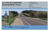
is an important lifeline to all communities throughout the Flint Hills region. This highway is<br />
heavily influenced by both commuters and local traffic that use the corridor to shop and enjoy<br />
recreational activities. Traffic volumes vary between 23,000 ADT on the west study limits to<br />
approximately 11,000 ADT at the east limits (2011 KDOT Traffic Count Map). This important<br />
corridor has recently experienced significant development and population growth. In response,<br />
agency <strong>of</strong>ficials agreed to initiate a corridor management plan that would assist the decisionmaking<br />
process regarding developments along the US-24 corridor.<br />
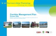
Pottawatomie County, Manhattan, St. George, Wamego, and KDOT have partnered to develop a<br />
coordinated plan for the US-24 study area. The intent <strong>of</strong> this effort is to (1) plan for adequate<br />
infrastructure to serve future development and (2) keep US-24 and its associated transportation<br />
system operating safely and smoothly. The result <strong>of</strong> this study is the US-24 Corridor <strong>Management</strong><br />
Plan (www.ksdot.org/projects.asp) for the highway’s traffic operations and adjacent land use.<br />
8.5.1.g US-56 from US-59 to I-35 (Douglas and Johnson Counties)<br />
This corridor consists <strong>of</strong> the segment <strong>of</strong> US-56 from US-59 in Douglas County east to I-35 in the<br />
city <strong>of</strong> Gardner in Johnson County (approximately 22 miles). US-24 is a Class D route that<br />
connects the cities <strong>of</strong> Gardner, Edgerton, Baldwin City, as well as Douglas and Johnson counties.<br />
With the construction <strong>of</strong> the new Burlington Northern Santa Fe (BNSF) railroad intermodal<br />
facility, and subsequent development in Edgerton, traffic along US-56 is expected to increase.<br />
Traffic volumes vary from 4,000 ADT to 5,000 ADT (2011 KDOT Traffic Count Map). This<br />
corridor will likely experience increased development as a result <strong>of</strong> the BNSF intermodal facility.<br />
As a result, KDOT <strong>of</strong>ficials agreed it would be beneficial to initiate a corridor management plan<br />
that would assist the future decision-making process.<br />
In 2008, KDOT and local partners began the US-56 Corridor <strong>Management</strong> Plan. The purpose <strong>of</strong> the<br />
plan was to improve access management and capacity along US-56 in a way that supports the<br />
needs and addresses the concerns <strong>of</strong> the corridor community. The US-56 Corridor <strong>Management</strong><br />
Plan (www.ksdot.org/projects.asp) was completed and adopted by local <strong>of</strong>ficials in July 2010.<br />
8.5.1.h K-4 from Auburn Road to I-70 (Shawnee County)<br />
This corridor consists <strong>of</strong> the segment <strong>of</strong> K-4 from Andover Road north to I-70 in Shawnee County.<br />
K-4 is a Class E route that connects the city <strong>of</strong> Topeka with the city <strong>of</strong> Auburn to the south (from<br />
Auburn Road) and the city <strong>of</strong> Dover to the west. Significant growth has occurred within southwest<br />
Shawnee County which has increased commuter traffic along Auburn Road in the corridor. Traffic<br />
volumes vary from between 6,000 and 7,000 ADT (2011 KDOT Traffic Count Map). Commercial<br />
and residential development could increase along this section <strong>of</strong> K-4 as a result <strong>of</strong> increased<br />
development in southwest Shawnee County. KDOT staff would like to work with local partners<br />
(city <strong>of</strong> Topeka, Shawnee County) to initiate an access management plan.<br />
8.5.1.i US-36 from K-187 to County Road L (city <strong>of</strong> Seneca, Nemaha County)<br />
This corridor consists <strong>of</strong> the segment <strong>of</strong> US-36 between K-187 (west boundary) and County Road<br />
L (east boundary), including portions <strong>of</strong> the city <strong>of</strong> Seneca and unincorporated areas <strong>of</strong> Nemaha<br />
County. US-36 is a Class B route, part <strong>of</strong> the National Highway System, which connects Seneca<br />
with Hiawatha to the east and Marysville to the west. US-36 is a commercial corridor that<br />
transports people and goods throughout northern <strong>Kansas</strong>. Traffic volumes vary from 4,000 ADT to<br />
6,000 ADT along the corridor (2011 KDOT Traffic Count Map). KDOT’s Bureau <strong>of</strong> Traffic<br />
Chapter 8—Appendices J a n u a r y 2 0 1 3 | P a g e | 8 - 57