Download - Uganda Land Alliance
Download - Uganda Land Alliance
Download - Uganda Land Alliance

Create successful ePaper yourself
Turn your PDF publications into a flip-book with our unique Google optimized e-Paper software.
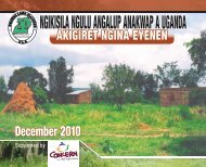
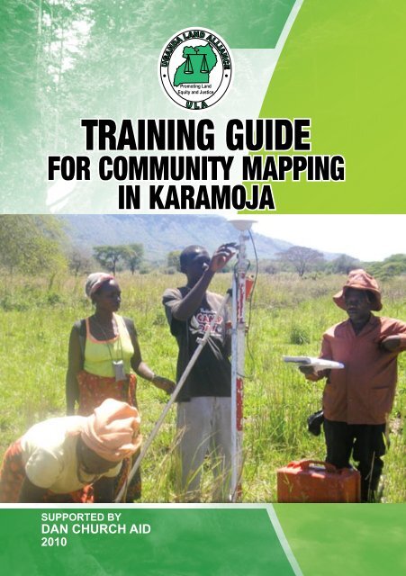
TRAINING GUIDE<br />
FOR COMMUNITY MAPPING<br />
IN KARAMOJA<br />
SUPPORTED BY<br />
DAN CHURCH AID<br />
2010
TABLE OF CONTENTS<br />
List of Acronyms ..................................................................... iii<br />
PART I – COMMUNITY MAPPING IN CONTEXT .......... 1<br />
1.0 Introduction to Community Mapping ......................... 1<br />
2.0 <strong>Land</strong> Administration and Management<br />
Institutions .................................................................... 4<br />
3.0 Forms Of <strong>Land</strong> Holding In <strong>Uganda</strong>............................. 6<br />
4.0 Highlight Features Of Customary <strong>Land</strong> Tenure/<br />
Characteristic AsStipulated By The <strong>Land</strong> Act............... 8<br />
4.1 Difference between Customary and other Tenure<br />
types with regard to Registration..................................... 8<br />
4.2 Rights and Duties of Customary <strong>Land</strong> Owner............. 8<br />
4.2.1 Rights of a Customary <strong>Land</strong> Owner:................ 8<br />
4.2.2 Obligations/Duties of a Customary <strong>Land</strong><br />
Owner..................................................................... 9<br />
4.3 Other Rights Accruing Under Customary Tenure....... 9<br />
4.3.1 Family <strong>Land</strong>........................................................... 9<br />
4.3.2 Communal <strong>Land</strong> 10<br />
4.3.3 Rights of Individuals on Communal land........ 13<br />
4.3.4 Common <strong>Land</strong>...................................................... 14<br />
4.3.5 Third party or other subsidiary rights............... 15<br />
5.0 Procedure For Acquiring A Certificate Of<br />
Customary Ownerships ................................................... 15<br />
5.1 Procedure for Acquiring a Certificate of Customary<br />
Ownership........................................................................... 15<br />
PART II - COMMUNITY MAPPING EXERCISE.............. 17<br />
6.0 Introduction.................................................................. 17<br />
6.1 Benefits and Outcomes of Community Mapping............. 18<br />
6.2 Methodology for Carrying out Community Mapping...... 20<br />
TRAINING GUIDE FOR COMMUNITY MAPPING IN KARAMOJA<br />
i
<strong>Uganda</strong> <strong>Land</strong> <strong>Alliance</strong><br />
6.2.1 What does Systematic Demarcation Field<br />
Work involve;......................................................... 20<br />
6.2.2 Steps for Carrying Out the Systematic<br />
Demarcation Exercise.......................................... 20<br />
6.2.2.0 Identifying, Ascertaining and<br />
Establishing land rights;............................. 21<br />
6.2.2.1 Identifying, Ascertaining and<br />
Establishing <strong>Land</strong> Rights............................ 22<br />
6.2.2.2 Marking of Established Boundaries......... 24<br />
6.2.2.3 Taking the Necessary Measurements........ 24<br />
6.2.2.4 Drawing a Plan (Index Map) of the <strong>Land</strong>....... 24<br />
6.2.2.5 <strong>Land</strong> Readjustment...................................... 25<br />
6.2.2.6 Recording <strong>Land</strong> Rights............................... 25<br />
6.2.2.7 Issuance of Certificate................................ 25<br />
6.3. Roles and Responsibilities of Different<br />
Stakeholders in Community Mapping............................ 26<br />
6.4 <strong>Land</strong> Disputes and <strong>Land</strong> Adjudication.......................... 27<br />
ii
List of Acronyms<br />
ALC Area <strong>Land</strong> Committee<br />
DLB District <strong>Land</strong> Board<br />
DLO District <strong>Land</strong> Office<br />
DLT District <strong>Land</strong> Tribunals<br />
LC Local Council<br />
LSSP <strong>Land</strong> Sector Strategic Plan<br />
MAAIF Ministry of Agriculture Animal I industry and Fisheries<br />
MLHUD Ministry of <strong>Land</strong>s, Housing and Urban Development<br />
PEAP Poverty Eradication Action Plan<br />
PMA Plan for Modernization of Agriculture<br />
SDTC Systematic Demarcation Technical Committee<br />
SD Systematic Demarcation<br />
ULC <strong>Uganda</strong> <strong>Land</strong> Commission<br />
TRAINING GUIDE FOR COMMUNITY MAPPING IN KARAMOJA<br />
iii
<strong>Uganda</strong> <strong>Land</strong> <strong>Alliance</strong><br />
iv
PART I<br />
COMMUNITY MAPPING IN CONTEXT<br />
1.0<br />
INTRODUCTION TO COMMUNITY MAPPING<br />
Community mapping is a grass roots community development<br />
initiative that strives to connect various actors in a particular area<br />
to issues affecting that area through a local inquiry. Community<br />
mapping is an exercise through which tacit knowledge as embedded<br />
in people’s spatial memory is converted into explicit and externally<br />
usable knowledge. It is an open ended, dynamic, and broadly inclusive<br />
way to bring community members, civil society, local governments<br />
and the central government together to better understand the places<br />
in which communities live, the social, economic and political issues<br />
affecting those places and the means by which those issues might<br />
be addressed. Resultantly, this programme allows for improved<br />
information exchange between outsiders (i.e. Central government,<br />
NGOs, Researchers, Donors, e.t.c.) and the insiders (Community<br />
members) in the design and implementation of development projects.<br />
Mapping tenure relations not only provides spatial information but<br />
also socio-political relationships, such as gender dynamics, underlying<br />
these entangled links, and socio-institutional structures that govern<br />
natural resources.<br />
Community mapping is of great significance to customary tenure,<br />
which for a long time has been regarded as non- progressive and<br />
backward. Through community mapping, it is possible to use<br />
the information generated for community project design and<br />
TRAINING GUIDE FOR COMMUNITY MAPPING IN KARAMOJA 1
<strong>Uganda</strong> <strong>Land</strong> <strong>Alliance</strong><br />
implementation, thus empowering people and their communities.<br />
Community mapping gathers gender disaggregated information<br />
on overlapping land claims where duties, rights and responsibilities<br />
are not clear and provides spatial information that is useful for<br />
territorial planning and natural resource management. It will map<br />
socio-political relations underlying the spatial information and<br />
socio-institutional structures that govern natural resources. Here, the<br />
roles of the women and the youth are clearly defined in the process.<br />
Furthermore, secondary rights to land are clearly demarcated e.g.<br />
access to grazing land, water resources, fruit trees, firewood lots e.t.c<br />
as these are fundamental in defining the livelihood strategies for the<br />
communities.<br />
Community mapping buttresses the community’s own vision of<br />
development and economic growth, of peace and security, and of<br />
their needs as a community, especially the role of women in the<br />
management and administration of land. The cultural dimension of<br />
this is that community mapping has the potential to enhance local<br />
governance structures as a channel through which to defend or<br />
advocate for the rights of indigenous peoples like the pastoralists, to<br />
their ancestral lands.<br />
Through the identification, adjudication and registration of interests,<br />
these community led land reforms are recognized and later perfected<br />
by the state, taking into consideration the fact that Government itself<br />
through its <strong>Land</strong> Sector Strategic Plan (LSSP) has embarked on a<br />
systematic demarcation programme. The community mapping exercise<br />
ensures that the outputs are of a standard enabling the issuance of<br />
certificates of title. Geo-referencing community spatial knowledge<br />
will provide the accuracy needed in community led processes for the<br />
government to recognize the results. Mapping for land registration<br />
enables information to be transferred and digitized into a Geographic<br />
Information system (GIS). The process should however, be affordable<br />
2
and user friendly generated by the participation of the community<br />
making the entire process clearly understandable by them.<br />
A reliable and regularly updated cadastral system enhances land<br />
security for the rural people as this system is maintained by the<br />
community itself through ULA member organizations in those areas,<br />
with a decentralized land administration system created, monitored<br />
with the participation of the community.<br />
Community mapping for land use planning and natural resource<br />
management is one critical area where this project becomes critical.<br />
Planning and managing land use is intimately linked to tenure security.<br />
The consolidation of secondary rights to land not only enables the<br />
definition of livelihood options and strategies, but also defines the<br />
comparative advantage of a communal tenure system as alternative<br />
or complementary to an individual ownership/tenure system. In this,<br />
issues of pasture management, land and water use optimization, thus<br />
taking into consideration the past, present and future natural resource<br />
use.<br />
Community mapping is a powerful mechanism to transform and<br />
possibly resolve disputes and conflicts by accompanying it with lobby<br />
for effective decentralized institutions for conflict resolution (Local<br />
council court systems, and magisterial courts) accompanied by a<br />
broader effort to empower communities. This mapping project can<br />
help manage internal dynamics and disputes or conflicts through the<br />
identification/strengthening of dispute resolution capacity of the<br />
traditional authorities as stipulated in the <strong>Land</strong> Act.<br />
This project aids planning and spatial integration especially in<br />
identifying administrative units while helping communities to include<br />
their concerns in an enlarged integrated vision of the reality. Thus,<br />
by using a common spatial framework, the maps will fortify the<br />
TRAINING GUIDE FOR COMMUNITY MAPPING IN KARAMOJA 3
<strong>Uganda</strong> <strong>Land</strong> <strong>Alliance</strong><br />
community’s understanding of how physical, social and political<br />
factors interact.<br />
2.0 LAND ADMINISTRATION AND MANAGEMENT<br />
INSTITUTIONS<br />
Most land administration institutions have been decentralized by the<br />
constitution (1995) and the <strong>Land</strong> Act (1998) as follows:<br />
i) Ministry of <strong>Land</strong>s, Housing and Urban Development<br />
The MLHUD is in charge of policy, planning and coordination of<br />
all stake holders operating in the area of <strong>Land</strong>, Housing and Urban<br />
Development. The Ministry, using the LSSP and other policy guidelines,<br />
is mandated to implement land tenure reforms. The Department of<br />
surveys and Mapping is responsible for surveys, mapping and quality<br />
control.<br />
ii) <strong>Uganda</strong> <strong>Land</strong> Commission (ULC)<br />
The <strong>Uganda</strong> <strong>Land</strong> Commission manages Government land and land<br />
held in trust by Government; such as forests, water bodies, game parks,<br />
and wetlands. <strong>Uganda</strong> <strong>Land</strong> Commission also manages government<br />
land outside the country such as embassies.<br />
iii) District <strong>Land</strong> Boards (DLB)<br />
The District <strong>Land</strong> Board holds and allocate land in the district which<br />
is not owned by any person or authority and they are mandated to<br />
facilitate the registration and transfer of interests in land. The District<br />
<strong>Land</strong> Boards took over the role and they do exercise the powers of<br />
the less or in case of a lease granted by a former controlling authority<br />
under the Public <strong>Land</strong>s Acts, 1969.<br />
iv) <strong>Land</strong> Committees<br />
These assist the District <strong>Land</strong> Boards in advisory capacity on<br />
4
matters relating to land including rights in land. These committees<br />
are mandated by the <strong>Land</strong> Act to undertake both adjudication<br />
and demarcation aspects in cases where a tenant by occupancy or<br />
a customary ownership applies for a certificate of occupancy or a<br />
certificate of customary ownership respectively. The committees also<br />
perform any other functions that are conferred on them by the <strong>Land</strong><br />
Act.<br />
v) Local Council Courts<br />
These are courts that handle disputes in respect of land held under<br />
customary tenure. They also have jurisdiction for the trial and<br />
determination of matters relating to land. Every suit is instituted in<br />
the first instance in a village local council court. Appeals from the<br />
judgment and orders of a village local council court are made to a<br />
parish local council court. From the parish local council court, the<br />
appeals go to a town, division or sub-county council court. From the<br />
town, division or sub-county council court, the appeals go to a court<br />
presided over by a Chief Magistrate. Appeals lie from decrees and<br />
orders made on appeal by a Chief Magistrate, with the leave of the<br />
Chief Magistrate or of the High Court, to the High Court.<br />
vi) District <strong>Land</strong> Tribunals (LT)<br />
Each district has a land tribunal, which handles land disputes in the<br />
district. The District <strong>Land</strong> Tribunal determines disputes as the court<br />
of first instance in all land matters where the subject matter does not<br />
exceed Ushs 50,000,000/= (<strong>Uganda</strong> shillings fifty million).<br />
It is important to note that currently, the jurisdiction of the<br />
District <strong>Land</strong> Tribunals is being temporarily exercised by Chief<br />
Magistrates or Grade One Magistrates in the area where the<br />
land dispute has occurred.<br />
vii) High Court<br />
The High Court handles appeals on land matters from the District<br />
TRAINING GUIDE FOR COMMUNITY MAPPING IN KARAMOJA 5
<strong>Uganda</strong> <strong>Land</strong> <strong>Alliance</strong><br />
<strong>Land</strong> Tribunal as provided under the <strong>Land</strong> Act, from the Chief<br />
Magistrate under the structure established under the Local Council<br />
Courts Act, 2006<br />
viii) Recorder<br />
The recorder is responsible for keeping records relating to certificates<br />
of customary ownership and certificates of occupancy. In rural areas,<br />
the recorder is the sub-county chief. In gazetted urban areas the<br />
recorder is the town clerk while in a division of a city, the assistant<br />
town clerk in charge of the division is the recorder.<br />
ix) Mediator<br />
These are appointed by the District <strong>Land</strong> Tribunals and their<br />
appointments are on an hoc basis. Generally, the mediators undertake<br />
such functions as are provided for under the <strong>Land</strong> Act or those<br />
conferred on them by the <strong>Land</strong> Regulations. One of such functions<br />
is to assist parties reach an agreement upon being invited to do so,<br />
incase where persons not qualified<br />
3.0 FORMS OF LAND HOLDING IN UGANDA.<br />
i) Mailo<br />
This is system where the owner of land referred to as a mailo owner<br />
owns land forever. The owner has full powers over his/her land and<br />
can sell lease or deal with it in anyway. This form of tenure was only<br />
peculiar to Buganda. It was created by the 1900 Buganda Agreement<br />
between her and the Kingdom of Buganda. By this Agreement,<br />
chunks of the land were given to certain individuals to own forever.<br />
The owner of Mailo land is entitled to certificate of title.<br />
ii). Freehold <strong>Land</strong><br />
This is the system where the owner of the land, referred to as a land<br />
owner, owns land forever or for unlimited time, depending on a<br />
6
condition or happening of a certain event.<br />
The landowner has full powers over this land and can do anything<br />
with the land except in cases where the conditions have been put on<br />
the landowner not to do certain things.<br />
Grants of land under this tenure were made to certain individuals and<br />
organizations by the crown and later by the <strong>Uganda</strong> <strong>Land</strong> Commission<br />
(ULC)<br />
The grantee of the land in freehold is entitled to a certificate of title.<br />
iii). Leasehold <strong>Land</strong><br />
This is the system whereby a person referred to as a tenant or lessee<br />
owns land through an agreement between him/her and the owner of<br />
the land known as landlord or lessee. Under this system, the landlord<br />
allows the tenant to use the land for a specified period but in turn the<br />
tenant will pay the landlord a payment called rent.<br />
An owner of the freehold, Mailo, or by the crown or <strong>Uganda</strong> <strong>Land</strong><br />
Commission (ULC) would make a grant of land under this tenure.<br />
The grantee of a lease for a period of 3 or more years is entitled to a<br />
certificate of title.<br />
iv) Customary <strong>Land</strong> Tenure<br />
This is a traditional method of owning land. Customary tenants would<br />
be in occupation of Mailo land, freehold, leasehold or public land.<br />
They occupy such land either by the growing various crops, exercising<br />
rights to look after animal or by carrying out any other activity. The<br />
term Kibanja became associated with people owning land under this<br />
tenure.<br />
NB. During this period land which was not owned either in freehold<br />
or by way of mailo was known as public land. Out of public land<br />
leases and freehold could be granted. Public land was vested in ULC.<br />
TRAINING GUIDE FOR COMMUNITY MAPPING IN KARAMOJA 7
<strong>Uganda</strong> <strong>Land</strong> <strong>Alliance</strong><br />
4.0 HIGHLIGHT FEATURES OF CUSTOMARY LAND<br />
TENURE/ CHARACTERISTIC AS STIPULATED BY<br />
THE LAND ACT.<br />
a)<br />
b)<br />
c)<br />
d)<br />
e)<br />
It’s characterized by the local customary regulations.<br />
Applying local customary regulation and management to individual<br />
and household ownership, use and occupation of and transaction<br />
in land<br />
Providing for communal ownership and use of land<br />
In which parcels of land may be recognized as subdivisions<br />
belonging to a person, a family or a traditional institution and<br />
Which is owned in perpetuity<br />
4.1 Difference between Customary and other Tenure types with<br />
regard to Registration<br />
1. Comprises 80% verses 20%of land<br />
2. none titled versus Titled<br />
3. family, community and individual ownership versus Individual<br />
4. unwritten laws versus Written laws<br />
4.2 Rights and Duties of Customary <strong>Land</strong> Owner<br />
4.2.1 Rights of a Customary <strong>Land</strong> Owner:<br />
• Acquire a certificate of customary ownership, non acquisition<br />
of the certificate does not take away his or her rights as the<br />
owner of the land. This certificate is recognized by financial<br />
institutions, bodies and authorities as a valid certificate and<br />
evidence of title<br />
• Give other rights to use to use and derive benefits from his/<br />
her land for a particular period of time, which may include the<br />
life time of that person.<br />
• Lease the land or part of it<br />
8
• Mortgage or pledge the land or part of it if the conditions in<br />
the certificates of customary ownership permits<br />
• Where the mortgager fails to redeem, the mortgagee may sell<br />
to a purchaser<br />
• Subdivide, sublet or sell his land or part of it if the conditions<br />
in the certificate permit<br />
• May give away the land by will<br />
4.2.2 Obligations / Duties of a Customary <strong>Land</strong> Owner<br />
• The customary land owner must<br />
• Transfer the land or part of it if a court of law or land tribunal<br />
orders him or her to do so.<br />
• Provide the recorder with a copy or accurate information<br />
about any dealings on the landing the process of exercising<br />
his or her rights in that land<br />
• A holder of a certificate of customary ownership will not<br />
lease, mortgage, pledge, create third party rights unless it is<br />
registered with the recorder<br />
4.3 Other Rights Accruing Under Customary Tenure<br />
4.3.1 Family <strong>Land</strong><br />
Sec. 28 Any decision taken in respect of land held under customary<br />
tenure (whether under individual or communal ownership) shall<br />
be in accordance with the customs, traditions and practices of the<br />
community. However, where a decision denies women or children<br />
or persons with disabilities access to ownership, occupation or use<br />
of any land it shall be null and void. Or where a decision imposes<br />
conditions, which violate articles 33, 34 and 35 of the Constitution, it<br />
shall be null and void.<br />
Where land is held by a family, the head of the family is registered on<br />
TRAINING GUIDE FOR COMMUNITY MAPPING IN KARAMOJA 9
<strong>Uganda</strong> <strong>Land</strong> <strong>Alliance</strong><br />
behalf of the family. The head of the family is not defined though so<br />
it could be a man or a woman.<br />
4.3.2 Communal <strong>Land</strong><br />
Communal land is the land held by a specific community or group<br />
of people recognizing individual rights in that land and regulating its<br />
use and management. Communal land may be held on a certificate<br />
of customary ownership, freehold or leasehold title by the managing<br />
committee on behalf of members of the communal association.<br />
Communal land is managed under customary law and any other law<br />
such as statutory law. For example, the provisions of the National<br />
Environment statue must be followed to ensure conservation of the<br />
environment, wetlands and grasslands.<br />
Management of Communal <strong>Land</strong><br />
Formation of Communal <strong>Land</strong> Associations<br />
• A group of people apply to the District Registrar of titles to<br />
become an association under the land Act.<br />
10<br />
• The registrar convenes a meeting of the members of association<br />
giving a notice of not less than 21 days to determine:<br />
o Whether to convene themselves into an association<br />
o Whether more than 60% of the members agree<br />
o That they elect not more than 9 and not less than<br />
3 people. One third of who should be women, as<br />
officers of the Association.<br />
• The registrar or an authorized person presides over the<br />
meeting.<br />
• The officers elected prepare the constitution of the Association
with the assistance of the registrar, who then certifies that<br />
it provides for a transparent and democratic process of<br />
management.<br />
• Where it does not conform, the Registrar returns it within<br />
thirty days for revision.<br />
• If it is certified, the members vote to approve it and it is<br />
binding on all members.<br />
• The officers apply for the incorporation and registration of<br />
the officers of the managing committee of the association of<br />
the Registrar.<br />
• The Registrar issues a certificate of incorporation of the<br />
officers of the Association with or without conditions and<br />
limitations.<br />
• The Registrar has supervisory powers over the activities of<br />
the Association.<br />
Powers of the Managing Committee of the Communal <strong>Land</strong><br />
Association<br />
• To sue and be sued in the corporate name<br />
• Make binding contracts on behalf of the Association and all<br />
its members.<br />
• Grant mortgages, Pledges or liens over any property of the<br />
Association<br />
• Dispose of any property of the Association<br />
• Hold any land and property and exercise their powers over<br />
that property on behalf of all members of the Association.<br />
• No transactions of any kind in respect of the land or any part<br />
TRAINING GUIDE FOR COMMUNITY MAPPING IN KARAMOJA 11
<strong>Uganda</strong> <strong>Land</strong> <strong>Alliance</strong><br />
of the land shall be entered into, undertaken, or concluded<br />
by the managing committees unless a majority vote has been<br />
attained to approve the specific<br />
• Transactions, which are the subject of the meeting.<br />
• Transactions, which do not comply with the above requirement,<br />
are null and void, giving rise to no rights or interest in the<br />
land.<br />
Disputes Arising Within the Association<br />
Where a dispute has risen within the association,<br />
a)<br />
b)<br />
At least one tenth of the of the members of the association<br />
place a request to the District Registrar or titles or;<br />
The Registrar on his/her own motion<br />
Under takes an inquiry on the activities of the Association<br />
and matters which cause or contributed to the dispute.<br />
Refer the issue to the district <strong>Land</strong> Board or other person to<br />
mediate<br />
Propose amendments to the constitution<br />
Take any other actions as may be necessary<br />
Where the Registrar has intervened, the Association must abide by the<br />
directions of the Registrar and cooperate with any person appointed<br />
to assist in the resolution of the dispute.<br />
Dissolution and De-certification of the Association<br />
• The managing committee may apply to the District Registrar<br />
of Titles for the dissolution<br />
• The application is accompanied by:<br />
o Signatures of the officers<br />
o Minutes of the member’ meeting<br />
12<br />
The application must be sent to the District Registrar of titles
within 14 days of the decision to resolve.<br />
• The Registrar may consent to the dissolution of he/she deems<br />
it fit. This however, does not remove any obligation to:<br />
o Pay debts owing<br />
o Pay taxes, fees dues or other sums which the officers owed<br />
up to the time of dissolution<br />
o Any action or proceedings against those officers which<br />
have been or which may be commenced in respect of any<br />
debts or sums owing.<br />
• When the order of dissolution is consented to, the District<br />
Registrar of Titles:<br />
o Gives an appropriate publicity to the dissolution and its<br />
effects<br />
o Cancel the certificate if incorporation of the Association<br />
o Cancel any other directions and make any other orders<br />
necessary to give full effect to the dissolution of the<br />
Association<br />
4.3.3 Rights of Individuals on Communal land.<br />
• Where an Association holds land under customary or Freehold<br />
tenure, the Association must recognize and verify that all or<br />
part of the land it holds is occupied and used by individuals<br />
and or families for their own purposes and benefits.<br />
• Under customary tenure, a family is recognized as legal person<br />
represented by the head of the family.<br />
• An individual or family within a community wishing to own<br />
her/his/its land which under customary norms is available for<br />
TRAINING GUIDE FOR COMMUNITY MAPPING IN KARAMOJA 13
<strong>Uganda</strong> <strong>Land</strong> <strong>Alliance</strong><br />
her/his/its use and occupation may:<br />
o If held by the Association on behalf of the community apply<br />
for a certificate of customary ownership or a certificate<br />
of freehold title in respect of her/his/its portion of land.<br />
The rules that apply for the application for a certificate of<br />
customary ownership or freehold certificate of title apply<br />
in this case without exception.<br />
o Where the Association holds land under customary tenure,<br />
the individual or family applies to the Association to have<br />
her/his/its portion of land transferred and registered. If<br />
the Association approves, the applicant causes her/his/its<br />
land to be demarcated, transferred and registered by the<br />
Recorder.<br />
o Where the Association holds the land under freehold, the<br />
individual or family applies to the Association to transfer<br />
the portion of land to her/his/it. If the Association<br />
approves the application, the applicant causes the piece of<br />
land to be surveyed and transferred to the applicant and<br />
registered by the Registrar of Titles.<br />
• Any person aggrieved by the decision of the Association may<br />
appeal to the District <strong>Land</strong> Tribunal.<br />
• The District <strong>Land</strong> Tribunal may:<br />
o Confirm, vary, reverse or modify the decision of the<br />
Association<br />
o Make any other orders it is empowered to make under the<br />
<strong>Land</strong> Act, 1998.<br />
4.3.4 Common <strong>Land</strong><br />
Common land is that land which the community agrees to set aside<br />
for common use by members of that community. It comprises grazing<br />
areas, wood lots, hunting grounds, swamps etc.<br />
14
A community must develop a common land management scheme<br />
which guides it in the manner in which the land is to be developed and<br />
sustainably utilized, how much extraction of the community resources<br />
can be done and who is permitted to utilize those resources.<br />
4.3.5 Third party or other subsidiary rights<br />
There are legally recognized rights in land by persons who do not own<br />
land. The main example of such rights is the right of easement, rights<br />
of way and passage. Also licensees, thus persons who temporarily use<br />
land but do not own it. They only have a license to occupy the land<br />
but they do not acquire interest in the land itself.<br />
5.0 PROCEDURE FOR ACQUIRING A CERTIFICATE OF<br />
CUSTOMARY OWNERSHIP<br />
We may not get into the details of how to acquire this certificate<br />
because it is what the systematic demarcation exercise dwells upon<br />
but emphasis is to be laid upon it when talking of the benefits of<br />
systematic demarcation to an individual and the community at large<br />
5.1 Procedure for acquiring a Certificate of Customary<br />
Ownership<br />
1.<br />
2.<br />
3.<br />
4.<br />
The applicant submits an application (form 1) to the land<br />
committee with the required fees.<br />
the land committee puts a notice in a known place in the<br />
parish e.g. in a market , on a prominent tree, on the church<br />
notice board and on the land being applied for<br />
the land committee confirms and marks the boundaries of<br />
the land applied for<br />
the land committee makes a decision following the customs<br />
of the area on any question or matter concerning the land<br />
TRAINING GUIDE FOR COMMUNITY MAPPING IN KARAMOJA 15
<strong>Uganda</strong> <strong>Land</strong> <strong>Alliance</strong><br />
applied for and listens to claims and interests of other people<br />
on the land or occupying the neighboring land<br />
5.<br />
6.<br />
7.<br />
8.<br />
9.<br />
the committee makes a report and submits it to the district<br />
land board, gives a copy to the applicant and a copy for any<br />
person who submitted a claim on the land<br />
The land committee produces three (3) copies of the sketch<br />
of the land applied for. The original copy is sent to the<br />
district land board, a copy given to the applicant and the land<br />
committee retains the third copy.<br />
The district land board considers the application and in doing<br />
so must refer to the committees report and recommendations.<br />
The board may confirm or reject the report of the<br />
committee.<br />
If the board approves the application, it makes copies of the<br />
sketch, sends to the recorder and requests him/ her to issue a<br />
certificate of customary ownership. The board must inform<br />
the recorder in writing about its decision<br />
The recorder makes and hands over the certificate of<br />
customary ownership to the owner.<br />
Remember that the land for which a certificate of customary<br />
ownership is issued bears a unique parcel identification number<br />
(PIN) given by the recorder.<br />
16
PART II<br />
COMMUNITY MAPPING EXERCISE<br />
6.0 Introduction<br />
Community mapping is an exercise through which tacit knowledge<br />
as embedded in people’s spatial memory is converted into explicit<br />
and externally usable knowledge. It is an open ended, dynamic, and<br />
broadly inclusive way to bring community members, civil society,<br />
local governments and the central government together to better<br />
understand the places in which communities live, the social, economic<br />
and political issues affecting those places and the means by which<br />
those issues might be addressed.<br />
It is a process whereby the existing land rights in parcels in defined<br />
administrative area will be identified and all the existing land rights<br />
ascertained, demarcated, surveyed and registered.<br />
In <strong>Uganda</strong>, land belongs to the people and the community mapping is<br />
not intended to grab land from the individual owners but to register<br />
the rights so that the land use, pledging of land for fulfillment of<br />
obligations, transactions, and transfer becomes easy and transparent.<br />
The two activities from the overall five that are to be concentrated<br />
upon in this phase are;<br />
i. Mobilization and sensitization of the communities<br />
ii. Establishing and authoritatively ascertaining the existing land<br />
rights, limitations, owners and rights of interested parties.<br />
TRAINING GUIDE FOR COMMUNITY MAPPING IN KARAMOJA 17
<strong>Uganda</strong> <strong>Land</strong> <strong>Alliance</strong><br />
The other three (3) activities include<br />
iii. Confirmation and marking of parcel boundaries<br />
iv. Measurement of the dimensions of land, land readjustment<br />
and producing sketch plans<br />
v. Recording land rights with the sub-county chief for rural areas<br />
and town clerk in urban areas<br />
vi. Insurance of certificates<br />
Community mapping generates information for planning and decision<br />
making<br />
6.1 Benefits and Outcomes of Community Mapping<br />
These benefits are the same as those derived from the Government<br />
Systematic demarcation programme and can be analyzed at three levels<br />
namely; Central Government, Local Government, and Individual<br />
level.<br />
1.<br />
<br />
<br />
<br />
<br />
Central Government<br />
The information concerning land ownership will enable the<br />
central government to effectively plan development activities<br />
within the country. The availability of update cadastral maps<br />
and other information will help development of information<br />
on land at all levels; and such information will be used for<br />
physical planning, development and transactions.<br />
Secondly, land ownership information will enable the<br />
government in the process of fair tax assessment.<br />
It will enable clear marking of central government and<br />
local government lands (forests and wetlands) for enhanced<br />
protection. This will enable easy monitoring of land for<br />
environmental protection.<br />
It will enable capacity building of District <strong>Land</strong> Office and<br />
the officers, Recorders and land committees.<br />
18
2. Local Government<br />
The Demarcation of parcels will enable the local government in<br />
various ways namely:<br />
Planning of local land use<br />
Proper land management and administration, especially<br />
insurance of certificates<br />
Levy of local tax from land transaction of the registered land<br />
Social benefits in terms of peaceful environment with few<br />
land disputes and tension.<br />
3.<br />
<br />
<br />
<br />
<br />
<br />
<br />
<br />
<br />
Individual Level<br />
The long-term benefits of community mapping at the<br />
individual level are linked to secure ownership rights that will<br />
lead to sustainability of livelihoods, particularly among the<br />
rural farmers. The specific benefits are:<br />
After the completion of the community mapping exercise, a<br />
person will have undisputed right of ownership because one’s<br />
piece of land must have been identified and demarcated, and<br />
ownership rights defined.<br />
The adjudication process that will be carried out during the<br />
demarcation exercise will remove the existing defects in tenure.<br />
Once these are removed, greater security will lead to greater<br />
investment in land and production.<br />
This will eventually reduce tension between neighboring<br />
landowners.<br />
Registration of land will improve land transaction since a<br />
registered land holder will have a land certificate or a land<br />
title as evidence of his/her, ownership rights which can be<br />
presented to the buyer.<br />
Getting a land title will be cheaper and easier.<br />
The customary ownership can be used as security for getting<br />
a loan from financial institutions<br />
The rights of women, orphans and other vulnerable groups<br />
TRAINING GUIDE FOR COMMUNITY MAPPING IN KARAMOJA 19
<strong>Uganda</strong> <strong>Land</strong> <strong>Alliance</strong><br />
owning customary land will be recorded.<br />
It will curtail land grabbing.<br />
It will protect land market.<br />
It will promote sustainable utilization of wetlands, since these<br />
areas will be demarcated.<br />
NB. Emphasis is going to be placed on individual level, because,<br />
it is the people we are targeting in the project and not the<br />
government institutions.<br />
6.2 Methodology for Carrying out Community Mapping.<br />
Community mapping contains a component of systematic<br />
demarcation which means that all the land within a given territory<br />
is mapped at the same time with community participation.<br />
6.2.1 What does Community Mapping Field Work<br />
involve;<br />
This chapter outlines the steps that will be taken in carrying out<br />
the Systematic Demarcation exercise by the systematic demarcation<br />
team, land committees, LC’s, chiefs, community members and other<br />
stakeholders. The following are the steps that will be followed to<br />
conduct a Systematic Demarcation exercise.<br />
6.2.2 Steps for Carrying out the Community<br />
Mapping Exercise.<br />
An application is required to be made to the Area <strong>Land</strong> Committee<br />
which then places a notice in the prescribed form requiring all persons<br />
claiming an interest in the land or any adjacent land to attend the<br />
meeting of the committee. The meeting is required to be held not less<br />
than two weeks from the date of the notice.<br />
20
6.2.2.0 Identifying, ascertaining and establishing land rights;<br />
i) What form of ownership is associated with each particular<br />
piece of land ownership?<br />
ii)<br />
What rights and interests are associated with each parcel of<br />
land?<br />
• Mortgage- No<br />
• License- yes<br />
• Sell- yes, but upon the family agreement<br />
• Give away- yes upon the family agreement<br />
• Third party rights/ easement- Accepted upon community and<br />
the local council leaders agreement<br />
• Clan/community interest- No, there is no Freeland.<br />
iii) Who owns each parcel of land in a given area?<br />
• Individual land – yes<br />
• Institutional land – yes for the sub-county was given by the<br />
British<br />
• -<strong>Land</strong> for the institutions like the church was got through an<br />
agreement<br />
• -Sub-county also hires land.<br />
• Public/ communal land- yes<br />
iv) What types of land use can be identified in the area.<br />
• agriculture- yes<br />
• pastoralism- yes<br />
• fish farming- No<br />
• wetland utilization- No<br />
• commercial- yes ( upland rice scheme is the only one so far<br />
in Nabwal<br />
• residential- yes<br />
• infrastructure and development that is schools, hospitals,<br />
government buildings and recreation grounds- yes<br />
TRAINING GUIDE FOR COMMUNITY MAPPING IN KARAMOJA 21
<strong>Uganda</strong> <strong>Land</strong> <strong>Alliance</strong><br />
• forestry- No<br />
• Industry- No<br />
v) Identifying the different stakeholders in the systematic<br />
process;<br />
• Opinion leaders<br />
• Local council Leaders<br />
• Parish <strong>Land</strong> committees and the sub-county land committees(<br />
area land committees)<br />
• Local community<br />
• Parish chiefs<br />
• Physical Planner<br />
• Environment Officer<br />
vi)<br />
Sketch Mapping Process;<br />
• Identifying features for the sketch maps;<br />
• Roads<br />
• Schools<br />
• Health Units<br />
• Water sources<br />
• Security units (Barracks, police post, prison)<br />
• Garden<br />
• Home/ Manyatta<br />
• Rivers, wetlands, trees, mountains,<br />
• neighbors<br />
6.2.2.1 Identifying, ascertaining and establishing land rights<br />
The first step will be identifying the boundary of the individual piece<br />
of land, as well as public facilities. The public facility may include; road<br />
reserve, health facilities and schools. It will not only be identifying<br />
land rights but also the limitations of such rights and disputes with a<br />
view of solving such disputes.<br />
22
The phase will involve a set of questions namely:<br />
x)<br />
What rights and interests are associated with each parcel<br />
of land?<br />
These interests maybe, easements (rights of another person or<br />
persons over one’s land), mortgages (pledging of land as security<br />
for a loan or credit), licensees, user rights (e.g. family interest for<br />
minor children, dependant children, spouses), third party interests,<br />
clan interests or community interests.<br />
xi)<br />
What form of ownership is associated with each particular<br />
piece of land?<br />
This is customary tenure but there are also emerging forms of<br />
land utilization which can be in form of wetland or peri-urban<br />
areas that may require special attention.<br />
xii)<br />
Who owns each parcel of land in a given area?<br />
The team together with the community has to establish whether<br />
the ownership is individual, communal, family, institutional or public<br />
land ownership.<br />
xiii)<br />
What types of land can be identified in the area?<br />
This may be one or a combination of the following: agriculture,<br />
pastoralism (cattle keeping), fish farming, wetland utilization,<br />
commercial, residential, infrastructure (schools, hospitals,<br />
government buildings, and recreational grounds), forests, or<br />
industry.<br />
The Community Mapping Team will be required to confirm the<br />
boundaries with the neighbors, local opinion leaders, environmental<br />
TRAINING GUIDE FOR COMMUNITY MAPPING IN KARAMOJA 23
<strong>Uganda</strong> <strong>Land</strong> <strong>Alliance</strong><br />
officers, physical planners and with any other relevant authority.<br />
The Environmental/ wetlands officer will be instrumental in<br />
identifying various land uses in peri-urban areas.<br />
6.2.2.2 Marking of established boundaries<br />
The second step will be marking the land boundaries by observing<br />
corners and turning points (bends) along the boundary. This<br />
exercise will apply to individual pieces of land as well as public<br />
facilities such as road reserves, health facilities, schools, wetlands<br />
as well as peri-urban areas.<br />
In some cases and regions, marking boundaries will be based on<br />
the natural man-made boundary marks. The problem may arise<br />
that these marks may not be visible or may have shifted. So, in<br />
marking the boundary, the concerned parties must be available.<br />
Incase of disagreement, the adjudication will be handled before<br />
the boundaries are marked. In terms of wetlands and peri-urban<br />
areas, the Community Mapping Team will depend on the base<br />
maps and the advice given by the relevant authorities.<br />
6.2.2.3 Taking the necessary measurements<br />
After marking the boundary, the parcel will be measured by<br />
the surveyors or experts in the survey field. The surveyor will<br />
determine which survey tools will best suit the situation on the<br />
ground and the survey standards required.<br />
6.2.2.4 Drawing a plan (index map) of the land<br />
After land parcel size has been measured, the technical team, in<br />
presence of the parties/ residents, will compile a map showing<br />
the land parcel shape and size. All land parcels within a given<br />
location will be compiled and displayed so that the local residents<br />
view, approve, or recommend readjustment of the land parcels<br />
information in question.<br />
24
6.2.2.5 <strong>Land</strong> Readjustment<br />
This will involve two or more parties who will agree to redraw<br />
their physical land boundaries. This is a purely optional exercise in<br />
which, two or more parties may agree to adjust their boundaries<br />
either by exchange or sale.<br />
6.2.2.6 Recording <strong>Land</strong> Rights<br />
This will involve recording the land rights with the Sub-county<br />
Chief for rural areas and the Town Clerk for urban centers. The<br />
recording of the <strong>Land</strong> Rights will entail several steps.<br />
• The <strong>Land</strong> Committee and Community Mapping Team will<br />
compile a report, with sketches/ maps attached.<br />
•<br />
• The <strong>Land</strong> Committee will then send the compiled report<br />
with sketches/ maps attached to the District <strong>Land</strong> Board for<br />
approval and issue of certificate of customary ownership.<br />
•<br />
• The District <strong>Land</strong> Board will meet to approve, or reject<br />
the issuance of a certificate of Customary Ownership with<br />
conditions, restrictions and limitations as specified by law.<br />
•<br />
• The District <strong>Land</strong> Board will send the approved application to<br />
the Recorder to issue a Certificate of Customary Ownership.<br />
6.2.2.7 Issuance of Certificate<br />
The certificate of customary ownership will only be issued by<br />
the Recorder to the applicant whose application is approved<br />
by the District <strong>Land</strong> Board at a prescribed fee.<br />
TRAINING GUIDE FOR COMMUNITY MAPPING IN KARAMOJA 25
<strong>Uganda</strong> <strong>Land</strong> <strong>Alliance</strong><br />
6.3. Roles and Responsibilities of Different Stakeholders in<br />
Community Mapping<br />
There are several land administration and management institutions in<br />
<strong>Uganda</strong> that will participate in the community mapping exercise.<br />
Role of the Central Government in community mapping<br />
• Provision of Equipment<br />
• Quality assurance<br />
Role of Ministry of <strong>Land</strong>s, Housing and Urban Development<br />
As already indicated the department of <strong>Land</strong>s and Surveys is<br />
responsible for survey, mapping and quality control.<br />
• During the community mapping exercise the department will avail<br />
up to date maps of demarcation areas to the community and the<br />
District <strong>Land</strong> Office showing administrative boundaries.<br />
• Advise the procurement of appropriate program equipment<br />
• Avail Community Mapping Technical Staff to District <strong>Land</strong><br />
Officers<br />
Role of Local Governments in Community Mapping<br />
• Assist in mobilization of people in their areas for Community<br />
Mapping exercise<br />
• Appoint land committees<br />
• Appoint and or fill vacant posts in the District <strong>Land</strong> Offices<br />
• Appoint the District <strong>Land</strong> Board members<br />
• Sustain (continue with) Community Mapping program through<br />
out the district after the pilot phase.<br />
The Role of Community in Community Mapping<br />
• The community will be expected to mobilize, co-operate and<br />
participate in the community mapping exercise<br />
• The community (owners/ occupiers) will be expected to provide<br />
26
accurate information concerning the land parcel and ownership.<br />
• The community will be requested to participate in settlement of<br />
disputes over land before the actual Community Mapping exercise<br />
begins.<br />
• Participate in clearing of boundaries for the mapping team<br />
The Role of the Recorder<br />
• The <strong>Land</strong> Act gives the responsibility of preparing and issuing<br />
of certificates (of customary ownership and occupancy) to the<br />
sub-county chief (rural land) and town clerk (urban land). When<br />
performing this role, her she will be known as the recorder.<br />
• Upon receipt of the approved report from the DLB, the Recorder<br />
will issue the required customary ownership certificate after<br />
payment of the official fee by the land owner.<br />
The Role of the <strong>Land</strong> Owner/ Occupier<br />
The land owners (and of course the community) will play an important<br />
role in the community mapping exercise and most important ones will<br />
be:<br />
• Availing him/herself during the exercise<br />
• Giving consent and active participation in the community mapping<br />
exercise<br />
• Ensuring that boundaries of his land are cleared<br />
• Participating in the settlement of land disputes, if any, before the<br />
actual community mapping exercise is carried out<br />
• Availing the required information concerning the land parcel and<br />
house hold members<br />
6.4 <strong>Land</strong> Disputes and <strong>Land</strong> Adjudication<br />
During the community mapping exercise, the adjudication stage<br />
involves settling land disputes. There are several forms of <strong>Land</strong><br />
TRAINING GUIDE FOR COMMUNITY MAPPING IN KARAMOJA 27
<strong>Uganda</strong> <strong>Land</strong> <strong>Alliance</strong><br />
Disputes which may arise and delay the Community Mapping exercise<br />
and these should be settled during the adjudication exercise. The<br />
following are some of the forms of disputes which may arise and<br />
should be addressed during course of the adjudication exercise.<br />
• Boundary disputes<br />
• Succession disputes<br />
• Ownership disputes<br />
• <strong>Land</strong> lord/Tenant disputes<br />
• Community versus individual interests<br />
• Government/individual disputes<br />
<strong>Land</strong> disputes will be settled through <strong>Land</strong> Adjudication. <strong>Land</strong><br />
Adjudication will involve settlement of land disputes in the selected<br />
area. Community Mapping of land rights within a given location will<br />
be carried out strictly in accordance with the existing legal frame work<br />
by technically competent personnel, assisted by the people at the grass<br />
roots who will provide reliable information for fair adjudication.<br />
Community mapping requires co-operation, collaboration and<br />
participation of all people for it to succeed. This is the reason why<br />
mass mobilization and sensitization is necessary.<br />
Some individuals may try to politicize and sabotage the process,<br />
usually at the mobilization stage. Therefore, carefully planned and<br />
detailed sensitization which costs a lot of money and requires a lot<br />
of dedicated time is required prior implementation of community<br />
mapping.<br />
28
<strong>Uganda</strong> <strong>Land</strong> <strong>Alliance</strong><br />
Block 29, Plot 1521, Mawanda Road.<br />
P.O. Box 26990 Kampala,<strong>Uganda</strong>.<br />
Tel: 256 414 540 038 Fax: 256 414 540 048<br />
Email: ula@ulaug.org<br />
Website: www.ulaug.org