3 Mansfield Road - Central Administration - University of Oxford
3 Mansfield Road - Central Administration - University of Oxford
3 Mansfield Road - Central Administration - University of Oxford

Create successful ePaper yourself
Turn your PDF publications into a flip-book with our unique Google optimized e-Paper software.
3 <strong>Mansfield</strong> <strong>Road</strong><br />
Building No. 159<br />
3 <strong>Mansfield</strong> <strong>Road</strong>, <strong>Oxford</strong> December 1 2012<br />
Conservation<br />
Conservation Plan<br />
Plan
Estates Services<br />
<strong>University</strong> <strong>of</strong> <strong>Oxford</strong><br />
December 2012<br />
3 <strong>Mansfield</strong> <strong>Road</strong>, <strong>Oxford</strong> 2<br />
Conservation Plan
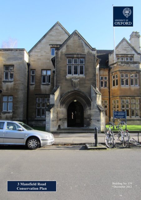
3 MANSFIELD ROAD, OXFORD<br />
CONSERVATION PLAN<br />
CONTENTS<br />
1 INTRODUCTION 7<br />
1.1 Purpose <strong>of</strong> the Conservation Plan 7<br />
1.2 Scope <strong>of</strong> the Conservation Plan 8<br />
1.3 Existing Information 8<br />
1.4 Methodology 9<br />
1.5 Constraints 9<br />
2 UNDERSTANDING THE SITE 13<br />
2.1 History <strong>of</strong> the Site and <strong>University</strong> 13<br />
2.2 History <strong>of</strong> 3 <strong>Mansfield</strong> <strong>Road</strong> 14<br />
3 SIGNIFICANCE OF 3 MANSFIELD ROAD 21<br />
3.1 Significance as part <strong>of</strong> <strong>Mansfield</strong> <strong>Road</strong> and the Holywell Ward 21<br />
3.2 Architectural and Aesthetic Significance 22<br />
3.2.1 Exterior Elevations 22<br />
3.2.2 Interior Spaces 23<br />
3.3 Archaeological Significance 24<br />
3.4 Historical Significance 25<br />
3.5 Significance as a functioning university department 25<br />
4 VULNERABILITIES 29<br />
4.1 Accessibility 29<br />
4.2 Maintenance 30<br />
4.2.1 Exterior Elevations and Setting 30<br />
3 <strong>Mansfield</strong> <strong>Road</strong>, <strong>Oxford</strong> 3<br />
Conservation Plan
4.2.2 Interior Spaces 31<br />
5 CONSERVATION POLICY 35<br />
6 BIBLIOGRAPHY 41<br />
7 APPENDICES 47<br />
Appendix 1: Listed Building Description 47<br />
Appendix 2: Conservation Area Description 51<br />
Appendix 3: Chronology <strong>of</strong> 3 <strong>Mansfield</strong> <strong>Road</strong> 55<br />
Appendix 4: Checklist <strong>of</strong> Significant Features 57<br />
Appendix 5: Floor plans 59<br />
3 <strong>Mansfield</strong> <strong>Road</strong>, <strong>Oxford</strong> 4<br />
Conservation Plan
3 <strong>Mansfield</strong> <strong>Road</strong>, <strong>Oxford</strong> 5<br />
Conservation Plan
THIS PAGE HAS BEEN LEFT BLANK<br />
3 <strong>Mansfield</strong> <strong>Road</strong>, <strong>Oxford</strong> 6<br />
Conservation Plan
1 INTRODUCTION<br />
3 <strong>Mansfield</strong> <strong>Road</strong> was constructed in 1897-98 as a private house for Rev. John Henry Mee by<br />
Symm & Co. to a design by C.J. Phipps and A. Blomfield Jackson. It was occupied by the<br />
<strong>University</strong> <strong>of</strong> <strong>Oxford</strong>’s School <strong>of</strong> Geography in 1922 and since 2005 has been occupied by<br />
Queen Elizabeth House, the <strong>University</strong> <strong>of</strong> <strong>Oxford</strong>’s Centre for International Development.<br />
Substantial extensions to the east <strong>of</strong> 1936-37 and 1965-68 were replaced in 2007-9 by a<br />
modern extension. A 1965-68 library extension to the north is extant. The building continues<br />
to serve as the headquarters for Queen Elizabeth House.<br />
1.1 Purpose <strong>of</strong> the Conservation Plan<br />
The <strong>University</strong> has an unrivalled portfolio <strong>of</strong> historic buildings, <strong>of</strong> which it is rightly proud. It<br />
has traditionally taken a thorough, holistic approach to building conservation, seeking to<br />
understand all the varied factors that make historic buildings significant to their diverse<br />
stakeholders, and using this to inform necessary change. It has become clear that this<br />
approach is vital to the conservation culture <strong>of</strong> an institution where so many <strong>of</strong> its historic<br />
buildings that are valued for their function also have extensive historical or architectural<br />
significance. This Conservation Plan represents the continuation <strong>of</strong> this tradition <strong>of</strong> seeking to<br />
understand what makes the <strong>University</strong>’s buildings cherished assets, and <strong>of</strong> seeking ways to<br />
conserve these most important features for the enjoyment <strong>of</strong> future generations.<br />
The success <strong>of</strong> this approach is such that it has now become codified in government policy:<br />
First in March 2010’s Planning Policy Statement 5: Planning for the Historical Environment<br />
then in its replacement, March 2012’s National Planning Policy Framework (hereafter:<br />
NPPF). NPPF provides useful guidance on approaching the conservation <strong>of</strong> heritage assets,<br />
and postdates the <strong>University</strong>’s existing literature. NPPF defines a heritage asset as:<br />
‘A building, monument, site, place, area or landscape identified as having a degree <strong>of</strong><br />
significance meriting consideration in planning decisions, because <strong>of</strong> its heritage interest.<br />
Heritage asset includes designated heritage assets and assets identified by the local planning<br />
authority (including local listing).’<br />
This designation clearly applies to 3 <strong>Mansfield</strong> <strong>Road</strong>.<br />
The purpose <strong>of</strong> this Conservation Plan is to update 3 <strong>Mansfield</strong> <strong>Road</strong>’s conservation policy to<br />
take into account the new guidance provided by NPPF. It will be <strong>of</strong> use both for informing<br />
responsible regular maintenance and in the preparation <strong>of</strong> future planning applications, as<br />
specified in NPPF paragraph 128.<br />
The Conservation Plan should form the basis for 3 <strong>Mansfield</strong> <strong>Road</strong>’s conservation policy and<br />
exists as part <strong>of</strong> an ongoing process. It will be renewed and updated at least every five years<br />
or following any major alterations or legislative changes.<br />
3 <strong>Mansfield</strong> <strong>Road</strong>, <strong>Oxford</strong> 7<br />
Conservation Plan
Figure 1. Map showing 3 <strong>Mansfield</strong> <strong>Road</strong> and the surrounding area, orientated with<br />
North at the top <strong>of</strong> the image. The original portion <strong>of</strong> the building is highlighted in<br />
red, the 1965-68 library extension is highlighted in blue, the 1987-88 courtyard infill is<br />
highlighted in yellow, and the 2007-9 extension is highlighted in green<br />
1.2 Scope <strong>of</strong> the Conservation Plan<br />
This plan will cover the interior and exterior <strong>of</strong> 3 <strong>Mansfield</strong> <strong>Road</strong>, a Grade-II-listed building<br />
on the corner <strong>of</strong> <strong>Mansfield</strong> <strong>Road</strong> and Jowett Walk in Holywell Ward in central <strong>Oxford</strong>.<br />
The building has been referred to as Holywell House, the School <strong>of</strong> Geography, and Queen<br />
Elizabeth House at different points in its existence. In this document its will be referred to as<br />
3 <strong>Mansfield</strong> <strong>Road</strong> unless the specific historical context demands otherwise.<br />
This plan is not a catalogue and to facilitate its practical use will concentrate only on the most<br />
vulnerable aspects <strong>of</strong> the building’s significance, suggesting how they should be approached<br />
and conserved in the future. A brief list <strong>of</strong> the most significant architectural features can be<br />
found in Appendix 4 and should be referred to when planning any repair or alteration work.<br />
1.3 Existing Information<br />
There are various forms <strong>of</strong> useful information available regarding 3 <strong>Mansfield</strong> <strong>Road</strong>:<br />
A conservation statement was produced for the building by Hawkins Brown Architects LLP<br />
in 2007, prior to the redevelopment <strong>of</strong> the building’s extensions. This contains useful<br />
information on the development <strong>of</strong> the building to this point.<br />
<strong>Oxford</strong> <strong>University</strong> Archives contains various useful historic plans and correspondence<br />
regarding this building.<br />
3 <strong>Mansfield</strong> <strong>Road</strong>, <strong>Oxford</strong> 8<br />
Conservation Plan
The original 1972 listed building description (Appendix 1) is characteristically brief but<br />
gives some indication <strong>of</strong> the features that were thought to make up the particular character for<br />
which the building was originally listed.<br />
Some planning applications have been made during the building’s recent history and these<br />
provide a fragmentary indication <strong>of</strong> the changes that have occurred over time.<br />
There are a variety <strong>of</strong> published sources regarding the architectural development <strong>of</strong> late 19 th -<br />
century <strong>Oxford</strong> and the history <strong>of</strong> the city and <strong>University</strong>. These publications provide an<br />
important resource for studying this building.<br />
This document draws on statutory guidance from NPPF prepared by HM’s Department for<br />
Communities and Local Government in March 2012.<br />
1.4 Methodology<br />
The Conservation Plan is a document that assesses the current and predicted conservation<br />
needs <strong>of</strong> 3 <strong>Mansfield</strong> <strong>Road</strong> and attempts to address them with a view towards maintaining or<br />
enhancing the significance <strong>of</strong> the heritage asset. Its formulation to supersede any existing<br />
literature is a response to the requirements <strong>of</strong> NPPF, and it is prepared in accordance with the<br />
policies contained therein.<br />
1.5 Constraints<br />
CP.3 – Limiting the Need to Travel: New development will be limited to accessible<br />
locations on previously developed sites.<br />
HE.2 – Archaeology Area: Where archaeological deposits that are potentially significant<br />
to the historic environment <strong>of</strong> <strong>Oxford</strong> are known or suspected to exist anywhere in <strong>Oxford</strong><br />
but in particular in the City Centre Archaeological Area, planning applications should<br />
incorporate sufficient information to define the character and extent <strong>of</strong> such deposits as far<br />
as reasonably practicable.<br />
HE.9 – High building Areas: Planning permission will not be granted for any development<br />
within a 1,200-metre radius <strong>of</strong> Carfax which exceeds 18.2m in height, except for minor<br />
elements <strong>of</strong> no bulk.<br />
TR.3, TR.11, TR.12 – Car Parking Standards: The City Council will not allow any<br />
significant increase in the overall number <strong>of</strong> car-parking spaces in the Transport <strong>Central</strong><br />
Area or development that provides an inappropriate level <strong>of</strong> car-parking spaces. It will<br />
attempt to reduce the level <strong>of</strong> non-residential car parking.<br />
The City <strong>of</strong> <strong>Oxford</strong> Smoke Control Order No.2: It is an <strong>of</strong>fence to emit smoke from the<br />
chimney <strong>of</strong> a building, from a furnace, or from any fixed boiler if located in a designated<br />
smoke control area.<br />
3 <strong>Mansfield</strong> <strong>Road</strong>, <strong>Oxford</strong> 9<br />
Conservation Plan
HE.7 – Conservation Areas: The <strong>Central</strong> (City and <strong>University</strong>) Conservation Area:<br />
Planning permission will only be granted for development that preserves or enhances the<br />
special character and appearance <strong>of</strong> the conservation areas or their setting.<br />
3 <strong>Mansfield</strong> <strong>Road</strong>, <strong>Oxford</strong> 10<br />
Conservation Plan
THIS PAGE HAS BEEN LEFT BL<br />
3 <strong>Mansfield</strong> <strong>Road</strong>, <strong>Oxford</strong> 11<br />
Conservation Plan
THIS PAGE HAS BEEN LEFT BLANK<br />
3 <strong>Mansfield</strong> <strong>Road</strong>, <strong>Oxford</strong> 12<br />
Conservation Plan
2 UNDERSTANDING THE SITE<br />
2.1 History <strong>of</strong> the Site and <strong>University</strong> 1<br />
The site <strong>of</strong> <strong>Oxford</strong> has had a sporadic history <strong>of</strong> settlement since the Neolithic period. Bronze<br />
Age barrows have been found in the <strong>University</strong> Parks (linear barrow cemetery) and in the<br />
Science Area (double-ditched barrow). <strong>Oxford</strong> has had a continuous history <strong>of</strong> occupation<br />
since at least the 8 th century AD. The <strong>University</strong> <strong>of</strong> <strong>Oxford</strong> itself has a long-standing tradition<br />
<strong>of</strong> exceptional education. Able to trace its roots to the 11 th century, it is known to be the<br />
oldest university in the English-speaking world.<br />
<strong>Mansfield</strong> <strong>Road</strong> and its surrounding area have a long history <strong>of</strong> occupation. Neolithic and<br />
Bronze Age pits and ditches have been found just to the north, at the corner <strong>of</strong> <strong>Mansfield</strong><br />
<strong>Road</strong> and South Parks <strong>Road</strong>. This is overlain by a Romano-British landscape <strong>of</strong> ditched<br />
enclosures and pits, suggesting a settlement focus nearby in this period. In the same area<br />
there is evidence for a massive ditch which formed part <strong>of</strong> <strong>Oxford</strong>’s Civil War defences. 2<br />
Figure 2. 1876 Ordnance Survey map with the location <strong>of</strong> 3 <strong>Mansfield</strong> <strong>Road</strong><br />
superimposed in red. Park Place corresponds roughly to the eventual location <strong>of</strong> the<br />
southern portion <strong>of</strong> <strong>Mansfield</strong> <strong>Road</strong><br />
<strong>Mansfield</strong> <strong>Road</strong> is located on the site <strong>of</strong> the mediaeval suburb <strong>of</strong> Holywell, near the 11 th -<br />
century Holywell church. This settlement grew up to the east in a piecemeal fashion around<br />
1 A short chronology <strong>of</strong> 3 <strong>Mansfield</strong> <strong>Road</strong> can be found in Appendix 3.<br />
2 Urban Archaeological Database:<br />
http://www.heritagegateway.org.uk/Gateway/Results_Single.aspx?uid=1801270&resourceID=964, accessed 4 th<br />
December 2012.<br />
3 <strong>Mansfield</strong> <strong>Road</strong>, <strong>Oxford</strong> 13<br />
Conservation Plan
the location <strong>of</strong> the holy well from which it takes its name. Holywell was nominally a suburb<br />
<strong>of</strong> <strong>Oxford</strong>, but resembled a country village with its church, townhouse (<strong>of</strong> 1516), farm<br />
buildings, a few cottages, and Holywell green or Common. A cock-pit and two bowling<br />
greens provided entertainment for Town and Gown by the 18 th Century, but the pastoral<br />
scene remained largely undisturbed. Holywell village was accessed via Holywell Lane with<br />
an <strong>of</strong>fshoot to Holywell Mill and a foot path link to the <strong>University</strong> Parks.<br />
St. Cross <strong>Road</strong> and Manor <strong>Road</strong> were constructed to the east <strong>of</strong> the site <strong>of</strong> 3 <strong>Mansfield</strong> <strong>Road</strong><br />
at some point between 1831 and 1876. The rapid Victorian growth <strong>of</strong> <strong>Oxford</strong> made an impact<br />
on the area in 1848, when part <strong>of</strong> the Holywell Green was enclosed to form Holywell<br />
cemetery. <strong>Mansfield</strong> <strong>Road</strong> was constructed in 1887-93, running between the existing<br />
Holywell Street and South Parks <strong>Road</strong>. This partly followed the line <strong>of</strong> the existing Park<br />
Place and cut through the sites <strong>of</strong> several post-mediaeval houses on Holywell Street but was<br />
designed to provide access to (Harris) Manchester College and <strong>Mansfield</strong> College, which<br />
were both then under construction. Prior to the construction <strong>of</strong> the road, the site <strong>of</strong> 3<br />
<strong>Mansfield</strong> <strong>Road</strong> was formed from parts <strong>of</strong> several long, linear gardens associated with<br />
Holywell Street properties (Figure 2).<br />
The immediate area surrounding the site has not experienced a great deal <strong>of</strong> new construction<br />
since 3 <strong>Mansfield</strong> <strong>Road</strong> was built in 1898: this having come after the major collegiate<br />
developments on the road. Two neo-Georgian houses (5 and 6 <strong>Mansfield</strong> <strong>Road</strong>) were<br />
constructed to the immediate north (in what had been the garden <strong>of</strong> 3 <strong>Mansfield</strong> <strong>Road</strong>) in<br />
1925 for Balliol to designs by E.P. Warren. 3 These houses lie between 3 <strong>Mansfield</strong> <strong>Road</strong> and<br />
the King’s Mound, built in 1892-3 to a design by Thomas Graham Jackson as the Master’s<br />
Lodgings for Balliol College. Merton College’s Holywell Buildings were constructed to the<br />
east in 1994 and Balliol College’s Jowett Walk Buildings were constructed in two phases in<br />
1996 and 2004. The <strong>Oxford</strong> <strong>University</strong> Club was constructed to the north in 2002-4. The area<br />
to the north <strong>of</strong> South Parks <strong>Road</strong> has undergone extensive development since the second half<br />
<strong>of</strong> the 19 th century, with the gradual but near-continuous construction <strong>of</strong> the <strong>University</strong><br />
Science Area.<br />
<strong>Mansfield</strong> <strong>Road</strong> now serves as a key component <strong>of</strong> the academic inner suburb <strong>of</strong> Holywell,<br />
located within <strong>Oxford</strong> City Council’s <strong>Central</strong> (City and <strong>University</strong>) Conservation Area. It is a<br />
transitionary space between the Science Area, which dominates South Parks <strong>Road</strong> to the<br />
north, and the city’s historic core to the south.<br />
2.2 History <strong>of</strong> 3 <strong>Mansfield</strong> <strong>Road</strong><br />
The site <strong>of</strong> 3 <strong>Mansfield</strong> <strong>Road</strong> was part <strong>of</strong> a larger plot <strong>of</strong> land held by Merton and Balliol<br />
Colleges. This plot <strong>of</strong> 89,090 sq.ft. ran in a long, narrow wedge from <strong>Mansfield</strong> <strong>Road</strong> in the<br />
west to Hollywell Lane (roughly now Manor <strong>Road</strong>) to the east (Figure 3). The Mertonowned<br />
elements <strong>of</strong> the plot were purchased in December 1894 by a joint syndicate <strong>of</strong> Rev.<br />
J.H. Mee, J.L. Stracham-Davidson, and Sir John Conroy, all <strong>of</strong> Balliol College, consolidating<br />
the ownership <strong>of</strong> the whole plot. The 3 <strong>Mansfield</strong> <strong>Road</strong> plot was purchased by Mee, whilst<br />
3 Pevsner, N., and Sherwood, J., Buildings <strong>of</strong> England: <strong>Oxford</strong>shire (Harmondsworth, 1974) 330.<br />
3 <strong>Mansfield</strong> <strong>Road</strong>, <strong>Oxford</strong> 14<br />
Conservation Plan
the other parts <strong>of</strong> the larger plot (the area now occupied by Balliol’s Jowett Walk Buildings)<br />
were assigned to Balliol. 4 Mee, Stracham-Davidson and Conroy also undertook to pay<br />
between them half the costs <strong>of</strong> the construction <strong>of</strong> the new road running along the southern<br />
boundary <strong>of</strong> this plot, which would become Jowett Walk.<br />
Figure 3. The large plot, consolidated for Balliol by Mee, Stracham-Davidson and<br />
Conroy. The portion purchased by Mee is coloured in green and the Balliol portion in<br />
red. The new road is in tan<br />
Mee was Coryphaeus <strong>of</strong> <strong>Oxford</strong> <strong>University</strong>, a former Fellow <strong>of</strong> Merton, and the Lecturer <strong>of</strong><br />
Ancient History at Worcester College. 5 He had been living at Kettell Hall on Broad Street<br />
since 1884. Kettell Hall had been purchased by Trinity College in 1883 and though it was let<br />
out to Mee as a senior member <strong>of</strong> the <strong>University</strong> it was still used for teaching, being fitted<br />
with a new lecture room in 1886. 6 3 <strong>Mansfield</strong> <strong>Road</strong> was intended as a permanent private<br />
home for Mee, though the size <strong>of</strong> the hall and music room would suggest that he still planned<br />
to do some teaching from his new home.<br />
3 <strong>Mansfield</strong> <strong>Road</strong> was constructed by Symm & Co. in Deddington stone and Broseley tiles.<br />
C.J. Phipps and Arthur Blomfield Jackson were the architects. Blomfield Jackson was<br />
Phipps’ son-in-law and junior partner in the firm, which he joined at some point after 1891.<br />
Blomfield Jackson was primarily a church builder, but the firm under Phipps specialised in<br />
4 <strong>Oxford</strong> <strong>University</strong> Archives, ref. GE 17, letter from J.L. Stracham-Davidson and John Conroy to J.H. Mee,<br />
dated 27 th November 1893.<br />
5 Howard, J.J., and Crisp, F.A., Visitation <strong>of</strong> England and Wales Vol.6 (Privately printed; London, 1898) 63.<br />
6 Headington.org.uk: http://www.headington.org.uk/oxon/broad/buildings/north/54.htm, accessed 5 th December<br />
2012.<br />
3 <strong>Mansfield</strong> <strong>Road</strong>, <strong>Oxford</strong> 15<br />
Conservation Plan
designing large theatres in both London and the provinces, e.g. the Theatre Royal in<br />
Nottingham (1865). Phipps died suddenly in 1897, the year before 3 <strong>Mansfield</strong> <strong>Road</strong> was<br />
completed. Although both names appear on some <strong>of</strong> the plans, this was one <strong>of</strong> the firm’s<br />
smaller projects and it seems likely that the design was wholly that <strong>of</strong> the junior partner,<br />
Blomfield Jackson.<br />
Mee lived at 3 <strong>Mansfield</strong> <strong>Road</strong> until his<br />
death in January 1918. It was briefly<br />
retained as a private house by his<br />
daughter, Bridget Eleanor Mee. Miss<br />
Mee left the house for 90 Banbury <strong>Road</strong><br />
when she married William Henry<br />
Macintosh in September 1918. 7 In June<br />
1921, the building was purchased by the<br />
<strong>University</strong> <strong>of</strong> <strong>Oxford</strong> and in 1922 it was<br />
occupied by the School <strong>of</strong> Geography. 8<br />
When Geography occupied the building<br />
they installed new heating and electric<br />
lighting, and made some changes to<br />
internal partitioning. 9<br />
3 <strong>Mansfield</strong> <strong>Road</strong> had been designed to<br />
function as a private house rather than as<br />
a university department and the School<br />
<strong>of</strong> Geography soon found it insufficient<br />
for its needs. Originally the building had<br />
a single-storey service wing arranged<br />
around a courtyard at the rear (this can<br />
be seen at the top right <strong>of</strong> Figure 4). In<br />
1936-38, the services wing was<br />
demolished and a new lecture theatre,<br />
designed by Sir Hubert Worthington,<br />
was constructed in its place against the<br />
Figure 4. The original ground-floor plan for 3<br />
<strong>Mansfield</strong> <strong>Road</strong>. Orientated with north at the<br />
left-hand side <strong>of</strong> the image<br />
eastern elevation <strong>of</strong> the main building. This was constructed in brick and faced with stone.<br />
The façades were angular and unadorned, suggesting a particularly-restrained classicism. The<br />
extension necessitated some alteration to the ro<strong>of</strong>line <strong>of</strong> the eastern elevation, where a tower<br />
<strong>of</strong> the demolished service wing had originally extended the full height <strong>of</strong> the building.<br />
7 <strong>Oxford</strong> <strong>University</strong> Archives, ref. GE 17, letter from Dr. R. Bryce-Smith to Pr<strong>of</strong>. E.W. Gilbert, dated 14 th April<br />
1961.<br />
8 Conveyance documents, copies held by Estates Services.<br />
9 Hawkins Brown Architects LLP, Lecture Theatre Redevelopment: Appendix B: Conservation Statement<br />
(Report, July 2007).<br />
3 <strong>Mansfield</strong> <strong>Road</strong>, <strong>Oxford</strong> 16<br />
Conservation Plan
There was a small extension constructed to the north <strong>of</strong> the music room at some point<br />
between 1938 and 1957. This may have been a single-storey war-time structure, as during<br />
World War II the building was occupied by the Naval Intelligence Division.<br />
The building was again extended in 1965-68. These additions were designed by the<br />
<strong>University</strong> Surveyor, Jack Lankester. A tile-hung extension was constructed on top <strong>of</strong> the<br />
1936-38 lecture theatre, adding an additional floor. At the same time, a buff-brick library<br />
extension was constructed to the north <strong>of</strong> the main building (this is presumably when the<br />
probably-war-time northern extension was demolished). The library was built in brick but the<br />
lift shaft, where it connected to the original building at the northern end <strong>of</strong> the music room,<br />
was externally clad in stone to ease the transition between the two phases. The construction<br />
<strong>of</strong> the library extension resulted in the unfortunate partitioning <strong>of</strong> the original music room and<br />
entrance hall in order to create a librarian’s <strong>of</strong>fice and a corridor from the entrance hall to the<br />
new extension. Several <strong>of</strong> the other large rooms were also partitioned to provide smaller<br />
<strong>of</strong>fices. The library extension now primarily houses D.Phil study spaces.<br />
Figure 5. 3 <strong>Mansfield</strong> <strong>Road</strong>, orientated with East at the top <strong>of</strong> the image. The<br />
original portion <strong>of</strong> the building is highlighted in red, the 1965-68 library extension is<br />
highlighted in blue, and the 1987-88 courtyard infill is highlighted in yellow. The<br />
location <strong>of</strong> the 2007-09 extension is highlighted in green, though the image still shows<br />
the 1936-38 lecture theatre with Lankester’s 1965-68 tile-hung cap<br />
The ground floor <strong>of</strong> the central courtyard/lightwell was infilled with lavatories at some point<br />
before 1972, when these were modernised and refurbished. 10 In 1987-88 the upper portion <strong>of</strong><br />
this lightwell area was infilled to form a computer room (now a video-screening room) and<br />
10 Supra. No. 9.<br />
3 <strong>Mansfield</strong> <strong>Road</strong>, <strong>Oxford</strong> 17<br />
Conservation Plan
study room, with the infill reaching to the second-floor level. The first-floor seminar room<br />
(the original drawing room, at the northeast corner <strong>of</strong> the 1898 house) was refurbished at this<br />
time.<br />
In 2005, the School <strong>of</strong> Geography vacated the building for quarters in the Dyson Perrins<br />
Laboratory. 11 Queen Elizabeth House occupied 3 <strong>Mansfield</strong> <strong>Road</strong> shortly afterwards. Queen<br />
Elizabeth House is a postgraduate institution and did not require the large lecture room or<br />
open-plan teaching spaces favoured by the School <strong>of</strong> Geography, which had a large<br />
undergraduate teaching commitment. Equally, Queen Elizabeth House did not require the<br />
laboratory spaces which had been fitted during the School <strong>of</strong> Geography’s occupation. In<br />
2005-06, several internal partitions were removed, returning some <strong>of</strong> the original large spaces<br />
to their original dimensions and some exposed services were concealed. In 2007-09,<br />
Worthington’s 1936-38 lecture room extension (including Lankester’s 1966-68 additions to<br />
it) was demolished and replaced with a modern, three-storey extension. This new extension,<br />
designed by Hawkins Brown Architects LLP, connects to the eastern elevation <strong>of</strong> the original<br />
building, in a similar location to the 1936-38 lecture theatre and the original service wing.<br />
The connection between the new wing and the original building is clad in bronze (as are the<br />
ro<strong>of</strong> and chimneys), easing the transition between the two phases with a distinct but<br />
sympathetic material. This new extension provided <strong>of</strong>fices, open-plan works spaces, and<br />
seminar rooms. The 1966-68 library block to the north was also refurbished at this time.<br />
Queen Elizabeth House continues to occupy 3 <strong>Mansfield</strong> <strong>Road</strong> and this serves as its primary<br />
site. When it occupied the building 2005, the institution formally applied its name to 3<br />
<strong>Mansfield</strong> <strong>Road</strong>, which is now referred to as Queen Elizabeth House.<br />
11 Estates Services, <strong>University</strong> <strong>of</strong> <strong>Oxford</strong>, Dyson Perrins Laboratory: Conservation Plan (Report, May 2012),<br />
available online:<br />
http://www.admin.ox.ac.uk/media/global/wwwadminoxacuk/localsites/estatesdirectorate/documents/conservatio<br />
n/Dyson_Perrins_Laboratory.pdf, accessed 6 th December 2012.<br />
3 <strong>Mansfield</strong> <strong>Road</strong>, <strong>Oxford</strong> 18<br />
Conservation Plan
3 <strong>Mansfield</strong> <strong>Road</strong>, <strong>Oxford</strong> 19<br />
Conservation Plan
THIS PAGE HAS BEEN LEFT BLANK<br />
3 <strong>Mansfield</strong> <strong>Road</strong>, <strong>Oxford</strong> 20<br />
Conservation Plan
3 SIGNIFICANCE<br />
NPPF paragraph 128 specifies that in assessing planning applications:<br />
‘Local planning authorities should require an applicant to provide a description <strong>of</strong> the<br />
significance <strong>of</strong> any heritage assets affected including any contribution made by their setting.’<br />
The significance <strong>of</strong> 3 <strong>Mansfield</strong> <strong>Road</strong> has been publically recognised by its designation as a<br />
Grade-II-listed building in 1972 (see Appendix 1). It was also included in <strong>Oxford</strong> City<br />
Council’s designation <strong>of</strong> its <strong>Central</strong> (City and <strong>University</strong>) Conservation Area in 1971 and its<br />
subsequent revisions in 1974, 1981, 1985, and 1998 (see Appendix 2).<br />
3.1 Significance as part <strong>of</strong> <strong>Mansfield</strong> <strong>Road</strong> and Holywell Ward<br />
3 <strong>Mansfield</strong> <strong>Road</strong> contributes significantly to the character <strong>of</strong> <strong>Mansfield</strong> <strong>Road</strong> and central<br />
Holywell Ward. The character <strong>of</strong> Holywell Ward is that <strong>of</strong> a leafy, academic suburb an area<br />
for serious research and study unimpeded by pomp and ceremony. This is a less striking<br />
feature than the grand stone edifices <strong>of</strong> Broad Street, but one as central to the image <strong>of</strong><br />
academic <strong>Oxford</strong>. The character created within the area provides an agreeable setting for the<br />
students and readers who live and work here, and a pleasant surprise for the tourist who<br />
wanders upon it by accident.<br />
<strong>Mansfield</strong> <strong>Road</strong>’s late Victorian buildings,<br />
notably <strong>Mansfield</strong> College, Harris Manchester<br />
College, and 3 <strong>Mansfield</strong> <strong>Road</strong>, are central to<br />
its character. 3 <strong>Mansfield</strong> <strong>Road</strong> is a defining<br />
factor in the character <strong>of</strong> the southern end <strong>of</strong><br />
the road. As one looks northwards up<br />
<strong>Mansfield</strong> <strong>Road</strong> from its junction with<br />
Holywell Street, the two defining visual<br />
features are 3 <strong>Mansfield</strong> <strong>Road</strong> on the eastern<br />
side <strong>of</strong> the road (Figure 6) and the chapel <strong>of</strong><br />
Harris Manchester College on the west. This is<br />
achieved through a combination <strong>of</strong> their<br />
heights, hard lines, and ashlar construction.<br />
The scale <strong>of</strong> 3 <strong>Mansfield</strong> <strong>Road</strong> is impressive:<br />
despite its domestic character it feels more in<br />
character with the nearby collegiate buildings<br />
than the smaller, domestic buildings on the<br />
road, even the King’s Mound.<br />
As one moves along the street, 3 <strong>Mansfield</strong><br />
<strong>Road</strong> remains an imposing visual feature,<br />
defining the corner <strong>of</strong> Jowett Walk.<br />
Figure 6. 3 <strong>Mansfield</strong> <strong>Road</strong> looking<br />
north-eastwards from the southern end<br />
<strong>of</strong> <strong>Mansfield</strong> <strong>Road</strong><br />
3 <strong>Mansfield</strong> <strong>Road</strong>, <strong>Oxford</strong> 21<br />
Conservation Plan
3.2 Architectural and Aesthetic Significance<br />
3.2.1 Exterior Elevations<br />
‘In the Elizabethan style. Ashlar. 2 storeys and attics. 2 and 3-light mullion and transom<br />
windows; 2 2-storeyed bays. Projecting 2 storey porch on street front. Gabled tiled ro<strong>of</strong> with<br />
moulded copings.’ 12<br />
The style <strong>of</strong> this building has been variously called ‘Elizabethan’, ‘Cotswold’ and ‘Queen<br />
Anne.’ 13 It is certainly an eclectic piece, notably the western elevation, though ‘Cotswold’ is<br />
perhaps the fairest <strong>of</strong> the stylistic descriptions. The primary, western elevation is the<br />
building’s most significant architectural feature, and it has changed little since its initial<br />
construction (Figure 7). The main change is the addition <strong>of</strong> the library extension to the<br />
northern end. The main façade possesses substantial aesthetic value, contributing greatly to<br />
the pleasant character <strong>of</strong> <strong>Mansfield</strong> <strong>Road</strong>.<br />
Figure 7. Phipps and Blomfield Jackson’s original scheme for the western façade <strong>of</strong> 3<br />
<strong>Mansfield</strong> <strong>Road</strong><br />
The southern elevation is also <strong>of</strong> some aesthetic value. This is a simpler affair than the<br />
western elevation, consisting <strong>of</strong> three bays: two are defined by gables and the easternmost by<br />
the massive chimneybreast <strong>of</strong> the original kitchen. This elevation runs along Jowett Walk, a<br />
road historically defined by the southern boundary <strong>of</strong> this plot and planned alongside the<br />
construction <strong>of</strong> this house. This elevation is now abutted by the 2007-09 eastern extension,<br />
which integrates relatively well with the original elevation, being distinct but not jarring.<br />
12 List description (Appendix 1).<br />
13 Ibid; Pevsner, N., and Sherwood, J., op. cit., 274; and Jackson’s <strong>Oxford</strong> Journal (1899, volume unknown)<br />
respectively.<br />
3 <strong>Mansfield</strong> <strong>Road</strong>, <strong>Oxford</strong> 22<br />
Conservation Plan
The northern elevation and the exposed elements <strong>of</strong> the original eastern elevation are <strong>of</strong> some<br />
aesthetic value. The courtyard remains a pleasant space which is dominated by the northern<br />
elevation <strong>of</strong> the main hall and its imposing windows. The eastern elevation is <strong>of</strong> a similar<br />
quality to the southern elevation but has been obscured by later construction. The surrounding<br />
landscaping to these elevations has suffered to a greater extent than the primary elevations,<br />
with a car park replacing the original garden.<br />
The external elevations <strong>of</strong> the buff-brick 1965-68 library extension are relatively unassuming.<br />
They do not contribute to the aesthetic value <strong>of</strong> the <strong>Mansfield</strong> <strong>Road</strong> façade, but are certainly<br />
not as obtrusive as they could be. The 2006-09 eastern extension is an attractive piece, which<br />
references the gables and chimneys <strong>of</strong> the original building.<br />
3.2.2 Interior Spaces<br />
The interior portions <strong>of</strong> the building<br />
have undergone extensive alteration<br />
since 3 <strong>Mansfield</strong> <strong>Road</strong> was constructed,<br />
though the original floor plan can still be<br />
traced in most cases. Notably the central<br />
light well has been infilled in two stages,<br />
forming lavatory accommodation on the<br />
ground floor, a video-screening area on<br />
the first floor, and <strong>of</strong>fice accommodation<br />
on the second floor. Surface-mounted<br />
trunking is present in many spaces in the<br />
building, but this is generally, with a few<br />
exceptions, used in relatively<br />
unobtrusive manner.<br />
The building has been well treated and<br />
contains several spaces that retain<br />
substantial aesthetic and illustrative<br />
value. The main hall is the most<br />
significant space within the building,<br />
notable for its impressive fireplace,<br />
windows, staircase, and gallery (Figure<br />
Figure 8. The main hall looking westwards<br />
8). The tie-beam ceiling is an attractive<br />
feature and the room is in a similar state to that suggested by the original contract drawings.<br />
The stone-mullioned windows possess extensive aesthetic value and show, running west to<br />
east, the arms <strong>of</strong> Rev. Mee, his wife (Alice Anne Mee), and his daughter (Bridget Eleanor<br />
Mee). There are window seats integrated into the sills, running up the stairs. There is a dining<br />
room <strong>of</strong>f the hall (beneath the drawing room), which is a pleasant space with an impressive<br />
carved and tiled fireplace.<br />
3 <strong>Mansfield</strong> <strong>Road</strong>, <strong>Oxford</strong> 23<br />
Conservation Plan
The double-height, apsed drawing room (Figure 9, now seminar room 2) on the first floor is<br />
another significant space. The character <strong>of</strong> the room, running towards the apse at the northern<br />
end, suggests a chapel, perhaps not<br />
surprising from a church builder like<br />
Blomfield Jackson.<br />
The music room, a distinct wing<br />
projecting from the north <strong>of</strong> the main<br />
building, was once probably one <strong>of</strong><br />
the more impressive spaces in the<br />
building. It was subdivided with the<br />
construction <strong>of</strong> the library extension<br />
in 1965-68. It has since been opened<br />
up somewhat but retains little <strong>of</strong> its<br />
original character.<br />
There has been some subdivision in<br />
the <strong>of</strong>fice spaces, but in most cases<br />
the original floor plan can be easily<br />
discerned. In some cases, the original<br />
floor plan has resulted in<br />
interestingly-proportioned <strong>of</strong>fices<br />
with a unique character, e.g. the<br />
lobby-lavatory configuration at the<br />
north-western end <strong>of</strong> the first floor<br />
which creates a cosy triple-suite <strong>of</strong><br />
<strong>of</strong>fices.<br />
Figure 9. The first-floor drawing room looking<br />
northwards<br />
3.3 Archaeological Significance<br />
3 <strong>Mansfield</strong> <strong>Road</strong> is situated within <strong>Oxford</strong> City Council’s Archaeology Area and the<br />
surrounding area has a long history <strong>of</strong> occupation. Considering nearby discoveries, there is a<br />
high potential for significant archaeological material on the site. De Gomme’s 1644 plan<br />
shows that <strong>Oxford</strong>’s Civil War defences do not stretch to this point, though they do cross the<br />
northern part <strong>of</strong> <strong>Mansfield</strong> <strong>Road</strong>. 14 The 17 th -century King’s Mound, Charles I’s earthwork<br />
from where he apparently reviewed his troops, runs through the gardens just north <strong>of</strong> the<br />
building. Several mediaeval houses were demolished for the construction <strong>of</strong> <strong>Mansfield</strong> <strong>Road</strong>,<br />
and elements <strong>of</strong> these may be extant in the surrounding area. Equally, the 1876 OS map<br />
shows that at that time there were several buildings <strong>of</strong> uncertain date in the location <strong>of</strong> 3<br />
<strong>Mansfield</strong> <strong>Road</strong> itself (Figure 2), features <strong>of</strong> which may well survive beneath the present<br />
building.<br />
14 Lattey, R.T., Parsons, E.J.S., and Philip, I.G., ‘A contemporary map <strong>of</strong> the defences <strong>of</strong> <strong>Oxford</strong> in 1644’ in<br />
Oxoniensia I (1936) 161-172.<br />
3 <strong>Mansfield</strong> <strong>Road</strong>, <strong>Oxford</strong> 24<br />
Conservation Plan
3.4 Historical Significance<br />
3 <strong>Mansfield</strong> <strong>Road</strong> has some illustrative value as an unusually southerly-located late 19 th -<br />
century suburban <strong>Oxford</strong> house. It was built on a grand scale in a desirable location for a<br />
senior member <strong>of</strong> the <strong>University</strong> <strong>of</strong> obviously-ample means.<br />
3.5 Significance as a functioning <strong>University</strong> department<br />
3 <strong>Mansfield</strong> <strong>Road</strong> was designed as a private house and is not necessarily well suited for use<br />
as a <strong>University</strong> building; however, the scale <strong>of</strong> building means that it does have some spaces,<br />
e.g. the main hall, that are appropriate to public use. Equally, over its c.90-year history <strong>of</strong><br />
<strong>University</strong> occupation it has been extended and altered to take into account its use in this<br />
way. The latest, 2007-09, extension has bought the building in line with the current needs and<br />
requirements <strong>of</strong> Queen Elizabeth House, a postgraduate institution devoted to social-science<br />
research. It remains significant as the base <strong>of</strong> operations <strong>of</strong> this important institution.<br />
3 <strong>Mansfield</strong> <strong>Road</strong>, <strong>Oxford</strong> 25<br />
Conservation Plan
THIS PAGE HAS BEEN LEFT BLANK<br />
3 <strong>Mansfield</strong> <strong>Road</strong>, <strong>Oxford</strong> 26<br />
Conservation Plan
3 <strong>Mansfield</strong> <strong>Road</strong>, <strong>Oxford</strong> 27<br />
Conservation Plan
THIS PAGE HAS BEEN LEFT BLANK<br />
3 <strong>Mansfield</strong> <strong>Road</strong>, <strong>Oxford</strong> 28<br />
Conservation Plan
4 VULNERABILITIES<br />
The ability <strong>of</strong> 3 <strong>Mansfield</strong> <strong>Road</strong> to fulfil a contemporary function<br />
3 <strong>Mansfield</strong> <strong>Road</strong> was designed as the private house <strong>of</strong> a senior member <strong>of</strong> the <strong>University</strong><br />
who, judging from spaces like the main hall, obviously intended it to be able to fulfil some<br />
public functions. As a result, the building has a useful mix <strong>of</strong> large and small areas, which are<br />
amenable to use as teaching/seminar spaces and <strong>of</strong>fices. The 2007-09 extension <strong>of</strong>fers<br />
facilities that could not be obtained without undesirable alteration within the main building<br />
and 3 <strong>Mansfield</strong> <strong>Road</strong> is now in a state where to a great extent it fulfils the needs and<br />
requirements <strong>of</strong> its occupants. The use <strong>of</strong> extensions means that the significant character <strong>of</strong><br />
the internal spaces has largely been retained. The external elevations have been compromised<br />
to some degree, but the primary western and southern elevations have not been obscured or<br />
diminished by later construction: The important exterior character and several key interior<br />
elements <strong>of</strong> the building have survived to this point and this has only been possible because<br />
the building has remained in use and has been maintained and cared for.<br />
The building possesses aesthetic and historic value; however, it is by no means a static<br />
monument. By retaining a modern and relevant use, the upkeep and conservation <strong>of</strong> the<br />
heritage asset is funded and its continued existence and significance ensured. Under the<br />
current usage, the most important elements are not threatened, and its listed status ensures<br />
that any further alterations operate within the constraints <strong>of</strong> an accepted understanding <strong>of</strong> the<br />
building’s value as a heritage asset.<br />
4.1 Accessibility<br />
The ability <strong>of</strong> 3 <strong>Mansfield</strong> <strong>Road</strong> to<br />
be accessed and enjoyed by anyone<br />
who has a legitimate right to use the<br />
building is central to its value as a<br />
heritage asset. The significance <strong>of</strong><br />
the building is lessened if any person<br />
who wishes to legitimately use and<br />
enjoy the building is hampered in<br />
doing so by inadequate access<br />
provision. Unfortunately, as is<br />
commonly the case in buildings <strong>of</strong><br />
this age, access provision to the 3<br />
<strong>Mansfield</strong> <strong>Road</strong> is hampered by its<br />
original design. Access to the main<br />
entrance is via two steps (the second<br />
<strong>of</strong> which is a recent addition) with a Figure 10. The main entrance from <strong>Mansfield</strong> <strong>Road</strong><br />
handrail. A disabled ramp is<br />
available on request, but there is no intercom. Fortunately, there is level access via the 2007-<br />
09 extension at the rear <strong>of</strong> the building and from here there is lift access to each floor <strong>of</strong> the<br />
3 <strong>Mansfield</strong> <strong>Road</strong>, <strong>Oxford</strong> 29<br />
Conservation Plan
uilding. Some <strong>of</strong> the circulation spaces, notably on the second floor, are quite narrow, and<br />
the design <strong>of</strong> the original service corridors makes some <strong>of</strong> them unsuitable for wheelchair<br />
use.<br />
Ideally all users should be able to access the building through the same point and move<br />
throughout the building without disadvantage. Unfortunately, it is unlikely that a permanent<br />
ramp or other provision could be provided at the main entrance to 3 <strong>Mansfield</strong> <strong>Road</strong> without<br />
detracting from the composition <strong>of</strong> one <strong>of</strong> the building’s most significant elements, its<br />
primary façade. Equally, it is unlikely the irregular and narrow spaces in the upper portion <strong>of</strong><br />
the building could be made more accessible without adversely affecting their unique<br />
character.<br />
4.2 Maintenance<br />
4.2.1 External elevations and setting<br />
The external elevations <strong>of</strong> 3 <strong>Mansfield</strong> <strong>Road</strong> are <strong>of</strong> substantial significance, especially the<br />
southern and western elevations, which define the character <strong>of</strong> the Jowett Walk and the<br />
southern portion <strong>of</strong> <strong>Mansfield</strong> <strong>Road</strong>. The western elevation (Figure 11.1) is in Deddington<br />
stone and is defined by a series <strong>of</strong> gables and mullioned and transomed bay windows. There<br />
is a projecting gabled porch onto the street. The elevation north <strong>of</strong> the porch is less uniform<br />
than that to the south and has quite a different character. The gable end and lift shaft <strong>of</strong> the<br />
1965-68 extension abuts the northern end <strong>of</strong> the western elevation. The extension does not<br />
suit the space particularly well (and the newer eastern extension is far more successful in this<br />
respect) but its simple buff-brick construction does not greatly detract from the significant<br />
elevation.<br />
Figure 11. 11.1, left, the western elevation. 11.2, right, the southern elevation<br />
The southern elevation (Figure 11.2) is a simpler configuration consisting <strong>of</strong> 3 gabled bays,<br />
the easternmost <strong>of</strong> which is defined by the large, projecting chimneystack <strong>of</strong> the original<br />
kitchen. The 2007-09 extension which connects to this elevation is more successful than the<br />
northern extension. Its bronze cladding, which has developed a dull patina, blends well with<br />
the Deddington stone <strong>of</strong> the older elevations, whilst remaining a distinct phase <strong>of</strong><br />
3 <strong>Mansfield</strong> <strong>Road</strong>, <strong>Oxford</strong> 30<br />
Conservation Plan
construction. The new extension references the gables and the chimneys <strong>of</strong> the original<br />
southern elevation and fits the character <strong>of</strong> the space well.<br />
The external elevations have aged well due to a good maintenance regime throughout their<br />
lifetimes; however, the heritage asset’s elevations remain open to weathering and erosion,<br />
potential vandalism, and pollution; damage which could detract from their significance in the<br />
future. Consideration could be given at some point to the sympathetic cleaning <strong>of</strong> some <strong>of</strong> the<br />
external stonework, notably on the western elevation <strong>of</strong> the porch in order to better reveal its<br />
detailing.<br />
The landscape settings <strong>of</strong> the western and southern elevations are relatively effective,<br />
consisting <strong>of</strong> narrow lawns leading onto the street. The northern and eastern elevations have<br />
suffered from the loss <strong>of</strong> the gardens and their hard landscaping does not create attractive<br />
spaces.<br />
4.2.2 Internal spaces<br />
The interior spaces <strong>of</strong> the building are <strong>of</strong> substantial aesthetic and illustrative value. There are<br />
several extant examples <strong>of</strong> original joinery and glass. Original fireplaces are extant in many<br />
<strong>of</strong> the former bedrooms, as well as in the hall and former dining and drawing rooms (e.g.<br />
Figure 12.3). In many cases these have been recently unblocked and are in all cases attractive<br />
pieces. Many <strong>of</strong> the windows contain their original glass and several <strong>of</strong> the former bedrooms<br />
retain their picture rails. There is surface-mounted electrical trunking at the dado-rail level in<br />
most <strong>of</strong> the <strong>of</strong>fices and also in some <strong>of</strong> the circulation spaces, but in most cases this is quite<br />
restrained and certainly compares well to buildings <strong>of</strong> a similar age and use.<br />
Figure 12. 12.1, left, the hall looking northeast. 12.2, centre, the hall, looking<br />
northwest. 12.3, right, the fireplace in the former dining room<br />
3 <strong>Mansfield</strong> <strong>Road</strong>, <strong>Oxford</strong> 31<br />
Conservation Plan
The double-height hall is the most significant <strong>of</strong> the heritage asset’s internal spaces. Its tiebeam<br />
ceiling possesses substantial aesthetic value, as does the grand staircase, with its carved<br />
newels and banisters, leading to the first-floor gallery (Figure 12.1). The tall windows that<br />
dominate the northern wall <strong>of</strong> this space are a striking feature, as is the huge stone fireplace<br />
and projecting chimneybreast reaching to ceiling height (Figure 12.2). There is timber<br />
panelling on the ground floor and running up the stairs.<br />
The double-height former drawing room at the north-eastern corner <strong>of</strong> the first floor has an<br />
interesting panelled, barrel-vaulted ceiling. At some point, this has been pierced in three<br />
places by ventilation grates, perhaps related to the aluminium chimney fitted to this ro<strong>of</strong>. The<br />
stone apse over the northern window is an interesting feature (Figure 8).<br />
As the interior features are in regular use and for the most part experience greater human<br />
interaction than the external structure <strong>of</strong> the building, they are vulnerable to accidents,<br />
vandalism, and general wear and tear. Some <strong>of</strong> these issues should be mitigated assuming<br />
adequate security and maintenance regimes are in place, but ultimately these significant<br />
elements will have limited lifespans. These lives can be lengthened as much as possible<br />
through regular, adequate monitoring and maintenance.<br />
As a Grade-II-listed building, any alteration, or repairs made with non-original materials, will<br />
require listed building consent.<br />
3 <strong>Mansfield</strong> <strong>Road</strong>, <strong>Oxford</strong> 32<br />
Conservation Plan
3 <strong>Mansfield</strong> <strong>Road</strong>, <strong>Oxford</strong> 33<br />
Conservation Plan
THIS PAGE HAS BEEN LEFT BLANK<br />
3 <strong>Mansfield</strong> <strong>Road</strong>, <strong>Oxford</strong> 34<br />
Conservation Plan
5 CONSERVATION POLICY<br />
Having established the significance <strong>of</strong> 3 <strong>Mansfield</strong> <strong>Road</strong> as a heritage asset, and having<br />
identified ways in which the significance <strong>of</strong> 3 <strong>Mansfield</strong> <strong>Road</strong> is vulnerable to harm, it is<br />
necessary to recommend policies to reduce the probability <strong>of</strong> such harm occurring and<br />
thereby conserve the significance <strong>of</strong> the site. In essence, these policies set parameters for<br />
managing the fabric <strong>of</strong> the site.<br />
The Conservation Plan is intended to be an active tool for the regular maintenance and longterm<br />
management <strong>of</strong> 3 <strong>Mansfield</strong> <strong>Road</strong>. It needs to be reviewed regularly, and revised as<br />
appropriate to take into account additional knowledge and changing priorities.<br />
5.1 3 <strong>Mansfield</strong> <strong>Road</strong>’s continued use in a contemporary function is important to its<br />
continued significance. Permit, in line with NPPF paragraphs 131, 132, 133, and 134,<br />
alterations intended to facilitate its continued use in this way<br />
The continued use <strong>of</strong> 3 <strong>Mansfield</strong> <strong>Road</strong> in a contemporary function is important to its<br />
continued significance. Limited alterations will inevitably be required to allow it to retain this<br />
significance in line with modern usage standards and requirements. If alteration is required in<br />
the future it should be permitted with the following provisos:<br />
Any alterations must be sympathetic to 3 <strong>Mansfield</strong> <strong>Road</strong>’s significance as a heritage asset<br />
and, in line with NPPF paragraph 134, any proposals that involve ‘less than substantial<br />
harm to the significance’ should deliver ‘substantial public benefits.’ In line with NPPF<br />
paragraph 132, any proposals that involve ‘substantial harm or loss’ should be ‘wholly<br />
exceptional.’<br />
Any changes should: ‘…preserve those elements <strong>of</strong> the setting that make a positive<br />
contribution to or better reveal the significance <strong>of</strong> the asset’ (NPPF paragraph 137).<br />
5.1.1 In order to ensure that 3 <strong>Mansfield</strong> <strong>Road</strong> can operate to modern standards, and that its<br />
significance can be maintained by making access as wide as possible, special concern<br />
should be applied to ensuring that disabled access is adequate<br />
Ensuring that the heritage asset can be enjoyed as widely as possible will have a major<br />
positive impact on its significance. As noted in Section 4.1, whilst the accessibility <strong>of</strong> the<br />
building has been improved in recent years by the 2007-09 extension, access to the building<br />
is still hampered by its historic design. Access will remain a concern in any plans developed<br />
for the site; a vigorous effort should be made to improve access to the site in any future plans,<br />
with the <strong>University</strong> seeking to exceed its statutory obligations and always viewing this as part<br />
<strong>of</strong> an ongoing process.<br />
3 <strong>Mansfield</strong> <strong>Road</strong>, <strong>Oxford</strong> 35<br />
Conservation Plan
5.2 Note that 3 <strong>Mansfield</strong> <strong>Road</strong> is a Grade-II-listed building and ensure that appropriate<br />
consents are obtained for works to the interior and exterior <strong>of</strong> the building<br />
In order to ensure the heritage asset’s significance, alterations may be required in the future,<br />
and due to the listed status <strong>of</strong> the building, even minor routine repairs may need consent.<br />
Caution should be applied in order to ensure that any statutory duties are fulfilled. In cases <strong>of</strong><br />
doubt Estates Services should be contacted in the first instance, and if necessary they will<br />
refer queries on to <strong>Oxford</strong> City Council.<br />
5.3 Ensure proper consultation in advance <strong>of</strong> any work to the building with the Local<br />
Authority conservation <strong>of</strong>ficer (through Estates Services) and any other interested<br />
parties<br />
It is important to guarantee that the best advice is obtained at an early stage <strong>of</strong> any proposal to<br />
alter any part <strong>of</strong> the building in order to ensure that the significance <strong>of</strong> the building is<br />
respected.<br />
5.4 Refer to this Conservation Plan when considering repairs or alterations in any space<br />
The Conservation Plan gives an overview <strong>of</strong> which aspects <strong>of</strong> the building are significant or<br />
vulnerable. Where original or significant material is extant, repairs should be carried out<br />
using the same materials and techniques and should not affect the significance <strong>of</strong> the asset<br />
without providing substantial public benefits in line with NPPF paragraph 134.<br />
5.5 Any alteration or redevelopment must respect the character <strong>of</strong> Banbury <strong>Road</strong> and the<br />
surrounding area<br />
3 <strong>Mansfield</strong> <strong>Road</strong>’s position on the southern end <strong>of</strong> <strong>Mansfield</strong> <strong>Road</strong> and defining the<br />
entrance to Jowett Walk is central to its significance. Any plans for alterations should take<br />
into account the relationship between the streetscape and the buildings, both listed and nonlisted,<br />
in this area.<br />
5.6 Conservation <strong>of</strong> specific factors contributing to overall significance<br />
3 <strong>Mansfield</strong> <strong>Road</strong> possesses various external and internal features <strong>of</strong> some significance<br />
(Sections 3.1 and 3.2). An effort should be made to identify and conserve original or<br />
significant architectural features and keep these in use where possible in line with Section<br />
5.1; however, it is accepted that all materials have a natural lifespan and some degree <strong>of</strong><br />
change must be permitted to keep the building safe, usable, and generally fit for function.<br />
Some material will have a very long life expectancy if given routine maintenance; others are<br />
impermanent and may need periodic replacement. Within the framework <strong>of</strong> understanding<br />
and valuing what is present in the building a degree <strong>of</strong> ongoing change is inevitable.<br />
5.6.1 Any alterations to be made to the external elevations will respect their significance and<br />
the contribution they make to the setting<br />
The exterior elevations <strong>of</strong> 3 <strong>Mansfield</strong> <strong>Road</strong>, primarily the <strong>Mansfield</strong> <strong>Road</strong> and Jowett Walk<br />
façades, are its most significant features. The visual character <strong>of</strong> the external elevations has<br />
3 <strong>Mansfield</strong> <strong>Road</strong>, <strong>Oxford</strong> 36<br />
Conservation Plan
not changed greatly since the building’s construction and should be maintained. That being<br />
said, the replacement <strong>of</strong> the western façade <strong>of</strong> the 1965-68 northern extension with a more<br />
sympathetic elevation, <strong>of</strong> a quality more in line with the 2007-09 extension, could enhance<br />
the primary face. If alterations are considered these should be undertaken only in the context<br />
<strong>of</strong> this significance and in line with Section 5.1 and 5.1.1.<br />
5.6.2 Any alterations to be made to the interior spaces will respect the significance <strong>of</strong> both the<br />
individual elements and the building as a whole<br />
The interior spaces <strong>of</strong> the building contain various significant elements, such as historic<br />
joinery, windows, and fireplaces. Original items such as the window glass and settings,<br />
fireplaces, banisters, and panelling contribute to the character <strong>of</strong> the building and should be<br />
retained.<br />
Any internal alterations planned in the future should only be undertaken with a full<br />
understanding <strong>of</strong> and respect for the character <strong>of</strong> the internal spaces in line with Section 5.1<br />
and 5.1.1.<br />
5.7 In conformity with NPPF paragraph 110, efforts should be made to ensure that 3<br />
<strong>Mansfield</strong> <strong>Road</strong>’s contribution to climate change is as minimal as is feasible for a<br />
building <strong>of</strong> its age, size, materials, and use. Any proposals for alterations should assess<br />
the feasibility <strong>of</strong> incorporating low and zero carbon technologies<br />
Ensuring that the building is sustainable will be crucial to its long-term survival and<br />
significance. As stated in NPPF paragraph 110, development should seek to ‘minimise<br />
pollution and other adverse effects on the local and natural environment.’<br />
5.8 If during any subsequent renovations or alterations any excavation work is carried out<br />
beneath 3 <strong>Mansfield</strong> <strong>Road</strong>, an archaeological assessment will be made <strong>of</strong> the potential<br />
for significant finds, and if appropriate an archaeologist will be given a watching brief<br />
as excavation takes place<br />
It is possible that there is significant archaeological material beneath 3 <strong>Mansfield</strong> <strong>Road</strong> (see<br />
Section 3.3). Should any excavation work be carried out in this area, an assessment <strong>of</strong> the<br />
archaeological potential should be made. This should include at least a desk-based<br />
assessment, but possibly geophysics and trial trenching. A watching brief will almost<br />
certainly be required for any excavation.<br />
5.9 A good practice <strong>of</strong> routine recording, investigation, and maintenance will be enacted<br />
and sustained. Such an approach will minimise the need for larger repairs or other<br />
interventions and will usually represent the most economical way <strong>of</strong> maintaining an<br />
asset<br />
3 <strong>Mansfield</strong> <strong>Road</strong>, <strong>Oxford</strong> 37<br />
Conservation Plan
5.9.1 Estates Services (or its agents) will ensure that a senior member <strong>of</strong> staff has<br />
responsibility for the administration and recording <strong>of</strong> a routine maintenance<br />
programme for the building<br />
All buildings need to routinely be maintained if they are to stay in good condition. This<br />
requires a detailed maintenance programme and, critically, someone who is responsible for<br />
ensuring that routine operations are carried out. A proper record <strong>of</strong> the repair and<br />
maintenance work in a maintenance log is a useful management tool. Such information will<br />
be recorded in the estates management s<strong>of</strong>tware package Planon.<br />
5.9.2 The Conservation Plan will be circulated to all senior staff who work in 3 <strong>Mansfield</strong><br />
<strong>Road</strong> and to all other members <strong>of</strong> the <strong>University</strong> who have responsibility for the<br />
building<br />
The value <strong>of</strong> the heritage asset needs to be appreciated by all senior staff managing or<br />
working in the building. Only in this way will the heritage asset be properly treated, repaired,<br />
and maintained.<br />
5.9.3 The Conservation Plan will be made available to <strong>Oxford</strong> City Council, English<br />
Heritage, and any other party with a legitimate interest in the building<br />
The Conservation Plan is intended to be a useful document to inform all parties with a<br />
legitimate interest in the building.<br />
5.10 The Conservation Plan will be reviewed and updated from time to time as work is<br />
carried out on the building or as circumstances change. The recommendations should<br />
be reviewed at least at five-yearly intervals<br />
Policy changes, building alterations, or other changes <strong>of</strong> circumstance, will affect the<br />
conservation duties and requirements <strong>of</strong> the building. The policy recommendations in the<br />
Conservation Plan will inform the future <strong>of</strong> the building and should be a useful tool for<br />
people carrying out maintenance work or where more significant alterations are being<br />
considered. The recommendations need to be kept up to date if they are to remain relevant.<br />
3 <strong>Mansfield</strong> <strong>Road</strong>, <strong>Oxford</strong> 38<br />
Conservation Plan
3 <strong>Mansfield</strong> <strong>Road</strong>, <strong>Oxford</strong> 39<br />
Conservation Plan
THIS PAGE HAS BEEN LEFT BLANK<br />
3 <strong>Mansfield</strong> <strong>Road</strong>, <strong>Oxford</strong> 40<br />
Conservation Plan
6 BIBLIOGRAPHY<br />
6.1 Government Reports and Guidance<br />
The Department for Communities and Local Government, National Planning Policy<br />
Framework (March, 2012).<br />
<strong>Oxford</strong> City Council, The <strong>Oxford</strong> Local Plan 2001-2016 (November 2005).<br />
Planning (Listed Building and Conservation Areas) Act 1990.<br />
Town and Country Planning Act 1990.<br />
6.2 Planning Applications and Supporting Documents<br />
Planning applications available from http://public.oxford.gov.uk/onlineapplications/propertyDetails.do?activeTab=relatedCases&keyVal=IOYLU9MFFA000,<br />
accessed 12 th December 2012.<br />
6.3 Books and Articles<br />
Howard, J.J., and Crisp, F.A., Visitation <strong>of</strong> England and Wales Vol.6 (Privately printed;<br />
London, 1898).<br />
Jackson’s <strong>Oxford</strong> Journal (1899, volume unknown).<br />
Pevsner, N., and Sherwood, J., Buildings <strong>of</strong> England: <strong>Oxford</strong>shire (Harmondsworth,<br />
1974).<br />
Lattey, R.T., Parsons, E.J.S., and Philip, I.G., ‘A contemporary map <strong>of</strong> the defences <strong>of</strong><br />
<strong>Oxford</strong> in 1644’ in Oxoniensia I (1936) 161-172.<br />
6.4 Reports<br />
Estates Services, <strong>University</strong> <strong>of</strong> <strong>Oxford</strong>, Dyson Perrins Laboratory: Conservation Plan<br />
(Report, May 2012)<br />
http://www.admin.ox.ac.uk/media/global/wwwadminoxacuk/localsites/estatesdirectorate/d<br />
ocuments/conservation/Dyson_Perrins_Laboratory.pdf, accessed 6 th December 2012.<br />
Hawkins Brown Architects LLP, Lecture Theatre Redevelopment: Appendix B:<br />
Conservation Statement (Report, July 2007).<br />
6.5 Other documents<br />
Conveyance documents, copies held by Estates Services.<br />
3 <strong>Mansfield</strong> <strong>Road</strong>, <strong>Oxford</strong> 41<br />
Conservation Plan
Historic plans, photographs, and documents courtesy <strong>of</strong> <strong>Oxford</strong> <strong>University</strong> Archives, refs:<br />
GE17A-D, HE18A, C, E, and F.<br />
Listed building descriptions courtesy <strong>of</strong> English Heritage (see Section 6.6).<br />
6.6 Websites<br />
Bing Maps:<br />
http://www.bing.com/maps/?showupgrade=1, accessed 27 th November 2012.<br />
Digimap (OS Maps):<br />
http://digimap.edina.ac.uk/, accessed 27 th November 2012.<br />
English Heritage Listed Buildings Online (listed building descriptions):<br />
http://list.english-heritage.org.uk/, accessed 27 th November 2012.<br />
English Heritage Viewfinder (historic photographs):<br />
http://viewfinder.english-heritage.org.uk, accessed 27 th November 2012.<br />
Estates Services Conservation Management Plans:<br />
http://www.admin.ox.ac.uk/estates/conservation/conservationmanagementplans/, accessed<br />
27 th November 2012.<br />
Google Maps:<br />
http://maps.google.co.uk/maps?hl=en&tab=wl, accessed 27 th November 2012.<br />
Headington.org.uk: http://www.headington.org.uk/oxon/broad/buildings/north/54.htm,<br />
accessed 5 th December 2012.<br />
<strong>Oxford</strong> Urban Archaeological Database:<br />
http://www.heritagegateway.org.uk/Gateway/Results_Single.aspx?uid=1801270&resource<br />
ID=964, accessed 4 th December 2012.<br />
6.7 Image Credits<br />
Cover and chapter covers: By author for Estates Services.<br />
Figure 1: Adapted from Google Maps (see Section 6.6).<br />
Figure 2: Adapted from 1876 OS Map (see Section 6.6).<br />
Figure 3: From conveyance documents.<br />
Figure 4: Phipps and Blomfield Jackson’s original plan, <strong>Oxford</strong> <strong>University</strong> Archives: ref.<br />
GE17D 1.<br />
Figure 5: Adapted from Bing Maps (see Section 6.6).<br />
3 <strong>Mansfield</strong> <strong>Road</strong>, <strong>Oxford</strong> 42<br />
Conservation Plan
Figure 6: Photograph by author for Estates Services.<br />
Figure 7: Phipps and Blomfield Jackson’s original plan, <strong>Oxford</strong> <strong>University</strong> Archives: ref.<br />
GE17D 6.<br />
Figure 8-12: Photograph by author for Estates Services.<br />
3 <strong>Mansfield</strong> <strong>Road</strong>, <strong>Oxford</strong> 43<br />
Conservation Plan
THIS PAGE HAS BEEN LEFT BLANK<br />
3 <strong>Mansfield</strong> <strong>Road</strong>, <strong>Oxford</strong> 44<br />
Conservation Plan
3 <strong>Mansfield</strong> <strong>Road</strong>, <strong>Oxford</strong> 45<br />
Conservation Plan
THIS PAGE HAS BEEN LEFT BLANK<br />
3 <strong>Mansfield</strong> <strong>Road</strong>, <strong>Oxford</strong> 46<br />
Conservation Plan
7 APPENDICES<br />
Appendix 1<br />
Listed Building Description<br />
List Entry Summary<br />
This building is listed under the Planning (Listed Buildings and Conservation Areas)<br />
Act 1990 as amended for its special architectural or historic interest.<br />
Name: SCHOOL OF GEOGRAPHY<br />
List Entry Number: 1107880<br />
Location<br />
SCHOOL OF GEOGRAPHY, MANSFIELD ROAD<br />
The building may lie within the boundary <strong>of</strong> more than one authority.<br />
County: <strong>Oxford</strong>shire<br />
District: <strong>Oxford</strong><br />
District Type: District Authority<br />
Parish:<br />
National Park: Not applicable to this List entry.<br />
Grade: II<br />
Date first listed: 28-Jun-1972<br />
Date <strong>of</strong> most recent amendment: Not applicable to this List entry.<br />
Legacy System Information<br />
The contents <strong>of</strong> this record have been generated from a legacy data system.<br />
Legacy System: LBS<br />
UID: 245642<br />
3 <strong>Mansfield</strong> <strong>Road</strong>, <strong>Oxford</strong> 47<br />
Conservation Plan
Asset Groupings<br />
This List entry does not comprise part <strong>of</strong> an Asset Grouping. Asset Groupings are not part <strong>of</strong><br />
the <strong>of</strong>ficial record but are added later for information.<br />
List Entry Description<br />
Summary <strong>of</strong> Building<br />
Legacy Record - This information may be included in the List Entry Details.<br />
Reasons for Designation<br />
Legacy Record - This information may be included in the List Entry Details.<br />
History<br />
Legacy Record - This information may be included in the List Entry Details.<br />
Details<br />
MANSFLELD ROAD<br />
1.<br />
1485<br />
(East Side)<br />
School <strong>of</strong> Geography<br />
SP 5106 NE 6/764<br />
II<br />
2.<br />
Late C19. By Jackson. In the Elizabethan style. Ashlar. 2 storeys and<br />
attics. 2 and 3-light mullion and transom windows; 2 2-storeyed bays. Projecting<br />
2 storey porch on street front. Gabled tiled ro<strong>of</strong> with moulded copings.<br />
Recent rear extension.<br />
Listing NGR: SP5177306604<br />
Selected Sources<br />
Legacy Record - This information may be included in the List Entry Details.<br />
3 <strong>Mansfield</strong> <strong>Road</strong>, <strong>Oxford</strong> 48<br />
Conservation Plan
Map<br />
National Grid Reference: SP 51773 06604<br />
The below map is for quick reference purposes only and may not be to scale. For a copy <strong>of</strong><br />
the full scale map, please see the attached PDF - 1107880.pdf<br />
© Crown Copyright and database right 2012. All rights reserved. Ordnance Survey Licence<br />
number 100019088.<br />
© British Crown and SeaZone Solutions Limited 2011. All rights reserved. Licence number<br />
102006.006.<br />
This copy shows the entry on 28-Nov-2012 at 03:51:49.<br />
3 <strong>Mansfield</strong> <strong>Road</strong>, <strong>Oxford</strong><br />
Conservation Plan<br />
49
THIS PAGE HAS BEEN LEFT BLANK<br />
3 <strong>Mansfield</strong> <strong>Road</strong>, <strong>Oxford</strong> 50<br />
Conservation Plan
Appendix 2<br />
Conservation Area Description<br />
<strong>Central</strong> Conservation Area, No. 5<br />
3 <strong>Mansfield</strong> <strong>Road</strong>, <strong>Oxford</strong> 51<br />
Conservation Plan
The historic centre <strong>of</strong> <strong>Oxford</strong> forms one <strong>of</strong> the masterpieces <strong>of</strong> European<br />
architectural heritage. It is also a major regional commercial centre. Many <strong>of</strong> its<br />
historic buildings still function for the purpose for which they were built, and provide<br />
accommodation for the <strong>University</strong> <strong>of</strong> <strong>Oxford</strong> and its colleges.<br />
From small beginnings as a settlement in the Saxon period, <strong>Oxford</strong> grew by the 11th<br />
century into one <strong>of</strong> the largest towns in England and a major trade centre. The<br />
Norman conquest brought the construction <strong>of</strong> the Castle and the establishment <strong>of</strong><br />
major religious houses. The infant <strong>University</strong> arose in the 12th century and gradually<br />
grew into a major force in the city's life. The Saxons’ rigid street layout and the fixed<br />
line <strong>of</strong> the 13th century defensive walls, together with the floodable river valleys,<br />
largely determined the plan <strong>of</strong> the historic centre as it is today. The gentle curve <strong>of</strong><br />
the High Street, the great market place <strong>of</strong> St Giles and the older churches, together<br />
with the post-medieval timber-framed houses, belong to the town rather than the<br />
gown.<br />
The <strong>University</strong> as it expanded, colonised the eastern half <strong>of</strong> the town with colleges<br />
and halls, building quadrangles <strong>of</strong> medieval and post-medieval gothic buildings, both<br />
within and without the walled town. The growth <strong>of</strong> the <strong>University</strong>'s central institutions<br />
is well shown by the magnificent group <strong>of</strong> buildings situated between Broad Street<br />
and St Mary's Church. This group began in the 15th century with the building <strong>of</strong> the<br />
Divinity School and the Duke Humfrey's Library, a nucleus which expanded in the<br />
17th century with the addition <strong>of</strong> the Schools’ Quadrangle, Convocation House and<br />
Sheldonian Theatre. The group was further extended in the 18th century by the<br />
addition <strong>of</strong> the Old Clarendon Building and Radcliffe Camera to form a sequence <strong>of</strong><br />
buildings and spaces <strong>of</strong> the highest architectural and historic interest, that today form<br />
the visual heart <strong>of</strong> the conservation area. Aspects <strong>of</strong> <strong>Oxford</strong>'s 19th and 20th century<br />
change and growth may be illustrated by the considerable additions made to<br />
<strong>University</strong> and College buildings in Victorian and recent times, by the vigorous<br />
commercial and shopping centre, and by the welcome fact that the presence <strong>of</strong> the<br />
<strong>University</strong> ensures that many upper floors <strong>of</strong> buildings in the conservation area are in<br />
use for residential purposes, rather than unoccupied as in some historic towns.<br />
Thomas Sharp, in his report to the City Council, published in 1948 as <strong>Oxford</strong><br />
Replanned, set out and defined <strong>Oxford</strong>'s special physical and architectural character<br />
and stressed its virtues and problems in a 20th century context. The Council, in its<br />
Review <strong>of</strong> the Development Plan, approved in 1967, approved much <strong>of</strong> the central<br />
area as an area <strong>of</strong> great historic value, and since 1962 the Council has protected the<br />
prospect <strong>of</strong> the city's unique skyline with its high buildings policy. The<br />
complementary views out <strong>of</strong> the city to its open country background have been<br />
similarly protected by the Green Belt and other policies.<br />
The Council designated a large part <strong>of</strong> the central area as a conservation area in<br />
1971. An extension taking in the Folly Bridge riverside was designated on 28th May<br />
1974, a second extension covering part <strong>of</strong> Walton Street, Fisher Row and lower St<br />
3 <strong>Mansfield</strong> <strong>Road</strong>, <strong>Oxford</strong> 52<br />
Conservation Plan
Aldate’s was designated on 23rd February 1981, while a third covering Cornmarket<br />
and Queen Street was designated on 29th April 1985. On 9th December 1998, a<br />
fourth extension was made to the conservation area taking in part <strong>of</strong> the St Thomas'<br />
area, the <strong>University</strong> Observatory adjacent to <strong>University</strong> Parks and Magdalen College<br />
School playing field.<br />
3 <strong>Mansfield</strong> <strong>Road</strong>, <strong>Oxford</strong> 53<br />
Conservation Plan
THIS PAGE HAS BEEN LEFT BLANK<br />
3 <strong>Mansfield</strong> <strong>Road</strong>, <strong>Oxford</strong> 54<br />
Conservation Plan
Appendix 3<br />
Chronology <strong>of</strong> 3 <strong>Mansfield</strong> <strong>Road</strong><br />
1894 Rev. John Henry Mee and his associates purchase the plot for 3 <strong>Mansfield</strong><br />
<strong>Road</strong><br />
1897-98 3 <strong>Mansfield</strong> <strong>Road</strong> is constructed by Symm & Co. to designs by Arthur<br />
Blomfield Jackson and possibly C.J. Phipps<br />
1918 Rev. Mee dies in January and his daughter, Bridget Eleanor takes on the<br />
house until her marriage in September<br />
1921 The building is purchased by the <strong>University</strong> <strong>of</strong> <strong>Oxford</strong> and occupied by the<br />
School <strong>of</strong> Geography in the following year<br />
1922 The School <strong>of</strong> Geography installs new heating and electrical lighting when it<br />
occupies the building, as well as fitting some new internal partitions<br />
1936-68 The single-storey service wing at the rear <strong>of</strong> the building is demolished and<br />
replaced with a single-storey lecture theatre extension to a design by Sir<br />
Hubert Worthington<br />
1938-57 At some point in this time a small extension (since demolished) was<br />
constructed to the north <strong>of</strong> the music room. This was possibly a war-time<br />
structure<br />
1965-68 The building is extended to designs by Jack Lankester with a large library<br />
extension (extant) to the north and the addition <strong>of</strong> a second storey to the<br />
1936-38 lecture theatre<br />
1972 By this point the light well had been infilled at the ground-floor level only.<br />
These lavatories are modernised and refurbished<br />
1987-88 The upper portion <strong>of</strong> the light well is infilled to the second-floor level<br />
1988 The first-floor seminar room (the former drawing room) is refurbished<br />
2005 The School <strong>of</strong> Geography vacates the building and its is occupied by Queen<br />
Elizabeth House<br />
2005-06 Several internal partitions are removed, exposed services concealed, and the<br />
building generally refurbished<br />
2007-09 Worthington’s eastern extension is demolished and replaced with a modern<br />
wing. The 1965-68 library is refurbished at this point<br />
3 <strong>Mansfield</strong> <strong>Road</strong>, <strong>Oxford</strong> 55<br />
Conservation Plan
THIS PAGE HAS BEEN LEFT BLANK<br />
3 <strong>Mansfield</strong> <strong>Road</strong>, <strong>Oxford</strong> 56<br />
Conservation Plan
Appendix 4<br />
Checklist <strong>of</strong> Significant Features<br />
This checklist is intended for the use <strong>of</strong> those working or planning work on the site or<br />
buildings. It highlights features <strong>of</strong> architectural significance within 3 <strong>Mansfield</strong> <strong>Road</strong>; these<br />
may be original features or new additions that nevertheless contribute positively to the<br />
character <strong>of</strong> the building. As this is a Grade-II-listed building any repair or alteration work to<br />
factors that contribute to the significance <strong>of</strong> the building will require listed building consent<br />
in order to avoid prosecution under the Planning (Listed Building and Conservation Areas)<br />
Act, 1990. If planned work will likely affect any <strong>of</strong> the aspects featured in the list below<br />
advice should immediately be sought from the Building Conservation Team at Estates<br />
Services.<br />
The checklist lists both general significant features that affect the building as a whole and<br />
which should be held in mind if working in any space, and specific features <strong>of</strong> particular<br />
significance that should receive special regard if working in these particular spaces. The<br />
Further Information column refers to the relevant page reference in the Conservation Plan<br />
proper.<br />
3 <strong>Mansfield</strong> <strong>Road</strong>, Building #159<br />
SIGNIFICANT FEATURE Further Information<br />
General:<br />
External elevations, chimneys, and ro<strong>of</strong> p.21-23, 29-31, 36-37<br />
Any carved stonework p.21-23, 29-31, 36-37<br />
Windows throughout p.21-23, 29-31, 36-37<br />
Joinery and fireplaces throughout p.23-34, 31-32, 37<br />
Staircases p.23-34, 31-32, 37<br />
Specific Features:<br />
External Elevations<br />
-Deddington stone elevations p.21-23, 29-31, 36-37<br />
-Tiled ro<strong>of</strong> p.21-23, 29-31, 36-37<br />
-Chimneys including projecting chimneybreast p.21-23, 29-31, 36-37<br />
-Window settings, including stone mullions and p.21-23, 29-31, 36-37<br />
transoms, and windows<br />
-Pedimented porch, including arch and carved coat p.21-23, 29-31, 36-37<br />
<strong>of</strong> arms<br />
-Turret, dormer windows, and gables p.21-23, 29-31, 36-37<br />
Internal Spaces<br />
-Staircase in reception p.23-24, 31-32, 37<br />
-Staircase and gallery in hall p.23-24, 31-32, 37<br />
-Fireplace in hall p.23-24, 31-32, 37<br />
-Windows, notably stained glass, and window cases p.23-24, 31-32, 37<br />
and seats in hall<br />
3 <strong>Mansfield</strong> <strong>Road</strong>, <strong>Oxford</strong> 57<br />
Conservation Plan
-Panelling in hall p.23-24, 31-32, 37<br />
-Tie-beam ceiling in hall p.23-24, 31-32, 37<br />
-Window surrounds to former light well p.23-24, 31-32, 37<br />
-Fireplaces in dining room, drawing room, and p.23-24, 31-32, 37<br />
<strong>of</strong>fices<br />
-Panelled, barrel-vaulted ceiling in former drawing p.23-24, 31-32, 37<br />
room<br />
-Windows surrounds and apse in former drawing p.23-24, 31-32, 37<br />
room<br />
-Window surrounds and mullions/transoms p.23-24, 31-32, 37<br />
throughout<br />
-Doorcases throughout p.23-24, 31-32, 37<br />
PRIOR TO UNDERTAKING ANY REPAIRS OR ALTERATIONS ON THE ABOVE-<br />
LISTED ARCHITECTURAL FEATURES, CONTACT THE CONSERVATION<br />
TEAM AT ESTATES SERVICES ON (01865) (2)78750<br />
3 <strong>Mansfield</strong> <strong>Road</strong>, <strong>Oxford</strong> 58<br />
Conservation Plan
Appendix 5<br />
Floor plans<br />
Basement plan, orientated with north at the top <strong>of</strong> the image<br />
3 <strong>Mansfield</strong> <strong>Road</strong>, <strong>Oxford</strong> 59<br />
Conservation Plan
Ground-floor plan, orientated with north at the top <strong>of</strong> the image<br />
3 <strong>Mansfield</strong> <strong>Road</strong>, <strong>Oxford</strong> 60<br />
Conservation Plan
First-floor plan, orientated with north at the top <strong>of</strong> the image<br />
3 <strong>Mansfield</strong> <strong>Road</strong>, <strong>Oxford</strong> 61<br />
Conservation Plan
Second-floor plan, orientated with north at the top <strong>of</strong> the image<br />
3 <strong>Mansfield</strong> <strong>Road</strong>, <strong>Oxford</strong> 62<br />
Conservation Plan
THIS PAGE HAS BEEN LEFT BLANK<br />
3 <strong>Mansfield</strong> <strong>Road</strong>, <strong>Oxford</strong> 63<br />
Conservation Plan