2 CORL.pdf - Office of the Federal Coordinator for Meteorology - NOAA
2 CORL.pdf - Office of the Federal Coordinator for Meteorology - NOAA
2 CORL.pdf - Office of the Federal Coordinator for Meteorology - NOAA

You also want an ePaper? Increase the reach of your titles
YUMPU automatically turns print PDFs into web optimized ePapers that Google loves.
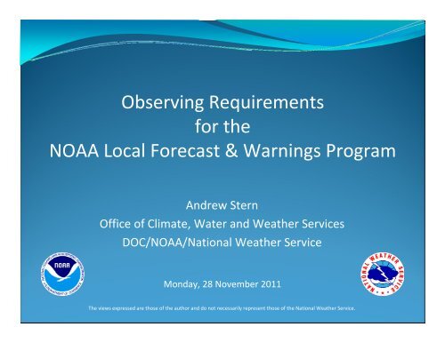
Observing Requirements<br />
<strong>for</strong> <strong>the</strong><br />
<strong>NOAA</strong> Local Forecast & Warnings Program<br />
Andrew Stern<br />
<strong>Office</strong> <strong>of</strong> Climate, Water and Wea<strong>the</strong>r Services<br />
DOC/<strong>NOAA</strong>/National Wea<strong>the</strong>r Service<br />
Monday, 28 November 2011<br />
The views expressed are those <strong>of</strong> <strong>the</strong> author and do not necessarily represent those <strong>of</strong> <strong>the</strong> National Wea<strong>the</strong>r Service.
Presentation Overview<br />
• Observing Requirements Background<br />
• <strong>NOAA</strong> Program Structure<br />
• Local Forecast and Warnings (LFW) Program<br />
• LFW Requirements and Validation<br />
• <strong>NOAA</strong> Observing Requirements Availability<br />
PREDECISIONAL<br />
2
<strong>NOAA</strong>’s Charge <strong>for</strong> Observing Requirements<br />
• From 2002 <strong>NOAA</strong> Program Review Team Report : <strong>NOAA</strong> needs to<br />
centrally plan and integrate all observing systems:<br />
A. Develop an observational architecture commencing immediately.<br />
With this architecture, <strong>NOAA</strong> would be able to assess current<br />
capabilities and identify short term actions<br />
B. All prospective observing systems should be based on validated<br />
requirements, should be consistent with <strong>the</strong> developed target<br />
architecture, and should be presented with plans to address utilization<br />
<strong>of</strong> <strong>the</strong> data as well as long term archive <strong>of</strong> <strong>the</strong> data<br />
• <strong>NOAA</strong> Observing System Council (NOSC) established to implement this<br />
recommendation<br />
• Requirements segmented by <strong>NOAA</strong> Planning, Programming, Budgeting<br />
and Execution System (PPBES) Programs<br />
PREDECISIONAL<br />
3
<strong>NOAA</strong> Goal Structure under PPBES<br />
PREDECISIONAL<br />
4
Goal and Program Structure<br />
PREDECISIONAL<br />
5
Change <strong>of</strong> Planning/Budgeting Systems<br />
• At <strong>the</strong> end <strong>of</strong> FY 2010, <strong>NOAA</strong> dissolved PPBES and<br />
replaced it with Strategy, Execution and<br />
Evaluation or SEE<br />
• SEE does not have a similar Program structure<br />
• However, 9 <strong>NOAA</strong> Programs have completed<br />
requirements validation and remaining 8 must<br />
complete requirements by end <strong>of</strong> CY11<br />
• In <strong>the</strong> future, observing requirements will be<br />
mapped to Line <strong>Office</strong>s<br />
PREDECISIONAL<br />
6
The LFW Program<br />
• Local Forecast & Warnings (LFW) Program<br />
resided in <strong>NOAA</strong>'s Wea<strong>the</strong>r and Water<br />
Mission Goal<br />
• Due to <strong>the</strong> nature <strong>of</strong> its service delivery and<br />
outreach activities, it touched many o<strong>the</strong>r mission<br />
goals<br />
• Was considered one <strong>of</strong> <strong>the</strong> most critical programs<br />
within <strong>NOAA</strong><br />
PREDECISIONAL
LFW Program Components<br />
• The LFW Program consisted <strong>of</strong>:<br />
• 122 Wea<strong>the</strong>r Forecast <strong>Office</strong>s (WFOs); 19 Wea<strong>the</strong>r Service<br />
<strong>Office</strong>s (WSOs); and two Data Collection <strong>Office</strong>s (DCOs)<br />
• Three NCEP centers (National Hurricane Center, Storm<br />
Prediction Center and NCEP Central Operations)<br />
• Six NWS Regional Headquarters (including CPHC, VAAC,<br />
AAWU)<br />
• World‐wide acquisition and delivery <strong>of</strong> wea<strong>the</strong>r and water<br />
data and in<strong>for</strong>mation via <strong>the</strong> Telecommunications<br />
Operations Center (TOC), <strong>the</strong> Master Ground Station, and<br />
<strong>the</strong> Network Control Facility<br />
• O&M <strong>for</strong> major systems such as NEXRAD, ASOS, Pr<strong>of</strong>iler<br />
Network, AWIPS, and <strong>NOAA</strong> Wea<strong>the</strong>r Radio<br />
PREDECISIONAL<br />
8
LFW Program Mission<br />
• Critical operations focused on protecting lives/property<br />
• Delivered essential <strong>NOAA</strong> services, especially those related<br />
to high‐impact events, to local communities through its<br />
distributed structure <strong>of</strong> field <strong>of</strong>fices and national centers.<br />
• Functional components included elements <strong>of</strong> <strong>the</strong> end‐toend<br />
<strong>for</strong>ecast and warning process:<br />
• Observe <strong>the</strong> atmosphere<br />
• Produce numerical <strong>for</strong>ecast guidance<br />
• Syn<strong>the</strong>size environmental in<strong>for</strong>mation<br />
• Make <strong>for</strong>ecast and warning decisions<br />
• Provide in<strong>for</strong>mation and decision assistance<br />
PREDECISIONAL<br />
9
LFW Requirements Methodology<br />
• Divided LFW Program into two subprograms<br />
• WFO/SPC requirements (Completed)<br />
• Tropical requirements (In Progress)<br />
• Requirements considerations<br />
• Focused on FY 12‐18 timeframe<br />
• Attempted to be technology independent<br />
• Considered requirements <strong>of</strong> overlapping mission areas<br />
(e.g., MWX/MTS <strong>for</strong> coastal waters, Aviation)<br />
• Classified requirements into categories<br />
• Surface‐based & Vertical Pr<strong>of</strong>iles<br />
• Marine (<strong>for</strong> Coastal Waters Operations)<br />
• Storm Area (<strong>for</strong> Convective Operations)<br />
• O<strong>the</strong>r (to capture remaining requirements)<br />
PREDECISIONAL<br />
10
Storm Area<br />
• "Storm Area" does not encompass a fixed<br />
time/space region. It is defined as:<br />
• "A relocatable, three dimensional region <strong>of</strong><br />
sufficient size to observe <strong>the</strong> pre‐convective,<br />
convective and near‐storm environments<br />
encompassing convective storm phenomena, from<br />
MCS‐scale down to tornado scale, <strong>for</strong> times 6‐12<br />
hours prior to anticipated convective initiation<br />
through dissipation <strong>of</strong> convective phenomena.”<br />
PREDECISIONAL
LFW WFO/SPC Requirements<br />
Priority 1 Requirement<br />
Storm<br />
Area<br />
Pr<strong>of</strong>ile<br />
Land<br />
Surface<br />
Marine O<strong>the</strong>r<br />
Air Temperature Pr<strong>of</strong>ile 1 1 1<br />
Cloud Base Height 1<br />
Dew Point/Water Vapor Pr<strong>of</strong>ile 1 1 1<br />
Imagery (Infrared, Microwave, Visible, Water Vapor) 4<br />
Ocean Winds: Surface (Dir & Speed) 2<br />
Precipitation Amount 1<br />
Precipitation Rate 1 1<br />
Precipitation Type 1 1<br />
Sea Surface Temperature 1<br />
Station Pressure 1<br />
Total Lightning 1<br />
Total Water Level 1<br />
Visibility (Land & Marine) 1 1<br />
Wave Height 1<br />
Winds (Pr<strong>of</strong>iles/Surface, Dir & Speed) 2 2 2<br />
PREDECISIONAL<br />
12
Sample Requirements Listing<br />
• Focus only on Priority 1 requirements –minimum acceptable threshold to<br />
support mission through FY18<br />
• Requirements strive to be technology independent<br />
• Based upon actual observations –not derived values (e.g., Heat Index)<br />
• Can be <strong>for</strong> one level, a pr<strong>of</strong>ile or <strong>for</strong> a region (e.g., storm area)<br />
• Each requirement contains attribute weights to illustrate relative<br />
importance<br />
PREDECISIONAL<br />
13
Confidence<br />
Level<br />
1<br />
Validation Criteria<br />
OBSERVING REQUIREMENTS VALIDATION CONFIDENCE LEVELS<br />
Color Criteria Examples<br />
Dark<br />
Green<br />
A scientific study proving data to a specified<br />
resolution/accuracy is needed to meet program<br />
objectives, irrespective <strong>of</strong> whe<strong>the</strong>r or not <strong>the</strong> data<br />
at that resolution are currently available. A study<br />
proving that if <strong>the</strong> data are not available at this<br />
level, <strong>the</strong> mission <strong>of</strong> <strong>the</strong> pprogram will be<br />
degraded. This is <strong>the</strong> most scientific way <strong>of</strong><br />
validating <strong>the</strong> observing requirements.<br />
Observing System Simulation<br />
Experiment (OSSE)<br />
2<br />
Light<br />
Green<br />
A document showing that <strong>the</strong> data are being used<br />
in current operational set up. This may not prove<br />
<strong>the</strong> need <strong>for</strong> <strong>the</strong> data at <strong>the</strong> specified attribute level,<br />
but provides justification <strong>for</strong> maintaining status<br />
quo.<br />
Operational user guides, customer<br />
requirements from outside agencies,<br />
operational s<strong>of</strong>tware documentation<br />
etc. Also, a review <strong>of</strong> requirements<br />
by high level bodies (Government<br />
Advisory Boards, National Reseach<br />
Council etc.) or international bodies<br />
(e.g., WMO) fall in this category<br />
3 Yellow<br />
4 Red<br />
In absence <strong>of</strong> validation documents, Subject Matter<br />
Expert statements that <strong>the</strong> data are needed to run<br />
<strong>the</strong>ir program.<br />
No validation documentation provided or <strong>the</strong><br />
documentation provided does not validate <strong>the</strong><br />
requirements at <strong>the</strong> specified attribute level.<br />
PREDECISIONAL<br />
Statements from experts within <strong>the</strong><br />
Program.<br />
14
Req<br />
Number<br />
LFW WFO/SPC Priority 1 Requirements<br />
Parameter<br />
Geographic Coverage<br />
Attribute Validated<br />
Vertical<br />
Resolution<br />
Horizontal<br />
Resolution<br />
Measurement<br />
Accuracy<br />
Sampling<br />
Interval<br />
1 Air Temperature Pr<strong>of</strong>ile: Storm Area CONUS+AK+HI+US Territories 100 m 100 m 0.5 K 1 min<br />
2 Air Temperature: Pr<strong>of</strong>iles CONUS+AK+HI+US Territories 100 m 100 km 0.5 K 5 min<br />
3 Air Temperature: Surface CONUS+AK+HI+US Territories na 25 km 0.1 K 1 min<br />
4 Cloud Base Height CONUS+AK+HI+US Territories na 25 km 8 m 1 min<br />
5 Dew Point Pr<strong>of</strong>ile: Storm Area CONUS+AK+HI+US Territories 100 m 100 m 0.5 K 1 min<br />
6 Dew Point Temperature: Pr<strong>of</strong>iles CONUS+AK+HI+US Territories 100 m 100 km 0.5 K 5 min<br />
7 Dew Point Temperature: Surface CONUS+AK+HI+US Territories na 25 km 0.1 K 1 min<br />
8 Imagery: Infrared CONUS+AK+HI+US Territories na 2 km 1 km 5 min<br />
9 Imagery: Microwave CONUS+AK+HI+US Territories na 10 km 5 km 1 hr<br />
10 Imagery: Visible CONUS+AK+HI+US Territories na 1 km 0.5 km 5 min<br />
Note: all 31 requirements<br />
are included in <strong>the</strong> backup<br />
slides<br />
PREDECISIONAL<br />
15
LFW Requirements Validation<br />
• For <strong>the</strong> WFO/SPC Consolidated Observations<br />
Requirements List (<strong>CORL</strong>)<br />
• 31 priority one requirements validated<br />
• 96% validated via supporting documentation<br />
• SME validation <strong>for</strong> some marine and satellite requirements<br />
• 4 Independent Reviews<br />
• NCEP/Storm Prediction Center Lead Forecasters<br />
• Marine and Coastal Wea<strong>the</strong>r Services Branch<br />
• Aviation Wea<strong>the</strong>r Services Branch<br />
• Observing Services Branch<br />
• <strong>CORL</strong> validation endorsement by NOSC late Sept 2011<br />
PREDECISIONAL<br />
16
PORD Availability<br />
• <strong>NOAA</strong> Program Observation Requirements Documents<br />
(PORDS) are available on line from:<br />
https://www.nosc.noaa.gov/tpio/main/pords.html<br />
• The following documents are available:<br />
PREDECISIONAL<br />
17
PORDS in Development<br />
• National Wea<strong>the</strong>r Service (NWS)<br />
• Surface Wea<strong>the</strong>r<br />
• Local Forecast and Warnings – Tropical Operations<br />
• National Ocean Service (NOS)<br />
• Corals<br />
• Remap <strong>of</strong> Coastal Marine Resources requirements to:<br />
• National Center <strong>for</strong> Coastal Ocean Science<br />
• <strong>Office</strong> <strong>of</strong> National Marine Sanctuaries<br />
• Ocean and Coastal Resource Management<br />
• <strong>Office</strong> <strong>of</strong> Response and Restoration<br />
• National Marine Fisheries Service (NMFS)<br />
• S&T Ecosystems Observations (Fisheries Management)<br />
• Habitat<br />
• Ecosystems Research<br />
PREDECISIONAL
Additional In<strong>for</strong>mation<br />
• <strong>NOAA</strong> Observing Requirements are managed by<br />
<strong>the</strong> Technology, Planning and Integration <strong>for</strong><br />
Observations (TPIO) Program<br />
• Director: Pamela Taylor (at noaa.gov)<br />
• Web: https://www.nosc.noaa.gov/tpio/<br />
• Presenter: Andrew Stern (at noaa.gov)<br />
• NWS <strong>Office</strong> <strong>of</strong> Climate, Water and Wea<strong>the</strong>r Services<br />
PREDECISIONAL
Backup<br />
• PORD Requirements and Validation Documents<br />
PREDECISIONAL<br />
20
Req<br />
Number<br />
Validation Assessment<br />
WW‐LFW_WFO/SPC Priority ‐1<br />
Requirements<br />
Parameter<br />
Geographic Coverage<br />
Attribute Validated<br />
Vertical<br />
Resolution<br />
Horizontal<br />
Resolution<br />
Measurement<br />
Accuracy<br />
Sampling<br />
Interval<br />
1 Air Temperature Pr<strong>of</strong>ile: Storm Area CONUS+AK+HI+US Territories 100 m 100 m 0.5 K 1 min<br />
2 Air Temperature: Pr<strong>of</strong>iles CONUS+AK+HI+US Territories 100 m 100 km 0.5 K 5 min<br />
3 Air Temperature: Surface CONUS+AK+HI+US Territories na 25 km 0.1 K 1 min<br />
4 Cloud Base Height CONUS+AK+HI+US Territories na 25 km 8 m 1 min<br />
5 Dew Point Pr<strong>of</strong>ile: Storm Area CONUS+AK+HI+US Territories 100 m 100 m 0.5 K 1 min<br />
6 Dew Point Temperature: Pr<strong>of</strong>iles CONUS+AK+HI+US Territories 100 m 100 km 0.5 K 5 min<br />
7 Dew Point Temperature: Surface CONUS+AK+HI+US Territories na 25 km 0.1 K 1 min<br />
8 Imagery: Infrared CONUS+AK+HI+US Territories na 2 km 1 km 5 min<br />
9 Imagery: Microwave CONUS+AK+HI+US Territories na 10 km 5 km 1 hr<br />
10 Imagery: Visible CONUS+AK+HI+US Territories na 1 km 0.5 km 5 min<br />
Direct Validation Documentation Submitted<br />
Associated Validation Documentation Submitted<br />
SME Consensus Validation Documentation Submitted<br />
Not Validated<br />
Attribute not applicable<br />
PREDECISIONAL<br />
21<br />
21
Req<br />
Number<br />
Validation Assessment<br />
WW‐LFW_WFO/SPC Priority ‐1<br />
Requirements<br />
Parameter<br />
Geographic Coverage<br />
Attribute Validated<br />
Vertical<br />
Resolution<br />
Horizontal<br />
Resolution<br />
Measurement<br />
Accuracy<br />
Sampling<br />
Interval<br />
11 Imagery: Water Vapor CONUS+AK+HI+US Territories na 2 km 1 km 5 min<br />
12 Ocean Wind Direction: Surface CONUS+AK+HI+US Territories na 2.5 km 10 deg 1 hr<br />
13 Ocean Wind Speed: Surface CONUS+AK+HI+US Territories na 2.5 km 1 m/sec 1 hr<br />
14 Precipitation Amount CONUS+AK+HI+US Territories na 2.5 km 0.5 mm 1 min<br />
15 Precipitation Rate CONUS+AK+HI+US Territories na 2.5 km 0.1 in/hr 1 min<br />
16<br />
Precipitation Rate Pr<strong>of</strong>ile: Storm<br />
Area<br />
CONUS+AK+HI+US Territories 100 m 100 m 1 mm/hr 30 sec<br />
17 Precipitation Type CONUS+AK+HI+US Territories na 25 km PT 1 min<br />
18 Precipitation Type: Storm Area CONUS+AK+HI+US Territories 100 m 100 m PT 30 sec<br />
19 Sea Surface Temperature CONUS+AK+HI+US Territories na 1 km 0.5 K 1 hr<br />
20 Station Pressure CONUS+AK+HI+US Territories na 25 km 0.1 hPa 1 min<br />
Direct Validation Documentation Submitted<br />
Associated Validation Documentation Submitted<br />
SME Consensus Validation Documentation Submitted<br />
Not Validated<br />
Attribute not applicable<br />
PREDECISIONAL<br />
22<br />
22
Req<br />
Number<br />
Validation Assessment<br />
WW‐LFW_WFO/SPC Priority ‐1<br />
Requirements<br />
Parameter<br />
Geographic Coverage<br />
Attribute Validated<br />
Vertical<br />
Resolution<br />
Horizontal<br />
Resolution<br />
Measurement<br />
Accuracy<br />
Sampling<br />
Interval<br />
21 Wind Direction: Surface CONUS+AK+HI+US Territories na 25 km 1 deg 1 min<br />
22 Wind Speed: Surface CONUS+AK+HI+US Territories na 25 km 0.5 m/sec 1 min<br />
23<br />
Total Lightning (Zones 1‐6, 16, 20‐<br />
22)<br />
CONUS+AK+HI+US Territories na 0.5 km 0.5 km 0.001 sec<br />
24 Total Water Level CONUS+AK+HI+US Territories na 10 km 1 cm 1 hr<br />
25 Visibility: Land (All Obscurations) CONUS+AK+HI+US Territories na 400 m 100 m 1 min<br />
26 Visibility: Marine CONUS+AK+HI+US Territories na 2 km 0.5 km 1 hr<br />
27 Wave Height CONUS+AK+HI+US Territories na 5 km 0.5 m 1 hr<br />
28<br />
Wind Direction Pr<strong>of</strong>ile: Storm<br />
Area<br />
CONUS+AK+HI+US Territories 100 m 100 m 1 deg 30 sec<br />
29 Wind Direction Pr<strong>of</strong>ile CONUS+AK+HI+US Territories 100 m 100 km 1 deg 5 min<br />
30 Wind Speed Pr<strong>of</strong>ile CONUS+AK+HI+US Territories 100 m 100 km 0.5 m/sec 5 min<br />
31 Wind Speed Pr<strong>of</strong>ile: Storm Area CONUS+AK+HI+US Territories 100 m 100 m 0.5 m/sec 30 sec<br />
Direct Validation Documentation Submitted<br />
Associated Validation Documentation Submitted<br />
SME Consensus Validation Documentation Submitted<br />
Not Validated<br />
Attribute not applicable<br />
PREDECISIONAL<br />
23<br />
23
Validation Documents<br />
Submitted<br />
Doc #<br />
Validation Document<br />
1 SURFACE WEATHER OBSERVING (DOT/FAA) ‐ May 11, 2001<br />
2 Automated Surface Observing System (ASOS) User’s Guide ‐ March 1998<br />
3 Aviation Priority 1 ‐ powerpoint slides (CT‐AWX & CT‐MWX Validation Slides)<br />
Mobile Doppler Radar Observations <strong>of</strong> a Tornado in a Supercell near Bassett, Nebraska, on 5 June 1999. Part I:<br />
4<br />
Tornadogenesis (OSSE)<br />
5 <strong>Federal</strong> Lightning Capability Requirements (OFCM), July 2008<br />
6 FEDERAL METEOROLOGICAL HANDBOOK No. 1 ‐ Surface Wea<strong>the</strong>r Observations and Reports<br />
7<br />
8<br />
FEDERAL METEOROLOGICAL HANDBOOK NO. 11 ‐ DOPPLER RADAR METEOROLOGICAL OBSERVATIONS, PART C,<br />
WSR‐88D PRODUCTS AND ALGORITHMS, April 2006<br />
Observing Wea<strong>the</strong>r and Climate FROM THE GROUND UP, A Nationwide Network <strong>of</strong> Networks, National Research<br />
Council, The National Academies Press<br />
9 A Phenomenological Approach to <strong>the</strong> Specification <strong>of</strong> Observational Requirements, 02 June 2005<br />
10 Large‐Eddy Simulation <strong>of</strong> a Tornado’s Interaction with <strong>the</strong> Surface<br />
11 NWS Marine Surface Data Requirements<br />
12 National Data Buoy Center, NDBC ‐ What are <strong>the</strong> sensorsreporting, sampling, and accuracy readings?<br />
13 Ships Synoptic Code snd Observing Methods: dd, Wind Direction<br />
14 NATIONAL WEATHER SERVICE INSTRUCTION 10‐310: COASTAL MARINE FORECAST SERVICES, AUGUST 22, 2008<br />
PREDECISIONAL 24<br />
24
Validation Documents<br />
Submitted<br />
Doc #<br />
15<br />
Validation Document<br />
NATIONAL WEATHER SERVICE INSTRUCTION 10‐311: OFFSHORE, NAVTEX, HIGH SEAS, AND MARINE FORECAST<br />
SERVICES, AUGUST 22, 2008<br />
16 NATIONAL WEATHER SERVICE INSTRUCTION 10‐312: GREAT LAKES MARINE SERVICES, OCTOBER 6, 2008<br />
17 NATIONAL WEATHER SERVICE INSTRUCTION, NWSI 10‐1301, Feb 2010, Aviation & Synoptic Observations<br />
18<br />
An OSSE Framework Based on <strong>the</strong> Ensemble Square Root Kalman Filter <strong>for</strong> Evaluating <strong>the</strong> Impact <strong>of</strong> Data from<br />
Radar Networks on Thunderstorm Analysis<br />
19 Guide to Meteorological Instruments and Methods <strong>of</strong> Observation, WMO‐No. 8<br />
20 <strong>NOAA</strong> Operational Ocean Surface Vector Winds Requirements Workshop, NHC, July 2006<br />
21 Subject Matter Expert Statement<br />
22 WMO Manual on Marine Meteorological Services, Vol 1<br />
23 WMO Manual on <strong>the</strong> Global Data‐Processing and Forecasting System<br />
24 A Coastal Theme <strong>for</strong> <strong>the</strong> IGOS Partnership, Report <strong>of</strong> <strong>the</strong> Coastal Theme Team, Jan 2006<br />
25 QuickSCAT Follow‐On Mission: User Impact Study Report<br />
26 Requirements <strong>of</strong> numerical wea<strong>the</strong>r prediction <strong>for</strong> observations <strong>of</strong> oceans<br />
27<br />
28<br />
A National Operational Wave Observation Plan, Prepared <strong>for</strong> <strong>the</strong> Interagency Working Group on Ocean<br />
Observations, March 2009<br />
NATIONAL WEATHER SERVICE INSTRUCTION 10‐302, OCTOBER 2010: MARINE AND COASTAL SERVICES AREAS OF<br />
RESPONSIBILITY<br />
PREDECISIONAL 25<br />
25
Validation Documents<br />
Submitted<br />
Doc #<br />
Validation Document<br />
29 NATIONAL WEATHER SERVICE MANUAL 10‐507, November 2009: PUBLIC GEOGRAPHIC AREAS OF RESPONSIBILITY<br />
30 Operations <strong>of</strong> <strong>the</strong> National Wea<strong>the</strong>r Service Spaceflight <strong>Meteorology</strong> Group; AMS, Sept 1997<br />
31<br />
Satellite Observations <strong>of</strong> a Severe Supercell Thunderstorm on 24 July 2000 Made during <strong>the</strong> GOES‐11 Science Test;<br />
AMS, Feb 2002<br />
32 Fire Detection Using GOES Rapid Scan Imagery; AMS, June 2004<br />
33 A Quantitative Analysis <strong>of</strong> <strong>the</strong> Enhanced‐V Feature in Relation to Severe Wea<strong>the</strong>r; AMS, Aug 2007<br />
34<br />
Forecasting Convective Initiation by Monitoring <strong>the</strong> Evolution <strong>of</strong> Moving Cumulus in Daytime GOES Imagery; AMS,<br />
Jan2006<br />
35<br />
Objective Satellite‐Based Detection <strong>of</strong> Overshooting Tops Using Infrared Window Channel Brightness<br />
Temperature Gradients; AMS, Feb 2010<br />
36<br />
Prototyping a Generic, Unified Land Surface Classification and Screening Methodology <strong>for</strong> GPM‐eraMicrowave<br />
Land Precipitation Retrieval Algorithms; AMS, 2010<br />
37<br />
Many uses <strong>of</strong> <strong>the</strong> geostationary operational environmental satellite‐10 sounder and imager during a high<br />
inclination state; AMS, Jan2009<br />
38 Convectively Induced Transverse Band Signatures in Satellite Imagery; AMS, Oct 2009<br />
39<br />
Understanding Satellite‐Observed Mountain‐Wave Signatures Using High‐Resolution Numerical Model Data;<br />
AMS, Feb 2009<br />
40<br />
Application <strong>of</strong> Airborne Passive Microwave Observations <strong>for</strong> Monitoring Inland Flooding Caused by Tropical<br />
Cyclones; AMS, Oct 2009<br />
41 MULTIFUNCTIONAL MESOSCALE OBSERVING NETWORKS, BAMS, July 2005<br />
42 Toward a New National Wea<strong>the</strong>r Service ‐ Assessment <strong>of</strong> NEXRAD Coverage and Associated Wea<strong>the</strong>r Services<br />
PREDECISIONAL 26<br />
26
Validation Document<br />
Mapping to Observation<br />
Requirement<br />
Req<br />
#<br />
Requirement<br />
Document Submitted<br />
1 Air Temperature Pr<strong>of</strong>ile: Storm Area 8, 10, 18, 28, 29<br />
2 Air Temperature: Pr<strong>of</strong>iles 9, 18, 28, 29<br />
3 Air Temperature: Surface 1, 2, 6, 28, 29, 41<br />
4 Cloud Base Height 2, 6, 28, 29, 41<br />
5 Dew Point Pr<strong>of</strong>ile: Storm Area 8, 10, 18, 28, 29<br />
6 Dew Point Temperature: Pr<strong>of</strong>iles 8, 9, 18, 28, 29<br />
7 Dew Point Temperature: Surface 1, 2, 6, 28, 29, 41<br />
8 Imagery: Infrared 21, 28, 29, 30, 31, 33, 34, 35, 37<br />
9 Imagery: Microwave 21, 28, 29, 36, 40<br />
10 Imagery: Visible 21, 28, 29, 30, 31, 32, 34, 35, 36, 37, 38, 39<br />
PREDECISIONAL<br />
27<br />
27
Validation Document<br />
Mapping to Observation<br />
Requirement<br />
Req<br />
#<br />
Requirement<br />
Document Submitted<br />
11 Imagery: Water Vapor 21, 28, 29, 31, 32, 39<br />
12 Ocean Wind Direction: Surface 13, 20, 22, 23, 24, 25, 28, 29<br />
13 Ocean Wind Speed: Surface 20, 22, 23, 24, 25, 28, 29<br />
14 Precipitation Amount 2, 8, 17, 28, 29<br />
15 Precipitation Rate 2, 7, 8, 18, 28, 29<br />
16 Precipitation Rate Pr<strong>of</strong>ile: Storm Area 4, 7, 18, 28, 29<br />
17 Precipitation Type 2, 28, 29, 41<br />
18 Precipitation Type: Storm Area 2, 8, 18, 28, 29, 41, 42<br />
19 Sea Surface Temperature 22, 23, 24, 26, 28, 29<br />
20 Station Pressure 2, 19, 28, 29, 41<br />
PREDECISIONAL<br />
28<br />
28
Validation Document<br />
Mapping to Observation<br />
Requirement<br />
Req<br />
#<br />
Requirement<br />
Document Submitted<br />
21 Wind Direction: Surface 2, 28, 29, 41,<br />
22 Wind Speed: Surface 2, 6, 28, 29, 41<br />
23 Total Lightning (Zones 1‐6, 16, 20‐22) 5<br />
24 Total Water Level 11, 12, 28, 29, 41<br />
25 Visibility: Land (All Obscurations) 1, 2, 17, 28, 29<br />
26 Visibility: Marine 14, 15, 16, 21, 22, 28, 29<br />
27 Wave Height 22, 24, 27, 28, 29<br />
28 Wind Direction Pr<strong>of</strong>ile: Storm Area 2, 4, 8, 18, 28, 29, 42<br />
29 Wind Direction Pr<strong>of</strong>ile 2, 4, 8, 9, 24, 28, 29<br />
30 Wind Speed Pr<strong>of</strong>ile 2, 4, 8, 9, 28, 29<br />
31 Wind Speed Pr<strong>of</strong>ile: Storm Area 2, 4, 8, 18, 28, 29<br />
PREDECISIONAL<br />
29<br />
29