You also want an ePaper? Increase the reach of your titles
YUMPU automatically turns print PDFs into web optimized ePapers that Google loves.
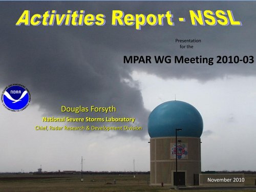
Presentation<br />
for the<br />
MPAR WG Meeting 2010-03<br />
Douglas Forsyth<br />
National Severe Storms Laboratory<br />
Chief, Radar Research & Development Division<br />
November 2010
TAP – NSSL Activities<br />
• Reviewed and Commented on LL SOW<br />
• Proceeded with TASK VI – BCI Contract<br />
– Finalize design of prototype RF and control electronics<br />
– Begin fabrication of the RF and control modules<br />
– Goal – Build 12x12 dual polarized radiating panel for<br />
operation at 3.2 GHZ.<br />
• Continued work on White-Paper Request for<br />
Proposals<br />
• Completed Evaluation on SBIR – FreEnt<br />
• Continued Risk Reduction using NWRT
Current Work – Since June 2010<br />
• Signal Processing<br />
– Continued testing adaptive range oversampling<br />
• Result of PAR DSP infrastructure improvements (ease of adding<br />
processors)<br />
• Result: Reduced scan time by factor of 2 with improved data<br />
quality.<br />
• Adaptive Scanning<br />
– Continued testing ADAPTS-II enhancements<br />
• i.e. Elevation-prioritized scanning<br />
• Scheduled base scanning<br />
– Different storms scanned with different settings and update times<br />
– Scheduler plans the best sequence of tasks to meet requested<br />
performance.<br />
– Optimizes utilization of radar resources.
Current Work – Since June 2010<br />
• Scan Processing functionality<br />
• Moved from RTC to Digital Signal Processor<br />
• Reduce computation in RTC and allow for maximum<br />
flexibility<br />
• Radar User Interface<br />
– Manual schedule-based scanning<br />
• Modify scanning strategies and change acquisition<br />
parameters on the fly<br />
• Looking at optimum ways to scan storms
Current Work – Since June 2010<br />
• Continued data analysis of NWRT Data & working on<br />
results from PARISE<br />
– Papers presented at AMS Severe Local Storms Conference<br />
• Continued work on Model Initialization with PAR data<br />
• Continued Work by OU Collaborators<br />
– Dual-Polarization element design<br />
– Eight Channel addition to the NWRT (Mono-pulse, Clutter<br />
channels)<br />
– Cylindrical Dual-Polarized PAR antenna<br />
– Mobile Imaging Radar<br />
• Wind Turbine Mitigation<br />
– Follow-on funding by DHS
Upgrades<br />
Radar<br />
Hardware<br />
Radar Control<br />
Interface<br />
(client)<br />
A/D<br />
Converters<br />
Real Time<br />
Controller<br />
Radar Control<br />
Scheduler Interface<br />
(server)<br />
Adaptive<br />
scanning<br />
Archive<br />
ATP<br />
Processor<br />
SKY Signal<br />
DSP Cluster<br />
Processor<br />
Displays<br />
Archive<br />
Data<br />
Control<br />
Original<br />
Upgraded
User Interface – Adaptive Scanning
User Interface – DSP Status
Range Oversampling
Multi- Receiver System<br />
eight downconverters<br />
eight LNA’s<br />
1 - Az Diff<br />
1 - El Diff<br />
Monopulse<br />
6 – Clutter Channels<br />
Courtesy of Mark Yeary<br />
Installed rack w/ digital receivers
MCR 1: Sum<br />
MCR 2: Delta Az<br />
MCR 3: Delta El<br />
MCR 4: Sidelobe
MCR 5: Sidelobe<br />
MCR 6: Sidelobe<br />
MCR 7: Sidelobe<br />
MCR 8: Sidelobe
MCR 1: Sum<br />
NWRT: Sum
22 nd Vaisala Award<br />
• “Rapid Sampling of Severe Storms by the<br />
NWRT Phased array Radar”<br />
– Weather & Forecasting, 2008
More Firsts for NWRT PAR<br />
031811 UTC 14 May 2009<br />
20 km 20 km<br />
KTLX<br />
KTLX<br />
PAR<br />
PAR<br />
1. First tornadic supercell sampled within 40 km of PAR<br />
- mesocyclones & other vortices within 20 km<br />
2. First supercell advantageously positioned for dual-Doppler<br />
analysis using PAR and KTLX
Did 43 s updates improve depiction of tornado<br />
cyclone evolution?<br />
PAR: 43 s Updates<br />
KTLX: 4.2 min Updates
250 m AGL, 0338:00 – 0346:15 UTC<br />
Vertical Velocity, 1 m s -1 contours<br />
Storm-relative wind vectors<br />
0335:45 UTC<br />
0338:00 UTC 0340:15 UTC 0342:30 UTC<br />
20 ms -1<br />
Vertical Vorticity, 5 x 10 -3 s -1 contours<br />
EF0 Tornado<br />
20 ms -1
Conclusions<br />
43 s updates at 0.5 provided depiction of tornado cyclone<br />
evolution superior to WSR-88D updates<br />
The amplification of vertical vorticity assoc. w/ the tornado<br />
• occurred during the occlusion phase, along axis of<br />
convergence<br />
• evolution suggests vortex co-located with updraft<br />
became dominant likely in response to vortex stretching and<br />
merging with vortex center to its south


