MPAR Notional Functional Requirements Document - NOAA
MPAR Notional Functional Requirements Document - NOAA
MPAR Notional Functional Requirements Document - NOAA

You also want an ePaper? Increase the reach of your titles
YUMPU automatically turns print PDFs into web optimized ePapers that Google loves.
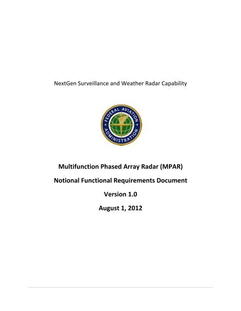
NextGen Surveillance and Weather Radar Capability<br />
Multifunction Phased Array Radar (<strong>MPAR</strong>)<br />
<strong>Notional</strong> <strong>Functional</strong> <strong>Requirements</strong> <strong>Document</strong><br />
Version 1.0<br />
August 1, 2012
REVISION HISTORY<br />
Filename Version Approved By Comments Date<br />
NSWRC NFR Ver1-0.docx 1.0 M. Emanuel Initial Release August 1 2012<br />
i
TABLE OF CONTENTS<br />
1. Background ........................................................................................................................................... 1<br />
1.1. Purpose ......................................................................................................................................... 1<br />
2. Concept ................................................................................................................................................. 1<br />
2.1. Operational ................................................................................................................................... 1<br />
2.2. System ........................................................................................................................................... 2<br />
3. <strong>Functional</strong> <strong>Requirements</strong> ...................................................................................................................... 2<br />
3.1. Terminal Aircraft Surveillance ....................................................................................................... 2<br />
3.2. Terminal Weather ......................................................................................................................... 6<br />
3.3. Enterprise Weather ....................................................................................................................... 7<br />
3.4. En-Route Aircraft Surveillance .................................................................................................... 11<br />
3.5. Reliability, Maintainability, Availability ....................................................................................... 13<br />
3.6. System Monitoring and Control .................................................................................................. 13<br />
3.7. Physical Interfaces ...................................................................................................................... 13<br />
ii
1. Background<br />
The Federal Aviation Administration (FAA) and the National Oceanographic and Atmospheric<br />
Administration (<strong>NOAA</strong>) have sponsored studies to evaluate the feasibility of replacing existing primary<br />
radar systems with phased array radars. The radars under consideration, currently used for aircraft<br />
surveillance and/or weather sensing, along with their wavelength and band, are:<br />
• ASR (Airport Surveillance Radar) models 8, 9 and 11 (10 cm, S-band)<br />
• TDWR (Terminal Doppler Weather Radar) (5 cm, C-band)<br />
• NEXRAD (Next-Generation Weather Radar) (10 cm, S-band)<br />
• ARSR (Air Route Surveillance Radar) models 1-4 (30 cm, L-band)<br />
These radars were developed by different agencies, and deployed at different times in different<br />
locations for different purposes. Many benefits may be realized if a new radar system(s) could be<br />
designed to take over the missions of the legacy radars, and reduce the extensive overlapping of those<br />
legacy radars. Reducing the total number of radars needed for national surveillance, while introducing a<br />
common radar system design that would simplify logistics and maintenance, has the potential to<br />
significantly reduce life cycle costs. This can be a realized benefit for the FAA in the terminal domain,<br />
and across both terminal and en route airspace should a federal enterprise solution be developed.<br />
1.1. Purpose<br />
The purpose of this document is to bring forth the <strong>MPAR</strong> notional functional requirements for each of<br />
the aircraft and weather surveillance elements currently in place to help drive functional requirements<br />
for NSWRC. NOTE, in this document where similar requirements are defined with dissimilar values (e.g.<br />
terminal aircraft surveillance range must be 60nmi / en route aircraft surveillance range must be<br />
250nmi) the more stringent value will be considered when applicable.<br />
2. Concept<br />
2.1. Operational<br />
The operational concept for a system based on these notional functional requirements would serve<br />
multiple roles including primary radar aircraft surveillance and terminal weather surveillance for aircraft<br />
operations specific threats such as gust fronts and microbursts detection. General weather surveillance<br />
for a variety of tasks, including severe weather detection and warning, hydrology, onset of convection,<br />
etc, and long range aircraft surveillance to support homeland and national security missions could also<br />
be included in the operational concept should a federal enterprise acquisition of NSWRC be realized.<br />
This radar would also deliver wind turbine clutter mitigation, provide Unmanned Aircraft Systems (UAS)<br />
surveillance, and offer enhanced aircraft target probability of detection and reduced false target<br />
detection in the terminal domain.<br />
Operation of radar based on these requirements would be tailored to perform multiple functions, and<br />
data would be shared among the stakeholders to support all functions. Phased array capability would be<br />
exploited to adapt scanning strategies to use radar resources to maximum efficiency, minimizing the<br />
time spent scanning empty space and focusing resources on targets of interest. Data from some scans<br />
1
could be exploited by multiple users to minimize the number of single-user scans consistent with<br />
meeting the mission requirements of all users.<br />
2.2. System<br />
Radar systems deployed based on these requirements would employ a single scalable architecture to<br />
reduce development, procurement, and logistical costs. Multiple variants, based on aperture size, could<br />
be mixed to provide the most efficient approach to gathering the required data. For planning purposes,<br />
two variants have been considered—one for short-range / lower resolution applications and one for<br />
longer range / high resolution surveillance. However, other possible combinations of variants could be<br />
considered.<br />
3. <strong>Functional</strong> <strong>Requirements</strong><br />
At a minimum, <strong>MPAR</strong> must provide Terminal aircraft and weather surveillance for an FAA acquisition.<br />
Should a Federal Enterprise acquisition be realized, <strong>MPAR</strong> must also provide En-Route aircraft and<br />
Weather search coverage under conditions of ground clutter, weather, and interference. <strong>MPAR</strong>s of<br />
different scale may be considered to fulfill FAA’s terminal and weather surveillance, and the Federal<br />
Enterprise en-route aircraft and weather surveillance requirements.<br />
3.1. Terminal Aircraft Surveillance<br />
3.1.1. Detection Envelope<br />
The envelope of detection for aircraft must be:<br />
a) Slant range 0.25 to 60 nmi<br />
b) Azimuth 360 degrees coverage<br />
c) Altitude to 28,000 feet above MSL<br />
d) Elevation 0 to 30 degrees<br />
3.1.2. Target Detection<br />
The probability of aircraft detection in the clear must be [90] percent or better when the target has a<br />
RCS of [0.25] m 2 under the following conditions:<br />
a) Swerling Case 1<br />
b) Probability of False alarms of 10 -6<br />
c) Target is at a range of [55] nmi, at the peak of the beam when boresight is normal to the plane<br />
of the antenna<br />
d) Target velocity ranges from [25] to [700] knots and maneuvering up to [3.0] g<br />
e) Target heading ranges from radial to tangential<br />
Target detections within the 60nmi range must be protected from range aliasing of aircraft targets<br />
outside this range.<br />
2
3.1.3. Altitude Determination<br />
The <strong>MPAR</strong> must produce height measurements on any detected target within the detection envelope<br />
specified in 3.1.1. The accuracy requirements are as specified in paragraph 3.1.9.<br />
3.1.4. Range Resolution<br />
When returns are detected from two Swerling Case 1 targets, separated in range by at least [0.125] nmi,<br />
on the same azimuth, with the same or different radial velocities, and located at any point in the<br />
coverage volume, the <strong>MPAR</strong> must resolve the two targets and generate two unique target reports [80]<br />
percent of the time for any combination of RCS from [0.25] to [20] m 2 provided that the larger target’s<br />
RCS is not more than [8] dB greater that the smaller target’s RCS.<br />
3.1.5. Azimuth Resolution<br />
When returns are detected from two Swerling Case 1 targets, separated in azimuth by [2.6] degrees, at<br />
the same range, with the same or different radial velocities and located at any point in the coverage<br />
volume, the <strong>MPAR</strong> must resolve the two targets and generate two unique target reports [80] percent of<br />
the time for any combination of RCS from [0.25] to [20] m 2 provided that the larger target’s RCS is not<br />
more than [8] dB greater than the smaller target’s RCS.<br />
3.1.6. Target Split<br />
The single dwell probability of a split report for <strong>MPAR</strong> must be less than [0.75] percent for targets having<br />
a SNR greater than or equal to [20] dB.<br />
3.1.7. Range Accuracy<br />
The <strong>MPAR</strong> must provide single dwell range surveillance information which is accurate to [275] feet RMS<br />
including all bias and errors, for a target with a median SNR greater than [30] dB, within the entire<br />
detection envelope in 3.1.1.<br />
3.1.8. Azimuth Accuracy<br />
The <strong>MPAR</strong> must provide single dwell azimuth surveillance information which is accurate to [0.16]<br />
degrees RMS including all bias and errors, for a target with a median SNR greater than [30] dB, within<br />
the entire detection envelope in 3.1.1.<br />
3.1.9. Height Accuracy<br />
The <strong>MPAR</strong> must provide single dwell height measurements accurate to [500] ft RMS including all bias<br />
and errors, of the target’s true altitude.<br />
3.1.10. Update Rate<br />
The <strong>MPAR</strong> must update reports on all aircraft targets within the detection envelope at least once every<br />
[4.8] seconds, ± 0.5 second.<br />
3.1.11. Timeliness<br />
Where the data delay is defined as the time from received signal at the radar antenna until the target<br />
report is ready for transmission from the <strong>MPAR</strong> must not exceed [0.16] seconds.<br />
3
3.1.12. Target Outputs<br />
The <strong>MPAR</strong> must be capable of outputting for following, on a per scan basis:<br />
a) [700] aircraft target reports and [300] false target returns, uniformly or non-uniformly<br />
distributed;<br />
b) The non-uniform distribution of these targets must be as follows and may occur consecutively in<br />
any order:<br />
1. A peak of [250] targets distributed a contiguous 90 degrees of a scan;<br />
2. A peak of [100] targets uniformly distributed across two contiguous 11.25 degree<br />
sectors;<br />
3. A peak of [16] targets in a 1.3 degree wedge lasting for not more than two contiguous<br />
wedges.<br />
3.1.12.1. Overload Handling<br />
Target overload must be handled in a manner that provides both a graceful decrease in target capacity<br />
and required performance for the remaining targets, based on a defined target priority.<br />
3.1.13. False Target Processing<br />
The <strong>MPAR</strong> must provide false target processing to:<br />
a) Report no more than [1] false track per minute under normal clutter conditions<br />
b) Report no more than [10] false tracks per minute when the clutter environment exceeds normal<br />
conditions.<br />
c) Report less than [10%] of the total primary radar detections input to the system as false tracks<br />
under excessive clutter environments.<br />
3.1.14. Weather Representation<br />
The <strong>MPAR</strong> must categorize weather data intensity to the six standard National Weather Service (NWS)<br />
levels in table 1.<br />
NWS Level<br />
NEXRAD Level in Precipitation Mode<br />
No. Reflectivity (dBZ) No. Reflectivity (dBZ)<br />
1 ≥ 18 3<br />
4<br />
5<br />
≥15 to
6 ≥ 57 11<br />
12<br />
13<br />
14<br />
15<br />
≥55 to
dBsm blade cross section, blade lengths of 44 m, and a maximum rotation rate of 15 rpm. Turbines can<br />
be spaced as close as 1 nmi from each other within the wind farm area and aircraft are required to fly a<br />
minimum of 1,000 feet above the highest point within the area.<br />
3.1.16. Fixed Clutter<br />
The <strong>MPAR</strong> must reject non-precipitation clutter (e.g. buildings, mountains etc.).<br />
3.2. Terminal Weather<br />
<strong>MPAR</strong> must detect hazardous weather phenomena to aviation including windshear and gust fronts to be<br />
conveyed to Air Traffic Control.<br />
3.2.1. Observation Volume<br />
There must be full azimuth coverage out to a 60 nautical mile range from the airport reference point<br />
(ARP) with a height up to 70,000 ft. Observation data (e.g. Doppler velocity) within the 60nmi range<br />
must be protected from range aliasing of weather signal outside this range.<br />
3.2.2. Update Rate<br />
There must be an observation volume update every 2.5 minutes and a surface (lowest elevation)<br />
observation update every 1 minute.<br />
3.2.3. Spatial Resolution<br />
a) Range resolution: 150 m.<br />
b) Azimuthal resolution: 450 m at 6 nautical miles from the ARP.<br />
c) Vertical resolution: 250 m at 6 nautical miles from the ARP.<br />
3.2.4. Spatial Accuracy<br />
a) Range accuracy: 50 m.<br />
b) Cross-range accuracy: 50 m at 6 nautical miles from the ARP.<br />
3.2.5. Sensitivity<br />
The minimum detectable reflectivity must be -20 dBZ at 6 nautical miles from the ARP.<br />
3.2.6. Radar Outputs Required<br />
The radar outputs required must be reflectivity, radial velocity, and spectral width.<br />
3.2.6.1. Reflectivity<br />
a) Resolution: 1 dBZ.<br />
b) Accuracy: 2 dBZ (SNR > 10 dB, spectrum width = 1 to 4 m/s).<br />
3.2.6.2. Radial Velocity<br />
a) Resolution: 0.1 m/s.<br />
b) Accuracy: 1 m/s (SNR > 8 dB, spectrum width = 4 m/s).<br />
6
3.2.6.3. Spectrum Width<br />
a) Resolution: 0.1 m/s.<br />
b) Accuracy: 1 m/s (SNR > 10 dB, spectrum width 1 to 4 m/s).<br />
3.2.7. Radial Velocity Range<br />
There must be a radial velocity measurement range of at least ±40 m/s.<br />
3.3. Enterprise Weather<br />
<strong>MPAR</strong> must have the ability to employ multiple weather scan strategies to scan the complete detection<br />
envelop periodically for new weather features, characterize those features, and interrogate and track<br />
them based on their evolution, impact and potential threat.<br />
3.3.1. Detection Envelope<br />
The nominal weather detection envelop for a large-aperture variant must be as stated below. Range<br />
requirements for smaller-aperture variants must be consistent with sensitivity and detection<br />
requirements.<br />
a) Range – Reflectivity 1-460km<br />
b) Range – Doppler 1-300km<br />
c) Range – Spectrum Width 1-300km<br />
d) Range- Polarimetric 1-300km<br />
e) Azimuth 360 degrees coverage<br />
f) Altitude 70,000 feet above AGL<br />
g) Elevation -10.0 to 90 degrees<br />
h) Range Resolution 250 meters<br />
<strong>MPAR</strong> must provide weather coverage with no ambiguities to the maximum range<br />
3.3.2. Maximum Power<br />
<strong>MPAR</strong> must have a suitable power aperture to meet weather sensitivity requirements (nominally 0 dB<br />
SNR for a -4.5 dBZe target at 50km)<br />
3.3.3. Pulse Length<br />
<strong>MPAR</strong> must have suitable power density and pulse lengths to meet resolution requirements and resolve<br />
weather features in precipitation and clear air.<br />
3.3.4. Resolution<br />
<strong>MPAR</strong> must be able to resolve severe storm features such as mesocyclone and tornadic vortex<br />
signatures at extended ranges. <strong>MPAR</strong> must also have the ability to observe phenomena to the top of all<br />
convective weather and resolve weather features consistent with the type of weather and its associated<br />
impact.<br />
7
3.3.5. Scanning<br />
<strong>MPAR</strong> must have the ability to scan specific areas more rapidly than others while periodically<br />
performing a full scan of the detection envelop<br />
3.3.5.1. Volume Scan<br />
To maintain situational awareness, volume updates for weather evolution must be performed at least<br />
every 2 minutes over the entire detection envelop<br />
3.3.5.2. Characterization Scan<br />
New areas of precipitation and other relevant features must be scanned within 1 minute of a volume<br />
scan to specifically characterize the nature of the features.<br />
3.3.5.3. Storm Scan<br />
Storm-specific scanning strategies must be used for evaluating convective storms. For potentially severe<br />
convective returns, storm scans must occur every 30 seconds to identify 3D spatial extent, evolution and<br />
movement, radial wind velocity, reflectivity patterns, hydrometeor type (including hail and hail size),<br />
severe weather signatures in wind and reflectivity features, and precipitation rate and amount. Nonsevere<br />
convective returns must be scanned for the same features every 1 minute. Repeated scans must<br />
track development and movement of features within convective cells, convective cells, and aggregations<br />
of cells (e.g., thunderstorm lines, multi-cell clusters, etc.).<br />
3.3.5.4. Clear Air Scan<br />
<strong>MPAR</strong> must be capable of detecting and tracking non-hydrometeorological features such as volcanic<br />
ash, fire plumes and atmospheric discontinuities such as fine lines and outflow boundaries.<br />
3.3.6. Liquid Water Content<br />
Liquid water content must be<br />
a) Updated every minute in stratiform precipitation at .5km horizontal and .1km vertical resolution<br />
below 5000ft, above 5000ft, resolution will be .5km both horizontally and vertically<br />
b) Updated every 30 seconds in severe convection at .1km resolution both horizontally and<br />
vertically<br />
c) Updated every minute in non-severe convection at .5km horizontal and 100 feet vertical<br />
resolution below 5000ft, above 5000ft, resolution will be 500 feet both horizontally and<br />
vertically<br />
3.3.7. Liquid Water Equivalent<br />
Liquid water equivalent must be<br />
a) Detected in a full volumetric scan every 2 minutes<br />
b) Characterized one time with a minute of detection at 2km horizontal and 1km vertical resolution<br />
for new targets only<br />
c) Updated every minute in stratiform precipitation at .5km horizontal and .1km vertical resolution<br />
below 5000ft, above 5000ft, resolution will be .5km both horizontally and vertically<br />
8
d) Updated every 30 seconds in severe convection at .1km resolution both horizontally and<br />
vertically<br />
e) Updated every minute in non-severe convection at .5km horizontal and 100 feet vertical<br />
resolution below 5000ft, above 5000ft, resolution will be 500 feet both horizontally and<br />
vertically<br />
3.3.8. Median Volume Drop Diameter<br />
Median volume drop diameter must be<br />
a) Updated every minute in stratiform precipitation at .5km horizontal and .1km vertical resolution<br />
below 5000ft, above 5000ft, resolution will be .5km both horizontally and vertically<br />
b) Updated every 30 seconds in severe convection at .1km resolution both horizontally and<br />
vertically<br />
c) Updated every minute in non-severe convection at .5km horizontal and 100 feet vertical<br />
resolution below 5000ft, above 5000ft, resolution will be 500 feet both horizontally and<br />
vertically<br />
3.3.9. Precipitation Type<br />
Precipitation near the surface and aloft must be<br />
a) Characterized one time within a minute of detection at 2km horizontal and 1km vertical<br />
resolution for new targets only<br />
b) Updated every minute in stratiform precipitation at .5km horizontal and .1km vertical resolution<br />
below 5000ft, above 5000ft, resolution will be .5km both horizontally and vertically<br />
c) Updated every 30 seconds in severe convection at .1km resolution both horizontally and<br />
vertically<br />
d) Updated every minute in non-severe convection at .5km horizontal and 100 feet vertical<br />
resolution below 5000ft, above 5000ft, resolution will be 500 feet both horizontally and<br />
vertically<br />
3.3.10. Rainfall Rate and Accumulation<br />
Rainfall rate and accumulation must be<br />
a) Updated every minute in stratiform precipitation at .5km horizontal and .1km vertical resolution<br />
below 5000ft, above 5000ft, resolution will be .5km both horizontally and vertically<br />
b) Updated every 30 seconds in severe convection at .1km resolution both horizontally and<br />
vertically<br />
c) Updated every minute in non-severe convection at .5km horizontal and 100 feet vertical<br />
resolution below 5000ft, above 5000ft, resolution will be 500 feet both horizontally and<br />
vertically<br />
3.3.11. Solid Precipitation Rate and Accumulation<br />
Solid precipitation (including snow, ice pellets, hail, and other forms of frozen water) rate and<br />
accumulation must be<br />
9
a) Updated every minute in stratiform precipitation at .5km horizontal and .1km vertical resolution<br />
below 5000ft, above 5000ft, resolution will be .5km both horizontally and vertically<br />
b) Updated every 30 seconds in severe convection at .1km resolution both horizontally and<br />
vertically<br />
c) Updated every minute in non-severe convection at .5km horizontal and 100 feet vertical<br />
resolution below 5000ft, above 5000ft, resolution will be 500 feet both horizontally and<br />
vertically<br />
3.3.12. Hail Size<br />
Hail size must be<br />
a) Updated every 30 seconds in severe convection at .1km resolution both horizontally and<br />
vertically<br />
b) Updated every minute in non-severe convection at .5km horizontal and 100 feet vertical<br />
resolution below 5000ft, above 5000ft, resolution will be 500 feet both horizontally and<br />
vertically<br />
3.3.13. Winds<br />
<strong>MPAR</strong> must be capable of detecting wind speed and direction in both precipitation and clear air<br />
3.3.13.1.1. Wind Information during Precipitation<br />
In areas of precipitation wind speed and direction must be<br />
a) Characterized one time within a minute of precipitation detection at 2km horizontal and 1km<br />
vertical resolution for new precipitation targets only<br />
b) Updated every minute in stratiform precipitation at .5km horizontal and .1km vertical resolution<br />
below 5000ft, above 5000ft, resolution will be .5km both horizontally and vertically<br />
c) Updated every 30 seconds in severe convection at .1km resolution both horizontally and<br />
vertically<br />
d) Updated every minute in non-severe convection at .5km horizontal and 100 feet vertical<br />
resolution below 5000ft, above 5000ft, resolution will be 500 feet both horizontally and<br />
vertically<br />
3.3.13.1.2. Wind Information in Clear Air<br />
a. In precipitation free areas, <strong>MPAR</strong> must be capable of providing wind speed and direction<br />
information, characterizing the winds to detect possible convective triggers and to create a<br />
vertical sounding product that shows wind speed and direction at 1000 foot increments to the<br />
top of the radar’s detection envelop<br />
b. In areas of expected convection, <strong>MPAR</strong> must provide updates of wind speed and direction near<br />
the ground every 30 seconds at .1km resolution both horizontally and vertically<br />
3.3.14. Cell Movement and Features<br />
Cell movement and features must be<br />
10
a) Updated every minute in stratiform precipitation at .5km horizontal and .1km vertical resolution<br />
below 5000ft, above 5000ft, resolution will be .5km both horizontally and vertically<br />
b) Updated every 30 seconds in severe convection at .1km resolution both horizontally and<br />
vertically<br />
c) Updated every minute in non-severe convection at .5km horizontal and 100 feet vertical<br />
resolution below 5000ft, above 5000ft, resolution will be 500 feet both horizontally and<br />
vertically<br />
3.3.15. Severe Weather Features<br />
Severe Weather features (e.g., microbursts, large hail, mesocyclones, etc) must be<br />
a) Characterized one time within a minute of detection at 2km horizontal and 1km vertical<br />
resolution for new targets only<br />
b) Updated every 30 seconds in severe convection at .1km resolution both horizontally and<br />
vertically<br />
c) Updated every minute in non-severe convection at .5km horizontal and 100 feet vertical<br />
resolution below 5000ft, above 5000ft, resolution will be 500 feet both horizontally and<br />
vertically<br />
3.4. En-Route Aircraft Surveillance<br />
3.4.1. Detection Envelope<br />
The envelop of detection for aircraft must be:<br />
a) Slant range 1 to 250 nmi<br />
b) Azimuth 360 degrees coverage<br />
c) Altitude to 100,000 feet MSL<br />
d) Elevation -7 to 30 degrees<br />
3.4.2. Target Detection<br />
The probability of aircraft detection in the clear must be [80] percent or better when the target has a<br />
RCS of [2] m 2 under the following conditions:<br />
a) Swerling Case 1<br />
b) Probability of False alarms of 10 -6<br />
c) Target is at a range of [250] nmi, at the peak of the beam when boresight is normal to the plane<br />
of the antenna.<br />
d) Target velocity range from [25] to [3000] knots.<br />
3.4.3. Altitude Determination<br />
The <strong>MPAR</strong> must produce height measurements on any detected target within the detection envelope<br />
specified in 3.4.1. The accuracy requirements are as specified in paragraph 3.4.9.<br />
11
3.4.4. Range Resolution<br />
When returns are detected form two Swerling Case 1 targets, separated in range by at least [0.125] nmi,<br />
on the same azimuth, with the same or different radial velocities, and located at any point in the<br />
coverage volume, the <strong>MPAR</strong> must resolve the two targets and generate two unique target reports [90]<br />
percent of the time for RCS of [10] m 2 , between [5] and [250] nmi.<br />
3.4.5. Azimuth Resolution<br />
When returns are detected from two Swerling Case 1 targets, separated in azimuth by [2] degrees, at<br />
the same range, with the same or different radial velocities and located at any point in the coverage<br />
volume, the <strong>MPAR</strong> must resolve the two targets and generate two unique target reports [90] percent of<br />
the time for RCS of [10] m 2 , between [5] and [250].<br />
3.4.6. Target Split<br />
The single dwell probability of a split report must be less than [1] percent.<br />
3.4.7. Range Accuracy<br />
The <strong>MPAR</strong> must provide single dwell range surveillance information which is accurate to [0.125] nmi<br />
RMS including all bias and errors, within the entire detection envelope in 3.4.1.<br />
3.4.8. Azimuth Accuracy<br />
The <strong>MPAR</strong> must provide single dwell azimuth surveillance information which is accurate to [0.176]<br />
degrees RMS including all bias and errors, within the entire detection envelope in 3.4.1.<br />
3.4.9. Height Accuracy<br />
The <strong>MPAR</strong> must provide single dwell height measurements accurate to [1000] ft RMS including all bias<br />
and errors, of the target’s true altitude.<br />
3.4.10. Update Rate<br />
The <strong>MPAR</strong> must update reports on all aircraft targets within the detection envelope at least once every<br />
[12] seconds ± [0.1] seconds.<br />
3.4.11. Timeliness<br />
Where the data delay is defined as the time from received signal at the radar antenna until the target<br />
report is ready for transmission from the <strong>MPAR</strong> must not exceed [0.35] seconds.<br />
3.4.12. Target Outputs<br />
The <strong>MPAR</strong> must be capable of outputting for following, on a per update interval basis:<br />
a) [800] aircraft targets and [194] false target returns<br />
b) The non-uniform distribution of these targets must be as follows and may occur consecutively in<br />
any order for conditions 1 and 2:<br />
1. A peak of [50] targets in each of 8 contiguous 11.25 degrees sectors;<br />
2. A peak of [20] targets in each of 3 contiguous 1.2 degree sectors;<br />
3. [60] aircraft returns aligned in an azimuth radial (could be at one elevation angle)<br />
12
4. [4] aircraft returns within [4.5] nmi, not necessarily uniformly distributed.<br />
3.4.12.1. Overload Handling<br />
Target overload must be handled in a manner that provides both a graceful decrease in target capacity<br />
and required performance for the remaining targets, based on a defined target priority.<br />
3.5. Reliability, Maintainability, Availability<br />
The <strong>MPAR</strong> must meet or exceed the following reliability, maintainability, and availability requirements:<br />
a) A minimum inherent system availability value of 0.99999<br />
b) A system mean time between preventative maintenance actions of 2190 hours;<br />
c) A mean time between critical failures (MTBCF) of 500 hours, based on an inherent availability of<br />
0.99999 and an MTTR of 0.5hours;<br />
d) A system mean time to repair (MTTR) not more than 0.5 hours;<br />
e) A system mean time to restore (MTR) not more than 1.0 hours<br />
f) The failure of any LRU must not affect the performance of any other LRU<br />
3.6. System Monitoring and Control<br />
Operators such as Air Traffic Controllers and NWS forecasters must have the ability to control the<br />
operation of <strong>MPAR</strong>.<br />
The <strong>MPAR</strong> must provide for both local and remote maintenance as follows:<br />
a) On-line performance monitoring to isolate problems to the LRUs;<br />
b) Local operational control and monitoring through on-line performance monitoring diagnostics<br />
and off-line fault isolation diagnostics;<br />
c) Identical control panels and associated software at all ATC sites (radar site, Terminal Radar<br />
Approach Control (TRACON), and ATC tower).<br />
d) Provide interface for remote control of radar functions needed to perform fault isolation and<br />
control from a remote maintenance facility via a maintenance data terminal<br />
3.7. Physical Interfaces<br />
3.7.1. Air Traffic Control<br />
3.7.1.1. Automation Systems<br />
<strong>MPAR</strong> must provide interface for dissemination of formatted data to ATC automation systems.<br />
3.7.1.2. Remote Maintenance and Monitoring<br />
<strong>MPAR</strong> must provide interface for remote monitoring of control functions and critical performance data<br />
<strong>MPAR</strong> maintenance data must be transmitted and received by remote maintenance and monitoring<br />
systems.<br />
13
3.7.1.3. Terminal Weather<br />
<strong>MPAR</strong> windshear and gust front products must be transmitted and received by weather decision<br />
support tools.<br />
3.7.2. National Weather Service<br />
3.7.2.1. Forecast Offices<br />
<strong>MPAR</strong> data must be transmitted to the appropriate NWS Forecast Office. This data must be capable of<br />
being run through various weather algorithms and formatted for display.<br />
3.7.2.2. Radar Operations Center<br />
<strong>MPAR</strong> data must be transmitted and received by the Radar Operations Center.<br />
14