

Ore Bin / Oregon Geology magazine / journal - Oregon Department ...
Ore Bin / Oregon Geology magazine / journal - Oregon Department ...
Ore Bin / Oregon Geology magazine / journal - Oregon Department ...

Create successful ePaper yourself
Turn your PDF publications into a flip-book with our unique Google optimized e-Paper software.
,<br />
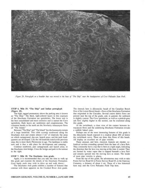
Figure 29. Petrogl)ph on a boo/db- lhal M"(.U IT/OI-ru 10 lhe ~ if '7he Ship" near 1M hmdqllOnm if C(JI't Pali.Jades Siale Park..<br />
STOP 6, Mile 19. " The Sh ip" and Indian petroglyph<br />
Wigure 29),<br />
The high, ragged promontory above the parking area is known<br />
as "The Ship." The thick, light-colored layers in this exposure<br />
of the Deschutes Fonnation are ignimbrites. The lower unit is<br />
the best consolidated and most extensive and is named the Cove<br />
ignimbrite. Dark layers are sandstones and conglomerates. The<br />
columnar basalts to the nonh are the Newberry intracanyon flows<br />
of 'The Island."<br />
Between 'The Ship" and "n.e Island'· lies the hummocky terrain<br />
of a large landslide. This slide extends southward along the<br />
Deschutes Arm and creates almost 2 mi 2 of relatively flat areas<br />
on which campground. day.use. launch areas. and the park headquaners<br />
are developed. Like the old landslide noted at the previous<br />
stop, this is most likely Pleistocene in age. The landmass is stable<br />
now and is thus a safe place for development and camping.<br />
Continue southwest, past campgrounds and launch areas, to<br />
the Deschutes Arm bridge. Cross the bridge and pa rk in the turnout<br />
to the right.<br />
STOP 7. Mile 20. The Deschutes Arm grade.<br />
Again, it is recommended that you take the time to walk up<br />
this grade and examine the details of the Deschutes Formation.<br />
(Less hardy souls may wish to drive up and walk OOwn.)<br />
The Deschutes Arm grade exhibits a number of features that<br />
contrast with those apparent on the Crooked River Arm grade.<br />
The rimrock here is diktytaxitic basalt of the Canadian Bench<br />
flow of the Lower Desen basalt-flows of the Deschutes Formation<br />
that originated in the Cascades. Several coarse debris flows are<br />
present near the top of the grade, and, in general, the sediment<br />
is slightly coarser. The Cove ignimbrite, as well as a pinkish-gray<br />
ash flow slightly higher in the section, can be examined along<br />
this grade.<br />
At the switchback, a close view of the contact between in·<br />
tracanyon flows and the underlying Deschutes Formation reveals<br />
a reddish baked zone.<br />
Perhaps one of the most interesting features of this grade is<br />
the diktytaxitic basal! exposed in a roadcut about 200 yd below<br />
the switchback curve. There are three thin flows of this basalt.<br />
All display an excellent set of pipe vesicles.<br />
These unusual, and here. classical, features are slender, cylindrical<br />
cavities extending upward from the base of a lava flow.<br />
They commonly have a top that is bent at a right angle, indicating<br />
the direction that the lava was moving at the time it cooled. They<br />
are formed by water vapor that is trapped beneath a lava flow<br />
and streams upward into the moving lava as steam. The inside<br />
of most pipe vesicles is glassy.<br />
From the top of this grade. the adventurous may wish to take<br />
Forest Service Road 64 to Forest Service Road 63, to the Gateway<br />
Cemetery, a distance of about 4 mi. Those of a less historical<br />
bent may end the Cove Palisades Field Trip here.<br />
OREGON GEOLOGY, VOLUME 52, NUMBER I, JANUARY 1990<br />
15


