Mowing and Landscaping Bid Information Packet - Oswego Illinois
Mowing and Landscaping Bid Information Packet - Oswego Illinois
Mowing and Landscaping Bid Information Packet - Oswego Illinois

Create successful ePaper yourself
Turn your PDF publications into a flip-book with our unique Google optimized e-Paper software.
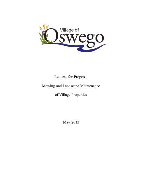
Request for Proposal<br />
<strong>Mowing</strong> <strong>and</strong> L<strong>and</strong>scape Maintenance<br />
of Village Properties<br />
May 2013
Request for<br />
Proposals<br />
1. The Village of <strong>Oswego</strong>, <strong>Illinois</strong> is issuing this Request for Proposal ("RFP") for the purpose<br />
of soliciting vendor proposals for the mowing <strong>and</strong> maintenance of certain areas <strong>and</strong> Well<br />
House sites throughout the Village, to serve the current <strong>and</strong> projected needs of the Village.<br />
2. The Village intends to seek the most cost-effective solution, based on the Criteria contained in<br />
this RFP <strong>and</strong> in accordance with its ordinances related to purchasing goods <strong>and</strong> services, for its<br />
needs.<br />
3. One sealed original <strong>and</strong> one copy of the proposal will be accepted until Monday, June 17, 2013<br />
at 10:00 a.m. Proposals submitted must be binding for not less than ninety (90) days after the<br />
date received. The Village will select the proposal that, in its opinion, is in the best interest of<br />
the Village. The Village reserves the right to reject any <strong>and</strong> all proposals or portions of a<br />
proposal. The Village also reserves the right to waive minor technicalities in the proposal, <strong>and</strong><br />
to determine the methodology for evaluation of the proposals.<br />
4. References. The proposal shall include current <strong>and</strong> past references that demonstrate the firm’s<br />
ability to successfully perform the duties required within this RFP.<br />
5. A m<strong>and</strong>atory meeting <strong>and</strong> site visit of each location will take place on June 13, 2013 at 10:00 a.m.<br />
All interested vendors will meet at the Public Works Facility at 100 Theodore Drive. For further<br />
questions, contact the Public Works office at 630-554-3242.<br />
6. Proposals must be mailed or h<strong>and</strong>-delivered to the following address by the date <strong>and</strong> time<br />
specified. Proposals delivered, but not received by the Village by proposal closing time, will<br />
be returned, after receipt, unopened to the firm. All proposals should be addressed to:<br />
Village of <strong>Oswego</strong><br />
Re: (vendor<br />
name)<br />
Proposal for the Village of <strong>Oswego</strong>, <strong>Mowing</strong> <strong>and</strong> L<strong>and</strong>scape Maintenance<br />
Attention: Tina Touchette<br />
Village Clerk<br />
100 Parkers Mill<br />
<strong>Oswego</strong>, <strong>Illinois</strong> 60543<br />
Proposal packets <strong>and</strong> map are available online at ww.villageofoswegoil.org or at the<br />
<strong>Oswego</strong> Village Hall, located at 100 Parkers Mill, <strong>Oswego</strong>, <strong>Illinois</strong>.<br />
Award of Contract. The Village of <strong>Oswego</strong> Board of Trustees will make the final award of<br />
the proposal or contract.
7. Contract. In addition to the completed proposal, a resulting contract may be required by the<br />
Village, including but not limited to, written correspondence between the Village <strong>and</strong> the<br />
vendor subsequent to the proposal submission, facsimiles <strong>and</strong> product literature. All<br />
agreements between the Village of <strong>Oswego</strong> <strong>and</strong> the vendor will be h<strong>and</strong>led through our<br />
legal counsel. In addition, any legal restrictions or provisions, enforced by the vendor or its<br />
parent company, which are not in line with the industry's st<strong>and</strong>ard, should be pointed out.<br />
8. Confidentiality of Documents. Proposals shall be maintained as confidential so as to avoid<br />
disclosure of contents to competing bidders <strong>and</strong> kept secret during the process of negotiation.<br />
However, all proposals that have been submitted shall be open for public inspection after<br />
contract award. Trade secrets <strong>and</strong> confidential information, as specified by the vendor,<br />
contained in the proposals shall not be open for public inspection.<br />
9. Contact with Village Employees. In order to ensure fair <strong>and</strong> objective evaluation, all<br />
questions related to this RFP should be addressed only to the person(s) so named in this<br />
RFP; those persons are Mark D. Runyon <strong>and</strong> Jerry Weaver. Further, all questions must be<br />
submitted in writing <strong>and</strong> answers to all questions received will be posted on the Village’s<br />
website for all to review. Contact with any other Village employee is expressly prohibited<br />
without prior consent of the persons so named herein. Vendors directly contacting other<br />
City employees will risk elimination of their proposal from further consideration.<br />
10. Conditions<br />
A. Contractor shall perform the maintenance <strong>and</strong> furnish all labor, equipment, <strong>and</strong><br />
services <strong>and</strong> supplies for the mowing, string trimming, cleanup, <strong>and</strong> other l<strong>and</strong>scape<br />
maintenance <strong>and</strong> services for the Village properties (see map) for the approximate period<br />
of July 1, 2013 through November 15, 2013. The scope <strong>and</strong> services are identified in<br />
Section 13 of this RFP. This will include any <strong>and</strong> all spring, fall <strong>and</strong> winterization<br />
maintenance <strong>and</strong> care. The hours of work will be M-F 7am-5pm <strong>and</strong> Sat. 8am-4pm.<br />
B. Contractor will furnish upon request the following certificates of insurance with<br />
provision that insurance policies may not be cancelled or endorsed in any way which<br />
would reduce or limit coverage within (10) days prior written notice to the Village of<br />
<strong>Oswego</strong>.<br />
i. Workman's Compensation Insurance covering employees performing the services<br />
outlined in the contract.<br />
ii. Comprehensive General Liability Insurance on an occurrence basis in an<br />
insurance company licensed to do business in this state. $1,000,000.00/$2,000,000.00<br />
iii. Village of <strong>Oswego</strong> needs to be named as an additional insured<br />
11. Work completed under this contract shall be subject to the approval of the Village of<br />
<strong>Oswego</strong>. For the practical implementation of the contract, the contractor agrees to meet with the<br />
Village as often as necessary to discuss any <strong>and</strong> all aspects of the contract.
12. If, in the opinion of the Village of <strong>Oswego</strong> Public Works Department, the contractor has not<br />
or is not satisfactorily performing the work covered by this specification, <strong>and</strong> within forty<br />
eight (48) hours of receipt of a written dem<strong>and</strong> from the Village of <strong>Oswego</strong>, for performance,<br />
has not cured any defect in performance specifically itemized in such dem<strong>and</strong>, the Village of<br />
<strong>Oswego</strong> may, at its option:<br />
A. Consider all or any part of this contract breached <strong>and</strong> terminate the contractor, or<br />
B. May hire another contractor to cure any defects in performance or complete all work<br />
covered by this specification for the remaining term of this contract.<br />
C. Any dem<strong>and</strong> for performance shall be specifically delivered to contractor by personal<br />
delivery or certified or registered mail.<br />
The Village will make periodic inspections <strong>and</strong> follow up as needed with the contractor to discuss<br />
any issues etc.<br />
13. Scope of work:<br />
A. MOWING - all mowing areas will be maintained at a height of 2 ½” or 3". Grass shall<br />
be cut weekly or when it is 1" higher than specified height. Grass next to light poles,<br />
trees, any permanent objects etc., shall be mechanically trimmed to the same height as<br />
specified above at the time of each mowing. All grass clippings <strong>and</strong> debris, shall be<br />
removed from the sidewalks, parking lots, <strong>and</strong> streets etc. at the time cutting takes place.<br />
The Village may require, at its discretion, additional mowing’s during rapid turf growth<br />
periods. This will be billed separately at an additional hourly rate.<br />
B. MULCHING- All mulching will be the responsibility of the Village of <strong>Oswego</strong>.<br />
C. WEEDING- All l<strong>and</strong>scaped areas will be inspected <strong>and</strong> maintained weekly <strong>and</strong> be<br />
kept weed free throughout the season.<br />
D. GENERAL MAINTENANCE- This includes but is not limited to the following: weeding as<br />
specified, pruning of l<strong>and</strong>scape plant bed material, this shall include any spring, fall <strong>and</strong><br />
winterization pruning, the removal of any dead plant material with the notification of such, to<br />
the Village of <strong>Oswego</strong> for replacement. Any other essential maintenance not covered under<br />
any specific line item.<br />
(All pruning will be in accordance with ANSIZ133.1 st<strong>and</strong>ards.)<br />
14. QUOTES- <strong>Mowing</strong> will be bid: Cost per cut & specified per site. L<strong>and</strong>scape maintenance will be<br />
bid: Cost per month & specified per site L<strong>and</strong>scape maintenance of downtown plant beds: Cost<br />
per month<br />
15. BILLING/INVOICING- All billing <strong>and</strong> invoicing will be done on a monthly basis with detailed<br />
itemized billing for each work item performed for each location. Billing will include the date, the<br />
work item performed, the cost per work item <strong>and</strong> the total cost.<br />
16. PREVAILING WAGE – To the extent applicable, the selected contractor is responsible for<br />
complying with all prevailing wage requirements m<strong>and</strong>ated by state statutes.
Village of <strong>Oswego</strong><br />
<strong>Mowing</strong>/Maintenance <strong>Bid</strong> Sheet<br />
LOCATION MOWING MAINTENANCE<br />
165 Harrison St<br />
Booster Station #2<br />
East side of Douglas from Longbeach to Saugatuck<br />
East side of Douglas from Weisbrook to Longbeach<br />
East Side of Douglas, from Easment to Barnaby<br />
East Side of Douglas, from Saugatuck to Barnaby<br />
East Side of Douglas - TOTAL<br />
Heritage Dr & US Rte 34<br />
Heritage enterance isl<strong>and</strong><br />
IL Rte 71 & Douglas St<br />
Isl<strong>and</strong> on BHP across from Chesterfield Dr<br />
Isl<strong>and</strong> on BHP btw Orchard Ave & Church Parkinglot<br />
Isl<strong>and</strong> on BHP btw US Rte 34 <strong>and</strong> Orchad Ave<br />
Isl<strong>and</strong> on BHP, south of Lombardy Ln<br />
Isl<strong>and</strong>s on Boulderhill Pass - TOTAL<br />
Isl<strong>and</strong> on Kendall Point Dr, South of Route 34<br />
Monroe St Alley between Wilson & E Benton St<br />
North side of Collins Rd btw Grove & Buckskin<br />
North side of Mill Rd & IL Rte 31<br />
North side of US Rte 34 @ Walgreens to Pfund Ct<br />
North side of US Rte 34 from BPH to Chesterfield<br />
North side of US Rte 34 from Bridge to 100' North<br />
North side of US Rte 34 from Bridge to BHP<br />
North side of US Rte 34 from Chesterfield to PD<br />
North side of US Rte 34 from PD to Bridge<br />
North side of US Rte 34 from Pfund to Bridge<br />
North side of US Rte 34 from Walgreens to PD Bridge - TOTAL<br />
North side of Woolley btw Plainfield & Stonehill<br />
North side of Woolley btw Stonehill & Colchester<br />
North St & East side of Adams to Railroad intersec<br />
Old Lumber Yard @ Washington btw Harrison & Adams<br />
Outlot @ Hackney & Morgan Valley<br />
Outlot North of E Van Buren & E Washington St<br />
Promenade<br />
Public Parkinglot @ Harrison St & W Washington St<br />
South side of Mill Rd & IL Rte 31<br />
South side of Penn Ct<br />
South side of W Tyler St btw Adams & Main<br />
Station Drive <strong>and</strong> Park-N-Ride<br />
US Rte 34 & Douglas Rd, Douglas Rd to Old Post Rd<br />
Village Hall<br />
Well # 10<br />
Well # 11<br />
Well # 3<br />
Well # 4<br />
Well # 6<br />
Well # 8<br />
Well #7<br />
Well #9<br />
West side of Douglas Rd from Fernwood to Longbeach<br />
West side of Douglas from Longbeach to Saugatuck<br />
West Side of Douglas, from Easment to Barnaby<br />
West Side of Douglas, from Fernwood to Barnaby - TOTAL<br />
Downtown (Main Street)<br />
Highlighted Columns denote locations requiring plant bed maintenance
Village of <strong>Oswego</strong><br />
<strong>Mowing</strong> Locations<br />
Location Area in Square Feet Area in Acres<br />
165 Harrison St 41,964.01 0.96<br />
Booster Station #2 19,667.13 0.45<br />
East side of Douglas from Longbeach to Saugatuck 26,917.54 0.62<br />
East side of Douglas from Weisbrook to Longbeach 20,012.25 0.46<br />
East Side of Douglas, from Easment to Barnaby 4,475.10 0.10<br />
East Side of Douglas, from Saugatuck to Barnaby 17,322.12 0.40<br />
East Side of Douglas - TOTAL 68,727.01 1.58<br />
Heritage Dr & US Rte 34 12,292.22 0.28<br />
Heritage enterance isl<strong>and</strong> 1,462.75 0.03<br />
IL Rte 71 & Douglas St 6,272.66 0.14<br />
Isl<strong>and</strong> on BHP across from Chesterfield Dr 2,101.68 0.05<br />
Isl<strong>and</strong> on BHP btw Orchard Ave & Church Parkinglot 5,705.50 0.13<br />
Isl<strong>and</strong> on BHP btw US Rte 34 <strong>and</strong> Orchad Ave 1,968.98 0.05<br />
Isl<strong>and</strong> on BHP, south of Lombardy Ln 1,827.63 0.04<br />
Isl<strong>and</strong>s on Boulderhill Pass - TOTAL 11,603.79 0.27<br />
Isl<strong>and</strong> on Kendall Point Dr, South of Route 34 3,652.99 0.08<br />
Monroe St Alley between Wilson & E Benton St 23,213.91 0.53<br />
North side of Collins Rd btw Grove & Buckskin 35,089.39 0.81<br />
North side of Mill Rd & IL Rte 31 7,308.96 0.17<br />
North side of US Rte 34 @ Walgreens to Pfund Ct 30,897.43 0.71<br />
North side of US Rte 34 from BPH to Chesterfield 20,086.77 0.46<br />
North side of US Rte 34 from Bridge to 100' North 1,443.21 0.03<br />
North side of US Rte 34 from Bridge to BHP 39,043.82 0.90<br />
North side of US Rte 34 from Chesterfield to PD 21,054.47 0.48<br />
North side of US Rte 34 from PD to Bridge 5,208.79 0.12<br />
North side of US Rte 34 from Pfund to Bridge 36,663.16 0.84<br />
North side of US Rte 34 from Walgreens to PD Bridge - TOTAL 154,397.64 3.54<br />
North side of Woolley btw Plainfield & Stonehill 29,267.92 0.67<br />
North side of Woolley btw Stonehill & Colchester 22,020.61 0.51<br />
North St & East side of Adams to Railroad intersec 26,525.77 0.61<br />
Old Lumber Yard @ Washington btw Harrison & Adams 19,132.07 0.44<br />
Outlot @ Hackney & Morgan Valley 13,248.56 0.30<br />
Outlot North of E Van Buren & E Washington St 3,830.25 0.09<br />
Promenade 28,867.46 0.66<br />
Public Parkinglot @ Harrison St & W Washington St 47,540.41 1.09<br />
South side of Mill Rd & IL Rte 31 4,724.53 0.11<br />
South side of Penn Ct 4,297.02 0.10<br />
South side of W Tyler St btw Adams & Main 6,957.33 0.16<br />
Station Drive <strong>and</strong> Park-N-Ride 89,398.20 2.05<br />
US Rte 34 & Douglas Rd, Douglas Rd to Old Post Rd 46,346.93 1.06<br />
Village Hall 88,519.84 2.03<br />
Well # 10 89,254.82 2.05<br />
Well # 11 66,222.25 1.52<br />
Well # 3 20,128.44 0.46<br />
Well # 4 18,854.25 0.43<br />
Well # 6 15,266.26 0.35<br />
Well # 8 42,968.97 0.99<br />
Well #7 65,804.43 1.51<br />
Well #9 29,519.01 0.68<br />
West side of Douglas Rd from Fernwood to Longbeach 20,306.82 0.47<br />
West side of Douglas from Longbeach to Saugatuck 21,291.02 0.49<br />
West Side of Douglas, from Easment to Barnaby 3,083.57 0.07<br />
West Side of Douglas, from Fernwood to Barnaby - TOTAL 24,374.59 0.56<br />
Total 1,209,029.21 27.76
MINKLER<br />
UNNAMED<br />
GALENA<br />
CLARK<br />
WS.<br />
STILLWATE R<br />
MD.<br />
CEBOLD<br />
CLAY<br />
MUSTANG<br />
YEADON<br />
ST<br />
ASHCRF.<br />
SIERRA<br />
TORRINGTO<br />
N<br />
INGLESHIRE<br />
IRONWOOD<br />
JENIPER<br />
MERCHANTS<br />
MERCHANTS<br />
5TH<br />
KEENE<br />
FLEET<br />
L<br />
BE<br />
ROTH<br />
WATERBURY<br />
TSC.<br />
TUSCANY<br />
TRAIL PARK<br />
Yorkville<br />
BLACKBERRY<br />
KNOLL<br />
PINERIDGE<br />
B M.<br />
GRAPEVINE<br />
BRG.<br />
M.<br />
CONCORD<br />
PINERIDGE<br />
38 39<br />
55 56<br />
73<br />
93 94<br />
113<br />
136<br />
5 6<br />
CONCORD<br />
CONCORD<br />
21<br />
MERLOT<br />
RL.<br />
CLUB HOUSE<br />
BERRYWOOD<br />
RIVERWOOD<br />
HOLLY<br />
R APEVINE<br />
G<br />
MEA D OWWOOD<br />
HEATHEWOOD<br />
PINE TRE<br />
HEATHERWD.<br />
RIVERWOOD<br />
E<br />
RIVERWOOD<br />
Montgomery<br />
GALENA<br />
MU D S<br />
SUNDOWN<br />
TUSCANY<br />
LINGER<br />
LEWIS<br />
UNNAMED<br />
UNNAMED<br />
ORCHARD<br />
UNNAMED<br />
UNNAMED<br />
UNNAMED<br />
BUELL<br />
WHITE<br />
WHITE OAK<br />
HERREN<br />
22 23<br />
24<br />
25<br />
ORCHARD<br />
WOODS<br />
74<br />
114<br />
OLD MINKLER<br />
137<br />
OWL<br />
D.<br />
BUCKTAIL<br />
WOLVERINE<br />
WOLVERINE<br />
1 2 3 4<br />
7 8 9<br />
40<br />
FANAD<br />
57<br />
HOOVER<br />
AUGUSTA<br />
LAKE PARK<br />
75 76<br />
95 96<br />
41<br />
FOX CHASE<br />
ELEMENTARY<br />
WASHINGTON<br />
PARK<br />
115 116 117 118<br />
138 139<br />
WORMLEY<br />
HERITAGE<br />
PARK<br />
58 59<br />
42 PATCH PARK<br />
43<br />
77<br />
140<br />
97<br />
PRAIRIEVIEW<br />
PARK<br />
BARTLETT LAKE<br />
PRAIRIE/WETLAND<br />
MORGAN<br />
CREEK<br />
PRAIRIE/WETLAND<br />
MORGAN<br />
CREEK<br />
PARK<br />
FOX RIVER<br />
TRAIL<br />
MARINA<br />
WOODS PARK<br />
VIOLET<br />
MILLSTONE<br />
PARK<br />
TROY<br />
PARK<br />
HUDSON<br />
CROSSING<br />
NORTH<br />
HUDSON<br />
CROSSING<br />
PARK<br />
WAUBONSIE<br />
PARK<br />
VILLAGE<br />
GREEN<br />
PARK<br />
LITTLE WHITE<br />
SCHOOL<br />
MUSEUM<br />
PRAIRIEVIEW<br />
LAKEVIEW<br />
PARK<br />
EAGLE<br />
RIDGE<br />
PARK<br />
HAINES<br />
PROPERTY<br />
DISTRICT<br />
308 CENTER<br />
OTHER<br />
PRAIRIE<br />
POINT<br />
BRIARWOOD<br />
PARKVIEW<br />
10<br />
26<br />
CIRCLE<br />
DRIVE<br />
ACCESS<br />
CIVIC<br />
CENTER<br />
PARK<br />
60<br />
STONEGATE<br />
PARK<br />
98<br />
78<br />
141<br />
EASTVIEW<br />
ELEMENTARY<br />
HUNT<br />
¯<br />
CLUB<br />
QUARRY<br />
Miles<br />
LEDGE<br />
HUNT CLUB<br />
ELEMENTARY<br />
DEERPATH<br />
0 157 0.25 0.5 158 159 1<br />
160 HILLS PARK 161 162 163 164 165 166 167 168<br />
HN.<br />
C.<br />
HICKORY<br />
PRKSD.<br />
HUNT CLUB<br />
LGHTN.<br />
ORCHARD<br />
ARBOR<br />
MC.<br />
GALENA<br />
OTTER<br />
OTTER<br />
BISON<br />
WOODCHUCK<br />
BAYBERRY<br />
WILLOWWOOD GATES CREEK<br />
ARBOR<br />
US ROUTE 34<br />
OAK HILL<br />
RIVERVIEW<br />
FERRET<br />
"Fine Cut" <strong>Mowing</strong> Location<br />
SPRUCE<br />
COUGAR<br />
INISHOWEN<br />
BICKFORD<br />
HUDSON<br />
WILLOWWOOD<br />
ASH GROVE<br />
BENTSON<br />
SCHOFIELD<br />
ROOSEV ELT<br />
TR.<br />
PLEASANT VIEW<br />
FOREST<br />
WILLOWWOOD<br />
KIWI<br />
BURR OAK<br />
GRACE<br />
CENTER<br />
FAWN<br />
T R.<br />
TRUMAN<br />
WEST<br />
O.<br />
CH.<br />
CHI PMUNK<br />
WHITEWATER<br />
CLDG.<br />
COLUMBUS<br />
REAGAN<br />
CHERRY<br />
BOBCAT<br />
BEAVER<br />
GREENVIEW<br />
ILLINOIS ROUTE 71<br />
BEAVER<br />
TAFT<br />
CENTURY<br />
G.<br />
HIGHVIEW<br />
CLEAR WATER<br />
MILLSTREAM<br />
EISENHOWER<br />
SOUTHERLAND<br />
RIVERVIE W<br />
WEAVER<br />
MANHATTAN<br />
STONEWATER<br />
PRESIDEN TIAL<br />
OSAGE<br />
LYNX<br />
WASHINGTON<br />
LTTC.<br />
TERRACE<br />
CL.<br />
PARADISE<br />
CVN.<br />
DR.<br />
PRDS.<br />
P<br />
RIVER RUN<br />
IRIS<br />
BL O<br />
ASHLEY<br />
ONDS<br />
P A<br />
M.<br />
D<br />
K LAN<br />
R<br />
ST. QR.<br />
DOUGLAS<br />
N<br />
PERSIMMO<br />
LENNOX<br />
FOX CHASE<br />
SSOM<br />
WHITETA<br />
BADG ER<br />
MAIN<br />
FULLER<br />
CRTH.<br />
IL<br />
DEERPATH<br />
BADGER<br />
EDGWT.<br />
FOX<br />
PARK<br />
RIVER<br />
RUN<br />
CHP.<br />
E RS<br />
LNNX.<br />
MADISON<br />
NORTHGATE<br />
CHU RCHILL<br />
CARNATI<br />
C.<br />
R<br />
H<br />
C<br />
ILLINOIS ROUTE 31<br />
SDDL.<br />
CH UR CHILL<br />
ROSEB US H<br />
CHASE<br />
YORK<br />
CY.<br />
PRRV.<br />
FOX<br />
CH.<br />
MAPLE<br />
ON<br />
PRAIRIEVIEW<br />
COLE<br />
CENTURY<br />
BNT.<br />
MILL<br />
ETTSNG.<br />
HARRISON<br />
CHT.<br />
C.<br />
D.<br />
ADAMS<br />
JUD SON<br />
NRTHGT.<br />
SARTG.<br />
CRLSL.<br />
CRYDN.<br />
DR.<br />
AL.<br />
PR OSPECT<br />
R. M.<br />
TYLER<br />
FOREST<br />
MONROE<br />
HIC KORY<br />
M.<br />
CNT.<br />
JACKSON<br />
VAN BUREN<br />
WILSON<br />
PRAIRIEVIEW<br />
PARKSID E<br />
CHURCHILL<br />
CLARION<br />
CENTURY<br />
RIV<br />
E R<br />
MIST<br />
LN.<br />
MILL<br />
LOCUST<br />
DANBURY<br />
DANBURY<br />
R.MIST<br />
MONROE<br />
BENTON<br />
.<br />
P<br />
CAMDEN<br />
ASHLAND<br />
TYLER<br />
ADAMS<br />
NORTH<br />
DANBURY<br />
MORGAN VALLEY<br />
ISLEVIEW<br />
FARO<br />
LIBERT Y<br />
P.<br />
WHITE PINES<br />
ILLINOIS ROUTE 25<br />
LAKVW.<br />
ALD.<br />
EL MWOOD<br />
JEFFERSON<br />
FRANKLIN<br />
WASHINGTON<br />
BOULDER<br />
HILL<br />
ELEMENTARY<br />
Boulder<br />
Hill<br />
OSWEGO<br />
HIGH SCHOOL<br />
HIGH SCHOOL<br />
PRAIRIEFEST<br />
PARK<br />
PRAIRIE<br />
POINT<br />
ELEMENTARY<br />
PRAIRIE POINT<br />
COMMUNITY PARK<br />
GROVE ROAD<br />
TRAIL<br />
PINEHURST<br />
ILLINOIS ROUTE 25<br />
JAY<br />
POLK<br />
JACKSON<br />
ARBORETUM<br />
BRDFR.<br />
CA MB RID GE<br />
BLUE HERON<br />
2ND<br />
WINDSOR<br />
GROVE<br />
HLLCR.<br />
PARK<br />
ALDON<br />
ROCKY<br />
GLNDL.<br />
STONEGATE<br />
PENN<br />
ASHLAND<br />
CALUMET<br />
ASHLAWN<br />
CURTMAR<br />
EVERGRN.<br />
RIVER<br />
GRANT<br />
WILMETTE<br />
DEERFIELD<br />
BOULDER HILL<br />
BRM.<br />
CHICAGO<br />
BELL<br />
HDGR.<br />
PRAIRIE<br />
POINT<br />
GREENWAY<br />
CL.<br />
PASS<br />
SCARSDALE<br />
EASTWAY<br />
HEDGEROW<br />
MARTY<br />
ANDOVER<br />
OAKLAWN<br />
CREVE<br />
W ST.<br />
VISTA<br />
BEREMAN<br />
GREENFIELD<br />
VISTA<br />
ALDON<br />
BUCKSKIN<br />
R.<br />
B.<br />
GUILFORD<br />
BARCLAY<br />
WOODCLIFF<br />
BEREMAN<br />
CODORUS<br />
OAKWOOD<br />
NORTHAMPTON<br />
CODORUS<br />
FIELDCREST<br />
BRIGHTON<br />
BRIARCLIFF<br />
27<br />
61<br />
79<br />
99<br />
44<br />
11<br />
SUZANJOHN<br />
PARK<br />
NOTTINGHAM<br />
NORTHAMPTON<br />
PARK<br />
PLANK<br />
IK<br />
CULVER<br />
BEDNARC<br />
SENECA<br />
LONG FOR D<br />
S<br />
H<br />
KNOLLWOOD<br />
SOMERSET<br />
PFUND<br />
PARK<br />
CAYMAN<br />
FIELDPOINT<br />
SH<br />
E R<br />
WICK<br />
PARTRIDGE<br />
RWOOD<br />
E<br />
PFUND<br />
TEMPLETON<br />
RBNH.<br />
NT<br />
.<br />
ARBORETUM<br />
MORGAN VALLEY<br />
DURANGO<br />
SD.<br />
NO TTI NGH AM<br />
WINDCREST<br />
WOODLA ND<br />
HACKNEY<br />
CHESTNUT<br />
GREENBRIAR<br />
WOODRIDGE<br />
PICKFORD<br />
THEODORE<br />
ASHCROFT<br />
DEERFIELD<br />
HAMPTON<br />
BROCKWAY<br />
SE DG WICK<br />
119<br />
ANDOVER<br />
PARK<br />
142<br />
CAYMAN<br />
BR.<br />
LOMBARDY<br />
O NEHILL<br />
STONEHILL<br />
HAWTHORNE<br />
GREENWOOD<br />
AMH.<br />
CIRCLE<br />
THOMPSON<br />
JUNIOR<br />
HIGH<br />
R.<br />
RIDGEFI ELD<br />
SPRINGDALE<br />
A.<br />
A MST.<br />
S.<br />
LINDEN<br />
ROULOCK<br />
MARNEL<br />
SPRING GARDEN<br />
STONEHILL<br />
WYNDHAM<br />
DORESET<br />
D O<br />
EST<br />
R<br />
BR O<br />
BRCH.<br />
CROFTO N<br />
CREEK<br />
CH.<br />
CRS.<br />
BEAU<br />
OK<br />
DORESET<br />
CIRCLE DRIVE<br />
INGLESHIRE<br />
SHERMEAD<br />
BOULDER HILL PASS<br />
D<br />
A<br />
S H<br />
OW<br />
SHADOW<br />
PLAINFIELD<br />
BRIARCLIFF<br />
WOODS PARK<br />
FERNWOOD<br />
PEMBROO K E<br />
JOSEPH<br />
SURREY<br />
C RESCENT<br />
JUD<br />
MEADE<br />
SHDWBRK.<br />
DELLA<br />
ITH<br />
ALXNDR.<br />
AMHERST<br />
BRN.<br />
MRK.<br />
WATE RFORD<br />
COLCHESTER<br />
LNDS.<br />
ROBERT<br />
LAKESHORE<br />
R EDDING<br />
BLOOMFIELD<br />
VINCA<br />
ANDOVER<br />
AMHERST<br />
CHATHAM<br />
BLO<br />
80<br />
12<br />
28<br />
OLD POST<br />
ELEMENTARY<br />
45<br />
CHESTERFIELD<br />
PARK<br />
P<br />
T N<br />
PUE<br />
.<br />
CT.<br />
CR .<br />
COLCHESTER<br />
ALLN.<br />
TRAUGHBER<br />
JUNIOR HIGH<br />
HEMLOCK<br />
ANDV.<br />
FRANCESC.<br />
INGLSH.<br />
LCKY.<br />
PRSWC.<br />
THORNBURY<br />
CINDERF ORD<br />
SOUTHBURY<br />
SOUTHBURY<br />
SUFFIEL D<br />
CHESHIRE<br />
ANTHONY<br />
CHESTERFIELD<br />
WILLINGTON<br />
LISZKA<br />
WHITNEY<br />
HUBBAR D<br />
ANGELA<br />
BRIARCLIFF<br />
LAKE<br />
GENTILLY<br />
WINROCK<br />
PARK<br />
OLD<br />
POST<br />
PARK<br />
PEARCE'S<br />
FORD PARK<br />
29<br />
MATENA<br />
GREENWAY<br />
TEWKSBURY<br />
WAUBONSIE<br />
WETLAND<br />
Fox Bend<br />
13<br />
62 63<br />
ADDS.<br />
CHAROLOTTE<br />
BLT.<br />
FAIRWIND<br />
OLD POST<br />
WLT.<br />
WINTHROP<br />
WB<br />
.<br />
AMESBURY<br />
B. T.<br />
C.<br />
MYSTIC<br />
SEASONS<br />
BRAEBURN<br />
SOUTHBURY<br />
ELEMENTARY<br />
SOUTH<br />
POINT PARK<br />
JAYCEE<br />
PARK<br />
WAUBONSIE<br />
GREENWAY<br />
DETENTION<br />
46<br />
14 15 16<br />
OGDEN<br />
30 31 32 33 34<br />
OSWEGO<br />
47 48<br />
64<br />
FARMINGTON<br />
LAKES PARK<br />
PRAIRIE<br />
TRAIL<br />
BARNABY<br />
BARNABY<br />
PARK<br />
CHURCHILL<br />
CLUB<br />
81 82 83 84 85 86<br />
100 101 102 103 104 105<br />
65<br />
66 67<br />
120 121 122 123 124 125 126<br />
COTTONEASTER<br />
CHST.<br />
MANSFIELD<br />
LITCHFIELD<br />
DURHAM<br />
ABINGDON<br />
WINROCK<br />
F.<br />
F.<br />
STRATFORD<br />
POMEROY<br />
HEMLOCK<br />
HUNTER<br />
BEAUWICK<br />
WEMBLEY<br />
L AKESIDE<br />
VICTORIA<br />
PRESTON<br />
ASHCROFT<br />
PLACE<br />
RIDGE<br />
FALLCREEK<br />
LONGBEACH<br />
PO<br />
BOWER<br />
SEQUOIA<br />
TEALWOOD<br />
SHEFIELD<br />
ET<br />
F R<br />
M<br />
FLN.<br />
WABNS.<br />
HM.<br />
METINA<br />
KNG. BRD.<br />
FAIRFIELD<br />
AFTON<br />
HEATHGATE<br />
PADDOCK<br />
GRAND VIEW<br />
DENHAM<br />
SPRINGDALE<br />
WAUBONSEE<br />
K.<br />
B.<br />
CASCA DE<br />
CASCADE<br />
SPRINGDALE<br />
PTTWT.<br />
PEARCES<br />
GRAYS<br />
ASTFIELD<br />
E<br />
PENDLE TON<br />
VILLAGE CENTER<br />
SONORA<br />
SONORA<br />
SNR.<br />
SAUGATUCK<br />
BARNABY<br />
MOND O VI<br />
STONEHILL<br />
ASHLEY<br />
WOLLMIN G TON<br />
GRAYS<br />
TOWNS<br />
H A R<br />
ORD<br />
TF<br />
GLORIA<br />
KENT<br />
US ROUTE 30<br />
HUNTINGTON<br />
SETON CREEK<br />
AVON<br />
ROCFO<br />
DOUGLAS<br />
D<br />
B<br />
C<br />
K.<br />
BRMPT.<br />
JULEP<br />
CANTERBURY<br />
C<br />
B<br />
HERITAGE<br />
B .<br />
5TH<br />
WST.<br />
CORNE<br />
RICH MOND<br />
HERI TAGE<br />
NEWPORT<br />
MSN. SQ.<br />
CITATION<br />
WEISBROOK<br />
BARNABY<br />
LL<br />
B.<br />
PLY.<br />
AUBURN<br />
A FFIRMED<br />
FAYETTE<br />
KENSINGTON<br />
FARMINGTON<br />
SALEM<br />
FRANKFORT<br />
KEIERLBR.<br />
WOOLLEY<br />
CARDINAL<br />
DOUGLAS<br />
Q.<br />
HANVR.<br />
SPRINGBROOK<br />
SP<br />
A RNABY<br />
B<br />
PARIS<br />
WILMORE<br />
BRO OKSIDE<br />
LAKE<br />
RINGBR O<br />
BURKHART<br />
OK<br />
5TH<br />
VR.<br />
BLUEGRASS<br />
PARK<br />
BARTON<br />
143 144 145 146 147 148 149<br />
US ROUTE 34<br />
BELMONT<br />
KENDALL<br />
POINT<br />
VERSAILLES<br />
GEORGETOWN<br />
JESSAMINE<br />
BLUEGRASS<br />
COLLINS<br />
BADEN<br />
EBONY<br />
SPIRES<br />
CHARISMATIC<br />
BOHANNON<br />
SECRETARIAT<br />
QUEEN<br />
MARQUIS<br />
POINTE<br />
KENDALL POINT<br />
LEVUE<br />
KENDALL POINT<br />
STPL.<br />
MARKET<br />
APOLLO<br />
49<br />
5TH<br />
HOMEVIEW<br />
BONAVENTURE<br />
KIRKLAND<br />
KIRKLAND<br />
EARLY CHILDHOOD<br />
EARLY CHILDHOOD<br />
CHURCHILL<br />
ELEMENTARY<br />
READING<br />
COM ED<br />
R.O.W.<br />
YOAKUM<br />
LEESBURG<br />
HUTCHISON<br />
PREAKN ESS<br />
DANCER<br />
WOODFORD<br />
SILVER<br />
MAJESTIC<br />
MCGRATH<br />
RISEN STAR<br />
CHESAPEAKE<br />
GOODWIN<br />
MILLERSBURG<br />
PIMLICO<br />
CHARM<br />
G.<br />
MARQUIS<br />
FURLONG<br />
CHM PNS.<br />
17<br />
LORADALE<br />
AMETHYST<br />
AL.<br />
CHR.<br />
DYL.<br />
FALLS<br />
FALLS<br />
PARK<br />
OGDEN<br />
TREASURE<br />
L.<br />
18<br />
50 51<br />
W.<br />
BRIDGEVIEW<br />
PRIMROSE<br />
PLEASANTON<br />
ARL.<br />
SPARKLE<br />
MANDY<br />
WINGATE<br />
BLUE RIDGE<br />
OSWEGO EAST<br />
HIGH SCHOOL<br />
68<br />
106<br />
169 170<br />
.SNS<br />
RAINTREE<br />
HL.<br />
MN.<br />
APPALOOSA<br />
HIDDEN<br />
CREEK<br />
PARK<br />
Aurora<br />
SUMMERLIN<br />
PALOMINO<br />
US ROUTE 30<br />
SUMMERLIN<br />
GRAND<br />
POINTE<br />
TRAILS<br />
ESSEX<br />
CRYSTA<br />
L<br />
Plainfield<br />
DUNHILL<br />
LNCL. STTN.<br />
127th St<br />
2nd St<br />
A<br />
Abbeyfeale Dr<br />
Abingdon Dr<br />
Acorn Ln<br />
Adams St<br />
Affirmed Dr<br />
Afton Dr<br />
Albright Rd<br />
Aldon Ct<br />
Aldon Rd<br />
Alex Ct<br />
Alex<strong>and</strong>er Ct<br />
Allington Ct<br />
Amesbury Rd<br />
Amethyst Ln<br />
Amherst Cir<br />
Amherst Ct<br />
Amsterdam Cir<br />
Amston Ct<br />
Amy Dr<br />
Anchor Dr<br />
Andover Dr<br />
Angela Cir<br />
Anna Maria Ln<br />
Anthony Ct<br />
Antietam Ct<br />
Apollo Ln<br />
Arbor Ct<br />
Arbor Ln<br />
Arboretum Way<br />
Arlington Ct<br />
Ashcroft Ct<br />
Ashcroft Ln<br />
Ashl<strong>and</strong> St<br />
Ashlawn Ave<br />
Ashley Ct<br />
Ashley Way<br />
Auburn Dr<br />
Audrey Ave<br />
Augusta Rd<br />
Autumn Ridge Dr<br />
Avon Ct<br />
B<br />
Baden Ave<br />
Badger Ct<br />
Badger Ln<br />
Baker Ct<br />
Barclay Ct<br />
Barickman Ct<br />
Barnaby Dr<br />
Barrington Dr<br />
Barton Dr<br />
Baseline Rd<br />
Baumann Trl<br />
Bayberry Dr<br />
Beaver Crossing<br />
Beaver Ct<br />
Bell Ct<br />
Bellevue Cir<br />
Belmont Ave<br />
Bennett Ct<br />
Bent Tree Ct<br />
Benton St<br />
Bentson St<br />
Bereman Rd<br />
Berkshire Ct<br />
Berrywood Ln<br />
Bickford Ave<br />
Birchwood Ct<br />
Bison Rd<br />
Blackhawk Blvd<br />
Bloomfield Cir E<br />
Bloomfield Cir W<br />
Bloomfield Ct<br />
Blossom Ct<br />
Blossom Ln<br />
Blue Heron Dr<br />
Blue Ridge Ct<br />
Blue Ridge Dr<br />
Bluegrass Pkwy<br />
Bluestem Ct<br />
Boat Ln<br />
Bohannon Cir<br />
Bolton Ct<br />
Bonaventure Dr<br />
Boulder Hill Pass<br />
Bower Ln<br />
Bradford Ct<br />
Brady St<br />
Braeburn Dr<br />
Br<strong>and</strong>on Ct<br />
Briarcliff Rd<br />
Briarwood Ln<br />
Bridgeview Dr<br />
Brighton Way<br />
Bristol Ct<br />
Bristol Ridge Rd<br />
Brock Ct<br />
Brockway Dr<br />
Brompton Ct<br />
Brook Ct<br />
Brookside Dr<br />
Bruell St<br />
Buckingham Ct<br />
Buckskin Dr<br />
Bucktail Dr<br />
Burgundy Ct<br />
Burr Ct<br />
Burr Oak Dr<br />
Burr St<br />
Butcher Dr<br />
C<br />
Caliendo Cir<br />
Calumet St<br />
Cambridge Ct<br />
Camden Cir<br />
Canterbury Ct<br />
Canton Ct<br />
Canton Dr<br />
Canyon Creek Ct<br />
Canyon Creek Dr<br />
Cardinal Ave<br />
Carlisle Ct<br />
Carlton Ct<br />
Carnation Ct<br />
Carnation Dr<br />
Carpenter Ave<br />
Carriage Ct<br />
Cascade Ln<br />
Case St<br />
Castle Pines Ln<br />
Caterpillar Dr<br />
Catherine Ct<br />
Cayman Ct<br />
Cayman Dr<br />
Cebold Dr<br />
Central Dr<br />
Century Ct<br />
Century Dr<br />
Champions Run<br />
Chapin Way<br />
Chapman Dr<br />
<strong>Mowing</strong> Locations 2013<br />
170<br />
60<br />
189<br />
100<br />
153<br />
77<br />
64<br />
13<br />
3<br />
10<br />
10<br />
33<br />
45<br />
100<br />
28<br />
17<br />
119<br />
119<br />
6<br />
99<br />
146<br />
25*<br />
141*<br />
28<br />
54<br />
45<br />
36<br />
49<br />
74<br />
74<br />
118*<br />
67<br />
119<br />
119<br />
77*<br />
43*<br />
46<br />
41<br />
64<br />
173<br />
41<br />
12<br />
14*<br />
65<br />
58<br />
58<br />
69<br />
43<br />
178<br />
29*<br />
35<br />
65<br />
1*<br />
21<br />
56<br />
58<br />
58<br />
78<br />
32<br />
65<br />
52<br />
45<br />
77*<br />
75<br />
10<br />
47*<br />
54*<br />
159<br />
27<br />
40<br />
20<br />
100<br />
99<br />
100<br />
116<br />
116<br />
140<br />
33<br />
34<br />
48*<br />
162<br />
42<br />
32*<br />
62<br />
49<br />
10*<br />
80*<br />
118<br />
37<br />
12<br />
28<br />
10*<br />
98<br />
33<br />
27<br />
92<br />
91<br />
44<br />
43*<br />
14<br />
99<br />
31<br />
94<br />
14<br />
141<br />
39*<br />
38<br />
91<br />
57<br />
91<br />
41<br />
5<br />
98<br />
141<br />
140*<br />
14<br />
100<br />
80*<br />
19<br />
19<br />
64*<br />
117<br />
117<br />
117<br />
116*<br />
159<br />
97<br />
46<br />
4<br />
36<br />
7<br />
45<br />
27<br />
27<br />
43<br />
153<br />
59<br />
41*<br />
67<br />
52*<br />
76<br />
Charismatic Dr<br />
Charles Ct<br />
Charles St<br />
Charolotte Ln<br />
Chateaux Ct<br />
Chelsea Ct<br />
Cherokee Dr<br />
Cherry Blvd<br />
Cherry Dr<br />
Cherry Rd<br />
Chesapeake Ln<br />
Chesterfield Ct<br />
Chesterfield Dr<br />
Chestnut Dr<br />
Cheyenne Ct<br />
Chippewa Ct<br />
Chippewa Dr<br />
Christian Ct<br />
Churchill Ct<br />
Churchill Ln<br />
Cinderford Ct<br />
Cinderford Dr<br />
Circle Ct<br />
Circle Dr E<br />
Circle Dr W<br />
Citation Dr<br />
Claridge Dr<br />
Claridge Ln<br />
Clarion Ct<br />
Clark Ave<br />
Clay Ct<br />
Clearwater Ct<br />
Clearwater Ln<br />
Club House Ln<br />
Cobblestone Ct<br />
Codorus Rd<br />
Colchester Dr<br />
Cole Ave<br />
Collins Rd<br />
Colony Ct<br />
Columbus Dr<br />
Commerce Dr<br />
Concord Ct<br />
Concord Dr<br />
Conway Ln<br />
Coolidge Pl<br />
Cornell Dr<br />
Cotoneaster Ave<br />
Cotoneaster Ct<br />
Cottonwood Dr<br />
Council Ave<br />
Country Rd<br />
Countryside Ln<br />
Countryview Dr<br />
Coventry Ct<br />
Coyote Ct<br />
Cranston Cir<br />
Creek Dr<br />
Creekside Ct<br />
Crestview Dr<br />
Crestwood Ct<br />
Creve Ct<br />
Crofton Ct<br />
Crofton Rd<br />
Crooker Dr<br />
Crothers Dr<br />
Croydon Ct<br />
Crystal Ct<br />
Curtmar Ct<br />
Cushing Ln<br />
D<br />
Danbury Ct<br />
Danbury Dr<br />
Dancer Ln<br />
David Ct<br />
Deer Run Dr<br />
Deerfield Dr<br />
Deerpath Dr<br />
Della Ln<br />
Denham Dr<br />
Derby Ct<br />
Devoe Dr<br />
Devonshire Ct<br />
Dolores St<br />
Dolphin Ct<br />
Donegal Ct<br />
Dorchester Ct<br />
Dorest Ave<br />
Dorset Ct<br />
Douglas Rd<br />
Dover Ct<br />
Durango Rd<br />
Durham Ln<br />
Dylan Dr<br />
E<br />
E Washington St<br />
Eagle View Ln<br />
Eastway Dr<br />
Eastwick Ln<br />
Ebony Dr<br />
Edgebrook Ct<br />
Edgewater Ct<br />
Edythe St<br />
Eisenhower Dr<br />
Ellsworth Ct<br />
Ellsworth Dr<br />
Elmwood Dr<br />
Emerald Dr<br />
Emma Ave<br />
Emma Ct<br />
End Ct<br />
Essex Dr<br />
Evans Ct<br />
Evergreen Ct<br />
F<br />
Fairwind Ct<br />
Fairwind Dr<br />
Fallcreek Cir<br />
Fanad Ct<br />
Farmington Lakes Dr<br />
Farnsworth Ave<br />
Fawn Dr<br />
Fayette Dr<br />
Fernwood Rd<br />
Ferret Crossing<br />
Fieldcrest Dr<br />
Fieldpoint Rd<br />
Fields Dr<br />
Fifth St<br />
Fleet Ave<br />
Flintlock Ct<br />
Forest Ave<br />
Forest Ct<br />
Fort Sumter Ct<br />
Foster Dr<br />
Fox Chase Ct<br />
Fox Chase Dr N<br />
Fox Chase Dr S<br />
Fox Mead Cir<br />
Fox Mead Ct<br />
Fox Sedge Ct<br />
Francesca Ct<br />
Frankfort Ave<br />
Franklin St<br />
* STREET CROSSES GRID LINES<br />
65*<br />
40<br />
72<br />
28<br />
117<br />
142<br />
198<br />
151<br />
75<br />
198*<br />
67<br />
62<br />
62<br />
141<br />
198<br />
189<br />
189<br />
33<br />
117<br />
96*<br />
62<br />
62<br />
44<br />
10*<br />
26*<br />
64<br />
118<br />
20<br />
117<br />
75<br />
26<br />
58<br />
57*<br />
55<br />
14<br />
26*<br />
80*<br />
140<br />
140*<br />
156<br />
40*<br />
40<br />
21<br />
20*<br />
19<br />
75<br />
30<br />
120<br />
120<br />
118<br />
35<br />
157*<br />
151<br />
155<br />
58<br />
59<br />
72<br />
99<br />
98<br />
179<br />
27<br />
26<br />
45<br />
45<br />
37<br />
76<br />
140<br />
34<br />
26<br />
36<br />
118<br />
117<br />
67<br />
54<br />
12<br />
141*<br />
58<br />
80<br />
13<br />
97<br />
52*<br />
197<br />
40*<br />
24<br />
56<br />
97<br />
119<br />
119<br />
13*<br />
197<br />
27<br />
100<br />
33<br />
77*<br />
178<br />
43<br />
19<br />
66<br />
58<br />
12<br />
72<br />
75*<br />
72<br />
72<br />
60<br />
16<br />
5<br />
5<br />
96<br />
34<br />
37<br />
60<br />
12<br />
12<br />
13<br />
57<br />
30*<br />
19*<br />
40<br />
64*<br />
10*<br />
39<br />
43<br />
44<br />
172*<br />
14*<br />
65<br />
46<br />
97<br />
95<br />
53<br />
69<br />
59<br />
57*<br />
59<br />
11<br />
11<br />
161<br />
45<br />
64<br />
78<br />
Fredericksburg Ln<br />
Frontier St<br />
Fuller St<br />
Furlong St<br />
G<br />
Gains Ct<br />
Galena Rd<br />
Garden Dr<br />
Garfield St<br />
Garnet Ln<br />
Gastville St<br />
Gates Creek Dr<br />
Gentilly Dr<br />
Gilda Ct<br />
Glendale Ave<br />
Gloria Ln<br />
Goldenrod Dr<br />
Goodwin Dr<br />
Gr<strong>and</strong>e Trl<br />
Gr<strong>and</strong>view Pl<br />
Grant St<br />
Grantham Ln<br />
Grape Vine Trl<br />
Grays Ct<br />
Grays Dr<br />
Greenbriar Rd<br />
Greenview Ct<br />
Greenview Ln<br />
Greenwood Pl<br />
Griffen Dr<br />
Grove Rd<br />
Guilford Rd<br />
Gunflint Ct<br />
H<br />
Hackney Ln<br />
Hafenrichter Rd<br />
Hagaman Ln<br />
Half Hollow Ct<br />
Half Moon Ct<br />
Half Round Rd<br />
Hampton Rd<br />
Hanover Ct<br />
Harlan Ave<br />
Harrison St<br />
Hartford Ct<br />
Harvey Rd<br />
Hawley Dr<br />
Heatherwood Dr<br />
Heathgate Rd<br />
Hedgerow Ct<br />
Hedgerow Ln<br />
Hemlock Ct<br />
Hemlock Ln<br />
Heritage Dr<br />
Herren Ln<br />
Hickory St<br />
Highl<strong>and</strong> Ct<br />
Highview Ct<br />
Hill Ave<br />
Hillcrest Ct<br />
Hillstone Rd<br />
Hobbs Ct<br />
Hollenback Ct<br />
Holly Ln<br />
Hoover Dr<br />
Horseman Trl<br />
Hubbard Way<br />
Hudson Dr<br />
Hunt Club Ct<br />
Hunt Club Dr<br />
Hunter Ct<br />
Hunter Dr<br />
Huntington Ct<br />
I<br />
Indian Hill Ln<br />
Ingleshire Ct<br />
Ingleshire Rd<br />
Inishowen Ct<br />
Iris Ct<br />
Ironwood Ave<br />
Iroquois Ct<br />
Isleview Dr<br />
J<br />
Jackson Pl<br />
Jackson St<br />
Jay St<br />
Jefferson St<br />
Jennifer Ct<br />
Jessamine Dr<br />
Judith Cir<br />
Judson Ave<br />
Juniper St<br />
Justice Ct<br />
Justice Dr<br />
K<br />
Kate Dr<br />
Kathleen Dr<br />
Keene Ave<br />
Keierleber Rd<br />
Kendall Point Dr<br />
Kensington Dr<br />
Kent Ct<br />
Ketchum Ct<br />
Kevin Ln<br />
Kiwi Ct<br />
Klock Ct<br />
Knights Bridge Ct<br />
Knollwood Dr<br />
Kristine St<br />
Kyla Ct<br />
L<br />
Lake Ct<br />
Lakeshore Dr<br />
Lakeside Dr<br />
Lakeview Ct<br />
Lakeview Dr<br />
Lakewood Creek Dr<br />
Lambert Dr<br />
L<strong>and</strong>shire Ct<br />
Lattice Dr<br />
Laughton Ave<br />
Laurie Ln<br />
Lehman Crossing<br />
Leisure Ln<br />
Lennox Ct<br />
Lennox Dr<br />
Lenox Cir<br />
Lewis St<br />
Light Rd<br />
Lincoln Station Dr<br />
Linden Dr<br />
Liszka Ln<br />
Litchfield Way<br />
Locust St<br />
Lombardy Ln<br />
Long Meadow Ct<br />
Longbeach Rd<br />
Longford Ct<br />
Loradale Rd<br />
Loreen Ct<br />
Lucky Ct<br />
Lundquist Dr<br />
Lyman Loop<br />
Lyncliff Dr<br />
35<br />
190<br />
96<br />
50<br />
37<br />
6*<br />
26<br />
78<br />
17<br />
35*<br />
56<br />
12<br />
173<br />
60<br />
29<br />
178<br />
17<br />
72*<br />
13<br />
78<br />
19<br />
21*<br />
46<br />
46<br />
11<br />
58<br />
58<br />
119<br />
5<br />
98*<br />
26<br />
190<br />
142<br />
19<br />
6<br />
178<br />
34<br />
161*<br />
27<br />
15<br />
35<br />
77<br />
13<br />
35*<br />
53<br />
55<br />
12*<br />
118<br />
118<br />
120<br />
120*<br />
30*<br />
94<br />
97<br />
97<br />
58<br />
18<br />
26<br />
10<br />
92<br />
72<br />
55<br />
57<br />
7<br />
28<br />
40<br />
159<br />
158*<br />
12<br />
12<br />
13<br />
36<br />
12<br />
12<br />
57<br />
96<br />
120<br />
189<br />
117<br />
78<br />
77*<br />
78<br />
78*<br />
173<br />
65*<br />
28<br />
97<br />
120<br />
72<br />
72<br />
5<br />
5<br />
65<br />
82<br />
32<br />
13*<br />
29<br />
20<br />
41<br />
57<br />
6<br />
46<br />
11<br />
41<br />
5<br />
58<br />
79*<br />
12*<br />
98<br />
97*<br />
20<br />
36<br />
62<br />
96<br />
158<br />
41<br />
54<br />
166<br />
42<br />
58<br />
20<br />
72*<br />
40*<br />
35<br />
119*<br />
120<br />
80<br />
97<br />
60*<br />
97<br />
13*<br />
61<br />
50<br />
34<br />
45<br />
36*<br />
91<br />
92<br />
Lyndhurst Ln<br />
Lynn Ct<br />
Lynn Dr<br />
Lynx Ln<br />
M<br />
Madison Ct<br />
Madison St<br />
Magnolia Ct<br />
Main St<br />
Majestic Ln<br />
Manchester Rd<br />
M<strong>and</strong>y Ln<br />
Manhattan Cir<br />
Mansfield Ct<br />
Mansfield Way<br />
Maple St<br />
Marina Dr<br />
Mark Ct<br />
Market Dr<br />
Marlin Dr<br />
Marnel Rd<br />
Marquis St<br />
Marty Ln<br />
Mary St<br />
Mason Square Dr<br />
Matena Dr<br />
Matlock Dr<br />
Mayfair Ct<br />
Mayfield Ct<br />
Mayfield Dr<br />
Mcgrath Dr<br />
Mclaren Dr<br />
Mclellan Blvd<br />
Meadowwood Ln<br />
Merchants Dr<br />
Merlot Ct<br />
Mill Rd<br />
Millbrook Cir<br />
Millersburg St<br />
Millstream Ln<br />
Minkler Rd<br />
Mitchell Dr<br />
Mo-ah-way Path<br />
Mondovi Dr<br />
Monroe St<br />
Montclair Ln<br />
Morgan Creek Ct<br />
Morgan Ct<br />
Morgan Valley Dr<br />
Morning Glory Ct<br />
Mustang Dr<br />
Mystic Ct<br />
N<br />
Naausay Ct<br />
Navajo Ct<br />
Newport Cir<br />
North St<br />
Northampton Dr<br />
Northgate Dr<br />
Northwest Pass<br />
Norway Pl<br />
Nottingham Ct<br />
Nottingham Dr<br />
O<br />
Oak Creek Dr<br />
Oak Ln<br />
Oaklawn Ave<br />
Oakwood Dr<br />
Obrien Way<br />
Ogden Falls Blvd<br />
Old Post Rd<br />
Old Reserve Rd<br />
Onyx Dr<br />
Orchard Ave<br />
Orchard Rd<br />
Osage Ct<br />
<strong>Oswego</strong> Plains Dr<br />
Ottawa Ct<br />
Otter Way<br />
Owen Ct<br />
Oxford Ct<br />
P<br />
Paddock St<br />
Palomino Ln<br />
Panther Dr<br />
Paradise Pkwy<br />
Paris Ave<br />
Park Dr N<br />
Park St<br />
Parker Pl<br />
Parkers Mill Pl<br />
Parkl<strong>and</strong> Ct<br />
Parkside Ln<br />
Partridge Sq<br />
Patriot Ct<br />
Pearces Ford<br />
Pearl Way<br />
Pembrooke Rd<br />
Pendleton Pl<br />
Penn Ct<br />
Peppertree Dr<br />
Persimmon Ln<br />
Pickford Rd<br />
Pimlico St<br />
Pine Tree Ct<br />
Pinehurst Ct<br />
Pinehurst Ln<br />
Pineridge Dr<br />
Plainfield Rd<br />
Plainsman Ct<br />
Plank Dr<br />
Pleasanton St<br />
Pleasantview Dr<br />
Plymouth Ct<br />
Polk St<br />
Pomeroy Rd<br />
Pomfret Ct<br />
Ponderosa Dr<br />
Ponds Ct<br />
Poplar Ct<br />
Pottowatamie Ct<br />
Praireview Ct<br />
Prairie Crossing Dr<br />
Prairieview Dr<br />
Preakness Dr<br />
Presidential Blvd<br />
Preston Dr<br />
Preswick Ct<br />
Primrose Ln<br />
Prospect Ln<br />
Providence Ln<br />
Pueblo Rd<br />
Putnam Ct<br />
Q<br />
Quantock Ln<br />
Queen Dr<br />
Quincy Dr<br />
R<br />
Railroad St<br />
Raintree Dr<br />
Rance Rd<br />
Reading Dr<br />
Reagan Dr<br />
Red Apple Rd<br />
Red Fox Run<br />
Red Hawk Dr<br />
Redding Ct<br />
Regal Oak Ct<br />
Reliance Ct<br />
Reservation Rd<br />
Richmond Ct<br />
Richmond Dr<br />
Rick Ct<br />
Rickard Dr<br />
Ridge Rd<br />
Ridge Wood Ln<br />
Ridgefield Rd<br />
Ridgemont Ct<br />
Risen Star Ln<br />
River Mist Ct<br />
River Mist Dr<br />
River Oaks Dr<br />
River Rd<br />
River Run Blvd<br />
River Run Ct<br />
River St<br />
Riverside Dr<br />
Riverview Ct<br />
Riverwood Ct<br />
Riverwood Dr<br />
Roaring Creek Dr<br />
Robert Rd<br />
Robinhood Cir<br />
Rocky Way<br />
Roosevelt Dr<br />
Rosemary Ct<br />
Rosewood Ln<br />
Roth Rd<br />
Roulock Rd<br />
Rourke Dr<br />
Route 25<br />
Route 30<br />
Route 31<br />
Route 34<br />
Route 71<br />
Royce Rd<br />
Rustic Wood Ln<br />
S<br />
Saddlebrook Ct<br />
Saratoga Ct<br />
Saugatuck Rd<br />
Scarsdale Rd<br />
Schmidt Ln<br />
Schofield Dr<br />
Seasons Ridge Blvd<br />
Secretariat Ln<br />
Sedgwick Ct<br />
Sedgwick Rd<br />
Seeley St<br />
Seneca Dr<br />
Sequoia Ct<br />
Seton Creek Dr<br />
Shadow Ct<br />
Shadowbrook Ct<br />
Shauna Dr<br />
Sheffield Rd<br />
Shell Ct<br />
Shen<strong>and</strong>oah Dr<br />
Sheridan Ct<br />
Sherwood Dr<br />
Shoeger Ct<br />
Shoeger Dr<br />
Shore Ct<br />
Shore Dr<br />
Sierra Rd<br />
Silver Springs Ct<br />
Simons Rd<br />
Simsbury Ct<br />
Sonora Dr<br />
Southbury Blvd<br />
Southfield Ln<br />
Sparkle Ct<br />
Spencer Ln<br />
Spires Dr<br />
Springbrook Trl N<br />
Springdale Rd<br />
Springhaven Ct<br />
Springside Ct<br />
Squire Cir<br />
Station Dr<br />
Steeplechase Blvd<br />
Stephens Rd<br />
Stillwater Ct<br />
Stone Quarry<br />
Stonehill Rd<br />
Stoneleigh Ln<br />
Stonemill Ln<br />
Stratford Rd<br />
Sudbury Cir<br />
Suffield Ct<br />
Summerlin Dr<br />
Sundown Ln<br />
Sunshine Ct<br />
Surrey Rd<br />
T<br />
Taft Dr<br />
Tallgrass Ln<br />
Tealwood Rd<br />
Templeton Dr<br />
Terrace Ct<br />
Terrace Ln<br />
Tewksbury Cir<br />
Tewksbury Ct<br />
Theodore Dr<br />
Thornbury Ct<br />
Thornbury Dr<br />
Thornwood Blvd<br />
Timber Ct<br />
Timber Lane Dr<br />
Timber Ridge Dr<br />
Timber Wood Cir<br />
Timberlake Trl<br />
Timberwood Ct<br />
Tomahawk Trl<br />
Torrington Ct<br />
Townsend Dr<br />
Treasure Dr<br />
Truman Dr<br />
Tuma Rd<br />
Turtle Creek Ct<br />
Turtle Creek Dr<br />
Tuscany Trl<br />
Tyler St<br />
U<br />
US Hwy 30 Bypass<br />
V<br />
Van Buren St<br />
Van Emmon Rd<br />
Vernon Dr<br />
Versailles Pkwy<br />
Vicksburg Ln<br />
Vinca Ln<br />
Vincent Dr<br />
Vista Dr<br />
W<br />
W Washington St<br />
Walnut Creek Ln<br />
Waterbury Cir<br />
Waterford Dr<br />
Waubonsee Cir<br />
Waubonsee Circle Ct<br />
Wayside Ct<br />
Weaver Ct<br />
Weaver St<br />
Wells St<br />
Wembley Rd<br />
West Dr<br />
Westleigh Ct<br />
Westminster Ct<br />
White Oak Dr<br />
White Owl Ln<br />
White Pines Ct<br />
White Pines Ln<br />
Whitewater Ln<br />
Wiesbrook Dr<br />
Wildwood Pl<br />
William Ct<br />
William Dr<br />
Willington Way<br />
Willowwood Dr<br />
Wilmette St<br />
Wilmore Dr<br />
Wilson Creek Cir<br />
Wilson Pl<br />
Wilton Ct<br />
Winchester Ct<br />
Windcrest Dr<br />
Winding Creek Rd<br />
Windsor Dr<br />
Wingate Ct<br />
Wingate Dr<br />
Winmont Ct<br />
Winrock Rd<br />
Winthrop Dr<br />
Wolf Rd<br />
Wollmington Dr<br />
Wolverine Dr<br />
Woodbine Ct<br />
Woodchuck Trl<br />
Woodford Rd<br />
Woodl<strong>and</strong> Way<br />
Woodridge Rd<br />
Y<br />
Yeadon Ave<br />
Yeadon Dr<br />
Yoakum Blvd<br />
York Dr<br />
The requested map will be created for study purposes only.Please refer to the official recorded plats or deeds for the actual legal descriptions <strong>and</strong> property dimensions. No liability is assumed for the accuracy of the<br />
data delineated herein, either expressed or implied by the Village of <strong>Oswego</strong> or its employees. This work is protected by the United States Copyright Act of 1976 (17 U.S.C. Sec101 et seq). You are not permitted to<br />
use <strong>and</strong>/or reproduce any part of a copyrighted work of the Village of <strong>Oswego</strong> in violation of Federal Copyright Law. Doing so may result in prosecution under such law. If you wish to use property in which the<br />
Village of <strong>Oswego</strong> owns a copyright, you must obtain written permission through the Community Development Department in the Village of <strong>Oswego</strong>, located at 100 Parkers Mill, <strong>Oswego</strong>, <strong>Illinois</strong> 60543.<br />
19<br />
5<br />
5<br />
58<br />
96<br />
60*<br />
38<br />
77*<br />
50*<br />
15<br />
34<br />
40*<br />
80<br />
80<br />
97<br />
42<br />
45<br />
49<br />
24<br />
11*<br />
17<br />
118<br />
41<br />
47<br />
29<br />
72<br />
13<br />
21<br />
6*<br />
67<br />
158*<br />
91<br />
55<br />
13<br />
21<br />
54*<br />
20*<br />
50<br />
57*<br />
94*<br />
35<br />
179<br />
29<br />
77*<br />
20<br />
179<br />
155<br />
140*<br />
12<br />
141<br />
80<br />
189<br />
198<br />
47<br />
77<br />
61<br />
96*<br />
190<br />
74<br />
61<br />
61<br />
157<br />
153<br />
60*<br />
60<br />
73<br />
33*<br />
27*<br />
162*<br />
17<br />
60*<br />
6*<br />
75<br />
198<br />
189<br />
39<br />
37*<br />
14<br />
29<br />
106<br />
78<br />
96*<br />
65<br />
132<br />
78<br />
52<br />
76*<br />
58<br />
97<br />
61<br />
91<br />
45*<br />
17<br />
11*<br />
13<br />
78<br />
170<br />
96<br />
44<br />
50<br />
55<br />
118<br />
118<br />
55<br />
98*<br />
199<br />
99<br />
67<br />
74*<br />
47<br />
78<br />
28<br />
81<br />
171<br />
58<br />
118<br />
46<br />
97<br />
178<br />
97*<br />
49*<br />
76<br />
37<br />
62<br />
33<br />
42<br />
20<br />
28<br />
80<br />
172<br />
32<br />
31<br />
4<br />
50<br />
87*<br />
16<br />
57*<br />
151<br />
11<br />
147<br />
100<br />
135<br />
21<br />
172*<br />
30<br />
30<br />
41<br />
54*<br />
150*<br />
170<br />
44*<br />
11<br />
67<br />
59<br />
59<br />
155<br />
10*<br />
58*<br />
59<br />
4<br />
153<br />
76*<br />
93<br />
73*<br />
19<br />
80<br />
61<br />
26<br />
57<br />
5<br />
187<br />
67<br />
11<br />
36*<br />
10*<br />
35*<br />
3*<br />
17*<br />
78*<br />
146<br />
187<br />
117<br />
117<br />
27*<br />
26<br />
173<br />
159<br />
13<br />
66<br />
44<br />
44<br />
54<br />
10*<br />
120<br />
46<br />
100<br />
79<br />
5<br />
29<br />
41<br />
36<br />
37<br />
61<br />
37<br />
37<br />
41<br />
42<br />
28<br />
20<br />
170<br />
99<br />
13<br />
80*<br />
197<br />
50<br />
142<br />
49<br />
31<br />
13*<br />
12<br />
99<br />
91<br />
56*<br />
49<br />
160<br />
59<br />
76<br />
79*<br />
46<br />
46<br />
28<br />
140<br />
80<br />
18*<br />
93*<br />
34<br />
12<br />
58*<br />
174<br />
13*<br />
99<br />
116<br />
116<br />
62<br />
62<br />
99<br />
62<br />
62<br />
187<br />
156<br />
12<br />
111<br />
170*<br />
190<br />
170<br />
190<br />
80<br />
52<br />
33*<br />
57*<br />
132*<br />
19<br />
19<br />
37*<br />
77<br />
4*<br />
77<br />
172<br />
15<br />
49<br />
53<br />
119<br />
151<br />
118<br />
58*<br />
74<br />
33*<br />
45<br />
45*<br />
45<br />
179<br />
159<br />
159<br />
132<br />
28<br />
75<br />
26<br />
14<br />
74<br />
39<br />
118<br />
118<br />
57<br />
13*<br />
187<br />
5<br />
5<br />
80<br />
56*<br />
98<br />
65<br />
36<br />
77*<br />
80<br />
197<br />
61<br />
156*<br />
141<br />
18<br />
34<br />
11<br />
12*<br />
80<br />
62*<br />
46<br />
39*<br />
67<br />
40<br />
50<br />
119<br />
11<br />
44<br />
44<br />
49*<br />
42
MAIN ST<br />
Downtown<br />
S ADAMS ST<br />
W JACKSON ST<br />
W WASHINGTON ST<br />
S ADAMS ST<br />
W VAN BUREN ST<br />
²<br />
Date Printed: 5/9/2013<br />
50<br />
Feet<br />
The requested map will be created for study purposes only.Please refer to the official recorded plats or deeds for the actual legal<br />
descriptions <strong>and</strong> property dimensions. No liability is assumed for the accuracy of the data delineated herein, either expressed or<br />
implied by the Village of <strong>Oswego</strong> or its employees. This work is protected by the United States Copyright Act of 1976 (17 U.S.C.<br />
Sec101 et seq). You are not permitted to use <strong>and</strong>/or reproduce any part of a copyrighted work of the Village of <strong>Oswego</strong> in<br />
violation of Federal Copyright Law. Doing so may result in prosecution under such law. If you wish to use property in which the<br />
Village of <strong>Oswego</strong> owns a copyright, you must obtain written permission through the Community Development Department in the<br />
Village of <strong>Oswego</strong>, located at 100 Parkers Mill, <strong>Oswego</strong>, <strong>Illinois</strong> 60543.<br />
Overview
Promenade<br />
9<br />
9<br />
12 - 52<br />
N ADAMS ST<br />
9 - 55<br />
12<br />
13<br />
13<br />
15<br />
15<br />
99998 - 99998<br />
99998 - 99998<br />
99999 - 99999<br />
27<br />
27<br />
19<br />
19<br />
S ADAMS ST<br />
13 - 27<br />
99998 - 99998<br />
5<br />
32<br />
W JACKSON ST<br />
JEFFERSON ST<br />
59<br />
59 - 59<br />
99998 - 99998<br />
99998 - 99998<br />
99999 - 99999<br />
19<br />
17<br />
MAIN ST<br />
5 - 27<br />
10 - 26<br />
10<br />
15<br />
17<br />
19<br />
21<br />
23<br />
25<br />
12<br />
15 - 25<br />
32 - 32<br />
Date Printed: 5/10/2013<br />
²<br />
100<br />
Feet<br />
The requested map will be created for study purposes only.Please refer to the official recorded plats or deeds for the actual legal<br />
descriptions <strong>and</strong> property dimensions. No liability is assumed for the accuracy of the data delineated herein, either expressed or implied by<br />
the Village of <strong>Oswego</strong> or its employees. This work is protected by the United States Copyright Act of 1976 (17 U.S.C. Sec101 et seq). You<br />
are not permitted to use <strong>and</strong>/or reproduce any part of a copyrighted work of the Village of <strong>Oswego</strong> in violation of Federal Copyright Law.<br />
Overview