Comprehensive Plan - Oswego Illinois
Comprehensive Plan - Oswego Illinois
Comprehensive Plan - Oswego Illinois

Create successful ePaper yourself
Turn your PDF publications into a flip-book with our unique Google optimized e-Paper software.
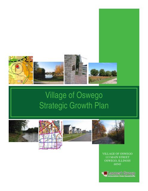
Village of <strong>Oswego</strong><br />
Strategic Growth <strong>Plan</strong><br />
VILLAGE OF OSWEGO<br />
113 MAIN STREET<br />
OSWEGO, ILLINOIS<br />
60543
VILLAGE OF OSWEGO<br />
113 MAIN STREET<br />
OSWEGO, ILLINOIS 60543<br />
VILLAGE OF OSWEGO BOARD OF TRUSTEES<br />
Craig Weber, President<br />
Trustees:<br />
Brian LeClearg<br />
Charles Pajor<br />
Ron Weilert<br />
Rodger Long<br />
Brad Rock<br />
Lori West<br />
PLAN COMMISSION<br />
Phil Solecki, Chairman<br />
David Ford<br />
Scott Gryder<br />
Ken Holmstrom<br />
E.E. “Red” Korn<br />
Edith McDonald<br />
Eric Simmons<br />
ADMINSITRATIVE STAFF<br />
Gary D. Adams, Village Administrator<br />
Rod Zenner, Community Development Director<br />
Jerry Weaver, Director of Public Works<br />
Elliot Eldridge, Building and Zoning Director<br />
Dwight Baird, Chief of Police<br />
Jeanne Hoch, Village Clerk<br />
Mark Pries, Finance Director<br />
This report has been prepared with input from residents and community leaders of the Village of <strong>Oswego</strong>, the<br />
<strong>Oswego</strong> Village Board and <strong>Plan</strong> Commission, and Village Staff members.<br />
Adopted by the Village of <strong>Oswego</strong> Board of Trustees on _______________________.<br />
<strong>Plan</strong> Prepared By:
TABLE OF CONTENTS<br />
CHAPTER<br />
Page<br />
1. INTRODUCTION 5<br />
Why a Strategic Growth <strong>Plan</strong>? 5<br />
<strong>Plan</strong>ning Process 10<br />
Inventory and Analysis 10<br />
Goals and Objectives 10<br />
<strong>Plan</strong> Development 10<br />
2. INVENTORY AND ANALYSIS 12<br />
Demographics/Socioeconomic Characteristics 12<br />
Existing Natural Features 13<br />
Existing Land Uses and Developed Lands 16<br />
Existing Transportation 16<br />
Existing Community Facilities and Utilities 18<br />
3. GOALS AND OBJECTIVES 22<br />
4. STRATEGIC GROWTH DENSITY STUDY 24<br />
5. TRANSPORTATION/ACCESS 30<br />
Goals and Objectives 30<br />
Road Realignment/Extension 33<br />
Intersection Improvements 34<br />
Road Hierarchy 35<br />
Buffer Requirements 36<br />
Pedestrian and Bike Trails 37<br />
6. OPEN SPACE-GREENWAY PLAN 38<br />
7. LAND USE PLAN 44<br />
Land Use Descriptions 44<br />
8. STRATEGIC GROWTH PLANS 47<br />
<strong>Plan</strong>ning Area 1 47<br />
<strong>Plan</strong>ning Area 2 64<br />
<strong>Plan</strong>ning Area 3 77<br />
<strong>Plan</strong>ning Area 4 97<br />
<strong>Plan</strong>ning Area 5 115<br />
<strong>Plan</strong>ning Area 6 134<br />
<strong>Plan</strong>ning Area 7 152<br />
<strong>Plan</strong>ning Areas Overall Composite 170<br />
9. CORRIDOR PLAN 172
LIST OF FIGURES<br />
FIGURE<br />
Page<br />
1-1 May 2000 <strong>Comprehensive</strong> <strong>Plan</strong> 6<br />
1-2 <strong>Plan</strong>ning Area 11<br />
2-1 Existing Natural Features 14<br />
2-2 Developable Areas 17<br />
2-3 Community Facilities 19<br />
4-1 Surrounding Densities 25<br />
4-2 Density Study 27<br />
4-3 Village Node Density Study 29<br />
5-1 Transportation <strong>Plan</strong> 32<br />
6-1 Open Space <strong>Plan</strong> 39<br />
A1 <strong>Plan</strong>ning Areas 1 Exhibits 49-61<br />
A2 <strong>Plan</strong>ning Area 2 Exhibits 66-75<br />
A3 <strong>Plan</strong>ning Area 3 Exhibits 79-94<br />
A4 <strong>Plan</strong>ning Area 4 Exhibits 99-113<br />
A5 <strong>Plan</strong>ning Area 5 Exhibits 117-132<br />
A6 <strong>Plan</strong>ning Area 6 Exhibits 136-150<br />
A7 <strong>Plan</strong>ning Area 7 Exhibits 154-169<br />
7-1 Overall Composite 171<br />
8- Corridor <strong>Plan</strong> Exhibits 174-197
Chapter 1: Introduction<br />
Why a Strategic Growth <strong>Plan</strong>?<br />
This Strategic Growth <strong>Plan</strong> was developed and<br />
adopted to direct future growth within the Village<br />
of <strong>Oswego</strong> and its surrounding planning areas.<br />
The plan will serve as a comprehensive plan<br />
as directed under the <strong>Illinois</strong> 65 ILCS 5/11-12-5<br />
law, which states that a municipal plan commission<br />
can prepare and recommend to the village<br />
board or city council a comprehensive plan “for<br />
the present and future development or redevelopment<br />
of a municipality”. This plan allows community<br />
leaders to identify and plan for additional<br />
growth and changes within the Village which<br />
may have adverse physical, social, political, or<br />
environmental effects. The plan also provides<br />
direction to address development issues and<br />
processes confronting a growing and changing<br />
environment.<br />
The current May 2000 <strong>Comprehensive</strong> <strong>Plan</strong> (Figure<br />
1-1) is a general land use plan that symbolizes<br />
areas of residential, commercial, industrial,<br />
institutional, and open space. The Comprehen-<br />
ment.<br />
The current <strong>Comprehensive</strong> <strong>Plan</strong> was<br />
limited to the area north of Cherry Road and did<br />
not anticipate growth pressures south of Cherry<br />
Road. This plan addresses the southern portion<br />
of the Village which is being impacted from surrounding<br />
communities growing in proximity to the<br />
Village planning areas.<br />
The purpose of the Strategic Growth <strong>Plan</strong> is to<br />
<br />
development, conservation, and enhancement.<br />
To plan a successful community, the 2006 Strategic<br />
Growth <strong>Plan</strong> will do the following:<br />
• Provide detailed plans for each planning area<br />
<br />
routes, residential areas, future school and park<br />
locations, and commercial opportunities.<br />
<br />
planning area and identify density to create<br />
these unique areas.<br />
• Provide approximate unit counts to assist the<br />
Village in planning for future development, and<br />
address the needs of existing and future<br />
residents.<br />
• Prescribe a proposed land use pattern for the<br />
southern portion of the planning area.<br />
• Preserve, establish, and maintain open space<br />
corridors that will enhance the environmental<br />
quality of the area and provide opportunities for<br />
recreation, and sustainability.<br />
• Identify land use, open space, transportation<br />
and environmental policies that will protect and<br />
enhance residents’ lifecycle within the<br />
community.<br />
Village of <strong>Oswego</strong> Strategic Growth <strong>Plan</strong>: Introduction<br />
5
Village of <strong>Oswego</strong> Strategic Growth <strong>Plan</strong>: Introduction<br />
6
It is important that the Strategic Land Use <strong>Plan</strong><br />
be used as a guide and a tool for future<br />
development. This plan will address process,<br />
inventory and analysis, density, open space, traf-<br />
<br />
of the plan will provide implementation actions to<br />
achieve the elements of the plan.<br />
The Strategic Growth <strong>Plan</strong> contains<br />
<br />
boundaries expand the Village of <strong>Oswego</strong><br />
municipal limits approximately<br />
four and one half miles from the existing<br />
corporate limits. These areas do<br />
not encompass properties within ad-<br />
<br />
<br />
agreements.<br />
The Strategic Growth <strong>Plan</strong><br />
<br />
increases and developmental pressures,<br />
the Village of <strong>Oswego</strong> engaged<br />
in a four-year study to develop<br />
a Strategic Growth <strong>Plan</strong>. The initial<br />
steps in the process were focused on<br />
the planning limits associated with<br />
an expanded facility planning area<br />
(F.P.A). The F.P.A study was the basis<br />
to establish boundary line agreements<br />
<br />
<br />
Strategic Growth <strong>Plan</strong>. The Village of<br />
<strong>Oswego</strong>’s growth is impacted by the<br />
development of urban subdivisions<br />
and rural county development. In order<br />
to control and manage growth, the<br />
Strategic Growth <strong>Plan</strong> was developed.<br />
This plan follows the guidelines of the<br />
smart growth principles discussed<br />
below.<br />
Smart Growth principles support<br />
more compact and pedestrian friendly<br />
environments and attempt to preserve<br />
existing natural land within a<br />
built and man-made environment. Smart Growth<br />
Village of <strong>Oswego</strong> Strategic Growth <strong>Plan</strong>: Introduction<br />
7<br />
nities<br />
can do more to ensure that development<br />
improves their economy, community, and environment.”<br />
1 Smart Growth principles encourage<br />
and support re-use and walkable communities.<br />
The principles encourage diversity and variety for<br />
different lifestyles and demographics. Overall,<br />
Smart Growth questions how and where commu-<br />
Mix land uses: Allows for a walkable environment where<br />
<br />
other community amenities with convenience.<br />
Create a range of housing opportunities and choices:<br />
Provides options for individuals to take advantage of different<br />
housing types (single family to multi-family dwellings) based<br />
on varying income levels and demographic groups.<br />
Create walkable communities: The <strong>Plan</strong> encourages<br />
environments that afford close proximity of schools, stores,<br />
restaurants, and other community amenities within more<br />
compact developments to support short destinations between<br />
uses.<br />
Foster distinctive, attractive neighborhoods with strong<br />
sense of place: The <strong>Plan</strong>’s corridor study, provides guidelines<br />
to establish a unique identity for a community and provides<br />
an attractive and pedestrian-oriented environment.<br />
Preserve open space, natural beauty, and critical environmental<br />
areas: Open space policies within the plan seek<br />
to conserve and protect sensitive natural land.<br />
Strengthen and direct development toward existing infrastrucuture:<br />
Aims to direct growth inward and avoid focusing<br />
development at the edges.<br />
Provide a variety of transportation choices: Provides<br />
links between shopping, schools, parks, workplace, and<br />
housing through a system of greenway linkages.<br />
Encourage community and stakeholder collaboration<br />
in development decisions: The planning process included<br />
community participation within the planning process.<br />
1 Getting to Smart Growth II: 100 More policies for<br />
Implementation (http://smartgrowth.org)
nities should grow in proximity to vital agricultural<br />
land while dealing with increasing populations.<br />
The <strong>Oswego</strong> Strategic Growth <strong>Plan</strong> addressed<br />
<br />
growth of the Village.<br />
These principles were vital through out the planning<br />
process providing a framework to develop<br />
a more practical and compact environment that<br />
<br />
It further stresses the ability of a community to<br />
retain a healthy and vibrant environment without<br />
logical<br />
systems. The Smart Growth principles<br />
were further built upon with the transect planning<br />
model.<br />
<br />
creates a horizontal cross-section through the<br />
natural environment, “based on the creation of<br />
a section of human habitats that vary by theirlevel<br />
and intensity of urban character.” 2 Within<br />
this model, components within the environments<br />
are organized within the built, man-made world,<br />
which include: building typology, lot sizes, land<br />
uses, streets, and other physical elements that<br />
co-exist. All these elements are organized within<br />
a rural to urban continuum, and appropriately<br />
located to preserve the integrity of its location and<br />
create an immersive environment.<br />
The importance of the transect planning model<br />
for the purposes of the Strategic Growth <strong>Plan</strong>, is<br />
its ability to address the negative implications of<br />
growth within a suburban setting. On the overall<br />
and regional scale the transect model allocates<br />
urban to rural tiers, balancing environmental<br />
Rural Rural Sub-urban General Urban Urban<br />
Preserve Reserve Urban Center Core<br />
Image 1-1: Transect <strong>Plan</strong>ning Model (Source Developed by Andres Duany and DPZ)<br />
The transect planning model is a framework of<br />
different land use layers from rural to urban in<br />
a seamless manner. The strategic growth plan<br />
utilizes the overall framework of the model while<br />
applying it to the community context.<br />
Village of <strong>Oswego</strong> Strategic Growth <strong>Plan</strong>: Introduction<br />
8<br />
protection and development. The tiers moved<br />
from the more originating terms of hamlets and<br />
villages to town centers. These terms are better<br />
said in New Urbanist language as “Cluster<br />
Development, Traditional Neighborhood Development,<br />
and Transit Orient Development.” The big<br />
rock and small pebble analogy with the walkable<br />
<br />
transect model. The Model is divided into six<br />
2 <br />
Vol. 68, No. 3)
different eco-zones. “Eco-zones” is a term used<br />
to show how each type of zone progresses from<br />
rural to urban. The zones are:<br />
natural environments while accepting growth and<br />
the need for development.<br />
• Rural preserve: Open space protected from<br />
development (ex. Water features, public open<br />
space, conservation easement, swales, and<br />
other wetlands and habitats)<br />
<br />
to be preserved (ex. Floodplains, steep slopes,<br />
and aquifer recharge)<br />
• Sub-urban: Less dense environment with single<br />
family, detached units, with restriction in size,<br />
land uses, roads, and open space is rural in<br />
character.<br />
• General urban: Primarily residential, consisting<br />
<br />
and open space consisting of parks and<br />
greens.<br />
• Urban center: Denser mixed use habitats, with<br />
diverse housing types and higher building<br />
heights and open space is in the form of<br />
planned public spaces, such as plazas.<br />
• Urban core: Densest residential, business,<br />
cultural concentration with a mixture of land<br />
uses.<br />
At the rural end of the continuum, the character<br />
of the environment is low density, single family<br />
detached, larger setbacks, paths, trails, and open<br />
swales. At the urban end of the continuum, the<br />
character of the environment is higher density,<br />
mix building types, and careful attention to street<br />
network. The continuum of development moves<br />
from the “rural open edge” to the intense city<br />
core. It extends the natural environment into the<br />
human habitat, preserving and conserving natural<br />
lands while clustering densities. The model<br />
<br />
between man made and natural features. This<br />
framework is demonstrated further within the proceeding<br />
chapters of this plan. There is an overall<br />
program to preserve and enhance the existing<br />
Village of <strong>Oswego</strong> Strategic Growth <strong>Plan</strong>: Introduction<br />
9
The existing conditions or planning factors inventoried<br />
and analyzed include:<br />
<strong>Plan</strong>ning Process<br />
The Strategic Growth <strong>Plan</strong> process consists of<br />
three phases – inventory and analysis, goals and<br />
<br />
The statements, conclusions and recommendations<br />
within each phase described herein represent<br />
a synthesis of input and ideas of Village<br />
Staff, <strong>Oswego</strong> residents, the Village Board, and<br />
the <strong>Plan</strong> Commission.<br />
Before these phases were addressed, the plan-<br />
<br />
this Strategic Land Use <strong>Plan</strong> is herein referred<br />
to as the Village of <strong>Oswego</strong>’s <strong>Plan</strong>ning Areas<br />
<br />
to facilitate a more in-depth study of the Village.<br />
Each planning area was established based on<br />
distinctive characteristics of the area. Features<br />
which served as boundary limits between the<br />
<br />
its,<br />
or boundary line agreements.<br />
Each planning area contains detailed information<br />
about the existing conditions, density allocations,<br />
<br />
the land use designations is explained within<br />
each planning area, based on the context of the<br />
area.<br />
Following are the three phases used to develop<br />
the process of the overall planning areas.<br />
Inventory and Analysis<br />
The basis of the strategic land use decision-making<br />
process was inventory and analysis, which<br />
established community character, needs, constraints,<br />
and opportunities. The initial steps of the<br />
<br />
planning areas.<br />
<br />
• Demographic and Socioeconomic<br />
Characteristics<br />
• Natural Features<br />
• Existing Land Use<br />
• Transportation<br />
• Community Facilities and Utilities –<br />
(including schools, parks, open space,<br />
<br />
boundaries)<br />
Goals and Objectives<br />
The next phase in the Strategic Growth <strong>Plan</strong><br />
decision-making process was the formulation of<br />
<br />
-<br />
<br />
presented in this report resulted from special<br />
meetings, workshop sections, and open discussions<br />
with the public, Staff, Village Board, and the<br />
<strong>Plan</strong> Commission.<br />
Initially, a consultant-lead community analysis<br />
<br />
development topics – land use, open space,<br />
access, and environmental issues. These four<br />
topics helped create four individual policies that<br />
<br />
Growth <strong>Plan</strong>.<br />
<strong>Plan</strong> Development<br />
The third phase of this process was the formulation<br />
and designation of land uses. The existing<br />
<br />
for various types of development. The primary<br />
emphasis of this Strategic <strong>Plan</strong> document was<br />
to update the existing Land Use <strong>Plan</strong> and coordinate<br />
future land uses by allocating densities,<br />
<br />
nizing<br />
commercial node opportunities that helped<br />
facilitate a walkable community.<br />
Village of <strong>Oswego</strong> Strategic Growth <strong>Plan</strong>: Introduction<br />
10
Village of <strong>Oswego</strong> Strategic Growth <strong>Plan</strong>: Introduction<br />
11
Chapter 2: Inventory and Analysis<br />
Introduction<br />
During the initial stages of the Strategic Growth<br />
<strong>Plan</strong>, an inventory was completed for the entire<br />
planning area. These studies allowed the planning<br />
staff to understand the opportunities and<br />
constraints of the social, physical, and economic<br />
elements of the Village. Opportunities were highlighted<br />
based on demographics and socio-economic<br />
characteristics. Transportation plans and<br />
updates were reviewed and incorporated into the<br />
plan. Village departments were consulted to locate<br />
existing and new facilities and utilities. In ad-<br />
<br />
for preservation. The following elements were addressed<br />
during the inventory and analysis phase<br />
of the planning process:<br />
Village of <strong>Oswego</strong> Racial Composition<br />
2% 1% 2% 1%<br />
94%<br />
• Demographics and socioeconomic<br />
characteristics<br />
• Natural Features<br />
• Existing Land Use<br />
• Transportation<br />
• Community Facilities and<br />
Utilities(including schools, parks,<br />
open space, public buildings,<br />
<br />
Demographics/Socioeconomic<br />
Characteristics<br />
The following will provide a brief overview of the<br />
Village of <strong>Oswego</strong> demographics by topic. This<br />
data 3 was obtained from the Census 2000 and<br />
<br />
Population Demographics<br />
<strong>Oswego</strong> total population in 2000 was 13,326 which<br />
was an approximate 70% increase from the 1990<br />
<br />
increase which will require additional planning to<br />
control the growth of additional development to<br />
accommodate the growing population.<br />
White<br />
Asian<br />
Two or more races<br />
Black or African American<br />
Some other race<br />
The Village of <strong>Oswego</strong>’s population composition<br />
by race/ethnicity is: 93% Caucasian and 2% Afri-<br />
3 Additional data for the current year (2004-2005)<br />
Image 2-1: Source Census 2000 SF1<br />
was obtained from Demographics Now by Experian/Applied<br />
Geographic Solutions, and represents the zip code of<br />
60543.<br />
Village of <strong>Oswego</strong> Strategic Growth <strong>Plan</strong>: Inventory and Analysis<br />
12
can American. The other groups represented in<br />
the remaining 5% are American Indian, Asian, and<br />
Hispanic. By 2009, all groups’ percentages within<br />
the Village and areas in proximity to the village will<br />
remain constant with the exception of the Hispanic<br />
population.<br />
The median age of the total population in 2000<br />
was age 30 to 34 years, while 1990 data showed<br />
that the age group 40 to 44 years was the predominate<br />
group. The second predominate age group<br />
for 2000 was 35 to 39, followed by 40 to 44-year<br />
olds. Overall, this data demonstrate that the Village<br />
of <strong>Oswego</strong> has a young population.<br />
Income<br />
<strong>Oswego</strong>’s population is predominately white collar<br />
professionals, representing 83% of the population<br />
while blue collar employment represents only<br />
17% of the population. The high percentage of<br />
white collar workers is exhibited in <strong>Oswego</strong>’s high<br />
incomes. <strong>Oswego</strong> average household income according<br />
to the 2000 census is a range<br />
of $75,000 to $99,999, and the median<br />
household earned $71,502. <strong>Oswego</strong><br />
population’s household income<br />
dall<br />
County and the State of <strong>Illinois</strong><br />
in 2000 4 . <strong>Oswego</strong>’s unemployment<br />
rate has stayed constant at only 3%,<br />
a rate that is consistent with the state<br />
but higher than the county overall rate<br />
based on 2000 data 5 .<br />
homes, and the remaining 8% are structures with<br />
2 or more units attached. Moreover, 40% of <strong>Oswego</strong><br />
housing was built during 1995 to 1998, and<br />
17% was built between 1990 to1994, this data<br />
<br />
housing stock.<br />
Existing Natural Features<br />
An understanding of the existing natural features<br />
within the Village of <strong>Oswego</strong>’s overall planning<br />
area is integral to long range planning. The May<br />
2000 <strong>Comprehensive</strong> <strong>Plan</strong> thoroughly describes<br />
the importance of preserving natural resources<br />
and provides strategies on how the Village can<br />
preserve and enhance these spaces. For the purposes<br />
of the Strategic Growth <strong>Plan</strong>, we have iden-<br />
<br />
tion<br />
(Figure 2-1). By delineating the boundaries<br />
of these natural resources, the Village can distinguish<br />
the difference between areas suitable for<br />
development or necessary for preservation.<br />
Housing<br />
Overall, home ownership in <strong>Oswego</strong><br />
is very high at 92%. Approximately,<br />
78% of the housing stock in <strong>Oswego</strong><br />
is single family detached homes, with<br />
14% representing one unit attached<br />
Image 2-2: Fox River’s edge<br />
<br />
County median household income was $64,625 and the<br />
State of <strong>Illinois</strong> median household income was $25,188.<br />
<br />
County unemployment rate was 2.1, and the State of <strong>Illinois</strong><br />
unemployment rate was 3.9%.<br />
Village of <strong>Oswego</strong> Strategic Growth <strong>Plan</strong>: Inventory and Analysis<br />
13
Village of <strong>Oswego</strong> Strategic Growth <strong>Plan</strong>: Inventory and Analysis<br />
14
Waterways<br />
<br />
the community. Additionally, the Village of <strong>Oswego</strong><br />
contains four creeks and multiple drainage<br />
ways that have retained their existing natural<br />
state or have been channelized by early settlers<br />
or through agricultural practices. Smaller streams<br />
that run through the overall planning area include<br />
Morgan Creek, Waubansee Creek and East Aux<br />
Sable Creek. Nonetheless, all these waterways<br />
portance<br />
and should be preserved during the development<br />
process.<br />
Wetlands<br />
in<br />
the waterway corridors, particularly along the<br />
Fox River, Morgan Creek, Waubansee Creek and<br />
East Aux Sable. Numerous wetland pockets are<br />
also scattered throughout the southern half of the<br />
overall planning area. It is important to consider<br />
<br />
-<br />
<br />
There are few wetland areas in the Overall <strong>Plan</strong>ning<br />
Area and most of the wetlands have already<br />
been designated for preservation. The wetland<br />
locations can be found on the soil maps for each<br />
planning area and are shown with the wetland<br />
symbol.<br />
Floodplain<br />
<br />
also illustrated on (Figure 2-1). Floodplains, together<br />
with wetlands, are vital components of the<br />
plain<br />
promotes public safety and environmental<br />
-<br />
<br />
overlap the open space shown in green and are<br />
designated in the ‘Open Space’ category on the<br />
area exhibits.<br />
Vegetation<br />
The natural features exhibit shows vegetation in<br />
the Village of <strong>Oswego</strong>’s overall planning area. As<br />
(Figure 2-1) indicates,<br />
ing<br />
overstory tree<br />
masses are scattered<br />
throughout the<br />
area. Some of the<br />
standing tree groves<br />
are along existing<br />
farmsteads that delineate<br />
their boundaries.<br />
A number of tree<br />
stands along water-<br />
<br />
value and should be<br />
preserved. Addition-<br />
<br />
trees in hedgerow or<br />
fence row planting<br />
should be preserved.<br />
Image 2-3: Water feature at the northeast corner of Walker and Schlapp Rd..<br />
Village of <strong>Oswego</strong> Strategic Growth <strong>Plan</strong>: Inventory and Analysis<br />
15
Existing Land Uses and<br />
Developed Lands<br />
The existing land use within the study area was<br />
reviewed in order to establish the historical background<br />
of the community. The previous <strong>Comprehensive</strong><br />
<strong>Plan</strong> provided the context for the existing<br />
land uses at that time. While mostly focused on the<br />
area north of Cherry Road, this map’s content was<br />
incorporated into the existing development exhibit.<br />
Other resources including the Village’s new subdi-<br />
<br />
chart and an aerial photograph from Spring 2004,<br />
<br />
in the study area.<br />
During the design<br />
process of the Strategic<br />
Growth <strong>Plan</strong>, it<br />
was important to work<br />
with accurate numbers<br />
of developable<br />
posed<br />
results. The<br />
Lannert Group created<br />
a Developable<br />
Areas (Figure 2-2)<br />
exhibit. The areas in<br />
blue represent pending<br />
neighborhoods,<br />
county, single-family<br />
estate lots, roadways, and<br />
natural features.<br />
As the Strategic Growth <strong>Plan</strong> study progressed,<br />
this graphic was created for each planning area<br />
and was used as a tool to identify areas that had<br />
potential development opportunities.<br />
Existing Transportation<br />
The existing transportation roadway network is<br />
shown on the planning area base maps. These<br />
<br />
previously stated. Listed below are the<br />
6 which have been assigned to the<br />
roadways.<br />
Arterials<br />
Description: Arterial roadways provide regional<br />
roadway access within an area. These roadways<br />
are typically State and Federal routes and are ma-<br />
<br />
The following roadways are existing arterials:<br />
Route 126 Route 71 Route 34<br />
Route 25 Route 31 Ridge Road<br />
<br />
<br />
Village of <strong>Oswego</strong> Strategic Growth <strong>Plan</strong>: Inventory and Analysis<br />
16<br />
Collectors<br />
Description: Collector<br />
roadways are designed<br />
cal<br />
roads and direct the<br />
<br />
system. These roads<br />
are typically county<br />
roads that have greater<br />
regional importance.<br />
Minor collector roads<br />
have less regional con-<br />
<br />
roads 7 . The following<br />
Image 2-4: Route 31 arterial roadway<br />
roadways are examples<br />
tors:<br />
Collins Road Minkler Road<br />
<br />
Grove Road Steward Road<br />
Wolf Crossing Road<br />
The following roadways are examples of some<br />
commonly used existing minor collectors:<br />
Arbeiter Road Roth Road<br />
<br />
Resource Management <strong>Plan</strong> (LRMP) Updated 1999.
Village of <strong>Oswego</strong> Strategic Growth <strong>Plan</strong>: Inventory and Analysis<br />
17
Baseline Road Schlapp Road<br />
Woolley Road Reservation Road<br />
Walker Road Wheeler Road<br />
Local Roads<br />
Description: Local roadways are designed to di-<br />
<br />
are typically township roads or Village roads which<br />
serve as the transportation network within the Village.<br />
The subdivision roads in each development<br />
complete the transportation network and connect<br />
each neighborhood into the system.<br />
Railway Transportation<br />
Currently, there is a Metra commuter rail park-nride<br />
facility that is located near the intersection of<br />
Orchard and Mill roads. This facility allows commuters<br />
to park their vehicle and take the PACE<br />
bus which will transport them to the Aurora railway<br />
center. It is planned that there will be a future<br />
Commuter Station at this park-n-ride facility.<br />
<br />
construction.<br />
Existing Community Facilities<br />
and Utilities<br />
<br />
and utilities were important to the planning process.<br />
Schools and park districts, FPA services boundar-<br />
<br />
to show service areas and boundary lines. Figure<br />
2-3 superimposes all of these facility service areas<br />
on the sub area maps. The planning areas<br />
which are not served or are underserved have<br />
<br />
addressed these limitations.<br />
Schools<br />
Currently, <strong>Oswego</strong>’s School District 308 is comprised<br />
of 17 schools. Eleven schools serve grades<br />
<br />
schools serve grades 9-12. Of these schools,<br />
three are new schools (Prairie Point Elementary<br />
School, Churchill Elementary School, and Wolf’s<br />
Crossing Elementary School) opened in 2005 and<br />
<br />
<br />
High School is located next to Churchill Elemen-<br />
VILLAGE OF OSWEGO<br />
SCHOOL DISTRICT 308<br />
SCHOOL NAME GRADE ENROLLMENT ACRES<br />
Churchill Elementary NA 39<br />
East View Elementary 1,137 18<br />
Fox Chase Elementary 803 11<br />
Old Post Elementary 606 18<br />
<strong>Oswego</strong> East High School 9 thru 12 914 102<br />
<strong>Oswego</strong> High School 9 thru 12 1,999 117<br />
6 thru 8 NA 39<br />
Prairie Point Elementary NA 15<br />
6 thru 8 1,029 20<br />
6 thru 8 710 10<br />
Village of <strong>Oswego</strong> Strategic Growth <strong>Plan</strong>: Inventory and Analysis<br />
18
Village of <strong>Oswego</strong> Strategic Growth <strong>Plan</strong>: Inventory and Analysis<br />
19
tary on Wolf Crossing Road. However, only ten of<br />
these schools (see School District Table) lie within<br />
the <strong>Oswego</strong> Municipal Boundary. There are also<br />
three future school sites within this boundary.<br />
The seven schools not in the <strong>Oswego</strong> Municipal<br />
Boundary are located in the Village of Montgomery<br />
and City of Aurora, IL. According to the <strong>Oswego</strong><br />
Community Unit School District Strategic <strong>Plan</strong> produced<br />
in August 26, 2002, the school district pro-<br />
<br />
experience a 90% increase in student enrollment<br />
between 2002 and 2007. This increase will be the<br />
result of new development in the district, requiring<br />
additional facilities and school sites.<br />
Figure 2-3 shows the location of the schools<br />
(shown in blue and marked by a yellow dot) located<br />
within the <strong>Oswego</strong> Municipal Boundary. This<br />
includes the three future school sites.<br />
Fire District<br />
facilities. Currently, the Fox Metro FPA boundaries<br />
extend south to Wheeler Road, and will not be<br />
<br />
the future, if there is a need to extend this boundary,<br />
the Village of <strong>Oswego</strong> will have to work with<br />
Fox Metro Water Reclamation District to discuss<br />
future expansion of the FPA to provide adequate<br />
infrastructure to accommodate further growth in<br />
the area.<br />
Public Parks<br />
The Village of <strong>Oswego</strong> Fire Protection District<br />
(FPD) covers the entire municipal boundary<br />
of the Village of <strong>Oswego</strong> and additional<br />
gomery<br />
and approximately 800 acres within<br />
<br />
The total service area covered by the FPD is<br />
all<br />
and Will County. The FPD currently services<br />
approximately 40,000 residents and is<br />
<br />
residents in 2010 with increases in develop-<br />
<br />
Fox Metro Facility <strong>Plan</strong>ning Area<br />
Fox Metro Water Reclamation District services<br />
the Village of <strong>Oswego</strong> and surrounding<br />
communities, which include: Sugar Grove, Aurora,<br />
North Aurora, Boulder Hill and Montgomery. The<br />
Fox Metro Facility <strong>Plan</strong>ning Area handles 4 million<br />
gallons of waste water on a daily basis, generated<br />
from the surrounding communities. This<br />
waste water is generated from residential units,<br />
industrial facilities, schools, businesses, and other<br />
Image 2-5: Fox River Pathway<br />
The <strong>Oswego</strong>land Park District owns and maintains<br />
the public parks and recreational areas. The district<br />
is further supported by the <strong>Oswego</strong>land Park<br />
and Recreation Foundation established in 2005,<br />
whose purpose is to address the district and its<br />
mission to preserve open space and acquire land<br />
for parks. One of the important mission statements<br />
by the Park District, which is supported by<br />
the Strategic Growth <strong>Plan</strong>, is to “plan, acquire, develop,<br />
maintain, and preserve parks, facilities and<br />
natural and historic areas” 8 <br />
the community. The <strong>Oswego</strong>land Park district is<br />
responsible for 36 park sites which total over 742<br />
acres of natural and developed parkland, which<br />
include: parks, playgrounds, and natural areas.<br />
8 <strong>Oswego</strong>landParkDistrict.org<br />
Village of <strong>Oswego</strong> Strategic Growth <strong>Plan</strong>: Inventory and Analysis<br />
20
However three park sites are not located within<br />
<strong>Oswego</strong> municipal boundary leaving a total of 33<br />
park sites and 655 acres of parkland.<br />
Another asset of the Park District is the extensive<br />
<br />
are shown on the Park District’s Existing Open<br />
Space and Bike Trail <strong>Plan</strong>. Three notable trails<br />
within the <strong>Oswego</strong> boundary are as follows:<br />
• Waubonsie Trail (2.5 miles): Starts at Eagle<br />
Ridge Park and travels along an existing open<br />
<br />
Park.<br />
Additional trails and proposed trails will be discussed<br />
in more detail in the sub-area plans.<br />
• Fox River Trail (3.14 miles): Starts at Hudson<br />
Crossing Park and travels north connecting to<br />
<br />
• Grove Road Trail (2.4 miles): Starts at Prairie<br />
Point Center to Reservation Road, then<br />
becomes an on-street trail which continues<br />
<br />
VILLAGE OF OSWEGO<br />
PARKLAND<br />
Park Name Acres Park Name Acres<br />
Augusta Lake Park 5 Pearce’s Ford Park/Wetland 9.2<br />
Barnaby Park 3.4 Prairie Fest Park 32<br />
Briarcliff Woods Park/Lake 18 Prairie Point Comm. Park 83<br />
24 Prairieview Park 5<br />
Civic Center Park 8.8 150<br />
Community Park at Grande Pk. 82.5 Stonegate Park 4.2<br />
Eagle Ridge Park 22 Summerlin Park 10<br />
Heritage Park 0.5 Troy Park 1.1<br />
Hidden Creek Park 4.7 Village Green Park 0.8<br />
Hudson Crossing Park 3.5 Violet Patch Park 4.2<br />
7.3 22<br />
Lakeview Park and Bartlett 33.2 Waubonsie Park 2<br />
Village of <strong>Oswego</strong> Strategic Growth <strong>Plan</strong>: Inventory and Analysis<br />
21
Chapter 3:<br />
<br />
<strong>Plan</strong> were crucial to the planning process. The<br />
<br />
address the future development of the Village, but<br />
more importantly addressed the vision of Oswe-<br />
nity,<br />
and stakeholders. To accomplish the vision,<br />
<br />
addressing: land use, open space, transportation,<br />
and environmental issues.<br />
Goal #1: Protect and enhance natural features<br />
as an integral part of the overall community<br />
design<br />
Objectives:<br />
• Promote extensive trails systems by preserving<br />
natural swales and drainage ways within and<br />
surrounding proposed and existing development.<br />
• Identify and preserve natural vegetation and<br />
specimen trees.<br />
• Encourage the protection and restoration of<br />
the Fox River Corridor.<br />
Goal #2: Provide greenway connections and<br />
promote additional open spaces<br />
Objectives:<br />
• Allocate open space percentages to developments<br />
within the planning areas.<br />
• Establish buffer requirements along all road<br />
ways.<br />
• Develop greenway linkages to connect<br />
neighborhood parks and avoid unplanned<br />
isolated open space islands.<br />
• Promote open space designations by<br />
allocating spaces for future schools, parks and<br />
regional open space set-asides.<br />
<br />
Transportation System<br />
Objectives:<br />
• Develop a hierarchy system for roadway<br />
<br />
• Create continuous through connections by<br />
<br />
Goal #4: Develop Walkable Communities<br />
Objectives:<br />
• Cluster development and land uses to provide<br />
a pedestrian friendly environment and minimize<br />
infrastructure extensions.<br />
• Develop mixed use development to provide<br />
<br />
choice.<br />
<br />
Village of <strong>Oswego</strong> Strategic Growth <strong>Plan</strong>: Goals and Objectives<br />
22
Goal #5: Incorporate Smart Growth Concepts<br />
Objectives:<br />
• Develop mix land uses.<br />
• Build compact and cluster development to<br />
create walkable environments.<br />
• Provide a variety of transportation choices for<br />
automobiles, transit users, bikers, and<br />
pedestrians.<br />
• Encourage collaboration during the<br />
development process between community and<br />
stakeholders.<br />
Goal #6: Integrate Innovative Design Ideas<br />
Objectives:<br />
• Encourage innovative storm water<br />
management techniques.<br />
<br />
to minimize monotony and provide affordability.<br />
• Implement conservation based zoning and<br />
subdivision codes.<br />
• Encourage alternate means for transportation<br />
<br />
• Use compact building designs as alternatives<br />
to conventional footprint designs.<br />
Image 2-5: Community Meeting (Image Source: www.srds.co.uk)<br />
Village of <strong>Oswego</strong> Strategic Growth <strong>Plan</strong>: Goals and Objectives<br />
23
Chapter 4: Strategic Growth Density Study<br />
velopment<br />
permitted on a given parcel of land” 9 .<br />
This amount is then converted into dwelling units<br />
per acre. The Strategic Growth density study was<br />
developed to provide an overall framework for the<br />
planning areas. The general perception is that<br />
higher densities can be negative while lower densities<br />
tend to be positive. The Strategic Growth<br />
<strong>Plan</strong> does not support either of these philosophical<br />
positions.<br />
sity<br />
study were based on Smart Growth principles<br />
which include: mix land uses, a range of housing<br />
choices, walkable communities with a sense<br />
of place, preservation of open space and natural<br />
features, and a variety of transportation choices.<br />
These elements when combined, lead to healthy<br />
<br />
use of existing infrastructure and avoid scattered,<br />
unplanned development.<br />
Surrounding Densities<br />
Analyzing the surrounding densities was important,<br />
because communities with increasing<br />
and sprawling populations tend to grow into the<br />
<br />
<br />
<br />
community with their existing or proposed densities.<br />
9 National Association of Realtors, Creating Great<br />
Neighborhoods: Density in your Community<br />
The Village of <strong>Oswego</strong> is bounded by the Village<br />
of Montgomery to the north, the City of Aurora to<br />
the northeast, the City of Yorkville to the west and<br />
<br />
land lies to the south, southeast, and southwest<br />
-<br />
<br />
between Wheeler Road and Walker Road.<br />
Figure 4-1, shows the surrounding densities of<br />
<br />
areas. From this exhibit, densities for the City<br />
<br />
<br />
The County densities are low, ranging from 0 to<br />
1.75 housing units per acre. These densities will<br />
<br />
within <strong>Oswego</strong>, because densities planned for<br />
this area will be consistent with County densities.<br />
The densities of the Villages of Yorkville<br />
<br />
higher densities resulting in a more urban village<br />
residential development pattern. Based on the<br />
overall framework of the density plan and corresponding<br />
land uses, it will be important to buffer<br />
<strong>Oswego</strong>’s outlying land from these encroaching<br />
densities.<br />
Village of <strong>Oswego</strong> Strategic Growth <strong>Plan</strong>: Strategic Growth Density Study<br />
24
Village of <strong>Oswego</strong> Strategic Growth <strong>Plan</strong>: Strategic Growth Density Study<br />
25
Densities for <strong>Plan</strong>ning Areas<br />
To plan growth sensitively and smartly, it was<br />
important to incorporate a density study within<br />
the comprehensive planning process. Presently,<br />
<br />
County and surrounding counties are being faced<br />
with issues of suburban sprawl with their municipal<br />
limits moving out to meet outlying subdivision<br />
development. To avoid the negative cost to suburban<br />
sprawl and to preserve natural open land<br />
and features, the density study was developed<br />
to prescribe densities for the planning areas by<br />
clustering development near the Village core and<br />
allowing larger lot development near the outlying<br />
areas near the Village’s edge.<br />
The overall density study contains<br />
radiating density bands<br />
which begin in the downtown<br />
area and radiate in circular<br />
rings outward covering the<br />
entire Village’s planning area.<br />
Each band is assigned a color<br />
and density range to graphi-<br />
<br />
concept. The densities range<br />
from 3 housing units per acre in<br />
proximity to the downtown area<br />
to .5 housing units per acre<br />
along the edges of the planning<br />
area. Furthermore, each band<br />
is also assigned an open space<br />
percentage, allocated for each<br />
category. This open space allocation<br />
ranges from the minimum<br />
amount of 20% open space in<br />
proximity to the downtown to<br />
the maximum amount of 50%<br />
open space along the outer<br />
rings of the planning area. The<br />
density in the downtown is more<br />
concentrated near the Village<br />
core and decreases to less<br />
dense areas as one move towards the edges of<br />
the planning areas. In addition, larger percentages<br />
of the open space requirements are designated<br />
toward the edges of the planning areas to<br />
Image 4-1: Inset of density rings<br />
<br />
transition from one community to the next.<br />
Figure 4-2, Density Study, demonstrates how<br />
these bands of densities work together. The<br />
circular band at the village center is red and<br />
contains the highest density of 3 hu/acre. This<br />
band contains a 20% open space allocation and<br />
encompasses most of <strong>Oswego</strong>’s downtown. The<br />
next circular band is orange and contains many<br />
of the planned unit developments in areas 4<br />
and 5, with a density range between 2.5 and 3<br />
hu/acre. This band contains a 40% open space<br />
allocation. The next surrounding band is tan and<br />
contains a lower density range between 2 and<br />
2.5 hu/acre. The tan band encompasses all planning<br />
areas with the exclusion<br />
of planning area 7. The yellow<br />
band assigns a less dense area<br />
between 1 and 2 hu/acre. The<br />
yellow band transitions through<br />
planning areas 3,5,6, and 7.<br />
The last band is represented<br />
<br />
the lowest density of .5 to 1<br />
hu/acre and incorporates a<br />
50% open space requirement.<br />
This outer ring, four miles from<br />
the Village’s downtown is the<br />
<br />
the community’s edge.<br />
Village of <strong>Oswego</strong> Strategic Growth <strong>Plan</strong>: Strategic Growth Density Study<br />
26
Village of <strong>Oswego</strong> Strategic Growth <strong>Plan</strong>: Strategic Growth Density Study<br />
27
Village Node<br />
tailed<br />
Village Node Density Study (Figure 4-3).<br />
Within this study, Village nodes are located within<br />
each planning area. Some planning areas are<br />
impacted by more than one Village node depending<br />
on anticipated development patterns. The<br />
<br />
intersections which will attract both vehicular and<br />
<br />
to take on additional circular radiating bands<br />
<br />
previous overall density overlay. These densities<br />
are depicted within the individual planning area<br />
analysis and land use plans. The density bands<br />
<br />
to 1 hu/acre along the edges of the planning<br />
areas. These numbers increase and decrease<br />
based on proximity to surrounding land uses,<br />
<br />
commercial nodes. The density nodes are then<br />
<br />
space allocations.<br />
The locations of the walkable nodes and radiating<br />
bands provide a method to re-calculate the development<br />
potential for each planning area, which<br />
leads to units and developable acreages. The<br />
individual planning areas are in the sub area.<br />
The Village Node Density Study follows the<br />
overall concept of transect planning: rural areas<br />
located along the edge have low intensities while<br />
development closer to the urban core provides<br />
characteristics that are compact, mix uses at<br />
higher intensities. Gradually, densities increase<br />
in the direction toward the Village core, transitioning<br />
from the rural to suburban to urban. In addition,<br />
this framework encourages growth closer to<br />
the Village core, therefore decreasing sprawling<br />
development at the edges.<br />
Image 4-2: Communications Comic<br />
(Source: Hedman, “Stop Me Before I <strong>Plan</strong> Again”)<br />
Village of <strong>Oswego</strong> Strategic Growth <strong>Plan</strong>: Strategic Growth Density Study<br />
28
Village of <strong>Oswego</strong> Strategic Growth <strong>Plan</strong>: Strategic Growth Density Study<br />
29
Chapter 5: Transportation/Access<br />
The May 8, 2000, <strong>Comprehensive</strong> <strong>Plan</strong> includes<br />
a transportation component that addresses road<br />
hierarchy and provides an illustrative transportation<br />
plan. However, over a 5 year period, the<br />
Village of <strong>Oswego</strong>’s population has expanded<br />
considerably, providing a need to update the previous<br />
plan and address additional issues due to<br />
population growth and development. This trans-<br />
tives<br />
for the overall framework of the transportation<br />
plan and provide implementation strategies.<br />
This plan will further identify existing roadways<br />
which may need to be improved and propose additional<br />
roadways. During the process of devel-<br />
<br />
County Land Resource Management <strong>Plan</strong> was<br />
reviewed and its overall transportation policies<br />
were taken into consideration. Smith Engineering,<br />
the Village’s consulting engineer, provided<br />
<br />
capacities. Additional input was provided by<br />
Village Staff and the Public Works Department.<br />
The purpose of this plan is to address the follow-<br />
<br />
Goals and Objectives:<br />
Goal #1: Protect right of way expansion.<br />
Objectives:<br />
• Preserve adequate right-of-ways for the future<br />
roadway network.<br />
• Create setbacks that provide buffering to<br />
existing/proposed land uses.<br />
Goal# 2: Protect the existing grid.<br />
Objective:<br />
• Propose parallel roads reinforcing the existing<br />
roads to maintain the established network.<br />
Goal #3: Enhance major intersections.<br />
Objective:<br />
<br />
of improvements.<br />
Goal #4: Provide a roadway network which<br />
<br />
throughout the area.<br />
Objectives:<br />
• Identify and categorize roadway hierarchy for<br />
planning and improvement purposes.<br />
• Connect and realign existing roads to create a<br />
continuous transportation route.<br />
Goal #5: Provide pedestrian and bicycle opportunities<br />
Objectives:<br />
• Identify roadways that can safely accommodate<br />
<br />
• Propose pedestrian and bike trails as<br />
alternates to the vehicular system.<br />
• Incorporate trail systems that link open spaces<br />
together.<br />
Village of <strong>Oswego</strong> Strategic Growth <strong>Plan</strong>: Transportation/Access<br />
30
County is one of the 10 fastest growing counties<br />
in the nation, and the third fastest growing county<br />
in the state of <strong>Illinois</strong>. These statistics suggest<br />
that many of the roadways within<br />
the county will be impacted by<br />
<br />
of new development of housing<br />
and commercial. Furthermore,<br />
<strong>Oswego</strong> is located in the northeast<br />
section of the county and<br />
<br />
roads frequently used within the<br />
county, and therefore experiences<br />
pressures from the surrounding<br />
<br />
by an additional 50% in the next four years (Village<br />
of <strong>Oswego</strong> Economic Development Corporation),<br />
which will have strong implications for its<br />
roadway network and the existing conditions of its<br />
roads. To address anticipated and current growth<br />
in the Village of <strong>Oswego</strong>, the Transportation <strong>Plan</strong><br />
(Figure 5-1) builds upon the features of the previous<br />
2000 transportation plan by focusing on the<br />
following:<br />
ROAD REALIGNMENT/EXTENSION – There are<br />
a few roads that need to be realigned or connected<br />
with existing roads to make a continuous<br />
transportation route. These proposed realignments<br />
create a safer intersection and convenient<br />
through trips.<br />
INTERSECTION IMPROVEMENTS – Improve-<br />
<br />
signs, directional signage, turn lanes, and creating<br />
safer crossings by eliminating visual barriers<br />
such as utility poles and dense foliage.<br />
ROAD HIERARCHY – The hierarchy includes ex-<br />
als<br />
collectors, and local roads. A brief description<br />
<br />
provisions associated with the roadway type will<br />
be further discussed.<br />
“Kendall County is<br />
one of the 10 fastest<br />
growing counties in<br />
the nation...the third<br />
fastest in the state of<br />
<strong>Illinois</strong>”<br />
tion<br />
of trails will be 10’ wide and accommodate<br />
pedestrians and bicyclists. It is the intention of<br />
the transportation plan to connect these trails<br />
into a network of routes that link the community’s<br />
open spaces together and provide non-vehicular<br />
connectivity.<br />
BUFFER REQUIREMENTS – In<br />
addition to the R.O.W. width, a<br />
buffer along all roadways will be<br />
required. Depending on the type<br />
of road, a designated setback<br />
width will be assigned for future<br />
improvements such as: potential<br />
pedestrian connections, new<br />
uses, protection of existing trees<br />
and landscaping. Landscape improvements may<br />
include berming, ornamental planting for screening,<br />
and canopy trees for shade.<br />
The proposed transportation plan incorporates<br />
the elements listed above. Within the plan the<br />
roadways are given a color that correlates with a<br />
road hierarchy system. Proposed roadways, realignments,<br />
or extensions are shown with dashed<br />
<br />
may need improvement. Bike trails, both proposed<br />
and existing, are also designated on the<br />
plan.<br />
Village of <strong>Oswego</strong> Strategic Growth <strong>Plan</strong>: Transportation/Access<br />
31
Village of <strong>Oswego</strong> Strategic Growth <strong>Plan</strong>: Transportation/Access<br />
32
ROAD REALIGNMENT/<br />
EXTENSION:<br />
Road realignments and extensions allow for safer<br />
transportation routes and intersections. More<br />
importantly, it improves the north/south and east/<br />
west connections, enhancing the Village’s grid<br />
system. The following streets are proposed road<br />
realignments.<br />
MAJOR ARTERIALS<br />
WIKADUKE Trail:<br />
<br />
<br />
all)<br />
to create a road<br />
system that would<br />
connect northbound<br />
and southbound traf-<br />
<br />
The proposed arterial<br />
roadway will run along<br />
the eastern border of<br />
the <strong>Oswego</strong> Township<br />
and will serve<br />
as a limited access<br />
corridor for regional<br />
vehicular, pedestrian,<br />
<br />
<br />
<br />
nor<br />
arterials (Wolf Crossing Road and the realignment<br />
of Collins Road, and Walker Road), and collector<br />
roads (Simons Road and Wheeler Road).<br />
<br />
Image 5-1: Douglas minor arterial roadway<br />
realigned westerly to establish a through intersection<br />
at Route 126.<br />
<br />
<br />
has the potential to become safer if Grove Road<br />
<br />
south of the existing intersection.<br />
Douglas Road:<br />
To provide a safer intersection where Schlapp,<br />
mended<br />
that Douglas Road be realigned to inter-<br />
<br />
then connect to the realigned Douglas Road at<br />
a 3-way intersection.<br />
As development<br />
continues to increase<br />
throughout the area,<br />
Douglas Road will<br />
become a well-traveled<br />
road. By realigning<br />
the Douglas<br />
Road intersection the<br />
<br />
bypass the existing<br />
neighborhoods.<br />
Additionally, it is proposed<br />
that Douglas<br />
Road be realigned<br />
south of the intersection<br />
of Wolf Crossing<br />
<br />
Crossing Road. By realigning Douglas at both<br />
ends, a continuous and more comprehensive<br />
route running north and south throughout the<br />
planning areas will be achieved.<br />
MINOR ARTERIALS<br />
Grove Road:<br />
Grove Road begins near the intersection of Route<br />
<br />
<strong>Plan</strong>ning Areas 6 and 7. Currently, the road has<br />
a sharp turn and then intersects Route 126. The<br />
continuation of Grove Road is west of the existing<br />
intersection. It is proposed that Grove Road be<br />
Collins Road:<br />
Currently, Collins Road terminates west of the<br />
intersection of Grove Road along the north line of<br />
the Morgan Crossing neighborhood. To provide<br />
connected access for proposed developments, it<br />
is recommended that Collins Road be extended<br />
to Route 71. The continuation of this minor arterial<br />
roadway will allow Area 5 residents an east/<br />
west route that will link them to Route 71 on the<br />
Village of <strong>Oswego</strong> Strategic Growth <strong>Plan</strong>: Transportation/Access<br />
33
It is also recommended that Collins Road be connected<br />
with 119th Street/Scotch Road to create a<br />
continuous connection to Route 30. Collins Road<br />
ing<br />
<strong>Oswego</strong> to the west and is the basis of the<br />
<br />
COLLECTORS<br />
5th Street:<br />
Currently, 5th Street intersects U.S. 30 and<br />
continues south through existing developments<br />
towards Route 34. It follows along the eastern<br />
edge of Farmington Lakes subdivision and terminates<br />
at the southeastern<br />
edge of the development’s<br />
boundary line. It is planned<br />
to continue southeast to<br />
intersect Route 34.<br />
Between Route 34 and<br />
Wolf Crossing Road, 5th<br />
Street has been planned<br />
and implemented to connect<br />
Steeplechase subdi-<br />
<br />
development, and Churchill<br />
Club.<br />
South of Wolf Crossing<br />
Road, it is proposed that<br />
5th Street continue south to intersect with Woolley/Collins<br />
Roads. The extension and improvements<br />
for 5th Street will provide additional routes<br />
from local roads to minor arterial roads, further<br />
enhancing the Village’s grid.<br />
Roth Road:<br />
Roth Road currently runs north/south and intersects<br />
Wolf Crossing Road and Woolley Road. It<br />
is proposed that Roth continue south to intersect<br />
Collins Road.<br />
In addition, it is proposed that Roth Road continue<br />
north, past the Wolf Crossing Road intersection<br />
and connect with Ogden Falls Boulevard.<br />
This will create a continuous north/south route<br />
and provide travelers alternate options throughout<br />
<strong>Plan</strong>ning Area 3.<br />
Reservation Road:<br />
Reservation Road currently begins at the intersection<br />
of Minkler Road at the edge of <strong>Plan</strong>ning<br />
Area 5. As the roadway approaches the eastern<br />
edge of the planning area, the road makes a<br />
sharp turn to the north that awkwardly intersects<br />
Grove Road. It is recommended that Reservation<br />
Road continue eastward and make a ninety<br />
degree intersection with Grove Road.<br />
INTERSECTION<br />
IMPROVEMENTS:<br />
Image 5-2: Minkler Road and Route 71<br />
Intersection<br />
Village of <strong>Oswego</strong> Strategic Growth <strong>Plan</strong>: Transportation/Access<br />
34<br />
The following intersection<br />
improvements have been<br />
proposed to create safer<br />
cross streets, alleviate traf-<br />
thetic<br />
appeal of the Village<br />
of <strong>Oswego</strong>:<br />
ington<br />
Street and U.S.<br />
71: Previously mentioned,<br />
this intersection would be<br />
improved by eliminating<br />
Grove Road’s connection<br />
to the crossroads of Plain-<br />
<br />
This would in turn create a safer intersection and<br />
scape<br />
improvements and directional signage are<br />
recommended at this location to entice travelers<br />
into the downtown.<br />
Route 71 and Minkler/Orchard Road: The state<br />
has proposed improvements for this intersection.<br />
As proposed, this section of Route 71 has<br />
increased lanes, traversable medians, and improved<br />
grading for safety. It is also recommended<br />
that this area be enhanced with street lighting,<br />
increased landscaping, and ornamental site<br />
amenities that would attract travelers to explore
further into the Village of <strong>Oswego</strong>.<br />
<br />
mentioned, Schlapp Road would connect with<br />
Douglas Road to create a continuous north/south<br />
route. More importantly, the new realignment<br />
of Schlapp Road would intersect Douglas Road<br />
at a ninety degree angle. Douglas Road would<br />
<br />
<br />
<br />
is recommended that a signalized intersection be<br />
incorporated.<br />
U.S. 126 and Grove Road: Previously mentioned,<br />
Grove Road is proposed to be realigned to meet<br />
Route 126 at a ninety degree intersection. It is<br />
trolled<br />
intersection with landscape improvements<br />
<br />
development at the southern end of the planning<br />
area.<br />
U.S. 126 and Schlapp Road: Intersection im-<br />
<br />
access issues due to new<br />
<br />
intersection. Additional landscaping,<br />
controlled access,<br />
and a signalized intersection<br />
are planned to direct area residents<br />
along Route 126.<br />
ROAD<br />
HIERARCHY:<br />
Road Hierarchy addresses the<br />
goals of protecting the existing<br />
grid and providing a roadway<br />
<br />
<br />
throughout the area. The<br />
Village’s existing grid will be<br />
protected through the development<br />
of additional north/south<br />
and east/west roadways which<br />
will enhance the established<br />
network. Presently, the Village<br />
Image 5-3: Inset of Existing Transportation<br />
<strong>Plan</strong> roadway heirarchy.<br />
network has multiple roadways that run north/<br />
<br />
arterial roads and diagonal roads that lead into or<br />
in proximity to <strong>Oswego</strong>’s downtown. The streets<br />
closer to the downtown core are patterned in a<br />
dense grid format, while the streets located near<br />
the Village’s edge, terminate at street intersections<br />
or have large distances between parallel<br />
collector and arterial roadways. This roadway<br />
pattern is the result of less development, existing<br />
estate housing on larger lots, and increased<br />
amounts of open space around the perimeter of<br />
the Village’s planning boundaries.<br />
In order to maintain the original grid pattern for<br />
the overall framework of the transportation network,<br />
it will be imperative to propose additional<br />
streets that serve as arterials and collectors<br />
spaced equally on the grid system and provide<br />
adequate distances between existing roads. This<br />
<br />
roads and allow the Village network to be more<br />
<br />
Village of <strong>Oswego</strong> Strategic Growth <strong>Plan</strong>: Transportation/Access<br />
35<br />
One of the main goals of this<br />
section is to provide a clas-<br />
<br />
identify the type of road, list<br />
the general provisions associated<br />
with each class, and<br />
identify which roads fall into<br />
each category. The following<br />
categories are similar to the<br />
categories listed in the existing<br />
transportation component addressed<br />
in Chapter 2, Inventory<br />
and Analysis. The categories<br />
also discuss the buffering<br />
requirements that were designated<br />
in each planning area’s<br />
concept plan. The following<br />
<br />
descriptions for each roadway<br />
type.
MAJOR ARTERIAL:<br />
<br />
access mainly to and from an area. These roadways<br />
are typically State and Federal routes that<br />
minor arterials and collectors feed into. The ma-<br />
<br />
the Transportation <strong>Plan</strong>. The following roadways<br />
<br />
Route 126 Route 71<br />
<br />
Route 31 Orchard Road<br />
Route 34 (east of Wolf Crossing Road and west<br />
of Orchard Road)<br />
MINOR ARTERIAL:<br />
als<br />
except that they are roadways that provide<br />
regional access within an area. These roadways<br />
<br />
<br />
minor arterial roads:<br />
Collins Road Wolf Crossing Road<br />
Douglas Road Washington Street<br />
Minkler Road Walker Road<br />
Schlapp Road<br />
Route 34 (between Washington Street and Orchard<br />
Road)<br />
Route 31 (between Mill Road and Washington<br />
Street)<br />
Route 25 (within Village limits)<br />
COLLECTOR:<br />
Woolley Road<br />
Simons Road<br />
Wheeler Road<br />
Southbury Blvd.<br />
Cherry Road<br />
Reservation Road<br />
BUFFER REQUIREMENTS:<br />
<br />
and minor arterial and collector roadways. By<br />
providing these setbacks, the Village can ensure<br />
that there will be an adequate open space<br />
separation from highly traveled roads to existing<br />
or proposed land uses. New developments will<br />
be required to incorporate these setbacks within<br />
their planning design and will work with the Village<br />
on the type of landscaping and additional<br />
buffering that is necessary. Existing developments<br />
that are being improved or redeveloped<br />
will have similar buffering requirements depending<br />
on the location within the Village boundaries<br />
<br />
Depending on the type of road, three buffer<br />
widths are assigned to designated roadways<br />
for future improvements. Buffer type A, located<br />
<br />
width of 60’ of buffer on either side. Buffer type<br />
B, located along minor arterial roads, will have a<br />
minimum width of 50’ on either side. Buffer C, located<br />
along collector roadways, will have a minimum<br />
width of 40’ on either side. The buffer provides<br />
for roadway expansion, building setbacks,<br />
pedestrian/bike trails, berming, and landscaping.<br />
The buffering requirement along each roadway<br />
type will apply to the open space requirements.<br />
The Open Space <strong>Plan</strong> (Fig. 6-1) designates the<br />
<br />
<br />
<br />
system. These roads were typically county roads<br />
that have become part of the communiy’s sub<br />
areas circulation system. The following roadways<br />
are examples of the collectors:<br />
5th Street<br />
Harvey Road<br />
Roth Road<br />
Rance Road<br />
Village of <strong>Oswego</strong> Strategic Growth <strong>Plan</strong>: Transportation/Access<br />
36
PEDESTRIAN AND<br />
BIKE TRAILS:<br />
Many communities are automobile dependent<br />
ple<br />
must use their cars as developments separate<br />
homes from the places they need to go, instead<br />
of bringing them together. One of the main<br />
goals in the Strategic Growth <strong>Plan</strong> is to create<br />
more walkable communities<br />
within the<br />
Village’s boundaries.<br />
This walkable environment<br />
provides an<br />
opportunity for social<br />
interaction among<br />
neighbors and creates<br />
a more desirable<br />
place to live. A goal<br />
of the transportation<br />
plan is to enhance<br />
pedestrian and bicycle<br />
opportunities<br />
through coordinating<br />
bicycle and pedestrian<br />
trails within the<br />
Village. Therefore,<br />
multi-use trails are<br />
proposed throughout<br />
the planning areas<br />
to connect land uses<br />
and nodes. They<br />
are proposed along<br />
<br />
along preserved or<br />
created open space<br />
corridors.<br />
It is the intent of the<br />
transportation plan to<br />
provide ample connectivity.<br />
The proposed<br />
pedestrian and<br />
bike trails that are<br />
shown on the transportation<br />
plan are<br />
required when development<br />
occurs.<br />
Image 5-4: Fox River’ Trail in downtown <strong>Oswego</strong><br />
Image 5-5: Fox River’s edge<br />
The exact location of the trail on each property<br />
<br />
to produce a continuous route for pedestrians<br />
and bikers. In addition, actual trail routes will<br />
<br />
engineering constraints.<br />
It is assumed that the <strong>Oswego</strong>land Park District,<br />
<br />
other local governments will have primary responsibility<br />
for development<br />
and maintenance<br />
of this trail<br />
system.<br />
Village of <strong>Oswego</strong> Strategic Growth <strong>Plan</strong>: Transportation/Access<br />
37<br />
The multi-use trails<br />
are discussed in<br />
more detail within the<br />
individual planning<br />
areas section.
Chapter 6: Open Space Greenway <strong>Plan</strong><br />
Retaining and enhancing open space within a<br />
community leads to the physical health of the<br />
community and its residents. According to the<br />
Trust for Public Land, there is a continual need<br />
for more parks and open spaces, which is lacking<br />
in many cities and growing communities.<br />
The organization states that there are economic,<br />
<br />
open space and parks within these growing communities.<br />
10 Economically, open space increases<br />
property values and attracts new residents and<br />
businesses to communities. Environmentally,<br />
open space reduces pollution and erosion by<br />
<br />
space can be used to control storm water runoff.<br />
From a social perspective, open space creates<br />
recreation opportunities and allows residents<br />
gathering places to interact. Overall, open space<br />
provides a healthy and thriving community, creating<br />
attractive places for people to live and work.<br />
The open space plan is important for the Village<br />
of <strong>Oswego</strong> because like most communities in<br />
<br />
growth in the form of new development and housing.<br />
The growth occurring within the Village will<br />
have an impact on existing open space and<br />
natural areas. New growth will have an impact on<br />
the Village’s streams, creeks, and other natural<br />
features and the Village must be able to accommodate<br />
development and protect undisturbed<br />
natural lands and water resources. Providing<br />
new open spaces through the protection of<br />
10 2006 The Trust for Public Land Annual Report<br />
natural features and set asides, is encouraged in<br />
this plan.<br />
Open space is allocated from the downtown (20%<br />
set aside) through the density bands to the outer<br />
ring (requiring a 50% set aside) at the edges.<br />
Open space requirements have been established<br />
to include all kinds of open space. Village ordinances<br />
which require school lands, park lands,<br />
and land areas for stormwater management are<br />
included. Conservation of environmental features<br />
which protect natural drainage areas, problematic<br />
tion<br />
are also included. Buffer areas required<br />
along roadways and for pedestrian linkages are<br />
included. Finally, the open space design fea-<br />
<br />
focus of the open space policy. The Open Space<br />
<strong>Plan</strong> (Fig. 6-1) is a graphic representation of the<br />
backbone elements of the open space set asides.<br />
Descriptions of the open space elements follow:<br />
school and park allocations, storm water management,<br />
natural features, buffers, and design<br />
features.<br />
School and Park Allocations<br />
School District 308 has thirteen schools within<br />
<strong>Oswego</strong>’s planning boundaries. The <strong>Oswego</strong>land<br />
Park District owns 742 acres at 36 park sites.<br />
The historical cooperation between the districts<br />
out<br />
the community. The land cash ordinance<br />
addresses the school and park site requirements<br />
Village of <strong>Oswego</strong> Strategic Growth <strong>Plan</strong>: Open Space Greenway <strong>Plan</strong><br />
38
Village of <strong>Oswego</strong> Strategic Growth <strong>Plan</strong>: Open Space Greenway <strong>Plan</strong><br />
39
which occur as a by product of growth. The<br />
Strategic Growth <strong>Plan</strong> has been developed with<br />
cooperation and input from the school and park<br />
districts. District staffs provided existing locations,<br />
reviewed the plan, and directed possible<br />
locations for additional facilities. Presentations<br />
<br />
patterns. The open space plan designates the<br />
general location of future school and park sites.<br />
The locations have been placed in accordance<br />
with the area’s concept plan and were allocated<br />
based upon the population generated through the<br />
density calculations. The asterisks depicting lo-<br />
<br />
<br />
application of the existing land cash ordinances.<br />
These required open spaces establish the basic<br />
framework of the plan and have been incorporated<br />
into the open space equation.<br />
Storm Water Management<br />
<br />
for many communities experiencing growth<br />
near critical natural areas. According to the<br />
Environmental Protection Agency, storm water<br />
<br />
<br />
of water don’t meet the Clean Water Act standards.<br />
Much of the pollutants are the result of<br />
development patterns consisting of impermeable<br />
surfaces that impact natural buffers such<br />
as: woodland, wetlands, and farmland. In order<br />
to promote a healthier and cleaner environment<br />
it is imperative that storm water management<br />
principles be addressed through best management<br />
practices.<br />
Steps taken to reduce storm water runoff consist<br />
of the following:<br />
• Minimize storm water runoff through construction<br />
site design.<br />
• Use conservation site design.<br />
• Use of Best Management practices.<br />
• Adopt model development principles.<br />
• Design open space to minimize storm water<br />
runoff.<br />
• Use low impact development techniques.<br />
• Adopt ordinances for storm water management.<br />
• Use of education to developers and local<br />
planning staff.<br />
The Village of <strong>Oswego</strong> stormwater control regulations<br />
generally result in approximately 10% of<br />
land being set aside for storm water management<br />
areas. This percentage will qualify as probable<br />
open space within subdivision development areas.<br />
One of the critical ways in which a community<br />
can provide a healthy watershed is by minimizing<br />
land disturbance and impervious surface<br />
coverage. Impervious surfaces which consist<br />
of roads and surface parking lots collect and accumulate<br />
pollutants that are deposited from the<br />
atmosphere, vehicles, and other sources. During<br />
periods of storms, these pollutants are usually<br />
<br />
<br />
Image 6-2: Mill Creek retention pond. Use of designing open<br />
space as stormwater management principle.<br />
Natural Features<br />
The protection of natural features is very important.<br />
The Village of <strong>Oswego</strong> contains 742 acres<br />
of parkland within the ownership of the Park<br />
District, and 317 acres of this parkland is consid-<br />
Village of <strong>Oswego</strong> Strategic Growth <strong>Plan</strong>: Open Space Greenway <strong>Plan</strong><br />
40
ered by the Park District as natural areas. These<br />
<br />
tree masses, prairies, wetlands, and drainage<br />
swales.<br />
Preserving open space is a goal of the Smart<br />
Growth Principles, which state, “Preserve open<br />
space, farmland, natural beauty, and critical<br />
areas”. It is very critical to protect these natural<br />
areas, as large continuous areas of open space<br />
tend to reduce or slow down run off, serve as<br />
<br />
impact surrounding water resources. Vegetation<br />
in the natural open space areas add to the health<br />
of a community’s clean air, so it is important to<br />
develop techniques to preserve and enhance the<br />
existing natural areas.<br />
Overall land preservation was addressed during<br />
the planning process. Critical environmental<br />
areas were highlighted for preservation, and environmental<br />
corridors with connections crossing<br />
cal<br />
areas were lands along the Fox River, areas<br />
along Wabaunsee and Morgan Creek, and other<br />
natural drainage areas with marginal soils. Existing<br />
Natural Features (Fig. 2-1) graphically shows<br />
these set asides of 200, 100, and 50 feet to<br />
establish the initial swath of protection for these<br />
constraints. Open space credit will be given for<br />
these multi-layered natural conditions.<br />
Roadway Buffers<br />
Roadway buffers in this plan will serve various<br />
roles; one important role is to create a visual<br />
buffer between development and the street to<br />
<br />
provide for the possible future expansion of the<br />
<br />
role is to reserve space for future non-vehicu-<br />
<br />
provide for additional landscaping plantings and<br />
serve to control and improve storm-water run off<br />
quality.<br />
Within this plan, buffers and setbacks will be re-<br />
tor<br />
roadways. By providing these setbacks, the<br />
Village can ensure that there will be an adequate<br />
amount of open space that separates these<br />
highly traveled roads from existing or proposed<br />
land uses. New developments will be required to<br />
incorporate these setbacks within their planning<br />
design and will work with the Village on the type<br />
of landscaping that is necessary. Existing developments<br />
that are being improved or redeveloped<br />
will have buffering requirements depending on<br />
the location within the Village boundaries and the<br />
<br />
Depending on the type of road, three buffer<br />
widths are assigned to designated roadways for<br />
future improvements:<br />
<br />
roads, will have a minimum width of 120’, 60’ of<br />
buffer on either side.<br />
• Buffer type B, located along minor arterial<br />
roads, will have a minimum width of 100’, 50’ on<br />
either side.<br />
• Buffer C, located<br />
along collector<br />
roadways, will<br />
have a minimum<br />
width of 80’, 40’ on<br />
either side.<br />
The Transportation<br />
<strong>Plan</strong> (Figure 5-1)<br />
designates the<br />
type of buffering<br />
for each roadway<br />
which will apply<br />
to the open space<br />
allocation.<br />
Image 6-3: Roadway Buffer Rendering<br />
Village of <strong>Oswego</strong> Strategic Growth <strong>Plan</strong>: Open Space Greenway <strong>Plan</strong><br />
41
Open Space Design Component<br />
Utilizing open space as a design component<br />
addresses the policy of preserving and protecting<br />
open space. The term used by the Trust for<br />
Public Land is “conservation subdivision design”<br />
which “advocates designing around and preserving<br />
natural and rustic features such as meadows,<br />
<br />
habitat, and woodlands”. There are many ben-<br />
<br />
is the use of open space as a design component<br />
of a residential development.<br />
Much of the preservation of<br />
this open space is due to the<br />
clustering of residential lots,<br />
which provide opportunities<br />
for open space. This open<br />
space can be in the form of<br />
retention ponds, parks, trails,<br />
open space corridors, and<br />
greenway networks.<br />
The process of conservation<br />
subdivision design is<br />
simple. 11 First, when developing<br />
in an area you must<br />
<br />
space that is worth preserving.<br />
This open space may<br />
be in the form of wetlands,<br />
<br />
low lying area. This area<br />
can also consist of a natural<br />
feature or a cultural icon that<br />
needs to be protected. Second,<br />
housing lots should be<br />
designated based on market<br />
or quality of life purposes<br />
and should be positioned<br />
in proximity to the preserve<br />
open space component. It<br />
is important to address view<br />
points and positioning to add<br />
-<br />
11 Elements used from Report submitted by Randall<br />
Arendt, “Enhancing Subdivision Value through Conservation<br />
Design”.<br />
Image 6-4: Mill Creek Subdivision <strong>Plan</strong><br />
Open Space Design<br />
ties. Third, local roads must be aligned within<br />
the development and additional trails which may<br />
<br />
be laid out. During this process it would be appropriate<br />
to connect internal trails with wider trails<br />
to provide a walkable and pedestrian friendly<br />
environment. Next, lot lines are drawn based on<br />
the roadways and meandering trails. Usually the<br />
use of curvilinear street networks allows for clustering<br />
of development and stays away from the<br />
“cookie-cutter” and conventional style subdivision<br />
development. Once all these elements are pulled<br />
together, a development is created<br />
that preserves open space,<br />
using it as a design component<br />
and creating a unique place<br />
with interconnected network of<br />
open spaces.<br />
Village of <strong>Oswego</strong> Strategic Growth <strong>Plan</strong>: Open Space Greenway <strong>Plan</strong><br />
42<br />
<br />
conservation subdivision design,<br />
and the Village of <strong>Oswego</strong><br />
is already engaged in<br />
this form of development. One<br />
such example is the Lakeview<br />
Estates Subdivision planned<br />
unit development. Within this<br />
development, 32 acres of wetland<br />
prairie combined with<br />
undisturbed natural areas was<br />
preserved with the creation of a<br />
27-acre lake. This natural area<br />
was then extended by the developers<br />
of the Deerpath Creek<br />
<br />
Creek. During the Strategic<br />
Growth plan process the Prairie<br />
View at Morgan Creek development<br />
was approved which continued<br />
these design concepts<br />
and conformed to the principles<br />
of the plan.<br />
Other areas of development<br />
along the Waubonsee Creek also show the use<br />
of preserving natural open space within subdivision<br />
development, with the additional preservation<br />
of natural wooded areas. With these tech-
and it amenities within short walking distances of<br />
their front porch. The open space allocations required<br />
in each density ring promote and encourage<br />
conservation design principles. Additional<br />
examples of these design solutions are included<br />
in the appendices.<br />
Conservation Easement<br />
Conserving open space is usually<br />
the concern of communities experiencing<br />
population growth and a<br />
need to avoid poorly planned development<br />
which may damage the<br />
natural environment, community<br />
character, or a particular way of life.<br />
One of the direct ways in which to<br />
preserve or conserve existing elements within<br />
developing environments is to create or pass a<br />
bond to conserve or acquire critical natural land.<br />
-<br />
vation<br />
easement as “A conservation easement<br />
(or conservation restriction) is a legal agreement<br />
between a landowner and a land trust or government<br />
agency that permanently limits uses of the<br />
land in order to protect its conservation values.”<br />
For the Village of <strong>Oswego</strong>, obtaining conservation<br />
easement to protect their open space will<br />
be very important. Within<br />
the Village of <strong>Oswego</strong><br />
the efforts can be carried<br />
out by the Park District<br />
whose stated mission is<br />
to “acquire, preserve, and<br />
maintain natural areas”.<br />
Areas to be conserved will<br />
be set aside for holding or<br />
purchase, particularly by<br />
the Park District. However<br />
before a park district or<br />
other municipal authority<br />
can begin to purchase or<br />
hold land, an overall assessment<br />
must be done by<br />
the Village which lays out<br />
“...within Kendall<br />
County alone only<br />
3,497 acres, representing<br />
1.3% of land<br />
area was preserved<br />
for public land.”<br />
conservation priorities and comprehensive plans.<br />
New parks, natural areas and water resources<br />
serving<br />
critical environmental areas. Priorities<br />
must be designated for various areas, then federal<br />
and local resources can be tapped.<br />
To establish a conservation easement several<br />
steps must be followed. First,<br />
and most importantly, Land<br />
Trusts are responsible for establishing<br />
conservation easements<br />
and enforcing restrictions that the<br />
easement spells out in a legal<br />
document. Many individuals<br />
<br />
land trust organizations to assist<br />
in restricting development and<br />
<br />
particular property.<br />
Moreover, funding mechanisms are needed for<br />
conservation of land. In these situations it is<br />
important to educate the public regarding conservation<br />
funding to ensure the community allocates<br />
funds toward parks and land conservation. <strong>Oswego</strong>land<br />
Park District assessment of natural<br />
areas sited a study conducted in 1999 by the<br />
<br />
<br />
only 3,497 acres, representing 1.3% of land area<br />
cent<br />
DuPage County, 15%<br />
of their total land area<br />
was preserved for permanent<br />
open space. These<br />
<br />
for the Village to address<br />
its disappearing open<br />
space through conservation<br />
initiatives.<br />
Image 6-5:-<br />
<br />
<br />
Village of <strong>Oswego</strong> Strategic Growth <strong>Plan</strong>: Open Space Greenway <strong>Plan</strong><br />
43
Chapter 7: Land Use <strong>Plan</strong><br />
Land Use <strong>Plan</strong><br />
piles<br />
analysis from the density study, transportation<br />
plan, open space plan, and existing conditions<br />
studies. The land use plan was greatly<br />
<br />
open space/greenway plan. Within this section<br />
of the Strategic Growth Land Use plan, in-depth<br />
sections of the land use plan will be discussed in<br />
further detail.<br />
Primary features of the Land Use <strong>Plan</strong>:<br />
<br />
development of the Land Use <strong>Plan</strong> providing<br />
<br />
• Open space requirements.<br />
• Extensive linear greenways and corridors.<br />
• Commercial nodes and mixed housing/<br />
<br />
<br />
Land Use Descriptions<br />
The land uses shown on the plan are listed below:<br />
Commercial: Uses designated as commercial<br />
<br />
planning area envisions large and small commercial<br />
uses which will function as the primary center<br />
within the area. Commercial is further categorized<br />
within the individual planning areas with the<br />
<br />
roads.<br />
Mixed Commercial: Uses designated as mix com-<br />
<br />
<br />
<br />
located in multi-unit buildings.<br />
Residential: Uses designated as residential will<br />
consist of housing unit developments that range<br />
in density and typology. The density study in the<br />
previous chapter will establish and limit the residential<br />
densities.<br />
Open Space: The open space land use category<br />
ment<br />
with characteristics to be preserved. Natural<br />
features including woodlands, hedgerows,<br />
<br />
creeks, rivers and water bodies; which serve as<br />
<br />
recreational areas and lifestyle areas, promote<br />
the quality of life in the village.<br />
The Open Space boundaries shown on the<br />
concept plans for the sub-areas are conceptual.<br />
opment<br />
area will be determined based upon the<br />
Village of <strong>Oswego</strong> Strategic Growth <strong>Plan</strong>: Strategic Growth <strong>Plan</strong><br />
44
initial radiating ring concept. The areas indicated,<br />
represent important open space linkages, or<br />
natural areas with development limitations that<br />
can be incorporated as features through smart<br />
growth techniques. Presentation techniques are<br />
encouraged to protect these valuable natural<br />
open space assets for the community.<br />
Mixed Residential: Uses designated as mixed<br />
residential consist of multiplex dwellings in more<br />
intense groupings. This type of development<br />
<br />
uses. The intent of this category is to create lifestyle<br />
areas which include residential, restaurants<br />
and recreation.<br />
<br />
consists of professional services generally located<br />
in single story buildings which provide for<br />
<br />
uses may be combined with commercial or retail<br />
-<br />
<br />
Light Industrial: This land use category provides<br />
for employment opportunities with high tech<br />
features for residents and generally occure on<br />
larger parcels within a designed industrial area<br />
or commerce center. Warehousing, distribution,<br />
secondary manufacturing, and contractor yards<br />
are included. A coordinated transportation system<br />
linked into the roadway network determiined<br />
the locations for this land use.<br />
Institutional: The instituional land use category<br />
applies to lands which include all local govermental<br />
activities, state or federal buildings. Existing<br />
or proposed public or private educational<br />
<br />
health care facilities are included in this category.<br />
plan. Within this section of the Strategic Growth<br />
Land Use plan, in-depth sections of the land use<br />
plan will be discussed in further detail.<br />
Village of <strong>Oswego</strong> Strategic Growth <strong>Plan</strong>: Strategic Growth <strong>Plan</strong><br />
45
Process<br />
Within the overall Land Use <strong>Plan</strong>, the planning areas were subdivided into seven sections. Boundaries<br />
and planning area limits were designated based on characteristics of the planning area and existing<br />
natural features or roadways that served as boundary breaks. Each section contains an existing<br />
condition analysis, which consists of existing site conditions, soils study and plat/ownership survey. In<br />
addition, detailed density studies and land use plans are included. Each Land Use <strong>Plan</strong> designates<br />
Land Uses, Open Spaces, School/Park Sites, Greenwayt/Trails, Roadway Characteristics and Buffer<br />
Types. These Elements are discussed in the Strategic Growth <strong>Plan</strong> and incorporate by reference.<br />
Images 7-1: 7-4: <strong>Plan</strong>ning Comics<br />
(Source: Hedman, “Stop Me Before I <strong>Plan</strong> Again”)<br />
Village of <strong>Oswego</strong> Strategic Growth <strong>Plan</strong>: Strategic Growth Density Study<br />
46
Area 1<br />
Strategic Growth <strong>Plan</strong><br />
TABLE OF CONTENTS<br />
1. Site Location<br />
2. Existing Conditions<br />
3. Density Study Description<br />
4. Concept <strong>Plan</strong> Description<br />
List of Figures<br />
1. Area 1 Location Map A1-1<br />
2. Aerial Photograph Exhibit A1-2<br />
3. Area Photographs 1-6 A1-3<br />
4. Soils Map A1-4<br />
5. Plat/Ownership Map A1-5<br />
6. <strong>Plan</strong>ning Area Map A1-6<br />
7. Conceptual <strong>Plan</strong> A1-7<br />
Village of <strong>Oswego</strong> Strategic Growth <strong>Plan</strong>: <strong>Plan</strong>ning Areas<br />
48
Village of <strong>Oswego</strong> Strategic Growth <strong>Plan</strong>: <strong>Plan</strong>ning Areas<br />
49
SITE LOCATION<br />
Area 1 is located at the far northwestern<br />
edge of the Village of <strong>Oswego</strong>’s planning<br />
areas. There is a combination of village limit<br />
lines and natural features that help establish<br />
the area’s boundaries. The Montgomery<br />
corporate limits lie north of the planning area<br />
and the Yorkville corporate limits run along<br />
the western edge. The southern and eastern<br />
limits of <strong>Plan</strong>ning Area 1 are the Fox River<br />
which separates this area from the others.<br />
Unincorporated county lots are scattered<br />
throughout the area captured between<br />
Montgomery’s, Yorkville’s, and <strong>Oswego</strong>’s<br />
hibit<br />
shows the planning limits with a dashed<br />
boundary and a hatched pattern.<br />
Most of Area 1 is included in the <strong>Oswego</strong><br />
School District 308. The areas that are<br />
excluded are in the southwestern portion of<br />
the planning area. All of Area 1 is included<br />
within the <strong>Oswego</strong> Fire Protection District, the <strong>Oswego</strong> Library and <strong>Oswego</strong>land Park District. The<br />
Fox Metro Water Reclamation District FPA boundary line runs near the western border of Area 1 and<br />
excludes the southwestern portion of the site.<br />
An aerial photograph is provided to show the corporate limits of <strong>Oswego</strong>, the unincorporated county<br />
estate lot subdivisions, and natural features (green). Site photographs with their locations shown on<br />
<br />
Village of <strong>Oswego</strong> Strategic Growth <strong>Plan</strong>: <strong>Plan</strong>ning Areas<br />
50
Village of <strong>Oswego</strong> Strategic Growth <strong>Plan</strong>: <strong>Plan</strong>ning Areas<br />
51
Village of <strong>Oswego</strong> Strategic Growth <strong>Plan</strong>: <strong>Plan</strong>ning Areas<br />
52
EXISTING CONDITIONS<br />
Area 1 is a developed area within the Village of<br />
<strong>Oswego</strong>. There are many established neighborhoods<br />
near the eastern edge of the planning area<br />
and future development that has been planned<br />
for the western edge. The neighborhoods in<br />
Area 1 consist of incorporated single family lots<br />
and a mix of county-zoned estate residential<br />
lots. This mixture creates a diverse community<br />
and a unique pattern of density. <strong>Plan</strong>ning Area<br />
1 has two key features that help make the area<br />
valuable: the Fox River and the commuter station.<br />
These elements create an opportunity for<br />
<strong>Oswego</strong>’s transportation system and open space<br />
network.<br />
Transportation<br />
<br />
throughout Area 1 are Route 31 and Route 34.<br />
Route 31 runs parallel with the Fox River. It can<br />
be viewed as the “gateway” into the Village because<br />
it directs travelers from the north towards<br />
the historic downtown area. As Route 31 intersects<br />
Washington Street from the north, Route 31<br />
becomes Route 34 and heads southwest towards<br />
Yorkville. Along this route is a mix of commercial,<br />
light industrial, and residential housing.<br />
Image A1-1: View of residential property along the<br />
Fox River<br />
Image A1-2: Commercial winnery along<br />
Route 34<br />
<br />
road within Area 1 that intersects Galena Road<br />
at the north and Route 71 on the south. Orchard<br />
Road crosses the Fox River and becomes Minkler<br />
Road at the intersection of Route 71. Orchard<br />
Road is currently planned to have regional<br />
commercial development along its edges between<br />
Mill Road and Route 34.<br />
Mill Road serves as a minor collector for the area<br />
and is centrally located in the planning area providing<br />
an east/west route for existing residents.<br />
Image A1-3: View of single family lots<br />
Village of <strong>Oswego</strong> Strategic Growth <strong>Plan</strong>: <strong>Plan</strong>ning Areas<br />
53
Mill Road is a well traveled roadway connecting<br />
Orchard Road and Route 31. Continuing further<br />
west, Mill Road intersects with Galena Road and<br />
the Village of Yorkville boundary line. With future<br />
commercial development planned<br />
for Orchard Road and the commuter<br />
station located north of the intersection,<br />
Mill Road will become a popular<br />
route for the residents of the Village.<br />
The commuter station area, located<br />
at the intersection of Mill Road and<br />
Orchard Road, is an important transportation<br />
component for <strong>Plan</strong>ning<br />
<br />
Rail Extension Feasibility study is<br />
being conducted to determine the<br />
feasibility of extending the existing<br />
Metra-BNSF Chicago/Aurora<br />
Commuter Rail Service as far as<br />
<strong>Oswego</strong>. This future commuter<br />
station would provide opportunities<br />
for residents to easily commute to<br />
Chicago and be connected to towns<br />
between the <strong>Oswego</strong> commuter station<br />
and Chicago Union Station. The<br />
proposed station will also spur economic growth<br />
in this area and will attract people to live in the<br />
community due to the ease of transportation.<br />
Currently the station serves as a feeder connection<br />
bus link to the Metra Station in Aurora.<br />
<br />
vegetation along the Fox River and the topography<br />
varies as one moves closer towards the Fox<br />
River. In general, the western side of the river<br />
Image A1-4: Commuter bus station<br />
has a gently sloping bank opposed to the eastern<br />
bank which is steep. Vegetation is located along<br />
the Fox River and consists of a combination of<br />
overstory trees in the higher elevations and wet-<br />
Physical Features<br />
The greatest amount of shoreline along the<br />
Fox River occurs in <strong>Plan</strong>ning Area 1. Most<br />
of the river’s edge is fronted with single fam-<br />
<br />
residents to access the river’s edge. With<br />
the lack of public access, the Fox River is<br />
not being utilized to its full potential. The<br />
river can function as a public amenity that<br />
<br />
residents and visitors to the area.<br />
<strong>Plan</strong>ning Area 1 has little vegetation and has<br />
<br />
Image A1-5: View of the Fox River’s edge<br />
Village of <strong>Oswego</strong> Strategic Growth <strong>Plan</strong>: <strong>Plan</strong>ning Areas<br />
54
land marshes at the lower elevations. The<br />
<br />
within the Area 1 Corridor Study Area (See<br />
Corridor Study <strong>Plan</strong>).<br />
The existing railroad separates the northern<br />
portion of the planning area and buffers<br />
Caterpillar’s industrial use to the north.<br />
The existing Fox Chase School and park<br />
land have created an open space identity<br />
within the northeast planning quadrant.<br />
Along the western edges of Gates Creek<br />
and the Estate of Fox Chase neighborhoods<br />
are large existing trees and dense<br />
vegetation associated with the existing<br />
drainage swale. This swale collects run off<br />
from the surrounding neighborhoods and<br />
channelizes southward towards the Fox<br />
River. This open space corridor should<br />
continue to be preserved and developed as a<br />
natural buffer between the existing residential<br />
and future development along Orchard Road.<br />
Results from the soil study were compiled from<br />
tion<br />
included has been generalized for the study<br />
of buildable soils for the future development of<br />
Area 1.<br />
Image A1-6: Gates Creek residential<br />
development<br />
that formed in silt loam material and the underly-<br />
lows<br />
the drainage swale as described previously.<br />
The Area 1 Soils Map exhibit illustrates a detailed<br />
layout of the soils and includes soil categories in<br />
numeric form. Most of the erodible soils are located<br />
along the drainage ways and have steeper<br />
slopes along their banks.<br />
<br />
<br />
<br />
<br />
Lorenzo-Fox association: nearly level, poorly<br />
drained soils that formed in silt loam sediment<br />
and gently sloping to very steep, well-drained<br />
soils that formed in dominantly sandy loam to<br />
silty clay loam material and the underlying sand<br />
<br />
Waupecan-Dresden-Brenton association: nearly<br />
level to gently sloping, well drained to somewhat<br />
poorly drained soils that formed in silt loam<br />
and loam material and the underlying sand and<br />
mer-Mundelein-Brenton<br />
association: nearly level,<br />
poorly drained and somewhat poorly drained soils<br />
Village of <strong>Oswego</strong> Strategic Growth <strong>Plan</strong>: <strong>Plan</strong>ning Areas<br />
55
Village of <strong>Oswego</strong> Strategic Growth <strong>Plan</strong>: <strong>Plan</strong>ning Areas<br />
56
Village of <strong>Oswego</strong> Strategic Growth <strong>Plan</strong>: <strong>Plan</strong>ning Areas<br />
57
Village of <strong>Oswego</strong> Strategic Growth <strong>Plan</strong>: <strong>Plan</strong>ning Areas<br />
58
DENSITY STUDY<br />
Each planning area contains a density study which shows the overall density for the area. The Density<br />
Study exhibit illustrates density bands radiating out from the downtown area. These bands are<br />
assigned a density and an open space percentage allocation. The density from the downtown radiates<br />
from a more concentrated density near the center decreasing to a less dense area as one moves<br />
towards the outer edges. In addition, larger percentages of open space are designated toward the<br />
outer limits of the planning areas to serve as a buffer.<br />
<br />
town,<br />
the existing and established neighborhoods and the proposed commuter station. Overlaying<br />
<br />
Area 1’s developable land will be appropriately matched with a density that corresponds to its proximity<br />
to the commuter station, the downtown, and existing neighborhoods.<br />
Proximity to Established Village<br />
Neighborhoods<br />
There are many existing village neighborhoods that are already established in Area 1 leaving few land<br />
<br />
will guide site planning considerations for public utilities, appropriate transitions, and buffers.<br />
Proximity to the Downtown<br />
Near the eastern edge of the Village downtown are small pockets of opportunities for residential<br />
development. These opportunities would mostly occur along Route 31. Since this location is in close<br />
proximity to the downtown, it is appropriate to plan for higher densities to promote a more walkable<br />
community.<br />
Proximity to the Commuter Station<br />
The most important factor about Area 1 is that it includes the commuter station. This area will be a<br />
highly desirable place to live focused on this transportation node. In addition, there is potential for this<br />
commuter station to become a Metra station. It would be appropriate to plan for higher density near<br />
the station considering the possible growth at this location. Transit Oriented Design (TOD) principles<br />
will guide the continuing growth within the Village surrounding the proposed commuter station (See<br />
TOD Principles in Introduction).<br />
Village of <strong>Oswego</strong> Strategic Growth <strong>Plan</strong>: <strong>Plan</strong>ning Areas<br />
59
CONCEPT PLAN<br />
After analyzing the existing conditions, soil survey,<br />
plat map ownership, and location factors, an<br />
overall concept plan was developed. The Concept<br />
<strong>Plan</strong> exhibit shows a conceptual diagram<br />
that represents areas of development and open<br />
space preservations. For the conceptual plan,<br />
each land use designation is provided with a corresponding<br />
color shown in the legend within the<br />
Concept <strong>Plan</strong> exhibit. The color red corresponds<br />
to commercial development, brown is a mix residential<br />
development, yellow is a general residential<br />
area, hatched purple and light blue is a com-<br />
<br />
blue represents existing institutional use, and<br />
green is designated for open space use. The<br />
red asterisk represents a future park opportunity.<br />
The bubbles with dashed outlines represent the<br />
designated land use areas. In addition, the corresponding<br />
acreage within each outlined area<br />
provides the measurement for that area. The<br />
measurement limits were bounded by existing<br />
right-of-ways, drainage features, planning area<br />
<br />
dwelling units were excluded from the acreage<br />
total. Open spaces are also delineated within the<br />
plan with dashed outlines. The total number of<br />
developable acres for the density studies and the<br />
overall concept plan are approximately the same<br />
to maintain consistency.<br />
Preserving Open Space Corridors<br />
The Fox River Corridor is the most prominent<br />
corridor within Area 1. The Fox River Corridor is<br />
predominantly residential, with homes set farther<br />
<br />
By preserving the Fox River water’s edge, the Village<br />
would be able to increase native landscape<br />
and create a more natural edge. Preserving and<br />
enhancing the Fox River’s edge will guarantee a<br />
stabilized ecosystem that will not only invite native<br />
species to thrive throughout the area but also<br />
<br />
Open space designations were assigned to natural<br />
areas, where vegetation, bodies of water, or<br />
small drainage ways existed. These open corridors<br />
provide opportunities to link park and school<br />
locations, bike and pedestrian paths, and neighborhoods<br />
together, therefore minimizing the use<br />
of automobiles.<br />
An open space corridor located on the west<br />
side of Gates Creek and the east side of Fox<br />
<br />
open space. This area contains storm water<br />
features and landscape improvements as part of<br />
the natural drainage way that feeds into the Fox<br />
River. This corridor provides the buffer between<br />
the proposed commercial development and the<br />
existing residential neighborhood. The corridor<br />
also helps establish an open space connection to<br />
the Fox River that can be utilized by both humans<br />
and wildlife.<br />
Path Way Systems<br />
It is recommended that multi-use paths be provided<br />
throughout <strong>Plan</strong>ning Area 1. Multi-use paths<br />
are proposed along the riverfront and Route<br />
31/34 to promote a healthy lifestyle for residents.<br />
To create a complete pathway system for Area 1,<br />
pathways are proposed to connect the following<br />
roadways and corridors: the southern portion of<br />
Orchard Road, the north side of Mill Road, Route<br />
31/34, and along the west side of the Fox River.<br />
The pathway network will begin along Mill Road<br />
allowing residents to have access to the proposed<br />
commuter station via bicycle or by walking.<br />
The path continues toward the Fox River<br />
intersecting at the Route 31/34 regional trail and<br />
then connecting to the Fox River bike/pedestrian<br />
trail. The trail continues parallel to the Fox River<br />
traveling south to Orchard Road, then traveling<br />
north parallel to Orchard Road crossing Route 34<br />
and turning west. The trail bends along Route 34<br />
behind commercial development and continues<br />
north. West of Orchard Road, the path ends at<br />
Mill Road where the path initially began.<br />
An additional path is located north of Mill Road<br />
starting at Tuscany Road and continuing east; in-<br />
Village of <strong>Oswego</strong> Strategic Growth <strong>Plan</strong>: <strong>Plan</strong>ning Areas<br />
60
Village of <strong>Oswego</strong> Strategic Growth <strong>Plan</strong>: <strong>Plan</strong>ning Areas<br />
61
tersecting at Route 31 and terminating at the Fox<br />
River trail. The Fox River pathway within Area<br />
1 starts at the Montgomery boundary line and<br />
continues south terminating at the intersection of<br />
Route 31/34. Proposed multi-use trails were exhibited<br />
with orange dots, while existing trails were<br />
shown by green dots.<br />
Buffers and Setbacks<br />
<br />
and minor arterial roads and collector roadways.<br />
Depending on the type of road, three buffer widths<br />
were assigned to designated roadways for future<br />
improvements. Buffer type A, located along ma-<br />
<br />
120’. Buffer type B, located along minor arterial<br />
roads, will have a minimum width of 100’. Buffer<br />
C, located along collector roadways, will have a<br />
minimum width of 80’. Within Area 1, there are no<br />
<br />
cation<br />
of the buffer types mentioned above. Many<br />
of the buffers described will not be possible along<br />
the existing street right-of-way because of existing<br />
buildings and development;<br />
however the buffer<br />
designation will apply to<br />
all new or renovated construction.<br />
* This section will be<br />
discussed further in the<br />
Transportation <strong>Plan</strong>.<br />
Commercial Areas<br />
The next step taken during<br />
the planning process<br />
was to identify areas that<br />
could develop as commercial<br />
areas. <strong>Plan</strong>ning<br />
Area 1 contains existing<br />
and established commer-<br />
<br />
corridors were highlighted within these planning<br />
areas. The purpose of the concept plan is to enhance<br />
or add to these areas. After reviewing the<br />
Image A1-7: A Potential Development Site Along Orchard<br />
Road<br />
existing conditions, Orchard Road, Route 31, and<br />
<br />
corridors.<br />
Orchard serves as an arterial road with a sig-<br />
<br />
opportunities for economic development. The<br />
proposed commuter station complex is located<br />
on Orchard Road with approximately 141 acres<br />
of proposed mixed use commercial south of the<br />
Burlington Northern railroad fronting the street.<br />
Proposed light industrial land uses located north<br />
of the Burlington Northern railroad in the northern<br />
portion of <strong>Plan</strong>ning Area will create an employment<br />
base.<br />
<br />
Within Area 1, the northwest section is proposed<br />
to develop as a light industrial area. Currently,<br />
there are plans for a business park campus-style<br />
development. Light industrial land uses exist<br />
near the northern portion of Area 1. Due to its<br />
proximity to the commuter station, it would be<br />
feasible to expand this land use pattern further<br />
south along Orchard<br />
Road.<br />
Residential Areas<br />
The residential areas<br />
were established by<br />
locating existing housing<br />
and existing vacant land<br />
that could potentially be<br />
developed. It was the intent<br />
to keep these areas<br />
<br />
exact boundaries or access<br />
points to keep the<br />
<br />
workable plan.<br />
Residential Densities<br />
It is recommended that each residential area’s<br />
proposed density transition between the existing<br />
and proposed uses. This will create a seamless<br />
<br />
Village of <strong>Oswego</strong> Strategic Growth <strong>Plan</strong>: <strong>Plan</strong>ning Areas<br />
62
areas that are to be designated as residential are<br />
<br />
School Locations<br />
Area 1 is a well developed community and does<br />
not have large amounts of un-developable land<br />
to be planned. Therefore, it is not necessary for<br />
Area 1 to have proposed schools.<br />
Park Locations<br />
It is recommended that parks are either located in<br />
the center of a residential area or along an open<br />
space corridor. Placing parks along corridors or<br />
centralizing them in neighborhoods, ensures easy<br />
access to these open space amenities for residents<br />
and visitors.<br />
<br />
River corridor as well as the existing Gates Creek<br />
natural drainage swale located east of Orchard<br />
Road. The latter preserved open land will serve<br />
as a connection network, connecting the Fox<br />
River, south of Area 1 parallel to Orchard Road<br />
crossing Route 34, Mill Road, and terminating<br />
at a 20 acre park along the Burlington Northern<br />
railroad. A new park is proposed along Orchard<br />
nating<br />
point on the proposed bike trail.<br />
Village of <strong>Oswego</strong> Strategic Growth <strong>Plan</strong>: <strong>Plan</strong>ning Areas<br />
63
Area 2<br />
Strategic Growth <strong>Plan</strong><br />
TABLE OF CONTENTS<br />
1. Site Location<br />
2. Existing Conditions<br />
3. Density Study Description<br />
4. Concept <strong>Plan</strong> Description<br />
List of Figures<br />
1. Area 2 Location Map A2-1<br />
2. Aerial Photograph Exhibit A2-2<br />
3. Aerial Photographs 1-6 A2-3<br />
3. Area Photographs 7-12 A2-4<br />
4. <strong>Plan</strong>ning Area Map A2-5<br />
5. Conceptual <strong>Plan</strong> A2-6<br />
Village of <strong>Oswego</strong> Strategic Growth <strong>Plan</strong>: <strong>Plan</strong>ning Areas<br />
65
Village of <strong>Oswego</strong> Strategic Growth <strong>Plan</strong>: <strong>Plan</strong>ning Areas<br />
66
SITE LOCATION<br />
Area 2 is located in the north<br />
central portion of <strong>Oswego</strong>’s overall<br />
planning area. Area 2 contains<br />
<strong>Oswego</strong>’s downtown and is located<br />
east of the Fox River. Area 2 is<br />
located south of the Montgomery<br />
boundary line along Route 30 and<br />
north of Route 34 and Route 71.<br />
The Area 2 Location exhibit shows<br />
the limits with a dashed boundary.<br />
A hatched pattern indicates <strong>Oswego</strong>’s<br />
corporate limits.<br />
Most of Area 2 is included in the<br />
<strong>Oswego</strong> School District 308. All of<br />
Area 2 is included within the <strong>Oswego</strong><br />
Fire Protection District, the<br />
<strong>Oswego</strong> Library, and <strong>Oswego</strong>land<br />
Park District.<br />
An aerial photograph is provided to show the corporate limits of <strong>Oswego</strong>, existing subdivisions, and<br />
natural features (green). Site photographs with their locations shown on the aerial exhibit are includ-<br />
<br />
Village of <strong>Oswego</strong> Strategic Growth <strong>Plan</strong>: <strong>Plan</strong>ning Areas<br />
67
Village of <strong>Oswego</strong> Strategic Growth <strong>Plan</strong>: <strong>Plan</strong>ning Areas<br />
68
Village of <strong>Oswego</strong> Strategic Growth <strong>Plan</strong>: <strong>Plan</strong>ning Areas<br />
69
Village of <strong>Oswego</strong> Strategic Growth <strong>Plan</strong>: <strong>Plan</strong>ning Areas<br />
70
EXISTING CONDITIONS<br />
Overall, Area 2 is a developed area with little<br />
opportunity for new growth. Area 2 consists of<br />
various planned unit developments which vary<br />
in densities and scale. Area 2 contains older<br />
and more established residential areas near<br />
the downtown area and newer subdivision developments<br />
north of Route 34 and near the<br />
Montgomery boundary line. Light industrial and<br />
<br />
intersections and along arterial roadways, which<br />
include Routes 34, 71, and 30. Area 2 also<br />
includes <strong>Oswego</strong>’s downtown, which is located<br />
<br />
serves as an anchor and has the possibility to<br />
<br />
Large swaths of natural open space corridors<br />
and ecological spines meander throughout Area<br />
2’s residential areas and commercial land uses.<br />
Area 2 also contains several schools, parks,<br />
churches, and natural areas.<br />
Transportation<br />
<br />
throughout Area 2 exist along the boundaries<br />
of the area, which include: Routes 34, 30, 71,<br />
and 25. Douglas Road and 5th Street are also<br />
<br />
south.<br />
<br />
located along the boundary line of the Village of<br />
Montgomery. Route 30 intersects Route 34 at<br />
the eastern edge of Area 2. Commercial and industrial<br />
development is also located along Route<br />
34, which transitions into Route 71 and continues<br />
west to Yorkville. Route 25 runs parallel to the<br />
nities<br />
north of <strong>Oswego</strong> within the Fox Valley.<br />
Image A2-1: <br />
Physical Features<br />
Area 2 contains a large amount of open space<br />
and park land which exists within the planned<br />
unit developments in the planning area. Many<br />
of these natural open spaces link parks, schools,<br />
and neighborhoods together. These linkages,<br />
shown in green, allow for access to the downtown<br />
and the Fox River.<br />
The soils map and plat/ownership map overlays<br />
were reviewed as part of the planning process.<br />
<br />
Area 2, neither exhibit has been included.<br />
Image A2-2: Car dealership along Route 30<br />
Village of <strong>Oswego</strong> Strategic Growth <strong>Plan</strong>: <strong>Plan</strong>ning Areas<br />
71
Village of <strong>Oswego</strong> Strategic Growth <strong>Plan</strong>: <strong>Plan</strong>ning Areas<br />
72
DENSITY STUDY<br />
Each planning area contains a density study which shows the overall density for the area. The Density<br />
Study exhibit illustrates density bands radiating out from the downtown area. These bands are<br />
assigned a density and an open space percentage allocation. The density from the downtown radiates<br />
from a more concentrated density near the center decreasing to a less dense area as one moves<br />
towards the outer edges. In addition, larger percentages of open space are designated toward the<br />
outer limits of the planning areas to serve as a buffer.<br />
Area 2 is similar to Area 1, in that it is located in close proximity to downtown with established resi-<br />
<br />
area.<br />
Proximity to Established Village Neighborhoods<br />
There are several existing planned unit neighborhoods that are already established in Area 2, which<br />
<br />
ties<br />
throughout Area 2.<br />
Proximity to the Downtown<br />
Many of the areas in proximity to the downtown are already established and therefore, there is no<br />
need to designate an overall density for this area. However, as the downtown continues to mature,<br />
there may be opportunities for redevelopment and re-use of existing structures and vacant lots. Re-<br />
<br />
densities to continue this appropriate pattern. Areas which provide opportunities for redevelopment<br />
near downtown are properties along Chicago Road and Route 25. Additional sub-area studies will be<br />
developed to identify these areas and opportunities.<br />
Village of <strong>Oswego</strong> Strategic Growth <strong>Plan</strong>: <strong>Plan</strong>ning Areas<br />
73
CONCEPT PLAN<br />
After analyzing the existing conditions, soil survey,<br />
plat/ownership map, and location factors, an<br />
overall concept plan was developed. The Concept<br />
<strong>Plan</strong> exhibit shows a conceptual diagram<br />
that represents areas of development and open<br />
space preservations. For the conceptual plan,<br />
each land use’s designation is provided with a<br />
corresponding color shown in the legend on the<br />
Concept <strong>Plan</strong> exhibit. The color red corresponds<br />
to commercial development, yellow is a general<br />
residential area, purple is light industry, blue<br />
represents existing institutional use, and green is<br />
designated for open space use.<br />
The bubbles with dashed outlines represent the<br />
designated land use<br />
areas. In addition, the<br />
corresponding acreage<br />
within each outlined<br />
area provides the measurement<br />
for that area.<br />
The measurement limits<br />
were bounded by existing<br />
right-of-ways, drainage<br />
features, planning<br />
<br />
limits. Existing subdivisions<br />
or dwelling units<br />
were excluded from the<br />
acreage total. Open<br />
spaces are also delineated<br />
within the plan<br />
with dashed outlines.<br />
The total number of<br />
developable acres for the density studies and the<br />
overall concept plan is approximately the same to<br />
maintain consistency.<br />
ing<br />
little developable acreage. This small amount<br />
of developable land, mostly zoned, mitigated the<br />
need to develop a density study for the area.<br />
Therefore, the concept plan’s land use designation<br />
displays the existing zoning on the site with<br />
Image A2-3: The Northhampton Greenway contains Pedestrian<br />
Pathways and Open Space<br />
land use designation provided for the three developable<br />
parcels.<br />
Path Way Systems<br />
Multi-use and pedestrian pathways are noticeable<br />
amenities in Area 2 and accessible from many of<br />
the planned unit developments and older neighborhoods.<br />
Area 2 existing trails link the area in a<br />
linear pathway system starting from the southern<br />
portion of the area moving north. Existing trails<br />
start south of Route 71 and travel northeasterly<br />
toward Douglas Road and 5th Avenue, terminating<br />
at Route 30. An existing trail runs along<br />
Route 25 parallel to the Fox River and others meander<br />
along a natural open space corridor which<br />
runs through the center of the area. Additional<br />
proposed multi-use trails will link to the existing<br />
pathway network connecting residential areas<br />
to parks and schools<br />
and linking existing<br />
pathways to larger<br />
pedestrian networks.<br />
Most of the proposed<br />
interconnecting of pedestrian<br />
pathways will<br />
occur along Route 25<br />
and the Fox River and<br />
interlink to the existing<br />
central open space<br />
corridor. Proposed<br />
multi-use trails were<br />
exhibited with orange<br />
dots, while existing<br />
trails were shown with<br />
green dots.<br />
Open Space Corridors<br />
Area 2 is a highly developed area with established<br />
neighborhoods and not many options for<br />
new development, so open space and natural<br />
corridors will not be threatened as the result of<br />
any new development. Area 2 contains numerous<br />
existing parks and large amounts of open<br />
space which are connected by natural Area 5<br />
linking most of Area 2 neighborhoods with community<br />
parks and schools.<br />
Village of <strong>Oswego</strong> Strategic Growth <strong>Plan</strong>: <strong>Plan</strong>ning Areas<br />
74
Village of <strong>Oswego</strong> Strategic Growth <strong>Plan</strong>: <strong>Plan</strong>ning Areas<br />
75
Buffers and Setbacks<br />
<br />
and minor arterial and collector roadways. Depending<br />
on the type of road, three buffer widths<br />
were assigned to designated roadways for improvements.<br />
Buffer type A, located along ma-<br />
<br />
120’. Buffer type B, located along minor arterial<br />
roads, will have a minimum width of 100’. Buffer<br />
C, located along collector roadways will have a<br />
minimum width of 80’. Furthermore, Area 2, like<br />
Area 1, is a more developed and built-up planning<br />
area. Many of the buffers prescribed will not<br />
be compatible to the existing street right-of-way<br />
because of existing development; however, the<br />
buffer designation will apply to non-residential<br />
land uses such as the proposed commercial or<br />
light manufacturing land uses.<br />
* This section will be discussed further in the<br />
Transportation <strong>Plan</strong>.<br />
Commercial Areas<br />
The concept plan shows the existing commercial<br />
<br />
tunities<br />
will occur within the two sub areas in Area<br />
2. The downtown sub area plan will continue<br />
the strategies established with the Corridor <strong>Plan</strong><br />
(see Sub Area <strong>Plan</strong>). The proposed Washington<br />
Street corridor redevelopment area will follow the<br />
process used for Routes 31 and 34. These general<br />
areas are outlined in gray on the plan.<br />
Village of <strong>Oswego</strong> Strategic Growth <strong>Plan</strong>: <strong>Plan</strong>ning Areas<br />
76
Area 3<br />
Strategic Growth <strong>Plan</strong><br />
TABLE OF CONTENTS<br />
1. Site Location<br />
2. Existing Conditions<br />
3. Density Study Description<br />
4. Concept <strong>Plan</strong> Description<br />
List of Figures<br />
1. Area 3 Location Map A3-1<br />
2. Aerial Photograph Exhibit A3-2<br />
3. Area Photographs 1-6 A3-3<br />
4. Area Photographs 7-11 A3-4<br />
5. Soils Map A3-5<br />
6. Plat/Ownership Map A3-6<br />
7. <strong>Plan</strong>ning Area Map A3-7<br />
8. Density Study A3-8<br />
9. Village Node Density A3-9<br />
10. Concept <strong>Plan</strong> A3-10<br />
Village of <strong>Oswego</strong> Strategic Growth <strong>Plan</strong>: <strong>Plan</strong>ning Areas<br />
78
Village of <strong>Oswego</strong> Strategic Growth <strong>Plan</strong>: <strong>Plan</strong>ning Areas<br />
79
SITE LOCATION<br />
Area 3 is located at the far eastern edge<br />
of the Village of <strong>Oswego</strong>’s overall planning<br />
areas. There is a combination<br />
of Village boundary limits and natural<br />
features that help establish the area’s<br />
boundaries. The Aurora corporate limits<br />
lie east of the planning area and the<br />
<br />
southern edge. The southwest triangle<br />
of the planning area lies within Will<br />
County. Area 3 is bounded to the west<br />
by Douglas Road and to the north by<br />
Route 34, to the east by Route 30 and<br />
on the south by Collins Road. The Area<br />
3 Location exhibit displays the limits with<br />
a dashed boundary. A hatched orange<br />
pattern shows <strong>Oswego</strong>’s corporate limits.<br />
Most of Area 3 is included in the <strong>Oswego</strong><br />
School District 308. All of Area<br />
3 is included within the <strong>Oswego</strong> Fire<br />
Protection District, the <strong>Oswego</strong> Library<br />
and <strong>Oswego</strong>land Park District. The Fox<br />
Metro Water Reclamation District FPA<br />
boundary line runs through Area 3 site. The southeast corner of the planning area will be served by<br />
<br />
An aerial photograph is provided to show the corporate limits of <strong>Oswego</strong>, the unincorporated county<br />
-<br />
<br />
Village of <strong>Oswego</strong> Strategic Growth <strong>Plan</strong>: <strong>Plan</strong>ning Areas<br />
80
Village of <strong>Oswego</strong> Strategic Growth <strong>Plan</strong>: <strong>Plan</strong>ning Areas<br />
81
Village of <strong>Oswego</strong> Strategic Growth <strong>Plan</strong>: <strong>Plan</strong>ning Areas<br />
82
Village of <strong>Oswego</strong> Strategic Growth <strong>Plan</strong>: <strong>Plan</strong>ning Areas<br />
83
EXISTING CONDITIONS<br />
Area 3 is a relatively undeveloped area east of<br />
the Village of <strong>Oswego</strong>. There are many farmsteads,<br />
single family homes on county lots, and<br />
<br />
the area. The new <strong>Oswego</strong> East High School,<br />
an elementary school, and several planned unit<br />
developments have been developed north of Wolf<br />
Crossing Road. The recently approved Prairie<br />
Market development is the largest commercial<br />
<br />
be an important element within Area 3, traveling<br />
along the eastern boundary of the site. This<br />
roadway will be a new regional arterial proposed<br />
<br />
municipalities, and will become the north/south<br />
<br />
Transportation<br />
<br />
throughout Area 3 exist along the boundaries of<br />
the area, which include Route 30 and Route 34.<br />
Douglas, Wolf, and Collins Roads are also important<br />
roadways that connect Area 3 to the rest of<br />
the Village.<br />
Douglas Road serves as a northsouth<br />
minor arterial road which begins<br />
<br />
County line and terminates in Area 6<br />
<br />
Crossing Roads serve as east-west<br />
minor arterial roadways. Wolf Crossing<br />
Road connects Area 3 to <strong>Oswego</strong>’s<br />
downtown and ends at Route 30. Collins<br />
Road serves as the planning limits for Area 3; this<br />
road starts at Grove Road and ends at Stewart<br />
Road. Wooley Road, a collector road is also an<br />
east-west through-road. With new development<br />
proposed in the future, there will be a need for<br />
additional north-south and east-west access to<br />
<br />
circulation.<br />
<br />
<br />
of Area 3 is a proposed roadway that will connect<br />
<br />
<br />
arterial roadway which will traverse through the<br />
<br />
<br />
is proposed as a parkway to accommodate both<br />
<br />
Physical Features<br />
land<br />
and open spaces. Several drainage swales<br />
meander throughout the site surrounded by tree<br />
clusters. Tree lined borders tend to outline the<br />
Route 30 travels along the eastern<br />
border of the Village parallel to the<br />
Aurora boundary line. Route 30 inter-<br />
point<br />
of the planning area and Route<br />
34 at the northeast corner. Route 30<br />
continues north to the City of Aurora<br />
<br />
Route 34 continues northeasterly to<br />
the City of Naperville.<br />
Image A3-1: Open farmland behind Ogden Falls<br />
development<br />
Village of <strong>Oswego</strong> Strategic Growth <strong>Plan</strong>: <strong>Plan</strong>ning Areas<br />
84
loam material and the underlying silt<br />
loam to loam glacial till. The area clas-<br />
<br />
Mundelein-Brenton association: nearly<br />
level, poorly drained, and somewhat<br />
poorly drained soils that formed in silt<br />
loam material and underlying glacial out<br />
wash.<br />
The exhibit, Area 3 Soils Map, illustrates<br />
a more detailed layout of the<br />
soils and includes soil categories in<br />
numeric form. Most of the erodible<br />
soils are located along the drainage<br />
ways and have steeper slopes along<br />
their banks.<br />
Image A3-2: View of a drainage swale along Douglas Road<br />
<br />
lots are surrounded by tree clusters and vegetation<br />
that has existed for decades.<br />
Area 3 also has large swaths of open space<br />
which serve as drainage corridors dispersed<br />
throughout the area; these drainage ways create<br />
opportunities for linking additional park land and<br />
useable open space amenities. It is important<br />
to preserve these areas and to incorporate them<br />
into future development.<br />
Results from the soil study were compiled from<br />
tion<br />
included has been generalized for the study<br />
of build-able soils for future development in Area<br />
3.<br />
<br />
<br />
Dresden-Brenton association: nearly level to<br />
gently sloping, well drained to somewhat poorly<br />
drained soils that formed in silt loam and the un-<br />
<br />
a 5 is described as Saybrook-Drummer-LaRose<br />
association: well drained to poorly drained, nearly<br />
level to strongly sloping soils that formed in silt<br />
Village of <strong>Oswego</strong> Strategic Growth <strong>Plan</strong>: <strong>Plan</strong>ning Areas<br />
85
Village of <strong>Oswego</strong> Strategic Growth <strong>Plan</strong>: <strong>Plan</strong>ning Areas<br />
86
Village of <strong>Oswego</strong> Strategic Growth <strong>Plan</strong>: <strong>Plan</strong>ning Areas<br />
87
Village of <strong>Oswego</strong> Strategic Growth <strong>Plan</strong>: <strong>Plan</strong>ning Areas<br />
88
DENSITY STUDY<br />
Each planning area contains a density study which shows the overall density for the area. The<br />
Density Study exhibit illustrates density bands radiating out from the downtown area. These bands<br />
are assigned a density and an open space percentage allocation. The density from the downtown<br />
radiates from a more concentrated density near the center decreasing to a less dense area as one<br />
moves towards the outer edges of the planning areas. In addition, larger percentages of open space<br />
are designated toward the outer limits of the planning areas to serve as a buffer.<br />
Area 3 is located at the far eastern edge of the Village of <strong>Oswego</strong>’s overall planning area. Since the<br />
area is near the border of the community, it is appropriate that the edge of this area contain a lower<br />
density. In addition, there is to be a larger percentage of open space towards the outer limits of the<br />
planning areas to provide a buffer. However, it is important to note that the northern and eastern<br />
<br />
-<br />
<br />
The Density Study exhibit illustrates density bands radiating out from the downtown area. These<br />
bands are assigned a density and an open space percentage. The green band shown on the outer<br />
edge is at the lowest density (between .5 housing units/acre and 1 housing units/acre) and has a<br />
designated 50% open space. The study area lies on the edge of the green band, a .85 housing units/<br />
acre density was determined. To calculate the number of units, .85 hu/ac was applied to the equation:<br />
developable acreage x proposed density = number of units. The amount that was calculated<br />
was 501 units. The yellow density band in the middle was calculated with a 1.5 hu/ac because the<br />
study area was between 1 hu/ac and 2 hu/ac. 2,258 units were calculated and 40% open space was<br />
designated for the yellow density band. The tan density band was calculated at 2.3 hu/ac because<br />
the study area was between 2 hu/ac and 3 hu/ac. 3,119 units were determined and 35% open space<br />
was designated. The total number of units from this density study for Area 3 is 5,878 units on 3,450<br />
developable acres.*<br />
* Developable Acreages were determined by excluding newly developed neighborhoods, county es-<br />
<br />
Village of <strong>Oswego</strong> Strategic Growth <strong>Plan</strong>: <strong>Plan</strong>ning Areas<br />
89
Village of <strong>Oswego</strong> Strategic Growth <strong>Plan</strong>: <strong>Plan</strong>ning Areas<br />
90
VILLAGE NODE DENSITY<br />
<br />
intersections. Area 3 is a unique area in that there are two commercial nodes planned along the<br />
<br />
<br />
commercial node that was considered in the Village Node Density calculations is near the intersection<br />
of Woolley Road and Douglas Road. This node is partially in Area 3 while mostly located in Area 4.<br />
Placing smaller commercial centers along main transportation routes with radiating densities creates<br />
a comprehensible and walkable community.<br />
<br />
red star represents the commercial node, with concentric circles radiating from the star demonstrating<br />
decreasing densities as the area moves from the focus. Near the center of the node, intense development<br />
with higher densities is encouraged. Land farther from the node should have lower densities<br />
denoting less intensity. The density (hu/acre) and possible number of units is shown on the density<br />
plan for each respective area.<br />
For Area 3 the total developable acreage is 3,450 acres, which is the same as the overall density<br />
study. However, the village node calculated units total 7,851, a difference of 1,973 units from the<br />
<br />
area rather than the single node typically planned for the other areas. Once the village nodes were<br />
<br />
Village of <strong>Oswego</strong> Strategic Growth <strong>Plan</strong>: <strong>Plan</strong>ning Areas<br />
91
Village of <strong>Oswego</strong> Strategic Growth <strong>Plan</strong>: <strong>Plan</strong>ning Areas<br />
92
CONCEPT PLAN<br />
After analyzing the existing conditions, soil survey,<br />
plat map ownership, and location factors, an<br />
overall concept plan was developed. The Concept<br />
<strong>Plan</strong> exhibit shows a conceptual diagram<br />
that represents areas of development and open<br />
space preservations. For the conceptual plan,<br />
each land use’s designation is provided with a<br />
corresponding color shown in the legend within<br />
the Concept <strong>Plan</strong> exhibit. The color red corresponds<br />
to commercial development, pink is a mix<br />
commercial development, brown is a mix residential<br />
development, yellow is a general residential<br />
area, purple is light<br />
industry use, blue is<br />
institutional use, and<br />
green is designated<br />
for open space use.<br />
The areas surrounding<br />
the village nodes<br />
are represented with a<br />
hatched pattern. This<br />
combination of land<br />
uses offers additional<br />
ning<br />
stages. Asterisk<br />
symbols represent<br />
future school and park<br />
allocation needs. The<br />
red asterisk represents<br />
a future park opportunity,<br />
with a yellow asterisk<br />
indicating an elementary school, and purple<br />
<br />
The bubbles with dashed outlines represent the<br />
designated land use areas. In addition, the corresponding<br />
acreage within each outlined area<br />
provides the measurement for that area. The<br />
measurement limits were bounded by existing<br />
right-of-ways, drainage features, planning area,<br />
<br />
dwelling units were excluded from the acreage<br />
total. Open spaces are also delineated within the<br />
plan with dashed outlines. The total number of<br />
Image A3-3: <br />
developable acres for the density studies and the<br />
overall concept plan are approximately the same<br />
to maintain consistency.<br />
Open Space Corridors<br />
The open space corridors established the framework<br />
for the plan. An open space designation<br />
<br />
<br />
open space corridors provide an opportunity to<br />
link park locations, school locations, bike and<br />
pedestrian paths, and neighborhoods together.<br />
In addition, these linkages provide a place where<br />
residents can walk or bike and minimize the use<br />
of their automobiles.<br />
There is one sig-<br />
<br />
corridor that will link<br />
the site from the east<br />
to the western edge of<br />
Area 3. This corridor<br />
begins at the intersection<br />
of Douglas and<br />
Woolley Roads and<br />
travels northeast along<br />
an existing drainage<br />
way. This open space<br />
corridor continues<br />
east and crosses<br />
Roth Road, Harvey<br />
Road, and intersects<br />
<br />
The intent of this open space connection is that<br />
it continues across the Trail and into the commercial<br />
node. This connection creates an ideal<br />
opportunity for residents to walk or bike to the<br />
village center. In addition, there are multiple<br />
north-south open space connections that link to<br />
<br />
space network.<br />
Another open space corridor that should be<br />
preserved is along Morgan Creek. There is a<br />
portion of the creek that runs along the north side<br />
of Collins Road. It is proposed that a park and<br />
Village of <strong>Oswego</strong> Strategic Growth <strong>Plan</strong>: <strong>Plan</strong>ning Areas<br />
93
Village of <strong>Oswego</strong> Strategic Growth <strong>Plan</strong>: <strong>Plan</strong>ning Areas<br />
94
school site be connected to this drainage way to<br />
preserve natural open space and provide an opportunity<br />
for outdoor educational experiences.<br />
Path Way Systems<br />
It is recommended that multi-use paths be provided<br />
throughout <strong>Plan</strong>ning Area 3 to promote a<br />
healthy lifestyle for residents and create a walkable,<br />
desirable place to live. To create a complete<br />
pathway system for Area 3, pathways are<br />
-<br />
<br />
could support the width for multi-use Trails. The<br />
following roadways would incorporate a multi-use<br />
vey<br />
Road, and the continuation of Rance Road.<br />
<br />
orange circles.<br />
Buffers and Setbacks<br />
<br />
and minor arterial and collector roadways. Depending<br />
on the type of road, three buffer widths<br />
were assigned to designated roadways for future<br />
improvements. Buffer type A, located along<br />
<br />
of 120’. Buffer type A will occur on Route 30,<br />
<br />
B, located along minor arterial roads, will have a<br />
minimum width of 100’. Buffer type B will occur<br />
on Collins Road/119th Street, Wolf Crossing<br />
Road, and Douglas Road. Buffer C, located<br />
along collector roadways, will have a minimum<br />
width of 80’. Buffer type C will occur on Woolley<br />
Road, Roth Road, the continuation of 5th Street,<br />
and the continuation of Rance Road.<br />
* This section will be discussed further in the<br />
Transportation <strong>Plan</strong>.<br />
Commercial Areas<br />
<br />
areas that could develop as commercial nodes.<br />
After reviewing the existing conditions, it was<br />
apparent that three commercial centers could<br />
-<br />
<br />
<br />
<br />
<br />
Road and Woolley Road.<br />
The commercial center located near the intersec-<br />
<br />
be a village center that would be uniquely designed<br />
to incorporate TOD concepts. This village<br />
node would be inviting to pedestrians with its<br />
smaller scale buildings, outdoor plazas, indoor/<br />
outdoor dining, and connections to open space<br />
Trails.<br />
The village node planned for the south along<br />
<br />
regional commercial center.<br />
The commercial center at the intersection of<br />
Douglas and Woolley Road is the planned village<br />
node for Area 4. It is the intent of the Strategic<br />
Land Use <strong>Plan</strong> to have at least one village node<br />
for each planning area. This intersection would<br />
be the most appropriate location for a node.<br />
Therefore, Area 3 is affected by this node and the<br />
proposed densities that will support it.<br />
Light Industrial Areas<br />
Within Area 3, the northeast section has an existing<br />
light industrial area. It is proposed that the<br />
panded<br />
as light industrial. The uses within this<br />
area would include distribution, corporate facili-<br />
<br />
Residential Areas<br />
The residential areas were established by locating<br />
existing housing and existing vacant land that<br />
could potentially be developed. It was the intent<br />
<br />
exact boundaries or access points to keep the<br />
<br />
Residential Densities<br />
<br />
Village of <strong>Oswego</strong> Strategic Growth <strong>Plan</strong>: <strong>Plan</strong>ning Areas<br />
95
node density study unit counts were assigned to<br />
each residential area. The density studies and<br />
<br />
each bubble. The highest density allocated was<br />
<br />
node. The densities decrease when moving farther<br />
away from the commercial center. The lowest<br />
density allocated was .75 housing units/acre;<br />
these areas lie at the edge of the community.<br />
ementary grades, 11 acres of land is needed to<br />
plan for a school. It is estimated that 3 elemen-<br />
<br />
elementary students.<br />
<br />
high grades, 20 acres of land are needed to plan<br />
<br />
<br />
high students.<br />
High School: For every 2400 students in the<br />
high school grades, 80 acres of land are needed<br />
<br />
amount of un-developed land to support a high<br />
school.<br />
A total of 4 schools are needed within this plan-<br />
<br />
the concept plan.<br />
Park Locations<br />
It is recommended that the park locations are<br />
either located near the center of a large residential<br />
area or along an open space corridor. Placing<br />
park locations along corridors or centralizing<br />
them in neighborhoods, ensures that most residents<br />
will have easy access to the open space<br />
amenities.<br />
Image A3-4: Inset of Concept <strong>Plan</strong> showing<br />
school and park locations with greenway<br />
connections<br />
School Locations<br />
After the total amount of units was calculated, it<br />
was possible to generate the student yield and<br />
number of schools needed for <strong>Plan</strong>ning Area 3.<br />
Student population was established by the Village<br />
of <strong>Oswego</strong> Land/Cash Ordinance and the<br />
1996 Table of Estimated Ultimate Population Per<br />
Dwelling Unit Children Per Unit.<br />
Elementary: For every 600 students in the el-<br />
Village of <strong>Oswego</strong> Strategic Growth <strong>Plan</strong>: <strong>Plan</strong>ning Areas<br />
96
Area 4<br />
Strategic Growth <strong>Plan</strong><br />
TABLE OF CONTENTS<br />
1. Site Location<br />
2. Existing Conditions<br />
3. Density Study Description<br />
4. Concept <strong>Plan</strong> Description<br />
List of Figures<br />
1. Area 4 Location Map A4-1<br />
2. Aerial Photograph Exhibit A4-2<br />
3. Area Photographs 1-6 A4-3<br />
4. Soils Map A4-4<br />
5. Plat/Ownership Map A4-5<br />
6. <strong>Plan</strong>ning Area Map A4-6<br />
7. Density Study A4-7<br />
8. Village Node Density Study A4-8<br />
9. Concept <strong>Plan</strong> A4-9<br />
Village of <strong>Oswego</strong> Strategic Growth <strong>Plan</strong>: <strong>Plan</strong>ning Areas<br />
98
Village of <strong>Oswego</strong> Strategic Growth <strong>Plan</strong>: <strong>Plan</strong>ning Areas<br />
99
SITE LOCATION<br />
Area 4 is centrally located within the Village of <strong>Oswego</strong>’s<br />
overall planning areas. Area 4 Location exhibit<br />
displays the limits with a dashed boundary; a hatched<br />
pattern shows <strong>Oswego</strong>’s corporate limits. Route 34 is<br />
the northern boundary line which transitions into Route<br />
71 at the intersection of Chicago Road. Route 34 continues<br />
west into <strong>Oswego</strong>’s downtown. Douglas Road<br />
serves as an east boundary line starting at the intersec-<br />
tinues<br />
south to Collins Road. Collins Road represents<br />
the southern boundary and Grove Road represents the<br />
western boundary of the planning area.<br />
All of Area 4 is included in the <strong>Oswego</strong> School District<br />
308, <strong>Oswego</strong> Fire Protection District, <strong>Oswego</strong> Library,<br />
and <strong>Oswego</strong>land Park District. The Fox Metro Water<br />
Reclamation District FPA boundary line runs through<br />
the Area 4 site.<br />
Village of <strong>Oswego</strong> Strategic Growth <strong>Plan</strong>: <strong>Plan</strong>ning Areas<br />
100
Village of <strong>Oswego</strong> Strategic Growth <strong>Plan</strong>: <strong>Plan</strong>ning Areas<br />
101
Village of <strong>Oswego</strong> Strategic Growth <strong>Plan</strong>: <strong>Plan</strong>ning Areas<br />
102
EXISTING CONDITIONS<br />
The western half of Area 4 is developed with the<br />
eastern half mostly agriculture. Along its northwestern<br />
boundary, Area 4 contains planned unit<br />
developments, schools, open spaces, light industrial,<br />
and commercial uses. South of these developments<br />
are additional planned unit developments,<br />
which include Morgan Crossing, Deerpath<br />
Trails, and Ashcroft Place. There are several<br />
farmsteads and<br />
natural swales<br />
located along<br />
the eastern side<br />
of the planning<br />
area. The northern<br />
boundary of<br />
Area 4, along<br />
Route 34, includes<br />
Fox Bend<br />
Golf Course and<br />
existing established<br />
commercial<br />
uses.<br />
The <strong>Oswego</strong><br />
high school that<br />
fronts on Route<br />
71 and the <strong>Oswego</strong><br />
Park District’s Centennial Park, fronting on<br />
<br />
uses.<br />
Transportation<br />
<br />
<br />
through Area 4. Douglas and Collins Roads are<br />
also important roadways that run along the east<br />
and south boundaries.<br />
Route 34 originates from the east through Naperville<br />
along the north edge of <strong>Plan</strong>ning Area 4 and<br />
transitions west towards <strong>Oswego</strong>’s downtown at<br />
the intersection of Chicago Road with Route 71,<br />
continuing westward into Yorkville.<br />
<br />
<br />
Image A4-1: Existing Conditions Comic<br />
(Source: Hedman, “Stop Me Before I <strong>Plan</strong> Again”)<br />
lins<br />
Road at the midpoint of the southern limits.<br />
Route 71 transitions from Route 34 at the Route<br />
34/Chicago Road and Wolf Crossing Road intersection<br />
in the northern section of the <strong>Plan</strong>ning<br />
Area. Route 71 continues southwesterly<br />
toward the City of Yorkville.<br />
Douglas Road serves as a north-south minor<br />
-<br />
<br />
Douglas Road<br />
will be realigned<br />
for continuity as<br />
rial<br />
along the<br />
eastern edge<br />
of Area 4 and<br />
south through<br />
Area 6. Collins,<br />
Woolley, and<br />
Wolf Crossing<br />
Roads serve as<br />
minor east-west<br />
arterial roadways.<br />
These<br />
roadways have<br />
established<br />
good access<br />
through the area and will become upgraded as<br />
development continues.<br />
Physical Features<br />
Area 4 contains large amounts of open space<br />
serving as recreational and park uses. The Fox<br />
Bend Golf Course is located along Route 34<br />
and connects the northern section of Area 3 with<br />
natural swales. The <strong>Oswego</strong>land Park District’s<br />
headquarters and Centennial Park are located<br />
<br />
space area is connected by natural swales that<br />
meander south of the area parallel to Woolley<br />
and Collins Roads. The existing drainage ways<br />
and swales create opportunities for open space<br />
corridors and pedestrian linkages throughout the<br />
development area.<br />
Village of <strong>Oswego</strong> Strategic Growth <strong>Plan</strong>: <strong>Plan</strong>ning Areas<br />
103
-<br />
<br />
in the form of hedgerows. Clusters of mature<br />
trees exist around farmsteads and on scattered<br />
woodlots. Preservation of these canopy trees<br />
will impact the land use plan.<br />
<br />
zo-Fox<br />
association: nearly level, poorly drained<br />
soils that formed in silt loam sediment and<br />
gently sloping to very steep, well-drained soils<br />
that formed in dominantly sandy loam to silty<br />
clay loam material and the underlying sand and<br />
<br />
as Drummer-Mundelein-Brenton association:<br />
nearly level, poorly drained and somewhat poorly<br />
drained soils that formed in silt loam material<br />
and underlying glacial outwash.<br />
The Area 4 Soils Map illustrates a more detailed<br />
layout of the soils and includes soil categories<br />
and a limitation chart. Most of the erodible soils<br />
are located along the drainage ways and have<br />
steeper slopes along their banks.<br />
Image A 4-2: An existing commercial development along<br />
Route 34 near its intersection with Douglas Road.<br />
An aerial photograph is provided to show the<br />
corporate limits of <strong>Oswego</strong>, the unincorporated<br />
county estate lot subdivisions, and natural features<br />
(green). Site photographs with their locations<br />
shown on the aerial exhibit are included to<br />
<br />
Results from the soil study were compiled from<br />
tion<br />
included has been generalized for the study<br />
of build-able soils for future development.<br />
Village of <strong>Oswego</strong> Strategic Growth <strong>Plan</strong>: <strong>Plan</strong>ning Areas<br />
104
Village of <strong>Oswego</strong> Strategic Growth <strong>Plan</strong>: <strong>Plan</strong>ning Areas<br />
105
Village of <strong>Oswego</strong> Strategic Growth <strong>Plan</strong>: <strong>Plan</strong>ning Areas<br />
106
Village of <strong>Oswego</strong> Strategic Growth <strong>Plan</strong>: <strong>Plan</strong>ning Areas<br />
107
DENSITY STUDY<br />
Each planning area contains a density study which shows the overall density for the area. The Area<br />
4 Density Study exhibit illustrates density bands radiating out from the downtown area. These bands<br />
are assigned a density with an open space percentage allocated for each ring. The density from the<br />
downtown radiates from a more concentrated density near the center decreasing to a less dense area<br />
as one moves towards the outermost edges of the planning area. In addition, there is a larger per-<br />
<br />
Area 4 is centrally located within the Village of <strong>Oswego</strong>’s overall planning area, therefore much of<br />
Area 4’s developable areas are located within the higher density zones due to its proximity to <strong>Oswego</strong>’s<br />
downtown. The density of housing units near the northeastern section of Douglas Road will<br />
decrease because it is farther from <strong>Oswego</strong>’s downtown and within a less dense zone.<br />
Overall, the green band shown on the outer edge is at the lowest density (between .75 housing units/<br />
acre and 1 housing units/acre) and has a designated 50% open space. The yellow density band also<br />
has a low density (between 1 hu/ac and 2 hu/ac) and has a designated 40% open space. Due to their<br />
close proximity to <strong>Oswego</strong>’s urban core, the green and yellow densities were not applied because<br />
they do not lie within Area 4’s planning area boundary. However, the tan and orange density bands<br />
lie within Area 4’s planning area boundary. The tan density band, 2.25 hu/ac, was applied because<br />
the study area was between 2 hu/ac and 2.5 hu/ac. 355 units were calculated and a total of 35%<br />
open space was designated for the orange density band. The orange band contained a 2.75 hu/ac<br />
because the study area was between 2.5hu/ac and 3 hu/ac. A total of 3,000 hu/ac was calculated<br />
with a total of 25% open space designation for this density band. The total number of units from this<br />
density study for Area 4 is 3,355 units on 1,249 developable acreages.*<br />
*Developable acreages were determined by excluding existing developed neighborhoods, county<br />
<br />
Village of <strong>Oswego</strong> Strategic Growth <strong>Plan</strong>: <strong>Plan</strong>ning Areas<br />
108
Village of <strong>Oswego</strong> Strategic Growth <strong>Plan</strong>: <strong>Plan</strong>ning Areas<br />
109
VILLAGE NODE DENSITY<br />
As shown on the exhibit, Area 4 Village Node, radiating circles within the outer rings represent varying<br />
density types of the walkable community concept. Within this plan, the red star represents the commercial<br />
node, and the concentric circles radiating from the star demonstrates decreasing densities as<br />
one moves farther from the node. Near the center, development is more intense and the density is<br />
higher. Land farther from the node has lower densities and less intensity. The density (hu/acre) and<br />
possible number of units are shown on the density plan for each respective area.<br />
Area 4’s commercial node is located along Douglas Road which currently functions as a minor arterial<br />
<br />
space corridor creates a safe route for pedestrians and bikers to easily access the commercial node.<br />
The total developable acreage of Area 4 is 1,249 acres, which is the same as the overall density<br />
study. However, the village node calculated units total 3,534, a difference of 179 units from the overall<br />
density study of 3,355. Once the village node was determined and their concentric zones were<br />
<br />
Village of <strong>Oswego</strong> Strategic Growth <strong>Plan</strong>: <strong>Plan</strong>ning Areas<br />
110
Village of <strong>Oswego</strong> Strategic Growth <strong>Plan</strong>: <strong>Plan</strong>ning Areas<br />
111
CONCEPT PLAN<br />
After analyzing the existing conditions, soil survey,<br />
plat map ownership, and location factors, an<br />
overall concept plan was developed. The Concept<br />
<strong>Plan</strong> exhibit shows a conceptual diagram<br />
that represents areas of development and open<br />
space preservations. For the conceptual plan,<br />
each land use designation is provided with a corresponding<br />
color shown in the legend within the<br />
Concept <strong>Plan</strong> exhibit. The color red corresponds<br />
to commercial development, pink is a mix commercial<br />
development, brown is a mix residential<br />
development, yellow is a general residential area,<br />
purple is light industrial use, blue represents institutional<br />
use, and green is designated for open<br />
space. Asterisk symbols represent future school<br />
and park allocation needs. The red asterisk represents<br />
a future park opportunity with a yellow asterisk<br />
indicating an elementary school and purple<br />
<br />
The bubbles with dashed outlines represent the<br />
designated land use areas. In addition, the corresponding<br />
acreage within each outlined area<br />
provides the measurement for that area. The<br />
measurement limits are established by the plan-<br />
<br />
exclude the right-of-way lines, drainage features,<br />
existing subdivisions, and dwelling units. Open<br />
spaces are also delineated within the plan with<br />
dashed outlines. The total number of developable<br />
acres for the density studies and the overall concept<br />
plan are approximately the same to maintain<br />
consistency.<br />
Open Space Corridors<br />
The open space corridors established the framework<br />
of the plan. Open space corridors were<br />
age<br />
ways, and along roadways. These corridors<br />
provide opportunities to link parks and school locations,<br />
bike and pedestrian paths, and neighborhoods<br />
together. In addition, the linkages provide<br />
access for residents to walk or bike, therefore<br />
minimizing the use of their automobiles.<br />
There are several open land and drainage ways<br />
located in the northern and southern sections of<br />
Area 4. These open land and natural drainage<br />
ways provide opportunities for land use connections<br />
and pedestrian path linkages. The numer-<br />
<br />
roadways and along open space corridors.<br />
Morgan Creek runs along the southern section<br />
of Area 4, which provides opportunities for multiuse<br />
trails and park locations. A natural drainage<br />
way travels south from Prairie Point Community<br />
Park toward Morgan Creek. An additional natural<br />
drainage way runs along the central section of<br />
Area 4 within the Southbury <strong>Plan</strong>ned Development.<br />
North of the drainage way is a proposed<br />
future school and park site which is centrally<br />
located for the overall area.<br />
Path Way Systems<br />
It is recommended that multi-use paths be provided<br />
throughout <strong>Plan</strong>ning Area 4 because they<br />
would promote a healthy lifestyle for residents.<br />
The following roadways will incorporate multi-use<br />
<br />
eastside section of Wolf Crossing Road. Multiuse<br />
trails will also exist along natural drainage<br />
ways, along Morgan Creek, Wabonsee Creek,<br />
and the natural open land in proximity to Woolley<br />
Road. Proposed multi-use trails were exhibited<br />
with orange dots, while existing trails were shown<br />
by green dots.<br />
Buffers and Setbacks<br />
<br />
and minor arterial and collector roadways. Depending<br />
on the type of road, three buffer widths<br />
were assigned to designated roadways for future<br />
improvements. Buffer type A, located along<br />
<br />
of 120’. Buffer type A will occur on Route 34 and<br />
<br />
minor arterial roads, will have a minimum width<br />
of 100’. Buffer type B will occur on Grove Road,<br />
Village of <strong>Oswego</strong> Strategic Growth <strong>Plan</strong>: <strong>Plan</strong>ning Areas<br />
112
Village of <strong>Oswego</strong> Strategic Growth <strong>Plan</strong>: <strong>Plan</strong>ning Areas<br />
113
Wolf Crossing Road, Collins Road, and Douglas<br />
Road. Buffer C, located along collector roadways,<br />
will have a minimum width of 80’. Buffer<br />
type C will occur on Woolley Road.<br />
* This section will be discussed further in the<br />
Transportation <strong>Plan</strong>.<br />
Commercial Areas<br />
The next step that was taken during the planning<br />
process was to look at areas that could develop<br />
as commercial nodes. Existing commercial land<br />
use within Area 4 is located within the northeastern<br />
section of the area near the intersection of<br />
Douglas Road and Route 34. Based on the existing<br />
conditions, road network, and density study,<br />
the commercial node for Area 4 was located at<br />
the intersection of Woolley Road and Douglas<br />
Road. The approximately 36 acres of proposed<br />
commercial will consist of small scale retail development<br />
surrounded by multi-family development.<br />
Small commercial development is also proposed<br />
along Douglas Road and Collins Road.<br />
<br />
There is an existing light industrial corridor along<br />
<br />
<br />
be incorporated within mix commercial located<br />
southeast of the intersection of Route 71 and<br />
<br />
Residential Areas<br />
The residential areas were established by locating<br />
existing housing and existing vacant land that<br />
could potentially be developed. The intent is to<br />
<br />
boundaries or access points allowing the concept<br />
<br />
Residential Densities<br />
<br />
study and the density study with the village node,<br />
dwelling units could be assigned to each residential<br />
area. The density and the concept plans<br />
were combined and each area matched with<br />
a corresponding density. The highest density<br />
amount allocated was 3.25 housing units/acre<br />
<br />
densities decrease when moving further away<br />
from the commercial center. The lowest density<br />
amount allocated was 1.5 housing units/acre and<br />
these areas lie at the edge of the community.<br />
School Locations<br />
After the total amount of units was calculated, it<br />
was possible to determine the number of schools<br />
needed for <strong>Plan</strong>ning Area 4. Student population<br />
was established by the Village of <strong>Oswego</strong> Land/<br />
Cash Ordinance and the 1996 Table of Estimated<br />
Ultimate Population Per Dwelling Unit Children<br />
Per Unit.<br />
Elementary: For every 600 students in the elementary<br />
grades, 11 acres of land is needed to<br />
plan for a school. It is estimated that 2 elemen-<br />
<br />
elementary students.<br />
<br />
high grades, 20 acres of land is needed to plan<br />
<br />
<br />
high students and has been previously planned.<br />
High School: For every 2400 students in the high<br />
school grades, 80 acres of land is needed to plan<br />
<br />
un-developed land to support a high school.<br />
A total number of 3 schools is needed and the lo-<br />
<br />
Park Locations<br />
It is recommended that the park locations are<br />
either located near the center of a large residential<br />
area or along an open space corridor. Placing<br />
park locations along corridors or centralizing<br />
them in neighborhoods, ensures that almost<br />
everyone will have an easy access to these open<br />
space amenities and linkages.<br />
Village of <strong>Oswego</strong> Strategic Growth <strong>Plan</strong>: <strong>Plan</strong>ning Areas<br />
114
Area 5<br />
Strategic Growth <strong>Plan</strong><br />
TABLE OF CONTENTS<br />
1. Site Location<br />
2. Existing Conditions<br />
3. Density Study Description<br />
4. Concept <strong>Plan</strong> Description<br />
List of Figures<br />
1. Area 5 Location Map A5-1<br />
2. Aerial Photograph Exhibit A5-2<br />
3. Area Photographs 1-6 A5-3<br />
4. Area Photographs 7-12 A5-4<br />
5. Soils Map A5-5<br />
6. Plat/Ownership Map A5-6<br />
7. <strong>Plan</strong>ning Area Map A5-7<br />
8. Density Study A5-8<br />
9. Village Node Density Study A5-9<br />
10. Concept <strong>Plan</strong> A5-10<br />
Village of <strong>Oswego</strong> Strategic Growth <strong>Plan</strong>: <strong>Plan</strong>ning Areas<br />
116
Village of <strong>Oswego</strong> Strategic Growth <strong>Plan</strong>: <strong>Plan</strong>ning Areas<br />
117
SITE LOCATION<br />
Area 5 is located at the far western edge of the<br />
Village of <strong>Oswego</strong>’s planning areas. There is a<br />
combination of roads and natural features that<br />
help establish the area’s boundaries. Beginning<br />
at the far northeast corner of the area, the inter-<br />
<br />
the start of the limit lines of Area 5. The limit<br />
line continues west along Route 71 and turns<br />
north before meeting the intersection of Route<br />
71 and Minkler Road. The northern limit line<br />
then follows westward along the Fox River. The<br />
Yorkville boundary line establishes the western<br />
limits of Area 5. The southern edge of the planning<br />
area is along Reservation Road and District<br />
308’s south line. The eastern limits start at the<br />
<br />
along Grove Road. The Area 5 Location exhibit<br />
displays the limits of Area 5 with a dashed<br />
boundary and a hatched pattern.<br />
Most of Area 5 is included in <strong>Oswego</strong> School District 308. The areas that are excluded are Oak<br />
wego<br />
Fire Protection District except for the far southwestern edge of Oak Creek subdivision. The<br />
<strong>Oswego</strong> Library and <strong>Oswego</strong>land Park District limits are south of Reservation Road and exclude<br />
the southern portion of Area 5. The Fox Metro Water Reclamation District FPA boundary line is also<br />
south of Reservation Road and excludes the far western edges of <strong>Plan</strong>ning Area 5.<br />
An aerial photograph is provided to show the corporate limits of <strong>Oswego</strong>, the unincorporated county<br />
estate lot subdivisions, and natural features (green). Site photographs with their locations shown on<br />
<br />
Village of <strong>Oswego</strong> Strategic Growth <strong>Plan</strong>: <strong>Plan</strong>ning Areas<br />
118
Village of <strong>Oswego</strong> Strategic Growth <strong>Plan</strong>: <strong>Plan</strong>ning Areas<br />
119
Village of <strong>Oswego</strong> Strategic Growth <strong>Plan</strong>: <strong>Plan</strong>ning Areas<br />
120
Village of <strong>Oswego</strong> Strategic Growth <strong>Plan</strong>: <strong>Plan</strong>ning Areas<br />
121
EXISTING CONDITIONS<br />
Area 5 is comprised of a mix of residential uses<br />
and many natural features including streams,<br />
ponds, woodlands, and quarry lakes with gently<br />
rolling topography. The area has well-established<br />
roads that provide effective access through the<br />
area. In addition, <strong>Plan</strong>ning Area 5 has several<br />
established neighborhoods that include lots with<br />
public utilities and rural, large, estate county lots.<br />
These various lot sizes offer diversity for the area<br />
and create a unique pattern of development.<br />
north of the intersection at Route 71. This road<br />
ments<br />
are built and will require buffering along its<br />
edges.<br />
Grove Road is a well used arterial roadway along<br />
<strong>Plan</strong>ning Area 5’s eastern edge. Currently, much<br />
<br />
from Route 126, from the south. This road will<br />
continue to be a popular route based on the<br />
newly developed subdivisions, public school,<br />
park, and additional facilities that are being built<br />
along the corridor.<br />
Reservation Road is currently a rural road that<br />
accesses existing farmsteads and large lot developments<br />
that are established in the southern<br />
portion of <strong>Plan</strong>ning Area 5. This rural county road<br />
bends with the gently sloping topography of the<br />
southwest portion of the planning area. However,<br />
in the middle of Reservation Road, there<br />
are sharp, awkward turns. Improvements are<br />
planned to ensure a safer route for the increased<br />
amount of travelers when future development<br />
occurs.<br />
Collins Road will be extended to Minkler<br />
Road. This extension will provide additional<br />
access to the future central development of<br />
<strong>Plan</strong>ning Area 5.<br />
Image A5-1: Dense vegetation along Route 71<br />
Transportation<br />
<br />
<br />
<br />
Wolf Crossing Road and Route 34. At this intersection,<br />
Route 34 turns into Route 71 traveling<br />
west and continues into Yorkville. This diagonal<br />
<br />
<strong>Oswego</strong> and the Village of Yorkville.<br />
Minkler Road is a minor arterial road that currently<br />
provides a north-south route for the<br />
residents of the southern portion of the planning<br />
area. Minkler Road terminates at the intersection<br />
with Route 126 to the south. To the north, Minkler<br />
Road transitions into Orchard Road traveling<br />
Physical Features<br />
Along the northern edge of <strong>Plan</strong>ning Area 5<br />
<br />
most important physical feature in the planning<br />
area. Its shoreline and other properties<br />
<br />
preserved and enhanced to increase the multiple<br />
uses and aesthetic appeal.<br />
Morgan Creek is an additional waterway that<br />
needs to be considered during the development<br />
process of <strong>Plan</strong>ning Area 5. This creek provides<br />
an opportunity to link open space throughout<br />
the area. This open space linkage can connect<br />
throughout the Village of <strong>Oswego</strong>.<br />
Village of <strong>Oswego</strong> Strategic Growth <strong>Plan</strong>: <strong>Plan</strong>ning Areas<br />
122
Currently, a gravel mining operation exists at the<br />
intersection of Minkler Road and Route 71. This<br />
feature will be incorporated into the future redevelopment<br />
plans for the property.<br />
The topography in Area 5 is diverse which creates<br />
an interesting and attractive landscape.<br />
<br />
variation. Additionally, within the south central<br />
area around Morgan Creek, the slopes pitch into<br />
<br />
the topographic features should be preserved<br />
to maintain this characteristic of the area. The<br />
<br />
land.<br />
There are few areas that have a<br />
-<br />
<br />
land is used for farming and most<br />
of the existing vegetation is sur-<br />
<br />
are in good condition and should<br />
be preserved during future development.<br />
Other areas that<br />
<br />
tree coverage are along Morgan<br />
Creek and along the southern<br />
limit lines of Area 5. The forest<br />
along the limit line is fairly large<br />
in size and is very dense. It is<br />
highly recommended that these<br />
masses of forestation be protected<br />
by a public agency.<br />
what poorly drained soils that formed in silt loam<br />
and loam material and the underlying sand and<br />
<br />
Dodge association: gently sloping to steep,<br />
well-drained soils that formed in silt loam material<br />
and the underlying loam and silt loam glacial till.<br />
mer-LaRose<br />
association: well drained to poorly<br />
drained, nearly level to strongly sloping soils that<br />
formed in silt loam material and the underlying silt<br />
scribed<br />
as Drummer-Mundelein-Brenton association:<br />
nearly level, poorly drained and somewhat<br />
poorly drained soils that formed in silt loam material<br />
and the underlying glacial outwash.<br />
The Area 5 Soils Map exhibit illustrates a detailed<br />
Results from the soil study come<br />
<br />
County. The information included<br />
has been generalized for the study of buildable<br />
soils for the future development of Area 5.<br />
<br />
<br />
-<br />
<br />
Waupecan-Dresden-Brenton association: nearly<br />
level to gently sloping, well drained to some-<br />
Image A5-2: Horse farm near Old Reserve Hill development<br />
layout of the soils and includes soil categories in<br />
numeric form. Most of the erodible soils are located<br />
along the drainage ways and have steeper<br />
slopes along their banks.<br />
Village of <strong>Oswego</strong> Strategic Growth <strong>Plan</strong>: <strong>Plan</strong>ning Areas<br />
123
Village of <strong>Oswego</strong> Strategic Growth <strong>Plan</strong>: <strong>Plan</strong>ning Areas<br />
124
Village of <strong>Oswego</strong> Strategic Growth <strong>Plan</strong>: <strong>Plan</strong>ning Areas<br />
125
Village of <strong>Oswego</strong> Strategic Growth <strong>Plan</strong>: <strong>Plan</strong>ning Areas<br />
126
DENSITY STUDY<br />
Each planning area contains a density study which shows the overall density for the area. The Density<br />
Study exhibit illustrates density bands radiating out from the downtown area. These bands are<br />
assigned a density and an open space percentage allocation. The density from the downtown radiates<br />
from a more concentrated density near the center decreasing to a less dense area as one moves<br />
towards the outer edges. In addition, larger percentages of open space are designated toward the<br />
outer limits of the planning areas to provide a buffer.<br />
The exhibit, Density Study, demonstrates where these bands of densities are located in Area 5. The<br />
green band shown on the outer edge is at the lowest density (between .5 housing units/acre and 1<br />
housing units/acre) and has a designated 50% open space requirement. The yellow band is at a<br />
low-density (between 1 housing units/acre and 2 housing units/acre) and has a designated 40% open<br />
space. The tan color represents a medium density (between 2 housing units/acre and 2.5 housing<br />
units/acre) and has a designated 35% open space requirement. The orange color represents a<br />
higher density (between 2.5 and 3.0 housing units/acre) and has an open space requirement of 25%.<br />
To determine the density amount for each band in planning area 5, the location of the developable<br />
<br />
each band. In orange bands the developable area was determined to be closer to the 2.5 mark and<br />
was assigned that density.<br />
The western portion of the study area lies near the edge of the green band. To calculate the number<br />
of units, 1.0 hu/ac was applied to the equation: developable acreage x proposed density = number<br />
of units. The amount that was calculated for the 1.0 hu/ac range was 43 units and 50% open space<br />
was designated for this area. In the yellow band,1.5 hu/ac was applied because the study area was<br />
between 1 and 2 hu/ac. 518 units were calculated and 40% open space was designated for this area.<br />
In the tan density band, 2.25 hu/ac was applied. 1224 units were calculated with 35% open space<br />
designated. The eastern region of <strong>Plan</strong>ning Area 5 is designated with an orange band that represents<br />
2.5 hu/ac and 25% open space. In this area, 250 units were calculated. The total number of units<br />
from this density study for Area 5 is 2,035 units with a total of 1,032 developable acreages*.<br />
*Developable Acreages were determined by excluding existing developments, county estate lots, ma-<br />
<br />
Village of <strong>Oswego</strong> Strategic Growth <strong>Plan</strong>: <strong>Plan</strong>ning Areas<br />
127
Village of <strong>Oswego</strong> Strategic Growth <strong>Plan</strong>: <strong>Plan</strong>ning Areas<br />
128
VILLAGE NODE DENSITY<br />
The walkable community (village node) designation was placed in the north western section of Area<br />
5. The undeveloped land, existing mining operation, and established county subdivisions and estate<br />
lots in the southern and southeastern area dictated the location.<br />
<br />
<br />
the center symbolize a pattern of decreasing densities as one moves farther away from the center.<br />
<br />
<br />
ance<br />
with the density study.<br />
Village of <strong>Oswego</strong> Strategic Growth <strong>Plan</strong>: <strong>Plan</strong>ning Areas<br />
129
Village of <strong>Oswego</strong> Strategic Growth <strong>Plan</strong>: <strong>Plan</strong>ning Areas<br />
130
CONCEPT PLAN<br />
After analyzing the existing conditions, soil survey,<br />
plat/ownership map, and location factors,<br />
an overall concept plan was developed. The<br />
Concept <strong>Plan</strong> exhibit shows a conceptual diagram<br />
that represents areas of development and<br />
open space preservations. For the conceptual<br />
plan, each land use designation is provided with<br />
a corresponding color shown in the legend within<br />
the Concept <strong>Plan</strong> exhibit. The color red corresponds<br />
to commercial development, brown is a<br />
mix residential development, yellow is a general<br />
residential area, and green is designated for<br />
open space use. Asterisk symbols represent<br />
future school and park allocation needs. The red<br />
asterisk represents a future park opportunity, with<br />
a yellow asterisk indicating an elementary school,<br />
<br />
The bubbles with dashed outlines represent the<br />
designated land use areas. In addition, the corresponding<br />
acreage within each outlined area<br />
provides the measurement for that area. The<br />
sub-area measurement limits are the right-of-way<br />
lines, drainage features, planning area bound-<br />
<br />
or dwelling units were excluded from the acreage<br />
total. Open spaces are also delineated within the<br />
plan with dashed outlines. The total number of<br />
developable acres for the density studies and the<br />
overall concept plan are approximately the same<br />
to maintain consistency.<br />
Open Space Corridors<br />
The open space corridors established the framework<br />
of the plan. Open space corridors were<br />
age<br />
ways, and along roadways. These corridors<br />
provide opportunities to link park and school locations,<br />
bike and pedestrian paths, and neighborhoods<br />
together. In addition, the linkages provide<br />
access for residents to walk or bike, therefore<br />
minimizing the use of their automobiles. Proposed<br />
bike and pedestrian pathways are represented<br />
with orange dots on the plan.<br />
<br />
it provide an opportunity for an open space corridor<br />
throughout <strong>Plan</strong>ning Area 5. The creek has<br />
been dredged with steep side slopes, is relatively<br />
straight, and functions as a drainage ditch rather<br />
than a natural body of water. It is recommended<br />
acter<br />
to enhance its water quality and appearance.<br />
In addition, it is recommended that multi-use trails<br />
be provided throughout <strong>Plan</strong>ning Area 5. One of<br />
<br />
to Morgan Creek and should eventually continue<br />
along the drainage way that travels south into<br />
the City of Yorkville. The other trail that is rec-<br />
<br />
extension of Collins Road. This trail would begin<br />
at the existing bike path along Grove Road and<br />
continue westward along Collins to the Fox River.<br />
Buffers and Setbacks<br />
<br />
and minor arterial, and collector roadways. Depending<br />
on the type of road, three buffer widths<br />
were assigned to designated roadways for future<br />
improvements. Buffer type A, is located along<br />
<br />
Buffer type A will occur along Route 71. Buffer<br />
type B will be designated for minor arterial roads<br />
which have a minimum of 100’. Buffer type B will<br />
occur along Grove Road, Collins Road proposed<br />
extension, and Minkler Road. Buffer type C is<br />
designed for collector roads, with a minimum of<br />
80’. Buffer type C will occur along Reservation<br />
Road.<br />
* This section will be discussed further in the<br />
Transportation <strong>Plan</strong>.<br />
Commercial Nodes<br />
The next step taken during the planning process<br />
was to locate an area that could develop as a<br />
commercial node. After reviewing the existing<br />
conditions, it was determined that the commercial<br />
-<br />
Village of <strong>Oswego</strong> Strategic Growth <strong>Plan</strong>: <strong>Plan</strong>ning Areas<br />
131
Village of <strong>Oswego</strong> Strategic Growth <strong>Plan</strong>: <strong>Plan</strong>ning Areas<br />
132
tion of Minkler Road and Route 71. The existing<br />
<br />
spur economic growth in the western edge of the<br />
planning areas. The main commercial site would<br />
be located at the southeast corridor of these two<br />
<br />
within this quadrant of <strong>Plan</strong>ning Area 5, a walkable<br />
community will be created with possible<br />
access throughout the area. It is proposed that<br />
approximately 36 acres be designated in this<br />
area. This commercial node is smaller than the<br />
other planning areas because of the uniqueness<br />
of <strong>Plan</strong>ning Area 5’s location. Area 5 is on the<br />
periphery of the Village of <strong>Oswego</strong> and the existing<br />
county developments have a rural density.<br />
Residential Areas<br />
The residential areas were established by locat-<br />
<br />
could potentially be developed. The sub areas<br />
cess<br />
points will be determined during the implementation<br />
phase of the plan.<br />
Residential Densities<br />
<br />
study and the density study with the village node,<br />
dwelling units were assigned to each residential<br />
area. The density and the concept plans were<br />
combined and each area matched with a corresponding<br />
density. The highest density amount<br />
allocated was 2.75 housing units/acre in the mix<br />
residential area that is near the commercial node.<br />
The densities decrease in amount when moving<br />
further away from the commercial center. The<br />
lowest density amount allocated was 1.0 housing<br />
units/acre at the western edge.<br />
School Locations<br />
After the number of units was calculated, it was<br />
possible to determine the number of schools<br />
needed for <strong>Plan</strong>ning Area 5. Student population<br />
was established by the Village of <strong>Oswego</strong> Land/<br />
Cash Ordinance and the 1996 Table of Estimated<br />
Ultimate Population Per Dwelling Unit Children<br />
Per Unit.<br />
Elementary: For every 600 students in the elementary<br />
grades, 11 acres of land are needed to<br />
plan for a school. It is estimated that 2 elemen-<br />
<br />
elementary students.<br />
<br />
high grades, 20 acres of land are needed to plan<br />
for a school. It is estimated that 1 school is need-<br />
<br />
High School: For every 2400 students in the<br />
high school grades, 80 acres of land are needed<br />
to plan for a school. It is estimated that no high<br />
schools are necessary for this area because of<br />
the lower amount of units.<br />
A total number of 3 schools are needed and the<br />
<br />
plan.<br />
Open Space/Park Locations<br />
<strong>Plan</strong>ning area 5 has open space requirements<br />
that range from 25-50%. It is recommended that<br />
the park locations are either located in the center<br />
of a residential area or along an open space<br />
corridor. Placing park locations along corridors or<br />
centralizing them in neighborhoods, ensures that<br />
most residents will have access to these open<br />
space amenities and linkages.<br />
Currently, it is proposed that there be a protected<br />
open space area along Morgan Creek. This open<br />
space area envisions a pedestrian connection<br />
that begins at Collins Road and travels south to<br />
Reservation Road. It is recommended that this<br />
trail be extended to link with the City of Yorkville.<br />
The open space pattern that exists within Area 5<br />
is located within the south central portion of the<br />
area, with linkages proposed to connect the open<br />
space to the northwestern swath of open land<br />
<br />
<br />
within the southeastern portion of Area 5.<br />
Village of <strong>Oswego</strong> Strategic Growth <strong>Plan</strong>: <strong>Plan</strong>ning Areas<br />
133
Area 6<br />
Strategic Growth <strong>Plan</strong><br />
TABLE OF CONTENTS<br />
1. Site Location<br />
2. Existing Conditions<br />
3. Density Study Description<br />
4. Concept <strong>Plan</strong> Description<br />
List of Figures<br />
1. Area 6 Location Map A6-1<br />
2. Aerial Photograph Exhibit A6-2<br />
3. Area Photographs 1-6 A6-3<br />
4. Soils Map A6-4<br />
5. Plat/Ownership Map A6-5<br />
6. <strong>Plan</strong>ning Area Map A6-6<br />
7. Density Study A6-7<br />
8. Village Node Density Study A6-8<br />
9. Concept <strong>Plan</strong> A6-9<br />
Village of <strong>Oswego</strong> Strategic Growth <strong>Plan</strong>: <strong>Plan</strong>ning Areas<br />
135
SITE LOCATION<br />
Area 6 is located within the southern<br />
expansion of the Village of <strong>Oswego</strong>’s<br />
planning areas. A combination of existing<br />
roads and the boundary agreements with<br />
<br />
Area 6’s limits. Collins Road is the northern<br />
boundary line. The eastern edge is<br />
-<br />
-<br />
<br />
Road. The western boundary line begins<br />
with Grove Road at the northwestern corner<br />
and follows the road southward, along<br />
<br />
At the southeastern edge of the park, the<br />
boundary travels west along the south line<br />
of Area 5. The limit then stair-steps consistent<br />
with Yorkville’s boundary line to a<br />
<br />
exhibit displays the limits of Area 6 with a dashed boundary and a hatched pattern.<br />
Almost the entire area is included in <strong>Oswego</strong> School District 308. The only area that is excluded is<br />
the western portion of the Henneberry Property. Area 6 is included in the <strong>Oswego</strong> Fire Protection District.<br />
Cherry Road is the boundary line for the <strong>Oswego</strong> Library District, the Park District, and the FOX<br />
METRO Water Reclamation District FPA providing service for the northern half of the planning area.<br />
<br />
An aerial photograph is provided to show the corporate limits of <strong>Oswego</strong>, the unincorporated county<br />
estate lot subdivisions and natural features (green). Site photographs with their locations shown on<br />
<br />
Village of <strong>Oswego</strong> Strategic Growth <strong>Plan</strong>: <strong>Plan</strong>ning Areas<br />
137
Village of <strong>Oswego</strong> Strategic Growth <strong>Plan</strong>: <strong>Plan</strong>ning Areas<br />
138
Village of <strong>Oswego</strong> Strategic Growth <strong>Plan</strong>: <strong>Plan</strong>ning Areas<br />
139
EXISTING CONDITIONS<br />
Area 6 is an appealing site because of its accessibility<br />
and unique physical features. Rolling<br />
hills and mature woodlands cover the area and<br />
provide an attractive framework for open space<br />
preservation and a natural backdrop for development.<br />
The area consists of newly developed<br />
single-family homes, existing farmsteads, and<br />
<br />
Transportation<br />
<br />
arterial road that provides a direct route for residents<br />
from planning areas 6 and 4 to the downtown<br />
area. It begins at the western-most edge of<br />
<br />
<br />
-<br />
<br />
ternate<br />
routes throughout the area: Grove Road,<br />
Simons Road, Cherry Road, Schlapp Road, and<br />
Douglas Road.<br />
Grove Road is a well-used north-south route<br />
that intersects with Route 126 in planning<br />
Area 7. This minor arterial road transitions<br />
<br />
the existing southern limits of <strong>Oswego</strong>. A<br />
cross intersection is planned to eliminate the<br />
north-south “T” which currently exists.<br />
Cherry Road is an existing east-west road<br />
that serves county estate housing to the east.<br />
Schlapp Road is an existing north-south minor<br />
arterial road that begins at the intersection of<br />
ues<br />
south through Areas 6 and 7. The merging<br />
of Douglas Road with Schlapp Road creates a<br />
mercial<br />
development at the north and south ends.<br />
Physical Features<br />
Parts of Area 6 have gently sloping terrain, rolling<br />
hills, and groves of dense forestation. These features<br />
create an interesting landscape for natural<br />
feature preservation and future development. Aux<br />
Sable Creek originates east of and extends westward<br />
through the planning area.<br />
There are a number of woodlots throughout<br />
the area that should be preserved as an open<br />
space amenity. Some of the trees are found in<br />
fence rows and along drainage ways. Most of<br />
<br />
Road and in the southern portion of the planning<br />
area (shown on Aerial Exhibit & Photograph<br />
Locations). These groves’ natural vegetation will<br />
Douglas Road is a well-traveled north-south<br />
route that connects residents with the commercial<br />
development on Route 34. The<br />
realignment with Schlapp Road will provide<br />
direct, continuous access through the Village.<br />
Simons Road is an east-west route that awk-<br />
<br />
Schlapp Road. This realignment will be further<br />
studied in the concept-planning phase.<br />
Image A6-1: Existing trees serving as buffer along Grove<br />
Road, traveling south toward Cherry Road<br />
Village of <strong>Oswego</strong> Strategic Growth <strong>Plan</strong>: <strong>Plan</strong>ning Areas<br />
140
process. It is the intent of the Strategic Land Use<br />
<strong>Plan</strong> to prioritize environmental features as the<br />
most important factor during the development<br />
process.<br />
<br />
Sable Creek south of Cherry Road. North of<br />
Cherry Road, the drainage way branches out<br />
<br />
be protected as a natural feature. These collections<br />
of drainage ways have the potential of<br />
linking spaces together within planning Area 6<br />
and eventually extending into planning Areas 5<br />
<br />
amounts of vegetation, including natural wetland<br />
plants and over story<br />
trees. By preserving<br />
these drainage ways,<br />
it will be possible to<br />
provide an ecological<br />
strategy for storm<br />
water management.<br />
These drainage ways<br />
will naturally recharge<br />
<br />
and ultimately attract<br />
wildlife habitats. In<br />
addition, the preservation<br />
of these drainage<br />
ways will be aesthetically<br />
pleasing for<br />
future residents and<br />
users of these open<br />
spaces. These physical<br />
features have established an environmental<br />
system which can become the central amenity for<br />
the development of Area 6.<br />
Results from the soil study come from the Soil<br />
cluded<br />
has been generalized for the study of<br />
buildable soils for the future development of<br />
<br />
<br />
there is a small area along the drainage way that<br />
<br />
6 is described as Drummer-Mundelein-Brenton<br />
association: nearly level, poorly drained and<br />
somewhat poorly drained soils that formed in silt<br />
loam material and the underlying glacial outwash.<br />
mer-La<br />
Rose association: well drained to poorly<br />
drained, nearly level to strongly sloping soils that<br />
formed in silt loam material and the underlying silt<br />
loam to loam glacial till.<br />
Area 6 Soils Map exhibit illustrates a detailed<br />
layout of the soils and includes soil categories in<br />
numeric form with potential limitations for development.<br />
Image A6-2: Trees along Simons Road traveling toward Plain-<br />
<br />
Village of <strong>Oswego</strong> Strategic Growth <strong>Plan</strong>: <strong>Plan</strong>ning Areas<br />
141
Village of <strong>Oswego</strong> Strategic Growth <strong>Plan</strong>: <strong>Plan</strong>ning Areas<br />
142
Village of <strong>Oswego</strong> Strategic Growth <strong>Plan</strong>: <strong>Plan</strong>ning Areas<br />
143
Village of <strong>Oswego</strong> Strategic Growth <strong>Plan</strong>: <strong>Plan</strong>ning Areas<br />
144
DENSITY STUDY<br />
Each planning area contains a density study which shows the overall density. The Density Study<br />
exhibit illustrates density bands radiating out from the downtown area. These bands are assigned a<br />
density and an open space percentage allocation. The density from the downtown radiates from a<br />
more concentrated density near the center decreasing to a less dense area as one moves towards<br />
the outer edges of the planning areas. In addition, larger percentages of open space are designated<br />
<br />
to preserve surrounding agricultural land.<br />
The exhibit, Density Study, demonstrates how these bands of densities work together. The yellow<br />
band shown on the outer edge of Area 6 is a low-density allotment (between 1 housing units/acre and<br />
2 housing units/acre) and has a designated 40% open space requirement. The southern portion of<br />
the study area lies near the edge of the yellow band. To calculate the number of units, 1.8 hu/ac was<br />
applied to the equation: developable acreage x proposed density = number of units. The amount that<br />
was calculated for the 1.8 hu/ac range is 1,492 units. In the tan density band, 2.25 hu/ac was applied<br />
because the study area was between 2hu/ac and 2.5 hu/ac. A total of 3,971 units were calculated<br />
and a 35% open space requirement was designated for the tan density band. The northern region of<br />
planning Area 6 was designated by an orange band that represents 2.5 hu/ac and 25% open space.<br />
In this area, 912 units were calculated. The total number of units from this density study for Area 6<br />
was 6,375 units with approximately 2,959 developable acreages*.<br />
*Developable Acreages were determined by excluding newly developed neighborhoods, county es-<br />
<br />
Village of <strong>Oswego</strong> Strategic Growth <strong>Plan</strong>: <strong>Plan</strong>ning Areas<br />
145
Village of <strong>Oswego</strong> Strategic Growth <strong>Plan</strong>: <strong>Plan</strong>ning Areas<br />
146
VILLAGE NODE DENSITY STUDY<br />
The walkable community concept is the strategic focus for all planning areas. The Village node envisions<br />
the creation of a neighborhood center with the re-allocation of the radiating ring density into<br />
a clustered, environmentally designed walkable community. Placement of the center core is determined<br />
by the existing or proposed roadway network. The roadway establishes the market window<br />
necessary to create the sense of place which legitimizes the focus of the neighborhood. It is important<br />
to locate these commercial areas in the planning process in order to effectively incorporate them<br />
into the design of the residential developments and reduce future controversy. The walkable community<br />
concept mirrors the radiating ring philosophy by permitting more intensity (higher densities) in<br />
close proximity to the core with less intensity (lower density) as one moves further from the center.<br />
<br />
<br />
from the center symbolize a pattern of decreasing densities as one moves farther away from the cen-<br />
<br />
<br />
2,959 acres.<br />
Village of <strong>Oswego</strong> Strategic Growth <strong>Plan</strong>: <strong>Plan</strong>ning Areas<br />
147
Village of <strong>Oswego</strong> Strategic Growth <strong>Plan</strong>: <strong>Plan</strong>ning Areas<br />
148
CONCEPT PLAN<br />
After analyzing the existing conditions, soil survey,<br />
plat map/ownership, and proposed density<br />
study, an overall concept plan was developed.<br />
The Concept <strong>Plan</strong> exhibit shows a conceptual<br />
diagram that represents areas of development<br />
and open space preservations. For the conceptual<br />
plan, each land use designation is provided<br />
with a corresponding color shown in the legend<br />
within the Concept <strong>Plan</strong> exhibit. The color red<br />
corresponds to commercial development, brown<br />
is a mix residential development, yellow is a general<br />
residential area, hatched purple and blue is<br />
<br />
designated for open space use. Asterisk symbols<br />
represent future school and park allocation<br />
needs. The red asterisk represents a future park<br />
opportunity, with a yellow asterisk indicating an<br />
<br />
for high school.<br />
The bubbles with dashed outlines represent the<br />
designated land use areas. In addition, the corresponding<br />
acreage within each outlined area<br />
provides the measurement for that area. The<br />
<br />
right-of-way lines, drainage features, planning<br />
<br />
subdivisions or dwelling units were excluded from<br />
the acreage total. Open spaces are also delineated<br />
within the plan with dashed outlines. The<br />
total number of developable acres for the density<br />
studies and the overall concept plan is approximately<br />
the same to maintain consistency.<br />
Open Space Corridors<br />
The open space corridors established the framework<br />
of the plan. Open space corridors, were<br />
age<br />
ways, and along roadways. These corridors<br />
provide opportunities to link parks and schools,<br />
bike and pedestrian paths, and neighborhoods<br />
together. In addition, the corridors provide places<br />
for residents to walk or bike, therefore minimizing<br />
the use of their automobiles.<br />
Buffers and Setbacks<br />
<br />
and minor arterial, and collector roadways. Depending<br />
on the type of road, three buffer widths<br />
were assigned to designated roadways for future<br />
improvements. Buffer type A, is located along<br />
<br />
<br />
Road. Buffer type B will be designated for minor<br />
arterial roads which will have a minimum width of<br />
100’. Buffer type B will occur along Collins Road,<br />
Grove Road, and Schlapp Road. Buffer type C<br />
is designed for collector roads, with a minimum<br />
width of 80’. Buffer type C will occur along Simons<br />
Road, Cherry Road, and Reservation Road<br />
extension.<br />
* This section will be discussed further in the<br />
Transportation <strong>Plan</strong>.<br />
Commercial Nodes<br />
The next step that was taken during the planning<br />
process of this concept plan was to look at areas<br />
that could develop as a commercial node. After<br />
reviewing the existing conditions, the commercial<br />
center was placed at the proposed new intersec-<br />
<br />
nomic<br />
growth in the southern end of the planning<br />
areas. The commercial sites would be located at<br />
the northwest and northeast intersection of these<br />
<br />
shown for commercial development opportunities.<br />
Residential Areas<br />
The residential areas were established by locating<br />
existing housing and open land that could<br />
potentially be developed. The intent is to keep<br />
-<br />
<br />
during the implementation of the plan.<br />
Residential Densities<br />
<br />
study and the density study with the village node,<br />
density amounts could be assigned to each<br />
Village of <strong>Oswego</strong> Strategic Growth <strong>Plan</strong>: <strong>Plan</strong>ning Areas<br />
149
Village of <strong>Oswego</strong> Strategic Growth <strong>Plan</strong>: <strong>Plan</strong>ning Areas<br />
150
esidential area. The density and the concept<br />
plans were combined and each area matched<br />
with a corresponding density. The highest density<br />
amount allocated was 3.0 housing units/acre<br />
in the mix residential area that is near the commercial<br />
node. The densities decrease in amount<br />
when moving farther away from the commercial<br />
center. The lowest density amount is allocated<br />
as 1.8 acres and these areas lie at the southern<br />
edge of the community.<br />
School Locations<br />
After the total number of units was calculated, it<br />
was possible to determine the number of schools<br />
needed for <strong>Plan</strong>ning Area 6. Student population<br />
was established by the Village of <strong>Oswego</strong> Land/<br />
Cash Ordinance and the 1996 Table of Estimated<br />
Ultimate Population Per Dwelling Unit Children<br />
Per Unit.<br />
Elementary: For every 600 students in the elementary<br />
grades, 11 acres of land are needed to<br />
plan for a school. It is estimated that 5 elemen-<br />
<br />
elementary students.<br />
nior<br />
high grades, 20 acres of land are needed to<br />
plan for a school. It is estimated that 2 schools<br />
<br />
students.<br />
to its terminus in the central portion of the area<br />
this natural feature provides the opportunity to<br />
assemble a concentrated land mass with linkage<br />
potentials to the east and west as shown.<br />
Three additional park sites have been designated<br />
resulting from the population calculation. It is<br />
recommended that the park locations are either<br />
located in the center of a residential area or along<br />
an open space corridor. Placing park locations<br />
along corridors or centralizing them in neighborhoods<br />
ensures that most residents will have access<br />
to these open space amenities.<br />
Transportation<br />
The existing roads within Area 6 provide for<br />
convenient and adequate circulation. The addition<br />
of the roadway buffers will accommodate<br />
the future needs of the existing roadway network.<br />
The merging of Schlapp Road to the south and<br />
Douglas Road to the north at the improved inter-<br />
<br />
commercial node and provides for the convenient<br />
connection of the southern planning areas with<br />
the existing commercial base on Route 34. Additionally,<br />
a through connection is planned for<br />
Grove Road at Route 126. This intersection<br />
maximizes the commercial potential shown in<br />
Area 7.<br />
High School: For every 2400 students in the high<br />
school grades, 80 acres of land are needed to<br />
plan for a school. It is estimated that at least 1<br />
<br />
high school students.<br />
A total number of 8 schools are needed and the<br />
<br />
plan.<br />
Park Locations<br />
<strong>Plan</strong>ning Area 6 has open space requirements<br />
that range from 25 to 40%. The Aux Sable Creek<br />
tributary with associated environmental features<br />
including topography, wetlands, and vegetation is<br />
<br />
Village of <strong>Oswego</strong> Strategic Growth <strong>Plan</strong>: <strong>Plan</strong>ning Areas<br />
151
Area 7<br />
Strategic Growth <strong>Plan</strong><br />
TABLE OF CONTENTS<br />
1. Site Location<br />
2. Existing Conditions<br />
3. Density Study Description<br />
4. Concept <strong>Plan</strong> Description<br />
List of Figures<br />
1. Area 7 Location Map A7-1<br />
2. Aerial Photograph Exhibit A7-2<br />
3. Area Photographs 1-6 A7-3<br />
4. Soils Map A7-4<br />
5. Plat/Ownership Map A7-5<br />
6. <strong>Plan</strong>ning Area Map A7-6<br />
7. Density Study A7-7<br />
8. Village Node Density Study A7-8<br />
9. Concept <strong>Plan</strong> A7-9<br />
Village of <strong>Oswego</strong> Strategic Growth <strong>Plan</strong>: <strong>Plan</strong>ning Areas<br />
153
Village of <strong>Oswego</strong> Strategic Growth <strong>Plan</strong>: <strong>Plan</strong>ning Areas<br />
154
SITE LOCATION<br />
Area 7 is located at the far south end of the Village of <strong>Oswego</strong>’s<br />
planning areas, approximately 6 miles from <strong>Oswego</strong>’s<br />
<br />
to the north, Schlapp Road on the east, Walker Road on the<br />
south, and Grove Road to its west. The area between Wheeler<br />
Road and Walker Road is considered as the FLEX area.<br />
This transition area could be incorporated into <strong>Oswego</strong> or<br />
<br />
annexation. This area has been included in the comprehensive<br />
plan to examine possibilities for future development.<br />
<br />
<br />
<br />
been growing at an exceedingly rapid rate and have been<br />
expanding toward the Village of <strong>Oswego</strong>’s boundaries. Intergovernmental<br />
agreements have been established between<br />
<br />
<br />
Area 7 is included in <strong>Oswego</strong> School District 308 and the limits of the district continue south for approximately<br />
2 miles south of Walker Road. The boundary for the <strong>Oswego</strong> Fire Protection District lies<br />
between Route 126 and Wheeler Road. The <strong>Oswego</strong> Library District, the Park District, and the Fox<br />
Metro Water Reclamation District FPA district limits all lie north of Cherry Road and do not serve planning<br />
Area 7 at this time.<br />
An aerial photograph is provided to show the corporate limits of <strong>Oswego</strong>, the unincorporated county<br />
estate lot subdivisions, and natural features (green). Site photographs with their locations shown on<br />
<br />
Village of <strong>Oswego</strong> Strategic Growth <strong>Plan</strong>: <strong>Plan</strong>ning Areas<br />
155
Village of <strong>Oswego</strong> Strategic Growth <strong>Plan</strong>: <strong>Plan</strong>ning Areas<br />
156
Village of <strong>Oswego</strong> Strategic Growth <strong>Plan</strong>: <strong>Plan</strong>ning Areas<br />
157
EXISTING CONDITIONS<br />
-<br />
<br />
single-family homes. The area is easily accessible<br />
with the existing roadway network. Multiple<br />
drainage ways crisscross the area generally<br />
draining southeasterly to Aux Sable Creek.<br />
Transportation<br />
<br />
-<br />
<br />
-<br />
tunity<br />
for commercial development that will in turn<br />
strengthen the Village of <strong>Oswego</strong>’s economy at<br />
the southern end.<br />
<br />
<br />
This realignment is in the conceptual stages.<br />
Upon resolution, the transition will be contained<br />
<br />
<br />
There are four minor arterial<br />
roads that provide alternate<br />
routes throughout Area 7.<br />
Grove Road is a well-used<br />
north-south route that intersects<br />
with Route 126. Currently,<br />
the road terminates<br />
<br />
and then continues southbound.<br />
It is proposed that<br />
Grove Road be realigned in<br />
order to create a cross intersection<br />
with Route 126 and<br />
Grove Road. The Area 6<br />
plan incorporates this alignment.<br />
and north-south transportation. These are two<br />
<br />
due to the sparse population of the area.<br />
Physical Features<br />
<strong>Plan</strong>ning Area 7 has the greatest opportunity<br />
for open space amenities due to the numerous<br />
<br />
streams, creeks, and waterways have the potential<br />
to create an open space linkage that will<br />
cant<br />
vegetation, including natural wetland and<br />
<br />
should be preserved. By preserving these drainage<br />
ways, it will be possible to provide an ecological<br />
strategy to include storm water management<br />
and water quality. These drainage ways<br />
<br />
ultimately attract wildlife habitats. In addition, the<br />
preservation of these drainage ways will be aesthetically<br />
pleasing for future residents and users<br />
of these open space linkages.<br />
In addition to the vegetation along the drainage<br />
ways, there are a few areas that have mature<br />
over-story trees. Private lots with estate homes<br />
Wheeler Road, Walker<br />
Road, and Schlapp Road<br />
are additional minor arterial<br />
roads that provide east-west<br />
Image A7-1: Vegetation located along the banks of drainage swale.<br />
Village of <strong>Oswego</strong> Strategic Growth <strong>Plan</strong>: <strong>Plan</strong>ning Areas<br />
158
on Route 126 and Schlapp Road (shown on<br />
pictures 4 and 5) have tree canopies that should<br />
be preserved. The tree-lined hedgerow plantings<br />
<br />
preserved.<br />
Results from the soil study come from the Soil<br />
cluded<br />
has been generalized to evaluate the<br />
buildable soils in Area 7.<br />
<br />
area south of Route 126 and the area one-quarter<br />
mile north of Route 126 includes soils that are<br />
delein-Brenton<br />
association: nearly level, poorly<br />
drained and<br />
somewhat poorly<br />
drained soils that<br />
formed in silt<br />
loam material and<br />
the underlying<br />
glacial outwash.<br />
One-quarter mile<br />
north of Route<br />
126 the soil is<br />
<br />
number 5. This<br />
is described as<br />
Saybrook-Drummer-La<br />
Rose<br />
association: well<br />
drained to poorly<br />
drained, nearly<br />
level to strongly<br />
sloping soils that<br />
formed in silt<br />
loam material and<br />
the underlying silt loam to loam glacial till.<br />
Image A7-2: Water feature located at the corner of Schlapp Road and Walker<br />
Road<br />
The Area 7 Soils Map exhibit illustrates a detailed<br />
layout of the soils and includes soil categories in<br />
numeric form. Most of the erodible soils are located<br />
along the drainage ways and have steeper<br />
slopes along their banks.<br />
Village of <strong>Oswego</strong> Strategic Growth <strong>Plan</strong>: <strong>Plan</strong>ning Areas<br />
159
Village of <strong>Oswego</strong> Strategic Growth <strong>Plan</strong>: <strong>Plan</strong>ning Areas<br />
160
Village of <strong>Oswego</strong> Strategic Growth <strong>Plan</strong>: <strong>Plan</strong>ning Areas<br />
161
Village of <strong>Oswego</strong> Strategic Growth <strong>Plan</strong>: <strong>Plan</strong>ning Areas<br />
162
DENSITY STUDY<br />
Each planning area contains a density study which shows the overall density for the area. The Density<br />
Study exhibit illustrates density bands radiating out from the downtown area. These bands are<br />
assigned a density and an open space percentage allocation for each category. The density from the<br />
downtown radiates from a more concentrated density near the center decreasing to a less dense area<br />
as one moves towards the outer edges of the planning areas. In addition, larger percentages of open<br />
<br />
that serves as a buffer to preserve surrounding agricultural land.<br />
The exhibit, Density Study, demonstrates how these bands of densities work together. The green<br />
band shown on the outer edge is at the lowest density allotment (between .5 housing units/acre and<br />
1 housing units/acre) and has a designated 50% open space requirement. The study area lies in the<br />
middle of the green band between .5 housing units/acre and 1 housing unit/acre. To calculate the<br />
number of units, .75 hu/ac was applied to the equation: developable acreage x proposed density =<br />
number of units. The amount that was calculated for the .75 hu/ac range is 1,235 units. In the yellow<br />
density band, 1.4 hu/ac was applied because the study area was between 1hu/ac and 2hu/ac. 2,555<br />
units were calculated with a 40% open space requirement designated. The total number of units from<br />
this density study for Area 7 is 3,790 units within a total developable acreage* of 3,472.<br />
*Developable Acreages were determined by excluding existing developed neighborhoods, county<br />
<br />
Village of <strong>Oswego</strong> Strategic Growth <strong>Plan</strong>: <strong>Plan</strong>ning Areas<br />
163
Village of <strong>Oswego</strong> Strategic Growth <strong>Plan</strong>: <strong>Plan</strong>ning Areas<br />
164
VILLAGE NODE DENSITY<br />
The walkable community concept is the strategic focus for all planning areas. The Village node envisions<br />
the creation of a neighborhood center with the re-allocation of the radiating ring density into a<br />
clustered, environmentally designed, walkable community. Placement of the center core is determined<br />
by the existing or proposed roadway network. The roadway establishes the market window<br />
necessary to create the sense of place which legitimizes the focus of the neighborhood. It is important<br />
to locate these commercial areas in the planning process in order to effectively incorporate them<br />
into the design of the residential developments and reduce future controversy. The walkable community<br />
concept mirrors the radiating ring philosophy, by permitting more intensity (higher densities) in<br />
close proximity to the core with less intensity (lower density) as one moves further from the center.<br />
<br />
at the proposed intersection of Route 126 and Schlapp/Douglas Road connection. The dashed<br />
<br />
<br />
-<br />
<br />
86 units from the overall density study of 3,790 units.<br />
Village of <strong>Oswego</strong> Strategic Growth <strong>Plan</strong>: <strong>Plan</strong>ning Areas<br />
165
Village of <strong>Oswego</strong> Strategic Growth <strong>Plan</strong>: <strong>Plan</strong>ning Areas<br />
166
CONCEPT PLAN<br />
After analyzing the existing conditions, soil survey,<br />
plat map ownership, and location factors, an<br />
overall concept plan was developed. The Concept<br />
<strong>Plan</strong> exhibit shows a conceptual diagram<br />
that represents areas of development and open<br />
space preservations. For the conceptual plan,<br />
each land use designation is provided with a corresponding<br />
color shown in the legend within the<br />
Concept <strong>Plan</strong> exhibit. The color red corresponds<br />
to commercial development, pink represents mix<br />
commercial, brown is a mix residential development,<br />
yellow is a general residential area, and<br />
green is designated for open space use. Asterisk<br />
symbols represent future school and park allocation<br />
needs. The red asterisk represents a future<br />
park opportunity, with a yellow asterisk indicating<br />
<br />
school.<br />
The bubbles with dashed outlines represent the<br />
designated land use areas. In addition, the corresponding<br />
acreage within each outlined area<br />
provides the measurement for that area. The<br />
<br />
right-of-way, drainage features, planning area<br />
sions<br />
or dwelling units were excluded from the<br />
acreage total. Open spaces are also delineated<br />
within the plan with dashed outlines. The total<br />
number of developable acres for the density studies<br />
and the overall concept plan are approximately<br />
the same to maintain consistency.<br />
Open Space Corridors<br />
The open space corridors established the framework<br />
of the plan. Open space corridors were<br />
<br />
drainage ways. These corridors provide opportunities<br />
to link parks, schools, bike and pedestrian<br />
paths and neighborhoods together and minimize<br />
the use of automobiles.<br />
Path Way Systems<br />
It is recommended that multi-use paths be provided<br />
throughout <strong>Plan</strong>ning Area 7 to promote a<br />
healthy lifestyle for residents and create a walkable,<br />
desirable place to live. To create a complete<br />
pathway system for Area 7, pathways are<br />
-<br />
<br />
could support the width for multi-use trails. It<br />
is proposed that a multi-use path be continued<br />
north along Grove Road to meet the existing path<br />
and continue along Walker Road to eventually<br />
<br />
<br />
Buffers and Setbacks<br />
<br />
and minor arterial roads and collector roadways.<br />
Depending on the type of road, three buffer<br />
widths were assigned to designated roadways for<br />
future improvements. Buffer type A, is located<br />
<br />
width of 120’. Buffer type A will occur along U.S.<br />
126. Buffer type B will be designated for minor<br />
arterial roads which have a minimum width of<br />
100’. Buffer type B will occur along Walker Road,<br />
Grove Road, and Schlapp Road. Buffer type<br />
C is designed for collector roads, with a minimum<br />
width of 80’. Buffer type C will occur along<br />
Wheeler Road.<br />
* This section will be discussed further in the<br />
Transportation <strong>Plan</strong>.<br />
Commercial Nodes<br />
The next step that was taken during the planning<br />
process was to evaluate areas that could develop<br />
as a commercial node. After reviewing the existing<br />
conditions, the commercial center was placed<br />
at the intersection of Route 126 and Schlapp<br />
els<br />
through this area that could spur economic<br />
growth in this southern end of the planning area.<br />
The main commercial site would be located at the<br />
ways.<br />
It is proposed that approximately 65 acres<br />
be developed in this area to support the residential<br />
population. Mix commercial is designated on<br />
Village of <strong>Oswego</strong> Strategic Growth <strong>Plan</strong>: <strong>Plan</strong>ning Areas<br />
167
the west side of the intersection of Route 126 and<br />
Grove Road. By placing the commercial nodes<br />
within the planning Area 7 community, residents<br />
will be able to access walkable commercial areas<br />
and will in turn, decrease the amount of vehicle<br />
<br />
Residential Areas<br />
The residential areas were established by locating<br />
existing housing and open<br />
land that could potentially be<br />
developed. It was the intent<br />
to keep these areas general<br />
ies<br />
or access points to keep<br />
<br />
workable plan.<br />
Residential Densities<br />
<br />
overall density study and the<br />
density study with the village<br />
node, unit counts can be<br />
assigned to each residential<br />
area. The density and the<br />
concept plans were combined<br />
and each area matched with<br />
a corresponding density. The<br />
highest density allocated was<br />
cent<br />
to the commercial node.<br />
The densities decrease when moving farther<br />
away from the commercial center. The lowest<br />
density allocated was .5 housing units/acre at the<br />
edge of the planning area.<br />
School Locations<br />
After the total number of units is calculated, it is<br />
possible to determine the student yield for planning<br />
area 7. Student population was established<br />
by the Village of <strong>Oswego</strong> Land/Cash Ordinance<br />
and the 1996 Table of Estimated Ultimate Population<br />
Per Dwelling Unit Children Per Unit.<br />
Elementary: For every 600 students in the elementary<br />
grades, 11 acres of land are needed<br />
to plan for a school. It is estimated that 3 elementary<br />
schools are needed for the elementary<br />
students.<br />
<br />
high grades, 20 acres of land is needed to plan<br />
<br />
school is not necessary for this planning area.<br />
High School: For every 2400 students in the high<br />
school grades, 80 acres of<br />
land are needed to plan for<br />
a school. It is estimated<br />
that a high school site is<br />
needed in the area for a<br />
future high school.<br />
A total number of 4 schools<br />
are needed and the loca-<br />
<br />
on the concept plan.<br />
Park Locations<br />
It is proposed that planning<br />
Area 7 be provided with<br />
40-50% open space from<br />
the previous overall density<br />
study. It is recommended<br />
that the park locations are<br />
either located in the center<br />
of a residential area or along<br />
an open space corridor.<br />
The convergence of the<br />
drainage ways, soil limitations, rolling topography,<br />
and natural vegetation in the northwest quadrant<br />
of Area 7 dictates a substantial set aside for open<br />
space. Placing park locations along corridors or<br />
centralizing them in neighborhoods, ensures that<br />
almost everyone will have easy access to these<br />
open space amenities and linkages.<br />
Image A7:3: Inset of Concept <strong>Plan</strong> showing<br />
school and park locations with greenway<br />
connections<br />
Village of <strong>Oswego</strong> Strategic Growth <strong>Plan</strong>: <strong>Plan</strong>ning Areas<br />
168
Village of <strong>Oswego</strong> Strategic Growth <strong>Plan</strong>: <strong>Plan</strong>ning Areas<br />
169
Village of <strong>Oswego</strong> Strategic Growth <strong>Plan</strong>: Overall Concept <strong>Plan</strong><br />
171
Chapter 8: Corridor <strong>Plan</strong><br />
Strategic Growth <strong>Plan</strong><br />
TABLE OF CONTENTS<br />
1. <strong>Plan</strong>ning Process<br />
2. Elements of the <strong>Plan</strong><br />
3. Goals<br />
4. Transitional <strong>Plan</strong>s<br />
5. Access Point Policy<br />
6. Design Guidelines<br />
7. Land Use Descriptions<br />
8. Conclusions<br />
List of Figures<br />
1. Aerial Photograph Exhibit CP1-1<br />
2. Existing Land Use Map CP1-2<br />
3. Area Photographs 1-6 CP1-3<br />
4. Area Photographs 7-12 CP1-4<br />
5. Zoning Map CP1-5<br />
6. Transitional <strong>Plan</strong> 5-10 years CP1-6<br />
7. Transitional <strong>Plan</strong>10-20 years CP1-7<br />
8. Transitional <strong>Plan</strong> 20-30 years CP1-8<br />
9. Design Guidelines 1-3 CP1-9<br />
10. Design Guidelines 4-6 CP1-10<br />
Village of <strong>Oswego</strong> Strategic Growth <strong>Plan</strong>: Corridor <strong>Plan</strong><br />
173
Village of <strong>Oswego</strong> Strategic Growth <strong>Plan</strong>: Corridor <strong>Plan</strong><br />
174
PLANNING PROCESS<br />
The purpose of a sub area Corridor <strong>Plan</strong> is to provide a detailed special focus along a community<br />
<br />
Corridor plans serve as guides for development, identifying community needs, and providing goals<br />
ties<br />
along Routes 31 and 34 and focuses on enhancing the edges of the Fox River.<br />
Within the planning process existing zoning designations were highlighted and existing land uses<br />
dents<br />
and community stakeholders to provide a better understanding of community assets and needs.<br />
Based on the evaluation of existing information and input compiled from workshops, three conceptual<br />
plans were developed over ten-year increments to prescribe how development could occur over a<br />
thirty-year period.<br />
Village of <strong>Oswego</strong> Strategic Growth <strong>Plan</strong>: Corridor <strong>Plan</strong><br />
175
ELEMENTS OF THE PLAN<br />
A. CORRIDOR SITE LOCATION<br />
The general study area for the Corridor <strong>Plan</strong><br />
starts at Mill Road on the north and terminates at<br />
West Street at the southwest corner of the study<br />
area. The study area also includes the edges of<br />
the Fox River.<br />
B. EXISTING CONDITIONS/<br />
ZONING<br />
Aerial<br />
Within the Aerial exhibit, the Fox River runs north<br />
and southwest along the eastern boundary of the<br />
study area. The Aerial exhibit highlights the study<br />
area with a yellow dashed outline. A large portion<br />
<br />
corporate limits are highlighted with a bold orange<br />
outline.<br />
After examining the aerial exhibit, a few elements<br />
stood out that were important to the development<br />
of the Corridor. First, it was apparent that there is<br />
<br />
River’s shore. Preservation efforts were considered,<br />
a leading focus to improving the Fox River’s<br />
<br />
a blue dashed line and limits potential development.<br />
The aerial exhibit also shows the lack of<br />
public access to the Fox River. Most properties<br />
front on Route 31 and 34 and extend to the<br />
river’s edge.<br />
Existing buildings, roadways, and natural vegetation<br />
are shown. Vacant and underused properties<br />
are visible between the surrounding residential<br />
uses.<br />
Existing Land Use<br />
The Existing Land Use exhibit displays the overall<br />
uses along the Corridor which include: residential,<br />
commercial, open space, and vacant parcels.<br />
Residential: Large lot residential land uses with<br />
deep setbacks are predominating along Route<br />
31. Farther south, along Route 34, a range of<br />
small to medium size lots within new subdivisions<br />
are located. Some residential uses along Route<br />
31 and 34 have existing businesses operating on<br />
site, demonstrating the on-going transition.<br />
Commercial: The commercial uses start at the<br />
intersection of Route 34 and Cherry Drive. Commercial<br />
uses along Route 34 contain large setbacks<br />
with parking being commonly located along<br />
the Corridor’s street frontage. Many of these<br />
commercial uses are individual small scale community<br />
businesses, such as a beauty school, auto<br />
mechanics, home improvement, and other businesses.<br />
Some commercial is used as industrial,<br />
with the back portion of lots being used for the<br />
storage.<br />
Open Space: Public open space along the Corridor<br />
is limited. The only public area designated as<br />
existing open space is on the east side of the Fox<br />
River where Hudson Park and Millstone Park are<br />
located. A large section of residential properties,<br />
located along the Fox River, is not developed to<br />
the river’s bank, and therefore provides opportunities<br />
for <strong>Oswego</strong>land Park District, working in<br />
<br />
preserved open space. Furthermore, the exist-<br />
<br />
edge allowing for further preservation efforts.<br />
Vacant: There are numerous vacant parcels<br />
along the Corridor. Most vacant parcels are located<br />
on Route 31 north of the Washington Street<br />
Bridge. Vacant parcels west of the Fox River are<br />
behind single family homes which front Route 31.<br />
It is important to identify these vacant parcels for<br />
future development or re-use opportunities.<br />
Existing Zoning<br />
<br />
<br />
within the Corridor’s study area are located within<br />
<br />
Village of <strong>Oswego</strong> Strategic Growth <strong>Plan</strong>: Corridor <strong>Plan</strong><br />
176
1<br />
3<br />
2<br />
4<br />
5<br />
6<br />
7<br />
8<br />
9<br />
11<br />
12<br />
Village of <strong>Oswego</strong> Strategic Growth <strong>Plan</strong>: Corridor <strong>Plan</strong><br />
177
Village of <strong>Oswego</strong> Strategic Growth <strong>Plan</strong>: Corridor <strong>Plan</strong><br />
178
Village of <strong>Oswego</strong> Strategic Growth <strong>Plan</strong>: Corridor <strong>Plan</strong><br />
179
control on these parcels and their uses until annexation<br />
is requested. The Village and County’s<br />
<br />
tones; the County’s zoning is represented by<br />
lighter yellow tones. Many of the parcels along<br />
Route 31 north of the Washington Street Bridge<br />
dential<br />
zoning within the Village are R-1 and R-4.<br />
A large parcel on the corner, near the Washington<br />
Street Bridge is zoned commercial within the<br />
Village’s limits.<br />
The commercial zoning for the Village is classi-<br />
-<br />
-<br />
<br />
<br />
located south along Route 34 show the current<br />
transition occurring from predominately residential<br />
uses to mixed uses. Furthermore, along the<br />
corridor residential zoned parcels exist, which operate<br />
commercial businesses on site. The county’s<br />
R-3 zoning allows for these home business’<br />
occupational uses which include professional<br />
<br />
for transitional uses and re-use development.<br />
The Village of <strong>Oswego</strong> currently does not control<br />
zoned county lots on well and septic infrastructure.<br />
At the point that County residents request<br />
annexation, future development will be implemented<br />
under the Village’s PUD process. The<br />
PUD process will be used to address new devel-<br />
<br />
Corridor Study.<br />
Village of <strong>Oswego</strong> Strategic Growth <strong>Plan</strong>: Corridor <strong>Plan</strong><br />
180
Village of <strong>Oswego</strong> Strategic Growth <strong>Plan</strong>: Corridor <strong>Plan</strong><br />
181
GOALS: Design Strategy<br />
Stated goals included in this plan are very vital to provide a clear vision statement for the overall program<br />
of the conceptual plan. The goals for this plan were derived from collaboration with the <strong>Oswego</strong><br />
staff and public input from the community through various vision meetings. However, goals cannot<br />
<br />
ments<br />
which will explain the process of action to express how the goals will be achieved or implemented.<br />
Goal #1: Preserve and restore Fox River’s edge.<br />
Goal #2: Create gateways into downtown.<br />
Goal #3: Identify development opportunities for mixed and re-use development.<br />
Goal #4: Identify access points along Corridor.<br />
Goal #5: Create linkages and transitional zones to downtown.<br />
Village of <strong>Oswego</strong> Strategic Growth <strong>Plan</strong>: Corridor <strong>Plan</strong><br />
182
TRANSITION PLANS<br />
After analyzing the existing conditions, taking into consideration public input and incorporating staff’s<br />
recommendations, transition plans were developed for the area. The transition plans provide conceptual<br />
layouts of how new development and enhancement initiatives will occur over a thirty-year period.<br />
ponents<br />
to the study which identify growth, developable areas, and highlight open space opportunities.<br />
The plans take these elements and map how they will evolve over time based on the growth and<br />
development of the Village. The plans also take into consideration roadway improvements and input<br />
from the <strong>Oswego</strong>land Park District.<br />
The importance of developing transitional plans for this Corridor is to begin to address not only the<br />
Village’s growth, but also address growth occurring within the surrounding communities of Yorkville<br />
<br />
<br />
source<br />
Management <strong>Plan</strong> anticipates roadway reconstruction and expansion on Route 34, between<br />
Orchard Road and Route 31. This expansion will include additional roadway lanes, changing the<br />
<br />
encourage commercial development, motivating the Village to develop plans to control future development.<br />
The transitional plans are important and allow development to be phased in accordance with<br />
the marketability of the area so that its impact is minimal for surrounding residents.<br />
Village of <strong>Oswego</strong> Strategic Growth <strong>Plan</strong>: Corridor <strong>Plan</strong><br />
183
FIVE TO TEN-YEAR<br />
TRANSITION PLAN<br />
<br />
providing enhancements to the Fox River, creating<br />
additional linkages, and expanding commercial<br />
along Route 34. A mixed use activity node is<br />
located along Washington Street, and provides<br />
opportunities for both commercial and multi-fam-<br />
<br />
ten-year plan will provide a more prominent link<br />
between the existing neighborhoods in Area 1<br />
and downtown.<br />
Design Objectives:<br />
• Cleanup and restoration<br />
of the Fox River to<br />
serve as an aesthetic<br />
amenity.<br />
• Provide public access to<br />
the Fox River and<br />
identify preservation<br />
efforts.<br />
• Create park space along<br />
the Fox River.<br />
• Create stronger linkages<br />
between neighborhoods<br />
and downtown.<br />
• Enhance the existing commercial along<br />
Route 34 and consolidate access points.<br />
• Identify vacant properties for potential<br />
development and re-use.<br />
Image CP-1: Bike/pedestrian path along the Fox<br />
River including public access with a natural edge.<br />
collaboration with an eco-support organization 1 to<br />
assist in the initial clean-up stages. Discussions<br />
and workshops can be held to address the riverfront<br />
clean-up.<br />
During these workshops it will be important to<br />
begin to inventory areas of degradation and highlight<br />
priority areas for restoration and conservation.<br />
This plan suggests that in the initial stages there<br />
is a step towards securing a community park.<br />
<br />
limit development along the river and increase<br />
the amount of land dedicated for public use.<br />
<br />
work with the Park District<br />
and County to assemble<br />
land along the Fox River<br />
for additional public access.<br />
A portion of this<br />
land can be assembled<br />
for the provisions of public<br />
park space for the community.<br />
Over the thirtyyear<br />
time span of the<br />
three transitional plans,<br />
the park size can increase<br />
incrementally. Expansions<br />
to the park will parallel<br />
growth within the Village<br />
and possible housing development.<br />
New development<br />
can provide opportunities to allocate additional<br />
funding through the land cash requirement<br />
for open space acquisitions. The park district can<br />
serve as a funding source obtaining resources<br />
from state and federal grants to fund and maintain<br />
the river side community park concept.<br />
The Fox River serves as an important cultural<br />
and environmental resource to the Village of<br />
Owego. Presently, the River has very limited<br />
public access and needs repair from the erosion<br />
and sediment occurring along its shoreline. During<br />
this transitional phase, it will be important for<br />
the Village to begin working with residents in<br />
1 The Village of <strong>Oswego</strong> contains an Eco<br />
Committee Information Center which contains<br />
links to the NIP Commission Environmental and<br />
Natural Resource Group. This organization can<br />
serve as an eco-support organization to assist<br />
the Village in obtaining resources for initial clean<br />
up.<br />
Village of <strong>Oswego</strong> Strategic Growth <strong>Plan</strong>: Corridor <strong>Plan</strong><br />
184
In addition, this plan will focus on pedestrian/bicycle<br />
connections to the Fox River through ac-<br />
<br />
within this plan and are represented by yellow-<br />
<br />
connection is located along Mill Road. This<br />
linkage begins at Willowwood Drive at Gates<br />
Creek subdivision, and runs east along Mill Road<br />
to Washington Street. The plan proposes that<br />
this existing trail be continued to Millstone Park<br />
and connect to the east side of the Fox River. A<br />
<br />
the two shorelines and connect with the Regional<br />
Fox River Trail.<br />
re-use of vacant buildings. The most important<br />
<br />
will be to address an access policy and develop<br />
design guidelines that create a cohesive<br />
streetscape, which transitions between the residential<br />
and commercial uses.<br />
<br />
along the Fox River, providing various opportuni-<br />
<br />
year plan, 20% of vacant land has the potential to<br />
be developed into a mixed use component.<br />
The second access point is farther south along<br />
Route 31. This access point serves as a buffer<br />
between the existing residential and proposed<br />
mixed use development. A third access point is<br />
located along Route 34. This access is located<br />
near a unique home with a sodded roof, which is<br />
historic to <strong>Oswego</strong>. This is a key point which not<br />
only connects surrounding residents along Route<br />
34 to the Fox River but provides pedestrians the<br />
opportunity to appreciate a historic feature of the<br />
Village.<br />
A goal of the plan is to create a stronger connection<br />
between the neighborhoods in Area 1<br />
and the downtown. This link can be achieved<br />
by connecting the existing pedestrian/bike trail<br />
which begins at Fox Chase Elementary school<br />
and meanders along Washington Street toward<br />
Route 31. In the <strong>Plan</strong>, the trail will continue along<br />
the Washington Street Bridge to Hudson Park on<br />
the east side of the Fox River. This pedestrian<br />
path will then link with the existing Fox River trail,<br />
which serves as a regional trail through <strong>Oswego</strong>,<br />
<br />
Another goal of this plan is the enhancement of<br />
existing commercial along Route 34. The commercial<br />
along Route 34 contains large setbacks<br />
from the street, and consists of such uses as a<br />
restaurant, veterinarian clinic, siding business, a<br />
beauty school, and other small scale commercial<br />
-<br />
<br />
Village of <strong>Oswego</strong> Strategic Growth <strong>Plan</strong>: Corridor <strong>Plan</strong><br />
185
Village of <strong>Oswego</strong> Strategic Growth <strong>Plan</strong>: Corridor <strong>Plan</strong><br />
186
TEN TO TWENTY-YEAR<br />
TRANSITION PLAN<br />
The ten to twenty-year transition plan focuses on<br />
increasing mixed and re-uses of development<br />
around the Washington Street Bridge and creating<br />
a centrally located commercial use area in<br />
proximity to downtown <strong>Oswego</strong>. This plan also<br />
provides additional linkages to the Fox River and<br />
<br />
Design Objectives:<br />
• Continue improvements along the Fox River.<br />
• Improve existing linkages and access to the<br />
Fox River.<br />
• Continue to support opportunities for mixed and<br />
re-use development along Route 34.<br />
• Expand mixed-use commercial along Route 31.<br />
In the ten to twenty-year plan, the Village should<br />
begin developing an overall conservation and<br />
restoration plan to address the Fox River’s natural<br />
condition. An overall plan for the River will<br />
address its biodiversity and preservation which<br />
can lead to further improvement regulations and<br />
discourage unsustainable development in proximity<br />
to the River. In addition, an overall plan for the<br />
River can encourage naturalistic approaches to<br />
retaining the River’s bank reducing the continued<br />
maintenance and clean-up.<br />
Moreover, the transitional plan also calls for the<br />
enhancement of the Fox River’s edge. The use<br />
of native plants can be used along the shoreline<br />
to keep pollutants from the surrounding devel-<br />
<br />
future erosion. It is important to not only provide<br />
access to the Fox River along Route 31 and 34,<br />
but to also provide an inviting environment which<br />
will attract Fox River users for passive recreation<br />
such as pedestrian/bike paths, gazebos, and<br />
look-outs. By addressing the treatment of the<br />
Fox River’s edge, the Village can provide various<br />
<br />
Within this plan, additional access to the Fox<br />
River is shown. On the east side of the Fox River<br />
is an opportunity to begin to extend the Fox River<br />
Trail further south along the frontage of the anticipated<br />
municipal parking lot. Pedestrian access is<br />
also proposed for the west side of the Fox River.<br />
On the west side, the proposed access point runs<br />
along the existing Estinger Road. This access<br />
point will be located within the mixed-use component<br />
which has been expanded south within this<br />
transition plan.<br />
During the term of this transition plan it will be<br />
important to improve existing linkages. Presently<br />
the Washington Street pedestrian bridge is<br />
approximately twenty feet wide with lighting and<br />
sparse seating. The bridge serves as a concrete<br />
walkway to connect the east and west portions<br />
of the Fox River. In its present condition with few<br />
seating options, the bridge does not provide a pedestrian<br />
friendly environment. This plan proposes<br />
that the bridge provide adequate seating and<br />
<br />
and paving to create a pedestrian environment.<br />
In the ten to twenty-year plan, mixed-use and reuse<br />
commercial is continued. Commercial along<br />
Route 31 is expanded south towards the Washington<br />
Street Bridge. As <strong>Oswego</strong> and surrounding<br />
communities continue to grow: Route 34 will<br />
become a desirable area for commercial growth.<br />
The existing homes will no longer be best suited<br />
for residential use but transition into home/business<br />
operations. Through this transition some<br />
existing homes’ unique character should be preserved.<br />
Village of <strong>Oswego</strong> Strategic Growth <strong>Plan</strong>: Corridor <strong>Plan</strong><br />
187
Village of <strong>Oswego</strong> Strategic Growth <strong>Plan</strong>: Corridor <strong>Plan</strong><br />
188
TWENTY TO THIRTY-YEAR<br />
TRANSITION PLAN<br />
The twenty to thirty-year plan focuses on providing<br />
additional bridge connections and public access<br />
to the Fox River. These plans also expand<br />
the mixed and re-use development opportunities<br />
farther north along Route 31.<br />
Design Objectives:<br />
• Continue enhancement of the Fox River to<br />
ultimately serve as an aesthetic and recreational<br />
amenity.<br />
• Develop a natural pedestrian/bike<br />
pathway along the west side of the<br />
Fox River.<br />
• Create physical bridge linkages to<br />
the east side of the Fox River.<br />
• Continue mixed and re-use development<br />
along Route 31.<br />
Further education of the public will also be important<br />
to gain additional support for preserving the<br />
Fox River as a cultural and environmental asset<br />
to the community. The education can evolve into<br />
physical elements along the River, such as the installation<br />
of interpretive signage at access points<br />
or along bike paths which provide the history and<br />
importance of the Fox River to <strong>Oswego</strong> residents’<br />
daily lives. Additional open space will be added<br />
in this phase resulting in a three acre park for the<br />
public along the Fox River.<br />
A pedestrian/bike pathway is proposed to occur<br />
along the frontage of the Fox River. The path<br />
will connect the existing pedestrian path along<br />
Mill Road to the Washington Street Bridge and<br />
continue south to connect the access from Route<br />
34. An additional connection will be made on the<br />
east side of the Fox River and continue along the<br />
existing natural islands within the Fox River. The<br />
path will start from the municipal parking lot and<br />
connect to the existing islands through a series of<br />
bridges. This action will require the acquisition of<br />
the natural islands by the Park District.<br />
• Provide additional open space for<br />
the community.<br />
<br />
along Route 31.<br />
During this transitional stage of development, a<br />
<br />
for the maintenance of the Fox River. Once this<br />
responsibility is established the other elements of<br />
conservation can also be addressed.<br />
Additional guidelines established to protect the<br />
environmental resources of the site can prescribe<br />
setbacks of structures or hard surfaces from the<br />
River to retain its natural character. Mechanisms<br />
to minimize changes to the natural topography,<br />
soils and vegetation along the River can also be<br />
cited within the guidelines to preserve the shore<br />
line and its existing plant and animal habitats.<br />
Image CP-2: Image of street treatment and<br />
activity with planters and awnings along a<br />
commercial corridor.<br />
Village of <strong>Oswego</strong> Strategic Growth <strong>Plan</strong>: Corridor <strong>Plan</strong><br />
189
Village of <strong>Oswego</strong> Strategic Growth <strong>Plan</strong>: Corridor <strong>Plan</strong><br />
190
ACCESS POINT POLICY<br />
The purpose of an Access Point Policy is to<br />
consolidate entry and exit points and not impede<br />
<br />
• Connect and consolidate parking lots and<br />
individual driveways when possible.<br />
• Create internal ‘frontage road’ access for<br />
parcels with separate lots that do not front<br />
Route 31/34.<br />
• Locate entry/exit points to<br />
allow for pedestrian walk<br />
ways and landscaping and<br />
improve safety.<br />
delivery vehicles resulting in safer service.<br />
The third goal addresses the location of entry and<br />
exit points along the Corridor. The location of access<br />
points and driveways are very important so<br />
ing<br />
and pedestrian walkways. Driveways should<br />
<br />
its<br />
must be spaced at appropriate distances for<br />
street frontage treatments, such as landscaping,<br />
lighting, signage, and other off-street amenities.<br />
Images 3-6 provide examples of how reducing<br />
<br />
<br />
Access points along Route<br />
31/34 should be minimized as<br />
the roadways are expanded<br />
<br />
development occurs. Presently<br />
Routes 31 and 34 have many<br />
crossing movements which<br />
<br />
To address these issues it is im-<br />
ing<br />
parking lots and individual<br />
drives, which will in turn reduce<br />
the amount of entrances/exits<br />
onto the Corridor and allow for<br />
more landscaping and pedestrian<br />
paths to occur.<br />
In addition, an internal “frontage”<br />
road “cross easement”,<br />
maintained by individual property<br />
owners, can be used to pro-<br />
<br />
interruptions. Internal access<br />
reduces the amount of driveways<br />
needed as entry points for<br />
businesses. This feature also<br />
allows for the connection and<br />
consolidation of parking lots<br />
and decreases disruption for<br />
Image CP-3: Existing Commercial along Route 31<br />
Image CP-4: Highlighted Access and Building Frontage<br />
Village of <strong>Oswego</strong> Strategic Growth <strong>Plan</strong>: Corridor <strong>Plan</strong><br />
191
existing commercial development along Route<br />
34 starting at West Drive and continuing east.<br />
Currently, the roadway contains fourteen access<br />
points which include driveway entrances and<br />
local roads. The building frontages are not connected,<br />
and have varying setbacks. Images 5-6<br />
demonstrate that uniformity along the streetscape<br />
<br />
access points. The access points on the exhibit<br />
are reduced from fourteen to seven, providing opportunities<br />
for a safer and connected streetscape<br />
<br />
Image CP-5:<br />
Image CP-6: Highlighted reduced access points and continuous building frontage<br />
<br />
Village of <strong>Oswego</strong> Strategic Growth <strong>Plan</strong>: Corridor <strong>Plan</strong><br />
192
DESIGN GUIDELINES<br />
Design Guidelines are an important component of<br />
the <strong>Plan</strong> to address the visual character and quality<br />
of development. For the Corridor <strong>Plan</strong>, the<br />
design guidelines also focus on the functionality<br />
of the Corridor to avoid a disconnected and cluttered<br />
streetscape (ex. lack of landscaping along<br />
street frontage, inconsistent signage sizes and<br />
styles, and disproportionate buildings scales).<br />
Overall, the design guidelines will act as a regula-<br />
<br />
Ordinance and building code, to guide the type of<br />
development and character of the Corridor. The<br />
<br />
• Create policies to retain orderly development<br />
within the Village.<br />
• Create a unique and positive character which<br />
<br />
• Through physical enhancements, stimulate<br />
further investment and strengthen economic<br />
vitality of the Corridor.<br />
• Provide regulations to protect and maintain<br />
property values.<br />
• Establish parameters that maintain sensitivity<br />
to existing residential development.<br />
Within these guidelines, the following elements<br />
will be addressed: building type, building materials,<br />
building façade treatment, signage, lighting,<br />
parking, access/pedestrian/bike pathways, and<br />
street furniture. In addition, design guidelines will<br />
address transitional development (residential to<br />
<br />
currently developing along the Corridor.<br />
Building Scale and Design<br />
<strong>Oswego</strong>’s downtown has already established a<br />
precedent for building scale, creating a distinct<br />
Main Street. To transition from residential to<br />
commercial, it will be important to be consistent<br />
with the existing scale of the surrounding buildings.<br />
• New building construction should be one or two<br />
stories in height to blend with the existing down<br />
town development.<br />
• Exterior building features are encouraged and<br />
should be similar to downtown development to<br />
create a visual linkage.<br />
• Covered porches and awnings are encouraged<br />
to protect pedestrians from sun glare and<br />
create a pedestrian space.<br />
Image CP-7: Existing: Former structure on west<br />
drive along Route 34.<br />
Image CP-8: Proposed:This development design<br />
<br />
scale and design.<br />
Village of <strong>Oswego</strong> Strategic Growth <strong>Plan</strong>: Corridor <strong>Plan</strong><br />
193
• Corner and gateway buildings should have<br />
unique architectural features that create corner<br />
stones or landmark points along the<br />
streetscape.<br />
<br />
to surrounding residential character by<br />
providing appropriate scale.<br />
• Additions to existing residential re-use<br />
buildings should also be appropriate to<br />
surrounding scale.<br />
Building Materials/Façade<br />
New building development should blend with<br />
existing development. Currently, Route 34 has a<br />
variety of very different building types and materials.<br />
The Corridor contains little identity or organization<br />
among the existing developments. However,<br />
the Fox Valley Winery starts to establish a<br />
precedent to guide future redevelopment along<br />
the Corridor, based on its use of material and façade<br />
treatment. Future development should take<br />
into consideration the following:<br />
Image CP-10: Proposed: A residential structure<br />
<br />
• Building styles must also follow consistencies<br />
of existing buildings and must not be obtrusive<br />
<br />
• Building façades should have windows at<br />
pedestrian levels as to deter blank walls.<br />
<br />
should be harmonious with the recurrence of<br />
lines, shapes, forms, features, and/or colors<br />
<br />
buildings.<br />
Signage<br />
Image CP-9: Existing: A home along Route 34<br />
within the commercial area.<br />
• Building materials and façade must be<br />
consistent with the context of the surrounding<br />
area.<br />
• Traditional building materials can be used to<br />
relate with the existing downtown development.<br />
Signage is very important to the cohesiveness<br />
and uniformity of a commercial Corridor. When<br />
commercial businesses compete for visibility, the<br />
results tend to be the clustering of excessive signage<br />
along the streetscape. The Sign Ordinance<br />
described in the Village of <strong>Oswego</strong>’s Zoning Ordinance<br />
provides descriptive guidelines to promote<br />
an appropriate system of signage and should<br />
be referred to during the design phase. General<br />
guidelines for the Corridor <strong>Plan</strong> are listed below:<br />
• Signage should be appropriate as to not<br />
obstruct the existing landscaping or architectural<br />
features on building facades.<br />
Village of <strong>Oswego</strong> Strategic Growth <strong>Plan</strong>: Corridor <strong>Plan</strong><br />
194
• Signage should be limited to a minimum size<br />
that contains readable messages.<br />
• Signage material should be homogenous with<br />
other building structures on the site and the<br />
surrounding area.<br />
• When possible, cluster signage to keep the<br />
roadway free of clutter and distractions.<br />
<br />
residential areas.<br />
Lighting<br />
Lighting is important when providing a pedestrian<br />
friendly environment and also to create an aes-<br />
<br />
The following components should be addressed<br />
when providing lighting along the Corridor:<br />
Parking<br />
Image CP-12: Proposed: Commercial<br />
streetscape with pedestrian<br />
scale lighting and street furniture.<br />
Parking is also an important component to the<br />
design guidelines because in mixed-use developments,<br />
parking is needed by the businesses and<br />
residents. To allow for landscaped areas and<br />
pedestrian walkways, the following should be addressed:<br />
Image CP-11: Existing: Parking lots along Route<br />
34 which shows a lack of proper lighting and street<br />
furniture.<br />
• Lighting that is ornamental should help to<br />
promote pedestrian scale.<br />
• Lighting throughout the corridor should be uni<br />
form in style and color.<br />
• Lighting must be sensitive to surrounding<br />
residential users.<br />
Image CP-13: Existing: Surface parking lots along<br />
Route 34. Commercial development in front of<br />
vacant building with no landscaping.<br />
• Shared parking is optimal in commercial zones<br />
to reduce excessive surface parking and along<br />
<br />
Village of <strong>Oswego</strong> Strategic Growth <strong>Plan</strong>: Corridor <strong>Plan</strong><br />
195
• Parking should be focused behind buildings<br />
whenever possible.<br />
• Commercial developments with existing<br />
parking should be evaluated for buffering<br />
techniques and access control.<br />
<br />
shall be heavily landscaped to provide ample<br />
<br />
lines, refer to the landscape ordinance during<br />
time of development.<br />
• Access pathways to the Fox River should be 8’<br />
<br />
• Pedestrian paths along Mill Road should be 6’<br />
in width.<br />
• Access pathways should be paved brick/concrete<br />
and should contain landscaping benches,<br />
lighting and plants.<br />
• Access pathway trailheads should provide<br />
comfortable seating facilities, parking area, and<br />
drinking source.<br />
• Terminating open space or park space at the<br />
end points of trails should be designed to serve<br />
a function for the community so as to not<br />
result into under-utilized and neglected dead<br />
open space.<br />
Image CP-14: Proposed: A surface parking<br />
lot along a major arterial roadway. Parking<br />
is buffered by landscaping and set back from<br />
the street edge.<br />
Access and Pedestrian/Bike Pathways<br />
Access and pedestrian/bike paths are used within<br />
the Village to connect surrounding neighborhoods<br />
and provide opportunities for pedestrian<br />
<br />
<br />
and provide consideration for the different types<br />
of trails based on whether they are on-street,<br />
<br />
arterial roadway. The Village should also make<br />
sure these pathways and access pathways are<br />
well lit and provide directional signage for users<br />
to follow. In addition, the trails should address<br />
the following:<br />
• Pedestrian/bike paths along the Fox River<br />
should be asphalt to keep a naturalized edge.<br />
Image CP-15: Existing: River’s edge with erosion<br />
and lack of a public access or pedestrian pathway.<br />
Image CP-16: Proposed: An asphalt pedestrian<br />
path along the river allows for public enjoyment.<br />
Village of <strong>Oswego</strong> Strategic Growth <strong>Plan</strong>: Corridor <strong>Plan</strong><br />
196
Street Furniture<br />
Street furniture creates a space for socializing<br />
and gathering. These on-site amenities can<br />
include benches, planters, trash receptacles, bike<br />
racks, landscape strips, street trees, and bol-<br />
cial<br />
to create a pedestrian oriented atmosphere,<br />
but, also to create a place where businesses will<br />
be willing to locate due to increased pedestrian<br />
<br />
for the economic vitality of the Village.<br />
Currently, the Village of <strong>Oswego</strong> contains street<br />
furniture within its downtown area, so street<br />
amenities along the Fox River and in proximity to<br />
the downtown should be similar. Some elements<br />
of the street furniture can be used on site for the<br />
Corridor’s business owners and users.<br />
<strong>Plan</strong>ters/Buffers/Landscape Strips: Natural<br />
vegetation enhances the aesthetics of a commer-<br />
ment.<br />
<strong>Plan</strong>ters, natural buffers, and landscape<br />
strips can be used along the Corridor to buffer<br />
surface parking lots, soften rigid façades, and<br />
provide a separation between the street and pedestrian<br />
walkways.<br />
Benches: Seating options should be provided<br />
along the Corridor to encourage walking and<br />
provide an atmosphere for interaction. Bench<br />
seats should be no less than 3’ high to provide a<br />
comfortable sitting element.<br />
Trash Receptacles: It will be important to provide<br />
trash receptacles along the street blocks to<br />
assist in maintaining a clean and orderly Corridor.<br />
Street Trees: Street trees can serve as buffers<br />
along street walkways and corner intersections.<br />
Street trees can serve as a source of shade to<br />
users and enhance the visual aspect of the Corridor.<br />
These elements can also be used to delineate<br />
pedestrian space from vehicular spaces.<br />
Bike Racks: Bike racks should be provided<br />
along the Corridor to encourage bike riding within<br />
the Village, allowing residents and even employees<br />
a place to leave their bikes if they are stopping<br />
along the Corridor while relying on the bike<br />
as a mode of transportation.<br />
Image CP-18: Proposed: Pedestrian bridge with<br />
lighting, planters, and paved walk-ways to provide<br />
for a pedestrian focused environmnet.<br />
Image CP-17: Existing: Washington<br />
Street Bridge with very few<br />
public amenities.<br />
Village of <strong>Oswego</strong> Strategic Growth <strong>Plan</strong>: Corridor <strong>Plan</strong><br />
197
LAND USE DESCRIPTIONS<br />
Open Space<br />
Natural undeveloped land along the river or designated parks, linear corridors or trails are available<br />
for public use in the forms of passive and/or active recreation.<br />
Commercial<br />
<br />
buildings or proposed new construction.<br />
Mixed-Use<br />
<br />
<br />
services, and specialty shops in proximity to <strong>Oswego</strong>’s downtown.<br />
Institutional/ Public Use<br />
Institutional and public uses will be represented by governmental or federally owned and/or operated<br />
<br />
Residential<br />
Residential land use consisting of the existing estate single family, smaller lot or cluster single family,<br />
<br />
Re-use Commercial<br />
Re-use commercial is a designation of an existing structure converted and used for commercial.<br />
Along Route 31 existing residential dwelling units can operate as home businesses and transition into<br />
commercial uses.<br />
CONCLUSIONS<br />
The overall vision of the Corridor plan is to create a unique and attractive character for the area surrounding<br />
Route 31/34 and along the Fox River. More importantly it is the goal of this plan to guide<br />
<br />
of <strong>Oswego</strong>. Through the use of transitional plans and design guidelines, this plan will provide opportunities<br />
for this section of <strong>Oswego</strong> to develop into a cohesive and economically vital Corridor.<br />
Village of <strong>Oswego</strong> Strategic Growth <strong>Plan</strong>: Corridor <strong>Plan</strong><br />
198