Comprehensive Plan - Oswego Illinois
Comprehensive Plan - Oswego Illinois
Comprehensive Plan - Oswego Illinois

You also want an ePaper? Increase the reach of your titles
YUMPU automatically turns print PDFs into web optimized ePapers that Google loves.
Existing Land Uses and<br />
Developed Lands<br />
The existing land use within the study area was<br />
reviewed in order to establish the historical background<br />
of the community. The previous <strong>Comprehensive</strong><br />
<strong>Plan</strong> provided the context for the existing<br />
land uses at that time. While mostly focused on the<br />
area north of Cherry Road, this map’s content was<br />
incorporated into the existing development exhibit.<br />
Other resources including the Village’s new subdi-<br />
<br />
chart and an aerial photograph from Spring 2004,<br />
<br />
in the study area.<br />
During the design<br />
process of the Strategic<br />
Growth <strong>Plan</strong>, it<br />
was important to work<br />
with accurate numbers<br />
of developable<br />
posed<br />
results. The<br />
Lannert Group created<br />
a Developable<br />
Areas (Figure 2-2)<br />
exhibit. The areas in<br />
blue represent pending<br />
neighborhoods,<br />
county, single-family<br />
estate lots, roadways, and<br />
natural features.<br />
As the Strategic Growth <strong>Plan</strong> study progressed,<br />
this graphic was created for each planning area<br />
and was used as a tool to identify areas that had<br />
potential development opportunities.<br />
Existing Transportation<br />
The existing transportation roadway network is<br />
shown on the planning area base maps. These<br />
<br />
previously stated. Listed below are the<br />
6 which have been assigned to the<br />
roadways.<br />
Arterials<br />
Description: Arterial roadways provide regional<br />
roadway access within an area. These roadways<br />
are typically State and Federal routes and are ma-<br />
<br />
The following roadways are existing arterials:<br />
Route 126 Route 71 Route 34<br />
Route 25 Route 31 Ridge Road<br />
<br />
<br />
Village of <strong>Oswego</strong> Strategic Growth <strong>Plan</strong>: Inventory and Analysis<br />
16<br />
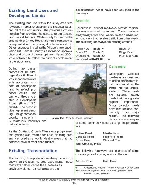
Collectors<br />
Description: Collector<br />
roadways are designed<br />
cal<br />
roads and direct the<br />
<br />
system. These roads<br />
are typically county<br />
roads that have greater<br />
regional importance.<br />
Minor collector roads<br />
have less regional con-<br />
<br />
roads 7 . The following<br />
Image 2-4: Route 31 arterial roadway<br />
roadways are examples<br />
tors:<br />
Collins Road Minkler Road<br />
<br />
Grove Road Steward Road<br />
Wolf Crossing Road<br />
The following roadways are examples of some<br />
commonly used existing minor collectors:<br />
Arbeiter Road Roth Road<br />
<br />
Resource Management <strong>Plan</strong> (LRMP) Updated 1999.