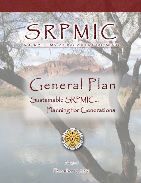
SRPMIC General Plan - Salt River Pima-Maricopa Indian Community
SRPMIC General Plan - Salt River Pima-Maricopa Indian Community
SRPMIC General Plan - Salt River Pima-Maricopa Indian Community

Create successful ePaper yourself
Turn your PDF publications into a flip-book with our unique Google optimized e-Paper software.
ACKNOWLEDGEMENTS<br />
<strong>Community</strong> Council<br />
Joni Ramos, President<br />
Leonard <strong>River</strong>s, Vice President<br />
Anthony Collins, Sr.,<br />
Diane Enos<br />
Selena Espinoza<br />
Grinelda Gates<br />
Ricardo Leonard<br />
Lynn Myore<br />
Dixie Padilla<br />
Land Management Board<br />
Emily Chiago<br />
Jacqueline Greyeyes<br />
Samia Hernandez<br />
Janet Johnson<br />
Lena Kontz,<br />
Yolanda Stacey<br />
Ronald White<br />
<strong>General</strong> <strong>Plan</strong> Steering Committee<br />
Gene Andreas<br />
Kent Andrews<br />
Vickie Andrews<br />
Christella Armijo<br />
Bruce Arnoldussen<br />
Karl Auerbach<br />
David Bunce<br />
Roberta Carlos<br />
Ron Chiago<br />
Daniel Daggett<br />
Robin Enos<br />
Larry Francis<br />
Robert Goodwin Sr.<br />
Robert Goodwin Jr.<br />
Lance Grey<br />
Stacey Gubser<br />
Toni Harvier<br />
Gardell Johnson<br />
M. John Landis<br />
Cathy Martinez<br />
Phil Matthews<br />
Claire Miller<br />
Cecelia Nash<br />
Crystal Orozco<br />
Dixie Padilla<br />
Bob Ramirez<br />
Russell Ray<br />
Leonard <strong>River</strong>s<br />
Joyce Sammaripa<br />
Donald Santeo<br />
Larry Schurz<br />
Allyson Thomas<br />
Huey Thomas<br />
Barrie Thomas<br />
Michael Washington<br />
Kelly Washington
Sustainable <strong>SRPMIC</strong> . . . <strong>Plan</strong>ning for Generations<br />
TABLE OF CONTENTS<br />
PREFACE ...............................................................................................................1<br />
GENERAL PLAN OVERVIEW.....................................................................................2<br />
Sustainable <strong>SRPMIC</strong> … <strong>Plan</strong>ning for Generations ..........................................2<br />
Relationship of the <strong>Plan</strong> to other <strong>Community</strong> Initiatives...................................3<br />
Process and Public Involvement ......................................................................4<br />
COMMUNITY VISION AND VALUES............................................................................5<br />
THE COMMUNITY SETTING ......................................................................................6<br />
GENERAL PLAN ELEMENTS.....................................................................................7<br />
1. LAND USE ELEMENT........................................................................................9<br />
Land Use Purpose Statement..........................................................................9<br />
Land Use Element Overview............................................................................9<br />
Goals and Policies .........................................................................................11<br />
<strong>Community</strong> <strong>Plan</strong>ning System................................................................11<br />
Residential Development......................................................................11<br />
People’s Village ....................................................................................12<br />
Environmentally Sensitive Areas ..........................................................12<br />
Culturally Sensitive Areas.....................................................................13<br />
Land Use Compatibility.........................................................................13<br />
<strong>General</strong> <strong>Community</strong> Design..................................................................13<br />
Industrial Development Design.............................................................15<br />
Environmentally Sensitive Design ........................................................15<br />
Land Use Map................................................................................................17<br />
Land Use Designations .............................................................................17<br />
People’s Village.........................................................................................18<br />
<strong>Pima</strong> Corridor ............................................................................................18<br />
2. TRANSPORTATION / CIRCULATION ELEMENT ..................................................23<br />
Transportation / Circulation Purpose Statement ............................................23<br />
Transportation / Circulation Element Overview..............................................23<br />
Roadways..................................................................................................23<br />
Transit .......................................................................................................23<br />
Bicycling and Pedestrians .........................................................................24<br />
Goals and Policies .........................................................................................24<br />
Roadway System..................................................................................24<br />
Transit Services....................................................................................25<br />
Non-Motorized Transportation..............................................................26<br />
Circulation <strong>Plan</strong> and Standards......................................................................26<br />
3. HOUSING ELEMENT .......................................................................................29<br />
Housing Purpose Statement ..........................................................................29<br />
Housing Element Overview............................................................................29<br />
Housing Projections..............................................................................30<br />
Goals and Policies .........................................................................................31<br />
New Housing ........................................................................................31<br />
Housing Rehabilitation and Preservation..............................................31<br />
List of Figures / List of Tables<br />
i
Sustainable <strong>SRPMIC</strong> . . . <strong>Plan</strong>ning for Generations<br />
4. NATURAL RESOURCES ELEMENT ...................................................................33<br />
Natural Resources Purpose Statement..........................................................33<br />
Natural Resources Element Overview ...........................................................33<br />
Goals and Policies .........................................................................................33<br />
Balanced Uses......................................................................................33<br />
Resource Extraction .............................................................................34<br />
Water Resources ..................................................................................34<br />
Range Management .............................................................................35<br />
Wildlife Preservation and Protection.....................................................35<br />
Solid Waste...........................................................................................35<br />
Air Quality .............................................................................................35<br />
5. PRESERVATION ELEMENT ..............................................................................37<br />
Preservation element Purpose Statement......................................................37<br />
Preservation Element Overview.....................................................................37<br />
Goals and Policies .........................................................................................37<br />
Historic and Archaeological Resources ................................................37<br />
Cultural Use..........................................................................................38<br />
6. COMMERCIAL DEVELOPMENT ELEMENT .........................................................41<br />
Commercial Development Purpose Statement ..............................................41<br />
Commercial Development Element Overview................................................41<br />
Goals and Policies .........................................................................................41<br />
Commercial Development ....................................................................41<br />
Commercial/Mixed-Use Design ............................................................42<br />
Commercial Corridor Land Use ............................................................42<br />
Commercial Corridor Natural Resources ..............................................43<br />
Commercial Corridor Environmental Education....................................44<br />
Commercial Corridor Resource Conservation ......................................44<br />
Commercial Corridor Circulation...........................................................44<br />
Commercial Corridor Recreation ..........................................................44<br />
Commercial Corridor <strong>Community</strong> Design .............................................45<br />
7. AGRICULTURAL DEVELOPMENT ELEMENT ......................................................47<br />
Agricultural Development Purpose Statement ...............................................47<br />
Agricultural Element Overview .......................................................................47<br />
Goals and Policies .........................................................................................47<br />
Agricultural Land Uses..........................................................................47<br />
Sustainable Agricultural Practices ........................................................48<br />
Agricultural Diversification ....................................................................48<br />
8. INFRASTRUCTURE DEVELOPMENT ELEMENT...................................................49<br />
Infrastructure Purpose Statement ..................................................................49<br />
Infrastructure Element Overview....................................................................49<br />
Water Supply and Distribution ...................................................................49<br />
Wastewater Collection and Treatment.......................................................50<br />
Stormwater / Drainage...............................................................................50<br />
Goals and Policies .........................................................................................51<br />
Water and Wastewater .........................................................................51<br />
Drainage and Stormwater Management ...............................................51<br />
Facility Cost and Operations.................................................................52<br />
List of Figures / List of Tables<br />
ii
Sustainable <strong>SRPMIC</strong> . . . <strong>Plan</strong>ning for Generations<br />
9. COMMUNITY FACILITIES ELEMENT..................................................................53<br />
<strong>Community</strong> Facilities Purpose Statement ......................................................53<br />
<strong>Community</strong> Facilities Element Overview........................................................53<br />
Recreation .................................................................................................53<br />
Police.........................................................................................................53<br />
Fire ............................................................................................................53<br />
Education ..................................................................................................53<br />
Telecommunications..................................................................................54<br />
Goals and Policies .........................................................................................54<br />
Recreation ............................................................................................54<br />
Health Care ..........................................................................................54<br />
<strong>Community</strong> Public Facilities..................................................................55<br />
Telecommunications.............................................................................55<br />
Energy ..................................................................................................55<br />
Education..............................................................................................56<br />
10. ECONOMIC DEVELOPMENT ELEMENT .............................................................57<br />
Economic Development Purpose Statement .................................................57<br />
Economic Development Element Overview ...................................................57<br />
Goals and Policies .........................................................................................57<br />
Economic Development <strong>Plan</strong>ning.........................................................57<br />
Development ........................................................................................58<br />
<strong>Community</strong> Economic Development.....................................................58<br />
11. GENERAL PLAN ADMINISTRATION..................................................................59<br />
<strong>General</strong> <strong>Plan</strong> Consistency Defined ................................................................59<br />
<strong>General</strong> <strong>Plan</strong> Amendments............................................................................59<br />
Annual <strong>General</strong> <strong>Plan</strong> Report ..........................................................................59<br />
Comprehensive <strong>General</strong> <strong>Plan</strong> Review ...........................................................60<br />
APPENDIX A: IMPLEMENTATION MEASURES ..........................................................61<br />
APPENDIX B: COMMERCIAL CORRIDOR VISION......................................................65<br />
The Vision for the <strong>Community</strong>........................................................................65<br />
How the Vision was Developed .................................................................65<br />
Components of the Vision .........................................................................66<br />
1. The <strong>Community</strong> as a Society................................................................66<br />
2. The <strong>Community</strong> as a Physical Place ....................................................67<br />
3. The <strong>Community</strong> as an Economic System.............................................68<br />
4. The <strong>Community</strong> as an Environmental System......................................69<br />
5. The <strong>Community</strong> as a Governmental Operation ....................................70<br />
6. The <strong>Community</strong> as a Symbol ................................................................71<br />
Epilogue ....................................................................................................72<br />
List of Figures / List of Tables<br />
iii
Sustainable <strong>SRPMIC</strong> . . . <strong>Plan</strong>ning for Generations<br />
LIST OF FIGURES<br />
Figure 1: <strong>SRPMIC</strong> Regional Location .................................................................. 6<br />
Figure 1-1: Land Use Map ..................................................................................21<br />
Figure 2-1: Circulation <strong>Plan</strong>.................................................................................27<br />
Figure 3-1: Home Site Distribution ......................................................................30<br />
LIST OF TABLES<br />
Table 1-1: Existing Land Use..............................................................................10<br />
Table 2-1: Circulation Map Classifications and Standards..................................26<br />
List of Figures / List of Tables<br />
iv
PREFACE/OVERVIEW/<br />
VISION AND VALUES/SETTING
Sustainable <strong>SRPMIC</strong> . . . <strong>Plan</strong>ning for Generations<br />
PREFACE<br />
Executive Order of President Rutherford B. Hayes established the <strong>Salt</strong> <strong>River</strong><br />
<strong>Pima</strong>-<strong>Maricopa</strong> <strong>Indian</strong> <strong>Community</strong> (<strong>SRPMIC</strong>) for the <strong>Pima</strong> and <strong>Maricopa</strong> people<br />
on June 4, 1879. Originally the land area was extensive. The <strong>Community</strong> size<br />
was dramatically reduced when non-<strong>Indian</strong> settlers objected to the <strong>Indian</strong>s<br />
having so much land.<br />
The <strong>Community</strong>’s traditional way of life was changed through the years by<br />
politics and lack of water. Despite agreements and court decisions, water was<br />
diverted from tribal farms making farming nearly impossible. The Dawes Act of<br />
1910 attempted to replace the centuries old system of family farms and individual<br />
allotments of land. These allotments were divided into 10<br />
acres below the Arizona Canal and 20 acres of<br />
secondary land above the canal, with the 20-acre parcels<br />
having no rights to irrigation water.<br />
To regain some control over its land on June 15, 1940,<br />
the <strong>SRPMIC</strong> adopted the <strong>Indian</strong> Reorganization Act.<br />
Over the next approximately 60 years, it established a<br />
sophisticated system of government, launched<br />
successful enterprises, and began rebuilding the<br />
<strong>Community</strong>.<br />
The <strong>SRPMIC</strong> has a long history of conducting and<br />
implementing planning efforts. It was discovered that<br />
during the early period of the <strong>SRPMIC</strong>’s history various forms of “<strong>Community</strong><br />
<strong>Plan</strong>ning” existed. These ranged from water committees to social functions<br />
undertaken by private organizations and religious groups. A more formal<br />
approach was evidenced in the meetings held at the old <strong>Community</strong> Hall on<br />
matters dealing with agriculture, law and order, and future use of <strong>Community</strong><br />
lands.<br />
In the 1950s, the <strong>Community</strong> initiated a more formal approach to “<strong>Community</strong><br />
<strong>Plan</strong>ning” by utilizing private and public agencies in preparing a direction for<br />
growth, economically and physically. With the assistance of a private consultant,<br />
the <strong>Community</strong> Council adopted a <strong>General</strong> Development <strong>Plan</strong> in the late 1960s.<br />
The 1970 <strong>SRPMIC</strong> <strong>General</strong> Development <strong>Plan</strong> documented the past efforts and<br />
provided guidance for future growth around a central theme “Looking Ahead.”<br />
The 1978 <strong>General</strong> Development <strong>Plan</strong> Update included a growth factor by<br />
requiring periodic review and allowing for amendments to reflect the changing<br />
times and priority of needs. The 1983 <strong>General</strong> Development <strong>Plan</strong> Update<br />
indicated major changes occurring and focused on the general direction for<br />
development of <strong>Community</strong> lands.<br />
Major <strong>Community</strong> development changes occurring on <strong>SRPMIC</strong> between 1983<br />
and 1988 prompted a plan update that was completed in December 1988. Some<br />
of these changes included increased number of home sites, water rights<br />
settlement, major roadway improvements, major enterprises established, and<br />
regional shopping center developed. The 1988 <strong>Plan</strong> served as a “policy guide<br />
and planning tool” to enhance decisions for future development.<br />
Preface<br />
1
Sustainable <strong>SRPMIC</strong> . . . <strong>Plan</strong>ning for Generations<br />
GENERAL PLAN OVERVIEW<br />
The <strong>Salt</strong> <strong>River</strong> <strong>Pima</strong>-<strong>Maricopa</strong> <strong>Indian</strong> <strong>Community</strong><br />
(<strong>SRPMIC</strong>) <strong>General</strong> <strong>Plan</strong> presents the desired future<br />
<strong>Community</strong> development, enhancement, and<br />
revitalization direction.<br />
The <strong>General</strong> <strong>Plan</strong> is the <strong>Community</strong>’s “blue print” for<br />
land use and development, as well as conservation and<br />
preservation; it serves as the basis for rational decisions<br />
regarding the <strong>Community</strong>’s long-term physical<br />
development and the protection of the <strong>Community</strong>’s<br />
natural and cultural resources. The <strong>General</strong> <strong>Plan</strong><br />
expresses the <strong>Community</strong>’s development goals and<br />
embodies public policy relative to the distribution of<br />
future land uses, both public and private. The goals,<br />
policies, and programs of the <strong>General</strong> <strong>Plan</strong> are intended<br />
to underlie most land use decisions. Preparing,<br />
adopting, implementing, and maintaining a <strong>General</strong> <strong>Plan</strong><br />
serves to:<br />
• Identify the <strong>Community</strong>’s land use, transportation, environmental,<br />
economic, and social goals and policies as they relate to land use and<br />
development.<br />
• Provide a basis for decision-making, including decisions on development<br />
approvals.<br />
• Provide <strong>Community</strong> members with opportunities to participate in the<br />
planning and decision making processes of the <strong>Community</strong>.<br />
• Inform <strong>Community</strong> members, developers, decision makers, and adjacent<br />
communities of the ground rules that govern development within the<br />
<strong>Community</strong>.<br />
<strong>General</strong> plans typically have three defining qualities. First, they are general in<br />
nature, providing general guidance for the future, particularly regarding growth<br />
and development. More precise direction is provided in implementation<br />
documents and plans, such as annexations, zoning codes and other ordinances,<br />
design regulations, annual budgets, and capital improvements program (see<br />
discussion below). Second, general plans are comprehensive in scope,<br />
addressing a broad range of environmental, social, and economic factors that<br />
affect how communities change over time. These factors include land use and<br />
circulation, environment and natural resources, economic and fiscal conditions,<br />
as well as a host of others. These factors should be addressed in an interrelated<br />
and, wherever possible, consistent manner. Third, general plans address the<br />
long-range future of communities. While they may take immediate concerns into<br />
consideration, they focus primarily on the future.<br />
SUSTAINABLE <strong>SRPMIC</strong> … PLANNING FOR GENERATIONS<br />
Through the course of preparing the <strong>General</strong> <strong>Plan</strong>, the <strong>Community</strong> focused on<br />
the theme of sustainability. There is widespread recognition in the <strong>Community</strong><br />
that the <strong>General</strong> <strong>Plan</strong> must establish a framework of sustainability to ensure that<br />
current and future generations can sustain the social, economic, and<br />
<strong>General</strong> <strong>Plan</strong> Overview<br />
2
Sustainable <strong>SRPMIC</strong> . . . <strong>Plan</strong>ning for Generations<br />
environmental health of the <strong>Community</strong>. This will entail continuous review and<br />
evaluation to ensure that the actions taken in implementing this <strong>Plan</strong> are<br />
consistent with this intent, and that the pre-eminent focus of the <strong>Plan</strong> should<br />
always be on the needs of <strong>Community</strong> members, both now and in the future.<br />
RELATIONSHIP OF THE PLAN TO OTHER COMMUNITY INITIATIVES<br />
The <strong>General</strong> <strong>Plan</strong> both informs and is informed by a variety of other <strong>Community</strong><br />
policies, standards, and programs that address growth and resource<br />
preservation. These include initiatives focused directly on planning (e.g., Zoning<br />
Ordinance, Design Guidelines, and Neighborhood <strong>Plan</strong>s) and those focused on<br />
the functional systems necessary to support development in the <strong>Community</strong>,<br />
particularly infrastructure plans. <strong>General</strong>ly, these other initiatives address their<br />
subject matter in considerably more detail than would be appropriate for the<br />
<strong>General</strong> <strong>Plan</strong>. As these other policies, standards, and programs are developed<br />
and refined, they will take their broad direction from the <strong>General</strong> <strong>Plan</strong>, with the<br />
intent of establishing consistency among the documents that guide development<br />
and resource preservation in the <strong>Community</strong>. Conversely, as the <strong>General</strong> <strong>Plan</strong> is<br />
reviewed and updated over time, it will take direction from these more focused<br />
processes.<br />
<strong>SRPMIC</strong> <strong>General</strong> <strong>Plan</strong><br />
Overall Policy Direction<br />
Zoning Ordinance<br />
Specific Standards for Development<br />
Neighborhood <strong>Plan</strong>s<br />
People’s Village<br />
Design Guidelines<br />
Development Form<br />
(Streetscape, Architectural Character)<br />
Functional System <strong>Plan</strong>s<br />
Transportation <strong>Plan</strong><br />
Water and Wastewater <strong>Plan</strong><br />
Stormwater <strong>Plan</strong><br />
Perhaps the most often confused or questioned among these relationships is the<br />
connection between the <strong>General</strong> <strong>Plan</strong> and zoning. As stated above, the <strong>General</strong><br />
<strong>Plan</strong> is a general policy document that guides community growth and<br />
development decisions. The Zoning Ordinance and associated zoning maps, are<br />
precise legal instruments that define the permitted land uses and associated<br />
performance standards for all property under the <strong>Community</strong>’s jurisdiction. In<br />
essence, the <strong>General</strong> <strong>Plan</strong> establishes the policy framework upon which the<br />
zoning prescriptions are based … and with which they must be consistent.<br />
<strong>General</strong> <strong>Plan</strong> Overview<br />
3
Sustainable <strong>SRPMIC</strong> . . . <strong>Plan</strong>ning for Generations<br />
PROCESS AND PUBLIC INVOLVEMENT<br />
The development of <strong>General</strong> <strong>Plan</strong> included extensive<br />
<strong>Community</strong> involvement over a three-year period.<br />
Involvement by <strong>Community</strong> Members was of the utmost<br />
priority. Many different opportunities were provided<br />
throughout the process for <strong>Community</strong> Members to voice<br />
their opinions and desires about the future <strong>Community</strong><br />
direction. The process began with a <strong>Community</strong>-wide event<br />
with a chicken scratch dance and band. Several other<br />
events held included <strong>Community</strong>-wide meetings, individual<br />
meetings with key stakeholders and the Land Management<br />
Board, District Workshops, <strong>Community</strong> Council<br />
presentations, meetings with the Elder and Disabled<br />
Committee, the Youth Council, and junior and senior high<br />
school students. In total, the <strong>Community</strong> sponsored over<br />
40 public meetings during the course of preparing the<br />
<strong>General</strong> <strong>Plan</strong>.<br />
In addition to these meetings, a community survey was developed in the fall of<br />
2002 and sent to 4,893 community members over 14 years of age. 560 surveys<br />
were returned for a response rate of 12.2 percent. <strong>Community</strong> members were<br />
asked to respond to 23 statements. The results of the survey were used to assist<br />
in developing <strong>General</strong> <strong>Plan</strong> content. Among the highlights of the survey results<br />
were the following:<br />
• Pedestrians and bicyclists do not feel safe in the <strong>Community</strong><br />
• Mixed opinions about additional commercial development along the<br />
Beeline Highway<br />
• Commercial development should be limited to the <strong>Pima</strong> Freeway<br />
Corridor<br />
• “Cut-through” traffic a major concern that must be dealt with<br />
• There are not enough parks and recreation facilities in the <strong>Community</strong><br />
• There should be an additional connection between Lehi and the rest of<br />
the <strong>Community</strong><br />
• Agricultural land should be protected if possible<br />
• More golf courses or resorts are not desired<br />
• A mix of housing needs to be developed to accommodate all Members<br />
• A need for a non-motorized trail system<br />
• Transportation for seniors and the disabled need to be available<br />
• A centrally located “Town Center” should be developed to serve<br />
members of the <strong>Community</strong><br />
• Open desert areas should be protected from development<br />
Additionally, extensive work was conducted by a Steering Committee composed<br />
of <strong>Community</strong> Members and <strong>Community</strong> Staff that worked with the consultants<br />
hired to develop the <strong>General</strong> <strong>Plan</strong>. The Steering Committee met regularly over a<br />
three-year timeframe.<br />
<strong>General</strong> <strong>Plan</strong> Overview<br />
4
Sustainable <strong>SRPMIC</strong> . . . <strong>Plan</strong>ning for Generations<br />
COMMUNITY VISION AND VALUES<br />
Through the course of the outreach efforts conducted for the <strong>General</strong> <strong>Plan</strong><br />
update, the <strong>Community</strong> identified a series of recurring themes or core values that<br />
exemplify <strong>SRPMIC</strong>. These themes or values collectively constitute the Vision for<br />
the future. The <strong>SRPMIC</strong> <strong>Community</strong> Council adopted the following <strong>Community</strong><br />
Vision (2003) that provides the <strong>General</strong> <strong>Plan</strong>’s framework:<br />
• The vision of the <strong>Salt</strong> <strong>River</strong> <strong>Pima</strong>-<strong>Maricopa</strong> <strong>Indian</strong> <strong>Community</strong> is to<br />
improve and preserve the quality of life for its peoples. The ongoing<br />
commitment will include the promotion and preservation of selfdetermination<br />
and sovereignty, well-planned economic growth leading<br />
to financial security, a spiritually, and physically healthy environment<br />
and a dedication to education.<br />
• This vision includes the preservation of our values and traditions and<br />
the passing of our ancestors’ wisdom to future generations. While<br />
clearly involved in many aspects of the <strong>Community</strong>, our Elders fulfill an<br />
especially important role regarding the preservation of values and<br />
traditions.<br />
• Finally, this vision includes endless generations of Onk Akimel<br />
O’Odham and Xalychidom Pipaash embracing the <strong>Salt</strong> <strong>River</strong> <strong>Pima</strong>-<br />
<strong>Maricopa</strong> <strong>Indian</strong> <strong>Community</strong> with dignity and pride.<br />
These statements serve as the philosophical foundation of this <strong>General</strong> <strong>Plan</strong><br />
(“the <strong>Plan</strong>”) and are reflected in the goals, policies, and implementation<br />
measures included in the <strong>Plan</strong>.<br />
<strong>Community</strong> Vision and Values<br />
5
Sustainable <strong>SRPMIC</strong> . . . <strong>Plan</strong>ning for Generations<br />
THE COMMUNITY SETTING<br />
The <strong>SRPMIC</strong> consists of approximately 54,000 acres of land, 81 square miles,<br />
lying to the east of the cities of Scottsdale and Phoenix and north of the cities of<br />
Mesa and Tempe, as shown in Figure 1. The general configuration of the land<br />
includes an area that extends from approximately six to nine miles in a northsouth<br />
direction and approximately 14 miles in an east-west direction.<br />
The <strong>Salt</strong> <strong>River</strong> and Lehi Districts are separated by the <strong>Salt</strong> <strong>River</strong> with the Lehi<br />
District south of the <strong>River</strong>, north of McDowell Road to the west of Gilbert Road.<br />
The two electoral districts are further divided into seven Council districts. One<br />
Council member represents each of these districts except for the Lehi District,<br />
which has two Council representatives.<br />
There are very few physical barriers to development in the planning area’s<br />
western two-thirds. The elevation begins to increase east of Gilbert Road,<br />
making development less practical. Furthermore, much of the eastern part of the<br />
<strong>Community</strong>, including the Red Mountain and Saddleback Mountain areas, hold<br />
substantial cultural significance, and thus are not considered suitable for<br />
development. The eastern extent of the <strong>Community</strong> is also rich with Sonoran<br />
Desert vegetation, including native Saguaro and other cacti and Ironwood trees.<br />
Figure 1: <strong>SRPMIC</strong> Regional Location<br />
<strong>Community</strong> Setting<br />
6
GENERAL PLAN ELEMENTS
Sustainable <strong>SRPMIC</strong> . . . <strong>Plan</strong>ning for Generations<br />
GENERAL PLAN ELEMENTS<br />
The balance of this document consists of the <strong>General</strong> <strong>Plan</strong> “elements,” which are<br />
the <strong>Community</strong>’s official statements of land use and development policy. These<br />
elements are as follows:<br />
1. Land Use Element: Establishes the framework for orderly physical<br />
development and environmental protection.<br />
2. Transportation/Circulation Element: Provides for a multimodal<br />
transportation system for the safe and efficient movement of <strong>Community</strong><br />
Members and visitors.<br />
3. Housing Element: Promotes a mix of housing choices for <strong>Community</strong><br />
Members while enhancing housing opportunities.<br />
4. Natural Resources Element: Outlines the <strong>Community</strong>’s policy<br />
commitment to use the <strong>Community</strong>’s natural resources for the long-term<br />
well-being of current and future <strong>Community</strong> Members.<br />
5. Preservation Element: Provides direction to preserve and maintain the<br />
<strong>Community</strong>’s cherished cultural resources.<br />
6. Commercial Development Element: Provides guidance for developing<br />
and maintaining the <strong>Community</strong>’s commercial areas, particularly the<br />
<strong>Pima</strong> Corridor.<br />
7. Agricultural Development Element: Reinforces the <strong>Community</strong>’s<br />
commitment to continued diversification and enhancement of agriculture<br />
and agri-business opportunities.<br />
8. Infrastructure Development Element: Provides direction to ensure<br />
that adequate infrastructure is available to support current and future<br />
<strong>Community</strong> Members and enterprises.<br />
9. <strong>Community</strong> Facilities Element: Provides direction for providing<br />
services and developing <strong>Community</strong> amenities and facilities that<br />
enhance the quality of life for <strong>Community</strong> Members.<br />
10. Economic Development Element: Presents strategies to expand the<br />
<strong>Community</strong>’s economy to ensure sustainable development that raises<br />
the standard of living for <strong>Community</strong> Members.<br />
11. <strong>General</strong> <strong>Plan</strong> Administration: Describes how the plan will be<br />
administered over time, including such issues as exceptions,<br />
amendments, and periodic reporting on the progress of the <strong>Plan</strong>’s<br />
implementation.<br />
Each of these elements includes a series of goals that are related to key topics.<br />
Under each goal is a set of policies intended to guide achievement of that goal.<br />
At the end of each element are several action/implementation measures that<br />
identify the actions necessary to effectively implement the <strong>General</strong> <strong>Plan</strong>. The<br />
following definitions describe the nature of the statements of goals, policies, and<br />
implementation measure as they are used in this document:<br />
<strong>General</strong> <strong>Plan</strong> Elements<br />
7
Sustainable <strong>SRPMIC</strong> . . . <strong>Plan</strong>ning for Generations<br />
• Goal: The ultimate purpose of an effort stated in a way that is general in<br />
nature and immeasurable. Goals are numbered with two-digit labels.<br />
The first digit corresponds with the element (e.g., Land Use is the first<br />
element, so all goals begin with 1.) and the second digit indicates the<br />
sequence within each element. Thus, the first goal in the Land Use<br />
Element is labeled 1.1.<br />
• Policy: A specific statement in text or diagram guiding action and<br />
implying clear commitment. Policies are nested under each goal and<br />
assigned corresponding three digit labels that correspond with their goal<br />
and the sequence of policies under that goal. Thus, the first policy under<br />
goal 4.1 would be 4.1.1.<br />
• Implementation Measure: An action, procedure, program, or technique<br />
that carries out <strong>General</strong> <strong>Plan</strong> policy. Implementation Measures are<br />
presented under the goals with which they are most closely associated,<br />
but they are numbered sequentially throughout the entire document,<br />
with a label that begins with IM. Thus, the 25 th implementation measure<br />
in the <strong>Plan</strong> is labeled IM 25.<br />
<strong>General</strong> <strong>Plan</strong> Elements<br />
8
1. LAND USE ELEMENT
Sustainable <strong>SRPMIC</strong> . . . <strong>Plan</strong>ning for Generations<br />
1. LAND USE ELEMENT<br />
LAND USE PURPOSE STATEMENT<br />
The Land Use Element is the overall set of guiding principles for the <strong>SRPMIC</strong><br />
<strong>General</strong> <strong>Plan</strong>. It is intended to lay the foundation for the orderly physical<br />
development and environmental protection of the <strong>Community</strong> where desired and<br />
protect areas where the <strong>Community</strong> would like to see no development occur. It<br />
provides a complementary mix of uses to accommodate residents, public<br />
institutions, commerce, and traditional cultural activities.<br />
The Land Use Element functions as a guide for <strong>Community</strong> officials (both elected<br />
and appointed), the general public, the development community, and other<br />
interested parties as to the ultimate pattern of development. The Land Use<br />
Element has the broadest scope of the elements and plays a central role in<br />
correlating all land use issues into a set of coherent development policies that<br />
relate directly to the other plan elements.<br />
LAND USE ELEMENT OVERVIEW<br />
The surrounding region has experienced tremendous growth reaching over 3<br />
million people. This growth has impacted every community and individual in the<br />
Phoenix metropolitan area. The completion of the Loop 101 Freeway on the<br />
<strong>SRPMIC</strong>’s western border has created tremendous economic opportunities for<br />
the <strong>Community</strong> and landowners but also brings environmental and social issues.<br />
The same can be said for the completion of the Loop 202 on the southern border<br />
of the <strong>Community</strong> adjacent to the Lehi area.<br />
The initiation of casino gaming and the construction of two casinos in the<br />
<strong>Community</strong>, as well as the completion of the Loop 101 Freeway, have brought<br />
employment and revenues, but also traffic and social issues, that could not have<br />
been anticipated a decade ago. The Talking Stick golf facility provides a worldclass<br />
destination for visitors, but it has also contributed to<br />
traffic in the area. In addition, continued development in<br />
Scottsdale and Fountain Hills has added pressure to<br />
develop <strong>Community</strong> lands, particularly along the <strong>Pima</strong><br />
Corridor.<br />
Currently, over 90 percent of the over 54,632 acres of<br />
land in <strong>SRPMIC</strong> is classified as either open space (which<br />
includes agriculture) or vacant. Commercial and<br />
industrial development has been limited to the periphery<br />
of the <strong>Community</strong>, along major transportation corridors.<br />
This emphasizes the very rural character of the<br />
<strong>Community</strong>. Table 1-1 shows the breakdown of existing<br />
land uses throughout the <strong>Community</strong>.<br />
Land Use Element<br />
9
Sustainable <strong>SRPMIC</strong> . . . <strong>Plan</strong>ning for Generations<br />
Table 1-1: Existing Land Use<br />
Land Code-<strong>General</strong> Acres Percentage<br />
Residential 1,641 3.0%<br />
Commercial 458 0.8%<br />
Industrial 6 >0.1%<br />
Office 22 >0.1%<br />
Public Use 430 0.8%<br />
Transportation, Canal, Utility 819 1.5%<br />
Open Space 45,477 83.2%<br />
Mining & Landfill 1,819 3.3%<br />
Vacant 3,960 7.3%<br />
Total 54,632 100.0%<br />
Land Use Element<br />
10
Sustainable <strong>SRPMIC</strong> . . . <strong>Plan</strong>ning for Generations<br />
GOALS AND POLICIES<br />
COMMUNITY PLANNING SYSTEM<br />
Goal 1.1<br />
To improve community planning capabilities and capacity<br />
within <strong>Community</strong> government.<br />
1.1.1 Maintain high quality, state-of-the-art information systems within<br />
<strong>Community</strong> government to support planning analysis and decisionmaking.<br />
1.1.2 Coordinate the <strong>Community</strong>’s planning activities among departments that<br />
are responsible for planning, improving, and maintaining the<br />
<strong>Community</strong>’s infrastructure and facilities.<br />
1.1.3 Maintain consistency between the <strong>General</strong> <strong>Plan</strong> and the <strong>Community</strong>’s<br />
Zoning Ordinance.<br />
1.1.4 Maintain a current land use inventory.<br />
1.1.5 Promote involvement of <strong>Community</strong> members in the land use and<br />
development decision-making process by ensuring effective use of<br />
mechanisms that maximize opportunities for direct participation.<br />
1.1.6 Monitor development along the community boundary to ensure that<br />
encroachment from adjacent communities does not occur.<br />
ACTIONS/IMPLEMENTATION MEASURES<br />
IM 1.<br />
IM 2.<br />
IM 3.<br />
IM 4.<br />
Update the <strong>Community</strong>’s Zoning Ordinance to ensure consistency with<br />
the <strong>General</strong> <strong>Plan</strong>.<br />
Enhance the <strong>Community</strong> Capital Improvements <strong>Plan</strong> (CIP) to identify<br />
needed infrastructure and facilities improvements and potential funding<br />
sources and programs and establish an implementation time-line.<br />
Prepare and maintain an up-to-date land use inventory using the<br />
<strong>Community</strong>’s GIS.<br />
Continue to survey new land purchases to maintain an up-to-date<br />
understanding of the <strong>Community</strong> boundaries and respond to specific<br />
encroachment concerns along the <strong>Community</strong> boundaries.<br />
RESIDENTIAL DEVELOPMENT<br />
Goal 1.2<br />
To identify land suitable for residential development to<br />
accommodate the housing needs of <strong>Community</strong> members.<br />
1.2.1 Designate sufficient land in appropriate locations to accommodate the<br />
development of housing to accommodate the needs of <strong>Community</strong><br />
members, including “life-cycle” opportunities ranging from starter<br />
homes, to multi-family housing, to large-lot rural housing, to congregate<br />
care facilities for the elderly.<br />
Land Use Element<br />
11
Sustainable <strong>SRPMIC</strong> . . . <strong>Plan</strong>ning for Generations<br />
1.2.2 Seek opportunities to assemble <strong>Community</strong>-owned and allotted parcels<br />
to accommodate viable subdivision developments to accommodate the<br />
housing needs of <strong>Community</strong> members.<br />
1.2.3 Support strategies to provide for land ownership or long-term leases to<br />
enable homeowners to obtain financing.<br />
1.2.4 <strong>Plan</strong> for and develop infrastructure in appropriate areas of the<br />
<strong>Community</strong> to promote quality residential development.<br />
ACTIONS/IMPLEMENTATION MEASURES<br />
IM 5.<br />
Develop a strategy for prioritization of purchases of allotted land from<br />
willing landowners.<br />
PEOPLE’S VILLAGE<br />
Goal 1.3<br />
To promote the development of People’s Village as a<br />
<strong>Community</strong>-oriented focal point of activity for <strong>Community</strong><br />
members.<br />
1.3.1 <strong>Plan</strong> for <strong>Community</strong> involvement and input for the People’s Village<br />
areas throughout the planning and design process.<br />
1.3.2 Encourage assembly of land within the People’s Village.<br />
1.3.3 Support the development of local services in the People’s Village, with<br />
an emphasis on opportunities for exchange of goods and services<br />
among <strong>Community</strong> members.<br />
1.3.4 Encourage the development of multi-modal connections within the<br />
People’s Village, including sidewalks and pathways to provide access to<br />
and from trails for non-motorized transportation.<br />
1.3.5 Support the efficient provision of utilities and other services within the<br />
People’s Village.<br />
ACTIONS/IMPLEMENTATION MEASURES<br />
IM 6.<br />
Develop an area plan for People’s Village.<br />
ENVIRONMENTALLY SENSITIVE AREAS<br />
Goal 1.4<br />
To protect environmentally sensitive areas in the <strong>Community</strong>.<br />
1.4.1 Ensure that new development does not damage or compromise the<br />
value of environmentally sensitive areas of the <strong>Community</strong>.<br />
1.4.2 Protect open space areas from development.<br />
1.4.3 Require sand and gravel operations to leave excavation areas with<br />
slopes that can be revegetated.<br />
Land Use Element<br />
12
Sustainable <strong>SRPMIC</strong> . . . <strong>Plan</strong>ning for Generations<br />
ACTIONS/IMPLEMENTATION MEASURES<br />
IM 7.<br />
IM 8.<br />
Develop a Master <strong>Plan</strong> for the <strong>Salt</strong> <strong>River</strong> corridor area.<br />
Adopt and maintain preservation regulations to govern land uses in areas<br />
designated as preserves and other culturally and environmentally<br />
sensitive areas. This should include consideration of appropriate levels of<br />
access to the <strong>Community</strong>’s preserve areas.<br />
CULTURALLY SENSITIVE AREAS<br />
Goal 1.5<br />
To protect culturally sensitive areas in the <strong>Community</strong>.<br />
1.5.1 Ensure that new development does not damage or compromise the<br />
value of areas of cultural significance in the <strong>Community</strong>.<br />
1.5.2 Engage <strong>Community</strong> members, as appropriate, when there is potential<br />
development near sacred or historic areas in the <strong>Community</strong>.<br />
LAND USE COMPATIBILITY<br />
Goal 1.6<br />
To avoid or mitigate incompatibility between land uses in the<br />
<strong>Community</strong>.<br />
1.6.1 Ensure the use of effective buffering techniques adjacent to the landfill<br />
and sand and gravel mining operations to protect adjacent development<br />
and open space areas.<br />
1.6.2 Ensure that existing residential areas are adequately protected from<br />
encroachment by incompatible uses.<br />
1.6.3 Ensure that the viability of existing commercial and industrial operations<br />
is not compromised by introduction of incompatible uses.<br />
1.6.4 Encourage the orderly and efficient placement of homesites at the edge,<br />
rather than in the middle, of agricultural fields and in locations with<br />
convenient access to utilities and roadways,.<br />
ACTIONS/IMPLEMENTATION MEASURES<br />
IM 9.<br />
Develop buffering standards for commercial, industrial, and retail<br />
developments to ensure compatibility with adjacent development and<br />
open space areas.<br />
GENERAL COMMUNITY DESIGN<br />
Goal 1.7<br />
To ensure that the built environment is aesthetically pleasing<br />
and compatible with the natural surroundings and <strong>Pima</strong>-<br />
<strong>Maricopa</strong> cultural values.<br />
1.7.1 Maintain development and design guidelines that ensure high quality<br />
design in all new and renovated development in the <strong>Community</strong>.<br />
Land Use Element<br />
13
Sustainable <strong>SRPMIC</strong> . . . <strong>Plan</strong>ning for Generations<br />
1.7.2 Promote architectural themes and project site design that<br />
reflect <strong>Pima</strong>-<strong>Maricopa</strong> cultural values and blend the built<br />
environment with natural surroundings.<br />
1.7.3 Require new development projects to explore solutions<br />
that employ natural materials and prohibit designs that<br />
channelize watercourses except where extreme threats<br />
to public safety would exist if the watercourse were not<br />
channelized.<br />
1.7.4 Require all new development to employ design strategies<br />
to reduce heat and glare impacts.<br />
1.7.5 Require that all development proposals depict an<br />
arrangement of and massing of buildings and/or<br />
arrangement of lots to minimize impacts on views from adjacent<br />
properties and streets and from properties and streets internal to the<br />
proposed project while providing privacy for residents.<br />
1.7.6 Require that all development proposals employ design strategies that<br />
minimize changes to existing topography and the disturbance of existing<br />
vegetation.<br />
1.7.7 Require that buildings be designed with recognition that all sides of the<br />
buildings, including the roofs, may affect their surroundings.<br />
1.7.8 In order to maximize integration of the built environment with the natural<br />
environment and to minimize distractions of the built environment,<br />
require all new development proposals to incorporate means of<br />
reducing the apparent size and bulk of buildings.<br />
1.7.9 Require that all landscape improvements adhere to the following<br />
general guidelines:<br />
• Maintain a predominantly natural Sonoran Desert image<br />
and conserving water resources;<br />
• Preserve, restore, and enhance the ecological and scenic<br />
qualities of the natural landscape;<br />
• Mitigate negative visual impacts of buildings and parking<br />
lots;<br />
• Add aesthetic charm, interest and character; and<br />
• Improve the functional use of a site.<br />
1.7.10 Require that all new development proposals consider existing<br />
landscaping within 400 feet of the project site to provide and<br />
maintain landscape continuity within the <strong>Community</strong>.<br />
ACTIONS/IMPLEMENTATION MEASURES<br />
IM 10.<br />
IM 11.<br />
Update the <strong>Community</strong>’s Development and Design Guidelines and design<br />
review procedures.<br />
Prepare informational material that describes the <strong>Community</strong>’s culturallybased<br />
design expectations to prospective developers.<br />
Land Use Element<br />
14
Sustainable <strong>SRPMIC</strong> . . . <strong>Plan</strong>ning for Generations<br />
INDUSTRIAL DEVELOPMENT DESIGN<br />
Goal 1.8<br />
To encourage human-scale design elements in industrial and<br />
large-scale commercial developments.<br />
1.8.1 Promote development projects that minimize the perceived size and<br />
scale of large projects through building massing and organization; color<br />
and material variation; and landscaping.<br />
1.8.2 Encourage the integration of small-scale, pedestrian-oriented<br />
commercial services into industrial areas.<br />
1.8.3 Encourage industrial and large-scale commercial developments<br />
to employ site design techniques that minimize the perceived<br />
dominance of surface parking areas.<br />
1.8.4 Encourage site design, internal street layout, and connections<br />
to adjacent areas that accommodate the needs of motorists,<br />
pedestrians, bicyclists, transit users, and commercial freight<br />
services.<br />
1.8.5 Require new industrial and large-scale commercial projects to<br />
incorporate design features that respect the scale of existing<br />
adjacent buildings.<br />
ENVIRONMENTALLY SENSITIVE DESIGN<br />
Goal 1.9<br />
To achieve environmental stewardship in the design and<br />
construction of all public and private projects.<br />
1.9.1 Incorporate the principles of Green Building to create environmentally<br />
responsible, profitable, and healthy places to live and work. This should<br />
include the following:<br />
• Sustainable sites (brownfields, site disturbance, stormwater<br />
management)<br />
• Water efficiency (efficient landscaping, use reduction)<br />
• Energy and atmosphere (energy performance, renewable energy,<br />
green power)<br />
• Materials and resources (building reuse, recyclable materials, local<br />
materials)<br />
• Indoor environmental quality (low-emitting materials, daylight and<br />
views)<br />
• Innovation and design process (creative approach, key challenges<br />
resolved)<br />
• Minimization of the “heat island” effect<br />
1.9.2 Actively support the achievement of the LEED (Leadership in Energy<br />
and Environmental Design) Green Building Rating System or an<br />
equivalent system to develop high performance, sustainable buildings<br />
and homes.<br />
Land Use Element<br />
15
Sustainable <strong>SRPMIC</strong> . . . <strong>Plan</strong>ning for Generations<br />
1.9.3 Promote site planning and architectural design that reduces heating and<br />
cooling demands, provides more comfortable indoor and outdoor living<br />
spaces, and avoids blocking or reflecting sun on adjacent public spaces<br />
or buildings.<br />
1.9.4 Ensure that new development provides adequate lighting levels to meet<br />
the safety and security needs of the <strong>Community</strong>.<br />
1.9.5 Encourage lighting design that minimizes light pollution and maintains<br />
visibility of stars at night.<br />
ACTIONS/IMPLEMENTATION MEASURES<br />
IM 12.<br />
IM 13.<br />
IM 14.<br />
Establish a Green Building Program within the <strong>Community</strong> government to<br />
provide guidance to the development community concerning sustainable<br />
design.<br />
Prepare and adopt lighting standards that address safety, security, and<br />
light pollution, including “dark sky” provisions for appropriate areas of the<br />
<strong>Community</strong>.<br />
Organize and manage a <strong>Community</strong>-based group to initiate and monitor<br />
sustainability programs and regulations and to assist in educating<br />
<strong>Community</strong> members concerning such programs and regulations.<br />
Land Use Element<br />
16
Sustainable <strong>SRPMIC</strong> . . . <strong>Plan</strong>ning for Generations<br />
LAND USE MAP<br />
The Land Use Map for the <strong>General</strong> <strong>Plan</strong> depicts the proposed general uses of<br />
land within the <strong>SRPMIC</strong>. It functions as official <strong>Community</strong> policy on the<br />
allocation and distribution of different land uses. The pattern of land uses is<br />
shown on the Land Use Map by means of various land use designations, each of<br />
which denotes specific types of land use. The boundary lines between land use<br />
designations are shown as precisely as possible, and generally follow property<br />
lines and/or roads. The <strong>Community</strong>’s Zoning Map implements the <strong>General</strong> <strong>Plan</strong><br />
land use designations by ordinance at a much more detailed, parcel-specific<br />
level and reflects existing development entitlements.<br />
LAND USE DESIGNATIONS<br />
The Land Use Map of this <strong>General</strong> <strong>Plan</strong> uses twelve land use designations to<br />
depict the types of land uses that are allowed. Following are brief descriptions of<br />
the intent of each of the land use designations appearing on the Land Use Map.<br />
The Land Use Map (Figure 1-1) designates land within the <strong>Community</strong> according<br />
to the use designations summarized in Table 1-2.<br />
Table 1-2: Land Use Designations: Permitted Uses<br />
Land Use<br />
Designation<br />
Permitted Uses<br />
Development<br />
Standards Acres<br />
% of<br />
Total<br />
Agricultural / Low This designation is intended to accommodate agricultural uses and Up to 3.0 du/ac 12,857 23.6%<br />
Density Residential the lowest density residential development.<br />
Medium Density Intended for a range of residential uses, including single-family Up to 8.0 du/ac 1,519 2.8%<br />
Residential<br />
homes, town homes, condominiums, or apartments.<br />
High Density<br />
Intended for multi-family units such as town homes,<br />
Up to 12.0 35 0.1%<br />
Residential<br />
condominiums, or apartments.<br />
du/ac<br />
Mixed Use Commercial An area that will have a mix of uses to include office, commercial,<br />
medical, hotel/resort, casinos, restaurants, entertainment,<br />
FAR 0.25 to<br />
0.45 4,562 8.4%<br />
warehousing, and light industrial,<br />
Neighborhood Consists of small commercial operations including convenience FAR 0.25<br />
Commercial<br />
stores, gas stations, fast food restaurants, and small shops.<br />
136 0.2%<br />
Neighborhood Commercial centers typically range from 10 to 20<br />
acres.<br />
Industrial<br />
Intensive business uses such as mining, construction yards, heavy FAR 0.05 0 0.0%<br />
manufacturing, and landfill operations that involve noise, light,<br />
heavy truck traffic, and potential three-shift activities.<br />
Public<br />
Areas containing public, governmental, or quasi-governmental<br />
732 1.3%<br />
uses including schools and other educational facilities.<br />
Natural Resource Important <strong>Community</strong> land resources that may be in current use<br />
3,031 5.6%<br />
for other purposes but eventually desired to be returned to their<br />
natural state.<br />
Open Space<br />
Areas in the <strong>Community</strong> where no building or development should<br />
20,119 36.9%<br />
occur.<br />
Preserve<br />
Sacred and/or environmentally sensitive areas that are to be<br />
10,891 20.0%<br />
protected from human incursion.<br />
Recreation Areas that contain recreation sites such as golf courses and parks. 670 1.2%<br />
Total 54,553 100.0%<br />
Land Use Element<br />
17
Sustainable <strong>SRPMIC</strong> . . . <strong>Plan</strong>ning for Generations<br />
PEOPLE’S VILLAGE<br />
Perhaps the most central theme of this <strong>General</strong> <strong>Plan</strong> is the desire<br />
of the <strong>Community</strong> to enhance its wellbeing while preserving and<br />
maintaining the cultural values that unify the <strong>Community</strong>’s<br />
members. To this end, the Land Use Map identifies an area called<br />
“People’s Village.” As stated in Goal 1.3 on page 12 of this <strong>Plan</strong>,<br />
the People’s Village is intended to be a <strong>Community</strong>-oriented focal<br />
point of activity for <strong>Community</strong> members. The Village already<br />
includes a mixture of residential and <strong>Community</strong> uses, including the<br />
educational complex. In the future, commercial businesses<br />
operated by <strong>Community</strong> members and geared toward the needs of<br />
<strong>Community</strong> members will be added, along with additional housing<br />
opportunities and public facilities and services, including new<br />
recreational facilities. The commercial development opportunities in<br />
People’s Village will complement other opportunities for <strong>Community</strong><br />
member-owned businesses elsewhere in the community.<br />
PIMA CORRIDOR<br />
In April 2006, the <strong>Community</strong> Council approved the parameters of the <strong>Pima</strong><br />
Corridor. This approval followed-up on the December 2005 election that changed<br />
maximum permitted floor-area ratio (FAR) to 0.45 and increased the maximum<br />
height of buildings in the <strong>Pima</strong> Corridor to 80 feet (6 stories), without a variance.<br />
The election did not define the “<strong>Pima</strong> Corridor” area, so the <strong>Community</strong> Council<br />
clarified the issue through its April 2006 action. The <strong>Community</strong> hosted four<br />
<strong>Community</strong> meetings in Lehi and <strong>Salt</strong> <strong>River</strong> so that Council could hear<br />
<strong>Community</strong> member opinions about the proposed areas of the <strong>Pima</strong> Corridor.<br />
The Council also considered comments that were made at the <strong>General</strong> <strong>Plan</strong>ning<br />
Meetings over a two-year period and District meeting presentations.<br />
The <strong>Pima</strong> Corridor is basically the land west of the 101 Freeway, starting at the<br />
Southern Gateway of the <strong>Community</strong> at McKellips and extending northward to<br />
the Northern Gateway to the <strong>Community</strong> boundary. Included in the Northern<br />
Gateway are 60 acres of land surrounding the Casino. This 60-acre area is the<br />
only area east of the 101 Freeway that was included in the <strong>Pima</strong> Corridor.<br />
Within the <strong>Pima</strong> Corridor are three areas defined as “gateways” to the Corridor.<br />
These gateways were defined as part of Generation 7, a strategic planning and<br />
visioning process sponsored by Devco, the <strong>Community</strong>’s commercial<br />
development and management enterprise. Following are Devco’s visions for<br />
future development in the gateways.<br />
Northern Gateway<br />
Capitalizing on its location adjacent to the affluent North Scottsdale corridor, the<br />
Northern Gateway enterprise Zone provides an attractive, cost-effective<br />
alternative for high-end office/retail and other businesses looking for a premiere<br />
address.<br />
Health Services and Medical Zone: Projected to emerge as a haven for healing<br />
and a place for the science of tomorrow, this zone is planned to attract<br />
Land Use Element<br />
18
Sustainable <strong>SRPMIC</strong> . . . <strong>Plan</strong>ning for Generations<br />
biomedical research companies and institutions that are doing outstanding<br />
research in 23rd century technology to inspire our imagination and expand our<br />
knowledge for the advancement of humankind.<br />
Targeted industries in the advanced life sciences<br />
include those firms utilizing bio-technical advances in a<br />
responsible way to develop healthier and more wellbalanced<br />
lives including innovative pharmaceutical<br />
companies, laboratories conducting genomics and<br />
other medical advancements, and makers of leading<br />
edge medical equipment.<br />
Entertainment Zone: This zone is planned as an<br />
entertainment and recreation destination for visitors<br />
worldwide. Here, imagination is projected into new<br />
dimensions and reality suspended. In this memorymaking<br />
environment, visitors are offered many<br />
experiences, including a look into Native American<br />
culture which honors the past, explores the present,<br />
and dreams far into the future.<br />
Central Gateway<br />
Commerce & International Trade Zone: Building on<br />
the existing professional campus for business and<br />
industry, Chaparral Business Center, this zone is<br />
attracting leaders in telecommunications systems. By<br />
leveraging its presence and the relationships inherent<br />
in the Canadian-U.S.- Mexico alliance, this zone is<br />
well-positioned to nurture international business<br />
relationships in these enterprises, international<br />
broadcasting, and global trade.<br />
Technology Zone: Designed to attract and support<br />
heightened technologies of tomorrow, this zone is<br />
targeting industry leaders in research and<br />
development in fields that are essential to the growth<br />
and development of the new knowledge-based, postindustrial<br />
world. An additional advantage for these<br />
industries is the area's proximity to the respected<br />
research capabilities of Arizona State University,<br />
which assures employers of opportunities for research partnerships and a<br />
reservoir of well-trained employees.<br />
Southern Gateway<br />
A Destination Meeting Place and retail attraction, the Southern Gateway<br />
enterprise zone provides timely opportunities for business and professionals to<br />
capitalize on its superior urban location. Adjacent to the cities of Scottsdale,<br />
Tempe and Mesa, the Southern Gateway connects with one of the fastestgrowing<br />
areas of metropolitan Phoenix, the burgeoning cities of the East Valley.<br />
Land Use Element<br />
19
Land Use Element<br />
20<br />
Sustainable <strong>SRPMIC</strong> . . . <strong>Plan</strong>ning for Generations
<strong>Indian</strong> Bend Road<br />
McDonald Drive<br />
Chaparral Road<br />
<strong>Indian</strong><br />
School Road<br />
Thomas Road<br />
Thomas Road<br />
Oak Street<br />
Stapley Drive<br />
McKellips Road<br />
LAND USE MAP<br />
Saddleback Mtn.<br />
Preserve<br />
Land Use Designations<br />
Agriculture / Low Density Res.<br />
Medium Density Residential<br />
92nd Street<br />
Longmore Road<br />
N. Extension Road<br />
Country Club Drive<br />
N. Center Road<br />
Mesa Drive<br />
Stapley Drive<br />
<strong>Pima</strong> Road/<br />
90th Sreet<br />
Verde <strong>River</strong><br />
Via de Ventura<br />
Aß<br />
Red Mtn. Preserve<br />
Central Arizona Project Canal<br />
Sandy Mtn. Preserve<br />
Arizona Canal<br />
Jackrabbit Road<br />
Arizona Canal<br />
?Ð<br />
Beeline Hwy<br />
People's Village<br />
Camelback Road Exchange Preserve<br />
<strong>Salt</strong> <strong>River</strong><br />
<strong>Salt</strong> <strong>River</strong><br />
Osborn Road<br />
Oak Street<br />
McDowell Road<br />
Gilbert Road<br />
Alma School Road<br />
Dobson Road<br />
High Density Residential<br />
Commercial Neighborhood<br />
Commercial Mixed Use<br />
Industrial<br />
Public<br />
Natural Resource<br />
Open Space<br />
Preserve<br />
Recreation<br />
Special Area Designations<br />
!( !( !( !(!( !( !( !(! ( ! (<strong>Pima</strong> Corridor<br />
Gilbert Road<br />
!( !(<br />
People's Village<br />
FIGURE 1-1<br />
Aß<br />
Að<br />
McDowell Road<br />
<br />
0 0.5 1 2<br />
<strong>Salt</strong> <strong>River</strong> <strong>Pima</strong>-<strong>Maricopa</strong><br />
<strong>Indian</strong> <strong>Community</strong><br />
2006 <strong>General</strong> <strong>Plan</strong><br />
Horne Road<br />
Harris Street<br />
Adopted 12.13.06<br />
<strong>Salt</strong> <strong>River</strong><br />
Miles<br />
Source: <strong>SRPMIC</strong> GIS<br />
P:\<strong>SRPMIC</strong>\23444408_IFGP\GIS\Plots\<strong>SRPMIC</strong>_AdoptedLU_12_13_06_Final.
Land Use Element<br />
22<br />
Sustainable <strong>SRPMIC</strong> . . . <strong>Plan</strong>ning for Generations
2. TRANSPORTATION/CIRCULATION ELEMENT
Sustainable <strong>SRPMIC</strong> . . . <strong>Plan</strong>ning for Generations<br />
2. TRANSPORTATION / CIRCULATION<br />
ELEMENT<br />
TRANSPORTATION / CIRCULATION PURPOSE STATEMENT<br />
The Circulation Element is intended to provide a multimodal transportation<br />
system for the safe and efficient movement of <strong>Community</strong> Members and visitors<br />
and provide a safe and efficient multi-modal system.<br />
TRANSPORTATION / CIRCULATION ELEMENT OVERVIEW<br />
As with the Land Use Element, the policy content of the Circulation Element is<br />
conveyed through a combination of mechanisms. The primary mechanism is the<br />
Circulation Map (Figure 2-1), which specifies the functional roles of all streets<br />
within the <strong>Community</strong>.<br />
ROADWAYS<br />
The <strong>SRPMIC</strong> area is served by several regional roadway facilities including SR<br />
Loop 101 (<strong>Pima</strong> Freeway), SR Loop 202 (Red Mountain Freeway), and SR 87<br />
(Beeline Highway). Due to the <strong>Community</strong>’s location within<br />
the Phoenix metropolitan area, regional demand is being<br />
placed on roadways throughout the <strong>Community</strong>.<br />
<strong>Community</strong> and local roadways include paved two-lane<br />
facilities and unimproved roads, many of which serve the<br />
<strong>Community</strong>’s residents. Roads within the <strong>Community</strong> are<br />
maintained by several agencies including the <strong>Community</strong>,<br />
the Bureau of <strong>Indian</strong> Affairs (BIA), the Arizona Department<br />
of Transportation (ADOT), and <strong>Maricopa</strong> County (MCDOT).<br />
Roadways are identified by functional classification. The<br />
functional classification depends upon two primary<br />
purposes: 1) to provide mobility and 2) to provide access to adjacent properties.<br />
The greatest mobility is achieved with large volumes of vehicles traveling at high<br />
speeds, uninterrupted by traffic control or side friction generated by intersecting<br />
streets and driveways, primarily on regional facilities. <strong>Community</strong> and local<br />
roadways provide maximum access on low-speed, low-volume roads with a high<br />
number of intersections and driveways.<br />
TRANSIT<br />
The <strong>Salt</strong> <strong>River</strong> <strong>Pima</strong>-<strong>Maricopa</strong> <strong>Indian</strong> <strong>Community</strong> Transit System (SRTS) was<br />
established in 1979 to provide transit services to the residents of the <strong>SRPMIC</strong>.<br />
The SRTS has been operating continuously since 1983 and is one of the earliest<br />
transit systems in Arizona to receive funding support. The system operates<br />
Monday through Friday, from 5:00 a.m. to 5:00 p.m. and provides service 52<br />
weeks a year, except for federal, state, or tribal holidays. <strong>Community</strong> residents<br />
use the SRTS to commute to work at the Tribal Government Complex and to<br />
travel to and from nearby communities.<br />
Transportation/Circulation Element<br />
23
Sustainable <strong>SRPMIC</strong> . . . <strong>Plan</strong>ning for Generations<br />
Valley Metro provides service to Scottsdale <strong>Community</strong> College via Routes 50,<br />
76, and 84. Valley Metro also provides service along <strong>Pima</strong> Road and 90 th Street<br />
in the northwestern corner of the <strong>Community</strong> via Route 81.<br />
White Mountain Passenger Lines provides daily inter-city bus service between<br />
Mesa and Payson, traveling through the <strong>Community</strong> on SR 87. However, no<br />
stops exist within the <strong>Community</strong>. Intercity bus passengers originating from or<br />
destined to the <strong>Community</strong> may connect at the Greyhound Bus Station in Mesa<br />
that is within the service boundaries of the <strong>Community</strong>’s local transit system.<br />
BICYCLING AND PEDESTRIANS<br />
A limited number of bicycle and pedestrian facilities exist within the <strong>Community</strong>.<br />
A policy was established as part of the <strong>General</strong> Development <strong>Plan</strong> dated<br />
December 1988 that identifies pedestrian walkways as part of future street<br />
improvements, especially within housing subdivisions and public facility areas.<br />
GOALS AND POLICIES<br />
ROADWAY SYSTEM<br />
Goal 2.1<br />
To maximize roadway safety and mobility for <strong>Community</strong><br />
residents while enhancing the <strong>Community</strong>’s identity and<br />
providing access to the commercial areas.<br />
2.1.1 <strong>Plan</strong> for and maintain a roadway network that links residents to their<br />
destinations within and beyond the boundaries of the <strong>Community</strong> in a<br />
safe and efficient manner.<br />
2.1.2 <strong>Plan</strong> for a new roadway connection between Lehi and <strong>Salt</strong> <strong>River</strong> to<br />
serve the needs of <strong>Community</strong> residents.<br />
2.1.3 Direct regional through-traffic to principal arterials and freeways to<br />
promote safety and mobility.<br />
2.1.4 Continue to identify appropriate truck routes within the <strong>Community</strong> and<br />
enforce restrictions on commercial truck traffic on other roadways.<br />
2.1.5 Discourage regional “cut-through” traffic on all local roadways within the<br />
<strong>Community</strong> via traffic controls and enforcement. This could include<br />
appropriate traffic calming devices in residential areas to slow traffic<br />
down and discourage cut-through traffic.<br />
2.1.6 Enforce speed limits on roadways within the <strong>Community</strong>.<br />
2.1.7 Support acquisition of rights-of-way sufficient to ensure development of<br />
a roadway network that provides for the safety and mobility of<br />
<strong>Community</strong> residents.<br />
2.1.8 Cooperate with adjacent communities and the <strong>Maricopa</strong> Association of<br />
Governments to ensure safe and secure access to commercial areas in<br />
the <strong>Community</strong>.<br />
Transportation/Circulation Element<br />
24
Sustainable <strong>SRPMIC</strong> . . . <strong>Plan</strong>ning for Generations<br />
ACTIONS/IMPLEMENTATION MEASURES<br />
IM 15.<br />
IM 16.<br />
IM 17.<br />
IM 18.<br />
IM 19.<br />
IM 20.<br />
Study roadway design and traffic control strategies for mitigating cutthrough<br />
traffic in the <strong>Community</strong>.<br />
Continue to coordinate with adjacent communities and the <strong>Maricopa</strong><br />
Association of Governments to ensure safe and efficient roadway<br />
linkages and to ensure that <strong>SRPMIC</strong> benefits from its fair share of<br />
regional roadway funding.<br />
Adopt uniform guidelines for the placement of traffic control devices in<br />
conjunction with the implementation of the roadway classification and<br />
roadway design standards in the Circulation Map and Policies.<br />
Identify methods for traffic calming on a neighborhood basis. This should<br />
include an assessment of various techniques, development guidelines,<br />
cost sharing, and administrative processes for considering installation of<br />
individual devices.<br />
Maintain an inventory of traffic counts for Major Arterial, Minor Arterial,<br />
and Collector roadways. This inventory will assist the <strong>Community</strong> in<br />
monitoring the performance of the roadway network, including tracking<br />
levels of service (LOS).<br />
Review the current process for acquiring and managing rights-of-way<br />
(ROW) to provide direction on securing, utilization, and provision of ROW<br />
as needed. Based on this review, develop policies and regulations for<br />
effective ROW management.<br />
TRANSIT SERVICES<br />
Goal 2.2<br />
To increase transit options and improve service for<br />
<strong>Community</strong> members and visitors.<br />
2.2.1 Continue to operate, and expand as necessary, SRTS, with a focus on<br />
providing services to the transit dependent (e.g., elderly, disabled).<br />
2.2.2 Work with regional transit providers to coordinate routes and improve<br />
connectivity, convenience, and options.<br />
2.2.3 Support privately-provided transit services to support the travel needs of<br />
employees and visitors, including shuttles connecting activity centers<br />
within and adjacent to the <strong>Community</strong> (e.g., hotels and casinos).<br />
ACTIONS/IMPLEMENTATION MEASURES<br />
IM 21.<br />
IM 22.<br />
IM 23.<br />
Develop a transit master plan for the <strong>Community</strong>.<br />
Work with the Regional Public Transportation Authority (RPTA) and<br />
adjacent jurisdictions to determine the demand for and feasibility of<br />
establishing additional transit service.<br />
Work with the casinos to provide transit services to casino employees and<br />
patrons.<br />
Transportation/Circulation Element<br />
25
Sustainable <strong>SRPMIC</strong> . . . <strong>Plan</strong>ning for Generations<br />
NON-MOTORIZED TRANSPORTATION<br />
Goal 2.3<br />
To ensure the development of safe facilities to accommodate<br />
non-motorized transportation.<br />
2.3.1 Encourage non-motorized travel opportunities within the <strong>Community</strong>,<br />
with an emphasis on accommodation of the needs of <strong>Community</strong><br />
residents and employees.<br />
2.3.2 Require the installation of bike lanes where appropriate as part of new<br />
road construction projects.<br />
2.3.3 Where pavement width allows, designate bike lanes through striping.<br />
2.3.4 Improve roadway shoulders to accommodate pedestrians and bicyclists<br />
where roadway width does not allow designated lanes.<br />
2.3.5 Encourage establishment and maintenance of equestrian trails within<br />
the <strong>Community</strong>.<br />
ACTIONS/IMPLEMENTATION MEASURES<br />
IM 24.<br />
Create a trails master plan to connect activity areas for pedestrians,<br />
bicyclists, and equestrians within the <strong>Community</strong>.<br />
CIRCULATION PLAN AND STANDARDS<br />
Figure 2-1 (Circulation <strong>Plan</strong>) depicts six typical roadway classifications: Freeway,<br />
Principal Arterial, Minor Arterial, Major Collector, Minor Collector and Local. Each<br />
of these classifications is associated with a variety of functional and physical<br />
characteristics. Table 2-1 outlines the basic character of each classification.<br />
Table 2-1: Circulation Map Classifications and Standards<br />
Classification BIA Classification Function Design Character<br />
Freeway - Statewide travel • High speed, complete access control<br />
Principal Arterial Class 2 Statewide, regional traffic • 4 to 6 lanes<br />
Minor Arterial Class 2 Links cities • 110 ft ROW, 2 to 4 lanes<br />
Major Collector Class 2 or Class 4 Connections to arterials • 110 ft ROW, 2 lanes<br />
Minor Collectors Class 4 Collects local traffic • 80 ft ROW, 2 lanes<br />
Local Class 3 Access to local land uses • 50 ft ROW, 2 lanes<br />
Transportation/Circulation Element<br />
26
CIRCULATION PLAN<br />
Street Classification<br />
Freeway<br />
Principal Arterial<br />
Minor Arterial<br />
Major Collector<br />
Minor Collector<br />
Verde <strong>River</strong><br />
Local<br />
Red Mtn. Preserve<br />
!( !( !( !( !( !( !(<br />
Trails<br />
<strong>Indian</strong> Bend Road<br />
!( !( !( !(<br />
!( !( !(<br />
McDonald Drive<br />
Chaparral Road<br />
<strong>Indian</strong><br />
School Road<br />
<strong>Salt</strong> <strong>River</strong> Trail<br />
Lehi Trail<br />
Thomas Road<br />
Thomas Road<br />
!( !( !( !( !( !( !(<br />
FIGURE 2-1<br />
Oak Street<br />
<strong>Salt</strong> <strong>River</strong> <strong>Pima</strong>-<strong>Maricopa</strong><br />
<strong>Indian</strong> <strong>Community</strong><br />
<br />
0 0.5 1 2<br />
Stapley Drive<br />
2006 <strong>General</strong> <strong>Plan</strong><br />
!( !(<br />
McKellips Road<br />
Adopted 12.13.06<br />
!( !( !( !( !( !( !( !(!( !( !(<br />
!( !( !( !(! ( ! (! ( ! ( ! ( ! ( ! ( ! ( ! ( ! ( ! ( ! ( ! ( ! ( ! ( ! ( ! ( ! ( ! ( ! ( ! ( ! ( ! ( ! ( ! (!( ! ( ! ( ! ( !( ! ( ! ( ! ( !( !( !(! ( ! ( ! (<br />
!( !( !(<br />
Saddleback Mtn.<br />
Preserve<br />
Sandy Mtn. Preserve<br />
<strong>Salt</strong> <strong>River</strong><br />
Beeline Hwy<br />
!( !(!( !( !( !(<br />
!( !( !(! ( ! (!( !( !( !(! ( ! ( ! ( ! ( ! ( ! ( ! (<br />
<strong>Salt</strong> <strong>River</strong><br />
!( !(<br />
!( !( !( !( !( !( !( !( !( !( !( !(<br />
!( !( !( !( !( !(<br />
Jackrabbit Road<br />
!( !( !( !( !( !( !( !( !( !( !( !( !(<br />
!( !(! (<br />
!( !( !( !( !(<br />
!( !( !( !(!( !( !( !( !( !( !( !( !( !( !( !( !( !( !( !( !( !( !( !( !( !( !( !( !( !( !( !( !( !( !( !( !( !( !( !( !( !( !( !( !( !( !( !( !( !( !( !( !( !( !( !( !( !( !(<br />
!( !( !(! (! ( ! ( ! (<br />
!( !( !( !( !( !(<br />
!( !( !(<br />
!( !( !( !( !( !( !(<br />
!( !( !( !( !( !( !( !( !( !( !( !( !( !( !( !( !( !(! ( ! ( ! ( ! ( ! ( ! ( ! ( ! ( ! ( ! ( ! ( ! ( ! ( ! ( ! ( ! ( ! ( ! ( ! ( ! ( ! ( ! ( ! ( ! ( ! (<br />
Osborn Road<br />
!( !( !(!( !(<br />
!( !( !( !(<br />
( !<br />
!(! ( ! ( ! ( ! ( ! ( ! ( ! ( ! ( ! ( ! ( ! ( ! (<br />
!( !( !( !( !(<br />
!( !( !( !( !( !( !(<br />
!( !( !( !( !( !( !( !( !( !( !( !(<br />
Oak Street<br />
!( !( !( !(<br />
!( !( !(<br />
!( !(<br />
!( !( !(<br />
!( !( !( !(<br />
<strong>Salt</strong> <strong>River</strong><br />
Via de Ventura<br />
?Ð<br />
McDowell Road<br />
Gilbert Road<br />
Gilbert Road<br />
Mesa Drive<br />
Stapley Drive<br />
N. Center Road<br />
Country Club Drive<br />
N. Extension Road<br />
Alma School Road<br />
Longmore Road<br />
Dobson Road<br />
92nd Street<br />
Aß<br />
<strong>Pima</strong> Road/<br />
90th Sreet<br />
McDowell Road<br />
Aß<br />
Miles<br />
Source: <strong>SRPMIC</strong> GIS<br />
P:\<strong>SRPMIC</strong>\23444408_IFGP\GIS\plots\GPStreet_Class_Final.pdf (ai)<br />
Central Arizona Project Canal<br />
Red Mountain Trail<br />
Southern Canal<br />
Arizona Canal<br />
Red Mountain Trail<br />
202<br />
Horne Road<br />
Harris Street<br />
Riparian Corridor Trail - South
Transportation/Circulation Element<br />
28<br />
Sustainable <strong>SRPMIC</strong> . . . <strong>Plan</strong>ning for Generations
3. HOUSING ELEMENT
Sustainable <strong>SRPMIC</strong> . . . <strong>Plan</strong>ning for Generations<br />
3. HOUSING ELEMENT<br />
HOUSING PURPOSE STATEMENT<br />
The Housing Element is targeted at ensuring that <strong>Community</strong> members have<br />
access to a full range of housing opportunities.<br />
HOUSING ELEMENT OVERVIEW<br />
<strong>SRPMIC</strong> has a very high housing vacancy rate, nearly 23 percent, as compared<br />
to the county, state, and the Gila <strong>River</strong> <strong>Indian</strong> <strong>Community</strong> (GRIC). This high<br />
vacancy rate is more often seen in communities with a high percentage of<br />
second or vacation homes. However, of those occupied there is a high level of<br />
home ownership.<br />
Housing demographics in the <strong>SRPMIC</strong> also diverge from those of the state and<br />
county in the fact that rental unit household size is on average much greater than<br />
owner-occupied units. Rental units in the county and state tend to have smaller<br />
household sizes than owner-occupied units, as shown in Table 3-1.<br />
Table 3-1: Housing Analysis<br />
<strong>SRPMIC</strong> GRIC <strong>Maricopa</strong> County Arizona<br />
Occupied Housing Units 77.6% 92.6% 90.6% 86.9%<br />
Owner-occupied Housing Units 80.4% 64.3% 67.5% 68.0%<br />
Renter-occupied Housing Units 19.6% 35.7% 32.5% 32.0%<br />
Average Household Size of Owner-occupied Units 3.04 3.93 2.74 2.69<br />
Average Household Size of Renter-occupied Units 4.09 4.16 2.54 2.53<br />
Source: 2000 US Census<br />
A housing needs assessment was completed in 2002 that evaluated the<br />
condition of housing in the <strong>Community</strong> and also compiled information through a<br />
survey. A total of 1,428 units were evaluated with 26 percent of the units being<br />
trailers and only 25 apartments identified in the <strong>Community</strong>.<br />
The assessment revealed that 22 percent of the units are in<br />
need of major repairs or are not feasible to repair with 47<br />
percent of the trailers in this condition. Property<br />
maintenance was also a concern as 50 percent of all the<br />
residences in the <strong>Community</strong> were categorized as having<br />
major neglect.<br />
Home values are much lower than the surrounding areas.<br />
The median value of housing units in the <strong>Community</strong> is<br />
$58,000 while this figure is over $129,000 in <strong>Maricopa</strong><br />
County.<br />
Members of the <strong>SRPMIC</strong> change residences much less frequently than overall<br />
populations within the state or county signaling less residential mobility, as<br />
shown in Table 3-2. Nearly two-thirds of residents lived in the same home over<br />
the past decade while less than half of county and state residents stayed in the<br />
same home. Only about one in 20 residents of <strong>SRPMIC</strong> moved from a different<br />
state, less than one-third of the interstate mobility rate of the state and county.<br />
Housing Element<br />
29
Sustainable <strong>SRPMIC</strong> . . . <strong>Plan</strong>ning for Generations<br />
Table 3-2: Residential Mobility<br />
<strong>SRPMIC</strong> GRIC <strong>Maricopa</strong> County Arizona<br />
Same House in 1995 63.2% 60.8% 41.6% 44.3%<br />
Different House in the US in 1995 34.8% 38.0% 53.8% 51.9%<br />
Different House in US Same County 27.6% 28.4% 34.1% 30.6%<br />
Different House in US Different County 7.3% 9.6% 19.7% 21.2%<br />
Different House Same State 2.2% 8.7% 2.4% 4.5%<br />
Different State 5.1% .9% 17.4% 16.8%<br />
Source: 2000 US Census<br />
HOUSING PROJECTIONS<br />
The <strong>Community</strong> is likely to see development of low- to medium-density<br />
homes/townhomes/apartments, both within the People’s Village and at<br />
a multifamily site at Dobson and Chaparral. On average, 20 families per<br />
year purchase mobile homes and put them in the <strong>Community</strong>, while 25-<br />
30 stick/block homes built are built annually. Some of the built houses<br />
are replacement homes for older mobilehomes. Every three to four<br />
years, the Housing Division builds a subdivision of about 40 to 60<br />
homes. It is anticipated that 100 to 150 apartments to be built within five<br />
years with another phase of 100 apartments within ten years. In<br />
addition, there are scattered home sites in both the <strong>Salt</strong> <strong>River</strong> and Lehi<br />
areas, where typically 20-30 homes are being built per year. Figure 3-1 shows<br />
the current distribution of home sites throughout the <strong>Community</strong>.<br />
Figure 3-1: Home Site Distribution<br />
Housing Element<br />
30
Sustainable <strong>SRPMIC</strong> . . . <strong>Plan</strong>ning for Generations<br />
GOALS AND POLICIES<br />
NEW HOUSING<br />
Goal 3.1<br />
To promote new housing opportunities for <strong>Community</strong><br />
members.<br />
3.1.1 Support the development of strategies for financing new housing.<br />
3.1.2 Work with <strong>Community</strong> members to consolidate parcels and address<br />
land ownership issues that make new residential development difficult.<br />
3.1.3 Review and improve the homesite withdrawal process to encourage<br />
increased home building.<br />
ACTIONS/IMPLEMENTATION MEASURES<br />
IM 25.<br />
IM 26.<br />
IM 27.<br />
Develop strategies to address residential development obstacles<br />
associated with fractionalized land ownership in the <strong>Community</strong>.<br />
Encourage the development of neighborhood plans for allotments that will<br />
allow for an efficient and safe development pattern<br />
Develop an education program and public service announcement to help<br />
homebuyers purchase safe and well-conditioned homes, particularly<br />
mobilehomes.<br />
HOUSING REHABILITATION AND PRESERVATION<br />
Goal 3.2<br />
To rehabilitate and/or preserve the <strong>Community</strong>’s existing<br />
housing stock.<br />
3.2.1 Encourage <strong>Community</strong> members to invest in rehabilitation of<br />
substandard properties.<br />
3.2.2 Enhance code enforcement activities to ensure mobilehomes and other<br />
residential properties are up to standards.<br />
3.2.3 Promote sound housing investments on the part of <strong>Community</strong><br />
members.<br />
ACTIONS/IMPLEMENTATION MEASURES<br />
IM 28.<br />
IM 29.<br />
Develop a housing rehabilitation and preservation strategy that includes a<br />
menu of financing vehicles for housing rehabilitation and home<br />
improvements and an incentive program for housing rehabilitation for<br />
<strong>Community</strong> members.<br />
Develop a code enforcement program that identifies properties in need of<br />
repair before they are no longer viable for rehabilitation.<br />
Housing Element<br />
31
Housing Element<br />
32<br />
Sustainable <strong>SRPMIC</strong> . . . <strong>Plan</strong>ning for Generations
4. NATURAL RESOURCES ELEMENT
Sustainable <strong>SRPMIC</strong> . . . <strong>Plan</strong>ning for Generations<br />
4. NATURAL RESOURCES ELEMENT<br />
NATURAL RESOURCES PURPOSE STATEMENT<br />
The Natural Resources Element focuses on a variety of descriptive, analytical,<br />
and prescriptive issues that are intended to ensure that the <strong>Community</strong><br />
establishes a framework for protection and preservation of the natural<br />
ecosystems.<br />
NATURAL RESOURCES ELEMENT OVERVIEW<br />
GOALS AND POLICIES<br />
BALANCED USES<br />
The valley basin north of the <strong>Salt</strong> <strong>River</strong> comprises the majority<br />
of the <strong>Community</strong>’s natural environment. This area is crossed<br />
by many ephemeral washes that drain the rolling land and<br />
steep hills (Red Mountain, Sawick Mountain) to the northeast.<br />
The Verde <strong>River</strong> crosses the <strong>Community</strong> at the lower end of<br />
the McDowell Basin near its confluence with the <strong>Salt</strong> <strong>River</strong>.<br />
<strong>General</strong>ly, vegetation consists of native saguaro and cacti as<br />
well as ironwood trees.<br />
The majority of the land in the <strong>Community</strong> is currently open<br />
space, and provides habitat, drainage, scenic views, and<br />
ecosystem processes that support recreational, commercial,<br />
and traditional cultural uses. The <strong>Community</strong> maintains active<br />
programs to facilitate the regulatory reviews that are required<br />
to protect cultural and natural resources.<br />
Goal 4.1<br />
To balance land uses and recreation activities with the<br />
continued integrity of ecological processes.<br />
4.1.1 Protect scenic and recreation areas within the <strong>Community</strong>.<br />
4.1.2 Enforce appropriate levels of access to the <strong>Community</strong>’s<br />
environmentally and culturally sensitive areas.<br />
4.1.3 Maintain an open space network to preserve native vegetation and<br />
provide contiguous wildlife corridors.<br />
4.1.4 Revegetate disturbed areas with indigenous plant species.<br />
4.1.5 Integrate developed area landscaping with open space areas.<br />
ACTIONS/IMPLEMENTATION MEASURES<br />
IM 30.<br />
IM 31.<br />
Develop an Integrated Resource Management <strong>Plan</strong>.<br />
Identify the resources and coordination necessary for the Rangers’<br />
program to include enforcement in environmentally and culturally<br />
sensitive lands.<br />
Natural Resources Element<br />
33
Sustainable <strong>SRPMIC</strong> . . . <strong>Plan</strong>ning for Generations<br />
RESOURCE EXTRACTION<br />
Goal 4.2<br />
To support the continued viability of sand and gravel<br />
operations in appropriate locations within the <strong>Community</strong>.<br />
4.2.1 Maintain the long-term viability of resource extraction activities while<br />
mitigating the effects of those activities on habitats and other<br />
components of the ecosystem.<br />
4.2.2 Support efforts to restore mineral extraction sites to their natural state<br />
following cessation of mining activities.<br />
ACTIONS/IMPLEMENTATION MEASURES<br />
IM 32.<br />
IM 33.<br />
IM 34.<br />
Coordinate with sand and gravel mining interests to restore degraded<br />
ecosystems within the <strong>Salt</strong> <strong>River</strong>.<br />
Require reclamation plans for all natural resource extraction sites.<br />
Investigate opportunities to secure a master lease on all sand and gravel<br />
excavation and production sites in the <strong>Community</strong>.<br />
WATER RESOURCES<br />
Goal 4.3<br />
To protect the <strong>Community</strong>’s water resources.<br />
4.3.1 Protect surface water, groundwater, and wellheads.<br />
4.3.2 Require strict compliance with pesticide use<br />
applications procedures and ordinances.<br />
4.3.3 Improve stormwater management.<br />
4.3.4 Maintain natural drainageways for potential water<br />
recharge areas, whenever feasible.<br />
4.3.5 Preserve the biological integrity and prevent any<br />
further degradation of the Verde <strong>River</strong> ecosystem.<br />
ACTIONS/IMPLEMENTATION MEASURES<br />
IM 35.<br />
IM 36.<br />
IM 37.<br />
IM 38.<br />
IM 39.<br />
Identify recharge areas and limit the type of<br />
development in those areas.<br />
Identify priority areas along the Verde <strong>River</strong> for restoration.<br />
Manage recreation and traditional uses that might affect the Verde <strong>River</strong><br />
ecosystem through an adaptive management approach.<br />
Develop a wellhead protection program.<br />
Provide for annual sampling of river water to measure contaminants and<br />
report results to the <strong>Community</strong>.<br />
Natural Resources Element<br />
34
Sustainable <strong>SRPMIC</strong> . . . <strong>Plan</strong>ning for Generations<br />
RANGE MANAGEMENT<br />
Goal 4.4<br />
To provide sustainable range management.<br />
4.4.1 Sustain the viability of the <strong>Community</strong>’s range areas for wild horses,<br />
cattle, and sheep.<br />
4.4.2 Protect forage and native plants in range areas<br />
through noxious weed management.<br />
WILDLIFE PRESERVATION AND PROTECTION<br />
Goal 4.5<br />
To protect and preserve the <strong>Community</strong>’s<br />
wildlife habitat areas.<br />
4.5.1 Where feasible, restore wildlife communities to their<br />
historical levels.<br />
4.5.2 Encourage the use of native plants in landscaping.<br />
4.5.3 Ensure continued protection of the <strong>Community</strong>’s wildlife.<br />
ACTIONS/IMPLEMENTATION MEASURES<br />
IM 40.<br />
Incorporate indigenous plant lists into the <strong>Community</strong>’s Development and<br />
Design Guidelines.<br />
SOLID WASTE<br />
Goal 4.6<br />
To reduce solid waste to maximize use of existing solid waste<br />
facilities in the <strong>Community</strong>.<br />
4.6.1 Promote recycling in Tribal government operations and enterprises and<br />
encourage <strong>Community</strong> residents to recycle.<br />
4.6.2 Work towards eliminating illegal dumping on the <strong>Community</strong>.<br />
ACTIONS/IMPLEMENTATION MEASURES<br />
IM 41.<br />
IM 42.<br />
Establish a recycling program for Tribal government and all enterprises.<br />
Continue enforcement of the <strong>Community</strong>’s illegal dumping ordinance.<br />
AIR QUALITY<br />
Goal 4.7<br />
To protect air quality through control of industrial emissions,<br />
improved land use management, energy conservation, and<br />
transportation planning.<br />
4.7.1 Promote walking, bicycling, car-pooling, and public transit as<br />
alternatives to the use of the single-occupant automobile.<br />
4.7.2 Increase the use of vehicles using alternative fuels and energy for the<br />
provision of <strong>Community</strong> services.<br />
4.7.3 Participate in regional transportation planning forums.<br />
Natural Resources Element<br />
35
Sustainable <strong>SRPMIC</strong> . . . <strong>Plan</strong>ning for Generations<br />
4.7.4 Regulate the burning of refuse within the <strong>Community</strong> to limit the<br />
emission of harmful pollutants.<br />
4.7.5 Ensure that industrial operations and other potential stationary sources<br />
of air pollutants in the <strong>Community</strong> adhere to best practices for control of<br />
emissions.<br />
ACTIONS/IMPLEMENTATION MEASURES<br />
IM 43.<br />
IM 44.<br />
Develop an ambient air quality regulatory program.<br />
Develop and impose restrictions on burning refuse.<br />
Natural Resources Element<br />
36
5. PRESERVATION ELEMENT
Sustainable <strong>SRPMIC</strong> . . . <strong>Plan</strong>ning for Generations<br />
5. PRESERVATION ELEMENT<br />
PRESERVATION ELEMENT PURPOSE STATEMENT<br />
The Preservation Element provides direction for conserving, maintaining, and<br />
enhancing the cultural and historic values of the <strong>Community</strong>.<br />
PRESERVATION ELEMENT OVERVIEW<br />
The <strong>Community</strong> is rich in cultural and archaeological resources. The actual<br />
number and sensitivity of cultural and archaeological sites throughout the<br />
<strong>Community</strong> is unknown, and specific discoveries often would accompany<br />
construction or other surface-disturbing activities.<br />
The <strong>Community</strong> maintains a program to evaluate archaeological and<br />
historic resources in accordance with applicable statutes, and a<br />
programmatic agreement is in place with the State Historic Preservation<br />
Office to protect resources within the <strong>Pima</strong> Freeway (State Route 101)<br />
corridor pursuant to the National Historic Preservation Act.<br />
The <strong>Community</strong> places primary importance on the protection of its cultural<br />
resources, as expressed in Chapter 17 of the <strong>Community</strong>’s Development,<br />
Real Property and Housing Code.<br />
The <strong>Salt</strong> <strong>River</strong> <strong>Pima</strong>-<strong>Maricopa</strong> <strong>Indian</strong> <strong>Community</strong> Council,<br />
recognizing the profound impact of population growth, highdensity<br />
urbanization, industrial expansion, resource<br />
exploitation, and the critical importance of maintaining the <strong>Salt</strong><br />
<strong>River</strong> <strong>Pima</strong>-<strong>Maricopa</strong> <strong>Indian</strong> <strong>Community</strong> as a community of<br />
<strong>Indian</strong> people dedicated to the preservation of <strong>Indian</strong> cultural<br />
and the economic, educational and cultural advancement of<br />
this community of <strong>Indian</strong> people declares that it is the<br />
continuing policy of the <strong>Salt</strong> <strong>River</strong> <strong>Pima</strong>-<strong>Maricopa</strong> <strong>Indian</strong><br />
<strong>Community</strong> to use all practicable means and measures, in a<br />
manner calculated to foster and promote the general welfare to<br />
create and maintain conditions under which the <strong>Indian</strong> people<br />
of this <strong>Community</strong> can exist in productive harmony, and fulfill<br />
the social, cultural, economic and other requirements of their<br />
present and future generation.<br />
The following goals, policies, and implementation measures are intended to<br />
follow-through on this commitment.<br />
GOALS AND POLICIES<br />
HISTORIC AND ARCHAEOLOGICAL RESOURCES<br />
Goal 5.1<br />
To balance land development with protection of historic<br />
properties and archaeological sites.<br />
5.1.1 Identify, evaluate, preserve, and protect significant historic properties<br />
and archaeological sites within the <strong>Community</strong>.<br />
Preservation Element<br />
37
Sustainable <strong>SRPMIC</strong> . . . <strong>Plan</strong>ning for Generations<br />
5.1.2 Ensure all construction projects are in compliance with federal and tribal<br />
preservation law and policy.<br />
5.1.3 Require environmental, archaeological, and cultural<br />
review and clearance for all development projects.<br />
5.1.4 Avoid or mitigate impacts to historic properties or<br />
archaeological sites when development occurs.<br />
5.1.5 Preserve and promote the historic character and<br />
archaeological significance of the <strong>Community</strong>.<br />
5.1.6 Require anyone involved in ground-disturbing activities<br />
within the <strong>Community</strong> to be trained in the cultural values of<br />
the <strong>Community</strong>.<br />
5.1.7 Seek additional funding sources for historic preservation.<br />
ACTIONS/IMPLEMENTATION MEASURES<br />
IM 45.<br />
IM 46.<br />
IM 47.<br />
IM 48.<br />
IM 49.<br />
IM 50.<br />
IM 51.<br />
IM 52.<br />
Update the <strong>Community</strong>’s Antiquities Ordinance.<br />
Identify and maintain a limited-access inventory of all historic properties<br />
and archaeological sites within the <strong>Community</strong>.<br />
Establish <strong>Community</strong>-based criteria for identification of historic buildings,<br />
structures, districts, and sites.<br />
Assess and evaluate historic buildings, structures, districts, and<br />
archaeological sites to determine their eligibility for inclusion on the<br />
National Register for Historic Places.<br />
Review all construction proposals to assess the potential impact on<br />
historic properties and archaeological sites<br />
Include cultural awareness training in all pre-construction meetings.<br />
Advise the <strong>Community</strong> Council on all matters relating to historic properties<br />
and/or archaeological sites.<br />
Develop a restoration program for historic structures and include projects<br />
in the <strong>Community</strong> Capital Improvements <strong>Plan</strong>.<br />
CULTURAL USE<br />
Goal 5.2<br />
To preserve unique cultural areas for continued and future use<br />
by cultural and traditional practitioners.<br />
5.2.1 Promote the identification of areas that are suitable venues for<br />
traditional and cultural events and activities.<br />
5.2.2 Establish a multi-disciplinary approach to protecting sites by<br />
coordinating preservation efforts within <strong>Community</strong> and Economic<br />
Development Department, or other departments as appropriate.<br />
Preservation Element<br />
38
Sustainable <strong>SRPMIC</strong> . . . <strong>Plan</strong>ning for Generations<br />
5.2.3 Protect viewsheds to and from significant sites, to the extent<br />
practicable.<br />
5.2.4 Establish a visitor-oriented cultural complex.<br />
Preservation Element<br />
39
Preservation Element<br />
40<br />
Sustainable <strong>SRPMIC</strong> . . . <strong>Plan</strong>ning for Generations
6. COMMERCIAL DEVELOPMENT ELEMENT
Sustainable <strong>SRPMIC</strong> . . . <strong>Plan</strong>ning for Generations<br />
6. COMMERCIAL DEVELOPMENT<br />
ELEMENT<br />
COMMERCIAL DEVELOPMENT PURPOSE STATEMENT<br />
The Commercial Development Element will provide guidance for developing and<br />
maintaining commercial areas in the <strong>Community</strong>.<br />
COMMERCIAL DEVELOPMENT ELEMENT OVERVIEW<br />
Existing commercial development includes two retail centers, and office<br />
development, located along the Loop 101 corridor and a few small retail uses<br />
within the western and southern portions of the <strong>Community</strong>. One of the two<br />
commercial centers is known as The Pavilions. This<br />
center is approximately 140 acres in size and is located<br />
at the intersection of <strong>Pima</strong> Road and <strong>Indian</strong> Bend Road,<br />
and was the nation's largest commercial development<br />
ever built on <strong>Indian</strong> land at the time (subsequently<br />
surpassed by Alter Group and <strong>Pima</strong> Center leases).<br />
Major tenants at The Pavilions include Target, Home<br />
Depot, Best Buy, Ross, United Artists, Cost Plus<br />
Imports, Miller's Outpost, Circuit City, Old Navy and<br />
Toys R Us. The other retail area features a Wal-Mart,<br />
located at the intersection of <strong>Pima</strong> Road and Chaparral<br />
Road. Offices have also been developed at this<br />
intersection, with additional office development occurring<br />
at <strong>Pima</strong> Road and Via De Ventura. The other small<br />
scattered retail are typically less than ten acres in size.<br />
Scattered along McDowell Road there are various commercial uses including<br />
retail, service and wholesale or warehousing.<br />
Existing land uses will influence development capability within, and adjacent to,<br />
the study area. Patterns of existing land use will influence suitability for proposed<br />
development. Infrastructure improvements such as cost for extending water,<br />
sewer, and streets, for small allotments could be a development constraint if<br />
infrastructure is not properly phased.<br />
GOALS AND POLICIES<br />
COMMERCIAL DEVELOPMENT<br />
Goal 6.1<br />
To promote sustainable commercial development that<br />
provides tax revenues to the <strong>Community</strong> Government, lease<br />
income to landowners, and employment opportunities and<br />
goods and services to <strong>Community</strong> Members.<br />
6.1.1 Ensure that commercial development within the <strong>Community</strong> balances<br />
and enhances the cultural, environmental, and economic well-being of<br />
the <strong>Community</strong>.<br />
Commercial Development Element<br />
41
Sustainable <strong>SRPMIC</strong> . . . <strong>Plan</strong>ning for Generations<br />
6.1.2 Support the development of “<strong>Community</strong> Member Commercial” areas<br />
such as in People’s Village or other appropriate locations.<br />
6.1.3 Focus regional commercial developments on the perimeter of the<br />
<strong>Community</strong> to minimize disruption (e.g., traffic, noise) in the interior of<br />
the <strong>Community</strong>.<br />
6.1.4 Encourage commercial development within the <strong>Community</strong> to adhere to<br />
principles of sustainability, including consistency with the United States<br />
Green Building Council’s LEED (Leadership in Energy and<br />
Environmental Design) Green Building Rating System or a similar rating<br />
system.<br />
COMMERCIAL/MIXED-USE DESIGN<br />
Goal 6.2<br />
To promote human-scale features in commercial and mixeduse<br />
development to promote pedestrian activity and comfort.<br />
6.2.1 Promote establishment of connecting streets with short blocks in<br />
pedestrian-oriented commercial areas that create a pedestrian-scale<br />
street environment.<br />
6.2.2 Encourage a vibrant ground floor atmosphere through building façade<br />
and hardscape treatments that attract and prolong pedestrian interest<br />
and comfort on the site. Appropriate features may include: large<br />
windows, canopies, signage, arcades, plazas, participatory activities,<br />
and outdoor seating.<br />
The following policy content is derived from the 1991 “Commercial<br />
Corridor <strong>Plan</strong>ning Policies.” It has been edited and reformatted to conform<br />
to the structure and content of the rest of the elements of this plan.<br />
COMMERCIAL CORRIDOR LAND USE<br />
Goal 6.3<br />
To maintain open space and visual qualities in the Corridor.<br />
6.3.1 Establish an easement from right of-way lines along major arterials,<br />
promoting these roadways as scenic transportation corridors.<br />
6.3.2 Establish visual corridors to Red Mountain from the <strong>Pima</strong> Freeway and<br />
the planning area.<br />
6.3.3 Maintain height limitations within visual corridors.<br />
6.3.4 Establish line of sight easements along arterial roadways.<br />
6.3.5 Cluster development uses, creating large parcels of open space.<br />
6.3.6 Require new development projects to provide internal open space<br />
features.<br />
6.3.7 Washes should be maintained in their natural state whenever possible.<br />
Commercial Development Element<br />
42
Sustainable <strong>SRPMIC</strong> . . . <strong>Plan</strong>ning for Generations<br />
6.3.8 An enhanced landscape easement for recreational use shall be<br />
encouraged along the south side of the Arizona Canal and integrated<br />
with the drainage way master plan on the north side of the canal.<br />
6.3.9 Disturbed areas such as grading and construction equipment storage<br />
areas, shall be revegetated with indigenous plant materials.<br />
ACTIONS/IMPLEMENTATION MEASURES<br />
IM 53.<br />
Goal 6.4<br />
Develop plant salvage requirements.<br />
To ensure that new developments are compatible with<br />
surrounding uses and the natural, physical, and environmental<br />
character of the area.<br />
6.4.1 New development applications shall include an environmental features<br />
analysis to assess suitability of the proposed development<br />
6.4.2 Developments shall include appropriate buffer elements to provide<br />
transition between uses and protect environmental and natural<br />
resources.<br />
6.4.3 Encourage the reduction of development intensity as growth moves<br />
away from the commercial corridors, providing a smooth transition of<br />
development from urban forms to agricultural lands and the natural<br />
desert.<br />
COMMERCIAL CORRIDOR NATURAL RESOURCES<br />
Goal 6.5<br />
To preserve identified unique natural resources in the area.<br />
6.5.1 Identify and preserve areas that have significant natural and cultural<br />
resources.<br />
6.5.2 Drainage channels shall be designed so they appear as natural as<br />
possible.<br />
6.5.3 Protect air quality through the control of industrial emissions, improved<br />
land use management, energy conservation, and transportation<br />
planning.<br />
6.5.4 Promote more effective recycling and reuse of resources, especially<br />
those that are nonrenewable.<br />
6.5.5 Require reclamation plans for all natural resource extraction sites.<br />
6.5.6 Maintain a balanced basin and conserve groundwater resources<br />
through requirements of recharging the underground aquifer with<br />
establishments of retention/detention basins to capture runoff water.<br />
Commercial Development Element<br />
43
Sustainable <strong>SRPMIC</strong> . . . <strong>Plan</strong>ning for Generations<br />
COMMERCIAL CORRIDOR ENVIRONMENTAL EDUCATION<br />
Goal 6.6<br />
Promote disbursement of educational information throughout<br />
the <strong>Community</strong> to expand the knowledge of the surrounding<br />
environment and the <strong>Community</strong>'s cultural values.<br />
6.6.1 Encourage environmental interpretive areas, with signage, information<br />
kiosks, or other permanent information stands, within open space areas.<br />
6.6.2 Encourage public art that is sensitive and reflective of the culture.<br />
COMMERCIAL CORRIDOR RESOURCE CONSERVATION<br />
Goal 6.7<br />
To employ development technology utilizing renewable natural<br />
resources.<br />
6.7.1 Develop and encourage alternate sources of energy to employ<br />
contemporary technology, such as, geothermal, thermal waste and<br />
solar.<br />
COMMERCIAL CORRIDOR CIRCULATION<br />
Goal 6.8<br />
To develop a hierarchy of transportation routes to ensure a<br />
community promoting a safe, energy efficient and cost<br />
effective system through the provision of alternative methods<br />
of transportation.<br />
6.8.1 Encourage alternate modes of transportation to help maintain<br />
acceptable air quality standards.<br />
6.8.2 Where feasible, integrate pedestrian and bike facilities into development<br />
within commercial corridors.<br />
6.8.3 Roadways across drainage ways shall be built to appropriate<br />
<strong>Community</strong> regulations.<br />
6.8.4 Ensure that all development is accessible to emergency vehicles and<br />
services.<br />
6.8.5 It is preferred that roadway improvements be constructed to be their<br />
ultimate design capacity.<br />
COMMERCIAL CORRIDOR RECREATION<br />
Goal 6.9<br />
To provide a recreational system integrating natural open<br />
space, washes, and unique topographic features compatible<br />
with protection of these natural resources.<br />
6.9.1 Encourage functional open spaces within commercial corridors,<br />
including areas designed for active and passive recreation.<br />
6.9.2 Open space areas within commercial corridors should provide<br />
environmental amenities, visual relief, shade, screening, and buffering.<br />
Commercial Development Element<br />
44
Sustainable <strong>SRPMIC</strong> . . . <strong>Plan</strong>ning for Generations<br />
6.9.3 Develop a system of pedestrian, bicycle, riding, and hiking trails linking<br />
recreational facilities where possible.<br />
6.9.4 Where appropriate, trails and paths shall be connected with existing or<br />
proposed <strong>Community</strong> trails and the open space system.<br />
COMMERCIAL CORRIDOR COMMUNITY DESIGN<br />
Goal 6.10<br />
To protect viewshed corridors of Red Mountain from the <strong>Pima</strong><br />
Freeway and throughout the community.<br />
6.10.1 Development visible from and to the <strong>Pima</strong> Freeway shall be designed to<br />
blend visually with the surrounding natural areas.<br />
6.10.2 Development structures shall be sited, built and landscaped to minimize<br />
negative visual impacts from and to the <strong>Pima</strong> Freeway.<br />
6.10.3 Development, including infrastructure, shall apply appropriate mitigation<br />
techniques, such as desert varnish, grading methods, boulder and rock<br />
replacement, in addition to implementing required revegetation<br />
mitigation policies.<br />
6.10.4 Require screening of mechanical equipment from views at ground level<br />
and from the <strong>Pima</strong> Freeway.<br />
Commercial Development Element<br />
45
Commercial Development Element<br />
46<br />
Sustainable <strong>SRPMIC</strong> . . . <strong>Plan</strong>ning for Generations
7. AGRICULTURAL DEVELOPMENT ELEMENT
Sustainable <strong>SRPMIC</strong> . . . <strong>Plan</strong>ning for Generations<br />
7. AGRICULTURAL DEVELOPMENT<br />
ELEMENT<br />
AGRICULTURAL DEVELOPMENT PURPOSE STATEMENT<br />
The Agricultural Development Element will provide strategies to<br />
enhance agri-business opportunities and maintain the<br />
<strong>Community</strong>’s rural character.<br />
AGRICULTURAL ELEMENT OVERVIEW<br />
About 20 percent of existing land uses are agricultural, which is<br />
the most common use besides open space. Abundant flat,<br />
irrigated land is available throughout the western half of the<br />
<strong>Community</strong>, and past plans and zoning have supported a strongly<br />
agricultural, low-density land use pattern. In addition, agriculture is a strong<br />
cultural tradition, and is viewed as a contributor to economic development efforts<br />
to provide sustainable revenue and employment within the <strong>Community</strong>.<br />
GOALS AND POLICIES<br />
AGRICULTURAL LAND USES<br />
Goal 7.1<br />
To maintain and expand the <strong>Community</strong>’s agricultural base.<br />
7.1.1 Ensure that rural community character is maintained through balanced<br />
land uses and quality development.<br />
7.1.2 Consider the effect of land use planning and development on the<br />
viability of existing agricultural operations.<br />
7.1.3 Encourage reintroduction of agricultural activities on land that is not<br />
currently farmed.<br />
7.1.4 Determine agribusiness enterprise opportunities as part of an overall<br />
economic development strategy (also, see Section 10, Economic<br />
Development Element).<br />
ACTIONS/IMPLEMENTATION MEASURES<br />
IM 54.<br />
IM 55.<br />
IM 56.<br />
IM 57.<br />
Inventory all active agricultural lands and current ownership.<br />
Continue to expand the <strong>Community</strong> Garden initiative.<br />
Contact landowners who have agricultural land not in use to determine<br />
the viability of reintroducing agricultural activities.<br />
Determine the availability of additional water resources to support<br />
expanded agricultural activities.<br />
Agricultural Development Element<br />
47
Sustainable <strong>SRPMIC</strong> . . . <strong>Plan</strong>ning for Generations<br />
SUSTAINABLE AGRICULTURAL PRACTICES<br />
Goal 7.2<br />
To transition to sustainable agricultural practices throughout<br />
the <strong>Community</strong> agricultural areas.<br />
7.2.1 Encourage sustainable agricultural practices for all commercial farming<br />
activities.<br />
7.2.2 Provide a supportive environment for existing farming operations to<br />
transition to sustainable agricultural practices.<br />
ACTIONS/IMPLEMENTATION MEASURES<br />
IM 58.<br />
IM 59.<br />
Create alliances with organization such as USDA, the University of<br />
Arizona Extension Service, and other organizations to create plans for the<br />
transition to sustainable agricultural practices.<br />
Explore crops that better utilize water.<br />
AGRICULTURAL DIVERSIFICATION<br />
Goal 7.3<br />
Create revenues through agricultural diversification.<br />
7.3.1 Explore sustainable agricultural programs for the commercially grown<br />
crops.<br />
ACTIONS/IMPLEMENTATION MEASURES<br />
IM 60.<br />
IM 61.<br />
IM 62.<br />
Develop an analysis to determine viability of alternative crops and<br />
traditional crops.<br />
Develop a <strong>Community</strong> co-op/farmer’s market where <strong>Community</strong> members<br />
and local farmers can sell goods.<br />
Develop a strategic plan to develop agribusiness opportunities and<br />
alternative profit centers.<br />
Agricultural Development Element<br />
48
8. INFRASTRUCTURE DEVELOPMENT ELEMENT
Sustainable <strong>SRPMIC</strong> . . . <strong>Plan</strong>ning for Generations<br />
8. INFRASTRUCTURE DEVELOPMENT<br />
ELEMENT<br />
INFRASTRUCTURE PURPOSE STATEMENT<br />
The purpose of the Infrastructure Development Element is to provide direction for<br />
making improvements to the <strong>Community</strong>’s basic infrastructure to improve public<br />
health and safety and enhance economic development opportunities.<br />
INFRASTRUCTURE ELEMENT OVERVIEW<br />
The timely expansion of potable water, wastewater, and stormwater protection<br />
facilities and services will enable growth to occur in a well-planned manner. The<br />
<strong>Community</strong> is intent on promoting a quality environment for its residents,<br />
workers, and visitors and, in doing so, recognizes the need to work with regional<br />
partners. The <strong>Community</strong> also understands the precious commodity of water,<br />
practicing sound water management practices.<br />
WATER SUPPLY AND DISTRIBUTION<br />
The water resources mix for the <strong>SRPMIC</strong> includes surface water, groundwater,<br />
and reclaimed water. The mix is evolving as a result of growth, development, and<br />
arsenic treatment needs, and the availability of various facilities located within or<br />
in close to the <strong>Community</strong>.<br />
The <strong>Community</strong> is uniquely situated among the <strong>Salt</strong> <strong>River</strong> Valley’s major water<br />
delivery systems. The <strong>Salt</strong> and Verde rivers merge within the reservation at the<br />
far eastern border of the <strong>Community</strong>. These rivers form the <strong>Salt</strong> <strong>River</strong>, which also<br />
forms the southern boundary of the reservation. The Arizona Canal is the major<br />
conveyance of <strong>Salt</strong> <strong>River</strong> Project water to its northern service area of the Valley.<br />
The Arizona Canal crosses the <strong>Community</strong> for about eight miles<br />
before exiting and making its way toward Tucson. The<br />
<strong>Community</strong>’s surface water rights are established in the<br />
<strong>SRPMIC</strong> Water Rights Settlement Agreement. The <strong>Community</strong><br />
may receive up to 85,820 acre-feet per year of surface water in<br />
a normal year.<br />
In 1967, the <strong>Community</strong> entered into an agreement with the City<br />
of Phoenix for the lease of 70 acres of land for the construction<br />
of the Verde Water Treatment <strong>Plan</strong>t. In addition to the plant, the<br />
City located a well field on the Fort McDowell Reservation and a<br />
pipeline connecting the well field with the plant and continuing<br />
across the <strong>Community</strong> to its terminus at 64 th Street and Thomas<br />
Road. The City provides a lease payment to the <strong>Community</strong><br />
and landowners along the length of the pipeline and provides access to 300,000<br />
gallons per day of water to <strong>Community</strong> facilities. The <strong>Community</strong> currently does<br />
not use this allocation. The Phoenix lease is scheduled to expire in Year 2015.<br />
Groundwater is relied upon almost exclusively for the potable water supply. Ten<br />
large wells are in use currently for this purpose. Most of these wells are<br />
Infrastructure Development Element<br />
49
Sustainable <strong>SRPMIC</strong> . . . <strong>Plan</strong>ning for Generations<br />
1,000 feet deep with water levels located between 300 and 400 feet below<br />
ground surface.<br />
WASTEWATER COLLECTION AND TREATMENT<br />
In 1997, the <strong>Community</strong> entered into an intergovernmental agreement (IGA) with<br />
the City of Mesa involving the treatment and recharge of sewer effluent and<br />
treated wastewater within the <strong>Community</strong>. The City of Mesa exchanged about<br />
6.0 million gallons per day (MGD) of treatment capacity at its new Northwest<br />
Water Reclamation <strong>Plan</strong>t (NWWRP) for the ability to locate 75 acres of recharge<br />
ponds within the <strong>Community</strong> just north of the hardbank, a flood diversion<br />
structure located along the north side of the <strong>Salt</strong> <strong>River</strong>, east of the 101 freeway.<br />
The <strong>Community</strong> reserved the right to divert from the discharge point of the<br />
NWWRP facility an amount equal to one-fourth of the treated effluent originating<br />
from wastewater generated within the <strong>Community</strong>. This percentage results in a<br />
right to 1.5 MGD of treated wastewater or 1,700 acre-feet per year.<br />
In 2004, the <strong>Community</strong> recorded the delivery of “Imported<br />
Water” into the <strong>Community</strong>. Imported Water is defined as<br />
waters that do not originate from within <strong>SRPMIC</strong> and which<br />
are not contracted for by <strong>SRPMIC</strong>, but are “processed” by<br />
third parties within the <strong>SRPMIC</strong> boundaries. However, the<br />
above definition does not mean that these imported waters<br />
do no benefit the <strong>Community</strong>.<br />
The effluent from the NWWRP, which is owned and<br />
operated by the City of Mesa, is being discharged into a<br />
series of recharge ponds (as described above) where the<br />
effluent is allowed to infiltrate into the <strong>Salt</strong> <strong>River</strong> sediments.<br />
An average of 3,300 acre-feet of water has been recharged<br />
annually into these ponds. The groundwater mound that<br />
results from this recharge raises the local water table in this<br />
area to within 50 to 60 feet below the riverbed.<br />
STORMWATER / DRAINAGE<br />
The <strong>Community</strong> is located within the Middle Gila Watershed. Due to surface<br />
water diversions, ground water pumping, and the limited rainfall received in this<br />
area, the majority of the streambeds within this watershed are dry. The one<br />
primary receiving water that collects the <strong>Community</strong>’s storm water, it is the <strong>Salt</strong><br />
<strong>River</strong>. In order to discharge into the river, <strong>SRPMIC</strong>’s stormwater is collected in a<br />
local municipal storm drain system. A Stormwater Management <strong>Plan</strong> (SWMP)<br />
was developed in March 2003 in order to fulfill the requirements for compliance<br />
with the National Pollutant Discharge Elimination System (NPDES) Phase II<br />
stormwater permit application. A more comprehensive SWMP is currently being<br />
prepared.<br />
Infrastructure Development Element<br />
50
Sustainable <strong>SRPMIC</strong> . . . <strong>Plan</strong>ning for Generations<br />
GOALS AND POLICIES<br />
WATER AND WASTEWATER<br />
Goal 8.1<br />
To properly manage water, wastewater, and reclaimed water<br />
within the <strong>Community</strong>.<br />
8.1.1 Manage the <strong>Community</strong>’s water resources to ensure that it can meet<br />
long-term needs, including through water conservation practices.<br />
8.1.2 Continue to provide uninterrupted, safe water service with acceptable<br />
flow, pressure, and quality, through efficient operations and<br />
maintenance.<br />
8.1.3 Continue to provide constant wastewater service without stoppages or<br />
other losses of service with acceptable treatment and disposal through<br />
environmentally safe operations.<br />
8.1.4 Support the expansion of constructed wetlands for wastewater<br />
treatment, with the additional benefits of providing habitat for wildlife<br />
and facilitating environmental education.<br />
8.1.5 Continue to connect residential subdivisions to sewer system as<br />
feasible.<br />
ACTIONS/IMPLEMENTATION MEASURES<br />
IM 63.<br />
IM 64.<br />
Periodically review and update the <strong>Community</strong>’s Water Master <strong>Plan</strong>.<br />
Periodically review and update the <strong>Community</strong>’s Sewer Master <strong>Plan</strong>.<br />
DRAINAGE AND STORMWATER MANAGEMENT<br />
Goal 8.2<br />
To capture and convey stormwater drainage in a safe and<br />
aesthetic manner.<br />
8.2.1 Coordinate with the Flood Control District of <strong>Maricopa</strong> County to plan<br />
and implement stormwater improvements to protect life and property in<br />
the <strong>Community</strong>.<br />
8.2.2 Strive to locate and jointly use stormwater detention facilities with<br />
programmable park and educational facilities. This should include<br />
partnering with the Flood Control District to determine the appropriate<br />
location and implementation timing to coordinate with parks and school<br />
planning activities.<br />
8.2.3 Protect the <strong>Community</strong> from major flood events in the <strong>Salt</strong> <strong>River</strong><br />
corridor.<br />
8.2.4 Coordinate flood control activities with mining activities in the <strong>Salt</strong> <strong>River</strong>.<br />
8.2.5 Support master planning of the <strong>Salt</strong> <strong>River</strong> corridor area (to investigate<br />
uses of floodplain areas).Require developers to provide runoff detention<br />
facilities with the ability to handle the 100-year storm event.<br />
Infrastructure Development Element<br />
51
Sustainable <strong>SRPMIC</strong> . . . <strong>Plan</strong>ning for Generations<br />
8.2.6 If feasible, developers shall provide retention and pretreatment facilities<br />
in order to enhance groundwater recharge.<br />
ACTIONS/IMPLEMENTATION MEASURES<br />
IM 65.<br />
Develop Comprehensive Stormwater Master <strong>Plan</strong><br />
FACILITY COST AND OPERATIONS<br />
Goal 8.3<br />
To ensure that non-residential development in the <strong>Pima</strong><br />
Corridor area contributes its fair share to the development of<br />
infrastructure necessary to serve the development.<br />
8.3.1 New non-residential developments shall pay its fair share of public<br />
facility costs<br />
ACTIONS/IMPLEMENTATION MEASURES<br />
IM 66.<br />
Update the <strong>Community</strong>’s development fee structure to ensure<br />
infrastructure costs are equitably allocated.<br />
Infrastructure Development Element<br />
52
9. COMMUNITY FACILITIES ELEMENT
Sustainable <strong>SRPMIC</strong> . . . <strong>Plan</strong>ning for Generations<br />
9. COMMUNITY FACILITIES ELEMENT<br />
COMMUNITY FACILITIES PURPOSE STATEMENT<br />
The <strong>Community</strong> Facilities Element provides direction for developing basic<br />
infrastructure and amenities that will add to the quality of life of <strong>Community</strong><br />
members.<br />
COMMUNITY FACILITIES ELEMENT OVERVIEW<br />
The <strong>Community</strong> provides community services and facilities, which include Health<br />
& Human Services, Public Safety, Education & Employment, Public Works<br />
(Utilities), and Recreation. The <strong>Community</strong> offers many services including<br />
community health, social support, youth services, and senior citizen services.<br />
FIRE<br />
RECREATION<br />
The <strong>Community</strong> Recreation Department provides recreational<br />
services including regional tournaments of volleyball, basketball,<br />
baseball, and softball. In addition, the <strong>Community</strong> allows fishing,<br />
picnicking, camping, and tubing along the Verde and <strong>Salt</strong> <strong>River</strong>s.<br />
POLICE<br />
The <strong>Community</strong>’s police department has three building locations.<br />
These are the main station, the small district station at <strong>Indian</strong><br />
Bend, and the district station in Lehi. There are over 100 sworn<br />
officers in the <strong>Community</strong>. The demand for services is allocated<br />
on a beat system for its sworn personnel. In addition to these<br />
three facilities, there is also a substation for traffic control and a<br />
communications building.<br />
The <strong>Community</strong>’s fire department provides both fire suppression and emergency<br />
medical services. Although there are service charges for ambulance service,<br />
these do not cover the capital costs. The fire department also conducts<br />
inspections (for which there is no charge by the <strong>Community</strong>). There are three fire<br />
stations in the <strong>Community</strong>, with a fourth station coming soon. There is a variety<br />
of equipment located at the stations, including three engines, three<br />
ambulances, a ladder truck, and several other pieces of equipment.<br />
As is typical in most communities, calls for emergency medical<br />
services constitute approximately three-quarters of all calls to the fire<br />
department.<br />
EDUCATION<br />
Education on the <strong>Salt</strong> <strong>River</strong> <strong>Indian</strong> <strong>Community</strong> ranges from early<br />
childhood programs through higher education opportunities from<br />
nearby state universities and local community colleges, including the<br />
Scottsdale <strong>Community</strong> College located within the <strong>SRPMIC</strong>.<br />
<strong>Community</strong> Facilities Element<br />
53
Sustainable <strong>SRPMIC</strong> . . . <strong>Plan</strong>ning for Generations<br />
TELECOMMUNICATIONS<br />
For many years, the <strong>Salt</strong> <strong>River</strong> <strong>Pima</strong>-<strong>Maricopa</strong> <strong>Indian</strong> <strong>Community</strong> (<strong>SRPMIC</strong>) had<br />
been frustrated with the poor telecommunications infrastructure and service<br />
inhibiting the quality of life and commercial growth of its community. In 1996,<br />
<strong>SRPMIC</strong> began to investigate the potential to provide better services than were<br />
available from the local Regional Bell Operating Company (RBOC). As a result of<br />
the Telecommunications Deregulation Act of 1996, on June 4, 1997, the<br />
<strong>SRPMIC</strong> Council created Saddleback Communications to improve and enhance<br />
business and residential telecommunications services on the <strong>Community</strong>.<br />
Saddleback Communications has partnered with Mountain Telecommunications,<br />
Inc. (MTI) to meet the telecommunications needs of the <strong>Community</strong>. The end<br />
result is two telecommunications organizations with tremendously powerful<br />
capabilities to provide carrier services to their respective customer base.<br />
<strong>SRPMIC</strong>/Saddleback Communications has an exclusive right to provide a wide<br />
range of telecommunications services on the <strong>Salt</strong> <strong>River</strong> <strong>Pima</strong>-<strong>Maricopa</strong> <strong>Indian</strong><br />
<strong>Community</strong>, as well as an extremely competitive commercial telephone system<br />
sales and service operation serving businesses in the State of Arizona. MTI is<br />
licensed as a CLEC in the State of Arizona with one of the few licenses that<br />
cover the entire state.<br />
GOALS AND POLICIES<br />
RECREATION<br />
Goal 9.1<br />
To provide adequate parks and recreation facilities for<br />
<strong>Community</strong> residents.<br />
9.1.1 Preserve areas designated on the Land Use Map for parks and<br />
recreation facilities.<br />
9.1.2 Develop or designate a systematic funding source for parks and<br />
recreation facility development.<br />
ACTIONS/IMPLEMENTATION MEASURES<br />
IM 67.<br />
Develop a comprehensive Parks and Recreation Master <strong>Plan</strong> for the<br />
<strong>Community</strong>.<br />
HEALTH CARE<br />
Goal 9.2<br />
To ensure that <strong>Community</strong> members have access to high<br />
quality health care facilities and services.<br />
9.2.1 Promote the development of a full service hospital for the <strong>Community</strong>.<br />
9.2.2 Support the provision of health care services to serve <strong>Community</strong><br />
residents, including clinics and mobile services.<br />
9.2.3 Ensure systematic funding sources for health care services facilities.<br />
<strong>Community</strong> Facilities Element<br />
54
Sustainable <strong>SRPMIC</strong> . . . <strong>Plan</strong>ning for Generations<br />
COMMUNITY PUBLIC FACILITIES<br />
Goal 9.3<br />
To ensure that <strong>Community</strong> government facilities and services<br />
keep pace with demand.<br />
9.3.1 Promote the development of a full service community center in <strong>Salt</strong><br />
<strong>River</strong>.<br />
9.3.2 Support the ongoing expansion, renovation, and replacement of the<br />
<strong>Community</strong>’s governmental buildings, as necessary.<br />
9.3.3 All occupied new public facilities over 10,000 square feet should be<br />
LEED certified or certified by a similar energy efficiency program.<br />
ACTIONS/IMPLEMENTATION MEASURES<br />
IM 68.<br />
IM 69.<br />
IM 70.<br />
Develop a full service community center in <strong>Salt</strong> <strong>River</strong>.<br />
Develop a facilities plan to expand/renovate/replace governmental<br />
buildings.<br />
Develop a public safety master plan that outlines needs for future police<br />
facilities, court buildings, fire stations, and correctional and educational<br />
facilities.<br />
TELECOMMUNICATIONS<br />
Goal 9.4<br />
Improve telecommunications and Internet communications<br />
systems.<br />
9.4.1 Continue to support efforts to provide telecommunications services to<br />
<strong>Community</strong> residents, including both phone and Internet service.<br />
ENERGY<br />
Goal 9.5<br />
To improve the energy resources of the <strong>Community</strong>.<br />
9.5.1 Research and look for ways to develop alternative sources of energy to<br />
serve development within the <strong>Community</strong> for the future.<br />
9.5.2 Continue to work with Southwest Gas for provision of natural gas<br />
utilities in the <strong>Community</strong>.<br />
ACTIONS/IMPLEMENTATION MEASURES<br />
IM 71.<br />
IM 72.<br />
IM 73.<br />
IM 74.<br />
Work with partner agencies to improve energy resources, including<br />
development of alternative energy sources.<br />
Prepare a comprehensive energy audit of the <strong>Community</strong>.<br />
Coordinate with SRP to develop additional electric substations and<br />
distribution systems.<br />
Develop alternative energy options for the future<br />
<strong>Community</strong> Facilities Element<br />
55
Sustainable <strong>SRPMIC</strong> . . . <strong>Plan</strong>ning for Generations<br />
EDUCATION<br />
Goal 9.6<br />
To support the continued expansion and improvement of<br />
educational opportunities within the <strong>Community</strong>.<br />
9.6.1 Support the provision of education facilities to provide high-quality<br />
programs.<br />
9.6.2 <strong>Plan</strong> for education facilities to meet the future needs of a growing<br />
<strong>Community</strong> population.<br />
9.6.3 Provide long-term evaluation of educational facilities for upgrades to<br />
meet the needs of changing community population.<br />
9.6.4 As the <strong>Community</strong>’s student population continues to grow, review and<br />
investigate placement of new school facilities where the need exists,<br />
such as Lehi.<br />
ACTIONS/IMPLEMENTATION MEASURES<br />
IM 75.<br />
Update the <strong>Community</strong>’s Master Education <strong>Plan</strong>.<br />
<strong>Community</strong> Facilities Element<br />
56
10. ECONOMIC DEVELOPMENT ELEMENT
Sustainable <strong>SRPMIC</strong> . . . <strong>Plan</strong>ning for Generations<br />
10. ECONOMIC DEVELOPMENT ELEMENT<br />
ECONOMIC DEVELOPMENT PURPOSE STATEMENT<br />
The Economic Development Element provides general direction for initiatives to<br />
expand the <strong>Community</strong>’s economy by encouraging sustainable development and<br />
to raise the standard of living for members.<br />
ECONOMIC DEVELOPMENT ELEMENT OVERVIEW<br />
The largest employment sector in the <strong>SRPMIC</strong> includes arts, entertainment,<br />
recreation, accommodation, and food service; these industries employ 18.6<br />
percent of the workforce and their size reflects the central role of the casinos in<br />
providing employment. In other industries, the workforce of <strong>SRPMIC</strong> is employed<br />
most heavily in education, health, and social services (16.9 percent); public<br />
administration (14.4 percent); retail trade (9.5 percent); and construction (9.2<br />
percent).<br />
Commercial and industrial uses typically have been identified along the <strong>Pima</strong><br />
Freeway (State Route 101) and other major transportation corridors. These<br />
areas are viewed as potential economic assets to the <strong>Community</strong>, as their<br />
development potential could translate into substantial revenue generation and<br />
employment. However, the <strong>Community</strong> outside of these corridors is more<br />
focused on local services and businesses and the agricultural sector.<br />
GOALS AND POLICIES<br />
ECONOMIC DEVELOPMENT PLANNING<br />
Goal 10.1<br />
To balance economic development in the <strong>Community</strong> with the<br />
cultural, economic, and environmental well-being of the<br />
<strong>Community</strong>.<br />
10.1.1 Foster economic diversification that increases revenues and promotes<br />
industries that are vital to the <strong>Community</strong>.<br />
10.1.2 Balance the desire to generate the highest possible return for<br />
landowners with cultural, economic, and environmental sustainability.<br />
10.1.3 Emphasize opportunities to generate revenue that would be used to<br />
improve services and provide job opportunities within the <strong>Community</strong>.<br />
ACTIONS/IMPLEMENTATION MEASURES<br />
IM 76.<br />
IM 77.<br />
IM 78.<br />
IM 79.<br />
Develop a strategic economic development plan.<br />
Conduct analysis to support economic decision-making.<br />
Explore the creation of other enterprises that build on <strong>Community</strong> assets,<br />
such as agriculture (see Agricultural Development Element), green<br />
(environmentally friendly) development, tourism, or recreation.<br />
Explore tax implications of different commercial land uses.<br />
Economic Development Element<br />
57
Sustainable <strong>SRPMIC</strong> . . . <strong>Plan</strong>ning for Generations<br />
IM 80.<br />
Encourage businesses that are committed to the principles of<br />
sustainability to locate in the <strong>Pima</strong> Corridor.<br />
DEVELOPMENT<br />
Goal 10.2<br />
To encourage sustainable economic development.<br />
10.2.1 Encourage the development of diverse economic opportunities within<br />
the <strong>Community</strong>.<br />
10.2.2 Increase the economic self-sufficiency and self-governance of the<br />
<strong>Community</strong>.<br />
ACTIONS/IMPLEMENTATION MEASURES<br />
IM 81.<br />
IM 82.<br />
Pursue impact fee initiative and establish capital improvements program<br />
or revenue distribution plan for economic development infrastructure.<br />
Recruit desired businesses.<br />
COMMUNITY ECONOMIC DEVELOPMENT<br />
Goal 10.3<br />
To encourage the development of diverse economic<br />
opportunities within the <strong>Community</strong>.<br />
10.3.1 Support <strong>Community</strong> member business development, expansion and<br />
sustainability.<br />
10.3.2 Provide savings, lending, coaching and other options to support<br />
<strong>Community</strong> Member owned business development.<br />
10.3.3 Work with members, allottees, and developers to develop economically<br />
viable commercial projects for lease income and benefits to the<br />
<strong>Community</strong> such as tax revenues, jobs and business opportunities.<br />
10.3.4 Promote college education as a means of expanding employment<br />
opportunities for <strong>Community</strong> members and enhancing the attractiveness<br />
of the <strong>Community</strong> as a location for businesses that rely on a college<br />
educated workforce.<br />
ACTIONS/IMPLEMENTATION MEASURES<br />
IM 83.<br />
IM 84.<br />
Goal 10.4<br />
Expand services and opportunities for <strong>Community</strong> Member owned<br />
businesses through the <strong>Salt</strong> <strong>River</strong> financial Services Institution to include<br />
classes, individual coaching, lending and savings programs.<br />
Work with member and non-member business to determine if assistance<br />
is necessary for business expansion.<br />
Create and expand businesses to create benefits for the<br />
<strong>Community</strong>.<br />
10.4.1 Support the development of local services in developed and growing<br />
areas within the <strong>Community</strong>, including People’s Village.<br />
Economic Development Element<br />
58
11. GENERAL PLAN ADMINISTRATION
Sustainable <strong>SRPMIC</strong> . . . <strong>Plan</strong>ning for Generations<br />
11. GENERAL PLAN ADMINISTRATION<br />
The <strong>SRPMIC</strong> <strong>General</strong> <strong>Plan</strong> is a general expression of the <strong>Community</strong>’s vision<br />
and is focused on “<strong>Plan</strong>ning for Generations.” The <strong>General</strong> <strong>Plan</strong> should be<br />
used as a policy guide for the <strong>Community</strong> Council, <strong>SRPMIC</strong> Staff, <strong>Community</strong><br />
Members, landowners, and developers. As a policy document, the <strong>General</strong> <strong>Plan</strong><br />
will be used when reviewing and making decisions about development projects<br />
within the <strong>Community</strong>. All proposals will be reviewed to ensure that they are<br />
“compatible” with the <strong>Plan</strong>’s vision, goals, and policies as well as with the Land<br />
Use Map (Figure 1-1 on page 21).<br />
It is important to note that the nature of planning must recognize the everevolving<br />
nature of the environment and <strong>Community</strong> Members’ desires.<br />
Therefore, the <strong>General</strong> <strong>Plan</strong> should be reviewed and updated regularly to reflect<br />
desired changes. But it is important that the <strong>Plan</strong>’s focus on the “<strong>Plan</strong>ning for<br />
Future Generations” is not compromised by the demands of current development<br />
trends.<br />
GENERAL PLAN CONSISTENCY DEFINED<br />
The following is a list of criteria for determining if a proposal is consistent with the<br />
<strong>SRPMIC</strong> <strong>General</strong> <strong>Plan</strong>.<br />
• Directly mirrors the Land Use <strong>Plan</strong>;<br />
• Reflects the <strong>Community</strong>’s adopted vision;<br />
• Addresses the <strong>Plan</strong>’s goals;<br />
• Proposal considers the long-term sustainability that fits within the<br />
“<strong>Plan</strong>ning for Generations” ideal; and<br />
• Would be supported by <strong>Community</strong> Members.<br />
GENERAL PLAN AMENDMENTS<br />
Frequent changes to the <strong>General</strong> <strong>Plan</strong> are ill-advised. There will, however, be<br />
cases where the policy content of the <strong>Plan</strong> is determined to be outdated or<br />
inconsistent with the evolving needs of the <strong>Community</strong>. In such cases, the<br />
<strong>General</strong> <strong>Plan</strong> may need to be amended. Since considerable <strong>Community</strong><br />
involvement contributed to the creation of the <strong>General</strong> <strong>Plan</strong>, any and all major<br />
updates to the <strong>Plan</strong> should be accompanied by opportunities for <strong>Community</strong><br />
involvement. The review process for amendments would also include a public<br />
hearing before the Land Management Board, which would provide a<br />
recommendation to the <strong>Community</strong> Council for Council consideration. The<br />
<strong>Community</strong> Council would then conduct a public hearing prior to taking final<br />
action.<br />
ANNUAL GENERAL PLAN REPORT<br />
The <strong>SRPMIC</strong> <strong>Community</strong> Development Department is responsible for developing<br />
an annual report that documents any <strong>General</strong> <strong>Plan</strong> changes and the plan’s<br />
status. Any problem areas, suggested updates, and an implementation report will<br />
be forwarded to the Land Management Board and <strong>Community</strong> Council.<br />
<strong>General</strong> <strong>Plan</strong> Administration<br />
59
Sustainable <strong>SRPMIC</strong> . . . <strong>Plan</strong>ning for Generations<br />
COMPREHENSIVE GENERAL PLAN REVIEW<br />
A formal <strong>General</strong> <strong>Plan</strong> Review will occur five years after the <strong>General</strong> <strong>Plan</strong> is<br />
approved. The <strong>General</strong> <strong>Plan</strong> Review is an opportunity to make changes to the<br />
plan by evaluating the success of the <strong>General</strong> <strong>Plan</strong> in meeting its goals and<br />
objectives. Changes to the <strong>General</strong> <strong>Plan</strong> and maps should be expected, as the<br />
Land Development, <strong>Community</strong> Council, and <strong>Community</strong> Development Staff will<br />
be monitoring land use information and issues throughout the life of the <strong>Plan</strong>.<br />
Land use planning is a continuing cycle where up-to-date information and issues<br />
are considered in the process on an on-going basis.<br />
<strong>General</strong> <strong>Plan</strong> Administration<br />
60
APPENDIX A<br />
IMPLEMENTATION MEASURES
Sustainable <strong>SRPMIC</strong> . . . <strong>Plan</strong>ning for Generations<br />
APPENDIX A: IMPLEMENTATION<br />
MEASURES<br />
IM 1.<br />
IM 2.<br />
IM 3.<br />
IM 4.<br />
IM 5.<br />
IM 6.<br />
IM 7.<br />
IM 8.<br />
IM 9.<br />
Update the <strong>Community</strong>’s Zoning Ordinance to ensure consistency with<br />
the <strong>General</strong> <strong>Plan</strong>.<br />
Enhance the <strong>Community</strong> Capital Improvements <strong>Plan</strong> (CIP) to identify<br />
needed infrastructure and facilities improvements and potential funding<br />
sources and programs and establish an implementation time-line.<br />
Prepare and maintain an up-to-date land use inventory using the<br />
<strong>Community</strong>’s GIS.<br />
Continue to survey new land purchases to maintain an up-to-date<br />
understanding of the <strong>Community</strong> boundaries and respond to specific<br />
encroachment concerns along the <strong>Community</strong> boundaries.<br />
Develop a strategy for prioritization of purchases of allotted land from<br />
willing landowners.<br />
Develop an area plan for People’s Village.<br />
Develop a Master <strong>Plan</strong> for the <strong>Salt</strong> <strong>River</strong> corridor area.<br />
Adopt and maintain preservation regulations to govern land uses in<br />
areas designated as preserves and other culturally and environmentally<br />
sensitive areas. This should include consideration of appropriate levels<br />
of access to the <strong>Community</strong>’s preserve areas.<br />
Develop buffering standards for commercial, industrial, and retail<br />
developments to ensure compatibility with adjacent development and<br />
open space areas.<br />
IM 10. Update the <strong>Community</strong>’s Development and Design Guidelines and<br />
design review procedures.<br />
IM 11. Prepare informational material that describes the <strong>Community</strong>’s<br />
culturally-based design expectations to prospective developers.<br />
IM 12. Establish a Green Building Program within the <strong>Community</strong> government<br />
to provide guidance to the development community concerning<br />
sustainable design.<br />
IM 13. Prepare and adopt lighting standards that address safety, security, and<br />
light pollution, including “dark sky” provisions for appropriate areas of<br />
the <strong>Community</strong>.<br />
IM 14. Organize and manage a <strong>Community</strong>-based group to initiate and monitor<br />
sustainability programs and regulations and to assist in educating<br />
<strong>Community</strong> members concerning such programs and regulations.<br />
IM 15. Study roadway design and traffic control strategies for mitigating cutthrough<br />
traffic in the <strong>Community</strong>.<br />
IM 16. Continue to coordinate with adjacent communities and the <strong>Maricopa</strong><br />
Association of Governments to ensure safe and efficient roadway<br />
linkages and to ensure that <strong>SRPMIC</strong> benefits from its fair share of<br />
regional roadway funding.<br />
IM 17. Adopt uniform guidelines for the placement of traffic control devices in<br />
conjunction with the implementation of the roadway classification and<br />
roadway design standards in the Circulation Map and Policies.<br />
IM 18. Identify methods for traffic calming on a neighborhood basis. This<br />
should include an assessment of various techniques, development<br />
Appendix A: Implementation Measures<br />
61
Sustainable <strong>SRPMIC</strong> . . . <strong>Plan</strong>ning for Generations<br />
guidelines, cost sharing, and administrative processes for considering<br />
installation of individual devices.<br />
IM 19. Maintain an inventory of traffic counts for Major Arterial, Minor Arterial,<br />
and Collector roadways. This inventory will assist the <strong>Community</strong> in<br />
monitoring the performance of the roadway network, including tracking<br />
levels of service (LOS).<br />
IM 20. Review the current process for acquiring and managing rights-of-way<br />
(ROW) to provide direction on securing, utilization, and provision of<br />
ROW as needed. Based on this review, develop policies and<br />
regulations for effective ROW management.<br />
IM 21. Develop a transit master plan for the <strong>Community</strong>.<br />
IM 22. Work with the Regional Public Transportation Authority (RPTA) and<br />
adjacent jurisdictions to determine the demand for and feasibility of<br />
establishing additional transit service.<br />
IM 23. Work with the casinos to provide transit services to casino employees<br />
and patrons.<br />
IM 24. Create a trails master plan to connect activity areas for pedestrians,<br />
bicyclists, and equestrians within the <strong>Community</strong>.<br />
IM 25. Develop strategies to address residential development obstacles<br />
associated with fractionalized land ownership in the <strong>Community</strong>.<br />
IM 26. Encourage the development of neighborhood plans for allotments that<br />
will allow for an efficient and safe development pattern<br />
IM 27. Develop an education program and public service announcement to<br />
help homebuyers purchase safe and well-conditioned homes,<br />
particularly mobilehomes.<br />
IM 28. Develop a housing rehabilitation and preservation strategy that includes<br />
a menu of financing vehicles for housing rehabilitation and home<br />
improvements and an incentive program for housing rehabilitation for<br />
<strong>Community</strong> members.<br />
IM 29. Develop a code enforcement program that identifies properties in need<br />
of repair before they are no longer viable for rehabilitation.<br />
IM 30. Develop an Integrated Resource Management <strong>Plan</strong>.<br />
IM 31. Identify the resources and coordination necessary for the Rangers’<br />
program to include enforcement in environmentally and culturally<br />
sensitive lands.<br />
IM 32. Coordinate with sand and gravel mining interests to restore degraded<br />
ecosystems within the <strong>Salt</strong> <strong>River</strong>.<br />
IM 33. Require reclamation plans for all natural resource extraction sites.<br />
IM 34. Investigate opportunities to secure a master lease on all sand and<br />
gravel excavation and production sites in the <strong>Community</strong>.<br />
IM 35. Identify recharge areas and limit the type of development in those<br />
areas.<br />
IM 36. Identify priority areas along the Verde <strong>River</strong> for restoration.<br />
IM 37. Manage recreation and traditional uses that might affect the Verde <strong>River</strong><br />
ecosystem through an adaptive management approach.<br />
IM 38. Develop a wellhead protection program.<br />
IM 39. Provide for annual sampling of river water to measure contaminants and<br />
report results to the <strong>Community</strong>.<br />
IM 40. Incorporate indigenous plant lists into the <strong>Community</strong>’s Development<br />
and Design Guidelines.<br />
Appendix A: Implementation Measures<br />
62
Sustainable <strong>SRPMIC</strong> . . . <strong>Plan</strong>ning for Generations<br />
IM 41. Establish a recycling program for Tribal government and all enterprises.<br />
IM 42. Continue enforcement of the <strong>Community</strong>’s illegal dumping ordinance.<br />
IM 43. Develop an ambient air quality regulatory program.<br />
IM 44. Develop and impose restrictions on burning refuse.<br />
IM 45. Update the <strong>Community</strong>’s Antiquities Ordinance.<br />
IM 46. Identify and maintain a limited-access inventory of all historic properties<br />
and archaeological sites within the <strong>Community</strong>.<br />
IM 47. Establish <strong>Community</strong>-based criteria for identification of historic<br />
buildings, structures, districts, and sites.<br />
IM 48. Assess and evaluate historic buildings, structures, districts, and<br />
archaeological sites to determine their eligibility for inclusion on the<br />
National Register for Historic Places.<br />
IM 49. Review all construction proposals to assess the potential impact on<br />
historic properties and archaeological sites<br />
IM 50. Include cultural awareness training in all pre-construction meetings.<br />
IM 51. Advise the <strong>Community</strong> Council on all matters relating to historic<br />
properties and/or archaeological sites.<br />
IM 52. Develop a restoration program for historic structures and include<br />
projects in the <strong>Community</strong> Capital Improvements <strong>Plan</strong>.<br />
IM 53. Develop plant salvage requirements.<br />
IM 54. Inventory all active agricultural lands and current ownership.<br />
IM 55. Continue to expand the <strong>Community</strong> Garden initiative.<br />
IM 56. Contact landowners who have agricultural land not in use to determine<br />
the viability of reintroducing agricultural activities.<br />
IM 57. Determine the availability of additional water resources to support<br />
expanded agricultural activities.<br />
IM 58. Create alliances with organization such as USDA, the University of<br />
Arizona Extension Service, and other organizations to create plans for<br />
the transition to sustainable agricultural practices.<br />
IM 59. Explore crops that better utilize water.<br />
IM 60. Develop an analysis to determine viability of alternative crops and<br />
traditional crops.<br />
IM 61. Develop a <strong>Community</strong> co-op/farmer’s market where <strong>Community</strong><br />
members and local farmers can sell goods.<br />
IM 62. Develop a strategic plan to develop agribusiness opportunities and<br />
alternative profit centers.<br />
IM 63. Periodically review and update the <strong>Community</strong>’s Water Master <strong>Plan</strong>.<br />
IM 64. Periodically review and update the <strong>Community</strong>’s Sewer Master <strong>Plan</strong>.<br />
IM 65. Develop Comprehensive Stormwater Master <strong>Plan</strong><br />
IM 66. Update the <strong>Community</strong>’s development fee structure to ensure<br />
infrastructure costs are equitably allocated.<br />
IM 67. Develop a comprehensive Parks and Recreation Master <strong>Plan</strong> for the<br />
<strong>Community</strong>.<br />
IM 68. Develop a full service community center in <strong>Salt</strong> <strong>River</strong>.<br />
IM 69. Develop a facilities plan to expand/renovate/replace governmental<br />
buildings.<br />
IM 70. Develop a public safety master plan that outlines needs for future police<br />
facilities, court buildings, fire stations, and correctional and educational<br />
facilities.<br />
Appendix A: Implementation Measures<br />
63
Sustainable <strong>SRPMIC</strong> . . . <strong>Plan</strong>ning for Generations<br />
IM 71. Work with partner agencies to improve energy resources, including<br />
development of alternative energy sources.<br />
IM 72. Prepare a comprehensive energy audit of the <strong>Community</strong>.<br />
IM 73. Coordinate with SRP to develop additional electric substations and<br />
distribution systems.<br />
IM 74. Develop alternative energy options for the future<br />
IM 75. Update the <strong>Community</strong>’s Master Education <strong>Plan</strong>.<br />
IM 76. Develop a strategic economic development plan.<br />
IM 77. Conduct analysis to support economic decision-making.<br />
IM 78. Explore the creation of other enterprises that build on <strong>Community</strong><br />
assets, such as agriculture (see Agricultural Development Element),<br />
green (environmentally friendly) development, tourism, or recreation.<br />
IM 79. Explore tax implications of different commercial land uses.<br />
IM 80. Encourage businesses that are committed to the principles of<br />
sustainability to locate in the <strong>Pima</strong> Corridor.<br />
IM 81. Pursue impact fee initiative and establish capital improvements program<br />
or revenue distribution plan for economic development infrastructure.<br />
IM 82. Recruit desired businesses.<br />
IM 83. Expand services and opportunities for <strong>Community</strong> Member owned<br />
businesses through the <strong>Salt</strong> <strong>River</strong> financial Services Institution to<br />
include classes, individual coaching, lending and savings programs.<br />
IM 84. Work with member and non-member business to determine if<br />
assistance is necessary for business expansion.<br />
Appendix A: Implementation Measures<br />
64
APPENDIX B<br />
COMMERCIAL CORRIDOR VISION
Sustainable <strong>SRPMIC</strong> . . . <strong>Plan</strong>ning for Generations<br />
APPENDIX B: COMMERCIAL CORRIDOR<br />
VISION<br />
(The following is an excerpt from “The Vision: A Statement of <strong>Community</strong> Goals<br />
based on District Meetings for the Commercial Corridor Area <strong>Plan</strong>,” which was<br />
prepared in 1991. It has not been revised from its original version.)<br />
THE VISION FOR THE COMMUNITY<br />
Vision for a community is a mental picture of the future created by anticipating or<br />
conceiving important, desired community characteristics. This mental picture is<br />
imaginative in that it envisions conditions that do not currently exist. It anticipates<br />
the results of numerous future events and actions.<br />
The Vision is practical in that it requires specific action to be carried out and must<br />
have continuing support by <strong>Community</strong> leaders. This will occur only if the Vision<br />
reinforces <strong>Community</strong> values and can be sustained over a long period of time.<br />
The Vision Statement for the <strong>Salt</strong> <strong>River</strong> <strong>Pima</strong>-<strong>Maricopa</strong> <strong>Indian</strong> <strong>Community</strong><br />
provides guidance for the scope and thrust of the Commercial Corridor Area. It<br />
will continue to have a unifying effect on planning and development in the area. If<br />
well-administered, it will be serve as a basis for attracting and maintaining the<br />
desired quality of life for the <strong>Community</strong>.<br />
HOW THE VISION WAS DEVELOPED<br />
This document was developed with the belief that the formation of new visions<br />
begins with asking questions about desired outcomes. A public participation<br />
strategy to help define the Vision was established in Spring 1991 by President<br />
Makil, the Land Board, and members of the <strong>Community</strong> Development<br />
Department staff.<br />
This Vision Statement was developed on the basis of public comment at a series<br />
of District Meetings convened by <strong>Community</strong> Council members. The meetings<br />
took place over the period from June 27 to July 30,1991. Notices of the meetings<br />
and their purpose were sent to residents of the individual Districts by their<br />
Council members.<br />
Attendance at each of the District meetings ranged from eight to 15 persons. The<br />
meetings were structured to give residents an opportunity to speak freely about<br />
their <strong>Community</strong> and its future. Each meeting began with the group defining the<br />
meaning of "community," an exercise that involved storytelling about important<br />
events of the past. The groups then focused on important elements of the<br />
present <strong>Community</strong> that should be preserved for future generations. Finally,<br />
participants were asked to describe their vision of the <strong>Community</strong> of the future.<br />
Comments from the District Meetings are included in the Appendix of this<br />
document. The 'Group Memory" records of these meetings served to guide the<br />
preparation of this Vision Statement. Common themes across the meetings are<br />
presented as integral elements of the Vision of the <strong>Salt</strong> <strong>River</strong> <strong>Pima</strong>-<strong>Maricopa</strong><br />
<strong>Indian</strong> <strong>Community</strong>.<br />
Appendix B: Commercial Corridor Vision<br />
65
Sustainable <strong>SRPMIC</strong> . . . <strong>Plan</strong>ning for Generations<br />
COMPONENTS OF THE VISION<br />
There are many ways to visualize a community. This Vision Statement focuses<br />
on<br />
1. the physical place;<br />
2. the economic system;<br />
3. the environmental system;<br />
4. the society;<br />
5. the government and<br />
6. the symbols.<br />
Some of these dimensions of Vision dominate our attention, but all of them are<br />
important. The Vision for the <strong>Salt</strong> <strong>River</strong> <strong>Pima</strong>-<strong>Maricopa</strong> <strong>Indian</strong> <strong>Community</strong><br />
contains all of these parts, even though the Commercial Corridor Area <strong>Plan</strong> is<br />
primarily physical in its focus. Thus, a very broad vision is one major source of<br />
direction for the Commercial Corridor. It is important to remember that this Vision<br />
is for he entire planning area, but is reflected in different ways for specific areas<br />
of the <strong>Community</strong>.<br />
While the <strong>Salt</strong> <strong>River</strong> <strong>Pima</strong>-<strong>Maricopa</strong> <strong>Indian</strong> <strong>Community</strong> is viewed as one<br />
community, its physical structure divides it into two specific areas of settlement:<br />
the <strong>Salt</strong> <strong>River</strong> area and the Lehi area. The Commercial Corridor Area <strong>Plan</strong> will<br />
reflect the unique needs and visions of these two areas.<br />
The idea of a "Sustainable <strong>Community</strong>" is the single expression of the long term<br />
goal upon which the Vision of the <strong>Community</strong> is based. This means that steps<br />
must be taken to ensure that the <strong>Community</strong> will prosper in all dimensions of its<br />
Vision. For example, it will retain and protect the natural environmental features<br />
so that they will not be degraded, but rather, become a permanent and highly<br />
valued part of the living environment. The significant economic, social, political,<br />
and environmental pressures felt by the <strong>Community</strong> today will certainly be more<br />
challenging in the future. One of the values of the Corridor <strong>Plan</strong> is its usefulness<br />
in helping the <strong>Community</strong> to contend with those changes.<br />
In the process of developing the Vision Statement with citizens and tribal leaders,<br />
goals for each dimension of the <strong>Community</strong> express desired future conditions.<br />
Individually, these goals represent a priority that must be achieved in the <strong>Plan</strong>.<br />
Taken together, they define a "Sustainable <strong>Community</strong>."<br />
This Vision Statement builds on these goals and translates them into statements<br />
of intent, indicating for users of the <strong>Plan</strong> how the goals are to be interpreted and<br />
how they have influenced the <strong>Plan</strong>.<br />
1. THE COMMUNITY AS A SOCIETY<br />
This aspect of the <strong>Community</strong> addresses people, culture, and values. It includes<br />
the vocational, educational, cultural, and recreational activities in which they<br />
engage. It also considers the institutions that they establish and the relationships<br />
that they experience.<br />
Appendix B: Commercial Corridor Vision<br />
66
Sustainable <strong>SRPMIC</strong> . . . <strong>Plan</strong>ning for Generations<br />
Intent as a Society<br />
At the time of plan formulation, the social fabric is primarily rural and agricultural.<br />
It is a society which places emphasis on hard work, community responsibilities,<br />
and the value of history. Those values are strongly reflected in the ideas<br />
motivating the <strong>Plan</strong>. The challenge is to accomplish the transition that will take<br />
place during Commercial Corridor development. The <strong>Plan</strong> envisions a<br />
<strong>Community</strong> in which:<br />
• Institutions anticipate the needs of residents for cultural, civic,<br />
educational, recreational, and religious involvement. The land use<br />
regulations and requirements are expected to provide for spaces to<br />
accommodate all of these needs.<br />
• The affordability, availability, and maintenance of housing units will be<br />
provided. This means that tribal housing for singles and large families will<br />
be included in the dwelling mix.<br />
• A variety of approaches will be initiated and conducted in order to<br />
enhance <strong>Community</strong> identity. This involves important design elements in<br />
the land use programs. It also includes an active program by all builders<br />
to sponsor community programs which contribute to <strong>Community</strong> identity.<br />
• A support structure will be established and maintained to provide for<br />
those with special needs, including mentally and physically handicapped,<br />
working single parents, troubled families, youth, elderly, and the<br />
unemployed. This does not mean costly welfare programs to subsidize<br />
unproductive living patterns. Instead, it means providing the physical<br />
facilities (day care centers and transitional housing facilities, for example)<br />
in community development plans and the integration of programs into<br />
institutions serving the <strong>Community</strong>.<br />
2. THE COMMUNITY AS A PHYSICAL PLACE<br />
This aspect of the <strong>Community</strong> is shaped by the physical setting in which it is<br />
located and is defined by the way it functions and appears physically. Major<br />
ingredients include topography, patterns of development variety, intensity and<br />
mix of uses, pattern and quality of open space, coherence of development<br />
patterns, the quality of human-made features, and the physical distinctiveness of<br />
the area.<br />
Physical Development Intent<br />
The planning area is largely in agriculture and related uses or is undeveloped. In<br />
contrast to adjacent suburban development in Scottsdale and Mesa, this plan<br />
envisions a development in which:<br />
• Future growth is sensitive to the cultural values and heritage of the<br />
people. Sensitivity will be reflected not only in the physical appearance of<br />
the built environment, but also in the types of uses. Of particular<br />
importance to residents are those support businesses that are pertinent to<br />
<strong>Community</strong> life and self-sufficiency: grocery stores, pharmacies, and<br />
clothing stores. Residents feel strongly that certain uses that might<br />
encourage violent or abusive behavior must be prohibited.<br />
• The unique character of the people will be evident in the built<br />
environment. Building styles, textures, colors, and <strong>Community</strong> symbols<br />
Appendix B: Commercial Corridor Vision<br />
67
Sustainable <strong>SRPMIC</strong> . . . <strong>Plan</strong>ning for Generations<br />
will play a role in setting the area apart from its neighbors. Residents of<br />
the <strong>Community</strong> have a strong pride in their history and achievements.<br />
Understandably, they want visitors to know when they enter <strong>Community</strong><br />
boundaries.<br />
• Business and commercial enterprises will be welcome, if they protect the<br />
rural lifestyle of the area's residents. Provisions will be made to develop<br />
commercial corridors in a manner that provides a buffer to the interior.<br />
Residents will have the opportunity to circulate freely from the interior to<br />
the corridors, but visitors will have limited access to the <strong>Community</strong>.<br />
• Architectural styles and building components will reflect a consistent<br />
theme while maintaining opportunities for design creativity. <strong>Community</strong><br />
residents express a strong desire for individual developments to appear<br />
as part of a whole, rather than competing elements.<br />
• Building materials, colors, textures, and heights will respect the history of<br />
the people and the natural setting. Public comment strongly favors earthtone<br />
hues for buildings, stucco or block textures, and two story maximum<br />
building heights.<br />
• Landscaping will be composed of native plants, especially those of<br />
importance to tribal culture. Significant stands of cottonwood, mesquite,<br />
palo verde, and Saguaro will be preserved. Landscaping will be droughttolerant,<br />
respecting the sanctity of water in the <strong>Community</strong>.<br />
• New development will respect the habitats of area wildlife. Populations of<br />
existing wildlife will be protected and provided with the necessary<br />
environment to prosper, particularly with the Red Mountain Preserve<br />
Area.<br />
3. THE COMMUNITY AS AN ECONOMIC SYSTEM<br />
This dimension of the <strong>Community</strong> has to do with its flow of private capital and<br />
financial investment in the form of cash, credit, land leases, land improvements,<br />
and sustainable employment and business activities of all kinds. It includes the<br />
amount of capital flowing through the <strong>Community</strong> (in and out) as well as within it.<br />
An important dimension of the economic character of the <strong>Community</strong> is the ability<br />
to provide a diversity of work opportunities for its residents.<br />
Economic Development Intent<br />
The commercial corridors are currently predominated by an agricultural<br />
economy. The possibility of that remaining the case indefinitely is considered<br />
remote by most observers, whether or not a comprehensive planning program is<br />
adopted to guide the transition to community development. In contrast to nearby<br />
suburban areas, this economic development strategy respects and sustains<br />
agriculture as the transition occurs, leading eventually to a limited and defined<br />
agricultural preserve. The intent is to achieve an economy in which:<br />
• Financial opportunities will be made available to generate individual and<br />
tribal-owned businesses, as well as non-<strong>Community</strong> concerns. Residents<br />
believe that tribal businesses will most likely provide the types of<br />
employment and services that will be beneficial to <strong>Community</strong> members.<br />
• Economic activities and employment opportunities reflect the cultural<br />
heritage and values of tribal members. These opportunities should<br />
Appendix B: Commercial Corridor Vision<br />
68
Sustainable <strong>SRPMIC</strong> . . . <strong>Plan</strong>ning for Generations<br />
provide a complete range of job types and wage/salary scales, including<br />
full and part-time jobs, and on-the-job training programs.<br />
• Agriculture remains a long-term, though smaller, part of the economy,<br />
with a focus on sustainable, high value crops, such as organically grown<br />
foods for local consumption.<br />
• New enterprises are welcomed as <strong>Community</strong> assets, with ample<br />
opportunity by virtue of non-conventional land use regulations, for<br />
incubator businesses to thrive.<br />
• The <strong>Community</strong> educational system is maintained and expanded, with an<br />
emphasis on practical educational programs for the job mix required to<br />
serve the <strong>Community</strong>. A full range of adult education, tribal education,<br />
special education, vocational/technical education, and college level<br />
facilities and programs are to be provided, all aimed at responding to the<br />
diverse and changing needs of the <strong>Community</strong> over time. Vocational and<br />
college preparatory programs will be offered.<br />
• Business and industry are treated as an extension of the <strong>Community</strong><br />
educational system, with business and labor involvement in helping to<br />
shape educational priorities and programs. Extensive use of business<br />
resource persons supplement the normal educational programs. The<br />
thrust of this approach is to establish and maintain a quality work force in<br />
the <strong>Community</strong> which will prefer to work in the area.<br />
• A complete range of housing types and costs is provided near<br />
employment places, including affordable housing units. The range shall<br />
include all types of dwelling units, such as rental, ownership, single-room<br />
occupancy, and other forms of housing required to make living in the<br />
<strong>Community</strong> affordable and safe.<br />
4. THE COMMUNITY AS AN ENVIRONMENTAL SYSTEM<br />
This perspective considers the combination of natural and human-made features<br />
as an interactive system. This includes such ingredients as air quality, water<br />
quality, flood protection, environmentally sensitive resources, plant and animal<br />
life, and the degree to which system balance is maintained or lost. Diversity and<br />
balance within the total system define its quality and provide the resilience to<br />
respond to changes.<br />
Environmental System Intent<br />
The <strong>Community</strong> is currently part of an environment that has been substantially<br />
modified by humans for purposes of agriculture, sand and gravel extraction, and<br />
the landfill. The area does provide significant wildlife habitat values incidental to<br />
the modifications made. The <strong>Plan</strong> seeks to 1) preserve and create sustainable<br />
natural environmental resources; 2). Create and preserve quality development,<br />
and 3) integrate the two so that they can reinforce each other and work together,<br />
rather than at cross-purposes. The intent is to achieve a total environmental<br />
system in which:<br />
• Natural and human systems are compatible and mutually reinforcing so<br />
that their preservation is a logical outcome of <strong>Plan</strong> implementation. The<br />
natural environmental features are viewed as irreplaceable <strong>Community</strong><br />
resources with economic value attributable to all development, and<br />
appropriately paid for equitably by all interests. The key ideal is to design<br />
Appendix B: Commercial Corridor Vision<br />
69
Sustainable <strong>SRPMIC</strong> . . . <strong>Plan</strong>ning for Generations<br />
and manage the natural and human-made environment so that its<br />
preservation and renewal is a matter of course.<br />
• The essential protection from flooding is accomplished by a system of<br />
flood control improvements and financing mechanisms which protect life<br />
and property. This is to be accomplished so that flood control facilities are<br />
used for multiple purposes to the maximum extent possible-including<br />
flood protection, natural habitat, recreation, visual resource and water<br />
management.<br />
• Air and water quality are high priorities in the design and operation of<br />
<strong>Community</strong> improvements. This requires building individual and<br />
community-wide responsibilities into fabric of community development<br />
and governmental institutions.<br />
• Substantial areas for natural habitat are permanently set aside and<br />
preserved as a <strong>Community</strong> resource. This is a conscious part of the<br />
planning and development process from the first increment of<br />
development onward. Preserve areas will include Red Mountain area,<br />
Monkey Mountain, and the <strong>Salt</strong> <strong>River</strong> bottom and riparian areas.<br />
• The total environment, including natural and human components, will<br />
consist of diversity in type and scale of use that is not found in<br />
neighboring suburban areas. <strong>Community</strong> residents and employees will<br />
experience natural and managed habitats; passive and active open<br />
spaces; moderate urban and semi-rural development; and vehicular,<br />
pedestrian, and equestrian movement. The result is to achieve a<br />
community environment that is both natural and human-made.<br />
• Natural resources and their preservation: are given high priority in the<br />
<strong>Community</strong>. This includes management, restoration, enhancement<br />
(where necessary), maintenance and operations. The Red Mountain<br />
area, for example, will provide a full range of visitor amenities,<br />
management activity, and preservation projects. Exemplary programs of<br />
habitat preservation are expected.<br />
5. THE COMMUNITY AS A GOVERNMENTAL OPERATION<br />
The governmental facet of the <strong>Community</strong> is responsible for many functions and<br />
is at the will of the people. The perception of the <strong>Community</strong> is shaped by the<br />
tribal government because it is the "official" manifestation of the <strong>Community</strong>. This<br />
dimension includes such functional concerns as: public revenues; budgeting,<br />
asset management; service levels; policy making; provision of public facilities;<br />
relationships with other governments; leadership; and responsiveness to the<br />
citizenry.<br />
Governmental Intent<br />
Development pressure, primarily within the <strong>Community</strong>’s commercial corridors<br />
suggests that the governance provided to oversee planning and development will<br />
be extremely challenging. Considerable thought needs to be given to the<br />
governmental structure of the <strong>Community</strong> prior to heightened development<br />
pressure. This involves a process of taking the lessons of the present into the<br />
future to invent a structure that is capable of responding to the demands. The<br />
vision for governance is one in which:<br />
Appendix B: Commercial Corridor Vision<br />
70
Sustainable <strong>SRPMIC</strong> . . . <strong>Plan</strong>ning for Generations<br />
• The management, proper use, and development of the allotted lands,<br />
natural resources, and other public property of the <strong>Salt</strong> <strong>River</strong> <strong>Pima</strong>-<br />
<strong>Maricopa</strong> <strong>Indian</strong> <strong>Community</strong> and the regulation of the use and disposition<br />
of allotted lands is prudently accomplished at the appropriate<br />
governmental level. This will require a careful fulfillment of responsibilities<br />
by the Land Board and <strong>Community</strong> Council.<br />
• Financing methods will achieve improvement according to the needs of<br />
each increment of new development.<br />
• Establishment of levels of service which are at the highest possible level.<br />
Of particular importance is the level of educational services.<br />
• Mechanisms are provided to insure that citizen concerns are responsively<br />
addressed.<br />
• An appointed Design Review Committee is established to help manage<br />
the design intents of land use policies.<br />
6. THE COMMUNITY AS A SYMBOL<br />
In a sense, this is the sum of all of the other dimensions of the <strong>Community</strong> rolled<br />
into a relatively simple representation of what people think about the place they<br />
live. It is a measure of pride and commitment; a belief that this is a special place.<br />
It also includes a strong measure of reputation; how the <strong>Community</strong> is perceived<br />
by those who don't live or work there. To a degree, the <strong>Community</strong> as a symbol<br />
reflects its function in the region. The symbol of the <strong>Community</strong> can be a<br />
powerful force in stimulating leadership and support for <strong>Community</strong> achievement.<br />
It can be aided, but not created, solely by physical improvements that are<br />
consistent with a desired image<br />
Intent as a Symbol<br />
To the outsider, the <strong>Salt</strong> <strong>River</strong> <strong>Pima</strong>-<strong>Maricopa</strong> <strong>Indian</strong> <strong>Community</strong> is probably<br />
most symbolized by farmland. Within the <strong>Community</strong>, Red Mountain has great<br />
symbolic meaning. As conceived by this <strong>Plan</strong>, the <strong>Community</strong> will be viewed as a<br />
new standard for quality, sustainable development. A model in which the<br />
mistakes of neighboring towns are avoided as development occurs, not<br />
afterward. It will symbolize a more comprehensively conceived quality of life than<br />
is typically accomplished. The <strong>Plan</strong> envisions a <strong>Community</strong> in which:<br />
• The citizens are proud of their <strong>Community</strong> because of 1) its unique<br />
qualities, 2) the challenge of participating in a precedent-setting<br />
community building endeavor; 3) the fact that difficult issues are being<br />
addressed; and 4) its leadership, which responds to new realities in a way<br />
that protects the unique qualities of the <strong>Community</strong>, while helping it to<br />
meet today's challenges.<br />
• New ways of solving problems and marketing opportunities are readily<br />
embraced. This attitude extends to such <strong>Community</strong> features as: quality<br />
design guidelines, phasing of development, and ways of integrating<br />
natural and human-made environments.<br />
• People wish to remain in the <strong>Community</strong> because they like what is going<br />
on and they have a hope for a quality of life superior to that available<br />
elsewhere. That does not mean an easy life; the scope of the undertaking<br />
is too challenging for that. The desire to remain as a resident is enhanced<br />
Appendix B: Commercial Corridor Vision<br />
71
Sustainable <strong>SRPMIC</strong> . . . <strong>Plan</strong>ning for Generations<br />
by the continuing spirit of community that prevails through activities as<br />
well as physical development.<br />
• The members of the <strong>Community</strong> are actively involved in shaping their<br />
future. This means that the <strong>Plan</strong> is merely a foundation upon which others<br />
will build. That is why the <strong>Community</strong>’s Vision is so important. The details<br />
of the <strong>Plan</strong> may vary and change as a result of the efforts of future<br />
generations. The essence of the Vision and its values, however, must be<br />
preserved through future <strong>Plan</strong> interpretations. This is the heart of the<br />
<strong>Plan</strong>’s integrity.<br />
• <strong>Community</strong> improvements will reinforce the positive images associated<br />
with the people's stated values. The policies, design and architectural<br />
guidelines, and subsequent land use regulations are all expected to<br />
conform to the main themes of this Vision.<br />
• A sense of history and long-standing <strong>Community</strong> values will be<br />
preserved. Tools to accomplish this goal include local monumentation<br />
and signage programs. The most fundamental opportunities lie within the<br />
educational system. Long time residents, for example, could be used as<br />
resources for elementary teachers to teach native languages and crafts.<br />
The intent is to reinforce a sense of the continuity of <strong>Community</strong>, even<br />
though this form will change through time.<br />
EPILOGUE<br />
This Vision Statement comes at the end of a long and sometimes difficult<br />
process. But it is not the end. It is a point of recognizing the past, understanding<br />
the present, and building a foundation of hope for the future.<br />
Appendix B: Commercial Corridor Vision<br />
72