Westminster Heights Neighborhood Plan - City of St. Petersburg
Westminster Heights Neighborhood Plan - City of St. Petersburg
Westminster Heights Neighborhood Plan - City of St. Petersburg

Create successful ePaper yourself
Turn your PDF publications into a flip-book with our unique Google optimized e-Paper software.
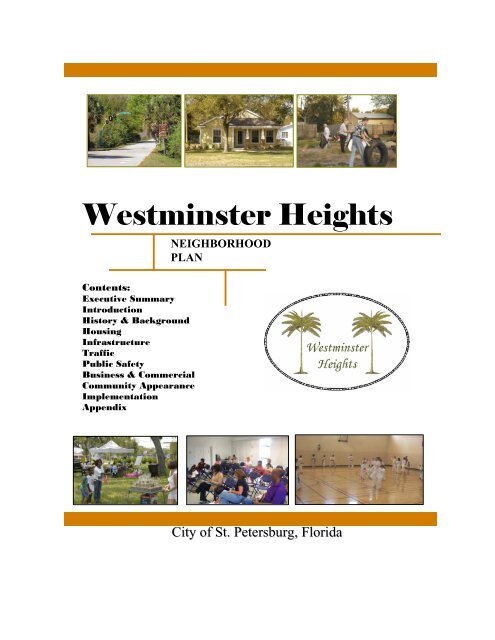
WESTMINSTER HEIGHTS NEIGHBORHOOD PLAN<br />
<strong>Westminster</strong> <strong>Heights</strong><br />
NEIGHBORHOOD<br />
PLAN<br />
Contents:<br />
Executive Summary<br />
Introduction<br />
History & Background<br />
Housing<br />
Infrastructure<br />
Traffic<br />
Public Safety<br />
Business & Commercial<br />
Community Appearance<br />
Implementation<br />
Appendix<br />
<strong>City</strong> <strong>of</strong> <strong>St</strong>. <strong>Petersburg</strong>, Florida<br />
December 2008 1
WESTMINSTER HEIGHTS NEIGHBORHOOD PLAN<br />
EXECUTIVE SUMMARY<br />
The <strong>Westminster</strong> <strong>Heights</strong> <strong>Neighborhood</strong> <strong>Plan</strong> was developed as a result <strong>of</strong> collaborations with neighborhood<br />
residents, businesses, <strong>Westminster</strong> <strong>Heights</strong> <strong>Neighborhood</strong> Association, community organizations, schools,<br />
developers, investors, and other stakeholders. The <strong>Westminster</strong> <strong>Neighborhood</strong> <strong>Plan</strong> is a blueprint: plan <strong>of</strong><br />
action, setting policies, priorities, goals, objectives and action steps for community revitalization. The<br />
neighborhood created a vision and identified the steps needed to reach their future goals. This plan organizes<br />
many <strong>of</strong> the stakeholder’s ideas into a single document that can be shared with residents, potential community<br />
partners and investors. This plan is comprised <strong>of</strong> six (6) elements defined in the <strong>Westminster</strong> <strong>Heights</strong><br />
<strong>Neighborhood</strong> initial “brainstorming” session hosted by the <strong>Westminster</strong> <strong>Heights</strong> <strong>Neighborhood</strong> Association.<br />
The elements are: Housing, Infrastructure, Public Safety, Traffic Calming, Business & Commercial, and<br />
Community Appearance. Once the elements were defined and approved by the neighborhood on May 21,<br />
2007, the <strong>Westminster</strong> <strong>Heights</strong> <strong>Neighborhood</strong> met monthly to develop programs and projects to address the<br />
identified issues and concerns.<br />
The <strong>Westminster</strong> <strong>Heights</strong> <strong>Neighborhood</strong>, 9,169 acres in total, encompasses the area between 49 th <strong>St</strong>reet South<br />
on the east and 58 th <strong>St</strong>reet South on the west. Central Avenue is the northern boundary and the Pinellas Trail<br />
forms the boundary on the south. The east end <strong>of</strong> the neighborhood is primarily commercial and general<br />
<strong>of</strong>fice along Central Avenue from 49th <strong>St</strong>reet South to 58th <strong>St</strong>reet South. Adjoining the east end commercial<br />
area on 49 th<br />
<strong>St</strong>reet South are several blocks predominantly zoned <strong>Neighborhood</strong> Traditional Single Family<br />
(NT-1) and Corridor Commercial Traditional (CCT-1).<br />
In addition, an active <strong>City</strong> Team meets to identify and resolve priority properties and/or issues within the<br />
neighborhood. The neighborhood association selects the resident representatives who serve on the <strong>City</strong> Team.<br />
To date, priority properties/issues identified by the neighborhood representatives on the <strong>City</strong> Team have been<br />
specific day-to-day concerns. There are 18 properties that have been resolved by representatives <strong>of</strong> <strong>City</strong><br />
departments, including but not limited to <strong>Neighborhood</strong> Partnership, Police, Codes Compliance Assistance,<br />
Engineering, Sanitation and Internal Services, since the inception <strong>of</strong> <strong>Westminster</strong> <strong>Heights</strong> <strong>City</strong> Team. In an<br />
effort to create an inclusive resource system for the neighborhood, other city department representatives were<br />
invited to participate. This neighborhood collaborative has created an environment <strong>of</strong> empowerment and<br />
commitment to revitalize the <strong>Westminster</strong> <strong>Heights</strong> <strong>Neighborhood</strong>.<br />
December 2008 2
WESTMINSTER HEIGHTS NEIGHBORHOOD PLAN<br />
RECOMMENDATIONS<br />
Listed below are the recommendations identified and prepared by the <strong>Westminster</strong> <strong>Heights</strong> <strong>Neighborhood</strong><br />
residents. The <strong>Plan</strong> was reviewed and accepted by the neighborhood residents on July 16, 2008, and will be<br />
reviewed by the <strong>Plan</strong>ning and Visioning Commission on October 14, 2008 and Public Safety, Infrastructure<br />
<strong>City</strong> Council Committee on November 13, 2008; and finally by <strong>City</strong> Council on December xx, 2008.<br />
HOUSING<br />
GOAL: IMPROVE THE CONDITION OF THE HOUSING STOCK IN WESTMINSTER HEIGHTS<br />
NEIGHBORHOOD.<br />
OBJECTIVE 1.1: Provide opportunities to support continued increase in property values within the<br />
neighborhood.<br />
RECOMMENDATIONS:<br />
1.1.1 The neighborhood association will have a representative from the Working to Improve <strong>Neighborhood</strong>s<br />
(WIN) program provide an overview and periodic updates to the association.<br />
1.1.2 The neighborhood association will work with not-for-pr<strong>of</strong>it and private developers to reduce the<br />
number <strong>of</strong> vacant/boarded properties in the neighborhood.<br />
1.1.3 The neighborhood association will work with not-for-pr<strong>of</strong>it agencies to provide home-ownership<br />
training classes to potential new homebuyers to encourage the maintenance <strong>of</strong> homes.<br />
1.1.4 The neighborhood association will work with private developers who may wish to purchase privately<br />
owned lots for construction <strong>of</strong> affordable infill housing.<br />
1.1.5 The neighborhood association will continue to support an increase in home ownership.<br />
1.1.6 <strong>St</strong>aff will continue WIN and Housing seminars to provide information about available refinancing,<br />
foreclosure prevention housing programs, and technical support.<br />
1.1.7 <strong>Westminster</strong> <strong>Heights</strong> <strong>Neighborhood</strong> Association will continue to participate with the <strong>City</strong> Team to<br />
identify the day to day issues that arise in the area.<br />
1.1.8 The codes investigator, community police <strong>of</strong>ficer and the other city staff, as needed, will attend the <strong>City</strong><br />
Team and neighborhood association meetings.<br />
December 2008 3
WESTMINSTER HEIGHTS NEIGHBORHOOD PLAN<br />
OBJECTIVE 1.2: Increase the percentage <strong>of</strong> code compliance within the <strong>Westminster</strong> <strong>Heights</strong><br />
<strong>Neighborhood</strong>.<br />
RECOMMENDATIONS:<br />
1.2.1 The neighborhood association should send letters to landlords <strong>of</strong> priority properties letting them know<br />
that the neighborhood will not tolerate bad/illegal behavior and/or conditions.<br />
1.2.2. The neighborhood association should host Codes seminars at meetings as well as providing<br />
information through any future association newsletter and/or website.<br />
1.2.3. The neighborhood association should encourage residents to call in Codes and Sanitation issues to:<br />
a. Mayor’s Action Line at 893-7111;<br />
b. Action Online at www.stpete.org; and<br />
c. Codes Compliance Assistance at 893-7373.<br />
d. Sanitation (Illegal Dumping) at 893-7398/ or TIP line: 892-5000<br />
1.2.4. The neighborhood association should consider establishing a codes committee within the association<br />
or appoint a member to serve as codes liaison increase compliance and decrease violations.<br />
INFRASTRUCTURE<br />
GOAL 2: IMPROVE THE PHYSICAL INFRASTRUCTURE OF THE WESTMINSTER HEIGHTS<br />
NEIGHBORHOOD.<br />
OBJECTIVE 2.1: Provide and maintain pedestrian lighting throughout the neighborhoods.<br />
RECOMMENDATIONS:<br />
2.1.1 The <strong>Westminster</strong> <strong>Heights</strong> residents should continue to monitor the street lighting throughout the<br />
neighborhood and report any lighting outages to Progress Energy 727-443-2641.<br />
2.1.2 Residents should continue to work with the PSR to identify locations where trees obstruct the lighting<br />
so that work orders for raiseups can be submitted.<br />
2.1.3 The neighborhood will work with Progress Energy to enhance service delivery <strong>of</strong> power, particularly in<br />
the area <strong>of</strong> 400 blocks <strong>of</strong> 52 nd and 53 rd <strong>St</strong>reets South.<br />
OBJECTIVE 2.2: Maintain alleys in good condition throughout the <strong>Westminster</strong> <strong>Heights</strong> <strong>Neighborhood</strong> for<br />
Trash Collection.<br />
RECOMMENDATIONS:<br />
2.2.1 As a neighborhood with an established alley system resulting in the use <strong>of</strong> 300 gallon community<br />
sanitation containers rather than individual ones, the Association should identify locations where<br />
additional dumpsters may be needed.<br />
2.2.2 Submit the following locations for possible illegal dumping:<br />
a. north-south alley between 49 th – 50 th <strong>St</strong>reets between Emerson and 6 th Avenues South<br />
b. east-west alley between 52 nd – 53 rd <strong>St</strong>reets between 3 rd and 4 th Avenues South.<br />
2.2.3 The Association should identify additional potential locations where illegal dumping may be occurring.<br />
December 2008 4
WESTMINSTER HEIGHTS NEIGHBORHOOD PLAN<br />
OBJECTIVE 2.3: Expand the reclaimed water system to supply reclaimed water for the <strong>Westminster</strong> <strong>Heights</strong><br />
<strong>Neighborhood</strong> for the purpose <strong>of</strong> cultivating vegetation to control erosion and provide<br />
wholesome appearance.<br />
RECOMMENDATIONS:<br />
2.3.1 Residents indicated an interest in the expansion <strong>of</strong> the reclaimed water system into their community as<br />
resources become available.<br />
OBJECTIVE 2.4: Provide and maintain a good pedestrian circulation system throughout the <strong>Westminster</strong><br />
<strong>Heights</strong> <strong>Neighborhood</strong>.<br />
RECOMMENDATIONS:<br />
2.4.1 The <strong>City</strong> will repair existing and construct new sidewalks to provide connectivity within the<br />
neighborhood along roadways where sidewalk segments currently exist.<br />
2.4.2 The <strong>City</strong> will construct a new sidewalk on the west side <strong>of</strong> 55 th <strong>St</strong>reet (cemetery side) to access the<br />
existing paved areas within the cemetery which is used as a walking trail by <strong>Westminster</strong> residents.<br />
OBJECTIVE 2.5: The <strong>Westminster</strong> <strong>Heights</strong> Association should encourage and increase the level <strong>of</strong><br />
participation in neighborhood cleanups.<br />
RECOMMENDATIONS:<br />
2.5.1 <strong>Neighborhood</strong> should schedule community based cleanups on a regular basis and promote through<br />
neighborhood website http://www.westminsterheights.com and newsletter.<br />
2.5.2 The <strong>Westminster</strong> <strong>Heights</strong> <strong>Neighborhood</strong> Association should partner with Keep Pinellas County<br />
Beautiful to assist with their community based cleanups and marketing.<br />
2.5.3 The Association should work with the <strong>City</strong> to notify residents to encourage removal <strong>of</strong> vehicles from<br />
the streets during the bi-annual street sweeping efforts.<br />
2.5.4 The Association should continue to work with the Public Service Representative (PSR) to request<br />
additional street sweeps on an as needed basis (e.g. heavy storms).<br />
2.5.5 The neighborhood association president or designee should contact <strong>Neighborhood</strong> Partnership<br />
Department programs to schedule annual neighborhood cleanups.<br />
December 2008 5
WESTMINSTER HEIGHTS NEIGHBORHOOD PLAN<br />
PUBLIC SAFETY<br />
GOAL 3: DECREASE OPPORTUNITIES FOR CRIMINAL ACTIVITY IN THE WESTMINSTER<br />
HEIGHTS NEIGHBORHOOD.<br />
OBJECTIVE 3.1: Reduce crime, especially drug trafficking, in the neighborhoods.<br />
RECOMMENDATIONS:<br />
3.1.1 The <strong>Westminster</strong> <strong>Heights</strong> <strong>Neighborhood</strong> Association should invite speakers to the association<br />
meetings to discuss various opportunities to address drug activity: Wrice anti-drug march (Turn<br />
Around <strong>St</strong>. <strong>Petersburg</strong>); Court Watch; Safe <strong>St</strong>reets Now, Crime Watch and CPTED (Crime<br />
Prevention Through Environmental Design).<br />
3.1.2 The Association should continue to provide phone numbers via website, newsletters, and encourage<br />
residents to contact the various city departments and agencies on public safety issues:<br />
a. Police<br />
1. Emergency: 911<br />
2. Non-emergency: 893-7780<br />
3. TIP line: 892-5000<br />
4. District III Community Service Officer Line: 551-3183<br />
b. Water Resources: 892-7261<br />
c. Code Violations: 893-7373<br />
d. Mayor’s Action Line: 893-7111 www.stpete.org<br />
e. Progress Energy: 1-800-228-8485<br />
f. Dog Bites: 582-2608 (County)<br />
3.1.3 The <strong>Westminster</strong> <strong>Heights</strong> <strong>Neighborhood</strong> Association should continue an informational campaign on<br />
loose animals and the need to keep pets on lease and/or confined for the safety <strong>of</strong> the animals and<br />
residents within the community.<br />
3.1.4 Areas <strong>of</strong> loitering within the neighborhood should be reviewed by the <strong>City</strong>’s CPTED (Crime<br />
Prevention Through Environmental Design) Task Force to identify strategies to decrease and/or<br />
eliminate non-neighborhood friendly activity.<br />
3.1.5 Residents should identify, and report to the Public Service Representatives (PSRs), areas within the<br />
<strong>Westminster</strong> <strong>Heights</strong> <strong>Neighborhood</strong> rights-<strong>of</strong>-ways where vegetation obstructs sight visibility.<br />
3.1.6 The neighborhood association should encourage residents to turn on their porch lights during evening<br />
hours.<br />
OBJECTIVE 3.2: <strong>St</strong>op illegal dumping <strong>of</strong> trash and debris in the <strong>Westminster</strong> <strong>Heights</strong> <strong>Neighborhood</strong>.<br />
RECOMMENDATIONS:<br />
3.2.1 The neighborhood association should provide phone numbers for Sanitation Department 727-893-<br />
7398 and inform residents about available Sanitation Department programs for free pickup.<br />
3.2.3 The neighborhood association should provide to residents Sanitation Department (12.5" X 3.5")<br />
“stickers” to be placed on the 300 gallon containers (see example) to deter alley dumping.<br />
3.2.4 The neighborhood association should encourage residents to call the Police TIP Line at 892-5000 to<br />
report valuable information in an anonymous manner.<br />
December 2008 6
WESTMINSTER HEIGHTS NEIGHBORHOOD PLAN<br />
OBJECTIVE 3.3: Continue community policing approach to solving crime in the neighborhoods.<br />
RECOMMENDATIONS:<br />
3.3.1 The Police Department should continue to use the Tone Down initiative and the <strong>City</strong>’s Noise<br />
Ordinance to address loud music from vehicles and residences.<br />
3.3.2 Residents should continue to identify and report drug activity and other illegal activity locations to the<br />
CSO line (551-3183) and Police TIP line (892-5000) for follow-up.<br />
3.3.3 The neighborhood association should encourage residents to start an active Crime Watch program.<br />
3.3.4 The neighborhood association should consider a phone tree or e-mail notification <strong>of</strong> activities in the<br />
neighborhood.<br />
TRAFFIC<br />
GOAL 4: CALM THE TRAFFIC FLOW THROUGH THE WESTMINSTER HEIGHTS<br />
NEIGHBORHOOD.<br />
OBJECTIVE 4.1: Enforce parking regulations neighborhood wide.<br />
RECOMMENDATIONS:<br />
4.1.1 The <strong>Westminster</strong> <strong>Heights</strong> <strong>Neighborhood</strong> Association is requesting the installation <strong>of</strong> “No Parking”<br />
signs, on the appropriate side <strong>of</strong> the road, so police <strong>of</strong>ficers can ticket the illegally parked vehicles.<br />
4.1.2 The Police Department should continue enforcement <strong>of</strong> tree line parking violations.<br />
OBJECTIVE 4.2: Implement traffic calming approaches to reduce speeding in the neighborhood.<br />
RECOMMENDATIONS:<br />
4.2.1 The <strong>City</strong> should install eight (8) landscaped medians and an entry way median on 5 th Avenue South<br />
west <strong>of</strong> 49 th <strong>St</strong>reet South to reduce speed.<br />
4.2.2 Reduce the speed limit neighborhood wide from 30 to 25 mph. (completed)<br />
4.2.3 The <strong>City</strong> should monitor traffic on an ongoing basis to determine the effectiveness <strong>of</strong> the installed<br />
Traffic <strong>Plan</strong> and recommend additional measures if warranted.<br />
December 2008 7
WESTMINSTER HEIGHTS NEIGHBORHOOD PLAN<br />
BUINESS & COMMERCIAL<br />
GOAL 5: IMPROVE THE ECONOMIC DEVELOPMENT CONDITIONS ALONG THE 49TH<br />
STREET SOUTH AND CENTRAL AVENUE CORRIDORS.<br />
OBJECTIVE 5.1: To support existing businesses and seek to attract new businesses to increase the variety <strong>of</strong><br />
the economic base.<br />
RECOMMENDATIONS:<br />
5.1.1 The neighborhood association should provide resource information to the business owners about the<br />
<strong>City</strong>’s Business Assistance Center (BAC) and available programs.<br />
5.1.2 The neighborhood association will continue to invite the businesses to join the <strong>Westminster</strong> <strong>Heights</strong><br />
<strong>Neighborhood</strong> Association and / support association activities.<br />
OBJECTIVE 5.2: Improve the appearance <strong>of</strong> the commercial corridor.<br />
RECOMMENDATIONS:<br />
5.2.1 The neighborhood association should explore the possibility <strong>of</strong> a consistent facade and streetscape<br />
treatment along the 49 th <strong>St</strong>reet Corridor in conjunction with the <strong>City</strong> <strong>of</strong> Gulfport Redevelopment <strong>Plan</strong><br />
and the Greater Childs Park <strong>St</strong>rategic <strong>Plan</strong>.<br />
5.2.2 The neighborhood association should, support and participate in the 49 th <strong>St</strong>reet business association.<br />
5.2.3 Residents should continue to report code violations within the commercial areas to the <strong>City</strong> via<br />
www.stpete.org (Action Online), Mayor’s Action Center (727-893-7111) or Codes Compliance<br />
Assistance (727-893-7373).<br />
COMMUNITY IDENTITY & APPEARANCE<br />
GOAL 6: IMPROVE THE PHYSICAL APPEARANCE OF THE WESTMINSTER HEIGHTS<br />
NEIGHBORHOOD.<br />
OBJECTIVE 6.1: Enhance the aesthetics <strong>of</strong> the neighborhood streets with landscaping<br />
RECOMMENDATIONS:<br />
6.1.1 The <strong>City</strong> should install crape myrtles along 55 th <strong>St</strong>reet to continue crape myrtle plantings around the<br />
perimeter <strong>of</strong> the cemetery.<br />
6.1.2 The <strong>City</strong> will install crape myrtles along 5 th Avenue South.<br />
6.1.3 Review the feasibility <strong>of</strong> a traffic median on Central Avenue west <strong>of</strong> 49 th <strong>St</strong>reet to include landscaping<br />
and <strong>Westminster</strong> <strong>Heights</strong> neighborhood identity sign.<br />
6.1.4 a. Association will continue working with the owners <strong>of</strong> the cemetery property to proceed with plans to<br />
install a fence, wall or other barriers along 55 th <strong>St</strong>reet South to eliminate the cut through vehicle<br />
traffic in the right-<strong>of</strong>-way along 55 th <strong>St</strong>reet South/cemetery.<br />
b. The <strong>City</strong> will identify alternative solutions to minimize and hopefully eliminate cut through traffic<br />
from 5 th Avenue South & 55 th <strong>St</strong>reet South through the cemetery/right-<strong>of</strong>-way.<br />
December 2008 8
WESTMINSTER HEIGHTS NEIGHBORHOOD PLAN<br />
OBJECTIVE 6.2: Define the boundaries <strong>of</strong> the <strong>Westminster</strong> <strong>Heights</strong> <strong>Neighborhood</strong>s though signage and<br />
decorative lighting.<br />
RECOMMENDATIONS:<br />
6.2.1 The neighborhood association will support the installation <strong>of</strong> decorative lighting along 49 th <strong>St</strong>reet South<br />
Corridor, 5 th Avenue South to Central Avenue as part <strong>of</strong> the Greater Childs Park <strong>St</strong>rategic Initiative<br />
<strong>Plan</strong>.<br />
6.2.2 Design and install artistic, decorative poles for the identity signs at the following locations:<br />
a. 58th <strong>St</strong>reet South & 1 st Avenue South;<br />
b. 55th <strong>St</strong>reet South & 1 st Avenue South;<br />
c. Central Avenue & 49 th <strong>St</strong>reet South;<br />
d. 49th <strong>St</strong>reet South & 5 th Avenue South; and<br />
e. 49th <strong>St</strong>reet South & 6 th Avenue South.<br />
OBJECTIVE 6.3: Create an atmosphere where residents <strong>of</strong> all ages can enjoy neighborhood amenities.<br />
RECOMMENDATIONS:<br />
6.3.1 Identify vacant lots to be used as potential sites for a future park or playlot.<br />
6.3.2 Create entryways to the Pinellas Trail through enhanced landscaping at 52 nd , 53 rd , Braddock & 55 th<br />
<strong>St</strong>reets South to encourage the use <strong>of</strong> the Pinellas Trail.<br />
6.3.3 The <strong>City</strong> will work with Pinellas County to consider paved entryway access onto the Pinellas Trail.<br />
December 2008 9
WESTMINSTER HEIGHTS NEIGHBORHOOD PLAN<br />
INTRODUCTION<br />
The <strong>City</strong> <strong>of</strong> <strong>St</strong>. <strong>Petersburg</strong> began a <strong>Neighborhood</strong> <strong>Plan</strong>ning Program in 1990 to provide neighborhoods in the<br />
city an opportunity to develop a vision and corresponding customized guidance on issues and priorities<br />
important to the residents. The program was designed to go beyond the general guidance in the <strong>City</strong>’s<br />
Comprehensive <strong>Plan</strong> to address specific neighborhood needs. The <strong>Westminster</strong> <strong>Heights</strong> <strong>Neighborhood</strong> <strong>Plan</strong><br />
is intended to retain or enhance those aspects <strong>of</strong> the neighborhood that contribute to its quality <strong>of</strong> life: diversity<br />
<strong>of</strong> housing and occupants, quiet neighborhood atmosphere, walkable streets with sidewalks, and safe access to<br />
the Pinellas Trail, park and commercial uses. To accomplish this, the plan proposes strategies for Housing<br />
Infrastructure, Public Safety, Traffic Calming, Business & Commercial, and Community Appearance.<br />
December 2008 10
WESTMINSTER HEIGHTS NEIGHBORHOOD PLAN<br />
HISTORY<br />
History provides an important context and background for any group or organization trying to plan its future.<br />
<strong>St</strong>. <strong>Petersburg</strong>’s unique development pattern evolved from the convergence <strong>of</strong> three waterfront areas: Tampa<br />
Bay, northern Boca Ciega Bay, and southern Boca Ciega Bay in Gulfport. Key to the development was the<br />
railroad and, later a trolley system. This was especially true in the area that became <strong>Westminster</strong> <strong>Heights</strong>. As<br />
the landboom in the 1920s spread, the train and trolley systems were key tools in the initial development and<br />
marketing <strong>of</strong> new areas.<br />
Orange Belt Railroad<br />
Peter Demens (the Anglicization <strong>of</strong> his native Russian name <strong>of</strong> Petrovitch A.<br />
Demenscheff) purchased the Orange Belt Railroad and expanded it south to <strong>St</strong>.<br />
<strong>Petersburg</strong> in May 1888. It was one <strong>of</strong> the last <strong>of</strong> Florida’s narrow gauge lines.<br />
(Railroads developed independently with lines being bought, sold and combined<br />
frequently and it took many years before track width or gauge was standardized. The<br />
narrow gauge slowly became obsolete.) Demens eventually sold Orange Belt and<br />
through several transactions the line became part <strong>of</strong> the Henry <strong>Plan</strong>t railroad system<br />
and then both subsumed by Atlantic Coast Lines, Seaboard Air Line Railroad (logo<br />
shown) and its final successor CSX. The southern boundary <strong>of</strong> <strong>Westminster</strong> <strong>Heights</strong><br />
was once the Orange Belt line. The abandoned lines in <strong>St</strong>. <strong>Petersburg</strong> became the Pinellas Trail.<br />
The <strong>Westminster</strong> <strong>Heights</strong> <strong>Neighborhood</strong> has changed dramatically over its short history. A quarter <strong>of</strong> present<br />
day <strong>Westminster</strong> <strong>Heights</strong> is made up <strong>of</strong> the Forest Hills Subdivision built by F. J. Burns. Forest Hills was<br />
developed in 1923 and encompassed 137 lots from 5 th to 7 th (now 6 th ) Avenues South. According to a <strong>St</strong>.<br />
<strong>Petersburg</strong> Times article by Scott Taylor Hartzell (2-26-2003 page 6) Forest Hills along with Burns’ other<br />
developments Bellecrest <strong>Heights</strong> and Waterview Park subdivisions were “among the highest points between<br />
Tampa Bay and Boca Ciega Bay.” Hartzell went on to say that the press <strong>of</strong> the time wrote “Coconut palms and<br />
semitropical shrubbery colored Forest Hills. Cement sidewalks and graded streets were a highlight. Forest Hills<br />
is one <strong>of</strong> the most attractive properties that has been placed on the market."<br />
December 2008 11
WESTMINSTER HEIGHTS NEIGHBORHOOD PLAN<br />
The plat map below contains F. J. Burn's signature. In 1923, he and his realty company were prominent<br />
landowners and developers within the <strong>Westminster</strong> Height <strong>Neighborhood</strong>. Three street names have changed<br />
in the past 83 years: Disston Avenue is present day 49 th <strong>St</strong>reet; 6 th Avenue has since changed to Emerson<br />
Avenue; and 7 th Avenue became 6 th Avenue.<br />
December 2008 12
WESTMINSTER HEIGHTS NEIGHBORHOOD PLAN<br />
Construction Booms<br />
The Construction Booms map below shows the number <strong>of</strong> existing homes by the decade they were built. This<br />
is useful in giving an indication <strong>of</strong> when construction activity peaked and ebbed. For example, between 1920<br />
and 1929 there were 49 homes built in the area that continue to exist, there was moderate home construction<br />
during that decade. During the 1930s, growth slowed down because <strong>of</strong> the Depression, but in the 1940s,<br />
another major construction boom was indicated by the 64 homes that are still part <strong>of</strong> the <strong>Westminster</strong> <strong>Heights</strong><br />
neighborhood’s housing stock. The 1950s were the largest housing boom in the area to date with 291 homes<br />
existing. Construction continued in the 1960s, 1970s, and 1980s with 19, 23, and 9 homes remaining,<br />
respectively. Given that most <strong>of</strong> the land has been developed earlier, only 22 homes have been built over the<br />
past 12 years.<br />
Legend<br />
1920-1929 1950-1959<br />
1930-1939 1960-1969<br />
1940-1949 1970-1979<br />
1980-1989<br />
1990-1999<br />
2000-Present<br />
Source: <strong>City</strong> <strong>of</strong> <strong>St</strong> <strong>Petersburg</strong> GIS<br />
December 2008 13
WESTMINSTER HEIGHTS NEIGHBORHOOD PLAN<br />
<strong>Neighborhood</strong> Assets<br />
During the initial brainstorming sessions, residents were asked to identify the assets <strong>of</strong> the neighborhood (see<br />
Assets Map). They were asked to think about the things that attracted them to the area initially and the things<br />
that have kept them in the area. Cemetery, nice quiet area, well kept yards, a variety <strong>of</strong> housing options, close<br />
to public transportation, close to downtown <strong>St</strong>. <strong>Petersburg</strong> and beaches were some <strong>of</strong> the assets identified by<br />
the residents. The <strong>Westminster</strong> <strong>Heights</strong> <strong>Neighborhood</strong> has a few neighborhood retail establishments along<br />
Central Avenue and 49 th <strong>St</strong>reet South.<br />
December 2008 14
WESTMINSTER HEIGHTS NEIGHBORHOOD PLAN<br />
Forest Hills Elementary School<br />
The land for the Forest Hills Elementary School was<br />
donated in February 1924 by F. J. Burns. The<br />
donation was six lots. The Forest Hills Elementary<br />
School was built on the south side <strong>of</strong> 6 th<br />
Avenue<br />
South between 50 th and 51 st <strong>St</strong>reets. The photo to the<br />
right shows the front entrance facing north. The<br />
school was demolished in January 2003 and has been<br />
replaced with a Pinellas County School Board bus<br />
compound. The photo shows the compound from<br />
the 49th <strong>St</strong>reet & 6 th Avenue South intersection. The<br />
previously mentioned 2003 <strong>St</strong>. <strong>Petersburg</strong> Times<br />
article (Hartzell, 3-26-2003), quoted Burns’ son, then<br />
76, “He didn't have the benefits <strong>of</strong> a formal<br />
education, and so he treasured (schooling)."<br />
Forest Hills Elementary, former tenant<br />
The article further stated A.C. Roundtree built the “four-room, H-shaped structure” for approximately<br />
$25,000. In 1928, the school expanded by adding a cafeteria. The article also quoted several individuals who<br />
attended the school, ‘It had the appearance <strong>of</strong> a country school,’ said Don Saxer, 77, “who mentioned the potbellied<br />
stoves.” Lynn Hayden, 50, said a North Shore Elementary teacher who attended and substituted at<br />
Forest Hills, the kids didn't come from the wealthiest <strong>of</strong> families, but everyone was proud <strong>of</strong> the school. Forest<br />
Hill Elementary school was razed in January 2003. “It was very much a neighborhood school.”<br />
Pinellas County Schools, current tenant<br />
December 2008 15
WESTMINSTER HEIGHTS NEIGHBORHOOD PLAN<br />
Royal Palm Cemetery<br />
The western boundary <strong>of</strong> <strong>Westminster</strong> <strong>Heights</strong> is dominated by the Royal Palm Cemetery, running south from<br />
1st Avenue South along the east side <strong>of</strong> 58 th<br />
<strong>St</strong>reet to the Pinellas Trail. The Woodlawn Cemetery on the<br />
westside <strong>of</strong> 58th <strong>St</strong>reet mirrors the first third <strong>of</strong> the cemetery. From October 14, 2000 to March 10, 2001, the<br />
Pinellas Genealogy Society completed a survey <strong>of</strong> the cemetery that recorded 22,069 individuals buried there.<br />
The survey also found monuments written in English, Jewish, Russian and Dutch. According to the<br />
USGenWeb Archives, the cemetery began in 1921. Royal Palm is on 55 acres <strong>of</strong> the 80 acres Reginald H.<br />
Sumner bought from George S. Gandy. The cemetery <strong>of</strong>fices once served as a chapel. With the cemetery<br />
owner’s encouragement, the grounds also serve as an ad hoc park with the asphalt drive around its<br />
circumference being regularly used as a walking trail by neighborhood residents. The cemetery has over one<br />
mile <strong>of</strong> roads through its grounds. The cemetery was sold in 2002 to Work & Son.<br />
December 2008 16
WESTMINSTER HEIGHTS NEIGHBORHOOD PLAN<br />
Pinellas Trail<br />
The Pinellas Trail is <strong>Westminster</strong> <strong>Heights</strong> southern boundary and also the boundary between <strong>St</strong>. <strong>Petersburg</strong><br />
and Gulfport. It is a major amenity for the neighborhood providing exercise opportunities. The trail is made<br />
up <strong>of</strong> abandoned railroad lines that were once part <strong>of</strong> the Orange Belt Railroad and its successors: the<br />
Seaboard Air Line; Atlantic Coast Line; and finally CSX. The photos below show east and west views <strong>of</strong> the<br />
trail as it passes through <strong>Westminster</strong> <strong>Heights</strong>.<br />
The trail stretches 34 miles from Tarpon Springs to <strong>St</strong>. <strong>Petersburg</strong>, providing scenic opportunities for walking,<br />
jogging and skating. <strong>Plan</strong>s are in the implementation stage to extend the trail to downtown <strong>St</strong>. <strong>Petersburg</strong> and to<br />
develop a spur from Childs Park through TwinBrooks and Clam Bayou. The first leg <strong>of</strong> the trail opened in<br />
1990 covering five miles south from the trailhead at Tarpon Springs. The trail currently runs to 8 th Avenue<br />
South and 34 th <strong>St</strong>reet in <strong>St</strong>. <strong>Petersburg</strong> near Gibbs High School.<br />
Photos above show the eastern and western views <strong>of</strong> the trail as it passes the neighborhood.<br />
Trail Security<br />
The Pinellas Trail website lists the organizations responsible for security: “Pinellas County Security Task Force<br />
which represents law enforcement <strong>of</strong>ficers from the Pinellas County Sheriff's Office and various municipal law<br />
enforcement agencies. Pinellas County Park Rangers also regularly patrol the Trail, just as they do any county<br />
park, and the Auxiliary Rangers, a legion <strong>of</strong> volunteers, function as extra eyes and ears for the regular Park<br />
Rangers.”<br />
December 2008 17
WESTMINSTER HEIGHTS NEIGHBORHOOD PLAN<br />
Houses <strong>of</strong> Worship<br />
Currently there are no existing houses <strong>of</strong> worship<br />
located within <strong>Westminster</strong> <strong>Heights</strong> <strong>Neighborhood</strong>,<br />
there are, however, two churches, Our Savior<br />
Lutheran and Elim Seventh-Day Adventist located<br />
along its western and eastern boundaries. Our<br />
Savior Lutheran Church, founded in 1954, is<br />
located at 5843 4 th<br />
Avenue South. In 2007, Elim<br />
Seventh-Day Adventist Church relocated to 4824 2 nd<br />
Avenue <strong>St</strong>reet South, a site that had been occupied<br />
by Central Christian Church since 1954. Both<br />
houses <strong>of</strong> worship have schools.<br />
Our Savior Lutheran Church<br />
NEIGHBORHOOD ASSOCIATION<br />
Elim Seventh-Day Adventist Church<br />
Residents within the <strong>Westminster</strong> <strong>Heights</strong><br />
<strong>Neighborhood</strong> Association began to meet with initial<br />
concerns over crime and safety in 1997. These<br />
concerns led to the formation <strong>of</strong> a <strong>Neighborhood</strong><br />
Crime Watch in November 1997. Early in 1998, the<br />
crime watch group became the <strong>Westminster</strong> <strong>Heights</strong><br />
<strong>Neighborhood</strong> Association. The association has<br />
developed a website http://www.westminsterheights.com , that includes home <strong>of</strong> the month, email update list, a<br />
codes committee and other organizational infrastructure to assist in overall neighborhood improvements. The<br />
association's name, <strong>Westminster</strong> <strong>Heights</strong>, was a collaboration <strong>of</strong> the different subdivisions in the area. The<br />
area near the Old Forrest Hill School was <strong>Westminster</strong> Place Subdivision. The name <strong>Westminster</strong> <strong>Heights</strong><br />
<strong>Neighborhood</strong> Association came from the <strong>Westminster</strong> <strong>Heights</strong> Crime Watch Group. The neighbors that<br />
made up the crime watch group voted in 1998 to become <strong>Westminster</strong> <strong>Heights</strong> <strong>Neighborhood</strong> Association.<br />
Their motto was, “One <strong>Neighborhood</strong>, One Voice.”<br />
December 2008 18
WESTMINSTER HEIGHTS NEIGHBORHOOD PLAN<br />
<strong>Westminster</strong> <strong>Heights</strong> has held block parties, neighborhood cleanup projects, yard sales and Easter egg hunt<br />
events. They have organized to volunteer and assist needy families within <strong>Westminster</strong> <strong>Heights</strong> <strong>Neighborhood</strong><br />
with the Somebody Cares Tampa Bay Carefest. <strong>Westminster</strong> <strong>Heights</strong> <strong>Neighborhood</strong> Association has received<br />
the following grants from the <strong>City</strong>’s Police Forfeiture Grant Program for a total <strong>of</strong> $2,000: FY 07- Youth Karate<br />
Lessons ($1,000) and FY 08- Youth Recreational Activities <strong>of</strong>fered at the J.W. Cate Recreational Center on 22<br />
Avenue North at 58th <strong>St</strong>reet ($1,000).<br />
Demographics<br />
There were 1,520 residents within the <strong>Westminster</strong> <strong>Heights</strong> <strong>Neighborhood</strong>s according to the 1990 U.S.<br />
Census. The 2000 Census indicates that there are 1,645 residents in the planning area, an 8.22% increase in<br />
population over the 1990 Census.<br />
Demographics 1990 2000 % Change<br />
Total Population 1,520 1,645 8.22%<br />
White 1,243 932 -25.02%<br />
Black 244 613 151.23%<br />
Hispanic 24 50 108.33%<br />
American Indian 4 7 75.00%<br />
Asian 23 38 65.22%<br />
Other 5 6 20.00%<br />
Male 712 826 16.01%<br />
Female 808 819 1.36%<br />
Housing Units 761 721 -5.26%<br />
Housing Units vacant 137 76 -44.53%<br />
Homestead 457 460 0.66%<br />
Non-Homestead 167 185 10.78%<br />
Source: US Census 1990 & 2000<br />
According to the 2000 Census, there are 721 housing units in the <strong>Westminster</strong> <strong>Heights</strong> neighborhood, 63.8%<br />
<strong>of</strong> the units are Homestead, 25.7% Non-Homestead units and 10.5% <strong>of</strong> the units are vacant.<br />
December 2008 19
WESTMINSTER HEIGHTS NEIGHBORHOOD PLAN<br />
<strong>Westminster</strong> <strong>Heights</strong> <strong>Plan</strong>ning Process<br />
The <strong>Neighborhood</strong> <strong>Plan</strong>ning Program is a collaborative process between the <strong>City</strong> and the residents and<br />
businesses that live and work in the neighborhoods. The program helps to build stronger community<br />
relationships, define neighborhood goals, issues, and explore alternatives for achieving desired neighborhood<br />
and <strong>City</strong> priorities. The <strong>Neighborhood</strong> <strong>Plan</strong>ning Program provides a forum for residents to initiate rather than<br />
to react to change, in which the various interest groups within a neighborhood can work out mutually<br />
acceptable alternatives and solutions to area problems and define future goals. Further, the neighborhood<br />
planning process addresses issues and opportunities at a scale, which is more refined and responsive to<br />
neighborhood needs than the broad policies <strong>of</strong> the Comprehensive <strong>Plan</strong>.<br />
The end product <strong>of</strong> the neighborhood planning program is the approval <strong>of</strong> a neighborhood plan which serves<br />
as the guide for future enhancement <strong>of</strong> the neighborhood, and for directing and managing change. Therefore,<br />
the plan serves as an <strong>of</strong>ficial guide for decision makers and facilities the coordination <strong>of</strong> public and private<br />
investments.<br />
The neighborhood planning program is a three-phase process. Phase I is the preparation <strong>of</strong> neighborhood<br />
pr<strong>of</strong>ile which includes data gathering and analysis to define among other things the demographic, housing<br />
conditions, physical infrastructure, historic and economic characteristics <strong>of</strong> an area. The information is used<br />
with the results <strong>of</strong> neighborhood survey to identify neighborhood problems and issues. Phase II involves the<br />
development <strong>of</strong> the neighborhood plan which defines alternatives and solutions to the problems. Phase III is<br />
<strong>Plan</strong> implementation, which is the process <strong>of</strong> constructing projects, enacting regulations, providing incentives<br />
and programs.<br />
The <strong>Westminster</strong> <strong>Heights</strong> <strong>Neighborhood</strong> kicked <strong>of</strong>f the development <strong>of</strong> their neighborhood plan on April 12,<br />
2007. All residents and property owners were notified and invited to participate in the planning process. The<br />
kick <strong>of</strong>f meeting was used as a brainstorming session where residents identified neighborhood assets to<br />
enhance as well as areas <strong>of</strong> the neighborhood needing improvements. These responses were categorized into<br />
major topics or elements. The residents prioritized the elements to determine the order <strong>of</strong> discussion. The<br />
elements identified include the following: Housing, Infrastructure, Public Safety, Traffic Calming, Business &<br />
Commercial, and Community Appearance. The residents held regular planning committee meetings to review<br />
data, verify inventory results, discuss issues and identify potential strategies. This input is vital to the<br />
neighborhood planning process and is a crucial component <strong>of</strong> this document. Input from the planning<br />
committee will also guide the development <strong>of</strong> the plan.<br />
December 2008 20
WESTMINSTER HEIGHTS NEIGHBORHOOD PLAN<br />
Following input and discussion by the residents and property owners <strong>of</strong> all the elements, a draft plan was<br />
presented at a neighborhood wide meeting for approval. All residents and property owners were notified and<br />
invited to participate in the meeting. After neighborhood approval, city staff will present the plan to the<br />
<strong>Plan</strong>ning & Visioning Commission for review and approval. The final plan is presented to and approved by<br />
<strong>City</strong> Council. The implementation process begins with Operation Commitment, a six month effort where the<br />
<strong>City</strong>, the neighborhood and other appropriate agencies join in partnership to implement projects identified in<br />
the neighborhood plan.<br />
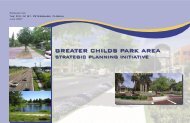
Adjacent <strong>Neighborhood</strong> <strong>Plan</strong><br />
Childs Park<br />
The Childs Park <strong>Neighborhood</strong> (5th - 18th Ave. S/34th - 49th <strong>St</strong>. S.) lies southeast <strong>of</strong> <strong>Westminster</strong> <strong>Heights</strong><br />
and shares 49 th <strong>St</strong>reet South. In 1994, the Childs Park <strong>Neighborhood</strong> <strong>Plan</strong> was accepted by <strong>City</strong> Council. As a<br />
partial result <strong>of</strong> that effort, Childs Park has seen substantial improvements, such as: a new swimming pool,<br />
recreation center renovation, property enhancements, new tennis courts and basketball court relocation.<br />
Greater Childs Park <strong>St</strong>rategic Initiative<br />
The Greater Childs Park area bounded by 2nd Avenue North, on the north, 49th <strong>St</strong>reet, on the west, 31st<br />
Avenue South, on the south and 34th <strong>St</strong>reet on the west and is a 2.5 square mile area consisting <strong>of</strong> four<br />
neighborhood planning areas: 1) the southern portion <strong>of</strong> the Central Oak Park neighborhood; 2) the Childs<br />
Park neighborhood; 3) the Twin Brooks neighborhood; and 4) the Perry Bayview neighborhood. Of those<br />
four neighborhood associations, only the Childs Park neighborhood and the Twin Brooks neighborhood have<br />
approved neighborhood plans. The <strong>City</strong> Council accepted the Childs Park <strong>Neighborhood</strong> <strong>Plan</strong> in the early<br />
1990s and since then several improvements and projects have been initiated to address the neighborhood<br />
concerns. However, the majority <strong>of</strong> improvements were developed in isolation without a community- wide<br />
vision. While many areas like the downtown and those neighborhoods adjacent to the revitalization areas have<br />
seen significant growth, the areas further away from that economic activity (west <strong>of</strong> Midtown) are in need <strong>of</strong><br />
attention.<br />
December 2008 21
WESTMINSTER HEIGHTS NEIGHBORHOOD PLAN<br />
CHAPTER 1<br />
HOUSING<br />
Housing is the backbone <strong>of</strong> a neighborhood. Physically, socially and economically, housing is an important<br />
element in our lives. The physical condition <strong>of</strong> housing is a matter <strong>of</strong> public health, and the regulation <strong>of</strong><br />
housing through zoning, subdivision controls, building and housing codes, and sanitation ordinances has been<br />
an accepted part <strong>of</strong> local government activities for many years. This chapter examines the composition <strong>of</strong> the<br />
housing stock found in the <strong>Westminster</strong> <strong>Heights</strong> <strong>Neighborhood</strong> in terms <strong>of</strong> density, value, and quality. This is<br />
generally done according to census tract boundaries with the exception <strong>of</strong> the structural quality survey and site<br />
condition assessment which was conducted at the parcel level through field inspection. The combined planning<br />
area is primarily single family residential with commercial uses focused along the 49 th <strong>St</strong>reet South, 1st Avenue<br />
South and Central Avenue corridors.<br />
Housing Demographics<br />
According to the 2000 U.S. Census, there are 721 housing units within the <strong>Westminster</strong> <strong>Heights</strong><br />
<strong>Neighborhood</strong>. This is a decrease <strong>of</strong> 40 housing units since the 1990 census. The term housing units includes<br />
multi-family and single family units but does not differentiate between them. Below is a housing unit<br />
comparison between 1990 and 2000 Census.<br />
1990 2000<br />
Housing Units 761 721<br />
Homestead 457 460<br />
Non-Homestead 167 185<br />
December 2008 22
WESTMINSTER HEIGHTS NEIGHBORHOOD PLAN<br />
According to the Property Appraiser’s records, approximately 67 percent <strong>of</strong> the single family residences have<br />
homestead exemptions. (see Homestead Properties Map).<br />
Homestead<br />
Partial Homestead<br />
Non-Homestead<br />
The majority (90%) <strong>of</strong> the homes are structurally sound (see <strong>St</strong>ructural Conditions Map, pg. 30). A “sound”<br />
designation for a building means that there are no structural problems with either the ro<strong>of</strong> or walls. There are<br />
two (2) boarded structures and six (6) vacant lots in the planning area (see Boarded <strong>St</strong>ructures & Vacant Lots<br />
Map).<br />
December 2008 23
WESTMINSTER HEIGHTS NEIGHBORHOOD PLAN<br />
Zoning/Land Use<br />
The zoning within the <strong>Westminster</strong> <strong>Heights</strong> <strong>Neighborhood</strong> is predominantly NT-1 (<strong>Neighborhood</strong> Traditional<br />
1) which comprises 77% <strong>of</strong> the area. Other zoning categories, existing land use and the number <strong>of</strong> acres are<br />
outlined below:<br />
Zoning Category # <strong>of</strong> Acres Existing Land Use # <strong>of</strong> Acres<br />
Commercial Corridor Suburban 6.73 (4.05%) Commercial 15.26 (9.17%)<br />
(CCS-1)<br />
Commercial Residential 13.49 (8.11%) Public/Semi-Public 67.95 (40.85%)<br />
Traditional (CRT-1)<br />
Industrial Traditional (IT) 12.52 (7.52%) Rec/Open Space 4.99 (3.00%)<br />
<strong>Neighborhood</strong> Suburban Multi- 5.54 (3.33%) Residential-Multi Family 1.29 (0.78%)<br />
Family (NSM-1)<br />
<strong>Neighborhood</strong> Traditional (NT- 128.06 (76.99%) Residential – Duplex 2.42 (1.45%)<br />
1)<br />
Residential – Single 72.87 (43.81%)<br />
Family<br />
Vacant 1.56 (0.94%)<br />
Total: 166.34 166.34<br />
The zoning and land use maps verify that <strong>Westminster</strong> <strong>Heights</strong> is predominantly single family residential. The<br />
land use map show that over 80% <strong>of</strong> the neighborhood is residential in use and character. The residents stated<br />
that affordable housing was one <strong>of</strong> the assets <strong>of</strong> their neighborhood.<br />
The new land development regulations went into effect on September 10, 2007, which changed the zoning<br />
throughout the <strong>City</strong> (see New Zoning Map below). <strong>Westminster</strong> <strong>Heights</strong> <strong>Neighborhood</strong> is considered a<br />
traditional neighborhood. The original development was geared toward pedestrian needs rather than multi-car<br />
families. The lot widths, within traditional neighborhoods, are narrow, generally 45 to 60 feet. Sidewalks and<br />
alleys were the norm as well as front doors that faced the streets.<br />
December 2008 24
WESTMINSTER HEIGHTS NEIGHBORHOOD PLAN<br />
Zoning<br />
A comparison <strong>of</strong> the average lot in <strong>Westminster</strong> <strong>Heights</strong> to the lot requirements for NT-1 (<strong>Neighborhood</strong><br />
Traditional) shows the following:<br />
NT-1 Requirements<br />
Average Existing Conditions<br />
Minimum Area: 5,800 sq ft<br />
7,115 sq ft<br />
Minimum Lot width: 45 ft<br />
60 ft<br />
Front setback:<br />
<strong>St</strong>oop: 15 ft 22ft<br />
Open Porch: 18 ft<br />
25ft<br />
Building: 25 ft 30ft<br />
Interior side<br />
< 60 ft width: 10% lot width range: 7 – 9½<br />
<strong>St</strong>reet side yard: 12 ft<br />
30ft<br />
Rear yard (w/ alley):<br />
50ft<br />
Alley < 16 ft: 6 ft<br />
15ft<br />
Rear yard (no alley): 10 ft<br />
range:40ft – 60ft<br />
Aerial map and visual onsite verification<br />
December 2008 25
WESTMINSTER HEIGHTS NEIGHBORHOOD PLAN<br />
Traditional neighborhoods in <strong>St</strong>. <strong>Petersburg</strong> were platted in the early 1920s. The Construction Boom map<br />
below shows the number <strong>of</strong> existing homes by the decade they were built. This is useful in giving an indication<br />
<strong>of</strong> when construction activity peaked and ebbed. During the 1930s, growth slowed down because <strong>of</strong> the<br />
Depression, but in the 1940s, another major construction boom was indicated by the 64 homes that are still<br />
part <strong>of</strong> the <strong>Westminster</strong> <strong>Heights</strong> neighborhood’s housing stock. The 1950s were the largest housing boom in<br />
the area to date with 291 homes existing. Construction continued in the 1960s, 1970s, and 1980s with 19, 23,<br />
and 9 homes. Given that most all the land has been developed earlier, only 22 homes have been built over the<br />
past 12 years (see Construction Boom map).<br />
Legend<br />
1920-1929 1950-1959<br />
1930-1939 1960-1969<br />
1940-1949 1970-1979<br />
1980-1989<br />
1990-1999<br />
2000-Present<br />
December 2008 26
WESTMINSTER HEIGHTS NEIGHBORHOOD PLAN<br />
Architectural <strong>St</strong>yles<br />
Although platted in the 1920s, the majority <strong>of</strong><br />
construction in the <strong>Neighborhood</strong> occurred between<br />
1938 and 1960. Historic Preservation staff conducted<br />
windshield survey <strong>of</strong> the neighborhood and found the<br />
majority <strong>of</strong> the non-historic buildings located along<br />
Central Avenue, with some non-historic infill housing<br />
located throughout the residential areas. See below the<br />
various styles within the neighborhood observed by the<br />
Historic Preservation staff.<br />
Contemporary<br />
Architectural <strong>St</strong>yle # <strong>of</strong> Homes % <strong>of</strong> Homes<br />
Masonry Vernacular 120 23%<br />
Frame Vernacular 140 27%<br />
Ranch 85 16%<br />
Art Deco 1 0.20%<br />
Minimal Traditional 16 3%<br />
Bungalow/Craftsman 33 6%<br />
Prairie/American<br />
Foursquare 2 0.30%<br />
Contemporary 9 2%<br />
Mediterranean<br />
Revival/Mission 8 2%<br />
Colonial Revival 1 0.20%<br />
Not Historic 113 21%<br />
Total 528 100%<br />
December 2008 27
WESTMINSTER HEIGHTS NEIGHBORHOOD PLAN<br />
Home Sales<br />
While the perception by many is that there has been little movement in the <strong>Westminster</strong> <strong>Heights</strong> real estate<br />
market, a comparison <strong>of</strong> housing sales shows significant activity. In fact, 266 <strong>of</strong> homes were sold during the<br />
2000 to 2008. The map below indicates the home sales activity from pre-1980 to 2008.<br />
Home Sales before 1980 - 2008<br />
Legend<br />
Before 1980<br />
1980-1984<br />
1985-1989<br />
1990-1994 2005-2008<br />
1995-1999<br />
2000-2004<br />
December 2008 28
WESTMINSTER HEIGHTS NEIGHBORHOOD PLAN<br />
Taxable Assessed Value<br />
The Assessed Values Map shows that the majority <strong>of</strong> homes (47.64%) were assessed at between $75,000 and<br />
$150,000. This is followed by 19.27% that have been assessed between $50,000 and $75,000. Furthermore,<br />
only moderate percentages (14.36%) <strong>of</strong> homes were assessed greater than $150,000, (18.73%) between $25,001<br />
and $50,000 (see Assessed Value Map). It is important to note that the taxable assessed value for a home<br />
(including property) does not typically match the fair market value.<br />
Assessed Value 2007<br />
Legend<br />
$25,001- 50,000 $75,001- 150,000<br />
$50,001- 75,000 >$150,000<br />
December 2008 29
WESTMINSTER HEIGHTS NEIGHBORHOOD PLAN<br />
Site & <strong>St</strong>ructural Conditions<br />
The high percentage <strong>of</strong> owner occupied structures is also evident in the site and structural conditions. A survey<br />
<strong>of</strong> the neighborhood was conducted in November 2006 to assess the structural integrity <strong>of</strong> the building and the<br />
site & yard conditions.<br />
Ninety percent (90%) <strong>of</strong> the structures within <strong>Westminster</strong> <strong>Heights</strong> are in sound condition. About eight<br />
percent (8%) are deteriorated (see <strong>St</strong>ructural Conditions Map). Each property site and structure were reviewed<br />
and given one <strong>of</strong> the four designations: excellent, sound, deteriorated or dilapidated. The analysis <strong>of</strong> structural<br />
conditions was based on the overall condition <strong>of</strong> the individual structure. The following elements were<br />
considered: walls, ro<strong>of</strong>, fence, paint, windows, doors, sills and porches. These individual factors are rated then<br />
one <strong>of</strong> the four building conditions is assigned. Sound buildings have no structural problems with either the<br />
ro<strong>of</strong> or walls. The deteriorated classification was assigned if at least two factors were identified: sagging or<br />
cracked foundation; broken windows; warped, split or rotten, decomposed shingles or ro<strong>of</strong> disrepair.<br />
December 2008 30
WESTMINSTER HEIGHTS NEIGHBORHOOD PLAN<br />
Site conditions <strong>of</strong> the combined area indicate that sixty-five percent (65%) are in sound condition and twentynine<br />
percent (29%) are in substandard condition (see Site Conditions Map).<br />
A “substandard” designation for site conditions means that 50 percent <strong>of</strong> the yard is dirt rather than covered by<br />
grass or other type <strong>of</strong> ground cover. In addition, a fence may be in disrepair (i.e. broken slats, leaning, or<br />
severe rust). The high percentage <strong>of</strong> substandard conditions may be attributed to the lack <strong>of</strong> reclaimed water<br />
lines in the neighborhood, and the expense and restrictions on the use <strong>of</strong> potable water for irrigation. There<br />
are 345 properties in this neighborhood area; <strong>of</strong> those properties 73 have been cited for code violations<br />
(September 2008). A review <strong>of</strong> the code violations, as <strong>of</strong> September 26, 2008, shows that 38 percent <strong>of</strong> the<br />
violations are property (PROP) cases. Property cases are generally exterior code violations such as peeling<br />
paint, broken windows, fence disrepair, brush, rotted wood, etc. The second highest percentage <strong>of</strong> code<br />
violations is yard parking with 17.8 percent <strong>of</strong> the cited properties. The next violation with the third highest<br />
percentage <strong>of</strong> violations is overgrowth (OG) with 13.7 percent <strong>of</strong> the cited properties. Securing (SEC1)<br />
structures cases total 6.8 percent <strong>of</strong> the cited properties. Securing cases can be either monitoring cases for those<br />
buildings currently boarded or buildings in need <strong>of</strong> boarding.<br />
December 2008 31
WESTMINSTER HEIGHTS NEIGHBORHOOD PLAN<br />
The issues discussed in the area <strong>of</strong> housing included the following: affordable housing, good family<br />
neighborhood, centrally located, variety <strong>of</strong> architectural styles, no deed restrictions, irresponsible landlords,<br />
illegal parking, “covered” vehicles in yard, auto repair within residential area, vacant lots, vacant buildings,<br />
accessible to the downtown and beaches. Another concern is the increased need for code enforcement. Junk<br />
storage, junk cars, weeded lots, and illegal dumping detract from the appearance <strong>of</strong> the neighborhood.<br />
Residents suggest a pro-active code enforcement sweep to clear all violations from the neighborhood.<br />
<strong>City</strong> Team<br />
The <strong>Westminster</strong> <strong>Heights</strong> <strong>City</strong> Team was formed in February <strong>of</strong> 2007 to begin addressing many <strong>of</strong> the<br />
neighborhood’s priority properties (a ‘top 10’ list <strong>of</strong> properties with multiple problems including significant<br />
codes violations and/ or alleged drug problems). The city team is made up <strong>of</strong> representatives from the<br />
neighborhood association, police, codes compliance assistance, Internal Services Public Service<br />
Representatives, <strong>Neighborhood</strong> Partnership, and others as needed, to identify and address priority property<br />
problems and needs and craft solutions. As present, the city team had resolved 18 priority properties.<br />
GOAL: IMPROVE THE CONDITION OF THE HOUSING STOCK IN WESTMINSTER HEIGHTS<br />
NEIGHBORHOOD.<br />
OBJECTIVE 1.1: Provide opportunities to support continued increase in property values within the<br />
neighborhood.<br />
RECOMMENDATIONS:<br />
1.1.1 The neighborhood association will have a representative from the Working<br />
to Improve <strong>Neighborhood</strong>s (WIN) program provide an overview and<br />
periodic updates to the association.<br />
1.1.2 The neighborhood association will work with not-for-pr<strong>of</strong>it and private<br />
developers to reduce the number <strong>of</strong> vacant/boarded properties in the<br />
neighborhood.<br />
1.1.3 The neighborhood association will work with not-for-pr<strong>of</strong>it agencies to<br />
provide home-ownership training classes to potential new homebuyers to<br />
encourage the maintenance <strong>of</strong> homes.<br />
1.1.4 The neighborhood association will work with private developers who may<br />
wish to purchase privately owned lots for construction <strong>of</strong> affordable infill<br />
housing.<br />
1.1.5 The neighborhood association will continue to support an increase in home<br />
ownership.<br />
1.1.6 <strong>St</strong>aff will continue WIN and Housing seminars to provide information about<br />
available refinancing, foreclosure prevention housing programs, and technical<br />
support.<br />
1.1.7 <strong>Westminster</strong> <strong>Heights</strong> <strong>Neighborhood</strong> Association will continue to participate<br />
with the <strong>City</strong> Team to identify the day to day issues that arise in the area.<br />
1.1.8 The codes investigator, community police <strong>of</strong>ficer and the other city staff, as<br />
December 2008 32
WESTMINSTER HEIGHTS NEIGHBORHOOD PLAN<br />
needed, will attend the <strong>City</strong> Team and neighborhood association meetings.<br />
OBJECTIVE 1.2: Increase the percentage <strong>of</strong> code compliance within the <strong>Westminster</strong> <strong>Heights</strong><br />
<strong>Neighborhood</strong>.<br />
RECOMMENDATIONS:<br />
1.2.1 The neighborhood association should send letters to landlords <strong>of</strong> priority properties letting them know<br />
that the neighborhood will not tolerate bad/illegal behavior and/or conditions.<br />
1.2.2. The neighborhood association should host Codes seminars at meetings as well as providing<br />
information through any future association newsletter and/or website.<br />
1.2.3. The neighborhood association should encourage residents to call in Codes and Sanitation issues to:<br />
a. Mayor’s Action Line at 893-7111;<br />
b. Action Online at www.stpete.org; and<br />
c. Codes Compliance Assistance at 893-7373.<br />
d. Sanitation (Illegal Dumping) at 893-7398/ or TIP line: 892-5000<br />
1.2.4. The neighborhood association should consider establishing a codes committee within the association<br />
or appoint a member to serve as codes liaison increase compliance and decrease violations.<br />
December 2008 33
WESTMINSTER HEIGHTS NEIGHBORHOOD PLAN<br />
Codes Compliance Flow Chart<br />
December 2008 34
WESTMINSTER HEIGHTS NEIGHBORHOOD PLAN<br />
CHAPTER 2<br />
INFRASTRUCTURE<br />
This chapter <strong>of</strong> the <strong>Westminster</strong> <strong>Heights</strong> <strong>Neighborhood</strong>s <strong>Plan</strong> focuses on the physical features (streets, alleys,<br />
lighting, sewer, storm water drainage, sidewalks, etc.), also known as infrastructure. There are areas <strong>of</strong><br />
infrastructure which are in need <strong>of</strong> repair, review or enhancement. The areas <strong>of</strong> need have been identified by<br />
the residents: sidewalks, alleys and street/alley lighting.<br />
Sidewalks<br />
<strong>St</strong>aff conducted windshield survey <strong>of</strong> the neighborhood and found that existing sidewalks in the <strong>Westminster</strong><br />
<strong>Heights</strong> <strong>Neighborhood</strong> are in good condition. Most development was built along with sidewalks as a required<br />
condition <strong>of</strong> the subdivision. Sidewalks can be more <strong>of</strong>ten found along the major roadways, for example 5 th<br />
Avenue South and 49 th<br />
<strong>St</strong>reet South. Residents expressed a need for sidewalks throughout the entire<br />
neighborhood for safety and character, because many streets still do not have them. Addressing the lack <strong>of</strong><br />
sidewalks in the area is an important priority <strong>of</strong> the <strong>Westminster</strong> <strong>Heights</strong> residents. <strong>St</strong>aff conducted a survey<br />
December 2008 35
WESTMINSTER HEIGHTS NEIGHBORHOOD PLAN<br />
<strong>of</strong> existing sidewalk conditions in the neighborhood which identified construction and repairs <strong>of</strong> sidewalks and<br />
pedestrian ramps at the following locations in accordance with <strong>City</strong> sidewalk standards and policies: 1 st Avenue<br />
South to 6 th Avenue South from 49 th <strong>St</strong>reet South to 58 th <strong>St</strong>reet South. The existing sidewalks are a combination<br />
<strong>of</strong> poured concrete and hexagon block design (see Existing Sidewalks Map).<br />
A survey <strong>of</strong> the sidewalks on June 8, 2007, showed that about 27.36% <strong>of</strong> the neighborhood has existing<br />
sidewalks. The majority <strong>of</strong> the existing sidewalks is concrete; however, there are hexagon block sidewalks<br />
concentrated in the eastern quadrant <strong>of</strong> the neighborhood (3rd - 6 th Avenues South between 49 th <strong>St</strong>reet – 52 nd<br />
<strong>St</strong>reets South).<br />
Residents and <strong>City</strong> staff have agreed on the replacement <strong>of</strong> existing hexagon block sidewalks with poured<br />
concrete. Engineering Department staff evaluated, recommended construction and repair <strong>of</strong> sidewalks<br />
throughout the neighborhood (see Sidewalk Construction Map). A review <strong>of</strong> the existing sidewalks shows 96%<br />
in good and 4% bad condition. <strong>St</strong>aff has proposed approx 3,000 linear feet <strong>of</strong> sidewalk to be repaired and<br />
replaced. In addition, new sidewalk is proposed and ramps.<br />
December 2008 36
WESTMINSTER HEIGHTS NEIGHBORHOOD PLAN<br />
Alleys<br />
The <strong>Westminster</strong> <strong>Heights</strong> <strong>Neighborhood</strong> has alleys within 90% <strong>of</strong> neighborhood. A survey <strong>of</strong> the alleys on<br />
June 10, 2007, showed that about 90% <strong>of</strong> the neighbourhood alleys are in good condition and 6% are in poor<br />
condition. Alleys do serve a public need, especially for the <strong>City</strong> <strong>of</strong> <strong>St</strong> <strong>Petersburg</strong> Sanitation Department, where<br />
dense overgrowth and lack <strong>of</strong> property maintenance makes trash collection difficult. The <strong>Westminster</strong> <strong>Heights</strong><br />
alleys were surveyed and classified into two specific categories: paved and dirt (see existing Alley condition<br />
map). A review <strong>of</strong> the existing alleys shows 98% in paved and 2% dirt condition. Majority <strong>of</strong> the alleys are in<br />
good condition; although, there are potholes in some <strong>of</strong> the alleys that have to be repaired. The residents have<br />
expressed the need for repairing potholes and grading dirt alleys in the neighborhood. The proposed locations<br />
need to be evaluated for grading or improvement:<br />
• Central – 1st Avenues South between 55 th <strong>St</strong>reet – 52 nd <strong>St</strong>reets South;<br />
• 2nd– 3 rd Avenues South between 55 th <strong>St</strong>reet – 52 nd <strong>St</strong>reets South;<br />
• 3 rd – 4 th Avenues South between 55 th <strong>St</strong>reet – 54 th <strong>St</strong>reets South;<br />
• 5 th – Emerson Avenues South between 49 th <strong>St</strong>reet – 50 th <strong>St</strong>reets South; and<br />
• Emerson – 6 th Avenues South between 49 th <strong>St</strong>reet – 52 nd <strong>St</strong>reets South.<br />
December 2008 37
WESTMINSTER HEIGHTS NEIGHBORHOOD PLAN<br />
Utilities<br />
<strong>St</strong>ormwater drainage system (see Existing <strong>St</strong>ormwater Drainage Map) is in good condition and has been<br />
evaluated for minor problems. Power, phone, and cable TV utilities are generally above ground. Residents<br />
reported the neighborhood does not flood after a heavy storm event. Public stormwater, sanitary sewer and<br />
water are available in all areas <strong>of</strong> the <strong>Westminster</strong> <strong>Heights</strong> <strong>Neighborhood</strong>. Sewer lines (see existing sewer map)<br />
are equally dispersed throughout the neighborhood located in the alleys along rights-<strong>of</strong>-way and easements<br />
through various properties.<br />
Reclaimed Water<br />
Currently, <strong>Westminster</strong> <strong>Heights</strong> <strong>Neighborhood</strong> does not have reclaimed water service in the neighborhood.<br />
The reclaimed water system is currently not being expanded; all future reclaimed service requests will be put<br />
on a waiting list for consideration when the system is able to accommodate expansion. If a property is adjacent<br />
to an existing reclaimed water line, then the owner can tap into the system after paying the appropriate fees.<br />
The reclaimed water system is nearly at capacity; it takes four homes to generate enough water for one home.<br />
The system can only support 15,000 homes. The <strong>City</strong> is looking at developing storage facilities to hold the<br />
excess water during the rainy season. The stored water can then be used during the dry season when it is<br />
needed.<br />
December 2008 38
WESTMINSTER HEIGHTS NEIGHBORHOOD PLAN<br />
Lighting<br />
Sufficient lighting in the <strong>Westminster</strong> <strong>Heights</strong> <strong>Neighborhood</strong> is a major concern for the residents. Residents<br />
recommend increased wattage along 4 th Avenue & 5 th Avenue South between 52 nd <strong>St</strong>reet & 53 rd <strong>St</strong>reet. Good<br />
lighting is one <strong>of</strong> the most effective crime deterrents. When used properly, light discourages criminal activity,<br />
enhances natural surveillance opportunities, and reduces fear. <strong>St</strong>reetlights are generally located at intersections;<br />
some additional lights in mid-block locations could help to improve deficient areas (see Existing <strong>St</strong>reetlights<br />
map). A constant level <strong>of</strong> light providing reasonably good visibility should be maintained at night. The absolute<br />
level <strong>of</strong> light, provided it meets minimum standards, is less critical than the evenness <strong>of</strong> the light. Bright spots<br />
and shadows should be avoided. <strong>Westminster</strong> <strong>Heights</strong> residents identified highly vulnerable areas and those<br />
that could conceal a potential attacker. The object is to light up the criminal without spotlighting the victim. As<br />
used in Crime Prevention Through Environmental Design (CPTED) strategies, lighting also plays a part in<br />
creating a feeling <strong>of</strong> territoriality. A bright, well lit environment is much more likely to encourage and welcome<br />
a person than one that is dark. The <strong>Westminster</strong> <strong>Heights</strong> <strong>Neighborhood</strong> residents want to feel safe in their<br />
environment. Proper lighting reduces the comfort level <strong>of</strong> criminals and acts as a deterrent to criminal activity.<br />
The low visibility along the streets and in the alleys makes for an inviting environment for criminal activity.<br />
Criminals look for areas where unkept landscaping, deteriorated fencing and darkness will conceal their<br />
activities.<br />
December 2008 39
WESTMINSTER HEIGHTS NEIGHBORHOOD PLAN<br />
<strong>St</strong>reet light maintenance falls under Progress Energy’s jurisdiction. Lighting outages should be reported to the<br />
Progress Energy customer service line (727-443-2641). Several lights have been reported and repaired since<br />
February 23, 2007. Numerous tree trimming and ‘raise ups’ were ordered as part <strong>of</strong> the Public Service<br />
Representative’s survey <strong>of</strong> alleys in the area.<br />
GOAL 2: IMPROVE THE PHYSICAL INFRASTRUCTURE OF THE WESTMINSTER HEIGHTS<br />
NEIGHBORHOOD.<br />
OBJECTIVE 2.1: Provide and maintain pedestrian lighting throughout the neighborhoods.<br />
RECOMMENDATIONS:<br />
2.1.1 The <strong>Westminster</strong> <strong>Heights</strong> residents should continue to monitor the street lighting throughout the<br />
neighborhood and report any lighting outages to Progress Energy 727-443-2641.<br />
2.1.2 Residents should continue to work with the PSR to identify locations where trees obstruct the lighting<br />
so that work orders for raiseups can be submitted.<br />
2.1.3 The neighborhood will work with Progress Energy to enhance service delivery <strong>of</strong> power, particularly in<br />
the area <strong>of</strong> 400 blocks <strong>of</strong> 52 nd and 53 rd <strong>St</strong>reets South.<br />
December 2008 40
WESTMINSTER HEIGHTS NEIGHBORHOOD PLAN<br />
OBJECTIVE 2.2: Maintain alleys in good condition throughout the <strong>Westminster</strong> <strong>Heights</strong> <strong>Neighborhood</strong> for<br />
Trash Collection.<br />
RECOMMENDATIONS:<br />
2.2.1 As a neighborhood with an established alley system resulting in the use <strong>of</strong> 300 gallon community<br />
sanitation containers rather than individual ones, the Association should identify locations where<br />
additional dumpsters may be needed.<br />
2.2.2 Submit the following locations for possible illegal dumping:<br />
a. North-south alley between 49 th – 50 th <strong>St</strong>reets between Emerson and 6 th Avenues South.<br />
b. East-west alley between 52 nd – 53 rd <strong>St</strong>reets between 3 rd and 4 th Avenues South.<br />
2.2.3 The Association should identify additional potential locations where illegal dumping may be occurring.<br />
OBJECTIVE 2.3: Explore the possible expansion <strong>of</strong> reclaimed water system in the <strong>Westminster</strong> <strong>Heights</strong><br />
<strong>Neighborhood</strong> for the purpose <strong>of</strong> cultivating vegetation to control erosion and provide<br />
wholesome appearance.<br />
RECOMMENDATIONS:<br />
2.3.1 Residents indicated an interest in the expansion <strong>of</strong> the reclaimed water system into their community as<br />
resources become available.<br />
OBJECTIVE 2.4: Provide and maintain a good pedestrian circulation system throughout the <strong>Westminster</strong><br />
<strong>Heights</strong> <strong>Neighborhood</strong>.<br />
2.4.1 The <strong>City</strong> will repair existing and construct new sidewalks to provide connectivity within the<br />
neighborhood along roadways where sidewalk segments currently exist.<br />
2.4.2 The <strong>City</strong> will construct a new sidewalk on the west side <strong>of</strong> 55 th <strong>St</strong>reet (cemetery side) to access the<br />
existing paved areas within the cemetery which is used as a walking trail by <strong>Westminster</strong> residents.<br />
OBJECTIVE 2.5: The <strong>Westminster</strong> <strong>Heights</strong> Association should encourage and increase the level <strong>of</strong><br />
participation in neighborhood cleanups.<br />
2.5.1 <strong>Neighborhood</strong> should schedule community based cleanups on a regular basis and promote through<br />
neighborhood website http://www.westminsterheights.com and newsletter.<br />
2.5.2 The <strong>Westminster</strong> <strong>Heights</strong> <strong>Neighborhood</strong> Association should partner with Keep Pinellas Beautiful to<br />
assist with their community based cleanups and marketing.<br />
2.5.3 The Association should work with the <strong>City</strong> to notify residents to encourage removal <strong>of</strong> vehicles from<br />
the streets during the bi-annual street sweeping efforts.<br />
2.5.4 The Association should continue to work with the Public Service Representative (PSR) to request<br />
additional street sweeps on an as needed basis (e.g. heavy storms).<br />
2.5.5 The neighborhood association president or designee should contact <strong>Neighborhood</strong> Partnership<br />
Department programs to schedule annual neighborhood cleanups.<br />
December 2008 41
WESTMINSTER HEIGHTS NEIGHBORHOOD PLAN<br />
CHAPTER 3<br />
PUBLIC SAFETY<br />
The <strong>Westminster</strong> <strong>Heights</strong> residents identified crime and public safety as one <strong>of</strong> the priorities for the<br />
neighborhood plan. Reducing the frequency and perception <strong>of</strong> crime is essential to the revitalization <strong>of</strong> the<br />
neighborhood and the creation <strong>of</strong> a positive image <strong>of</strong> the <strong>Westminster</strong> <strong>Heights</strong> area. The <strong>City</strong> <strong>of</strong> <strong>St</strong>.<br />
<strong>Petersburg</strong> Police Department’s records <strong>of</strong> incoming calls requesting police assistance for the <strong>Westminster</strong><br />
<strong>Heights</strong> <strong>Neighborhood</strong> show the majority <strong>of</strong> the calls for services were for alarms, illegal dumping, loose dogs,<br />
domestic disorders, noise violations, or narcotic drug law (NDL) violations (see <strong>Neighborhood</strong> Public Safety<br />
Concerns map). Public safety concerns related to the underlying issue <strong>of</strong> youth; neighbors report the dual<br />
concern <strong>of</strong> high numbers <strong>of</strong> youth involved in or associating with drug trade and needing places for children<br />
and youth to be involved in positive activities (see Appendix).<br />
<strong>Neighborhood</strong> Public Safety Concerns<br />
December 2008 42
WESTMINSTER HEIGHTS NEIGHBORHOOD PLAN<br />
Community Policing<br />
Community policing was developed in <strong>St</strong>. <strong>Petersburg</strong> in 1991 as a philosophy and management style that<br />
promotes partnerships between residents, police <strong>of</strong>ficers, and other city departments. The philosophy is<br />
designed to develop community involvement in pro-active problem solving. Community Service Officers<br />
(CSO) work with residents to identify and address concerns in their neighborhoods. The CSOs attend<br />
neighborhood meetings to share crime statistics for their area, provide criminal activity updates, teach crime<br />
prevention, and inform residents <strong>of</strong> developing trends and issues. They spend many hours in the community<br />
communicating and interacting with residents to provide service that is tailored to meet the needs <strong>of</strong> the areas<br />
they serve. CSOs develop strategies and implement programs designed to improve the safety and quality <strong>of</strong> life<br />
for community residents.<br />
The <strong>City</strong> <strong>of</strong> <strong>St</strong>. <strong>Petersburg</strong> is divided into three policing districts (I, II and III). The district major manages and<br />
directs all resources within the district. The <strong>Westminster</strong> <strong>Heights</strong> <strong>Neighborhood</strong> is located in District III. To<br />
enhance traditional policing, districts are further broken down under four Community Service Officers (CSO)<br />
and one Community Service Sergeant (CSS) assigned to each <strong>of</strong> the <strong>City</strong>’s three districts; their sole<br />
responsibilities are to act as the community interface and liaison, and become facilitators <strong>of</strong> the problem<br />
solving/community policing process using department-wide resources. All shift sergeants and lieutenants<br />
(middle managers) will now play an active role in community policing. Additional community policing/problem<br />
solving training will be provided to all sworn employees in order to finalize this decentralizing expansion<br />
process, giving them the knowledge base necessary to ensure effective community partnering. This expansion<br />
will focus all employees on their community-policing role. District III has a central telephone contact number<br />
(727-551-3183) for residents within <strong>Westminster</strong> <strong>Heights</strong> to call and report quality-<strong>of</strong>-life issues, with a return<br />
phone call within 24 hours by a CSO. Calls received will be assigned, extensively tracked via a computer-based<br />
reporting system and resolved. The Department’s response to these calls will be measured and reported in the<br />
Department’s Performance Measures. Appropriate personnel will regularly attend <strong>Westminster</strong> <strong>Heights</strong><br />
<strong>Neighborhood</strong> meetings. This approach will address neighborhood concerns <strong>of</strong> unreturned phone calls and<br />
unattended meetings.<br />
December 2008 43
WESTMINSTER HEIGHTS NEIGHBORHOOD PLAN<br />
Crime <strong>St</strong>atistics<br />
The <strong>St</strong>. <strong>Petersburg</strong> Police Department Crime Analysis Unit compiles crime statistics for the city. This unit<br />
conducts analysis by calculating the total reported crimes for crime tracts in each neighborhood. The<br />
<strong>Westminster</strong> <strong>Heights</strong> <strong>Neighborhood</strong> contains five crime tracts: CT 163, 171, 172, 196 & 197 (see Crime Tract<br />
map). Collected data is divided into two categories: crimes against persons and crimes against property. Crimes<br />
against persons include: murder, forcible sex, robbery, aggravated assault. Crimes against property include:<br />
burglary, larceny and auto theft.<br />
The crime analysis table shows a decrease in five <strong>of</strong> the categories <strong>of</strong> crimes against property and crimes against<br />
persons. As shown in the table, burglary decreased from 71 reported cases in 1998 to 29 reported cases in<br />
2007 (-59%). Auto theft had 22 reported cases in 1998 to 19 cases in 2007 (-13.6%). There was also a decrease<br />
in larceny from 91 reported cases in 1998 to 39 reported cases in 2007 (-57%). Another decrease was<br />
aggravated assault from 26 reported cases in 1998 to 17 cases in 2007 (-34%). Lastly, robbery remained the<br />
same <strong>of</strong> 9 reported cases in 1998 and 9 cases in 2007 (0%).<br />
December 2008 44
WESTMINSTER HEIGHTS NEIGHBORHOOD PLAN<br />
Table 2: <strong>Westminster</strong> <strong>Heights</strong> UCR Crime Index 1998-2007<br />
1998-2007 <strong>Westminster</strong> <strong>Heights</strong> <strong>Neighborhood</strong><br />
The table shows no reported cases involving Murder between 1998 and 2006. Forcible sex had increase from<br />
zero (0) reported cases in 1998 to four (4) reported cases in 2006 (400%).<br />
Crime Reduction <strong>St</strong>rategies<br />
Public safety is a priority concern for residents in the <strong>Westminster</strong> <strong>Heights</strong> <strong>Neighborhood</strong> and is crucial to the<br />
neighborhood's future. Calls for service have decreased in recent years. Residents have expressed concerns <strong>of</strong><br />
drug trafficking and other illegal activity in pockets throughout the area. <strong>Westminster</strong> <strong>Heights</strong> has a<br />
neighborhood watch program. Criminal activity usually occurs where criminals feel they can safely commit a<br />
crime without the possibility <strong>of</strong> arrest. These activities are greatly reduced in areas where the residents take an<br />
active role in the observation and reporting <strong>of</strong> illegal activities. An active neighborhood watch program can be<br />
the “eyes and ears” for police <strong>of</strong>ficers by residents calling in suspicious activity, holding monthly meetings to<br />
share information, and establishing resident foot or car patrols, which should be part <strong>of</strong> a strategy to address<br />
issues <strong>of</strong> crime within the neighborhood. Signage is one tool to show ownership <strong>of</strong> the community and warn<br />
others <strong>of</strong> active resident involvement. Drugs and crime continue to be key issues for the neighbors. The<br />
association membership has worked closely with their community service <strong>of</strong>ficer and has participated in several<br />
Turn Around <strong>St</strong>. <strong>Petersburg</strong>-The Wrice Process anti drug marches and vigils in the <strong>Westminster</strong> <strong>Heights</strong> area.<br />
A <strong>St</strong>. <strong>Petersburg</strong> Times article included descriptions <strong>of</strong> marches in the area. These efforts have received strong<br />
support from area businesses, such as the Nightriders Van Club and the Mid Peninsula Seafood Restaurant.<br />
The <strong>Westminster</strong> <strong>Heights</strong> <strong>Neighborhood</strong> Association has collaborated with the Central Oak Park<br />
<strong>Neighborhood</strong> in addressing common issues such as drugs and crime.<br />
December 2008 45
WESTMINSTER HEIGHTS NEIGHBORHOOD PLAN<br />
Potential programs, strategies and existing resources are listed below in alphabetical order. These can be<br />
employed individually or in conjunction with each other.<br />
Anti-drug marches & vigils: The marches & vigils target police confirmed drug trafficking locations and<br />
individuals with public protest and attention. The marchers are concerned neighbors from throughout<br />
<strong>St</strong>. <strong>Petersburg</strong> accompanied by police. The intent is to separate the buyer from the seller and make the<br />
neighborhood an inhospitable and unpr<strong>of</strong>itable place to do drug dealing. This is designed to make drug<br />
fighting a catalyst for community and economic development. The marches & vigils utilized the Turn<br />
Around <strong>St</strong>. <strong>Petersburg</strong>-The Wrice Process;<br />
Courtwatch: Courtwatch is a group <strong>of</strong> volunteers focused on ensuring that chronic and/or predatory<br />
drug dealers/users and prostitutes receive the highest bails and strongest sentences. They believe that<br />
the community has a right to safety and security. To ensure the community’s input in these court cases,<br />
they attend court several times a month based on which cases are being heard;<br />
<strong>Neighborhood</strong> Crime Watch: <strong>Neighborhood</strong> Crime Watch is organized means <strong>of</strong> neighbors looking<br />
out for each others’ properties. The approach is based on identifying ‘block captains’ for each area <strong>of</strong><br />
the neighborhood. They coordinate with other neighbors in their area to keep a close eye on problem<br />
areas and strangers in the neighborhood. <strong>Neighborhood</strong> Crime Watch becomes the ‘eyes and ears’ for<br />
the police, forming an early warning system to alert neighbors and law enforcement <strong>of</strong> potential and<br />
existing problems. It is a program within the Police Department’s Crime Prevention Unit;<br />
Safe <strong>St</strong>reets!: Safe <strong>St</strong>reets Now is a program for neighbors to address a nuisance property from their<br />
neighborhood using small claims or civil courts. The process involves working with the police in<br />
verifying that drug, gang, or any antisocial activity is suspected. Neighbors living close by most affected<br />
by the nuisance keep detailed logs on vehicle and pedestrian traffic in and around the nuisance<br />
property for several weeks. The log should also include the impact on the recorder (i.e. made me<br />
angry, couldn’t sleep and was late for work). The logs are then used to ‘make a case’ for the owner(s)<br />
operating a nuisance, (i.e. allowing the sale <strong>of</strong> drugs on site). The neighbors can pursue the case in civil<br />
court or decide to take the case to small claims court themselves. In that case each neighbor could file<br />
for the maximum award (usually $5,000.00). If the neighbors win the case then they could each receive<br />
$5,000.00, making the total judgment could be $5,000.00 multiplied by the number <strong>of</strong> neighbors filing.<br />
As in any court case receiving the funds from a judgment is not guaranteed.<br />
Crime Prevention Through Environmental Design<br />
The proper design <strong>of</strong> development can discourage criminal behavior. The idea <strong>of</strong> Crime Prevention Through<br />
Environmental Design (CPTED) builds physical crime prevention measures into development. CPTED Task<br />
Force review and provide recommendations for new developments and public improvements. Crime<br />
prevention measures must be balanced with overall needs for good design and accessibility. For example,<br />
landscaping is versatile and can be used to perform a variety <strong>of</strong> design functions. As a symbolic barrier,<br />
landscaping can mark the transition between public and private space. Features such as decorative fencing,<br />
flowerbeds, ground cover, and varied patterns in cement work can clearly show separation between zones. If<br />
more substantial barriers are needed, shrubbery such as evergreen hedges can be used to create more<br />
formidable obstacles. From a surveillance standpoint, landscaping can be critical. Such factors as growth<br />
characteristics <strong>of</strong> plants and their placement in relation to potentially vulnerable areas are extremely important.<br />
Visual corridors must be maintained in open, park-like areas as well as in densely planted areas. As a rule,<br />
December 2008 46
WESTMINSTER HEIGHTS NEIGHBORHOOD PLAN<br />
visual surveillance corridors can be maintained by limiting shrubbery to a maximum height <strong>of</strong> three (3) feet and<br />
trees to a minimum height <strong>of</strong> eight (8) feet at the lowest branches. This approach ensures that visibility between<br />
three (3) and eight (8) feet from the ground will always be relatively unimpaired. Another function <strong>of</strong><br />
landscaping in crime prevention is aesthetics. Again, an attractive environment generates a sense <strong>of</strong> pride and<br />
ownership.<br />
Noise<br />
Loud music from residences and motorists was another concern for the residents. The residents <strong>of</strong><br />
<strong>Westminster</strong> <strong>Heights</strong> are disturbed by the noise which comes into their homes from vehicles driving down<br />
neighborhood streets with loud, “booming” music. “Operation Tone Down” is a police program which cites<br />
drivers for playing music above a specified decibel. Loud music from residences is another concern for<br />
residents. The Noise Pollution Ordinance (Chapter 11-64 <strong>of</strong> the <strong>St</strong>. <strong>Petersburg</strong> <strong>City</strong> Code) regulates loud<br />
music emanating from residences. Violations <strong>of</strong> the ordinance occur when: 1) in a residential area, between the<br />
hours <strong>of</strong> 6:00 p.m. and 11:00 p.m. the sound is plainly audible more than 50 feet from the property line <strong>of</strong> the<br />
property upon which the building from which the sound originates is located; or 2) in a residential area<br />
between the hours <strong>of</strong> 11:00 p.m. and 8:00 a.m. the following morning, the sound is plainly audible outside <strong>of</strong><br />
the building from which the sound originates. Residential areas for the <strong>Westminster</strong> <strong>Heights</strong> neighborhood are<br />
the areas located within the NT-1 and the CCT-1 zoning districts. Enforcement <strong>of</strong> noise ordinance violations<br />
will increase the enjoyment <strong>of</strong> outdoor activities and quality <strong>of</strong> life in the residential areas <strong>of</strong> the<br />
neighborhoods.<br />
Reporting Illegal Dumping &<br />
Graffiti<br />
If illegal dumping or graffiti needs to<br />
be removed, residents should call<br />
Sanitation at 727-893-7398/ or Police<br />
TIP line: 892-5000. If the writing is<br />
gang related or a hate crime, the Police<br />
Department dispatches an <strong>of</strong>ficer for<br />
follow-up. Sanitation staff will look at<br />
the graffiti and determine what is and<br />
is not gang related. Pictures will be<br />
taken then referred to the Gang<br />
Intelligence Unit.<br />
<strong>Neighborhood</strong> Park<br />
Over the years finding an area for a<br />
neighborhood park has been the most<br />
persistent concern. The cemetery’s road and the Pinellas Trail double as park and recreation spaces. The<br />
concern is heightened and underscored by the perceived need for positive alternatives for the growing number<br />
<strong>of</strong> children and youth in the area and the increase in youth criminal behavior. To assist in addressing the youth<br />
concerns the association applied and was approved for a 2005 police forfeiture grant to provide subsidized<br />
karate lessons for neighborhood youth. There was a strong opinion that an increase in children and youth<br />
December 2008 47
WESTMINSTER HEIGHTS NEIGHBORHOOD PLAN<br />
recreation opportunities is tied to preventing and reducing illegal use <strong>of</strong> drugs and crime. <strong>Westminster</strong> <strong>Heights</strong><br />
residents propose a neighborhood park within a safe walking distance for all ages.<br />
GOAL 3: DECREASE OPPORTUNITIES FOR CRIMINAL ACTIVITY IN THE<br />
WESTMINSTER HEIGHTS NEIGHBORHOOD.<br />
OBJECTIVE 3.1: Reduce crime, especially drug trafficking, in the neighborhood.<br />
RECOMMENDATIONS:<br />
3.1.1 The <strong>Westminster</strong> <strong>Heights</strong> <strong>Neighborhood</strong> Association should invite speakers to the association<br />
meetings to discuss various opportunities to address drug activity: Wrice anti-drug march (Turn<br />
Around <strong>St</strong>. <strong>Petersburg</strong>); Court Watch; Safe <strong>St</strong>reets Now, Crime Watch and CPTED (Crime<br />
Prevention Through Environmental Design).<br />
3.1.2 The Association should continue to provide phone numbers via website, newsletters, and encourage<br />
residents to contact the various city departments and agencies on public safety issues:<br />
a. Police<br />
1. Emergency: 911<br />
2. Non-emergency: 893-7780<br />
3. TIPS line: 892-5000<br />
4. District III Community Service Officer Line: 551-3183<br />
b. Water Resources: 892-7261<br />
c. Code Violations: 893-7373<br />
d. Mayor’s Action Line: 893-7111 www.stpete.org<br />
e. Progress Energy: 1-800-228-8485<br />
f. Dog Bites: 582-2608 (County)<br />
3.1.3 The <strong>Westminster</strong> <strong>Heights</strong> <strong>Neighborhood</strong> Association should continue an informational campaign on<br />
loose animals and the need to keep pets on lease and/or confined for the safety <strong>of</strong> the animals and<br />
residents within the community.<br />
3.1.4 Areas <strong>of</strong> loitering within the neighborhood should be reviewed by the <strong>City</strong>’s CPTED (Crime<br />
Prevention Through Environmental Design) Task Force to identify strategies to decrease and/or<br />
eliminate non-neighborhood friendly activity.<br />
3.1.5 Residents should identify, and report to the Public Service Representatives (PSRs), areas within the<br />
<strong>Westminster</strong> <strong>Heights</strong> <strong>Neighborhood</strong> rights-<strong>of</strong>-ways where vegetation obstructs sight visibility.<br />
3.1.6 The neighborhood association should encourage residents to turn on their porch lights during evening<br />
hours.<br />
December 2008 48
WESTMINSTER HEIGHTS NEIGHBORHOOD PLAN<br />
OBJECTIVE 3.2: <strong>St</strong>op illegal dumping <strong>of</strong> trash and debris in the <strong>Westminster</strong> <strong>Heights</strong> <strong>Neighborhood</strong>.<br />
RECOMMENDATIONS:<br />
3.2.1 The neighborhood association should provide phone numbers for Sanitation Department 727-893-<br />
7398 and inform residents about available Sanitation Department programs for free pickup.<br />
3.2.2 The neighborhood association should provide to residents Sanitation Department (12.5" X 3.5")<br />
“stickers” to be placed on the 300 gallon containers (see example below) to deter alley dumping.<br />
3.2.3 The neighborhood association should encourage residents to call the Police Tip Line at 892-5000 to<br />
report valuable information in an anonymous manner.<br />
OBJECTIVE 3.3: Continue community policing approach to solving crime in the neighborhoods.<br />
RECOMMENDATIONS:<br />
3.3.1 The Police Department should continue to use the Tone Down initiative and the <strong>City</strong>’s Noise<br />
Ordinance to address loud music from vehicles and residences.<br />
3.3.2 Residents should continue to identify and report drug activity and other illegal activity locations to the<br />
CSO line (551-3183) and Police TIP line (892-5000) for follow-up.<br />
3.3.3 The neighborhood association should encourage residents to start an active Crime Watch program.<br />
3.3.4 The neighborhood association should consider a phone tree or e-mail notification <strong>of</strong> activities in the<br />
neighborhood.<br />
December 2008 49
WESTMINSTER HEIGHTS NEIGHBORHOOD PLAN<br />
CHAPTER 4<br />
TRAFFIC<br />
The <strong>Westminster</strong> <strong>Heights</strong> <strong>Neighborhood</strong> roadway systems are grid streets, which provide excellent access both<br />
within the neighborhood and to other parts <strong>of</strong> the city. The major east-west thoroughfares are 1 st , 2 nd , 3 rd , 4 th , and<br />
5 th Avenues South. The major north-south thoroughfares are 50 th , 51 st , 52 nd , 54 th , and 55 th <strong>St</strong>reets South. Traffic<br />
study conducted by Transportation planning staff show speeds greater than 30 mph exist on 5 th<br />
Avenue<br />
South between 50 th Avenue South and 51 st <strong>St</strong>reets South; 5 th Avenue South between 53 rd and 54 th <strong>St</strong>reets South;<br />
4 th Avenue South between 50 th and 51 st <strong>St</strong>reets South.<br />
Traffic Analysis<br />
<strong>Westminster</strong> <strong>Heights</strong> residents identified related traffic issues and concerns on 52 nd & 55 th <strong>St</strong>reets South, 3 rd , 4 th ,<br />
5 th , and 6 th Avenues South. Table 1 displays the traffic studies conducted by Transportation planning staff on<br />
52 nd & 55 th <strong>St</strong>reets South, 3 rd , 4 th , 5 th , and 6 th Avenues South. Each study was conducted for a 24 hour time period<br />
for both directions <strong>of</strong> travel. Speeds were recorded in 5 miles per hour (mph) increments. The posted speed<br />
for all roadways studied is 30 mph.<br />
December 2008 50
WESTMINSTER HEIGHTS NEIGHBORHOOD PLAN<br />
As Table 1 shows, 4 th and 5 th Avenues South received the most traffic volume <strong>of</strong> the roadways studied in the<br />
neighborhoods. Fifth Avenue South serves as the major east/west roadway for travel in the <strong>Westminster</strong><br />
<strong>Heights</strong> <strong>Neighborhood</strong>. Fifth Avenue South also had the highest total volume <strong>of</strong> vehicles <strong>of</strong> all the roadways<br />
studied. During this traffic study, 1,397 vehicles (562 traveling eastbound and 835 traveling westbound) used<br />
this roadway in a 24-hour period.<br />
Table 1: <strong>Westminster</strong> <strong>Heights</strong> <strong>Neighborhood</strong>s Traffic <strong>St</strong>udies<br />
Count<br />
Vehicle 85th % % Exceeding<br />
No. <strong>of</strong><br />
Vehicles ><br />
Roadway Location Date Direction Volume Speed Speed Limit 30 MPH<br />
between 53rd &<br />
5th Avenue S 54th <strong>St</strong>reets 08/27/07 EB 165 14.28 0.00% 0<br />
WB 299 33.93 59.20% 81<br />
4th Avenue S<br />
4th Avenue S<br />
between 50th &<br />
51st <strong>St</strong>reets 08/27/07 EB 136 39.87 66.90% 59<br />
WB 334 43.07 78.70% 178<br />
between 53rd &<br />
54th <strong>St</strong>reets 08/27/07 WB 47 29.48 34.00% 6<br />
The majority (24 to 78 percent) <strong>of</strong> the drivers captured by these studies exceed the 30 mph speed limit. Peak<br />
volume time in the neighborhoods varied between 8:00 a.m. and 6:00 p.m. For most roadways peak volume<br />
time was 5:00 p.m., a common “rush hour” time period.<br />
Traffic Calming<br />
The traffic management process conducted by the <strong>Neighborhood</strong> Transportation Division begins with a public<br />
input meeting. The purpose <strong>of</strong> the input meeting is to identify problems. Residents are encouraged to<br />
participate in the discussion <strong>of</strong> neighborhood related traffic issues/concerns. <strong>Westminster</strong> <strong>Heights</strong> residents<br />
and <strong>Neighborhood</strong> Transportation staff reviewed the concerns and specific problem areas at input meeting on<br />
July 23, 2007. Traffic studies were then conducted <strong>of</strong> the problem roadways (see results on Table 1). Once the<br />
traffic studies were completed and options were reviewed, <strong>Neighborhood</strong> Transportation staff presented a<br />
possible plan at meeting with residents on November 19, 2007, indicating where traffic calming measures could<br />
be implemented. The final outcome is to amend the current traffic plan to include additional<br />
recommendations as part <strong>of</strong> the neighborhood plan process (see Traffic <strong>Plan</strong> Map). The <strong>Westminster</strong> <strong>Heights</strong><br />
residents recommend a neighborhood-wide speed limit reduction to 25 mph, eight (8) landscaped medians<br />
and an entry way median on 5 th Avenue South just west <strong>of</strong> 49 th <strong>St</strong>reet South.<br />
December 2008 51
WESTMINSTER HEIGHTS NEIGHBORHOOD PLAN<br />
The sections <strong>of</strong> 5th Avenue South between 53rd &<br />
54th <strong>St</strong>reets and between 49th & 52nd <strong>St</strong>reets have two<br />
way travel lanes and additional parking lanes on both<br />
sides <strong>of</strong> street. The majority <strong>of</strong> the streets in<br />
<strong>Westminster</strong> <strong>Heights</strong> neighborhood are 20 feet.<br />
However, an estimated 1,374 vehicles per day travel<br />
5th Avenue South, which is 40 feet <strong>of</strong> brick paving.<br />
Fifth (5th) Avenue South is unusually wide and is not<br />
pedestrian-friendly. This plan recommends narrowing<br />
<strong>of</strong> this thoroughfare to an urban boulevard by<br />
landscaped medians (see Traffic <strong>Plan</strong> Map) and onstreet<br />
parking. When considering narrowing options,<br />
potential impacts on traffic movement must be<br />
assessed.<br />
Proposed Landscaped Median<br />
5 th Avenue South<br />
December 2008 52
WESTMINSTER HEIGHTS NEIGHBORHOOD PLAN<br />
GOAL 4: CALM THE TRAFFIC FLOW THROUGH THE WESTMINSTER HEIGHTS<br />
NEIGHBORHOOD.<br />
OBJECTIVE 4.1: Enforce parking regulations neighborhood wide.<br />
RECOMMENDATIONS:<br />
4.1.1 The <strong>Westminster</strong> <strong>Heights</strong> <strong>Neighborhood</strong> Association is requesting the installation <strong>of</strong> “No Parking”<br />
signs, on the appropriate side <strong>of</strong> the road, so police <strong>of</strong>ficers can ticket the illegally parked vehicles.<br />
4.1.2 The Police Department should continue enforcement <strong>of</strong> tree line parking violations.<br />
OBJECTIVE 4.2: Implement traffic calming approaches to reduce speeding in the neighborhood.<br />
RECOMMENDATIONS:<br />
4.2.1 The <strong>City</strong> will install eight (8) landscaped medians and an entry way median on 5 th Avenue South west <strong>of</strong><br />
49 th <strong>St</strong>reet South to reduce speed.<br />
4.2.2 Reduce the speed limit neighborhood wide from 30 to 25 mph. (completed)<br />
4.2.3 The <strong>City</strong> should monitor traffic on an ongoing basis to determine the effectiveness <strong>of</strong> the installed<br />
Traffic <strong>Plan</strong> and recommend additional measures if warranted.<br />
December 2008 53
WESTMINSTER HEIGHTS NEIGHBORHOOD PLAN<br />
CHAPTER 5<br />
BUSINESS & COMMERCIAL<br />
The <strong>Westminster</strong> <strong>Heights</strong> <strong>Neighborhood</strong> has a diverse mixture <strong>of</strong> businesses including commercial and <strong>of</strong>fice<br />
space uses. Most business use is focused along the 49 th<br />
<strong>St</strong>reet South, 1st Avenue South and Central Avenue<br />
corridors, with small strip shopping boutiques, <strong>of</strong>fices and other small businesses (see Existing Land Use map).<br />
Existing Land Use Map<br />
The 49 th <strong>St</strong>reet South corridor contains basic services such as convenience stores, auto parts stores, residential<br />
<strong>of</strong>fices and hardware stores. The depth <strong>of</strong> commercial zoning along 49 th <strong>St</strong>reet South (100 ft -105 ft), limits the<br />
size <strong>of</strong> existing business and does not allow for future expansion. Uses are small in scale and serve both the<br />
surrounding neighborhood and those passing through the neighborhood. Economic development efforts<br />
along the 49th <strong>St</strong>reet South corridor should be coordinated with ongoing efforts and the implementation <strong>of</strong> the<br />
Greater Childs Park <strong>St</strong>rategic <strong>Plan</strong>.<br />
December 2008 54
WESTMINSTER HEIGHTS NEIGHBORHOOD PLAN<br />
The Central Avenue/1st Avenue South corridors have a greater depth <strong>of</strong> commercial zoning (200 ft -220 ft)<br />
and contains uses such as pr<strong>of</strong>essional <strong>of</strong>fices, personal services, retail and banks. Larger houses along Central<br />
Avenue are appropriate for conversion to residential-<strong>of</strong>fices. Permitting limited <strong>of</strong>fice development should<br />
encourage business to rehabilitate larger homes for <strong>of</strong>fices (i.e. attorney <strong>of</strong>fices). New <strong>of</strong>fice development that<br />
occurs in this area should maintain the residential character <strong>of</strong> the neighborhood.<br />
Zoning<br />
<strong>St</strong>. <strong>Petersburg</strong> Vision 2020 encourages a community <strong>of</strong> economic diversity, strength and self-sufficiency,<br />
resulting in a growth economy. Mixed-use centers shall be vital with service, pr<strong>of</strong>essional and technology<br />
businesses that provide economic stability. All areas <strong>of</strong> the city make meaningful and stable economic<br />
contributions as well as manifesting a beautiful built environment. Economic initiatives shall be prioritized and<br />
executed based on creating partnerships and social equity. The <strong>Westminster</strong> <strong>Heights</strong> <strong>Neighborhood</strong> business<br />
community is an ideal candidate for this type <strong>of</strong> redevelopment (see New Zoning map). Eventually, it could<br />
function as a center serving the neighborhood.<br />
December 2008 55
WESTMINSTER HEIGHTS NEIGHBORHOOD PLAN<br />
Zoning Category # <strong>of</strong> Acres Existing Land<br />
Use<br />
Commercial Corridor Suburban<br />
(CCS-1)<br />
Commercial Residential<br />
Traditional (CRT-1)<br />
# <strong>of</strong> Acres<br />
6.73 (4.05%) Commercial 15.26 (9.17%)<br />
13.49<br />
(8.11%)<br />
Public/Semi-<br />
Public<br />
67.95 (40.85%)<br />
The zoning along the business and commercial corridor within the <strong>Westminster</strong> <strong>Heights</strong> <strong>Neighborhood</strong> is<br />
Commercial Corridor Suburban (CCS-1) and Commercial Residential Traditional (CRT-1), which comprises<br />
4% and 8% <strong>of</strong> the area, respectively. Zoning categories, existing land use and the number <strong>of</strong> acres are outlined<br />
above.<br />
GOAL 5: IMPROVE THE ECONOMIC DEVELOPMENT CONDITIONS ALONG THE 49TH<br />
STREET SOUTH AND CENTRAL AVENUE CORRIDORS.<br />
OBJECTIVE 5.1: To support existing businesses and seek to attract new businesses to increase the variety <strong>of</strong><br />
the economic base.<br />
RECOMMENDATIONS:<br />
5.1.1 The neighborhood association should provide resource information to the business owners about the<br />
<strong>City</strong>’s Business Assistance Center (BAC) and available programs.<br />
5.1.2 The neighborhood association will continue to invite the businesses to join the <strong>Westminster</strong> <strong>Heights</strong><br />
<strong>Neighborhood</strong> Association and / support association activities.<br />
OBJECTIVE 5.2: Improve the appearance <strong>of</strong> the commercial corridor.<br />
RECOMMENDATIONS:<br />
5.2.1 The neighborhood association should explore the possibility <strong>of</strong> a consistent facade and streetscape<br />
treatment along the 49 th<br />
<strong>St</strong>reet Corridor in conjunction with the <strong>City</strong> <strong>of</strong> Gulfport Redevelopment <strong>Plan</strong><br />
and the Greater Childs Park <strong>St</strong>rategic <strong>Plan</strong>.<br />
5.2.2 The neighborhood association should, support and participate in the 49 th <strong>St</strong>reet business association.<br />
5.2.3 Residents should continue to report code violations within the commercial areas to the <strong>City</strong> via<br />
www.stpete.org (Action Online), Mayor’s Action Center (727-893-7111) or Codes Compliance<br />
Assistance (727-893-7373).<br />
December 2008 56
WESTMINSTER HEIGHTS NEIGHBORHOOD PLAN<br />
CHAPTER 6<br />
COMMUNITY APPEARANCE<br />
Community Appearance and neighborhood identity create the image and the first impression that a person<br />
sees upon entering an area. To create a sense <strong>of</strong> identity, the <strong>Westminster</strong> <strong>Heights</strong> neighborhood residents<br />
have identified the need to enhance the aesthetics <strong>of</strong> the area by installing landscaping and decorative signage<br />
on a number <strong>of</strong> streets. Residents indicated that there is a lack <strong>of</strong> pride in the neighborhood. Residents cite<br />
problems with frequent visible drug trafficking and littering. <strong>St</strong>reets and alleys are overgrown and littered with<br />
junk, trash, and debris. The <strong>City</strong> and <strong>Westminster</strong> <strong>Heights</strong> residents must keep the neighborhood clean and<br />
safe to make future revitalization possible.<br />
To enhance the neighborhoods appearance and identity, residents have identified 5 th Avenue South, 49 th <strong>St</strong>reet<br />
South and Central Avenue as gateway streets (the most used streets in the neighborhood). The residents<br />
recommend installing landscaped medians on Central and signage along these streets to create a sense <strong>of</strong> pride<br />
and identity (see Community Appearance and Identity Map). The residents also recommend installing<br />
landscaping and crepe myrtles to add variety and color along 5 th Avenue South and 55 th <strong>St</strong>reet South. The<br />
owners <strong>of</strong> Royal Palm Cemetery will be encouraged to proceed with a wall or installation <strong>of</strong> a fence along 55 th<br />
<strong>St</strong>reet South. Residents have selected the following locations for installation <strong>of</strong> decorative poles for identity<br />
signs: Central Avenue/49 th <strong>St</strong>reet South, 1 st Avenue South/58 th <strong>St</strong>reet South, 1 st Avenue South/55 th <strong>St</strong>reet South,<br />
and 6 th Avenue/49 th <strong>St</strong>reet South. Residents are interested in creating entryway landscape enhancements into<br />
the Pinellas County Trail at the following locations 55 th <strong>St</strong>reet South, Braddock <strong>St</strong>reet South, 53 rd <strong>St</strong>reet South,<br />
and 52 nd<br />
<strong>St</strong>reet South. Lastly, <strong>Westminster</strong> <strong>Heights</strong> resident have chosen to support the installation <strong>of</strong><br />
decorative lighting along 49 th<br />
<strong>St</strong>reet South. Proposed lighting and/or landscaping plans should be coordinated<br />
with any ongoing efforts and the implementation <strong>of</strong> the Greater Childs Park <strong>St</strong>rategic <strong>Plan</strong>.<br />
December 2008 57
WESTMINSTER HEIGHTS NEIGHBORHOOD PLAN<br />
Although there are a number <strong>of</strong> recreational<br />
facilities within close proximity, <strong>Westminster</strong><br />
<strong>Heights</strong> residents want a park/play lot located<br />
within the boundaries <strong>of</strong> the neighborhood. The<br />
park/play lot should be relatively standard size (60<br />
X 130 or 7800 sq. ft.) and be in a central and<br />
ideally visible location within the neighborhood.<br />
Parks are a desirable amenity and are typically<br />
coordinated with new housing development. Since<br />
this is a developed neighborhood, it maybe difficult<br />
to identify potential sites. Residents identified two<br />
potential locations: 6 th Avenue & 52 nd <strong>St</strong>reet South<br />
and 3 rd Avenue South & 49 th <strong>St</strong>reet South.<br />
December 2008 58
WESTMINSTER HEIGHTS NEIGHBORHOOD PLAN<br />
GOAL 6: IMPROVE THE PHYSICAL APPEARANCE OF THE WESTMINSTER HEIGHTS<br />
NEIGHBORHOOD.<br />
OBJECTIVE 6.1: Enhance the aesthetics <strong>of</strong> the neighborhood streets with landscaping<br />
RECOMMENDATIONS:<br />
6.1.1 The <strong>City</strong> should install crape myrtles along 55 th <strong>St</strong>reet to continue crape myrtle plantings around the<br />
perimeter <strong>of</strong> the cemetery.<br />
6.1.2 The <strong>City</strong> will the install crape myrtles along 5 th Avenue South.<br />
6.1.3 Review the feasibility <strong>of</strong> a traffic median on Central Avenue west <strong>of</strong> 49 th <strong>St</strong>reet to include landscaping<br />
and <strong>Westminster</strong> <strong>Heights</strong> neighborhood identity sign.<br />
6.1.4 a. Association will continue working with the owners <strong>of</strong> the cemetery property to proceed with plans to<br />
install a fence, wall or other barriers along 55 th <strong>St</strong>reet South to eliminate the cut through vehicle<br />
traffic in the right-<strong>of</strong>-way along 55 th <strong>St</strong>reet South/cemetery.<br />
b. The <strong>City</strong> will identify alternative solutions to minimize and hopefully eliminate cut through traffic<br />
from 5 th Avenue South & 55 th <strong>St</strong>reet South through the cemetery/right-<strong>of</strong>-way.<br />
OBJECTIVE 6.2: Define the boundaries <strong>of</strong> the <strong>Westminster</strong> <strong>Heights</strong> <strong>Neighborhood</strong>s though signage and<br />
decorative lighting.<br />
RECOMMENDATIONS:<br />
6.2.1 The neighborhood will support the installation <strong>of</strong> decorative lighting along 49 th <strong>St</strong>reet South Corridor,<br />
5 th Avenue South to Central Avenue as part <strong>of</strong> the Greater Childs Park <strong>St</strong>rategic Initiative <strong>Plan</strong>.<br />
6.2.2 Design and install artistic, decorative poles for the identity signs at the following locations:<br />
a. 58th <strong>St</strong>reet South & 1 st Avenue South;<br />
b. 55th <strong>St</strong>reet South & 1 st Avenue South;<br />
c. Central Avenue & 49 th <strong>St</strong>reet South;<br />
d. 49th <strong>St</strong>reet South & 5 th Avenue South; and<br />
e. 49th <strong>St</strong>reet South & 6 th Avenue South.<br />
December 2008 59
WESTMINSTER HEIGHTS NEIGHBORHOOD PLAN<br />
OBJECTIVE 6.3: Create an atmosphere where residents <strong>of</strong> all ages can enjoy neighborhood amenities.<br />
RECOMMENDATIONS:<br />
6.3.1 Identify vacant lots to be used as potential sites for a future park or playlot.<br />
6.3.2 Create entryways to the Pinellas Trail through enhanced landscaping at 52 nd , 53 rd , Braddock & 55 th<br />
<strong>St</strong>reets South to encourage the use <strong>of</strong> the Pinellas Trail.<br />
6.3.3 The <strong>City</strong> will work with Pinellas County to consider paved entryway access onto the Pinellas Trail.<br />
Photos above show the western view <strong>of</strong> the trail as it passes the neighborhood and potential enhanced landscaping<br />
December 2008 60
WESTMINSTER HEIGHTS NEIGHBORHOOD PLAN<br />
.<br />
CHAPTER 7<br />
IMPLEMENTATION<br />
Numerous projects have been proposed in the <strong>Westminster</strong> <strong>Heights</strong> <strong>Neighborhood</strong> <strong>Plan</strong>. The implementation<br />
stage <strong>of</strong> the planning process is the most anticipated and important. Upon acceptance <strong>of</strong> the <strong>Westminster</strong><br />
<strong>Heights</strong> <strong>Neighborhood</strong> <strong>Plan</strong>, the residents and members <strong>of</strong> the <strong>City</strong> Team will begin preparations for the start<br />
<strong>of</strong> Operation Commitment. Operation Commitment is a six month implementation program in which the<br />
residents and the <strong>City</strong> Team members work to complete as many projects and recommendations as possible.<br />
The <strong>Westminster</strong> <strong>Heights</strong> <strong>Neighborhood</strong> <strong>Plan</strong> will serve as the guideline for the Operation Commitment work<br />
program and for the continuation <strong>of</strong> the plan implementation beyond Operation Commitment. Operation<br />
Commitment will begin 2 to 4 months after the final acceptance <strong>of</strong> the neighborhood plan by <strong>City</strong> Council.<br />
Estimated costs for total and potential funding sources <strong>of</strong> plan recommendations have been outlined estimated<br />
$702,072. The primary funding sources for the proposed projects is the $100,000 identification <strong>Neighborhood</strong><br />
<strong>Plan</strong> Improvement dollars dedicated to city-initiated neighborhoods with approved plans. Projects funded with<br />
this source could include: park/play lot property acquisition, crape myrtles along 55 th <strong>St</strong>reet and 5 th Avenue<br />
South, landscaped entryway median, and neighborhood identification signs and decorative poles. These are<br />
projects which are specifically identified within the plan. Monies, $210,000, have also been allocated for new<br />
construction and repair <strong>of</strong> sidewalks. Other funding sources may be identified and used to implement projects<br />
such as housing strategies.<br />
December 2008 61
WESTMINSTER HEIGHTS NEIGHBORHOOD PLAN<br />
PROPOSED BUDGET<br />
PROJECTS<br />
ESTIMATED COST POTENTIAL FUNDING SOURCE<br />
Housing<br />
Housing strategy TBD CDBG, HOME, SHIP<br />
Infrastructure<br />
Sidewalk construction/repair<br />
$150,000<br />
55 th <strong>St</strong>reet South (Westside) $60,000 <strong>Neighborhood</strong> Infrastructure CIP<br />
Alley Improvements<br />
Complete<br />
<strong>St</strong>reet Lighting (non-decorative) No cost Progress Energy<br />
Traffic<br />
8 Landscaped medians @ $1,800 ea $14,400 Traffic Calming CIP<br />
Landscaping (Oak trees, plants, mulch, fertilizer and<br />
watering /maintenance establishment) $7,200 $100K <strong>Neighborhood</strong> Improvement CIP<br />
Speed limit signs<br />
Complete<br />
No Parking Signs $12.00 ea (not include labor<br />
charges, installation, post's, hardware and van charges) TBD $100K <strong>Neighborhood</strong> Improvement CIP<br />
Community Appearance<br />
Playground<br />
- Property Acquisition<br />
* Non-plan funding source<br />
* <strong>Neighborhood</strong> <strong>Plan</strong><br />
- Equipment & fencing<br />
5 Decorative Identity Signs<br />
Option 1 @ $616.98 ea<br />
Option 2 @ $679.48 ea<br />
Option 3 @ $3,289.25 ea<br />
up to $200,000<br />
up to $149,700<br />
$50,300<br />
$100,000<br />
TBA<br />
$100K <strong>Neighborhood</strong> Improvement CIP<br />
Play N Close to Home<br />
$3,085<br />
$3,397<br />
$16,446 $100K <strong>Neighborhood</strong> Improvement CIP<br />
31 Decorative Lighting (49th <strong>St</strong>. S) $106,626 TBD<br />
4 Entryway Landscaping (Pinellas Trail) $12,000 $100K <strong>Neighborhood</strong> Improvement CIP<br />
Crape Myrtle (75 to 100) (5th Ave. S.) include trees,<br />
mulch and fertilizer, watering (to be done in conjunction<br />
with median watering) and 4 hrs. <strong>of</strong> Project Admin.<br />
Option A -Multi-<strong>St</strong>em Crape Myrtles, 30 gal.<br />
Option B-<strong>St</strong>andard Crape Myrtles, 30 gal.<br />
$16,900 to $21,900<br />
$20,650 to $26,900 Traffic Calming CIP<br />
3ft Vinyl Coated Fence w/Line Posts & Top Rails<br />
(55th <strong>St</strong>. S.) $6,000 $100K <strong>Neighborhood</strong> Improvement CIP<br />
1 Wrought Iron <strong>Neighborhood</strong> Entranceway Identity<br />
Sign (5th Ave. S/50th <strong>St</strong>. S.) $2,500 $100K <strong>Neighborhood</strong> Improvement CIP<br />
Total<br />
$702,072<br />
December 2008 62
WESTMINSTER HEIGHTS NEIGHBORHOOD PLAN<br />
APPENDIX<br />
December 2008 63
WESTMINSTER HEIGHTS NEIGHBORHOOD PLAN<br />
<strong>Westminster</strong> <strong>Heights</strong> <strong>Neighborhood</strong><br />
Priorities/Categories (# “votes”) 4-12-07<br />
(A) – assets/what do you like (I) – needs improvement/enhancement<br />
Housing (19)<br />
Affordable Housing (A) & (I)<br />
Irresponsible Landlords (I)<br />
-Don't screen tenants<br />
-Absentee (out <strong>of</strong> area)<br />
Illegal Parking (tree line/yard) (I)<br />
-4 th Ave.<br />
-6 th Ave.<br />
-5 th Ave (RV)<br />
“Covered” vehicles in yard (I)<br />
Auto repair within residential area (I)<br />
-Near bus compound<br />
-3 rd Ave. S. / 53 rd <strong>St</strong>. S.<br />
Vacant lots (I)<br />
Vacant buildings (I)<br />
Condemned properties (time frame)(I)<br />
-52 nd <strong>St</strong>. S. / 4 th Ave. S.<br />
-55 th <strong>St</strong>. S.<br />
More visibility from Code enforcement (I)<br />
Infrastructure (19)<br />
Pinellas Trail (A)<br />
-Great opportunity for exercise<br />
No through traffic (bordered by<br />
trail/cemetery) (A)<br />
Poor lighting (I)<br />
Mature trees that need to be removed (I)<br />
Poor lighting due to trees (I)<br />
Power outage<br />
-5200 Block/ 4 th & 5 th Ave. S.<br />
-5300 Block/ 4 th & 5 th Ave. S.<br />
Damaged sidewalks (I)<br />
More sidewalks (I)<br />
Trash in alley (I)<br />
<strong>St</strong>reet sweeping schedule & frequency (I)<br />
Reclaimed water (I)<br />
Public Safety (17)<br />
Congregation (I)<br />
-Youth<br />
-Drug activity<br />
Loose dogs (I)<br />
Mini bikes/ATV on streets (I)<br />
Going over speed limit (I)<br />
Illegal dumping (I)<br />
Loud music from cars (I)<br />
Loud music from homes/yard (I)<br />
Speeding on 5 th Ave. S. (I)<br />
More visibility <strong>of</strong> police in area (I)<br />
Need more “enforcement” signs (No<br />
Parking)(I)<br />
Business/Commercial (4)<br />
Unkempt businesses (yard/building) (I)<br />
-5 th Ave.<br />
-49 th <strong>St</strong>.<br />
-Central Ave.<br />
<strong>Neighborhood</strong> Identity (1)<br />
<strong>Neighborhood</strong> was quiet (A) & (I)<br />
Centrally located (A)<br />
Good neighbors (used to be) (A) & (I)<br />
5 th Ave. S. (brick, trees) (A)<br />
Neighbors taking care <strong>of</strong> property (A) & (I)<br />
Serenity/cemetery(neighborhood park) (A)<br />
Cemetery stops traffic(A)<br />
Proximity to schools (walking distance) (A)<br />
Kids (A)<br />
10 minutes from Downtown (A)<br />
Close to Beaches/Airport/ Gulf (A)<br />
Great location (A)<br />
Shading by trees (A)<br />
Quaint (A)<br />
<strong>St</strong>able environment (older residents) (A)<br />
Knowing neighbor (A) & (I)<br />
-Communication<br />
-Safety<br />
The preserver <strong>of</strong> the neighborhood<br />
(cemetery-park) (A)<br />
December 2008 64
<strong>Westminster</strong> <strong>Heights</strong> <strong>Neighborhood</strong> <strong>Plan</strong><br />
Objectives<br />
Support for neighborhood plans:<br />
Support for neighborhood plans:<br />
Chapter 1 - Housing<br />
1.1.6 <strong>St</strong>aff will continue WIN and Housing<br />
seminars to provide information about available<br />
refinancing, foreclosure prevention housing<br />
programs, and technical support.<br />
Corresponding Comprehensive <strong>Plan</strong> Goals, Objectives and<br />
Policies<br />
LU10.1 <strong>St</strong>udies and programs to identify and address the needs<br />
<strong>of</strong> specific areas shall be conducted on an ongoing basis.<br />
LU10.2 The need for redevelopment should be assessed based<br />
on the following factors; 1) building conditions, 2) socio<br />
/economic characteristics, 3) land to improvement value ratios,<br />
4) non-conforming uses and 5) potential for private investment.<br />
LU11.2 The <strong>City</strong> shall track neighborhood conditions by: a)<br />
issuing periodic reports that describe the status <strong>of</strong> the following<br />
indicators for neighborhoods citywide: police calls for service,<br />
total crime, home ownerships, property value, vacant buildings<br />
and code violations, and; b) periodically conducting resident<br />
surveys (citywide and neighborhood surveys) regarding<br />
neighborhood quality <strong>of</strong> life issues.<br />
H2.2 Seek federal and state funding, otherwise provide local<br />
public funds for the demolition or rehabilitation <strong>of</strong> substandard<br />
housing.<br />
1.1.8 The codes investigator, community police<br />
<strong>of</strong>ficer and the other city staff, as needed, will<br />
attend the <strong>City</strong> Team and neighborhood<br />
association meetings.<br />
LU11.2 The <strong>City</strong> shall track neighborhood conditions by:<br />
a) issuing periodic reports that describe the status <strong>of</strong> the<br />
following indicators for neighborhoods citywide: police calls for<br />
service, total crime, home ownerships, property value, vacant<br />
buildings and code violations, and; b) periodically conducting<br />
resident surveys (citywide and neighborhood surveys) regarding<br />
neighborhood quality <strong>of</strong> life issues.
Chapter 2 - Infrastructure<br />
2.1.2 Residents should continue to work with the<br />
PSR to identify locations where trees obstruct the<br />
lighting so that work orders for raiseups can be<br />
submitted.<br />
2.2.2 Submit the following locations for possible<br />
illegal dumping:<br />
a. North-south alley between 49th – 50th <strong>St</strong>reets<br />
between Emerson and 6th Avenues South.<br />
b. East-west alley between 52nd – 53rd <strong>St</strong>reets<br />
between 3rd and 4th Avenues South.<br />
2.4.1 Repair existing and construct new sidewalks<br />
to provide connectivity within the neighborhood<br />
along roadways where sidewalk segments currently<br />
exist.<br />
2.5.1 <strong>Neighborhood</strong> should schedule community<br />
based cleanups on a regular basis and promote<br />
through neighborhood website<br />
http://www.westminsterheights.com and newsletter.<br />
2.5.3 The Association should work with the <strong>City</strong> to<br />
notify residents to encourage removal <strong>of</strong> vehicles<br />
from the streets during the biannual street<br />
sweeping efforts.<br />
2.5.4 The Association should continue to work<br />
with the Public Service Representative (PSR) to<br />
request additional street sweeps on an as needed<br />
basis (e.g. heavy storms).<br />
H8.2 The <strong>City</strong> shall continue to schedule and concentrate<br />
public infrastructure and supporting infrastructure and services<br />
to upgrade the quality <strong>of</strong> all existing neighborhoods including<br />
those identified in <strong>City</strong> Council approved neighborhood plans<br />
and needs studies/assessments.<br />
T16.8 The <strong>City</strong> shall facilitate the expansion <strong>of</strong> sidewalks in <strong>St</strong>.<br />
<strong>Petersburg</strong> where they are most needed. These include<br />
locations along principal and minor arterial collectors and<br />
neighborhood collectors where gaps exist between existing<br />
sidewalks or between an existing sidewalk and a major<br />
destination such as a park, shopping center, major employer<br />
or school.<br />
LU11.5 The <strong>City</strong> shall maintain and upgrade the physical<br />
quality <strong>of</strong> <strong>St</strong>. <strong>Petersburg</strong> neighborhoods by continuing and,<br />
where necessary, expanding the following programs:<br />
1) <strong>Neighborhood</strong> Partnership and N-Team, 2) Community<br />
Service Coordinator Program, 3) Operation Commitment,<br />
4) <strong>St</strong>. <strong>Petersburg</strong> Code Compliance Assistance Program,<br />
5) Traffic Calming, 6) Community Policing.<br />
LU11.5 Same as above.<br />
LU11.5 Same as above.
Chapter 3 - Public Safety<br />
3.1.2 The Association should continue to provide<br />
phone numbers via website, newsletters, and<br />
encourage residents to contact the various city<br />
departments and agencies on public safety issues:<br />
a. Police<br />
1. Emergency: 911<br />
2. Non-emergency: 893-7780<br />
3. TIP line: 892-5000<br />
4. District III Community Service Officer<br />
Line: 551-3183<br />
b. Water Resources: 892-7261<br />
c. Code Violations: 893-7373<br />
d. Mayor’s Action Line: 893-7111/<br />
www.stpete.org<br />
e. Progress Energy: 1-800-228-8485<br />
f. Dog Bites: 582-2608 (County)<br />
3.1.4 Areas <strong>of</strong> loitering within the neighborhood<br />
should be reviewed by the <strong>City</strong>’s CPTED (Crime<br />
Prevention Through Environmental Design) Task<br />
Force to identify strategies to decrease and/or<br />
eliminate non-neighborhood friendly loitering<br />
activity.<br />
3.2.3 The neighborhood association should<br />
encourage residents to call the Police Tip Line at<br />
892-5000 to report valuable information in an<br />
anonymous manner.<br />
Chapter 4 - Traffic<br />
4.1.1 The <strong>Westminster</strong> <strong>Heights</strong> <strong>Neighborhood</strong><br />
Association is requesting the installation <strong>of</strong> “No<br />
Parking” signs, on the appropriate side <strong>of</strong> the road,<br />
so police <strong>of</strong>ficers can ticket the illegally parked<br />
vehicles.<br />
4.2.1 The <strong>City</strong> will install eight (8) landscaped<br />
medians and an entry way median on 5th Avenue<br />
South west <strong>of</strong> 49th <strong>St</strong>reet South to reduce speed.<br />
4.2.2 Reduce the speed limit neighborhood wide<br />
from 30 to 25 mph. (Completed)<br />
LU11.5 The <strong>City</strong> shall maintain and upgrade the physical<br />
quality <strong>of</strong> <strong>St</strong>. <strong>Petersburg</strong> neighborhoods by continuing and,<br />
where necessary, expanding the following programs:<br />
1) <strong>Neighborhood</strong> Partnership and N-Team, 2) Community<br />
Service Coordinator Program, 3) Operation Commitment,<br />
4) <strong>St</strong>. <strong>Petersburg</strong> Code Compliance Assistance Program,<br />
5) Traffic Calming, 6) Community Policing.<br />
LU11.5 Same as above.<br />
LU11.5 Same as above.<br />
LU11.5 The <strong>City</strong> shall maintain and upgrade the physical<br />
quality <strong>of</strong> <strong>St</strong>. <strong>Petersburg</strong> neighborhoods by continuing and,<br />
where necessary, expanding the following programs:<br />
1) <strong>Neighborhood</strong> Partnership and N-Team, 2) Community<br />
Service Coordinator Program, 3) Operation Commitment,<br />
4) <strong>St</strong>. <strong>Petersburg</strong> Code Compliance Assistance Program,<br />
5) Traffic Calming, 6) Community Policing.<br />
T9.3 Vertical traffic calming measures such as speed plateaus<br />
and raised intersections shall be reserved for local roads and<br />
neighborhood collectors.<br />
T9.2 The <strong>City</strong> shall conduct neighborhood traffic studies to<br />
analyze traffic volumes, accident rates, operational speed,<br />
and traffic characteristics in a continuing effort to protect<br />
the quality <strong>of</strong> life <strong>of</strong> <strong>St</strong>. <strong>Petersburg</strong>’s residential neighborhoods.
Chapter 5 - Business & Commercial<br />
5.2.3 Residents should continue to report code<br />
violations within the commercial areas to the <strong>City</strong><br />
via www.stpete.org (Action Online), Mayor’s<br />
Action Center (727-893-7111) or Codes<br />
Compliance Assistance (727-893-7373).<br />
Chapter 6 - Community Appearance<br />
6.1.1 The <strong>City</strong> should install crape myrtles along<br />
55th <strong>St</strong>reet to continue crape myrtle plantings<br />
around the perimeter <strong>of</strong> the cemetery.<br />
6.1.2 The <strong>City</strong> will install crape myrtles along 5th<br />
Avenue South.<br />
6.1.3 Review the feasibility <strong>of</strong> a traffic median on<br />
Central Avenue west <strong>of</strong> 49th <strong>St</strong>reet to include<br />
landscaping a <strong>Westminster</strong> <strong>Heights</strong> neighborhood<br />
identity sign.<br />
6.1.4 Association will work with the owners <strong>of</strong> the<br />
cemetery property to proceed with their plans to<br />
install a fence/or wall along 55th <strong>St</strong>reet South.<br />
6.2.1 The neighborhood will support the<br />
installation <strong>of</strong> decorative lighting along 49th <strong>St</strong>reet<br />
South Corridor, 5th Avenue South to Central<br />
Avenue as part <strong>of</strong> the Greater Childs Park <strong>St</strong>rategic<br />
Initiative <strong>Plan</strong>.<br />
6.2.2 Design and install artistic, decorative poles<br />
for the identity signs at the following locations:<br />
a. 58th <strong>St</strong>reet South & 1st Avenue South;<br />
b. 55th <strong>St</strong>reet South & 1st Avenue South;<br />
c. Central Avenue & 49th <strong>St</strong>reet South;<br />
d. 49th <strong>St</strong>reet South & 5th Avenue South; and<br />
e. 49th <strong>St</strong>reet South & 6th Avenue South.<br />
6.3.2 Create entryways to the Pinellas Trail<br />
through enhanced landscaping at 52nd, 53rd,<br />
Braddock & 55th <strong>St</strong>reets South to encourage the<br />
use <strong>of</strong> the Pinellas Trail.<br />
6.3.1 Identify vacant lots to be used as potential<br />
sites for a future park or playlot.<br />
LU11.5 The <strong>City</strong> shall maintain and upgrade the physical<br />
quality <strong>of</strong> <strong>St</strong>. <strong>Petersburg</strong> neighborhoods by continuing and,<br />
where necessary, expanding the following programs:<br />
1) <strong>Neighborhood</strong> Partnership and N-Team, 2) Community<br />
Service Coordinator Program, 3) Operation Commitment,<br />
4) <strong>St</strong>. <strong>Petersburg</strong> Code Compliance Assistance Program,<br />
5) Traffic Calming, 6) Community Policing.<br />
R4.2 The <strong>City</strong> shall pursue designation and acquisition <strong>of</strong> open<br />
space areas in new and redeveloping areas through creation <strong>of</strong><br />
green permeable areas in easements, traffic islands, etc. in<br />
compliance with the <strong>City</strong>’s land development regulations.
<strong>Westminster</strong> <strong>Heights</strong> <strong>Neighborhood</strong> <strong>Plan</strong><br />
Objectives<br />
Chapter 1 - Housing<br />
1.1.2 The neighborhood association will work<br />
with not-for-pr<strong>of</strong>it and private developers to<br />
reduce the number <strong>of</strong> vacant/boarded properties<br />
in the neighborhood.<br />
Greater Childs Park Area <strong>St</strong>rategic <strong>Plan</strong>ning Initiative Goals<br />
& Objectives<br />
2. Housing<br />
Objective 1: Redevelop vacant board properties to encourage<br />
adaptive reuse, infill development and to improve the investment<br />
image <strong>of</strong> the community attracting new private development.<br />
Chapter 2 - Infrastructure<br />
2.4.1 Repair existing and construct new sidewalks<br />
to provide connectivity within the neighborhood<br />
along roadways where sidewalk segments<br />
currently exist.<br />
2. Housing<br />
Objective 2: Continue to enhance residential areas through<br />
investment in public infrastructure and promoting programs that<br />
support investment in residental development. Enhance property<br />
values and cultivate positive perceptions <strong>of</strong> housing.<br />
Chapter 6 - Community Identity & Appearance<br />
6.1.1 The <strong>City</strong> should install crape myrtles along<br />
55th <strong>St</strong>reet to continue crape myrtle plantings<br />
around the perimeter <strong>of</strong> the cemetery.<br />
6.1.2 The <strong>City</strong> will install crape myrtles along 5th<br />
Avenue South.<br />
6.2.1 Design and install artistic, decorative poles<br />
for the identity signs at the following locations:<br />
a. 58th <strong>St</strong>reet South & 1st Avenue South;<br />
b. 55th <strong>St</strong>reet South & 1st Avenue South;<br />
c. Central Avenue & 49th <strong>St</strong>reet South;<br />
d. 49th <strong>St</strong>reet South & 5th Avenue South; and<br />
e. 49th <strong>St</strong>reet South & 6th Avenue South.<br />
6.3.1 Identify vacant lots to be used as potential<br />
sites for a future park or playlot.<br />
3. <strong>Neighborhood</strong> identity and Connectivity<br />
Objective 2: Preserve the planning area's existing neighborhood<br />
character and improve the physical conditions to establish a safe,<br />
functional and aesthetically pleasing environment.<br />
3. <strong>Neighborhood</strong> identity and Connectivity<br />
Objective 2: Preserve the planning area's existing neighborhood<br />
character and improve the physical conditions to establish a safe,<br />
functional and aesthetically pleasing environment.<br />
4. Recreation and Open Space<br />
Objective 1: Develop an interconnected parks and recreation<br />
system that enhances the neighborhood's aesthetic and<br />
environmental character and provides increased public access to<br />
a diverse range <strong>of</strong> recreational activities.
MEMORANDUM<br />
<strong>City</strong> <strong>of</strong> <strong>St</strong>. <strong>Petersburg</strong>, Florida<br />
TO:<br />
FROM:<br />
RE:<br />
Susan Ajoc, <strong>Neighborhood</strong> Partnership<br />
Al Galbraith, Assistant <strong>City</strong> Attorney<br />
<strong>Neighborhood</strong> plans<br />
DATE: July 30, 2003<br />
From time to time, questions are raised regarding the extent to which a neighborhood plan,<br />
approved by a resolution adopted by the <strong>City</strong> Council, may be binding or have the effect <strong>of</strong> being<br />
mandatory upon the <strong>City</strong>, property owners, or developers.<br />
Legal authority <strong>of</strong> neighborhood plans<br />
<strong>Neighborhood</strong> plans are approved by resolution adopted by the <strong>City</strong> Council. The resolutions<br />
used to approve neighborhood plans, in their current form, state that the <strong>City</strong>’s <strong>Neighborhood</strong><br />
<strong>Plan</strong>ning Program is “mandated by the <strong>City</strong>’s Comprehensive <strong>Plan</strong>.”<br />
The statement that neighborhood plans are mandated by the <strong>City</strong>’s Comprehensive <strong>Plan</strong> is<br />
derived from Objective LU11 <strong>of</strong> the Future Land Use element <strong>of</strong> the <strong>Plan</strong>. The paragraph that<br />
introduces Objective LU11 begins by stating that “neighborhood preservation has been an<br />
ongoing planning priority since adoption <strong>of</strong> the 1974 Conceptual <strong>Plan</strong>.” Objective LU11 states:<br />
The <strong>City</strong> <strong>of</strong> <strong>St</strong>. <strong>Petersburg</strong> shall continually strive to maintain and enhance the<br />
vitality <strong>of</strong> neighborhoods through programs and projects developed and<br />
implemented in partnership with CONA, FICO and neighborhood associations.<br />
Objective LU11 is followed by six “policies.” A copy <strong>of</strong> Objective LU11 and the six policies is<br />
attached hereto. The first five <strong>of</strong> the policies are to encourage participation by neighborhood<br />
groups in planning activities and decisions (LU11.1), track neighborhood conditions (LU11.2),<br />
notify neighborhood associations and others <strong>of</strong> applications for certain specified land<br />
development approvals (LU11.3), prepare a report regarding the feasibility/desirability <strong>of</strong> adopting<br />
a neighborhood commercial zoning district (LU11.4), and maintain and upgrade the physical<br />
quality <strong>of</strong> the <strong>City</strong> by continuing and, where necessary, expanding certain programs (LU11.5).<br />
The sixth policy is to consider the neighborhood plans approved by the <strong>City</strong> Council, and the<br />
recommendations contained therein, as guidelines to maintain and enhance the vitality <strong>of</strong> the<br />
neighborhoods (LU11.6). (Italics added.)<br />
The <strong>City</strong> Council added the sixth policy to the Comprehensive <strong>Plan</strong> on April 20, 2000, by adopting<br />
Ordinance 413-G. Ordinance 413-G made other changes relating to neighborhood plans. With<br />
respect to the North Shore <strong>Neighborhood</strong> Redevelopment District, the ordinance added a
eference to “the <strong>City</strong>’s vision for this area” (italics in original) in accordance with the adopted<br />
North Shore <strong>Neighborhood</strong> <strong>Plan</strong> (Policy LU2.1.E.5).<br />
The ordinance amended the Housing Element to state that the <strong>City</strong> would “continue to implement<br />
the neighborhood planning program and produce neighborhood plans on an ongoing basis”<br />
(Objective H8A); would “continue to schedule and concentrate public infrastructure. . . and<br />
supporting facilities and services to upgrade the quality <strong>of</strong> all existing neighborhoods including<br />
those identified in <strong>City</strong> Council approved neighborhood plans and needs studies/assessment”<br />
(Policy H8.2); and “shall actively coordinate <strong>City</strong> Council approved neighborhood plan<br />
recommendations with other initiatives to ensure maximum results in all programs” (Policy H8.8).<br />
<strong>St</strong>atus <strong>of</strong> neighborhood plans approved by the <strong>City</strong> Council<br />
Approved neighborhood plans are guidelines. They are not approved in the manner provided by<br />
Florida law for amendments to a comprehensive plan, and they do not become elements <strong>of</strong> the<br />
<strong>City</strong>’s Comprehensive <strong>Plan</strong> unless the Comprehensive <strong>Plan</strong> is amended to incorporate vision<br />
statements or other provisions <strong>of</strong> neighborhood plans (see above).<br />
The Land Use element <strong>of</strong> the Comprehensive <strong>Plan</strong> is implemented through land development<br />
regulations adopted by ordinance. <strong>Neighborhood</strong> plans are not adopted by ordinance and the<br />
approval process for neighborhood plans does not follow the statutory requirements for the<br />
approval <strong>of</strong> land development regulations.<br />
The references to adopted neighborhood plans in the Housing Element (summarized above) are<br />
in the nature <strong>of</strong> broadly-stated goals and policies. The most concrete policy, to “schedule and<br />
concentrate public infrastructure. . . and supporting facilities and services,” is not self-executing<br />
but requires funding.<br />
A neighborhood plan might call for the expenditure <strong>of</strong> <strong>City</strong> funds, but such expenditure will not be<br />
authorized unless such expenditure is included in the budget and approved.<br />
A resolution accepting a neighborhood plan authorizes the Mayor to “initiate the development <strong>of</strong><br />
regulations, programs and projects as identified in the <strong>Plan</strong> to the extent they are consistent with<br />
the <strong>City</strong>'s plans, goals and objectives.” The resolution requests the Administration to report to the<br />
<strong>City</strong> Council within one year after adoption <strong>of</strong> the resolution regarding the status <strong>of</strong> the<br />
neighborhood plan and the development <strong>of</strong> such regulations, programs and projects. Regulations<br />
<strong>of</strong> an ongoing, permanent nature should be adopted by the <strong>City</strong> Council in the form <strong>of</strong> an<br />
ordinance.
<strong>Neighborhood</strong> plans and the <strong>City</strong> Code<br />
Some elements <strong>of</strong> a neighborhood plan have been adopted by ordinance and have become part<br />
<strong>of</strong> the zoning code, thereby limiting development in a neighborhood. An example is Section 29-<br />
1039(2)b. <strong>of</strong> the <strong>City</strong> Code, the zoning district regulations for the <strong>Neighborhood</strong> Redevelopment<br />
District (NRD). This limits multi-family developments with accessory commercial uses in the<br />
North Shore <strong>Neighborhood</strong> to Fifth Avenue North. Such a limitation could not be adopted by<br />
resolution.<br />
The zoning district regulations for single-family and multifamily residential districts permit<br />
development to be regulated by adopted neighborhood plans with respect to lot dimensions and<br />
setbacks. Without the necessity for a variance, the lot width and area can be less than the <strong>City</strong>’s<br />
minimum requirements if the dimensions are consistent with the minimum lot dimensions <strong>of</strong> an<br />
adopted neighborhood plan. In the <strong>Neighborhood</strong> Redevelopment District (NRD), the height <strong>of</strong> a<br />
building can be greater than the <strong>City</strong>’s maximum height limitation if it is not taller than the<br />
maximum building height provided in an adopted neighborhood plan.<br />
I have attached a list <strong>of</strong> <strong>City</strong> Code sections that provide for lot dimensions and building heights<br />
consistent with an adopted neighborhood plan.<br />
Also, development in a neighborhood with an approved neighborhood plan is subject to the<br />
<strong>Neighborhood</strong> Design Review Ordinance (Sections 16-631-636, <strong>City</strong> Code), which provides<br />
neighborhood design guidelines and design review procedures applicable to exterior changes,<br />
building additions, and new development.<br />
Conclusion<br />
In summary, an adopted neighborhood plan is not binding or mandatory, unless elements <strong>of</strong> the<br />
plan have been adopted, directly or indirectly, by ordinance.<br />
MAG:a
ZONING CODE and NEIGHBORHOOD PLANS<br />
Development in a neighborhood with an Approved <strong>Neighborhood</strong> <strong>Plan</strong> may comply with the<br />
development characteristics <strong>of</strong> the <strong>Plan</strong> without a variance if the <strong>City</strong> Code authorizes such<br />
development. The <strong>City</strong> Code authorizes such development in the following zoning districts:<br />
RS-100 (Residential Single-Family District)<br />
Sec. 29-306. Minimum lot requirements.<br />
Sec. 29-307. Minimum yard requirements.<br />
RS-75 (Residential Single-Family District)<br />
Sec. 29-326. Minimum lot requirements.<br />
Sec. 29-327. Minimum yard requirements.<br />
RM-10 (Residential Multifamily District)<br />
Sec. 29-426. Minimum lot requirements.<br />
Sec. 29-427. Minimum yard requirements.<br />
RM-12/15 (Residential Multifamily District)<br />
Sec. 29-446. Minimum lot requirements.<br />
Sec. 29-447. Minimum yard requirements.<br />
Lot width, lot area<br />
Front, side, rear yards<br />
Lot width, lot area<br />
Front, side, rear yards<br />
Lot width, lot area<br />
Front, side, rear yards<br />
Lot width, lot area<br />
Front, side, rear yards<br />
NRD (<strong>Neighborhood</strong> Redevelopment District)<br />
Sec. 29-1041. Maximum lot development.<br />
Residential densities*<br />
Sec. 29-1042. Minimum lot requirements.<br />
Lot width, lot area<br />
Sec. 29-1043. Minimum yard requirements. Front, side, rear yards<br />
Sec. 29-1045. Maximum height <strong>of</strong> structures. Building height**<br />
* The “specific area to which this ordinance will apply will be adopted by ordinance by the<br />
<strong>City</strong> Council.”<br />
** In the North Shore <strong>Neighborhood</strong> only.