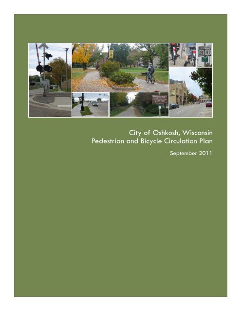
City of Oshkosh, Wisconsin Pedestrian and Bicycle Circulation Plan
City of Oshkosh, Wisconsin Pedestrian and Bicycle Circulation Plan
City of Oshkosh, Wisconsin Pedestrian and Bicycle Circulation Plan

Create successful ePaper yourself
Turn your PDF publications into a flip-book with our unique Google optimized e-Paper software.
<strong>City</strong> <strong>of</strong> <strong>Oshkosh</strong>, <strong>Wisconsin</strong><br />
<strong>Pedestrian</strong> <strong>and</strong> <strong>Bicycle</strong> <strong>Circulation</strong> <strong>Plan</strong><br />
September 2011
CITY OF OSHKOSH<br />
PEDESTRIAN AND BICYCLE CIRCULATION PLAN<br />
Adopted by the <strong>Oshkosh</strong> <strong>Plan</strong> Commission<br />
August 16, 2011<br />
Approved by the <strong>Oshkosh</strong> Common Council<br />
September 27, 2011<br />
OSHKOSH COMMON COUNCIL<br />
Burk Tower, Mayor<br />
Steve Herman, Deputy Mayor<br />
Steve Cummings<br />
Bob Poeschl<br />
Debra Allison-Aasby<br />
Thomas Pech, Jr.<br />
Jeff Hall<br />
PEDESTRIAN AND BICYCLE PLAN<br />
STAKEHOLDER/ STEERING GROUP<br />
Robert Breest, <strong>Oshkosh</strong> Sustainability Advisory Board<br />
David Buck, <strong>Oshkosh</strong> Community Development Department<br />
Steven Gohde, <strong>Oshkosh</strong> Department <strong>of</strong> Public Works<br />
Matt Halada, <strong>Wisconsin</strong> Department <strong>of</strong> Transportation<br />
James Kaprelian, <strong>Oshkosh</strong> Traffic Review Advisory Board<br />
Brian Kienert, <strong>Oshkosh</strong> Cycling Club<br />
S<strong>and</strong>y Knutson, <strong>Oshkosh</strong> Health Department<br />
Michael Lizotte, University <strong>of</strong> <strong>Wisconsin</strong> <strong>Oshkosh</strong><br />
Fred Luebke, <strong>Oshkosh</strong> Area Friends <strong>of</strong> Recreational Trails<br />
Shirley Brabender Mattox, <strong>Oshkosh</strong> L<strong>and</strong>marks Commission<br />
Ray Maurer, <strong>Oshkosh</strong> Parks Department<br />
James Michaelson, <strong>Oshkosh</strong> Advisory Parks Board<br />
Ann Rumbuc, Safe Routes to Schools<br />
Jean Stebbins, <strong>Oshkosh</strong> Area School District<br />
Chris Strong, <strong>Oshkosh</strong> Transportation Department<br />
Jeffrey Thoms, <strong>Oshkosh</strong> <strong>Plan</strong> Commission<br />
Rob Way, Winnebago County Parks<br />
Mark Ziemer, <strong>Oshkosh</strong> Senior Center<br />
CITY OF OSHKOSH BICYCLE AND PEDESTRIAN PLAN
ABSTRACT<br />
TITLE:<br />
CONTACT:<br />
<strong>City</strong> <strong>of</strong> <strong>Oshkosh</strong><br />
<strong>Pedestrian</strong> <strong>and</strong> <strong>Bicycle</strong> <strong>Circulation</strong> <strong>Plan</strong><br />
David Buck, Principal <strong>Plan</strong>ner<br />
<strong>Oshkosh</strong> <strong>Plan</strong>ning Division<br />
PH: 920.236.5059<br />
dbuck@ci.oshkosh.wi.us<br />
Chris Strong, Director<br />
<strong>Oshkosh</strong> Transportation Department<br />
PH: 920.232.5345<br />
cstrong@ci.oshkosh.wi.us<br />
AGENCY:<br />
AUTHORS:<br />
<strong>City</strong> <strong>of</strong> <strong>Oshkosh</strong><br />
David Buck, Principal <strong>Plan</strong>ner<br />
<strong>City</strong> <strong>of</strong> <strong>Oshkosh</strong><br />
Jeffrey Nau, Associate <strong>Plan</strong>ner/GIS<br />
<strong>City</strong> <strong>of</strong> <strong>Oshkosh</strong><br />
Schreiber/Anderson Associates Inc.<br />
Madison, <strong>Wisconsin</strong><br />
SOURCE OF COPIES:<br />
<strong>City</strong> <strong>of</strong> <strong>Oshkosh</strong> <strong>Plan</strong>ning Division<br />
215 Church Avenue<br />
<strong>Oshkosh</strong>, WI 54901<br />
PH: 920.236.5059<br />
<strong>City</strong> <strong>of</strong> <strong>Oshkosh</strong> Transportation Department<br />
926 Dempsey Trail<br />
<strong>Oshkosh</strong>, WI 54902<br />
PH: 920.232.5342<br />
<strong>City</strong> <strong>of</strong> <strong>Oshkosh</strong> Web Page<br />
www.ci.oshkosh.wi.us/Community_Development/<strong>Plan</strong>ning_Services/plans.asp<br />
CITY OF OSHKOSH BICYCLE AND PEDESTRIAN PLAN
TABLE OF CONTENTS<br />
CHAPTER 1: EXECUTIVE SUMMARY<br />
1.1 Introduction 1 - 1<br />
1.2 Existing Conditions 1 - 1<br />
1.3 Recommendations <strong>and</strong> Implementation 1 - 2<br />
General Facility Improvements 1 - 3<br />
Development <strong>and</strong> Maintenance Costs 1 - 5<br />
1.4 Funding Opportunities 1 - 6<br />
1.5 Appendices 1 - 6<br />
CHAPTER 2: INTRODUCTION<br />
2.1 Why is this plan important? 2 - 1<br />
2.2 How was this plan developed? 2 - 3<br />
2.3 Definition <strong>of</strong> Terms 2 - 3<br />
CHAPTER 3: PLANNING PROCESS<br />
3.1 <strong>Bicycle</strong> <strong>and</strong> <strong>Pedestrian</strong> <strong>Plan</strong> Stakeholder/Steering Group 3 - 1<br />
3.2 Survey 3 - 1<br />
3.3 Public Meetings 3 - 2<br />
CHAPTER 4: CURRENT CONDITIONS AND INVENTORY<br />
4.1 Assessment <strong>of</strong> <strong>Bicycle</strong> <strong>and</strong> <strong>Pedestrian</strong> Friendliness 4 - 1<br />
Bridge Access 4 - 1<br />
Street <strong>and</strong> Highway System Access 4 - 1<br />
<strong>Bicycle</strong> <strong>and</strong> <strong>Pedestrian</strong> System Access 4 - 2<br />
Transit Interface 4 - 3<br />
4.2 Community <strong>and</strong> User Characteristics 4 - 3<br />
Socioeconomic Data 4 - 4<br />
Travel to Work 4 - 4<br />
L<strong>and</strong>-Use 4 - 5<br />
4.3 Inventory <strong>and</strong> Assessment <strong>of</strong> Existing Facilities 4 - 5<br />
Biking Conditions 4 - 5<br />
Walking Conditions 4 - 7<br />
4.4 <strong>Bicycle</strong> <strong>and</strong> <strong>Pedestrian</strong> Statutes <strong>and</strong> Ordinances 4 - 9<br />
4.5 Existing <strong>Plan</strong>s 4 - 10<br />
CHAPTER 5: GOALS AND OBJECTIVES<br />
5.1 Vision Statement 5 - 1<br />
5.2 Goals <strong>and</strong> Objectives 5 - 1<br />
CHAPTER 6: BEST FACILITY PRACTICES<br />
6.1 Alternatives for Improved <strong>Bicycle</strong> <strong>and</strong> <strong>Pedestrian</strong> Facilities 6 - 1<br />
6.2 <strong>Bicycle</strong> Facilities 6 - 2<br />
Signed <strong>and</strong> Shared Roadways 6 - 2<br />
• Striped Bike Lanes 6 - 4<br />
• Sharrows 6 - 7<br />
• Wide Curb Lanes 6 - 9<br />
• Paved Shoulders 6 - 10<br />
CITY OF OSHKOSH BICYCLE AND PEDESTRIAN PLAN<br />
i
• Share-Use Roadway 6 - 11<br />
• Off-Road Facilities 6 - 12<br />
• Sidepaths 6 - 12<br />
• Multi-Use Trails 6 - 13<br />
Additional <strong>Bicycle</strong> Facility Considerations 6 - 16<br />
• <strong>Bicycle</strong> Parking 6 - 16<br />
• Advance Stop Line/<strong>Bicycle</strong> Boxes 6 - 18<br />
• <strong>Bicycle</strong> Signal Heads 6 - 19<br />
• Drainage Grates & Utility Covers 6 - 19<br />
• Rumble Strips 6 - 20<br />
• Colored Bike Lanes 6 - 20<br />
• Railroad Crossings 6 - 21<br />
• Bridges 6 - 21<br />
• Roundabouts 6 - 22<br />
• Road Diets 6 - 24<br />
6.3 <strong>Pedestrian</strong> Facilities 6 - 24<br />
Sidewalks 6 - 25<br />
Sidepaths 6 - 26<br />
Multi-Use Trails 6 - 27<br />
<strong>Pedestrian</strong> Facility Improvements 6 - 28<br />
• Crosswalks 6 - 28<br />
• Crossing Enhancements 6 - 29<br />
• Curb Ramps 6 - 32<br />
• Facility Separation 6 - 33<br />
Signs <strong>and</strong> Signals 6 - 33<br />
• Signal <strong>and</strong> Timing 6 - 34<br />
• Signal Enhancements 6 - 34<br />
• Right-Turn-On-Red Restriction 6 - 35<br />
• Signage 6 - 35<br />
Traffic Calming 6 - 37<br />
• Bumpouts/Bulbouts/Neckdowns/Chokers 6 - 37<br />
• Center Isl<strong>and</strong>s 6 - 37<br />
• Chicanes/Lateral Shifts 6 - 38<br />
• Closures 6 - 38<br />
• Diverters 6 - 38<br />
• Forced Turn Lanes 6 - 38<br />
• Median Barriers 6 - 39<br />
• Speed Humps 6 - 39<br />
• Speed Tables/Raised Crossings 6 - 39<br />
• Neighborhood Traffic Circles 6 - 39<br />
Lighting Improvements 6 - 40<br />
Walking Environment 6 - 40<br />
• “Street Furniture”/Obstructions 6 - 40<br />
• <strong>Pedestrian</strong> Overpass/Underpass 6 - 41<br />
6.4 Impacts <strong>of</strong> <strong>Bicycle</strong> <strong>and</strong> <strong>Pedestrian</strong> Facility Alternatives 6 - 42<br />
CITY OF OSHKOSH BICYCLE AND PEDESTRIAN PLAN<br />
ii
CHAPTER 7: SAFETY ANALYSIS<br />
7.1 Crash Statistics 7 - 1<br />
<strong>Bicycle</strong> Crashes <strong>and</strong> Countermeasures 7 - 2<br />
<strong>Pedestrian</strong> Crashes <strong>and</strong> Countermeasures 7 - 3<br />
7.2 Five E’s 7 - 4<br />
Education 7 - 4<br />
Encouragement 7 - 7<br />
Enforcement 7 - 7<br />
Engineering 7 - 9<br />
Evaluation 7 - 9<br />
CHAPTER 8: RECOMMENDATIONS AND IMPLEMENTATION<br />
8.1 Primary Recommendation 8 - 1<br />
Establish Commission 8 - 1<br />
8.2 Programmatic Recommendations 8 - 1<br />
Education, Encouragement & Outreach 8 - 2<br />
Enforcement 8 - 3<br />
Facility Maintenance 8 - 3<br />
Policy Recommendations 8 - 4<br />
8.3 <strong>Bicycle</strong> <strong>and</strong> <strong>Pedestrian</strong> Facility Recommendations 8 - 5<br />
Signage 8 - 5<br />
Program Priorities 8 - 6<br />
Network <strong>and</strong> Facility Improvements 8 - 8<br />
Implementation Tables 8 - 10<br />
8.4 Cost <strong>of</strong> Developing & Maintaining Facilities 8 - 19<br />
Facility Development Costs 8 - 19<br />
Cost <strong>of</strong> Maintaining Facilities 8 - 19<br />
Facility Maintenance Responsibility 8 - 20<br />
8.5 Funding Opportunities 8 - 20<br />
Specific Funding Opportunities 8 - 21<br />
8.6 <strong>Plan</strong> Amendment Process 8 - 22<br />
APPENDICES<br />
Appendix A:<br />
Appendix B:<br />
Appendix C:<br />
Appendix D:<br />
Appendix E:<br />
Appendix F:<br />
Appendix G:<br />
Appendix H:<br />
<strong>City</strong> <strong>of</strong> <strong>Oshkosh</strong> <strong>Bicycle</strong> <strong>and</strong> <strong>Pedestrian</strong> <strong>Plan</strong> Survey Results<br />
Origins <strong>and</strong> Destination Maps<br />
Proposed 41 <strong>Bicycle</strong> <strong>and</strong> <strong>Pedestrian</strong> Improvements<br />
<strong>Pedestrian</strong> Hazard Areas<br />
Recommended <strong>Bicycle</strong> Route/Improvement Maps<br />
Priority Facility Improvement Map<br />
Supplemental Road Diet Information<br />
Table <strong>of</strong> Suggestions/Comments for Consideration<br />
CITY OF OSHKOSH BICYCLE AND PEDESTRIAN PLAN<br />
iii
1<br />
EXECUTIVE SUMMARY<br />
1.1 INTRODUCTION<br />
The <strong>City</strong> <strong>of</strong> <strong>Oshkosh</strong> has prepared this 20-year <strong>Pedestrian</strong> <strong>and</strong> <strong>Bicycle</strong> <strong>Circulation</strong><br />
<strong>Plan</strong> to develop sound strategies for improving pedestrian <strong>and</strong> bicycle<br />
transportation throughout the <strong>Oshkosh</strong> area. The planning area includes the <strong>City</strong><br />
<strong>of</strong> <strong>Oshkosh</strong> with connection to surrounding extra-territorial areas.<br />
Oversight on this project has been provided by the <strong>Pedestrian</strong> <strong>and</strong> <strong>Bicycle</strong> <strong>Plan</strong><br />
Stakeholder/Steering Group, a working team formed <strong>of</strong> interested citizens,<br />
representatives from various organizations <strong>and</strong> city departments. The group was<br />
responsible for providing direction <strong>and</strong> review <strong>of</strong> plan components through an<br />
extensive series <strong>of</strong> workshop meetings. The process also included multiple public<br />
information Meetings <strong>and</strong> public hearings.<br />
1.2 EXISTING CONDITIONS<br />
The <strong>Oshkosh</strong> area consists primarily <strong>of</strong> a grid pattern street system that is altered<br />
by the area’s waterways such as the Fox River <strong>and</strong> Lake Winnebago. As a result,<br />
bridges are a major concession for bicycle <strong>and</strong> pedestrian travel. The prevalent<br />
transportation pattern evident in <strong>Oshkosh</strong> is the use <strong>of</strong> all <strong>of</strong> the street width for<br />
motorized traffic on most major collectors <strong>and</strong> arterials. In many cases, the street<br />
is divided into four narrow travel lanes, with no terrace <strong>and</strong> with the sidewalk, if<br />
present, abutting the street.<br />
The <strong>Oshkosh</strong> urbanized area is connected to the surrounding rural areas by a<br />
system <strong>of</strong> State <strong>and</strong> County highways. United States Highway (USH) 41 provides<br />
the primary north- south route through the area. Travel east to west is<br />
accommodated through Highways 21, Witzel Avenue, 9 th Avenue, West 20 th<br />
Avenue <strong>and</strong> South Park Avenue. <strong>Bicycle</strong> <strong>and</strong> pedestrian travel is prohibited on<br />
USH 41. Currently, bicycle <strong>and</strong> pedestrian accommodations on the bridges <strong>and</strong><br />
underpasses <strong>of</strong> USH 41 are through the newly constructed or planned round-about<br />
network but connections to these new facilities are inadequate, <strong>and</strong> in many<br />
cases not present.<br />
Census 2000 indicates workers living in the <strong>Oshkosh</strong> area had an average<br />
commute time <strong>of</strong> 16 minutes. Connections between places <strong>of</strong> residence to place <strong>of</strong><br />
employment are integral to increasing mode share. Providing safe <strong>and</strong> adequate<br />
facilities along these “commuter routes” creates opportunities for commuters who<br />
want to bike to work the opportunity to do so. Similarly, connections to area trails,<br />
such as the WIOUWASH State Trail <strong>and</strong> the USH 41 Lake Butte des Morts trail will<br />
increase comfort levels for bicyclists <strong>of</strong> all abilities.<br />
Transportation systems <strong>and</strong> l<strong>and</strong> use patterns have a well-documented reciprocal<br />
relationship. As <strong>Oshkosh</strong> has grown, the dem<strong>and</strong>s for transportation system<br />
CITY OF OSHKOSH PEDESTRIAN AND BICYCLE PLAN 1- 1
improvements have also grown. However, these transportation improvements have<br />
also provided more convenient access to l<strong>and</strong> farther out, thus spurring outward<br />
growth. More than any other transportation system, it has been the road network<br />
<strong>and</strong> the prevalence <strong>of</strong> the automobile that has impacted l<strong>and</strong> use patterns over<br />
the past half- century.<br />
Notable l<strong>and</strong> use patterns or issues for the <strong>City</strong> <strong>of</strong> <strong>Oshkosh</strong> <strong>and</strong> Winnebago<br />
County include:<br />
• Water divides the urbanized area between north to south <strong>and</strong> to a lesser<br />
extent from east <strong>and</strong> west.<br />
• Development is <strong>of</strong>ten not contiguous; in general, <strong>Oshkosh</strong> has its distinct areas<br />
<strong>of</strong> both residential <strong>and</strong> commercial development. In many cases, water, or<br />
undeveloped l<strong>and</strong> separates <strong>Oshkosh</strong> from our neighboring communities.<br />
• Development as it exists today directly corresponds to the freeway system.<br />
Walking is <strong>of</strong>ten overlooked <strong>and</strong> undervalued as a transportation mode. Yet, in<br />
the <strong>Oshkosh</strong> area, 3.3 percent <strong>of</strong> commuters reported regularly walking to work.<br />
These percentages do not include other pedestrian activity, such as walking trips to<br />
schools <strong>and</strong> universities, commercial areas or for recreation. Many <strong>of</strong> these<br />
pedestrians are children, seniors <strong>and</strong> persons utilizing wheelchairs or mobility<br />
devices who require special consideration regarding facility design.<br />
Areas where there are gaps in the bicycle <strong>and</strong> pedestrian system include any<br />
place there is a lack <strong>of</strong> biking or walking facilities, maintenance issues, or areas<br />
where bike paths <strong>and</strong> major routes should connect to other routes, recreational<br />
areas, residential areas, commercial centers or employment centers. Noteworthy<br />
gaps included the difficulty <strong>of</strong> bicycle travel under or over USH 41, on many<br />
collectors <strong>and</strong> arterials throughout the city <strong>and</strong> on the bridges that span the Fox<br />
River. A general comment from the public about these gaps includes the usability<br />
<strong>of</strong> these areas on a year-round basis. The quick <strong>and</strong> effective removal <strong>of</strong> snow<br />
can be an issue when not done with respect to crosswalk locations or curb lanes.<br />
1.3 RECOMMENDATIONS AND IMPLEMENTATION<br />
Recommendations were developed using an inventory <strong>and</strong> analysis <strong>of</strong> existing<br />
facilities, Ordinances, <strong>and</strong> plans as well as suggestions/comments from the public,<br />
city staff <strong>and</strong> the <strong>Pedestrian</strong> <strong>and</strong> <strong>Bicycle</strong> <strong>Plan</strong> Stakeholder/Steering Group.<br />
Recommendations include a principal or overriding recommendation to establish an<br />
<strong>of</strong>ficial <strong>City</strong> <strong>of</strong> <strong>Oshkosh</strong> <strong>Bicycle</strong> <strong>and</strong> <strong>Pedestrian</strong> Commission, bicycle <strong>and</strong> pedestrian<br />
program recommendations, general facility improvements, route configuration, <strong>and</strong><br />
implementation strategies, including a timetable for expansion <strong>of</strong> the bicycle<br />
network.<br />
1.3.1 <strong>Bicycle</strong> <strong>and</strong> <strong>Pedestrian</strong> Commission Recommendations<br />
The creation <strong>of</strong> an <strong>of</strong>ficial <strong>Bicycle</strong> <strong>and</strong> <strong>Pedestrian</strong> Commission, functioning similar to<br />
other existing city boards/commissions, would hold regular meetings <strong>and</strong> be<br />
charged with the responsibility <strong>of</strong> reviewing, amending <strong>and</strong> implementing the<br />
recommendations <strong>and</strong> initiatives included within this plan.<br />
CITY OF OSHKOSH PEDESTRIAN AND BICYCLE PLAN 1- 2
1.3.2 <strong>Bicycle</strong> <strong>and</strong> <strong>Pedestrian</strong> Program Recommendations<br />
<strong>Bicycle</strong> <strong>and</strong> pedestrian program recommendations include education,<br />
encouragement, <strong>and</strong> outreach programs; enforcement; facility maintenance <strong>and</strong><br />
policy recommendations. Education, encouragement, <strong>and</strong> outreach programs were<br />
designed to foster a safe bicycling <strong>and</strong> walking environment <strong>and</strong> increase the<br />
prevalence <strong>and</strong> enjoyment <strong>of</strong> walking <strong>and</strong> bicycling. Successful encouragement<br />
<strong>and</strong> outreach efforts largely rest on a foundation <strong>of</strong> extensive <strong>and</strong> effective<br />
educational programs. Education programs include identifying safe routes for<br />
bicyclists <strong>and</strong> pedestrians, teaching bicycling techniques, disseminating information<br />
regarding regulations that govern bicyclists <strong>and</strong> pedestrians, <strong>and</strong> instructing<br />
bicyclists <strong>and</strong> pedestrians how to h<strong>and</strong>le potentially dangerous situations.<br />
Encouragement activities are valuable because they promote biking <strong>and</strong> walking<br />
through incentives (such as rewards) or provisions (such as safe <strong>and</strong> convenient<br />
parking facilities). Outreach activities are among the easiest <strong>and</strong> least cost<br />
intensive initiatives that advance bicyclist <strong>and</strong> pedestrian safety. Consistent<br />
enforcement <strong>of</strong> traffic laws also plays an important role in advancing bicyclist <strong>and</strong><br />
pedestrian safety. Likewise, maintenance is important for all types <strong>of</strong><br />
transportation facilities. Periodic <strong>and</strong> consistent removal <strong>of</strong> debris <strong>and</strong><br />
resurfacing/patching <strong>of</strong> deteriorated pavement are important procedures for<br />
ensuring that users are provided with safe <strong>and</strong> reliable transportation facilities.<br />
1.3.3 General Facility Improvements<br />
While useful to encourage <strong>and</strong> sustain walking <strong>and</strong> bicycling, operational<br />
programs <strong>and</strong> policies are futile without adequate facilities. Too <strong>of</strong>ten, facility<br />
planning is synonymous with planning separate trail systems. However, separated<br />
bike/pedestrian paths <strong>and</strong> bike lanes are the most costly <strong>of</strong> all facility<br />
improvements. Because <strong>of</strong> their costs <strong>and</strong> the amount <strong>of</strong> public right-<strong>of</strong>-way<br />
needed to accommodate these systems, separate bikeways seldom form a<br />
complete bicycle <strong>and</strong> pedestrian system. For the <strong>City</strong> <strong>of</strong> <strong>Oshkosh</strong>, it is most<br />
efficient <strong>and</strong> cost effective to make use <strong>of</strong> established transportation right-<strong>of</strong>ways,<br />
especially within the older developed areas <strong>of</strong> the <strong>City</strong>. Trails <strong>and</strong><br />
sidepaths are mainly utilized in newer areas <strong>of</strong> <strong>Oshkosh</strong>, at natural corridors <strong>and</strong><br />
where physically <strong>and</strong> economically feasible.<br />
Signing bike routes direct pedestrians <strong>and</strong> bicyclists to the preferred routes <strong>and</strong><br />
also helps to direct visitors from outside the community to their desired destinations<br />
safely <strong>and</strong> efficiently. The routes also increase the likelihood that motorists will<br />
encounter bicyclists which may heighten driver attentiveness <strong>and</strong> bicyclist<br />
confidence. All bike routes within <strong>Oshkosh</strong> are recommended to be signed,<br />
whether they have bike lanes, sharrows, wide curb lanes, or are simply shared-use<br />
roadways.<br />
As important as bicycle facilities are for increasing mobility, it is also critical to<br />
maintain a comprehensive vision for creating a “walkable” <strong>and</strong> “bikable” <strong>Oshkosh</strong>,<br />
which includes bike lanes, shared roadways, multi-use trails, sidepaths <strong>and</strong><br />
sidewalks. Not only does this plan recommend specific facility improvements, it<br />
sets policy priorities <strong>and</strong> <strong>of</strong>fers guidance <strong>and</strong> tools to help promote bicycling <strong>and</strong><br />
pedestrian safety, efficiency <strong>and</strong> effectiveness.<br />
CITY OF OSHKOSH PEDESTRIAN AND BICYCLE PLAN 1- 3
The overriding principle for bicycle <strong>and</strong> pedestrian friendly streets is to create<br />
public right-<strong>of</strong>-ways that work effectively for <strong>and</strong> benefit all modes <strong>of</strong><br />
transportation. Regardless <strong>of</strong> whether streets <strong>and</strong> roads are included in this plan’s<br />
designated bicycle network, bicyclists will use all available roads. Therefore, the<br />
recommended bicycle network has been developed to formalize safe routes from<br />
“origins” to “destinations”, eliminate gaps within the current network, continue the<br />
expansion <strong>of</strong> the existing <strong>of</strong>f-road facilities utilizing natural <strong>and</strong> other areas <strong>of</strong><br />
opportunity, <strong>and</strong> improve access <strong>and</strong> connectivity for the bicyclist within the<br />
<strong>Oshkosh</strong> community.<br />
Best facility practices must be considered when any transportation network is<br />
developed, reconstructed or augmented. Policy <strong>and</strong> project priorities for<br />
pedestrians are much more programmatic while those for bicycles tend to be more<br />
physical in nature.<br />
<strong>Pedestrian</strong> Facilities<br />
<strong>Oshkosh</strong>’s pedestrian framework is partially in place in that sidewalks or trails are<br />
required for new subdivisions <strong>and</strong> other development. Sidewalks form the<br />
backbone <strong>of</strong> the physical portion <strong>of</strong> our pedestrian transportation network,<br />
however, what constitutes a “pedestrian-friendly” or “walkable” community is much<br />
more than merely having sidewalk facilities in place. High quality, navigable,<br />
appropriately sized sidewalks certainly are one part <strong>of</strong> the equation; however,<br />
other elements <strong>and</strong> amenities such as crosswalks, signalization, traffic calming,<br />
pedestrian-scale lighting, street furniture, <strong>and</strong> space separating vehicle traffic<br />
lanes from sidewalks are also extremely important. Best facility practices for<br />
<strong>Oshkosh</strong> pedestrian facilities include three primary facility types:<br />
• Sidewalks - paths located within a right-<strong>of</strong>-way along the side <strong>of</strong> a road<br />
<strong>and</strong> are normally separated from the vehicular section by a curb<br />
• Sidepaths - segregated facilities located next to or alongside a roadway<br />
separated from motor vehicle traffic by a physical barrier <strong>and</strong>/or increased<br />
greenspace.<br />
• Multi-use trails - segregated trails or paths located within their own right-<strong>of</strong>way<br />
or easement area <strong>and</strong> are not closely associated with a roadway.<br />
<strong>Bicycle</strong> Facilities<br />
Suitably designed bikeways can be identified formally as "Bike Routes." These<br />
routes indicate a major route that most bicyclists will feel comfortable using.<br />
This plan recommends a comprehensive <strong>and</strong> interconnected bicycle network by<br />
suggesting a facility type (bike lane, sharrow, multi-use trail) throughout the<br />
<strong>Oshkosh</strong> area. It is important to state that the design approach behind the<br />
recommended bicycle facility types <strong>and</strong> routes contained within this planning<br />
document was guided <strong>and</strong> shaped with a critical design consideration in mind.<br />
Design approach<br />
The fundamental design consideration behind route determination that must be<br />
described is what type <strong>of</strong> bicyclist is best served by the <strong>City</strong>’s bicycle facility<br />
network. The <strong>Bicycle</strong> <strong>and</strong> <strong>Pedestrian</strong> Stakeholder/Steering Group made the<br />
CITY OF OSHKOSH PEDESTRIAN AND BICYCLE PLAN 1- 4
decision that all network route <strong>and</strong> facility choice decisions had to be made with<br />
the basic bicyclist in mind, not the novice or advanced rider. To this end, the<br />
design approach contained the principal <strong>of</strong> locating designated bicycle routes <strong>of</strong>f<br />
unsafe, high traffic volume streets & truck routes, wherever possible. Furthermore,<br />
the group also focused on route placement as it related to existing traffic<br />
controlled intersections <strong>and</strong> the separation <strong>of</strong> bicycle travel from vehicular traffic<br />
such as the utilization <strong>of</strong> park properties, greenways <strong>and</strong> rail corridors<br />
The proposed recommended improvement is delineated into three sections that<br />
correlate with facility recommendations:<br />
• Signed <strong>and</strong> striped roadways - a portion <strong>of</strong> the roadway which has been<br />
designated by striping, signing <strong>and</strong> other pavement markings for the<br />
preferential or exclusive use by bicyclists.<br />
• Signed <strong>and</strong>/or shareways - also known as stripeless bike lanes, do not have<br />
corridors reserved for bicyclists, but signs <strong>and</strong> pavement symbols indicate<br />
that they are bike routes <strong>and</strong> heavily used by bicyclists.<br />
• Multi-use trail - segregated trails or paths located within their own right-<strong>of</strong>way<br />
or easement area <strong>and</strong> are not closely associated with a roadway.<br />
Short range (0-5 years) recommendation cost estimates are included in the plan<br />
but estimates for longer term recommendations (6+ years) are not as they would<br />
not be useful because their timeframes are too far out to be realistically<br />
calculated.<br />
Recommendations within the plan are assigned a “Timeframe” based on the ability<br />
to develop in a timely manner <strong>and</strong> their importance in meeting plan goals <strong>and</strong><br />
objectives. Priority for facilities was done with an assumption that they could be<br />
completed within the allotted timeframe, they create a connected network on<br />
the interim <strong>and</strong> that “funds were available”, as predictions on funding levels<br />
could not be accurately estimated. Facility development fall under two<br />
headings:<br />
• Priority Facility Improvements: 0-5 years<br />
• Future Facility Improvements: 6 or more years<br />
Recommendations within the first five-year timeframe are viewed as the most vital<br />
for fulfilling the short-term goals <strong>of</strong> the <strong>Bicycle</strong> <strong>and</strong> <strong>Pedestrian</strong><br />
Stakeholder/Steering Group <strong>and</strong> also represent existing planned projects that will<br />
soon be implemented. Future Facility Improvement recommendations are longerterm<br />
desires requiring a more sustained effort to implement.<br />
As many <strong>of</strong> the recommendations within the plan require coordination with<br />
roadway reconstruction <strong>and</strong> potential property acquisition, especially in the case<br />
<strong>of</strong> bike lane <strong>and</strong> multi-use trail development, an interim solution to connect system<br />
facilities must be the temporary use <strong>of</strong> signed <strong>and</strong>/or shared facilities, especially<br />
if sign <strong>and</strong> striped facilities (bike Lanes) are included as part <strong>of</strong> the longrange/future<br />
facility improvement schedule. Therefore, flexibility in facility<br />
development, using a less intensive facility such as sharrows/signage or simply<br />
signage when bike lanes are determined to be unfeasible or are a longer<br />
timeframe out are recommended at the time a facility is being created. It is very<br />
CITY OF OSHKOSH PEDESTRIAN AND BICYCLE PLAN 1- 5
important that the <strong>City</strong> consider all facilities, such as automobile parking, bike<br />
lanes/sharrows, terrace, etc. to determine which are most important. The aim <strong>of</strong><br />
this plan is to maintain a balance <strong>of</strong> transportation related needs in the community.<br />
It is not intended that the recommendations be implemented as a “winner takes all”<br />
scenario but a “win-win” between potentially competing interests.<br />
The road diet concept (reducing the number <strong>of</strong> travel lanes located on a roadway)<br />
may be an appropriate <strong>and</strong> feasible technique to gain right-<strong>of</strong>-way area for bike<br />
facility installation <strong>and</strong> pedestrian safety. However, the <strong>Bicycle</strong> <strong>and</strong> <strong>Pedestrian</strong><br />
Stakeholder/Steering Group has not formerly recommended road diets for any<br />
specific streets as they believe they need further study on an individual street-bystreet<br />
basis during restriping or reconstruction.<br />
1.3.4 Development <strong>and</strong> Maintenance Costs<br />
Development cost estimates for on-street facility types within the plan were<br />
determined by using actual costs experienced by Sheboygan County, WI <strong>and</strong> are<br />
current in 2011. Trail cost estimates are based on the development <strong>of</strong> trails<br />
including the Badger State Trail (linking Madison to Fitchburg), which was<br />
completed in 2010.<br />
Maintenance cost estimates were derived from various state <strong>and</strong> municipal sources<br />
with the assumption that restriping/resymbolization would be necessary every<br />
three years. Trail maintenance cost estimates are derived from the American<br />
Trails Partnership based on surveys <strong>of</strong> their membership.<br />
1.4 FUNDING OPPORTUNITIES<br />
The <strong>Plan</strong> recommends that the <strong>City</strong> <strong>of</strong> <strong>Oshkosh</strong> appropriate annual funds for<br />
bicycle <strong>and</strong> pedestrian improvements just as it does for other roadway projects. In<br />
addition, bicycle <strong>and</strong> pedestrian projects may be eligible for state or federal<br />
funding. <strong>Pedestrian</strong> improvements that benefit public health <strong>and</strong> safety should be<br />
funded through the general fund, supplemented by available state <strong>and</strong> federal<br />
grants, rather than through assessment.<br />
1.5 APPENDICES<br />
The plan is supplemented by seven appendices that are referenced within the<br />
document <strong>and</strong> help to provide information that is readily accessible <strong>and</strong>/or would<br />
potentially be “lost” within the body <strong>of</strong> the document. These appendices are<br />
described below:<br />
Appendix A: <strong>City</strong> <strong>of</strong> <strong>Oshkosh</strong> <strong>Bicycle</strong> <strong>and</strong> <strong>Pedestrian</strong> <strong>Plan</strong> Survey Results- A survey<br />
to solicit information regarding biking <strong>and</strong> walking within <strong>Oshkosh</strong> by <strong>Oshkosh</strong><br />
residents <strong>and</strong> visitors. Posted on the web as well as provided at bicycle <strong>and</strong><br />
run/walk events.<br />
Appendix B: Origins <strong>and</strong> Destination Maps- Origin <strong>and</strong> destination maps were<br />
derived from the initial public informational meeting identifying where interested<br />
parties are coming from <strong>and</strong> going to as well as areas <strong>of</strong> concern.<br />
CITY OF OSHKOSH PEDESTRIAN AND BICYCLE PLAN 1- 6
Appendix C: Proposed 41 <strong>Bicycle</strong> <strong>and</strong> <strong>Pedestrian</strong> Improvements - This appendix<br />
details improvements proposed by the Department <strong>of</strong> Transportation.<br />
Appendix D: <strong>Pedestrian</strong> Hazard Areas- Areas <strong>and</strong> intersections identified as<br />
pedestrian hazard areas such as schools, parks, <strong>and</strong> commercial areas as well as<br />
long blocks that should be given special attention.<br />
Appendix E: Recommended <strong>Bicycle</strong> Route/Improvement Maps- Depicts the<br />
recommended bicycle facility network including routes, facility types <strong>and</strong> areas <strong>of</strong><br />
intersection improvements.<br />
Appendix F: Priority Facility Improvement Map- Depicts the recommended bicycle<br />
facility considered to be “priority” <strong>and</strong> that can be developed within a five year<br />
period.<br />
Appendix G: Supplemental Road Diet Information- Information, primarily articles<br />
<strong>and</strong> study’s, which describe the Road Diet concept.<br />
Appendix H: Table <strong>of</strong> Suggestions/Comments for Consideration- Compilation <strong>of</strong><br />
comments <strong>and</strong> suggested changes to the plan received during its formal review<br />
process.<br />
CITY OF OSHKOSH PEDESTRIAN AND BICYCLE PLAN 1- 7
2 INTRODUCTION<br />
The <strong>City</strong> <strong>of</strong> <strong>Oshkosh</strong> has prepared this Comprehensive <strong>Pedestrian</strong> <strong>and</strong> <strong>Bicycle</strong><br />
<strong>Circulation</strong> <strong>Plan</strong> to develop sound strategies for improving bicycle <strong>and</strong> pedestrian<br />
transportation throughout the <strong>Oshkosh</strong> area for users <strong>of</strong> varying abilities. The<br />
planning area includes the <strong>Oshkosh</strong> metro area <strong>and</strong> is illustrated in Appendix E.<br />
This document incorporates recommendations set forth in a number <strong>of</strong> planning<br />
documents including the <strong>City</strong> <strong>of</strong> <strong>Oshkosh</strong> Comprehensive <strong>Plan</strong> 2005-2025, the<br />
<strong>Oshkosh</strong> Area Safe Routes to School <strong>Plan</strong>, the 2007 <strong>Oshkosh</strong> MPO Long-range<br />
Transportation/L<strong>and</strong> Use <strong>Plan</strong> <strong>and</strong> the <strong>City</strong> <strong>of</strong> <strong>Oshkosh</strong> 1998 <strong>Pedestrian</strong> <strong>and</strong><br />
<strong>Bicycle</strong> <strong>Circulation</strong> <strong>Plan</strong>.<br />
The recommendations set forth in this plan are designed to increase transportation<br />
safety for pedestrians, bicyclists <strong>and</strong> motorists. Infrastructure improvements such as<br />
sidewalks, marked crosswalks, bike lanes, paved shoulders, multi-use trails <strong>and</strong><br />
traffic <strong>and</strong> informational signs are among the type <strong>of</strong> facilities recommended to<br />
improve conditions for the non-motoring public. Opportunities to educate bicyclists<br />
about safety <strong>and</strong> promote bicycling as a viable mode <strong>of</strong> transportation are<br />
discussed. Additionally, recommendations to improve enforcement <strong>and</strong> education<br />
regarding traffic laws affecting bicyclists <strong>and</strong> walkers are also presented.<br />
2.1 WHY IS THIS PLAN IMPORTANT?<br />
Before the 1900's, bicycling <strong>and</strong> walking were common modes <strong>of</strong> transportation in<br />
the United States. Transportation infrastructure <strong>and</strong> l<strong>and</strong> use patterns reflected<br />
the need to accommodate these travel modes. Compact communities allowed<br />
people to walk to most destinations. Interestingly, early American urban roads<br />
were originally paved to help bicyclists reach their destinations. As the pace <strong>of</strong><br />
the American lifestyle quickened <strong>and</strong> automobiles were made affordable to the<br />
population, bicycling <strong>and</strong> walking gradually dropped in priority as modes <strong>of</strong><br />
transportation. Since the late 1940's, motor vehicles have been the dominant<br />
influence on transportation <strong>and</strong> l<strong>and</strong> use patterns <strong>and</strong> subsequently, these l<strong>and</strong> use<br />
patterns have changed behavior patterns. The convenience <strong>and</strong> flexibility <strong>of</strong> the<br />
automobile are easily recognized; however, automobiles are not the most efficient<br />
mode <strong>of</strong> travel for many types <strong>of</strong> trips. The benefits <strong>of</strong> alternative modes <strong>of</strong><br />
travel such as bicycling <strong>and</strong> walking are particularly significant for short urban<br />
trips. Arguments for encouraging these modes <strong>of</strong> travel are both functional <strong>and</strong><br />
philosophical:<br />
• Bicycling <strong>and</strong> walking are two <strong>of</strong> the most cost efficient modes <strong>of</strong><br />
transportation with regard to operation, development <strong>and</strong> maintenance <strong>of</strong><br />
facilities.<br />
• Bicycling <strong>and</strong> walking are two <strong>of</strong> the best forms <strong>of</strong> physical exercise <strong>and</strong><br />
therefore can effectively enhance the health <strong>of</strong> the citizens <strong>of</strong> <strong>Oshkosh</strong>.<br />
CITY OF OSHKOSH PEDESTRIAN AND BICYCLE PLAN 2- 1
• Bike <strong>and</strong> pedestrian facilities developed for transportation purposes can<br />
simultaneously enhance recreation <strong>and</strong> tourism opportunities within <strong>Oshkosh</strong>.<br />
• Bicycling <strong>and</strong> walking do not contribute to noise or air pollution <strong>and</strong> thus<br />
contribute to the health <strong>of</strong> our community. Off-road facilities developed for<br />
bicycling <strong>and</strong> walking can protect <strong>and</strong> enhance our natural resources.<br />
• Bicycling <strong>and</strong> walking promote social interaction <strong>of</strong> families <strong>and</strong> community<br />
members.<br />
The premise <strong>of</strong> “multi-modalism” is simple: to create a transportation system that<br />
<strong>of</strong>fers not only choices among travel modes for specific trips, but more importantly,<br />
presents these options so that they are viable choices that meet the needs <strong>of</strong><br />
individuals <strong>and</strong> the <strong>Oshkosh</strong> community as a whole.<br />
As part <strong>of</strong> the federal initiative to encourage multi-modal transportation in general<br />
<strong>and</strong> bicycle transportation in particular, the Safe, Accountable, Flexible, Efficient<br />
Transportation Equity Act: A Legacy for Users (SAFETEA-LU) requires that long<br />
range planning <strong>of</strong> transportation systems include provisions for bicycling <strong>and</strong><br />
walking. This legislation builds on the Intermodal Surface Transportation Efficiency<br />
Act <strong>of</strong> 1991 (ISTEA) <strong>and</strong> the Transportation Equity Act for the 21 st Century (TEA-<br />
21) to supply funds <strong>and</strong> a programmatic framework for investments in<br />
transportation infrastructure. SAFETEA-LU also provided funding for all fifty states<br />
to initiate a Safe Routes to School program to enable <strong>and</strong> encourage school<br />
children (K-8) to walk <strong>and</strong> bicycle to school.<br />
In <strong>Wisconsin</strong>, bicycling <strong>and</strong> walking have been promoted through WisDOT's<br />
TransLinks 21 <strong>Plan</strong>. This transportation initiative is a comprehensive, twenty-five<br />
year transportation plan that was developed through two years <strong>of</strong> planning <strong>and</strong><br />
public involvement. The TransLinks plan calls for bicycle <strong>and</strong> pedestrian provisions<br />
on state highway projects, inclusion in Metropolitan <strong>Plan</strong>ning Organization's (MPO)<br />
plans <strong>and</strong> also recommends the development <strong>of</strong> a comprehensive State <strong>Bicycle</strong><br />
<strong>Plan</strong> <strong>and</strong> <strong>Pedestrian</strong> <strong>Plan</strong>. While nearly eight million Americans enjoy bicycling<br />
<strong>and</strong> all are pedestrians, only 5.5% <strong>of</strong> all urban trips in the United States are by<br />
walking <strong>and</strong> 0.9% by bicycling. Safety, distance <strong>and</strong> traffic conditions are<br />
reasons <strong>of</strong>ten cited for the infrequent use <strong>of</strong> these travel modes. A 1990 Harris<br />
Poll suggests that twice as many people would walk or bicycle as a primary means<br />
<strong>of</strong> transportation if better facilities were available. In this fast-paced society, time<br />
<strong>and</strong> distance are perhaps the greatest impediments to non-motorized travel. Yet<br />
nearly 40% <strong>of</strong> trips made in the U.S. are less than two miles. Trips <strong>of</strong> this length<br />
are very easily accomplished by average bicyclists, <strong>and</strong> when compared to<br />
driving, require little additional time.<br />
Walking <strong>and</strong> bicycling are underutilized modes <strong>of</strong> transportation in the <strong>Oshkosh</strong><br />
area. While mean travel time to work in <strong>Oshkosh</strong> was under 16.5 minutes in 2006-<br />
2008, very few choose to commute by bicycle (0.2%) or by walking (3.8%) (US<br />
Census 2006-2008). The relatively small number <strong>of</strong> walking <strong>and</strong> bicycling trips can<br />
be attributed to impediments such as traffic conditions, safety concerns,<br />
transportation infrastructure <strong>and</strong> topography. This plan is designed to increase<br />
levels <strong>of</strong> bicycle use by making recommendations to reduce these impediments,<br />
CITY OF OSHKOSH PEDESTRIAN AND BICYCLE PLAN 2- 2
<strong>and</strong> to change the prevailing attitude that using an automobile is easier <strong>and</strong> more<br />
convenient than bicycling or walking.<br />
2.2 HOW WAS THE PLAN DEVELOPED?<br />
Development <strong>of</strong> this plan was administered by city planning staff with oversight<br />
from the <strong>Pedestrian</strong> <strong>and</strong> <strong>Bicycle</strong> Stakeholder/Steering Group. It was initially<br />
prepared by Schreiber/Anderson Associates, a consulting firm out <strong>of</strong> Madison,<br />
<strong>Wisconsin</strong> <strong>and</strong> had multiple portions rewritten using their draft as a base. The<br />
stakeholder/steering group included representatives from various organizations<br />
<strong>and</strong> reflected a broad cross-section <strong>of</strong> biking <strong>and</strong> walking interests. They provided<br />
guidance <strong>and</strong> met regularly over an 24 month time period to review the work to<br />
date. There were also two public informational meetings held during the planning<br />
process.<br />
2.3 DEFINITION OF TERMS<br />
The language used within this plan document is meant to be easy to read <strong>and</strong><br />
underst<strong>and</strong>able, however many <strong>of</strong> the terms used are not common place <strong>and</strong> are<br />
specific terms used primarily by engineers, planners, bicycle enthusiasts <strong>and</strong><br />
pedestrian advocates. Although all the concepts within this plan are described <strong>and</strong><br />
defined within the body <strong>of</strong> the text, below is an alphabetical list <strong>of</strong> terms with the<br />
definitions that may not be clearly or fully understood by the general public.<br />
<strong>Bicycle</strong> Facility- A general term denoting improvements <strong>and</strong> provisions that<br />
accommodate <strong>and</strong> encourage bicycling, including but not limited to parking <strong>and</strong><br />
storage facilities, <strong>and</strong> shared roadways not specifically defined for bicycle use.<br />
Bike Box (Also known as an Advanced Stop Line)- Road markings at signalized road<br />
junctions allowing bikes a “head start” when the traffic signal changes from red to<br />
green.<br />
Bike Lane - A portion <strong>of</strong> a roadway that has been designated for preferential or<br />
exclusive use by bicyclists by pavement markings <strong>and</strong> signs.<br />
Bulbout/Bumpout (also known as curb extensions, chokers or neckdowns) –<br />
Extensions <strong>of</strong> the sidewalk or curb line out that reduce curb-to-curb effective<br />
roadway lane widths.<br />
Chevron- A double directional arrow used with a bicycle symbol as pavement<br />
marking painted on the roadway to designate a sharrow <strong>and</strong> remind motorists<br />
<strong>and</strong> cyclists that they are sharing the roadway.<br />
Chicane- Curb extensions that alternate from one side <strong>of</strong> the roadway to the other,<br />
forming S-shaped curves.<br />
Choke (also known as Bulbout/Bumpout, curb extensions, or neckdowns) -<br />
Extensions <strong>of</strong> the sidewalk or curb line out that reduce curb-to-curb effective<br />
roadway lane widths.<br />
Complete Streets- Roadways designed <strong>and</strong> operated to enable safe, attractive,<br />
<strong>and</strong> comfortable access <strong>and</strong> travel for all users, including pedestrians, bicyclists,<br />
motorists <strong>and</strong> public transport users <strong>of</strong> all ages <strong>and</strong> abilities.<br />
Crosswalk- Any portion <strong>of</strong> a roadway at an intersection or elsewhere distinctly<br />
indicated as a pedestrian crossing by pavement marking lines on the surface,<br />
which might be supplemented by contrasting pavement texture, style, or color<br />
CITY OF OSHKOSH PEDESTRIAN AND BICYCLE PLAN 2- 3
Cul-de-sac- A dead end, closed, no through road/court. Street with only one<br />
inlet/outlet.<br />
Curb Extension (also known as bump-outs/bulb-outs or neckdowns) - Extensions<br />
<strong>of</strong> the sidewalk or curb line out that reduce curb-to-curb effective roadway lane<br />
widths.<br />
Designated <strong>Bicycle</strong> Route– A system <strong>of</strong> bikeways <strong>of</strong>ficially designated <strong>and</strong><br />
including appropriate directional <strong>and</strong> informational route signs.<br />
Diverter- Barriers placed diagonally across an intersection, blocking certain<br />
movements.<br />
Easement- A certain right to use the real property <strong>of</strong> another without possessing it.<br />
Easements are helpful for providing pathways across two or more pieces <strong>of</strong><br />
property<br />
Gutter Pan- A depression which runs alongside a city street, usually at the curb <strong>and</strong><br />
diverts rain <strong>and</strong> street-cleaning water away from the street <strong>and</strong> into a storm drain.<br />
Intermodel- The use <strong>of</strong> more than one mode <strong>of</strong> transportation, including but not<br />
limited to automobile, mass transit, bicycling, walking.<br />
Manual <strong>of</strong> Uniform Traffic Control Devices (MUTCD)- A document that defines the<br />
st<strong>and</strong>ards used by road managers nationwide to install <strong>and</strong> maintain traffic<br />
control devices on all public streets, highways, bikeways, <strong>and</strong> private roads open<br />
to public traffic. The MUTCD is published by the Federal Highway Administration<br />
(FHWA).<br />
Median- Area between two roadways measured from the edge <strong>of</strong> the travel way<br />
to the edge <strong>of</strong> the travel way.<br />
Median Barrier- Raised isl<strong>and</strong>s located along the centerline <strong>of</strong> a roadway <strong>and</strong><br />
continuing through an intersection to block cross traffic.<br />
Motor vehicle- A vehicle whose propulsion is provided by an engine or motor. The<br />
internal combustion engine is the most common motor choice, although an electric<br />
motor, a combination <strong>of</strong> the two (hybrid electric vehicle), or other types are also<br />
included.<br />
Multi-use trail- A travelway separated <strong>and</strong> distinct from facilities in the right-<strong>of</strong>way<br />
which are physically separated from motorized vehicle traffic by an open<br />
space or barrier either within the right-<strong>of</strong>-way or within an independent area.<br />
Multi-Use paths are typically used exclusively by pedestrians, bicyclists, <strong>and</strong> other<br />
nonmotorized users.<br />
Neckdown (also known as Bulbout/Bumpout, chokers or curb extensions) -<br />
Extensions <strong>of</strong> the sidewalk or curb line out that reduce curb-to-curb effective<br />
roadway lane widths.<br />
Neighborhood Traffic Circles - Barriers placed in the middle <strong>of</strong> an intersection,<br />
directing all traffic in the same direction.<br />
Nonmotorized Vehicle- A vehicle whose propulsion is provided by means other than<br />
an engine or motor. These include but are not limited to bicycles, skateboards,<br />
<strong>and</strong> animals.<br />
Park-<strong>and</strong>-ride- A car park that allow drivers to leave their vehicles <strong>and</strong> transfer to<br />
other transportation choices such as walking, bicycling, mass transit, or carpooling.<br />
The vehicle is stored in the car park <strong>and</strong> retrieved when the owner returns<br />
<strong>Pedestrian</strong>- A person on foot, in a wheelchair, on skates or on a skateboard.<br />
CITY OF OSHKOSH PEDESTRIAN AND BICYCLE PLAN 2- 4
<strong>Pedestrian</strong> Facilities- A general term denoting improvements <strong>and</strong> provisions made<br />
to accommodate <strong>and</strong> encourage walking.<br />
Right-<strong>of</strong>-way- A portion <strong>of</strong> l<strong>and</strong> that is granted, through dedication, easement or<br />
other mechanism, for public purposes including transportation purposes, such as for<br />
a trail, driveway, rail line or street. A public right <strong>of</strong> way is not restricted by l<strong>and</strong><br />
ownership <strong>and</strong> grants travel access to all.<br />
Road Diet- A technique in transportation planning whereby a road is reduced in<br />
number <strong>of</strong> travel lanes <strong>and</strong>/or effective width in order to achieve systemic<br />
improvements. A typical road diet technique is to reduce the number <strong>of</strong> lanes on a<br />
roadway cross-section. One <strong>of</strong> the most common applications <strong>of</strong> a road diet is to<br />
improve safety or provide space for other users in the context <strong>of</strong> two-way streets<br />
with 2 lanes in each direction. The road diet reduces this to 1 travel lane in each<br />
direction. The freed-up space is then used to provide sidewalks, l<strong>and</strong>scaping strips,<br />
bicycle lanes, wider lane widths on remaining traffic lanes, two-way turn lane or<br />
centre turn lane. Additional information is located in Appendix G.<br />
Roundabout- A circular intersection with yield control at entry, which permits a<br />
vehicle on the circulatory roadway to proceed, <strong>and</strong> with deflection <strong>of</strong> the<br />
approaching vehicle counter-clockwise around a central isl<strong>and</strong>.<br />
Rumblestrip- a series <strong>of</strong> intermittent, traverse areas <strong>of</strong> rough textured, slightly<br />
raised, or depressed road surface typically located across travel lanes, on a<br />
roadway shoulder or centerline/isl<strong>and</strong>s to alert road users <strong>of</strong> unusual or special<br />
road conditions.<br />
Safe Routes To School (SRTS)- The SRTS Program empowers communities to make<br />
walking <strong>and</strong> bicycling to school a safe <strong>and</strong> routine activity once again. The<br />
Program makes funding available for a wide variety <strong>of</strong> programs <strong>and</strong> projects,<br />
from building safer street crossings to establishing programs that encourage<br />
children <strong>and</strong> their parents to walk <strong>and</strong> bicycle safely to school<br />
Shared Roadway- A roadway that is <strong>of</strong>ficially designated <strong>and</strong> marked as a bicycle<br />
route, but which is open to motor vehicle travel <strong>and</strong> upon which no bicycle lane is<br />
designated.<br />
Sharrow (also known as stripeless bike lanes)- An arrow-like design painted on<br />
a roadway to mark a bicycling route. Sharrows are placed in the center <strong>of</strong> a<br />
travel lane to indicate that a bicyclist may use the full lane. The name "sharrow" is<br />
a contraction <strong>of</strong> "shared roadway marking.<br />
Shoulder- The edge or border running on either side <strong>of</strong> a roadway. It can be dirt,<br />
grass, gravel or pavement typically intended for emergency stops. In most places<br />
there is a solid white line separating the shoulder <strong>and</strong> the road.<br />
Sidepath- Segregated travel facilities located next to or alongside a roadway that<br />
are separated from the roadway <strong>and</strong> divided from motor vehicle traffic by a<br />
physical barrier <strong>and</strong>/or increased greenspace.<br />
Sidewalk- That portion <strong>of</strong> the street between the curb line or lateral line <strong>of</strong> the<br />
roadway, <strong>and</strong> the adjacent property line or on easements <strong>of</strong> private property that<br />
is paved or otherwise improved <strong>and</strong> intended for use by pedestrians.<br />
Speed Hump/Speed Bump- Rounded raised pavement devices placed across<br />
roadways to slow <strong>and</strong>/or discourage traffic.<br />
Speed table- Flat topped speed humps <strong>of</strong>ten constructed with a brick or other<br />
textured material to slow traffic.<br />
CITY OF OSHKOSH PEDESTRIAN AND BICYCLE PLAN 2- 5
Traffic calming- a way to design streets, using physical measures, to encourage<br />
people to drive more slowly <strong>and</strong> is self-enforcing.<br />
Trailhead- A point at which a trail begins, where the trail is <strong>of</strong>ten intended for<br />
hiking, biking, horseback riding, or <strong>of</strong>f-road vehicles. Modern trailheads <strong>of</strong>ten<br />
contain rest rooms, maps, sign posts <strong>and</strong> distribution centers for informational<br />
brochures about the trail <strong>and</strong> its features, as well as parking areas for vehicles<br />
<strong>and</strong> trailers<br />
Transit (Public)- A shared passenger transportation service which is available for<br />
use by the general public, as distinct from modes such as Taxicab, car pooling or<br />
hired busses which are not shared without private arrangement<br />
<strong>Wisconsin</strong> Department <strong>of</strong> Transportation (WisDOT)- State Agency responsible for<br />
planning, building <strong>and</strong> maintaining <strong>Wisconsin</strong>'s network <strong>of</strong> state highways <strong>and</strong><br />
Interstate highway system. The department shares the costs <strong>of</strong> building <strong>and</strong><br />
operating county <strong>and</strong> local transportation systems - from highways to public transit<br />
<strong>and</strong> other modes. WisDOT plans, promotes <strong>and</strong> financially supports statewide air,<br />
rail <strong>and</strong> water transportation, as well as bicycle <strong>and</strong> pedestrian facilities.<br />
CITY OF OSHKOSH PEDESTRIAN AND BICYCLE PLAN 2- 6
3<br />
PLANNING PROCESS<br />
The planning process began with the formation <strong>of</strong> a vision, goals <strong>and</strong> objectives<br />
that were the basis for evaluating <strong>and</strong> guiding the overall plan. <strong>Plan</strong> goals were<br />
refined through the planning process to suit the local conditions as determined by<br />
an inventory <strong>and</strong> analysis <strong>of</strong> existing data. Inventories <strong>of</strong> conditions included<br />
historical data, field observations (conducted by traveling the planning area),<br />
research <strong>of</strong> local <strong>and</strong> county planning documents <strong>and</strong> meetings with the public <strong>and</strong><br />
municipal staff.<br />
<strong>Plan</strong>ning <strong>and</strong> design criteria derived from <strong>Wisconsin</strong> <strong>Bicycle</strong> <strong>Plan</strong>ning Guidelines,<br />
<strong>Wisconsin</strong> <strong>Bicycle</strong> Facility Design H<strong>and</strong>book, AASHTO Guidelines for Developing<br />
<strong>Bicycle</strong> Facilities, AASHTO Guidelines for the <strong>Plan</strong>ning, Design, <strong>and</strong> Operation<br />
<strong>Pedestrian</strong> Facilities, <strong>and</strong> The National Bicycling <strong>and</strong> Walking Study were used as<br />
general analysis criteria. Following the analysis <strong>of</strong> planning considerations, city<br />
staff, the <strong>Bicycle</strong> <strong>and</strong> <strong>Pedestrian</strong> Stakeholder/Steering Group <strong>and</strong> the public<br />
reviewed the interim plan.<br />
The following sections describe the public process <strong>and</strong> summarize the results <strong>of</strong><br />
these efforts.<br />
3.1 BICYCLE AND PEDESTRIAN STAKEHOLDER/STEERING GROUP<br />
MEETINGS<br />
The genesis for the development <strong>of</strong> this plan began with the formation <strong>of</strong> the <strong>City</strong><br />
<strong>of</strong> <strong>Oshkosh</strong> <strong>Bicycle</strong> <strong>and</strong> <strong>Pedestrian</strong> Stakeholder/Steering group. Membership<br />
includes advocates, municipal representatives, recreation groups, <strong>and</strong> other<br />
members <strong>of</strong> the <strong>Oshkosh</strong> community. The steering group was the direct oversight<br />
authority over creation <strong>of</strong> this plan <strong>and</strong> shaped its vision, content <strong>and</strong><br />
recommendations. They met approximately 18 times over a 24 month period <strong>and</strong><br />
created the draft plan from beginning to finalization. It is recommended that a<br />
form <strong>of</strong> this body become formalized as an <strong>of</strong>ficial <strong>City</strong> <strong>of</strong> <strong>Oshkosh</strong><br />
commission/board <strong>and</strong> remain intact after adoption <strong>of</strong> this plan to act as a<br />
clearinghouse <strong>and</strong> resource for the <strong>City</strong> <strong>of</strong> <strong>Oshkosh</strong> to help grow bicycle <strong>and</strong><br />
pedestrian mobility within the <strong>Oshkosh</strong> metro area.<br />
3.2 SURVEY<br />
The public process used for the preparation <strong>of</strong> this plan includes multiple<br />
opportunities to gather stakeholder feedback. One opportunity was the creation<br />
<strong>of</strong> an online survey posted on the <strong>City</strong> <strong>Plan</strong>ning Department’s website. Notification<br />
<strong>of</strong> the survey was provided via word <strong>of</strong> mouth, the Tour-de-Titan ride, the<br />
University <strong>of</strong> <strong>Wisconsin</strong>-<strong>Oshkosh</strong> website <strong>and</strong> various media outlets. Results from<br />
the survey are included in Appendix A.<br />
CITY OF OSHKOSH PEDESTRIAN AND BICYCLE PLAN 3- 1
3.3 PUBLIC MEETINGS<br />
There are two public information meetings held during the planning process<br />
positioned to “bookend” the plan creation prior to review <strong>and</strong> recommendation by<br />
the interested/affected city boards/commissions <strong>and</strong> the <strong>City</strong> Council. The first<br />
public information meeting is an introductory Kick-Off meeting to outline the<br />
process <strong>and</strong> solicit input; the second is an unveiling <strong>of</strong> the draft plan to the public<br />
as an open house. Following the public information open house, the draft plan is<br />
brought before multiple city boards <strong>and</strong> commissions for formal review <strong>and</strong><br />
recommendations. Once reviewed by individual commissions <strong>and</strong> boards, a<br />
workshop before the Common Council takes place for presentation <strong>of</strong> the plan indepth<br />
discussion on its elements. Formal public hearing <strong>and</strong> adoption <strong>of</strong> the draft<br />
plan by the Common Council takes place following the Council workshop.<br />
The schedule <strong>of</strong> public meetings <strong>and</strong> workshops as well as description <strong>of</strong> each are<br />
as follows:<br />
Public Informational Meeting: Kick-Off<br />
This meeting was held August 30, 2009 at<br />
<strong>City</strong> Hall, 215 Church Avenue, <strong>Oshkosh</strong> WI.<br />
It was attended by approximately 35-40<br />
people. The purpose <strong>of</strong> this “open house”<br />
was to display maps (bicycle audit, etc.),<br />
draft goals <strong>and</strong> objectives, <strong>and</strong> to allow<br />
participants to discuss their preferences<br />
about biking <strong>and</strong> walking in the <strong>Oshkosh</strong><br />
area. The meeting provided an informal<br />
opportunity for community members to<br />
discuss issues <strong>and</strong> aspirations with members<br />
<strong>of</strong> the Stakeholder/Steering group <strong>and</strong> the<br />
consultant. Some <strong>of</strong> the discussions included:<br />
• Highway 41 as a barrier to safe access around <strong>and</strong> out <strong>of</strong> the city.<br />
• Significant origin <strong>and</strong> destinations.<br />
• Preferred routes (east/west <strong>and</strong> north/south connections).<br />
• Safety <strong>of</strong> existing routes as major areas <strong>of</strong> concern.<br />
• Connections to the WIOUWASH Trail.<br />
• “Origins <strong>and</strong> Destinations” Maps are provided in Appendix B.<br />
Additional information gathering took place through a <strong>Pedestrian</strong> <strong>and</strong> <strong>Bicycle</strong> <strong>Plan</strong><br />
informational kiosk/display manned at the Tour De Titan, UWO Transportation<br />
Day, multiple running-walking events, special interest group presentations to<br />
groups such as the League <strong>of</strong> Women Voters, Winnebago County Healthy<br />
Recreational Opportunity Committee <strong>and</strong> the State <strong>of</strong> the <strong>City</strong>.<br />
Government Body Workshop<br />
A workshop/presentation to <strong>City</strong> <strong>of</strong> <strong>Oshkosh</strong> Boards <strong>and</strong> Commissions including a<br />
joint board/commission presentation <strong>and</strong> discussion sponsored by the Traffic<br />
Review Advisory Board <strong>and</strong> including members from the Sustainability Advisory<br />
Board, Advisory Parks Board, the <strong>Plan</strong> Commission <strong>and</strong> the Common Council on<br />
July 12, 2011 at <strong>City</strong> Hall, 215 Church Avenue, <strong>Oshkosh</strong> WI. It was attended by<br />
CITY OF OSHKOSH PEDESTRIAN AND BICYCLE PLAN 3- 2
a majority <strong>of</strong> individuals serving on the specific boards/commissions as well as six<br />
<strong>of</strong> the seven Common Council members. The primary purpose <strong>of</strong> the workshop was<br />
to introduce the key concepts <strong>and</strong> recommendations included in the draft plan well<br />
before it went to a public open house or the individual boards/commissions for<br />
formal review <strong>and</strong> recommendation. This meeting can be viewed online at:<br />
http://www.oshkoshcommunitymedia.org/traffic_review_stream.htm<br />
Public Informational Meeting: Open House<br />
A second public meeting to “unveil” the plan was held on August 11, 2011 at the<br />
<strong>Oshkosh</strong> Seniors Center, 200 North Campbell Road, <strong>Oshkosh</strong>, WI. It was<br />
attended by approximately 80-90 people, many <strong>of</strong> whom have followed the<br />
progress <strong>of</strong> the plans creation over the planning period. The open house included<br />
a presentation <strong>of</strong> the plan to the general public, discussion on the plan elements<br />
<strong>and</strong> recommendations <strong>and</strong> opportunity for community comment. Presentation<br />
materials included multiple sets <strong>of</strong> display boards detailing the Vision, Goals <strong>and</strong><br />
Objectives, <strong>and</strong> Best Facility Practices for <strong>Pedestrian</strong>s <strong>and</strong> <strong>Bicycle</strong>s as well as maps<br />
depicting the proposed <strong>Bicycle</strong> Route System, the Five-Year Priority Facility<br />
Improvements <strong>and</strong> <strong>Pedestrian</strong> Hazard Areas. Questions were fielded by city staff<br />
<strong>and</strong> Stakeholder/Steering group members <strong>and</strong> comments <strong>and</strong> suggestions were<br />
provided by attendees, which were discussed at the individual boar/commission<br />
meetings listed below <strong>and</strong> partially included in the suggestion/comments located in<br />
Appendix H.<br />
Sustainability Advisory Board<br />
A formal review <strong>of</strong> the plan was held by the <strong>Oshkosh</strong> Sustainability Advisory<br />
Board on August 1, 2011 during their regularly scheduled meeting at <strong>City</strong> Hall,<br />
215 Church Avenue, <strong>Oshkosh</strong> WI. Questions were addressed <strong>and</strong><br />
comments/suggestions provided with the result being a recommendation for<br />
approval being made by the Sustainability Advisory Board to the Common<br />
Council. This meeting can be viewed online at:<br />
http://www.oshkoshcommunitymedia.org/sustainability_advisory_board_stream.htm<br />
Advisory Parks Board<br />
A formal review <strong>of</strong> the plan was held by the <strong>Oshkosh</strong> Advisory Parks Board on<br />
August 8, 2011 during their regularly scheduled meeting at <strong>City</strong> Hall, 215 Church<br />
Avenue, <strong>Oshkosh</strong> WI. Questions were addressed <strong>and</strong> comments/suggestions<br />
provided with the result being a recommendation for approval being made by the<br />
Advisory Parks Board to the Common Council.<br />
Traffic Review Advisory Board<br />
A formal review <strong>of</strong> the plan was held by the <strong>Oshkosh</strong> Traffic Review Advisory<br />
Board on August 9, 2011 during their regularly scheduled meeting at <strong>City</strong> Hall,<br />
215 Church Avenue, <strong>Oshkosh</strong> WI. Questions were addressed <strong>and</strong><br />
comments/suggestions provided with the result being a recommendation for<br />
approval being made by the Traffic Review Advisory Board to the Common<br />
Council. This meeting can be viewed online at:<br />
http://www.oshkoshcommunitymedia.org/traffic_review_stream.htm<br />
CITY OF OSHKOSH PEDESTRIAN AND BICYCLE PLAN 3- 3
<strong>Plan</strong> Commission<br />
A formal review <strong>of</strong> the plan was held by the <strong>Oshkosh</strong> <strong>Plan</strong> Commission on August<br />
16, 2011 during their regularly scheduled meeting at <strong>City</strong> Hall, 215 Church<br />
Avenue, <strong>Oshkosh</strong> WI. Questions were addressed <strong>and</strong> comments/suggestions<br />
provided with the result being a recommendation for approval being made by the<br />
<strong>Plan</strong> Commission to the Common Council. This meeting can be viewed online at:<br />
http://www.oshkoshcommunitymedia.org/planning_stream.htm<br />
Common Council Workshop<br />
A workshop/presentation <strong>of</strong> the plan was held by the <strong>Oshkosh</strong> Common Council on<br />
August 23, 2011 prior to their regularly scheduled meeting at <strong>City</strong> Hall, 215<br />
Church Avenue, <strong>Oshkosh</strong> WI. All recommendations, comments <strong>and</strong> suggestions<br />
received by the general public <strong>and</strong> the individual boards/commissions were<br />
provided including the staff response to them. They are included in Appendix H.<br />
The workshop can be viewed online at:<br />
http://www.oshkoshcommunitymedia.org/council_stream.htm<br />
Common Council<br />
Public Hearing <strong>and</strong> final Common Council review was held at the <strong>City</strong> <strong>of</strong> <strong>Oshkosh</strong><br />
Common Council meeting on September 27, 2011 at <strong>City</strong> Hall, 215 Church<br />
Avenue, <strong>Oshkosh</strong>, WI. The Common Council approved the draft plan amending it<br />
to include the comments <strong>and</strong> suggestions received as a new appendix item. This<br />
meeting can be viewed online at:<br />
http://www.oshkoshcommunitymedia.org/council_stream.htm<br />
CITY OF OSHKOSH PEDESTRIAN AND BICYCLE PLAN 3- 4
4<br />
CURRENT CONDITIONS <strong>and</strong> INVENTORY<br />
The inventory <strong>and</strong> analysis <strong>of</strong> factors affecting bicycle <strong>and</strong> pedestrian transportation in<br />
<strong>Oshkosh</strong> include an assessment <strong>of</strong> bicycle <strong>and</strong> pedestrian access, population <strong>and</strong><br />
transportation patterns, existing bicycle <strong>and</strong> pedestrian facilities, destination<br />
identification, <strong>and</strong> a review <strong>of</strong> state <strong>and</strong> local ordinances <strong>and</strong> plans.<br />
4.1 ASSESSMENT OF BICYCLE AND PEDESTRIAN FRIENDLINESS<br />
4.1.1 BRIDGE ACCESS<br />
The <strong>Oshkosh</strong> area consists primarily <strong>of</strong> a grid pattern street system that is traversed by<br />
the area’s waterways <strong>and</strong> highways. As a result, bridges are a major concession for<br />
bicycle <strong>and</strong> pedestrian travel. There are 5 bridges that cross the Fox River <strong>and</strong> roughly<br />
divide the <strong>City</strong> between north <strong>and</strong> south. All <strong>of</strong> the following bridges are located within<br />
the planning area.<br />
The major bridges along arterial <strong>and</strong> collector streets that have been assessed for active<br />
transportation include (from east to west):<br />
1. USH 45 (Main Street Bridge): provides a raised, separated sidewalk for pedestrian<br />
accommodation. There are four travel lanes for motorized traffic <strong>and</strong> are wide<br />
enough to accommodate bicycles. However, the decking surfaces <strong>of</strong> all <strong>of</strong> the travel<br />
lanes on the bridges can be treacherous for bicyclists, <strong>and</strong> most riders prefer to use<br />
the sidewalk.<br />
2. Jackson/Oregon Street Bridge: four traffic lanes are wide enough to accommodate<br />
bicycles.<br />
3. <strong>Wisconsin</strong> Street Bridge: good pedestrian facilities, four travel lanes for motorized<br />
traffic with a bike lane on the deck with special bike friendly plates on the lift spans.<br />
The newly constructed bridge has wide sidewalks to accommodate both bicyclists<br />
<strong>and</strong> pedestrians but the transition areas from the bridge sidewalk to the adjacent<br />
streets are lacking.<br />
4. Congress Avenue/<strong>Oshkosh</strong> Avenue/STH 21 Bridge: good pedestrian facilities, travel<br />
lanes are wide enough to accommodate bicycles.<br />
5. USH 41overpasses <strong>and</strong> underpasses: Recently reconstructed <strong>and</strong> current plans for<br />
reconstruction <strong>of</strong> USH 41 call for bicycle <strong>and</strong> pedestrian improvements on all<br />
overpasses <strong>and</strong> underpasses to varying degrees from wider outside lanes to bike<br />
entrance/exit ramps for sidewalk use. See Appendix C.<br />
4.1.2 STREET AND HIGHWAY SYSTEM ACCESS<br />
The <strong>Oshkosh</strong> urbanized area is connected to the surrounding suburban <strong>and</strong> rural areas<br />
by a system <strong>of</strong> State <strong>and</strong> County highways. USH 41 provides a north-south route<br />
through the area. Travel east to west is primarily accommodated through any number <strong>of</strong><br />
county <strong>and</strong> state highways. <strong>Bicycle</strong> <strong>and</strong> pedestrian travel is prohibited on USH 41. The<br />
County Highway (CTH) system <strong>and</strong> state highway system (STH) is a primary linkage<br />
between extraterritorial areas <strong>and</strong> the <strong>Oshkosh</strong> urbanized area <strong>and</strong> provides limited<br />
bike facilities.<br />
CITY OF OSHKOSH BICYCLE AND PEDESTRIAN PLAN 4- 1
4.1.3 BICYCLE AND PEDESTRIAN SYSTEM ACCESS<br />
This section includes a discussion on the importance <strong>of</strong> connectivity <strong>of</strong> transportation<br />
facilities, identifying origin/destination points, <strong>and</strong> underst<strong>and</strong>ing the function <strong>of</strong> bicycles<br />
<strong>and</strong> pedestrian facilities for both transportation <strong>and</strong> recreation.<br />
Connectivity<br />
The importance <strong>of</strong> connectivity cannot be overstated. If a segment <strong>of</strong> road, trail, or<br />
sidewalk does not link a user’s origin with their intended/desired destination it may not<br />
be a viable transportation option for that trip. However, if linkages are available from<br />
this segment to other segments, facilities, or destinations, then the whole system is<br />
improved. For example, many bicycle commuters will use a series <strong>of</strong> on-road facilities<br />
(e.g. bike lanes), <strong>of</strong>f-road facilities (multi-use trails), <strong>and</strong> other connections (local paths to<br />
buildings or structures) during a typical trip. Ensuring these facilities are “connected” in<br />
some way increases the likelihood they will be considered as a regular transportation<br />
option.<br />
Within <strong>Oshkosh</strong>’s urbanized area there are a few trails, such as the developing Riverfront<br />
Trail <strong>and</strong> the WIOUWASH State Recreation Trail, that provide important linkages<br />
between commercial centers, recreation areas, <strong>and</strong> environmental resources. Enhancing<br />
the usability <strong>of</strong> existing trails by increasing the number <strong>of</strong> connections to priority<br />
destinations is vital to creating a more bicycle <strong>and</strong> pedestrian friendly transportation<br />
system.<br />
Intergovernmental linkages are just as important. Census 2000 indicates 82.4 percent <strong>of</strong><br />
workers who reside within the county also work within the county <strong>and</strong> 69% <strong>of</strong> <strong>City</strong> <strong>of</strong><br />
<strong>Oshkosh</strong> residents have less than a 20 minute drive to work. Connections between places<br />
<strong>of</strong> residence to place <strong>of</strong> employment are integral to increasing mode share. Often,<br />
bicycle commuters who reside in suburban or rural areas use county highways to access<br />
the urban transportation network. Providing safe <strong>and</strong> adequate facilities along these<br />
“urban escape routes” creates opportunities for commuters who want to bike to work the<br />
opportunity to do so. Similarly, connections to area trails, such as the WIOUWASH State<br />
Recreation Trail, can increase comfort levels for bicyclists <strong>of</strong> all abilities.<br />
Transportation versus Recreation Function<br />
In terms <strong>of</strong> funding federal transportation facilities, there is a restriction in 23 U.S.C.<br />
217(i) that a bicycle project must be principally for transportation rather than recreation<br />
purposes. However, the restriction is only for bicycle projects, not for pedestrian projects<br />
or multiple use trail projects.<br />
A facility serves a transportation purpose when it is used to get people from Point A to<br />
Point B, <strong>and</strong> could likely substitute for motor vehicle trips. The Stakeholder/Steering<br />
Group addresses this issue by linking bike routes to <strong>Oshkosh</strong> area destinations (such as<br />
commercial, religious, educational, recreational, places <strong>of</strong> employment <strong>and</strong> community<br />
buildings). Recreation trips also may occur on the same facility.<br />
A facility is a recreation facility when the primary purpose is to use the facility itself. For<br />
example, a backcountry hiking trail is a recreational facility because its intent is not<br />
transportation. All <strong>of</strong> the trails, routes, <strong>and</strong> facilities in the <strong>Oshkosh</strong> area are<br />
transportation facilities that may also serve a recreation or tourism function.<br />
CITY OF OSHKOSH BICYCLE AND PEDESTRIAN PLAN 4- 2
Origins <strong>and</strong> Destinations<br />
Generally, motorized <strong>and</strong> non-motorized transportation users share similar origins <strong>and</strong><br />
destinations - but use different modes to accomplish their goal <strong>of</strong> arriving at a destination<br />
safely <strong>and</strong> efficiently. Arterial <strong>and</strong> collector roads that effectively deliver many motorists<br />
also provide the most direct <strong>and</strong> continuous routes for many bicyclists. These systems,<br />
however, are not always designed to accommodate the special needs <strong>of</strong> the average<br />
bicyclist. When roadway conditions are unsuitable for bicyclists, infrastructure design<br />
treatments may be used to improve the roadway or an alternative corridor may be<br />
selected. To reduce the potential <strong>of</strong> bicycle–vehicle conflicts where possible, the<br />
Stakeholder/Steering Group chose to use alternate street networks for the bicycle facility<br />
routes to improve overall safety <strong>and</strong> comfort <strong>of</strong> riders.<br />
Potential use patterns are not always reflected by the existing transportation system, but<br />
can be estimated by locating trip generators (origins <strong>and</strong> destinations) <strong>and</strong> projecting<br />
areas <strong>of</strong> population growth <strong>and</strong> future l<strong>and</strong> use patterns.<br />
Generally speaking, people are less willing to commute to work by bicycling <strong>and</strong><br />
walking if the travel time is more than 20 minutes. Directness <strong>of</strong> the route, physical<br />
condition <strong>of</strong> the bicyclist, number <strong>of</strong> stops <strong>and</strong> availability <strong>and</strong> proximity <strong>of</strong> bicycle<br />
parking facilities will affect how far one is able to cycle in 20 minutes. The average<br />
adult cyclist commonly travels 3 to 4 miles in 20 minutes. From a bicyclist's st<strong>and</strong>point, this<br />
3-4 mile trip defines the service area <strong>of</strong> each destination <strong>and</strong> helps to define commuting<br />
use patterns. Recreational riders will ride much farther in a day - trips <strong>of</strong> 30 to 40 miles<br />
are not unusual <strong>and</strong> tours <strong>of</strong> 80 to 100 miles are <strong>of</strong>fered regularly during the biking<br />
season in <strong>Wisconsin</strong>. Fitness riders <strong>and</strong> bike racers will travel 30 to 50 miles in a typical<br />
training ride.<br />
At the regional level, other communities <strong>and</strong> major recreational destinations are the prime<br />
trip generators. Within the urban <strong>and</strong> suburban areas, these destinations also include<br />
local shopping, employment, <strong>and</strong> government centers.<br />
4.1.4 TRANSIT INTERFACE<br />
The <strong>City</strong> <strong>of</strong> <strong>Oshkosh</strong> Transportation Department provides public transportation<br />
services in the <strong>Oshkosh</strong> area. Owned by the <strong>City</strong> <strong>of</strong> <strong>Oshkosh</strong>, limited service is<br />
also provided to the <strong>City</strong> <strong>of</strong> Neenah. Most transit users access the bus system on<br />
foot <strong>and</strong> rely on pedestrian facilities. Inadequate pedestrian facilities not only<br />
make it more difficult to use the bus, they can also pose safety hazards to riders.<br />
Increasing the number <strong>of</strong> shelters or street furniture for pedestrians waiting for<br />
buses may improve comfort levels for transit users. Transit users who access the<br />
bus system via bike must rely on the availability <strong>of</strong> an adequate location to lock<br />
their bike once arriving at the bus stop, or must bring their bicycle with them.<br />
<strong>Oshkosh</strong> has recently started retr<strong>of</strong>itting buses with front-end bicycle racks so users<br />
can transport their bicycles to their destination.<br />
4.2 COMMUNITY AND USER CHARACTERISTICS<br />
This section includes Census 2000 data related to walking <strong>and</strong> biking in the <strong>Oshkosh</strong><br />
area. It should be noted that most <strong>of</strong> this data is derived from the “long-form” which was<br />
r<strong>and</strong>omly distributed to 1 in 6 households <strong>and</strong> while this should not skew results, the time<br />
<strong>of</strong> enumeration may have an impact. The Census is recorded in March making conditions<br />
in north central <strong>Wisconsin</strong> less than ideal for biking <strong>and</strong> walking. The data should be<br />
used to establish a baseline <strong>of</strong> users in the planning area, to compare to other<br />
communities, <strong>and</strong> to reserve for evaluation against the next Census (2010).<br />
CITY OF OSHKOSH BICYCLE AND PEDESTRIAN PLAN 4- 3
4.2.1 SOCIOECONOMIC DATA (2000)<br />
This analysis is based on the information gathered from the 2000 Census <strong>and</strong> the<br />
WI Demographic Services Center.<br />
Population<br />
In 2000, approximately 62,916 people <strong>and</strong> 25,420 households lived within the<br />
<strong>City</strong> <strong>of</strong> <strong>Oshkosh</strong>. 2008 estimates had a population <strong>of</strong> 65,920. T he area has<br />
continued to grow over the last couple decades, increasing in population by eight<br />
percent between 1980 <strong>and</strong> 1990 <strong>and</strong> fifteen percent between 1990 <strong>and</strong> 2000.<br />
This anecdotal evidence is substantiated by WI Demographic Services Center. The<br />
estimates show Winnebago County has increased from 64,721 units in 2000 to<br />
71,736 in 2008 which represents an 11% increase.<br />
Households<br />
In <strong>Oshkosh</strong>, the average household size in 2000 was 2.2 persons per household.<br />
However, average household size can vary significantly by neighborhood.<br />
Household size can also change over time. Over the last several decades,<br />
average household size has decreased dramatically, due to people having fewer<br />
children, people waiting longer to have children, more single-parent families, more<br />
older people living alone, <strong>and</strong> rising incomes which allow persons to afford to live<br />
alone.<br />
4.2.2 TRAVEL TO WORK<br />
Means <strong>of</strong> Travel<br />
The table below reflects how workers aged 16 years or older in the <strong>City</strong> <strong>of</strong><br />
<strong>Oshkosh</strong> get to work on a daily basis compared to state <strong>and</strong> national figures for<br />
the same. This data shows that essentially the same number <strong>of</strong> <strong>City</strong> <strong>of</strong> <strong>Oshkosh</strong><br />
workers drove alone (79.9%) in 2000 to get to work as did others in the state<br />
(79.5%), both slightly higher than the nation (76%). Many <strong>of</strong> these trips for the<br />
citizens <strong>of</strong> <strong>Oshkosh</strong> (over 54%) took less than 15 minutes. A higher percentage <strong>of</strong><br />
<strong>City</strong> <strong>of</strong> <strong>Oshkosh</strong> workers walked or biked to work than in the state or nation.<br />
Table 4-2-2: Means <strong>of</strong> Travel to Work for Workers 16 Years or Older (2000)<br />
2000 Bureau <strong>of</strong> Census<br />
Data<br />
United States <strong>Wisconsin</strong> <strong>City</strong> <strong>of</strong> <strong>Oshkosh</strong><br />
Means <strong>of</strong> Travel to Work Number Percent Number Percent Number Percent<br />
Total Population 16 <strong>and</strong><br />
over<br />
128,279,228 2,690,704 31,839<br />
Drove Alone 97,102,050 75.7 2,138,832 79.5 25,449 79.9<br />
<strong>Bicycle</strong>d 488,497 0.4 11,635 0.4 230 0.7<br />
Walked 3,758,982 2.9 100,301 3.7 1771 5.7<br />
Travel Time to Work<br />
(mode <strong>of</strong> travel not<br />
specified)<br />
Less than 10 Minutes 17,868,011 14.4 533,891 20.7 8,917 29.0<br />
10 to 14 Minutes 18,618,305 15 476,569 18.4 7,941 25.8<br />
CITY OF OSHKOSH BICYCLE AND PEDESTRIAN PLAN 4- 4
4.2.3 LAND USE<br />
The importance between l<strong>and</strong> use <strong>and</strong> transportation should also not be<br />
underestimated. L<strong>and</strong> use patterns <strong>and</strong> development decisions are <strong>of</strong>ten seen as<br />
controlled solely by market forces, leaving public agencies to respond to the<br />
transportation dem<strong>and</strong> created in their wake. However, public l<strong>and</strong> use policies<br />
directly affect private l<strong>and</strong> use decisions such as zoning regulations <strong>and</strong> minimum<br />
parking requirements. Therefore, l<strong>and</strong> use policies need to be considered in<br />
relation to the impact <strong>of</strong> transportation just as transportation policies need to be<br />
considered in relation to l<strong>and</strong> use.<br />
Transportation systems <strong>and</strong> l<strong>and</strong> use patterns have a well-documented reciprocal<br />
relationship. As communities have grown, the dem<strong>and</strong>s for transportation system<br />
improvements have also grown. However, these transportation improvements have<br />
also provided more convenient access to undeveloped l<strong>and</strong> farther out, thus<br />
spurring further growth. More than any other transportation system, it has been<br />
the road network <strong>and</strong> the prevalence <strong>of</strong> the automobile that has impacted l<strong>and</strong><br />
use patterns over the past half- century.<br />
Notable l<strong>and</strong> use patterns or issues for the <strong>City</strong> <strong>of</strong> <strong>Oshkosh</strong> include:<br />
• Water divides the urbanized area significantly.<br />
• The majority <strong>of</strong> city arterials are four lane with no on-street parking <strong>and</strong><br />
immediately adjacent sidewalks.<br />
• Development as it exists today directly corresponds to the freeway system.<br />
4.3 INVENTORY AND ASSESSMENT OF EXISTING FACILITIES<br />
4.3.1 BIKING CONDITIONS<br />
An analysis <strong>of</strong> the walking <strong>and</strong> bicycling conditions within the <strong>Oshkosh</strong> planning<br />
area was performed by SAA staff. The analysis included a review <strong>and</strong><br />
confirmation <strong>of</strong> the conditions recorded by the information solicited at the Public<br />
Informational Meeting on August 20 th , 2009. The assessment was performed with<br />
special attention toward identifying key destinations within the community as well<br />
as key links, or “urban escape routes”, between the country <strong>and</strong> the urbanized<br />
area. Often, the conditions in these critical areas determine the usability <strong>of</strong> the<br />
entire route. Limitations include volume <strong>and</strong> type <strong>of</strong> traffic (cars, trucks), high<br />
speeds, <strong>and</strong> limited roadway space for accommodation.<br />
Minor arterials <strong>and</strong> collectors were evaluated throughout the planning area. Local<br />
urban roads were thought to be bikeable unless otherwise identified. The listing<br />
below separates observations into north <strong>and</strong> south <strong>of</strong> the Fox River.<br />
Observations/inventory was based on logical east/west <strong>and</strong> north/south routes<br />
<strong>and</strong> suggestions/comments solicited at the public informational meetings.<br />
Existing conditions <strong>of</strong> note for bicyclists (esp. minor arterials <strong>and</strong> collectors, local<br />
roads where identified):<br />
CITY OF OSHKOSH BICYCLE AND PEDESTRIAN PLAN 4- 5
North/West <strong>of</strong> the Fox River<br />
North <strong>of</strong> W. Snell Road between Lake Butte des Morts <strong>and</strong> Lake Winnebago<br />
• County Road A: no bicycle or pedestrian accommodations – 4 travel lanes, no<br />
shoulder<br />
• Jackson Street: no bicycle accommodations – 4 travel lanes with an intermittent<br />
TWLTL; sidewalks on portions <strong>of</strong> the road<br />
South <strong>of</strong> Snell Road, north <strong>of</strong> W. Nevada<br />
Avenue<br />
• Bowen Street: no bicycle<br />
accommodations, 2 travel lanes,<br />
parking lane; sidewalks on both sides<br />
<strong>of</strong> street<br />
• Harrison Street: wide street with<br />
parking lane, suitable as is for cycling;<br />
sidewalk on one side <strong>of</strong> street<br />
• East Murdock Street: no bicycle<br />
accommodations, 4 narrow travel lanes, TWLTL on one stretch <strong>of</strong> street,<br />
pedestrian refuges separate from crosswalks; sidewalks on both sides <strong>of</strong> street<br />
• West Smith Avenue: wide with parking lane; sidewalks on both sides<br />
• Vinl<strong>and</strong> Street: wide with parking lane; sidewalks on both sides<br />
• West Bent Avenue: two travel lanes; room to accommodate bikes; sidewalks on<br />
both sides<br />
• Algoma Boulevard (45): four narrow travel lanes, no accommodations north <strong>of</strong><br />
campus; on campus 4’ bike lane; sidewalks on both sides<br />
North <strong>of</strong> W. 14 th Avenue <strong>and</strong> south <strong>of</strong> W. Bent Avenue<br />
• Bowen Street: two travel lanes <strong>and</strong> parking lane; sidewalks on both sides<br />
• East/West Irving Street: two travel lanes; sidewalks on both sides<br />
• Washington Avenue: two travel lanes; sidewalks on both sides<br />
• Broad Street: two travel lanes separated by railroad tracks; sidewalks on both<br />
sides<br />
• <strong>Wisconsin</strong> Street: two travel lanes with parking; sidewalks on both sides<br />
• Algoma Boulevard: two travel lanes; bike lane only through campus;<br />
intermittent parking lane; sidewalks on both sides<br />
• High Avenue: two travel lanes; bike lane only through campus; intermittent<br />
parking lane; sidewalks on both sides<br />
South/East <strong>of</strong> the Fox River<br />
South <strong>of</strong> STH 21 <strong>and</strong> north <strong>of</strong> West 20 th Avenue<br />
• Omro Road: north <strong>of</strong> 21, paved, striped shoulder, no sidewalk<br />
• 21 to Omro Road: no accommodations, no sidewalks<br />
• N. Westhaven Road: wide travel lanes, intersection at 21 needs improvement,<br />
sidewalks both sides<br />
• Witzel Avenue: transitions from rural: paved 2’ striped shoulder to urban: 4<br />
narrow travel lanes, no bicycle accommodations, sidewalks on both sides<br />
• Havenwood Drive: wide travel lanes; sidewalks on both sides<br />
CITY OF OSHKOSH BICYCLE AND PEDESTRIAN PLAN 4- 6
South <strong>of</strong> Lake Butte des Morts, north <strong>of</strong> Omro Road<br />
• Leonard Point Rd: gravel shoulder, no stripe; no sidewalks<br />
• Oakwood Road: gravel shoulder; no sidewalk<br />
4.3.2 WALKING CONDITIONS<br />
Walking as Transportation<br />
Walking is <strong>of</strong>ten overlooked <strong>and</strong> undervalued as a transportation mode. Yet, in<br />
the <strong>Oshkosh</strong> planning area, 2.3 percent <strong>of</strong> commuters reported regularly walking<br />
to work. <strong>Pedestrian</strong> commuting percentages are even higher within the <strong>City</strong> <strong>of</strong><br />
<strong>Oshkosh</strong>’s older neighborhoods near downtown. These percentages do not include<br />
other pedestrian activity, such as walking trips to school, to shopping, or for<br />
recreation. Many <strong>of</strong> these pedestrians are children <strong>and</strong> seniors who require<br />
special consideration regarding facility design. <strong>Pedestrian</strong>s also include persons<br />
using wheelchairs or mobility devices.<br />
Everyone is a pedestrian at some point in his or her trip, whether it is walking to<br />
the parking lot, a bus stop, or to work from home. The most common pedestrian<br />
facilities people think <strong>of</strong> are sidewalks. Other facilities include pedestrian ramps,<br />
pedestrian isl<strong>and</strong>s (i.e. road medians), crosswalks <strong>and</strong> pedestrian signals. Where<br />
sidewalks are not available, roads <strong>and</strong>/or road shoulders provide the public right<strong>of</strong>-way<br />
for pedestrians. However, what constitutes a “pedestrian-friendly” or<br />
“walkable” neighborhood or business district is much more than merely having the<br />
aforementioned facilities in place.<br />
A “walkable” or pedestrian-friendly community is one that provides a comfortable<br />
<strong>and</strong> safe environment for pedestrians. Having sidewalks certainly is one major<br />
part <strong>of</strong> the equation; however, other amenities such as street trees, pedestrianscale<br />
lighting, street furniture <strong>and</strong> terrace space separating vehicle traffic lanes<br />
from sidewalks are also important. In the <strong>Oshkosh</strong> area snow <strong>and</strong> its effective<br />
removal are another important considerations.<br />
The quick <strong>and</strong> effective removal <strong>of</strong> snow on sidewalks <strong>and</strong> multi-use trails has a<br />
major effect on the usability <strong>of</strong> those facilities. In <strong>Oshkosh</strong>, all sidewalks are<br />
required to be cleared within a certain timeframe from the incidence snowfall (24<br />
hours), however the maintenance <strong>of</strong> many <strong>of</strong> these facilities is the responsibility <strong>of</strong><br />
the homeowner <strong>and</strong> work schedules, vacations, <strong>and</strong> the physical abilities <strong>of</strong> the<br />
resident can make for inconsistent snow removal. Multi-use facilities are<br />
maintained in selected areas as budgets dictate.<br />
Another important element <strong>of</strong> “walkable” communities is having something to walk<br />
to. Destinations, such as commercial areas, parks, churches, <strong>and</strong> schools need to be<br />
within walking distance <strong>and</strong> accessible if walking is going to be a serious<br />
transportation alternative. The scale <strong>and</strong> interest <strong>of</strong> buildings can add or detract<br />
from the pedestrian experience. Studies have also found that pedestrians like<br />
company <strong>and</strong> seeing other pedestrians increases one’s comfort level <strong>and</strong> sense <strong>of</strong><br />
safety <strong>and</strong> security.<br />
Requirements for pedestrian facilities within the <strong>Oshkosh</strong> planning area include<br />
those for crosswalks <strong>and</strong> sidewalks. Specifically, for new subdivisions:<br />
CITY OF OSHKOSH PEDESTRIAN AND BICYCLE PLAN 4- 7
• Sidewalks shall be required on both sides <strong>of</strong> the street.<br />
• Sidewalks are not required on cul-de-sacs or dead end streets less than one<br />
hundred fifty (150) feet in length, unless it is required by the Common Council.<br />
• Sidewalks shall be a minimum <strong>of</strong> five (5) feet wide<br />
• Construction <strong>of</strong> said sidewalks to be in conformance with requirements set forth<br />
in Chapter 25 <strong>of</strong> the <strong>City</strong> <strong>of</strong> <strong>Oshkosh</strong> Municipal Code.<br />
• The requirement for sidewalks may be waived or modified by the Common<br />
Council if the subdivider submits an alternative plan to effectively serve<br />
pedestrian needs. An alternative plan may involve the development <strong>of</strong> a trail<br />
system serving all lots within the subdivision, linking the trail system to other<br />
trails or sidewalks in adjacent areas.<br />
Neighborhoods constructed prior to World War II generally included sidewalks.<br />
Post war era neighborhoods tended to be built without sidewalks. Retr<strong>of</strong>itting<br />
areas with sidewalks is <strong>of</strong>ten controversial given cost <strong>and</strong> funding issues (i.e. who<br />
should pay) but is the common procedure within <strong>Oshkosh</strong> <strong>and</strong> should continue in<br />
order to have complete <strong>and</strong> comprehensive pedestrian infrastructure.<br />
Safe Routes to School<br />
Safe Routes to School planning is necessitated by a number <strong>of</strong> factors. Chief<br />
among them are health <strong>and</strong> safety concerns for children. The National Highway<br />
Traffic Safety Administration (NHTSA) determined in 1998 that motor vehicle<br />
injury is the leading cause <strong>of</strong> death for children aged two to eighteen. Recent<br />
studies also report the incidence <strong>of</strong> childhood asthma continue to escalate due in<br />
part to exacerbated air pollutants caused by a number <strong>of</strong> sources including<br />
automobile emissions. Childhood obesity rates are also increasing <strong>and</strong> today one<br />
in four kids are over weight <strong>and</strong> at higher risk for chronic conditions such as<br />
diabetes.<br />
In response to these <strong>and</strong> other health conditions <strong>and</strong> statistics, the Safe Routes To<br />
School model has been developed to increase the number <strong>of</strong> kids walking <strong>and</strong><br />
biking to school safely. Doing so also provides noteworthy ancillary benefits. For<br />
one, increasing the number <strong>of</strong> children who walk or ride bikes to school lessens the<br />
amount <strong>of</strong> traffic congestion placed on local roadways. A recent NHTSA statistic<br />
reports between 20-25 percent <strong>of</strong> morning rush-hour traffic may be parents<br />
driving kids to school. At the same time, school districts are facing decreased<br />
budgets <strong>and</strong> rising gas prices. In fact, the National Center for Education Statistics<br />
reports school bus transportation is frequently the second largest budget item for<br />
school districts after salaries. In light <strong>of</strong> these <strong>and</strong> other conditions, Safe Routes To<br />
School planning makes good sense in any community working to increase the<br />
livability <strong>and</strong> sustainability <strong>of</strong> their neighborhoods.<br />
The Safe Routes To School initiative is comprised <strong>of</strong> five core areas, called “The<br />
Five E’s”. They include Engineering, Enforcement, Education, Encouragement, <strong>and</strong><br />
Evaluation.<br />
• Engineering is a broad concept used to describe the design, implementation,<br />
operation, <strong>and</strong> maintenance <strong>of</strong> traffic control devices or physical measures. It is<br />
one <strong>of</strong> the complementary strategies <strong>of</strong> SRTS, because engineering alone<br />
cannot produce safer routes to school.<br />
CITY OF OSHKOSH PEDESTRIAN AND BICYCLE PLAN 4- 8
• Enforcement includes policies that address safety issues such as speeding or<br />
illegal turning, but also includes getting community members to work together<br />
to promote safe walking, bicycling, <strong>and</strong> driving.<br />
• Education includes identifying safe routes, teaching students to look both ways<br />
at intersections, <strong>and</strong> how to h<strong>and</strong>le potentially dangerous situations. This<br />
strategy is closely tied to Encouragement strategies.<br />
• Encouragement combines the results <strong>of</strong> the other “E’s” to improve knowledge,<br />
facilities <strong>and</strong> enforcement to encourage more students to walk or ride safely to<br />
school. Most importantly, encouragement activities build interest <strong>and</strong><br />
enthusiasm. Programs may include “Walk to School Days” or “Mileage Clubs<br />
<strong>and</strong> Contests” with awards to motivate students.<br />
• Evaluation involves monitoring outcomes <strong>and</strong> documenting trends through data<br />
collection before <strong>and</strong> after SRTS activities. Surveys <strong>and</strong> audits can help<br />
provide quantitative support for improvements brought about through SRTS<br />
programming.<br />
The <strong>Wisconsin</strong> Department <strong>of</strong> Transportation administers a federal grant program<br />
(SAFETEA-LU) to qualified communities that demonstrate a need for funding <strong>and</strong><br />
have developed bicycle <strong>and</strong> pedestrian safety improvement plans. The <strong>Oshkosh</strong><br />
Area Safe Routes to School <strong>Plan</strong> was prepared by the East Central <strong>Wisconsin</strong><br />
Regional <strong>Plan</strong>ning Commission in November 2008 <strong>and</strong> includes twelve area<br />
schools. A PDF <strong>of</strong> the document can be found at:<br />
http://www.eastcentralrpc.org/<strong>Oshkosh</strong>SRTS/docs/plan/<strong>Oshkosh</strong>_Area_Safe_Rou<br />
tes_Final.pdf<br />
Engineering recommendations listed in the plan are school specific but directly<br />
relate to bicycling <strong>and</strong> walking conditions in the <strong>Oshkosh</strong> area. Where feasible,<br />
those recommendations should be implemented.<br />
4.4 BICYCLE AND PEDESTRIAN STATUTES AND ORDINANCES<br />
In the 1960's, the national Institute <strong>of</strong> Transportation Engineers produced a<br />
publication titled -- Recommended Practice for Subdivision Streets. This publication<br />
contained a set <strong>of</strong> recommended st<strong>and</strong>ards for residential street design. These<br />
included: a 60 foot ROW; 32-34 feet <strong>of</strong> pavement; a 6-7 foot planting strip; <strong>and</strong><br />
a 5 foot sidewalk on both sides <strong>of</strong> the street. Typical front yard setbacks were set<br />
at 40-60 feet. These st<strong>and</strong>ards have been widely used as the basis for many <strong>of</strong><br />
today's subdivision regulations <strong>and</strong> are reflected in some <strong>of</strong> the local codes.<br />
Many modern subdivisions continue to build the right-<strong>of</strong>-way for motorized<br />
transportation at the expense <strong>of</strong> walking or biking. Wide, curvilinear streets are<br />
thought to be appealing by many developers engaged in designing new housing<br />
projects <strong>and</strong> sidewalks are included as an afterthought, if at all. Unfortunately, it<br />
isn’t until after these neighborhoods are built that residents begin to question street<br />
width <strong>and</strong> speeding that comes wide lanes, <strong>and</strong> the lack <strong>of</strong> pedestrian facilities<br />
such as sidewalks.<br />
CITY OF OSHKOSH PEDESTRIAN AND BICYCLE PLAN 4- 9
In response to traffic congestion <strong>and</strong> neighborhood concerns, many planners <strong>and</strong><br />
engineers are looking to the past for answers. A key component <strong>of</strong> neo-traditional<br />
neighborhoods is creating neighborhoods that people enjoy walking around in. The<br />
minimum requirement is to provide sidewalks <strong>and</strong> safe street crossings. However,<br />
providing shade trees, planter strips, l<strong>and</strong>scaping, benches, <strong>and</strong> other amenities<br />
can make an enormous qualitative difference in the pedestrian environment.<br />
Similarly, bicycle facilities can greatly enhance the usability <strong>of</strong> a transportation<br />
network. The best strategy for accommodating bicycle trips is to provide<br />
adequate bicycle lanes <strong>and</strong> to educate the driving public on the need to share the<br />
road with bicyclists.<br />
<strong>Wisconsin</strong> Statutes<br />
The State <strong>of</strong> <strong>Wisconsin</strong> does not require municipalities to provide sidewalk<br />
facilities, but does require clearing <strong>of</strong> sidewalks after snow conditions. Statutes<br />
are written to provide guidance for the use <strong>and</strong> enforcement <strong>of</strong> rules governing<br />
pedestrian activities <strong>and</strong> facilities. Likewise, rules for bicycles regulate the proper<br />
use <strong>of</strong> facilities including roadways. Local communities are provided a great deal<br />
<strong>of</strong> discretion in the placement <strong>and</strong> usage <strong>of</strong> bicycle <strong>and</strong> pedestrian facilities under<br />
state law.<br />
<strong>City</strong> <strong>of</strong> <strong>Oshkosh</strong> Municipal Code<br />
The <strong>City</strong> <strong>of</strong> <strong>Oshkosh</strong> Subdivision Ordinance (Chapter 30) includes regulations for<br />
the development <strong>of</strong> sidewalk facilities or multi-use paths. Chapter 25 deals with<br />
street <strong>and</strong> sidewalk regulations, including snow removal. Residents are expected<br />
to remove snow <strong>and</strong> ice within 24 hours <strong>of</strong> the cessation <strong>of</strong> the snowfall event. If<br />
found in violation <strong>of</strong> the ordinance, property owners can be assessed fines that<br />
range from $20 to $100 per day. Chapter 30 is the Zoning Ordinance, which<br />
addresses required private property walkways connecting businesses <strong>and</strong><br />
multiple-family developments to pedestrian networks <strong>and</strong> also includes slight<br />
incentive <strong>of</strong> reducing required automobile parking for providing bicycle parking.<br />
4.5 EXISTING PLANS<br />
<strong>City</strong> <strong>of</strong> <strong>Oshkosh</strong> Comprehensive <strong>Plan</strong> 2005-2025<br />
Chapter Five <strong>of</strong> the Comprehensive <strong>Plan</strong>, Transportation Element, briefly touches<br />
on bicycle <strong>and</strong> pedestrian circulation <strong>and</strong> accommodations within the city <strong>of</strong><br />
<strong>Oshkosh</strong>. The Transportation element lays out policies, goals <strong>and</strong> maps to guide<br />
future development <strong>of</strong> the transportation system. The recommendations put forth in<br />
this plan should supersede those <strong>of</strong> the comprehensive plan, as they are bicycle<br />
<strong>and</strong> pedestrian specific.<br />
Winnebago County Comprehensive <strong>Plan</strong> 2006<br />
Chapter six <strong>of</strong> the Winnebago County Comprehensive <strong>Plan</strong> is the Transportation<br />
<strong>Plan</strong> Element. It addresses overall county <strong>and</strong> locality specific bicycle, pedestrian<br />
<strong>and</strong> trail elements with the goal “To create a physical <strong>and</strong> cultural environment<br />
which encourages travel by foot or bicycle by making these modes <strong>of</strong><br />
transportation safe, convenient, <strong>and</strong> attractive alternatives to motorized travel<br />
through the provision <strong>of</strong> adequate accommodations, education <strong>and</strong> enforcement,<br />
<strong>and</strong> more compact l<strong>and</strong> use patterns”. The Transportation plan element lays out<br />
specific goals <strong>and</strong> policies to guide future development <strong>of</strong> the transportation<br />
system.<br />
CITY OF OSHKOSH PEDESTRIAN AND BICYCLE PLAN 4- 10
University <strong>of</strong> <strong>Wisconsin</strong> <strong>Oshkosh</strong> Campus <strong>Plan</strong> 2010(draft update)<br />
UWO Master <strong>Plan</strong> summarizes various planning documents into one concise<br />
reference. Supporting documents include Campus Development <strong>Plan</strong>, Long Range<br />
Maintenance <strong>Plan</strong>, Campus Parking <strong>Plan</strong>, Residence Life Master <strong>Plan</strong> <strong>and</strong> Space-<br />
Use <strong>Plan</strong>. Specific attention is given to the transportation <strong>and</strong> parking conditions<br />
<strong>and</strong> needs which identify potential changes to campus for vehicle parking, bike<br />
parking, bus service, pedestrian facilities <strong>and</strong> programs/policies on campus user’s<br />
transportation choices.<br />
<strong>Oshkosh</strong> Area Safe Routes to School <strong>Plan</strong> 2008<br />
The <strong>Oshkosh</strong> SRTS plan developed recommendations using the five E’s:<br />
Engineering, Education, Encouragement, Enforcement <strong>and</strong> Evaluation. The<br />
recommendations <strong>of</strong> the plan not only include crosswalk <strong>and</strong> traffic calming<br />
elements but also address a number <strong>of</strong> educational <strong>and</strong> encouragement activities<br />
to provide incentive for walking <strong>and</strong> bicycling to school.<br />
<strong>Wisconsin</strong> <strong>Pedestrian</strong> Policy <strong>Plan</strong> 2020 –WisDOT published the <strong>Wisconsin</strong><br />
<strong>Pedestrian</strong> Policy <strong>Plan</strong> 2020 in March 2002. The plan outlines statewide <strong>and</strong> local<br />
measures to increase walking <strong>and</strong> to promote pedestrian safety. The plan<br />
establishes state goals <strong>and</strong> objectives <strong>and</strong> identifies action steps for WisDOT to<br />
take toward achieving these goals <strong>and</strong> objectives. The plan does provides some<br />
pedestrian planning guidance for municipalities <strong>and</strong> recommends that government<br />
set specific pedestrian objectives, develop sidewalk inventories, review existing<br />
ordinances regarding the installation <strong>and</strong> retr<strong>of</strong>itting <strong>of</strong> sidewalks. Other planning<br />
elements to consider included reviewing cost assessment practices for financing<br />
pedestrian projects, analyzing pedestrian crashes, reviewing snow removal issues<br />
relating to pedestrian travel, <strong>and</strong> developing pedestrian improvement<br />
recommendations.<br />
<strong>Wisconsin</strong> <strong>Bicycle</strong> Transportation <strong>Plan</strong> 2020 – WisDOT acknowledges the<br />
importance <strong>of</strong> bicycling as a legitimate transportation mode <strong>and</strong> clarifies its role in<br />
encouraging bicycling in the <strong>Wisconsin</strong> <strong>Bicycle</strong> Transportation <strong>Plan</strong> 2020. This plan<br />
presents a blueprint for improving bicycling conditions <strong>and</strong> encouraging bicycling<br />
in the state <strong>and</strong> calls for the implementation <strong>of</strong> metropolitan area bicycle plans<br />
prepared by Metropolitan <strong>Plan</strong>ning Organizations or local governments.<br />
<strong>Wisconsin</strong> <strong>Bicycle</strong> <strong>Plan</strong>ning Guidance& <strong>Wisconsin</strong> <strong>Bicycle</strong> Facility Design<br />
H<strong>and</strong>book – WisDOT has published two recent documents relating to bicycle<br />
planning <strong>and</strong> bicycle facility design. <strong>Wisconsin</strong> <strong>Bicycle</strong> <strong>Plan</strong>ning Guidance was<br />
published in June 2003 <strong>and</strong> provides guidelines for metropolitan planning<br />
organizations <strong>and</strong> communities in planning bicycle facilities. The document is<br />
available on the Internet at:<br />
http://www.dot.wisconsin.gov/projects/state/docs/bikeguidance.pdf<br />
The <strong>Wisconsin</strong> <strong>Bicycle</strong> Facility Design H<strong>and</strong>book was published in January 2004<br />
<strong>and</strong> provides a wealth <strong>of</strong> detailed information for designing a range <strong>of</strong> bike<br />
facilities, from on-road bike routes to dedicated trails.<br />
CITY OF OSHKOSH PEDESTRIAN AND BICYCLE PLAN 4- 11
5<br />
GOALS AND OBJECTIVES<br />
5.1 VISION STATEMENT<br />
Develop <strong>and</strong> maintain a pedestrian <strong>and</strong> bicycle friendly transportation system that<br />
is safe, increases physical activity <strong>and</strong> recreational options, <strong>and</strong> is an economic<br />
asset to the community.<br />
5.2 GOALS AND OBJECTIVES<br />
Goals are statements that describe a desired condition or outcome. Objectives<br />
state the rationale for achieving a goal.<br />
Goals <strong>and</strong> Objectives (numerical listing for reference purposes only, ordering does not suggest<br />
order <strong>of</strong> importance)<br />
5.2.1 Create a permanent <strong>Bicycle</strong> <strong>and</strong> <strong>Pedestrian</strong> Committee within the <strong>City</strong> <strong>of</strong><br />
<strong>Oshkosh</strong> governmental structure.<br />
a. Oversee implementation <strong>of</strong> the <strong>Bicycle</strong> <strong>and</strong> <strong>Pedestrian</strong> <strong>Plan</strong>.<br />
b. Encourage widespread, safe, <strong>and</strong> responsible use <strong>of</strong> walking <strong>and</strong><br />
bicycling as forms <strong>of</strong> transportation.<br />
c. Have an ongoing, working relationship with <strong>City</strong> Departments <strong>and</strong> other<br />
committees.<br />
d. Act as a liaison for <strong>Oshkosh</strong> in regard to pedestrian <strong>and</strong> bicycle issues<br />
with outside agencies <strong>and</strong> government bodies.<br />
5.2.2 Develop a well-connected bicycle route system that links a variety <strong>of</strong><br />
facilities together into a cohesive transportation system (both on <strong>and</strong> <strong>of</strong>froad).<br />
a. Promote safe bicycle <strong>and</strong> pedestrian travel modes by linking<br />
pedestrian <strong>and</strong> bicycle systems throughout <strong>Oshkosh</strong>.<br />
b. Capitalize on the availability <strong>of</strong> easements<br />
<strong>and</strong> access corridors to enhance the existing<br />
linear trail network throughout <strong>and</strong> beyond the<br />
city limits.<br />
c. Improve the overall quality <strong>of</strong> life for both<br />
residents <strong>of</strong> <strong>and</strong> visitors to the <strong>City</strong> <strong>of</strong> <strong>Oshkosh</strong><br />
by providing a variety <strong>of</strong> opportunities for<br />
safe walking <strong>and</strong> biking.<br />
d. Ensure adequate bicycle parking <strong>and</strong><br />
intermodal coordination <strong>and</strong> connectivity.<br />
5.2.3 Increase the utilization <strong>and</strong> availability <strong>of</strong> funding for bicycle <strong>and</strong><br />
pedestrian improvements.<br />
a. T arget resources for bicycle <strong>and</strong> pedestrian improvements to areas <strong>of</strong><br />
greatest transportation need.<br />
b. Use this plan as a project guide when applying for all funding sources.<br />
c. Promote public-private partnerships to compete for funding sources for<br />
which <strong>Oshkosh</strong> is not eligible.<br />
CITY OF OSHKOSH PEDESTRIAN AND BICYCLE PLAN 5- 1
5.2.4 Design roads to be compatible with surrounding uses <strong>and</strong> be pedestrian,<br />
bicycle <strong>and</strong> transit friendly.<br />
a. Integrate the trail system into a bicycle<br />
<strong>and</strong> pedestrian transportation network<br />
which supports linkages to mass transit<br />
facilities.<br />
b. Identify priority origins <strong>and</strong> destinations<br />
<strong>and</strong> increase access to these locations by<br />
bicycle <strong>and</strong> pedestrian travel modes.<br />
c. Minimize the number <strong>and</strong> severity <strong>of</strong><br />
vehicle-bicycle <strong>and</strong> vehicle-pedestrian<br />
conflicts.<br />
d. Ensure sufficient road capacity for areas with high amounts <strong>of</strong><br />
pedestrian <strong>and</strong> bicycle traffic.<br />
5.2.5 Provide adequate education, encouragement, evaluation, <strong>and</strong> enforcement<br />
programs.<br />
a. Increase educational opportunities to educate pedestrians, bicyclists,<br />
<strong>and</strong> motorists about rights <strong>and</strong> responsibilities<br />
on roadways <strong>and</strong> shared-use facilities.<br />
b. Promote incentives for walking or biking.<br />
c.. Increase the usability <strong>of</strong> transportation<br />
facilities by placing additional emphasis on<br />
enforcing speed limits, rights <strong>of</strong> way, etc.<br />
along pedestrian <strong>and</strong> bicycle corridors.<br />
d. Promote <strong>and</strong> provide dedicated facilities for<br />
public <strong>and</strong> private developments such as<br />
connecting walkways, transit stops <strong>and</strong> bicycle parking.<br />
5.2.6 Enhance intergovernmental cooperation <strong>and</strong> coordination for improving<br />
multimodal transportation.<br />
a. E ngage elected <strong>of</strong>ficials <strong>and</strong> residents in development <strong>and</strong> utilization<br />
<strong>of</strong> bicycle <strong>and</strong> pedestrian facilities.<br />
B Work cooperatively in developing grant-writing workshops,<br />
maintenance seminars, <strong>and</strong> training sessions.<br />
c. Guide outside agencies such as Winnebago County, the State <strong>of</strong><br />
<strong>Wisconsin</strong>, metropolitan planning agencies, etc. to utilize <strong>and</strong> adopt<br />
this plan’s elements in their projects.<br />
5.2.7 Develop shared-use transportation st<strong>and</strong>ards to include in the development<br />
review process for developments planning.<br />
a. Ensure “complete streets” are constructed or reconstructed to prevent<br />
costly future retr<strong>of</strong>itting.<br />
b. P romote connectivity to<br />
destinations <strong>and</strong> promote<br />
alternative methods <strong>of</strong><br />
transportation within<br />
neighborhoods.<br />
c. Interconnect all areas in the<br />
community, especially neighborhoods to the transportation network<br />
throughout <strong>Oshkosh</strong>.<br />
CITY OF OSHKOSH PEDESTRIAN AND BICYCLE PLAN 5- 2
6<br />
BEST FACILITY PRACTICES<br />
6.1 ALTERNATIVES FOR IMPROVED BICYCLE AND PEDESTRIAN<br />
FACILITIES<br />
It is generally understood that bicycle <strong>and</strong> pedestrian facilities greatly enhance<br />
the usability <strong>of</strong> an entire transportation network. Unfortunately, for decades<br />
transportation engineering trends focused on designing roadways <strong>and</strong><br />
transportation networks for four wheels <strong>and</strong> the provision <strong>of</strong> facilities for bicycles<br />
<strong>and</strong> pedestrians have taken such a backseat as to be minimal or nonexistent, <strong>of</strong>ten<br />
to the extent that public walkways <strong>and</strong> bicycle facilities were not being provided<br />
at all within some communities.<br />
Bicyclists <strong>and</strong> pedestrians must be included as a matter <strong>of</strong> course in the planning<br />
<strong>and</strong> design <strong>of</strong> roadway plans <strong>and</strong> facility selection <strong>of</strong> transportation networks. This<br />
includes reconstruction, repaving, <strong>and</strong> retr<strong>of</strong>its <strong>of</strong> existing streets. Only by<br />
integrating bicycle, pedestrian, transit, <strong>and</strong> motor vehicle facilities comprehensively<br />
will the transportation system work in totality for our community.<br />
Some elements <strong>of</strong> roadway design pertain specifically to bicycles, such as bike<br />
lanes <strong>and</strong> bike parking while others may pertain almost exclusively to pedestrians,<br />
such as sidewalks <strong>and</strong> crosswalks. However, the overall design <strong>and</strong> operational<br />
elements <strong>of</strong> the roadway are just as important. Designers, planners <strong>and</strong> engineers<br />
have a diverse array <strong>of</strong> design elements <strong>and</strong> ever-developing technologies at<br />
their disposal. This chapter is a source <strong>of</strong> information on design, engineering tools<br />
<strong>and</strong> facility alternatives that promote “walkability” <strong>and</strong> “bikeability”.<br />
To enable safe <strong>and</strong> efficient bicycle <strong>and</strong> pedestrian movement throughout the<br />
<strong>Oshkosh</strong> area; on-street, <strong>of</strong>f-street <strong>and</strong> other infrastructure improvements are<br />
addressed in this chapter. The transportation network <strong>and</strong> physical improvement<br />
recommendations included within this planning document are broken into bicycle<br />
facilities <strong>and</strong> pedestrian facilities. They include signed <strong>and</strong> striped roadways,<br />
signed <strong>and</strong>/or shared roadways <strong>and</strong> multi-use trails as well as additional facility<br />
considerations associated with each.<br />
Rationale behind choosing the best facility alternatives for any <strong>of</strong> the network<br />
recommendations within the plan must be done on a case-by-case basis, factoring<br />
in such things as location, right-<strong>of</strong>-way width, number <strong>of</strong> lanes, traffic speed,<br />
presence <strong>of</strong> on-street parking, traffic volumes, pedestrian volumes, pedestrians<br />
with disabilities, snow removal, etc. It is important to underst<strong>and</strong> that the facilities<br />
chosen for any given segment <strong>of</strong> the overall network is not static <strong>and</strong> therefore<br />
open to debate <strong>and</strong> discussion because what may be feasible <strong>and</strong> desirable in<br />
one instance may not be in all instances.<br />
CITY OF OSHKOSH BICYCLE AND PEDESTRIAN PLAN<br />
6- 1
6.2 BICYCLE FACILITIES<br />
The best strategy for accommodating bicycle trips is to provide adequate onstreet<br />
bicycle lanes <strong>and</strong> to educate the public on the need to share the road with<br />
bicyclists. Some corridors within the <strong>City</strong> <strong>of</strong> <strong>Oshkosh</strong> are presently suitable for<br />
bicycling <strong>and</strong> require little or no improvement (e.g. most local residential streets),<br />
while other corridors pose significant hazards to would-be bicyclists <strong>and</strong><br />
pedestrians (e.g. Parts <strong>of</strong> Murdock, Jackson <strong>and</strong> 9 th Streets). Signage <strong>and</strong> shared<br />
roadways are the foundation <strong>of</strong> the recommended bicycle network in this plan;<br />
with the use <strong>of</strong> pavement markings added to further enhance the functionality <strong>of</strong><br />
the system <strong>and</strong> to increase awareness thereby increasing safety. Best facility<br />
practices for <strong>Oshkosh</strong> bicycle facilities include three primary facility alternatives<br />
that are designed to provide a safer <strong>and</strong> more attractive infrastructure for<br />
bicycling: Signed <strong>and</strong> striped bike lanes, signed <strong>and</strong> shared roadways, <strong>and</strong> <strong>of</strong>froad<br />
facilities. Other infrastructure initiatives such as bicycle parking will also assist<br />
to facilitate safe bicycle travel.<br />
This “Complete Street”<br />
section enables safe access<br />
for all users. <strong>Pedestrian</strong>s,<br />
bicyclists, <strong>and</strong> motorists are<br />
all accommodated.<br />
SIGNED AND SHARED ROADWAYS<br />
Signed <strong>and</strong> shared roadways are those that have been identified as designated<br />
bike routes within the <strong>City</strong> <strong>of</strong> <strong>Oshkosh</strong> bicycle network. Regardless <strong>of</strong> what facility<br />
improvement (bike lanes, sharrow, paved shoulder, etc.) is utilized, the inclusion <strong>of</strong><br />
signage <strong>and</strong> pavement markings must be considered as an essential element <strong>of</strong><br />
best facility practice <strong>and</strong> must be incorporated in the <strong>City</strong> <strong>of</strong> <strong>Oshkosh</strong> <strong>Pedestrian</strong><br />
<strong>and</strong> <strong>Bicycle</strong> <strong>Circulation</strong> <strong>Plan</strong>. There are many reasons for signing designated bike<br />
routes:<br />
• The route provides continuity to other facilities such as bike lanes, sharrows <strong>and</strong><br />
trails<br />
• The road is a common route for bicyclists through high dem<strong>and</strong> corridor(s)<br />
• In rural type areas, the route is preferred due to low vehicle traffic or paved<br />
shoulder<br />
• The route extends along local neighborhood <strong>and</strong> collector streets that lead to<br />
internal neighborhood destination such as parks, schools or commercial districts<br />
• Signing on shared roadways indicates the particular advantage <strong>and</strong> suitability<br />
<strong>of</strong> the route that lead to desired destinations in the <strong>City</strong> <strong>of</strong> <strong>Oshkosh</strong>.<br />
CITY OF OSHKOSH BICYCLE AND PEDESTRIAN PLAN<br />
6- 2
Signage<br />
Signage on bicycle routes should take two forms – the wayfinding or directional<br />
sign <strong>and</strong> the traffic regulation sign. While signs are extremely important along<br />
on-street facilities, they should also be present on <strong>of</strong>f-street trails/paths to inform<br />
users about potential conflicts, regulatory information, destinations, etc.<br />
Wayfinding/directional signs are used along routes to help<br />
bicyclists find the preferred (safest <strong>and</strong> most convenient) route<br />
to their destinations <strong>and</strong> are extremely helpful to out-<strong>of</strong>-thearea<br />
cyclists looking for a place to eat, shop or play. Signage<br />
<strong>of</strong> this type is best if coordinated between the <strong>City</strong> <strong>and</strong><br />
interested community boosters such as the Convention <strong>and</strong><br />
Visitors Bureau, UWO or the Business Improvement District in<br />
order to develop custom directional signs specific to <strong>Oshkosh</strong>.<br />
Traffic regulation signs are used to inform road users <strong>of</strong><br />
selected traffic laws <strong>and</strong> indicate the applicability <strong>of</strong> a<br />
regulation to the specific situation such as “share the road”<br />
or “walk your bike”. In urban areas, bicycle route signs<br />
should be placed approximately every ¼ mile <strong>and</strong> at<br />
every turn at all signalized intersection. The placement <strong>of</strong><br />
all other bicycle regulatory signs <strong>and</strong> their use should be<br />
guided by the Manual on Uniform Traffic Control Devices<br />
(MUTCD), which provides comprehensive guidance for the use <strong>of</strong><br />
signs, pavement markings <strong>and</strong> traffic signals on both roadways<br />
<strong>and</strong> <strong>of</strong>f-road facilities. These regulatory signs indicate to<br />
drivers that there is a good possibility that bicycles may be<br />
sharing the road <strong>and</strong> also inform bicyclists to physical conditions<br />
<strong>of</strong> the route <strong>and</strong> where routes may be in a potential conflict<br />
area like an intersection with a busy street.<br />
Pavement Markings<br />
Whenever possible, pavement markings should<br />
be used to designate bicycle lanes, delineated<br />
paved shoulders <strong>and</strong> other infrastructure<br />
improvements such as “bike boxes”. Pavement<br />
markings give motorists the feeling <strong>of</strong> a<br />
narrower traffic lane <strong>and</strong> thereby slow traffic<br />
speeds. Pavement markings give bicyclists<br />
information about traffic direction, merging <strong>and</strong><br />
turning which reduce sign clutter near intersections. Because these pavement<br />
markings indicate restricted <strong>and</strong> shared right-<strong>of</strong>-ways, they must be consistent with<br />
all traffic patterns. The Manual <strong>of</strong> Traffic Control Devices (MUTCD), the <strong>Wisconsin</strong><br />
<strong>Bicycle</strong> Facility Design H<strong>and</strong>book <strong>and</strong> the <strong>Wisconsin</strong> Department <strong>of</strong> Transportation<br />
Facilities Development Manual (FDM are all sources for designing pavement<br />
marking systems.<br />
CITY OF OSHKOSH BICYCLE AND PEDESTRIAN PLAN<br />
6- 3
SIGNED AND SHARED ROADWAYS - STRIPED BIKE LANES<br />
Bike lanes are defined as "a portion <strong>of</strong> the roadway which has been designated<br />
by striping, signing <strong>and</strong> other pavement markings for the preferential or exclusive<br />
use by bicyclists". <strong>Bicycle</strong> lanes make the movements <strong>of</strong> both motorists <strong>and</strong><br />
bicyclists more predictable <strong>and</strong> as with other bicycle facilities there are<br />
advantages to all road users in striping them on the roadway.<br />
<strong>Bicycle</strong> lanes in the roadways are reserved solely for bicyclists <strong>and</strong> are marked<br />
<strong>of</strong>f on the pavement. <strong>Bicycle</strong> lanes are the most effective way to encourage<br />
bicycle travel on urban streets. They should be considered when it is desirable to<br />
delineate available road space for preferential use by bicyclists <strong>and</strong> provide for<br />
more predictable movements <strong>of</strong> both bicyclists <strong>and</strong> motorists. <strong>Bicycle</strong> lane<br />
markings increase a bicyclist’s confidence that motorists will not stray into his/her<br />
path <strong>of</strong> travel. <strong>Bicycle</strong> lanes are delineated by a combination <strong>of</strong> painted lane<br />
markings <strong>and</strong> signage <strong>and</strong> are one-way facilities.<br />
Striped bike lanes are a minimum <strong>of</strong> 4 feet wide excluding the gutter pan, (5-6<br />
foot wide is recommended), <strong>and</strong> should be located on both sides <strong>of</strong> the street. The<br />
<strong>Pedestrian</strong> <strong>and</strong> <strong>Bicycle</strong> Stakeholder/Steering Group strongly feel that a 5 foot bike<br />
lane is safe <strong>and</strong> should be used in all circumstances <strong>and</strong> the reduced lane should only<br />
be incorporated in the situations were no alternative is available. If parking is<br />
permitted, the bike lane is placed between the parking lane <strong>and</strong> the travel lane. If<br />
the parking lane <strong>and</strong> the bike lane share a curb lane, a minimum 12-foot width is<br />
required. To increase safety, wider bike lanes should be considered on roads with<br />
high traffic speeds.<br />
Curb Lane<br />
12-16 ft<br />
Street cross-section with<br />
bike lanes<br />
4-6 ft 10-12 ft 10- 12 ft 5-6 7-10<br />
ft<br />
ft<br />
General design st<strong>and</strong>ards for the appropriate design <strong>of</strong><br />
bicycle lanes include:<br />
• Lane should be one-way <strong>and</strong> flow with traffic.<br />
• If on a one-way street, lane should be on the right<br />
side.<br />
• If parking is permitted, bike lane should always be<br />
between parking area <strong>and</strong> auto travel lane.<br />
• Bike lane should always be delineated from the auto<br />
lane <strong>and</strong> parking lane with a 6 inch white line.<br />
• 4-6 foot bike lane width is recommended (3-4 ft ride<br />
lane, 1-2 ft gutter)<br />
• Surface must be smooth <strong>and</strong> relatively free <strong>of</strong><br />
obstacles – maintain clear area <strong>and</strong> use flush utility<br />
covers <strong>and</strong> appropriate drain grates.<br />
Appropriate Bicyclist’s<br />
Operating Space<br />
CITY OF OSHKOSH BICYCLE AND PEDESTRIAN PLAN<br />
6- 4
Design considerations at intersections include:<br />
• Lane striping not be installed across pedestrian crosswalks nor continue through<br />
intersections.<br />
• When there are bus stops or high right-turn volumes, the use <strong>of</strong> a dashed line is<br />
advised.<br />
• At “T”-intersections without<br />
crosswalks, bike lane striping should<br />
continue through the intersection with<br />
no break.<br />
• With crosswalks, striping should be<br />
discontinued only at crosswalks, <strong>and</strong><br />
then dotted.<br />
D<br />
e<br />
s<br />
i<br />
g<br />
n<br />
d<br />
E<br />
S<br />
I<br />
G<br />
N<br />
g<br />
h<br />
t<br />
St<strong>and</strong>ards at Intersections<br />
Design considerations at right-turn-only lanes include:<br />
• Striping <strong>and</strong> signage is located well in advance <strong>of</strong> the intersection.<br />
• Where throat widening has reduced available pavement width for bike lanes,<br />
it is recommended that the bike lane striping be discontinued (with signage)<br />
<strong>and</strong> bicyclists be directed to merge with the auto lane to cross the intersection.<br />
St<strong>and</strong>ards at Right-Turn Only<br />
CITY OF OSHKOSH BICYCLE AND PEDESTRIAN PLAN<br />
6- 5
<strong>Bicycle</strong> Lane Symbols <strong>and</strong> Markings:<br />
A bike lane should be separated from the automobile travel lane by a 6 inch wide<br />
line to provide visual separation between the two types <strong>of</strong> travel lanes. The lane<br />
itself should be marked/stenciled with st<strong>and</strong>ard pavement symbols to inform<br />
bicyclists <strong>and</strong> motorists <strong>of</strong> the presence <strong>of</strong> the bike lane. The st<strong>and</strong>ard pavement<br />
symbols are one <strong>of</strong> two bicycle symbols <strong>and</strong>/or the words “BIKE LANE” with an<br />
optional directional Arrow. Given the lack <strong>of</strong> bike lanes <strong>and</strong> the relatively small<br />
number <strong>of</strong> bicyclists on the street, <strong>Oshkosh</strong> should be encouraged to use directional<br />
arrows extensively in the early stages <strong>of</strong> plan implementation. Other optional<br />
symbolization like “Railroad Crossing” or “Uneven Roadway” is also important<br />
information providing symbols creating a more user friendly <strong>and</strong> safe environment.<br />
Regardless <strong>of</strong> the symbolization used, all pavement markings are to be white <strong>and</strong><br />
reflective with the <strong>Bicycle</strong> or “BIKE LANE” identifier being painted on the far side<br />
<strong>of</strong> each intersection, with additional stencils placed on long uninterrupted sections<br />
<strong>of</strong> roadway where deemed appropriate based on conditions. The lane symbols<br />
should be approximately 6 feet in length <strong>and</strong> “BIKE LANE” wording should be<br />
approximately 4 feet in length (each word). The lane symbol markings <strong>and</strong> “BIKE<br />
LANE” wording should be placed approximately 6 feet from each other <strong>and</strong> other<br />
pavement markings.<br />
Bike Lane Symbols <strong>and</strong> Markings<br />
CITY OF OSHKOSH BICYCLE AND PEDESTRIAN PLAN<br />
6- 6
The Preferential Lane Symbol (“Diamond”) previously used as a pavement<br />
markings <strong>and</strong> on directional signs are no longer to be used for bicycles due to the<br />
confusion with the use <strong>of</strong> the diamond for High Occupant Vehicle (HOV) lanes as<br />
well as the misinterpretation <strong>of</strong> the diamond being a two-way arrow. Any existing<br />
diamond marks in <strong>Oshkosh</strong> should be removed.<br />
SIGNED AND SHARED ROADWAYS - SHARROWS<br />
Sharrows, also known as stripeless bike<br />
lanes, do not have corridors reserved<br />
for bicyclists, but signs indicate that<br />
they are bike routes <strong>and</strong> heavily used<br />
by bicyclists. Additionally, bicycle <strong>and</strong><br />
chevron symbols are painted on the<br />
roadway to remind motorists <strong>and</strong><br />
cyclists that they are sharing the<br />
roadway. Sharrows are <strong>of</strong>ten<br />
described as “a compromise” by<br />
complete street advocates <strong>and</strong> are<br />
used to show motorists that cyclists may<br />
“take the lane”. Also, they help to show cyclists good lane positioning, especially<br />
where lanes are too narrow to be shared safely. Bike lanes are preferred<br />
facilities over sharrows but, due to conditions such as roadway width restrictions,<br />
widening rights-<strong>of</strong>-way to accommodate bike lanes is <strong>of</strong>ten difficult or impossible<br />
as they may take away parking or terrace/sidewalk space, especially in the builtup<br />
urban areas where parking is already in high dem<strong>and</strong> so that sharrows should<br />
be considered as an acceptable bicycle facility. More specifically, sharrows:<br />
• Are on-street legends that reinforce the<br />
existing rules <strong>of</strong> the road in regard to the<br />
rights <strong>of</strong> both automobile <strong>and</strong> bicycle<br />
multiple transportation modes.<br />
• Are not separate bike lanes: a motorist can<br />
still drive over the sharrows.<br />
• Are expected to be seen by motorists <strong>and</strong><br />
indicate that they share the lane with<br />
bicyclists.<br />
• Indicate to bicyclists the best place to ride<br />
within the lane.<br />
• Are typically used in locations where the<br />
roadway width is not adequate to provide<br />
dedicated bike facilities.<br />
Overview <strong>of</strong> Sharrow<br />
CITY OF OSHKOSH BICYCLE AND PEDESTRIAN PLAN<br />
6- 7
Design considerations for sharrows include:<br />
• It is desirable to have 14 foot wide travel lanes when possible, but not<br />
necessary.<br />
• At corners with turn lanes, bikes should be<br />
directed to merge into the full travel lane.<br />
• Sharrows should include a bicycle symbol<br />
<strong>and</strong> a chevron (double directional arrow).<br />
St<strong>and</strong>ard stencil sizing is approximately 3<br />
feet 3 inches wide by 9 feet 3 inches long.<br />
• Where parking is permitted, stencils for<br />
sharrows should be at least 11 feet from the<br />
curb or 4 feet from on-street parking (5 feet<br />
preferred) so they do not encourage<br />
bicyclists to travel in the “door zone”.<br />
• The optimal location for the symbol is the<br />
center <strong>of</strong> the lane so they can be easily seen<br />
by motorists.<br />
Sharrow in Use<br />
• Not placed at the approach <strong>of</strong> intersections, lest they direct cyclists to the<br />
wrong location on the road.<br />
Sharrow Symbols <strong>and</strong> Markings<br />
CITY OF OSHKOSH BICYCLE AND PEDESTRIAN PLAN<br />
6- 8
Signed <strong>and</strong> Shared Roadways – Wide Curb Lanes<br />
A wide curb lane is a right h<strong>and</strong> or curb side lane that is wider than a typical<br />
travel lane, oversized to better accommodate both bicycle <strong>and</strong> motor vehicle<br />
travel in the same travel lane. The wide curb lane allows motorists to pass<br />
bicyclists without changing lanes <strong>and</strong> has a positive impact on motor vehicle<br />
capacity whether bikes are present or not. In addition, a wider curb lane<br />
provides more negotiation room for motorists entering the travel lane from<br />
driveways or areas with limited site distance. Wide curb lanes are not striped or<br />
marked but are <strong>of</strong>ten needed to help accommodate bicycle travel on major<br />
urban streets. Bike lanes or sharrows should be considered if the street is to be<br />
designated an <strong>of</strong>ficial bicycle routes.<br />
In general, 14-15 feet <strong>of</strong> usable lane width is the recommended width for shared<br />
use in a wide curb lane. It is not advisable to install lanes wider than 15 feet for<br />
continuous distances as this has been shown to increase vehicle speeds <strong>and</strong><br />
compels drivers to operate two vehicles in one lane.<br />
Design considerations for wide curb lanes include:<br />
• Right h<strong>and</strong> curb lane should<br />
have a minimum <strong>of</strong> 14 feet<br />
<strong>of</strong> usable width but not<br />
exceed 15 feet.<br />
• If parking is present,<br />
calculate the width from the<br />
curb face <strong>and</strong> include the<br />
gutter.<br />
• If parking is not present, do<br />
not include the gutter in the<br />
width calcuation.<br />
Street Cross-Section with Wide Curb Lane<br />
CITY OF OSHKOSH BICYCLE AND PEDESTRIAN PLAN<br />
6- 9
Signed <strong>and</strong> Shared Roadways – Paved Shoulders<br />
In rural areas or on sections <strong>of</strong> road that are rural roads or rural highways or<br />
areas without curb <strong>and</strong> gutter, adding or improving paved shoulders is <strong>of</strong>ten the<br />
best way to accomadate bicyclists. Paved Shoulders allow cyclists to share the<br />
road with motorists. Road shoulders should be marked <strong>of</strong>f with a white line, <strong>and</strong><br />
cyclists travel on them in the same direction as other traffic. Signage is used to<br />
indicate to motorists that cyclists may be using the paved shoulder <strong>of</strong> the road <strong>and</strong><br />
to inform cyclists that the area <strong>of</strong> the paved shoulder will be flat, clear <strong>of</strong> debri<br />
<strong>and</strong> otherwise designed for bicycle travel.<br />
Paved shoulders are a popular method to accommodate bicycle transportation,<br />
especially on rural highways. The proper width <strong>of</strong> the paved shoulders varies<br />
depending on a number <strong>of</strong> factors including the type <strong>of</strong> highway, the amount <strong>of</strong><br />
daily automobile traffic, automobile speeds, sight lines <strong>and</strong> number <strong>of</strong> curves, <strong>and</strong><br />
the amount <strong>of</strong> expected bicycle traffic. On rural two-lane state trunk highways<br />
the DOT recommends employing a roadway evaluation method that would safely<br />
allow one bicycle <strong>and</strong> one motor vehicle traveling in the same direction <strong>and</strong> one<br />
motor vehicle in the oncoming travel lane to occupy the same lateral road section<br />
at the same time. Local discussions indicate paved shoulders at least 4 feet wide<br />
are preferable by bicyclists in Winnebago County.<br />
Design considerations for paved shoulders include:<br />
• 4 feet minimum width to accommodate bicycle travel (useable width <strong>and</strong> NOT<br />
including any gutter pan or any area treated with rumble strips)<br />
• 5 feet or more minimum width recommended from the face <strong>of</strong> a guardrail,<br />
curb or other barrier.<br />
• Widths should be increased if there are higher levels <strong>of</strong> bicycle usage, motor<br />
vehicle speeds are above 45 mph, or there is a higher percentage <strong>of</strong> truck<br />
<strong>and</strong> bus traffic.<br />
• Paved shoulder area should always be delineated from the auto lane with a 6<br />
inch white line.<br />
Photograph depicting a paved shoulder<br />
CITY OF OSHKOSH BICYCLE AND PEDESTRIAN PLAN<br />
6- 10
Signed <strong>and</strong> Shared Roadways – Shared-Use Roadway<br />
A shared-use roadway is<br />
typically a local<br />
neighborhood street where<br />
traffic volume <strong>and</strong> speeds are<br />
low <strong>and</strong> motorists <strong>and</strong><br />
bicyclists feel comfortable<br />
sharing the road as designed.<br />
Shared-use roadway facilities<br />
are commonly residential<br />
streets, narrow town roads<br />
<strong>and</strong> County Trunk Highways.<br />
On a shared roadway, bicyclists <strong>and</strong> motorists are accommodated in the same<br />
travel lane <strong>and</strong> no additional improvement is necessary to make the road “bicyclefriendly”.<br />
Because <strong>of</strong> narrow widths or parked vehicles, motorists may find it<br />
necessary to switch into the oncoming travel lane. This plans recommendations<br />
define all <strong>Oshkosh</strong> residential neighborhood streets to be an acceptable part <strong>of</strong><br />
the <strong>Oshkosh</strong> bicycle network, though they may need to be identified as specific<br />
routes.<br />
Shared roadways are an extremely common form <strong>of</strong> bicycle accommodation. It is<br />
important that the shared-use roadway facilities that are part <strong>of</strong> a formal or<br />
established bicycle route system or network be identified through the use <strong>of</strong><br />
wayfinding <strong>and</strong> regulatory signage as well as be included in any route maps.<br />
Street Cross-Section <strong>of</strong> a Shared-Use Roadway<br />
CITY OF OSHKOSH BICYCLE AND PEDESTRIAN PLAN<br />
6- 11
OFF-ROAD FACILITIES<br />
Off-road facilities are those that have been identified<br />
as designated bike routes within the <strong>City</strong> <strong>of</strong> <strong>Oshkosh</strong><br />
coordinated bicycle network. Off-road facilities<br />
within this plan include two facility type; Multi-Use<br />
Trails <strong>and</strong> Sidepaths. These two <strong>of</strong>f-road facility<br />
types are specifically designed for pedestrians <strong>and</strong><br />
cyclists <strong>and</strong> are physically separated from any motor<br />
vehicle traffic. They are sometimes reserved for<br />
bicyclists only but more <strong>of</strong>ten they are open to all nonmotorized<br />
road users, such as pedestrians, bicyclists,<br />
rollerbladers <strong>and</strong> skateboarders.<br />
Regardless <strong>of</strong> the fact they are separated from the<br />
streets, <strong>of</strong>f-road facilities should include signage similar to those used for on-street<br />
systems. When possible, pavement or ground markings should also be utilized.<br />
OFF-ROAD FACILITIES - SIDEPATHS<br />
Sidepaths are segregated facilities located next to or alongside a roadway. They<br />
are generally located within the right-<strong>of</strong>-way but can be on private property via<br />
easements. These facilities are separated from the roadway <strong>and</strong> divided from<br />
motor vehicle traffic by a physical barrier <strong>and</strong>/or increased greenspace. A<br />
sidepath is similar to a sidewalk in that is can support two-way traffic but is<br />
generally wider to facilitate multiple use movements. They are most <strong>of</strong>ten utilized<br />
in areas where a sidewalk is deemed to be undesirable, unsafe or unfeasible such<br />
as rural highways or in urban areas with limited right-<strong>of</strong>-way or difficult design<br />
considerations.<br />
Sidepaths are not generally<br />
recommended in areas with a lot <strong>of</strong><br />
driveways or road crossings as<br />
they can cause conflicts, especially<br />
for sidepath users traveling in the<br />
opposite direction <strong>of</strong> the traffic on<br />
Street Cross-Section <strong>of</strong> Sidepaths<br />
the roadway. Sidepaths are<br />
currently being utilized as pedestrian/bicycle facilities by the Town <strong>of</strong> Algoma.<br />
Design considerations for sidepaths include:<br />
• Install on one or both sides <strong>of</strong> the street,<br />
depending on anticipated level <strong>of</strong> use <strong>and</strong><br />
available area.<br />
• May be located within the right-<strong>of</strong>-way,<br />
easement area <strong>of</strong> private property or<br />
combination<br />
• Minimum <strong>of</strong> 8 feet wide for bicycle only travel.<br />
Minimum range <strong>of</strong> 10-14 feet for multipleuse<br />
with 12 feet being desirable.<br />
Street Cross-Section <strong>of</strong> Sidepath<br />
CITY OF OSHKOSH BICYCLE AND PEDESTRIAN PLAN<br />
6- 12
• A seperation from the road <strong>of</strong> greater than 5 ft.<br />
• Sidepath material must be firm, stable, <strong>and</strong> slip-resistant - concrete, asphalt,<br />
bricks/pavers. Crushed stone could be considered on a case-by-case basis.<br />
OFF-ROAD FACILITIES – MULTI-USE TRAILS<br />
In the last decade <strong>of</strong> the 20th Century,<br />
multi-use trails for bicyclists <strong>and</strong> walkers<br />
sprang up in communities across the<br />
nation. There are more than 11,000<br />
miles <strong>of</strong> paths on former railroad<br />
corridors <strong>and</strong> thous<strong>and</strong>s more alongside<br />
canals, rivers, <strong>and</strong> highways <strong>and</strong> running<br />
through parks <strong>and</strong> recreation areas.<br />
Multi-Use Trails are segregated trails or<br />
paths located within their own right-<strong>of</strong>way<br />
or easement area <strong>and</strong> are not<br />
closely associated with a roadway.<br />
Multi-use trails <strong>of</strong>fer exceptional bicycle<br />
mobility, especially when truly isolated<br />
from motor vehicles such as along rivers<br />
<strong>and</strong> creeks, greenways, railroad<br />
corridors <strong>and</strong> dedicated connections<br />
between cul-de-sacs <strong>and</strong> subdivisions to<br />
other bicycle facilities. A multi-use trail is<br />
similar to a sidepath in function as it<br />
supports two-way traffic <strong>and</strong> is<br />
generally wider but differs in that it has<br />
a much greater physical <strong>and</strong> psychological barrier from motor vehicle<br />
transportation facilities. Multi-use trails provide many valuable benefits including<br />
transportation links, recreation areas, habitat corridors, economic development<br />
attractors <strong>and</strong> outdoor fitness centers. They may range in length from a mile or<br />
two in a downtown, to a regional commuter route <strong>of</strong> 15 miles or more, right up to<br />
a cross-state or interstate path covering hundreds <strong>of</strong> miles, <strong>and</strong> the level <strong>of</strong> use on<br />
a trial may vary from a few thous<strong>and</strong> people a year to several million per year.<br />
Off-road or multi-use trails have a variety <strong>of</strong> different types <strong>and</strong> design<br />
considerations. In our plan, trail type recommendations include Rail Trails, Rails<br />
with Trails <strong>and</strong> Waterway/Greenway Trails. These facility types are detailed<br />
further below.<br />
Rail Trails<br />
Rail trails are multi-purpose public paths created<br />
from former railroad corridors most <strong>of</strong>ten flat or<br />
following a gentle grade. Ideal for many uses,<br />
such as bicycling, walking, inline skating, crosscountry<br />
skiing, equestrian <strong>and</strong> wheelchair use,<br />
rail-trails are extremely popular as recreation<br />
<strong>and</strong> transportation corridors, such as <strong>Oshkosh</strong>’s<br />
WIOUWASH Trail.<br />
CITY OF OSHKOSH BICYCLE AND PEDESTRIAN PLAN<br />
6- 13
Rail-trails create healthier places for healthier people. They serve as wildlife<br />
conservation <strong>and</strong> historical preservation corridors, stimulate local economies by<br />
increasing tourism <strong>and</strong> promoting local business, <strong>of</strong>fer safe <strong>and</strong> accessible routes<br />
for work <strong>and</strong> school commuting, <strong>and</strong> promote active lifestyles for all ages.<br />
Use <strong>of</strong> former railroad corridors is a great option for the installation <strong>of</strong> a multipleuse<br />
trail system as the widths <strong>of</strong> the former rail right-<strong>of</strong>-way is typically sufficient<br />
for construction <strong>of</strong> the trail with buffer <strong>and</strong> the network is already established.<br />
However, issues include difficulty in acquisition <strong>of</strong> old rail lines <strong>and</strong> railbanking,<br />
easements are <strong>of</strong>ten necessary on former railways that are now used for specific<br />
public use or in private control <strong>and</strong> the myriad <strong>of</strong> environmental concerns from the<br />
former railroad uses.<br />
Rails with Trails<br />
A rail-with-trail is a public path that runs parallel to a<br />
still-active rail line. There are more than 115 rail-withtrails<br />
facilities in the United States. In this case, the<br />
relationship between the trail <strong>and</strong> the rail is all the<br />
more significant. Rail-with-trails are operating under a<br />
wide variety <strong>of</strong> conditions. The rail <strong>and</strong> trail share an<br />
easement/railroad right-<strong>of</strong>-way <strong>and</strong> are sometimes<br />
separated by extensive l<strong>and</strong>scaping, barriers <strong>and</strong><br />
fencing. Rail-with-trails can also provide a unique<br />
opportunity for connecting non-motorized<br />
transportation with other transportation.<br />
The placement <strong>of</strong> trails within active rail right-<strong>of</strong>-way<br />
is a logical use <strong>of</strong> unutilized l<strong>and</strong>. Issues include<br />
difficulty in acquisition or obtaining easements/rights to be within the rail corridor,<br />
trail location in relation to bicyclist or pedestrian safety, difficulty associated with<br />
rail crossings, the necessary physical separation by grade or barrier <strong>and</strong> trespass<br />
onto railroad property.<br />
Waterway/Greenway Trails<br />
Waterway/greenway trails are typically multipurpose<br />
public trails that are placed alongside or<br />
near environmentally sensitive areas such as<br />
navigable waterways, wetl<strong>and</strong>s, river <strong>and</strong> creek<br />
banks, <strong>and</strong> areas with steep slope as most<br />
environmentally sensitive areas are ideal for multiuse<br />
trails. Trails provide people alternative transportation<br />
routes that can reduce automobile use <strong>and</strong> provide<br />
alternatives to driving. Waterway/greenway trails also<br />
provide a unique facility to serve a diverse population that<br />
may otherwise have limited opportunities to access natural<br />
areas as most <strong>of</strong> the l<strong>and</strong>s associated with<br />
waterway/greenway trails is left in a natural state, providing habitat for birds<br />
<strong>and</strong> other wildlife as well as diverse plant communities <strong>and</strong> the corridors created<br />
CITY OF OSHKOSH BICYCLE AND PEDESTRIAN PLAN<br />
6- 14
y waterway/greenway trails may be important as wildlife passageways. A<br />
local example is the lakefront trail at Menominee Park.<br />
Waterway/greenway trails have been shown<br />
to increase the values <strong>of</strong> properties adjacent,<br />
especially through residential neighborhoods.<br />
The National Association <strong>of</strong> Homebuilders cites<br />
trails as the second <strong>and</strong> third most important<br />
amenity that would influence people to move<br />
to a new location. Additionally, quality <strong>of</strong> life<br />
is an increasingly important factor in attracting<br />
<strong>and</strong> retaining businesses in a community <strong>and</strong><br />
trails are important contributors to the quality <strong>of</strong> life. Waterway/greenway trails<br />
can also help to provide a sense <strong>of</strong> place <strong>and</strong> be a source <strong>of</strong> community pride.<br />
When integrated with features such as historic sites, commercial <strong>and</strong> residential<br />
areas, schools <strong>and</strong> parks, they can improve the overall character <strong>of</strong> a region.<br />
Waterway/greenway trails should be <strong>of</strong>ficially mapped to not only protect the<br />
integrity <strong>of</strong> trail/bicycle route system by securing future trail placement through<br />
easement or acquisition but also to allow property owners, trail users <strong>and</strong> the<br />
pubic to know intention <strong>of</strong> utilizing the environmental area from transportation<br />
purposes. Items that must be addressed include approval <strong>of</strong> Army Corps <strong>and</strong><br />
DNR, easements on private property, difficult engineering issues, environmental<br />
<strong>and</strong> naturalist concerns <strong>and</strong> security/liability<br />
Design considerations for multi-use trails<br />
include:<br />
• All paths <strong>and</strong> trails should be two-way<br />
<strong>and</strong> separated with a painted line or<br />
with a physical barrier, such as a<br />
centerline “curb”.<br />
• May be located within its own right-<strong>of</strong>way,<br />
easement area <strong>of</strong> private property,<br />
or both.<br />
• Minimum paved width <strong>of</strong> two-way trail<br />
10-14 feet with 12 feet being<br />
preferred.<br />
• If excess space is available, a<br />
separated bicycle lane could be<br />
utilized.<br />
• Graded area <strong>of</strong> 2’ with a maximum<br />
slope <strong>of</strong> 1:6 should be maintained on<br />
both sides. When adjacent to<br />
river/creek banks, ditches, & other<br />
slopes steeper than 1:3, a wider Street Cross-Section <strong>of</strong> Trail with Separations<br />
separation should be considered.<br />
CITY OF OSHKOSH BICYCLE AND PEDESTRIAN PLAN<br />
6- 15
• A physical barrier, such as plantings, shrubbery, railing, or relatively open<br />
fence should be considered to be provided. This barrier should be at least<br />
3.5’ high to prevent toppling over it while not impairing sight (especially at<br />
corners) or be a hazard.<br />
• A snow removal program be incorporated with the trail development.<br />
• Multi-use trail material must be firm, stable, <strong>and</strong> slip-resistant - concrete,<br />
asphalt, etc. to provide an accessable environment. Other materials could be<br />
considered on a case-by-case basis.<br />
ADDITIONAL BICYCLE FACILITY CONSIDERATIONS– BICYCLE PARKING<br />
It is estimated that over 1.5 million bicycles<br />
are stolen every year in the United States,<br />
<strong>and</strong> fear <strong>of</strong> bicycle theft is recognized as<br />
a significant deterrent to bicycle use. The<br />
availability <strong>of</strong> safe <strong>and</strong> convenient parking<br />
is as critical to bicyclists as it is for motorists<br />
<strong>and</strong> yet it is frequently overlooked in the<br />
design <strong>and</strong> operation private <strong>and</strong> public<br />
transportation <strong>and</strong> parking facilities. A<br />
lack <strong>of</strong> sufficient bicycle parking can lead<br />
to bikes being chained to trees, street<br />
lights, fences <strong>and</strong> other structures with<br />
potential for damage. Providing sufficient<br />
bicycle parking that is going to be used <strong>and</strong> useful is not as simple as leaving a<br />
"fence" or "grid" style rack in the rear <strong>of</strong> a shopping plaza or school <strong>and</strong><br />
expecting cyclists to find <strong>and</strong> use it.<br />
Locating <strong>Bicycle</strong> Parking<br />
<strong>Bicycle</strong> parking needs to be visible, accessible, easy to use, convenient, <strong>and</strong><br />
plentiful. The most common form <strong>of</strong> bicycle parking, <strong>and</strong> that which is<br />
recommended in this plan, is the bike rack, however alternative bicycle parking<br />
facilities such as bicycle lockers are also common in bike friendly venues. Parking<br />
should preferably be coordinated with the installation <strong>of</strong> other street amenities like<br />
benches <strong>and</strong> trash receptacles. It should be well lit <strong>and</strong> in plain view without being<br />
in the way <strong>of</strong> pedestrians or motor vehicles. Wherever possible, bicycle parking<br />
should be covered to protect the bike from rain, snow <strong>and</strong> other elements.<br />
Covered parking areas should have at least six or seven feet <strong>of</strong> clearance, but not<br />
so high as to allow rain <strong>and</strong> snow to easily blow under the ro<strong>of</strong>. Also, <strong>Bicycle</strong><br />
parking areas should be well identified with wayfinder signage.<br />
<strong>Bicycle</strong> racks need to be sited <strong>and</strong> installed appropriately for them to be well<br />
used. They need to be clearly visible <strong>and</strong> accessible, yet shouldn't interfere with<br />
pedestrians or other street furniture. When possible, racks should be installed in a<br />
public space, preferably on a wide sidewalk with five or more feet <strong>of</strong> clear<br />
sidewalk space remaining. When no public space is available <strong>and</strong> racks are<br />
required to be placed on private property, bicycle racks should be located in a<br />
convenient <strong>and</strong> visible location no farther from a destination (like school entrance)<br />
CITY OF OSHKOSH BICYCLE AND PEDESTRIAN PLAN<br />
6- 16
than the closest automobile space. For either case, bicycle racks should be placed<br />
to avoid conflicts with pedestrians. They are usually installed near the curb <strong>and</strong><br />
away from building entrances <strong>and</strong> crosswalks. <strong>Bicycle</strong> racks can be installed in bus<br />
stops or loading zones but only if they do not interfere with boarding or loading<br />
patterns <strong>and</strong> there are no alternative sites.<br />
<strong>Bicycle</strong> Rack design<br />
The Inverted U type bike rack is currently the industry st<strong>and</strong>ard bicycle parking<br />
rack, although there are many other racks out on the market. Regardless <strong>of</strong> the<br />
bicycle rack that may be provided, they should meet certain performance<br />
requirements. Racks should:<br />
• Support the frame <strong>of</strong> the bicycle <strong>and</strong> not<br />
just one wheel. There should be at least<br />
two points <strong>of</strong> contact between the bike <strong>and</strong><br />
the rack.<br />
• Allow the frame <strong>and</strong> one wheel to be<br />
locked to the rack when both wheels are<br />
left on the bike or allow the frame <strong>and</strong><br />
both wheels to be locked to the rack if the<br />
front wheel is removed.<br />
• Allow the use <strong>of</strong> either a cable or U-<br />
shaped lock.<br />
• Be securely anchored.<br />
• Be usable by bikes with no<br />
kickst<strong>and</strong> <strong>and</strong>/or with water<br />
bottle cages.<br />
Set <strong>of</strong> Inverted U Racks<br />
• Be usable by a wide variety <strong>of</strong> sizes <strong>and</strong> types <strong>of</strong> bicycle.<br />
• Have a non-marring surface to protect the bicycle.<br />
Short-Term versus Long-Term Parking<br />
Short-term bicycle parking is defined as being two hours or less, such as might be<br />
necessary outside a store or for visitors to an <strong>of</strong>fice building, park, or government<br />
service center. Critical factors for short-term parking include:<br />
• Recommend racks be within 50 feet <strong>of</strong> the<br />
main entrance to the building, or entrances<br />
that are frequently used by cyclists.<br />
• Be well distributed (i.e., it's likely better to<br />
have four or five racks spread out along one<br />
city block rather than a group <strong>of</strong> four or five<br />
racks mid-block).<br />
• Be visible to the cyclist.<br />
• Located in areas <strong>of</strong> high pedestrian activity,<br />
to discourage would-be thieves.<br />
Example <strong>of</strong> a <strong>Bicycle</strong> Parking Locker<br />
CITY OF OSHKOSH BICYCLE AND PEDESTRIAN PLAN<br />
6- 17
Long term parking suggests that the bicyclist is leaving the bike all day, or<br />
overnight, or for an even longer duration. The level <strong>of</strong> security <strong>and</strong> protection<br />
from the elements needs to be greater <strong>and</strong> the immediate convenience <strong>of</strong> the<br />
parking facility is not as important. Long-term parking options include:<br />
• Lockers, individual lockers for one or two bicycles.<br />
• Racks in an enclosed, lockable building or room <strong>of</strong> a building.<br />
• Racks in an area that is monitored by security cameras or guards (within 100<br />
feet).<br />
• Racks or lockers in an area always visible to employees.<br />
Amount <strong>of</strong> Parking<br />
<strong>Oshkosh</strong> currently does not require bicycle parking but allows a reduction <strong>of</strong> auto<br />
spaces if bicycle parking is included. However, an increasing number <strong>of</strong><br />
communities are adopting bicycle parking ordinances that specify a minimum level<br />
<strong>of</strong> bicycle parking for different building types <strong>and</strong> l<strong>and</strong> uses. While these usually<br />
relate to new developments, the level <strong>of</strong> provision required can be used as a<br />
guide to retr<strong>of</strong>it communities also. It is recommended that the city revise its codes<br />
to require bicycle parking with all new development or redevelopment (including<br />
parking lot reconstruction).<br />
ADDITIONAL BICYCLE FACILITY CONSIDERATIONS– ADVANCE STOP LINE/BICYCLE BOXES<br />
Bike boxes or advanced stop lines are common features <strong>of</strong> bicycle networks in<br />
other countries; however they are only just being experimented with in the United<br />
States. The bike box enables bicyclists to get to the front <strong>of</strong> traffic at signalized<br />
intersections so that they may better clear the intersection <strong>and</strong> make left turns than<br />
they might otherwise be able. They also have the added benefit <strong>of</strong> distancing<br />
motorists from crosswalks, thus providing a more pleasant crossing place for<br />
pedestrians. These facilities should be considered as a concept as they may<br />
provide improved safety at high bicycle volume intersections however this plan<br />
does not recommend any locations for such facilities.<br />
Diagram <strong>and</strong> Example <strong>of</strong> a <strong>Bicycle</strong> Box<br />
CITY OF OSHKOSH BICYCLE AND PEDESTRIAN PLAN<br />
6- 18
ADDITIONAL BICYCLE FACILITY CONSIDERATIONS– BICYCLE SIGNAL HEADS<br />
<strong>Bicycle</strong> signal heads are alterations to intersection signals<br />
that provide bicycle only phases giving precedent to bicycle<br />
over vehicular movements. The <strong>City</strong> <strong>of</strong> Davis, Calif., has<br />
pioneered the use <strong>of</strong> bicycle signal heads at signalized<br />
intersections providing bicycle only phases <strong>and</strong> movements.<br />
This type <strong>of</strong> signal head has yet to be approved for<br />
inclusion in the national MUTCD, although they have been<br />
approved for use by individual states such as California. As<br />
with bike boxes, these facility improvements should be<br />
considered as a concept as they may provide improved<br />
safety at high bicycle volume intersections, however this plan<br />
does not recommend the use at any locations.<br />
<strong>Bicycle</strong> Signal Head<br />
ADDITIONAL BICYCLE FACILITY CONSIDERATIONS– DRAINAGE GRATES & UTILITY COVERS<br />
Drainage grates <strong>and</strong> utility covers can be hazards for bicyclists because grate<br />
slots trap or divert bike wheels, slippery utility covers or grate surfaces are<br />
common, surfaces may not be flush with the road <strong>and</strong> debris <strong>and</strong> water collects.<br />
Drainage grates with bars that are parallel to the direction <strong>of</strong> travel can catch<br />
bicycle tires <strong>and</strong> cause the bicyclist to fall. Utility covers that are not flush with the<br />
surrounding pavement can be hazardous to bicyclists as well. <strong>Bicycle</strong> facilities<br />
should avoid drainage<br />
grates wherever<br />
possible.<br />
WisDOT Approved Grates<br />
Solutions recommended to address the drainage grate<br />
issues include using <strong>Wisconsin</strong> Department <strong>of</strong><br />
Transportation grates (Types A, H, HM, R, <strong>and</strong> Z ) as<br />
these are bike friendly if installed <strong>and</strong> maintained<br />
flush <strong>and</strong> perpendicular to the street, keeping grates<br />
<strong>and</strong> covers out <strong>of</strong> a bicycles typical travel path by<br />
keeping them close to the curb/in the gutter pan,<br />
<strong>of</strong>fset the curb. It is recommended that the<br />
replacement <strong>of</strong> inconsistent grates <strong>and</strong> utility covers<br />
should be done as soon as possible on designated<br />
bicycle routes <strong>and</strong> in a timely manner elsewhere.<br />
<strong>Bicycle</strong> Travel Path<br />
CITY OF OSHKOSH BICYCLE AND PEDESTRIAN PLAN<br />
6- 19
ADDITIONAL BICYCLE FACILITY CONSIDERATIONS– RUMBLE STRIPS<br />
Rumble strips are typically found on rural roads as one approach a stop sign or<br />
along the road’s edge to alert errant drivers. In the case <strong>of</strong> rumble strips used for<br />
a stop sign approach, the bicycle must enter the opposing traffic lane to avoid a<br />
rumble strip that extends from the center line to the pavement edge. When used<br />
on the paved shoulder, the strips lessen the amount <strong>of</strong> usable pavement. If<br />
continuous, rumble strips restrict a bicyclist's ability to<br />
make left-h<strong>and</strong> turns. To prevent these issues, rumble<br />
strips in paved shoulder areas should be avoided, if<br />
possible, or installed in a non-continuous pattern.<br />
Shoulder rumble strips are not suitable as a riding<br />
surface <strong>and</strong> present a potential hazard for bicyclists. In<br />
<strong>Wisconsin</strong>, they are commonly used on freeways <strong>and</strong><br />
expressways, but rarely on two-lane roadways. The<br />
WisDOT only provides for their use on limited<br />
access highways.<br />
Perpendicular style rumble strips are more<br />
common on two-lane roadways <strong>and</strong> are found<br />
on state, county <strong>and</strong> town road systems. If they<br />
are required at intersection approaches, they<br />
should not continue across the paved shoulder. If a Rumble Strips<br />
paved shoulder is not present, the right most 4 feet<br />
<strong>of</strong> pavement should be left open so bicyclists may pass safely.<br />
ADDITIONAL BICYCLE FACILITY CONSIDERATIONS– COLORED BIKE LANES<br />
Colored bike lanes have been a feature <strong>of</strong> bicycle<br />
infrastructure in the Netherl<strong>and</strong>s (red), Denmark<br />
(blue), France (green) <strong>and</strong> many other countries for<br />
many years. In the United Kingdom, both red <strong>and</strong><br />
green pigments are used to delineate bike lanes<br />
<strong>and</strong> bike boxes. However, in this country their use<br />
has been limited to a few experiments in just a<br />
h<strong>and</strong>ful <strong>of</strong> locations. One <strong>of</strong> the issues to be<br />
determined before colored bike lanes are accepted<br />
in the MUTCD will be the choice <strong>of</strong> color. Blue,<br />
probably the most visible <strong>of</strong> the colors, is <strong>of</strong>ten<br />
associated with facilities for people with disabilities<br />
while green <strong>and</strong> red are less visible, especially in the rain or at dusk. Controversy<br />
over the continuous maintenance <strong>of</strong> ever fading colored pavement has retarded<br />
their implementation. Additionally, in cold weather climates like <strong>Wisconsin</strong>, the<br />
operation <strong>of</strong> snow removal make the use <strong>of</strong> colored bike lanes impractical as they<br />
are affected by plow blades. These facilities should be considered as a concept<br />
however this plan does not recommend their use at this time.<br />
CITY OF OSHKOSH BICYCLE AND PEDESTRIAN PLAN<br />
6- 20
ADDITIONAL BICYCLE FACILITY CONSIDERATIONS– RAILROAD CROSSINGS<br />
Special care should be taken wherever a bicycle route<br />
or trail crosses railroad tracks. Numerous bicycle<br />
crashes have resulted from dangerous crossings <strong>and</strong><br />
therefore require special consideration. Namely, the<br />
bikeway should cross railroad tracks at or near a right<br />
angle (90 degrees). This minimizes the potential for a<br />
bicyclist's front wheel to become caught by the tracks,<br />
causing a loss <strong>of</strong> steering control. If the crossing angle<br />
is less than 45 degrees, consider widening the outside<br />
lane, shoulder or bicycle lane to allow the bicyclists to<br />
improve the angle <strong>of</strong> approach without moving into<br />
traffic.<br />
The use <strong>of</strong> compressible flangeway fillers, which are<br />
rubber or polymer fillers placed in the rail gaps, is<br />
discussed as an enhancement to bicycle operation over<br />
tracks but has been debated as their effectiveness <strong>and</strong><br />
durability have been questioned.<br />
This type <strong>of</strong> rail improvement should<br />
not be completely discounted as the<br />
fillers effectively eliminate the gap<br />
between the rail <strong>and</strong> roadway <strong>and</strong><br />
also keep out water <strong>and</strong> debris.<br />
Railroad Warning<br />
Sign<br />
Regardless <strong>of</strong> the angle <strong>of</strong> crossing Flangeway Fillers<br />
or size <strong>of</strong> gap, it is recommended<br />
that ab<strong>and</strong>oned tracks be removed in timely fashion to<br />
eliminate an unnecessary danger for bicyclists. Where<br />
hazards cannot be avoided, appropriate warning signs <strong>and</strong><br />
markings should be installed in accordance with MUTCD.<br />
ADDITIONAL BICYCLE FACILITY CONSIDERATIONS– BRIDGES<br />
<strong>Oshkosh</strong>’s four bridges maintained by <strong>Oshkosh</strong> provide critical links over the Fox<br />
River for all travel modes, including bicycles. Since they are expensive to build or<br />
modify, structures tend to be replaced less <strong>of</strong>ten than the connecting sections <strong>of</strong><br />
roadways. As a result, bridge structures typically form “bottlenecks” on the overall<br />
bicycle route system. However, they are the only way over the river <strong>and</strong> are<br />
necessary connecting points for bicycle facilities at either end. Improving a bridge<br />
structures or considering the needs <strong>of</strong> bicyclists when reconstructing/renovating can<br />
provide significant benefits for bicycle users. Additionally, lesser bridges (such as<br />
those on Sawyer, South Main, Eagle, etc) may also be needed over creeks, rails,<br />
<strong>and</strong> possibly highways to complete a roadway or a multi-use trail system.<br />
CITY OF OSHKOSH BICYCLE AND PEDESTRIAN PLAN<br />
6- 21
Improving a bridge for bicycle use involves analyzing<br />
three major areas <strong>of</strong> concern: (1) width constraints; (2)<br />
bridge railings; <strong>and</strong> (3) surface problems.<br />
Width constraints can be addressed several ways:<br />
• A 4-5’ strip (marked or unmarked) should be<br />
included in basic bridge designs for bike lane use.<br />
• A wide outside lane <strong>of</strong> 14-15 feet be<br />
incorporated to allow a safe shared travel lane.<br />
• If on a low volume bridge (under 2000 average<br />
daily trips) such as those crossing creeks or<br />
railroad tracks, the use <strong>of</strong> the st<strong>and</strong>ard vehicle<br />
travel lane is acceptable.<br />
Bridge railings should be used on bridges designed to carry bicycle traffic <strong>and</strong> on<br />
bridges where specific protection <strong>of</strong> bicyclists is deemed necessary. Guardrails on<br />
bridge approaches should be designed with bicycles in mind<br />
<strong>and</strong> as a general rule should be placed as far from the travel<br />
way as possible. <strong>Bicycle</strong> friendly bridge rails should be<br />
designed <strong>and</strong> used as follows:<br />
• Highway bridges with full length shoulders that are not<br />
designated as a bicycle route should have the st<strong>and</strong>ard<br />
32” railing/parapet.<br />
• Bridges signed or marked as bikeways with bikes<br />
operating next to the rail should have increased<br />
rail/parapet height to minimum <strong>of</strong> 3.5 feet.<br />
• In cases where existing bridge railings are lower than<br />
desired, consideration should be given to retr<strong>of</strong>itting it,<br />
bringing the height to the desired 3.5 feet.<br />
On all bridge deck surfaces, special care should be taken to<br />
ensure conditions are bicycle friendly <strong>and</strong> safe. The bridge<br />
deck itself should not pose a hazard to bicyclists as steel<br />
decking on draw <strong>and</strong> swing bridges can cause steering difficulties. Options for<br />
bridge surface safety include:<br />
• The use <strong>of</strong> bike-safe expansion joints, which are rubberized joint filler or skidresistant<br />
steel plates attached to one side <strong>of</strong> the joint for uneven joints.<br />
• Filling voids on steel decks with lightweight concrete at least on the right sides<br />
near the edges <strong>of</strong> the roadways while also providing warning signage.<br />
ADDITIONAL BICYCLE FACILITY CONSIDERATIONS– ROUNDABOUTS<br />
Over 1,000 roundabouts are operational in the United States <strong>and</strong>, according to<br />
the Federal Highway Administration, 150-200 new roundabouts are being<br />
constructed each year. Roundabouts are becoming increasingly common in the<br />
State <strong>of</strong> <strong>Wisconsin</strong> <strong>and</strong> have recently been included at multiple locations in the<br />
<strong>City</strong> <strong>of</strong> <strong>Oshkosh</strong>, including the Jackson Street/Murdock Avenue intersection <strong>and</strong> the<br />
overpasses <strong>of</strong> Highway 41. Roundabouts can move traffic safely through an<br />
intersection because they reduce the speeds <strong>of</strong> vehicles <strong>and</strong> reduce the number <strong>of</strong><br />
conflict points. Studies by the Insurance Institute for Highway Safety have shown<br />
CITY OF OSHKOSH BICYCLE AND PEDESTRIAN PLAN<br />
6- 22
that roundabouts reduce fatal crashes by 90 percent, injury crashes by 76 percent,<br />
pedestrian crashes by 30-40 percent, <strong>and</strong> bicycle crashes by 10 percent. A<br />
majority <strong>of</strong> crashes at roundabouts involve entering vehicles <strong>and</strong> circulating<br />
bicycles. This fact reinforces the need to reduce entering speeds by providing<br />
ample maneuvering space, maintaining good visibility <strong>and</strong> enforcing yield<br />
conditions <strong>of</strong> entering traffic.<br />
Generally there are two ways to<br />
accommodate bicyclists in roundabouts: in<br />
mixed flow with vehicle traffic <strong>and</strong> along a<br />
separated sidepath or sidewalk.<br />
In low speed two-lane <strong>and</strong> single lane<br />
roundabouts, few negative effects are<br />
associated with mixing in the traffic stream.<br />
Basically, the bicyclist takes the lane <strong>and</strong><br />
rides like an automobile. When bike lanes<br />
lead to a low speed two-lane <strong>and</strong> single<br />
lane roundabout, the lane should be<br />
discontinued approximately 35-65 feet<br />
prior to the roundabout, rather than<br />
continuing them through.<br />
<strong>Bicycle</strong> safety tends to deteriorate at higher speed multiple lane configurations<br />
<strong>and</strong> at flared entries. Design considerations for higher speed multiple lane<br />
roundabouts include a separated shared use sidepath/sidewalk. In this instance<br />
the bicyclist dismounts <strong>and</strong> becomes a pedestrian, using the crosswalks at each leg<br />
where a street enters. Alternatively, diverting bicycle traffic through other nonroundabout<br />
intersections is recommended but is generally impractical, especially<br />
for those at highway overpasses.<br />
Sometimes two or more roundabouts are placed one after the other, <strong>of</strong>ten when<br />
they are used on either side <strong>of</strong> a highway interchange. Witzel Avenue near<br />
Highway 41 is an example where two roundabouts (one on either side <strong>of</strong> the<br />
highway) are used <strong>and</strong> 9th Avenue near Highway 41 is an example where four<br />
roundabouts are used (two on either side <strong>of</strong> a Highway). If the spacing is close, on<br />
a case by case basis, the bike lane/facility should not resume until after the last<br />
roundabout but if there is an extended distance between them, the bike<br />
lane/facility should resume in between each roundabout.<br />
<strong>Oshkosh</strong> Roundabouts over Highway 41<br />
CITY OF OSHKOSH BICYCLE AND PEDESTRIAN PLAN<br />
6- 23
ADDITIONAL BICYCLE FACILITY CONSIDERATIONS– ROAD DIETS<br />
Road diets are a technique in transportation planning whereby a road is reduced<br />
in number <strong>of</strong> travel lanes <strong>and</strong>/or effective width in order to achieve systemic<br />
improvements. Road diets are most <strong>of</strong>ten conversions <strong>of</strong> four-lane undivided roads<br />
into three lanes (two through lanes <strong>and</strong> a center turn lane). The fourth lane may<br />
be converted to bicycle lanes, sidewalks, terrace greenspace <strong>and</strong>/or on-street<br />
parking. In other words, existing space is reallocated; the overall area remains the<br />
same.<br />
Under most average daily traffic (ADT)<br />
conditions tested, road diets have minimal<br />
effects on vehicle capacity, because leftturning<br />
vehicles are moved into a common<br />
two-way left-turn lane. However, for road<br />
diets with ADTs above approximately<br />
20,000 vehicles, there is a greater<br />
likelihood that traffic congestion will<br />
increase to the point <strong>of</strong> diverting traffic to<br />
alternate routes.<br />
Road diets can <strong>of</strong>fer potential benefits to both vehicles <strong>and</strong> pedestrians. On a<br />
four-lane street, drivers change lanes to pass slower vehicles (such as vehicles<br />
stopped in the left lane waiting to make a left turn). In contrast, drivers’ speeds on<br />
two-lane streets are limited by the speed <strong>of</strong> the lead vehicle. Thus, road diets may<br />
reduce vehicle speeds <strong>and</strong> vehicle interactions during lane changes, which<br />
potentially could reduce the number <strong>and</strong> severity <strong>of</strong> vehicle-to-vehicle crashes.<br />
<strong>Pedestrian</strong>s benefit because they have fewer lanes <strong>of</strong> traffic to cross, <strong>and</strong> because<br />
motor vehicles are likely to be moving more slowly. The Federal Highway<br />
Administration (FHWA) report Safety Effects <strong>of</strong> Marked vs. Unmarked Crosswalks<br />
at Uncontrolled Locations found that pedestrian crash risk was reduced when<br />
pedestrians crossed two- <strong>and</strong> three-lane roads, compared to roads with four or<br />
more lanes.<br />
Additional information on road diets is located in Appendix G.<br />
6.3 PEDESTRIAN FACILITIES<br />
As a general rule, pedestrian facilities should be installed where people live,<br />
work, go to school, or walk to accomplish err<strong>and</strong>s or visit neighbors <strong>and</strong> friends<br />
but they should also be placed to facilitate recreational walking. The overriding<br />
principle in providing for pedestrians is to create public rights-<strong>of</strong>-way that work<br />
effectively for <strong>and</strong> benefit all modes <strong>of</strong> transportation. A transportation<br />
environment <strong>and</strong> system that works for pedestrians will generally work better for<br />
bicyclists, disabled persons, automobile drivers, <strong>and</strong> for all other users, including<br />
transit <strong>and</strong> commercial vehicles.<br />
<strong>Oshkosh</strong>’s pedestrian framework is partially in place in that sidewalks or trails are<br />
required for new subdivisions <strong>and</strong> other development. Additionally, the <strong>City</strong> has<br />
policy <strong>of</strong> including walks on most if not all reconstructed streets. However, what<br />
constitutes a “pedestrian-friendly” or “walkable” neighborhood or business district<br />
CITY OF OSHKOSH BICYCLE AND PEDESTRIAN PLAN<br />
6- 24
is much more than merely having sidewalk facilities in place. A “walkable” or<br />
pedestrian-friendly community is one that provides a comfortable <strong>and</strong> safe<br />
environment for pedestrians. High quality, navigable, appropriately sized<br />
sidewalks certainly are one part <strong>of</strong> the equation; however, other elements <strong>and</strong><br />
amenities such as crosswalks, signalization, traffic calming, pedestrian-scale lighting,<br />
street furniture, <strong>and</strong> space separating vehicle traffic lanes from sidewalks are also<br />
extremely important. Best facility practices for <strong>Oshkosh</strong> pedestrian facilities<br />
include three primary facility types: Sidewalks, sidepaths, <strong>and</strong> multi-use trails.<br />
Other infrastructure facilities designed to increase the effectiveness <strong>of</strong> the<br />
pedestrian network are also discussed within this section.<br />
PEDESTRIAN FACILITY TYPES - SIDEWALKS<br />
Sidewalks are paths located within a right-<strong>of</strong>-way along<br />
the side <strong>of</strong> a road <strong>and</strong> are normally separated from the<br />
vehicular section by a curb. There may also be street<br />
furniture <strong>and</strong>/or vegetation between the pedestrian section<br />
<strong>and</strong> the vehicular section.<br />
Sidewalks form the backbone <strong>of</strong> the physical portion <strong>of</strong> our<br />
pedestrian transportation network. Sidewalks are<br />
"pedestrian lanes" providing people with space to travel<br />
within the public right-<strong>of</strong>-way that is separated from<br />
roadway <strong>and</strong> vehicles. They need to be safe, accessible, <strong>and</strong> aesthetically<br />
pleasing to attract pedestrians <strong>and</strong> encourage continued walking as a form <strong>of</strong><br />
transportation. In areas <strong>of</strong> high pedestrian activity, walks need to be sufficiently<br />
wide to carry traffic. Sidewalks not only function as a mobility facility, they<br />
provide places to walk, run, skate, <strong>and</strong> play. Sidewalks in <strong>Oshkosh</strong> serve as areas<br />
for young, inexperienced or disabled bicyclists who ride at slow speeds.<br />
Furthermore, they typically delineate public right-<strong>of</strong>-way from private property,<br />
although many sidewalks are included as part <strong>of</strong> a private development or are<br />
located with an easement area.<br />
Street cross-section for sidewalk<br />
Sidewalks are associated with significant reductions in<br />
pedestrian collisions with motor vehicles, improve<br />
mobility for pedestrians <strong>and</strong> provide access for all<br />
types <strong>of</strong> pedestrian travel: to <strong>and</strong> from home, work,<br />
parks, schools, shopping areas, transit stops, etc. <strong>and</strong><br />
sidewalks <strong>and</strong> street crossings accommodate older <strong>and</strong><br />
disabled people who are <strong>of</strong>ten pedestrians, by choice<br />
or necessity.<br />
CITY OF OSHKOSH BICYCLE AND PEDESTRIAN PLAN<br />
6- 25
General design st<strong>and</strong>ards for the appropriate design <strong>and</strong> construction <strong>of</strong> our<br />
sidewalk network include:<br />
• Should be installed on both sides <strong>of</strong> the street as<br />
well as along cul-de-sac or dead ended streets.<br />
• Be a minimum <strong>of</strong> 5 feet wide in residential<br />
areas, although 4 feet could be considered in<br />
special circumstances.<br />
• Increased width in high volume pedestrian areas<br />
to approximately 8 to 10 feet. High volume<br />
pedestrian areas include but are not limited to<br />
schools, transit stops, recreational/event areas<br />
<strong>and</strong> commercial zones.<br />
• A 4 to 6 foot terrace “buffer zone” should be<br />
provided to separate pedestrians from the<br />
street. Use <strong>of</strong> street furniture <strong>and</strong> other<br />
buffers are acceptable in more<br />
Street cross-section for sidewalk<br />
commercial or urbanized areas.<br />
• With cooperation <strong>and</strong> coordination <strong>of</strong> other entities, prioritize interconnecting<br />
noncontiguous networks with town <strong>and</strong> county roads.<br />
• Retr<strong>of</strong>it streets that do not have a continuous or accessible system, such as<br />
locations near transit stops, schools, parks, public buildings, <strong>and</strong> other areas<br />
with high concentrations <strong>of</strong> pedestrians.<br />
• Material selection should be firm, stable, <strong>and</strong> slip-resistant such as concrete.<br />
Alternate Sidewalk Materials<br />
PEDESTRIAN FACILITY TYPES - SIDEPATHS<br />
Sidepaths are segregated facilities located next to or alongside a roadway. They<br />
are generally located within the right-<strong>of</strong>-way but also on<br />
private property via easements. These facilities are<br />
separated from the roadway <strong>and</strong> divided from motor<br />
vehicle traffic by a physical barrier <strong>and</strong>/or increased<br />
greenspace. A sidepath is similar to a sidewalk in that it<br />
can support two-way traffic but is wider to facilitate<br />
multiple uses. They are most <strong>of</strong>ten utilized in areas a<br />
sidewalk is deemed to be undesirable, unsafe or<br />
unfeasible such as rural areas or urban areas with limited<br />
right-<strong>of</strong>-way or difficult design considerations.<br />
CITY OF OSHKOSH BICYCLE AND PEDESTRIAN PLAN<br />
6- 26
Sidepaths along major roadways are feasible, given an appropriate level <strong>of</strong><br />
separation between them <strong>and</strong> automobile facilities. The provision <strong>of</strong> sidepaths<br />
avoid car-pedestrian conflict <strong>and</strong> are most appropriate where there is low<br />
amounts <strong>and</strong> controlled cross traffic, including drive openings.<br />
Sidepaths for pedestrians are typically more desirable in rural areas where there<br />
is no curb <strong>and</strong> gutter or insufficient right-<strong>of</strong>-way for sidewalks. The Town <strong>of</strong><br />
Algoma, <strong>Oshkosh</strong>’s neighbor to the west, utilizes sidepaths as their major<br />
pedestrian facility. They are appropriate in urban areas if they provide access<br />
that is not possible via sidewalks, potentially due to limited right-<strong>of</strong>-way.<br />
Accommodating pedestrian movements on sidewalks are typically a better <strong>and</strong><br />
more desirable option as it avoids the costs associated with the separate sidepath<br />
facility<br />
Design Consideration<br />
• Installed on one or both sides <strong>of</strong> the<br />
street, depending on anticipated level <strong>of</strong><br />
use <strong>and</strong> available area.<br />
• May be located within the right-<strong>of</strong>-way,<br />
easement area <strong>of</strong> private property or<br />
combination.<br />
• Minimum <strong>of</strong> 5 feet wide for pedestrian<br />
only movement, 10-14 feet for multi-use<br />
(with 12’ preferred) with the caveat that<br />
reductions could be acceptable if<br />
Sidepath Cross-Section<br />
obstacles such as trees be avoided.<br />
• A separation from road <strong>of</strong> greater than 5 ft is desirable to separate<br />
pedestrians from the street.<br />
• As with sidewalks, material selection should be firm, stable, <strong>and</strong> slip-resistant -<br />
concrete, asphalt, bricks/pavers. Use <strong>of</strong> alternative materials like crushed<br />
stone or woodchips should be discouraged but considered on a case-by-case<br />
basis.<br />
PEDESTRIAN FACILITY TYPES – MULTI-USE TRAILS<br />
Off-road or multi-use trails have a variety <strong>of</strong><br />
different types <strong>and</strong> design considerations. In our<br />
plan, all trails are determined to be multi-use<br />
type trails with recommendations including Rail<br />
Trails, Rails with Trails <strong>and</strong><br />
Waterway/Greenway Trails. These facility<br />
types are detailed within the bicycle facility<br />
section <strong>of</strong> this chapter. Recommendations <strong>and</strong><br />
considerations made within that section shall also<br />
apply to this section.<br />
CITY OF OSHKOSH BICYCLE AND PEDESTRIAN PLAN<br />
6- 27
PEDESTRIAN FACILITY IMPROVEMENTS– CROSSWALKS<br />
Crosswalks are defined as an area<br />
designated for pedestrians to cross<br />
vehicle lanes.<br />
Their purpose is to warn motorists to<br />
expect <strong>and</strong> yield to pedestrians <strong>and</strong><br />
indicate the preferred crossing locations<br />
for pedestrians. Crosswalk locations<br />
should be convenient for pedestrian<br />
access. They can be used in conjunction<br />
with other measures (such as advance warning signs, warning signs, stop bars,<br />
median crossing isl<strong>and</strong>s <strong>and</strong> curb extensions), designed to improve the safety <strong>of</strong> a<br />
pedestrian crossing <strong>and</strong> aid the visually impaired.<br />
Crosswalks - Markings<br />
To enhance pedestrian safety, priority should be given to crosswalk marking in<br />
high volume pedestrian hazard areas such as schools, parks, <strong>and</strong> commercial areas<br />
as well as long blocks. The map in Appendix D depicts these areas within<br />
<strong>Oshkosh</strong>. Markings must be placed to include the ramp so that a wheelchair does<br />
not have to leave the marked crosswalk to access the ramp.<br />
Various crosswalk marking patterns are given in the MUTCD. The "international"<br />
(also known as "ladder" or "zebra") markings are preferred because they are<br />
most visible, which is particularly important at night or in low light conditions (e.g.,<br />
rain). The use <strong>of</strong> the weaker “st<strong>and</strong>ard” or “dashed” designs should be<br />
discouraged.<br />
The width <strong>of</strong> crosswalks should match the sidewalk for which they service to match<br />
wider walks or to give motorists a stronger visual signal on roads with higher<br />
vehicle speeds.<br />
Marked crosswalks should be installed in conjunction with other crossing<br />
enhancements that physically reinforce crosswalks <strong>and</strong> reduce vehicle speeds,<br />
particularly at uncontrolled locations <strong>and</strong> on major roadways. It is useful to<br />
supplement crosswalk markings with warning signs for motorists. At some locations,<br />
signs can get "lost" in visual clutter, so care must be taken in placement. All<br />
midblock crossings must include crosswalk markings.<br />
CITY OF OSHKOSH BICYCLE AND PEDESTRIAN PLAN<br />
6- 28
Crosswalks - Materials<br />
Crosswalk markings are defined in the MUTCD as<br />
solid white transverse, longitudinal, or diagonal lines.<br />
It is important to ensure that crosswalk markings are<br />
visible to motorists, particularly at night. Crosswalks<br />
must not be slippery, create tripping hazards nor be<br />
difficult to traverse by those with diminished<br />
mobility or visual capabilities. Acceptable<br />
materials for marking are paint <strong>and</strong> tape.<br />
Alternate materials or colors may be used to<br />
supplement the markings but not supersede<br />
them. Materials such as brick, granite <strong>and</strong><br />
cobblestones are <strong>of</strong>ten used as an aesthetic<br />
enhancement, but should be discouraged as a<br />
substitute for regular roadway markings as they are<br />
not smooth, become slippery when wet, difficult to traverse <strong>and</strong> are likely to<br />
become uneven over time when subject to the regular weight <strong>of</strong> motor vehicles <strong>and</strong><br />
snow plowing. Consideration should be given to using colored concrete, scored<br />
concrete <strong>and</strong> pavers as accents to the traditional white crosswalk markings.<br />
PEDESTRIAN FACILITY IMPROVEMENTS– CROSSING ENHANCEMENTS<br />
Advance Stop/Yield Lines<br />
At signalized intersections <strong>and</strong><br />
midblock marked crosswalks, an<br />
advance stop/yield line set<br />
back from the crosswalk allows<br />
pedestrians <strong>and</strong> drivers to have<br />
a clearer view <strong>of</strong> each other<br />
<strong>and</strong> more time in which to<br />
assess each other's intentions.<br />
An advance stop/yield line<br />
placed 20 to 50 feet ahead <strong>of</strong><br />
the crosswalk can greatly<br />
reduce the likelihood <strong>of</strong> a<br />
multiple-threat crash, as this<br />
encourages drivers to stop back far enough so a pedestrian can see if a second<br />
motor vehicle is not stopping <strong>and</strong> be able to take evasive action. The advance<br />
yield/stop line should be supplemented with "Stop Here for <strong>Pedestrian</strong>s" signs at<br />
high volume areas.<br />
Purpose<br />
• Improve visibility <strong>of</strong> pedestrians to motorists.<br />
• Allow pedestrians to advance before motor vehicles turn.<br />
Considerations<br />
• Effectiveness depends on motorist compliance with the marked stop line.<br />
• If placed too far in advance <strong>of</strong> the crosswalk, motorists may ignore the line.<br />
CITY OF OSHKOSH BICYCLE AND PEDESTRIAN PLAN<br />
6- 29
Curb Extensions<br />
Curb extensions—also known as bump-outs,<br />
bulb-outs or neckdowns—extend the<br />
sidewalk or curb line out into the parking<br />
lane, which reduces the effective street<br />
width.<br />
Curb extensions are only appropriate where<br />
there is an on-street parking lane. Curb<br />
extensions must not extend into travel lanes,<br />
bicycle lanes, or shoulders. Curb extensions<br />
should not extend more than 6 feet from the<br />
curb. The turning needs <strong>of</strong> larger vehicles,<br />
such as school buses, need to be considered in curb extension design.<br />
Purpose<br />
• Increase visibility <strong>and</strong> reduce speed <strong>of</strong><br />
turning vehicles.<br />
• Encourage pedestrians to cross at<br />
designated locations.<br />
• Prevent motor vehicles from parking at<br />
corners.<br />
• Shorten crossing distance <strong>and</strong> reduce<br />
pedestrian exposure.<br />
Considerations<br />
• Can provide adequate space on narrow sidewalks for curb ramps, l<strong>and</strong>ings,<br />
l<strong>and</strong>scaping, <strong>and</strong> street furniture.<br />
• Midblock extensions provide an opportunity to enhance midblock crossings.<br />
• Emergency access is <strong>of</strong>ten improved through the use <strong>of</strong> curb extensions if<br />
intersections are kept clear <strong>of</strong> parked cars. Fire engines <strong>and</strong> other<br />
emergency vehicles can climb a curb where they would not be able to move<br />
a parked car. At midblock locations, curb extensions can keep fire hydrants<br />
clear <strong>of</strong> parked cars <strong>and</strong> make them more accessible.<br />
Crossing Isl<strong>and</strong>s<br />
Crossing isl<strong>and</strong>s—also known as center isl<strong>and</strong>s, refuge isl<strong>and</strong>s, or pedestrian<br />
isl<strong>and</strong>s are raised isl<strong>and</strong>s placed in the center <strong>of</strong> the street at intersections or<br />
midblock to protect crossing pedestrians from motor vehicles.<br />
Center crossing isl<strong>and</strong>s allow pedestrians to deal<br />
with one direction <strong>of</strong> traffic at a time, <strong>and</strong> they<br />
enable them to stop partway across the street <strong>and</strong><br />
wait for a gap in traffic. Where midblock or<br />
intersection crosswalks are installed at uncontrolled<br />
locations (i.e., no traffic signal or stop sign), crossing<br />
isl<strong>and</strong>s should be considered as a supplement to the<br />
crosswalk.<br />
CITY OF OSHKOSH BICYCLE AND PEDESTRIAN PLAN<br />
6- 30
Curb extensions may be built in conjunction with center crossing isl<strong>and</strong>s to further<br />
improve the pedestrian environment, where there is on-street parking.<br />
Purpose<br />
• Enhance <strong>and</strong> highlight pedestrian crossings, particularly at non-signalized <strong>and</strong><br />
midblock crossing points.<br />
• Reduce vehicle speeds approaching pedestrian crossings.<br />
Considerations<br />
• Illuminate or highlight isl<strong>and</strong>s with street lights, signs, <strong>and</strong>/or reflectors to<br />
ensure that motorists see them.<br />
• Design isl<strong>and</strong>s to accommodate pedestrians in wheelchairs.<br />
• Crossing isl<strong>and</strong>s at intersections or near driveways may affect left-turn access.<br />
Raised Medians<br />
Raised medians are barriers inside the street or roadway that can serve as a<br />
l<strong>and</strong>ing place for pedestrians who cross a street midblock or at an intersection<br />
location.<br />
Raised medians are most useful on high-volume, high-speed roads, <strong>and</strong> should be<br />
designed to provide visual indication <strong>of</strong> the border between the pedestrian refuge<br />
area <strong>and</strong> the motorized vehicle roadway.<br />
Purpose<br />
• Manage motor vehicle traffic.<br />
• Provide a safe “l<strong>and</strong>ing” for<br />
pedestrians to cross the street.<br />
• Provide space for street trees <strong>and</strong><br />
other l<strong>and</strong>scaping<br />
Considerations<br />
• Space requirements limit ability to<br />
locate <strong>and</strong> install.<br />
• L<strong>and</strong>scaping, if not maintained,<br />
could obstruct the visibility.<br />
• Median crossings at midblock <strong>and</strong><br />
intersection locations are expensive<br />
as they must be constructed to be<br />
fully accessible.<br />
CITY OF OSHKOSH BICYCLE AND PEDESTRIAN PLAN<br />
6- 31
PEDESTRIAN FACILITY IMPROVEMENTS– CURB RAMPS<br />
Curb ramps provide access between the<br />
sidewalk <strong>and</strong> roadway for people using<br />
wheelchairs, strollers, walkers, crutches,<br />
h<strong>and</strong>carts, bicycles, <strong>and</strong> also for pedestrians<br />
with mobility impairments who have trouble<br />
stepping up <strong>and</strong> down high curbs.<br />
Curb ramps must be installed at all<br />
intersections <strong>and</strong> midblock locations where<br />
pedestrian crossings exist, as m<strong>and</strong>ated by<br />
federal legislation. Where feasible, separate<br />
curb ramps for each crosswalk at an<br />
intersection should be provided rather than<br />
having a single ramp at a corner for both<br />
crosswalks<br />
While curb ramps are needed for use on all<br />
types <strong>of</strong> streets, priority locations are in downtown areas <strong>and</strong> on streets near<br />
transit stops, schools, parks, medical facilities, shopping areas, <strong>and</strong> near residences<br />
with people who use wheelchairs.<br />
Purpose<br />
• Provide access to street crossings <strong>and</strong> intersections.<br />
Considerations<br />
• Follow Americans with Disabilities Act (ADA) design guidelines.<br />
• Limited right-<strong>of</strong>-way will significantly impact curb ramp location.<br />
Illustration <strong>of</strong> Corner with Curb Ramp<br />
CITY OF OSHKOSH BICYCLE AND PEDESTRIAN PLAN<br />
6- 32
PEDESTRIAN FACILITY IMPROVEMENTS– FACILITY SEPARATION<br />
Where possible, a physical element should be<br />
provided to separate pedestrians from automobile<br />
traffic <strong>and</strong> consideration for separation <strong>of</strong><br />
pedestrian from bicycle traffic on multiple-use trails.<br />
A “buffer zone” or terrace area will vary according<br />
to the street type, but desirable distances for<br />
pedestrian <strong>and</strong> automobile separation is:<br />
Sidewalks - separation <strong>of</strong> 4 to 6 ft is desirable.<br />
Sidepaths - separation greater than 5 ft is<br />
necessary.<br />
Off-road trails - complete physical separation <strong>and</strong><br />
independence from the roadway/R-O-W.<br />
In the downtown or commercial districts, a “street<br />
furniture zone” is <strong>of</strong>ten appropriate. Parked cars<br />
<strong>and</strong>/or bicycle lanes can also add to or act as an<br />
acceptable buffer zone. In more suburban or rural<br />
areas, a l<strong>and</strong>scape strip is most suitable.<br />
For trails associated with natural areas that are<br />
steeply sloped such as rivers/creeks, a physical<br />
barrier (at least 3.5’ high), such as plantings,<br />
shrubbery, railing, or provision <strong>of</strong> relatively open<br />
fence should be considered to be provided.<br />
SIGNS AND SIGNALS<br />
Traffic control devices are used to improve safety <strong>and</strong> access for pedestrians. In<br />
addition to marked crosswalks, several other devices are available, including<br />
pedestrian signals, pedestrian signal timing, traffic signal enhancements, right-turnon-red-restrictions,<br />
<strong>and</strong> signage.<br />
Signals are particularly important at high-use,<br />
midblock crossings on higher speed roads, multilane<br />
roads, or at highly congested intersections.<br />
In downtown areas, signals should be closely<br />
spaced, possibly every block. Signals are usually<br />
spaced farther apart in suburban or outlying<br />
areas.<br />
Marked crosswalks at signals should always be<br />
installed at all four legs to encourage<br />
pedestrians to cross at the signal <strong>and</strong> discourage<br />
motorists from encroaching into the crossing area.<br />
CITY OF OSHKOSH BICYCLE AND PEDESTRIAN PLAN<br />
6- 33
Purpose<br />
• Provide intervals in where pedestrians can cross streets safely.<br />
Considerations<br />
• Where pedestrian traffic is regular <strong>and</strong> frequent, pedestrian phases should<br />
come up automatically. <strong>Pedestrian</strong> actuation should only be used when<br />
pedestrian crossings are intermittent.<br />
• Marked crosswalks at signals should be installed at all four legs.<br />
Signs <strong>and</strong> Signals – <strong>Pedestrian</strong> Signal/Timing<br />
<strong>Pedestrian</strong> signal indications should be used at all traffic signals, unless the signal<br />
is located on a highway where walking is prohibited. The international pedestrian<br />
symbol signal is recommended <strong>and</strong> “WALK <strong>and</strong> DON'T<br />
WALK” messages should not be used for new installations.<br />
<strong>Pedestrian</strong> signals should be clearly visible to the<br />
pedestrian when in the crosswalk or waiting on the far<br />
side <strong>of</strong> the street. Larger pedestrian signals should be<br />
used where the streets are wide or visibility limited.<br />
Signals should be supplemented with audible messages to make crossing<br />
information accessible for all pedestrians, including those with vision<br />
impairments.<br />
Traffic signals create gaps in the automobile traffic flow, allowing<br />
pedestrians to cross the street. They should allow adequate crossing<br />
time for pedestrians <strong>and</strong> an adequate clearance interval (based<br />
upon a max. walk speed <strong>of</strong> 3.5 feet/second).<br />
Purpose<br />
• Indicate appropriate time for pedestrians to cross<br />
• Provide pedestrian clearance interval<br />
Considerations<br />
• Ensure that signals are visible to pedestrians<br />
• Pushbuttons must be well positioned <strong>and</strong> within easy reach<br />
• Signal cycles should be kept short (ideally 90 seconds maximum) to reduce<br />
pedestrian delay<br />
Signs <strong>and</strong> Signals – Signal Enhancements<br />
A variety <strong>of</strong> traffic signal enhancements that can benefit pedestrians (as well as<br />
bicyclists) are available. These include:<br />
CITY OF OSHKOSH BICYCLE AND PEDESTRIAN PLAN<br />
6- 34
Automatic pedestrian detectors - "intelligent" microwave or<br />
infrared pedestrian detectors are currently being installed<br />
<strong>and</strong> tested. They are considered experimental <strong>and</strong> their<br />
reliability may vary under different environmental<br />
conditions, like <strong>Wisconsin</strong> snow.<br />
• Larger traffic signals - better visibility<br />
• Signal placement - prohibit motorists waiting at a red<br />
light from seeing other signals <strong>and</strong> anticipating green<br />
lights<br />
• Countdown signals - provide pedestrians with<br />
information about the amount <strong>of</strong> time remaining in a<br />
crossing interval.<br />
Purpose<br />
• Improve pedestrian accommodation at signalized crossings.<br />
Automatic <strong>Pedestrian</strong><br />
Detectors<br />
Considerations<br />
• If pedestrians with vision impairments are to take advantage <strong>of</strong> them,<br />
pedestrian signals need to indicate the crossing interval by visual <strong>and</strong> audible<br />
means.<br />
Signs <strong>and</strong> Signals – Right-Turn-On-Red Restriction<br />
A permissible Right-Turn-on-Red (RTOR) was introduced in the<br />
1970s as a fuel-saving measure <strong>and</strong> sometimes has detrimental<br />
effects on pedestrians. While the law requires motorists to come<br />
to a full stop <strong>and</strong> yield to cross-street traffic <strong>and</strong> pedestrians<br />
prior to turning right on red, many motorists do not fully comply<br />
with the regulations.<br />
Prohibiting RTOR should be considered where or when there are<br />
high pedestrian volumes, or where there is a proven problem with motorists<br />
conflicting with pedestrians. This can be done with a simple sign posting.<br />
Purpose<br />
• Increase pedestrian safety <strong>and</strong> decrease crashes with right-turning vehicles.<br />
Considerations<br />
• Prohibiting RTOR is a simple, low-cost measure. Together with a leading<br />
pedestrian interval, the signal changes can benefit pedestrians with minimal<br />
impact on traffic.<br />
• Prohibiting RTOR may cause congestion at locations with high right turn<br />
movements. Part-time RTOR prohibitions during the busy times may be<br />
sufficient.<br />
• Signs should be clearly visible to right-turning motorists stopped at the<br />
crosswalk.<br />
CITY OF OSHKOSH BICYCLE AND PEDESTRIAN PLAN<br />
6- 35
Signs <strong>and</strong> Signals – Signage<br />
Signs can provide important information that can improve road safety. By letting<br />
people know what to expect, there is a greater chance<br />
that they will react <strong>and</strong> behave appropriately. Signage<br />
used shall follow the MUTCD St<strong>and</strong>ard Signs &<br />
Markings book.<br />
All signs should be periodically checked to make sure<br />
that they are in good condition, free from graffiti,<br />
reflective at night, <strong>and</strong> continue to serve a purpose.<br />
Regulatory signs, such as STOP, YIELD, or turn restrictions<br />
require certain driver actions <strong>and</strong> can be enforced.<br />
Warning signs can provide helpful information, especially to motorists <strong>and</strong><br />
pedestrians unfamiliar with an area. Some examples <strong>of</strong> signs that affect<br />
pedestrians include pedestrian warning signs, motorist warning signs, NO TURN<br />
ON RED signs, <strong>and</strong> guide signs.<br />
Advance pedestrian warning signs should be used, except in very urbanized<br />
situations where short blocks don't provide appropriate distances for locating the<br />
signs. They should always be used where pedestrian crossings may not be<br />
expected by motorists, such as midblock.<br />
Signs are defined by their function as follows:<br />
• Regulatory signs (white) - give notice <strong>of</strong> traffic<br />
laws or regulations.<br />
• Warning signs (yellow) - give notice <strong>of</strong> a<br />
situation that might not be readily apparent.<br />
• Guide signs (green/blue/brown) - show route<br />
designations, destinations, directions, distances,<br />
services, points <strong>of</strong> interest, <strong>and</strong> other<br />
geographical, recreational, or cultural<br />
information.<br />
• Temporary Traffic Control (orange) – give<br />
information on construction or other<br />
temporary situations<br />
Example <strong>of</strong> Guide Sign<br />
Purpose<br />
• Provide regulation, warning, or information to road users as to what to expect<br />
<strong>and</strong> how to behave.<br />
• Provide information on the location <strong>of</strong> destinations.<br />
Considerations<br />
• Overuse <strong>of</strong> signs breeds noncompliance <strong>and</strong> disrespect.<br />
• Signs should be limited to avoid visual clutter that may result in driver not<br />
being able to read or pay attention to any <strong>of</strong> the signs.<br />
• Signs must have adequate nighttime reflectivity<br />
CITY OF OSHKOSH BICYCLE AND PEDESTRIAN PLAN<br />
6- 36
TRAFFIC CALMING<br />
Traffic calming is a way to design streets,<br />
using physical measures, to encourage<br />
people to drive more slowly <strong>and</strong> is selfenforcing.<br />
The design <strong>of</strong> the roadway<br />
results in the desired effect, without relying<br />
on compliance with traffic control devices<br />
such as signals <strong>and</strong> signs, or on<br />
enforcement. While elements do not force<br />
a change in driver behavior, they can<br />
provide the visual cues that encourage<br />
people to drive more slowly. Use <strong>of</strong><br />
several <strong>of</strong> the traffic-calming measures<br />
has also resulted in substantial reductions in motor vehicle crashes.<br />
Research on traffic-calming projects in the United States supports their<br />
effectiveness at decreasing automobile speeds, reducing the number <strong>and</strong> severity<br />
<strong>of</strong> crashes, <strong>and</strong> reducing noise levels for specific contexts. Looking at a sample <strong>of</strong><br />
various speed studies shows that typical speed reductions <strong>of</strong> 5 to 20 percent at the<br />
85th percentile speed can be realized by the use <strong>of</strong> traffic-calming measures—<br />
including neighborhood traffic circles, chicanes, speed tables <strong>and</strong> other st<strong>and</strong>ard<br />
traffic-calming devices<br />
Traffic calming measures in this plan include:<br />
This skewed intersection was modified to<br />
slow vehicle speeds <strong>and</strong> increase awareness<br />
at the intersection.<br />
Bumpouts/Bulbouts/Neckdowns/Chokers - Curb extensions at intersections that<br />
reduce curb-to-curb roadway travel lane widths.<br />
Center Isl<strong>and</strong>s - Raised isl<strong>and</strong>s located along the centerline <strong>of</strong> a roadway that<br />
narrow the width at that location.<br />
CITY OF OSHKOSH BICYCLE AND PEDESTRIAN PLAN<br />
6- 37
Chicanes/Lateral Shifts - Curb extensions that alternate from one side <strong>of</strong> the<br />
roadway to the other, forming s-shaped curves.<br />
Closures (Cul-de-sacs) - Barriers placed across roadways to completely close<br />
through vehicle traffic.<br />
Diverters - Barriers placed diagonally across an intersection, blocking certain<br />
movements.<br />
Forced Turn Lanes - Raised isl<strong>and</strong>s<br />
located on approaches to an<br />
intersection that block certain<br />
movements.<br />
CITY OF OSHKOSH BICYCLE AND PEDESTRIAN PLAN<br />
6- 38
Median Barriers - Raised isl<strong>and</strong>s located along the centerline <strong>of</strong> a roadway <strong>and</strong><br />
continuing through an intersection to block cross traffic.<br />
Speed Humps - Rounded raised pavement devices placed across roadways to<br />
slow <strong>and</strong>/or discourage traffic.<br />
Speed Tables/Raised Crossings - Flat topped speed humps <strong>of</strong>ten constructed with<br />
a brick or other textured material to slow traffic.<br />
Neighborhood Traffic Circles - Barriers placed in the middle <strong>of</strong> an intersection,<br />
directing all traffic in the same direction.<br />
CITY OF OSHKOSH BICYCLE AND PEDESTRIAN PLAN<br />
6- 39
LIGHTING IMPROVEMENTS<br />
Good quality <strong>and</strong> appropriate placement <strong>of</strong> lighting can enhance a pedestrian<br />
environment as well as increase comfort <strong>and</strong> safety, especially at intersections.<br />
Without sufficient overhead lighting, motorists may not be able to see pedestrians<br />
in time to stop for them. Lighting should be addressed based on location as<br />
follows:<br />
Residential areas - Streetlights should be scaled <strong>and</strong> placed in such a way to<br />
provide a safe consistent light level.<br />
Commercial areas - Streetlights should be placed along both sides <strong>of</strong> the street.<br />
<strong>Pedestrian</strong> crossing areas should be supplemented with brighter or additional<br />
lighting. This could include lighting pedestrian crosswalks <strong>and</strong> crosswalk<br />
approaches.<br />
Downtown <strong>and</strong> other “specialty” areas - Specialty pedestrian-level lighting should<br />
be placed over/within the sidewalks to improve pedestrian comfort, security, <strong>and</strong><br />
safety.<br />
Purpose<br />
• Enhance safety <strong>of</strong> all roadway users, particularly<br />
pedestrians.<br />
• Improve nighttime security.<br />
Considerations<br />
• Ensure that pedestrian walkways <strong>and</strong> crosswalks are<br />
well lit <strong>and</strong> maintain uniform light levels.<br />
• Install lighting on both sides <strong>of</strong> wide streets <strong>and</strong> streets in commercial districts.<br />
WALKING ENVIRONMENT – “STREET FURNITURE”/OBSTRUCTIONS<br />
Well-designed walking environments should be enhanced by urban design<br />
elements <strong>and</strong> street furniture, such as benches, bus shelters, <strong>and</strong> trash receptacles.<br />
Obstructions that must be designed around include signs, utility poles, light fixtures,<br />
s<strong>and</strong>wich board signs, etc. These items should be practical in function, consistent in<br />
design, <strong>and</strong> chosen as local plans dictate.<br />
Benches, trash receptacles, bicycle parking racks, <strong>and</strong> other possible street<br />
obstructions should be carefully placed to create an unobstructed path for<br />
pedestrians. In no area should the clear pedestrian way be less than 5 feet in<br />
width.<br />
Walking environments within the street must be properly<br />
maintained <strong>and</strong> kept clear <strong>of</strong> debris, overgrown<br />
vegetation, tripping hazards, or water accumulation.<br />
Snow removal is extremely important for maintaining<br />
safety <strong>and</strong> mobility. In <strong>Oshkosh</strong>, local ordinances give<br />
property owners the responsibility <strong>of</strong> removing snow<br />
within 24 hours <strong>of</strong> a weather event.<br />
CITY OF OSHKOSH BICYCLE AND PEDESTRIAN PLAN<br />
6- 40
Purpose<br />
• Enhance the pedestrian environment <strong>and</strong> enliven areas by encouraging<br />
community life.<br />
Considerations<br />
• Good-quality street furniture will show that the community values its public<br />
spaces <strong>and</strong> is more cost-effective in the long run.<br />
• Include plans <strong>and</strong> policies for l<strong>and</strong>scape irrigation/maintenance.<br />
• Ensure proper placement <strong>of</strong> furniture; don’t block walkway, curb ramps or<br />
create sightline problems.<br />
• Ensure adequacy <strong>of</strong> overhead clearances <strong>and</strong> detectability <strong>of</strong> protruding<br />
objects for pedestrians who are visually impaired.<br />
WALKING ENVIRONMENT – PEDESTRIAN OVERPASS/UNDERPASS<br />
<strong>Pedestrian</strong> overpasses <strong>and</strong> underpasses allow for<br />
uninterrupted flow <strong>of</strong> pedestrian movement<br />
separated from the vehicle traffic. Due to their<br />
expense <strong>and</strong> inconvenience to pedestrians, they<br />
should be a measure <strong>of</strong> last resort. It is usually<br />
more appropriate to install safe crossings that are<br />
accessible to all pedestrians. Grade separated<br />
facilities are extremely high-cost, <strong>and</strong> overpasses<br />
in particular are a visually intrusive measure.<br />
<strong>Pedestrian</strong> overpasses <strong>and</strong> underpasses must<br />
accommodate all persons, as required by the<br />
ADA. These measures include ramps or elevators.<br />
Extensive ramping will accommodate wheelchairs<br />
<strong>and</strong> bicyclists, but results in long crossing distances<br />
<strong>and</strong> additional time that discourage their use.<br />
Studies have shown that many pedestrians will not<br />
use an overpass or underpass if they can cross at<br />
street level in about the same amount <strong>of</strong> time or less. Grade separation is most<br />
appropriate in extreme cases where pedestrians must cross highways such as<br />
Highway 41. <strong>Oshkosh</strong> has utilized bridge underpasses at the newly constructed<br />
<strong>Wisconsin</strong> Street Bridge, <strong>and</strong> should consider them for future bridge upgrades at<br />
Jackson <strong>and</strong> Main.<br />
Purpose<br />
• Provide crossings where other appropriate pedestrian facility is not available.<br />
• Connect <strong>of</strong>f-road trails <strong>and</strong> paths across major barriers.<br />
Considerations<br />
• Use sparingly <strong>and</strong> as a measure <strong>of</strong> last resort. Most appropriate over busy,<br />
high-speed highways, railroad tracks, or barriers.<br />
• Lighting, drainage, graffiti removal, <strong>and</strong> security are major concerns.<br />
• Must be wheelchair accessible, which generally results in long ramps on either<br />
end <strong>of</strong> the overpass/underpass.<br />
CITY OF OSHKOSH BICYCLE AND PEDESTRIAN PLAN<br />
6- 41
6.4 IMPACTS OF BICYCLE AND PEDESTRIAN FACILITIES<br />
ALTERNATIVES<br />
Transportation planning is largely dependent on l<strong>and</strong>-use planning <strong>and</strong> the types<br />
<strong>of</strong> facilities being planned. <strong>Pedestrian</strong> amenities, such as street trees <strong>and</strong> lights,<br />
will do little to promote walking if there is nowhere to walk to. L<strong>and</strong> use, zoning,<br />
<strong>and</strong> subdivision ordinances that promote segregated uses separate origins <strong>and</strong><br />
destinations, impede bicycling <strong>and</strong> walking, <strong>and</strong> necessitate reliance on the<br />
automobile. Governments <strong>and</strong> school districts should avoid constructing public<br />
buildings <strong>and</strong> facilities in places where people cannot walk or bike to them.<br />
<strong>Plan</strong>ning policies <strong>and</strong> city ordinances, on the other h<strong>and</strong>, can promote all modes <strong>of</strong><br />
transportation equally by encouraging buildings to front the street whenever<br />
practical, requiring bike rack installation, <strong>and</strong> reducing/limiting the number <strong>of</strong><br />
required auto parking for new buildings. In addition, friendly environments for<br />
bicyclists <strong>and</strong> pedestrians have been shown to facilitate a stronger sense <strong>of</strong><br />
community, benefit public health, <strong>and</strong> raise property values.<br />
A 1999 Study by the Urban L<strong>and</strong> Institute <strong>of</strong> four new pedestrian communities<br />
determined that homebuyers were willing to pay $20,000 more for homes in<br />
“walkable” areas compared to similar homes in surrounding areas. New Urbanism<br />
“walkable” communities enjoy significantly higher housing values than traditional<br />
suburban developments. In a growing number <strong>of</strong> small <strong>and</strong> medium sized cities,<br />
downtown condominium <strong>and</strong> townhouse prices <strong>and</strong> apartment rents comm<strong>and</strong> a<br />
premium over comparable suburban, auto- dependant real estate.<br />
CITY OF OSHKOSH BICYCLE AND PEDESTRIAN PLAN<br />
6- 42
7<br />
SAFETY ANALYSIS / FIVE “E”s<br />
The development <strong>of</strong> bicycle <strong>and</strong> pedestrian facilities as discussed in Chapter 6 is<br />
only one part <strong>of</strong> increasing walking <strong>and</strong> bicycling. In order to enable<br />
transportation users a variety <strong>of</strong> modal choices, the safety <strong>of</strong> all transportation<br />
methods must be considered <strong>and</strong> accommodated. To this end, Chapter 7<br />
comprises an analysis <strong>of</strong> regional crash statistics <strong>and</strong> characteristics, identifies<br />
countermeasures to prevent crashes, <strong>and</strong> outlines the Five E’s for improving bicycle<br />
<strong>and</strong> pedestrian safety.<br />
7.1 CRASH STATISTICS<br />
Roadway <strong>and</strong> bicycle safety specialists now use the term “crash” instead <strong>of</strong><br />
“accident” to emphasize that most automobile <strong>and</strong> bicycle interactions are<br />
predictable <strong>and</strong> preventable occurrences. <strong>Bicycle</strong> crashes include both falls <strong>and</strong><br />
collisions. A bicyclist may fall due to slippery conditions or an unexpected<br />
impediment to travel; or a bicyclist might have a collision with a car, another bike<br />
or a pedestrian. These are all considered “crashes” <strong>and</strong> in a perfect world,<br />
“crash” data would be available for all crashes no matter what the cause.<br />
Underst<strong>and</strong>ing bicycle <strong>and</strong> pedestrian crash data helps to identify methods for<br />
preventing future crashes. Detailing statistics, such as who is typically involved in a<br />
crash (children or adults), where crashes occur (specific intersections or streets) <strong>and</strong><br />
what time <strong>of</strong> day crashes occur allows bicycle <strong>and</strong> pedestrian planners <strong>and</strong><br />
engineers to more accurately implement safety programs <strong>and</strong> roadway design<br />
enhancements.<br />
National Data<br />
Nationally, 773 pedalcyclists <strong>and</strong> 4,784 pedestrians were killed in 2006,<br />
according to the National Highway Traffic Safety Administration. Additionally,<br />
61,000 pedestrians <strong>and</strong> 44,000 pedalcyclists were injured in traffic crashes in the<br />
United States this same year. Pedalcyclists include all types <strong>of</strong> transportation that<br />
is pedaled by the user, including bicycles, tricycles, etc. They accounted for 13<br />
percent <strong>of</strong> all nonoccupant traffic fatalities in 2006, while pedestrians make up 80<br />
percent <strong>of</strong> all nonoccupant traffic fatalities. In terms <strong>of</strong> age, those under age 16<br />
accounted for 14 percent <strong>of</strong> all pedalcyclists killed <strong>and</strong> 28 percent <strong>of</strong> those<br />
injured in traffic crashes in 2006. Children under age 16 accounted for 17<br />
percent <strong>of</strong> the pedestrian fatalities in 2006.<br />
<strong>Wisconsin</strong> Data<br />
In <strong>Wisconsin</strong>, 1,110 pedalcyclists were injured <strong>and</strong> 10 pedalcyclists were killed in<br />
2007. With 1.79 pedalcyclists fatalities per million population, <strong>Wisconsin</strong> was<br />
slightly higher than its neighboring states including Illinois (1.40), <strong>and</strong> Minnesota<br />
(0.77) <strong>and</strong> slightly lower than Iowa (2.34). Additionally, fifty-one pedestrians<br />
were killed <strong>and</strong> 1,284 pedestrians were injured in traffic crashes in 2007.<br />
CITY OF OSHKOSH PEDESTRIAN AND BICYCLE PLAN 7- 1
Local County Data<br />
The <strong>Wisconsin</strong> Department <strong>of</strong> Transportation (WisDOT) Motor Vehicles Traffic<br />
Crash Section indicates that in 2007, Winnebago County saw 49 pedalcyclists <strong>and</strong><br />
30 pedestrians injured in traffic crashes. Of the 51 pedestrian fatalities statewide<br />
in 2007, two pedestrians died in Winnebago County.<br />
7.1.1 BICYCLE CRASHES AND COUNTERMEASURES<br />
Generally, there are three common crash types that comprise the vast majority <strong>of</strong><br />
bicycle crashes occurring in both rural <strong>and</strong> urban areas <strong>of</strong> Winnebago County:<br />
right-<strong>of</strong>-way take over, bicycle “ride-outs” <strong>and</strong> wrong-way riding.<br />
RIGHT-OF-WAY TAKE OVER<br />
Right-<strong>of</strong>-way take over happens when<br />
either a bicycle or a car cuts <strong>of</strong>f the other<br />
vehicle. For example, a car makes a left<br />
h<strong>and</strong> turn into the path <strong>of</strong> a bicyclist that is<br />
proceeding straight through an intersection<br />
or a bicyclist passes a stopped car on the<br />
right h<strong>and</strong> side at an intersection <strong>and</strong> is hit<br />
as the driver turns right.<br />
Countermeasures include:<br />
• Educating bicyclists on the importance<br />
<strong>of</strong> following the “rules <strong>of</strong> the road”,<br />
searching for motorists <strong>and</strong> catching the<br />
motorist's eye prior to moving into the<br />
path <strong>of</strong> an on-coming vehicle.<br />
• Educating motorists about the rights <strong>of</strong><br />
bicyclists as well as searching for<br />
<strong>and</strong> avoiding bicyclists.<br />
Right-<strong>of</strong>-Way Take Over<br />
BICYCLE "RIDE-OUTS"<br />
“Ride Outs” are very common, especially among child bicyclists. This crash occurs at<br />
driveways or along streets when the bicyclist or pedestrian darts out into traffic. It<br />
most commonly occurs at residential driveways.<br />
Countermeasures include:<br />
• Remove on-street parking or restrict<br />
parking near driveways to improve<br />
visibility.<br />
• Reduce speed <strong>of</strong> traffic where<br />
appropriate.<br />
• Educate pedestrians <strong>and</strong> cyclists on<br />
the appropriate <strong>and</strong> safe way to<br />
enter a street from a driveway.<br />
• Alert drivers to the possibility <strong>of</strong> the<br />
presence <strong>of</strong> children <strong>and</strong> ask for<br />
extra caution on the part <strong>of</strong> the driver.<br />
<strong>Bicycle</strong> “Ride-Out”<br />
CITY OF OSHKOSH PEDESTRIAN AND BICYCLE PLAN 7- 2
WRONG WAY RIDING<br />
Wrong-way riding most commonly occurs when a bicyclist is riding on a sidewalk,<br />
which is legal within the <strong>City</strong> <strong>of</strong> <strong>Oshkosh</strong>. There is a prevalence <strong>of</strong> sidewalk riding<br />
bicyclist in <strong>Oshkosh</strong>, primarily due to a perceived lack <strong>of</strong> safety in terms <strong>of</strong> riding<br />
in the street. These crashes occur mostly at driveways <strong>and</strong> intersections as the<br />
bicyclist enters the drive or intersection <strong>and</strong> the driver does not notice him or her<br />
approaching on the right as they are looking left for traffic. Wrong-way riding on<br />
the street can also cause crashes because it places the bicyclist in a location on the<br />
street that is unexpected by the driver.<br />
Countermeasures include:<br />
• Educate people that sidewalk riding has hazards <strong>and</strong> how to avoid them.<br />
• Educate bicyclists about the hazards <strong>of</strong> wrong-way riding both on the street<br />
<strong>and</strong> on the sidewalk.<br />
• Encourage drivers to be on the lookout for sidewalk bike riding, especially<br />
around schools, in residential neighborhoods <strong>and</strong> in other areas <strong>of</strong> high bicycle<br />
volumes.<br />
7.1.2 PEDESTRIAN CRASHES AND COUNTERMEASURES<br />
Common characteristics <strong>of</strong> pedestrian collisions include:<br />
• Driver distraction <strong>and</strong> inattention.<br />
• Struck by vehicle while crossing at intersection (failure to yield right-<strong>of</strong>-way).<br />
• Struck by vehicle while crossing midblock (failure to yield right-<strong>of</strong>-way).<br />
• Struck from behind while walking in the roadway in the same direction as<br />
traffic.<br />
• Motorist exceeding safe speed.<br />
• Darting out into the street at midblock (most common for children).<br />
• Vehicles backing up (difficult to see people walking behind).<br />
• Collisions in urban areas (approximately 70% <strong>of</strong> all pedestrian crashes).<br />
Effective countermeasures include the following:<br />
• Improvements to the walking environment.<br />
• Improvements in the road design.<br />
• Intersection treatments.<br />
• Traffic calming measures.<br />
• Traffic management.<br />
• Signs <strong>and</strong> signals.<br />
• Other measures, including school zone improvements, speed monitoring,<br />
parking changes (add, remove, restrict), school crossing guards, ordinances,<br />
education programs, <strong>and</strong> enforcement.<br />
The countermeasures listed above are meant to enhance the future safety <strong>of</strong><br />
bicyclists, pedestrians, <strong>and</strong> motorists.<br />
CITY OF OSHKOSH PEDESTRIAN AND BICYCLE PLAN 7- 3
7.2 FIVE “E’S”<br />
<strong>Bicycle</strong> <strong>and</strong> pedestrian travel enhances the overall transportation system only when<br />
it can be done safely. The Federal Highway Administrations Safe Routes to School<br />
program <strong>and</strong> its associated “Five Es” present a useful model to increase the<br />
number <strong>of</strong> bicyclists <strong>and</strong> pedestrians <strong>and</strong> decrease the incidence <strong>of</strong> crashes. The<br />
Five E’s—Education, Encouragement, Enforcement, Engineering, <strong>and</strong> Evaluation<br />
are integral to one another, as it is difficult to address one element effectively<br />
without also addressing the other four. Further, if one element is ignored, then the<br />
impact <strong>of</strong> the remaining four is reduced.<br />
7.2.1 EDUCATION<br />
Education includes identifying safe routes to bicycle<br />
<strong>and</strong> walk; teaching community members to walk,<br />
bike <strong>and</strong> drive safely; <strong>and</strong> sharing methods to<br />
h<strong>and</strong>le potentially dangerous situations. This “E” is<br />
closely tied to Encouragement strategies.<br />
Police departments are considered to have<br />
primary responsibility for pedestrian <strong>and</strong> bicyclist<br />
safety education; however, the message is even<br />
more effective when it comes from schools, parents,<br />
elected <strong>of</strong>ficials, public health educators, business<br />
owners, chambers <strong>of</strong> commerce <strong>and</strong> neighbors, in<br />
addition to police <strong>of</strong>ficers.<br />
At the state level, far more attention is being given<br />
to pedestrian safety. This attention stems from the<br />
<strong>Wisconsin</strong> <strong>Pedestrian</strong> Policy <strong>Plan</strong> 2020, the<br />
WisDOT <strong>Pedestrian</strong> Best Practices Guide, <strong>and</strong> from<br />
concerns that a single transportation mode (the<br />
automobile) is having a negative impact on<br />
pedestrian safety.<br />
Officer Promotes<br />
<strong>Pedestrian</strong> Safety<br />
The <strong>City</strong> <strong>of</strong> <strong>Oshkosh</strong> can order free materials from WisDOT to promote pedestrian<br />
<strong>and</strong> bicyclist safety. <strong>Pedestrian</strong> <strong>and</strong> Bicyclist safety education materials that can<br />
be ordered include:<br />
• School Zones Save Lives (HS210)<br />
• I Stop for <strong>Pedestrian</strong>s Bumper Stickers (HS233)<br />
• Walk on the Safe Side (HS242)<br />
• Myths & Facts about <strong>Pedestrian</strong> Safety (for parents) HS209<br />
Note: School bus safety materials are also available from WisDOT Bureau <strong>of</strong><br />
Transportation Safety (BOTS).<br />
Other useful education tools include:<br />
• Walkability Checklist (www.walkinginfo.org) (can be used by citizens in<br />
neighborhoods)<br />
• Safe Communities <strong>Pedestrian</strong> Safety Action Guide (published by WisDOT)<br />
• Walking Workshop (funded through WisDOT)<br />
CITY OF OSHKOSH PEDESTRIAN AND BICYCLE PLAN 7- 4
Furthermore, a bicyclist who underst<strong>and</strong>s the rules <strong>of</strong> the road is more likely to be<br />
a safe bicyclist. A motorist who underst<strong>and</strong>s that bicycles are also vehicles <strong>and</strong><br />
treats them as such is more likely to drive safely around bicyclists. In the <strong>Oshkosh</strong><br />
area, bicyclists <strong>and</strong> motorists must underst<strong>and</strong> that they may encounter each other<br />
around any turn or over any hill. Focused educational efforts are necessary to<br />
make motorists <strong>and</strong> bicyclists aware <strong>of</strong> this reality so that they can operate their<br />
respective vehicles safely.<br />
An effective, ongoing educational initiative caters its message <strong>and</strong> delivery<br />
techniques depending upon the audience. The <strong>City</strong> <strong>of</strong> <strong>Oshkosh</strong> can target its<br />
bicycle safety education message to three distinct groups:<br />
• Child bicyclists <strong>and</strong> their parents<br />
• Average adult bicyclists<br />
• Motor vehicle operators<br />
Children are quick learners <strong>and</strong> will copy what they see demonstrated. Basic bike<br />
safety courses for children will reach most children if <strong>of</strong>fered through public <strong>and</strong><br />
private elementary schools in <strong>Oshkosh</strong>. The <strong>Wisconsin</strong> DOT <strong>of</strong>fers curriculum for<br />
teachers, such as the Basics <strong>of</strong> Bicycling, aimed at fourth <strong>and</strong> fifth graders.<br />
Physical education teachers can teach h<strong>and</strong>s-on curriculum that will increase a<br />
child’s cycling abilities, teach them the rules <strong>of</strong> the road <strong>and</strong> help them avoid<br />
danger. WisDOT BOTS <strong>of</strong>fers funding <strong>of</strong> up to $2,000 to public schools to buy<br />
bikes <strong>and</strong> other material for this course. Public <strong>and</strong> private school teachers are<br />
urged to attend the <strong>Wisconsin</strong> DOT’s Teaching Safe Bicycling training courses.<br />
Some communities in <strong>Wisconsin</strong> <strong>of</strong>fer bicycle safety education during popular,<br />
optional summertime classes such as Safety Town or Safety Camp, which are<br />
coordinated by civic groups, such as the Junior Women’s Clubs <strong>and</strong> conducted by<br />
law enforcement <strong>of</strong>ficers. Park <strong>and</strong> recreation departments around the state are<br />
beginning to sponsor bike safety classes taught by instructors certified by the<br />
League <strong>of</strong> American Bicyclists (LAB). A course for children K-3 requires that one<br />
parent attend. It covers bike <strong>and</strong> helmet fit, safety checks <strong>and</strong> basic bike h<strong>and</strong>ling<br />
skills. A course for children in fourth, fifth, <strong>and</strong> sixth grades teaches basic traffic<br />
laws, in-depth bike h<strong>and</strong>ling, group riding <strong>and</strong> how to select the safest route. It<br />
includes on-road riding to both test student comprehension <strong>and</strong> allow for practice<br />
<strong>of</strong> the skills learned in the classroom <strong>and</strong> parking lot exercises. The <strong>Bicycle</strong><br />
Federation <strong>of</strong> <strong>Wisconsin</strong> can provide a list <strong>of</strong> instructors (www.bfw.org).<br />
By involving parents in bicycle education classes, adults learn that bicycling is<br />
different from a childs point <strong>of</strong> view. Adults are reminded that children under the<br />
age <strong>of</strong> 10 cannot judge vehicle speed accurately <strong>and</strong> have a narrower range <strong>of</strong><br />
peripheral vision, which may prevent them from seeing danger. Most parents<br />
know that their children are easily distracted <strong>and</strong> do not always pay attention.<br />
Parents can help their children practice the stop, look <strong>and</strong> listen behaviors learned<br />
in a bike safety class, <strong>and</strong> by learning what to teach their children, parents learn<br />
to model positive behaviors themselves. The <strong>Wisconsin</strong> DOT <strong>of</strong>fers the video “A<br />
Kid’s Eye View” free <strong>of</strong> charge.<br />
CITY OF OSHKOSH PEDESTRIAN AND BICYCLE PLAN 7- 5
Adult cyclists are much more difficult to reach with a safety message. LAB <strong>of</strong>fers<br />
safety classes for this age group, but most adults believe they know how to ride a<br />
bike even as they ride in the wrong direction on the road or ignore stop signs.<br />
Effective ways to educate adults include point <strong>of</strong> sale safety information,<br />
presentations at bike club meetings <strong>and</strong> organized bike rides that emphasize bike<br />
safety (wearing a helmet, stopping at stop signs, riding on the right, correct lane<br />
position, signaling, etc.). Public education campaigns, discussed below, are also<br />
effective. An excellent, free brochure, “Two-Wheeled Survival in a Four-Wheeled<br />
World”, is available from the <strong>Wisconsin</strong> DOT. A convenient wallet card developed<br />
by the <strong>Bicycle</strong> Federation <strong>of</strong> <strong>Wisconsin</strong> highlights <strong>Wisconsin</strong>’s <strong>Bicycle</strong> Laws.<br />
Young people, especially, enjoy mountain biking, which is an extremely challenging<br />
<strong>and</strong> sometimes dangerous sport. Knowing how to h<strong>and</strong>le a mountain bike safely<br />
on isolated, tricky trails is critical. Schools can invite an amateur or pr<strong>of</strong>essional<br />
mountain bike competitor to speak annually at school assemblies to reach kids with<br />
a safety message. Ideally, the speaker would also be a bicycle commuter <strong>and</strong><br />
would cover the basic rules <strong>of</strong> the road. A local bike shop can be encouraged to<br />
<strong>of</strong>fer a course on mountain bike techniques (<strong>and</strong> safety) that will appeal to<br />
children <strong>and</strong> young adults.<br />
Br<strong>and</strong> new motorists can learn about bike safety during driver’s education classes,<br />
provided the instructor has the necessary information to teach the subject. Other<br />
motorists can learn about bike safety through public information campaigns.<br />
Senior centers <strong>of</strong>ten sponsor safe driving classes for older adults. The free<br />
WisDOT brochure, “Sharing the Road: Survival <strong>of</strong> the Smallest” <strong>and</strong> other basic<br />
bike safety materials should be included in such courses.<br />
Safety campaign ideas for distribution <strong>of</strong> public information include the following:<br />
• Publicize safe driving tips during bicycle season (via newspaper articles, public<br />
service announcements).<br />
• Distribute WisDOT brochure “Sharing the Road”.<br />
• Distribute “Share the Road with Bicyclists” bumper stickers.<br />
• Encourage service groups, injury prevention groups or local hospitals to sponsor<br />
<strong>and</strong> staff bike safety booths at public events or to sponsor a bike safety fair.<br />
• Encourage the city’s Health Services Division to hold a summer safety fair <strong>and</strong><br />
include bike safety materials <strong>and</strong> demonstrations.<br />
• Encourage the city’s Transportation Department to distribute safety<br />
information.<br />
• Encourage local public libraries to display <strong>and</strong> distribute safety materials<br />
during the bicycling season <strong>and</strong> encouraging libraries to purchase educational<br />
videotapes <strong>and</strong> books about bike safety <strong>and</strong> basic maintenance.<br />
• Distribute bike safety materials in other locations such as city hall, motor<br />
vehicle registration <strong>of</strong>fices, bike shops <strong>and</strong> local libraries.<br />
CITY OF OSHKOSH PEDESTRIAN AND BICYCLE PLAN 7- 6
7.2.2 ENCOURAGEMENT<br />
Encouragement can only occur after the foundation <strong>of</strong> the previous E (Education) is<br />
strong. Encouragement combines the results <strong>of</strong> the other Es to improve knowledge,<br />
facilities, <strong>and</strong> enforcement to encourage more people to walk or ride safely.<br />
Importantly, encouragement activities build interest <strong>and</strong> enthusiasm.<br />
A bicyclist who underst<strong>and</strong>s how to bicycle safely in traffic is more likely to feel<br />
comfortable riding on the road <strong>and</strong> will bike more places - more <strong>of</strong>ten. If cyclists<br />
know that the community's roadway development <strong>and</strong> maintenance practices take<br />
bicycling into consideration, they will be more likely to use their bicycle for more<br />
types <strong>of</strong> trips. Bicyclists who believe that law enforcement will both protect them<br />
<strong>and</strong> motorists will operate their bicycles in a safer manner.<br />
One way that the <strong>City</strong> <strong>of</strong> <strong>Oshkosh</strong> can encourage new bicyclists to go for a ride is<br />
to ensure that safety classes are <strong>of</strong>fered <strong>and</strong> that safety materials are widely<br />
available. Then, the <strong>City</strong> can promote family rides by suggesting bike routes that<br />
appeal to all age <strong>and</strong> skill levels through distribution <strong>of</strong> a bicycle routes map.<br />
Employers in the <strong>Oshkosh</strong> area can encourage employees to bike to work by<br />
providing information about bicycle commuting, installing bicycle parking, <strong>of</strong>fering<br />
incentives, <strong>and</strong> making showers available.<br />
The <strong>City</strong> can participate with other groups or other government bodies to sponsor<br />
"Bike Week" in the early summer to encourage people to ride their bike at least<br />
once during that week to a nearby destination. The <strong>Bicycle</strong> Federation <strong>of</strong><br />
<strong>Wisconsin</strong> can help by providing information about how to plan a Bike Week.<br />
Many communities encourage different activities on different days. Some<br />
examples <strong>of</strong> fun events include Monday - Bike to School Day, Tuesday - Bike to<br />
the Library Day, Wednesday - Bike to Work Day, Thursday - Bike the Brook Day,<br />
Friday - Bike to the Store Day, Saturday - Bike to the C<strong>of</strong>fee Shop Day, Sunday -<br />
Bike to the Park Day.<br />
<strong>Oshkosh</strong> can distribute its bicycle maps <strong>and</strong> encourage the Chamber <strong>of</strong> Commerce<br />
to develop <strong>and</strong> distribute "around town" bicycle maps <strong>and</strong> can also partner with<br />
bicycle tour operators to make sure that all <strong>of</strong> the routes <strong>and</strong> communities are<br />
ready for bicyclists. Finally, local bike shops can sell <strong>Wisconsin</strong>'s four-section state<br />
bike map. This map highlights the most favorable bicycling conditions <strong>and</strong> rates all<br />
roadways for “rideability”.<br />
7.2.3 ENFORCEMENT<br />
Enforcement includes policies that address safety issues, such as speeding or illegal<br />
turning, but also includes encouraging community members to work together to<br />
promote safe walking, bicycling, <strong>and</strong> driving. Law enforcement <strong>of</strong>ficers play an<br />
important role in advancing bicyclist <strong>and</strong> pedestrian safety. Officers have the<br />
greatest impact when they speak to young people in a school environment or when<br />
they demonstrate safety practices to children. Many communities sponsor bicycle<br />
rodeos or Safety Towns that emphasize the importance <strong>of</strong> wearing a helmet <strong>and</strong><br />
riding on the correct side <strong>of</strong> the street. In this setting, children learn that they<br />
should not ride on the roadway until they underst<strong>and</strong> <strong>and</strong> practice all <strong>of</strong> the rules<br />
<strong>of</strong> the road.<br />
CITY OF OSHKOSH PEDESTRIAN AND BICYCLE PLAN 7- 7
By involving law enforcement in delivering the bicycle safety message to motorists<br />
<strong>and</strong> bicyclists alike, <strong>of</strong>ficers are more apt to see that their responsibility includes<br />
the enforcement <strong>of</strong> laws that promote bike safety. Officers can reinforce bicycle<br />
safety messages by stopping bicyclists they observe ignoring the rules <strong>of</strong> the road.<br />
A verbal or written warning is very effective. Along with the warning, <strong>of</strong>ficers<br />
should be encouraged to give the cyclist information about sharing the road with<br />
motorists <strong>and</strong> <strong>Wisconsin</strong>’s bike laws.<br />
By stopping motorists who exhibit dangerous driving practices around bicyclists, an<br />
<strong>of</strong>ficer helps to prevent a future tragedy. Such a stop is a “teachable moment”<br />
<strong>and</strong> the <strong>of</strong>ficer can give the motorist information about sharing the road with<br />
bicyclists.<br />
Increasing the presence <strong>of</strong> law enforcement, especially when children are present,<br />
will establish a safer traveling environment for people on foot or bike.<br />
Specifically, enforcing speed limits can boost the safety <strong>of</strong> walkers <strong>and</strong> bicyclists.<br />
The “Keep Kids Alive—Drive 25” campaign is a community-based approach to<br />
attract attention to reducing driving speed in neighborhoods or school areas.<br />
A growing number <strong>of</strong> <strong>Wisconsin</strong><br />
communities have bicycle patrols.<br />
Although it may not be feasible to<br />
have an <strong>of</strong>ficer on a bike during<br />
the entire riding season, having a<br />
trained bike patrol <strong>of</strong>ficer<br />
available during special events,<br />
such as the downtown events like<br />
Waterfest, helps to make the<br />
<strong>Oshkosh</strong> area’s commitment to<br />
bicycling more visible to its<br />
residents. The <strong>Wisconsin</strong> DOT<br />
<strong>of</strong>fers bike patrol training <strong>and</strong> it is<br />
recommended that the <strong>Oshkosh</strong><br />
Police Department send one or<br />
more members to such a course.<br />
<strong>Bicycle</strong> Patrol<br />
In addition to promoting educational campaigns about pedestrian safety, the<br />
police department <strong>and</strong> its <strong>of</strong>ficers can join with other departments <strong>and</strong> <strong>of</strong>ficers<br />
throughout <strong>Wisconsin</strong> in making pedestrian safety part <strong>of</strong> community oriented<br />
policing. Technical assistance <strong>and</strong> <strong>of</strong>ficer training is available from WisDOT<br />
BOTS.<br />
Sidewalk, building <strong>and</strong> property maintenance laws that support a safer, friendlier<br />
walking environment must also be enforced. For example, overgrown vegetation,<br />
namely at corners, can obscure the visibility <strong>of</strong> the pedestrian to motorists <strong>and</strong> vice<br />
versa. In addition, sidewalks in disrepair (or snow-covered) can become a tripping<br />
hazard or otherwise impassable.<br />
CITY OF OSHKOSH PEDESTRIAN AND BICYCLE PLAN 7- 8
7.2.4 ENGINEERING<br />
Engineering is a broad concept used to describe the design, implementation,<br />
operation, <strong>and</strong> maintenance <strong>of</strong> traffic control devices or physical measures. It is<br />
one <strong>of</strong> the complementary strategies <strong>of</strong> the 5 Es, because engineering alone<br />
cannot produce a safer environment for walking <strong>and</strong> bicycling.<br />
Engineering considerations include<br />
designating <strong>and</strong> signing routes <strong>and</strong><br />
making capital improvements to<br />
provide such facilities as bike lanes,<br />
wider shoulders, <strong>and</strong> crosswalks.<br />
Engineering also includes periodic<br />
street <strong>and</strong> bridge sweeping to<br />
remove glass, gravel <strong>and</strong> other<br />
debris <strong>and</strong> the installation <strong>of</strong> drain<br />
grates that do not impede bicycle<br />
tires. The <strong>Wisconsin</strong> DOT promotes<br />
the Road Hazard Program that<br />
involves local cyclists in reporting<br />
roadway hazards to the appropriate<br />
municipal agency. The <strong>City</strong> <strong>of</strong><br />
<strong>Oshkosh</strong> can work with the WisDOT<br />
to implement this program.<br />
Engineering Improvement – Bulb-out, crosswalk,<br />
pedestrian sign & speed bump<br />
The WisDOT <strong>Pedestrian</strong> Best Practices Guide provides specific engineering<br />
strategies. In addition, WisDOT at the state <strong>and</strong> district level can be called upon<br />
for technical assistance. Engineers can seek technical assistance <strong>and</strong> training from<br />
WisDOT <strong>and</strong> from the U.S. DOT. Useful websites provide ongoing help -<br />
www.bicyclinginfo.org <strong>and</strong> www.walkinginfo.org, <strong>and</strong> www.bikewalk.org. New<br />
tools on these websites include an “ask an expert” feature providing design<br />
options complete with pictures <strong>and</strong> operational information. Several interactive<br />
CDs are available as additional <strong>and</strong> h<strong>and</strong>y tools.<br />
7.2.5 EVALUATION<br />
Evaluation involves monitoring outcomes <strong>and</strong> documenting trends through data<br />
collection before <strong>and</strong> after activities associated with the previous four Es.<br />
Evaluation is necessary to assess advancements in implementing this plan,<br />
recognize progress towards the completion <strong>of</strong> each element, <strong>and</strong> identify successes<br />
in achieving plan goals <strong>and</strong> objectives.<br />
Attitudinal surveys provide information on community feelings toward walking <strong>and</strong><br />
biking <strong>and</strong> travel mode surveys provide raw data on the extent <strong>and</strong> nature <strong>of</strong><br />
walking <strong>and</strong> bicycling throughout the area. Both are useful tools for identifying<br />
methods to improve walking <strong>and</strong> bicycling in the <strong>Oshkosh</strong> area.<br />
“Walkability/bikeability” audits should be regularly performed to identify safe<br />
routes to bicycle <strong>and</strong> walk. Audits can help provide quantitative support for<br />
improvements brought about through the 5 Es programming.<br />
In summary, the Five Es—Education, Encouragement, Enforcement, Engineering, <strong>and</strong><br />
Evaluation—support walking <strong>and</strong> bicycling safely <strong>and</strong> help develop a culture<br />
where pedestrians <strong>and</strong> cyclists are respected <strong>and</strong> their mobility is given priority.<br />
CITY OF OSHKOSH PEDESTRIAN AND BICYCLE PLAN 7- 9
8<br />
RECOMMENDATIONS & IMPLEMENTATION<br />
The following recommendations are presented as a means to address the goals<br />
<strong>and</strong> objectives identified by the Stakeholder/Steering Group, the public, <strong>Oshkosh</strong><br />
city staff, <strong>and</strong> the consultant in previous chapters. The recommendations were<br />
developed using an inventory <strong>and</strong> analysis <strong>of</strong> existing facilities, ordinances, <strong>and</strong><br />
plans, <strong>and</strong> rely on suggestions from the local system users <strong>and</strong> the <strong>Oshkosh</strong> Bike<br />
<strong>and</strong> <strong>Pedestrian</strong> Stakeholder/Steering Group. This chapter recommends the<br />
formation <strong>of</strong> a commission to oversee the plan, specific bicycle <strong>and</strong> pedestrian<br />
orientated programs/policies, facility improvement recommendations to create an<br />
interconnected/comprehensive bicycle route system, costs associated with facilities<br />
<strong>and</strong> a process for plan amendment.<br />
8.1 PRIMARY PEDESTRIAN & BICYCLING PLAN<br />
RECOMMENDATION<br />
8.1.1 ESTABLISHMENT OF A BICYCLE AND PEDESTRIAN COMMISSION<br />
The <strong>Bicycle</strong> <strong>and</strong> <strong>Pedestrian</strong> <strong>Plan</strong> Stakeholder/Steering Group has made a<br />
principal or overriding recommendation within the plan to create an <strong>of</strong>ficial <strong>City</strong> <strong>of</strong><br />
<strong>Oshkosh</strong> <strong>Bicycle</strong> <strong>and</strong> <strong>Pedestrian</strong> Commission. The proposed commission would<br />
function similar to other existing city boards/commissions such as the Parks<br />
Advisory Board, Traffic Review Advisory Board, or Sustainability Advisory Board,<br />
<strong>and</strong> would hold regular meetings <strong>and</strong> be charged with the responsibility <strong>of</strong><br />
reviewing, amending <strong>and</strong> implementing the recommendations <strong>and</strong> initiatives<br />
included within this plan. Additionally, the Commission will annually review <strong>and</strong><br />
monitor the progress <strong>of</strong> projects <strong>and</strong> evaluate existing facilities, plan for new<br />
development <strong>and</strong> explore funding sources. Every 5 years, the Commission will<br />
review <strong>and</strong> amend the <strong>Plan</strong> to ensure integrity <strong>and</strong> determine priorities.<br />
It is suggested that the proposed <strong>Bicycle</strong> <strong>and</strong> <strong>Pedestrian</strong> Commission be an<br />
independent commission staffed by the Transportation Department with support <strong>of</strong><br />
other city departments as needed, from sources such as the Department <strong>of</strong> Public<br />
Works, the Parks Department <strong>and</strong> the Community Development Department. It is<br />
recommended that a seven member commission be established with members<br />
appointed by the Mayor <strong>and</strong> Common Council. The proposed make-up is one <strong>City</strong><br />
Council person <strong>and</strong> six citizen commissioners. Citizen members should ideally be<br />
individuals with interest in bicycling <strong>and</strong> walking.<br />
8.2 PROGRAM RECOMMENDATIONS<br />
Drawing from the bicycle <strong>and</strong> pedestrian safety initiatives outlined in Chapter 7,<br />
the following program recommendations focus on: education, encouragement, <strong>and</strong><br />
outreach; enforcement; facility maintenance; <strong>and</strong> policy recommendations.<br />
CITY OF OSHKOSH PEDESTRIAN AND BICYCLE PLAN<br />
8- 1
8.2.1 EDUCATION, ENCOURAGEMENT, & OUTREACH<br />
Education, encouragement, <strong>and</strong> outreach programs are designed to foster a safe<br />
bicycling <strong>and</strong> walking environment <strong>and</strong> increase the prevalence <strong>and</strong> enjoyment <strong>of</strong><br />
walking <strong>and</strong> bicycling. Successful encouragement <strong>and</strong> outreach efforts largely rest<br />
on a foundation <strong>of</strong> extensive <strong>and</strong> effective educational programs. Any education,<br />
encouragement or outreach efforts including those identified <strong>and</strong> recommended<br />
below should be coordinated between the formal <strong>Pedestrian</strong> <strong>and</strong> <strong>Bicycle</strong><br />
Commission, bicycle advocacy groups, other government agencies <strong>and</strong> the private<br />
sector.<br />
Education programs include identifying safe routes for bicyclists <strong>and</strong> pedestrians,<br />
teaching bicycling techniques, disseminating information regarding regulations that<br />
govern bicyclists <strong>and</strong> pedestrians, <strong>and</strong> instructing bicyclists <strong>and</strong> pedestrians how to<br />
h<strong>and</strong>le potentially dangerous situations. Encouragement activities are valuable<br />
because they enable or promote biking <strong>and</strong> walking through incentives or<br />
provisions. Outreach activities, such as the Summer Safety Fair or the Tour De Titan<br />
are among the easiest <strong>and</strong> least cost intensive initiatives that advance bicyclist <strong>and</strong><br />
pedestrian safety.<br />
1. Hold, participate <strong>and</strong> support annual events that promote walking <strong>and</strong><br />
bicycling including the provision <strong>of</strong> bicycle-training, such as a “Bike rodeos”,<br />
Safety Fairs, <strong>and</strong> helmet campaigns.<br />
• Bike Rodeos are used to educate parents <strong>and</strong> children about the safety<br />
aspects <strong>of</strong> riding a bicycle on streets <strong>and</strong> roads.<br />
• Summer safety fair would include bicycle safety materials <strong>and</strong><br />
demonstrations, in conjunction with the <strong>City</strong> <strong>of</strong> <strong>Oshkosh</strong> Health Services<br />
Division <strong>and</strong> the Park <strong>and</strong> Forestry Division.<br />
• Helmet campaigns are typically held at area schools to highlight the<br />
importance <strong>of</strong> helmet use.<br />
2. Promote public <strong>and</strong> private bicycle rides, events, programs, <strong>and</strong> bicycle<br />
advocacy group campaigns such as bike to work week, bike swap, club rides,<br />
fundraising events, <strong>and</strong> competitive sporting events.<br />
3. Encourage <strong>and</strong> assist the development <strong>of</strong> employer incentive programs to<br />
encourage employees to try bicycling <strong>and</strong> walking to work.<br />
4. Create a multimodal transportation guide highlighting how to access specific<br />
destinations with emphasis on biking <strong>and</strong> walking. Provide maps that help<br />
bicyclists <strong>and</strong> pedestrians navigate around the community as well as to locate<br />
areas <strong>of</strong> interest.<br />
5. Act as a "clearinghouse" for bicycle <strong>and</strong> pedestrian related information by<br />
acquiring technical information from other agencies.<br />
6. Commit to becoming a recognized <strong>Bicycle</strong> <strong>and</strong> <strong>Pedestrian</strong> Friendly Community<br />
with designation sponsored by the League <strong>of</strong> American Bicyclists <strong>and</strong> the<br />
Federal Highway Administration.<br />
7. Educate motorists <strong>and</strong> bicyclists through marketing <strong>and</strong> advertising campaigns<br />
like a “Share the Road” Campaign <strong>and</strong> use promotional materials to promote<br />
bicycle <strong>and</strong> pedestrian safety such as a “Myths <strong>and</strong> Facts” pamphlet, etc.<br />
CITY OF OSHKOSH PEDESTRIAN AND BICYCLE PLAN<br />
8- 2
8.2.2 ENFORCEMENT<br />
Consistent enforcement <strong>of</strong> traffic laws is vitally important for creating a safe<br />
pedestrian <strong>and</strong> bicycling environment. Enforcement programs target unsafe<br />
driving behaviors, such as speeding <strong>and</strong> a police presence serves to reinforce safe<br />
bicycling <strong>and</strong> walking behaviors. The presence <strong>of</strong> more “eyes on the street” helps<br />
make everyone feel safer, <strong>and</strong> drivers <strong>and</strong> cyclists alike are on their best<br />
behavior.<br />
1. Continue <strong>and</strong> enhance police bicycle patrols throughout the city, especially on<br />
designated bicycle routes.<br />
2. Continue to educate <strong>and</strong> train law enforcement personnel in<br />
the enforcement <strong>of</strong> laws concerning bicyclists’ <strong>and</strong><br />
pedestrian’s rights <strong>and</strong> responsibilities. Train crossing<br />
guards to report motorists who violate crosswalk<br />
regulations.<br />
3. Continue efforts to improve safe driving in school zones such<br />
as the Speedwatch Program.<br />
4. Install driver feedback signs on designated routes to<br />
display driver’s rate <strong>of</strong> speed in real time to encourage<br />
safety for bicyclists <strong>and</strong> pedestrians.<br />
5. Work with residents, school districts, neighborhood<br />
groups <strong>and</strong> law enforcement agencies to identify<br />
crosswalks where motorists fail to yield to pedestrians.<br />
8.2.3 FACILITY MAINTENANCE<br />
Maintenance procedures are important for all types <strong>of</strong> transportation facilities.<br />
Periodic <strong>and</strong> consistent removal <strong>of</strong> snow, ice, <strong>and</strong> debris as well as<br />
resurfacing/patching <strong>of</strong> deteriorated pavement are important procedures for<br />
ensuring that users are provided with safe <strong>and</strong> reliable transportation facilities.<br />
1. Maintain <strong>and</strong> exp<strong>and</strong> the intensive street sweeping policy <strong>of</strong> the city to<br />
maintain pedestrian <strong>and</strong> bicycle safety.<br />
2. Continue providing a road hazard identification program (i.e. telephone <strong>and</strong><br />
internet) for bicyclists, pedestrians <strong>and</strong> motorists to proactively identify needed<br />
repairs to roadways, bikeways, <strong>and</strong> sidewalks.<br />
3. Accommodate bicycle routing during construction, maintenance, <strong>and</strong> repair<br />
work on roadways <strong>and</strong> trails by providing warnings, detour signage, etc.<br />
4. Regularly inspect <strong>and</strong> maintain pedestrian <strong>and</strong> bicycle signs <strong>and</strong> pavement<br />
markings.<br />
5. Implement public/private cooperative agreements to<br />
<strong>of</strong>fset maintenance costs such as an “Adopt-a-Bikeway” or<br />
“Adopt-a-Sidewalk” program.<br />
6. Install pedestrian-scale lighting at select popular locations<br />
to facilitate safety on sidewalks <strong>and</strong> multi-use trails.<br />
7. Continue to maintain ADA curb cuts <strong>and</strong> curb ramps to<br />
facilitate pedestrian mobility.<br />
8. Investigate the adequacy <strong>of</strong> pedestrian signals with<br />
countdown timers at traffic controlled intersections.<br />
9. Continue to upgrade pedestrian countdown timers at<br />
intersections that experience a lot <strong>of</strong> pedestrian traffic.<br />
CITY OF OSHKOSH PEDESTRIAN AND BICYCLE PLAN<br />
Image <strong>of</strong> Driver<br />
Feedback Sign<br />
<strong>Pedestrian</strong><br />
countdown timer<br />
8- 3
8.2.4 POLICY RECOMMENDATIONS<br />
Encouragement <strong>and</strong> enforcement efforts coupled with the provision <strong>of</strong> wellmaintained<br />
sidewalks, trails <strong>and</strong> bicycle facilities may not be sufficient to increase<br />
non-motorized transportation mode share. Municipal l<strong>and</strong> use patterns <strong>and</strong><br />
governing policies are equally important. Many <strong>of</strong> these policies need to be<br />
developed <strong>and</strong> implemented at the community level following extensive public<br />
participation.<br />
1. Incorporate the establishment <strong>of</strong> the <strong>Pedestrian</strong> <strong>and</strong> <strong>Bicycle</strong> Commission into<br />
Chapter 2: Administration section <strong>of</strong> the <strong>Oshkosh</strong> Municipal Code<br />
2. Review existing zoning <strong>and</strong> subdivision ordinances to provide adequate on-site<br />
pedestrian <strong>and</strong> bicycle access, parking, <strong>and</strong> circulation.<br />
• Establish a parking policy to encourage public bicycle parking facilities at<br />
public destinations such as community centers, parks, schools, mass transit<br />
stops <strong>and</strong> shopping centers.<br />
• Create a policy to require appropriate bicycle parking at all major<br />
employment <strong>and</strong> service centers.<br />
3. Incorporate the bicycle <strong>and</strong> pedestrian circulation plan into future updates to<br />
local planning documents, such as the Comprehensive <strong>Plan</strong>, transportation plans<br />
<strong>and</strong> park <strong>and</strong> open space plans.<br />
4. Make bicycle <strong>and</strong> pedestrian infrastructure development part <strong>of</strong> the annual<br />
<strong>City</strong> <strong>of</strong> <strong>Oshkosh</strong> Capital Improvement Programming.<br />
5. Officially map <strong>and</strong> record all trails, needed greenway easements <strong>and</strong><br />
necessary roadway easements within the <strong>Oshkosh</strong> <strong>City</strong> limits <strong>and</strong><br />
extraterritorial areas to aid in future development efforts.<br />
6. Investigate sources <strong>of</strong> funding for multi-use trails <strong>and</strong> on-street bicycle <strong>and</strong><br />
pedestrian facilities. Seek grants at the federal, state, <strong>and</strong> local level to install<br />
uniform signage along “Bike Routes” throughout the city.<br />
7. Place additional emphasis on existing property maintenance regulations that<br />
require such items as trimming vegetation <strong>and</strong> clearing snow <strong>and</strong> maintaining<br />
clear pathways on sidewalks.<br />
8. Develop policies to ensure that all multi-use trails <strong>and</strong> bicycle parking facilities<br />
are maintained <strong>and</strong> clear <strong>of</strong> snow/ice during winter months so that all facilities<br />
are assessable <strong>and</strong> functional.<br />
9. Increase use <strong>of</strong> multimodal transportation options by employing the use <strong>of</strong> items<br />
such as bicycle racks on buses, at park-<strong>and</strong>-rides, at public parking lots <strong>and</strong> at<br />
trail heads.<br />
10. Encourage all new or reconstructed local roads <strong>and</strong> new or reconstructed<br />
bridges to meet st<strong>and</strong>ards <strong>of</strong> the <strong>Wisconsin</strong> <strong>Bicycle</strong> Facility Design H<strong>and</strong>book.<br />
11. Coordinate with Winnebago County <strong>and</strong> adjacent Townships to build, or<br />
rebuild county <strong>and</strong> town roads to minimum <strong>Wisconsin</strong> <strong>Bicycle</strong> Facility Design<br />
H<strong>and</strong>book st<strong>and</strong>ards, especially when that roadway has been identified as a<br />
bike route.<br />
12. Coordinate with the State <strong>of</strong> <strong>Wisconsin</strong> to build, or rebuild State roads to<br />
minimum <strong>Wisconsin</strong> <strong>Bicycle</strong> Facility Design H<strong>and</strong>book st<strong>and</strong>ards, especially<br />
when that roadway has been identified as a bike route.<br />
13. Encourage <strong>and</strong> assist employers to provide incentives for employees, <strong>and</strong><br />
customers to bicycle <strong>and</strong> walk to work such as reducing the amount <strong>of</strong><br />
automobile parking required if bicycle <strong>and</strong> pedestrian facilities are included<br />
or the <strong>Bicycle</strong> Commuter Tax Provision.<br />
CITY OF OSHKOSH PEDESTRIAN AND BICYCLE PLAN<br />
8- 4
8.3 GENERAL BICYCLE AND PEDESTRIAN FACILITY<br />
RECOMMENDATIONS<br />
While useful to encourage <strong>and</strong> sustain walking <strong>and</strong> bicycling as transportation,<br />
operational programs <strong>and</strong> policies are futile without adequate facilities. Too<br />
<strong>of</strong>ten, multimodal facility planning is synonymous with planning separate trails.<br />
However, separate bike lanes <strong>and</strong> bike/pedestrian trails are the most costly <strong>of</strong> all<br />
facility improvements. Because <strong>of</strong> their direct costs <strong>and</strong> the amount <strong>of</strong> public right<strong>of</strong>-way<br />
needed to accommodate these systems, separated bike paths <strong>and</strong> trails<br />
seldom form a complete bicycle <strong>and</strong> pedestrian system. For the <strong>City</strong> <strong>of</strong> <strong>Oshkosh</strong>, it<br />
is most efficient <strong>and</strong> cost effective to make use <strong>of</strong> established transportation right<strong>of</strong>-ways,<br />
especially within the older developed areas <strong>of</strong> the <strong>City</strong>. Trails <strong>and</strong><br />
sidepaths are mainly utilized in newer areas <strong>of</strong> <strong>Oshkosh</strong>, at natural corridors <strong>and</strong><br />
where physically <strong>and</strong> economically feasible.<br />
8.3.1 SIGNAGE<br />
Many streets in <strong>Oshkosh</strong> are currently suitable for<br />
bicycling due to adequately wide travel lanes, curb <strong>and</strong><br />
gutter, <strong>and</strong>/or low traffic volumes. All bike routes within<br />
<strong>Oshkosh</strong> should be signed, whether they have bike lanes,<br />
sharrows, wide curb lanes. or are simply shared-use<br />
roadways. This section discusses route signage more in<br />
depth.<br />
Signing “Bike Routes” allows the communities who post<br />
these signs to better prioritize bicycle improvements on roadways <strong>and</strong> to direct<br />
pedestrians <strong>and</strong> bicyclists to the preferred routes. Signage also helps to direct<br />
visitors from outside the community to their desired destinations safely <strong>and</strong><br />
efficiently. These routes also increase the likelihood that motorists will encounter<br />
bicyclists along the route which may heighten driver attentiveness <strong>and</strong> bicyclist<br />
confidence.<br />
Signage can convey a variety <strong>of</strong> information.<br />
Chief among these are locational attributes<br />
such as where the nearest commercial center is<br />
located or distance to a local trail connection.<br />
Distinct signage can establish a community’s<br />
identity <strong>and</strong> replicate the efforts <strong>of</strong><br />
beautification taken in other parts <strong>of</strong> the<br />
community. Signage should be<br />
consistent throughout the city <strong>and</strong> meet<br />
MUTCD st<strong>and</strong>ards.<br />
Wayfinding signage for<br />
bicyclists <strong>and</strong> pedestrians<br />
Signs with travel time <strong>and</strong> distance<br />
information to inform cyclists how long a<br />
bicycle trip will take<br />
1. Sign all recommended “Bike Routes” identified in this plan as they are<br />
developed, established or constructed.<br />
2. Coordinate map development with wayfinding signage so route users can<br />
navigate effectively.<br />
3. Display proper safety signage to educate motorists <strong>and</strong> bicyclists indicating<br />
“Bikes Use Full Lane” or “Share the Road” on all shared-use roads.<br />
CITY OF OSHKOSH PEDESTRIAN AND BICYCLE PLAN<br />
8- 5
8.3.2 PROGRAM PRIORITIES<br />
It is critical to maintain a comprehensive vision for creating a “walkable” <strong>and</strong><br />
“bikable” <strong>Oshkosh</strong>, which includes bike lanes, shared roadways, mulit-use trails,<br />
sidepaths <strong>and</strong> sidewalks. Not only does this plan recommend a myriad <strong>of</strong> specific<br />
facility improvements, it sets policy priorities <strong>and</strong> <strong>of</strong>fers guidance <strong>and</strong> tools to help<br />
promote bicycling <strong>and</strong> pedestrian safety, efficiency <strong>and</strong> effectiveness.<br />
The overriding principle for bicycle <strong>and</strong> pedestrian friendly streets is to create<br />
public right-<strong>of</strong>-ways that work effectively for <strong>and</strong> benefit all modes <strong>of</strong><br />
transportation. A transportation environment <strong>and</strong> system that works for pedestrians<br />
will generally work better for bicyclists, disabled persons, automobile drivers, <strong>and</strong><br />
for all other users, including transit <strong>and</strong> commercial vehicles. In the <strong>Wisconsin</strong><br />
<strong>Pedestrian</strong> Policy <strong>Plan</strong> 2020, the <strong>Wisconsin</strong> Department <strong>of</strong> Transportation<br />
(WisDOT) articulated its commitment to accommodate pedestrians. WisDOT<br />
recognized its responsibilities for pedestrians <strong>and</strong> agreed to evaluate pedestrian<br />
needs on STH projects <strong>and</strong> minimize barriers in STH designs. Complete streets<br />
legislation also dictates that all roadways being reconstructed with federal dollars<br />
accommodate all modes <strong>of</strong> transportation including the bicyclist <strong>and</strong> pedestrian.<br />
In order to form a well-connected non-motorized transportation system, the bicycle<br />
network was planned to utilize both on-street <strong>and</strong> <strong>of</strong>f-street facilities. The routes<br />
<strong>and</strong> facilities recommended within this plan have been determined keeping<br />
established transportation right-<strong>of</strong>-ways <strong>and</strong> rider safety in mind.<br />
Regardless <strong>of</strong> whether streets <strong>and</strong> roads are included in this plan’s designated<br />
bicycle network, bicyclists will use all available roads. Therefore, the<br />
recommended bicycle network has been developed primarily to formalize safe<br />
routes from “origins” to “destinations”, eliminate gaps within the current network,<br />
continue the expansion <strong>of</strong> the existing <strong>of</strong>f-road facilities utilizing natural <strong>and</strong> other<br />
areas <strong>of</strong> opportunity, <strong>and</strong> improve access <strong>and</strong> connectivity for the bicyclist within<br />
the <strong>Oshkosh</strong> community.<br />
In order to prioritize future pedestrian improvements <strong>and</strong> bicycle facilities, the<br />
following section sets forth recommended project priorities. It is conceded that<br />
best facility practices must be considered when any transportation network is<br />
developed, reconstructed or augmented (See Chapter 6: Best Facility Practices for<br />
additional design information). The policy <strong>and</strong> project priorities for pedestrians<br />
are more programmatic while those for bicycles tend to be physical in nature.<br />
Recommended Program Priorities<br />
1. Establish a formal interconnected bicycle network.<br />
• Adopt the recommended bicycle network as delineated in Appendix E.<br />
• Incorporate best facility practices within the design <strong>and</strong> construction <strong>of</strong> all<br />
street <strong>and</strong> trail segments.<br />
• Develop a policy <strong>and</strong> procedure to acquire easements <strong>and</strong> right-<strong>of</strong>-way<br />
necessary to further the development <strong>of</strong> the recommended bicycle network.<br />
• Include bicycle facility construction <strong>and</strong> maintenance within <strong>Oshkosh</strong>’s<br />
annual Capital Improvement Program.<br />
CITY OF OSHKOSH PEDESTRIAN AND BICYCLE PLAN<br />
8- 6
2. Formalize safe routes from “origins” to “destinations”. Make it practical for<br />
people to walk or bicycle from their homes to the library, downtown, grocery<br />
store, pharmacy, community swimming pool, Neighborhood Park, government<br />
buildings, places <strong>of</strong> employment, hotels <strong>and</strong> other destinations.<br />
• Conduct “walkability” <strong>and</strong> “bikability” audits to help determine safest<br />
routes from origins to destinations.<br />
• Identify areas <strong>and</strong> intersections that are hazardous/unfriendly to<br />
pedestrians <strong>and</strong> bicyclists including those listed in Appendix D.<br />
• Audit long city blocks to determine feasibility <strong>of</strong> midblock crossings.<br />
• Audit existing government facilities, such as transit stops <strong>and</strong> school areas<br />
for ADA accessibility.<br />
• Publish maps <strong>of</strong> current walking <strong>and</strong> biking conditions with designated<br />
routes. Maps should be made available at locations such as convenience<br />
stores, motels/hotels, visitor information centers, <strong>and</strong> public libraries.<br />
• Establish a partnership (local agencies, <strong>Oshkosh</strong> Chambers <strong>of</strong> Commerce,<br />
<strong>Oshkosh</strong> Convention & Visitor Bureau, DNR, DOT <strong>and</strong> others) to develop<br />
education material promoting bike <strong>and</strong> pedestrian safety as well as<br />
detailing walks <strong>and</strong> bicycling routes for fitness, recreation <strong>and</strong><br />
transportation.<br />
• Install appropriate scaled street lights along bicycle routes <strong>and</strong> popular<br />
walking routes <strong>and</strong> between popular destinations to encourage bicycle<br />
<strong>and</strong> pedestrian use <strong>and</strong> enhance security.<br />
• Focus facility improvements first in areas where residents walk or bike most<br />
<strong>of</strong>ten. Focus next on areas where visitors to the area walk or bike.<br />
• Facilitate the year-round use <strong>of</strong> bicycle <strong>and</strong> pedestrian facilities through<br />
maintenance <strong>and</strong> snow clearance procedures <strong>and</strong> policies.<br />
3. Facilitate school route safety.<br />
• Make crosswalks more visible.<br />
• Add or replace existing school zone signs with bright green signs <strong>and</strong><br />
arrows marking crosswalks, in accordance with the Manual on Uniform<br />
Traffic Control Devices (MUTCD).<br />
• Support the Safe Routes to School program.<br />
• At signalized <strong>and</strong> non-signalized intersections determined to be dangerous,<br />
consider posting additional crossing guards.<br />
• Conduct education campaigns with motorists about school zones.<br />
• Complete gaps in sidewalk <strong>and</strong> bicycle route systems from neighborhoods<br />
to schools.<br />
4. Adopt planning policies that promote all modes <strong>of</strong> transportation equally.<br />
• Encourage development patterns that coordinate housing proximity to<br />
employment, commercial <strong>and</strong> service centers.<br />
• Consider amending ordinances to require that buildings front the street<br />
whenever practical <strong>and</strong> place required auto parking behind or to the side<br />
<strong>of</strong> the building to promote pedestrian access.<br />
• Encourage or require pedestrian <strong>and</strong> bicycle facilities <strong>and</strong> amenities, such<br />
as benches, awnings, bicycle parking <strong>and</strong> refuse containers at all public<br />
<strong>and</strong> private employment <strong>and</strong> recreation centers.<br />
CITY OF OSHKOSH PEDESTRIAN AND BICYCLE PLAN<br />
8- 7
• Advocate shared-use transportation st<strong>and</strong>ards, including “complete streets”<br />
guidelines, in the development review process.<br />
• Affirm existing city policy to provide walks on both sides <strong>of</strong> all city streets<br />
<strong>and</strong> discourage or eliminate the ability to install trail systems in lieu <strong>of</strong><br />
sidewalks.<br />
• Work <strong>and</strong> coordinate with other jurisdictions to close gaps in the network.<br />
• Require all developments, in their planning stages, to link their pedestrian<br />
<strong>and</strong> bicycle system to the existing or future network.<br />
8.3.3 BICYCLE NETWORK AND FACILITY IMPROVEMENTS<br />
Preferred bicycle <strong>and</strong> pedestrian routes are largely determined by the<br />
geography <strong>and</strong> planned growth patterns <strong>of</strong> the city. While the <strong>City</strong> <strong>of</strong> <strong>Oshkosh</strong><br />
consists primarily <strong>of</strong> a grid street system, the grid is significantly altered by the<br />
area’s waterways, lakes <strong>and</strong> USH 41. As a result, the location <strong>and</strong> condition <strong>of</strong><br />
bridges largely affect bicycle <strong>and</strong> pedestrian travel. Additionally, the nature <strong>of</strong><br />
modern day development help to create disconnected pockets <strong>of</strong> residential <strong>and</strong><br />
commercial development, which affect decisions to walk, bike, or drive. In some<br />
areas, past planning decisions preclude interconnectivity <strong>of</strong> the transportation<br />
system. The State <strong>of</strong> <strong>Wisconsin</strong>’s Highway system <strong>and</strong> Winnebago County’s<br />
freeway system also affect routes available to bicyclists <strong>and</strong> pedestrians.<br />
Suitably designed bikeways can be identified formally as "Bike Routes." Bike<br />
routes are segments <strong>of</strong> a system <strong>of</strong> roads that are designated with appropriate<br />
directional <strong>and</strong> informational markers. These routes indicate a major route that<br />
most bicyclists will feel comfortable using. The routes are not intended to link all<br />
possible locations, <strong>and</strong> bicyclists are not required to use these routes. New<br />
bicyclists <strong>and</strong> bicyclists new to the <strong>Oshkosh</strong> area will find these routes useful for<br />
getting to know the <strong>City</strong> <strong>of</strong> <strong>Oshkosh</strong> <strong>and</strong> Winnebago County by bicycle.<br />
This plan recommends a comprehensive <strong>and</strong> interconnected bicycle network by<br />
suggesting a facility type (bike lane, sharrow, multi-use trail) as outlined in<br />
Chapter 6 – Best Facility Practices at specific locations throughout the <strong>Oshkosh</strong><br />
area. The purpose <strong>of</strong> the proposed bicycle network is to safely link identified<br />
“origins” <strong>and</strong> “destinations” for residents <strong>and</strong> visitors <strong>of</strong> the city as well as to<br />
provide a connection with current or planned facilities outside the city. It is<br />
important to state that the design approach behind the recommended bicycle<br />
facility types <strong>and</strong> routes contained within this planning document was guided <strong>and</strong><br />
shaped with a critical design consideration in mind.<br />
Design approach<br />
The fundamental design consideration behind route determination that must be<br />
described is what type <strong>of</strong> bicyclist is most practically <strong>and</strong> best served by the city’s<br />
bicycle facility network. For our purposes, bicyclists can be fit into one <strong>of</strong> three<br />
generalized groups:<br />
CITY OF OSHKOSH PEDESTRIAN AND BICYCLE PLAN<br />
8- 8
• Advanced Bicyclists – These users are “strong <strong>and</strong> fearless” cyclists. They log<br />
long hours on their bicycles <strong>and</strong> may be everyday bicycle commuters who<br />
<strong>of</strong>ten belong to a cycling club <strong>and</strong> take part in organized rides. Advanced<br />
riders tend to know best bicycling practices <strong>and</strong> operate on existing roadways.<br />
This group is best served by making every street bicycle friendly.<br />
• Basic Bicyclists – This group <strong>of</strong> bicyclists are casual or young adult/teenage<br />
riders who tend to be interested in cycling but concerned with safety. Basic<br />
riders typically underst<strong>and</strong> the basics <strong>of</strong> best bicycle riding practices but limit<br />
themselves to low speed, low traffic streets <strong>and</strong> prefer well-defined separation<br />
<strong>of</strong> bicycles from automobiles such as riding on sidewalks This group is best<br />
served by identifying key travel corridors, determining what type <strong>of</strong> facility<br />
best serves their needs <strong>and</strong> where new or additional facilities are needed.<br />
• Novice Bicyclists – Novice bicyclists tend to be pre-teen riders or people new<br />
to bicycling. These riders have very little underst<strong>and</strong>ing <strong>of</strong> what it takes to<br />
safely operate a bicycle in most circumstances <strong>and</strong> <strong>of</strong>ten require monitoring by<br />
parents with complete physical separation from vehicles or other transportation<br />
modes. This group <strong>of</strong> riders is best served through education programs <strong>and</strong><br />
experience in order to move them to a basic bicyclist.<br />
The <strong>Bicycle</strong> <strong>and</strong> <strong>Pedestrian</strong> Stakeholder/Steering Group made the early decision<br />
that all network route <strong>and</strong> facility choice decisions had to be made with the basic<br />
bicyclist in mind, not the novice or advanced rider. To this end, the design<br />
approach contained the principal <strong>of</strong> locating designated bicycle routes <strong>of</strong>f unsafe,<br />
high traffic volume streets & truck routes, wherever possible. Furthermore, the<br />
group also focused on route placement as it related to existing traffic controlled<br />
intersections <strong>and</strong> the separation <strong>of</strong> bicycle travel from vehicular traffic such as the<br />
utilization <strong>of</strong> park properties, greenways <strong>and</strong> rail corridors.<br />
<strong>Bicycle</strong> Facilities <strong>and</strong> Routes<br />
The Implementation Table lists facility improvements types recommended <strong>and</strong> the<br />
extent <strong>of</strong> its location. This table coincides with the Route Maps 1-3 in Appendix E.<br />
The proposed recommended improvement is broken down into two geographic<br />
areas divided by the Fox River <strong>and</strong> designated as the Northside <strong>Oshkosh</strong> <strong>and</strong><br />
Southside <strong>Oshkosh</strong>. It is further delineated into four sections that correlate with<br />
facility recommendations detailed in Chapter 6 – Best Facility Practices:<br />
Signed <strong>and</strong> striped roadways<br />
Signed <strong>and</strong>/or shareways<br />
Multi-use trail<br />
Area/intersection for study.<br />
The segment <strong>of</strong> roadway or trail recommended for improvement is listed under<br />
“Name” <strong>and</strong> is identified by the columns labeled “From” <strong>and</strong> “To”(the beginning<br />
<strong>and</strong> end <strong>of</strong> each segment). A comment column is provided to further expound<br />
upon the recommended improvement. Short range (0-5 years) recommendation<br />
cost estimates are included in the following section <strong>and</strong> it was felt that estimates<br />
for longer term recommendations (6+ years) would not be useful as their<br />
timeframes were too far out to be realistically calculated.<br />
CITY OF OSHKOSH PEDESTRIAN AND BICYCLE PLAN<br />
8- 9
Note - particular care should be taken when considering the project cost as these<br />
numbers are estimates <strong>and</strong> subject to unforeseeable market fluctuations <strong>and</strong><br />
specific site condition analysis, which are beyond the scope <strong>of</strong> this plan. For<br />
example, a detailed study <strong>of</strong> storm water management, special design or<br />
engineering requirements, demolition issues, topography concerns, unique<br />
l<strong>and</strong>scaping, <strong>and</strong> the location <strong>of</strong> utility lines was not undertaken for each<br />
recommendation <strong>and</strong> will undoubtedly alter the estimated project costs. The costs<br />
provided are for preliminary planning purposes only.<br />
Implementation Tables – <strong>Bicycle</strong> Facility Improvements<br />
NORTHSIDE OSHKOSH ROUTE LIST<br />
NAME FROM TO COMMENTS<br />
Sign <strong>and</strong> Stripe Facility (Bike Lane)<br />
North Main - northbound<br />
Bridge<br />
East on Ceape, north on State<br />
to Washington<br />
Circumnavigate narrow<br />
section <strong>of</strong> North Main Street<br />
Washington to State, south to Otter,<br />
North Main - southbound<br />
west to Commerce, south to Ceape,<br />
east to Main<br />
Bridge<br />
Circumnavigate narrow<br />
section <strong>of</strong> North Main Street<br />
Market Algoma High<br />
N Main Murdock Snell<br />
<strong>Wisconsin</strong> Bridge Smith or Packer<br />
Possible extension to Packer,<br />
once constructed<br />
Vinl<strong>and</strong> W Linwood Snell<br />
Future Packer <strong>Wisconsin</strong> Algoma Roadway does not yet exist<br />
Hamilton Linwood Future Packer<br />
Possible extension to Packer,<br />
once constructed<br />
LakeShore Washington Merritt/Park Trail<br />
Washington N Main Lakeshore<br />
Murdock Bowen or future trail Hazel/Menomonie & Trail<br />
Bowen Bayshore Nicolet<br />
Nicolet Bowen Future trail or CTY A/Harrison Trails with rails proposed<br />
Irving Elmwood Park Entrance/Hazel<br />
Harrison N Main Nicolet/future trail or CTY A Trails with rails proposed<br />
High New York Commerce<br />
Coordinate with Campus<br />
<strong>Plan</strong><br />
Algoma New York N Main<br />
Coordinate with Campus<br />
<strong>Plan</strong><br />
Elmwood W Irving New York<br />
Coordinate with Campus<br />
<strong>Plan</strong><br />
Smith Vinl<strong>and</strong> Harrison<br />
Fernau N Main or future trail WIOUWASH Trails with rails proposed<br />
Snell Future trail or CTY A/Harrison US 45/Stearns Trails with rails proposed<br />
CITY OF OSHKOSH PEDESTRIAN AND BICYCLE PLAN<br />
8- 10
NAME FROM TO COMMENTS<br />
Stearns W Snell CTY T/Ryf/Trail<br />
CTY T Stearns CTY Y<br />
Ryf Stearns Leach<br />
Consider sign <strong>and</strong>/or<br />
shareway facility type as<br />
alternative<br />
Sign <strong>and</strong>/or Shareway Faciltiy<br />
School Bowen Rosalia<br />
E Melvin Bowen Hazel<br />
Nevada N Main Menominee/Hazel<br />
E Murdock N Main Bowen or future trail Possible Road Diet<br />
N Main Algoma/Washington Murdock<br />
New York Wiouwash Menominee/Hazel Park Connection<br />
Spruce/Vinl<strong>and</strong> New York Linwood<br />
W Linwood Vinl<strong>and</strong> Algoma<br />
CTY S Leach Brooks<br />
Leach Ryf CTY S<br />
Green Valley W Snell Jackson<br />
Walter Fernau Snell<br />
E Snell CTY A/Trail Sherman<br />
Sherman Lakefront/picnic point Snell<br />
Brooks CTY S Green Valley Continue west<br />
Indian Point CTY A/Channel View Jackson<br />
Sunny View CTY A/Trail Isl<strong>and</strong> View<br />
Isl<strong>and</strong> View Sunnyview Channel View<br />
Channel View Sunnyview Indian Point<br />
Bent Trail <strong>Wisconsin</strong><br />
Bayshore<br />
Broad/Trail<br />
Washington (via Frankfort<br />
Ceape, Rosalia)<br />
Hazel/Menominee Wahington Murdock/Park trail<br />
Court Trail Ceape<br />
Ceape Court Broad / trail<br />
Multi-Use Trail Facility<br />
Tracks <strong>of</strong>f Broad Washington CTY Y Trails with Rails proposed<br />
WIOUWASH Connections Algoma WIOUWASH Trail<br />
At future Packer, once<br />
constructed<br />
WIOUWASH Connections Algoma WIOUWASH Trail At Linwood<br />
CTY Y Wiouwash trail Future trail or CTY A/Harrison Trails with Rails proposed<br />
West-East Railroad<br />
Connection Broad Trail Trails with Rails proposed<br />
41 Intersection Connection Indian Point CTY Y Coordinate with WI-DOT<br />
Menominee Park Merritt Murdock<br />
WIOUWASH/Riverfront Broad WIOUWASH trail<br />
Off-trail connection at<br />
Arboretum. Continue north<br />
CITY OF OSHKOSH PEDESTRIAN AND BICYCLE PLAN<br />
8- 11
NAME FROM TO COMMENTS<br />
CTY A CTY Y/Sunnyview Indian Point Continue north<br />
County Park Trail North-<br />
South Linkage/Community<br />
Park Snell CTY Y<br />
North-South Railroad<br />
Connection Nicolet CTY Y/Sunnyview Trails with Rails Proposed<br />
Broad Connection Bayshore trail Washington In ROW parallel with tracks<br />
Jackson CTY Y Brooks<br />
Jackson & Bent<br />
Jackson & Nevada<br />
Jackson & Smith<br />
Bowen & Washington<br />
intersection<br />
Bowen & Murdock<br />
intersection<br />
Area/Intersection for Study<br />
Safety & alignment issues<br />
Safety & alignment issues<br />
Safety & alignment issues<br />
Safety issues<br />
Broad St Trail Bayshore Washington Design consideration<br />
Trails with Rails (various<br />
locations)<br />
Congress & Summit<br />
Intersection<br />
Fernau & Algoma<br />
Intersection<br />
Rail Crossings<br />
Coordination needed with<br />
Railroad<br />
Safety issues<br />
Safety issues<br />
Safety issues<br />
Bridge Crossings<br />
Murdock & Elmwood/<br />
Spruce Intersection<br />
Long-term design<br />
Safety & connection issues<br />
CITY OF OSHKOSH PEDESTRIAN AND BICYCLE PLAN<br />
8- 12
SOUTHSIDE OSHKOSH ROUTE LIST<br />
NAME FROM TO COMMENTS<br />
Sign <strong>and</strong> Stripe Faciltiy (Bike Lane)<br />
S Main/Fond du Lac/USH 45 Bridge Fisk continue south…<br />
Sawyer <strong>Oshkosh</strong> W 5th<br />
Eagle Sawyer Creek Trail/Taft W 5th Trail proposed. Could stop at Taft<br />
Mason W 5th W 6th Connect to Franklin trail<br />
Emmers/Westhaven Omro W 9th<br />
Oakwood Omro STH 91/W Waukau<br />
Clairville W 9th Fisk<br />
Idaho W 5th W 6th<br />
Knapp Osborn W 20th<br />
Knapp Trail / Ripple CTY N continue south…<br />
Minnesota W 20th W 23rd<br />
Oregon W 23rd Fisk continue south…<br />
Taft N Campbell N. Koeller<br />
Witzel N Washburn S Oakwood continue west...<br />
W 5th Idaho Lilac-W 7th - N Koeller Multiple road connection<br />
W 6th Fox River Trail/S Main Idaho<br />
W 9th S Washburn Clairveille continue west...<br />
W 12th S Main Ohio/Park connect at South Park trail<br />
Osborn Georgia/Park S Koeller connect at South Park trail<br />
W 17th S Main Knapp<br />
W 20th S Washburn Clairville continue west...<br />
W 20th Minnesota W 20th Trail Trail proposed<br />
W 23rd/Doty Boat Launch/S Main Minnesota<br />
STH 91/W Waukau S Washburn Clairville continue west...<br />
W Waukau Fond du Lac Oregon<br />
Fisk/CTY N USH 45 S Washburn<br />
Fisk S Washburn Clairville continue west...<br />
Sign <strong>and</strong>/or Shareway Faciltiy<br />
Westowne N Westhaven N Washburn<br />
Omro <strong>Oshkosh</strong> USH 41 cross USH 41<br />
Havenwood N Oakwood N Westhaven<br />
Security-Sunnybrook N Westhaven Sawyer Creek trail Trail proposed<br />
Dempsey Trail/N Campbell Witzel Trail proposed<br />
Southl<strong>and</strong> N Sawyer Josslyn connect to Titan Stadium Trail<br />
Witzel Ohio/Bridge N Washburn cross USH 41<br />
Easement thru private prop.<br />
Abby S Washburn S Westhaven<br />
Alternative to Trail<br />
9th Ave S Koeller S Washburn cross USH 41<br />
CITY OF OSHKOSH PEDESTRIAN AND BICYCLE PLAN<br />
8- 13
NAME FROM TO COMMENTS<br />
Michigan W 4th/Trail W 20th/Trail Trails propsed<br />
Knapp Osborn Witzel<br />
W 10th S Main Michigan<br />
Punhoqua Trail/Lake Graham Trail proposed<br />
Graham N Eagle Punhoqua<br />
N Eagle Graham Sawyer Creek Trail<br />
Mason-Huntington-<br />
Kensington W 9th Osborn<br />
Florida Georgia Knapp<br />
Georgia Florida W 17th<br />
Trail proposed. Could stop at<br />
Buchanan<br />
W 20th S Koeller S Washburn cross USH 41<br />
State Rd 44/South Park Poberezny S Washburn cross USH 41<br />
Minnesota W 6th W South Park<br />
Pheasant Creek W 9th Hayward<br />
Hayward Pheasant Creek Wellington<br />
Multiple road connection. Connect<br />
to Franklin trail<br />
Wellington-Sawyer Creek-<br />
Ruschfield Hayward S Oakwood Multiple road connection<br />
Mockingbird extended Wellington Clairville<br />
Alternative routes based on<br />
roadway construction<br />
Newport S Oakwood Westhaven Circle<br />
Westhaven Circle<br />
Maricopa W 20th Westhaven Circle<br />
S Westhaven Westhaven Circle W 9th<br />
W Ripple Fond du Lac Red Oak Trail proposed<br />
W Ripple Knapp S Koeller/Poberezney<br />
W Ripple S Washburn Clairville<br />
Country Club USH 45 Nekimi<br />
Multi-Use Trail Faciltiy<br />
USH 41-Over Butte Des<br />
Morts WIOUWASH/Algoma Omro WIDOT Coordination<br />
Washburn <strong>Oshkosh</strong> South… Special Study Area<br />
Koeller/Poberezny <strong>Oshkosh</strong> South… Special Study Area<br />
Sawyer Creek Clairville N Eagle<br />
Complicated tail/easement<br />
acquisition<br />
<strong>Oshkosh</strong>/State Rd 21 STH 41 N Westhaven continue west…<br />
N <strong>of</strong> Abby S Westhaven S Washburn<br />
Easement/Alternative to Abby<br />
Signed Route<br />
SW Industrial Park trails W 20th State Road 91<br />
Multiple trails based on Industrial<br />
Park <strong>Plan</strong>s<br />
Casey Meadow/Trager<br />
School Trails Sawyer Creek W 20th Multiple trails along waterways<br />
Butte Des Morte - Fox River HWY 41 <strong>Oshkosh</strong> On golf course/park property<br />
Titan Stadium Trail Josslyn N Campbell<br />
CITY OF OSHKOSH PEDESTRIAN AND BICYCLE PLAN<br />
8- 14
NAME FROM TO COMMENTS<br />
Fox River Trail Dempsey S Main<br />
Pioneer Drive Trail S Main W 17th<br />
Coordinate with Pioneer<br />
redevelopment<br />
South Park Park Trail Georgia Ohio Park trail<br />
Franklin School Mason Huntington<br />
W 20th Ave Minnesota S Koeller<br />
Alternate to 3 block W 20th Bike<br />
Lane<br />
Creek Trail S Koeller/Poberezney Knapp Traverse Airport<br />
Ripple Connector Knapp W Ripple Traverse Airport<br />
Tracks W 20th W 23rd Rails with trails<br />
W South Park Trail<br />
Connector W 20th S Koeller/Poberezny<br />
Waterway Trail Fond du Lac Oregon/County I<br />
Waterway Trail STH 44/STH 91 S Washburn Trail Trail proposed<br />
Rail Line in SW Ind Park S Washburn west… based on Industrial Park <strong>Plan</strong>s<br />
Fox River Valley Rail Trail Fond du Lac Country Club Rd<br />
Airport<br />
SW Industrial Park<br />
STH 41 - Frontage Roads<br />
Rail Crossings<br />
Bridge Croassings<br />
Fond du Lac/STH 45<br />
<strong>Pedestrian</strong> Overpass 41<br />
<strong>Pedestrian</strong> Overpass 41<br />
<strong>Pedestrian</strong> Overpass 41<br />
at Sawyer Creek<br />
South <strong>of</strong> Osborn<br />
at Ripple<br />
Area/Intersection for Study<br />
Special Study Area<br />
Special Study Area<br />
Special Study Area/Road Diet<br />
Option<br />
Must be analysed for safety<br />
Long-term design<br />
Changes <strong>of</strong> lanes <strong>and</strong> speeds<br />
* The Highway 41 frontage roads (Koeller <strong>and</strong> Washburn Streets) are areas that<br />
present a particular challenge. As one <strong>of</strong> the primary commercial <strong>and</strong><br />
recreational areas <strong>of</strong> <strong>Oshkosh</strong>, they have ranked extremely high as destination<br />
locations for pedestrians <strong>and</strong> bicyclists but were designed at a time that bicycle<br />
<strong>and</strong> pedestrian facilities were not given consideration <strong>and</strong> the property along their<br />
frontage was developed with little or no setback. As these frontage roads have<br />
been reconstructed, pedestrian sidewalks have been or will be included but<br />
facilities for bicycling is challenging with no clear or easy solution. The <strong>Bicycle</strong> <strong>and</strong><br />
<strong>Pedestrian</strong> Steering/Stakeholder Group suggests that a possible creative mix <strong>of</strong><br />
multi-use trails, on-street facilities <strong>and</strong> easements over private property may need<br />
to be utilized when singular facility recommendations are unable to be<br />
accommodated. Further specific study for best facility feasibility needs to be<br />
conducted to balance multimodal accessibility <strong>and</strong> travel mode conflicts. The<br />
<strong>Pedestrian</strong> <strong>and</strong> <strong>Bicycle</strong> Commission must focus efforts on this difficult set <strong>of</strong><br />
roadways to develop a strategy to address the lack <strong>of</strong> facilities.<br />
CITY OF OSHKOSH PEDESTRIAN AND BICYCLE PLAN<br />
8- 15
Timeframe<br />
Recommendations within the plan are assigned a “Timeframe” based on the ability<br />
to develop in a timely manner <strong>and</strong> their importance in meeting plan goals <strong>and</strong><br />
objectives. In particular, the recommendations were prioritized to reduce gaps in<br />
the existing bicycle <strong>and</strong> pedestrian transportation network; connect community<br />
destinations; increase the quantity, pleasure, <strong>and</strong> safety <strong>of</strong> bicyclists within the city;<br />
<strong>and</strong> enhance bicycle <strong>and</strong> pedestrian travel as an economic asset to the community.<br />
Priority for facilities was done with an assumption that they could be completed<br />
within the allotted timeframe, create a connected network on the interim <strong>and</strong><br />
that “funds were available” as predictions on funding levels could not be<br />
accurately estimated. Priorities are shown on the associated table (below) <strong>and</strong><br />
on the map in Appendix F. They fall under two headings:<br />
• Priority Facility Improvements 0-5 years<br />
• Future Facility Improvements 6 or more years<br />
Priority Facility recommendations are viewed as the most vital for fulfilling the<br />
short-term goals <strong>of</strong> the <strong>Bicycle</strong> <strong>and</strong> <strong>Pedestrian</strong> Stakeholder/Steering Group,<br />
especially promoting increased connectivity to key destinations. Recommendations<br />
within the first five-year timeframe also represent existing planned projects that<br />
will soon be implemented. Future Facility Improvement recommendations are<br />
longer-term desires requiring a more sustained effort to implement.<br />
As many <strong>of</strong> the recommendations within the plan require coordination with<br />
roadway reconstruction <strong>and</strong> potential property acquisition, especially in the case<br />
<strong>of</strong> bike lane <strong>and</strong> multi-use trail development, an interim solution to connect system<br />
facilities must be the temporary use <strong>of</strong> signed <strong>and</strong>/or shared facilities, especially<br />
if sign <strong>and</strong> striped facilities (bike Lanes) are included as part <strong>of</strong> the longrange/Future<br />
Facility Improvement schedule.<br />
The road diet concept discussed in the best facility practices section <strong>and</strong> in<br />
Appendix G has been used in many communities throughout the United States <strong>and</strong><br />
<strong>Wisconsin</strong> including area communities such as Appleton <strong>and</strong> Green Bay <strong>and</strong> may<br />
be an appropriate <strong>and</strong> feasible technique to gain right-<strong>of</strong>-way area for bike<br />
facility installation <strong>and</strong> pedestrian safety. However, the <strong>Bicycle</strong> <strong>and</strong> <strong>Pedestrian</strong><br />
Stakeholder/Steering Group has not formerly recommended road diets for any<br />
specific streets as they believe they need further study on an individual street-bystreet<br />
basis during restriping or reconstruction.<br />
Additionally, at the time a facility is being created, the <strong>City</strong> must consider all<br />
facilities such as automobile parking, bike lanes/sharrows, terrace, etc. <strong>and</strong><br />
determine which are most important. The goal is to create a balance <strong>of</strong> needs in<br />
the community <strong>and</strong> not a “winner takes all” scenario but a “win-win” between<br />
potentially competing interests.<br />
CITY OF OSHKOSH PEDESTRIAN AND BICYCLE PLAN<br />
8- 16
STREET FROM TO<br />
SIGN & SHAREWAY - HIGH PRIORITY STREETS<br />
LENGTH<br />
(FEET)<br />
LENGTH<br />
(MILES)<br />
SIGN<br />
COST<br />
STRIPE<br />
COST<br />
SYMBOL<br />
COST<br />
KNAPP ST WITZEL AVE OSBORN AVE 4046 0.77 $ 600 N/A $ 4,828<br />
MICHIGAN ST W 4TH AVE W 20TH AVE 6696 1.27 $ 1,000 N/A $ 7,990<br />
BAY SHORE DR BROAD ST FRANKFORT ST 2764 0.52 $ 400 N/A $ 3,298<br />
ROSALIA ST WASHINTON AVE CEAPE AVE 2055 0.39 $ 400 N/A $ 2,452<br />
CEAPE AVE FRANKFORT ST ROSAILIA ST 406 0.08 $ 200 N/A $ 484<br />
ARBORETUM DR RIVER MILL RD CONGRESS AVE 957 0.18 $ 200 N/A $ 1,142<br />
NEW YORK AVE FOX RIVER MENOMINEE DR 10366 1.96 $ 1,600 N/A $ 12,369<br />
N MAIN ST MURDOCK AVE WASHINTON AVE 7916 1.50 $ 1,200 N/A $ 9,445<br />
HAZEL ST BALDWIN AVE WASHINGTON AVE 4830 0.91 $ 800 N/A $ 5,763<br />
MENOMINEE DR FAIRVIEW ST HAZEL ST 549 0.10 $ 200 N/A $ 655<br />
FRANKFORT ST CEAPE AVE BAY SHORE DR 1158 0.22 $ 200 N/A $ 1,382<br />
W 9TH AVE S WASHBURN ST S KOELLER ST 1372 0.26 $ 200 N/A $ 1,637<br />
W 10TH AVE MICHIGAN ST S MAIN ST 3132 0.59 $ 600 N/A $ 3,737<br />
CEAPE AVE BROAD ST COURT ST 553 0.10 $ 200 N/A $ 660<br />
COURT ST CEAPE AVE RIVERWALK 577 0.11 $ 200 N/A $ 688<br />
$ 8,000 $ - $ 56,529<br />
Total $ 64,529<br />
SIGN & STRIPE - HIGH PRIORITY STREETS<br />
STREET FROM TO<br />
LENGTH<br />
(FEET)<br />
LENGTH<br />
(MILES)<br />
SIGN<br />
COST<br />
STRIPE<br />
COST<br />
SYMBOL<br />
COST<br />
N CAMPBELL RD DEMPSEY TR TAFT AVE 2391 0.45 $ 400 $ 2,083 $ 216<br />
CEAPE AVE COMMERCE ST N MAIN ST 179 0.03 $ 200 $ 156 $ 216<br />
CEAPE AVE N MAIN ST STATE ST 95 0.02 $ 200 $ 83 $ 216<br />
WASHINGTON<br />
AVE N MAIN ST STATE ST 313 0.06 $ 200 $ 273 $ 216<br />
WASHINGTON<br />
AVE HAZEL ST ROSALIA ST 540 0.10 $ 200 $ 470 $ 216<br />
IDAHO ST W 5TH AVE W 6TH AVE 318 0.06 $ 200 $ 277 $ 216<br />
W 6TH AVE IDAHO ST S MAIN ST 5374 1.02 $ 800 $ 4,682 $ 216<br />
SAWYER ST W 5TH AVE RUSH AVE 3976 0.75 $ 600 $ 3,464 $ 216<br />
ALGOMA BLVD W NEW YORK AVE N MAIN ST 7184 1.36 $ 1,000 $ 6,259 $ 432<br />
ELMWOOD AVE W IRVING AVE W NEW YORK AVE 3004 0.57 $ 400 $ 2,617 $ 216<br />
IRVING AVE ELMWOOD AVE MENOMINEE DR 7500 1.42 $ 1,200 $ 6,534 $ 432<br />
HIGH AVE CONGRESS AVE COMMERCE ST 7679 1.45 $ 1,200 $ 6,690 $ 432<br />
STATE ST CEAPE AVE WASHINGTON AVE 1052 0.20 $ 200 $ 917 $ 216<br />
W 12TH AVE OHIO ST S MAIN ST 3773 0.71 $ 600 $ 3,287 $ 216<br />
OSBORN AVE S KOELLER ST GEORGIA ST 6975 1.32 $ 1,000 $ 6,077 $ 432<br />
W 7TH AVE S KOELLER ST LILAC ST 455 0.09 $ 200 $ 396 $ 216<br />
LILAC ST W 5TH AVE W 7TH AVE 703 0.13 $ 200 $ 612 $ 216<br />
W 5TH AVE LILAC ST IDAHO ST 5295 1.00 $ 800 $ 4,613 $ 216<br />
TAFT AVE N KOELLER ST N SAWYER ST 3710 0.70 $ 600 $ 3,232 $ 216<br />
TAFT AVE N SAWYER ST N CAMPBELL RD 1750 0.33 $ 400 $ 1,525 $ 216<br />
CITY OF OSHKOSH PEDESTRIAN AND BICYCLE PLAN<br />
8- 17
SIGN & STRIPE - HIGH PRIORITY STREETS (cont’d)<br />
STREET FROM TO<br />
LENGTH<br />
(FEET)<br />
LENGTH<br />
(MILES)<br />
SIGN<br />
COST<br />
STRIPE<br />
COST<br />
SYMBOL<br />
COST<br />
N SAWYER ST RUSH AVE OSHKOSH AVE 7572 1.43 $ 1,200 $ 6,597 $ 432<br />
WISCONSIN ST W IRVING AVE FOX RIVER 3304 0.63 $ 600 $ 2,878 $ 216<br />
COMMERCE ST WAUGOO AVE CEAPE AVE 762 0.14 $ 200 $ 664 $ 216<br />
W 9TH AVE S WASHBURN ST S OAKWOOD RD 4790 0.91 $ 800 $ 4,173 $ 216<br />
S OAKWOOD RD W 9TH AVE W 20TH AVE 5285 1.00 $ 800 $ 4,604 $ 216<br />
WESTHAVEN DR W 9TH AVE STH 21 7217 1.37 $ 1,000 $ 6,288 $ 432<br />
W SMITH AVE N MAIN ST WISCONSIN ST 1963 0.37 $ 400 $ 1,710 $ 216<br />
N MAIN ST MURDOCK AVE W SMITH AVE 2041 0.39 $ 400 $ 1,778 $ 216<br />
N MAIN ST CEAPE AVE PIONEER DR 918 0.17 $ 200 $ 800 $ 216<br />
$ 16,200 $ 83,739 $ 7,560<br />
Total $ 107,499<br />
TRAIL FROM TO<br />
OFF-ROAD TRAILS - HIGH PRIORITY<br />
LENGTH<br />
(FEET)<br />
LENGTH<br />
(MILES) ASPHALT CONCRETE COMMENT<br />
WIOUWASH RIVERMILL RD US HWY 41 6883 1.30 $ 139,746 $ 284,576 Currently constructed<br />
ARBORETUM & RIVER<br />
MILL CONGRESS AVE WIOUWASH 1323 0.25 $ 26,861 $ 54,699 Currently constructed<br />
BUTTE DES MORTS<br />
BRIDGE<br />
WIOUWASH<br />
OSHKOSH<br />
AVE 8507 1.61 $ 172,718 $ 351,719 Currently constructed<br />
SOUTH PARK SOUTH 1643 0.31 $ 33,358 $ 67,929 Currently constructed<br />
SOUTH PARK NORTH 2259 0.43 $ 45,865 $ 93,398 Currently constructed<br />
PIONEER MARINA POINT 968 0.18 $ 19,653 $ 40,022<br />
RIVERWALK JACKSON ST N MAIN ST 1398 0.26 $ 28,384 $ 57,800<br />
Constructed under<br />
separate funding<br />
RIVERWALK N MAIN ST BROAD ST 1273 0.24 $ 25,846 $ 52,632<br />
Constructed under<br />
separate funding<br />
RIVERWALK OHIO ST DEMPSEY TR 1692 0.32 $ 34,353 $ 69,955<br />
Constructed under<br />
separate funding<br />
RIVERWALK OREGON ST OHIO ST 4288 0.81 $ 87,059 $ 177,286<br />
Constructed under<br />
separate funding<br />
Constructed under<br />
separate funding<br />
RIVERWALK S MAIN ST OREGON ST 1492 0.28 $ 30,292 $ 61,686<br />
PIONEER ISLAND 3133 0.59 $ 63,609 $ 129,533<br />
PIONEER DR S MAIN ST E 15TH AVE 3859 0.73 $ 78,349 $ 159,549<br />
Constructed under<br />
RIVERWALK WISCONSIN JACKSON ST 2915 0.55 $ 59,183 $ 120,520 separate funding<br />
WISCONSIN<br />
Constructed under<br />
RIVERWALK<br />
CONGRESS AVE ST 6764 1.28 $ 137,330 $ 279,656 separate funding<br />
S KOELLER ST W 7TH AVE W 9TH AVE 270 0.05 $ 5,482 $ 11,163<br />
BROAD ST RIVERWALK CEAPE AVE 773 0.15 $ 15,694 $ 31,959<br />
$ 1,003,782 $ 2,044,082<br />
Total to be constructed (Asphalt) $ 182,788<br />
<strong>and</strong> / or Total to be constructed (Concrete) $ 372,226<br />
Total for Priority Improvements –<br />
Asphalt Trails $354,817<br />
Total for Priority Improvements –<br />
Concrete Trails $544,255<br />
CITY OF OSHKOSH PEDESTRIAN AND BICYCLE PLAN<br />
8- 18
8.4 COST OF DEVELOPING AND MAINTAINING FACILITIES<br />
8.4.1 FACILITY DEVELOPMENT COSTS<br />
Cost estimates for Priority Facility Improvements projects have been listed in the<br />
Implementation Table in the preceding section. Development cost estimates for onstreet<br />
facility types were determined by using actual costs experienced by<br />
Sheboygan County, WI through one <strong>of</strong> four national Non-motorized<br />
Transportation Pilot Projects <strong>and</strong> are current in 2011. Trail cost estimates are<br />
based the consultants experience in developing trails including the Badger State<br />
Trail (linking Madison to Fitchberg) that was completed in 2010.<br />
Cost assumptions are shown below but it is important to say that cost analysis for<br />
each facility type for each specific recommended facility must be conducted on a<br />
case-by-case basis as the general estimates used will not reflect actual costs.<br />
• Signs (with post): $200 each<br />
• Bike Lane Epoxy (1 side): $2,300 per mile<br />
• Bike Lane Epoxy (2 sides): $4,600 per mile<br />
• Bike Lane Symbol (1 side): $108 per mile<br />
• Bike Lane Symbol (2 sides): $216 per mile<br />
• Sharrow Symbol (1 side): $3,100 per mile<br />
• Sharrow Symbol (2 sides): $6,300 per mile<br />
• Paved Shoulder (6’ concrete): $123,500 per mile<br />
• Paved Shoulder (6’ asphalt): $45,250 per mile<br />
• Paved Sidepath/Multi-Use Trail (10’ concrete): $218,300 per mile<br />
• Paved Sidepath/Multi-Use Trail (10’ asphalt): $107,200 per mile<br />
• Sidewalk (6’ concrete): $130,944 per mile<br />
8.4.2 COST OF MAINTAINING FACILITIES<br />
Per-mile maintenance costs can differ according to environmental conditions, like<br />
snow removal <strong>and</strong> economic factors. The following estimated costs were derived<br />
from various state <strong>and</strong> municipal sources <strong>and</strong> are given on per mile/per year<br />
basis with the assumption that restriping will be necessary every three years. Trail<br />
maintenance costs vary widely <strong>and</strong> those listed are from the American Trails<br />
Partnership based on surveys <strong>of</strong> their membership. These per-mile costs are<br />
generalized <strong>and</strong> do not include the maturation costs <strong>of</strong> reconstruction or the costs<br />
<strong>of</strong> snow removal activities.<br />
• Bike Lane Epoxy (1 side): $800 per mile<br />
• Bike Lane Epoxy (2 sides): $1,600 per mile<br />
• Bike Lane Symbol (1 side): $108 per mile<br />
• Bike Lane Symbol (2 sides): $216 per mile<br />
• Paved Sidepath/Trail: $2,800 per mile<br />
• Unpaved Sidepath/Trail: $2,300 per mile<br />
CITY OF OSHKOSH PEDESTRIAN AND BICYCLE PLAN<br />
8- 19
8.4.3 FACILITY MAINTENANCE RESPONSIBILITY<br />
• Public Walks – Adjacent l<strong>and</strong>owner responsible for maintenance.<br />
• On-Street <strong>Bicycle</strong> Facilities (bike lanes, sharrows, wide shoulders, etc.) –<br />
<strong>City</strong> responsible for maintenance.<br />
• Multi-Use Trail Facility (multi-use trail & sidepath) - <strong>City</strong> responsible for<br />
maintenance on the majority but private-public partnership be<br />
considered on segments on a case-by-case basis.<br />
8.5 FUNDING OPPORTUNITIES<br />
The <strong>City</strong> <strong>of</strong> <strong>Oshkosh</strong> should appropriate annual funds for bicycle <strong>and</strong> pedestrian<br />
improvements just as it does for other roadway projects. In addition, bicycle <strong>and</strong><br />
pedestrian projects may be eligible for state or federal funding. <strong>Bicycle</strong> <strong>and</strong><br />
pedestrian improvements that benefit public health <strong>and</strong> safety should be funded<br />
through the general fund <strong>and</strong> assessments, supplemented or <strong>of</strong>fset by available<br />
state <strong>and</strong> federal grants.<br />
As part <strong>of</strong> the state <strong>and</strong> federal initiatives to enhance bicycling <strong>and</strong> walking as<br />
transportation modes, several grants <strong>and</strong> funding sources are available to<br />
communities for planning, facility development, <strong>and</strong> l<strong>and</strong> acquisition. Although<br />
some grants may be available for improving on-street facilities, opportunities to<br />
fund <strong>of</strong>f-street facilities (such as multi-use trails) are substantial--particularly if the<br />
facility is intended to provide both utilitarian <strong>and</strong> recreational benefits.<br />
Federal transportation enhancement programs, most recently reauthorized as<br />
SAFETEA-LU, have helped fund many bicycle <strong>and</strong> pedestrian transportation<br />
activities throughout the United States. Similarly, <strong>Wisconsin</strong> has approved the<br />
funding <strong>of</strong> many community projects. Local <strong>of</strong>ficials should work with the WisDOT<br />
Northeast Region to ensure that pedestrians <strong>and</strong> bicycles are accommodated on<br />
state trunk <strong>and</strong> connecting highway projects, both urban <strong>and</strong> rural.<br />
Off-street multi-use trails may have overlapping recreational <strong>and</strong> transportation<br />
value. For these bicycle improvements, the <strong>Wisconsin</strong> Department <strong>of</strong> Natural<br />
Resources' Stewardship Program may be an appropriate source <strong>of</strong> funding. In<br />
addition, impact fees provide a potential source <strong>of</strong> funding for multi-use trails both<br />
within <strong>and</strong> connecting to residential subdivisions. Current state ordinances permit<br />
the use <strong>of</strong> impact fees by municipalities for transportation improvements as well as<br />
for parks <strong>and</strong> recreational facilities. Multi-use paths serve both a transportation<br />
<strong>and</strong> recreational function <strong>and</strong> therefore impact fees are an appropriate source <strong>of</strong><br />
funding.<br />
Alternate funding strategies through private interests should also be considered.<br />
Local private interests will benefit from an improved system that <strong>of</strong>fers<br />
transportation choices <strong>and</strong> attracts tourists to the area. Private agencies that<br />
share the city’s vision for an integrated bicycle <strong>and</strong> pedestrian system may be<br />
willing to invest in development or maintenance <strong>of</strong> facilities. These private<br />
partnerships should be explored to provide better facilities.<br />
CITY OF OSHKOSH PEDESTRIAN AND BICYCLE PLAN<br />
8- 20
8.5.1 SPECIFIC FUNDING OPPORTUNITIES<br />
The following is a list <strong>of</strong> examples <strong>of</strong> programs that help to provide a base <strong>of</strong><br />
funding sources for bicycle <strong>and</strong> pedestrian improvements.<br />
Local Transportation Enhancements (TE)<br />
Program Description: Transportation enhancements (TE) are transportation-related<br />
activities that are designed to strengthen the cultural, aesthetic, <strong>and</strong> environmental<br />
aspects <strong>of</strong> transportation systems. The transportation enhancements program<br />
provides for the implementation <strong>of</strong> a variety <strong>of</strong> non-traditional projects, with<br />
examples ranging from the restoration <strong>of</strong> historic transportation facilities, to bike<br />
<strong>and</strong> pedestrian facilities, to l<strong>and</strong>scaping <strong>and</strong> scenic beautification, <strong>and</strong> to the<br />
mitigation <strong>of</strong> water pollution from highway run<strong>of</strong>f. Most <strong>of</strong> the projects awarded in<br />
<strong>Wisconsin</strong> have been for bicycle <strong>and</strong> pedestrian facilities. Examples <strong>of</strong> bicycle<br />
<strong>and</strong> pedestrian projects include: multi-use trails, paved shoulders, bike lanes,<br />
bicycle route signage, bicycle parking, overpasses/underpasses/bridges,<br />
sidewalks, <strong>and</strong> pedestrian crossings. Local municipalities contribute 20% <strong>of</strong> the<br />
project costs.<br />
Transportation enhancement activities must relate to surface transportation.<br />
Federal regulations restrict the use <strong>of</strong> funds on trails that allow motorized users,<br />
except snowmobiles.<br />
<strong>Bicycle</strong> <strong>and</strong> <strong>Pedestrian</strong> Facilities Program (BPFP)<br />
Program description: <strong>Bicycle</strong> <strong>and</strong> pedestrian facility projects costing $200,000 or<br />
more <strong>and</strong> planning projects costing $50,000 or more are eligible for BPFP funds.<br />
To be eligible, the project must be usable when it is completed <strong>and</strong> not staged so<br />
that additional money is needed to make it a useful project. A project sponsor must<br />
pay for a project <strong>and</strong> then seek reimbursement for the project from the state.<br />
Federal funds will provide up to 80% <strong>of</strong> project costs, while the sponsor must<br />
provide at least 20%. Because <strong>of</strong> the similarities between the BPFP <strong>and</strong> the<br />
Transportation Enhancements (TE) program objectives <strong>and</strong> eligibility criteria,<br />
applications <strong>and</strong> funding for both programs are typically undertaken together.<br />
Surface Transportation Program (STP-U) Urban<br />
Project Description: This program allocates federal funds to complete a variety <strong>of</strong><br />
improvements to federal-aid-eligible roads <strong>and</strong> streets in urban areas. Projects<br />
must meet federal <strong>and</strong> state requirements. Communities are eligible for funding<br />
on roads functionally classified (collector or arterial). The WisDOT requires that<br />
pedestrian <strong>and</strong> on- street bicycle accommodations be part <strong>of</strong> all STP projects <strong>and</strong><br />
STP-Rural projects within or in the vicinity <strong>of</strong> population centers, unless<br />
extraordinary circumstances can be demonstrated to WisDOT for not providing<br />
these accommodations.<br />
Surface Transportation Program (STP-R) Rural<br />
Project Description: This program allocates federal funds to complete a variety <strong>of</strong><br />
improvements to federal-aid-eligible roads <strong>and</strong> streets outside <strong>of</strong> urban areas,<br />
primarily county trunk highways. The program funds roads functionally classified<br />
as principal arterial, minor arterial, <strong>and</strong> major collector. The WisDOT requires<br />
that pedestrian <strong>and</strong> on-street bicycle accommodations be part <strong>of</strong> STP-Rural<br />
CITY OF OSHKOSH PEDESTRIAN AND BICYCLE PLAN<br />
8- 21
projects within or in the vicinity <strong>of</strong> population centers, unless extraordinary<br />
circumstances can be demonstrated to WisDOT for not providing these<br />
accommodations.<br />
Robert Wood Johnson Foundation (RWJF)<br />
Project Description: One <strong>of</strong> the largest foundations in the country, the Robert Wood<br />
Johnson Foundation <strong>of</strong>fers grants that address public health issues, such as<br />
childhood obesity <strong>and</strong> asthma. <strong>Bicycle</strong> <strong>and</strong> pedestrian facilities qualify for RWJF<br />
funding.<br />
<strong>Wisconsin</strong> Department <strong>of</strong> Natural Resources Stewardship Program<br />
Program Description: Stewardship funds are intended to support the development<br />
<strong>of</strong> “nature-based” recreational facilities. Stewardship grants have been used to<br />
implement hiking <strong>and</strong> biking trails <strong>and</strong> otherwise facilitate active recreation. Local<br />
municipalities or the grant applicant is responsible for 50% <strong>of</strong> project costs.<br />
<strong>Wisconsin</strong> DNR Recreational Trails Grant<br />
Program Description: Recreational Trails grants provide funding to build <strong>of</strong>f-street<br />
trails for both motorized <strong>and</strong> non-motorized transportation. Local municipalities or<br />
the grant applicant is responsible for 50% <strong>of</strong> project costs.<br />
Safe Routes to School (SRTS)<br />
Program Description: Safe Routes to School (SRTS) programs encourage children<br />
ages K-8 to walk <strong>and</strong> bike to school by creating safer walking <strong>and</strong> biking routes.<br />
These programs are funded through the revised federal transportation act -<br />
SAFETEA-LU - signed into law on August 10, 2005. This legislation provides<br />
funding to state departments <strong>of</strong> transportation to create <strong>and</strong> administer SRTS<br />
Programs. SRTS Programs improve walking <strong>and</strong> biking travel options, promote<br />
healthier lifestyles in children at an early age <strong>and</strong> decrease auto-related emissions<br />
near schools. SRTS funds can be used for both infrastructure projects <strong>and</strong> noninfrastructure<br />
activities within 2 miles <strong>of</strong> elementary <strong>and</strong> middle schools. Safe<br />
Routes to School grants fully fund accepted projects (100% funding).<br />
8.6 PLAN AMENDMENT PROCESS<br />
The <strong>Bicycle</strong> <strong>and</strong> <strong>Pedestrian</strong> <strong>Plan</strong> is a staged, multi-year, multimodal program <strong>of</strong><br />
transportation projects developed to create <strong>and</strong> enhance the bicycling <strong>and</strong><br />
walking network in <strong>Oshkosh</strong>. The <strong>Bicycle</strong> <strong>and</strong> <strong>Pedestrian</strong> <strong>Plan</strong> should have an<br />
annual review as well as be reviewed in its entirety with a full update every five<br />
years.<br />
Amendments to documents such as the <strong>Bicycle</strong> <strong>and</strong> <strong>Pedestrian</strong> <strong>Plan</strong> are occasionally<br />
necessary after they have been adopted but prior to its annual or five-year<br />
update. Amendments are most likely appropriate throughout the lifecycle <strong>of</strong> the<br />
plan, particularly if new issues emerge or trends change, due to new requirements<br />
<strong>and</strong> needs, implementation <strong>of</strong> improvements, <strong>and</strong> the completion <strong>of</strong> more specific<br />
studies or plans.<br />
CITY OF OSHKOSH PEDESTRIAN AND BICYCLE PLAN<br />
8- 22
The amendment process is as follows:<br />
• A recommendation or proposed amendment to the <strong>Bicycle</strong> <strong>and</strong> <strong>Pedestrian</strong> <strong>Plan</strong><br />
will be brought before the <strong>Bicycle</strong> <strong>and</strong> <strong>Pedestrian</strong> Advisory Commission for<br />
their review <strong>and</strong> comment.<br />
• The <strong>Bicycle</strong> <strong>and</strong> <strong>Pedestrian</strong> Advisory Commission will make a recommendation<br />
on the proposed amendment to the <strong>City</strong> Council for its consideration <strong>and</strong><br />
approval/denial.<br />
• The <strong>Bicycle</strong> <strong>and</strong> <strong>Pedestrian</strong> Advisory Commission review will entail a Class I<br />
notice/announcement <strong>of</strong> the proposed amendment through the local<br />
newspaper.<br />
• The public comment period on the proposed amendment will last a minimum <strong>of</strong><br />
thirty (30) calendar days.<br />
• A public review will be held before the <strong>City</strong> Council takes its final action on the<br />
proposed amendment.<br />
• Upon approval by the <strong>City</strong> Council, the amendment will be included in the<br />
current version <strong>of</strong> the <strong>Bicycle</strong>/<strong>Pedestrian</strong> <strong>Plan</strong>.<br />
CITY OF OSHKOSH PEDESTRIAN AND BICYCLE PLAN<br />
8- 23
Appendix A:<br />
Survey Results
<strong>Oshkosh</strong> <strong>Pedestrian</strong> <strong>and</strong> <strong>Bicycle</strong> <strong>Circulation</strong> <strong>Plan</strong> Update<br />
1. Do you currently live within the city limits <strong>of</strong> <strong>Oshkosh</strong>?<br />
Response<br />
Percent<br />
Response<br />
Count<br />
Yes 73.2% 345<br />
No - if no, please tell us<br />
where you live in the<br />
comment box.<br />
27.0% 127<br />
Address 232<br />
answered question 471<br />
skipped question 5<br />
2. What is your current employment status?<br />
Response<br />
Percent<br />
Response<br />
Count<br />
Retired 4.5% 21<br />
Employed, work outside<br />
<strong>of</strong> home<br />
91.8% 424<br />
Employed, work at home 0.9% 4<br />
Not currently employed 2.8% 13<br />
Other (please specify) 18<br />
answered question 462<br />
skipped question 14<br />
1<strong>of</strong> 15
3. Do you currently work in <strong>Oshkosh</strong>?<br />
Response<br />
Percent<br />
Response<br />
Count<br />
Yes 81.4% 380<br />
No 15.2% 71<br />
Not Sure 0.4% 2<br />
Does not<br />
apply<br />
3.0% 14<br />
answered question 467<br />
skipped question 9<br />
4. How do you currently travel to work? (select all that apply)<br />
Response<br />
Percent<br />
Response<br />
Count<br />
Drive Alone 83.4% 386<br />
Carpool 6.7% 31<br />
Vanpool 0.2% 1<br />
<strong>Bicycle</strong> 25.7% 119<br />
Walk 15.1% 70<br />
Transit 5.0% 23<br />
Does not<br />
apply<br />
5.2% 24<br />
Other (please specify) 14<br />
answered question 463<br />
skipped question 13<br />
2<strong>of</strong> 15
5. How far do you currently travel to work (each way)?<br />
Response<br />
Percent<br />
Response<br />
Count<br />
Under 1 mile 11.6% 54<br />
1-4 miles 41.4% 193<br />
5-9 miles 21.2% 99<br />
Between 10 <strong>and</strong> 20 miles 12.0% 56<br />
More than 20 miles 8.2% 38<br />
Does not apply 5.6% 26<br />
answered question 466<br />
skipped question 10<br />
6. How long does it take you to travel to work (each way)?<br />
Response<br />
Percent<br />
Response<br />
Count<br />
Under 5 minutes 12.3% 55<br />
5-10 minutes 36.8% 164<br />
11-20 minutes 32.5% 145<br />
21-30 minutes 12.3% 55<br />
Over 30 minutes 6.1% 27<br />
answered question 446<br />
skipped question 30<br />
3<strong>of</strong> 15
7. Do you currently walk, hike, or bicycle for transportation or recreation in <strong>Oshkosh</strong>?<br />
Response<br />
Percent<br />
Response<br />
Count<br />
Yes 89.8% 407<br />
No 9.7% 44<br />
Not sure 0.4% 2<br />
answered question 453<br />
skipped question 23<br />
8. What sorts <strong>of</strong> places would/do you like to travel to by walking or bicycling? (select all that apply)<br />
Response<br />
Percent<br />
Response<br />
Count<br />
Library 55.8% 236<br />
School 41.8% 177<br />
Parks 90.1% 381<br />
Shopping Centers 52.2% 221<br />
Workplace 58.6% 248<br />
Other (please specify) 84<br />
answered question 423<br />
skipped question 53<br />
4<strong>of</strong> 15
9. How <strong>of</strong>ten do you walk for recreation?<br />
Response<br />
Percent<br />
Response<br />
Count<br />
Never 10.0% 45<br />
1-3 times per week 61.1% 276<br />
4-6 times per week 19.9% 90<br />
7 or more times per week 7.3% 33<br />
always 1.8% 8<br />
answered question 452<br />
skipped question 24<br />
10. How <strong>of</strong>ten do you walk for transportation?<br />
Response<br />
Percent<br />
Response<br />
Count<br />
Never 55.7% 250<br />
1-3 times per week 34.5% 155<br />
4-6 times per week 5.3% 24<br />
7 or more times per week 3.6% 16<br />
always 0.9% 4<br />
answered question 449<br />
skipped question 27<br />
5<strong>of</strong> 15
11. How <strong>of</strong>ten do you use your bicycle for recreation?<br />
Response<br />
Percent<br />
Response<br />
Count<br />
Never 25.5% 113<br />
1-3 times per week 53.4% 237<br />
4-6 times per week 16.2% 72<br />
7 or more times per week 3.4% 15<br />
always 1.6% 7<br />
answered question 444<br />
skipped question 32<br />
12. How <strong>of</strong>ten do you use your bicycle for transportation?<br />
Response<br />
Percent<br />
Response<br />
Count<br />
never 52.2% 234<br />
1-3 times per week 34.6% 155<br />
3-6 times per week 9.6% 43<br />
7 or more times per week 2.7% 12<br />
always 0.9% 4<br />
answered question 448<br />
skipped question 28<br />
6<strong>of</strong> 15
13. Do you currently walk or bicycle to any <strong>of</strong> the destinations you identified in Question #2 above?<br />
Response<br />
Percent<br />
Response<br />
Count<br />
Yes 70.1% 310<br />
No 27.1% 120<br />
Does not apply 2.7% 12<br />
Please identify any barriers to walking or biking to these places. 166<br />
answered question 442<br />
skipped question 34<br />
14. Is there a safe way to walk or bicycle to the location you identified in Question #2? Specifically,<br />
do you feel comfortable traveling this route on foot or by bike?<br />
Response<br />
Percent<br />
Response<br />
Count<br />
Yes 40.1% 178<br />
No 53.8% 239<br />
Does not apply 6.1% 27<br />
If yes, please briefly describe your route <strong>and</strong> destination 139<br />
answered question 444<br />
skipped question 32<br />
7<strong>of</strong> 15
15. In general, how far are you willing to walk or bicycle to reach your destination?<br />
Response<br />
Percent<br />
Response<br />
Count<br />
Under 1 mile 9.6% 43<br />
2-4 miles 43.8% 197<br />
5-9 miles 28.2% 127<br />
Between 10-20 miles 11.8% 53<br />
More than 20 miles 3.8% 17<br />
Does not apply 2.9% 13<br />
Comments 41<br />
answered question 450<br />
skipped question 26<br />
8<strong>of</strong> 15
16. What issues affect your decision to walk or bicycle to your destination? (select all that apply)<br />
Response<br />
Percent<br />
Response<br />
Count<br />
Distance 54.1% 223<br />
Convenience <strong>of</strong> driving 35.2% 145<br />
Time 57.3% 236<br />
Speed <strong>of</strong> traffic along route 62.1% 256<br />
Amount <strong>of</strong> traffic<br />
along route<br />
Finding others to<br />
walk/bike with<br />
70.9% 292<br />
9.5% 39<br />
Sidewalks or pathways 59.7% 246<br />
Safety <strong>of</strong> intersections<br />
<strong>and</strong> crossings<br />
70.6% 291<br />
Violence or crime 13.3% 55<br />
Weather or climate 68.0% 280<br />
Motorists not following<br />
traffic laws<br />
42.5% 175<br />
<strong>Bicycle</strong> unfriendly<br />
roadways<br />
71.4% 294<br />
Lack <strong>of</strong> sidewalks 32.3% 133<br />
Lack <strong>of</strong> trails 48.5% 200<br />
Lack <strong>of</strong> bicycle parking<br />
at destination<br />
28.6% 118<br />
Other (please specify) 35<br />
answered question 412<br />
skipped question 64<br />
9<strong>of</strong> 15
17. Would your decision to walk or bicycle to your destination change if any <strong>of</strong> the issues in Question<br />
#1 were changed or improved?<br />
Yes No Not Sure<br />
Response<br />
Count<br />
Distance 47.3% (156) 35.5% (117) 17.3% (57) 330<br />
Convenience <strong>of</strong> driving 35.5% (109) 43.0% (132) 21.5% (66) 307<br />
Time 53.5% (170) 30.8% (98) 15.7% (50) 318<br />
Speed <strong>of</strong> traffic along route 76.7% (263) 15.2% (52) 8.2% (28) 343<br />
Amount <strong>of</strong> traffic along route 82.5% (297) 10.8% (39) 6.7% (24) 360<br />
Finding others to<br />
walk/bike with<br />
25.3% (66) 55.6% (145) 19.2% (50) 261<br />
Sidewalks or pathways 84.9% (292) 8.4% (29) 6.7% (23) 344<br />
Safety <strong>of</strong> intersections<br />
<strong>and</strong> crossings<br />
86.9% (306) 6.5% (23) 6.5% (23) 352<br />
Violence or crime 38.8% (102) 36.9% (97) 24.3% (64) 263<br />
Weather or climate 60.7% (184) 29.0% (88) 10.2% (31) 303<br />
Motorists not following<br />
traffic laws<br />
78.6% (243) 12.3% (38) 9.1% (28) 309<br />
<strong>Bicycle</strong> unfriendly roadways 89.8% (316) 5.4% (19) 4.8% (17) 352<br />
Lack <strong>of</strong> trails 83.6% (276) 8.2% (27) 8.2% (27) 330<br />
Lack <strong>of</strong> sidewalks 71.0% (215) 19.5% (59) 9.6% (29) 303<br />
Lack <strong>of</strong> bicycle parking<br />
at destination<br />
57.9% (169) 26.4% (77) 15.8% (46) 292<br />
answered question 408<br />
skipped question 68<br />
10 <strong>of</strong> 15
18. Do you feel encouraged to walk or bicycle?<br />
Response<br />
Percent<br />
Response<br />
Count<br />
Yes 28.4% 116<br />
No 56.2% 230<br />
Not Sure 15.4% 63<br />
answered question 409<br />
skipped question 67<br />
19. If there were programs to help educate <strong>and</strong> encourage safe walking <strong>and</strong> bicycling behaviors do you<br />
think you would walk or bike more <strong>of</strong>ten?<br />
Response<br />
Percent<br />
Response<br />
Count<br />
Yes 42.5% 174<br />
No 25.4% 104<br />
Not Sure 32.0% 131<br />
answered question 409<br />
skipped question 67<br />
11 <strong>of</strong> 15
20. Please select which <strong>of</strong> the following activities would have the most impact for encouraging<br />
walking or bicycling for you or your children as part <strong>of</strong> regular recreation or transportation trips.<br />
Most<br />
Impact<br />
Some<br />
Impact<br />
Neutral<br />
Little<br />
Impact<br />
Least<br />
Impact<br />
No<br />
Opinion<br />
Response<br />
Count<br />
Forums describing health<br />
aspects <strong>of</strong> walking or biking<br />
5.2%<br />
(19)<br />
23.9%<br />
(87)<br />
24.5%<br />
(89)<br />
25.8%<br />
(94)<br />
15.9%<br />
(58)<br />
4.7%<br />
(17)<br />
364<br />
Maps that identify safe<br />
places to walk or bike<br />
43.5%<br />
(165)<br />
43.0%<br />
(163)<br />
5.0%<br />
(19)<br />
5.0%<br />
(19)<br />
1.3%<br />
(5)<br />
2.1%<br />
(8)<br />
379<br />
Enforcement <strong>of</strong> traffic<br />
regulations<br />
(speeding, stop signs, etc.)<br />
45.4%<br />
(173)<br />
36.5%<br />
(139)<br />
7.6%<br />
(29)<br />
6.0%<br />
(23)<br />
2.4%<br />
(9)<br />
2.1%<br />
(8)<br />
381<br />
Obeying the rules<br />
<strong>of</strong> the road<br />
43.1%<br />
(162)<br />
35.1%<br />
(132)<br />
12.5%<br />
(47)<br />
5.1%<br />
(19)<br />
1.6%<br />
(6)<br />
2.7%<br />
(10)<br />
376<br />
Bike to Work Week<br />
activities<br />
19.6%<br />
(71)<br />
35.5%<br />
(129)<br />
17.9%<br />
(65)<br />
14.6%<br />
(53)<br />
8.3%<br />
(30)<br />
4.1%<br />
(15)<br />
363<br />
Walk to School Day<br />
activities<br />
15.4%<br />
(55)<br />
34.1%<br />
(122)<br />
19.3%<br />
(69)<br />
12.0%<br />
(43)<br />
11.2%<br />
(40)<br />
8.1%<br />
(29)<br />
358<br />
<strong>Bicycle</strong> Rodeos<br />
8.0%<br />
(28)<br />
16.2%<br />
(57)<br />
27.6%<br />
(97)<br />
14.5%<br />
(51)<br />
16.0%<br />
(56)<br />
17.7%<br />
(62)<br />
351<br />
Driver education about how<br />
to interact with bicyclists <strong>and</strong><br />
pedestrians<br />
35.4%<br />
(132)<br />
35.4%<br />
(132)<br />
15.5%<br />
(58)<br />
6.4%<br />
(24)<br />
4.0%<br />
(15)<br />
3.2%<br />
(12)<br />
373<br />
Regular plowing <strong>of</strong> sidewalks<br />
<strong>and</strong> trails (in winter)<br />
51.1%<br />
(193)<br />
27.0%<br />
(102)<br />
10.1%<br />
(38)<br />
5.3%<br />
(20)<br />
4.5%<br />
(17)<br />
2.1%<br />
(8)<br />
378<br />
Route signage on County<br />
<strong>and</strong>/or<br />
Community roadways<br />
37.5%<br />
(137)<br />
37.8%<br />
(138)<br />
13.7%<br />
(50)<br />
5.2%<br />
(19)<br />
2.2%<br />
(8)<br />
3.6%<br />
(13)<br />
365<br />
Dedicated space for<br />
cycling or walking<br />
80.8%<br />
(315)<br />
12.8%<br />
(50)<br />
2.8%<br />
(11)<br />
1.5%<br />
(6)<br />
1.0%<br />
(4)<br />
1.0%<br />
(4)<br />
390<br />
answered question 397<br />
skipped question 79<br />
12 <strong>of</strong> 15
21. Please select which <strong>of</strong> the following activities would increase the amount <strong>of</strong> time you currently bike<br />
or walk.<br />
Most<br />
Impact<br />
Some<br />
Impact<br />
Neutral<br />
Little<br />
Impact<br />
Least<br />
Impact<br />
No<br />
Opinion<br />
Response<br />
Count<br />
Forums describing health<br />
aspects <strong>of</strong> walking or biking<br />
3.4%<br />
(12)<br />
21.5%<br />
(75)<br />
27.2%<br />
(95)<br />
22.9%<br />
(80)<br />
18.9%<br />
(66)<br />
6.0%<br />
(21)<br />
349<br />
Maps that identify safe<br />
places to walk or bike<br />
39.7%<br />
(145)<br />
39.2%<br />
(143)<br />
8.5%<br />
(31)<br />
6.8%<br />
(25)<br />
3.0%<br />
(11)<br />
2.7%<br />
(10)<br />
365<br />
Enforcement <strong>of</strong> traffic<br />
regulations (speeding,<br />
stop signs, etc.)<br />
41.7%<br />
(150)<br />
32.5%<br />
(117)<br />
12.2%<br />
(44)<br />
6.4%<br />
(23)<br />
4.2%<br />
(15)<br />
3.1%<br />
(11)<br />
360<br />
Obeying the rules<br />
<strong>of</strong> the road<br />
39.2%<br />
(139)<br />
31.5%<br />
(112)<br />
15.8%<br />
(56)<br />
6.8%<br />
(24)<br />
3.9%<br />
(14)<br />
2.8%<br />
(10)<br />
355<br />
Bike to Work Week<br />
activities<br />
13.3%<br />
(46)<br />
29.1%<br />
(101)<br />
25.9%<br />
(90)<br />
12.1%<br />
(42)<br />
14.7%<br />
(51)<br />
4.9%<br />
(17)<br />
347<br />
Walk to School Day<br />
activities<br />
11.4%<br />
(39)<br />
21.0%<br />
(72)<br />
28.0%<br />
(96)<br />
13.4%<br />
(46)<br />
17.5%<br />
(60)<br />
8.7%<br />
(30)<br />
343<br />
<strong>Bicycle</strong> Rodeos<br />
5.3%<br />
(18)<br />
13.2%<br />
(45)<br />
28.9%<br />
(99)<br />
17.0%<br />
(58)<br />
19.9%<br />
(68)<br />
15.8%<br />
(54)<br />
342<br />
Driver education about how<br />
to interact with bicyclists<br />
<strong>and</strong> pedestrians<br />
33.8%<br />
(120)<br />
29.3%<br />
(104)<br />
18.0%<br />
(64)<br />
9.0%<br />
(32)<br />
5.9%<br />
(21)<br />
3.9%<br />
(14)<br />
355<br />
Regular plowing <strong>of</strong><br />
sidewalks <strong>and</strong> trails<br />
(in winter)<br />
48.4%<br />
(177)<br />
27.0%<br />
(99)<br />
10.9%<br />
(40)<br />
5.7%<br />
(21)<br />
5.2%<br />
(19)<br />
2.7%<br />
(10)<br />
366<br />
Route signage on County<br />
<strong>and</strong>/or<br />
Community roadways<br />
37.7%<br />
(133)<br />
31.4%<br />
(111)<br />
18.1%<br />
(64)<br />
5.9%<br />
(21)<br />
3.4%<br />
(12)<br />
3.4%<br />
(12)<br />
353<br />
Dedicated space for<br />
cycling or walking<br />
76.5%<br />
(289)<br />
13.2%<br />
(50)<br />
4.0%<br />
(15)<br />
3.2%<br />
(12)<br />
1.6%<br />
(6)<br />
1.6%<br />
(6)<br />
378<br />
answered question 385<br />
skipped question 91<br />
13 <strong>of</strong> 15
22. Statewide, <strong>Wisconsin</strong> spends about 1.4% <strong>of</strong> transportation dollars on bicycle infrastructure while<br />
9% <strong>of</strong> all trips are made by bicycle. Please rate your opinion on the following statements.<br />
Strongly<br />
Agree<br />
Agree Neutral Disagree<br />
Strongly<br />
Disagree<br />
No<br />
Opinion<br />
Response<br />
Count<br />
<strong>Oshkosh</strong> should allocate<br />
additional monies for the<br />
development <strong>of</strong> bicycle<br />
facilities<br />
56.3%<br />
(222)<br />
28.4%<br />
(112)<br />
9.6%<br />
(38)<br />
1.3%<br />
(5)<br />
2.0%<br />
(8)<br />
2.3%<br />
(9)<br />
394<br />
<strong>Oshkosh</strong> should focus spending<br />
on developing <strong>of</strong>f-road trails<br />
34.2%<br />
(132)<br />
32.1%<br />
(124)<br />
23.1%<br />
(89)<br />
7.0%<br />
(27)<br />
1.8%<br />
(7)<br />
1.8%<br />
(7)<br />
386<br />
<strong>Oshkosh</strong> should focus spending<br />
on developing safer on-street<br />
bicycle facilities (paved<br />
shoulders, etc.)<br />
65.5%<br />
(258)<br />
27.7%<br />
(109)<br />
2.5%<br />
(10)<br />
1.8%<br />
(7)<br />
1.3%<br />
(5)<br />
1.3%<br />
(5)<br />
394<br />
<strong>Wisconsin</strong> should allocate a<br />
greater share <strong>of</strong> the<br />
transportation budget on bicycle<br />
<strong>and</strong> pedestrian projects<br />
52.6%<br />
(206)<br />
31.1%<br />
(122)<br />
10.5%<br />
(41)<br />
2.3%<br />
(9)<br />
1.8%<br />
(7)<br />
1.8%<br />
(7)<br />
392<br />
Developing additional walking<br />
<strong>and</strong> bicycling facilities would<br />
increase the number <strong>of</strong><br />
walkers <strong>and</strong> bicyclists<br />
56.8%<br />
(222)<br />
31.2%<br />
(122)<br />
8.2%<br />
(32)<br />
0.8%<br />
(3)<br />
1.3%<br />
(5)<br />
1.8%<br />
(7) 391<br />
Developing additional walking<br />
<strong>and</strong> bicycling facilities would<br />
reduce the number <strong>of</strong><br />
automobile drivers<br />
28.5%<br />
(111)<br />
30.3%<br />
(118)<br />
26.0%<br />
(101)<br />
9.8%<br />
(38)<br />
2.6%<br />
(10)<br />
2.8%<br />
(11)<br />
389<br />
Increasing the number <strong>of</strong><br />
walkers <strong>and</strong> bicyclists would<br />
have positive environmental<br />
impacts<br />
64.4%<br />
(253)<br />
29.5%<br />
(116)<br />
2.8%<br />
(11)<br />
0.8%<br />
(3)<br />
1.3%<br />
(5)<br />
1.3%<br />
(5)<br />
393<br />
Increasing the number <strong>of</strong><br />
walkers <strong>and</strong> bicyclists would<br />
have positive health impacts<br />
73.9%<br />
(291)<br />
21.6%<br />
(85)<br />
2.0%<br />
(8)<br />
0.5%<br />
(2)<br />
0.8%<br />
(3)<br />
1.3%<br />
(5)<br />
394<br />
answered question 398<br />
skipped question 78<br />
14 <strong>of</strong> 15
23. Comments<br />
NOTE: Please see the following pages for comments<br />
Response<br />
Count<br />
66<br />
answered question 66<br />
skipped question 410<br />
15 <strong>of</strong> 15
<strong>Oshkosh</strong> <strong>Pedestrian</strong> <strong>and</strong> <strong>Bicycle</strong> <strong>Circulation</strong> <strong>Plan</strong> Update<br />
Response Text<br />
1 I don't live in <strong>Oshkosh</strong>. I bring my bike when I go to college in <strong>Oshkosh</strong> <strong>and</strong> then ride my bike<br />
to work when I am done with school. I think more specific bike facilities is a great idea.<br />
2 I have a hard time getting around town, since I don't own a car. Everything is so spread out that I<br />
have to plan out a specific time <strong>and</strong> day to go somewhere. The only thing within reasonable<br />
distance <strong>of</strong> my apartment is Piggly Wiggly. The public transit system doesn't help much. I can<br />
get to school <strong>and</strong> home fine, however I have no ability to hold a steady part-time job unless I<br />
worked only on Saturdays. It's not convenient <strong>and</strong> only runs until 6:15. On a different note, the<br />
sidewalks are tilted, <strong>and</strong> the corners are near impossible to maneuver on a bicycle.<br />
Oct 20, 2009 2:48 AM<br />
Oct 20, 2009 3:28 PM<br />
3 If everything in <strong>Oshkosh</strong> was closer, I would definitely walk or bike, but everything is so far from<br />
each other.<br />
4 I returned last week from a trip to Wash state & B.C Canada.<br />
Both have bike lanes painted on the roadway w/ very stiff penalties for drivers who violate those<br />
spaces. They also have signage <strong>and</strong> in many cases actual traffic signals just for bicycles. Woe<br />
to the driver that violates those controls.<br />
5 I have been an avid bicyclist for years. I <strong>of</strong>ten bike to destinations less than 2 miles at least 8-9<br />
months a year. (Ice is very dangerous!) If people in Europe & Asia can do it, so can we! I love<br />
being outdoors, using less gas & wear/tear on my car (a good way to decrease the U.S. addiction<br />
to foreign oil), less pollution, being less dependent on a car, <strong>and</strong> it's great exercise. Our<br />
roadways would be much safer if people would bike more <strong>and</strong> drive smaller cars.<br />
6 <strong>Oshkosh</strong> needs to have bike/walking trails like there are in the Town <strong>of</strong> Menasha, Fond du Lac<br />
<strong>and</strong> Appleton to name a few. <strong>Oshkosh</strong> is really behind the entire Valley in this area.<br />
Oct 20, 2009 3:34 PM<br />
Oct 21, 2009 9:40 PM<br />
Oct 24, 2009 11:46 AM<br />
Oct 25, 2009 1:36 PM<br />
7 I am very dissatisfied that W. 9th Ave. past Oakwood Rd. is not included in the future<br />
pedestrian plans.<br />
8 I ride about 2000 miles a year. I run about 1500. I know what roads to stay away from. Like to<br />
have a safe road to cross highway 41.<br />
9 I have put on approximately 500 miles on my bike this summer. My health is better <strong>and</strong> I<br />
continue to try to stay in shape while being retired. However, I feel unsafe at times due to the<br />
speed <strong>and</strong> closeness <strong>of</strong> vehicle traffic. The roadways present an almost daily challenge due to<br />
their disrepair. Riding on sidewalks is not the answer due to pedestrian traffic <strong>and</strong> low-hanging<br />
branches on trees <strong>and</strong> shrubs. Car traffic must use the center lane in most instances, yet our<br />
traffic lanes tend to lend themselves to right-lane travel. I can remember when the right lanes<br />
were used for parked cars only. It's a sign <strong>of</strong> the times when cars speed through city streets.<br />
Our police department <strong>and</strong> their issuing <strong>of</strong> speeding tickets speaks for itself. Everyone should<br />
leave home a minute or two earlier <strong>and</strong> take the time to enjoy the beauty <strong>of</strong> each day. That's<br />
exactly why I try to get out on my bike each day. I'm not looking forward to the winter <strong>and</strong> my<br />
having to resort to a stationary bicycle instead <strong>of</strong> riding outdoors.<br />
10 The country is so focused on going green <strong>and</strong> being healthy. It's about time <strong>Oshkosh</strong> does the<br />
same. Not to say they haven't but the city could do much better. You'd be surprised the impact<br />
it would have on health<br />
Oct 25, 2009 2:12 PM<br />
Oct 25, 2009 3:02 PM<br />
Oct 25, 2009 7:49 PM<br />
Oct 25, 2009 11:40 PM<br />
1<strong>of</strong> 7
Response Text<br />
11 <strong>Oshkosh</strong> is not a biker, walker, runner friendly city. Most drivers do not stop at the designated<br />
(white painted) walkways for non-motorized people...which is the law but not enforced at all. This is<br />
especially true on High Ave by the University <strong>and</strong> the walkways across Congress by Arboretum<br />
Drive...two areas I utilize everyday for walking <strong>and</strong> running.<br />
Oct 28, 2009 1:52 PM<br />
12 It would be great to have the WIOUWASH trail cleared <strong>of</strong> snow <strong>and</strong> not allow snowmobiles<br />
until north <strong>of</strong> Ryf Rd. This would allow me to bike to work year round. The crossing <strong>of</strong> Hwy 21<br />
<strong>and</strong> Wiouwash trail is a major problem (near Fratellos). We do not let our kids bike to school<br />
for lack <strong>of</strong> bike-friendly routes, which is a shame.<br />
13 this is kind <strong>of</strong> a leading question, but I think having more biking opportunities IS<br />
really crucial.<br />
14 I would probably walk more if I could take my dog in the city parks, especially by the lake. I feel<br />
as a taxpayer <strong>and</strong> responsible dog owner, I am discriminated against.<br />
15 Cyclists need to avoid confrontation with motorists. For example, on Jackson St, you have 2 lanes<br />
<strong>of</strong> auto traffic - cycles need to use the sidewalk, not impede traffic. Many perceived problems for<br />
cyclists are <strong>of</strong> their own creation - perhaps funding for facilities needs to come from licensure <strong>of</strong><br />
cycles rather than to raid the transportation gas tax paid for by motorists.<br />
Oct 28, 2009 1:55 PM<br />
Oct 28, 2009 2:16 PM<br />
Oct 28, 2009 2:17 PM<br />
Oct 28, 2009 2:20 PM<br />
16 On the Employment section, question 4, you don't give an option for 1-2 miles, which is what my<br />
commute is. Also, on the destination section, your options are assuming that the activities are done<br />
weekly or never - I bike <strong>and</strong> walk several times a month, but not necessarily at least once a week.<br />
On the issues <strong>and</strong> concerns section, several questions are worded with bias. For example, on<br />
question 7, you tell us the statewide spending <strong>and</strong> ask us to make opinions about <strong>Oshkosh</strong><br />
spending. Overall, this survey appears to be invalid. I certainly appreciate the opportunity to<br />
express my views <strong>and</strong> I would like to see more bicycle paths, however, the data from this survey<br />
may not be representative <strong>of</strong> the public's opinion.<br />
17 <strong>Oshkosh</strong> is so far behind the times in bicycle safety. I wonder how hard it is going to be to turn this<br />
around <strong>and</strong> make people aware <strong>of</strong> the positives <strong>of</strong> this form <strong>of</strong> transportation. One personal story -<br />
Last year I was minding my own business as I was biking to work - a driver rolled down their<br />
window <strong>and</strong> yelled "biking sucks" I responded - "the war in Iraq sucks" as people are dying so we<br />
can have more oil - we can do something to help the dependence on foreign oil by each <strong>of</strong> us doing<br />
a little bit. SO the thing I am saying is that we have to educate the community on the alternatives to<br />
cars <strong>and</strong> make it a prideful thing to do our "part". We also need to make it a safe experience. Pat<br />
Oct 28, 2009 2:24 PM<br />
Oct 28, 2009 2:40 PM<br />
18 More trails <strong>and</strong> areas for pets to be allowed. Oct 28, 2009 2:43 PM<br />
19 I already bike <strong>and</strong> walk almost exclusively <strong>and</strong> so many <strong>of</strong> these questions do not really pertain to Oct 28, 2009 2:51 PM<br />
me.<br />
20 <strong>Oshkosh</strong> is ready-made for walking <strong>and</strong> cycling with the general lay-out <strong>and</strong> close proximity <strong>of</strong> so Oct 28, 2009 2:55 PM<br />
many key places, especially for young, healthy college students. Promoting how easy it is to walk to<br />
so many <strong>of</strong> the great <strong>Oshkosh</strong> attractions from campus would be incredibly useful.<br />
21 I bike because I like to bike! Time <strong>and</strong> weather are the biggest factors in my not biking. It would be<br />
nice to have a variety <strong>of</strong> locations to bike but biking directly beside a busy street is not aesthetically<br />
pleasing or relaxing. Thus, bike lanes on busy streets like 9th would not be used by me. Bikes <strong>and</strong><br />
cars do not mix. A painted line does not equal safety in my opinion. Side streets are where bikes<br />
belong but some <strong>of</strong> them are SO bumpy that they are almost impossible to ride (Idaho for example).<br />
Oct 28, 2009 2:57 PM<br />
2<strong>of</strong> 7
Response Text<br />
22 Designated paths <strong>and</strong> enforcing driving laws is the key to getting more bikes on the roads. I<br />
have been almost hit several times at the Witzel St Overpass. I was actually hit on Koehler St - I<br />
was riding my bike on the footpath, <strong>and</strong> a driver turned from a shopping center into traffic without<br />
looking both ways. She even admitted she didn't look both ways!<br />
23 It's not just drivers who don't know what to do. I've encountered bicyclists riding on the wrong<br />
side <strong>of</strong> the road leaving one <strong>of</strong> us to pull out into traffic as well as drivers who don't know that<br />
bicyclists are allowed in the middle <strong>of</strong> the driving lane.<br />
24 The city needs to improve enforcement <strong>of</strong> sidewalk clearing <strong>of</strong> snow around the university,<br />
especially on Elmwood Street. A lot <strong>of</strong> students walk here <strong>and</strong> the l<strong>and</strong>lords rarely clear their<br />
sidewalks <strong>and</strong> crosswalks.<br />
25 Please look in to adding more bus routes in <strong>Oshkosh</strong>--I live on the west side <strong>of</strong> town <strong>and</strong> would<br />
love to be able to take a straight shot from the west side <strong>of</strong> town to the campus area, but switching<br />
buses makes it more time-consuming. Would love a one-stop shop for coming <strong>and</strong> going from<br />
work.<br />
Oct 28, 2009 3:04 PM<br />
Oct 28, 2009 3:40 PM<br />
Oct 28, 2009 3:42 PM<br />
Oct 28, 2009 3:43 PM<br />
26 I am not a member <strong>of</strong> any cycling clubs, but I would like to be able to cycle to work! Oct 28, 2009 3:57 PM<br />
27 The major disincentive for walking is the condition <strong>of</strong> sidewalks. During construction season, Oct 28, 2009 4:20 PM<br />
they are torn up <strong>and</strong> barricaded. In the winter, few people shovel <strong>and</strong> the sidewalks become<br />
absolutely treacherous, particularly in front <strong>of</strong> rental properties. Perhaps the city could simply<br />
provide this service to l<strong>and</strong>lords, or elders, on a sliding fee scale.<br />
Poor lighting at night, <strong>and</strong> the number <strong>of</strong> crimes that occur along the route I travel, currently makes<br />
walking a risky choice. And, because the roads are too narrow <strong>and</strong> traffic too fast, bicyclists <strong>of</strong>ten<br />
endanger pedestrians by speeding down the sidewalks!<br />
Riding a bike on narrow roads with fast, cell-phone focused drivers is not something I<br />
would consider.<br />
28 Long distance travel is difficult unless you have access to a bike path. Oct 28, 2009 5:16 PM<br />
29 It's hard to find additional money in the current economic climate but DOT spending is skewed<br />
toward automobiles, no chance for trains, buses, bikes.<br />
Oct 28, 2009 5:22 PM<br />
30 I walk all the time so I don't think any <strong>of</strong> those things would significantly change my<br />
opinion...You need to focus on getting drivers to walk or bike...<br />
31 The greatest hindrance to walking <strong>and</strong> biking more for many people is the lack <strong>of</strong> sidewalks, bike<br />
paths or lanes, <strong>and</strong> the fact that motorists don't pay attention to bikers -- in short, if biking could<br />
be safer, more people would do it <strong>and</strong> that would be good for the environment <strong>and</strong> for health <strong>and</strong><br />
for energy independence.<br />
Oct 28, 2009 5:41 PM<br />
Oct 28, 2009 5:55 PM<br />
32 I'm not convinced that education will improve the bicycling climate in <strong>Oshkosh</strong>, though it cannot<br />
hurt. I would very much like to see dedicated bike lanes <strong>and</strong> signage integrated into the <strong>Oshkosh</strong><br />
street network, especially on the busier streets.<br />
33 fix the roads first. trails <strong>and</strong> bike lanes would be great, but what good is a bike<br />
lane if the sewer grates on the street are still 6 inches below the pavement? (corner <strong>of</strong> division<br />
<strong>and</strong> church - right down from city hall)<br />
Oct 28, 2009 6:43 PM<br />
Oct 29, 2009 4:43 PM<br />
34 Badly maintained streets <strong>and</strong> lack <strong>of</strong> bike lanes are the biggest impediments to biking in this city Oct 29, 2009 11:54 PM<br />
35 What is a walking or biking facility?<br />
The problems with walking safety are more <strong>of</strong>ten BIKERS on sidewalk or BIKERS not obeying<br />
traffic laws, in my experience.<br />
Oct 30, 2009 1:12 AM<br />
3<strong>of</strong> 7
Response Text<br />
36 I am particularly concerned that drivers do not obey traffic rules when it comes to stopping for<br />
pedestrians or sharing road with bicycles.<br />
37 Traveling bicycling groups will more likely visit <strong>Oshkosh</strong> during summer season <strong>and</strong> have an<br />
economic impact on the local economy. Currently, there are no easy ways to get in <strong>and</strong> out <strong>of</strong><br />
<strong>Oshkosh</strong> by bicycle.<br />
38 We should look at ways to connect <strong>Oshkosh</strong> to Fond du Lac trail system. The old inter urban line<br />
that is adjacent to the existing CN rail tracks would be an excellent option. This could also link<br />
south <strong>Oshkosh</strong> to the downtown.<br />
39 What I fear most when I ride my bike on city streets is drivers (<strong>of</strong>ten young ones) who talk on<br />
their cell phones, sometimes while turning at intersections. They are not paying any attention! At<br />
least in a car if I get hit I st<strong>and</strong> a chance <strong>of</strong> surviving, but not if I am on a bike or if my kids are in<br />
a bike trailer. For that reason I refuse to take my kids anywhere by bike except to/from the park.<br />
I'm not sure there is anything anyone can do to make car drivers safer consistently.<br />
Oct 30, 2009 8:56 PM<br />
Nov 2, 2009 10:15 PM<br />
Nov 3, 2009 7:22 PM<br />
Nov 4, 2009 3:48 AM<br />
40 Unsure <strong>of</strong> question #3 - encouraged by what? Nov 9, 2009 6:11 PM<br />
41 This is a HIGH PRIORITY item for me <strong>and</strong> my husb<strong>and</strong> Nov 12, 2009 1:54 PM<br />
42 I think the largest increase with better paths, etc. would be on recreation, which improves health.<br />
I think there would be only a neutral or slight increase in terms <strong>of</strong> trips for work or shopping, etc.<br />
Nov 12, 2009 7:36 PM<br />
43 I don't particularly like this survey. I just did it before <strong>and</strong> wrote a lot <strong>of</strong> comments <strong>and</strong> don't know<br />
why but it all <strong>of</strong> a sudden disappeared on me. I think I hit the end <strong>of</strong> the message box. So will<br />
not waste my time here, perhaps will rewrite a note to you as what I wish to say is not really in this<br />
survey at all.<br />
44 Take a look at what Neenah <strong>of</strong>fers. Citizens want to get out <strong>and</strong> walk in their downtown, children<br />
are outside, people bike <strong>and</strong> care to interact with each other positively. The buzz around their<br />
water is model practice. We are wasting one <strong>of</strong> our greatest resources "<strong>Oshkosh</strong> on the Water". It's<br />
appropriate use would prompt walking <strong>and</strong> exercise.<br />
Nov 13, 2009 12:28 AM<br />
Nov 13, 2009 6:43 PM<br />
45 Look at the Vision plan results; identify routes for walking/biking with low traffic volumes; narrow<br />
those streets <strong>and</strong> create inviting pedestrian <strong>and</strong> biking paths; connect schools, cultural <strong>and</strong><br />
recreational facilities <strong>and</strong> parks; create connections to other recreational trails in cooperation with<br />
county; encourage good bike racks at all public facilities <strong>and</strong> retail centers. Be assertive in<br />
requiring multi-use paths on all state transportation projects! Thanks for the <strong>Wisconsin</strong> Street<br />
bridge paths - love them!<br />
46 A bicycle friendly city would help to encourage more <strong>of</strong> a green lifestyle...an example would be<br />
Madison which has many trails which connect working area's such as downtown <strong>and</strong> industrial<br />
parks...this gives the worker better <strong>and</strong> safer access to his work place...thus cutting down on the<br />
maintenance <strong>of</strong> roads...the ripple effect <strong>of</strong> bike commuters does have a dollar effect on all<br />
municipal spending<br />
47 I feel that <strong>Oshkosh</strong> falls far behind in developing bike paths <strong>and</strong> trails, that the city doesn't care<br />
about it, <strong>and</strong> has missed opportunities to develop paths along busy roads, like Hwy 76 going north<br />
<strong>and</strong> County A, for example, risking the safety <strong>of</strong> every person who rides a bike to school or wants<br />
to walk or rollerblade <strong>and</strong> is forced to drive to a safe place. What about kids that can't drive? I see<br />
this city as having a long-st<strong>and</strong>ing history <strong>of</strong> apathy towards health <strong>and</strong> recreation. Where are the<br />
winter skating rinks anymore? It's frustrating. We had guests from Minnesota last winter who<br />
brought their ice skates along - but they were floored to find out that <strong>Oshkosh</strong> had no skating rinks<br />
left <strong>and</strong> no cross-country ski trails.<br />
Nov 14, 2009 3:09 AM<br />
Nov 14, 2009 3:39 PM<br />
Nov 14, 2009 4:05 PM<br />
4<strong>of</strong> 7
Response Text<br />
48 Driver education <strong>and</strong> making the roads safer is the number one priority for cyclists, IMHO.<br />
Dedicated lanes would greatly assist in this since drivers who see dedicated lanes will know that<br />
cyclists have a right be on the road too.<br />
49 I don't know what you mean by "facilities". I finally did see a hint <strong>of</strong> a definition above--"paved<br />
shoulders, etc." We need to do something about the bus routes that would allow for a mix <strong>of</strong><br />
biking/walking <strong>and</strong> bus. Otherwise it isn't reasonably possible to get from one side <strong>of</strong> town to the<br />
other in a timely fashion. It is also not possible to reach key areas, such as the industrial parks for<br />
employment. People rely on taxi because <strong>of</strong> the limited routes <strong>and</strong> operating times <strong>of</strong> buses.<br />
Nov 14, 2009 4:16 PM<br />
Nov 14, 2009 6:37 PM<br />
50 I live on the NE side <strong>of</strong> <strong>Oshkosh</strong>. It would be nice to have some closer retail stores on this side <strong>of</strong> Nov 16, 2009 3:23 PM<br />
town to walk or bike to. I like to shop at Target <strong>and</strong> don't walk or bike there due to the<br />
distance...plus I have a small child that could not walk that far, <strong>and</strong> it is somewhat scary to bike that<br />
distance with a child in tow.<br />
51 I am very pleased to see these issues being considered. Nov 17, 2009 4:15 AM<br />
52 I would like to see more interaction with <strong>and</strong> among surrounding communities as well. As<br />
someone who has to commute outside <strong>of</strong> <strong>Oshkosh</strong> for work, it would be nice to see collaboration<br />
with other communities to create more pedestrian <strong>and</strong> bike friendly routes. Currently, there is no<br />
safe route for me to get to work on my bike, <strong>and</strong> I would be willing to bike extra distance if I knew I<br />
had a safe trail to ride on versus the narrow country roads.<br />
Nov 18, 2009 2:37 PM<br />
53 <strong>Oshkosh</strong> is way behind other nearby cities in providing bike/ped facilities. It's time we get on<br />
board. I live only a few miles out <strong>of</strong> town, so <strong>Oshkosh</strong> is my community <strong>and</strong> I would like very much<br />
to make this city bike friendly. I am a board member <strong>of</strong> Fox Cities Greenways in Appleton. I joined<br />
there three years ago because there was no organization like this for bike/ped advocacy here in<br />
<strong>Oshkosh</strong>. If one is created I will join it.<br />
Pat Spiegelberg, 920-427-6086, spiegspa@yahoo.com<br />
54 Education also has to been done to make sure walkers underst<strong>and</strong> trails are multi-use <strong>and</strong><br />
not walk three or four abreast blocking the whole trail from other users.<br />
I have had walkers yell at me to get <strong>of</strong>f multi use trails even though I slow <strong>and</strong> announce my<br />
presence so as not to startle or scare anyone.<br />
Nov 18, 2009 5:30 PM<br />
Nov 18, 2009 5:42 PM<br />
55 Safe route from <strong>Oshkosh</strong> to Neenah for pedestrians must be a priority Nov 18, 2009 11:19 PM<br />
56 It is really exciting that more attention is being put on biking <strong>and</strong> walking. I feel the way our<br />
community has developed has discouraged walking <strong>and</strong> biking. The fact that all <strong>of</strong> our<br />
grocery/everyday needs are predominately located on the west side <strong>of</strong> town the only option most<br />
residents have is to use their car. We do have a great bus system in <strong>Oshkosh</strong> which does allow<br />
residents a different option, however, the buses do not run late enough in the day to allow people<br />
working until 5 or later the opportunity to use them (which is when most people would use the<br />
bus). I underst<strong>and</strong> that it is expensive to run empty buses for 1/2 the day, but when they are<br />
packed the other 1/2 <strong>of</strong> the day it shows you that people are willing to use other forms <strong>of</strong><br />
transportation. I am all for any efforts to improve our non- motorized circulation.<br />
Nov 19, 2009 5:37 PM<br />
57 Quality <strong>of</strong> life will be improved for next generation. When I was member <strong>of</strong> bike committee,<br />
parallel sewer grates near schools were major issue. Safe bicycle lanes <strong>and</strong> routes NEEDED.<br />
58 This plan is LONG overdue for implementation <strong>and</strong> I sincerely wish that <strong>Oshkosh</strong> was thought <strong>of</strong><br />
as a bike friendly <strong>and</strong> even desired destination for biking. Promotion <strong>and</strong> outreach need to be<br />
equally practiced as the money aspect.<br />
Nov 19, 2009 11:30 PM<br />
Nov 20, 2009 4:14 PM<br />
59 There currently is no safe way to cross Highway 41 on a bicycle. Nov 23, 2009 12:04 AM<br />
5<strong>of</strong> 7
Response Text<br />
60 To gather further information, the survey should be divided into two segments- walking <strong>and</strong><br />
biking. The issues are different for both. Poorly designed intersections (think Koeller Road,<br />
Witzel, Hwy. 21-- all death zones for bicycles <strong>and</strong> pedestrians.).<br />
Nov 28, 2009 5:43 PM<br />
61 Overall, the north <strong>and</strong> east sides <strong>of</strong> <strong>Oshkosh</strong> have enough roads that have little traffic.<br />
Crossing the river <strong>and</strong> Hwy 41 can be problematic. Bike safety--#1 priority--wear a helmet.<br />
Should be a law for children. I biked hundreds <strong>of</strong> miles within <strong>Oshkosh</strong> this summer for<br />
commuting <strong>and</strong> err<strong>and</strong>s, <strong>and</strong> only had one large pick-up truck speed past too close. Most<br />
drivers are very courteous.<br />
Dec 2, 2009 2:15 PM<br />
62 When the westside exp<strong>and</strong>s, they seem to get sidewalks. How about the Northside? Connect Dec 2, 2009 11:29 PM<br />
the subdivisions to the rest <strong>of</strong> the city. Add sidewalks to N. Main, Bowen, Vinl<strong>and</strong>, Jackson<br />
<strong>and</strong> Snell.<br />
63 Also improvements <strong>of</strong> buses would help get cars <strong>of</strong>f roads to allow more room for bikes! Dec 3, 2009 5:56 PM<br />
64 Setting an example for children/gr<strong>and</strong>children w/o risking life <strong>and</strong> limb will change perceived<br />
cultural trends. Horse groups have members keep logs <strong>of</strong> travel to gather statistics when<br />
lobbying for trails. I would be willing to join/start a seniors group for this purpose which will<br />
support <strong>and</strong> justify monies. Maybe down the<br />
road a tax credit could be allowed for individuals who cut down on vehicle mileage annually<br />
verified w/odometer readings.<br />
65 Some <strong>of</strong> the questions are hard to answer because I would never be able to bike or walk to work<br />
because I have one child to get to school <strong>and</strong> one child to get to day care. The desire to bike or<br />
walk is there but not the ability to do it. Also don't know what a bike rodeo is.<br />
Dec 5, 2009 6:20 PM<br />
Dec 11, 2009 2:41 PM<br />
66 <strong>Oshkosh</strong> is a weak link between Fond du Lac <strong>and</strong> Neenah Dec 19, 2009 6:28 PM<br />
6<strong>of</strong> 7
THIS PAGE INTENTIONALLY LEFT BLANK<br />
7<strong>of</strong> 7
Appendix B:<br />
Origins & Destination Maps
IVY LN<br />
LEACH RD<br />
OLD OAK RD<br />
PIP LN<br />
GIBS RD<br />
BRITISH LN<br />
Legend<br />
!( Origin<br />
KOLB RD<br />
GRIMSON RD<br />
") Destination<br />
( Note<br />
Potential Route<br />
Park/Open Space<br />
Street Centerlines<br />
Right-<strong>of</strong>-Way<br />
Railroads<br />
Wiouwash Trail<br />
SKELETON BRIDGE RD<br />
HILLTOP RD<br />
(<br />
Pave trail<br />
MAXWELL RD<br />
T<br />
ST IVES RD<br />
VINLAND CENTER RD<br />
DOBBERKE LN<br />
GG<br />
76<br />
GREEN VALLEY CT<br />
41<br />
(<br />
WOODENSHOE RD<br />
OLD DIXIE RD<br />
Widen Frontage Road<br />
NEE-VIN RD<br />
SHAWNEE LN<br />
DIXIE RD<br />
COMANCHE LN<br />
PAYNES POINT RD pvt<br />
GRUNDMAN LN<br />
To Neenah<br />
")<br />
COUNTY LN pvt<br />
RIMWOOD LN pvt<br />
BITTERSWEET LN<br />
CHESAPEAKE CT<br />
NICKELS DR<br />
S<br />
PRIMROSE LN<br />
LUEBKE RD<br />
45<br />
BROOKS RD<br />
TUMBLEBROOK DR<br />
JUNIPER LN<br />
INDIAN POINT RD<br />
SHERMAN RD<br />
CHANNEL VIEW DR<br />
KILLDEER LN<br />
ISLAND VIEW DR<br />
I-AH-MAYTAH RD<br />
PLUMMERS POINT RD<br />
ROBERTS AVE<br />
GRANDSTAND DR<br />
RED FOX RD<br />
ANDREW ST<br />
ULMAN ST<br />
SKY RANCH AVE<br />
W COUNTY RD Y<br />
JACKSON ST<br />
EXPO DR<br />
E COUNTY RD Y<br />
SUNNYVIEW RD<br />
ZACHER DR<br />
!(<br />
To downtown <strong>Oshkosh</strong><br />
JACKTAR RD<br />
BUTLER AVE<br />
Lake Butte<br />
des Morts<br />
WALDEN LN pvt<br />
SHANGRI LA POINT RD<br />
RYF RD<br />
EDGEWOOD RD<br />
STEARNS DR<br />
FOUNTAIN AVE<br />
GREEN VALLEY RD<br />
41<br />
Bad bike intersection. Need<br />
signage <strong>and</strong> traffic calming.<br />
W SNELL RD<br />
OLSON AVE<br />
FARMINGTON AVE<br />
CHRISTIAN DR<br />
WESTERN DR<br />
NIELSEN DR<br />
ZION ST<br />
KOPE AVE pvt<br />
(<br />
SHARRATT DR<br />
N MAIN ST<br />
BEACH RD<br />
MOSER ST<br />
COMMUNITY PARK DR<br />
E SNELL RD<br />
")<br />
COUNTY RD A<br />
SHERMAN RD<br />
PICKETT AVE<br />
TREFFERT DR pvt<br />
NORTH DR pvt<br />
SOUTH DR pvt<br />
To downtown <strong>Oshkosh</strong><br />
Lake<br />
Winnebago<br />
<strong>Oshkosh</strong> <strong>Pedestrian</strong> <strong>and</strong> <strong>Bicycle</strong> <strong>Plan</strong> Update<br />
Origins <strong>and</strong> Destinations<br />
MAP 1A<br />
[<br />
0 0.25 0.5 Miles<br />
June 2009<br />
Project 2362
MARQUART LN<br />
SWALLOW BANKS LN<br />
SUNKIST RD<br />
AMY JO DR<br />
HAYDEN DR<br />
VALLEY RD<br />
PRAIRIE WOOD DR<br />
N OAKWOOD RD<br />
BROOKS LN<br />
Legend<br />
Proposed <strong>Bicycle</strong> Facilities (1998)<br />
Proposed Multi-Use Trail (1998)<br />
GRIMSON RD<br />
Wiouwash Trail<br />
Street Centerlines<br />
Park/Open Space<br />
Railroads<br />
Right-<strong>of</strong>-Way<br />
HILLTOP RD<br />
L a k e B u t t e<br />
d e s M o r t s<br />
LANSING HIGH PT pvt<br />
SUNSET POINT LN<br />
SALLY LYNN CT<br />
SAND PIT LN<br />
BELL HAVEN LN<br />
LAKELAND DR<br />
RAVINE WAY<br />
HAVEN CT<br />
STONEGATE DR<br />
HIGHLAND SHORE LN pvt<br />
VIVIAN LN<br />
SAMERS BAY RD pvt<br />
STONEGATE DR<br />
Widen Leonard Point Road<br />
to better accomodate cyclists<br />
CARLTON RD<br />
Widen Leonard Point Road<br />
to better accomodate cyclists<br />
ROSELAWN LN<br />
PASTURE LN<br />
LEONARD POINT RD<br />
DAVID DR<br />
CISCEL DR<br />
ALIDA LN<br />
SAND PIT RD<br />
KENWOOD CT<br />
TIMBERLINE DR<br />
TWILIGHT CT<br />
STAR CT<br />
FORTE RD<br />
EMILY ANNE DR<br />
WESTVIEW LN<br />
WESTBREEZE DR<br />
GREENBRIAR TR<br />
SCARLET OAK TR<br />
Widen Leonard Point Road<br />
to better accomodate cyclists<br />
BAMBI LN<br />
LEONARD POINT LN pvt<br />
Want a Lakeshore Trail<br />
PINE RIDGE RD<br />
OAKWOOD LN pvt<br />
SHOREHAVEN CT<br />
WALDWIC LN pvt<br />
SHOREHAVEN LN pvt<br />
LEILA MAE LN<br />
TULANE CT<br />
NOTRE DAME DR<br />
DRAKE CT<br />
GEORGETOWN DR<br />
RUSSETT LN<br />
DUCHESS LN<br />
BRAEBURN ST<br />
CRAB APPLE LN<br />
MILTON CIR<br />
NELSON RD<br />
ADDIE PKWY<br />
LAKE BREEZE RD<br />
SPRING VALLEY RD<br />
SHELDON DR<br />
SHELDON DR<br />
SHEBOYGAN ST<br />
OAKWOOD CIR<br />
ONEIDA AVE<br />
MOORES ISL<br />
<strong>Pedestrian</strong> <strong>and</strong> <strong>Bicycle</strong> <strong>Plan</strong> Update<br />
<strong>Oshkosh</strong>, <strong>Wisconsin</strong><br />
MAP 2<br />
[<br />
0 0.125 0.25 Miles<br />
June 2009<br />
Project 2362
BROOKS LN<br />
CEDAR ST<br />
BEECH ST<br />
OAK ST<br />
SUNSET POINT LN<br />
Legend<br />
!( Origin<br />
") Destination<br />
( Note<br />
Potential Route<br />
Park/Open Space<br />
Street Centerlines<br />
Right-<strong>of</strong>-Way<br />
Railroads<br />
Wiowash Trail<br />
BELLAIRE LN<br />
LAKE BUTTE DES MORTS DR<br />
STEARNS DR<br />
WESTWIND RD<br />
45<br />
FOUNTAIN AVE<br />
MARINE DR<br />
(<br />
41<br />
NOLTE AVE pvt<br />
GREEN VALLEY RD<br />
Dangerous bike crossing - Important<br />
access point to Wiowash Trail. Waiting<br />
for light is an issue.<br />
STILLMAN DR<br />
PROGRESS DR<br />
W SNELL RD<br />
FERNAU CT<br />
VINLAND ST<br />
OLSON AVE<br />
FARMINGTON AVE<br />
CHRISTIAN DR<br />
FREEDOM AVE<br />
EICHSTADT RD<br />
INDUSTRIAL AVE pvt<br />
LOGAN DR<br />
W FERNAU AVE<br />
JACKSON ST<br />
N MAIN ST<br />
E FERNAU AVE<br />
MOSER ST<br />
")<br />
COUNTY RD A<br />
To Neenah<br />
LOUISE CT<br />
HARBOR BAY RD<br />
RIDGE LN<br />
SHADOW LN<br />
COZY LN<br />
HARBORVIEW CT<br />
BIRCH LN<br />
SHOREWOOD DR<br />
SHERMAN RD<br />
Lake<br />
Winnebago<br />
PORTSIDE CT<br />
NICOLET AVE<br />
W PACKER AVE<br />
E PACKER AVE<br />
STARBOARD CT<br />
CLOVER ST<br />
41<br />
Lake Butte<br />
des Morts<br />
(<br />
!(<br />
<strong>Oshkosh</strong> <strong>Pedestrian</strong><br />
( (<br />
<strong>and</strong> <strong>Bicycle</strong> <strong>Plan</strong> Update<br />
Origins <strong>and</strong> Destinations<br />
PUNHOQUA ST<br />
PUBLIC ALLEY<br />
RAINBOW DR<br />
VETERANS TR<br />
W PACKER AVE<br />
ALGOMA BLVD<br />
")<br />
HAMILTON ST<br />
WILSON AVE<br />
ROOSEVELT AVE<br />
RIVER MILL RD<br />
MINERVA ST<br />
WINCHESTER AVE<br />
Wiowash Trail<br />
access<br />
MARQUETTE AVE<br />
PLYMOUTH ST<br />
HOLLISTER AVE<br />
SHERIDAN ST<br />
Need traffic calming<br />
<strong>and</strong> lanes<br />
COLUMBIA AVE<br />
CRANE ST<br />
OLIVE ST<br />
PARKSIDE DR<br />
MITCHELL ST<br />
ELMWOOD AVE<br />
LAMAR AVE<br />
MORGAN AVE<br />
(<br />
(<br />
SPRUCE ST<br />
WALNUT ST<br />
WALNUT ST<br />
PARK RIDGE AVE<br />
")<br />
(<br />
W BENT AVE<br />
W GRUENWALD AVE<br />
W MURDOCK AVE<br />
STILLWELL AVE<br />
HOBBS AVE<br />
LIBERTY ST<br />
HEARTHSTONE DR<br />
Very bad traffic<br />
(Treated as 4 lanes)<br />
Very bad crossing<br />
(Need light?)<br />
Dead end<br />
North High<br />
WESTERN ST<br />
ONTARIO ST<br />
ONTARIO ST<br />
WISCONSIN ST<br />
W LINWOOD AVE<br />
STANLEY AVE<br />
W NEVADA AVE<br />
W SMITH AVE<br />
VIOLA AVE<br />
KENTUCKY ST<br />
GENEVA ST<br />
ALLEN AVE<br />
")<br />
(<br />
BURDICK ST<br />
W NEVADA AVE<br />
CENTRAL ST<br />
(<br />
JEFFERSON ST<br />
LIBBEY AVE<br />
Bad crossing<br />
alignment<br />
E SMITH AVE<br />
E LINWOOD AVE<br />
Bad intersection<br />
E MURDOCK ST<br />
Would like bike lane<br />
on Murdock St<br />
MT VERNON ST<br />
ASHLAND ST<br />
HARRISON ST<br />
(<br />
E SMITH AVE<br />
DOCTOR'S CT<br />
(<br />
E MURDOCK AVE<br />
BOWEN ST<br />
WINDWARD CT<br />
LEEWARD CT<br />
ANCHORAGE CT<br />
(<br />
BAVARIAN CT<br />
(<br />
Bowen needs bike<br />
lane marked<br />
MAP 3A<br />
EVANS ST<br />
ALPINE CT<br />
GREENWOOD CT<br />
Presently can not ride<br />
on Bowen St.<br />
MALLARD AVE<br />
Bad intersection<br />
HURON AVE<br />
GROVE ST<br />
School<br />
E BENT AVE<br />
E NEVADA AVE<br />
HAZEL ST<br />
To High School<br />
Safe route to<br />
Wiowash Trail<br />
")<br />
FAIRVIEW ST<br />
DOEMEL ST<br />
NORTHPOINT ST<br />
!(<br />
!(<br />
WHITE SWAN DR<br />
WHITE SWAN DR<br />
GRABER ST<br />
MENOMINEE DR<br />
[<br />
0 0.125 0.25 Miles<br />
CLIFFVIEW CT<br />
CLIFFVIEW DR<br />
HICKORY ST<br />
OAKS TR pvt<br />
HICKORY LN<br />
CHESTNUT ST<br />
!(<br />
!(<br />
Continue a trail <strong>of</strong>f<br />
Menominee Dr to<br />
Bowen St. North along<br />
A to Snell to County Park.<br />
June 2009<br />
Project 2362
HANSON RD<br />
MILLER DR<br />
RUSSETT LN<br />
RASMUSSEN RD<br />
FENZL DR<br />
WELSH HAVEN DR<br />
SNOWDON DR<br />
CAMBRIA CT<br />
ELMHURST LN<br />
PARTRIDGE CT<br />
TAMMY RD<br />
HONEY CREEK RD<br />
VALLEY RD<br />
WYLDE OAK DR<br />
FAIRFAX ST<br />
ROLLING GREEN CR<br />
TIMOTHY TR<br />
FOX FIRE DR<br />
KIRKWOOD DR<br />
N OAKWOOD RD<br />
BARTON RD<br />
OAKWOOD CT<br />
OAKWOOD CIR<br />
MARYDEN RD<br />
SHEBOYGAN ST<br />
SHERRIN ST<br />
CONRAD ST<br />
S WESTHAVEN DR<br />
EMMERS LN<br />
KEWAUNEE ST<br />
SUNNYBROOK DR<br />
HERITAGE TR<br />
GREENFIELD TR<br />
MARQUART LN<br />
Legend<br />
POTRATZ HILL RD<br />
DRAKE CT<br />
LA CROSSE DR<br />
RUTGERS DR<br />
!( Origin<br />
")<br />
( Destination<br />
Note<br />
Potential Route<br />
Park/Open Space<br />
Street Centerlines<br />
Right-<strong>of</strong>-Way<br />
Railroads<br />
21<br />
PIERCE LN<br />
To Town <strong>of</strong> Algoma<br />
OLDE APPLE LN<br />
PIERCE LN<br />
")<br />
LEONARD POINT RD<br />
NELSON RD<br />
SHEPPARD DR<br />
CHARLIE ANNA DR<br />
JONES CT<br />
CREEK SIDE DR<br />
TRILLIUM TR<br />
FOREST VIEW RD<br />
SCENIC CT<br />
SCENIC DR<br />
!(<br />
FWL<br />
WESTMOOR RD<br />
YORKTON PL<br />
RAN-LIE ST<br />
ONEIDA AVE<br />
OMRO RD<br />
(<br />
N WESTHAVEN DR<br />
WESTOWNE AVE<br />
PATRIOT LN<br />
WILLOW WAY DR<br />
WILLOW BEND LN<br />
BROOKS LN<br />
To Wiowash Trail,<br />
to Menomonee<br />
Park<br />
ABRAHAM LN<br />
Difficult to cross Highway 21.<br />
(Insufficient time on light to<br />
even reach median)<br />
LINWAY CT pvt<br />
")<br />
HICKORY RIDGE RD<br />
ACORN CT<br />
ROSEWOOD LN<br />
WOODRIDGE DR<br />
OAK MANOR DR<br />
OAK CREST DR<br />
DANBE RD<br />
!(<br />
HAVENWOOD DR<br />
FALL CREEK LN<br />
THACKERY DR<br />
HORSESHOE RD<br />
CRYER LN<br />
HOLLY CT<br />
MANOR DR<br />
Traffic calming<br />
E WITZEL AVE<br />
(<br />
OVERLAND TR<br />
WYLDEFLOWER CT<br />
WYLDEWOOD RD<br />
WYLDEWOOD DR<br />
NOEL CT<br />
BLAKE CT<br />
NICOLE CT<br />
To senior center, library <strong>and</strong><br />
Koeller Rd businesses<br />
WESTBROOK DR<br />
")<br />
KATY CT<br />
S OAKWOOD RD<br />
SAND PIT RD<br />
QUAIL RUN DR<br />
GOLDEN AVE<br />
ABBEY AVE<br />
HENNESSY ST<br />
GRACELAND DR<br />
QUAIL CT<br />
9TH ST RD<br />
W 9TH AVE<br />
ARDMORE TR<br />
TRAXLER TR<br />
CLAIRVILLE RD<br />
LINDEN OAKS DR<br />
BAILEY CT<br />
HEIDI HAVEN DR<br />
REBECCA RUN<br />
HUNTERS PL<br />
PHEASANT CREEK DR<br />
WHEATFIELD WAY<br />
HOMESTEAD DR<br />
RUSCHFIELD DR<br />
S OAKWOOD RD<br />
MARICOPA DR<br />
ARCADIA AVE<br />
VIKING PL<br />
KINGSTON PL<br />
CAMDEN LN<br />
CUMBERLAND TR<br />
<strong>Oshkosh</strong> <strong>Pedestrian</strong> <strong>and</strong> <strong>Bicycle</strong> <strong>Plan</strong> Update<br />
Origins <strong>and</strong> Destinations<br />
MAP 4A<br />
[<br />
0 0.125 0.25 Miles<br />
June 2009<br />
Project 2362
GRACELAND DR<br />
N KOELLER ST<br />
SULLIVAN ST<br />
LILAC ST<br />
MORELAND ST<br />
N WESTFIELD ST<br />
S WESTFIELD ST<br />
S WESTFIELD ST<br />
REICHOW ST<br />
WINDSOR ST<br />
ARMORY PL<br />
N EAGLE ST<br />
S EAGLE ST<br />
N EAGLE ST<br />
N MEADOW ST<br />
S MEADOW ST<br />
HUNTINGTON PL<br />
HAWK ST<br />
S LARK ST<br />
N LARK ST<br />
MASON ST<br />
DOVE ST<br />
N SAWYER ST<br />
S SAWYER ST<br />
S SAWYER ST<br />
GUENTHER ST<br />
KANSAS ST<br />
JOSSLYN ST<br />
WEISBROD ST<br />
FOSTER ST<br />
BAUMAN ST<br />
KNAPP ST<br />
RUGBY ST<br />
IDAHO ST<br />
GEORGIA ST<br />
OHIO ST<br />
CEDAR ST<br />
BEECH ST<br />
IOWA ST<br />
CHERRY ST<br />
WRIGHT ST<br />
WRIGHT ST<br />
COMMERCE ST<br />
S MAIN ST<br />
OAK ST<br />
OAK ST<br />
OAK ST<br />
ARDMORE TR<br />
")<br />
HENNESSY ST<br />
STATE RD 21<br />
WESTOWNE AVE<br />
")<br />
WESTBROOK DR<br />
BROOKS LN<br />
To Town <strong>of</strong> Algoma<br />
ABBEY AVE<br />
MARICOPA DR<br />
ABRAHAM LN<br />
STATE RD 21<br />
Main western<br />
access point<br />
To Mercy Medical<br />
LINWAY CT pvt<br />
(<br />
Bike lane to<br />
bike shop<br />
41<br />
")<br />
(<br />
S WASHBURN ST<br />
N WASHBURN ST<br />
41<br />
41<br />
")<br />
(<br />
Main western access point.<br />
Bad bike crossing.<br />
S KOELLER ST<br />
OMRO RD<br />
OSHKOSH AVE<br />
ROBIN AVE<br />
LOMBARD AVE<br />
SKYVIEW AVE<br />
Marcus Cinema<br />
(<br />
W 7TH AVE<br />
Roundabouts.<br />
Are they safe?<br />
Need bike lane<br />
SAWTELL CT<br />
LOCUST ST<br />
TAFT AVE<br />
PUNHOQUA ST<br />
<strong>Oshkosh</strong> West<br />
High School<br />
SOUTHLAND AVE<br />
WITZEL AVE<br />
W 2ND AVE<br />
DEVONSHIRE DR<br />
RAINBOW DR<br />
FOX ST<br />
PORTER AVE<br />
NATIONAL AVE<br />
FAUST AVE<br />
VETERANS TR<br />
FILLMORE AVE<br />
BUCHANAN AVE<br />
RUSH AVE<br />
ARTHUR AVE<br />
VAN BUREN AVE<br />
TYLER AVE<br />
COOLIDGE AVE<br />
ADAMS AVE<br />
PIERCE AVE<br />
W 7TH AVE<br />
RIVER MILL RD<br />
Dangerous<br />
(<br />
( ( ( !( ( (<br />
")<br />
(<br />
W 6TH AVE<br />
W 7TH AVE<br />
N EAGLE ST<br />
OSHKOSH AVE<br />
PUBLIC ALLEY<br />
MAPLE Traffic AVE Calming<br />
BUCHANAN AVE<br />
Pollock Pool<br />
Bike racks?<br />
W 3RD AVE<br />
W 4TH AVE<br />
CLAYTON CT<br />
BISMARCK AVE<br />
ARTHUR AVE<br />
VAN BUREN AVE<br />
W 12TH AVE<br />
Poor trail signage<br />
OSBORN AVE<br />
SUMMIT AVE<br />
N CAMPBELL RD<br />
BISMARCK AVE<br />
W 12TH AVE<br />
Very dangerous<br />
intersection!<br />
HIGH AVE<br />
Need traffic<br />
calming<br />
UW-<strong>Oshkosh</strong><br />
DEMPSEY TR<br />
W 5TH AVE<br />
W 6TH AVE<br />
W 8TH AVE<br />
W 11TH AVE<br />
ALGOMA BLVD<br />
W 3RD AVE<br />
W 4TH AVE<br />
DAKOTA ST<br />
LAMAR AVE<br />
REED AVE<br />
ROCKWELL AVE<br />
VINE AVE<br />
PEARL AVE<br />
W SOUTH PARK AVE<br />
SPRUCE ST<br />
W BENT AVE<br />
WALNUT ST<br />
ELMWOOD AVE<br />
MICHIGAN ST<br />
OSCEOLA ST<br />
LIBERTY ST<br />
WESTERN ST<br />
CONGRESS AVE<br />
PROSPECT AVE<br />
WOODLAND AVE<br />
W NEW YORK AVE<br />
MCKINLEY ST<br />
W 9TH AVE<br />
W 10TH AVE<br />
W 14TH AVE<br />
ONTARIO ST<br />
MARION RD<br />
WISCONSIN ST<br />
STANLEY AVE<br />
AMHERST AVE<br />
DAWES ST<br />
MINNESOTA ST<br />
TITAN CT<br />
JACKSON ST<br />
SCOTT AVE<br />
W LINCOLN AVE<br />
W IRVING AVE<br />
CHURCH AVE<br />
OREGON ST<br />
FRANKLIN ST<br />
KENTUCKY ST<br />
W MELVIN AVE<br />
FREDERICK ST<br />
BURDICK ST<br />
W CUSTER AVE<br />
MERRILL ST<br />
DIVISION ST<br />
NEBRASKA ST<br />
CENTRAL ST<br />
IDA AVE<br />
W PARKWAY AVE<br />
CONCORDIA AVE<br />
") ")<br />
DAKOTA ST<br />
GOSS CT<br />
WOODLAND AVE<br />
S CAMPBELL RD<br />
GARFIELD ST<br />
RIVERWAY DR<br />
PROSPECT AVE<br />
") ( !(<br />
Bad pedestrian<br />
")<br />
crossing<br />
!(<br />
OSC<br />
(<br />
Improve pedestrian<br />
crossing<br />
(<br />
")<br />
Bad access to<br />
paved path<br />
")<br />
")<br />
(<br />
")<br />
W 4TH AVE<br />
Bad intersection<br />
Bad intersection<br />
(Turn lane)<br />
(<br />
PEARL AVE<br />
!(<br />
W 12TH AVE<br />
W 7TH AVE<br />
(<br />
KENTUCKY ST<br />
(<br />
")<br />
(<br />
(<br />
!(<br />
W 5TH AVE<br />
CENTRAL ST<br />
W TENNESSEE AVE<br />
")<br />
((<br />
Problem curb cuts<br />
CHURCH AVE<br />
CENTRAL ST<br />
IVY PL<br />
BROWN ST<br />
Opera House Square<br />
(Needs bike racks)<br />
DIVISION ST<br />
MARKET ST<br />
N MAIN ST<br />
E 7TH AVE<br />
JEFFERSON ST<br />
Merrill Elementary/<br />
Middle<br />
School bike lane<br />
needed<br />
(<br />
!(<br />
")<br />
E NEW YORK AVE<br />
BALDWIN AVE<br />
STERLING AVE<br />
JEFFERSON ST<br />
HARRISON ST<br />
E MELVIN AVE<br />
STATE ST<br />
E 8TH AVE<br />
E 9TH AVE<br />
EASTMAN ST<br />
E LINCOLN AVE<br />
FULTON AVE<br />
E 10TH AVE<br />
E 14TH AVE<br />
MT VERNON ST<br />
MT VERNON ST<br />
E CUSTER AVE<br />
DALE AVE<br />
OXFORD AVE<br />
Bad corner<br />
")<br />
HUDSON AVE<br />
")<br />
MADISON ST<br />
COURT ST<br />
PIONEER DR<br />
(<br />
GRAND ST<br />
ROCK PL<br />
GEHRES CT<br />
MARSTON PL<br />
BROAD ST<br />
BROAD ST<br />
FULTON AVE<br />
Library<br />
")<br />
BROAD ST<br />
")<br />
BROAD ST<br />
PYLE AVE<br />
MONROE ST<br />
E IRVING AVE<br />
MONROE ST<br />
POWERS ST<br />
BAY ST<br />
POPLAR AVE<br />
MONROE ST<br />
BONG CT<br />
BOYD ST<br />
BOWEN ST<br />
MERRITT AVE<br />
WASHINGTON AVE<br />
SCHOOL AVE<br />
Leach Concerts<br />
PUBLIC ALLEY<br />
POWERS ST<br />
")<br />
MILL ST<br />
EVANS ST<br />
WAUGOO AVE<br />
CEAPE AVE<br />
E NEVADA AVE<br />
E CUSTER AVE<br />
E TENNESSEE AVE<br />
(<br />
!(<br />
FLUOR CT<br />
E BENT AVE<br />
To Murdock, Snell, <strong>and</strong><br />
Highway A to Neenah<br />
Presently can not<br />
ride on Bowen<br />
OTTER AVE<br />
GROVE ST<br />
E LINCOLN AVE<br />
!(<br />
CLEVELAND AVE<br />
E PARKWAY AVE<br />
PUBLIC ALLEY<br />
PUBLIC ALLEY<br />
STEVENS CT<br />
SCHOOL AVE<br />
HARNEY AVE<br />
HAZEL ST<br />
")<br />
WINNEBAGO AVE<br />
BAY SHORE DR<br />
")<br />
Lake<br />
Winnebago<br />
FAIRVIEW ST<br />
SIEWERT TR<br />
ROSALIA ST<br />
DOEMEL ST<br />
EVELINE ST<br />
!(<br />
MENOMINEE DR<br />
LINDE ST<br />
RAHR AVE<br />
BABBITZ AVE<br />
LAKE ST<br />
!(<br />
LAMPERT ST<br />
LAKE SHORE DR<br />
PRATT TR<br />
OAKS TR pvt<br />
To downtown,<br />
to Leach Concerts<br />
Legend<br />
!( Origin<br />
") Destination<br />
( Note<br />
Potential Route<br />
Park/Open Space<br />
Street Centerlines<br />
Right-<strong>of</strong>-Way<br />
Railroads<br />
Wiouwash Trail<br />
")<br />
<strong>Oshkosh</strong> <strong>Pedestrian</strong> <strong>and</strong> <strong>Bicycle</strong> <strong>Plan</strong> Update<br />
Origins <strong>and</strong> Destinations<br />
!(<br />
MAP 5A<br />
[<br />
0 0.125 0.25 Miles<br />
June 2009<br />
Project 2362
BERNHEIM ST<br />
CLAY RD<br />
LENNOX ST<br />
ELK RIDGE DR<br />
MARICOPA DR<br />
S WASHBURN ST<br />
S WASHBURN ST<br />
POBEREZNY RD<br />
S KOELLER ST<br />
UNKNOWN pvt<br />
FOUNDATION RD pvt<br />
ORCHARD LN<br />
KNAPP ST<br />
KNAPP ST pvt<br />
FABRY ST<br />
SANDERS ST<br />
WITTMAN RD pvt<br />
GEORGIA ST<br />
MCCURDY ST<br />
DELAWARE ST<br />
HUBBARD ST<br />
OHIO ST<br />
SIMPSON ST<br />
MICHIGAN ST<br />
IOWA ST<br />
BRADLEY ST<br />
HUNTERS GLEN DR<br />
S OAKWOOD RD<br />
ATLAS AVE<br />
VILLAGE LN<br />
CHATHAM DR<br />
NEWPORT AVE<br />
BRENTWOOD DR<br />
TEMPLETON PL<br />
Legend<br />
!( Origin<br />
") Destination<br />
( Note<br />
ARLINGTON DR<br />
BADGER AVE<br />
Potential Route<br />
Park/Open Space<br />
NEWPORT CT<br />
STATE RD 44<br />
Street Centerlines<br />
Right-<strong>of</strong>-Way<br />
Railroads<br />
Wiouwash Trail<br />
CRESTVIEW DR<br />
BELLFIELD DR<br />
91<br />
UNIVERSAL ST<br />
CUTTER CT<br />
ENTERPRISE DR<br />
44<br />
W WAUKAU AVE<br />
DEERFIELD DR<br />
VILLA PARK DR<br />
")<br />
WHITE TAIL LN<br />
THORNTON DR<br />
ALLERTON DR<br />
INSURANCE WAY<br />
COVINGTON DR<br />
US HWY 41 RAMP<br />
MCCLONE DR<br />
") ")<br />
")<br />
(<br />
(<br />
( ( ( (<br />
")<br />
41<br />
Dangerous<br />
intersections<br />
41<br />
OSBORN AVE<br />
Main western access point.<br />
Need bike lanes on bridge<br />
over 41. Very narrow.<br />
Dangerous<br />
intersections<br />
NEUNTEUFEL LN pvt<br />
CAPITAL DR<br />
RIPON LN<br />
SCHAICK AVE pvt<br />
STITS RD pvt<br />
VENTURE DR<br />
(<br />
Frontage road needs<br />
help. Scary.<br />
Need bike lanes<br />
HIGH OAK DR<br />
BURNWOOD DR<br />
MUSEUM RD pvt<br />
KNAPP ST<br />
GOYKE AVE pvt<br />
(<br />
INDIGO DR pvt<br />
Bad intersection<br />
LINDBERGH AVE pvt<br />
TOLL CT pvt<br />
W SOUTH PARK AVE<br />
W 20TH AVE<br />
FOREST HOME pvt<br />
ORCHARD CT<br />
<strong>Oshkosh</strong><br />
Cyclery<br />
LAAGER LN<br />
W 19TH AVE<br />
")<br />
CAPP AVE pvt<br />
GALATIN AVE pvt<br />
KILPS AVE pvt<br />
W 18TH AVE<br />
EIDE ST pvt<br />
CELEBRATION WAY pvt<br />
BINDER LN pvt<br />
ERIE AVE<br />
W WAUKAU AVE<br />
KNAPP ST<br />
KNAPP ST<br />
!(<br />
HARMEL AVE<br />
VERN AVE pvt<br />
WAUPUN RD pvt<br />
SANDERS ST<br />
ECKHARDT CT<br />
FLORIDA AVE<br />
(<br />
MICHIGAN ST<br />
W 17TH AVE<br />
Need bike lanes <strong>and</strong><br />
traffic calming<br />
AVIATION RD pvt<br />
MEDALIST DR<br />
ALASKA ST<br />
MARVEL DR<br />
W 16TH AVE<br />
W 33RD AVE<br />
Traffic calming<br />
HUGHES ST<br />
MONTANA ST<br />
W 35TH AVE<br />
MINNESOTA ST<br />
ARIZONA ST<br />
(<br />
W 29TH AVE<br />
OREGON ST<br />
BROCKWAY AVE<br />
W WAUKAU AVE<br />
NEBRASKA ST<br />
W 19TH AVE<br />
NEBRASKA ST<br />
W 22ND AVE<br />
W 23RD AVE<br />
W 25TH AVE<br />
FUGLEBERG TR<br />
DOTY ST<br />
W 24TH AVE<br />
W 28TH AVE<br />
(<br />
S MAIN ST<br />
LAKEVIEW CT pvt<br />
")<br />
(<br />
Marked bike lanes<br />
needed here<br />
Make Main Street a<br />
“Complete Street”<br />
FOND DU LAC RD<br />
Lake<br />
Winnebago<br />
Traffic calming<br />
STONEY BEACH RD<br />
(<br />
SENNHOLZ CT<br />
ISAAC LN<br />
GIBSON CT<br />
COVE LN pvt<br />
MYRNA JANE DR<br />
LAKE REST AVE<br />
JACOB AVE<br />
JOHNSON AVE<br />
WELLE DR<br />
STONEY BEACH ST<br />
E WAUKAU AVE<br />
CHERRY PARK CT<br />
To Fond du Lac<br />
along rails?<br />
LAKE REST LN pvt<br />
OLD ORCHARD LN<br />
JURKINS LN pvt<br />
OAKLAND LN pvt<br />
")<br />
TALBOT LN<br />
<strong>Oshkosh</strong> <strong>Pedestrian</strong> <strong>and</strong> <strong>Bicycle</strong> <strong>Plan</strong> Update<br />
Origins <strong>and</strong> Destinations<br />
MAP 6A<br />
[<br />
0 0.125 0.25 Miles<br />
June 2009<br />
Project 2362
COUNTY RD FF<br />
IMPERIAL RD<br />
KNOTT RD<br />
SAND PIT RD<br />
JAMES RD<br />
JAMES RD<br />
CLAIRVILLE RD<br />
BERNHEIM ST<br />
CLAY RD<br />
S WASHBURN ST<br />
POBEREZNY RD<br />
S KOELLER ST<br />
UNKNOWN pvt<br />
KNAPP ST<br />
KNAPP ST pvt<br />
KNAPP ST<br />
OLD KNAPP RD<br />
FABRY ST<br />
EIDE ST pvt<br />
WITTMAN RD pvt<br />
GEORGIA ST<br />
MCCURDY ST<br />
DELAWARE ST<br />
OHIO ST<br />
IOWA ST<br />
COUNTY RD I<br />
BRADLEY ST<br />
COUNTRY CLUB RD<br />
Legend<br />
!( Origin<br />
") Destination<br />
( Note<br />
Potential Route<br />
Park/Open Space<br />
Street Centerlines<br />
Right-<strong>of</strong>-Way<br />
Railroads<br />
Wiouwash Trail<br />
COUNTY RD K<br />
91<br />
(<br />
MOCKINGBIRD WAY<br />
W 20TH AVE<br />
Difficult to access<br />
YMCA <strong>and</strong> school<br />
WOODSTOCK ST<br />
!(<br />
S OAKWOOD RD<br />
ATLAS AVE<br />
VILLAGE LN<br />
TEMPLETON PL<br />
BADGER AVE<br />
STATE RD 44<br />
UNIVERSAL ST<br />
BELLFIELD DR<br />
MARICOPA DR<br />
ELK RIDGE DR<br />
VILLA PARK DR<br />
WHITE TAIL LN<br />
ALLERTON DR<br />
OSBORN AVE<br />
W SOUTH PARK AVE<br />
SCHAICK AVE pvt<br />
KILPS AVE pvt<br />
LINDBERGH AVE pvt<br />
CAPP AVE pvt<br />
FLORIDA AVE<br />
CELEBRATION WAY pvt<br />
W 18TH AVE<br />
W 17TH AVE<br />
W 19TH AVE<br />
MEDALIST DR<br />
W 16TH AVE<br />
Main western access point.<br />
(<br />
(<br />
Need bike lanes on bridge<br />
over 41. Very narrow.<br />
LAAGER LN<br />
Needs bike lanes<br />
(<br />
") (<br />
Traffic calming<br />
Wittman Regional<br />
Airport<br />
Dangerous<br />
Intersections<br />
( ((( Dangerous<br />
Intersections<br />
CRESTVIEW DR<br />
W WAUKAU AVE<br />
INSURANCE WAY<br />
")<br />
") ") ")<br />
NEUNTEUFEL LN pvt<br />
HIGH OAK DR<br />
W WAUKAU AVE<br />
KNAPP ST<br />
GOYKE AVE pvt<br />
BINDER LN pvt<br />
AVIATION RD pvt<br />
ALASKA ST<br />
MARVEL DR<br />
HUGHES ST<br />
MONTANA ST<br />
W 35TH AVE<br />
MINNESOTA ST<br />
ARIZONA ST<br />
W 29TH AVE<br />
OREGON ST<br />
S MAIN ST<br />
DOTY ST<br />
W 24TH AVE<br />
W 28TH AVE<br />
W WAUKAU AVE<br />
NEBRASKA ST<br />
(<br />
Marked bike lanes<br />
are needed here<br />
Make Main Street a<br />
“Complete Street”<br />
FOND DU LAC RD<br />
Lake<br />
Winnebago<br />
Traffic calming<br />
(<br />
SENNHOLZ CT<br />
MYRNA JANE DR<br />
JACOB AVE<br />
JOHNSON AVE<br />
OLD ORCHARD LN<br />
WELLE DR<br />
STONEY BEACH ST<br />
LAKE REST AVE<br />
FF<br />
W RIPPLE AVE<br />
W RIPPLE AVE W RIPPLE AVE<br />
STITS RD pvt<br />
RED OAK CT<br />
W RIPPLE AVE<br />
E ELM LN<br />
45<br />
APPLE LN<br />
COTTONTAIL DR<br />
RIPON PL<br />
STEVENS LN<br />
WAUPUN RD<br />
HARTLAND RD<br />
BRENLAND RD<br />
To Fond du Lac<br />
")<br />
CROWN DR<br />
BUEHRING RD<br />
FISK AVE<br />
FISK AVE<br />
COUNTY RD N<br />
FISK AVE<br />
E FISK AVE<br />
KNOTT RD<br />
KINGS LN<br />
JAMES LN<br />
JAMES LN pvt<br />
PICKETT RD<br />
41<br />
N 26<br />
PLANEVIEW DR<br />
<strong>Oshkosh</strong> <strong>Pedestrian</strong> <strong>and</strong> <strong>Bicycle</strong> <strong>Plan</strong> Update<br />
Origins <strong>and</strong> Destinations<br />
MAP 7A<br />
[<br />
0 0.25 0.5 Miles<br />
June 2009<br />
Project 2362
Appendix C:<br />
Highway 41 Improvements
Proposed Highway 41 <strong>Bicycle</strong> <strong>and</strong> <strong>Pedestrian</strong> Improvements<br />
• On cross streets that approach US 41 (20 th Avenue, 9 th Avenue, Witzel Avenue,<br />
<strong>and</strong> WIS 21) WisDOT will construct wider outside lanes to provide an extra 2<br />
feet. Total, with 2 feet <strong>of</strong> gutter pan, bike accommodations will include 4 extra<br />
feet on the outside <strong>of</strong> the motor vehicle travel lane to provide room for bicyclists.<br />
WisDOT is specifying integral curb <strong>and</strong> gutter which eliminates the concrete joint<br />
between the pavement <strong>and</strong> gutter. This will be similar to what exists on Witzel<br />
Avenue from Washburn to Oakwood. However, improvements will only be<br />
made within the project limits, beyond which only 4 11’ motor vehicle travel<br />
lanes exist.<br />
• On roundabouts, bike entrance ramps will allow bicyclists to travel from the street<br />
to the sidewalk if they choose to use the sidewalk around the multi-lane<br />
roundabouts. Those sidewalks around the roundabouts will be 10 feet wide<br />
which will provide room for two way bike traffic.<br />
• Bike exit ramps, from the sidewalk back to the street, are proposed for the<br />
bicyclist that chooses not to continue to ride on the sidewalk once past the<br />
roundabouts.<br />
• A 12’ wide paved asphalt trail is proposed on the east side <strong>of</strong> USH 41 from STH<br />
21 to Lake Butte des Morts Drive. The trail will be separated from USH 41 by<br />
56” high concrete barrier. This trail will provide a connection to the WIOUWASH<br />
trail.<br />
• Additional sidewalk is planned for Snell Road when it is reconstructed to an<br />
urban street section.<br />
• WisDOT will be reconstructing the County Y structure over USH 41 with a 12’<br />
wide trail to provide for future connection <strong>of</strong> the County A trail to the<br />
WIOUWASH trail.<br />
• WisDOT will be reconstructing County GG structure over USH 41 with 12’ wide<br />
trail to provide for future connection across USH 41 for bicyclists <strong>and</strong><br />
snowmobiles.<br />
Use the following link to view detailed maps <strong>of</strong> these improvements on the <strong>Wisconsin</strong><br />
Department <strong>of</strong> Transportation website.<br />
http://www.dot.wisconsin.gov/projects/us41expansion/maps.htm
Appendix D:<br />
<strong>Pedestrian</strong> Hazard Areas Map
SHEPPARD DR<br />
WELSH HAVEN DR<br />
9TH ST RD<br />
CRYER LN<br />
SNOWDON DR<br />
CAMBRIA CT<br />
JONES CT<br />
COLLIER CT<br />
THACKERY DR<br />
WYLDEBERRY LN<br />
COUNTRY MEADOW CT<br />
LEACH RD<br />
OMRO RD<br />
LAKE BREEZE RD<br />
HICKORY RIDGE RD<br />
HOLLY CT<br />
MEADOWBROOK RD<br />
PARTRIDGE CT<br />
WYLDEFLOWER CT<br />
WITZEL AVE<br />
WELLINGTON CT<br />
SHELDON DR<br />
EDEN CT<br />
BAILEY CT<br />
OVERLAND TR<br />
REBECCA RUN<br />
PINE RIDGE RD<br />
TAMMY RD<br />
JUDY LEE DR<br />
HAYWARD AVE<br />
HONEY CREEK RD<br />
VALLEY RD<br />
FITCHBURG CT<br />
WYLDE OAK CT<br />
W 9TH AVE<br />
PHEASANT CREEK DR<br />
MOCKINGBIRD WAY<br />
W 20TH AVE<br />
WYLDE OAK DR<br />
SAWYER CREEK DR<br />
HIDDEN HOLLOW RD<br />
FAIRFAX ST<br />
PRAIRIE WOOD DR<br />
ROLLING GREEN CR<br />
WHEATFIELD WAY<br />
RYF RD<br />
WALDWIC LN pvt<br />
SHELDON DR<br />
WOODSTOCK ST<br />
SCENIC DR<br />
WYLDEWOOD RD<br />
MANOR DR<br />
TIMOTHY TR<br />
FOX FIRE DR<br />
BERNHEIM ST<br />
LULLABYE RD<br />
HOMESTEAD DR<br />
FOX TAIL LN<br />
KIRKWOOD DR<br />
DANBE RD<br />
RADDISON AVE<br />
HUNTERS GLEN DR<br />
N OAKWOOD RD<br />
BEECHNUT DR<br />
S OAKWOOD RD<br />
S OA KWOOD RD<br />
WESTMOOR RD<br />
ATLAS AVE<br />
HAVENWOOD DR<br />
GALWAY CT<br />
LEILA MAE LN<br />
CHATHAM DR<br />
BARTON RD<br />
VILLAGE LN<br />
OAKWOOD CT<br />
YORKTON PL<br />
NEWPORT AVE<br />
TEMPLETON PL<br />
CANDLELIGHT CT<br />
OAKWOOD CIR<br />
MARYDEN RD<br />
RAN-LIE ST<br />
SHEBOYGAN ST<br />
EDGEWOOD RD<br />
SHERRIN ST<br />
ONEIDA AVE<br />
NEWPORT CT<br />
CONRAD ST<br />
N WESTHAVEN DR<br />
S WESTHAVEN DR<br />
EMMERS LN<br />
KEWAUNEE S T<br />
SPRINGMILL DR<br />
NOEL CT<br />
NICOLE CT<br />
UNIVERSAL ST<br />
SUNNYBROOK DR<br />
ARCADIA AVE<br />
LENNOX ST<br />
WINDINGBROOK DR<br />
KINGSTON PL<br />
HERITAGE TR<br />
PATRIOT LN<br />
GREENFIELD TR<br />
MARICOPA DR<br />
GOLDEN AVE<br />
ABBEY AVE<br />
ARDMORE TR<br />
HENNESSY ST<br />
DEERFIELD DR<br />
GRACELAND DR<br />
WESTBROOK DR<br />
BROOKS LN<br />
EAST WAY DR<br />
VILLA PARK DR<br />
LINWAY CT pvt<br />
DICKINSON AVE<br />
N WASHBURN ST<br />
S WASHBURN ST<br />
US HWY 41 SOUTHBOUND<br />
N KOELLER ST<br />
WESTWIND RD<br />
SULLIVAN ST<br />
SULLIVAN ST<br />
OMRO RD<br />
MENARD DR<br />
ROBIN AVE<br />
LOMBARD AVE<br />
POBEREZNY RD<br />
SKYVIEW AVE<br />
MONTICELLO DR pvt<br />
W 7TH AVE<br />
MORELAND ST<br />
N WE STFIELD ST<br />
S WESTFIELD ST<br />
SAWTELL CT<br />
S WESTFIELD ST<br />
LOCUST ST<br />
TAFT AVE<br />
SOUTHLAND AVE<br />
REICHOW ST<br />
CRYSTAL SPRINGS AVE<br />
MARINE DR<br />
WINDSOR ST<br />
W 6TH AVE<br />
W 7TH AVE<br />
HIGH OAK DR<br />
ARMORY PL<br />
GLENSHIRE LN pvt<br />
N EAGLE ST<br />
S EAGLE ST<br />
GLENWAY DR pvt<br />
BURNWOOD DR<br />
GLENKIRK LN pvt<br />
GLENWOOD DR pvt<br />
N EAGLE ST<br />
N EAGLE ST<br />
N EAGLE ST<br />
DEVONSHIRE DR<br />
KNAPP ST<br />
GLENWALK DR pvt<br />
N MEADOW ST<br />
GLENHURST LN pvt<br />
REPP AVE<br />
PUBLIC ALLEY<br />
MAPLE AVE<br />
HAW K ST<br />
GLENBROOK LN pvt<br />
W 2ND AVE<br />
W 3RD AVE<br />
S MEADOW ST<br />
CATHERINE AVE<br />
PUBLIC ALLEY<br />
W 4TH AVE<br />
HAWK ST<br />
N LARK ST<br />
KENSINGTON AVE<br />
S LARK ST<br />
N LARK ST<br />
STILLMAN DR<br />
OSHKOSH AVE<br />
CLAYTON CT<br />
DOVE ST<br />
ADAMS AVE<br />
RUSH AVE<br />
PORTER AVE<br />
NATIONAL AVE<br />
FAUST AVE<br />
INDIGO DR pvt<br />
MASON ST<br />
PUBLIC ALLEY<br />
BUCHANAN AVE<br />
ARTHUR AVE<br />
GLEN AVE<br />
W 10TH AVE<br />
TAILWIND AVE pvt<br />
WITTMAN RD pvt<br />
N SAWYER ST<br />
S SAWYER ST<br />
W 11TH AVE<br />
W 12TH AVE<br />
FILLMORE AVE<br />
FOUNDATION RD pvt<br />
S SAWYER ST<br />
BUCHANAN AVE<br />
ARTHUR AVE<br />
GUENTHER ST<br />
VAN BUREN AVE<br />
BISMARCK AVE<br />
ORCHARD LN<br />
ORCHARD CT<br />
KANSAS ST<br />
TYLER AVE<br />
JOSS LYN ST<br />
COOLIDGE AVE<br />
PIERCE AVE<br />
WYOMING ST<br />
WEISBROD ST<br />
FOS TER ST<br />
LAAGER LN<br />
CAPP AVE pvt<br />
GALATIN AVE pvt<br />
CLOVER ST<br />
W 4TH AVE<br />
W 7TH AVE<br />
BAUMAN ST<br />
KNAPP ST<br />
HAMILTON ST<br />
KNAPP ST pvt<br />
PROGRESS DR<br />
W PACKER AVE<br />
CONCORDIA AVE<br />
W 18TH AVE<br />
BERGER ST<br />
ERIE AVE<br />
FABRY ST<br />
KIENAST AVE<br />
MINERVA ST<br />
WILSON AVE<br />
RUGBY ST<br />
PLYMOUTH ST<br />
HOLLISTER AVE<br />
W 12TH AVE<br />
FLORIDA AVE<br />
AUDREY LN pvt<br />
MARQUETTE AVE<br />
ROOSEVELT AVE<br />
W NEW YORK AVE<br />
HARMEL AVE<br />
CORRIGAN LN pvt<br />
SANDERS ST<br />
SANDERS ST<br />
SANDERS ST<br />
IDAHO ST<br />
SHERIDAN ST<br />
COLUMBIA AVE<br />
FAIRLAWN S T<br />
W 5TH AVE<br />
W 6TH AVE<br />
ECKHARDT CT<br />
W 11TH AVE<br />
GEORGIA ST<br />
CRANE ST<br />
BISMARCK AVE<br />
DAKOTA ST<br />
DAKOTA ST<br />
DAKOTA ST<br />
OLIVE ST<br />
W 10TH AVE<br />
MCCURDY ST<br />
FERNAU CT<br />
W 19TH AVE<br />
PARKSIDE DR<br />
W SNELL RD<br />
MORGAN AVE<br />
FIRESIDE CIR<br />
DELAWARE ST<br />
MITCHELL ST<br />
LAMAR AVE<br />
VINLAND ST<br />
W MURDOCK AVE<br />
PLUMMER ST<br />
HUBBARD ST<br />
SPRUCE ST<br />
OHIO ST<br />
WALNUT ST<br />
W BENT AVE<br />
CEDAR ST<br />
SIMPSON ST<br />
OLSON AVE<br />
FARMINGTON AVE<br />
CHRISTIAN DR<br />
FREEDOM AVE<br />
MORGAN AVE<br />
SHORT AVE<br />
WALNUT ST<br />
PARK RIDGE AVE<br />
BEECH ST<br />
VINE AVE<br />
W 4TH AVE<br />
EICHSTADT RD<br />
MICHIGAN ST<br />
WESTERN DR<br />
LIBERTY ST<br />
INDUSTRIAL AVE pvt<br />
HOBBS AVE<br />
PROSPECT AVE<br />
WOODLAND AVE<br />
W 7TH AVE<br />
WESTERN CT<br />
ANDERSON ST<br />
W 8TH AVE<br />
ALASKA ST<br />
STILLWELL AVE<br />
WESTERN ST<br />
NORTON AVE<br />
COURTLAND AVE<br />
GLENDALE AVE<br />
ZARLING AVE<br />
GOLDEN IRIS DR<br />
JOHN AVE<br />
W 12TH AVE<br />
W GRUENWALD AVE<br />
W NEW YORK AVE<br />
W 14TH AVE<br />
W 15TH AVE<br />
W 16TH AVE<br />
IOWA ST<br />
ONTARIO ST<br />
LOGAN DR<br />
CHERRY ST<br />
ONTARIO ST<br />
W FERNAU AVE<br />
CONGRESS AVE<br />
MONTANA ST<br />
ZION ST<br />
CAMELOT CT<br />
PUBLIC ALLEY<br />
WISCONSIN ST<br />
AMHERST AVE<br />
MINNESOTA ST<br />
NIELSEN DR<br />
W 17TH AVE<br />
JACKSON ST<br />
W PACKER AVE<br />
W LINWOOD AVE<br />
STANLEY AVE<br />
W NEVADA AVE<br />
ANNEX AVE<br />
WRIGHT ST<br />
WRIGHT ST<br />
GREENBRIAR CT<br />
TITAN CT<br />
PUBLIC ALLEY<br />
W LINCOLN AVE<br />
ARIZONA ST<br />
SUMMERSET WAY<br />
SHARRATT DR<br />
W IRVING AVE<br />
UNION AVE<br />
BACON AVE<br />
OREGON ST<br />
W SMITH AVE<br />
SARATOGA AVE<br />
W 29TH AVE<br />
FARMSTEAD LN<br />
SCOTT AVE<br />
FRANKLIN ST<br />
KENTUCKY ST<br />
FRANKLIN ST<br />
COBBLESTONE CT<br />
FREDERICK ST<br />
KENTUCKY ST<br />
ALLEN AVE<br />
W 23RD AVE<br />
VIOLA AVE<br />
BURDICK ST<br />
W MELVIN AVE<br />
FREDERICK ST<br />
GENEVA ST<br />
W NEVADA AVE<br />
MERRILL ST<br />
CHATEAU TERRACE<br />
IDA AVE<br />
NEBRASKA ST<br />
CENTRAL ST<br />
W CUSTER AVE<br />
PROSPECT AVE<br />
FREDERICK ST<br />
W PARKWAY AVE<br />
NEBRASKA ST<br />
BROCKWAY AVE<br />
W 19TH AVE<br />
CENTRAL ST<br />
CENTRAL ST<br />
W 22ND AVE<br />
W 21ST AVE<br />
W 24TH AVE<br />
W 25TH AVE<br />
COMET ST<br />
W TENNESSEE AVE<br />
CENTRAL ST<br />
CENTRAL ST<br />
DIVISION ST<br />
N MAIN ST<br />
VILAS AVE<br />
COMMERCE ST<br />
BRADLEY ST<br />
S MAIN ST<br />
E 7TH AVE<br />
PARKVIEW CT<br />
E FERNAU AVE<br />
JEFFERSON ST<br />
E PACKER AVE<br />
E 10TH AVE<br />
LIBBEY AVE<br />
E LINWOOD AVE<br />
E MURDOCK ST<br />
E 8TH AVE<br />
E 9TH AVE<br />
E 11TH AVE<br />
E 14TH AVE<br />
E 15TH AVE<br />
FUGLEBERG TR<br />
E SMITH AVE<br />
E GRUENWALD AVE<br />
HURON AVE<br />
JEFFERSON ST<br />
W 21ST AVE<br />
BALDWIN AVE<br />
JEFFERSON ST<br />
MT VERNON ST<br />
MT VERNON ST<br />
FULTON AVE<br />
ASHLAND ST<br />
E LINCOLN AVE<br />
EASTMAN ST<br />
MOS ER ST<br />
E GRUENWALD AVE<br />
E CUSTER AVE<br />
MT VERNON ST<br />
E MELVIN AVE<br />
MT VERNON ST<br />
E TENNESSEE AVE<br />
STERLING AVE<br />
DALE AVE<br />
OXFORD AVE<br />
HUDSON AVE<br />
MADISON ST<br />
NORTHWESTERN AVE<br />
HARRISON ST<br />
PLEASANT ST<br />
GRAND ST<br />
ROCK PL<br />
FULTON AVE<br />
MARSTON PL<br />
SENNHOLZ CT<br />
BROAD ST<br />
GEHRES CT<br />
MONROE ST<br />
E SNELL RD<br />
E MURDOCK AVE<br />
E NEW YORK AVE<br />
PYLE AVE<br />
E LINCOLN AVE<br />
STARBOARD CT W<br />
MONROE ST<br />
LEEWARD CT WEST<br />
DOCTOR'S CT<br />
E SMITH AVE<br />
E IRVING AVE<br />
E PARKWAY AVE<br />
MONROE ST<br />
COVE LN pvt<br />
POWERS ST<br />
POWERS ST<br />
COUNTY RD A<br />
E MELVIN AVE<br />
BOYD ST<br />
BOWEN ST<br />
RIDGE LN<br />
MILLER LN<br />
E NEVADA AVE<br />
E TENNESSEE AVE<br />
BALDWIN AVE<br />
STERLING AVE<br />
CRIMSON LN pvt<br />
DRIFTWOOD LN<br />
LOUISE CT<br />
KEENVILLE LN<br />
HARBORVIEW CT<br />
PORTSIDE CT<br />
NICOLET AVE<br />
STARBOARD CT<br />
WINDWARD CT<br />
LEEWARD CT<br />
ANCHORAGE CT<br />
BAVARIAN CT<br />
MERRITT AVE<br />
E BENT AVE<br />
EVANS ST<br />
MACARTHUR RD<br />
ALPINE CT<br />
GREENWOOD CT<br />
FLUOR CT<br />
PICKETT AVE<br />
MALLARD AVE<br />
HURON AVE<br />
E CUSTER AVE<br />
GROVE ST<br />
E LINCOLN AVE<br />
OAK ST<br />
SHERMAN RD<br />
CLEVELAND AVE<br />
STEVENS CT<br />
OAK ST<br />
WASHINGTON AVE<br />
OAK ST<br />
HAZEL ST<br />
SOUTH DR pvt<br />
FAIRVIEW ST<br />
FAIRVIEW ST<br />
WINNEBAGO AVE<br />
LAWNDALE ST<br />
DOEMEL ST<br />
LINDE ST<br />
LANE ST<br />
NORTHPOINT ST<br />
RAHR AVE<br />
WHITE SWAN DR<br />
WHITE SWAN DR<br />
BABBITZ AVE<br />
LAMPERT ST<br />
GRABER ST<br />
CLIFFVIEW CT<br />
WALDEN LN pvt<br />
COUNTY RD S<br />
US HWY 45 RA MP<br />
COUNTY RD T<br />
COUNTY RD T<br />
COMMUNITY PARK DR<br />
SPORT RD<br />
BUTLER AVE<br />
TREFFERT DR pvt<br />
NORTH DR pvt<br />
COMMUN ITY PARK DR<br />
SUMMERVIEW DR<br />
SHANGRI-LA POINT RD<br />
EDGEWOOD LN<br />
FRASER DR<br />
SH OR EBIRD C T<br />
SHORE PR ESERVE D R<br />
US HWY 45 SOUTHBOUND<br />
US HWY 45 RAMP<br />
LAKE BUTTE DES M ORTS DR<br />
GLENVIEW LN pvt<br />
GREEN VALLEY RD<br />
PURPLE CREST DR<br />
PR AIR IE LN<br />
PIC NIC POINT TRL pvt<br />
STEARNS DR<br />
HARVEST DR<br />
OMNI DR<br />
WALTER ST<br />
US HWY 41 NORTHBOUND<br />
US HWY 45 NORTHBOUND<br />
US HWY 41 SOUTH OFF<br />
Independent<br />
Christian<br />
School<br />
Logan<br />
Drive<br />
Area<br />
HARBOR BAY RD<br />
S<br />
Intersection Improvements<br />
Railroads<br />
<strong>Pedestrian</strong> Hazard Areas<br />
Park<br />
<strong>Oshkosh</strong> <strong>City</strong> Limits<br />
Lake<br />
Butte<br />
des<br />
Morts<br />
SUNSET POINT LN<br />
BELLAIRE LN<br />
US HWY 41 RAMP<br />
US HWY 41 RAMP<br />
S<br />
WALTER CT<br />
SHADOW LN<br />
COZY LN<br />
BIRCH LN<br />
COMMANDER CT<br />
SHOR EWOOD DR<br />
HEARTHSTONE DR<br />
OAKWOOD LN pvt<br />
SHOREHAVEN CT<br />
SH OREHAVEN LN pvt<br />
AL GOMA BLVD<br />
WINCHESTER AVE<br />
WINCHESTER AVE<br />
<strong>Oshkosh</strong> North<br />
High School<br />
S<br />
LEONARD POINT LN pvt<br />
MILFORD DR<br />
ADDIE PKWY<br />
NELSON RD<br />
LINDEN OAKS DR<br />
ELMHURST LN pvt<br />
CREEK SID E DR<br />
TRILLIUM TR<br />
CASEY TR<br />
FOREST VIEW RD<br />
SPRING VALLEY RD<br />
HONEY CREEK CT<br />
ROSEWOOD LN<br />
WELLINGTON DR<br />
SCENIC CT<br />
MOON CIR<br />
ED EN LN<br />
WOODRIDGE DR<br />
HEIDI HAVEN DR<br />
JUDY LEE CT<br />
QUAIL RUN DR<br />
HUNT ER S PL<br />
Traeger<br />
School<br />
STATE RD 21<br />
DANIEL CT<br />
OAK MANOR DR<br />
WESTMOOR CT<br />
OAK PARK DR<br />
W PH EASANT CT<br />
Oakwood<br />
Hospital<br />
QUAI L CT<br />
STATE RD 21<br />
GU LIG CT<br />
RUSCHFIELD DR<br />
OAK CREST DR<br />
S<br />
OAKDALE CT<br />
FLEUR DE LIS CT<br />
WYLDEWOO D DR<br />
Mercy<br />
Hospital<br />
CHATHAM CT<br />
MONTCLAIR PL<br />
BRENTWOOD DR<br />
VILLAGE LN pvt<br />
S WESTHAVEN DR<br />
VIL LAGE LN pvt<br />
ARLINGTON DR<br />
Aurora<br />
Hospital<br />
WESTHAVEN CIR<br />
CRESTVIEW DR<br />
VIKING PL<br />
MOORE ISL pvt<br />
WILLOW SPRINGS RD<br />
WESTOWNE AVE<br />
LAKE SIDE CT<br />
CAMDEN LN<br />
LAKE POINTE DR<br />
KATY CT<br />
WILLOW WAY DR<br />
WILLOW BEND LN<br />
BROOKVIEW CT<br />
CUMBERLAND TR<br />
WELDON CT<br />
THORNTON DR<br />
EGG HARBOR LN pvt<br />
COVINGTON DR<br />
ALLERTON DR<br />
US HWY 41 RAMP<br />
ABRAHAM LN<br />
S WASHBURN ST<br />
US HWY 41 RAMP<br />
US HWY 41 RAMP<br />
S KOELLER ST<br />
OSHKOSH AVE<br />
LILAC ST<br />
CAPITAL DR<br />
<strong>Oshkosh</strong><br />
West High<br />
School<br />
Tipler<br />
School<br />
OSBO RN AVE<br />
VENTURE DR<br />
BROOKWOOD CT<br />
PUNHOQUA ST<br />
CAMBRIDGE AVE<br />
NIMROD CT<br />
Frankin<br />
School<br />
CANTERBURY DR<br />
FOX ST<br />
RAINBOW DR<br />
HAW THORNE ST<br />
VETERANS TR<br />
ALEXANDRA CT<br />
S<br />
Roosevelt<br />
School<br />
Lourdes &<br />
St. Johns<br />
School<br />
DURFEE AVE<br />
RIVER MILL RD<br />
University <strong>of</strong><br />
<strong>Wisconsin</strong><br />
<strong>Oshkosh</strong><br />
St. Jude's<br />
School<br />
Jacob<br />
Shapiro<br />
School<br />
ARBORETUM DR<br />
SU MMIT AVE<br />
N CAMPBELL RD<br />
W 4TH AVE<br />
CLARKS CT<br />
Martin<br />
Luther<br />
School<br />
Fox River<br />
DEMP SEY TR<br />
GOSS CT<br />
ROCKWELL AVE<br />
W 3RD AVE<br />
W SOUTH PARK AVE<br />
S<br />
REED AVE<br />
WOODLAND AVE<br />
Fox Valley<br />
Technical<br />
College<br />
South Park<br />
School<br />
PEARL AVE<br />
S CAM PBELL RD<br />
S<br />
ELMWOOD AVE<br />
University <strong>of</strong><br />
<strong>Wisconsin</strong><br />
<strong>Oshkosh</strong><br />
OSCEOLA ST<br />
HIGH AVE<br />
CAMPUS PL<br />
MARION RD<br />
DAWES ST<br />
CHURCH AVE<br />
RIVER WAY DR<br />
Jefferson<br />
School<br />
S<br />
St. Vincent's<br />
School<br />
Smith<br />
School<br />
Oaklawn<br />
School<br />
Merrill<br />
School<br />
DIVISION ST<br />
W 5TH AVE<br />
CENTRAL ST<br />
Grace<br />
School<br />
CHUR CH AVE<br />
BROWN ST<br />
MARKET ST<br />
Central<br />
Business<br />
N MAIN ST<br />
STATE ST<br />
S<br />
District<br />
COURT ST<br />
PIONEER DR<br />
BROAD ST<br />
BROAD ST<br />
YMCA<br />
BROAD ST<br />
BROAD ST<br />
OTT ER AVE<br />
POPLAR AVE<br />
PUBLIC ALLEY<br />
BAY ST<br />
SCHOOL AVE<br />
PUBLIC ALLEY<br />
S<br />
St. Mary's<br />
School<br />
SHAWANO AVE<br />
MILL ST<br />
Trinity<br />
School<br />
WAUGOO AVE<br />
PUBLIC ALLEY<br />
PUBLIC ALLEY<br />
Webster<br />
Stanley<br />
School<br />
SCHOOL AVE<br />
HARNEY AVE<br />
FRANKFORT ST<br />
HURON CT<br />
Washington<br />
School<br />
BAY SH ORE DR<br />
Emiline<br />
Cook<br />
School<br />
SIEWERT TR<br />
ROSALIA ST<br />
CEAPE AVE<br />
EVELINE ST<br />
PRATT TR<br />
LAKE ST<br />
SWEET ST<br />
CLIFFVIEW DR<br />
MENOM INEE DR<br />
Lake<br />
Winnebago<br />
LAKE SHORE DR<br />
SHORELANE ST<br />
DOTY ST<br />
YMCA<br />
RIPON LN<br />
Wittman<br />
ME ADOW PARK DR<br />
US HWY 41 RAMP<br />
LAKEVIEW CT pvt<br />
Regional Airport /<br />
BADGER AVE<br />
US HWY 41 RAMP<br />
Experimental<br />
Aircraft<br />
EIDE ST pvt<br />
Association<br />
AVIATION RD pvt<br />
AVIATION CT pvt<br />
RED TAIL WAY pvt<br />
HUGHES ST<br />
W 28TH AVE<br />
FOND DU LAC RD<br />
STONEY BEACH RD<br />
GIBSON CT<br />
STONEY BEACH LN<br />
STONEY BEACH ST<br />
GLOBAL PARKWAY<br />
STATE RD 91<br />
STATE RD 44<br />
ENTERPRISE DR<br />
UNIVERSAL CT<br />
<strong>Oshkosh</strong> <strong>Pedestrian</strong> <strong>and</strong> <strong>Bicycle</strong> <strong>Plan</strong><br />
MUSEUM RD pvt<br />
PELTON PKWY pvt<br />
<strong>Pedestrian</strong> Hazard Areas<br />
BRUGGER AVE pvt<br />
LAKE REST AVE<br />
LAKE REST LN pvt<br />
²<br />
0 0.05 0.1 0.2 0.3 0.4 0.5 0.6 0.7<br />
Miles<br />
November, 2011
Appendix E:<br />
Recommended <strong>Bicycle</strong><br />
Route/Improvement Maps
COUNTY RD T<br />
JACKSON ST<br />
PIP LN<br />
RYF RD<br />
W SNELL RD<br />
N MAIN ST<br />
VINLAND ST<br />
BOWEN ST<br />
LEACH RD<br />
OLSON AVE<br />
E SNELL RD<br />
HARRISON ST<br />
MOSER ST<br />
HAMILTON ST<br />
W SMITH AVE<br />
MINERVA ST<br />
ASHLAND ST<br />
WISCONSIN ST<br />
LEONARD POINT RD<br />
SHERIDAN ST<br />
VIOLA AVE<br />
EVANS ST<br />
OAK ST<br />
HAZEL ST<br />
CRANE ST<br />
DOEMEL ST<br />
JEFFERSON ST<br />
CLOVER ST<br />
PLYMOUTH ST<br />
GIBS RD<br />
ST IVES RD<br />
BRITISH LN<br />
KILLDEER LN<br />
I-AH-MAYTAH RD<br />
CHANNEL VIEW DR<br />
IVY LN<br />
ULMAN ST<br />
WESTERN DR<br />
NICOLET AVE<br />
GROVE ST<br />
N OAKWOOD RD<br />
BEECH ST<br />
PARKSIDE DR<br />
ALLEN AVE<br />
PINE RIDGE RD<br />
WILSON AVE<br />
NORTHPOINT ST<br />
WALNUT ST<br />
WALDWIC LN pvt<br />
FAIRVIEW ST<br />
WHITE SWAN DR<br />
OLIVE ST<br />
MITCHELL ST<br />
EDGEWOOD RD<br />
EXPO DR<br />
INDIAN BEND RD<br />
OLD OAK RD<br />
TAMARACK TR<br />
CHESAPEAKE CT<br />
ROBERTS AVE<br />
KOPE AVE pvt<br />
SHARRATT DR<br />
NORTON AVE<br />
ZARLING AVE<br />
MALLARD AVE<br />
CLIFFVIEW CT<br />
LOGAN DR<br />
LAKE BREEZE RD<br />
PRAIRIE WOOD DR<br />
STILLWELL AVE<br />
MT VERNON ST<br />
EICHSTADT RD<br />
SUMMERSET WAY<br />
KRISTINE ST<br />
GARDENVIEW LN<br />
BITTERSWEET LN<br />
GLENWAY DR pvt<br />
STILLMAN DR<br />
GLENDALE AVE<br />
RIDGE LN<br />
ALPINE CT<br />
GREENWOOD CT<br />
PICKETT AVE<br />
STARBOARD CT<br />
WINDWARD CT<br />
ZACHER DR<br />
LEEWARD CT<br />
BAVARIAN CT<br />
GRABER ST<br />
ONTARIO ST<br />
COMET ST<br />
FERNAU CT<br />
ANCHORAGE CT<br />
CLIFFVIEW DR<br />
HICKORY ST<br />
JACKTAR RD<br />
CHESTNUT ST<br />
LOUISE CT<br />
ZION ST<br />
ANDREW ST<br />
GRAY WOLF DR pvt<br />
PARKVIEW CT<br />
SHOREHAVEN CT<br />
MORGAN AVE<br />
E SMITH AVE<br />
KEENVILLE LN<br />
DOCTOR'S CT<br />
HARVEST CT<br />
SODA CREEK RD<br />
MILTON CIR<br />
PERREN WAY<br />
WESTERN CT<br />
COBBLESTONE CT<br />
SHERMAN RD<br />
SHERMAN RD<br />
KIENAST AVE<br />
E SMITH AVE<br />
MT VERNON ST<br />
HURON AVE<br />
HOBBS AVE<br />
HURON AVE<br />
INDIAN POINT RD<br />
ISLAND VIEW DR<br />
ISLAND VIEW DR<br />
NORTH DR pvt<br />
PICNIC POINT TRL pvt<br />
HICKORY CT<br />
HICKORY LN<br />
MENOMINEE DR<br />
OLD DIXIE CT<br />
CONGER CT<br />
US HWY 41 RAMP<br />
US HWY 41 RAMP<br />
STATE RD 76 SOUTHBOUND<br />
BROOKS RD<br />
JUNIPER LN<br />
CLEVEDON LN<br />
ELDERBERRY LN<br />
WILD ROSE LN<br />
SKELETON BRIDGE RD<br />
TUMBLEBROOK DR<br />
SHERMAN RD<br />
LUEBKE RD<br />
US HWY 45 SOUTHBOUND<br />
US HWY 45 NORTHBOUND<br />
GREEN VALLEY RD<br />
PLUMMERS POINT RD<br />
COUNTY RD S<br />
SHOWVIEW LN<br />
SKY RANCH AVE<br />
SHAMBEAU DR<br />
GRANDSTAND DR<br />
RICHARDS AVE<br />
RED FOX RD<br />
SUNNYVIEW RD<br />
SCHNEIDER AVE<br />
E COUNTY RD Y<br />
W COUNTY RD Y<br />
BUTLER AVE<br />
COUNTY RD A<br />
COMMUNITY PARK DR<br />
BEACH RD<br />
US HWY 45 RAMP<br />
WALDEN LN pvt<br />
TREFFERT DR pvt<br />
BUTLER AVE<br />
SPORT RD<br />
SOUTH DR pvt<br />
SUMMERVIEW DR<br />
PRAIRIE LN<br />
COURTLAND AVE<br />
NIELSEN DR<br />
PRAIRIE CT<br />
GLENVIEW LN pvt<br />
US HWY 45 RAMP<br />
CHATEAU TERRACE<br />
GLENWALK DR pvt<br />
LAKE BUTTE DES MORTS DR<br />
HEMLOCK CT<br />
PURPLE CREST DR<br />
SHOREBIRD CT<br />
EDGEWOOD LN<br />
STEARNS DR<br />
SHANGRI-LA POINT RD<br />
HARVEST DR<br />
US HWY 41 SOUTHBOUND<br />
FARMINGTON AVE<br />
OMNI DR<br />
CHRISTIAN DR<br />
WALTER ST<br />
HARBOR BAY RD<br />
FREEDOM AVE<br />
US HWY 41 SOUTH OFF<br />
SHADOW LN<br />
BIRCH LN<br />
COZY LN<br />
US HWY 41 RAMP<br />
W FERNAU AVE<br />
S<br />
BELLAIRE LN<br />
WESTWIND RD<br />
SHOREWOOD DR<br />
US HWY 41 NORTHBOUND<br />
SUNSET POINT LN<br />
INDUSTRIAL AVE pvt<br />
E PACKER AVE<br />
W PACKER AVE<br />
PARK RIDGE AVE<br />
LIBBEY AVE<br />
S<br />
S<br />
OAKWOOD LN pvt<br />
ALGOMA BLVD<br />
LEONARD POINT LN pvt<br />
ROOSEVELT AVE<br />
W LINWOOD AVE<br />
W GRUENWALD AVE<br />
E FERNAU AVE<br />
MACARTHUR RD<br />
PROGRESS DR<br />
WALTER CT<br />
US HWY 41 RAMP<br />
Lake<br />
Butte<br />
des<br />
Morts<br />
MARINE DR<br />
HARBORVIEW CT<br />
COMMANDER CT<br />
HEARTHSTONE DR<br />
MARQUETTE AVE<br />
BACON AVE<br />
WINCHESTER AVE<br />
BAMBI LN<br />
SHOREHAVEN LN pvt<br />
LEILA MAE LN<br />
BEECHNUT DR<br />
HIDDEN HOLLOW RD<br />
E MURDOCK AVE<br />
S<br />
COLUMBIA AVE<br />
W MURDOCK AVE<br />
PUNHOQUA ST<br />
MOORE ISL pvt<br />
SPRING VALLEY RD<br />
NELSON RD<br />
HOLLISTER AVE<br />
VETERANS TR<br />
RIVER MILL RD<br />
PORTSIDE CT<br />
W PACKER AVE<br />
E GRUENWALD AVE<br />
<strong>Oshkosh</strong> <strong>Pedestrian</strong> <strong>and</strong> <strong>Bicycle</strong> <strong>Plan</strong><br />
Map 1 <strong>of</strong> 3<br />
Lake<br />
Winnebago<br />
Sign & Stripe<br />
Sign & Stripe Optional Locations<br />
Sign <strong>and</strong>/or Shareway<br />
S<br />
Intersection<br />
<strong>Pedestrian</strong><br />
<br />
Multi-Use Trail<br />
Improvements<br />
Overpass<br />
Railroads<br />
School<br />
Park<br />
²<br />
0 0.25 0.5 1 Miles<br />
<strong>Oshkosh</strong> <strong>City</strong> Limits<br />
November, 2011<br />
VIOLET LN<br />
PRIMROSE LN<br />
HIGHLAND SHORE LN pvt<br />
CARLTON RD<br />
STONEGATE DR<br />
SCARLET OAK TR<br />
WESTBREEZE DR<br />
GREENBRIAR TR
PINE RIDGE RD<br />
OMRO RD<br />
N MAIN ST<br />
WITZEL AVE<br />
US HWY 41 SOUTHBOUND<br />
CLAIRVILLE RD<br />
OREGON ST<br />
W 20TH AVE<br />
US HWY 41 NORTHBOUND<br />
HAZEL ST<br />
GRAND ST<br />
N OAKWOOD RD<br />
W BENT AVE<br />
BOWEN ST<br />
EVANS ST<br />
JACKSON ST<br />
GROVE ST<br />
COUNTY RD E<br />
TAFT AVE<br />
OHIO ST<br />
S OAKWOOD RD<br />
IOWA ST<br />
S MAIN ST<br />
S KOELLER ST<br />
W 10TH AVE<br />
MICHIGAN ST<br />
MINNESOTA ST<br />
JOSSLYN ST<br />
DOVE ST<br />
BROAD ST<br />
MERRITT AVE<br />
W 18TH AVE<br />
COUNTY RD K<br />
W 19TH AVE<br />
W 17TH AVE<br />
GEORGIA ST<br />
S WASHBURN ST<br />
UNIVERSAL ST<br />
MASON ST<br />
N WESTFIELD ST<br />
N LARK ST<br />
HAWK ST<br />
ATLAS AVE<br />
W 15TH AVE<br />
W 16TH AVE<br />
W 14TH AVE<br />
SCOTT AVE<br />
E IRVING AVE<br />
S WESTHAVEN DR<br />
N KOELLER ST<br />
E PARKWAY AVE<br />
KNAPP ST pvt<br />
IDAHO ST<br />
BOYD ST<br />
TAILWIND AVE pvt<br />
VINE AVE<br />
HOBBS AVE<br />
MARICOPA DR<br />
N WASHBURN ST<br />
CEDAR ST<br />
BEECH ST<br />
DELAWARE ST<br />
LIBERTY ST<br />
ARIZONA ST<br />
GREENFIELD TR<br />
CHERRY ST<br />
EASTMAN ST<br />
WALNUT ST<br />
SPRUCE ST<br />
ONTARIO ST<br />
POWERS ST<br />
ABBEY AVE<br />
E CUSTER AVE<br />
MONROE ST<br />
VALLEY RD<br />
FOX FIRE DR<br />
RUGBY ST<br />
WESTERN ST<br />
W LINCOLN AVE<br />
W IRVING AVE<br />
KIRKWOOD DR<br />
REICHOW ST<br />
S EAGLE ST<br />
S SAWYER ST<br />
BAUMAN ST<br />
NEWPORT AVE<br />
W 23RD AVE<br />
WINNEBAGO AVE<br />
POBEREZNY RD<br />
JEFFERSON ST<br />
DOEMEL ST<br />
BALDWIN AVE<br />
E MELVIN AVE<br />
BRADLEY ST<br />
GRACELAND DR<br />
OVERLAND TR<br />
N SAWYER ST<br />
HORSESHOE RD<br />
WYLDE OAK DR<br />
HONEY CREEK RD<br />
TAMMY RD<br />
BROOKS LN<br />
LAKE BREEZE RD<br />
SHEBOYGAN ST<br />
MT VERNON ST<br />
MONTANA ST<br />
FABRY ST<br />
FAIRFAX ST<br />
HERITAGE TR<br />
S WESTFIELD ST<br />
S LARK ST<br />
WYLDEBERRY LN<br />
NORTHPOINT ST<br />
NELSON RD<br />
PATRIOT LN<br />
HURON AVE<br />
E BENT AVE<br />
OAK ST<br />
SNOWDON DR<br />
RAHR AVE<br />
NEBRASKA ST<br />
PHEASANT CREEK DR<br />
WRIGHT ST<br />
RAN-LIE ST<br />
RASMUSSEN RD<br />
GUENTHER ST<br />
WESTBROOK DR<br />
CLIFFVIEW DR<br />
W 24TH AVE<br />
FOUNDATION RD pvt<br />
ARMORY PL<br />
BARTON RD<br />
N EAGLE ST<br />
CONRAD ST<br />
BURDICK ST<br />
ASHLAND ST<br />
ROBIN AVE<br />
FULTON AVE<br />
FOSTER ST<br />
SIMPSON ST<br />
SHERRIN ST<br />
CENTRAL ST<br />
REBECCA RUN<br />
HUBBARD ST<br />
BERNHEIM ST<br />
OLIVE ST<br />
IDA AVE<br />
MCCURDY ST<br />
CHATHAM DR<br />
FRANKLIN ST<br />
KENTUCKY ST<br />
FAIRVIEW ST<br />
W MELVIN AVE<br />
WESTMOOR RD<br />
GALATIN AVE pvt<br />
W WAUKAU AVE<br />
STATE RD 91<br />
CELEBRATION WAY pvt<br />
AMHERST AVE<br />
MORELAND ST<br />
N MEADOW ST<br />
FREDERICK ST<br />
KEWAUNEE ST<br />
CRANE ST<br />
TRAXLER TR<br />
ARTHUR AVE<br />
KANSAS ST<br />
HANSON RD<br />
RUSSETT LN<br />
PRAIRIE WOOD DR<br />
HARMEL AVE<br />
E 10TH AVE<br />
MEADOW PARK DR<br />
ALASKA ST<br />
VINLAND ST<br />
W 22ND AVE<br />
W 21ST AVE<br />
JAMES RD<br />
WOODSTOCK ST<br />
FENZL DR<br />
WYLDEWOOD DR<br />
SUNNYBROOK DR<br />
EMMERS LN<br />
HICKORY ST<br />
WYLDEWOOD RD<br />
LINDE ST<br />
LOCUST ST<br />
FOX TAIL LN<br />
GOLDEN AVE<br />
W 2ND AVE<br />
W 25TH AVE<br />
DALE AVE<br />
BELLFIELD DR<br />
GLOBAL PARKWAY<br />
TIMOTHY TR<br />
OAKWOOD CIR<br />
PLYMOUTH ST<br />
MITCHELL ST<br />
TWILIGHT CT<br />
SCARLET OAK TR<br />
GRABER ST<br />
WHITE SWAN DR<br />
CHARLIE ANNA DR<br />
HAYWARD AVE<br />
MCCLONE DR<br />
LAMAR AVE<br />
E WAUKAU AVE<br />
BABBITZ AVE<br />
WINDSOR ST<br />
CHESTNUT ST<br />
OAK CREST DR<br />
CLEVELAND AVE<br />
HICKORY RIDGE RD<br />
WHEATFIELD WAY<br />
SULLIVAN ST<br />
WELSH HAVEN DR<br />
HAYDEN DR<br />
SAWTELL CT<br />
JOHN AVE<br />
ANNEX AVE<br />
W CUSTER AVE<br />
CAMBRIA CT<br />
MERRILL ST<br />
INDIGO DR pvt<br />
W WAUKAU AVE pvt<br />
E 14TH AVE<br />
OXFORD AVE<br />
HUDSON AVE<br />
COVE LN pvt<br />
STITS RD pvt<br />
ORCHARD CT<br />
FAIRLAWN ST<br />
LAWNDALE ST<br />
MADISON ST<br />
CRYER LN<br />
YORKTON PL<br />
ARCADIA AVE<br />
KINGSTON PL<br />
REPP AVE<br />
ERIE AVE<br />
ISAAC LN<br />
PYLE AVE<br />
SANDERS ST<br />
ORCHARD LN<br />
OAKWOOD CT<br />
PARTRIDGE CT<br />
MAPLE AVE<br />
ROLLING GREEN CR<br />
KENSINGTON AVE<br />
MEADOWBROOK RD<br />
NOEL CT<br />
MARYDEN RD<br />
COUNTRY MEADOW CT<br />
BLAKE CT<br />
ECKHARDT CT<br />
W 29TH AVE<br />
VILAS AVE<br />
E 11TH AVE<br />
ROCK PL<br />
LENNOX ST<br />
WEISBROD ST<br />
WYOMING ST<br />
COMMERCE ST<br />
MILLER DR<br />
WINDHURST DR<br />
CLAYTON CT<br />
STEVENS CT<br />
KENTUCKY ST<br />
NEWPORT CT<br />
OSHKOSH AVE<br />
E 7TH AVE<br />
FLUOR CT<br />
HUNTINGTON PL<br />
S MEADOW ST<br />
MT VERNON ST<br />
ARTHUR AVE<br />
W 12TH AVE<br />
FUGLEBERG TR<br />
FULTON AVE<br />
MARSTON PL<br />
SANDERS ST<br />
KNAPP ST<br />
PUBLIC ALLEY<br />
S SAWYER ST<br />
CENTRAL ST<br />
JEFFERSON ST<br />
W 4TH AVE<br />
NEBRASKA ST<br />
DIVISION ST<br />
WRIGHT ST<br />
CENTRAL ST<br />
MONROE ST<br />
POWERS ST<br />
W 4TH AVE<br />
SENNHOLZ CT<br />
S WASHBURN ST<br />
S WESTFIELD ST<br />
N EAGLE ST<br />
OAK ST<br />
W WAUKAU AVE<br />
OMRO RD<br />
PUBLIC ALLEY<br />
BUCHANAN AVE<br />
E LINCOLN AVE<br />
S OAKWOOD RD<br />
W 3RD AVE<br />
PUBLIC ALLEY<br />
N LARK ST<br />
MT VERNON ST<br />
N EAGLE ST<br />
OAK ST<br />
JEFFERSON ST<br />
MONROE ST<br />
HAWK ST<br />
BISMARCK AVE<br />
W 7TH AVE<br />
W 12TH AVE<br />
W 19TH AVE<br />
W GRUENWALD AVE<br />
HICKORY LN<br />
E MURDOCK AVE<br />
S<br />
<br />
<br />
S<br />
S S<br />
COLUMBIA AVE<br />
STILLWELL AVE<br />
E MURDOCK ST<br />
W MURDOCK AVE<br />
SHERIDAN ST<br />
MOORE ISL pvt<br />
ADDIE PKWY<br />
LEONARD POINT RD<br />
DUCHESS LN<br />
SHELDON DR<br />
MENOMINEE DR<br />
E NEVADA AVE<br />
HARRISON ST<br />
ARBORETUM DR<br />
VETERANS TR<br />
RAINBOW DR<br />
PUNHOQUA ST<br />
CONGRESS AVE<br />
SHEPPARD DR<br />
E TENNESSEE AVE<br />
E NEW YORK AVE<br />
W NEW YORK AVE<br />
ELMWOOD AVE<br />
PIERCE LN<br />
ALGOMA BLVD<br />
HIGH AVE<br />
TYLER AVE<br />
STATE RD 21<br />
S<br />
WASHINGTON AVE<br />
DIVISION ST<br />
WAUGOO AVE<br />
BAY ST<br />
OTTER AVE<br />
CEAPE AVE<br />
S<br />
S<br />
W 5TH AVE<br />
W 6TH AVE<br />
W 8TH AVE<br />
W 9TH AVE<br />
9TH ST RD<br />
ADAMS AVE<br />
PIERCE AVE<br />
N WESTHAVEN DR<br />
SCENIC DR<br />
SOUTHLAND AVE<br />
COOLIDGE AVE<br />
SIEWERT TR<br />
RUSH AVE<br />
HAVENWOOD DR<br />
PEARL AVE<br />
N CAMPBELL RD<br />
PRATT TR<br />
ROSEWOOD LN<br />
THACKERY DR<br />
DEMPSEY TR<br />
SCHOOL AVE<br />
ROSALIA ST<br />
W 4TH AVE<br />
MILL ST<br />
W 7TH AVE<br />
LAKE ST<br />
COURT ST<br />
W 3RD AVE<br />
LILAC ST<br />
OLDE APPLE LN<br />
WESTOWNE AVE<br />
E LINCOLN AVE<br />
FOREST VIEW RD<br />
FOX ST<br />
OSHKOSH AVE<br />
ABRAHAM LN<br />
PROSPECT AVE<br />
WOODLAND AVE<br />
OSCEOLA ST<br />
PORTER AVE<br />
VAN BUREN AVE<br />
OAK MANOR DR<br />
DAWES ST<br />
WISCONSIN ST<br />
MARION RD<br />
STATE ST<br />
HARNEY AVE<br />
EVELINE ST<br />
BAY SHORE DR<br />
PIONEER DR<br />
W 11TH AVE<br />
W SOUTH PARK AVE<br />
RUSCHFIELD DR<br />
FLORIDA AVE<br />
OSBORN AVE<br />
VILLAGE LN<br />
MOCKINGBIRD WAY<br />
MANOR DR<br />
ONEIDA AVE<br />
REED AVE<br />
SUMMIT AVE<br />
BUCHANAN AVE<br />
STERLING AVE<br />
WOODRIDGE DR<br />
CHURCH AVE<br />
W PARKWAY AVE<br />
ALLERTON DR<br />
VILLA PARK DR<br />
MONTCLAIR PL<br />
DOTY ST<br />
BADGER AVE<br />
WITTMAN RD pvt<br />
KNAPP ST<br />
FOND DU LAC RD<br />
W 28TH AVE<br />
HUGHES ST<br />
CAPP AVE pvt<br />
BISMARCK AVE<br />
POPLAR AVE<br />
W 12TH AVE<br />
CUMBERLAND TR<br />
COVINGTON DR<br />
DEERFIELD DR<br />
THORNTON DR<br />
LAAGER LN<br />
ARLINGTON DR<br />
OAK PARK DR<br />
DURFEE AVE<br />
HOMESTEAD DR<br />
LOMBARD AVE<br />
FAUST AVE<br />
PUBLIC ALLEY<br />
ARDMORE TR<br />
CRESTVIEW DR<br />
CAPITAL DR<br />
US HWY 41 RAMP<br />
STONEY BEACH RD<br />
AVIATION RD pvt<br />
EIDE ST pvt<br />
MUSEUM RD pvt<br />
STATE RD 44<br />
KILPS AVE pvt<br />
MEDALIST DR<br />
JAMES RAY DR pvt<br />
GOYKE AVE pvt<br />
ELK RIDGE DR<br />
LINDEN OAKS DR<br />
WINDINGBROOK DR<br />
LAKE POINTE DR<br />
EDEN LN<br />
E 8TH AVE<br />
HEIDI HAVEN DR<br />
CANDLELIGHT CT<br />
WESTBREEZE DR<br />
SPRING VALLEY RD<br />
HOLLISTER AVE<br />
MILTON CIR<br />
STANLEY AVE<br />
RIVER MILL RD<br />
OAKS TR pvt<br />
W NEVADA AVE<br />
WILLOW WAY DR<br />
TITAN CT<br />
EAST WAY DR<br />
WILLOW SPRINGS RD<br />
GOSS CT<br />
WILLOW BEND LN<br />
ROCKWELL AVE<br />
DANBE RD<br />
NATIONAL AVE<br />
MARKET ST<br />
QUAIL RUN DR<br />
FILLMORE AVE<br />
BONG CT<br />
HONEY CREEK CT<br />
ELMHURST LN pvt<br />
CREEK SIDE DR<br />
LINWAY CT pvt<br />
SCENIC CT<br />
TRILLIUM TR<br />
LAKE SHORE DR<br />
SHAWANO AVE<br />
EDEN CT<br />
HENNESSY ST<br />
E 9TH AVE<br />
BAILEY CT<br />
DEVONSHIRE DR<br />
MCINTOSH CT<br />
W NEVADA AVE<br />
EGG HARBOR LN pvt<br />
JONES CT<br />
W TENNESSEE AVE<br />
GEHRES CT<br />
NIMROD CT<br />
GULIG CT<br />
HOLLY CT<br />
LAMPERT ST<br />
BROWN ST<br />
S CAMPBELL RD<br />
NICOLE CT<br />
KATY CT<br />
RADDISON AVE<br />
QUAIL CT<br />
HUNTERS PL<br />
VIKING PL<br />
DICKINSON AVE<br />
CAMDEN LN<br />
MENARD DR<br />
VILLAGE LN pvt<br />
SAWYER CREEK DR<br />
CASEY TR<br />
BROCKWAY AVE<br />
VENTURE DR<br />
TEMPLETON PL<br />
RIPON LN<br />
STONEY BEACH ST<br />
HIGH OAK DR<br />
BURNWOOD DR<br />
CONCORDIA AVE<br />
E 15TH AVE<br />
E CUSTER AVE<br />
US HWY 41 RAMP<br />
BROAD ST<br />
BROAD ST<br />
US HWY 41 RAMP<br />
E TENNESSEE AVE<br />
PIERCE LN<br />
SHELDON DR<br />
WOODLAND AVE<br />
CHURCH AVE<br />
NORTHWESTERN AVE<br />
BROAD ST<br />
RIVERWAY DR<br />
SCHOOL AVE<br />
PUBLIC ALLEY<br />
BROAD ST<br />
W 4TH AVE<br />
PUBLIC ALLEY<br />
N MAIN ST<br />
W 5TH AVE<br />
W 6TH AVE<br />
SANDERS ST<br />
HAWTHORNE ST<br />
W 7TH AVE<br />
W 7TH AVE<br />
US HWY 41 RAMP<br />
US HWY 41 RAMP<br />
S WESTHAVEN DR<br />
LAKEVIEW CT pvt<br />
US HWY 41 RAMP<br />
CIMARRON CT pvt<br />
GIBSON CT<br />
Industrial<br />
ENTERPRISE DR<br />
OLD ORCHARD LN<br />
MYRNA JANE DR<br />
CRIMSON LN pvt<br />
UNIVERSAL CT<br />
Park<br />
Southwest<br />
Wittman<br />
Experimental<br />
Regional<br />
Lake<br />
Winnebago<br />
LAKE REST LN pvt<br />
LAKE REST AVE<br />
Aircraft<br />
Airport /<br />
W WAUKAU AVE<br />
Association<br />
S<br />
Intersection<br />
<strong>Pedestrian</strong><br />
<br />
Sign & Stripe<br />
Sign & Stripe Optional Locations<br />
Sign <strong>and</strong>/or Shareway<br />
Multi-Use Trail<br />
Improvements<br />
Overpass<br />
Railroads<br />
School<br />
Park<br />
<strong>Oshkosh</strong> <strong>City</strong> Limits<br />
INSURANCE WAY<br />
WHITE TAIL LN<br />
<strong>Oshkosh</strong> <strong>Pedestrian</strong> <strong>and</strong> <strong>Bicycle</strong> <strong>Plan</strong><br />
Map 2 <strong>of</strong> 3<br />
²<br />
0 0.25 0.5 1 Miles<br />
November, 2011
W WAUKAU AVE<br />
STATE RD 91<br />
CLAIRVILLE RD<br />
S WASHBURN ST<br />
POBEREZNY RD<br />
JAMES RD<br />
KNAPP ST<br />
US HWY 41 NORTHBOUND<br />
FISK AVE<br />
N CLAY RD<br />
COUNTY RD I<br />
OLD KNAPP RD<br />
US HWY 41 SOUTHBOUND<br />
BLACK OAK SCHOOL RD<br />
COUNTRY CLUB RD<br />
WITTMAN RD pvt<br />
E FISK AVE<br />
JAMES LN<br />
GALATIN AVE pvt<br />
DOOLITTLE RD pvt<br />
ELK RIDGE DR<br />
PICKETT RD<br />
CELEBRATION WAY pvt<br />
W 35TH AVE<br />
SUNNYHILL AVE<br />
E RIPPLE AVE<br />
NEKIMI AVE<br />
PLANEVIEW DR<br />
COUNTY RD R<br />
S CLAY RD<br />
BUEHRING RD<br />
STONEWOOD DR<br />
GLOBAL PARKWAY<br />
BRADLEY ST<br />
MCCLONE DR<br />
E WAUKAU AVE<br />
W WAUKAU AVE pvt<br />
W 33RD AVE<br />
JACOB AVE<br />
JOHNSON AVE<br />
BRENLAND RD<br />
CHERRY PARK CT<br />
HARTLAND RD<br />
SENNHOLZ CT<br />
JURKINS LN pvt<br />
OAKLAND LN pvt<br />
W RIPPLE AVE<br />
GLANE CT<br />
PARKWOOD DR<br />
JAMES RD<br />
TIMBERLAND DR<br />
FISK AVE<br />
W WAUKAU AVE<br />
FISK AVE<br />
NEKIMI AVE<br />
SESAME STREET RD pvt<br />
COUNTRY CLUB RD<br />
GREYSTONE CT<br />
JAMES RD<br />
LAKE REST LN pvt<br />
LAKE REST AVE<br />
OLD ORCHARD LN<br />
MYRNA JANE DR<br />
ISAAC LN<br />
EDGEWATER LN pvt<br />
WELLE DR<br />
FOND DU LAC RD<br />
PAU-KO-TUK LN pvt<br />
E ELM LN<br />
WINDERMERE LN pvt<br />
APPLE LN<br />
S SHADY LN pvt<br />
COUNTRY CLUB LN pvt<br />
STONEFIELD DR<br />
INDIAN ECHOES LN pvt<br />
BAYBERRY LN pvt<br />
S SANDY BEACH LN pvt<br />
E FISK AVE<br />
S US HWY 45<br />
STONEWOOD CT<br />
BAY VIEW LN pvt<br />
WEYERHORST CREEK RD<br />
OREGON ST<br />
HUGHES ST<br />
EIDE ST pvt<br />
MUSEUM RD pvt<br />
ATLAS AVE<br />
FOUNDATION RD pvt<br />
ENTERPRISE DR<br />
KILPS AVE pvt<br />
Regional<br />
GOYKE AVE pvt<br />
INSURANCE WAY<br />
MEDALIST DR<br />
KNAPP ST pvt<br />
STATE RD 44<br />
VERN AVE pvt<br />
FOREST HOME pvt<br />
WHITE TAIL LN<br />
BELLFIELD DR<br />
NEUNTEUFEL AVE pvt<br />
Wittman<br />
W WAUKAU AVE<br />
CUTTER CT<br />
TOLL CT pvt<br />
SCHAICK AVE pvt<br />
W 34TH AVE<br />
LINDBERGH AVE pvt<br />
MARVEL DR<br />
BINDER LN pvt<br />
Experimental<br />
Aircraft<br />
Airport /<br />
Association<br />
WAUPUN RD pvt<br />
STITS RD pvt<br />
RED OAK CT<br />
W RIPPLE AVE<br />
<br />
W RIPPLE AVE<br />
W RIPPLE AVE<br />
WAUPUN RD<br />
RIPON PL<br />
MISSION MEADOWS TR<br />
US HWY 41 RAMP<br />
STEVENS LN<br />
COUNTY RD N<br />
US HWY 41 RAMP<br />
WAGON TRAIL RD<br />
JAMES LN pvt<br />
NEKIMI AVE<br />
HICKORY HTS AVE<br />
Sign & Stripe<br />
Sign & Stripe Optional Locations<br />
Map 3 <strong>of</strong> 3<br />
Lake<br />
Winnebago<br />
²<br />
0 0.25 0.5 1 Miles<br />
November, 2011<br />
MELODY LN<br />
Sign <strong>and</strong>/or Shareway<br />
CIRCLE "R" RD<br />
DOYLE LN<br />
STATE RD 26<br />
Multi-Use Trail<br />
Improvements<br />
COUNTY RD N<br />
BLACK WOLF AVE<br />
S<br />
Intersection<br />
<strong>Pedestrian</strong><br />
<br />
Overpass<br />
Railroads<br />
School<br />
Park<br />
<strong>Oshkosh</strong> <strong>City</strong> Limits<br />
<strong>Oshkosh</strong> <strong>Pedestrian</strong> <strong>and</strong> <strong>Bicycle</strong> <strong>Plan</strong>
HANSON RD<br />
SWALLOW BANKS LN<br />
LAKELAND DR<br />
W RIPPLE AVE<br />
JAMES LN<br />
STEVENS LN<br />
JAMES RD<br />
JAMES RD<br />
BELL HAVEN LN<br />
SUNKIST RD<br />
STATE RD 21<br />
AMY JO DR<br />
FISK AVE<br />
LEONARD POINT RD<br />
FORTE RD<br />
WESTVIEW LN<br />
HORSESHOE RD<br />
MILLER DR<br />
9TH ST RD<br />
JAMES LN pvt<br />
RUSSETT LN<br />
PIERCE LN<br />
COUNTY RD E<br />
COUNTY RD K<br />
RASMUSSEN RD<br />
FENZL DR<br />
MILTON CIR<br />
DUCHESS LN<br />
HAYDEN DR<br />
PIERCE LN<br />
TRAXLER TR<br />
CLAIRVILLE RD<br />
INDIAN BEND RD<br />
NELSON RD<br />
STATE RD 91<br />
PLUMMERS POINT RD<br />
SHEPPARD DR<br />
CHARLIE ANNA DR<br />
MILFORD DR<br />
SNOWDON DR<br />
JONES CT<br />
CAMBRIA CT<br />
CRYER LN<br />
PARKWOOD DR<br />
COUNTRY MEADOW CT<br />
LEACH RD<br />
LAKE BREEZE RD<br />
OMRO RD<br />
HICKORY RIDGE RD<br />
ACORN CT<br />
BUEHRING RD<br />
W RIPPLE AVE<br />
PINE RIDGE RD<br />
MOCKINGBIRD WAY<br />
GLOBAL PARKWAY<br />
PARTRIDGE CT<br />
SHELDON DR<br />
TAMMY RD<br />
WOODRIDGE DR<br />
WYLDEFLOWER CT<br />
EDEN CT<br />
BAILEY CT<br />
REBECCA RUN<br />
MEADOW PARK DR<br />
HONEY CREEK RD<br />
QUAIL RUN DR<br />
W 9TH AVE<br />
HAYWARD AVE<br />
PHEASANT CREEK DR<br />
VALLEY RD<br />
OLD OAK RD<br />
WYLDE OAK DR<br />
FAIRFAX ST<br />
PRAIRIE WOOD DR<br />
WALDWIC LN pvt<br />
SHELDON DR<br />
ROLLING GREEN CR<br />
WHEATFIELD WAY<br />
WOO DSTOCK ST<br />
SCENIC DR<br />
WYLDEWOOD RD<br />
MANOR DR<br />
FOX FIRE DR<br />
HOMESTEAD DR<br />
TIMO THY TR<br />
SHOREHAVEN CT<br />
OAK CREST DR<br />
W 20TH AVE<br />
KIRKWOOD DR<br />
FOX TAIL LN<br />
BERNHEIM ST<br />
GRAY WOLF DR pvt<br />
DANBE RD<br />
N OAKWOOD RD<br />
RADDISON AVE<br />
S OA KWOOD RD<br />
WESTMOOR RD<br />
WINDHURST DR<br />
S OAKWOOD RD<br />
ATLAS AVE<br />
MISSION MEADOWS TR<br />
N CLAY RD<br />
HAVENWOOD DR<br />
CHATHAM DR<br />
BARTON RD<br />
WYLDEWOOD DR<br />
OAKWOOD CT<br />
YORKTON PL<br />
VILLAGE LN<br />
NEWPORT AVE<br />
OAKWOOD CIR<br />
MARYDEN RD<br />
RAN-LIE ST<br />
SHEBOYGAN ST<br />
EDGEWOOD RD<br />
RYF RD<br />
ONEIDA AVE<br />
SHERRIN ST<br />
NEWPORT CT<br />
CONRAD ST<br />
S WESTHAVEN DR<br />
KEWAUNEE ST<br />
EMMERS LN<br />
NOEL CT<br />
BLAKE CT<br />
UNIVERSAL ST<br />
WITZEL AVE<br />
NICOLE CT<br />
ARCADIA AVE<br />
PATRIOT LN<br />
HERITAGE TR<br />
KINGSTON PL<br />
LENNOX ST<br />
ANDREW ST<br />
FALL CREEK LN<br />
FISK AVE<br />
SCHNEIDER AVE<br />
GREENFIELD TR<br />
GOLDEN AVE<br />
ELK RIDGE DR<br />
MARICOPA DR<br />
ABBEY AVE<br />
ROBERTS AVE<br />
W WAUKAU AVE<br />
GRACELAND DR<br />
ULM AN ST<br />
WESTBROOK DR<br />
BROOKS LN<br />
KRISTINE ST<br />
PERREN WAY<br />
RICHARDS AVE<br />
EAST WAY DR<br />
COUNTY RD T<br />
SKY RANCH AVE<br />
LINWAY CT pvt<br />
S WASHBURN ST<br />
MCCLONE DR<br />
PICKETT RD<br />
N WASHBURN ST<br />
S WASHBURN ST<br />
WESTWIND RD<br />
N KOELLER ST<br />
S KOELLER ST<br />
POBEREZNY RD<br />
OMRO RD<br />
ROBIN AVE<br />
LOMBARD AVE<br />
SULLIVAN ST<br />
MENARD DR<br />
NEUNTEUFEL AVE pvt<br />
PIP LN<br />
MORELAND ST<br />
N WESTFIELD ST<br />
S WESTFIELD ST<br />
SAWTELL CT<br />
S WESTFIELD ST<br />
SCHAICK AVE pvt<br />
LOCUST ST<br />
REICHOW ST<br />
MARINE DR<br />
OMNI DR<br />
TAFT AVE<br />
W 6TH AVE<br />
W 7TH AVE<br />
WINDSOR ST<br />
HIGH OAK DR<br />
BURNWOOD DR<br />
ARMORY PL<br />
GLENWAY DR pvt<br />
N EAGLE ST<br />
S EAGLE ST<br />
N EAGLE ST<br />
REPP AVE<br />
MAPLE AVE<br />
HAWK ST<br />
SOUTHLAND AVE<br />
N MEADOW ST<br />
W 2ND AVE<br />
S MEADOW ST<br />
OSHKOSH AVE<br />
PUBLIC ALLEY<br />
N EAGLE ST<br />
W 3RD AVE<br />
W 4TH AVE<br />
HUNTINGTON PL<br />
HAWK ST<br />
KNAPP ST<br />
S LARK ST<br />
N LARK ST<br />
STILLMAN DR<br />
PORTER AVE<br />
CLAYTON CT<br />
N LARK ST<br />
MASON ST<br />
DOVE ST<br />
FAUST AVE<br />
BISMARCK AVE<br />
ARTHUR AVE<br />
INDIGO DR pvt<br />
ADAMS AVE<br />
PIERCE AVE<br />
N SAWYER ST<br />
S SAWYER S T<br />
COOLIDGE AVE<br />
RUSH AVE<br />
TAILWIND AVE pvt<br />
LINDBERGH AVE pvt<br />
FILLMORE AVE<br />
W 11TH AVE<br />
W 12TH AVE<br />
W WAUKAU AVE<br />
FOUNDATION RD pvt<br />
BUCHANAN AVE<br />
ORCHARD LN<br />
W RIPPLE AVE<br />
ARTHUR AVE<br />
VAN BUREN AVE<br />
ORCHARD CT<br />
GUENTHER S T<br />
KANSAS ST<br />
TYLER AVE<br />
JOSSLYN ST<br />
KILPS AVE pvt<br />
WYOMING ST<br />
WEISBROD ST<br />
FOSTER ST<br />
LAAGER LN<br />
CLOVER ST<br />
BAUMAN ST<br />
W 7TH AVE<br />
CAPP AVE pvt<br />
GALATIN AVE pvt<br />
KNAPP ST<br />
HAMILTON ST<br />
W 18TH AVE<br />
KNAPP ST pvt<br />
KNAPP ST<br />
OLD KNAPP RD<br />
MINERVA ST<br />
BISMARCK AVE<br />
FABRY ST<br />
W COUNTY RD Y<br />
RUGBY ST<br />
PLYM OUTH ST<br />
W 12TH AVE<br />
CELEBRATION WAY pvt<br />
BINDER LN pvt<br />
KIENAST AVE<br />
MARQUETTE AVE<br />
HOLLISTER AVE<br />
CONCORDIA AVE<br />
ERIE AVE<br />
WITTMAN RD pvt<br />
IDAHO ST<br />
SHERIDAN ST<br />
COLUMBIA AVE<br />
HARMEL AVE<br />
W WAUKAU AVE pvt<br />
SANDERS ST<br />
FAIRLAWN ST<br />
W 5TH AVE<br />
W 6TH AVE<br />
W 8TH AVE<br />
W 11TH AVE<br />
ECKHARDT CT<br />
GEORGIA ST<br />
CRANE ST<br />
W 19TH AVE<br />
COUNTY RD N<br />
FER NAU CT<br />
OLIVE ST<br />
PARKSIDE DR<br />
DELAWARE ST<br />
MITCHELL ST<br />
LAMAR AVE<br />
VINLAND ST<br />
W SNELL RD<br />
W MURDOCK AVE<br />
HUBBARD ST<br />
SPRUCE ST<br />
WALNUT ST<br />
OHIO ST<br />
W BENT AVE<br />
W 17TH AVE<br />
CEDAR ST<br />
OLSON AVE<br />
FARMINGTON AVE<br />
CHRISTIAN DR<br />
FREEDOM AVE<br />
MORGAN AVE<br />
ALDEN AVE<br />
WALNUT ST<br />
PARK RIDGE AVE<br />
SIMPSON ST<br />
BEECH ST<br />
EICHSTADT RD<br />
VINE AVE<br />
W 15TH AVE<br />
MICHIGAN ST<br />
WESTERN DR<br />
LIBERTY ST<br />
HOBBS AVE<br />
PROSPECT AVE<br />
WOODLAND AVE<br />
W 4TH AVE<br />
WESTERN C T<br />
JOHN AVE<br />
ALASKA ST<br />
NORTON AVE<br />
COURTLAND AVE<br />
GLENDALE AVE<br />
HARVEST CT<br />
WESTERN ST<br />
W 10TH AVE<br />
IOWA ST<br />
W FERNAU AVE<br />
CONGRESS AVE<br />
CHERRY ST<br />
ONTARIO ST<br />
W 16TH AVE<br />
W SMITH AVE<br />
W GRUENWALD AVE<br />
STILLWELL AVE<br />
W 33RD AVE<br />
ZARLING AVE<br />
ONTARIO ST<br />
LOGAN DR<br />
W NEW YORK AVE<br />
PUBLIC ALLEY<br />
W 7TH AVE<br />
W 12TH AVE<br />
MONTANA ST<br />
ZION ST<br />
WISCONSIN ST<br />
AMHERST AVE<br />
W 35TH AVE<br />
MINNESOTA ST<br />
NIELSEN DR<br />
JACKSON ST<br />
W PACKER AVE<br />
W LINWOOD AVE<br />
STANLEY AVE<br />
W NEVADA AVE<br />
ANNEX AVE<br />
TITAN CT<br />
WRIGHT ST<br />
PUBLIC ALLEY<br />
WRIGHT ST<br />
W 14TH AVE<br />
ARIZONA ST<br />
KOPE AVE pvt<br />
SUMMERSET WAY<br />
SHARRATT DR<br />
BACON AVE<br />
VIOLA AVE<br />
OREGON ST<br />
SCOTT AVE<br />
W LINCOLN AVE<br />
W IRVING AVE<br />
HARTLAND RD<br />
BRENLAND RD<br />
SODA CREEK RD<br />
W 29TH AVE<br />
COUNTY RD I<br />
KENTUCKY ST<br />
JACKTAR RD<br />
FRANKLIN ST<br />
COBBLESTONE CT<br />
ALLEN AVE<br />
KENTUCKY ST<br />
W 23RD AVE<br />
BURDICK ST<br />
W NEVADA AVE<br />
W MELVIN AVE<br />
W WAUKAU AVE<br />
NEBRASKA ST<br />
CENTRAL ST<br />
W CUSTER AVE<br />
MERRILL ST<br />
IDA AVE<br />
W 22ND AVE<br />
N MAIN ST<br />
W PARKWAY AVE<br />
NEBRASKA ST<br />
BROCKWAY AVE<br />
COMET ST<br />
W TENNESSEE AVE<br />
W 19TH AVE<br />
W 24TH AVE<br />
W 25TH AVE<br />
CENTRAL ST<br />
DIVISION ST<br />
BRADLEY ST<br />
S MAIN ST<br />
GRANDSTAND DR<br />
VILAS AVE<br />
COMMERCE ST<br />
PARK VIEW CT<br />
SHOWVIEW LN<br />
E FERNAU AVE<br />
E 7TH AVE<br />
E PACKER AVE<br />
E NEW YORK AVE<br />
JEFFERSON ST<br />
E 8TH AVE<br />
E 9TH AVE<br />
LIBBEY AVE<br />
MT VERNON ST<br />
EXPO DR<br />
FULTON AVE<br />
E 10TH AVE<br />
E 11TH AVE<br />
E 14TH AVE<br />
E 15TH AVE<br />
FUGLEBERG TR<br />
JEFFERSON ST<br />
E SMITH AVE<br />
JEFFERSON ST<br />
FISK AVE<br />
MT VERNON ST<br />
E COUNTY RD Y<br />
E CUSTER AVE<br />
ASHLAND ST<br />
MOSER ST<br />
E TENNESSEE AVE<br />
MT VERNON ST<br />
STERLING AVE<br />
E LINCOLN AVE<br />
MT VERNON ST<br />
EASTMAN ST<br />
DALE AVE<br />
OXFORD AVE<br />
HUDSON AVE<br />
W RIPPLE AVE<br />
MADISON ST<br />
HARRISON ST<br />
GRAND ST<br />
E SNELL RD<br />
ROCK PL<br />
BROAD ST<br />
BUTLER AVE<br />
GEHRES CT<br />
MARSTON PL<br />
SENNHOLZ CT<br />
PYLE AVE<br />
POWERS ST<br />
E IRVING AVE<br />
E PARKWAY AVE<br />
COVE LN pvt<br />
MYRNA JANE DR<br />
MONROE ST<br />
JACOB AVE<br />
ISAAC LN<br />
MONROE ST<br />
DOCTOR'S CT<br />
E SMITH AVE<br />
MONROE ST<br />
JOHNSON AVE<br />
E NEVADA AVE<br />
POWERS ST<br />
BOYD ST<br />
RIDGE LN<br />
E CUSTER AVE<br />
BALDWIN AVE<br />
BOWEN ST<br />
NICOLET AVE<br />
E TENNESSEE AVE<br />
CRIMSON LN pvt<br />
MERRITT AVE<br />
E WAUKAU AVE<br />
CHERRY PARK CT<br />
LOUISE CT<br />
HARBORVIEW CT<br />
PORTSIDE CT<br />
BONG CT<br />
STARBOARD CT<br />
WINDWARD CT<br />
LEEWARD CT<br />
ANCHORAGE CT<br />
BAVARIAN CT<br />
MALLARD AVE<br />
EVANS ST<br />
PICKETT AVE<br />
ALPINE CT<br />
GREENWOOD CT<br />
FLUOR CT<br />
JURKINS LN pvt<br />
OAKLAND LN pvt<br />
HURON AVE<br />
TALBOT LN<br />
E BENT AVE<br />
GROVE ST<br />
OAK ST<br />
E MELVIN AVE<br />
E LINCOLN AVE<br />
E MURDOCK AVE<br />
CLEVELAND AVE<br />
WASHINGTON AVE<br />
SUNNYHILL AVE<br />
STEVENS CT<br />
OAK ST<br />
OAK ST<br />
COUNTRY CLUB LN pvt<br />
STONEWOOD DR<br />
HAZEL ST<br />
WINNEBAGO AVE<br />
COUNTRY CLUB RD<br />
FAIRVIEW ST<br />
FAIRVIEW ST<br />
E RIPPLE AVE<br />
LAWNDALE ST<br />
DOEMEL ST<br />
SHERMAN RD<br />
SHERMAN RD<br />
LINDE ST<br />
SUNNYVIEW RD<br />
NORTHPOINT ST<br />
WHITE SWAN DR<br />
RAHR AVE<br />
WHITE SWAN DR<br />
BABBITZ AVE<br />
E FISK AVE<br />
LAMPERT ST<br />
GRABER ST<br />
CLIFFVIEW CT<br />
HICKORY ST<br />
CHESTNUT ST<br />
COUNTY RD R<br />
SESAME STREET RD pvt<br />
STREICH LN<br />
ISLAN D VIEW DR<br />
COUNTY RD S<br />
ZACHER DR<br />
SHAMBEAU DR<br />
RED FOX RD<br />
ISLAND VIEW DR<br />
WALDEN LN pvt<br />
EDGEWOOD LN<br />
HEMLOCK CT<br />
US HWY 45 RAMP<br />
SHOREBIR D CT<br />
US HWY 45 SOUTHBOUND<br />
US HWY 45 NORTHBOUND<br />
LAKE BUTTE DES MORTS DR<br />
GLENVIEW LN pvt<br />
GLENWALK DR pvt<br />
GR EEN VAL LEY RD<br />
SUMMERVIEW DR<br />
BEACH R D<br />
SPORT RD<br />
COMMUNITY PARK DR<br />
COUNTY RD A<br />
SHERMAN RD<br />
TREFFERT DR pvt<br />
SOUTH DR pvt<br />
NORTH DR pvt<br />
SHANGRI-LA POINT RD<br />
PURPLE CREST DR<br />
PR AIR IE LN<br />
PR AIRIE CT<br />
BUTLER AVE<br />
SALLY LYNN CT<br />
Lake<br />
Butte<br />
des<br />
Morts<br />
SUNSET POINT LN<br />
BELLAI RE LN<br />
STEARNS DR<br />
US HWY 41 NORTHBOUND<br />
US HWY 41 RAMP<br />
US HWY 41 RAMP<br />
US HWY 41 SOUTH OFF<br />
S<br />
WALTER CT<br />
US HWY 41 SOUTHBOUND<br />
WALTER ST<br />
PROGRESS DR<br />
INDUSTRIAL AVE pvt<br />
HARVEST DR<br />
SHADOW LN<br />
HARBOR BAY RD<br />
COZY LN<br />
BIRCH LN<br />
SHOREWOOD DR<br />
PICNIC POINT TRL pvt<br />
RAVI NE WAY<br />
HAVEN CT<br />
W PACKER AVE<br />
ROSEL AWN LN<br />
TIMBERLINE DR<br />
BELL HEIGHTS CT<br />
STAR CT<br />
TWILIGHT CT<br />
CREST CT<br />
STONEGATE DR<br />
EMILY ANNE DR<br />
WES TBREEZE DR<br />
HIGHLAND SHOR E LN pvt<br />
GREENBRIAR TR<br />
CARLTON RD<br />
SCARLET OAK TR<br />
MCINTOSH CT<br />
OLDE APPLE LN<br />
BAMBI LN<br />
LEONARD POINT LN pvt<br />
ADDIE PKWY<br />
THACKERY DR<br />
ELMH URST LN pvt<br />
LINDEN OAKS DR<br />
CREEK SID E DR<br />
TRILLIUM TR<br />
FOREST VIEW RD<br />
ROSEWOOD LN<br />
HOLLY CT<br />
SPRING VALLEY RD<br />
SCENIC CT<br />
EDEN LN<br />
OVERLAND TR<br />
HEIDI HAVEN DR<br />
HUNTERS PL<br />
SAWYER CREEK DR<br />
OAKWOOD LN pvt<br />
OAK MANOR DR<br />
QUAI L CT<br />
RUSCHF IEL D DR<br />
S<br />
SHOREH AVEN LN pvt<br />
LEILA MAE LN<br />
BEECHNUT DR<br />
MONTCLAIR PL<br />
CANDLELIGHT CT<br />
TEMPLETON PL<br />
S WESTHAVEN DR<br />
ARLINGTON DR<br />
VILLAGE LN pvt<br />
CRESTVIEW D R<br />
MOORE ISL pvt<br />
N WESTHAVEN DR<br />
SPRINGMILL DR<br />
SECURITY DR<br />
VIKIN G PL<br />
WILLOW SPRINGS RD<br />
WESTOWNE AVE<br />
WI NDIN GBROOK DR<br />
SUNNYBROOK DR<br />
CAMDEN LN<br />
WILLOW WAY DR<br />
KATY CT<br />
WILLOW BEND LN<br />
HENNESSY ST<br />
DEERFIELD DR<br />
ARDMORE TR<br />
CUMBERLAND TR<br />
VILLA PARK DR<br />
EGG HARBOR LN pvt<br />
COVINGTON DR<br />
ALLERTON DR<br />
ABRAHAM LN<br />
US HWY 41 RAMP<br />
DICKINSON AVE<br />
<br />
US HWY 41 RAMP<br />
US HWY 41 RAMP<br />
<br />
OSHKOSH AVE<br />
LILAC ST<br />
CAPITAL DR<br />
DEVONSHIRE DR<br />
OSBORN AVE<br />
VENTURE DR<br />
PUNHOQUA ST<br />
NIMROD CT<br />
FOX ST<br />
RAINBOW DR<br />
W 4TH AVE<br />
HAWTHORNE ST<br />
VETE RANS TR<br />
WINCHESTER AVE<br />
S<br />
RIVER M ILL R D<br />
DURFEE AVE<br />
AR BORETU M D R<br />
SU MMIT AVE<br />
N CAMPBELL RD<br />
SANDERS ST<br />
DEMP SEY TR<br />
W 4TH AVE<br />
HIGH AVE<br />
GOSS CT<br />
ALGOMA BLVD<br />
W 3RD AVE<br />
W SOUTH PARK AVE<br />
S<br />
REED AVE<br />
ROCKWELL AVE<br />
ELMWOOD AVE<br />
FLORIDA AVE<br />
PEARL AVE<br />
S CAM PBELL RD<br />
S<br />
OSCEOL A ST<br />
HEARTHSTO NE DR<br />
DAWES ST<br />
MARION RD<br />
S<br />
CHURCH AVE<br />
RIVER WAY DR<br />
S<br />
CHURCH AVE<br />
DIVISION ST<br />
W 5TH AVE<br />
BROWN ST<br />
MARKET ST<br />
STATE ST<br />
S<br />
N MAIN ST<br />
COURT ST<br />
PION EER DR<br />
BROAD ST<br />
BROAD ST<br />
BROAD ST<br />
BAY ST<br />
POPLAR AVE<br />
S<br />
SHAWANO AVE<br />
SCHOOL AVE<br />
PUBLIC ALLEY<br />
MILL ST<br />
WAUGOO AVE<br />
CEAPE AVE<br />
OTT ER AVE<br />
SCHOOL AVE<br />
PUBLIC ALLEY<br />
PUBLIC ALLEY<br />
HARNEY AVE<br />
BAY SHORE DR<br />
ROSALIA ST<br />
EVELINE ST<br />
SIEWERT TR<br />
LAKE ST<br />
CLIFFVIEW DR<br />
MENOMINEE DR<br />
PRATT TR<br />
LAKE SHORE DR<br />
HICKORY LN<br />
HICKORY CT<br />
OA KS TR pvt<br />
Lake<br />
Winnebago<br />
BADGER AVE<br />
STATE RD 44<br />
BELLFIELD DR<br />
ENTERPRISE DR<br />
UNIVERSAL CT<br />
WHITE TAIL LN<br />
INSURANCE WAY<br />
US HWY 41 RAMP<br />
US HWY 41 RAMP<br />
RIPON LN<br />
Experimental<br />
MUSEUM RD pvt<br />
Wittman<br />
Regional Airport /<br />
Aircraft<br />
GOYKE AVE pvt<br />
FOREST HOME pvt<br />
EIDE ST pvt<br />
Association<br />
VERN AVE pvt<br />
AVIATION CT pvt<br />
MEDALIST DR<br />
AVIATION RD pvt<br />
HUGHES ST<br />
DOTY ST<br />
W 28TH AVE<br />
LAKEVIEW CT pvt<br />
CIMAR RON CT pvt<br />
FOND DU LAC RD<br />
STONEY BEACH RD<br />
GIBSON CT<br />
LAKE REST AVE<br />
STONEY BEACH ST<br />
LAKE REST LN pvt<br />
OLD ORCHARD LN<br />
S<br />
<br />
Sign & Stripe<br />
Sign & Stripe Optional Locations<br />
Sign <strong>and</strong>/or Shareway<br />
Sign & Shareway Optional Locations<br />
Multi-Use Trail<br />
Intersection Improvements<br />
<strong>Pedestrian</strong> Overpass<br />
Railroads<br />
TOLL CT pvt<br />
WAUPUN R D pvt<br />
W 34TH AVE<br />
MARVEL DR<br />
WELLE DR<br />
ED GEWATER LN<br />
School<br />
Park<br />
<strong>Oshkosh</strong> <strong>City</strong> Limits<br />
<br />
STITS RD pvt<br />
RED OAK CT<br />
E ELM LN<br />
PAU-KO-TUK LN pvt<br />
APPLE LN<br />
WINDERMERE LN pvt<br />
WAUPUN RD<br />
S SHA DY LN pvt<br />
RIPON PL<br />
STONEFIELD DR<br />
US HWY 41 RAMP<br />
STONEWOOD CT<br />
INDIAN ECHOES LN pvt<br />
BAYBERRY L N pvt<br />
N SANDY BEACH LN pvt<br />
S SANDY BEACH LN pvt<br />
E FISK AVE<br />
BAY VIEW LN pvt<br />
WAGON TRAIL RD<br />
STATE RD 26<br />
PLANEVIEW DR<br />
STATE RD 26<br />
BLACK OAK SCHOOL RD<br />
US HWY 41 RAMP<br />
<strong>Oshkosh</strong> <strong>Pedestrian</strong> <strong>and</strong> <strong>Bicycle</strong> <strong>Plan</strong><br />
WEYERHORST CREEK RD<br />
S US HWY 45<br />
²<br />
0 0.5 1<br />
0.25<br />
Miles November, 2011<br />
LAKE RD pvt
NORTHSIDE OSHKOSH ROUTE LIST<br />
NAME FROM TO COMMENTS<br />
Sign <strong>and</strong> Stripe Facility (Bike Lane)<br />
North Main - northbound<br />
Bridge<br />
East on Ceape, north on State<br />
to Washington<br />
Circumnavigate narrow section<br />
<strong>of</strong> North Main Street<br />
Washington to State, south<br />
south to Otter, west to<br />
North Main - southbound<br />
commerce, south to ceape,<br />
east to Main<br />
Bridge<br />
Circumnavigate narrow section<br />
<strong>of</strong> North Main Street<br />
Market Algoma High<br />
N Main Murdock Snell<br />
<strong>Wisconsin</strong> Bridge Smith or Packer<br />
Possible extension to Packer,<br />
once constructed<br />
Vinl<strong>and</strong> W Linwood Snell<br />
Future Packer <strong>Wisconsin</strong> Algoma Roadway does not yet exist<br />
Hamilton Linwood Future Packer<br />
Possible extension to Packer,<br />
once constructed<br />
LakeShore Washington Merritt/Park Trail<br />
Washington N Main Lakeshore<br />
Murdock Bowen or future trail Hazel/Menomonie & Trail<br />
Bowen Bayshore Nicolet<br />
Nicolet Bowen Future trail or CTY A/Harrison Trails with rails proposed<br />
Irving Elmwood Park Entrance/Hazel<br />
Harrison N Main Nicolet/future trail or CTY A Trails with rails proposed<br />
High New York Commerce Coordinate with Campus <strong>Plan</strong><br />
Algoma New York N Main Coordinate with Campus <strong>Plan</strong><br />
Elmwood W Irving New York Coordinate with Campus <strong>Plan</strong><br />
Smith Vinl<strong>and</strong> Harrison<br />
Fernau N Main or future trail Wiouwash Trails with rails proposed<br />
Snell Future trail or CTY A/Harrison US 45/Stearns Trails with rails proposed<br />
Stearns W Snell CTY T/Ryf/Trail<br />
CTY T Stearns CTY Y<br />
Ryf Stearns Leach<br />
Consider sign <strong>and</strong>/or shareway<br />
facility type as alternative<br />
Sign <strong>and</strong>/or Shareway Faciltiy<br />
School Bowen Rosalia<br />
E Melvin Bowen Hazel<br />
Nevada N Main Menomonie/Hazel<br />
E Murdock N Main Bowen or future trail Possible Road Diet<br />
N Main Algoma/Washington Murdock<br />
New York Wiouwash Menomonie/Hazel Park Connection<br />
Spruce/Vinl<strong>and</strong> New York Linwood<br />
W Linwood Vinl<strong>and</strong> Algoma<br />
CTY S Leach Brooks<br />
Leach Ryf CTY S<br />
Green Valley W Snell Jackson<br />
Walter Fernau Snell<br />
E Snell CTY A/Trail Sherman<br />
Sherman Lakefront/picnic point Snell<br />
Brooks CTY S Green Valley Continue west<br />
Indian Point CTY A/Channel View Jackson<br />
Sunny View CTY A/Trail Isl<strong>and</strong> View<br />
Isl<strong>and</strong> View Sunny View Channel View<br />
Channel View Sunny View Indian Point<br />
Bent Trail <strong>Wisconsin</strong><br />
Bayshore<br />
Broad/Trail<br />
Washington (via Frankfort<br />
Ceape, Rosalia)<br />
Hazel/Menomonie Wahington Murdock/Park trail<br />
Court Trail Ceape<br />
Ceape Court Broad / trail<br />
2/21/11
NORTHSIDE OSHKOSH ROUTE LIST<br />
NAME FROM TO COMMENTS<br />
Multi-Use Trail Facility<br />
Tracks <strong>of</strong>f Broad Washington CTY Y Trails with Rails proposed<br />
Wiouwash Connections Algoma Wiouwash Trail<br />
At future Packer, once<br />
constructed<br />
Wiouwash Connections Algoma Wiouwash Trail At Linwood<br />
CTY Y Wiouwash trail Future trail or CTY A/Harrison Trails with Rails proposed<br />
West-East Railroad<br />
Connection Broad Trail Trails with Rails proposed<br />
41 Intersection Connection Indian Point CTY Y Coordiante with WI-DOT<br />
Menonomie Park Merritt Murdock<br />
Wiouwash/Riverfront Broad Wiouwash trail<br />
Off-trail connection at<br />
Arboretum. Continue north<br />
CTY A CTY Y/Sunnyview Indian Point Continue north<br />
County Park Trail North-South<br />
Linkage/Community Park Snell CTY Y<br />
North-South Railroad<br />
Connection Nicolet CTY Y/Sunnyview Trails with Rails Proposed<br />
Broad Connection Bayshore trail Washington In ROW parrallel with tracks<br />
Jackson CTY Y Brooks<br />
Jackson & Bent<br />
Jackson & Nevada<br />
Jackson & Smith<br />
Bowen & Washington<br />
intersection<br />
Bowen & Murdock intersection<br />
Area/Intersection for Study<br />
Safety & alignment issues<br />
Safety & alignment issues<br />
Safety & alignment issues<br />
Safety issues<br />
Broad St Trail Bayshore Washington Design consideration<br />
Trails with Rails (various<br />
locations)<br />
Coordination needed with<br />
Railroad<br />
Congress & Summit<br />
Intersection<br />
Safety issues<br />
Fernau & Algoma Intersection<br />
Rail Crossings<br />
Bridge Crossings<br />
Murdock & Elmwood/Spruce<br />
Intersection<br />
Safety issues<br />
Safety issues<br />
Long-term design<br />
Safety & connection issues<br />
2/21/11
SOUTHSIDE OSHKOSH ROUTE LIST<br />
NAME FROM TO COMMENTS<br />
Sign <strong>and</strong> Stripe Faciltiy (Bike Lane)<br />
S Main/Fond du Lac/USH 45 Bridge Fisk continue south…<br />
Sawyer <strong>Oshkosh</strong> W 5th<br />
Eagle Sawyer Creek Trail/Taft W 5th<br />
Trail proposed. Could stop at<br />
Taft<br />
Mason W 5th W 6th Connect to Franklin trail<br />
Emmers/Westhaven Omro W 9th<br />
Oakwood Omro STH 91/W Waukau<br />
Clairville W 9th Fisk<br />
Idaho W 5th W 6th<br />
Knapp Osborn W 20th<br />
Knapp Trail / Ripple CTY N continue south…<br />
Minnesota W 20th W 23rd<br />
Oregon W 23rd Fisk continue south…<br />
Taft N Campbell N. Koeller<br />
Witzel N Washburn S Oakwood continue west...<br />
W 5th Idaho Lilac-W 7th - N Koeller Multiple road connection<br />
W 6th Fox River Trail/S Main Idaho<br />
W 9th S Washburn Clairveille continue west...<br />
W 12th S Main Ohio/Park connect at South Park trail<br />
Osborn Georgia/Park S Koeller connect at South Park trail<br />
W 17th S Main Knapp<br />
W 20th S Washburn Clairville continue west...<br />
W 20th Minnesota W 20th Trail Trail proposed<br />
W 23rd/Doty Boat Launch/S Main Minnesota<br />
STH 91/W Waukau S Washburn Clairville continue west...<br />
W Waukau Fond du Lac Oregon<br />
Fisk/CTY N USH 45 S Washburn<br />
Fisk S Washburn Clairville continue west...<br />
Sign <strong>and</strong>/or Shareway Faciltiy<br />
Westowne N Westhaven N Washburn<br />
Omro <strong>Oshkosh</strong> USH 41 cross USH 41<br />
Havenwood N Oakwood N Westhaven<br />
Security-Sunnybrook N Westhaven Sawyer Creek trail Trail proposed<br />
Dempsey Trail/N Campbell Witzel Trail proposed<br />
Southl<strong>and</strong> N Sawyer Josslyn connect to Titan Stadium Trail<br />
Witzel Ohio/Bridge N Washburn cross USH 41<br />
Abby S Washburn S Westhaven<br />
Easement thru private prop.<br />
Alternative to Trail<br />
9th Ave S Koeller S Washburn cross USH 41<br />
Michigan W 4th/Trail W 20th/Trail Trails propsed<br />
Knapp Osborn Witzel<br />
W 10th S Main Michigan<br />
Punhoqua Trail/Lake Graham Trail proposed<br />
Graham N Eagle Punhoqua<br />
N Eagle Graham Sawyer Creek Trail<br />
Trail proposed. Could stop at<br />
Buchanan<br />
Mason-Huntington-Kensington W 9th Osborn<br />
Multiple road connection.<br />
Connect to Franklin trail<br />
Florida Georgia Knapp<br />
Georgia Florida W 17th<br />
W 20th S Koeller S Washburn cross USH 41<br />
State Rd 44/South Park Poberezny S Washburn cross USH 41<br />
Minnesota W 6th W South Park<br />
Pheasant Creek W 9th Hayward<br />
Hayward Pheasant Creek Wellington<br />
Wellington-Sawyer Creek-<br />
Ruschfield Hayward S Oakwood Multiple road connection<br />
Mockingbird extended Wellington Clairville<br />
Alternative routes based on<br />
roadway construction<br />
Newport S Oakwood Westhaven Circle<br />
Westhaven Circle<br />
Maricopa W 20th Westhaven Circle<br />
S Westhaven Westhaven Circle W 9th<br />
W Ripple Fond du Lac Red Oak Trail proposed<br />
W Ripple Knapp S Koeller/Poberezney<br />
W Ripple S Washburn Clairville<br />
Country Club USH 45 Nekimi<br />
2/21/11
SOUTHSIDE OSHKOSH ROUTE LIST<br />
NAME FROM TO COMMENTS<br />
Multi-Use Trail Faciltiy<br />
USH 41-Over Butte Des Morte Wiouwash/Algoma Omro WIDOT Coordination<br />
Washburn <strong>Oshkosh</strong> South… Special Study Area<br />
Koeller/Poberezny <strong>Oshkosh</strong> South… Special Study Area<br />
Sawyer Creek Clairville N Eagle<br />
Complicated tail/easement<br />
acquisition<br />
<strong>Oshkosh</strong>/State Rd 21 STH 41 N Westhaven continue west…<br />
N <strong>of</strong> Abby S Westhaven S Washburn<br />
Easement/Alternative to Abby<br />
Signed Route<br />
SW Industrial Park trails W 20th State Road 91<br />
Multiple trails based on<br />
Industrial Park <strong>Plan</strong>s<br />
Casey Meadow/Trager School<br />
Trails Sawyer Creek W 20th Multiple trails along waterways<br />
Butte Des Morte - Fox River HWY 41 <strong>Oshkosh</strong> On golf course/park property<br />
Titan Stadium Trail Josslyn N Campbell<br />
Fox River Trail Dempsey S Main<br />
Pioneer Drive Trail S Main W 17th<br />
Coordinate with Pioneer<br />
redevelopment<br />
South Park Park Trail Georgia Ohio Park trail<br />
Franklin School Mason Huntington<br />
W 20th Ave Minnesota S Koeller<br />
Alternate to 3 block W 20th<br />
Bike Lane<br />
Creek Trail S Koeller/Poberezney Knapp Traverse Airport<br />
Ripple Connector Knapp W Ripple Traverse Airport<br />
Tracks W 20th W 23rd Rails with trails<br />
W South Park Trail Connector W 20th S Koeller/Poberezny<br />
Waterway Trail Fond du Lac Oregon/County I<br />
Waterway Trail STH 44/STH 91 S Washburn Trail Trail proposed<br />
Rail Line in SW Ind Park S Washburn west… based on Industrial Park <strong>Plan</strong>s<br />
Fox River Valley Rail Trail Fond du Lac Country Club Rd<br />
Airport<br />
SW Industrial Park<br />
STH 41 - Frontage Roads<br />
Rail Crossings<br />
Bridge Croassings<br />
Area/Intersection for Study<br />
Special Study Area<br />
Special Study Area<br />
Special Study Area/Road Diet<br />
Option<br />
Must be analysed for safety<br />
Long-term design<br />
Fond du Lac/STH 45<br />
<strong>Pedestrian</strong> Overpass 41<br />
<strong>Pedestrian</strong> Overpass 41<br />
<strong>Pedestrian</strong> Overpass 41<br />
at Sawyer Creek<br />
South <strong>of</strong> Osborn<br />
at Ripple<br />
Changes <strong>of</strong> lanes <strong>and</strong> speeds<br />
2/21/11
Appendix F:<br />
Priority Facility Improvement Map
LUL LABYE RD<br />
KIRKWOOD DR<br />
N OAKWOOD RD<br />
S OAKWOOD RD<br />
S OAKWOOD RD<br />
BEECHNUT DR<br />
N CLAY RD<br />
CHATHAM DR<br />
BARTON RD<br />
WYLDEWOOD DR<br />
OAKWOOD CT<br />
RAN-LIE ST<br />
OAKWOOD CIR<br />
MARYDEN RD<br />
SHEBOYGAN ST<br />
EDGEWOOD RD<br />
SHERRIN ST<br />
CONRAD ST<br />
S WESTHAVEN DR<br />
KEWAUNEE ST<br />
EMMERS LN<br />
UNIVERSAL ST<br />
SUNNYBROOK DR<br />
LENNOX ST<br />
HERITAGE TR<br />
GREENFIELD TR<br />
ELK RIDGE DR<br />
MARICOPA DR<br />
WESTBROOK DR<br />
GRACELAND DR<br />
BROOKS LN<br />
S WASHBURN ST<br />
N WASHBURN ST<br />
US HWY 41 SOUTHBOUND<br />
N KOELLER ST<br />
S KOELLER ST<br />
SULLIVAN ST<br />
POBEREZNY RD<br />
MORELAND ST<br />
N WESTFIELD ST<br />
S WESTFIELD ST<br />
SAWTEL L CT<br />
S WESTFIELD ST<br />
LOCUST ST<br />
REICHOW ST<br />
STITS RD pvt<br />
WINDSOR ST<br />
GLENVIEW LN pvt<br />
ARMORY PL<br />
N EAGLE ST<br />
S EAGLE ST<br />
N EAGLE ST<br />
N E AGLE ST<br />
N MEADOW ST<br />
S MEADOW ST<br />
HUNTINGTON PL<br />
HAWK ST<br />
HAWK ST<br />
N LARK ST<br />
S LARK ST<br />
N LARK ST<br />
MASON ST<br />
DOVE ST<br />
N SAWYER ST<br />
S SAWYER ST<br />
FOUNDATION RD pvt<br />
ORCHARD LN<br />
ORCHARD CT<br />
GUENTHER ST<br />
KANSAS ST<br />
JOSSLYN ST<br />
WYOMING ST<br />
WEISBROD ST<br />
FOSTER ST<br />
CLOVER ST<br />
BAUMAN ST<br />
KNAPP ST<br />
HAMILTON ST<br />
KNAPP ST pvt<br />
BERGER ST<br />
FABRY ST<br />
MINERVA ST<br />
RUGBY ST<br />
PLYMOUTH ST<br />
SANDERS ST<br />
SANDERS ST<br />
IDAHO ST<br />
SHERIDAN ST<br />
FAIRLAWN ST<br />
GEORGIA ST<br />
CRANE ST<br />
FERNAU CT<br />
MCCURDY ST<br />
OLIVE ST<br />
PARKSIDE DR<br />
DELAWARE ST<br />
MITCHELL ST<br />
VINLAND ST<br />
HUBBARD ST<br />
SPRUCE ST<br />
OHIO ST<br />
WALNUT ST<br />
WALNUT ST<br />
CEDAR ST<br />
SIMPSON ST<br />
BEECH ST<br />
EICHSTADT RD<br />
MICHIGAN ST<br />
WESTERN CT<br />
LIBERTY ST<br />
WESTERN DR<br />
ALASKA ST<br />
HARVEST CT<br />
WESTERN ST<br />
IOWA ST<br />
ONTARIO ST<br />
LOGAN DR<br />
CHERRY ST<br />
ONTARIO ST<br />
MONTANA ST<br />
ZION ST<br />
WISCONSIN ST<br />
MINNESOTA ST<br />
WRIGHT ST<br />
JACKSON ST<br />
WRIGHT ST<br />
PUBLIC ALLEY<br />
TITAN CT<br />
ARIZONA ST<br />
SUMMERSET WAY<br />
KENTUCKY ST<br />
OREGON ST<br />
FRANKLIN ST<br />
COBBLESTONE CT<br />
KENTUCKY ST<br />
BURDICK ST<br />
MERRILL ST<br />
NEBRASKA ST<br />
NEBRASKA ST<br />
COMET ST<br />
CENTRAL ST<br />
CENTRAL ST<br />
DIVISION ST<br />
N MAIN ST<br />
COMMERCE ST<br />
BRADLEY ST<br />
S MAIN ST<br />
PARKVIEW CT<br />
JEFFERSON ST<br />
JEFFERSON ST<br />
JEFFERSON ST<br />
MT VERNON ST<br />
MT VERNON ST<br />
MT VERN ON ST<br />
MT VERNON ST<br />
ASHLAND ST<br />
MADISON ST<br />
MOSER ST<br />
EASTMAN ST<br />
HARRISON ST<br />
GRAND ST<br />
BROAD ST<br />
MONROE ST<br />
MONROE ST<br />
SHELTER CT<br />
MONROE ST<br />
POWERS ST<br />
COUNTY RD A<br />
BOYD ST<br />
BOWEN ST<br />
BONG CT<br />
LOUISE CT<br />
EVANS ST<br />
GROVE ST<br />
STEVENS CT<br />
SHERMAN RD<br />
OAK ST<br />
OAK ST<br />
OAK ST<br />
HAZEL ST<br />
FAIRVIEW ST<br />
FAIRVIEW ST<br />
LAWNDALE ST<br />
DOEMEL ST<br />
LINDE ST<br />
NORTHPOINT ST<br />
WHITE SWAN DR<br />
WHITE SWAN DR<br />
GRABER ST<br />
CLIFFVIEW CT<br />
CLIFFVIEW DR<br />
HICKORY ST<br />
CHESTNUT ST<br />
EDGEWOOD LN<br />
SHOREBIRD CT<br />
US HWY 45 RAMP<br />
GLENWALK DR pvt<br />
GREEN VALLEY RD<br />
CHATEAU TERRACE<br />
COMMUNITY PARK DR<br />
PURPLE CREST DR<br />
STEARNS DR<br />
HARVEST DR<br />
GLENWAY DR pvt<br />
E SNELL RD<br />
W SNELL RD<br />
OMNI DR<br />
WALTER ST<br />
OLSON AVE<br />
FARMINGTON AVE<br />
CHRISTIAN DR<br />
PICNIC POINT TRL pvt<br />
US HWY 45 SOUTHBOUND<br />
HARBOR BAY RD<br />
SUNSET POINT LN<br />
BELLAIRE LN<br />
WESTWIND RD<br />
LAKE BUTTE DES MORTS DR<br />
US HWY 45 N ORTHBOUND<br />
FREEDOM AVE<br />
RIDGE LN<br />
Lake<br />
Butte<br />
des<br />
Morts<br />
SHOREHAVEN LN pvt<br />
US HWY 41 NORTHBOUND<br />
MARINE DR<br />
WALTER CT<br />
STILLMAN DR<br />
PROGRESS DR<br />
INDUSTRIAL AVE pvt<br />
W FERNAU AVE<br />
W PACKER AVE<br />
E FERNAU AVE<br />
E PACKER AVE<br />
SHADOW LN<br />
COZY LN<br />
HARBORVIEW CT<br />
PORTSIDE CT<br />
MACARTHUR RD<br />
NICOLET AVE<br />
STARBOARD CT<br />
BIRCH LN<br />
SHOR EWOOD D R<br />
W PACKER AVE<br />
WINDWARD CT<br />
WINCHESTER AVE<br />
KIENAST AVE<br />
MARQUETTE AVE<br />
WILSON AVE<br />
MORGAN AVE<br />
PARK RIDGE AVE<br />
HEARTHSTONE DR<br />
W SMITH AVE<br />
BACON AVE<br />
ALLEN AVE<br />
LIBBEY AVE<br />
E SMITH AVE<br />
LEEWARD CT<br />
ANCHORAGE CT<br />
BAVARIAN CT<br />
ALPINE CT<br />
GREENWOOD CT<br />
HICKORY LN<br />
HICKORY CT<br />
LEILA MAE LN<br />
ROOSEVELT AVE<br />
W LINWOOD AVE<br />
E LINWOOD AVE<br />
MALLARD AVE<br />
VIOLA AVE<br />
HICKORY LN<br />
W GRUENWALD AVE<br />
COLUMBIA AVE<br />
STILLWELL AVE<br />
PINE RIDGE RD<br />
W MURDOCK AVE<br />
E MURDOCK ST<br />
E MURDOCK AVE<br />
ONEIDA AVE<br />
MOORE ISL pvt<br />
WILLOW WAY DR<br />
WILLOW BEND LN<br />
EAST WAY DR<br />
REPP AVE<br />
PUNHOQUA ST<br />
OSHKOSH AVE<br />
PUBLIC ALLEY<br />
FOX ST<br />
RAINBOW DR<br />
VETERANS TR<br />
RIVER MILL RD<br />
HOLLISTER AVE<br />
ARBORETUM DR<br />
SUMMIT AVE<br />
LAMAR AVE<br />
REED AVE<br />
W BENT AVE<br />
SHORT AVE<br />
HOBBS AVE<br />
CONGRESS AVE<br />
STANLEY AVE<br />
W NEVADA AVE<br />
W NEVADA AVE<br />
W CUSTER AVE<br />
ANNEX AVE<br />
E CUSTER AVE<br />
W TENNESSEE AVE E TENNESSEE AVE<br />
BROAD ST<br />
E NEVADA AVE<br />
E CUSTER AVE<br />
E TENNESSEE AVE<br />
HURON AVE<br />
E BENT AVE<br />
MENOMINEE DR<br />
OAKS TR pvt<br />
WILLOW SPRINGS RD<br />
EGG HARBOR LN pvt<br />
ELMWOOD AVE<br />
MAPLE AVE<br />
GOSS CT<br />
SCENIC DR<br />
GULIG CT<br />
OAK PARK DR<br />
DANBE RD<br />
RADDISON AVE<br />
HUNTERS GLEN DR<br />
WESTMOOR RD<br />
YORKTON PL<br />
VILLAGE LN<br />
NEWPORT AVE<br />
OMRO RD<br />
STATE RD 21<br />
PATRIOT LN<br />
HAVENWOOD DR<br />
MONTCLAIR PL<br />
CANDLELIGHT CT<br />
TEMPLETON PL<br />
S WESTHAVEN DR<br />
ARLINGTON DR<br />
STATE RD 21<br />
VILLAGE LN pvt<br />
NEWPORT CT<br />
CRESTVIEW DR<br />
N WESTHAVEN D R<br />
ARCADIA AVE<br />
KINGSTON PL<br />
WESTOWNE AVE<br />
CAMDEN LN<br />
LAKE POINTE DR<br />
GOLDEN AVE<br />
ABBEY AVE<br />
HENNESSY ST<br />
ARDMORE TR<br />
CUMBERLAND TR<br />
DEERFIELD DR<br />
THORNTON DR<br />
VILLA PARK DR<br />
COVINGTON DR<br />
ALLERTON DR<br />
ABRAHAM LN<br />
LINWAY CT pvt<br />
OSHKOSH AVE<br />
ROBIN AVE<br />
LOMBARD AVE<br />
LILAC ST<br />
TAFT AVE<br />
SOUTHLAND AVE<br />
CAPITAL DR<br />
OSBORN AVE<br />
PORTER AVE<br />
NOEL CT<br />
CLAYTON CT<br />
BLAKE CT<br />
NICOLE CT<br />
VIKING PL<br />
FALL CREEK LN<br />
KATY CT<br />
KINCAID AVE<br />
US HWY 41 R AMP<br />
US HWY 41 RAMP<br />
OMRO RD<br />
DICKINSON AVE<br />
MENARD DR<br />
W 7TH AVE<br />
W 6TH AVE<br />
NATIONAL AVE<br />
FAUST AVE<br />
WITZEL AVE<br />
W 2ND AVE<br />
COOLIDGE AVE<br />
ADAMS AVE<br />
RUSH AVE<br />
ARTHUR AVE<br />
VAN BUREN AVE<br />
TYLER AVE<br />
PIERCE AVE<br />
DURFEE AVE<br />
W 7TH AVE<br />
W 7TH AVE<br />
DEVONSHIRE DR<br />
VENTURE DR<br />
NIMROD CT<br />
W 3RD AVE<br />
W 4TH AVE<br />
BISMARCK AVE<br />
KENSINGTON AVE<br />
BUCHANAN AVE<br />
W 4TH AVE<br />
HAWTHORNE ST<br />
INDIGO DR pvt<br />
FILLMORE AVE<br />
BUCHANAN AVE<br />
W 11TH AVE<br />
LAAGER LN<br />
W 20TH AVE<br />
ERIE AVE<br />
W 18TH AVE<br />
N CAMPBELL RD<br />
BISMARCK AVE<br />
W 12TH AVE<br />
SANDERS ST<br />
HARMEL AVE<br />
DEMPSEY TR<br />
W 4TH AVE<br />
W 5TH AVE<br />
HIGH AVE<br />
Fox River<br />
W 6TH AVE<br />
W 8TH AVE<br />
W 9TH AVE<br />
W 11TH AVE<br />
ECKHARDT CT<br />
ALGOMA BLVD<br />
ROCK WELL AVE<br />
W 3RD AVE<br />
W SOUTH PARK AVE<br />
WOODLAND AVE<br />
FLORIDA AVE<br />
PEARL AVE<br />
S CAMPBELL RD<br />
W 17TH AVE<br />
W 19TH AVE<br />
VINE AVE<br />
OSCEOLA ST<br />
DAWE S ST<br />
! !<br />
! !<br />
W 10TH AVE<br />
W 15TH AVE<br />
W 16TH AVE<br />
W NEW YORK AVE<br />
E NEW YORK AVE<br />
PROSPECT AVE<br />
WOODLAND AVE<br />
W MELVIN AVE<br />
W 4TH AVE<br />
JOHN AVE<br />
PUBLIC ALLEY<br />
BALDWIN AVE<br />
AMHERST AVE<br />
MARION RD<br />
W 14TH AVE<br />
SCOTT AVE<br />
W LINCOLN AVE<br />
W IRVING AVE<br />
CHURCH AVE<br />
RIVERWAY D R<br />
IDA AVE<br />
DIVISION ST<br />
STATE ST<br />
E LINCOLN AVE<br />
FULTON AVE<br />
E 10TH AVE<br />
STERLING AVE<br />
COURT ST<br />
! ! ! !<br />
PIONEER DR<br />
DALE AVE<br />
W PARKWAY AVE<br />
HUDSON AVE<br />
CHURCH AVE<br />
W 5TH AVE<br />
BROWN ST<br />
BROCKWAY AVE<br />
VILAS AVE<br />
MARK ET ST<br />
W 7TH AVE<br />
E 7TH AVE<br />
E 8TH AVE<br />
E 9TH AVE<br />
E 11TH AVE<br />
W 12TH AVE<br />
E 14TH AVE<br />
E 15TH AVE<br />
W 19TH AVE<br />
FUGLEBERG TR<br />
OXFORD AVE<br />
ROCK PL<br />
GEHRES CT<br />
BROAD ST<br />
FULTON AVE<br />
MARSTON PL<br />
PYLE AVE<br />
E IRVING AVE<br />
E PARKWAY AVE<br />
BAY ST<br />
CEAPE AVE<br />
BALDWIN AVE<br />
E MELVIN AVE<br />
MERRITT AVE<br />
NORTHWESTERN AVE<br />
FLUOR CT<br />
BROAD ST<br />
BROAD ST<br />
SHAWANO AVE<br />
SCHOOL AVE<br />
PUBLIC ALLEY<br />
PUBLIC ALLEY<br />
MILL ST<br />
!! ! ! ! !<br />
E LINCOLN AVE<br />
WAUGOO AVE<br />
CLEVELAND AVE<br />
WASHINGTON AVE<br />
PUBLIC ALLEY<br />
OTTER AVE<br />
PUBLIC ALLEY<br />
SCHOOL AVE<br />
HARNEY AVE<br />
WINNEBAGO AVE<br />
BAY SHORE DR<br />
ROSALIA ST<br />
SIEWERT TR<br />
EVELINE ST<br />
RAHR AVE<br />
BABBITZ AVE<br />
LAKE ST<br />
LAMPERT ST<br />
PRATT TR<br />
Sign & Stripe<br />
Sign <strong>and</strong>/or shareway<br />
Multii-Use Trail<br />
Multi-Use Trail Future Locations<br />
Railroads<br />
School<br />
Park<br />
<strong>Oshkosh</strong> <strong>City</strong> Limits<br />
LAKE SHORE DR<br />
W 21ST AVE<br />
DOTY ST<br />
RIPON LN<br />
TAILWIND AVE pvt<br />
W 23RD AVE<br />
W 22ND AVE<br />
US HWY 41 RAMP<br />
LAKEVIEW CT pvt<br />
ATLAS AVE<br />
BADGER AVE<br />
US HWY 41 RAMP<br />
S WASHBURN ST<br />
US HWY 41 RAMP<br />
HIGH OAK DR<br />
BURNWOOD DR<br />
KNAPP ST<br />
Wittman Regional Airport/<br />
WITTMAN RD pvt<br />
Experimental Aircraft Association<br />
CAPP AVE pvt<br />
EIDE ST pvt<br />
AVIATION CT pvt<br />
AVIATION RD pvt<br />
HUGHES ST<br />
W 24TH AVE<br />
W 25TH AVE<br />
W 28TH AVE<br />
CIM ARRON CT pvt<br />
FOND DU LAC RD<br />
STONEY BEAC H RD<br />
GIBSON CT<br />
COVE LN pvt<br />
STONEY BEACH ST<br />
Lake<br />
Winnebago<br />
STATE RD 91<br />
STATE RD 44<br />
BELLFIELD DR<br />
CUTTER CT<br />
ENTERPRISE DR<br />
UNIVERSAL CT<br />
WHITE TAIL LN<br />
INSURANCE WAY<br />
W WAUKAU AVE<br />
MCCLONE DR<br />
MUSEUM RD pvt<br />
DOOLITTLE RD pvt<br />
GOYKE AVE pvt<br />
FOREST HOME pvt<br />
GALATIN AVE pvt<br />
W WAUKAU AVE<br />
KILPS AVE pvt<br />
W WAUKAU AVE pvt<br />
CELEBRATION WAY pvt<br />
MEDALIST DR<br />
W 33RD AVE<br />
W 29TH AVE<br />
W WAUKAU AVE<br />
SENNHOLZ CT<br />
MYRNA JANE DR<br />
JACOB AVE<br />
CRIMSON LN pvt<br />
LAKE REST AVE<br />
E WAUKAU AVE<br />
LAKE REST LN pvt<br />
OLD ORCHARD LN<br />
MULVA DR pvt<br />
ISAAC LN<br />
NEUNTEUFEL AVE pvt<br />
SCHAICK AVE pvt<br />
SCHAICK AVE pvt<br />
VERN AVE pvt<br />
<strong>Oshkosh</strong> <strong>Pedestrian</strong> <strong>and</strong> <strong>Bicycle</strong> <strong>Plan</strong><br />
Priority Facility Improvements<br />
²<br />
0 0.1 0.2 0.4 0.6<br />
Miles<br />
November, 2011
Appendix G:<br />
Supplemental Road Diet<br />
Information
Road Diets by Dan Burden <strong>and</strong> Peter Lagerwey<br />
Road<br />
Diets<br />
Losing width<br />
<strong>and</strong> gaining<br />
respect<br />
Can our nation's roads gain<br />
efficiency, mode share <strong>and</strong><br />
safety by getting leaner?<br />
Many are doing just that.<br />
Nationwide, engineers are putting roads on “diets,” helping<br />
them lose lanes <strong>and</strong> width. In the process formerly “fat” streets<br />
<strong>of</strong>ten become leaner, safer, <strong>and</strong> more efficient. They become<br />
multi-modal <strong>and</strong> more productive. In many cases these former<br />
“warrior” roadways are tamed <strong>and</strong> turned into “angels.”<br />
Often these changed roads set the stage for millions or megamillions<br />
<strong>of</strong> dollars in new commercial <strong>and</strong> residential development.<br />
The change can increase value <strong>of</strong> existing properties. In<br />
some cases costs <strong>of</strong> reconstructing roadways are repaid in as<br />
little as one year through increased sales tax or property tax<br />
revenue.<br />
Roadway conversions discussed here may be just the ticket to<br />
start remaking unhealthy, unsafe city neighborhoods or commercial<br />
districts <strong>and</strong> turn them into more robust, vital, economically<br />
sound places. Road conversion may be undertaken to create<br />
safer, more efficient ways to provide access <strong>and</strong> mobility for<br />
pedestrians, bicycle riders <strong>and</strong> transit users, as well as motorists.<br />
They improve livability <strong>and</strong> quality <strong>of</strong> life for residents <strong>and</strong><br />
shoppers. Just as with human diets, road diets without doctors’<br />
(transportation planners <strong>and</strong> engineers) analyses <strong>and</strong> prescriptions,<br />
might be foolhardy.<br />
Mobility <strong>and</strong> Access Improve. Four-lane roadways<br />
significantly discourage mobility <strong>and</strong> access <strong>of</strong><br />
transit users (cannot cross these streets), pedestrians<br />
<strong>and</strong> bicyclists. Communities, interested in providing<br />
higher levels <strong>of</strong> service <strong>and</strong> broadening transportation<br />
choices, find street conversions essential to success.<br />
Cities like Toronto in Ontario, Canada; Santa Monica,<br />
Pasadena, Arcada <strong>and</strong> Mountain View in California;<br />
Seattle, Kirkl<strong>and</strong>, Gig Harbor, University Place <strong>and</strong><br />
Bellevue in Washington; <strong>and</strong> Portl<strong>and</strong>, Eugene <strong>and</strong><br />
Bend in Oregon; are finding funds to increase mobility<br />
<strong>and</strong> access by reducing the number <strong>of</strong> lanes <strong>and</strong><br />
widths <strong>of</strong> arterial <strong>and</strong> collector streets.<br />
Turn Lanes Help Road Capacity<br />
Capacity remains the same. By keeping the<br />
full number <strong>of</strong> lanes at intersections, 4-lane<br />
to 2-lane conversions <strong>of</strong>ten keep the same<br />
high capacity <strong>of</strong> original 4-lane roadways.<br />
Turn lanes can be created at intersections.<br />
Conversions are Not New. Transportation<br />
engineers <strong>and</strong> safety specialists have long known that<br />
overloaded two-lane or four-lane roads <strong>of</strong> any volume<br />
can be risky places to drive, conduct business, attempt to access<br />
transit, walk or bicycle. On such roadways, frequent turning<br />
movements into commercial <strong>and</strong> residential driveways can result<br />
in high crash levels. On multi-lane roadways lane swapping adds<br />
friction <strong>and</strong> reduces performance.<br />
Safety Improvements. In the 1980’s Pennsylvania DOT<br />
engineers used FHWA safety monies to fully fund a study <strong>and</strong> to<br />
convert a one-mile section <strong>of</strong> Electric Avenue in Lewistown,<br />
Pennsylvania, from four lanes to three. The roadway was<br />
carrying 13,000 ADT. After reviewing hours <strong>of</strong> time-lapse video<br />
1
© Walkable Communities, Inc. March 1999<br />
<strong>and</strong> analyzing crash statistics <strong>and</strong> other data, the team concluded<br />
that more uniform flow, reduced conflicts <strong>and</strong> great reduction in<br />
crashes would result from four to three-lane conversion. The<br />
change was made facing 95% opposition from local residents,<br />
who felt that their trip times would increase.<br />
Once the new roadway section was completed, new time-lapse<br />
photography <strong>and</strong> data collection began. Dangerous maneuvers <strong>and</strong><br />
crashes dropped to nearly zero. Overall trip times were unaffected.<br />
Today nearly 95% <strong>of</strong> those fearing the change are openly<br />
thankful to PennDOT for making the roadway better for safety,<br />
mobility <strong>and</strong> access.<br />
Full roadway diets still move cars, but<br />
now the corridor moves people as well.<br />
Both Bellevue, Washington, <strong>and</strong> Mountain<br />
View, California, have converted formerly<br />
four-lane sections to pedestrian <strong>and</strong> bicycle<br />
friendly roads. Motorists benefit from more<br />
border width to fixed objects <strong>and</strong> are more<br />
comfortable with bicyclists <strong>and</strong><br />
pedestrians.<br />
,<br />
Many Roadways Await Change. America has a<br />
plethora <strong>of</strong> “leftover” four-lane roadways. Many<br />
bypasses <strong>and</strong> other road improvements leave fourlane<br />
roads ready for conversion. At the same time<br />
thous<strong>and</strong>s <strong>of</strong> miles <strong>of</strong> new four-lane sections are<br />
proposed <strong>and</strong> built each year. Many <strong>of</strong> these roadways<br />
would be better designed with odd numbers <strong>of</strong><br />
lanes or two lanes, plus medians with turning pockets.<br />
During the past twenty years many new roadways<br />
have been constructed with three or five lanes. (Third<br />
or fifth lanes are scramble or two-way left turn lanes<br />
- TWLTLs.) These lanes add as much as 30 percent<br />
to efficiency <strong>of</strong> movement, <strong>and</strong> they <strong>of</strong>ten cut number<br />
<strong>of</strong> crashes in half. Significant bodies <strong>of</strong> research have<br />
proven the value <strong>of</strong> shifting left turn movements from main<br />
through movement. Typically in these cases, however, roadways<br />
have been widened from two to three lanes or from four to five<br />
lanes.<br />
This widening <strong>of</strong>ten converts sidewalks <strong>and</strong> paved shoulders or<br />
requires high cost, right-<strong>of</strong>-way acquisition. In many such cases<br />
“roadway improvements” only allow more cars into traffic<br />
streams, encouraging communities to become more car dependent.<br />
Increased congestion sends roadways’ level <strong>of</strong> service into longterm<br />
slide. Changes <strong>of</strong>ten generate more speed, noise <strong>and</strong> danger<br />
to people trying to walk, shop or live on main streets or neighborhood<br />
collectors. Property values can diminish, <strong>and</strong> towns lose their<br />
livability factors <strong>and</strong> competitive edges. This process <strong>of</strong> roadway<br />
widening can be thought <strong>of</strong> as fattening a patient. The belt is let<br />
out another notch, <strong>and</strong> the patient puts on a few more unhealthy<br />
pounds toward auto dependency.<br />
The Road Diet. “Road dieting” is a new term applied to<br />
“skinnying up” patients (streets) into leaner, more productive<br />
members <strong>of</strong> society. The ideal roadway patient is <strong>of</strong>ten a four-lane<br />
road carrying 12-18,000 auto trips per day. Other roadway patients<br />
may be helped through this same process. Some especially sick<br />
four-lane patients may be carrying 19-25,000 cars per day, but still<br />
qualify for diets. What are the symptoms that scream for change?<br />
What roadways are ideal patients? And what are the upper limits?<br />
2
Road Diets by Dan Burden <strong>and</strong> Peter Lagerwey<br />
Spare Lanes Reward Speeders<br />
NW 8th Avenue in Gainesville, Florida.<br />
This four-lane roadway is an excellent<br />
c<strong>and</strong>idate for “road dieting.” Today,<br />
motorists race from the signal anticipating<br />
the merge to 2-lanes, 3000 feet ahead.<br />
Excessive speeds <strong>of</strong> 50 mph are common.<br />
School, park <strong>and</strong> bicycle trail crossing are<br />
located here. Two-lane roadway with bike<br />
lanes, medians <strong>and</strong> turning lane at the<br />
intersection is suggested by safety<br />
advocates as an alternative. The redesigned<br />
roadway would increase capacity by<br />
lowering speed.<br />
Sick Road Patient Symptoms. Four lane roadways<br />
<strong>of</strong>ten generate excessive speeds. These roadways<br />
also erode the ability for transit, walking <strong>and</strong><br />
bicycling to succeed. How does this happen? Motorists<br />
using four-lane roadways, note that there are<br />
always spare lanes in their direction. They tend to<br />
drive faster than they should. Motorists using multilane<br />
roads seek to match speeds <strong>of</strong> other drivers.<br />
Imprudent, speeding drivers tend to set prevailing<br />
speeds. As traffic volumes increase, especially at rush<br />
hour, risk <strong>of</strong> high-speed driving increases. During peak<br />
volumes, right or left-turning movements occur. Also<br />
during these times, many motorists drive close to one<br />
another creating “screens” <strong>of</strong> impeded view. Last<br />
minute, instant swapping <strong>of</strong> lane behavior to stay in motion leads<br />
to serious rear-end crashes. Motorists move from lanes <strong>of</strong><br />
slowing vehicles directly into the backs <strong>of</strong> other motorists who<br />
have already slowed for their turns. The upper comfort range for<br />
arterial conversions appears to be between 20-25,000 ADT.<br />
Higher numbers have been achieved. Santa Monica <strong>of</strong>ficials feel<br />
most comfortble capping at 20,000, although they have hit 25,000.<br />
<strong>Pedestrian</strong>s at Risk. <strong>Pedestrian</strong>s have rugged times finding<br />
gaps across four lanes. Crash rates <strong>and</strong> severity <strong>of</strong> conflicts with<br />
autos result in almost certain death (83% <strong>of</strong> pedestrians hit at 40<br />
mph die). Many bicyclists find four-lane roads too narrow to ride<br />
comfortably. Transit users cannot safely cross streets at most<br />
locations. Thus, many people, who have formerly had mode<br />
choice, give up trying to cross streets converted to four lanes.<br />
Instead they join the daily traffic stream <strong>and</strong> add to the roadways’<br />
level <strong>of</strong> service drain.<br />
Typical Patient <strong>and</strong> Process. Burcham Road in East Lansing,<br />
Michigan, was formerly a “fat road.” Speeds were excessive.<br />
<strong>Pedestrian</strong>s near the high school found it unsafe to cross the fourlane<br />
roadway. Neighbors complained about noise <strong>and</strong> danger.<br />
East Lansing’s traffic engineer, John Matusik, P.E., felt that this<br />
roadway was a prime c<strong>and</strong>idate for a road diet. The roadway<br />
carried 11-14,000 cars per day (AADT). Viewed from another<br />
perspective, 14,000 cars in four lanes over a ten hour period is<br />
only 3,500 per lane per day, or 350 per hour for a ten- hour<br />
period. Each lane is capable <strong>of</strong> carrying 1,900 cars per hour.<br />
Thus, cutting the number <strong>of</strong> lanes in half wouldn’t affect traffic<br />
capacity.<br />
The Diet Begins. The change on Burcham Road was made<br />
(see picture). With “leftover” road space John added turn lane<br />
(TWLTL) <strong>and</strong> bike lanes. The bike lanes give motorists more<br />
border width, moving them six feet further from fixed objects<br />
such as utility poles, hydrants <strong>and</strong> other fixed objects. Cars move<br />
today at more uniform speeds (prudent drivers set prevailing<br />
speeds). People are able to enter <strong>and</strong> exit driveways more easily.<br />
3
© Walkable Communities, Inc. March 1999<br />
have six feet more separation from <strong>Pedestrian</strong>s<br />
motorists. Comfort levels <strong>of</strong> all people using the<br />
corridor have markedly improved.<br />
Burcham Road’s Four-Lanes<br />
to Three-Lanes<br />
<strong>Pedestrian</strong>s <strong>and</strong> motorists are more<br />
comfortable today. Motorists are easily 10<br />
feet from fixed objects. As much as sixteen<br />
feet separate pedestrians from motorists.<br />
Bigger Roads, Same Diet. Once John had proven<br />
he could make a moderate volume, four lane into a<br />
healthier patient, he pushed Michigan DOT to use the<br />
same diet strategy on a higher volume road, the<br />
central artery through East Lansing, Gr<strong>and</strong> River<br />
Boulevard. The 23,000 AADT roadway had been<br />
sluggish <strong>and</strong> risky for years. People did not enjoy<br />
living along it or driving, walking, using transit or<br />
bicycling this corridor. This roadway section was 1.1<br />
miles in length. The roadway serves as a regional<br />
traffic distributor. It has minimal number <strong>of</strong> commercial<br />
driveways, thus turning movements are modest.<br />
Two Stage Implementation. Michigan DOT staff took deep,<br />
uncertain breaths <strong>and</strong> made this higher volume road conversion in<br />
two safe, evaluative steps. As Michigan DOT resurfaced Gr<strong>and</strong><br />
River Boulevard, they wanted the option <strong>of</strong> going back to four lanes<br />
if the “experiment” didn’t work. They painted new lane markings,<br />
using two-lanes, plus center turn lane (TWLTL). They omitted bike<br />
lanes in the first stage. Some drainage grates needed to be swapped<br />
before they added bike lanes. But they also wanted the chance to<br />
switch back. The conversion worked, but it was slightly shaky.<br />
With the loss <strong>of</strong> two lanes on the departure side <strong>of</strong> signalized<br />
intersections, traffic now merged into orderly, lower paced<br />
movement. Speeds came down to more preferred speed <strong>of</strong> around<br />
35 mph (down from 40). Yet, some confusion remained. Resulting<br />
travel lanes were sixteen feet wide. Second stage markings were<br />
made six months later. Bike lanes were added, narrowing travel<br />
lanes to twelve feet. Speeds were reduced slightly more, <strong>and</strong><br />
confusion ended. Today planners <strong>and</strong> engineers from both city <strong>and</strong><br />
state report greater safety, efficiency, <strong>and</strong> more than adequate<br />
movement during peak hours. Again, people walking, using transit<br />
<strong>and</strong> bicycling find the area more comfortable <strong>and</strong> safe. Crash<br />
records are being kept. Potential conflicts <strong>and</strong> speeds are greatly<br />
reduced. Property owners are pleased with reduced speeding, noise<br />
<strong>and</strong> challenge <strong>of</strong> entering <strong>and</strong> exiting their driveways safely. Bike<br />
lanes give them more turning radius <strong>and</strong> improved sight triangles.<br />
Today East Lansing is in the early stages <strong>of</strong> converting two to<br />
six more roadways. They find that they can make many <strong>of</strong> these<br />
conversions at no cost. They wait for lane markings to fade (easy<br />
with winter snow plow scraping), or they make changes with<br />
resurfacing projects.<br />
Other Cities, Higher Numbers. East Lansing is not the first<br />
community to make these changes. Seattle, Portl<strong>and</strong> <strong>and</strong> Santa<br />
Monica are three communities that have been making these lane<br />
4
Road Diets by Dan Burden <strong>and</strong> Peter Lagerwey<br />
High Volume Conversion in<br />
Kirkl<strong>and</strong><br />
For a short period during area road<br />
construction, Kirkl<strong>and</strong>’s Lake<br />
Washington Boulevard picked up<br />
additional load <strong>and</strong> was successfully<br />
carrying 30,000 ADT. This four- lane to<br />
three-lane conversion has been very<br />
successful. Note how much easier it is for<br />
motorists to enter <strong>and</strong> exit driveway.,<br />
Added border width provides motorists<br />
safer conditions. Caution, this 30,000<br />
figure is real for one portion <strong>of</strong> this<br />
roadway, but may be beyond the comfort<br />
range <strong>of</strong> many. For a more comfortable<br />
number 20-23,000 is achieveable in most<br />
areas.<br />
reductions for years. Seattle made its first conversion (N 45th<br />
Street in 1972. Since then they have successfully converted 8<br />
additional roadways. Many <strong>of</strong> these include commercial sections.<br />
Kirkl<strong>and</strong>, Washington, Pushes Numbers to the Limit. So<br />
far, the record for roadway conversion with highest traffic counts<br />
is Lake Washington Boulevard in Kirkl<strong>and</strong>, Washington. This<br />
largely residential street travels by high priced homes with<br />
spectacular views <strong>of</strong> Lake Washington. When Lake<br />
Washington Boulevard was operated with four lanes,<br />
capacity problems were reached most evenings.<br />
Residents trying to enter or exit driveways on both<br />
sides <strong>of</strong> the road tended to constrain the flow on the<br />
20,000 AADT roadway. Switching to three-lanes on<br />
the roadway was easy. The results were impressive<br />
not only to drivers, but to pedestrians, transit users<br />
<strong>and</strong> bicyclists as well. Motorists now had substantial<br />
added border width to fixed objects. Residents saw<br />
reduction in speeding <strong>and</strong> noise levels, <strong>and</strong> they could<br />
now enter <strong>and</strong> exit their driveways much more easily.<br />
Kirkl<strong>and</strong> Tests Ceiling with Lake Washington<br />
Boulevard. In 1995, Kirkl<strong>and</strong> closed another roadway<br />
for reconstruction. They forced totals <strong>of</strong> 30,000<br />
vehicles (ADT) onto the two + TWLTLroadway.<br />
The roadway never crashed. These extremely high<br />
numbers continue to astound researchers. What is the<br />
upper limit? This 30,000 ADT may be it. In most<br />
cases carrying capacity numbers must be lower.<br />
Researchers do not have enough knowledge to say where <strong>and</strong><br />
how peaks are reached, but many feel comfortable with 20-<br />
23,000 ADT's. Each community must set its own upper limits.<br />
Four-Lane to Two-Lane Conversions. More aggressive<br />
diets drop four lanes down to two. Fewer roadways can undergo<br />
this more aggressive conversion. Roadway conversions in<br />
Toronto, Ontario, are proving safety <strong>and</strong> livability benefits <strong>of</strong><br />
these changes, while holding to previous capacities. More than<br />
six formerly four-lane roadways have been converted to either<br />
two-lane roads with medians <strong>and</strong> turning pockets, or simply two<br />
lanes. St. George Street, a principal arterial through the University<br />
<strong>of</strong> Toronto Campus is perhaps the best known. This 16,000<br />
ADT roadway owes its success to low number <strong>of</strong> driveways.<br />
The roadway holds its full capacity at intersections by keeping<br />
the previous number <strong>of</strong> storage lanes. The 1.l mile roadway<br />
project was launched when a local benefactor to the University<br />
<strong>of</strong> Toronto challenged the city to the improvement by putting up<br />
her $1 million in match money. The University contributed<br />
$500,000 (Canadian), <strong>and</strong> the <strong>City</strong> <strong>of</strong> Toronto gave the additional<br />
$2.5 million match for a total rebuild price <strong>of</strong> $4 million. The road<br />
was totally reconstructed. New foundations, improved intersections,<br />
greatly widened sidewalks, bike lanes <strong>and</strong> full canopy <strong>of</strong><br />
5
St. George Street in<br />
Toronto, Ontario<br />
(Right <strong>and</strong> Above) In 1997 this onemile<br />
section <strong>of</strong> St. George Street was<br />
converted from four lanes to two<br />
lanes at a cost <strong>of</strong> $4 M Canadian.<br />
The roadway carries the same<br />
capacity as before. Note capacity is<br />
well h<strong>and</strong>led at each intersection.<br />
The project began when a benefactor<br />
to the University <strong>of</strong> Toronto pledged<br />
$1M on the condition that the<br />
University <strong>and</strong> <strong>City</strong> would contribute<br />
the balance <strong>of</strong> $3 million.<br />
© Walkable Communities, Inc. March 1999<br />
trees were placed. Today walking, transit <strong>and</strong> bicycling are<br />
pleasurable activities; speeding has dropped, <strong>and</strong> the center <strong>of</strong><br />
campus has come alive with people.<br />
Other Four-Lane to Two-Lane Conversions. Toronto has<br />
also converted five other roadways. In each case the same<br />
volume <strong>of</strong> auto traffic is serviced, always at lower, more appropriate<br />
speeds. As with four-lane to three-lane conversions, prudent<br />
drivers set the speed. Many <strong>of</strong> these additional roadways operate<br />
with 11-17,000 ADT. Some sections are reduced from four lanes<br />
to two lanes to incorporate critical pedestrian crossings; then they<br />
widened back out 1,000 feet further downstream. Many combinations<br />
<strong>of</strong> road diet techniques are practicable. Seattle, Washington;<br />
Portl<strong>and</strong>, Oregon; Santa Monica <strong>and</strong> Mountain View, California;<br />
<strong>and</strong> dozens <strong>of</strong> other cities are making similar conversions. These<br />
streets are made more business, resident, transit, bicycle <strong>and</strong><br />
pedestrian friendly by placing medians with turning pockets <strong>and</strong><br />
bike lanes in the mix.<br />
What is the future? In the past two years the principle author<br />
<strong>of</strong> this article, Walkable Communities Director, Dan Burden, has<br />
been to more than 500 cities in North America. Almost every<br />
town he visits has at least two or three streets ideal for conversion.<br />
In California, alone, more than 20 cities have made successful<br />
conversions. Dan’s advice, “Elected <strong>of</strong>ficials, business leaders<br />
<strong>and</strong> engineers should look for easy conversions first.” All but the<br />
most self-evident projects are likely to generate concern from<br />
business leaders <strong>and</strong> nearby residents who worry that traffic might<br />
back into their neighborhood streets. The public has come to<br />
believe that the only way to improve roadways is to widen entire<br />
sections. Model projects are needed.<br />
Best Model Projects. First projects should include roadways<br />
with some <strong>of</strong> the following criteria:<br />
Ö<br />
Ö<br />
Ö<br />
Ö<br />
Ö<br />
Ö<br />
Ö<br />
Ö<br />
Ö<br />
Ö<br />
Moderate volumes (8-15,000 ADT)<br />
Roads with safety issues<br />
Transit corridors<br />
Popular or essential bicycle routes/links<br />
Commercial reinvestment areas<br />
Economic enterprise zones<br />
Historic streets<br />
Scenic roads<br />
Entertainment districts<br />
Main streets<br />
The Process <strong>of</strong> Change. Street conversions are as much<br />
process as they are product. Due to the controversial nature <strong>of</strong> the<br />
first road diet conversions, it is essential to involve the public<br />
through highly interactive processes. As pointed out earlier in this<br />
article with Electric Avenue in Lewistown, Pennsylvania, 95<br />
percent <strong>of</strong> the citizens were against the change.<br />
6
Road Diets by Dan Burden <strong>and</strong> Peter Lagerwey<br />
Effective process <strong>of</strong>ten includes focus groups, <strong>and</strong> highly<br />
interactive workshops <strong>and</strong> designs. Citizens, residents <strong>and</strong><br />
business owners should help design both process <strong>and</strong> product.<br />
Many cities are learning to conduct 3-6 day planning charrettes to<br />
gain input from a variety <strong>of</strong> people who then gain ownership <strong>of</strong><br />
the results.Atlantic Boulevard in downtown Del Ray Beach,<br />
Florida, was converted from four-lane to two-lane roadway at the<br />
request <strong>of</strong> retailers. This request was the reverse <strong>of</strong> previous<br />
thinking. Merchants <strong>of</strong>ten feel that more traffic passing their<br />
doors is better for business. In Del Ray Beach the decaying<br />
downtown forced merchants to take another look. Retailers<br />
worked with the city manager, elected <strong>of</strong>ficials, <strong>and</strong> chamber <strong>of</strong><br />
commerce to weigh their risks <strong>and</strong> suggest changes. The net<br />
result <strong>of</strong> this street conversion is one <strong>of</strong> the more successful<br />
downtowns in Florida, <strong>and</strong> significant increase in local sales <strong>and</strong><br />
tax base for the town. Motorists did not leave Atlantic Boulevard<br />
to take advantage <strong>of</strong> two new lanes <strong>of</strong> travel on parallel streets.<br />
They come through the now attractive center, cruising at 15 mph.<br />
Lane Reductions <strong>of</strong> Select Street Conversions-- Volume Changes<br />
Roadway Section Change ADT (Before) (After) Notes<br />
1. Lake Washington Blvd.,<br />
Kirkl<strong>and</strong>, Washington<br />
South <strong>of</strong> 83<br />
4 lanes to 2 + TWLTL + bike lanes 23,000 25,913<br />
2. Lake Washington Blvd,<br />
Kirkl<strong>and</strong>, Washington 4 lanes to 2+ TWLTL + bike lanes 11,000 12,610<br />
Near downtown<br />
3. Electric Avenue,<br />
Lewistown, Pennsylvania 4 lanes to 2 + TWLTL + bike lanes 13,000 14,500<br />
4. Burcham Road,<br />
East Lansing, Michigan 4 lanes to 2 + TWLTL + bike lanes 11-14,000 11-14,000<br />
5. Gr<strong>and</strong> River Boulevard,<br />
East Lansing, Michigan 4 lanes to 2 + TWLTL + bike lanes 23,000 23,000<br />
6. St. George Street,<br />
Toronto, Ontario, Canada 4 lanes to 2 + bike lanes + wide sidewalks 15,000 15,000<br />
7. 120th Avenue, NE<br />
Bellevue, Washington 4 lanes to 2 + TWLTL 16,900 16,900<br />
8. Montana (commecial street)<br />
Bellevue, Washington<br />
9. Main Street<br />
Santa Monica, California<br />
4 lanes to 2 lanes + TWLTL<br />
4 lanes to 2 + median + bike lanes<br />
4 lanes to 2 lanes + TWLTL<br />
4 lanes to 2 + median + bike lanes<br />
18,500 18,500<br />
20,000 18,000<br />
7
© Walkable Communities, Inc. March 1999<br />
Lane Reductions <strong>of</strong> Select Street Conversions-- Volume Changes<br />
Roadway Section<br />
Change<br />
<strong>and</strong> Date<br />
ADT (Before)<br />
ADT (After)<br />
9. Danforth<br />
Toronto, Ontario, Canada<br />
Seattle, Washington<br />
4 lanes to 2 + bike lanes<br />
4 lanes to 2+ turning poc<br />
22,000<br />
ets+ bike lanes<br />
22,000<br />
10. Greenwood Avenue<br />
N, from N. 80th St to N 50th<br />
4 lanes to 2, plus<br />
TWLTL Plus Bike lanes<br />
April, 1995 11,872 11,2427<br />
11. N 45th Street in<br />
4 lanes to 2 lanes<br />
Wallingford Area<br />
plus TWLTL 19,421 20,274<br />
Seattle, Washington December, 1972<br />
12. 8th Ave. NW in<br />
Ballard Area<br />
Seattle, Washington<br />
13. Martin Luther<br />
King Jr. Way,<br />
north <strong>of</strong> I-90<br />
14. Dexter Avenue, N.<br />
East side <strong>of</strong> Queen<br />
Anne Area<br />
15. 24th Ave. NW,<br />
from NW 85th St.<br />
to NW 65th St.<br />
16. Madison St., from<br />
7th Ave. to<br />
Broadway<br />
17. W. Government<br />
Way/Gilman Ave.<br />
W,. from W Ruffner<br />
St. to 31st Ave. W.<br />
4 lanes to 2 lanes<br />
plus planted median 10,549 11,858<br />
with turn pockets<br />
January, 1994<br />
4 lanes to 2 lanes<br />
plus TWLTL, plus 12,336 13,161<br />
bike lanes<br />
Jan 1994<br />
4 lanes to 2 lanes<br />
plus TWLTL 13,606 14,949<br />
<strong>and</strong> bike lanes<br />
4 lanes to 2 lanes<br />
plus TWLTL 9,727 9,754<br />
4 lanes to 2 lanes<br />
plus TWLTL 16,969 18,075<br />
4 lanes to 2 lanes<br />
plus TWLTL plus 12,916 14,286<br />
bike lanes<br />
Dan Burden served for sixteen years as state bicycle <strong>and</strong><br />
pedestrian coordinator for the Florida Department <strong>of</strong> Transportation.<br />
In his new role as the director <strong>of</strong> Walkable Communities,<br />
Inc., Dan has promoted <strong>and</strong> helped the process for more<br />
than a dozen conversions <strong>of</strong> collector <strong>and</strong> arterial streets. Dan<br />
teaches courses for the Federal Highway Administration,<br />
National Highway Institute <strong>and</strong> the National Highway Traffic<br />
Safety Administration. Dan is the author <strong>of</strong> the Healthy Streets<br />
booklet which provides guidelines for building traditional<br />
neighborhood development (TND), published by the Local<br />
Government Commission, Center for Livable Communities. For<br />
more information contact webpage: www.lgc.org/clc/<br />
Peter Lagerwey is the pedestrian/bicycle coordinator for the<br />
<strong>City</strong> <strong>of</strong> Seattle Engineering Department. Peter has overseen<br />
<strong>and</strong> monitored conversion <strong>of</strong> four street lane reduction projects.<br />
Peter recently spent a full year on assignment as pedestrian/<br />
bicycle planner for Perth, Australia. Peter is an instructor for<br />
FHWA’s <strong>Pedestrian</strong> Road Show, as well as for a number <strong>of</strong> state<br />
agencies.<br />
Additional Article: See Andrew G. MacBeth, P.E. Calming<br />
Arterials in Toronto, paper delivered to the 68th ITE Annual<br />
Meeting, August 10, 1998 (Accepted by ITE for 1999 publication<br />
in ITE Journal)<br />
8
Road Diets by Dan Burden <strong>and</strong> Peter Lagerwey<br />
Data on Street Conversions - Seattle, Washington<br />
R OADWAY<br />
SECTION<br />
DATE<br />
CHANGE<br />
ADT<br />
(BEFOR E)<br />
ADT<br />
(AFTER )<br />
CHANGE<br />
Greenwood Ave. N,<br />
from N 80th St. to N<br />
50th St.<br />
N 45th Street in<br />
Wallingford Area<br />
8th Ave. NW in Ballard<br />
Area<br />
Martin Luther King Jr.<br />
Way , north <strong>of</strong> I-90<br />
Dexter Ave. N, East<br />
side <strong>of</strong> Queen Anne<br />
Area<br />
24th Ave. NW, from<br />
NW 85th St. to NW<br />
65th St.<br />
Madison St., from 7th<br />
Ave. to Broadway<br />
W Government<br />
Way/Gilman Ave. W,<br />
from W Ruffner St. to<br />
31st Ave. W<br />
12th Ave., from Yesler<br />
Way to John St.<br />
April 1995 11872 12427<br />
December 1972 19421 20274<br />
January 1994 10549 11858<br />
January 1994 12336 13161<br />
June 1991 13606 14949<br />
October 1995 9727 9754<br />
July 1994 16969 18075<br />
June 1991 12916 14286<br />
March 1995 11751 12557<br />
4 lanes to 2 lanes<br />
plus TWLTL plus<br />
bike lanes<br />
4 lanes to 2 lanes<br />
plus TWLTL<br />
4 lanes to 2 lanes<br />
plus planted median<br />
with turn pockets as<br />
needed<br />
4 lanes to 2 lanes<br />
plus TWLTL plus<br />
bike lanes<br />
4 lanes to 2 lanes<br />
plus TWLTL plus<br />
bike lanes<br />
4 lanes to 2 lanes<br />
plus TWLTL<br />
4 lanes to 2 lanes<br />
plus TWLTL<br />
4 lanes to 2 lanes<br />
plus TWLTL plus<br />
bike lanes<br />
4 lanes to 2 lanes<br />
plus TWLTL plus<br />
bike lanes<br />
9
© Walkable Communities, Inc. March 1999<br />
CAR & CAR<br />
Subtotal<br />
Subtotal<br />
CAR & PED<br />
Subtotal<br />
Total<br />
% Change<br />
FATAL<br />
Total<br />
INJ UR IES<br />
Total<br />
% Change<br />
I M-B I M-B I M-B I M-B I M-B<br />
1 Greenwood Ave N<br />
BEFORE<br />
19 5<br />
24<br />
0 0<br />
0<br />
0 0<br />
0<br />
24<br />
0 0<br />
0<br />
10 5<br />
15<br />
&<br />
-58.3<br />
-20.0<br />
N 80 Street<br />
AFTER<br />
5 4<br />
9<br />
0 1<br />
1<br />
0 0<br />
0<br />
10<br />
0 0<br />
0<br />
6 6<br />
12<br />
2 N 45 Street<br />
BEFORE<br />
6 37<br />
43<br />
0 0<br />
0<br />
1 1<br />
2<br />
45<br />
0 1<br />
1<br />
2 5<br />
7<br />
& Wallingford Av N<br />
-48.9<br />
+14.3<br />
AFTER<br />
11 12<br />
23<br />
0 0<br />
0<br />
0 0<br />
0<br />
23<br />
0 0<br />
0<br />
3 5<br />
8<br />
3 8 Ave NW<br />
BEFORE<br />
8 7<br />
15<br />
2 0<br />
2<br />
0 1<br />
1<br />
18<br />
0 0<br />
0<br />
6 2<br />
8<br />
&<br />
-61.1<br />
-37.5<br />
NW 65 Street<br />
AFTER<br />
5 1<br />
6<br />
0 0<br />
0<br />
1 0<br />
1<br />
7<br />
0 0<br />
0<br />
4 1<br />
5<br />
4 ML King Jr Wy<br />
BEFORE<br />
8 7<br />
15<br />
0 0<br />
0<br />
0 0<br />
0<br />
15<br />
0 0<br />
0<br />
4 6<br />
10<br />
& Yesler Way<br />
-60.0<br />
-80.0<br />
AFTER<br />
4 2<br />
6<br />
0 0<br />
0<br />
0 0<br />
0<br />
6<br />
0 0<br />
0<br />
2 0<br />
2<br />
5 Dexter Ave N<br />
BEFORE<br />
12 4<br />
16<br />
1 0<br />
1<br />
2 0<br />
2<br />
19<br />
0 1<br />
1<br />
6 1<br />
7<br />
&<br />
-15.8<br />
+114.3<br />
Roy Street<br />
AFTER<br />
9 7<br />
16<br />
0 0<br />
0<br />
0 0<br />
0<br />
16<br />
0 0<br />
0<br />
6 9<br />
15<br />
6 24 Ave NW<br />
BEFORE<br />
11 3<br />
14<br />
0 0<br />
0<br />
0 0<br />
0<br />
14<br />
0 0<br />
0<br />
9 1<br />
10<br />
&<br />
-28.6<br />
+60.0<br />
NW 80 Street<br />
AFTER<br />
5 4<br />
9<br />
0 0<br />
0<br />
1 0<br />
1<br />
10<br />
0 0<br />
0<br />
10 6<br />
16<br />
7 Madison Street<br />
BEFORE<br />
12 15<br />
27<br />
0 0<br />
0<br />
0 1<br />
1<br />
28<br />
0 0<br />
0<br />
9 7<br />
16<br />
&<br />
0<br />
-37.5<br />
Boren Avenue<br />
AFTER<br />
9 18<br />
27<br />
0 0<br />
0<br />
1 0<br />
1<br />
28<br />
0 0<br />
0<br />
5 5<br />
10<br />
8 Gilman Ave W<br />
BEFORE<br />
5 1<br />
6<br />
0 0<br />
0<br />
0 0<br />
0<br />
6<br />
0 0<br />
0<br />
0 2<br />
2<br />
&<br />
0<br />
-100.0<br />
W Emerson Pl<br />
AFTER<br />
3 3<br />
6<br />
0 0<br />
0<br />
0 0<br />
0<br />
6<br />
0 0<br />
0<br />
0 0<br />
0<br />
9 12 Avenue<br />
BEFORE<br />
5 8<br />
13<br />
1 0<br />
1<br />
2 0<br />
2<br />
16<br />
0 0<br />
0<br />
5 1<br />
6<br />
& Cherry Street<br />
0<br />
+16.7<br />
AFTER<br />
4 11<br />
15<br />
1 0<br />
1<br />
0 0<br />
0<br />
16<br />
0 0<br />
0<br />
3 4<br />
7<br />
TOTAL<br />
BEFOR E<br />
86 87<br />
173<br />
4 0<br />
4<br />
5 3<br />
8<br />
185<br />
0 2<br />
2<br />
51 30<br />
81<br />
AFTER<br />
55 62<br />
117<br />
1 1<br />
2<br />
3 0<br />
3<br />
122<br />
-34.1<br />
0 0<br />
0<br />
39 36<br />
75<br />
-7.4<br />
* LEGEND: I = Intersection<br />
M-B = Mid-Block<br />
10
Additional Road Diets Experiences<br />
Santa Barbara<br />
Over a decade ago, the <strong>City</strong> <strong>of</strong> Santa Barbara created bike lanes on two parallel one-way streets by<br />
removing one <strong>of</strong> the two existing traffic lanes. The <strong>City</strong>'s original proposal was to remove parking from one<br />
side to keep two traffic lanes plus put in a bike lane. But since the streets are mostly residential, the people<br />
pressured the <strong>City</strong> to keep parking <strong>and</strong> lose a traffic lane instead. Just about everybody thinks that it's a good<br />
solution.<br />
In the next two months, another street will change from 4 traffic lanes to three (middle turn lane) plus<br />
bike lanes on both sides.<br />
Ralph Fertig<br />
Santa Barbara <strong>Bicycle</strong> Coalition<br />
www.sbbike.org<br />
Palo Alto<br />
Palo Alto did so on two streets (University Ave. & East Meadow Drive) in 1974 as part <strong>of</strong> its overall<br />
bikeways plan. Since then Mountain View has done so on at least two streets, <strong>and</strong> just recently Sunnyvale<br />
has approved doing so on part <strong>of</strong> Mathilda.<br />
Ellen Fletcher<br />
Sacramento<br />
In Sacramento, on Auburn Boulevard, the city installed a bike lane by taking out on-street parking. After a<br />
few months <strong>of</strong> this, the businesses howled. The <strong>City</strong> Council decided that the viability <strong>of</strong> the businesses were<br />
more important, so they took the bike lane back out <strong>and</strong> put the parking back in.<br />
This didn't happen that easily, though, since I put the question to the traffic engineers about taking the<br />
travel lane space <strong>and</strong> give it to bikeway space. We were lucky this time, since there were two travel lanes one<br />
direction <strong>and</strong> one travel lane going the other. When we challenged the staff to find out if they could shift the<br />
center line over so that it was one travel lane in each direction, they answered that, yes, indeed this was a<br />
possibility. So they did it, <strong>and</strong> we got our bike lanes back <strong>and</strong> the businesses had their parking! My only<br />
complaint was the time it took to get the final product. It took them less than a week to re-establish the on<br />
street parking, <strong>and</strong> over a year to re-adjust the lane striping. So, in a round-about way, we did get a travel lane<br />
removed for the installation <strong>of</strong> a bike lane. But it was with a lot <strong>of</strong> luck that this happened. It isn't that<br />
common to find a spare travel lane that has a low enough ADT to let the traffic engineers feel like giving it<br />
over to the bicycles. This incident is unusual for Sacramento, so I wouldn't necessarily consider it to be the<br />
result <strong>of</strong> progressive thinking--they still need some help in that department.<br />
Ed Cox<br />
edcox@jps.net<br />
Santa Cruz<br />
Santa Cruz has proposed reducing Soquel Avenue from 4 lanes to 3 (two plus turn lane) in order to install<br />
bike lanes, but has not yet done so.<br />
Cambridge<br />
A portion <strong>of</strong> Massachusetts Avenue, the main drag <strong>of</strong> Cambridge, MA (also a state numbered route)<br />
was redesigned, going from 4 lanes to 3, allowing not only bicycle lanes but also wider sidewalks <strong>and</strong><br />
maintaining parking. ADT is approx. 21,000. There are a couple <strong>of</strong> turning lanes. The project was<br />
completed about a year ago.<br />
Cara Seiderman<br />
<strong>City</strong> <strong>of</strong> Cambridge, MA<br />
11
© Walkable Communities, Inc. March 1999<br />
Mountain View <strong>and</strong> Sunnyvale<br />
1) A few years ago Mountain View, CA restriped the section <strong>of</strong> Dana Street from Calderon to Pioneer<br />
(across Highway 85, the Stevens Creek Freeway), from 2 lanes each direction to 1 lane + bike lane in each<br />
direction, adding a planted median. Contact rene.dalton@ci.mtnview.ca.us, their BAC staffer, for details.<br />
2) Mountain View also restriped Cuesta (Drive?) west <strong>of</strong> Miramonte from 4 lanes down to 3 (i.e. center<br />
turn) with bike lanes. This was done during a sewer line upgrade that required tearing up that whole stretch<br />
anyway. That end <strong>of</strong> Cuesta abuts neighboring Los Altos, which never did 4-lane their collector streets back<br />
when Silicon Valley was rapidly building out its street network; I believe that stretch <strong>of</strong> Cuesta didn't<br />
really need 4-lane capacity anyway.<br />
3) Sunnyvale, CA just decided to restripe Mary Avenue between Fremont Avenue <strong>and</strong> Homestead Road<br />
to add bike lanes. I don't know the details on before <strong>and</strong> after lane counts on that stretch, but believe it's<br />
currently 2 lanes with on-street parking <strong>and</strong> a center 2-way left turn lane. Contact<br />
pubworks@ci.sunnyvale.ca.us or BAC staffer Jack Witthaus .<br />
John.Ciccarelli@stanford.edu, <strong>Bicycle</strong> Program Manager<br />
711 Serra Street, Stanford, California USA 94305-7240<br />
voice 650-725-BIKE, fax 650-723-0790<br />
http://www-facilities.stanford.edu/transportation<br />
Greenbelt, MD<br />
Glad you asked. The <strong>City</strong> <strong>of</strong> Greenbelt, MD eliminated two traffic lanes on Ivy Lane <strong>and</strong> Cherrywood Lane<br />
to make room for bicycle lanes to the new Greenbelt Metro Station. The objectives were to (1) improve<br />
bicycle access to the Metro Station (2) to calm traffic (3) to improve aesthetics <strong>and</strong> (4) to provide a<br />
median area for pedestrians crossing the road. We are very happy with the results. Eventually, we plan to<br />
l<strong>and</strong>scape the median. The plans caused a tremendous uproar in 1996. The <strong>City</strong> received letters <strong>and</strong><br />
complaints from the County Executive, the Governor <strong>and</strong> our Congressman. They called Cherrywood Lane<br />
crucial to development plans near the Greenbelt Metro Station.<br />
The configuration was 12'-12'-12'-12'-12 narrowing to 12'-12' 12'-12' at an overpass. The configuration<br />
today is 8'-6'-11'-18'median-11'-6' narrowing to 6'-11'-14'median-11'-6' at the overpass. The 8' lane is a<br />
parking lane. The 6' lanes are marked <strong>and</strong> signed as bike lanes.<br />
Greenbelt has a 60 year tradition <strong>of</strong> innovative planning <strong>and</strong> <strong>of</strong> making bicycle <strong>and</strong> pedestrian access a priority.<br />
Our <strong>City</strong> Council loves to talk about Greenbelt's bike lanes.<br />
Bill Clarke<br />
Chairman, Greenbelt <strong>Bicycle</strong> Coalition<br />
Austin, TX<br />
To date we have removed travel lanes from two streets to make bike lanes. These streets were<br />
operating below capacity as striped <strong>and</strong> we could demonstrate that the level <strong>of</strong> service would be<br />
acceptable after the changes. There has been serious opposition to one near a federal IRS/Treasury/Veteran's<br />
complex. The admin- istrators were convinced that the roadway with bike lanes would make their lives<br />
miserable due to increased congestion. They continue to pressure the department <strong>and</strong> <strong>City</strong> Council so the<br />
final outcome is uncertain at this time.<br />
We are considering several other streets to remove travel lanes in favor <strong>of</strong> bike lanes, but it will take some<br />
time to go through the political process to get this done.<br />
Keith Snodgrass<br />
<strong>Bicycle</strong> <strong>and</strong> <strong>Pedestrian</strong> Program Coordinator<br />
Department <strong>of</strong> Public Works <strong>and</strong> Transportation<br />
PO Box 1088<br />
Austin, Texas 78767<br />
512 499-7240 fax 512 499-7101<br />
http://www.ci.austin.tx.us/bicycle<br />
12
Road Diets by Dan Burden <strong>and</strong> Peter Lagerwey<br />
Ottawa<br />
We have a project in Ottawa where a bridge is being reconstructed. The original cross-section included<br />
two HOV (buses only) lanes <strong>and</strong> four car lanes (2 in each direction). The new cross-section includes two<br />
HOV (buses only) in the outside lanes, then two car lanes <strong>and</strong> two bicycle lanes (one in each direction). A<br />
median was also added. In essence, two car lanes were given over to bicycle lanes <strong>and</strong> a median. The bridge<br />
opens this spring<br />
- we can hardly wait!<br />
Daphne Hope<br />
Alternative Transportation <strong>Plan</strong>ner<br />
Denver<br />
In Denver, we are removing 2 lanes <strong>of</strong> traffic on a collector street for approximately 2000' alongside a city<br />
golf course so that we can build a 12' wide bikeway/multi use trail alongside the golf course frontage. The<br />
lanes on the street were very narrow (10' wide I think) <strong>and</strong> the center turn lane served little purpose. The<br />
bike route that we will sign runs the full width <strong>of</strong> the city - this was the major missing link. The process to do<br />
this was NOT FUN.<br />
James MacKay<br />
Boulder<br />
Last year, after significant public process, the <strong>City</strong> <strong>of</strong> Boulder also removed a traffic lane to add a bike<br />
climbing lane on Table Mesa Drive. The roadway was build in a era <strong>of</strong> different development expectations,<br />
<strong>and</strong> traffic counts indicated that this could easily be done. However there was still significant public concern,<br />
which was in part addressed by first doing a trial run where we blocked the lane with barricades for three<br />
weeks <strong>and</strong> collected data, <strong>and</strong> then by selecting a non-structural project design where the changes were<br />
made by paint rather than moving the curb face. This addition links several significant bike facilities <strong>and</strong> is<br />
working great.<br />
R<strong>and</strong>all Rutsch<br />
Transportation <strong>Plan</strong>ner<br />
<strong>City</strong> <strong>of</strong> Boulder, CO<br />
Salem, OR<br />
The city <strong>of</strong> Salem, Oregon reconfigured 4 lanes to two lanes plus center turn lane <strong>and</strong> bike lanes on 17th<br />
Street <strong>and</strong> possible others.<br />
Michael Moule<br />
Oregon Department <strong>of</strong> Transportation<br />
Bend, Oregon<br />
(541) 388-6216<br />
michael.m.moule@state.or.us<br />
http://www.odot.state.or.us/techserv/bikewalk/index.htm<br />
Portl<strong>and</strong> & Corvallis<br />
The cities <strong>of</strong> Corvallis <strong>and</strong> Portl<strong>and</strong> removed a travel lane from one-way couplets that had 4 lanes in<br />
each direction (they now have 3). On top <strong>of</strong> bike lanes, motorists benefit from the reduced need to weave<br />
(getting from one side to the other in anticipation <strong>of</strong> having to turn left or right), <strong>and</strong> pedestrians benefit from<br />
easier crossing (Portl<strong>and</strong> reduced pavement width <strong>and</strong> widened sidewalks <strong>and</strong> built curb extensions at<br />
sidewalks). ODOT bi- cycle <strong>and</strong> pedestrian program was instrumental in preventing a couplet project from<br />
going to four lanes in one direction, <strong>and</strong> keeping at 3 (Albany). So it's not uncommon. Seattle does it for<br />
traffic-calming.<br />
13
Michael Ronkin<br />
<strong>Bicycle</strong> <strong>and</strong> <strong>Pedestrian</strong> Program Manager<br />
Oregon Department <strong>of</strong> Transportation<br />
michael.p.ronkin@odot.state.or.us<br />
(503) 986-3555<br />
London, UK<br />
I think it has been done here in London, Engl<strong>and</strong>. For example, the London Borough <strong>of</strong> Ealing, has, I<br />
believe, removed some car lanes on the Uxbridge Road, the A4020, that heads west out <strong>of</strong> London, adding<br />
bike lanes instead. The current cry by bike activists here in Engl<strong>and</strong> is 'reallocating road space' How much<br />
it is actually being done, though, I do not know. Bike lanes are somewhat new here in Engl<strong>and</strong>, <strong>and</strong> all the<br />
fiascoes <strong>of</strong> a quarter a century ago in the USA seem to be being repeated here<br />
JeremyParker@compuserve.com<br />
London, Engl<strong>and</strong><br />
Toronto<br />
In Toronto, we have removed traffic lanes on approximately 18 km (12 miles) <strong>of</strong> downtown streets<br />
(eight different streets) to provide bike lanes. These routes represent about two thirds <strong>of</strong> our existing bike<br />
lanes.<br />
Typical downtown arterial widths are 12.8 to 14.0 meters wide <strong>and</strong> striped as four lane two way roads<br />
with both curb lanes accommodating parking in the <strong>of</strong>f-peak hours. During peak hours parking is generally<br />
prohibited on both sides so the roads operate as four lane roads.<br />
To incorporate bike lanes on a road 12.8 meters (42 feet) wide we permit 24-hour parking on one side<br />
(2.0 meters wide) , provide a bike lane (2.0 meters) next to parking, two general traffic lanes (3.5 meters) <strong>and</strong><br />
a bike lane next to the curb (1.8 meters). Left turn lanes are provided at signalized intersections to maintain<br />
capacity. The length <strong>of</strong> the left turn slot is determined by the left turn dem<strong>and</strong>, with a typical length being<br />
15 meters. Curbside parking stops in advance <strong>of</strong> the intersection to accommodate the additional lane required<br />
for left turns <strong>and</strong> to make the transition between a bike lane adjacent to parking <strong>and</strong> a bike lane next to the<br />
curb. It is a fine balance because the longer the left turn slot the less parking we can provide. Parking is<br />
definitely the most politically sensitive issue when implementing bike lanes.<br />
To incorporate a bike lane on a road 14.0 meters (46 feet) wide we permit 24-hour parking on both sides<br />
(2.0 meters wide), provide two bike lanes (1.8 meters) next to parking <strong>and</strong> two general traffic lanes (3.2<br />
meters). Again, left turn lanes are provided at signalized intersections to maintain capacity.<br />
Based on our experience in the past few years we have concluded that the two above designs can work<br />
well on roads with up to approx. 18,000 vehicles per day.<br />
We have also provided bike lanes through three railway underpasses by, in each case, eliminating two<br />
general traffic lanes (from four to two lanes -one in each direction) in order to provide two bike lanes.<br />
One <strong>of</strong> these carried 22,000 vehicles per day.<br />
On another 1.6 km stretch <strong>of</strong> roadway (55,000 vehicles per day) we reduced six general traffic lanes to<br />
five lanes to accommodate two bike lanes over a bridge connecting east end neighborhoods to the Central<br />
Area. <strong>Bicycle</strong> volumes on this route increased to approximately 3,000 bicycles per summer weekday; weekday<br />
average throughout the year is 1,800 bicycles per day). In another case we reduced a six lane road with<br />
30,000 vehicles per day to four general traffic lanes (five at signalized intersections) to accommodate<br />
bicycle lanes in each direction.<br />
Greater Vancouver's experience:<br />
"In the Greater Vancouver Region, two municipalities have removed a traffic lane for bikes. The <strong>City</strong> <strong>of</strong><br />
Surrey along their East Whalley Ring Road <strong>and</strong> the <strong>City</strong> <strong>of</strong> Richmond along Williams Road. In both instances,<br />
four lanes <strong>of</strong> traffic (two in each direction) were reduced to three lanes to provide bike lanes. The third<br />
middle lane func- tions as a left turn lane for both directions <strong>of</strong> traffic. I can give contacts if anyone wants<br />
more details.<br />
Doug Louie, P.Eng.<br />
<strong>City</strong> <strong>of</strong> Vancouver."<br />
14
Appendix H:<br />
Table <strong>of</strong> Suggestions/Comments for Consideration
<strong>Pedestrian</strong> <strong>and</strong> <strong>Circulation</strong> <strong>Plan</strong><br />
Suggestions/Comments for Consideration<br />
Suggestion/Comment<br />
1 Create a pedestrian mall on North<br />
Main Street (ban cars on some<br />
blocks).<br />
2 Institute a wheel‐tax, which could<br />
<strong>of</strong>fset some <strong>of</strong> the expenses <strong>of</strong><br />
bicycle/pedestrian facility<br />
installation.<br />
3 Institute a bike‐sharing program<br />
sponsored by the <strong>City</strong>, possibly<br />
supplied with Police confiscated /<br />
unclaimed bikes.<br />
4 Add a definition <strong>of</strong> “Shareway” (a<br />
shared roadway) in definition<br />
section.<br />
5 Change image <strong>of</strong> the Sharrow to<br />
better reflect the intended design<br />
<strong>and</strong> function.<br />
Staff Response<br />
Could be included in the Policy Recommendation Section (8.2.4). Staff feels closure <strong>of</strong><br />
Main Street to automobiles is unfeasible at this time considering uses on Main Street.<br />
Possibly add policy recommendation that Streets be considered for temporary closure to<br />
motor vehicles for special events such as farmers markets, festivals, etc.<br />
Policy Recommendation Section (8.2.4) <strong>and</strong> Funding Opportunity Section (8.5) addition.<br />
This would be a potential funding source that staff feels could be added as a policy to<br />
consider.<br />
Could be included in the Education, Encouragement <strong>and</strong> Outreach Section (8.2.1). Staff<br />
feels that this program would be an encouragement to biking, especially for those who do<br />
not own bikes or are visitors to the area. However there is a high cost associated with the<br />
program. They have been instituted in other communities/areas with mixed results<br />
ranging from failure in that the bikes are <strong>of</strong>ten stolen/destroyed to success in that they<br />
promote tourism bicycle travel. Staff believes that if the program is designed right <strong>and</strong><br />
managed properly, it could work for <strong>Oshkosh</strong>.<br />
A shareway, as referenced in the plan, is the same as a shared roadway <strong>and</strong> the definition<br />
should be added to the Definition <strong>of</strong> Terms Section (2.3).<br />
The current image associated with the explanation <strong>of</strong> the sharrow in the Best Facilities<br />
Section (6.2.2) is misleading in that it shows both car <strong>and</strong> bicycle traveling next to each<br />
other. Staff agrees the image should be replaced with one that better reflects the<br />
function <strong>of</strong> a sharrow in that the travel lane is used either for an automobile or a bicycle<br />
but not both at one time.<br />
9/27/2011 Page 1 <strong>of</strong> 3
<strong>Pedestrian</strong> <strong>and</strong> <strong>Circulation</strong> <strong>Plan</strong><br />
Suggestions/Comments for Consideration<br />
6 Add a WIOUSASH trail trailhead at<br />
Steiger Park with Ho‐Chunk<br />
dedicating/naming it<br />
7 Remove the Overpasses from the<br />
5 year priority maps or include as<br />
a 5 year priority project<br />
8 Add pushbutton pedestrian<br />
crossing signals at roundabouts<br />
including audible messages for the<br />
visually impaired.<br />
The plan does not go into such detail as recommending individual trailheads at specific<br />
location but does recommend in the Program Priorities Section (8.3.2) to “incorporate<br />
best facility practices within the design <strong>and</strong> construction <strong>of</strong> all street <strong>and</strong> trail segments”<br />
as well as in the Policy Recommendations (8.2.4) under item 9 which recommends the<br />
“increase <strong>of</strong> multimodal transportation options by employing the use <strong>of</strong> items such as<br />
racks on buses, at park‐<strong>and</strong>‐rides, public parking lots <strong>and</strong> trail heads”. If it is felt to be<br />
important to further emphasize the use <strong>of</strong> trail heads, staff recommends a new policy<br />
recommendation be added to the Policy Recommendations Section (8.2.4) specifically<br />
promoting the installation <strong>of</strong> trail heads at parks <strong>and</strong> other public facilities, where<br />
feasible.<br />
The <strong>Pedestrian</strong> Overpass symbolization was inadvertently included in the 5 year Priority<br />
Facility Improvement Map in Appendix F. Though the Steering group felt the overpasses<br />
are important <strong>and</strong> needed to be included in the Recommended <strong>Bicycle</strong><br />
Route/Improvement Maps in Appendix E, it was not intended to be included in the 5 year<br />
installation plan based on the extremely high cost <strong>of</strong> engineering <strong>and</strong> construction as well<br />
as the political feasibility <strong>of</strong> getting such a facility improvement approved <strong>and</strong> funded by<br />
controlling jurisdictions in such a short timeframe. Staff recommends removing the<br />
recommendations from the 5 year Priority Facility Improvement Map.<br />
Specific facility design recommendations for roundabouts are located in the <strong>Bicycle</strong><br />
Facilities Section (6.2.2) under Additional <strong>Bicycle</strong> Facility Considerations‐Roundabouts. It<br />
is true that roundabouts are not extremely friendly to bicycle <strong>and</strong> pedestrian movement.<br />
They are even more problematic for the visually impaired as the typical sounds associated<br />
with a traffic controlled crossing are not present <strong>and</strong> the flow <strong>of</strong> traffic is generally<br />
continuous <strong>and</strong> the noise associated with moving vehicles does not stop so as to provide<br />
an audible break in the sound <strong>of</strong> vehicles signifying that the crossing is clear. Staff<br />
recommends the inclusion <strong>of</strong> pushbutton pedestrian crossing signals with audible<br />
messages/sound in the <strong>Bicycle</strong> Facilities Section (6.2.2) under Additional <strong>Bicycle</strong> Facility<br />
Considerations‐Roundabouts.<br />
9/27/2011 Page 2 <strong>of</strong> 3
<strong>Pedestrian</strong> <strong>and</strong> <strong>Circulation</strong> <strong>Plan</strong><br />
Suggestions/Comments for Consideration<br />
9 Have the make‐up <strong>of</strong> the<br />
<strong>Pedestrian</strong> <strong>and</strong> <strong>Bicycle</strong><br />
Commission include members <strong>of</strong><br />
other related commissions such as<br />
the Sustainability Board, <strong>Plan</strong><br />
Commission, Traffic Review, etc.<br />
rather than citizens‐at‐large<br />
The plan recommends that the <strong>Bicycle</strong> <strong>and</strong> <strong>Pedestrian</strong> Commission be made up <strong>of</strong> 7<br />
members ‐ 1 Council representative <strong>and</strong> 6 citizen members with interest in bicycling <strong>and</strong><br />
walking. While it would be advantageous to require representatives from related<br />
commissions/boards the Stakeholder/Steering Group felt that it could force membership<br />
by individuals that may not truly have interest or knowledge <strong>of</strong> pedestrian <strong>and</strong> bicycle<br />
issues who are serving only because it is required. Additionally, it was thought that the<br />
individuals volunteering for the city are already burdened with many hours <strong>of</strong> volunteer<br />
time on their respective commissions/boards <strong>and</strong> that requiring them to sit on an<br />
additional commission may discourage them from participating in any city<br />
commission/board at all. That being said, staff does see an advantage to having specific<br />
people interested in pedestrian <strong>and</strong> bicycle issues represented such as members <strong>of</strong> the<br />
<strong>Oshkosh</strong> Area School District, the Universities, the elderly <strong>and</strong> disabled community, etc..<br />
If included, we suggest that encouraging those types <strong>of</strong> individuals rather than requiring<br />
them would be more suitable. In the end, it will be up to the discretion <strong>of</strong> the Mayor <strong>and</strong><br />
Common Council on which applicants are most suitable <strong>and</strong> appointed to the <strong>Bicycle</strong> <strong>and</strong><br />
<strong>Pedestrian</strong> Commission.<br />
9/27/2011 Page 3 <strong>of</strong> 3