

The California Sunâ¬!|jgr - CLSA
The California Sunâ¬!|jgr - CLSA
The California Sunâ¬!|jgr - CLSA

Create successful ePaper yourself
Turn your PDF publications into a flip-book with our unique Google optimized e-Paper software.
<strong>The</strong> <strong>California</strong> Sun€!<strong>|jgr</strong><br />
•<br />
No. 56 <strong>The</strong> Voice of the Land Surveyors of <strong>California</strong> Summer 1979
CALIFORNIA LAND<br />
SURVEYORS ASSOCIATION<br />
HEADQUARTERS:<br />
P.O. BOX 7400<br />
SANTA ROSA, CA 95401<br />
TELEPHONE: 707-526-2572<br />
1979 OFFICERS<br />
President: Paul W. Lamoreaux, Jr.<br />
Vice President: Merle W. Eli<br />
Secretary: Raymond B. Thinggaard<br />
Treasurer: Bruce E. Wilt<br />
Executive Director:<br />
Mrs. Dorothy Calegari<br />
Immediate Past President:<br />
Michael K. Welch<br />
DIRECTORS AT LARGE<br />
Donald E. Bender<br />
Lloyd C. Parker<br />
Gary K. Shelton<br />
Richard P. Siegmund<br />
Gerald W. White<br />
CHAPTER PRESIDENTS<br />
Bakersfield: Robert L. Giggy<br />
Central Coast: Robert HiUiard<br />
Central Valley: Edison S. Ayer<br />
fast Bay: Wendle Whipple<br />
Feather River/Northern Counties:<br />
Gary T. Lippincott<br />
Lake/Mendocino: Robert W. Hendricks<br />
Marin County: John J. FitzGerald, III<br />
Monterey Bay: John R. Cadiente<br />
Mother Lode: Frederick W. Kelt<br />
Orange County: David DeGroot<br />
Riverside/San Bernardino:<br />
Willard H. Piummer<br />
Sacramento: Kent Schoenenberger<br />
San Diego: Louis R. Hall<br />
San Joaquin Valley: William O. Gentry<br />
Santa Clara/San Mateo:<br />
Frederick H. Blomquist<br />
Sonoma County: Neal P. Campbell<br />
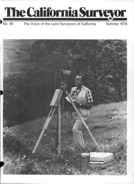
Cover: Surveyor Melvin A. Gee in<br />
boundary control survey for the city<br />
of Walnut Creek Open Spaces Program.<br />
Page 2 <strong>The</strong> <strong>California</strong> Surveyor - Summer 1979<br />
<strong>The</strong>CaBJamJaSurvgyor<br />
is the quarterly publication of <strong>The</strong><br />
<strong>California</strong> Land Surveyors Association<br />
and is published as a service to the<br />
Land Surveying profession of <strong>California</strong>.<br />
It is mailed to all Licensed<br />
Land Surveyors and Land Surveyors in<br />
Training in the state of <strong>California</strong> as<br />
well as to all members of <strong>California</strong><br />
Land Surveyors Association. <strong>The</strong> <strong>California</strong><br />
Surveyor is an open forum for<br />
all surveyors, with an editorial poUcy<br />
predicated on the preamble to the<br />
constitution of the <strong>California</strong> Land<br />
Surveyors Association and its stated<br />
aims and objectives, which read:<br />
"Recognizing that the true merit of<br />
a profession is determined by the<br />
value of its services to society, the<br />
'<strong>California</strong> Land Surveyors Association'<br />
does hereby dedicate itself to<br />
the promotion and protection of<br />
the profession of Land Surveying as<br />
a social and economic influence<br />
vital to the welfare of society, community,<br />
and state."<br />
"<strong>The</strong> purpose of this organization is<br />
to promote the common good and<br />
welfare of its members in their activities<br />
in the profession of Land<br />
Surveying, to promote and maintain<br />
the highest possible standards<br />
of professional ethics and practices,<br />
to promote professional uniformity,<br />
to promote public faith and dependence<br />
in the Land Surveyors<br />
and tiieir work."<br />
PERSONNEL<br />
Owner: CaHfornia Land Surveyors<br />
Association<br />
Editor: R. E. Baldwin<br />
National Sales Manager: Fred Rose-<br />
John Geier<br />
Production: Fred Rose —John Geier<br />
Advertising<br />
Commercial advertising is accepted<br />
by <strong>The</strong> <strong>California</strong> Surveyor. Advertising<br />
rates and information can be obtained<br />
by contacting Alniac Technical<br />
Graphics, 2476 Embarcadero Way,<br />
Palo Alto, CA 94303. Phone 415-<br />
327-6785.<br />
Sustaining Membership<br />
Membership in the CaHfornia Land<br />
Surveyors Association as a sustaining<br />
member is open to any individual,<br />
company or corporation who, by their g<br />
interest in the Land Surveying profes- •<br />
sion, is desirous of supporting the purposes<br />
and objectives of this association.<br />
For information regarding sustaining<br />
membership, contact the Editor of<br />
<strong>The</strong> <strong>California</strong> Surveyor.<br />
Editorial Material<br />
All articles, reports, letters and<br />
contributions are accepted and will be<br />
considered for publication regardless<br />
of the author's affiliation with the<br />
CaHfornia Land Surveyors Association.<br />
Material should be sent to <strong>The</strong> <strong>California</strong><br />
Surveyor.<br />
EDITOR:<br />
R.E.Baldwin<br />
1206 Neilson Street<br />
Berkeley, CA 94706<br />
DEADLINE DATES FOR<br />
THE CALIFORNIA SURVEYOR<br />
FALL AUGUST 18, 1979<br />
WINTER .... NOVEMBER 17, 1979<br />
Articles, Reports, Letters, etc., re-'<br />
ceived after the above mentioned date<br />
will be placed in the next edition.<br />
Editor<br />
CALIFORNIA BOARD<br />
OF REGISTRATION<br />
FOR PROFESSIONAL ENGINEERS<br />
Written Examination Schedule<br />
1979<br />
Land Survey or-in-Training—L SIT<br />
•Final Filing Dates:<br />
August 31, 1979 (Friday)<br />
November 3, 1979 (Saturday)<br />
**Land Surveyor—LS<br />
November 3, 1979 (Saturday)<br />
*AppHcations filed after the final filing<br />
date specified will be considered<br />
for the following examination.<br />
**Until further notice, these exams<br />
will be given only once a year.<br />
NOTE: This schedule is subject to<br />
change at any time without prior<br />
notice. *<br />
i<br />
i
Ezn<br />
STRAIGHT<br />
SIRAIGHT<br />
STHAIGHI<br />
CURVE<br />
t<br />
STREET INTERSECTIONS<br />
<br />
POINT*.<br />
30.<br />
2,<br />
25.<br />
RADIUS'<br />
25.<br />
25.0000<br />
90.00000<br />
39.2699<br />
25.0000<br />
35.3553<br />
30 1.<br />
9:63.0842<br />
10052,6976<br />
'RADIUS)<br />
POINT*'<br />
4J2.<br />
9238.0843<br />
10052.7890<br />
Letters<br />
Editor:<br />
<strong>The</strong> LSD Board at its recent meetings<br />
in Washington, D.C., has established<br />
certain Priority Projects as<br />
needing immediate attention and funding.<br />
A management study has been<br />
completed which dictated new organization<br />
and management. Much of the<br />
office work has been computerii^ed<br />
and Mr. William A. Radlinski has been<br />
hired as our new Executive Director<br />
beginning May 7, 1979.<br />
We have classified "Communications"<br />
as the first priority item to<br />
better keep our members informed of<br />
what is being done by their National<br />
Organization on their behalf. <strong>The</strong><br />
second priority is that of Legislative<br />
Activity at the national level. <strong>The</strong><br />
third item is that of Education.<br />
In the area of "Communications"<br />
it is our intent to send out more<br />
update type newsletters and bulletins<br />
in addition to our regular quarterly<br />
publications. Also, our LSD Board<br />
Members will be in direct personal<br />
contact with members through attendance<br />
at all State and Regional<br />
Surveyors Meetings, throughout the<br />
year. (You will receive a request from<br />
your Area Director for meeting dates.)<br />
Our present Legislative Program is<br />
in full swing as evidenced by our<br />
recent successes on "the Surface<br />
Mining Act," "the Brooks Bill." the<br />
ABA "Model Procurement Code," and<br />
obtaining professional stature in the<br />
Department of Labor's Directory<br />
of Occupational Titles. Continuing<br />
efforts by surveyors in the area of<br />
national legislation is of paramount<br />
importance in helping to advance<br />
and keep the surveying profession on a<br />
par with Engineers and Architects.<br />
In the area of education we are<br />
being asked to sponsor more Workshops<br />
and Seminars. Also, we must<br />
develop a full and ongoing program<br />
for professional development and<br />
continuing education. Aiding our<br />
colleges and universities in establishing<br />
degree programs is a prime responsibility.<br />
All of our educational goals can<br />
only be achieved through the hiring<br />
of a qualified Education Director. This<br />
position is now available to any qualified<br />
candidate. It is felt that the<br />
formation of an Independent Accrediting<br />
Agency run by the ACSM might<br />
be a worthwhile objective for the<br />
proper accreditation of all Surveying<br />
related curricula.<br />
All of the above Priority Projects<br />
require funding this year. <strong>The</strong> ACSM<br />
Board of Directors has approved deficit<br />
funding of these projects on the<br />
basis of recovering the advanced funds<br />
from members and Affiliated Societies<br />
through a temporary "Special Dues"<br />
for all LSDCorporate Members (S20.00<br />
additional on the next dues biUing<br />
only) and contributions from affiliated<br />
State Societies. As you may already<br />
know, the "S5.00 per Non-ACSM<br />
Member" amendment to the ACSM<br />
Constitution was not ratified by the<br />
membership. <strong>The</strong>refore, these anticipated<br />
funds will not be available.<br />
<strong>The</strong>refore, until an acceptable method<br />
is found we are asking all state affiliated<br />
organizations to contribute volun-<br />
{<br />
(Continued on Page 291<br />
Rent from us<br />
and save money!<br />
• Overnight deliverv anywhere!<br />
• No minimum!<br />
Purchase options available!<br />
Call toll-free!<br />
• Charges stop on day shipped<br />
for return!<br />
Electronic Distance Measuring Equipment:<br />
tHewlett-Packard 3800 A 110.000 ti<br />
'fPrecision International Beetle'<br />
Used equipment cash sales!<br />
1st 10 Days<br />
per day<br />
25 00<br />
25 00<br />
tCubic DM-60 Cubitape Distance Meter (6,000 It ) 25 00<br />
fHewlett-Packard 3805 Distance Meier (5780 ft ) 30 00<br />
fHewlett-Packard 3808 Distance Meter (32,800 II ) 50 00<br />
tHewlen-Packard 3810 Total Station ib,280 ft i 70,00<br />
tHewlett-Packard 3820 Total Station n6,400 ft ) 150,00<br />
•tK & E Auloranger wiin AzimuIH Base or mount tor Tneodoltte 30 00<br />
K & E Ranger III 40 00<br />
Cubic DM-20 Electrolapes—Two Units 40 00<br />
Positioning Equipment:<br />
• • Motorola Mini-Ranger wiin two Coded Transponders 200 00<br />
Eacn Additional Mim-Ranger Coded Transponder 36 00<br />
Cubic DM-40 Autolape with Two flesponders 300 00<br />
Autotape or Mini-Ranger Pnnter 15 00<br />
Ravlheon DE-719 flecordmg Fathometer 25 00<br />
Optical Surveying Equipment:<br />
•LietZ TM-IA 1 or Wild T2 THeodolile<br />
(Direct reading Horizontal and Vertical lo l", Self Indexing Vertical Circle) 27.50<br />
•Liet2TM-6orTM-10C 10 <strong>The</strong>odolite<br />
(Horizontal and vertical Estimation lo r', Sell Indexing Vertical Circle) 20 00<br />
•LietzTM-20C20 <strong>The</strong>odolite<br />
(Horizontal and Vertical Estimation io 3<br />
•LietzT-60D 60 <strong>The</strong>odolite<br />
(Horizontal and Vertical Estimation lo 6<br />
•Liet2TS-20 60''<strong>The</strong>odolite<br />
Sett indexing Vertical Circle)<br />
Self Indexing Vertical Circle)<br />
17 50<br />
16.50<br />
(Estimation to 20' Horizontal, r Vertical) 12.50<br />
•Leitz BT-20A 20" or Geotec T-24 Optical Plummet Transit 9.50<br />
•Eagle 6''» (20' Surveyors Transit) 6,00<br />
•Eagle 4 (1 Construction Transit) 4.50<br />
•Leitz B-1 Engineers Precision Automatic Level 7,50<br />
'Lietz B2-A Engineers Automatic Level 5.50<br />
•Lietz C3-A Engineers Automatic Level 4.50<br />
• Lietz B-4 Contractors Automatic Level 3.00<br />
Miscellaneous:<br />
•Lietz #7312-45 Traverse Set 6 00<br />
•Magnetic Locator, Schonstedt<br />
'1,00<br />
Spectra-Physics LT-3 Laser Transitlile with Fan Beam anachment 20 00<br />
Speclra-Physics 611 Laser on 20'' Transit 15,00<br />
•Amencan Paulm Model M-2 Surveying Altimelet — 0 to 10,000 (eet, 2 fool graduation 4 00<br />
•Kern #173 W Tripot) with ^^ x 11 Adaptor 2 00<br />
•Lietz #7512-52 Of Equal Wide Frame *»• x II Tripod 1,00<br />
•Lietz #7311-35 or Wild GDF-6 Tribrach with Optical Plummet 2.00<br />
•Lietz #7311-38 Tribrach Prism Adaptor 50<br />
•Retro-Ray Single Prism Assembly (round) 1.00<br />
•Retro-Ray Triple Pnsm Assembly (round) 2.50<br />
•Retro-Ray Tilling Single Pnsm Assembly (round) 1.50<br />
- Retro-Ray Tilling Single Pnsm Assembly (lateral) 1.50<br />
• Retro-Ray Tilling Triple Pnsm Assembly (lateral) 3 50<br />
Afler 10 Days Atter 90 Dayt<br />
per day per day<br />
(or 30 Day Minimum)<br />
15 00<br />
15.00<br />
15 00<br />
18,00<br />
30 00<br />
42.00<br />
90.00<br />
18 00<br />
24 00<br />
24,00<br />
105 00<br />
18 00<br />
150 00<br />
6 00<br />
15,00<br />
16 50<br />
12,00<br />
10 50<br />
990<br />
7.50<br />
5 70<br />
3.60<br />
270<br />
4.50<br />
3.30<br />
2 70<br />
1,80<br />
360<br />
240<br />
12 00<br />
9 00<br />
2.40<br />
1 20<br />
.60<br />
1.20<br />
30<br />
.60<br />
1.50<br />
90<br />
,90<br />
2 10<br />
NOTE: For 30-day minimum contract rate, disregard "1st 10 days" column above.<br />
"New and used equipment available for purchase Option to purchase mtormalion in rental agreemeni Additional equipmeni available<br />
for rent or purchase—information on request Authorized Lielz. Lufkin. Geolec. David While. Retro-Ray dislnbulors<br />
fAll short-range E D M units are supplied with power supply, altimeter, thermomeler and one single pnsm assemply<br />
We purchase used surveying equipment. Call us lor a quote.<br />
Lessee pays all round trip shipping charges on rented equipment Rental charges commence on the day the equipment leaves Lewis &<br />
Lewis and terminates on the day the equipmeni is returned or shipped lor return lo same Lewis & Lewis othce Irom lessee s location<br />
Rales for longer periods available on request Rates suOiect to change without notice<br />
Lewis & Lewis surveying equipment<br />
1600 Callens Rd . P.O. Box 820. Ventura. CA 93001 • (805) 644-7405 Anytime<br />
CALL TOLL-FREE (800) 235-3377 (except Calilornla. Alaska. Hawaii) • TELEX 659254 (ANS BK: NAV SVC VNTH)<br />
10 00<br />
10 00<br />
10 00<br />
12,00<br />
20 00<br />
28,00<br />
60,00<br />
12 00<br />
16,00<br />
16 00<br />
70 00<br />
12,00<br />
100 00<br />
4 00<br />
10,00<br />
11,00<br />
8 00<br />
7 00<br />
6.60<br />
5,00<br />
3.80<br />
240<br />
1,80<br />
3,00<br />
2.20<br />
1.80<br />
1.20<br />
2 40<br />
1 60<br />
8,00<br />
6 00<br />
1 60<br />
60<br />
.40<br />
.80<br />
.20<br />
.40<br />
1 00<br />
.60<br />
60<br />
1 40
Reports<br />
WESTERN REGIONAL<br />
CONFERENCE REPORT<br />
by Robert Baldwin<br />
From Wednesday, March 28, though<br />
Saturday, March 31, Land Surveyors<br />
from 22 States met at the Sahara<br />
Tahoe Hotel in Stateline, Nevada, for<br />
the Western Regional Conference of<br />
Land Surveyors. <strong>The</strong> 770 registrants,<br />
along with their guests and others involved<br />
in the profession, enjoyed<br />
varied and informative technical<br />
sessions and workshops, plus a number<br />
of social activities in addition to those<br />
for which Nevada is famous. Fortyfour<br />
exhibitors attended the Conference,<br />
bringing with them the latest<br />
equipment and the knowledge as to<br />
how it's best used. <strong>The</strong> Conference<br />
also afforded Land Surveyors from the<br />
13 western states the opportunity to<br />
meet and discuss common concerns<br />
and ideas, and led to the formation<br />
of the Western Conference of Professional<br />
Land Surveyors as reported<br />
elsewhere in this issue.<br />
<strong>The</strong> first social event of the conference<br />
was to have been a Golf Tournament<br />
at the Eagle Valley Golf<br />
Course in Carson City on Wednesday<br />
morning, but a fresh snowfall forced<br />
cancellation of this event. <strong>The</strong> skiers<br />
among us adjusted reasonably well to<br />
this and even the golfers seemed not<br />
to mind at the evening's exhibitorsponsored<br />
cocktail party which, in<br />
addition to free cocktails, offered such<br />
gastronomic deUghts as prime rib and<br />
ham.<br />
ULTRA-SITE<br />
ADJUSTABLE TRIPOD<br />
SVih to 10ft high<br />
FLUORESCENT SURVEY EQUIPMENT<br />
write or phone for details<br />
(714 630-5060)<br />
CAR MANUFACTURING<br />
1189 N. KRAEMER BLVD.<br />
ANAHEIM. CALIF. 92806<br />
OWNED AND OPERATED BY HADCO INSTRUMENTS<br />
<strong>The</strong> Conference got into full swing<br />
on Thursday morning with the opening<br />
remarks and introduction of dignitaries<br />
by James V. Potter of the Idaho Association<br />
of Land Surveyors, Addresses<br />
by Morton S. Fine of N.C.E.E. and<br />
Urho A. Uotila, president of A.C.S.M.,<br />
then spoke on the convention theme,<br />
"New Shape of the Surveying World."<br />
At Thursday'sluncheon, Dr. Helmut<br />
Leitz, Chief of Research and Development<br />
for Carl Zeiss, Inc., spoke on the<br />
latest advance in Electronic Tacheometry.<br />
He began by stating there is no<br />
"black box" technology for surveyors,<br />
and that he personally hopes there never<br />
will be, for it would rob the surveyor<br />
of much of the enjoyment<br />
derived from working in the field. A<br />
Ladies Luncheon was held concurrently,<br />
featuring a fashion show entitled<br />
"Fashions from 1776 to the Present."<br />
<strong>The</strong> afternoon sessions began with<br />
Attorney Michael Dyer presenfing<br />
Nevada's posifion in the CaUfornia-<br />
Nevada Boundary Dispute, which is<br />
now before a Special Master of the<br />
U.S. Supreme Court. Edward Elder<br />
of New Mexico then discussed "Intent<br />
and How to Prove It." Joseph E.<br />
Dracup, Chief of N.G.S. Control<br />
Networks Division discussed the "1983<br />
Readjustment of the North American<br />
Datum," followed by Cmdr. James<br />
Collins, Chief of N.G.S. Coastal Mapping<br />
Division, who spoke on "Land-Sea<br />
Boundaries by Air." Thursday evening's<br />
social activity was an Alpine "Oompah"<br />
Party complete with an "Oompah<br />
Band," appropriate beverages, and<br />
alpine hats.<br />
Friday saw concurrent technical i<br />
sessions and workshops, offering registrants<br />
a choice of which to attend.<br />
Don Wilson of New Hampshire spoke<br />
on wooden evidence, including its<br />
identification as to type and age. Don<br />
Michael, Technical Sales Manager for<br />
K & E Co., discussed the digital electronic<br />
theodolite, while Joseph E.<br />
Dracup conducted a workshop on<br />
State Plane Coordinate Systems. F.D.<br />
Uzes, head of the Boundary Determination<br />
Section of the <strong>California</strong> State<br />
Lands Commission, presented Cahfornia's<br />
position in the <strong>California</strong>-Nevada<br />
boundary dispute. Claud Hoffman,<br />
Chief Cadastral Engineer, State of<br />
Alaska, discussed Land Surveying in<br />
our nothernmost, westernmost, and<br />
easternmost State. Concurrent with<br />
these sessions were others concen- I<br />
trating on the legal aspects of the<br />
profession. Walter Robillard, a specialist<br />
in the legal aspects of surveying<br />
and photogrammetry, discussed "<strong>The</strong><br />
Judicial Function of the Land Surveyor"<br />
and how to present evidence in<br />
court. Roy Minnick, Senior Boundary^<br />
Officer for the Cahfornia State Lands^<br />
Commission, spoke on research. John<br />
Briscoe, Deputy Attorney General<br />
with the <strong>California</strong> Department of<br />
Justice, discussed legal proceedures.<br />
<strong>The</strong> surprise guest speaker at Friday's<br />
joint mens-womens luncheon,<br />
whose topic "You Got It, You Sell It,<br />
You Still Got It" covered one of<br />
Nevada's unique legal recreational activities,<br />
was Madame Beverly Harrell of<br />
Cottontail Ranch. Undoubtedly, she<br />
spoke to what was by far the most enthusiastic<br />
audience of the conference.<br />
In the afternoon, while another<br />
State Plane Coordinate Workshop was<br />
held, Gerald Johnson, Director, Bureau<br />
of Business Research & Service, <strong>California</strong><br />
State University at Fresno, discussed<br />
cash flow and how to get it.<br />
Leila Johnson, Psychologist, spoke on<br />
how to hire and fire. <strong>The</strong> future role<br />
of the Land Surveyor was then discussed<br />
by T. S. Madsen, L.S. of Florida.<br />
Concurrently, a presentation entitled<br />
"<strong>The</strong> History of a Court Case," which<br />
followed the legal proceedings of a<br />
court case including a mock trial, gav«<br />
registrants an idea as to what thejH<br />
might encounter in court. Walter^<br />
Robillard, Roy Minnick, Don Wilson,<br />
(Continued on Page 26)<br />
Page 6 <strong>The</strong> <strong>California</strong> Surveyor - Summer 1979
•-:^^"--Tfr'^.'''<br />
•WRi--"<br />
Geodimeter 12A<br />
<strong>The</strong> short-range, portable EDM<br />
instrument with fast, easy, fullyautomatic<br />
operation, automatic<br />
tracking facility, and excellent<br />
single-prism range. Sets up in<br />
seconds, with unique pointing<br />
system. Switch-selected sensitivity/<br />
max. accuracy, and automatic<br />
atmospheric correction over full<br />
range. An outstanding, rugged,<br />
field-proven pioneer, now<br />
warranted for tw^o full years!<br />
AGA<br />
<strong>The</strong><br />
EDM<br />
Pioneers<br />
L<br />
^^<br />
AGA Corporation, Geodimetet Division<br />
385 Bel Marin Keys Blvd.,Suite F,Novate, CA94947<br />
In Norihcm <strong>California</strong><br />
and Nevada Call:<br />
ohn Weir<br />
(415) 749-3816<br />
In Southern <strong>California</strong><br />
and Nevada Call;<br />
Fred Murray<br />
(714) 469-8346<br />
V-
Presidenfe Message<br />
Shortly after our May Conference<br />
in Tahoe, Michael McKissick, editor of<br />
the <strong>California</strong> Surveyor for the last<br />
five years, asked to be relieved of his<br />
position subject to his finding a qualified<br />
replacement. I am happy to report<br />
that Mike has found such a replacement<br />
in the person of Robert "Bob" Baldwin.<br />
This issue of the Surveyor, therefore is<br />
Mike's last.<br />
During the time that Mike has been<br />
the editor of the Surveyor, the paper<br />
has grown in stature, size and the<br />
amount of advertising. <strong>The</strong> Surveyor<br />
format has improved to its present<br />
three-column layout and at Mike's<br />
urging, the mailing list was increased<br />
to include everyone in <strong>California</strong> who<br />
offers to practice surveying professionally.<br />
Mike, I speak for all members<br />
of <strong>CLSA</strong> when I say, "Thank you and<br />
good job well done."<br />
Our new editor, Bob Baldwin, has<br />
written a column in the last several<br />
issues of <strong>California</strong> Surveyor, so by<br />
now he is more or less up to speed. He<br />
tells me he intends to continue the<br />
program of improvement which Mike<br />
started. That program will include regular<br />
features such as book reviews,<br />
legal reviews, new equipment and systems,<br />
and profiles. In order to include<br />
as much original material as possible,<br />
he plans to ask for your assistance. If<br />
you want to be sure you are included<br />
in his plans, contact Bob.<br />
At this writing Bill SB2 (which removes<br />
the engineers exemption from<br />
the Land Surveyors Act) is out of the<br />
Senate Business &. Professions Committee<br />
with a 5 to 0 vote recommending<br />
"Do pass." <strong>The</strong> only parties who<br />
appeared at the hearing to oppose the<br />
Bill were Ted Fairfield and Jim Corn,<br />
representing the <strong>California</strong> Council of<br />
Civil Engineers & Land Surveyors. By<br />
the time you read this, the Bill should<br />
have been heard by the Senate Finance<br />
Committee and also on the fioor of<br />
the Senate. <strong>The</strong> author of SB2, Senator<br />
Green, has done an excellent<br />
job of carrying the Bill. <strong>The</strong> members<br />
of <strong>CLSA</strong> owe him a debt of gratitude 1<br />
for his efforts.<br />
Mike Welsh, Chairman of the Legislative<br />
Committee, devoted many<br />
hours organizing our program to<br />
support the Bill for action. It is all<br />
too possible to overlook the great !<br />
effort required of many individuals '<br />
to successfully push any Bill through<br />
the <strong>California</strong> Legislature. Every bit of<br />
effort helps. Any personal contact,<br />
particularly with individual legislators, i<br />
helps. "Personal contact" includes all I<br />
of the letters that have been written to<br />
them. Your good efforts have helped<br />
<strong>CLSA</strong> to hurdle the first step in the ,<br />
process of the eventual success we I<br />
hope for.<br />
A<br />
ELECTRONIC DISTANCE MEASURING<br />
EQUIPMENT RENTALS<br />
HEWLETT Jjg PACKARD<br />
DISTANCE METERS<br />
THEODOLITES<br />
ALSO AVAILABLE — QUALIFIED TECHNICAL<br />
ASSISTANCE AND OVERNIGHT DELIVERY<br />
TO MOST AREAS. CALL OR WRITE TODAY,<br />
ELECTRO-DIST. & ASSOC,<br />
5383 EAST FIG<br />
MANTECA, CA. 95336<br />
(209)239-3121<br />
Sure the price is great, but<br />
are they any good?<br />
We can prove they are with our exclusive "hands-on" trial! That's<br />
rigrit |ust buy one of our Retro-Ray reflectors and try tt for a montti.<br />
If you don't think it's as good or better than any E.D.M. prism on<br />
Ilie market, send it back and we'll send back your money—all of it,<br />
no questions asked. Call us toll-free or check with your local dealer.<br />
You'll like Retro-Ray, and you'll love the price—we guarantee it'<br />
Retro-Ray reflectors:<br />
No. 110L; Round, Single prism $160.00<br />
No, 109L; Round, triple prism 435.00<br />
No. 105L; Lateral, triple prism, tilting 750.00<br />
Padded storage bags available lor above models.<br />
See your local dealer or send tor complete price list and details on all<br />
our retlectots.<br />
Lewis & Lewisepu:p^=<br />
e^ ^ 1600 Callens Road • P.O, Box 820<br />
y Ventura, <strong>California</strong> 93001 • (805)644-7405<br />
' CALL TOLL-FREE (except Calilornia, Alaska & Hawaii)<br />
- - (800)235-3377 TELEX 659254 [ANS BK: NAVSVCVNTR<br />
Page 8 <strong>The</strong> <strong>California</strong> Surveyor - Summer 1979
Report firomthe Capitol<br />
SURVEYORS APPEAR BEFORE<br />
UNITED STATES SENATE ENERGY<br />
AND NATURAL RESOURCES<br />
COMMITTEE<br />
On June 21, 1979, the American<br />
Congress on Surveying and Mapping<br />
took its second historic step toward<br />
a full time presence on Capitol Hill.<br />
At the invitation of the Honorable<br />
Wendell H. Ford (Ky.), ACSM's prepared<br />
statement and questions relative<br />
to the preemption of surveyors by the<br />
Surface Mining Control and Reclamation<br />
Act of 1977 were submitted.<br />
<strong>The</strong> ACSM's March 6, 1976 appearance<br />
before the Subcommittee on<br />
Energy and the Environment of the<br />
Honorable Morris K. Udall's House<br />
Committee on Interior and Insular<br />
Affairs was apparently very well<br />
received. Several congressmen were<br />
knowledgeable concerning our problem<br />
and commented favorably-presumably,<br />
the result of personal contacts<br />
by a few land surveyors prior<br />
to the hearing. Congressman Udall<br />
personally questioned the ACSM representatives<br />
and commented publically<br />
that he believed that he miglit<br />
be persuaded to amend the Act<br />
to remedy the injustice to land surveyors.<br />
<strong>The</strong> grassroots personal contacts<br />
of committee members by land surveyors<br />
was of obvious benefit and contributed<br />
to an open and concerned<br />
review of the surveyor's preemption<br />
problem. <strong>The</strong> placement of surveyors<br />
in a subordinate or assistance status<br />
to other professions is totally unacceptable<br />
to the ACSM and its membership.<br />
(See March 1979 Surveying<br />
and Mapping at page 27 for hearing<br />
testimony.)<br />
Personal contacts and letters to all<br />
members of the Energy and Natural<br />
Resources Committee will ensure<br />
acceptance of ACSM's request for<br />
corrective legislation to reestablish the<br />
land surveyor as one of the lead professions<br />
in the preparation of maps<br />
and plans. <strong>The</strong> Senators are:<br />
Arkansas:<br />
Alaska:<br />
Connecticut:<br />
Hawaii:<br />
Idaho:<br />
Kentucky:<br />
Louisiana:<br />
Massachusetts<br />
Montana:<br />
N. Hampshire:<br />
N. Mexico:<br />
N. Jersey:<br />
Ohio:<br />
Oklahoma:<br />
Oregon:<br />
Washington:<br />
Wyoming:<br />
Dale Bumpers<br />
Ted Stevens<br />
Lowell P. Weicker, Jr.<br />
Spark M. Matsunaga<br />
Frank Church,<br />
James A. McClure<br />
Wendell H. Ford<br />
J. Bennett Johnston<br />
Paul E. Tsongas<br />
John Melcher<br />
John A. Durkin<br />
Pete V. Domenici<br />
Bill Bradley<br />
Howard M,<br />
Metzenbaum<br />
Henry Bellmon<br />
Mark 0. Hatfield<br />
Henry M. Jackson,<br />
Chairman<br />
Malcolm Wallop<br />
ISN'T IT TIME YOU RETIRED YOUR OLD 1854 VINTAGE<br />
PLAN I METER? (MECH. POLAR PLANIMETERS ARE BASICALLY UNCHANGED SINCE 1854)<br />
i<br />
lASICO<br />
ELECTRONIC<br />
PLANIMETERS<br />
Can Do Your Work<br />
Much Faster,<br />
Easier, With More<br />
Comfort And<br />
Precision<br />
SHOWN: MOD 40 $395.00<br />
FEATURES: DIGITAL READOUT<br />
INSTANT ZERO SET.<br />
ACCUMULAT MEASUR.<br />
WRITE FOR CATALOGS ON THIS<br />
AND OUR MORE ADVANCED MODELS.<br />
I^SICO<br />
Los Angeles Scientific Instrument Co. Inc.<br />
2451 RIVERSIDE DRIVE, LOS ANGELES, CALIFORNIA 90039, PHONE: (213) 662-2128<br />
Page 10 <strong>The</strong> <strong>California</strong> Surveyor - Summer 1979
LEIGHTON KEELING<br />
In Memoriam<br />
It is with deep regret that we note<br />
the passing of Leighton Keeling of Surveyors<br />
Service Company.<br />
Many of you will remember<br />
Leighton and his wry sense of humor.<br />
He started with Surveyors Service<br />
Company in 1938. He worked in the<br />
shop, was a salesman on the road, and<br />
for the last 25 years has been in administration<br />
and management of the<br />
company. In January, 1971, he was<br />
made President, serving until March,<br />
1978, when ill health forced him to<br />
become Chairman of the Board of<br />
Directors. He was very active until<br />
recent years with the National Model<br />
Railroaders Association and was a<br />
Past President of that organization.<br />
Most recently, he has been active in<br />
the Southern <strong>California</strong> Section of the<br />
ACSM and instrumental in counseling<br />
on the manufacture of chaining tapes<br />
in the metric system.<br />
Leighton is survived by a son and a<br />
daughter, both residing in <strong>California</strong>.<br />
One more good "old-timer" passed<br />
on to rest.<br />
August 5-8<br />
August 8<br />
August 31<br />
September<br />
September 12<br />
Calendar<br />
September 14& 15<br />
October 4-7<br />
October 20<br />
November 3<br />
November 3<br />
November 14<br />
November 17<br />
December 12<br />
N.C.E.E. Annual Meeting, Omni International, Norfolk, VA<br />
BOARD OF REGISTRATION meeting. Board Office, Sacramento,<br />
CA 95814<br />
Final filing date, November 3, 1979 L.S.I.T. Examination<br />
Fall A.C.S.M. Convention, Sioux Falls, S.D.<br />
BOARD OF REGISTRATION meeting. Royal Inn of San<br />
Francisco Airport, South San Francisco, CA<br />
CALIFORNIA ENGINEERS CONFERENCE on Registration,<br />
Marriott Hotel, adjacent to the Los Angeles International<br />
Airport<br />
A.C.S.M. <strong>California</strong> Conference, Monterey, CA, Doubletree<br />
Inn, Monterey<br />
C.L.S.A. Board of Directors meeting<br />
L.S. and L.S.I.T. Examinations<br />
C.L.S.A. Legal Seminar—Location to be announced<br />
BOARD OF REGISTRATION Meeting, Board Office, Sacramento,<br />
CA 95814<br />
C.L.S.A. Legal Seminar—Location to be announced<br />
BOARD OF REGISTRATION Meeting, Airport Park Hotel,<br />
Inglewood,CA<br />
nn IS MAKING IT EASIER FOR YOU!<br />
ii<br />
the precise automatic<br />
level GK2-A doesn't<br />
need a "tap" or a<br />
"push"on the<br />
button...<br />
i<br />
find out why...<br />
write or call for details:<br />
Kern Instruments, Inc. Geneva Road, Brewster, N.Y. 10509 (914) 279-5095<br />
Kern Instruments of Canada, Ltd. Ottawa, Ontario (613) 235-4908<br />
r' TO: Kern Instruments, Inc., Geneva Road, Brewster, N. Y. 10509<br />
D Please call to arrange a<br />
demonstration.<br />
D Please send more information.<br />
NAME<br />
COMPANY<br />
ADDRESS^<br />
_TEL,I<br />
CS<br />
I<br />
CITY<br />
STATE<br />
ZIP<br />
::J<br />
Page 12 <strong>The</strong> <strong>California</strong> Surveyor - Summer 1979
New from Hewlett-Packard<br />
- Survey System One -<br />
boosts productivity from field to finish.<br />
Introducing Hewlett-Packard's Survey System One.<br />
A system designed to let you do more work in less time,<br />
and with much less chance for error. In brief, the system<br />
transfers all of your measurement data from the field to<br />
the office electronically;, with speed and accuracy. In the<br />
office, your field data is reduced in a fraction of the<br />
time it would take using conventional methods, and you<br />
get answers while the job is still fresh in your crew's mind.<br />
Time savings are substantial, and the potential for error<br />
is all but eliminated.<br />
Four key components make up the HP Survey<br />
System One. For field work, measurements are made<br />
electronically with the HP 3810A Total Station, a<br />
dependable easy-to-use instrument combining angle and<br />
horizontal distance measurements. <strong>The</strong> HP 3851A Data<br />
Collector is the link between field and office. Readings<br />
displayed by the Total Station are stored in the Data<br />
Collector's solid-state memory. Back at the office, the<br />
Data Collector transfers your field data to the HP 9815<br />
Surveying Calculator for processing. This transfer is<br />
accomplished automatically, error free, and in a fraction<br />
of the time you now spend on the same task. <strong>The</strong> fourth<br />
component is the HP 9871A Page Printer, which makes<br />
working plots in minutes and provides convenient pagewidth<br />
printouts.<br />
Call us today and let us show you how the HP Survey<br />
System One can make a dramatic difference in your<br />
firm's productivity and profitability.<br />
In surveying, expect HP to set the standards.<br />
646 W. North Market Blvd.<br />
Sacramento, CA 95834<br />
(916)929-7222<br />
1430 East Orangethorpe<br />
Fullerton,CA 92631<br />
(714)870-1000<br />
HEWLETT ihffj PACKARD<br />
^ ^<br />
Sales and service trom 172 offices in 65 countries.<br />
P.O. Box 301. Loveland. Colorado 80537
Services<br />
COLLECTION SERVICE<br />
PROVING EFFECTIVE<br />
More than 95 members of the <strong>California</strong><br />
Land Surveyors Association are<br />
enrolled in the collection service provided<br />
by I.e. System, Inc. and have<br />
recovered thousands of dollars in pastdue<br />
accounts. Nationally, the company<br />
collected an all-time record of $28,8<br />
million during 1978. Close to 1,000<br />
associations, includmg 21 land surveyors<br />
associations, now endorse the<br />
service for their members.<br />
Collections through 1. C. Systems<br />
are guaranteed to return at least eight<br />
times the initial cost of the service.<br />
At the same time, the creditor retains<br />
full control and is the only one who<br />
can make adjustments, accept partial<br />
payments or forgive a debt entirely if<br />
appropriate.<br />
<strong>The</strong> company has been in active<br />
operation since 1938. During the<br />
196D's, growth outstripped existing<br />
systems, necessitating adoption of<br />
ever more modern methods of doing<br />
business. This culminated in 1975 with<br />
construction of a new centralized information<br />
center in St. Paul, Minnesota.<br />
Here, customer service specialists<br />
have the latest on-line computer equipment<br />
available for handling customer<br />
inquiries on a "right now" basis.<br />
Members enrolled in the program<br />
can write or phone the Information<br />
Center direct via toll free hot line. <strong>The</strong><br />
office is open Monday through Friday<br />
and, if customer service can't handle a<br />
problem, they see that a local representative<br />
makes a personal call as soon<br />
as possible.<br />
To learn more about the service,<br />
simply contact the C.L.S.A. office.<br />
LIABILITY INSURANCE<br />
FOR SURVEYORS<br />
In 1955, the Land Surveys Division<br />
of the American Congress on Surveying<br />
and Mapping undertook a comprehensive<br />
study of the professional liability<br />
problem facing land surveyors in private<br />
practice. In 1960, with the cooperation<br />
of Victor 0. Schinnerer &<br />
Company, Inc. (VOSCO) and Continental<br />
Casualty Company (CNA), a<br />
pilot Land Surveyors' Professional<br />
Liability Program was launched in the<br />
States of Illinois, Maryland, Michigan,<br />
New York, South Dakota, Virginia and<br />
Washington. Based upon the results of<br />
the pilot program, Continental expanded<br />
the Land Surveyors Professional<br />
Liability Insurance Program to a<br />
nationwide basis in 1965. Professional<br />
liabhty protection has been available<br />
to land surveyors under the program<br />
continuously since its inception.<br />
BROAD PROTECTION-<strong>The</strong> policy<br />
provides broad coverage for normal<br />
professional exposures of the land<br />
surveying profession. Each policy is<br />
tailored to the needs and exposures of<br />
the individual firm.<br />
CLAIMS-MADE FORM-<strong>The</strong> policy is<br />
written on a "claims-made" form. <strong>The</strong><br />
policy coverage applies to claims arising<br />
from professional errors, omissions or<br />
negligent acts committed during the<br />
pohcy period and for which claim is<br />
made during the policy period. <strong>The</strong><br />
Continental policy provides coverage<br />
for professional services performed on<br />
or after the effective date of the first<br />
continuously renewed professional liability<br />
pohcy.<br />
ELIGIBILITY-<strong>The</strong> Program is available i<br />
to professional land surveyors in private<br />
practice who render services to a variety<br />
of clients. Although the Program is<br />
designed specifically for land surveyors,<br />
land surveying firms which perform a<br />
minimal amount of engineering services<br />
may be eligible. Firms rendering a<br />
significant amount of services in the<br />
engineering area would be eligible for<br />
coverage under the Continental Architects'/Engineers'<br />
Professional Liability<br />
Insurance Program.<br />
CLAIMS SERVICES-Continental provides<br />
complete investigation of claims<br />
plus legal defense by a corps of defense<br />
attorneys especially skilled and experienced<br />
in professional liability claims.<br />
Local claim service is available throughout<br />
the country. In addition, VOSCO<br />
is available for consultation and help<br />
whenever needed.<br />
j<br />
You can protect yourself against<br />
financial loss by purchasing this<br />
Professional Liability Insurance Policy<br />
designed specifically for members<br />
of the land surveying profession.<br />
For further information, contact^<br />
Ms. Michelle Hill, Victor 0. Schin-"<br />
nerer & Company, 5028 Wisconsin<br />
Avenue, N. W., Washington, D. C.<br />
20016. Phone: (202) 686-2850. A<br />
ALLIED SURVEYOR SUPPLIES MFG. CO.<br />
DIVISION OF ALLIED MANUFACTURING CO , INC<br />
P 0 BOX 27367. TUCSON. AZ 85726 (602| 6226011<br />
PERMANENT SURVEY MARKERS<br />
Cold Formed For Strength & Durability<br />
SOMETHING FOR ALL YOUR PERMANENT MARKER NEEDS<br />
KAP AND ROD ASSEMBLIES<br />
MAGNETIC MONUMENTS<br />
CONCRETE MARKERS<br />
KAPS TO FIT PIPE<br />
CUSTOM MARKERS<br />
REBAR KAPS<br />
EASY TO INSTALL<br />
LIGHT TO TRANSPORT<br />
GUARANTEED NOT TO CRACK, CHIP OR BREAK<br />
PREMARKED AT FACTORY OR MARK EASILY IN THE FIELD<br />
AVAILABLE IN VARIOUS TOP SIZES FOR DIFFERENT DIAMETER REBAR&I<br />
Page 14 <strong>The</strong> <strong>California</strong> Surveyor - Summer 1979
i<br />
<strong>The</strong>y sure are well made."<br />
Everett Edwards<br />
Hatcher Engineering Co.<br />
Neosho, MO<br />
Take it hrom a man who knows.<br />
Everett's Beetle and case rolled 200 feet down a shale-covered ravine before the Beetle came<br />
out of the case and rolled another 100 feet to the rocks at the bottom. Three switch handles on<br />
the control panel were bent, but the Beetle still operated accurately.<br />
Neither we nor Everett recommend this kind of treatment, but accidents will happen. It's nice<br />
to know that when Murphy's Law strikes, your equipment could survive. Rugged construction.<br />
Portability. Ease of operation. Economy. Four reasons why the Beetle Systems do a lot more.<br />
Beetle Systems do more than save you money.<br />
Precision<br />
InternBtipnal<br />
•^•^••••••^•••^B inc.<br />
329 West Lincoln Street / P.O. Box 821<br />
Tullahoma. Tennessee 37388. USA<br />
Phone (615) 455-8524 ITWX 810-375-3149<br />
26lOChurncreek Road<br />
Redding, <strong>California</strong> 96001<br />
Phone: (916) 241-1121<br />
SURVEYING EQUIPMENT, INC.<br />
924 South Central<br />
Medford, Oregon 97501<br />
Phone: 1503} 773-1236
Now K&E achieves<br />
the ideal matchup of<br />
electronics and<br />
surveying technology.<br />
Introducing<br />
theVECTRON<br />
Electronic<br />
Surveying<br />
Systema<br />
total surveying<br />
package in a<br />
modular format.<br />
K&E brings the full force of its surveying<br />
instrument experience and leadership<br />
into the age of eleclronics.<br />
Result: the first total surveying package<br />
in a modular system. <strong>The</strong> system<br />
consists of three separate electronic<br />
components:<br />
A. VECTRON Surveying Instrument:<br />
for angle measurement<br />
and calculation of<br />
surveying coordinates<br />
B. AUTORANGERS EDM Instrument:<br />
for range measurement<br />
C. VECTRON Field Computer:<br />
for data storage and<br />
calculation.<br />
Each is a fully independent unit<br />
that can be purchased separately, and<br />
operated independently, or in combinations.<br />
All three are programmed<br />
to interconnect in a system unparalleled<br />
in performing all functions.<br />
<strong>The</strong> VECTRON System makes<br />
angle and distance measurements<br />
electronically, calculates surveying<br />
coordinates in the field, and stores<br />
data without manual transcription.<br />
That translates to increased productivity<br />
and greater accuracy in all surveying<br />
projects.<br />
<strong>The</strong> heart of the system is the<br />
VECTRON Instrument which integrates<br />
Keuffel & Esser Co.<br />
1327 South Olive St.<br />
Los Angeles, CA 90015<br />
Phone: 213 747-7601<br />
precision optics and mechanics with<br />
electronic sensor and microprocessor<br />
to perform standard surveying functions<br />
with speed and versatility- By<br />
means of a numeric keyboard or field<br />
computer the readout of the horizontal<br />
circle can be preset to a known<br />
azimuth or zero. When the VECTRON<br />
Instrument is interfaced with its other<br />
components (he VECTRON system<br />
performs the following:<br />
automatically measures, displays and<br />
records slope range, 1 m to 2km<br />
{3 feet to IV4 miles) (R)<br />
horizontal angle (H)<br />
vertical angle {V)<br />
automatically computes, displays and<br />
records horizontal distance (D)<br />
departure (X)<br />
latitude {Y)<br />
difference in elevation (Z)<br />
automatically accumulates and<br />
averages readings for slope range,<br />
horizontal and vertical angles<br />
automatically senses and corrects for<br />
mis-level of vertical angle.<br />
converts slant range to horizontal and<br />
vertical range<br />
converts horizontal range and azimuth<br />
to X and y coordinates<br />
averages data<br />
reads out in angular units of degrees,<br />
grads or mils<br />
permits repeating horizontal angle<br />
readings to 9999.999<br />
stores measured data and calculated<br />
results, identified alphanumerically<br />
retrieves data from storage, for displa<br />
on command, or transfers to magnetic<br />
tape recorder<br />
automatically verifies stored data<br />
For more details about the VECTRON<br />
System and its individual components.<br />
write Keuffel & Esser Co., 20 Whippany<br />
Road, Morristown, N.J, 07960.<br />
KEUFFEL & ESSER COMPANY^<br />
Keuffel & Esser Co.<br />
223 Lav^rrence Ave.<br />
South San Francisco. CA 94080<br />
Phone: 415 873-6850
-«^i'«ff-'*.iK4(Sfrjft. ••• ^^^^jfiMM^fSfSS^
Court Case<br />
COURT ERRED IN REFUSING<br />
TO DETERMINE<br />
BOUNDARY LOCATION<br />
IN THE COURT OF APPEAL OF<br />
THE STA TE OF CALIFORNIA<br />
FIFTH APPELLA TE DISTRICT<br />
EDWARD JAMES JOAQUIN, et al.,<br />
Plaintiffs and Respondents,<br />
V.<br />
SHILOH ORCHARDS, etc.,<br />
Defendant and Appellant.<br />
APPEAL from a judgment of the<br />
Superior Court of Stanislaus County.<br />
Jeremy C. Cook, Judge. Reversed with<br />
directions.<br />
Zuckerman & Hartmann and<br />
Thomas M. Zuckerman for Defendant<br />
and Appellant.<br />
A. M. Frad for Plaintiffs and<br />
Respondents.<br />
INTRODUCTION<br />
<strong>The</strong> fundamental question presented<br />
by this quiet title action is the extent<br />
of the trial court's obligation to fix the<br />
location of an agreed boundary between<br />
contiguous owners of land<br />
where the monument fixing the line<br />
(a fence) has been removed without a<br />
survey or other marking to identify its<br />
precise location. As we shall explain,<br />
the trial court is required to fix the<br />
location of the agreed boundary according<br />
to the evidence presented at<br />
trial if it is reasonably possible to do<br />
so. Thus, in the present case the court<br />
erred in refusing to determine the<br />
location of the agreed boundary and in<br />
quieting title in respondents according<br />
to their complaint.<br />
STATEMENT OF FACTS<br />
Prior to 1942 the Bank of America<br />
was the common owner of the adjoining<br />
parcels of real property now owned<br />
by appellant and respondents, the<br />
boundary line of which is the subject<br />
of this controversy. On April 6, 1942,<br />
the bank sold one parcel to the respondents'<br />
predecessors in interest and on<br />
March 1, 1943, sold the other parcel<br />
to the appellant's predecessor in<br />
interest. <strong>The</strong> deed to both parcels<br />
described their common boundary as<br />
the quarter section line separating the<br />
southwest quarter section from the<br />
northwest quarter section of section<br />
19, in township 4 south, range 8 east,<br />
Mount Diablo Base and Meridian, in<br />
the County of Stanislaus. <strong>The</strong>re is a<br />
5-inch diameter concrete monument<br />
located in Shiloh Road marking the<br />
western quarter section corner, which<br />
the federal government established in<br />
1854. <strong>The</strong> monument set at the easterly<br />
corner of the section line in 1854<br />
has never been located, but a surveyor<br />
reestablished this point in 1974 for a<br />
survey of nearby property.<br />
At sometime prior to 1944, a fence<br />
was constructed which divided one<br />
portion of the property from the other,<br />
and the two portions were separately<br />
farmed and utihzed up to the fence.<br />
In addition, the separate farming practices<br />
of the adjoining owners over the<br />
years created a line demarcing the<br />
differing cultural practices, evidenced<br />
by a change in elevation or bench between<br />
the two farms at the fence line,<br />
ranging from 12 to 36 inches in heiglit.<br />
<strong>The</strong> fence was located at the top of<br />
this bench. <strong>The</strong> area between the fence<br />
line and the corner section line is<br />
approximately 2.4 acres.<br />
Respondents acquired their parcel<br />
on September 5, 1967, and appellant<br />
acquired its parcel on December 28,<br />
1973. At the date of appellant's acquisition,<br />
appellant and its predecessors in<br />
interest accepted and understood the<br />
fence to be the boundary between<br />
the respective parcels. Appellant entered<br />
into possession of its parcel to<br />
the fence and dealt with the property<br />
as if the fence constituted the boundary,<br />
cultivating and improving its<br />
parcel, including the now disputed<br />
piece.<br />
In 1974 appellant removed the<br />
fence to establidi an almond orchard<br />
on the property, which it accomplished<br />
in 1975. <strong>The</strong> fence line was<br />
removed to help control weeds that<br />
had grown along the fence. Appellant<br />
used a disc to control the weeds on the<br />
old fence line. <strong>The</strong> effect of the discing<br />
was to "round" the bench somewhat,<br />
but not enough to extinguish<br />
the original line. Appellant leveled the<br />
property, installed a sprinkler system,<br />
(Continued on Page 23)<br />
i<br />
Introducing the PIONEER I Computer<br />
A full-scale computer for less money than a HP-9815S or Survey 31<br />
with printer! Now you can do your survey computations p/us your<br />
books, billings, payroll, letter writing, standard printouts, and<br />
much, much more. <strong>The</strong> survey programs, patterned after HP's<br />
9815 series, were refined by a practicing <strong>California</strong> land surveyor for<br />
your type of problems.<br />
skerra<br />
Terence Petersen<br />
LS4315<br />
CVBERnETlCS,<br />
Page 18 <strong>The</strong> <strong>California</strong> Surveyor - Summer 1979<br />
Don't be misled by limited-feature imitations; this Is<br />
absolutely the most complete computer on the market<br />
today for the money. Prices start as low as $6000,<br />
complete with survey programs and conversion of your<br />
IBM typewriter to a printer!<br />
Call or write today for literature or<br />
an in-house demonstration In Northern <strong>California</strong>.<br />
105 Willow Valley Rd., Nevada City, CA 95959 • 916-265^39
-.>,-^«V^,.;V*.<br />
THE "BIG S" IS HERE.<br />
AND WE'RE ON THE LEVEL<br />
THE SM-2<br />
Ideally suited for heavy construction<br />
projects, highway work,<br />
topographic surveys, etc., the<br />
Automatic Level is a highly efficient<br />
and accurate instrument for<br />
surveying. Lightweight and compact<br />
in size, they provide operational<br />
features previously found<br />
only in the most expensive levels.<br />
SIMPLY place the instrument on a<br />
tripod roughly center the<br />
circular spirit level bubble, and<br />
the sighting line assumes a horizontal<br />
position instantly, accurately<br />
and automatically. Any<br />
change in the position of the<br />
instrument occurring during the<br />
leveling operation due to accidental<br />
tilting of the telescope or<br />
because of the tripod legssinking<br />
into soft ground are immediately<br />
and automatically compensated<br />
for. Two models in stock, the<br />
SM-2 28X power and the SM-1<br />
32X power.<br />
THE SM-2<br />
TT-600 TRANSIT<br />
DESCRIPTION:<br />
SVz inch graduated on<br />
silver, Double numbered<br />
from 0-360 and 360-0 degrees,<br />
2 verniers graduated<br />
on silver double<br />
direct reading to 20<br />
seconds.<br />
CONSTRUCTION:<br />
4 replaceable leveling<br />
screws, SVaxS threads,<br />
bronze tapered centers,<br />
hand fitted, dark green<br />
vifrinke finish.<br />
EXTENSION LEG TRIPODS<br />
Wide frame, narrow frame, aluminum & all wood frames. American<br />
& European head tripods.<br />
FREE ESTIMATES • PICKUP • DELIVERY<br />
COMPLETE LINE OF NEW RENTAL INSTRUMENTS<br />
FOR SURVEYORS, CONTRACTORS AND BUILDERS<br />
TT-700 TRANSIT<br />
DESCRIPTION:<br />
6V2 inches internal focus,<br />
26X magnification with<br />
60 second telescope vial<br />
and 2 90 sec plate vials.<br />
Coated optics, min focus<br />
7 feel.<br />
CONSTRUCTION:<br />
3 replaceable leveling<br />
screws, 5/8x11 threads,<br />
bronze tapered centers<br />
hand fitted, full vertical<br />
circle, optical plummet,<br />
attachable compass.<br />
Gray finish, metal carrying<br />
case with standard<br />
accessories.<br />
NO COST OR OBLIGATION FOR A FREE DEMONSTRATION. VISIT OUR MODERN MAJOR REPAIR<br />
FACILITY WHERE WE REPAIR ALL MAKES AND MODELS OF THEODOLITES, TRANSITS, LEVELS,<br />
AUTOMATIC LEVELS. CERTIFIED CALIBRATION ON ALL INSTRUMENTS ON OUR MASTER CHECK STAND.<br />
SACRAMENTO<br />
SURVEYORS<br />
SUPPLY<br />
SACRAMENTO<br />
(916) 332-4748<br />
Name<br />
Company<br />
Address _<br />
City<br />
State<br />
I would like a salesman to call.<br />
Please send additional information on<br />
Phone<br />
Zip<br />
D<br />
n<br />
SALES<br />
SERVICE<br />
SATISFACTION<br />
BAY AREA<br />
(408)946-1601<br />
SACRAMENTO SURVEYORS SUPPLY. 4737 AUBURN BLVD. SACRAMENTO, CALIF. 95841.<br />
"SERVICE AND SATISFACTION IS OUR BUSINESS/'
IVewMembers<br />
FIRST QUARTER, 1979<br />
CORPORATE<br />
Ned Snyder, LS, Rocklin, CA<br />
Carson Storer, LS, San Bernadino, CA<br />
Lee Leishman, LS, San Jose, CA<br />
B.B. DeWitt, LS, Oceanside, CA<br />
Kevin McHugh, LS, Irvine, CA<br />
<strong>The</strong>odore Fike, LS, San Bernardino, CA<br />
Terence Peterson, LS, Nevada City, CA<br />
Robert Ness, LS, Sacramento, CA<br />
John Greenwood, LS, Sacramento, CA<br />
Gerald Hurlbert, LS, Weaverville.CA<br />
Gerald Compton, LS, Chico, CA<br />
Robert Horn, LS, Upland, CA<br />
Duane Stout, LS, Anaheim, CA<br />
George Gary, LS, Carmel Valley, CA<br />
Stephan Frost, LS, Fair Oaks, CA<br />
David Kopp, LS, Nevada City, CA<br />
Norman LaBare, LS, Bakersfield, CA<br />
John Estes, LS, Mill Valley, CA<br />
William Richard, LS, Poway, CA<br />
Robert Milliard, LS, Atascadero, CA<br />
Robert Trockey, LS, San Pablo, CA<br />
Larry McDowell, LS, Grenada, CA<br />
Francis Fitzpatrick, LS, San Marcos, CA<br />
Howard Cohen, LS, Fresno, CA<br />
James Duffy, LS, Duarte, CA<br />
Cyris Hoblitt, LS, Tuolumne, CA<br />
Edward Hill, LS, Hydesville, CA<br />
Hugh Kelley, LS, Eureka, CA<br />
Lawrence Bowers, LS Merced, CA<br />
Robert Troughton, LS, Diamond Springs, CA<br />
AFFILIATE<br />
Edmund Johnson, North Hollywood, CA<br />
Tom McGannon, San Clemente, CA<br />
Patrick Collins, Paso Robles, CA<br />
Terence Orton, San Luis Obispo, CA<br />
Richard Kettering, Irvine, CA<br />
Jerry Anderson, Homer, AL<br />
Francis Eickbush, Newcastle, CA<br />
ASSOCIATE<br />
Robert Herkus, Rancho Palos Verdes, CA<br />
Richard Briner, Shingle Springs, CA<br />
Wilham Touchon, Santa Ana, CA<br />
Walter Haydon, Ukiah, CA<br />
James Barker, Oakland, CA<br />
Jon Marcussen, Santa Rosa, CA<br />
Michael Loustalot, Sonoma, CA<br />
Russell Miller, San Diego, CA<br />
Gwen-Vera Means, Long Beach, CA<br />
Douglas Foster, Newport Beach, CA<br />
Richard Buchholz, Chico, CA<br />
Michael Gunby, Sacramento, CA<br />
Neil McAnally, San Bernardino, CA<br />
Jan Cudrnak, Fair Oaks, CA<br />
Richard Sinor, Murphys, CA<br />
William Masterson, Emeryville, CA<br />
William Hogoboom, Eureka, CA<br />
Daniel Cook, Westminister, CA<br />
James Long, Halcyon, CA<br />
STUDENT<br />
Judith Edwards, La Canada, CA<br />
Tod Coleman, Clovis, CA<br />
Daryl Whitcher, Fresno, CA<br />
Jeffery Armstrong, Sierra Madre, CA<br />
THE VERY BEST IN TITLE SERVICES<br />
with offices located in:<br />
LOS ANGELES ORANGE RIVERSIDE<br />
SAN BERNARDINO SAN DIEGO SANTA CLARA<br />
SOLANO and VENTURA counties<br />
Page 20 <strong>The</strong> <strong>California</strong> Surveyor - Summer 1979
SURVEYING<br />
STAKES<br />
SAVE UPWARDS O<br />
ON THE FINEST<br />
STEEL PIPE<br />
BOUNDABY STAKES<br />
PRICES FOR<br />
MOST<br />
POPULAR SIZES<br />
3/4"<br />
1"<br />
1 1/2"<br />
2"<br />
3/4"<br />
1"<br />
1 1/2"<br />
2"<br />
3/4"<br />
1"<br />
1 1/2"<br />
2"<br />
3/4"<br />
1"<br />
1 1/2"<br />
2"<br />
I.D.<br />
I.D.<br />
I.D.<br />
I.D.<br />
I.D.<br />
I.D.<br />
I.D.<br />
I.D.<br />
I.D.<br />
I.D.<br />
I.D.<br />
I.D.<br />
I.D.<br />
I.D.<br />
I.D.<br />
I.D.<br />
12"<br />
12"<br />
12"<br />
12"<br />
18"<br />
18"<br />
18"<br />
18"<br />
x24"<br />
x24"<br />
x24"<br />
x24"<br />
x30"<br />
x30"<br />
x30"<br />
x30"<br />
.34<br />
.46<br />
.67<br />
.85<br />
.44<br />
.59<br />
.88<br />
1.13<br />
.53<br />
.72<br />
1.09<br />
1.40<br />
.63<br />
.85<br />
1.30<br />
1.67<br />
each<br />
each<br />
€lach<br />
each<br />
each<br />
each<br />
each<br />
each<br />
each<br />
each<br />
each<br />
each<br />
each<br />
each<br />
each<br />
each<br />
VESI PIPES<br />
GALVANlfplcALL<br />
AVA-^;«iS0TES<br />
IMMEDIATE DELIVERY<br />
PLEASE f=EEL FREE TO CALL FOR PRICES ON ANY SIZE<br />
NOT LISTED ABOVE. WE CUT ANY SIZE AND LENGTH<br />
(Ask for TOM)<br />
INDUSTRIAL PIPE & STEEL CO.<br />
9936 HUSH SI SOUIHfl MONll CAlll 91/,H<br />
443-9467
CALIFORNIA SURVEYOR<br />
CONTINUES EXPANSION<br />
Education<br />
<strong>The</strong> publishers of the <strong>California</strong> Surveyor<br />
have received numerous compliments<br />
regarding recent changes in the<br />
magazine.<br />
We'd Uke our readers to know that<br />
we're continuing our effort to provide<br />
increased quality and quantity in editorial<br />
matter, as well as an attractive<br />
format.<br />
By improving the magazine and<br />
broadening circulation, we attract new<br />
advertisers-advertisers who use the<br />
publication to tell you, our readers,<br />
about their products and services. In<br />
turn, revenues from advertising help<br />
fund expanded editorial coverage and<br />
keep you fully informed regarding<br />
matters of interest to the professional<br />
surveyor.<br />
Currently, we're working to interest<br />
other Western surveying associations in<br />
helping the Surveyor become a unifying<br />
force for surveying professionals. Our<br />
objective is to be, truly, the voice of<br />
the professional surveyor. For this<br />
reason, we welcome any suggestions<br />
you might have regarding the publication.<br />
A<br />
This problem is from the State Board<br />
of Registration's Licensing Exam.<br />
In presenting the following solution<br />
to Problem D-1, <strong>The</strong> Old Professor<br />
(TOP) thinks that a few words of explanation<br />
are in order. In those few<br />
seconds before his pencil began to<br />
move several ideas flashed through<br />
TOP'S head. First, the "Required" said<br />
"Determine the coordinates" then, second,<br />
it said "and the probable error."<br />
Finally, the "Note" said "all formulae.<br />
. ." <strong>The</strong>re were, then, two basic<br />
parts to the problem and a general stipulation<br />
to be followed-the parts required:<br />
(1) Grid coordinates AND<br />
(2) Probable (not STANDARD but<br />
PROBABLE) error.<br />
Looking at the given data there<br />
were, within each of these elements,<br />
two basic considerations. In the "coordinate"<br />
phase we had to relate geodetic<br />
direction to coordinate (or<br />
"grid") direction and, given the grid<br />
distance, to calculate the coordinates<br />
of the distant station. In looking at<br />
the "error" phase there was error in<br />
the direction of the distance measurement<br />
and error in the angle measurement<br />
to be reflected as error at<br />
right angles to the distance mesurement.<br />
Since the measured angle was an<br />
element in both basic parts TOP started<br />
his pencil going as follows (He always<br />
starts his solutions by summarizing the<br />
"Given" and the "Required"):<br />
PROBLEM D-1<br />
Given:<br />
Geodetic Azimuth Dust to Mark:<br />
340° 14'48"<br />
At Dust Angle Fr. Mark to Cash Meas.<br />
as below.<br />
Grid Dist., Dust to Cash: 3352.54<br />
±0.02 ±3 ppm std. error<br />
At Dust:<br />
0 - 34 40 47.076<br />
X = 1160942.671<br />
N = 798,283.13(5}<br />
E = 2,545,947.50 (5)<br />
Required:<br />
1) Coordinates of Cash and<br />
2} P.E. of Coordinates of Cash<br />
Solution:<br />
v[sec.<br />
Meas. 4 = 290^^ 30' 47" ^<br />
49 3<br />
42 4<br />
44 2<br />
46 0<br />
48 2<br />
E= 276<br />
n= 6<br />
X 290° 30' 46"<br />
v'<br />
1<br />
9<br />
16<br />
4<br />
0<br />
4<br />
34<br />
_ = + B^' 34<br />
ox<br />
V n(n-1)<br />
5x6<br />
= 1.065 sec.<br />
?Ex = ±0.6745 ax = ±0.7 seconds<br />
PE @ Rt. ^s to Direction of Sight<br />
= 3353 X sin 0."7= ±0.01 ft.<br />
PE in Direction of sight<br />
10-^,<br />
= ±0.6745(0.02 + 3(3352)'<br />
= ±0.02 feet.<br />
{<br />
(Continued on Page 25)<br />
C.L.S.A.<br />
DECALS<br />
AVAILABLE<br />
2 for $1.00<br />
(Minimum Order)<br />
<strong>CLSA</strong> decals can be obtained from<br />
<strong>CLSA</strong> headquarters:<br />
P.O. Box 7400<br />
Santa Rosa, CA 95401<br />
<strong>The</strong>se decals can be used on windows,<br />
windshields or any otlier location in<br />
which you wish to indicate your<br />
membership in the Association.<br />
HADCO INSTRUMENTS<br />
SURVEY INSTRUMENTS<br />
SALES & SERVICE<br />
LIETZ DAVID WHITE WILD<br />
K&E ZEISS/EDM EQUIPMENT<br />
FINEST REPAIRS AVAILABLE<br />
RENTALS - FIELD SUPPLIES<br />
714 630-5050<br />
1189 N. KRAEMER BLVD.<br />
ANAHEIM, CALIFORNIA 92806<br />
Page 22 <strong>The</strong> <strong>California</strong> Surveyor - Summer 1979
COURT CASE<br />
(Continued from Page 18)<br />
and planted an almond orchard, at<br />
the cost of approximately $2,100 per<br />
acre.<br />
Appellant's witnesses testified that<br />
the location of the fence line could be<br />
established. Ronald P. Vella testified<br />
that the fence "lined up with the road<br />
across the street" and that the fence<br />
ran just north of a roadway used by<br />
farmers in the area for access to the<br />
irrigation gates at a nearby irrigation<br />
canal. Gordon A. Batson also indicated<br />
that the fence line could be<br />
located in relationship to the canal. He<br />
also testified that the assessor's map in<br />
use since 1967 appeared to designate<br />
the boundary line between the properties<br />
in accordance with the location of<br />
the fence line.<br />
Keith Chrisman, a registered civil<br />
engineer, was retained by appellant<br />
four months before trial to survey the<br />
location of the old fence line. Mr.<br />
Chrisman testified that he located the<br />
two quarter section corners that are on<br />
the east and west ends of the quarter<br />
section line and with a surveyor's<br />
transit measured the angle between the<br />
center line of Shiloh Road (a northsouth<br />
section line) and the quarter<br />
section line and found the angle to be<br />
i9 degrees and 28 minutes. He then<br />
measured the angle between the center<br />
line of Shiloh Road and the top of the<br />
bench, a "very evident physical boundary<br />
between the two properties," and<br />
found it to be 90 degrees and 54<br />
minutes.<br />
Chrisman then compared his physical<br />
measurements of the location of<br />
the fence line with a 1956 aerial photo<br />
of the property taken by the United<br />
States Department of Agricuhure,Soil<br />
Conservation Service. With a protractor<br />
he measured on the photograph the<br />
angle between the center line of<br />
Shiloh Road and the quarter section<br />
line as represented by the visible<br />
physical features on the photograph,<br />
including the line representing the<br />
differences in cultural practices between<br />
the two parcels of land, a road<br />
adjacent to and south of the cultural<br />
line, and the north edge of the irrigation<br />
canal. Mr. Chrisman found the<br />
angle to be 89 degrees and 20 minutes.<br />
He then measured the angle between<br />
Ithe center line of Shiloh Road and the<br />
iltural boundary line and found it to<br />
90 degrees, 50 minutes. He then<br />
[expressed the opinion that the fence<br />
line represented by the embankment<br />
(Continued on Page 24)<br />
iniPiiiiPiMiPiii<br />
AN OLD FRIEND ;<br />
WITH ,<br />
A NEW FACE<br />
REDESIGNED AND RELOCATED<br />
NUMERALS INCREASE EASE AND<br />
ACCURACY OF READING<br />
OPTIONAL HEAVY DUTY MODEL FOR<br />
RUGGED SERVICE AVAILABLE<br />
HAVING MILLED ALUMINUM SIDE<br />
CHANNELS<br />
SURVEYORS SERVICE CO. .<br />
E9f2 CEnTURY PLACE<br />
P.O. BOI 1500<br />
CD5TR mESH. CR 92E2E<br />
PHDHE 7H-51G-0EDE<br />
EXCLUSIVE WESTERN DISTRIBUTOR<br />
r THE ORIGINAL DIRECT READING ROD ^<br />
lillllillllillllili<br />
<strong>The</strong> <strong>California</strong> Surveyor - Summer 1979 Page 23
COURT CASE<br />
(Continued from Page 23)<br />
described by prior witnesses is "very<br />
close" to the cultural boundary line<br />
shown on the aerial photograph. He<br />
explained that by "very close" he<br />
meant "somewhere between two to<br />
five feet."<br />
In the course of constructing a<br />
power line project, respondents began<br />
to suspect that the former fence line<br />
might not be the boundary described<br />
in the deeds to the respective parcels.<br />
Respondents commissioned a land survey,<br />
which indicated that the boundary<br />
described in the deeds was some<br />
distance to the north of the newly<br />
planted almond orchard, leaving ownership<br />
of a portion of the orchard in<br />
dispute and leading to this action.<br />
TRIAL COURT'S FINDINGS<br />
<strong>The</strong> trial court found that although<br />
a fence had been in existence for many<br />
years south of the quarter section line,<br />
and the parties and their predecessors<br />
had each farmed the land to the fence,<br />
causing the formation of an embankment<br />
of soil along the fence line, the<br />
removal of the fence without a survey<br />
or other method of marking its exact<br />
location resulted in a loss of appellant's<br />
title in the land to the fence. In support<br />
of this conclusion, the court<br />
found that appellant had disced and<br />
broadened the bank after the fence<br />
had been removed; that neither the<br />
top nor the bottom of the bank as it<br />
existed prior to 1974 had been established;<br />
and that no remnants of the<br />
fence post remaining below ground<br />
had been shown. From these findings<br />
the court concluded that " [t] he<br />
only ascertainable boundary which can<br />
be defined in words and which can be<br />
translated into monuments on the<br />
ground is the common quarter section<br />
line as used and described in the recorded<br />
deed of each property." It<br />
then quieted title in respondents<br />
according to the prayer of their<br />
complaint.<br />
THE AGREED BOUNDARY<br />
<strong>The</strong> doctrine of acquiesance to a<br />
boundary line is referred to in <strong>California</strong><br />
as the doctrine of title by<br />
agreed boundary. (See tynie vs.<br />
Trinity Lutheran Church (1959) 51<br />
Cal.2d 702, 707.) It is a mixture of<br />
impUed agreement and estoppel. (Miller<br />
and Starr, Current Law of <strong>California</strong><br />
Real Hstate( 1977) § 2I:27;pp. 552-<br />
559.) <strong>The</strong> elements of the doctrine are<br />
an uncertainty as to the true boundary<br />
line, an agreement between the adjacent<br />
owners estabUshing the Hne,<br />
and acceptance and acquiescence in<br />
that Hne. {Ernie v. Trinity Lutheran<br />
Church, supra; Duncan v. Peterson<br />
(I970)3Cal.App.3d607,611.)<br />
<strong>The</strong> doctrine clearly appUes to this<br />
case. <strong>The</strong> inabihty to locate the<br />
eastern quarter section monument<br />
demonstrates the requisite uncertainty.<br />
<strong>The</strong> evidence shows that the owners<br />
had accepted the fence as the boundary<br />
line. "A longstanding acceptance<br />
of a fence as a boundary line gives rise<br />
to an inference that there was, in<br />
fact, a boundary agreement between<br />
the coterminous owners resulting from<br />
an uncertainty or dispute as to the<br />
location of the true line." (Current<br />
Law of <strong>California</strong> Real Estate, supra,<br />
§ 21:31, p. 562; Ernie v. Trinity<br />
Lutheran Church, supra. 51 Cal.2d<br />
702, 708.)<br />
<strong>The</strong> trial court apparently misunderstood<br />
the full legal consequences<br />
of the agreed boundary.<br />
" ". . . [Wjhen such owners, being<br />
uncertain of the true position of<br />
the boundaries so described, agree<br />
upon its true location, mark it<br />
upon the ground, or build up to it,<br />
occupy on each side up to the place<br />
thus fixed and acquiesce in such<br />
location for a period equal to the<br />
statute of limitations, or under such<br />
circumstances that substantial loss<br />
would be caused by a change of its<br />
position, such line becomes, in<br />
law, the true line called for by the<br />
respective descriptions, regardless<br />
of the accuracy of the agreed location,<br />
as it may appear by subsequen t<br />
measurements." (Emphasis added.<br />
Young \.Blakeman{\9m) 153 Cal.<br />
477, 481; Duncan v. Peterson,<br />
supra, 3 Cal.App.3d 607,611.)<br />
Once an agreement between parties<br />
over an uncertain boundary line is<br />
estabhshed according to law, the agreement<br />
is conclusive as to the correctness<br />
of the boundary. {Martin v.<br />
Lopes (1946) 28 Cal.2d 618, 622; 2<br />
Cal.Jur.3d, Adjointing Landowners, §<br />
93, p. 164.) <strong>The</strong> agreement estabHshes<br />
the true boundary line which the<br />
parties are estopped to deny. If more<br />
land is given to one than the description<br />
of his deed actually requires, he<br />
holds the excess by legal and not<br />
merely equitable title. {Sneed v.<br />
Osborn (1864) 25 Cal. 619, 631; 2<br />
Cal.Jur.3d, supra, § 93. p. 146.) Thus,<br />
once appellant proved by uncontradicted<br />
evidence that the fence line<br />
was the agreed boundary separating<br />
the two properties, respondents lost<br />
their riglit to quiet title to the quarter j<br />
section line. 1<br />
UNCONTRADICTED I<br />
EVIDENCE SHOWING THE<br />
GENERAL LOCATION OF ,<br />
THE FENCE LINE (<br />
Appellant's witnesses testified that \<br />
the former fence line could be estab- j<br />
lished. Batson and Vella testified that I<br />
even though the embankment formed i<br />
by the different cultural practices had '<br />
been disced and rounded somewhat, \<br />
tlie original line had not been obliter- |<br />
ated altogether. Sidney Long testified ;<br />
that the fence had been located at the i<br />
top of the bank. Vella testified that '<br />
the fence lined up with a road per- |<br />
pendicular to and west of Shiloh Road. I<br />
<strong>The</strong> fence also ran just north of a road- |<br />
way leading to the irrigation canal. ;<br />
Batson's testimony was similar. He :<br />
further testified that this line corres- I<br />
ponded to the boundary on the assessor's<br />
map. Long testified that he could<br />
locate the former fence within one<br />
foot on the basis of Vella's description.<br />
Chrisman, the civil engineer, testified<br />
that he was able to observe<br />
througli his transit the top of the embankment<br />
from the quarter corner on<br />
Shiloh Road down a line of siglit to<br />
the north edge of the canal. He compared<br />
that line with the culturaB<br />
practices line apparent on the aeriai'<br />
photograph and opined that the two<br />
lines were "very close." He explained<br />
that the accuracy with which he could<br />
read the location and distances of the<br />
lines on the aerial photograph was two<br />
to five feet.<br />
In sum, the testimony of appellant's<br />
witnesses established beyond question<br />
that the embankment caused by the<br />
cultural practices and on which the<br />
fence was located is presently discernible.<br />
Hence, the trial court erred in<br />
not finding that at least the general<br />
location of the fence line had been<br />
established. Furthermore, if the trial<br />
court felt that it could not determine<br />
the precise location of the fence line<br />
from the evidence, it could have<br />
entered a conditional interlocutory<br />
judgment declaring the fine to be along<br />
the top of the embankment provided<br />
that (1) appellant obtained a survey<br />
with a metes and bounds description<br />
of the agreed boundary line along the<br />
embankment and (2) any uncertainty<br />
be resolved in respondents' favor. Such<br />
a conditional decree would be in ke^|<br />
ing with the equitable principS<br />
inherent in a quiet tifie action. (Cf. ^<br />
(Continued on Page 21<br />
Page 24 <strong>The</strong> CaUrornia Surveyor - Summer 1979
\<br />
EDUCATION (Continued from Page 22}<br />
Top then drew the following sketch both to jog his feeble mind as to the<br />
relation between "grid" and "geodetic" and also to impress the expert<br />
examiner (EE) that he knew the relationship between them. (If he had<br />
goofed his pinkie count the EE might have had some compassion.) After<br />
that the balance of the calculation was straightforward:<br />
O- - Mapping ^<br />
PARALLEL OF LAT<br />
POINT OF CONTROL<br />
•-33 30. = O.OOH<br />
GEOD. A;: MARK<br />
Az. TO CASH<br />
& = C X A X (S.P. 253}<br />
= 0.57001 19219 {118°-116° 09-42.671)<br />
= 1°02'52:'0 NOTE: calculate using H.P.25 calculator<br />
w/ "HMS"
COURT CASE<br />
(Continued from Page 24)<br />
Witkin, Cal. Procedure (2d ed. 1971)<br />
§§ 18-19. pp. 3194-3195.)<br />
<strong>The</strong> decree quieting title in respondents<br />
to the real property described in<br />
their complaint is reversed. <strong>The</strong> matter<br />
is remanded to the trial court with<br />
directions to receive such additional<br />
evidence as either party shall desire to<br />
produce and determine the location<br />
of the agreed line according to the<br />
evidence available.<br />
<strong>The</strong> above opinion was filed August 23,<br />
1978 in the Court of Appeals, Fifth<br />
Appellate District, <strong>California</strong>.<br />
FOOTNOTE:<br />
Mr. Chrisman explained how he surveyed<br />
the fence location as follows: He set up a<br />
surveyor's transit on the quarter section<br />
corner of Shiioh Road and sighted down a<br />
line of site on the top of the bench which<br />
intersected the quarter section corner "within<br />
five or six inches off from hitting it<br />
precisely." He then stated that although he<br />
did not physically measure the distance<br />
between the two lines at the eastern end, he<br />
calculated the 74 feet "plus or minus a<br />
half a foot" by computing (by geometric<br />
equation) the angular difference at a distance<br />
of half a mile.<br />
ADVERTISER'S INDEX<br />
Page No.<br />
Allied Surveyor Supplies 14<br />
AGA 7<br />
Brunson Instrument Co. 11<br />
CaHfornia Land Title 20<br />
C&R Manufacturing 6<br />
Concap 9<br />
Electro-Dist. & Assoc. 8<br />
Electronic Survey Rentals 25<br />
Engineering Computer Services 29<br />
Engineering Services Co. 3<br />
Hadco Instruments 22<br />
Hewlett-Packard 13<br />
Industrial Pipe & Steel Co. 21<br />
Kern Instruments, Inc. 12<br />
Keuffel & Esser 16&19<br />
Lewis & Lewis 5 & 8<br />
Los Angeles Scientific<br />
Instrument Co. 10<br />
Ogden Surveying<br />
Equipment Co. 4<br />
Sacramento Surveyors Supply 19<br />
SECO Surveying<br />
Equipment, Inc. 15<br />
Sierra Cybernetics 18<br />
Surveyors Service Co. 23<br />
Swiss Precision Instruments 27<br />
Warren-Knight Co. 4<br />
Page 26 <strong>The</strong> <strong>California</strong> Surveyor - Summer 1979<br />
REPORTS<br />
(Continued from Page 6)<br />
John Briscoe, and Lance Kiely, Senior<br />
Boundary Determination Officer for<br />
the <strong>California</strong> State Lands Commission,<br />
gave the presentation. <strong>The</strong> evening was<br />
spent enjoying a dinner show in the<br />
High Sierra <strong>The</strong>atre.<br />
Saturday began with an exhilarating<br />
Five Mile Fun Run on a brisk, clear<br />
mountain morning. Although the previous<br />
night's activities seemed to have<br />
taken their toll, most of the entrants<br />
showed up on time, and problems with<br />
the altitude seem to have gone unnoticed<br />
amid the beauty of the snowcovered<br />
trees.<br />
Saturdays's technical sessions were<br />
concurrent with a State Plane Coordinate<br />
Workshop and a Time Management<br />
Workshop conducted by<br />
Dr. Victor Panico of the Department<br />
of Office Administration, <strong>California</strong><br />
State University at Fresno. <strong>The</strong> technical<br />
sessions included a discussion of<br />
the Land Surveyor's Liability by<br />
Gerald Igl, Vice President of Pioneer<br />
National Trust Insurance Co., a presentation<br />
entitled "L.S.LT. -A Right<br />
to Life?" by N.C.E.E. Representative<br />
James R. McLaughHn, and a discussion<br />
of the advantages of a University Education<br />
for Land Surveyors by Anthony<br />
Novotny of U.S.G.S. and Donald M.<br />
McHarg of Nevada.<br />
<strong>The</strong> Surveyors Historical Society<br />
held drawings for the raffle they'd<br />
been conducting, and three lucky<br />
registrants walked off with antique<br />
surveying articles generously donated<br />
by Cecil Hansen. <strong>The</strong> first prize was a<br />
Young & Sons transit, second prize a<br />
K & E Pocket Compass, and third<br />
prize a 1901 Gurley Handbook. Dennis<br />
King then reported on the formation<br />
of the Western Conference of Professional<br />
Land Surveyors, and closing<br />
remarks were presented by Paul<br />
Lamoreaux and Lawrence Werner,<br />
presidents of C.L.S.A. and N.A.L.S.<br />
respectively.<br />
Special thanks to all who gave so<br />
generously of their time to speak at<br />
the luncheons and technical sessions,<br />
to those who donated door prizes, to<br />
those who handled the ladies activities,<br />
and to the Convention Committee for<br />
making this first Regional Conference<br />
a memorable one. We are all looking<br />
forward to the next one, tentatively<br />
scheduled for 1981 at the M.G.M.<br />
Grand in Reno, Nevada.<br />
STATE<br />
ALASKA<br />
ARIZONA<br />
CALIFORNIA<br />
COLORADO<br />
HAWAII<br />
IDAHO<br />
ILLINOIS<br />
LOUISIANA<br />
MICHIGAN<br />
MINNESOTA<br />
MISSOURI<br />
MONTANA<br />
NEVADA<br />
NEW MEXICO<br />
OHIO<br />
OKLAHOMA<br />
OREGON<br />
UTAH<br />
VIGINIA<br />
WASHINGTON<br />
WISCONSIN<br />
WYOMING<br />
PAID REGISTRANTS<br />
12<br />
3<br />
406<br />
16<br />
1<br />
31<br />
2<br />
2<br />
1<br />
12<br />
1<br />
13<br />
57<br />
6<br />
1<br />
1<br />
69<br />
40<br />
1<br />
56<br />
18<br />
21<br />
TOTAL 770<br />
SURVEYORS FORM<br />
REGIONAL ORGANIZATION<br />
<strong>The</strong> following is a report on the"<br />
activities of a Steering Committee<br />
established at the Western States Regional<br />
Conference of Land Surveyors<br />
held March 28-31, 1979 at the Sahara<br />
Tahoe in Lake Tahoe, Nevada. <strong>The</strong><br />
purpose of the Steering Committee<br />
was to investigate interest in the<br />
formation of a permanent organization<br />
and to formulate goals and objectives<br />
thereof. <strong>The</strong> Steering Committee was<br />
comprised of two delegates from each<br />
state in attendance at the conference.<br />
Those states and their respective delegates<br />
are listed at the end of this<br />
report.<br />
Due to the fuU schedule of other<br />
activities and prior commiments of the<br />
delegates, the Steering Committee was<br />
limited to three consecutive Breakfast<br />
meetings held March 29, 30, and 31,<br />
1979. James V. Potter of Idaho and<br />
Dennis A. King of Idaho were appointed<br />
Chairman and Secretary, respectively,<br />
of the committee.<br />
<strong>The</strong> principal topic of the Committee<br />
was the relationship of A.C.S.M.<br />
and the individual surveyor. It ws<br />
agreed that the prime objective of tf<br />
Committee would be the formation<br />
I<br />
(Continued on Page 28)
Classified<br />
HELP WANTED<br />
Civil Engineering Designer/Draftsman.<br />
Must be able to design and draft all<br />
types of subdivision/survey plans and<br />
plats, including calculations. Minimum<br />
five years experience.<br />
HOLMES ENGINEERING<br />
& DEVELOPMENT CORP.<br />
106 South Main Street<br />
Bishop, CA 93514<br />
(714)873-4273<br />
FOR SALE<br />
HP 3800A Serial No. 1225A02483<br />
Wild Interface. Excellent condition,<br />
$2,800.00. CaU (415) 934-6727 Supervising<br />
Surveyor.<br />
FOR SALE<br />
Lietz TM 20C used. $2,000.00 cash.<br />
Contact:<br />
EDWARD HALL<br />
P.O.Box 1590<br />
Marysville,CA 95901<br />
(916)743-6511<br />
For ease of filing, permanent wide<br />
page printout of your narrow tape-<br />
$.05 a line plus postage. Send to:<br />
DAN BELEMECICH<br />
16200 Jacksonville Road<br />
Jamestown, CA 95327<br />
iRoy Minnick, Membership Chairman<br />
[Surveyor's Historical Society<br />
]l 0324 Newton Way<br />
^ancho Cordova, CA 95670<br />
SURVEYORS HISTORICAL<br />
SOCIETY MEETS AT<br />
TAHOE CONFERENCE<br />
Members of the Surveyors Historical<br />
Society met on Saturday. March 31, in<br />
the Alpine Room of the Sahara Tahoe<br />
Hotel during the Western States Regional<br />
Conference of Land Surveyors.<br />
A major concern of the society is the<br />
adoption of a Constitution and By-<br />
Laws, with the eventual goal of becoming<br />
a non-profit corporation. A<br />
committee to study the inventory of<br />
antique surveying equipment in private<br />
hands was established.<br />
<strong>The</strong> society exhibited a collection<br />
of instruments, books, and other<br />
surveying paraphernalia at the Conference.<br />
Cecil Hansen exhibited many<br />
of his items along with a special exhibit<br />
of hydrographic instruments. Cecil<br />
also donated antique surveying items<br />
as prizes raffled off at the conference.<br />
<strong>The</strong> next regular meeting of the<br />
Surveyors Historical Society will be<br />
during the A.C.S.M. Convention in<br />
Monterey, CaHfornia. to be held October<br />
5 and 6, 1979.<br />
Note: In stressing the importance<br />
of continually updating our education<br />
and technology, it is possible to lose<br />
sight of the fact that as Surveyors we<br />
are in a very real sense practicing historians,<br />
relying upon and perpetuating<br />
the work of others before us. Old maps<br />
and documents are not merely historical<br />
curiosities, they are of substantial<br />
practical importance to the Surveyor.<br />
<strong>The</strong> same holds true for "antique"<br />
instruments and the knowledge of the<br />
quality of work they could deliver<br />
when used with care. <strong>The</strong> Surveyor's<br />
Historical Society invites your active<br />
participation.<br />
A<br />
h'nroll me as a Charter member of the Surveyor's Historical Society. Enclosed is<br />
$100 membership fee and I understand that if I am not among the first 100 enrollees,<br />
my money will be refunded.<br />
Enroll me as a contributing member of the Surveyor's Historical Society. Enclosed<br />
is $20 membership fee.<br />
^hese dues cover first year annual dues. All dues are anticipated as $20 for next year.<br />
ime,<br />
rtreet<br />
:ity_ State. Zip<br />
f<br />
.-^i^if.giijh<br />
<strong>The</strong> K1-SE scale-reading<br />
repetitition theodolite.<br />
It's designed and built for<br />
utmost field reliability.<br />
Reads at a glance by estimation<br />
to 6 seconds of arc.<br />
And can be combined with<br />
the DM501 for the most advanced<br />
theodolite/distance<br />
meter system anywhere.<br />
You saw it at the ^<br />
convention; now (<br />
get it at:<br />
PRECISION INSTRUMENTS<br />
•THE SERVICE SPECIALISTS<br />
154 Hamilton Drive<br />
Novato, Ca 94947 (415) 883-0616<br />
V<br />
<strong>The</strong> <strong>California</strong> Surveyor - Summer 1979 Page 27
REPORTS<br />
(Continued from Page 26)<br />
of a cohesive regional group wliich<br />
could provide input to A.C.S.M. concerning<br />
its proposed reorganization<br />
and/or restructuring. General agreement<br />
was to form a Western Conference<br />
using the By-Laws of the Northeast<br />
Federation of Land Surveyors as<br />
guideUnes.<br />
It is the intent of the Committee<br />
for each state to prepare suggested<br />
modifications to these By-Laws to<br />
fit the needs of the Western Conference.<br />
<strong>The</strong>se suggested modifications will be<br />
consohdated into a final document to<br />
be ratified by the member states.<br />
To further exemplify the purpose<br />
of the Western Conference, the Committee<br />
adopted the following resolution:<br />
WHEREAS, the temporary delegates<br />
of the participating State Land<br />
Surveying Societies convened this 30th<br />
day of March 1979 for the Western<br />
States Regional Conference of Land<br />
Surveyors, in the Sahara Tahoe Hotel,<br />
subscribe to the following goals and<br />
objectives for the promotion of the<br />
Land Surveying Profession, to wit:<br />
To promote the profession of<br />
Surveying by:<br />
Improving the national, regional<br />
and state image of the Surveyor.<br />
Conducting a pubUc relations program<br />
to increase public awareness of<br />
the surveyor and his services.<br />
To maintain active legislative involvement<br />
at the national and state<br />
level and provide region coordination<br />
and assistance in local legislative<br />
matters.<br />
To provide regional communication<br />
by soliciting information from each<br />
state affihate and communicating said<br />
information to all society members.<br />
To develop and maintain recommendations<br />
for educational standards.<br />
To develop and maintain recommendations<br />
for professional registration<br />
requirements.<br />
To develop and maintain standards<br />
of practice for the surveying profession<br />
as an aid in the development of<br />
state manuals.<br />
To develop a program which will<br />
provide professional development activities.<br />
AND, WHEREAS, it appears that<br />
the American Congress on Surveying<br />
and Mapping may be taking positive<br />
steps to better accomplish these Goals<br />
and Objectives.<br />
NOW, THEREFORE, BE IT RE<br />
SOLVED, that this Conference supports<br />
the efforts of the American<br />
Congress on Surveying and Mapping to<br />
reorganize and will work with that<br />
Congress to accomplish these goals and<br />
objectives.<br />
AND, BE IT FURTHER RE<br />
SOLVED, that the temporary delegates<br />
of the State Land Surveying Societies<br />
here convened return to their separate<br />
societies to discuss with their membership<br />
the notion of forming a federation<br />
of the participating Professional<br />
Land Surveying Societies of the Western<br />
United States of America in order<br />
to better achieve these stated goals and<br />
objectives, and if this notion be favorable<br />
to their members, appointed delegates<br />
of these Societies meet again, in<br />
not less than four months time, to<br />
commence with the formation of such<br />
a federation.<br />
STATE<br />
ALASKA<br />
ARIZONA<br />
CALIFORNIA<br />
COLORADO<br />
HAWAII<br />
IDAHO<br />
MONTANA<br />
NEW MEXICO<br />
NEVADA<br />
OREGON<br />
UTAH<br />
WASHINGTON<br />
WYOMING<br />
<strong>The</strong> above committees will be<br />
meeting June 15 and 16, 1979 in<br />
Seattle, Washington to continue their<br />
efforts in the establishment of the<br />
Western Conference.<br />
<strong>The</strong> "Western Conference of Professional<br />
Land Surveyors" was adopted<br />
by the Steering Committee as the official<br />
name for the organization. Subsequent<br />
information from the committee<br />
will be placed under this heading.<br />
WESTERN CONFERENCE<br />
COMMITTEE<br />
Robert D. Cray, Chairman<br />
Harry M. Campbell, Jr.<br />
(Not Represented)<br />
Mike Welch<br />
Bernard F. Kochevar, Sr.<br />
Mark Fischer<br />
Dennis A. King<br />
Scott L. Valentine<br />
(Not Represented)<br />
James L. MacFarlane<br />
Bob Wade<br />
Thomas W. Harvey<br />
Robert D. Cray<br />
Martin A. Pedersen<br />
To facilitate communication between<br />
the various states, the State of<br />
<strong>California</strong> offered to restructure its |<br />
publication, the "<strong>California</strong> Surveyor,"<br />
into a Western Regional Journal. It<br />
was agreed that such a regional journal<br />
should not replace individual state publications,<br />
but should be considered as a<br />
supplemental publication. It was mutually<br />
agreed that the profits from the<br />
Regional Conference in Tahoe be retained<br />
and utiUzed to initiate the<br />
publication. <strong>California</strong> will also be<br />
publishing a convention issue which<br />
will include this report.<br />
Two sub-committees have been<br />
formed to expedite the formation of<br />
the Western Conference. One committee<br />
will be coordinating efforts toward<br />
the estabUshment and structure of the<br />
Western Conference and the other in<br />
providing input to the re-organiztion<br />
of A.C.S.M. <strong>The</strong> committee members<br />
from each state are as follows:<br />
A.C.S.M. COMMITTEE<br />
Albert J. Hebrank, Chairman<br />
Claud M.Hoffman J<br />
(Not Represented)<br />
Paul Lamoreaux<br />
James V. Potter<br />
Stanley J. Skousen<br />
(Not Represented)<br />
Maurice E. Lafferty<br />
Tom 0. McCullough<br />
Ed Patience<br />
Albert J. Hebrank<br />
Plans are being formulated for the<br />
next Regional Convention of W.C.P. L.S<br />
Tentative plans are to hold the convention<br />
in Reno, Nevada the week prior<br />
to the A.C.S.M. Spring Convention in<br />
1981. <strong>The</strong> Nevada Association of Land<br />
Surveyors have agreed to host the<br />
convention.<br />
Respectfully Submitted,<br />
Dennis A.King, L.S.<br />
Acting Secretary<br />
1<br />
Page 28 <strong>The</strong> <strong>California</strong> Surveyor - Summer 1979
LETTERS<br />
(Continued from Page 4)<br />
tarily this year whatever funds they<br />
deem appropriate to support the LSD<br />
Priority Project mentioned above.<br />
Some State Societies have increased<br />
their own membership dues by $5.00<br />
so as to be able to send ACSM a S5.00<br />
per member contribution. Others have<br />
agreed on amounts ranging from $1.00<br />
per member to $10.00 per member<br />
depending on the size of their membership.<br />
Whatever amount you deem<br />
reasonable for your specific membership<br />
is urgently needed to fund projects<br />
our membership has requested.<br />
ACSM will be undergoing a complete<br />
restructuring of its Constitution<br />
during this next year. This will mean<br />
that the LSD will be a separate and<br />
distinct National Surveyors Organization<br />
under the "umbrella" of ACSM.<br />
This will mean "autonomy" for Land<br />
Surveyors nationally. We can then<br />
structure ourselves to provide for membership<br />
dues that are needed to pursue<br />
our own programs.<br />
It is our hope that all affiliated<br />
State Societies will respond directly<br />
and positively to this request. Professional<br />
stature must be earned and<br />
guarded. It is time Professional Surveyors<br />
started to be professional at the<br />
national level as are Engineers and<br />
Architects.<br />
Sincerely,<br />
James G. Donahue<br />
LSD/ACSM Chairman<br />
Gentlemen:<br />
I wish to express my appreciation<br />
for the professional job done by the<br />
convention staff at your recent Western<br />
States Regional Conference in<br />
Stateline, Nevada.<br />
Your programs were excellent and<br />
the hospitahty was outstanding.<br />
I wish to especially thank your<br />
president, Paul Lamoreaux, Jr., and<br />
others for going out of their way to<br />
accomodate me.<br />
Sincerely,<br />
E. R. Brownell<br />
President Elect, ACSM<br />
EXPLANATION OF PROPERTY<br />
LINE SURVEY<br />
Dear Editor:<br />
This originated in the office of<br />
Oscar Larson, an old-timer in Eureka<br />
who is well known and respected for his<br />
land surveying abilities.<br />
<strong>The</strong> following is a copy of a letter<br />
written by a surveyor to explain the<br />
many steps which are necessary before<br />
a property line survey can be completed.<br />
It gives an excellent explanation<br />
of why the cost of a small survey<br />
is so high when compared with the<br />
time the survey crew actually spends<br />
on the ground, and for that reason we<br />
feel it is worth repeating. It is as<br />
follows:<br />
CONFERENCE. <strong>The</strong> client must at<br />
some time, explain what he requires,<br />
or what his problem is. This may take<br />
considerable time.<br />
RESEARCH. Before any work is attempted,<br />
some knowledge of the legal<br />
boundaries of the property must be<br />
(Continued on Back Cover)<br />
I ENGINEERING COMPUTER SERVICES WILL<br />
PROVIDE YOU WITH:<br />
SUBDIVISION CALCULATING & PLOTTING<br />
FIELD STAKING CALCULATIONS<br />
AERIAL CONTROL PLOTTING<br />
EARTHWORK QUANTITIES<br />
SURVEYING CALCULATIONS<br />
GRADING PLAN BASE MAPS<br />
CONDOMINIUM PLOTTING<br />
I ERGinEERinG<br />
SPECIAL MAP PLOTTING<br />
PLOT PLAN BASE MAPS I I I CCmPUTER<br />
UTILITY MAPPING<br />
I M I I M SERUICES<br />
SALES MAPS<br />
2200 "F" STREET<br />
BAKERSFIELD, CALIFORNIA 93301<br />
(805) 325-7012 ^ ^ _ . . . — ^ . ^<br />
<strong>The</strong> <strong>California</strong> Surveyor - Summer 1979 Page 29
Book Nook<br />
1. Shore and Sea Boundaries (1962)<br />
Reprint 1975-Aaron L. Shalowitz,<br />
U.S. Department of Commerce<br />
Publication No. 10-1<br />
Vol. //-<strong>The</strong> Interpretation and<br />
Use of U.S. Coast and Geodetic<br />
Survey Data $11.95 ea.<br />
2. Tide and Current Glossary-<br />
U.S. Department of Commerce,<br />
N.O.A.A.-National Ocean Survey<br />
(1949) Revised 1975.Special<br />
Publication No. 228. .$ 0.75 ea.<br />
3. Proceedings; Water and Water<br />
Related Boundaries Workshop II,<br />
May 20 & 21, 1977, Irvine, CA<br />
(262 pages)<br />
<strong>CLSA</strong> Members. . .$ 15.00 ea.<br />
Non-Members. . . .$20.00ea.<br />
4. Coastal Zone Map ^TP-00189 -<br />
Florida, Palm Beach County,<br />
Lantana to Boynton Beach-<br />
1.10,000(1970)<br />
An extremely interesting map<br />
format which contains detailed<br />
printed instructions to Surveyors<br />
on How to Locate a Mean High<br />
Water Line According to Law,<br />
adopted by the Florida State<br />
Legislature. A real collector's<br />
item<br />
$ 2.50 ea.<br />
5. Restoration of Lost or Obliterated<br />
Comers & Subdivision of<br />
Sections—a guide for surveyors-<br />
United State Department of the<br />
Interior, Bureau of Land Management—1974<br />
Edition. . .75 ea.<br />
6. Cassette Tape Recordings of the<br />
<strong>CLSA</strong> Water & Water Related<br />
Boundaries Workshop II at Irvine.<br />
CA-May 25-26, 1977.<br />
Costs have been established as<br />
follows:<br />
Complete 10 cassette set, mcW-<br />
/ng^'Troceedings"(ltem 3 above)<br />
(Over 8 hours of lecture and<br />
discussion)<br />
<strong>CLSA</strong> Members $50.00<br />
Non-Members $60.00<br />
a. TTie Pornography of Water<br />
and Water Related Boundaries<br />
(Terms and Terminology J-<br />
James N. Dowden, L.S.,<br />
Boundary Determination Officer,<br />
State Lands Commission.<br />
b. Tides, Time and Shoreline<br />
Processes - DT. Warren C.<br />
Thompson, Professor of Physical<br />
Oceanography, U.S. Naval<br />
Post Graduate School, Monterey.<br />
c. <strong>California</strong> Law Looks at the<br />
Water Boundary-Peter H. F.<br />
Graber, Esq., Deputy Attorney<br />
General, Land Law Section,<br />
Department of Justice.<br />
d. <strong>The</strong> Ordinary High Water<br />
Mark - How Determined! -<br />
Ned Washburn, Esq., Attorney<br />
at Law, Landes, Ripley<br />
& Diamond, San Francisco,<br />
CA<br />
e. To Insure or Not to Insure-<br />
That is the Exception!-<br />
James R. Dorsey, L.S., Executive<br />
Vice President, Winter,<br />
Durnford, Dorsey and Associates,<br />
Land Consultants.<br />
f. More Muddles in the Puddle-<br />
<strong>The</strong> Jurisdictional Aspects<br />
and Boundaries of the <strong>California</strong><br />
Coastal Zone Commission<br />
and San Francisco Bay \<br />
Conservation and Development<br />
Commission-Kay raond<br />
B. Thinggaard, L.S., Assistant<br />
Manager Real Property, Leslie<br />
Salt Co.<br />
g. Internal Conflicts-State V.<br />
Federal Rules, Sovereign<br />
Lands and Rights-Ed Griffin,<br />
L.S., Chief, Branch of Cadastral<br />
Surveys, <strong>California</strong> State<br />
Office of U.S. Bureau of<br />
Land Management.<br />
h. <strong>The</strong> Restless Tides and the<br />
Marine Boundary Program of<br />
the National Ocean Survey-<br />
Carrol 1. Thurlow, Deputy<br />
Chief, Oceanographic Division,<br />
Office of Marine Surveys<br />
and Maps, N.O.S.<br />
i. Slope and Undulations of<br />
Tidal Datum Planes and Quantification<br />
of Accuracy of<br />
Various Methods-Cdr. A.<br />
Nicholas Bodnar, R.C.E. (<strong>California</strong>)<br />
Principal Engineer,<br />
Requirements and Facilities<br />
Section, Tides and Water^<br />
Levels Branch, Oceanographic"<br />
Division, Office of Marine<br />
Surveys and Maps, N.O.S.<br />
j. Survey Procedures For Determination<br />
of Mean High<br />
Water-Sack E. Guth, Capt.<br />
N.O.S. (Ret.), President of<br />
Coast Survey Limited, Herndon,<br />
VA.<br />
ORDERS AND PAYMENTS SHOULD BE DIRECTED TO:<br />
CALIFORNIA LAND SURVEYORS ASSOCIATION, INC.<br />
P.O. Box 7400, Santa Rosa, CA 95401<br />
ITEM NO. DESCRIPTION PRICE EA. TOTAL<br />
Name<br />
Address<br />
TOTAL: $<br />
MASTER CHARGE OR VISA ACCT. M<br />
City State Zip Expiration Date<br />
Page 30 <strong>The</strong> <strong>California</strong> Surveyor - Summer 1979
Sustaining Members<br />
HEWLETT ' M ^ PACKARD<br />
Electronic Distance Meters<br />
Total Station<br />
Programmable Calculators<br />
MARK of EXCELLENCE<br />
K^rtf<br />
{§ \ SWISS I<br />
SINCE 1819<br />
SURVEYORS SERVICE CO<br />
P.O. Box 1500 COSTA MESA. CA. 92626<br />
1/ps.<br />
9936 EAST RUSH STREET<br />
SOUTH EL MONTE, CALIFORNIA<br />
CD)<br />
CALIFORNIA LAND TITLE COMPANY<br />
1010 North Main Si.<br />
Santa Ana, <strong>California</strong> 92701<br />
LEWIS & LEWIS<br />
• urvsylng •qulpmvnl<br />
Ventura, <strong>California</strong><br />
ENGINEERING SERVICES COMPANY<br />
14604 205th S.E.<br />
Renton, Washington 98055<br />
^<br />
Cln^Q<br />
Since 1882<br />
Surveying Instruments<br />
Engineering Supplies<br />
I ENGINEERING<br />
Ml COMPUTER<br />
mil SERVICES<br />
2200 T'St, Bakersfield, Calif. 93301<br />
Phone (805) 325-7012<br />
AGA<br />
KEUFFEL&ESSERCO.<br />
<strong>The</strong> EDM Pioneers<br />
385 Bel Marin Keys Blvd., SuiteF=<br />
Novato, <strong>California</strong> 94947, (415) 883-2367<br />
ZEISS<br />
TECHNICAL ASSISTANCE<br />
AND INSTRUMENT REPAIR<br />
14764 Wicks Blvd.<br />
San Leandro, Ca. 94577<br />
SACRAMENTO<br />
URVEYORS<br />
UPPLY<br />
SACRAMENTO AREA<br />
(916) 332-4748<br />
S.F. BAY AREA<br />
(408)946-1601<br />
'FIFTY YEARS OF SERVICE"<br />
SALES - RENTALS - REPAIRS<br />
6936 Brokaw Rd. 1 311 5 S. BroadvjOY<br />
San Jose, CA951 12 Los Angeles, CA 90061<br />
THE SERVICE<br />
SPECIALISTS<br />
I II I<br />
&<br />
829 Cowan Road<br />
Burlingame, CA 94010 (415)697-6365<br />
i<br />
HASELBACH<br />
SURVEYING<br />
INSTRUMENTS<br />
SALES • SERVICE • SUPPLIES • RENTALS<br />
(4151 348-7247<br />
1447 Rollins Road<br />
Burlingame, CA 94010<br />
ELECTRONIC<br />
SURVEY<br />
RENTALS, INC<br />
Land. Aerial, & Hydrographic Systems<br />
1301 North Airpsrf Road. C>Jii' Cifr. Uiuh 84;i0<br />
(toil M6.2Mt « fWIJ SW-9W4<br />
<strong>The</strong> <strong>California</strong> Surveyor - Summer 1979 Page 31
SUSTAINING MEMBERS (Continued)<br />
disco+ech<br />
^^^T.U.<br />
11 5 Coddington Center<br />
Santa Rosa, CA 95406<br />
Post Office Box 11129 (707)527-8500<br />
26lDChurncreek Road<br />
Redding, <strong>California</strong> 96001<br />
Phone: (916) 241-1121<br />
SURVEYING EQUIPMENT, INC.<br />
924 South Centol<br />
Medlord, Oregon 97501<br />
Phone; (503) 773-1236<br />
TRIOPTICS<br />
1524 Highland Avenue<br />
DuartG, CA 91010 (213)357-3243<br />
LETTERS<br />
(Continued from Page 29)<br />
had. Unless the client furnishes the<br />
proper documents, it is necessary for<br />
the surveyor to look these things up<br />
in the records. This involves office<br />
time, in extreme cases several days.<br />
Having this data in hand, the surveyor<br />
then searches notes of previous surveys<br />
to find data as to the location of<br />
physical monuments on which these<br />
documents are based.<br />
EVIDENCE. <strong>The</strong> monuments mentioned<br />
above must be found in the<br />
field in order that the required measurements<br />
may be taken from them. At<br />
this point, it is usual to find that some<br />
of the monuments have been destroyed,<br />
or moved, or do not correspond<br />
with record measurements.<br />
MEASUREMENTS. <strong>The</strong> field party<br />
measures to check existing monuments<br />
and then runs lines and sets<br />
corners where it is possible to do so.<br />
In most cases, however, it is not<br />
possible to complete a project at this<br />
stage, so the field party returns their<br />
findings to the office.<br />
COMPUTATIONS. Field notes, whicli<br />
consist of measurements of horizontal<br />
and vertical angles and slope distances<br />
must be reduced to bearings, true distances,<br />
and positions before they can<br />
be evaluated. This involves considerable<br />
mathematical computation in the office,<br />
and the results must be plotted<br />
on a map or plat.<br />
INVESTIGATION. <strong>The</strong> data and evidence<br />
found is then compared with<br />
matters of record, such as deeds,<br />
plats, older surveys, etc. In many<br />
cases, there are prima facie defects in<br />
the records, such as overlaps, gaps, erroneous<br />
or contradictory descriptions,<br />
missing data, etc. Resolving these existing<br />
defects is usually part of the required<br />
survey.<br />
SOLUTION. <strong>The</strong> surveyor then decides<br />
what must be done to complete<br />
the required survey, and the necessary<br />
computations are made to enable<br />
the field party to set monuments or<br />
run lines or do whatever is requried<br />
by the client.<br />
SETTING CORNERS AND LINES.<br />
<strong>The</strong> field party then returns to run<br />
from the previously found points to<br />
set the required corners .or lines for the<br />
client. This often is the first time that<br />
the client sees anyone on the job, and<br />
he may be surprised to see how quickly<br />
the work proceeds.<br />
RECORDS. Upon completion of the<br />
survey, a record must be made. Usually,<br />
the surveyor is required by law to<br />
file certain records in the County Surveyor's<br />
office. Often maps and descriptions<br />
are required by the client. All of<br />
this requires considerable time.<br />
REPORTS. Very fiequently the client<br />
will need explanations or advice concerning<br />
his problem, or an attorney or<br />
title company will require information<br />
as to the findings of the survey. Often<br />
clients request detailed statements of<br />
charges for the survey fees, but suclij<br />
detail is not meaningful to most peoplH<br />
unless they understand the situation as<br />
outlined herein.<br />
Griffith & Associates<br />
A<br />
<strong>The</strong> <strong>California</strong> Sun€|or<br />
Published Quarterly by the<br />
CALIFORNIA LAND SURVEYORS ASSOCIATION<br />
POST OFFICE BOX 7400<br />
SANTA ROSA, CALIF. 95401<br />
Opinions or assertions expressed in articles in the publication<br />
do not necessarily represent the official views of the Association<br />
i


