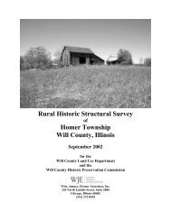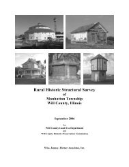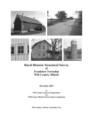
6104-S Final Report.pdf - Will County Land Use
6104-S Final Report.pdf - Will County Land Use
6104-S Final Report.pdf - Will County Land Use

Create successful ePaper yourself
Turn your PDF publications into a flip-book with our unique Google optimized e-Paper software.
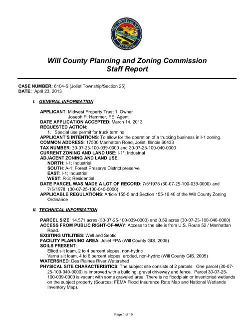
<strong>Will</strong> <strong>County</strong> Planning and Zoning Commission<br />
Staff <strong>Report</strong><br />
CASE NUMBER: <strong>6104</strong>-S (Joliet Township/Section 25)<br />
DATE: April 23, 2013<br />
I. GENERAL INFORMATION<br />
APPLICANT: Midwest Property Trust 1, Owner<br />
Joseph P. Hammer, PE, Agent<br />
DATE APPLICATION ACCEPTED: March 14, 2013<br />
REQUESTED ACTION:<br />
1. Special use permit for truck terminal<br />
APPLICANT’S INTENTIONS: To allow for the operation of a trucking business in I-1 zoning.<br />
COMMON ADDRESS: 17500 Manhattan Road, Joliet, Illinois 60433<br />
TAX NUMBER: 30-07-25-100-039-0000 and 30-07-25-100-040-0000<br />
CURRENT ZONING AND LAND USE: I-1*; Industrial<br />
ADJACENT ZONING AND LAND USE:<br />
NORTH: I-1; Industrial<br />
SOUTH: A-1; Forest Preserve District preserve<br />
EAST: I-1; Industrial<br />
WEST: R-3; Residential<br />
DATE PARCEL WAS MADE A LOT OF RECORD: 7/5/1978 (30-07-25-100-039-0000) and<br />
7/5/1978 (30-07-25-100-040-0000)<br />
APPLICABLE REGULATIONS: Article 155-5 and Section 155-16.40 of the <strong>Will</strong> <strong>County</strong> Zoning<br />
Ordinance<br />
II. TECHNICAL INFORMATION<br />
PARCEL SIZE: 14.571 acres (30-07-25-100-039-0000) and 0.59 acres (30-07-25-100-040-0000)<br />
ACCESS FROM PUBLIC RIGHT-OF-WAY: Access to the site is from U.S. Route 52 / Manhattan<br />
Road.<br />
EXISTING UTILITIES: Well and Septic<br />
FACILITY PLANNING AREA: Joliet FPA (<strong>Will</strong> <strong>County</strong> GIS, 2005)<br />
SOILS PRESENT:<br />
Elliott silt loam, 2 to 4 percent slopes, non-hydric<br />
Varna silt loam, 4 to 6 percent slopes, eroded, non-hydric (<strong>Will</strong> <strong>County</strong> GIS, 2005)<br />
WATERSHED: Des Plaines River Watershed<br />
PHYSICAL SITE CHARACTERISTICS: The subject site consists of 2 parcels. One parcel (30-07-<br />
25-100-040-0000) is improved with a building, gravel driveway and fence. Parcel 30-07-25-<br />
100-039-0000 is vacant with some graveled area. There is no floodplain or inventoried wetlands<br />
on the subject property (Sources: FEMA Flood Insurance Rate Map and National Wetlands<br />
Inventory Map).<br />
Page 1 of 19
CASE NUMBER: <strong>6104</strong>-S (JO/25)<br />
DATE: April 23, 2013<br />
WILL COUNTY PLANNING AND ZONING COMMISSION<br />
2002 LAND RESOURCE MANAGEMENT PLAN:<br />
Development Form: Suburban Community<br />
WILL COUNTY 2030 TRANSPORTATION FRAMEWORK PLAN: The subject property is located<br />
on U.S. Route 52 / Manhattan Road at the intersection of Briggs Street. The <strong>Will</strong> <strong>County</strong> 2030<br />
Transportation Framework Plan identifies Briggs Road/IL 52 as a new collector that is to be<br />
added from Schweizer Road to Spencer Road. The new road may involve widening along IL 52<br />
north of Laraway Road to avoid impacts to Forest Preserve property. Briggs Road is also<br />
identified as a Collector to be widened to 4 lanes from Spencer Road to I-80.<br />
OTHER LAND USE PLAN(S):<br />
Joliet Township Comprehensive Plan: No plan on file<br />
City of Joliet South Side Comprehensive Plan (March 2007): Industrial<br />
III. OTHER AGENCY COMMENTS<br />
WILL COUNTY HEALTH DEPARTMENT: Has no objection to the proposed special use. The<br />
private sewage disposal system serving the property is designed for domestic sewage only. All<br />
automotive waste fluids, oils and solvents must be disposed of in accordance with Illinois<br />
Environmental Protection Agency requirements. No parking or stock piling of materials or<br />
equipment on or within 10 feet of any part of the private sewage disposal system. See letter<br />
dated April 8, 2013.<br />
VILLAGE OF NEW LENOX: Responded stating that the subject property lies on the Joliet side of<br />
the Boundary Agreement and New Lenox transfers review authority to the City of Joliet. See<br />
letter dated February 15, 2013.<br />
EAST JOLIET FIRE PROTECTION DISTRICT: Has no objection to the issuance of a special use<br />
permit. The District will need to see a print of the proposed changes or additions to be made to<br />
the occupancy. Applicants will be required to install a Fire Alarm System that is directly<br />
connected to the fire department through radio alarm or hard wire. Applicants will be required to<br />
install a Knox Box near the main entrance so access to the occupancy can be gained during<br />
non business hours if needed. See attached letter dated February 13, 2013.<br />
ILLINOIS DEPARTMENT OF NATURAL RESOURCES: EcoCAT report states that The Illinois<br />
Natural Heritage Database contains no record of State-listed threatened or endangered<br />
species, Illinois Natural Area Inventory sites, dedicated Illinois Nature Preserves or registered<br />
<strong>Land</strong> and Water Reserves in the vicinity of the project location. See EcoCAT report dated<br />
February 11, 2013.<br />
FOREST PRESERVE DISTRICT OF WILL COUNTY: Responded stating property is adjacent to<br />
Sugar Creek Preserve and the southwest corner of the property drains directly onto the forest<br />
preserve property. The district requests at a minimum, an opportunity to review and comment<br />
on the development plan, stormwater management plan, compensatory storage plan and<br />
erosion control plan for this project. Additionally the district suggests the use of some sort of<br />
screening to protect the property from debris blowing into the preserve and creek. See letter<br />
dated April 17, 2013.<br />
AGENCIES THAT HAVE RECEIVED NOTIFICATION BUT NOT PROVIDED WRITTEN<br />
COMMENT:<br />
Joliet Township Highway Commissioner: Return receipt in case file dated February 18, 2013.<br />
Joliet Township Clerk: Return receipt in case file dated, February 13, 2013.<br />
Joliet Township Supervisor: Return receipt in case file dated, February 13, 2013.<br />
<strong>Will</strong> South Cook Soil & Water Conservation District: Return receipt in case file dated February<br />
27, 2013.<br />
City of Joliet Clerk: Return receipt in case file dated, February 14, 2013.<br />
Illinois Department of Transportation: Return receipt dated February 15, 2013.<br />
_________________________________________________<br />
<strong>Will</strong> <strong>County</strong> <strong>Land</strong> Resource Management Plan: Suburban Community<br />
Page 2 of 19
CASE NUMBER: <strong>6104</strong>-S (JO/25)<br />
DATE: April 23, 2013<br />
IV. STAFF ANALYSIS/FINDINGS OF FACT<br />
The applicant would like to operate a trucking business on the property. The applicant stated that<br />
the trucking operation consists of trucks used for grain hauling and that the building would be used<br />
for dispatch and repair of trucks. The applicant also stated that approximately 2 acres of the<br />
property would be used for this operation and the lot would have on average 6 trucks parked.<br />
WILL COUNTY PLANNING AND ZONING COMMISSION<br />
The applicants will have to comply with <strong>Will</strong> <strong>County</strong> Zoning Ordinance requirements for landscaping<br />
including installation of a land use buffer for the western border of the property which abuts the<br />
residential area along Briggs Street. U.S. Route 52 is under State jurisdiction. The Illinois<br />
Department of Transportation was notified via Certified Mail but no written correspondence has<br />
been received to date. The site development permit will require Illinois Department of<br />
Transportation approval prior to issuance.<br />
FINDINGS: Special use permit for truck terminal<br />
Section 155-16.40 of the <strong>Will</strong> <strong>County</strong> Zoning Ordinance provides the standards by which a Special <strong>Use</strong><br />
Permit may be granted. No special use permit may be granted unless:<br />
1. That the establishment, maintenance, or operation of the special use will not be detrimental to or<br />
endanger the public’s health, safety, morals, comfort or general welfare.<br />
The applicant stated that the use on the property will take place on approximately 2 acres of the<br />
property and would consist of, on average, 6 trucks being parked on site. The property is zoned<br />
industrial and has been used for industrial purposes prior to this use. Properties to the north and<br />
east are also zoned industrial and used for industrial purposes. The Forest Preserve District owns<br />
the property to the south and has requested review of the development plans to ensure that any<br />
potential adverse affects are mitigated. The western boundary of the property abuts a residential<br />
area and will require the installation of a land use buffer to mitigate any potential adverse affects to<br />
the residents living in the area.<br />
2. That the special use will not be injurious to the use and enjoyment of other property in the<br />
immediate vicinity for the purposes already permitted, nor substantially diminish or impair property<br />
values within the neighborhood.<br />
The property is zoned industrial and has previously been used for industrial purposes as have the<br />
properties to the north and east of the subject property. The western boundary of the property,<br />
which abuts a residential area, will require the installation of a land use buffer to mitigate any<br />
potential adverse affects to residents of the area. The southern boundary abuts Forest Preserve<br />
District land which serves as a buffer to the residential area south of the property and north of<br />
Laraway Road.<br />
3. That the establishment of the special use will not impede the normal and orderly development and<br />
improvement of surrounding property for uses permitted in the district.<br />
The historical use on the property is industrial. The property is located near other industrial uses to<br />
the north and east of the subject property. The establishment of the special use permit for a<br />
trucking operation will not impede the normal and orderly development of surrounding property for<br />
uses permitted in the district.<br />
_________________________________________________<br />
<strong>Will</strong> <strong>County</strong> <strong>Land</strong> Resource Management Plan: Suburban Community<br />
Page 3 of 19
CASE NUMBER: <strong>6104</strong>-S (JO/25)<br />
DATE: April 23, 2013<br />
4. That adequate utilities, access roads, drainage, and/or other necessary facilities have been or are<br />
being provided.<br />
WILL COUNTY PLANNING AND ZONING COMMISSION<br />
Current access points along U.S. Route 52 will be utilized for the trucking operation. U.S. Route 52<br />
is under State jurisdiction. The Illinois Department of Transportation was notified via Certified Mail<br />
but no written correspondence has been received to date. A site development permit will require<br />
Illinois Department of Transportation approval prior to issuance. Storm facilities will be provided<br />
according the <strong>Will</strong> <strong>County</strong> Water Resource Ordinance.<br />
The <strong>Will</strong> <strong>County</strong> Health Department advised that the private sewage disposal system which serves<br />
the property is designed for domestic sewage only. All automotive waste fluids, oils and solvents<br />
must be disposed of in accordance with Illinois Environmental Protection Agency requirements.<br />
5. That adequate measures have been or will be taken to provide ingress and egress so designed as<br />
to minimize traffic congestion in the public streets.<br />
Ingress and egress to the property will remain the same. The Illinois Department of Transportation<br />
was notified via Certified Mail but no written correspondence has been received to date. The<br />
applicant stated that a traffic impact study was prepared for the proposed use and indicated that<br />
existing facilities meet standards of evaluation for use.<br />
6. That the special use shall in all other respects conform to the applicable regulation of the district in<br />
which it is located, except as such regulations may in each instance be modified by the <strong>County</strong><br />
Board pursuant to the recommendation of the Planning and Zoning Commission.<br />
The special use permit will conform in all other respects to the applicable regulations of the I-1<br />
district.<br />
7. At least one (1) year has elapsed since any denial by the <strong>County</strong> Board of any prior application for<br />
a special use permit that would have authorized substantially the same as all or part of the sites,<br />
unless conditions in the area have substantially change.<br />
This is the first time request.<br />
V. STAFF RECOMMENDATIONS<br />
Approval of special use permit for a truck terminal with the following conditions:<br />
1. Upon (fourteen) 14 days of written notice to the owner of record at their last known address, <strong>Will</strong><br />
<strong>County</strong> <strong>Land</strong> <strong>Use</strong> Department and <strong>Will</strong> <strong>County</strong> Sheriff’s Department employees are hereby granted<br />
the right of entry in and upon the premises for the purpose of inspecting the premises and uses<br />
thereon for compliance with the terms and conditions of the special use permit.<br />
2. Applicant shall comply with the regulations of the <strong>Will</strong> <strong>County</strong> Health Department.<br />
3. Applicant shall comply with the regulations of the East Joliet Fire Protection District as described in<br />
the letter dated February 13, 2013 and submit an approval letter when compliance is achieved.<br />
4. Applicant shall comply with the requests of the Forest Preserve District of <strong>Will</strong> <strong>County</strong> to address<br />
the concerns stated in the letter dated April 17, 2013.<br />
5. Applicants shall install a land use buffer along the western border of the property which abuts the<br />
residential area on Briggs Street in accordance with <strong>Will</strong> <strong>County</strong> Zoning Ordinance standards.<br />
_________________________________________________<br />
<strong>Will</strong> <strong>County</strong> <strong>Land</strong> Resource Management Plan: Suburban Community<br />
Page 4 of 19
CASE NUMBER: <strong>6104</strong>-S (JO/25)<br />
DATE: April 23, 2013<br />
Additional Information<br />
The applicants are hereby advised of the following:<br />
WILL COUNTY PLANNING AND ZONING COMMISSION<br />
1. The applicants shall comply with the current <strong>Will</strong> <strong>County</strong> Building Ordinance and Codes (Resolution<br />
# 01-442).<br />
2. The applicants shall comply with the current Water Resource Ordinance for Unincorporated <strong>Will</strong><br />
<strong>County</strong><br />
3. The applicant shall comply with all zoning regulations established by the <strong>Will</strong> <strong>County</strong> Zoning<br />
Ordinance.<br />
4. No special use permit shall be valid for a period longer than one (1) year from the date it is granted<br />
unless a building permit or certificate of occupancy is obtained within such period and the erection<br />
or alteration of a building is started or the use is commenced within such period. The <strong>County</strong> Board<br />
may grant an extension of this period, valid for no more than one hundred eighty (180) additional<br />
days, upon written application within the first year of the special use permit and upon good cause<br />
shown without notice or hearing. The <strong>County</strong> Board may grant one (1) additional extension of this<br />
period, valid for no more than one hundred eighty (180) additional days, upon written application<br />
within the initial extension and upon good cause shown without notice or hearing. If any special use<br />
is abandoned, or is discontinued for a continuous period of one year, the special use permit for<br />
such use shall become void, and such use shall not thereafter be reestablished unless a new<br />
special use permit is obtained.<br />
ATTACHMENTS<br />
1. Aerial (<strong>Will</strong> <strong>County</strong> GIS Department)<br />
2. Plat of survey<br />
3. Letter from <strong>Will</strong> <strong>County</strong> Health Department dated April 8, 2013<br />
4. Letter from Village of New Lenox dated February 15, 2013<br />
5. Letter from East Joliet Fire Protection District dated February 13, 2013<br />
6. Letter from the Forest Preserve District of <strong>Will</strong> <strong>County</strong> dated April 17, 2013<br />
7. EcoCAT report dated February 11, 2013<br />
8. Zoning map (unofficial)<br />
9. <strong>Land</strong> Resource Management Plan form map<br />
10. Criteria completed by the applicant<br />
Prepared by: Martha M. Glas, <strong>Will</strong> <strong>County</strong> <strong>Land</strong> <strong>Use</strong> Department<br />
Date of Site Inspection: April 19, 2013<br />
Date of PZC Hearing: May 7, 2013<br />
J:\Development Review\CURRENT PLANNING\CASES BY TOWNSHIP\Joliet\<strong>6104</strong>-S\<strong>6104</strong>-S Written<br />
<strong>Report</strong>.doc<br />
_________________________________________________<br />
<strong>Will</strong> <strong>County</strong> <strong>Land</strong> Resource Management Plan: Suburban Community<br />
Page 5 of 19
CASE NUMBER: <strong>6104</strong>-S (JO/25)<br />
DATE: April 23, 2013<br />
Picture 1: Photo of the subject property looking<br />
southwest from across U.S. Route 52.<br />
WILL COUNTY PLANNING AND ZONING COMMISSION<br />
Picture 2: Photo of the subject property looking<br />
southeast from across U.S. Route 52.<br />
Picture 3: Photo looking north from the subject<br />
property across U.S Route 52.<br />
_________________________________________________<br />
<strong>Will</strong> <strong>County</strong> <strong>Land</strong> Resource Management Plan: Suburban Community<br />
Page 6 of 19
CASE NUMBER: <strong>6104</strong>-S (JO/25)<br />
DATE: April 23, 2013<br />
Picture 4: Photo looking east at the subject<br />
property from Briggs Street.<br />
WILL COUNTY PLANNING AND ZONING COMMISSION<br />
Picture 5: Photo looking east along U.S. Route<br />
52 from Briggs Street.<br />
Picture 6: Photo looking west along U.S. Route<br />
52 from the driveway of the subject property.<br />
_________________________________________________<br />
<strong>Will</strong> <strong>County</strong> <strong>Land</strong> Resource Management Plan: Suburban Community<br />
Page 7 of 19
CASE NUMBER: <strong>6104</strong>-S (JO/25)<br />
DATE: April 23, 2013<br />
WILL COUNTY PLANNING AND ZONING COMMISSION<br />
Subject Property<br />
_________________________________________________<br />
<strong>Will</strong> <strong>County</strong> <strong>Land</strong> Resource Management Plan: Suburban Community<br />
Page 8 of 19
Scale: 1:3,481<br />
Disclaimer of Warranties and Accuracy of Data: Although the data developed by <strong>Will</strong> <strong>County</strong> for its maps, websites, and Geographic Information System has been produced and processed from sources believed to be reliable, no warranty, expressed or implied, is made regarding accuracy, adequacy,<br />
completeness, legality, reliability or usefulness of any information. This disclaimer applies to both isolated and aggregate uses of the information. The <strong>County</strong> and elected officials provide this information on an "as is" basis. All warranties of any kind, express or implied, including but not limited to the<br />
implied warranties of merchantability, fitness for a particular purpose, freedom from contamination by computer viruses or hackers and non-infringement of proprietary rights are disclaimed. Changes may be periodically made to the information herein; these changes may or may not be incorporated in any<br />
new version of the publication. If you have obtained information from any of the <strong>County</strong> web pages from a source other than the <strong>County</strong> pages, be aware that electronic data can be altered subsequent to original distribution. Data can also quickly become out of date. It is recommended that careful attention<br />
be paid to the contents of any data, and that the originator of the data or information be contacted with any questions regarding appropriate use. Please direct any questions or issues via email to gis@willcountyillinois.com.<br />
Page 9 of 19<br />
Aerial<br />
0 325 650 975 ft.
N:\Tech\2012\1032\Surveying\Alta_Topo\1032A.dwg, Model, 4/19/2013 12:38:09 PM, ehawkinson<br />
Page 10 of 19
Page 11 of 19
Page 12 of 19
Page 13 of 19
Page 14 of 19
Page 15 of 19
Page 16 of 19
Scale: 1:10,000<br />
Disclaimer of Warranties and Accuracy of Data: Although the data developed by <strong>Will</strong> <strong>County</strong> for its maps, websites, and Geographic Information System has been produced and processed from sources believed to be reliable, no warranty, expressed or implied, is made regarding accuracy, adequacy,<br />
completeness, legality, reliability or usefulness of any information. This disclaimer applies to both isolated and aggregate uses of the information. The <strong>County</strong> and elected officials provide this information on an "as is" basis. All warranties of any kind, express or implied, including but not limited to the<br />
implied warranties of merchantability, fitness for a particular purpose, freedom from contamination by computer viruses or hackers and non-infringement of proprietary rights are disclaimed. Changes may be periodically made to the information herein; these changes may or may not be incorporated in any<br />
new version of the publication. If you have obtained information from any of the <strong>County</strong> web pages from a source other than the <strong>County</strong> pages, be aware that electronic data can be altered subsequent to original distribution. Data can also quickly become out of date. It is recommended that careful attention<br />
be paid to the contents of any data, and that the originator of the data or information be contacted with any questions regarding appropriate use. Please direct any questions or issues via email to gis@willcountyillinois.com.<br />
Page 17 of 19<br />
Zoning<br />
0 1000 2000 3000 ft.
<strong>6104</strong>-S<br />
Page 18 of 19
Page 19 of 19