Rural Historic Structural Survey - Will County Land Use
Rural Historic Structural Survey - Will County Land Use
Rural Historic Structural Survey - Will County Land Use

You also want an ePaper? Increase the reach of your titles
YUMPU automatically turns print PDFs into web optimized ePapers that Google loves.
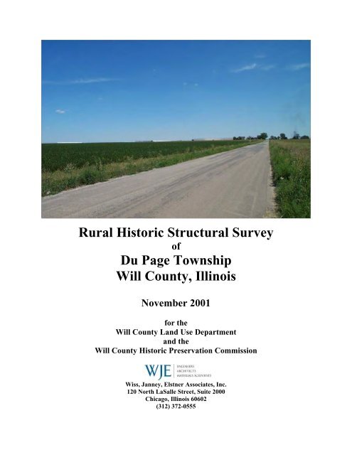
<strong>Rural</strong> <strong>Historic</strong> <strong>Structural</strong> <strong>Survey</strong><br />
of<br />
Du Page Township<br />
<strong>Will</strong> <strong>County</strong>, Illinois<br />
November 2001<br />
for the<br />
<strong>Will</strong> <strong>County</strong> <strong>Land</strong> <strong>Use</strong> Department<br />
and the<br />
<strong>Will</strong> <strong>County</strong> <strong>Historic</strong> Preservation Commission<br />
Wiss, Janney, Elstner Associates, Inc.<br />
120 North LaSalle Street, Suite 2000<br />
Chicago, Illinois 60602<br />
(312) 372-0555
Wiss, Janney, Elstner Associates, Inc.
Wiss, Janney, Elstner Associates, Inc.<br />
<strong>Rural</strong> <strong>Historic</strong> <strong>Structural</strong> <strong>Survey</strong> of<br />
Du Page Township<br />
<strong>Will</strong> <strong>County</strong>, Illinois<br />
TABLE OF CONTENTS<br />
Cover photograph: View to the northeast along Normantown Road (127 th Street) in Section 30 of Du Page Township. On<br />
the horizon are a series of warehouse and light industrial buildings that have been constructed in recent years.<br />
EXECUTIVE SUMMARY ..................................................................................................................... E-1<br />
FEDERAL ASSISTANCE ACKNOWLEDGEMENT<br />
CHAPTER I: CONTEXT HISTORY OF THE RURAL SURVEY REGION<br />
Geologic and Topographic Background to the Illinois Region .............................................................I – 1<br />
First Nations in the Illinois Region ............................................................................................................I – 4<br />
The Arrival of European Settlers<br />
French Explorers and Settlers in the Illinois Territory .............................................................................I – 5<br />
Illinois in the English Colonial Period and Revolutionary War ...............................................................I – 8<br />
<strong>Land</strong> Division and Distribution in the New Nation..................................................................................I – 9<br />
Development of the Northwest Territory ...............................................................................................I – 10<br />
Illinois Statehood....................................................................................................................................I – 11<br />
Settlement and Development of <strong>Will</strong> <strong>County</strong>.........................................................................................I – 13<br />
Development of the Illinois and Michigan Canal...................................................................................I – 17<br />
Plank Roads in <strong>Will</strong> <strong>County</strong>...................................................................................................................I – 22<br />
Agricultural Development of the <strong>County</strong> and State ...............................................................................I – 23<br />
Twentieth Century Developments..........................................................................................................I – 26<br />
American <strong>Rural</strong> Architecture<br />
Farmstead Planning ...............................................................................................................................I – 34<br />
Development of Ballon Framing............................................................................................................I – 39<br />
Masonry Construction ............................................................................................................................I – 43<br />
Local Limestone.....................................................................................................................................I – 44<br />
Joliet Limestone ..............................................................................................................................I – 44<br />
Quarries in Lemont .........................................................................................................................I – 45<br />
Development of the Limestone Industry ..........................................................................................I – 46<br />
Dupage Valley Limestone and Gravel.............................................................................................I – 51<br />
Reinforced Concrete...............................................................................................................................I – 54<br />
Concrete Block.......................................................................................................................................I – 56<br />
Classification of Farmhouse Types ........................................................................................................I – 60<br />
Architectural Style..................................................................................................................................I – 60<br />
Greek Revival..................................................................................................................................I – 60<br />
Gothic Revival.................................................................................................................................I – 61<br />
Italianate .........................................................................................................................................I – 62<br />
Second Empire ................................................................................................................................I – 63<br />
Stick Style ........................................................................................................................................I – 63<br />
Queen Anne.....................................................................................................................................I – 64<br />
Colonial and Georgian Revival.......................................................................................................I – 64<br />
Craftsman or Arts and Crafts Style .................................................................................................I – 65<br />
Prairie Style ....................................................................................................................................I – 65<br />
Tudor Revival..................................................................................................................................I – 66<br />
Ranch ..............................................................................................................................................I – 66<br />
International Style...........................................................................................................................I – 67
Wiss, Janney, Elstner Associates, Inc.<br />
House Types...........................................................................................................................................I – 68<br />
I House ............................................................................................................................................I – 69<br />
German Stone Farmhouse...............................................................................................................I – 70<br />
Hall and Parlor...............................................................................................................................I – 70<br />
Upright and Wing............................................................................................................................I – 71<br />
Gabled Ell .......................................................................................................................................I – 72<br />
Side Hallway ...................................................................................................................................I – 73<br />
Four-over-Four...............................................................................................................................I – 73<br />
Gable Front.....................................................................................................................................I – 74<br />
American Foursquare .....................................................................................................................I – 74<br />
Bungalow ........................................................................................................................................I – 75<br />
Cape Cod.........................................................................................................................................I – 75<br />
Schoolhouses...................................................................................................................................I – 76<br />
Development of the Barn .......................................................................................................................I – 77<br />
Barn Types .............................................................................................................................................I – 81<br />
English Barn or Three-bay Threshing Barn....................................................................................I – 82<br />
Raised, Bank, and Basement Barns.................................................................................................I – 82<br />
German Barn...................................................................................................................................I – 83<br />
Wisconsin Dairy Barn.....................................................................................................................I – 86<br />
Plank Frame Barn...........................................................................................................................I – 87<br />
Three-ended Barn............................................................................................................................I – 87<br />
Feeder Barn ....................................................................................................................................I – 88<br />
Pole Barn ........................................................................................................................................I – 88<br />
Round Roof Barn.............................................................................................................................I – 89<br />
Quonsets..........................................................................................................................................I – 89<br />
Grain Elevators.......................................................................................................................................I – 90<br />
Corncribs................................................................................................................................................I – 90<br />
Crib Barns ..............................................................................................................................................I – 93<br />
Metal Bins ..............................................................................................................................................I – 95<br />
Silos........................................................................................................................................................I – 96<br />
Other Farm Structures ..........................................................................................................................I – 102<br />
Chicken Houses.............................................................................................................................I – 102<br />
Milk Houses...................................................................................................................................I – 103<br />
Smokehouses .................................................................................................................................I – 104<br />
Windmills, Pump Houses, and Cisterns ........................................................................................I – 105<br />
Miscellaneous Buildings ...............................................................................................................I – 106<br />
The American Post-war Suburb: Successor or Annihilator of the <strong>Rural</strong> Community? ...............................I – 107<br />
CHAPTER II: DU PAGE TOWNSHIP<br />
Settlement Patterns of Du Page Township...............................................................................................II – 1<br />
The <strong>Rural</strong> Crossroads of Du Page Township ..........................................................................................II – 6<br />
Barber's Corners..............................................................................................................................II – 7<br />
Sprague's Corner ...........................................................................................................................II – 10<br />
First Presbyterian Church of Du Page ..........................................................................................II – 10<br />
Romeo Depot and Romeoville ........................................................................................................II – 12<br />
Schoolhouses in Du Page Township ..............................................................................................II – 15<br />
Cemeteries of Du Page Township ..................................................................................................II – 17<br />
Bolingbrook...........................................................................................................................................II – 19<br />
Du Page Township and the <strong>Will</strong> <strong>County</strong> <strong>Land</strong> Resource Management Plan ........................................II – 23<br />
Neighboring Communities in Du Page and Cook Counties ..................................................................II – 23<br />
Significant and Contributing Farmsteads in Du Page Township<br />
Amsden–Biggins–Mather ...............................................................................................................II – 24<br />
Anglemire–Kopperud .....................................................................................................................II – 25<br />
Bartoo–Elwood–Patterson.............................................................................................................II – 26<br />
Biggins–Doyle–Kelley....................................................................................................................II – 26<br />
Biggins–Yackley–Boldt ..................................................................................................................II – 27<br />
Calkins–Laing–Reardon–Smith–Jurca ..........................................................................................II – 28
Wiss, Janney, Elstner Associates, Inc.<br />
Bennett–Clifford–Ketchum–Heeg–Peabody–Hullett......................................................................II – 29<br />
Dyer–Rathbun–Mather–Hageman–Scholz.....................................................................................II – 30<br />
Dyer–Dixon–Mather–Haley...........................................................................................................II – 33<br />
Eaton–Weinhold–Schafer–Schoenherr ..........................................................................................II – 34<br />
Freeman–Wescott–Garrette...........................................................................................................II – 35<br />
Lambert ..........................................................................................................................................II – 38<br />
Royce–McDonald...........................................................................................................................II – 40<br />
Whallon–Eichelberger–Konicek ....................................................................................................II – 42<br />
Non-contributing or Non-existing Farmsteads in Du Page Township<br />
Barber–Breitweiser........................................................................................................................II – 45<br />
Boardman.......................................................................................................................................II – 46<br />
Johnson–Eaton–George.................................................................................................................II – 47<br />
Dagen–Ward–Weber......................................................................................................................II – 48<br />
Glover ............................................................................................................................................II – 49<br />
Godfrey...........................................................................................................................................II – 49<br />
Higgins...........................................................................................................................................II – 51<br />
King................................................................................................................................................II – 51<br />
Lord................................................................................................................................................II – 52<br />
Miller–Hullett.................................................................................................................................II – 53<br />
Overholser......................................................................................................................................II – 53<br />
Ranck..............................................................................................................................................II – 54<br />
Rank ...............................................................................................................................................II – 54<br />
Schmid............................................................................................................................................II – 54<br />
Smith ..............................................................................................................................................II – 54<br />
Strong.............................................................................................................................................II – 55<br />
Walker ............................................................................................................................................II – 55<br />
<strong>Will</strong>iams .........................................................................................................................................II – 56<br />
CHAPTER III: SURVEY SUMMARY AND RECOMMENDATIONS<br />
Period of Significance: 1830 to 1970 ..................................................................................................... III – 1<br />
Significance<br />
National Register and Local <strong>Land</strong>mark Criteria.................................................................................... III – 2<br />
Integrity................................................................................................................................................. III – 4<br />
Contributing and Non-contributing Properties ...................................................................................... III – 4<br />
<strong>Will</strong> <strong>County</strong> <strong>Land</strong> Resource Management Plan (1990, Amended 1996) .............................................. III – 5<br />
Potential <strong>Historic</strong> Districts and <strong>Land</strong>marks<br />
Wheatland <strong>Rural</strong> Heritage District ........................................................................................................ III – 6<br />
Wheatland Presbyterian Church <strong>Rural</strong> Crossroads................................................................................ III – 7<br />
Limestone Multiple Property <strong>Historic</strong> District...................................................................................... III – 8<br />
Individual <strong>Land</strong>marks ........................................................................................................................... III – 9<br />
<strong>Survey</strong> Summary ..................................................................................................................................... III – 11<br />
Table of Farmsteads and Agriculturally-related Sites (Sorted by PIN)............................................... III – 13<br />
Table of Farmhouses (Sorted by PIN)................................................................................................. III – 20<br />
Table of Barns (Sorted by PIN)........................................................................................................... III – 25<br />
Table of Support Buildings (Sorted by PIN)....................................................................................... III – 28<br />
Recommendations for Additional <strong>Survey</strong> Work<br />
Summary ............................................................................................................................................. III – 35<br />
Introduction ......................................................................................................................................... III – 35<br />
Areas Adjacent to the <strong>Survey</strong> Region ................................................................................................. III – 36<br />
Other Townships in <strong>Will</strong> <strong>County</strong> ........................................................................................................ III – 36<br />
<strong>Land</strong>scape Features ............................................................................................................................. III – 37
Wiss, Janney, Elstner Associates, Inc.<br />
CHAPTER IV: SURVEY METHODOLOGY............................................................................................. IV – 1<br />
BIBLIOGRAPHY<br />
Previous <strong>Survey</strong>s<br />
Books, Articles, and Other Publications<br />
Maps and Aerial Photographs<br />
TABLES<br />
Table 1 – Du Page Township <strong>Survey</strong> Sites (April and May 2001)<br />
Table 2 – Selected <strong>Historic</strong> Du Page Township Farmstead Sites No Longer Extant<br />
APPENDIX A: Reproductions of Plat Maps<br />
<strong>Will</strong> <strong>County</strong> Plat Maps of Du Page, Lockport, Plainfield, and Wheatland Townships<br />
Du Page <strong>County</strong> Plat Maps of Naperville, Lisle, and Downers Grove Townships<br />
Cook <strong>County</strong> Plat Maps of Lemont Township<br />
APPENDIX B: Wheatland Plowing Matches, 1877–1976<br />
APPENDIX C: Maps<br />
APPENDIX D: <strong>Will</strong> <strong>County</strong> Neighboring Communities in Du Page and Cook <strong>County</strong>
Wiss, Janney, Elstner Associates, Inc.
Wiss, Janney, Elstner Associates, Inc.
Wiss, Janney, Elstner Associates, Inc.<br />
Errata for the <strong>Rural</strong> <strong>Historic</strong> <strong>Structural</strong> <strong>Survey</strong> of Du Page Township, <strong>Will</strong> <strong>County</strong>, Illinois<br />
Chapter III – 11: The corrected barn table is reprinted as follows:<br />
Barns<br />
Barn Type Du Page Wheatland Plainfield Lockport Totals<br />
Three-bay Threshing 9 16 7 10 42<br />
Bank 1 1 ― 1 3<br />
Raised 1 2 1 1 5<br />
Pennsylvania German ― 7 1 ― 8<br />
Three-ended 1 3 ― ― 4<br />
Plank Frame 1 14 15 4 35<br />
Feeder 1 6 ― ― 7<br />
Dairy 1 9 3 5 17<br />
Other or unknown 2 15 1 16 1 ― 4<br />
Totals 17 59 28 21 125<br />
Chapter III – 16: The corrected table is reprinted as follows:<br />
Farmsteads and Agriculturally-related Sites (Sort by PIN)<br />
NUMBER STREET NAME<br />
PARCEL<br />
IDENTIFICATION<br />
NUMBER (PIN)<br />
NATIONAL LANDMARK<br />
POTENTIAL<br />
LOCAL LANDMARK POTENTIAL<br />
2205 Royce Road 02-04-200-011 CONTRIBUTING SIGNIFICANT LOCAL LANDMARK<br />
1490 Royce Road 02-04-300-004 CONTRIBUTING SIGNIFICANT LOCAL LANDMARK<br />
Knoch Knolls 02-06-300-007 CONTRIBUTING CONTRIBUTING<br />
21339 Boughton Rd. 02-07-300-009 CONTRIBUTING CONTRIBUTING<br />
910 Boughton Rd. 02-08-200-003 NON-CONTRIBUTING NON-CONTRIBUTING<br />
550 Boughton 02-09-200-021 NON-CONTRIBUTING NON-CONTRIBUTING<br />
17025 Davey 02-13-400-016 CONTRIBUTING CONTRIBUTING<br />
1570 Rodeo Dr.<br />
(Ferguson)<br />
02-19-300-006 CONTRIBUTING POSSIBLE LOCAL LANDMARK AFTER<br />
DETERMINATION IF ORIGINAL PORTION OF<br />
FARMHOUSE IS LOG STRUCTURE<br />
Weber (<strong>Will</strong>iams) 02-20-100-001 NON-CONTRIBUTING NON-CONTRIBUTING<br />
Weber 02-20-300-001 CONTRIBUTING CONTRIBUTING<br />
Naperville Road 02-20-400-002 CONTRIBUTING CONTRIBUTING<br />
S. Frontage Road 02-21-300-002 CONTRIBUTING CONTRIBUTING<br />
S. Frontage Road 02-22-176-002 CONTRIBUTING CONTRIBUTING<br />
11313 Katherine’s<br />
Crossing (Limestone<br />
farmhouse)<br />
11313 Katherine’s<br />
Crossing (Wood<br />
frame farmhouse)<br />
02-24-102-045 SIGNIFICANT AS PART OF A "LIMESTONE<br />
DISTRICT"<br />
SIGNIFICANT LOCAL LANDMARK<br />
02-24-102-045 CONTRIBUTING SOME LOCAL LANDMARK POTENTIAL,<br />
ALTHOUGH IN POOR CONDITION<br />
S. Frontage Road 02-28-100-019 CONTRIBUTING CONTRIBUTING<br />
Naperville Road 02-28-200-006 CONTRIBUTING CONTRIBUTING<br />
19628 Normantown 02-28-300-003 NON-CONTRIBUTING NON-CONTRIBUTING<br />
19852 Normantown 02-28-300-001 NON-CONTRIBUTING NON-CONTRIBUTING<br />
19504 W. Normantown 02-28-400-003 CONTRIBUTING CONTRIBUTING<br />
Normantown 02-29-200-002 CONTRIBUTING CONTRIBUTING<br />
Ferguson 02-30-100-008 CONTRIBUTING CONTRIBUTING<br />
21038 Normantown 02-30-300-010 CONTRIBUTING CONTRIBUTING<br />
(127th)<br />
1840 N. Frontage Rd.(55) 02-31-100-003 CONTRIBUTING SIGNIFICANT LOCAL LANDMARK<br />
Normantown 02-32-200-020 CONTRIBUTING CONTRIBUTING<br />
20442 Romeo Rd. 02-32-300-003 NON-CONTRIBUTING NON-CONTRIBUTING<br />
11528 Naper-Romeo Rd. 02-32-400-008 CONTRIBUTING CONTRIBUTING<br />
13336 Smith 02-36-400-007 NON-CONTRIBUTING NON-CONTRIBUTING<br />
Chapter III – 22: The following lines in the table have been reprinted with corrections to the architectural<br />
style:<br />
550 BOUGHTON 02-09-200-021 QUEEN ANNE VERNACULAR<br />
FRONTAGE ROAD 02-22-176-002 GABLE FRONT VERNACULAR<br />
1840 N. FRONTAGE<br />
RD.(55)<br />
02-31-100-003 UPRIGHT AND WING ITALIANATE
Wiss, Janney, Elstner Associates, Inc.
Wiss, Janney, Elstner Associates, Inc.
Wiss, Janney, Elstner Associates, Inc.<br />
November 2001<br />
EXECUTIVE SUMMARY<br />
At the request of the <strong>Will</strong> <strong>County</strong> <strong>Land</strong> <strong>Use</strong> Department (<strong>Will</strong> <strong>County</strong>), acting as liaison for the <strong>Will</strong><br />
<strong>County</strong> <strong>Historic</strong> Preservation Commission (<strong>Historic</strong> Preservation Commission), Wiss, Janney, Elstner<br />
Associates, Inc. (WJE) has prepared the following report of the intensive survey of existing farmsteads in<br />
unincorporated Du Page Township in <strong>Will</strong> <strong>County</strong>, Illinois. WJE has previously performed an intensive<br />
survey of Wheatland, Plainfield, and Lockport Townships, with a final report dated November 2000.<br />
Most of the survey of Du Page Township was performed in April and May 2001, with follow-up survey<br />
in August and November 2001, and includes 36 square miles with 27 farmsteads containing 131<br />
individual structures. This intensive survey was performed to update the previous survey of the township<br />
performed in 1988, which identified 76 farmsteads with 411 individual structures. Therefore, in the 13<br />
years between the survey efforts a significant number of rural structures, as well as rural character and<br />
heritage, have been lost. Of the 27 farmsteads identified, 5 are individually eligible for <strong>Will</strong> <strong>County</strong><br />
<strong>Historic</strong> <strong>Land</strong>mark status and/or National Register of <strong>Historic</strong> Places designation; 15 have sufficient<br />
integrity to contribute to a potential <strong>Will</strong> <strong>County</strong> or National Register rural heritage historic district; and 7<br />
lack sufficient historic integrity to contribute to a historic district. Approximately one-half of the<br />
farmsteads in the township are actively engaged in some form of agricultural production. However,<br />
although many structures survive on farmsteads in Du Page Township and northwest <strong>Will</strong> <strong>County</strong>, they<br />
are under increasing threat without the former vitality of the agricultural economy.<br />
Northwest <strong>Will</strong> <strong>County</strong> was settled by pioneer farmers of European origin beginning in the late 1820s.<br />
Two subsequent historical developments led to an increase in settlement: more land in the region became<br />
available after the Treaty of Chicago of 1833 resettled the remaining Native Americans to west of the<br />
Mississippi; and the decision to build the Illinois and Michigan Canal, begun in 1836. By the time the<br />
canal opened in 1848, the towns of Plainfield and Lockport had been founded (in 1834 and 1836<br />
respectively) and farmers were established in Wheatland and Du Page Townships. The canal promoted<br />
the use of Chicago as a port city and reoriented the growth center of Illinois from the southern end of the<br />
state to the north. The canal helped farmers move their harvests and livestock to market. Within a few<br />
years, the railroad arrived to the region, offering farmers an additional means of transporting their bounty<br />
to Chicago and elsewhere. The canal gradually declined in use with the spread of the railroads; however,<br />
routing of the Sanitary and Ship Canal in the 1890s parallel to the canal renewed the waterways in the<br />
region for shipping purposes. Other transportation arteries included the Elgin, Joliet & Eastern Railroad,<br />
established in the late 1880s, and the routing of U.S. 30 through Joliet and Plainfield in the 1910s.<br />
Although these transportation arteries also served newly established industries in the area, they served the<br />
vital agricultural economy of northwest <strong>Will</strong> <strong>County</strong> until its decline in the last half of the twentieth<br />
century.<br />
The <strong>Rural</strong> Structures <strong>Survey</strong> of unincorporated <strong>Will</strong> <strong>County</strong> performed in 1988 identified approximately<br />
21,000 structures, 343 of which were noted to be potentially significant. The 1988 survey documented<br />
sites with photographs and survey data on standard Illinois <strong>Historic</strong> Preservation Agency format cards.<br />
For most sites, the data for the 1988 survey was gathered from the public right-of-way. In addition to this<br />
survey a report, was prepared examining the overall rural themes present in the county and identifying<br />
noteworthy structures. In 1999 and 2000, an intensive survey of Wheatland, Plainfield, and Lockport<br />
Townships was performed by WJE. The survey area includes 108 square miles of land, 227 farmsteads<br />
and historically related sites, and 890 individual structures. This report incorporates information from the<br />
final report November 2000, but with additional historical information obtained during the survey of Du<br />
Page Township.<br />
Because of the numerous changes that have occurred in the years since the first rural survey in 1988, the<br />
<strong>Will</strong> <strong>County</strong> <strong>Historic</strong> Preservation Commission recognized the need to reassess the agricultural heritage<br />
<strong>Will</strong> <strong>County</strong> <strong>Rural</strong> <strong>Historic</strong> <strong>Structural</strong> <strong>Survey</strong><br />
Du Page Township
Wiss, Janney, Elstner Associates, Inc.<br />
in the region. Northwest <strong>Will</strong> <strong>County</strong> in particular is one of the fastest developing areas of the state, and<br />
for this reason was selected as the first area in the county to be reassessed. The Village of Bolingbrook<br />
has grown to dominate Du Page Township. The boundaries of Naperville, Plainfield, and Bolingbrook<br />
were once several miles apart. Now, through a series of annexations in recent years, all three share<br />
common boundaries in the center of Wheatland Township to the west of Du Page Township.<br />
The <strong>Will</strong> <strong>County</strong> <strong>Rural</strong> <strong>Historic</strong> <strong>Structural</strong> <strong>Survey</strong> described in this report was conducted on an intensive<br />
level, reconfirming the data gathered in the 1988 survey, and also including additional information such<br />
as sketch site plans and identification of more detailed building features. (The intensive level of the<br />
survey was possible because only one township was included in the present survey, as opposed to the<br />
entire county for the 1988 survey.) <strong>Survey</strong> work was conducted on farmstead and agriculturally related<br />
sites on unincorporated land, although a limited number of significant sites on incorporated land were<br />
included as well. Access to each site was sought from property owners to allow for closer examination of<br />
structures documented in the survey. This also allowed for photographs taken at close range to be<br />
included in the survey data. <strong>Rural</strong> structures constructed before 1950 were documented, as a minimum<br />
age of 50 years is the basic criteria for elements to be considered for nomination to the National Register<br />
of <strong>Historic</strong> Places (National Register). Each of the structures was documented on a separate survey form.<br />
Database software was used to organize written survey data for each structure and each farmstead site.<br />
Mapping software using geographic information system (GIS) technology was used to plot a graphic<br />
database showing the location of each farmstead.<br />
The intensive survey conducted to date of all four northwestern <strong>Will</strong> <strong>County</strong> townships determined that<br />
there is a large, semi-contiguous region in Wheatland Township and northwestern Plainfield Township<br />
with a rich cultural heritage dating back to the first farmsteads established by settlers in the 1830s and<br />
1840s. Spread throughout this region are several extant sites where a local farming competition, the<br />
Wheatland Plowing Match, was held almost every year between 1877 and 1976. Within this region are<br />
several farmsteads meriting local landmark designation. Centered within this large region of Wheatland<br />
and Plainfield Townships is a small settlement, the Wheatland Presbyterian Church rural crossroads, with<br />
a rich history and several intact structures. Consideration should be given to nominating the region to the<br />
National Register as a <strong>Will</strong> <strong>County</strong> historic agricultural district or a National Register <strong>Historic</strong> District<br />
through multiple property designation.<br />
Also present in the four township area, and centered on the Des Plaines and Du Page River Valleys, are<br />
several extant buildings constructed of locally quarried limestone. The stone quarrying industry in the Des<br />
Plaines River Valley began in the 1830s, with quarrying in the Du Page River Valley initiated in the<br />
following decade as settlement progressed to northwestern <strong>Will</strong> <strong>County</strong>. As an area with buildings unique<br />
to agricultural production, it merits nomination to the National Register of <strong>Historic</strong> Places as a multiple<br />
property district. The survey also identified a select number of architecturally distinctive or historically<br />
significant sites and structures not defined by either of the two above categories. These are sites that merit<br />
local landmark designation. After additional research is performed to grant local landmark designation, a<br />
few of these sites may merit designation to the National Register.<br />
Chapters I and II provide the context in which the surveyed farmsteads were established, grew, and in<br />
many cases have been divided into separate properties. Chapter I covers the geological, historical, and<br />
architectural contexts of <strong>Will</strong> <strong>County</strong> agriculture. Chapter II discusses the historical context of each of the<br />
three townships and focuses on historically and/or architecturally significant farmsteads, as identified by<br />
the survey, and the families that owned them. Chapter III describes the survey results, and includes a<br />
discussion of the National Register and local <strong>Will</strong> <strong>County</strong> criteria for determination of historical and<br />
architectural significance; a listing of the significant farmsteads in the survey region and potential<br />
individual or group designation; tabulation of individual building types; and recommendations for future<br />
survey work. Chapter IV contains a description of the survey methodology.<br />
Executive Summary - E – 2<br />
<strong>Will</strong> <strong>County</strong> <strong>Rural</strong> <strong>Historic</strong> <strong>Structural</strong> <strong>Survey</strong><br />
Du Page Township
Wiss, Janney, Elstner Associates, Inc.<br />
FEDERAL ASSISTANCE ACKNOWLEDGEMENT<br />
This program receives federal financial assistance for identification and protection of historic properties.<br />
Under Title VI of the Civil Rights Act of 1964, Section 504 of the Rehabilitation Act of 1973, and the Age<br />
Discrimination Act of 1975, as amended, the U.S. Department of the Interior prohibits discrimination on the<br />
basis of race, color, national origin, or disability or age in its federally assisted programs. If you believe you<br />
have been discriminated against in any program, activity, or facility as described above, or if you desire<br />
further information, please write to:<br />
Office for Equal Opportunity<br />
National Park Service<br />
P.O. Box 37127<br />
Washington, DC 20013-7127<br />
or<br />
Equal Employment Opportunity Officer<br />
Illinois <strong>Historic</strong> Preservation Agency<br />
One Old State Capitol Plaza<br />
Springfield, IL 62701<br />
The activity which is the subject of the “<strong>Rural</strong> <strong>Historic</strong> <strong>Structural</strong> <strong>Survey</strong> of Du Page Township,<br />
November 2001” had been financed in part with federal funds from the Department of the Interior,<br />
administered by the Illinois <strong>Historic</strong> Preservation Agency. However, the contents and opinions do not<br />
necessarily reflect the views or policies of the Department of the Interior nor the Illinois <strong>Historic</strong><br />
Preservation Agency, nor does the mention of trade names or commercial products constitute<br />
endorsement or recommendation by the U.S. Department of the Interior or the Illinois <strong>Historic</strong><br />
Preservation Agency.<br />
<strong>Will</strong> <strong>County</strong> <strong>Rural</strong> <strong>Historic</strong> <strong>Structural</strong> <strong>Survey</strong><br />
Du Page Township
Wiss, Janney, Elstner Associates, Inc.<br />
This is not a moraine. While its overall form may resemble a terminal moraine formed by glaciation, this mound lying along the<br />
Lisle Township (Du Page <strong>County</strong>) and Du Page Township (<strong>Will</strong> <strong>County</strong>) border is a landfill. It is located at the southern end of<br />
the Greene Valley Forest Preserve of the Du Page <strong>County</strong> Forest Preserve District.<br />
<strong>Will</strong> <strong>County</strong> <strong>Rural</strong> <strong>Historic</strong> <strong>Structural</strong> <strong>Survey</strong><br />
Du Page Township
Wiss, Janney, Elstner Associates, Inc.<br />
CHAPTER I:<br />
CONTEXT HISTORY OF THE RURAL SURVEY AREA<br />
Geologic and Topographic Background to the Illinois Region<br />
Du Page, Wheatland, Plainfield, and Lockport Townships are located at the northeast edge of the<br />
Mississippi River drainage basin. The region contains two rivers, the Des Plaines River and its largest<br />
tributary, the Du Page River, that flows in turn to the Illinois River and on to the Mississippi. Each of the<br />
rivers has a number of tributary creeks and streams. In Lockport Township, the Des Plaines has Fraction<br />
Run in the southeast portion of the township. The Du Page has Spring Brook in northeast Wheatland<br />
Township and Lily Cache Creek (and its tributary, Mink Creek) in the eastern half of Plainfield Township.<br />
As with most of Illinois, the survey area was profoundly altered by glaciation. The region surrounding<br />
Joliet is a zone of fairly old limestones, sandstones, and shales where older rocks of Ordovician and<br />
Silurian age to the north give way near the surface to younger coal-rich rocks of Pennsylvanian age to the<br />
south. The surface topography of the land often bears little resemblance to that of the bedrock beneath.<br />
For example, although the Des Plaines River occupies a true rock valley, the Du Page River only does so<br />
for a portion of its run. Northeast of the survey area, the East Branch of the Du Page River occupies a<br />
glacial drift valley over a rock valley; however, the drift valley slopes south and the rock valley slopes<br />
north. 1<br />
Over approximately one million years, the northern hemisphere was alternately covered by and free of large<br />
ice sheets that were hundreds to a few thousand feet thick during the Pleistocene era. In the United States,<br />
portions of New England and the upper Midwest were the most affected by glaciation, with nearly all of the<br />
these areas covered by ice at one time or another. 2 Illinois was covered by ice sheets in four major periods,<br />
with only the far northwest and far southern portions of the state relatively unaffected. Most of the glacial<br />
deposits in the state date from the last two periods: the Illinoian and the Wisconsin. Lake Michigan was<br />
formed by successive advances, but took its current form during the Wisconsin Period. The Illinoian reached<br />
as far south as Carbondale and Harrisburg, the Wisconsin only to Mattoon and Peoria. In addition to<br />
deposits from glaciation, streams and rivers formed by the melting glaciers deposited sand and gravel across<br />
the landscape.<br />
Pleistocene glaciers and the waters melting from them changed the landscapes they covered. The ice scraped<br />
and smeared the landforms it overrode, leveling and filling many of the minor valleys and even some of the<br />
larger ones. Moving ice carried colossal amounts of rock and earth, for much of what the glaciers wore off<br />
the ground was kneaded into the moving ice and carried along, often for hundreds of miles. Wisconsinan drift<br />
was deposited on the weathered Illinoian drift in much of Illinois.<br />
A significant feature left by the advance and retreat of glaciers in the northeast corner of the state are glacial<br />
moraines—low mounds tens of miles long left by the furthest advance of a glaciers in the Wisconsinan<br />
period. The townships in the survey area lie to the west of one of the most pronounced moraines, the<br />
Valparaiso Morainic System. Immediately west of the Des Plaines River Valley in Lockport Township is the<br />
1 D.J. Fisher, Geology and Mineral Resources of the Joliet Quadrangle, Bulletin No. 51 of the Illinois State<br />
Geological <strong>Survey</strong> (Urbana, Illinois, 1925), 95. This reference was brought to the attention of the project team by<br />
Mr. Michael A. Lambert of Plainfield.<br />
2 Besides the physical impact of the ice sheets in the above named regions was the overall climatic changes that<br />
occurred in North America. See E.C. Pielou, After the Ice Age: The Return of Life to Glaciated North America<br />
(Chicago: University of Chicago Press, 1991) for an analysis of the biological recovery after the retreat of last ice<br />
sheets.<br />
<strong>Will</strong> <strong>County</strong> <strong>Rural</strong> <strong>Historic</strong> <strong>Structural</strong> <strong>Survey</strong><br />
Du Page Township Chapter I – 1
Wiss, Janney, Elstner Associates, Inc.<br />
Illustrated at left are the moraine systems in<br />
northeastern Illinois. The rural survey region<br />
lies between the Valparaiso Morainic System to<br />
the east (which includes the West Chicago,<br />
Wheaton, and Keeneyville moraines), the much<br />
smaller Minooka Ridge to the west, with the<br />
intermittent Rockdale Moraine extending from<br />
the Valparaiso system. (H.B. <strong>Will</strong>man,<br />
Summary of the Geology of the Chicago Area,<br />
Illinois State Geological <strong>Survey</strong> Circular 460<br />
(Urbana, Illinois, 1971), 43.)<br />
smaller Rockdale Moraine. Along the western edge of Wheatland and Plainfield Townships is the Minooka<br />
Ridge, which is a minor topographic feature compared to the Valparaiso Moraine. 3<br />
The last ice sheets in this area began to retreat approximately 13,500 years ago. The retreating and<br />
melting glaciers continued to impact the area for a few more thousand years, as the outflow deposited<br />
sand and gravel. As the Valparaiso ice sheet was melting, the Des Plaines River Valley overflowed,<br />
forming the beds of Lily Cache and Mink Creeks, which then flowed through a network of creek beds<br />
into the Du Page River. The waters flowing through this network, located east of Plainfield, deposited the<br />
3 Nonetheless, the Minooka Ridge is perceptible when looking west across the farm fields of western Wheatland and<br />
Plainfield Townships. This is particularly true when traveling by westbound in a car toward the western edge of each<br />
township. The Valparaiso Moraine, on the other hand, is perhaps less perceptible because of the greater amount of<br />
development that has occurred in that area.<br />
Chapter I – 2<br />
<strong>Will</strong> <strong>County</strong> <strong>Rural</strong> <strong>Historic</strong> <strong>Structural</strong> <strong>Survey</strong><br />
Du Page Township
Wiss, Janney, Elstner Associates, Inc.<br />
The slight rise that occurs at the Minooka<br />
Ridge is more pronounced in some areas,<br />
as shown in this illustration of the Wolf-<br />
Mathers farmstead in Section 18 of<br />
Wheatland Township, where the farmhouse<br />
is set on the brow of the ridge and the barn<br />
set into the slope. Several other farmsteads<br />
on the western edge of Wheatland and<br />
Plainfield Townships line have similar rises<br />
in the landscape, such as the Stewart<br />
farmstead in Section 30 of Wheatland, and<br />
the Book-Susemiehl farmstead in Section 17<br />
of Wheatland Township, where the barn is<br />
set into the slope.<br />
gravel present in the region and exposed underlying limestone beds in isolated locations. Another effect,<br />
present along parts of the Des Plaines River and on the east bank of the Du Page River in Section 14 of<br />
Wheatland Township, was the formation of sandstone and conglomerate rock from cementation of outwash<br />
sands and gravels. 4<br />
4 Fisher, Geology and Mineral Resources of the Joliet Quadrangle, 84–85. The following table lists some of the<br />
predominant soil types present in rural areas of the survey area. The numbers are based on United States Department<br />
of Agriculture, Soil Conservation Service; subcategories such as 23A and 23B, which consider the overall slope of<br />
the land, have not been included in this table. Note that each of the townships has different but closely related soil<br />
types, reflecting localized variations formed during and after the last period of glaciation:<br />
Soil Type Description Wheatland<br />
Township<br />
Du Page<br />
Township<br />
Plainfield<br />
Township<br />
Lockport<br />
Township<br />
23 Blount silt loam X<br />
27B Miami silt loam X<br />
27C2 Miami loam X<br />
59 Lisbon silt loam X X X<br />
67 Harpster silty clay loam X X<br />
82 Millington loam X X<br />
93 Rodman gravelly loam X<br />
134 Camden silt loam X X<br />
145 Saybrook silt loam X X X<br />
146 Elliot silt loam X X X<br />
148 Proctor silt loam X X X X<br />
149 Brenton silt loam X X X<br />
152 Drummer silty clay loam X X X X<br />
194 Morley silt/silty clay loam X X<br />
197 Troxel silt loam X<br />
210 Lena muck X<br />
219 Millbrook silt loam X<br />
223 Varna silt loam X X<br />
232 Ashkum silty clay loam X X X<br />
240 Platville silt loam X<br />
290 Warsaw silt loam X X X<br />
293 Andres silt loam X X<br />
294 Symerton silt loam X X X<br />
<strong>Will</strong> <strong>County</strong> <strong>Rural</strong> <strong>Historic</strong> <strong>Structural</strong> <strong>Survey</strong><br />
Du Page Township Chapter I – 3
Wiss, Janney, Elstner Associates, Inc.<br />
At left is a naturalist photograph dating from the early<br />
1900s along Fraction Run in Dellwood Park south of<br />
Lockport. Shown exposed are the Niagara limestone bluffs<br />
that line the Des Plaines River Valley. (University of<br />
Chicago Department of Botany Records, Reproduction No.<br />
AEP-ILP79.) Dellwood Park is illustrated above from<br />
James Walter Goldthwait, Physical Features of the Des<br />
Plaines Valley, Illinois State Geological Society <strong>Survey</strong><br />
Bulletin No. 11 (Urbana, Illinois: University of Illinois,<br />
1909).<br />
First Nations in the Illinois Region<br />
Human inhabitation of the North American continent from the Paleo-Indian culture has been dated to the<br />
end of the last glacial advance (about 15,000 to 12,000 years ago). Increasing warmth toward the close of<br />
the Pleistocene Era caused the melting and disappearance of the ice sheet in approximately 9000 B.C. The<br />
arrival of the First Nations, or Native Americans, in the region between the middle Mississippi valley and<br />
Lake Michigan appears to date from the earliest period following the retreat of the polar ice sheet. This<br />
time is known as the Paleo-Indian Period, when peoples in the region briefly occupied campsites while<br />
subsisting on deer, small mammals, nuts, and wild vegetables and other plants.<br />
The first signs of specific colonization date from the Archaic Period, prior to 1000 B.C., when deer<br />
hunting and wild plant gathering supported a dispersed population. As climatic conditions changed over<br />
the next several thousand years, populations tended to concentrate near river floodplains and adjacent<br />
areas. In the Woodland Period (1000 B.C. to 1000 A.D.), crude grit-tempered pottery appeared in<br />
northeastern Illinois. The end of this period saw the advent of large fortified towns with platform mounds,<br />
such as the community at Cahokia located east of St. Louis. Further north, villages in the upper Illinois<br />
298 Beecher silt loam X<br />
313 Rodman loam X<br />
314 Joliet silty clay loam X X<br />
315 Channahon silt loam X<br />
316 Romeo silt loam X X<br />
317 Millsdale silty clay loam X<br />
318 Lorenzo silt loam X X X X<br />
321 Du Page silt loam X X<br />
325 Dresden silt loam X X X<br />
326 Homer silt loam X<br />
327 Fox silt loam X X<br />
329 <strong>Will</strong> silty clay loam X X<br />
330 Peotone silty clay loam X X<br />
451 Lawson silt loam X<br />
504 Sogn loam X<br />
531 Markham silt loam X<br />
Chapter I – 4<br />
<strong>Will</strong> <strong>County</strong> <strong>Rural</strong> <strong>Historic</strong> <strong>Structural</strong> <strong>Survey</strong><br />
Du Page Township
Wiss, Janney, Elstner Associates, Inc.<br />
River Valley lacked large platform mounds. 5 It was also a period of a widespread trading network known<br />
to modern anthropology as the Hopewell Interaction Sphere. The villages of this period were typically<br />
located on valley bottom lands, close to river transportation. Agricultural development included<br />
cultivation of floodplain lands; by 650 A.D. maize was being grown in the Illinois River valley. 6<br />
The time span between 1000 A.D. and the coming of European explorers and settlers is known as the<br />
Mississippian Period. Northeast Illinois was at the fringe of the larger Middle Mississippi culture present<br />
in central and southern Illinois. At the beginning of this period, the communities of large fortified towns<br />
and ceremonial platform mounds reached their zenith. Among these sites in northeastern Illinois is the<br />
Fisher site in <strong>Will</strong> <strong>County</strong>, located in Channahon Township.<br />
The Arrival of European Settlers<br />
Now the Lenapées had a village by the sea. They often looked out, but they saw nothing. One day something came.<br />
When it came near the land, it stopped. Then the people were afraid. They ran into the woods. The next day two Indians<br />
went quietly to look It was lying there in the water. Then something just like it [a rowboat] came out of it and walked<br />
on two legs over the water. When it came to land, two men stepped out of it. They were different from us. They made<br />
signs for the Lenapées to come out of the woods. They gave presents. Then the Lenapées gave them skin clothes.<br />
The white men went away. They came back many times. They asked the Indians for room to put a chair on the land. So<br />
it was given. But soon they began to pull the lacing out of the bottom and walk inland with it. They have not yet come to<br />
the end of the string.<br />
Wyandot tale, “The Coming of the White Man” 7<br />
French Explorers and Settlers in the Illinois Territory<br />
By the time of the French explorations of the seventeenth century, the native inhabitants of Illinois as a<br />
group belonged to the Algonquian linguistic family, closely related to the Chippewa. The specific tribes<br />
in the northeast Illinois region included the Miami (located on sites near the Calumet River, the juncture<br />
of the Des Plaines and Kankakee Rivers, and the Fox River) and the Illinois (present throughout the rest<br />
of modern-day Illinois). “Illinois” was a native word signifying “men” or “people.” 8 By the early to mid-<br />
1700s, the Potawatomi moved into the area from the region of Michigan and northern Wisconsin.<br />
Detail of a mural in the Illinois State Capitol, Springfield, showing<br />
Marquette and Jolliet on their travels.<br />
5 Several Woodland sites are present in the river valleys of the Des Plaines and Du Page Rivers. (John Doershuk,<br />
Plenemuk Mound and the Archaeology of <strong>Will</strong> <strong>County</strong>, Illinois Cultural Resource Study No. 3 (Springfield, Illinois:<br />
Illinois <strong>Historic</strong> Preservation Agency, 1988), 11–14).<br />
6 James E. Davis, Frontier Illinois (Bloomington, Indiana: Indiana University Press, 1998), 25.<br />
7 Native American Legends of the Great Lakes and Mississippi Valley, Katherine B. Judson, ed. (1914, reprinted<br />
DeKalb, Illinois: Northern Illinois University Press, 2000), 195.<br />
8 John R. Swanton, The Indian Tribes of North America (1952, Bureau of American Ethnology Bulletin Number<br />
145; reprint, Washington, D.C.: Smithsonian Institution Press, 1969), 241.<br />
<strong>Will</strong> <strong>County</strong> <strong>Rural</strong> <strong>Historic</strong> <strong>Structural</strong> <strong>Survey</strong><br />
Du Page Township Chapter I – 5
Wiss, Janney, Elstner Associates, Inc.<br />
Detail of a map dating from 1688 drawn by Jean-Baptiste Louis Franquelin, Lake Michigan is labeled “Lac des Ilinois”; modern<br />
day Chicago lies where “Fort Checagou” is shown on the map; to the east of “Fort S. Louis” (near modern day Starved Rock) is<br />
the confluence of the Kankakee and Des Plaines Rivers. (Map reproduced from Atlas and Supplement: Indian Villages of the<br />
Illinois Country, compiled by Sara Jones Tucker (1942) with supplement compiled by Wayne C. Temple (1975) (Springfield,<br />
Illinois: Illinois State Museum, 1975), Plate XIB.)<br />
Chapter I – 6<br />
<strong>Will</strong> <strong>County</strong> <strong>Rural</strong> <strong>Historic</strong> <strong>Structural</strong> <strong>Survey</strong><br />
Du Page Township
Wiss, Janney, Elstner Associates, Inc.<br />
In 1673, the expedition of Father Jacques Marquette and Louis Jolliet traveled primarily along the<br />
Mississippi River and up the Illinois River to the region of Cook and <strong>Will</strong> Counties. 9 This expedition<br />
claimed the region for France. In 1678, an expedition led by Robert de La Salle with Henry Tonti and<br />
Father Hennepin explored the region along the Mississippi River and adjacent territory on behalf of<br />
France. A Jesuit mission was established at Chicago in 1696 by Father Pierre Pinet, but it failed to last<br />
more than a year. As time progressed the French centered their principal activities in the middle<br />
Mississippi valley, focusing on Fort de Chartres near Kaskaskia and its connections via the Ohio,<br />
Maumee, and Wabash rivers with Québec via the Great Lakes, well to the south and east of the upper<br />
Illinois valley. Also, The Chicago portage became a significant channel of movement, especially for those<br />
involved in the fur trade.<br />
During this period, the Native Americans were undergoing migrations, often leading to conflict with each<br />
other. The Sauk, Fox, Kickapoo, and Potawatomi displaced the Miami and Illinois in the lands bordering<br />
Lake Michigan on the south and west. French traders first encountered the Potawatomi in the early 1600s<br />
along Lake Huron during the latter’s westward migration. The Potawatomi, followed by the Sauk and the<br />
Fox, were the predominant peoples in the northeastern Illinois by the later 1700s. The Winnebago and<br />
Shawnee were also present in the region. 10<br />
French colonial settlers in the southern and central portions of Illinois brought with them traditional<br />
agricultural practices from northern France, including open-field plowlands, divided into longlots, and<br />
communal pasturing areas. 11 However, unlike labor practices in France, colonial settlers utilized African<br />
slaves. By the middle of the eighteenth century, black slaves were one-third of the region’s population.<br />
Early settlements founded as missions and fur trading posts, such as Cahokia and Kaskaskia, developed<br />
into the core of agricultural communities. 12 French colonial farms produced wheat for human<br />
consumption and maize as feed for hogs. A staple of the settlers’ diet was wheat bread. Livestock for use<br />
as dairy production, meat consumption, and draft animals were also present on the region’s farms. The<br />
open field agriculture system continued in use beyond the era of French domination, and ended only with<br />
the influx of settlers from the east coast. 13<br />
9 Louis Jolliet was born at Beauport, near Québec, in September 1645. He began to study at the Jesuit College of<br />
Québec in 1655 and in 1662 he received minor religious orders from Bishop Laval. After leaving the seminary and<br />
becoming a fur trader, he gained proficiency in surveying and mapmaking. Jolliet was chosen by the government of<br />
France to be a member of a delegation meeting with the chieftains of the Indian tribes assembled at Sault Sainte<br />
Marie in 1671. Beginning the next year, Jolliet led an expedition down the Mississippi, during which he traveled up<br />
the Illinois and Des Plaines Rivers. According to historical legend, Jolliet camped at a large gravel and clay mound<br />
that would later be named for him. During this expedition, he surmised that digging a canal from to connect the<br />
waterways in this region would allow transportation from the Great Lakes to the Mississippi and the Gulf of Mexico.<br />
The Illinois and Michigan Canal constructed in the 1830s and 1840s was the realization of this route.<br />
10 Jean L. Herath, Indians and Pioneers: A Prelude to Plainfield, Illinois (Hinckley, Illinois: The Hinckley Review,<br />
1975), 20–21.<br />
11 Carl J. Ekberg, French Roots in the Illinois Country: The Mississippi Frontier in Colonial Times (Urbana, Illinois:<br />
University of Illinois Press, 1998), 2–3. “Longlots” are, as the name implies, long narrow plots of cultivated land<br />
that developed because of the difficulty for plowing teams to turn around. Forms of longlots date back to ancient<br />
Mesopotamia; French colonial forms developed from Medieval European models. The longlots in Illinois typically<br />
had length to width ratios of 10 to 1.<br />
12 Ibid., 33.<br />
13 Ibid., 173–251.<br />
<strong>Will</strong> <strong>County</strong> <strong>Rural</strong> <strong>Historic</strong> <strong>Structural</strong> <strong>Survey</strong><br />
Du Page Township Chapter I – 7
Wiss, Janney, Elstner Associates, Inc.<br />
Shown at left is a portion of a map dating<br />
from 1755 titled A Map of the British and<br />
French Dominions in North America (…),<br />
drawn by Dr. John Mitchell. The map shows<br />
“Port Chicagou” and the portage between<br />
the Lake Michigan watershed and the<br />
Illinois River. The Chicago River is<br />
mistakenly shown as flowing into the Illinois<br />
River. (Map reproduced from Atlas and<br />
Supplement: Indian Villages of the Illinois<br />
Country, compiled by Sara Jones Tucker<br />
(1942) with supplement compiled by Wayne<br />
C. Temple (1975) (Springfield, Illinois:<br />
Illinois State Museum, 1975), Plate LXX.)<br />
Illinois in the English Colonial Period and Revolutionary War<br />
<strong>Land</strong> ownership was not an original right when the Virginia Company settled Jamestown in 1607. The<br />
company owned the land, and paid its employees for their labor in food and supplies out of a common<br />
storehouse, limiting their motivation as well. After a period of starvation that nearly wiped out the<br />
settlement, the company gave each employee an incentive of a three acre garden, which led to regular<br />
land distribution consisting of a 50 acre “headright.” 14 Unencumbered private access to land in the<br />
English colonies to the east prevented rigorous land use planning.<br />
French influence in the Illinois territory began to wane by the mid-1700s. Québec on the St. Lawrence<br />
River fell to the British in September 1759 during the French and Indian War, opening a route through the<br />
Great Lakes to the middle part of the continent. In 1763, the French ceded land east of the Mississippi to<br />
the British. In October 1765, the British took possession of Fort Chartres (and briefly renamed it<br />
Cavendish), extending British authority across the continent east of the Mississippi River. British control<br />
of the Illinois region lasted until challenged during Revolutionary War. In 1778, at the direction of the<br />
Governor of Virginia, George Rogers Clark led an expedition against the British and captured their posts<br />
in the frontier northwest. Clark marched across southern Illinois, and by July 1778 had disarmed the<br />
British-held frontier forts of Kaskaskia, Cahokia, and Vincennes, claiming the region for the<br />
independence-seeking American colonies.<br />
14 John Opie, The Law of the <strong>Land</strong>: Two Hundred Years of Farm Policy (Lincoln: University of Nebraska: 1994),<br />
19.<br />
Chapter I – 8<br />
<strong>Will</strong> <strong>County</strong> <strong>Rural</strong> <strong>Historic</strong> <strong>Structural</strong> <strong>Survey</strong><br />
Du Page Township
Wiss, Janney, Elstner Associates, Inc.<br />
Shown at left is a portion of a map dating from 1778<br />
titled A New Map of the Western Parts of Virginia,<br />
Pennsylvania, Maryland and North Carolina (…), drawn<br />
by Thomas Hutchins. The map shows “Chakago,” the<br />
“River Plan” (Des Plaines River), and “Lake Du Page,”<br />
and “Mount Juliet.” The Chicago and Des Plaines Rivers<br />
are shown correctly as not flowing one to the other.<br />
(Map reproduced from Atlas and Supplement: Indian<br />
Villages of the Illinois Country, compiled by Sara Jones<br />
Tucker (1942) with supplement compiled by Wayne C.<br />
Temple (1975) (Springfield, Illinois: Illinois State<br />
Museum, 1975), Plate XXIX.)<br />
<strong>Land</strong> Division and Distribution in the New Nation<br />
When land claims of several of the newly independent states overlapped, Congress, under the Articles of<br />
Confederation, struggled to maintain control over the territory extending to the Mississippi River. After<br />
making all land west of the Pennsylvania Line to the Mississippi common national property, a system of<br />
land division was developed based on meridians and base lines, which were subdivided further into a<br />
series of rectangular grids. In the “Rectangular System,” distances and bearing were measured from two<br />
lines which are at right angles to each other: the Principal Meridians, which run north and south, and the<br />
Base Lines, which run east and west. Subdividing lines called Range Lines are spaced at six mile intervals<br />
between the meridians and base lines. Range Lines defined territories known as townships. 15<br />
15 Township were the largest subdivision of land platted by the United States. After the Township Corners were<br />
located, the Section and Quarter Section Corners were established. Each Township was six miles square and<br />
contained 23,040 acres, or 36 square miles, as near as possible to fit specific geographic conditions such as lakes and<br />
rivers, political boundaries such as State boundaries, as well as survey errors. Each Township, unless irregular in<br />
shape due to the reasons cited above, was divided into 36 squares called Sections. These Sections were intended to<br />
be one mile, or 320 rods, square and contained 640 acres of land. Sections were numbered consecutively from 1 to<br />
36, utilizing the same criss-cross numbering pattern on each section regardless of national location or actual<br />
township configuration. Sections are may be subdivided in different ways. A half section contains 320 acres; a<br />
quarter section contains 160 acres; half of a quarter contains 80 acres, and quarter of a quarter contains 40 acres, and<br />
so on. Each piece of land is described according to the portion of the section within which it is located.<br />
<strong>Will</strong> <strong>County</strong> <strong>Rural</strong> <strong>Historic</strong> <strong>Structural</strong> <strong>Survey</strong><br />
Du Page Township Chapter I – 9
Wiss, Janney, Elstner Associates, Inc.<br />
On 20 May 1785, Congress adopted this system as the <strong>Land</strong> <strong>Survey</strong> Ordinance of 1785. (Eventually,<br />
frontier settlers west of Pennsylvania and north of Texas could walk up to a plat map on the wall of a<br />
regional land office and locate a one quarter section property for farming, which was thought to be<br />
sufficient to sustain individual farmers. 16 ) In 1787, after about twenty months of surveying work, the first<br />
national public land sales occurred, consisting of 72,934 acres with $117,108.22 in revenue. 17 Also in that<br />
year, the Ordinance of 1787 organized the Northwest Territory, consisting of what would become Illinois,<br />
Indiana, Michigan, Ohio, and Wisconsin.<br />
After the ratification of the new United State Constitution, land legislation was not addressed for several<br />
years. Meanwhile, settlement continued on the portions already surveyed and sold by the government, and<br />
extended into unsurveyed land with settlement by squatters (many of whom were later evicted by federal<br />
troops). Additional federal land sales took place in 1796, and in 1800 the government opened land offices<br />
in Cincinnati, Chillicothe, Marietta, and Steubenville, all in Ohio. In the ensuing decades, as European<br />
settlement pushed westward into the Illinois region, land offices were set up across the newly admitted<br />
State of Illinois. Chicago, Galena, Danville, Quincy, Springfield, Palestine, Vandalia, Edwardsville,<br />
Kaskaskia, and Shawneetown all had <strong>Land</strong> District Offices by the 1830s.<br />
Development of the Northwest Territory<br />
In 1801 Illinois, then part of the Northwest Territory, became part of the Indiana Territory. Eight years<br />
later the Illinois Territory was formed, including the region of Wisconsin. By 1800, fewer than 5,000<br />
settlers lived in the territorial region, with most located in the southern portion of what became Illinois<br />
along the Mississippi, Ohio, and Wabash Rivers. The northern portion of the state was more sparsely<br />
populated, as European settlers did not begin to enter this area until the early years of the 1800s.<br />
The map at left dates from 1812, six years prior to Illinois becoming a state<br />
but over 150 years after European settlers first came to the region. The<br />
makeup of the Native American presence had changed during this same<br />
period, and the Potawatomi were as new to the region as the Europeans.<br />
(Map reproduced from Atlas and Supplement: Indian Villages of the<br />
Illinois Country, compiled by Sara Jones Tucker (1942) with supplement<br />
compiled by Wayne C. Temple (1975) (Springfield, Illinois: Illinois State<br />
Museum, 1975), Plate LXXXI.)<br />
16 Opie, The Law of the <strong>Land</strong>, 10.<br />
17 Ibid., 15.<br />
Chapter I – 10<br />
<strong>Will</strong> <strong>County</strong> <strong>Rural</strong> <strong>Historic</strong> <strong>Structural</strong> <strong>Survey</strong><br />
Du Page Township
Wiss, Janney, Elstner Associates, Inc.<br />
At this time, the Native American tribe leader Tecumseh organized the tribes of the Northwest Territory<br />
against European settlers. Although defeated in the Battle of Tippecanoe of 1811, Tecumseh remained<br />
active throughout the War of 1812 and aided British forces in capturing many European settled areas. These<br />
reverted to American control at the end of the war. A series of treaties with Native American populations<br />
influenced the future of northeast Illinois. In 1795, a peace treaty with warring Native Americans included<br />
the ceding of “one piece of land, six miles square, at the mouth of the Chicago River, emptying into the<br />
southwest end of Lake Michigan, where a fort formerly stood.” 18 It was on this land that Fort Dearborn was<br />
established in 1803, where a settlement of French traders and their Native American wives developed. The<br />
site grew initially from the fur trade, and despite the Fort Dearborn Massacre of 1812, more settlers came to<br />
the area.<br />
Cutting across the western half of the region later known as <strong>Will</strong> <strong>County</strong> was a land corridor ceded by the<br />
Potawatomi, Ottawa, and Chippewa in a treaty signed in St. Louis on 24 August 1816, under territory<br />
commissioners Ninian Edwards, <strong>Will</strong>iam Clark, and Auguste Chouteau. The corridor, defined by the<br />
cartographic features now known as the Indian Boundary Lines (and still present on many maps of the area),<br />
was meant for allow European settlers access to Lake Michigan for the construction of a (later developed as<br />
the Illinois and Michigan Canal, discussed later in this chapter). The corridor was physically surveyed by<br />
James M. Duncan and T.C. Sullivan in 1819; its southern boundary was defined by a point on the shore of<br />
Lake Michigan, ten miles south of the Chicago River, to a point on the Kankakee River, ten miles upstream<br />
of its mouth. 19<br />
Illinois Statehood<br />
The United States Congress passed an enabling act on 18 April 1818 admitting Illinois as the twenty-first<br />
state as of 3 December 1818. A bill had passed Congress in early 1818 moving the northern boundary<br />
northward to include the mouth of the Chicago River within the Illinois Territory. 20 The act passed<br />
despite the fact that the population of the state was only 40,258, less than the 60,000 required by the<br />
Ordinance of 1787. The state capital was established first at Kaskaskia and moved to Vandalia two years<br />
later. Much of the land in the state was the property of the United States government. Early sales offices<br />
were located at Kaskaskia, Shawneetown, and Vincennes. Until the financial panic of 1819, there was an<br />
initial rush of sales and settlement at the southern end of the state where navigable streams and the only<br />
road system were located. 21 State legislation regulating agriculture began in 1819 with acts addressing the<br />
rights of settlers to the land they occupied and regulation of land enclosures and cultivation of common<br />
fields. 22 Agricultural advocacy and scientific study also began in 1819, with the founding of the Illinois<br />
Agricultural Society on 23 February. 23<br />
18 As quoted by A.T. Andreas in his History of Chicago, from the Earliest Period to the Present Time (Chicago: A.T.<br />
Andreas, 1884), 79.<br />
19 <strong>Will</strong> <strong>County</strong> Property Owners, 1842 (Joliet, Illinois: <strong>Will</strong> <strong>County</strong> <strong>Historic</strong>al Society, 1973), 1.<br />
20 The northern boundary of the Illinois Territory was on an east-west line from the southern line of Lake Michigan.<br />
In order to give the future state a portage on Lake Michigan, the boundary line was moved 10 miles north of the<br />
initial boundary. The Congressional legislation was amended before passage moving the future state’s northern<br />
boundary a total of 51 miles north. In addition to the added economic security, it lessened the potential for the region<br />
to be sympathetic to the slave states in the south.<br />
21 Olin Dee Morrison, Prairie State, A History: Social, Political, Economical (Athens, Ohio: E. M. Morrison, 1960),<br />
24–25.<br />
22 History of State Departments, Illinois Government, 1787–1943, compiled by Margaret C. Norton, Illinois State<br />
Archives; Illinois Laws 1819, 23, 37, and 44.<br />
23 However, the society had a short life, being disbanded in 1825.<br />
<strong>Will</strong> <strong>County</strong> <strong>Rural</strong> <strong>Historic</strong> <strong>Structural</strong> <strong>Survey</strong><br />
Du Page Township Chapter I – 11
Wiss, Janney, Elstner Associates, Inc.<br />
Shown at left is a map of Illinois dating from 1819 with the<br />
corridor defined by the “Indian Boundary Lines” in the<br />
northeast portion of the state. (Map reproduced from Atlas<br />
and Supplement: Indian Villages of the Illinois Country,<br />
compiled by Sara Jones Tucker (1942) with supplement<br />
compiled by Wayne C. Temple (1975) (Springfield,<br />
Illinois: Illinois State Museum, 1975), Plate XLVI. The<br />
survey map below, showing the potential route for a canal<br />
connecting Chicago River and the Des Plaines River, dates<br />
from 1821 and was prepared by John Walls (Ulrich<br />
Danckers and Jane Meredith, Early Chicago (River Forest,<br />
Illinois: Early Chicago, Incorporated, 1999), 53). As<br />
recorded by George Woodruff, “in 1821, an appropriation<br />
of ten thousand dollars was voted for a survey, which was<br />
made, and the project was pronounced eminently<br />
practicable” (Woodruff, Forty Years Ago: A Contribution<br />
to the Early History of Joliet and <strong>Will</strong> <strong>County</strong>, Lecture I<br />
(Joliet, Illinois: Joliet Republican Steam Printing House,<br />
1874), 8).)<br />
Chapter I – 12<br />
<strong>Will</strong> <strong>County</strong> <strong>Rural</strong> <strong>Historic</strong> <strong>Structural</strong> <strong>Survey</strong><br />
Du Page Township
Wiss, Janney, Elstner Associates, Inc.<br />
The Native Americans who occupied the area at this time were divided into powerful tribes who at times<br />
fought the European settlers to hold their hunting grounds. Chief among these tribes was the Kickapoo,<br />
who were among the first to engage in war with European settlers and the last to enter into treaties with<br />
the United States government. On 30 July 1819, by the Treaty at Edwardsville, the Kickapoo ceded their<br />
land to United States and began to retreat to Osage <strong>County</strong>. By 1822, only 400 Kickapoo were left in the<br />
state. The Peace Treaty of Tippecanoe of 1832 was negotiated with the Potawatomi tribe, resulting in the<br />
ceding of the land now occupied by Chicago and Joliet to the federal government.<br />
The early 1830s saw the greatest land boom thus far in American history. <strong>Land</strong> sales gradually came<br />
under the control of the General <strong>Land</strong> Office as the survey moved westward. In 1834 and 1835 alone, 28<br />
million acres were shifted from closed to open land for purchase. Two years later the Van Buren<br />
administration placed an enormous 56,686,000 acres on the market. These lands were located in some of<br />
the most fertile farming regions of the nation: Illinois, Iowa, Alabama, Mississippi, Arkansas, and<br />
Missouri. 24 The building of the Illinois and Michigan Canal in the later 1830s and 1840s (discussed in<br />
Chapter II) led to a land boom in Chicago, which had been platted in 1830 and incorporated in 1833. 25<br />
The rate of growth in northern Illinois soon matched and then surpassed that of the southern portion of the<br />
state.<br />
Settlement and Development of <strong>Will</strong> <strong>County</strong><br />
By 1826, more European settlers began to move to the northeast Illinois region, so that by 1831 a few<br />
hamlets were present between LaSalle and Chicago. Also present in the region was a tribe of nearly 1,000<br />
Potawatomi in the area along the Du Page River south of what would become Plainfield. 26 At the<br />
beginning of the Black Hawk War in 1832 the largest settlement north of the Illinois River (except for<br />
Chicago) was on Bureau Creek, where there were about 30 families. A few other settlers had located on<br />
the river at Peru and LaSalle, and a considerable number at Ottawa. At Walker’s Grove or Plainfield,<br />
there were 12 or 15 families. 27 Along the branch of the Du Page, partially located in the region that would<br />
become <strong>Will</strong> <strong>County</strong> in 1836, there were about twenty families. In Yankee settlements, which embraced<br />
part of the towns of Homer, Lockport and New Lenox, there were 20 or 25 families. Along the Hickory in<br />
the town of New Lenox, including the Zarley settlement in Joliet Township, there were approximately 20<br />
more families, and at the Reed’s and Jackson Grove there were 6 or 8 more. 28<br />
In 1832, a band of Sauk Indians led by Black Sparrow Hawk, resisted their deportation by Europeans<br />
settlers from their ancestral lands. Although most of the fighting occurred in the Rock River area in<br />
Northwest Illinois and southern Wisconsin, an Indian panic swept through <strong>Will</strong> <strong>County</strong> settlements. The<br />
settlers in Walker’s Grove together with about 25 fugitives from the Fox River area hurriedly constructed<br />
a stockade from the logs of Stephen Begg’s pigpen, outbuildings, and fences (“Fort Beggs”). The prospect<br />
of engaging Indians in pitched battle from the confines of “Fort Beggs” prompted the settlers to leave the<br />
makeshift stockade in favor of Fort Dearborn in Chicago. Meanwhile homesteaders in the eastern <strong>Will</strong><br />
<strong>County</strong> area gathered at the Gougar homestead and decided to flee to Indiana. 29<br />
24 Ibid., 51.<br />
25 Between 1840 and 1860 the population of Chicago increased from 4,470 to nearly 100,000, growth tied to the<br />
economic boom started by the opening of the Illinois and Michigan Canal. By 1890, Chicago’s population was more<br />
than 1,000,000 persons (Harry Hansen, ed., Illinois: A Descriptive and <strong>Historic</strong>al Guide (New York: Hastings<br />
House Publishers, 1974), 176–83).<br />
26 Herath, Indians and Pioneers: A Prelude to Plainfield, Illinois, 21.<br />
27 A Potawatomi village was located to the south of Walker’s Grove. (Map 26, Helen Hornbeck Tanner, ed., Atlas of<br />
Great Lakes Indian History (Norman, Oklahoma: University of Oklahoma Press, 1987), 140.)<br />
28 Ibid.<br />
29 Robert E. Sterling, A Pictorial History of <strong>Will</strong> <strong>County</strong>, Volume 1 (Joliet: <strong>Will</strong> <strong>County</strong> <strong>Historic</strong>al Publications,<br />
1975).<br />
<strong>Will</strong> <strong>County</strong> <strong>Rural</strong> <strong>Historic</strong> <strong>Structural</strong> <strong>Survey</strong><br />
Du Page Township Chapter I – 13
Wiss, Janney, Elstner Associates, Inc.<br />
Also in 1832, northwest <strong>Will</strong> <strong>County</strong> was the scene of an epidemic of smallpox among the Potawatomi,<br />
inflicting a mortality rate at least twice that of European settlers. Approximately one-third of the Native<br />
American population in the region died during the epidemic. 30<br />
The end of the Black Hawk War brought about the expulsion of the Sauks and Foxes from lands east of<br />
the Mississippi River. Also in 1832, the Winnebago ceded their lands in Wisconsin south and east of the<br />
Wisconsin River and east of the Fox River to Green Bay. The Potawatomi, Ottawa, and Chippewa tribes<br />
still held title to land in northern Illinois outside of the Indian Treaty Boundary lines.<br />
The illustration at right is from a diorama that formerly<br />
was in the Illinois State Museum (it is no longer on<br />
display). It shows two Native American chiefs who have<br />
been plied with alcohol to force a signature on the 1833<br />
Chicago treaty agreeing to Indian removals to lands<br />
west of Mississippi. Whether historically accurate or<br />
not, the diorama is noteworthy in the honesty that it<br />
portrays the subtle treachery of European-American<br />
negotiators. (Reproduced from Virginia S. Eifert, The<br />
Story of Illinois: Indian and Pioneer, Story of Illinois<br />
Series No. 1, Fourth revised edition (Springfield, Illinois,<br />
1954).)<br />
Early northeastern Illinois settler, and later Illinois Supreme Court chief justice, John Dean Caton was<br />
witness to the native peoples of the region:<br />
…I found this whole country occupied as the hunting grounds of the Pottawatomie [sic] Indians. I<br />
soon formed the acquaintance of many of their chiefs, and this acquaintance ripened into a cordial<br />
friendship. I found them really intelligent and possessed of much information resulting from their<br />
careful observation of natural objects. I traveled with them over the prairies, I hunted and I fished<br />
with them, I camped with them in groves, I drank with them at the native springs, of which they<br />
were never at a loss to find one, and I partook of their hospitality around their camp fire. 31<br />
In September 1833, a gathering of Native American chiefs and leaders was held in Chicago to “negotiate<br />
a treaty whereby the lands might be peaceably ceded, and the Indians removed therefrom, to make way<br />
for the tide of white emigration which had begun to set irresistibly and with ever increasing volume to the<br />
coveted region.” 32 Chicago historian A.T. Andreas, writing in the 1880s, emphasized the disadvantaged<br />
position of the Native Americans, who had seen the effects of war on other Native Americans and<br />
experienced the ravages of epidemic on their own peoples:<br />
Black Hawk’s ill-starred campaign, followed by the subsequent treaty made by his tribe, showed<br />
them the inevitable result [that] must follow resistance. They knew quite well that they had no<br />
alternative. They must sell their lands for such a sum and on such terms as the Government agents<br />
might deem it politic or just or generous to grant. The result of the treaty was what might have been<br />
expected. The Indians gave up their lands and agreed for certain considerations, the most of which<br />
30 Tanner, ed., Atlas of Great Lakes Indian History, 173.<br />
31 John Dean Caton, “The Last of the Illinois, with a Sketch of the Pottawatomies [sic],” Miscellanies (Boston:<br />
Houghton, Osgood and Company, 1880), 117.<br />
32 Andreas, History of Chicago, 123.<br />
Chapter I – 14<br />
<strong>Will</strong> <strong>County</strong> <strong>Rural</strong> <strong>Historic</strong> <strong>Structural</strong> <strong>Survey</strong><br />
Du Page Township
Wiss, Janney, Elstner Associates, Inc.<br />
did not redound to their profit, to cede all their lands to the Government, and to leave forever their<br />
homes and the graves of their fathers for a land far toward the setting sun, which they had never seen<br />
and of which they knew nothing. 33<br />
In the resulting treaty, the three tribes ceded land “along the western shore of Lake Michigan, and<br />
between this lake and the land ceded to the United States by the Winnebago nation at the treaty of Fort<br />
Armstrong….” 34 As compensation, the tribes received land on the east bank of the Missouri River and a<br />
series of monetary payments. 35<br />
Map of northeast Illinois and northwest Indiana showing lands forfeited by Native Americans through treaties negotiated<br />
between 1829 and 1835. (Map reproduced from Atlas and Supplement: Indian Villages of the Illinois Country, compiled by Sara<br />
Jones Tucker (1942) with supplement compiled by Wayne C. Temple (1975) (Springfield, Illinois: Illinois State Museum, 1975),<br />
Plate XCIII.)<br />
33 Ibid.<br />
34 As quoted in Andreas, History of Chicago, 124.<br />
35 It has been reported that Native Americans returned to <strong>Will</strong> <strong>County</strong> as late as 1900 on pilgrimages (Herath, Indians<br />
and Pioneers: A Prelude to Plainfield, Illinois, 21):<br />
Though officially ousted, the Indians, being great travelers, made pilgrimages back to the land of their<br />
childhood for many years. Small ragtag bands of women and children were seen as late as the 1870s<br />
along the Du Page, wending their way north in the spring and south in the fall. In 1900 an old Indian<br />
man, a small boy and a horse pulling a travois were seen along the Kankakee River.<br />
<strong>Will</strong> <strong>County</strong> <strong>Rural</strong> <strong>Historic</strong> <strong>Structural</strong> <strong>Survey</strong><br />
Du Page Township Chapter I – 15
Wiss, Janney, Elstner Associates, Inc.<br />
Emigration into this area after the Black Hawk War increased so markedly that settlers began agitating for<br />
separation from Cook <strong>County</strong>. Residents of these settlements, then part of Cook <strong>County</strong>, demanded a<br />
more convenient place to record their land purchases and to pay their taxes. Accordingly, Dr. A. W.<br />
Bowen of Juliet and James Walker of Plainfield went to the state capital of Vandalia and successfully<br />
lobbied a detachment petition through the General Assembly. On 12 January 1836, an act was passed<br />
creating <strong>Will</strong> <strong>County</strong> from portions of Cook, Iroquois, and Vermilion Counties. <strong>Will</strong> <strong>County</strong> also<br />
included at that time the northern part of what would later become Kankakee <strong>County</strong>. (In 1845, the<br />
boundaries of <strong>Will</strong> <strong>County</strong> were changed to their present locations.) The county was named in honor of<br />
Dr. Conrad <strong>Will</strong>, a member of the state legislature who lived in the southern part of Illinois. 36<br />
A plat of survey for Wheatland Township in northwest <strong>Will</strong><br />
<strong>County</strong>, dated 21 May 1839. The diagonal line in the lower<br />
righthand corner is the Indian Boundary Line. As explained<br />
above, the land shown platted here was not officially<br />
accessible to settlers until after the Treaty of Chicago of<br />
1833 since it belonged to Native American tribes in the<br />
region.<br />
On 7 March 1836, an election was held to select <strong>Will</strong> <strong>County</strong>’s first public officials. They in turn set the<br />
price of tavern licenses and created a book for recording the ear markings of livestock. Since swine,<br />
sheep, cows, and other livestock freely roamed the city streets and open fields, settlers devised special ear<br />
markings consisting of slits, crops, and holes to identify their animals. These “brands” were recorded with<br />
pen and ink drawings in the county clerk’s office. 37<br />
36 Born near Philadelphia, Pennsylvania, on 3 June 1779, Conrad <strong>Will</strong> emigrated westward after studying medicine.<br />
First homesteading on the Big Muddy River in the Illinois Territory in 1813, he established a salt works in 1816<br />
using the salt springs in the area. He was instrumental in the formation of Jackson <strong>County</strong> from the lower half of<br />
Randolph <strong>County</strong> and part of present day Perry <strong>County</strong>. When the salt business did not prosper, <strong>Will</strong> entered<br />
politics, becoming a state senator in the newly formed State of Illinois in 1818. In 1820 he became a member of the<br />
state House of Representatives, an office he held until his death on 11 June 1835. On the following 12 January, the<br />
state legislature passed an act sectioning the southern portion of Cook <strong>County</strong> in northern Illinois, naming it after<br />
Conrad <strong>Will</strong>. (Alice C. Storm, Doctor Conrad <strong>Will</strong> (Joliet, Illinois: Louis Joliet Chapter of the Daughters of the<br />
American Revolution, 1917), 1–5.)<br />
37 Address of George H. Woodruff, Sixth Annual Reunion of the <strong>Will</strong> <strong>County</strong> Pioneer Association (Joliet: The Press<br />
Company, 1886), 5–6.<br />
Chapter I – 16<br />
<strong>Will</strong> <strong>County</strong> <strong>Rural</strong> <strong>Historic</strong> <strong>Structural</strong> <strong>Survey</strong><br />
Du Page Township
Wiss, Janney, Elstner Associates, Inc.<br />
The primary concern of pioneer farmers was providing food for his family and livestock. Most farmers<br />
homesteaded around wooded land to provide building materials and fuel. 38 On cultivated land, settlers<br />
would need to grub out tree stumps before breaking the prairie sod with a walking plow. This latter<br />
activity was often difficult, since the soil tended to ball up on the plow. In 1833, John Lane of Lockport<br />
invented the breaking plow, which eliminated this problem. Lane’s innovation developed from an<br />
improvised steel plow attached to the plow molding board. It successfully cut the prairie sod so that the<br />
soil could be turned over. 39<br />
Although most early settlers were occupied with subsistence farming, growing crops and raising livestock<br />
to meet the needs of themselves and their neighbors, transportation became an important issue for moving<br />
their yields to markets as they became more established. Before the opening of the Illinois and Michigan<br />
Canal in 1848, regular passage for people could be obtained on stage coach routes. Three such services<br />
included the Chicago and Ottawa route, which passed from Chicago through Lockport and Joliet and on<br />
to Ottawa (a total of 85 miles); another Chicago and Ottawa route, and another by way of Naperville and<br />
Plainfield (which was several miles longer). Many of these early routes followed roads that had been<br />
established by Native Americans moving through the region to hunting grounds and settlements, although<br />
necessarily improved to allow the passage of horse-drawn coaches. The Chicago and Ottawa route was<br />
inaugurated on 1 January 1834.<br />
Development of the Illinois and Michigan Canal<br />
The proximity of the headwaters of the Illinois River to Lake Michigan led early explorers to propose the<br />
construction of a canal to link the two, thus allowing river traffic to move from the Great Lakes to the<br />
Mississippi River. In 1673 the French explorers Marquette and Jolliet were commissioned to verify the<br />
extent of the Mississippi River. While in northeast Illinois, they were required to make a short portage<br />
across the land dividing the waterways in the region. The northern branch of the Illinois River is the Des<br />
Plaines River, which at the closest point flows about five miles west of the shore of Lake Michigan before<br />
turning southwest in the region now called Summit. The usefulness of a canal to link Lake Michigan with<br />
the Illinois watershed was apparent to the two explorers. The Des Plaines River flowed into the Illinois,<br />
which then flowed to the Mississippi, and the Chicago River flowed to Lake Michigan. Canals would<br />
eliminate the portages, providing useful water routes between the Gulf of Mexico and the Great Lakes.<br />
During periods of spring rains the two waterways were frequently linked as floodwaters spread across the<br />
portage and part of the Des Plaines River spilled into the Chicago.<br />
As early as 1794, plans were made to establish the Illinois waterway link with the lake. The Louisiana<br />
Purchase of 1803 gave a further impetus to the development of a canal. Army engineers began surveying<br />
the area after the War of 1812. <strong>Land</strong> acquisition began when a treaty with Native American tribes was<br />
signed at St. Louis in 1816, leading to the acquisition of a corridor from Chicago to Ottawa, Illinois.<br />
Debate on the canal project continued for several years until 1834 when Joseph Duncan, a strong<br />
supporter of the canal, was elected governor of Illinois. Governor Duncan supported legislation in 1836 to<br />
assist financing for the construction of a canal. Construction began on 4 July 1836, with ground broken at<br />
Bridgeport in Chicago. 40<br />
38 Wood was so important that the lack of wooded land in Wheatland Township was one of the issues that dissuaded<br />
settlers from buying land in the region until the later 1830s and 1840s, when land in surrounding townships was<br />
selling out.<br />
39 Fayette Baldwin Shaw, <strong>Will</strong> <strong>County</strong> Agriculture (<strong>Will</strong> <strong>County</strong> <strong>Historic</strong>al Society, 1980), 1. The site of Lane’s<br />
farmstead has a <strong>Will</strong> <strong>County</strong> historical marker commemorating his importance due to the invention of this plow.<br />
40 Leslie C. Swanson, Canals of Mid-America, 35.<br />
<strong>Will</strong> <strong>County</strong> <strong>Rural</strong> <strong>Historic</strong> <strong>Structural</strong> <strong>Survey</strong><br />
Du Page Township Chapter I – 17
Wiss, Janney, Elstner Associates, Inc.<br />
The canal route followed the south branch of the Chicago River and followed the Des Plaines River and<br />
Illinois River to a western terminus at LaSalle. 41 The canal was subsidized with a federal land grant of<br />
325,000 acres to the State of Illinois of alternate sections of land along the canal route, which then were<br />
sold to settlers. After little progress was made during the first year of construction, financial problems<br />
developed. By 1840 the canal was two-thirds completed when another series of funding problems delayed<br />
completion of the canal until 1848.<br />
The route of the canal from Chicago to Ottawa is shown above on a map prepared in the 1930s when the Civilian Conservation<br />
Corps transformed the canal into a recreational park (Illinois Park, Parkway, and Recreational Area Plan (Chicago, Illinois:<br />
Illinois State Planning Commission, 1938).)<br />
Labor for the project was attracted to Illinois, with many new immigrants from Ireland. Bridgeport, now a<br />
Chicago neighborhood, was the eastern terminus of the canal and began as a settlement to house Irish<br />
canal workers. Numerous towns were founded as a result of the construction and operation of the canal.<br />
Until the canal was completed, farmers in northeast Illinois who wished to sell their crops and livestock in<br />
the Chicago markets had to move it there by wagon cart. The son of one of the early settlers described the<br />
journey, writing that “in 1844, we began to haul wheat to Chicago, the trip taking three or four days. The<br />
hauling was generally done in the fall when the roads were good. We killed and dressed our hogs at home<br />
and hauled them to Chicago markets in cold weather.” 42<br />
41 The eastern entrance into the canal was near the present intersection of Archer and Ashland Avenues and followed<br />
the right-of-way of the contemporary Stevenson Expressway (Interstate 55) to the town of Summit, where it turned<br />
to the southwest, paralleling the east bank of the Des Plaines River to Joliet. At Joliet the canal crossed the Des<br />
Plaines at river level. Continuing southwest it made a level crossing of the Du Page River at Channahon. The canal<br />
then followed the west banks of the Du Page and Des Plaines Rivers and the north bank of the Illinois. It ended in a<br />
riverboat turning basin at La Salle/Peru.<br />
42 Michael Henry Crider (source unknown), as quoted in Herath, Indians and Pioneers: A Prelude to Plainfield,<br />
Chapter I – 18<br />
<strong>Will</strong> <strong>County</strong> <strong>Rural</strong> <strong>Historic</strong> <strong>Structural</strong> <strong>Survey</strong><br />
Du Page Township
Wiss, Janney, Elstner Associates, Inc.<br />
Completion of the canal in 1848 revolutionized freight and passenger traffic on the Illinois River route by<br />
allowing shippers to utilize Chicago as their route to the eastern United States as shipping prices dropped.<br />
During the early years of operation the canal’s eastbound traffic included corn, wheat, sugar, and coal;<br />
westbound traffic included lumber, salt, and merchandise. The improvements to transportation brought by<br />
the canal helped to spur further agricultural development in northern Illinois. 43 During the first three years<br />
of the canal’s operation, 1.4 million bushels of wheat and 1.6 million bushels of corn were transported to<br />
markets. 44 In the ensuing years, the railroad first supplemented and then supplanted the canal as a<br />
significant traffic route. But one of the most significant contributions of the canal was the benefit it gave<br />
to Chicago as a trading center. The canal effected a reorientation of the state, from downstate<br />
communities focused on markets in St. Louis to more economically successful northern communities<br />
focused on the port of Chicago.<br />
By 1851, traffic was already showing signs of having outgrown the canal, and it was necessary to restrict<br />
its use to boats to those with a draught of not more than four and a half feet. Railroad service from the<br />
Chicago and Alton Railroad was initiated in 1854, running nearly parallel to the canal for much of its<br />
length. Business continued to increase for over two decades, especially during the Civil War when<br />
commercial traffic was restricted on the Mississippi. In 1871 the last of the canal debt was paid. The<br />
decline of the canal began in the late 1870s, when the waterway showed a deficit of $40,000 a year while<br />
the railroads began to supplant the canal as a transportation route. 45<br />
Illustrated at left is an excerpt of Sectional Map of the State<br />
of Illinois of 1861, showing <strong>Will</strong> <strong>County</strong> in relation to<br />
Chicago and the railroad lines radiating from the latter. The<br />
Chicago and Alton Railroad roughly parallels the route of<br />
the Illinois and Michigan Canal. (Leopold Richter, State<br />
Topographer, Springfield, Illinois, Sectional Map of the State<br />
of Illinois (St. Louis: Leopold Gast, Brother & Co., 1861).)<br />
Illinois, 65.<br />
43 Michael P. Conzen, “1848: The Birth of Modern Chicago,” in 1848: Turning Point for Chicago, Turning Point for<br />
the Region (Chicago: The Newberry Library, 1998), 11.<br />
44 Statistics cited in John G. Clark, The Grain Trade in the Old Northwest (Urbana, Illinois: University of Illinois,<br />
1966), 88. Clark goes on to state that corn soon supplanted wheat as a major crop in the middle upper Illinois River<br />
area, a fact shown by the agricultural statistics cited for individual farmsteads in this chapter. Wheat production<br />
shifted to Wisconsin and other near western states.<br />
45 Swanson, Canals of Mid-America, 37.<br />
<strong>Will</strong> <strong>County</strong> <strong>Rural</strong> <strong>Historic</strong> <strong>Structural</strong> <strong>Survey</strong><br />
Du Page Township Chapter I – 19
Wiss, Janney, Elstner Associates, Inc.<br />
Chicago had an influence on the future of the canal in an unusual way. Because the city dumped its<br />
sewage effluents into Lake Michigan, the source of its drinking water, the risk of pollution leading to<br />
epidemics was high. Plans were implemented to reverse the flow of the Chicago River, passing wastes<br />
down to the Illinois River. This also provided a widened and deepened waterway from Chicago to<br />
Lockport. The new canal, the Sanitary and Ship Canal, was constructed between 1890 and 1900.<br />
Traffic over the Chicago to Joliet segment of the Illinois and Michigan Canal halted after 1900 with the<br />
opening of the Sanitary and Ship Canal. Other portions of the Illinois and Michigan Canal continued to be<br />
navigable until 1933 when the Illinois Waterway was completed. In the same year, the Civilian<br />
Conservation Corps (CCC) in Illinois selected the waterway for transformation into a recreational park. 46<br />
Subsequent to the rehabilitation work of the CCC, recognition of the canal’s regional and national<br />
significance began to grow. To mark the centenary of the canal in 1948, Illinois Governor Dwight Green<br />
The engineering plat and profile drawing<br />
shows the Sanitary and Ship Canal,<br />
designed to reverse the flow of the Chicago<br />
River and allow larger barges and ships to<br />
traverse the Illinois waterway system<br />
(Illinois State Archives collection). Shown at<br />
left is construction in progress of a portion<br />
of the Sanitary and Ship Canal north of<br />
Lockport, circa 1890s, showing the derricks<br />
constructed to remove limestone from the<br />
canal channel. Limestone (<strong>Historic</strong><br />
photograph at left from John Lamb,<br />
Lockport, Illinois: The Old Canal Town,<br />
Images of America series (Charleston, South<br />
Carolina: Arcadia Publishing, 1999).)<br />
46 Gerald W. Adelmann, “A Preservation History of the Illinois and Michigan Canal,” in Illinois and Michigan<br />
Canal National Heritage Corridor: A Guide to Its History and Sources, Michael P. Conzen and Kay J. Carr, ed.<br />
(DeKalb, Illinois: Northern Illinois University Press, 1988), 43.<br />
Chapter I – 20<br />
<strong>Will</strong> <strong>County</strong> <strong>Rural</strong> <strong>Historic</strong> <strong>Structural</strong> <strong>Survey</strong><br />
Du Page Township
Wiss, Janney, Elstner Associates, Inc.<br />
presided of the placing of a marker at 28 th Street and Ashland Avenue in Chicago, where he gave the<br />
following speech, focusing importance on the region’s pioneer farmers:<br />
In placing this marker, we also mark an era. The Illinois-Michigan Canal was really a great<br />
achievement for a state only 30 years old, with little wealth and small population. It pulled the<br />
farmers out of the sticky mud of the Illinois prairie, the mud that also forced the birth of the<br />
modern steel plow [on the John Lane farm in Homer Township in 1833]. It may well have been<br />
the turning point which made Chicago such a great city and also Illinois a leading farming state.<br />
The pioneers were farseeing people. They knew, somehow, that the fertile soil and the confluence<br />
of transport had the potential to make Illinois a great state. And it was a testimonial to the<br />
hardheaded promoters of the canal that they went ahead with their project in the face of the<br />
knowledge that the railroad had arrived.<br />
Eventually, the old canal had to be abandoned, but only because it wasn’t big enough to handle the<br />
many developments in waterway transport. There came instead the Illinois deep waterway–and<br />
today there are people who think a waterway connecting the St. Lawrence waterway and the Gulf<br />
of Mexico is a necessity. 47<br />
The surviving portions of the canal were designated a National <strong>Historic</strong> <strong>Land</strong>mark in 1963. The canal<br />
corridor was transferred to the control of the Illinois Department of Conservation in 1974. In 1984, the<br />
canal was named the first National Heritage Corridor following special legislation passed by Congress. 48<br />
In recent years, the U.S. Army Corps of Engineers has coordinated the study of twenty-four separate<br />
cultural, historical, natural, and recreational resource projects along the length of the canal route.<br />
After the Illinois and Michigan Canal<br />
ceased to be a functioning waterway, it<br />
deteriorated until the work of the<br />
Civilian Conservation Corps in the<br />
1930s rehabilitated portions of it for<br />
recreational use. The map as left shows<br />
how the canal linked the forest preserve<br />
areas in southwest Cook <strong>County</strong> and<br />
northwest <strong>Will</strong> <strong>County</strong> (Illinois Park,<br />
Parkway, and Recreational Area Plan<br />
(Chicago, Illinois: Illinois State Planning<br />
Commission, 1938)).<br />
47 “Illinois-Michigan Canal Reaches Century Mark,” Illinois Public Works 6, no. 2 (summer 1948), 15.<br />
48 Ibid., 50.<br />
<strong>Will</strong> <strong>County</strong> <strong>Rural</strong> <strong>Historic</strong> <strong>Structural</strong> <strong>Survey</strong><br />
Du Page Township Chapter I – 21
Wiss, Janney, Elstner Associates, Inc.<br />
Plank Roads in <strong>Will</strong> <strong>County</strong><br />
The map excerpt illustrated above dates from 1851 and shows the roads present in the region, including the plank roads leading<br />
from Plainfield to Joliet and Plainfield to Lockport. Also noted is Godfrey Tavern in eastern Du Page Township, a stopping point<br />
on the stage coach route from Chicago to Plainfield where travelers rested and horses for the coach were changed. (Illustration<br />
above excerpted from Map of the Counties of Cook, Du Page, the East Part of Kane and Kendall, the Northern Part of <strong>Will</strong>, State<br />
of Illinois (Chicago: James H. Rees, 1851).)<br />
The boom in agricultural production coincided with the opening of the Illinois and Michigan Canal in<br />
1848 was soon followed by the introduction of railroad service in the following decade. Plank roads were<br />
also a significant mode of transportation in the mid-eighteenth century. In 1849, the state legislature<br />
passed a law allowing the construction of plank roads. Two years later the Chicago and Oswego Plank<br />
Road was incorporated with a scheme to connect Oswego, Plainfield, and Joliet by plank road with a plan<br />
to extend it eventually to the Indiana state line. 49 The road was opened on 1 December 1851. The toll rate<br />
was 2 cents a mile one way, 3 cents round trip. In use until 1869, the road eventually failed since farmers<br />
would drive miles out of their way to avoid tolls and because of lack of proper maintenance. 50<br />
49 Construction of a plank road involved grading the dirt road bed to a width of 21 feet with ditches on both sides.<br />
Wood stringers were laid six feet apart and dirt was packed in between (similar to a subfloor). With planks laid<br />
lengthwise on the stringers, the road was approximately eight feet wide.<br />
50 Joliet Herald News, 2 September 1961, as quoted in A History of Plainfield “Then and Now,” 77. Toll houses<br />
were located at the northwest corner of U.S. Route 30 and Renwick Road and in Joliet at the corner of Raynor<br />
Chapter I – 22<br />
<strong>Will</strong> <strong>County</strong> <strong>Rural</strong> <strong>Historic</strong> <strong>Structural</strong> <strong>Survey</strong><br />
Du Page Township
Wiss, Janney, Elstner Associates, Inc.<br />
Agricultural Development of the State and <strong>County</strong><br />
In the late 1840s, the United States still owned 14,060,308 acres of land in Illinois. Between 1848 and<br />
1857, much of this land passed into private hands. In addition to land that could be purchased from the<br />
government, alternate five mile sections each side of the route planned for the Illinois and Michigan<br />
Canal in western <strong>Will</strong> <strong>County</strong> were offered for sale by the canal authority. Later, alternate six mile<br />
sections each side of the route granted to the Illinois Central Railroad (which passed through eastern <strong>Will</strong><br />
<strong>County</strong>) was available for purchase from the railroad. 51<br />
Another attempt was made as establishing a state agriculture organization, with the founding of the Union<br />
Agricultural Society in 1839. The organization existed the state legislature passed an act on 8 February<br />
1853 to incorporate the Illinois State Agricultural Society to promote agricultural, horticultural, and<br />
household arts. The society sponsored a State Fair annually between 1853 and 1871 at different places<br />
around the state, including at Chicago on four occasions. 52 <strong>Will</strong> <strong>County</strong> had a local chapter of the Illinois<br />
State Agricultural Society, although it remained active only intermittently and was not a strong voice in<br />
the organization. In 1871, the Department of Agriculture was formed with business conducted by a “State<br />
Board of Agriculture.” 53<br />
Illinois’ corn production was 57.65 million bushels in 1850, which increased to 115.2 million in 1860,<br />
making it the leading corn producer in the nation. 54 Wheat was also a major crop—the state was fifth in<br />
wheat production in 1850 and first in 1860. 55 Acreage in improved farmland increased two and one half<br />
Avenue, Black Road, and Ruby Street. A third toll house was located in Plainfield at Lockport Road and Van Dyke<br />
Road. Twenty years later a similar radial route around the outlying Chicago area was followed in the alignment of<br />
the Elgin, Joliet, and Eastern Railroad.<br />
51 The lands were sold to actual settlers and speculators. It is estimated that six million acres passed into the hands of<br />
speculators between 1849 and 1856. There were several types of speculators. Small farmers bought the land for<br />
pasturage, timber, or simply as an investment. Small businessmen also bought land as an investment, and in this<br />
group was included practically every prominent politician in Illinois except Abraham Lincoln. Professional<br />
speculators operated on a large scale, with corporations or individuals owning land in many states. Finally, East<br />
Coast capitalists who invested in western lands—Samuel Allerton, a wealthy resident of New York, owned 2,000<br />
acres in Frankfort, New Lenox, and Homer Townships in <strong>Will</strong> <strong>County</strong> and an additional 400 acres in Cook <strong>County</strong>.<br />
In time, settlers purchased the land from speculators. The Chicago <strong>Land</strong> Office was the last one in the state opened<br />
and the last one closed, except for Springfield, which took over all the unfinished work of all offices and remained<br />
open until 1877. (Shaw, <strong>Will</strong> <strong>County</strong> Agriculture, 1–2.)<br />
52 History of State Departments, Illinois Government, 1787–1943, compiled by Margaret C. Norton, Illinois State<br />
Archives.<br />
53 Illinois Laws 1871–1872.<br />
54 “Corn” was the term used in the Old World to what was later known as wheat to settlers in the New World.<br />
Settlers given “Indian corn” by the Native Americans began to sow it themselves, with corn becoming one of the<br />
leading grain crops by the 1800s. Farmers were cognizant of the numerous factors that led to a successful corn crop,<br />
including planting time, soil treatments, and pest prevention. In Illinois, the Illinois Corn Breeders association was<br />
founded in 1890 to disseminate information and develop better seed stock. Beginning in the 1920s, the University of<br />
Illinois began studies that led to improvements in corn varieties. In Illinois alone, sixteen breeds were reported in<br />
1936, one of which was called “<strong>Will</strong> <strong>County</strong> Favorite.” (United States Department of Agriculture, Yearbook of<br />
Agriculture (1936), 496.)<br />
55 Wheat was one of the earliest crops sown by settlers in the New World. The process of developing hybrid strains<br />
of wheat was initiated by individuals and educational institutions before this work was addressed by the U.S.<br />
Department of Agriculture and state agricultural experiment stations. Numerous other grains grown historically in<br />
<strong>Will</strong> <strong>County</strong>, including oats and barley, benefited from hybrid research conducted by university and governmental<br />
agriculture studies. The first Agriculture administrative body in the United States was in New York, where a State<br />
Board of Agriculture was established in 1819. The U.S. Department of Agriculture was established in 1862, and was<br />
raised to cabinet status in 1880. State agricultural experiment stations, operated by the U.S. Department of<br />
Agriculture, were established in 1887.<br />
<strong>Will</strong> <strong>County</strong> <strong>Rural</strong> <strong>Historic</strong> <strong>Structural</strong> <strong>Survey</strong><br />
Du Page Township Chapter I – 23
Wiss, Janney, Elstner Associates, Inc.<br />
times in the decade. Other principal farm crops were oats, rye, and barley. The average price for corn and<br />
wheat was $1.25 per bushel.<br />
Of the 16,703 persons living in <strong>Will</strong> <strong>County</strong> in 1850, 8,850 were male and 7,820 female; there were also<br />
21 “colored” males and 12 “colored” females. A total of 2,833 families were living in 2,796 dwellings.<br />
The census of 1860 gives the population of the county as 29,321. Ten years later the population had<br />
reached 43,013 and in 1880 it was 53,422. 56<br />
In the early- to mid-1800s, agricultural methods were primitive with reapers, iron plowshares, and hay<br />
tenders. The first McCormick reaper in the county appeared in Du Page Township in 1846 on the farm of<br />
Harry Boardman. 57 Some local inventions that could be attached to modify the McCormick included<br />
gearing developed by W. Holmes of Hickory Creek in <strong>Will</strong> <strong>County</strong>, produced at Adams’ Foundry,<br />
followed later by a turf and stubble plow. 58<br />
The major crops in <strong>Will</strong> <strong>County</strong> historically have been corn and wheat, although wheat production<br />
declined in the later 1800s after infestations of the chinch bug and the army worm. (Wheat farming<br />
revived during World War I due to incentives from the U.S. government.) As early at 1850, corn was the<br />
leading crop in the county, since it could be fed to livestock as well as processed into other products. 59<br />
Other grain crops included oats, barley (used in beer production), and rye. Potatoes were also grown in<br />
the region up through the late 1800s, but several seasons of wet summers led to rotting crops, followed in<br />
subsequent years by potato bugs. Strawberries and grapes were grown in limited areas by at least the<br />
1870s. 60<br />
The change from self-sufficient farming to cash crop farming occurred during the mid-nineteenth century.<br />
Prior to that time, farmsteads typically had less than ten acres. Most farms were 80 acres in size by the<br />
end of the century, sometimes with additional parcels of 40 and 80 acres. 61 However, a few individuals in<br />
<strong>Will</strong> <strong>County</strong> owned larger parcels of land. C.C. Smith of Channahon owned about 1,800 acres in various<br />
parcels, while J.D. Caton, at one time Chief Justice of the Illinois Supreme Court, owned two full sections<br />
(1,200 acres) in Plainfield Township. 62 In order to divide their parcels of land and enclosure pasturage,<br />
farmers used split-rail fencing and vegetation such as osage hedges. Other means included wire fencing,<br />
available after 1860, and barbed wire, introduced in the 1880s. (As discussed in Chapter II in conjunction<br />
with the development of Joliet, the steel and wire industry was significant to the local economy.) 63<br />
56 Souvenir of Settlement and Progress of <strong>Will</strong> <strong>County</strong> Illinois (Chicago: <strong>Historic</strong>al Directory Publishing Co., 1884),<br />
243.<br />
57 Harry Boardman in Section 3 of Du Page Township is discussed in Chapter II.<br />
58 Shaw, <strong>Will</strong> <strong>County</strong> Agriculture, 13.<br />
59 Improved land in <strong>Will</strong> <strong>County</strong> in 1850 was valued at $102,578, unimproved $82,789; cash value of farms,<br />
$1,950,289, value of farm implements, $103,469. There were 3,674 horses, 16 asses and mules, 5,868 milch cows,<br />
1,171 working oxen, and 9,628 other cattle; 21,703 sheep, 8,650 swine, $404,806 value of livestock, $62,576 value<br />
of slaughtered animals. The largest crop in 1850 was corn (527,903 bushels) followed by oats (334,360 bushels),<br />
wheat (230,885 bushels), Irish potatoes (64,274 bushels), buckwheat (8,136 bushels), barley (1,795 bushels), peas<br />
and beans (1,109 bushels), and sweet potatoes (508 bushels). In addition there were 50,237 pounds of wool, 2,760<br />
pounds of tobacco, 9,617 pounds of maple sugar, 319,054 pounds of butter, 55,735 pounds of cheese, 32043 tons of<br />
hay, 167 pounds of molasses, 15, 175 pounds of honey and beeswax. Homemade manufactures totaled $4,742<br />
(Souvenir of Settlement and Progress of <strong>Will</strong> <strong>County</strong> Illinois (Chicago: <strong>Historic</strong>al Directory Publishing Co., 1884),<br />
244).<br />
60 Shaw, <strong>Will</strong> <strong>County</strong> Agriculture, 8.<br />
61 However, it should be noted that plat maps from the period reflect land ownership, not tilled land or the extent<br />
(through land leasing or barter) of a farmstead.<br />
62 Shaw, <strong>Will</strong> <strong>County</strong> Agriculture, 3. The Caton Farm is discussed in Chapter II.<br />
63 Ibid., 5.<br />
Chapter I – 24<br />
<strong>Will</strong> <strong>County</strong> <strong>Rural</strong> <strong>Historic</strong> <strong>Structural</strong> <strong>Survey</strong><br />
Du Page Township
Wiss, Janney, Elstner Associates, Inc.<br />
The three advertisements at left all<br />
date from 1898, early in the period<br />
of farming mechanization. Along<br />
with barbed wire, woven wire<br />
fencing was invented in Illinois. (All<br />
illustrations from Souvenir Sketch<br />
of the Wheatland Plowing Match<br />
with Programme for Meeting of<br />
1898 (Joliet, Illinois: Republican<br />
Printing Co., 1898).) The Joliet<br />
Manufacturing Company had been<br />
in business for at least 35 years by<br />
the time this advertisement was<br />
published, building “a large number<br />
of Reapers and Mowers, Corn<br />
Shellers, etc.” 64<br />
64 B.F. Russell, “<strong>Will</strong> <strong>County</strong>,” Transactions of the Illinois State Agricultural Society, Volume VI, 1865–66<br />
(Springfield, Illinois: Baker, Bailhache and Co., 1868), 256.<br />
<strong>Will</strong> <strong>County</strong> <strong>Rural</strong> <strong>Historic</strong> <strong>Structural</strong> <strong>Survey</strong><br />
Du Page Township Chapter I – 25
Wiss, Janney, Elstner Associates, Inc.<br />
Above left is Rascher’s Birds Eye View of the Chicago Packing Houses & Union Stock Yards (Charles Rascher, 1890; Library of<br />
Congress collection). Above right is a historic postcard view of the stockyards (author’s collection).<br />
By 1890, there were 3,452 farms in the county. This number remained fairly constant over the next 30<br />
years (3,584 in 1900, 3,588 in 1910, and 3,385 in 1920). 65 The average value of a southern Illinois farm in<br />
1910 was $15,000; in the northern part of the state it was $20,700. The value of farm products measured<br />
in dollars rose from $186 million in 1896 to $277 million annually in 1912; this was accompanied by an<br />
increase in production of field crops by 70 percent and 76 percent respectively for those years. During this<br />
time, wheat, rye, and oat production was on the decline. Livestock production remained fairly constant in<br />
overall value but sales of animals decreased by 50 percent during this period. Vegetable production was<br />
led by root crops like potatoes, turnips, and carrots. Of orchard fruits, apples had the greatest production. 66<br />
The two maps illustrated above show the production of corn (left) and wheat (right) as recorded by the 1900 federal census.<br />
Northern Illinois lies in the heart of the “corn belt,” while for wheat production there is a noticeable void in the map. (Twelfth<br />
Census of the United States: 1900, Census of Agriculture (Washington, D.C.: 1901).)<br />
Twentieth Century Developments<br />
With the development of the gasoline engine and adaptation to the tractor, work on the farm improved<br />
considerably. Water could be pumped using gasoline engines instead of depending on the wind to run<br />
windmills. Engines also provided power to operate milking machines, grind feed, and run various kinds<br />
65 Eleventh Census of the United States: 1890, Part 3: Agriculture (Washington, D.C.: n.d.); Twelfth Census of the<br />
United States: 1900, Census of Agriculture (Washington, D.C.: 1901); and Fourteenth Census of the United States:<br />
1920, Agriculture: Part V: General Report and Analytical Tables (Washington, D.C.: 1922).<br />
66 Morrison, Prairie State, A History, 98.<br />
Chapter I – 26<br />
<strong>Will</strong> <strong>County</strong> <strong>Rural</strong> <strong>Historic</strong> <strong>Structural</strong> <strong>Survey</strong><br />
Du Page Township
Wiss, Janney, Elstner Associates, Inc.<br />
Prior to the paving of roads, a good seat cushion on a<br />
buggy or early automobile was a necessity. (Souvenir<br />
Sketch of the Wheatland Plowing Match with<br />
Programme for Meeting of 1898 (Joliet, Illinois:<br />
Republican Printing Co., 1898).)<br />
of machinery. The coming of the automobile and truck led to demands for better roads in Illinois, at a<br />
time when responsibility for local road construction lay with individual townships in counties in the state.<br />
At the 1913 meeting of the Illinois Farmers’ Institute, Illinois State Highway Engineer A.N. Johnson<br />
recognized these needs:<br />
In particular, there is a vast field for the development of motor truck traffic, which it has not been<br />
necessary heretofore to consider in plans for road improvement. It is believed that in many sections of the<br />
State the opportunity is big for the development of this class of traffic, and provision should be made in<br />
the future for road building on a majority of the main roads for the eight and ten ton motor truck. Already<br />
truck farmers in the vicinity of Chicago have clubbed together in the purchase of a motor truck by which<br />
a 24-hour trip has been reduced to 8 hours, while the delivery of milk from the farm to the city by motor<br />
truck is already an economic proposition. It is believed therefore that the construction to be undertaken on<br />
our main roads should be a character that can withstand the heavy motor traffic, heavy horse drawn<br />
traffic, as well as the lighter forms of traffic, and that a serious mistake will be made to put down any<br />
other than rigid, durable forms of pavement. In Illinois this reduces the choice of the road surface to brick<br />
and concrete. 67<br />
The rise of the automobile demanded the development of a safe, structurally sound roadway across the<br />
United States. Most road networks were dirt; few were gravel, and fewer were paved. In 1912, the<br />
Lincoln Highway Association planned a road to extend from New York to San Francisco. Lincoln<br />
Highway—also known as U.S. Route 30—was routed through Joliet and Plainfield in the 1920s. In 1915,<br />
work on the Pontiac Trail extending from Chicago to Los Angeles, California, was begun. In 1917, the<br />
federal government initiated the practice of granting fund to the states for the construction of highways. 68<br />
Pontiac Trail was renamed State Bond Issue 4 (SBI 4) in 1921. Five years later the road was given the<br />
name that later became a modern legend: Route 66. The roadway passed through Du Page Township on<br />
Ottawa and Chicago Road and early on diverted down contemporary Joliet Road through Lockport<br />
Township and on south. 69 (By the late 1940s, Route 66 was rerouted through Plainfield, continuing south<br />
from there.)<br />
Also in 1917, the State of Illinois Civil Administrative Code was enacted, forming the departmental<br />
structure within the executive branch. One of the agencies established was the Illinois Department of<br />
Agriculture.<br />
67 A.N. Johnson, “Cost of a System of Durable Roads for Illinois,” in Eighteenth Annual Report of the Illinois<br />
Farmers’ Institute, edited by H.A. McKeene (Springfield, Illinois: Illinois State Journal Company, 1913), 149.<br />
68 This was the first federal aid given for road construction since the abandonment in 1820 a national road between<br />
Cumberland, Maryland and St. Louis, Missouri. The road was completed as far as Vandalia, Illinois.<br />
69 Unlike Lincoln Highway and Dixie Highway (which ran between Sault St. Marie, Ontario, Canada and Miami,<br />
Florida), Route 66 did not follow a linear course. Its diagonal course linked hundreds of rural communities in<br />
Illinois, Missouri, and Kansas to Chicago, enabling farmers to transport grain and produce for redistribution.<br />
<strong>Will</strong> <strong>County</strong> <strong>Rural</strong> <strong>Historic</strong> <strong>Structural</strong> <strong>Survey</strong><br />
Du Page Township Chapter I – 27
Wiss, Janney, Elstner Associates, Inc.<br />
<strong>Land</strong> area of farms in the Chicago area declined from 88.7 percent of total area in 1900 to 84.9 percent in<br />
1920 and to 80 percent in 1925. Between 1830 to 1925, the number of farms reached its maximum in<br />
1900. In 1925, the total number of farms was 5,000 less than in 1880. 70 During that same period livestock<br />
production (including swine) peaked in 1900. For the counties within 50 miles of Chicago, the number of<br />
dairy cows per square mile of farmland declined from 46.1 in 1900 to 42.8 in 1925. Acreage in grain<br />
production showed a gradual increase after 1925. Sheep and wool production peaked in 1880 and horses<br />
and mules in 1920, declining as a direct result of the introduction of the tractor and motor truck. Dairy<br />
production in the Chicago region peaked in 1900 and declined markedly in the following two decades. 71<br />
Although the Great Depression of the 1930s had a dramatic impact on all Americans, for American<br />
farmers the economic decline began a decade earlier. This decline is reflected in the census figures for<br />
<strong>Will</strong> <strong>County</strong>, where an approximately 6 percent decline in the number of farms occurred between 1910<br />
and 1920, followed by an additional decline of approximately 14 percent between 1920 and 1930. During<br />
the period same period (1910 to 1930), the number of owner-operated farms decreased from 2,102 to<br />
1,516, while the number of tenant-operated farms increased from 1,367 to 1,411. 72 Numerous factors led<br />
to the decline of the farm economy in the post-World War I era. To meet the needs of the wartime<br />
economy that was feeding American and European populations, American farmers increased production<br />
by cultivating lands that were formerly kept fallow. Following the war, farmers continued this trend,<br />
overproducing despite reductions in demand. As commodity prices fell, so did the standard of living of<br />
many farmers since prices in the rest of the economy were increasing. Farmers went into debt, mortgaged<br />
their property, and in many cases lost their farms to creditors.<br />
The illustration at left is a notice<br />
from the Illinois Agricultural<br />
Association Record of 1 May 1926<br />
shows how charged an issue farm<br />
relief was in the 1920s.<br />
70 Edward A. Duddy, Agriculture in the Chicago Region (Chicago: University of Chicago, 1929), 3.<br />
71 Ibid., 4.<br />
72 Twelfth Census of the United States: 1900 – Census of Agriculture (Washington, D.C.: 1901); Thirteenth Census<br />
of the United States: 1910, Census of Agriculture (Washington, D.C.: 1914); Fourteenth Census of the United<br />
States: 1920, Agriculture: Part V: General Report and Analytical Tables (Washington, D.C.: 1922); and Fifteenth<br />
Census of the United States: 1930 – Agriculture, Volume II: Part I – The Northern States, Reports by States, with<br />
Statistics for Counties and a Summary for the United States (Washington, D.C.: 1931). Twenty years earlier, there<br />
were 3,452 farms in <strong>Will</strong> <strong>County</strong>, 2,325 were owner-operated and 1,127 operated by tenants, which shows that the<br />
trend had been occurring over an extended period of time. (Eleventh Census of the United States: 1890 – Part 3:<br />
Agriculture (Washington, D.C.).)<br />
Chapter I – 28<br />
<strong>Will</strong> <strong>County</strong> <strong>Rural</strong> <strong>Historic</strong> <strong>Structural</strong> <strong>Survey</strong><br />
Du Page Township
Wiss, Janney, Elstner Associates, Inc.<br />
The first table shown below summarizes the number of farms in <strong>Will</strong> <strong>County</strong> as listed in the 1930 census;<br />
the second table shows the trend towards larger farms between 1900 and 1930: 73<br />
Township<br />
Farms within Each Township, 1 April 1930<br />
Total Number<br />
of Farms<br />
Township<br />
Total Number<br />
of Farms<br />
Channahon 98 Monee 129<br />
Crete 150 New Lenox 140<br />
Custer 70 Peotone 133<br />
Du Page 128 Plainfield 144<br />
Florence 121 Reed 46<br />
Frankfort 154 Troy 107<br />
Green Garden 161 Washington 196<br />
Homer 137 Wesley 78<br />
Jackson 159 Wheatland 133<br />
Joliet 88 <strong>Will</strong> 141<br />
Lockport 111 Wilmington 96<br />
Manhattan 123 Wilton 126<br />
Size of Farms – 1900 and 1930<br />
Size of Farms 1900 Percent of<br />
Total<br />
1930 Percent of<br />
Total<br />
Under 3 acres 35 1% 7 0.2%<br />
3 to 9 acres 110 3.1% 54 1.8%<br />
10 to 19 acres 115 3.2% 79 2.6%<br />
20 to 49 acres 232 6.5% 158 5.3%<br />
50 to 99 acres 785 21.9% 468 15.9%<br />
100 to 174 acres 1,373 38.3% 1,273 42.9%<br />
175 to 259 acres 623 17.4% 633 21.4%<br />
260 to 499 acres 292 8.1% 276 9.3%<br />
500 to 999 acres 16 0.4% 20 0.5%<br />
1,000 to 4,999 acres 3 0.08% 1 0.03%<br />
The coming of the Great Depression deepened the crisis further. Agricultural production in Illinois<br />
collapsed from almost $6.25 billion in 1929 to $2.5 billion in 1933. As unemployment in industrial<br />
centers soared, some people fled to rural communities, putting additional pressure on rural areas as most<br />
did not have access to welfare relief. 74 Within days of the inauguration of Franklin Roosevelt, legislation<br />
was formulated that would later pass Congress as the Agricultural Adjustment Act. The legislation was<br />
intended to regulate production in order to raise prices to an acceptable level. In 1934, 15,734,600 acres<br />
of land were in production, for a total crop value of $218,569,000 nationally, which grew to 17,692,100<br />
acres and a crop value of $273,931,000 the following year. 75 The numerous adjustment programs initiated<br />
73 Twelfth Census of the United States: 1900 – Census of Agriculture (Washington, D.C.: 1901); Fifteenth Census of<br />
the United States: 1930 – Agriculture, Volume II: Part I – The Northern States, Reports by States, with Statistics for<br />
Counties and a Summary for the United States, (Washington, D.C.: 1931).<br />
74 Morrison, Prairie State, A History, 108.<br />
75 United States Department of Agriculture, Yearbook of Agriculture (1936), 1146.<br />
<strong>Will</strong> <strong>County</strong> <strong>Rural</strong> <strong>Historic</strong> <strong>Structural</strong> <strong>Survey</strong><br />
Du Page Township Chapter I – 29
Wiss, Janney, Elstner Associates, Inc.<br />
under the New Deal led to limitations in agricultural production in order to raise crop prices to acceptable<br />
levels. These included 20 percent of the land or 1,218,062 acres used in corn production being retired;<br />
over 1,000,000 acres of land in wheat production were also retired. 76<br />
In the 1930 census in <strong>Will</strong> <strong>County</strong>, 12 percent of farm reported as being general farms, 48 percent as cash<br />
grain farms (primarily corn), 25 percent dairy farms, 7 percent cattle, swine, or poultry as specialization,<br />
and the remaining percentage in other categories including crop specialization and fruit farm. 77 In 1940,<br />
after ten years of the Depression, 16 farms, about average for most counties in the state, were reported as<br />
being idle or abandoned in <strong>Will</strong> <strong>County</strong>, compared with 128 in downstate <strong>Will</strong>iamson <strong>County</strong>. The 1945<br />
Census of Agriculture recorded 2,817 farms in <strong>Will</strong> <strong>County</strong>, 40.6 percent of which had running water,<br />
82.6 percent had electricity, 89.8 percent had a radio, and 63.8 percent had telephones. Other statistics<br />
included 34 percent of the farms with trucks, 83 percent had motorized tractors, and 91 percent with at<br />
least one car. The breakdown of farm types included 18.7 percent classified as general farms, 37 percent<br />
as crop producing farms, 12.6 percent as livestock farms, 5 percent as poultry farms, 17.1 percent as dairy<br />
farms, 7.2 percent as subsistence farms, and the remainder classified in other categories including<br />
vegetable, horticulture, and forest product farms. Also as recorded in the 1945 agricultural census, 43<br />
percent of the farms in <strong>Will</strong> <strong>County</strong> were rented or leased by tenants, the remainder being owner occupied<br />
and operated. 78<br />
Soybeans were first planted in the late 1930s as a forage crop mainly to be fed to dairy cows and cattle.<br />
Although some soybeans were processed through a threshing machine and sold on the market it was not<br />
at that time a very popular grain product. Ten or fifteen years later, however, soybeans became a valuable<br />
food and commercial product as new uses were developed with the assistance of state and federal<br />
agricultural programs. The 1945 agricultural census recorded 56 percent of the farms in <strong>Will</strong> <strong>County</strong> as<br />
growing soybeans, although this represented only 14 percent of the farmland in the county. 79 By the mid-<br />
1960s, 79 percent of the farms in the county grew soybeans on 37 percent of the farmland. 80<br />
A significant portion of <strong>Will</strong> <strong>County</strong> agricultural land was obtained by the U.S. Army in 1940 for the<br />
construction of two ammunition plants, the Elwood Ordnance Plant and the Kankakee Ordnance Works.<br />
Both plants, comprising the Joliet Army Ammunition Plant, were located on 23,554 acres of farmland<br />
that had been settled in the 1830s and 1840s, and contained a total of six cemeteries. The Elwood<br />
Ordnance Plant was located in the northern half of Florence Township and the southern portion of<br />
Jackson Township. The Kankakee Ordnance Works was located to the west in northeastern Wilmington<br />
Township and southeastern Channahon Township. Construction on both facilities began in the fall of<br />
1940 and continued throughout World War II. Ten farmhouses on the tract of land were retained as staff<br />
housing and were still present when the site was documented for the <strong>Historic</strong> American Engineering<br />
Record in 1984. Eight of these were wood frame and were relocated to a residential area within the site.<br />
Two houses were brick and remained in their original location. 81<br />
76 Ibid., 1155–6.<br />
77 Fifteenth Census of the United States: 1930 – Agriculture, Volume II: Part I – The Northern States, Reports by<br />
States, with Statistics for Counties and a Summary for the United States, (Washington, D.C.: 1931).<br />
78 United States Census of Agriculture: 1945 – Volume I, Part 5: Illinois, Statistics for Counties (Washington, D.C.:<br />
1946).<br />
79 Ibid.<br />
80 United States Census of Agriculture: 1964 – Volume I, Part 12: Illinois (Washington, D.C.: 1967).<br />
81 <strong>Historic</strong> American Engineering Record IL-18, 20–22. The plant remained intermittently opened until 1976, when<br />
it was mothballed. In 1995, the Illinois <strong>Land</strong> Conservation Act established the Midewin National Tallgrass Prairie to<br />
manage the environmental resources of the former ammunition plant. In 1997, 16,000 acres of the former Joliet<br />
Army Ammunition Plant were officially transferred to the U.S. Department of Agriculture Forest Service for the<br />
Midewin National Tallgrass Prairie preserve. Although only a small portion of the land was undisturbed prairie,<br />
there were numerous important plant species and the size of the preserve provided an important wildlife habitat in<br />
Chapter I – 30<br />
<strong>Will</strong> <strong>County</strong> <strong>Rural</strong> <strong>Historic</strong> <strong>Structural</strong> <strong>Survey</strong><br />
Du Page Township
Wiss, Janney, Elstner Associates, Inc.<br />
During World War II, farmers were encouraged by the federal government to increase production by the<br />
use of power machinery and the latest scientific processes. When a decline in demand arose, the farmer<br />
was forced to continue his heavy production rate in order to compensate for lower farm prices. Cash crop<br />
income in 1950 was $2.038 billion nationally. Of this amount livestock and livestock products accounted<br />
for $1.26 billion; crops, $763 million; and government pay for adaptation of production program, $10.6<br />
million paid to the farmers in Illinois. Principal crops were corn, soybeans, wheat, oats, hay, fruits, and<br />
greenhouse products. The average value of an Illinois farm in 1950 was $28,400. 82 The farm population<br />
83<br />
in Illinois declined from 1,341,104 in 1900 to 772,521 in 1950.<br />
The map at left diagrams the predominant types of<br />
agriculture in Illinois during the mid-1950s. Note<br />
that northwest <strong>Will</strong> <strong>County</strong> lies near the dividing<br />
line between dairy, livestock and grain, and cash<br />
grain farming. (Robert C. Ross and Harold C.M.<br />
Case, “Types of Farming in Illinois – An Analysis<br />
of Differences by Areas,” University of Illinois<br />
Agricultural Experiment Station Bulletin No. 601,<br />
April 1956.)<br />
northeastern Illinois. (U.S. Department of Agriculture Forest Service, Draft Environmental Impact Statement,<br />
Midewin National Tallgrass Prairie <strong>Land</strong> and Resource Management Plan (Wilmington, Illinois, 7 May 2001), 1.)<br />
82 Morrison, Prairie State, A History, 116.<br />
83 Salamon, 35.<br />
<strong>Will</strong> <strong>County</strong> <strong>Rural</strong> <strong>Historic</strong> <strong>Structural</strong> <strong>Survey</strong><br />
Du Page Township Chapter I – 31
Wiss, Janney, Elstner Associates, Inc.<br />
In 1964, when there were 1,859 active farms in <strong>Will</strong> <strong>County</strong>, the size distribution of farms was as follows<br />
(compared with the 1930 census data): 84 Size of Farms – 1930 and 1964<br />
Size of Farms 1930 Percent of<br />
Total<br />
Size of Farms 1964 Percent of<br />
Total<br />
Under 3 acres 7 0.2% 1 to 9 acres 63 3.4%<br />
3 to 9 acres 54 1.8% 10 to 19 acres 71 3.8%<br />
10 to 19 acres 79 2.6% 20 to 29 acres 37 2%<br />
20 to 49 acres 158 5.3% 30 to 49 acres 96 5.1%<br />
50 to 99 acres 468 15.9% 50 to 99 acres 335 18%<br />
100 to 174 acres 1,273 42.9% 100 to 199 acres 690 37%<br />
175 to 259 acres 633 21.4%<br />
260 to 499 acres 276 9.3%<br />
200 to 499 acres 520 28%<br />
500 to 999 acres 20 0.5% 500 to 999 acres 44 2.4%<br />
1,000 to 4,999 acres 1 0.03% 1,000 acres or more 3 1.6%<br />
By 1970, when the population of <strong>Will</strong> <strong>County</strong> was 247,800, 90 percent of the population was located in<br />
the 11 northern and northeastern township. In the four township survey area, Lockport, Du Page, and<br />
Plainfield Townships had populations in the tens of thousands (33,354, 20,037, and 11,028, respectively).<br />
Wheatland Township reflected the rural character of the southern half of the county, with a population of<br />
1,794. Compared to population figures from 1950, Du Page had increased the most (324.1 percent,<br />
primarily due to the establishment of Bolingbrook), while the townships of Lockport (24.1 percent),<br />
Plainfield (65.7 percent), and Wheatland (75.4 percent) had smaller increases. Between 1969 and 1974,<br />
the total number of farms in <strong>Will</strong> <strong>County</strong> decreased from 1,660 to 1,430. 85<br />
By 1987, there were 1,239 farms in <strong>Will</strong> <strong>County</strong> on 328,729 acres. The surveyed total of 114,702 acres<br />
produced 13,514,967 bushels of corn for seed or grain; 1,016 acres produced 16,430 tons of corn for<br />
silage; 116,101 acres produced 4,500,809 bushels of soybeans; and 8,832 acres produced 26,615 dry tons<br />
of alfalfa. 86 Five years later, the continued decline in agricultural production in <strong>Will</strong> <strong>County</strong> was apparent.<br />
There were 1,057 farms in <strong>Will</strong> <strong>County</strong> with 325,227 acres of land involved with farming operations. The<br />
surveyed total of 144,035 acres produced 18,507,438 bushels of corn for grain or seed; 1,041 acres<br />
produced 20,231 tons of green silage; 1,868 acres produced 71,847 bushels of wheat; 125,298 acres<br />
produced 4,997,784 bushels of soybeans; and 8,861 acres produced 21,491 bushels of hay and alfalfa. 87<br />
The 1992 Census of Agriculture recorded the following breakdown of <strong>Will</strong> <strong>County</strong> farms according to<br />
size: 88<br />
84 United States Census of Agriculture: 1964 – Volume I, Part 12: Illinois (Washington, D.C.: 1967).<br />
85 David Lyle Chicoine, “Farmland Values in an Urban Fringe: An Analysis of Market Data from <strong>Will</strong> <strong>County</strong>,<br />
Illinois” (Ph.D. diss., University of Illinois at Urbana-Champaign, 1979), 65–75.<br />
86 1992 Census of Agriculture – Volume I, Geographic Area Series; Part 13: Illinois (Washington, D.C.: 1994).<br />
87 Ibid.<br />
88 Ibid.<br />
Chapter I – 32<br />
<strong>Will</strong> <strong>County</strong> <strong>Rural</strong> <strong>Historic</strong> <strong>Structural</strong> <strong>Survey</strong><br />
Du Page Township
Wiss, Janney, Elstner Associates, Inc.<br />
Size of Farms 1964 Percent of<br />
Total<br />
Size of Farms – 1964 and 1992<br />
Size of Farms 1992 Percent of<br />
Total<br />
1 to 9 acres 63 3.4% 1 to 9 acres 91 8.6%<br />
10 to 19 acres 71 3.8%<br />
20 to 29 acres 37 2%<br />
10 to 49 acres 240 22.7%<br />
30 to 49 acres 96 5.1%<br />
50 to 199 acres 1025 55% 50 to 179 acres 265 25%<br />
200 to 499 acres 520 28% 180 to 499 acres 228 21.7%<br />
500 to 999 acres 44 2.4% 500 to 999 acres 158 14.9%<br />
1,000 acres or more 3 1.6% 1,000 acres or more 75 7.1%<br />
These two aerial photographs are separated by nearly 60 years, and show not only residential development but also light<br />
industrial development along Joliet Road. The image at left dates from 1939, and the one at right is from 1998. Note that the<br />
refinery installation along the south bank at the bend in the Des Plaines River were present as early as 1939.<br />
<strong>Will</strong> <strong>County</strong> <strong>Rural</strong> <strong>Historic</strong> <strong>Structural</strong> <strong>Survey</strong><br />
Du Page Township Chapter I – 33
Wiss, Janney, Elstner Associates, Inc.<br />
American <strong>Rural</strong> Architecture<br />
Farmstead Planning<br />
The relationship of the farmhouse to the barn and other farm buildings was generally determined by five<br />
factors: topography, weather conditions, convenience and labor efficiency, land survey organization, and,<br />
most importantly for some settlers, ethnic or regional tradition. A south facing orientation secured<br />
maximum light; an orientation toward the east allowed a barn to place its back against west prevailing<br />
winds. Local snow accumulation also influenced barn locations. In much of the Midwest, the geometric<br />
grid of roads and survey lines was basically aligned with compass directions, and farmers often lined up<br />
their barns and farm buildings in conformity. Where the terrain was more rugged, farmers followed the<br />
contours of the land in laying out buildings. In terms of labor efficiency, the barn did not need to be near<br />
the house except in areas where winters were cold and harsh. It was desirable to locate the barn closer to<br />
the field and other outbuildings than to the house. Midwestern farmers usually laid out their farmsteads in<br />
one of two basic patterns influenced by the five factors listed above. The most common site plan was one<br />
with all of the buildings in the same orientation in a courtyard arrangement, where the house and barn<br />
formed two sides of an open square and smaller outbuildings and roads formed the other two sides. The<br />
third pattern was a more free form arrangement in which buildings varied in alignment, but generally<br />
followed the contour of the land. 89<br />
The Poor-Kronmeyer-Kirman farmstead (shown at left) in Section 10 of Lockport Township is located on a strip of<br />
land between Route 53 and the western bluff of the Des Plaines River Valley (its farmland was located west of<br />
Route 53). This influenced the buildings on the farmstead into a linear arrangement. The Hafenrichter-Noggle<br />
farmstead (shown at right) in Section 6 of Wheatland Township follows a courtyard arrangement, with the house<br />
and main barn forming the west and east sides with the other farm buildings located on the north side.<br />
(Illustration at lower right from This is <strong>Will</strong> <strong>County</strong>, Illinois, The American Aerial <strong>County</strong> History Series, No. 26,<br />
1955.)<br />
89 Allen G. Noble and Hubert G.H. Wilhelm, “The Farm Barns of the American Midwest” in Barns of the Midwest,<br />
Allen G. Noble and Hubert G.H. Wilhelm, ed. (Athens: Ohio University Press, 1995), 9–10.<br />
Chapter I – 34<br />
<strong>Will</strong> <strong>County</strong> <strong>Rural</strong> <strong>Historic</strong> <strong>Structural</strong> <strong>Survey</strong><br />
Du Page Township
Wiss, Janney, Elstner Associates, Inc.<br />
Illustrated above and at left are three different<br />
early plans for farmsteads. All three give much<br />
attention to the picturesque qualities of the<br />
farmhouse and surrounding yard, although the<br />
agricultural support are arranged in a rational<br />
manner. (Upper left and above illustrations from<br />
The Register of <strong>Rural</strong> Affairs, 1857 and 1858,<br />
respectively; plan sketch at left from Frances E.<br />
<strong>Will</strong>ard, “On the Embellishment of a Country<br />
Home,” Transactions of the Illinois State<br />
Agricultural Society, Volume III, 1857–58.)<br />
Scientific planning of farmsteads, adapted to contemporary farming techniques, developed in the twentieth<br />
century. However, in the nineteenth century, agricultural publications illustrated and discussed various<br />
planning techniques. One set of early recommendations came from the eighteen or nineteen year old<br />
Frances E. <strong>Will</strong>ard, who later in life would serve as president of the Women’s Christian Temperance<br />
Union and support of women’s suffrage. Miss <strong>Will</strong>ard received a First Premium award from the Illinois<br />
State Agricultural Society in 1858 for her essay “On the Embellishment of a <strong>County</strong> Home,” where she<br />
seems to be describing her own family’s farmstead in Janesville, Wisconsin. 90 Like many of the<br />
recommendations set forth in architectural pattern books and early agricultural guides, her comments deal<br />
more with the beautification and the picturesque. However, her essay includes the drawings shown here,<br />
as well as the following practical suggestions:<br />
The yard in front of the barn should be seeded down and used only as a rendezvous for the teams,<br />
etc., preparatory to going to the fields.<br />
The cattle yards should be dry and large. If the animals are sheltered instead of stabled, the shelter<br />
should face the south. The fence surrounding this yard should be high and tight.<br />
Swine ought not to be allowed to run at large, except perhaps in acorn time. They should be made<br />
comfortable and happy at home, which can be done by furnishing them with plenty of food and<br />
drink and straw to sleep on.<br />
The poultry yard should be picketed, and the fowls should not be allowed to visit the lawn or the<br />
garden, though they may be permitted to run at large back of their own yard. There can be no<br />
90 Frances E. <strong>Will</strong>ard, “On the Embellishment of a Country Home,” Transactions of the Illinois State Agricultural<br />
Society, Volume III, 1857–58 (Springfield, Illinois: Bailhache and Baker, 1859), 466–71.<br />
<strong>Will</strong> <strong>County</strong> <strong>Rural</strong> <strong>Historic</strong> <strong>Structural</strong> <strong>Survey</strong><br />
Du Page Township Chapter I – 35
Wiss, Janney, Elstner Associates, Inc.<br />
greater nuisance than to have fowls ranging where they will, and few greater additions to a farm<br />
establishment than a well selected, well governed yard of poultry.<br />
The location of the well is a good one [as shown on the plan on the previous page], being equally<br />
accessible to the barn, poultry yard, and house.<br />
———<br />
Swine should be kept as much as in the “background” as possible. Indeed, all animals should have<br />
their “sphere of action in the territory back of the barn. 91<br />
The siting of the farmstead on the land was a significant issue as well. It needed to be near the public road<br />
as well as the tillable fields or pasturage, with drives and cart paths laid out to avoid steep pitches. Fences<br />
were a significant problem, one that was more readily solved after barbed and straight wire became<br />
available in the 1860s and 1870s. Compass orientation of the farmstead was also important. It was<br />
recommended that the buildings and plantings be arranged to offer protection from the northern<br />
northwestern winds, unless natural features such a hill or a stand of trees was available. 92<br />
Illustrated at left is a model 160 acres farm and<br />
farmstead, showing the relationship of the<br />
buildings to the fields. (Farm Buildings (Chicago:<br />
The Breeder’s Gazette, 1911).<br />
With the development of federal and state agriculture departments, and with the founding of organizations<br />
such as the American Society of Agricultural Engineers in 1907, rational planning farmsteads developed.<br />
These methods often applied labor-saving principles, studied in tandem with the benefits that newly<br />
available farming implements could bring. The Breeder’s Gazette discussed proper drainage of the land<br />
(including the farmstead site), optimal distances between farm buildings and between buildings and<br />
driveways, and environmental and sanitary concerns. 93<br />
91 Ibid., 469–70. With respect to farmhouse architecture, Miss <strong>Will</strong>ard states that “story and a half houses are<br />
preferable for the country” since “high, mansion-looking houses” are more appropriate for town living. Stone was<br />
recommended as the best material for constructing a house since it would be durable and not need painting. (Ibid.,<br />
469.)<br />
92 Concepts taken from an article in The American Agriculturalist, 1864, as reprinted in Donald J. Berg, American<br />
Country Building Design (New York: Sterling Publishing Co., 1997), 122.<br />
93 Farm Buildings (Chicago: The Breeder’s Gazette, 1911), 13–18.<br />
Chapter I – 36<br />
<strong>Will</strong> <strong>County</strong> <strong>Rural</strong> <strong>Historic</strong> <strong>Structural</strong> <strong>Survey</strong><br />
Du Page Township
Wiss, Janney, Elstner Associates, Inc.<br />
Whalon-Eichelberger-Konicek Farmstead<br />
Shown above is the Whalon-<br />
Eichelberger-Konicek farmstead<br />
in Section 4 of Du Page<br />
Township of <strong>Will</strong> <strong>County</strong>, where<br />
the farm buildings are organized<br />
around a central farmyard. The<br />
Norton farmstead in Section 3 of<br />
Plainfield Township has a more<br />
sophisticated layout, with the<br />
house shown at lower right set<br />
perpendicular to the street with<br />
a formal approach from the<br />
driveway. The farm structures<br />
are aligned in a row behind the<br />
house and parallel with the<br />
street.<br />
Norton Farmstead<br />
<strong>Will</strong> <strong>County</strong> <strong>Rural</strong> <strong>Historic</strong> <strong>Structural</strong> <strong>Survey</strong><br />
Du Page Township Chapter I – 37
Wiss, Janney, Elstner Associates, Inc.<br />
Farmers were advised to draw a plan of their farms, especially the house, barn, yards, trees and shrubbery,<br />
and fields in order to study ways of improving the arrangement to save time. 94 Through this process, the<br />
farmer could see which tasks could be improved immediately and which required construction or removal<br />
buildings to optimize their operations. Agricultural extension services recommended that the farmer<br />
remove useless machinery and material; repair salvageable structures and fences; tear down worn out<br />
buildings; follow the plan when constructing new buildings and fences; remove overgrown and<br />
unnecessary trees and shrubs and plant anew following the plan; improve grading and drainage; construct<br />
walks and drives where needed; improve the appearance of the lawn and plantings near the farmhouse;<br />
and continue to study literature for new building techniques and add them to the plan when it improves<br />
the efficiency of the farmstead. 95<br />
Shown at left is an example of a scaled plan that farmers<br />
should develop to improve their farmstead (Developing the<br />
Farmstead: The Plan (Lafayette, Indiana: Purdue University<br />
Agricultural Extension Service, n.d. [circa 1940s])). The<br />
schematic above is an example of zone planning (Hugh J.<br />
Hansen, et al., “Farmstead Planning and Services,” Farmstead<br />
Engineering (St. Joseph, Missouri: American Society of<br />
Agricultural Engineers, 1981)).<br />
Contemporary farmstead planning builds on previous techniques but adds a conceptual tool with zone<br />
planning. Each of the zones groups activities that relate to each other. This also separates activities that<br />
require distance. Zone 1 contains the farmhouse and other domestic items, buffered from the noise, dust,<br />
and odors of the farming activities and the public road. Zone 2 serves as an additional buffer, containing<br />
shops and storage that are relatively free from odor and dust. Zones 3 and 4 contain the primary animal<br />
raising activities, located in close proximity to the house. Beyond the four zones would be the tilled fields<br />
and pasturage.<br />
94 M.C. Betts and W.R. Humphries, Planning the Farmstead, U.S. Department of Agriculture Farmers’ Bulletin<br />
1132 (1931), n.p.<br />
95 These recommendations are derived from Developing the Farmstead: The Plan (Lafayette, Indiana: Purdue<br />
University Agricultural Extension Service, n.d. [circa 1940s]), 18. Several other farming publications contained<br />
similar recommendations.<br />
Chapter I – 38<br />
<strong>Will</strong> <strong>County</strong> <strong>Rural</strong> <strong>Historic</strong> <strong>Structural</strong> <strong>Survey</strong><br />
Du Page Township
Wiss, Janney, Elstner Associates, Inc.<br />
Development of Balloon Framing<br />
The settlement of northwest <strong>Will</strong> <strong>County</strong> coincided with one of the most revolutionary developments in<br />
American building construction: the introduction of the balloon frame. Referred to as “that most<br />
democratic of building technologies,” 96 the balloon frame allowed the construction of a house with a<br />
minimum of labor and moderate amount of carpentry skills: the key to the success of the balloon frame<br />
was the proper construction and erection sequence of its components. Prior to the development of the<br />
balloon frame, builders using timber for the construction of houses and other structures used structural<br />
systems such as the box frame or braced frame. It utilized heavy timbers to form posts, girts, girders,<br />
braces, and rafters, all fastened together with traditional carpentry joining such as mortise and tenons,<br />
splices, dovetails, and others. This type of structural system required builders to have a crew of five or six<br />
men to raise and set the heavy timbers. 97 The materials used in the construction of a balloon frame<br />
structure consisted of milled lumber that was much lighter in weight than heavy timbers and cut nails. 98<br />
At right is the box or braced frame, showing the heavy timbers<br />
necessary for the corner posts, girts, and top plates. The balloon<br />
frame has many similarities with this structural system, although<br />
the use of lighter weight milled lumber in a unique combination to<br />
achieve the same end was revolutionary (Masonry, Carpentry,<br />
Joinery, International Library of Technology Vol. 30 (1889, reprint<br />
Chicago: Chicago Review Press, 1980), Carpentry Section, page<br />
34).<br />
96 Michael P. Conzen, “The Birth of Modern Chicago,” in 1848: Turning Point for Chicago, Turning Point for the<br />
Region (Chicago: The Newberry Library, 1998), 22.<br />
97 For a thorough discussion of the early architectural history of Illinois, see Thomas Edward O’Donnell, “An<br />
Outline of the History of Architecture in Illinois,” Transactions of the Illinois State <strong>Historic</strong>al Society (Springfield,<br />
Illinois, 1931); and Thomas Edward O’Donnell, “Recording the Early Architecture of Illinois in the <strong>Historic</strong><br />
American Buildings <strong>Survey</strong>,” Illinois State <strong>Historic</strong>al Society, Transactions for the Year 1934 (Springfield, Illinois,<br />
1934).<br />
98 Advances in milling techniques in the early 1800s and the invention and development of machinery to produce<br />
nails from iron in the late 1700s and early 1800s preceded the development of the balloon frame.<br />
<strong>Will</strong> <strong>County</strong> <strong>Rural</strong> <strong>Historic</strong> <strong>Structural</strong> <strong>Survey</strong><br />
Du Page Township Chapter I – 39
Wiss, Janney, Elstner Associates, Inc.<br />
Credit for the development of the balloon frame is usually given to George Washington Snow of<br />
Chicago, 99 although others give note that the originator of the system was a carpenter, Augustine Taylor,<br />
who with Snow built the first structure using balloon frame construction, St. Mary’s Church, in 1833. 100<br />
At that time Chicago lacked a sawmill to produce the cut lumber, mills were present in Indiana and in<br />
Plainfield, Illinois. 101 However, these mills were relatively far away, and transportation of milled heavy<br />
timbers difficult and expensive. Therefore, it was necessary to develop a more economical construction<br />
system.<br />
The classic balloon frame consists of the following elements: 102<br />
• A sill, made from a large section of milled lumber (e.g., 4x8) or two or more smaller pieces (two<br />
2x8s), set on a masonry or concrete foundation,<br />
• Floor joists (2x10, 2x12, etc.), typically at 16 inches on center, 103 reinforced by diagonal bridging,<br />
nailed to the sill and nailed to:<br />
• Studs (2x4 or 2x6), also set at 16 inches on center, running the full height of the building wall, to<br />
which is nailed:<br />
• Ledgers to support the second floor joints,<br />
• Exterior wall sheathing, consisting of wood boards (1x8), often set at a diagonal to create a<br />
structural diaphragm,<br />
• A top plate on the stud wall, on which are set:<br />
• Roof rafters (2x10, 2x12, etc.) set at 16 to 24 inches on center, to which roof sheathing consisting<br />
of wood boards are nailed, followed by wood roofing shingles,<br />
• Exterior wall siding,<br />
• Flooring nailed to the wood joists, consisting of two layers of wood boards (a rough board<br />
subfloor followed by a finished wood strip surface,<br />
• Interior wall finish, consisting of wood lath nailed to the wood studs, covered by two to three<br />
layers of plaster.<br />
Since a carpenter with one or two helpers could frame and sheath a small one story house in one week,<br />
the balloon allowed a settler to have a dwelling on their land in a short amount of time. In addition, there<br />
was a 40 percent savings in the amount of material to enclose the same volume as compared to the braced<br />
frame. 104 Additions were as easy to construct as the original house, and easier to frame into than if braced<br />
framing was used. Another benefit because of the balloon frame’s light weight was how it allowed a<br />
structure to be moved easier, something that pioneers occasionally took advantage of when they needed to<br />
allow more room on a property for other buildings or if additional land was obtained.<br />
99 Paul E. Sprague, “Chicago Balloon Frame: The Evolution During the 19 th Century of George W. Snow’s System<br />
for Erecting Light Frame Buildings from Dimension Lumber and Machine-made Nails,” in The Technology of<br />
<strong>Historic</strong> American Buildings, H. Ward Jandl, ed. (Washington, D.C.: Foundation for Preservation Technology for<br />
the Association for Preservation Technology, 1983), 36.<br />
100 Fred W. Peterson, Homes in the Heartland: Balloon Frame Farmhouses of the Upper Midwest, 1850–1920<br />
(Lawrence, Kansas: University Press of Kansas, 1992), 14.<br />
101 Sprague, “Chicago Balloon Frame,” 37. The Plainfield mill was the first James Walker mill, built between 1830<br />
and 1832 (see Chapter III).<br />
102 As with any new system or technique, there was a period of transition where older framing methods were use<br />
along side balloon framing. This is discussed in Sprague, “Chicago Balloon Frame.”<br />
103 Platform framing, also called Western framing, developed from balloon framing, allowing floor joists to be space<br />
up to 24 inches on center. Platform framing involved setting each floor level as a platform on the stud walls,<br />
allowing the use of shorter stud walls.<br />
104 Peterson, Homes in the Heartland, 9 and 11.<br />
Chapter I – 40<br />
<strong>Will</strong> <strong>County</strong> <strong>Rural</strong> <strong>Historic</strong> <strong>Structural</strong> <strong>Survey</strong><br />
Du Page Township
Wiss, Janney, Elstner Associates, Inc.<br />
The balloon frame derived its name from the lightweight framing that allowed a large volume of space to be enclosed<br />
economically. The drawing shown above is from was published nearly 60 years after the system was developed (Masonry,<br />
Carpentry, Joinery, International Library of Technology Vol. 30 (1889, reprint Chicago: Chicago Review Press, 1980),<br />
Carpentry section, drawing between pages 101 and 102). Below right is a drawing of balloon framing from 1894 (<strong>Will</strong>iam E.<br />
Bell, Carpentry Made Easy, or the Science and Art of Framing (Philadelphia: Ferguson Bros. & Co., 1894), plate 5). Below left<br />
is a drawing of platform or Western framing construction, a development from balloon framing, published in the 1930s (Charles<br />
George Ramsey and Harold Reeve Sleeper, Architectural Graphic Standards, 3 rd Edition (New York: John Wiley and Sons,<br />
1941).<br />
<strong>Will</strong> <strong>County</strong> <strong>Rural</strong> <strong>Historic</strong> <strong>Structural</strong> <strong>Survey</strong><br />
Du Page Township Chapter I – 41
Wiss, Janney, Elstner Associates, Inc.<br />
The Parr-Powers-Haywood farmhouse, shown above left, in Section 36 of Plainfield Township is a good example of the use of<br />
balloon frame construction, where a large volume of space has been enclosed relatively economically. Another example is the<br />
Dyer-Rathbun-Hageman-Scholz farmhouse in Section 32 of Du Page Township.<br />
Farming trade publications touted the benefits of the balloon frame to their audience. 105 All of its inherit<br />
advantages led American farmers to adopt it as the standard structural framing system for houses by the<br />
end of the century. Although many ethnic groups brought their own techniques of constructing<br />
farmhouses and farm buildings with them to the United States, they often adopted balloon framing<br />
techniques in whole or in part and adapted it to their traditions. 106 Within the area of the rural survey are a<br />
few examples of this, such as the first Spangler farmhouse (illustrated in this chapter as an example of a<br />
German stone farmhouse), where additions have been constructed using balloon frame.<br />
As different architectural styles were introduced, the balloon frame was easily adaptable to create the<br />
forms and spaces required. Albert Britt of Illinois, in his book An America That Was, describes his<br />
family’s new farmhouse that “cost nearly a thousand dollars”: 107<br />
Farmhouses were built without benefit of architect or reference to a particular style or period. Such<br />
plans as existed were principally in the head of the local carpenter who bossed the job. Ours was<br />
named Perkins and he came from Alexis, all of six miles away….A model of our house could have<br />
been made easily with a set of child’s building blocks, but it was roomy and comfortable without<br />
dormers, turrets, or scrollsaw ornamentation, which unpleasantly common on dwellings of that<br />
time. Prime consideration was enough interior space to suite a family needs, and if the house was<br />
leakproof through rain and snow and windproof for anything short of a cyclone, all hands were<br />
satisfied. Houses were painted white, window blinds green. Barns were always painted red and as<br />
the color weathered some of the barns were beautiful. If a barn was in sight of from the road it<br />
usually had the year of construction painted on it in large white numerals. 108<br />
With the completion of the new farmhouse, Britt goes on to describe how the older farm structures were<br />
adapted for new functions: “with the building of a new home the little old one became a stable for horses,<br />
and the lean-to kitchen the family smokehouse.” 109 This shows the flexibility that the framing system<br />
allowed, since these new functions required new or larger openings, relocating the structure, or adding<br />
onto the structure.<br />
105 Peterson, Homes in the Heartland, 15–24.<br />
106 One example was German-Russian farmers from Eastern Europe: “German-Russians eventually combined Batsa<br />
brick with balloon-frame construction, placing clay brick in walls between the studs to stabilize and insulate the<br />
dwelling.” (Michael Koop, “German-Russians,” in America’s Architectural Roots: Ethnic Groups that Built<br />
America, Dell Upton, ed. (New York: Preservation Press, John Wiley & Sons, 1986), 131.)<br />
107 Albert Britt, An America That Was (Barre, Massachusetts: Barre Publishers, 1964), 33.<br />
108 Ibid.<br />
109 Ibid.<br />
Chapter I – 42<br />
<strong>Will</strong> <strong>County</strong> <strong>Rural</strong> <strong>Historic</strong> <strong>Structural</strong> <strong>Survey</strong><br />
Du Page Township
Wiss, Janney, Elstner Associates, Inc.<br />
The Herzog farmstead in Section 34 of Wheatland Township has a rare example of a nineteenth century brick masonry<br />
farmhouse – most of the house structures in that period were wood frame, or if built with masonry construction used local<br />
limestone. The Hafenrichter-Noggle farmhouse in Section 6 dates from the 1910s, when a few brick masonry bungalow-type<br />
houses were constructed in the rural survey area.<br />
Masonry Construction<br />
Although brick masonry structures were somewhat rare in the rural areas surveyed in 1999-2000 (the<br />
Herzog farmhouse illustrated above being the most prominent example), a few more were identified<br />
during the period of survey of Du Page Township. Two structures, both farmhouses and illustrated below,<br />
were identified on land that is now incorporated into Bolingbrook. The presence of these brick masonry<br />
farmhouses and the relative similarities of architectural style indicate several potential conditions: the<br />
affluence of the farm owner, the availability of brick, or a common builder to all three farmhouses<br />
During the survey of Du Page Township, a few significant properties in incorporated Bolingbrook in Wheatland Township were<br />
briefly examined, including these two brick masonry farmhouses. The main portion of the Fraser-Bronk farmhouse in Section 24,<br />
shown at left, has a wood frame wing visible at left that may have been the original house on the site (it also may be an I House<br />
type structure). The Dague-Stewart farmhouse in Section 26 has a date in the gable end of 1870, making it contemporary with<br />
the Herzog farmhouse in Section 34.<br />
Stone masonry was a more common practice of building construction survey region. (A full discussion of<br />
the Des Plaines River and Du Page River Valleys’ stone industry, with illustrations of some of the<br />
structures within the rural survey area, is provided later in this chapter.) Many of the structures in the<br />
survey area have limestone foundations.<br />
<strong>Will</strong> <strong>County</strong> <strong>Rural</strong> <strong>Historic</strong> <strong>Structural</strong> <strong>Survey</strong><br />
Du Page Township Chapter I – 43
Wiss, Janney, Elstner Associates, Inc.<br />
Above left is an intact limestone foundation at the Whalon-Eichelberger-Konicek farmhouse, now owned by the <strong>Will</strong> <strong>County</strong><br />
Forest Preserve District; however, the house is scheduled to be demolished. During the move of the Wheatland Zion Lutheran<br />
Church in Wheatland Township during January 2001, shown above right, a new concrete foundation was constructed for the<br />
church building, where limestone was used as a veneer.<br />
Local Limestone<br />
One building material dating from the earliest period of European settlement in northwest <strong>Will</strong> <strong>County</strong><br />
was limestone quarried from the Des Plaines and Du Page River Valleys. These same regions later<br />
provided gravel for use in concrete construction in <strong>Will</strong> <strong>County</strong> and the Chicago area. The Des Plaines<br />
River Valley in Du Page and Lockport Townships of <strong>Will</strong> <strong>County</strong> contains numerous quarries of<br />
limestone, often referred to as Joliet limestone. Quarries in the Du Page River Valley were utilized first<br />
for their limestone reserves but are primarily used today as sources of gravel. The following is an<br />
overview of the history of the stone industry in the region.<br />
Joliet Limestone<br />
The area surrounding Joliet contains abundant supplies of limestone, derived predominantly from the<br />
Niagaran strata. Owing to oxidation of ferrous minerals contained in the stone, the color of the stone<br />
ranges from buff near the surface to gray tones at deeper levels. Its surface is a hard, compact and slightly<br />
porous, brittle dolomite. The stone has thin seams of greenish clay (chert) running through the whole<br />
mass, which upon long exposure to alternate wetting and drying causes the solid calcium carbonate layers<br />
to delaminate. 110<br />
The period of prosperity for stone quarrying in the Joliet area began during the 1830s. D.H. Demmond<br />
was the first to quarry stone in the Joliet district, most likely on the bluffs west of Des Plaines River<br />
overlooking the fledgling Joliet settlement. His was the first stone house in the area, built in 1835. The<br />
local limestone was used in the construction of the Illinois and Michigan Canal, such as the locks and<br />
foundations of buildings used in the canal operation. Stone quarrying spread quickly and by 1850 a chain<br />
of quarries was developing against the bluffs on the western bank of the river. <strong>Will</strong>iam Davidson and his<br />
brother opened the first of their quarries in 1845, one mile south of Joliet at a point where the canal turns<br />
west-southwest with the curve of the river. By the mid-1850s tracks for the Chicago and Rock Island<br />
Railroad had been laid within the same curve, between river and canal, affording this quarry access to<br />
good transportation facilities. By 1897, it had grown to cover about 60 acres and employed about 130<br />
men, and shipped to customers up to 500 miles away. The quarry produced flagstone, dimension stone,<br />
rough stone, dressed stone, cut stone, and rubble for use in construction and ornamentation of buildings<br />
and for the roadbeds of highways and railroads.<br />
110 Linda Ponte, “The Celebrated Joliet Marble Field,” in An <strong>Historic</strong>al Geography of the Lower Des Plaines Valley<br />
Limestone Industry, Time and Place in Joliet, Michael Conzen, ed. (Chicago: The University of Chicago, 1988), 15–<br />
22.<br />
Chapter I – 44<br />
<strong>Will</strong> <strong>County</strong> <strong>Rural</strong> <strong>Historic</strong> <strong>Structural</strong> <strong>Survey</strong><br />
Du Page Township
Wiss, Janney, Elstner Associates, Inc.<br />
Shown at left is the Joliet Quarries of W.A.<br />
Steel (Combination Atlas Map of <strong>Will</strong> <strong>County</strong><br />
(Elgin, Illinois: Thompson Brothers & Burr,<br />
1873)).<br />
Around 1852, James Bruce established his quarry just to the south of Lockport. He had already<br />
established quarries in Romeo and Drummond in 1848. In March 1851, Oak Hill Quarry was opened by<br />
Isaac Noble and G. A. Cousens Company, just south of Lockport and adjacent to the Bruce quarry. These<br />
quarries provided dimension stone, flagging stone, bridge stone, and rubble stone, shipped by rail and<br />
canal from their location approximately one mile north of the Illinois State Penitentiary (constructed 1858<br />
to 1868) in northern Joliet. The penitentiary, too, had a quarry roughly triangular and about 1,000 feet in<br />
length on the longest side. Another early quarryman was <strong>Will</strong>iam Kronmeyer who opened a stone yard<br />
near the canal lock, 1 1/2 miles north of downtown Joliet.<br />
The limestone industry grew steadily, both in number and acreage size of firms. By the beginning of 1856<br />
there were 8 quarries in operation near Joliet, the smallest of which employed 5 men and the largest of<br />
which employed 48. The total number of men employed by the quarries during that year was 120. Of<br />
these 23 worked for Francis Schwalm and 48 for A.H. Taylor and Company, the largest quarries in<br />
operation at that time. In July of 1865, W.A. Steel, together with his father-in-law, Colonel Lorenzo P.<br />
Sanger, opened Sanger and Steel, In early 1871, Steel purchased Sanger’s interests and became the sole<br />
proprietor of the Joliet Stone Quarries. Steel furnished stone for the United States Custom Houses in Des<br />
Moines, Iowa, and Madison, Wisconsin, as well as the Michigan State Capitol. Moreover, he supplied<br />
stone for about sixty courthouses and jails in Illinois and Michigan, St. Louis court building, and<br />
government buildings at the Rock Island Arsenal.<br />
Lime was also a significant product of the stone industry, especially with numerous masonry structures<br />
erected due to local economic development after the opening of the Illinois and Michigan Canal in 1848.<br />
In that year, local physician Dr. J. F. Daggett bought a considerable amount of land south of Lockport and<br />
approximately three miles north of Joliet where he opened a quarry. Daggett and Hiram Norton had a kiln<br />
for making lime for mortar used in building construction.<br />
Quarries in Lemont 111<br />
Nathaniel Brown, a contractor for the Illinois and Michigan Canal, recognized the value of the stone when<br />
soon after completion of the canal he began the first known quarrying operations in Lemont, located in the<br />
township of the same name in Cook <strong>County</strong>. Other stone companies were soon established in Lemont<br />
Township of Cook <strong>County</strong>, including the Illinois Stone and Lime Company in 1852, Singer and Talcott<br />
111 <strong>Historic</strong>al background information on Lemont Township is contained in Appendix D.<br />
<strong>Will</strong> <strong>County</strong> <strong>Rural</strong> <strong>Historic</strong> <strong>Structural</strong> <strong>Survey</strong><br />
Du Page Township Chapter I – 45
Wiss, Janney, Elstner Associates, Inc.<br />
Stone Company in 1854, Excelsior and Riordan in 1864, Edwin Walker in the late 1860s, Boyer and<br />
Corneau in 1870, Bodenschatz and Earnshaw in 1872, and Chicago and Lemont Stone Company in 1879.<br />
Most of the quarries were located north of the canal or on the west side of Lemont. By the end of the Civil<br />
War, Singer and Talcott was the largest limestone producing company in the world, maintaining a cut stone<br />
mill employing 30 men to handle special orders. 112 The company introduced innovations such as steam<br />
derricks for moving heavy stone blocks and steam-driven canal boats to transport the stone along the canal<br />
to Chicago. Singer and Talcott acquired Boyer and Corneau Stone Company, one of the smaller quarries, in<br />
1884. By 1894, the company was employing over 400 men in manufacturing, quarrying, and<br />
transportation. 113<br />
Development of the Limestone Industry<br />
The Great Chicago Fire of 1871 provided enormous stimulation to the stone quarrying industry. Not only<br />
was stone needed at once to replace destroyed buildings, especially in the city center, but new building<br />
ordinances created a “fire” zone in which wood construction was in theory prohibited. Many new quarries<br />
were catered to the increased demand. For example, the Joliet Stone Company incorporated in 1872. 114<br />
The Fitzpatrick House, built in 1848 and<br />
located in Section 15 of Lockport<br />
Township, is shown above in a cutaway<br />
view to show the exterior stone bearing<br />
walls. (HABS IL-1153, drawing by Mark<br />
Igleski, 1987.) The house was listed on the<br />
National Register of <strong>Historic</strong> Places in<br />
1984.<br />
112 <strong>Historic</strong> American Buildings <strong>Survey</strong> IL-311, Town of Lemont, 2–3.<br />
113 The Lemont and Joliet limestone quarries were the scene of dramatic labor strikes in 1885. When the quarries<br />
opened for the work year on 1 April 1885, quarry workers at the Joliet Stone Quarry refused to work for the standard<br />
wage of $1.50 per day (work days lasted 10 to 12 hours). The Lemont workers also joined the strike. For two weeks,<br />
the strike continued despite the presence of striker breakers and the withdrawal of credit by merchants. Knowing that<br />
the workers were particularly vulnerable after not working since the previous November, the owners held their ground.<br />
By the end of April, the Joliet and Lockport workers returned to work, but Lemont quarry workers organized a march<br />
to the two towns that resulted in a clash between the two groups in Joliet. On 25 April, Horace Singer, president of the<br />
Quarry Owners Association, appealed to Governor Richard Oglesby to call in the militia. When the militia arrived in<br />
Lemont on 4 May 1885, a clash led to two townspeople being fatally wounded. The strike was broken by the end of<br />
May with no concessions made to the quarry workers. In 1893, the quarry men again struck after wages were reduced<br />
from $1.75 per day to $1.50. Canal contractors for the construction of the Sanitary and Ship Canal had met with the<br />
quarry owners and agreed to the same pay scale for their unskilled labor. The quarry workers began a campaign to have<br />
the wages for the canal workers raised. Once again calls for the military action were made. However, Governor John<br />
Altgeld sided with the strikers, and the $1.75 wage scale was reinstated.<br />
114 Ibid.<br />
Chapter I – 46<br />
<strong>Will</strong> <strong>County</strong> <strong>Rural</strong> <strong>Historic</strong> <strong>Structural</strong> <strong>Survey</strong><br />
Du Page Township
Wiss, Janney, Elstner Associates, Inc.<br />
Shown at left is a detail of a plat map<br />
from 1886 of quarries north of<br />
Lemont. Quarries for Singer and<br />
Talcott, Illinois Stone Company,<br />
Chicago and Lemont Stone Company,<br />
and Edwin Walker are marked. Most<br />
of these sites were obliterated when<br />
the Sanitary and Ship Canal was<br />
routed through these sites in the<br />
1890s. (Snyder’s Real Estate Map of<br />
Cook <strong>County</strong>, Illinois (Chicago: L.M.<br />
Snyder and Co., 1886).)<br />
As the quarry industry peaked in the 1880s, many smaller businesses were bought out by much larger<br />
operations or forced by competition to abandon their sites. The consolidation of established quarries<br />
changed the methods of the business. Tools to crush, cut, rub, and saw stone became more advanced and<br />
increased production, while some of the old established quarries saw themselves eclipsed by newer and<br />
larger enterprises. Lemont quarries developed branch offices and storage yards in Chicago as early as the<br />
1870s; those of Joliet and Lockport quarries appeared in the 1880s. It was reported in Economical<br />
Geology of Illinois (1882) that “the amount of stone accessible here is almost unlimited.” 115 Quarries were<br />
removing only the top 12 to 15 feet to supply building stone, since it was unnecessary to go any deeper:<br />
115 A.H. Worthen, Economical Geology of Illinois, Volume II (Springfield, Illinois, 1882), 482. Another source of<br />
gravel was Joliet Mound, the legendary site where Louis Jolliet’s camped during his travels through the region. It<br />
was primarily a large till mound of gravel mixed with clay formed by the drainage runoff from the melting glaciers<br />
at the end of the most recent ice age. It was located southwest of downtown Joliet near Rockdale, in Sections 19 and<br />
20 of Joliet Township. The mound was the site of the Drain Tile Manufactory of the Joliet Mound Company, which<br />
was engaged in mining the clay to produce its wares. In 1868, the mound was described in a letter by George<br />
Goodrich to H.M. Bannister, Assistant Geologist of Illinois (contained in A.W. Worthen, Economical Geology of<br />
Illinois, volume 2 (Springfield, Illinois, 1882), 484–5):<br />
As regards the Joliet Mound, situated one and a half miles southwest of the City of Joliet: It is about onefourth<br />
of a mile in length, and two to three hundred feet in width. As its northeast extremity is solid<br />
limestone rock, overlaid with a thin stratum of blue clay, above which is about twenty feet of fine gravel,<br />
containing a large percentage of cement, and many boulders of various sizes and species. The rock dips<br />
toward the southwest, and when it reaches the gravel pit, at or neat its extreme end, the gravel bed is forty or<br />
fifty feet in thickness in the centre, while beneath it is a bed of fine, blue, earthen clay, six feet in thickness,<br />
and remarkably free from stones and other impurities, though strongly impregnated with salts and lime, and<br />
so solid as to require a sharp pick to excavate it. The top of the bed is stratified, and colored with oxide of<br />
iron, producing a fine slip or glaze for pottery ware. The lower portions of the bed is solid and rather impure<br />
clay. The bed dips with the rock, and increases in thickness in the same proportion as the gravel.<br />
Many Indian remains have been exhumed while excavating the gravel, and an old flint-lock pistol was<br />
found ten feet in the gravel while excavating the clay….<br />
Under this bed of clay are boulders, gravel, and clay, and under that a stronger brown clay, beneath which<br />
are strong evidences of the same formation as that above it, and then rock.<br />
<strong>Will</strong> <strong>County</strong> <strong>Rural</strong> <strong>Historic</strong> <strong>Structural</strong> <strong>Survey</strong><br />
Du Page Township Chapter I – 47
Wiss, Janney, Elstner Associates, Inc.<br />
Possible quarry sites are abundant along the Des Plaines Valley, but favorable locations are<br />
limited to areas near some railroad where the overburden is not too great and water will not be too<br />
abundant. In general, the higher the elevation of a quarry, the less difficulty with water will be<br />
encountered. 116<br />
Despite the development of more direct links with customers in metropolitan areas, it did not offset<br />
competition from alternative sources with superior building stone. The availability of more durable<br />
Indiana limestone and the discovery of the lack of long-term durability of the Joliet stone, in addition to<br />
the introduction of other building materials such as concrete, led to the decline of the Joliet, Lemont, and<br />
Lockport stone industry.<br />
Throughout the first two decades of the twentieth century, the industry continued to decline. In 1913, the<br />
Western Stone Company, which had bought out many a smaller company during the boom years of the<br />
later nineteenth century, closed its doors. 117 In an Illinois Geological <strong>Survey</strong> report of 1925, it was<br />
reported that “the main uses of dolomite from this area are for road metal [stone for road beds], concrete,<br />
flux, agricultural purposes, building stone, and sidewalks.” 118 The report also stated that building stone or<br />
flagstone (for sidewalks) was no longer a major product of the quarries, and that “with the present<br />
tendency towards the use of brick and artificial stone, it seems fairly certain that the dimension stone<br />
industry of this area is not a growing industry.” 119 Also in 1925, the National Stone Company, controlling<br />
about 30 acres, became the largest quarry in <strong>Will</strong> <strong>County</strong>. This quarry reflected a new emphasis on<br />
crushed stone and the declining demand for building stone. A number of quarries remained in business,<br />
depending on the demand for crushed stone to keep their sites open and active. 120 The demand for crushed<br />
stone with the increase in reinforced concrete construction in the 1910s and 1920s.<br />
The Consumers Company, formerly the Illinois Stone Company, located in Lemont, was operating a<br />
quarry in mid-1920s that was 2,000 feet long and 1,500 feet wide, with a 22 foot face (roughly<br />
corresponding to depth). Other technical aspects of the quarry included the following:<br />
The rock is drilled by Clipper well drills, and the entire face is shot down at one time with 40<br />
percent dynamite….The primary crusher is a No. 18 Allis-Chalmers….Any sized stone can be<br />
made, and the product is run from the screens to bins having a total capacity of 800 cubic yards.<br />
The daily production of this plan is about 1500 tons; the annual production about 400,000 tons.<br />
Quarrying is carried on for about 8 months of the year. 121<br />
One-half mile further to the southwest is Mount Flat-head, one mile in length, one-quarter in width, and<br />
about sixty feet in height, composed of boulders and gravel, with very little cement and not clay under it.<br />
The rock in this mound dips in directly the opposite direction from that in Mount Joliet.<br />
Although it surely was a geologically and historically significant site, Joliet Mound was gradually quarried away in<br />
the last half of the 1800s. By 1930, only small remnants of the mound remained. (See Robert Knight and Lucius<br />
Zeuch, “Mount Joliet: Its Place in Illinois History and Its Location,” Journal of the Illinois State <strong>Historic</strong>al Society<br />
23, no. 1 (April 1930).)<br />
116 Fisher, Geology and Mineral Resources of the Joliet Quadrangle, 118.<br />
117 Ponte, “The Celebrated Joliet Marble Field,” 23.<br />
118 Fisher, Geology and Mineral Resources of the Joliet Quadrangle, 118. In the mid-1920s, the Illinois State<br />
Penitentiary at Stateville (now Stateville Correctional Center) was under construction and utilized concrete<br />
extensively. Gravel for the concrete mixing was quarried by inmates in the region. But the primary involvement of<br />
the Illinois prison system with the Des Plaines valley limestone industry was the quarry at the “old prison” at Joliet<br />
(now Joliet Correctional Center). The quarry at the prison, using inmate labor, produced a not insignificant amount<br />
of stone material, although use of this stone began to be restricted to state agencies after the early 1900s.<br />
119 Ibid., 119.<br />
120 Ibid.<br />
121 Frank Krey and J.E. Lamar, Limestone Resources of Illinois (Urbana, Illinois: State of Illinois Department of<br />
Registration and Education, Division of the State Geological <strong>Survey</strong>, 1925), 99–102.<br />
Chapter I – 48<br />
<strong>Will</strong> <strong>County</strong> <strong>Rural</strong> <strong>Historic</strong> <strong>Structural</strong> <strong>Survey</strong><br />
Du Page Township
Wiss, Janney, Elstner Associates, Inc.<br />
Des Plaines River Valley Limestone. Illustrated here are some of the<br />
extant Des Plaines River Valley limestone buildings, all in Lockport and<br />
Du Page Townships. Top left and right are two views of the Ketchum-<br />
Heeg-Hullett farmhouse in Section 24 of Du Page Township. Middle left<br />
is the Zipf-Waldvogel-Theobald farmhouse in Section 35 of Lockport<br />
Township; middle right is the Poor-Kronmeyer-Kirman farmhouse in<br />
Section 10 on Route 53 in Lockport Township. Above left is a detail view<br />
of the Harder farmhouse in Section 22 and above right is the Fitzpatrick<br />
farmhouse in Section 15 (both are also on Route 53 in Lockport<br />
Township). At right is a smoke house on the Simeon Lonergan farmstead<br />
in Section 9 in Lockport Township.<br />
<strong>Will</strong> <strong>County</strong> <strong>Rural</strong> <strong>Historic</strong> <strong>Structural</strong> <strong>Survey</strong><br />
Du Page Township Chapter I – 49
Wiss, Janney, Elstner Associates, Inc.<br />
Stone at this quarry was used for railroad ballast, concrete aggregate, road base, and agricultural lime.<br />
Also reported in the mid-1920s were abandoned quarries along the Sanitary and Ship Canal at Lemont.<br />
The Western Stone Company quarry north of the canal retained some of its equipment, while another<br />
quarry south of the canal had been stripped of equipment. 122<br />
Numerous other stone quarries turned to gravel production with the downturn in the dimension stone<br />
industry. Joliet Penitentiary’s quarry, located in Section 3 of Lockport Township, was a roughly triangular<br />
pit 500 by 700 by 1,000 feet that used inmate labor for production. It was producing aggregate for concrete<br />
and gravel for road beds. Rock was broken in four Austin gryatory crushers, which produced aggregated in<br />
three sizes: dust to 3/8 inch (18 percent); 3/8 to 3/4 inch (32 percent); and 3/4 inch to 2 inches (50 percent).<br />
Screens were used to separate the stone sizes. 123<br />
Construction of the Sanitary and Ship Canal in the early 1900s (discussed further in Chapter II in relation<br />
to Lockport Township) led to the build-up of spoil banks of stone along its route:<br />
The spoil banks are found on both sides of both canals for nearly their entire length. They are<br />
composed of earth and rock removed in digging the canals. Where the canals were cut through<br />
rock, which did not have a heavy surficial covering, these piles afford an excellent source of<br />
stone….The spoil banks…extend from the vicinity of Lockport, <strong>Will</strong> <strong>County</strong>, northward into<br />
Cook <strong>County</strong> to a point about 800 feet north of the <strong>Will</strong>ow Springs bridge. In some places<br />
deposits lie on both sides of the canal, but most commonly they are found on the west side only. 124<br />
The historic photograph shown at left dating from the 1890s are spoil banks along the route of the Illinois Sanitary and Ship<br />
Canal (John Lamb, Lockport, Illinois: The Old Canal Town (Charleston, South Carolina: Arcadia, 1999))<br />
122 Ibid., 111.<br />
123 Ibid., 186–7. The stone was reserved for use by state agencies and local governments because of laws that<br />
prevented sales of prison-made goods to the private sector.<br />
124 Ibid., 112.<br />
Chapter I – 50<br />
<strong>Will</strong> <strong>County</strong> <strong>Rural</strong> <strong>Historic</strong> <strong>Structural</strong> <strong>Survey</strong><br />
Du Page Township
Wiss, Janney, Elstner Associates, Inc.<br />
The Du Page River Valley stone quarry located in Section 2 of Plainfield, west of the<br />
site of the John Spangler farmstead, was the largest quarry in the region outside of<br />
the Des Plaines River Valley. The site is now used as an automobile salvage yard.<br />
Du Page Valley Limestone and Gravel<br />
Besides the abundant stone and gravel supply in the Des Plaines River Valley, the Du Page River Valley<br />
had also supported quarrying operations, first of stone from numerous sites and later gravel from large<br />
tracts of land to the east and northeast of Plainfield. Du Page River Valley limestone appears similar to<br />
Des Plaines River Valley limestone, but is slightly more yellow in color and often has less hardness.<br />
Stone quarrying operations date back to the 1850s. The Clow farmstead in Section 22 is built with Du<br />
Page River Valley limestone for the ashlar wall masonry, while the quoins, window heads and sill, and<br />
other detail features are of Des Plaines River Valley or Joliet limestone. Numerous other surviving<br />
structures in the survey region were constructed with Du Page River Valley limestone. One quarry has<br />
been identified in Section 2 of Plainfield Township, west of the site of the John Spangler farmstead. 125<br />
Map 6 in Appendix C shows the location of this quarry.<br />
The quarrying of sand and gravel in northeast Plainfield Township dates from at least the 1840s, when the<br />
farmstead of Benjamin Norton was reported have gravel “held in high repute among builders since<br />
1846.” 126 In the first decade of the 1900s, the Chicago Gravel Company began excavations east of the<br />
town of Plainfield Township. The resultant opening in the ground filled with water and was named Lake<br />
Renwick, after Frank W. Renwick of the Chicago Gravel Company. By the mid-1920s, the lake was a<br />
half mile in length. 127 The gravel layer extended down approximately 25 feet below the level of the<br />
ground plain at the north end of the lake and almost ten feet more at the south end. The gravel that was<br />
quarried by the Chicago Gravel Company was reported to be 40 percent sand smaller than 1/4 inch in<br />
diameter. 128 Map 6 in Appendix C shows the relative dates for the gravel quarrying operations northeast<br />
and east of Plainfield. 129 Gravel quarrying operations have continued to the present, with much of the<br />
quarry work in progress in Wheatland Township (primarily in Sections 23 and 26).<br />
125 Michael A. Lambert. Preliminary Study Map – Wheatland and Plainfield Township Stone Building District. 1<br />
June 1992.<br />
126 Souvenir of Settlement and Progress of <strong>Will</strong> <strong>County</strong>, Illinois, 379.<br />
127 Fisher, Geology and Mineral Resources of the Joliet Quadrangle, 120.<br />
128 Ibid.<br />
129 Dates on the maps are based on aerial photographs dated circa 1939 and 1954 listed in the bibliography.<br />
<strong>Will</strong> <strong>County</strong> <strong>Rural</strong> <strong>Historic</strong> <strong>Structural</strong> <strong>Survey</strong><br />
Du Page Township Chapter I – 51
Wiss, Janney, Elstner Associates, Inc.<br />
Du Page River Valley Limestone. A detail view of the main house on the Clow farmstead (top left) in Section 22 of Wheatland<br />
Township. The relatively poor quality of the Du Page River Valley limestone is apparent when compared with the Joliet<br />
limestone. The Du Page River Valley limestone has weathered more severely than the detail units, which are in fair condition.<br />
Also shown, at top right, is the Durant-Hyland farmhouse in Section 14 Wheatland Township (in incorporated Naperville); at<br />
center left, the smoke house at the Whalon-Eichelberger-Konicek farmstead in Section 4 of Du Page Township; at center right,<br />
the farmhouse on the John Spangler farmstead in Section 2 of Plainfield Township; at bottom left, the first Spangler family<br />
farmhouse (with subsequent additions) in Section 1 of Plainfield Township; and at bottom right, the Thomas-Brossman<br />
farmhouse in Section 14 of Wheatland Township.<br />
Chapter I – 52<br />
<strong>Will</strong> <strong>County</strong> <strong>Rural</strong> <strong>Historic</strong> <strong>Structural</strong> <strong>Survey</strong><br />
Du Page Township
Wiss, Janney, Elstner Associates, Inc.<br />
Shown above is Lake Renwick with gravel quarrying in progress circa early 1920s (D.J. Fisher, Geology and Mineral<br />
Resources of the Joliet Quadrangle, Bulletin No. 51 of the Illinois State Geological <strong>Survey</strong> (Urbana, Illinois, 1925), 93). The<br />
photograph below right shows a crane from the gravel quarries east of Plainfield that currently lies in a fenced off area of<br />
Section 14. The land is now owned by the Forest Preserve District of <strong>Will</strong> <strong>County</strong>. At below left is an illustration of Iper’s<br />
gravel quarry in Section 2 of Du Page Township, located some ten miles to the northeast of the Plainfield gravel pits (Fisher,<br />
Geology and Mineral Resources of the Joliet Quadrangle (1925), 80). The bottom photograph shows the conveyor for gravel<br />
washing and sorting at the Chicago Gravel Company quarry yard located east of Plainfield, circa 1910 (A History of Plainfield<br />
“Then and Now”).<br />
<strong>Will</strong> <strong>County</strong> <strong>Rural</strong> <strong>Historic</strong> <strong>Structural</strong> <strong>Survey</strong><br />
Du Page Township Chapter I – 53
Wiss, Janney, Elstner Associates, Inc.<br />
Reinforced Concrete<br />
Although concrete-like material was used by the Ancient Romans, its use in recent times dates only from<br />
the mid-nineteenth century. In 1860, S.T. Fowler patented a type of reinforced concrete wall construction,<br />
but it was not until the 1870s and 1880s that examples had actually been constructed. By 1900, there were<br />
numerous patented systems of reinforced concrete construction. 130<br />
Concrete was seen as a material with great potential for use on the farm. Farmers were given guidance in<br />
using concrete on the farm, recommending its use in a variety of structures:<br />
Concrete can be used on the farm for residences, barns, poultry houses, garages, piggeries, stalls<br />
and mangers, milk houses, machine sheds, ice houses, silos, all kinds of tanks and troughs, vats<br />
and wallows, manure pits, septic tanks, piers and foundations, sidewalls, steps, driveways, hen<br />
nests, pump pits, fence posts, etc.<br />
———<br />
Of all the buildings on the farm, which should be built of concrete, probably none is more<br />
important than the silo. Here is a structure in which it is essential to keep the silage fresh in order<br />
that the stock may be keep thrifty and growing all winter.…The concrete silo is ratproof,<br />
windproof, fireproof and will withstand cyclones. It will not dry out in the hot summer months,<br />
keeps the silage in perfect condition and can be constructed at a moderate first cost. There are four<br />
types of silos: monolithic, cement block, stave, and cement plaster construction.<br />
———<br />
Concrete buildings contain no crevices in which to harbor vermin….The first requirement of a<br />
milk house is that it is scrupulously clean, and the construction should be such as to eliminate<br />
breeding places for germs and cracks or crevices for dirt to collect, making cleaning difficult or<br />
impossible. A milk house properly constructed of concrete fulfills these requirements, and<br />
concrete floors are recommended for sanitary reasons, with proper provisions for draining. The<br />
milk house should be located with reference to other buildings, such as stables and manure pits. 131<br />
The survey area contains numerous examples of cast-in-place concrete structures, including silos, milk<br />
houses, pump houses, paving, and building foundations.<br />
Numerous early twentieth century publications discussed the<br />
simplicity of concrete and the benefits of its use as a building<br />
material. (Illustration at left from Plans for Concrete Farm<br />
Buildings (N.p.: Portland Cement Association, n.d. [circa<br />
1920s]); illustration above from Concrete on the Dairy Farm<br />
(N.p.: Portland Cement Association, n.d. [circa 1920s]).)<br />
130 <strong>Will</strong>iam B. Coney, “Preservation of <strong>Historic</strong> Concrete: Problems and General Approaches,” National Park<br />
Service Preservation Brief 15, 2.<br />
131 “The <strong>Use</strong> of Concrete Work on the Farm,” Building Age (February 1917), 102–3.<br />
Chapter I – 54<br />
<strong>Will</strong> <strong>County</strong> <strong>Rural</strong> <strong>Historic</strong> <strong>Structural</strong> <strong>Survey</strong><br />
Du Page Township
Wiss, Janney, Elstner Associates, Inc.<br />
The cover of Illinois Farmer and Farmer’s Call (vol. 58, no. 1, 1 January 1911) had as its feature article “Concrete on the Farm.”<br />
<strong>Will</strong> <strong>County</strong> <strong>Rural</strong> <strong>Historic</strong> <strong>Structural</strong> <strong>Survey</strong><br />
Du Page Township Chapter I – 55
Wiss, Janney, Elstner Associates, Inc.<br />
Concrete Block<br />
Beginning in the early 1900s, mass production of concrete block units succeeded after several earlier<br />
developments failed to lead to widespread production. 132 Harmon S. Palmer patented a cast iron machine<br />
with a removable core and adjustable sides in 1900, allowing companies and cottage industries to spring<br />
up across the country. Palmer founded the Hollow Building Block Company in 1902, selling $200 block<br />
machines. Other manufacturers who flooded the market with similar machines (without directly<br />
infringing on Palmer’s patent) led to more use of concrete block in building construction.<br />
Farmers in the early twentieth century could purchase<br />
concrete block from local building material suppliers.<br />
(Illustration at left from Prairie Farmer’s Reliable Directory<br />
of Farmers and Breeders of <strong>Will</strong> and Southern Cook<br />
Counties, Illinois (Chicago: Prairie Farmer Publishing<br />
Company, 1918); illustration above from Concrete on the<br />
Dairy Farm (N.p.: Portland Cement Association, n.d. [circa<br />
1920s]).)<br />
The blocks were produced by mixing Portland cement, water, sand, and gravel aggregate (typically one<br />
part cement to two or three parts sand to four to six parts aggregate); placing the mixture in the machine<br />
and tamping it down to eliminate voids; and pulling a lever to release the block from the machine. Newly<br />
made blocks were stacked until the concrete cured, usually recommended to be a one month period of<br />
time. Blocks were made with a variety of face textures and even color, with “rockface” block being one of<br />
the most popular. 133<br />
132 Pamela H. Simpson, Cheap, Quick, and Easy: Imitative Architectural Materials, 1870–1930 (Knoxville,<br />
Tennessee: University of Tennessee Press, 1999), 11.<br />
133 Ibid., 24.<br />
Chapter I – 56<br />
<strong>Will</strong> <strong>County</strong> <strong>Rural</strong> <strong>Historic</strong> <strong>Structural</strong> <strong>Survey</strong><br />
Du Page Township
Wiss, Janney, Elstner Associates, Inc.<br />
Although early block machines and block manufacturers produced units relatively larger than<br />
contemporary units, by the mid-1920s standards were introduced by concrete products organizations that<br />
included fabrication of units 8 by 8 by 16 inches in size. Other standards, produced by the National<br />
Association of Cement <strong>Use</strong>rs, the Concrete Producers Association, and the Concrete Block Manufacturers<br />
Association, promoted testing to improve quality. 134 However, concrete block began to fall out of favor as<br />
a building facing material during this same period. During the 1930s, smooth-faced block began to<br />
dominate the industry as architectural styles changed. Also by the later 1930s, large scale manufacturers<br />
of block units introduced mass production techniques, supplanting the use of concrete block machines.<br />
Just as with concrete, farmers were encouraged to use concrete block for their structures. At the annual<br />
meeting of the Illinois Farmers’ Institute in 1913, one lecturer discussed concrete block for silos:<br />
It is clear that the cash outlay for material becomes of the first importance and cost of labor<br />
becomes second. To illustrate, a man in such circumstances might have gravel on his farm. Also,<br />
he might have lumber, which he could use temporarily for the scaffold. The cost of cement block<br />
molds is slight, and if this man were somewhat of a mechanic, he would find it advantageous to<br />
secure a mold or molds and make his own cement blocks at odd times. In this way a cement block<br />
silo could be built with less cash outlay than any other form of silo. 135<br />
Building trade journals also promoted the use of concrete block on the farm:<br />
If one may judge from the demand and the variety of uses to which it is put, the concrete block is<br />
the most important of all cement products. When properly made it has not failed to give<br />
satisfaction as a building material and much of its popularity has resulted from the pleasing<br />
architectural effects that have been brought about. Hollow blocks represent a considerable saving<br />
in cost, without reducing the strength so as to impair the safety of the building. The use of facings<br />
to bring about pleasing exterior treatments has its advantages while the interior air chambers allow<br />
them to conduct heat or cold but slowly. This fact makes buildings of this material warm in winter<br />
and cool in summer and tends to prevent sweating of walls. 136<br />
Shown at left is the concrete block milkhouse on the<br />
Whallon-Eichelberger-Konicek farmstead in Section<br />
4 of Du Page Township.<br />
134 Ibid., 21–22.<br />
135 M.L. King, “Planning the Silo,” in Eighteenth Annual Report of the Illinois Farmers’ Institute, H.A. McKeene,<br />
ed. (Springfield, Illinois: Illinois State Journal Company, 1914), 64.<br />
136 “The <strong>Use</strong> of Concrete Work on the Farm,” 100.<br />
<strong>Will</strong> <strong>County</strong> <strong>Rural</strong> <strong>Historic</strong> <strong>Structural</strong> <strong>Survey</strong><br />
Du Page Township Chapter I – 57
Wiss, Janney, Elstner Associates, Inc.<br />
The survey area has many fine examples of concrete block structures, ranging from Foursquare farmhouses to utilitarian farm<br />
structures. At top left is the G.W. Adelmann farmhouse in Section 15 of Lockport Township; at top right is an illustration from<br />
Wm. A Radford’s Cement Houses and How to Build Them (c. 1910). At middle far right is a detail view of a concrete stave/steel<br />
hoop silo on the Myers (later Elliot) farmstead in Section 10 of Wheatland Township. Middle left and center is a corn crib in<br />
Section 16 of Wheatland Township. The farmhouse shown at bottom left, with a detail view of the rockface concrete masonry<br />
units at bottom right, is in Section 8 of Wheatland Township on Oswego or Wolf’s Crossing Road.<br />
Chapter I – 58<br />
<strong>Will</strong> <strong>County</strong> <strong>Rural</strong> <strong>Historic</strong> <strong>Structural</strong> <strong>Survey</strong><br />
Du Page Township
Wiss, Janney, Elstner Associates, Inc.<br />
By the 1910s, farmers had several choices of silos using concrete block. Both advertisements are from the farm journal Hoard’s<br />
Dairyman, 1909.<br />
The survey area has many good examples of the use of concrete block. Most of the houses are American<br />
Foursquare types, since that was the most popular style of rural residential construction in the first two<br />
decades of the twentieth century.<br />
<strong>Will</strong> <strong>County</strong> <strong>Rural</strong> <strong>Historic</strong> <strong>Structural</strong> <strong>Survey</strong><br />
Du Page Township Chapter I – 59
Wiss, Janney, Elstner Associates, Inc.<br />
Classification of Farmhouse Types<br />
Building construction includes three areas of stylistic classification: “high style,” where the building<br />
clearly relates to a defined architectural style in form and detail; vernacular of “folk architecture,” where<br />
builders or owners without formal architectural training construct buildings based on regional or cultural<br />
customs, and where stylistic elements derived from stylebooks are applied or mixed within the same<br />
structure; and utilitarian, where style is entirely secondary and efficient use of materials is the primary<br />
factor in the design. Most buildings fall into the categories of vernacular and utilitarian. Farmhouses were<br />
usually built by a builder or carpenter, and reflect general types of houses popular at the time. A<br />
discussion of the utilitarian types of farm buildings is covered later in this chapter. The discussion below<br />
first describes the architectural styles found to some degree in the survey area. This is followed by an<br />
outline of the types farmhouses, since most of these structures are better categorized by this means, with<br />
only the applied ornament being classified by style. There are a few houses in the survey area that have<br />
undergone extensive renovations, making identification difficult. In these situations, the an assessment<br />
has been made as to possible original style or type with notes made in the comment portion of each<br />
survey form giving additional information on additions or alterations.<br />
Architectural Style<br />
In the second half of the nineteenth century, architectural styles were disseminated through stylebooks<br />
promoting not only aesthetic features of houses but also the orderly qualities for a proper domestic<br />
environment. 137 Another source of building ideas was agricultural journals. Although carpenters and<br />
builders rarely followed such books and journals exactly, they did influence the types of houses being<br />
constructed (and discussed in the next section) as well as the stylistic elements applied to those houses.<br />
Although it is unlikely that many of the buildings in the survey area were built using designs or<br />
supervision of academically trained architects, many of the farmhouses were built by carpenters and<br />
builders competent at applying fashionable architectural styles in their work.<br />
Shown at left is the Greek Revival style Coe-Cheeny farmhouse, located on Van Dyke Road in Plainfield Township (PIN 03-09-<br />
300-004). At right is the Allen-Wilson-Findley-Ferguson farmhouse in Section 19 of Wheatland Township (PIN 01-19-400-014).<br />
Greek Revival<br />
The Greek Revival style was popular beginning in the 1820s and continued in some regions until the<br />
1870s. Inspired by archaeological excavations and measured drawings of ancient Greek temples, the style<br />
was developed by America’s first trained architects and spread by pattern books that influenced<br />
carpenters and builders across the relatively young United States. American culture found an<br />
identification with the democracy in Ancient Greece. Greek Revival buildings have simple rectilinear<br />
forms, prominent classical ornament, molded cornices and window lintels, and other ornamental motifs<br />
137 Peterson, Homes in the Heartland, 68.<br />
Chapter I – 60<br />
<strong>Will</strong> <strong>County</strong> <strong>Rural</strong> <strong>Historic</strong> <strong>Structural</strong> <strong>Survey</strong><br />
Du Page Township
Wiss, Janney, Elstner Associates, Inc.<br />
inspired by Classical architecture. The style’s simple massing and details went along with the sometimes<br />
limited materials and resources of rural areas.<br />
Several of the buildings in the survey area have Classical details. Two of the houses that relate best to the<br />
Greek Revival style are the Coe-Cheeny farmhouse in Plainfield Township and Abraham Matter<br />
farmhouse in Wheatland Township. The Wheatland Zion Lutheran Church, shown in Chapter II, is a fine<br />
example of Greek Revival as well. Several other farmhouses have the basic rectilinear form inspired by<br />
Classical architecture even if they do not have dominant Greek Revival detailing.<br />
Although the overall massing and details of the Patrick Fitzpatrick farmhouse on Route<br />
53 in Lockport Township are Greek Revival, the details of the porch are more Italianate<br />
in character and the use of dressed stone for quoins at the corners reminiscent of<br />
Renaissance Revival.<br />
The bargeboard ornament of the Herzog farmhouse in Section 34 of Wheatland Township<br />
is similar to Gothic Revival patterns. Another farmhouse with this style of ornament is<br />
located in Section 13 of Plainfield Township (PIN 03-13-300-004).<br />
Gothic Revival<br />
Gothic Revival was roughly contemporary with Greek Revival, although with very different inspiration. It<br />
utilized late Medieval Gothic forms that have vertically oriented massing with steeply sloped roofs, and<br />
detail features such as pointed arches, narrow lancet windows, decorative bargeboards and finials,<br />
battlemented parapets, and clusters of chimney stacks. Like Greek Revival, pattern book guided architects<br />
and builders, such as Andrew Jackson Downing’s The Architecture of Country Houses. Gothic Revival<br />
<strong>Will</strong> <strong>County</strong> <strong>Rural</strong> <strong>Historic</strong> <strong>Structural</strong> <strong>Survey</strong><br />
Du Page Township Chapter I – 61
Wiss, Janney, Elstner Associates, Inc.<br />
architecture is not strongly present in Wheatland, Plainfield, or Lockport Townships, although some<br />
buildings have ornamental features inspired by the style.<br />
The survey area has numerous examples of Italianate or<br />
Italianate-influenced buildings. These include the farmhouse<br />
from the Joseph Ward farmstead on Taylor Road in Section 5 of<br />
Lockport Township. Other houses have Italianate detailing,<br />
such as shown above at the gable of the Biggins-Phelps-Mather<br />
farmhouse on Normantown Road in Section 28 of Du Page<br />
Township.<br />
Italianate<br />
Italianate, or Italianate Victorian as some refer to it, was one of the most popular and fashionable building<br />
styles in the mid-1800s, popular from about 1850 to 1880. Inspired by Italian Renaissance architecture (in<br />
fact Renaissance Revival was a related architectural style), Italianate style houses feature rectilinear<br />
massing, low pitched roofs, overhanging eaves with and bracketed cornice, and tall rectangular windows.<br />
Other features often present are moldings or hoods around window lintel (which are sometimes arched)<br />
and polygonal or rectangular bays or towers. Numerous examples of Italianate are present in the survey<br />
region. There are also several farmhouses with Italianate detailing, such as window hoods or brackets.<br />
Chapter I – 62<br />
<strong>Will</strong> <strong>County</strong> <strong>Rural</strong> <strong>Historic</strong> <strong>Structural</strong> <strong>Survey</strong><br />
Du Page Township
Wiss, Janney, Elstner Associates, Inc.<br />
Although no true examples of Second Empire are present in the rural areas of Wheatland, Plainfield, and<br />
Lockport Townships, this house located on Route 30 in Section 23 of Plainfield Township and believed to<br />
once have belonged to A.E. Conant and F.R. Spangler, has a deck roof that is reminiscent of a mansard roof.<br />
The inset dormer windows may have been an original economizing feature or a later modification.<br />
Second Empire<br />
Roughly contemporary with Italianate was the Second Empire style, which took its name from the public<br />
buildings with mansard roofs built under French emperor Napoleon III (the first empire being the reign of<br />
his uncle, Napoleon). The style was transformed and applied in the United States to domestic as well as<br />
institutional buildings. In addition to the mansard roof and architectural features often present on<br />
Italianate buildings, Second Empire buildings often feature rich classical or baroque detailing and dormer<br />
windows with moldings or hoods. No true examples of Second Empire are extant in the rural areas<br />
studied, although the example shown on the next page has certain characteristics of a mansard roof.<br />
Stick Style<br />
The Stick Style was popular from about 1870 to 1890, and is typified by the applied wood ornament onto<br />
buildings. Almost always built of wood frame construction, these structures feature tall rectilinear<br />
massing (reminiscent of Gothic Revival), planar walls with applied wood moldings, decorative moldings<br />
at eaves, and incised ornament. The Wheatland Presbyterian Church illustrated on the next page has the<br />
overall massing of a Stick Style building but without ornament. This may be because it dates from 1907,<br />
which was essentially after the style had gone out of fashion, but also because it expresses the disciplined,<br />
pious nature of the Scotch Presbyterians.<br />
Wheatland Presbyterian Church at the rural crossroads in southwest Wheatland Township is an early<br />
twentieth century Neo-Gothic Revival structure with some minor detailing reminiscent of the Stick Style.<br />
<strong>Will</strong> <strong>County</strong> <strong>Rural</strong> <strong>Historic</strong> <strong>Structural</strong> <strong>Survey</strong><br />
Du Page Township Chapter I – 63
Wiss, Janney, Elstner Associates, Inc.<br />
The farmhouse on the John Hafenrichter farmstead (with the side and rear elevation shown above left) has massing reminiscent<br />
of Queen Anne, as well as a pedimented porch with classical details (above left and center). The farmstead is located in Section 7<br />
of Wheatland Township. The side wing addition to the Glover farmhouse in Section 8 of Du Page Township, shown above right,<br />
has beveled ground floor corners and a gabled roof form reminiscent of Queen Anne. The Glover farmhouse was demolished<br />
soon after being surveyed in the summer of 2001.<br />
Queen Anne<br />
Popular in the last two decades of the nineteenth century, this building style in its purest form utilized<br />
irregular, asymmetrical massing and floor plans, several types of building materials, and extensive<br />
ornament to create an eclectic architectural tapestry that was often picturesque and entertaining. None of<br />
the farmhouses in the survey region reflect all of the primary elements of Queen Anne, although the<br />
massing and details of some of them show Queen Anne influence, likely due to the influence of the style<br />
on builders and carpenters.<br />
The farmhouse on the Stewart farmstead in Section 30 of Wheatland Township has five bays, window<br />
shutters, wide clapboard siding, and a pedimented entry porch, all elements influenced by Colonial Revival<br />
architecture.<br />
Colonial and Georgian Revival<br />
After the comparative excesses of the Italianate, Second Empire, and Queen Anne styles, the Colonial and<br />
Georgian Revival styles are more restrained and utilize stricter use of ornament and proportion.<br />
Introduced on the east coast at the end of the nineteenth century, it spread to the Midwest over the next<br />
decade and became an influential style for larger homes and public buildings until the 1930s (although it<br />
is still being implemented on many structures today). The rectilinear forms of Colonial Revival structures<br />
Chapter I – 64<br />
<strong>Will</strong> <strong>County</strong> <strong>Rural</strong> <strong>Historic</strong> <strong>Structural</strong> <strong>Survey</strong><br />
Du Page Township
Wiss, Janney, Elstner Associates, Inc.<br />
are often symmetrical and have gabled roofs with dormers, classical columns and ornament, and<br />
ornamental window shutters. Georgian Revival buildings differ in that they adhere more closely to<br />
symmetrical floor plans, have strong cornice lines, Flemish bond brick coursing, watertables, and other<br />
elements of traditional Colonial period architecture. The survey area does have a few farmhouses that<br />
have the same massing and proportions of Colonial and Georgian revival models, although without much<br />
of the detailing present in “high style” examples.<br />
Craftsman or Arts and Crafts Style<br />
The Arts and Crafts movement originated in England in the mid-nineteenth century, although it did not<br />
become fashionable in the United States until the first two decades of the twentieth century. The style<br />
favored simple designs with natural materials, low-pitched roofs, battered wall treatments, exposed<br />
rafters, and casement and double hung windows. Although there are no true examples of Craftsman or<br />
Arts and Crafts farmhouses in the region, there are a few with elements having its stylistic influence.<br />
Prairie Style<br />
The Prairie Style was developed by several architects in the Midwest but originated chiefly from the<br />
Chicago area, where Frank Lloyd Wright, Walter Burley Griffin, Marion Mahony Griffin, <strong>Will</strong>iam<br />
Purcell, and George Elmslie (among several others) formulated a set of principles uniquely suited to and<br />
inspired by the American suburban and rural landscape. In many ways it developed from the Arts and<br />
Crafts movement, although it was a distinct style with its own characteristics. Prairie Style structures are<br />
characterized by broad, horizontal massing, hipped and gabled roofs with deep overhangs, asymmetrical<br />
floor plans, and geometric detailing based on nature motifs. Natural and earth-toned materials such as<br />
wood, stucco, and brick predominate, and windows often have leaded glass windows that repeat and<br />
develop nature motifs. The style was fashionable from around 1895 to 1920.<br />
The second farmhouse on the Jacob Matter farmstead site (shown at left) in Section 5 of Wheatland Township has strong<br />
characteristics of the Prairie Style in its use of broad overhangs and horizontal emphasis in the detailing. The Hafenrichter-<br />
Noggle farmhouse (shown at right) in Section 6, also in Wheatland Township, has strong horizontal elements inspired by the<br />
Prairie Style.<br />
The survey area does not have any “high style” Prairie Style houses, although there are a few that shows<br />
its influence. The second farmhouse on the Jacob Matter farmstead has broad overhangs inspired by<br />
Prairie Style houses, although the structure is basically an American Foursquare. The Hafenrichter<br />
farmhouse, built in Section 6, dates from late in the era when the Prairie Style was in vogue, and although<br />
this house too is basically a Foursquare. Bungalows often have architectural massing or ornamental<br />
elements that relate to the Arts and Crafts Style and the Prairie Style, although bungalows developed from<br />
somewhat different origins (see below).<br />
<strong>Will</strong> <strong>County</strong> <strong>Rural</strong> <strong>Historic</strong> <strong>Structural</strong> <strong>Survey</strong><br />
Du Page Township Chapter I – 65
Wiss, Janney, Elstner Associates, Inc.<br />
The original Jacob Fry homestead shown above was extensively renovated in the 1920s to create this eclectic<br />
Tudor Revival home (PIN 01-26-300-001). The garage structure to the left of the house (behind tree) was the<br />
original stone “settlement” house on this site dating back to the 1850s. (Information as related by architect<br />
Michael A. Lambert of Plainfield.)<br />
Tudor Revival<br />
From about 1910 to 1940, Tudor Revival was one of several fashionable revival styles in practice. Based<br />
on English late medieval architecture, the style was adapted to unique American building forms created<br />
by the balloon frame. Although Tudor Revival buildings were also built in stone, the use of wood and<br />
stucco to imitate a half-timbered appearance was a predominant feature. Often times only the ground or<br />
first floor was clad with stone while the upper story was clad with wood and stucco “half-timbering.” The<br />
style also utilized asymmetrical floor plans and massing, narrow multi-paned windows, prominent<br />
masonry chimneys, and steeply sloped roofs. The survey area has one fine Tudor Revival structure, as<br />
illustrated on the previous page. This structure was a remodeling of an earlier farmhouse on the Jacob Fry<br />
farmstead. (Compare the house illustrated on the previous page with the 1873 atlas illustration of the<br />
original Upright and Wing farmhouse, shown in Chapter II under the discussion of the Fry family.)<br />
Ranch<br />
Because it is a relatively recent domestic architecture<br />
development (it generally dates from the post-World War II<br />
era), ranch style houses were generally not recorded in the rural<br />
survey. The presence of a ranch style house was noted on the<br />
site plan of surveyed farmsteads to indicate that these houses<br />
likely replaced the original house on the site or provided an<br />
additional dwelling on the property. Ranch style houses are<br />
usually one or at most two stories and have rambling floor<br />
plans and relatively low-pitched hipped or gabled roofs.<br />
Although much of the housing on newly developed areas have<br />
features and elements reminiscent of older architectural styles<br />
(Colonial Revival, Dutch Colonial, or even Queen Anne), their<br />
true architectural lineage traces back to the ranch houses of the<br />
1950s and 1960s.<br />
The news item at left is from the University of Illinois<br />
publication Illinois Extension News-Messenger from May 1948<br />
for an event in downstate Illinois. It illustrates the need that<br />
many farm families, especially those who occupied farmsteads<br />
that dated back to the mid-1800s, had for new residences.<br />
Chapter I – 66<br />
<strong>Will</strong> <strong>County</strong> <strong>Rural</strong> <strong>Historic</strong> <strong>Structural</strong> <strong>Survey</strong><br />
Du Page Township
Wiss, Janney, Elstner Associates, Inc.<br />
The original portion of the house on the grounds of Kelley Kennel in Section 35 of Wheatland Township<br />
began life as a U.S. Gypsum Company show house. The massing of the house consists of the garage at left, a<br />
small courtyard at the entrance, a bay with two rectangular windows (believed to be the original portion of<br />
the structure), and an addition with a slightly sloping roof. Overall, the house with its additions is related to<br />
the International Style.<br />
International Style<br />
Originating in Europe in the 1920s, the International Style did not influence the mainstream of American<br />
architecture until the post-World War II era. International Style buildings are characterized by<br />
rectangular, box-like massing, flat roofs, flat skin-like exterior cladding (such as a glass and metal curtain<br />
wall), bands of windows (known as ribbon windows), and open floor plans. Because of the rural focus of<br />
this study, it was not expected that any International Style buildings would be encountered. However, one<br />
house was included in the survey, despite being was less than 50 years old, because of its unique origins.<br />
Although significantly altered, the original portion of the house was a model home constructed by the<br />
U.S. Gypsum Company to showcase their products. A previous owner of the property, Mr. Elmer<br />
Johnson, worked for U.S. Gypsum and obtained the model home for his use after the original farmhouse<br />
on the property burned. Its location on this site dates from circa 1968. 138<br />
138 The date for the house was provided by Mr. Michael A. Lambert of Plainfield. The additional information<br />
provided above was based on telephone interviews with Mrs. Kelley of Kelley Kennel, owners of the house, and<br />
Mrs. Harold Kemmerer, a neighbor whose mother was born in the original farmhouse on the property.<br />
<strong>Will</strong> <strong>County</strong> <strong>Rural</strong> <strong>Historic</strong> <strong>Structural</strong> <strong>Survey</strong><br />
Du Page Township Chapter I – 67
Wiss, Janney, Elstner Associates, Inc.<br />
House Types<br />
Vernacular residential dwellings are not always suited to classification by architectural style because style<br />
is not the primary organizing principle in their design. Most vernacular houses relate to a type that<br />
describes or classifies its massing and floor plan. This section discusses the different types of housing<br />
found specifically in the survey area. Additional types and subtypes do exist but have been excluded<br />
because they are not pertinent to the discussion of northwest <strong>Will</strong> <strong>County</strong>.<br />
During the survey, there were not any readily identifiable structures dating from the earliest period of<br />
settlement (approximately the 1820s to the 1840s). 139 House types dating from the earliest settlement may<br />
have used configurations known as single pen or double pen, which basically are one or two room houses<br />
respectively. A double pen dogtrot separates the two rooms with a space in between covered by the roof.<br />
A saddlebag house is similar to the double pen except for the inclusion of a central chimney between the<br />
two rooms.<br />
The house types classified below are those that are typically found in the survey area. As with any<br />
classification system, there are alternate systems that could be utilized. Most of the definitions provided<br />
below were derived from How to Complete the Ohio <strong>Historic</strong> Inventory by Stephen C. Gordon and<br />
published by the Ohio <strong>Historic</strong> Preservation Office. Building forms followed the movement of settlers<br />
from New England westward through the Ohio Valley to Illinois. 140 However, a significant number of the<br />
settlers in the survey area were new immigrants to the United States. Their influence on the region’s<br />
buildings is visible in some of the extant house types, but more readily visible in the barns and other farm<br />
structures.<br />
A simple I House on the King farmstead in Section 29 of Wheatland<br />
Township. The site has a sign marking it as a centennial farm, meaning<br />
the same family has owned it for 100 years.<br />
139 One exception was the original building on the Clow farmstead in Section 22 of Wheatland Township.<br />
140 The settlers discussed in Chapter IV, if they were not new immigrants to the United States, mainly originated in<br />
the New England states. For overviews of this pattern of diffusion, see Fred B. Kniffen, “Folk Housing: Key to<br />
Diffusion,” in Common Places: Readings in American Vernacular Architecture, Dell Upton and John Michael<br />
Vlack, ed. (Athens, Georgia: University of Georgia Press, 1986); and John A. Jakle, Robert W. Bastian, and Douglas<br />
K. Meyer, Common Houses in America’s Small Towns: The Atlantic Seaboard to the Mississippi Valley (Athens,<br />
Georgia: University of Georgia Press, 1989). Jakle, et al., provide another classification system for house types as<br />
well. Yet another system of house type classification is provided by Fred W. Peterson in Homes in the Heartland:<br />
Balloon Frame Farmhouses of the Upper Midwest, 1850–1920.<br />
Chapter I – 68<br />
<strong>Will</strong> <strong>County</strong> <strong>Rural</strong> <strong>Historic</strong> <strong>Structural</strong> <strong>Survey</strong><br />
Du Page Township
Wiss, Janney, Elstner Associates, Inc.<br />
There are several examples of I Houses in the survey area. The house shown above left on Book Road in Section 2 of Wheatland<br />
Township has had a porch added and the second floor renovated with playful arches in the wall plane. The example from Section<br />
1 of Lockport Township at right is in poor condition, but illustrates that the type could have variations, since it is only 1 1/2<br />
stories tall. At lower left is the Abraham Matter farmhouse in Section 4 of Wheatland Township (PIN 01-04-100-006). Note that<br />
the Matter farmhouse has the same asymmetrically placed chimney and paired first floor windows as the house in Section 1 of<br />
Lockport Township. The wing at the rear of the Matter house is an addition from the early 1900s. At lower right is the Whalon-<br />
Eichelberger-Konicek in Section 4 of Du Page Township, whose original portion was an I House that had a two-bay wide<br />
addition constructed on the rear elevation.<br />
I House<br />
The name “I House” was first recognized in 1930 as a housing type in Indiana that had originated in the<br />
Middle Atlantic states. The form was later identified in the other Midwestern “I” states of Illinois and<br />
Iowa. 141 The form consists of a two story, one room deep plan that was at least two rooms wide.<br />
Chimneys were often placed at each end of the floor plan. Several I houses were noted in the rural survey,<br />
constituting some of the oldest extant farmhouses in the survey area.<br />
141 Kniffen, “Folk Housing: Key to Diffusion,” in Common Places: Readings in American Vernacular Architecture,<br />
7–8.<br />
<strong>Will</strong> <strong>County</strong> <strong>Rural</strong> <strong>Historic</strong> <strong>Structural</strong> <strong>Survey</strong><br />
Du Page Township Chapter I – 69
Wiss, Janney, Elstner Associates, Inc.<br />
Both the Zipf-Waldvogel-Theobald farmhouse in Lockport Township and the first Spangler family farmhouse in Plainfield<br />
Township were both built by German immigrants or descendents of German immigrants. Both houses, in their original forms,<br />
were one-and-a-half stories tall.<br />
German Stone Farmhouse<br />
Among the groups of immigrants in the 1800s that settled in the Midwestern United States were large<br />
groups of Germans. They came “with a strong love for the soil, [and] regarded their land with a deep<br />
sense of permanency. Stability and longevity became hallmarks of their built environment and land<br />
ethic.” 142 This permanency is apparent in the two one-and-a-half story farmhouses illustrated above,<br />
where local limestone was used in their construction. Stone was a traditional building material for<br />
German settlers. 143<br />
Above left is the Michael Prior house in Section 13 of Lockport Township is one of the surviving Des Plaines River Valley<br />
limestone houses in the survey area. Although the exterior clapboard siding on the Anglemire-Kopperud farmhouse in Section 20<br />
of Du Page Township has been replaced with wood shingles, although the overall form and the door and window trim survives.<br />
Hall and Parlor<br />
The Hall and Parlor house is a simple rectangular plan dwelling one to one-and-a-half stories in height,<br />
with a sideways oriented gable roof. In plan, these types of houses have one larger room for the kitchen<br />
and daily living and a side room used as a more formal parlor or a bedroom. There is often an addition at<br />
the rear of the house extending from the parlor side. Chimneys are often placed at each end of the house.<br />
The type was used less often after the late 1800s. 144 Few Hall and Parlor houses were identified in the<br />
142 <strong>Will</strong>iam H. Tishler, “Midwestern Germans,” in America’s Architectural Roots: Ethnic Groups that Built<br />
America. Dell Upton, ed. (New York: Preservation Press, John Wiley & Sons, 1986), 142.<br />
143 A discussion of the limestone industry in the survey area is included at the end of Chapter II.<br />
144 Stephen C. Gordon, How to Complete the Ohio <strong>Historic</strong> Inventory (Columbus, Ohio: Ohio <strong>Historic</strong> Preservation<br />
Office, 1992), 125. Since the form can be confused with later cottage-types of houses, one feature that can date it<br />
properly is the height to width ratios of the window openings: tall window openings usually date a house to the<br />
1800s.<br />
Chapter I – 70<br />
<strong>Will</strong> <strong>County</strong> <strong>Rural</strong> <strong>Historic</strong> <strong>Structural</strong> <strong>Survey</strong><br />
Du Page Township
Wiss, Janney, Elstner Associates, Inc.<br />
survey area. Other houses in the survey may have started our as Hall and Parlor types, but through<br />
renovations and additions have evolved into other forms.<br />
Upright and Wing farmhouses are fairly common in the survey area. The one at upper left is in Section 3 of Plainfield Township<br />
(PIN 03-12-300-013). At upper right is the Thomas-Brossman farmhouse in Section 14 of Wheatland Township (PIN 01-14-400-<br />
003), constructed of Du Page River Valley limestone. The oldest of three extant houses at the Patterson farmstead in Wheatland<br />
Township (lower left, PIN 01-09-400-001) has had the wing portion of the house renovated. The Glavy-Patterson farmhouse in<br />
Section 13 of Wheatland Township (lower right, PIN 01-13-400-002) has a full two story wing.<br />
Upright and Wing<br />
The Upright and Wing was popular in the mid to late 1800s. 145 The type consists of an “upright” portion<br />
with a gable end, usually one-and-a-half to two stories, and a one to one-and-a-half story wing. The gable<br />
end of the wing is usually at or below the eave of the upright. Upright and Wing type houses have T- or<br />
L-shaped floor plans. Inside, the wing contains a kitchen and one or two bedrooms and the upright a<br />
parlor and additional bedrooms. 146<br />
145 Peterson classifies the Upright and Wing with the Gabled Ell type (both being forms of ell or T-plan houses),<br />
making it “the most numerous and familiar farmhouse type in the Upper Midwest…” (Peterson, Homes in the<br />
Heartland, 96.) Peterson also notes that many ell and T-plan houses are the result of additions being constructed to<br />
existing rectangular house forms (Ibid., 99).<br />
146 Gordon, How to Complete the Ohio <strong>Historic</strong> Inventory, 132.<br />
<strong>Will</strong> <strong>County</strong> <strong>Rural</strong> <strong>Historic</strong> <strong>Structural</strong> <strong>Survey</strong><br />
Du Page Township Chapter I – 71
Wiss, Janney, Elstner Associates, Inc.<br />
The Gabled Ell farmhouse type is the most prevalent in the survey area. Illustrated at upper left is the Herzog farmhouse in<br />
Section 34 of Wheatland Township (PIN 01-34-400-006), which is unusual because it is constructed of brick. At upper right is the<br />
Henry Spangler farmhouse in Section 15 of Plainfield Township (PIN 03-15-300-011). Below left is a farmhouse in Section 19 of<br />
Wheatland Township circa 1910 (PIN 01-19-300-010), located near the Wheatland Presbyterian Church <strong>Rural</strong> Crossroads<br />
discussed in Chapter II. The farmhouse below right on Ferguson Road in Section 30 of Du Page Township has Italianate<br />
detailing; however, the one bay deep wing may be the original portion of the house.<br />
Gabled Ell<br />
The Gabled Ell type of farmhouse is the second most prevalent in the survey area. This type of farmhouse<br />
usually dates from the two decades after the Civil War. 147 It has an L-shaped plan, sometimes has with<br />
additions to make a T-shaped plan, and usually is two stories in height with a gabled roof. Within the<br />
main “L” there is often a porch. In most arrangements, the gable end of the shorter of the two wings faces<br />
the street or main approach with the broad side of the other wing at the side.<br />
147 Ibid., 136.<br />
Chapter I – 72<br />
<strong>Will</strong> <strong>County</strong> <strong>Rural</strong> <strong>Historic</strong> <strong>Structural</strong> <strong>Survey</strong><br />
Du Page Township
Wiss, Janney, Elstner Associates, Inc.<br />
Shown above are two examples of Side Hallway type houses. The brick masonry house at upper left is located in incorporated<br />
Bolingbrook on the Fraser-Bronk farmstead in Section 24 of Wheatland Township. The Parr-Powers-Haywood farmhouse in<br />
Section 36 of Plainfield Township is balloon frame construction.<br />
Side Hallway<br />
Side Hallway houses are typically simple rectilinear volumes, two stories in height, and often with gable<br />
roofs oriented to the front or the side. In plan the entry is at the end bay of the front elevation, opening<br />
into the main stair hall. Adjacent to the hall is the main parlor with additional rooms at the rear of the<br />
house. The form was popular until the 1880s. 148<br />
This Four-over-Four is at the Norton farmstead (left) in Section 3 of Plainfield Township; it now lies abandoned. The farmhouse<br />
shown at right in Section 2 of Plainfield Township is unusual in that it has a pyramidal roof. Another example of a Four-over-<br />
Four is the Stewart farmhouse illustrated on a previous page as an example of Colonial Revival style.<br />
Four-over-Four<br />
The Four-over-Four basically consists of a central hallway flanked by two rooms each side in a house two<br />
to two-and-a-half stories in height. Exploiting balloon frame construction, the form was popular in the<br />
middle 1800s, although it returned during the vogue of the Colonial and Georgian Revival styles. A few<br />
Four-over-Four farmhouses are present in the survey area.<br />
148 Ibid., 126.<br />
<strong>Will</strong> <strong>County</strong> <strong>Rural</strong> <strong>Historic</strong> <strong>Structural</strong> <strong>Survey</strong><br />
Du Page Township Chapter I – 73
Wiss, Janney, Elstner Associates, Inc.<br />
The Gable Front farmhouse is a common type with many variations. The house at left in 22 of Wheatland Township has cornice<br />
and pediment moldings. The house at right in Section 9 of Wheatland Township is second oldest extant house on the Patterson<br />
farmstead.<br />
Gable Front<br />
The Gable Front house describes a variety of house types dating from the mid-1800s through the 1920s. It<br />
is similar to the Four-over-Four, except that the main entrance at the gable end facing the street or main<br />
approach. It is also similar to the Side Hallway type, and usually has a rectangular floor plan. A relatively<br />
economical type of house, the Gable Front is found throughout the rural survey area.<br />
American Foursquare<br />
The American Foursquare 149 was introduced around 1900 and continued to be popular until the 1920s. It<br />
consists of a two to two-and-a-half story block with a roughly square floor plan with four rooms each<br />
floor. Roofs are hipped or pyramidal, with dormer windows (hipped and gable) on at least the front<br />
elevation and sometimes the side and rear elevations. Foursquares usually have front porches, but they<br />
could also have bay windows (some extending both stories) and one story rear additions. Many<br />
Foursquares were built from plans developed by local lumber companies or mail order sources that<br />
advertised in farm journals; others were purchased whole and delivered as pre-cut, ready-to-assemble<br />
houses from Sears, Roebuck and Company or home manufacturers.<br />
The American Foursquare is another farmhouse type that is very common in the survey area. At left is the Ferguson farmhouse in<br />
Section 5 of Plainfield Township (PIN 03-05-100-003). The house at right is the Schaffer-Dannenberg farmhouse in Section 34 of<br />
Wheatland Township (PIN 01-34-100-002), which was reportedly a Sears, Roebuck and Company house. Several other examples<br />
of Foursquare houses are illustrated earlier in this chapter as examples of concrete block construction and Prairie Style<br />
architecture.<br />
149 The term “American Foursquare” was coined by Clem Labine, former editor of the Old-House Journal. (Gordon,<br />
How to Complete the Ohio <strong>Historic</strong> Inventory, 137.)<br />
Chapter I – 74<br />
<strong>Will</strong> <strong>County</strong> <strong>Rural</strong> <strong>Historic</strong> <strong>Structural</strong> <strong>Survey</strong><br />
Du Page Township
Wiss, Janney, Elstner Associates, Inc.<br />
Although lacking the front porch typically found on Dormer Front Bungalows, the farmhouse at left in Section 19 of Lockport<br />
Township is a bungalow. The house at right is a typical Gable Front Bungalow, located at the southeast quadrant of Wheatland<br />
Presbyterian Church <strong>Rural</strong> Crossroads in Wheatland Township.<br />
Bungalow<br />
The term bungalow derives from the word bangla, an Indian word adopted by the British in the nineteenth<br />
century for a one story house with porches. The American house form descended from the Craftsman<br />
movement, using natural materials and simple forms to create an informal domestic environment. Popular<br />
from approximately 1905 to 1935, there are two basic types of bungalows (and numerous subtypes), each<br />
deriving their names from the dominant roof forms. The Dormer Front Bungalow (also called the Shed<br />
Roof Bungalow) has a gable or shed roof turned parallel to the front elevation and a single large dormer.<br />
The Gable Front has the roof turned perpendicular to the main elevation. The examples in the rural survey<br />
are somewhat simpler than those found in city and suburban areas, lacking stylistic features such as<br />
exposed roof beams, ornamental wall trim, or shingle siding.<br />
Cape Cod<br />
In the quarter century after the mid-1920s, the Cape Cod was a popular house type. The type was inspired<br />
by eighteenth century cottages in Massachusetts and Virginia. 150 The Cape Cod has a simple rectangular<br />
plan, one story in height with dormers, and a gable roof.<br />
The Cape Cod is a simple rectangular block with a gabled roof, often with a pair of gabled dormers. At left is a farmhouse in<br />
Section 19 of Wheatland Township. The house at right is in Section 25 of Plainfield Township.<br />
150 Ibid., 140.<br />
<strong>Will</strong> <strong>County</strong> <strong>Rural</strong> <strong>Historic</strong> <strong>Structural</strong> <strong>Survey</strong><br />
Du Page Township Chapter I – 75
Wiss, Janney, Elstner Associates, Inc.<br />
The two residences shown above were formerly schoolhouses in Du Page Township. The former schoolhouse at lower left is<br />
located in Section 5 of Wheatland Township on Old Joliet Gravel Road. The building at lower right is located at 119 th Street and<br />
Heggs Road, also in Wheatland Township, at the Wheatland Presbyterian Church <strong>Rural</strong> Crossroads (discussed Chapter II).<br />
Schoolhouses<br />
<strong>Historic</strong> plat maps for the survey area illustrate the relative frequent spacing of schools. Many of these<br />
early schools were typical “one room” schoolhouses: a rectangular volume with a gabled roof. As the<br />
need for larger schools grew, and as schools were consolidated in the 1950s, the one room schoolhouses<br />
were replaced with multiple room school buildings that were still relatively small. Many of these former<br />
schoolhouses were converted to single family houses, like the examples shown above.<br />
Chapter I – 76<br />
<strong>Will</strong> <strong>County</strong> <strong>Rural</strong> <strong>Historic</strong> <strong>Structural</strong> <strong>Survey</strong><br />
Du Page Township
Wiss, Janney, Elstner Associates, Inc.<br />
Development of the Barn<br />
The barns of the American Midwest have several typical functions: animal shelter, crop storage, crop<br />
processing, equipment storage, and machinery repair. However, barns also have specialized functions,<br />
with its designation carrying adjectives such as “sheep” barn or “dairy” barn. In some instances a<br />
substitute term was used such as hog house or implement shed, especially if a larger multipurpose “barn”<br />
is also on the farm. Nonetheless, these structures shared some similar forms and structural systems. 151<br />
In Britain, traces of barns built by the Romans are still discernible. Most surviving European barns date<br />
from the sixteenth century, the beginning of the “second agricultural revolution,” 152 a period characterized<br />
by expanding populations following the ravages of the Black Death; transfer of communal landholdings<br />
to private ownership; and improved methods of crop rotation, fertilization, and innovations in agricultural<br />
tools and machinery. One of the most common forms of Old World farm shelter was the housebarn, a<br />
large rectangular structure with a house unit sharing a common wall with the larger barn. 153<br />
European colonists, with some exceptions, did not bring the practice with them of constructing large<br />
housebarns. Many reasons explain the discontinuance of housebarns, including “geographic abundance, a<br />
penchant for individualism, freedom, and persistent search for privacy and comfort.” 154 Faced with<br />
clearing virgin forest or breaking sod, pioneer settlers had little time to do more than erect a roughhouse<br />
and perhaps a crude animal shelter in the early years. Not until after some ten years after settlement, or<br />
perhaps not even until the second generation, did the pioneer have the means to construct a large barn. 155<br />
The need for large barns necessitated the development of structural systems to enclose large volumes of<br />
space. As the frontier of settlement passed into the Midwest, many early barns were constructed of logs<br />
by settlers who either possessed log-building skills or gained these techniques by association with other<br />
ethnic or cultural groups. Although the eastern Midwest was well forested, providing sufficient log<br />
materials, the prairies of the central Midwest (including Illinois) had less forested land to supply log<br />
construction. Therefore, other solutions were required. 156<br />
A drawing of heavy timber barn<br />
framing from 1894 (<strong>Will</strong>iam E.<br />
Bell, Carpentry Made Easy, or the<br />
Science and Art of Framing<br />
(Philadelphia: Ferguson Bros. &<br />
Co., 1894), plate 7).<br />
151 Allen G. Noble and Hubert G.H. Wilhelm, “The Farm Barns of the American Midwest,” in Barns of the Midwest,<br />
Allen G. Noble and Hubert G.H. Wilhelm, ed. (Athens, Ohio: Ohio University Press, 1995), 9.<br />
152 Ibid.<br />
153 Ibid.<br />
154 Hubert G.H. Wilhelm, “Midwestern Barns and Their Germanic Connections,” in Barns of the Midwest, Allen G.<br />
Noble and Hubert G.H. Wilhelm, ed. (Athens, Ohio: Ohio University Press, 1995), 65.<br />
155 Ibid.<br />
156 Ibid.<br />
<strong>Will</strong> <strong>County</strong> <strong>Rural</strong> <strong>Historic</strong> <strong>Structural</strong> <strong>Survey</strong><br />
Du Page Township Chapter I – 77
Wiss, Janney, Elstner Associates, Inc.<br />
The skeletal framework of barns consists typically of sill timbers resting directly on the foundation<br />
(usually stone, although concrete was introduced in the early 1900s). The sills also form the substructure<br />
for the floor joists and wall framing. The barn’s joists sometimes remained round, except for the top side<br />
where the top was flattened to accommodate floorboards. Most early barns had a gable roof composed of<br />
rafters, rough sawn boards, and wooden shingles. Vertically attached boards, some as large as fourteen<br />
inches wide, ran from the sill to the top plate of the wall for siding on timber frame barns. 157<br />
As discussed earlier in this chapter, light framing techniques and advanced wood milling machines<br />
influenced the development of Midwestern farmhouses. However, barns continued to be built as with<br />
heavy timber. As these large framing members became scarce and expensive in the early twentieth<br />
century, new innovations were sought, such as plank framing that featured the substitution of heavy long,<br />
square timbers with plank lumber. 158<br />
At the beginning of the twentieth century, new barn building ideas emerged from a growing field of<br />
experts: agricultural engineers, experiment station researchers, and commercial farm planning services.<br />
The American Society of Agricultural Engineers (ASAE) soon contained a committee on farm structures<br />
after its formation. The result of these efforts widened the variety of barn building plans available to<br />
farmers and encouraged improved building standards. 159 Round barns, constructed in limited numbers but<br />
found throughout the Midwest, were often promoted by state university agriculture departments and other<br />
public and private advocacy agencies in the early twentieth century. At about this time, manufacturers and<br />
marketers of pre-cut, ready-to-assemble houses (such as the American Foursquare house type discussed<br />
above) entered the market for barn construction. Two major Iowa firms, the Louden Machinery Company<br />
of Fairfield and the Gordon-Van Tine Company of Davenport advertised plans for their pre-cut barns<br />
along with their pre-cut homes.<br />
Engineering research led to the development of framing for gambrel roofs, culminating in the Clyde or<br />
Iowa truss. (The shape of the gambrel roof allowed a larger loft space to store hay than the gable roof<br />
allowed.) The first step in this development was the work of John Shawver of Ohio, who developed a<br />
gambrel truss form using sawn lumber. The Iowa truss was developed by A.W. Clyde, an engineer with<br />
the Iowa State College farm extension service, around 1920. It had a stiff frame at a far cheaper cost than<br />
the Shawver truss, which required expensive extra-length material. 160<br />
157 Ibid., 48–50.<br />
158 Lowell J. Soike, “Within the Reach of All: Midwest Barns Perfected,” in Barns of the Midwest, Allen G. Noble<br />
and Hubert G.H. Wilhelm, ed. (Athens, Ohio: Ohio University Press, 1995), 147. Two major forms of plank framing<br />
developed. The first took dimension plank lumber and imitated heavy timber framing, carrying the loads through<br />
posts and beams. The second type opened up the center of the barn by using a truss for the framing bents. This was<br />
followed by an adaptation of the balloon framing for barn construction. Stud walls replaced posts and girts for<br />
handling loads; roof loads were carried by trusses made from lighter weight lumber (Ibid., 155–156).<br />
159 Ibid., 158.<br />
160 Ibid. The open loft, free from interior braces like those used in the Shawver and Iowa trusses, was finally<br />
achieved with the laminated gothic arch roof. The gothic roof was developed over a two decade period, with an early<br />
system using sawn boards 12 inches wide, 1 inch thick, and 3 to 4 feet long from which the outside edge was shaved<br />
to the needed curvature. Three or four plies were laminated together with nails, with splices staggered along the<br />
curve. These rafters were placed 2 feet on center. However, due to the material wasted in shaving the lumber and the<br />
labor consumed in sawing and nailing, farmers and builders were slow to adopt this system. Bent or sprung arches<br />
were the second major type of curved rafter construction, first used in an experiment in Davis, California, in 1916.<br />
The perceived savings in material and labor required to produce the same contour, by bending instead of sawing,<br />
made this system more popular. Bent-rafter gothic arch construction, although more economical in labor and<br />
material, proved less rigid that the more expensive sawed type. For this reason, many farmers adopted a combination<br />
of the two, with the sawed rafters spaced every 8 to 12 feet and the bent rafters spaced between, twenty-four inches<br />
on center (Ibid., 161–2).<br />
Chapter I – 78<br />
<strong>Will</strong> <strong>County</strong> <strong>Rural</strong> <strong>Historic</strong> <strong>Structural</strong> <strong>Survey</strong><br />
Du Page Township
Wiss, Janney, Elstner Associates, Inc.<br />
The Shawver, Iowa, laminated gothic arch, and sawn gothic arch barn roof rafters. (Deane G. Carter and W.A. Foster, Farm<br />
Buildings, 3 rd ed. New York: John Wiley & Sons, 1941), 136, 138, 140, and 141).<br />
During the 1930s, the gothic roof entered the last phase of its evolution. At Iowa State Agricultural<br />
College, Henry Giese tested existing types of laminated bent rafters in an attempt to solve their<br />
shortcomings. Working in collaboration with Rock Island Lumber Company, distributor of Weyerhauser<br />
Forest Products, he explored the potential of modern glues to yield a stronger bent rafter. Using Douglas<br />
fir, clear of knots and defects, glue-laminated under approximately 100 pounds per square inch of<br />
pressure and shaped to an arch form, the rafter was stronger than those laminated conventionally with<br />
nails and bolts (either the shaved- or bent-lumber techniques). Rafter performance was also improved<br />
with the use of hinge connections at the supports. Weyerhauser was marketing these factory-built rafters<br />
<strong>Will</strong> <strong>County</strong> <strong>Rural</strong> <strong>Historic</strong> <strong>Structural</strong> <strong>Survey</strong><br />
Du Page Township Chapter I – 79
Wiss, Janney, Elstner Associates, Inc.<br />
under the trademark of Rilco by 1938. 161 The United States Forest Products Laboratory also performed<br />
tests on glued laminated construction. Their laboratory tests showed that laminated rafters were two to<br />
four times stronger than ordinary bent and sawed rafters laminated with nails. 162<br />
The two-story loft barn ceased to be built after World War II. 163 In the first half of the twentieth century<br />
the dependence on draft animals waned and mechanical power in the form of tractors increased, and<br />
farmers needed less loft space. 164 Less custom wood frame structures were built as manufactured<br />
buildings using steel became available. One early metal-barn type, such as Quonsets using corrugate<br />
metal, gained a notable measure of popularity among some Midwestern farmers immediately after World<br />
War II. Corrugated metal was also a suggested covering for wooden barn siding, and organizations as the<br />
Asbestos Farm Service Bureau promoted the use of large asbestos-based cement boards for siding. 165<br />
Because lofts were no longer needed, one story barn construction became more standard in the post-war<br />
years. The shift from loose to baled or chopped hay reduced the need for haymows as many farmers<br />
adopted the “loose-housing” or “loafing” system for housing cattle. University of Wisconsin agricultural<br />
scientists argued that cows would be more content and give more milk if they were allowed to roam in<br />
and out of the barn at will. The loose-housing system resulted in the construction of one-story galvanized<br />
all-steel barns. 166 The pole barn was a simple method for constructing the necessary enclosure for farm<br />
implements and the limited amount of hay still required on the farm. Pole barns use round poles set into<br />
small, individual foundations, to which engineered roof trusses and wall girts and siding are attached. The<br />
structural concept for the modern pole barn was developed by H. Howard Doane of St. Louis in the early<br />
1930s. He and George Perkins, his farm manager, used creosoted wood poles (which were commonly<br />
used for telephone poles) for the vertical structural members. 167<br />
The rural survey area contained a few fairly<br />
unremarkable pole barn structures. Perhaps more<br />
distinctive were the few Quonset structures dating from<br />
the 1930s through 1950s. The illustration shown at left<br />
is from the Peoria publication The Illinois Farmers<br />
Guide, August 1939.<br />
161 Ibid., 162–3.<br />
162 Ibid., 164.<br />
163 Ibid., 165.<br />
164 In 1930, 61,000 combines were counted by the U.S. Census; in 1953, 918,000. One in six farmers already owned<br />
a tractor by 1932. In 1944, 14 percent of the nation’s hay was harvested with windrow balers; by 1948, the figure<br />
was 46 percent (Glenn A. Harper and Steve Gordon, “The Modern Midwestern Barn, 1900–Present,” in Barns of the<br />
Midwest, Allen G. Noble and Hubert G.H. Wilhelm, ed. (Athens: Ohio University Press, 1995), 225.)<br />
165 Ibid.,226.<br />
166 Glenn A Harper and Steve Gordon, “The Modern Midwestern Barn, 1900–Present” in Barns of the Midwest,<br />
Allen G. Noble and Hubert G.H. Wilhelm, ed. (Athens, Ohio: Ohio University Press, 1995), 225.<br />
167 Ibid.<br />
Chapter I – 80<br />
<strong>Will</strong> <strong>County</strong> <strong>Rural</strong> <strong>Historic</strong> <strong>Structural</strong> <strong>Survey</strong><br />
Du Page Township
Wiss, Janney, Elstner Associates, Inc.<br />
Barn Types<br />
As with house types, there are several systems that have been used to classify barns, either by function,<br />
shape and structural system; ethnic traditions and their influence; or regional characteristics and<br />
commonalties. 168 The classification types developed below are based on Allen G. Noble and Richard K.<br />
Cleek’s The Old Barn Book: A Field Guide to North American Barns & Other Farm Structures and Allen<br />
G. Noble’s Wood, Brick & Stone. Classification is often by ethnic influence, which is appropriate to the<br />
region of the rural survey because of the Scottish, Irish, and German origins and ancestry of many of its<br />
settlers; or it is by shape and configuration.<br />
Both of the Three-bay Threshing barns shown above in Lockport Township date from the early 1900s, although they maintain the<br />
traditional Three-bay or English Barn form. The barn at left is on the Adelmann-Petges farmstead in Section 15; the one at right<br />
is in Section 5 on the Ward-Biggins-Ward farmstead. Shown below is a small Three-bay Threshing barn on the Norton farmstead<br />
in Section 3 of Plainfield Township, where the siding has deteriorated and blown off or has been removed, exposing the heavy<br />
timber framing.<br />
168 Often there are more conflicts than agreements between different classification systems. The types defined herein<br />
seem to best describe the structures actually present and the social and ethnic origins of their builders.<br />
<strong>Will</strong> <strong>County</strong> <strong>Rural</strong> <strong>Historic</strong> <strong>Structural</strong> <strong>Survey</strong><br />
Du Page Township Chapter I – 81
Wiss, Janney, Elstner Associates, Inc.<br />
English Barn or Three-bay Threshing Barn<br />
The English barn (also called the Three-bay Threshing barn) was introduced into North America through<br />
English colonial settlement in southern New England. 169 The English and continental European<br />
immigrants of the early 1800s introduced this barn type to the Midwest. It was originally designed as a<br />
single function barn to store or process grain and was most suitable for small-scale, subsistence farms. It<br />
is a single level, rectangular structure divided into three parts or sections, each termed a bay.<br />
Large double doors are centered on both long sides of the structure. Hand threshing with a grain flail was<br />
done in the central bay, sometimes called the threshing bay. Following threshing, the large doors were<br />
opened to create a draft, which, during winnowing, would separate the chaff from the heavier grain, and<br />
carry it away. Flanking the central bay were the other two bays of generally equal dimensions. One was<br />
used during the fall or winter to store sheaves of harvested grain, awaiting threshing. The other bay was<br />
used for storing the threshed grain, commonly in bins, and straw, which was used as feed and bedding for<br />
horses and cattle. 170 Early examples had steeply pitched (over 45 degrees) gable roofs and low stone<br />
foundations. They were sided in vertical boards with small ventilation openings high on the gable ends.<br />
Windows are largely absent, although later versions included them at animal stall locations. Gable-end<br />
sheds were a common addition. 171<br />
Eventually as dairying replaced wheat production in the agricultural economy, threshing/storage function<br />
of this barn type was no longer as important. At first no animals were housed in the structure, although<br />
subsequently internal rearrangements often were made to introduce animal stalls in one of the two side<br />
bays. This effectively reduced the grain storage and processing function and only offered shelter for a<br />
modest number of animals. 172 In some cases this barn type was raised and placed over a basement, which<br />
then could house the animals, especially dairy cows. 173<br />
Raised, Bank, and Basement Barns<br />
The Raised or Bank barn originated in central New York as a shelter for dairy cattle. It was the first multipurpose<br />
barn to gain widespread popularity. They are usually larger than Three-bay Threshing barns and<br />
have a ground floor level for cattle and dairy cows with an upper level for hay and feed storage. This<br />
upper level is reached by an earthen ramp, bridge, or the natural slope of an embankment. Basement barns<br />
are similar to Raised barns, in that the foundation walls extend up to the bottom of the second floor.<br />
However, Basement barns do not have ramps nor are sited to utilize the natural topography to access the<br />
second floor. The survey area has only a few Basement barns. Raised, Bank, and Basement barns often<br />
have very similar characteristics with German barns. Although similar, Raised barns do not usually have<br />
the forebay or other features of German barns. Nonetheless, many of the barns in the survey area could be<br />
categorized to either grouping.<br />
169 Fred B. Kniffen “Folk-Housing: Key to Diffusion,” in Common Places, Readings in American Vernacular<br />
Architecture, Dell Upton and John Michael Vlach, ed. (Athens, Georgia: University of Georgia Press, 1986), 11.<br />
170 Charles Calkins and Martin Perkins, “The Three-bay Threshing Barn,” in Barns of the Midwest, Allen G. Noble<br />
and Hubert G.H. Wilhelm, ed. (Athens, Ohio: Ohio University Press, 1995), 40–41.<br />
171 Allen G. Noble and Richard K. Cleek, The Old Barn Book: A Field Guide to North American Barns and Other<br />
Farm Structures (New Brunswick, New Jersey: Rutgers University Press, 1995), 77.<br />
172 Allen G. Noble, Wood, Brick and Stone, The North American Settlement <strong>Land</strong>scape, Volume 2: Barns and Farm<br />
Structures (Amherst, Massachusetts: University of Massachusetts Press, 1984), 56–58.<br />
173 Calkins and Perkins, “The Three-bay Threshing Barn,” in Barns of the Midwest, 59.<br />
Chapter I – 82<br />
<strong>Will</strong> <strong>County</strong> <strong>Rural</strong> <strong>Historic</strong> <strong>Structural</strong> <strong>Survey</strong><br />
Du Page Township
Wiss, Janney, Elstner Associates, Inc.<br />
Numerous Raised and Bank barns are present in the rural areas of Wheatland and Plainfield Townships. The Bank barn at upper<br />
left is in Section 17 of Wheatland Township on the Book-Susemiehl farmstead. In this structure, the natural slope of the land has<br />
been used to gain access to the second floor level. It is one of the few remaining original farm buildings on the farmstead site. At<br />
upper right is a detail of a drawing of the barn on the Grill family farmstead adjacent to the farm of Jacob Fry (Combination<br />
Atlas Map of <strong>Will</strong> <strong>County</strong>, 1873); this is the same barn that is illustrated on the cover of this report. However, it could also be<br />
categorized as a German barn since it has an enclosed forebay on the south elevation. The barn at lower left is on the Steigle<br />
farmstead in Section 5 of Plainfield Township. The one at lower right is on the Patterson farmstead in Section 9 of Wheatland<br />
Township.<br />
German Barn<br />
German barns, also called a German/Swiss barn or Pennsylvania barns, includes a group of barns<br />
introduced into the Delaware valley by German-speaking settlers. It was one of the first American barn<br />
types to combine crop storage and animal shelter. It became a structure synonymous with Pennsylvania<br />
Dutch culture and its mixed grain-livestock agriculture. These barns had a lower story partially cut into<br />
the natural slope of the land and an upper level that was accessed from a slope or ramp. A forebay is<br />
formed by recessing the ground floor wall and enclosing it at each end with the masonry gable end walls.<br />
Another distinctive feature is the use of a combination of stone masonry and wood framed and sheathed<br />
walls: stone was typically reserved for gable end walls and/or north facing walls.<br />
<strong>Will</strong> <strong>County</strong> <strong>Rural</strong> <strong>Historic</strong> <strong>Structural</strong> <strong>Survey</strong><br />
Du Page Township Chapter I – 83
Wiss, Janney, Elstner Associates, Inc.<br />
Several barns in the Wheatland and Plainfield Townships have distinct barn characteristics brought to the region by German and<br />
Pennsylvania Dutch settlers. The barn shown above is on the Wolf-Mathers farmstead in Section 18 of Wheatland Township. It is<br />
basically a Raised barn, except that the opposite side (not seen in this view) has an enclosed forebay, although the forebay is now<br />
infilled with concrete block.<br />
The detail view above left shows an enclosed forebay is on the barn at the Myers-Elliot farmstead in Section 10 of Wheatland<br />
Township (this barn is also illustrated in Chapter II). An open forebay is present on the south side of the barn (above right) on<br />
the Herzog farmstead in Section 34 of Wheatland Township; this barn is visible in the illustration from the 1873 Combination<br />
Atlas of <strong>Will</strong> <strong>County</strong> reproduced in the discussion of the Herzog family in Chapter II. The crib barn portion at the far end is a<br />
later addition.<br />
Chapter I – 84<br />
<strong>Will</strong> <strong>County</strong> <strong>Rural</strong> <strong>Historic</strong> <strong>Structural</strong> <strong>Survey</strong><br />
Du Page Township
Wiss, Janney, Elstner Associates, Inc.<br />
The main barn on the Fry-Stiegel farmstead (shown above) in Section 26 of Wheatland Township also has an enclosed forebay,<br />
as does the barn on the second John Spangler farmstead (shown immediately below) in Section 2 of Plainfield Township. The<br />
barn illustrated at bottom was also constructed by Jacob Fry in 1867; it has been substantially altered on the interior to<br />
accommodate offices. All of these barns utilize stone walls, a feature common for barns built by German immigrants and their<br />
descendents. Barely visible in these two illustrations are the narrow slits in the stone masonry for ventilation.<br />
<strong>Will</strong> <strong>County</strong> <strong>Rural</strong> <strong>Historic</strong> <strong>Structural</strong> <strong>Survey</strong><br />
Du Page Township Chapter I – 85
Wiss, Janney, Elstner Associates, Inc.<br />
In the late nineteenth and early twentieth centuries, northwestern <strong>Will</strong> <strong>County</strong> lay at the southern end of the dairy farm region<br />
west of Chicago. Above left is the dairy barn on the Kemmerer farmstead in Section 2 of Wheatland Township (PIN 01-02-302-<br />
009), which is illustrated above right in an aerial photograph circa 1955 (This is <strong>Will</strong> <strong>County</strong>, Illinois, 1955). The barn below<br />
left is on the Haag farmstead in Section 18 (PIN 01-18-400-001), which however was demolished in late 1999 or early 2000. The<br />
unique dairy barn shown below right has a brick masonry ground floor level and an adjacent brick silo. It is located near<br />
Atlanta, Illinois, in downstate Logan <strong>County</strong>.<br />
Wisconsin Dairy Barn<br />
A barn associated with dairying is the Wisconsin Dairy barn, which originated at the Wisconsin’s<br />
Agricultural Experiment Station at Madison around 1915. It was specially designed to provide a structure<br />
for efficient dairy farming. This large barn was typically 36 by 100 feet or larger. It had a gambrel roof or<br />
occasionally a round roof, although early versions were often gable-roofed with horizontal boarding.<br />
Rows of small windows and gable-end doors were typical. There was usually a large gable-end loft<br />
opening and a triangular hay hood. Frequently there are roof ventilators. 174<br />
174 Noble and Cleek, The Old Barn Book, 77.<br />
Chapter I – 86<br />
<strong>Will</strong> <strong>County</strong> <strong>Rural</strong> <strong>Historic</strong> <strong>Structural</strong> <strong>Survey</strong><br />
Du Page Township
Wiss, Janney, Elstner Associates, Inc.<br />
Although in poor condition, this plank frame barn shown above left in Section 18 of Plainfield Township has a number of features<br />
found on this type: a gambrel roof, a large loft door, a hanging gable hay hood, smaller ground floor windows, and a large<br />
sliding door. The plank frame barn shown above right in Section 28 of Du Page Township, which has a raised concrete<br />
foundation, is in better condition.<br />
Plank Frame Barn<br />
This relatively small barn type originated in the eastern Midwest in around 1875. 175 They often have<br />
gambrel roofs, one story in height plus a large hay loft, small ground floor windows, and a large sliding<br />
door to allow dairy cows to pass. Their floor plans are approximately 30 feet by 40 feet in dimension.<br />
They had multiple functions: dairy barn, hay storage, workshop, and later tractor shed.<br />
Three Three-ended barns are present in area intensively surveyed to date: two in Wheatland Township (top two images) and one<br />
Du Page Township (lower center image). The barn at left is in Section 20 on the Lantz-Caldwell-Susemiehl-Hageman farmstead<br />
(PIN 01-20-200-006); the one at right is in Section 28 on the Varley farmstead (PIN 01-28-100-001). Note the hanging gable hay<br />
hood on the barn at right. The barn in Du Page Township is on the Royce-McDonald farmstead in Section 6.<br />
Three-ended Barn<br />
This barn type is a modification to the Three-bay Threshing barn, adding a hay storage barn addition<br />
perpendicular to an existing barn. This addition, sometimes called a straw shed, could have less height<br />
than the main portion of the barn or (as shown above at right) be taller than the main barn. The additions<br />
could also have an open bay at ground level for a cart to drive into for unloading hay into the loft space.<br />
175 Noble and Cleek, The Old Barn Book, 117.<br />
<strong>Will</strong> <strong>County</strong> <strong>Rural</strong> <strong>Historic</strong> <strong>Structural</strong> <strong>Survey</strong><br />
Du Page Township Chapter I – 87
Wiss, Janney, Elstner Associates, Inc.<br />
Shown above are two feeder barns, sometimes called hay barns, in Wheatland Township. The barn at left is in Section 27 on the<br />
Eldridge farmstead (PIN 01-27-400-002); the one at right is in Section 30 on the Stewart family farmstead (PIN 01-30-100-005).<br />
Note the hay hoods on both barns for lifting hay into the loft space. The feeder barn shown below is on the Dixon-Mather<br />
farmstead in Section 32 of Du Page Township.<br />
Feeder Barn<br />
During the last two decades of the nineteenth century, Illinois and Iowa developed into the regional center<br />
for beef production. Farmers with rougher land, fit more for raising cattle than crops, raised their cattle<br />
from birth to finished beef. They fattened their stock on surplus corn, alfalfa and feed supplements, and<br />
sold them to the rail-connected beef-processing industry in Chicago. The industry was also aided by the<br />
introduction of the refrigerated box car. In order to build a barn to hold cattle and hay, the feeder barn<br />
(sometimes called the hay barn) was developed. Cattle are housed and fed on the ground floor with a loft<br />
above to hold hay.<br />
Pole Barn<br />
The latest major barn type, called the pole barn, evolved in the eastern Midwest. The walls of the building<br />
are hung on poles that are driven into individual footings buried in the ground below the frost line. The<br />
floor is typically concrete slab or dirt. There is no loft. Later versions are of metal construction, especially<br />
those erected after World War II. 176 The pole barn has no folk antecedents or ethnic connections at all.<br />
The most significant area of pole barns is still the eastern Midwest, covering Illinois, Indiana and<br />
Michigan. 177<br />
176 Noble and Cleek, The Old Barn Book, 120.<br />
177 Noble, Wood, Brick and Stone, 64.<br />
Chapter I – 88<br />
<strong>Will</strong> <strong>County</strong> <strong>Rural</strong> <strong>Historic</strong> <strong>Structural</strong> <strong>Survey</strong><br />
Du Page Township
Wiss, Janney, Elstner Associates, Inc.<br />
A Round Roof barn in Section 8 of Wheatland Township (PIN 01-08-100-027).<br />
Round Roof Barn<br />
Round Roof Barns came into existence with structural advances in the first quarter of the twentieth<br />
century. Although called round, roof shapes for this type are often gothic arch in form. The name<br />
describes the roof shape, although the configuration of their floor plans were usually based on more<br />
typical barn types such as plank frame, Dairy, or Raised barns.<br />
The Quonset type implement shed above left is located in Section 27 of Wheatland Township (PIN 01-27-300-008); the interior<br />
view at right is on the Clow-Patterson-Wagner farmstead in Section 10 of Wheatland Township (PIN 01-10-300-029).<br />
Quonsets<br />
Sometime referred to as Quonset “huts,” this building type is named for their use at the U.S. Naval Air<br />
Station at Quonset Point in Davisville, Rhode Island, in 1942. However, the building type was introduced<br />
in the United States in the 1930s, and similar structures were used by the British and French during World<br />
War I. Their universal use by American military forces made it seem to be an ideal economical building<br />
type in the post-war years, finding use as storage facilities, offices, homes, and commercial ventures such<br />
as movie theaters. Military Quonsets often had steel framing members to support the corrugated<br />
galvanized metal sheathing, but civilian examples used wood framing as well. Where it could be<br />
observed, the examples present in the rural survey area usually have wood framing. Their use in the<br />
survey area includes implement sheds, animal shelters, and other types of storage.<br />
<strong>Will</strong> <strong>County</strong> <strong>Rural</strong> <strong>Historic</strong> <strong>Structural</strong> <strong>Survey</strong><br />
Du Page Township Chapter I – 89
Wiss, Janney, Elstner Associates, Inc.<br />
The cast-in-place concrete silo at Normantown (shown at top left and discussed in Chapter II) dates from the 1920s. The site once<br />
included a grain elevator structure, shown at lower left (This is <strong>Will</strong> <strong>County</strong>, Illinois, The American Aerial <strong>County</strong> History Series,<br />
No. 26, 1955). At right is a grain elevator in Manhattan, Illinois. The elevator in Plainfield, formerly part of the Plainfield Grain<br />
Company, is illustrated in Chapter II.<br />
Grain Elevators<br />
Grain elevators began to be constructed alongside developing rail systems during the second half of the<br />
nineteenth century. Early elevators were often associated with the flour mills they served. They were<br />
usually timber-framed structures, as were the mills themselves. 178 Concrete grain elevators and silos,<br />
usually constructed in banks of two to ten or more, were constructed in the early decades of the twentieth<br />
century. Besides the single concrete silo constructed at Normantown (shown above) along the former<br />
route of the Elgin, Joliet, and Eastern Railroad, a grain elevator is located on the eastern edge of Kendall<br />
<strong>County</strong> at the crossing of the railroad and Wolf’s Crossing Road. Located within Plainfield is the grain<br />
elevator of the Plainfield Grain Company. Normantown and Plainfield Grain Company are discussed in<br />
Chapter II.<br />
Corncribs<br />
The history of the corncribs can be traced back to pre-Columbian days. Advanced Native American<br />
civilizations such as the Aztecs of Mexico had log and stone granaries. Early European explorers reported<br />
seeing Indian corn stored in houses fashioned from saplings bound together with strips of hickory bark<br />
178 Keith E. Roe, Corncribs in History, Folklife, and Architecture (Ames, Iowa: Iowa State University Press, 1988),<br />
176.<br />
Chapter I – 90<br />
<strong>Will</strong> <strong>County</strong> <strong>Rural</strong> <strong>Historic</strong> <strong>Structural</strong> <strong>Survey</strong><br />
Du Page Township
Wiss, Janney, Elstner Associates, Inc.<br />
and set above the ground on poles to keep them out of reach of squirrels and mice. Native Americans in<br />
drier climates built pits for underground crop storage. 179<br />
European settlers first stored their corn in baskets in hovels and later in lofts over their kitchens. Soon<br />
they built crude barns to house their animals, although their feed corn was kept in piles or in bins. Only<br />
later did separate corn houses or cratches come to be built. By 1681 the terms “corn cribb,” “corn house,”<br />
and “corn barne” were in general use. The term “cratch” was also in use to describe a small corn storage<br />
bin or building. The Indian method of storing corn in underground pits or mounds, though well known,<br />
was not adopted by the colonists for grain storage. 180<br />
Pioneer farmers frequently built log corncribs during their two centuries of migration into and settlement<br />
of the Midwest. Most crude frontier log cribs were little more than bins, loosely constructed of saplings or<br />
split rails and laid up with saddle notching to hold them together. 181 Sometimes the logs were skinned to<br />
lessen the danger of infestation by worms and insect. The bin-like cribs were typically covered with<br />
thatch or cornstalks to help shed the rain; a board and shingle roof took more effort, required nails, and<br />
thus was more expensive. Unfortunately, thatch roofs served as housing for rodents and the crib often<br />
became their pantry. Log construction of corncribs remained popular through the 1800s in areas where<br />
timber resources proved readily accessible.<br />
The invention of the circular saw in 1860 and its growing adaptation to steam power by mid-century<br />
made lumber cheap enough for general use on out buildings such as corncribs enabling later versions to<br />
be built of narrow lumber slats. 182 The corncrib usually rested on log or stone piers. 183 In constructing a<br />
framed corncrib, two ways of attaching the slat siding or cribbing were used. The slats were put on either<br />
horizontally or vertically (cribbing attached diagonally for extra strength seems to have come into practice<br />
about 1900). 184<br />
Farmers in northern <strong>Will</strong> <strong>County</strong> had the option of setting up temporary corn cribs using<br />
materials from Illinois Wire and Manufacturing Company in Joliet (Prairie Farmer’s<br />
Reliable Directory of Farmers and Breeders of <strong>Will</strong> and Southern Cook Counties, Illinois<br />
(Chicago: Prairie Farmer Publishing Company, 1918)).<br />
179 Ibid., 4.<br />
180 Ibid.<br />
181 Noble and Cleek, The Old Barn Book, 170–1.<br />
182 Roe, Corncribs in History, Folklife, and Architecture, 26.<br />
183 Noble and Cleek, The Old Barn Book, 155.<br />
184 Roe, Corncribs in History, Folklife, and Architecture, 27.<br />
<strong>Will</strong> <strong>County</strong> <strong>Rural</strong> <strong>Historic</strong> <strong>Structural</strong> <strong>Survey</strong><br />
Du Page Township Chapter I – 91
Wiss, Janney, Elstner Associates, Inc.<br />
The size of the corncribs remained small, even as corn production rose, during much of the nineteenth<br />
century, in part due to the practice of corn shocking. Corn could be gradually “shucked out” as needed<br />
and hauled to the crib or barn for milling and feeding to livestock. Large corncribs were unnecessary<br />
since farmers could leave much of their corn in the field until spring. 185 Crib width was influenced by the<br />
climate of a region; drier conditions allowed for wider cribs with no increased loss of corn due to mold.<br />
As corn production outgrew the single crib in the developing Corn Belt, double cribs were formed by<br />
extending the roof over a pair of cribs to form a gable roof. If the gap between the cribs was then lofted<br />
over, extra space was gained beneath the roof for overflow storage of ear corn. Spreading the cribs apart<br />
not only increased the loft space but created a storage area below for wagons, tools and implements.<br />
These structures, called crib barns, became common in the Midwest by 1900. 186 The creation of larger<br />
corncribs and their overhead grain bins depended upon the invention of new methods to raise the grain<br />
and ear corn higher than a farmer could scoop it. High cribs were made possible by the commercial<br />
adaptation of continuous belt and cup elevators from grain mills and by the portable grain elevator grain.<br />
The large double bin concrete block corn crib with integral ventilation holes shown above right is located on the Ward farmstead<br />
in Section 5 of Lockport Township (PIN 04-05-100-001). With the exception of the slight gambrel bend in the roofline, it is very<br />
similar to the published example shown above left (Plans for Concrete Farm Buildings (N.p.: Portland Cement Association, n.d.<br />
[circa 1920s])). The example shown below is on the Dyer-Rathbun-Hageman-Scholz farmstead in Section 31 of Du Page<br />
Township.<br />
185 Keith E. Roe, “Corncribs to Grain Elevators: Extensions of the Barn, ” in Barns of the Midwest, Allen G. Noble<br />
and Hubert G.H. Wilhelm, ed. (Athens, Ohio: Ohio University Press, 1995), 170.<br />
186 Roe, Corncribs in History, Folklife, and Architecture, 60.<br />
Chapter I – 92<br />
<strong>Will</strong> <strong>County</strong> <strong>Rural</strong> <strong>Historic</strong> <strong>Structural</strong> <strong>Survey</strong><br />
Du Page Township
Wiss, Janney, Elstner Associates, Inc.<br />
In the early decades of the twentieth century, both concrete and steel were promoted as alternative<br />
construction materials for corncribs and grain elevators. The use of hollow clay tiles was also encouraged<br />
in those parts of the Midwest where they were manufactured, notably in Iowa, Illinois and Indiana. 187 The<br />
most common variety of concrete corncrib was made of interlocking stave blocks, which had been cast<br />
with ventilating slots in them. In some cases, steel wires or rods were incorporated in the vents to keep<br />
rats out. The blocks were laid up in the form of a circular bin. These were encircled with steel rods,<br />
enabling the structure to withstand side pressures from the corn heaped within. Single and double bin<br />
corncribs of this type were most common, although four-bin corncribs were not unusual. Between 1900<br />
and 1940, concrete was promoted as a do-it-yourself material, poured into rented forms, for building<br />
corncribs. 188<br />
Wood frame corn cribs are relatively rare in the rural survey area, or if they are present are often unused<br />
and in poor condition. Crib barns and silos are much more common.<br />
Crib Barns<br />
Crib barns are simple structures formed of pens or cribs that have a space between the cribs for implement<br />
storage. There are two basics types: crib barns with the gable or roofline parallel to the cribs, and<br />
transverse crib barns with the roofline perpendicular to the pens. Although both are present in the rural<br />
survey area, crib barns are more prevalent. Also present in the survey area are two crib barns in<br />
Wheatland Township with walk-up stairs to access the top of the grain bins. These are located on the<br />
Patterson-Clow farmstead on Plainfield-Naperville Road in Section 11; and on the Fry-Levereny<br />
farmstead on Essington Road in Section 25. 189<br />
The large crib barn shown above has a gambrel roof and a transverse gable elevator. It<br />
is located on the Norton farmstead in Section 3 along the Du Page River. The site is now<br />
owned by the Plainfield Park District.<br />
187 Ibid., 177.<br />
188 Ibid., 176.<br />
189 The Fry-Levereny farmstead is located in incorporated Bolingbrook and was not included in this survey.<br />
Information on the walk-up crib barns provided by Mr. Michael A. Lambert of Plainfield.<br />
<strong>Will</strong> <strong>County</strong> <strong>Rural</strong> <strong>Historic</strong> <strong>Structural</strong> <strong>Survey</strong><br />
Du Page Township Chapter I – 93
Wiss, Janney, Elstner Associates, Inc.<br />
Crib barns, usually with two bins, abound in the four-township survey area. The crib barn with a transverse elevator monitor<br />
shown at upper left is on the Werner-Mondrello-Mack farmstead in Section 36 of Lockport Township (PIN 04-36-100-009); the<br />
transverse crib barn at upper right is on the Thomas-Brossman farmstead in Section 14 of Wheatland Township (PIN 01-14-400-<br />
003). The low “single story” crib barn at middle left is in Section 20 of Wheatland Township (PIN 01-20-200-007); the<br />
transverse crib barn with the small elevator monitor shown at middle right is in Section 21 of Wheatland Township (PIN 01-21-<br />
300-003). The crib barn at bottom left has diagonally-set ventilation slats, which contribute to the structural rigidity much as the<br />
diagonally-set sheathing on a balloon frame house; it is located in Section 32 of Wheatland Township (PIN 01-32-200-001). The<br />
crib barn at lower right, located in Section 8 of Plainfield Township (PIN 03-08-400-004), is likely no longer in use for storage<br />
since it has been resided with composition cement shingles.<br />
Chapter I – 94<br />
<strong>Will</strong> <strong>County</strong> <strong>Rural</strong> <strong>Historic</strong> <strong>Structural</strong> <strong>Survey</strong><br />
Du Page Township
Wiss, Janney, Elstner Associates, Inc.<br />
Both of the early metal bins shown above date from the 1930s or 1940s are located in Wheatland Township. The one at left is on<br />
the Kemmerer farmstead in Section 2 (PIN 01-02-302-009). The one at upper right is located on the Leppert-Breitwiesser<br />
farmstead in Section 17 (PIN 01-17-200-001); the other metal bins adjacent date from the 1950s or 1960s. The example shown<br />
below, located on the Lambert farmstead in Section 32 of Du Page Township, is somewhat unusual as it almost appears to be a<br />
short silo.<br />
Metal Bins<br />
Metal construction for corn storage came into use early in the twentieth century and was promoted by the<br />
steel industry during World War I as a crop saver for the patriotic farmer. Rectangular or hexagonal<br />
corncribs were constructed from flat, galvanized-steel sheet metal with ventilating perforations.<br />
Corrugated, curved sheets created the more common cylindrical bin type, which was usually topped with<br />
a conical roof. The steel corncrib had wall ventilation slits and, most times, a roof ventilator at its peak. 190<br />
Steel was ideal for fabricating standard parts, as well as being vermin-proof. Proper design of metal bins<br />
included such factors as ventilation, consideration of structural loads from the feed to be contained, and<br />
use of a concrete or heavy timber foundation with the exterior walls anchored to the foundation. Roofs<br />
usually consisted of overlapping sheets to form a conical form. 191 Corncribs manufactured of steel rods or<br />
heavy wire mesh also became available in the 1930s. The wire mesh type was particularly popular after<br />
World War II because of its low cost, ease of filling, and low maintenance.<br />
Mesh bins of various sizes are found<br />
frequently in the survey area. This one is<br />
located in Section 20 of Wheatland Township<br />
(PIN 01-20-400-001).<br />
190 Ibid.<br />
191 R.E. Martin, “Steel Bin Design for Farm Storage of Grain,” Agricultural Engineering (April 1940): 144 and 146.<br />
<strong>Will</strong> <strong>County</strong> <strong>Rural</strong> <strong>Historic</strong> <strong>Structural</strong> <strong>Survey</strong><br />
Du Page Township Chapter I – 95
Wiss, Janney, Elstner Associates, Inc.<br />
These four structures show the progression in construction techniques for silos. The wood/masonry and cast-in-place concrete<br />
structures at top left and top right are located on the Patterson farmstead in Section 9 in Wheatland Township. The concrete<br />
stave/steel hoop silo above left is located on the Myers-Elliot farmstead in Section 10 in Wheatland Township. Domical sheet<br />
metal roofs are common on silos. The roofless silo shown at lower right, located on the Musselman-Young farmstead in Section<br />
30 of Du Page Township is somewhat unusual as it is constructed of glazed clay tile block, an expensive material for silo<br />
construction.<br />
Silos<br />
Silos, structures used for preserving green fodder crops, principally field corn, in a succulent condition,<br />
are a recent phenomenon, employed only after 1875 and not truly established until shortly before the turn<br />
of the century. The stored green fodder material is termed ensilage, which is shortened to silage. The<br />
acceptance of silos was gradual but eventually came to be enthusiastically embraced by farmers because it<br />
offered certain advantages. First, larger numbers of cattle could be kept on the farm because the food<br />
value of corn is greater than that of a combination of hay and grain. Second, less water was needed for<br />
stock in the winter, making labor requirements less strenuous as frequent ice breaking and thawing was<br />
no longer required. Finally, because succulent green fodder could be fed throughout the year, cows<br />
produced milk during the entire winter season, increasing the income of the farm. 192<br />
192 Noble, Wood, Brick and Stone, 71–72.<br />
Chapter I – 96<br />
<strong>Will</strong> <strong>County</strong> <strong>Rural</strong> <strong>Historic</strong> <strong>Structural</strong> <strong>Survey</strong><br />
Du Page Township
Wiss, Janney, Elstner Associates, Inc.<br />
The first silos were pits excavated inside the barn. The earliest upright or tower silos date from the end of<br />
the 1880s and were rectangular or square in form and constructed with the same materials and techniques<br />
as those used in the barn itself, with framed lumber walls. 193 Many were constructed within the barn<br />
building. 194 Later examples of this silo type had rounded corners on the inside formed by a vertical<br />
tongue-in-groove lining. The rectangular silo appeared in some areas as late as 1910. The octagonal silo<br />
type that followed attempted to achieve the advantages of a circular silo while keeping the ease of angular<br />
construction. In the 1890s circular forms began to be seen. A shift from the rectangular to the circular<br />
stems from the efficiency of the circular form in storing corn ensilage by eliminating air space and<br />
thereby reducing spoilage.<br />
The wooden-hoop silo was formed with wood, soaked and shaped into gigantic circular hoop forms and<br />
then fastened together horizontally in the tower shape. This style did not become popular because the<br />
hoops tended to spring apart. A more common type of wood silo was the panel or Minneapolis silo, also<br />
known by several other names. It was advertised in numerous farm journals in the early twentieth century.<br />
It consisted of ribs set about 20 inches to 24 inches apart and horizontal matched boards (known as<br />
staves) set in grooves in the ribs. Steel hoops were placed around silo, which locked boards in place. This<br />
type silo was made with either single or double wall construction and was polygonal in plan.<br />
Masonry silos, constructed of either hollow clay tile, brick, or concrete block, appeared in the first decades<br />
of the twentieth century. In comparison with the other two types of silos, brick silos were more difficult to<br />
construct because of the time required to erect the relatively small masonry units. There were many patents<br />
on concrete blocks for silo purposes, with some blocks curved and other finished with rock-faced building<br />
blocks. Some patented blocks had reinforcing sold with the blocks or integral with the block units. 195<br />
Concrete block silos were finished on the interior with a layer of cement mortar to seal joints that might leak<br />
air or water.<br />
The hollow clay tile block silo, generally known as the “Iowa Silo,” was developed by the Experiment<br />
Station of the Iowa State College and erected during the summer of 1908 on the college farm. 196 Brick and<br />
tile companies manufactured curved clock for silos, advertising them in farm journals. The main complaint<br />
regarding the hollow block silo was that the masonry units were porous and leaked water. The mortar joints<br />
on both inside and outside of wall needed to be properly pointed as a further precaution against leakage.<br />
Some silo builders washed the interior of the wall with cement mortar as a further precaution. Steel<br />
reinforcing consisted of heavy wire embedded in the mortar joints. 197<br />
Cement stave silos were constructed as early as 1904 in Cassopolis, Missouri, which used book-shaped<br />
staves. 198 Several patents existed for cement stave silos, including that of the Mason & Lawrence of Elgin,<br />
Illinois, dating from 1914. 199 Farmers also could make concrete staves or blocks to construct a silo or other<br />
193 Noble and Cleek, The Old Barn Book, 158.<br />
194 Ingolf Vogeler, “Dairying and Dairy Barns in the Northern Midwest,” Barns of the Midwest (Athens: Ohio<br />
University Press, 1995), 108.<br />
195 W.A. Foster, “Silo Types and Essentials,” Hoard’s Dairyman (21 February 1919): 201, 216, 217, and 232.<br />
196 Ibid.<br />
197 Clay tile block silos are not found in the rural survey area included in this study and are somewhat rare in<br />
northern Illinois.<br />
198 Foster, “Silo Types and Essentials.” Patents were granted on this type stave in 1908 and was known<br />
commercially Playford patent cement stave silo.<br />
199 “How to Make and Sell Concrete Silo Staves,” Concrete (October 1927): 32–35. In addition to their own<br />
manufacturing plant, Mason & Lawrence licensed seven other companies to produce their design for concrete<br />
staves. Other patents for cement stave silos included the Interlocking patent, with an interlocking end joint; the<br />
Caldwell patent, with a stepped end joint and a steel reinforcing bar embedded in the stave; and the Perfection<br />
patent, with a hollow side joint filled with cement mortar upon erection (Foster, “Silo Types and Essentials”).<br />
<strong>Will</strong> <strong>County</strong> <strong>Rural</strong> <strong>Historic</strong> <strong>Structural</strong> <strong>Survey</strong><br />
Du Page Township Chapter I – 97
Wiss, Janney, Elstner Associates, Inc.<br />
farm structure using a block mix, either by the dry tamp method or the wet cast process. The dry tamp<br />
method involved making a relatively dry concrete mix and removing the block after being compressed in<br />
a molding machine. The wet cast process used a concrete mix with more water added, which was placed<br />
in a series of molds for 24 to 48 hours. Curing of the staves (allowing the concrete mix to attain proper<br />
strength) was important with either method. It was recommended to place the staves in a curing room for<br />
two or three days so the Portland cement could react with the moisture in the concrete mix. After removal<br />
from the curing room, the staves were to be sprinkled with water periodically until they were a week to<br />
ten days old. Further open air curing continued over an additional three weeks. Concrete staves could vary<br />
in size, but were often approximately 30 inches long, 10 inches wide, and 2 1/2 inches thick. One end of<br />
the block was concave and the other convex to allow fitting the blocks in the assembled structure. 200<br />
A Mason & Lawrence precast concrete stave silo is located on the site of the Haag farmstead in Section 18 of Wheatland<br />
Township. Although the other farm buildings on the abandoned site were demolished in early 2000, the silo was still standing<br />
late in the year.<br />
The finished staves (or blocks) were then ready for assembly. This excerpt from Concrete magazine from<br />
1927 outlines the erection procedure for a concrete stave silo:<br />
Concrete stave silos are quickly and easily erected. Three men can easily erect two average sized<br />
silos each week and some crews can do better than that, especially when the proper equipment is<br />
at hand. The concrete window and door frames used are precast, made in the plant where the<br />
staves are made. A light, adjustable erecting scaffold is a necessary piece of equipment. Scaffolds<br />
are of two general types those supported by a center mast and those hooked over the silo wall.<br />
Staves are fitted to position by means of a light derrick, which comes as a part of the erecting<br />
equipment.<br />
Concrete staves are generally set up dry, no mortar being used in the joints. In some types a grove<br />
is molded entirely around the edge of the stave….The hoops or steel rods, placed to reinforce the<br />
silo, are set as the erection of the wall progressed. Hoops are usually composed of two or three<br />
200 David Mocine, “Keep Workmen Busy the Year Round,” Concrete Products (January 1948): 161. The<br />
manufacture and construction of the Mason & Lawrence precast concrete silo was described as follows (Ibid., 161–<br />
2):<br />
Staves are formed in flat sections measuring 12 x 30 in. by 21/2 in. thick, with the curvature of the<br />
completed silo being taken care of by the slight angle made at the joint between each successive stave.<br />
Compressive strength of the concrete at 28 days is 70 p.s.i. and flexural strength of the completed stave<br />
at 28 days is 1400 pounds. Reinforcing is provided by 1/4-in. smooth round steel bars running the full<br />
length of the two vertical sides (concave and convex edges). Each course of staves in the silo is held in<br />
place and further reinforced by a 58 in. rolled steel ban around the outside. The stave design is so<br />
engineered that these bands pull the staves against each other, forming a true curve, which is a basic<br />
point of the patent, according to Mr. Lawrence. The completed silo may be from 10 to 18 feet in<br />
diameter, and any height up to 60 feet. Chutes, receiving rooms and doorways are also formed to<br />
reinforced concrete and designed to fit the silo.<br />
Chapter I – 98<br />
<strong>Will</strong> <strong>County</strong> <strong>Rural</strong> <strong>Historic</strong> <strong>Structural</strong> <strong>Survey</strong><br />
Du Page Township
Wiss, Janney, Elstner Associates, Inc.<br />
sections, depending upon the diameter of the silo. The sections are joined by means of special<br />
lugs. After the hoops are placed in position they are drawn tight enough to hold them in<br />
position….After the entire silo walls are completed, the hoops are drawn tight, care being<br />
exercised to draw them all to the same tension.<br />
The number of hoops to be used depends on the size of the silo and the material it is to store. The<br />
silage or other material exerts and outward pressure which would burst the silo, unless the proper<br />
number of steel hoops was provided. This pressure increases in proportion to the depth of the silage.<br />
At the top of the silo, where the pressure is light, hoops are usually spaced 30 inches apart. Because<br />
the silo staves are 30 inches high, this is the maximum spacing that can be used. A little farther from<br />
the top the silos are double hooped, that is, the hoops are spaced fifteen inches apart. Some silo<br />
manufacturers double-hoop the silo for its entire height, believing that this adds to its appearance as<br />
well as to its strength. The 9/16 inch rod with rolled threads is now most generally used for silo<br />
hoops.<br />
After the walls are erected and the hoops tightened, the interior walls are ready for a wash that seals<br />
the joints and produces a smooth, impervious surface. A cement wash, made of a mixture of cement<br />
and water and of the consistency of thick paint, is often used. 201<br />
Detail views of the steel hoops<br />
and turnbuckles on a concrete<br />
stave silo.<br />
Silos constructed with monolithic concrete walls also appeared in the early decades of the twentieth<br />
century. Concrete silos were built using “slip-forms,” with the forms usually about two feet high and<br />
lifted once the level below had cured sufficiently, leaving cold joints between each level. 202 Such silos<br />
could be expensive to construct since labor was required to prepare the concrete and lift the forms.<br />
However, forms could be rented from contractors or cement manufacturers. Farmers who chose to build a<br />
concrete silo were given guidance from farm and building trade journals. Qualities of the reinforcing steel<br />
and type, concrete components and mixing, formwork, and concrete placement were outlined, as stated in<br />
this excerpt from Hoard’s Dairyman from 1919:<br />
201 “How to Make and Sell Concrete Silo Staves,” Concrete (October 1927): 32–35.<br />
202 The presence of cold joints had the potential to allow air to enter the silo. Therefore, it was important to coat the<br />
silo interior with a layer of cement mortar. Like other silo types, this mortar layer would need to be renewed<br />
periodically.<br />
<strong>Will</strong> <strong>County</strong> <strong>Rural</strong> <strong>Historic</strong> <strong>Structural</strong> <strong>Survey</strong><br />
Du Page Township Chapter I – 99
Wiss, Janney, Elstner Associates, Inc.<br />
When used, the cement should be in perfect condition and contain no lumps, which cannot readily be<br />
pulverized between the fingers. Sand and gravel or broken stone should conform to the requirements<br />
of proper grading and cleanliness….Water must be clean, free from oil, alkali, silt, loam, and clay in<br />
suspension. Steel used in reinforcement should be secured from one of the manufacturers<br />
specializing in steel for use in concrete construction.<br />
———<br />
Wire mesh fabrics may be used instead of steel bars but if used should contain an amount of metal<br />
equal in cross-section area to the rods for which substituted. Reinforcing rods must be properly<br />
placed to meet the stresses and strains that are to be imposed upon them. The quantity and placing of<br />
these cannot be stated without knowing the size of the structure, except that it may be said all<br />
reinforcements, whether mesh or rods, should be placed at the center of the silo walls.<br />
———<br />
Materials should be mixed with sufficient water to produce a concrete which, when deposited, will of<br />
its own weight gradually settle to a flat mass, but not wet enough to result in a separation of the<br />
mortar from the gravel or broken stone. The most desirable consistency is generally described as<br />
“quaky.” Wall foundations of footings should be made of a 1:3:5 mixture. Walls should be made of a<br />
1:21/2:4 mixture. Roof, floors, and walls, and floors of tanks should be of a 1:2:3 mixture….Forms<br />
may be made of wood or metal but must be free from warp and sufficiently strong to resist springing<br />
out of shape when concrete is being placed. The soil will not exceed 3,000 pounds per square<br />
foot….Walls should be uniformly 6 inches thick and in the doorways of block silos the horizontal<br />
bars should be bent around the vertical bars alongside the doorways and twisted back upon<br />
themselves. 203<br />
In 1913, farmers were lectured at the annual gathering of the Illinois Farmers’ Institute about not only the<br />
utility of the silo but also other issues to consider:<br />
The question of general arrangement of the farm buildings is too often neglected. This should be of<br />
second consideration, as there is beauty in utility. Often the upper portion of a well-built silo<br />
showing above the sloping roof of some of the other buildings adds very materially to the general<br />
appearance of the group of buildings. Also the side near the top often affords the best place for the<br />
farm name. 204<br />
Farm journals gave their readers the essential information for constructing a silo with the “essential<br />
features…necessary to secure good, sweet silage,” 205 mostly focusing on the silo walls. Wall strength,<br />
smoothness of interior walls, and air and water tightness were considered essential features. The<br />
foundation for the silo could consist of a wall ten inches minimum in width extending below the frost line<br />
and six to eight inches above grade. Conical roof shapes were common on some early silos, but gambrel<br />
and, later, domical roofs became more prevalent. 206 An essential feature of any roof was a snug fit to<br />
prevent birds from entering the silo.<br />
By the late 1940s, a new type of silo appeared: the blue Harvestore silos. Constructed of fiberglass<br />
bonded to sheets of metal, they were first introduced in Wisconsin. The glass-coated interior surface<br />
prevented silage from freezing and rust from forming, and because the container is airtight, the silage<br />
does not spoil. Augers, derived from coal-mining equipment, are used to boar the silage out at the bottom<br />
203 H. Colin Campbell, “Concrete Silo Construction,” Hoard’s Dairyman (21 February 1919): 200.<br />
204 King, “Planning the Silo,” in Eighteenth Annual Report of the Illinois Farmers’ Institute, 64.<br />
205 W.A. Foster, “Silo Types and Essentials,” Hoard’s Dairyman (21 February 1919): 201.<br />
206 Gambrel and domical roofs allowed for filling the silo to the top of the outer wall, maximizing the storage<br />
capacity.<br />
Chapter I – 100<br />
<strong>Will</strong> <strong>County</strong> <strong>Rural</strong> <strong>Historic</strong> <strong>Structural</strong> <strong>Survey</strong><br />
Du Page Township
Wiss, Janney, Elstner Associates, Inc.<br />
of the silo, a great change from the earlier top-unloaded silos. 207 In 1974 the company launched another<br />
line of products for the containment of manure called Slurrystore. By 1999, over 70,000 of the Harvestore<br />
structures of various sizes (tall and short, narrow and stout) had been built. 208<br />
Immediately recognizable for their blue<br />
color, Harvestore silos are a post-World<br />
War II phenomenon an American farms.<br />
This silo is located on the Boughton<br />
farmstead in Section 27 of Wheatland<br />
Township.<br />
207 Noble and Cleek, The Old Barn Book, 108–9.<br />
208 Information from the website of A.O. Smith Harvestore Products, Inc., at www.slurrystore.com/56/Sp99/<br />
spri99nl.htm.<br />
<strong>Will</strong> <strong>County</strong> <strong>Rural</strong> <strong>Historic</strong> <strong>Structural</strong> <strong>Survey</strong><br />
Du Page Township Chapter I – 101
Wiss, Janney, Elstner Associates, Inc.<br />
Other Farm Structures<br />
We did much of our own carpentering as a matter of course. The farmer who couldn’t build his<br />
own henhouse or woodshed wasn’t much of a farmer. 209<br />
Farmhouses, barns, corn cribs, and silos make up approximately half of the buildings in the survey area.<br />
The remaining structures include many of the structures illustrated below. They include chicken houses,<br />
hog houses, milk houses, smokehouses, and windmills. As implied by the above quote, many of these<br />
structures likely were built by the farmers themselves.<br />
Chicken Houses<br />
These two chicken houses have quite different roofs: the one at upper left has a traditional gable roof, while the one at upper<br />
right has a semi-monitor roof. They are located in Section 27 of Wheatland Township and Section 18 of Lockport Township<br />
respectively. The bottom illustrations are of a structure on the Hafenrichter-Noggle farmstead in Section 6 of Wheatland<br />
Township, reported by the current owners to be the original dwelling on this site. It was subsequently used as a chicken house,<br />
although it is now used for storage.<br />
209 Britt, An America That Was, 127.<br />
Chapter I – 102<br />
<strong>Will</strong> <strong>County</strong> <strong>Rural</strong> <strong>Historic</strong> <strong>Structural</strong> <strong>Survey</strong><br />
Du Page Township
Wiss, Janney, Elstner Associates, Inc.<br />
Milk Houses<br />
Illustrated above are three milk houses, used for the temporary storage of milk until picked up for transport to a dairy. Milk<br />
houses are located near the main dairy barn but necessarily separated for sanitary reasons. The structure at upper left was<br />
constructed in cast-in-place concrete (including a concrete roof slab). Concrete was utilized for its perceived sanitary<br />
characteristics: “Concrete buildings contain no crevices in which to harbor vermin….” The building at top left, built around<br />
1910 or 1920, was located on the Haag farmstead in Section 18 of Wheatland Township (it was demolished in early 2000). The<br />
concrete block milk house immediately above is likely the same vintage, is on the Kemmerer farmstead in Section 2 of Wheatland<br />
Township. The wood frame structure at upper right is located on the Mather-Wilson farmstead in Section 23 of Wheatland<br />
Township. The illustration below, showing concrete for use in milkhouses, is from Concrete on the Dairy Farm (N.p.: Portland<br />
Cement Association, n.d. [circa 1920s]).<br />
<strong>Will</strong> <strong>County</strong> <strong>Rural</strong> <strong>Historic</strong> <strong>Structural</strong> <strong>Survey</strong><br />
Du Page Township Chapter I – 103
Wiss, Janney, Elstner Associates, Inc.<br />
Smokehouses<br />
Both of these smokehouses are built of local limestone, although the one at left might be of Des Plaines River Valley limestone<br />
and the one at right is of Du Page River Valley limestone. The smokehouse at left is located on the Simeon Lonergan farmstead in<br />
Section 9 of Lockport Township. The one at right is on the Wolf-Mathers farmstead in Section 18 of Wheatland Township. Other<br />
smokehouses in the survey area are constructed of brick and wood framing. Although not present in the survey area,<br />
smokehouses continued to be a necessary rural structure into the twentieth century, when concrete became a new material for<br />
building construction. Smokehouse illustration below from Plans for Concrete Farm Buildings (N.p.: Portland Cement<br />
Association, n.d. [circa 1920s]).)<br />
Chapter I – 104<br />
<strong>Will</strong> <strong>County</strong> <strong>Rural</strong> <strong>Historic</strong> <strong>Structural</strong> <strong>Survey</strong><br />
Du Page Township
Wiss, Janney, Elstner Associates, Inc.<br />
Windmills, Pump Houses, and Water Tanks<br />
Most of the windmills in the survey area are in poor condition, although the one shown at upper right still has its blades and<br />
weathervane. The windmill and wood frame pump house at upper left is located on the Adelmann-Petges farmstead in Section 25<br />
of Lockport Township. The one at upper right, on the Thomas-Brossman farmstead in Section 14 of Wheatland Township, has a<br />
concrete block pump house.<br />
The windmill is no longer extant above this wood frame pump house at the Clow-Patterson-Wagner farmstead in Section 10 of<br />
Wheatland Township. The water tank at right is located on the Steiner farmstead in Section 7 of Plainfield Township.<br />
<strong>Will</strong> <strong>County</strong> <strong>Rural</strong> <strong>Historic</strong> <strong>Structural</strong> <strong>Survey</strong><br />
Du Page Township Chapter I – 105
Wiss, Janney, Elstner Associates, Inc.<br />
Miscellaneous Buildings<br />
Above left is a concrete block garage on the Clow-Patterson-Wagner farmstead in Section 10 of Wheatland Township. Above<br />
right is a hog house in Section 8 of Plainfield Township. The survey area has fewer hog houses than chicken houses, since hog<br />
farming has not been one of the significant livestock commodities in the region.<br />
Several of the farmstead sites have extant summer kitchens, like that shown at Herzog farmstead in Section 34 of Wheatland<br />
Township. The barn on the upper right, similar to a Quebec long barn, is on the John Hafenrichter farmstead in Section 7 of<br />
Wheatland Township.<br />
Even structures such as this simple shed shown above left, located on the Whalon-Eichelberger-Konicek farmstead in Section 4<br />
of Du Page Township, has a pedigree. The structure shown at right was suggested to farmers during World War II, and like the<br />
shed shown above left, is meant to be placed on wooden skids to allow relocation. (Illinois Extension News-Messenger VI, no. 7,<br />
p. 8.)<br />
Chapter I – 106<br />
<strong>Will</strong> <strong>County</strong> <strong>Rural</strong> <strong>Historic</strong> <strong>Structural</strong> <strong>Survey</strong><br />
Du Page Township
Wiss, Janney, Elstner Associates, Inc.<br />
The American Post-war Suburb: Successor or Annihilator of the <strong>Rural</strong> Community?<br />
Beginning in 1940 and continuing during and after American involvement in the Second World War, the<br />
marriage and birth rate increased dramatically in the United States. This increase followed a decade long<br />
decline during the Depression that paralleled a mostly dormant residential building industry. After the<br />
war, demand for housing moved to the forefront of consumer needs. In many cities and surrounding areas<br />
the shortages became acute, and in many cases temporary buildings (such as army barracks) were<br />
constructed as an interim measure.<br />
Perhaps the most influential solutions for the housing shortage in the United States were developed and<br />
implemented by Abraham Levitt and his sons, <strong>Will</strong>iam and Alfred. Abraham Levitt had begun his career<br />
in housing construction on Long Island, New York, in 1929. Levitt continued development on a small<br />
scale periodically during the 1930s. In 1941, Levitt and Sons received an important contract from the<br />
federal government to construct 1,600 war worker houses in Norfolk, Virginia. Despite numerous<br />
construction difficulties and an increase in the contract to 2,350 houses, the Levitts managed to pour<br />
dozens of concrete foundations each day and developed techniques for prefabricating wall and roof<br />
components. Additional contracts followed during the war for more housing at Portsmouth, Virginia, and<br />
Pearl Harbor, Hawaii. 210<br />
Father of the post-war suburb? Abraham Levitt and<br />
his sons, <strong>Will</strong>iam and Alfred, built approximately<br />
140,000 homes in the United States between the late<br />
1930s and the 1970s. In the 1970s, Levitt Residential<br />
developed a portion of Section 6 in Du Page<br />
Township. (Abraham Levitt photograph from the<br />
Saturday Evening Post, 28 October 1944; plat map<br />
from Atlas & Plat Book, <strong>Will</strong> <strong>County</strong>, Illinois<br />
(Rockford, Illinois: Rockford Map Publishers, 1976).)<br />
Concurrent with the development of Levitt and Sons’ expertise was the establishment of war veteran<br />
financial assistance programs for education and housing purchase. The Servicemen’s Readjustment Act of<br />
1944 (known popularly as the GI Bill) had set up a mortgage assistance program similar to the Federal<br />
Housing Administration (FHA) dating from a decade earlier. 211 The Federal Housing Administration had<br />
210 Kenneth T. Jackson, Crabgrass Frontier: The Suburbanization of the United States (New York: Oxford<br />
University Press, 1985), 234–36.<br />
211 These programs were developed in response to the inadequacies in compensation that World War I veterans had<br />
received, as evidenced by the Bonus March on Washington, D.C., from May to July 1932 by veterans demanding<br />
<strong>Will</strong> <strong>County</strong> <strong>Rural</strong> <strong>Historic</strong> <strong>Structural</strong> <strong>Survey</strong><br />
Du Page Township Chapter I – 107
Wiss, Janney, Elstner Associates, Inc.<br />
been established as part of the National Housing Act of 27 June 1934, as a method to stimulate the<br />
building economy in the United States. The primary means to achieve this was through the availability of<br />
affordable mortgage insurance and interest rates. The agency also encouraged the improvement in<br />
housing standards.<br />
The Levitts applied the techniques developed during their war work to the construction of a series of<br />
“Levittowns” in the suburban areas of New York City and Philadelphia. The first of these to utilize mass<br />
production techniques that passed the savings along to the home buyer was established near the town of<br />
Hempstead, Long Island, and was named Island Trees (later changed to Levittown). After clearing the<br />
trees at the site, the construction formula included placing building materials at 60 foot intervals (the<br />
width of each residential lot), pouring of flat concrete slabs with perimeter foundation walls (no<br />
basements were excavated), and use of prefabricated building materials in the structure, exterior cladding,<br />
and interior finishes in the house. Like the assembly line developed by Henry Ford for his Model T,<br />
workers were trained to perform one trade, moving from house to house to complete each structure. The<br />
development ultimately included 17,400 houses. Two later developments were established near<br />
Philadelphia in the 1950s and 1960s. The Levitts had many imitators during the 1950s and 1960s. Among<br />
these were Joseph Kelly in Boston, Louis H. Boyar and Fritz B. Burns in Los Angeles, Del Webb in<br />
Phoenix, and Irving Blietz and Phillip Klutznick in Chicago.<br />
“Levittown,” whether actually<br />
called that name and built by the<br />
Levitt brothers, or contemporary<br />
with the Levitt’s construction<br />
projects in the post-World War II<br />
era, was a watershed in suburban<br />
development. Illustrated above is<br />
the house of Mrs. Robert Berman<br />
at 3626 Regent Lane, Levittown,<br />
New York (Gottscho-Schleisner,<br />
Inc., photographer, 28 August<br />
1958; Library of Congress<br />
Collection.)<br />
Another postwar development was the construction of the interstate system throughout the United States.<br />
The highway system was the result of several concurrent forces, including military strategists who needed<br />
to move missiles with nuclear warheads, Cold War planners who encouraged decentralization of cities,<br />
contractors who wanted to build highways, auto companies who wanted to sell cars, and numerous others<br />
with public interests and private desires. President Dwight Eisenhower appointed a study committee in<br />
early payment of the bonus due to them from their national service. The FHA alone was responsible to tens of<br />
thousands of post-World War II insurance policies on mortgages, including at least 8,000 in Phillip Klutznick’s<br />
development in Park Forest, Illinois, located in far southern Cook <strong>County</strong> bordering eastern <strong>Will</strong> <strong>County</strong> (Jackson,<br />
Crabgrass Frontier, 238.)<br />
Chapter I – 108<br />
<strong>Will</strong> <strong>County</strong> <strong>Rural</strong> <strong>Historic</strong> <strong>Structural</strong> <strong>Survey</strong><br />
Du Page Township
Wiss, Janney, Elstner Associates, Inc.<br />
1954 that led to legislation passed in 1956 as the Interstate Highway Act, which provided for 41,000<br />
miles of highway with 90 percent of the cost subsidized by the federal government. Funding for this<br />
massive project came in part from gasoline taxes, so that as more fuel was consumed, more funds became<br />
available.<br />
Du Page Township was one of thousands of then rural regions directly affected by this national policy,<br />
when the two-lane Route 66 (formerly Ottawa and Chicago Road) was enlarged as Interstate 55 in the late<br />
1950s. The growth of Bolingbrook in the late 1960s and 1970s was dependent on access that I-55<br />
provided for residents in metropolitan Chicago.<br />
The Dyer–Rathbun–Mather–Hageman–Scholz farmstead in Section 31 of Du Page Township, whose farmyard was divided by<br />
former Ottawa and Chicago Road, lost its barn, barnyard, and silo south of the road when Route 66 was enlarged for Interstate<br />
55 in the late 1950s. The buildings in Section 21 shown below on land once owned by Peter Juengels, presumably a small motel,<br />
are still extant along I-55, having been converted to residential use. (Drawing above left from Combination Atlas Map of <strong>Will</strong><br />
<strong>County</strong>, 1873; the two aerial photographs are from This is <strong>Will</strong> <strong>County</strong>, Illinois, The American Aerial <strong>County</strong> History Series, No.<br />
26 (1955).)<br />
Recent decades have seen tremendous suburban growth in rural areas of <strong>Will</strong> <strong>County</strong>, particularly in the<br />
northwestern portions of the county bordering Naperville, Plainfield, and Bolingbrook, and other<br />
communities in the eastern portions of the county. Along with this suburban development has come<br />
conflict between the “new” settlers and established farmers:<br />
<strong>Will</strong> <strong>County</strong> <strong>Rural</strong> <strong>Historic</strong> <strong>Structural</strong> <strong>Survey</strong><br />
Du Page Township Chapter I – 109
Wiss, Janney, Elstner Associates, Inc.<br />
A while back, farmer Ray Dettmering was arrested for plowing his fields late at night in Matteson,<br />
Illinois, a rural community 30 miles southwest of Chicago. The 28-year-old farmer told police<br />
officers that he needed to prepare his fields for spring planting after days of rain had put him<br />
behind schedule. The real problem? A few years earlier, subdivisions had been built near<br />
Dettmering’s corn and soy bean fields. The new residents claimed they couldn’t hear their TVs<br />
above the tractor noise. Others were having trouble sleeping. Two neighbors complained to the<br />
police, and Dettmering was booked and fingerprinted. “What where these people thinking when<br />
they moved to the country?” he asked. “It’s not like these farms snuck up on them.” 212<br />
Perhaps in response the incidents like these, the Illinois Farm Bureau issued a booklet in 1999 titled The<br />
Code of Country Living, aimed at city dwellers and suburbanites who move out to rural areas as a sort of<br />
nouveau homesteading. The booklet discusses the comparative limitations of rural living versus urban or<br />
suburban living:<br />
In rural Illinois, you’ll find working farms. You’ll also find a level of infrastructure and services<br />
generally below that provided through the collective wealth of an urban community. Many other<br />
factors, too, make the country living experience very different from what may be found in the<br />
city. 213<br />
Several key issues are discussed in the booklet: access (quality of roads and rural traffic); utilities<br />
(extension of power lines, drilling of wells, and fire protection); private property (zoning, fences, and<br />
flood plains); and agriculture (cropland and associated pests, farm animals, and noise from machinery).<br />
The information in The Code of Country Living probably applies more to the remainder of <strong>Will</strong> <strong>County</strong><br />
townships outside of the four included this study. However, some sections within Du Page, Lockport,<br />
Plainfield and Wheatland Township show signs of the conflict that comes with suburban development of<br />
agricultural land. When the rural survey was being performed in 1999 in Wheatland Township, the survey<br />
team met a descendant of a longtime farming family on what had been his farm in Section 17. The<br />
gentleman was renting the farmstead from the development company that had purchased the land. As he<br />
put it, “Well, as I see it, we used to raise corn and soybeans, and the people who will live here in the<br />
houses [that will likely be there in the future] will be raising children.”<br />
212 Charles Lockwood, “Sprawl,” Hemispheres [United Airlines in-flight magazine] (September 1999), 82–84.<br />
213 The Code of Country Living (Bloomington, Illinois: Illinois Farm Bureau, 1999), 3.<br />
Chapter I – 110<br />
<strong>Will</strong> <strong>County</strong> <strong>Rural</strong> <strong>Historic</strong> <strong>Structural</strong> <strong>Survey</strong><br />
Du Page Township
Wiss, Janney, Elstner Associates, Inc.<br />
CHAPTER II<br />
DU PAGE TOWNSHIP<br />
Settlement Patterns in Du Page Township<br />
Du Page Township is one of the most geographically varied of the townships in northwestern <strong>Will</strong><br />
<strong>County</strong>, containing two river valleys separated by what was once open prairie. The northern edge of the<br />
township contains the east branch of the Du Page River, with a valley up to one-half mile wide separating<br />
bluffs approximately 60 feet high. In the southeastern quadrant of the township is a bend in the Des<br />
Plaines River framed by bluffs more than a mile apart. Parallel to Des Plaines River are the channels of<br />
the Illinois and Michigan Canal and the Sanitary and Ship Canal. 1 The prairie that lies between the two<br />
rivers is actually a low ridge connecting the Rockdale Moraine to the southwest and the Valparaiso<br />
Morainic System to the northeast. (Additional information on the geological development of Du Page<br />
Township is contained in Chapter I.)<br />
Du Page Township is crossed by the Indian Boundary Line, established by a treaty between<br />
representatives of the Potawatomi, Ottawa, and Chippewa tribes and Illinois Territory commissioners and<br />
signed in St. Louis on 24 August 1816. The boundary lines defined a corridor to allow European settlers<br />
access to Lake Michigan for the construction of a waterway (developed as the Illinois and Michigan<br />
Canal, discussed in Chapter I). The corridor was surveyed by James M. Duncan and T.C. Sullivan in<br />
1819. 2<br />
There are slightly different versions for the origin of the name Du Page. The traditional story is that it is<br />
derived from the name of a French trapper, Du Pazhe, who settled in the 1820s along the river to later<br />
bear his name. He is alleged to have been an agent for the American Fur Company of St. Louis (whose<br />
presence there dates from 1821) and may have married a Native American woman. 3 DuPazhe’s trading<br />
post was located at the confluence of the east and west branches of the Du Page River, in either Section 7<br />
of Du Page Township or Section 11 of Wheatland Township. Structures located at the trading post<br />
reportedly included crude log cabins enclosed with a timber stockade. 4 A second and perhaps more<br />
scholarly version is that the name Du Page is a derivation of the French name Pagé. The owner of the<br />
trading post on the Du Page River (which the Native Americans called Tukoquenone) was either Pierre<br />
Pagé (1715–1752) or (less likely) his brother Joseph Prisque Pagé (1717–1764). The Pagé brothers were<br />
members of a prominent family in Kaskaskia, located on the Mississippi in the southwestern part of the<br />
state. 5<br />
Beginning in 1830, numerous settlers of European origin came to the area, including Pierce Hawley,<br />
Stephen J. Scott and his son <strong>Will</strong>ard, and Ralph Stowell. All settled in the wooded areas surrounding the<br />
1 The channel of the Des Plaines River widened at a point lying in the southern half of Section 26 and northern half<br />
of Section 35 in Du Page Township. This portion of the river was known as Goose Lake, as marked on historical<br />
maps. Today, Goose Lake has “moved.” it is now marked on such maps as the U.S Geological <strong>Survey</strong> map of<br />
Romeo Quadrangle as being located in the northern half of Section 19, in what was once likely a former quarry site.<br />
2 <strong>Will</strong> <strong>County</strong> Property Owners, 1842 (Reprint, Joliet, Illinois: <strong>Will</strong> <strong>County</strong> <strong>Historic</strong>al Society, 1973), 1.<br />
3 Ada Douglas Harmon, “Story of an Old Town – Glen Ellyn,” as quoted in Genevieve Towsley, “A View of<br />
<strong>Historic</strong> Naperville,” N.p, n.d., and reprinted in James D. Bingle, Bolingbrook Has Even More History<br />
(Bolingbrook, Illinois: Bolingbrook <strong>Historic</strong>al Society, n.d. [circa 1980]).<br />
4 Elmer F. Ott, “Old Hickory School in Du Page First in <strong>Will</strong> <strong>County</strong>” Joliet Herald-News, 27 October 1962, p. 7.<br />
5 Ulrich Danckers and Jane Meredith, Early Chicago (River Forest, Illinois: Early Chicago, Incorporated, 1999),<br />
134. Based on research by John F. Swenson, “A French Trader Named Pagé: The Origin of Du Page,” Du Page<br />
History 3 (1996).<br />
<strong>Will</strong> <strong>County</strong> <strong>Rural</strong> <strong>Historic</strong> <strong>Structural</strong> <strong>Survey</strong><br />
Du Page Township Chapter II – 1
Wiss, Janney, Elstner Associates, Inc.<br />
east branch of the Du Page River. 6 The winter of 1830–1831 was known as that of the “Deep Snow,”<br />
when, beginning a few days before Christmas, snow fell to a depth of three feet with drifts of four to six<br />
feet. High winds and bitterly cold temperatures continued over the next two months, leaving many<br />
homesteaders trapped on their land. 7<br />
In 1831, these early settlers were joined by Israel Blodgett, Robert Strong, Harry Boardman, Reverend<br />
Isaac Scarritt, and Lester Peet. Blodgett established the farmstead in Section 6 that was later owned by<br />
Jonathan Royce. 8 Boardman, discussed later in this chapter, came from Vermont via New York. Seth<br />
Wescott, John Barber, and John Miller arrived in 1832. As with the previous year’s settlers, the new<br />
arrivals settled along the valley of the east branch of the Du Page River, a region known at the time as<br />
“Fountaindale” because of the presence of many springs and aquifers. The following description was<br />
published a few years later:<br />
Fountaindale, a flourishing settlement in the forks of the Du Page [River], Cook county [sic],<br />
thirty miles west of Chicago. Here are perennial springs, beautiful timber, rich soil, extensive<br />
prairies, and good society of industrious and enterprising farmers. The Methodists and<br />
Presbyterians have congregations and constant preaching. 9<br />
A secondary source of early pioneer settlement was written by Mabel Garrette, descendent of three of the<br />
European families that came to the region in the 1830s: the Boardmans, Wescotts, and Freemans. Mrs.<br />
Garrette was the last family member to own the Boardman land in Section 4 of Du Page Township.<br />
Garrette’s remembrances of family lore was written and deposited with the collection at the Martin-<br />
Mitchell Mansion in Naperville. She made several remarks not found in published writings on the early<br />
period of European settlement. For example, Seth Wescott, recorded as purchasing 320 acres in Section<br />
10 on 2 June 1835, 10 arrived in the area not in 1832, but as early as 1826:<br />
[Seth Wescott] came to the “Du Page country” from New York, but was originally from Vermont,<br />
as were most of the settlers there. My grandfather, Seth Jr., told me that the family called him<br />
“Indian Wescott,” and that he came west for the first time around 1826. Since he did not like the<br />
marshy country around Fort Dearborn, he returned east, but was in Illinois again in 1831. In the<br />
winter of 1831, so my grandfather says, he cut timber for Bailey Hobson’s saw mill and occupied<br />
a cabin near the Hobson cabin. 11<br />
6 Pierce Hawley was from Vermont and first settled downstate within the early borders of Sangamon <strong>County</strong>.<br />
Hawley was a Mormon, and after some years in the Du Page region emigrated first to Nauvoo, Illinois, and then to<br />
Utah. Disgusted with some members having a “plurality of wives” at that time, he left the Mormon faith and settled<br />
in Iowa until his death. The Scotts were from Baltimore. Stephen J. Scott later emigrated to California after the Gold<br />
Rush of 1849. Ralph Stowell, born in Ohio, established the farmstead that was later owned by Glover, which is<br />
discussed at the end of this section of the chapter. (George H. Woodruff, History of <strong>Will</strong> <strong>County</strong>, Illinois (Chicago:<br />
Wm. Le Baron Jr., & Company, 1878), 526–29.)<br />
7 See Appendix D for the experiences of early settler Bailey Hobson in southern Du Page <strong>County</strong> during this winter.<br />
8 Ibid., 529. (Burhans and Van Vechten, Map of <strong>Will</strong> <strong>County</strong>, Illinois, 1862.)<br />
9 J.M. Peck, A Gazetteer of Illinois, in Three Parts: Containing a General View of the State, a General View of Each<br />
<strong>County</strong>, and a Particular Description of Each Town, Settlement, Stream, Prairie, Bottom, Bluff, Etc.; Alphabetically<br />
Arranged (Philadelphia: Grigg & Elliot, 1837), 205.<br />
10 Illinois Public Domain <strong>Land</strong> Tract Sales Database at http://www.cyberdriveillinois.com/departments/archives/<br />
genealogy/landsrch.html. Wescott purchased an additional 40 acres, in Section 15, on 18 November 1841, and 80<br />
acres, again in Section 15, on 8 June 1842.<br />
11 Genevieve Towsley, “Pioneer Triumvirate on East Branch of Du Page,” Naperville Sun, part II, 14 September<br />
1979, p. 10, reproduced in Bingle, Bolingbrook Has Even More History. The newspaper article that quotes this<br />
account states that Wescott’s inhabiting the cabin near Hobson, whose narrative is contained in Appendix C, is<br />
substantiated in C.W. Richmond and H.F. Vallette, A History of the <strong>County</strong> of Du Page, Illinois (Chicago: Steam<br />
Chapter II – 2<br />
<strong>Will</strong> <strong>County</strong> <strong>Rural</strong> <strong>Historic</strong> <strong>Structural</strong> <strong>Survey</strong><br />
Du Page Township
Wiss, Janney, Elstner Associates, Inc.<br />
Shown at left is an illustration of the plat map for Du Page Township dating from 1821. After the ceding of Native American held<br />
lands outside of the Indian Boundary Line in 1833, the northwest portion cut off in the 1821 plat map was officially available for<br />
settlement, as shown in the plat may at right dating from 1837. However, as discussed in the narrative, European settlers were<br />
occupying the out-of-bounds region prior to 1833. (Both illustrations reproduced from James D. Bingle, Bolingbrook Has Even<br />
More History (Bolingbrook, Illinois: Bolingbrook <strong>Historic</strong>al Society, n.d. [circa 1980].)<br />
During the Black Hawk War of 1832, European settlers were forced to take shelter in fortifications in the<br />
area. In a letter from Caroline Strong, wife of Robert Strong, to her sister Venelia, she reports on the<br />
families that sought refuge in Fort Dearborn and Fort Payne, located near Chicago Avenue and Ellsworth<br />
Street in Naperville. The fort was a stockade approximately 100 feet square, with block houses set at<br />
opposite diagonal corners. The following is an excerpt from Mrs. Strong’s letter:<br />
I suppose by now you hear much said of the present affliction of this State. How eagerly you must<br />
search for and listen to all the news concerning us, your far-off Robert and Caroline who are really<br />
in the midst of trouble! I tell you I am tired of war times as was far and guess you would be too if<br />
you had to live as I do. For four days after we came to this place we had to live entirely out of<br />
doors, ‘tho we were permitted to sleep under shelter. Since then we have had a comfortable house,<br />
but there are only two small rooms and six families to occupy them. There are twenty-two<br />
children. There are five or six crying, two or three scolding almost constantly, besides all the rest<br />
of the confusion naturally expected in such a place as this….<br />
We stayed at Chicago nearly four weeks. (Women and children [had] fled to Fort Dearborn for<br />
protection when danger of Indian attack threatened the Naper settlement.) When thinking we<br />
Presses of Scripps, Bross & Spears, 1857). Wescott was among the volunteers in the Black Hawk War. Mrs.<br />
Garrette also wrote the following: “The first Seth Jr. died at the age of four and was buried under a tree in the yard<br />
for fear of theft by the Indians. My grandfather, the second Seth Jr., vouched for this fact. As stone marked 1835 and<br />
placed in the Boardman cemetery, but the body was never moved.”<br />
<strong>Will</strong> <strong>County</strong> <strong>Rural</strong> <strong>Historic</strong> <strong>Structural</strong> <strong>Survey</strong><br />
Du Page Township Chapter II – 3
Wiss, Janney, Elstner Associates, Inc.<br />
should be as safe at home as there [Fort Dearborn], we ventured to return. As day or two after we<br />
got home, Genera Atkinson sent 40 of his men, commanded by Captain Payne, to build a fort and<br />
to remain at this place, which is four miles from our house. The day after they arrived here, one of<br />
their men was killed by hostile Indians….<br />
…Two months ago we were quietly pursuing out labors, thought not of danger or interruption,<br />
especially from such a quarter. But what a contrast! What before was peace and prosperity was<br />
suddenly reversed into scenes of fear, distress, and poverty. Homes were deserted, farms left<br />
uncultivated, large droves of cattle left to range on their boundless fields. Now people are just<br />
beginning to creep our of their hives and tremblingly take a peep at their old homes which, I<br />
assure you, do not look as though they had ever been inhabited by human beings. Some houses<br />
where the owners were previously permitted to escape were visited by Indians and everything<br />
destroyed…. 12<br />
In the late fall of 1832, after the cessation of hostilities in the Black Hawk War, the first public school was<br />
constructed in what was then Cook <strong>County</strong>. It was a log structure located near the intersection of Barkdoll<br />
and Royce Roads in Section 5 of Du Page Township, on land owned by Robert Strong. This first school<br />
in either Cook or <strong>Will</strong> Counties was “of cheap construction even for early pioneer days.” 13 The walls<br />
were split hickory logs laid on edge, with split side facing the interior; the chinking (or filler material)<br />
between the logs was reportedly a mixture of clay, mud, and twigs. The school was built by the early<br />
settlers in the immediate vicinity. 14<br />
After the Black Hawk War and the resettlement of Native Americans to the west of the Mississippi in<br />
1833, settlement in the region increased. Samuel Goodrich, Andrew Godfrey, Harry and Philip Lord,<br />
Samuel Whallen, <strong>Will</strong>iam Smith, and Hannibal Ward arrived in 1833 and 1834, and also settled near the<br />
Du Page River. 15 Abner Royce arrived in 1835 (with his son Jonathan) and settled in Section 5. Thomas J.<br />
Sprague visited the region in 1837 and settled the following year. 16 Most of these settlers chose land with<br />
stands of timber to use as fuel and building materials. It was surmised that the prairies spanning between<br />
these wooded sections would not be suitable for farming, and that it would be decades before the region<br />
was fully settled. However, by the early 1840s every section in the township had at least one farmstead. 17<br />
Within a short period of time, enterprising settlers constructed saw and grinding mills in the region. The<br />
first such mill was a sawmill built in 1836 by Alden and Scott. Four years later another sawmill was built<br />
by Harry Lord, and like the earlier mill was built in the Du Page River. Both were washed away during<br />
flooding within a few years. A grinding mill powered by horses was built by Pierce Hawley. The first<br />
tavern was kept by Ralph Stowell along what is now Boughton Road east of Naperville Road. Hobson’s<br />
mill, located north of the east branch settlers in what later would be southern Du Page <strong>County</strong>, was also<br />
the site of tavern.<br />
As stated in Chapter I, <strong>Will</strong> <strong>County</strong> was formed from the south and southwestern portions of Cook<br />
<strong>County</strong> on 12 January 1836, and included the region known after 1850 as Du Page Township. Along with<br />
the later named Wheatland Township immediately to the west, the two regions were known as the Du<br />
12 Caroline Strong to her sister Venelia, quoted in Genevieve Towsley, “A Letter from Fort Payne,” in A View from<br />
<strong>Historic</strong> Naperville, reproduced in James D. Bingle, Bolingbrook Does Too Have a History (Bolingbrook, Illinois:<br />
Bolingbrook <strong>Historic</strong>al Society, n.d. [circa late 1970s]).<br />
13 Ott, “Old Hickory School in Du Page First in <strong>Will</strong> <strong>County</strong>”; and Woodruff, History of <strong>Will</strong> <strong>County</strong>, Illinois, 533.<br />
14 Ibid.<br />
15 George H. Woodruff, Forty Years Ago: A Contribution to the Early History of Joliet and <strong>Will</strong> <strong>County</strong> (Joliet,<br />
Illinois: Joliet Republican Steam Printing House, 1874), 18.<br />
16 Woodruff, History of <strong>Will</strong> <strong>County</strong>, Illinois, 532.<br />
17 Ibid.<br />
Chapter II – 4<br />
<strong>Will</strong> <strong>County</strong> <strong>Rural</strong> <strong>Historic</strong> <strong>Structural</strong> <strong>Survey</strong><br />
Du Page Township
Wiss, Janney, Elstner Associates, Inc.<br />
Page precinct (the name Fountaindale had been abandoned). 18 On 9 February 1839, Du Page <strong>County</strong> to<br />
the north was formed from nine townships on the western edge of Cook <strong>County</strong>. As originally planned,<br />
the northern half of Wheatland and Du Page Townships were to be included in the new county to the<br />
north. However, this plan was contingent on the passage of a referendum held in the two <strong>Will</strong> <strong>County</strong><br />
townships in August of that year. The referendum failed by one vote, leaving Du Page precinct part of<br />
<strong>Will</strong> <strong>County</strong>.<br />
Du Page Township was formally organized in 1850, following legislation passed in Springfield in 1849<br />
that called for the township form of government in Illinois counties.<br />
An early post office in the region was at Barber’s Corners, located at the intersection of contemporary<br />
Boughton Road and Route 53 between Sections 10 and 11 on land owned by John Barber and his sons. It<br />
was opened on 21 December 1846. Later, the Du Page Post Office (established on 16 April 1856) was<br />
located at the intersection of contemporary Naperville Road and Lily Cache Lane. 19 Another post office<br />
was located in the southwestern portion of the township, named “Long John” after John Wentworth.<br />
“Long John” Post Office was opened 13 January 1848 and disbanded 2 July 1859. 20 By the early 1900s<br />
the only post office reported to be operating in the township was at Romeo station on the railroad line<br />
paralleling the Des Plaines River. 21<br />
The Social Statistics schedule from the 1860 federal census lists seven schools in Du Page Township with<br />
a total of 212 pupils. Approximately 40 percent of the funding for the school was provided by local<br />
taxation, 40 percent from other public funds, and 20 percent of other sources (which presumably includes<br />
private donations). 22 No churches are listed on the Social Statistics schedule for 1860, nor are any shown<br />
on the plat map from 1862. 23 However, the first church established in Du Page Township was First<br />
Presbyterian Church of Du Page, whose original church building dates from 1853. This congregation and<br />
the crossroads region at which it lies is discussed later in this chapter.<br />
The Agriculture Schedules for the 1870 federal census lists a total of 20,032 acres of improved (tilled)<br />
land and 2,752 acres of woodland. Seven hundred and eighty-two horses, eleven mules, and four working<br />
oxen were present. Dairy cattle numbered 1,099 head and beef cattle 1,092 head. Sheep were quite<br />
numerous at this time, with 2,132 head, and swine numbered 971 head. The spring wheat crop at that time<br />
was 16,821 bushels. Corn yields were 84,170 bushels and oat yields were 125,642 bushels. Among other<br />
crops produced, the largest yields were in potatoes, with 14,692 bushels. 24 The following table<br />
summarizes diary production in Du Page Township as compared to other selected regions of the county,<br />
including the adjacent townships: 25<br />
18 W.W. Stevens, Past and Present of <strong>Will</strong> <strong>County</strong>, Illinois (Chicago: S.J. Clarke Publishing, 1907), 75.<br />
19 Illinois Place Names, <strong>Will</strong>iam E. Keller, editor, and James N. Adams, compiler (Springfield, Illinois: Illinois State<br />
<strong>Historic</strong>al Society, 1989), 286 and 344.<br />
20 Woodruff, History of <strong>Will</strong> <strong>County</strong>, Illinois, 533; and Illinois Place Names, 423.<br />
21 Stevens, Past and Present of <strong>Will</strong> <strong>County</strong>, Illinois, 75.<br />
22 Social Statistic Schedules for Illinois, Eighth Federal Census, 1860. Illinois State Archives, Record Group<br />
951.017. This census data was compiled by A. Amsden, whose farmstead was located on land that is now occupied<br />
by the George L. Mather farmstead in Section 28 of Du Page Township.<br />
23 Burhans and Van Vechten, Map of <strong>Will</strong> <strong>County</strong>, Illinois, 1862.<br />
24 Productions of Agriculture, Agriculture Schedules for Illinois, Ninth Federal Census, 1870. Illinois State<br />
Archives, Record Group 951.010. Du Page Township hay production as listed in the schedule was 6,579 bushels.<br />
25 It is possible that the statistics (from the Agriculture Schedules for Illinois, Ninth Federal Census, 1870) are not<br />
complete, as shown by the lack of entries for Wheatland and Plainfield Townships.<br />
<strong>Will</strong> <strong>County</strong> <strong>Rural</strong> <strong>Historic</strong> <strong>Structural</strong> <strong>Survey</strong><br />
Du Page Township Chapter II – 5
Wiss, Janney, Elstner Associates, Inc.<br />
Item<br />
Butter<br />
(pounds)<br />
Cheese<br />
(pounds)<br />
Milk<br />
(gallons)<br />
Du Page<br />
Township<br />
Wheatland<br />
Township<br />
Plainfield<br />
Township<br />
Lockport<br />
Township<br />
Homer<br />
Township<br />
Channahon<br />
Township<br />
(southwest <strong>Will</strong><br />
<strong>County</strong>)<br />
Crete<br />
Township<br />
(eastern <strong>Will</strong><br />
<strong>County</strong>)<br />
68,605 60,335 56,780 1,180 65,915 45,664 84,660<br />
21,340 6,810 Not<br />
listed<br />
9,944 Not listed Not<br />
listed<br />
Not<br />
listed<br />
Not<br />
listed<br />
660 300 19,200<br />
Not<br />
listed<br />
Not listed 72,790<br />
Census data from 1880 lists two cheese factories: T.J. Sprague and Sons and S.H. Richardson. 26<br />
Sprague’s business, open April 1 through the end of the year, was valued at $3,000. Richardson’s<br />
business was open year-round and was valued at $8,000. Average daily wages for dairymen were $2.25<br />
and $2.50, respectively. Each enterprise utilized a boiler and steam engine with four horsepower<br />
capacity. 27 Production for the two dairies is summarized below:<br />
Dairy<br />
Number of<br />
Cows<br />
Providing<br />
Milk<br />
Butter<br />
Produced<br />
(pounds)<br />
Price per<br />
Pound of<br />
Butter<br />
Cheese<br />
Produced<br />
(pounds)<br />
Price per<br />
Pound of<br />
Cheese<br />
T.J. Sprague 300 30,522 23 ¢ 110,992 6 ½ ¢ $5,078<br />
and Sons 28<br />
S.R.<br />
Richardson 29 500 40,911 26 ¢ 107,913 8 ¢ $8,060<br />
The following sections focus on specific settlement patterns in Du Page Township.<br />
Net Profit (Fiscal<br />
Year 1 June 1879 to<br />
31 May 1880<br />
The <strong>Rural</strong> Crossroads of Du Page Township<br />
Unlike Lockport and Plainfield Townships, Du Page and Wheatland Townships never developed any<br />
large-scale settlements—although another viewpoint would be that these two townships did not develop<br />
from any large-scale settlements. Since Lockport and Plainfield both date from early in the settlement<br />
period of the region, a symbiotic relationship between urban and agricultural areas was able to evolve.<br />
These towns developed from commercial and transportation concerns that were not specifically related to<br />
the surrounding rural community (although as already cited, both town and farm evolved together).<br />
Lockport was founded around the Illinois and Michigan Canal; Plainfield was founded from a variety of<br />
interests, including the Oswego to Chicago Stage route.<br />
However, Du Page Township contains numerous types of smaller settlements or gatherings of people and<br />
functions, and these smaller types such as hamlets and rural crossroads are found throughout rural areas.<br />
Hamlets have been defined as places with less than 250 permanent residents. <strong>Rural</strong> crossroads are even<br />
smaller, although they have the same combination of rural and formal, almost urban qualities found in<br />
larger communities. <strong>Rural</strong> crossroads are of two types: social centers and commercial centers. These<br />
include the presence of institutional structures and sites, such as a post office, a school, a church, a<br />
26 Biographical information on Thomas Sprague is provided below in the discussion of Sprague’s Corner.<br />
27 Flour and Grist Mills – Cheese, Butter, and Condensed Milk Factories, Special Schedules of Manufactures,<br />
Industrial Schedules of Illinois, Tenth Federal Census, 1880. Illinois State Archives, Record Group 951.015.<br />
28 The location of T.J. Sprague’s cheese factory was at “Sprague’s Corners.” However, the location of Sprague’s<br />
Corners cannot be determined from the available research material.<br />
29 S.R. Richardson’s cheese factory located at Barber’s Corners, as discussed later in this chapter.<br />
Chapter II – 6<br />
<strong>Will</strong> <strong>County</strong> <strong>Rural</strong> <strong>Historic</strong> <strong>Structural</strong> <strong>Survey</strong><br />
Du Page Township
Wiss, Janney, Elstner Associates, Inc.<br />
commercial structure, or a park or recreation space as the core of the crossroads. 30 These institutions were<br />
established to meet the needs of the surrounding farmers: a post office to send and receive mail, a school<br />
to educate their children, a church for the religion common to the farmers in the region, a shop or business<br />
conveniently located for trading purposes, or simply a gathering space. The placement of such centers<br />
depended on the distance from which area farmers could complete a round trip in one-half day’s time.<br />
Besides buildings and parks, physical features may include some basic elements, such as groups of fences<br />
defining different property owners’ land (which are usually smaller tracts than typically found in the<br />
surrounding rural areas); roadside parking for several vehicles, defined by gravel areas; or short lengths of<br />
sidewalks.<br />
The following are some of the rural crossroad that were once present in Du Page Township; few signs of<br />
these settlements are still present. As discussed in the rural survey report for Wheatland Township, some<br />
significant elements of the rural crossroads have survived there.<br />
Barber’s Corners<br />
The site was named for John Barber, who owned the land on two easterly quadrants of the corner; Seth<br />
Wescott owned the other two. The “corners” are defined by two roads: Boughton Road (originally called<br />
Plainfield-Chicago Road) running northeast to southwest, which connected Plainfield with Chicago via<br />
the Du Page River Valley; and Route 53 running north south, which connected Lockport and the west<br />
bank of the Des Plaines River Valley with settlements in Du Page <strong>County</strong>. An early post office in the<br />
region was at Barber’s Corners, opened on 21 December 1846. 31 Barber’s Corners was the site of a<br />
Methodist Church, built sometime in the 1850s. 32 Seth Wescott gave 99/100 of an acre for a school at the<br />
Barber’s Corners site, in the northwest quadrant, in 1855. A cheese factory was founded here around<br />
1870, having been moved to this location from Lemont. The factory, described as being a frame building<br />
with a brick basement, was purchased by S.R. Richardson in early 1878. 33<br />
Barber’s Corners circa early 1950s. The two illustrations are aerial views dating from the 1950s, showing the schoolhouse and<br />
general store at the west side of the intersection (left photograph top) and the farm implement shop in the southeast quadrant<br />
(left photograph bottom and right photograph). (Both images from This is <strong>Will</strong> <strong>County</strong>, Illinois, The American Aerial <strong>County</strong><br />
History Series, No. 26, 1955; the reproduction at left courtesy the Bolingbrook <strong>Historic</strong> Preservation Commission.)<br />
30 However, the presence of a school does not always define a rural crossroads, since schools are typically<br />
positioned more frequently on the landscape because of the limited distances that children could walk (Michael A.<br />
Lambert, “<strong>Rural</strong> Crossroads: Meaning and Architecture,” Master’s degree student paper, University of Illinois,<br />
1985).<br />
31 Illinois Place Names, 286.<br />
32 Woodruff, History of <strong>Will</strong> <strong>County</strong>, Illinois, 534. The plat map from 1862 shows a symbol in the southwest<br />
quadrant of the corner that may be indicating a church building – this is more clearly marked on the 1873 plat map.<br />
33 Ibid., 535.<br />
<strong>Will</strong> <strong>County</strong> <strong>Rural</strong> <strong>Historic</strong> <strong>Structural</strong> <strong>Survey</strong><br />
Du Page Township Chapter II – 7
Wiss, Janney, Elstner Associates, Inc.<br />
Barber’s Corners. The illustration at left is a detail of the plat map for Du Page Township in the Combination Atlas Map of <strong>Will</strong><br />
<strong>County</strong>, 1873, showing the crossroads where Barber’s Corners was located. Named for the Barber family who owned half the<br />
land at the site (Seth Wescott owned the other half), it had a Methodist church, a schoolhouse, and a cheese factory. The<br />
illustration at right is from the 1948 plat map, where the name Barber’s Corners is prominently written.<br />
Activity at the crossroads continued until the 1950s and 1960s, when first the school was closed and<br />
moved for use as a house and then the surrounding area became enveloped in the development of<br />
Bolingbrook. Until that time, besides the church and school there was a farm implement store in a one<br />
story building on the southeast quadrant of the intersection and a general store (Clover Farm store) on the<br />
southwest quadrant. In 1979, the Bolingbrook <strong>Historic</strong>al Society placed a marker, a boulder with a metal<br />
plaque, at the northeast corner of the intersection of Boughton Road and Route 53 (now Bolingbrook<br />
Drive), on the lawn of the Central Federal Savings and Loan, to commemorate the site of Barber’s<br />
Corners. The boulder, likely deposited there during the ice ages, was moved from the site of Clow<br />
Airport. 34 The plaque has the following statement:<br />
Barber’s Corners<br />
This intersection of Route 53 and Boughton Road, known as Barber’s Corners, was never an<br />
incorporated municipality. It was named after the John Barber family who came here from<br />
Vermont in 1832. Over the last century and a half there has been at this corner a general store,<br />
Methodist church, cheese factory, and one-room school house. It was twice the location of the Du<br />
Page Post Office. Barber’s Corners served the needs of the people in the area for decades, long<br />
before Bolingbrook was incorporated in 1965. This plaque is to insure that this part of our history<br />
endures, even though the name may disappear from the map.<br />
Bolingbrook <strong>Historic</strong>al Society<br />
1979<br />
34 “<strong>Historic</strong>al Marker Commemorates Old Barber’s Corners of the Past,” Bolingbrook Beacon, 12 September 1979,<br />
p. 4, reproduced in Bingle, Bolingbrook Has Even More History.<br />
Chapter II – 8<br />
<strong>Will</strong> <strong>County</strong> <strong>Rural</strong> <strong>Historic</strong> <strong>Structural</strong> <strong>Survey</strong><br />
Du Page Township
Wiss, Janney, Elstner Associates, Inc.<br />
As shown above, Barber’s Corners has changed considerably in the last 50 years. It is one of the region’s busiest intersections<br />
and at the time of survey in July 2000 was undergoing roadwork to widen lanes. The marker unveiled in 1979, shown at lower<br />
left, was slightly displaced during the road work, making the plaque more difficult to read. (Newspaper image reproduced from<br />
James D. Bingle, Bolingbrook Has Even More History.)<br />
<strong>Will</strong> <strong>County</strong> <strong>Rural</strong> <strong>Historic</strong> <strong>Structural</strong> <strong>Survey</strong><br />
Du Page Township Chapter II – 9
Wiss, Janney, Elstner Associates, Inc.<br />
Sprague’s Corner<br />
“Sprague’s Corner” appears to have had an ephemeral existence as compared to Barber’s Corners, since<br />
it does not appear on any available plat maps and is mentioned little in published histories of the region.<br />
It may have been located near the home of Thomas J. Sprague in Section 27, perhaps near present day<br />
Joliet Road and Normantown Road. T.J. Sprague and Sons’ cheese factory discussed above was<br />
originally built by Sylvester Ward 35 at Sprague’s Corners. It was described as having a substantial frame<br />
building with a stone basement. The new enterprise cost $3,000 to construct. 36<br />
Sprague’s Corners. Although not definitively identified,<br />
Sprague’s Corners may have been located at near the<br />
intersection of present day Joliet Road and Normantown<br />
Road. However, this rural crossroads appears to have<br />
had a short existence. By 1902, the farmstead above<br />
located near the site of Sprague’s Corners was owned<br />
by the Phelps family. (Illustration above from Robert E.<br />
Sterling, A Pictorial History of <strong>Will</strong> <strong>County</strong>: Volume II<br />
(Joliet, Illinois: 2H Printing, 1976); at right from<br />
Combination Atlas Map of <strong>Will</strong> <strong>County</strong>, 1873.)<br />
Thomas J. Sprague was born on 23 November 1810 in Hamburg, Erie <strong>County</strong>, New York. He moved west<br />
in March 1838 and settled in Du Page Township as a farm laborer. After spending 1839 as a laborer on the<br />
Illinois and Michigan Canal, Sprague purchased 160 acres in Section 22. He married Mrs. Lydia Godfrey, a<br />
widow, with whom he had nine children, six of whom survived to adulthood. In 1858, he moved to a new<br />
residence and 590 acre farm in Section 27. He was primarily involved in dairy farming. 37<br />
First Presbyterian Church of Du Page<br />
The Scotch Presbyterian congregation that later became the First Presbyterian Church of Du Page initially<br />
met in the log structure that was the first public school on Robert Strong’s land, constructed at the end of<br />
1832. The congregation was ministered by Reverend Aratas Kent, a travelling missionary. In 1833,<br />
35 Sylvester Ward was born in Genesee <strong>County</strong>, New York, 29 May 1831. With his parents Hannibal and Jane Ward,<br />
he emigrated to the west in September 1833 and settled on land in Section 2. When Sylvester came of age, he moved<br />
to St. Charles in Kane <strong>County</strong> to work in his Uncle Justice Ward’s wagon-hub manufacturing shop. Sylvester made<br />
improvements to the hub manufacturing machine invented by his uncle, allowing three workers to produce 100 hubs<br />
per day. This business was expanded to an 80 acre plot in Porter <strong>County</strong>, Indiana, and Sylvester Ward stayed with<br />
this venture for nearly three years. He then became the co-owner of a grist mill in Leland, LaSalle <strong>County</strong>, Illinois,<br />
for an additional two and one-half years. Sylvester Ward then returned to his family farmstead in Du Page Township<br />
and took over farming duties. He married Lorina Johnson in 1860, and the couple had two children, one of whom<br />
lived to adulthood. Hannibal Ward died on 23 December 1874, and was buried on the homestead. By the late 1870s,<br />
Sylvester Ward owned 355 acres valued at $21,000, and operated a large cheese factory that cost $3,000 to build.<br />
(Woodruff, History of <strong>Will</strong> <strong>County</strong>, Illinois, 899–900.)<br />
36 Woodruff, History of <strong>Will</strong> <strong>County</strong>, Illinois, 535.<br />
37 Ibid., 898.<br />
Chapter II – 10<br />
<strong>Will</strong> <strong>County</strong> <strong>Rural</strong> <strong>Historic</strong> <strong>Structural</strong> <strong>Survey</strong><br />
Du Page Township
Wiss, Janney, Elstner Associates, Inc.<br />
Reverend Nathaniel Cattlin Clark arrived to lead the congregation. The adoption of articles of faith and<br />
church covenants on 13 July 1833 followed the organization of the First Presbyterian Church in Chicago<br />
by only 17 days. In the 1840s the congregation met in the Naperville Courthouse, and was known as the<br />
First Presbyterian Church of Naperville. Since this location was inconvenient to those members of the<br />
congregation from Du Page Township, the First Presbyterian Church of Du Page was organized on 9<br />
March 1844. Their first meeting house was the schoolhouse located on Robert Strong’s land. 38<br />
First Presbyterian Church of Du Page. The original building for the First Presbyterian Church of Du Page dates from the<br />
1850s and reportedly is still extant. When the church was remodeled and a new sanctuary constructed in 1908, the original wood<br />
frame church building was overclad with a brick veneer. Comparing the historic photograph at upper left with the current<br />
condition photographs above and below shows that the volume of the original structure is still visible. (<strong>Historic</strong> photograph at<br />
upper left courtesy Bolingbrook <strong>Historic</strong> Preservation Commission, date unknown; aerial photograph at lower left from This is<br />
<strong>Will</strong> <strong>County</strong>, Illinois, The American Aerial <strong>County</strong> History Series, No. 26, 1955.)<br />
38 “First Presbyterian Church of Du Page – <strong>Historic</strong>al Sketch,” reproduced in Bingle, Bolingbrook Does Too Have a<br />
History.<br />
<strong>Will</strong> <strong>County</strong> <strong>Rural</strong> <strong>Historic</strong> <strong>Structural</strong> <strong>Survey</strong><br />
Du Page Township Chapter II – 11
Wiss, Janney, Elstner Associates, Inc.<br />
By the early 1850s plans were underway for the construction of a church building, which was located in<br />
the southwest quadrant of Section 8 of the township, along the road leading to Naperville. <strong>Land</strong> for the<br />
structure was leased from Reuben W. Smith, whose farmstead was located a half mile north on Naperville<br />
Road. The completed structure was completed on 24 February 1853. 39 This original church structure was<br />
renovated and enlarged in 1908, with a brick veneer overcladding the wood frame structure. (Comparison<br />
of the historic photographs illustrated above shows that the overall massing of the original structure is still<br />
visible.) An addition containing the present church entrance was constructed in the late 1970s.<br />
Romeo Depot and Romeoville<br />
European settlement at the site of Romeo dates from the early 1830s and was related to the construction<br />
of the Illinois and Michigan Canal and the founding of Lockport. Romeo was planned by the Canal<br />
Commissioners as a port along the proposed canal, with a plat recorded on 14 September 1835. A post<br />
office on the site had been established in the region on 29 June 1833 under the name of Juliet; on 29<br />
October 1833, it was renamed Romeo, then changed back to Juliet on 27 February 1834. 40 In the last<br />
quarter of the nineteenth century, stone quarrying developed as an important business in the area. Another<br />
important business concern was a grain elevator located along the Illinois and Michigan Canal at 135 th<br />
Street. With construction of the Sanitary and Ship Canal in the 1890s, the settlement grew.<br />
A post office was established on 5 December 1892 and the settlement was incorporated as a village on 21<br />
January 1895 as Romeoville. After the turn of the century, the town was a distribution point for<br />
pulverized limestone as fertilizer for farmers in the surrounding area. Some of the gravel quarries in the<br />
vicinity were converted to a recreation area, which was known as Romeo Beach. On 11 April 1918, the<br />
entire village was threatened by fire as Peter Startz’s saloon, residence, icehouse, garage, and barns were<br />
burned. Farrell’s grocery store and dwelling were also destroyed before the fire was checked. The<br />
population of Romeoville in 1929 was 200 people with approximately 46 homes. After the first decades<br />
of the twentieth century the population of Romeoville declined – by 1950, there were only 147 residents.<br />
In 1955, the <strong>Will</strong> <strong>County</strong> Electric Generating Station was placed into service by Commonwealth Edison<br />
Company at Romeoville’s southern edge. In 1957, Romeoville was revived through a suburban<br />
development on over 600 acres of farmland west of the Des Plaines River along Illinois Route 53. This<br />
became the Hampton Park Subdivision and was annexed into Romeoville. In 1964, another section of 446<br />
acres of the subdivision were annexed into the village. From 197 resident in 1957, the population grew to<br />
6,358 residents in 1963. 41 The illustration at left is a HAER drawing, showing a<br />
reproduction of the original construction drawing, of the bridge<br />
at 135 th Street that was moved just west of its original location to<br />
the Isle de la Cache Forest Preserve (HAER IL-41).<br />
39 Ibid. Other references list 1854 or 1855 (Woodruff, History of <strong>Will</strong> <strong>County</strong>, Illinois, 534, who also mentions a<br />
remodeling circa 1875) and 1856 (Michael A. Lambert, “<strong>Rural</strong> Crossroads: Meaning and Architecture” [Master’s<br />
degree student paper, University of Illinois, 1985.], 19).<br />
40 Illinois Place Names, 404–5.<br />
41 Mabel Hrpcha, “Romeoville, Illinois,” (N.p., 1967), 1–3.<br />
Chapter II – 12<br />
<strong>Will</strong> <strong>County</strong> <strong>Rural</strong> <strong>Historic</strong> <strong>Structural</strong> <strong>Survey</strong><br />
Du Page Township
Wiss, Janney, Elstner Associates, Inc.<br />
There are few recognizable remains of Romeo Depot or<br />
Romeo Beach. Shown above is the original plat for Romeo<br />
prepared for the I &M Canal Commissioners (reproduced<br />
from Mabel Hrpcha, Romeoville, Illinois (N.p., 1967)).<br />
Houses of the original settlement of Romeo circa 1900 are<br />
shown above right; today a few of the wood frame<br />
structures remain on the east shore of the ship channel<br />
near the bridge at 135 th Street (historic photograph above<br />
right from John Lamb, Lockport, Illinois: The Old Canal<br />
Town (Charleston, South Carolina: Arcadia, 1999)). The<br />
plat map of Rairdon’s Subdivision at right is from Geo. A.<br />
Ogle & Co., Standard Atlas of <strong>Will</strong> <strong>County</strong>, Illinois<br />
(Chicago, 1909). Several houses and a church, including<br />
the house and church shown below, are extant at the site of<br />
Rairdon’s Subdivision. Shown below right is the former<br />
gravel quarry that was converted for recreational use as<br />
“Romeo Beach” in the early 1900s. The pit still remains<br />
but is not readily accessible (historic photograph<br />
reproduced from Robert E. Sterling, A Pictorial History of<br />
<strong>Will</strong> <strong>County</strong>: Volume I (Joliet, Illinois: 2H Printing,<br />
1975)). A current view of the Illinois Central Railroad<br />
tracks (formerly the Chicago and Alton Railroad), which<br />
was the site of Romeo Depot, is shown at bottom left.<br />
<strong>Will</strong> <strong>County</strong> <strong>Rural</strong> <strong>Historic</strong> <strong>Structural</strong> <strong>Survey</strong><br />
Du Page Township Chapter II – 13
Wiss, Janney, Elstner Associates, Inc.<br />
Industry on the Des Plaines River. The land south of the bend in the Des Plaines River in Du Page Township<br />
was likely agricultural in the 1860s and 1870s, when it was owned by the Farrell family. The land later was<br />
owned by a business related to the stone industry, but became a petroleum refinery in the late 1930s. The<br />
oblique aerial photograph above is from This is <strong>Will</strong> <strong>County</strong>, Illinois, The American Aerial <strong>County</strong> History<br />
Series, No. 26, 1955. The overhead aerial photographs date from 1939 (above right), downloaded from the<br />
website of Grainger Map Library of the University of Illinois at images.grainger.uiuc.edu.<br />
Chapter II – 14<br />
<strong>Will</strong> <strong>County</strong> <strong>Rural</strong> <strong>Historic</strong> <strong>Structural</strong> <strong>Survey</strong><br />
Du Page Township
Wiss, Janney, Elstner Associates, Inc.<br />
Schoolhouses in Du Page Township<br />
From the first log schoolhouse built on Robert Strong’s land in 1832, the education system in Du Page<br />
Township expanded to five school districts with seven single room schoolhouses by 1860. This rate of<br />
expansion continued in the post-Civil War period with 11 schoolhouses (each comprising a district) with<br />
22 teachers and 375 students by 1872. 42 Of these 11 schoolhouses, one was stone masonry and the<br />
remainder wood frame. As reported by one former student of the school system, “the pupils had to carry<br />
the drinking water from the nearby farms at recess and noon, also carry in the corn cobs and coal from the<br />
woodshed to feed a potbellied heater….” 43 The school buildings contained all eight elementary grades.<br />
Between 1880 to 1920, the population of Du Page Township decreased from 1,101 to 939. From the 11<br />
districts and schoolhouses in the 1870s, there were only 8 in 1920. This was in response to a dramatically<br />
decreased student population of only 146 in 1920. 44<br />
The student population continued to decrease, with only 101 in 1948. In that year the <strong>Will</strong> <strong>County</strong> <strong>Survey</strong><br />
Committee recommended that school districts in the region be reorganized, with schools in Du Page,<br />
Lockport, and Homer Townships merged into a unit school district. In 1951, the six separate school<br />
systems in Du Page and Lockport Townships were merged into District 96. The following year the district<br />
constructed Valley View School in what is now Romeoville. With the merger of the school system, the<br />
Chapman School was sold, moved to a site west of the former Barber’s Corner, and renovated as a house<br />
The map at left, dating from 1921,<br />
shows the following schools: Royce<br />
School on the boundary of Sections 7<br />
and 8; Graves School in Section 13;<br />
Chapman School near the boundary<br />
of Sections 14 and 23; Higgins<br />
School in Section 17; Sprague School<br />
in Section 27; Red and Lambert<br />
Schools in Section 30; and Burkhart<br />
School in Section 36. Also shown is<br />
Orchard School in adjacent Downers<br />
Grove Township of Du Page <strong>County</strong>.<br />
(Map excerpted from Joliet<br />
Quadrangle, State of Illinois<br />
Department of Registration and<br />
Education, State Geological <strong>Survey</strong><br />
Division (1921).)<br />
42 Woodruff, History of <strong>Will</strong> <strong>County</strong>, Illinois, 534.<br />
43 Elizabeth Eichelberger, “Octogenanian [sic] Tells How it <strong>Use</strong>d To Be in the Old Days,” Bolingbrook Beacon, 17<br />
November 1971, p. 6.<br />
44 Leslie Joseph Farrington, “Development of Public School Administration in the Public Schools of <strong>Will</strong> <strong>County</strong>,<br />
Illinois, As Shown in a Comparison of Three Selected Years: 1877, 1920, and 1965” (Ph.D. diss., Northern Illinois<br />
University, 1967), 85–86, 167–68, and 276–79.<br />
<strong>Will</strong> <strong>County</strong> <strong>Rural</strong> <strong>Historic</strong> <strong>Structural</strong> <strong>Survey</strong><br />
Du Page Township Chapter II – 15
Wiss, Janney, Elstner Associates, Inc.<br />
on the Gordon and Mae Konicek farm (Section 9). Barber’s Corner School was purchased by Carl Rott<br />
and converted to a residence; it was later relocated west of its original site. Ricken School was purchased<br />
by Dwight Andrus, and later was the home of Mr. and Mrs. Charles Sahs. Gordon School became the<br />
home of Matthew Featherstone. Taylor School, located on Route 66 (now Interstate 55) was bought by<br />
Stephen Ward and renovated for his daughter and son-in-law, Mr. and Mrs. Ernest Koch. Hillside School<br />
on Naperville Road became the lodge of the Hampton Park American Legion, but later burned in a fire.<br />
Orchard School saw new life as a school when it was relocated to Lemont Road with an addition<br />
constructed, and was renamed Bromberek School. Graves and Sprague Schools were reportedly<br />
demolished. 45 In 1972, after the incorporation of Bolingbrook seven years before, Valley View School<br />
District 365-U was formed.<br />
At least two of the schoolhouses in Du Page Township were relocated and renovated. Top and above left is the Barber’s Corner<br />
School, which was moved a few hundred yards west on Boughton Road. The top two illustrations at right are the Chapman<br />
School, relocated on Boughton Road as well. (Top left and right illustrations from This is <strong>Will</strong> <strong>County</strong>, Illinois, The American<br />
Aerial <strong>County</strong> History Series, No. 26, 1955); top middle illustration courtesy Bolingbrook <strong>Historic</strong> Preservation Commission.)<br />
Cemeteries of Du Page Township<br />
While not true anchor points for rural crossroads, the three historic cemeteries in Du Page Township<br />
remain as intact landmarks today. The three cemeteries include Hillcrest Cemetery (also known as<br />
Barber’s Corner Cemetery), in Section 2; Boardman’s Cemetery in Section 4; and <strong>Will</strong>iams Alexander<br />
Cemetery in Section 34. Resurrection Cemetery in Sections 33 and 34 is a modern cemetery dating from<br />
the 1950s.<br />
Boardman’s Cemetery has received the most recognition as a historic site. The first recorded death of a<br />
European settler in Du Page precinct was Elizabeth Cleveland, 55, wife of a recent settler. She died in<br />
1832 and was buried in the plot of land that had been set aside by Harry Boardman as a cemetery. Over<br />
the next 95 years, at least 86 individuals were interred in the cemetery. 46 Most burials occurred over the<br />
45 Eichelberger, “Octogenanian [sic] Tells How it <strong>Use</strong>d To Be in the Old Days,” Bolingbrook Beacon, 17 November<br />
1971.<br />
46 Boardman Cemetery – Chronological List of Known Burials (1979), reproduced in Bingle, Bolingbrook Has Even<br />
More History.<br />
Chapter II – 16<br />
<strong>Will</strong> <strong>County</strong> <strong>Rural</strong> <strong>Historic</strong> <strong>Structural</strong> <strong>Survey</strong><br />
Du Page Township
Wiss, Janney, Elstner Associates, Inc.<br />
next 50 years; only 8 burials have been identified after 1885 until the last in 1927. The list of persons<br />
buried in the plot reads like a Who’s Who of early settlers and their descendents. Boardman’s son Clarke,<br />
1 year old, was the second burial. Strongs, Freemans, Wescotts, and Barbers are also present. Harry<br />
Boardman himself was interred here in 1877. Royces are present too, and their family members were the<br />
last seven to be placed here between 1896 and 1927.<br />
Boardman’s Cemetery was “lost” for nearly 45 years, as the plot was forgotten and overgrown. The<br />
cemetery was “rediscovered” by Lois Michel in 1972. Wanting more information on the burial ground<br />
lying in the middle of a field, she made inquiries to James Bingle, Du Page Township Assessor. No<br />
record of the cemetery existed, and only after further investigation was it discovered that Robert Strong,<br />
Samuel Whallon, and Isaac Scarrett had purchased the land from Harry Boardman in 1846. The three<br />
subsequently deeded the one acre plot to <strong>Will</strong> <strong>County</strong>, who lost record of it in the ensuing 125 years.<br />
Word of the re-identified cemetery reached the <strong>Will</strong> <strong>County</strong> <strong>Historic</strong>al Society, which then wished to<br />
restore the markers and grounds. The <strong>Will</strong> <strong>County</strong> Board passed a resolution on 28 April 1972 deeding<br />
the plot to Du Page Township. 47 At the present, the cemetery is surrounded by a chain link fence. Signage<br />
indicates contacts to call to gain access to it. A housing development dating from the last two decades was<br />
built around the cemetery, with three sides of it facing back yards of houses and the fourth facing a street.<br />
Boardman’s Cemetery has survived and is now surrounded by a recently built subdivision. A fence encloses the site and it does<br />
receive regular maintenance such as grass cutting.<br />
Hillcrest and <strong>Will</strong>iams Alexander Cemeteries are no less significant. These were located along major<br />
traffic routes (Boughton Road and Route 53, respectively) and as such were less likely to be “lost,” like<br />
Boardman’s Cemetery was. Hillcrest Cemetery is the largest of the three plots, bounded on the east and<br />
north by a housing development, on the west by commercially zoned land (formerly the site of the<br />
Steward Ward farmstead), and on the south by Boughton Road. The cemetery was incorporated on 1 July<br />
1854 as Barber’s Corner Cemetery, although the first burial there was of Harriet Martin, who died in July<br />
1835. 48 The cemetery is first shown on the 1873 plat map. It was renamed Hillcrest Cemetery in 1929, and<br />
is still used today for burials. The plot is easily accessible since it has no gates at the driveway openings<br />
in the stone wall facing Boughton Road. At present, some of the markers are in poor condition and the<br />
landscaping requires tending.<br />
<strong>Will</strong>iams Alexander Cemetery, the smallest of the three historic cemeteries discussed here, is named for<br />
Thomas <strong>Will</strong>iams and James Alexander. <strong>Will</strong>iams, was born in the county of Cornwall, England, and<br />
47 “Hot Line,” Bolingbrook Beacon, 23 February and 3 May 1972, reproduced in Bingle, Bolingbrook Does Too<br />
Have a History. Perhaps significantly, the current U.S. Geological <strong>Survey</strong> map for Romeoville Quadrangle, dated<br />
1993 but based on original survey information dating from 1952, does not show Boardman’s Cemetery but does<br />
show “Barber’s Corners Cemetery” and Alexander Cemetery.<br />
48 “Relate History of Old Du Page Cemetery,” Bolingbrook Beacon, 3 May 1972, p. 26.<br />
<strong>Will</strong> <strong>County</strong> <strong>Rural</strong> <strong>Historic</strong> <strong>Structural</strong> <strong>Survey</strong><br />
Du Page Township Chapter II – 17
Wiss, Janney, Elstner Associates, Inc.<br />
emigrated to the United States in 1825, was shown on the 1862 plat map as the owner of 160 acres in<br />
Sections 33 and 34. <strong>Will</strong>iams had been in Du Page Township since 1836 to work on a contract for the<br />
construction of the Illinois and Michigan Canal. He later accepted a contract to build 12 miles of the<br />
Galena Division of the North-Western Railway.<br />
Hillcrest Cemetery, shown above, on Boughton Road is the largest of the three historic cemeteries in Du Page Township. It<br />
contains the resting places of several farming families, including the Spragues, Hasserts, and Godfreys. The <strong>Will</strong>iams Alexander<br />
Cemetery shown below is located in southern Du Page Township on Route 53. The cemetery contains two sections enclosed by<br />
low limestone walls.<br />
Chapter II – 18<br />
<strong>Will</strong> <strong>County</strong> <strong>Rural</strong> <strong>Historic</strong> <strong>Structural</strong> <strong>Survey</strong><br />
Du Page Township
Wiss, Janney, Elstner Associates, Inc.<br />
James Alexander is listed in the Illinois Public Domain <strong>Land</strong> Tract Sales as the purchaser of 120 acres of<br />
land in Section 33 on 11 September 1848. 49 It was on this land that the cemetery was established.<br />
Alexander was born in Massachusetts in 1805 and moved west in 1837. The first known burial in the<br />
cemetery was of Alexander’s daughter Mary, who died on 9 October 1845. Both James Alexander and his<br />
wife Betsy were later buried in the cemetery as well. Other early burials were of members of the Smith,<br />
Gilbert, and Goudy families. Thomas <strong>Will</strong>iams inherited the Alexander family farm in 1853, and<br />
<strong>Will</strong>iams established a family plot in the cemetery near the Alexander plot. The <strong>Will</strong>iams Alexander<br />
Cemetery first appears on the 1873 plat map.<br />
The Alexander-<strong>Will</strong>iams farm was acquired by Thomas Kirman in 1883. The Kirman family owned the<br />
farm until 1949, when it was purchased by Joseph and Minnie Mikan. The Mikans subsequently sold the<br />
land east of Route 53 as part of the post-World War II development of Romeoville. In 1953, the land west<br />
of Route 53 adjacent to <strong>Will</strong>iams Alexander Cemetery was sold to the Roman Catholic Diocese of Joliet.<br />
This land was later developed for Resurrection Cemetery.<br />
West of <strong>Will</strong>iams Alexander Cemetery is a more recent last place<br />
of rest: Resurrection Cemetery. This site had been the farm of<br />
Mrs. Fiona Kirman (as shown on the 1940 plat map), and<br />
historically had been listed as owned by Robinson and Anderson<br />
(as 1862 plat map). (Photograph at left from This is <strong>Will</strong> <strong>County</strong>,<br />
Illinois, The American Aerial <strong>County</strong> History Series, No. 26,<br />
1955.)<br />
Bolingbrook<br />
Du Page Township remained essentially rural in character until the early 1960s, when three subdivisions<br />
were built by the Dover Construction Company. The apocryphal story is that Dover named the new<br />
community “Bolingbrook” after Henry Bolingbroke, Duke of Hereford, from Shakespeare’s Richard II.<br />
Construction problems with the new houses inspired the formation of the Bolingbrook Homeowners<br />
Association, which in turn led to referenda for incorporation. Incorporation began in Bolingbrook as a<br />
grass roots movement. Area residents published newsletters, including The Bolingbrook Beacon and The<br />
Bull Sheet, which promoted incorporation as a means to solving problems in the new community. When a<br />
referendum for incorporation was passed on the second attempt in 1965, the population of the village was<br />
5,357.<br />
At a parade to celebrate the first anniversary of the village, Judge Michael A. Orenic delivered a speech in<br />
which he made very insightful comments regarding urbanization, comments made at a time when suburbs in<br />
America were thriving and so many downtowns were declining:<br />
A real city is not merely a statutory corporation formed as a subdivision of the state for the<br />
administration of the laws. A real city is a living, throbbing, pulsing body and soul with all classes of<br />
people, of all ages and ethnic backgrounds, with infinite variety of houses and buildings, with narrow<br />
crooked streets and broad boulevards, and interesting alleys; with churches, schools, factories, stores,<br />
shops, noise, dust, smoke, children running and shouting, sirens and whistles, and above all else, a<br />
downtown. Every city must have a downtown – whether it be the corner drugstore of a little hamlet<br />
or the Loop in Chicago. Don’t let any planners do away with your downtown….Whether or not you<br />
realize it, you must make your decision now. Do you want to be a real city or do you want to be the<br />
49 Illinois Public Domain <strong>Land</strong> Tract Sales Database.<br />
<strong>Will</strong> <strong>County</strong> <strong>Rural</strong> <strong>Historic</strong> <strong>Structural</strong> <strong>Survey</strong><br />
Du Page Township Chapter II – 19
Wiss, Janney, Elstner Associates, Inc.<br />
Bedroom of the Metropolis? Your zoning ordinances based on comprehensive plans, your building<br />
codes, fire and police protection, municipal building and construction, utilities and services,<br />
annexation of territory–your every action–all will depend upon your vision of the future–suburban<br />
sprawl or living city? 50<br />
The former farmhouse shown in a historic photograph above<br />
right and in a current view above left was the first village hall<br />
for Bolingbrook. The house is located on Briarcliff Road and<br />
was part of the Graves-Schroeder farmstead. As shown on the<br />
map at left, early Bolingbrook consisted of isolated subdivisions<br />
separated by farmland: Colonial Village, King’s Park, and<br />
Westbury.<br />
When this aerial photograph shown below was taken on 8<br />
October 1978, the landscape still had an agricultural character<br />
surrounding enclaves of suburban growth. On the photograph,<br />
number 1 is Old Chicago, 2 is Route 53, 3 is Interstate 55, 4 is<br />
Beaconridge townhomes (formerly the Reuben Weber<br />
farmstead), 5 is Westbury subdivision; 6 is North View School, 7<br />
is Briar Square Shopping Center, and 8 is McDonald’s. (Map<br />
and historic photographs courtesy the Bolingbrook <strong>Historic</strong><br />
Preservation Commission.)<br />
50<br />
“Bolingbrook Parade Huge Success,” Bolingbrook Beacon, 29 September 1966, reproduced in Bingle,<br />
Bolingbrook Has Even More History.<br />
Chapter II – 20<br />
<strong>Will</strong> <strong>County</strong> <strong>Rural</strong> <strong>Historic</strong> <strong>Structural</strong> <strong>Survey</strong><br />
Du Page Township
Wiss, Janney, Elstner Associates, Inc.<br />
The following table summarizes the housing developments in Bolingbrook in the first ten years of its<br />
existence: 51<br />
Name<br />
Type of<br />
development<br />
Number<br />
of units<br />
Year<br />
started<br />
Developer<br />
Original farmstead<br />
owner (1862 or<br />
1873)<br />
Last known<br />
farmstead owner<br />
(year of plat map)<br />
Westbury Single family 288 1960 Dover Seth Wescott (1862) Nicholas Eipers (circa<br />
1940)<br />
Colonial Village Single family 1962 Dover G. Cheese, A. Paxson,<br />
and H. Boardman<br />
(1862)<br />
C.F. Schrader, Peter<br />
Grabow, and A.B.<br />
Graves (circa 1940)<br />
King’s Park J. Halleck (1862) John Reed and W. and<br />
M. Albrecht (1966)<br />
Beaconridge Townhomes 583 1967 K & B L. and <strong>Will</strong>iam<br />
Simmons (1862)<br />
Old Bolingbrook Single family 986 1968 Dover<br />
Sugarbrook 1 – 4 Single family 630 1968 K & B S.R. Rathbun, J.Q.<br />
<strong>Land</strong>er, Hiram<br />
Warren, and B.B.<br />
Clark (1862)<br />
Reuben Weber<br />
(circa 1940)<br />
<strong>Will</strong>iam and Grace<br />
Mathers, T. Moeller, R.<br />
and E. Kelm, and<br />
Marvin Hudek (1966)<br />
Brentwood Apartments 789 1971 Vavrus<br />
Cherrywood Single family 385 1971 U.S. Home Seth Wescott (1862) Jerome Head (1966)<br />
Indian Oaks 1 – 9 Single family 1,042 1971 Hoffman<br />
Indian Oaks Townhomes 506 1971 Hoffman<br />
Townhomes<br />
L. Overholser, B.B.<br />
Clark, and Hiram<br />
Warren (1862)<br />
Innsbruck Apartments 475 1971 Norman<br />
Ivanhoe 1 – 5 Single family 718 1971 Surety John Barber and John<br />
Miller Estate (1862)<br />
Sugarbrook 5 & 6 Single family 275 1971 K & B<br />
Winston Woods Single family 940 1971 Centex<br />
Winston Village Townhomes 649 1971 Centex<br />
Winston Oaks Apartments 16 1971 Centex<br />
John Barber and John<br />
Miller Estate (1862)<br />
Balstrode Single family 241 1972 K & B<br />
Cinnamon Creek Single family 624 1972 K & B D. Gordon and E.T.<br />
Durant (1862)<br />
Home Run Single family 205 1972 Pres.<br />
Malone<br />
Pinemeadow /<br />
Sunridge<br />
Townhomes 422 1972 K & B S. Welch and L.<br />
Chapman (1862)<br />
Hattie Bushing,<br />
Gordon Konicek, and<br />
Thomas W. Bruce Jr.<br />
(1966)<br />
Joseph Breitweiser and<br />
Florence and George<br />
Steinhouse (1966)<br />
Joseph Breitweiser and<br />
Florence and George<br />
Steinhouse (1966)<br />
J. and E. Gordon and<br />
Joe Schumacher Jr.<br />
(circa 1940)<br />
A. Warren (1862) Charles Erickson<br />
(1966)<br />
Mrs. Clara Heussner<br />
and Helen Schrader<br />
(1966)<br />
Robinhood Way I Townhomes 14 1972 Hoffman Seth Wescott (1862) Mattias Palzer<br />
(circa 1940)<br />
A unique commercial and recreational development was opened in the Bolingbrook area on 21 June 1975.<br />
Planning for the development began in 1973. The $40 million project combined a “completely enclosed and<br />
climatized fairgrounds” with a 200 unit retail store and restaurant complex totaling 545,000 square feet.<br />
Built by Brant Construction Company of Long Beach, California, the structure was planned by Recreational<br />
Retail Builders, Inc., headed by Robert Brindle. It was hoped that the millions of people in metropolitan<br />
Chicago would flock to the attraction. The 31-ride amusement park lay at the center of the building with<br />
51 “Subdivision Analysis,” May 1994, reproduced in Bingle, Bolingbrook Keeps Making History.<br />
<strong>Will</strong> <strong>County</strong> <strong>Rural</strong> <strong>Historic</strong> <strong>Structural</strong> <strong>Survey</strong><br />
Du Page Township Chapter II – 21
Wiss, Janney, Elstner Associates, Inc.<br />
facades “depicting turn-of-the-century Chicago,” or “Chicago’s 1893 Columbian (Fair) Exposition<br />
buildings,” surrounded by the ring of shops and restaurants. 52 However, Old Chicago failed to be a longterm<br />
success. The amusement park area closed in 1980. Stores in the mall stayed open while efforts were<br />
made to find a new owner. The building closed for good in 1981. After considering different possible uses<br />
for the building, it was demolished in 1986. The lot is now occupied by the Arena Auto Auction. 53<br />
The intersection of Route 53 and Old Chicago Drive,<br />
the name of which is not the only remnant of the<br />
amusement park at the site–the trees along Route 53<br />
were part of its’ original landscaping.<br />
With the coming of the American Bi-centennial in 1976 and the growing awareness of our nation’s heritage,<br />
many local groups examined their own histories. 54 One effort in the Bolingbrook area was the founding of<br />
Bolingbrook <strong>Historic</strong>al Society. “Even though the village was incorporated in 1965, we were settled in 1832<br />
[sic],” 55 as Village Clerk Carol Penning was quoted in 1993. This recognition of Du Page Township’s past<br />
is perhaps unique in a “new” suburban community, creating a sense of historical continuity. Known as the<br />
Bolingbrook <strong>Historic</strong> Preservation Commission since 1993, the group meets often to plan historical displays<br />
(such as those at the Bolingbrook Town Center), collect artifacts of the area’s history, and participate in<br />
town events. Many of the commission’s members have been from longtime farming families of the<br />
township, who are now residents of the suburb. One of the future plans of the commission is to open the<br />
original Village Hall on Briarcliff Road as a museum. As commission members were reminded at a recent<br />
meeting, Bolingbrook will be 50 years old in another 14 years.<br />
In the 1980s, planning and construction began for Interstate 355, a beltway on the perimeter of<br />
metropolitan Chicago to link Interstates 90, 88, and 55. Planning for the extension of 355 has been<br />
developed, and will cut across the eastern edge of Du Page Township. However, implementation of these<br />
plans is awaiting approval of funding. 56<br />
52 “Full Steam Ahead for Old Chicago Project,” Old Chicago News 1, no. 3, n.d., reproduced in James D. Bingle,<br />
Bolingbrook Keeps Making History (Bolingbrook, Illinois: Bolingbrook <strong>Historic</strong> Preservation Commission, n.d.<br />
[circa 1995]). The primary author of this rural survey report spent his eleventh birthday at Old Chicago a few<br />
months after its opening.<br />
53 Website of Lisa Cummings, at http://members.tripod.com/lisawebworld/index.html. A chronology of Old<br />
Chicago’s history is available at http://www.geocities.com/RVNRDR2/OldChicago/OCHistory.html.<br />
54 A similar awareness in 1876, during the time of the American Centennial, was one of the influences that led to the<br />
writing of many of the county histories, such as Woodruff’s History of <strong>Will</strong> <strong>County</strong>, Illinois. Such histories provide a<br />
valuable resource, since they were written while many of the early settlers of some regions were still alive.<br />
55 Carney, Dan, “ Bolingbrook Group Seeks Pieces of History,” Suburban Life Graphic, 21 July 1993, reproduced in<br />
Bingle, Bolingbrook Keeps Making History.<br />
56 A similar highway was planned in the late 1960s, meant to connect the Interstate 90 near Itasca to Interstate 80<br />
near New Lenox. See “Hot Line,” Bolingbrook Beacon, 12 November 1969, reproduced in Bingle, Bolingbrook<br />
Keeps Making History.<br />
Chapter II – 22<br />
<strong>Will</strong> <strong>County</strong> <strong>Rural</strong> <strong>Historic</strong> <strong>Structural</strong> <strong>Survey</strong><br />
Du Page Township
Wiss, Janney, Elstner Associates, Inc.<br />
Bolingbrook village officials announced in 1992 that an additional 2.5 square miles were to be annexed<br />
southwest of the existing boundary, extending the village to the incorporated limits of Plainfield. This land<br />
included farms owned by families for generations, including the Bronks, Kemmerers, and Days. The<br />
annexations were voluntary, with the Village of Bolingbrook negotiating with the property owners. In<br />
addition to the possibility for residential or light industrial development (much of what has been built falls<br />
in the latter category), the village was planning the annexed area to include the site of a new sewerage<br />
treatment plant. 57<br />
Du Page Township and the <strong>Will</strong> <strong>County</strong> <strong>Land</strong> Resource Management Plan<br />
In 1990, the <strong>Will</strong> <strong>County</strong> <strong>Land</strong> <strong>Use</strong> Department, in conjunction with Teska Associates, Inc., prepared the<br />
<strong>Will</strong> <strong>County</strong> <strong>Land</strong> Resource Management Plan (LRMP) outlining the future development goals for the<br />
county in general and for each township. With respect to Du Page Township, the LRMP states that it is<br />
expected that region will continue to be urbanized, “second only to Joliet Township” 58 in density.<br />
Recommendations of the LRMP included the construction of interchanges along Interstate 55, since this<br />
was projected to be a significant corridor of light industrial and office development. However, careful<br />
planning was urged for development along the Des Plaines and Du Page River Valley because of the<br />
sensitive environmental conditions in each area. Much of this area at present is still occupied by industrial<br />
and mining operations, although park development has occurred along a portion of the Du Page River.<br />
Neighboring Communities in Du Page and Cook Counties<br />
Because of the proximity of Du Page <strong>County</strong> to Du Page Township (<strong>Will</strong> <strong>County</strong>) and Wheatland<br />
Township, it is illuminating to examine the historical development of this region. Appendix D of this<br />
report contains a summary of the development of the Du Page <strong>County</strong> municipalities of Naperville,<br />
Downers Grove, and Woodridge, and the Cook <strong>County</strong> municipality of Lemont. Although Du Page<br />
<strong>County</strong> is now having a significant influence on northern <strong>Will</strong> <strong>County</strong>, during the period of early<br />
settlement the reverse was the case. Personalities like Bailey Hobson, <strong>Will</strong>ard Scott, and Israel Blodgett<br />
had all been early settlers of the river valley of the north branch of the Du Page River but later moved to<br />
southern Du Page <strong>County</strong>. Also, along with the limestone industry that, literally as well as economically,<br />
formed the foundation of Lemont, this Cook <strong>County</strong> community was nearly as significant to the region as<br />
Lockport.<br />
57 “Bolingbrook to Annex Clear to Plainfield,” Bolingbrook Metropolitan, 22 October 1992, reproduced in Bingle,<br />
Bolingbrook Keeps Making History.<br />
58 Teska Associates, Inc., and <strong>Will</strong> <strong>County</strong> <strong>Land</strong> <strong>Use</strong> Department, Planning Division, <strong>Will</strong> <strong>County</strong> <strong>Land</strong> Resource<br />
Management Plan, October 1990 and amended November 1996, 53.<br />
<strong>Will</strong> <strong>County</strong> <strong>Rural</strong> <strong>Historic</strong> <strong>Structural</strong> <strong>Survey</strong><br />
Du Page Township Chapter II – 23
Wiss, Janney, Elstner Associates, Inc.<br />
Significant and Contributing Farmsteads in Du Page Township 59<br />
Shown above are extant buildings on the Amsden-Biggins-Mather farmstead on Normantown Road in Section 28 of Du Page<br />
Township (PIN 02-28-400-003). The farmhouse shown above left is a Side Hallway type, and shown above right is Erie Shore<br />
barn and the crib barn (marked as a granary on the plan view at center).<br />
Amsden–Biggins–Mather<br />
Albert Amsden is shown on the 1862 plat map as being the owner of the southeastern quarter section of<br />
Section 28 in Du Page Township. The plat map also shows the farmstead fronting on contemporary<br />
Naperville Road. The 1860 federal population census lists Albert Amsden, 36; his wife Sarah, 30; and three<br />
children: Oscar (born in Michigan), 11; Ella (born in Illinois), 8; and Alice, 9 months. The Agricultural<br />
Schedules of the 1860 federal census listed the A. Amsden farm as having 160 improved and 5 unimproved<br />
acres. The estimated values of the farm and the farming implements were $4,125 and $200, respectively.<br />
The farm had livestock valued at $600, which included 5 horses, 8 dairy cows, 5 cattle, and 12 swine. The<br />
output of the farms for the preceding year was 150 bushels of wheat, 700 bushels of corn, 450 bushels of<br />
oats, 10 bushels of peas and beans, 60 bushels of potatoes, 65 bushels of barley, 700 pounds of butter, and<br />
40 tons of hay. (Albert Amsden was the census taker in Du Page Township in 1860.)<br />
The 1860 census also lists Patrick Biggins farm as being 160 acres. As shown on the 1862 plat map, Biggins<br />
farm was located in the northwest quadrant of Section 33 in Du Page Township, land he had owned since<br />
1848. 60 The 1850 federal population census listed Patrick Biggins (spelled “Begins” on census forms), 40,<br />
born in Ireland; Bridget, 45, also born in Ireland; sons Francis, 12; Philip, 9; and James, 4; and daughters<br />
Ann, 15; Catherine, 10; and Rosanna, 7. Ten years later, the census does not include Bridget Biggins,<br />
indicating that she had died.<br />
Between 1860 and 1870, Biggins purchased the Amsden farm (this is shown on the 1873 plat map). The<br />
1870 census indicates the Biggins farm contained 320 improved acres. The estimated values of the farm<br />
and the farming implements were $16,000 and $1,000 respectively. A total of $600 were paid in wages<br />
for hired help including the cost of board. The farm had livestock valued at $1,900, which included 11<br />
horses, 6 dairy cows, 28 cattle, and 10 swine. The output of the farms for the preceding year was 300<br />
59 This portion of the narrative describes the families who occupied significant extant farmstead sites in the threetownship<br />
survey area. A few, although by no means all, of the families who had a significant impact on <strong>Will</strong> <strong>County</strong><br />
agriculture and whose farmstead sites have not survived are also described. Sources of information have included<br />
the plat maps listed in the bibliography to this report as well as a variety of historical writings, including <strong>Will</strong> <strong>County</strong><br />
Property Owners (1842); George H. Woodruff, History of <strong>Will</strong> <strong>County</strong> Illinois (1878); Souvenir of Settlement and<br />
Progress of <strong>Will</strong> <strong>County</strong>, Illinois: A Review (1884); Portrait and Biographical Album of <strong>Will</strong> <strong>County</strong>, Illinois (1890);<br />
Genealogical and Biographical Record of <strong>Will</strong> <strong>County</strong>, Illinois (1900), W.W. Stevens, Past and Present of <strong>Will</strong><br />
<strong>County</strong>, Illinois (1907); August Maue, History of <strong>Will</strong> <strong>County</strong>, Illinois (1927); as well as federal census data and the<br />
Agricultural Schedules from the 1850, 1860, 1870, and 1880 censuses.<br />
60 Illinois Public Domain <strong>Land</strong> Tract Sales Database.<br />
Chapter II – 24<br />
<strong>Will</strong> <strong>County</strong> <strong>Rural</strong> <strong>Historic</strong> <strong>Structural</strong> <strong>Survey</strong><br />
Du Page Township
Wiss, Janney, Elstner Associates, Inc.<br />
bushels of spring wheat, 1200 bushels of corn, 2500 bushels of oats, 110 bushels of potatoes, $3 worth of<br />
orchard produce, 300 pounds of butter, and 60 tons of hay.<br />
Presumably after Patrick Biggin’s death the farm in Section 28 passed to his son James. 61 This is the<br />
farmstead that is present on Normantown Road today. As shown on the 1893 plat map, the farmstead<br />
belonging to the James Biggins family occupied the west half of the southeastern quarter section in<br />
Section 28. The eastern half of this quarter section is identified as belonging to Margaret Reardon (her<br />
relationship to the Biggins family, if any, is not known).<br />
The 1909 plat maps show E. Biggins as the holder of the farmstead in Section 28 (Catherine Biggins,<br />
discussed below, is listed as owning the land in Section 29). The <strong>Will</strong> <strong>County</strong> Farmers’ Directory of 1918<br />
lists E.W. Biggins as a chicken farmer married to Mamie O’Connor with five children: <strong>Will</strong>iam, James,<br />
May, Catherine, and Margaret. His farm was 182 acres and he had lived in the county since 1870. H.R.<br />
Phelps is listed as owner of the farmstead on the plat map from circa 1940. By the 1960s, this farmstead<br />
had passed to members of the Mather family. George, Millie, and George L. Mather are listed in<br />
succession on the plat maps between 1966 and 1998.<br />
Shown above is the farmhouse and support buildings on the Anglemire-Kopperud farmstead in Section 20 of Du Page Township<br />
(PIN 02-20-300-001).<br />
Anglemire–Kopperud<br />
Emmanuel Anglemire is not listed in the census of Du Page Township from 1850. The 1860 federal<br />
population census lists Emmanuel Anglemire, 50, born in Pennsylvania; and children Henry, 21; Maria, 19;<br />
Elphaim, 17; Emma, 15; and <strong>Will</strong>iam, 7. The Agricultural Schedules from the 1860 federal census list the<br />
Anglemire farm as having 160 improved acres. The estimated values of the farm and the farming<br />
implements were $4,800 and $100 respectively. The farm had livestock valued at $300, which included 2<br />
horses, 2 dairy cows, 2 cattle, and 3 swine. The output of the farm for the preceding year was 500 bushels of<br />
wheat, 300 bushels of corn, 400 bushels of oats, 20 bushels of peas and beans, 200 bushels of potatoes, 150<br />
pounds of butter, and 10 tons of hay.<br />
The 1870 census indicates that the Anglemire farm had reduced in size, containing only 40 improved acres.<br />
The estimated values of the farm and the farming implements were $2,000 and $250 respectively. A total of<br />
$325 were paid in wages including the cost of board. The farm had livestock valued at $325, which included<br />
2 horses, 2 dairy cows, 1 cattle, and 3 swine. The output of the farms for the preceding year was 50 bushels<br />
of spring wheat, 300 bushels of corn, and 250 bushels of oats. The Anglemire farm is not listed in the 1880<br />
federal census.<br />
61 The James Biggins discussed here is not to be confused with the James Biggins discussed below. Based on the<br />
research materials that were reviewed, it is not clear if the two were related. However, the farms comprising the<br />
James Biggins Estate did pass to Catherine Biggins as of the 1909 plat map.<br />
<strong>Will</strong> <strong>County</strong> <strong>Rural</strong> <strong>Historic</strong> <strong>Structural</strong> <strong>Survey</strong><br />
Du Page Township Chapter II – 25
Wiss, Janney, Elstner Associates, Inc.<br />
The Anglemire Estate held the land through the circa 1940 plat map. By the mid-1960s, Anglemire and<br />
Kopperud are listed on plat maps, with Mrs. <strong>Will</strong>iam Kopperud and Dorothy A. Kopperud listed on plat<br />
maps in the 1980s and 1990s.<br />
The farmhouse on the Bartoo-Elwood-Patterson farmstead in Section 7 of Du Page Township (PIN 02-07-300-009) was<br />
illustrated in the Combination Atlas Map of <strong>Will</strong> <strong>County</strong> of 1873. The house appears to have been an Upright and Wing type,<br />
although the one story wing was later enlarged to two floors. A later addition extends from the wing.<br />
Bartoo–Elwood–Patterson<br />
The 1860 lists Benjamin Elwood, originally from New York, as a 55 year old farmer who lived with Sara<br />
W., aged 36, and Grace G., aged 9. The occupied two tracts of adjacent land in the southern portion of<br />
Section 7 and the northern portion of Section 18 according to the 1862 map. The 1893 map indicates the<br />
two tracts along with the plots owned by Bartoo and Virgil transferred ownership to Robert Patterson.<br />
The 1909 map indicates a larger plot owned by Patterson. The 1940s map indicates the land is now owned<br />
by M.J. Patterson. In 1966, the land was owned by Warren Patterson. By 1976, the map was owned by<br />
Warren and Frances Patterson. By 1990, the Frances M. Patterson was listed as the sole owner of the<br />
property.<br />
The Gabled Ell farmhouse on the Biggins-Doyle-Kelley farmstead (PIN 02-30-300-010) is clad with asphalt shingle siding, a<br />
synthetic siding material that had common usage in the mid-1900s. The barn on the farm is clad with composition shingle siding,<br />
another common siding material.<br />
Biggins–Doyle–Kelley<br />
The farmstead at 21038 Normantown Road has been operated by a number of families. S. Annis is listed on<br />
the 1862 plat map. The 1873 plat map shows E. Mather to be the owner. Catherine Biggins is listed as<br />
owner on this plot as well as the remaining southwest quarter section on the 1893 and 1909 plat maps. E.M.<br />
Chapter II – 26<br />
<strong>Will</strong> <strong>County</strong> <strong>Rural</strong> <strong>Historic</strong> <strong>Structural</strong> <strong>Survey</strong><br />
Du Page Township
Wiss, Janney, Elstner Associates, Inc.<br />
Biggins is listed on the plat map from circa 1940. The <strong>Will</strong> <strong>County</strong> Farmers’ Directory of 1918 lists Edward<br />
M. Biggins as a breeder of Chester White hogs. Joseph J. Doyle, followed by Mary Kelley, have been the<br />
owners since at least the 1960s.<br />
The farmhouse on the Biggins-Yackley-Boldt farmstead (PIN 02-29-200-003) has had numerous additions. Shown above right<br />
are the Three-bay Threshing barn, the clay tile block silo (an atypical material for construction silos in this region), and the crib<br />
barn with a transverse elevator.<br />
Biggins–Yackley–Boldt<br />
James Biggins, the first known owner of this farmstead, was born in <strong>County</strong> Monaghan, Ireland, on 11 May<br />
1822, immigrating to America in 1840. He was joined by his brother Owen. The two settled in Du Page<br />
Township of <strong>Will</strong> <strong>County</strong>, establishing farmsteads in the southern half of Section 29. James married<br />
Catherine Poor in 1861, and the couple had six children: Eugene, James, Edward, <strong>Will</strong>iam, George, and<br />
Mary. The elder James Biggins died on 15 June 1884. Owen Biggins died 19 April 1885. 62<br />
The 1870 census indicates the James Biggins farm contained 120 improved acres. The estimated values of<br />
the farm and the farming implements were $4,800 and $150 respectively. A total of $150 were paid in<br />
wages including the cost of board. The farm had livestock valued at $525, which included 4 horses, 4 dairy<br />
cows, 5 cattle, and 6 swine. The output of the farms for the preceding year was 100 bushels of spring wheat,<br />
300 bushels of corn, 600 bushels of oats, 20 bushels of potatoes, 300 pounds of butter, and 40 tons of hay.<br />
The Owen Biggins farmstead is listed in the 1870 census as having 120 acres of improved land, with<br />
livestock including 4 horses, 6 dairy cows, 5 head of cattle, and 3 swine. Crop yields included 500 bushels<br />
each of corn and oats. Three hundred pounds of butter were produced.<br />
The 1880 census listed the James Biggins farm as having 70 tilled and 8 pasture acres. The estimated<br />
values of the farm and the farming implements were $4,000 and $100 respectively. The farm had<br />
livestock valued at $500, which included 6 horses, 7 dairy cows, 9 cattle, and 14 swine. The output of the<br />
farms for the preceding year was 45 bushels of wheat, 500 bushels of corn, 1600 bushels of oats, 70<br />
bushels of potatoes, 400 pounds of butter, and 10 tons of hay. In the 1880 census, the Owen Biggins<br />
farmstead reported that $300 in farm labor was hired for a total of 50 man-weeks. Only two dairy cows<br />
were present, and butter production was 200 pounds for the previous year. Other farm animals included<br />
50 chickens. Fifty acres of Owen Biggin’s land produced seven hundred bushels of corn, and twenty acres<br />
produced 1,000 bushels of oats.<br />
After the death of James and Owen Biggins, the farmsteads in Section 29 are shown on the 1893 plat map<br />
as belonging to the James Biggins Estate. Catherine Biggins, presumably the daughter of the other James<br />
Biggins in Du Page Township, is shown on the 1909 plat map as the owner. Albert Yackley is listed on<br />
62 Genealogical and Biographical Record of <strong>Will</strong> <strong>County</strong>, Illinois (Chicago: Biographical Publishing Company,<br />
1900), 586.<br />
<strong>Will</strong> <strong>County</strong> <strong>Rural</strong> <strong>Historic</strong> <strong>Structural</strong> <strong>Survey</strong><br />
Du Page Township Chapter II – 27
Wiss, Janney, Elstner Associates, Inc.<br />
the circa 1940 plat map. The 1966 plat map shows Harvey and Edna Boldt, owners of the farmstead<br />
through 1998. 63<br />
Both the Upright and Wing farmhouse (with Greek Revival details) and Raised barn on the Calkins-Laing-Reardon-Smith-Jurca<br />
farmstead (PIN 02-13-400-016) were illustrated in the Combination Atlas Map of <strong>Will</strong> <strong>County</strong> of 1873. The cow in the righthand<br />
photograph is a statue.<br />
Calkins–Laing–Reardon–Smith–Jurca<br />
The farmstead at 17025 Davey Road has had numerous owners. James Calkins is shown on the 1862 plat<br />
map at the farmstead illustrated above in Section 13 of Du Page Township. James M. Calkins purchased<br />
80 acres in Section 13 in 1848. 64 The 1850 federal population census listing for Calkins in Du Page<br />
Township lists James N., 36, born in New York State; Videlia, 29, born in Massachusetts; and children<br />
Mary, 10; Newel, 7; Julia, 6; and Ruth, 3 months, all born in Illinois. Also listed is Ezra Calkins, 21,<br />
presumably a brother or relative of James, and also born in New York. The Agricultural Schedules of the<br />
census list the Calkins farm as having 60 improved acres and 30 wooded or pasturage acres. Livestock<br />
included six dairy cows and six head of cattle. Crop yields included 300 bushels of wheat, 200 bushels of<br />
corn, and 550 bushels of oats. Dairy production included 400 pounds of butter and 200 pounds of cheese.<br />
James M. Calkins was also listed in the <strong>Will</strong> <strong>County</strong> Directory for 1859–60.<br />
The 1873 plat map shows S.H. Laing as the farm’s owner. Twenty years later, the Du Page Township plat<br />
map indicates that Thomas Reardon owned the farmstead. The 1880 federal census listed the Reardon farm<br />
as having 40 tilled and 40 untilled acres. The estimated values of the farm and the farming implements were<br />
$4,000 and $100 respectively. The farm had livestock valued at $500, which included 4 horses, 5 dairy<br />
63 <strong>Will</strong> <strong>County</strong> & Plat Book: <strong>Will</strong> <strong>County</strong>, Illinois (Joliet, Illinois: Rockford Map Publishers, Inc., 1998). The 1998<br />
plat map lists Harvey and Pearl Boldt.<br />
64 Illinois Public Domain <strong>Land</strong> Tract Sales Database<br />
Chapter II – 28<br />
<strong>Will</strong> <strong>County</strong> <strong>Rural</strong> <strong>Historic</strong> <strong>Structural</strong> <strong>Survey</strong><br />
Du Page Township
Wiss, Janney, Elstner Associates, Inc.<br />
cows, 10 cattle, and 7 swine. The output of the farm for the preceding year was 80 bushels of wheat, 75<br />
bushels of rye, 300 bushels of corn, 250 bushels of oats, 5 bushels of potatoes, 500 pounds of butter, and 20<br />
tons of hay. The farmstead remained in the Reardon family through at least 1940. The most recent owners<br />
have been P. and A. Jurca.<br />
One of the greatest discoveries during the survey of Du Page Township was the Des Plaines River valley farmhouse on the<br />
Bennett-Clifford-Ketchum-Heeg-Peabody-Hullett farmstead (02-24-102-045). The site is now operated by a religious foundation.<br />
Bennett–Clifford–Ketchum–Heeg–Peabody–Hullett<br />
The farm and limestone farmhouse in Section 24 of Du Page Township has passed through many owners.<br />
The 1862 plat map shows L. Clifford as property holder at this location. However, L. Clifford had<br />
purchased 160 acres in Section 11, not Section 24, in 1842, meaning that he may have acquired the<br />
farmstead Section 24 between 1842 and 1862 and may not be the original builder. (A search of the Illinois<br />
Public Domain <strong>Land</strong> Tract Sales Database revealed that the property had been originally purchased by<br />
Samuel C. Bennett in 1835.) The 1850 federal population census lists Leander Clifford, 30, farmer;<br />
Jeanette, 37; and Ellena, 69. Also listed at this location was Ernest Gise, 30, a farm laborer from Hanover,<br />
Germany; and Nicholas Ambrosin, 22, also a farm laborer from Germany.<br />
On the 1873 plat map, Levi Ketchum is listed as owning this farm plot. On the 1870 federal census, the Levi<br />
Ketchum farm is listed as having 120 improved acres and 30 woodland acres. A total of $250, including the<br />
value of board, was paid in outside laborer wages. Livestock included 3 horses, 2 mules, and 20 dairy cows.<br />
The 1893 plat map listed Franklin Heeg as the owner of the land formerly known as the L. Clifford farm.<br />
The 1880 federal census listed the Heeg farm as having 40 tilled and 32 untilled acres. The estimated<br />
values of the farm and the farming implements were $3,000 and $100 respectively. The farm had<br />
livestock valued at $300, which included 2 horses, 4 dairy cows, 3 cattle, and 4 swine. The output of the<br />
farm for the preceding year was 20 bushels of wheat, 300 bushels of corn, 900 bushels of oats, 40 bushels<br />
of potatoes, 10 bushels of apples, 400 pounds of butter, and 8 tons of hay. The <strong>Will</strong> <strong>County</strong> Farmers’<br />
Directory of 1918 lists Frank Heeg with five children (these included Frank, Samuel, and Edith; the other<br />
<strong>Will</strong> <strong>County</strong> <strong>Rural</strong> <strong>Historic</strong> <strong>Structural</strong> <strong>Survey</strong><br />
Du Page Township Chapter II – 29
Wiss, Janney, Elstner Associates, Inc.<br />
two are not named). He had lived in <strong>Will</strong> <strong>County</strong> since 1866. Frank Heeg Jr., born in 1880, was married<br />
to Elizabeth Seiler, the couple having two children: Catherine and Bernard. Frank Jr. managed the rental<br />
of his father’s 152 acres.<br />
Although the plat maps for 1893 and 1909 show the Heeg farmstead as being only 30 acres, much more<br />
land is indicated by the 1918. This is shown by the circa 1940 plat map, when S. Peabody is shown as the<br />
owner. The tract of land extended into Section 23 to the west. By 1966, the plat map shows that the<br />
Peabody land had been subdivided, with the limestone farmhouse owned by M. and K. Hullett. Hulletts<br />
have been the owners of the farmhouse to the present.<br />
Also present on the Clifford-Ketchum-Heeg-Peabody-Hullett farmstead is this wood frame farmhouse with Greed Revival<br />
detailing. Unfortunately, the structure is in only fair to poor condition and has been altered for use as a garage.<br />
Dyer–Rathbun–Mather–Hageman–Scholz<br />
The endangered farmstead in the northwest quarter section of Section 31 has belonged to numerous<br />
farming families. George R. Dyer is shown on the plat map from 1862, and he and his family is listed in<br />
the 1850 and 1860 federal censuses. Dyer had emigrated from Vermont in 1834 and remained in Chicago<br />
and Milwaukee for seven years. During this period, he helped to organize the Wisconsin Territory, and<br />
later assisted in the survey of the Fox River when it was planned to utilize it as a feeder for the Illinois<br />
and Michigan Canal. 65 George R. Dyer is recorded as purchasing a total of 164.87 acres in Section 31 of<br />
Du Page Township on 11 September 1848. 66<br />
In 1850, G.R. Dyer’s household consisted of himself, 37, born in Vermont; wife Elizabeth H., 32, born in<br />
New Hampshire; and children Belvidere (called Belle in the 1860 census), 8; George D., 5; Susan O., 3;<br />
and David B., 1, all born in Illinois. Workers on his farm included laborers Thomas Leggott, 25, born in<br />
England; and Henry Eaton, 21, born in Vermont; and helper Winnefred Nonan, 18, born in Ireland. The<br />
1850 census listed the Dyer farm as 180 improved and 30 unimproved acres. The estimated values of the<br />
farm and the farming implements were $3,000 and $180 respectively. The farm had livestock valued at<br />
$1,100, which included 9 horses, 1dairy cows, 4 working oxen, and 15 swine. The output of the farms for<br />
the preceding year was 600 bushels of wheat, 800 bushels of corn, 500 bushels of oats, 25 pounds of<br />
wool, 30 bushels of potatoes, 100 pounds of butter, 18 tons of hay, and 2 bushels of other grass seed.<br />
Dyer served a term as <strong>Will</strong> <strong>County</strong> sheriff, and lived in Joliet during this period. 67<br />
65 Woodruff, History of <strong>Will</strong> <strong>County</strong>, 675.<br />
66 Illinois Public Domain <strong>Land</strong> Tract Sales Database.<br />
67 Arris Architects and Planners [Michael A. Lambert, principal author], Dyer–Rathbun Farm, Bolingbrook, Illinois.<br />
October 1997, 4.<br />
Chapter II – 30<br />
<strong>Will</strong> <strong>County</strong> <strong>Rural</strong> <strong>Historic</strong> <strong>Structural</strong> <strong>Survey</strong><br />
Du Page Township
Wiss, Janney, Elstner Associates, Inc.<br />
The population census from 1860 lists additional children Elizabeth, 8; and Ida M., 6. Also living on the<br />
farmstead were Daniel H. Dyer, 63; and Philanda Dyer, 55, both born in Vermont. The Agricultural<br />
Schedules of the 1860 census listed the Dyer farm as 184 improved and 10 unimproved acres. The estimated<br />
values of the farm and the farming implements were $9,000 and $600 respectively. The farm had livestock<br />
valued at $2,500, which included 12 horses, 48 dairy cows, 6 cattle, and 15 swine. The output of the farms<br />
for the preceding year was 300 bushels of wheat, 1500 bushels of corn, 800 bushels of oats, 30 bushels of<br />
potatoes, 75 pounds of butter, and 30 tons of hay. As listed for the next farmstead site, Dyer owned a second<br />
farm in Section 32 by 1862. During the Civil War, George R. Dyer attained the rank of Captain in the Union<br />
army. He moved to Joliet at the end of the war, and was described in the 1878 History of <strong>Will</strong> <strong>County</strong> as<br />
being “a little eccentric, witty, jolly as a companion,” and “a defender of the rights of man” and a committed<br />
Abolitionist. 68<br />
The farmhouse on the Dyer-Rathbun-Mather-Hageman-Scholz farmstead (PIN 02-31-100-003) was illustrated in the<br />
Combination Atlas Map of <strong>Will</strong> <strong>County</strong> of 1873, shown at top left. However, several additions were made to the structure after<br />
the 1870s, including the main gabled portion with the Victorian style brackets. The aerial photograph at top right dates from the<br />
early 1950s before the barn and farmyard were demolished during the construction of the northbound lane of Interstate 55 (This<br />
is <strong>Will</strong> <strong>County</strong>, Illinois, The American Aerial <strong>County</strong> History Series, No. 26 (1955)).<br />
68 Woodruff, History of <strong>Will</strong> <strong>County</strong>, 675.<br />
<strong>Will</strong> <strong>County</strong> <strong>Rural</strong> <strong>Historic</strong> <strong>Structural</strong> <strong>Survey</strong><br />
Du Page Township Chapter II – 31
Wiss, Janney, Elstner Associates, Inc.<br />
The farm was purchased by Saxon R. Rathbun in 1868, who arrived in the region with his family in that<br />
year. Rathbun was born in 1805 in Marcellus, Onondaga <strong>County</strong>, New York, and married Maria <strong>Land</strong>er<br />
in 1827. Of the couple’s fourteen children, ten lived to adulthood: Volentine, <strong>Will</strong>iam, Permelia, Bela,<br />
Sabrina, Mary, Ester, Alvin, and Charles (another son, Hiram, was killed in 1863 while fighting in the<br />
Civil War). S.R. Rathbun had arrived in Illinois in 1845 and settled in Wheatland Township the following<br />
year. After farming there for 20 years, he moved to Lake <strong>County</strong>. He returned to <strong>Will</strong> <strong>County</strong> two years<br />
later, settling in Du Page Township on the Dyer farm.<br />
The 1873 and 1893 plat maps show W.R.(<strong>Will</strong>iam) Rathbun and C.W. (Charles) Rathbun, respectively, as<br />
owners of the farm. (S.R. Rathbun continued to reside there until his death in 1886.) The Combination<br />
Atlas Map of <strong>Will</strong> <strong>County</strong> of 1873 shows an illustration of the Rathbun farm, which was arranged with<br />
farmhouse on the northwest side of Chicago–Oswego Road and the barn and farmyard on the southeast<br />
side. (For additional information on the development of the structures on the Rathbun farm during this<br />
period, see Arris Architects and Planners, Dyer–Rathbun Farm, Bolingbrook, Illinois, pages 7 and 8,<br />
which dates the large barn south of Chicago–Oswego Road as prior to 1873 and the large gabled portion<br />
of the house as built after 1873 but prior to 1885.)<br />
Jonathan Mather is listed as the farm’s owner on the 1909 plat map, which also indicates that the<br />
farmstead on the land was the residence of E.T. Mather. (Other Mather family members are discussed in<br />
connection to Wheatland Township in the rural survey report of that region.) By 1940 the farmstead was<br />
owned by Fred Hageman, who retained it until the 1980s when Fred Scholz is listed as the owner.<br />
However, the farm became a tenant property, with the owners no longer in residence, during the 1940s. 69<br />
The Dyer–Rathbun–Mather–Hageman–Scholz farmstead has a double bin concrete block corn<br />
crib, shown at left, with a center elevator and equipment bay.<br />
69 Arris Architects and Planners, Dyer–Rathbun Farm, Bolingbrook, Illinois, 9.<br />
Chapter II – 32<br />
<strong>Will</strong> <strong>County</strong> <strong>Rural</strong> <strong>Historic</strong> <strong>Structural</strong> <strong>Survey</strong><br />
Du Page Township
Wiss, Janney, Elstner Associates, Inc.<br />
The orientation of the Dyer–Rathbun–Mather–Hageman–Scholz farmstead, shown above from the southwest is<br />
significant. While most farms are located on the orthogonal road system found in most Midwestern and western states,<br />
the Dyer–Rathbun–Mather–Hageman–Scholz farmstead is located on Chicago Road, which runs southwest-northeast<br />
between Chicago and Plainfield. The farm now lies on a frontage road constructed along Interstate 55, which<br />
subsumed the route of Chicago Road (later called Route 66). The original route of Chicago Road is now the<br />
southbound lane of I-55.<br />
Shown above left is the farmhouse on the Dyer-Dixon-Mather-Haley farmstead (PIN 02-32-200-020). It appears to be a Gabled<br />
Ell type house; however, because of the shallow one-room depth of the side wing, was probably an Upright and Wind type house<br />
that was expanded. Shown above right is the crib barn on the property, with the remnants of a limestone wall in the foreground.<br />
Dyer–Dixon–Mather–Haley<br />
George R. Dyer, discussed above, is shown on the 1862 plat map as the owner of the farm in the northern<br />
half of Section 32. By the time of the 1873 plat mapping, the land had been divided, with two-thirds of it<br />
(including the farmstead) going to George Dixon. George Dixon was born in Lincolnshire, England, on<br />
25 December 1832. He emigrated to America in 1851 and was a farm laborer for G. R. Dyer for six years.<br />
After working as a laborer for a Mr. Ray another six years, when he moved to 320 acres of timber land in<br />
<strong>Will</strong> <strong>County</strong> <strong>Rural</strong> <strong>Historic</strong> <strong>Structural</strong> <strong>Survey</strong><br />
Du Page Township Chapter II – 33
Wiss, Janney, Elstner Associates, Inc.<br />
Michigan that he had purchased 1856. After a fire destroyed much of the timber, he returned to England.<br />
In 1869 he returned to the Du Page Township region and purchased a portion of the G.R. Dyer farm.<br />
The 1870 federal census lists the George Dixon farm as being 160 acres of improved land with a total value<br />
of $6,500. Eight dairy cows were present, as well as 12 head of cattle. However, no other information for<br />
the farmstead is recorded. In the 1880 federal census, George Dixon’s farm is listed as being 40 tilled acres<br />
and 120 pasturage acres. Seven dairy cows and 18 head of other cattle were present. Crop yields included<br />
800 bushels of corn from 18 acres and 700 bushels of oats from 12 acres. George Dixon is shown as owner<br />
on the 1893 plat map, although his total land holdings were 240 acres.<br />
The 1909 plat map shows A.F. Mather as the farm’s owner, followed by R.O. Mather in the 1940s.<br />
Although Robert M. Haley is shown as owner on the 1966 plat maps, the Union Trust National Bank and<br />
Standard National Bank and Trust are shown as trustees in recent years.<br />
The farmhouse on the Eaton-Weinhold-Schafer-<br />
Schoenherr farmstead on Ferguson Road is an<br />
Gabled Ell type house, although the rear wing is<br />
a much simpler construct. Reportedly, the<br />
original building beneath the clapboard siding is<br />
a log structure. The house and farmstead site is<br />
now owned by a religious-affiliated organization<br />
and reportedly will be demolished in the future to<br />
build a church building.<br />
Eaton–Weinhold–Schafer–Schoenherr<br />
As recorded in the 1850 federal census, Henry Eaton must have been a recent arrival to Illinois, being a 21<br />
year old from Vermont and working as a laborer on the George Dyer farm. By 1860, the census recorded<br />
Henry Eaton as being an independent farmer, with wife Elizabeth, 25; son Charles, 2; and parents E.D. and<br />
Harriet Eaton (57 and 60, respectively) from Vermont. The Agricultural Schedules from the 1860 federal<br />
census recorded the Eaton farm as being 100 acres of improved land and 17 acres of woodland. Eaton had<br />
10 horses, 5 dairy cows, and 14 head of cattle.<br />
Chapter II – 34<br />
<strong>Will</strong> <strong>County</strong> <strong>Rural</strong> <strong>Historic</strong> <strong>Structural</strong> <strong>Survey</strong><br />
Du Page Township
Wiss, Janney, Elstner Associates, Inc.<br />
The 1873 plat map indicates that the land had changed ownership from H.C. Eaton to Richard Weinhold.<br />
The 1880 census listed the Weinhold farm as having 160 tilled and 50 pasture acres. The estimated values<br />
of the farm and the farming implements were $8,800 and $200, respectively. The farm had livestock<br />
valued at $1,200, which included 9 horses, 10 dairy cows, 4 cattle, and 7 swine. The output of the farms<br />
for the preceding year was 100 bushels of wheat, 1500 bushels of corn, 800 bushels of oats, 100 bushels<br />
of rye, 100 bushels of potatoes, 1200 pounds of butter, 30 tons of hay, and 5 bushels of clover seed.<br />
H. Weinhold is shown as the owner of the farm on the 1893 plat map. The 1909 plat map shows Simon<br />
Schafer as the owner, followed by <strong>Will</strong>iam Shafer on the circa 1940 map, Schafer and Schoedherr on the<br />
1966 map, and other Schoenherr family members on the plat maps since that time.<br />
Shown above is the Freeman–Wescott–Garrette farmstead as illustrated in the Combination Atlas Map of <strong>Will</strong> <strong>County</strong> of 1873.<br />
Freeman–Wescott–Garrette<br />
The Robert Freeman farmhouse on Royce Road in Section 3 is one of the most architecturally intact<br />
structures of its type in the township. Born in 1809, Robert Freeman had come to Chicago in 1833,<br />
working as a carpenter for ten years. He performed his civic duty in the newly incorporated town by<br />
serving in the fire department. Within a few years Freeman was investing money in land, and became<br />
interested in the Du Page Township area later in the decade. In 1841, he married Adeline Boardman,<br />
daughter of Harry Boardman. The couple moved from Chicago to 48 acres adjoining her parents’ land in<br />
Du Page Township in 1843. The first portion of the farmhouse on Royce Road dates from this period. 70<br />
The 1850 federal population census lists Robert Freeman, 38; his wife Adeline, 29; and children Harry, 8;<br />
Emma, 4; and Jane, 11 months. Laborers on the farm included “Augustus F.,” 25, tanner and courier; and<br />
Joel Plant, 19. The Agricultural Schedules recorded the Freeman farm as 326 improved acres. The<br />
estimated values of the farm and the farming implements were $6,000 and $250, respectively. The farm<br />
had livestock valued at approximately $800, which included 7 horses, 6 dairy cows, 2 working oxen, 10<br />
70 Manuscript of Mabel Garrette, collection of the Martin-Mitchell Mansion at Naper Settlement, Naperville,<br />
Illinois, as referenced in Towsley, “Pioneer Triumvirate on East Branch of Du Page,” part II.<br />
<strong>Will</strong> <strong>County</strong> <strong>Rural</strong> <strong>Historic</strong> <strong>Structural</strong> <strong>Survey</strong><br />
Du Page Township Chapter II – 35
Wiss, Janney, Elstner Associates, Inc.<br />
cattle, 156 sheep, and 9 swine. The output of the farm for the preceding year was 700 bushels of wheat,<br />
1,500 bushels of corn, 700 bushels of oats, 125 bushels of potatoes, $5 worth of orchard produce, 400<br />
pounds of butter, 200 pounds of cheese, 100 tons of hay, 6 bushels of other grass seed, and 200 pounds of<br />
beeswax and honey. Freeman is recorded as purchasing land twice in the 1850s. In 1851 he bought 80<br />
acres in Section 21. He purchased an additional 80 acres, also in Section 21, in 1854. 71<br />
Adeline Boardman Freeman died in 1859. Robert Freeman remarried two years later, to Cynthia Dewey,<br />
and subsequently enlarged the farmhouse. The 1860 census lists the Freeman farm as being 200 improved<br />
acres and 150 unimproved acres. Sixty head of cattle were kept on the farm. Crop yields included 150<br />
bushels of wheat, 200 bushels of corn, and 1,500 bushels of oats. Seven hundred pounds of butter were<br />
produced from 7 dairy cows.<br />
November 1860 was the election of Abraham Lincoln as president. Freeman wrote the following letter to<br />
the President-elect, offering to be part of the entourage to escort him to Washington, D.C.: 72<br />
Du Page <strong>Will</strong> Co. Jan 21 1861<br />
Hon. Abraham Lincoln<br />
President Elect of the United States<br />
Dear Sir,<br />
Permit me one of the people to address you on the all important subject of<br />
the day; the preservation of the Union.<br />
And the first step (so far as we Republicans are concerned) is your<br />
peaceable inauguration. Peaceable if it can be done so, forcibly if must be.<br />
God grant that it be may be done peaceably.<br />
But in this crisis, and especially at this juncture of the affair it becomes us<br />
to be prepared for the worst. And as I honestly believe there mite [sic] be strong<br />
opposition to your taking the Chair, I honestly tender my services in any way<br />
you require thus, and would be most happy to be one of the number who will<br />
escort you to Washington and see that you are placed in position as President.<br />
And to his end, and the preservation of this glorious Union I pledge Life,<br />
Property and Sacred Honor.<br />
Hoping to hear from you, or any one you may select to act in this matter, I<br />
remain your obedient servant.<br />
R. Freeman<br />
P.S.<br />
As you are not known [to] me personally, not perhaps even by reputation I<br />
will just say that I am a man of some property and the reputation (when known)<br />
of being a positive man, knowing to some extent my duty, and always willing to<br />
do it.<br />
I also have the honor of belonging to the Mounted Wid[e]-A-Wakes<br />
Lincoln Rangers of the Town of Du Page <strong>Will</strong> <strong>County</strong>.<br />
For further particulars please call on your friend and mine the Honorable<br />
Fred Mather, member of the legislature of this District.<br />
R. Freeman<br />
[…]If you think proper to answer please direct Naperville, Ill.<br />
Freeman is reported to have used the two front rooms of the farmhouse as granaries when he anticipated a<br />
sharp rise in prices with the start of hostilities between the north and south. 73<br />
71 Illinois Public Domain <strong>Land</strong> Tract Sales Database.<br />
72 Image of the original manuscript available for viewing on the internet at the website of the Library of Congress.<br />
73 Towsley, “Pioneer Triumvirate on East Branch of Du Page,” part II.<br />
Chapter II – 36<br />
<strong>Will</strong> <strong>County</strong> <strong>Rural</strong> <strong>Historic</strong> <strong>Structural</strong> <strong>Survey</strong><br />
Du Page Township
Wiss, Janney, Elstner Associates, Inc.<br />
The 1870 census indicates the Freeman farm contained 450 improved and 270 unimproved acres. The<br />
estimated values of the farm and the farming implements were $46,300 and $750 respectively. A total of<br />
$1,652 was paid in wages including the cost of board. The farm had livestock valued at $3,746, which<br />
included 22 horses, 14 dairy cows, 6 cattle, and 31 swine. The output of the farms for the preceding year<br />
was 550 bushels of spring wheat, 5,000 bushels of corn, 3,700 bushels of oats, 20 bushels of peas and<br />
beans, 400 bushels of potatoes, $250 of produce, 2500 pounds of butter, and 200 tons of hay.<br />
The <strong>Will</strong> <strong>County</strong> Business Directory published in the Combination Atlas Map of <strong>Will</strong> <strong>County</strong> of 1873 lists<br />
Robert Freeman as a capitalist and farmer. Freeman married again, to Frances Wescott, daughter of Seth<br />
Wescott (Cynthia Dewey Freeman had died in 1866). In 1876, Robert and Frances moved to a brick<br />
residence at the corner of Chicago Avenue and Brainard Street in Naperville.<br />
One of the most intact houses architecturally in Du Page Township is on the Freeman-Wescott-Garrette farmstead (PIN 02-04-<br />
200-011). The house appears to have been rehabilitated within the last decade. Compared with the illustration on the following<br />
page, the house retains the same overall form as in the 1870s.<br />
<strong>Will</strong> <strong>County</strong> <strong>Rural</strong> <strong>Historic</strong> <strong>Structural</strong> <strong>Survey</strong><br />
Du Page Township Chapter II – 37
Wiss, Janney, Elstner Associates, Inc.<br />
The top illustration is from the Combination<br />
Atlas Map of <strong>Will</strong> <strong>County</strong> of 1873. The although<br />
the existing driveway is located on the opposite<br />
side of the house today, the farmyard illustrated<br />
above remains defined by one farm support<br />
structure, a Quonset-style implement shed shown<br />
above. (The aerial photograph at left is from<br />
This is <strong>Will</strong> <strong>County</strong>, Illinois, The American<br />
Aerial <strong>County</strong> History Series, No. 26, 1955.)<br />
Shown at left is an enlarged view of the<br />
Quonset-style implement shed. The concrete slab<br />
shown below is located near the front of the site<br />
opposite the house and is inscribed with the date<br />
July 1934. The function of the slab is not known.<br />
The Upright and Wing type farmhouse, Three-bay Threshing barn with concrete stave silo, and concrete milk house on the<br />
Lambert farmstead (02-32-400-008) are shown above.<br />
Lambert<br />
The Lambert farmstead located in Section 32 off of Romeo Road has been in the same family since before<br />
1870. The earliest record identified during the rural survey, the plat map of 1862, lists the owner only as<br />
“J.M.,” but on the Agricultural Schedules of the 1870 census John Lambert was listed as the proprietor of<br />
the farm. Originally from Ireland, he moved to <strong>Will</strong> <strong>County</strong> in 1854. The described farm is smaller than<br />
Chapter II – 38<br />
<strong>Will</strong> <strong>County</strong> <strong>Rural</strong> <strong>Historic</strong> <strong>Structural</strong> <strong>Survey</strong><br />
Du Page Township
Wiss, Janney, Elstner Associates, Inc.<br />
others in the area containing only 50 improved acres with an estimated value of the farm and the farming<br />
implements as $1,600 and $100 respectively. The farm had livestock valued at $400 including 4 horses, 2<br />
dairy cows, 3 cattle, and 2 swine. The output of the farm for the preceding year was predominately oats (200<br />
bushels), corn (100 bushels), and potatoes (100 bushels), and to a lesser extent spring wheat (23 bushels),<br />
and hay (15 tons). The farm produced 150 pounds of butter. The 1873 plat map listed the owner of this<br />
farmstead as J. Lambert.<br />
The 1880 agricultural schedule continues to list John Lambert as the owner of the farm. It is listed as a 50<br />
acre farm including 40 tilled acres, 5 acres of permanent meadows, and 5 acres of woodland. The farm<br />
and farming implements are listed as having a values of $2,500 and $100 respectively. The farm had<br />
livestock valued at $400 including 2 horses, 6 dairy cows, 1 cattle, and 7 swine. The output of the farm<br />
for the preceding year was predominately oats (700 bushels), and corn (700 bushels), and to a lesser<br />
extent potatoes (80 bushels) and hay (5 tons). The farm dramatically increased its butter production to 600<br />
pounds.<br />
The 1893 <strong>Historic</strong>al Directory of <strong>Will</strong> <strong>County</strong>, Illinois continues to lists John Lambert as the owner of the<br />
farm located in Section 32, but the plat map of the same year indicates the farm had decreased slightly in<br />
size with the sale of a small plot on the north side of the lot to D. Ward. The 1909 plat map indicates that<br />
John Lambert increased the size of his farm to 80 acres by purchasing the land from D. Ward immediately<br />
to the east of the original section.<br />
The map from the 1940s indicates that Mrs. Thomas Lambert owned the entire plot formerly owned by<br />
John Lambert. An additional 10 acres to the north of the area purchased from D. Ward was added to the<br />
lot, this plot bought from Edward Ward. The land then passed to Mrs. Frances Lambert by 1976, as<br />
illustrated by the map of that year. The 1985 map indicates that the land again changed ownership.<br />
Loretta Lambert now owned 60 acres of the original farm. The land on the east part of the property,<br />
previously belonging to D. Ward and Edward Ward, was sold to the Village of Romeoville. In 1998,<br />
Loretta Lambert was still listed as the owner of the farm.<br />
Musselman<br />
The Musselman farm, located in Section 30, was the home to Gidding and Barbara Musselman according<br />
to the 1860 Federal Census. Gidding, a 45 year old farmer from Pennsylvania, and his wife Barbara, a 30<br />
year old woman from Germany, had three children: Josephine, aged 6; Jacob, aged 3; and Lathan, aged 1<br />
year.<br />
The 1860 Agricultural Schedule of the Federal Census describes the Musselman farm and production. It<br />
was 180 improved and 5 unimproved acres. The estimated values of the farm and the farming implements<br />
were $4,950 and $100 respectively. The farm had livestock valued at $400 including 4 horses, 3 dairy<br />
cows, 12 cattle, and 6 swine. The main crops of the farm included wheat (200 bushels), oats (200<br />
bushels),and to a lesser extent corn (100 Bushels), potatoes (50 bushels), hay (5 tons), and clover seed (6<br />
bushels). The farm also produced 280 pounds of butter.<br />
The 1873 map indicates the farm is still owned by the Musselman family. The 1893 plat map and <strong>Historic</strong>al<br />
Directory of <strong>Will</strong> <strong>County</strong> indicate that the farm was now operated by Gidding Mussleman’s son, Jacob. The<br />
1880 Agricultural Schedule lists Jacob Musselman as renting 183 tilled and 60 untilled acres of land. The<br />
farm and machinery had estimated values of $10,000 and $300 respectively, and livestock valued at $400<br />
included 7 horses, 14 dairy cows, 15 cattle, and 20 swine. The main crops of the farm included oats (3,300<br />
bushels),and corn (3,400 Bushels), and to a lesser extent potatoes (50 bushels), hay (40 tons), and apples (50<br />
bushels). The farm also produced 1,300 pounds of butter.<br />
<strong>Will</strong> <strong>County</strong> <strong>Rural</strong> <strong>Historic</strong> <strong>Structural</strong> <strong>Survey</strong><br />
Du Page Township Chapter II – 39
Wiss, Janney, Elstner Associates, Inc.<br />
The Musselman farmstead (02-30-100-008) was illustrated in the<br />
Combination Atlas Map of <strong>Will</strong> <strong>County</strong> of 1873, which shows that<br />
the layout of the farm has changed little. The farmhouse is an Upright<br />
and Wing that has had several modifications, including the addition<br />
of a second floor to the wing and the raising of the roof over the main<br />
gable “upright.”<br />
The 1893 map still listed J. E. Musselman as the owner of the farm. The 1909 map indicates that the land<br />
was sold to Albert Corbin, and a school was built on the northwest corner of the property. By the 1940s,<br />
the property was owned by Mrs. Joseph Sonntag. The 1966 map indicates the land was sold again, this<br />
time the owner was Miriam Young; by this time, the school had been moved. The 1985 map indicates the<br />
land again changed hands, this time Mary A. Kelley is now listed as the owner. The 1998 map continues<br />
to list her as the owner.<br />
Royce-McDonald<br />
Born on 9 May 1822, Jonathan Royce came to Illinois with his family when he was 13. Abner Royce,<br />
Jonathan’s father, first had a farmstead in what is now Section 5 along the east branch of the Du Page<br />
River. 74 In 1847, Jonathan Royce obtained the farm of Israel Blodgett located today in Section 6 of Du<br />
Page Township. It has nearly the same property lines shown on the 1998 plat map as in the 1862 plat<br />
map. 75 The 1850 census indicates that Jonathan and Polly Royce from New Hampshire natives with three<br />
children: Hypsabeth, aged 34; Jonathan Jr., aged 27; and Abner, aged 20. A German laborer also lived on<br />
the farm in 1850. The Agricultural Schedule of the same year describe a farm with 200 cultivated acres<br />
and 286 acres of prairie and woodlands. The estimated values of the farm and the farming implements<br />
were $5,500 and $200 respectively. The farm had livestock valued at $530 including 2 horses, 7 dairy<br />
cows, 2 working oxen, 35 cattle, and 6 swine. The major crops of the Royce’s farm were wheat (400<br />
bushels), corn (300 bushels), oats (300 Bushels), and hay (50 tons). The farm also produced 150 pounds<br />
of butter.<br />
74 Abner Royce also purchased land totaling 160 acres Sections 17, 23, and 28 of Wheatland Township between<br />
1844 and 1847 (Illinois Public Domain <strong>Land</strong> Tract Sales Database).<br />
75 Jonathan Royce purchased land totaling 335.52 acres across Sections 4, 5, and 6 in Du Page Township in 1839.<br />
Royce also purchased 814.46 acres, likely as an investment, in Sections 1, 2, 11, 12, and 25 of Wheatland Township<br />
between 1839 and 1844. Royce also purchased land in the name of his children Charlotte, Hypsabeth, and Jonathan<br />
Jr. in Wheatland Township in 1844 and 1845. (Illinois Public Domain <strong>Land</strong> Tract Sales Database.)<br />
Chapter II – 40<br />
<strong>Will</strong> <strong>County</strong> <strong>Rural</strong> <strong>Historic</strong> <strong>Structural</strong> <strong>Survey</strong><br />
Du Page Township
Wiss, Janney, Elstner Associates, Inc.<br />
Jonathan Royce married Sarah A. Mather (born in Essex <strong>County</strong>, New York) on 18 October 1853. Royce<br />
and his wife had five children: Jonathan, George, Asa, Maria, and Emma. He and his family moved to<br />
Naperville for some three years in the mid-1870s, but then returned to his farmstead. His total land holdings,<br />
as stated in the 1878 history of <strong>Will</strong> <strong>County</strong>, was 500 acres with the raising of cattle the primary focus of his<br />
agricultural pursuits. His farmstead was “the best improved and his buildings the most substantial of any of<br />
his entire neighborhood.” 76<br />
The series of photographs and illustrations above show the intact state of the Royce-McDonald farmstead (02-06-300-007).<br />
Although the original farmhouse is no longer present, having been replaced with a ranch style house sometime prior to the<br />
1950s, the orientation of the buildings remains mostly the same. The site is now operated by a private non-profit foundation.<br />
(Top illustration from Combination Atlas Map of <strong>Will</strong> <strong>County</strong> (1873); aerial view middle left from This is <strong>Will</strong> <strong>County</strong>, Illinois,<br />
(1955).)<br />
76 Woodruff, History of <strong>Will</strong> <strong>County</strong>, 898.<br />
<strong>Will</strong> <strong>County</strong> <strong>Rural</strong> <strong>Historic</strong> <strong>Structural</strong> <strong>Survey</strong><br />
Du Page Township Chapter II – 41
Wiss, Janney, Elstner Associates, Inc.<br />
By the 1860 federal census, Jonathan and Polly were no longer listed as occupants of the Royce farmstead<br />
and were instead listed as occupants of Abner Royce’s farmstead just west of their farm. Jonathan Royce<br />
died 14 December 1863 at the age of 83 and is buried in Boardman Cemetery. Polly Royce died 25 April<br />
25 1875 at the age of 90 and is buried in Boardman Cemetery. The farm had transferred ownership to<br />
Jonathon Royce Jr., now aged 38, who was married to Sara A., aged 25, also from New York. They had<br />
two daughters: Maria and Emma, ages 5 and 3 respectively.<br />
The 1870 federal census indicates that the Royce farm had substantially increased the amount of farmed<br />
land and its total output. It now contained 400 improved acres and 40 acres of prairie and woodlands. The<br />
estimated values of the farm and the farming implements had also increased substantially and were now<br />
$23,000 and $1,000 respectively. A total of $1,000 was paid in wages including the cost of board. The<br />
farm had livestock valued at $1,700 which included the addition of 175 sheep (producing 750 pounds of<br />
wool), as well as, 6 horses, 8 dairy cows, 20 cattle, and 24 swine. The main crops the preceding year<br />
included corn (1,200 bushels), and oats (1,500 bushels), and to a lesser degree wheat (220 bushels),<br />
potatoes (100 bushels), produce ($10), and hay (200 tons). The farm’s butter production also increased<br />
over 3 times to 500 pounds. The business directory included in the Combination Atlas Map of <strong>Will</strong><br />
<strong>County</strong> (1873) notes Jonathon Royce’s farm expansion and describes him as a supervisor and stock raiser.<br />
That plat map still refers to Jonathan Royce Jr. as the owner of the same plot of land through the 1909<br />
census. By the 1940s, the plat map indicates the land was sold to Miller and covered the same boundaries.<br />
By 1966 the land was owned by Sterling McDonald. The 1985 plat map indicates the land had passed to<br />
Lenore McDonald with the same boundaries. The 1998 plat map indicates the portion bordering the Du<br />
Page River as no longer part of the property.<br />
The aerial view of the Whallon-Eichelberger-Konicek<br />
farmstead (PIN 02-04-300-004) dates from the early<br />
1950s when the farm was still in operation. At the<br />
time of survey most of the buildings shown in this<br />
view were extant, including the farmhouse,<br />
smokehouse, barn and silo, and crib barn. (This is<br />
<strong>Will</strong> <strong>County</strong>, Illinois, The American Aerial <strong>County</strong><br />
History Series, No. 26 (1955).)<br />
Whallon-Eichelberger-Konicek<br />
The 1862 map of <strong>Will</strong> <strong>County</strong> indicates that the land in the southwest quadrant of Section 4 was owned<br />
by S. Whallon. The 1860 federal census record Samuel Whallon as a 78 year old farmer from New Jersey,<br />
and his wife Louisa as a 50 year old woman from Connecticut. The 1873 map lists S. Whallon as the<br />
owner of the same plot of land. The 1870 census describes the Whallon farm as containing 113 improved<br />
and 13 unimproved acres. The estimated values of the farm and the farming implements were $5,000 and<br />
$300 respectively. The farm had livestock valued at $550 which included 4 horses, 5 dairy cows, 3 cattle,<br />
and 3 swine. The output of the farm for the preceding year was 600 bushels of potatoes, 300 bushels of<br />
corn, 250 bushels of oats, 200 bushels of spring wheat, 100 bushels of barley, $30 of produce, and 20 tons<br />
of hay. The farm also produced 400 pounds of butter. Samuel Whallon died 15 June 1873 at the age of 94,<br />
just before Louisa Whallon who died 22 June 1873 at the age of 63. They were both buried at Boardman’s<br />
Cemetery.<br />
Chapter II – 42<br />
<strong>Will</strong> <strong>County</strong> <strong>Rural</strong> <strong>Historic</strong> <strong>Structural</strong> <strong>Survey</strong><br />
Du Page Township
Wiss, Janney, Elstner Associates, Inc.<br />
Shown above are views of the farmhouse on the Whallon-Eichelberger-Konicek farmstead. The structure was built as a one-room<br />
deep I-house type, with later additions as what was originally the rear of the house but functionally was the most used entrance<br />
since it faced the farmyard.<br />
The 1893 map shows the land is now owned by Urias Eichelberger. The total lot incorporates over half of<br />
Section 4 including half the southwest quadrant and nearly all of the northeast and southeast quadrants.<br />
This includes the entire lot formerly owned by S. Whallon, plus nearly all of the land formerly owned by<br />
Horace Boardman. The map also shows Boardman’s Cemetery in the northeast quadrant east of<br />
Boardman’s property. The 1909 map shows that Eichelberger owned the property with the same<br />
boundaries. The 1940s map indicates the center portion of the southern half of Section 4 was owned by<br />
Urias Eichelberger, but the land in the northwest quadrant and some of the land in the southwest quadrant<br />
had been sold to Ralph Garrett. This area includes the cemetery. The 1966 map shows a larger 192 acre<br />
property belonging to John Konicek. The property includes the entire property formerly owned by<br />
Eichelberger, but also includes the entire southeast corner of Section 4 formerly owned by R. Garrett.<br />
This area was part of the original plot owned by Eichelberger in 1909. The 1976 map does not indicate an<br />
owner for the plot of land making up the southern portion of Section 6, but it does show two buildings<br />
along Royce Road. The 1985 and 1990 map list John Konicek Jr. as the owner of a small portion of the<br />
property in the southwest quadrant of Section 4. The property is currently part of the <strong>Will</strong> <strong>County</strong> Forest<br />
Preserve.<br />
<strong>Will</strong> <strong>County</strong> <strong>Rural</strong> <strong>Historic</strong> <strong>Structural</strong> <strong>Survey</strong><br />
Du Page Township Chapter II – 43
Wiss, Janney, Elstner Associates, Inc.<br />
The Whallon-Eichelberger-Konicek farmstead has several support structures in various states of condition. Top left is a Raised<br />
barn with concrete stave silo. Top right is a crib barn with a shed roof addition on the south side. The Du Page River valley<br />
limestone smokehouse, where hanging timbers are still present on the interior. The concrete block milkhouse contains a concrete<br />
tub for keeping milk cool and a painted wood board ceiling. The choice of concrete block and interior finish materials was meant<br />
to contribute to the cleanliness in the farm’s dairy operations.<br />
Chapter II – 44<br />
<strong>Will</strong> <strong>County</strong> <strong>Rural</strong> <strong>Historic</strong> <strong>Structural</strong> <strong>Survey</strong><br />
Du Page Township
Wiss, Janney, Elstner Associates, Inc.<br />
Non-contributing or Non-existing Farmsteads in Du Page Township<br />
Because of the degree of development that has occurred in Du Page Township, and the amount of rural<br />
properties that have been lost since the 1988 survey, it is worthwhile to look at a selected number of<br />
additional sites that date back to the early period of settlement. For this section, farmsteads illustrated in<br />
the Combination Atlas Map of <strong>Will</strong> <strong>County</strong> from 1873 but no longer extant are discussed in the following<br />
section. In addition to this number, farmstead sites in Du Page Township that were surveyed but “noncontributing”<br />
(either in poor condition at present or lacking sufficient integrity to be recognizable as a<br />
farmstead) are discussed as well. These sites were traced from the earliest available plat maps to the most<br />
recent. 77<br />
The farmstead shown above, photographed in late November 2001, was to be demolished soon afterwards. It had been the<br />
Anderson-Nair-Blum-Bauman-Gerten farmstead, with an Upright and Wing type farmhouse that probably dates from the 1870s.<br />
The property was located in incorporated Bolingbrook at the time of survey.<br />
Barber–Breitweiser<br />
The man for whom Barber’s Corners was named was John Barber, who came to Fort Dearborn in 1832<br />
and settled east branch of the Du Page River that same year. John Barber served as a soldier in the Black<br />
Hawk War. John Barber is recorded as having purchased 80 acres in Section 2, southwest quadrant, in<br />
1835. 78 His son Franklin E. Barber was born 25 August 1835 in Du Page Township. The 1850 federal<br />
population census lists John Barber, 54; his wife Emma, 55; and twin sons Franklin and Francis, 14. The<br />
Agricultural Schedules from that year’s census list Barber’s farmstead as having 150 acres of improved<br />
land and 80 acres of woodland and prairie. Livestock included 8 dairy cows, 50 sheep (producing 150<br />
pounds of wool), and 7 swine. Barber’s major crop was oats (500 bushels), with lesser amounts of corn<br />
and wheat (300 bushels each). The 1860 federal census lists the Barber farm as being 160 improved acres<br />
and 76 acres of woodland and prairie acres. Sheep were no longer kept at the farm. Eight dairy cows were<br />
present. Oat production was still at 500 bushels, and corn production at 400 bushels. Three hundred<br />
pounds of butter were produced.<br />
Franklin Barber married Adelaide Volentine, a widow with a daughter (Mary), on 2 September 1867. They<br />
had five children of their own: Emma, Etta, Edward, Jessie, and one other daughter. By 1870, the farm was<br />
listed under Frank (Franklin) Barber. The census that year records it to be 170 improved acres and 50 acres<br />
of woodland. There were now 14 dairy cows as well as 12 other head of cattle, and oat production had<br />
77 In developing this section of the report, it was noted the farmsteads that are no longer extant or are extant but noncontributing<br />
were more likely to pass through the ownership of several more families, or were subdivided more<br />
frequently, than those that are still extant and are either locally an/or nationally contributing or significant. This may<br />
indicate that farmsteads that did not remain in families for several generations, or farmsteads that were not<br />
subdivided into smaller and, depending on the conditions of the time, poorly sized units economically, had better<br />
chances to remain intact. However, additional research would be necessary to confirm this conclusion.<br />
78 Illinois Public Domain <strong>Land</strong> Tract Sales Database. John Barber also purchased 80 acres in Section 26 of Lockport<br />
Township at the same time as his land in Du Page Township.<br />
<strong>Will</strong> <strong>County</strong> <strong>Rural</strong> <strong>Historic</strong> <strong>Structural</strong> <strong>Survey</strong><br />
Du Page Township Chapter II – 45
Wiss, Janney, Elstner Associates, Inc.<br />
increased to 1,200 bushels. Corn production was 250 bushels. Butter production was up to 700 pounds<br />
annually. Franklin Barber continued to maintain his father John’s farmstead after the latter’s death in 1876.<br />
Frank E. Barber is listed on the 1880 federal census as having a 180 acre farm (100 acres tilled and 80 acres<br />
pasturage). Wages in 1879 for outside labor were $400 with a total of 75 man-weeks for the year. Twentyfive<br />
dairy cattle were present, producing 8,000 gallons of milk. Thirty acres of corn produced 800 bushels<br />
and 25 acres of oats produced 1,200 bushels. Franklin Barber’s farm supplied milk to the cheese factory in<br />
operation near his residence.<br />
The 1893 plat map lists J. Breitweiser 79 as the owner of the Barber farmstead. The <strong>Will</strong> <strong>County</strong> Farmers’<br />
Directory of 1918 lists John Breitwieser as married to Amanda Kaylor, the two having five children. He<br />
owned his 212 acre farm (named “Oak Knoll Farm”) and had lived in the county since 1886. Breitwieser<br />
kept dairy cattle, Duroc Jersey hogs, and chickens. The same directory lists him as having a wood silo.<br />
Joseph Breitweiser is listed on the plat map from 1966. The land appears to have been developed in the<br />
late 1960s or early 1970s, since it is shown incorporated into Bolingbrook by 1976.<br />
The source of the name Barber’s Corners was the farmstead of John Barber, later owned by John Breitweiser (also a well known<br />
farming family of northwest <strong>Will</strong> <strong>County</strong>). The illustration above left from the Combination Atlas Map of <strong>Will</strong> <strong>County</strong> (1873)<br />
shows the main barn perpendicular to the road that became Route 53. The aerial view above right from This is <strong>Will</strong> <strong>County</strong>,<br />
Illinois (1955) shows the farmstead from the northwest. The site of the farmstead was developed by the mid-1970s at the latest.<br />
Boardman<br />
Harry Boardman was born circa 1793 in Vermont. Among Harry Boardman’s children were Horace and<br />
Franklin. Franklin later settled in Section 13 of Wheatland Township. Harry Boardman’s son Horace was<br />
born in Orleans <strong>County</strong>, New York, on 25 July 1819. Harry Boardman brought his family west to Illinois in<br />
August 1831, settling land in that would later be Section 3 of Du Page Township. An example of the<br />
hospitality extended by early settlers is shown in how Boardman gave shelter to Deacon Goodrich and his<br />
family for several months in 1832. 80 Goodrich settled in Du Page <strong>County</strong> once his own first homestead was<br />
constructed there. 81<br />
Harry Boardman is recorded as having purchased 317.89 acres of land in Section 4 of Du Page Township,<br />
with another 80 acres purchased in Section 14 the same year. In 1844 and 1845, he purchased an additional<br />
160 acres in Section 13 and 120 acres in Section 24. 82 Boardman is reported to have purchased <strong>Will</strong><br />
79 Breitweisers were owners of a farmstead in Section 17 of Wheatland Township until recently. That property was<br />
owned by a development company at the time of survey in 1999.<br />
80 Towsley, “Pioneer Triumvirate on East Branch of Du Page,” part I.<br />
81 Goodrich became one of the early prominent citizens of Lisle Township of Du Page <strong>County</strong>, as discussed in<br />
Appendix D (Newton Bateman and Paul Selby, editors, <strong>Historic</strong>al Encyclopedia of Illinois and History of Du Page<br />
<strong>County</strong> (Chicago: Munsell Publishing Company, 1913), 682).<br />
82 Illinois Public Domain <strong>Land</strong> Tract Sales Database.<br />
Chapter II – 46<br />
<strong>Will</strong> <strong>County</strong> <strong>Rural</strong> <strong>Historic</strong> <strong>Structural</strong> <strong>Survey</strong><br />
Du Page Township
Wiss, Janney, Elstner Associates, Inc.<br />
<strong>County</strong>’s first McCormick Reaper, in 1846. Boardman was acquainted with Cyrus Hall McCormick in New<br />
York (from which he had emigrated in 1831), and purchased a mechanical reaper with the provision that<br />
McCormick would compensate Boardman if the equipment failed to perform as promised. However, the<br />
new farm implement delivered more than satisfactory results. 83<br />
The Boardmans had farmhouses facing each other on what later became Royce Road<br />
(Combination Atlas Map of <strong>Will</strong> <strong>County</strong> (1873)).<br />
Horace lived at home until he was 28 years old, when he moved to Grand Traverse Bay, Michigan, to<br />
work in the lumber industry. Horace returned to Illinois in 1853, and moved again, this time to<br />
Wisconsin, in 1864. He returned to the family homestead in 1867. Horace Boardman married three times,<br />
first in 1843 to Laura Farr from New York State. The couple had two daughters: Ellen and Maria. Laura<br />
died in 1846. Horace married his second wife, Emily Cowles, also from New York State, in 1849. Horace<br />
and Emily had three children: James, Abby, and Walker. After Emily’s death in 1862, Horace Boardman<br />
married again, in 1863, to the widowed Mrs. Isabella Lewis, with whom he had six more children:<br />
George, Fannie, Frank, Harry, Edith, and Charles Roy. Harry and Horace Boardman worked their farms<br />
together to raise crops to feed their large numbers of dairy cows. Harry Boardman died 20 May 1877. 84<br />
The farmsteads had passed to Urias Eichelberger by the time of the 1893 plat mapping, followed by John<br />
Konicek and R.D. Garrette by the late 1940s. (Sometime after the farm passed from the Boardman family<br />
to others, it may have been rented out since both Konicek and Garette had farmsteads nearby that are still<br />
intact today.) It is not clear from available documentation when the Boardman farmsteads were<br />
demolished.<br />
Johnson–Eaton–George<br />
The farmstead formerly located in the southeastern portion of Section 32, fronting on Ferguson Road (119 th<br />
Street), was significant as it was the site of the Ron George Round Barn, an experimental round barn<br />
developed at the University of Illinois. The barn was constructed sometime in 1912 or 1913 by farmer Frank<br />
Eaton, whose half-sister, Alice, was married to University of Illinois agriculture professor Wilbur Fraser.<br />
Fraser was developing and promoting the use of round barns, and succeeded in convincing his brother-inlaw<br />
to erect what was an experimental barn types. The structure, named for Ron George, grandson of Frank<br />
83 Woodruff, History of <strong>Will</strong> <strong>County</strong>, Illinois, 529–30. The 1846 purchase date predates the initiation of<br />
McCormick’s large-scale manufacture of the reapers in Chicago by one year.<br />
84 Woodruff, History of <strong>Will</strong> <strong>County</strong>, Illinois, 895–6.<br />
<strong>Will</strong> <strong>County</strong> <strong>Rural</strong> <strong>Historic</strong> <strong>Structural</strong> <strong>Survey</strong><br />
Du Page Township Chapter II – 47
Wiss, Janney, Elstner Associates, Inc.<br />
Eaton and resident on the farmstead until the 1970s, was documented in 1998 for the Illinois <strong>Historic</strong><br />
American Buildings <strong>Survey</strong> (Illinois HABS No. WI-1998-4). The following year the barn was dismantled<br />
and placed in storage. The Village of Bolingbrook plans to reassemble and restore the barn on a site as part<br />
of a historic farm exhibit. 85<br />
The Ron George Round Barn (Illinois HABS No. WI-1998-4),<br />
located on Ferguson Road, is shown at left shortly before it was<br />
dismantled. (Photograph by Anthony May, Anthony May<br />
Photography.)<br />
Although most of the buildings on the Dagen-Ward-<br />
Weber farmstead lack historical integrity, the summer<br />
kitchen shown at left is relatively intact from the<br />
exterior.<br />
Dagen–Ward–Weber<br />
The farmstead in the southwestern quarter section of Section 32 is shown on the 1862 plat map as<br />
belonging to Malachi Dagen, who is listed in the 1860 federal population census as being 40 years old<br />
and born in Ireland. The Agricultural Schedules for that year’s federal census list the Dagen farm as<br />
having 80 improved acres. The estimated values of the farm and the farming implements were $1,000 and<br />
$50 respectively. The farm had livestock valued at $200, which included 3 horses, 1 dairy cow, 1 head of<br />
cattle, and 2 swine. The output of the farms for the preceding year was 100 bushels of wheat, 150 bushels<br />
of corn, 200 bushels of oats, 30 pounds of potatoes, 100 pounds of butter, and 15 tons of hay.<br />
The 1870 federal census indicates that the Dagen farm contained 160 improved and 8 woodland acres. The<br />
estimated values of the farm and the farming implements were $6,000 and $150 respectively. A total of $75<br />
was paid in wages including the cost of board. The farm had livestock valued at $550, which included 3<br />
horses, 5 dairy cows, 5 cattle, and 5 swine. The output of the farms for the preceding year was 50 bushels of<br />
85 Illinois <strong>Historic</strong> American Buildings <strong>Survey</strong>, Ron George Round Barn, Illinois HABS No. WI-1998-4.<br />
Chapter II – 48<br />
<strong>Will</strong> <strong>County</strong> <strong>Rural</strong> <strong>Historic</strong> <strong>Structural</strong> <strong>Survey</strong><br />
Du Page Township
Wiss, Janney, Elstner Associates, Inc.<br />
spring wheat, 200 bushels of corn, 1,000 bushels of oats, 100 bushels of potatoes, 200 pounds of butter, and<br />
30 tons of hay. The 1893 plat map shows that Daniel Ward was the owner of the farm. <strong>Will</strong>iam Ward is<br />
shown on the 1909 plat map as owner. The <strong>Will</strong> <strong>County</strong> Farmers’ Directory of 1918 lists <strong>Will</strong>iam D. Ward<br />
as married to Agnes Erickson with two children, Marvin and Florence. Plat maps since circa 1940 show<br />
members of the Weber family as owners. At the time of survey, the farmstead lacked sufficient integrity to<br />
be considered contributing or significant to rural heritage in the region, although the summer kitchen shown<br />
above is still mostly intact.<br />
The Glover farm, formerly located in Section 8 of Du Page Township on Boughton<br />
Road, was illustrated in the Combination Atlas Map of <strong>Will</strong> <strong>County</strong> of 1873.<br />
Glover<br />
The 1850 census describes John Glover as 34 year old farmer from England; his wife Harriet, aged 24;<br />
<strong>Will</strong>iam, aged 2; and Samuel Harrington, a 20 year old laborer from England. The farm was located in the<br />
west half of Section 8. The 1860 census listed the Glover farm as being 360 improved acres. The<br />
estimated values of the farm, farming implements, and livestock, were $10,000, $900, and $2,000<br />
respectively. The 1873 <strong>Will</strong> <strong>County</strong> Business directory lists John Glover as a stock raiser, dairyman, and<br />
farmer. The 1880 census describes the farm as being nearly half the size of the 1860 farm, with 180 tilled<br />
and 60 untilled acres. The estimated values of the farm, farming implements, and livestock, were $15,000,<br />
$300, and $1,800 respectively. The 1893 map indicates the land had been divided with <strong>Will</strong>iam Glover<br />
owning the east half of the farm; Sarah E. Glover and Mary E. Murr each owned half of the west side of<br />
the farm. By the 1940s, John Glover was listed as the owner of the property. By 1966, the farm site was<br />
owned by the Exchange National Bank. At the time of survey, the farmstead lacked sufficient integrity to<br />
contribute to rural heritage in the area.<br />
Godfrey<br />
Austin Godfrey was born 31 August 1822 in Erie <strong>County</strong>, New York. He came west to Illinois with his<br />
parents, Henry and Kansas Godfrey, in the fall of 1833. They first settled on land that, with the creation f<br />
<strong>Will</strong> and Du Page Counties in the ensuing years, was spread across both counties. The farm was located<br />
on the stage coach line between Chicago and Ottawa and had a tavern and station for changing stage<br />
horses. 86 (The tavern is noted on the 1851 plat map shown at the beginning of Chapter III.) Henry<br />
Godfrey died in 1850. Austin’s land, which he obtained from his father in 1836, was located within <strong>Will</strong><br />
<strong>County</strong>. Austin Godfrey married twice: to Lorenia Warren, on 25 December 1847, with whom he had two<br />
86 This land, located in Section 12 of Du Page Township, is listed as having been purchased by Orrin Godfrey in<br />
1835 (Illinois Public Domain <strong>Land</strong> Tract Sales Database).<br />
<strong>Will</strong> <strong>County</strong> <strong>Rural</strong> <strong>Historic</strong> <strong>Structural</strong> <strong>Survey</strong><br />
Du Page Township Chapter II – 49
Wiss, Janney, Elstner Associates, Inc.<br />
children, Emma and <strong>Will</strong>iam; and to Lucy Denton, on 24 December 1857, with whom he had seven<br />
children, Herbert, Howard, Abbie, Carrie, Arthur, Guy, and Roy. Austin Godfrey is listed as purchasing a<br />
total of 120 acres in Du Page Township in 1853, although this land was in Section 1. 87 In order to allow<br />
the approximately 60 head of dairy cattle to cross road bisecting his farm, he built a tunnel under the road.<br />
Godfrey moved to Joliet in 1874 to give his children access to better schools. During this period he<br />
maintained the farm in Du Page Township, and returned there in 1876. In 1886, he bought 247 acres in<br />
The Godfrey farm in Section 12 was one of the largest in the<br />
township, with well over 200 acres at one time. The farm<br />
remained active under Charles and Ray Elliott until the mid-<br />
1970s, when it was annexed into Bolingbrook and developed.<br />
(Illustration above of Austin Godfrey from Genealogical and<br />
Biographical Record of <strong>Will</strong> <strong>County</strong>, Illinois (Chicago:<br />
Biographical Publishing Company, 1900); above right from<br />
Combination Atlas Map of <strong>Will</strong> <strong>County</strong> (1873); at right from<br />
This is <strong>Will</strong> <strong>County</strong>, Illinois (1955).)<br />
Section 28 of Lockport Township. 88 Here he built a residence, granary, and an addition to the barn. The<br />
Genealogical and Biographical Record of <strong>Will</strong> <strong>County</strong>, Illinois, published in 1900, reported that the original<br />
portion of the barn was the first frame barn built in <strong>Will</strong> <strong>County</strong>. Godfrey also owned four other farms that<br />
he rented out. Austin Godfrey held public offices of Supervisor and Road Commissioner of Du Page<br />
Township. 89 By 1909, G.R. and R.S. Godfrey were listed as the owners of the farm. The 1940s map<br />
indicates the land was owned by H.A. Godfrey. In 1966, the plat map indicates the land was owned by<br />
Charles H. and Ray H. Elliott. By 1976, the property had been sold to the Centex Winston Corporation, after<br />
which the land was developed and incorporated.<br />
87 Ibid.<br />
88 This land was later obtained by the State of Illinois for Stateville Penitentiary (now Stateville Correctional<br />
Center), constructed at the northern end of Section 28 between 1916 and 1932.<br />
89 Woodruff, History of <strong>Will</strong> <strong>County</strong>, Illinois, 896–7; Genealogical and Biographical Record of <strong>Will</strong> <strong>County</strong>, Illinois,<br />
473–4.<br />
Chapter II – 50<br />
<strong>Will</strong> <strong>County</strong> <strong>Rural</strong> <strong>Historic</strong> <strong>Structural</strong> <strong>Survey</strong><br />
Du Page Township
Wiss, Janney, Elstner Associates, Inc.<br />
Higgins<br />
The 1862 plat map shows a triangular shaped lot in the northwest portion of Section 17 and the northeast<br />
portion of Section 18 owned by Chauncey Higgins. The 1860 federal census describes Higgins as being a 46<br />
year old farmer from New York, and his wife Emily as 47 years old, also from New York. They had seven<br />
children, all born in Illinois. By 1914, the property was owned by James McMicken and Franklin Clow, the<br />
latter buying out the former twenty years later. Franklin Clow’s three children (Caroline Collins, <strong>Will</strong>iam<br />
Franklin Clow, and Oliver Boyd Clow) owned the land by 1968. Subsequently, the land was developed into<br />
Clow Airport. The airport, comprising 70 acres, was sold in 1998 to Mr. Joe DePaulo of Naperville. The<br />
remainder of the farmland was sold and commercially developed.<br />
The Chauncey Higgins farmstead in Section 7 (incorrectly identified as being in Section 17 on the illustration above left from the<br />
Combination Atlas Map of <strong>Will</strong> <strong>County</strong> of 1873) was located on Naperville Road south of the intersection with Boughton Road.<br />
The aerial photograph above right (courtesy of the Bolingbrook <strong>Historic</strong> Preservation Commission) shows the farmstead from<br />
the opposite side when it formed part of the Clow Airport.<br />
King<br />
The 1862 map shows a triangular plot of land on the north portion of Section 6 owned by Charles B King.<br />
The 1893 map indicates the plot was plat owned by James B. King. By 1909, the land was owned by Urias<br />
Eichelberger, followed by George Eichelberger at the time of the 1940 plat map. By 1966, the land had been<br />
transferred to Donald M. Greer. In 1976, the land was owned by Levitt Residential Commercial, Inc. The<br />
land has subsequently been developed and incorporated into Naperville.<br />
The James B. King farmstead<br />
in Section 6 was located at the<br />
northwest corner of the<br />
township. It is illustration at<br />
left from the Combination Atlas<br />
Map of <strong>Will</strong> <strong>County</strong> (1873).<br />
The Gable Front farmhouse<br />
was still extant at the time the<br />
aerial photograph at right was<br />
taken (This is <strong>Will</strong> <strong>County</strong>,<br />
Illinois (1955)). The site was<br />
developed in the late 1960s or<br />
early 1970s by Levitt<br />
Residential.<br />
<strong>Will</strong> <strong>County</strong> <strong>Rural</strong> <strong>Historic</strong> <strong>Structural</strong> <strong>Survey</strong><br />
Du Page Township Chapter II – 51
Wiss, Janney, Elstner Associates, Inc.<br />
The Harry Lord farmstead in Section 27 is illustrated at left from the<br />
Combination Atlas Map of <strong>Will</strong> <strong>County</strong> (1873).<br />
Lord<br />
The 1850 census describes Henry Lord as a 58 year old farmer from Massachusetts. The 1862 map,<br />
shows an L-shaped farm in the northwest quadrant of Section 27 marked as owned by H. Lord. By 1893,<br />
the land was owned by Enoch Stafford. 90 By the 1940s, the land had been divided and J.L. Kennedy<br />
owned the southern portion of the land. In 1966, the land was owned by Belle Kennedy. After that date,<br />
the land was developed and incorporated.<br />
McCain<br />
The 1850 Federal Census describes Joseph McCain as 36 years old and from New York. His farm was<br />
located in the southeast quadrant of Section 16. The 1893 plat map shows the land owned by Fred Edrn.<br />
The 1909 map lists Herman Zarn as owning the 100 acre lot. In the 1940s, the property was owned by Joe<br />
Schlumachen Jr. The 1966 map indicates the plot was owned by Earl Konicek. By 1990, the land was<br />
owned by Harris Trust and Savings, and by 1998, the land was owned by Montalband Builders, Inc.<br />
The Joseph McCain farmstead in Section 6 is illustrated at left<br />
from the Combination Atlas Map of <strong>Will</strong> <strong>County</strong> (1873). By the<br />
time the farmstead was photographed for This is <strong>Will</strong> <strong>County</strong>,<br />
Illinois (1955), shown above, it was owned by Earl Konicek.<br />
90 Enoch Stafford was born in Nottinghamshire, England, on 23 February 1830. When he was 21 years old, he<br />
emigrated to America, working as a farm laborer. After ten years he invested his savings in farm property,<br />
purchasing 190 acres in Du Page Township. <strong>Will</strong>iam Stafford was born on 13 February 1856 from Enoch’s first<br />
marriage with Sarah Wheat Stafford; his second marriage was to his first wife’s sister, with whom he had eight more<br />
children (four survived to adulthood). <strong>Will</strong>iam remained on his father’s farm until 1890, when he joined the Du Page<br />
Creamery. By 1900, <strong>Will</strong>iam Stafford was the largest wholesale and retail milk dealer in Joliet, providing milk and<br />
cream for the state penitentiary (now Joliet Correctional Center) as well as for many businesses.<br />
Chapter II – 52<br />
<strong>Will</strong> <strong>County</strong> <strong>Rural</strong> <strong>Historic</strong> <strong>Structural</strong> <strong>Survey</strong><br />
Du Page Township
Wiss, Janney, Elstner Associates, Inc.<br />
The illustration above left from the Combination Atlas Map of <strong>Will</strong> <strong>County</strong> (1873) shows the Frank Hulett farmstead in Section<br />
2, which was divided by the road later known as Boughton Road. Shown above right is an aerial photograph of the farmstead<br />
from This is <strong>Will</strong> <strong>County</strong>, Illinois (1955), when it was owned by George Steinhouse.<br />
Miller–Hulett<br />
In 1862, the Estate of John Miller owned a farm on part of the southern portion of Section 2 and part of the<br />
northern portion of Section 11. The 1873 plat map indicates that the land was owned by Frank Hulett, whom<br />
the business directory of the Combination Atlas Map of <strong>Will</strong> <strong>County</strong> of 1873 described as a cheese maker<br />
and farmer. The 1893 plat map indicates that the land had changed hands and was now owned by Louis<br />
Seegers. By 1909, the land was owned by P. Hermann. The 1940s map indicates that the land was owned by<br />
George Steinhouse. By 1966, the owner of the land was Florence and George Steinhouse. By 1976, the land<br />
had been developed and incorporated into Bolingbrook.<br />
Shown at left is a contemporary view of the brick farmhouse that is<br />
located on the former Overholer farmstead.<br />
Overholser<br />
The 1862 map, indicates that a plot of land in the center of the northern portion of Section 9 was owned<br />
by S. Overholser. By 1873, the plot had been purchased by E. Stutencoth along with the plot directly to<br />
the south owned by L. Overholser. The 1893 plat map indicates that the entire plot of land was owned by<br />
Matthew Eipers. The 1909 map shows the land was owned by the Estate of Matthew Eipers. The 1940s<br />
map indicates that the 181 acre farm was owned by Louis Bushing. The 1966 map shows that the land<br />
was owned by Hattie Bushing. The 1976 map indicates that the southern portion of the land had been<br />
incorporated into Bolingbrook, but that 90 undeveloped acres in the northern portion of Section 9<br />
remained and owned by the Hoffman Rosner Corporation. The 1985 plat map shows that the land north of<br />
Boughton Road was owned by V.P.C.O. Properties. By 1990, additional parts of the lot had been<br />
developed and incorporated, the remaining property is owned by V.P.P.I Reo, Inc. By 1998, ownership of<br />
the land had been transferred to the Oliver Hoffman Trust. At the time of survey, the farmhouse on the<br />
property was the only discernable remnant.<br />
<strong>Will</strong> <strong>County</strong> <strong>Rural</strong> <strong>Historic</strong> <strong>Structural</strong> <strong>Survey</strong><br />
Du Page Township Chapter II – 53
Wiss, Janney, Elstner Associates, Inc.<br />
Ranck<br />
The 1862 atlas shows the J. Ranck farm in the eastern half of the southwest quadrant of Section 28.<br />
Subsequent owners included J. Alexander and Henry Dollinger. The 1940s map shows Emma Dollinger<br />
as the property owner. The 1966 plat map lists the Chanslor-Western Company as the property owner.<br />
The 1976 map indicates that Pearl M. Thoman owned the property. Irene Schindel was listed as the owner<br />
of the property on the 1985 map. The 1998 map listed the Oak Creek Development as the owner of the<br />
plot in Section 28. At the time of survey, the farmstead lacked sufficient integrity to contribute to rural<br />
heritage in the area.<br />
Rank<br />
The 1862 atlas shows the S.B. Rank farm directly to the west of the J. Ranck Farm in Section 28. The<br />
1873 map shows, M. Kelley as the owner of the property by 1873. By 1893, Michael Kelley doubled his<br />
lot size by purchasing a lot of equal size in Section 33. The 1940s map indicates the owner of the farm<br />
was Albert Hassert. The Hassert property was divided into three sections. Albert Hassert remained the<br />
owner of the northern half in Section 28. By 1985, Roy Hassert owned the northern half of the property<br />
and Irene Schindel owned the entire southern half of the property. The 1998 map lists the Roy F. Hassert<br />
Trust as the owner of the property in Section 28. At the time of survey, the farmstead lacked sufficient<br />
integrity to contribute to rural heritage in the area.<br />
Schmid<br />
The 1862 atlas shows two small properties in the southeast quadrant of Section 36 owned by “A.P.” and<br />
Schmid. By 1873, these plots along with the area north were consolidated into a larger farmed owned by<br />
J. Smith. By 1909, Anton Kwasnicwski was listed as the owner of the 115 acre parcel of land. By the<br />
1940s, Ignatz Kwasnicwski is listed as the owner of the land. In 1966, Max Hoehnel is listed as the owner<br />
of the 115 acres. By 1976, the Chicago Title and Trust Company had obtained ownership of the property.<br />
By 1985, the property had been subsumed into a larger plot of land to the north and west owned by the<br />
Union Oil Company of California. At the time of survey, the farmstead lacked sufficient integrity to<br />
contribute to rural heritage in the area.<br />
Smith<br />
The 1862 map indicates a large tract of land incorporating the eastern half of Section 7 and the western<br />
half of Section 8 as owned by R.W. Smith. The 1893 map shows the property had been subdivided, and<br />
John S. White owned the east quarter of Section 7. By 1909, the land had been further divided and S.W.<br />
Chilvers owned the portion north of Patterson Road. By the 1940s map, C.S. Chilvers owned the farm. By<br />
1966, Walter S. Chilvers had enlarged the property to incorporate land to the east and south of the<br />
previous lot. After 1966, the land was subdivided and developed.<br />
The Smith farmstead located in Sections 7 and 8 of Du Page<br />
Township is illustrated at left from the Combination Atlas Map<br />
of <strong>Will</strong> <strong>County</strong> (1873). The aerial view above from This is<br />
<strong>Will</strong> <strong>County</strong>, Illinois (1955) shows the farmstead when it was<br />
owned by the Chilvers family.<br />
Chapter II – 54<br />
<strong>Will</strong> <strong>County</strong> <strong>Rural</strong> <strong>Historic</strong> <strong>Structural</strong> <strong>Survey</strong><br />
Du Page Township
Wiss, Janney, Elstner Associates, Inc.<br />
Strong<br />
According to the 1862 plat map, the eastern quarter of Section 5 was owned by Robert Strong. Strong was<br />
born 28 August 1806 in Greensboro, Vermont. When he as eight years old, his family moved to<br />
Pennsylvania; eleven years later, his father moved the family to Monroe <strong>County</strong>, New York. Robert<br />
married Caroline <strong>Will</strong>ey on 12 April 1831, and the same year the couple moved west to Du Page<br />
Township, establishing their farm in Section 5. Of the couple’s eleven children, four lived to adulthood:<br />
Alfred, Robert, Mary, and Albert. Robert Strong’s land purchases in 1839 in Sections 5 and 6 (160 acres,<br />
respectively) is recorded in the Illinois Public Domain <strong>Land</strong> Tract Sales Database. As of 1878, Strong<br />
owned 230 acres of land. Strong held the offices of Supervisor, Justice of the Peace, and School<br />
Treasurer. The 1893 plat map shows the same 150 acres owned by A.M. Strong. Frank Huke is listed as<br />
the owner on the plat map of 1930. By the 1940s, the property was owned by the Prudential Insurance<br />
Company. The 1966 map shows that the land had been divided, with Louise Hartung owning the southern<br />
half of the property. By 1976, the Chicago Title and Trust Company owned the entire 150 acre plot.<br />
Subsequently, the entire plot was developed and incorporated into Naperville.<br />
The Robert Strong farmstead in Section 5, one of the<br />
oldest in the township, is shown at left as illustrated in<br />
the Combination Atlas Map of <strong>Will</strong> <strong>County</strong> (1873). It<br />
was on or near this farmstead that the log structure was<br />
situated that served as the first school in the region (as<br />
well as Cook <strong>County</strong>) and the predecessor home of the<br />
First Presbyterian Church of Du Page. It is possible<br />
that the small structure tucked behind the wing of the<br />
farmhouse as illustrated at left was that log building.<br />
Walker<br />
Jonas Walker was shown as the owner of the northwest quadrant of Section 21 on the 1862 plat map.<br />
Walker was born in Worcester <strong>County</strong>, Massachusetts, on 5 April 1817, the son of James and Sally Walker.<br />
Jonas Walker left home at the age of 13, and after working in farming and manufacturing, emigrated to<br />
Greene (now Jersey) <strong>County</strong>, Illinois, where he engaged in farming for six years. In the fall of 1844, he<br />
came to Lockport, <strong>Will</strong> <strong>County</strong>, to work for Hiram Norton, hauling flour to Chicago by horse cart and<br />
bringing back goods. Two years later, Walker settled a farm in Section 29 of Lockport Township later<br />
owned by S. Wilson, who is marked as owner on the 1862 plat map. Walker settled a farm in Section 16 of<br />
Lockport Township before moving to Du Page Township in 1855. His first farmstead in Du Page Township<br />
was on land one-quarter mile south of the 160 acre plot in the northwest quadrant in Section 21 that he<br />
obtained in 1859. By 1873, he had expanded his farm to an adjacent lot in Section 20.<br />
The 1909 map shows that Peter Brook owned the land in Section 20 and 21. By the 1940s, Myrtle Brown<br />
owned the northwest quadrant of Section 21 and the Northeast Quadrant of Section 20. By 1966, Alice<br />
Fern Brown is listed as the owner of the land. The 1985 map lists the owner as “Fern Brown c/o Samuel<br />
Saxon.” Walsh Gahlberg Real Estate owned the property by 1990. By 1998, the land had been developed<br />
and incorporated.<br />
<strong>Will</strong> <strong>County</strong> <strong>Rural</strong> <strong>Historic</strong> <strong>Structural</strong> <strong>Survey</strong><br />
Du Page Township Chapter II – 55
Wiss, Janney, Elstner Associates, Inc.<br />
The Jonas Walker farmstead in Section 21 is shown at<br />
left from the Combination Atlas Map of <strong>Will</strong> <strong>County</strong><br />
of 1873, and above in an aerial view from This is<br />
<strong>Will</strong> <strong>County</strong>, Illinois of 1955. According to historic<br />
plat maps, the farm had been owned by members of<br />
the Brown family since at least the 1930s.<br />
Ward<br />
The 1862 atlas shows H. Ward as the owner of a portion of land in the southwest quadrant of Section 2,<br />
land that he had purchased in 1835. 91 S. Ward was listed as the owner of the land by 1873, and a small<br />
cemetery (now Hillcrest Cemetery) was indicated in the eastern portion of the plot. By 1893, Seraphine<br />
Rott was listed as the owned of the property. By 1909, James Clifford was listed as the property owner.<br />
N.G. Eipers owned the property by the 1940s. By 1966, W. and H. Brehm were listed as the owners. The<br />
land had been developed and incorporated by 1976.<br />
The illustration at left of the S. Ward farmstead in Section 2<br />
of Du Page Township is from the Combination Atlas Map of<br />
<strong>Will</strong> <strong>County</strong> of 1873.<br />
91 Illinois Public Domain <strong>Land</strong> Tract Sales Database. Other members of the Ward family are discussed in connection<br />
with the intensive rural survey of Lockport Township conducted in 1999 and 2000.<br />
Chapter II – 56<br />
<strong>Will</strong> <strong>County</strong> <strong>Rural</strong> <strong>Historic</strong> <strong>Structural</strong> <strong>Survey</strong><br />
Du Page Township
Wiss, Janney, Elstner Associates, Inc.<br />
Located on Joliet Road in Section 27, the two illustrations<br />
above and at left of the <strong>Will</strong>ams-Stafford farmstead show how<br />
the barn and other farm buildings were roughly parallel to the<br />
street while the house was positioned on a north-south axis.<br />
(At left, from the Combination Atlas Map of <strong>Will</strong> <strong>County</strong><br />
(1873); above, from This is <strong>Will</strong> <strong>County</strong>, Illinois (1955).)<br />
<strong>Will</strong>iams<br />
The 1862 atlas shows T. <strong>Will</strong>iams as owner of a farm in the northwest quadrant of Section 27. Thomas<br />
<strong>Will</strong>iams was born in the county of Cornwall in England, emigrating to the United States in 1825. Nine<br />
years later he arrived in Chicago, moving finally to the Du Page Township area in 1836 to work on a<br />
contract for the construction of the Illinois and Michigan Canal. After working on the canal, he accepted a<br />
contract to build 12 miles of the Galena Division of the North-Western Railway. Later in life he retired to<br />
his farm in Du Page Township. By 1873, Enoch Stafford owned the land. 92 Enoch Stafford increased the<br />
size of his farm by purchasing portions to the south by 1893. The 1909 plat map indicates two residents<br />
on Enoch Stafford’s property. By the 1940s, Charles Hahn owned the 80 acres in the northwest quadrant<br />
of Section 27. Charles A. and Rose Hahn were jointly listed as the owners of the same property in 1966.<br />
Subsequently, the parcel was developed and incorporated.<br />
92 Background information on Enoch Stafford is given in a footnote to the entry above for the Lord farmstead.<br />
<strong>Will</strong> <strong>County</strong> <strong>Rural</strong> <strong>Historic</strong> <strong>Structural</strong> <strong>Survey</strong><br />
Du Page Township Chapter II – 57
Wiss, Janney, Elstner Associates, Inc.<br />
Sod Farming. One of the most active “agricultural” activities in Wheatland Township and western Du Page Township is sod<br />
farming, which gradually strips away the topsoil from the land. The illustration shown above is located at the southeast corner of<br />
Heggs Road and Tamarack Road (127 th Street), where a schoolhouse was once located at the Tamarack rural crossroads settlement.<br />
Chapter II – 58<br />
<strong>Will</strong> <strong>County</strong> <strong>Rural</strong> <strong>Historic</strong> <strong>Structural</strong> <strong>Survey</strong><br />
Du Page Township
Wiss, Janney, Elstner Associates, Inc.<br />
CHAPTER III:<br />
SURVEY SUMMARY AND RECOMMENDATIONS<br />
Period of Significance: 1830 to 1970<br />
The four townships that have been intensively surveyed to date were first settled by farmers of European<br />
origin in the late 1820s and early 1830s. Settlers came to the east branch of the Du Page River Valley as<br />
early as the late 1820s, and several of the settlers in this region were significant to the development of Du<br />
Page <strong>County</strong> as well. Plainfield was platted in 1834 and 1835. Construction of the Illinois and Michigan<br />
Canal began in 1836 and Lockport was platted in 1837. Most of Wheatland Township was not officially<br />
available for settlement until the land was obtained by the Treaty of Chicago in 1833. Based upon these<br />
development trends, a general date of 1830 seems appropriate for a beginning date of Europeaninfluenced<br />
agricultural development.<br />
Farming would continue to be the dominant use of the land in the survey region until the recent past.<br />
Suburban development did not begin on a large scale until the post-World War II era, as subdivisions<br />
were established outside of Joliet, followed by new suburbs such as Bolingbrook in the 1960s. By the<br />
1970s, the towns of Plainfield, Lockport, and Romeoville annexed more land as development progressed.<br />
Therefore, a closing date for a period of agricultural significance would fall approximately around 1970,<br />
when agriculture in the region when agriculture declined as amajor social and economic force in the<br />
region. 1<br />
The map shown at left, dating from 1851, and that<br />
shown on the next page roughly frame the period<br />
of significance for the survey area. This map<br />
shows the major roads present at that time. (Map<br />
of the Counties of Cook, Du Page, the East Part of<br />
Kane and Kendall, the Northern Part of <strong>Will</strong>, State<br />
of Illinois (Chicago: James H. Rees, 1851).)<br />
1 The use of the closing 1970 date does not mean that all structures constructed prior to that time were surveyed.<br />
Only a select number obviously constructed between 1950 and 1970 are included. The ones included in the survey<br />
were chosen for their importance as part of the overall rural landscape or unique construction.<br />
<strong>Will</strong> <strong>County</strong> <strong>Rural</strong> <strong>Historic</strong> <strong>Structural</strong> <strong>Survey</strong><br />
Du Page Township Chapter III – 1
Wiss, Janney, Elstner Associates, Inc.<br />
The map shown at left dates from<br />
1980, prior to the recent period of<br />
suburban development in the four<br />
townships in northwestern <strong>Will</strong><br />
<strong>County</strong>. The middle gray tone<br />
covering most of the area on the<br />
map was mostly used for<br />
agricultural purposes. (U.S.<br />
Department of Agriculture, Soil<br />
Conservation Service, <strong>Will</strong> <strong>County</strong>,<br />
Illinois (Washington, D.C., May<br />
1980).)<br />
Significance<br />
National Register and Local <strong>Land</strong>mark Criteria<br />
A selected number of properties within the rural survey area are potentially eligible for listing on the<br />
National Register of <strong>Historic</strong> Places. The National Register Criteria for Evaluation, as cited below,<br />
provide standards that significant historic properties are required to meet in order to be listed in the<br />
register:<br />
The quality of significance in American history, architecture, archeology, engineering, and culture<br />
is present in districts, sites, buildings, structures, and objects that possess integrity of location,<br />
design, setting, materials, workmanship, feeling, and association, and:<br />
A. That are associated with events that have made a significant contribution to the broad<br />
patterns of our history; or<br />
B. That are associated with the lives of persons significant in our past; or<br />
C. That embody the distinctive characteristics of a type, period, or method of construction, or<br />
that represent the work of a master, or that possess high artistic values, or that represent a<br />
significant and distinguishable entity whose components may lack individual distinction;<br />
or<br />
D. That have yielded, or may be likely to yield, information in prehistory or history. 2<br />
2 Quoted from National Register Bulletin 15, How to Apply the National Register Criteria for Evaluation<br />
(Washington, D.C.: U.S. Department of the Interior, National Park Service, Cultural Resources Division, 1997), 2;<br />
originally published in Code of Federal Regulations, Title 36, Part 60.<br />
Chapter III – 2<br />
<strong>Will</strong> <strong>County</strong> <strong>Rural</strong> <strong>Historic</strong> <strong>Structural</strong> <strong>Survey</strong><br />
Du Page Township
Wiss, Janney, Elstner Associates, Inc.<br />
The three criteria that are most applicable to the rural survey area are A, B, and C. Under Criterion A, the<br />
survey region has significance as a historic agricultural region with over 100 years of historical<br />
significance. The survey region has less significance under Criterion B, except on a local level as<br />
discussed below. Under Criteria A and C, the survey region contains architecturally significant structures<br />
that represent the diverse range of agricultural practices that occurred during the period of significance.<br />
Under the criteria for National Register listing, the survey region has several properties with appropriate<br />
significance. These fall into three general themes: a rural heritage district in Wheatland and portions of<br />
Plainfield Townships; a limestone building district on multiple sites in the three townships; and a multiple<br />
property listing at the Wheatland Presbyterian Church <strong>Rural</strong> Crossroads. 3 Each of these potential listings<br />
is described below.<br />
In addition to eligibility for national listing, properties within the survey region are also eligible for local<br />
<strong>Will</strong> <strong>County</strong> listing, either individually as landmarks or as a group as a preservation district. The<br />
following are the criteria for <strong>Will</strong> <strong>County</strong> landmark listing as given in the <strong>Will</strong> <strong>County</strong> Preservation<br />
Ordinance:<br />
Criteria for Consideration of Nomination. The Commission may recommend to the <strong>County</strong> Board<br />
the designation of landmarks and preservation districts, where not more than fifty percent (50%) of<br />
the property owners whose property is located within the boundaries of the proposed district object<br />
to designation, when after a thorough investigation results in a determination that a property,<br />
structure or improvement, or area so recommended meets one (1) or more of the following criteria:<br />
a) It has character, interest, or value which is part of the development, heritage, or cultural<br />
characteristics of a local community, the <strong>County</strong> of <strong>Will</strong>, State of Illinois or the Nation;<br />
b) Its location is a site of a significant local, <strong>County</strong>, State, or National event;<br />
c) It is identified with a person or persons who significantly contributed to the development<br />
of the local community <strong>County</strong> or <strong>Will</strong>, State of Illinois, or the Nation;<br />
d) It embodies distinguishing characteristics of an architectural style valuable for the study of<br />
a period, type, method of construction, or use of indigenous materials;<br />
e) It is identified with the work of a master builder, designer, architect, engineer, or<br />
landscape architect whose individual work has influenced the development of the local<br />
area, <strong>County</strong> of <strong>Will</strong>, State of Illinois, or the Nation;<br />
f) It embodies elements of design, detailing, materials, or craftsmanship that render it<br />
architecturally significant;<br />
g) It embodies design elements that make it structurally or architecturally innovative;<br />
h) It has a unique location or singular physical characteristics that make it an established or<br />
familiar visual feature;<br />
i) It has character which is a particularly fine or unique example of a utilitarian structure<br />
with a high level of integrity or architectural significance;<br />
j) It is suitable for preservation or restoration;<br />
k) It is included in the National Register of <strong>Historic</strong> Places and/or the Illinois Register of<br />
<strong>Historic</strong> Places.<br />
l) It has yielded, or may be likely to yield, information important to pre-history, history or<br />
other areas of archaeological significance.<br />
In the event a property, structure, or an area is found to be of such significant character and quality<br />
where it is determined that its designation as a landmark or preservation district is in the overall<br />
best interest of the general welfare, any person may nominate and the Commission may<br />
recommend to the <strong>County</strong> Board such appropriate designation.<br />
3 The concepts for a limestone building district and the Wheatland Presbyterian Church <strong>Rural</strong> Crossroads originated<br />
with past and current members of the <strong>Historic</strong> Preservation Commission, with Mr. Michael A. Lambert, former<br />
chairperson of the commission, providing most of the background information.<br />
<strong>Will</strong> <strong>County</strong> <strong>Rural</strong> <strong>Historic</strong> <strong>Structural</strong> <strong>Survey</strong><br />
Du Page Township Chapter III – 3
Wiss, Janney, Elstner Associates, Inc.<br />
In addition to the themes discussed above for potential National Register listing, there are numerous<br />
properties in the survey region that are potentially eligible for listing as <strong>Will</strong> <strong>County</strong> <strong>Land</strong>marks. These<br />
include the individual properties or sites listed below. The primary difference between national and local<br />
listing is that local significance is easier to justify than national significance. 4 The suggested properties<br />
have been researched sufficiently in performing this survey to merit consideration as <strong>Will</strong> <strong>County</strong><br />
<strong>Land</strong>marks. 5 It should be noted that some of the properties with local landmark potential could be<br />
determined, after performing additional research, to have sufficient significance for National Register<br />
listing.<br />
Integrity<br />
One important issue in the consideration of significance of a property or site is its historical and<br />
architectural integrity. There are many properties in the survey region, including several that were built or<br />
are located on the farmsteads of some of the region’s earliest settlers. These include the Thomas Patterson<br />
farmhouse, located in Section 11 of Wheatland Township and illustrated in Chapter II. However, this<br />
property, like several others, has been substantially altered, making it difficult to recognize the original<br />
architectural form of the house. In addition, this property no longer has its barn or other original support<br />
buildings.<br />
Another example of a farmstead with eroded integrity but with one significant structure is the Freeman<br />
farmstead in Section 3 of Du Page Township and illustrated in Chapter II. At this site the farmhouse is<br />
relatively intact (more recent additions have been confined to the rear of the house) but the farm service<br />
structures, save for one Quonset structure used as an implement shed, are no longer extant. Despite the<br />
lack of a coherent, multi-structured farmstead at the Freeman site, the strong presence of the farmhouse<br />
communicates its agricultural origin.<br />
Contributing and Non-contributing Properties<br />
For potential historic districts based on rural heritage, the three-township survey area contains many more<br />
farmsteads and supporting rural sites that can be considered contributing than are not contributing. In<br />
evaluating the sites in this survey, a contributing site is one that retains a coherent appearance as a<br />
farmstead or whatever its original function once was. Most of the structures on the property were<br />
observed to be in good or fair condition, although a few of the structures might be considered to be in<br />
4 Properties that are eligible and listed as local landmarks, but are more difficult to nominate for the National<br />
Register, receive important recognition and thereby afforded a certain measure of protection. Eventually, it is<br />
possible that these properties could be nominated and listed as National Register properties.<br />
5 It is useful at this point to provide general readers of this report with information on the issues surrounding the<br />
designation of a property as a <strong>Land</strong>mark as embodied in the <strong>Will</strong> <strong>County</strong> Preservation Ordinance. (The issues<br />
discussed herein are current as of the date of this report.) <strong>Land</strong>marks may be properties (including districts),<br />
structures, or natural features. Any individual or group may propose a property for designation to the <strong>Historic</strong><br />
Preservation Commission. Although the property owner does not need to be the party proposing designation, and the<br />
property owner does not need to grant consent in event of approval by the <strong>Historic</strong> Preservation Commission and the<br />
<strong>Will</strong> <strong>County</strong> Board, the property owner is notified in accordance with legal requirements of public hearings<br />
(adjacent property owners are notified as well).<br />
The <strong>Will</strong> <strong>County</strong> Preservation Ordinance protects <strong>Land</strong>marks from alteration and demolition. All work on the<br />
<strong>Land</strong>mark (with the exception of normal maintenance) must be reviewed by the <strong>Historic</strong> Preservation Commission<br />
prior to beginning work, although work limited by economic hardship or in response to emergency situations is<br />
allowable with proper documentation. Demolition of a <strong>Land</strong>mark is permitted only after review of the demolition<br />
application by the <strong>Historic</strong> Preservation Commission, who may require written, graphic, and/or photographic<br />
documentation of the <strong>Land</strong>mark prior to demolition. Owners of <strong>Will</strong> <strong>County</strong> <strong>Land</strong>marks are not obligated to<br />
preserve, rehabilitate, or restore their properties; however, owners may be eligible for low-interest loans, tax credits,<br />
or grants to assist with such actions. (Source: “<strong>Will</strong> <strong>County</strong> <strong>Land</strong>mark Nomination Questions,” n.d.)<br />
Chapter III – 4<br />
<strong>Will</strong> <strong>County</strong> <strong>Rural</strong> <strong>Historic</strong> <strong>Structural</strong> <strong>Survey</strong><br />
Du Page Township
Wiss, Janney, Elstner Associates, Inc.<br />
poor condition. Non-contributing sites are listed as such because they lack integrity, or the structures on<br />
the site were observed to be in poor condition.<br />
<strong>Will</strong> <strong>County</strong> <strong>Land</strong> Resource Management Plan (1990, Amended 1996)<br />
In 1990, the <strong>Will</strong> <strong>County</strong> <strong>Land</strong> <strong>Use</strong> Department in conjunction with their consultant, Teska Associates,<br />
Inc., prepared a comprehensive <strong>Land</strong> Resource Management Plan (LRMP) that examined the<br />
environmental, cultural, historical, industrial, and residential development in the county. With respect to<br />
the rural areas of the county, the LRMP set forth the following goals and objectives:<br />
Goal: A rural environment that provides for continuation of viable agricultural activities and a<br />
rural character and lifestyle.<br />
Objective: Preserve cultural, social, economic, environmental and aesthetic amenities provided<br />
by agricultural land use for the benefit of both <strong>Will</strong> <strong>County</strong> and Northeastern Illinois.<br />
Objective: Maintain the most productive agricultural lands for agricultural purposes, allowing<br />
only less productive lands to be used for urbanization.<br />
Objective: Prohibit urbanization from penetrating prematurely into productive zones of<br />
agriculture and support services.<br />
Objective: Encourage the use of agriculture techniques [that] produce long term advances in<br />
agriculture production and soil and water conservation.<br />
Goal: The preservation of the <strong>County</strong>'s cultural heritage and scenic character.<br />
Objective: Identify and conserve historically significant structures, areas, and open spaces.<br />
Objective: Carefully control urban development and countryside conditions so as not to conflict<br />
with the scale and character of nearby historic homes, landmarks and sites.<br />
Objective: Increase awareness of the history and culture upon which <strong>Will</strong> <strong>County</strong> is built.<br />
Objective: Preserve the importance and function of existing central business districts within<br />
communities.<br />
Objective: Increase the awareness of the National Heritage Corridor as both a historic and<br />
cultural resource. 6<br />
The LRMP also addressed the importance of encouraging growth contiguous to existing communities<br />
rather than allowing isolated development. The LRMP stated the goal to “support and maintain housing<br />
and support services within rural communities,” and to “preserve the intimate setting of hamlets within<br />
areas bounded by the existing limited pattern of streets and homes.” 7 <strong>Historic</strong> sites were addressed<br />
specifically with the objective to “preserve and enhance places of cultural and historic<br />
significance…whether within municipal boundaries or in unincorporated areas.” 8 The management plan<br />
also included goals to establish portions of Wilton, Green Garden, Washington, Florence, <strong>Will</strong>, Wesley,<br />
Reed, and Custer Townships as agricultural preservation areas.<br />
Although the management plan addresses land use and is not specific to buildings or structures, by<br />
implication the preservation of rural areas should include the preservation of those elements significant to<br />
agricultural production and the agricultural landscape, which would include rural structures. Therefore,<br />
the <strong>Land</strong> Resource Management Plan supports the goals for the preservation of rural structures.<br />
6 Teska and Associates, Inc., and <strong>Will</strong> <strong>County</strong> <strong>Land</strong> <strong>Use</strong> Department, Planning Division, <strong>Will</strong> <strong>County</strong> <strong>Land</strong> Resource<br />
Management Plan, October 1990 and amended November 1996, 8 and 9.<br />
7 Ibid., 28.<br />
8 Ibid., 29.<br />
<strong>Will</strong> <strong>County</strong> <strong>Rural</strong> <strong>Historic</strong> <strong>Structural</strong> <strong>Survey</strong><br />
Du Page Township Chapter III – 5
Wiss, Janney, Elstner Associates, Inc.<br />
Potential <strong>Historic</strong> Districts and <strong>Land</strong>marks<br />
Wheatland <strong>Rural</strong> Heritage District<br />
The four townships in the region intensively surveyed to date contain three municipalities, Lockport,<br />
Plainfield, and Bolingbrook, with several others (such as Naperville and Joliet) that have expanded from<br />
adjacent townships and counties. As shown on Map 1B in Appendix A, the remaining landscape outside<br />
of these municipalities has retained varying degrees of rural character. This remaining landscape is<br />
partitioned into four contiguous areas: the western portions of Wheatland and Plainfield Townships; the<br />
east central and west central portions, respectively, of Plainfield and Lockport Townships; the southeast<br />
and northeast corners, respectively, of Du Page and Lockport Townships; and the southeast corner of<br />
Lockport Township. Of these, only the western portions of Wheatland and Plainfield Townships retain a<br />
degree of integrity meriting local or national historic district recognition. (Depending on the results of the<br />
Homer Township survey, scheduled for completion in the first half of 2002, the remaining rural areas of<br />
southeast Lockport Township may merit inclusion in a potential historic district with properties in<br />
Homer.)<br />
Within Wheatland Township, the most significant changes to the rural landscape have been due to the<br />
growth and development of Naperville on the northern edge. Recent annexations by Plainfield and<br />
Bolingbrook have also encroached upon the landscape, but these areas had not yet been developed at the<br />
time of the Du Page Township survey. The western half of Wheatland Township retains much of its rural<br />
landscape, and also contains the former site of Tamarack, the remnants of Normantown, and the relatively<br />
intact Wheatland Presbyterian Church rural crossroads. This latter site, consisting of the church,<br />
parsonage, cemetery, playing field, former schoolhouse, and collection of houses has significance that<br />
could be considered self-contained and is discussed in more detail in the following section. The<br />
Wheatland Presbyterian Church rural crossroads lies at the core of the intact rural landscape. The region<br />
also contains many of the sites for the Wheatland Plowing Match. Many of the surveyed sites in this area<br />
are still active farmsteads and have enough integrity to be considered as contributing to a rural heritage<br />
district. Several of these farmsteads and rural sites are locally significant landmarks. Similar farmsteads<br />
are present in the northwest corner of Plainfield Township, extending for a contiguous area of<br />
approximately 8 or 9 sections.<br />
In evaluating the southwest portion of Wheatland Township and western Plainfield Township with<br />
National Register criteria, it meets Criterion A as representing the historic agricultural practices that<br />
occurred during the period of significance. It also meets Criterion C because of the presence of an<br />
extensive number of representative rural structures, many of which retain their historical and architectural<br />
integrity. Therefore, it would be possible to define a historic district centered as shown on Maps 3B and<br />
4B in Appendix C on the western half of these two townships. The region could also be established as a<br />
local landmark district, in that it had great significance as an agricultural region for <strong>Will</strong> <strong>County</strong>.<br />
However, establishing a historic district in this region might be difficult because of the large number of<br />
property owners and the rapid pace of development, especially on the northern edge bordering Naperville<br />
and Aurora. Therefore, Maps 3B and 4B show primary and secondary zones for the definition of a<br />
Wheatland <strong>Rural</strong> Heritage District. The primary zone serves as a buffer zone around the Wheatland<br />
Presbyterian Church rural crossroads and contains several extant farmsteads that are active to some<br />
degree. 9 Since the primary zone may not establish enough “critical mass” for a rural heritage district,<br />
portions of the secondary zone may be included as well. Determination of which areas should be included<br />
depends on which farmstead or farmland is actively engaged in farming, and which areas are already<br />
9 It should be noted that the southwest portion of Wheatland Township and western Plainfield Township were<br />
identified in the <strong>Will</strong> <strong>County</strong> <strong>Land</strong> Resource Master Plan (1990 and amended 1996) as meriting conservation as an<br />
agricultural district.<br />
Chapter III – 6<br />
<strong>Will</strong> <strong>County</strong> <strong>Rural</strong> <strong>Historic</strong> <strong>Structural</strong> <strong>Survey</strong><br />
Du Page Township
Wiss, Janney, Elstner Associates, Inc.<br />
planned for development or sold to developers. Therefore, additional study and analysis are necessary to<br />
determine the exact boundaries for a Wheatland <strong>Rural</strong> Heritage District, either for National Register<br />
nomination or <strong>Will</strong> <strong>County</strong> <strong>Land</strong>mark status.<br />
In assessing the remaining rural areas of the survey region, numerous farmsteads, ranging from active to<br />
abandoned, are extant in the corridor between Romeoville and Stateville Correctional Center on the east and<br />
Plainfield on the west. (In fact, most of the landscape surrounding the walled prison structure is rural in<br />
character, although only a few farm structures are present.) However, an area approximately one township<br />
section in land area has been annexed by Romeoville in the center of this corridor. Also, many of the<br />
properties within this corridor are either in poor condition or are not intact farmsteads. Because of<br />
development along I-55, this area is probably too isolated geographically to link it with a potential historic<br />
district in Wheatland Township.<br />
The remaining properties in Lockport Township are located primarily on the eastern edge of the township.<br />
Although there are many contributing sites and a few significant structures, it would be difficult to relate this<br />
area to the proposed district in the remainder of Lockport Township. However, numerous farmsteads are<br />
present in the western portion of Homer Township. In order to create a coherent district from the properties<br />
on the eastern portion of Lockport Township, farmsteads in Homer Township should be surveyed.<br />
Wheatland Presbyterian Church <strong>Rural</strong> Crossroads<br />
The rural crossroads at the Wheatland Presbyterian Church, discussed in Chapter II, has a rich social and<br />
architectural history in the local region. It retains many of its original buildings (although in the case of<br />
the schoolhouse that is now a house, the function has changed) and has retained the basic layout of a rural<br />
crossroads. Therefore, this region should be considered for nomination to the National Register. Map 8 in<br />
Appendix C shows this region. The follow properties are located at this site:<br />
NUMBER STREET NAME PARCEL<br />
IDENTIFICATION<br />
NUMBER (PIN)<br />
119TH STREET &<br />
HEGGS<br />
(BASEBALL<br />
FIELD)<br />
26200 119TH STREET<br />
(HOUSE)<br />
26202 119TH STREET<br />
(HOUSE)<br />
NATIONAL LANDMARK<br />
POTENTIAL<br />
01-19-300-007 CONTRIBUTING; SIGNIFICANT AS<br />
PART OF WHEATLAND<br />
PRESBYTERIAN CHURCH RURAL<br />
CROSSROADS<br />
01-19-300-009 CONTRIBUTING; SIGNIFICANT AS<br />
PART OF WHEATLAND<br />
PRESBYTERIAN CHURCH RURAL<br />
CROSSROADS<br />
01-19-300-010 CONTRIBUTING; SIGNIFICANT AS<br />
PART OF WHEATLAND<br />
PRESBYTERIAN CHURCH RURAL<br />
CROSSROADS<br />
11619 HEGGS ROAD 01-19-400-002 CONTRIBUTING; SIGNIFICANT AS<br />
PART OF WHEATLAND<br />
PRESBYTERIAN CHURCH RURAL<br />
CROSSROADS<br />
26000 119TH & HEGGS<br />
(CHURCH AND<br />
PARSONAGE)<br />
HEGGS ROAD<br />
(CEMETERY)<br />
119TH STREET<br />
(HOUSE)<br />
26002 119TH STREET<br />
(HOUSE)<br />
01-19-400-004 CONTRIBUTING; SIGNIFICANT AS<br />
PART OF WHEATLAND<br />
PRESBYTERIAN CHURCH RURAL<br />
CROSSROADS<br />
01-19-400-004 CONTRIBUTING; SIGNIFICANT AS<br />
PART OF WHEATLAND<br />
PRESBYTERIAN CHURCH RURAL<br />
CROSSROADS<br />
01-19-400-008 CONTRIBUTING; SIGNIFICANT AS<br />
PART OF WHEATLAND<br />
PRESBYTERIAN CHURCH RURAL<br />
CROSSROADS<br />
01-19-400-010 CONTRIBUTING; SIGNIFICANT AS<br />
PART OF WHEATLAND<br />
PRESBYTERIAN CHURCH RURAL<br />
CROSSROADS<br />
LOCAL LANDMARK POTENTIAL<br />
SIGNIFICANT AS PART OF<br />
WHEATLAND PRESBYTERIAN<br />
CHURCH RURAL CROSSROADS<br />
SIGNIFICANT AS PART OF<br />
WHEATLAND PRESBYTERIAN<br />
CHURCH RURAL CROSSROADS<br />
SIGNIFICANT AS PART OF<br />
WHEATLAND PRESBYTERIAN<br />
CHURCH RURAL CROSSROADS<br />
SIGNIFICANT AS PART OF<br />
WHEATLAND PRESBYTERIAN<br />
CHURCH RURAL CROSSROADS<br />
SIGNIFICANT AS PART OF<br />
WHEATLAND PRESBYTERIAN<br />
CHURCH RURAL CROSSROADS<br />
SIGNIFICANT AS PART OF<br />
WHEATLAND PRESBYTERIAN<br />
CHURCH RURAL CROSSROADS<br />
SIGNIFICANT AS PART OF<br />
WHEATLAND PRESBYTERIAN<br />
CHURCH RURAL CROSSROADS<br />
SIGNIFICANT AS PART OF<br />
WHEATLAND PRESBYTERIAN<br />
CHURCH RURAL CROSSROADS<br />
<strong>Will</strong> <strong>County</strong> <strong>Rural</strong> <strong>Historic</strong> <strong>Structural</strong> <strong>Survey</strong><br />
Du Page Township Chapter III – 7
Wiss, Janney, Elstner Associates, Inc.<br />
NUMBER STREET NAME PARCEL<br />
IDENTIFICATION<br />
NUMBER (PIN)<br />
119TH & HEGGS<br />
(RESIDENCE,<br />
FORMER<br />
SCHOOLHOUSE)<br />
12464 HEGGS ROAD<br />
(HOUSE)<br />
NATIONAL LANDMARK<br />
POTENTIAL<br />
01-30-200-000 CONTRIBUTING; SIGNIFICANT AS<br />
PART OF WHEATLAND<br />
PRESBYTERIAN CHURCH RURAL<br />
CROSSROADS<br />
LOCAL LANDMARK POTENTIAL<br />
SIGNIFICANT AS PART OF<br />
WHEATLAND PRESBYTERIAN<br />
CHURCH RURAL CROSSROADS<br />
01-30-300-006 CONTRIBUTING SIGNIFICANT; OWNER SAYS THAT<br />
THE FOUNDATION OF AN 1847<br />
HOUSE IS UNDER THE CURRENT<br />
GARAGE. THIS IS THE SAME HOUSE<br />
WHERE THE LOCAL CHURCH WAS<br />
FOUNDED. ADDITIONAL RESEARCH<br />
REQUIRED TO CONFIRM THIS<br />
As an alternative to establishing a historic district in a large region of western Wheatland Township and<br />
northwestern Plainfield Township, the Wheatland Presbyterian Church <strong>Rural</strong> Crossroads could serve as the<br />
center of a smaller rural historic district. The borders of such a district could be located sufficiently far from<br />
existing area of development to allow time for the establishment of such a district. Possible borders for this<br />
region could include Route 30 on the northeast, Pilcher Road on the south, and the <strong>Will</strong>-Kendall county line<br />
on the west.<br />
Limestone Multiple Property <strong>Historic</strong> District<br />
Previous survey efforts in the region by Mr. Michael A. Lambert recognized several properties that<br />
interrelate because of the use of local limestone as a building material. This use of limestone occurred<br />
early in the development of the region because of the lack of sufficient milled lumber and the ready<br />
supply of limestone for building. Therefore, these structures fall under Criterion C, due to their unique<br />
construction. The following properties contain structures and sites with potential for inclusion in a<br />
limestone structure historic district:<br />
NUMBER<br />
STREET<br />
NAME<br />
PARCEL<br />
IDENTIFICATION<br />
NUMBER (PIN)<br />
104TH STREET 01-14-200-000<br />
NATIONAL LANDMARK<br />
POTENTIAL<br />
SIGNIFICANT AS PART OF A<br />
"LIMESTONE DISTRICT"<br />
111TH STREET 01-14-300-002 SIGNIFICANT AS PART OF A<br />
"LIMESTONE DISTRICT"<br />
10856 PLAINFIELD- 01-14-400-003 SIGNIFICANT AS PART OF A<br />
NAPERVILLE<br />
"LIMESTONE DISTRICT"<br />
BOOK ROAD<br />
& 103RD ST<br />
01-15-200-000 SIGNIFICANT AS PART OF A<br />
"LIMESTONE DISTRICT"<br />
BOOK ROAD 01-22-200-000 SIGNIFICANT AS PART OF A<br />
"LIMESTONE DISTRICT"<br />
LOCAL LANDMARK POTENTIAL<br />
SIGNIFICANT LOCAL LANDMARK, AS<br />
A FARMSTEAD SITE DATING FROM<br />
THE 1850S (ALTHOUGH ONLY THE<br />
LIMESTONE FARMHOUSE REMAINS)<br />
SIGNIFICANT LOCAL LANDMARK<br />
SIGNIFICANT LOCAL LANDMARK,<br />
MANY BUILDINGS INTACT ON<br />
FARMSTEAD SITE DATING FROM THE<br />
1850S<br />
SIGNIFICANT LOCAL LANDMARK<br />
SIGNIFICANT LOCAL LANDMARK,<br />
MANY BUILDINGS INTACT ON<br />
FARMSTEAD SITE DATING FROM THE<br />
1850S<br />
BOOK ROAD 01-22-400-005 NON-CONTRIBUTING NON-CONTRIBUTING<br />
11314 PLAINFIELD- 01-23-200-016 SIGNIFICANT AS PART OF A SIGNIFICANT LOCAL LANDMARK<br />
NAPERVILLE<br />
"LIMESTONE DISTRICT"<br />
11313 KATHERINE’S 02-24-102-045 SIGNIFICANT AS PART OF A SIGNIFICANT LOCAL LANDMARK<br />
CROSSING<br />
"LIMESTONE DISTRICT"<br />
14216 BUDLER 03-01-300-009 SIGNIFICANT AS PART OF A SIGNIFICANT LOCAL LANDMARK<br />
"LIMESTONE DISTRICT"<br />
143RD STREET 03-02-400-000 SIGNIFICANT AS PART OF A SIGNIFICANT LOCAL LANDMARK<br />
"LIMESTONE DISTRICT"<br />
1019 143RD STREET 03-02-400-016 SIGNIFICANT AS PART OF A SIGNIFICANT LOCAL LANDMARK<br />
"LIMESTONE DISTRICT"<br />
1052 143RD STREET 03-11-200-006 SIGNIFICANT AS PART OF A<br />
"LIMESTONE DISTRICT"<br />
SIGNIFICANT LOCAL LANDMARK<br />
Chapter III – 8<br />
<strong>Will</strong> <strong>County</strong> <strong>Rural</strong> <strong>Historic</strong> <strong>Structural</strong> <strong>Survey</strong><br />
Du Page Township
Wiss, Janney, Elstner Associates, Inc.<br />
NUMBER<br />
STREET<br />
NAME<br />
PARCEL<br />
IDENTIFICATION<br />
NUMBER (PIN)<br />
NATIONAL LANDMARK<br />
POTENTIAL<br />
19425 TAYLOR 04-09-200-001 CONTRIBUTING, ALTHOUGH COULD<br />
BE SIGNIFICANT IF SMOKEHOUSE IS<br />
CONSIDERED PART OF "LIMESTONE<br />
DISTRICT"<br />
ROUTE 53 04-10-100-014 SIGNIFICANT AS PART OF A<br />
"LIMESTONE DISTRICT"<br />
1053 NORTH STATE 04-13-100-018 SIGNIFICANT AS PART OF A<br />
"LIMESTONE DISTRICT"<br />
ROUTE 53 04-15-400-014 ALREADY ON THE NATIONAL<br />
REGISTER OF HISTORIC PLACES<br />
(ENTERED FEBRUARY 9, 1984);<br />
SIGNIFICANT AS PART OF A<br />
"LIMESTONE DISTRICT"<br />
510 BRUCE 04-35-200-027 SIGNIFICANT AS PART OF A<br />
"LIMESTONE DISTRICT"<br />
17121 OAK 04-36-400-022 SIGNIFICANT AS PART OF A<br />
"LIMESTONE DISTRICT"<br />
LOCAL LANDMARK POTENTIAL<br />
CONTRIBUTING; SMOKEHOUSE IS<br />
SIGNIFICANT LOCAL LANDMARK AS<br />
LIMESTONE BUILDING<br />
SIGNIFICANT LOCAL LANDMARK<br />
SIGNIFICANT LOCAL LANDMARK<br />
SIGNIFICANT LOCAL LANDMARK<br />
SIGNIFICANT LOCAL LANDMARK<br />
SIGNIFICANT LOCAL LANDMARK<br />
Individual <strong>Land</strong>marks<br />
In addition these three themes, there area several individual structures and sites that have potential for<br />
local landmark status. As noted above, some of these sites may have potential for National Register<br />
nomination after additional research. The following sites are recommended for possible <strong>Will</strong> <strong>County</strong><br />
<strong>Land</strong>mark nomination:<br />
NUMBER<br />
STREET<br />
NAME<br />
PARCEL<br />
IDENTIFICATION<br />
NUMBER (PIN)<br />
NATIONAL LANDMARK<br />
POTENTIAL<br />
91ST & 248TH 01-04-100-006 CONTRIBUTING; SOME POTENTIAL<br />
FOR SIGNIFICANT DESIGNATION<br />
AFTER ADDITIONAL RESEARCH<br />
NORMANTOW<br />
N ROAD<br />
(VERMONT<br />
CEMETERY)<br />
LOCAL LANDMARK POTENTIAL<br />
SIGNIFICANT AS AN EARLY HOUSE<br />
TYPE (DESPITE ITS FAIR TO POOR<br />
CONDITION) IN THE SURVEY REGION,<br />
THE BARN AND OTHER SUPPORT<br />
BUILDINGS ARE IN POOR CONDITION<br />
01-08-400-000 CONTRIBUTING SIGNIFICANT LOCAL LANDMARK;<br />
CURRENTLY UNDER THE<br />
JURISDICTION OF THE WILL COUNTY<br />
FOREST PRESERVE DISTRICT<br />
9900 ROUTE 59 01-09-400-001 CONTRIBUTING; SOME POTENTIAL<br />
FOR SIGNIFICANT DESIGNATION<br />
AFTER ADDITIONAL RESEARCH<br />
E. OF R59 95TH STREET 01-10-100-007 CONTRIBUTING; SOME POTENTIAL<br />
FOR SIGNIFICANT DESIGNATION<br />
AFTER ADDITIONAL RESEARCH<br />
104TH STREET<br />
(WHEATLAND<br />
CEMETERY)<br />
21602 111TH STREET 01-13-400-002 CONTRIBUTING; SOME POTENTIAL<br />
FOR SIGNIFICANT DESIGNATION<br />
AFTER ADDITIONAL RESEARCH<br />
11746 PLAINFIELD-<br />
NAPERVILLE<br />
12206 PLAINFIELD-<br />
NAPERVILLE<br />
(LIMESTONE<br />
BARN)<br />
PLAINFIELD-<br />
NAPERVILLE<br />
SIGNIFICANT LOCAL LANDMARK AS<br />
THE FARMSTEAD OF ONE OF<br />
WHEATLAND'S MOST IMPORTANT<br />
FAMILIES<br />
SIGNIFICANT LOCAL LANDMARK,<br />
PRIMARILY BECAUSE OF ITS BARN<br />
01-12-200-000 CONTRIBUTING SIGNIFICANT LOCAL LANDMARK<br />
SIGNIFICANT LOCAL LANDMARK,<br />
MANY BUILDINGS INTACT ON<br />
FARMSTEAD SITE DATING FROM THE<br />
1850S<br />
01-23-300-004 CONTRIBUTING SIGNIFICANT LOCAL LANDMARK,<br />
ILLUSTRATED IN 1873 ATLAS OF WILL<br />
COUNTY<br />
01-26-100-008 CONTRIBUTING, ALTHOUGH<br />
SUBSTANTIALLY ALTERED<br />
CONTRIBUTING, POTENTIALLY<br />
SIGNIFICANT ALTHOUGH<br />
SUBSTANTIALLY ALTERED<br />
01-26-300-001 CONTRIBUTING SIGNIFICANT LOCAL LANDMARK,<br />
MANY BUILDINGS INTACT ON<br />
FARMSTEAD SITE DATING FROM THE<br />
1850S<br />
<strong>Will</strong> <strong>County</strong> <strong>Rural</strong> <strong>Historic</strong> <strong>Structural</strong> <strong>Survey</strong><br />
Du Page Township Chapter III – 9
Wiss, Janney, Elstner Associates, Inc.<br />
NUMBER<br />
STREET<br />
NAME<br />
PARCEL<br />
IDENTIFICATION<br />
NUMBER (PIN)<br />
NATIONAL LANDMARK<br />
POTENTIAL<br />
LOCAL LANDMARK POTENTIAL<br />
12655 PLAINFIELD-<br />
NAPERVILLE<br />
01-26-300-001 CONTRIBUTING SIGNIFICANT LOCAL LANDMARK,<br />
MANY BUILDINGS INTACT ON<br />
FARMSTEAD SITE DATING FROM THE<br />
1850S<br />
12550 SOUTH 252ND 01-29-300-002 CONTRIBUTING SIGNIFICANT LOCAL LANDMARK<br />
25224 ROUTE 30 01-29-300-012 CONTRIBUTING SIGNIFICANT LOCAL LANDMARK<br />
(CONCRETE<br />
SILO)<br />
119 135TH STREET 01-34-400-006 CONTRIBUTING SIGNIFICANT LOCAL LANDMARK,<br />
FARMSTEAD ILLUSTRATED IN 1873<br />
ATLAS OF WILL COUNTY<br />
PLAINFIELD-<br />
NAPERVILLE<br />
ROAD<br />
01-35-200-000 CONTRIBUTING SIGNIFICANT LOCAL LANDMARK,<br />
FARMSTEAD ILLUSTRATED IN 1873<br />
ATLAS OF WILL COUNTY<br />
2205 ROYCE ROAD 02-03-100-000 CONTRIBUTING SIGNIFICANT LOCAL LANDMARK;<br />
HOMESTEAD OF ROBERT FREEMAN<br />
1490 ROYCE ROAD 02-04-300-000 CONTRIBUTING SIGNIFICANT LOCAL LANDMARK AS A<br />
FINE WORK OF ARCHITECTURE; SITE<br />
UNDER JURISDICTION OF WILL<br />
COUNTY FOREST PRESERVE DISTRICT.<br />
HOWEVER, HOUSE AND SEVERAL<br />
OTHER BUILDINGS SCHEDULED FOR<br />
DEMOLITION<br />
1570 RODEO DR.<br />
(FERGUSON)<br />
11313 KATHARINE'S<br />
CROSSING<br />
(WOOD<br />
FRAME<br />
FARMHOUSE)<br />
1840 N. FRONTAGE<br />
RD.(55)<br />
02-19-300-006 CONTRIBUTING POSSIBLE LOCAL LANDMARK AFTER<br />
DETERMINATION IF ORIGINAL<br />
PORTION OF FARMHOUSE IS LOG<br />
STRUCTURE<br />
02-24-102-045 CONTRIBUTING SOME LOCAL LANDMARK POTENTIAL,<br />
ALTHOUGH IN POOR CONDITION AND<br />
SUBSTANTIALLY ALTERED FOR USE<br />
AS GARAGE<br />
02-31-100-003 CONTRIBUTING SIGNIFICANT LOCAL LANDMARK<br />
120 PILCHER 03-03-100-002 CONTRIBUTING CONTRIBUTING; SOME POTENTIAL AS<br />
A LOCAL LANDMARK PENDING<br />
ADDITIONAL SURVEY TO DETERMINE<br />
CONDITION AND INTEGRITY OF THE<br />
STRUCTURES ON SITE<br />
LOCKPORT<br />
ROAD<br />
03-14-100-000 CONTRIBUTING SIGNIFICANT LOCAL LANDMARK;<br />
CRANE FROM GRAVEL QUARRY<br />
LOCKPORT 03-15-200-001 SIGNIFICANT AS A FINE WORK OF<br />
ARCHITECTURE<br />
SIGNIFICANT LOCAL LANDMARK AS A<br />
FINE WORK OF ARCHITECTURE<br />
39 RENWICK 03-15-300-011 CONTRIBUTING SIGNIFICANT LOCAL LANDMARK;<br />
HOMESTEAD OF HENRY SPANGLER<br />
STATEVILLE<br />
ROAD<br />
03-24-400-000 CONTRIBUTING ALREADY DESIGNATED AS A LOCAL<br />
LANDMARK<br />
(NIVERS-<br />
PICKEL-<br />
WALSH<br />
HOUSE)<br />
2708 CATON FARM 03-36-100-029 CONTRIBUTING SIGNIFICANT LOCAL LANDMARK AS A<br />
ROAD<br />
20100 TAYLOR 04-05-400-004 SIGNIFICANT AS A FINE WORK OF<br />
ARCHITECTURE<br />
FINE WORK OF ARCHITECTURE<br />
SIGNIFICANT LOCAL LANDMARK AS A<br />
FINE WORK OF ARCHITECTURE<br />
Chapter III – 10<br />
<strong>Will</strong> <strong>County</strong> <strong>Rural</strong> <strong>Historic</strong> <strong>Structural</strong> <strong>Survey</strong><br />
Du Page Township
Wiss, Janney, Elstner Associates, Inc.<br />
<strong>Survey</strong> Summary<br />
The survey of Du Page Township documented 131 structures, including 26 houses, 17 barns, and 88<br />
agricultural support structures. The previous survey of Lockport, Plainfield, and Wheatland Townships<br />
documented a total of 890 structures, including 204 houses, 108 barns, and 578 agricultural support<br />
structures on 227 sites. 10 The following tables give a breakdown for the four townships intensively<br />
surveyed to date for each of the building types discussed in Chapter I:<br />
Farmhouses<br />
House Type Du Page Wheatland Plainfield Lockport Totals<br />
I House 1 4 3 3 11<br />
Hall and Parlor 2 4 3 4 13<br />
German Farmhouse ― ― 1 1 2<br />
Four over Four 5 11 11 8 36<br />
Side Hallway ― 1 1 1 3<br />
Italianate ― 1 ― 1 2<br />
Upright and Wing 3 27 8 7 45<br />
Gabled Ell 8 15 15 6 44<br />
Gable Front 4 5 3 6 17<br />
Queen Anne 1 2 ― ― 2<br />
Foursquare ― 11 8 4 24<br />
Bungalow ― 4 1 7 12<br />
Tudor Revival ― 1 ― ― 1<br />
Cape Cod ― 7 1 1 9<br />
Other 2 11 4 12 2 13 1 14 9<br />
Totals 26 97 57 50 230<br />
Barns<br />
Barn Type Du Page Wheatland Plainfield Lockport Totals<br />
Three-bay Threshing 9 16 7 10 42<br />
Bank 1 1 ― 1 3<br />
Raised 1 2 1 1 5<br />
Pennsylvania<br />
― 7 1 ― 8<br />
German<br />
Three-ended 1 3 ― ― 4<br />
Plank Frame 1 14 15 4 35<br />
Feeder 1 6 ― ― 7<br />
Dairy 1 9 3 5 17<br />
Other or unknown 2 15 1 16 1 ― 4<br />
Totals 17 59 28 21 125<br />
10 Approximately half of the surveyed sites were in Wheatland Township (101 of the total of 227), with a total of<br />
499 structures and elements dating from 1950 or before. Plainfield Township contained 70 sites with a total of 225<br />
structures and elements. Lockport Township contained 56 sites with a total of 166 structures and elements.<br />
11 In Du Page Township, two ranch houses were identified in the survey.<br />
12 In Wheatland Township, two former schoolhouses (now residences), one International Style house (discussed in<br />
Chapter I), and one “cottage” were identified in the survey.<br />
13 In Plainfield Township, two “cottages” were identified in the survey.<br />
14 In Lockport Township, one “cottage” was identified in the survey.<br />
15 In Du Page Township, two unclassified barns were identified in the survey.<br />
16 A barn on the Hafenrichter farmstead in Section 7 of Wheatland Township appeared to be similar to a Quebec<br />
long barn, although this type is unusual for the region.<br />
<strong>Will</strong> <strong>County</strong> <strong>Rural</strong> <strong>Historic</strong> <strong>Structural</strong> <strong>Survey</strong><br />
Du Page Township Chapter III – 11
Wiss, Janney, Elstner Associates, Inc.<br />
Support Buildings<br />
Building Type Du Page Wheatland Plainfield Lockport Totals<br />
Animal Shed/Shelter 2 27 1 2 32<br />
Small Barn 1 4 7 2 14<br />
Cellar ― 1 ― 1 2<br />
Chicken House/Coop 3 18 6 4 31<br />
Corn Crib 1 3 ― 1 5<br />
Crib Barn 13 48 24 14 99<br />
Foundation 17 2 10 1 1 14<br />
Garage 3 36 15 8 62<br />
Hog House ― 3 1 ― 4<br />
Implement Shed 7 41 35 14 97<br />
Mesh Bin 7 4 ― 8 19<br />
Metal Bin 9 10 1 2 21<br />
Milk House 4 3 ― ― 7<br />
Pole Barn 1 10 ― 5 16<br />
Privy ― 3 1 ― 4<br />
Pump House 3 16 12 10 41<br />
Shed 12 36 11 2 61<br />
Silo 11 46 16 15 88<br />
Smokehouse 2 3 ― ― 5<br />
Summer Kitchen 1 5 1 ― 7<br />
Windmill 3 10 4 5 22<br />
Workshop/Carriage 1 1 ― ― 2<br />
House<br />
Other 1 18 5 19 4 20 1 21 11<br />
Totals 88 343 140 95 664<br />
The following series of tables list farmsteads and agriculturally-related sites and their status toward<br />
landmark potential; farmhouse types; barn types; and all other support buildings. The tables cover all four<br />
townships that have been included to date in the intensive survey: Du Page, Wheatland, Plainfield, and<br />
Lockport Townships.<br />
17 Most foundations appeared to be for sheds or other small buildings. Larger foundations for barns were present at a<br />
few farmsteads.<br />
18 In Du Page Township, the other structure was a concrete slab dated “July 1934.”<br />
19 In Wheatland Township, other structures include a water tank tower, a prefabricated cottage, a mechanical sorter,<br />
a cistern, and a gas pump.<br />
20 In Plainfield Township, other structures include a well, a cistern, and two concrete troughs.<br />
21 In Lockport Township, a trough was surveyed as well.<br />
Chapter III – 12<br />
<strong>Will</strong> <strong>County</strong> <strong>Rural</strong> <strong>Historic</strong> <strong>Structural</strong> <strong>Survey</strong><br />
Du Page Township
Wiss, Janney, Elstner Associates, Inc.<br />
NUMBER STREET NAME<br />
Farmsteads and Agriculturally-related Sites (Sort by PIN)<br />
PARCEL<br />
IDENTIFICATION<br />
NUMBER (PIN)<br />
NATIONAL LANDMARK<br />
POTENTIAL<br />
LOCAL LANDMARK POTENTIAL<br />
28W621 87TH STREET 01-02-101-013 CONTRIBUTING CONTRIBUTING<br />
10S130 ? BOOK ROAD 01-02-106-012 CONTRIBUTING CONTRIBUTING<br />
10S521 BOOK ROAD 01-02-302-008 CONTRIBUTING CONTRIBUTING<br />
10S551 BOOK ROAD 01-02-302-009 CONTRIBUTING CONTRIBUTING<br />
BOOK ROAD 01-03-200-006 NON-CONTRIBUTING NON-CONTRIBUTING<br />
91ST & 248TH 01-04-100-006 CONTRIBUTING SIGNIFICANT<br />
24626 95TH STREET 01-04-300-004 CONTRIBUTING CONTRIBUTING<br />
25564 HAFENRICHTE 01-05-300-002 CONTRIBUTING CONTRIBUTING<br />
R<br />
25400 HAFENRICHTE 01-05-300-016 CONTRIBUTING CONTRIBUTING<br />
R<br />
9426 248TH STREET 01-05-400-004 CONTRIBUTING CONTRIBUTING<br />
9500 HEGGS ROAD 01-06-300-005 CONTRIBUTING CONTRIBUTING<br />
25950 HAFENRICHTE 01-06-400-005 CONTRIBUTING CONTRIBUTING<br />
R<br />
9647 HEGGS ROAD 01-07-200-005 NON-CONTRIBUTING NON-CONTRIBUTING<br />
26216 WOLFS 01-07-300-001 CONTRIBUTING CONTRIBUTING<br />
CROSSING<br />
ROAD<br />
S 1200 CARL DRIVE 01-08-100-027 CONTRIBUTING CONTRIBUTING<br />
9746 CARL DRIVE 01-08-100-038 NON-CONTRIBUTING NON-CONTRIBUTING<br />
25501 WOLFS 01-08-100-040 CONTRIBUTING CONTRIBUTING<br />
CROSSING<br />
ROAD<br />
25126 OSWEGO ROAD 01-08-200-005 NON-CONTRIBUTING NON-CONTRIBUTING; BUILDINGS IN<br />
POOR CONDITION<br />
25336 OSWEGO ROAD 01-08-300-015 CONTRIBUTING CONTRIBUTING<br />
NORMANTOW<br />
N ROAD<br />
01-08-400-000 CONTRIBUTING SIGNIFICANT LOCAL LANDMARK;<br />
CURRENTLY UNDER THE<br />
JURISDICTION OF THE WILL COUNTY<br />
FOREST PRESEVE DISTRICT<br />
9900 248TH STREET 01-08-400-009 CONTRIBUTING CONTRIBUTING<br />
9900 ROUTE 59 01-09-400-001 CONTRIBUTING SIGNIFICANT LOCAL LANDMARK AS<br />
THE FARMSTEAD OF ONE OF<br />
WHEATLAND'S MOST IMPORTANT<br />
FAMILIES<br />
E. OF R59 95TH STREET 01-10-100-007 CONTRIBUTING SIGNIFICANT LOCAL LANDMARK,<br />
PRIMARILY BECAUSE OF ITS BARN<br />
11S300 ? BOOK ROAD 01-10-200-017 CONTRIBUTING CONTRIBUTING<br />
9937 ROUTE 59 01-10-300-029 CONTRIBUTING CONTRIBUTING<br />
9915 ROUTE 59 01-10-300-029 CONTRIBUTING CONTRIBUTING<br />
10038 PLAINFIELD- 01-11-400-014 NON-CONTRIBUTING NON-CONTRIBUTING<br />
NAPERVILLE<br />
10046 PLAINFIELD- 01-11-400-017 NON-CONTRIBUTING NON-CONTRIBUTING<br />
NAPERVILLE<br />
10953 PLAINFIELD- 01-13-300-003 NON-CONTRIBUTING NON-CONTRIBUTING<br />
NAPERVILLE<br />
21602 111TH STREET 01-13-400-002 CONTRIBUTING SIGNIFICANT LOCAL LANDMARK,<br />
MANY BUILDINGS INTACT ON<br />
FARMSTEAD SITE DATING FROM THE<br />
1850S<br />
104TH STREET 01-14-200-000 SIGNIFICANT AS PART OF A<br />
"LIMESTONE DISTRICT"<br />
SIGNIFICANT LOCAL LANDMARK, AS<br />
A FARMSTEAD SITE DATING FROM<br />
THE 1850S (ALTHOUGH ONLY THE<br />
LIMESTONE FARMHOUSE REMAINS)<br />
104TH STREET 01-14-200-000 CONTRIBUTING SIGNIFICANT LOCAL LANDMARK<br />
111TH STREET 01-14-300-002 SIGNIFICANT AS PART OF A<br />
"LIMESTONE DISTRICT"<br />
01-14-400-003 SIGNIFICANT AS PART OF A<br />
"LIMESTONE DISTRICT"<br />
10856 PLAINFIELD-<br />
NAPERVILLE<br />
BOOK ROAD &<br />
103RD ST<br />
01-15-200-000 SIGNIFICANT AS PART OF A<br />
"LIMESTONE DISTRICT"<br />
SIGNIFICANT LOCAL LANDMARK<br />
SIGNIFICANT LOCAL LANDMARK,<br />
MANY BUILDINGS INTACT ON<br />
FARMSTEAD SITE DATING FROM THE<br />
1850S<br />
SIGNIFICANT LOCAL LANDMARK<br />
<strong>Will</strong> <strong>County</strong> <strong>Rural</strong> <strong>Historic</strong> <strong>Structural</strong> <strong>Survey</strong><br />
Du Page Township Chapter III – 13
Wiss, Janney, Elstner Associates, Inc.<br />
NUMBER STREET NAME<br />
Farmsteads and Agriculturally-related Sites (Sort by PIN)<br />
PARCEL<br />
IDENTIFICATION<br />
NUMBER (PIN)<br />
NATIONAL LANDMARK<br />
POTENTIAL<br />
LOCAL LANDMARK POTENTIAL<br />
10826 BOOK ROAD 01-15-400-002 CONTRIBUTING CONTRIBUTING<br />
10846 BOOK ROAD 01-15-400-005 CONTRIBUTING CONTRIBUTING<br />
10413 248TH STREET 01-16-100-008 NON-CONTRIBUTING NON-CONTRIBUTING<br />
24524 111TH STREET 01-16-300-010 CONTRIBUTING CONTRIBUTING<br />
W/248TH<br />
ST<br />
103RD STREET 01-17-200-001 CONTRIBUTING CONTRIBUTING<br />
10752 248TH STREET 01-17-400-008 CONTRIBUTING CONTRIBUTING<br />
W OF 248TH STREET 01-17-400-010 CONTRIBUTING CONTRIBUTING<br />
111TH<br />
HEGGS ROAD 01-18-200-001 NON-CONTRIBUTING NON-CONTRIBUTING<br />
50 ROUTE 30 01-18-300-002 NON-CONTRIBUTING NON-CONTRIBUTING<br />
12 S 670 HEGGS ROAD 01-18-300-003 CONTRIBUTING CONTRIBUTING<br />
HEGGS ROAD 01-18-400-001 NON-CONTRIBUTING NON-CONTRIBUTING, DEMOLISHED<br />
EARLY 2000<br />
11150 HEGGS ROAD 01-19-100-004 CONTRIBUTING CONTRIBUTING<br />
11152 HEGGS ROAD 01-19-100-009 CONTRIBUTING CONTRIBUTING<br />
119TH STREET<br />
& HEGGS<br />
01-19-300-007 CONTRIBUTING; SIGNIFICANT AS<br />
PART OF WHEATLAND<br />
PRESBYTERIAN CHURCH RURAL<br />
CROSSROADS<br />
26200 119TH STREET 01-19-300-009 CONTRIBUTING; SIGNIFICANT AS<br />
PART OF WHEATLAND<br />
PRESBYTERIAN CHURCH RURAL<br />
CROSSROADS<br />
26202 119TH 01-19-300-010 CONTRIBUTING; SIGNIFICANT AS<br />
PART OF WHEATLAND<br />
PRESBYTERIAN CHURCH RURAL<br />
CROSSROADS<br />
11619 HEGGS ROAD 01-19-400-002 CONTRIBUTING; SIGNIFICANT AS<br />
PART OF WHEATLAND<br />
PRESBYTERIAN CHURCH RURAL<br />
CROSSROADS<br />
26000 119TH &<br />
HEGGS<br />
01-19-400-004 CONTRIBUTING; SIGNIFICANT AS<br />
PART OF WHEATLAND<br />
PRESBYTERIAN CHURCH RURAL<br />
CROSSROADS<br />
HEGGS ROAD 01-19-400-004 CONTRIBUTING; SIGNIFICANT AS<br />
PART OF WHEATLAND<br />
PRESBYTERIAN CHURCH RURAL<br />
CROSSROADS<br />
119TH STREET 01-19-400-008 CONTRIBUTING; SIGNIFICANT AS<br />
PART OF WHEATLAND<br />
PRESBYTERIAN CHURCH RURAL<br />
CROSSROADS<br />
26002 119TH STREET 01-19-400-010 CONTRIBUTING; SIGNIFICANT AS<br />
PART OF WHEATLAND<br />
PRESBYTERIAN CHURCH RURAL<br />
CROSSROADS<br />
SIGNIFICANT<br />
SIGNIFICANT<br />
SIGNIFICANT<br />
SIGNIFICANT<br />
SIGNIFICANT<br />
SIGNIFICANT<br />
SIGNIFICANT<br />
SIGNIFICANT<br />
25728 119TH STREET 01-19-400-014 NON-CONTRIBUTING NON-CONTRIBUTING<br />
11230 NORMANTOW 01-20-100-003 CONTRIBUTING CONTRIBUTING<br />
N<br />
2503 111TH STREET 01-20-200-006 CONTRIBUTING CONTRIBUTING<br />
248TH STREET 01-20-200-007 CONTRIBUTING CONTRIBUTING<br />
119TH STREET 01-20-300-002 CONTRIBUTING CONTRIBUTING<br />
11563 NORMANTOW 01-20-400-001 CONTRIBUTING CONTRIBUTING<br />
N<br />
11341 248TH STREET 01-21-100-002 CONTRIBUTING CONTRIBUTING<br />
24462 119TH STREET 01-21-300-003 CONTRIBUTING CONTRIBUTING<br />
24310 119TH STREET 01-21-400-006 CONTRIBUTING CONTRIBUTING<br />
BOOK ROAD 01-22-200-000 SIGNIFICANT AS PART OF A<br />
"LIMESTONE DISTRICT"<br />
SIGNIFICANT LOCAL LANDMARK,<br />
MANY BUILDINGS INTACT ON<br />
FARMSTEAD SITE DATING FROM THE<br />
1850S<br />
BOOK ROAD 01-22-400-005 NON-CONTRIBUTING NON-CONTRIBUTING<br />
Chapter III – 14<br />
<strong>Will</strong> <strong>County</strong> <strong>Rural</strong> <strong>Historic</strong> <strong>Structural</strong> <strong>Survey</strong><br />
Du Page Township
Wiss, Janney, Elstner Associates, Inc.<br />
NUMBER STREET NAME<br />
11314 PLAINFIELD-<br />
NAPERVILLE<br />
11630 PLAINFIELD-<br />
NAPERVILLE<br />
11746 PLAINFIELD-<br />
NAPERVILLE<br />
12211 PLAINFIELD-<br />
NAPERVILLE<br />
12206 PLAINFIELD-<br />
NAPERVILLE<br />
PLAINFIELD-<br />
NAPERVILLE<br />
12655 PLAINFIELD-<br />
NAPERVILLE<br />
Farmsteads and Agriculturally-related Sites (Sort by PIN)<br />
PARCEL<br />
IDENTIFICATION<br />
NUMBER (PIN)<br />
NATIONAL LANDMARK<br />
POTENTIAL<br />
LOCAL LANDMARK POTENTIAL<br />
01-23-200-016 SIGNIFICANT AS PART OF A SIGNIFICANT LOCAL LANDMARK<br />
"LIMESTONE DISTRICT"<br />
01-23-300-001 CONTRIBUTING CONTRIBUTING<br />
01-23-300-004 CONTRIBUTING SIGNIFICANT LOCAL LANDMARK<br />
01-26-100-007 NON-CONTRIBUTING NON-CONTRIBUTING<br />
01-26-100-008 CONTRIBUTING, ALTHOUGH<br />
SUBSTANTIALLY ALTERED<br />
CONTRIBUTING, ALTHOUGH<br />
SUBSTANTIALLY ALTERED<br />
01-26-300-001 CONTRIBUTING SIGNIFICANT LOCAL LANDMARK,<br />
MANY BUILDINGS INTACT ON<br />
FARMSTEAD SITE DATING FROM THE<br />
1850S<br />
01-26-300-001 CONTRIBUTING SIGNIFICANT LOCAL LANDMARK,<br />
MANY BUILDINGS INTACT ON<br />
FARMSTEAD SITE DATING FROM THE<br />
1850S<br />
01-26-300-003 NON-CONTRIBUTING NON-CONTRIBUTING<br />
12629 PLAINFIELD-<br />
NAPERVILLE<br />
23721 119TH STREET 01-27-200-001 CONTRIBUTING CONTRIBUTING<br />
23459 119TH STREET 01-27-200-001 CONTRIBUTING CONTRIBUTING<br />
119TH STREET 01-27-200-001 CONTRIBUTING CONTRIBUTING<br />
12262 BOOK ROAD 01-27-200-002 CONTRIBUTING CONTRIBUTING<br />
12262 BOOK ROAD 01-27-200-002 CONTRIBUTING CONTRIBUTING<br />
23228 127TH STREET 01-27-300-008 NON-CONTRIBUTING NON-CONTRIBUTING<br />
23358 127TH STREET 01-27-400-002 CONTRIBUTING CONTRIBUTING<br />
24741 119TH STREET 01-28-100-001 CONTRIBUTING CONTRIBUTING<br />
VAN DYKE 01-28-100-002 CONTRIBUTING CONTRIBUTING<br />
12415 248TH STREET 01-28-300-018 CONTRIBUTING CONTRIBUTING<br />
12550 SOUTH 252ND 01-29-300-002 CONTRIBUTING SIGNIFICANT LOCAL LANDMARK<br />
25224 ROUTE 30 01-29-300-012 CONTRIBUTING SIGNIFICANT LOCAL LANDMARK<br />
ROUTE 30 01-29-400-006 CONTRIBUTING CONTRIBUTING<br />
12248 248TH STREET 01-29-400-011 CONTRIBUTING CONTRIBUTING<br />
12130 248TH STREET 01-29-400-013 CONTRIBUTING CONTRIBUTING<br />
12264 HEGGS ROAD 01-30-100-005 CONTRIBUTING CONTRIBUTING<br />
HEGGS ROAD 01-30-200-003 CONTRIBUTING CONTRIBUTING<br />
26034 127TH STREET 01-30-300-002 NON-CONTRIBUTING NON-CONTRIBUTING<br />
12464 HEGGS ROAD 01-30-300-006 CONTRIBUTING CONTRIBUTING<br />
HEGGS ROAD 01-31-400-003 CONTRIBUTING CONTRIBUTING<br />
135TH STREET 01-31-400-006 CONTRIBUTING CONTRIBUTING<br />
25353 127TH STREET 01-32-100-002 CONTRIBUTING CONTRIBUTING<br />
25333 127TH STREET 01-32-100-002 CONTRIBUTING CONTRIBUTING<br />
ROUTE 30 01-32-200-001 CONTRIBUTING CONTRIBUTING<br />
VAN DYKE 01-33-100-006 CONTRIBUTING CONTRIBUTING<br />
1163 135TH STREET 01-33-300-007 CONTRIBUTING CONTRIBUTING<br />
127TH STREET 01-34-100-001 NON-CONTRIBUTING NON-CONTRIBUTING<br />
GREENFIELD 01-34-100-002 NON-CONTRIBUTING NON-CONTRIBUTING<br />
DRIVE<br />
125 135TH STREET 01-34-300-013 NON-CONTRIBUTING NON-CONTRIBUTING<br />
119 135TH STREET 01-34-400-006 CONTRIBUTING SIGNIFICANT LOCAL LANDMARK<br />
PLAINFIELD- 01-35-200-000 CONTRIBUTING SIGNIFICANT LOCAL LANDMARK<br />
NAPERVILL<br />
22449 127TH ST. 01-35-200-004 NON-CONTRIBUTING NON-CONTRIBUTING<br />
<strong>Will</strong> <strong>County</strong> <strong>Rural</strong> <strong>Historic</strong> <strong>Structural</strong> <strong>Survey</strong><br />
Du Page Township Chapter III – 15
Wiss, Janney, Elstner Associates, Inc.<br />
NUMBER STREET NAME<br />
Farmsteads and Agriculturally-related Sites (Sort by PIN)<br />
PARCEL<br />
IDENTIFICATION<br />
NUMBER (PIN)<br />
NATIONAL LANDMARK<br />
POTENTIAL<br />
LOCAL LANDMARK POTENTIAL<br />
2205 Royce Road 02-04-200-011 CONTRIBUTING SIGNIFICANT LOCAL LANDMARK<br />
1490 Royce Road 02-04-300-004 CONTRIBUTING SIGNIFICANT LOCAL LANDMARK<br />
Knoch Knolls 02-06-300-007 CONTRIBUTING CONTRIBUTING<br />
21339 Boughton Rd. 02-07-300-009 CONTRIBUTING CONTRIBUTING<br />
910 Boughton Rd. 02-08-200-003 NON-CONTRIBUTING NON-CONTRIBUTING<br />
550 Boughton 02-09-200-021 NON-CONTRIBUTING NON-CONTRIBUTING<br />
17025 Davey 02-13-400-016 CONTRIBUTING CONTRIBUTING<br />
1570 Rodeo Dr.<br />
(Ferguson)<br />
02-19-300-006 CONTRIBUTING POSSIBLE LOCAL LANDMARK AFTER<br />
DETERMINATION IF ORIGINAL PORTION<br />
OF FARMHOUSE IS LOG STRUCTURE<br />
Weber (<strong>Will</strong>iams) 02-20-100-001 NON-CONTRIBUTING NON-CONTRIBUTING<br />
Weber 02-20-300-001 CONTRIBUTING CONTRIBUTING<br />
Naperville Road 02-20-400-002 CONTRIBUTING CONTRIBUTING<br />
S. Frontage Road 02-21-300-002 CONTRIBUTING CONTRIBUTING<br />
S. Frontage Road 02-22-176-002 CONTRIBUTING CONTRIBUTING<br />
11313 Katherine’s<br />
Crossing<br />
(Limestone<br />
farmhouse)<br />
11313 Katherine’s<br />
Crossing (Wood<br />
frame farmhouse)<br />
02-24-102-045 SIGNIFICANT AS PART OF A<br />
"LIMESTONE DISTRICT"<br />
SIGNIFICANT LOCAL LANDMARK<br />
02-24-102-045 CONTRIBUTING SOME LOCAL LANDMARK POTENTIAL,<br />
ALTHOUGH IN POOR CONDITION<br />
S. Frontage Road 02-28-100-019 CONTRIBUTING CONTRIBUTING<br />
Naperville Road 02-28-200-006 CONTRIBUTING CONTRIBUTING<br />
19628 Normantown 02-28-300-003 NON-CONTRIBUTING NON-CONTRIBUTING<br />
19852 Normantown 02-28-300-001 NON-CONTRIBUTING NON-CONTRIBUTING<br />
19504 W. Normantown 02-28-400-003 CONTRIBUTING CONTRIBUTING<br />
Normantown 02-29-200-002 CONTRIBUTING CONTRIBUTING<br />
Ferguson 02-30-100-008 CONTRIBUTING CONTRIBUTING<br />
21038 Normantown 02-30-300-010 CONTRIBUTING CONTRIBUTING<br />
(127th)<br />
1840 N. Frontage 02-31-100-003 CONTRIBUTING SIGNIFICANT LOCAL LANDMARK<br />
Rd.(55)<br />
Normantown 02-32-200-020 CONTRIBUTING CONTRIBUTING<br />
20442 Romeo Rd. 02-32-300-003 NON-CONTRIBUTING NON-CONTRIBUTING<br />
11528 Naper-Romeo Rd. 02-32-400-008 CONTRIBUTING CONTRIBUTING<br />
13336 Smith 02-36-400-007 NON-CONTRIBUTING NON-CONTRIBUTING<br />
Chapter III – 16<br />
<strong>Will</strong> <strong>County</strong> <strong>Rural</strong> <strong>Historic</strong> <strong>Structural</strong> <strong>Survey</strong><br />
Du Page Township
Wiss, Janney, Elstner Associates, Inc.<br />
Farmsteads and Agriculturally-related Sites (Sort by PIN)<br />
NUMBER STREET NAME PARCEL<br />
NATIONAL LANDMARK LOCAL LANDMARK POTENTIAL<br />
IDENTIFICATION<br />
NUMBER (PIN)<br />
POTENTIAL<br />
14216 BUDLER 03-01-300-009 SIGNIFICANT AS PART OF A SIGNIFICANT LOCAL LANDMARK<br />
"LIMESTONE DISTRICT"<br />
413 MAIN 03-02-300-004 NON-CONTRIBUTING NON-CONTRIBUTING<br />
143RD STREET 03-02-400-000 SIGNIFICANT AS PART OF A SIGNIFICANT LOCAL LANDMARK<br />
"LIMESTONE DISTRICT"<br />
1019 143RD STREET 03-02-400-016 SIGNIFICANT AS PART OF A SIGNIFICANT LOCAL LANDMARK<br />
"LIMESTONE DISTRICT"<br />
120 PILCHER 03-03-100-002 CONTRIBUTING CONTRIBUTING<br />
1926 PILCHER 03-05-100-003 CONTRIBUTING CONTRIBUTING<br />
2005 143RD 03-05-300-004 CONTRIBUTING CONTRIBUTING<br />
(WHISKEY RD.)<br />
25963 PILCHER 03-06-100-007 CONTRIBUTING CONTRIBUTING<br />
25710 143RD 03-06-400-002 CONTRIBUTING CONTRIBUTING<br />
(WHISKEY RD.)<br />
25725 143RD 03-07-100-001 CONTRIBUTING CONTRIBUTING<br />
(WHISKEY RD.)<br />
STEINER ROAD 03-07-100-002 NON-CONTRIBUTING NON-CONTRIBUTING<br />
15040 STEINER ROAD 03-07-400-002 CONTRIBUTING CONTRIBUTING<br />
1828 143RD 03-08-100-002 CONTRIBUTING CONTRIBUTING<br />
(WHISKEY RD.)<br />
1813 LOCKPORT 03-08-300-008 CONTRIBUTING CONTRIBUTING<br />
1907 LOCKPORT 03-08-300-015 CONTRIBUTING CONTRIBUTING<br />
721 ROUTE 30 03-08-400-004 CONTRIBUTING CONTRIBUTING<br />
1857 LOCKPORT 03-08-400-014 CONTRIBUTING CONTRIBUTING<br />
14844 VAN DYKE 03-09-300-004 CONTRIBUTING CONTRIBUTING<br />
1131 VAN DYKE 03-09-400-002 CONTRIBUTING CONTRIBUTING<br />
1052 143RD STREET 03-11-200-006 SIGNIFICANT AS PART OF A SIGNIFICANT LOCAL LANDMARK<br />
"LIMESTONE DISTRICT"<br />
14631 BUDLER 03-12-200-010 CONTRIBUTING CONTRIBUTING<br />
LOCKPORT 03-12-300-009 CONTRIBUTING CONTRIBUTING<br />
AND BUDLER<br />
14804 BUDLER 03-12-300-013 CONTRIBUTING CONTRIBUTING<br />
21270 LOCKPORT 03-12-400-012 NON-CONTRIBUTING NON-CONTRIBUTING<br />
22313 FRONTAGE- 03-13-100-009 CONTRIBUTING CONTRIBUTING<br />
EAST OF 55<br />
22207 LOCKPORT 03-13-100-011 CONTRIBUTING CONTRIBUTING<br />
22045 LOCKPORT 03-13-100-017 CONTRIBUTING CONTRIBUTING<br />
21600 LOCKPORT 03-13-200-005 CONTRIBUTING CONTRIBUTING<br />
FRONTAGE- 03-13-300-004 CONTRIBUTING CONTRIBUTING<br />
EAST OF 55<br />
LOCKPORT 03-14-100-000 CONTRIBUTING SIGNIFICANT LOCAL LANDMARK<br />
ROAD<br />
LOCKPORT 03-15-200-001 SIGNIFICANT AS A FINE WORK OF SIGNIFICANT LOCAL LANDMARK<br />
ARCHITECTURE<br />
39 RENWICK 03-15-300-011 CONTRIBUTING SIGNIFICANT LOCAL LANDMARK<br />
1900 ROWLEY ROAD 03-17-100-018 CONTRIBUTING CONTRIBUTING<br />
26049 LOCKPORT 03-18-100-004 CONTRIBUTING CONTRIBUTING<br />
25857 LOCKPORT 03-18-200-004 NON-CONTRIBUTING NON-CONTRIBUTING<br />
26160 RENWICK 03-18-300-002 CONTRIBUTING CONTRIBUTING<br />
16523 INDIAN 03-19-300-001 CONTRIBUTING CONTRIBUTING<br />
BOUNDARY<br />
RD.<br />
16521 INDIAN 03-19-400-003 CONTRIBUTING CONTRIBUTING<br />
BOUNDARY<br />
RD.<br />
1950 RENWICK 03-20-100-001 NON-CONTRIBUTING NON-CONTRIBUTING<br />
1628 RENWICK 03-20-200-020 CONTRIBUTING CONTRIBUTING<br />
15929 DRAUDEN 03-20-200-024 CONTRIBUTING CONTRIBUTING<br />
ROAD<br />
17150 DRAUDEN 03-20-300-001 CONTRIBUTING CONTRIBUTING<br />
ROAD<br />
24501 FRASER 03-21-300-004 CONTRIBUTING CONTRIBUTING<br />
<strong>Will</strong> <strong>County</strong> <strong>Rural</strong> <strong>Historic</strong> <strong>Structural</strong> <strong>Survey</strong><br />
Du Page Township Chapter III – 17
Wiss, Janney, Elstner Associates, Inc.<br />
Farmsteads and Agriculturally-related Sites (Sort by PIN)<br />
NUMBER STREET NAME PARCEL<br />
NATIONAL LANDMARK LOCAL LANDMARK POTENTIAL<br />
IDENTIFICATION<br />
NUMBER (PIN)<br />
POTENTIAL<br />
1018 RENWICK 03-22-100-006 CONTRIBUTING CONTRIBUTING<br />
16608 LILY CACHE 03-22-400-034 CONTRIBUTING CONTRIBUTING<br />
ROAD<br />
ROUTE 30 03-23-300-000 CONTRIBUTING CONTRIBUTING<br />
22300 OLD STATE 03-24-100-008 CONTRIBUTING CONTRIBUTING<br />
ROAD<br />
22228 OLD STATE 03-24-100-019 CONTRIBUTING CONTRIBUTING<br />
ROAD<br />
21629 RENWICK 03-24-200-022 CONTRIBUTING CONTRIBUTING<br />
STATEVILLE<br />
ROAD<br />
03-24-400-000 CONTRIBUTING ALREADY DESIGNATED AS A LOCAL<br />
LANDMARK<br />
26846 GAYLORD 03-25-202-032 CONTRIBUTING CONTRIBUTING<br />
16761 ROUTE 59 03-27-100-001 CONTRIBUTING CONTRIBUTING<br />
16938 LILY CACHE 03-27-200-013 CONTRIBUTING CONTRIBUTING<br />
ROAD<br />
23622 CATON FARM 03-27-300-009 CONTRIBUTING CONTRIBUTING<br />
ROAD<br />
23808 CATON FARM 03-27-300-049 CONTRIBUTING CONTRIBUTING<br />
ROAD<br />
23440 CATON FARM 03-27-400-007 CONTRIBUTING CONTRIBUTING<br />
ROAD<br />
16710 ROUTE 59 03-28-200-003 CONTRIBUTING CONTRIBUTING<br />
24820 CATON FARM 03-29-400-006 CONTRIBUTING CONTRIBUTING<br />
ROAD<br />
CATON FARM 03-30-400-000 CONTRIBUTING CONTRIBUTING<br />
ROAD<br />
26233 CATON FARM 03-31-100-003 CONTRIBUTING CONTRIBUTING<br />
ROAD<br />
17552 DRAUDEN 03-32-100-004 CONTRIBUTING CONTRIBUTING<br />
ROAD<br />
25536 THEODORE 03-32-300-006 NON-CONTRIBUTING NON-CONTRIBUTING<br />
24639 CATON FARM 03-33-100-006 CONTRIBUTING CONTRIBUTING<br />
ROAD<br />
24447 CATON FARM 03-33-100-008 NON-CONTRIBUTING NON-CONTRIBUTING<br />
ROAD<br />
23839 CATON FARM 03-34-100-006 CONTRIBUTING CONTRIBUTING<br />
23865 CATON FARM<br />
ROAD<br />
03-34-100-008 CONTRIBUTING CONTRIBUTING. IT HAS A LOW<br />
INTEGRITY, BUT IF IT IS 1850S, THEN<br />
ITS WORTHY OF FURTHER RESEARCH.<br />
18130 BRONK 03-34-400-003 NON-CONTRIBUTING NON-CONTRIBUTING<br />
18038 BRONK 03-34-400-015 NON-CONTRIBUTING NON-CONTRIBUTING<br />
2708 CATON FARM 03-36-100-029 CONTRIBUTING CONTRIBUTING<br />
ROAD<br />
2500 CATON FARM<br />
ROAD<br />
03-36-202-001 CONTRIBUTING CONTRIBUTING<br />
Chapter III – 18<br />
<strong>Will</strong> <strong>County</strong> <strong>Rural</strong> <strong>Historic</strong> <strong>Structural</strong> <strong>Survey</strong><br />
Du Page Township
Wiss, Janney, Elstner Associates, Inc.<br />
NUMBER STREET NAME PARCEL<br />
IDENTIFICAT<br />
ION NUMBER<br />
(PIN)<br />
Farmsteads and Agriculturally-related Sites (Sort by PIN)<br />
NATIONAL LANDMARK<br />
POTENTIAL<br />
LOCAL LANDMARK POTENTIAL<br />
17361 143RD STREET 04-01-300-008 NON-CONTRIBUTING NON-CONTRIBUTING<br />
17114 143RD STREET 04-01-400-008 NON-CONTRIBUTING NON-CONTRIBUTING<br />
19924 TAYLOR 04-04-300-002 CONTRIBUTING CONTRIBUTING<br />
20210 TAYLOR 04-04-400-012 CONTRIBUTING CONTRIBUTING<br />
13849 WEBER 04-05-100-001 NON-CONTRIBUTING NON-CONTRIBUTING<br />
WEBER (AND 04-05-300-003 NON-CONTRIBUTING NON-CONTRIBUTING<br />
TAYLOR)<br />
TAYLOR 04-05-300-005 CONTRIBUTING CONTRIBUTING<br />
20100 TAYLOR 04-05-400-004 SIGNIFICANT AS A FINE WORK OF SIGNIFICANT LOCAL LANDMARK<br />
ARCHITECTURE<br />
21411 AIRPORT ROAD 04-07-300-001 CONTRIBUTING CONTRIBUTING<br />
20760 WEBER 04-08-100-018 NON-CONTRIBUTING NON-CONTRIBUTING<br />
20103 TAYLOR 04-08-200-005 NON-CONTRIBUTING NON-CONTRIBUTING<br />
20724 AIRPORT ROAD 04-08-300-007 CONTRIBUTING CONTRIBUTING<br />
19832 AIRPORT ROAD 04-08-400-004 CONTRIBUTING CONTRIBUTING<br />
20102 AIRPORT ROAD 04-08-400-004 NON-CONTRIBUTING NON-CONTRIBUTING<br />
19425 TAYLOR 04-09-200-001 CONTRIBUTING, ALTHOUGH COULD<br />
BE SIGNIFICANT IF SMOKEHOUSE IS<br />
CONSIDERED PART OF "LIMESTONE<br />
DISTRICT"<br />
CONTRIBUTING; SMOKEHOUSE IS<br />
SIGNIFICANT LOCAL LANDMARK AS<br />
LIMESTONE BUILDING<br />
ROUTE 53 04-10-100-014 SIGNIFICANT AS PART OF A<br />
"LIMESTONE DISTRICT"<br />
17361 143RD STREET 04-12-103-032 NON-CONTRIBUTING NON-CONTRIBUTING<br />
14612 ARCHER AVENUE 04-12-203-020- NON-CONTRIBUTING NON-CONTRIBUTING<br />
14747 HIGH ROAD 04-12-300-001 CONTRIBUTING CONTRIBUTING<br />
SIGNIFICANT LOCAL LANDMARK<br />
1053 NORTH STATE 04-13-100-018 SIGNIFICANT AS PART OF A SIGNIFICANT LOCAL LANDMARK<br />
"LIMESTONE DISTRICT"<br />
610 TABLE 04-14-401-002 NON-CONTRIBUTING NON-CONTRIBUTING<br />
ROUTE 53 04-15-400-014 ALREADY ON THE NATIONAL<br />
REGISTER OF HISTORIC PLACES<br />
(ENTERED FEBRUARY 9, 1984);<br />
SIGNIFICANT AS PART OF A<br />
"LIMESTONE DISTRICT"<br />
SIGNIFICANT LOCAL LANDMARK<br />
20100 RENWICK 04-16-300-002 CONTRIBUTING CONTRIBUTING<br />
19826 RENWICK 04-16-300-004 CONTRIBUTING CONTRIBUTING<br />
19260 RENWICK 04-16-400-025 CONTRIBUTING CONTRIBUTING<br />
20645 AIRPORT ROAD 04-17-100-001 CONTRIBUTING CONTRIBUTING<br />
20413 AIRPORT ROAD 04-17-100-007 CONTRIBUTING CONTRIBUTING<br />
20309 AIRPORT ROAD 04-17-200-007 CONTRIBUTING CONTRIBUTING<br />
20707 RENWICK 04-17-300-019 CONTRIBUTING CONTRIBUTING<br />
21400 RENWICK 04-18-300-002 CONTRIBUTING CONTRIBUTING<br />
21144 RENWICK 04-18-300-006 CONTRIBUTING CONTRIBUTING<br />
21440 RENWICK 04-18-300-006 CONTRIBUTING CONTRIBUTING<br />
20858 RENWICK 04-18-400-001 CONTRIBUTING CONTRIBUTING<br />
21329 RENWICK 04-19-100-013 CONTRIBUTING CONTRIBUTING<br />
21527 RENWICK 04-19-100-014 CONTRIBUTING CONTRIBUTING<br />
16457 GAYLORD 04-19-300-023 NON-CONTRIBUTING NON-CONTRIBUTING<br />
20665 RENWICK 04-20-100-008 CONTRIBUTING CONTRIBUTING<br />
ROUTE 53 04-22-200-005 CONTRIBUTING CONTRIBUTING<br />
1736 BRIGGS 04-25-100-017 CONTRIBUTING CONTRIBUTING<br />
2516 SOUTH FARRELL 04-25-200-022 CONTRIBUTING CONTRIBUTING<br />
1915 SOUTH FARRELL 04-25-200-026 NON-CONTRIBUTING NON-CONTRIBUTING<br />
2725 SOUTH FARRELL 04-25-400-004 CONTRIBUTING CONTRIBUTING<br />
22 LAWRENCE 04-26-400-037 CONTRIBUTING CONTRIBUTING<br />
16820 WEBER 04-30-200-004 CONTRIBUTING CONTRIBUTING<br />
510 BRUCE 04-35-200-027 SIGNIFICANT AS PART OF A<br />
"LIMESTONE DISTRICT"<br />
17963 OAK 04-35-400-001 CONTRIBUTING CONTRIBUTING<br />
18060 BRIGGS 04-35-400-016 NON-CONTRIBUTING NON-CONTRIBUTING<br />
17918 ROSALIND 04-35-401-008 NON-CONTRIBUTING NON-CONTRIBUTING<br />
1025 BRUCE 04-36-100-009 CONTRIBUTING CONTRIBUTING<br />
17024 OAK 04-36-100-019 CONTRIBUTING CONTRIBUTING<br />
SIGNIFICANT LOCAL LANDMARK<br />
<strong>Will</strong> <strong>County</strong> <strong>Rural</strong> <strong>Historic</strong> <strong>Structural</strong> <strong>Survey</strong><br />
Du Page Township Chapter III – 19
Wiss, Janney, Elstner Associates, Inc.<br />
NUMBER STREET NAME PARCEL<br />
IDENTIFICAT<br />
ION NUMBER<br />
(PIN)<br />
Farmsteads and Agriculturally-related Sites (Sort by PIN)<br />
NATIONAL LANDMARK<br />
POTENTIAL<br />
LOCAL LANDMARK POTENTIAL<br />
17421 OAK 04-36-300-002 NON-CONTRIBUTING NON-CONTRIBUTING<br />
18225 BRIGGS 04-36-300-030 NON-CONTRIBUTING NON-CONTRIBUTING<br />
17551 OAK 04-36-300-037 CONTRIBUTING CONTRIBUTING<br />
18021 BRIGGS 04-36-300-038 NON-CONTRIBUTING NON-CONTRIBUTING<br />
17324 ROSALIND 04-36-300-041 CONTRIBUTING CONTRIBUTING<br />
17121 OAK 04-36-400-022 SIGNIFICANT AS PART OF A<br />
"LIMESTONE DISTRICT"<br />
SIGNIFICANT LOCAL LANDMARK<br />
Farmhouses (Sorted by PIN)<br />
NUMBER STREET NAME PARCEL<br />
BUILDING STYLE<br />
DETAILS STYLE<br />
IDENTIFICAT<br />
ION NUMBER<br />
(PIN)<br />
28W621 87TH STREET 01-02-101-013 UPRIGHT AND WING VERNACULAR<br />
10S130 ? BOOK ROAD 01-02-106-012 I HOUSE VERNACULAR<br />
10S521 BOOK ROAD 01-02-302-008 FOUR OVER FOUR VERNACULAR<br />
91ST & 248TH 01-04-100-006 I HOUSE GREEK REVIVAL<br />
24626 95TH STREET 01-04-300-004 UPRIGHT AND WING VERNACULAR<br />
25564 HAFENRICHTER 01-05-300-002 ONE ROOM SCHOOLHOUSE VERNACULAR<br />
25400 HAFENRICHTER 01-05-300-016 CAPE COD<br />
25400 HAFENRICHTER 01-05-300-016 GABLED ELL VERNACULAR<br />
9426 248TH STREET 01-05-400-004 FOURSQUARE PRAIRIE VERNACULAR<br />
9500 HEGGS ROAD 01-06-300-005 QUEEN ANNE VERNACULAR QUEEN ANNE<br />
25950 HAFENRICHTER 01-06-400-005 MODIFIED FOURSQUARE PRAIRIE VERNACULAR<br />
9647 HEGGS ROAD 01-07-200-005 FOURSQUARE PRAIRIE VERNACULAR<br />
26216 WOLFS CROSSING 01-07-300-001 GABLED ELL VERNACULAR<br />
S 1200 CARL DRIVE 01-08-100-027 GABLE FRONT ITALIANATE VERNACULAR<br />
9746 CARL DRIVE 01-08-100-038 UPRIGHT AND WING VERNACULAR<br />
25501 WOLFS CROSSING 01-08-100-040 UPRIGHT AND WING VERNACULAR<br />
ROAD<br />
25126 OSWEGO ROAD 01-08-200-005 CAPE COD<br />
25336 OSWEGO ROAD 01-08-300-015 FOURSQUARE PRAIRIE VERNACULAR<br />
NORMANTOWN 01-08-400-000 VERMONT CEMETERY<br />
ROAD<br />
9900 248TH STREET 01-08-400-009 UPRIGHT AND WING VERNACULAR<br />
9900 ROUTE 59 01-09-400-001 UPRIGHT AND WING VERNACULAR<br />
9900 ROUTE 59 01-09-400-001 GABLE FRONT VERNACULAR<br />
9900 ROUTE 59 01-09-400-001 CAPE COD<br />
E. OF R59 95TH STREET 01-10-100-007 CAPE COD<br />
11S300 ? BOOK ROAD 01-10-200-017 UPRIGHT AND WING<br />
9937 ROUTE 59 01-10-300-029 FOURSQUARE CLASSICAL REVIVAL<br />
9915 ROUTE 59 01-10-300-029 DORMER FRONT BUNGALOW<br />
10038 PLAINFIELD- 01-11-400-014 UPRIGHT AND WING VERNACULAR<br />
NAPERVILLE<br />
10046 PLAINFIELD- 01-11-400-017 FOURSQUARE PRAIRIE VERNACULAR<br />
NAPERVILLE<br />
21602 111TH STREET 01-13-400-002 UPRIGHT AND WING VERNACULAR<br />
104TH STREET 01-14-200-000 UPRIGHT AND WING GREEK REVIVAL<br />
104TH STREET 01-14-200-000 WHEATLAND CEMETERY<br />
111TH STREET 01-14-300-002 VERNACULAR FEDERAL VERNACULAR<br />
10856 PLAINFIELD- 01-14-400-003 UPRIGHT AND WING VERNACULAR<br />
NAPERVILLE<br />
BOOK ROAD & 01-15-200-000 CLOW FARMSTEAD<br />
103RD ST<br />
10826 BOOK ROAD 01-15-400-002 FOUR OVER FOUR VERNACULAR<br />
10846 BOOK ROAD 01-15-400-005 HALL AND PARLOR VERNACULAR<br />
10413 248TH STREET 01-16-100-008 GABLED ELL VERNACULAR<br />
24524 111TH STREET 01-16-300-010 HALL AND PARLOR VERNACULAR<br />
W/248TH 103RD STREET 01-17-200-001 GABLED ELL VERNACULAR<br />
STREET<br />
10752 248TH STREET 01-17-400-008 FOUR OVER FOUR VERNACULAR<br />
Chapter III – 20<br />
<strong>Will</strong> <strong>County</strong> <strong>Rural</strong> <strong>Historic</strong> <strong>Structural</strong> <strong>Survey</strong><br />
Du Page Township
Wiss, Janney, Elstner Associates, Inc.<br />
Farmhouses (Sorted by PIN)<br />
NUMBER STREET NAME PARCEL<br />
BUILDING STYLE<br />
DETAILS STYLE<br />
IDENTIFICAT<br />
ION NUMBER<br />
(PIN)<br />
50 ROUTE 30 01-18-300-002 FOUR OVER FOUR CLASSICAL REVIVAL<br />
12 S 670 HEGGS ROAD 01-18-300-003 GABLED ELL QUEEN ANNE<br />
11150 HEGGS ROAD 01-19-100-004 FOURSQUARE COLONIAL REVIVAL<br />
11152 HEGGS ROAD 01-19-100-009 FOUR OVER FOUR<br />
119TH STREET & 01-19-300-007 BASEBALL FIELD<br />
HEGGS<br />
26200 119TH STREET 01-19-300-009 CAPE COD<br />
26202 119TH 01-19-300-010 GABLED ELL<br />
11619 HEGGS ROAD 01-19-400-002 SIDE HALLWAY ITALIANATE<br />
26000 119TH & HEGGS 01-19-400-004 FOURSQUARE CRAFTSMAN<br />
HEGGS ROAD 01-19-400-004 STICK STYLE VERNACULAR<br />
119TH STREET 01-19-400-008 FOURSQUARE<br />
26002 119TH STREET 01-19-400-010 GABLE FRONT BUNGALOW<br />
25728 119TH STREET 01-19-400-014 GABLE FRONT GREEK REVIVAL<br />
11230 NORMANTOWN 01-20-100-003 FOUR OVER FOUR<br />
2503 111TH STREET 01-20-200-006 I HOUSE<br />
248TH STREET 01-20-200-007 UPRIGHT AND WING<br />
119TH STREET 01-20-300-002 GABLED ELL ITALIANATE<br />
11563 NORMANTOWN 01-20-400-001 UPRIGHT AND WING<br />
11341 248TH STREET 01-21-100-002 COTTAGE<br />
24462 119TH STREET 01-21-300-003 UPRIGHT AND WING<br />
24310 119TH STREET 01-21-400-006 GABLED ELL<br />
BOOK ROAD 01-22-200-000 FOUR-OVER-FOUR GREEK REVIVAL<br />
BOOK ROAD 01-22-400-005 GABLE FRONT VERNACULAR<br />
11314 PLAINFIELD- 01-23-200-016 UPRIGHT AND WING GERMAN VERNACULAR<br />
NAPERVILLE<br />
11630 PLAINFIELD- 01-23-300-001 UPRIGHT AND WING VERNACULAR<br />
NAPERVILLE<br />
11746 PLAINFIELD- 01-23-300-004 HALL AND PARLOR VERNACULAR<br />
NAPERVILLE<br />
12211 PLAINFIELD- 01-26-100-007 UPRIGHT AND WING VERNACULAR<br />
NAPERVILLE<br />
12655 PLAINFIELD- 01-26-300-001 TUDOR REVIVAL TUDOR REVIVAL<br />
NAPERVILLE<br />
12629 PLAINFIELD- 01-26-300-003 FOUR OVER FOUR VERNACULAR<br />
NAPERVILLE<br />
23721 119TH STREET 01-27-200-001 GABLED ELL ITALIANATE<br />
23459 119TH STREET 01-27-200-001 GABLED ELL ITALIANATE<br />
119TH STREET 01-27-200-001 PLOWING MATCH MARKER<br />
12262 BOOK ROAD 01-27-200-002 CAPE COD<br />
12262 BOOK ROAD 01-27-200-002 UPRIGHT AND WING VERNACULAR<br />
23228 127TH STREET 01-27-300-008 UPRIGHT AND WING<br />
23358 127TH STREET 01-27-400-002 GABLED ELL<br />
24741 119TH STREET 01-28-100-001 UPRIGHT AND WING ITALIANATE<br />
VAN DYKE 01-28-100-002 FOUR OVER FOUR<br />
12415 248TH STREET 01-28-300-018 GABLED ELL<br />
12550 SOUTH 252ND 01-29-300-002 I HOUSE<br />
ROUTE 30 01-29-400-006 GABLE FRONT<br />
12248 248TH STREET 01-29-400-011 FOURSQUARE<br />
12130 248TH STREET 01-29-400-013 UPRIGHT AND WING<br />
12264 HEGGS ROAD 01-30-100-005 SIDE GABLE<br />
HEGGS ROAD 01-30-200-003 GABLED ELL<br />
26034 127TH STREET 01-30-300-002 SIDE GABLE<br />
HEGGS ROAD 01-31-400-003 UPRIGHT AND WING<br />
135TH STREET 01-31-400-006 UPRIGHT AND WING<br />
25353 127TH STREET 01-32-100-002 SIDE GABLE<br />
25333 127TH STREET 01-32-100-002 BUNGALOW<br />
ROUTE 30 01-32-200-001 UPRIGHT AND WING<br />
VAN DYKE 01-33-100-006 FOUR OVER FOUR<br />
1163 135TH STREET 01-33-300-007 UPRIGHT AND WING<br />
127TH STREET 01-34-100-001 GABLE FRONT BUNGALOW VERNACULAR<br />
GREENFIELD 01-34-100-002 FOURSQUARE VERNACULAR/DORIC COLUMNS<br />
<strong>Will</strong> <strong>County</strong> <strong>Rural</strong> <strong>Historic</strong> <strong>Structural</strong> <strong>Survey</strong><br />
Du Page Township Chapter III – 21
Wiss, Janney, Elstner Associates, Inc.<br />
Farmhouses (Sorted by PIN)<br />
NUMBER STREET NAME PARCEL<br />
BUILDING STYLE<br />
DETAILS STYLE<br />
IDENTIFICAT<br />
ION NUMBER<br />
(PIN)<br />
119 135TH STREET 01-34-400-006 GABLED ELL GERMAN VERNACULAR<br />
PLAINFIELD- 01-35-200-000 HALL AND PARLOR<br />
NAPERVILL<br />
22449 127TH ST. 01-35-200-004 INTERNATIONAL STYLE<br />
2205 ROYCE ROAD 02-04-200-011 GABLE FRONT ITALIANATE<br />
1490 ROYCE ROAD 02-04-300-004 I HOUSE GREEK REVIVAL<br />
21339 BOUGHTON RD. 02-07-300-009 GABLED ELL VERNACULAR<br />
910 BOUGHTON RD. 02-08-200-003 GABLE FRONT AND WING ITALIANATE<br />
550 BOUGHTON 02-09-200-021 QUEEN ANNE VERNACULAR<br />
17025 DAVEY 02-13-400-016 FOUR OVER FOUR VERNACULAR<br />
1570 RODEO DR. 02-19-300-006 GABLED ELL VERNACULAR<br />
(FERGUSON)<br />
WEBER 02-20-300-001 I HOUSE OR HALL & PARLOR VERNACULAR<br />
NAPERVILLE 02-20-400-002 HALL & PARLOR VERNACULAR<br />
ROAD<br />
FRONTAGE ROAD 02-21-300-002 UPRIGHT AND WING VERNACULAR<br />
FRONTAGE ROAD 02-22-176-002 FOUR-OVER-FOUR GREEK REVIVAL<br />
FRONTAGE ROAD 02-22-176-002 GABLE FRONT VERNACULAR<br />
11313 KATHARINE'S 02-24-102-045 SIDE GABLE VERNACULAR VERNACULAR<br />
CROSSING<br />
11313 KATHARINE'S 02-24-102-045 FOUR OVER FOUR VERNACULAR<br />
CROSSING<br />
FRONTAGE ROAD 02-28-100-019 GABLED ELL DUTCH COLONIAL<br />
NAPERVILLE RD. 02-28-200-006 GABLED ELL VERNACULAR<br />
19628 NORMANTOWN 02-28-300-003 UPRIGHT AND WING VERNACULAR<br />
19504 W. NORMANTOWN 02-28-400-003 FOUR OVER FOUR ITALIANATE<br />
NORMANTOWN 02-29-200-002 GABLED ELL VERNACULAR<br />
FERGUSON 02-30-100-008 GABLED ELL ITALIANATE<br />
21038 NORMANTOWN 02-30-300-010 GABLED ELL VERNACULAR<br />
(127TH)<br />
1840 N. FRONTAGE 02-31-100-003 UPRIGHT AND WING ITALIANATE<br />
RD.(55)<br />
NORMANTOWN 02-32-200-020 GABLED ELL VERNACULAR<br />
11528 NAPER-ROMEO 02-32-400-008 UPRIGHT AND WING VERNACULAR<br />
RD.<br />
14216 BUDLER 03-01-300-009 GERMAN STONE HOUSE<br />
413 MAIN 03-02-300-004 FOUR OVER FOUR<br />
143RD STREET 03-02-400-000 AUTO SALVAGE YARD<br />
1019 143RD STREET 03-02-400-016 FOUR OVER FOUR<br />
120 PILCHER 03-03-100-002 FOUR OVER FOUR<br />
1926 PILCHER 03-05-100-003 FOURSQUARE<br />
2005 143RD (WHISKEY 03-05-300-004 GABLED ELL<br />
RD.)<br />
25963 PILCHER 03-06-100-007 GABLED ELL<br />
25710 143RD (WHISKEY 03-06-400-002 GABLED ELL ITALIANATE<br />
RD.)<br />
25725 143RD (WHISKEY 03-07-100-001 FOURSQUARE<br />
RD.)<br />
STEINER ROAD 03-07-100-002 GREEK REVIVAL GREEK REVIVAL<br />
15040 STEINER ROAD 03-07-400-002 HALL AND PARLOR<br />
1828 143RD (WHISKEY 03-08-100-002 GABLED ELL<br />
RD.)<br />
1907 LOCKPORT 03-08-300-015 FOURSQUARE GREEK REVIVAL<br />
721 ROUTE 30 03-08-400-004 GABLED ELL ITALIANATE<br />
1857 LOCKPORT 03-08-400-014 FOUR OVER FOUR COLONIAL REVIVAL<br />
14844 VAN DYKE 03-09-300-004 FOUR OVER FOUR GREEK REVIVAL<br />
1131 VAN DYKE 03-09-400-002 GABLE FRONT<br />
1052 143RD STREET 03-11-200-006 FOUR OVER FOUR<br />
14631 BUDLER 03-12-200-010 GABLED ELL<br />
LOCKPORT AND<br />
BUDLER<br />
03-12-300-009 I HOUSE<br />
Chapter III – 22<br />
<strong>Will</strong> <strong>County</strong> <strong>Rural</strong> <strong>Historic</strong> <strong>Structural</strong> <strong>Survey</strong><br />
Du Page Township
Wiss, Janney, Elstner Associates, Inc.<br />
Farmhouses (Sorted by PIN)<br />
NUMBER STREET NAME PARCEL<br />
BUILDING STYLE<br />
DETAILS STYLE<br />
IDENTIFICAT<br />
ION NUMBER<br />
(PIN)<br />
14804 BUDLER 03-12-300-013 UPRIGHT AND WING<br />
21270 LOCKPORT 03-12-400-012 GABLED ELL<br />
22313 FRONTAGE-EAST 03-13-100-009 GABLED ELL<br />
OF 55<br />
22045 LOCKPORT 03-13-100-017 FOUR OVER FOUR<br />
21600 LOCKPORT 03-13-200-005 UPRIGHT AND WING<br />
FRONTAGE-EAST 03-13-300-004 GABLED ELL GOTHIC REVIVAL VERNACULAR<br />
OF 55<br />
LOCKPORT 03-15-200-001 I HOUSE GREEK REVIVAL<br />
39 RENWICK 03-15-300-011 GABLED ELL QUEEN ANNE/STICK STYLE<br />
1900 ROWLEY ROAD 03-17-100-018 UPRIGHT AND WING GREEK REVIVAL<br />
26049 LOCKPORT 03-18-100-004 FOUR OVER FOUR<br />
25857 LOCKPORT 03-18-200-004 FOURSQUARE<br />
26160 RENWICK 03-18-300-002 GABLED ELL<br />
16523 INDIAN<br />
03-19-300-001 GABLED ELL<br />
BOUNDARY RD.<br />
16521 INDIAN<br />
03-19-400-003 GABLE FRONT<br />
BOUNDARY RD.<br />
1950 RENWICK 03-20-100-001 FOUR OVER FOUR<br />
1628 RENWICK 03-20-200-020 UPRIGHT AND WING<br />
15929 DRAUDEN ROAD 03-20-200-024 UPRIGHT AND WING<br />
17150 DRAUDEN ROAD 03-20-300-001 GABLED ELL<br />
24501 FRASER 03-21-300-004 HALL AND PARLOR<br />
1018 RENWICK 03-22-100-006 FOURSQUARE<br />
16608 LILY CACHE ROAD 03-22-400-034 UPRIGHT AND WING<br />
ROUTE 30 03-23-300-000 SECOND EMPIRE VERNACULAR<br />
22300 OLD STATE ROAD 03-24-100-008 GABLED ELL<br />
22228 OLD STATE ROAD 03-24-100-019 GABLED ELL<br />
21629 RENWICK 03-24-200-022 GABLED ELL<br />
STATEVILLE RD. 03-24-400-000 GREEK REVIVAL GREEK REVIVAL<br />
26846 GAYLORD 03-25-202-032 CAPE COD<br />
16761 ROUTE 59 03-27-100-001 FOURSQUARE GREEK REVIVAL<br />
16938 LILY CACHE ROAD 03-27-200-013 FOURSQUARE<br />
23622 CATON FARM 03-27-300-009 HALL AND PARLOR ITALIANATE<br />
ROAD<br />
23808 CATON FARM 03-27-300-049 GABLED ELL<br />
ROAD<br />
23440 CATON FARM 03-27-400-007 GABLED ELL ITALIANATE<br />
ROAD<br />
16710 ROUTE 59 03-28-200-003 COTTAGE<br />
24820 CATON FARM 03-29-400-006 COTTAGE<br />
ROAD<br />
CATON FARM 03-30-400-000 FOURSQUARE<br />
ROAD<br />
17552 DRAUDEN ROAD 03-32-100-004 GABLED ELL ITALIANATE<br />
25536 THEODORE 03-32-300-006 GABLED ELL<br />
24639 CATON FARM 03-33-100-006 GABLE FRONT<br />
ROAD<br />
24447 CATON FARM 03-33-100-008 DORMER FRONT BUNGALOW SHINGLE STYLE<br />
ROAD<br />
23839 CATON FARM 03-34-100-006 FOUR OVER FOUR<br />
ROAD<br />
23865 CATON FARM 03-34-100-008 I HOUSE<br />
ROAD<br />
18130 BRONK 03-34-400-003 UPRIGHT AND WING<br />
18038 BRONK 03-34-400-015 UPRIGHT AND WING<br />
2708 CATON FARM RD. 03-36-100-029 SIDE HALLWAY<br />
2500 CATON FARM RD. 03-36-202-001 FOURSQUARE<br />
17114 143RD STREET 04-01-400-008 I HOUSE VERNACULAR<br />
19924 TAYLOR 04-04-300-002 UPRIGHT AND WING<br />
13849 WEBER 04-05-100-001 I HOUSE GREEK REVIVAL<br />
<strong>Will</strong> <strong>County</strong> <strong>Rural</strong> <strong>Historic</strong> <strong>Structural</strong> <strong>Survey</strong><br />
Du Page Township Chapter III – 23
Wiss, Janney, Elstner Associates, Inc.<br />
Farmhouses (Sorted by PIN)<br />
NUMBER STREET NAME PARCEL<br />
BUILDING STYLE<br />
DETAILS STYLE<br />
IDENTIFICAT<br />
ION NUMBER<br />
(PIN)<br />
WEBER (AND 04-05-300-003 FOUR OVER FOUR<br />
TAYLOR)<br />
TAYLOR 04-05-300-005 CAPE COD<br />
20100 TAYLOR 04-05-400-004 ITALIANATE ITALIANATE<br />
20760 WEBER 04-08-100-018 BUNGALOW<br />
20103 TAYLOR 04-08-200-005 COTTAGE QUEEN ANNE<br />
19832 AIRPORT ROAD 04-08-400-004 UPRIGHT AND WING<br />
20102 AIRPORT ROAD 04-08-400-004 BUNGALOW<br />
19425 TAYLOR 04-09-200-001 GABLE FRONT<br />
ROUTE 53 04-10-100-014 GABLED ELL VERNACULAR<br />
17361 143RD STREET 04-12-103-032 FOURSQUARE<br />
14612 ARCHER AVENUE 04-12-203-020- UPRIGHT AND WING VERNACULAR<br />
14747 HIGH ROAD 04-12-300-001 FOUR OVER FOUR VERNACULAR<br />
1053 NORTH STATE 04-13-100-018 HALL AND PARLOR GREEK REVIVAL<br />
610 TABLE 04-14-401-002 GABLE FRONT VERNACULAR<br />
ROUTE 53 04-15-400-014 UPRIGHT AND WING GREEK REVIVAL/ITALIANATE<br />
20100 RENWICK 04-16-300-002 DORMER FRONT BUNGALOW<br />
19826 RENWICK 04-16-300-004 GABLED ELL<br />
19260 RENWICK 04-16-400-025 SIDE HALLWAY<br />
20645 AIRPORT ROAD 04-17-100-001 GABLE FRONT<br />
20413 AIRPORT ROAD 04-17-100-007 GABLE FRONT<br />
20309 AIRPORT ROAD 04-17-200-007 GABLED ELL<br />
20707 RENWICK 04-17-300-019 UPRIGHT AND WING<br />
21144 RENWICK 04-18-300-006 BUNGALOW VERNACULAR<br />
21440 RENWICK 04-18-300-006 FOUR OVER FOUR<br />
20858 RENWICK 04-18-400-001 HALL AND PARLOR GREEK REVIVAL<br />
21527 RENWICK 04-19-100-014 UPRIGHT AND WING<br />
16457 GAYLORD 04-19-300-023 GABLED ELL<br />
20665 RENWICK 04-20-100-008 HALL AND PARLOR<br />
ROUTE 53 04-22-200-005 FOUR-OVER-FOUR GERMAN FARMHOUSE<br />
1736 BRIGGS 04-25-100-017 FOURSQUARE<br />
2516 SOUTH FARRELL 04-25-200-022 PRAIRIE VERNACULAR<br />
1915 SOUTH FARRELL 04-25-200-026 QUEEN ANNE/GABLED ELL VERNACULAR<br />
2725 SOUTH FARRELL 04-25-400-004 GABLED ELL VERNACULAR<br />
22 LAWRENCE 04-26-400-037 FOUR OVER FOUR<br />
510 BRUCE 04-35-200-027 FOUR OVER FOUR<br />
17963 OAK 04-35-400-001 GABLE FRONT BUNGALOW<br />
18060 BRIGGS 04-35-400-016 GABLE FRONT<br />
17918 ROSALIND 04-35-401-008 GABLE FRONT BUNGALOW<br />
1025 BRUCE 04-36-100-009 FOUR OVER FOUR<br />
17024 OAK 04-36-100-019 GABLE FRONT<br />
17421 OAK 04-36-300-002 BUNGALOW<br />
18225 BRIGGS 04-36-300-030 UPRIGHT AND WING<br />
17324 ROSALIND 04-36-300-041 I HOUSE<br />
17121 OAK 04-36-400-022 GERMAN STONE HOUSE<br />
Chapter III – 24<br />
<strong>Will</strong> <strong>County</strong> <strong>Rural</strong> <strong>Historic</strong> <strong>Structural</strong> <strong>Survey</strong><br />
Du Page Township
Wiss, Janney, Elstner Associates, Inc.<br />
Barns (Sorted by PIN)<br />
NUMBER STREET NAME PARCEL<br />
IDENTIFICAT<br />
ION NUMBER<br />
BARN TYPE(S)<br />
(PIN)<br />
28W621 87TH STREET 01-02-101-013 PLANK FRAME BARN<br />
10S551 BOOK ROAD 01-02-302-009 DAIRY BARN<br />
BOOK ROAD 01-03-200-006 DAIRY BARN<br />
91ST & 248TH 01-04-100-006 PLANK FRAME BARN<br />
24626 95TH STREET 01-04-300-004 DAIRY BARN<br />
25400 HAFENRICHTER 01-05-300-016 PLANK FRAME BARN<br />
9500 HEGGS ROAD 01-06-300-005 QUEBEC LONG BARN<br />
25950 HAFENRICHTER 01-06-400-005 FEEDER BARN<br />
26216 WOLFS CROSSING 01-07-300-001 THREE-BAY THRESHING<br />
ROAD<br />
S 1200 CARL DRIVE 01-08-100-027 PLANK FRAME BARN<br />
25501 WOLFS CROSSING 01-08-100-040 THREE-BAY THRESHING<br />
9900 ROUTE 59 01-09-400-001 RAISED BARN AND HAY/FEEDER<br />
BARN<br />
E. OF R59 95TH STREET 01-10-100-007 PENNSYLVANIA GERMAN BARN<br />
11S300 ? BOOK ROAD 01-10-200-017 PLANK FRAME BARN<br />
10046 PLAINFIELD- 01-11-400-017 THREE-BAY THRESHING<br />
NAPERVILLE<br />
21602 111TH STREET 01-13-400-002 PLANK FRAME BARN<br />
10856 PLAINFIELD- 01-14-400-003 THREE-BAY THRESHING<br />
NAPERVILLE<br />
10826 BOOK ROAD 01-15-400-002 DAIRY BARN<br />
10413 248TH STREET 01-16-100-008 DAIRY BARN<br />
24524 111TH STREET 01-16-300-010 DAIRY BARN<br />
W/248TH ST 103RD STREET 01-17-200-001 THREE-BAY THRESHING<br />
10752 248TH STREET 01-17-400-008 THREE-BAY THRESHING<br />
W OF 111TH 248TH STREET 01-17-400-010 BANK BARN<br />
HEGGS ROAD 01-18-200-001 THREE-BAY THRESHING BARN AND<br />
FEEDER BARN<br />
12 S 670 HEGGS ROAD 01-18-300-003 PENNSYLVANIA GERMAN / RAISED<br />
BARN<br />
HEGGS ROAD 01-18-400-001 DAIRY BARN<br />
11230 NORMANTOWN 01-20-100-003 THREE-BAY THRESHING<br />
2503 111TH STREET 01-20-200-006 THREE-END BARN<br />
119TH STREET 01-20-300-002 THREE-BAY THRESHING<br />
11563 NORMANTOWN 01-20-400-001 THREE-BAY THRESHING<br />
11341 248TH STREET 01-21-100-002 PLANK FRAME BARN<br />
24462 119TH STREET 01-21-300-003 PLANK FRAME BARN<br />
24310 119TH STREET 01-21-400-006 THREE-END BARN<br />
BOOK ROAD 01-22-200-000 THREE-BAY THRESHING<br />
BOOK ROAD 01-22-400-005 THREE-BAY THRESHING<br />
11314 PLAINFIELD- 01-23-200-016 POLE BARN 1<br />
NAPERVILLE<br />
11746 PLAINFIELD- 01-23-300-004 THREE-BAY THRESHING<br />
NAPERVILLE<br />
12206 PLAINFIELD- 01-26-100-008 PENNSYLVANIA GERMAN BARN<br />
NAPERVILLE<br />
PLAINFIELD-<br />
NAPERVILLE<br />
01-26-300-001 PENNSYLVANIA GERMAN / RAISED<br />
BARN<br />
23459 119TH STREET 01-27-200-001 PENNSYLVANIA GERMAN BARN<br />
12262 BOOK ROAD 01-27-200-002 THREE-BAY THRESHING BARN1<br />
12262 BOOK ROAD 01-27-200-002 CATTLE BARN (BARN 2)<br />
23358 127TH STREET 01-27-400-002 FEEDER BARN<br />
24741 119TH STREET 01-28-100-001 THREE-END BARN<br />
VAN DYKE 01-28-100-002 PLANK FRAME BARN<br />
12415 248TH STREET 01-28-300-018 PLANK FRAME BARN<br />
ROUTE 30 01-29-400-006 PLANK FRAME BARN<br />
12248 248TH STREET 01-29-400-011 THREE-BAY THRESHING<br />
12264 HEGGS ROAD 01-30-100-005 RAISED BARN<br />
HEGGS ROAD 01-30-200-003 DAIRY BARN<br />
<strong>Will</strong> <strong>County</strong> <strong>Rural</strong> <strong>Historic</strong> <strong>Structural</strong> <strong>Survey</strong><br />
Du Page Township Chapter III – 25
Wiss, Janney, Elstner Associates, Inc.<br />
\<br />
Barns (Sorted by PIN)<br />
NUMBER STREET NAME PARCEL<br />
IDENTIFICAT<br />
ION NUMBER<br />
BARN TYPE(S)<br />
(PIN)<br />
12464 HEGGS ROAD 01-30-300-006 THREE-BAY THRESHING<br />
25333 127TH STREET 01-32-100-002 PLANK FRAME BARN<br />
ROUTE 30 01-32-200-001 PLANK FRAME BARN<br />
VAN DYKE 01-33-100-006 PLANK FRAME BARN<br />
119 135TH STREET 01-34-400-006 PENNSYLVANIA GERMAN BARN,<br />
OPEN FOREBAY<br />
PLAINFIELD-<br />
NAPERVILLE<br />
01-35-200-000 PENNSYLVANIA GERMAN/RAISED<br />
BARN AND PLANK FRAME BARN<br />
1490 ROYCE ROAD 02-04-300-004 BANK BARN<br />
KNOCH KNOLLS 02-06-300-007 THREE-END BARN<br />
21339 BOUGHTON RD. 02-07-300-009 THREE-BAY THRESHING<br />
910 BOUGHTON RD. 02-08-200-003 THREE-BAY THRESHING<br />
17025 DAVEY 02-13-400-016 RAISED/BANK BARN<br />
WEBER 02-20-300-001 NOT IDENTIFIED<br />
NAPERVILLE ROAD 02-20-400-002 PLANK FRAME BARN<br />
FRONTAGE ROAD 02-28-100-019 UNKNOWN<br />
NAPERVILLE ROAD 02-28-200-006 THREE-BAY THRESHING<br />
19504 W. NORMANTOWN 02-28-400-003 DAIRY BARN<br />
NORMANTOWN 02-29-200-002 THREE-BAY THRESHING<br />
FERGUSON 02-30-100-008 NOT IDENTIFIED<br />
21038 NORMANTOWN 02-30-300-010 THREE-BAY THRESHING<br />
(127TH)<br />
1840 N. FRONTAGE RD.(55) 02-31-100-003 POLE BARN<br />
NORMANTOWN 02-32-200-020 FEEDER BARN<br />
20442 ROMEO RD. 02-32-300-003 THREE-BAY THRESHING<br />
11528 NAPER-ROMEO RD. 02-32-400-008 THREE-BAY THRESHING<br />
13336 SMITH 02-36-400-007 THREE-BAY THRESHING<br />
14216 BUDLER 03-01-300-009 (UNKNOWN TYPE)<br />
1019 143 RD STREET 03-02-400-016 PENNSYLVANIA GERMAN BARN<br />
120 PILCHER 03-03-100-002 DAIRY BARN<br />
1926 PILCHER 03-05-100-003 THREE-BAY THRESHING<br />
2005 143 RD (WHISKEY 03-05-300-004 BANK BARN<br />
ROAD)<br />
1813 LOCKPORT 03-08-300-008 PLANK FRAME BARN ?<br />
721 ROUTE 30 03-08-400-004 FEEDER BARN<br />
14844 VAN DYKE 03-09-300-004 RAISED BARN<br />
1131 VAN DYKE 03-09-400-002 THREE-BAY THRESHING<br />
14804 BUDLER 03-12-300-013 PLANK FRAME BARN<br />
22045 LOCKPORT 03-13-100-017 PLANK FRAME BARN<br />
26049 LOCKPORT 03-18-100-004 PLANK FRAME BARN ?<br />
26160 RENWICK 03-18-300-002 DAIRY BARN<br />
16521 INDIAN BOUNDARY 03-19-400-003 PLANK FRAME BARN<br />
ROAD<br />
15929 DRAUDEN ROAD 03-20-200-024 THREE-BAY THRESHING<br />
24501 FRASER 03-21-300-004 PLANK FRAME BARN<br />
1018 RENWICK 03-22-100-006 PLANK FRAME BARN<br />
22300 OLD STATE ROAD 03-24-100-008 THREE-BAY THRESHING<br />
21629 RENWICK 03-24-200-022 PLANK FRAME BARN<br />
16761 ROUTE 59 03-27-100-001 PLANK FRAME BARN<br />
16938 LILY CACHE ROAD 03-27-200-013 PLANK FRAME BARN<br />
16710 ROUTE 59 03-28-200-003 PLANK FRAME BARN<br />
24820 CATON FARM ROAD 03-29-400-006 THREE-BAY THRESHING<br />
CATON FARM ROAD 03-30-400-000 PLANK FRAME BARN AND FEEDER<br />
BARN ?<br />
26233 CATON FARM ROAD 03-31-100-003 PLANK FRAME BARN<br />
17552 DRAUDEN ROAD 03-32-100-004 THREE-BAY THRESHING<br />
24639 CATON FARM ROAD 03-33-100-006 PLANK FRAME BARN<br />
23865 CATON FARM ROAD 03-34-100-008 PLANK FRAME BARN<br />
18038 BRONK 03-34-400-015 DAIRY BARN<br />
2708 CATON FARM ROAD 03-36-100-029 THREE-BAY THRESHING<br />
Chapter III – 26<br />
<strong>Will</strong> <strong>County</strong> <strong>Rural</strong> <strong>Historic</strong> <strong>Structural</strong> <strong>Survey</strong><br />
Du Page Township
Wiss, Janney, Elstner Associates, Inc.<br />
Barns (Sorted by PIN)<br />
NUMBER STREET NAME PARCEL<br />
IDENTIFICAT<br />
ION NUMBER<br />
BARN TYPE(S)<br />
(PIN)<br />
17361 143RD STREET 04-01-300-008 THREE-BAY THRESHING<br />
19924 TAYLOR 04-04-300-002 THREE-BAY THRESHING<br />
13849 WEBER 04-05-100-001 THREE-BAY THRESHING<br />
TAYLOR 04-05-300-005 THREE-BAY THRESHING<br />
21411 AIRPORT ROAD 04-07-300-001 PLANK FRAME BARN<br />
20760 WEBER 04-08-100-018 RAISED BARN<br />
19832 AIRPORT ROAD 04-08-400-004 PLANK FRAME BARN<br />
19425 TAYLOR 04-09-200-001 THREE-BAY THRESHING<br />
ROUTE 53 04-10-100-014 PLANK FRAME BARN<br />
14612 ARCHER AVENUE 04-12-203-020- THREE-BAY<br />
14747 HIGH ROAD 04-12-300-001 THREE-BAY<br />
20645 AIRPORT ROAD 04-17-100-001 DAIRY BARN<br />
20707 RENWICK 04-17-300-019 THREE-BAY THRESHING<br />
21400 RENWICK 04-18-300-002 CRIB BARN<br />
21144 RENWICK 04-18-300-006 DAIRY OR CATTLE BARN<br />
21440 RENWICK 04-18-300-006 DAIRY BARN<br />
21329 RENWICK 04-19-100-013 DAIRY BARN<br />
21527 RENWICK 04-19-100-014 DAIRY BARN<br />
16457 GAYLORD 04-19-300-023 PLANK FRAME BARN<br />
20665 RENWICK 04-20-100-008 PLANK FRAME BARN<br />
1736 BRIGGS 04-25-100-017 THREE-BAY THRESHING<br />
16820 WEBER 04-30-200-004 DAIRY BARN<br />
1025 BRUCE 04-36-100-009 BANK BARN<br />
<strong>Will</strong> <strong>County</strong> <strong>Rural</strong> <strong>Historic</strong> <strong>Structural</strong> <strong>Survey</strong><br />
Du Page Township Chapter III – 27
Wiss, Janney, Elstner Associates, Inc.<br />
NUMBER<br />
STREET<br />
NAME<br />
PARCEL<br />
IDENTIFICA<br />
TION<br />
NUMBER<br />
(PIN)<br />
Support Buildings (Sort by PIN)<br />
STRUCTURE 1 STRUCTURE 2 STRUCTURE 3 STRUCTURE 4 STRUCTURE 5 ADDITIONAL<br />
STRUCTURES<br />
28W621 87TH STREET 01-02-101-013 SHED PUMP HOUSE SILO<br />
10S130 ? BOOK ROAD 01-02-106-012 SUMMER CRIB BARN<br />
KITCHEN ?<br />
10S521 BOOK ROAD 01-02-302-008 CHICKEN<br />
HOUSE<br />
10S551 BOOK ROAD 01-02-302-009 IMPLEMENT METAL BIN ANIMAL SHED SILO PUMP HOUSE<br />
SHED<br />
BOOK ROAD 01-03-200-006 CRIB BARN<br />
91ST & 01-04-100-006 GARAGE CHICKEN SHED<br />
248TH<br />
HOUSE<br />
24626 95TH STREET 01-04-300-004 SILO CRIB BARN CHICKEN GARAGE 2 HOG HOUSE<br />
HOUSE<br />
24626 95TH STREET 01-04-300-004 GARAGE 3 IMPLEMENT GARAGE 1<br />
SHED<br />
25564 HAFENRICH 01-05-300-002<br />
TER<br />
25400 HAFENRICH 01-05-300-016 GARAGE CRIB BARN WINDMILL<br />
TER<br />
25400 HAFENRICH<br />
TER<br />
01-05-300-016 IMPLEMENT<br />
SHED<br />
9426 248TH 01-05-400-004 GARAGE<br />
STREET<br />
9500 HEGGS<br />
ROAD<br />
01-06-300-005 WORKSHOP ? FOUNDATION CORN BIN FOUNDATION MECHANICAL<br />
SORTER<br />
25950 HAFENRICH 01-06-400-005 SILO MESH BIN GARAGE CORN BIN<br />
TER<br />
25950 HAFENRICH 01-06-400-005 SHED CHICKEN CRIB BARN IMPLEMENT ANIMAL SHED<br />
TER<br />
HOUSE<br />
SHED<br />
26216 WOLFS<br />
CROSSING<br />
ROAD<br />
01-07-300-001 SILO 3 SILO 4 SILO 5 ANIMAL SHED IMPLEMENT<br />
SHED<br />
26216 WOLFS<br />
CROSSING<br />
ROAD<br />
01-07-300-001 SHED 1 IMPLEMENT<br />
SHED<br />
HARVESTORE<br />
SILO<br />
SILO 2 SILO 1<br />
S 1200 CARL DRIVE 01-08-100-027 CRIB BARN ANIMAL SHED GARAGE WATER TANK<br />
TOWER<br />
25501 WOLFS 01-08-100-040 IMPLEMENT SILO<br />
CROSSING<br />
SHED ?<br />
ROAD<br />
CHICKEN<br />
HOUSE<br />
25126 OSWEGO 01-08-200-005 CORN CRIB CORN CRIB GARAGE 1 GARAGE<br />
ROAD<br />
25336 OSWEGO 01-08-300-015 SHED 1 SHED 2 GARAGE CRIB BARN<br />
ROAD<br />
NORMANTO 01-08-400-000<br />
WN ROAD<br />
9900 248TH 01-08-400-009 CRIB BARN SILO POLE BARN SHED GARAGE<br />
STREET<br />
9900 248TH 01-08-400-009 SHED<br />
STREET<br />
9900 ROUTE 59 01-09-400-001 CRIB BARN GARAGE IMPLEMENT HAY/FEEDER CRIB BARN<br />
SHED<br />
BARN<br />
9900 ROUTE 59 01-09-400-001 CRIB BARN QUONSET HUT BIG SILO SMALL SILO WINDMILL<br />
9900 ROUTE 59 01-09-400-001 CRIB BARN 2 SHED SHED SMOKE HOUSE CONCRETE<br />
FOUNDATION<br />
E. OF<br />
R59<br />
95TH STREET 01-10-100-007 IMPLEMENT<br />
SHED<br />
SILO CRIB BARN SILO<br />
FOUNDATION<br />
11S300 ? BOOK ROAD 01-10-200-017 CRIB BARN IMPLEMENT ANIMAL SHED<br />
SHED<br />
9937 ROUTE 59 01-10-300-029 GARAGE PUMP HOUSE IMPLEMENT SILO<br />
SHED<br />
9937 ROUTE 59 01-10-300-029 IMPLEMENT<br />
AND ANIMAL<br />
SHED<br />
9915 ROUTE 59 01-10-300-029 GARAGE<br />
ANIMAL SHED<br />
IMPLEMENT<br />
SHED<br />
SEE NEXT<br />
ENTRY<br />
Chapter III – 28<br />
<strong>Will</strong> <strong>County</strong> <strong>Rural</strong> <strong>Historic</strong> <strong>Structural</strong> <strong>Survey</strong><br />
Du Page Township
Wiss, Janney, Elstner Associates, Inc.<br />
NUMBER<br />
STREET<br />
NAME<br />
PARCEL<br />
IDENTIFICA<br />
TION<br />
NUMBER<br />
(PIN)<br />
Support Buildings (Sort by PIN)<br />
STRUCTURE 1 STRUCTURE 2 STRUCTURE 3 STRUCTURE 4 STRUCTURE 5 ADDITIONAL<br />
STRUCTURES<br />
10046 PLAINFIELD- 01-11-400-017 PUMP HOUSE FOUNDATION CRIB BARN<br />
NAPERVLLE<br />
10953 PLAINFIELD- 01-13-300-003 SILO<br />
NAPERVLLE<br />
21602 111TH<br />
STREET<br />
01-13-400-002 CRIB BARN MOVEABLE<br />
CHICKEN<br />
COOP<br />
CORRUGATED<br />
METAL BIN<br />
GARAGE<br />
21602 111TH 01-13-400-002 CHICKEN<br />
STREET<br />
HOUSE<br />
21602 111TH 01-13-400-002 SUMMER CHICKEN PREFAB IMPLEMENT<br />
STREET<br />
KITCHEN HOUSE OCTAGON SHED<br />
10856 PLAINFIELD-<br />
NAPERVLLE<br />
10856 PLAINFIELD-<br />
NAPERVLLE<br />
COTTAGE<br />
01-14-400-003 PRIVY GAS PUMP STONE<br />
FOUNDATION<br />
01-14-400-003 ANIMAL SHED<br />
1<br />
ANIMAL SHED<br />
2<br />
CRIB BARN<br />
ANIMAL<br />
SHELTER<br />
WINDMILL<br />
AND PUMP<br />
HOUSE<br />
HOG HOUSE PRIVY<br />
MESH BIN SILO ANIMAL SHED<br />
10856 PLAINFIELD-<br />
NAPERVLLE<br />
01-14-400-003 GARAGE TRANSVERSE<br />
CRIB BARN<br />
10826 BOOK ROAD 01-15-400-002 SUMMER IMPLEMENT CRIB BARN SILOS (2) BIN<br />
KITCHEN SHED<br />
10413 248TH 01-16-100-008 SILO SMALL BARN<br />
STREET<br />
24524 111TH 01-16-300-010 CORN BIN SMALL BARN SILO<br />
STREET<br />
W/248T 103RD 01-17-200-001 SHED 1 CHICKEN CRIB BARN MILK HOUSE ? PRIVY ?<br />
H ST STREET<br />
HOUSE<br />
W/248T 103RD 01-17-200-001 CHICKEN CHICKEN CORN BIN<br />
H ST STREET<br />
COOP 1 COOP 2<br />
10752 248TH 01-17-400-008 POLE BARN CRIB BARN GARAGE SILO 1 SILO 2<br />
STREET<br />
10752 248TH 01-17-400-008 WINDMILL IMPLEMENT<br />
STREET<br />
SHED<br />
W OF 248TH 01-17-400-010 POLE BARN<br />
111TH STREET<br />
HEGGS 01-18-200-001 GARAGE 1 GARAGE 2 FEEDER BARN<br />
ROAD<br />
12 S 670 HEGGS 01-18-300-003 SHED CRIB BARN SILO CELLAR MILK HOUSE<br />
ROAD<br />
HEGGS 01-18-400-001 CRIB BARN ANIMAL GARAGE 2 GARAGE 3 FOUNDATION<br />
ROAD<br />
SHELTER<br />
HEGGS 01-18-400-001 GARAGE 1 SILO CHICKEN CHICKEN<br />
ROAD<br />
HOUSE 1 HOUSE 2<br />
11150 HEGGS<br />
ROAD<br />
01-19-100-004 IMPLEMENT<br />
SHED<br />
11152 HEGGS<br />
ROAD<br />
01-19-100-009 IMPLEMENT<br />
SHED<br />
26200 119TH<br />
STREET<br />
01-19-300-009 STORAGE<br />
BARN<br />
SILO<br />
26202 119TH 01-19-300-010 IMPLEMENT<br />
SHED<br />
(GARAGE)<br />
119TH 01-19-400-008 CRIB BARN ANIMAL SHED<br />
STREET<br />
25728 119TH<br />
STREET<br />
11230 NORMANTO<br />
WN<br />
2503 111TH<br />
STREET<br />
IMPLEMENT<br />
SHED<br />
01-19-400-014 ANIMAL SHED IMPLEMENT<br />
SHED<br />
01-20-100-003 SHED 1 PUMP HOUSE SHED 2 CRIB BARN<br />
QUONSET<br />
IMPLEMENT<br />
SHED<br />
01-20-200-006 SHED 1 SHED 2 CRIB BARN SHED 3 ANIMAL SHED ANIMAL SHED;<br />
SHED 4; PUMP<br />
HOUSE;<br />
WINDMILL<br />
<strong>Will</strong> <strong>County</strong> <strong>Rural</strong> <strong>Historic</strong> <strong>Structural</strong> <strong>Survey</strong><br />
Du Page Township Chapter III – 29
Wiss, Janney, Elstner Associates, Inc.<br />
NUMBER<br />
STREET<br />
NAME<br />
248TH<br />
STREET<br />
119TH<br />
STREET<br />
11563 NORMANTO<br />
WN<br />
11341 248TH<br />
STREET<br />
24462 119TH<br />
STREET<br />
PARCEL<br />
IDENTIFICA<br />
TION<br />
NUMBER<br />
(PIN)<br />
Support Buildings (Sort by PIN)<br />
STRUCTURE 1 STRUCTURE 2 STRUCTURE 3 STRUCTURE 4 STRUCTURE 5 ADDITIONAL<br />
STRUCTURES<br />
01-20-200-007 SHED 1 SHED 2 CRIB BARN SHED 3<br />
01-20-300-002 IMPLEMENT<br />
SHED<br />
CRIB BARN SILO<br />
01-20-400-001 GARAGE IMPLEMENT CRIB BARN<br />
SHED<br />
01-21-100-002 CRIB BARN IMPLEMENT<br />
SHED<br />
01-21-300-003 GARAGE CRIB BARN IMPLEMENT<br />
SHED<br />
BOOK ROAD 01-22-200-000 SMALL BARN<br />
BOOK ROAD 01-22-400-005 SILO<br />
11314 PLAINFIELD-<br />
NAPERVLLE<br />
11314 PLAINFIELD-<br />
NAPERVLLE<br />
11314 PLAINFIELD-<br />
NAPERVLLE<br />
11630 PLAINFIELD-<br />
NAPERVLLE<br />
11630 PLAINFIELD-<br />
NAPERVLLE<br />
11746 PLAINFIELD-<br />
NAPERVLLE<br />
11746 PLAINFIELD-<br />
NAPERVLLE<br />
PLAINFIELD-<br />
NAPERVILL<br />
12655 PLAINFIELD-<br />
NAPERVLLE<br />
23721 119TH<br />
STREET<br />
23459 119TH<br />
STREET<br />
WIRE MESH<br />
BIN<br />
ANIMAL SHED<br />
CHICKEN<br />
HOUSE<br />
IMPLEMENT<br />
SHED<br />
CRIB BARN<br />
01-23-200-016 SILO POLE BARN 2 TOOL SHED IMPLEMENT<br />
SHED<br />
01-23-200-016 ANIMAL SHED CHICKEN<br />
HOUSE<br />
01-23-200-016 GARAGE/<br />
HOUSE<br />
MILK HOUSE ? PUMP HOUSE<br />
SILO<br />
CRIB BARN<br />
SEE NEXT<br />
ENTRY<br />
HOG HOUSE SHED 1 SHED 2 SEE NEXT<br />
ENTRY<br />
01-23-300-001 CRIB BARN WINDMILL FOUNDATION SILO CONCRETE<br />
SLAB<br />
01-23-300-001 IMPLEMENT<br />
SHED<br />
01-23-300-004 IMPLEMENT<br />
SHED<br />
01-23-300-004 SHED 2 SHED 1 CHICKEN<br />
HOUSE<br />
01-26-300-001 SILO ANIMAL SHED<br />
01-26-300-001 GARAGE CHICKEN<br />
HOUSE<br />
01-27-200-001 CRIB BARN<br />
CHICKEN GARAGE<br />
HOUSE<br />
CRIB BARN ANIMAL SHED SHED 3 WINDMILL 2<br />
PUMP HOUSE ?<br />
01-27-200-001 CRIB BARN SHED 1 LONG<br />
STORAGE<br />
SHEDS<br />
12262 BOOK ROAD 01-27-200-002 SILO 1 SILO 2<br />
12262 BOOK ROAD 01-27-200-002 WINDMILL CRIB BARN GARAGE IMPLEMENT<br />
SHED<br />
SEE NEXT<br />
PAGE<br />
WINDMILL 1 CORN CRIB SEE NEXT<br />
ENTRY<br />
SILO<br />
HARVESTORE<br />
SILOS<br />
HARVESTORE<br />
SILO<br />
PUMP HOUSE<br />
23228 127TH<br />
STREET<br />
01-27-300-008 IMPLEMENT<br />
SHED<br />
GARAGE/SHED ANIMAL SHED STORAGE<br />
BARN<br />
24741 119TH 01-28-100-001 IMPLEMENT CRIB BARN WIRE MESH METAL BIN<br />
STREET<br />
SHED<br />
BIN<br />
VAN DYKE 01-28-100-002 CRIB BARN<br />
12415 248TH 01-28-300-018 SILO PUMP HOUSE<br />
STREET<br />
12550 SOUTH 01-29-300-002 SHED 1 SHED 2 SHED 3<br />
252ND<br />
25224 ROUTE 30 01-29-300-012 CONCRETE<br />
SILO<br />
CONCRETE<br />
SLAB<br />
ROUTE 30 01-29-400-006 CRIB BARN ANIMAL SHED<br />
1<br />
ANIMAL SHED<br />
2<br />
12248 248TH 01-29-400-011 SHED/PLAYHO CRIB BARN<br />
STREET<br />
USE<br />
12264 HEGGS 01-30-100-005 GARAGE SUMMER IMPLEMENT FEEDER BARN<br />
ROAD<br />
KITCHEN SHED<br />
HEGGS 01-30-200-003 GARAGE SHED<br />
SILO PUMP HOUSE CRIB BARN ANIMAL SHED.<br />
ROAD<br />
ADDITION<br />
26034 127TH 01-30-300-002 GARAGE<br />
STREET<br />
12464 HEGGS<br />
ROAD<br />
01-30-300-006 SILO CRIB BARN PUMP HOUSE<br />
Chapter III – 30<br />
<strong>Will</strong> <strong>County</strong> <strong>Rural</strong> <strong>Historic</strong> <strong>Structural</strong> <strong>Survey</strong><br />
Du Page Township
Wiss, Janney, Elstner Associates, Inc.<br />
NUMBER<br />
STREET<br />
NAME<br />
PARCEL<br />
IDENTIFICA<br />
TION<br />
NUMBER<br />
(PIN)<br />
Support Buildings (Sort by PIN)<br />
STRUCTURE 1 STRUCTURE 2 STRUCTURE 3 STRUCTURE 4 STRUCTURE 5 ADDITIONAL<br />
STRUCTURES<br />
135TH<br />
STREET<br />
01-31-400-006 IMPLEMENT<br />
SHED<br />
25353 127TH<br />
STREET<br />
01-32-100-002 IMPLEMENT<br />
SHED<br />
25333 127TH 01-32-100-002 GARAGE CRIB BARN CISTERN<br />
STREET<br />
ROUTE 30 01-32-200-001 CRIB BARN ANIMAL SHED ANIMAL SHED IMPLEMENT WINDMILL<br />
2<br />
SHED<br />
VAN DYKE 01-33-100-006 PUMP HOUSE SILO CRIB BARN IMPLEMENT<br />
SHED<br />
PUMP HOUSE SHED 2;<br />
SHED 3<br />
1163 135TH 01-33-300-007 GARAGE CRIB BARN METAL BIN<br />
STREET<br />
127TH<br />
STREET<br />
01-34-100-001 SMOKE HOUSE<br />
OR SHED<br />
125 135TH 01-34-300-013 CORN BIN CRIB BARN COTTAGE GARAGE<br />
STREET<br />
119 135TH 01-34-400-006 SUMMER SMOKE HOUSE IMPLEMENT SILO<br />
STREET<br />
KITCHEN<br />
SHED<br />
PLAINFIELD-<br />
NAPERVILLE<br />
01-35-200-000 SHED ? SILO POLE BARN PLANK FRAME<br />
BARN<br />
2205 ROYCE<br />
ROAD<br />
02-04-200-011 IMPLEMENT<br />
SHED<br />
CONCRETE<br />
SLAB<br />
1490 ROYCE 02-04-300-004 CRIB BARN CHICKEN SILO<br />
SMOKE HOUSE CHICKEN MILK HOUSE<br />
ROAD<br />
HOUSE<br />
COOP/SHED<br />
KNOCH 02-06-300-007 CARRIAGE CHICKEN CRIB BARN MILK HOUSE<br />
KNOLLS<br />
HOUSE HOUSE<br />
21339 BOUGHTON 02-07-300-009 THREE-BAY CRIB BARN CORN BIN<br />
RD.<br />
THRESHING<br />
910 BOUGHTON 02-08-200-003 PUMP HOUSE WINDMILL CRIB BARN IMPLEMENT SILOS ANIMAL SHED<br />
RD.<br />
SHED<br />
550 BOUGHTON 02-09-200-021 GARAGE POLE SHED<br />
17025 DAVEY 02-13-400-016 IMPLEMENT CRIB BARN SILO MILK HOUSE<br />
SHED<br />
1570 RODEO DR. 02-19-300-006 MESH BIN CORN BIN RUINS WINDMILL<br />
WEBER 02-20-100-001 SHED CORN BIN MESH BINS (2)<br />
WEBER 02-20-300-001 SHED CRIB BARN MESH BIN METAL BIN<br />
NAPERVILLE 02-20-400-002 CRIB BARN METAL BIN MESH BIN<br />
FRONTAGE<br />
ROAD<br />
02-21-300-002 CHICKEN<br />
HOUSE<br />
FRONTAGE<br />
ROAD<br />
02-22-176-002 CRIB BARN QUONSET<br />
SHED<br />
GARAGE ANIMAL SHED IMPLEMENT<br />
SHED<br />
FRONTAGE 02-22-176-002 COACH HOUSE<br />
ROAD<br />
FRONTAGE 02-28-100-019 SILO CRIB BARN<br />
ROAD<br />
NAPERVILLE 02-28-200-006 SILO CRIB BARN MESH BIN IMPLEMENT<br />
ROAD<br />
SHED<br />
19852 NORMANTOWN 02-28-300-001 SHED PUMP HOUSE SILO<br />
19628 NORMANTOWN 02-28-300-003 PUMP HOUSE SILO SHED/CRIB<br />
BARN<br />
19504 NORMANTOWN 02-28-400-003 CRIB BARN MESH BINS (4)<br />
NORMANTOWN 02-29-200-002 CRIB BARN SHED 1 SILO SHED 2 SHED 3<br />
FERGUSON 02-30-100-008 SHED CORN BINS (4) WINDMILL<br />
21038 NORMANTOWN 02-30-300-010 SILO SHED 1 SMOKE HOUSE SHED 2 CRIB BARN<br />
1840 FRONTAGE 02-31-100-003 CORN BIN SILO ANIMAL SHED<br />
NORMANTOWN 02-32-200-020 CRIB BARN BARN SILOS LIMESTONE<br />
RUBBLE WALL<br />
20442 ROMEO RD. 02-32-300-003 SUMMER<br />
KITCHEN<br />
CORN BINS (2) IMPLEMENT<br />
SHED<br />
11528 NAPER- 02-32-400-008 MILK HOUSE CORN BIN MESH BIN SILO<br />
ROMEO RD.<br />
13336 SMITH 02-36-400-007 SHED 1 CORN CRIB SHED 2<br />
<strong>Will</strong> <strong>County</strong> <strong>Rural</strong> <strong>Historic</strong> <strong>Structural</strong> <strong>Survey</strong><br />
Du Page Township Chapter III – 31
Wiss, Janney, Elstner Associates, Inc.<br />
NUMBER<br />
STREET<br />
NAME<br />
PARCEL<br />
IDENTIFICA<br />
TION<br />
NUMBER<br />
(PIN)<br />
Support Buildings (Sort by PIN)<br />
STRUCTURE 1 STRUCTURE 2 STRUCTURE 3 STRUCTURE 4 STRUCTURE 5 ADDITIONAL<br />
STRUCTURES<br />
14216 BUDLER 03-01-300-009 GARAGE IMPLEMENT<br />
SHED<br />
1019 143RD<br />
STREET<br />
03-02-400-016 GARAGE PRIVY CHICKEN<br />
HOUSE<br />
IMPLEMENT<br />
SHED<br />
120 PILCHER 03-03-100-002 CRIB BARN CRIB BARN BARN 3 IMPLEMENT PUMP HOUSE SILO.<br />
SHED<br />
1926 PILCHER 03-05-100-003 GARAGE CRIB BARN SILO SILO<br />
2005 143RD 03-05-300-004 CRIB BARN SILO SHED<br />
(WHISKEY<br />
RD.)<br />
25963 PILCHER 03-06-100-007 SILO<br />
25725 143RD 03-07-100-001 CISTERN IMPLEMENT SHED<br />
(WHISKEY<br />
RD.)<br />
SHED<br />
15040 STEINER<br />
ROAD<br />
03-07-400-002 IMPLEMENT<br />
SHED<br />
IMPLEMENT<br />
SHED 2<br />
1813 LOCKPORT 03-08-300-008 CRIB BARN IMPLEMENT<br />
SHED 1<br />
IMPLEMENT<br />
SHED 2<br />
IMPLEMENT<br />
SHED 3<br />
721 ROUTE 30 03-08-400-004 CRIB BARN GARAGE IMPLEMENT PUMP HOUSE HOG HOUSE SILO.<br />
SHED<br />
1131 VAN DYKE 03-09-400-002 IMPLEMENT<br />
SHED<br />
CHICKEN<br />
HOUSE<br />
PUMP HOUSE IMPLEMENT<br />
SHED<br />
1052 143RD 03-11-200-006 IMPLEMENT CONCRETE SILO<br />
CRIB BARN<br />
STREET<br />
SHED<br />
TROUGH<br />
14631 BUDLER 03-12-200-010 IMPLEMENT<br />
SHED<br />
LOCKPORT<br />
AND<br />
03-12-300-009 CHICKEN<br />
HOUSE<br />
BUDLER<br />
14804 BUDLER 03-12-300-013 CONCRETE CHICKEN CRIB BARN IMPLEMENT PUMP HOUSE<br />
TROUGH HOUSE<br />
SHED<br />
21270 LOCKPORT 03-12-400-012 CRIB BARN<br />
22207 LOCKPORT 03-13-100-011 CRIB BARN<br />
22045 LOCKPORT 03-13-100-017 CRIB BARN ANIMAL SHED SILO WINDMILL PUMP HOUSE<br />
21600 LOCKPORT 03-13-200-005 SILO<br />
39 RENWICK 03-15-300-011 GARAGE IMPLEMENT<br />
SHED<br />
1900 ROWLEY 03-17-100-018 IMPLEMENT GARAGE<br />
ROAD<br />
SHED<br />
26049 LOCKPORT 03-18-100-004 SHED 1 SHED 2<br />
26160 RENWICK 03-18-300-002 DAIRY BARN SILO IMPLEMENT WELL<br />
16523 INDIAN<br />
BOUNDARY<br />
RD.<br />
16521 INDIAN<br />
BOUNDARY<br />
RD.<br />
03-19-300-001 CRIB BARN (2) SILO<br />
03-19-400-003 GARAGE IMPLEMENT<br />
SHED<br />
SHED<br />
STORAGE<br />
BARN<br />
1628 RENWICK 03-20-200-020 PUMP HOUSE<br />
15929 DRAUDEN 03-20-200-024 BARN GARAGE SHED SHED<br />
ROAD<br />
17150 DRAUDEN 03-20-300-001 GARAGE PUMP HOUSE IMPLEMENT CRIB BARN<br />
ROAD<br />
SHED<br />
24501 FRASER 03-21-300-004 CRIB BARN<br />
CRIB BARN SILOS SHED<br />
1018 RENWICK 03-22-100-006 IMPLEMENT<br />
SHED 1<br />
IMPLEMENT<br />
SHED 2<br />
16608 LILY CACHE 03-22-400-034 PUMP HOUSE WINDMILL<br />
ROAD<br />
22300 OLD STATE<br />
ROAD<br />
03-24-100-008 BARN IMPLEMENT<br />
SHED<br />
22228 OLD STATE 03-24-100-019 GARAGE<br />
ROAD<br />
IMPLEMENT<br />
SHED<br />
IMPLEMENT<br />
SHED<br />
FOUNDATION<br />
Chapter III – 32<br />
<strong>Will</strong> <strong>County</strong> <strong>Rural</strong> <strong>Historic</strong> <strong>Structural</strong> <strong>Survey</strong><br />
Du Page Township
Wiss, Janney, Elstner Associates, Inc.<br />
NUMBER<br />
STREET<br />
NAME<br />
PARCEL<br />
IDENTIFICA<br />
TION<br />
NUMBER<br />
(PIN)<br />
Support Buildings (Sort by PIN)<br />
STRUCTURE 1 STRUCTURE 2 STRUCTURE 3 STRUCTURE 4 STRUCTURE 5 ADDITIONAL<br />
STRUCTURES<br />
21629 RENWICK 03-24-200-022 CRIB BARN<br />
STATEVILLE<br />
ROAD<br />
03-24-400-000 CRIB BARN CHICKEN<br />
HOUSE<br />
26846 GAYLORD 03-25-202-032 GARAGE PUMP HOUSE IMPLEMENT<br />
SHED<br />
16761 ROUTE 59 03-27-100-001 SHED SHED CRIB BARN SHED SILO<br />
16938 LILY CACHE 03-27-200-013 IMPLEMENT WINDMILL<br />
ROAD<br />
SHED<br />
23808 CATON<br />
FARM ROAD<br />
03-27-300-049 GARAGE CHICKEN<br />
HOUSE<br />
23440 CATON 03-27-400-007 PUMP HOUSE CRIB BARN<br />
FARM ROAD<br />
16710 ROUTE 59 03-28-200-003 CRIB BARN PUMP HOUSE WINDMILL SUMMER<br />
KITCHEN<br />
SHED<br />
24820 CATON 03-29-400-006 GARAGE CRIB BARN<br />
FARM ROAD<br />
CATON 03-30-400-000 POLE BARN FEEDER IMPLEMENT<br />
FARM ROAD<br />
BARN? SHED<br />
26233 CATON 03-31-100-003 STORAGE CRIB BARN SILO<br />
FARM ROAD<br />
BARN<br />
17552 DRAUDEN 03-32-100-004 IMPLEMENT IMPLEMENT CRIB BARN<br />
ROAD<br />
SHED<br />
SHED<br />
25536 THEODORE 03-32-300-006 GARAGE PUMP HOUSE STORAGE<br />
BARN<br />
24639 CATON 03-33-100-006 IMPLEMENT SILO<br />
FARM ROAD<br />
SHED<br />
23839 CATON 03-34-100-006 CRIB BARN<br />
FARM ROAD<br />
18130 BRONK 03-34-400-003 IMPLEMENT<br />
SHED<br />
18038 BRONK 03-34-400-015 METAL BIN IMPLEMENT<br />
SHED<br />
2708 CATON<br />
FARM ROAD<br />
03-36-100-029 IMPLEMENT<br />
SHED<br />
IMPLEMENT<br />
SHED 2<br />
2500 CATON 03-36-202-001 GARAGE<br />
FARM ROAD<br />
17361 143RD 04-01-300-008 WIRE MESH CORN CRIB PUMP HOUSE<br />
STREET<br />
BIN<br />
17114 143RD 04-01-400-008 SHED SILO<br />
STREET<br />
19924 TAYLOR 04-04-300-002 WINDMILL PUMP HOUSE WATER<br />
TROUGH<br />
20210 TAYLOR 04-04-400-012 IMPLEMENT<br />
SHED<br />
13849 WEBER 04-05-100-001 CRIB BARN SILO PUMP HOUSE<br />
GARAGE<br />
STORAGE<br />
BARN<br />
CRIB BARN<br />
CRIB BARN<br />
CRIB BARN<br />
WIRE MESH<br />
BIN<br />
WEBER (AND 04-05-300-003 GARAGE<br />
TAYLOR)<br />
TAYLOR 04-05-300-005 PUMP HOUSE WINDMILL WIRE MESH SILO<br />
BIN<br />
20100 TAYLOR 04-05-400-004 WIRE MESH SILO<br />
CRIB BARN<br />
BIN<br />
21411 AIRPORT<br />
ROAD<br />
04-07-300-001 BARN IMPLEMENT<br />
SHED<br />
20760 WEBER 04-08-100-018 PUMP HOUSE<br />
20103 TAYLOR 04-08-200-005 SILO PUMP HOUSE<br />
20724 AIRPORT 04-08-300-007 CRIB BARN<br />
ROAD<br />
19832 AIRPORT 04-08-400-004 CRIB BARN BARN GARAGE PUMP HOUSE SILO<br />
ROAD<br />
20102 AIRPORT<br />
ROAD<br />
04-08-400-004 SHED SILO<br />
CHICKEN<br />
HOUSE<br />
SILO<br />
<strong>Will</strong> <strong>County</strong> <strong>Rural</strong> <strong>Historic</strong> <strong>Structural</strong> <strong>Survey</strong><br />
Du Page Township Chapter III – 33
Wiss, Janney, Elstner Associates, Inc.<br />
NUMBER<br />
STREET<br />
NAME<br />
PARCEL<br />
IDENTIFICA<br />
TION<br />
NUMBER<br />
(PIN)<br />
Support Buildings (Sort by PIN)<br />
STRUCTURE 1 STRUCTURE 2 STRUCTURE 3 STRUCTURE 4 STRUCTURE 5 ADDITIONAL<br />
STRUCTURES<br />
19425 TAYLOR 04-09-200-001 SPRING OR SILO<br />
SMOKE HOUSE<br />
ROUTE 53 04-10-100-014 CHICKEN SILO<br />
HOUSE<br />
14747 HIGH ROAD 04-12-300-001 IMPLEMENT<br />
SHED<br />
ROUTE 53 04-15-400-014 GARAGE BARN<br />
FOUNDATION<br />
20100 RENWICK 04-16-300-002 CRIB BARN<br />
19826 RENWICK 04-16-300-004 CRIB BARN<br />
19260 RENWICK 04-16-400-025 GARAGE PUMP HOUSE<br />
20645 AIRPORT RD 04-17-100-001 CRIB BARN SILO<br />
20309 AIRPORT 04-17-200-007 IMPLEMENT IMPLEMENT CRIB BARN<br />
ROAD<br />
SHED 1 SHED 2<br />
20707 RENWICK 04-17-300-019 WINDMILL<br />
21400 RENWICK 04-18-300-002 CRIB BARN<br />
21144 RENWICK 04-18-300-006 IMPLEMENT CRIB BARN WIRE MESH CORN BIN<br />
SHED<br />
BIN<br />
21440 RENWICK 04-18-300-006 IMPLEMENT<br />
SHED<br />
ANIMAL SHED IMPLEMENT<br />
SHED<br />
WIRE MESH<br />
BIN<br />
20858 RENWICK 04-18-400-001 CRIB BARN CHICKEN POLE BARN<br />
HOUSE<br />
21329 RENWICK 04-19-100-013 SILO IMPLEMENT<br />
SHED<br />
21527 RENWICK 04-19-100-014 WIRE MESH<br />
BINS<br />
16457 GAYLORD 04-19-300-023 WINDMILL ANIMAL SHED<br />
20665 RENWICK 04-20-100-008 GARAGE<br />
ROUTE 53 04-22-200-005 GARAGE<br />
1736 BRIGGS 04-25-100-017 WINDMILL PUMP HOUSE CRIB BARN WIRE MESH<br />
BIN<br />
2725 SOUTH 04-25-400-004 GARAGE CHICKEN<br />
FARRELL<br />
HOUSE<br />
22 LAWRENCE 04-26-400-037 HORSE BARN<br />
16820 WEBER 04-30-200-004 SILO IMPLEMENT<br />
SHED<br />
17918 ROSALIND 04-35-401-008 GARAGE<br />
1025 BRUCE 04-36-100-009 IMPLEMENT<br />
SHED<br />
18225 BRIGGS 04-36-300-030 IMPLEMENT<br />
SHED<br />
17551 OAK 04-36-300-037 POLE BARN<br />
18021 BRIGGS 04-36-300-038 METAL BIN POLE BARN<br />
17324 ROSALIND 04-36-300-041 POLE BARN<br />
17121 OAK 04-36-400-022 SILO<br />
SILO PUMP HOUSE CHICKEN<br />
HOUSE<br />
DAIRY BARN<br />
IMPLEMENT<br />
SHED<br />
IMPLEMENT<br />
SHED<br />
FOURSQUARE<br />
COTTAGE.<br />
Chapter III – 34<br />
<strong>Will</strong> <strong>County</strong> <strong>Rural</strong> <strong>Historic</strong> <strong>Structural</strong> <strong>Survey</strong><br />
Du Page Township
Wiss, Janney, Elstner Associates, Inc.<br />
Recommendations for Additional <strong>Survey</strong> Work<br />
Summary<br />
Based on the townships included in the intensive survey to date, the following are the immediate priorities<br />
for additional survey work:<br />
1. Homer Township should be surveyed in order to complete the study of northern <strong>Will</strong> <strong>County</strong>. WJE<br />
was recently selected by <strong>Will</strong> <strong>County</strong> to prepare the survey of Homer Township. Work on the survey<br />
began in December 2001.<br />
2. Several other areas of <strong>Will</strong> <strong>County</strong> are experiencing development that potentially threatens rural<br />
historic resources. These include the following townships: New Lenox, Joliet, Troy, Jackson,<br />
Frankfort, and Crete. We understand that the <strong>Historic</strong> Preservation Commission, through <strong>Will</strong> <strong>County</strong><br />
<strong>Land</strong> <strong>Use</strong> Department staff, is applying to the Illinois <strong>Historic</strong> Preservation Agency for matching<br />
funds to survey New Lenox Township.<br />
3. Eastern <strong>Will</strong> <strong>County</strong> will be affected dramatically if a “third airport” is developed. Although plans for<br />
a new airport are tenuous at best at the present, political pressures could keep this possibility alive for<br />
several more years, and planning for the site may continue in the interim. Under the current plan, the<br />
townships that would ultimately be affected include Peotone, Green Garden, Monee, and <strong>Will</strong>. We<br />
understand that the <strong>Historic</strong> Preservation Commission, through <strong>Will</strong> <strong>County</strong> <strong>Land</strong> <strong>Use</strong> Department<br />
staff, is applying to the Illinois <strong>Historic</strong> Preservation Agency for matching funds to survey <strong>Will</strong><br />
Township.<br />
Introduction<br />
The rate of development of rural areas is a significant topic, not only to <strong>Will</strong> <strong>County</strong> and the <strong>Historic</strong><br />
Preservation Commission, but to the general public as well as indicated by several articles that have<br />
appeared in the print media. On a single day in late 1999, two stories appeared in the Chicago Tribune on<br />
farmsteads: one in eastern <strong>Will</strong> <strong>County</strong> and two sites in Kane <strong>County</strong>. 22<br />
<strong>Will</strong> <strong>County</strong> performed a rural survey in 1988 that identified approximately 4,867 structures. (A<br />
discussion of this survey is provided in the bibliography.) However, numerous changes have occurred in<br />
the 12 years since the original survey and a reassessment should be performed in the remaining townships<br />
in the county. For the most historically and architecturally significant area, this reassessment should be an<br />
intensive survey as this report documents for Du Page Township.<br />
22 James Janega, “Development Uproots Town’s <strong>Rural</strong> Heritage,” Chicago Tribune, sec. 2, p. 1; Phil Borchmann,<br />
“Planting the Seeds to Save 2 Farms,” Chicago Tribune, sec. 2, p. 6. Kane <strong>County</strong> performed a thorough rural<br />
architecture survey in the late 1980s, which was published in 1991. Recently the county was recognized by the<br />
<strong>Land</strong>marks Preservation Council of Illinois (LPCI) for their efforts in completing rural survey work and in funding<br />
preservation efforts in rural areas (see <strong>Land</strong>marks Preservation Council of Illinois, Preservation Brief #66,<br />
December 1999). Kane <strong>County</strong>’s efforts began in the 1970s when several studies were performed of rural villages<br />
and vernacular farm buildings. Since the rural survey of the 1980s, the county has developed a land resource<br />
management plan and a planning, development, and preservation program. In 1997, the Kane <strong>County</strong> Board began<br />
receiving funds from casino revenues, with almost $750,000 appropriated for historic preservation and heritage<br />
tourism. (Kane <strong>County</strong> Development Department, Planning and Projects Division. Built for Farming: A Guide to the<br />
<strong>Historic</strong> <strong>Rural</strong> Architecture of Kane <strong>County</strong> (N.p., 1991).)<br />
Another region with significant rural heritage is Kendall <strong>County</strong>. The general pattern of farmstead development on<br />
the western edge of Wheatland and Plainfield Townships continues into eastern Kendall <strong>County</strong>. In performing<br />
historical research, we found that some of the farming families in the survey area also had land in Kendall <strong>County</strong> or<br />
had relatives with farms on the eastern edge of Kendall <strong>County</strong>. However, we are not aware of any rural survey<br />
work in Kendall <strong>County</strong>. If performed, this would provide historians and preservationists a broader picture of<br />
agriculture in the region.<br />
<strong>Will</strong> <strong>County</strong> <strong>Rural</strong> <strong>Historic</strong> <strong>Structural</strong> <strong>Survey</strong><br />
Du Page Township Chapter III – 35
Wiss, Janney, Elstner Associates, Inc.<br />
This image is a warning. Although this crib barn was not located in the survey area<br />
(photographed in the summer of 1999, it was located along Route 59 in southern Naperville in<br />
Du Page <strong>County</strong> and was no longer extant by September 2000), it illustrates the sad fate of many<br />
farmsteads and farm structures. No longer used in farming operations, it served as a billboard<br />
for the type of development that will lead to its destruction.<br />
Areas Adjacent to the <strong>Survey</strong> Region<br />
The <strong>Will</strong> <strong>County</strong> <strong>Historic</strong> Preservation Commission intends Phase I of the re-survey of <strong>Will</strong> <strong>County</strong> to<br />
include the five northern townships. Homer Township, the remaining area to be surveyed in Phase I, has<br />
had a significant rural history closely tied to the four townships documented to date. It also has been<br />
closely linked to the settlement and development of southwest Cook <strong>County</strong>.<br />
Settlement increased in Homer Township with the building of the Illinois and Michigan Canal, which<br />
passed through the southeastern sections, in the latter 1830s and 1840s. Homer Township included a<br />
settlement called Goodings Grove, settled in 1832 named for Deacon James Gooding and located in the<br />
northeast portion of the township. <strong>Will</strong> <strong>County</strong> towns outside of Homer Township that have influenced its<br />
development include Lockport, located to the west, and New Lenox, located to the south. Cook <strong>County</strong><br />
towns that have influenced Homer Township development include Lemont (originally called Athens),<br />
located in Lemont Township to the north, and Orland Park, located in Orland Township to the east.<br />
Growth of surrounding communities and unincorporated subdivisions within Homer Township has begun<br />
to change its character, which was essentially rural until recent times. Significant development has<br />
occurred in the northeast portion of the township, although development extending from Lockport, New<br />
Lenox, and Orland Park has changed the landscape as well. The extension of Interstate 355 is proposed in<br />
the west and southwest sections of the township. We understand that in early 2001 voters in the township<br />
passed a referendum to incorporate, potentially under the name of Goodings Grove. All of these factors<br />
emphasize the importance of rural survey work at this point in time.<br />
Other Townships in <strong>Will</strong> <strong>County</strong><br />
Several areas of <strong>Will</strong> <strong>County</strong> are experiencing residential and industrial development that will potentially<br />
affect farmsteads and other historic rural resources. According to information provided by the <strong>Land</strong> <strong>Use</strong><br />
Department, New Lenox, Troy, Joliet, Jackson, and Frankfort Townships are experiencing widespread<br />
development and therefore should be considered for future rural survey action. Another area of recent<br />
growth is eastern <strong>Will</strong> <strong>County</strong>, including Crete Township.<br />
Chapter III – 36<br />
<strong>Will</strong> <strong>County</strong> <strong>Rural</strong> <strong>Historic</strong> <strong>Structural</strong> <strong>Survey</strong><br />
Du Page Township
Wiss, Janney, Elstner Associates, Inc.<br />
We understand that the <strong>Historic</strong> Preservation Commission is seeking matching funds from the Illinois<br />
<strong>Historic</strong> Preservation Agency for funds to survey New Lenox Township. A brief recognizance of the New<br />
Lenox area by WJE identified numerous interesting historic structures along U.S. Highway 6. Like<br />
Lockport and Plainfield, New Lenox has a rich rural history.<br />
Despite the recent downturn in airline traffic in the United States after the tragic events of 11 September<br />
of this year, the possibility for a “third airport” in eastern <strong>Will</strong> <strong>County</strong> remains. This would have a<br />
significant impact on not only the immediate vicinity around an airport but the entire eastern half of <strong>Will</strong><br />
<strong>County</strong>. We understand that the <strong>Historic</strong> Preservation Commission is applying to the Illinois <strong>Historic</strong><br />
Preservation Agency for funds to survey <strong>Will</strong> Township. This is a prudent move, since study of eastern<br />
<strong>Will</strong> <strong>County</strong> is an important issue, and <strong>Will</strong> Township is an appropriate starting point whether a third<br />
airport is built or not.<br />
<strong>Land</strong>scape Features<br />
One overall issue to consider in performing additional surveys is to include a component that examines<br />
the rural landscape as well as the rural architecture. In performing this survey, efforts were made to<br />
comment on certain significant landscape features, although unlike the survey of the rural architecture this<br />
has not been performed in a comprehensive manner. <strong>Land</strong>scape is more than the spaces between buildings<br />
– it is what binds and defines the rural environment.<br />
National Register Bulletin 30 is titled “Guidelines for Evaluating and Documenting <strong>Rural</strong> <strong>Historic</strong><br />
<strong>Land</strong>scapes,” which is a document meant to guide the process of assessing rural environments toward<br />
nomination on the National Register of <strong>Historic</strong> Places. The document states that the examination may<br />
require using “the combined efforts of historians, landscape historians, architectural historians, architects,<br />
landscape architects, archaeologists, and anthropologists.” 23 Therefore, the <strong>Land</strong> <strong>Use</strong> Department and<br />
<strong>Will</strong> <strong>County</strong> <strong>Historic</strong> Preservation Commission should consider performing a limited landscape survey or<br />
a landscape survey component for the survey of rural architecture in the areas described below. In<br />
addition, there should be consideration to have the results of the rural structures survey of Wheatland,<br />
Plainfield, and Lockport Townships reviewed by a qualified consultant as part of any National Register<br />
nomination action on properties in the survey area.<br />
Shown above are two views from a farmstead site in southeastern Homer Township, which has slightly rolling terrain. It was<br />
formed by the runoff channels of melting glaciers, which now are present as Spring Creek (present just beyond the farmstead<br />
shown above) and Fraction Run. This site is among those included in the rural survey of Homer Township.<br />
23<br />
National Register Bulletin 30, Guidelines for Evaluating and Documenting <strong>Rural</strong> <strong>Historic</strong> <strong>Land</strong>scapes<br />
(Washington, D.C.: U.S. Department of the Interior, National Park Service, Interagency Resources Division, n.d.), 7.<br />
<strong>Will</strong> <strong>County</strong> <strong>Rural</strong> <strong>Historic</strong> <strong>Structural</strong> <strong>Survey</strong><br />
Du Page Township Chapter III – 37
Wiss, Janney, Elstner Associates, Inc.<br />
Present in Vermont Cemetery (discussed in Chapter II) are several surviving markers, including<br />
the one illustrated below for a Kinley family member. The Kinley farmstead (located in Section 6 of<br />
Wheatland Township, not Section 7 as noted above) was later subsumed by the Hafenrichter<br />
farmstead.<br />
Chapter III – 38<br />
<strong>Will</strong> <strong>County</strong> <strong>Rural</strong> <strong>Historic</strong> <strong>Structural</strong> <strong>Survey</strong><br />
Du Page Township
Wiss, Janney, Elstner Associates, Inc.<br />
CHAPTER IV:<br />
SURVEY METHODOLOGY<br />
<strong>Survey</strong> Team<br />
The survey team for this report from WJE consisted of Jeffrey Koerber, Project Manager and Architect;<br />
Joshua D. Freedland, Project Conservator; and David J. Felleti, Project Technician. <strong>Historic</strong> preservation<br />
consultant Lawrence M. Shure provided extensive assistance to WJE as a subconsultant by performing<br />
field survey work. This report incorporates information from the previous report on Wheatland,<br />
Plainfield, and Lockport Townships dated November 2000, which included historical research by Kaaren<br />
R. Staveteig and Marci R. Uihlein.<br />
Background Research<br />
Work on the rural survey of Du Page Township began in April 2001, with background research<br />
performed at the State of Illinois Archives, Springfield, the Joliet Public Library, and the Chicago Public<br />
Library. This report incorporates material from the November 2000 rural survey report, which included<br />
research performed at the following institutions:<br />
• State of Illinois Archives, Springfield<br />
• University of Illinois Libraries<br />
• Joliet Public Library<br />
• Des Plaines Valley Library (Lockport)<br />
• Plainfield Public Library<br />
• Chicago Public Library<br />
• <strong>Will</strong> <strong>County</strong> <strong>Historic</strong>al Society<br />
• Joliet Area <strong>Historic</strong>al Society<br />
• Plainfield <strong>Historic</strong>al Society<br />
The November 2000 report included additional historical information provided by Mr. Michael A.<br />
Lambert, former chair of the <strong>Will</strong> <strong>County</strong> <strong>Historic</strong> Preservation Commission, and current commission<br />
member Mr. John Lamb. Mr. Lambert provided information on the development of Plainfield, the rural<br />
crossroads of Wheatland Township, and the Du Page River valley limestone industry. Mr. Lamb provided<br />
comments on the development of Lockport.<br />
<strong>Historic</strong>al information included development of northwestern <strong>Will</strong> <strong>County</strong> and the surrounding region.<br />
This information was used by the survey teams to understand the pattern of agricultural growth in the<br />
region. In addition, general background research was performed in a variety of areas, including the<br />
development of agriculture in the United States, immigration of major ethnic groups, and types of<br />
agricultural structures.<br />
Field <strong>Survey</strong><br />
Field survey of Du Page Township was performed by Mr. Shure, Mr. Koerber, and Mr. Freedland in<br />
April and May 2001, utilizing the survey forms developed during the 1999–2000 rural survey work. The<br />
database (using Microsoft Access), developed previously by Mr. Shure, was then used to compile the<br />
field survey information.<br />
On a typical day of survey, drive-through identification of former or current farmsteads and related<br />
support structures buildings was performed in a given location (usually about one to three square mile<br />
sections in area, depending on farmstead density) before the site-to-site survey. Maps produced using<br />
ArcView GIS were used in the field in conjunction with detailed road maps. Approximately five to twelve<br />
farmsteads were surveyed in a typical day, for a total of 7 personnel days until completion of the field<br />
survey in mid-May 2001.<br />
<strong>Will</strong> <strong>County</strong> <strong>Rural</strong> <strong>Historic</strong> <strong>Structural</strong> <strong>Survey</strong><br />
Du Page Township Chapter IV – 1
Wiss, Janney, Elstner Associates, Inc.<br />
Each site was entered by first approaching the house on each property and requesting permission to<br />
survey from the property owner or occupant. (<strong>Survey</strong> teams were in possession of a letter from the <strong>Land</strong><br />
<strong>Use</strong> Department that requested that owners allow the survey to be conducted.) If residents were not home,<br />
survey was conducted from the main driveway to the site, staying in open view should the resident return.<br />
In instances where the property owner or occupant requested that the survey team leave, the survey was<br />
conducted from the public right-of-way; this occurred at only a few sites.<br />
Using a minimum age of 50 years as a general limit for structures to be included in the survey, each<br />
structure built before 1950 was documented on a printed version of the database input form, with the most<br />
detailed information taken on the farmhouse and primary barn. Each structure was photographed with a<br />
35mm camera with a 28 to 90 mm zoom lens. Kodak Plus-X or Tri-X film was used for all photographs.<br />
Many structures dating from approximately 1950 to 1960, were also included in the survey, given that<br />
this would allow the data to be used for several years following the completion of this report. Very few<br />
structures less than 40 years old were documented – one of the exceptions was Harvestore silos, which<br />
were included because their construction demonstrated the continued vitality of the farm economy in the<br />
post-World War II era. During each day of field survey, the taxpayer identification numbers (referred to<br />
as “PIN numbers”) were looked up at the <strong>Will</strong> <strong>County</strong> Office Building in Joliet.<br />
Presentations<br />
A presentation of the survey finding was given to the <strong>Historic</strong> Preservation Commission at its monthly<br />
meeting in September 2001. WJE received verbal comments that were subsequently reviewed and<br />
included in this report. Note: We anticipate that this draft report will elicit comments, which will reviewed<br />
and responded to in the final report.<br />
Database and Base Map Preparation<br />
Mr. Shure and Mr. Koerber were responsible for entering the field data into the Microsoft Access<br />
database. At the time of data entry, details such as house style and barn type were re-examined based on<br />
the photographic documentation. Enlarged contact sheets were made of each roll of film, resulting in<br />
black and white prints approximately 2-1/4 inches by 3-1/2 inches.<br />
Concurrent with the field survey, the base map for the survey region was prepared using ArcView GIS<br />
Version 3.1. (GIS stands for Geographical Information System.) Base map information was downloaded<br />
from the website of the Illinois Natural Resources Geospatial Data Clearinghouse at www.isgs.uiuc.edu/<br />
nsdihome/ISGSindex.html. Information on the geographical data included in the base map is contained at<br />
the end of Appendix C. The sites included in the survey were plotted on the base map during June and<br />
July 2001, identifying sites as being significant, contributing, or non-contributing according the<br />
evaluation criteria.<br />
<strong>Survey</strong> Sheets<br />
Two original copies of the survey sheets and five xerographic copies are being provided to the <strong>Land</strong> <strong>Use</strong><br />
Department under separate cover. The survey sheets were generated from Microsoft Access with each<br />
structure (or site in the case of elements such as baseball fields or cemeteries) having one page. General<br />
information for the site was provided on each page, including address or street intersection, PIN number,<br />
property name, site plan sketch, and survey date. The database was set up assuming that each site had one<br />
farmhouse, one main barn, and up to five additional structures. For most sites, this was sufficient.<br />
However, when a site had numerous additional structures, another line of data in the database was entered<br />
and the PIN numbers and other identifying information repeated.<br />
Information on the survey sheets included building type, features, and condition. The general condition of<br />
the exterior walls, trim, porches, and roofs was noted as good, fair, or poor. Condition was determined<br />
Chapter IV – 2<br />
<strong>Will</strong> <strong>County</strong> <strong>Rural</strong> <strong>Historic</strong> <strong>Structural</strong> <strong>Survey</strong><br />
DuPage Township
Wiss, Janney, Elstner Associates, Inc.<br />
based solely on brief visual examination and does not consider comprehensive structural or material<br />
condition.<br />
Although PIN numbers were looked up for all of the properties within the rural survey area, sites that<br />
were recorded in the database but were outside the scope of the survey work were recorded generically,<br />
with township number, section number, and quarter section number with “-000” at the end. In this<br />
manner, it is possible to sort these properties in the database.<br />
Shown above is another view of the Whallon-Eichelberger-Konicek farmhouse in Section 4 of Du Page Township, with the<br />
original I-House form and local limestone foundation visible. This property is now owned by the <strong>Will</strong> <strong>County</strong> Forest Preserve<br />
District; however, it has been reported that the house is to be demolished.<br />
<strong>Will</strong> <strong>County</strong> <strong>Rural</strong> <strong>Historic</strong> <strong>Structural</strong> <strong>Survey</strong><br />
Du Page Township Chapter IV – 3
Wiss, Janney, Elstner Associates, Inc.<br />
During the execution of the rural survey, unique remnants are often encountered. At the Whalon-Eichelberger-Konicek farmstead<br />
in Section 4 of Du Page Township, an overgrown farm road leading from the farmyard was encountered. The road led down the<br />
bluff to what was either crop or pasture land along the Du Page River.<br />
Chapter IV – 4<br />
<strong>Will</strong> <strong>County</strong> <strong>Rural</strong> <strong>Historic</strong> <strong>Structural</strong> <strong>Survey</strong><br />
DuPage Township
Wiss, Janney, Elstner Associates, Inc.<br />
BIBLIOGRAPHY<br />
Previous <strong>Survey</strong>s<br />
In 1988, <strong>Will</strong> <strong>County</strong> performed a survey of unincorporated rural areas, documenting approximately<br />
4,867 structures dating from before 1945. The documentation, performed by architect Michael A.<br />
Lambert, consisted of black and white photographs and a completed information card utilizing a format<br />
established by the Illinois <strong>Historic</strong> Preservation Agency. Recorded information included the approximate<br />
age, architectural style, construction materials, noticeable additions or alterations, and overall condition<br />
of the structure. For most sites, survey data was gathered from the public right-of-way. In addition to the<br />
survey a report was prepared, “<strong>Historic</strong> Structures of <strong>Will</strong> <strong>County</strong>,” dated 1991. The report examined the<br />
overall rural themes present in the county and identification of noteworthy structures.<br />
In 1999, the <strong>Will</strong> <strong>County</strong> <strong>Land</strong> <strong>Use</strong> Department, acting as laisons for the <strong>Will</strong> <strong>County</strong> <strong>Historic</strong><br />
Preservation Commission, engaged Wiss, Janney, Elstner Associates, Inc. to perform an intensive survey<br />
of Wheatland, Plainfield, and Lockport Townships in northwest <strong>Will</strong> <strong>County</strong>, Illinois. The resulting<br />
report, dated November 2000 and printed in January 2001, was used as a basis for developing this<br />
report.<br />
Books, Articles, and Other Publications<br />
Adelmann, Gerald W. “A Preservation History of the Illinois and Michigan Canal.” In Illinois and Michigan<br />
Canal National Heritage Corridor: A Guide to Its History and Sources. Edited by Michael P.<br />
Conzen and Kay J. Carr. DeKalb, Illinois: Northern Illinois University Press, 1988.<br />
Agricultural Schedules for Illinois (7 th Federal Census). 1850. Record Series 951.008, Illinois State<br />
Archives.<br />
In comparing cumulative data for <strong>Will</strong> <strong>County</strong> from the 1850 census with later census data, it<br />
should be noted that the land of Kankakee <strong>County</strong> was part of <strong>Will</strong> <strong>County</strong> until 1851.<br />
Agricultural Schedules for Illinois (8 th<br />
Archives.<br />
Agricultural Schedules for Illinois (9 th<br />
Archives.<br />
Federal Census). 1860. Record Series 951.009, Illinois State<br />
Federal Census). 1870. Record Series 951.010, Illinois State<br />
Agricultural Schedules for Illinois (10 th Federal Census). 1880. Record Series 951.011, Illinois State<br />
Archives.<br />
Alvord, Clarence Walworth. The Illinois Country: 1673–1818. The Sesquicentennial History of Illinois,<br />
Volume One. Urbana, Illinois: University of Illinois Press, 1920.<br />
Andreas, A.T. History of Chicago, from the Earliest Period to the Present Time. Chicago: A.T. Andreas,<br />
1884.<br />
Arris Architects and Planners [Michael A. Lambert, principal author]. Dyer–Rathbun Farm, Bolingbrook,<br />
Illinois. October 1997.<br />
Bale, D. Andrew, editor. A Necrology of <strong>Will</strong> <strong>County</strong> Pioneers, 1886-1890. Wilmington, Illinois:<br />
<strong>Will</strong>/Grundy Counties Genealogical Society, 1992.<br />
<strong>Will</strong> <strong>County</strong> <strong>Rural</strong> <strong>Historic</strong> <strong>Structural</strong> <strong>Survey</strong><br />
Du Page Township Bibliography – 1
Wiss, Janney, Elstner Associates, Inc.<br />
⎯⎯⎯. A Necrology of <strong>Will</strong> <strong>County</strong> Pioneers, 1890-1897. Wilmington, Illinois: <strong>Will</strong>/Grundy Counties<br />
Genealogical Society, 1993.<br />
⎯⎯⎯. A Necrology of <strong>Will</strong> <strong>County</strong> Pioneers, 1902-1907. Wilmington, Illinois: <strong>Will</strong>/Grundy Counties<br />
Genealogical Society, 1994.<br />
⎯⎯⎯. A Necrology of <strong>Will</strong> <strong>County</strong> Pioneers, 1911-1921. Wilmington, Illinois: <strong>Will</strong>/Grundy Counties<br />
Genealogical Society, 1998.<br />
Benedetti, Michael M. “Urban and Municipal Development, 1836-1900.” In Lockport Legacy: Themes in<br />
the <strong>Historic</strong>al Geography of an Illinois Canal Town. Edited by Michael P. Conzen and Adam R.<br />
Daniel. Chicago: University of Chicago, 1990.<br />
Berg, Donald J. American Country Building Design. New York: Sterling Publishing Co., 1997.<br />
Bingle, James D, compiler. Bolingbrook Does Too Have a History. Bolingbrook, Illinois: Bolingbrook<br />
<strong>Historic</strong>al Society, n.d. [circa late 1970s].<br />
⎯⎯⎯. Bolingbrook Has Even More History. Bolingbrook, Illinois: Bolingbrook <strong>Historic</strong>al Society, n.d.<br />
[circa 1980].<br />
⎯⎯⎯. Bolingbrook Keeps Making History. Bolingbrook, Illinois: Bolingbrook <strong>Historic</strong> Preservation<br />
Commission, n.d. [circa 1995].<br />
Blair, Emma Helen [translator and editor]. The Indian Tribes of the Upper Mississippi Valley and Region<br />
of the Great Lakes. 1911. Reprint, Lincoln, Nebraska: University of Nebraska Press, 1996.<br />
Block, Daniel Ralston. “The Development of Regional Institutions in Agriculture: The Chicago Milk<br />
Marketing Order.” Ph.D. diss., University of California at Los Angeles, 1997.<br />
“Bolingbrook Parade Huge Success.” Bolingbrook Beacon. 29 September 1966,<br />
Britt, Albert. An America That Was: What Life Was Like on an Illinois Farm Seventy Years Ago. Barre,<br />
Massachusetts: Barre Publishers, 1964.<br />
Bruce, Alfred, and Harold Sandbank. A History of Prefabrication. Research Study 3. Raritan, New<br />
Jersey: John B. Pierce Foundation, Housing Research Division, 1945.<br />
Calkins, Charles F. The Barn as an Element in the Cultural <strong>Land</strong>scape of North America: A Bibliography.<br />
Monticello, Illinois: Vance Bibliography, September 1979.<br />
Campbell, H. Colin. “Concrete Silo Construction.” Hoard’s Dairyman (21 February 1919): 200.<br />
Carter, Deane G. and W.A. Foster. Farm Buildings, 3 rd ed. New York: John Wiley & Sons, 1941.<br />
Caton, John Dean. Miscellanies. Boston: Houghton, Osgood and Company, 1880.<br />
Chicoine, David Lyle. “Farmland Values in an Urban Fringe: An Analysis of Market Data from <strong>Will</strong><br />
<strong>County</strong>, Illinois.” Ph.D. diss., University of Illinois at Urbana-Champaign, 1979.<br />
The Code of Country Living. Bloomington, Illinois: Illinois Farm Bureau, 1999.<br />
Bibliography – 2<br />
<strong>Will</strong> <strong>County</strong> <strong>Rural</strong> <strong>Historic</strong> <strong>Structural</strong> <strong>Survey</strong><br />
Du Page Township
Wiss, Janney, Elstner Associates, Inc.<br />
Colton, J.H. (Joseph Hutchins). Colton’s Railroad & Township Map, Western States Compiled from the<br />
United States <strong>Survey</strong>s. New York, 1853.<br />
Concrete for the Farmer. Chicago: Universal Portland Cement Co., 1914.<br />
Concrete on the Dairy Farm. N.p.: Portland Cement Association, n.d. [circa 1920s].<br />
Concrete Silos: A Booklet of Practical Information for the Farmer and <strong>Rural</strong> Contractor. Chicago:<br />
Universal Portland Cement Co., 1914.<br />
Conzen, Michael P. “1848: The Birth of Modern Chicago.” In 1848: Turning Point for Chicago, Turning<br />
Point for the Region. Chicago: The Newberry Library, 1998.<br />
Coppa & Avery Consultants. Farm Architecture: A Guide to Farmhouses and Buildings. Monticello,<br />
Illinois: Vance Bibliography, April 1982.<br />
Cremin, Dennis H. “The Region in 1848: A View Down the I&M Canal Corridor.” In 1848: Turning<br />
Point for Chicago, Turning Point for the Region. Chicago: The Newberry Library, 1998.<br />
Cultural & <strong>Historic</strong>al Preservation Plan. <strong>Will</strong> <strong>County</strong>, Illinois: <strong>Will</strong> <strong>County</strong> Regional Planning<br />
Commission, 1976.<br />
Danckers, Ulrich, and Jane Meredith. Early Chicago. River Forest, Illinois: Early Chicago, Incorporated,<br />
1999.<br />
Davis, James E. Frontier Illinois. Bloomington, Indiana: Indiana University Press, 1998.<br />
Doane Ideas on Farm Buildings. St. Louis: Doane Agricultural Service, 1955.<br />
Doershuk, John. Plenemuk Mound and the Archaeology of <strong>Will</strong> <strong>County</strong>. Illinois Cultural Resources Study<br />
No. 3. Springfield, Illinois: Illinois <strong>Historic</strong> Preservation Agency, 1988.<br />
Drury, John. This is <strong>Will</strong> <strong>County</strong>, Illinois. The American Aerial <strong>County</strong> History Series, No. 26. Chicago:<br />
The Loree Company, 1955.<br />
Duddy, Edward A. Agriculture in the Chicago Region. Chicago: University of Chicago Press, 1929.<br />
Ekberg, Carl J. French Roots in the Illinois Country: The Mississippi Frontier in Colonial Times. Urbana,<br />
Illinois: University of Illinois Press, 1998.<br />
Eichelberger, Elizabeth. “Octogenanian [sic] Tells How it <strong>Use</strong>d To Be in the Old Days.” Bolingbrook<br />
Beacon. 17 November 1971, p. 6.<br />
Ellis, Edward Robb. A Nation in Torment: The Great American Depression, 1929-1939. 1970. Reprint<br />
New York: Kodansha International, 1995.<br />
Farm Buildings. Chicago: Sanders Publishing, 1905.<br />
Farm Buildings. Chicago: Sanders Publishing, 1911.<br />
Farm Buildings: How to Build Them. Charles City, Iowa: W.E. Frudden, 1916.<br />
<strong>Will</strong> <strong>County</strong> <strong>Rural</strong> <strong>Historic</strong> <strong>Structural</strong> <strong>Survey</strong><br />
Du Page Township Bibliography – 3
Wiss, Janney, Elstner Associates, Inc.<br />
Farm Buildings: New and Enlarged Edition. Chicago: The Breeder’s Gazette, 1913.<br />
Farrington, Leslie Joseph. “Development of Public School Administration in the Public Schools of <strong>Will</strong><br />
<strong>County</strong>, Illinois, As Shown in a Comparison of Three Selected Years: 1877, 1920, and 1965.”<br />
Ph.D. diss., Northern Illinois University, 1967.<br />
Fetherston, David. Farm Tractor Advertising In America: 1900-1960. Osceola, Wisconsin: Motorbooks<br />
International, 1996.<br />
Fisher, D.J. Geology and Mineral Resources of the Joliet Quadrangle. Bulletin No. 51 of the Illinois State<br />
Geological <strong>Survey</strong>. Urbana, Illinois, 1925.<br />
Fitzgerald, Deborah. “Farmers Deskilled: Hybrid Corn and Farmers’ Work.” In Technology and<br />
American History: A <strong>Historic</strong>al Anthology from “Technology & Culture.” Edited by Stephen H.<br />
Cutcliffe and Terry S. Reynolds. Chicago: University of Chicago Press, 1997.<br />
Foster, W.A. “Silo Types and Essentials.” Hoard’s Dairyman (21 February 1919): 201, 216, 217, and<br />
232.<br />
Gardner, John S., editor. The Fitzpatrick Homestead: A University of Illinois Case Study in Recording<br />
<strong>Historic</strong> Buildings. Springfield, Illinois: Illinois <strong>Historic</strong> Preservation Agency, n.d.<br />
Genealogical and Biographical Record of <strong>Will</strong> <strong>County</strong>, Illinois. Chicago: Biographical Publishing<br />
Company, 1900.<br />
Goldthwait, James Walter. Physical Features of the Des Plaines Valley. Illinois State Geological Society<br />
Bulletin No. 11. Urbana, Illinois: University of Illinois, 1909.<br />
Gordon, Stephen C. How to Complete the Ohio <strong>Historic</strong> Inventory. Columbus, Ohio: Ohio <strong>Historic</strong>al<br />
Society, 1992.<br />
Halsted, Dr. Byron D., and Edwin C. Powell, editors. Barn Plans and Outbuildings. New York: Orange<br />
Judd Company, 1917.<br />
Hardick, Jane E. “Suburbanization and Annexation since 1930.” Time and Place in Joliet: Essays on the<br />
Geographical Evolution of the City. Edited by Michael P. Conzen. Chicago: University of Chicago,<br />
1988.<br />
Harris, Emily J. Prairie Passage: The Illinois and Michigan Canal Corridor. Urbana, Illinois: University<br />
of Illinois Press, 1998.<br />
Herath, Jean L. Indians and Pioneers: A Prelude to Plainfield, Illinois. Hinckley, Illinois: The Hinckley<br />
Review, 1975.<br />
<strong>Historic</strong> American Buildings <strong>Survey</strong> IL-311, Town of Lemont.<br />
<strong>Historic</strong> American Engineering Record IL-18, Joliet Army Ammunition Plant.<br />
“<strong>Historic</strong>al Marker Commemorates Old Barber’s Corners of the Past.” Bolingbrook Beacon. 12<br />
September 1979, p. 4.<br />
Bibliography – 4<br />
<strong>Will</strong> <strong>County</strong> <strong>Rural</strong> <strong>Historic</strong> <strong>Structural</strong> <strong>Survey</strong><br />
Du Page Township
Wiss, Janney, Elstner Associates, Inc.<br />
The History and Genealogy of the Family John and Jane Hall Patterson of Kirtlehead, Dumfriesshire,<br />
Scotland. N.p., n.d.<br />
History of Du Page <strong>County</strong>, Illinois. Aurora, Illinois: Knickerbocker & Hodder, 1877.<br />
A History of Plainfield “Then and Now.” N.p., n.d.<br />
History of State Departments, Illinois Government, 1787–1943. Compiled by Margaret C. Norton, Illinois<br />
State Archives.<br />
“How to Make and Sell Concrete Silo Staves.” Concrete (October 1927): 32-35.<br />
Hrpcha, Mabel. Romeoville, Illinois. N.p., 1967.<br />
Illinois Department of Public Works and Buildings, Division of State Parks. Illinois Park, Parkway and<br />
Recreational Area Plan. Chicago: Illinois State Planning Commission, 1938.<br />
“Illinois-Michigan Canal Reaches Century Mark.” Illinois Public Works 6, no. 2 (summer 1948): 14–16.<br />
Illinois Place Names. Edited by <strong>Will</strong>iam E. Keller and compiled by James N. Adams with an addendum<br />
by Lowell E. Volkel. Springfield, Illinois: Illinois State <strong>Historic</strong>al Society, 1989.<br />
Illinois Public Domain <strong>Land</strong> Tract Sales Database, website located at http://www.cyberdriveillinois.com/<br />
departments/archives/genealogy/landsrch.html (State of Illinois Secretary of State).<br />
Jackson, Kenneth T. Crabgrass Frontier: The Suburbanization of the United States. New York: Oxford<br />
University Press, 1985.<br />
“Joe Henebry Celebrates 25 Years at Plainfield.” Farmer’s Elevator Guide. 5 April 1937.<br />
Johnson, A.N. “Cost of a System of Durable Roads for Illinois.” The Eighteenth Annual Report of the<br />
Illinois Farmers’ Institute. Edited by H.A. McKeene. Springfield, Illinois: Illinois State Journal<br />
Company, 1913.<br />
Jones, Edward Richard. Farm Structures. Madison, Wisconsin: University of Wisconsin Press, 1933.<br />
Kane <strong>County</strong> Development Department, Planning and Projects Division. Built for Farming: A Guide to<br />
the <strong>Historic</strong> <strong>Rural</strong> Architecture of Kane <strong>County</strong>. N.p., 1991.<br />
King, M.L. “Planning the Silo.” The Eighteenth Annual Report of the Illinois Farmers’ Institute. Edited<br />
by H.A. McKeene. Springfield, Illinois: Illinois State Journal Company, 1913.<br />
Knight, Robert, and Lucius Zeuch. “Mount Joliet: Its Place in Illinois History and Its Location.” Journal<br />
of the Illinois State <strong>Historic</strong>al Society 23, no. 1 (April 1930).<br />
Krey, Frank, and J.E. Lamar. Limestone Resources of Illinois. Urbana, Illinois: State of Illinois<br />
Department of Registration and Education, Division of the State Geological <strong>Survey</strong>, 1925.<br />
Lamb, John. Lockport, Illinois: The Old Canal Town. Charleston, South Carolina: Arcadia, 1999.<br />
<strong>Will</strong> <strong>County</strong> <strong>Rural</strong> <strong>Historic</strong> <strong>Structural</strong> <strong>Survey</strong><br />
Du Page Township Bibliography – 5
Wiss, Janney, Elstner Associates, Inc.<br />
Lambert, Michael A. “<strong>Rural</strong> Crossroads: Meaning and Architecture.” [Master’s degree student paper,<br />
University of Illinois, 1985.]<br />
Lockport, Illinois: An HCRS Project Report. Washington, D.C.: U.S. Government Printing Office, n.d.<br />
Lockwood, Charles. “Sprawl.” Hemispheres. September 1999.<br />
Martin, R.E. “Steel Bin Design for Farm Storage of Grain.” Agricultural Engineering (April 1940): 144<br />
and 146.<br />
Maue, August. History of <strong>Will</strong> <strong>County</strong>, Illinois. Indianapolis: <strong>Historic</strong>al Publishing, 1928.<br />
McKeene, H.A., editor. The Eighteenth Annual Report of the Illinois Farmers’ Institute. Springfield,<br />
Illinois: Illinois State Journal Co., State Printers, 1914.<br />
Meyer, Douglas K. Making the Heartland Quilt: A Geographical History of Settlement and Migration in<br />
Early-Nineteenth Century Illinois. Carbondale, Illinois: Southern Illinois University Press, 2000.<br />
The Midwest Farm Handbook. Ames, Iowa: Iowa State College Press, 1957.<br />
Morrison, Olin Dee. Prairie State, A History: Social, Political, Economical. Athens, Ohio: E. M.<br />
Morrison, 1960.<br />
Naperville Centennial. Naperville, Illinois: Fort Payne Chapter of the Daughters of the American<br />
Revolution, 1931.<br />
National Register Bulletin 15. How to Apply the National Register Criteria for Evaluation. Washington,<br />
D.C.: U.S. Department of the Interior, National Park Service, Cultural Resources Division, 1997.<br />
National Register Bulletin 30. Guidelines for Evaluating and Documenting <strong>Rural</strong> <strong>Historic</strong> <strong>Land</strong>scapes.<br />
Washington, D.C.: U.S. Department of the Interior, National Park Service, Interagency Resources<br />
Division, n.d.<br />
Neth, Mary. Preserving the Family Farm: Women, Community, and the Foundations of Agribusiness in<br />
the Midwest, 1900-1940. Baltimore: Johns Hopkins University Press, 1995.<br />
Noble, Allen G., and Richard K. Cleek. The Old Barn Book: A Field Guide to North American Barns &<br />
Other Farm Structures. New Brunswick, New Jersey: Rutgers University Press, 1995.<br />
Noble, Allen G., and G.H. Wilhelm, editors. Barns of the Midwest. Athens, Ohio: University of Ohio<br />
Press, 1995.<br />
Noble, Allen G. Wood, Brick, & Stone. The North American Settlement <strong>Land</strong>scape, Volume 2: Barns and<br />
Farm Structures. Amherst, Massachusetts: University of Massachusetts Press, 1984.<br />
Opie, John. The Law of the <strong>Land</strong>: Two Hundred Years of American Farmland Policy. Lincoln, Nebraska:<br />
University of Nebraska Press, 1987.<br />
Ott, Elmer F. “Old Hickory School in Du Page First in <strong>Will</strong> <strong>County</strong>.” Joliet Herald-News. 27 October<br />
1962, p. 7.<br />
Bibliography – 6<br />
<strong>Will</strong> <strong>County</strong> <strong>Rural</strong> <strong>Historic</strong> <strong>Structural</strong> <strong>Survey</strong><br />
Du Page Township
Wiss, Janney, Elstner Associates, Inc.<br />
Peck, J.M. A Gazetteer of Illinois, in Three Parts: Containing a General View of the State, a General<br />
View of Each <strong>County</strong>, and a Particular Description of Each Town, Settlement, Stream, Prairie,<br />
Bottom, Bluff, Etc.; Alphabetically Arranged. Philadelphia: Grigg & Elliot, 1837.<br />
Peterson, Fred W. Homes in the Heartland: Balloon Frame Farmhouses of the Upper Midwest, 1850-<br />
1920. Lawrence, Kansas: University Press of Kansas, 1992.<br />
Plans for Concrete Farm Buildings. N.p.: Portland Cement Association, n.d. [circa 1920s].<br />
Portrait and Biographical Album of <strong>Will</strong> <strong>County</strong>, Illinois. Chicago: Chapman Bros., 1890.<br />
Pote, Linda T. “ ‘The Celebrated Joliet Marble Fields’: An <strong>Historic</strong>al Geography of the Lower Des<br />
Plaines Valley Limestone Industry.” Time and Place in Joliet: Essays on the Geographical<br />
Evolution of the City. Edited by Michael P. Conzen. Chicago: University of Chicago, 1988.<br />
Prarie Farmer’s Reliable Directory of Farmers and Breeders of <strong>Will</strong> and Southern Cook Counties,<br />
Illinois. Chicago: Prairie Farmer Publishing Company, 1918.<br />
Radford, <strong>Will</strong>iam A. Cement Houses and How to Build Them. Chicago: The Radford Architectural<br />
Company, n.d. [Circa 1910s.]<br />
Roe, Keith E. Corncribs in History, Folklife, and Architecture. Ames, Iowa: Iowa State University Press,<br />
1988.<br />
Roll of Property Owners in <strong>Will</strong> <strong>County</strong>, Illinois, in the Year 1842. <strong>Will</strong> <strong>County</strong>, Illinois: <strong>Will</strong> <strong>County</strong><br />
<strong>Historic</strong>al Society, 1992.<br />
Salamon, Sonya. Prairie Patrimony: Family, Farming, & Community in the Midwest. Chapel Hill, North<br />
Carolina: University of North Carolina Press, 1992.<br />
Sanders, J.H. Practical Hints About Barn Building. Chicago: J.H. Sanders, 1892.<br />
Shaw, Fayette Baldwin, Ph.D. <strong>Will</strong> <strong>County</strong> Agriculture. <strong>Will</strong> <strong>County</strong> <strong>Historic</strong>al Society, 1980. [This<br />
publication is “a selected portion of a thesis written and submitted by Dr. Shaw in partial fulfillment<br />
of the requirements for the degree of Doctor of Philisophy, Harvard University, 1933.”]<br />
Silos: Types and Construction. Washington, D.C.: U.S. Department of Agriculture, 1948.<br />
Simpson, Pamela H. Cheap, Quick, & Easy: Imitative Architectural Materials, 1870-1930. Knoxville:<br />
University of Tennessee Press, 1999.<br />
Small Farm Buildings of Concrete: A Booklet of Practical Information for the Farmer and <strong>Rural</strong><br />
Contractor. Chicago: Universal Portland Cement Co., 1914.<br />
Souvenir of Settlement and Progress of <strong>Will</strong> <strong>County</strong>, Illinois: A Review. Chicago: <strong>Historic</strong>al Directory<br />
Publishing, 1884.<br />
Souvenir Sketch of the Wheatland Plowing Match with Programme for Meeting of 1898. Joliet, Illinois:<br />
Republican Printing Co., 1898.<br />
<strong>Will</strong> <strong>County</strong> <strong>Rural</strong> <strong>Historic</strong> <strong>Structural</strong> <strong>Survey</strong><br />
Du Page Township Bibliography – 7
Wiss, Janney, Elstner Associates, Inc.<br />
Sprague, Paul E. “Chicago Balloon Frame: The Evolution During the 19 th Century of George W. Snow’s<br />
System for Erecting Light Frame Buildings from Dimension Lumber and Machine-made Nails.”<br />
The Technology of <strong>Historic</strong> American Buildings. Edited by H. Ward Jandl. Washington, D.C.:<br />
Foundation for Preservation Technology for the Association for Preservation Technology, 1983.<br />
Spies, L.A. “How to Make Money Dairying on <strong>Land</strong> Worth Two Hundred Dollars per Acre.” The<br />
Eighteenth Annual Report of the Illinois Farmers’ Institute. Edited by H.A. McKeene. Springfield,<br />
Illinois: Illinois State Journal Company, 1913.<br />
Sterling, Robert E. A Pictorial History of <strong>Will</strong> <strong>County</strong>: Volume I. Joliet, Illinois: 2H Printing, 1975.<br />
Sterling, Robert E. A Pictorial History of <strong>Will</strong> <strong>County</strong>: Volume II. Joliet, Illinois: <strong>Will</strong> <strong>County</strong> <strong>Historic</strong>al<br />
Publications Company, 1976.<br />
Stevens, W.W. Past and Present of <strong>Will</strong> <strong>County</strong>, Illinois. Chicago: S.J. Clarke Publishing, 1907.<br />
Stewart, John T. Engineering on the Farm: A Treatise on the Application of Engineering Principles to<br />
Agriculture. Chicago: Rand McNally and Co., 1923.<br />
Storm, Alice C. Doctor Conrad <strong>Will</strong>. Joliet, Illinois: Louis Joliet Chapter of the Daughters of the<br />
American Revolution, 1917.<br />
Tanner, Helen Hornbeck, editor. Atlas of Great Lakes Indian History. Norman, Oklahoma: University of<br />
Oklahoma Press, 1987.<br />
Teska Associates, Inc., and <strong>Will</strong> <strong>County</strong> <strong>Land</strong> <strong>Use</strong> Department, Planning Division. <strong>Will</strong> <strong>County</strong> <strong>Land</strong><br />
Resource Management Plan. October 1990, amended November 1996.<br />
Towsley, Genevieve. “A Letter from Fort Payne,” in A View from <strong>Historic</strong> Naperville, N.p., n.d.<br />
⎯⎯⎯. “Pioneer Triumvirate on East Branch of Du Page.” Naperville Sun. Part I, 12 September 1979;<br />
part II, 14 September 1979.<br />
United States Department of Agriculture. Yearbook of Agriculture. Washington, DC: United States<br />
Government Printing Office, 1936.<br />
United States Department of Agriculture Forest Service. Draft Environmental Impact Statement, Midewin<br />
National Tallgrass Prairie <strong>Land</strong> and Resource Management Plan. Wilmington, Illinois, 7 May<br />
2001.<br />
United States Department of Commerce, Bureau of the Census.<br />
Eleventh Census of the United States: 1890. Part 3: Agriculture. Washington, D.C.<br />
Twelfth Census of the United States: 1900. Census of Agriculture. Washington, D.C.: 1901.<br />
Thirteenth Census of the United States: 1910. Census of Agriculture. Washington, D.C.: 1914.<br />
Fourteenth Census of the United States: 1920. Agriculture: Part V: General Report and Analytical<br />
Tables. Washington, D.C.: 1922.<br />
Bibliography – 8<br />
<strong>Will</strong> <strong>County</strong> <strong>Rural</strong> <strong>Historic</strong> <strong>Structural</strong> <strong>Survey</strong><br />
Du Page Township
Wiss, Janney, Elstner Associates, Inc.<br />
Fifteenth Census of the United States: 1930.<br />
Agriculture, Volume I: Farm Acreage and Farm Values by Township or Other Minor Civil<br />
Divisions. Washington, D.C.: 1931.<br />
Agriculture, Volume II: Part I – The Northern States, Reports by States, with Statistics for<br />
Counties and a Summary for the United States. Washington, D.C.: 1931.<br />
United States Census of Agriculture: 1935.<br />
Volume II: Reports for States with Statistics for Counties and a Summary for the United<br />
States. Washington, D.C., 1936.<br />
Sixteenth Census of the United States: 1940.<br />
Agriculture, Volume III: General Report. Washington, D.C.: 1943.<br />
Agriculture: Value of Farm Products by Color and Tenure of Farm Operator. A Special<br />
Study by Irvin Holmes, Principal Statistician for Income and Value. Washington, D.C.:<br />
1944.<br />
Agriculture: Abandoned or Idle Farms. A Special Study. Washington, D.C.: 1943.<br />
United States Census of Agriculture: 1945.<br />
Volume I, Part 5: Illinois. Statistics for Counties. Washington, D.C.: 1946.<br />
United States Census of Agriculture: 1954.<br />
Volume I: Counties and State Economic Areas; Part 5: Illinois. Washington, D.C.: 1957.<br />
United States Census of Agriculture: 1964.<br />
Volume I, Part 12: Illinois. Washington, D.C.: 1967.<br />
1974 Census of Agriculture.<br />
Volume I, Part 13: Illinois. Washington, D.C.: 1977.<br />
1982 Census of Agriculture.<br />
Volume I, Geographic Area Series; Part 13: Illinois. Washington, D.C.: 1984.<br />
1992 Census of Agriculture.<br />
Volume I, Geographic Area Series; Part 13: Illinois. Washington, D.C.: 1994.<br />
Upton, Dell, and John Michael Vlach, editors. Common Places: Readings in American Vernacular<br />
Architecture. Athens, Georgia: University of Georgia Press, 1986.<br />
Upton, Dell, editor. America’s Architectural Roots: Ethnic Groups that Built America. New York:<br />
Preservation Press, John Wiley & Sons, 1986.<br />
“The <strong>Use</strong> of Concrete Work on the Farm.” Building Age. (February 1917): 99-105.<br />
What the Farmer Can Do with Concrete. Montreal, Quebec: Canada Cement Company Limited, n.d.<br />
[Circa 1920s.]<br />
<strong>Will</strong> <strong>County</strong> <strong>Rural</strong> <strong>Historic</strong> <strong>Structural</strong> <strong>Survey</strong><br />
Du Page Township Bibliography – 9
Wiss, Janney, Elstner Associates, Inc.<br />
<strong>Will</strong> <strong>County</strong> Directory for 1859–60. Compiled by John C.W. Bailey. Chicago: <strong>Will</strong>iam H. Rand, 1859.<br />
<strong>Will</strong> <strong>County</strong> Places, Old and New. <strong>Will</strong> <strong>County</strong> <strong>Historic</strong>al Society, 1982.<br />
<strong>Will</strong> <strong>County</strong> Property Owners, 1842. Reprint, Joliet, Illinois: <strong>Will</strong> <strong>County</strong> <strong>Historic</strong>al Society, 1973.<br />
<strong>Will</strong>man, H.B. Summary of the Geology of the Chicago Area. Illinois State Geological <strong>Survey</strong> Circular<br />
460. Urbana, Illinois, 1971.<br />
Winds of Fury: The <strong>Will</strong> <strong>County</strong> Tornado of 1990. Sun City West, Arizona: C.F. Boone, 1990.<br />
Woodruff, George H. Forty Years Ago: A Contribution to the Early History of Joliet and <strong>Will</strong> <strong>County</strong>.<br />
Joliet, Illinois: Joliet Republican Steam Printing House, 1874.<br />
⎯⎯⎯. Patriotism of <strong>Will</strong> <strong>County</strong>: Designed to Preserve the Names and Memory of <strong>Will</strong> <strong>County</strong><br />
Soldiers. Joliet, Illinois: Joliet Republican Book and Job Steam Printing House, 1876.<br />
⎯⎯⎯. History of <strong>Will</strong> <strong>County</strong>, Illinois. Chicago: Wm. Le Baron Jr., & Company, 1878.<br />
Wooley, John C. M.S. Farm Buildings. New York: McGraw-Hill Book Company, 1941.<br />
Worthen, A.H. Economical Geology of Illinois. Volume II. Springfield, Illinois, 1882.<br />
Maps and Aerial Photographs<br />
Many of the older maps listed below were viewed on the websites of the Library of Congress at<br />
memory.loc.gov and the Grainger Map Library of the University of Illinois at images.grainger.uiuc.edu.<br />
Atlas & Plat Book, <strong>Will</strong> <strong>County</strong>, Illinois. Rockford, Illinois: Rockford Map Publishers, 1976.<br />
Atlas and Supplement: Indian Villages of the Illinois Country. Compiled by Sara Jones Tucker (1942)<br />
with supplement compiled by Wayne C. Temple (1975). Springfield, Illinois: Illinois State<br />
Museum, 1975.<br />
Bateman, Newton, and Paul Selby, editors. <strong>Historic</strong>al Encyclopedia of Illinois and History of Du Page<br />
<strong>County</strong>. Chicago: Munsell Publishing Company, 1913.<br />
Burhans, S.H., and J. Van Vechten. Map of Cook <strong>County</strong>, Illinois. 1861.<br />
⎯⎯⎯. Map of Cook <strong>County</strong>, Illinois. 1862.<br />
⎯⎯⎯. Map of <strong>Will</strong> <strong>County</strong>, Illinois. 1862.<br />
Certificate of <strong>Survey</strong>: Wheatland Township. St, Louis, Missouri: <strong>Survey</strong>or’s Office, 1839.<br />
Chicago & Northwestern Railroad- <strong>Land</strong> Department. Map showing the Location of the Chicago &<br />
Northwestern Railway with its Branches & Connections through Illinois, Iowa, Nebraska,<br />
Wisconsin, Minnesota, Michigan. Chicago, 1862.<br />
Combination Atlas Map of Du Page <strong>County</strong>. Elgin, Illinois: Thompson Brothers & Burr, 1874.<br />
Bibliography – 10<br />
<strong>Will</strong> <strong>County</strong> <strong>Rural</strong> <strong>Historic</strong> <strong>Structural</strong> <strong>Survey</strong><br />
Du Page Township
Wiss, Janney, Elstner Associates, Inc.<br />
Combination Atlas Map of <strong>Will</strong> <strong>County</strong>. Elgin, Illinois: Thompson Brothers & Burr, 1873.<br />
Ensign, Bridgman & Fanning. Railroad and <strong>County</strong> Map of Illinois Showing Its Internal Improvements<br />
1854. New York, 1854.<br />
Farm Plat Book and Business Guide: <strong>Will</strong> <strong>County</strong>, Illinois. Joliet, Illinois: Rockford Map Publishers, Inc.,<br />
1948.<br />
G.W. & C.B. Colton & Company. Map of Danville, Olney & Ohio River Railroad and its Connections.<br />
New York, 1881.<br />
G.W. & C.B. Colton & Company. Map of the Chicago and Southwestern Railway and the Chicago, Rock<br />
Island & Pacific Railroad and their Connections. New York, 1869.<br />
Geo. A. Ogle & Co. Plat Book, <strong>Will</strong> <strong>County</strong>, Illinois. Chicago, 1893.<br />
Geo. A. Ogle & Co. Standard Atlas of <strong>Will</strong> <strong>County</strong>, Illinois. Chicago, 1909.<br />
Lambert, Michael. Preliminary Study Map – Wheatland and Plainfield Township Stone Building District.<br />
1 June 1992.<br />
<strong>Land</strong> Atlas and Plat Book, <strong>Will</strong> <strong>County</strong>, Illinois. Rockford, Illinois: Rockford Map Publishers, 1985.<br />
Map of the Counties of Cook, Du Page, the East Part of Kane and Kendall, the Northern Part of <strong>Will</strong>,<br />
State of Illinois. Chicago: James H. Rees, 1851.<br />
Map of <strong>Will</strong> <strong>County</strong>, Illinois. Rockford, Illinois: Hixson Map Co., 1902.<br />
McBean, <strong>Will</strong>iams. A Map of a part of the Southern & Western States Showing the Contemplated Route<br />
of the New Orleans & Ohio Railroad and the Central Railroad of Illinois, also the Route of the<br />
Mobile & Ohio Railroad Representing the Most Central, Direct and Practical Route for a Great<br />
National and Commercial Highway Between the Gulf of Mexico and the Great Northern Lakes, and<br />
by Various Branches and Intersections with Other Railways Connecting With All the Principal<br />
Cities of the United States. New Orleans, 1850.<br />
Plat Book of Du Page <strong>County</strong>, Illinois. Rockford, Illinois: W.W. Hixson and Co., 1940.<br />
Plat Book of <strong>Will</strong> <strong>County</strong>, Illinois. Rockford, Illinois: W.W. Hixson and Co., n.d. [Circa 1928.]<br />
Plat Book of <strong>Will</strong> <strong>County</strong>, Illinois. Rockford, Illinois, W.W. Hixson and Co., n.d. [Circa 1940.]<br />
Rand McNally and Company. Map of Illinois Central R.R. Chicago: 1892.<br />
Rand McNally and Company. Railroad Map of Illinois Prepared Under the Direction of, and presented<br />
by, Cicero J. Lindly, Chas. S. Rannells, and Jos. E. Bidwell, Railroad and Warehouse<br />
Commissioners. Chicago: April 1, 1898.<br />
Snyder’s Real Estate Map of Cook <strong>County</strong>, Illinois. Chicago: L.M. Snyder and Co., 1886.<br />
Snyder’s Real Estate Map of Cook, Du Page, and Part of <strong>Will</strong> Counties. Chicago: <strong>Will</strong>iam L. Mitchell,<br />
1898.<br />
<strong>Will</strong> <strong>County</strong> <strong>Rural</strong> <strong>Historic</strong> <strong>Structural</strong> <strong>Survey</strong><br />
Du Page Township Bibliography – 11
Wiss, Janney, Elstner Associates, Inc.<br />
State of Illinois Department of Registration and Education, State Geological <strong>Survey</strong> Division. Joliet<br />
Quadrangle. 1921.<br />
Tanner, H.S. Illinois and Missouri: Improved to 1825. [Map located in the collection of the Map and<br />
Geography Library, University of Illinois at Urbana-Champaign.]<br />
Tri-annual Atlas & Plat Book, Du Page <strong>County</strong>, Illinois. Rockford, Illinois: Rockford Map Publishers,<br />
1964.<br />
Tri-annual Atlas & Plat Book, <strong>Will</strong> <strong>County</strong>, Illinois. Rockford, Illinois: Rockford Map Publishers, 1966.<br />
United States Agricultural Adjustment Agency. Aerial photographs of <strong>Will</strong> <strong>County</strong>, 1939. [Images<br />
viewed on the website of the Grainger Map Library of the University of Illinois at<br />
images.grainger.uiuc.edu.]<br />
United States Commodity Stabilization Service. Aerial photographs of <strong>Will</strong> <strong>County</strong>, 1954. [Images<br />
viewed on the website of the Grainger Map Library of the University of Illinois at<br />
images.grainger.uiuc.edu.]<br />
United States Department of Agriculture, Soil Conservation Service, Soil Map – <strong>Will</strong> <strong>County</strong>, Illinois,<br />
1980.<br />
Van Vechten, J. Map of Cook and Du Page Counties. 1870.<br />
Wheatland Township. Tax Assessment, 15 September 1851.<br />
Wheatland Township. U.S. Federal Census, 1860.<br />
Wheatland Township. [Circa 1860–1865.]<br />
<strong>Will</strong> <strong>County</strong> & Plat Book: <strong>Will</strong> <strong>County</strong>, Illinois. Rockford, Illinois: Rockford Map Publishers, 1990.<br />
<strong>Will</strong> <strong>County</strong> & Plat Book: <strong>Will</strong> <strong>County</strong>, Illinois. Rockford, Illinois: Rockford Map Publishers, 1998.<br />
<strong>Will</strong> <strong>County</strong>, Illinois: Official Farm Plat Book and Directory. Joliet, Illinois: Dreher & Schorie, 1970.<br />
Bibliography – 12<br />
<strong>Will</strong> <strong>County</strong> <strong>Rural</strong> <strong>Historic</strong> <strong>Structural</strong> <strong>Survey</strong><br />
Du Page Township
Wiss, Janney, Elstner Associates, Inc.<br />
Tables<br />
The following tables were developed for this report on the rural survey of Du Page Township. Although<br />
Du Page Township has<br />
over a 100 year period. The accompanying maps shows each of these locations in contemporary<br />
Wheatland Township. The table and map are based on the following sources:<br />
• “<strong>Historic</strong>al Sketch of the Wheatland Plowing Match Association,” 1927, reproduced in August Maue,<br />
History of <strong>Will</strong> <strong>County</strong>, 1928, 372-95.<br />
• “100 th Annual Wheatland Plowing Match,” 1976.<br />
• Combination Atlas Map of <strong>Will</strong> <strong>County</strong>. Elgin, Illinois: Thompson Brothers & Burr, 1873.<br />
• Geo. A. Ogle & Co. Plat Book, <strong>Will</strong> <strong>County</strong>, Illinois. Chicago, 1893.<br />
• Geo. A. Ogle & Co. Standard Atlas of <strong>Will</strong> <strong>County</strong>, Illinois. Chicago, 1909.<br />
• Plat Book of <strong>Will</strong> <strong>County</strong>, Illinois. Rockford, Illinois, n.d. [Circa 1940.]<br />
• Farm Plat Book and Business Guide: <strong>Will</strong> <strong>County</strong>, Illinois. Joliet, Illinois: Rockford Map Publishers,<br />
Inc., 1948.<br />
• <strong>Will</strong> <strong>County</strong>, Illinois: Official Farm Plat Book and Directory. Joliet, Illinois: Dreher & Schorie, 1970.<br />
• <strong>Will</strong> <strong>County</strong> & Plat Book: <strong>Will</strong> <strong>County</strong>, Illinois. Joliet, Illinois: Rockford Map Publishers, Inc., 1998.<br />
<strong>Will</strong> <strong>County</strong> <strong>Rural</strong> <strong>Historic</strong> <strong>Structural</strong> <strong>Survey</strong><br />
Du Page Township
Street<br />
Number<br />
Street Name PIN (Sidwell # only) Assessment of<br />
Significance<br />
2205 Royce Road 02-04-200-004 Local<br />
<strong>Land</strong>mark<br />
Eligible<br />
1490 Royce Road 02-04-300-004 Local<br />
<strong>Land</strong>mark<br />
Eligible<br />
TABLE 1<br />
<strong>Will</strong> <strong>County</strong> <strong>Rural</strong> <strong>Historic</strong> <strong>Structural</strong> <strong>Survey</strong><br />
Du Page Township <strong>Survey</strong> Sites (April and May 2001)<br />
Names Listed on <strong>Historic</strong> Plat Maps Listed in Bibliography<br />
1862 1873 1893 1909 Circa 1940 1966 1976 1985 1990 1998<br />
Robert Freeman Robert Freeman Freeman Estate Emma Wescott R.D. Garrett Mabel T. Garrett Bank of<br />
Naperville<br />
S. Whalon S. Whalon Urias<br />
Eichelberger<br />
Urias<br />
Eichelberger<br />
Urias<br />
Eichelberger<br />
Knoch Knolls 02-06-300-007 Contributing Jonathan Royce Jonathan Royce Jonathan Royce Jonathan Royce Miller Sterling<br />
McDonald<br />
21339 Boughton Road 02-07-300-009 Contributing B. Elwood and<br />
E. Bartoo<br />
910 Boughton Road 02-08-200-003 Noncontributing<br />
550 Boughton Road 02-09-200-021 Noncontributing<br />
Roby or<br />
John Glover<br />
E. Bartoo Robert Patterson Robert Patterson<br />
Estate<br />
M.J. Patterson<br />
Russell R.<br />
Breitweiser<br />
Elizabeth<br />
Yackley<br />
Elmhurst<br />
Chicago Stone<br />
Company<br />
John Konicek John Konicek John Konicek John Konicek <strong>Will</strong> <strong>County</strong><br />
Forest Preserve<br />
District<br />
Warren<br />
Patterson<br />
John Glover <strong>Will</strong>iam Glover <strong>Will</strong>iam Glover John Glover Exchange<br />
National Bank<br />
S. Overholser E. Stutenroth Matthew Eipers Matthew Eipers<br />
Estate<br />
17025 Davey Road 02-13-400-016 Contributing J.M. Calkins S.H. Laing Thomas<br />
Reardon<br />
1570 Rodeo Drive<br />
(Ferguson)<br />
Weber Road<br />
(<strong>Will</strong>iams)<br />
02-19-300-006 Local<br />
<strong>Land</strong>mark<br />
Eligible<br />
02-20-100-001 Noncontributing<br />
H.C. Eaton<br />
Weber Road 02-20-300-001 Contributing Emmanuel<br />
Anglemire<br />
Richard<br />
Weinhold<br />
Frank Lambert Frank Lambert Frank Lambert<br />
Estate<br />
Anglemire<br />
Estate<br />
Thomas<br />
Reardon<br />
Sterling<br />
McDonald<br />
Warren and<br />
Frances<br />
Exchange<br />
National Bank<br />
Louis Bushing Hattie Bushing Hoffman Rosner<br />
Corporation<br />
H. Weinhold Simon Schafer <strong>Will</strong>iam Schafer Schafer and<br />
Schoenherr<br />
Anglemire<br />
Estate<br />
Lenore<br />
McDonald<br />
Warren and<br />
Frances<br />
Exchange<br />
National Bank<br />
VPCO<br />
Properties<br />
Lenore<br />
McDonald<br />
Frances<br />
Patterson<br />
LaSalle National<br />
Bank<br />
VPPI Reo, Inc.<br />
Lenore<br />
McDonald<br />
Frances<br />
Patterson<br />
Fukuen Cheng,<br />
et al.<br />
Oliver Hoffman<br />
Trust<br />
Ed Reardon J.B. Smith P. and A. Jurca P. and A. Jurca P. and A. Jurca P. and A. Jurca<br />
Lambert Estate Lambert Estate Charles<br />
Schumacher<br />
Anglemire<br />
Estate<br />
Anglemire<br />
Estate<br />
Naperville Road 02-20-400-002 Contributing A. Huston Matthew Reid Matthew Reid John Lambert Mrs. Thomas<br />
Lambert<br />
South Frontage<br />
Road (I-55)<br />
South Frontage<br />
Road (I-55)<br />
11313 Katharine’s<br />
Crossing<br />
11313 Katharine’s<br />
Crossing<br />
Anglemire and<br />
Kopperud<br />
Mrs. Frances<br />
Lambert<br />
02-21-300-002 Contributing <strong>Will</strong>iam Found <strong>Will</strong>iam Found <strong>Will</strong>iam Found <strong>Will</strong>iam Found Irene Elliot Charles H. and<br />
Ray Elliot<br />
02-22-176-002 Contributing M. Bronson M. Bronson A.C. Clemens A.S. Alderman A.C. Dystup Mrs. Eleanor<br />
Dystup<br />
02-24-102-045<br />
(local limestone<br />
farmhouse)<br />
02-24-102-045<br />
(wood frame<br />
farmhouse/garage)<br />
Significant<br />
Local<br />
<strong>Land</strong>mark<br />
Eligible<br />
L. Clifford or<br />
“J.W.C.”<br />
L. Ketchum or<br />
S. Laing<br />
Franklin Heeg Franklin Heeg S. Peabody M. and K.<br />
Hullett<br />
L.G. and J.<br />
Schoenherr<br />
LaSalle National<br />
Bank<br />
Anglemire and<br />
Kopperud<br />
Constance<br />
Schoenherr<br />
LaSalle National<br />
Bank<br />
Mrs. <strong>Will</strong>iam<br />
Kopperud<br />
Constance<br />
Schoenherr<br />
LaSalle National<br />
Bank<br />
Mrs. <strong>Will</strong>iam<br />
Kopperud<br />
Schoenherr<br />
Trust<br />
LaSalle National<br />
Bank<br />
Dorothy A.<br />
Kopperud<br />
Loretta Lambert Loretta Lambert Loretta Lambert Loretta Lambert<br />
Charles H. and<br />
Ray Elliot<br />
Basil and<br />
Wayne Bennett<br />
M. and K.<br />
Hullett<br />
Charles H. and<br />
Ray Elliot<br />
Basil Bennett<br />
Katherine<br />
Hullett<br />
Harris Bank of<br />
Hinsdale Trust<br />
Chicago<br />
Crossroads<br />
Katherine<br />
Hullett<br />
<strong>Will</strong>iam<br />
Gahlberg<br />
Anglo American<br />
Properties<br />
Katherine<br />
Hullett
Street<br />
Number<br />
Street Name<br />
South Frontage<br />
Road (I-55)<br />
PIN (Sidwell # only) Assessment of<br />
Significance<br />
TABLE 1<br />
<strong>Will</strong> <strong>County</strong> <strong>Rural</strong> <strong>Historic</strong> <strong>Structural</strong> <strong>Survey</strong><br />
Du Page Township <strong>Survey</strong> Sites (April and May 2001)<br />
Names Listed on <strong>Historic</strong> Plat Maps Listed in Bibliography<br />
1862 1873 1893 1909 Circa 1940 1966 1976 1985 1990 1998<br />
02-28-100-019 Contributing R. Goudy W. Dunlop G. Lambert <strong>Will</strong>iam Walker Daniel Mostyn Leo Mostyn Madeleine<br />
Mostyn<br />
Madeleine<br />
Mostyn<br />
First American<br />
Trust<br />
First National<br />
Bank of Cicero<br />
Naperville Road 02-28-200-006 Contributing J.P. Glavy Peter Ward Peter Ward Peter Ward Stephen S. Ward Stephen S. Ward Stephen S. Ward Stephen S. Ward Stephen S. Ward <strong>Will</strong>iam<br />
Gahlberg<br />
19852 Normantown<br />
Road<br />
19628 Normantown<br />
Road<br />
19504 Normantown<br />
Road<br />
02-28-300-001 Noncontributing<br />
02-28-300-003 Noncontributing<br />
02-28-400-003 Contributing A. Amsden<br />
(original<br />
farmstead at east<br />
end of quartersection)<br />
S.B. Rank Michael Kelly Michael Kelly Michael Kelly Albert Hassert Albert Hassert Albert Hassert Roy F. Hassert Roy F. Hassert Roy F. Hassert<br />
Trust<br />
J. Ranck J. Alexander Henry Dollinger Henry Dollinger Emma Dollinger Chanslor-<br />
Western Co.<br />
P. Biggins<br />
(original<br />
farmstead at east<br />
end of quartersection)<br />
James A.<br />
Biggins<br />
Pearl M.<br />
Thoman<br />
Irene T.<br />
Schindel<br />
Irene T.<br />
Schindel<br />
Oak Creek<br />
Development<br />
E. Biggins H.R. Phelps George Mather George Mather Millie Mather George Mather George L.<br />
Mather<br />
Normantown<br />
Road<br />
02-29-200-002 Contributing J. Biggins J. Biggins Biggins Estate Catherine<br />
Biggins<br />
Ferguson Road 02-30-100-008 Contributing Gidding<br />
Musselman<br />
21038 Normantown<br />
Road (127th)<br />
1840 North Frontage<br />
Road (I-55)<br />
Normantown<br />
Road<br />
Gidding<br />
Musselman<br />
02-30-300-010 Contributing S. Annis E. Mather Catherine<br />
Biggins<br />
02-31-100-003 Local<br />
<strong>Land</strong>mark<br />
Eligible<br />
20442 Romeo Road 02-32-300-003 Noncontributing<br />
J.E. Musselman Albert Corbin<br />
Catherine<br />
Biggins<br />
Albert Yackley<br />
Mrs. Joseph<br />
Sonntag<br />
Harvey and<br />
Edna Boldt<br />
Mrs. Miriam<br />
Young<br />
Harvey and<br />
Edna Boldt<br />
Mrs. Miriam<br />
Young<br />
Harvey and<br />
Edna Boldt<br />
Harvey and<br />
Edna Boldt<br />
Harvey and<br />
Pearl Boldt<br />
Mary Kelley Mary Kelley Mary Kelley<br />
E.M. Biggins Joseph J. Doyle Joseph J. Doyle Mary Kelley Mary Kelley Mary Kelley<br />
G.R. Dyer R. Rathburn C.W. Rathburn Jonathan Mather Fred Hageman Fred Hageman Fred Hageman Fred Scholz Fred Scholz Fred Scholz<br />
Trust<br />
02-32-200-020 Contributing G.R. Dyer George Dixon George Dixon A.F. Mather R.O. Mather Robert M. Haley Union National<br />
Bank Trust<br />
Dagen M. Dagen Daniel Ward <strong>Will</strong>iam Ward P.C. Weber Peter Weber Phillip and Ann<br />
Weber<br />
11528 Romeo Road 02-32-400-008 Contributing “J.M.” J. Lambert John Lambert John Lambert Mrs. Thomas<br />
Lambert<br />
13336 Smith 02-36-400-007 Noncontributing<br />
Schmid and/or J. Smith John Smith Anton Anton<br />
“A.P.”<br />
Kwasnicwski<br />
Kwasnicwski<br />
Mrs. Frances<br />
Lambert<br />
Max Haehnel<br />
Union National<br />
Bank Trust<br />
Robert C.<br />
Weber<br />
Union National<br />
Bank Trust<br />
Robert C.<br />
Weber<br />
Standard<br />
National Bank<br />
and Trust Trust<br />
Irene Weber<br />
Loretta Lambert Loretta Lambert Loretta Lambert Loretta Lambert<br />
Chicago Title<br />
and Trust<br />
Union Oil<br />
Company<br />
Union Oil<br />
Company<br />
Union Oil<br />
Company
Names Listed on <strong>Historic</strong> Plat Maps Listed in Bibliography<br />
TABLE 2<br />
<strong>Will</strong> <strong>County</strong> <strong>Rural</strong> <strong>Historic</strong> <strong>Structural</strong> <strong>Survey</strong><br />
Selected <strong>Historic</strong> Du Page Township Farmstead Sites No Longer Extant<br />
(including those illustrated in the Combination Atlas Map of <strong>Will</strong> <strong>County</strong>, 1873)<br />
Section 1862 1873 1893 1909 Circa 1940 1966 1976 1985 1990 1998<br />
2 H. Ward S. Ward Seraphine Rott James Clifford N.G. Eipers W. and H. Brehm Subsequently developed and incorporated<br />
2 John Miller Estate Frank Hulett Louis Seegers P. Hermann George Steinhouse Florence and George<br />
Steinhouse<br />
Subsequently developed and incorporated<br />
2 John Barber John Barber John and Franklin<br />
Barber<br />
4 H. Boardman Horace and Harry<br />
Boardman<br />
J. Breitweiser J. Breitweiser Joseph Breitweiser Subsequently developed and incorporated<br />
Urias Eichelberger Urias Eichelberger Urias Eichelberger John Konicek and<br />
others<br />
5 Robert Strong Robert Strong A.M. Strong A.M. Strong Prudential Insurance<br />
Company<br />
Louise Hartung<br />
Carleton F.<br />
Nodelhofer and<br />
Elmhurst Stone<br />
Company<br />
Chicago Title and<br />
Trust<br />
Elmhurst Stone<br />
Company<br />
Elmhurst Stone<br />
Company<br />
Subsequently developed and incorporated<br />
6 Charles King Charles King James King Urias Eichelberger George Eichelberger Donald Greer Levitt Residential Subsequently developed and incorporated<br />
7 R.W. Smith Smith Estate John White S.W. Chilvers C.S. Chilvers Walter Chilvers Subsequently developed and incorporated<br />
Elmhurst Stone<br />
Company<br />
12 Austin Godfrey Austin Godfrey Austin Godfrey G.R. and R.S.<br />
Godfrey<br />
16 S.R. Rathburn and<br />
J.Q. <strong>Land</strong>er<br />
V. Rathburn P. Didow and<br />
H. Schultz<br />
J. Grabow and<br />
H. Schultz<br />
H.A. Godfrey<br />
J. Grabow and Minnie<br />
Kehm (Kelm?)<br />
Charles and Ray<br />
Elliot<br />
Mathers and Moeller<br />
Centex Winston<br />
Corporation<br />
Subsequently developed and incorporated<br />
Subsequently developed and incorporated<br />
16 J. McCain J. McCain J. Dreyfus Herman Zarn Joe Schumacher Earl Konicek Earl Konicek Kaufman and Broad Harris Trust and<br />
Savings<br />
17 Chauncy Higgins Chauncy Higgins Chauncey Higgins Chauncey Higgins James McMicken and<br />
F. Clow<br />
Chicago Title and<br />
Trust<br />
Subsequently developed as Clow (International) Airport<br />
21 Jonas Walker Jonas Walker Jonathan Walker Peter Book Myrtle Brown Alice Fern Brown Fern Brown Fern Brown,<br />
Samuel Saxon, trustee<br />
27 Thomas <strong>Will</strong>iams Enoch Stafford Enoch Stafford Stafford Brothers Charles Hahn Charles and Rose<br />
Hahn<br />
Subsequently developed and incorporated<br />
Walsh Gahlberg Real<br />
Estate<br />
Montalband Builders<br />
Subsequently<br />
developed and<br />
incorporated<br />
27 H. Lord H. Lord Enoch Stafford Enoch Stafford J.L. Kennedy Belle Kennedy Subsequently developed and incorporated<br />
35 and 36 Farrell family Farrell family Century Stone Co.<br />
and George Monroe<br />
Central Stone Co.,<br />
Joliet Flux Co., and<br />
Madden, Campbell,<br />
and Munro<br />
Theophine Products<br />
Co. and Bruce Ice Co.<br />
Pure Oil Company Union Oil Company Mobil Oil<br />
Corporation<br />
Mobil Oil<br />
Corporation<br />
Mobil Joliet Refining
Wiss, Janney, Elstner Associates, Inc.<br />
Appendix A<br />
Reproductions of Plat Maps<br />
<strong>Will</strong> <strong>County</strong> Plat Maps of Du Page, Lockport, Plainfield, and Wheatland Townships<br />
Du Page <strong>County</strong> Plat Maps of Naperville, Lisle, and Downers Grove Townships<br />
Cook <strong>County</strong> Plat Maps of Lemont Township<br />
Introduction<br />
In researching and analyzing the farmsteads included in this study, a range of historic plat maps were<br />
reviewed to determine the recorded owner of each of the more significant sites. As with any plat map, the<br />
owner of the property is listed and not necessarily the occupant. Nonetheless, these maps are useful in<br />
determining the overall patterns of settlement; tracking the uses of the land for farming and subsequent<br />
other uses (such as residential and industrial development or quarrying operations); and for understanding<br />
the patrimony of some of the more significant families, as farmsteads passed from generation to<br />
generation.<br />
They are reproduced here from copies obtained from a variety of sources. For some of the maps, more<br />
legible or original copies may exist. Most maps dating between 1940 and 1998 are copyright Rockford<br />
Map Publishers, Inc., and are used with permission; reproduction of these maps for commercial use is<br />
prohibited.<br />
<strong>Will</strong> <strong>County</strong> <strong>Rural</strong> <strong>Historic</strong> <strong>Structural</strong> <strong>Survey</strong><br />
Du Page Township Appendix A – 1
Wiss, Janney, Elstner Associates, Inc.<br />
Appendix B<br />
Wheatland Plowing Matches, 1877 – 1976<br />
The Wheatland Plowing Matches were held in 50 known locations (based on the sources cited below)<br />
over a 100 year period. The accompanying maps shows each of these locations in contemporary<br />
Wheatland Township (or in adjacent Du Page Township as noted below). The table below and Map 3C in<br />
Appendix C are based on the following sources:<br />
• “<strong>Historic</strong>al Sketch of the Wheatland Plowing Match Association,” 1927, reproduced in August Maue,<br />
History of <strong>Will</strong> <strong>County</strong>, 1928, 372-95.<br />
• “100 th Annual Wheatland Plowing Match,” 1976.<br />
• Combination Atlas Map of <strong>Will</strong> <strong>County</strong>. Elgin, Illinois: Thompson Brothers & Burr, 1873.<br />
• Geo. A. Ogle & Co. Plat Book, <strong>Will</strong> <strong>County</strong>, Illinois. Chicago, 1893.<br />
• Geo. A. Ogle & Co. Standard Atlas of <strong>Will</strong> <strong>County</strong>, Illinois. Chicago, 1909.<br />
• Plat Book of <strong>Will</strong> <strong>County</strong>, Illinois. Rockford, Illinois, n.d. [Circa 1940.]<br />
• Farm Plat Book and Business Guide: <strong>Will</strong> <strong>County</strong>, Illinois. Joliet, Illinois: Rockford Map Publishers,<br />
Inc., 1948.<br />
• <strong>Will</strong> <strong>County</strong>, Illinois: Official Farm Plat Book and Directory. Joliet, Illinois: Dreher & Schorie, 1970.<br />
• <strong>Will</strong> <strong>County</strong> & Plat Book: <strong>Will</strong> <strong>County</strong>, Illinois. Joliet, Illinois: Rockford Map Publishers, Inc., 1998.<br />
Entries in dark shading signify developed properties (i.e., these historic sites have been “lost”).<br />
Entries in lighter shading signify undeveloped agricultural or fallow land, but no extant farmstead.<br />
Unshaded entries signifies extant farmsteads.<br />
Italicized entries signifies sites requiring additional research to confirm location.<br />
Map<br />
Number<br />
Year Farmstead Owner Current PIN Number of Farmstead Site (if extant) and<br />
Comments<br />
1 1877 Alexander Brown 01-27-200-001; property currently a horse farm<br />
2 1878 Robert Clow Site currently developed; located west of Book Road,<br />
across the street from Zion Lutheran Church<br />
3 1879 <strong>Will</strong>iam King Site currently developed<br />
4 1880 Eli Varley Farmstead(s) no longer extant; portion of property<br />
currently a horse farm<br />
5 1881 Elias Myers 01-10-100-007; farmstead site with many original<br />
buildings is currently owned by the Naperville Park<br />
District<br />
6 1882 John Lombard Farmstead no longer extant<br />
3 1883 <strong>Will</strong>iam King Site currently developed<br />
1884 No Match<br />
1885 Location unknown<br />
7 1886 Ralton Burkett 01-21-300-003 and 01-28-100-002; each property has<br />
extant farmstead buildings extant<br />
8 1887 George Mather 01-23-200-016; farmstead site with many original<br />
buildings extant<br />
9 1888 James Patterson 01-09-400-001 and 01-09-400-014; farmstead site with<br />
many original buildings extant<br />
10 1889 Leonard Wolf 01-07-300-001; farmstead site with many original<br />
buildings extant<br />
<strong>Will</strong> <strong>County</strong> <strong>Rural</strong> <strong>Historic</strong> <strong>Structural</strong> <strong>Survey</strong><br />
Du Page Township Appendix B – 1
Wiss, Janney, Elstner Associates, Inc.<br />
Map<br />
Number<br />
Year Farmstead Owner Current PIN Number of Farmstead Site (if extant) and<br />
Comments<br />
9 1890 Daniel and James Patterson 01-09-400-001 and 01-09-400-014; farmstead site with<br />
many original buildings extant<br />
11 1891 Asa Mather Site located in incorporated Bolingbrook, although not<br />
currently developed<br />
9 1892 Daniel and James Patterson 01-09-400-001 and 01-09-400-014; farmstead site with<br />
many original buildings extant<br />
1893 No Match<br />
12 1894 W.D. Boughton Developed site located in incorporated Bolingbrook<br />
13 1895 Peter Lantz Site currently developed<br />
14 1896 Jacob Graber 01-16-300-010; property currently Golf View Farm for<br />
horses<br />
15 1897 David Fry 01-27-200-001; farmstead site with many original<br />
buildings extant<br />
16 1898 Ernest Kinley Developed site located in incorporated Aurora<br />
17 1899 <strong>Will</strong>iam Stark Original farmstead site in incorporated Naperville<br />
17 1900 <strong>Will</strong>iam Stark Original farmstead site in incorporated Naperville<br />
11 1901 Asa Mather Site located in incorporated Bolingbrook, although not<br />
currently developed<br />
18 1902 Daniel Lantz Farmstead no longer extant<br />
18 1903 Daniel Lantz Farmstead no longer extant<br />
19 1904 Mrs. Abner Royce Original farmstead site in incorporated Naperville<br />
10 1905 Leonard Wolf 01-07-300-001; farmstead site with many original<br />
buildings extant<br />
17 1906 <strong>Will</strong>iam Stark Original farmstead site in incorporated Naperville<br />
1907 Location unknown<br />
20 1908 A.E. Hafenrichter Farmstead no longer extant<br />
6 1909 John Lombard Farmstead no longer extant<br />
21 1910 F.M. Culver Developed site located in incorporated Plainfield<br />
20 1911 A.E. Hafenrichter Farmstead no longer extant<br />
22 1912 John Wolf 01-18-300-003; farmstead site with many original<br />
buildings extant<br />
23 1913 Fred Westphal 01-18-200-001; farmstead site with a few original<br />
buildings extant<br />
24 1914 James Findley 01-19-400-014; farmstead site with a few original<br />
buildings extant<br />
25 1915 W.D. Patterson 01-10-300-029; farmstead site with many original<br />
buildings extant, now used as Wagner Farms garden center<br />
26 1916 Harvey Brothers Farmstead no longer extant<br />
27 1917 Pritchard Stewart 01-30-200-003; farmstead site with many original<br />
buildings extant<br />
Appendix B – 2<br />
<strong>Will</strong> <strong>County</strong> <strong>Rural</strong> <strong>Historic</strong> <strong>Structural</strong> <strong>Survey</strong><br />
Du Page Township
Wiss, Janney, Elstner Associates, Inc.<br />
Map<br />
Number<br />
Year Farmstead Owner Current PIN Number of Farmstead Site (if extant) and<br />
Comments<br />
1918 No Match<br />
2 1919 John Clow Site currently developed; located west of Book Road,<br />
across the street from Zion Lutheran Church<br />
28 1920 Elmer Haag 01-18-400-001; buildings on farmstead site demolished<br />
early 2000<br />
29 1921 John Wolf and<br />
Reuben Hafenrichter<br />
01-06-300-005 and 01-06-300-006; farmstead site on west<br />
side of Heggs Road has a few original buildings extant<br />
30 1922 Walter Meuller Additional research required to confirm location;<br />
possible location in Section 21 (01-21-400-006); existing<br />
farmstead site has few original buildings<br />
31 1923 Frank Stewart Original farmstead site in incorporated Plainfield<br />
32 1924 <strong>Will</strong>iam Patterson Section 19 of Du Page Township<br />
33 1925 W. Hanley Thomas Additional research required to confirm location;<br />
possible location in Section 12, which is currently<br />
developed<br />
34 1926 Reuben Hafenrichter 01-06-300-005 and 01-06-300-006; farmstead site on west<br />
side of Heggs Road has a few original buildings extant<br />
33 1927 W. Hanley Thomas<br />
Additional research required to confirm location;<br />
33 1928 W. Hanley Thomas<br />
possible location in Section 12, which is currently<br />
developed<br />
35 1929 Howard Blackman Additional research required to confirm location<br />
36 1930 R.J. Patterson<br />
Section 18 of Du Page Township<br />
36 1931 R.J. Patterson<br />
36 1932 R.J. Patterson<br />
37 1933 Martin Fry Original farmstead site in incorporated Plainfield<br />
36 1934 R.J. Patterson Section 18 of Du Page Township<br />
37 1935 Martin Fry Original farmstead site in incorporated Plainfield<br />
38 1936 Stewart Parsons Original farmstead site in incorporated Bolingbrook<br />
37 1937 Martin Fry Original farmstead site in incorporated Plainfield<br />
37 1938 Martin Fry Original farmstead site in incorporated Plainfield<br />
39 1939 Bryon Haag 01-27-200-001; property currently a horse farm<br />
40 1940 Thomas King Farmstead no longer extant<br />
37 1941 Martin Fry Original farmstead site in incorporated Plainfield<br />
41 1942 Glen Sprague Additional research required to confirm location<br />
1943- No Match<br />
1945<br />
42 1946 <strong>Will</strong>iam Day Original farmstead site in incorporated Bolingbrook<br />
39 1947 Bryon Haag 01-27-200-001; property currently a horse farm<br />
43 1948 Harley Schoger 01-08-400-009; farmstead site with many original<br />
buildings extant<br />
44 1949 Wilbur Fischer Site currently developed<br />
<strong>Will</strong> <strong>County</strong> <strong>Rural</strong> <strong>Historic</strong> <strong>Structural</strong> <strong>Survey</strong><br />
Du Page Township Appendix B – 3
Wiss, Janney, Elstner Associates, Inc.<br />
Map<br />
Number<br />
Year Farmstead Owner Current PIN Number of Farmstead Site (if extant) and<br />
Comments<br />
43 1950 Harley Schoger 01-08-400-009; farmstead site, many original buildings<br />
43 1951 Harley Schoger 01-08-400-009; farmstead site with many original<br />
buildings extant<br />
45 1952 Roy Graver Site currently developed<br />
36 1953 Martin Fry Original farmstead site in incorporated Plainfield<br />
45 1954 Roy Graver Site currently developed<br />
42 1955 <strong>Will</strong>iam Day Original farmstead site in incorporated Bolingbrook<br />
46 1956 Elmer Mandel 01-08-100-040; farmstead site with many original<br />
buildings extant<br />
47 1957 Earl Matter 01-05-400-004; farm house and garage only extant<br />
buildings<br />
47 1958 Earl Matter 01-05-400-004; farm house and garage only extant<br />
buildings<br />
43 1959 Harley Schoger 01-08-400-009; farm house and garage only extant<br />
buildings<br />
1960 No Match<br />
1961 No Match (rained out)<br />
48 1962 Grant King and<br />
Joseph Doyle<br />
49 1963 Earl Yunker and<br />
Anthony Tryner<br />
50 1964 Lewis Tower Site currently developed<br />
50 1965 Lewis Tower Site currently developed<br />
50 1966 Lewis Tower Site currently developed<br />
50 1967 Lewis Tower Site currently developed<br />
50 1968 Lewis Tower Site currently developed<br />
50 1969 Lewis Tower Site currently developed<br />
50 1970 Lewis Tower Site currently developed<br />
50 1971 Lewis Tower Site currently developed<br />
1972 No Match (rained out)<br />
50 1973 Lewis Tower Site currently developed<br />
50 1974 Lewis Tower Site currently developed<br />
1975 No Match (rained out)<br />
50 1976 Lewis Tower Site currently developed<br />
King farmstead, located in Section 25 of Wheatland<br />
Township, has been developed. Doyle farmstead, located<br />
in Section 30 of Du Page Township; is currently rented out<br />
and likely to be developed in the future<br />
Farmstead no longer extant<br />
Appendix B – 4<br />
<strong>Will</strong> <strong>County</strong> <strong>Rural</strong> <strong>Historic</strong> <strong>Structural</strong> <strong>Survey</strong><br />
Du Page Township
Wiss, Janney, Elstner Associates, Inc.<br />
Appendix C<br />
Maps<br />
<strong>Will</strong> <strong>County</strong> <strong>Rural</strong> <strong>Historic</strong> <strong>Structural</strong> <strong>Survey</strong><br />
Du Page Township
Wiss, Janney, Elstner Associates, Inc.<br />
Appendix D<br />
<strong>Will</strong> <strong>County</strong> Neighboring Communities in Du Page and Cook Counties<br />
Because of the proximity of Du Page <strong>County</strong> to Du Page Township (<strong>Will</strong> <strong>County</strong>) and Wheatland<br />
Township, it is worth examining the historical development of this region in brief. Although Du Page<br />
<strong>County</strong> is now having a significant influence on northern <strong>Will</strong> <strong>County</strong>, during the period of early<br />
settlement the reverse was the case.<br />
The first section of this appendix recounts the experiences of Bailey Hobson, an early settler of the north<br />
branch Du Page River valley during the harsh winter of 1830–1831.<br />
The Adventure of Bailey Hobson<br />
The following has been excerpted from History of Du Page <strong>County</strong>, Illinois (1877). 1 It tells of the<br />
hardships of Bailey Hobson, one of the early European settlers to the Du Page region. To a large extent, it<br />
is a highly romanticized account. However, it is being provided in this appendix because the thoroughness<br />
of the tale it tells. (Limited editing has been applied to this transcription.)<br />
The following details will serve to show something of the trials endured by our early settlers, and the heroic<br />
fortitude with which they braved discouragement:<br />
About the middle of May 1830, Bailey Hobson, weary of the toil of clearing the encumbering forests from<br />
the rugged banks of the Ohio River, and animated by the hope of finding a home in the wilderness of the<br />
northwest, more congenial to the spirit and genius of agriculture, set out from the sparsely settled county of<br />
Orange for the more sparsely settled section of northern Illinois. His resolutions were those of the pioneers<br />
of the west. Without arms amounting to more than a jack-knife, for defense, he mounted his horse, and<br />
destitute of chart or compass, groped his way, as best he could, through the dense forests and deep ravines,<br />
and forded the bridgeless waters that lay in his course. Day after day was consumed in the solitary windings<br />
from hut to hut, through a region which then presented but slight indications of that civilization [that] has<br />
since struck its roots deep into the bosom of those forests. Rain and sunshine alternately poured through the<br />
darkening foliage that over-arched his pathway. Many miles were traveled where not a sound broke the<br />
silence of the dim woods, save the read of his own steed as it bore him onward. The dismal surroundings of<br />
a forest path accompanied him until state lines were crossed, and the bright opening prairies were gained in<br />
the state of Illinois. Emerging from the heavy timber country of Indiana, into the prairie wilderness, was an<br />
agreeable respite from the dull monotony of the scenery through which he had passed.<br />
Here was a spot fit for a moment’s pause, to view with far-strained vision those undulating plains, in<br />
contemplating which the heart swells, while the dilated sight takes in the encircling vastness.<br />
Moving onward to the north, with the hope of success brightening before him, he gained the south bank of<br />
the Illinois River, which he crossed in a ferry-boat at a place then called Ft. Clarke, near the present site of<br />
Peru. At this place he fell in company with four strangers, who had been spending some time in exploring<br />
the country further west, which they found, comparatively speaking, a blank wilderness, peopled only by<br />
savages. Discouraged at the idea of settling in a country so wild and so remote from civilized man, they had<br />
abandoned their journey and were returning, with no the most favorable impressions of the great west.<br />
They urged Mr. Hobson to abandon the idea also, not only as impracticable, but as a wild and hazardous<br />
undertaking. He, however, left them, and pushed onward, soon reaching Weed’s Grove, since known as<br />
Holderman’s Grove, 2 where he found a settlement consisting of five little huts, occupied by as many<br />
families. Here, for the first time in his journey, he made a halt, and explored the Du Page River as far as<br />
Walker’s Grove, near Plainfield. He afterwards explored Fox River as far as Long Grove, and finally made<br />
a claim six miles from Holderman’s, and three miles from the main village of the Pottawatomi Indians, on<br />
Fox River. In order to secure his claim while moving his family out to it, he cut logs for the erection of<br />
what in later times has been termed the “squatter’s hut.” Having done this, he mounted his horse and turned<br />
1 History of Du Page <strong>County</strong>, Illinois (Aurora, Illinois: Knickerbocker & Hodder, 1877), 172–87.<br />
2 Holderman’s Grove is located approximately 18 miles east/northeast of Ottawa, Illinois, in Kendall <strong>County</strong>.<br />
<strong>Will</strong> <strong>County</strong> <strong>Rural</strong> <strong>Historic</strong> <strong>Structural</strong> <strong>Survey</strong><br />
Du Page Township Appendix D – 1
Wiss, Janney, Elstner Associates, Inc.<br />
homeward. To save distance, he took a new route, and struck out upon the unknown prairies, where the<br />
footsteps of neither man nor beast were to be seen, without a solitary thing to guide him, save the<br />
instinctive allurements of his own fireside, which was more than four hundred miles distant. About noon of<br />
the same day he re-crossed the Illinois River, at the lower rapids and pursued his way until night shut in<br />
upon him, when he pitched his camp, consisting of a horse blanket and overcoat, on the banks of a small<br />
stream that flowed along the border of a grove. During the night there was a heavy fall of rain, which put<br />
out his fire, and for the remainder of the night he was obliged to hold himself in a defensive attitude against<br />
the ravenous mosquitoes. The sun rose bright and clear next morning, and he pressed onward. Later in the<br />
afternoon he overtook a company of Kickapoo Indians, who were returning from a hunting excursion, and<br />
accompanied them to their village, where he was fortunate enough to find a white man, a trader, with whom<br />
he passed the night. Leaving the wigwam town early next morning, he laid his course over the trackless<br />
prairie, for the waters of the Sangamon, which were reached just as the sun went down. Here for the first<br />
time in three day’s travel, he struck the trail of his former course. A cabin stood on the bank of the stream,<br />
occupied by a family whose nearest neighbors were twelve miles distant. He passed the night with them,<br />
and after breakfast the next morning, re-crossed the river which he had left some five weeks previous.<br />
Retracing his former path over the wide prairies of Illinois and through the dense forests of Indiana, he<br />
reached his home about the first of July. One the first day of September, in the same year, he started with<br />
his family, accompanied by L. Stewart, for his new claim amid the wilds of the northwest. They had<br />
proceeded scarcely half a mile when the wagon was upset, and the entire “bag and baggage” strewn<br />
promiscuously upon the ground. This was by no means a welcome omen of the invisible future, and created<br />
unpleasant foreboding of what might lie before them in their perilous journey. Four hours detention was the<br />
result of this first ill fortune. After the wagon was turned right side up, and their effects gathered together,<br />
they moved on again. They soon lost sight of things which had grown familiar by time, and the forests<br />
through which they passed opened upon them new scenes. The camp fire was kindled whenever night<br />
overtook them, and a small canvas tent was their only protection from the inclemency of the weather, and<br />
all that screened the starlight and moonbeams from their pillows.<br />
The evening of the third day found them at the Drift Wood fork of the White River. This was now to be<br />
crossed. It was a difficult stream, without bridge or ferry, and having a bed of quicksand. As there was but<br />
one plan to choose, (“Hobson’s choice,” of course), they resolved to hazard the experiment of fording. So,<br />
increasing the load of the already burdened team with their own weight, and giving the oxen a few smart<br />
blows with the braid of buckskin, they dashed into the stream, and with great effort reached the opposite<br />
bank. The men were obliged to re-cross the stream for the herd of cattle and horses that were left behind,<br />
and the journey was resumed, until the shadows of night compelled them to pitch their tents. Thus they<br />
journeyed, day after day leaving no visible evidence of their passage, save here and there the ashes of their<br />
camp fires, fording all the streams that lay in their course, until they came to the Wabash, which they<br />
crossed in a ferry, two miles above Terre Haute.<br />
Coming upon the prairies, the land was marshy for a considerable distance, and their progress was slow and<br />
difficult; but nothing of moment occurred until they arrived at the Black Swamp, which was about half a<br />
mile in width. Here they were obliged to take everything from the wagon and carry to the opposite side on<br />
foot. Mrs. Hobson rode across on horseback, with her babe, and the two little boys waded through the mire,<br />
at the imminent hazard of being entirely swallowed up. This passed, they journeyed on, encountering<br />
similar obstacles, often getting mired, and often being obliged to unload a part of their goods in order to<br />
proceed. Leaving the Ft. Clark road, and having no path to guide them, they now passed through an<br />
uninhabited region for the distance of one hundred miles, finding but one habitation during six days, and<br />
being able to obtain neither wood nor water to cook their meals more than twice during the whole time.<br />
Arriving at the Illinois River, they crossed that stream at the lower rapids, and after traveling a few miles<br />
further, fell in company with Mr. Clark, whose father resided at Walker’s Grove. Preparations were being<br />
made for a night encampment, but Clark insisted that they should go as far as Holderman’s Grove, where<br />
he intended to remain that night. Having with him three yoke of oxen, he attached two of them to Mr.<br />
Hobson’s wagon, and thus assisted, they went on, arriving at Holderman’s grove about midnight, having<br />
been on the road twenty-one days. Here they remained three weeks, during which time Mr. Hobson sowed<br />
some fall wheat, cut some hay for his cattle, and began the erection of a cabin on his new claim.<br />
Appendix D – 2<br />
<strong>Will</strong> <strong>County</strong> <strong>Rural</strong> <strong>Historic</strong> <strong>Structural</strong> <strong>Survey</strong><br />
Du Page Township
Wiss, Janney, Elstner Associates, Inc.<br />
Shown above and below are views of the Hobson House, the tavern built by Bailey Hobson between 1834 and<br />
1837 in Section 30 of Lisle Township of Du Page <strong>County</strong>. These images date from the 1930s when the<br />
building was documented for the <strong>Historic</strong> American Buildings <strong>Survey</strong>. (HABS 1L-154, photographer<br />
unknown.)<br />
<strong>Will</strong> <strong>County</strong> <strong>Rural</strong> <strong>Historic</strong> <strong>Structural</strong> <strong>Survey</strong><br />
Du Page Township Appendix D – 3
Wiss, Janney, Elstner Associates, Inc.<br />
Shown at left are interior details for<br />
the house that Bailey Hobson built<br />
in Du Page <strong>County</strong> (HABS IL-154).<br />
The family were moved to the claim, and lived in a tent until the cabin was so far completed as to admit of<br />
their occupying it. Their provisions were likely to run short, and Mr. Hobson set out on horseback to<br />
procure some. After spending two days in fruitless search of something to prevent starvation, he returned<br />
home. In a few days, he started again on a longer journey, crossing the Fox and Vermillion rivers, the latter<br />
of which he forded, where the water covered the back of his horse. Still onward he went, and after crossing<br />
the Illinois, and arriving at the Ox Bow prairie, he found he could purchase no flour, but pork was offered<br />
him, which he engaged, appointing the time when he would come for it, and returned.<br />
Not feeling entirely satisfied with this location, he resolved to examine the country still further, and<br />
accordingly set out in the direction of Fox River. Knowing that a solitary Frenchman was living in a grove<br />
near that stream, he though to reach his hut, if possible, before night-fall; but the darkness came on before<br />
he was able to find it, and tying his horse to a tree, he laid down upon the ground, and, with nothing to<br />
shield him from the cold of a November night, save his overcoat and horse blanket, slept till morning. On<br />
waking, he found, to his surprise, that he had encamped in full sight of the Frenchman’s dwelling, but was<br />
separated from it by a swamp. It being very cold, he hastened to the cabin, but found the door closed and<br />
fastened. He however effected an entrance by descending the chimney, encountering in his descent some<br />
smoke, considerable soot, a blazing fire, and last, but not by any means least, a huge bull –dog, who<br />
bristled up savagely at the singular phenomenon. He made peace with the dog, and sat down to warm<br />
himself by the fire. The proprietor of the cabin soon returned, and was not a little surprised, on opening the<br />
door, at finding a strange guest within. After breakfasting, Mr. Hobson made his way across the country to<br />
the Du Page River, examining the lands and localities as far as the site of his present family residence. This<br />
place satisfied him in every respect, and he at once determined to abandon the claim he had already made,<br />
and secure this as his future home. He made a few marks by which to identify it, and returned to his family,<br />
having been absent five days.<br />
Appendix D – 4<br />
<strong>Will</strong> <strong>County</strong> <strong>Rural</strong> <strong>Historic</strong> <strong>Structural</strong> <strong>Survey</strong><br />
Du Page Township
Wiss, Janney, Elstner Associates, Inc.<br />
In a few days Hobson and Stewart both set out for the new claim, for the purpose of cutting timber and<br />
building a cabin upon it. This was in December. They arrived at the Du Page, and found it frozen over.<br />
Unable to force their team into the crusted stream, they waded through it themselves, breaking a path in the<br />
ice, which the oxen were made to follow. Having succeeded in crossing, they pitched their tent, built a fire<br />
and made preparations for passing the night. During the night it commenced snowing, and continued<br />
throughout the next day. They attempted to work, but were unable to accomplish anything in consequence<br />
of the severity of the weather, which continued to increase until they were obliged to abandon their<br />
undertaking. They drove down the river, a distance of three miles, to the dwelling of Mr. Scott, who had<br />
built a cabin and moved into it a few days before. Here they passed the night, and the following day and<br />
night. On the third day the wind ceased, the severity of the weather somewhat abated, though still very<br />
cold, and they started toward home. Their course lay across a prairie for thirty miles, on which there was no<br />
appearance of a road, but they accomplished the distance, reaching home before midnight, nearly exhausted<br />
by fatigue, hunger and cold. In the course of a few days the weather changed; some rain fell, which melted<br />
the snow, and by a succession of snow, rain and frost which followed, the earth was covered with a crust of<br />
ice, which made traveling almost impossible.<br />
It was now near Christmas, the time at which Mr. Hobson had agreed to go for his pork.<br />
He therefore left his family and stock in care of Mr. Stewart, and set out for Ox Bow prairie, with the<br />
intention of returning in about ten days. The weather was now extremely cold, and on the afternoon of the<br />
second day it commenced snowing. The storm came so fast and thick that the track was soon covered, and<br />
he had nothing to direct his course, while the atmosphere was so filled with the falling flakes that he could<br />
see only a few feet before him. Toward night a horseman passed him, but said nothing, and was very soon<br />
out of sight, leaving no traces of his course, as the snow filled the horse’s track almost as soon as made.<br />
Night closed in upon him, with no cessation of the driving storm. Unable to see his way even a rod before<br />
him, the chance of reaching a habitation or place of shelter seemed hopeless, and he was about to resign<br />
himself to his fate, when he discovered a light at a little distance, which appeared to be coming toward him.<br />
On its nearer approach, to his inexpressible joy and gratitude, he discovered two or three men, who had<br />
come to his assistance, from the nearest settlement. They had been made acquainted with his situation by<br />
the horseman who passed him in the afternoon. They assisted him in reaching the settlement, where he<br />
stayed 'til next morning, when, the storm having considerably abated, he started on his way.<br />
He followed a small stream, though it was not his direct course, in order to be nearer the timber and nearer<br />
habitations. Before night came on, guided by the barking of dogs, he was enabled to reach a dwelling.<br />
Finding it unoccupied, he took temporary possession. A few embers were still burning on the hearth, and<br />
taking some rails from the fence he reduced them to fuel and built a fire. He found feed for his oxen, and a<br />
supply of provisions for himself, of which he partook without much ceremony, and in peaceful and quiet<br />
possession passed the night.<br />
Pursuing his journey next morning, he shortly arrived at another dwelling where he found the owner of the<br />
cabin in which he had stayed the night before, and told him of the liberty he had taken. Being assured that<br />
all he had done at the cabin was right, he pressed on and reached his destination on the evening of the<br />
fourth day. The pork was procured, and he started homeward on the following morning, his team consisting<br />
of two yoke of heavy cattle, and his load of about one thousand pounds, including a prairie plow.<br />
The snow had fallen to such a depth that he found it impossible to proceed, and was obliged to employ a<br />
man with an additional team to assist him on. With the three yoke of oxen attached to the wagon, they<br />
started, going before with wooden paddles to shovel the snow from the path. About two hours before<br />
sunset, they found that in the course of the whole day, they had advanced just one mile! There was little use<br />
in trying to go on, so they turned their team and took the back track for a quarter of a mile to a dwelling.<br />
Here they remained for a few days, endeavoring to fit the wagon to runners, but in this they were<br />
unsuccessful. Mr. Hobson now resolved on trying to reach home on foot, and accordingly set out. He had to<br />
cross a twelve mile prairie before coming to a settlement. This he aimed to do in one day, but the sun had<br />
passed the meridian before he had made a third of the distance. Knowing it was vain to attempt to gain the<br />
settlement, he retraced his steps to the dwelling he had left in the morning, where he arrived, with life and<br />
strength nearly exhausted. Here he remained a few days, hardly knowing what course to pursue. Having<br />
already been absent many days longer than he intended, he felt great anxiety for his family, whom he had<br />
<strong>Will</strong> <strong>County</strong> <strong>Rural</strong> <strong>Historic</strong> <strong>Structural</strong> <strong>Survey</strong><br />
Du Page Township Appendix D – 5
Wiss, Janney, Elstner Associates, Inc.<br />
left but scantily provided with provisions, and at length determined upon making another effort to reach<br />
home. Leaving his team and load, with order, that if it became necessary, the meat should be cut up and<br />
salted, he set out in a new direction, pursuing his way through the troves, towards the Illinois River, and<br />
finding shelter at night in the cabins which at long intervals were scattered through the forests. At length he<br />
arrived at the Illinois, which he found frozen and covered with snow. To facilitate progress he now traveled<br />
upon the ice for thirty miles, in imminent peril of his life. The ice, in many places, we so thin that it gave<br />
way beneath his feet. At the end of this distance the river was open, in consequence of its junction with a<br />
large spring, and he was now obliged to travel again through the deep and drifted snow. His progress was<br />
slow and fatiguing, but impelled by anxiety for the loved ones at home, he journeyed on with unflagging<br />
zeal, and at least reached home on the nineteenth day of his absence, to the almost overwhelming joy and<br />
surprise of his destitute family, from whom the last, lingering hope of ever beholding him again had faded<br />
out. Imagine his feelings as his little ones, half famished, came around him, anxiously inquiring about his<br />
wagon, and about the provisions which they expected he would bring them. Until now he had borne up<br />
against a tide of adverse circumstances with a determined and even a cheerful spirit, but the situation of his<br />
family, with no prospect of relief, was a matter not to be contemplated without the most distressing<br />
apprehensions. Nearly a week passed, and the weather became so much moderated that the snow began to<br />
melt, and it was feared that a thaw was about to commence, in which case their situation would be rendered<br />
still more hopeless. Corn was their only article of food, and upon this along they had already subsisted for<br />
more than two months; this they prepared by hulling and boiling. Something must be done, for starvation<br />
seemed looking them in the face. But one plan suggested itself to Mr. Hobson, and that was a hard one to<br />
execute. It was to leave his family, and, accompanied by Stewart, make one more effort to get his<br />
provisions home before the breaking up of the ice. His situation was indeed a trying one. It was with great<br />
reluctance that he resolved to leave his family along and unprotected in the dead of winter, and in a region<br />
inhabited only by Indians, whose proximity produced no more agreeable impression than fear, to say the<br />
least. But Mrs. Hobson, brushing the tears from her face, and summoning all the courage and resolution she<br />
could command, entreated him to go, and leave her to do the best she could. After preparing fuel sufficient<br />
to last until their return, they set out, taking with them a yoke of cattle, which they drove in advance, for the<br />
purpose of breaking a road through the snow. Thirteen head of cattle and three horses where left in Mrs.<br />
Hobson’s care. On the second day after the departure of Messrs. Hobson and Stewart, it commenced<br />
snowing, and continued without interruption for two days and nights, covering the earth upon a level, three<br />
feet deep. On the third day, just at sunrise, the wind began to blow with fury from the west, and continued<br />
like a hurricane, without cessation, for three days, sweeping the snow from the ground and piling it in drifts<br />
twenty, thirty, and even forty feet high, while the atmosphere was so thick with the driving snow as almost<br />
to turn daylight into darkness. On the first morning of the wind storm, Mrs. Hobson, taking a pail, went to a<br />
spring a few yards from the house for some water, but before reaching the house she was compelled to<br />
throw the water upon the ground and make all possible haste back. The children opened the door for her,<br />
which being on the west side of the house, it required all their strength to close again. It was not opened<br />
again until after the storm had subsided. The snow, which was constantly driving into the house, supplied<br />
them with water; but who shall describe the feelings of that mother, as along with her little ones, the days<br />
dragged wearily along, while her mind was filled with the most fearful apprehensions. Husband or brother<br />
she should in all probability see no more. Her children might perish in her sight, while a like fate awaited<br />
[her]. It was, indeed, a severe trial of endurance, and needed all the fortitude of her soul to sustain such<br />
agonizing reflections while the rain storm swept around her solitary dwelling. After the wind had ceased,<br />
Mr. Hobson went out to look after the cattle and horses, but could find nothing of them, and concluded they<br />
had been covered in the snow-drifts and perished. The day passed with out any of them making their<br />
appearance. The next morning they all came around from the east side of the grove, whither they had fled<br />
and remained during the storm. The fuel [that] had been prepared and put in the house was now exhausted,<br />
while that which had been left outside was embedded in a deep snow-drift. The only alternative was to dig<br />
this wood out of the snow with a pick-ax, and Mrs. Hobson accordingly set about it, working and resting<br />
alternately, as her strength would permit. Weak and faint from hunger, and with hands frozen and blistered,<br />
she worked on day after day, unable to get out more wood than would barely serve from one day to<br />
another. A cow, that was accustomed to being fed at the door, came into the house one day and seemed to<br />
reel, as if about to fall. Mrs. Hobson pushed her outside of the door, when she immediately fell dead.<br />
Fearing that the wolves, which were very plenty and hungry, would come to the door to feed upon the<br />
carcass, she covered it deep in the snow.<br />
Appendix D – 6<br />
<strong>Will</strong> <strong>County</strong> <strong>Rural</strong> <strong>Historic</strong> <strong>Structural</strong> <strong>Survey</strong><br />
Du Page Township
Wiss, Janney, Elstner Associates, Inc.<br />
On the fourteenth day after this departure, Hobson returned with some provisions, leaving Steward at<br />
Holderman’s grove with a part of the oxen that were unable to finish the trip. On his arrival, he found the<br />
wood [that] they had prepared all consumed, and Mrs. Hobson tearing down a log stable and chopping it up<br />
for fuel. During [those] fourteen weary days, Mrs. Hobson had not seen a human being besides her<br />
children. Though it was known at Holderman’s Grove that they were alone, yet no one dared venture to see<br />
what had become of them. It was thought by all there that they family would inevitably perish. In the<br />
course of eight days Stewart arrived with the remainder of the oxen. They presented a deplorable spectacle<br />
indeed, being worn with fatigue, their flesh sore and bleeding, and the hair all cut from their legs by wading<br />
through the hard crusted snow. The drifting of the snow had been altogether favorable to the return of<br />
Hobson and Stewart. Having arrived at their destination before the wind storm, they remained until they<br />
could make themselves some sledges. On the way home, they could travel sometimes the whole day<br />
without the crust giving way, and some days their teams would break through every little while, when they<br />
were obliged to dig them out again.<br />
At home again, it was now time for new arrangements to be made, as there had been nothing done as yet,<br />
upon the new claim. Stewart accordingly set out for the new location with the intention of working there,<br />
but soon after his arrival, the snow sent off with a heavy rain. After the flood, occasioned by the melting<br />
snow and the breaking up of the ice, had nearly subsided, the Indians came – a hundred or more – into the<br />
grove near the house, and prepared for making sugar. Hobson now sent his family to Holderman’s Grove,<br />
where he had obtained permission for them to stay a few days, while he with his household goods started<br />
for the Du Page, and again aimed to take up his night’s lodging at the Frenchman’s cabin. But the traveling<br />
was bad, and his progress slow. Late in the afternoon he got “stalled” in a slough. Taking off his boots and<br />
stockings, in order to keep them dry, he waded through on foot, and with great effort succeeded in getting<br />
his team through, his clothes the whole were wet and freezing.<br />
It being by this time quite dark, and fearing to proceed further, lest he should again be “stalled,” there was<br />
no other chance than to spend the night upon the open prairie. And having some bedding in the wagon he<br />
made out to pass the night without freezing. In the morning he reached the Frenchman’s cabin where he<br />
breakfasted. The next night found him at the Spring Brook, just west of the Du Page River, but it was so<br />
dark that he did not venture to cross it, and accordingly camped out again. Here the grass was long, and<br />
making his bed upon the ground, he passed the night very comfortably, and the next morning reached his<br />
destination. Mr. Scott advised him to bring his family to his place, and let them remain until he could build<br />
his cabin. He accordingly did so, and in a few days their own cabin was ready for their reception.<br />
In April Mr. Hobson went again to Ox Box Prairie for his wagon, taking with him two yoke of cattle, and<br />
bringing back some seed corn, and potatoes. His cattle were so poor and weak that he was often obliged to<br />
carry the corn and potatoes on his back, the team being hardly able to draw the empty wagon. The spring<br />
and summer were cold, wet, and consequently unfavorable to crops. But little was raised during that year.<br />
Shown above are Bailey and Clarissa Hobson, dates unknown (A.T. Andreas, History of<br />
Chicago, from the Earliest Period to the Present Time (Chicago: A.T. Andreas, 1884).)<br />
<strong>Will</strong> <strong>County</strong> <strong>Rural</strong> <strong>Historic</strong> <strong>Structural</strong> <strong>Survey</strong><br />
Du Page Township Appendix D – 7
Wiss, Janney, Elstner Associates, Inc.<br />
Shown above is an early photograph of Hobson’s Mill, built in 1834–35 along the east branch of the Du Page River by Bailey<br />
Hobson and Harry Boardman of <strong>Will</strong> <strong>County</strong>. It was located north of Du Page Township in Section 30 of Lisle Township, Du<br />
Page <strong>County</strong>, on the current site of Pioneer Park. (Photograph from HABS IL-154.)<br />
Naperville<br />
Captain Joseph Naper of Ashtabula <strong>County</strong>, Ohio, was the founder of the Naper Settlement in Du Page<br />
<strong>County</strong>. In the winter of 1831, he and his brother built a log cabin, followed later by a trading house (the<br />
first in the region), a grist mill, and a saw mill. By that fall, a school was established with 22 students in<br />
attendance. By the end of 1832, the population in the settlement was 180. The first wood balloon frame<br />
building erected here was by A.H. Howard, in the fall of 1833. In 1833 the first church was organized. By<br />
1834, the Naper Settlement was an important center for travel, becoming a junction between two<br />
important roads. One ran southwest through Oswego, Yorkville, and Newark to Ottawa, Illinois, and the<br />
other was the southern stage route from Chicago to Galena.<br />
Appendix D – 8<br />
<strong>Will</strong> <strong>County</strong> <strong>Rural</strong> <strong>Historic</strong> <strong>Structural</strong> <strong>Survey</strong><br />
Du Page Township
Wiss, Janney, Elstner Associates, Inc.<br />
“White Eagle” <strong>Will</strong>ard Scott was a banker and prominent<br />
member of the Naperville community who had settled in the<br />
east branch Du Page region in the early 1830s. In the spring of<br />
1838 he moved to Naperville and built the Naperville Hotel. He<br />
earned the name “White Eagle” from the Potawatomi.<br />
(Illustration at left from History of Du Page <strong>County</strong>, Illinois<br />
(Aurora, Illinois: Knickerbocker & Hodder, 1877).)<br />
The original town plat, laying out 80 acres, was recorded in 1835 by Captain Naper. In 1839, the Naper<br />
Settlement was selected for the county seat and $5,000 was subscribed for the erection of a courthouse. 3<br />
By 1850, the population was 1,628, growing to 2,055 five years later. By this time the town had two<br />
breweries and a brick and tile works. In addition to mercantile trade, agriculture was the economic basis<br />
for the town.<br />
Naper Settlement was reorganized as the Village of Naperville in 1857, with Joseph Naper its first<br />
President. North Western College (now North Central College) moved to Naperville from Plainfield in<br />
1861. Area business included two stone quarries, hotels, banks, nurseries, a tile works, breweries, and a<br />
publishing house. The village grew slowly, reporting 2,629 residents at the beginning of the twentieth<br />
century. In 1940, it was a community of 5,200 residents with ties to the surrounding agricultural<br />
economy. The corporate city limits included slightly more that 6 square miles. The 1950s saw the first<br />
housing developments and in 1960, Naperville annexed more than 1,500 acres to facilitate further growth<br />
and expansion. By that time the population had increased to 13,000. In 1970, there were 22,600 resident;<br />
in 1980, there were 42,600; and in the next ten years the population more than doubled. 4<br />
Woodridge<br />
Woodridge is the closest suburban area northeast of Bolingbrook, bordering it just across the <strong>Will</strong>-Du<br />
Page <strong>County</strong> line. Although most of the village lies within Du Page <strong>County</strong>, a portion of it wraps around<br />
the eastern side of Bolingbrook. Internationale Center, south of I-55 in Section 13 of Du Page Township,<br />
<strong>Will</strong> <strong>County</strong>, is located in incorporated Woodridge.<br />
3 Centennial <strong>Historic</strong>al Committee, Naperville Centennial 1831–1931 (Naperville, Illinois: Daughters of the<br />
American Revolution, 1931), 5–29.<br />
4 The Chicago Fact Consortium, Local Community Fact Book, Chicago Metropolitan Area, 1990 (Chicago: The<br />
University of Illinois at Chicago, 1990), 285.<br />
<strong>Will</strong> <strong>County</strong> <strong>Rural</strong> <strong>Historic</strong> <strong>Structural</strong> <strong>Survey</strong><br />
Du Page Township Appendix D – 9
Wiss, Janney, Elstner Associates, Inc.<br />
Surety Builders, who had built previously in Elmhurst, arrived in 1958 and was the first developer in the<br />
area. The first subdivision was located south of 75 th Street. The Village of Woodridge was incorporated<br />
on 24 August 1959 with a population of 459. Farming families in the region included the Nadelhoffers,<br />
Greenes, and Goodriches. The dairy industry was a major component of the agricultural production of the<br />
region. The Greene family farmstead once served as the site of the village police station, public library,<br />
and post office, and the farm buildings are still extant, used by the Woodridge <strong>Historic</strong>al Society. From a<br />
1960 population of 542, the village increased in size to approximately 11,000 in 1970 and 22,000 in<br />
1980. 5<br />
Downers Grove<br />
Along with Naperville and Lemont, Downers Grove is another older settlement bordering Du Page<br />
Township. The earliest European settler in the vicinity was Pierce Downer, who came from New York in<br />
1832 to visit his son Stephen Downer. By 1835, other settlers arrived: Dexter Stanley and his family,<br />
Edwin Bush, and Daniel Narramore. Also in 1835, Israel Blodgett moved here from his first settlement in<br />
the east branch Du Page River area of Du Page Township, <strong>Will</strong> <strong>County</strong>, buying several hundred acres of<br />
land in Sections 8, 17, and 19 of township range 38N and 11E (later named Downers Grove Township).<br />
The elder Downer purchased 200 acres in Section 6 in August 1842. By 1845, the region had a store and a<br />
blacksmith shop, the former operated by H. Carpenter and the latter by N.A. Belden. By 1850, nearly 80<br />
families had settled in the vicinity. With the naming of Downer’s Grove Township in that year, 967<br />
people lived in the region. 6<br />
The railroad running from Chicago to Aurora arrived in the 1860s, and Downer’s Grove was incorporated<br />
as a village in 1873 with a population of approximately 350 people. A year later a writer described the<br />
village as having 90 homes, 3 general stores, a meat market, coal and lumber yard, drug store, two-story<br />
brick school house, 4 organized churches, and a hotel. Additional subdivisions were planned in the 1880s,<br />
and the 1890 population was 960 people. By the 1910s, a history of Du Page <strong>County</strong> made the following<br />
comment on the changing relationship of Downer’s Grove in the region:<br />
Since the completion of the railroad, it has gradually become more and more a suburb of Chicago,<br />
having now quite a large number of men residing here who are doing business in that city. This in<br />
many ways helps forward its refinement, and stimulates our citizens to an ambition to keep pace<br />
with the times. There may be drawbacks to this in the tendency to indulge in the luxuries of city<br />
life beyond what can be afforded; but, if our people do not yield to that temptation to any greater<br />
extent in the future than in the past, there will be no cause to regret our proximity to a great city. 7<br />
Just west of the town was the country estate of Marshal Field III, whose land was divided in the 1920s,<br />
with 80 acres going to the newly established forest preserved district in Du Page <strong>County</strong> and other<br />
portions platted for subdivisions. By 1940, there were approximately 9,500 residents in the village.<br />
Growth was steady in the post-World War II years, with the 1980 population being 43,000.<br />
Lemont<br />
Lying along the route of the Illinois and Michigan Canal, Lemont is one of the towns in the region with<br />
extensive historic architecture. Lemont is located in the southwestern portion of Cook <strong>County</strong>, bordered<br />
by <strong>Will</strong> <strong>County</strong> on the south and west and Du Page <strong>County</strong> on the north. The downtown area of the<br />
village is situated along the route of the former Illinois and Michigan Canal and the Chicago and Alton<br />
Railroad. The town is located in the Des Plaines River Valley, with expansive outcroppings of yellow,<br />
tan, and gray limestone that provided ample building material for structures in the region and across the<br />
Midwest.<br />
5 Ibid., n.p.<br />
6 Ibid., n.p.<br />
7 History of Du Page <strong>County</strong>, Illinois, 159.<br />
Appendix D – 10<br />
<strong>Will</strong> <strong>County</strong> <strong>Rural</strong> <strong>Historic</strong> <strong>Structural</strong> <strong>Survey</strong><br />
Du Page Township
Wiss, Janney, Elstner Associates, Inc.<br />
The earliest permanent settlement in the Lemont area occurred in 1833, when Nathan Lee of Vermont,<br />
Jeremiah Luther of Castile, New York, and Forbes H. Miner of New York arrived to the region. W. R.<br />
Derby, Orange Chauncy, Joshua Smith, and Hylong Martin (all from Vermont) arrived during the<br />
following year. With the beginning of construction on the Illinois and Michigan Canal in 1837, shanty<br />
towns for laborers were set up outside what is now the present village limits. Early plats of land for the<br />
town of Lemont included Keepataw, which included the present-day central business district of Lemont,<br />
subdivided by Pearson and Hunter as early as July 1836. 8 This was re-subdivided again in July 1839 and<br />
in 1842, and was “vacated” or removed from the public laws on 27 January 1857. Athens, the name<br />
village prior to adopting the name Lemont, was subdivided by Hugen in August 1839, re-filed or resubdivided<br />
in 1843, and vacated around 1861. Athens was located east of Keepataw.<br />
Beginning with plat maps from 1862, the town formerly called Athens was shown on the map as being<br />
called Lemont. 9 However, the town was not officially incorporated until 1873. Elections were held on 9<br />
June 1873 that approved incorporation of the town, and further elections the following month selected the<br />
village officers and a board of trustees.<br />
Stone quarrying was the most important industry in the Lemont vicinity throughout the nineteenth<br />
century. The discovery of the high quality, easily quarried limestone during construction of the canal<br />
provided the industrial basis upon which permanent settlement depended. Soon after the completion of<br />
the canal in 1848, quarries were quickly opened. However, business was slow for the first ten years<br />
because of doubts as to the suitability of the stone for building purposes. Once the durability of the stone<br />
had been demonstrated, both the number of quarries and the amount of business grew, and with it the<br />
town of Lemont.<br />
The quarries dominated the economy and determined its development until the twentieth century. The<br />
seasonal nature of the work (the quarries were often closed from November to March) affected all aspects<br />
of the town economy. This one-industry economy also often left the workers vulnerable to control by the<br />
quarry owners. This inequity is illustrated in two labor strikes, one in 1885, and one in 1893.<br />
The construction of the Sanitary and Ship Canal provided another source of employment in the 1890s.<br />
However, with the decline in the stone industry in the same decade the economy of Lemont needed to<br />
become more diversified. Local officials, concerned over unemployment, began a campaign to attract new<br />
industry. One of their more important successes was an aluminum factory that moved to Lemont in 1892.<br />
Practical uses for aluminum were still in the experimental stage and a commercial viable means of<br />
production had only been developed in 1886. Located at the corner of Talcott Avenue and Holmes, the<br />
Illinois Pure Aluminum Company opened in August 1892. By the following January the company was<br />
bought by Edwin Walker, who installed his son, George, as president. 10<br />
8 Although Keepataw was platted on a true north-south grid, the arrival of the Chicago and Alton Railroad in the<br />
1850s influenced future development. Subsequent subdivisions in the town were aligned on a grid parallel with the<br />
railroad tracks running slightly northeast-southwest.<br />
9 S.H. Burhans and J. Van Vechten, Map of Cook <strong>County</strong>, Illinois (1861).<br />
10 George Walker remained with the firm until his death in 1947. The company quickly developed a national market<br />
for its line of aluminum products including combs, thimbles, hairpins, cookware, and road signs. Their cookware,<br />
“Walker Ware,” was particularly successful; however, the company operated on a small scale and never employed<br />
more than 60 to 100 workers.<br />
<strong>Will</strong> <strong>County</strong> <strong>Rural</strong> <strong>Historic</strong> <strong>Structural</strong> <strong>Survey</strong><br />
Du Page Township Appendix D – 11
Wiss, Janney, Elstner Associates, Inc.<br />
These two plat maps trace the development of<br />
Lemont over 35 years of its history. The map<br />
above dates from 1861, and shows the layout of<br />
the town parallel with the Illinois and Michigan<br />
Canal, with the Joliet and Chicago Railroad<br />
alignment running through the central business<br />
district. By 1886, Lemont had grown with many<br />
blocks aligned on the same grid as the original<br />
portion of town and several more configured on<br />
a north-south axis. Also shown on the 1886 map<br />
is the Singer and Talcott Stone Company<br />
quarry, located between the Des Plaines River<br />
and the Illinois and Michigan Canal. These<br />
quarries were obliterated by the construction of<br />
the Chicago Ship and Sanitary Canal. (Map<br />
above from S.H. Burhans and J. Van Vechten,<br />
Map of Cook <strong>County</strong>, Illinois (1861); map at<br />
left from Snyder’s Real Estate Map of Cook<br />
<strong>County</strong>, Illinois (Chicago: L.M. Snyder and<br />
Co., 1886).)<br />
Other attempts at diversifying the economy included the passage of an ordinance in 1898 granting any<br />
company employing 50 adults a 10 year tax exemption. The list of the major industries contained in a<br />
promotional publication by the Lemont Commercial Association from 1913 confirms that the town was<br />
successful in diversifying the economy, although the stone industry remained very important. The<br />
industries listed included the Aluminum Products Company, Chicago <strong>Structural</strong> Tile Company, Lemont<br />
Limestone Company, Illinois Stone Company, Western Stone Company, The Flux Company, Illinois<br />
Pure Aluminum Company, Lemont Manufacturing Company, Nagel Cement Block Company, as well as<br />
warehouses for two breweries, one cigar manufacturer, and two lumber yards. The Chicago and Joliet<br />
Electric Railroad Company, which provided hourly service between the two cities, had a large substation<br />
in Lemont.<br />
Although the farms south and west of Lemont in <strong>Will</strong> and southern Cook Counties depended upon the<br />
town for grain storage and shipment, the economy of the town remained based in industry and quarrying.<br />
Unlike other canal towns, such as Joliet, Lockport, and others, Lemont was never a significant depot for<br />
the local farm population. Lemont did not have grain elevators along the railroad lines. Norton and<br />
Company’s elevator on the Illinois and Michigan Canal was the largest grain storage and shipment site in<br />
Lemont.<br />
Appendix D – 12<br />
<strong>Will</strong> <strong>County</strong> <strong>Rural</strong> <strong>Historic</strong> <strong>Structural</strong> <strong>Survey</strong><br />
Du Page Township
Wiss, Janney, Elstner Associates, Inc.<br />
Shown at left is an advertisement dating from 1918 for a farm<br />
implement dealer in Lemont (Prairie Farmer’s Reliable Directory<br />
of Farmers and Breeders of <strong>Will</strong> and Southern Cook Counties,<br />
Illinois (Chicago: Prairie Farmer Publishing Company, 1918.)).<br />
In recent decades, the original industries, such as stone quarrying and aluminum manufacturing, no longer<br />
formed the economic base for the town. The stone industry went into decline early in the twentieth<br />
century and the aluminum industry after World War II. Newer industries in the region include petroleum<br />
refineries, which arrived in the 1930s. Lemont is no longer economically self-sufficient, being integrated<br />
into the metropolitan Chicago economy.<br />
Argonne National Laboratory<br />
Argonne National Laboratory, located east of Bolingbrook in Du Page <strong>County</strong>, is named for the Argonne<br />
Forest in the Cook <strong>County</strong> Forest Preserve. In turn, the forest had been named for the Argonne forest in<br />
France, site of numerous battles between American and German armies during the First World War. 11<br />
In the early days of the Manhattan Project, the U.S. Army program to build an atomic bomb, the first<br />
sustained nuclear chain reaction occurred at Stagg Field at the University of Chicago in December 1942.<br />
During the following three months the first nuclear reactor, Chicago Pile 1 (CP-1), was constructed and<br />
tested. It was dismantled in March 1943 and moved to the Argonne Forest to a facility later named the<br />
Manhattan Engineering District’s Metallurgical Laboratory. Tests continued over the next year and CP-3,<br />
the world’s first heavy-water-moderated nuclear reactor, was inaugurated on 15 May 1944.<br />
On 19 April 1946, the University of Chicago accepted a contract to operate the facility, whose name was<br />
officially changed to Argonne National Laboratory on 1 July 1946. The facility was placed under the<br />
jurisdiction of the Atomic Energy Commission (AEC) on 1 January 1947. The following 23 January, the<br />
AEC authorized the purchase of 3,700 acres in Du Page <strong>County</strong> near the Argonne Forest, predominantly<br />
in Sections 9 south and 10 south in Downers Grove Township. After a year in official operation, the AEC<br />
named Argonne National Laboratory its principal reactor development center. A second laboratory, a<br />
reactor proving ground, was founded in Idaho in 1948; it is now known as Idaho National Engineering<br />
Laboratory.<br />
Beginning in 1953, the first of one million pine trees was planted at Argonne National Laboratory, part of<br />
a three-year project that would eventually convert the site from farmland to forest. The lab has been the<br />
site of innumerable tests and scientific breakthroughs since its founding, including the development of the<br />
propulsion systems for the first nuclear powered submarine, the Nautilus.<br />
11 Information on Argonne National Laboratory summarized from the website www.anl.gov/OPA/history/.<br />
<strong>Will</strong> <strong>County</strong> <strong>Rural</strong> <strong>Historic</strong> <strong>Structural</strong> <strong>Survey</strong><br />
Du Page Township Appendix D – 13
Wiss, Janney, Elstner Associates, Inc.<br />
Above and below are farmhouses representing the agricultural heritage of Du Page <strong>County</strong>; those shown below have been lost to<br />
development. Above is the house on the former Hoffman farmstead on 75 th Street in Section 27 of Naperville Township in Du<br />
Page <strong>County</strong>. Although in poor condition, many original features, such as the shingle siding on the second floor, are still extant.<br />
The two structures below were located in Downers Grove Township of Du Page <strong>County</strong>. The Jacob Veith farm was located in<br />
Section 28, and the George Mochel farm was located in Section 30. (Illustrations below from Newton Bateman and Paul Selby,<br />
<strong>Historic</strong>al Encyclopedia of Illinois and History of Du Page <strong>County</strong> (Chicago: Munsell Publishing Company, 1913).)<br />
Appendix D – 14<br />
<strong>Will</strong> <strong>County</strong> <strong>Rural</strong> <strong>Historic</strong> <strong>Structural</strong> <strong>Survey</strong><br />
Du Page Township