

philips catalogue 2008 - British Cartographic Society
philips catalogue 2008 - British Cartographic Society
philips catalogue 2008 - British Cartographic Society

Create successful ePaper yourself
Turn your PDF publications into a flip-book with our unique Google optimized e-Paper software.
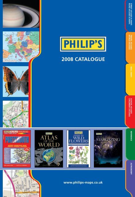
<strong>2008</strong> CATALOGUE<br />
www.<strong>philips</strong>-maps.co.uk<br />
STREET ATLASES & MAPS<br />
ROAD ATLASES & MAPS<br />
TRAVEL ATLASES<br />
WORLD ATLASES<br />
WALL MAPS SCHOOL ATLASES<br />
CHILDREN’S ATLASES<br />
REFERENCE ASTRONOMY
CONTENTS<br />
STREET ATLASES & MAPS<br />
ROAD ATLASES & MAPS<br />
TRAVEL ATLASES<br />
WORLD ATLASES<br />
WALL MAPS<br />
SCHOOL ATLASES<br />
CHILDREN’S ATLASES<br />
REFERENCE<br />
ASTRONOMY<br />
INDEX<br />
2<br />
18<br />
22<br />
28<br />
30<br />
37<br />
44
‘ A fantastic reference – mapping every street in detail’<br />
THE BOOKSELLER<br />
For those who need a lot of detail on their mapping, Philip’s Street Atlas series sets the<br />
‘gold standard’ and is an essential reference for a huge number of motorists,<br />
emergency service operators, delivery companies and local businesses.<br />
The mapping is the most detailed available in print form, based on the latest<br />
authoritative data from Ordnance Survey, the national mapping agency, and enhanced<br />
to Philip’s exacting specifications.<br />
Parking facilities,<br />
pedestrianized areas,<br />
retail parks, markets,<br />
and shopping malls.<br />
Shows hospitals, fire<br />
brigade headquarters<br />
and police stations.<br />
Rail stations,<br />
bus stations<br />
and other<br />
transport links.<br />
Time-saving<br />
through-routes.<br />
STREET ATLASES & MAPS<br />
Schools, colleges, public<br />
buildings, sports and leisure<br />
facilities and industrial<br />
estates all marked.<br />
NEW! Speed camera<br />
locations and limits<br />
featured on the<br />
mapping.<br />
Mapping sample from the new Street Atlas London standard edition.<br />
Rivers, ponds, farms, woods,<br />
hills and other rural features<br />
marked and named.<br />
Complete urban and rural coverage<br />
Ordnance Survey ® . Crown © 2007<br />
Postcodes<br />
featured on the<br />
mapping and<br />
in the index.
NEW<br />
Street Atlas London<br />
The definitive street atlas of London is published by Philip’s with mapping<br />
created to our specifications by Ordnance Survey’s own cartographers.<br />
It features:<br />
• The clearest mapping and the biggest scales in four handy formats:<br />
EasyRead, Standard, Pocket and Mini.<br />
• Thousands more places marked than in any other atlas.<br />
• The best enlarged central London map.<br />
• Time-saving thro u g h - routes, including unclassified ro a d s .<br />
• 24-page route-planner showing all main roads within the M25 area.<br />
• Speed cameras with speed limits and the Congestion Charging Zone.<br />
• Standard<br />
Scale: 5 inches to 1 mile<br />
and 10 inches to 1 mile (central area)<br />
£9.99 Spiral £7.99 PB<br />
978 0 540 09046 4 978 0 540 09047 1<br />
268 x 185mm 268 x 185mm<br />
448 pages 448 pages<br />
• Pocket<br />
Scale: 3.5 inches to 1 mile<br />
and 7 inches to 1 mile (central area)<br />
£6.50 Spiral £5.50 PB<br />
978 0 540 09035 8 978 0 540 09036 5<br />
194 x 134mm 194 x 134mm<br />
480 pages 480 pages<br />
• Mini<br />
Scale: 3.5 inches to 1 mile<br />
and 7 inches to 1 mile (central area)<br />
£4.99 Spiral £4.50 PB<br />
978 0 540 09044 0 978 0 540 09045 7<br />
138 x 105mm 138 x 105mm<br />
320 pages 320 pages<br />
• EasyRead<br />
Scale: 5.5 inches to 1 mile<br />
and 11 inches to 1 mile (central area)<br />
£12.99 Spiral<br />
978 0 540 09043 3<br />
297 x 212mm<br />
480 pages<br />
London Mini Street Atlas Deluxe Editions<br />
• Deluxe editions of the most detailed mini London atlas.<br />
• Discreet covers offered in a choice of contemporary colours.<br />
• Double ribbon marker, elastic fastener/page holder and notes pages.<br />
• Speed-camera locations and the Congestion Charging Zone.<br />
• Street maps show tube and rail stations, car parks, and hundreds of places of interest.<br />
• Tube map.<br />
• Theatre and cinema map.<br />
• Comprehensive index includes postcodes, schools, hospitals, sports centres, etc.<br />
Scale: 3.5 inches to 1 mile<br />
and 7 inches to 1 mile (central area)<br />
£8.99<br />
Navy 978 0 540 09107 2<br />
Pink 978 0 540 09108 9<br />
Red 978 0 540 09110 2<br />
Grey 978 0 540 09111 9<br />
Green 978 0 540 09113 3<br />
Brown 978 0 540 09115 7<br />
Leopardskin 978 0 540 09443 1<br />
138 x 105mm HB<br />
320 pages<br />
• Mini Pocket Street Map<br />
Scale: 6 inches to 1 mile<br />
£1.99 Folded sheet map<br />
(double-sided)<br />
978 0 540 09055 6<br />
604 x 756mm<br />
• London Main Roads Map<br />
Scale: 1 inch to 1 mile<br />
£6.99 Folded sheet map<br />
(shrink-wrapped)<br />
978 0 540 09062 4<br />
1080 x 1590mm<br />
£10.99 Laminated sheet map<br />
(supplied in tube)<br />
978 0 540 09064 8<br />
1080 x 1590mm<br />
Compact Edition<br />
Scale: 1.2 inches to 1 mile<br />
£4.99 Folded sheet map<br />
(double-sided)<br />
978 0 540 09180 5<br />
680 x 1200mm
4<br />
Birkenhead & Wirral<br />
(Spring <strong>2008</strong>)<br />
978 0 540 09201 7<br />
120 pages £4.50<br />
Birmingham<br />
978 0 540 08943 7<br />
88 pages £3.99<br />
Bolton<br />
978 0 540 09177 5<br />
88 pages £3.99<br />
Bournemouth<br />
978 0 540 08992 5<br />
144 pages £4.99<br />
Bradford<br />
978 0 540 09171 3<br />
144 pages £4.99<br />
Bristol<br />
(Spring <strong>2008</strong>)<br />
978 0 540 09200 0<br />
120 pages £3.99<br />
Cambridge<br />
978 0 540 08854 6<br />
64 pages £3.99<br />
Cardiff<br />
978 0 540 09197 3<br />
96 pages £3.99<br />
Coventry<br />
978 0 540 09039 6<br />
128 pages £3.99<br />
Derby<br />
978 0 540 09169 0<br />
88 pages £3.99<br />
Edinburgh<br />
978 0 540 08967 3<br />
88 pages £3.99<br />
Glasgow<br />
978 0 540 08966 6<br />
104 pages £3.99<br />
Huddersfield<br />
978 0 540 09172 0<br />
136 pages £4.99<br />
Hull<br />
978 0 540 09072 3<br />
96 pages £3.99<br />
Leeds<br />
978 0 540 09170 6<br />
136 pages £4.99<br />
Leicester & Loughborough<br />
(Spring <strong>2008</strong>)<br />
978 0 540 09202 4<br />
128 pages £4.99<br />
CITY STREET ATLASES & MAPS<br />
City Street Atlases<br />
• Complete coverage of each city with<br />
named streets and postcodes.<br />
• Enlarged mapping of central area,<br />
naming major buildings.<br />
• A–Z guide to top visitor attractions.<br />
• Handy pocket size, saddle-stitched<br />
to open out flat.<br />
• 194 x 131mm PB<br />
Lincoln<br />
978 0 540 08877 5<br />
56 pages £3.50<br />
Liverpool<br />
978 0 540 09199 7<br />
128 pages £3.99<br />
Maidstone, Chatham,<br />
Gillingham & Rochester<br />
978 0 540 09146 1<br />
136 pages £4.50<br />
Manchester<br />
978 0 540 09178 2<br />
128 pages £3.99<br />
Milton Keynes<br />
978 0 540 08919 2<br />
104 pages £3.99<br />
Newcastle & Gateshead<br />
978 0 540 09122 5<br />
112 pages £3.99<br />
Northampton<br />
978 0 540 09179 9<br />
96 pages £3.99<br />
Norwich<br />
978 0 540 09101 0<br />
72 pages £3.99<br />
Nottingham<br />
978 0 540 09070 9<br />
144 pages £4.99<br />
Oxford<br />
978 0 540 08945 1<br />
88 pages £3.99<br />
Plymouth<br />
978 0 540 09071 6<br />
80 pages £3.99<br />
Portsmouth<br />
978 0 540 09042 6<br />
112 pages £4.50<br />
Sheffield & Rotherham<br />
978 0 540 09148 5<br />
144 pages £3.99<br />
Southampton<br />
978 0 540 09040 2<br />
144 pages £4.50<br />
Stoke-on-Trent<br />
& Newcastle under Lyme<br />
978 0 540 09149 2<br />
144 pages £4.99<br />
Sunderland<br />
978 0 540 09147 8<br />
112 pages £4.25<br />
Swansea<br />
978 0 540 09198 0<br />
144 pages £4.99<br />
Swindon<br />
978 0 540 08978 9<br />
80 pages £3.99<br />
Wolverhampton<br />
978 0 540 09150 8<br />
88 pages £3.99<br />
York<br />
978 0 540 09041 9<br />
80 pages £3.99<br />
All £3.99<br />
Folded sheet maps<br />
• Edinburgh<br />
978 0 540 08434 0<br />
1320 x 680mm<br />
• Glasgow<br />
978 0 540 08433 3<br />
1320 x 680mm<br />
• York<br />
978 0 540 08965 9<br />
1200 x 680mm<br />
City by City Britain<br />
978 0 540 08923 9<br />
£9.99<br />
Standard Spiral<br />
City by City Britain Atlas<br />
(See page 14)<br />
100 indexed city plans<br />
268 x 185mm<br />
Philip’s Street<br />
Atlases cover all of<br />
England, Wales and<br />
Northern Ireland,<br />
and most of<br />
Scotland
Deluxe Mini Street Atlas Counterpack<br />
Supplied empty<br />
12-copy counterstand<br />
978 0 540 09315 1<br />
City Mini Street Atlas Deluxe Editions<br />
After the success of the London Mini Street Atlas Deluxe<br />
Editions, Philip’s bring you their new range of Deluxe Mini City<br />
Street Atlases for Birmingham, Edinburgh, Glasgow and<br />
Manchester.<br />
• Deluxe editions of the most detailed mini city street atlases.<br />
• Discreet covers offered in a choice of contemporary colours.<br />
• Double ribbon marker, elastic fastener/page holder and<br />
notes pages.<br />
• Enlarged map of city centre, naming major buildings.<br />
• Route-planning map showing all A and B roads.<br />
• Four-page guide to the top visitor attractions.<br />
• Handy pocket size.<br />
• 138 x 105mm HB<br />
Birmingham<br />
Navy 978 0 540 09227 7<br />
Pink 978 0 540 09229 1<br />
Red 978 0 540 09226 0<br />
Green 978 0 540 09228 4<br />
Leopardskin 978 0 540 09447 9<br />
184 pages £8.99<br />
Edinburgh<br />
Navy 978 0 540 09219 2<br />
Pink 978 0 540 09221 5<br />
Red 978 0 540 09218 5<br />
Green 978 0 540 09220 8<br />
Leopardskin 978 0 540 09445 5<br />
168 pages £8.99<br />
Glasgow<br />
Navy 978 0 540 09223 9<br />
Pink 978 0 540 09225 3<br />
Red 978 0 540 09222 2<br />
Green 978 0 540 09224 6<br />
Leopardskin 978 0 540 09444 8<br />
192 pages £8.99<br />
Manchester<br />
Navy 978 0 540 09231 4<br />
Pink 978 0 540 09233 8<br />
Red 978 0 540 09230 7<br />
Green 978 0 540 09232 1<br />
Leopardskin 978 0 540 09446 2<br />
184 pages £8.99<br />
Scale: 3.5 inches to 1 mile and<br />
5.25 inches to 1 mile (central areas)<br />
5<br />
5
ENGLAND<br />
ISBN Price Format<br />
Bedfordshire<br />
978 0 540 08292 6 £9.99 Standard Spiral<br />
978 0 540 08293 3 £5.99 Pocket PB<br />
Berkshire<br />
978 0 540 08492 0 £12.99 Standard HB<br />
978 0 540 08493 7 £9.99 Standard Spiral<br />
978 0 540 08494 4 £5.99 Pocket PB<br />
Birmingham & West Midlands<br />
978 0 540 08836 2 £9.99 Standard Spiral<br />
978 0 540 08837 9 £5.99 Pocket PB<br />
978 0 540 08995 6 £ 1 2 . 9 9 EasyRead Spira l<br />
Bristol & Bath<br />
978 0 540 08524 8 £9.99 Standard Spiral<br />
978 0 540 09188 1 £4.99 Pocket PB<br />
Buckinghamshire<br />
978 0 540 08669 6 £14.99 Standard HB<br />
978 0 540 08670 2 £9.99 Standard Spiral<br />
978 0 540 08671 9 £5.99 Pocket PB<br />
Cambridgeshire<br />
978 0 540 08735 8 £9.99 Standard Spiral<br />
978 0 540 08736 5 £5.99 Pocket PB<br />
Cheshire<br />
978 0 540 09163 8 £9.99 Standard Spiral<br />
978 0 540 09164 5 £5.99 Pocket PB<br />
Cornwall<br />
978 0 540 08848 5 £9.99 Standard Spiral<br />
978 0 540 08849 2 £5.99 Pocket PB<br />
Cumbria<br />
978 0 540 08498 2 £9.99 Standard Spiral<br />
978 0 540 08500 2 £5.99 Pocket PB<br />
Derbyshire<br />
978 0 540 08844 7 £9.99 Standard Spiral<br />
978 0 540 08845 4 £5.99 Pocket PB<br />
Devon<br />
978 0 540 08846 1 £9.99 Standard Spiral<br />
978 0 540 08847 8 £5.99 Pocket PB<br />
Dorset<br />
978 0 540 08774 7 £9.99 Standard Spiral<br />
978 0 540 08775 4 £5.99 Pocket PB<br />
County Durham & Teesside<br />
978 0 540 08672 6 £9.99 Standard Spiral<br />
978 0 540 08673 3 £5.99 Pocket PB<br />
Essex<br />
978 0 540 09195 9 £14.99 Standard Spiral<br />
978 0 540 08487 6 £9.99 Pocket PB<br />
North Essex<br />
978 0 540 09191 1 £9.99 Standard Spiral<br />
978 0 540 09192 8 £5.99 Pocket PB<br />
South Essex<br />
978 0 540 08283 4 £9.99 Standard Spiral<br />
978 0 540 09190 4 £5.99 Pocket PB<br />
Gloucestershire<br />
978 0 540 08760 0 £9.99 Standard Spiral<br />
978 0 540 08761 7 £5.99 Pocket PB<br />
Hampshire, Bournemouth & Poole<br />
978 0 540 08776 1 £14.99 Standard Spiral<br />
978 0 540 08777 8 £9.99 Pocket PB<br />
North Hampshire<br />
978 0 540 08768 6 £9.99 Standard Spiral<br />
978 0 540 08769 3 £5.99 Pocket PB<br />
STREET ATLASES - ENGLAND<br />
South Hampshire<br />
978 0 540 08105 9 £12.99 Standard HB<br />
978 0 540 08772 3 £9.99 Standard Spiral<br />
978 0 540 08773 0 £5.99 Pocket PB<br />
Herefordshire & Monmouthshire<br />
978 0 540 08490 6 £9.99 Standard Spiral<br />
978 0 540 08491 3 £5.99 Pocket PB<br />
Hertfordshire<br />
978 0 540 08495 1 £12.99 Standard HB<br />
978 0 540 08496 8 £9.99 Standard Spiral<br />
978 0 540 08497 5 £5.99 Pocket PB<br />
Isle of Wight<br />
978 0 540 08637 5 £6.99 Standard Spiral<br />
978 0 540 08638 2 £3.99 Pocket PB<br />
Kent<br />
978 0 540 08750 1 £14.99 Standard Spiral<br />
978 0 540 08751 8 £9.99 Pocket PB<br />
East Kent<br />
978 0 540 08664 1 £9.99 Standard Spiral<br />
978 0 540 08665 8 £5.99 Pocket PB<br />
West Kent<br />
978 0 540 08667 2 £9.99 Standard Spiral<br />
978 0 540 08668 9 £5.99 Pocket PB<br />
Lancashire<br />
978 0 540 08657 3 £9.99 Standard Spiral<br />
978 0 540 08658 0 £5.99 Pocket PB<br />
Leicestershire & Rutland<br />
978 0 540 08488 3 £9.99 Standard Spiral<br />
978 0 540 09174 4 £5.99 Pocket PB<br />
Lincolnshire<br />
978 0 540 09082 2 £9.99 Standard Spiral<br />
978 0 540 08341 1 £5.99 Pocket PB<br />
Liverpool & Merseyside<br />
978 0 54009167 6 £8.99 Standard Spiral<br />
978 0 54008521 7 £4.99 Pocket PB<br />
Greater Manchester<br />
978 0 540 09084 6 £9.99 Standard Spiral<br />
978 0 540 09085 3 £5.50 Pocket PB<br />
978 0 540 08616 0 £ 1 2 . 9 9 EasyRead Spira l<br />
Norfolk<br />
978 0 540 08958 1 £9.99 Standard Spiral<br />
978 0 540 08959 8 £5.99 Pocket PB<br />
Northamptonshire<br />
978 0 540 09086 0 £9.99 Standard Spiral<br />
978 0 540 09097 6 £5.99 Pocket PB<br />
Northumberland<br />
978 0 540 08754 9 £9.99 Standard Spiral<br />
978 0 540 08755 6 £5.99 Pocket PB<br />
Nottinghamshire<br />
978 0 540 08840 9 £9.99 Standard Spiral<br />
978 0 540 08841 6 £5.99 Pocket PB<br />
Oxfordshire<br />
978 0 540 08108 0 £12.99 Standard HB<br />
978 0 540 08766 2 £9.99 Standard Spiral<br />
978 0 540 08767 9 £5.99 Pocket PB<br />
Shropshire<br />
978 0 540 08338 1 £9.99 Standard Spiral<br />
978 0 540 08339 8 £5.99 Pocket PB<br />
Available formats<br />
Scales shown may vary<br />
EasyRead Spiral<br />
Scale: 4 inches to 1 mile<br />
297 x 212mm<br />
Standard Hardback<br />
Scale: 3 1 ⁄2 inches to 1 mile<br />
and 7 inches to 1 mile (central<br />
area) – scales may vary<br />
268 x 185mm<br />
Standard Spiral<br />
Scale: 3 1 ⁄2 inches to 1 mile<br />
and 7 inches to 1 mile (central<br />
area) – scales may vary<br />
268 x 185mm<br />
Pocket PB<br />
Scale: 2 2 ⁄3 inches to 1 mile<br />
and 5 1 ⁄3 inches to 1 mile (central area)<br />
206 x 142mm
Somerset<br />
978 0 540 08842 3 £9.99 Standard Spiral<br />
978 0 540 08843 0 £5.99 Pocket PB<br />
Staffordshire<br />
978 0 540 08756 3 £10.99 Standard Spiral<br />
978 0 540 08757 0 £5.99 Pocket PB<br />
Suffolk<br />
978 0 540 08996 3 £9.99 Standard Spiral<br />
978 0 540 08997 0 £5.99 Pocket PB<br />
Surrey<br />
978 0 540 09051 8 £12.99 Standard HB<br />
978 0 540 09049 5 £9.99 Standard Spiral<br />
978 0 540 09050 1 £5.99 Pocket PB<br />
East Sussex<br />
978 0 540 08648 1 £12.99 Standard HB<br />
978 0 540 08649 8 £9.99 Standard Spiral<br />
978 0 540 08650 4 £5.99 Pocket PB<br />
WALES NORTHERN<br />
IRELAND<br />
Anglesey, Conwy & Gwynedd<br />
978 0 540 08587 3 £9.99 Standard Spiral<br />
978 0 540 08588 0 £5.99 Pocket PB<br />
Cardiff, Swansea & the Valleys<br />
978 0 540 09165 2 £9.99 Standard Spiral<br />
978 0 540 08656 6 £5.99 Pocket PB<br />
Cardiff City<br />
978 0 540 09197 3 £3.99 City Atlas<br />
C a r m a r t h e n s h i re, Pe m b ro ke s h i re & Swansea<br />
978 0 540 08661 0 £9.99 Standard Spiral<br />
978 0 540 08662 7 £5.99 Pocket PB<br />
SCOTLAND<br />
Aberdeenshire<br />
978 0 540 08653 5 £9.99 Standard Spiral<br />
978 0 540 08654 2 £5.99 Pocket PB<br />
Ayrshire<br />
978 0 540 08674 0 £9.99 Standard Spiral<br />
978 0 540 08675 7 £5.99 Pocket PB<br />
Dumfries & Galloway<br />
978 0 540 08872 0 £9.99 Standard Spiral<br />
978 0 540 08873 7 £5.99 Pocket PB<br />
West Sussex<br />
978 0 540 08646 7 £9.99 Standard Spiral<br />
978 0 540 08647 4 £5.99 Pocket PB<br />
Tyne & Wear<br />
978 0 540 08752 5 £9.99 Standard Spiral<br />
978 0 540 08753 2 £5.99 Pocket PB<br />
978 0 540 08906 2 £ 1 2 . 9 9 EasyRead Spira l<br />
Warwickshire<br />
978 0 540 08758 7 £9.99 Standard Spiral<br />
978 0 540 08759 4 £5.99 Pocket PB<br />
Wiltshire & Swindon<br />
978 0 540 08770 9 £9.99 Standard Spiral<br />
978 0 540 08771 6 £5.99 Pocket PB<br />
Worcestershire<br />
978 0 540 08336 7 £9.99 Standard Spiral<br />
978 0 540 08337 4 £5.99 Pocket PB<br />
WALES, SCOTLAND & NORTHERN IRELAND<br />
Ceredigion & South Gwynedd<br />
978 0 540 08724 2 £9.99 Standard Spiral<br />
978 0 540 08725 9 £5.99 Pocket PB<br />
Denbighshire, Flintshire & Wrexham<br />
978 0 540 08589 7 £9.99 Standard Spiral<br />
978 0 540 08590 3 £5.99 Pocket PB<br />
Herefordshire & Monmouthshire<br />
978 0 540 08490 6 £9.99 Standard Spiral<br />
978 0 540 08491 3 £5.99<br />
Powys<br />
Pocket PB<br />
978 0 540 08659 7 £9.99 Standard Spiral<br />
978 0 540 08660 3 £5.99<br />
Swansea City<br />
Pocket PB<br />
978 0 540 09198 0 £4.99 City Atlas<br />
Edinburgh & East Central Scotland<br />
978 0 540 08838 6 £9.99 Standard Spiral<br />
978 0 540 08839 3 £5.99 Pocket PB<br />
Edinburgh City<br />
978 0 540 08967 3 £3.99 City Atlas<br />
978 0 540 08434 0 £3.99 Folded Map<br />
978 0 540 09219 2 £8.99 Navy Deluxe<br />
978 0 540 09221 5 £8.99 Pink Deluxe<br />
978 0 540 09218 5 £8.99 Red Deluxe<br />
978 0 540 09220 8 £8.99 Green Deluxe<br />
978 0 540 09445 5 £8.99 Leopardskin Deluxe<br />
Fife & Tayside<br />
978 0 540 09203 1 £9.99 Standard Spiral<br />
978 0 540 09204 8 £5.99 Pocket PB<br />
Glasgow & West Central Scotland<br />
978 0 540 08834 8 £9.99 Standard Spiral<br />
978 0 540 08835 5 £5.99 Pocket PB<br />
East Yorkshire & Northern Lincolnshire<br />
978 0 540 08762 4 £9.99 Standard Spiral<br />
978 0 540 08763 1 £5.99 Pocket PB<br />
North Yorkshire<br />
978 0 540 08764 8 £9.99 Standard Spiral<br />
978 0 540 08765 5 £5.99 Pocket PB<br />
South Yorkshire<br />
978 0 540 08993 2 £9.99 Standard Spiral<br />
978 0 540 08994 9 £5.99 Pocket PB<br />
West Yorkshire<br />
978 0 540 08990 1 £9.99 Standard Spiral<br />
978 0 540 08991 8 £5.99 Pocket PB<br />
978 0 540 08722 8 £ 1 2 . 9 9 EasyRead Spira l<br />
Belfast<br />
978 0 540 08929 1 £9.99 Standard Spiral<br />
978 0 540 08930 7 £5.99 Pocket PB<br />
Co. Antrim & Co. Londonderry<br />
978 0 540 08931 4 £9.99 Standard Spiral<br />
978 0 540 08932 1 £5.99 Pocket PB<br />
Co. Armagh & Co. Down<br />
978 0 540 08927 7 £9.99 Standard Spiral<br />
978 0 540 08928 4 £5.99 Pocket PB<br />
Co. Tyrone & Co. Fermanagh<br />
978 0 540 08933 8 £9.99 Standard Spiral<br />
978 0 540 08934 5 £5.99 Pocket PB<br />
Glasgow City<br />
978 0 540 08966 6 £3.99 City Atlas<br />
978 0 540 08433 3 £2.99 Folded Map<br />
978 0 540 09223 9 £8.99 Navy Deluxe<br />
978 0 540 09225 3 £8.99 Pink Deluxe<br />
978 0 540 09222 2 £8.99 Red Deluxe<br />
978 0 540 09224 6 £8.99 Green Deluxe<br />
978 0 540 09444 8 £8.99 Leopardskin Deluxe<br />
Inverness & Moray<br />
978 0 540 08651 1 £9.99 Standard Spiral<br />
978 0 540 08652 8 £5.99 Pocket PB<br />
Lanarkshire<br />
978 0 540 08832 4 £9.99 Standard Spiral<br />
978 0 540 08833 1 £5.99 Pocket PB<br />
Scottish Borders<br />
978 0 540 08870 6 £9.99 Standard Spiral<br />
978 0 540 08871 3 £5.99 Pocket PB
8<br />
Red Books<br />
NEW TO PHILIP’S<br />
The new Philip’s Red Books range of local street atlases provides both residents and visitors with unrivalled coverage of their local<br />
town and the surrounding area. Their handy pocket size and easy-to-read street mapping make them ideal for both business and<br />
leisure use. The maps feature the most detailed local knowledge of the area including hospitals, car parks, post offices, one-way<br />
streets, leisure facilities, industrial areas and retail areas, together with an index listing street names and postcodes.<br />
• Area road map to assist journey route-planning.<br />
• Handy pocket size, wire-stitched to open out flat (scales and prices vary).<br />
• 206 x 142mm PB<br />
Alfreton<br />
(Autumn <strong>2008</strong>)<br />
978 0 540 09373 1<br />
72 pages £3.99<br />
Andover<br />
(Spring <strong>2008</strong>)<br />
978 0 540 09353 3<br />
24 pages £2.75<br />
Ashford & Tenterden<br />
(Spring <strong>2008</strong>)<br />
978 0 540 09358 8<br />
24 pages £3.50<br />
Aylesbury & Tring<br />
(Autumn <strong>2008</strong>)<br />
978 0 540 09407 3<br />
20 pages £2.99<br />
Bangor & Caernarfon<br />
(Autumn <strong>2008</strong>)<br />
978 0 540 09403 5<br />
32 pages £3.50<br />
Barnstable & Bideford<br />
(Spring <strong>2008</strong>)<br />
978 0 540 09393 9<br />
24 pages £3.50<br />
Basildon & Billericay<br />
(Spring <strong>2008</strong>)<br />
978 0 540 09344 1<br />
32 pages £3.25<br />
Basingstoke & Alton<br />
(Spring <strong>2008</strong>)<br />
978 0 540 09346 5<br />
32 pages £3.75<br />
Bath & Bradford-on-Avon<br />
(Autumn <strong>2008</strong>)<br />
978 0 540 09406 6<br />
24 pages £3.25<br />
Bedford<br />
(Autumn <strong>2008</strong>)<br />
978 0 540 09405 9<br />
24 pages £3.25<br />
Blackpool<br />
(Summer <strong>2008</strong>)<br />
978 0 540 09274 1<br />
64 pages £3.50<br />
Bournemouth<br />
(Spring <strong>2008</strong>)<br />
978 0 540 09335 9<br />
80 pages £4.50<br />
Brighton<br />
(Spring <strong>2008</strong>)<br />
978 0 540 09380 9<br />
48 pages £3.99<br />
Bromley<br />
(Summer <strong>2008</strong>)<br />
978 0 540 09372 4<br />
88 pages £3.99<br />
RED BOOKS<br />
Burton upon Trent<br />
(Autumn <strong>2008</strong>)<br />
978 0 540 09399 1<br />
24 pages £2.75<br />
Carlisle<br />
(Spring <strong>2008</strong>)<br />
978 0 540 09369 4<br />
48 pages £3.99<br />
Chelmsford & Braintree<br />
(Spring <strong>2008</strong>)<br />
978 0 540 09340 3<br />
40 pages £3.50<br />
Chester & Wrexham<br />
(Spring <strong>2008</strong>)<br />
978 0 540 09396 0<br />
88 pages £4.25<br />
Chichester & Bognor Regis<br />
(Summer <strong>2008</strong>)<br />
978 0 540 09387 8<br />
32 pages £3.25<br />
Colchester & Clacton-on-Sea<br />
(Autumn <strong>2008</strong>)<br />
978 0 540 09408 0<br />
52 pages £3.75<br />
C o r b y, Kettering & We l l i n g b o rough<br />
(Summer <strong>2008</strong>)<br />
978 0 540 09397 7<br />
44 pages £3.99<br />
Crawley & Mid-Sussex<br />
(Spring <strong>2008</strong>)<br />
978 0 540 09355 7<br />
48 pages £3.75<br />
Crewe & Nantwich<br />
(Spring <strong>2008</strong>)<br />
978 0 540 09357 1<br />
20 pages £3.25<br />
Dundee & St Andrews<br />
(Spring <strong>2008</strong>)<br />
978 0 540 09348 9<br />
36 pages £3.75<br />
Eastbourne & Hailsham<br />
(Spring <strong>2008</strong>)<br />
978 0 540 09384 7<br />
32 pages £3.75<br />
Exeter & Exmouth<br />
(Spring <strong>2008</strong>)<br />
978 0 540 09359 5<br />
32 pages £3.25<br />
Falkirk<br />
(Spring <strong>2008</strong>)<br />
978 0 540 09366 3<br />
80 pages £3.99<br />
Fareham & Gosport<br />
(Spring <strong>2008</strong>)<br />
978 0 540 09381 6<br />
32 pages £3.75<br />
Folkestone & Dover<br />
(Spring <strong>2008</strong>)<br />
978 0 540 09337 3<br />
40 pages £3.99<br />
Gloucester & Cheltenham<br />
(Spring <strong>2008</strong>)<br />
978 0 540 09363 2<br />
84 pages £3.99<br />
Gravesend & Dartford<br />
(Spring <strong>2008</strong>)<br />
978 0 540 09339 7<br />
40 pages £3.75<br />
Grays & Thurrock<br />
(Summer <strong>2008</strong>)<br />
978 0 540 09385 4<br />
24 pages £3.25<br />
Great Yarmouth & Lowestoft<br />
(Spring <strong>2008</strong>)<br />
978 0 540 09338 0<br />
32 pages £3.50<br />
Grimsby & Cleethorpes<br />
(Summer <strong>2008</strong>)<br />
978 0 540 09390 8<br />
32 pages £3.99<br />
Guildford & Woking<br />
(Spring <strong>2008</strong>)<br />
978 0 540 09368 7<br />
104 pages £4.99<br />
Harlow<br />
(Summer <strong>2008</strong>)<br />
978 0 540 09371 7<br />
64 pages £3.99<br />
Hastings & Bexhill<br />
(Summer <strong>2008</strong>)<br />
978 0 540 09388 5<br />
24 pages £3.25<br />
Hereford<br />
(Spring <strong>2008</strong>)<br />
978 0 540 09354 0<br />
16 pages £3.25<br />
High Wycombe & Amersham<br />
(Spring <strong>2008</strong>)<br />
978 0 540 09360 1<br />
52 pages £3.75<br />
Huntingdon<br />
(Autumn <strong>2008</strong>)<br />
978 0 540 09379 3<br />
48 pages £3.99<br />
Ipswich<br />
(Spring <strong>2008</strong>)<br />
978 0 540 09263 5<br />
88 pages £3.99<br />
Isle of Man<br />
(Spring <strong>2008</strong>)<br />
978 0 540 09361 8<br />
16 pages £2.99
Lancaster<br />
(Autumn <strong>2008</strong>)<br />
978 0 540 09378 6<br />
64 pages £3.99<br />
Llandudno<br />
(Autumn <strong>2008</strong>)<br />
978 0 540 09374 8<br />
48 pages £3.99<br />
Luton<br />
(Autumn <strong>2008</strong>)<br />
978 0 540 09281 9<br />
56 pages £3.50<br />
Mansfield & Sutton in Ashfield<br />
(Spring <strong>2008</strong>)<br />
978 0 540 09341 0<br />
40 pages £3.99<br />
Middlesbrough<br />
(Summer <strong>2008</strong>)<br />
978 0 540 09276 5<br />
120 pages £4.99<br />
New Forest<br />
(Spring <strong>2008</strong>)<br />
978 0 540 09356 4<br />
36 pages £3.75<br />
Northwich & Winsford<br />
(Autumn <strong>2008</strong>)<br />
978 0 540 09401 1<br />
24 pages £2.99<br />
Penzance & St Ives<br />
(Summer <strong>2008</strong>)<br />
978 0 540 09370 0<br />
40 pages £3.50<br />
Argyll & The Isles<br />
(Spring <strong>2008</strong>)<br />
978 0 540 09410 3<br />
£4.25<br />
Dartmoor &<br />
South Devon Coast<br />
(Spring <strong>2008</strong>)<br />
978 0 540 09411 0<br />
£4.25<br />
Devon<br />
(Spring <strong>2008</strong>)<br />
978 0 540 09412 7<br />
£4.50<br />
Dorset &<br />
the Channel Islands<br />
(Spring <strong>2008</strong>)<br />
978 0 540 09427 1<br />
£4.25<br />
East Anglia<br />
(Spring <strong>2008</strong>)<br />
978 0 540 09413 4<br />
£3.99<br />
Exmoor &<br />
North Devon Coast<br />
(Summer <strong>2008</strong>)<br />
978 0 540 09428 8<br />
£3.99<br />
Fort William<br />
(Summer <strong>2008</strong>)<br />
978 0 540 09429 5<br />
£4.25<br />
Grampian Highlands<br />
(Summer <strong>2008</strong>)<br />
978 0 540 09430 1<br />
£4.25<br />
Highlands of Scotland<br />
(Spring <strong>2008</strong>)<br />
978 0 540 09415 8<br />
£4.99<br />
Iona & Mull<br />
(Summer <strong>2008</strong>)<br />
978 0 540 09431 8<br />
£3.99<br />
Isle of Man<br />
(Spring <strong>2008</strong>)<br />
978 0 540 09416 5<br />
£4.25<br />
Isle of Wight<br />
(Spring <strong>2008</strong>)<br />
978 0 540 09417 2<br />
£3.75<br />
Peterborough<br />
(Spring <strong>2008</strong>)<br />
978 0 540 09267 3<br />
64 pages £3.99<br />
Portsmouth<br />
(Spring <strong>2008</strong>)<br />
978 0 540 09332 8<br />
48 pages £3.99<br />
Preston, Blackburn & Burnley<br />
(Summer <strong>2008</strong>)<br />
978 0 540 09275 8<br />
120 pages £4.99<br />
Reading & Henley-on-Thames<br />
(Spring <strong>2008</strong>)<br />
978 0 540 09352 6<br />
40 pages £3.99<br />
St Albans<br />
(Autumn <strong>2008</strong>)<br />
978 0 540 09375 5<br />
72 pages £3.99<br />
Scarborough & Whitby<br />
(Spring <strong>2008</strong>)<br />
978 0 540 09347 2<br />
28 pages £3.50<br />
Scunthorpe<br />
(Spring <strong>2008</strong>)<br />
978 0 540 09367 0<br />
32 pages £3.50<br />
Shrewsbury & Telford<br />
(Spring <strong>2008</strong>)<br />
978 0 540 09333 5<br />
64 pages £3.99<br />
Red Books Tourist Maps<br />
Kent & East Sussex<br />
(Spring <strong>2008</strong>)<br />
978 0 540 09418 9<br />
£4.50<br />
Kent to Cornwall<br />
(Summer <strong>2008</strong>)<br />
978 0 540 09432 5<br />
£3.50<br />
Kingdom of Fife<br />
(Spring <strong>2008</strong>)<br />
978 0 540 09414 1<br />
£4.25<br />
Lake District<br />
(Summer <strong>2008</strong>)<br />
978 0 540 09419 6<br />
£4.25<br />
Loch Lomond<br />
& Trossachs<br />
(Summer <strong>2008</strong>)<br />
978 0 540 09433 2<br />
£3.99<br />
Loch Ness & Aviemore<br />
(Spring <strong>2008</strong>)<br />
978 0 540 09420 2<br />
£4.25<br />
Sittingbourne & Faversham<br />
(Summer <strong>2008</strong>)<br />
978 0 540 09389 2<br />
20 pages £3.50<br />
Slough, Maidenhead & Windsor<br />
(Autumn <strong>2008</strong>)<br />
978 0 540 09400 4<br />
32 pages £3.25<br />
Southampton<br />
(Spring <strong>2008</strong>)<br />
978 0 540 09392 2<br />
88 pages £4.25<br />
Southend-on-Sea<br />
(Spring <strong>2008</strong>)<br />
978 0 540 09395 3<br />
40 pages £3.50<br />
Stevenage<br />
(Autumn <strong>2008</strong>)<br />
978 0 540 09376 2<br />
48 pages £3.99<br />
Stirling & Alloa<br />
(Summer <strong>2008</strong>)<br />
978 0 540 09398 4<br />
32 pages £3.50<br />
Taunton<br />
(Autumn <strong>2008</strong>)<br />
978 0 540 09377 9<br />
32 pages £3.50<br />
Thanet & Canterbury<br />
(Spring <strong>2008</strong>)<br />
978 0 540 09383 0<br />
48 pages £3.99<br />
Orkney &<br />
Shetland Islands<br />
(Spring <strong>2008</strong>)<br />
978 0 540 09421 9<br />
£4.25<br />
Outer Hebrides<br />
(Spring <strong>2008</strong>)<br />
978 0 540 09422 6<br />
£4.50<br />
Peak District<br />
(Summer <strong>2008</strong>)<br />
978 0 540 09434 9<br />
£3.99<br />
Perthshire<br />
(Spring <strong>2008</strong>)<br />
978 0 540 09423 3<br />
£4.25<br />
Shetland &<br />
Orkney Islands<br />
(Spring <strong>2008</strong>)<br />
978 0 540 09424 0<br />
£4.25<br />
Skye & Lochalsh<br />
(Summer <strong>2008</strong>)<br />
978 0 540 09436 3<br />
£4.50<br />
Torbay & Newton Abbot<br />
(Spring <strong>2008</strong>)<br />
978 0 540 09362 5<br />
36 pages £3.50<br />
Trowbridge & Frome<br />
(Autumn <strong>2008</strong>)<br />
978 0 540 09402 8<br />
32 pages £2.99<br />
Tunbridge Wells & Tonbridge<br />
(Summer <strong>2008</strong>)<br />
978 0 540 09386 1<br />
36 pages £3.75<br />
Wales Tourist Atlas<br />
(Spring <strong>2008</strong>)<br />
978 0 540 09334 2<br />
88 pages £5.99<br />
Watford & Hemel Hempstead<br />
(Spring <strong>2008</strong>)<br />
978 0 540 09394 6<br />
48 pages £3.50<br />
Weymouth & Dorchester<br />
(Summer <strong>2008</strong>)<br />
978 0 540 09391 5<br />
24 pages £3.25<br />
Winchester & New Alresford<br />
(Spring <strong>2008</strong>)<br />
978 0 540 09342 7<br />
20 pages £2.99<br />
Worcester<br />
(Autumn <strong>2008</strong>)<br />
978 0 540 09404 2<br />
32 pages £3.75<br />
Worthing & Littlehampton<br />
(Spring <strong>2008</strong>)<br />
978 0 540 09382 3<br />
40 pages £3.75<br />
Southern England<br />
(Summer <strong>2008</strong>)<br />
978 0 540 09435 6<br />
£4.25<br />
Shoppers Map Calais<br />
and Boulogne<br />
(Spring <strong>2008</strong>)<br />
978 0 540 09409 7<br />
£2.99<br />
The Cotswolds<br />
(Summer <strong>2008</strong>)<br />
978 0 540 09425 7<br />
£4.25<br />
Wessex<br />
(Summer <strong>2008</strong>)<br />
978 0 540 09437 0<br />
£4.25<br />
Yorkshire<br />
(Spring <strong>2008</strong>)<br />
978 0 540 09438 7<br />
£4.25<br />
Yorkshire Dales<br />
(Spring <strong>2008</strong>)<br />
978 0 540 09426 4<br />
£4.25
‘ Best product ★★★★★’<br />
CLASSIC AND SPORTS CAR<br />
Philip’s Navigator ®<br />
county road maps<br />
A range of folded sheet maps featuring:<br />
• Acclaimed Navigator ® mapping at ultra-large scale*.<br />
• Superbly detailed coverage of each county’s<br />
road network including:<br />
- Minor country lanes, rural tracks and<br />
major footpaths.<br />
- All slip-roads, junctions and roundabouts.<br />
- Thousands of individually named farms,<br />
houses and hamlets.<br />
- Lakes, rivers, streams, woods and copses<br />
also marked and named.<br />
- Stations, airfields, canals, tourist attractions<br />
and much more.<br />
* Scales vary, around 1.5 miles to 1 inch.<br />
Folded size 250 x 140mm (sheet sizes vary)<br />
Board cover<br />
ROAD ATLASES & MAPS<br />
‘ The ultimate in UK road mapping’<br />
THE SUNDAY TIMES<br />
Philip’s Navigator ® Road Atlas<br />
Superbly detailed coverage of Britain’s road network.<br />
• Fixed speed-camera locations, with speed limits.<br />
• Over 3000 roads named.<br />
• 72 indexed town centre maps, 12 approach maps, airport<br />
and port maps.<br />
• 8-page London main roads section, with all roads named<br />
and London’s Congestion Charging Zone.<br />
• Detailed 6-page route planner.<br />
• Smaller grids on maps for easier place location.<br />
• Restyled index including tourism.<br />
• Extra clear and up-to-date mapping at 1.5 miles to 1 inch.<br />
• Exceptional road detail, from motorways to country lanes<br />
with every junction, roundabout and slip-road in detail.<br />
• Thousands of individually named farms, houses and hamlets.<br />
• Available in both spiral and flexi bound bindings, at both A4<br />
size and large-format.<br />
• Philip’s Navigator ® Britain A4<br />
£19.99 Spiral £19.99 Flexi<br />
978 0 540 09077 8 978 0 540 09078 5<br />
297 x 212mm 297 x 212mm<br />
608 pages 608 pages<br />
• P h i l i p ’s Navigator ® Britain Larg e - Fo r m a t<br />
£19.99 Spiral £19.99 Flexi<br />
978 0 540 09063 1 978 0 540 09037 2<br />
350 x 280mm 350 x 280mm<br />
448 pages 448 pages<br />
PHILIP'S NAVIGATOR ON CD-ROM FROM ANQUET<br />
Please visit www.anquet.co.uk or call 0845 330 9570<br />
for further information and to purchase this product.<br />
• Cambridgeshire £3.99<br />
978 0 540 08149 3<br />
• Cheshire £3.99<br />
978 0 540 08306 0<br />
• Cornwall £4.99<br />
978 0 540 08918 5<br />
• Cumbria £4.99<br />
978 0 540 08989 5<br />
• Derbyshire £4.99<br />
978 0 540 08955 0<br />
• Devon £4.99<br />
978 0 540 08922 2<br />
• Dorset £4.99<br />
978 0 540 08880 5<br />
• County Durham £3.99<br />
978 0 540 08514 9<br />
• Essex £3.99<br />
978 0 540 08399 2<br />
• Gloucestershire £3.99<br />
978 0 540 08043 4<br />
• Hampshire £3.99<br />
978 0 540 08401 2<br />
• Kent £3.99<br />
978 0 540 08513 2<br />
• Lancashire £3.99<br />
978 0 540 08305 3<br />
• Lincolnshire £3.99<br />
978 0 540 08150 9<br />
• London and M25 £4.99<br />
978 0 540 08974 1<br />
• Norfolk £4.99<br />
978 0 540 09065 5<br />
• Northumberland £3.99<br />
978 0 540 08517 0<br />
• Shropshire £4.99<br />
978 0 540 088508<br />
• Somerset £4.99<br />
978 0 540 09066 2<br />
• Suffolk £4.99<br />
978 0 540 08862 1<br />
Navigator ® Map<br />
display box<br />
Holds 10 copies. Supplied empty.<br />
• FREE<br />
• 978 0 540 08212 4<br />
• East Sussex £3.99<br />
978 0 540 08402 9<br />
• West Sussex £3.99<br />
978 0 540 08403 6<br />
NEW EDITION<br />
• North Wales £4.99<br />
978 0 540 09217 8<br />
• South Wales £3.99<br />
978 0 540 08516 3<br />
• West Wales £3.99<br />
978 0 540 08515 6<br />
• Wiltshire £3.99<br />
978 0 540 08042 7<br />
• East Yorkshire £3.99<br />
978 0 540 08152 3<br />
• North Yorkshire £4.99<br />
978 0 540 08861 4
Philip’s Navigator ® Regional Atlases<br />
This series of Navigator ® regional atlases features Philip’s exceptionally<br />
large-scale and detailed Navigator ® mapping in an easy-to-handle format.<br />
The atlases contain a unique 15-page guide to regional leisure with full details<br />
of places of interest such as castles, houses, cathedrals and gardens, guides to<br />
landscape areas and museums, and information on a wide variety of activities<br />
from angling to yachting. There are also useful details of many services that<br />
may be needed while travelling, such as tourist information offices and<br />
hospitals with casualty departments. All Navigator ® titles are recommended<br />
by the Institute of Advanced Motorists.<br />
NEW EDITION<br />
Philip’s Navigator ® South West<br />
Covers Cornwall, Devon, Dorset, Gloucestershire,<br />
Somerset and Wiltshire, and includes 14 fully indexed<br />
town plans.<br />
Summer <strong>2008</strong><br />
£6.99 Spiral<br />
978 0 540 09330 4<br />
297 x 212mm<br />
112 pages<br />
Still available:<br />
Previous edition<br />
978 0 540 08680 1<br />
Philip’s Navigator ® East Anglia and<br />
Lincolnshire<br />
Covers Cambridgeshire, Essex, Lincolnshire, Norfolk<br />
and Suffolk, and includes 13 fully indexed town plans.<br />
£6.99 Spiral<br />
978 0 540 08155 4<br />
297 x 212mm<br />
112 pages<br />
Philip’s Navigator ® North West<br />
Covers Cheshire, Cumbria, Denbighshire, Flintshire,<br />
Lancashire, Merseyside, Greater Manchester,<br />
and Gwynedd, incorporating The Lake District,<br />
The Peak District, The Yorkshire Dales and Snowdonia.<br />
Includes 11 fully indexed town plans.<br />
£6.99 Spiral<br />
978 0 540 08296 4<br />
297 x 212mm<br />
112 pages<br />
NEW EDITION<br />
Philip’s Navigator ® Scotland<br />
Covers the whole of Scotland and<br />
includes 13 fully indexed town plans.<br />
Summer <strong>2008</strong><br />
£6.99 Spiral<br />
978 0 540 09329 8<br />
297 x 212mm<br />
144 pages<br />
Still available:<br />
Previous edition<br />
978 0 540 08886 7<br />
Philip’s Navigator ® NEW EDITION<br />
Wales<br />
Covers the whole of Wales and<br />
includes 14 fully indexed town plans.<br />
Spring <strong>2008</strong><br />
£6.99 Spiral<br />
978 0 540 09328 1<br />
297 x 212mm<br />
112 pages<br />
Still available:<br />
Previous edition<br />
978 0 540 08529 3
Voted Britain’s clearest and most detailed<br />
mapping in an independent survey<br />
‘ Packed with information’<br />
OUR CHOICE AUTOCAR<br />
Philip’s Road Atlas Dumpbin<br />
978 0 020 74887 8<br />
Holds 16 A3 atlases and<br />
16 A4 atlases<br />
FREE on application to<br />
Philip’s Sales department<br />
NEW EDITIONS<br />
Philip’s Road Atlas Britain<br />
and Ireland 2009<br />
• 3 miles to 1 inch.<br />
• 96 pages (A3 edition)/176 pages (A4 edition) of<br />
clear detailed mapping.<br />
• Speed camera locations and speed limits marked.<br />
• Full listings of mobile speed cameras.<br />
• Detailed coverage of Ireland, plus indexed town plans<br />
of Belfast, Cork, Dublin and Londonderry.<br />
• 71 indexed town centre maps (97 in A4 edition).<br />
• Unique detail of minor roads – over or under 4 metres wide.<br />
• 22 pages of city approach maps, plus M25 and M60 maps.<br />
• Route-planning section.<br />
• North French coast maps include all ferry ports.<br />
Philip’s Road Atlas Britain and Ireland 2009 A3<br />
Summer <strong>2008</strong><br />
£14.99 Spiral<br />
978 0 540 09307 6 Still available:<br />
394 x 287mm Previous edition<br />
216 pages 978 0 540 09090 7<br />
Philip’s Road Atlas Britain and Ireland 2009 A4<br />
Summer <strong>2008</strong><br />
£14.99 Spiral<br />
978 0 540 09304 5 Still available:<br />
298 x 217mm Previous edition<br />
320 pages 978 0 540 09091 4<br />
Philip’s Road Atlas Britain and Ireland 2009 HB<br />
Summer <strong>2008</strong><br />
£19.99 HB<br />
978 0 540 09305 2<br />
298 x 217mm<br />
320 pages
‘ The best of its kind<br />
with quick and easy<br />
to use information’<br />
FLEET WEEK<br />
NEW EDITIONS<br />
Philip’s Road Atlas Britain 2009<br />
• 3 miles to 1 inch.<br />
• 96 pages (A3 edition)/176 pages (A4 edition) of clear<br />
detailed mapping.<br />
• 63 town and city plans (55 in A4 edition).<br />
• 22 pages of city approach maps plus M25 and M60 maps.<br />
• Full listings of mobile speed cameras.<br />
• Route-planning section.<br />
• Unique detail of minor roads – over or under 4 metres wide.<br />
• Full-page map of Calais and Boulogne, plus a 2-page map of<br />
Northern France including ferry ports.<br />
• Philip’s Road Atlas<br />
Britain 2009 A3<br />
Summer <strong>2008</strong><br />
£10.99 Spiral<br />
978 0 540 09301 4<br />
394 x 287mm<br />
184 pages<br />
Still available:<br />
Previous edition<br />
978 0 540 09088 4<br />
• Philip’s Road Atlas<br />
Britain 2009 A4<br />
Summer <strong>2008</strong><br />
£10.99 Spiral<br />
978 0 540 09302 1<br />
298 x 217mm<br />
272 pages<br />
Still available:<br />
Previous edition<br />
978 0 540 09089 1<br />
Philip’s Driver’s Atlas Britain 2009<br />
• 3 miles to 1 inch (A3 edition); 4 miles to 1 inch (A4 edition).<br />
• Superb detail for journey planning and leisure activities.<br />
• 96 pages of large-scale mapping.<br />
• London street plan and 53 city centre plans.<br />
• Route-planner, distance table and restricted access<br />
motorway junctions.<br />
• Excellent value for money.<br />
• Full listings of mobile speed cameras.<br />
Philip’s Driver’s Atlas Britain 2009 A3<br />
Summer <strong>2008</strong><br />
£6.99 Spiral<br />
978 0 540 09303 8<br />
394 x 287mm<br />
136 pages<br />
NEW EDITIONS<br />
Philip’s Driver’s Atlas Britain 2009 A4<br />
Summer <strong>2008</strong><br />
£5.99 PB<br />
978 0 540 09306 9<br />
297 x 210mm<br />
144 pages<br />
Still available:<br />
Previous edition<br />
978 0 540 09094 5<br />
13
Philip’s City<br />
by City Britain<br />
£9.99 Spiral<br />
978 0 540 08923 9<br />
268 x 185mm<br />
168 pages<br />
Philip’s Compact<br />
Atlas Britain<br />
£9.99 Flexi<br />
978 0 540 09125 6<br />
210 x 148mm<br />
384 pages<br />
NEW EDITIONS<br />
Philip’s EasyRead Britain<br />
• Extra-large scale (2 1 ⁄3 miles to 1 inch) gives<br />
exceptional legibility.<br />
• Unique illustrated listings section with more<br />
than 800 places to visit.<br />
• Distinguishes narrow lanes over and under 4m wide.<br />
• 35 town and city plans.<br />
• Route-planning section.<br />
• 12 large-scale city approach maps.<br />
• M25 and routes into London map.<br />
• Great value at £14.99.<br />
Philip’s EasyRead Britain A3<br />
• 176 pages of clear detailed<br />
mapping, ideal for leisure<br />
drivers.<br />
• Ultra-legible 32-page index.<br />
Philip’s EasyRead Britain A4<br />
• 288 pages of clear detailed<br />
mapping, ideal for leisure drivers.<br />
• Ultra-legible 48-page index.<br />
Philip’s Compact Atlas Britain<br />
Philip’s City by City Britain<br />
Philip’s EasyRead<br />
Britain A3<br />
Summer <strong>2008</strong><br />
£14.99 Spiral<br />
978 0 540 09312 0<br />
394 x 287mm<br />
264 pages<br />
Philip’s EasyRead<br />
Britain A4<br />
Summer <strong>2008</strong><br />
£14.99 Spiral<br />
978 0 540 09311 3<br />
298 x 217mm<br />
392 pages<br />
• Complete coverage of Great Britain at<br />
3.3 miles to 1 inch.<br />
• 287 pages of clear, detailed road maps including<br />
speed-camera locations.<br />
• Route-planning section.<br />
• 21 extra-detailed town and city centre plans.<br />
• Great value at £9.99.<br />
This popular atlas of city and town plans features four<br />
different scales of Philip’s exceptionally detailed mapping –<br />
route-planner, road atlas, plus approach maps and indexed<br />
street maps for 100 cities and towns throughout England,<br />
Scotland and Wales.<br />
• 100 fully indexed town plans with approach mapping at<br />
1.5 miles to 1 inch.<br />
• 31 pages of clear detailed mapping at 10 miles to 1 inch.<br />
• Route-planner.<br />
• Local information including web addresses, radio<br />
stations and tourist information centres. Must-see<br />
sights highlighted.<br />
• Restricted motorway junctions.<br />
• 2-page Central London street map.<br />
• Distance table.
Philip’s Family<br />
Road Atlas<br />
£12.99 Spiral<br />
978 0 540 09131 7<br />
298 x 217mm<br />
272 pages<br />
Philip’s Green<br />
Road Atlas<br />
£12.99 PB<br />
978 0 540 09185 0<br />
298 x 217mm<br />
272 pages<br />
Philip’s SatNav<br />
Atlas Britain<br />
£9.99 Flexi<br />
978 0 540 09080 8<br />
297 x 212mm<br />
160 pages<br />
Philip’s SatNav Atlas Britain<br />
• Tips on using satellite navigation to the full.<br />
• Up-to-date route planning maps at 10 miles to 1 inch.<br />
• 100 indexed city and town plans.<br />
• 100 Navigator ® approach maps showing safety cameras<br />
and road names.<br />
• Motorway maps for London, Birmingham, Liverpool<br />
and Manchester.<br />
• Map of Greater London with named suburban through-roads.<br />
• Notes on the OS National Grid and GPS.<br />
Philip’s Family Road Atlas<br />
• Unique illustrated listings section with 500 places<br />
to visit with kids.<br />
• Games to play in the car, and child-friendly places<br />
to stop en route.<br />
• 176 pages of fully updated road maps at 3 miles to 1 inch.<br />
• Voted Britain’s clearest and most detailed maps.<br />
• 55 town and city plans plus M25 and M60 maps.<br />
• Ultra-clear route-planning section.<br />
• Great value at £12.99.<br />
Philip’s Green Road Atlas<br />
• Extra-large scale (2 1 ⁄3 miles to 1 inch) gives<br />
exceptional legibility.<br />
• Unique illustrated listings section with 850 houses<br />
and gardens open to the public.<br />
• Distinguishes narrow lanes over and under 4m wide.<br />
• 35 town and city plans.<br />
• Route-planning section.<br />
• 12 city approach maps with named arterial roads<br />
and speed-camera locations.<br />
• M25 map.<br />
• Printed on environmentally-friendly biodegradable paper.<br />
Philip’s France, Belgium and<br />
Luxembourg Road Atlas<br />
• 4 miles to 1 inch (1 cm to 2.5 km).<br />
• Motorway-junction layouts and names.<br />
• Marks toll roads and dual carriageways.<br />
• Scenic routes clearly shown.<br />
• Extensive tourist information with highlighted sites<br />
and places of interest.<br />
• 35 city plans, plus 2-page Central Paris street plan,<br />
and detailed map of Paris appro a c h e s .<br />
• Distances table and a comprehensive index.<br />
Philip’s France, Belgium and Luxembourg Road Atlas<br />
£10.99 Spiral<br />
978 0 540 08954 3<br />
288 x 208mm<br />
336 pages
Philip’s EasyRead<br />
Europe<br />
£14.99 Spiral<br />
978 0 540 09057 0<br />
297 x 212mm<br />
312 pages<br />
Philip’s Multiscale Europe <strong>2008</strong><br />
These best-selling road atlases of<br />
Europe – Philip's sells more than any<br />
other publisher* – contain:<br />
• 15 pages of route-planning maps for<br />
the whole of Europe (from Orkney<br />
to Istanbul and Gibraltar to St<br />
Petersburg), allowing journeys of<br />
over 1200 miles to be planned and<br />
followed without turning the page.<br />
• 103 pages of clear and detailed<br />
road maps featuring high-quality<br />
digital mapping that’s packed with<br />
up-to-date road detail and tourist<br />
information.<br />
• 31 large-scale approach maps for<br />
major cities clearly show the main<br />
routes of entry and help navigation<br />
t h rough complex urban road systems.<br />
• Philip’s Multiscale Europe <strong>2008</strong> A3<br />
£10.99 Spiral<br />
978 0 540 09184 3<br />
394 x 285mm<br />
192 pages<br />
• A3 counterpacks<br />
FREE Empty<br />
978 0 540 06473 1<br />
Philip’s Driver’s<br />
Atlas Europe <strong>2008</strong><br />
£8.99 A3 Spiral<br />
978 0 540 09214 7<br />
394 x 285mm<br />
160 pages<br />
£7.99 A4 PB<br />
978 0 540 09213 0<br />
297 x 210mm<br />
168 pages<br />
• 42 highly detailed city-centre plans<br />
that show historic buildings and<br />
tourist attractions, car parks, post<br />
offices, police stations, rail and metro<br />
stations. All main streets are clearly<br />
marked and named.<br />
• Motorway information that includes:<br />
restricted junctions, numbered<br />
junctions, services, toll and pre-pay<br />
motorways.<br />
• Unique 300-entry listing of Europe’s<br />
top tourist destinations, illustrated in<br />
colour.<br />
• Country-by-country driving<br />
regulations and ski resort listings.<br />
*Nielsen Bookscan data<br />
• Philip’s Multiscale Europe <strong>2008</strong> A4<br />
£10.99 Spiral<br />
978 0 540 09183 6<br />
297 x 212mm<br />
216 pages<br />
• A4 counterpacks<br />
FREE Empty<br />
978 0 540 07903 2<br />
NEW EDITIONS<br />
P h i l i p ’s Driver’s Atlas Europe <strong>2008</strong><br />
• Ultra-clear mapping across the whole of<br />
Europe including western Russia and Turkey.<br />
• Tourist information including scenic routes,<br />
theme parks and World Heritage sites.<br />
• Major routes and toll, toll-free and pre-pay<br />
motorways clearly shown.<br />
• 15 pages of route-planning maps.<br />
• 103 pages of clear, detailed road maps.<br />
• 21 city centre plans.<br />
Philip’s EasyRead Europe<br />
• Covers the whole of Europe including<br />
western Russia and Turkey.<br />
• Easy-to-read large-scale approach maps<br />
and city centre plans.<br />
• Shows scenic routes, theme parks and<br />
World Heritage sites.<br />
• Full colour driving regulations and ski<br />
resorts section.<br />
• Colour section of 300 not-to-be-missed<br />
sights.
Philip’s national road maps<br />
A range of maps which use digital mapping to show road networks in exceptional detail, picking out major routes and<br />
destinations in bold colours for easy route-planning, plus street maps of major cities. High-quality travel information provides a<br />
wealth of useful detail – marking car ferries, national parks, ski resorts, beaches, cathedrals, castles, ancient monuments and<br />
many other places of interest.<br />
Most at 680 x 1200mm,<br />
folding to 250 x 140mm<br />
Board cover<br />
All £8.99<br />
210 x 148mm<br />
128 pages<br />
Spiral<br />
• Austria £4.99<br />
978 0 540 08686 3<br />
• Belgium and the<br />
Netherlands £4.99<br />
978 0 540 08740 2<br />
• Britain & Ireland £4.99<br />
Double sided<br />
Scale: 13 miles to 1 inch<br />
960 x 680mm<br />
978 0 540 09001 3<br />
• Denmark £4.99<br />
978 0 540 08737 2<br />
• England and Wales £3.99<br />
978 0 540 08509 5<br />
NEW EDITION<br />
• Europe £4.99<br />
978 0 540 09326 7<br />
• France and Belgium £4.99<br />
978 0 540 09059 4<br />
• Germany and the<br />
Netherlands £4.99<br />
978 0 540 08975 8<br />
NEW EDITION<br />
• Ireland £4.99<br />
Scale: 9 miles to 1 inch<br />
960 x 680mm<br />
978 0 540 09331 1<br />
NEW EDITION<br />
• Italy £4.99<br />
978 0 540 09327 4<br />
Indexed Sheet Map in a tube:<br />
• Britain & Ireland<br />
Scale: 20 miles to 1 inch<br />
978 0 540 08437 1<br />
£9.99<br />
CYCLE TOURS<br />
• Norway £4.99<br />
978 0 540 08739 6<br />
• Portugal £3.99<br />
978 0 540 08539 2<br />
• Scotland £4.99<br />
978 0 540 09105 8<br />
• Spain and Portugal £4.99<br />
978 0 540 08688 7<br />
• Sweden £4.99<br />
978 0 540 08738 9<br />
• Switzerland £4.99<br />
978 0 540 08794 5<br />
NEW EDITION<br />
• Wales £4.99<br />
978 0 540 091034<br />
Indexed Sheet Map in a tube:<br />
• Ireland<br />
Scale: 9 miles to 1 inch<br />
978 0 540 08532 3<br />
£9.99<br />
• Twenty one-day routes, on and off-road.<br />
• Easy-to-use A5 format with sturdy spiral binding that fits<br />
in map case of handlebar bags.<br />
• Routes clearly marked as OS mapping.<br />
• Clear, easy-to-follow directions.<br />
• Routes start and end within easy reach of railway stations.<br />
• Practical information on length and difficulty.<br />
• Tourist information with places of interest and descriptions.<br />
• Refreshment stops listed.<br />
• Rides through beautiful scenery and charming<br />
towns and villages.<br />
• Around Birmingham<br />
978 0 540 08202 5<br />
• Cumbria and the Lakes<br />
978 0 540 08203 2<br />
• Around Edinburgh<br />
and the Scottish Borders<br />
978 0 540 08208 7<br />
• Around Glasgow<br />
and South west Scotland<br />
978 0 540 08209 4<br />
• Around Gloucester<br />
and Hereford<br />
978 0 540 08198 1<br />
• Kent and Sussex<br />
978 0 540 08194 3<br />
• Around London North<br />
978 0 540 08192 9<br />
• Around London South<br />
978 0 540 08193 6<br />
• North Wales<br />
978 0 540 08210 0
Autumn <strong>2008</strong><br />
£30.00 HB<br />
978 0 540 09255 0<br />
336 x 252mm<br />
320 pages<br />
Still available:<br />
Previous edition<br />
978 0 540 09014 3<br />
£30.00<br />
Autumn <strong>2008</strong><br />
£8.99 PB<br />
978 0 540 09258 1<br />
235 x 156mm<br />
216 pages<br />
Still available:<br />
Previous edition<br />
978 0 540 08893 5<br />
£8.99<br />
Philip’s World Travel Atlas<br />
This compact paperback atlas contains an informative<br />
56-page travel section, which includes maps of world time<br />
zones and climate, together with major air routes around<br />
the globe and a distance table, plus a gazetteer for<br />
150 of the world’s most notable countries, with key<br />
information for travellers on currencies, languages,<br />
medical advice and international telephone dialling codes,<br />
plus other useful travel hints. A selection of 24 city plans<br />
completes the travel section, arranged in alphabetical<br />
order for easy reference. The 96 pages of physically<br />
coloured maps are accompanied by a 64-page letter-figure<br />
index listing all major towns and cities, plus numerous<br />
geographical features such as mountains, rivers and lakes.<br />
TRAVEL ATLASES<br />
Philip’s World Traveller’s Atlas<br />
Philip’s World Traveller’s Atlas is designed specifically for the long-haul traveller.<br />
Whether for business or pleasure, this atlas provides three invaluable travel-planning<br />
sections: World Explorer, World Cities and World Atlas.<br />
• World Explorer guides the reader to 400 selected destinations around the globe,<br />
providing a wealth of inspiration for short breaks or holidays. The destinations<br />
are arranged by theme or activity, ranging from natural wonders like volcanoes<br />
and canyons to activities such as snowboarding and whale watching. Other<br />
themes include railway and river journeys and ocean cruises, historic sites,<br />
festivals and theme parks.<br />
• World Cities provides indexed City Maps of 67 cities around the world, including<br />
all the major capitals, plus an illustrated City Gazetteer, giving concise visitor<br />
information and recommended day-trips for 100 cities.<br />
• World Atlas contains 128 pages of Philip’s relief mapping, fully updated with<br />
the latest digital cartography.<br />
NEW EDITION<br />
£6.99 HB<br />
978 0 540 09015 0<br />
177 x 110mm<br />
232 pages<br />
Philip’s Pocket Travel Atlas<br />
NEW EDITION<br />
This superbly detailed atlas contains 96 pages of<br />
topographically coloured maps, with town and city<br />
names and major transport routes clearly shown.<br />
An information section includes population statistics<br />
and maps showing time zones, flight paths and<br />
world climate, together with 26 major city plans.<br />
A concise Gazetteer of Nations provides up-to-date<br />
information for 150 of the world’s countries, with<br />
key facts on currencies, languages, governments,<br />
plus current medical and travel advice.<br />
The slim format of this atlas makes it ideal for<br />
travellers of all kinds, and the map coverage reflects<br />
an emphasis on areas of international interest.
‘ This is compulsive reading, for those who want<br />
to know and those who want to dream.’<br />
MICHAEL PALIN<br />
‘ My Philip’s Atlas is<br />
invaluable in planning<br />
my adventures.’<br />
SIR CHRIS BONINGTON<br />
‘ The perfect gift for<br />
armchair travellers and<br />
globetrotters – both<br />
of whom will enjoy<br />
hours of pleasure<br />
in its pages.’<br />
THE MAIL ON SUNDAY<br />
‘ An invaluable source<br />
of geographical<br />
information<br />
– without equal.’<br />
SIR RANULPH FIENNES<br />
WORLD ATLASES<br />
NEW EDITION<br />
Positioned at the very top of the Philip’s<br />
Atlas range, the Universal Atlas of the<br />
World is our most comprehensive<br />
product, and contains more full-page<br />
maps than the Times Comprehensive<br />
Atlas. With superb mapping detail,<br />
stunning images and a wealth of<br />
information, this atlas is an exceptional<br />
reference work.<br />
Autumn <strong>2008</strong><br />
£90.00 HB<br />
978 0 540 09016 7<br />
390 x 294mm<br />
584 pages<br />
• Published in a protective slip-case.<br />
• 50 ultra-large scale maps of every state in the USA.<br />
• 290 pages of highly detailed topographic mapping,<br />
including large-scale maps of Central and East Asia,<br />
Australia and New Zealand.<br />
• Over 100 metropolitan area maps and city plans.<br />
• Set of five ocean floor maps, and charts of the Moon<br />
and the night sky.<br />
• 16 dramatic full-page satellite views of major cities<br />
and spectacular regions across the globe.<br />
• Statistical tables and an illustrated overview of World<br />
Geography.<br />
• 115,000 name index provides full latitude and longitude<br />
co-ordinates.
Key<br />
Features<br />
World<br />
Maps<br />
Index<br />
Entries<br />
Sales<br />
Points<br />
Format<br />
Sales<br />
C a t e g o r y<br />
Published in association with<br />
The Royal Geographical <strong>Society</strong><br />
with The Institute of <strong>British</strong> Geographers.<br />
Universal Atlas of<br />
the Wo r l d<br />
Autumn <strong>2008</strong><br />
£90.00 HB<br />
978 0 540 09016 7<br />
390 x 294mm<br />
584 pages<br />
Slip-cased<br />
World Statistics<br />
Satellite Images<br />
World Geography<br />
World Cities<br />
Ocean Maps<br />
290 pages, physical colours<br />
115,000 entries<br />
Philip’s biggest ever atlas<br />
containing over 400 satellite<br />
images, thematic maps, city<br />
plans and highly detailed<br />
large-scale topographical<br />
maps. Supplied in a protective<br />
slip-case.<br />
LARGE FORMAT<br />
GIFT/ADULT REFERENCE<br />
Atlas of the Wo r l d<br />
Autumn <strong>2008</strong><br />
£60.00 HB<br />
978 0 540 09256 7<br />
370 x 280mm<br />
448 pages<br />
Still available:<br />
Previous edition<br />
978 0 540 09006 8<br />
£60.00<br />
World Statistics<br />
Satellite Images<br />
World Geography<br />
Gazetteer of Nations<br />
World Cities<br />
179 pages, physical colours<br />
80,000 entries<br />
Classic edition of Philip’s<br />
reference mapping,<br />
accompanied by a wealth<br />
of detailed geographical<br />
information.<br />
LARGE FORMAT<br />
GIFT/ADULT REFERENCE<br />
‘ A valuable asset to any<br />
reference desk or collection’<br />
LIBRARY JOURNAL<br />
NEW EDITION NEW EDITION NEW EDITION NEW EDITION NEW EDITION<br />
G reat World Atlas<br />
Autumn <strong>2008</strong><br />
£40.00 HB<br />
978 0 540 09257 4<br />
360 x 270mm<br />
304 pages<br />
Still available:<br />
Previous edition<br />
978 0 540 09007 5<br />
£40.00<br />
World Statistics<br />
Satellite Images<br />
Introduction to World<br />
Geography<br />
Regions in the News<br />
128 pages, physical colours<br />
55,000 entries<br />
Best-value gift atlas –<br />
128 pages of Philip’s<br />
physical maps and over<br />
50 pages of geographical<br />
information –at a highly<br />
competitive price.<br />
LARGE FORMAT<br />
GIFT/ADULT REFERENCE<br />
Reference World<br />
Atlas<br />
Autumn <strong>2008</strong><br />
£30.00 HB<br />
978 0 540 09254 3<br />
336 x 252mm<br />
304 pages<br />
Still available:<br />
Previous edition<br />
978 0 540 09013 6<br />
£30.00<br />
World Statistics<br />
Nations of the World<br />
Images of Earth<br />
Regions in the News<br />
128 pages, physical colours<br />
55,000 entries<br />
First-class atlas for home<br />
reference. An invaluable<br />
source of information for<br />
school projects and general<br />
knowledge.<br />
PREMIUM FORMAT<br />
HOME/STUDY REFERENCE<br />
Concise World Atlas<br />
Autumn <strong>2008</strong><br />
£25.00 HB<br />
978 0 540 09253 6<br />
336 x 252mm<br />
288 pages<br />
Still ava i l a b l e :<br />
Previous edition<br />
978 0 540 09012 9<br />
£25.00<br />
World Statistics<br />
The Earth in Space<br />
Regions in the News<br />
128 pages, physical colours<br />
55,000 entries<br />
A classic atlas for gift or<br />
home reference – lavishly<br />
illustrated and informationpacked<br />
front section plus a<br />
top-of-the-range selection<br />
of world maps.<br />
PREMIUM FORMAT<br />
GIFT/FAMILY REFERENCE
Encyclopedic<br />
World Atlas<br />
£19.99 HB<br />
978 0 540 08947 5<br />
270 x 204mm<br />
448 pages<br />
World Statistics<br />
Countries A–Z reference<br />
World Cities<br />
96 pages, physical colours<br />
35,000 entries<br />
A complete geographical<br />
reference work, profiling<br />
every nation on Earth.<br />
400 encyclopedia entries<br />
provide maps, geographical<br />
and historical information,<br />
flags, climate graphs and<br />
statistics.<br />
STANDARD FORMAT<br />
H O M E / S T U DY REFERENCE<br />
NEW EDITION<br />
World Atlas<br />
Autumn <strong>2008</strong> Autumn <strong>2008</strong><br />
£16.99 HB £12.99 PB<br />
978 0 540 09259 8 978 0 540 09260 4<br />
310 x 230mm 310 x 230mm<br />
264 pages 264 pages<br />
Still ava i l a b l e : Still ava i l a b l e :<br />
Previous edition Previous edition<br />
978 0 540 09010 5 978 0 540 09011 2<br />
£16.99 HB £12.99 PB<br />
World Statistics<br />
The World in Focus<br />
World Cities<br />
96 pages, physical colours<br />
35,000 entries<br />
Ideal for school curriculum support<br />
and project work: World in Focus<br />
explains key concepts in geogra p h y,<br />
backed up with useful maps, tables<br />
and charts.<br />
STANDARD FORMAT<br />
H O M E / S T U DY REFERENCE<br />
Family World Atlas<br />
£6.99 HB<br />
978 0 540 09034 1<br />
310 x 230mm<br />
64 pages<br />
World Flags<br />
World City Maps<br />
48 pages, political colours<br />
15,000 entries<br />
Practical, bargain-price<br />
atlas for no-nonsense<br />
place-finding: countries<br />
picked out in bright,<br />
distinctive colours.<br />
Includes city centre maps<br />
for 21 major world cities.<br />
STANDARD FORMAT<br />
FAMILY REFERENCE<br />
Quick Reference<br />
World Atlas<br />
£5.99 PB<br />
978 0 540 09056 3<br />
310 x 230mm<br />
64 pages<br />
World Flags<br />
World City Maps<br />
48 pages, physical colours<br />
15,000 entries<br />
High-quality mapping<br />
at a throwaway price –<br />
48 pages of detailed<br />
physical maps, plus<br />
city centre plans for<br />
21 major world cities.<br />
STANDARD FORMAT<br />
GENERAL REFERENCE<br />
Pocket World<br />
Atlas<br />
£4.99 PB<br />
978 0 540 08900 0<br />
177 x 110mm<br />
144 pages<br />
World Statistics<br />
Key facts and flags<br />
for over 200<br />
countries<br />
96 pages, political<br />
colours<br />
9,000 entries<br />
Instant, handy<br />
reference: the 96<br />
pages of maps are<br />
politically coloured<br />
with countries picked<br />
out in bright colours;<br />
perfect size for<br />
student bag or<br />
briefcase.<br />
SLIM POCKET<br />
FORMAT<br />
GENERAL<br />
REFERENCE<br />
Key<br />
Features<br />
World<br />
Maps<br />
Index<br />
Entries<br />
Sales<br />
Points<br />
Format<br />
Sales<br />
C a t e g o r y
Philip’s Map of<br />
the World (Political) –<br />
Compact Format<br />
Map projection: Miller Cylindrical.<br />
£5.99<br />
Folded, supplied in a shrink-wrapped cover<br />
978 0 540 08971 0<br />
613 x 985mm (24” x 39”)<br />
Philip’s World Reference Map<br />
(Political)<br />
Includes separate maps of the Arctic and Antarctica,<br />
plus thematic maps showing the world’s population by<br />
continent, January/July temperature and ocean currents,<br />
plus a world cities distance table.<br />
Map projection: Winkel-Tripel.<br />
£9.99 Tube<br />
978 0 540 08925 3<br />
£5.99 Folded<br />
978 0 540 08924 6<br />
770 x 1070mm (30” x 42“)<br />
WALL MAPS<br />
Formats: Tube: Laminated map, rolled in a clear plastic tube<br />
Folded: Unlaminated map, folded with a tip-on cover<br />
Philip’s World Flags Reference Map<br />
Includes flags for 188 countries around the world.<br />
Map projection: Miller Cylindrical.<br />
£9.99 Tube<br />
978 0 540 09235 2<br />
£5.99 Folded<br />
978 0 540 08912 3<br />
770 x 1070mm (30” x 42“)<br />
Philip’s World Physical Wall Map<br />
Includes separate maps of the Arctic and Antarctica, plus<br />
tables of world comparisons and records (e.g. the highest<br />
mountains), plus a selection of climate graphs.<br />
Map projection: Winkel-Tripel.<br />
£9.99 Tube<br />
978 0 540 08073 1<br />
770 x 1070mm (30” x 42“)<br />
Philip’s Map of<br />
the World (Political) – Ultra-Large<br />
Format<br />
Main map projection: Winkel-Tripel.<br />
£8.99<br />
Folded, supplied in a shrink-wrapped cover<br />
978 0 540 08972 7<br />
£14.99 Tube<br />
978 0 540 08072 4<br />
1080 x 1590mm (43” x 63”)
Philip’s Britain &<br />
Ireland Reference<br />
Map (Political)<br />
Includes maps of rainfall,<br />
temperature, transport,<br />
population and relief.<br />
Main map projection:<br />
Lambert’s Conformal Conic.<br />
£9.99 Tube<br />
978 0 540 08916 1<br />
£5.99 Folded<br />
978 0 540 08917 8<br />
1070 x 770mm (42” x 30“)<br />
Philip’s US Reference Map<br />
(Political)<br />
The United States of America in political colours.<br />
Includes Alaska and Hawaii as separate inset<br />
maps.<br />
Map projection: Albers’ Equal Area with two<br />
standard parallels.<br />
£4.99 Folded<br />
978 0 540 08716 7<br />
770 x 1070mm (30” x 42“)<br />
NEW EDITION<br />
Philip’s Europe<br />
Reference Map<br />
(Political)<br />
Includes distance table and<br />
maps of population density,<br />
temperature, the European<br />
Union, relief and climate<br />
graphs.<br />
Main map projection:<br />
Conical with two standard<br />
parallels.<br />
£9.99 Tube<br />
978 0 540 08914 7<br />
£5.99 Folded<br />
978 0 540 08915 4<br />
1070 x 770mm (42” x 30“)<br />
Philip’s Ireland<br />
Reference Map<br />
(Political)<br />
Detailed coverage of the<br />
whole of Ireland with<br />
individual counties picked<br />
out in bright distinctive<br />
colours.<br />
Map projection: Conical<br />
with two standard parallels.<br />
£9.99 Tube<br />
978 0 540 08719 8<br />
£4.99 Folded<br />
978 0 540 08720 4<br />
1070 x 770mm (42” x 30“)<br />
Philip’s US Reference Map<br />
(Physical)<br />
Superb topographical coverage of the United<br />
States of America. Alaska and Hawaii are shown<br />
as separate inset maps.<br />
Map projection: Albers’ Equal Area with two<br />
standard parallels.<br />
£4.99 Folded<br />
978 0 540 08717 4<br />
770 x 1070mm (30” x 42“)
Formats: Tube: Laminated map, rolled in a clear plastic tube<br />
Folded: Unlaminated map, folded with a tip-on cover<br />
Philip’s Africa Reference Map<br />
(Physical)<br />
The whole of Africa shown in topographical<br />
coloration. Included also is a smaller scale inset<br />
map showing the continent in political colours.<br />
Map projection:<br />
Sanson-Flamsteed’s Sinusoidal.<br />
£9.99 Tube<br />
978 0 540 08607 8<br />
£4.99 Folded<br />
978 0 540 08608 5<br />
770 x 1070mm (30” x 42“)<br />
Also available<br />
Philip’s New Zealand North Island<br />
Reference Map (Physical)<br />
£9.99 Tube<br />
978 0 540 08572 9<br />
1070 x 770mm (42” x 30“)<br />
Philip’s Caribbean<br />
Reference Map (Physical)<br />
Includes separate larger-scale physical maps of<br />
Jamaica, Trinidad and Tobago, St Lucia, Barbados,<br />
Guadeloupe and Martinique.<br />
Main map projection: Conical with two standard<br />
parallels.<br />
£9.99 Tube<br />
978 0 540 08238 4<br />
£4.99 Folded<br />
978 0 540 08239 1<br />
770 x 1070mm (30” x 42“)<br />
Philip’s Africa Reference Map<br />
(Political)<br />
Shows the whole of Africa in political coloration.<br />
Included also is a smaller scale inset map showing<br />
the continent in physical colours.<br />
Map projection:<br />
Sanson-Flamsteed’s Sinusoidal.<br />
£9.99 Tube<br />
978 0 540 08605 4<br />
£4.99 Folded<br />
978 0 540 08606 1<br />
770 x 1070mm (30” x 42“)<br />
Philip’s New Zealand South Island<br />
Reference Map (Physical)<br />
£9.99 Tube<br />
978 0 540 08574 3<br />
1070 x 770mm (42” x 30“)<br />
Philip’s South-east Asia<br />
Reference Map (Physical)<br />
Large-scale coverage of the whole region in<br />
physical colours. Also includes a small-scale inset<br />
map showing the area in political coloration,<br />
identifying the countries making up the<br />
Association of South-east Asian Nations (ASEAN),<br />
together with their flags.<br />
Main map projection: Mercator.<br />
£9.99 Tube<br />
978 0 540 08470 8<br />
770 x 1070mm (30” x 42“)
Philip’s Southern Africa<br />
Reference Map (Physical)<br />
P rovides excellent large-scale topographical<br />
coverage of Botswana, Lesotho,<br />
Mozambique, Namibia, South Africa,<br />
Swaziland and Zimbabwe, together with<br />
an inset map of Madagascar at the same<br />
scale. National parks, nature and game<br />
reserves are clearly marked.<br />
Map projection: Lambert’s Equivalent<br />
Azimuthal.<br />
£9.99 Tube<br />
978 0 540 08474 6<br />
£5.99 Folded<br />
978 0 540 08475 3<br />
770 x 1070mm (30” x 42“)<br />
Philip’s World Wall Map<br />
(Political/Physical) – School<br />
Edition<br />
Brightly coloured and with clear, easy-to-read type.<br />
Includes a map of the world in physical coloration,<br />
plus thematic maps showing population, wealth,<br />
climate and vegetation.<br />
Map projection: Wi n k e l - Tripel are a .<br />
£9.99 Tube<br />
978 0 540 08970 3<br />
770 x 1070mm (30” x 42“)<br />
Philip’s Europe<br />
Wall Map (Political/Physical)<br />
– School Edition<br />
Brightly coloured and with clear, easy-to-read type.<br />
Includes maps of population, rainfall, climate and<br />
the European Union.<br />
Main map projection: Bonne.<br />
Spring <strong>2008</strong><br />
£9.99 Tube<br />
978 0 540 09351 9<br />
1070 x 770mm (42” x 30“)<br />
Still available:<br />
Previous edition<br />
978 0 540 08802 7<br />
Philip’s Britain and Ireland Wall<br />
Map (Political/Physical)<br />
– School Edition<br />
Brightly coloured and with clear, easy-to-read type.<br />
Includes a smaller map of the <strong>British</strong> Isles in<br />
physical coloration, plus thematic maps showing<br />
population, wealth, climate and transport. Main map<br />
projection: Conical with two standard parallels.<br />
£9.99 Tube<br />
978 0 540 09236 9<br />
770 x 1070mm (30” x 42“)
Philip’s World Wall Map<br />
– Junior Edition<br />
This new brightly coloured wall map suitable for<br />
younger children shows the whole world in political<br />
colours with clear lettering and symbols for easy<br />
reference. Unique to this map are enlarged maps of<br />
Europe and the Caribbean for greater clarity and extra<br />
maps of the Arctic and Antarctica as well as a Pacificcentred<br />
map of the continents.<br />
Main map projection:<br />
Hammer Equal Area<br />
£9.99 Tube<br />
978 0 540 09176 8<br />
770 x 107mm (30” x 42”)<br />
Philip’s Britain and Ireland Wall<br />
Map – Junior Edition<br />
Published in association with the Royal Geographical<br />
<strong>Society</strong>, this new brightly-coloured wall map has<br />
been specially created for children of primary and<br />
secondary school age. It shows the whole of Britain<br />
and Ireland in political colours with clear large-size<br />
lettering and symbols.<br />
Main map projection:<br />
Conical with two standard parallels<br />
£9.99 Tube<br />
978 0 540 09158 4<br />
1070 x 770mm (42” x 30”)<br />
Philip’s Tube<br />
Map Stand<br />
Plastic dispenser that<br />
holds 15 tube maps.<br />
Supplied empty.<br />
• FREE on request to the Sales<br />
Department<br />
• 978 0 02 074867 0
Philip’s World Desk Map<br />
(Outline/Political)<br />
This new durable double-sided<br />
encapsulated desk map has been specially<br />
created for use in the classroom or at<br />
home. It shows the whole of the World in<br />
outline on Side 1 and in political colours<br />
on Side 2.<br />
£4.99 Card (Encapsulated)<br />
978 0 540 09157 7<br />
300 x 450mm<br />
Philip’s Britain and Ireland Desk Map (Political/Physical)<br />
This new durable double-sided encapsulated desk map has been specially created for use in<br />
the classroom or at home. Side 1 shows political colours making it easy to identify individual<br />
countries, while side 2 shows the physical colours, providing a vivid portrayal of landforms.<br />
£4.99 Card (Encapsulated)<br />
978 0 540 09156 0<br />
450 x 300mm<br />
DESK MAPS<br />
Philip’s World Desk Map<br />
(Political/Physical)<br />
This new durable double-sided<br />
encapsulated desk map has been<br />
specially created for use in the classroom<br />
or at home. It shows the World in<br />
political colours on Side 1 and in physical<br />
colours on Side 2.<br />
£4.99 Card (Encapsulated)<br />
978 0 540 09154 6<br />
300 x 450mm<br />
Philip’s Europe Desk Map<br />
(Political/Physical)<br />
This new durable double-sided<br />
encapsulated desk map has been specially<br />
created for use in the classroom or at<br />
home. It shows the whole of Europe in<br />
political colours on Side 1 and in physical<br />
colours on Side 2.<br />
£4.99 Card (Encapsulated)<br />
978 0 540 09155 3<br />
300 x 450mm
Key<br />
Features<br />
Sales<br />
Points<br />
Age<br />
Range<br />
Philip’s Junior<br />
School Atlas<br />
Spring <strong>2008</strong><br />
6th edition<br />
£8.99 HB / £6.99 PB<br />
978 0 540 09247 5 (HB)<br />
978 0 540 09248 2 (PB)<br />
280 x 224mm (HB and PB)<br />
64 pages (HB and PB)<br />
Still available:<br />
5th edition HB<br />
978 0 540 08891 1<br />
Divided into four sections:<br />
Using Maps<br />
<strong>British</strong> Isles<br />
The World<br />
The Continents<br />
This is the market-leading school<br />
atlas for 8–11 year olds and is a<br />
stimulating and authoritative first<br />
introduction to the world of maps.<br />
The introductory section examines<br />
the meaning of scale and explains<br />
the symbols used in the atlas.<br />
The maps are brightly coloured and<br />
easy to read. The atlas includes<br />
numerous thematic maps and graphs<br />
covering topics taught at primary<br />
school, both for the <strong>British</strong> Isles and<br />
for the World as a whole, such as<br />
climate, vegetation, agriculture,<br />
minerals and environmental concerns.<br />
Now available in paperback format<br />
as well as hardback.<br />
8–11 YEARS<br />
NEW EDITION<br />
Philip’s Foundation<br />
Atlas<br />
9th edition<br />
£8.50 HB<br />
978 0 435 35019 2<br />
300 x 224mm<br />
88 pages<br />
£6.99 PB<br />
978 0 435 35018 5<br />
300 x 224mm<br />
88 pages<br />
Divided into three sections:<br />
<strong>British</strong> Isles<br />
Regional Studies<br />
The World<br />
A clear, easy-to-use atlas for lower<br />
secondary pupils. The <strong>British</strong> Isles<br />
section covers basic atlas skills, and<br />
features satellite imagery and aerial<br />
photographs. The World Maps section<br />
includes larger-scale maps of Russia,<br />
Japan, Nigeria, Ghana and the USA<br />
for special project-work. A Regional<br />
Studies section, illustrated with<br />
satellite images, maps and charts,<br />
focuses on areas of special curriculum<br />
interest; the regions covered include<br />
Italy, Japan, Kenya, South Africa,<br />
Brazil, the Arctic and Antarctica.<br />
11–14 YEARS<br />
SCHOOL ATLASES<br />
‘ Good, clear maps and<br />
masses of information’<br />
THE GUARDIAN EDUCATION SUPPLEMENT<br />
Philip’s Modern<br />
School Atlas<br />
95th edition<br />
£10.99 HB<br />
978 0 540 08745 7<br />
285 x 224mm<br />
184 pages<br />
£9.99 PB<br />
978 0 540 08746 4<br />
285 x 224mm<br />
184 pages<br />
Divided into four sections:<br />
Remote Sensing<br />
<strong>British</strong> Isles<br />
The World<br />
World Themes<br />
An essential reference work for<br />
secondary education – recommended<br />
for GCSE/A-level and Standard Grade<br />
Highers. The introductory spreads<br />
explain latitude/longitude, scale and<br />
map projections. The 32-page <strong>British</strong><br />
Isles section uses maps, charts and<br />
statistics to explain key geographical,<br />
social and economic topics; 74 pages<br />
of world relief maps and 38 pages<br />
of world thematic maps complete<br />
the atlas. The index to the relief maps<br />
gives letter-figure grid references as<br />
well as latitude and longitude coordinates.<br />
14–18 YEARS<br />
Philip’s International<br />
School Atlas<br />
2nd edition<br />
£10.99 PB<br />
978 0 540 08901 7<br />
285 x 224mm<br />
160 pages<br />
Divided into four sections:<br />
Remote Sensing<br />
World Themes<br />
The World<br />
World Study<br />
An atlas for students of geography<br />
studying for Cambridge International<br />
Examinations or the International<br />
Baccalaureate around the world at<br />
secondary level. The contents are<br />
divided into four clear sections to<br />
make the atlas easy to use. The Wo r l d<br />
Study section focuses on areas of<br />
special curriculum interest, including<br />
the <strong>British</strong> Isles, Switzerland, the<br />
Middle East, China, Japan, Nigeria,<br />
Canada, the USA, the Caribbean,<br />
Brazil, Tokyo, Cairo, New York City<br />
and Mexico City.<br />
14–18 YEARS
Philip’s Certificate Atlas<br />
for the Caribbean<br />
5th edition<br />
£8.99 PB<br />
978 0 540 08089 2<br />
285 x 224mm<br />
184 pages<br />
Divided into four sections:<br />
Caribbean<br />
The World<br />
World Themes<br />
CXC Study Maps<br />
Created specially for CXC Geography<br />
students in secondary schools and<br />
colleges, this atlas provides up-todate<br />
coverage for each country in<br />
the Caribbean region, including<br />
Guyana, combined with a series of<br />
world and regional maps. The<br />
detailed Caribbean section gives<br />
particular emphasis to maps of<br />
Jamaica, Barbados, and Trinidad and<br />
Tobago. Included also are a series<br />
of CXC study maps on essential<br />
curriculum topics, such as forestry<br />
and fishing in Canada, and tourism<br />
in Switzerland.<br />
14–18 YEARS<br />
Philip’s Caribbean Social<br />
Studies Atlas<br />
2nd edition<br />
£4.99 PB<br />
978 0 540 08693 1<br />
300 x 224mm<br />
64 pages<br />
Divided into two sections:<br />
Caribbean<br />
The World<br />
For CXC Social Studies students in<br />
both primary and secondary schools,<br />
this atlas provides detailed relief<br />
maps for each country in the<br />
Caribbean region, plus thematic<br />
maps on climate, population, tourism<br />
and trade. The atlas also covers the<br />
social and economic development of<br />
the Caribbean – its history,<br />
population, agriculture, industry and<br />
commerce. The informative section of<br />
World topographical maps also<br />
includes thematic maps on climate,<br />
the environment, energy, resources<br />
and people.<br />
11–14 YEARS<br />
Philip’s Children’s Atlas<br />
David & Jill Wright<br />
12th edition<br />
£10.99 HB<br />
978 0 540 09005 1<br />
290 x 240mm<br />
96 pages<br />
Divided into nine sections:<br />
Our Planet Earth; Europe; Asia;<br />
Africa; The Pacific; North America;<br />
South America; The Arctic and<br />
Antarctica; Quiz Questions and Index<br />
This highly acclaimed world atlas<br />
for 7–12 year olds contains clear,<br />
accurate cartography and fascinating<br />
information on people and places<br />
around the world. Illustrated with<br />
full-colour photographs and packed<br />
with fact boxes, curiosities, flags and<br />
quiz questions, this atlas is both fun<br />
to use and easy to understand.<br />
Guidance is given at the beginning<br />
of the atlas on how to use the maps,<br />
encouraging the early development<br />
of map skills.<br />
7–12 YEARS<br />
Philip’s Children’s<br />
Picture Atlas<br />
£7.99 HB<br />
978 0 540 08960 4<br />
330 x 245 mm<br />
48 pages including endpapers<br />
Divided into 18 spreads, covering the<br />
Americas, Europe, Africa, Asia and<br />
Australasia<br />
This highly illustrated atlas has been<br />
specially created by author and artist<br />
team Anne McRae and Daniela de<br />
Luca. It fulfils the requirements of<br />
Key Stage 1 in the National<br />
Curriculum of England and Wales.<br />
With 65 maps and 80 illustrations,<br />
the atlas is packed full of intricate<br />
visual detail which will fascinate<br />
children. A series of quiz questions<br />
will keep children busy looking for<br />
capital cities, highest mountains,<br />
longest rivers and famous<br />
landmarks.<br />
Key<br />
Features<br />
Sales<br />
Points<br />
4 – 9 YEARS Age<br />
Range
£25.00 HB<br />
978 0 540 08215 5<br />
305 x 227mm<br />
256 pages<br />
More than 400 colour maps.<br />
Over 200,000 words.<br />
Comprehensive index.<br />
£19.99 HB<br />
978 0 540 08867 6<br />
290 x 222mm<br />
312 pages<br />
REFERENCE<br />
Philip’s Encyclopedia 2009<br />
Colourful, fact-packed and authoritative, with more than<br />
20,000 entries in five sections.<br />
• A–Z Encyclopedia: concise cro s s - re f e renced articles with<br />
1500 colour illustrations.<br />
• Identification Guide: stars and planets, human body,<br />
mammals, birds, butterflies and trees with 1000<br />
colour illustrations.<br />
• History of the World: illustrated region-by-region<br />
time chart.<br />
• World Atlas: featuring detailed relief mapping and index.<br />
• Ready Reference: 200 tables, charts and lists.<br />
Autumn <strong>2008</strong><br />
£30.00 HB<br />
978 0 540 09451 6<br />
270 x 204mm<br />
960 pages<br />
Still available:<br />
Previous edition<br />
978 0 540 09151 5<br />
Philip’s Atlas of World History<br />
– Concise Edition<br />
The story of civilization presented through<br />
fascinating and authoritative maps and text.<br />
Detailed coverage of Africa, Asia and Oceania as<br />
well as Europe and the Americas. Ideal for home,<br />
secondary school and college use. Each spread<br />
portrays key developments in a region over a<br />
specific period of time. General Editor Patrick<br />
O’Brien was Director of Historical Research at<br />
the University of London.<br />
Philip’s Atlas of Exploration<br />
Created in association with the Royal<br />
Geographical <strong>Society</strong>, this is a fascinating,<br />
authoritative reference to the history of<br />
exploration. With almost 100 specially drawn<br />
maps and 300 photographs and illustrations, it<br />
traces the journeys of the discoverers of our<br />
world, recording their many achievements. Their<br />
motives are also examined: the desire for land,<br />
wealth and fame, missionary zeal, political and<br />
cultural empire-building, scientific inquiry or<br />
simply sheer curiosity.<br />
‘ A riveting history of<br />
exploration of our earth<br />
and our universe’<br />
THE GOOD BOOK GUIDE<br />
NEW EDITION<br />
‘ Astonishingly<br />
comprehensive’<br />
THE SCIENCE MUSEUM,<br />
LONDON
Philip’s Mini Reference Guides<br />
These new pocket-sized small-format field guides provide essential information for both newcomers or those with more<br />
experienced knowledge, and are an ideal size for use when out walking.<br />
These six beautifully illustrated guides cover a range of popular subjects. Each book is easy to use and informative, with<br />
different species and topics covered in great detail.<br />
Philip’s Mini Guide<br />
to Birds<br />
• Over 250 of Europe’s most<br />
commonly found birds.<br />
• Only one species per page.<br />
• At-a-glance ‘Key<br />
Identification’ box provides<br />
three identification tips.<br />
• Authors are Europe’s<br />
leading ornithologists.<br />
Spring <strong>2008</strong><br />
978 0 540 09284 0<br />
£4.99<br />
150 x 90mm<br />
272 pages<br />
Philip’s Mini Guide<br />
to Mushrooms<br />
• Over 250 of the most<br />
commonly found mushrooms<br />
in Britain and Northern<br />
Europe.<br />
• Only one species per page.<br />
• Covers both common and<br />
scientific names, physical<br />
appearance, habitat and is<br />
clearly labelled if a particular<br />
species is deemed harmful.<br />
Summer <strong>2008</strong><br />
978 0 540 09283 3<br />
£4.99<br />
150 x 90mm<br />
272 pages<br />
Philip’s Mini Guide<br />
to Weather<br />
• Over 200 colour photographs,<br />
diagrams and charts.<br />
• Year-round weather statistics<br />
for North America, Europe<br />
and Australasia.<br />
• Suitable for beginners, outdoor<br />
enthusiasts, sailors and<br />
ramblers.<br />
• Covers all the essential details<br />
on weather systems,<br />
depressions, anticyclones and<br />
hurricanes, wind systems,<br />
visibility along with optical<br />
effects such as rainbows, and<br />
weather forecasting.<br />
Summer <strong>2008</strong><br />
978 0 540 09287 1<br />
£4.99<br />
150 x 90mm<br />
272 pages<br />
MINI REFERENCE GUIDES<br />
Philip’s Mini Guide<br />
to Butterflies<br />
• Over 250 of Europe’s most<br />
commonly found butteflies.<br />
• Arranged into 22 family<br />
groups so that family<br />
species are found together<br />
to aid identification.<br />
• The author is a former<br />
e n t o m o l o g i s t at the Natural<br />
History Museum.<br />
Spring <strong>2008</strong><br />
978 0 540 09286 4<br />
£4.99<br />
150 x 90mm<br />
272 pages<br />
Philip’s Mini Guide<br />
to Trees<br />
• Over 250 of Europe’s most<br />
commonly occurring trees.<br />
• Covers both common and<br />
scientific names, physical<br />
appearance, and flowering<br />
times and distribution.<br />
• The author is a former<br />
senior botanist at the<br />
Natural History Museum.<br />
Summer <strong>2008</strong><br />
978 0 540 09282 6<br />
£4.99<br />
150 x 90mm<br />
272 pages<br />
Philip’s Mini Guide<br />
to Wild Flowers<br />
• Over 250 of Europe’s most<br />
commonly found wild<br />
flowers.<br />
• Particular emphasis on<br />
species found in Ireland<br />
and the United Kingdom.<br />
• Beautifully-annotated<br />
artwork for each species as<br />
well as a colour photo to aid<br />
i d e n t i f i c a t i o n .<br />
• The authors are both<br />
renowned in the field of<br />
botany.<br />
Spring <strong>2008</strong><br />
978 0 540 09285 7<br />
£4.99<br />
150 x 90mm<br />
272 pages
£25.00 HB<br />
978 0 540 08968 0<br />
280 x 215 mm<br />
384 pages<br />
£9.99 PB<br />
978 0 540 08980 2<br />
198 x 126mm<br />
176 pages<br />
£25.00 HB<br />
978 0 540 08982 6<br />
280 x 215mm<br />
368 pages<br />
£25.00 HB<br />
978 0 540 09025 9<br />
246 x 189 mm<br />
256 pages<br />
Philip’s Wildflowers of Britain and<br />
Northern Europe<br />
Bob Gibbons and Peter Brough<br />
One of the most comprehensive collections of colour photographs of<br />
E u ropean plants (including many species of tree) ever published,<br />
P h i l i p ’s Wild Flowers of Britain and Northern Europe is essential<br />
reading for anyone interested in European flora. The volume feature s<br />
1500 superb colour photographs, many specially commissioned,<br />
which place the plant in its natural habitat so aiding identification;<br />
1900 detailed individual species descriptions; 1000 painstakingly<br />
re s e a rched distribution maps and over 400 diagnostic line artworks,<br />
all of which aid identification.<br />
Philip’s Birds of the World<br />
Philip’s Birds of the World features 1300 individual bird<br />
species, making it the most comprehensive single-volume<br />
photographic collection of birds ever produced. As well as<br />
illustrating in full colour one-seventh of all known bird<br />
species, the book also features the most up-to-date listing<br />
of all known species, with information on range and status.<br />
The text is written by an international panel of experts.<br />
Philip’s Gems of the World<br />
Cally Oldershaw<br />
A richly illustrated and comprehensive reference to gemstones,<br />
crystals and semi-precious stones, plus synthetics and imitations,<br />
organics and precious metals. The book contains more than 850<br />
colour photos including over 350 large-scale reproductions of the<br />
world’s most sought-after gemstones. The book is organized in<br />
two sections: ‘The World of Gems’ contains helpful information<br />
on gem formation, mining, crystal structure, and both optical and<br />
physical properties of gemstones. The second section, ‘Gems of<br />
the World’, provides an in-depth description of each gem and<br />
shows beautiful examples of jewellery made from the gem.<br />
POCKET REFERENCE GUIDES<br />
£9.99 PB<br />
978 0 540 08969 7<br />
198 x 126mm<br />
320 pages<br />
Philip’s Guide to Birds of Britain and<br />
Europe<br />
Lars Svensson and Håkan Delin<br />
An easy-to-use rapid identification guide to more than 500<br />
species – all the resident and regular migrant birds in the<br />
geographical continent of Europe. The region covered<br />
extends from Iceland, Ireland and Britain in the west to the<br />
Ural Mountains, Black Sea and Western Turkey in the east.<br />
A highly practical field guide, the book comes in a convenient<br />
pocket-sized format, and is organized for maximum ease of use.<br />
Philip’s Guide to Butterflies<br />
of Britain and Ireland<br />
Jeremy Thomas<br />
A new guide giving comprehensive coverage of every butterfly<br />
resident in Britain and Ireland. The book features fully<br />
cross-referenced identification guides including male and<br />
female upper and lower wing with distinguishing annotations.<br />
There are colour photographs of each species; colour artwork<br />
of the life cycle of each species; detailed and up-to-date<br />
distribution maps; and diagrams showing dates of occurrence<br />
of all life-cycle stages. In addition the guide also features photos<br />
and information on the most common day-flying moths. The<br />
author Jeremy Thomas is widely recognized as one of the UK’s<br />
leading experts on butterflies.
33<br />
£9.99 PB<br />
978 0 540 08374 9<br />
198 x 126mm<br />
192 pages<br />
£9.99 PB<br />
978 0 540 07429 7<br />
198 x 126mm<br />
336 pages<br />
£9.99 PB<br />
978 0 540 08734 1<br />
198 x 126mm<br />
320 pages<br />
Philip’s Guide to<br />
Fossils<br />
A practical guide to the identification,<br />
understanding and ‘hunting’ of<br />
all types of fossils. A substantial<br />
introductory section describes all<br />
aspects of fossils, their evolution<br />
and geology, fossil-hunting and<br />
collecting. The main section identifies<br />
many examples of each major<br />
group of fossils. It includes a wide<br />
international range, from the<br />
common and easy-to-find (such as<br />
ferns and sponges) to the rare and<br />
exotic (such as dinosaur bones).<br />
The book is lavishly illustrated with<br />
colour photographs and artworks.<br />
Philip’s Guide to<br />
Minerals, Rocks<br />
& Fossils<br />
A. C. Bishop, A. R. Woolley<br />
& W. R. Hamilton<br />
Published in association with The<br />
Natural History Museum, London,<br />
this is a practical and authoritative<br />
guide to identifying all minerals,<br />
rocks and fossils. It has been a<br />
bestseller in its field since its first<br />
publication in 1974. This edition<br />
has been completely revised,<br />
updated and redesigned, with<br />
extended introductory sections and<br />
appendices. It features 150 colour<br />
plates and 100 line drawings.<br />
P h i l i p ’s Guide to Tre e s<br />
of Britain & Euro p e<br />
Chris Humphries, Bob<br />
Press & David Sutton<br />
A highly illustrated easy-to-use<br />
identification guide to the trees of<br />
Europe. Many separate seasonal as<br />
well as permanent features of<br />
common species are illustrated,<br />
making this book of practical value<br />
throughout the year. Nearly 350<br />
colour illustrations will enable<br />
tree-lovers to identify and<br />
appreciate trees while on field trips<br />
or when studying the book at home.<br />
The text is thorough, accurate and<br />
authoritative, with more than 400<br />
species described: the distinctive<br />
features of genera as well as of<br />
individual species, according to<br />
habit, bark, branches, buds, leaves,<br />
inflorescence, flowers, fruit, seeds,<br />
taxonomic notes, ecological notes,<br />
and distribution.<br />
£9.99 PB<br />
978 0 540 08389 3<br />
198 x 126mm<br />
224 pages<br />
£9.99 PB<br />
0 540 08374 7<br />
978 0 540 09020 4<br />
198 x 126mm<br />
368 pages<br />
£9.99 PB<br />
978 0 540 08936 9<br />
198 x 126mm<br />
256 pages<br />
Philip’s Guide to<br />
Gems<br />
Cally Oldershaw<br />
A practical guide to the<br />
identification and use of precious<br />
and semi-precious stones, novelty<br />
stones, agates and crystals. The<br />
substantial introductory section<br />
describes all aspects of gemmology<br />
in clear and accessible terms. The<br />
main part of the book examines<br />
stones, concentrating especially on<br />
the semi-precious stones used by<br />
the majority of professional and<br />
amateur jewellers and purchased by<br />
most jewellery buyers. All sections<br />
are richly illustrated with<br />
photographs.<br />
Philip’s Guide to Wild<br />
Flowers of Britain and<br />
Northern Europe<br />
A portable identification guide that<br />
provides comprehensive coverage<br />
of the most common wild flowers<br />
in Britain, Ireland and northern<br />
Europe, with over 1000 species<br />
studied in great detail. Each species<br />
is beautifully-illustrated in colour<br />
and an illustrated key guides the<br />
reader to individual plants or family<br />
groups to aid identification. This<br />
book also contains over 500<br />
distribution maps showing the<br />
distribution of those species not<br />
usually found throughout the re g i o n .<br />
Philip’s Guide to<br />
Mushrooms and<br />
Toadstools of Britain<br />
and Northern Europe<br />
Geoffrey Kibby<br />
A practical identification guide to<br />
more than 400 of the larger fungi<br />
of Britain and northern Europe.<br />
This field guide contains accurate,<br />
full-colour illustrations of each<br />
of the featured species, with<br />
important distinguishing<br />
characteristics labelled. A crosssection<br />
of each specimen is also<br />
provided, together with a drawing<br />
of a spore. The accompanying text<br />
gives detailed yet accessible<br />
information to enable the easy<br />
identification of the specimen. The<br />
author also highlights the most<br />
distinctive features of the species,<br />
so that even a brief glance at the<br />
text can provide key information<br />
quickly in the field.
£9.99 PB<br />
978 0 540 08566 8<br />
198 x 126mm<br />
320 pages<br />
£9.99 PB<br />
978 0 540 08747 1<br />
198 x 126mm<br />
328 pages<br />
£9.99 PB<br />
978 0 540 08881 2<br />
198 x 126mm<br />
272 pages<br />
Philip’s Guide to<br />
Seashells of<br />
the World<br />
A.P.H. Oliver<br />
A fascinating and beautifully<br />
illustrated guide to the seashells<br />
found in all the oceans of the<br />
world. The book is an easy-to-use<br />
identification guide that covers a<br />
wide range of shells, from the<br />
commonest to the most beautiful<br />
and coveted. The introductory<br />
section covers all aspects of shell<br />
collecting in clear and accessible<br />
terms. In the identification section,<br />
some 1200 species are described in<br />
great detail. More than 1000 of<br />
these species are illustrated.<br />
Philip’s Guide to<br />
Seashores and<br />
Shallow Seas of<br />
Britain and Europe<br />
Andrew Campbell<br />
A colourful guide to the fascinating<br />
plant and animal life found in the<br />
shallow seas and on the seashores<br />
of Britain and northern Europe.<br />
More than 1000 species are<br />
described and illustrated, with<br />
details of form, size, habitat and<br />
distribution. The life-like artworks<br />
will enable even a complete novice<br />
to identify a wide range of flora<br />
and fauna.<br />
Philip’s Guide to<br />
Freshwater Fish of<br />
Britain and Northern<br />
Europe<br />
Peter S. Maitland<br />
An easy-to-use rapid identification<br />
guide describing more than 200<br />
species, each of which is illustrated<br />
with full-colour images and a<br />
distribution map. The fresh waters<br />
of Britain and Europe support a<br />
great variety of different fish. More<br />
than 200 species – mostly native,<br />
some introduced – have been<br />
recorded, representing nearly 30<br />
families. The book, which is written<br />
in non-technical language, is<br />
suitable for anyone with an interest<br />
in fish, and will be invaluable to<br />
anglers, naturalists and students<br />
alike.<br />
£9.99 PB<br />
978 0 540 08793 8<br />
198 x 126mm<br />
304 pages<br />
£9.99 PB<br />
978 0 540 08559 0<br />
198 x 126mm<br />
240 pages<br />
Philip’s Guide<br />
to Wetlands<br />
Patrick Dugan<br />
A must for birdwatchers and<br />
ecologists, this comprehensive<br />
introduction to the world’s marshes,<br />
estuaries, floodplains, lagoons,<br />
swamps and bogs describes the<br />
diverse wildlife that they support.<br />
The author explains how birds,<br />
animals and plants adapt to life in<br />
these regions, and the importance<br />
of conserving the wetlands. A<br />
detailed atlas section, using maps<br />
from the UN’s World Conservation<br />
Monitoring Centre, describes many<br />
of the most important wetland sites<br />
in detail.<br />
‘ A fact-packed little<br />
jewel of a book’<br />
REFERENCE REVIEWS<br />
Philip’s Guide<br />
to the Oceans<br />
John Pernetta<br />
A richly illustrated guide to the<br />
many facets of the world’s oceans<br />
and seas. The book contains more<br />
than 300 photographs, maps and<br />
diagrams and a comprehensive,<br />
authoritative text. The book divides<br />
into seven sections detailing every<br />
aspect of the oceans from genesis,<br />
to the first ocean explorers and the<br />
ocean-based leisure industry. The<br />
book also contains an ‘Atlas’<br />
section and an illustrated<br />
‘Encyclopedia of Marine Life’.<br />
34
£9.99 PB<br />
978 0 540 08578 1<br />
198 x 126mm<br />
208 pages<br />
£9.99 PB<br />
978 0 540 08948 2<br />
198 x 126mm<br />
208 pages<br />
£9.99 PB<br />
978 0 540 09026 6<br />
198 x 126mm<br />
176 pages<br />
Philip’s Guide to the<br />
State of the World<br />
A richly illustrated and accessible<br />
guide to the key facts behind the<br />
challenges that face the modern<br />
world. The book examines the<br />
principal economic, political, social,<br />
and environmental issues that affect<br />
the world today. The wide range<br />
of topics covered includes wars,<br />
terrorism, refugees and migration,<br />
education and literacy,<br />
communications, urbanization,<br />
and religion. The book includes<br />
more than 250 specially drawn<br />
colour maps, diagrams and charts.<br />
‘ Easy to browse and<br />
graphically pleasing’<br />
LIBRARY JOURNAL<br />
P h i l i p ’s Guide<br />
to Deserts<br />
Andrew Warren<br />
and Tony Allan<br />
A highly illustrated and<br />
comprehensive survey of the<br />
world’s desert regions – their<br />
formation, their highly adapted<br />
animal and plant life, their<br />
precarious ecologies and natural<br />
resources, and their extraordinarily<br />
varied human populations. Includes<br />
high-quality maps charting desert<br />
extents and resources region by<br />
region, illustrated with superb<br />
colour artworks and photographs.<br />
Philip’s Guide to<br />
Weather Forecasting<br />
A brand new practical guide to<br />
weather forecasting giving detailed<br />
information on how to make your<br />
own forecast. The book features<br />
numerous colour photos and<br />
diagrams of cloud formations,<br />
storms and other weather<br />
phenomena. Professional weather<br />
forecasting including explanations<br />
of television, newspaper and<br />
internet weather reports and their<br />
relationship to local conditions are<br />
also covered in detail.<br />
£9.99 PB<br />
978 0 540 08983 3<br />
198 x 126mm<br />
208 pages<br />
£9.99 PB<br />
978 0 540 08579 8<br />
198 x 126mm<br />
272 pages<br />
Philip’s Guide<br />
to Weather<br />
Ross Reynolds<br />
A fully revised edition of this popular<br />
practical guide to observing,<br />
measuring and understanding the<br />
weather. Illustrated with colour<br />
photographs, maps, charts and<br />
satellite images, it explains every<br />
aspect of the subject. Ideal for<br />
those who enjoy the outdoors,<br />
such as sailors, walkers and birdwatchers,<br />
it is also useful as an aid<br />
to planning holidays – with handy<br />
country-by-country climate guides.<br />
It also takes a detailed look at<br />
environmental issues in the<br />
headlines.<br />
‘ A splendid little pocket book...<br />
p a c k e d with information’<br />
THE ROYAL METEOROLOGICAL SOCIETY<br />
Philip’s Guide<br />
to Mountains<br />
General Editor: Doug Scott<br />
Stephen Cribb, David<br />
Henderson & Tim Stott<br />
A richly illustrated guide to the<br />
mountain ranges of the world. It<br />
will appeal to those who study<br />
mountains and those who spend<br />
their leisure time trekking, climbing<br />
or skiing in some of the most<br />
spectacular regions on the Earth.<br />
The book covers mountain<br />
formation and erosion, climate and<br />
weather, flora and fauna, economy<br />
and people, sports, and a history of<br />
climbing. A detailed atlas section is<br />
illustrated with maps from the UN’s<br />
World Conservation Monitoring<br />
Centre.
2nd edition<br />
£9.99 PB<br />
978 0 540 08565 1<br />
198 x 126mm<br />
256 pages<br />
£9.99 PB<br />
978 0 540 08375 6<br />
198 x 126mm<br />
224 pages<br />
£9.99 PB<br />
978 0 540 08388 6<br />
198 x 126mm<br />
256 pages<br />
Philip’s Geography<br />
Dictionary<br />
An illustrated edition of this<br />
extensive and up-to-date A–Z<br />
survey covering both physical and<br />
human geography. It contains over<br />
1500 entries, ranging in scope<br />
from ablation and abrasion to<br />
urban morphology and zero<br />
population growth. The book is<br />
illustrated in full colour with more<br />
than 100 diagrams carefully<br />
prepared to enhance the<br />
explanations in the text. There are<br />
also numerous charts and tables.<br />
‘ Easy to use’<br />
REFERENCE REVIEWS<br />
Philip’s Guide to<br />
Flags of the World<br />
A guide to the flag of every<br />
sovereign state together with its<br />
history and symbolism. For each<br />
nation t h e re is also a concise history<br />
and a panel of key facts. Postage<br />
stamps colourfully convey further<br />
i n f o r m a t i o n about each nation. Other<br />
flags are featured, such as flags of<br />
US states, provinces of Canada and<br />
i n t e rn a t i o n a l organizations, signal<br />
flags, rules on the display of flags,<br />
a history of flags and a glossary of<br />
flag terms.<br />
Philip’s Guide to<br />
Global Hazards<br />
Robert Kovach and<br />
Bill McGuire<br />
A reference guide to the many<br />
threats to life on Earth, such as<br />
earthquakes, volcanoes, hurricanes<br />
and tornadoes, floods, tidal waves<br />
and tsunamis, drought and famine,<br />
epidemic disease, pollution, climate<br />
change, and cosmic disasters such<br />
as meteorite strikes. The book is<br />
richly illustrated with colour<br />
photographs, artworks and maps,<br />
and is useful to geography and<br />
social studies students and to all<br />
readers interested in current affairs<br />
and the environment.<br />
NEW EDITION<br />
Spring <strong>2008</strong><br />
<strong>2008</strong>–2009 edition<br />
£9.99 PB<br />
978 0 540 09237 6<br />
198 x 126mm<br />
400 pages<br />
NEW EDITION<br />
Spring <strong>2008</strong><br />
2nd edition<br />
£9.99 PB<br />
978 0 540 09004 4<br />
198 x 126mm<br />
192 pages<br />
Philip’s World<br />
Factbook<br />
Keith Lye<br />
A comprehensive fully revised<br />
edition, with physically coloured<br />
maps. This handy volume features<br />
an A–Z reference of all the world’s<br />
countries, together with detailed<br />
descriptions of their landscape,<br />
climate, history, politics and<br />
economy. An information box lists<br />
the population, area, languages,<br />
ethnic groups, religions and website<br />
of each individual nation. The flag<br />
of each country is illustrated,<br />
together with a simple locator<br />
map to show the country within<br />
its region.<br />
Philip’s Guide to<br />
the Human Body<br />
Richard Walker<br />
A new edition of this illustrated<br />
guide to the human body. The book<br />
is organized in two sections. Part<br />
one is an illustrated handbook of<br />
the anatomy and physiology of the<br />
human body. Part two is a concise<br />
A–Z medical encyclopedia, with<br />
more than 600 entries describing<br />
and defining medical conditions<br />
and the elements of human<br />
biology. Illustrated in full colour<br />
with more than 250 artworks and<br />
diagrams.
£25.00 HB<br />
978 0 540 08937 6<br />
336 x 252mm<br />
320 pages<br />
Philip’s Astronomy Dictionary<br />
The Sky at Night 2001–2005<br />
Sir Patrick Moore<br />
6th edition<br />
£25.00 HB<br />
978 0 540 09118 8<br />
305 x 227mm<br />
288 pages<br />
A completely updated edition of this comprehensive A–Z<br />
dictionary covering all aspects of astronomy. Written in a<br />
style that is both interesting and accessible, it is an<br />
invaluable reference source for all fans of astronomy,<br />
whether active observers or armchair enthusiasts. It<br />
contains more than 1,000 clear and concise entries<br />
covering stars, planets, constellations and galaxies, famous<br />
astronomers, observatories, space exploration and theories<br />
of cosmology.<br />
This collection of Sky at Night essays accompanies the<br />
hugely successful BBC television series and is illustrated<br />
with more than 100 colour photographs and artworks.<br />
The 40 essays range across the whole spectrum of<br />
astronomy, space exploration and astrophysics, detailing<br />
the amazing discoveries and events of 2001–2005<br />
including Galactic Whirlpools, Dobsonian telescopes and<br />
the transit of Venus. They include fascinating discussions<br />
with many leading astronomers, and are rendered in Sir<br />
Patrick’s inimitable conversational style.<br />
ASTRONOMY<br />
‘ ...claims to deliver the cosmos<br />
and succeeds spectacularly’<br />
TIMES LITERARY SUPPLEMENT<br />
Philip’s Atlas of the Universe<br />
Sir Patrick Moore<br />
Now in its 6th edition, this best-selling re f e rence book is a must<br />
for amateur a s t ronomers. Written by Sir Patrick Moore, Britain’s<br />
best-known astronomer, it is a classic and highly re a d a b l e<br />
account of the stars, the planets and the Universe, together with<br />
practical advice on observing the night sky. This fully revised new<br />
edition has been updated to include the latest information and<br />
images from the current space missions, including Cassini. It is<br />
illustrated with hundreds of colour pictures, including spectacular<br />
photographs from ground and space-based telescopes. It also<br />
contains a complete atlas of the constellations.<br />
Philip’s Complete Guide to Stargazing<br />
Robin Scagell<br />
Ph i l i p ’s Complete Guide to Stargazing is an inspiring<br />
i n t roduction to observing the night sky, written by Robin Scagell,<br />
author of the Philip’s bestseller Stargazing with a Te l e s c o p e.<br />
Included is a complete set of star charts, presenting the whole sky<br />
in a series of maps that show stars down to magnitude 5.5 – all<br />
stars visible with the naked eye in semi-rural conditions. These<br />
maps are drawn with black stars on a white background, so that<br />
observers can pencil their own observations on to the charts.<br />
Opposite each map is a 'photo-realistic’ image which shows how<br />
the same portion of the sky appears to the eye.<br />
3rd edition<br />
£9.99 PB<br />
978 0 540 08689 4<br />
198 x 126mm<br />
264 pages<br />
‘ A valuable resource for<br />
stargazers everywhere’<br />
THE GOOD BOOK GUIDE<br />
• £9.99 PB<br />
• 978 0540 08808 9<br />
• 198 x 126mm<br />
• 184 pages<br />
Also available:<br />
The Sky at Night<br />
• £9.99 PB<br />
• 978 0 540 07959 9<br />
• 198 x 126mm<br />
• 256 pages
Philip’s Stargazer/<br />
Philip’s Southern Stargazer<br />
This excellent starter pack contains three essential items to<br />
get the beginner started on the fascinating hobby of<br />
astronomy:<br />
• Philip’s Star Chart: A large attractive wall chart showing<br />
all the stars and constellations in three superb colour<br />
maps.<br />
• Philip’s Planisphere: A practical starfinder for locating<br />
the stars, constellations and planets visible on any night<br />
of the year.<br />
Plus: Either Philip’s Guide to the Northern Constellations<br />
or Philip’s Guide to the Southern Constellations.<br />
An introduction to the stars and constellations written by<br />
Robin Scagell, Vice-President of the <strong>Society</strong> for Popular<br />
Astronomy.<br />
Recommended first<br />
purchase by Astronomy<br />
& Space magazine<br />
• Philip’s Stargazer<br />
(northern hemisphere)<br />
£10.99<br />
978 0 540 08908 6<br />
294 x 294mm<br />
Contains:<br />
• Philip’s Star Chart<br />
• Philip’s Guide to the Northern<br />
Constellations<br />
• Philip’s Northern Planisphere 51.5ºN<br />
• P h i l i p ’s Southern Stargazer<br />
(southern hemisphere )<br />
£14.99<br />
978 0 540 08580 4<br />
294 x 294mm<br />
Contains:<br />
• Philip’s Star Chart<br />
• Philip’s Guide to the Southern<br />
Constellations<br />
• Philip’s Southern Planisphere 35º S<br />
Philip’s Astro-Box/<br />
Philip’s Southern Astro-Box<br />
This best-value set contains all you need to start the fascinating<br />
hobby of astronomy:<br />
• Philip’s Stargazing with a Telescope: A guide to choosing the<br />
right telescope and setting it up. Written by Robin Scagell,<br />
Vice-President of Britain’s <strong>Society</strong> for Popular Astronomy.<br />
• Philip’s Star Finder: A planner showing planets, stars and<br />
constellations visible month by month. Star maps by<br />
celebrated celestial cartographer Wil Tirion and explanatory<br />
text by John Woodruff.<br />
• Philip’s Star Chart: The stars of the night sky in three superb<br />
colour maps: the northern and southern hemispheres and<br />
the equatorial region.<br />
• Philip’s Planisphere: Pinpoints the stars and constellations<br />
visible on any night of the year.<br />
• Philip’s Astro-Box<br />
(northern hemisphere)<br />
£19.99<br />
978 0 540 08819 5<br />
300 x 320mm<br />
Box contains:<br />
• Philip’s Stargazing with a Telescope<br />
• Philip’s Star Finder<br />
• Philip’s Star Chart<br />
• Philip’s Northern Planisphere 51.5ºN<br />
Contents value £26.96<br />
Save £6.97!<br />
Philip’s Planisphere<br />
• Planisphere 51.5ºN<br />
UK, Northern Europe, Canada<br />
£7.99<br />
978 0 540 08817 1<br />
• Planisphere 42ºN<br />
Southern Europe, USA, Japan<br />
£10.99<br />
978 0 540 08940 6<br />
• Planisphere 32ºN<br />
Middle East, Northern Africa<br />
£9.99<br />
978 0 540 06318 5<br />
• P h i l i p ’s Southern A s t ro - B o x<br />
(southern hemisphere )<br />
£25.00<br />
978 0 540 08611 5<br />
300 x 320mm<br />
Box contains:<br />
• Philip’s Stargazing with a Telescope<br />
• Philip’s Southern Star Finder<br />
• Philip’s Star Chart<br />
• Philip’s Southern Planisphere 35ºS<br />
Contents value £30.96<br />
Save £3.96!<br />
Turn the disc to reveal the stars visible from your location<br />
on any night of the year. The 51.5 o N and 35 o S editions of<br />
this practical hour-by-hour tracker come with their own<br />
full-colour season-by-season guide to exploring the skies.<br />
Major constellations are used as signposts to navigate the<br />
night sky, introducing the novice astronomer to the joys of<br />
s t a r g a z i n g . The wallet also contains illustrated step-bystep<br />
instructions on how to use the planisphere.<br />
• Planisphere 23.5ºN<br />
Hawaii, Mexico, Caribbean, India,<br />
Hong Kong, Taiwan<br />
£9.99<br />
978 0 540 06319 2<br />
• Planisphere 35ºS<br />
With specially commissioned star<br />
map by Wil Tirion.<br />
South America, Southern<br />
Africa, Australia, New Zealand<br />
£10.99<br />
978 0 540 08479 1
Philip’s Stargazing with Binoculars<br />
Philip’s Deep Sky Observer<br />
This pack for the amateur deep sky observer contains three<br />
essential items for exploring the Universe beyond our Solar System.<br />
• Philip’s Deep Sky Observer’s Guide: A practical guide to deep sky observing, with<br />
descriptions of more than 200 objects, written by Neil Bone, winner of the <strong>British</strong><br />
Astronomical Association’s Merlin Medal.<br />
• Philip’s Deep Sky Chart: A large wall chart by Wil Tirion showing the night sky in three<br />
superb maps. As well as identifying all stars visible with the naked eye, it also shows<br />
galaxies, nebulae and other deep sky objects.<br />
• Philip’s Deep Sky Calendar: A full-colour wall poster featuring a deep sky object for<br />
every week of the year. Suitable for observers in both hemispheres.<br />
Following the success of Philip’s Stargazing with A Telescope and by<br />
popular demand, Philip’s Stargazing with Binoculars is a practical and<br />
easy-to-use guide to binoculars and how to achieve the best results.<br />
Whether you are a keen astronomer or bird-watcher, buying for the first<br />
time or looking for an upgrade, this guide will provide you with<br />
straightforward explanations of how binoculars work and gives you a list<br />
of objects in the night sky to look at with different sizes of binoculars.<br />
Philip’s Stargazing 2009<br />
Heather Couper and Nigel Henbest<br />
Philip’s Moonwatch<br />
A complete starter pack for the lunar observer, P h i l i p ’s Moonwatch<br />
contains three essential items for finding your way around the Moon:<br />
• Philip’s Moon Observer’s Guide: An illustrated introduction describing the best<br />
features to observe on each day of the lunar month. It also contains information on<br />
drawing and photographing the Moon. Written by Peter Grego, Director of the Lunar<br />
Section of Britain’s <strong>Society</strong> for Popular Astronomy.<br />
• Philip’s Moon Map: A detailed and attractive large format map of the Moon, with over<br />
500 features labelled and indexed.<br />
• Philip’s Moon Poster: Only available with Moonwatch, this photographic poster shows<br />
the Moon on each day of the lunar month. It is double-sided, showing the phases<br />
of the Moon as seen from both the northern and southern hemipsheres.<br />
Philip’s Solar System Observer<br />
A brand new pack for the amateur Solar System observer. It<br />
contains three essential items for exploring and enjoying our<br />
corner of the Universe.<br />
• Philip’s Solar System Observer’s Guide: This practical 232-page illustrated guide is<br />
suitable for observers with small-to medium-sized telescopes or binoculars; it is written<br />
by Peter Grego.<br />
• Philip’s Map of the Solar System: A new large-format chart that uses mapping returned<br />
from space probes to provide a close-up view of the Solar System.<br />
• Philip’s Solar System Phenomena poster: A stunning, full-colour, A1-sized wall poster<br />
featuring the top 25 phenomena to observe within the Solar System.<br />
A new edition of this popular month-by-month guide to the ever- c h a n g i n g<br />
night sky, written by internationally known science communicators<br />
Heather Couper and Nigel Henbest. It is indispensable to skywatchers<br />
wanting to see all the year’s most fascinating events, whether observing<br />
with the naked eye or with a large telescope. Each month has a colour<br />
star chart, created by Wil Tirion, with the Moon and planets marked in<br />
easy-to-spot colours. Information is given on the planets, Sun, Moon,<br />
meteors and other special events. Interesting deep sky objects are<br />
described for users of binoculars or telescopes. An equipment guide<br />
provides a round-up of what’s new in observing technology.<br />
‘ Clear and relevant’<br />
THE OBSERVATORY<br />
Autumn <strong>2008</strong><br />
£6.99 PB<br />
978 0 540 09314 4<br />
230 x 160mm<br />
64 pages<br />
Still available<br />
Stargazing <strong>2008</strong><br />
978 0 540 09027 3<br />
Contents value £21.97 Save £8.98!<br />
‘ Probably the best beginner’s guide on the market...’ SKY & TELESCOPE<br />
‘ ...an attractive and useful set’ SKY & TELESCOPE<br />
NEW EDITION<br />
• Philip’s Deep Sky Pack<br />
£12.99<br />
978 0 540 08642 9<br />
294 x 294mm<br />
Contains:<br />
• Philip’s Deep Sky<br />
Observer’s Guide<br />
• Philip’s Deep Sky Chart<br />
• Philip’s Deep Sky Calendar<br />
Contents value £21.97 Save £8.98!<br />
• Philip’s Moonwatch<br />
£12.99<br />
978 0 540 08543 9<br />
294 x 294mm<br />
Contains:<br />
• Philip’s Moon<br />
Observer’s Guide<br />
• Philip’s Moon Map<br />
• Philip’s Moon Poster<br />
Contents value £21.97 Save £8.98!<br />
• Philip’s Solar<br />
System Observer<br />
£12.99<br />
978 0 540 08828 7<br />
300 x 320 mm<br />
Contains:<br />
• Philip’s Solar System<br />
Observer’s Guide<br />
• Philip’s Map of the Solar System<br />
• Philip’s Solar System Poster<br />
£7.99<br />
978 0 540 09022 8<br />
198 x 126mm
£9.99 PB<br />
978 0 540 08935 2<br />
198 x 126mm<br />
256 pages<br />
4th edition<br />
£10.99 HB<br />
978 0 540 08610 8<br />
290 x 240mm<br />
80 pages<br />
Philip’s Stargazing with a Telescope<br />
Robin Scagell<br />
An essential guide to telescope choosing and using. This straightforward,<br />
practical guide to telescopes and how to achieve the best results has<br />
been fully updated to include all the latest equipment on the market.<br />
Features include ‘What if’ boxes, containing solutions to common<br />
problems encountered by novice users; lists of objects to look at; and<br />
easy-to-use star maps covering the whole sky.<br />
Written by Robin Scagell, Vice-President of Britain’s <strong>Society</strong> for Popular<br />
Astronomy.<br />
Philip’s Practical Astronomy<br />
Storm Dunlop<br />
This practical illustrated guide has been fully revised and is the ideal<br />
introduction to observational astronomy. The first half, ‘Beginning<br />
Astronomy’, explains where, when and how to observe, what<br />
equipment to use (whether with the naked eye, binoculars or a small<br />
telescope), and how to record your observations. The second section,<br />
‘Exploring the Sky’, looks in more detail at all the objects the amateur<br />
can view, from objects in our Solar System to deep sky objects. It<br />
includes lists of interesting observational targets. The book is<br />
illustrated with more than 150 colour images, a Moon map and two<br />
sets of star maps by Wil Tirion. The author is a former President of the<br />
<strong>British</strong> Astronomical Association.<br />
‘ ...attractive, clearly written and includes all that<br />
a beginner would need to know to get started’<br />
POPULAR ASTRONOMY<br />
Philip’s Atlas of Stars & Planets<br />
Ian Ridpath<br />
Written specially for 8–14 year olds, with a clear and<br />
lively text, this is an ideal introduction to astronomy. It is<br />
full of fascinating facts and figures about the Universe<br />
and is packed with photographs taken from giant<br />
telescopes and the latest space probes. Illustrated<br />
throughout with colourful artworks and maps, it also<br />
contains star charts covering the whole of the sky.<br />
The book concludes with quiz questions for budding<br />
young astronomers.<br />
Philip’s Guide to Stars & Planets<br />
Sir Patrick Moore<br />
A thoroughly revised and updated edition of this wellestablished<br />
and popular title. Concise chapters describe the<br />
Sun, Moon, planets, asteroids and meteors, stars and<br />
galaxies. A complete set of constellation maps, created by Wil<br />
Tirion, is accompanied by lists of interesting objects to view.<br />
An entire Moon Map is also included. The book contains<br />
practical details for amateur observers anywhere on Earth,<br />
and is an excellent introduction to astronomy for both<br />
practical and armchair observers. Full-colour throughout, it is<br />
illustrated with the latest images from the world’s<br />
best telescopes.<br />
2nd editon<br />
£9.99 PB<br />
978 0 540 08999 4<br />
198 x 126mm<br />
208 pages<br />
2nd edition<br />
£7.99 PB<br />
978 0 540 08478 4<br />
198 x 126mm<br />
192 pages
£9.99 PB<br />
978 0 540 08419 7<br />
198 x 126mm<br />
192 pages<br />
£9.99 PB<br />
978 0 540 08585 9<br />
198 x 126mm<br />
224 pages<br />
Philip’s Moon<br />
Observer’s Guide<br />
Peter Grego<br />
A practical guide to observing the<br />
Moon, suitable for absolute<br />
beginners and more experienced<br />
observers. It contains a day-by-day<br />
observing diary for the lunar<br />
month, which recommends what to<br />
look for and when. It explains the<br />
features visible on the Moon’s<br />
surface, and provides instructions<br />
for recording the Moon – drawing,<br />
photography and digital imaging.<br />
With information about the<br />
equipment available, ranging from<br />
basic binoculars to large telescopes,<br />
and more than 100 photographs<br />
and drawings. The author is the<br />
Director of the Lunar Section of<br />
Britain’s <strong>Society</strong> for Popular<br />
Astronomy.<br />
‘ ...a moon encyclopedia for<br />
your back pocket’<br />
SKY & TELESCOPE<br />
Philip’s Deep Sky<br />
Observer’s Guide<br />
Neil Bone<br />
A practical introduction to deep sky<br />
observing for beginners and more<br />
advanced observers. It contains<br />
descriptions of more than 200 deep<br />
sky objects suitable for users of<br />
binoculars and small telescopes.<br />
Finder charts help to locate the<br />
more difficult objects, and a set of<br />
star maps is annotated with all the<br />
targets described. The book is full<br />
colour throughout, with more than<br />
100 photographs and drawings.<br />
The author has recently been<br />
awarded the <strong>British</strong> Astronomical<br />
Association’s Merlin Medal for his<br />
contribution to the advancement of<br />
astronomy.<br />
‘ ...look no further than this<br />
gem of a book’<br />
ASTRONOMY NOW<br />
‘ probably the best beginner’s guide<br />
to deep sky observing currently<br />
on the market’<br />
THE JOURNAL OF THE BRITISH<br />
ASTRONOMICAL ASSOCIATION<br />
£9.99 PB<br />
978 0 540 08393 0<br />
198 x 126mm<br />
160 pages<br />
£8.99 PB<br />
978 0 540 08387 9<br />
198 x 126mm<br />
160 pages<br />
£9.99 PB<br />
978 0 540 08827 0<br />
198 x 126mm<br />
256 pages<br />
Philip’s Sun<br />
Observer’s Guide<br />
Pam Spence<br />
A practical guide to safely observing<br />
the Sun, for both beginner and<br />
more advanced observers. It clearly<br />
explains the equipment that can be<br />
used, from pinhole cameras to<br />
telescopes, spectroscopes to<br />
hydrogen-alpha filters, and explains<br />
how to monitor the activity of the<br />
Sun. Instructions on how to<br />
photograph and record the Sun<br />
are provided, as well as detailed<br />
information on how and when to<br />
observe solar eclipses. Full colour<br />
throughout, it is illustrated with<br />
more than 100 photographs and<br />
artworks, including the latest<br />
colour images sent back from<br />
spaceprobes.<br />
Philip’s Mars<br />
Observer’s Guide<br />
Neil Bone<br />
A practical guide to observing<br />
Mars, it explains the equipment<br />
needed to look at the Red Planet<br />
and provides detailed timetables for<br />
observing it. Illustrated with more<br />
than 100 photographs, artworks<br />
and maps, it features the latest<br />
colour photographs from<br />
spaceprobes as well as details of<br />
the missions. It is an excellent<br />
general introduction to the Red<br />
Planet.<br />
‘ ...this is the book you’ll want as<br />
your companion’<br />
ASTRONOMY NOW<br />
Philip’s Solar System<br />
Observer’s Guide<br />
Peter Grego<br />
A practical and colourful intro d u c t i o n<br />
to observing the Solar System,<br />
including the Moon, Sun, asteroids,<br />
comets and meteors, as well as the<br />
planets. It contains more than 200<br />
colour and black-and-white images<br />
– photographs, maps and artworks.<br />
The book provides dates for special<br />
events, such as transits, eclipses<br />
and oppositions, for the next 10<br />
years, as well as listing the best<br />
times to observe planets and<br />
meteors. It is suitable for use in<br />
both northern and southern<br />
hemispheres.
£6.99<br />
978 0 540 08612 2<br />
960 x 680mm, folding<br />
to 250 x 130mm<br />
Board cover<br />
£6.99 (folded map)<br />
978 0 540 06378 9<br />
660 x 990mm<br />
Sheet<br />
£9.99 (tube)<br />
978 0 540 09058 7<br />
660 x 990mm<br />
Sheet<br />
Philip’s Dark Skies Map<br />
Britain and Ireland<br />
Published in association with the<br />
<strong>British</strong> Astronomical Association’s<br />
Campaign for Dark Skies, this map is a<br />
must for astronomers who want to<br />
find the darkest observing sites in<br />
Britain and Ireland. The map has been<br />
produced using data from the Light<br />
Pollution Science and Technology<br />
Institute in Italy, carefully combined<br />
with a Philip’s road map (approximate<br />
scale 20 miles to 1 inch). Different<br />
levels of light pollution are represented<br />
by different colours, so that keen<br />
observers can easily see their nearest<br />
dark site, and then find the best route<br />
to get there.<br />
‘ ...excellent dark skies map’<br />
SKY AT NIGHT<br />
Philip’s Moon Map<br />
A highly detailed large-format map of<br />
the near side of the Moon, drawn by<br />
Dr John Murray, a lunar expert at the<br />
Open University. More than 500<br />
physical features are named and<br />
indexed, so that the observer can<br />
readily identify objects seen or pick<br />
targets for a programme of observation.<br />
The chart includes a small map of the<br />
far side of the Moon (never visible from<br />
the Earth). The map is accompanied by<br />
a practical guide to lunar observing,<br />
written by Peter Grego, and illustrated<br />
with diagrams and photographs.<br />
P h i l i p ’s Star Finder/<br />
P h i l i p ’s Southern Star Finder<br />
John Wo o d r u ff & Wil Tirion<br />
A concise month-by-month calendar for star watchers<br />
in the northern/southern hemisphere. Star charts show<br />
the position of stars, constellations and other celestial<br />
objects for each month of the year, in both northerly<br />
and southerly directions. The introduction explains the<br />
basic facts that observers need to know, including the<br />
apparent motions of the stars, seasonal changes and<br />
star brightnesses. Location tables are provided for<br />
Venus, Mars, Jupiter and Saturn.<br />
• Philip’s Southern<br />
Star Finder<br />
(southern hemisphere)<br />
£5.99 PB<br />
978 0 540 08093 9<br />
198 x 126mm<br />
64 pages<br />
£5.99 (folded map)<br />
978 0 540 08416 6<br />
690 x 1000mm<br />
Sheet<br />
£6.99<br />
978 0 540 08733 4<br />
690 x 1000mm<br />
Sheet<br />
• Philip’s Star Finder<br />
(northern hemisphere)<br />
£4.99 PB<br />
978 0 540 08818 8<br />
198 x 126mm<br />
64 pages<br />
Philip’s Star Chart<br />
The stars of the night sky in thre e<br />
detailed maps: the northern and<br />
s o u t h e rn hemispheres and the<br />
equatorial region. All stars visible with<br />
the naked eye are shown, with fainter<br />
star clusters and nebulae marked for<br />
observers with binoculars or small<br />
telescopes. Constellations, double<br />
stars and variable stars are listed and<br />
an informative text explains how to<br />
use the charts throughout the world.<br />
Philip’s Deep Sky Chart<br />
Wil Tirion & Neil Bone<br />
A large wall chart showing the stars<br />
of the night sky in three superbly clear<br />
and detailed maps of the northern<br />
and southern hemispheres and the<br />
equatorial region. As well as showing<br />
all stars visible with the naked eye, the<br />
charts show galaxies, nebulae and<br />
other deep sky objects, including all<br />
the Messier objects. The maps are<br />
accompanied by tables of interesting<br />
objects, such as double stars, variable<br />
stars, star clusters and nebulae.
4th edition<br />
£4.99 PB<br />
978 0 540 08792 1<br />
198 x 126mm<br />
64 pages<br />
£3.50 PB<br />
978 0 540 08453 1<br />
185 x 120mm<br />
32 pages<br />
Philip’s Night Sky Atlas<br />
Robin Scagell with maps by Wil Tirion<br />
This highly practical star atlas is suitable for use anywhere in the world. It has a robust<br />
damp-proof binding, making it ideal for use out of doors, and the tough paper is suitable<br />
for annotating with pencil when observing. It contains five sets of maps – whole sky,<br />
photo-realistic, seasonal, constellation and lunar. The photo-realistic images help match<br />
the mapping with the sky. Tips and techniques for observing the Moon, planets and deep<br />
sky objects are provided, and the book is illustrated with more than 200 photographs<br />
and artworks, and 50 lists of observing targets.<br />
Robin Scagell is the Vice-President of Britain’s <strong>Society</strong> for Popular Astronomy.<br />
£14.99 PB<br />
978 0 540 08700 6<br />
297 x 210mm<br />
128 pages<br />
Philip’s Pocket Star<br />
Atlas<br />
John Cox<br />
The new edition of this compact<br />
star atlas has been updated and<br />
expanded, and remains the ideal<br />
pocket atlas for outdoor use. Its 18<br />
maps cover the whole of the night<br />
sky, detailing well over 1,000 stars<br />
and deep sky objects visible to the<br />
naked eye. A Moon map is also<br />
included. Tables provide up-to-date<br />
information on the planets,<br />
eclipses, meteor showers, bright<br />
stars and other interesting celestial<br />
objects.<br />
Philip’s Guide to the<br />
Northern<br />
Constellations<br />
Robin Scagell<br />
A mini-guide to stargazing for the<br />
novice astronomer, written by Robin<br />
Scagell, author of the Philip's bestseller<br />
Stargazing with a Telescope. It<br />
introduces the major stars and<br />
constellations, season by season,<br />
and contains easy-to-read star maps<br />
for the beginning observer. No<br />
specialist equipment is required, as<br />
all stars can be seen with the naked<br />
eye. It also provides information on<br />
the Sun, Moon, planets, comets<br />
and galaxies.<br />
£9.99 PB<br />
978 0 540 08312 1<br />
198 x 126mm<br />
256 pages<br />
£4.99 PB<br />
978 0 540 087013<br />
230 x 160mm<br />
48 pages<br />
Philip’s<br />
Astrophotography<br />
H.J.P. Arnold<br />
This practical guide to<br />
photographing the night sky<br />
explains how to capture the Sun,<br />
Moon and planets, as well as<br />
constellations, comets, meteors and<br />
Earthly phenomena. It also explains<br />
how to choose and use a camera<br />
for astronomical imaging. It covers<br />
both conventional astro p h o t o g r a p h y<br />
and digital techniques, and includes<br />
information on CCDs, digital<br />
cameras and photography through<br />
the telescope. Full colour<br />
throughout, it is illustrated with<br />
more than 100 photographs<br />
and artworks.<br />
‘ Everything about the book<br />
says “quality”’<br />
THE JOURNAL OF THE BRITISH<br />
ASTRONOMICAL ASSOCIATION<br />
Philip’s Guide to the<br />
Night Sky<br />
Sir Patrick Moore<br />
Work your way around the night<br />
sky with this illustrated guide to<br />
stargazing for the complete<br />
newcomer, written in clear, nontechnical<br />
language. Sir Patrick<br />
Moore takes the reader on a guided<br />
tour of the stars and constellations<br />
seen from the northern hemisphere,<br />
using easily recognizable key star<br />
groups to ‘jump’ from one area of<br />
the sky to the next.<br />
All stars shown on the maps can be<br />
seen with the naked eye.
Africa Reference Map (Physical) 24<br />
Africa Reference Map (Political) 24<br />
Astro-Box (northern hemisphere) 38<br />
Astro-Box (southern hemisphere) 38<br />
Astronomy Dictionary 37<br />
Astrophotography 43<br />
Atlas of Exploration 30<br />
Atlas of Stars and Planets 40<br />
Atlas of the Universe 37<br />
Atlas of the World 20<br />
Birds of the World 32<br />
Britain & Ireland Reference Map (Political) 23<br />
Britain & Ireland route-planning map 17<br />
Britian & Ireland wall map (Junior) 26<br />
Britain & Ireland Wall Map (Political/Physical) – School Edition 25<br />
Caribbean Reference Map (Physical) 24<br />
Caribbean Social Studies Atlas 29<br />
Certificate Atlas for Caribbean 29<br />
Children’s Atlas 29<br />
Children’s Picture Atlas 29<br />
City Street Atlases & Maps 4<br />
City-by-City Britain 4 & 14<br />
Compact Atlas Britain 14<br />
Complete Guide to Stargazing 37<br />
Concise Atlas of World History 30<br />
Concise World Atlas 20<br />
County Street Atlases 6–7<br />
Cycle Tours 17<br />
Dark Skies Map 42<br />
Deep Sky Chart 42<br />
Deep Sky Observer’s Guide 41<br />
Deep Sky Observer Pack 39<br />
Deluxe Street Atlases 3 & 5<br />
Desk Maps 27<br />
Driver’s Atlas Britain 2009 13<br />
Driver’s Atlas Europe <strong>2008</strong> 16<br />
EasyRead Britain <strong>2008</strong> 14<br />
EasyRead Europe <strong>2008</strong> 16<br />
Encyclopedia 2009 30<br />
Encyclopedic World Atlas 21<br />
Europe route-planning map 17<br />
Europe Reference Map (Political) 23<br />
Europe Wall Map (Political/Physical) – School Edition 25<br />
Europe Road Atlases 15–16<br />
Family Road Atlas 15<br />
Family World Atlas 21<br />
Foundation Atlas 28<br />
France, Belgium, Luxembourg Road Atlas 15<br />
Gems of the World 32<br />
Geography Dictionary 36<br />
Great World Atlas 20<br />
Green Road Atlas 15<br />
Guide to Birds of Britain and Europe 32<br />
Guide to Butterflies of Britain and Europe 32<br />
Guide to Deserts 35<br />
Guide to Flags of the World 36<br />
Guide to Fossils 33<br />
Guide to Freshwater Fish of Britain and Northern Europe 34<br />
Guide to Gems 33<br />
Guide to Global Hazards 36<br />
Guide to the Human Body 36<br />
Guide to Minerals, Rocks & Fossils 33<br />
Guide to Mountains 35<br />
Guide to Mushrooms and Toadstools 33<br />
of Britain and Northern Europe<br />
Guide to the Night Sky 43<br />
Guide to the Northern Constellations 43<br />
Guide to the Oceans 34<br />
Guide to Seashells of the World 34<br />
Guide to Seasores and Shallow Seas of Britain and Europe 34<br />
Guide to Stars and Planets 40<br />
Guide to the State of the World 35<br />
Guide to Trees of Britain and Europe 33<br />
Guide to Weather 35<br />
Guide to Weather Forecasting 35<br />
INDEX<br />
Guide to Wetlands 34<br />
Guide to Wildflowers 33<br />
International School Atlas 28<br />
Ireland Reference Map (Political) 23<br />
Junior School Atlas 28<br />
London (Street Atlases & Maps) 3<br />
Map of the World (Political) – Compact Format 22<br />
Map of the World (Political) – Ultra-large Format 22<br />
Mars Observer’s Guide 41<br />
Mini Reference Guides 31<br />
Modern School Atlas 28<br />
Moon Map 42<br />
Moon Observer’s Guide 41<br />
Moonwatch Pack 39<br />
Multiscale Europe <strong>2008</strong> 16<br />
National road maps 17<br />
Navigator Britain 10<br />
Navigator East Anglia and Lincolnshire 11<br />
Navigator North West 11<br />
Navigator Scotland 11<br />
Navigator South West 11<br />
Navigator Wales 11<br />
Navigator county road maps 10<br />
New Zealand North Island Reference Map (Physical) 24<br />
New Zealand South Island Reference Map (Physical) 24<br />
Night Sky Atlas 43<br />
Planispheres 38<br />
Pocket Star Atlas 43<br />
Pocket Travel Atlas 18<br />
Pocket World Atlas 21<br />
Practical Astronomy 40<br />
Quick Reference World Atlas 21<br />
Red Books Street Atlases 8<br />
Red Books Tourist Maps 9<br />
Road Atlases 12–16<br />
Road Maps 17<br />
Road Atlas Britain 2009 13<br />
Road Atlas Britain & Ireland 2009 12<br />
Sat Nav Road Atlas Britain <strong>2008</strong> 15<br />
School and Children’s Atlases 28–29<br />
Sky at Night (The) 37<br />
Solar System Observer’s Guide 41<br />
Solar System Observer Pack 39<br />
Southern Africa Reference Map (Physical) 25<br />
South-east Asia Reference Map (Physical) 24<br />
Southern Astro-Box 42<br />
Star Chart 42<br />
Star Finder (northern hemisphere) 42<br />
Star Finder (southern hemisphere) 42<br />
Stargazer Pack (northern hemisphere) 38<br />
Stargazer Pack (southern hemisphere) 38<br />
Stargazing 2009 39<br />
Stargazing with Binoculars 39<br />
Stargazing with a Telescope 40<br />
Street Atlases 2–9<br />
Sun Observer’s Guide 41<br />
Travel Atlases 18<br />
US Reference Map (Physical) 23<br />
US Reference Map (Political) 23<br />
Universal Atlas of the World 19 & 20<br />
Wall Maps 22–26<br />
Wildflowers of Britain & Europe 32<br />
World Atlases 19–21<br />
World Atlas 21<br />
World Factbook 36<br />
World Flags Reference Map 22<br />
World Physical Wall Map 22<br />
World Reference Atlas 20<br />
World Reference Map (Political) 22<br />
World Travel Atlas 18<br />
World Traveller’s Atlas 18<br />
World Wall Map (Junior) 26<br />
World Wall Map (Political/Physical) – School Edition 25
Philip’s Overseas Distributors and Representatives<br />
Africa, ex. South Africa<br />
Kelvin van Hasselt<br />
Willow House, The Street<br />
Bringham<br />
Norfolk<br />
NR24 2PY<br />
Tel: (+44) 01263 862724<br />
Fax: (+44) 01263 862803<br />
Email: kvhbooks@aol.com<br />
Australia<br />
Hachette Livre Australia<br />
Level 17, 207 Kent Street<br />
Sydney<br />
NSW 2000<br />
Australia<br />
Tel: (+61) 2 8248 0800<br />
Fax: (+61) 2 8248 0810<br />
Email: hsales@hachette.com.au<br />
Canada/USA<br />
Laura Rust<br />
Scholarly Book Services<br />
289 Bridgeland Street<br />
Unit 105<br />
Toronto, Ontario<br />
M6A 1Z6<br />
Tel: (+1) 800 847 9736/5<br />
Fax: (+1) 800 220 9895<br />
Email: orders@sbookscan.com<br />
Caribbean and Central<br />
& South America<br />
David Williams<br />
InterMediaAmericana Ltd<br />
PO Box 8734<br />
London SE21 7ZF<br />
United Kingdom<br />
Tel: (+44) 020 7274 7113<br />
Fax: (+44) 020 7274 7103<br />
Email: david@intermediaamericana.com<br />
China, Hong Kong and Taiwan<br />
Edward Summerson<br />
Asia Publisher Services Ltd<br />
Units B & D, 17/F Gee Chang Hong Centre<br />
65 Wong Chuk Hang Road<br />
Aberdeen<br />
Hong Kong<br />
Tel: (+852) 2553 9289<br />
Fax: (+852) 2554 2912<br />
Email: aps_hk@asiapubs.com.hk<br />
France, Belgium, Netherlands,<br />
Scandinavia, Iceland, The Baltics,<br />
Eastern Europe, Russia, Germany,<br />
Austria, Switzerland, Italy, Greece,<br />
Spain, Portugal & Gibraltar<br />
Bill Bailey Publishers Representatives<br />
16 Devon Square<br />
Newton Abbot, Devon<br />
TQ12 2HR<br />
Tel: 01626 331079<br />
Fax: 01626 331080<br />
Email: info@billbaileypubreps.co.uk<br />
India<br />
Ajay Parmar<br />
2/25 Ansari Road<br />
New Delhi 110002, India<br />
Tel: (+91) 11 2328 4849<br />
Fax: (+91) 11 2328 1819<br />
Email: aparmar@researchpress.co.in<br />
Israel & Middle East<br />
Ray Potts<br />
Publishers International Marketing<br />
Moreton Lodge<br />
Moreton Jeffries<br />
Herefordshire<br />
HR1 3QY<br />
United Kingdom<br />
Tel/Fax: +44 (0) 1432 820845<br />
Mob: +44 (0) 7813314319<br />
Email: ray@pim-uk.com<br />
Korea & Philippines<br />
Benjie Ocampo<br />
57 Sta Teresita<br />
Kapitolyo, Pasig City<br />
Metro Manila<br />
1603 Philippines<br />
Tel: (63) 2 635 3592<br />
Fax: (63) 2 635 3593<br />
Email: benjie-ocampo@pldtdsl.net<br />
Malaysia<br />
APD Kuala Lumpur<br />
No 24 & 26<br />
Jalan SS3/41<br />
47300 Petaling Jaya<br />
Selamgor Darul Ehsan<br />
Malaysia<br />
Tel: (+3) 7877 6063<br />
Fax: (+3) 7877 3414<br />
Email: customersvc@apdkl.com<br />
New Zealand<br />
Hachette Livre NZ<br />
4 Whetu Place<br />
Mairangi Bay<br />
Auckland<br />
New Zealand<br />
Tel: (+64) 9 478 1000<br />
Fax: (+64) 9 478 1024<br />
Singapore, Indonesia & Thailand<br />
APD Singapore Pte Ltd<br />
52 Genting Lane<br />
06–05 Ruby Land Complex 1<br />
Singapore 349560<br />
Tel: (+65) 6749 3551<br />
Fax: (+65) 6749 3552<br />
Email: customersvc@apdsing.com<br />
South Africa<br />
Penguin Books Pty Ltd<br />
21 Sturdee Avenue<br />
Rosebank<br />
Johannesburg 2196<br />
South Africa<br />
Tel: (+27) 11 327 3550<br />
Fax: (+27) 11 327 3660<br />
Email: nicola.vanrooyen@za.penguingroup.com
Philip’s Contacts & Representation<br />
Philip’s Head Office<br />
Octopus Publishing Group<br />
2–4 Heron Quays<br />
London E14 4JP<br />
tel: 020 7531 8400<br />
email: <strong>philips</strong>@<strong>philips</strong>-maps.co.uk<br />
Distribution<br />
Littlehampton Book Services Ltd<br />
Faraday Close<br />
Durrington, Worthing<br />
West Sussex BN13 3RB<br />
Customer Services (trade accounts):<br />
01903 828800<br />
Direct Order Fax: 01903 828802<br />
Mail Orders: 01903 828503<br />
email: orders@lbsltd.co.uk<br />
web: www.lbsltd.co.uk<br />
Trade Sales & Marketing<br />
UK Key Account Manager (South)<br />
Ashley Dampier<br />
Office Tel: 0207 531 8456<br />
Mobile: 07917 652803<br />
Email: ashley.dampier@octopus-publishing.co.uk<br />
UK Key Account Manager (North)<br />
Joanne Patel<br />
tel: 0161 972 0976<br />
mobile: 07940 418860<br />
email: joanne.patel@<strong>philips</strong>-maps.co.uk<br />
Marketing Manager<br />
Abigail Goldsmith<br />
tel: 020 7531 8480<br />
email: abigail.goldsmith@octopus-publishing.co.uk<br />
Account Executive<br />
Nick Gausden<br />
tel: 0207 531 8473<br />
fax: 0207 531 8534<br />
e-mail: nick.gausden@octopus-publishing.co.uk<br />
Philip’s<br />
Octopus Publishing Group<br />
2–4 Heron Quays<br />
London E14 4JP<br />
tel: 020-7531-8400<br />
email: <strong>philips</strong>@<strong>philips</strong>-maps.co.uk<br />
www.<strong>philips</strong>-maps.co.uk<br />
Rights, Special Editions<br />
& Data Sales<br />
Rights Director<br />
Victoria Dawbarn<br />
tel: 020 7531 8440 fax: 020 7531 8654<br />
email: victoria.dawbarn@<strong>philips</strong>-maps.co.uk<br />
Sales Manager<br />
James Mann<br />
tel: 020 7531 8434 fax: 020 7531 8654<br />
email: james.mann@<strong>philips</strong>-maps.co.uk<br />
Sales Executive<br />
Khol Dieu<br />
tel: 020 7531 8416 fax: 020 7531 8654<br />
email: khol.dieu@<strong>philips</strong>-maps.co.uk<br />
UK Trade Sales Force Office<br />
tel: 01923 205240<br />
Sales Force Manager<br />
Ian Murray<br />
Tel: 01923 205240<br />
London<br />
Richard Sloley<br />
mobile: 07967 399779<br />
South East<br />
Chris Meeten<br />
mobile: 07779 267457<br />
East Anglia/Midlands<br />
Graham Williams<br />
mobile: 07971 434974<br />
Northern England<br />
Dave Morris<br />
mobile: 07971 435002<br />
South West/Midlands<br />
Chris Duckett<br />
mobile: 07971 435015<br />
Scotland<br />
Donald MacDonald<br />
mobile: 07968 307643<br />
Ireland Sales Force<br />
Kevin Hawkins<br />
tel: 0207 531 8582<br />
Export Sales<br />
Europe, Africa (incl. South Africa),<br />
Caribbean, Latin America, Middle East<br />
Sarah Daniels<br />
Tel: 020 7531 8483<br />
Email: sarah.daniels@octopus-publishing.co.uk<br />
Far East, Asia, Indian Subcontinent,<br />
Australasia, Philippines<br />
Caroline Babler<br />
Tel: 020 7531 8574<br />
Email: caroline.babler@octopus-publishing.co.uk