

philips catalogue 2008 - British Cartographic Society
philips catalogue 2008 - British Cartographic Society
philips catalogue 2008 - British Cartographic Society

You also want an ePaper? Increase the reach of your titles
YUMPU automatically turns print PDFs into web optimized ePapers that Google loves.
NEW<br />
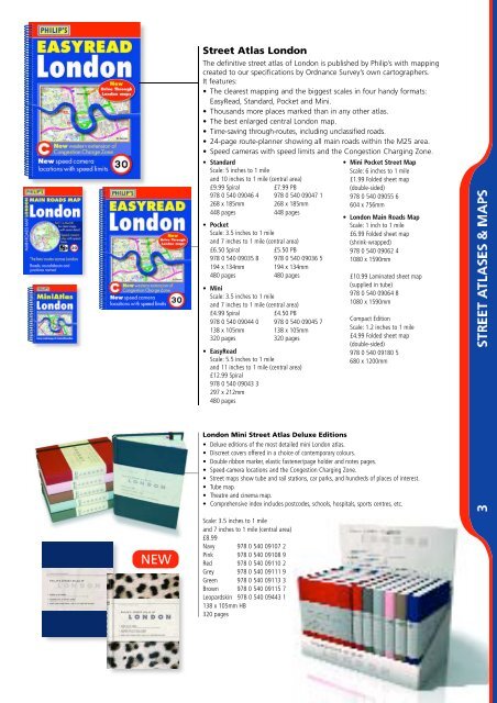
Street Atlas London<br />
The definitive street atlas of London is published by Philip’s with mapping<br />
created to our specifications by Ordnance Survey’s own cartographers.<br />
It features:<br />
• The clearest mapping and the biggest scales in four handy formats:<br />
EasyRead, Standard, Pocket and Mini.<br />
• Thousands more places marked than in any other atlas.<br />
• The best enlarged central London map.<br />
• Time-saving thro u g h - routes, including unclassified ro a d s .<br />
• 24-page route-planner showing all main roads within the M25 area.<br />
• Speed cameras with speed limits and the Congestion Charging Zone.<br />
• Standard<br />
Scale: 5 inches to 1 mile<br />
and 10 inches to 1 mile (central area)<br />
£9.99 Spiral £7.99 PB<br />
978 0 540 09046 4 978 0 540 09047 1<br />
268 x 185mm 268 x 185mm<br />
448 pages 448 pages<br />
• Pocket<br />
Scale: 3.5 inches to 1 mile<br />
and 7 inches to 1 mile (central area)<br />
£6.50 Spiral £5.50 PB<br />
978 0 540 09035 8 978 0 540 09036 5<br />
194 x 134mm 194 x 134mm<br />
480 pages 480 pages<br />
• Mini<br />
Scale: 3.5 inches to 1 mile<br />
and 7 inches to 1 mile (central area)<br />
£4.99 Spiral £4.50 PB<br />
978 0 540 09044 0 978 0 540 09045 7<br />
138 x 105mm 138 x 105mm<br />
320 pages 320 pages<br />
• EasyRead<br />
Scale: 5.5 inches to 1 mile<br />
and 11 inches to 1 mile (central area)<br />
£12.99 Spiral<br />
978 0 540 09043 3<br />
297 x 212mm<br />
480 pages<br />
London Mini Street Atlas Deluxe Editions<br />
• Deluxe editions of the most detailed mini London atlas.<br />
• Discreet covers offered in a choice of contemporary colours.<br />
• Double ribbon marker, elastic fastener/page holder and notes pages.<br />
• Speed-camera locations and the Congestion Charging Zone.<br />
• Street maps show tube and rail stations, car parks, and hundreds of places of interest.<br />
• Tube map.<br />
• Theatre and cinema map.<br />
• Comprehensive index includes postcodes, schools, hospitals, sports centres, etc.<br />
Scale: 3.5 inches to 1 mile<br />
and 7 inches to 1 mile (central area)<br />
£8.99<br />
Navy 978 0 540 09107 2<br />
Pink 978 0 540 09108 9<br />
Red 978 0 540 09110 2<br />
Grey 978 0 540 09111 9<br />
Green 978 0 540 09113 3<br />
Brown 978 0 540 09115 7<br />
Leopardskin 978 0 540 09443 1<br />
138 x 105mm HB<br />
320 pages<br />
• Mini Pocket Street Map<br />
Scale: 6 inches to 1 mile<br />
£1.99 Folded sheet map<br />
(double-sided)<br />
978 0 540 09055 6<br />
604 x 756mm<br />
• London Main Roads Map<br />
Scale: 1 inch to 1 mile<br />
£6.99 Folded sheet map<br />
(shrink-wrapped)<br />
978 0 540 09062 4<br />
1080 x 1590mm<br />
£10.99 Laminated sheet map<br />
(supplied in tube)<br />
978 0 540 09064 8<br />
1080 x 1590mm<br />
Compact Edition<br />
Scale: 1.2 inches to 1 mile<br />
£4.99 Folded sheet map<br />
(double-sided)<br />
978 0 540 09180 5<br />
680 x 1200mm