

philips catalogue 2008 - British Cartographic Society
philips catalogue 2008 - British Cartographic Society
philips catalogue 2008 - British Cartographic Society

Create successful ePaper yourself
Turn your PDF publications into a flip-book with our unique Google optimized e-Paper software.
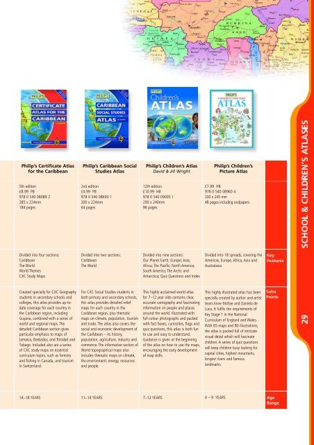
Philip’s Certificate Atlas<br />
for the Caribbean<br />
5th edition<br />
£8.99 PB<br />
978 0 540 08089 2<br />
285 x 224mm<br />
184 pages<br />
Divided into four sections:<br />
Caribbean<br />
The World<br />
World Themes<br />
CXC Study Maps<br />
Created specially for CXC Geography<br />
students in secondary schools and<br />
colleges, this atlas provides up-todate<br />
coverage for each country in<br />
the Caribbean region, including<br />
Guyana, combined with a series of<br />
world and regional maps. The<br />
detailed Caribbean section gives<br />
particular emphasis to maps of<br />
Jamaica, Barbados, and Trinidad and<br />
Tobago. Included also are a series<br />
of CXC study maps on essential<br />
curriculum topics, such as forestry<br />
and fishing in Canada, and tourism<br />
in Switzerland.<br />
14–18 YEARS<br />
Philip’s Caribbean Social<br />
Studies Atlas<br />
2nd edition<br />
£4.99 PB<br />
978 0 540 08693 1<br />
300 x 224mm<br />
64 pages<br />
Divided into two sections:<br />
Caribbean<br />
The World<br />
For CXC Social Studies students in<br />
both primary and secondary schools,<br />
this atlas provides detailed relief<br />
maps for each country in the<br />
Caribbean region, plus thematic<br />
maps on climate, population, tourism<br />
and trade. The atlas also covers the<br />
social and economic development of<br />
the Caribbean – its history,<br />
population, agriculture, industry and<br />
commerce. The informative section of<br />
World topographical maps also<br />
includes thematic maps on climate,<br />
the environment, energy, resources<br />
and people.<br />
11–14 YEARS<br />
Philip’s Children’s Atlas<br />
David & Jill Wright<br />
12th edition<br />
£10.99 HB<br />
978 0 540 09005 1<br />
290 x 240mm<br />
96 pages<br />
Divided into nine sections:<br />
Our Planet Earth; Europe; Asia;<br />
Africa; The Pacific; North America;<br />
South America; The Arctic and<br />
Antarctica; Quiz Questions and Index<br />
This highly acclaimed world atlas<br />
for 7–12 year olds contains clear,<br />
accurate cartography and fascinating<br />
information on people and places<br />
around the world. Illustrated with<br />
full-colour photographs and packed<br />
with fact boxes, curiosities, flags and<br />
quiz questions, this atlas is both fun<br />
to use and easy to understand.<br />
Guidance is given at the beginning<br />
of the atlas on how to use the maps,<br />
encouraging the early development<br />
of map skills.<br />
7–12 YEARS<br />
Philip’s Children’s<br />
Picture Atlas<br />
£7.99 HB<br />
978 0 540 08960 4<br />
330 x 245 mm<br />
48 pages including endpapers<br />
Divided into 18 spreads, covering the<br />
Americas, Europe, Africa, Asia and<br />
Australasia<br />
This highly illustrated atlas has been<br />
specially created by author and artist<br />
team Anne McRae and Daniela de<br />
Luca. It fulfils the requirements of<br />
Key Stage 1 in the National<br />
Curriculum of England and Wales.<br />
With 65 maps and 80 illustrations,<br />
the atlas is packed full of intricate<br />
visual detail which will fascinate<br />
children. A series of quiz questions<br />
will keep children busy looking for<br />
capital cities, highest mountains,<br />
longest rivers and famous<br />
landmarks.<br />
Key<br />
Features<br />
Sales<br />
Points<br />
4 – 9 YEARS Age<br />
Range