Belfast Area Plan - Urban Design Study - Christchurch City Council
Belfast Area Plan - Urban Design Study - Christchurch City Council
Belfast Area Plan - Urban Design Study - Christchurch City Council

Create successful ePaper yourself
Turn your PDF publications into a flip-book with our unique Google optimized e-Paper software.
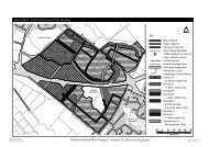
11.2.2. If new development goes ahead to<br />
the south, residents in this sub-area will be<br />
able to access facilities created as part of<br />
the subdivision such as the school, shops<br />
and reserve. The boundary of the S293<br />
area stops short of properties in Darroch<br />
Street, so that vehicular or pedestrian links<br />
will only be possible from Darroch Street if<br />
land in the ownership of others is<br />
developed or acquired by the <strong>Council</strong>. In<br />
any event, residents of Darroch Street<br />
may be opposed to additional traffic<br />
passing along their street to access the<br />
S293 area. However, access for<br />
pedestrians and cyclists would be<br />
beneficial, particularly to provide a safe<br />
route to the new school.<br />
11.2.3. The timber plant is located in the<br />
Rural 4 (Waimakariri) zone, the purpose of<br />
which is primary production, recreation<br />
and floodplain management. It is likely that<br />
noise and dust from the timber plant is an<br />
issue for residential neighbours. The<br />
development of the northern end of<br />
Rushmoor Drive will bring more residents<br />
in close proximity. Also, the timber<br />
operations are visually incompatible with<br />
the rural scenery of this area close to the<br />
Waimakariri River. The site has been<br />
identified as potentially contaminated and<br />
as prone to flooding. To the south of the<br />
timber yard is an undeveloped parcel of<br />
land. This land is immediately adjacent to<br />
the Darroch Reserve, zoned Rural 4<br />
(Waimakariri) zone and also in an area<br />
prone to flood.<br />
11.2.4. Between the timber yard and the<br />
rear boundaries of properties in Main<br />
North Road is a narrow strip of land zoned<br />
Rural 3. There is a vacant residential<br />
section adjacent to the tavern on Main<br />
North Road (5).<br />
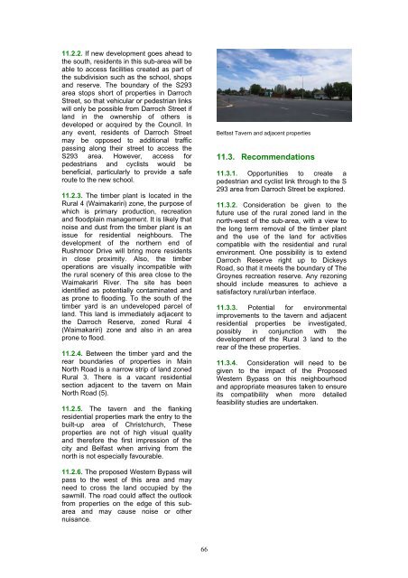
11.2.5. The tavern and the flanking<br />
residential properties mark the entry to the<br />
built-up area of <strong>Christchurch</strong>, These<br />
properties are not of high visual quality<br />
and therefore the first impression of the<br />
city and <strong>Belfast</strong> when arriving from the<br />
north is not especially favourable.<br />
<strong>Belfast</strong> Tavern and adjacent properties<br />
11.3. Recommendations<br />
11.3.1. Opportunities to create a<br />
pedestrian and cyclist link through to the S<br />
293 area from Darroch Street be explored.<br />
11.3.2. Consideration be given to the<br />
future use of the rural zoned land in the<br />
north-west of the sub-area, with a view to<br />
the long term removal of the timber plant<br />
and the use of the land for activities<br />
compatible with the residential and rural<br />
environment. One possibility is to extend<br />
Darroch Reserve right up to Dickeys<br />
Road, so that it meets the boundary of The<br />
Groynes recreation reserve. Any rezoning<br />
should include measures to achieve a<br />
satisfactory rural/urban interface.<br />
11.3.3. Potential for environmental<br />
improvements to the tavern and adjacent<br />
residential properties be investigated,<br />
possibly in conjunction with the<br />
development of the Rural 3 land to the<br />
rear of the these properties.<br />
11.3.4. Consideration will need to be<br />
given to the impact of the Proposed<br />
Western Bypass on this neighbourhood<br />
and appropriate measures taken to ensure<br />
its compatibility when more detailed<br />
feasibility studies are undertaken.<br />
11.2.6. The proposed Western Bypass will<br />
pass to the west of this area and may<br />
need to cross the land occupied by the<br />
sawmill. The road could affect the outlook<br />
from properties on the edge of this subarea<br />
and may cause noise or other<br />
nuisance.<br />
66