Colorado Floodplain Rules and Regulations
Colorado Floodplain Rules and Regulations
Colorado Floodplain Rules and Regulations

Create successful ePaper yourself
Turn your PDF publications into a flip-book with our unique Google optimized e-Paper software.
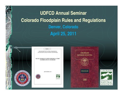
UDFCD Annual Seminar<br />
<strong>Colorado</strong> <strong>Floodplain</strong> <strong>Rules</strong> <strong>and</strong> <strong>Regulations</strong><br />
Denver, <strong>Colorado</strong><br />
April 25, 2011
Examples of <strong>Colorado</strong> Flood Events<br />
10’s – Cherry Creek in Denver ($161 million, 2 deaths)<br />
20’s – Arkansas River at Pueblo ($1.02 billion, 78 deaths)<br />
30’s – Monument Creek ($69 million, 18 deaths)<br />
50’s – Purgatoire River at Trinidad ($48 million, 2 deaths)<br />
60’s – South Platte River in Denver ($2.95 billion, 8 deaths)<br />
70’s – Big Thompson Canyon ($114 million, 144 deaths)<br />
80’s – Heavy Snowmelt Runoff 1984 ($63 million, 2 deaths)<br />
90’s – Fort Collins, Sterling, Lower Arkansas River ($518<br />
million, 6 deaths)<br />
00’s – No major disasters, but damages occurred<br />
All values are in 2010 dollars<br />
Since 1900, the AVERAGE annual flood losses in<br />
<strong>Colorado</strong> is over $50 million. 300 lives have been lost.
Statutory <strong>Floodplain</strong> Citations<br />
24-65.1-101<br />
It is the intent of the general assembly that l<strong>and</strong> use, l<strong>and</strong> use<br />
planning, <strong>and</strong> quality of development are matters in which the<br />
state has responsibility for the health, welfare, <strong>and</strong> safety of<br />
the people of the state <strong>and</strong> for the protection of the<br />
environment of the state.<br />
Flooding as it relates to l<strong>and</strong> use has been declared as a<br />
matter of statewide interest.<br />
State agencies (e.g. CWCB) shall assist local governments to<br />
identify, designate, <strong>and</strong> adopt guidelines for administration of<br />
matters of state interest.
Statutory <strong>Floodplain</strong> Citations<br />
24-65.1-202(2)(a)(I)<br />
<strong>Floodplain</strong>s shall be administered so as to minimize<br />
significant hazards to public health <strong>and</strong> safety or to property.<br />
The CWCB shall promulgate model floodplain regulations.<br />
Building of structures in the floodplain shall be designed in<br />
terms of the availability of flood protection devices, etc.<br />
Need to reduce hazards to public health <strong>and</strong> safety or to<br />
property.<br />
Activities shall be discouraged that, in time of flooding, would<br />
create significant hazards to public health <strong>and</strong> safety or to<br />
property.
Statutory <strong>Floodplain</strong> Citations<br />
30-28-111(1)–(2)<br />
For adequate safety, county planning commissions may regulate<br />
uses on or along any storm or floodwater runoff channel or basin<br />
only after designation <strong>and</strong> approval by the CWCB.<br />
CWCB designation is required in order to reduce or avoid hazards<br />
to persons <strong>and</strong> damage to property resulting from floods.<br />
The county planning commission or the board of adjustment of any<br />
county may condition any portion of a zoning resolution… upon the<br />
preservation, improvement, or construction of any storm or<br />
floodwater runoff channel designated <strong>and</strong> approved by the CWCB.<br />
Municipalities have a similar citation at 31-23-301(1)–(3)
Statutory <strong>Floodplain</strong> Citations<br />
37-60-106(1)<br />
It is the duty of the board to promote the<br />
conservation of the waters of the state of<br />
<strong>Colorado</strong> in order to secure the greatest<br />
utilization of such waters <strong>and</strong> the utmost<br />
prevention of floods;
History of <strong>Rules</strong> <strong>and</strong> <strong>Regulations</strong><br />
<strong>Rules</strong> initially promulgated 1987<br />
<strong>Rules</strong> revised in 2005<br />
Revisions focused on updating mapping activities<br />
Revision in 2010<br />
New <strong>Rules</strong> Became effective on January 14, 2011
Background for <strong>Rules</strong> <strong>and</strong> Regs<br />
<strong>Colorado</strong> statutes require state designation <strong>and</strong><br />
approval of floodplain information prior to local<br />
regulation<br />
Flooding is considered an issue of statewide<br />
concern<br />
<strong>Rules</strong> were initially developed to provide<br />
mapping st<strong>and</strong>ards <strong>and</strong> outline processes for<br />
designation
FEMA Support for Higher St<strong>and</strong>ards<br />
FEMA will support State-initiated enforcement actions<br />
by providing technical assistance <strong>and</strong> FEMA<br />
enforcement actions, even in instances where State<br />
regulations are more restrictive than the NFIP minimum<br />
criteria (FEMA CAP guidance document)<br />
44 CFR 60.1(d) states that “any floodplain management<br />
regulations adopted by a State or a community which<br />
are more restrictive than the criteria set forth in this Part<br />
are encouraged <strong>and</strong> shall take precedence.”
RULE 3<br />
Summary Statement Rule #3<br />
PURPOSE AND SCOPE<br />
Intent: Statement of purpose <strong>and</strong> scope<br />
Modifications: Clarification of which entities must follow<br />
<strong>Rules</strong>. In particular, explicit statement regarding the<br />
following:<br />
All local communities, regardless of NFIP participation<br />
All state agencies (clarification, not new)
Summary Statement Rule #5<br />
RULE 5 STATE REGULATORY<br />
FLOODPLAIN<br />
Intent: Clarify definition of<br />
• Regulatory floodplain<br />
Modifications: L<strong>and</strong>s removed by<br />
• LOMR-F remain in regulatory<br />
• floodplain for certain purposes.<br />
Added ability for CWCB to designate<br />
500-year floodplains, but ONLY by<br />
community request
Summary Statement Rule #6<br />
RULE 6<br />
CRITICAL FACILITIES<br />
Intent: Defines critical facilities <strong>and</strong> provides regulatory<br />
requirements for their development <strong>and</strong> use.<br />
Regulatory floodplain is the basis for these structures.<br />
Modifications: New Rule
Protection of<br />
Critical Facilities<br />
For critical facilities within the 100-year floodplain, structure<br />
shall be floodproofed or elevated to 100-year level plus two<br />
feet of freeboard<br />
Consistent with International Building Code <strong>and</strong> Flood<br />
Resistant Design <strong>and</strong> Construction (ASCE 24-05),<br />
currently adopted by the State
Which Critical Facilities Do These <strong>Rules</strong> Apply To?<br />
New Critical Facilities<br />
Existing Critical Facilities that are Substantially<br />
Damaged or Substantially Improved<br />
Additions to Existing Facilities<br />
Critical Facilities are NOT prohibited in the<br />
floodplain!<br />
Notes:<br />
1. This is a similar requirement to all existing regulations, just to a<br />
higher st<strong>and</strong>ard.<br />
2. Existing critical facilities are not affected by this rule.<br />
3. A variance procedure exists when necessary
Critical Facilities<br />
Critical Facilities Include the Following:<br />
Essential Service Facilities<br />
Hazardous Materials Facilities<br />
At-Risk Population Facilities<br />
Facilities Vital to Restoring Normal<br />
Services
Identification of Critical Facilities<br />
The local government is ultimately responsible<br />
for identification of critical facilities<br />
All structures that clearly meet the CWCB criteria<br />
for critical facilities must be classified as such<br />
For ambiguous or “gray area” structures, the<br />
local government is given the discretion as to the<br />
classification of the structure
Summary Statement Rule #8<br />
RULE 8 STANDARDS FOR REGULATORY<br />
FLOODWAYS<br />
Intent: Discuss the use of floodways as regulatory tools<br />
Modifications:<br />
Application of a ½ foot floodway<br />
Does not require automatic mapping of ½ floodway by<br />
community<br />
Only when new mapping (PMR) is generated in future<br />
Does not apply to communities where flood elevations (BFE’s)<br />
have not been established<br />
LOMRs should be based on current (e.g. one foot) floodway to<br />
avoid “patchwork” floodways on community maps
Floodway Schematic
Summary Statement Rule #11<br />
RULE 11 FLOODPLAIN MANAGEMENT<br />
REGULATIONS<br />
Intent: Sets forth minimum floodplain management st<strong>and</strong>ards<br />
statewide.<br />
Modifications:<br />
Requires compliance with NFIP minimum st<strong>and</strong>ards regardless<br />
of community participation in NFIP (clarification, not new<br />
requirement)<br />
Requires one foot minimum freeboard for new <strong>and</strong> substantially<br />
changed structures<br />
Establishes more restrictive requirements on issuance of<br />
permits on properties removed from FEMA’s floodplain due to<br />
Letters of Map Revision Based on Fill (LOMR-F).
Summary Statement Rule #12<br />
RULE 12 EFFECTS OF FLOOD MITIGATION<br />
MEASURES AND STREAM ALTERATION<br />
ACTIVITIES ON REGULATORY FLOODPLAINS<br />
Intent: Provide floodplain regulation requirements for stream<br />
alteration activities.<br />
Modifications:<br />
Clarification of when a Letter of Map Revision (LOMR) is<br />
required (0.3 feet)
How does this affect<br />
communities <strong>and</strong><br />
developers?
Ordinance Updates<br />
Communities will have up to three years to update<br />
ordinances based on the new st<strong>and</strong>ards. CWCB will<br />
provide free technical assistance.<br />
For some communities, ordinance updates can happen<br />
simultaneously with new DFIRM mapping, depending<br />
on timing.<br />
CWCB will develop <strong>and</strong> provide a model ordinance for<br />
guidance <strong>and</strong> assistance to communities<br />
Communities at their discretion may allow without<br />
violation development based on designs permitted prior<br />
to local ordinance update or with valid CLOMR
Moving Forward - Floodways<br />
This rule does not affect LOMRs. Applicants are<br />
highly encouraged to check with FEMA/Baker<br />
prior to work to determine if a study will result in<br />
a LOMR or PMR.<br />
All mapping work started prior to January 14,<br />
2011 is not required to use the 6” surcharge. It<br />
is recommended where feasible.<br />
The State will develop a database of stream<br />
reaches with 6” surcharge data to assist with<br />
future mapping changes
Moving Forward - Floodways<br />
When floodways are to be delineated, FEMA<br />
<strong>and</strong> State mapping begun after January 14,<br />
2011 will use a 6-inch floodway surcharge<br />
criteria for new <strong>and</strong> revised stream reaches<br />
FEMA <strong>and</strong> State mapping not yet complete but<br />
begun before January 14, 2011 may use either<br />
surcharge criteria at local’s request – 6” is<br />
encouraged where feasible (not m<strong>and</strong>atory)<br />
Existing reaches that are not revised may<br />
continue to use the 1-foot surcharge
Moving Forward - Floodways<br />
When current FEMA maps show 1-foot surcharge, but<br />
6-inch data is currently available, community will not be<br />
forced to use the 6-inch data<br />
Finally, a reminder that this rule deals with maximum<br />
allowable surcharges. This may not impact stream<br />
reaches as much as believed – many mapped crosssections<br />
already show surcharges less than 0.5 feet.<br />
6-inch floodway also applies to anticipatory floodplains<br />
in detailed stream reaches. Community may wait to<br />
regulate until after ordinance update.
Moving Forward - Freeboard<br />
Communities are urged to begin regulating<br />
freeboard as soon as feasibly possible – this is<br />
an easy ordinance update<br />
Not m<strong>and</strong>atory until ordinance is updated, but<br />
this must be done by January 14, 2014
Moving Forward – Critical Facilities<br />
Not m<strong>and</strong>atory until ordinance is updated, but<br />
this must be done by January 14, 2014<br />
Communities do not need to make a list of<br />
critical facilities beforeh<strong>and</strong> as they do with<br />
emergency management planning<br />
Suggested approach is to simply add a checklist<br />
item to floodplain development permit<br />
If a structure is labeled a critical facility, then one<br />
extra foot of freeboard is required
Moving Forward – Critical Facilities<br />
For all gray areas, community is given the<br />
discretion as to whether something is a critical<br />
facility<br />
Please contact the CWCB for further<br />
clarifications – additional guidance may be<br />
issued as needed
Moving Forward – LOMR-F<br />
Community is responsible for keeping track of<br />
LOMR-F properties<br />
On these properties, lowest floor must remain at<br />
or above BFE (even if FEMA has removed the<br />
property from the regulatory floodplain); no other<br />
m<strong>and</strong>atory floodplain restrictions apply
Next Steps<br />
Initial guidance document being prepared to<br />
address initial clarifications<br />
Anticipated release May or June 2011<br />
Further guidance documents may be released as<br />
needed in future<br />
State <strong>and</strong> FEMA will develop <strong>Colorado</strong>-specific<br />
model ordinance<br />
Anticipated release summer-fall 2011<br />
Communities must adopt new state-m<strong>and</strong>ated<br />
regulations by January 14, 2011
THANK YOU!<br />
For questions, contact:<br />
Kevin Houck, PE, CFM<br />
303-866-3441, x3219<br />
Kevin.houck@state.co.us<br />
Cwcb.state.co.us<br />
For a copy of the <strong>Rules</strong> <strong>and</strong> related documents,<br />
http://cwcb.state.co.us/Pages/CWCBProposedFlood<br />
plain<strong>Rules</strong><strong>and</strong><strong>Regulations</strong>.aspx<br />
(link from the front page)