programme tuesday, july, 31 - Université de Caen Basse Normandie
programme tuesday, july, 31 - Université de Caen Basse Normandie
programme tuesday, july, 31 - Université de Caen Basse Normandie
Create successful ePaper yourself
Turn your PDF publications into a flip-book with our unique Google optimized e-Paper software.
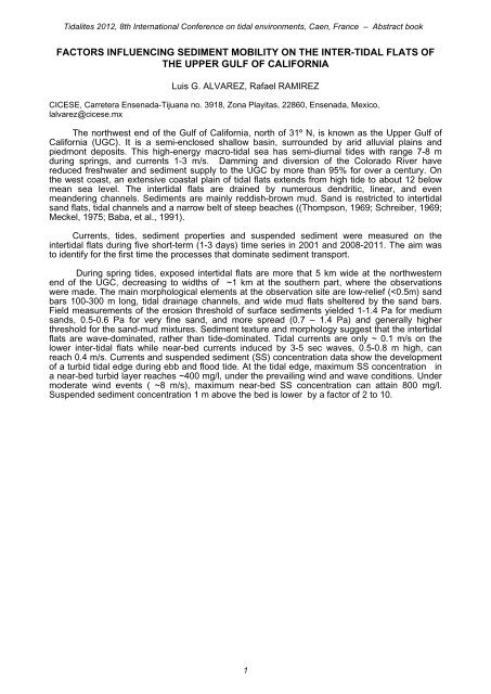
Tidalites 2012, 8th International Conference on tidal environments, <strong>Caen</strong>, France – Abstract book<br />
FACTORS INFLUENCING SEDIMENT MOBILITY ON THE INTER-TIDAL FLATS OF<br />
THE UPPER GULF OF CALIFORNIA<br />
Luis G. ALVAREZ, Rafael RAMIREZ<br />
CICESE, Carretera Ensenada-Tijuana no. 3918, Zona Playitas, 22860, Ensenada, Mexico,<br />
lalvarez@cicese.mx<br />
The northwest end of the Gulf of California, north of <strong>31</strong>º N, is known as the Upper Gulf of<br />
California (UGC). It is a semi-enclosed shallow basin, surroun<strong>de</strong>d by arid alluvial plains and<br />
piedmont <strong>de</strong>posits. This high-energy macro-tidal sea has semi-diurnal ti<strong>de</strong>s with range 7-8 m<br />
during springs, and currents 1-3 m/s. Damming and diversion of the Colorado River have<br />
reduced freshwater and sediment supply to the UGC by more than 95% for over a century. On<br />
the west coast, an extensive coastal plain of tidal flats extends from high ti<strong>de</strong> to about 12 below<br />
mean sea level. The intertidal flats are drained by numerous <strong>de</strong>ndritic, linear, and even<br />
mean<strong>de</strong>ring channels. Sediments are mainly reddish-brown mud. Sand is restricted to intertidal<br />
sand flats, tidal channels and a narrow belt of steep beaches ((Thompson, 1969; Schreiber, 1969;<br />
Meckel, 1975; Baba, et al., 1991).<br />
Currents, ti<strong>de</strong>s, sediment properties and suspen<strong>de</strong>d sediment were measured on the<br />
intertidal flats during five short-term (1-3 days) time series in 2001 and 2008-2011. The aim was<br />
to i<strong>de</strong>ntify for the first time the processes that dominate sediment transport.<br />
During spring ti<strong>de</strong>s, exposed intertidal flats are more that 5 km wi<strong>de</strong> at the northwestern<br />
end of the UGC, <strong>de</strong>creasing to widths of ~1 km at the southern part, where the observations<br />
were ma<strong>de</strong>. The main morphological elements at the observation site are low-relief (


