programme tuesday, july, 31 - Université de Caen Basse Normandie
programme tuesday, july, 31 - Université de Caen Basse Normandie
programme tuesday, july, 31 - Université de Caen Basse Normandie

Create successful ePaper yourself
Turn your PDF publications into a flip-book with our unique Google optimized e-Paper software.
Tidalites 2012<br />
8th International Conference<br />
on Tidal Environments<br />
<strong>Caen</strong>, France<br />
July <strong>31</strong> - August 2<br />
Abstract book
Acknowledgments<br />
The organizing committee of Tidalites 2012 greatly thanks the following partners<br />
for their support:<br />
The research Lab UMR M2C<br />
The CNRS - INSU<br />
The APGN (Association of the Geological Heritage of Normandy)<br />
The University of <strong>Caen</strong> - <strong>Basse</strong> <strong>Normandie</strong><br />
The University of Rouen<br />
The City of <strong>Caen</strong><br />
The <strong>Basse</strong> <strong>Normandie</strong> Regional Council<br />
The Calvados Department Council<br />
The Geological Society of France (SGF)<br />
The Association of French Sedimentologists (ASF)<br />
We sincerely thank also the following additional partners for field trip organisation:<br />
University of La Rochelle, UMR LIENSs, The Charente-Maritime Department Council (FT1)<br />
University of Angers, BIAF lab, LaSalle Beauvais School, MNHN (FT3)<br />
University of Lille 1, UMR Géosystèmes, Carrière Oscar Savreux (FT4)<br />
University of <strong>Caen</strong>, UMR M2C, Total, MINES ParisTech, Syndicat Mixte Mont Saint Michel (FT5)
Main organizing committee<br />
The Tidalites 2012 conference<br />
is organized by the research laboratory<br />
“Morphodynamique Continentale et Côtière”<br />
(CNRS - Universities of <strong>Caen</strong> <strong>Basse</strong> <strong>Normandie</strong> and Rouen)<br />
Berna<strong>de</strong>tte Tessier (general coordination)<br />
Anthony Dubois (webmaster, data base)<br />
Jacques Avoine, Olivier Dugué, Isabelle Neghaban, Marie-Pierre Bouet<br />
(financial management)<br />
Valérie Casado, Isabelle Neghaban (secretariat)<br />
Venue<br />
Auditorium - Musée <strong>de</strong>s Beaux-Arts<br />
<strong>Caen</strong> Castle
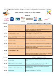
PROGRAMME<br />
TUESDAY, JULY, <strong>31</strong><br />
Auditorium of the "Musée <strong>de</strong>s Beaux-Arts", <strong>Caen</strong> Castle<br />
8h00 - 9h00 - Registration and Poster installation<br />
9h00 - 10h00 - Conference introduction<br />
Chairman: Daidu FAN<br />
10h00 - BARTHOLDY Jesper, ERNSTSEN Verner B.<br />
ON THE FORMATION OF RIPPLES AND DUNES<br />
10h20 - FLOESER Goetz, BURCHARD Hans, RIETHMUELLER Rolf<br />
OBSERVATIONAL EVIDENCE FOR THE INWARD TRANSPORT OF SUSPENDED MATTER BY ESTUARINE CIRCULATION IN THE<br />
WADDEN SEA<br />
10h40 - WANG Ya Ping<br />
SEDIMENT RESUSPENSION, FLOCCULATION AND SETTLING IN A MACROTIDAL ESTUARINE ENVIRONMENT<br />
11h00 - LIU James T., CHEN Wayne, C.<br />
SEDIMENT TRANSPORT PATTERNS AND SOURCES IN A RIVER DELTA-TIDAL FLAT COMPLEX IN TAIWAN<br />
11h20 - ALVAREZ Luis G., RAMIREZ Rafael<br />
FACTORS INFLUENCING SEDIMENT MOBILITY ON THE INTER-TIDAL FLATS OF THE UPPER GULF OF CALIFORNIA.<br />
11h40 - CHANG Taesoo<br />
BAEKSU OPEN-COAST TIDAL FLAT OF THE KOREAN WEST SEA COAST REVISITED: A DEPOSITIONAL MODEL AND ITS<br />
PRESERVATION POTENTIAL<br />
12h00 - 14h00 -Lunch at the restaurant "Café Mancel"<br />
Chairman: Kyungsik CHOI<br />
14h00 - JABLONSKI Bryce, DALRYMPLE Robert W.<br />
SEDIMENTOLOGY OF A FLUVIALLY DOMINATED, TIDALLY INFLUENCED POINT BAR: THE LOWER CRETACEOUS MIDDLE<br />
MCMURRAY FORMATION, LOWER STEEPBANK RIVER AREA, NORTHEASTERN ALBERTA, CANADA<br />
14h20 - PELLETIER Jonathan, ABOUESSA Ashour, DURINGER Philippe, SCHUSTER Mathieu, GHIENNE Jean-François, RUBINO Jean-Loup<br />
RHYTHMIC CLIMBING RIPPLES LAMINATION FROM MODERN (BAY OF THE MONT-SAINT-MICHEL, FRANCE) AND ANCIENT (DUR AT<br />
TALAH, PALEOGENE, LIBYA) TIDAL DEPOSITIONAL ENVIRONMENTS: DESCRIPTION, GENESIS, SIGNIFICANCE AND NEW CRITERION<br />
FOR TIDAL EVIDENCE.<br />
14h40 - REITH Geoff, DALRYMPLE Robert W., MACKAY Duncan, ICHASO Aitor<br />
UNDERSTANDING THE DEPOSITION OF TIDALLY DEPOSITED MUDSTONES: AN EXAMPLE FROM THE TILJE FORMATION<br />
(JURASSIC), OFFSHORE NORWAY<br />
15h00 - LEGLER Berit, JOHNSON Howard, HAMPSON Gary, MASSART Benoit, JACKSON Christopher, JACKSON Matthew, EL-BARKOOKY<br />
Ahmed, RAVNAS Rodmar<br />
FACIES MODEL OF A FINE-GRAINED, TIDE-DOMINATED DELTA: LOWER DIR ABU LIFA MEMBER (EOCENE), WESTERN DESERT,<br />
EGYPT<br />
15h20 - QUIJADA I. Emma, SUAREZ-GONZALEZ Pablo, BENITO M. Isabel, MAS Ramón<br />
TIDE-INFLUENCED FLUVIAL-DELTAIC SEDIMENTS VERSUS CONTINENTAL SANDY-MUDDY FLAT DEPOSITS: EVIDENCE FROM THE<br />
HUERTELES FM (EARLY CRETACEOUS, N SPAIN)<br />
15h40 - LONGHITANO Sergio, CHIARELLA Domenico, SPALLUTO Luigi<br />
TIDAL FACIES IN SILICICLASTIC, CARBONATE AND MIXED MICROTIDAL ANCIENT SYSTEMS OF SOUTHERN ITALY<br />
Coffee break and poster session<br />
Chairman: Jesper BARTHOLDY<br />
17h00 - MARGOTTA José, TRENTESAUX Alain, TRIBOVILLARD Nicolas, ABRAHAM Romain<br />
FRENCH FLANDERS FIELDS: DECIPHERING THE HOLOCENE SEDIMENTARY HISTORY OF THE COASTAL PLAIN OF NORTHERN<br />
FRANCE<br />
17h20 - JOHANNESSEN Peter N., NIELSEN Lars Henrik, MØLLER Ingelise, NIELSEN Lars Henrik, ANDERSEN Thorbjørn Joest, PEJRUP<br />
Morten<br />
THE SEDIMENTARY DEVELOPMENT OF A HOLOCENE TO RECENT BARRIER ISLAND, DANISH WADDEN SEA<br />
17h40 - FRUERGAARD Mikkel, ANDERSEN Thorbjørn Joest, NIELSEN Lars Henrik, JOHANNESSEN Peter N., PEJRUP Morten<br />
EVOLUTION AND STRATIGRAPHY OF A HOLOCENE MICRO-TIDAL BARRIER SYSTEM IN THE NORTHERN WADDEN SEA<br />
18h00 - WANG Yunwei, YU Qian, GAO Shu<br />
EFFECTS OF GRAIN-SIZE SORTING ON THE SCALE-DEPENDENCES OF EQUILIBRIUM MORPHOLOGY OF BACKBARRIER TIDAL<br />
BASINS<br />
18h30 - 20h00 - Conference cocktail
WEDNESDAY, AUGUST, 01<br />
Auditorium of the "Musée <strong>de</strong>s Beaux-Arts", <strong>Caen</strong> Castle<br />
Chairman: Burghard FLEMMING<br />
08h30 - TRENTESAUX Alain, ABRAHAM Romain, BAFFREAU Alexandrine, DAUVIN Jean-Clau<strong>de</strong>, LOZACH Sophie, MALENGROS Deny,<br />
POIZOT Emmanuel<br />
MARINE HABITAT CLASSIFICATION: A PLURIDISCIPLINARY APPROACH IN A HIGH MACROTIDAL ENVIRONMENT. THE CASE OF THE<br />
ENGLISH MEDIAN CHANNEL<br />
08h50 - DAUVIN Jean-Clau<strong>de</strong>, BERYOUNI Khadija, LOZACH Sophie, MEAR Yann, MURAT Anne, POIZOT Emmanuel<br />
LIVE UNDER TIDAL REGIME: THE ROLE OF THE BRITTLE-STAR OPHIOTHRIX FRAGILIS BEDS FROM THE EASTERN BAY OF SEINE IN<br />
THE FINE PARTICLE DEPOSIT-SUSPENSION MECHANISMS<br />
09h10 - BARTHOLOMAE Alexan<strong>de</strong>r, HOLLER Peter<br />
ANALYSIS OF SUBTIDAL HABITATS IN THE GERMAN WADDEN SEA ON THE BASE OF HYDRO-ACOUSTIC REMOTE SENSING DATA<br />
09h30 - BAUCON Andrea, FELLETTI Fabrizio<br />
A QUANTITATIVE TOOL FOR THE ICHNOLOGICAL ANALYSIS OF TIDAL ENVIRONMENTS: THE ICHNOGIS METHOD<br />
09h50 - VALERIUS Jennifer, MILBRADT Peter, VAN ZOEST Michael, ZEILER Manfred<br />
DEVELOPMENT OF A SEABED MODEL FOR ANALYZING SEDIMENT AND MORPHODYNAMIC PROCESSES IN THE GERMAN BIGHT<br />
(NORTH SEA)<br />
Coffee break and poster session<br />
Chairman: Robert W. DALRYMPLE<br />
11h00 - ARCHER Allen<br />
COMPARISON OF HYPERTIDAL SYSTEMS IN EUROPE, SOUTH AND NORTH AMERICA<br />
11h20 - FURGEROT Lucille, MOUAZE Dominique, TESSIER Berna<strong>de</strong>tte, HAQUIN Sylvain, PEREZ Laurent, VIEL Félix<br />
INFLUENCE OF THE TIDAL BORE ON SEDIMENT TRANSPORT IN THE MONT-SAINT-MICHEL ESTUARY, NW FRANCE.<br />
11h40 - FAN Daidu, SHANG Shuai, TU Jinbiao, CAI Guofu, WU Yijing<br />
SEDIMENTATION PROCESSES AND SEDIMENTARY CHARACTERISTICS OF TIDAL BORES IN THE QIANTANG ESTUARY,<br />
EAST-CENTRAL CHINA<br />
12h00 - CHAMIZO BORREGUERO M., MELENDEZ N., DE BOER Poppe<br />
TIDAL BORE INDUCED SEDIMENTS IN INCISED VALLEYS, UTRILLAS FM, ALBIAN, SW IBERIAN RANGES, SPAIN<br />
12h20 - DE BOER Poppe<br />
MILANKOVITCH-SCALE ORBITALLY FORCED TIDAL CYCLICITY<br />
12h40 - 14h30 -Lunch at the restaurant "Café Mancel"<br />
Chairman: Eric CHAUMILLON<br />
14h30 - GONG Wenping<br />
ASSESSMENT OF SILTATION AT THE DREDGED CHANNEL IN THE HUANGMAOHAI ESTUARY, PEARL RIVER DELTA, CHINA<br />
14h50 - GLUARD Lucile, LEVOY Franck<br />
THE 18.6 YEAR TIDAL CYCLE INFLUENCE ON THE COUESNON RIVER BEHAVIOUR, MONT-SAINT-MICHEL BAY (FRANCE)<br />
15h10 - CHOI Kyungsik, HONG Chang Min, OH Chung Rok, JUNG Jae Hoon<br />
MORPHODYNAMICS OF TIDAL CHANNELS IN THE MACROTIDAL YEOCHARI TIDAL FLAT, GYEONGGI BAY, WEST COAST OF KOREA:<br />
IMPLICATION FOR THE ARCHITECTURE OF INCLINED HETEROLITHIC STRATIFICATION<br />
15h30 - HERRLING Gerald, WINTER Christian<br />
THE EFFECT OF HIGH-ENERGY EVENTS ON EBB-TIDAL DELTA SEDIMENTOLOGY AND MORPHOLOGY – A PROCESS-BASED MODEL<br />
STUDY<br />
15h50 - FERRET Yann, LE BOT Sophie, LAFITE Robert, BLANPAIN Olivier, GARLAN Thierry<br />
INFLUENCE OF TIDE VS WAVE ON SEDIMENT DYNAMICS AND DUNE INTERNAL ARCHITECTURE ON A MACROTIDAL INNER<br />
CONTINENTAL SHELF (EASTERN ENGLISH CHANNEL).<br />
Coffee break and poster session<br />
Chairman: Poppe DE BOER<br />
17h00 - YU Qian<br />
MODELING THE FORMATION OF A SAND BAR WITHIN A LARGE FUNNEL-SHAPED, TIDE-DOMINATED ESTUARY: QIANTANGJIANG<br />
ESTUARY, CHINA<br />
17h20 - CHAUMILLON Eric, FENIES Hugues, BILLY Julie, BREILH Jean-François<br />
TIDAL AND CLIMATE CONTROLS ON THE MORPHOLOGICAL EVOLUTIONS AND THE INTERNAL ARCHITECTURE OF A TIDAL BAR:<br />
THE PLASSAC TIDAL BAR IN THE BAY-HEAD DELTA OF THE GIRONDE ESTUARY.<br />
17h40 - SAITO Yoshiki<br />
MONSOON-CONTROLLED DELTAIC SEDIMENTATION IN A TIDE-DOMINATED SETTING: EXAMPLES FROM MEGA-DELTAS IN ASIA<br />
18h00 - MASSUANGANHE Elidio, BANDEIRA Salomao, WESTERBERG Lars-Ove<br />
IMPACTS OF FLOODS AND CYCLONES ON MANGROVE OVER A SECTOR OF THE SAVE RIVER DELTA PLAIN, MOZAMBIQUE.<br />
18h20 - MAKINO Yasuhiko, ARAI Shota, ITO Takashi, NANAYAMA Futoshi<br />
EFFECT OF THE 2011 GIANT TSUNAMI ON A SANDY BEACH AT OARAI, EASTERN JAPAN<br />
18h45 - Departure from the conference place for the Conference Dinner (by bus)
THURSDAY, AUGUST, 02<br />
Auditorium of the "Musée <strong>de</strong>s Beaux-Arts", <strong>Caen</strong> Castle<br />
Chairman: Jean-Yves REYNAUD<br />
08h30 - CHOI Kyungsik, JUNG Jae Hoon, JO Joo Hee<br />
RAPID INFILLING OF MACROTIDAL ESTUARY DURING EARLY HOLOCENE IN YEOCHARI TIDAL FLAT, GYEONGGI BAY, WEST COAST<br />
OF KOREA<br />
08h50 - KITAZAWA Toshiyuki<br />
TIDAL RAVINEMENT SURFACE IN A TIDE-DOMINATED ESTUARY: PLEISTOCENE NHA BE ESTUARY, SOUTHERN VIETNAM.<br />
09h10 - EKWENYE Ogechi, NICHOLS Gary, NWAJIDE Sunny, OBI Gordian<br />
DEPOSITIONAL ARCHITECTURE AND ICHNOLOGY OF THE TIDALLY-INFLUENCED ESTUARINE SYSTEM OF THE EOCENE AMEKI<br />
GROUP<br />
09h30 - DALRYMPLE Robert W., JAMES Noel, SEIBEL Meg, BESSON David, PARIZE Olivier<br />
WARM-TEMPERATE, MARINE, CARBONATE SEDIMENTATION IN AN EARLY MIOCENE, TIDE-DOMINATED, INCISED VALLEY;<br />
PROVENCE, SE FRANCE<br />
09h50 - ILGAR Ayhan, TIMUR Erol, KARAKUS Erhan, KAYA Serap, TURKMEN Banu<br />
LATE MIOCENE INCISED VALLEY-FILL IN EASTERN TAURIDES, TURKEY: DEPOSITIONAL EVOLUTION IN RESPONSE TO SEA-LEVEL<br />
CHANGE AND DEPOSITIONAL PROCESSES<br />
Coffee break and poster session<br />
Chairman: Yoshiki SAITO<br />
11h00 - YIN Yong<br />
THE LATE PLEISTOCENE–HOLOCENE STRATIGRAPHY AND SEDIMENTARY ENVIRONMENT OF THE TIDAL RADIAL SAND RIDGE<br />
SYSTEM, JIANGSU OFFSHORE, SOUTH YELLOW SEA<br />
11h20 - MICHAUD Kain, DALRYMPLE Robert W.<br />
TRANSGRESSIVE, HEADLAND-ATTACHED TIDAL SAND RIDGES IN THE RODA FORMATION, NORTHERN SPAIN<br />
11h40 - PELLETIER Jonathan, ABOUESSA Ashour, DURINGER Philippe, SCHUSTER Mathieu, RUBINO Jean-Loup<br />
THE GEOLOGICAL RECORD OF TIDAL DYNAMIC: DIVERSITY OF ASSOCIATED DEPOSITS AND MULTI-SCALE CYCLES FROM THE<br />
DUR AT TALAH FORMATION (UPPER EOCENE, SIRT BASIN, LIBYA)<br />
12h00 - CHOI Kyungsik, STEEL Ronald, OLARIU Cornel<br />
TIDAL RHYTHMITES IN THE UPPER CRETACEOUS NESLEN FORMATION, UTAH, USA: THEIR IMPLICATIONS FOR THE<br />
SEDIMENTOLOGY AND STRATIGRAPHIC ARCHITECTURE OF TIDAL-FLUVIAL CHANNEL<br />
12h30 - 14h00 Lunch at the restaurant "Café Mancel"<br />
Chairman: Allen ARCHER<br />
14h30 - WEILL Pierre, MOUAZE Dominique, TESSIER Berna<strong>de</strong>tte<br />
INTERNAL ARCHITECTURE AND EVOLUTION OF BIOCLASTIC BEACH RIDGES IN A MEGATIDAL CHENIER PLAIN: WAVE FLUME<br />
EXPERIMENTS AND FIELD DATA<br />
14h50 - REYNAUD Jean-Yves, RUBINO Jean-Loup, PARIZE Olivier, DALRYMPLE Robert W., VENNIN Emmanuelle, FERRANDINI Michelle,<br />
FERRANDINI Jean, ANDRE Jean-Pierre, TESSIER Berna<strong>de</strong>tte, JAMES Noel<br />
OFFSHORE TIDAL BIOCLASTIC BODIES IN EPEIRIC SEAS: MIOCENE EXAMPLES FROM SE FRANCE AND CORSICA<br />
15h10 - FLEMMING Burghard W.<br />
THE ORDOVICIAN TABLE MOUNTAIN GROUP, SOUTH AFRICA: THE TIDAL DEPOSIT THAT NEVER WAS<br />
15h30 - SUAREZ-GONZALEZ Pablo, QUIJADA I. Emma, BENITO M. Isabel, MAS Ramón<br />
DO STROMATOLITES NEED TIDES TO TRAP OOIDS? INSIGHTS FROM THE COASTAL-LAKE CARBONATES OF THE LEZA FM (EARLY<br />
CRETACEOUS, N SPAIN).<br />
15h50 - ILGAR Ayhan, KARAKUS Erhan, ESIRTGEN Tolga<br />
THE VARIABILITY OF ESTUARINE DEPOSITS IN A MICROTIDAL SETTING OF LATE MIOCENE MEDITERRANEAN (EASTERN TAURIDES,<br />
TURKEY): CONTROLLING FACTORS ON DEPOSITION<br />
Last coffee break and poster session
POSTERS<br />
BARRIOS Edixon Jose<br />
SEDIMENTOLOGICAL MODEL FOR C-4 RESERVOIR FROM VLA6/9/21 AREA, BASED ON INFORMATION OF CORE INTERPRETATION AND<br />
COMPARISON WITH THEORETICAL MODELS DEPOSITED UNDER SIMILAR SEDIMENTOLOGICAL CONDITIONS<br />
BAUCON Andrea, FELLETTI Fabrizio<br />
“DEEP TIME ON A TIDAL FLAT”: THE ANCESTRAL ICHNOASSOCIATIONS OF THE MODERN GRADO LAGOON (NORTHERN ADRIATIC, ITALY)<br />
CHANG Taesoo, KIM Jincheol, YOO Dong-Geun<br />
LATE QUATERNARY STRATIGRAPHIC EVOLUTION OF BAEKSU OPEN-COAST TIDAL FLAT, WEST COAST OF KOREA: REGIONAL<br />
UNCONFORMITY-BOUNDED TWO TIDAL DEPOSITS<br />
DIEZ-CANSECO Davinia, BENITO M. Isabel, DIAZ-MOLINA Margarita, KALIN Otto<br />
TIDAL INFLUENCE IN THE ‘LOWER RED UNIT’ OF THE TREMP FM IN SOUTH-CENTRAL PYRENEES (LATE CRETACEOUS-TERTIARY)<br />
GUGLIOTTA Marcello, FLINT Stephen, HODGSON David, VEIGA Gonzalo<br />
SEDIMENTOLOGY AND SEQUENCE STRATIGRAPHY OF THE FLUVIAL-TO-TIDAL TRANSITION ZONE IN THE UPPER LAJAS FORMATION<br />
(NEUQUEN BASIN, ARGENTINA)<br />
HUSTELI Berit, JENSEN Maria, OLAUSSEN Snorre<br />
TIDALLY RELATED HETEROGENITIES IN SANDBODIES SOUGHT PARAMETERIZED FOR REFINED RESERVOIR MODELLING<br />
JAMET Guillaume, DUGUE Olivier, DELCAILLAU Bernard, CLIQUET Dominique<br />
THE TIDALLY-INFLUENCED RIVER DEPOSITS OF THE PLEISTOCENE SEINE SYSTEM: THE EXAMPLE OF THE TOURVILLE-LA-RIVIERE<br />
TERRACE (NW FRANCE)<br />
KURCINKA Colleen, ICHASO Aitor, DALRYMPLE Robert W.<br />
TIDAL DELTAS IN THE LAJAS AND TILJE FORMATIONS: TIDE-DOMINATED OR TIDE-INFLUENCED?<br />
LE BOT Sophie, BERTEL F, LANGLOIS Estelle, FOREY Estelle, MEIRLAND Antoine, LAFITE Robert<br />
LITTORAL SEDIMENTATION WITHIN SPARTINE AND OBIONE COMMUNITIES IN THE SOMME ESTUARY (EASTERN ENGLISH CHANNEL).<br />
PRELIMINARY RESULTS<br />
LEMOINE Maxence, DELOFFRE Julien, LAFITE Robert, LESOURD Sandric, LESUEUR Patrick, CUVILLIEZ Antoine, FRITIER Nicolas, MASSEI<br />
Nicolas<br />
RHYTHMITES PRESERVATION IN MACROTIDAL ESTUARINE ENVIRONMENTS: FROM UPSTREAM TO DOWNSTREAM ESTUARY<br />
LOZACH Sophie, ABRAHAM Romain, BAFFREAU Alexandrine, DAUVIN Jean-Clau<strong>de</strong>, MALENGROS Deny, POIZOT Emmanuel, TRENTESAUX<br />
Alain<br />
BENTHIC HABITAT DIVERSITY IN COARSE SEDIMENT UNDER HIGH MACROTIDAL ENVIRONMENT<br />
MAKINO Yasuhiko<br />
SEDIMENTATION OF THE 2011 GIANT TSUNAMI ON A SANDY BEACH ON THE PACIFIC COAST OF EASTERN JAPAN<br />
PARK Soo Chul<br />
LATE QUATERNARY STRATIGRAPHY AND MORPHODYNAMICS OF MACROTIDAL SAND BODIES IN THE WESTERN COAST OF KOREA<br />
ROSSI Valentina, STEEL Ronald, OLARIU Cornel, LEVA LOPEZ Julio<br />
COMPOUND TIDAL DUNES IN THE NEUQUEN JURASSIC RIFT BASIN<br />
SCASSO Roberto, CUITIÑO José Ignacio, DOZO Teresa, BOUZA Pablo<br />
MEANDERING TIDAL CHANNEL DEPOSITS IN THE FLUVIAL-TIDAL TRANSITION OF A MIOCENE ESTUARY IN PATAGONIA<br />
SON Chang Soo, BARTHOLOMAE Alexan<strong>de</strong>r, FLEMMING Burghard W., CHUN Seong Soo, LEE In Tae<br />
THE VARIATION OF THE SEDIMENTARY FACIES ON JADEBUSEN TIDAL BASIN IN GERMANY: SURFACE SEDIMENTS AND SEDIMENTARY<br />
STRUCTURES<br />
TANAKA Akiko<br />
COASTAL MONITORING USING L-BAND SYNTHETIC APERTURE RADAR (SAR) IMAGE DATA IN THE MEKONG AND HUANGHE (YELLOW<br />
RIVER) DELTA AREAS<br />
TESSIER Berna<strong>de</strong>tte, BILLEAUD Isabelle, SORREL Philippe<br />
SEDIMENTARY RECORDS OF CLIMATE CHANGES IN MACROTIDAL TIDE-DOMINATED ESTUARIES<br />
VREL Anne, BOUST Dominique, LESUEUR Patrick, COSSONNET Catherine, DELOFFRE Julien, DUBRULLE-BRUNAUD Carole, MASSEI<br />
Nicolas, ROZET Marianne, SOLIER Luc, THOMAS Sandrine<br />
TIDAL ASYMMETRY: THE USE OF ARTIFICIAL RADIONUCLIDES IN SEDIMENTS (THE SEINE ESTUARY, FRANCE)<br />
WANG Dong, SONG Shengli, DING Hao, WU Jichun, ZHU Qingping, WANG Ling<br />
HYDROLOGIC CHARACTERISTICS OF THE YELLOW RIVER MOUTH, CHINA<br />
ZHANG Jicai, HUGHES Joseph, WANG Ping, HORWITZ Mark<br />
THE VARIATIONS OF SALINITY AND STRATIFICATION FOR MICRO-TIDAL AND MANGROVE-COVERED FROG CREEK SYSTEMS, FLORIDA
ABSTRACTS
Tidalites 2012, 8th International Conference on tidal environments, <strong>Caen</strong>, France – Abstract book<br />
FACTORS INFLUENCING SEDIMENT MOBILITY ON THE INTER-TIDAL FLATS OF<br />
THE UPPER GULF OF CALIFORNIA<br />
Luis G. ALVAREZ, Rafael RAMIREZ<br />
CICESE, Carretera Ensenada-Tijuana no. 3918, Zona Playitas, 22860, Ensenada, Mexico,<br />
lalvarez@cicese.mx<br />
The northwest end of the Gulf of California, north of <strong>31</strong>º N, is known as the Upper Gulf of<br />
California (UGC). It is a semi-enclosed shallow basin, surroun<strong>de</strong>d by arid alluvial plains and<br />
piedmont <strong>de</strong>posits. This high-energy macro-tidal sea has semi-diurnal ti<strong>de</strong>s with range 7-8 m<br />
during springs, and currents 1-3 m/s. Damming and diversion of the Colorado River have<br />
reduced freshwater and sediment supply to the UGC by more than 95% for over a century. On<br />
the west coast, an extensive coastal plain of tidal flats extends from high ti<strong>de</strong> to about 12 below<br />
mean sea level. The intertidal flats are drained by numerous <strong>de</strong>ndritic, linear, and even<br />
mean<strong>de</strong>ring channels. Sediments are mainly reddish-brown mud. Sand is restricted to intertidal<br />
sand flats, tidal channels and a narrow belt of steep beaches ((Thompson, 1969; Schreiber, 1969;<br />
Meckel, 1975; Baba, et al., 1991).<br />
Currents, ti<strong>de</strong>s, sediment properties and suspen<strong>de</strong>d sediment were measured on the<br />
intertidal flats during five short-term (1-3 days) time series in 2001 and 2008-2011. The aim was<br />
to i<strong>de</strong>ntify for the first time the processes that dominate sediment transport.<br />
During spring ti<strong>de</strong>s, exposed intertidal flats are more that 5 km wi<strong>de</strong> at the northwestern<br />
end of the UGC, <strong>de</strong>creasing to widths of ~1 km at the southern part, where the observations<br />
were ma<strong>de</strong>. The main morphological elements at the observation site are low-relief (
Tidalites 2012, 8th International Conference on tidal environments, <strong>Caen</strong>, France – Abstract book<br />
Study site.<br />
2
Tidalites 2012, 8th International Conference on tidal environments, <strong>Caen</strong>, France – Abstract book<br />
COMPARISON OF HYPERTIDAL SYSTEMS IN EUROPE, SOUTH AND NORTH<br />
AMERICA<br />
Allen ARCHER<br />
KANSAS STATE UNIVERSITY, Department of Geology, 66506, Kansas, Us, aarcher@ksu.edu<br />
Hypertidal ranges exceed 6 m and can range upwards to 15 m and potentially higher.<br />
Herein a comparison is ma<strong>de</strong> among systems that have the highest recognized tidal ranges on<br />
Earth. Settings in Europe inclu<strong>de</strong> Bristol Bay and the Severn River estuary, southwestern UK<br />
and Mont-Saint-Michel Bay in Normandy, France. In South America, hypertidal ranges occur<br />
within tidal estuaries of Patagonia (southeastern portion of the Atlantic coast of Argentina). In<br />
North America hypertidal systems inclu<strong>de</strong>: Turnagain Arm within Cook Inlet in south-central<br />
Alaska, USA, Leaf Lake in Ungava Bay, northern Quebec, Canada and the Salmon River estuary<br />
in the Bay of Fundy, Nova Scotia, Canada.<br />
When compared to micro-, meso- or macrotidal coasts, hypertidal systems are extremely<br />
rare. Hypertidal systems, however, do have enormous tidal ranges coupled with a tremendous<br />
potential for high rates of sedimentation and erosion. A complete un<strong>de</strong>rstanding of the dynamics<br />
of these extreme systems is important for at least two reasons. First, they serve as mo<strong>de</strong>rn<br />
analogs for ancient systems that were formed with extremely dynamic tidal systems. In addition,<br />
from a more pragmatic standpoint, tidal power is a relatively untapped nonpolluting and<br />
renewable source of energy. Currently operational tidal-power stations have been constructed<br />
entirely within hypertidal coastal settings. It is highly plausible that future <strong>de</strong>velopments will also<br />
be concentrated in hypertidal coastal settings.<br />
3
Tidalites 2012, 8th International Conference on tidal environments, <strong>Caen</strong>, France – Abstract book<br />
4
Tidalites 2012, 8th International Conference on tidal environments, <strong>Caen</strong>, France – Abstract book<br />
SEDIMENTOLOGICAL MODEL FOR C-4 RESERVOIR FROM VLA6/9/21 AREA,<br />
BASED ON INFORMATION OF CORE INTERPRETATION AND COMPARISON WITH<br />
THEORETICAL MODELS DEPOSITED UNDER SIMILAR SEDIMENTOLOGICAL<br />
CONDITIONS<br />
Edixon Jose BARRIOS<br />
PDVSA, Calle 77 Edificio 5 <strong>de</strong> Julio, 4002, Las Laras, Venezuela, barrioseg@pdvsa.com<br />
Sedimentary environments <strong>de</strong>fined for a specific reservoir, are the result of the<br />
interpretation of data extracted from cores, cut in intervals with economic interest specifically on<br />
VLA6/9/21 area C-4 and C- 5 reservoirs from Misoa Formation have been studied and sitted<br />
with the mo<strong>de</strong>ls built in neighboring areas. A well sedimentological mo<strong>de</strong>l will be the result of<br />
geological and coherent integration of information provi<strong>de</strong>d by cores and channel samples and /<br />
or wall, biostratigraphy, well logs, information about <strong>de</strong>epmeters and image logs and even<br />
engineering reservoir and then checked against all the mo<strong>de</strong>ls, which in turn will serve as input<br />
for the construction of other mo<strong>de</strong>ls such as geostatistics and simulation.<br />
Throughout history, Geologists in pro of creating a mo<strong>de</strong>l according to the reality of<br />
reservoir, they have been required to propose mo<strong>de</strong>ls with poor or not information about cores<br />
and when they exist, in some cases with poor data or it´s has been recovered in sandy sections<br />
only.<br />
In recent studies in the area VLA6/9/21 was achieved taking into account the core data<br />
technically to support possible tidal influence for this reservoir in based of the presence of<br />
sedimentary structures, biostratigraphy and with the comparison with others mo<strong>de</strong>l was proposed<br />
a mo<strong>de</strong>l with <strong>de</strong>ltaic sedimentation and tidal influences for the units C-4 and C5 based on the<br />
i<strong>de</strong>ntification and recognition of distinctive features such as double-layer structures of clay, cone<br />
cone structure, pairs of clay, together with other data will be the i<strong>de</strong>al complement to think that the<br />
area at some point in geological time was un<strong>de</strong>r the influence of sedimentary processes<br />
associated with ti<strong>de</strong>s. In other way, several studies have mentioned possible presence of an<br />
estuary as a sedimentary behavior as responsability of sedimentation. It´s important to highlight<br />
that an estuary extends from the maximum bound of tidal influence zone to maximum bound of<br />
coastal processes influence of mouth, In some cases, it´s so difficult to difference where the<br />
fluvial action begins and where ends.<br />
An estuary is <strong>de</strong>fined as a coastal body of water semi-closed connected to open sea and<br />
insi<strong>de</strong> which there are water mixtures of different salinities, from the sea and the continent;<br />
enough reason to avoid <strong>de</strong>fining sedimentary environments of a region without having enough<br />
information. If we consi<strong>de</strong>r that this area represent only a little part about all basin and in the<br />
same way the answer of well log it´s show us heterogeneities in all of them, It´s neccesary to<br />
highlight that Misoa Formation involve episo<strong>de</strong>s of complex sedimentation, where is so difficult to<br />
recognize and i<strong>de</strong>ntify a sedimentological mo<strong>de</strong>l without uncertainty.<br />
Complex systems like this are so linked and <strong>de</strong>pend on the transgressive periods because<br />
if in a <strong>de</strong>lta occurs a transgression it´s could become an estuary, Similarly, falls in the eustatic<br />
level in an estuary, will make it a prograding system (un<strong>de</strong>r certain parameters such as rate<br />
accommodation, sediment supply, etc) therefore would be having like a <strong>de</strong>lta.<br />
5
Tidalites 2012, 8th International Conference on tidal environments, <strong>Caen</strong>, France – Abstract book<br />
Escalona, A. and Mann, P. Sequence-stratigraphic, analisys of Eocene clastic foreland basin <strong>de</strong>posits in<br />
central Lake Maracaibo using high-resolution well correlation and 3D seismic data: AAPG, April 2006, v 90,<br />
N°-4.<br />
Galloway, W. and Hobday, D. Terrigenous clastic <strong>de</strong>positional system, Springer-Verlag, Berlin 1996.<br />
Galloway, W,.Genetic stratigraphic sequences in basic analysis: I Arquitecture and genesis of flodding<br />
surface boun<strong>de</strong>d <strong>de</strong>positional units:, AAPG Bulletin, February 1989.<br />
Gonzalez <strong>de</strong> Juana, C., J. Azorena y X. C. Picard (1980) Geología <strong>de</strong> Venezuela y <strong>de</strong> sus cuencas<br />
petrolíferas, Foninves, Caracas.<br />
Pettijohn, F.; Potter, P.; Siever, R. Sand and Sandstones. 1987, Springer- Verlag, New York, Inc., 2th<br />
edition.<br />
6
Tidalites 2012, 8th International Conference on tidal environments, <strong>Caen</strong>, France – Abstract book<br />
ON THE FORMATION OF RIPPLES AND DUNES<br />
Jesper BARTHOLDY, Verner B. ERNSTSEN<br />
GEOLOGICAL SURVEY OF DENMARK AND GREENLAND, Oester Voldga<strong>de</strong> 10, 1350, Copenhagen,<br />
Denmark, jb@geo.ku.dk<br />
Ripples and dunes are commonly distinguished on the basis of their scaling or not-scaling<br />
with flow <strong>de</strong>pth as well as dimensional criteria such as wavelength. Ripples are regar<strong>de</strong>d as<br />
in<strong>de</strong>pen<strong>de</strong>nt of water <strong>de</strong>pth while dunes are generally consi<strong>de</strong>red to scale with <strong>de</strong>pth. The simple<br />
fact that compound dunes exist contradicts the <strong>de</strong>pth-scaling argument. If the largest compound<br />
dunes scale with water <strong>de</strong>pth, where does that leave the smaller, superimposed ones? And, if<br />
these scale with water <strong>de</strong>pth, how can the compound dunes be or<strong>de</strong>rs of magnitu<strong>de</strong> larger? To<br />
overcome this contradiction, it has sometimes been argued that the smaller superimposed dunes<br />
scale with boundary layers related the larger compound bedforms, also this can be disproved by<br />
means of examples, e.g lower right of Fig. 1 where the large compound features are missing.<br />
Numerous experiments in small laboratory flumes the world over have <strong>de</strong>monstrated that<br />
ripples are not always in<strong>de</strong>pen<strong>de</strong>nt of water <strong>de</strong>pth. In terms of their size, all flow-transverse<br />
bedforms generated in small <strong>de</strong>monstration flumes with <strong>de</strong>pths < 0.1 m are by <strong>de</strong>finition ripples in<br />
spite of the fact that they clearly scale with water <strong>de</strong>pth, as revealed by contracting water surfaces<br />
over their crests. As a consequence, the criteria by which ripples and dunes are supposed to be<br />
distinguished are inherently suspect. Fact is that if flow <strong>de</strong>pth is small enough, any bedform will<br />
scale with it, simply because <strong>de</strong>pth limitation forms a natural upper boundary, and serves as an<br />
upper limit for bedform growth of any kind. In research flumes, the maximum water <strong>de</strong>pth is<br />
typical less than 0.5 m. As a result, dune heights will remain smaller than about 15 cm. It is<br />
therefore not surprising that the largest bedforms in flume studies are always found to scale with<br />
flow <strong>de</strong>pth. By contrast, dunes observed on the ocean floor at <strong>de</strong>pths of 10s-1000s of meters<br />
exhibit a wi<strong>de</strong> range of sizes. These must evi<strong>de</strong>ntly be controlled by factors other than water<br />
<strong>de</strong>pth. The only meaningful explanation is that dunes are scaled with the mutual relationship<br />
between flow conditions and form response. These matters are examined on the basis of theory<br />
and experiments, and it is <strong>de</strong>monstrated that bedforms result from self-organizing processes<br />
acting across the interface between sand and water forming boundary layers directly <strong>de</strong>pen<strong>de</strong>nt<br />
on bedform height.<br />
7
Tidalites 2012, 8th International Conference on tidal environments, <strong>Caen</strong>, France – Abstract book<br />
Multibeam registration of bedforms in the tidal inlet Knu<strong>de</strong>dyb on the Danish west coast. The colors indicate<br />
the approximate water <strong>de</strong>pth relative to the mean water level. The tidal range in the inlet is 1.7 m. The<br />
mean grain-size in the center of the channel varies from a maximum of about 0.650mm at the bedform<br />
crest to a minimum of about 0.200 mm in the troughs.<br />
8
Tidalites 2012, 8th International Conference on tidal environments, <strong>Caen</strong>, France – Abstract book<br />
ANALYSIS OF SUBTIDAL HABITATS IN THE GERMAN WADDEN SEA ON THE<br />
BASE OF HYDRO-ACOUSTIC REMOTE SENSING DATA<br />
Alexan<strong>de</strong>r BARTHOLOMAE, Peter HOLLER<br />
SENCKENBERG, Suedstrand 40, 26382, Wilhelmshaven, Germany, abartholomae@senckenberg.<strong>de</strong>,<br />
peter.holler@senckenberg.<strong>de</strong><br />
Since the Wad<strong>de</strong>n Sea area was awar<strong>de</strong>d a World Nature Heritage the public pressure of<br />
habit protection grows distinctly. The European Water Framework Directive requires a standard<br />
mapping of marine habitats. Therefore quality tools to assess the recent stage and to monitor<br />
changes in the near future are nee<strong>de</strong>d. For the intertidal area airborne laserscanning and<br />
Synthetic Aperture radar (SAR) are the state of art (Bartholdy & Folving 1986, Brzank et al. 2008).<br />
In contrast to the intertidal area, optical approaches are less successful to cover the subtidal part<br />
of the Wad<strong>de</strong>n Sea area. High suspension load coupled with less visibility reduce and /or inhibit<br />
wi<strong>de</strong>-spread used optical based techniques. To compensate this <strong>de</strong>ficit, alternative techniques<br />
have to be <strong>de</strong>veloped. From the pelagic area the quite well-known hydro-acoustic <strong>de</strong>vices are<br />
now more and more adapted to shallow water operation (Hughes-Clarke et al. 1996).<br />
To work out standard procedures for sub-aquatic monitoring, three hydro-acoustic <strong>de</strong>vices<br />
were tested to their resolution, their redundancy and their value of benefit <strong>de</strong>tecting habitats in a<br />
three year lasting case study in the East Frisian Wad<strong>de</strong>n Sea (Bartholomae et al 2011). In or<strong>de</strong>r<br />
to find out which are the system-specific limitations like foot-print sizes and coverage, seven test<br />
areas in water <strong>de</strong>pths between 5 m to 15 m were simultaneously surveyed using singlebeam<br />
echosoun<strong>de</strong>r (SBS) (200 kHz), multibeam echosoun<strong>de</strong>r (MBES) (455 kHz) and Si<strong>de</strong>scan sonar<br />
(SSS) (380 kHz). Based on the principle of acoustic respond the return signals were analysed<br />
with acoustic seabed classification tools to <strong>de</strong>termine the different characteristics of seafloor<br />
roughness. Up to five major acoustic classes have been specified. These classes cover sea<br />
surface sediments consisting of sand, shells <strong>de</strong>bris, gravel, less mud and infrequently some peat<br />
at the seven study sites in the East Frisian backbarrier tidal flats. Repetitive surveys were carried<br />
out to investigate system specific variations and natural changes in the complex spatial pattern of<br />
the subtidal habitats. Based on the given technical specifications of the different acoustic <strong>de</strong>vices<br />
the influence of footprint sizes was tested by applying different grid sizes in the data analysis. In<br />
or<strong>de</strong>r to generate similar footprint sizes for a water <strong>de</strong>pth of 15m MBES data were calculated on a<br />
grid sizes of 33x17 pixel (0.9m x 3.7m ; 3.3 m²), SSS data with 17x9 pixels (0.8m x 2.4m ;<br />
1.92m²) which correspond to a SBS footprint of 2.98 m². This already limits the minimum water<br />
<strong>de</strong>pth of operation for the oblique-angled geometries.<br />
The spatial distribution of the acoustic classes was tested by means of confi<strong>de</strong>nce levels of<br />
acoustic similarities within the classification results of each system as well as between the<br />
different acoustic <strong>de</strong>vices. The fit of ground truth data to acoustic classes and the importance of<br />
the sediment specific surface roughness was tested by multidimensional scaling (MDS) and<br />
cluster analysis for bulk sediment composition and for the individual grain size distributions.<br />
Seasonal up to annual scaled times series were analysed with regard to habitat dynamics in<br />
exposed and sheltered areas of the Wad<strong>de</strong>n Sea.<br />
The results of the case study are summarized in a comprehensive report which discusses<br />
the differences in backscatter based classification, local effects of natural and human impact to<br />
the specific sites and the system specific differences such as working-frequencies and footprint<br />
geometry.<br />
In general the backscatter based systems are much more sensitive to changes in surface<br />
roughness than of the sediment type itself. For the sediments in the Wad<strong>de</strong>n Sea this sensitivity<br />
starts getting more relevant in <strong>de</strong>pen<strong>de</strong>nce of the footprint size, the effect of smoothing <strong>de</strong>creases<br />
in shallower water <strong>de</strong>pth.<br />
Results of habitat distributions and their site <strong>de</strong>pen<strong>de</strong>nt differences and the system related<br />
limitation will be discussed in a con<strong>de</strong>nsed way.<br />
9
Tidalites 2012, 8th International Conference on tidal environments, <strong>Caen</strong>, France – Abstract book<br />
Ground truthing results for the classification of multi-beam echosoun<strong>de</strong>r data (5 classes) from the location<br />
Otzumer Balje<br />
Bartholdy, J. and Folving, S. 1986. Sediment classification and surface type mapping in the Danish<br />
Wad<strong>de</strong>n Sea by remote sensing. Netherlands Journal of Sea Research, 20 (4), 337-345.<br />
Bartholomä, A., Holler, P., Schrottke, K. and Kubicki, A. (2011) Acoustic habitat mapping in the German<br />
Wad<strong>de</strong>n Sea – Comparison of hydro-acoustic <strong>de</strong>vices. J. Coast. Res.,Spec. Iss. 64, ICS 2011 Proc., 1-5.<br />
Brzank, A., Heipke, Ch., Goepfert, J. and Soergel, U., Aspects of generating precise digital terrain mo<strong>de</strong>ls<br />
in the Wad<strong>de</strong>n Sea from lidar–water classification and structure line extraction. Journal of Photogrammetry<br />
and Remote Sensing, 63 (5), 510-528.<br />
Hughes-Clarke, J.E., Mayer, L.A. and Wells, D.W., 1996. Shallow water imaging multibeam sonars: A new<br />
tool for investigating seafloor processes in the coastal zone and on the continental shelf. Marine<br />
Geophysical Research, 18, 607-629.<br />
10
Tidalites 2012, 8th International Conference on tidal environments, <strong>Caen</strong>, France – Abstract book<br />
“DEEP TIME ON A TIDAL FLAT”: THE ANCESTRAL ICHNOASSOCIATIONS OF THE<br />
MODERN GRADO LAGOON (NORTHERN ADRIATIC, ITALY)<br />
Andrea BAUCON, Fabrizio FELLETTI<br />
DIPARTIMENTO DI SCIENZE DELLA TERRA, Università di Milano, 20133, Milano, Italy,<br />
andrea@tracemaker.com<br />
The Northern Adriatic Sea is a shallow, semi-enclosed sea lying on continental crust, being<br />
an i<strong>de</strong>al mo<strong>de</strong>l for past epicontinental seas (Fig. 1A). In addition, recent studies suggests that its<br />
benthic subtidal ecosystem closely resembles Paleozoic-style ecology (McKinney, 2003, 2007;<br />
McKinney and Hageman, 2006). Although some objections were raised on the mentioned<br />
ecological aspects (Zuschin and Stachowitsch, 2009), the Northern Adriatic Sea is unanimously<br />
consi<strong>de</strong>red one of the few mo<strong>de</strong>rn epicontinental seas comparable to some Paleozoic–Mesozoic<br />
shelves (McKinney, 2003, 2007; McKinney and Hageman, 2006; Zuschin and Stachowitsch,<br />
2009).<br />
The Grado-Marano lagoon is the northernmost transitional system of this peculiar<br />
geobiologic scenario. Here, barrier-island systems with vast tidal flats support a complex mosaic<br />
of sedimentary environments, which offer varied habitats for tracemaking organisms (Baucon,<br />
2008). Intriguingly, the intertidal flats are characterized by ancestral bioturbation styles coexisting<br />
with mo<strong>de</strong>rn, Thalassinoi<strong>de</strong>s-dominated ones:<br />
• Microbial mat ichnoassociation. Intertidal microbial mats are characterized by horizontal,<br />
gently winding burrows without branching (Helminthoidichnites; tunnel diameter: 1 mm). These<br />
traces accurately follow the interface between the organic-rich and the mineral-rich layer of<br />
microbial mats (Fig. 1B). The observed Helminthoidichnites reflect the mining of the microbial mat<br />
from un<strong>de</strong>rneath: ‘un<strong>de</strong>rmat mining behaviour’ sensu Seilacher (1999). Similar behavioural<br />
strategies were particularly common within Proterozoic microbial mats, before of the Agronomic<br />
Revolution (Seilacher, 1999). Obviously, the Helminthoidichnites from Grado correspond to<br />
Proterozoic-style behaviour but the tracemakers are mo<strong>de</strong>rn: insect larvae (un<strong>de</strong>termined<br />
Diptera). Intertidal insects (Heterocerus flexuosus) are also the authors of Macanopsis, an<br />
unbranched burrow with a lower clavate chamber and a convolute, tapered neck (maximum<br />
penetration <strong>de</strong>pth: 5 cm; Fig. 1C).<br />
• Rippled sands ichnoassociation. Rippled sands are dominated by <strong>de</strong>ep (20-30 cm)<br />
U-shaped burrows (Arenicolites) produced by sipunculans (Fig. 1D). Vertical burrows with<br />
constructional lining (Skolithos) are common especially on longshore bars; the<br />
suspension-feeding polychaete Megalomma is the tracemaker. With the exception of localized<br />
clusters with <strong>de</strong>nse Thalassinoi<strong>de</strong>s, crustacean burrows are very rare. These elements closely<br />
resemble pre-Jurassic ichnoassociations, when <strong>de</strong>capod crustaceans were not dominating<br />
shallow marine environments.<br />
The mentioned ancestral features are explained by the peculiar intertidal environment of the<br />
Grado lagoon. In<strong>de</strong>ed, the studied microbial mats are characterized by extreme conditions: high<br />
cohesiveness, prolonged emersion time and noxious phosphate content. For these reasons, they<br />
represent a rich trophic niche available only to few non-marine specialists. On the other hand,<br />
rippled sands provi<strong>de</strong> less extreme conditions, i.e. relatively high turbulence and low nutrients.<br />
However, <strong>de</strong>capod crustaceans prefer to settle within the adjacent sheltered, organic-rich<br />
habitats.<br />
The <strong>de</strong>scribed ichnologic features, united to the peculiar physiographic and ecological<br />
context, make Grado an i<strong>de</strong>al analogue for past peritidal ichnological systems. Paraphrasing<br />
McKinney (2007), the Grado ichnosite allows to study “<strong>de</strong>ep time on a tidal flat”.<br />
11
Tidalites 2012, 8th International Conference on tidal environments, <strong>Caen</strong>, France – Abstract book<br />
(A) Geographical setting and facies map. (B) Helminthoidichnites (He) and Macanopsis (Ma) are visible<br />
after peeling off the superficial, organic-rich level of the microbial mats. (C) Microbial mat with Macanopsis.<br />
The tracemaker (the coleopteran Heterocerus flexuosus) is arrowed; profile view. (D) Arenicolites (dashed)<br />
with its tracemaker, a sipunculan worm.<br />
Baucon, A. 2008. Neoichnology of a microbial mat in a temperate, siliciclastic environment. In: Avanzini M.,<br />
Petti F. Italian Ichnology, Studi Trent. Sci. Nat. Acta Geol., 83: 183-203.<br />
Ger<strong>de</strong>s, G., 2003. Biofilms and macroorganisms, in: Krumbein, W.E., Paterson, D.M., Zavarzin, G.A.<br />
(Eds.), Fossil and Recent Biofilms: a Natural History of Life on Earth. Kluwer Aca<strong>de</strong>mic Publishers,<br />
Dordrecht, pp. 197-216.<br />
McKinney, F.K., 2003. Preservation Potential and Paleoecological Significance of Epibenthic Suspension<br />
Fee<strong>de</strong>r-Dominated Benthic Communities (Northern Adriatic Sea ). Palaios 18, 47-62.<br />
McKinney, F.K., 2007. The Northern Adriatic Ecosystem: Deep Time in a Shallow Sea. Columbia University<br />
Press, New York.<br />
McKinney, F.K., Hageman, S.J., 2006. Paleozoic to mo<strong>de</strong>rn marine ecological shift displayed in the<br />
northern Adriatic Sea. Geology 34, 881-884.<br />
Seilacher, A., 1999. Biomat-related lifestyles in the Precambrian. Palaios 14, 86-93.<br />
Zuschin, M., Stachowitsch, M., 2009. Epifauna-Dominated Benthic Shelf Assemblages: Lessons From the<br />
Mo<strong>de</strong>rn Adriatic Sea. Palaios 24, 211-221.<br />
12
Tidalites 2012, 8th International Conference on tidal environments, <strong>Caen</strong>, France – Abstract book<br />
A QUANTITATIVE TOOL FOR THE ICHNOLOGICAL ANALYSIS OF TIDAL<br />
ENVIRONMENTS: THE ICHNOGIS METHOD<br />
Andrea BAUCON, Fabrizio FELLETTI<br />
DIPARTIMENTO DI SCIENZE DELLA TERRA, Università di Milano, 20133, Milano, Italy,<br />
andrea@tracemaker.com<br />
Since its earliest roots in Renaissance times, trace fossil analysis relied on actualistic<br />
experiences for inspiring and testing theories and mo<strong>de</strong>ls. In fact, each of the major watersheds<br />
in the history of ichnology was initiated by advances in neoichnological knowledge: the<br />
paleoichnological knowledge of Leonardo da Vinci was inspired by mo<strong>de</strong>rn burrowing and boring<br />
organisms (Baucon, 2010), the experiments of Nathorst disproved the botanical interpretation of<br />
trace fossils, the Senckenberg Laboratory marked the <strong>de</strong>velopment of the mo<strong>de</strong>rn approach in<br />
ichnology (Osgood, 1975). With the Internet and GPS among the faster-growing technologies of<br />
the <strong>de</strong>ca<strong>de</strong>, the previous historical consi<strong>de</strong>rations addresses traditional questions with novel<br />
approaches: How are traces distributed on a tidal flat? What are the association patterns (‘links’)<br />
between ichnotaxa? What is the relationship between traces and their tidal environment?<br />
With these questions in mind, we present a new method to capture, manage, analyze, and<br />
display geographically referenced ichnological data: IchnoGIS. This new method uses spatial<br />
location as the key in<strong>de</strong>x variable for all other information, recor<strong>de</strong>d during different sampling<br />
stages (Fig. 1A):<br />
a) quadrat sampling. For each sampling site, a frame (quadrat) of a set size is placed on the<br />
substrate. Spatial coordinates, facies and ichnological attributes (i.e. abundance of each<br />
ichnotaxon) are recor<strong>de</strong>d.<br />
b) trench sampling. Quadrat sampling emphasizes the recognition of distinct structures on<br />
the sediment surface, being unsuitable for burrows with poorly visible openings. Consequently,<br />
quadrat sampling is complemented by the study of vertical trenches, realized at regularly spaced<br />
sites.<br />
c) environmental and topographical sampling. Several environmental attributes can be<br />
recor<strong>de</strong>d to <strong>de</strong>termine the major control factors on trace distribution: PH, Reduction Potential<br />
(Eh), nutrients (nitrite, nitrate, phosphate), salinity, <strong>de</strong>pth of the Redox Potential Discontinuity<br />
Layer, emersion time and substrate firmness, measured with the modified Brinell method (Gingras<br />
and Pemberton, 2000).<br />
Data analysis is based on the integration of network theory (Fig. 1B) with geostatistical<br />
techniques (Fig. 1C). More specifically, geostatistical analysis enables to measure the spatial<br />
structure of burrow distribution and allows to interpolate trace abundance in unsampled positions.<br />
Consequently, the IchnoGIS method leads to the <strong>de</strong>finition of ichnological maps in which trace<br />
<strong>de</strong>nsity is confronted to geomorphological gradients (Fig. 1C).<br />
Furthermore, network analysis exploits the fact that traces assemble in a complex web-like<br />
structure. Accordingly, an ichnological system can be conveniently <strong>de</strong>scribed by network graph,<br />
which represents ichnotaxa and their connections (Fig. 1B). According to this approach,<br />
researchers can analyze not only the <strong>de</strong>gree of association between different ichnotaxa, but also<br />
<strong>de</strong>scribe how an ichnotaxon is embed<strong>de</strong>d in the whole system. Ichnoassociations can be found<br />
by applying specific pattern-finding algorithms. Finally, the integration of geostatistics and network<br />
theory allows to <strong>de</strong>fine the environmental significance of ichnoassociations and find out the<br />
factors controlling an ichnological system.<br />
In or<strong>de</strong>r to test the accuracy of the IchnoGIS method, we applied it on a mo<strong>de</strong>rn tidal flat:<br />
the Grado lagoon (Northern Adriatic Sea, Italy). Our results show that the IchnoGIS method<br />
provi<strong>de</strong>s unprece<strong>de</strong>nted research opportunities for ichnologists and sedimentologists, as it allows<br />
to <strong>de</strong>termine accurately spatial distribution, association patterns and environmental significance of<br />
traces from the Grado lagoon. In particular, emersion time, hydrodynamism, substrate firmness<br />
and microbial binding are the major control factors <strong>de</strong>termining the structure and distribution of<br />
trace associations. These structuring factors are used to <strong>de</strong>fine a predictive mo<strong>de</strong>l of<br />
ichnoassociation composition, providing an immediate tool for paleoenvironmental reconstitution<br />
(Fig. 1D).<br />
13
Tidalites 2012, 8th International Conference on tidal environments, <strong>Caen</strong>, France – Abstract book<br />
(A) The IchnoGIS method. (B) The IchnoGIS method <strong>de</strong>scribes an ichnosite through a network graph<br />
(ichnonetwork). The ichnonetwork graph displays which ichnotaxon is associated to which other and<br />
records the intensity of each relation (weight of the connections). Data from the Grado lagoon (Adriatic Sea,<br />
Italy). (C) The IchnoGIS method allows to compare environmental data with ichnological maps. In<br />
particular, the figured example consi<strong>de</strong>rs exposure (or emersion) time. Data from the Grado lagoon<br />
(Adriatic Sea, Italy). (D) The Grado ichnological mo<strong>de</strong>l, as <strong>de</strong>fined by the IchnoGIS method. Cr – Crab<br />
burrows ichnoassociation: dominated by crab burrows, sparse Arenicolites; Th - Thalassinoi<strong>de</strong>s<br />
ichnoassociation: dominated by Thalassinoi<strong>de</strong>s and small Arenicolites; Ar –Arenicolites ichnoassociation:<br />
dominated by large Arenicolites, occasional Skolithos and Thalassinoi<strong>de</strong>s; Sk – Skolithos ichnoassociation:<br />
dominated by large Skolithos, often lined; Ma – Macanopsis ichnoassociation: dominated by Macanopsis<br />
and Helminthoidichnites; Pa – Parmaichnus ichnoassociation: dominated by Parmaichnus<br />
Baucon, A., 2010. Leonardo Da Vinci, the Founding Father of Ichnology. Palaios 25, 361-367.<br />
Gingras, M.K., Pemberton, S.G., 2000. A field method for <strong>de</strong>termining the firmness of colonized sediment<br />
substrates. Journal of Sedimentary Research 70, 1341-1344.<br />
Osgood, R.G., 1975. The history of invertebrate ichnology, in: Frey, R.W. (Ed.), The Study of Trace Fossils.<br />
Springer Verlag, New York, pp. 3-12.<br />
14
Tidalites 2012, 8th International Conference on tidal environments, <strong>Caen</strong>, France – Abstract book<br />
TIDAL BORE INDUCED SEDIMENTS IN INCISED VALLEYS, UTRILLAS FM, ALBIAN,<br />
SW IBERIAN RANGES, SPAIN<br />
M. CHAMIZO BORREGUERO*, N. MELENDEZ*, Poppe DE BOER**<br />
*GRUPO DE ANALISIS DE CUENCAS. DPTO. DE ESTRATIGRAFIA-INSTITUTO DE GEOCIENCIAS<br />
(UCM-CSIC), Universidad Complutense, Ciudad Universitaria, 28040, Madrid, Spain,<br />
manu.chamizo@hotmail.com, nievesml@geo.ucm.es<br />
**SEDIMENTOLOGY GROUP, DEPARTMENT OF EARTH SCIENCES, UTRECHT UNIVERSITY,<br />
Budapestlaan 4, 3584 CD, Utrecht, The netherlands, p.l.<strong>de</strong>boer@uu.nl<br />
Exceptionally well preserved tidal-bore <strong>de</strong>posits within Albian siliciclastics in the<br />
southwestern Iberian Basin, adjacent to the Tethys, are interbed<strong>de</strong>d with sediments formed by<br />
ephemeral alluvial discharge, tidal reworking and aeolian processes.<br />
The study area is located in the southwestern domain of the Iberian Ranges (Eastern<br />
Spain) in the Serranía <strong>de</strong> Cuenca. The Iberian Ranges form a NW-SE striking intraplate fold belt<br />
and represent an uplifted (inverted) Mesozoic basin that was formed by crustal thinning during<br />
earlier rift stages. Moreover, the Serranía <strong>de</strong> Cuenca sub-basin was controlled by minor<br />
SSW-NNE extension faults that acted as thresholds during the middle Cretaceous sea-level rise<br />
(Melén<strong>de</strong>z, 1983; Capote et al., 2002). Above Lower Cretaceous synrift continental <strong>de</strong>posits, the<br />
siliciclastic Albian to Early Cenomanian Utrillas Sandstone Formation is laterally very extensive<br />
and crops out all over the Iberian Ranges.<br />
In five <strong>de</strong>tailed sections recor<strong>de</strong>d near the village of Uña, 14 sedimentary facies were<br />
distinguished and grouped into 5 facies associations: ephemeral alluvial, overbank, tidal flat,<br />
aeolian and tidal bore <strong>de</strong>posits. Ephemeral alluvial discharge and tidal reworking alternated with<br />
varying supremacy, and the continuous presence of ventifacts, feldspars as well as fine<br />
windblown sand reflects continued aeolian activity.<br />
Two main units are divi<strong>de</strong>d by a laterally continuous, <strong>de</strong>ep and sharp incision attributed to a<br />
relative sea-level fall. The Lower Unit, <strong>de</strong>posited in the (fluvial) alluvial–tidal transition zone,<br />
records the evolution from a tidally reworked arid ephemeral alluvial system to tidal flats and<br />
aeolian dunes as the result of a progressive <strong>de</strong>crease of alluvial discharge resulting in an<br />
increase of the tidal and aeolian signature.<br />
The Upper Unit, covering the sharp and <strong>de</strong>ep incision, shows a reactivation of alluvial<br />
discharge, although weaker than in the Lower Unit. The most remarkable characteristics of the<br />
Upper Unit are (i) two <strong>de</strong>ep incision surfaces, one at the base of the Upper Unit and a second one<br />
higher in the succession, and (ii) the exceptional and conspicuous presence of high-energy<br />
flood-ti<strong>de</strong>-induced <strong>de</strong>posits, brought in through the <strong>de</strong>ep and likely dry incisions. Two such<br />
<strong>de</strong>posits, directly upon the incision surfaces, are interpreted as the product of tidal bores. The two<br />
<strong>de</strong>ep incisions in the Upper Unit, at the base of the two tidal bore <strong>de</strong>posits, lack ephemeral<br />
alluvial <strong>de</strong>posits suggesting the absence or bypass of alluvial discharge. Thus, erosion and<br />
subsequent fill of these <strong>de</strong>ep incisions are suggestive of two different, successive processes, i.e.<br />
(i) erosion, later followed by (ii) <strong>de</strong>position, as is characteristic for incised valley fills (Boyd et al.,<br />
2006).<br />
The successions ascribed to tidal bore activity are characterised by up to 9 m thick well<br />
sorted sands with carbonate cement and dinoflagellates. Main sedimentary structures are<br />
high-energy low-angle planar lamination and <strong>de</strong>cimetre-scale gently tangential planar<br />
cross-bedding with occasional weak internal erosion surfaces. The palaeocurrent pattern is<br />
persistently inland.<br />
Tidal bore <strong>de</strong>posits in the Uña outcrop consist of marine sediments carried landinward by<br />
high-energy flood ti<strong>de</strong>s, where alluvial discharge is low or absent, as is the case nowadays for<br />
tidal bores (Lynch, 1982; Bartsch-Winkler and Lynch, 1988; Kjerfve and Ferreira, 1993; Chanson,<br />
2011). Examples from the fossil sedimentary record are rare. Martinius and Gowland (2011)<br />
reported on tidal bore <strong>de</strong>posits in the Late Jurassic Lourinhã Fm (Western Portugal).<br />
In the case presented here, the sub-basin formed a funnel-shaped estuary connected to<br />
the Tethys. In this way, the ti<strong>de</strong> in the open marine domain may have been amplified by basin<br />
resonance, while the funnel-shaped estuary led to a further amplification of the flood ti<strong>de</strong> resulting<br />
15
Tidalites 2012, 8th International Conference on tidal environments, <strong>Caen</strong>, France – Abstract book<br />
in landward-directed sediment transport and the formation of the up to 9 m thick successions of<br />
low-angle lamination and gently tangential planar cross-bedding.<br />
Detailed sketch of second incision and tidal bore <strong>de</strong>posits in Uña outcrop (Iberian Basin, Spain).<br />
Bartsch-Winkler, S. and Lynch, D.K. (1988) Catalogue of worldwi<strong>de</strong> tidal bore occurrences and<br />
characteristics. U.S. Geol. Surv. Circ., 1022, 17.<br />
Capote, R., Muñoz, J.A., Simón, J.L., Liesa, L.C. and Arlegui, L.E. (2002) Alpine Tectonics I: The alpine<br />
system north of the Betic Cordillera. In: The Geology of Spain (Ed: W. Gibbson, T. Moreno). The Geological<br />
Society of London. 367-400.<br />
Chanson, H. (2011) Current knowledge in tidal bores and their environmental, ecological and cultural<br />
impacts. Environ. Fluid Mech., 11, 77–98.<br />
Kjerfve, B. and Ferreira, H.O. (1993) Tidal bores: first ever measurements. Cienc. Cult., 45, 135–138.<br />
Lynch, D.K. (1982) Tidal bores. Sci. Am., 247, 134–143.<br />
Martinius, A.W. and Gowland, S. (2011) Ti<strong>de</strong>-influenced fluvial bedforms and tidal bore <strong>de</strong>posits (Late<br />
Jurassic Lourinhã Formation, Lusitanian Basin, Western Portugal) Sedimentology, 58, 285-324.<br />
Melén<strong>de</strong>z, M.N. (1983) El Cretácico <strong>de</strong> la Región <strong>de</strong> Cañete - Rincón <strong>de</strong> A<strong>de</strong>muz (Provincias <strong>de</strong> Cuenca y<br />
Valencia) [Tesis Doctoral]. Seminarios <strong>de</strong> Estratigrafía, Serie Monografías 9. UCM.<br />
16
Tidalites 2012, 8th International Conference on tidal environments, <strong>Caen</strong>, France – Abstract book<br />
LATE QUATERNARY STRATIGRAPHIC EVOLUTION OF BAEKSU OPEN-COAST<br />
TIDAL FLAT, WEST COAST OF KOREA: REGIONAL UNCONFORMITY-BOUNDED<br />
TWO TIDAL DEPOSITS<br />
Taesoo CHANG, Jincheol KIM, Dong-Geun YOO<br />
KOREA INSTITUTE OF GEOSCIENCE & MINERAL RESOURCES, #124, Gwahang-No, Yuseong-Gu,<br />
305-350, Daejeon, Korea, tschang@kigam.re.kr<br />
Along the eastern margin of the Yellow Sea, numerous macrotidal flats are extensively<br />
<strong>de</strong>veloped. In the last two <strong>de</strong>ca<strong>de</strong>s, lithostratigraphic studies of these tidal <strong>de</strong>posits have been<br />
based on sedimentological anlayses of vibrocores up to ~6 m long, and hence stratigraphically<br />
the tidal <strong>de</strong>posits were restricted mostly to the Holocene in age due mainly to lack of <strong>de</strong>ep cores.<br />
Another reason for that was likely a general <strong>de</strong>arth of dateable materials and credibility of age<br />
dates prior to the Holocene. One of the important findings from the Korean tidalite researches in<br />
the past was the presence of the semi-consolidated, yellow oxidized layers overlain by Holocene<br />
tidal <strong>de</strong>posits with a stark erosion boundary <strong>de</strong>fining them. Un<strong>de</strong>r the situation without any reliable<br />
age constraints for that layers, the pre-Holocene strata have been controversial.<br />
In a recent year, however, advanced dating technologies, i.e., OSL and 14C AMS, have<br />
enabled to ensure the age constraints of ol<strong>de</strong>r tidal <strong>de</strong>posits dating back to late Pleistocene, and<br />
to un<strong>de</strong>rstand the stratigraphic packages in response to local changes in sea level. Previous<br />
works showed that some tidal <strong>de</strong>posits at the Korean west sea coasts can be grouped into at<br />
least two unconformity-boun<strong>de</strong>d sequences, which formed in response to late Quaternary<br />
sea-level fluctuations (Lim and Park, 2003; Choi and Dalrymple, 2004; Choi and Kim, 2006).<br />
However, some age dates <strong>de</strong>termined by AMS, particularly ages around 40,000~50,000 yr BP,<br />
are still questionable, the ages leading to discrepancy between the curve reconstructed and the<br />
elevation of the <strong>de</strong>posits. In or<strong>de</strong>r to elucidate the chronostratigraphic problems, an OSL dating<br />
method was applied to the pre-Holocene tidal <strong>de</strong>posits recovered from the Baeksu tidal flat,<br />
Korea. In addition, the relationship between the seismic reflection boundary and the lithologic<br />
surface based on the analysis of seismic profiles and <strong>de</strong>ep- drilled cores will be addressed.<br />
Sediment cores from an open-coast, Baeksu macrotidal flat, Korea, contain about 45 m<br />
thick two tidal <strong>de</strong>posits stratigraphically separated by a yellow, semi-consolidated mud layer and a<br />
gravel layer. Two tidal units, a Holocene unit and an un<strong>de</strong>rlying late Pleistocene unit, have<br />
recurred, as previously reported in the other tidal basin. In the course of core examination, the<br />
Baeksu open-coast tidal <strong>de</strong>posits can be grouped into distinct 6 facies associations, shoreface<br />
sands, sand flat, gravelly channel lags, paleosoil horizons, mudflat/salt marshes, and fluvial<br />
gravel lags with muds in <strong>de</strong>scending or<strong>de</strong>r. The Baeksu tidal flats comprise at least two<br />
sequences which formed in response to fluctuations in local sea-level during the late Quaternary.<br />
The oxidized layer characterized by semi-consolidated, yellowish sediments separates them,<br />
producing a regional unconformity. Such an unconformity-bounding surfaces correlate well with a<br />
prominent mid-reflector, observed on seismic profiles. Consequently, the layer associated with<br />
the striking reflector may signify the emergence of the Yellow Sea shelf during the pre-Holocene<br />
lowstand. Each sequence consists of lower fluvial <strong>de</strong>posits and overlying tidal <strong>de</strong>posits. However,<br />
intertidal sands are commonly missing in lower sequence. The presence of two tidal <strong>de</strong>posits<br />
warrants that two cycles of major sea-level fluctuations are recor<strong>de</strong>d, the similarity between<br />
Holocene and late Pleistocene tidal <strong>de</strong>posits indicating macrotidal regime recurred in the region.<br />
The extensive shallow shelf and relatively stable tectonic setting of the Yellow Sea appears to<br />
promote the repetition of tidal sedimentation in the Baeksu open-coast tidal flat.<br />
17
Tidalites 2012, 8th International Conference on tidal environments, <strong>Caen</strong>, France – Abstract book<br />
Columnar sections of drillcores and their stratigraphic evolution. Unit I and II are separated by a sharp<br />
erosional surface, interpreted here as a sequence boundary which <strong>de</strong>fines between the upper Holocene<br />
and the lower pre-Holocene <strong>de</strong>posits.<br />
Choi, K.S., Dalrymple, R.W. (2004) Recurring ti<strong>de</strong>-dominated sedimentation in Kyonggi Bay (west coast of<br />
Korea): similarity of tidal <strong>de</strong>posits in late Pleistocene and Holocene sequences. Marine Geology, 212,<br />
81-96.<br />
Choi, K.S., Kim, S.-P. (2006) Late Quaternary evolution of macrotidal Kimpo tidal flat, Kyonggi Bay, west<br />
coast of Korea. Marine Geology, 232, 17-34.<br />
Lim, D.I., Park, Y.A. (2003) Late Quaternary stratigraphy and evolution of a Korean tidal flat, Haenam Bay,<br />
southeastern Yellow Sea, Korea. Marine Geology, 193, 177-194.<br />
18
Tidalites 2012, 8th International Conference on tidal environments, <strong>Caen</strong>, France – Abstract book<br />
BAEKSU OPEN-COAST TIDAL FLAT OF THE KOREAN WEST SEA COAST<br />
REVISITED: A DEPOSITIONAL MODEL AND ITS PRESERVATION POTENTIAL<br />
Taesoo CHANG<br />
KOREA INSTITUTE OF GEOSCIENCE & MINERAL RESOURCES, #124, Gwahang-No, Yuseong-Gu,<br />
305-350, Daejeon, Korea, tschang@kigam.re.kr<br />
In a recent year, open-coast tidal flats and its ancient analogues have been increasingly<br />
received attention, as they are a hybrid <strong>de</strong>positional system controlled by the interaction of waves<br />
and ti<strong>de</strong>s. In a consequence, some attempts were ma<strong>de</strong> to distinguish between a classical tidal<br />
flat and wave-dominated tidal flat, and between tidal shoreface and open-coast tidal flat too (Yang<br />
et al., 2005, 2008; Basilici et al., 2011; Fan, 2012). Baeksu open-coast tidal flats were previously<br />
reported as such a typical hybrid coastal system, wave-dominated in winter and ti<strong>de</strong>-dominated in<br />
summer due to the seasonal wind distribution. However, the arguments for this open-coast tidal<br />
flat mo<strong>de</strong>l were raised and alternative interpretations suggested as two facies mo<strong>de</strong>ls, an<br />
intertidal shoreface for outer part and an estuarine tidal flat mo<strong>de</strong>l for inner part (Chang and<br />
Flemming, 2006). In this regard, we revisited on the open-coast tidal flats in or<strong>de</strong>r to fulfill the<br />
arguments and to discuss a <strong>de</strong>positional mo<strong>de</strong>l for hybrid tidal flats with respect to preservation<br />
potential. For this purpose, over 200 surface sediments were taken from intertidal to subtidal<br />
regions using a grab-sampler. Vibro-coring was carried out along the two transects placed across<br />
the reclaimed area.<br />
The Baeksu tidal flats are 6~10 km wi<strong>de</strong> and ~10 km long and it opens directly to the Yellow<br />
Sea without any barriers and the coast-oblique subtidal sand bars boar<strong>de</strong>r the seaward margin of<br />
the tidal flats. Near the high-ti<strong>de</strong> line, the artificial dikes were built and the upper flats have been<br />
reclaimed over the century. Beyond the reclaimed area where the villages are located, the<br />
<strong>de</strong>gra<strong>de</strong>d coastal dune fields occur. The only topographic features on the flats are the low-relief,<br />
shore-parallel swash bars and tidal channels are restricted to upper mud flats and salt marshes.<br />
The ti<strong>de</strong> is semidiurnal with a mean tidal range of 3.9 m, corresponding to the lower macrotidal<br />
regime. The wind regime is predominantly influenced by the monsoon, leading to strong<br />
seasonality. Significant wave heights vary between
Tidalites 2012, 8th International Conference on tidal environments, <strong>Caen</strong>, France – Abstract book<br />
Bathymetry of the study area with location of vibra-core and grab-sampling stations (dots) in the Baeksu<br />
open-coast tidal flats, West Coast of Korea. Water <strong>de</strong>pths are in metres relative to Chart Datum<br />
Basilici, G., De Luca, P.H.V., Oliveirmares, E.P. (2011) A <strong>de</strong>positional mo<strong>de</strong>l for a wave-dominated<br />
open-coast tidal flat, based on analyses of the Cambrian-Ordovician Lagarto and Palmares formations,<br />
north-eastern Brazil. Sedimentology, DOI: 10.1111/j.1365-3091.2011.01<strong>31</strong>8.x.<br />
Chang, T.S., Flemming, B.W. (2006) Sedimentation on a wave-dominated, open-coast tidal flat,<br />
southwestern Korea: summer tidal flat-winter shoreface-discussion. Sedimentology, 53, 687-691.<br />
Fan, D. (2012) Open-coast tidal flats. In: Principles of Tidal Sedimentology (eds., R.A. Davis, R.W.<br />
Dalrymple), Springer, 187-229.<br />
Yang, B.C., Dalrymple, R.W., Chun, S.S. (2005) Sedimentation on a wave-dominated, open-coast tidal flat,<br />
southwestern Korea: summer tidal flat-winter shoreface. Sedimentology, 52, 235-252.<br />
Yang, B.C., Dalrymple, R.W., Chun, S.S., Johnson, M.E., Lee, H. (2008) Tidally modulated storm<br />
sedimentation on open-coast tidal flats, southwestern coast of Korea: distinguishing tidal-flat from<br />
shoreface storm <strong>de</strong>posits. In: Recent Advances in Mo<strong>de</strong>ls of Siliciclastic Shallow-Marine Stratigraphy (eds.,<br />
G.J. Hampson, R.J., Steel, P.M., Burgess, R.W. Dalrymple), SEPM Spec. Publ., 90, 161-176.<br />
20
Tidalites 2012, 8th International Conference on tidal environments, <strong>Caen</strong>, France – Abstract book<br />
TIDAL AND CLIMATE CONTROLS ON THE MORPHOLOGICAL EVOLUTIONS AND<br />
THE INTERNAL ARCHITECTURE OF A TIDAL BAR: THE PLASSAC TIDAL BAR IN<br />
THE BAY-HEAD DELTA OF THE GIRONDE ESTUARY<br />
Eric CHAUMILLON*, Hugues FENIES**, Julie BILLY***, Jean-François BREILH*<br />
*UMR CNRS 7266 LIENSS, 2 rue Olympe <strong>de</strong> Gouges, 17000, La Rochelle, France,<br />
eric.chaumillon@univ-lr.fr, jbreil01@univ-lr.fr<br />
**CV ASSOCIES ENGINEERING, 7 Chemin <strong>de</strong> la Marouette, 64100, Bor<strong>de</strong>aux, France,<br />
hugues.fenies@orange.fr<br />
***CEFREM, UMR 5110, 52 Avenue Paul Alduy, 66860, Perpignan, France, juliebilly@gmail.com<br />
Estuarine tidal bars occur in the mouth and in the bay-head <strong>de</strong>ltas of ti<strong>de</strong>-dominated<br />
estuaries or mixed ti<strong>de</strong>-and-wave dominated estuaries. Tidal bars <strong>de</strong>posited in estuary mouths<br />
are composed of relatively clean sands whereas tidal bars <strong>de</strong>posited in bay-head <strong>de</strong>ltas can<br />
contain large quantities of mud. Estuarine tidal bars have an elongated or a lobate morphology,<br />
but relatively few studies have been conducted on the lobate category. This study is focused on a<br />
lobate tidal bar, the Plassac tidal bar, located in the bay-head <strong>de</strong>lta of the Giron<strong>de</strong> Estuary.<br />
This work is based on: (1) successive bathymetric data (1905-2010) which allow to observe<br />
the geomorphological evolution of the bar (century scale), (2) <strong>de</strong>tailed imaging of the bedforms<br />
that cover the surface of the bar (over a few days in 2010, Figure 1) which allow to analyze the<br />
sediment dynamic. Those well-constrained evolutions and governing processes, combined with<br />
very high resolution seismic and core data are then used to un<strong>de</strong>rstand the internal architecture<br />
of the tidal bar and the fluvial sediment influx within the bay-head <strong>de</strong>lta at a time scale of a<br />
century.<br />
The sediment transport pattern, inferred from the lee face orientations of subaqueous dunes<br />
observed on very high resolution bathymetric data acquired in 2010 (Figure 1), together with<br />
results from previous studies, allows explaining the five main mechanisms for the tidal bar<br />
evolution i<strong>de</strong>ntified from 29 bathymetric maps since 1905: flood ramp infill, partial ebb shield<br />
breaching, lateral accretion of the ebb spits and ebb shield lengthening, generated by the merging<br />
of mini-flood lobes on the outer si<strong>de</strong>s of the ebb spits. Lateral accretion seems to be a<br />
key-process of sediment accretion for lobate tidal sand bars. Most of the evolutions are explained<br />
by tidal processes, but fluvial influence is evi<strong>de</strong>nced by correlating the presence of mini flood<br />
lobes (migrating seaward from the upper reaches of the bay-head <strong>de</strong>lta) and the lengthening of<br />
the tidal bar with periods of high fluvial discharge. A 25 years periodicity in both the fluvial<br />
discharge and the tidal bar width, length and volume variations is evi<strong>de</strong>nced and suggest the<br />
climate control on the tidal bar evolution.<br />
Seismic and core data show that the bar was <strong>de</strong>posited onto a basal bounding surface<br />
which consist of a discontinuous sub horizontal reflector correlated with sand and clay<br />
alternations and which may represent the main flooding surface within the Giron<strong>de</strong> Estuary.<br />
Within the sandbar, the master bedding corresponds to strong amplitu<strong>de</strong> reflectors (clinoforms)<br />
correlated with continuous inclined mud-rich strata. Correlation with bathymetric data shows that<br />
clinoform orientations are not indicative of ti<strong>de</strong>-induced sand transport direction but record the<br />
progressive lateral accretion of the sandbar generated by fluvial sand influx. Thus it appears that<br />
the internal architecture of the bar is dominated by lateral accretion of sand packages, isolated<br />
from one another by extensive inclined mud layers. A major strong amplitu<strong>de</strong> inclined reflector,<br />
observed in the eastern ebb spit of the sandbar, is correlated with a 20 cm thick bed ma<strong>de</strong> of<br />
angular mud pebbles and was <strong>de</strong>posited between 1991 and 1993. Consi<strong>de</strong>ring the period of time<br />
between 1958 and 2008, the years 1991 to 1993 were characterized by the largest number of<br />
autumn river floods and prece<strong>de</strong>d by the years 1989 to 1991, characterized by the largest number<br />
of days of low river stage. A 3-step <strong>de</strong>positional process is proposed to explain the heterogeneity<br />
present within the internal architecture of the tidal bar: (1) during periods of low river stage, the<br />
turbidity maximum of the Giron<strong>de</strong> Estuary is located upstream, in the bay head <strong>de</strong>lta, leading to<br />
mud <strong>de</strong>position on the sandbars; (2) subsequent periods of floods (especially autumn floods<br />
occurring immediately after the dry summer season), lead to erosion of the mud drape lying on<br />
the sandbar and to <strong>de</strong>position of a mud clasts layer rapidly buried by massive sand transport.<br />
From this study it appears that sandbars emplaced in bay head <strong>de</strong>ltas of estuaries are<br />
heterolithic bodies dominated by ti<strong>de</strong>s and influenced by fluvial processes. The fluvial influence<br />
implies that they have a good potential to record high frequency climate changes. During periods<br />
of low rainfall and low river stage, sand supply to the tidal bar is reduced and mud <strong>de</strong>position<br />
occurs on the tidal bar, whereas during high rainfall and associated floods, seaward sand<br />
transport increases and leads to tidal bar lengthening, lateral accretion processes and rapid<br />
burying of antece<strong>de</strong>nt morphological features and strata.<br />
21
Tidalites 2012, 8th International Conference on tidal environments, <strong>Caen</strong>, France – Abstract book<br />
High resolution digital elevation mo<strong>de</strong>l (1.3 m grid) of the Plassac Tidal Bar Plassac Tidal Bar in 2010<br />
(From Billy J., Chaumillon E., Féniès H. and Poirier C., Geomorphology, in press).<br />
22
Tidalites 2012, 8th International Conference on tidal environments, <strong>Caen</strong>, France – Abstract book<br />
TIDAL RHYTHMITES IN THE UPPER CRETACEOUS NESLEN FORMATION, UTAH,<br />
USA: THEIR IMPLICATIONS FOR THE SEDIMENTOLOGY AND STRATIGRAPHIC<br />
ARCHITECTURE OF TIDAL-FLUVIAL CHANNEL<br />
Kyungsik CHOI*, Ronald STEEL**, Cornel OLARIU**<br />
*FACULTY OF EARTH SYSTEMS AND ENVIRONMENTAL SCIENCES, CHONNAM NATIONAL<br />
UNIVERSITY, 300 Yongbong-Dong, Buk-Gu, 500-757, Gwangju, Korea, tidalchoi@hotmail.com<br />
**JACKSON SCHOOL OF GEOSCIENCE, UNIVERSITY OF TEXAS AT AUSTIN, 1 University Station<br />
C9000, 78712, Austin, Usa<br />
Upper Cretaceous Neslen Formation in the Floy Canyon, Utah is dominated by multiple<br />
stackings of tidal-fluvial channel <strong>de</strong>posits that consist of inclined heterolithic stratification (IHS)<br />
(Figure top). Each channelized unit is 3 – 10 m thick and has an upwardly fining succession with<br />
a sharp and erosional base and a gradational top of coaly mud. IHS has variable dips ranging<br />
from 2 and 5 <strong>de</strong>gree and consists of rippled fine to medium sandstone and interlaminated<br />
siltstone to mudstone. On the basis of facies association and stratigraphic occurrence, four types<br />
of tidal rhythmites (TR) are i<strong>de</strong>ntified within the IHS (Figure down). TR is composed of mostly<br />
siltstone and less commonly very fine sandstone, exhibiting neap-spring tidal cycles and diurnal<br />
inequalities. TR is either planar laminated or rippled. Ripples are commonly unidirectional and<br />
migrating updip of IHS. Type 1 TR is composed of rhythmically laminated very fine to siltstone<br />
that alternates with non-cyclic rippled sandstone, occurring near the base of channel. Rippled<br />
sandstone has a highly variable thickness and geometry with an erosional base. Type 2 TR<br />
consists of alternating rippled sandstone and laminated mudstone, wherein the former represents<br />
spring ti<strong>de</strong>s and the latter neap ti<strong>de</strong>s. Type 2 TR is common in the lower to upper part of IHS unit.<br />
Type 3 TR is <strong>de</strong>fined by rhythmically climbing ripple lamination, exhibiting rhythmic changes in<br />
cross-laminae thicknesses. Type 3 TR is mainly present at the top of IHS unit. Type 4 TR is ma<strong>de</strong><br />
up of laminated siltstone that is either planar or inclined, occurring in the middle to upper part of<br />
IHS. The prevalence of updip migrating ripples on the IHS suggests that rhythmic tidal <strong>de</strong>position<br />
occurred in a highly sinuous and actively migrating channel, where mutually evasive tidal current<br />
is well established. Type 1 and Type 2 TR represent subtidal point bar <strong>de</strong>position while Type 3<br />
and Type 4 TR reflect intertidal point bar <strong>de</strong>position.<br />
23
Tidalites 2012, 8th International Conference on tidal environments, <strong>Caen</strong>, France – Abstract book<br />
Top: Outcrop photograph (A) and linedrawings (B) showing multiple stacking of IHS (inclined heterolithic<br />
stratification) units of 2-5 m thick, which is <strong>de</strong>veloped in the Upper Cretaceous (Campanian) Neslen<br />
Formation, Horse Canyon area, Utah, USA. Down: Tidal rhythmites (TR) from Neslen Formation. (A) Type<br />
1 TR showing gradual change of laminae thicknesses reflecting neap-spring tidal cycle, which is found in<br />
the interbbe<strong>de</strong>d rippled sandstone and rhythmically laminated sandstone. (B) Type 2 TR consists of rippled<br />
sandstone beds that exhibit well-<strong>de</strong>fined cyclicity in ripple heights that varies sinusoidally. (C) Rhythmically<br />
climbing rippled sandstone illustrating a gradual change in ripple height and wavelength (Type 3 TR). (D)<br />
Thinly and faintly laminated sandstone with rhythmic lamination thickness variation (Type 4 TR). White<br />
arrows indicate neap-stage laminae.<br />
24
Tidalites 2012, 8th International Conference on tidal environments, <strong>Caen</strong>, France – Abstract book<br />
RAPID INFILLING OF MACROTIDAL ESTUARY DURING EARLY HOLOCENE IN<br />
YEOCHARI TIDAL FLAT, GYEONGGI BAY, WEST COAST OF KOREA<br />
Kyungsik CHOI, Jae Hoon JUNG, Joo Hee JO<br />
FACULTY OF EARTH SYSTEMS AND ENVIRONMENTAL SCIENCES, CHONNAM NATIONAL<br />
UNIVERSITY, 300 Yongbong-Dong, Buk-Gu, 500-757, Gwangju, Korea, tidalchoi@hotmail.com<br />
Recent drilling campaign unveiled up to 12 m thick tidal rhythmites (TR) in the lower part of<br />
Holocene successions at Yeochari tidal flat, west coast of Korea (Figure top). Various tidal<br />
rhythms are enco<strong>de</strong>d in the TR, which inclu<strong>de</strong> diurnal inequality, synodic neap-spring cycle,<br />
fortnightly inequality, and semi-annual cycle (Figure down). Reduced number of laminae in a<br />
neap-spring tidal cycle, accentuated anomalistic cycle, fine-grained nature and close association<br />
with organic-rich muds are all suggestive of upper intertidal origin of the TR. Abnormally thick<br />
neap-spring tidal cycles are interpreted to be associated with monsoon discharge period.<br />
Recurrence of TR boun<strong>de</strong>d by organic-rich muds indicates that base-level has been fluctuated<br />
during the <strong>de</strong>position of the TR. Sedimentation rate inferred from the TR ranges from 1.7<br />
cm/month to 10 cm/month with the maximum annual rate reaching up to 0.3 m. Stratigraphic<br />
analysis with AMS dating indicates that TR-<strong>de</strong>position occurred in the topographic lows between<br />
main channels during early Holocene (10~8 ka) when sea-level rose at the maximum rate of 2 cm<br />
per year. Given the stable tectonic condition of study area, the generation of accommodation<br />
space due to the rapid base-level rise combined with antece<strong>de</strong>nt topography that effectively<br />
facilitated protection from storms seems to have played a key role in the creation and<br />
preservation of unusually thick and <strong>de</strong>licate tidal records during Holocene transgression.<br />
25
Tidalites 2012, 8th International Conference on tidal environments, <strong>Caen</strong>, France – Abstract book<br />
Graphic summary of columnar section of BH 16. Tidal rhythmites <strong>de</strong>monstrate various tidal cyclicities<br />
including diurnal inequality, synodic neap-spring cycle, anomalistic neap-spring cycle, and presumably<br />
semi-annual cycle. White arrows indicate neap-ti<strong>de</strong>s laminae. Note well-<strong>de</strong>veloped rhythmites are mainly<br />
present in the early Holocene unit (8 ka~9 ka), which was formed during rapid transgression. Depths are<br />
meters below present mean sea level.<br />
26
Tidalites 2012, 8th International Conference on tidal environments, <strong>Caen</strong>, France – Abstract book<br />
MORPHODYNAMICS OF TIDAL CHANNELS IN THE MACROTIDAL YEOCHARI<br />
TIDAL FLAT, GYEONGGI BAY, WEST COAST OF KOREA: IMPLICATION FOR THE<br />
ARCHITECTURE OF INCLINED HETEROLITHIC STRATIFICATION<br />
Kyungsik CHOI, Chang Min HONG, Chung Rok OH, Jae Hoon JUNG<br />
FACULTY OF EARTH SYSTEMS AND ENVIRONMENTAL SCIENCES, CHONNAM NATIONAL<br />
UNIVERSITY, 300 Yongbong-Dong, Buk-Gu, 500-757, Gwangju, Korea, tidalchoi@hotmail.com<br />
Morphodynamics of intertidal channels were monitored using a total station and RTK GPS<br />
in the Yeochari tidal flat, Gyeonggi Bay, Korea. Along the transect YC-1, four channels (CH-1,<br />
CH-2, CH-3, and CH-4 from seaward to landward) are present in the lower intertidal flat (Figure<br />
1). They are 240-570 m wi<strong>de</strong> and 1.2-2.4 m <strong>de</strong>ep at bankful stage. Three-year-long observations<br />
reveal that channels migrate at a noticeable rate with strong seasonality. In particular, CH-4<br />
migrated about 200 m in 30 months. During summertime in 2010 and 2011, it migrated as much<br />
as 40 m in a month, respectively, which leads to rapid accumulation up to 40 cm in the point bar<br />
position of channel. In contrast, migration rate <strong>de</strong>creased down to 5 m per month between fall to<br />
spring. Difference in channel migration between summer and the rest of year can be explained by<br />
the occurrence of enhanced ebb currents due to increased runoff discharge during summertime.<br />
Point-bar geometry alternates between a concave-up profile in summertime and convex-up profile<br />
in the rest of season (Figure 3). Varying <strong>de</strong>gree of rill erosion in the upper point bar results in the<br />
seasonal morphologic change. Pronounced rill erosion and high suspen<strong>de</strong>d sediment<br />
concentration in summertime led to rapid accumulation of sediment at channel base, creating a<br />
concave-up point-bar geometry. Continued sedimentation with little rill erosion resulted in a<br />
convex-up point-bar geometry during the rest of season. Present study suggests that the external<br />
architecture of inclined heterolithic stratification of intertidal origin is controlled by seasonality in<br />
precipitation.<br />
27
Tidalites 2012, 8th International Conference on tidal environments, <strong>Caen</strong>, France – Abstract book<br />
Top: Diagram of transect YC-1 showing morphologic features of Yeochari tidal flat. Upper tidal flat has a<br />
concave-up profile. Small channels are present in the concave to convex-up middle tidal flat. Lower tidal flat<br />
is characterized by channels and interchannel areas covered by migrating dunes. Down: Temporal<br />
morphologic variation of channel profiles at CH-4, displaying a distinct seasonality. Point bar attains a<br />
concave-up profile during summertime, whereas it has a convex-up profile during the rest of season. Such<br />
seasonal morphologic change resulted from monsoon-driven runoff discharge.<br />
28
Tidalites 2012, 8th International Conference on tidal environments, <strong>Caen</strong>, France – Abstract book<br />
WARM-TEMPERATE, MARINE, CARBONATE SEDIMENTATION IN AN EARLY<br />
MIOCENE, TIDE-DOMINATED, INCISED VALLEY; PROVENCE, SE FRANCE<br />
Robert W. DALRYMPLE*, Noel JAMES*, Meg SEIBEL*, David BESSON**, Olivier PARIZE***<br />
*DEPT. GEOL. SCI. & GEOL. ENG., Queen'S University, K7L 3N6, Kingston, Ontario, Canada,<br />
dalrymple@geol.queensu.ca, james@geol.queensu.ca, meseibel@gmail.com<br />
**SHPEC/DHMD, 5 Avenue Buffon, 4064, Orleans Cé<strong>de</strong>x 2, France, david-besson@hotmail.fr<br />
***AREVA NC, 1 Place Jean Millier, 92084, Paris la Défense, France, olivier.parize@areva.com<br />
The Miocene in southern France was generally a time of tidal sedimentation. Some of the<br />
most spectacular tidal <strong>de</strong>posits occur in a series of incised valleys that were cut into ol<strong>de</strong>r<br />
sediments during a succession of sea-level lowstands, and back-filled during sea-level rises by<br />
tidal <strong>de</strong>posits with variable amounts of bioclastic carbonate material. We have examined one of<br />
these valleys in <strong>de</strong>tail, using a combination physical and carbonate sedimentological approaches,<br />
to obtain a more holististic paleoenvironmental reconstruction.<br />
The Saumane-Venasque paleovalley is oriented north-south and cuts across the westerly<br />
end of the Vaucluse Mountains that were rising at the time of valley incision and filling. The valley<br />
is narrow (2-5 km wi<strong>de</strong>) and has several tributaries entering from the east and west. The portion<br />
of the valley between Saumane and Venasque is filled with well-cemented limestones, but the<br />
more northerly part of the valley is empty, presumably because it was filled with less permeable,<br />
finer-grained material that was not as tightly cemented. Paleogeographic reconstructions indicate<br />
that the estuary contained one, gently sinuous, main channel that was up to 25 m <strong>de</strong>ep and<br />
flanked by shoals that were cut by smaller channels tied to the tributary valleys. The general<br />
morphology of the system was broadly similar to that the mo<strong>de</strong>rn-day Scheldt estuaries in The<br />
Netherlands. However, the preserved valley-filling <strong>de</strong>posits may represent a flood-tidal <strong>de</strong>lta (the<br />
system was overwhelmingly flood dominated as indicated by the pervasive presence of<br />
northward-direct cross bedding) that passed landward into a muddy “lagoon” that existed in the<br />
exhumed (empty) valley to the north.<br />
The water in this “estuary” was warm-temperate, with normal marine to mildly brackish<br />
salinities. The absence of significant river input during valley filling led to the <strong>de</strong>position of<br />
extensive calcarenites that are pervasively cross-bed<strong>de</strong>d. All of the limestones are variably rich in<br />
quartz, glauconite, and minor phosphate. The principle biofragments are echinoids, bryozoans,<br />
coralline algae, barnacles, and benthic foraminifers. Particles are largely parautochthonous,<br />
produced in seagrass meadows on the flanking shoals, on rocky substrates along the valley walls<br />
that were colonized by macroalgae (kelp), and within the subaqueous dune fields that<br />
characterized the channels and their flanks. Some of the grains could have been brought into the<br />
estuary from areas farther seaward by the flood-dominant currents.<br />
The valley fill is compound, and is partitioned into two sequences and three subsequences<br />
(Fig. 1; Besson, 2005; Seibel, 2009). Many packages have a similar upward progression of<br />
<strong>de</strong>posits, the complete succession consisting of six stages: 1) a basal erosional surface that is<br />
locally bored and glauconitized, which represents the sequence boundary; 2) a discontinuous unit<br />
of lagoonal lime mudstone or wackestone; 3) an overlying thin (< 1 m) conglomerate that is the<br />
tidal ravinement surface; 4) a <strong>de</strong>cameter-thick TST series of pervasively cross-bed<strong>de</strong>d<br />
calcarenites that formed within the main estuary channel; 5) a several meter–thick maximum<br />
flooding interval (MFI) of argillaceous, bioturbated muddy quartzose limestones that accumulated<br />
in an open-marine setting, in water <strong>de</strong>pths of ~ 50 m after the interfluves were inundated; and 6) a<br />
local thin HST of fine-grained calcarenite. Tidal currents during stages 2 and 3 were accentuated<br />
by the constricted topography, but the tidal currents did not <strong>de</strong>crease immediately after flooding of<br />
the interfluves, but continued to be strong as water <strong>de</strong>pths increased, forming formset dunes up<br />
to 7 m in height on top of the valley fill (sensu strito). These strong tidal currents in <strong>de</strong>ep water<br />
are presumably due to far-field influences associated with the transgressive expansion of the<br />
seaway in the Rhodanian foreland basin farther north.<br />
There is a temporal change in the composition of the overall succession with quartz,<br />
barnacles, encrusting corallines, and epifaunal echinoids <strong>de</strong>creasing in abundance upward,<br />
whereas bryozoans, articulated corallines, and infaunal echinoids increase in numbers upward<br />
through the sequence set. This trend is interpreted to be the result of changing oceanographic<br />
conditions as the valley was filled, bathymetric relief was reduced, rocky substrates were replaced<br />
as carbonate factories by seagrass meadows and subaqueous dunes, and the setting became<br />
29
Tidalites 2012, 8th International Conference on tidal environments, <strong>Caen</strong>, France – Abstract book<br />
progressively more open marine. These cool-water limestones are characteristic of a suite of<br />
similar calcareous sand bodies, located elsewhere in southern France and beyond, that<br />
<strong>de</strong>veloped in environments with little siliciclastic or freshwater input during times of high amplitu<strong>de</strong><br />
sea-level change, wherein complex inboard antece<strong>de</strong>nt topography was floo<strong>de</strong>d by a rising<br />
ocean.<br />
((Upper) Simplified vertical succession of <strong>de</strong>posits within the Saumane-Venasque incised-valley fill.<br />
(Lower) Simplified cross section of the Saumane-Venasque incised-valley fill. (Modified after Besson,<br />
2005).<br />
Besson, D., 2005, Architecture du bassin Rhodano-Provençal Miocéne (Alpes, S.E. 1220 France): relations<br />
entre déformation, physiographie et sédimentation dans un 1221 basin molassique d’avant-pays. Ecole<br />
Nationale Supérieure <strong>de</strong>s Mines <strong>de</strong> Paris, 1222 Paris, 250 pp.<br />
Seibel, M.J., 2009, Deposition and diagenesis of the Miocene Saumane-Veasque limestones, southeastern<br />
France. Unpubl. M.Sc. thesis, Queen's University, Kingston, ON, 144 p.<br />
30
Tidalites 2012, 8th International Conference on tidal environments, <strong>Caen</strong>, France – Abstract book<br />
LIVE UNDER TIDAL REGIME: THE ROLE OF THE BRITTLE-STAR OPHIOTHRIX<br />
FRAGILIS BEDS FROM THE EASTERN BAY OF SEINE IN THE FINE PARTICLE<br />
DEPOSIT-SUSPENSION MECHANISMS<br />
Jean-Clau<strong>de</strong> DAUVIN*, Khadija BERYOUNI**, Sophie LOZACH*, Yann MEAR**, Anne MURAT**,<br />
Emmanuel POIZOT**<br />
*UMR CNRS 6143 M2C, UNIVERSITE DE CAEN, 24 rue <strong>de</strong>s Tilleuls, 14000, <strong>Caen</strong>, France,<br />
jean-clau<strong>de</strong>.dauvin@unicaen.fr<br />
**GEOCEANO, Cnam/intechmer bp 324, 50110, Tourlaville, France<br />
In the English Channel, the brittle-star Ophiothrix fragilis is a common epifauna species<br />
mainly found in strong tidal current characterized by pebbles benthic habitats (Holme, 1984). In<br />
the Bay of Seine, O. fragilis is however living on gravel and coarse sandy sediments and more<br />
locally, it occurs in areas with unexpected amount of fine particles for such high hydrodynamic<br />
areas (Mear et al., 2006; Lozach et al., 2011). This species forms <strong>de</strong>nse aggregation supporting<br />
high <strong>de</strong>nsity populations (1,500 to 7,000 ind.m-2) and both ophiuroid aggregation morphology and<br />
behaviour of juveniles play an important role in formation of relatively large patches in term of<br />
surface area on the seafloor. Moreover, living in <strong>de</strong>nse aggregations may reduce displacement by<br />
strong currents (Warner and Woodley, 1975). Adults, although mobile, are not highly active, but<br />
O. fragilis can be a crawling epibenthic species; individuals will crawl back and forth across water<br />
currents until a conspecific was found (Broom, 1975). Some migration of adults from nearby<br />
populations may be possible. Where <strong>de</strong>nse Ophiothrix aggregations are found on bedrock<br />
surfaces they may monopolize the substratum, virtually to the exclusion of other epifauna. In<br />
contrasts, beds on soft bottom may contain a rich associated fauna, with a dominance of large<br />
suspension-fee<strong>de</strong>rs. In addition, O. fragilis plays a major role in pelago-benthic transfer of<br />
particles from the water column to the benthic habitats due to its suspension feeding activity<br />
(Davoult and Gounin, 1995).<br />
At the scale of the Bay of Seine patches Gentil and Cabioch (1997) suggest that O. fragilis<br />
show spatial changes along the years due the variability of the recruitment; but, in the Dover<br />
Strait, some had remained stable in the long term (Davoult and Gounin, 1995). By contrasts, in<br />
the Plymouth area, <strong>de</strong>nse Ophiothrix beds showed large long-term fluctuations from the end of<br />
the 19th century, to the 1970’s (Holme, 1984). Later, for the Bay of Seine, Lozach et al. (2011)<br />
have showed that the patches of abundances presented several spatial scales of organisation,<br />
from small scales (differences between grab replicates), local scales (differences between sites)<br />
and regional scales (differences between areas in the Bay of Seine).<br />
The accumulation of benthic data during the last 25 years in the eastern part of the Bay of<br />
Seine from several scientific <strong>programme</strong>s permits to revisit the spatio-temporal structure patterns<br />
of the Ophiothrix fragilis population in this area. The objective of this communication is to analyse<br />
the temporal changes of the O. fragilis aggregation from 1986 to 2010 in a tidal area affected by<br />
the Seine estuary and submitted to potential sediment supply from the dumping site of Le Havre<br />
harbour dredging operations. During all surveys, there was a similar pattern, i.e. persistence of<br />
stations with high abundances of Ophiothrix and stations with the absence of Ophiothrix showing<br />
that there was a high heterogeneity of the spatial population pattern. Finally, it is possible to<br />
propose a conceptual mo<strong>de</strong>l for the evolution of the Ophiothrix fragilis beds offshore Antifer<br />
harbour in an area un<strong>de</strong>r the influence of natural and anthropogenic constraints (Figure 1). In<br />
addition to the fine particles input from the Seine estuary and the Octeville <strong>de</strong>posit area of Le<br />
Havre habour, when a <strong>de</strong>nse population of brittle-star is established on this gravely substrate, the<br />
silting increases due to biological influences.<br />
<strong>31</strong>
Tidalites 2012, 8th International Conference on tidal environments, <strong>Caen</strong>, France – Abstract book<br />
Schematic mo<strong>de</strong>l of evolution of the seabed in the Bay of Seine un<strong>de</strong>r the four actions of Seine River<br />
discharges, tidal currents, swell and high Ophiothrix fragilis populations<br />
Broom, D.M., 1975. Aggregation behaviour of the brittle-star Ophiothrix fragilis. Journal of the Marine<br />
Biological Association of the United Kingdom 55, 191-197.<br />
Davoult, D., Gounin, F., 1995. Suspension feeding activity of a <strong>de</strong>nse Ophiothrix fragilis (Abildgaard)<br />
population at the water-sediment interface: Time coupling of food availability and feeding behaviour of the<br />
species. Estuarine Coastal and Shelf Science 41, 567-577.<br />
Gentil, F., Cabioch, L., 1997. Les biocénoses subtidales macrobenthiques <strong>de</strong> la Manche, conditions<br />
écologiques et structure générale. In: Dauvin J.C., (édit.) 1997. Les biocénoses marines et littorales<br />
françaises <strong>de</strong>s côtes Atlantique, Manche et Mer du Nord, synthèse, menaces et perspectives. MNHN,<br />
Paris, 68-78.<br />
Holme, N.A., 1984. Fluctuations of Ophiothrix fragilis in the Western English Channel. Journal of the Marine<br />
Biological Association of the United Kingdom 64, 351-378.<br />
Lozach, S., Dauvin, J.C., Méar, Y., Murat, A., Dominique Davoult, D., Migné, A., 2011. Sampling Epifauna,<br />
a Necessity for a Better Assessment of Benthic Ecosystem Functioning: An Example of the Epibenthic<br />
Aggregated Species Ophiothrix fragilis from the Bay of Seine. Marine Pollution Bulletin 62, 2753-2760.<br />
Méar, Y., Poizot, E., Murat, A., Lesueur, P., Thomas, M., 2006. Fine-grained sediment spatial distribution<br />
on the basis of a geostatistical analysis: Example of the eastern Bay of the Seine (France). Continental<br />
Shelf Research 26, 2335-2351.<br />
Warner, G.F., Woodley, J., 1975. Suspension-feeding in the brittle star Ophiothrix fragilis. Journal of the<br />
Marine Biological Association of the United Kingdom 55, 199-210.<br />
32
Tidalites 2012, 8th International Conference on tidal environments, <strong>Caen</strong>, France – Abstract book<br />
MILANKOVITCH-SCALE ORBITALLY FORCED TIDAL CYCLICITY<br />
Poppe DE BOER<br />
DEPT OF EARTH SCIENCES, P.o. box 80.021, 33508TA, Utrecht, The netherlands, P.L.<strong>de</strong>Boer@uu.nl<br />
Milankovitch-scale variations in insolation affect climate and oceanography, and contribute<br />
to the generation of cyclic sedimentary successions, especially at critical latitu<strong>de</strong>s. Common<br />
oceanographic principles show that also the ocean ti<strong>de</strong> responds to variations in the orbital<br />
parameters (<strong>de</strong> Boer and Trabucho-Alexandre, 2012). Variations of the ocean ti<strong>de</strong>, due to<br />
changing eccentricity (at present 0•0165; theoretical maximum 0•0728) and precession affect a<br />
variety of oceanographic and related sedimentary processes. Having the same frequency, their<br />
effects may be mixed up with, blurred by, or add to the insolation effects. Gravitation-<strong>de</strong>pen<strong>de</strong>nt<br />
variations of the ti<strong>de</strong> are related to the third power of the distance to the Sun. Insolation only has<br />
a quadratic relation. Thus the tidal effects should be felt especially in periods of high eccentricity.<br />
Variations of the ocean ti<strong>de</strong> due to the, much shorter, 18•6 year lunar nodal cycle, which<br />
has no insolation counterpart by which they may be obscured, produce relatively small, or<strong>de</strong>r of<br />
5%, variations of tidal amplitu<strong>de</strong> and tidal currents. This leads to significant effects in sedimentary<br />
environments that are sensitive to variations in the strength of the ti<strong>de</strong>. For example, progradation<br />
and retreat of tropical coastlines (Gratiot et al., 2008), ebb-tidal <strong>de</strong>lta behaviour and erosion and<br />
sedimentation on adjacent barrier islands (Oost et al., 1993), the morphodynamics of estuaries<br />
(Wang and Townend, 2012), mean-sea-level changes (Peterson, 1988), and Arctic climate and<br />
fishery stocks (Yn<strong>de</strong>stad et al., 2008) have been related to the effects of the Lunar Nodal Cycle.<br />
Orbital variations of the ti<strong>de</strong> on Milankovitch time scales are stronger than those due to the<br />
18•6 year lunar nodal cycle. They also should affect sedimentary systems. In the Quaternary and<br />
other ice-house periods, rapid sea-level changes may blur such effects. In greenhouse periods<br />
when sea-level changes are slower by 2 to 3 or<strong>de</strong>rs of magnitu<strong>de</strong>, the preservation potential of<br />
sedimentary signals of orbitally forced variations of the ocean ti<strong>de</strong> likely is greater. In such<br />
periods, variations of the ocean ti<strong>de</strong> may affect the behaviour of barrier coastlines, <strong>de</strong>lta lobe<br />
switching, carbonate platform evolution and processes in the open ocean related to circulation<br />
intensity. Especially in cases in which the period of autocyclic changes approaches that of<br />
precession or eccentricity, orbital variations of the ti<strong>de</strong> may tune cyclic changes in ti<strong>de</strong>-influenced<br />
sedimentation patterns.<br />
In analogy with the lunar nodal cycle, semi-precession cycles are to be expected not only at<br />
low latitu<strong>de</strong>s, as is the case with insolation, but also at high latitu<strong>de</strong>s.<br />
33
Tidalites 2012, 8th International Conference on tidal environments, <strong>Caen</strong>, France – Abstract book<br />
<strong>de</strong> Boer, P.L. and Trabucho-Alexandre, J. (2012) Orbitally forced sedimentary rhythms in the stratigraphic<br />
record: is there room for tidal forcing? Sedimentology, 59, 379-392.<br />
Gratiot, N., Anthony, E.J., Gar<strong>de</strong>l, A., Gaucherel, C., Proisy, C. and Wells, J.T. (2008) Significant<br />
contribution of the 18.6 year tidal cycle to regional coastal changes. Nature Geoscience,<br />
doi:10.1038/ngeo127, 1-4.<br />
Oost, A.P., Dehaas, H., IJnsen, F., Van<strong>de</strong>nboogert, J.M. and <strong>de</strong> Boer, P.L. (1993) The 18.6 Yr Nodal Cycle<br />
and Its Impact on Tidal Sedimentation. Sedimentary Geology, 87, 1-11.<br />
Peterson, R.G. (1988) Comparisons of sea level and bottom pressure measurements at Drake Passage.<br />
Journal of Geophysical Research, 93, 12439-12448.<br />
Wang, Z.B. and Townend, I.H. (2012) Influence of the nodal ti<strong>de</strong> on the morphological response of<br />
estuaries. Marine Geology, 291–294, 73-82.<br />
Yn<strong>de</strong>stad, H., Turrel, W.R. and Ozhigin, V. (2008) Lunar nodal ti<strong>de</strong> effects on variability of sea level,<br />
temperature and salinity in the Faroe-Shetland Channel and the Barents Sea. Deep-Sea Research I, 55,<br />
1201-1217.<br />
34
Tidalites 2012, 8th International Conference on tidal environments, <strong>Caen</strong>, France – Abstract book<br />
TIDAL INFLUENCE IN THE ‘LOWER RED UNIT’ OF THE TREMP FM IN<br />
SOUTH-CENTRAL PYRENEES (LATE CRETACEOUS-TERTIARY)<br />
Davinia DIEZ-CANSECO*, M. Isabel BENITO*, Margarita DIAZ-MOLINA*, Otto KALIN**<br />
*STRATIGRAPHY DPT.-COMPLUTENSE UNIV. OF MADRID-IGEO (CSIC-UCM), José Antonio Novais 2,<br />
28040, Madrid, Spain, davigeo2@gmail.com<br />
**PALEONTOLOGY DPT.-COMPLUTENSE UNIV. OF MADRID-IGEO (UCM-CSIC), José Antonio Novais,<br />
2, 28040, Madrid, Spain<br />
Interpreting transitional <strong>de</strong>positional environment is a difficult task when the ocurrence of<br />
sedimentary features associated with continental environments, such as reddish-coloured<br />
mudstone with abundant paleosols are profuse, and there is scarcity or lack of sedimentary<br />
features and/or fossil content indicative of marine influence. This study presents an example of a<br />
transitional environment recor<strong>de</strong>d in the Late Cretaceous red <strong>de</strong>posits of the Tremp Fm in the<br />
south-central Pyrenees, which traditionally have been consi<strong>de</strong>red as continental, but display<br />
evi<strong>de</strong>nce of tidal influence.<br />
The studied area is located in the south-central Pyrenees, at the eastern part of the<br />
northern flank of the east–west-trending Tremp syncline, near Suterranya. This syncline exposes<br />
Late Cretaceous-Tertiary <strong>de</strong>posits reflecting <strong>de</strong>epening to the west, with a transition from<br />
continental to shelf and turbidite facies. In this area, Late Cretaceous-Tertiary succession is<br />
represented by the Arén Fm, composed mainly of sandstone, which is overlain by the Tremp Fm<br />
composed of predominantly mudstone and subordinate sandstone (Fig. 1 a). These formations<br />
contain various worldwi<strong>de</strong> known dinosaur fossil sites (Fig. 1 b), which are among the youngest in<br />
the world (López-Martínez et al., 2001). The Cretaceous–Tertiary boundary is enclosed within the<br />
lower part of Tremp Fm, although its precise location has not been well established yet.<br />
The stratigraphic succession at Suterranya inclu<strong>de</strong>s the top of the Aren Fm and the lower<br />
portion of the Tremp Fm. The Aren Fm consists of shallow-marine sandstones interpreted as<br />
beach ridge <strong>de</strong>posits (Diaz-Molina et al., 2007). This is followed by the Tremp Fm, commonly<br />
known as the “Garumnian facies”. In the sections studied, the Tremp Fm consists of greyish<br />
mudstones with abundant pedogenic features (‘Grey Unit’), interpreted as lagoonal or estuarine<br />
facies.These are followed by reddish to yellowish silty mudstones interbed<strong>de</strong>d with channelized<br />
sandstone and conglomerate (‘Lower Red Unit’), that have been interpreted as fluvial and flood<br />
plain <strong>de</strong>posits (Rossell et al., 2001; Riera et al., 2009). These <strong>de</strong>posits are overlain by lacustrine<br />
limestones, which have been attributed to the Danian (López-Martínez et al., 2006).<br />
Interestingly, several indications of a marine influence have been <strong>de</strong>tected in both the<br />
‘Lower Red Unit’ and the lacustrine carbonate facies. For example, <strong>de</strong>spite the abundant<br />
pedogenetic features, such as carbonate nodules precipitaction, reddish to yellowish mottling and<br />
rhizolites (Fig. 2 a), the reddish-yellowish silty mudstones are intensely burrowed (Fig. 2 a and b)<br />
and contain abundant planktonic foraminifers and calcareous nannoplankton, which do not show<br />
any sign of having been reworked from ol<strong>de</strong>r formations (Fig. 2 c, d, e and f). Moreover, the<br />
lacustrine limestones overlying reddish-yellowish siliciclastic <strong>de</strong>posits contain abundant benthonic<br />
foraminifers.<br />
Sandstone bodies in the ‘Lower Red Unit’ are ma<strong>de</strong> up of coarse- to fine-grained hybrid<br />
arenites, with interbed<strong>de</strong>d silty mudstones and conglomerates. Their geometry is tabular or<br />
convex upwards and they are interpreted as point bar bodies. Individual point bar bodies may<br />
reach 2 m in thickness and typically display Inclined Hetherolitic stratification (IHS, Fig. 3), in<br />
cases intensely burrowed and pedogenetically altered, mainly at the top. Point bar bodies of the<br />
same mean<strong>de</strong>r loop are separated by discordances or mean<strong>de</strong>r loop reactivation surfaces. The<br />
convex-upward-shaped bodies represent longitudinal sections trough point bars. IHS <strong>de</strong>posits are<br />
interpreted as products of point bar lateral accretion, formed in mean<strong>de</strong>ring channels with tidal<br />
influence (sensu Thomas et al., 1987).<br />
Both, marine fauna found in the silty mudstones and the presence of HIS in sandstone<br />
bodies strongly suggest that the ‘Lower red Unit’ of the Tremp Fm consists of mudflat <strong>de</strong>posits<br />
incised by mean<strong>de</strong>ring channels with tidal influence. Moreover, the presence of abundant<br />
foraminifers in the overlaying lacustrine limestones corroborates the interpretation of a marine<br />
influence in the ‘Lower Red Unit’ of the Tremp Fm. This is in line with the tidal flat environmental<br />
setting for dinosaur nesting proposed by Sanz et al. (1995) and López-Martínez et al. (2000).<br />
35
Tidalites 2012, 8th International Conference on tidal environments, <strong>Caen</strong>, France – Abstract book<br />
1/ (a) Mudstone with interbed<strong>de</strong>d sandstone of Tremp Fm. (b) Dinosaur bone remain in the Tremp Fm. 2/<br />
Reddish-yellowish silty mudstone facies (‘Lower Red Unit’, Tremp Fm). (a) Burrows and reddish to<br />
yellowish mottling. (b) Detail of a single burrow. (c and d) Planktonic foraminifers. (e and f) Calcareous<br />
nannoplankton. 3/ Two superimposed point bars bodies (‘Lower Red Unit’, Tremp Fm). Note IHS in the<br />
lower body.<br />
Díaz Molina, M., Kälin, O., Benito, M.I., López-Martínez, N., Vicens, E., 2007. Depositional setting and early<br />
diagenesis of the dinosaur eggshell-bearing Arén Fm at Bastús, Late Campanian, south-central Pyrenees.<br />
Sedimentary geology 199, 205–221.<br />
Lopez-Martinez, N., Moratalla, J.J., Sanz, J.L., 2000. Dinosaur nesting on tidal flats. Palaeogeography,<br />
Palaeoclimatology, Palaeoecology 160, 153–163.<br />
Lopez-Martinez, N., Canudo, J.I., Ardèvol, L., Pereda Suberbiola, X., Orue-Etxebarría, X., Cuenca-Bescós,<br />
G., Ruiz Omeñaca, J.I., Murelaga, X., Feist, M., 2001. New dinosaur sites correlated with Upper<br />
Maastrichtian pelagic <strong>de</strong>posits in the Spanish Pyrenees: implications for the dinosaur extinction pattern in<br />
Europe. Cretaceous Research 22, 41–61.<br />
López-Martínez, N., Arribas, M.E., Robador, A., Vicens, E., Ardèvol, Ll. Los carbonatos danienses (Unidad<br />
3) <strong>de</strong> la Fm Tremp (Pirineos Sur-centrales): Paleogeografía y relación con el límite Cretácico-Terciario.<br />
Revista <strong>de</strong> la Sociedad Geológica <strong>de</strong> España 19 (3-4).<br />
Rosell, J., Linares, R. & Llompart, C., 2001. El “Garumniense prepirenaico”. Rev. Soc. Geol. Esp. 14 (1-2).<br />
Sanz, J.L., Moratalla, J.J., Díaz-Molina, M., Lopez-Martinez, N., Kälin, O., Vianey-Liaud,M., 1995. Dinosaur<br />
nests at the sea shore. Nature 376, 7<strong>31</strong>–732.<br />
Thomas, R.G., Smith, D.G., Wood, J.M., Visser, J., Calverlyrange, E.A., Koster, E.H., 1987, Inclined<br />
heterolithic stratification; terminology, <strong>de</strong>scription, interpretation and significance: Sedimentary Geology v.<br />
53, p. 123–179.<br />
Riera, V., Oms, O., Gaete, R., Galobart, À., 2009. The end-Cretaceous dinosaur succession in Europe: the<br />
Tremp basin record (Spain). Palaeogeography, Palaeoclimatology, Palaeoecology 283, 160–171.<br />
36
Tidalites 2012, 8th International Conference on tidal environments, <strong>Caen</strong>, France – Abstract book<br />
DEPOSITIONAL ARCHITECTURE AND ICHNOLOGY OF THE TIDALLY-INFLUENCED<br />
ESTUARINE SYSTEM OF THE EOCENE AMEKI GROUP<br />
Ogechi EKWENYE*, Gary NICHOLS*, Sunny NWAJIDE**, Gordian OBI***<br />
*DEPARTMENT OF EARTH SCIENCES, Royal, TW20 0EX, London, United kingdom,<br />
sedogechy@yahoo.com, Gary.Nichols@rhul.ac.uk<br />
**SITP, Shell Development Company Limited, 320242, Nigeria, sunny_nwaji<strong>de</strong>@yahoo.com<br />
***DEPARTMENT OF GEOLOGY, Anambra State University, 430261, Anambra, Nigeria,<br />
gordianobi@yahoo.com<br />
The Eocene siliciclastic sedimentary facies of the Ameki Group in the south-eastern Nigeria<br />
records sedimentary response to an initial regression, followed by marine incursion<br />
(transgression) into the pro-Niger Delta basin. Detailed studies of several well-exposed sections<br />
of the Eocene Ameki Group (Figure 1) within an outcrop area of over 1,800 km2 show that<br />
<strong>de</strong>position took place in a setting that varied from coastal to shallow marine. Detailed<br />
sedimentological and ichnological studies indicate that the overall setting was of a tidally<br />
influenced estuarine system. This interpretation is similar to the <strong>de</strong>scription of ti<strong>de</strong>-dominated<br />
estuary (Dalrymple, 1992; Kitazawa, 2007), where a complete preservation of transgressive<br />
valley-fill sediments consist of fining upward sequence from fluvial sands and/or gravel to<br />
interbed<strong>de</strong>d sands and muds <strong>de</strong>posited in the tidal fluvial transition of inner estuary. This is<br />
followed by upward coarsening fine grained sand flats sediments and cross bed<strong>de</strong>d sandstone of<br />
elongate tidal sand bars.<br />
Six facies associations (FA1 to FA6) are documented in the study area with well preserved<br />
sediments interpreted as fluvial channel, tidally influenced fluvial channel, tidal channel, tidal flats,<br />
tidal sand bar and tidal/shallow marine embayment <strong>de</strong>posits. Facies distribution in the Ameki<br />
Group is similar to that of the Cobequid Bay-Salmon River macrotidal estuary, Bay of Fundy<br />
(Dalrymple, et. al. 1990), where the tidal channels and tidal sand bars are bor<strong>de</strong>red by tidal flats.<br />
Architectural element analysis is applied to <strong>de</strong>termine the basic building blocks of the estuarine<br />
succession and to show the spatial arrangement and continuity of sandstone bodies. The<br />
architectural elements are grouped into channels, non-channels and heterolithic elements.<br />
Two major temporal controls were responsible for the formation of the non-cyclic and cyclic<br />
rhythmites and other tidally-influenced <strong>de</strong>positional structures observed in the study area. Tidal<br />
<strong>de</strong>positional cycles inclu<strong>de</strong> semi-diurnal tidal rhythmites are recognised in tidal bundles and<br />
millimetre-centimetre scale heteroliths whereas <strong>de</strong>cimetre-metre scale cyclic successions indicate<br />
seasonal <strong>de</strong>positional cycles. Similar interpretation is observed in the works of Hovikoski et al.,<br />
2008, where they discussed the tidal and seasonal controls of the Upper Miocene sediments of<br />
the Acre sub-basin, Brazil. The tidal <strong>de</strong>posits are associated with ichnofacies assemblages of<br />
Skolithos, Cruziana, mixed Skolithos-Cruziana, Glossifungites and Teredolites ichnofacies that<br />
show variation in intensity and diversity across the facies. The <strong>de</strong>positional architecture of the<br />
Eocene Ameki Group has been most probably controlled by relative sea-level changes, sediment<br />
supply, basin accommodation and regional tectonics consequent upon the location of the Niger<br />
Delta at the edge of a trailing continental plate.<br />
37
Tidalites 2012, 8th International Conference on tidal environments, <strong>Caen</strong>, France – Abstract book<br />
Geologic map of the study area showing the outcrop locations in the Ameki Group<br />
Dalrymple, R.W. 1992, Tidal <strong>de</strong>positional systems in Walker, R. G. and James, N. P., eds., Facies Mo<strong>de</strong>ls:<br />
response to sea level change: Geological Association of Canada, p.195-218.<br />
Dalrymple, R.W., Knight, R. J., Zaitlin, B. A. and Middleton, G.V., 1990, Dynamics and facies mo<strong>de</strong>l of a<br />
macrotidal sandbar complex, Cobequid Bay-Salmon River estuary (Bay of Fundy): Sedimentology, v. 37. p.<br />
577-612.<br />
Hovikoski, J., M. Rasanen, and Gingras, M, Ranzi, A, and Melo, J., 2008, Tidal and seasonal controls in the<br />
formation of Late Miocene inclined heterolithic stratification <strong>de</strong>posits, western Amazonian foreland basin:<br />
Sedimentology, v. 55, p. 499-530.<br />
Kitazawa, T., 2007, Pleistocene macrotidal ti<strong>de</strong>-dominated estuary–<strong>de</strong>lta succession, along the Dong Nai<br />
River, southern Vietnam: Sedimentary Geology, v. 194, no. 1–2, p. 115-140.<br />
38
Tidalites 2012, 8th International Conference on tidal environments, <strong>Caen</strong>, France – Abstract book<br />
SEDIMENTATION PROCESSES AND SEDIMENTARY CHARACTERISTICS OF TIDAL<br />
BORES IN THE QIANTANG ESTUARY, EAST-CENTRAL CHINA<br />
Daidu FAN, Shuai SHANG, Jinbiao TU, Guofu CAI, Yijing WU<br />
STATE KEY LAB OF MARINE GEOLOGY, 605# Ocean Building, 1239 Siping Road, 200092, Shanghai,<br />
China, ddfan@tongji.edu.cn<br />
A tidal bore is a unique Earth surface process, characterized by its highly <strong>de</strong>structive<br />
energy, predictable periodicities and magnitu<strong>de</strong>s, and the production of characteristic<br />
sedimentary features. Tidal bores and associated rapid flood flows are highly turbulent flows of<br />
the upper-flow regime with a velocity over several meters per second. Reynolds (Re) and Frou<strong>de</strong><br />
(Fr) numbers, respectively, are larger than 104 and 1.0, making them significantly different from<br />
regular tidal flows but analogous to turbidity currents. Until now, un<strong>de</strong>rstanding of tidal-bore<br />
<strong>de</strong>positional processes and products has been limited because of the difficulty and hazards<br />
involved with gauging tidal bores directly. The Qiantang bore is known as the largest breaking<br />
bore in the world. Field surveys were carried out in May 2010, along the north bank of the<br />
Qiantang Estuary to observe the occurrence of peak bores, including regular observations of<br />
current, water level and turbidity at the main channel. Several short cores were sampled on the<br />
intertidal flats to study the characteristic sedimentary features of tidal bores.<br />
Hydrodynamic and sedimentological studies show that the processes of sediment<br />
resuspension, transport and <strong>de</strong>position are controlled primarily by the tidal bores, and the<br />
subsequent abruptly accelerated and <strong>de</strong>celerated flood flows, which only account for one tenth of<br />
each semidiurnal tidal cycle in the estuary. The asymmetry between the flooding and ebbing<br />
phases of ti<strong>de</strong>s in the Qiantang Estuary is extraordinary. For example, an ebb duration of more<br />
than 10 hours is approximately four times the flood duration of more than 2 hours observed during<br />
the spring ti<strong>de</strong>s at Daquekou. The maximum near-bottom (1 m above the bed) velocities for this<br />
period were 0.7 and 2.1 m/s for the ebb and flood flows, respectively, with the latter being three<br />
times the former. The maximum turbidity variation usually occurs at the same moment as the<br />
passage of the bore-head, and a few minutes ahead of the maximum flooding regime. The<br />
hydraulic observations at Daquekou showed that the suspen<strong>de</strong>d concentration jumped sharply<br />
from a minimum value in the range of 0–50 NTU to 1300–1800 NTU within one or two minutes<br />
before and after the bore. During the following stage, vast amounts of suspen<strong>de</strong>d sediments<br />
should be <strong>de</strong>posited rapidly because of a sharp <strong>de</strong>celeration of flood flows. This lasted only 30<br />
minutes with a drastic drop of turbidity from ~1800 NTU to ~450 NTU according to our single field<br />
observation. After these first two stages, absolute values of flow speeds and their variation<br />
magnitu<strong>de</strong>s were relatively small. A maximum speed of 0.7 m/s occurred at the rapid ebbing<br />
stage, but its general competence to resuspend sediments was presumably low and the<br />
suspen<strong>de</strong>d sediment concentration was not observed to increase significantly either. The<br />
suspen<strong>de</strong>d sediment concentration fluctuated between 300 NTU and 500 NTU for a long time<br />
following the slow flooding stage, and <strong>de</strong>clined toward zero from the late slow ebbing stage to the<br />
slack stage. In short, sedimentation in the bore-affected section of the river is mainly controlled by<br />
the tidal bore and closely related processes, including the abrupt rise in water level, and the rapid<br />
increase and <strong>de</strong>crease in flow velocities during and immediately after the passing of the tidal<br />
bore.<br />
Rapid sedimentation occurs at the sharply <strong>de</strong>celerated flooding stage, producing poorly<br />
sorted <strong>de</strong>posits characterized by massive bedding, gra<strong>de</strong>d bedding and basal scour structures.<br />
Soft-sediment <strong>de</strong>formation structures are also <strong>de</strong>veloped, including convoluted bedding and<br />
<strong>de</strong>watering structures. These occur because of the liquefaction of newly <strong>de</strong>posited beds that<br />
contain abundant pore water, triggered by the passage of the bore above. The C-M graphic<br />
interpretation <strong>de</strong>monstrates that the sediments are mainly transported as suspen<strong>de</strong>d loads with<br />
only a slight amount of bed load un<strong>de</strong>r fierce vortex turbulence in the bore-affected river section.<br />
The differences between tidal-bore and regular tidal <strong>de</strong>posits are evi<strong>de</strong>nt not only in sedimentary<br />
structures, with the former having characteristic thick massive beddings and the latter commonly<br />
<strong>de</strong>veloping with tidal beddings (lenticular, wavy and flaser beddings), mud couplets, and<br />
spring-neap tidal cycles, but also in the grain size composition. Scattering plots of any two<br />
grain-size parameters have the potential to differentiate the three kinds of tidal <strong>de</strong>position: TBD<br />
(tidal bore <strong>de</strong>posit), TSD (tidal sandy <strong>de</strong>posits) and TMD (tidal muddy <strong>de</strong>posit), with some general<br />
trends in terms of mean grain size with TBD>TSD>TMD, sorting of TMD>TBD>TSD (larger value<br />
indicating poorer sorting), and both skewness and kurtosis with TSD>TBD>TMD.<br />
39
Tidalites 2012, 8th International Conference on tidal environments, <strong>Caen</strong>, France – Abstract book<br />
Acknowledgement: This work was jointly supported by National Natural Science Foundation<br />
of China (40876021, 41076016), State Key Lab of Marine Geology (MG200907), SOA Key Lab of<br />
Marine Sedimentology & Environmental Geology (MASEG200802), the Special Research Fund<br />
for the Doctoral Program of Higher Education (20090072110004) and the Fundamental Research<br />
Funds for the Central University.<br />
Photographs of short cores with sampling locations and characteristic sedimentary structures indicated<br />
(JS1–JS5, DQK1, DQK2). Green and pink circles or squares <strong>de</strong>note the sampling locations on muddy and<br />
sandy layers, respectively, with sample numbers marked nearby; horizontal pink arrows <strong>de</strong>note tidal-bore<br />
<strong>de</strong>positional layers; green and blue arrows point to scour structures and water-escape structures,<br />
respectively; S and N represent the spring and the neap ti<strong>de</strong>s, respectively (in Fan et al., 2012).<br />
40
Tidalites 2012, 8th International Conference on tidal environments, <strong>Caen</strong>, France – Abstract book<br />
INFLUENCE OF TIDE VS WAVE ON SEDIMENT DYNAMICS AND DUNE INTERNAL<br />
ARCHITECTURE ON A MACROTIDAL INNER CONTINENTAL SHELF (EASTERN<br />
ENGLISH CHANNEL)<br />
Yann FERRET*, Sophie LE BOT**, Robert LAFITE**, Olivier BLANPAIN**, Thierry GARLAN***<br />
*MARUM - CENTER FOR MARINE ENVIRONMENTAL SCIENCES, Leobener Strasse 2, 28359, Bremen,<br />
Germany, yferret@marum.<strong>de</strong><br />
**UMR CNRS 6143 M2C, UNIVERSITE DE ROUEN , Place Emile Blon<strong>de</strong>l, 76821, Mont Saint Aignan,<br />
France<br />
***SHOM, 13 rue du Chatellier, 29200, Brest, France<br />
Seabed of continental shelf environments is regularly covered with a multitu<strong>de</strong> of bedforms<br />
formed in response to interactions between fluid dynamics and sediment. These mobile<br />
sedimentary features have been wi<strong>de</strong>ly studied in or<strong>de</strong>r to prevent damages on human activities<br />
and anthropogenic structures. In coastal areas, submarine dune dynamics is mainly controlled by<br />
tidal currents and wind and wave forcings (e.g. Le Bot et al., 2004; Idier et al., 2011). However, it<br />
is generally not obvious to distinguish which forcing is predominant in dune dynamics.<br />
In a previous study mainly based on seismic measurement analyses, Ferret et al. (2010)<br />
highlighted that both long-term tidal oscillations and inter-annual to <strong>de</strong>cennial variability of storm<br />
activity could be responsible for the dynamics and internal architecture of dunes (height: 2-10.5m,<br />
wavelength: 250-1800m) in the Eastern English Channel. If storms are consi<strong>de</strong>red as major<br />
events, authors assume that they can be strong enough to reverse dune migration direction, and<br />
form second-or<strong>de</strong>r erosive reflectors (Figure 1). The present study aims to verify this assumption<br />
by quantifying the wave influence on the dynamics of heterogeneous sediment (mixture of sand<br />
and gravel). The final objective is to get wave thresholds above which an inversion of the direction<br />
of sediment transport is calculated.<br />
For this purpose, two oceanographic surveys, conducted in 2007 and 2008, allow to realize<br />
current measurements (ADP and ADV) and sediment samples, in or<strong>de</strong>r to calculate sediment<br />
fluxes and to quantify sediment dynamics. In this study, only bedload sediment transport is<br />
consi<strong>de</strong>red since it is generally accepted as the dominant transport mo<strong>de</strong> responsible for dune<br />
dynamics. Calculations have been realized for ti<strong>de</strong>- and wave-combined conditions by using a<br />
non-uniform sediment transport formulae <strong>de</strong>veloped by Wu et al. (2000), and consi<strong>de</strong>red to be the<br />
most suitable for the heterogeneous sediments in the Channel (Blanpain, 2009).<br />
Calculated sediment fluxes are almost only concerned with fine and medium sands. From<br />
measurements, we see that storm waves (HS>2m) can: (1) initiate bedload sediment transport<br />
where it is inexistent un<strong>de</strong>r fair tidal conditions (neap ti<strong>de</strong>s), or (2) strongly increase the quantities<br />
of sands transported by tidal currents (medium sands in particular). Sediment fluxes are up to ten<br />
times higher compared to mild conditions. Moreover, we also noted that waves can reverse the<br />
direction of the residual sediment transport induced by ti<strong>de</strong>, and subsequently be responsible for<br />
the formation of second-or<strong>de</strong>r reflectors.<br />
Strong storm events have not been experienced during this time. In<strong>de</strong>ed, significant wave<br />
heights are not very high, and wavy conditions took place only for several hours. In or<strong>de</strong>r to<br />
quantify the impact of waves on sediment transport, sediment fluxes have been calculated over a<br />
spring ti<strong>de</strong> semi-diurnal cycle by simulating different wave conditions: Hs from 0m (tidal forcing<br />
only) to 6m (<strong>de</strong>cennial wave height). Thus, it has been possible to i<strong>de</strong>ntify a wave height<br />
threshold above which direction of sedimentary fluxes is reversed: it varies from 1.7 to 2.8 m,<br />
according to the studied sector. These values are lower than local annual wave height (4.2 m),<br />
indicating that several second-or<strong>de</strong>r reflectors are formed per year. Compared to the formation<br />
occurrence estimated from seismic records for second-or<strong>de</strong>r reflectors (4 to 18 years ; Ferret et<br />
al., 2010), it is obvious that only few of them are preserved due to strong ero<strong>de</strong>d volumes.<br />
41
Tidalites 2012, 8th International Conference on tidal environments, <strong>Caen</strong>, France – Abstract book<br />
Example of typical dune internal architecture observed off the Normandy coast (Eastern English Channel):<br />
(A) 3•5 kHz seismic profile and (B) its interpretation. 1 and 2 indicate first- and second-or<strong>de</strong>r reflectors.<br />
Blanpain, O. 2009. Dynamique sédimentaire multi-classe : <strong>de</strong> l'étu<strong>de</strong> <strong>de</strong>s processus à la modélisation en<br />
Manche. PhD thesis, Université <strong>de</strong> Rouen. <strong>31</strong>5 pp.<br />
Ferret, Y., Le Bot, S., Tessier, B., Garlan, T. and Lafite, R. 2010. Migration and internal architecture of<br />
marine dunes in the Eastern English Channel over 14 and 56 year intervals: the influence of ti<strong>de</strong>s and<br />
<strong>de</strong>cennial storms. Earth Surface Processes and Landforms 35: 1480-1493..<br />
Idier, D., Astruc, D. & Garlan,T. 2011. Spatio-temporal variability of currents over a mobile dune field in the<br />
Dover Strait. Continental Shelf Research <strong>31</strong> (19–20): 1955-1966.<br />
Le Bot, S. and Trentesaux, A. 2004. Types of internal structure and external morphology of submarine<br />
dunes un<strong>de</strong>r the influence of ti<strong>de</strong>- and wind-driven processes (Dover Strait, northern France). Marine<br />
Geology, 211(1-2): 143-168.<br />
Wu, W., Wang, S.S.Y. and Jia, Y. 2000. Non-uniform sediment transport in alluvial rivers. Journal of<br />
Hydraulic Research, 38: 427-434.<br />
42
Tidalites 2012, 8th International Conference on tidal environments, <strong>Caen</strong>, France – Abstract book<br />
THE ORDOVICIAN TABLE MOUNTAIN GROUP, SOUTH AFRICA: THE TIDAL<br />
DEPOSIT THAT NEVER WAS<br />
Burghard W. FLEMMING<br />
SENCKENBERG, Suedstrand 40, 26382, Wilhelmshaven, Germany, bflemming@senckenberg.<strong>de</strong><br />
In the Ordovician Cape Basin, South Africa, the Table Mountain Group commences at its<br />
base with a ca. 800-m-thick conglomeratic coarse-grained sandstone (Piekenierskloof Formation),<br />
followed by 440 m of interbed<strong>de</strong>d quartzarenites and silt-/mudstones locally containing marine<br />
trace fossils (Graafwater Formation), and 1,800 m of medium- to coarse-grained, supermature<br />
quartzarenites (Peninsula Formation), which frequently display floating pebbles and which are<br />
occasionally interrupted by several <strong>de</strong>cimetre-thick pebble beds. Within a few thin sequences the<br />
quartzarenites display marine trace fossils (Rust, 1973). The latter is capped by a 120-m-thick<br />
sequence comprising sandstones, conglomerates and a diamictite (Pakhuis Formation). The<br />
succession as a whole has been interpreted as representing, from north to south, a prograding<br />
alluvial fan, braid plain/fan <strong>de</strong>lta to shallow-marine <strong>de</strong>posit in a mesotidal setting (Fig. 1a; Visser,<br />
1974; Tankard et al., 1982), the latter being supposedly well exposed in the up to 800-m-thick<br />
sedimentary succession preserved in the Cape Peninsula which is located along the western<br />
margin of the Cape Basin (Tankard and Hobday, 1977; Hobday and Tankard, 1978; Tankard et<br />
al., 1982).<br />
A closer look at the criteria, however, reveals that, as far as the exposures on the Cape<br />
Peninsula are concerned, the above interpretation is mostly based on circumstantial evi<strong>de</strong>nce,<br />
none of the sedimentary structures <strong>de</strong>scribed in the literature being exclusively or uniquely<br />
diagnostic of tidal environments, although it is undisputed that sporadic trace fossils documented<br />
from a few discrete horizons were produced by marine organisms. With the exception of these<br />
horizons, the majority of sedimentary structures and other features overwhelmingly favour an<br />
alluvial braid-plain/fan-<strong>de</strong>lta setting which experienced a number of marine incursions. Among the<br />
structures and features are sand-filled mud cracks more typically associated with <strong>de</strong>siccation after<br />
episodic flooding rather than regular tidal emergence (Turner, 1986); the ubiquitous occurrence of<br />
floating pebbles in cross-bed<strong>de</strong>d sets; the intercalation of several <strong>de</strong>cimetre-thick pebble beds;<br />
stacked linguoid bars typical of distal braid-plain environments; the frequency and scale of<br />
<strong>de</strong>formation structures, including overturned large-scale cross-beds (up to 10 m high!); the<br />
absence or very rare occurrence of true herringbone structures; the total absence of neap-spring<br />
tidal bundle sequences even in large cross-bed<strong>de</strong>d sets; and last but not least, the large<br />
thickness of the sedimentary succession which is quite atypical of tidal <strong>de</strong>posits. On account of<br />
these inconsistencies, the tidal origin of the lower Table Mountain Group <strong>de</strong>posits was already<br />
questioned by Fuller (1984), Turner (1986), Flemming (1988), and Hiller (1992).<br />
In or<strong>de</strong>r to reconcile the entire suite of observed sedimentary structures and other features<br />
with an appropriate <strong>de</strong>positional environment, it is proposed that the Table Mountain Group<br />
sediments were <strong>de</strong>posited to the south of an escarpment on a very broad (several 100 km wi<strong>de</strong>),<br />
gradually sloping coastal plain with the shoreline situated south of the Cape Peninsula, but with<br />
some <strong>de</strong>eper channels within the reach of the high ti<strong>de</strong> (Fig. 1b). Initially, the coastal plain was<br />
encroached by alluvial fans fed by material <strong>de</strong>rived from Precambrian rocks exposed in the not<br />
too distant hinterland to the north, as revealed by the mineralogical composition. The proximal,<br />
conglomeratic <strong>de</strong>posits of these fans <strong>de</strong>fine the Piekenierskloof Formation. The distal parts en<strong>de</strong>d<br />
in shallow, playa-type water bodies which seasonally dried up to produce the mud-cracked<br />
successions of the Graafwater Formation which were capped by thin sand sheets during<br />
subsequent flood seasons (Turner, 1986). This basal sequence, which was occasionally<br />
inundated by the sea, was then (quite sud<strong>de</strong>nly) overrid<strong>de</strong>n by huge supplies of glacial outwash<br />
sands <strong>de</strong>rived from the margin of the polar ice sheet which, in Ordovician times, was located<br />
several thousand kilometres to the north.<br />
The large transport distance explains the supermature nature of the sands, while the large<br />
water masses released from the glaciers in summer are compatible with the overall high-energy<br />
<strong>de</strong>positional character. Large downstream migrating bedforms in up to several 10s of metres<br />
<strong>de</strong>ep channels incised into the middle to distal fan-<strong>de</strong>lta <strong>de</strong>posits produced the up to several<br />
metres thick cross-bed<strong>de</strong>d sets. The distal braid-plain probably merged with the coastal ocean to<br />
the south. Subsi<strong>de</strong>nce and temporary interruptions in sediment supply were associated with<br />
occasional marine transgressions across the lower fan-<strong>de</strong>lta, the invading marine organisms<br />
leaving their traces in discrete marine-influenced sedimentary successions. During Silurian times<br />
the southward shifting ice sheet eventually emplaced the diamictite at the top of the succession.<br />
43
Tidalites 2012, 8th International Conference on tidal environments, <strong>Caen</strong>, France – Abstract book<br />
a) Schematic illustration of the <strong>de</strong>positional environments proposed by Tankard et al. (1982) for the lower<br />
Table Mountain Group sedimentary succession. b) Alternative braid-plain/fan-<strong>de</strong>lta interpretation proposed<br />
here. The Cape Peninsula would be located in a middle to distal position on the fan.<br />
Flemming, B.W., 1988. Evi<strong>de</strong>nce for a fluvial rather than tidal origin of the lower Table Mountain Group<br />
sedimentary succession (Ordovician Cape basin, South Africa). Terra Cognita, 8, p. 30.<br />
Fuller, A.O., 1984. A contribution to the conceptual mo<strong>de</strong>lling of pre-Devonian fluvial systems. Trans. Geol.<br />
Soc. SA. Afr. 88, 189–194.<br />
Hiller, N., 1992. The Ordovician System of South Africa: a review. In: Webbey, B.D., Laurie, J.R. (eds),<br />
Global perspectives on Ordovician geology. Balkema, Rotterdam, pp. 473–485.<br />
Hobday, D.K., Tankard, A.J., 1978. Transgressive-barrier and shallow-shelf interpretation of the lower<br />
Paleozoic Peninsula Formation, South Africa. Geol. Soc. Am. Bull. 89, 1733–1744.<br />
Tankard, A.J., Hobday, D.K., 1977. Ti<strong>de</strong>-dominated back-barrier sedimentation, early Ordovician Cape<br />
Basin, Cape Peninsula, South Africa. Sediment. Geol. 18, 135–159.<br />
Tankard, A.J., Jackson, M.P.A., Eriksson, K.A., Hobday, D.K., Hunter, D.R., Minter, W.E.L., 1982. Crustal<br />
evolution of Southern Africa – 3.8 billion years of Earth history. Springer-Verlag, New York, 523 pp.<br />
Turner, B.R., 1986. Environmental significance of <strong>de</strong>siccation cracks in the Early Ordovician Graafwater<br />
Formation, Cape Peninsula, South Africa. Geocongress ’86, Geol. Soc. S. Afr., Exten<strong>de</strong>d Abstracts, pp.<br />
433–435.<br />
Rust, I.C., 1973. The evolution of the Paleozoic Cape Basin, southern margin of Africa. In: Nairn, A.E.M.,<br />
Stehli, F.G. (eds), The ocean basins and margins, I. The South Atlantic. Plenum Press, New York, pp.<br />
247–276.<br />
Visser J.N.J., 1974. The Table Mountain Group: a study in the <strong>de</strong>position of quartz arenites on a stable<br />
shelf. Trans. Geol. Soc. S. Afr. 77, 229–237.<br />
44
Tidalites 2012, 8th International Conference on tidal environments, <strong>Caen</strong>, France – Abstract book<br />
OBSERVATIONAL EVIDENCE FOR THE INWARD TRANSPORT OF SUSPENDED<br />
MATTER BY ESTUARINE CIRCULATION IN THE WADDEN SEA<br />
Goetz FLOESER*, Hans BURCHARD**, Rolf RIETHMUELLER*<br />
*HELMHOLTZ ZENTRUM, Max-Planck-strasse 1, 21502, Geesthacht, Germany, floeser@hzg.<strong>de</strong>,<br />
riethmueller@hzg.<strong>de</strong><br />
**BALTIC SEA RESEARCH INSTITUTE, Seestrasse 15, 18119, Warnemuen<strong>de</strong>, Germany,<br />
hans.burchard@io-warnemuen<strong>de</strong>.<strong>de</strong><br />
Observational evi<strong>de</strong>nce is presented that corroborates several predictions of the theory of<br />
estuarine circulation in the Wad<strong>de</strong>n Sea. Current velocity data from moored ADCPs and ship<br />
cruises, turbulence measurements and SPM transport measurements from several locations in<br />
the Wad<strong>de</strong>n Sea were analyzed. As a general result, the vertical current profiles and turbulence<br />
indicators show features concurring with the predictions of the theory. One more consequence is<br />
that these current features must lead to a residual outflow of Wad<strong>de</strong>n Sea waters in the upper<br />
part and a residual inflow of water in the lower part of the water column, thus giving a generic<br />
explanation for the obvious net import of suspen<strong>de</strong>d sediments from the German Bight into the<br />
Wad<strong>de</strong>n Sea.<br />
The predictions of Burchard’s theory (Burchard, 2008) concerning estuarine circulation<br />
concern a) current velocity profiles, b) turbulence indicators like mass diffusion and turbulent<br />
kinetic energy dissipation, c) the salinity difference between surface and bottom waters and d) the<br />
entire suspen<strong>de</strong>d matter transport in the water column. For all items, confirmations could be<br />
found in several locations of the Wad<strong>de</strong>n Sea.<br />
For the case of current velocity, measurements from moored (from 2002 through 2009) and<br />
ship-bound ADCPs were analyzed along with conductivity and temperature measurements from<br />
which the <strong>de</strong>nsity gradient was <strong>de</strong>rived. The current velocity profiles were averaged and fitted to a<br />
logarithmic function. The curvatures of ebb and flood current were used and compared to the<br />
predictions.<br />
Becherer et al. (2011) analyzed turbulence measurements from a campaign in the Lister<br />
Deep in April 2008 and found a confirmation of the theory’s predictions: <strong>de</strong>stratification during<br />
flood and increased stratification during ebb.<br />
In May 2011, a ship campaign was done in the backbarrier Wad<strong>de</strong>n Sea area of Spiekeroog<br />
Island with concentrated measurements of current velocity, suspen<strong>de</strong>d matter and turbulence<br />
measurements.<br />
With these results from several regions of the Dutch and German Wad<strong>de</strong>n Sea, we<br />
consi<strong>de</strong>r our hypothesis of the presence of estuarine circulation in the Wad<strong>de</strong>n Sea as confirmed.<br />
Future investigations will concentrate on the effect of this kind of circulation on vertically resolved<br />
suspen<strong>de</strong>d matter transport.<br />
45
Tidalites 2012, 8th International Conference on tidal environments, <strong>Caen</strong>, France – Abstract book<br />
Map of the locations where data were collected in the German and Dutch Wad<strong>de</strong>n Sea<br />
Becherer, J., Burchard, H., Flöser, G., Mohrholz, V., and Umlauf, L. (2011). Evi<strong>de</strong>nce of tidal straining in<br />
well-mixed channel flow from microstructure observations. Geophysical Research Letters 38, L17611<br />
Burchard, H., Flöser, G., Staneva, J.V., Ba<strong>de</strong>wien, T.H., Riethmüller, R. (2008). Impact of <strong>de</strong>nsity gradients<br />
on net sediment transport into the Wad<strong>de</strong>n Sea. J. Phys. Oceanogr., 38, 566-587.<br />
Flöser, G., Burchard, H., Riethmüller, R. (2011). Observational evi<strong>de</strong>nce for estuarine circulation in the<br />
German Wad<strong>de</strong>n Sea. Cont. Shelf Res. <strong>31</strong>, 1633-1639.<br />
46
Tidalites 2012, 8th International Conference on tidal environments, <strong>Caen</strong>, France – Abstract book<br />
EVOLUTION AND STRATIGRAPHY OF A HOLOCENE MICRO-TIDAL BARRIER<br />
SYSTEM IN THE NORTHERN WADDEN SEA<br />
Mikkel FRUERGAARD, Thorbjørn Joest ANDERSEN, Lars Henrik NIELSEN, Peter N.<br />
JOHANNESSEN, Morten PEJRUP<br />
GEOLOGICAL SURVEY OF DENMARK AND GREENLAND, Oester Voldga<strong>de</strong> 10, 1350, Copenhagen,<br />
Denmark, mif@geo.ku.dk<br />
Introduction<br />
Barrier islands only occupies about 15% of the world’s coastlines but along the Atlantic and<br />
Gulf coasts of the United States and the NW European Wad<strong>de</strong>n Sea coast they are a very<br />
common feature. Barrier islands are consi<strong>de</strong>red very important areas both economically and<br />
recreational and they are often <strong>de</strong>nsely populated. Many mo<strong>de</strong>rn barrier islands may however be<br />
threatened by the rising global eustatic sea level and there is an increasing concern for the future<br />
<strong>de</strong>velopment of barrier islands (FitzGerald et al., 2008). Several studies have investigated the<br />
evolution of barrier islands (e.g. Heron et al., 1984; Moslow and Heron, 1981) in relation to the<br />
Holocene sea level rise. Common for many of these studies are that 14C dating was applied to<br />
establish the time frame of barrier island sedimentation. This is often problematic due to the low<br />
content of applicable organic material in many barrier island <strong>de</strong>posits. This study uses optically<br />
stimulated luminescence (OSL) dating, which enables direct age-<strong>de</strong>termination of sandy <strong>de</strong>posits<br />
and together with sedimentological facies interpretations aims to set up a mo<strong>de</strong>l accounting for<br />
the <strong>de</strong>velopment of the barrier island in relation to the Holocene sea level rise.<br />
Research area<br />
The Skallingen-Langli complex is located in the Northern part of the Danish Wad<strong>de</strong>n Sea<br />
(Fig. 1). The complex consists of the NW-SE situated barrier-peninsula of Skallingen (c. 22 km2)<br />
and the smaller island of Langli (c. 1 km2) situated in the back-barrier area east of Skallingen.<br />
The area is influenced by semidiurnal ti<strong>de</strong>s with a mean tidal range of about 1.3 m and the west<br />
coast of Skallingen is subject to a mo<strong>de</strong>rately-high energy wind climate from the North Sea with a<br />
mean annual wave height of about 1 m (Nielsen and Nielsen, 2006). Extreme storms occasionally<br />
contribute to the astronomical tidal range with more than 4 m of wind set-up.<br />
Method<br />
Five wells ranging in <strong>de</strong>pth from 10 to 22 m were cored and 92 sediment samples were<br />
collected to create a <strong>de</strong>tailed absolute chronology using OSL dating (Madsen et al., 2005). This<br />
method <strong>de</strong>termines the time of the last light exposure of the sediment which generally<br />
corresponds to the time of <strong>de</strong>position. OSL dating is especially suited when working with sandy<br />
sediments <strong>de</strong>posited within the last ~100.000 years. Sedimentological <strong>de</strong>scriptions of the cores<br />
were carried out and the interpretation of the <strong>de</strong>positional environments were based on key<br />
characteristics as lithology, grain-size, structures, amount of bioturbation, amount and maximum<br />
size of pebbles and trace fossils.<br />
Results<br />
Based on sediment facies logs from the core wells 10 <strong>de</strong>positional units each representing<br />
a <strong>de</strong>positional environment have been i<strong>de</strong>ntified in the Skallingen-Langli barrier complex. These<br />
are: Transgressive lag, flood tidal <strong>de</strong>lta, aggradational shoal and shoreface, tidal inlet/channel,<br />
mudflat, sand flat, reed swamp/organic rich soil, washover fan, beach ridge and beach, and<br />
aeolian. The Holocene <strong>de</strong>posits overlay sandy outwash plain <strong>de</strong>posits of Pleistocene age. The<br />
Holocene evolution of the barrier complex began with basal peat accumulation in a reed swamp<br />
about 8400 years ago. Approximately 8000 years ago the sea floo<strong>de</strong>d the reed swamp and<br />
formed a transgressive flooding surface. The first transgressive lag sediments accumulated 6600<br />
years ago followed by rapid accumulation of flood tidal <strong>de</strong>lta sediments until about 4500 years<br />
ago. At core site S1 beach sediments accumulated 5000 years ago and at core site L1 flood tidal<br />
sedimentation was succee<strong>de</strong>d by beach sedimentation about 4500 years ago. Between 4500 and<br />
2000 years ago core site S2, S4 and S5 became exposed to wave erosion due to shoreline<br />
transgression and in the same period the sedimentation at core site L1 <strong>de</strong>creased or ceased and<br />
the site became floo<strong>de</strong>d. The mo<strong>de</strong>rn Skallingen-Langli complex formed during the last c. 1000<br />
years with back-barrier sedimentation at core site L1 followed by aeolian sedimentation from 450<br />
to 300 years ago. The mo<strong>de</strong>rn Skallingen formed as an aggradational intertidal to supratidal<br />
marine shoal 370 years ago possibly during or shortly after a major storm in 1634 AD. The last c.<br />
300 years washover and aeolian sediments have accumulated on Skallingen.<br />
47
Tidalites 2012, 8th International Conference on tidal environments, <strong>Caen</strong>, France – Abstract book<br />
Conclusions<br />
1 A high-resolution absolute chronology has been obtained for 5 sediment cores with ages<br />
ranging from 32300 ± 300 to 100 ± 10 years. The chronology documents the temporal evolution<br />
from wi<strong>de</strong> spread outwash plain to the Skallingen-Langli barrier island complex.<br />
2 Two major surfaces have been i<strong>de</strong>ntified in the internal architecture of the complex. A<br />
transgressive surface formed due to the marine flooding of the pre-Holocene surface. This<br />
surface marks the lithological change from glacio-fluvial sand or terrestrial accumulated peat to<br />
marine or estuarine mud and sand. The second major surface is a marine wave ravinement<br />
surface formed by shoreline erosion due to the transgression of the shoreline and is only present<br />
in the seaward part of the Skallingen-Langli complex.<br />
3 The sea-level rise and rapid shoreline retreat shifted the area of sedimentation in a<br />
landward direction during the marine transgression of the low-relief Pleistocene substratum<br />
causing a distinct time lag between flooding and the initial estuarine sedimentation.<br />
4 The Holocene sedimentation preserved in the complex is characterised by restricted<br />
periods (centuries) of rapid accumulation and periods of non-<strong>de</strong>position or erosion. Wi<strong>de</strong>spread<br />
erosion was especially associated with the shoreline transgression which resulted in a large<br />
hiatus of c. 4000 years in the seaward part of the sedimentary complex.<br />
5 The formation of the mo<strong>de</strong>rn Skallingen may have been the result of an extreme storm<br />
impacting the Northern Wad<strong>de</strong>n Sea in 1634.<br />
6 The application of a high resolution OSL chronology in the analysis of the evolution of the<br />
Skallingen-Langli complex has been a key tool in the i<strong>de</strong>ntification of the <strong>de</strong>positional units and<br />
bounding unconformities due to the homogenous sedimentology characteristic for this system.<br />
The study <strong>de</strong>monstrates that small changes in lithology and structures can represent major<br />
discontinuities in the stratigraphy and changes in the <strong>de</strong>positional systems. A high resolution<br />
geochronology is therefore critical in the interpretation of complex stratigraphic architecture, in the<br />
construction of the sequence stratigraphic framework of barrier systems, and in the unravelment<br />
of the sea-level history.<br />
Acknowledgement<br />
This study was foun<strong>de</strong>d by Geocenter Denmark, grant no. 603-0000 REFLEKS, by a PhD<br />
grant from the Department of Geography and Geology, University of Copenhagen and by the<br />
Danish Council for Strategic Research grant no. 09-066869 COADAPT.<br />
(A) Location of research area. (B) LiDAR-based digital elevation mo<strong>de</strong>l (DEM) and Landsat image (ETM+<br />
May <strong>31</strong> 2003). All surface elevations above 8 m DVR90 are reproduced in white in the DEM. Notice the<br />
marked terrain elevation difference between Skallingen and the area bor<strong>de</strong>ring Skallingen towards the<br />
north.<br />
FitzGerald, D.M., Fenster, M.S., Argow, B.A. and Buynevich, I.V. (2008) Coastal impacts due to sea-level<br />
rise. Annu Rev Earth Pl Sc, 36, 601-647.<br />
Heron, S.D., Moslow, T.F., Berelson, W.M., Herbert, J.R., Steele, G.A. and Susman, K.R. (1984) Holocene<br />
Sedimentation of A Wave-Dominated Barrier-Island Shoreline - Cape Lookout, North-Carolina. Mar Geol,<br />
60, 413-434.<br />
Madsen, A.T., Murray, A.S., An<strong>de</strong>rsen, T.J., Pejrup, M. and Breuning-Madsen, H. (2005) Optically<br />
stimulated luminescence dating of young estuarine sediments: a comparison with Pb-210 and Cs-137<br />
dating. Mar Geol, 214, 251-268.<br />
Moslow, T.F. and Heron, S.D. (1981) Holocene Depositional History of A Microtidal Cuspate Foreland Cape<br />
- Cape Lookout, North-Carolina. Mar Geol, 41, 251-270.<br />
Nielsen, N. and Nielsen, J. (2006) Development of a washover fan on a transgressive barrier, Skallingen,<br />
Denmark. J Coastal Res, 1, 107-111.<br />
48
Tidalites 2012, 8th International Conference on tidal environments, <strong>Caen</strong>, France – Abstract book<br />
INFLUENCE OF THE TIDAL BORE ON SEDIMENT TRANSPORT IN THE<br />
MONT-SAINT-MICHEL ESTUARY, NW FRANCE<br />
Lucille FURGEROT, Dominique MOUAZE, Berna<strong>de</strong>tte TESSIER, Sylvain HAQUIN, Laurent<br />
PEREZ, Félix VIEL<br />
UMR CNRS 6143 M2C, UNIVERSITE DE CAEN, 24 rue <strong>de</strong>s Tilleuls, 14000, <strong>Caen</strong>, France,<br />
lucille.furgerot@unicaen.fr, dominique.mouaze@unicaen.fr, berna<strong>de</strong>tte.tessier@unicaen.fr,<br />
sylvain.haquin@unicaen.fr, laurent.perez@unicaen.fr<br />
The Mont Saint Michel estuary is a megatidal setting (tidal range up to 14 m). It is<br />
characterized by a strong tidal asymmetry during spring ti<strong>de</strong>s, with the flood stage much shorter<br />
and quicker than the ebb, reaching commonly a velocity of 2m/s into the estuarine channels.<br />
In estuaries with tidal ranges greater than 6 m, the difference of elevation between the rising<br />
ti<strong>de</strong> and the river creates a discontinuity of velocity and pressure, called tidal bore (or “mascaret”<br />
in French). Visually, a tidal bore can be <strong>de</strong>scribed as a wave or series of waves propagating<br />
upstream.<br />
This study takes place into a national project “ANR Mascaret”. Part of the field work we<br />
performed recently on the tidal bores that propagate into the Mt St Michel estuary, aims in<br />
studying the impact of the bore fluid dynamics on sediment transport. This is an important issue<br />
for a better un<strong>de</strong>rstanding of the complex fluid-sediment interactions and for the operation of<br />
restoration of the Mont-Saint-Michel's maritime character<br />
(http://www.projetmontsaintmichel.fr/in<strong>de</strong>x_uk.html). We present herein the results of<br />
measurements of Suspen<strong>de</strong>d Sediment Concentration (SSC) sampled into the tidal bores.<br />
Previous measurements of SSC using OBS (Optical Backscattering Sensor) in the outer estuary<br />
indicate maximum values of 6g/L close to the seafloor (Desguée et al., 2011). In or<strong>de</strong>r to get<br />
more accurate values associated with tidal bore propagation into the inner estuary, we measured<br />
SSC using different techniques (optic, acoustic, direct sampling)<br />
The measurements were performed into the See River (View map of figure), some 8 km<br />
upstream from the outer estuary. Velocities were measured by using ADV (Acoustic Doppler<br />
Velocimeter). For SSC estimates we used three means. SSC was measured thanks to an OBS,<br />
by direct sampling into the water column, and was calculated by acoustic inversion method (from<br />
ADV raw signals).<br />
Manual pumps were used for direct sampling. Successive samples (less than 400ml) were<br />
taken approximately every 30 seconds during about 5 minutes immediately after the passage of<br />
the tidal bore, and then every 1 to 2 minutes during the thirty following minutes. SSC were then<br />
<strong>de</strong>duced in the laboratory after weighing and drying. ADV signal inversion is a common method<br />
for SSC calculation (Hosseini et al., 2006; Sottolichio et al., 2010). The critical step of the method<br />
is the calibration phase in the laboratory. It allows correlating sediment concentration and<br />
backscattering intensity. This is a difficult operation since the response of the ADV is very<br />
sensitive to high sediment concentrations. The OBS was calibrated in the same conditions, to<br />
correlate the output voltage with concentration of suspen<strong>de</strong>d matter.<br />
Preliminary results <strong>de</strong>monstrate that SSC obtained by direct samplings in the water column<br />
and ADV signal inversion are fairly different, although SSC evolution show similar patterns (See<br />
graphs). We assume that the problem is related to the ADV signal inversion method since direct<br />
samplings can be consi<strong>de</strong>red as the most reliable technique. This may be due to the properties of<br />
the local sediment, carbonated silt (called locally tangue) or to the high turbulence levels<br />
generated by the tidal bore passage.<br />
Anyhow, it appears that the SSC values obtained into the inner estuary are well above the<br />
average SSC measured by using OBS in the external estuary, i.e. 30-40 g/L vs. 6 g/L.<br />
Complementary analyses are in course using the data of a new field survey performed in<br />
May 2012, with simultaneous samplings at different heights in the water column. In addition to<br />
SSC estimates, grain-size analyses are also done on the samples. The objective is to <strong>de</strong>fine<br />
accurately vertical profiles of SSC and the sediment transport evolution associated with a tidal<br />
bore passage.<br />
49
Tidalites 2012, 8th International Conference on tidal environments, <strong>Caen</strong>, France – Abstract book<br />
Location of the study area and evolution of suspen<strong>de</strong>d sediment concentration (SSC) into an ondular tidal<br />
bore (top) and a breaking tidal bore (bottom) (SSC measured and SSC calculated from the amplitu<strong>de</strong> of the<br />
ADV signal)<br />
Desguée, R., Robin, N., Gluard, L., Monfort, O., Anthony, E.J., Levoy F. (2011). Contribution of<br />
hydrodynamic conditions during shallow water stages to the sediment balance on a tidal flat:<br />
Mont-Saint-Michel Bay, Normandy, France. Estuarine, Coastal and Shelf Science 94:343-354<br />
Hosseini, S.A., Shamsai, A., Ataie-Ashtiani, B. 2006. Synchronous measurements of the velocity and<br />
concentration in low <strong>de</strong>nsity turbidity currents using an Acoustic Doppler Velocimeter. Flow Measurement<br />
and Instrumentation 17: 59–68<br />
Sottolichio, A., Hurther, D., Gratiot, N., Bretel, P. 2011. Acoustic measurements of turbulence in highly<br />
turbid waters of a macrotidal estuary. Continental Shelf Research:<strong>31</strong>:S36-S49.<br />
50
Tidalites 2012, 8th International Conference on tidal environments, <strong>Caen</strong>, France – Abstract book<br />
THE 18.6 YEAR TIDAL CYCLE INFLUENCE ON THE COUESNON RIVER<br />
BEHAVIOUR, MONT-SAINT-MICHEL BAY (FRANCE)<br />
Lucile GLUARD, Franck LEVOY<br />
UMR CNRS 6143 M2C, UNIVERSITE DE CAEN, 24 rue <strong>de</strong>s Tilleuls, 14000, <strong>Caen</strong>, France,<br />
lucile.gluard@unicaen.fr, franck.levoy@unicaen.fr<br />
River mean<strong>de</strong>ring in fluvial environment are well documented. But few studies <strong>de</strong>scribe their<br />
behaviour in salt marches areas where both tidal currents and river discharge were the main<br />
acting processes (Fagherazzi et al., 2004). This study aims at a better un<strong>de</strong>rstanding of their<br />
behaviour on sand flat surfaces, through the example of the Couesnon river that wan<strong>de</strong>r at the<br />
foot of the Abbey, in the inner part of the Mont-Saint-Michel Bay. Such results are useful in the<br />
actual context of coastal anthropisation, or in a local context, to help stake-hol<strong>de</strong>rs in the project<br />
of re-establishment of the marine nature of the Mont-Saint-Michel.<br />
A large aerial or satellite image dataset from 1969 to 2007, and a DEM constructed from a<br />
LiDAR survey in February 2009, are used to observe the channel position of the river at each<br />
date. Those positions are linked to annual high ti<strong>de</strong> levels, annual river discharges and wind data.<br />
The analysis of the Couesnon channel migration shows that the river changes its channel<br />
planform in a global dynamic, well correlated with the 18.6 year lunar nodal tidal cycle, called the<br />
Saros cycle. When the channel migrates to the East, the Saros cycle is on an ascendant phase.<br />
When the channel migrates to the West, the Saros cycle is on a <strong>de</strong>scendant phase. Extreme East<br />
or West positions of the river channel take place during high or low phases of the Saros cycle,<br />
respectively.<br />
This dynamic reflects the sedimentary inputs variation that contributes to a sand bank<br />
changes, in the West si<strong>de</strong> of the study site. This sand bank grows and moves to the East during<br />
an ascendant phase of the 18.6 year lunar nodal tidal cycle. Its location forces the Couesnon<br />
channel to migrate to the same direction. During the <strong>de</strong>scendant phase of the Saros cycle, the<br />
sand bank loses its influence, and the Couesnon channel answers to intern parameters, in<br />
particular river discharge. Regardless of the Saros cycle phase, at medium time scale (i.e. year to<br />
few years), the discharge controls also the sinuosity of the channel planform. The influence of the<br />
18.6 year lunar nodal tidal cycle has already been <strong>de</strong>scribed in salt marsh environments (Wells et<br />
Coleman, 1981; Oost et al., 1993; Dronkers, 2005; Gratiot et al., 2008; Weill et al., 2011).<br />
However, this is a result to the local site of the Mont-Saint-Michel Bay that contributes to the<br />
un<strong>de</strong>rstanding of its global functioning.<br />
51
Tidalites 2012, 8th International Conference on tidal environments, <strong>Caen</strong>, France – Abstract book<br />
Extreme Couesnon channel locations. a/ channel and salt marsh locations in 1980; b/ channel and salt<br />
marsh locations in 1989; c/ channel and salt marsh locations in 1995; d/ channel and salt marsh locations in<br />
2003. MSM : Mont-Saint-Michel Abbey.<br />
Dronkers J. (2005). Natural and human impacts on sedimentation in the Wad<strong>de</strong>n Sea: an analysis of<br />
historical data. Rapport du Ministerie van Verkeer en Waterstaat, 51 p.<br />
Fagherazzi S., Gabet EJ, Furbish DJ. (2004). The effect of bi-directional flow on tidal channel planforms.<br />
Earth Surface Processes and Landforms 29, p. 295-309<br />
Gratiot N., Anthony EJ., Gar<strong>de</strong>l A., Gaucherel C., Proisy C., Wells JT. (2008). Significant contribution of the<br />
18,6 year tidal cycle to regional coastal changes. Nature geoscience1, p. 169-172<br />
Oost AP., <strong>de</strong> Haas H., Ijnsen F., van <strong>de</strong>r Boogert JM., <strong>de</strong> Boer PL. (1993). The 18,6 yr nodal cycle and its<br />
impact on tidal sedimentation. Sedimentary Geology 87, p. 1-11<br />
Weill P., Tessier B., Mouazé D., Bonnot-Courtois C., Norgeot C. (2011). Shelly cheniers on a macrotidal flat<br />
(Mont-Saint-Michel Bay, France)- Internal architecture revealed by ground penetrating radar. Sedimentary<br />
Geology (in press)<br />
Wells JT., Coleman JM. (1981). Periodic mudflat progradation, northeastern coast of south america : a<br />
hypothesis. Journal of Sedimentary Petrology 51 (4), p. 1069-1075<br />
52
Tidalites 2012, 8th International Conference on tidal environments, <strong>Caen</strong>, France – Abstract book<br />
ASSESSMENT OF SILTATION AT THE DREDGED CHANNEL IN THE<br />
HUANGMAOHAI ESTUARY, PEARL RIVER DELTA, CHINA<br />
Wenping GONG<br />
SCHOOL OF MARINE SCIENCE, SUN YAT-SEN UNIVERSITY, 135 of Xingangxi Road, 510275,<br />
Guangzhou, China, gongwp@mail.sysu.edu.cn<br />
The Huangmaohai Estuary is located in the southwest part of the Pearl River Delta, one of<br />
the fastest <strong>de</strong>veloping regions in China. The estuary features a large open water body, relatively<br />
<strong>de</strong>ep navigation channel, and sheltered environment from wave attack, which makes it an i<strong>de</strong>al<br />
place for harbor construction. A draft plan is being un<strong>de</strong>rtaken to <strong>de</strong>epen its navigation channel<br />
from 7 m to 12.5m due to the <strong>de</strong>velopment of large vessels for transportation. The assessment of<br />
changes in hydrodynamics, saline intrusion and sediment transport is a necessity for the<br />
environmental concern, and also the prediction of siltation situation after this expansion is of<br />
great importance for the maintenance of the drafted <strong>de</strong>ep channel.<br />
In this study, a three-dimensional baroclinic mo<strong>de</strong>l EFDC (Environmental Fluid Dynamics<br />
Co<strong>de</strong>, the mo<strong>de</strong>l domain is shown in Fig .1) is utilized to investigate the changes in<br />
hydrodynamics and sediment transport, induced by the planned project. The mo<strong>de</strong>l is modified to<br />
account for the combined effect of wave and currents. After careful calibration and verification in<br />
terms of water level, water current, salinity and suspen<strong>de</strong>d sediment concentration in dry and wet<br />
seasons, the mo<strong>de</strong>l is applied to study the siltation un<strong>de</strong>r different scenarios of channel<br />
<strong>de</strong>epening. The results indicate the importance of baroclinic effect on circulation, convergence of<br />
sediment transport and siltation at the channel. The inclusion of wave effect is also shown to be<br />
critical for sediment resuspension at the shoals and sedimentation at the channel, especially<br />
during storm conditions.<br />
The siltation in the channel is unraveled to show large seasonal variability and is mainly<br />
associated with the changes in external forcings and the associated sediment load. In the wet<br />
season, large sediment load from the upstream, combined with the establishment of strong<br />
baroclinic circulation, cause the majority of the siltation in the channel, among which storm effect<br />
plays an important role. In the dry season, with <strong>de</strong>creasing of the sediment load, and enhanced<br />
wind and wave, the channel is shown to be un<strong>de</strong>r erosion.<br />
53
Tidalites 2012, 8th International Conference on tidal environments, <strong>Caen</strong>, France – Abstract book<br />
The study site and mo<strong>de</strong>l grid<br />
Hamrick, J.M., 1992. A three-dimensional environmental fluid dynamics computer co<strong>de</strong>: theoretical and<br />
computational aspects. Special Report <strong>31</strong>7. Virginia Institute of Marine Science, Gloucester Point, VA.<br />
Hamrick, J.M., 1996. User's manual for the environmental fluid dynamics computer co<strong>de</strong>. Special Report<br />
3<strong>31</strong>. Virginia Institute of Marine Science, Gloucester Point, VA.<br />
54
Tidalites 2012, 8th International Conference on tidal environments, <strong>Caen</strong>, France – Abstract book<br />
SEDIMENTOLOGY AND SEQUENCE STRATIGRAPHY OF THE FLUVIAL-TO-TIDAL<br />
TRANSITION ZONE IN THE UPPER LAJAS FORMATION (NEUQUEN BASIN,<br />
ARGENTINA)<br />
Marcello GUGLIOTTA*, Stephen FLINT*, David HODGSON**, Gonzalo VEIGA***<br />
*SCHOOL OF EARTH, ATMOSPHERIC & ENVIRONMENTAL SCIENCES, UNIVERSITY OF<br />
MANCHESTER, Oxford Road, M13 9PL, Manchester, Uk, marcello_gugliotta@virgilio.it<br />
**SCHOOL OF ENVIRONMENTAL SCIENCE, UNIVERSITY OF LIVERPOOL, 4, Brownlow Street, L69<br />
3BX, Liverpool, Uk<br />
***CENTRO DE INVESTIGACIONES GEOLOGICAS (UNIVERSIDAD NACIONAL DE LA PLATA –<br />
CONICET), Calle 1 N°644, B1900TAC, La Plata, Argentina<br />
The change from fluvial to estuarine settings is marked by the interaction of unidirectional<br />
fluvial currents and tidal currents. In mo<strong>de</strong>rn systems the sedimentary process changes in the<br />
transition zone can be monitored. However, our un<strong>de</strong>rstanding of how the fluvial-to-tidal transition<br />
zone is recor<strong>de</strong>d in stratigraphic successions is poorly constrained. The lower reaches of many<br />
rivers are influenced by marine process, including tidal currents and brackish water. Because the<br />
resulting interaction of fluvial and marine processes occurs in low-lying areas near the coast,<br />
there is a high likelihood that these facies will be preserved in many sedimentary basins. This<br />
study is focused on the sedimentological characteristics of the fluvial-to-tidal transition zone in<br />
or<strong>de</strong>r to <strong>de</strong>velop a better set of criteria for <strong>de</strong>termining palaeogeographic position. Specific points<br />
to be addressed inclu<strong>de</strong>: how does grain size change through the transition?; in what or<strong>de</strong>r do the<br />
various marine indicators begin to be expressed moving down palaeoriver?; how does the<br />
transition change as a function of parasequence stacking pattern (forward-stepping vs<br />
aggradational vs back-stepping)?<br />
Preliminary results from a <strong>de</strong>tailed outcrop case study of the Middle Jurassic Lajas<br />
Formation of the Neuquén Basin are presented. The Lajas Formation comprises about 600 m of<br />
succession, spanning approximately 4.5 My and it is distinctive as ti<strong>de</strong>-influenced sedimentation<br />
persisted through complete base level cycles and was not restricted to transgressive systems<br />
tracts or to the fills of incised valleys (McIlroy et al., 2006).<br />
The Lajas Formation contains fluvial <strong>de</strong>posits and is overlain transitionally by the fluvial<br />
Challacó Formation, providing an i<strong>de</strong>al opportunity to explore the stratigraphic distribution of<br />
preserved sedimentary facies, and reservoir and seals, in the fluvial-to-tidal transition.<br />
The study is focused initially on the “Bajada <strong>de</strong> los Molles” area, in which the transition<br />
between tidal and fluvial <strong>de</strong>posits is clearly and continuous exposed for about 0.5 km along the<br />
outcrop. Several erosion surfaces, correlatable across the entire outcrop, mark abrupt<br />
stratigraphic changes in facies that allow interpretations of changes in palaeoenvironment.<br />
Multiple measured sections have been correlated to constrain strike-parallel change in facies.<br />
In general, tidal and fluvial channel <strong>de</strong>posits are characterized by rather different grain size<br />
ranges. Tidal channels are filled by fine to medium sandstone and some abandoned mud-filled<br />
channels are also present. Fluvial channel fills are coarser (medium to coarse sandstone) and<br />
may have basal pebbles layers. Palaeocurrent data indicate westerly flowing rivers but the<br />
marginal marine/marine <strong>de</strong>posits show a wi<strong>de</strong> range of paleocurrent directions and scales of<br />
crossbedding. Generally the Lajas Formation progra<strong>de</strong>d from the southern and the eastern<br />
margins of the basin, but the subordinate tidal current and wave processes generated<br />
centimetre-scale cross-bedding in different directions.<br />
As well as grain size and palaeocurrents additional indicators allow the distinction of<br />
fluvial-dominated from tidal-dominated <strong>de</strong>posits and better <strong>de</strong>fine the range of the fluvial-to-tidal<br />
transitional zone. These indicators inclu<strong>de</strong> tidal bundles, drapes of mud and coaly material, shells,<br />
bioturbation (marine) and large-scale cross bedding, abundant silicified wood, plant <strong>de</strong>bris and<br />
thin carbonaceous shales (fluvial).<br />
ACKNOWLEDGEMENTS<br />
This work is part of the LAJAS Project, a joint study by the Universities of Manchester,<br />
Liverpool, University of Texas at Austin and Queen's University, Ontario. The project is sponsored<br />
by BHPBilliton, Statoil, VNG Norge and Woodsi<strong>de</strong><br />
55
Tidalites 2012, 8th International Conference on tidal environments, <strong>Caen</strong>, France – Abstract book<br />
The “Bajada <strong>de</strong> los Molles” outcrop (40 Km South of Zapala) showings the upper part of the Lajas<br />
Formation an excellent example of fluvial-to-tidal transitional facies.<br />
MCILROY, D., FLINT, S.S., HOWELL, J.A. & TIMMS, N.E. 2006. Sedimentology of the ti<strong>de</strong> dominated<br />
Lajas Formation, Jurassic, Neuquén Basin, Argentina. In: VEIGA, G. D., SPALLETTI, L.A., HOWELL, J.A.<br />
& SCHWARZ, E. (eds) The Neuquén Basin: a Case Study in Sequence Stratigraphy and Basin Dynamics.<br />
Special Publication of the Geological Society, London, 252, 83-107.<br />
56
Tidalites 2012, 8th International Conference on tidal environments, <strong>Caen</strong>, France – Abstract book<br />
THE EFFECT OF HIGH-ENERGY EVENTS ON EBB-TIDAL DELTA SEDIMENTOLOGY<br />
AND MORPHOLOGY – A PROCESS-BASED MODEL STUDY<br />
Gerald HERRLING, Christian WINTER<br />
MARUM - CENTER FOR MARINE ENVIRONMENTAL SCIENCES, Leobener Strasse 2, 28359, Bremen,<br />
Germany, gherrling@marum.<strong>de</strong>, cwinter@marum.<strong>de</strong><br />
The environment of ebb-tidal <strong>de</strong>ltas between barrier island systems is characterized by<br />
complex morphology with tidal sand bars and shoals bor<strong>de</strong>ring the main channel, near-shore<br />
oblique sand bars and shoreface-connected ridges (FitzGerald et al., 1984). These morphological<br />
features are in a dynamic equilibrium with the prevailing hydrodynamic forces and reveal<br />
characteristic surface sediment grain-size distributions. In this study the western tidal inlet and the<br />
shoreface of an East Frisian barrier island in the southern North Sea, has been chosen as an<br />
exemplary study area for an i<strong>de</strong>ntification of relevant hydrodynamic drivers of ebb-tidal <strong>de</strong>lta<br />
morphology and sedimentology. ANTIA (1993) studied the shoreface-connected ridges off<br />
Spiekeroog island with lengths of more than 10km and heights of up to 6m that are aligned with<br />
the direction of major storms (NW-SE). Surface sediments at the crests and upper seaward<br />
slopes are characterized by fine to medium sands, while coarser grain sizes are found in the<br />
troughs - in contrast to the contrary sedimentological patterns of near-shore tidal sand bars. SON<br />
et al. (2011) showed that surface sediments of the ebb-<strong>de</strong>lta shoal, the swash bars and the inlet<br />
channel are characterized by medium sands with a fair amount of coarser shell hash. Both<br />
authors suggest that high-energy storm conditions play a significant role on sediment dynamics<br />
and morphology. This hypothesis has been tested in this study. By application of a process-based<br />
morphodynamic mo<strong>de</strong>l the effect of high-energy events and long-term fair-weather conditions on<br />
(1) morphological changes and (2) the spatial surface sediment grain-size distribution has been<br />
differentiated.<br />
Mo<strong>de</strong>l simulations have been carried out to compare the effect of an exemplary major storm<br />
surge event in the North Sea (Nov. 9th 2007) and a period of representative fair-weather<br />
conditions. A fully coupled, three-dimensional, multi-fractional morphodynamic mo<strong>de</strong>l (Delft3D,<br />
Deltares) was set-up with a high spatial-resolution grid size of 30-60m. The interaction of wave<br />
forces, tidal currents and bed evolution is realized by fully bidirectional-coupled wave-current<br />
transport simulations. A bed layer mo<strong>de</strong>l (van <strong>de</strong>r Wegen et al., 2011) is applied permitting the<br />
re-distribution of multiple sediment fractions in accordance to the imposed hydrodynamic forces.<br />
The mo<strong>de</strong>l simulation was started with a uniform distribution of five sand fractions with grain-sizes<br />
of 150, 200, 250, 350 and 450 microns throughout the mo<strong>de</strong>l domain. Each sand fraction<br />
<strong>de</strong>pletes or increases in the bed cell according to erosion or <strong>de</strong>position processes in the sediment<br />
transport formulation (van Rijn, 1993). Very fine sands (
Tidalites 2012, 8th International Conference on tidal environments, <strong>Caen</strong>, France – Abstract book<br />
The mo<strong>de</strong>l predicted re-distribution of five surface sand fractions between 150 and 450 microns allows the<br />
evaluation of the 50% sediment grain-size percentile (d50 in µm); very fine sand fractions and cohesive<br />
sediments were exclu<strong>de</strong>d in the present study, thus no grain-size sorting was mo<strong>de</strong>led on the back-barrier<br />
tidal flats.<br />
Antia E.E. (1993): Surficial grain-size statistical parameters of a North Sea shoreface-connencted ridge:<br />
patterns and process implication, Geo-Mar Lett. 13: 172-181.<br />
FitzGerald DM., Penland S., Nummedal D. (1984): Control of barrier islands shape by inlet sediment<br />
bypassing: East Frisian Islands, West Germany. Mar. Geol. 60: 355-376.<br />
Son C.S., Flemming B.W., Bartholomä A. (2011): Evi<strong>de</strong>nce for sediment recirculation on an ebb-tidal <strong>de</strong>lta<br />
of the East Frisian barrier-island system, southern North Sea, Geo-Mar Lett. <strong>31</strong>: 87-100.<br />
Van Rijn L.C. (1993): Principles of Sediment Transport in Rivers, Estuaries and Coastal Seas. Aqua<br />
Publications, The Netherlands.<br />
Van <strong>de</strong>r Wegen M., Dastgheib A., Jaffe B.E. (2011): Bed composition generation for morpho-dynamic<br />
mo<strong>de</strong>ling: case study of San Pablo Bay California, USA, Ocean Dynam. 61: 173-186.<br />
58
Tidalites 2012, 8th International Conference on tidal environments, <strong>Caen</strong>, France – Abstract book<br />
TIDALLY RELATED HETEROGENITIES IN SANDBODIES SOUGHT<br />
PARAMETERIZED FOR REFINED RESERVOIR MODELLING<br />
Berit HUSTELI, Maria JENSEN, Snorre OLAUSSEN<br />
UNIS, C/o Unis pb 156, 9171, Longyearbyen, Norway, berit.husteli@unis.no<br />
Beneath Longyearbyen, in Central Western Svalbard, an Upper Triassic to Lower Jurassic<br />
reservoir is targeted to store CO2 produced by the local energy plant. The 700 – 1000 m <strong>de</strong>ep<br />
location of the reservoir will allow the gas to remain in its fluid state. To ensure the success and<br />
safety of the future storage, <strong>de</strong>tailed mo<strong>de</strong>ling of the fluids future behavior is nee<strong>de</strong>d.<br />
Sedimentary heterogenities is difficult to inclu<strong>de</strong> in the current practice of reservoir mo<strong>de</strong>ling. This<br />
project will, through <strong>de</strong>tailed core and outcrop analysis coupled with Lidar data, contribute to<br />
improve future reservoir mo<strong>de</strong>ling and fluid behavior prediction. Additionally, it will contribute to a<br />
refined un<strong>de</strong>rstanding of the sedimentary environment that prevailed in the Svalbard archipelago<br />
during the Triassic and Early Jurassic.<br />
Detailed core <strong>de</strong>scriptions will be presented, in addition to outcrop studies of equivalent<br />
rocks ten kilometres north of the proposed point of injection. Edgeøya, east of Spitsbergen will be<br />
the focus of fieldwork in equivalent strata in August 2012. The facies distributions will be<br />
compared with Tertiary <strong>de</strong>posits and other <strong>de</strong>posits of similar origin for a better un<strong>de</strong>rstanding of<br />
the dynamics of such an environment. The results will provi<strong>de</strong> an overview of the range of variety<br />
that can be expected from these marginal marine sedimentary successions influenced by tidal<br />
energy fluctuations. The i<strong>de</strong>ntified variation in geometry, grain size and porosity/permeability will<br />
yield quantified parameters that can be applied to <strong>de</strong>velop a reservoir mo<strong>de</strong>l which can<br />
successfully forward, and reverse mo<strong>de</strong>l the targeted CO2 reservoir.<br />
The study is part of the project Geological input to Carbon storage (GeC) and<br />
Longyearbyen CO2 project. The Climit program of the Norwgian Research Council funds the<br />
study. The results will be presented in publications as part of a PhD terminating in March 2015.<br />
59
Tidalites 2012, 8th International Conference on tidal environments, <strong>Caen</strong>, France – Abstract book<br />
Correlation of retrieved cores from the CO2-storage project. The upper sandbody from Triassic/Lower<br />
Jurassic is the targeted reservoir.<br />
60
Tidalites 2012, 8th International Conference on tidal environments, <strong>Caen</strong>, France – Abstract book<br />
LATE MIOCENE INCISED VALLEY-FILL IN EASTERN TAURIDES, TURKEY:<br />
DEPOSITIONAL EVOLUTION IN RESPONSE TO SEA-LEVEL CHANGE AND<br />
DEPOSITIONAL PROCESSES<br />
Ayhan ILGAR, Erol TIMUR, Erhan KARAKUS, Serap KAYA, Banu TURKMEN<br />
GENERAL DIRECTORATE OF MINERAL RESEARCH AND EXPLORATION, Balgat, 06520, Ankara,<br />
Turkey, ayhan_ilgar@yahoo.com<br />
The incised valley-fills located within the reefal limestones of Middle Miocene age crop out<br />
in the southwestern part of the Adana Basin in eastern Tauri<strong>de</strong>s (Figure 1A, B). These <strong>de</strong>posits<br />
show funnel-shaped geometry extending 18 km in north-south direction. The valley-fill <strong>de</strong>posits<br />
comprise wi<strong>de</strong> variety of facies types and composed of five facies associations including<br />
bay-head <strong>de</strong>lta, tidal-flat, central basin lagoon, ebb-tidal <strong>de</strong>lta and barrier-island. Based on these<br />
facies associations, the valley-fill is regar<strong>de</strong>d as the typical microtidal wave-dominated estuary.<br />
Bay-head <strong>de</strong>lta <strong>de</strong>posits which are located on the landward edge of the estuary to the north,<br />
consist of fluvial topset and basinward inclined foreset beds of conglomerates (Figure 1C). The<br />
sediments of the <strong>de</strong>lta are mainly <strong>de</strong>rived from the pre-estuarine reefal limestones. The tidal-flat<br />
sediments, which are also situated on the northern margin of the incised-valley, are composed of<br />
mudstones, siltstones, sandstones and subordinate conglomerates. These <strong>de</strong>posits show flaser,<br />
lenticular and wavy bedding, planar paralel stratification, current ripples, bi-directional cross<br />
stratification and well-sorted point bar <strong>de</strong>posits of tidal channels (Figure 1D). The central basin<br />
lagoon <strong>de</strong>posits mainly comprise the bioturbated, massive mudstones and subordinate lenticular<br />
siltstones (Figure 1E). The ridge-shaped barrier-island <strong>de</strong>posits which extend in east-west<br />
direction, are located on the southern part of the incised-valley. These <strong>de</strong>posits consist of planar<br />
paralel stratified, well sorted coarse sandstones and granule conglomerates (Figure 1F). The<br />
ebb-tidal <strong>de</strong>lta <strong>de</strong>posits which are composed of fine to coarse sandstones, <strong>de</strong>veloped in the<br />
basinward si<strong>de</strong> of the barrier-island. These <strong>de</strong>posits are characterized by planar cross-stratified<br />
dunes (Figure 1G) and tidal channel <strong>de</strong>posits, up to 60 cm and 190 cm in thickness, respectively.<br />
The mammalian fossil of Tetralophodon longirostris found in ebb-tidal <strong>de</strong>lta <strong>de</strong>posits indicates a<br />
Late Miocene (early-middle Turolian (MN 11-12) age.<br />
The Neogene palaeogeographic evolution of the Adana Basin were greatly controlled by the<br />
relative sea-level changes. The interruption of marine sedimentation related to the falling of<br />
sea-level in eastern Tauri<strong>de</strong>s occurred at latest Middle Miocene. This event exposed the <strong>de</strong>posits<br />
of reefal limestones and caused to the formation of incised-valleys by fluvial erosion in the<br />
southwestern part of the Adana Basin. Subsequent marine flooding during the early Late Miocene<br />
sea-level rise converted the incised-valley into an wave-dominated estuarine environment in the<br />
regional microtidal setting of Miocene Mediterranean. The wave processes controlled the<br />
<strong>de</strong>position by constructing a barrier-island at the mouth of the incised-valley which caused to the<br />
formation of a sheltered environment behind the barrier-island. The mudstones of the central<br />
basin lagoon <strong>de</strong>posited on this protected environment. The bay-head <strong>de</strong>lta progra<strong>de</strong>d southward<br />
from the landward edge of the estuarine to the central basin lagoon. In spite of the low tidal range<br />
of microtidal setting, the confinement of the tidal currents within the incised-valley caused to the<br />
enhancement of the tidal wave. So, the sufficient tidal prism provi<strong>de</strong>d tidal sedimentation in the<br />
incised-valley as tidal-flat and ebb-tidal <strong>de</strong>lta <strong>de</strong>posits. It is thought that the ebb-tidal <strong>de</strong>lta<br />
<strong>de</strong>posits were protected from the strong wave or storm erosion by confinement in the<br />
incised-valley.<br />
61
Tidalites 2012, 8th International Conference on tidal environments, <strong>Caen</strong>, France – Abstract book<br />
(A) Topographic map of Anatolia, showing the major tectonic boundaries and location of the Adana Basin<br />
between Taurus Orogenic Belts to the northwest and Misis Structural High to the southeast. (B) Simplified<br />
geological map of the Mut and Adana basins, showing the position of the wave-dominated estuary at the<br />
southwestern part of the Adana Basin. (C) Bay-head <strong>de</strong>lta <strong>de</strong>posits consist of fluvial topset and basinward<br />
inclined foreset beds of conglomerates on the central basin lagoon mudstones. (D) The tidal-flat sediments<br />
are composed of flaser, lenticular and wavy beddings, planar paralel stratification, current ripples,<br />
bi-directional cross stratification and well-sorted point bar <strong>de</strong>posits of tidal channels. (E) The central basin<br />
lagoon <strong>de</strong>posits mainly comprise the bioturbated, massive mudstones and subordinate lenticular siltstones.<br />
(F) The ridge-shaped barrier-island <strong>de</strong>posits consist of planar paralel stratified, well sorted coarse<br />
sandstones and granule conglomerates. (G) The ebb-tidal <strong>de</strong>lta <strong>de</strong>posits which <strong>de</strong>veloped in the basinward<br />
si<strong>de</strong> of the barrier-island, are characterized by planar cross-stratified dunes and tidal channel <strong>de</strong>posits.<br />
62
Tidalites 2012, 8th International Conference on tidal environments, <strong>Caen</strong>, France – Abstract book<br />
THE VARIABILITY OF ESTUARINE DEPOSITS IN A MICROTIDAL SETTING OF LATE<br />
MIOCENE MEDITERRANEAN (EASTERN TAURIDES, TURKEY): CONTROLLING<br />
FACTORS ON DEPOSITION<br />
Ayhan ILGAR, Erhan KARAKUS, Tolga ESIRTGEN<br />
GENERAL DIRECTORATE OF MINERAL RESEARCH AND EXPLORATION, Balgat, 06520, Ankara,<br />
Turkey, ayhan_ilgar@yahoo.com<br />
The Adana Basin is one of the largest Neogene basin which is located on the northeastern<br />
edge of the Mediterranean in southern Turkey formed between the Taurus Orogenic Belts to the<br />
northwest and Misis Structural High to the southeast (Figure 1A). The latest Middle Miocene<br />
sea-level fall caused to the formation of incised-valleys in different part of the Adana Basin which<br />
were filled by discrete facies associations of fluvial to estuarine settings during the subsequent<br />
sea-level rise.<br />
The incised-valleys show funnel-shaped geometry extending in north-south direction.<br />
Although the incised-valleys were situated in the same coast of the basin in the earliest Late<br />
Miocene, two contrasting estuarine sediments were <strong>de</strong>posited on these valleys. One of them<br />
consisting of bay-head <strong>de</strong>lta, tidal-flat, central basin lagoon, ebb-tidal <strong>de</strong>lta and barrier-island<br />
facies associations reflects a wave-dominated estuarine setting in the western part of the basin<br />
(Figure 1B). The other incised valley-fill is located 55 km to the east of the basin (Figure 1B) and<br />
starts with the fluvial <strong>de</strong>posits of mean<strong>de</strong>ring rives at the bottom of the valley. Fluvial sandstones<br />
and mudstones are overlain by fine to very coarse grained marine sandstones rich in oyster<br />
fossils at the boundary. The marine sandstones inclu<strong>de</strong> amalgamated trough and planar<br />
cross-stratifications, sigmoidal beds, lateral accretion sand bodies and isolated herringbone<br />
cross-stratifications which forming sand bars. The dunes, up to 150 cm in thickness, show mainly<br />
bi-directional bar <strong>de</strong>velopments boun<strong>de</strong>d by reactivation surfaces with fine pebble pavement and<br />
thin bed<strong>de</strong>d parallel stratified sandstones between them (Figure 1). These features of tidal dune<br />
and bars are confined in an incised-valley and form a ti<strong>de</strong>-dominated estuarine <strong>de</strong>posits.<br />
The coeval occurrence of the wave- and ti<strong>de</strong>-dominated estuarine <strong>de</strong>posits in a microtidal<br />
palaeo-oceanographic setting of Mediterranean in Late Miocene reflects an important<br />
palaeogeographic and structural implications. The western incised-valley was open to the normal<br />
marine processes and the <strong>de</strong>position was controlled by the wave action at the mouth of the valley<br />
and fluvial processes at the head of the estuary. Tidal processes relatively little affected the<br />
sedimentation and caused the <strong>de</strong>position of the ebb-tidal <strong>de</strong>lta and tidal-flat sediments. However,<br />
the tidal processes were the main controlling factor on eastern incised-valley. This distinction<br />
occurred related to the enhancement of the tidal prism on eastern estuarine which was located at<br />
the northern margin and inner part of the Adana Basin embayment. This embayment was<br />
tectonically constructed by Misis Structural High which protected the <strong>de</strong>posits in Adana Basin<br />
from erosional effects of strong wave and storm action. The <strong>de</strong>velopment of the embayment also<br />
caused to a resonance and consequent amplification of the tidal wave which was resulted in a<br />
ti<strong>de</strong>-dominated estuarine of a microtidal setting in the incised-valley.<br />
63
Tidalites 2012, 8th International Conference on tidal environments, <strong>Caen</strong>, France – Abstract book<br />
(A) Topographic map of Anatolia, showing the major tectonic boundaries and location of the Adana Basin<br />
between Taurus Orogenic Belts to the northwest and Misis Structural High to the southeast. (B) Simplified<br />
geological map of the Mut and Adana basins, showing the positions of the wave-dominated estuary at the<br />
southwestern part of the Adana Basin and ti<strong>de</strong>-dominated estuary at the northern margin of the Middle<br />
Miocene Adana Basin embayment. (C, D, E, F, G) Tidal dunes and sand bars formed by various types of<br />
trough and planar cross-stratifications. These tidal bars are confined in an incised-valley and form<br />
ti<strong>de</strong>-dominated estuarine <strong>de</strong>posits.<br />
64
Tidalites 2012, 8th International Conference on tidal environments, <strong>Caen</strong>, France – Abstract book<br />
SEDIMENTOLOGY OF A FLUVIALLY DOMINATED, TIDALLY INFLUENCED POINT<br />
BAR: THE LOWER CRETACEOUS MIDDLE MCMURRAY FORMATION, LOWER<br />
STEEPBANK RIVER AREA, NORTHEASTERN ALBERTA, CANADA<br />
Bryce JABLONSKI*, Robert W. DALRYMPLE**<br />
*HEAVY OIL TECHNOLOGY CENTRE, STATOIL CANADA, 3600, 308-4 Ave. sw, T2P 0H7, Calgary,<br />
Canada, brjab@statoil.com<br />
**DEPARTMENT OF GEOLOGICAL SCIENCES, QUEEN'S UNIVERSITY, Miller Hall, K7L 2E2, Kingston,<br />
Otario, Canada, dalrymple@geol.queensu.ca<br />
The Lower Cretaceous (Aptian-Albian) McMurray Formation exposed along the lower<br />
Steepbank River in northeastern Alberta, Canada, exhibits world-class examples of inclined<br />
heterolithic stratification (IHS; Thomas et al., 1987) that is formed of alternating sand and mud<br />
layers. Individual sand layers reach 30 cm thick and consist of fine-grained sand that contains<br />
unidirectional climbing current-ripple lamination and, less commonly, dune-scale cross bedding.<br />
There is no evi<strong>de</strong>nce of tidal activity in most beds, but thin silt drapes are present in rare cases.<br />
Bioturbation is typically absent, but some beds contain scattered vertical burrows (Cylindrichnus<br />
predominates), or discrete layers with abundant burrows that are interpreted to represent<br />
amalgamation of two sand beds. These attributes indicate that the sand beds were <strong>de</strong>posited<br />
rapidly by river floods, in water that was either fully fresh or only very slightly brackish. The<br />
intervening mud layers range from less than a centimeter to approximately 10 cm in thickness. In<br />
contrast to the sand layers, they are intensely burrowed (again Cylindrichnus predominates, with<br />
lesser numbers of Planolites and Gyrolithes). Tidal-rhythmite lamination is visible in some<br />
occurrences where lamination has not been obliterated by burrowing. These fine-grained beds<br />
were <strong>de</strong>posited during times of low river discharge, un<strong>de</strong>r conditions of weak to mo<strong>de</strong>rate tidal<br />
activity. The water was brackish, but the very restricted ichnological diversity indicates that<br />
salinity levels were low. Each sand-mud couplet is, thus, interpreted to represent one year.<br />
These couplets are organized into a larger-scale cyclicity termed “meter-scale cycles”<br />
(MSCs; thicknesses 0.5-3 m). The basal part of each cycle consists of amalgamated sand layers,<br />
whereas the upper part of a cycle contains thicker mud interbeds. The thickness of the sand<br />
beds <strong>de</strong>creases upward through a cycle. The number of recognizable sand beds within these<br />
cycles ranges from 3-20. These cycles are thus “<strong>de</strong>cadal” in duration and presumably reflect<br />
interannual variations in river discharge. These MSCs are an important architectural element of<br />
these point bars and can be correlated over long distances around each bend.<br />
Previous workers have interpreted these outcrops as having accumulated in an “estuarine”<br />
environment. We believe that they were formed in the fluvially dominated, tidally influenced<br />
portion of the tidal-fluvial transition (Fig. 1; i.e., in the innermost part of the transition). This is<br />
based on the fact that river-flood <strong>de</strong>posits are volumetrically predominant in the succession, and<br />
that river-flood <strong>de</strong>position occurred un<strong>de</strong>r conditions of essentially unidirectional flow and nearly<br />
fresh water. Tidal action and brackish-water conditions only penetrated this far up the river during<br />
times of low river discharge. We suggest that the presence of a clear river-generated seasonality<br />
in a <strong>de</strong>posit is an indication that <strong>de</strong>position occurred in a fluvially dominated setting. As one<br />
moves seaward through the fluvial-marine transition, one can expect this river-generated<br />
seasonality to <strong>de</strong>crease in prominence, while features generated by marine processes (e.g., tidal<br />
sedimentary structures and bioturbation) increase in abundance (Fig. 1).<br />
65
Tidalites 2012, 8th International Conference on tidal environments, <strong>Caen</strong>, France – Abstract book<br />
Schematic map of the fluvial-tidal transition displaying the variation in <strong>de</strong>positional conditions and structures<br />
as a function of the relative importance of fluvial and tidal energy. Through the transition, there is a change<br />
in the relative abundance of tidal sedimentary structures (e.g., tidal bundles, tidal rhythmites), the amount of<br />
bioturbation, and the prominence of bedding related to seasonal variations in river discharge. The<br />
migration of the salinity and tidal no<strong>de</strong>s (i.e., the limit of salinity and tidal intrusion up the river) in response<br />
to seasonal variations in river discharge is also shown.<br />
Thomas, R.G., Smith, D.G., Wood, J.M.,Visser, J., Calverley-Range, E.A., Koster, E.H., 1987. Inclined<br />
heterolithic stratification -terminology, <strong>de</strong>scription, interpretation and significance. Sedimentary Geology v.<br />
53, pp. 123–179.<br />
66
Tidalites 2012, 8th International Conference on tidal environments, <strong>Caen</strong>, France – Abstract book<br />
THE TIDALLY-INFLUENCED RIVER DEPOSITS OF THE PLEISTOCENE SEINE<br />
SYSTEM: THE EXAMPLE OF THE TOURVILLE-LA-RIVIERE TERRACE (NW<br />
FRANCE)<br />
Guillaume JAMET*, Olivier DUGUE*, Bernard DELCAILLAU*, Dominique CLIQUET**<br />
*UMR CNRS 6143 M2C, UNIVERSITE DE CAEN, 24 rue <strong>de</strong>s Tilleuls, 14000, <strong>Caen</strong>, France,<br />
guillaume.jamet@unicaen.fr, olivier.dugue@unicaen.fr, bernard.<strong>de</strong>lcaillau@unicaen.fr.<br />
**DRAC SRA, 13 Bis, rue Saint-Ouen, 14000, <strong>Caen</strong>, France, dominique.cliquet@culture.gouv.fr<br />
Since the 20th century, the Pleistocene Seine terraces system from Les An<strong>de</strong>lys to Le<br />
Havre was mainly studied using geomorphological tools (Lautridou et al., 1999). The lower Seine<br />
Valley was formed by the Plio-Pleistocene fluvial incision and shows presently large enclosed<br />
mean<strong>de</strong>rs. Few studies focused on fluvial to tidal environment transition during Pleistocene. An<br />
un<strong>de</strong>rstanding of both continental and marine processes at the lower Seine Valley scale is<br />
nee<strong>de</strong>d to comprehend the stepped terraces system. On the one hand, the Seine River has<br />
incised a 125 m-<strong>de</strong>ep and 2-4 km-wi<strong>de</strong> valley. The substratum is composed of Cretaceous chalks<br />
with flints overlain by an irregular Cenozoic sedimentary cover (clay-with-flints and sands) and<br />
Plio-Pleistocene fluvio-marine facies (Lozere sand Formation and Saint Eustache sand<br />
Formation). The brai<strong>de</strong>d Pleistocene Seine River flow was able to ero<strong>de</strong>, transport and rework<br />
bed material over large distances. On the other hand, alternating glacial and interglacial<br />
conditions during the Pleistocene period resulted in large shoreline fluctuations between the<br />
coastal watersheds of the Bay of Seine (Seine, Touques, Dives and Orne) and the Channel.<br />
During the interglacial periods (i.e., Marine Isotopic Stages 5e, 7 or 11), several marine incursions<br />
occurred along different courses of the Seine fluvial system. Consequently, the Pleistocene Seine<br />
Valley started to trap silty and sandy sediments supplied by the river.<br />
New sedimentological investigations on the Tourville-la-Rivière low terrace were conducted<br />
100 km away from the Seine estuary. Such sedimentary studies based on recently-discovered<br />
outcrop profiles exhibit mixed fluvial and tidal <strong>de</strong>posit that settled down during the Middle<br />
Pleistocene. The lower unit (fig.) of the vertical sequence shows 6 to 8 m-thick fluvial <strong>de</strong>posits<br />
overlying the Senonian chalky bedrock (± 4 m NGF). These <strong>de</strong>posits are mainly composed of<br />
coarse sands and gravels organised in fluvial bars. The latter fluvial architecture corresponds to a<br />
brai<strong>de</strong>d river system. This alluvial sequence is overlain by sands with flazer and wavy beddings (±<br />
13 m NGF) and a well-<strong>de</strong>veloped pedocomplex closed to a schorre system. The middle unit is<br />
characterized by homogeneous tidal sand <strong>de</strong>posits previously interpreted as fluvial environment<br />
(± 20 m NGF) (Lautridou et al., 1984). The upper unit evolves toward a slope <strong>de</strong>posits composed<br />
of sands, local head <strong>de</strong>posits and palaeosols (reworked Eemian Bt horizon, present-day soil).<br />
This sedimentological change in fluvial architecture started by high river discharges un<strong>de</strong>r<br />
periglacial conditions followed by the drowning of the Seine valley. Those new investigations<br />
complemented by numerical dating (IRSL, 196 ±23 ka BP; e.g. Balescu et al., 1996) and results<br />
of previous palaecological data, have allowed to discuss the cut-and-fill terrace processes of the<br />
Seine River during the Saalian (MIS 7). Those important results can be used to improve the<br />
palaeogeographic reconstruction of the Seine River during the Quaternary.<br />
67
Tidalites 2012, 8th International Conference on tidal environments, <strong>Caen</strong>, France – Abstract book<br />
Evolution of the fluvial-tidal transition units during MIS 7: The Tourville terrace (NW France)<br />
Balescu S., Lamothe M., Lautridou J.-P., 1996 - Luminescence evi<strong>de</strong>nce of two Middle Pleistocene<br />
Interglacial events at Tourville (Northern France). Boreas, 26, p. 61-72.<br />
Lautridou J.-P., Lefebvre D., Lécolle F., Carpentier G., Descombes J.-C., Gaquerel C., Huault M.-F., 1984 -<br />
Les Terrasses <strong>de</strong> la Seine dans le méandre d’Elbeuf, corrélations avec celles <strong>de</strong> la région <strong>de</strong> Mantes.<br />
Bulletin <strong>de</strong> l’Association Française pour l’Etu<strong>de</strong> du Quaternaire, 1.2.3, p. 27-32.<br />
Lautridou J.-P., Auffret J.-P., Baltzer A., Clet M., Lécolle F., Lefèbvre D., Lericolais G., Roblin-Jouve A.,<br />
Balescu S., Carpentier G., Cordy J.-M., Descombes J.-C., Occhietti S., Rousseau D.-D., 1999 - Le fleuve<br />
Seine, Le fleuve Manche. Bulletin <strong>de</strong> la Société Géologique <strong>de</strong> France, 170, (4), p. 545-558.<br />
68
Tidalites 2012, 8th International Conference on tidal environments, <strong>Caen</strong>, France – Abstract book<br />
THE SEDIMENTARY DEVELOPMENT OF A HOLOCENE TO RECENT BARRIER<br />
ISLAND, DANISH WADDEN SEA<br />
Peter N. JOHANNESSEN, Lars Henrik NIELSEN, Ingelise MØLLER, Lars Henrik NIELSEN,<br />
Thorbjørn Joest ANDERSEN, Morten PEJRUP<br />
GEOLOGICAL SURVEY OF DENMARK AND GREENLAND, Oester Voldga<strong>de</strong> 10, 1350, Copenhagen,<br />
Denmark, pjo@geus.dk<br />
The Rømø barrier island is situated in the northern part of the European Wad<strong>de</strong>n Sea. It<br />
has been intensively studied on the basis of recent <strong>de</strong>positional systems and morphology, seven<br />
25 m long sediment cores, 35 km ground penetrating radar (GPR) reflection profiles with a<br />
maximum signal penetration of c. 15 m and a resolution of c. 20–30 cm (Nielsen et al., 2009), and<br />
dating of 70 core samples using optically stimulated luminescence (OSL).<br />
The area has experienced a relative sea-level rise of c. 15 m during the last c. 8000 years.<br />
The Recent tidal amplitu<strong>de</strong> reaches c. 1.8 m. During strong wind set up the water level increases<br />
consi<strong>de</strong>rably and the highest measured water level is 4.9 m above mean sea level.<br />
The barrier island is c. 14 km long and c. 4 km wi<strong>de</strong> and is separated from the mainland by<br />
a c. 8 km wi<strong>de</strong> lagoon. At the northern and southern parts of the island, tidal inlets occur with a<br />
width of 400–1000 m and <strong>de</strong>pths of 7–30 m. Salt marsh areas, up to 2 km wi<strong>de</strong>, are fringing the<br />
lagoonal coast of the island. Active eastward migrating aeolian dunes cover large parts of the<br />
island.<br />
The Rømø barrier island system is a very sand rich system as it receives coast parallel<br />
transported sand from north and south along the shoreface and is resting on fluvial sand.<br />
The combination of cores, GPR and studies of the Recent morphology and <strong>de</strong>positional<br />
processes is a powerful tool to i<strong>de</strong>ntify palaeo-sedimentary environments (Johannessen et al.,<br />
2008). On GPR sections from the central part of the island a series of beach ridges, up to 2.5 m<br />
high, often with swales in between are un<strong>de</strong>rlying the mo<strong>de</strong>rn aeolian dune sands. Washover<br />
fans, up to 2.5 m thick, are often seen in the GPR sections immediately east of the beach ridges<br />
and can be followed c. 250 m eastwards and may have steep slipfaces. Shoreface sands may be<br />
followed eastward to beach ridges and show westward progradation. Swash bars are<br />
occasionally seen on the shoreface close to the beach ridges. In the northernmost area of the<br />
island the GPR sections are dominated by co-sets with westerly and easterly dipping foresets,<br />
indicating bipolar current directions (Møller et al., 2008). These sediments were probably<br />
<strong>de</strong>posited in a <strong>de</strong>ep, broad tidal inlet north of the initial barrier island similar to what is observed at<br />
the island today.<br />
Facies analysis on the cores and correlations between wells show that barrier island<br />
sediments and related shoreface sand and lagoonal sediments are up to 20 m thick and overlie<br />
Weichselian fluvial sand. The first 5000 years the barrier island aggra<strong>de</strong>d and the last 3000 years<br />
it progra<strong>de</strong>d <strong>de</strong>spite the relative rising sea level rise of c. 15 m during the last c. 8000 years. This<br />
shows, that if there is a surplus of sand in a tidal area, barrier islands may aggra<strong>de</strong> even if there<br />
is a rise in sea level. If the rate of sea level rise <strong>de</strong>creases then the barrier island may prograd.<br />
With this unique dataset with extremely large amounts of OSL datings from core sediments<br />
it has been possible to construct <strong>de</strong>tailed palaeogeographic maps of the barrier island<br />
<strong>de</strong>velopment through time.<br />
69
Tidalites 2012, 8th International Conference on tidal environments, <strong>Caen</strong>, France – Abstract book<br />
Orthophoto of the Rømø barrier island. The location of Ground Penetrating Radar reflection profiles and<br />
seven core wells are shown. Very wi<strong>de</strong> tidal sand flat characterise the north-western and south-western<br />
parts of Rømø.<br />
Johannessen, P.N., Nielsen, L.H., Nielsen, L., Møller, I., Pejrup. M., An<strong>de</strong>rsen, J.T., Korshøj, J.S., Larsen,<br />
B. and Piasecki, S. (2008) Sedimentary facies and architecture of the Holocene to Recent Rømø barrier<br />
island in the Danish Wad<strong>de</strong>n Sea. Geological Survey of Denmark and Greenland Bulletin, 15, 49-52.<br />
Møller, I., Nielsen, L., Johannessen, P.N., Nielsen, L.H., Pejrup, M., An<strong>de</strong>rsen, T.J., and Korshøj, J.S.<br />
(2008) Creating the framework of sedimentary architecture of a barrier island in the Danish Wad<strong>de</strong>n Sea.<br />
Proceedings of 12th International Conference on Ground Penetrating Radar, Birmingham, UK, 8 pp.<br />
Nielsen, L., Møller, I., Nielsen, L.H., Johannessen, P.N., Pejrup, M., Korshøj, J.S. and An<strong>de</strong>rsen, T.J.<br />
(2009) Integrating ground-penetrating radar and borehole data from a Wad<strong>de</strong>n Sea barrier island. Journal<br />
of Applied Geophysics, 68, 47-59.<br />
70
Tidalites 2012, 8th International Conference on tidal environments, <strong>Caen</strong>, France – Abstract book<br />
TIDAL RAVINEMENT SURFACE IN A TIDE-DOMINATED ESTUARY: PLEISTOCENE<br />
NHA BE ESTUARY, SOUTHERN VIETNAM<br />
Toshiyuki KITAZAWA<br />
FACULTY OF GEO-ENVIRONMENTAL SCIENCE, RISSHO UNIVERSITY, 1700 Magechi, 360-0194,<br />
Kumagaya, Saitama Pref., Japan, kitazawa@ris.ac.jp<br />
The features of tidal ravinement surface (TRS: Allen, 1991; Allen and Posamentier, 1993) in<br />
macrotidal ti<strong>de</strong>-dominated estuary are discussed based on ancient <strong>de</strong>posits. TRS is an important<br />
sequence stratigraphic boundary in an incised-valley system, because a TRS is <strong>de</strong>veloped only<br />
insi<strong>de</strong> of an incised valley and is not on interfluves (Zaitlin et al., 1994) in contrast to a wave<br />
ravinements surface. A TRS is created in a transgressive ti<strong>de</strong>-dominated estuary by<br />
amalgamation of channel scours as a result of the landward migration of the tidal channels<br />
separating tidal sand bars (Dalrymple et al., 1992). The sedimentological feature and distribution<br />
of TRS formed in a ti<strong>de</strong>-dominated estuary have not been known well because only a few<br />
examples have been <strong>de</strong>scried. Although TRSs are observed in numerous incised-valley systems,<br />
the term TRS is commonly used for amalgamated truncations at the base of tidal inlet channels<br />
cutting a barrier island and at the base of flood tidal <strong>de</strong>lta in wave-dominated or wave- and<br />
ti<strong>de</strong>-dominated estuaries.<br />
The solid subject in this study is the Middle to Upper Pleistocene Ba Mieu and Thu Duc<br />
Formations exposed around the Nha Be River, southern Vietnam. The Ba Mieu Formation was<br />
<strong>de</strong>posited during marine isotope stage (MIS) 7 to 6, and the Thu Duc Formation was <strong>de</strong>posited<br />
during MIS 5 (Kitazawa et al., 2006). The formations are <strong>de</strong>posited in ti<strong>de</strong>-dominated<br />
incised-valley systems consists of estuary and <strong>de</strong>lta (Kitazawa and Tateishi, 2005; Kitazawa,<br />
2007). TRS in the formations is divi<strong>de</strong>d into 3 types based on the environment.<br />
1) Intertidal-TRS is formed by landward migration of mean<strong>de</strong>ring tidal channels in intertidal<br />
zone around the bay head. The tidal channels are filled with mud clasts fed from the channel<br />
bank. Intertidal-TRS is not laterally continuous relative to incised-valley bottom and the other<br />
TRSs because the tidal channels are small and sometimes abandoned.<br />
2) Bar-channel-TRS is formed by landward migration of brai<strong>de</strong>d tidal channels in a marine<br />
sand body consists of tidal sand bars and sand flat around the central portion of the estuary. The<br />
channels filled with sand and gravel are amalgamated with each other and continuous laterally.<br />
The continuity <strong>de</strong>pends on the extent and migrating distance of the marine sand body.<br />
3) Subtidal-TRS is formed by landward migration of major subtidal channels. It ero<strong>de</strong>s<br />
away former existing transgressive <strong>de</strong>posits, and gravel and mud clasts are only preserved as lag<br />
<strong>de</strong>posits. The continuity <strong>de</strong>pends on the extent and migration distance of the subtidal erosional<br />
zone.<br />
At inland portion, fluvial and salt marsh <strong>de</strong>posits overlie the basement rocks, and<br />
intertidal-TRS is only scattered in tidal flat <strong>de</strong>posits. In more seaward portion, sand flat and mixed<br />
flat <strong>de</strong>posits are interfingered, that is the landward limit of the bar-channel-TRS at the maximum<br />
flooding period. Bar-channel-TRS and subtidal-TRS are amalgamated with each other and<br />
remarkable on outcrops. This amalgamated TRS is laterally continuous (at least 15 km),<br />
therefore, it is recognized as an important sequence stratigraphic boundarie regionally <strong>de</strong>veloped<br />
within the ti<strong>de</strong>-dominated estuary. The transgressive <strong>de</strong>posits below the bar-channel TRS thin<br />
seaward because of the tidal erosion during later transgression, and are almost ero<strong>de</strong>d away in<br />
the most seaward portion. As a result, bar-channel-TRS and subtidal-TRS commonly ero<strong>de</strong> the<br />
un<strong>de</strong>rlying <strong>de</strong>positional sequence or basement rocks and is recognized as a sequence boundary.<br />
In other words, an incised valley formed by fluvial erosion during a lowstand period is again<br />
ero<strong>de</strong>d and <strong>de</strong>epen by tidal channels during the transgression.<br />
The relative extent of TRS to the estuary length is wi<strong>de</strong> in the Pleistocene ti<strong>de</strong>-dominated<br />
Nha Be Estuary in comparison to wave- and ti<strong>de</strong>-dominated Giron<strong>de</strong> Estuary. It is caused by the<br />
relative extent of tidal scour, that is, the existence of marine sand body and subtidal erosional<br />
zone.<br />
71
Tidalites 2012, 8th International Conference on tidal environments, <strong>Caen</strong>, France – Abstract book<br />
Classification of TRS in a ti<strong>de</strong>-dominated estuary section.<br />
Allen, G.P., 1991. Sedimentary processes and facies in the Giron<strong>de</strong> estuary: a recent mo<strong>de</strong>l for macrotidal<br />
estuarine systems. In: Smith, D.G., Reinson, G.E., Zaitlin, B.A., Rahmani, R.A. (Eds.), Clastic Tidal<br />
Sedimentology. Canadian Society of Petroleum Geologists, Memoir 16, pp. 29–400.<br />
Allen, G.P., Posamentier, H.W., 1993. Sequence stratigraphy and facies mo<strong>de</strong>l of an incised valley fill: the<br />
Giron<strong>de</strong> Estuary, France. Journal of Sedimentary Petrology 63, 378–391.<br />
Dalrymple, R.W., Zaitlin, B.A., Boyd, R., 1992. Estuarine facies mo<strong>de</strong>ls: conceptual basis and stratigraphic<br />
implications. Journal of Sedimentary Petrology 62, 1130–1146.<br />
Kitazawa, T., 2007. Pleistocene macrotidal ti<strong>de</strong>-dominated estuary–<strong>de</strong>lta succession, along the Dong Nai<br />
River, southern Vietnam. Sedimentary Geology 194, 115–140.<br />
Kitazawa, T., Nakagawa, T., Hashimoto, T., Tateishi, M., 2006. Stratigraphy and optically stimulated<br />
luminescence (OSL) dating of a Quaternary sequence along the Dong Nai River, southern Vietnam. Journal<br />
of Asian Earth Sciences 27, 788–804.<br />
Kitazawa, T., Tateishi, M., 2005. Geometry and preservation process of tidal sand bar <strong>de</strong>posits of Middle<br />
Pleistocene macrotidal ti<strong>de</strong>-dominated <strong>de</strong>lta succession, southern Vietnam. Journal of Sedimentological<br />
Society of Japan 61, 27–38.<br />
Zaitlin, B.A., Dalrymple, R.W., Boyd, R., 1994. The stratigraphic organization of incised-valley systems<br />
associated with relative sea-level change. In: Dalrymple, R.W., Boyd, R., Zaitlin, B.A. (Eds.), Incised-valley<br />
Systems: Origin and Sedimentary Sequences, SEPM Special Publication 51, pp. 45–60.<br />
72
Tidalites 2012, 8th International Conference on tidal environments, <strong>Caen</strong>, France – Abstract book<br />
TIDAL DELTAS IN THE LAJAS AND TILJE FORMATIONS: TIDE-DOMINATED OR<br />
TIDE-INFLUENCED?<br />
Colleen KURCINKA*, Aitor ICHASO**, Robert W. DALRYMPLE*<br />
*DEPT. GEOL. SCI. & GEOL. ENG., Queen'S University, K7L 3N6, Kingston, Ontario, Canada,<br />
c.kurcinka@queensu.ca, dalrymple@geol.queensu.ca<br />
**SHELL CANADA LTD., 400 - 4th ave sw, T2P 2H5, Calgary, Alberta, Canada, aitorichaso@hotmail.com<br />
The Lower Lajas Formation (Jurassic) located in the Neuquen Basin of western Argentina is<br />
thought to represent a <strong>de</strong>ltaic system that accumulated in a back-arc basin (post-rift) (Howell et<br />
al., 2005). The funnel-shaped geometry of the basin accentuated the tidal currents while<br />
restricting wave influence. The basal portion of the Lajas Formation records ti<strong>de</strong>-dominated<br />
<strong>de</strong>ltaic <strong>de</strong>posits, which gra<strong>de</strong> into a ti<strong>de</strong>-dominated coastline, and eventually into the overlying<br />
fluvial and floodplain <strong>de</strong>posits of the Challaco Formation (McIlroy et al., 2005). The broadly<br />
time-equivalent Tilje Formation (Jurassic, offshore Norway) also consists of stacked tidally<br />
influenced <strong>de</strong>ltaic <strong>de</strong>posits that accumulated in a rift-basin setting. Both successions have been<br />
interpreted as ti<strong>de</strong>-dominated by previous workers (Martinius et al., 2001; McIlroy et al., 2005).<br />
Ti<strong>de</strong>-dominated <strong>de</strong>ltas are poorly known relative to other <strong>de</strong>lta types. The mo<strong>de</strong>rn<br />
ti<strong>de</strong>-dominated <strong>de</strong>ltas that have been studied in some <strong>de</strong>tail (e.g.. the Amazon and Fly river<br />
<strong>de</strong>ltas) are large and mud dominated, while many of the ancient analogues tend to be sandy and<br />
on a much smaller scale (e.g.. the Frewens Sandstone). Recent work has suggested that such<br />
sandy ti<strong>de</strong>-dominated <strong>de</strong>ltas may contain abundant oppositely dipping crossbeds, sigmoidal<br />
cross-bedding, reactivation surfaces, abundant heterolithic facies, tidal bundles, and double<br />
drapes as their more distinctive characteristics (Willis, 2005), whereas tidal rhythmites and fluid<br />
muds are wi<strong>de</strong>spread in mo<strong>de</strong>rn muddy <strong>de</strong>ltas. In much new work on coastal systems, there is a<br />
growing realization, however, that reliance on end-member mo<strong>de</strong>ls can be misleading, as most<br />
areas experience an interplay of two or more <strong>de</strong>positional processes. Thus, it is relevant to ask<br />
what the <strong>de</strong>posits of a ti<strong>de</strong>-influenced <strong>de</strong>lta are like and how they might differ from those of a<br />
ti<strong>de</strong>-dominated system. Presumably, tidal features will be present, but they are likely to be mixed<br />
with wave- and/or river-generated structures. Tanavsuu-Milkeviciene and Plink-Bjorklund (2009),<br />
for example, have suggested that the presence of fluvial <strong>de</strong>posits in the <strong>de</strong>lta plain is an indicator<br />
of tidal influence rather than tidal dominance. However, the range of possible mixed-energy <strong>de</strong>ltas<br />
is large and there are very few examples in the ancient that can be used for comparison.<br />
Recent work (Ichaso, 2012) on the Tilje Formation in offshore Norway (for which the Lajas<br />
Formation has been used as an outcrop analog) suggests that these <strong>de</strong>ltaic <strong>de</strong>posits contain a<br />
significant and pervasive indication of fluvial influence. Evi<strong>de</strong>nce of seasonal variations in river<br />
discharge is present in the heterolithic, mouth-bar and <strong>de</strong>lta-front areas, in the form of<br />
<strong>de</strong>cimeter-scale variations in the grain size, abundance of fluid-mud layers and the intensity of<br />
bioturbation. Wave-generated structures are only rarely present in progradational successions,<br />
but are more common in areas away from the active distributaries and during times of <strong>de</strong>lta-lobe<br />
abandonment. This assemblage of structures indicates that this system was formed by a<br />
mixed-energy <strong>de</strong>lta that would plot approximately half-way between the ti<strong>de</strong>- and river-dominated<br />
end-members on the “<strong>de</strong>lta triangle”, rather than at the ti<strong>de</strong>-dominated apex. Preliminary<br />
investigations of the Lajas Formation <strong>de</strong>ltas (Figure 1) suggest that tidal action might also have<br />
been over-estimated in this system, and that river influence may be significant. While organic<br />
drapes, some of them double, are present in the toesets of some dunes, they are not ubiquitous.<br />
Other compelling tidal indicators are absent or sparse, and paleocurrent data indicate primarily<br />
seaward-directed crossbeds. Similarities exist between the Lajas Formation and the<br />
ti<strong>de</strong>-influenced Frewens Sandstone, as the Frewens is also strongly ebb-dominated. However,<br />
the Frewens Sandstone contains wi<strong>de</strong>spread tidal indicators in the form of true double mud<br />
drapes, heterolithic <strong>de</strong>posits, and local current reversals (Willis, 1999). It can be suggested that<br />
the Lajas Formation, much like the Tilje Formation, is a mixed ti<strong>de</strong>-river <strong>de</strong>lta and its position on<br />
the <strong>de</strong>ltaic triangle should also be moved. More work is nee<strong>de</strong>d on both mo<strong>de</strong>rn and ancient<br />
ti<strong>de</strong>-dominated and mixed-energy <strong>de</strong>ltas in or<strong>de</strong>r to <strong>de</strong>termine the expected range of <strong>de</strong>posit<br />
types in mouth-bar and <strong>de</strong>lta-front settings.<br />
Howell, J.A., Schwarz, E., Spalletti, L.A., and Viega, G.D. 2005. The Neuquen Basin: an overview.In:<br />
Spalletti, L., Veiga, G., Howell, J.A. & Schwarz, E. (eds.), The Neuquén Basin: A Case Study in Sequence<br />
Stratigraphy and Basin Dynamics. Geological Society, London, Special Publications.<br />
73
Tidalites 2012, 8th International Conference on tidal environments, <strong>Caen</strong>, France – Abstract book<br />
Ichaso, A. 2012. Spatial and temporal controls on the <strong>de</strong>velopment of heterolithic, lower Jurassic tidal<br />
<strong>de</strong>posits (upper Are and Tilje Formations), Haltenbanken area, offshore Norway. Unpublished Ph.D thesis,<br />
Queen’s University, p. 252.<br />
Martinius, A.W., Kaas, I., Næss, A., Helgesen, G., Kjærefjord, J.M., and Leith, D.A. 2001. Sedimentology of<br />
the heterolithic and ti<strong>de</strong>-dominated Tilje Formation (Early Jurassic, Halten Terrace, offshore mid-Norway).<br />
In: Martinsen, O.J. and Dreyer, T. (eds.), Sedimentary environments offshore Norway – Paleozoic to recent<br />
(Eds), Norwegian Petroleum Foundation Spec. Publ. 10, 103-144.<br />
McIlroy, D., Flint, S.S., Howell, J.A. & Timms, N.E. 2005. Sedimentology of the ti<strong>de</strong>-dominated Lajas<br />
Formation, Jurassic Neuquén Basin, Argentina. In: Spalletti, L., Veiga, G., Howell, J.A. & Schwarz, E.<br />
(eds.), The Neuquén Basin: A Case Study in Sequence Stratigraphy and Basin Dynamics. Geological<br />
Society, London, Special Publications.<br />
Tanavsuu-Milkeviciene, K., and Plink-Bjorklund, P. 2009. Recognizing ti<strong>de</strong>-dominated versus<br />
ti<strong>de</strong>-influenced <strong>de</strong>ltas: the Middle Devonian strata of the Baltic Basin. Sedimentology 79, 887-905.<br />
Willis, B.J., 1999. Architecture of the ti<strong>de</strong>-influenced river <strong>de</strong>lta in the Frontier Formation of central<br />
Wyoming, USA. Sedimentology 46, 667-688.<br />
Willis, B.J., 2005, Deposits of ti<strong>de</strong>-influenced river <strong>de</strong>ltas. In: Giosan, L., and Bhattacharya, J.P. (eds.),<br />
River Deltas—Concepts, Mo<strong>de</strong>ls and Examples. SEPM Special Publication 83, p. 87-129.<br />
74
Tidalites 2012, 8th International Conference on tidal environments, <strong>Caen</strong>, France – Abstract book<br />
LITTORAL SEDIMENTATION WITHIN SPARTINE AND OBIONE COMMUNITIES IN<br />
THE SOMME ESTUARY (EASTERN ENGLISH CHANNEL). PRELIMINARY RESULTS<br />
Sophie LE BOT*, F BERTEL*, Estelle LANGLOIS*, Estelle FOREY*, Antoine MEIRLAND**,<br />
Robert LAFITE*<br />
*UMR CNRS 6143 M2C, UNIVERSITE DE ROUEN , Place Emile Blon<strong>de</strong>l, 76821, Mont Saint Aignan,<br />
France, sophie.lebot@univ-rouen.fr<br />
**GEMEL PICARDIE, 115 Quai Jeanne D’arc, 80230, Saint-Valéry-Sur-somme, France<br />
Like many estuaries in the English Channel, the Somme estuary follows an infill pattern<br />
(Tessier et al., 2011). Land reclamation (embankments, pol<strong>de</strong>rs) increase reinforces the natural<br />
accretion process (Basti<strong>de</strong>, 2011). The infilling leads to important modifications of environment<br />
uses (e.g. fisheries, navigation).<br />
The Somme estuary is macrotidal but wave-dominated due to high energy wave conditions.<br />
They induce strong littoral drift leading to the <strong>de</strong>velopment of a gravel barrier at its mouth, on the<br />
southern part (Anthony and Héquette, 2007; Marion et al., 2009). The tidal regime is semi-diurnal<br />
and flood-dominated. The tidal range reaches 9-10 m in spring conditions. Fluvial discharge of the<br />
Somme river is weak (5-60 m3/s) (Dupont et al., 1994), inducing an infilling of the estuary almost<br />
exclusively with sands of marine origin (Dupont, 1981) and bioclasts from en<strong>de</strong>mic benthic<br />
production (Desprez et al., 1998).<br />
Sedimentation rate in the Somme estuary is about 700 000 m3/yr, corresponding to a mean<br />
seabed elevation between 1.3 and 1.8 cm/yr (Verger, 2005; Basti<strong>de</strong>, 2011). These rates are<br />
similar to those recor<strong>de</strong>d in the Authie estuary located some tens of kilometers to the North<br />
(0.71-1.6 cm/yr; Marion, 2007). Vegetation plays a major role in the estuarine sedimentation,<br />
since it constitutes an hydrodynamic barrier that favours sediment <strong>de</strong>position. In particular,<br />
Spartina townsendii and Halimione portulacoi<strong>de</strong>s communities play a significant effect on<br />
sedimentation rate. These species are respectively observed on the low marsh (between slikke<br />
and schorre) floo<strong>de</strong>d by mean ti<strong>de</strong>s and on the mid-marsh floo<strong>de</strong>d by spring ti<strong>de</strong>s. In European<br />
salt marshes, sedimentation rates are in the range of 15 cm/yr in pioneer zones with Spartina and<br />
4.7 cm/yr in mid salt marsh vegetation with Halimione (Ranwell, 1964; Brown et al., 1998;<br />
Langlois et al., 2001).<br />
In or<strong>de</strong>r to analyze sediment characteristics in Spartina and Halimione communities, short<br />
cores (30-40 cm) have been collected on three sites of the estuary selected as representative of<br />
different hydro-sedimentary conditions (exposed and sheltered sites). Three replicates have been<br />
sampled per site. A visual <strong>de</strong>scription of the cores has been realised to <strong>de</strong>termine sediment<br />
layering and layer thicknesses (Figure 1). Grain-size analyses have been conducted on<br />
sub-samples in specific core layers. Topographic surveys, carried out using an airborne scanning<br />
LIDAR from the CLAREC team and a high resolution laser electronic station, have been used to<br />
assess the erosive or accumulative sedimentary trend through the winter 2011-2012.<br />
A grain-size varibility is observed at different scales: the vegetation communities scale, the<br />
estuary scale (inter-site variability) and the replicate scale (intra-site variability). Spartina.<br />
communities are associated with a sandy dominant sedimentation (122 and 185 mm), whereas<br />
Halimione communities are merely silty dominated (38 and 84 mm; Figure 1) un<strong>de</strong>r the influence<br />
of <strong>de</strong>cantation processes. This may be explained by differences in exposure of the communities<br />
to the main marine forcing agents, mainly controlled by altitu<strong>de</strong>, that influences tidal immersion<br />
time, position along the cross-shore profile and vegetation <strong>de</strong>nsity, both controlling the energy<br />
dissipation of the forcing agents. In the estuary, a grain size fining trend is observed from sites<br />
open on the marine environment to sheltered sites, due to various exposure <strong>de</strong>grees to ti<strong>de</strong> and<br />
wave action. The three study sites belong to different estuarian sub-units, <strong>de</strong>fined by Dupont<br />
(1981) as variously influenced by actions of the forcing agents.Site-effect is therefore important as<br />
confirmed by the contrasted topographic evolution recor<strong>de</strong>d during winter 2011-2012. Within a<br />
site, sedimentary record is homogeneous exception ma<strong>de</strong> of the number and <strong>de</strong>pth of layers.<br />
Rythmicity is observed in core sedimentation, due to the repetition of a two-layer pattern. In<br />
Halimione communities, the two-layer pattern (0.7-5.8 cm) is composed of one dark layer (0.3-1<br />
cm), often rich in stems, and one clear silty layer (0.4-4.7 cm). Stem-rich dark layers may indicate<br />
the period of the falling leaves of Halimione. The two-layer pattern would therefore represent<br />
annual sedimentation, what is consistant with mean annual sedimentation rates previously<br />
recor<strong>de</strong>d (Verger, 2005; Marion, 2007; Basti<strong>de</strong>, 2011). In Spartina communities, the the two-layer<br />
pattern displays various compositions and thicknesses. They are composed of: (i) one layer<br />
(0.75-9 cm) ma<strong>de</strong> of fine sands and one layer (0.4-3.4 cm) ma<strong>de</strong> of very fine sands, (ii) two<br />
0.75-cm layers, dark or light, ma<strong>de</strong> of very fine sands, or (iii) one sandy layer (2.8-11.4 cm)<br />
alternating with a shelly layer (0.9-1.4 cm). Compared to the mid-marsh where Halimione is<br />
75
Tidalites 2012, 8th International Conference on tidal environments, <strong>Caen</strong>, France – Abstract book<br />
observed, the stronger sedimentation variability in Spartina community is probably to relate to a<br />
higher variability of the hydrodynamic conditions due to: (i) a stronger exposure <strong>de</strong>gree of the<br />
low-marsh where Spartina is observed, (ii) a variability in exposure <strong>de</strong>gree according to the<br />
location of the site within the Somme estuary, and/or (iii) the vegetation cover (<strong>de</strong>nse in the case<br />
of Halimione, scarse in the case of Spartina).<br />
Core sampled in the Halimione community (core 0Z1A). From left to right : photo, scheme, sub-samples,<br />
visual <strong>de</strong>scription. The colour of sub-samples inform on their grain-size: mo<strong>de</strong> of 38, 84 and 96-116 mm<br />
respectively for orange, red and brown colours.<br />
Anthony and Héquette, Sediment. Geol. (2007)<br />
Basti<strong>de</strong>, PhD Thesis (2011)<br />
Brown et al., Mar. Poll. Bull. (1998)<br />
Desprez et al., in Auger et al. (Ed.) (1998)<br />
Dupont, PhD Thesis (1981)<br />
Dupont et al., Mar. Geol. (1994)<br />
Langlois et al., Journ. Veget. Science (2001)<br />
Marion, PhD thesis (2007)<br />
Marion et al., Estuar. Coast. Shelf Science (2009)<br />
Ranwelle, Journ. Ecology (1964)<br />
Tessier et al., Sediment. Geol (2011)<br />
Verger, Belin Ed. (2005)<br />
76
Tidalites 2012, 8th International Conference on tidal environments, <strong>Caen</strong>, France – Abstract book<br />
FACIES MODEL OF A FINE-GRAINED, TIDE-DOMINATED DELTA: LOWER DIR ABU<br />
LIFA MEMBER (EOCENE), WESTERN DESERT, EGYPT<br />
Berit LEGLER*, Howard JOHNSON**, Gary HAMPSON**, Benoit MASSART**, Christopher<br />
JACKSON**, Matthew JACKSON**, Ahmed EL-BARKOOKY***, Rodmar RAVNAS****<br />
*UNIVERSITY OF MANCHESTER, SEAES, Oxford Road, Williamson Building, M9 13PL, Manchester, Uk,<br />
berit.legler@manchester.ac.uk<br />
**IMPERIAL COLLEGE LONDON, Prince Consort Road, SW2 7AZ, London, Uk<br />
***SHELL EGYPT, El-Horreya, 2681, Cairo, Egypt<br />
****NORSKE SHELL, Tankvegen 1, 4056, Tananger, Norway<br />
Existing facies mo<strong>de</strong>ls of ti<strong>de</strong>-dominated <strong>de</strong>ltas largely omit fine-grained, mud-rich <strong>de</strong>ltaic<br />
successions. Sedimentary facies and sequence stratigraphic analysis of the Late Eocene Dir Abu<br />
Lifa Member (Western Desert, Egypt) aims to bridge this gap. The succession was <strong>de</strong>posited in a<br />
structurally controlled, shallow, macrotidal embayment and <strong>de</strong>position was supplemented by<br />
fluvial processes but lacked wave influence.<br />
The Dir Abu Lifa Member, studied along a 12 km-long, continuously exposed cliff face<br />
through an exceptionally well-preserved succession of tidal <strong>de</strong>posits containing a plethora of tidal<br />
indicators (c. 80 m thick and divi<strong>de</strong>d into seven facies associations: FA1-7). The majority of the<br />
succession (FA1-6) was <strong>de</strong>posited in a ti<strong>de</strong>-dominated environment, which was supplemented by<br />
fluvial processes but lacked wave influence. Two main genetic units are i<strong>de</strong>ntified: (1)<br />
non-channelised tidal bars (FA1-2); and (2) tidal channels (FA3-6). The non-channelised tidal<br />
bars comprise coarsening upwards parasequences (c. 4-12 m thick), which passed upwards from<br />
shallow, brackish water mud-dominated bays (c. 5-15 m water <strong>de</strong>pth) and into sandy heterolithic<br />
tidal bar forms, including large, forward-facing accretion surfaces, sometimes with evi<strong>de</strong>nce of<br />
emergence at the top (rooted with thin coals). The tidal channels are preserved as both singleand<br />
multi-storey bodies, but displaying different types of bar and infill: (1) FA3 channels were<br />
filled by laterally migrating, elongate tidal bars (with Inclined Heterolithic Strata - IHS; c. 5-25 m<br />
thick), (2) FA4 channels were filled by large, forward-facing sigmoidal bars (with Sigmoidal<br />
Heterolithic Strata - SHS; up to 10 m thick), (3) FA5 channels were filled by si<strong>de</strong> bars displaying<br />
oblique to vertical accretion (c. 4-7 m thick), and (4) FA6 channels were filled by<br />
vertically-accreting mud (c. 1-4 m thick). Palaeocurrent data, supported by a wi<strong>de</strong> range of other<br />
tidal indicators, shows that these channels were swept by bidirectional tidal currents and were<br />
typically mutually evasive (the dominant westerly currents were fluvial/ebb-ti<strong>de</strong> oriented and the<br />
subordinate easterly currents were flood oriented).<br />
Larger scale, stratigraphic relationships show that the lower Dir Abu Lifa Member comprises<br />
three stacked, progradational parasequence sets boun<strong>de</strong>d by carbonate-cemented transgressive<br />
lags (FA7), which are overlain by regionally extensive ravinement surfaces. Significant<br />
along-strike variability <strong>de</strong>fines three distinctive facies belts (SW, Central and NE). The SW and<br />
NE facies belts are fine grained, mud-rich and dominated by non-channelised tidal bars (FA1-2),<br />
smaller channelised bodies (FA5) and mud-filled channels (FA6). The central belt is dominated by<br />
large, multilateral and multi-storey channel sandstones with wi<strong>de</strong>spread IHS and occasional SHS<br />
(FA3-4) within both PSS1 and PSS2 and is interpreted as a major tidal-distributary channel belt.<br />
These areas preserve tidal bars and intercalated tidal distributary channels <strong>de</strong>posited in a <strong>de</strong>lta<br />
front to inter-tidal to supra-tidal lower <strong>de</strong>lta plain setting.<br />
A ti<strong>de</strong>-dominated <strong>de</strong>lta mo<strong>de</strong>l is favoured, based on: (1) the gross stratigraphy (Late<br />
Eocene to Oligocene) forms part of a large-scale regressive succession, which passes from<br />
offshore shallow marine sandstones, through inshore/tidal sandstones and mudstones (including<br />
the Dir Abu Lifa Member), and into fluvial <strong>de</strong>posits; (2) the parasequences and parasequence set<br />
stacking patterns are characterised by overall progradational patterns; (3) there is an absence of<br />
both <strong>de</strong>positional transgressive successions and tidal ravinement surfaces; and (4) architectural<br />
relationships <strong>de</strong>monstrate contemporaneous tidal distributary channel infill and tidal bar accretion<br />
at the <strong>de</strong>lta front.<br />
The data-driven interpretation of an exclusively ti<strong>de</strong>-dominated <strong>de</strong>lta significantly expands<br />
the range of facies and sequence stratigraphic mo<strong>de</strong>ls available for the analysis of ancient tidal<br />
successions, which are currently biased towards transgressive, valley-confined estuaries.<br />
77
Tidalites 2012, 8th International Conference on tidal environments, <strong>Caen</strong>, France – Abstract book<br />
Generalised facies mo<strong>de</strong>l of the Dir Abu Lifa Member<br />
78
Tidalites 2012, 8th International Conference on tidal environments, <strong>Caen</strong>, France – Abstract book<br />
RHYTHMITES PRESERVATION IN MACROTIDAL ESTUARINE ENVIRONMENTS:<br />
FROM UPSTREAM TO DOWNSTREAM ESTUARY<br />
Maxence LEMOINE*, Julien DELOFFRE*, Robert LAFITE*, Sandric LESOURD**, Patrick<br />
LESUEUR***, Antoine CUVILLIEZ****, Nicolas FRITIER*, Nicolas MASSEI*<br />
*UMR CNRS 6143 M2C, UNIVERSITE DE ROUEN , Place Emile Blon<strong>de</strong>l, 76821, Mont Saint Aignan,<br />
France, maxence.lemoine@univ-rouen.fr<br />
**UMR 8187 LOG, 28 Avenue Foch, bp 80, 62930, Wimereux, France<br />
***UMR CNRS 6143 M2C, UNIVERSITE DE CAEN, 24 rue <strong>de</strong>s Tilleuls, 14000, <strong>Caen</strong>, France<br />
****UMR 6294 CNRS LOMC, 53, rue Prony, bp 540, 76058, Le Havre, France<br />
Estuaries are interface environments between continental and marine domains. The<br />
estuarine system classifications allow estuarine zonation based on the longitudinal distribution of<br />
hydrodynamic forcing relative energies (flow, ti<strong>de</strong> and swell) which contribute to the<br />
hydrodynamics and sediment dynamics. The respective influence of hydrodynamic processes<br />
was represented by Dalrymple et al., 1992 (Fig. 1). The resulting hydrodynamics is highly variable<br />
and nonlinear in space but also in time: from seconds (swell) to multi-year (interannual variability<br />
of hydrological flows).<br />
The Seine estuary is a macrotidal estuary (tidal range of 8m at the mouth) <strong>de</strong>veloped over<br />
160km up the upstream limit of tidal wave penetration at the Poses dam. With an average river<br />
flow of 450m3.s-1 (ranges between 200 and 2200), the Suspen<strong>de</strong>d Particles Matter (SPM) annual<br />
flux is about 700,000tons, with 80% of solid discharge during the flood period (Avoine, 1986). In<br />
the downstream part, the Seine estuary Turbidity Maximum (TM) is the second SPM stock with a<br />
tonnage rangin from 300,000 to 500,000tons (Avoine et al., 1981). During their transfer to the<br />
English Channel, the fine particles can be trapped in (i) the intertidal mudflats, preferential areas<br />
characterized by low hydrodynamics and generally sheltered of the flow, the main tidal current the<br />
Seine river and (ii) the TM. The Seine estuary is a strongly man-altered estuary with numerous<br />
facilities in or<strong>de</strong>r to secure navigation. One consequence of these <strong>de</strong>velopments is the tidal bore<br />
disappearance.<br />
In the upstream part, sedimentation occurs during the flood (flow > 800m3.s-1) with a<br />
higher mean water level causing permanent <strong>de</strong>watering of the mudflats and the SPM settling. The<br />
sedimentation episo<strong>de</strong> intensity <strong>de</strong>pends on the flood intensity (pluri-centimetric during strong<br />
floods carrying larger quantities of SPM) (Guézennec et al., 1999). The gradual release of<br />
particles filed during the flood is mainly provi<strong>de</strong>d by tidal cycles during low flow periods (Deloffre<br />
et al., 2005). Finally, at the annual scale, the intertidal mudflats of this area seem close to<br />
balance. The rhythmites are not or poorly preserved on the lateral areas of the upper estuary,<br />
except in connected basins with the river Seine (i.e. docks), and <strong>de</strong>veloped sheltered area from<br />
the currents, where sedimentation and recording are almost continuously for several <strong>de</strong>ca<strong>de</strong>s.<br />
Close to the mouth, the tidal influence in the <strong>de</strong>posit rhythms increases with abrupt<br />
periods of TM particles settling (centimeter to pluricentimeters per ti<strong>de</strong>) preferentially during low<br />
water (TM not expelled by the Seine river) and during the largest spring ti<strong>de</strong>s (Lesourd et al.,<br />
2003 ; Deloffre et al., 2006). The particles settled come from the TM. During the rest of the year, a<br />
ten<strong>de</strong>ncy to erosion is recor<strong>de</strong>d (in winter and in flood) following (i) tidal cycles (progressive<br />
erosion) and (ii) storm surges (erosion-time) (Le Hir et al., 2001). Just as in the upper estuary, the<br />
sedimentary evolution of the stock shows some stability indicating a lack of preservation of<br />
rhythmites on an annual basis (Deloffre et al., 2006).<br />
The Seine estuary middle part is not an intermediate between the upstream and the<br />
downstream behaviors. This area is strongly influenced by the flow and the inter-annual climatic<br />
cyclicity (6-7 years) (Massei et al., 2009). Plurimetric sedimentation occurs during low floods. The<br />
mudflat nourishment lasts during one to two years before reaching its size equilibrium, which<br />
allows the rhythmites preservation. Erosion is sud<strong>de</strong>n and intense and it occurs during strong<br />
floods, removing the sedimentary stock and therefore not allowing conservation "long term" of<br />
these rhythmites.<br />
Although macrotidal estuarine environments are potentially suitable for sedimentary<br />
records of tidal cycles, their preservation is the Seine estuary is strongly limited by strong<br />
hydrodynamic variability and paroxysmal events. This strong variability is expressed at different<br />
time scales: (i) event (swell), (ii) daily / monthly (tidal cycles) or (iii) annual / pluri-annual<br />
79
Tidalites 2012, 8th International Conference on tidal environments, <strong>Caen</strong>, France – Abstract book<br />
(hydrologic variability). Anthropism (dikes, filling) promotes the increase in hydrodynamic, with a<br />
channel current velocities increase. These changes are responsible for a shift of the TM<br />
downstream and the muddy intertidal muddy surface reduction (Cuvilliez et al., 2009). It appears<br />
that sedimentation occurs during exceptionnal condition periods (flood, spring ti<strong>de</strong>s…) and in the<br />
actual hydrological conditions, erosion seems to be the normal behavior. Finally, in this macrotidal<br />
estuary, although sedimentation events are consistent (pluricentimetric) over short periods, the<br />
preservation rate of rhythmites is relatively low. Only a few areas in connection with the Seine<br />
river (docks) are likely to present a continuous sedimentation record in macrotidal estuary.<br />
energy distribution in a ti<strong>de</strong>-dominated estuary (Dalrymple et al., 1992) and studied sites location<br />
Avoine, J., 1986. Evaluation <strong>de</strong>s apports fluviatiles dans l’estuaire <strong>de</strong> la Seine. In Ifremer, editor, La baie <strong>de</strong><br />
Seine (GRECO Manche) : <strong>Caen</strong>, Ifremer, 117-124.<br />
Avoine, J., Allen, G.P., Nichols, M., Salomon, J.C., Larsonneur, C., 1981. Suspen<strong>de</strong>d sediment transport in<br />
the Seine estuary, France: effect of man-ma<strong>de</strong> modifications on estuary-shelf. Sedimentology. Marine<br />
Geology, 40, 119–137.<br />
Cuvilliez, A., Deloffre, J., Lafite, R., Bessineton, C., 2009. Morphological responses of an estuarine mudflat<br />
to constructions since 1978 to 2005 : The Seine estuary (France). Geomorphology, 104, (3-4), 165-174.<br />
Dalrymple, R.W., Zaitlin, B.A., Boyd, R., 1992. Estuarine facies mo<strong>de</strong>ls: conceptual and stratigraphic<br />
implications BASIS. Journal of Sedimentary Petrology, 62, (6), 1130-1146.<br />
Deloffre, J., Lafite, R., Lesueur, P., Lesourd, S., Verney, R., Guézennec, L., 2005. Sedimentary processes<br />
on an intertidal mudflat in the upper macrotidal Seine estuary, France. Estuarine, Coastal and Shelf<br />
Science, 64, (4), 710-720.<br />
Deloffre, J., Lafite, R., Lesueur, P., Verney, R., Lesourd, S., Cuvilliez, A., Taylor, J., 2006. Controlling<br />
factors of rhythmic sedimentation processes on an intertidal estuarine mudflat – Role of the turbidity<br />
maximum in the macrotidal Seine estuary, France. Marine Geology, 235, (1-4), 151-164.<br />
Guézennec, L., Lafite, R., Dupont, J.P., Meyer, R., Boust, D., 1999. Hydrodynamics of suspen<strong>de</strong>d<br />
particulate matter in the freshwater zone of a macrotidal estuary (the Seine estuary, france). Estuaries, 22,<br />
(3A), 717-727.<br />
Le Hir, P., Ficht, A., Jacinto, R., Lesueur, P., Dupont, J.P., Lafite, R., Brenon, I., Thouvenin, B., Cugier, P.,<br />
2001. Fine sediment transport and accumulations at the mouth of the seine estuary (France). Estuaries and<br />
Coasts, 24, (6), 950-963.<br />
Lesourd, S., Lesueur, P., Brun-Cottan, J.C., Garnaud, S., Poupinet, N., 2003. Seasonal variations in the<br />
characteristics of superficial sediments in a macrotidal estuary (the Seine inlet, France). Estuarine, Coastal<br />
and Shelf Science, 58, (1), 3-16.<br />
Massei, N., Laignel, B., Deloffre, J., Mesquita, J., Motelay-Massei, A., Lafite, R., Durand, A., 2009.<br />
Long-term hydrological changes of the Seine River flow (France) And their relation to North Atlantic<br />
Oscillation over the period 1950-2008. International Journal of Climatology, 30, (14), 2146-2154.<br />
Verney, R., Deloffre, J., Brun-Cottan, J.C., Lafite, R., 2007. The effect of wave-induced turbulence on<br />
intertidal mudflats : Impact of boat traffic and wind. Continental Shelf Research, 27, (5), 594-612.<br />
80
Tidalites 2012, 8th International Conference on tidal environments, <strong>Caen</strong>, France – Abstract book<br />
SEDIMENT TRANSPORT PATTERNS AND SOURCES IN A RIVER DELTA-TIDAL<br />
FLAT COMPLEX IN TAIWAN<br />
James T. LIU, Wayne, C. CHEN<br />
INSTITUTE OF MARINE GEOLOGY AND CHEMISTRY, NATIONAL SUN YAT-SEN UNIVERSITY, 70<br />
Lien-Hai rd., 80424, Kaohsiung, Taiwan, roc, james@mail.nsysu.edu.tw, e1002399@gmail.com<br />
Zhoushuei River has the largest sediment discharge (50-60 Mt) on the west coast in<br />
Taiwan. Its mouth is located on a mesotidal (tidal range between 2 and 4 m) coast. Because of<br />
the strong tidal currents and seasonal monsoon waves in the Taiwan Strait, the sediment<br />
exported by the river formed a small fan-shaped tidal <strong>de</strong>lta and a large tidal <strong>de</strong>positional system<br />
located immediately north of the river mouth. This tidal system contains tidal ridges separated by<br />
large tidal channels. Swathbars separated by cross-bar channels are large secondary<br />
<strong>de</strong>positional features more or less perpendicular to the main tidal channel. Geomorphologically,<br />
the <strong>de</strong>lta at the river mouth and the tidal flat seem to be one complex system.<br />
It is hypothesized that this system is the immediate/temporary sink of sediment exported by<br />
the river though plume-ti<strong>de</strong> interaction. The sediment might be transported out of the tidal system<br />
during ebbing ti<strong>de</strong> into the littoral drift and further dispersed by alongshore currents and<br />
tidal/coastal current systems.<br />
To test the hypothesis surfacial sediment samples from the river <strong>de</strong>lta and the tidal flat<br />
complex were taken in May (the end of dry season) and September (end of the flood season)<br />
2010. The samples were analyzed for the grain-size composition of the original (Liu et al., 2002),<br />
the lithogenic and non-lithogenic fractions of the samples (Liu et al., 2009). Six grain-sizes<br />
classes were used in the analysis, including clay, silt, very fine sand, fine sand, medium sand,<br />
and coarse sand. The samples were also analyzed for their organic (TOC, TN) content and C/N<br />
ratio. Statistics-based trend analysis techniques (McLaren Mo<strong>de</strong>l and Transport Vector) and the<br />
multi-vairate EOF analysis technique combined with ‘digital filters’ were used to <strong>de</strong>cipher the<br />
information contained in the spatial grain-size distribution patterns (Liu et al, 2000, 2002).<br />
According to the McLaren Mo<strong>de</strong>l, sediment transport directions in the study area are shown<br />
in Figure 1a for the dry season data set and Figure 1b for the wet season data set. Common<br />
themes in these two scenarios are the bi-directional transport along the surf zone on the outer<br />
edge of the complex, which is due to the tidal currents and seasonal littoral drift. In the dry<br />
season, the influence of the river is weak, and on the si<strong>de</strong>-lobes of the <strong>de</strong>lta the sediment<br />
transport patterns are bi-directional (landward and seaward) due the influence of the river effluent<br />
and ti<strong>de</strong> (Fig. 1a). The sediment mainly moves from the river <strong>de</strong>lta to the tidal flat (Fig. 1a).<br />
In the more energetic wet season where the water level is higher over the complex,<br />
bi-directional transport exists along the main tidal channel and along the upper tidal flat, the net<br />
sediment movement is still from the river into the tidal flat (Fig. 1b). Over the <strong>de</strong>lta, due the<br />
increased river influence, the sediment transport patters are seaward except on the south si<strong>de</strong> of<br />
the <strong>de</strong>lta where secondary flood transport exists (Fig. 1b).<br />
Results from filtering and EOF technique show among the possible forcings of river<br />
discharge, tidal transport, wave sorting, and littoral drift, none of them is the dominant<br />
factor/forcing that influenced the spatial grain-size patterns observed in the dry season. In the wet<br />
season, the northbound littoral drift appears to be the dominant factor/forcing. This is because<br />
the inci<strong>de</strong>nt monsoon waves are from the SW in the summer. Other forcings are of secondary<br />
importance. Despite of the large sediment load in the summer, most sediment discharged by the<br />
river bypasses the <strong>de</strong>lta-tidal flat complex and is transported further away from the study area.<br />
However, the river is the primary source for organic material in the complex. Through grain-size<br />
affinity, sediment that is organic-rich and has stronger terrestrial signals (high C/N) is associated<br />
mostly with the distribution of clay in the upper tidal flat and river <strong>de</strong>lta in both seasons.<br />
81
Tidalites 2012, 8th International Conference on tidal environments, <strong>Caen</strong>, France – Abstract book<br />
Sediment trend analysis results according to the McLaren Mo<strong>de</strong>l for (a) the dry season and (b) wet season.<br />
The lengths and widths of the arrows have no magnitu<strong>de</strong> implication. They merely indicate statistically<br />
valid transport directions. The black stars indicate the sampling locations.<br />
Liu, J.T., Huang, J.-S., and Chyan, J.-M., 2000. The coastal <strong>de</strong>positional system of a small mountainous<br />
river: a perspective from grain-size distributions. Marine Geology, 165 (1-4), 63-86.<br />
Liu, J.T., Liu, K.-j., and Huang, J.-S., 2002. The influence of a submarine canyon on river sediment<br />
dispersal and inner shelf sediment movements: a perspective from grain-size distributions. Marine<br />
Geology, 181 (4), 357-386.<br />
Liu, J.T., Hung, J.-J., and Huang, Y.-W., 2009. Partition of suspen<strong>de</strong>d and riverbed sediments related to<br />
the salt-wedge in the lower reaches of a small mountainous river. Marine Geology, 264, 152-164.<br />
82
Tidalites 2012, 8th International Conference on tidal environments, <strong>Caen</strong>, France – Abstract book<br />
TIDAL FACIES IN SILICICLASTIC, CARBONATE AND MIXED MICROTIDAL<br />
ANCIENT SYSTEMS OF SOUTHERN ITALY<br />
Sergio LONGHITANO*, Domenico CHIARELLA**, Luigi SPALLUTO***<br />
*UNIVERSITY OF BASILICATA, DEPARTMENT OF GEOLOGICAL SCIENCES, Via Dell'Ateneo Lucano,<br />
10, 85100, Potenza, Italy, sergio.longhitano@unibas.it<br />
**WEATHERFORD PETROLEUM CONSULTANTS AS, Folke Bernardottevei, 5007, Bergen, Norway<br />
***UNIVERSITY OF BARI DIPARTIMENTO DI SCIENZE DELLA TERRA E GEOAMBIENTALI, Via<br />
Orabona, 4, 70100, Bari, Italy<br />
Tidalites are usually associated to meso-, macro- or mega-tidal oceanographic settings,<br />
where the tidal excursions are the main hydrodynamics in sediment distribution and organization<br />
along coastal environments (Longhitano et al., 2012a). However, also in microtidal settings (i.e.,<br />
the Italian coastlines) ti<strong>de</strong>s may have influence on to the sediments, when: (i) tidally-driven<br />
currents are amplified throughout marine straits, as today along the Messina Strait; (ii) when<br />
other, usually dominant, hydrodynamic forces (i.e., waves or currents) are mitigated in their<br />
strength by coastal embayments, as in the Lagoon of Venice, or (iii) along barred coasts, where<br />
tidal waves enter bays isolated from the open sea by discontinuous sandy bars, as in the<br />
present-day Lagoon of Lesina. Tidal influence/dominance along microtidal coasts occurred also<br />
during the Mesozoic and the Cenozoic in a variety of ancient environments, presently cropping<br />
out in south Italy.<br />
Examples of ancient tidally-dominated/-influenced facies <strong>de</strong>veloped un<strong>de</strong>r microtidal<br />
conditions are wi<strong>de</strong>ly <strong>de</strong>tectable across southern Italy (Longhitano et al., 2012b). Tidalites were<br />
documented in: (i) terrigenous, siliciclastic-rich sandstones, (ii) carbonate, platform-like limestones<br />
and (iii) mixed, silici-/bioclastic sandstones. Each of these <strong>de</strong>posits recor<strong>de</strong>d <strong>de</strong>positional systems<br />
that inclu<strong>de</strong> different facies assemblages with highly varying properties, although the basic<br />
process was roughly the same.<br />
Three main field examples are proposed from the lower Pleistocene Catanzaro palaeo-strait<br />
(Calabria, Fig. 1A) (Longhitano et al., 2012b), the upper Cretaceous Apulian platform (Apulia, Fig.<br />
1B) (Spalluto, 2008), and the middle-upper Pliocene Acerenza palaeo-bay (Basilicata, Fig. 1C)<br />
(Chiarella et al., 2012).<br />
These case studies summarize the main facies differences and the petrophysical features<br />
of tidalite-bearing <strong>de</strong>posits accumulated in very different microtidal scenarios, having a<br />
fundamental role in reservoir characterisation and fluid migration mo<strong>de</strong>ls.<br />
83
Tidalites 2012, 8th International Conference on tidal environments, <strong>Caen</strong>, France – Abstract book<br />
Example of tidalites exposed in southern Italy. (A) Lowere Pleistocene dune-bed<strong>de</strong>d siliciclastic sandstones<br />
from the Catanzaro Palaeostrait. (B) Upper Cretaceous stromatolitic limestones from the Apulia Platform.<br />
(C) Middle-upper Pliocene mixed, bioclastic/siliciclastic cross-bed<strong>de</strong>d sandstones from the Acerenza<br />
Palaeobay.<br />
Chiarella D., Longhitano S.G., Sabato L., Tropeano M. (2012). Sedimentology and hydrodynamics of mixed<br />
(siliciclastic-bioclastic) shallow-marine <strong>de</strong>posits of Acerenza (Pliocene, Southern Apennines, Italy). Ital. J.<br />
Geosci., 1<strong>31</strong>, 136-151.<br />
Longhitano S.G. , Mellere D., Steel R.J., Ainsworth B. (2012a). Tidal Depositional systems in the Rock<br />
Record: a Review and New Insights. In: Longhitano S.G., Mellere D., Ainsworth B. (Eds.) Mo<strong>de</strong>rn and<br />
ancient <strong>de</strong>positional systems: perspectives, mo<strong>de</strong>ls and signatures, Sed. Geol. Special Issue, in press.<br />
Longhitano S.G. , Chiarella D., Di Stefano A., Messina C., Sabato L., Tropeano M. (2012b). Tidal<br />
signatures in Neogene to Quaternary mixed <strong>de</strong>posits of southern Italy straits and bays. In: Longhitano S.G.,<br />
Mellere D., Ainsworth B. (Eds.) Mo<strong>de</strong>rn and ancient <strong>de</strong>positional systems: perspectives, mo<strong>de</strong>ls and<br />
signatures, Sed. Geol. Special Issue, in press.<br />
Spalluto L. (2008). Sedimentology and high-resolution sequence stratigraphy of a lower Cretaceous<br />
shallow-water carbonate succession from the Western Gargano Promontory (Apulia, Southern Italy).<br />
GeoActa Spec. Publ. 1, 173-192.<br />
84
Tidalites 2012, 8th International Conference on tidal environments, <strong>Caen</strong>, France – Abstract book<br />
BENTHIC HABITAT DIVERSITY IN COARSE SEDIMENT UNDER HIGH MACROTIDAL<br />
ENVIRONMENT<br />
Sophie LOZACH*, Romain ABRAHAM**, Alexandrine BAFFREAU*, Jean-Clau<strong>de</strong> DAUVIN*, Deny<br />
MALENGROS***, Emmanuel POIZOT****, Alain TRENTESAUX**<br />
*UMR CNRS 6143 M2C, UNIVERSITE DE CAEN, 24 rue <strong>de</strong>s Tilleuls, 14000, <strong>Caen</strong>, France,<br />
sophie.lozach@unicaen.fr<br />
**UMR CNRS 8217 GEOSYSTEMES, Université Lille1 U.f.r. <strong>de</strong>s Sciences <strong>de</strong> la Terre, Bâtiment sn5,<br />
59655, Villeneuve D'Ascq, France<br />
***UMR CNRS 8217 GEOSYSTEMES, Université Lille1 U.f.r. <strong>de</strong>s Sciences <strong>de</strong> la Terre, Bâtiment sn5,<br />
59655, Villeneuve D’ascq, France<br />
****GEOCEANO, Cnam/intechmer bp 324, 50110, Tourlaville, France<br />
EUNIS (European Nature Information System) is the habitat typology of reference in Europe<br />
but it must be implemented by new observations, particularly for the more <strong>de</strong>tailed levels of the<br />
classification in coarse sediments which were historically less explored because of sampling<br />
difficulties.<br />
Two surveys in 2010 and 2011 permitted to sample twelve rectangular areas in the mid part<br />
of the Channel dominated by coarse sediment habitats in a high hydrodynamic environment<br />
strongly influenced by tidal currents (see Trentesaux et al., this conference for the map). During<br />
the survey, four longitudinal si<strong>de</strong>-scan sonar (SSS) profiles were realised (~10 nm length) in each<br />
area allowing a real time selection of sampling areas. A minimum of four 0.25 m² Hamon grab<br />
sampling stations for quantitative macrofaunal and sediment analysis and two vi<strong>de</strong>o footages<br />
(ROV Seabotix LBV200) were selected in each area (see figure). The main objectives of this<br />
study were to re-assess the EUNIS typology along an east-west gradient in the English Channel,<br />
and to find a way to integrate acoustic information in the <strong>de</strong>scription and mapping of the habitats<br />
which is not yet taken into account.<br />
The sampling protocol provi<strong>de</strong>d five <strong>de</strong>scriptors of the benthic environment that had<br />
different levels of benthic habitat structure: (i) small scale infauna distribution (grabs), (ii) small<br />
scale epifauna distribution (grabs), (iii) sediment grain size and pictures of collected sediments<br />
(grab), (iv) seabed morphology (SSS) and (v) macrofauna and megafauna seascape (ROV). All<br />
this information will be integrated in the EUNIS habitat typology taking into account mainly the<br />
type sedimentary and benthic macrofauna. This poster presents an approach that follows different<br />
steps:<br />
- First of all, a coding for si<strong>de</strong>-scan sonar images was <strong>de</strong>veloped to incorporate seabed<br />
morphology <strong>de</strong>scriptions. For this, it is distinguished different types of seabed morphology in the<br />
observed acoustic images that has compared with general seabed features previously <strong>de</strong>scribed<br />
in publications (see Ashley, 1990) to get different ‘types’ of sonar signatures.<br />
- Then, as views of the benthic habitat were obtained at different scales according to the<br />
gear used (ROV or grab), the biological data is processed with the different available <strong>de</strong>scriptors<br />
to improve the EUNIS habitats coding.<br />
- The final step was to cross-check EUNIS interpretation with seabed signatures coding and<br />
integrated these <strong>de</strong>scriptions into benthic habitat typology.<br />
85
Tidalites 2012, 8th International Conference on tidal environments, <strong>Caen</strong>, France – Abstract book<br />
From the left to the right: the si<strong>de</strong>-scan sonar, the Hamon grab and the ROV Seabotix LBV200L. Pictures<br />
below show examples of raw observation obtain during the survey by these equipments.<br />
86
Tidalites 2012, 8th International Conference on tidal environments, <strong>Caen</strong>, France – Abstract book<br />
EFFECT OF THE 2011 GIANT TSUNAMI ON A SANDY BEACH AT OARAI, EASTERN<br />
JAPAN<br />
Yasuhiko MAKINO*, Shota ARAI**, Takashi ITO**, Futoshi NANAYAMA***<br />
*IBARAKI UNIV., Bunkyou 2-1-1, <strong>31</strong>0-8512, Mito, Japan, makinoy@mx.ibaraki.ac.jp<br />
**IBARAKI UNIV.,, Bunkyou 2-1-1, <strong>31</strong>0-8512, Mito, Japan<br />
***GSJ/AIST, Higashi, 305-8567, Tsukuba, Japan<br />
Introduction<br />
The 2011 Tohoku earthquake (Mw 9.0) occurred in the Japan Trench on March 11 and<br />
caused a giant tsunami, which struck the coasts of countries bor<strong>de</strong>ring the Pacific Ocean. About<br />
twenty thousand people in eastern Japan were <strong>de</strong>ad or missing as a result of the earthquake and<br />
tsunami. The Oarai Sun Beach on the Pacific coast of eastern Japan near Ibaraki University was<br />
struck by three tsunami waves, the third of which was the highest, at 4.0 m.<br />
We investigated inundation of the sandy beach by the tsunami, the redistribution of sandy<br />
sediments, and the current system of the 2011 giant tsunami by examination of changes to the<br />
topography of the beach, sedimentary structures <strong>de</strong>veloped there, and damage to man-ma<strong>de</strong><br />
structures on and near the sandy beach.<br />
Results<br />
1. Remote imagery<br />
We searched the Internet for information about the Oarai area after the tsunami. Satellite<br />
images and aerial photographs provi<strong>de</strong>d information on the area and <strong>de</strong>pth of inundation and on<br />
changes to the beach topography. After the tsunami, new channels had been formed in the wi<strong>de</strong><br />
backshore area of the beach. Before the tsunami, the backshore area was flat and grass covered.<br />
The configuration of the channels shows that they were formed by return flows.<br />
2. Field work<br />
The information we obtained from the Internet was confirmed during our field work. We<br />
conducted field investigations of the <strong>de</strong>pth of inundation and the thickness of sand <strong>de</strong>posits along<br />
two transect lines (Fig. 1). Line IH was 700 m long and line ON was 1200 m long. Sand <strong>de</strong>posits<br />
along both lines were in the form of a thin veneer, less than 6 cm thick.<br />
The tsunami current system on Oarai Sun Beach consisted of run-up flows travelling from<br />
S to N and return flows travelling NW to SE.<br />
Discussion<br />
The run-up flows appear to have been controlled and redirected by the position of a raised<br />
road between the resi<strong>de</strong>ntial area and the port area, and the thickness of sand it <strong>de</strong>posited was a<br />
thin veneer. The current system indicates that run-up flows were <strong>de</strong>structive over a very short<br />
time, but the return flows were mainly within newly cut channels, and exerted traction for a longer<br />
period of time. Evi<strong>de</strong>nce of the strength of the run-up surge is seen in the transport of two steel<br />
bridge gir<strong>de</strong>rs (10 m long) over a distance of 100 m, fishing boats and many shipping containers<br />
moved landward from the port area, bending of steel poles, tilting of thick woo<strong>de</strong>n poles, and the<br />
creation of plunge pools.<br />
87
Tidalites 2012, 8th International Conference on tidal environments, <strong>Caen</strong>, France – Abstract book<br />
Inundation area at Oarai Sun Beach<br />
88
Tidalites 2012, 8th International Conference on tidal environments, <strong>Caen</strong>, France – Abstract book<br />
SEDIMENTATION OF THE 2011 GIANT TSUNAMI ON A SANDY BEACH ON THE<br />
PACIFIC COAST OF EASTERN JAPAN<br />
Yasuhiko MAKINO<br />
IBARAKI UNIV., Bunkyou 2-1-1, <strong>31</strong>0-8512, Mito, Japan, makinoy@mx.ibaraki.ac.jp<br />
Introduction<br />
The Pacific coast of the Japanese Islands has been struck by many giant tsunamis over<br />
geological time. Giant tsunamis caused by earthquakes in and around the Japan Trench have<br />
occurred every several hundred to one thousand years. Very few studies have documented the<br />
changes to sandy beach sediments immediately after such huge tsunamis, given the rarity of<br />
these events. The 2011 tsunami provi<strong>de</strong>d an opportunity to study the effects of a large tsunami on<br />
a sandy beach.<br />
The 2011 Tohoku earthquake occurred in the Japan Trench off Sanriku at 14:46 JST on<br />
March 11. About 30 minutes later, a giant tsunami struck the Pacific coast of eastern Japan,<br />
including Oarai Sun Beach at Oarai in Ibaraki Prefecture. Oarai Sun Beach, which is about 1000<br />
m wi<strong>de</strong> and extends 500 m inland, was struck by three tsunami waves. The third run-up flow was<br />
at 16:52 JST and, at 4 m, was the highest wave. The topography of the sandy beach was<br />
changed by the tsunami waves, various new sedimentary structures were formed, and man-ma<strong>de</strong><br />
structures were damaged. These changes on the beach provi<strong>de</strong> information about the current<br />
systems of the tsunami.<br />
Current system<br />
Evi<strong>de</strong>nce of the direction of flow of the tsunami on the beach was examined during field<br />
surveys and from aerial photographs. The first tsunami wave struck Oarai at 15:20 JST, and the<br />
third wave, at 16:52 JST, was the biggest, with a height of 4.0 m at Oarai port. Run-up flows were<br />
from S to N, and return flows were from NW to SE.<br />
Evi<strong>de</strong>nce of the tsunami on the beach<br />
Run-up flows<br />
Directional features and other evi<strong>de</strong>nce of the passage of the run-up flows indicate a<br />
surge of great strength.<br />
1. Two very heavy steel bridge gir<strong>de</strong>rs (10 m long) were carried about 100 m inland.<br />
2. Several woo<strong>de</strong>n poles supporting nets on beach volleyball courts were bent landward or<br />
broken.<br />
3. Depressions (plunge pools) were formed in the pavement of a parking area on the<br />
landward si<strong>de</strong> of low steel fences within the parking area. The pools were elliptical with their long<br />
axes in the N–S direction.<br />
4. Some steel poles (1 m height) of a soft net fence were bent inland.<br />
5. Fishing boats were carried landward by up to several hundred meters.<br />
Return flows<br />
1. Erosional channels formed by return flows wi<strong>de</strong>ned seaward.<br />
2. Many tiles (30 × 30 cm, 10 cm thick) from a 300-m-long tiled si<strong>de</strong>walk aligned<br />
perpendicular to the beach were torn up by the run-up flow and <strong>de</strong>posited on the N si<strong>de</strong> of the<br />
si<strong>de</strong>walk. These were rearranged in imbricate structures by the return flow.<br />
3. Woo<strong>de</strong>n poles supporting nets in some beach volleyball courts were bent seaward.<br />
Discussion<br />
Run-up flow<br />
The run-up flows formed a strong surge, probably of 4 m height on the beach front, which<br />
flowed over the backshore and damaged and distorted man-ma<strong>de</strong> structures there over a<br />
relatively brief time period. The total amount of sand ero<strong>de</strong>d by the run-up flows may have been<br />
less than that of the return flows, because sporadic areas of grass on the wi<strong>de</strong> backshore were<br />
exposed after the tsunami. Further inland, sand ero<strong>de</strong>d by run-up flows was mainly <strong>de</strong>posited<br />
un<strong>de</strong>r hedges.<br />
Return flow<br />
Return flows had more time to exert their effects than run-up flows, and they ero<strong>de</strong>d large<br />
volumes of backshore sand, creating four or five seaward-wi<strong>de</strong>ning erosional channels on the<br />
previously flat backshore (Fig. 1).<br />
89
Tidalites 2012, 8th International Conference on tidal environments, <strong>Caen</strong>, France – Abstract book<br />
Current system of the 2011 giant tsunami at Oarai Sun Beach<br />
90
Tidalites 2012, 8th International Conference on tidal environments, <strong>Caen</strong>, France – Abstract book<br />
FRENCH FLANDERS FIELDS: DECIPHERING THE HOLOCENE SEDIMENTARY<br />
HISTORY OF THE COASTAL PLAIN OF NORTHERN FRANCE<br />
José MARGOTTA, Alain TRENTESAUX, Nicolas TRIBOVILLARD, Romain ABRAHAM<br />
UMR 8217 GEOSYSTEMES, Bâtiment sn5 Cité Scientifique, 59655, Villeneuve D'Ascq, France,<br />
ja.margotta-coronado@etudiant.univ-lille1.fr, Alain.Trentesaux@univ-lille1.fr,<br />
Nicolas.Tribovillard@univ-lille1.fr, romain.abraham@univ-lille1.fr<br />
The French Flan<strong>de</strong>rs Fields represent the southern end of the North Sea large coastal plain<br />
that continues northward to the Danish coast. In this area, the Holocene infillings and their<br />
sedimentary processes have been studied for <strong>de</strong>ca<strong>de</strong>s, to <strong>de</strong>cipher the stratigraphic succession<br />
and paleoclimatic changes that occurred during this period. However, in spite of several<br />
stratigraphic analyzes that have been carried out in the area, it has not been possible yet to<br />
establish a robust stratigraphic frame for the evolution of the Holocene.<br />
In this sense, new integrative methodologies implemented in coastal areas, such as very<br />
high-resolution seismic surveys, have allowed to reveal significant new information in contrast to<br />
the studies based on isolated outcrops and boreholes. Integrating all these data in one dataset<br />
provi<strong>de</strong>s the opportunity to <strong>de</strong>velop a mo<strong>de</strong>l to better <strong>de</strong>scribe the architecture of the subsurface.<br />
In this view, a very high-resolution seismic survey was performed along the French Flemish<br />
waterways open to navigation. The data consist in a series of seismic profiles that illustrate the<br />
first 30 meters of the subsoil and show distinctive features of the Holocene infillings.<br />
Two stratigraphic units have been <strong>de</strong>fined from the seismic profiles; they are separated by<br />
an unconformity surface with an unresolved chronostratigraphic position. Available boreholes and<br />
outcrops display the internal characteristics of these stratigraphic units and give an insight into the<br />
composition of the substrate and the constant tidal influence. The integration of all the data<br />
provi<strong>de</strong>s some clues to un<strong>de</strong>rstand the overall sedimentary processes at the origin of the <strong>de</strong>posits<br />
and the evolution of these lowlands.<br />
91
Tidalites 2012, 8th International Conference on tidal environments, <strong>Caen</strong>, France – Abstract book<br />
Location of study zone showing the French Flemish watercourses and indicating the distribution of seismic<br />
surveys<br />
92
Tidalites 2012, 8th International Conference on tidal environments, <strong>Caen</strong>, France – Abstract book<br />
IMPACTS OF FLOODS AND CYCLONES ON MANGROVE OVER A SECTOR OF THE<br />
SAVE RIVER DELTA PLAIN, MOZAMBIQUE<br />
Elidio MASSUANGANHE*, Salomao BANDEIRA**, Lars-Ove WESTERBERG*<br />
*DEPARTMENT OF PHYSICAL GEOGRAPHY AND QUATERNARY GEOLOGY, STOCKHOLM<br />
UNIVERSITY, Svante Arrhenius vag 8c, Frescati, SE106 91, Stockholm, Swe<strong>de</strong>n,<br />
geomuzaza2000@yahoo.com.br, low@natgeo.su.se<br />
**DEPARTMENT OF BIOLOGICAL SCIENCES, FACULTY OF SCIENCES, EDUARDO MONDLANE<br />
UNIVERSITY, Av. Julius Nyerere 3453, 257, Maputo, Mozambique, sband@uem.mz<br />
Located in Southern Mozambique, the Save River <strong>de</strong>lta plain is an example of estuarine<br />
<strong>de</strong>ltas with extensive mangrove forests that face threats of climate-related events. During the last<br />
<strong>de</strong>ca<strong>de</strong> Save River <strong>de</strong>lta plain has been severely affected by recurring high-magnitu<strong>de</strong> weather<br />
events (e.g. the 1999-2000 floods and cyclone, and the cyclones Japhet (2003) and Favio (2007))<br />
that prompted <strong>de</strong>struction in vegetation, notably on mangroves. However, the impact pattern of<br />
the mangrove <strong>de</strong>gradation is unclear, given the multiple ways that the floods and cyclones act on<br />
the study area. This study aims to assess the recent impacts of recurrent floods and cyclones in<br />
the landscape over a sector of the Save River <strong>de</strong>lta plain, with emphasis on mangrove and<br />
geomorphology. Aerial photographs and Google Earth images of Save River <strong>de</strong>lta were<br />
interpreted to find the geomorphological units. Additional field studies were un<strong>de</strong>rtaken to<br />
complement the interpretation and to evaluate the impacts of extreme weather events. The<br />
geomorphological map produced shows that the study area is composed mainly of beach sand<br />
and embryonic coastal dunes, beach ridges, marsh, alluvial plain and eluvial <strong>de</strong>pressions (Fig. 1).<br />
The beach ridges are located in the northern part of the study area reflecting a prograding<br />
shoreline. Today, embryonic coastal dunes and sand beaches bor<strong>de</strong>r the <strong>de</strong>lta plain to the open<br />
sea, acting as a barrier for offshore winds and waves. Mangrove is distributed throughout the<br />
study area, but it is more luxuriant in the marshland and channel fill where a thick layer of muddy<br />
sediments is available, and brackish water exchange is frequent. Mangrove dieback is evi<strong>de</strong>nt in<br />
different areas, but most accentuated in the mouths of tidal outlet channels exposed to the open<br />
sea. At such locations (e.g. Waypoint 22 and 23, Fig. 1), extensive areas of the mangrove are<br />
physically impacted by winds and waves (Fig. 1 B1) during the cyclone landfall. At this site,<br />
mangroves are also negatively affected by a chenier of beach sand <strong>de</strong>posited during cyclone<br />
Eline (2000). In some sectors of the inland si<strong>de</strong> of the barrier formed by beach sand and<br />
embryonic coastal dunes, the marshland was recently covered by a flush of sediments that<br />
overtopped the barrier dune during extreme weather event (Fig. 1 B2). This has affected the<br />
mangrove <strong>de</strong>velopment negatively. On the other hand, other areas located on the sheltered si<strong>de</strong><br />
of the spit (e.g. waypoint 115) show flourishing mangrove and a new mangrove nursery is<br />
<strong>de</strong>veloping in a northerly direction as the spit grows and siltation takes place in the bay (Fig. 1<br />
B3). During floods the banks of the tidal channels experience accelerated erosion resulting in<br />
both <strong>de</strong>struction of the terrestrial and mangrove vegetation on one si<strong>de</strong> and sediment accretion<br />
on the other si<strong>de</strong>. At the accreted areas mangrove flourishes. Vertical fine sand accretion in the<br />
waypoint 107 was attributed to recent sediment reworking from the channel and it is affecting the<br />
mangrove <strong>de</strong>velopment negatively.<br />
This work has shown the need to un<strong>de</strong>rstand the geomorphological process dynamics in<br />
or<strong>de</strong>r to accurately assess the net effects on mangroves of low-magnitu<strong>de</strong> versus high-magnitu<strong>de</strong><br />
weather events. The geomorphology controls the evolution pattern of mangrove forest as part of<br />
the normal landscape dynamic, but it also plays an important role controlling high magnitu<strong>de</strong><br />
weather related events.<br />
93
Tidalites 2012, 8th International Conference on tidal environments, <strong>Caen</strong>, France – Abstract book<br />
A1- Map showing the main geomorphological unities of the study area; B1 – mangrove impacted directly by<br />
cyclone at the Waypoint 23; B2 – Marshland covered by dune sand from the barrier overtopping (Waypoint<br />
103) and B3 – Very recent sheltered bay (at the right si<strong>de</strong> of the photo) where new mangrove nursery<br />
<strong>de</strong>velops.<br />
94
Tidalites 2012, 8th International Conference on tidal environments, <strong>Caen</strong>, France – Abstract book<br />
TRANSGRESSIVE, HEADLAND-ATTACHED TIDAL SAND RIDGES IN THE RODA<br />
FORMATION, NORTHERN SPAIN<br />
Kain MICHAUD*, Robert W. DALRYMPLE**<br />
*PETREL ROBERTSON CONSULTING LTD., Suite 500, 736 8th Ave. sw, T2P 1H4, Calgary, Alberta,<br />
Canada, kain_michaud@hotmail.com<br />
**DEPT. GEOL. SCI. & GEOL. ENG., Queen'S University, K7L 3N6, Kingston, Ontario, Canada,<br />
dalrymple@geol.queensu.ca<br />
In mo<strong>de</strong>rn shallow-marine settings, tidal currents are often an effective agent of<br />
transgressive sea-floor reworking. Where sand is present in sufficient quantity and tidal currents<br />
are fast enough, tidally moved sediment can accumulate to form transgressive sand ridges. Such<br />
ridges are often composed of well-sorted sand and can be overlain by shelf mudstone, making<br />
them a clear target for oil and gas exploration. While transgressive tidal ridges are abundant in<br />
the mo<strong>de</strong>rn, uncontested ancient counterparts are comparably few, largely because <strong>de</strong>tailed<br />
studies of their internal facies are rare. This presentation outlines the facies, internal architecture,<br />
and stratigraphic framework of 6 transgressive tidal ridges. The quality of outcrop exposure is<br />
excellent, and allows collection of <strong>de</strong>tailed information about the facies, paleocurrent patterns,<br />
internal architecture and stratigraphic positioning within regressive-transgressive cycles for all 6<br />
ridges.<br />
The presence of tidal cross bedding in the Roda Member is well known (Nio 1976;<br />
Lopez-Blanco et al., 2003; Tinterri et al., 2007) and has been interpreted as being due to<br />
reworking of contemporaneous <strong>de</strong>lta-front sands by tidal currents. New work, including<br />
comprehensive logging of the entire Roda Formation (including the overlying Esdolomada<br />
Member), indicates that tidal sands accumulated at the distal end of 6 of the 18 progradational<br />
tongues. Detailed outcrop mapping and tracing of the tidal sand bodies shows that they do not<br />
interfinger with progradational <strong>de</strong>lta lobes, but instead overlie and/or lie immediately seaward of<br />
the tip of the tongue, indicating they were <strong>de</strong>posited after <strong>de</strong>ltaic progradation had en<strong>de</strong>d, during<br />
the ensuing transgression.<br />
The tidal sands are reconstructed as headland-attached sand ridges that are present only<br />
on those tongues that progra<strong>de</strong> more than 2 kilometers basinward: only these tongues protru<strong>de</strong><br />
far enough out into the basin to constrict the shore-parallel tidal currents sufficiently to cause tidal<br />
reworking of the <strong>de</strong>lta lobe. Each ridge is situated immediately to the west of a <strong>de</strong>ltaic headland,<br />
further implying local dominance of a westerly flowing ebb ti<strong>de</strong> within the basin. As evi<strong>de</strong>nced by<br />
paleocurrent analysis for each of the ridges, the southwestern (offshore) si<strong>de</strong> of each ridge was<br />
dominated by the westerly flowly ebb current whereas the sheltered landward si<strong>de</strong> of the ridge<br />
was typically dominated by the easterly flowing flood ti<strong>de</strong>. Accretion occurred on both si<strong>de</strong>s of the<br />
ridges, but with seaward accretion predominating. Facies are quite variable, ranging from a<br />
high-energy end member dominated by large-scale trough cross bedding to a low-energy end<br />
member dominated by ripple cross-laminated sand.<br />
Rates of subsi<strong>de</strong>nce, distance from the <strong>de</strong>pocentre, current speed, sedimentation rate and<br />
water <strong>de</strong>pth are directly linked to facies variability and their stacking pattern within the ridges.<br />
• Where subsi<strong>de</strong>nce rates were high (Esdolomada Member), sediment was effectively<br />
trapped in up-system estuaries during transgressions, allowing for carbonate drapes to form caps<br />
on the ridges. Well-<strong>de</strong>veloped carbonate caps did not form during the Roda Member because<br />
subsi<strong>de</strong>nce rates were lower, allowing for more rapid progradation of the <strong>de</strong>lta, limiting carbonate<br />
accumulation on the ridges.<br />
• In general, current speeds are highest at the ridge crest, such that the internal facies<br />
change from cross-bed<strong>de</strong>d sandstone at the crest to rippled sandstone and eventually<br />
interlaminated sands and muds/silts at the toe of the ridge flanks.<br />
• If the ridge grows high enough, strong tidal currents produce cross-ridge incision, forming<br />
swatchways.<br />
• Sandy ridges with cross beds (high sedimentation rate) are less bioturbated than finer<br />
grained ridges composed of ripple cross lamination (coinci<strong>de</strong>nt with a lower average<br />
sedimentation rate).<br />
• Neap-spring cyclicity visibly affects the preserved bioturbation intensity and diversity within<br />
bed-sets. The thin tidal bundles <strong>de</strong>posited during neap-ti<strong>de</strong> periods are significantly more<br />
bioturbated than the thicker bundles formed during spring ti<strong>de</strong>s.<br />
Changes in environmental conditions that accompanied the transgression are sometimes,<br />
but not always, recor<strong>de</strong>d within the ridges. Some ridges were drowned (relative sea-level rise<br />
95
Tidalites 2012, 8th International Conference on tidal environments, <strong>Caen</strong>, France – Abstract book<br />
outpaced ridge growth) and are mantled by lower-energy sandy facies <strong>de</strong>posited as the ridge<br />
became moribund. More rapidly growing ridges, by contrast, retain a core of lower energy<br />
<strong>de</strong>posits draped by shallower-water <strong>de</strong>posits.<br />
Simplified proximal-distal cross section of the Roda Formation, showing the stratigraphic and geographic<br />
location of the headland-attached transgressive sand ridges (yellow).<br />
LOPEZ-BLANCO, M., MARZO, M., and MUNOZ, J.A., 2003, Low-amplitu<strong>de</strong>, synsedimentary folding of a<br />
<strong>de</strong>ltaic complex: Roda Sandstone (lower Eocene), South-Pyrenean Foreland Basin: Basin Research, v. 15,<br />
p. 73-95.<br />
NIO, S.D., 1976, Marine transgressions as a factor in the formation of sandwave complexes: Geologie En<br />
Mijnbouw, v. 55, p. 18-40.<br />
TINTERRI, R., 2007, The lower Eocene Roda Sandstone (south-central Pyrenees): An example of a<br />
flood-dominated river-<strong>de</strong>lta system in a tectonically controlled basin: Rivista Italiana di Paleontologia e<br />
Stratigrapfia, v. 113, no. 2, p. 223-255.<br />
96
Tidalites 2012, 8th International Conference on tidal environments, <strong>Caen</strong>, France – Abstract book<br />
LATE QUATERNARY STRATIGRAPHY AND MORPHODYNAMICS OF MACROTIDAL<br />
SAND BODIES IN THE WESTERN COAST OF KOREA<br />
Soo Chul PARK<br />
DEPARTMENT OF OCEANOGRAPHY, CHUNGNAM NATIONAL UNIVERSITY, Gung-Dong 220,<br />
Yuseong-Ku, 305-350, Daejeon, Korea, scpark@cnu.ac.kr<br />
The west coast of Korea (eastern Yellow Sea) is a well-known macrotidal environment with<br />
tidal ranges of up to 9 m. Sand bodies are prominent sedimentary features in this area and most<br />
of them occur either as a series of linear or individual sand bodies. The shelf sand bodies are<br />
present in water <strong>de</strong>pths of 50–90 m and show large, elongate shapes with a length up to 200 km.<br />
In contrast, the nearshore sand bodies are much smaller in size (up to 34 km length) and occur in<br />
water <strong>de</strong>pths shallower than about 30 m. In this study, we analyze a number of sediment cores,<br />
high-resolution seismic (sparker) profiles and si<strong>de</strong>-scan sonar images to un<strong>de</strong>rstand the<br />
stratigraphy and morphodynamics of these sand bodies, using radiocarbon datings to constrain<br />
the ages of the ridges.<br />
The coastal sand bodies above the acoustic basement can be divi<strong>de</strong>d into three<br />
stratigraphic units (N1, N2, and N3 in a <strong>de</strong>scending or<strong>de</strong>r) based on the mid-reflecors and<br />
acoustic characters. The upper unit (N1) is the main body of the ridges with a thickness of 5-25<br />
m, which formed during the recent highstand of sea-level (
Tidalites 2012, 8th International Conference on tidal environments, <strong>Caen</strong>, France – Abstract book<br />
Seismic profiles of the nearshore (top) and shelf (bottom) sand bodies<br />
98
Tidalites 2012, 8th International Conference on tidal environments, <strong>Caen</strong>, France – Abstract book<br />
RHYTHMIC CLIMBING RIPPLES LAMINATION FROM MODERN (BAY OF THE<br />
MONT-SAINT-MICHEL, FRANCE) AND ANCIENT (DUR AT TALAH, PALEOGENE,<br />
LIBYA) TIDAL DEPOSITIONAL ENVIRONMENTS: DESCRIPTION, GENESIS,<br />
SIGNIFICANCE AND NEW CRITERION FOR TIDAL EVIDENCE<br />
Jonathan PELLETIER*, Ashour ABOUESSA*, Philippe DURINGER*, Mathieu SCHUSTER*,<br />
Jean-François GHIENNE*, Jean-Loup RUBINO**<br />
*INSTITUT DE PHYSIQUE DU GLOBE DE STRASBOURG (IPGS)-UMR 7516; UNIVERSITE DE<br />
STRASBOURG (UDS)/EOST/CNRS, 1 rue Blessig, 67084, Strasbourg, France,<br />
jonathan.pelletier@aliceadsl.fr<br />
**TOTAL, CENTRE SCIENTIFIQUE ET TECHNIQUE JEAN FEGER, Avenue Larribau, 64000, Pau, France<br />
The New Idam Unit of the Dur At Talah Formation is known to have been <strong>de</strong>posited in a<br />
tidal environment (Abouessa et al., 2012; Pelletier et al., 2012a this congress). Some of the<br />
associated <strong>de</strong>posits display typical Rhythmic Climbing Ripple (RCR; Choi, 2010) sequences.<br />
From a distance, RCR laminations look like classical climbing ripples laminations, but a<br />
closer observation reveals alternations of sand and mud laminations which suggest that they form<br />
step by step (i.e. rythmically) rather than continuously. RCR have been <strong>de</strong>scribed from mo<strong>de</strong>rn<br />
environments (Lanier and Tessier, 1998; Choi, 2010) and rarely reported from the geological<br />
record (Lanier and Tessier, 1998; Chanda and Bhattacharyya, 1974). This work displays<br />
Rhythmic Climbing Ripple structures from both mo<strong>de</strong>rn (MSM) and ancient (DAT) tidal systems<br />
and reveals RCR as being a key feature to i<strong>de</strong>ntify ti<strong>de</strong>-driven <strong>de</strong>positional process.<br />
For both cases, RCR sequences are characterized by rhythmic gradual thinning and<br />
thickening of cross-laminae expressed by neap-spring tidal cycles, indicating a strong control by<br />
tidal dynamic. A fine observation of mo<strong>de</strong>rn Mont-Saint-Michel Bay RCR shows that they are,<br />
most of the time, generated in upper intertidal domain in inclined heterolithic stratification (IHS) of<br />
tidal channels. In<strong>de</strong>ed, RCR record flood and ebb markers; the morphologic dissymmetry is due<br />
to the asymmetric energy between dominant and subordinate currents. Mud couplets,<br />
corresponding to the slack water phases of flood and ebb ti<strong>de</strong>s, should give evi<strong>de</strong>nce of<br />
subaquatic genesis but it seems that the mud drape corresponding to the ebb slack water is an<br />
intermediate settling of mud occurring during the ebb ti<strong>de</strong> way down. These structures are formed<br />
in a narrow interval in tidal channel IHS indicative of a precise elevation. Moreover, new<br />
diagnostic criteria of morphology have been observed to <strong>de</strong>fine these ripples. For example, a new<br />
recognition criterion for tidal dynamic was <strong>de</strong>ducted and observed in these structures; in most of<br />
cases, the RCR lee si<strong>de</strong>s seem notably ero<strong>de</strong>d, contrary to conventional climbing ripples.<br />
This study is principally focused on the centimetric to <strong>de</strong>cimetric-scaled <strong>de</strong>scription of these<br />
sedimentary structures as well as the comparison with ancient series. These are also indicative of<br />
paleogeography. This work tries to <strong>de</strong>monstrate and suggests first, indirectly, that macro to<br />
mesotidal regime of the Tethian Sea prevailed on the Sirtic paleocoast, that these structures were<br />
formed in intertidal and/to subtidal domain respectively in MSM Bay and in Libyan <strong>de</strong>posits, and<br />
finally, that the tidal regime of the Tethian Sea in the Sirt embayment was certainly semi-diurnal.<br />
This comparison between mo<strong>de</strong>rn MSM Bay facies and ancient DAT facies seems to be a<br />
good tool to restrict environment and dynamic conditions and reveals RCR are a robust criterion<br />
to i<strong>de</strong>ntify tidal dynamic.<br />
99
Tidalites 2012, 8th International Conference on tidal environments, <strong>Caen</strong>, France – Abstract book<br />
Comparison between mo<strong>de</strong>rn RCR from the Mont-Saint-Michel Bay (MSM) and ancient RCR from the Dur<br />
At Talah (DAT): (A) Rhythmic climbing ripple (RCR) sequence showing a neap-spring cyclicity (N-S), note<br />
the slight lee-si<strong>de</strong> erosion (black arrows) and the ripple cap (c) generated by a subordinate current; (B)<br />
Mo<strong>de</strong>rn RCR sequence showing exactly same characteristics than A; (C) Close-view of ripple laminations<br />
un<strong>de</strong>rlined by double mud drapes (yellow and red lines) generated by slack water periods (of ebb and<br />
flood); (D) Close-view of mo<strong>de</strong>rn RCR exposing well-preserved double mud drapes, note the slight lee-si<strong>de</strong><br />
erosion.<br />
100
Tidalites 2012, 8th International Conference on tidal environments, <strong>Caen</strong>, France – Abstract book<br />
THE GEOLOGICAL RECORD OF TIDAL DYNAMIC: DIVERSITY OF ASSOCIATED<br />
DEPOSITS AND MULTI-SCALE CYCLES FROM THE DUR AT TALAH FORMATION<br />
(UPPER EOCENE, SIRT BASIN, LIBYA)<br />
Jonathan PELLETIER*, Ashour ABOUESSA*, Philippe DURINGER*, Mathieu SCHUSTER*,<br />
Jean-Loup RUBINO**<br />
*INSTITUT DE PHYSIQUE DU GLOBE DE STRASBOURG (IPGS)-UMR 7516; UNIVERSITE DE<br />
STRASBOURG (UDS)/EOST/CNRS, 1 rue Blessig, 67084, Strasbourg, France,<br />
jonathan.pelletier@aliceadsl.fr<br />
**TOTAL, CENTRE SCIENTIFIQUE ET TECHNIQUE JEAN FEGER, Avenue Larribau, 64000, Pau, France<br />
Dur At Talah sequence is outcropping in the Abu Tumayam Trough, in the southern part of<br />
the Sirt Basin (Libya). This formation consists of tidal marine <strong>de</strong>posits at the base (New Idam<br />
Unit) and fluvial <strong>de</strong>posits at the top (Sarir Unit). This stratigraphic succession highlights a<br />
regressive trend attributed to the upper Eocene (Abouessa et al., 2012).<br />
Sedimentological investigations based on lithofacies and ichnofacies suggest that the<br />
<strong>de</strong>positional environments were mainly dominated by a tidal dynamic. Characterization of this<br />
tidal dynamic is focused on diagnostic sedimentary structures and their associated sequences.<br />
Several paleoenvironments have been <strong>de</strong>fined for the New Idam Unit: the basal part of this unit is<br />
built up of an intertidal to supratidal flat system associated with oyster patches. The medium part<br />
is characterized by an estuarine channels belt. The upper part of the New Idam Unit exposes<br />
typical facies of tidal flats and prograding bar system (mouth bars?). The extremely good quality<br />
of preservation of sedimentary structures and sequences allows to investigate the recording of<br />
tidal cycles at various scales of time, from the elementary tidal cycle to the solsticial cycles. A<br />
comparison between mo<strong>de</strong>rn Mont-Saint-Michel Bay facies and ancient Dur At Talah facies was<br />
proposed to calibrate facies and paleoenvironments.<br />
These tidal cyclicities are recor<strong>de</strong>d through several sedimentary structures and lamination<br />
morphologies. Tidal overprint can be expressed insi<strong>de</strong> horizontal laminations, ripples (flaser, wavy<br />
or lenticular) as well as megaripples. And this spectrum of morphologies is preserved into<br />
sedimentary bodies such as inclined heterolithic stratifications (IHS) of tidal channels.<br />
The elementary recording is ma<strong>de</strong> of mud-sand couplet corresponding to one ti<strong>de</strong> event<br />
(slack and flood/ebb). The next scale recording corresponds to the neap-spring cycle and it is<br />
characterized by a contraction-dilation of ripple bundles. Finally, a higher wavelength cycle is<br />
recognizable, likely corresponding to a solsticial cyclicity. All these cycles have been i<strong>de</strong>ntified for<br />
large-scale sedimentary bodies attributed to tidal channels and are best expressed within IHS.<br />
These cycles can be used as a chronometer for the timing of tidal channel migration and channel<br />
infilling. From a basic calculation based on the tidal cycle counting, a hypothetic migration rate<br />
was <strong>de</strong>duced.<br />
Calculation of tidal cycles recor<strong>de</strong>d insi<strong>de</strong> IHS gives a lateral migration rate between 0,4 to<br />
2 m/month and a channel infilling average between 15-20 years. This postulate is valid for Dur At<br />
Talah tidal channels and probably for equivalent in size and hydrodynamic parameters (e.g. tidal<br />
range) mo<strong>de</strong>rn tidal channels. Finally, mo<strong>de</strong>rn analogue such as Mont-Saint-Michel Bay facies is<br />
a good tool to compare tidal cyclicities and tidal structures and were useful for<br />
paleoenvironmental reconstruction.<br />
101
Tidalites 2012, 8th International Conference on tidal environments, <strong>Caen</strong>, France – Abstract book<br />
(A) Inclined heterolithic Stratifications (IHS) of tidal Channel; (B) Tidalite pin-stripe facies in vertical<br />
accretion; (C) Neap (n)/spring (s) cyclicity recor<strong>de</strong>d in tidal channel facies; (D) Flaser bedding showing the<br />
bidirectionality of elementary ebb and flood curents (black arrows).<br />
102
Tidalites 2012, 8th International Conference on tidal environments, <strong>Caen</strong>, France – Abstract book<br />
TIDE-INFLUENCED FLUVIAL-DELTAIC SEDIMENTS VERSUS CONTINENTAL<br />
SANDY-MUDDY FLAT DEPOSITS: EVIDENCE FROM THE HUERTELES FM (EARLY<br />
CRETACEOUS, N SPAIN)<br />
I. Emma QUIJADA, Pablo SUAREZ-GONZALEZ, M. Isabel BENITO, Ramón MAS<br />
STRATIGRAPHY DPT.-COMPLUTENSE UNIV. OF MADRID-IGEO (CSIC-UCM), José Antonio Novais 2,<br />
28040, Madrid, Spain, equijada@geo.ucm.es<br />
Recognizing and interpreting features attributable to tidal influence in the sedimentary<br />
record may be difficult in certain tidal settings, such as fluvial-tidal transition estuaries, fluvial-tidal<br />
<strong>de</strong>ltas and protected inland tidal embayments (e.g. Kvale & Archer, 1990; Gingras, 2002;<br />
Hovikoski, 2005, Rebata et al., 2006). In these settings, clear evi<strong>de</strong>nce of tidal influence, such as<br />
tidal bundles, herringbone structures or biological features, may be absent. Mixed<br />
siliciclastic-carbonate Huérteles Fm, from the Cameros Basin (Early Cretaceous, N Spain), poses<br />
a challenging sedimentological problem as it displays several features suggesting tidal influence<br />
but some other evi<strong>de</strong>nces, such as marine biota, are lacking.<br />
The Huérteles Fm was <strong>de</strong>posited during the Berriasian in the Cameros Basin, a Tithonian to<br />
Albian rift basin situated in northern Spain. This basin comprises more than 9000m of<br />
stratigraphic record, including essentially alluvial, fluvial and lacustrine <strong>de</strong>posits (Mas et al.,<br />
2002). This record has been subdivi<strong>de</strong>d in 8 <strong>de</strong>positional sequences limited by unconformities<br />
(Mas et al., 2002): the Huérteles Fm is part of the third one.<br />
The Huérteles Fm consists of siliciclastic <strong>de</strong>posits in the central area of the basin and<br />
changes to coeval carbonate-evaporitic <strong>de</strong>posits to the eastern area. The siliciclastic <strong>de</strong>posits,<br />
ma<strong>de</strong> up of channelled sandstones, laminated mudstones and fine-grained sandstones, have<br />
been interpreted as <strong>de</strong>posited in continental sandy-muddy flats and mean<strong>de</strong>ring fluvial systems<br />
(Gómez-Fernán<strong>de</strong>z & Melén<strong>de</strong>z, 1994). Several sedimentary features, such as sandstone<br />
channelled beds and mudcracked laminated lutites, the lack of marine fossil remains and the<br />
presence of reptile fossil remains and footprints (Fig. 1) led to interpret these siliciclastic <strong>de</strong>posits<br />
as formed in a continental setting. In addition, carbonates and evaporites, laterally related and<br />
interbed<strong>de</strong>d with the siliciclastics, do not contain marine fossils and do not display sedimentary<br />
features clearly indicating a marine <strong>de</strong>positional setting. They are ma<strong>de</strong> up of laminated<br />
carbonates and evaporites (Fig. 2-3) and massive carbonates with large pseudomorphs after<br />
gypsum. Their fossil content is limited to stromatolites, ostracods and occasional charophytes.<br />
Nevertheless, several sedimentary structures of the siliciclastic <strong>de</strong>posits lead us to a<br />
different interpretation. The presence of inclined heterolithic stratification (IHS) within channelled<br />
beds (Fig. 4), abundant flaser, wavy and lenticular stratification (frequently within the IHS) (Fig.<br />
5-6), rhythmic alternations of sandstones and lutites (Fig. 5) and occasional bi-polar current<br />
indicators suggest that these siliciclastic <strong>de</strong>posits were formed in tidally-influenced fluvial-<strong>de</strong>ltaic<br />
environments. In such context, the carbonate and evaporite <strong>de</strong>posits would have been formed in<br />
a coastal environment. Marine influence in these carbonate-evaporitic areas is consistent with the<br />
large input of sulphate ions into these settings and with ostracod assemblages indicating mixed<br />
fresh and brackish water environments (Schudack & Schudack, 2009).<br />
The absence of marine fossils in the Huérteles Fm needs not be explained by a continental<br />
setting. Instead, a fresh to brackish tidal environment, such as the Upper San Francisco<br />
Estuary/Sacramento Delta (California) during the late Holocene (Wells & Goman, 1995), could<br />
explain this lack of marine organisms. Some other reasons for the scarcity of biota in the<br />
proposed sedimentary environments may be high sedimentation rates, rapid salinity fluctuations<br />
and acidic ground or surface waters (Kvale & Archer, 1990).<br />
The Colorado River Delta and the Tigris-Euphrates Delta could represent two present-day<br />
analogues for siliciclastic tidal environments laterally related to evaporitic <strong>de</strong>positional settings<br />
similar to the proposed for the Huérteles Fm. However, in both mo<strong>de</strong>rn analogues, the evaporites<br />
are interbed<strong>de</strong>d with siliciclastics, while in the studied unit, they are interbed<strong>de</strong>d with carbonates.<br />
Probably a wi<strong>de</strong> and restricted area where siliciclastic discharges were scarce <strong>de</strong>veloped in the<br />
eastern Cameros Basin, allowing particularly <strong>de</strong>position of carbonate and evaporite in this more<br />
distal zone.<br />
103
Tidalites 2012, 8th International Conference on tidal environments, <strong>Caen</strong>, France – Abstract book<br />
Gingras, M.K., Räsänen, M. & Ranzi, A., 2002. Palaios 17, 591-601.<br />
Gómez-Fernán<strong>de</strong>z, J.C. & Melén<strong>de</strong>z, N., 1994. Journal of Paleolimnology 11, 91-107.<br />
Hovikoski, J., 2005. Geology 33, 177-180.<br />
Kvale, E.P. & Archer, A.W.,1990. Journal of Sedimentary Petrology 60, 563-574.<br />
Mas, R., Benito, M.I., Arribas, J., Serrano, A., Guimerà, J., Alonso, A. & Alonso-Azcárate, J., 2002. Zubía<br />
14, 9-64.<br />
Rebata-H., L.A., Gingras, M.K., Räsänen & M.E. Barbieri, M., 2006. Sedimentology 53, 971-1013.<br />
Schudack, S. & Schudack, M., 2009. Journal of Iberian Geology 35, 141-168.<br />
Wells, L.E. & Goman, M., 1995. In: Isaacs & Tharp (eds.), Proceedings of the 11th Annual Pacific Climate<br />
(PACLIM) Workshop, 185-198.<br />
104
Tidalites 2012, 8th International Conference on tidal environments, <strong>Caen</strong>, France – Abstract book<br />
UNDERSTANDING THE DEPOSITION OF TIDALLY DEPOSITED MUDSTONES: AN<br />
EXAMPLE FROM THE TILJE FORMATION (JURASSIC), OFFSHORE NORWAY<br />
Geoff REITH*, Robert W. DALRYMPLE*, Duncan MACKAY**, Aitor ICHASO***<br />
*DEPT. GEOL. SCI. & GEOL. ENG., Queen'S University, K7L 3N6, Kingston, Ontario, Canada,<br />
reith.geoff@gmail.com, dalrymple@geol.queensu.ca<br />
**P1 ENERGY, Suite 700, 440 - 2nd ave sw, T2P 5E9, Calgary, Alberta, Canada,<br />
duncanamackay@yahoo.com<br />
***SHELL CANADA LTD., 400 - 4th ave sw, T2P 2H5, Calgary, Alberta, Canada, aitorichaso@hotmail.com<br />
Our un<strong>de</strong>rstanding of tidally transported and <strong>de</strong>posited mud has been reshaped over the<br />
last two <strong>de</strong>ca<strong>de</strong>s. It is now recognized that not all mud <strong>de</strong>position is by passive settling; in<strong>de</strong>ed,<br />
mud can accumulate un<strong>de</strong>r dynamic conditions where current velocities are above the threshold<br />
of mud erosion, provi<strong>de</strong>d there are high-<strong>de</strong>nsity (i.e., > 1 g/L) near-bed mud suspensions (Baas et<br />
al., 2009, 2011; Schieber and Southard, 2009). Such high-<strong>de</strong>nsity suspensions, and especially<br />
fluid mud (> 10 g/L), are now known to occur in many different tidal environments, and may even<br />
be an indicator of significant tidal action. Ichaso and Dalrymple (2009) have provi<strong>de</strong>d general<br />
criteria for i<strong>de</strong>ntifying fluid-mud <strong>de</strong>posits in the rock record. Using core from the Tilje Formation,<br />
an Early Jurassic, mixed-energy (ti<strong>de</strong>- and river-influenced) <strong>de</strong>ltaic succession, thick (up to 15<br />
cm), slack-water mud layers at the base of tidal-fluvial channels and in mouth-bar <strong>de</strong>posits have<br />
been interpreted as the product of fluid muds <strong>de</strong>posited during tidal slack-water periods. It was<br />
assumed that they accumulated by passive settling, but is now known that generally similar, thick<br />
mudstone layers can accumulate dynamically (Mackay and Dalrymple, 2011). Therefore, we<br />
have un<strong>de</strong>rtaken a more <strong>de</strong>tailed investigation of the Tilje fluid-mud layers using thin sections, to<br />
<strong>de</strong>termine whether they too were <strong>de</strong>posited by dynamic processes. This study reveals the<br />
presence of three main mudstone “facies” within the fluid-mud layers.<br />
UNSTRATIFIED MUDSTONE (UM)<br />
This facies consists of thick claystone and siltstone laminae (5-10 mm thick) and beds (><br />
10mm thick) that do not contain any internal laminations. They are interpreted to have formed<br />
during periods of mo<strong>de</strong>rate (1-10 g/L) to high (>10 g/L) SSC levels where near-bed turbulence is<br />
completely suppressed by a “plug” (a strong cohesive network of clay floccules) (Mackay and<br />
Dalrymple, 2011). The lack of internal lamination is accounted for by the lack of turbulence,<br />
which is required as a sorting mechanism. This facies was classified as a fluid mud by Ichaso<br />
and Dalrymple (2009). Two sub-facies are recognized.<br />
1) Without floating sand grains<br />
2) With floating sand grains<br />
The presence or absence of floating sand grains in a plug <strong>de</strong>pends on the cohesive<br />
strength of the suspension. Baas et al. (2011) noted that the critical value occurred at SSC levels<br />
from ~<strong>31</strong>5 g/L to 430 g/L: at values below this, the sand grains sink to the bottom, whereas, from<br />
these values and above, the sand grains cannot sink. In some cases the dispersed sand grains<br />
may appear to be gra<strong>de</strong>d; however, this is due to differential ability to sink through the suspension<br />
and is not due to turbulent sorting.<br />
CROSS-LAMINATED MUDSTONE (CLM)<br />
These mudstone layers contain small-scale cross lamination as a result of bedload<br />
transport of material. Mo<strong>de</strong>rate (1-10 g/L) SSC levels were shown to <strong>de</strong>posit mud dynamically in<br />
flume studies by Schieber and Southard (2009), where mud flocs can be transported in bedload<br />
and <strong>de</strong>posited as floccule ripples. Two varieties exist.<br />
1) Mud Ripple Laminations: This cross laminations consists solely of fine to very fine silt<br />
and clay, and occurs in small low-angle sets (3-5 mm thick). They are thought to be formed by<br />
floccule ripples and have been flattened due to the high <strong>de</strong>gree of compaction.<br />
2) Mixed Grain-size Ripple Laminations: In systems where silt and fine sand are able to be<br />
transported in bedload together with flocculated mud, mixed grain-size laminations may form.<br />
Typically these sets are thicker and are more easily recognizable in thin-section than floccule<br />
ripples.<br />
PLANAR-LAMINATED MUDSTONE (PLM)<br />
Planar-laminated mudstones are common in the Tilje Formation, and many intervals<br />
interpreted by Ichaso and Dalrymple (2009) as unstratified are in<strong>de</strong>ed laminated when observed<br />
in thin section. Many physical mechanisms have been proposed for the formation of these<br />
complex laminations. Two sub-facies have been created.<br />
105
Tidalites 2012, 8th International Conference on tidal environments, <strong>Caen</strong>, France – Abstract book<br />
1) Continuous Lamination: Non-bioturbated alternating laminae of clay and silt were<br />
interpreted by Mackay and Dalrymple (2011) to have formed un<strong>de</strong>rneath a plug in a flow with high<br />
SSC levels and mixed turbulent and laminar forces. Many of their examples un<strong>de</strong>rlay unstratified<br />
mudstone (UM); however, the Tilje Formation does not always display this pattern. Therefore, if<br />
continuous laminations occur below an UM, they likely formed at high SSC levels, but if there is<br />
no overlying UM, it is possible that the continuous laminations formed in a flow with lower SSC<br />
levels.<br />
2) Non-continuous Lamination (Grain Clusters): Non-continuous laminations occur as<br />
several millimeters-long sand/silt clusters that are capped with clay. Many of these clusters<br />
appear to have accumulated in a similar manner to pebble clusters in gravel rivers. This indicates<br />
that turbulence must have been present at the bed and they, thus, are likely to have accumulated<br />
at lower SSC levels. Some examples of this feature appear to indicate current direction because<br />
of grain imbrication.<br />
Cyclic variations in flow strength and SSC levels are recor<strong>de</strong>d within some mudstone layers<br />
by vertical changes in the facies. Figure 1, a sample <strong>de</strong>posited in a tidal channel in the Tilje Fm.,<br />
has been interpreted to contain a complete tidal cycle.<br />
Baas, J.H., Best, J.L., Peakall, J., and Wang, M., 2009, A phase diagram for turbulent, transitional, and<br />
laminar clay suspension flows: Journal of Sedimentary Research, v. 79, p. 162–183.<br />
Baas, J.H., Best, J.L., and Peakall, J., 2011, Depositional processes, bedform <strong>de</strong>velopment and hybrid bed<br />
formation in rapidly <strong>de</strong>celerated cohesive (mud–sand) sediment flows: Sedimentology. doi:<br />
10.1111/j.1365-3091.2011.01247.x.<br />
Ichaso, A.A., and Dalrymple, R.W., 2009, Ti<strong>de</strong>- and wave-generated fluid mud <strong>de</strong>posits in the Tilje<br />
Formation (Jurassic), offshore Norway: Geology, v. 37, p. 539–542.<br />
Mackay, D.A., and Dalrymple, R.W., 2011, Dynamic mud <strong>de</strong>position in a tidal environment: the record of<br />
fluid-mud <strong>de</strong>position in the Cretaceous Bluesky Formation, Alberta, Canada: Jour. Sed. Res., v. 81, p.<br />
901-920.<br />
Schieber, J., and Southard, J.B., 2009, Bedload transport of mud by floccule ripples-direct observation of<br />
ripple migration processes and their implications: Geology, v. 37, p. 483–486.<br />
106
Tidalites 2012, 8th International Conference on tidal environments, <strong>Caen</strong>, France – Abstract book<br />
OFFSHORE TIDAL BIOCLASTIC BODIES IN EPEIRIC SEAS: MIOCENE EXAMPLES<br />
FROM SE FRANCE AND CORSICA<br />
Jean-Yves REYNAUD*, Jean-Loup RUBINO**, Olivier PARIZE***, Robert W. DALRYMPLE****,<br />
Emmanuelle VENNIN*****, Michelle FERRANDINI******, Jean FERRANDINI******, Jean-Pierre<br />
ANDRE*******, Berna<strong>de</strong>tte TESSIER********, Noel JAMES****<br />
*MUSEUM NATIONAL D'HISTOIRE NATURELLE, Dht-43 rue Buffon, 75005, Paris, France, jyr@mnhn.fr<br />
**TOTAL, CENTRE SCIENTIFIQUE ET TECHNIQUE JEAN FEGER, Avenue Larribau, 64000, Pau, France<br />
***AREVA NC, 1 Place Jean Millier, 92084, Paris la Défense, France<br />
****QUEEN'S UNIVERSITY, Dept Geological Sciences, ONK7L3N6, Kingston Otario, Canada<br />
*****UNIVERSITE DE DIJON, 6 Boulevard Gabriel, 21000, Dijon, France<br />
******UNIVERSITE DE CORSE, Bp52, 20250, Santa-Lucia-Di-mercurio, France<br />
*******UNIVERSITE D'ANGERS, 2 bd Lavoisier, 49000, Angers, France<br />
********UMR CNRS 6143 M2C, UNIVERSITE DE CAEN, 24 Rue <strong>de</strong>s Tilleuls, 14000, <strong>Caen</strong>, France<br />
In the Lower and Middle Miocene, the northern part of the Western Mediterranean and most<br />
of the western perialpine foreland basins experienced strong ti<strong>de</strong>s, which were locally enhanced<br />
where the tidal flows were entrenched in narrow seaways or straits. The resulting <strong>de</strong>posits are<br />
mixed siliciclastic to dominantly bioclastic crossbed<strong>de</strong>d successions, several tens of meters thick<br />
and about several kilometers in extent which where formed by the stacking of subtidal dunes. In<br />
France these rocks are famous since the Romans used them to build the roman bridge over the<br />
Gard River (photo). Although most of the bioclastic grains in each unit were <strong>de</strong>rived from the<br />
same heterozoan carbonate factory (dominated by bryozoans to coralline algae), they were<br />
sorted by tidal currents and residual faunal assemblages <strong>de</strong>pict vertical and lateral trends that can<br />
be interpreted in terms of current strength, proximal-distal relationships and high-frequency<br />
sea-level changes.<br />
These tidal <strong>de</strong>posits are mostly comprised within TSTs but also locally in FRSTs. The<br />
historical stratotype of the Burdigalian in the foreland basin of SE France is an overall<br />
transgressive stack of high frequency sequences of crossbed<strong>de</strong>d calcarenites, which have been<br />
interpreted as tidal bars and channel-fills (Lesueur et al., 1990). In the Vénasque valley, the tidal<br />
<strong>de</strong>posits are confined within the walls of the valley, and topped by storm-influenced marls that<br />
overlap the valley interfluves (Besson et al., 2005). This points to the dominant control of tidal flow<br />
constriction on the localization of the tidal <strong>de</strong>posits. Similarly, tidal <strong>de</strong>posits are emplaced as a<br />
flood-tidal <strong>de</strong>lta at the outlet of the Uzès-Castillon valley into Uzès Basin (Reynaud et al., 2006).<br />
This is explained as the consequence of tidal flow expansion into the basin. The tidal inlet is<br />
plugged by very large tidal dunes.<br />
In the Sommières Basin, which had the same paleogeography as Uzès Basin, storm<br />
influenced <strong>de</strong>posits are found at the base of the TST below the tidal dunes. This shows, in<br />
addition to the dominant role of constriction or expansion of tidal flows, a local control by relative<br />
sea-level. The tidal climax was, in that case, the time of maximum tidal prism in the course of<br />
sea-level rise. At larger scales, tectonics also controlled the non-tidal to tidal switch of offshore<br />
dynamics in those basins. In the Bonifacio Basin (André et al., 2011; Reynaud et al., 2012), an<br />
agradational ti<strong>de</strong>-dominated sand sheet composed of dunes replaced a wave-dominated ramp<br />
after the strait separating Corsica and Sardinia abruptly <strong>de</strong>epened, at the end of the opening of<br />
the Western Mediterranean.<br />
107
Tidalites 2012, 8th International Conference on tidal environments, <strong>Caen</strong>, France – Abstract book<br />
The roman bridge over the Gard River is ma<strong>de</strong> up of Miocene tidal calcarenites, extracted from a<br />
paleovalley incised in the Lower Cretaceous platform carbonates (which form the bedrock outcropping on<br />
this picture).<br />
André J.-P., Barthet Y., Ferrandini M., Ferrandini J., Reynaud J.-Y. & Tessier B. (2011) The Bonifacio<br />
Formation (Miocene of Corsica): Transition from a wave- to ti<strong>de</strong>-dominated coastal system in mixed<br />
carbonate-siliciclastic sediments. Bull. Soc. Geol. Fr., 182, 225-234<br />
Besson D., Parize O., Rubino J.-L., Aguilar J.-P., Aubry M.-P., Beaudoin B., Berggren W.A., Clauzon G.,<br />
Crumeyrolle P., Dexcoté Y., Fiet N., Iaccarino S., Jimenez-Moreno G., Laporte-Galaa C., Michaux J., von<br />
Salis K., Suc J.-P., Reynaud J.-Y. & Wernli R. (2005) Un réseau fluviatile d’âge Burdigalien terminal dans le<br />
Sud-Est <strong>de</strong> la France : remplissage, extension, âge, implications.- C.R. Géoscience, 337, 1045-1054.<br />
Lesueur J.-L., Rubino J.-L. & Giraudmaillet M. (1990) Organisation et structures internes <strong>de</strong>s dépots tidaux<br />
du Miocène rhodanien. Bull. Soc. Geol. Fr., 6, 49-65.<br />
Reynaud J.-Y., Dalrymple R.W, Vennin E., Parize O., Besson D. & Rubino J.-L. (2006) Topographic<br />
controls on producing and <strong>de</strong>positing tidal cool-water carbonates, Uzès basin, SE France. J. Sed. Res., 76,<br />
117-130.<br />
Reynaud J.-Y., Ferrandini M., Ferrandini J., Santiago M., Thinon I., André J.-P., Barthet Y., Guennoc P. &<br />
Tessier B. (2012) From non-tidal shelf to ti<strong>de</strong>-dominated seaway: the Miocene Bonifacio Basin, southern<br />
Corsica. Sedimentology, in press.<br />
108
Tidalites 2012, 8th International Conference on tidal environments, <strong>Caen</strong>, France – Abstract book<br />
COMPOUND TIDAL DUNES IN THE NEUQUEN JURASSIC RIFT BASIN<br />
Valentina ROSSI, Ronald STEEL, Cornel OLARIU, Julio LEVA LOPEZ<br />
JACKSON SCHOOL OF GEOSCIENCE, UNIVERSITY OF TEXAS AT AUSTIN, 1 University Station<br />
C9000, 78712, Austin, Usa, valentina.marzia.rossi@utexas.edu, RSteel@jsg.utexas.edu,<br />
cornelo@jsg.utexas.edu, julioleva@utexas.edu<br />
As part of a larger collaborative project revisiting the origin of the 500 m-thick, Bajocian<br />
Lajas Formation in the Neuquén Basin of Argentina, the present work reports on the distal <strong>de</strong>lta<br />
front to shelf portion of the lower Lajas Formation, exposed in a 6 Km long outcrop belt at Lohan<br />
Mahuida.<br />
The studied unit is characterized by stacked, cross-stratified sandbodies and is sand-rich<br />
with relatively thin intervening mudstones.<br />
Detailed stratigraphic sections, linked to high resolution photo-mosaics, provi<strong>de</strong> correlation<br />
and <strong>de</strong>finition of the architecture of the sedimentary bodies. Three sandstone bodies (Fig. 1)<br />
have been selected for <strong>de</strong>tailed study and 3D photos and LIDAR data have been acquired. These<br />
cross-stratified bodies have average thickness of 3, 5.5 and 15 m respectively; they are generally<br />
capped by heterolithic, thinly laminated facies , which can pass upwards to storm-wave<br />
generated sandstones or fine-grained sediments.<br />
Hundreds of paleocurrent indicators have been collected to <strong>de</strong>termine the accretion style of<br />
these bodies (forward versus lateral accretion) in or<strong>de</strong>r to discriminate between compound tidal<br />
dunes and tidal sand ridges. To accomplish this, a hierarchy of inclined surfaces have been<br />
discriminated within the sandbodies (Fig. 2a and 2b): first or<strong>de</strong>r master surfaces or downlap<br />
surfaces, second or<strong>de</strong>r foreset surfaces of large dunes and third or<strong>de</strong>r foresets of small dunes<br />
within the larger ones. If the growth style of the sandbody is lateral accretion, the angle between<br />
master surfaces and second/third or<strong>de</strong>r surfaces would be significant, and usually greater than<br />
60°. In the selected sandbodies there was little <strong>de</strong>viation between the dip azimuth of the master<br />
surfaces and the two sets of dunes, indicating that the sandbodies are compound dunes (Fig. 3).<br />
The bodies are therefore likely to be elongate perpendicular to the main tidal current direction<br />
rather than parallel to it.<br />
The analyzed succession is mainly unidirectional, with very few indicators of bidirectionality.<br />
This characteristic can possibly be explained in a shelfal environment, where the tidal currents<br />
are mainly rotary. An alternative explanation is that flood tidal currents, just seaward of the <strong>de</strong>ltas,<br />
dominated.<br />
109
Tidalites 2012, 8th International Conference on tidal environments, <strong>Caen</strong>, France – Abstract book<br />
110
Tidalites 2012, 8th International Conference on tidal environments, <strong>Caen</strong>, France – Abstract book<br />
MONSOON-CONTROLLED DELTAIC SEDIMENTATION IN A TIDE-DOMINATED<br />
SETTING: EXAMPLES FROM MEGA-DELTAS IN ASIA<br />
Yoshiki SAITO<br />
GSJ/AIST, Higashi, 305-8567, Tsukuba, Japan, yoshiki.saito@aist.go.jp<br />
Sediment discharge from rivers to the ocean and sediment dispersal in coastal zones in<br />
Asia are mainly controlled by the monsoon. The monsoon climate is characterized by a rainy<br />
summer with prevailing south winds and a dry winter with strong north winds in Asia. More than<br />
70–80% of annual sediment discharge occurs in summer, and re-suspension of sediment in the<br />
coastal zone by waves is dominant in winter. These characters are well recognized in the Yellow<br />
River Delta, Yangtze River Delta and Mekong River Delta. Here I review recent studies on these<br />
<strong>de</strong>ltas and show an example of seasonal changes of sediment <strong>de</strong>livery and dispersal in a<br />
ti<strong>de</strong>-dominated setting from the Mekong River Delta in Vietnam.<br />
The Mekong River Delta in Vietnam and Cambodia is one of largest <strong>de</strong>ltas in the world with<br />
a <strong>de</strong>lta plain that is about 300 km wi<strong>de</strong> plain in a wave-ti<strong>de</strong> dominated setting (mesotidal).<br />
Repeated surveys between November 2005 and March 2012 along shore-normal beach transects<br />
have shown that muddy sediment <strong>de</strong>livery occurs in summer, resulting in thick mud distribution on<br />
upper parts of the <strong>de</strong>lta-front platform at the river mouth and a slightly muddier beach. During<br />
summer, the wave direction is relatively weak southwesterly. However, mud and very fine sand in<br />
the surface sediments tend to be removed during winter, suggesting that the sediment supplied<br />
from the river during summer is temporarily <strong>de</strong>posited near the river mouth and later transported<br />
southwestward during the winter monsoon. This feature coinci<strong>de</strong>s with the long-term sediment<br />
distribution and strata formation of the Mekong River Delta.<br />
111
Tidalites 2012, 8th International Conference on tidal environments, <strong>Caen</strong>, France – Abstract book<br />
Location and geomorphology of the Mekong River Delta with Optically stimulated luminescence (OSL) and<br />
radiocarbon ages (After Tamura et al., 2012)<br />
A: Location of Mekong River <strong>de</strong>lta. Locations of sediment drill cores reported by previous studies are<br />
shown. B: Geomorphology of Mekong River <strong>de</strong>lta (simplified from Nguyen et al., 2000; Tamura et al., 2010)<br />
and bathymetry of coastal sea relative to mean sea level (Ta et al., 2005). Beach ridges were re<strong>de</strong>fined<br />
using Landsat image taken in 1989. Delta-front platform extends from shoreline to 4-m-<strong>de</strong>ep isobath,<br />
offshore of which is <strong>de</strong>lta-front slope. Delta-front slope gra<strong>de</strong>s offshore into pro<strong>de</strong>lta and shelf at water<br />
<strong>de</strong>pth of 18–20 m. Optically stimulated luminescence (OSL) and radiocarbon ages are expressed relative to<br />
A.D. 2010.<br />
Nguyen, V.L., Ta, T.K.O., and Tateishi, M., 2000. Late Holocene <strong>de</strong>positional environments and coastal<br />
evolution of the Mekong River Delta, southern Vietnam. Journal of Asian Earth Sciences, vol. 18, pp.<br />
427–439, doi:10.1016/S1367-9120(99)00076-0.<br />
Ta, T.K.O., Nguyen, V.L., Tateishi, M., Kobayashi, I., and Saito, Y., 2005. Holocene <strong>de</strong>lta evolution and<br />
<strong>de</strong>positional mo<strong>de</strong>ls of the Mekong River <strong>de</strong>lta, southern Vietnam, in Giosan, L., and Bhattacharya, J.P.,<br />
eds., River <strong>de</strong>ltas—Concepts, mo<strong>de</strong>ls, and examples: Society for Sedimentary Geology Special Publication<br />
83, pp. 453–466.<br />
Tamura, T., Horaguchi, K., Saito, Y., Nguyen, V.L., Tateishi, M., Ta, T.K.O., Nanayama, F., and Watanabe,<br />
K., 2010. Monsoon-influenced variations in morphology and sediment of a mesotidal beach on the Mekong<br />
River <strong>de</strong>lta coast: Geomorphology, vol. 116, pp. 11–23, doi:10.1016/j.geomorph.2009.10.003.<br />
Tamura, T., Saito, Y., Nguyen, V.L., Ta, T.K.O., Bateman, M.D., Matsumoto, D., Yamashita, S., 2012.<br />
Origin and evolution of inter-distributary <strong>de</strong>lta plains, insights from Mekong River <strong>de</strong>lta. Geology, vol. 40,<br />
no. 4, pp. 303–306, doi:10.1130/G32717.1<br />
112
Tidalites 2012, 8th International Conference on tidal environments, <strong>Caen</strong>, France – Abstract book<br />
MEANDERING TIDAL CHANNEL DEPOSITS IN THE FLUVIAL-TIDAL TRANSITION<br />
OF A MIOCENE ESTUARY IN PATAGONIA<br />
Roberto SCASSO*, José Ignacio CUITIÑO*, Teresa DOZO**, Pablo BOUZA**<br />
*DEPARTMENT OF GEOLOGICAL SCIENCES, Inten<strong>de</strong>nte Guiral<strong>de</strong>s 2160, Ciudad Universitaria,,<br />
C1428EHA, Pabelón ii, Argentina, rscasso@gl.fcen.uba.ar, joseignacio@gl.fcen.uba.ar<br />
**CENPAT, CONICET, Boulevard Brown 2915, U9120ACD, Puerto Madryn, Argentina,<br />
dozo@cenpat.edu.ar, bouza@cenpat.edu.ar<br />
La Pastosa beds constitute a nice example of sediments <strong>de</strong>posited in the highly<br />
mean<strong>de</strong>ring reach of the of fluvial-tidal transition (Dalrymple and Choi, 2007; van <strong>de</strong>n Berg et al.,<br />
2007) within an estuary <strong>de</strong>veloped at the top of the “Rionegrense”, a marine-estuarine sequence<br />
of Late Miocene age in northeast Patagonia (Scasso and <strong>de</strong>l Río, 1987; Scasso et al., 2001;<br />
Dozo et al., 2010). Sedimentary facies like channel lags rich in rip-up boul<strong>de</strong>rs and mud<br />
intraclasts, cross-bed<strong>de</strong>d sands with mud drapes and “set-climber” ripples, inclined (HIS)and<br />
horizontal heterolithic stratification, herringbone bedding and tidal rhythmites, together with<br />
paucity of bioturbation and marine fossils, indicate that sedimentation took place in tidal channels<br />
subjected to strong tidal influence boun<strong>de</strong>d by <strong>de</strong>posits formed in transgressive conditions at the<br />
base and at the top of the succession (Figure 1).<br />
Channel lag intraformational conglomerates are product of collapse of the cutbank due to<br />
erosion in the active margin of mean<strong>de</strong>ring channels. Cross-bed<strong>de</strong>d sands accumulate in <strong>de</strong>eper<br />
parts of the channel and IHS formed in point bars. Discontinuities at the base of the channels and<br />
at the base of large IHS sets are the result of the migration of the whole channel-system and<br />
seasonally increased run-off and wi<strong>de</strong>ning of the channel, respectively. Thick mud drapes and<br />
mud pebbles point to high suspen<strong>de</strong>d-sediment concentration and subsequent erosion by peak<br />
currents. Mud pebbles and blocks were also formed by lateral migration of the channels that<br />
ero<strong>de</strong>d adjacent muddy tidal flats and salt marshes.<br />
Alternation of sand-rich and muddy IHS suggests periodical changes in the position of the<br />
turbidity maximum due to seasonal variation of fluvial discharge, in good agreement with the<br />
seasonal climate in Patagonia during the Late Miocene. Heterolithic bedding preserves<br />
neap-spring tidal cycles interrupted by periods of erosion occurred during spring ti<strong>de</strong>s or<br />
increases in the fluvial discharge, and no sand <strong>de</strong>position occurred during neap ti<strong>de</strong>s. IHS sets<br />
dipping in N-S opposite directions indicate recurrent migration of high sinuosity channels in the<br />
tightly mean<strong>de</strong>ring reach.<br />
Grain size analyses of successive sand-mud layers in heterolithic bedding allow distinction<br />
of a part of a tidal cycle. Layers of current-ripple laminated sands with bipolar palaeocurrents<br />
directions show a consistent asymmetry in mean grain size, with coarser grained west (flood)<br />
oriented layers and finer grained east (ebb) oriented ones. The east oriented layers tend to<br />
disappear during neap ti<strong>de</strong>s.<br />
Repeated lateral migration of mean<strong>de</strong>ring channels caused erosion of the adjacent<br />
freshwater, low-energy restricted environments, including a well preserved vertebrate fauna<br />
concentrated in channel lags after short transport.<br />
Dalrymple, R.W., Choi, K., 2007. Morphologic and facies trends through the fluvial–marine transition in<br />
ti<strong>de</strong>-dominated <strong>de</strong>positional systems: A schematic framework for environmental and sequence-stratigraphic<br />
interpretation. Earth-Science Reviews 81, 135–174.<br />
Dozo, M.T., Bouza, P., Monti, A., Palazzesi, L., Barreda, V., Massaferro, G., Scasso, R.A, Tambussi, C.,<br />
2010. Late Miocene continental biota in Northeastern Patagonia (Península Valdés, Chubut, Argentina).<br />
Palaeogeography, Palaeoclimatology, Palaeoecology, 297: 100-106.<br />
Scasso, R., <strong>de</strong>l Río, C.J., 1987. Ambientes <strong>de</strong> sedimentación y proveniencia <strong>de</strong> la secuencia marina <strong>de</strong>l<br />
Terciario Superior <strong>de</strong> la región <strong>de</strong> Península Valdés. Revista <strong>de</strong> la Asociación Geológica Argentina 42<br />
(3/4), 291–321.<br />
Scasso, R., McArthur, J.M., <strong>de</strong>l Río, C., Martínez, S., Thirlwall, M.F., 2001. 87Sr/86Sr Late Miocene age of<br />
fossil molluscs in the “Entrerriense” of the Valdés Peninsula (Chubut, Argentina). Journal of South<br />
American Earth Sciences 14, <strong>31</strong>9–329.<br />
van <strong>de</strong>n Berg, J.H., Boersma, J.R., van Gel<strong>de</strong>r, A., 2007. Diagnostic sedimentary structures of the<br />
fluvial-tidal transition zone – Evi<strong>de</strong>nce from <strong>de</strong>posits of the Rhine and Meuse. Netherlands Journal of<br />
Geosciences — Geologie en Mijnbouw, 86: 287 – 306.<br />
113
Tidalites 2012, 8th International Conference on tidal environments, <strong>Caen</strong>, France – Abstract book<br />
114
Tidalites 2012, 8th International Conference on tidal environments, <strong>Caen</strong>, France – Abstract book<br />
THE VARIATION OF THE SEDIMENTARY FACIES ON JADEBUSEN TIDAL BASIN IN<br />
GERMANY: SURFACE SEDIMENTS AND SEDIMENTARY STRUCTURES<br />
Chang Soo SON*, Alexan<strong>de</strong>r BARTHOLOMAE**, Burghard W. FLEMMING**, Seong Soo<br />
CHUN*, In Tae LEE***<br />
*CHONNAM NATIONAL UNIVERSITY, 77 Yongbong-Ro, Buk-Gu, 500-757, Gwangju, Korea,<br />
senlab@hanmail.net<br />
**SENCKENBERG, Suedstrand 40, 26382, Wilhelmshaven, Germany<br />
***RESEARCH INSTITUTE FOR COASTAL ENVIRONMENT AND FISHERY-POLICY, 77 Yongbong-Ro,<br />
Buk-Gu, 500-757, Gwangju, Korea, itlee63@hanmail.net<br />
The study area is located at northwestern Germany. It is a broad inlet of the North Sea that<br />
covers an area of 190 km2. This area is characterized by semi-diurnal ti<strong>de</strong>s and the mean tidal<br />
range is around 3.8 m. The prevailing wind direction is from west-southwest. The discharge of the<br />
River can be negligible due to the small amount of water.<br />
For this study, 80 samples of surface sediments and 38 box- and pipe-cores were collected<br />
along four transects (Fig. 1).<br />
In general, the distribution pattern of surface sediments in this area is shown in Fig. 1. First<br />
of all, sand facies are predominant in the eastern area (transect 1) except for the nearby<br />
shoreline, whereas sand contents tend to <strong>de</strong>crease dramatically from the vicinity of the main<br />
channel to the landward direction in the southern and southwestern areas (transect 2 and 3). In<br />
the western area, on the other hand, the mud contents are high on average regardless of<br />
sampling positions (transect 4).<br />
In the case of sedimentary structures, cross-laminated sand, bioturbated sand and<br />
alternated sand/mud beds are prominent in the sand dominant areas, whereas homogeneous<br />
mud and bioturbated mud are predominant in the muddy area. In addition, the southwestern and<br />
western areas (transect 3 and 4) are characterized by the presence of coarse sand to gravel bed<br />
and shell bed except for the close to the shoreline.<br />
115
Tidalites 2012, 8th International Conference on tidal environments, <strong>Caen</strong>, France – Abstract book<br />
The distribution pattern of surface sediments on Ja<strong>de</strong>busen tidal basin.<br />
116
Tidalites 2012, 8th International Conference on tidal environments, <strong>Caen</strong>, France – Abstract book<br />
DO STROMATOLITES NEED TIDES TO TRAP OOIDS? INSIGHTS FROM THE<br />
COASTAL-LAKE CARBONATES OF THE LEZA FM (EARLY CRETACEOUS, N<br />
SPAIN)<br />
Pablo SUAREZ-GONZALEZ, I. Emma QUIJADA, M. Isabel BENITO, Ramón MAS<br />
DPTO. ESTRATIGRAFIA, FACULTAD DE CIENCIAS GEOLOGICAS, UNIVERSIDAD COMPLUTENSE<br />
DE MADRID - IGEO (CSIC-UCM), José Antonio Nováis 12., 28040, Madrid, Spain,<br />
pablosuarez@geo.ucm.es<br />
Stromatolites associated with ooid grainstones are often <strong>de</strong>scribed in the literature, both in<br />
marine and fresh-water environments. However, lateral relationship between them does not<br />
necessary entail that ooids are trapped within the stromatolites. Interestingly, stromatolites that<br />
trap ooids are quite rare. The Cretaceous Leza Fm (Barremian-Aptian in age, Cameros Basin, N.<br />
Spain) offers an exceptional opportunity to elucidate the factors controlling grain trapping. The<br />
Leza Fm carbonates were <strong>de</strong>posited in coastal-lakes with several interrelated sedimentary<br />
environments, including fresh-water facies and facies with clear marine influence, and it contains<br />
two stromatolite types associated with ooids: one type traps grains (agglutinated oolitic<br />
stromatolites) and the other (skeletal stromatolites) does not.<br />
Agglutinated oolitic stromatolites of the Leza Fm (Fig. 1A) occur at the top of rippled ooid<br />
grainstone <strong>de</strong>posits, up to 1 m thick. Ooid grainstones are composed of ooids, peloids, intraclasts<br />
and bioclasts (ostraco<strong>de</strong>s and foraminifera) and they show cm-scale lenticular, wavy and flaser<br />
bedding (Fig. 1C-D), which resemble some of the typical structures of peritidal carbonates. The<br />
agglutinated oolitic stromatolites are composed of alternating oolitic layers (formed by trapping of<br />
ooids by microbial mats) and clotted-peloidal micritic layers (formed by microbially-induced<br />
carbonate precipitation) (Fig. 1B). Small calcified filaments, relicts of mat microbes, are very rare.<br />
These stromatolites are one of the ol<strong>de</strong>st examples of agglutinated carbonate stromatolites and<br />
their oolitic layers are similar to those of present-day popular examples of Bahamas and Shark<br />
Bay (Australia) (Reid et al., 1995). Nevertheless, the present-day agglutinated oolitic stromatolites<br />
are formed mainly by one accretion mechanism (trapping of ooids) with hiatuses marked by thin<br />
micritic crusts, but they do not significantly accrete by precipitating microbially-induced<br />
clotted-peloidal or filamentous carbonate. The conditions for effectively trapping ooids in these<br />
recent examples are soft and partially uncalcified surface mats, explained by the low carbonate<br />
saturation state of the waters (Riding, 2011), and grains supply, explained by the movement of<br />
ooids over the stromatolites due to tidal currents (Dill et al., 1986). Shallow marine settings,<br />
generally showing tidal influence, have been proposed for the rare ancient examples of these<br />
stromatolites (Riding et al., 1991; Matyskiewicz et al., 2006; Arenas & Pomar, 2010).<br />
Skeletal stromatolites of the Leza Fm (Fig. 1E) occur in fresh-water lacustrine facies, where<br />
they are laterally related with sandstones and grainstones of intraclasts, oncoids, ooids and<br />
bioclasts (ostraco<strong>de</strong>s and charophytes). The dominant microfabric of these examples is long and<br />
strongly calcified microbial filaments with no trapped grains (Fig. 1F), thus their main accretion<br />
mechanism is active microbial mat calcification. Several examples of skeletal stromatolites and<br />
other stromatolite types are associated with ooid grainstones in ancient lacustrine sequences<br />
(e.g. Cole & Picard, 1978; Paul & Peryt, 2000), but, to our knowledge, none of them have trapped<br />
ooids in their microfabrics.<br />
The textural differences between the Leza Fm tidal-influenced agglutinated oolitic<br />
stromatolites (with soft and poorly calcified mats that trapped grains, Figs. 1A-B) and fresh-water<br />
skeletal stromatolites (with hard and strongly calcified mats that did not trap grains, Figs. 1E-F),<br />
suggests that water chemistry and hydrodynamics during their formation were different.<br />
Carbonate saturation state of marine water might have been low enough to prevent intense<br />
microbial calcification in the tidal-influenced coastal-lakes, producing soft mats that trapped<br />
grains. In addition, the cyclic hydrodynamic changes produced by ti<strong>de</strong>s allowed periodic supply of<br />
grains to be trapped by the soft mats, producing agglutinated ooid stromatolites. In contrast, the<br />
higher carbonate saturation of meteoric waters, which came from the Jurassic carbonate<br />
substrate of the Cameros Basin, as well as the lower hydrodynamic changes of lacustrine<br />
environments, probably lead to the stronger mat calcification of skeletal stromatolites of the Leza<br />
Fm and the absence of trapped grains.<br />
Furthermore, input of meteoric water in the tidal-influenced coastal-lakes of the Leza Fm<br />
would explain the differences between the present-day agglutinated oolitic stromatolites (formed<br />
mainly by trapping), and the Leza agglutinated examples (formed by alternation of trapping and<br />
mat calcification).<br />
To conclu<strong>de</strong>, we propose that water chemistry and hydrodynamics of tidal-influenced<br />
environments are very suitable for the <strong>de</strong>velopment of agglutinated carbonate stromatolites,<br />
117
Tidalites 2012, 8th International Conference on tidal environments, <strong>Caen</strong>, France – Abstract book<br />
explaining why these stromatolites are almost restricted to tidal environments at the present-day<br />
and in the geological record.<br />
Field (A, C, D, E) and microscope (B, F) images of the Leza Fm stromatolites and associated facies. See<br />
text for <strong>de</strong>scriptions.<br />
Arenas, C. & Pomar, L. (2010) Palaeog., Palaeocl., Palaeoec., 297, 465-485.<br />
Cole, R. & Picard, M. (1978) Geological Society of America Bulletin, 89, 1441-1454.<br />
Dill, R.F.; Shinn, E.A.; Jones, A.T.; Kelly, K. & Steinen, R.P. (1986) Nature, 324, 55-58.<br />
Matyszkiewicz, J.; Krajewski, M. and Kedzierski, J. (2006) Facies, 52, 249-263.<br />
Paul, J. & Peryt, T.M. (2000) Palaeog., Palaeocl., Palaeoec., 161, 435-458.<br />
Reid, P.; Macintyre, I.; Browne, K.; Steneck, R. & Miller, T. (1995) Facies, 33, 1-18.<br />
Riding, R. (2011) In: Reitner & Thiel (eds.), Encyclopedia of Geobiology, 635-654.<br />
Riding, R.; Braga, J.C. & Martín, J.M. (1991) Sedimentary Geology, 71, 121-127.<br />
118
Tidalites 2012, 8th International Conference on tidal environments, <strong>Caen</strong>, France – Abstract book<br />
COASTAL MONITORING USING L-BAND SYNTHETIC APERTURE RADAR (SAR)<br />
IMAGE DATA IN THE MEKONG AND HUANGHE (YELLOW RIVER) DELTA AREAS<br />
Akiko TANAKA<br />
GSJ/AIST, Higashi, 305-8567, Tsukuba, Japan, akiko-tanaka@aist.go.jp<br />
Coastal geomorphology is highly variable as it is affected by sea-level changes and other<br />
naturally- and human-induced fluctuations. To effectively assess and monitor geomorphological<br />
changes in various time scales is thus critical for coastal management. Asian mega <strong>de</strong>ltas are<br />
vulnerable to a sea-level rise due to its low-lying <strong>de</strong>lta plain, and are dynamic region given a large<br />
amount of sediment supply. However, limited data availability and accessibility in the <strong>de</strong>ltas have<br />
prevented establishment of systematic coastal monitoring. A variety of remote sensing systems<br />
can be used to monitor geomorphological changes in coastal areas as it has wi<strong>de</strong> spatial<br />
coverage and high temporal repeatability. Especially, analysis using SAR (Synthetic Aperture<br />
Radar) data not affected by the cloud conditions offer potential for monitoring in the monsoon<br />
Asia region. In this paper, I present that L-band SAR data are useful for monitoring coastal areas<br />
on a regional scale. I present two examples: ALOS (Advanced Land Observing Satellite) PALSAR<br />
(Phased Array type L-band SAR) data for the Mekong Delta area, and JERS-1 (Japanese Earth<br />
Resource Satellite-1) SAR data for the Huanghe (Yellow River) Delta Areas.<br />
ALOS/PALSAR data acquired over a period from December 2006 to January 2011 are<br />
analyzed to investigate the relation between the sea level and the shape of mouthbars in the<br />
Mekong River (Figure 1 (b)). River mouthbars with strong backscatter, which is surroun<strong>de</strong>d by the<br />
water with weak backscatter, are successfully extracted using a histogram thresholding algorithm.<br />
Estimated areas of river mouthbars, which are located openly faced to the South China Sea,<br />
gradually increase on an annual time scale (Figure 2). Besi<strong>de</strong>s this overall increasing trend,<br />
seasonal variations of areas are observed.<br />
A series of binary image of JERS-1 data <strong>de</strong>monstrates the ability to monitor tidal flat in the<br />
he Huanghe (Yellow River) Delta area quantitatively. Tidal flat area increased until 1995, and then<br />
ero<strong>de</strong>d between 1995 and 1997. In May 1996, a new channel was cut near the tip of the <strong>de</strong>lta,<br />
with the result that tidal flat area again increased. This area change is well correlated with annual<br />
water and sediment discharge at the Lijin Station, which is located about 100 km upstream from<br />
the entrance of the mouth channel and the lowest hydrological station on the river. A series of<br />
binary data also captures the seasonal changes in tidal flat area.<br />
To monitor the area changes over longer time intervals, further investigation combing data<br />
from another SAR and optical sensors is required. It will also be useful to apply to other regions to<br />
reach more comprehensive and comparable analysis.<br />
Acknowledgement: Ministry of Economy, Tra<strong>de</strong> and Industry (METI) and Japan Aerospace<br />
eXploration Agency (JAXA) retains the ownership of the original JERS-1/SAR and<br />
ALOS/PALSAR data. This work is done in collaboration with Dr. Yoshiki Saito, Dr. Toru Tamura,<br />
Dr. Katsuto Uehara, Dr. Zuosheng Yang, Dr. Houjie Wang, Dr. Nguyen Van Lap, and Dr. Ta Thi<br />
Kim Oanho.<br />
119
Tidalites 2012, 8th International Conference on tidal environments, <strong>Caen</strong>, France – Abstract book<br />
(a) Location map of the study area, (b) the Mekong River Delta in Vietnam, and (c) the Huanghe (Yellow<br />
River) River Delta, in China. (b) Study area in the Mekong River Delta. Dashed boxes <strong>de</strong>note the<br />
approximate area coverage of the acquired ALOS/PALSAR images with path-frame numbers. White line<br />
boxes represent the target river mouthbars (RMs) used for area changes, superimposed on SAR intensity<br />
image. (c) Study area in the Huanghe (Yellow River) River Delta, facing the Bohai Sea. Gray represents<br />
land areas using SRTM 90 m digital elevation mo<strong>de</strong>l data (Jarvis et al, 2008). Bold dashed and solid lines<br />
show coastline and river from GSHHS, which is a high-resolution shoreline data set amalgamated from two<br />
databases in the public domain (Wessel and Smith, 1996). Rectangle indicates the target area. The target<br />
area is located between the coastline and the low ti<strong>de</strong> line. Figure 2 Temporal area changes in RM1<br />
(black), RM2 (blue), and RM3 (red) at the Mekong River Delta, with the linear least-square fit (dashed-line).<br />
Circles, squares, crosses, and triangles show data from ascending tracks, Path-Frame 4770-0190 and<br />
4770-0180, and <strong>de</strong>scending tracks, Path-Frame, 110-3420 and 110-3430, respectively. Symbols with gray<br />
fill represent the area data without hourly tidal height data.<br />
120
Tidalites 2012, 8th International Conference on tidal environments, <strong>Caen</strong>, France – Abstract book<br />
SEDIMENTARY RECORDS OF CLIMATE CHANGES IN MACROTIDAL<br />
TIDE-DOMINATED ESTUARIES<br />
Berna<strong>de</strong>tte TESSIER*, Isabelle BILLEAUD**, Philippe SORREL***<br />
*UMR CNRS 6143 M2C, UNIVERSITE DE CAEN, 24 rue <strong>de</strong>s Tilleuls, 14000, <strong>Caen</strong>, France,<br />
berna<strong>de</strong>tte.tessier@unicaen.fr<br />
**TOTAL EXPLORATION & PRODUCTION, CSTJF, Avenue Larribau, 64018, Pau, France,<br />
isabelle.billeaud@total.com<br />
***UMR CNRS 5125 PEPS, UNIVERSITE CLAUDE BERNARD–LYON 1, 27-43 bd du 11 Novembre,<br />
69622, Other, France, philippe.sorrel@univ-lyon1.fr<br />
During the last few years, many studies <strong>de</strong>aling with the Holocene evolution of<br />
ti<strong>de</strong>-dominated estuaries and embayments, pointed out the major role of rapid climate changes<br />
on the morphodynamics behaviour of such coastal systems (Chaumillon et al., 2010). Examples<br />
inclu<strong>de</strong> the Holocene sedimentary infill of incised valleys along the Atlantic and English Channel<br />
coasts of France (Billeaud et al., 2009; Sorrel et al., 2009, Sorrel et al., 2010; Tessier et al.,<br />
2011).<br />
The aim here is to propose a synthesis of the different features that can be ascribed to<br />
climate changes during the sedimentary infill of macrotidal ti<strong>de</strong>-dominated estuaries and<br />
embayments (Figure). This synthesis is based mainly on the data collected in the<br />
Mont-Saint-Michel Bay (MSMB) and Seine estuary (SE) (NW France). The general context is that<br />
of the mid- to late Holocene (since 7000 y. BP) and associated slow sea-level rise (1-2 mm/y),<br />
and that of the ~1500 year-periodicity rapid climate changes of the North Atlantic domain (RCC,<br />
Mayewski et al., 2004; or Bond’s cold events, Bond et al., 1997) characterized by enhanced storm<br />
periods of a few hundred years. Available radiocarbon dating clearly <strong>de</strong>monstrates that the<br />
following features <strong>de</strong>scribed are contemporaneous of these periods (Billeaud et al., 2009; Sorrel<br />
et al., 2009).<br />
Various <strong>de</strong>positional environments such as tidal flats and salt marshes, estuarine channels<br />
and bars characterize ti<strong>de</strong>-dominated systems. In some areas, upper tidal flats and salt marshes<br />
<strong>de</strong>velop in tidal “lagoons” sheltered behind wave-dominated coastal barriers that construct along<br />
the edges of the ti<strong>de</strong>-dominated domain.<br />
Cores collected in the sandflats (MSMB), subtidal bottomsets of the estuarine bars (SE) and<br />
marginal tidal channel area (SE), display typical ti<strong>de</strong>-dominated facies successions, including<br />
badly sorted muddy sands and well-preserved mud-drapes (tidal beddings). Coarse-grained<br />
shelly layers, <strong>de</strong>cimetric in thickness, and with an erosive base, are regularly intercalated within<br />
these 5-6 m long successions. These layers that can be correlated at the scale of the whole<br />
studied system (a few km) are interpreted as the result of storm-induced processes, and<br />
associated with the periods of enhanced storminess. Ti<strong>de</strong>-dominated successions that compose<br />
the infill of back-barrier tidal <strong>de</strong>pressions (MSMB) display regular variations in grain-sizes; muddy<br />
and peaty facies are associated with a well-stabilized barrier, whereas, coarser sandy facies are<br />
related to a <strong>de</strong>stabilized (or at least partly <strong>de</strong>stroyed) barrier. In embayment (MSMB), when<br />
barriers are <strong>de</strong>stroyed during the enhanced storm periods, the tidal prism sud<strong>de</strong>nly increases due<br />
to the inundation of the salt marsh areas located behind the barriers. This phenomenon of<br />
enhanced tidal currents, due to enhanced storm activity, induces the formation of tidal creeks that<br />
incise <strong>de</strong>eply mud flat successions. In the offshore approaches of these ti<strong>de</strong>-dominated<br />
environments (MSMB), subtidal sandbanks are composed of stacked tidal bodies, separated from<br />
each other by flat surfaces interpreted as the result of high energy erosional processes during the<br />
enhanced storm periods.<br />
The preservation of these different signatures <strong>de</strong>monstrates that climate changes should be<br />
consi<strong>de</strong>red as major factors of morphodynamic behaviour and long-term evolution of macrotidal<br />
ti<strong>de</strong>-dominated coastal environments. However, no signature related to climate change has been<br />
found into the successions that characterize the main axis of the estuaries, where intense<br />
reworking constantly occurs un<strong>de</strong>r the action of powerful tidal currents. The cut-and-fill facies<br />
preserved at the base of the successions are probably good candidate that remains to explore for<br />
<strong>de</strong>ciphering climate change impacts into these environments. More surely, since annual cycles<br />
are commonly preserved on the upper part of these successions (Tessier, 1998), impacts of very<br />
high frequency climate changes on macrotidal ti<strong>de</strong>-dominated estuaries can be potentially<br />
studied.<br />
121
Tidalites 2012, 8th International Conference on tidal environments, <strong>Caen</strong>, France – Abstract book<br />
Schematic representation of the sedimentary features preserved in Holocene incised-valley infills recording<br />
the impacts of enhanced storminess periods (~1500 year-periodicity Rapid Climate Change – RCC) on<br />
macrotidal ti<strong>de</strong>-dominated environments. Such features are preserved almost everywhere, except in the<br />
active estuary, where however very high frequency (VHF) climate variability can potentially be <strong>de</strong>ciphered<br />
(black scale bar indicative: 1 m)<br />
BILLEAUD I., TESSIER B, LESUEUR. P (2009). – Impacts of Late Holocene rapid climate changes as<br />
recor<strong>de</strong>d in a macrotidal coastal setting (Mont-Saint-Michel Bay, France). Geology, 37, 10<strong>31</strong>-1034.<br />
BOND G., SHOWERS W., CHESEBY M., LOTTI R., ALMASI P., DE MONECAL P., PRIORE P., CULLEN<br />
H., HAJDAS I., BONANI G. (1997). A pervasive millennial-scale cycle in north Atlantic Holocene and glacial<br />
climates, Science, vol. 278, pp. 1257-1266.<br />
CHAUMILLON E., TESSIER B. & REYNAUD J.-Y. (2010). Stratigraphic records and variability of incised<br />
valleys and estuaries along French coasts. Bull. Soc. géol. France, 181, 2, 75-86.<br />
MAYEWSK P.A., ROHLING E.E., STAGER J.C., KARLÈN W., MAASCH K.A., MEEKER L.D., MEYERSON<br />
E.A., GASSE F., VAN KREVELD S., HOLMGREN K., LEE-THORP J., ROSQVIST G., RACK F.,<br />
STAUBWASSER M., SCHNEIDER R.R., STEIG E.J. (2004). Holocene climate variability, Quaternary<br />
Research, vol. 62, pp. 243-255.<br />
SORREL P., TESSIER B., DEMORY F., DELSINNE N., MOUAZÉ D. (2009). Evi<strong>de</strong>nce for millennial-scale<br />
climatic events in the sedimentary infilling of a macrotidal estuarine system, the Seine Estuary (NW<br />
France). Quaternary Science Reviews, 28, 499-516.<br />
SORREL P., TESSIER B., DEMORY F., BALTZER A., BOUAOUINA F., PROUST J.N., MENIER D.,<br />
TRAINI C. (2010) Sedimentary archives of the French Atlantic coast (inner Bay of Vilaine, south Brittany):<br />
<strong>de</strong>positional history and late Holocene climatic signals. Continental Shelf Research 30, 1250-1266.<br />
TESSIER B., 1998. Tidal cycles: annual versus semi-lunar records. In: Tidalites: Processes and Products.<br />
Eds.: Alexan<strong>de</strong>r, C., Davis Jr., R.A. & Henry, V.J. SEPM Special Publication n°61, 69-74<br />
TESSIER B., BILLEAUD I., SORREL P., DELSINNE N. & LESUEUR P. (2011) Infilling stratigraphy of<br />
macrotidal ti<strong>de</strong>-dominated estuaries. Sedimentary Geology. doi:10.1016/j.sedgeo.2011.02.003<br />
122
Tidalites 2012, 8th International Conference on tidal environments, <strong>Caen</strong>, France – Abstract book<br />
MARINE HABITAT CLASSIFICATION: A PLURIDISCIPLINARY APPROACH IN A<br />
HIGH MACROTIDAL ENVIRONMENT. THE CASE OF THE ENGLISH MEDIAN<br />
CHANNEL<br />
Alain TRENTESAUX*, Romain ABRAHAM*, Alexandrine BAFFREAU**, Jean-Clau<strong>de</strong> DAUVIN**,<br />
Sophie LOZACH**, Deny MALENGROS*, Emmanuel POIZOT***<br />
*UMR CNRS 8217 GEOSYSTEMES, University Lille 1, 59655, Villeneuve D'Ascq, France,<br />
alain.trentesaux@univ-lille1.fr, romain.abraham@univ-lille1.fr<br />
**UMR CNRS 6143 M2C, UNIVERSITE DE CAEN, 24 rue <strong>de</strong>s Tilleuls, 14000, <strong>Caen</strong>, France,<br />
jean-clau<strong>de</strong>.dauvin@unicaen.fr, sophie.lozach@unicaen.fr<br />
***GEOCEANO, Cnam/intechmer bp 324, 50110, Tourlaville, France, emmanuel.poizot@cnam.fr<br />
In megatidal sea, benthic marine communities are strongly <strong>de</strong>pen<strong>de</strong>nt on the substrate,<br />
which is fashioned by hydrodynamism. This inter<strong>de</strong>pen<strong>de</strong>nce between substrate and benthic<br />
communities has enabled the establishment of marine benthic habitats classifications. Such<br />
classification allows <strong>de</strong>picting at the same time the general habitats diversity at the scale of a<br />
given shelf, and the local variations at the scale of a smaller area. In<strong>de</strong>ed, it meets diverse needs<br />
for ecological <strong>de</strong>scription of the marine environment such as general habitat knowledge or<br />
environmental impact assessment. The EUNIS classification is available to <strong>de</strong>scribe the main<br />
habitats of the European marine seabeds (Davies et al., 2004). Based on available data at the<br />
time of its <strong>de</strong>livery, it is well adapted to <strong>de</strong>scribe shallow bays and estuarine environments, mostly<br />
characterised by mobile muddy fine sediments. On the contrary it fails in <strong>de</strong>scribing correctly<br />
clean coarser sediments habitats in more <strong>de</strong>ep areas such as those found in the central part of<br />
English Channel (La Manche) (Connor, 2005; James et al., 2007). This continental shelf sea<br />
connects with the Atlantic Ocean in its western part and to the Southern North Sea in its eastern<br />
part. It is characterised by a series of strong offshore-inshore and capes/bays gradients<br />
characterised by progressive changes in temperature, bathymetry, shear stress that are<br />
registered in the sediment, but also in the benthic communities.<br />
In the framework of the European INTERREG IVa CHARM III project, supplementary data<br />
were nee<strong>de</strong>d to increase knowledge in sublittoral coarse sediment habitats. To fulfil this objective<br />
and to re-assess EUNIS habitats types, the <strong>de</strong>epest (mid) part of the Western English Channel<br />
was prospected. Our study is a snapshot of the habitats diversity thanks to two Vi<strong>de</strong>oCHARM<br />
surveys in June 2010 and June 2011. We focussed on a longitudinal profile, from the western<br />
approach to the Greenwich meridian to stay in the <strong>de</strong>epest part of the English Channel (Figure 1).<br />
Nevertheless, no sediment was taken in the Hurd Deep, elongated <strong>de</strong>pression in the median<br />
Channel. Conversely, near coastal <strong>de</strong>ep zone was sampled along the Brittany coast to investigate<br />
an inshore/offshore gradient (Figure 1). This approach could be compared to that of Cabioch et<br />
al. (1977). One big difference is that, <strong>de</strong>spite the high quality of their study, it was a combination<br />
of several surveys that were run during more than ten years in the 1960’ to the 1970’.<br />
Vi<strong>de</strong>oCHARM study is a synoptic work as sampling has been realised within two year and at the<br />
same season. A multidisciplinary approach was used to better precise the different habitats. Both<br />
indirect (Si<strong>de</strong> scan sonar, ROV) and direct (Grab sampling with benthos <strong>de</strong>termination, and<br />
grain-size analyses) approaches were used and combined.<br />
Different types of benthic habitats are <strong>de</strong>fined. We observe a progressive change in the<br />
residual tidal current speed and a progressive change in the habitat structure from the Western<br />
Approaches to the East. The diversity is changing at the scale of a local study <strong>de</strong>pending on the<br />
sediment type and the presence of pebbles or hard substrates, but also over the entire English<br />
Channel. The substrates and sediment characteristics vary a lot, also at diverse scales (Figure 2).<br />
These changes will be discussed and compared with physical data such as shear stress or<br />
seawater temperatures.<br />
123
Tidalites 2012, 8th International Conference on tidal environments, <strong>Caen</strong>, France – Abstract book<br />
Comparison of different visual <strong>de</strong>scription of the sediment, by grab sampling or by vi<strong>de</strong>o. Grab samples<br />
show the variability is sediment type in a small area on the sea bed (each picture is from a different<br />
sampling site) and ROV images show heterogeneity of sedimentary profiles at the scale of one sampling<br />
station (all images are from the same vi<strong>de</strong>o). The top frame and the bottom frame show observations within<br />
a same area, indicated on the map.<br />
Cabioch, L., Gentil, F., Glaçon, R., et Retière, C., 1977. Le macrobenthos <strong>de</strong>s fonds meubles <strong>de</strong> la<br />
Manche: distribution générale et écologie. In : Biology of benthic organisms : 11th European symposium on<br />
marine biology, Galway, Ireland, 115-128.<br />
Connor, D.W., 2005. EUNIS marine habitat classification: application, testing and improvement. MESH, pp.<br />
16<br />
Davies C. E., Moss, D., et Hill, M.O., 2004. EUNIS habitat classification revised 2004. 307 pp<br />
James, J.W.C., Coggan, R.A., Blyth-Skyrme, V.J., Morando, A., Birchenough, S.N.R., Bee, E., Limpenny,<br />
D.S., Verling, E., Vanstaen, K., Pearce, B., Johnston, C.M., Rocks, K.F., Philpott, S. et Rees, H.L., 2007.<br />
The eastern English Channel map. Science Series Technical Report n°139, CEFAS, lowestoft, 191 pp.<br />
124
Tidalites 2012, 8th International Conference on tidal environments, <strong>Caen</strong>, France – Abstract book<br />
DEVELOPMENT OF A SEABED MODEL FOR ANALYZING SEDIMENT AND<br />
MORPHODYNAMIC PROCESSES IN THE GERMAN BIGHT (NORTH SEA)<br />
Jennifer VALERIUS*, Peter MILBRADT**, Michael VAN ZOEST**, Manfred ZEILER*<br />
*FEDERAL MARITIME AND HYDROGRAPHIC AGENCY, Bernhard-Nocht-str. 78, 20359, Hamburg,<br />
Germany, jennifer.valerius@bsh.<strong>de</strong>, manfred.zeiler@bsh.<strong>de</strong><br />
**SMILE CONSULT GMBH, Vahrenwal<strong>de</strong>r Straße 4, 30165, Hanover, Germany, milbradt@smileconsult.<strong>de</strong>,<br />
vanzoest@smileconsult.<strong>de</strong><br />
Motivation<br />
An increase in human activities in shelf and coastal waters as well as rising sea level due to<br />
climate change reveals the need for better un<strong>de</strong>rstanding nature and variability of the seabed.<br />
Especially the combination of marine geological field work and numeric mo<strong>de</strong>lling helps to<br />
improve our knowledge and prediction capabilities with respect to sediment and morphodynamic<br />
processes.<br />
The AufMod project fun<strong>de</strong>d by the Fe<strong>de</strong>ral Ministry of Research and Education (BMBF) is<br />
focussing on this interdisciplinary approach to <strong>de</strong>velop tools and mo<strong>de</strong>ls for analyzing the<br />
long-term morphodynamics in the German Bight (North Sea).<br />
One objective is to build up a Seabed Mo<strong>de</strong>l based on bathymetric and sedimentologic<br />
datasets in space and time. The Seabed Mo<strong>de</strong>l consists of a quasi-consistent and plausible<br />
geodatabase for bathymetric data and sedimentological parameters like grain size distributions,<br />
porosity, thickness of the mobile sediment (sand) layer and bedforms.<br />
This geodatabase may be used as (1) a source of input data for numeric mo<strong>de</strong>lling and (2)<br />
for data-based analyses of morphological changes and sedimentological variations.<br />
Methodology<br />
In the first stage of the project, point datasets available for the different parameters were<br />
collected and stored in a database system called Functional Seabed Mo<strong>de</strong>l, which inclu<strong>de</strong>s<br />
sophisticated interpolation and approximation methods for data-based mo<strong>de</strong>lling in time and<br />
space. In the second stage of the project data-based mo<strong>de</strong>lling was applied to regular or irregular<br />
grids in variable spatial resolution; confi<strong>de</strong>nce layers will be provi<strong>de</strong>d for each product.<br />
Results and Products<br />
The amount of data differs strongly among the parameters stored in the Functional Seabed<br />
Mo<strong>de</strong>l. Nearshore bathymetric data are available in an acceptable to relatively high spatial<br />
resolution from 1948 until today. Beyond a water <strong>de</strong>pth of 15 m, bathymetric data in time are<br />
scarce as well as sedimentological parameters.<br />
Based on these consistent bathymetric time series, morphological parameters like changes<br />
in <strong>de</strong>pth (dz/dt) or „morphological space“ (zmax – zmin) can be <strong>de</strong>rived or volumetric calculations<br />
can be performed. Figure 1 illustrates the morphological space for the coastal and nearshore<br />
waters of the German Bight.<br />
Statistical parameters were calculated for the German Bight based on consistent<br />
sedimentological datasets. Figure 2 shows the distribution of the median (D50) in the German<br />
Bight <strong>de</strong>picting areas of reworked (coarse) sediment (red colours) and areas of grain size<br />
fractionation (green colours).<br />
125
Tidalites 2012, 8th International Conference on tidal environments, <strong>Caen</strong>, France – Abstract book<br />
Fig. 1: Morphological Space (zmax - zmin) in the German Bight from the coastline to the 20m-isobath for a<br />
period of 15 years (1996 to 2011) on a 50m-raster. Fig. 2: Interpolated d50-value in the German Bight in<br />
half Phi intervals on an irregular grid.<br />
126
Tidalites 2012, 8th International Conference on tidal environments, <strong>Caen</strong>, France – Abstract book<br />
TIDAL ASYMMETRY: THE USE OF ARTIFICIAL RADIONUCLIDES IN SEDIMENTS<br />
(THE SEINE ESTUARY, FRANCE)<br />
Anne VREL*, Dominique BOUST**, Patrick LESUEUR*, Catherine COSSONNET***, Julien<br />
DELOFFRE****, Carole DUBRULLE-BRUNAUD*, Nicolas MASSEI****, Marianne ROZET**, Luc<br />
SOLIER**, Sandrine THOMAS***<br />
*UMR CNRS 6143 M2C, UNIVERSITE DE CAEN, 24 rue <strong>de</strong>s Tilleuls, 14000, <strong>Caen</strong>, France,<br />
anne.vrel@unicaen.fr, patrick.lesueur@unicaen.fr<br />
**IRSN - LABORATOIRE DE RADIOECOLOGIE DE CHERBOURG-OCTEVILLE, Rue max pol Fouchet,<br />
50130, Cherbourg, France<br />
***IRSN - LABORATOIRE DE MESURE DE LA RADIOACTIVITE DANS L’ENVIRONNEMENT, Bois <strong>de</strong>s<br />
Rames, 91400, Orsay, France<br />
****UMR CNRS 6143 M2C, UNIVERSITE DE ROUEN , Place Emile Blon<strong>de</strong>l, 76821, Mont Saint Aignan,<br />
France<br />
The Seine estuary is the outlet of the catchment area of the Paris Basin, where fine<br />
sediments and a number of anthropogenic elements and substances end in. Among them,<br />
artificial radionucli<strong>de</strong>s can be used as tracers of sediment sources and mixing processes. They<br />
may originate from upstream (atmospheric fallout from Chernobyl acci<strong>de</strong>nt in 1986 and from<br />
nuclear weapons testing in the 1960s, licensed discharges from nuclear facilities...) or from<br />
downstream (La Hague reprocessing plant –Central Channel).<br />
In this macrotidal estuary, trapping and upstream migration of sediment is in process, due to<br />
the ti<strong>de</strong> asymmetry; it is named “tidal pumping”. It has been previously documented using 60Co, a<br />
short-lived radionucli<strong>de</strong>, originating from the La Hague reprocessing plant (north of Cotentin<br />
peninsula). The average upstream velocity of 60Co-labelled sediment particles has been<br />
estimated to be in the or<strong>de</strong>r of 10 km per year. The plutonium 239, 240 and the americium 241<br />
have much longer <strong>de</strong>cay period and could, therefore, give the opportunity to better un<strong>de</strong>rstand<br />
the dynamics of the “tidal pumping” on a longer term.<br />
Plutonium and americium profiles have been obtained in three sediment cores collected in<br />
various settings along the lower Seine: (1) a proximal fluvial floodplain upstream from the estuary<br />
(i.e. without any tidal influence); (2) an old sheltered dock in the upper estuary (un<strong>de</strong>r mo<strong>de</strong>rate<br />
tidal influence); (3) a mudflat at the mouth (un<strong>de</strong>r strong ti<strong>de</strong> and wave forcings). The sediments<br />
cored were analysed and dated using historical data (bathymetric maps, flood time-series...),<br />
analysis of cesium 137, and signal processing techniques.<br />
The inputs of Pu- and Am-bearing particles are characterized by contrasting ratios (239,<br />
240Pu/241Am). At the most upstream (fluvial) cored site, the sediments are marked by the global<br />
fallout with a ratio about 2.5. In the upper estuary, a combined influence of upstream solid<br />
discharges with sediment particles coming from downstream (since 1975) is observed. The<br />
sediment pool coming from downstream, marked by discharges from La Hague reprocessing<br />
plant, is characterized by a much lower ratio about 1.0. The input signal of marine Pu- and<br />
Am-bearing particles is constrained by the Pu and Am data obtained in the sediments cored at<br />
the mouth of the estuary (Figure 1).<br />
Thanks to a simple mixing mo<strong>de</strong>l, it is possible to quantify the percentage of radionucli<strong>de</strong>s<br />
from upstream for each year and to obtain a time-series of the percentage of radionucli<strong>de</strong>s in the<br />
upper estuary due to “tidal pumping”. The radionucli<strong>de</strong>s downstream contribution in the upper<br />
estuary is low or nonexistent <strong>de</strong>pending on the year (0 to 4%). The “tidal pumping” is <strong>de</strong>pen<strong>de</strong>nt<br />
on a lot of parameters during several consecutive years: hydrological parameters and tidal<br />
parameters. Overall, “tidal pumping” is amplified when the flow is low and the ti<strong>de</strong> energy is high<br />
during the 10 previous years.<br />
Artificial radionucli<strong>de</strong>s are likely to be powerful tracers for the un<strong>de</strong>rstanding of fine-grained<br />
sediment dynamics in macrotidal estuaries. Moreover, they lead to unique and valuable<br />
information on the dynamics of the “tidal pumping” over the last 20 years.<br />
127
Tidalites 2012, 8th International Conference on tidal environments, <strong>Caen</strong>, France – Abstract book<br />
Upstream and downstream inputs of artificial radionucli<strong>de</strong>s in the Seine estuary<br />
Boust, D., Lesueur, P., Rozet, M., Solier, L., Ficht, A., 2002. The dynamics of Co- labelled sédiment<br />
particles in the Seine estuary. Radioprotection 37, 749-754.<br />
128
Tidalites 2012, 8th International Conference on tidal environments, <strong>Caen</strong>, France – Abstract book<br />
HYDROLOGIC CHARACTERISTICS OF THE YELLOW RIVER MOUTH, CHINA<br />
Dong WANG*, Shengli SONG*, Hao DING*, Jichun WU*, Qingping ZHU**, Ling WANG***<br />
*SCHOOL OF EARTH SCIENCES AND ENGINEERING, Nanjing University, 210093, Nanjing, China,<br />
wangdong@nju.edu.cn<br />
**CHINA WATER INTERNATIONAL ENGINEERING CONSULTING CO, LTD., China Water International<br />
Engineering Consulting co, Ltd., 100010, Beijing, China<br />
***HYDROLOGY BUREAU , the Yellow River Conservancy Committee, 450000, Zhengzhou, China<br />
In recent years, the impact of climate change and human activities on the World‘s Large<br />
Rivers’ runoff is great, especially on that of the Yellow River. Using 1950-2003 runoff series from<br />
Lijin hydrologic station of the Yellow River Mouth as the case, the eigenvalues (maximum value,<br />
minimum value, mean value, skewness coefficient Cv ,Variation coefficient Cs , etc.) are<br />
calculated. And the main periods characteristics of monthly runoff series are ascertained by using<br />
WA (Wavelet Analysis) method. Then taking these eigenvalues and the main period’s<br />
characteristics of monthly runoff series as the input vector of the SOM (Self-Organizing Maps)<br />
method, a WA-SOM coupling mo<strong>de</strong>l is established in this study. Thus the characteristics of<br />
monthly and annual runoff series of 2 spans (1950-1969 and 1970-2003 respectively) of the<br />
Yellow River Mouth are compared. Results show that: (1) After 1970s, the monthly and annual<br />
runoff series <strong>de</strong>creased significantly in the lower Yellow River. (2) The main periods<br />
characteristics of monthly runoff after 1970s became more complex than before 1970s. (3) After<br />
1970s, the change of runoff series in January and February is not obvious, but the changes of<br />
runoff series in the other months are significant.<br />
129
Tidalites 2012, 8th International Conference on tidal environments, <strong>Caen</strong>, France – Abstract book<br />
The continuous wavelet transform result of observed annual runoff series in Lijing station of the Yellow<br />
River (1-30a)<br />
130
Tidalites 2012, 8th International Conference on tidal environments, <strong>Caen</strong>, France – Abstract book<br />
SEDIMENT RESUSPENSION, FLOCCULATION AND SETTLING IN A MACROTIDAL<br />
ESTUARINE ENVIRONMENT<br />
Ya Ping WANG<br />
SCHOOL OF GEOGRAPHIC AND OCEANOGRAPHIC SCIENCES, 22 Hankou Road, 210093, Nanjing,<br />
China, ypwang@nju.edu.cn<br />
Flocculation, settling and resuspension play important roles on the cohesive sediment<br />
transport and biogeochemical processes in the estuarine environment. Results from in-situ<br />
measurements of hydrodynamics, sediment resuspension and sediment particle size distribution<br />
from both the bentic boundary layer and the whole water column are used to examine the<br />
sediment resuspension and sediment aggregation process in the Jiulong River estuary (China).<br />
Time-series from two experimental periods were phased averaged into typical neap and spring<br />
tidal cycles and the tidal variability of the processes is discussed.<br />
Near bed flow data were used to provi<strong>de</strong> accurate estimates of bottom shear velocities and<br />
associated turbulence parameters. The law of the wall, Reynolds stress and the inertial<br />
dissipation methods were utilized. The latter two methods were found to be more reliable in this<br />
environment while the law of the wall failed to provi<strong>de</strong> reliable estimates during slack water<br />
conditions. On the basis of these results a drag coefficient of approximately 4.2x10⁻³ was<br />
estimated to be valid in this area without a significant difference between ebb and flood stages.<br />
Sediment resuspension is higher during spring ti<strong>de</strong>s in response to higher velocities. During<br />
resuspension, flocullation processes were revealed. The primary particles i<strong>de</strong>ntified through the<br />
analysis of dispersed sediment from water samples had a mean size of just un<strong>de</strong>r 10microns.<br />
Bottom sediments were found to be either unimodal with a mean size of approximately 200<br />
microns or bimodal with peaks corresponding to 200microns and to the mean size obtained from<br />
the water samples. In situ size distributions obtained using the LISST show a variable sediment<br />
size concentration in the water column that is influenced by flocculation processes.<br />
The size of the flocullates seems to be controlled by turbulence more than any other<br />
parameter,<br />
The flocculation exists wi<strong>de</strong>ly during tidal cycles in the estuary, with in-situ mean size<br />
significantly coarser one or<strong>de</strong>r more than the primary size of sampling particles. In addition, the<br />
turbulence dissipation is found to be negative related to the floc size and positive related to the<br />
settling velocity, which controls the aggregation and <strong>de</strong>flocculation processes. The 95-percentile<br />
floc size, which was close to the maximum floc size, had a significant linear relationship with<br />
Kolmogorov microscale, while the former was 0.3-0.5 size of the later. It indicated that floc size<br />
variations are limited by the turbulent eddy evolution during a tidal cycle. Further, the high<br />
turbulence dissipation parameter, corresponding to high bottom shear velocities, is attributed to<br />
the entrainment and resuspension of bottom sediment with high <strong>de</strong>nsities into the water column<br />
and results in high effective <strong>de</strong>nsity of SPM and high settling velocity. In addition, the high<br />
turbulence dissipation parameter is associated with small eddies and could <strong>de</strong>stroy the macrofloc.<br />
Such a condition is present at the middle flood/ebb, especially during the spring stage. On the<br />
contrary, the sea water becomes strong stratification at low water level when the river discharge<br />
enhances and the low salinity or salt wedge dominated, and then the turbulence was suppressed<br />
with low dissipation. This induces large Kolmogorov microscale (or big eddy) and thus is<br />
advantage of macrofloc formation.<br />
1<strong>31</strong>
Tidalites 2012, 8th International Conference on tidal environments, <strong>Caen</strong>, France – Abstract book<br />
Study area showing the tripod station<br />
132
EFFECTS OF GRAIN-SIZE SORTING ON THE SCALE-DEPENDENCES OF<br />
EQUILIBRIUM MORPHOLOGY OF BACKBARRIER TIDAL BASINS<br />
Yunwei WANG, Qian YU, Shu GAO<br />
MOE KEY LABORATORY OF COAST AND ISLAND DEVELOPMENT, 22 Hankou Road, Nanjing<br />
University, 210093, Nanjing, China, ms.ywwang@gmail.com<br />
Coastal tidal basins consist of two major morphological units: tidal channels and tidal flats.<br />
Based on field observations of the backbarrier tidal basins along the Dutch-German North Sea<br />
coast, some empirical relations were found between the morphological parameters and the basin<br />
scale: the dimensional parameters of channel area (Ac) and volume (Vc) are proportional to the<br />
1.5 power of the basin area (Ab) and tidal prism (P), respectively; and the dimensionless<br />
parameters of relative channel area (Ac/Ab) and the ratio of channel volume to tidal prism (Vc/P)<br />
are both proportional to the square root of basin area (Ab1/2). The coefficients in the power-law<br />
expressions are all in the or<strong>de</strong>r of 10-5. Furthermore, previous observations also indicated that, at<br />
equilibrium states, both volume and area hypsometries of back-barrier tidal flats are <strong>de</strong>pen<strong>de</strong>nt<br />
on the basin scale. Large basins favour pronounced concave hypsometries, while small basins<br />
favour subdued concave ones. In this study, the scale-<strong>de</strong>pen<strong>de</strong>nces of equilibrium morphology of<br />
the Dutch-German tidal basins are investigated by process-based mo<strong>de</strong>ling approaches on the<br />
basis of the Delft3D system with single and multi-grain-size fractions of sediments, so as to<br />
provi<strong>de</strong> physical explanations for the scaling relations. The effects of grain-size sorting on the<br />
scale-<strong>de</strong>pen<strong>de</strong>nces of equilibrium morphology are therefore emphasized through comparisons of<br />
the results from the single fraction mo<strong>de</strong>ling, multi-fraction mo<strong>de</strong>ling and observations.<br />
The mo<strong>de</strong>l results suggest that both the single and multi-fraction mo<strong>de</strong>ling series show the<br />
same types of the power-law scaling relations as the empirical expressions <strong>de</strong>rived from<br />
observations, and the values of the coefficients in the equations are also close. However, the<br />
differences of the flat hypsometries in the single and multi-fraction mo<strong>de</strong>ling series are<br />
pronounced, and for the equilibrium flat hypsometries, the multi-fraction mo<strong>de</strong>ling has a better<br />
performance than the single-fraction cases, since the coefficients in the scaling relations are<br />
closer to those <strong>de</strong>rived from the observed data.<br />
The local balance processes in channels is proposed as interpretations. Due to limited<br />
remote sediment supply, the channel-flat morphology is generated from the redistribution of the<br />
local sediments in the basins. When multi-grain-size fractions are employed, the channel tends to<br />
be sculptured by the scouring of the fine grains. The fine sediments, on one hand, are more easily<br />
ero<strong>de</strong>d, leading to more occurrences of the shallow channels. On the other hand, the lagged<br />
coarse sediments may prevent erosions, the <strong>de</strong>ep channels thus become shallower. Therefore,<br />
the <strong>de</strong>eper shallow channels and the shallower <strong>de</strong>ep channels result in limited changes of the<br />
morphological parameters about channels. However, the grain-size sorting effects on the tidal<br />
flats are more pronounced due to the lack of these balance processes. The pronounced<br />
differences in the flat hypsometry suggest the importance of grain-size sorting on the flat<br />
morphology. Through this effect, fine sediments <strong>de</strong>posit on the high flat, and coarse sediments<br />
accumulate on the low flat, resulting in the significant modifications to the flat morphology.<br />
133
a: initial bathymetry and grid of the reference case; b and c: bathymetry of the reference case after a<br />
60-year simulation period from the single and multi- fraction mo<strong>de</strong>ling, respectively (The color bar <strong>de</strong>notes<br />
the bed elevation relative to mean sea level (m))<br />
134
Tidalites 2012, 8th International Conference on tidal environments, <strong>Caen</strong>, France – Abstract book<br />
INTERNAL ARCHITECTURE AND EVOLUTION OF BIOCLASTIC BEACH RIDGES IN<br />
A MEGATIDAL CHENIER PLAIN: WAVE FLUME EXPERIMENTS AND FIELD DATA<br />
Pierre WEILL*, Dominique MOUAZE**, Berna<strong>de</strong>tte TESSIER**<br />
*MINES PARISTECH, CENTRE DE GEOSCIENCES, 35 rue Saint-Honoré, 77300, Fontainebleau, France,<br />
pierre.weill@mines-paristech.fr<br />
**UMR CNRS 6143 M2C, UNIVERSITE DE CAEN, 24 rue <strong>de</strong>s Tilleuls, 14000, <strong>Caen</strong>, France,<br />
dominique.mouaze@unicaen.fr, berna<strong>de</strong>tte.tessier@unicaen.fr<br />
Forcing parameters of chenier ridges formation and internal structure are investigated using<br />
field data and wave flume experiments. This work focuses on mo<strong>de</strong>rn, coarse bioclastic beach<br />
ridges such as those located on the uppermost part of the tidal flat in Mt. St. Michel Bay (NW<br />
France), in the context of a prograding megatidal chenier plain. These ridges migrate landward<br />
over the upper tidal flat and salt marshes by washover processes during coinci<strong>de</strong>nce of high<br />
spring ti<strong>de</strong> and enhanced wave activity, until they are stabilized and integrated in the chenier<br />
plain.<br />
The internal architecture of these ridges has been investigated on the field using<br />
high-frequency ground-penetrating radar (GPR). Three types of ridges were i<strong>de</strong>ntified, that<br />
represent a continuum of evolution between active transgressive, mature transgressive (Fig. 1),<br />
and mature progradational ridges (Fig. 2). Each type reflects major differences in external<br />
morphology and internal structure. The altitu<strong>de</strong> of the banks regarding to the level of tidal<br />
flooding, as well as local sediment supply, are assumed to be important forcing parameters in<br />
chenier <strong>de</strong>velopment and evolution.<br />
In or<strong>de</strong>r to investigate the role of low frequency fluctuations of the level of tidal flooding,<br />
wave flume experiments were carried out with natural sediment sampled on the field. Despite<br />
differences of spatial and time scales, the experimental mo<strong>de</strong>ls compare very well with the<br />
morphologies and internal structures observed on the field (Fig. 1 and 2). The three stages<br />
i<strong>de</strong>ntified on GPR profiles have been successfully mo<strong>de</strong>lled. Flume experiments confirmed that<br />
the flat shape of bioclastic particles plays an essential role in sediment sorting in the wave<br />
breaking zone, and bedding <strong>de</strong>position on the beachface or in washover fans. On longer time<br />
scales, the water level appears to be the key parameter controlling the patterns of washover<br />
geometries. Moreover, low water levels allow sediment to accumulate off the chenier. During<br />
subsequent water level rise, this sediment is available for the <strong>de</strong>position of a new washover unit,<br />
or for a new stage of chenier progradation, <strong>de</strong>pending on the altitu<strong>de</strong> of the ridge. This result<br />
highlights the role of multi-annual to multi-<strong>de</strong>cennial tidal cycles in chenier construction.<br />
Both field work and flume experiment results ties up with the conclusion that low frequency<br />
mean water level fluctuations control the dynamics and the evolution of chenier ridges, and<br />
consequently their internal architecture. On the field, low frequency mean water level fluctuations<br />
are related to the 4 and 18 years tidal cycles, which should thus be regar<strong>de</strong>d as the main factor of<br />
chenier coast evolution at this time scale in such macrotidal environments.<br />
135
Tidalites 2012, 8th International Conference on tidal environments, <strong>Caen</strong>, France – Abstract book<br />
Comparison between flume experiment results (A) and GPR profile (B) and interpretation (C). The different<br />
colours emphasize the similarities between the different morpho-sedimentary units. HSTL = High Spring<br />
Tidal Level.<br />
136
Tidalites 2012, 8th International Conference on tidal environments, <strong>Caen</strong>, France – Abstract book<br />
THE LATE PLEISTOCENE–HOLOCENE STRATIGRAPHY AND SEDIMENTARY<br />
ENVIRONMENT OF THE TIDAL RADIAL SAND RIDGE SYSTEM, JIANGSU<br />
OFFSHORE, SOUTH YELLOW SEA<br />
Yong YIN<br />
THE KEY LABORATORY OF COAST AND ISLAND DEVELOPMENT, Hankou rd. 22, 210093, Nanjing,<br />
China, yinyong@nju.edu.cn<br />
The South Yellow Sea is a shallow and semi-closed, epicontinetal sea between the Korean<br />
peninsula and China, with average water <strong>de</strong>pth of 46m. The western coast of South Yellow Sea<br />
within Jiangsu province has a length of 888.9 km and mostly dominated by tidal flat. On the<br />
average, it has a slope less than 1/1000 and a width between 4 and 5 km. But the wi<strong>de</strong>st tidal flat<br />
can reach to 14 km. On offshore area, a characteristic tidal radial sand ridge system (TRSRS),<br />
radiating perpendicularly or at a high angle to the coastline, has <strong>de</strong>veloped un<strong>de</strong>r a complex tidal<br />
current field along the west coast of South Yellow Sea between the Yangtze River <strong>de</strong>lta to the<br />
south and the abandoned Yellow River <strong>de</strong>lta to the north. This ridge system has a length of<br />
199.6km in latitu<strong>de</strong> and 140 km in longitu<strong>de</strong>, which covers an area of 22470km2. It contains more<br />
than 70 ridges and tidal channels between them. The ridge system which overlies the late<br />
Pleistocene terrestrial and marine <strong>de</strong>posits has formed during Holocene period. The late<br />
Pleistocene terrestrial <strong>de</strong>posits are mostly contributed by the Yangtze and Yellow River (the two<br />
biggest rivers in China) when they flowed into the sea in the study area. There remains lot of<br />
uncertainties about the evolution of sedimentary environments and the source materials whether<br />
they are <strong>de</strong>rived from Yangtze or Yellow River. This paper is based on 12 cores and some<br />
chronological control obtained in 2007 and 2011. We try to set up the stratigraphic framework and<br />
sedimentary sequence based on sedimentary facies and core correlation between. We also try to<br />
distinguish the source of <strong>de</strong>posits from clay mineral ratio from cores.<br />
12 cores, some from sandy ridges and some from tidal channels have been drilled to reveal<br />
the late Pleistocene–Holocene sedimentary environment of the system. Seven facies have been<br />
distinguished (fig.1): (1) Fluvial. This facies usually appears on the core bottom. It consists of<br />
fining-upward successions of poorly sorted fine to medium sands, with fine pebbles. Ripple cross<br />
and horizontal-beddings are common. No foraminifera, but fresh water snails are present.<br />
Calcareous concretion probably containing ferric oxi<strong>de</strong> can be found in the facies. These <strong>de</strong>posits<br />
are probably from the point bar. In core 07SR11, the overbank <strong>de</strong>posits have been found<br />
superimposed on the point bar, which are composed of olive grey to greyish brown silty clay to<br />
clay, with lenticular beddings and horizontal laminas. Climbing-ripple laminations are common in<br />
the facies. (2) Tidal flat. This facies appears immediately beneath and above the so called stiff<br />
clay. It consists of light olive grey silt, interlayered with dark yellowish brown silty clay. Flaser,<br />
wavy and lenticular beddings, with bidirectional laminations are common. Foraminifera species<br />
are mostly benthic communities, indicating littoral to neritic environment. (3) Estuary to Neritic.<br />
This facies consists of olive black clay with silty layers, interlayered with poorly sorted light olive<br />
grey silt, with lenticular and wavy beddings and few bioturbation. Foraminifera species are similar<br />
to tidal flat. (4) tidal-controlled coast to inner shelf. This environment inclu<strong>de</strong>s sandy ridge and<br />
associated tidal channels. The tidal ridge is characterized by massive sand and sand-dominated<br />
couplets such as flaser beddings. The muddy pebbles are common in this facies. Tidal channel<br />
consists of light olive grey silt and muddy silt, with wavy beddings. Bidirectional cross beddings<br />
and contorted beddings are common. (5)Stiff mud (paleosol). This facies is composed of yellow<br />
brown clay and silty clay. The stiff mud contains abundant pedogenesis features, such as<br />
argillans, ferric mottles, concretions and plant roots, but lacks marine microfossils. The stiff mud<br />
was produced in a complex terrestrial environment from fluvial overbank to swampy and<br />
lacustrine plain. It is distinct from overlying strata in lithological characteristics and microfossil<br />
assemblages with sharp contact. 14C dating indicated that stiff mud was formed during 15-25 ka<br />
B.P. (Li et al., 2001).<br />
The scenario shows that during the MIS 4, the cut down of incised valley took place in study<br />
area due to the sea level <strong>de</strong>cline. With the sea level rise during the MIS 3, the incised valley has<br />
been filled with fluvial and tidal flat <strong>de</strong>posits successively. It experienced extensive exposure<br />
during the LGM and produced the symbolized stiff mud (paleosol). The study area was drowned<br />
during the Holocene transgression and received tidal flat <strong>de</strong>posits at the first period of sea level<br />
rise and then estuary to neritic <strong>de</strong>posits during Mid-Holocene. In late Holocene, the study area<br />
changed to a tidal-controlled coast to inner shelf. The sediments have been reworked by strong<br />
ti<strong>de</strong>s to build up sandy ridges and channels between them.<br />
137
Tidalites 2012, 8th International Conference on tidal environments, <strong>Caen</strong>, France – Abstract book<br />
The stratigraphic correlation between cores in study area<br />
Li, C.X, Zhang, J. Q.,Fan D. D. et. al.,2001. Holocene regression and the tidal radial sand ridge system<br />
formation in the Jiangsu coastal zone, east China. Marine Geology, 173:97-120<br />
138
Tidalites 2012, 8th International Conference on tidal environments, <strong>Caen</strong>, France – Abstract book<br />
MODELING THE FORMATION OF A SAND BAR WITHIN A LARGE<br />
FUNNEL-SHAPED, TIDE-DOMINATED ESTUARY: QIANTANGJIANG ESTUARY,<br />
CHINA<br />
Qian YU<br />
MOE KEY LABORATORY OF COAST AND ISLAND DEVELOPMENT, 22 Hankou Road, Nanjing<br />
University, 210093, Nanjing, China, qianyu.nju@gmail.com<br />
The Qiangtangjiang Estuary (the outer part being known as Hangzhou Bay) located on the<br />
east coast of China is a large funnel-shaped, ti<strong>de</strong>-dominated and well-mixed estuary. The<br />
equilibrium estuarine morphology has been attained and characterized by a large sand bar having<br />
a total length of 125 km and an elevation of 10 m above the average adjacent seabed. In or<strong>de</strong>r to<br />
investigate the physical processes governing the formation of this morphological feature,<br />
two-dimensional <strong>de</strong>pth-averaged process-based morphodynamic mo<strong>de</strong>ling (Delft3D) was carried<br />
out on a schematized funnel-shaped domain with exponentially <strong>de</strong>creasing widths based on the<br />
dimensions of the Qiangtangjiang Estuary. The mo<strong>de</strong>l simulated a 6,000-year period, the output<br />
showing the <strong>de</strong>velopment of a sand bar that reached equilibrium within about 3,000 years. The<br />
general shape, size and position of the mo<strong>de</strong>led sand bar are consistent with the observations.<br />
Short-term simulations of hydrodynamic and sediment transport processes at the initial stage<br />
indicate that, in response to the interactions between river discharge and tidal currents, which are<br />
strongly influenced by the funnel-shape, the sand bar <strong>de</strong>veloped in the transition zone between<br />
the river-dominated upper estuary and the flood-dominated lower estuary where sediment<br />
transport pathways converge. A series of sensitivity analyses suggest that the estuarine<br />
convergence rate, sediment grain size, and river discharge are the main controlling factors of<br />
sand bar formation. Similar to other large funnel-shaped, ti<strong>de</strong>-dominated estuaries of the world, a<br />
sufficient supply of fine cohesionless sediment (<strong>de</strong>rived from the adjacent Changjiang Estuary), a<br />
large river discharge, and a strong shoreline convergence rate have shaped the large sand bar in<br />
the Qiangtangjiang Estuary.<br />
139
Tidalites 2012, 8th International Conference on tidal environments, <strong>Caen</strong>, France – Abstract book<br />
Mo<strong>de</strong>lled long-term evolution of the longitudinal bed morphology of Qiangtangjiang estuary, and the<br />
mo<strong>de</strong>lled final (6000 yr) equilibrium lateral averaged bed and the large sand bar.<br />
140
Tidalites 2012, 8th International Conference on tidal environments, <strong>Caen</strong>, France – Abstract book<br />
THE VARIATIONS OF SALINITY AND STRATIFICATION FOR MICRO-TIDAL AND<br />
MANGROVE-COVERED FROG CREEK SYSTEMS, FLORIDA<br />
Jicai ZHANG*, Joseph HUGHES**, Ping WANG***, Mark HORWITZ***<br />
*MOE KEY LABORATORY OF COAST AND ISLAND DEVELOPMENT, 22 Hankou Road, Nanjing<br />
University, 210093, Nanjing, China, jczhang2008@yahoo.cn<br />
**U.S. GEOLOGICAL SURVEY, Florida Water Science Center, 33612, Tampa, United states,<br />
jdhughes@usgs.gov<br />
***COASTAL RESEARCH LABORATORY, DEPARTMENT OF GEOLOGY, Department of Geology,<br />
University of South Florida, 33620, Tampa, United states, pwang@usf.edu, mhorwitz@mail.usf.edu<br />
The variations of salinity and stratification for Terra Ceia River and Frog Creek (Frog Creek<br />
systems), Florida, which were mangrove covered, micro-tidal, partially mixed and shallow<br />
estuaries, were discussed based on one-year observations. Temperature, salinity and tidal<br />
fluctuation were all important physical factors that influence the size and extent of mangrove<br />
swamps. The level of stratification in the water column was crucial in controlling the intensity of<br />
vertical mixing and hence, the vertical flux of water properties. The circulation of Frog Creek<br />
systems was driven by weak tidal dynamics and small river discharge, which can be a<br />
supplement to the studies of estuarine hydrodynamics. Salinity observations indicated that the<br />
saline water can persistently affect upstream areas of Frog Creek systems and the reason was<br />
attributed to the bathymetry of river channel. The results of spectral analysis also proved that the<br />
bathemetry can significantly influence the temporal structure of salinity. The effects of periodical<br />
tidal shears and river freshwater discharge on the stratification were investigated. Well mixed<br />
conditions were observed during flood ti<strong>de</strong> and stratified conditions during ebb ti<strong>de</strong>. Besi<strong>de</strong>s, we<br />
found that the stratification can be enhanced by higher river discharge, while the stratification<br />
would be <strong>de</strong>stroyed above a threshold river discharge. The threshold river discharge value was<br />
<strong>de</strong>scribed qualitatively by: (1) processing the salinity time series with a low pass filter to eliminate<br />
the diurnal, semidiural and other high-frequency tidal signals; (2) calculating the filtered (i.e.,<br />
subtidal) stratification as the difference between the bottom and the surface subtidal salinities; (3)<br />
rearranging the filtered stratification data according to the time of corresponding river discharge.<br />
Example from Frog Creek Systems, Florida. The 100 pairs of average stratification versus<br />
excee<strong>de</strong>nce probability (p) at four stations are shown in Fig. 1. The clearest relation of<br />
stratification and p is observed at TF3 as shown in Fig. 1a. When the excee<strong>de</strong>nce probability is<br />
less than 10%, the stratification is 1 or less. When p exceeds 10%, the stratification increases to<br />
values as high as 12. When p is approximately 20%, the stratification is sharply reduced to about<br />
6. Above a p of 20%, the stratification shows an approximately linear <strong>de</strong>crease from 6 to 2 with<br />
increasing p. A similar response is also observed at TF2 as shown in Fig. 1b. However, the trends<br />
are not very clear at TF1 or Manatee River where stratification would also be influenced by<br />
periodical tidal variations (Figs. 1c and 1d).<br />
141
Tidalites 2012, 8th International Conference on tidal environments, <strong>Caen</strong>, France – Abstract book<br />
Stratification versus the excee<strong>de</strong>nce probability at TF3 (a), TF2 (b), TF1(c) and Manatee River (d). Red<br />
dotted lines indicate the trend of variations.<br />
142
Tidalites 2012, 8th International Conference on tidal environments, <strong>Caen</strong>, France – Abstract book<br />
143
Tidalites 2012, 8th International Conference on tidal environments, <strong>Caen</strong>, France – Abstract book<br />
LIST OF AUTHORS<br />
144
Tidalites 2012, 8th International Conference on tidal environments, <strong>Caen</strong>, France – Abstract book<br />
A<br />
ABOUESSA Ashour: p. 99, 101<br />
ABRAHAM Romain: p. 85, 91, 123<br />
ALVAREZ Luis G.: p. 1<br />
ANDERSEN Thorbjørn Joest: p. 47, 69<br />
ANDRE Jean-Pierre: p. 107<br />
ARAI Shota: p. 87<br />
ARCHER Allen: p. 3<br />
B<br />
BAFFREAU Alexandrine: p. 85, 123<br />
BANDEIRA Salomao: p. 93<br />
BARRIOS Edixon Jose: p. 5<br />
BARTHOLDY Jesper: p. 7<br />
BARTHOLOMAE Alexan<strong>de</strong>r: p. 9, 115<br />
BAUCON Andrea: p. 11, 13<br />
BENITO M. Isabel: p. 35, 103, 117<br />
BERTEL F: p. 75<br />
BERYOUNI Khadija: p. <strong>31</strong><br />
BESSON David: p. 29<br />
BILLEAUD Isabelle: p. 121<br />
BILLY Julie: p. 21<br />
BLANPAIN Olivier: p. 41<br />
BOUST Dominique: p. 127<br />
BOUZA Pablo: p. 113<br />
BREILH Jean-François: p. 21<br />
BURCHARD Hans: p. 45<br />
C<br />
CAI Guofu: p. 39<br />
CHAMIZO BORREGUERO M.: p. 15<br />
CHANG Taesoo: p. 17, 19<br />
CHAUMILLON Eric: p. 21<br />
CHEN Wayne, C.: p. 81<br />
CHIARELLA Domenico: p. 83<br />
CHOI Kyungsik: p. 23, 25, 27<br />
CHUN Seong Soo: p. 115<br />
CLIQUET Dominique: p. 67<br />
COSSONNET Catherine: p. 127<br />
CUITIÑO José Ignacio: p. 113<br />
CUVILLIEZ Antoine: p. 79<br />
D<br />
DALRYMPLE Robert W.: p. 29, 65, 73, 95,<br />
105, 107<br />
DAUVIN Jean-Clau<strong>de</strong>: p. <strong>31</strong>, 85, 123<br />
DE BOER Poppe: p. 15, 33<br />
DELCAILLAU Bernard: p. 67<br />
DELOFFRE Julien: p. 79, 127<br />
DIAZ-MOLINA Margarita: p. 35<br />
DIEZ-CANSECO Davinia: p. 35<br />
DING Hao: p. 129<br />
DOZO Teresa: p. 113<br />
DUBRULLE-BRUNAUD Carole: p. 127<br />
DUGUE Olivier: p. 67<br />
DURINGER Philippe: p. 99, 101<br />
E<br />
EKWENYE Ogechi: p. 37<br />
EL-BARKOOKY Ahmed: p. 77<br />
ERNSTSEN Verner B.: p. 7<br />
ESIRTGEN Tolga: p. 63<br />
F<br />
FAN Daidu: p. 39<br />
FELLETTI Fabrizio: p. 11, 13<br />
FENIES Hugues: p. 21<br />
FERRANDINI Jean: p. 107<br />
FERRANDINI Michelle: p. 107<br />
FERRET Yann: p. 41<br />
FLEMMING Burghard W.: p. 43, 115<br />
FLINT Stephen: p. 55<br />
FLOESER Goetz: p. 45<br />
FOREY Estelle: p. 75<br />
FRITIER Nicolas: p. 79<br />
FRUERGAARD Mikkel: p. 47<br />
FURGEROT Lucille: p. 49<br />
G<br />
GAO Shu: p. 133<br />
GARLAN Thierry: p. 41<br />
GHIENNE Jean-François: p. 99<br />
GLUARD Lucile: p. 51<br />
GONG Wenping: p. 53<br />
GUGLIOTTA Marcello: p. 55<br />
H<br />
HAMPSON Gary: p. 77<br />
HAQUIN Sylvain: p. 49<br />
HERRLING Gerald: p. 57<br />
HODGSON David: p. 55<br />
HOLLER Peter: p. 9<br />
HONG Chang Min: p. 27<br />
HORWITZ Mark: p. 141<br />
HUGHES Joseph: p. 141<br />
HUSTELI Berit: p. 59<br />
I<br />
ICHASO Aitor: p. 73, 105<br />
ILGAR Ayhan: p. 61, 63<br />
ITO Takashi: p. 87<br />
J<br />
JABLONSKI Bryce: p. 65<br />
JACKSON Christopher: p. 77<br />
JACKSON Matthew: p. 77<br />
JAMES Noel: p. 29, 107<br />
JAMET Guillaume: p. 67<br />
JENSEN Maria: p. 59<br />
JO Joo Hee: p. 25<br />
JOHANNESSEN Peter N.: p. 47, 69<br />
JOHNSON Howard: p. 77<br />
JUNG Jae Hoon: p. 25, 27<br />
K<br />
KALIN Otto: p. 35<br />
KARAKUS Erhan: p. 61, 63<br />
KAYA Serap: p. 61<br />
KIM Jincheol: p. 17<br />
KITAZAWA Toshiyuki: p. 71<br />
KURCINKA Colleen: p. 73<br />
L<br />
LAFITE Robert: p. 41, 75, 79<br />
LANGLOIS Estelle: p. 75<br />
LE BOT Sophie: p. 41, 75
Tidalites 2012, 8th International Conference on tidal environments, <strong>Caen</strong>, France – Abstract book<br />
LEE In Tae: p. 115<br />
LEGLER Berit: p. 77<br />
LEMOINE Maxence: p. 79<br />
LESOURD Sandric: p. 79<br />
LESUEUR Patrick: p. 79, 127<br />
LEVA LOPEZ Julio: p. 109<br />
LEVOY Franck: p. 51<br />
LIU James T.: p. 81<br />
LONGHITANO Sergio: p. 83<br />
LOZACH Sophie: p. <strong>31</strong>, 85, 123<br />
M<br />
MACKAY Duncan: p. 105<br />
MAKINO Yasuhiko: p. 87, 89<br />
MALENGROS Deny: p. 85, 123<br />
MARGOTTA José: p. 91<br />
MAS Ramón: p. 103, 117<br />
MASSART Benoit: p. 77<br />
MASSEI Nicolas: p. 79, 127<br />
MASSUANGANHE Elidio: p. 93<br />
MEAR Yann: p. <strong>31</strong><br />
MEIRLAND Antoine: p. 75<br />
MELENDEZ N.: p. 15<br />
MICHAUD Kain: p. 95<br />
MILBRADT Peter: p. 125<br />
MOUAZE Dominique: p. 49, 135<br />
MURAT Anne: p. <strong>31</strong><br />
MØLLER Ingelise: p. 69<br />
N<br />
NANAYAMA Futoshi: p. 87<br />
NICHOLS Gary: p. 37<br />
NIELSEN Lars Henrik: p. 47, 69, 69<br />
NWAJIDE Sunny: p. 37<br />
O<br />
OBI Gordian: p. 37<br />
OH Chung Rok: p. 27<br />
OLARIU Cornel: p. 23, 109<br />
OLAUSSEN Snorre: p. 59<br />
P<br />
PARIZE Olivier: p. 29, 107<br />
PARK Soo Chul: p. 97<br />
PEJRUP Morten: p. 47, 69<br />
PELLETIER Jonathan: p. 99, 101<br />
PEREZ Laurent: p. 49<br />
POIZOT Emmanuel: p. <strong>31</strong>, 85, 123<br />
Q<br />
QUIJADA I. Emma: p. 103, 117<br />
R<br />
RAMIREZ Rafael: p. 1<br />
RAVNAS Rodmar: p. 77<br />
REITH Geoff: p. 105<br />
REYNAUD Jean-Yves: p. 107<br />
RIETHMUELLER Rolf: p. 45<br />
ROSSI Valentina: p. 109<br />
ROZET Marianne: p. 127<br />
RUBINO Jean-Loup: p. 99, 101, 107<br />
S<br />
SAITO Yoshiki: p. 111<br />
SCASSO Roberto: p. 113<br />
SCHUSTER Mathieu: p. 99, 101<br />
SEIBEL Meg: p. 29<br />
SHANG Shuai: p. 39<br />
SOLIER Luc: p. 127<br />
SON Chang Soo: p. 115<br />
SONG Shengli: p. 129<br />
SORREL Philippe: p. 121<br />
SPALLUTO Luigi: p. 83<br />
STEEL Ronald: p. 23, 109<br />
SUAREZ-GONZALEZ Pablo: p. 103, 117<br />
T<br />
TANAKA Akiko: p. 119<br />
TESSIER Berna<strong>de</strong>tte: p. 49, 107, 121, 135<br />
THOMAS Sandrine: p. 127<br />
TIMUR Erol: p. 61<br />
TRENTESAUX Alain: p. 85, 91, 123<br />
TRIBOVILLARD Nicolas: p. 91<br />
TU Jinbiao: p. 39<br />
TURKMEN Banu: p. 61<br />
V<br />
VALERIUS Jennifer: p. 125<br />
VAN ZOEST Michael: p. 125<br />
VEIGA Gonzalo: p. 55<br />
VENNIN Emmanuelle: p. 107<br />
VIEL Félix: p. 49<br />
VREL Anne: p. 127<br />
W<br />
WANG Dong: p. 129<br />
WANG Ling: p. 129<br />
WANG Ping: p. 141<br />
WANG Ya Ping: p. 1<strong>31</strong><br />
WANG Yunwei: p. 133<br />
WEILL Pierre: p. 135<br />
WESTERBERG Lars-Ove: p. 93<br />
WINTER Christian: p. 57<br />
WU Jichun: p. 129<br />
WU Yijing: p. 39<br />
Y<br />
YIN Yong: p. 137<br />
YOO Dong-Geun: p. 17<br />
YU Qian: p. 133, 139<br />
Z<br />
ZEILER Manfred: p. 125<br />
ZHANG Jicai: p. 141<br />
ZHU Qingping: p. 129