meeting agenda of the planning commission - City of Jurupa Valley
meeting agenda of the planning commission - City of Jurupa Valley
meeting agenda of the planning commission - City of Jurupa Valley

You also want an ePaper? Increase the reach of your titles
YUMPU automatically turns print PDFs into web optimized ePapers that Google loves.
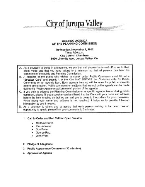
MEETING AGENDA<br />
OF THE PLANNING COMMISSION<br />
Wednesday, November 7,2012<br />
Time: 7:00 p.m.<br />
<strong>City</strong> Council Chambers<br />
8930 Limonite Ave., <strong>Jurupa</strong> <strong>Valley</strong>, CA<br />
A. As a courlesy lo Ihose in attendance, we ask Ihal cell phones be lurned <strong>of</strong>f or sel lo Iheir<br />
silenl mode and Ihal you keep lalking lo a minimum so Ihal all persons can hear Ihe<br />
commenls <strong>of</strong> Ihe public and Planning Commission.<br />
B. A member <strong>of</strong> Ihe public who wishes lo speak under Public Commenls musl fill oul a<br />
"Speaker Card" and submil il lo Ihe Cily Slaff BEFORE Ihe Chairman ca lis for Public<br />
Commenls on an <strong>agenda</strong> ilem. Each <strong>agenda</strong> ilem up will be open for public commenls<br />
before laking action. Public commenls on subjecls Ihal are nol on Ihe <strong>agenda</strong> can be made<br />
during Ihe "Public Appearance/Commenls" porlion <strong>of</strong> Ihe <strong>agenda</strong>.<br />
C. If you wish lo address Ihe Planning Commission on a specific <strong>agenda</strong> ilem or during public<br />
commenl, please fill oul a speaker card and hand il lo Ihe Clerk wilh your na me and address<br />
before Ihe ilem is called so Ihal we can call you lo come lo Ihe podium for your commenls.<br />
While lisling your name and address is nol required, il helps us lo provide follow-up<br />
informalion lo you if needed.<br />
D. As a courtesy to o<strong>the</strong>rs and to assure that each person wishing to be heard has an<br />
opportunity to speak, please limil your comments lo 3 minutes.<br />
1. Call to Order and RolI Call for Open Session<br />
• Mat<strong>the</strong>w Burris<br />
• Kim Johnson<br />
• Don Porter<br />
• George Ruiz<br />
• John Wesl<br />
2. Pledge <strong>of</strong> Allegiance<br />
3. Public Appearance/Comments (30 minutes)<br />
4. Approval <strong>of</strong> Agenda
<br />
<br />
5. Consent Calendar<br />
5.1 FINAL RESOLUTION NO 2012-10-24-01 FOR CHANGE OF ZONE NO. 7619<br />
GENERAL PLAN AMENDMENT NO.901/SPECIFIC PLAN NO. 376/PARCEL MAP<br />
NO.36081<br />
(A PROPOSAL TO CHANGE THE GENERAL PLAN LAND USE DESIGNATION<br />
FROM COMMUNITY DEVELOPMENT: BUSINESS PARK TO RETAIL<br />
COMMERCIAL, TOURIST COMMERCIAL, LIGHT INDUSTRIAL, BUSINESS PARK<br />
AND PUBLIC FACILITIES AS DESCRIBED BELOW IN THIS STAFF REPORT TO<br />
SEEK APPROVAL OF A SPECIFIC PLAN FOR A 108 ACRE COMPREHENSIVE<br />
MASTER PLANNED BUSINESS COMMUNITY AND AN EIGHTEEN LOT<br />
INDUSTRIAL PARCEL MAP LOCATED NORTH OF BELLEGRAVE AVENUE,<br />
SOUTH OF LANDON DRIVE, EAST OF I-15, AND WEST OF WINEVILLE<br />
AVENUE IN THE HEAVY AGRICULTURE – 10 ACRE MINIMUM (A-2-10) ZONE.<br />
APPLICANT: INDUSTRIAL DEVELOPMENT INTERNATIONAL (IDI)<br />
RECOMMENDATION<br />
REVIEW PLANNING COMMISSION RESOLUTION NO. 2012-10-24-01 AND<br />
AFFIRM THAT IT REFLECTS THE ACTION OF THE COMMISSION<br />
6. Approval <strong>of</strong> Minutes<br />
6.1 October 24, 2012 Regular Meeting<br />
7. Planning Commission Business<br />
7.1 PLANNING COMMISSION REVIEW OF DIRECTOR APPROVAL OF PLOT PLAN<br />
NO. 24355 FOR A WIRELESS TELECOMMUNICATION FACILITY PURSUANT<br />
TO ORDINANCE NO. 348 SECTION 18.30(f).<br />
APPLICANT: REALCOM ASSOCIATES<br />
RECOMMENDATION<br />
That <strong>the</strong> Planning Commission review <strong>the</strong> action <strong>of</strong> <strong>the</strong> Planning Director to<br />
approve PP24355 with conditions <strong>of</strong> approval for a 70 foot high disguised wireless<br />
telecommunication facility (monopalm) pursuant to Ordinance No. 348 Section<br />
18.30(f), and determine whe<strong>the</strong>r to permit <strong>the</strong> decision to stand, subject to citizen<br />
appeal, or to assume jurisdiction and order a Planning Commission hearing to be<br />
set.<br />
11/7/12Planning Commission -2- <strong>City</strong> <strong>of</strong> <strong>Jurupa</strong> <strong>Valley</strong>
7.2 WORK SESSION FOR PAR1208 PROPOSED PROPANE REBOTTLlNG &<br />
DISTRIBUTION FACILlTY AT 1893 BROWN AVENUE WITHIN THE AGUA<br />
MANSA INDUSTRIAL CORRIDOR (SPECIFIC PLAN 210)<br />
APPLlCANT: KAMPS PROPANE (REPRESENTATIVE: J. OLlVER)<br />
RECOMMENDATION<br />
Receive a presentation from <strong>the</strong> applicant to introduce <strong>the</strong> proposed project,<br />
discuss <strong>the</strong> project and identify issues that will need to be addressed as <strong>the</strong> project<br />
moves forward.<br />
8. Public Appearance/Comments, (only if needed)<br />
9. Planning Commissioner's Reports and Comments<br />
10. Planning Department Report<br />
11. Adjournment to November 28, 2012 at <strong>the</strong> <strong>City</strong> Council Chambers<br />
In complíanee wilh <strong>the</strong> Amerieans with Disabilities Act and Government Code Seetion 54954.2,<br />
if you need speeial assistance to partieipate in a <strong>meeting</strong> <strong>of</strong> <strong>the</strong> <strong>Jurupa</strong> <strong>Valley</strong> Planning<br />
Commission, please call 951-332-6464. Notification at least 48 hours prior to <strong>the</strong> <strong>meeting</strong> or<br />
time when serviees are needed will assist staft in assuring that reasonable arrangements ean be<br />
made to provide aeeessibilily to <strong>the</strong> <strong>meeting</strong> or serviee.<br />
Agendas <strong>of</strong> publíe <strong>meeting</strong>s and any o<strong>the</strong>r writings distributed to all, or a majorily 0[, <strong>the</strong><br />
<strong>Jurupa</strong> <strong>Valley</strong> Planning Commission in eonneetion with a matter subjeet to diseussion or<br />
eonsideration at an open <strong>meeting</strong> <strong>of</strong> <strong>the</strong> Planning Commission are publíe reeords. If sueh<br />
wriling is distributed less than 72 hours prior to a publíe <strong>meeting</strong>, <strong>the</strong> writing will be made<br />
available for publie inspeetion at <strong>the</strong> <strong>City</strong> <strong>of</strong> <strong>Jurupa</strong> <strong>Valley</strong>, 8304 Limonite Ave., Suite M,<br />
<strong>Jurupa</strong> <strong>Valley</strong>, CA 92509, at <strong>the</strong> time <strong>the</strong> writing is distributed to all, or a majority 0[, <strong>the</strong><br />
<strong>Jurupa</strong> <strong>Valley</strong> Planning Commission. The Planning Commission may also post <strong>the</strong> writing<br />
on its Internet website at www';urupavallev.ora.<br />
11/7/12Planning Commission -3- Cily <strong>of</strong> <strong>Jurupa</strong> <strong>Valley</strong>
STAFF REPORT<br />
DATE:<br />
TO:<br />
FROM:<br />
BY:<br />
NOVEMBER 72012<br />
CHAIR JOHNSON AND MEMBERS OF THE PLANNING COMMISSION<br />
THOMAS G. MERRELL, AICP, PLANNING MANAGER<br />
CHARLES RANGEL, SENIOR PROJECT MANAGER<br />
SUBJECT: AGENDA ITEM 5<br />
FINAL RESOLUTION NO 2012-10-24-01 FOR CHANGE OF ZONE NO.<br />
7619 GENERAL PLAN AMENDMENT NO.901/SPECIFIC PLAN NO.<br />
376/PARCEL MAP NO.36081<br />
(A PROPOSAL TO CHANGE THE GENERAL PLAN LAND USE<br />
DESIGNATION FROM COMMUNITY DEVELOPMENT: BUSINESS<br />
PARK TO RETAIL COMMERCIAL, TOURIST COMMERCIAL, L1GHT<br />
INDUSTRIAL, BUSINESS PARK AND PUBLlC FACILITIES AS<br />
DESCRIBED BELOW IN THIS STAFF REPORT TO SEEK APPROVAL<br />
OF A SPECIFIC PLAN FOR A 108 ACRE COMPREHENSIVE MASTER<br />
PLANNED BUSINESS COMMUNITY AND AN EIGHTEEN LOT<br />
INDUSTRIAL PARCEL MAP LOCATED NORTH OF BELLEGRAVE<br />
AVENUE, SOUTH OF LANDON DRIVE, EAST OF 1-15, AND WEST OF<br />
WINEVILLE AVENUE IN THE HEAVY AGRICULTURE - 10 ACRE<br />
MINIMUM (A-2-10) ZONE.<br />
APPLlCANT: INDUSTRIAL DEVELOPMENT INTERNATIONAL (IDI)<br />
RECOMMENDATION<br />
REVIEW PLANNING COMMISSION RESOLUTION NO. 2012-10-24-01 ANO<br />
AFFIRM THAT IT REFLECTS THE ACTION OF THE COMMISSION<br />
BACKGROUND<br />
On October 24, 2012, <strong>the</strong> Planning Commission by a 4-0 vote (Commissioner West<br />
recused) adopted Resolution No. 2012-10-24-03 recommending <strong>City</strong> Council approval <strong>of</strong><br />
Change <strong>of</strong> Zone No. 7619 General Plan Amendment No.901/Specific Plan No. 376/Parcel<br />
Map NO.36081. The motion included various modifications made to <strong>the</strong> resolution approving<br />
Page 11<br />
www.jurupavalley.org
<strong>the</strong> project and directed staff to present <strong>the</strong> resolution incorporating <strong>the</strong> modifications to <strong>the</strong><br />
Planning Commission for review at <strong>the</strong> <strong>meeting</strong> <strong>of</strong> November 7,2012 in order to affirm that<br />
it accurately reflects what was articulated verbally into <strong>the</strong> record. A summary <strong>of</strong> those<br />
changes is as follows:<br />
• Remove <strong>the</strong> following permitted uses:<br />
o<br />
Petroleum and bulk fuel storage, aboye ground<br />
o Warehousing and distribution<br />
o<br />
• Change to CUP:<br />
o<br />
o<br />
Concrete, gypsum, plaster and mineral products manufacturing<br />
Body and fender shops and spray painting<br />
Equipment sales, rental and storage<br />
o Truck and trailer sales and rental<br />
• Section 111 Development Plans and Standards #2, Project-Wide Development Standards<br />
to include uses Iisted are principallY "indoor uses".<br />
• Recommend to <strong>the</strong> Council that <strong>the</strong> General Plan not be amended, inasmuch as <strong>the</strong><br />
proposed Specific Plan is designated as consistent with <strong>the</strong> existing General Plan land<br />
use designation, and said existing designation provides greater flexibility in administering<br />
<strong>the</strong> Specific Plan.<br />
Prepared by:<br />
Submitled by:<br />
0/: J 01 ¡)<br />
~/ 1
RESOLUTION NO. 2012-10-24-01<br />
A RESOLUTION OF THE PLANNING COMMISSION OF<br />
THE CITY OF JURUPA VALLEY RECOMMENDING<br />
THAT THE CITY COUNCIL ADOPT THE<br />
THOROUGHBRED FARM SPECIFIC PLAN, ADOPT A<br />
CHANGE OF ZONE APPLICATION, ADOPT A GENERAL<br />
PLAN AMENDMENT, AND APPROVE A TENTATIVE<br />
PARCEL MAP TO ALLOW FOR THE DEVELOPMENT OF<br />
108.2 ACRES IMMEDIATELY EAST OF INTERSTATE 15<br />
AND ON THE NORTHWEST CORNER OF BELLGRA VE<br />
A VENUE AND WINEVILLE ROAD<br />
THE PLANNING COMMISSION OF THE CITY OF JURUPA VALLEY DOES<br />
RESOLVE AS FOLLOWS:<br />
Section 1. <strong>City</strong> <strong>of</strong> <strong>Jurupa</strong> <strong>Valley</strong> Land U se Regulatory Authority. The Planning<br />
Commission <strong>of</strong><strong>the</strong> <strong>City</strong> <strong>of</strong> <strong>Jurupa</strong> <strong>Valley</strong> does hereby find, determine and declare that:<br />
(a) The <strong>City</strong> <strong>of</strong><strong>Jurupa</strong> ValIey incorporated on July 1, 2011.<br />
(b) On July 1, 2011, <strong>the</strong> <strong>City</strong> Council adopted Ordinance No. 2011-01. This<br />
Ordinance provides that pursuant to <strong>the</strong> provisions <strong>of</strong>Government Code Section 57376, all<br />
ordinances <strong>of</strong><strong>the</strong> County <strong>of</strong>Riverside which have been applicable within <strong>the</strong> territory now<br />
incorporated as <strong>the</strong> <strong>City</strong> <strong>of</strong> <strong>Jurupa</strong> <strong>Valley</strong>, to <strong>the</strong> extent that <strong>the</strong>y applied before incorporation,<br />
shalI remain in full force and effect as ordinances <strong>of</strong> <strong>the</strong> <strong>City</strong> <strong>of</strong> <strong>Jurupa</strong> <strong>Valley</strong>, including <strong>the</strong><br />
Riverside County General Plan. Additionally, Ordinance No. 2011-01 provides that <strong>the</strong><br />
resolutions, rules and regulations <strong>of</strong><strong>the</strong> County <strong>of</strong>Riverside which have been applicable in <strong>the</strong><br />
implementation <strong>of</strong> <strong>the</strong> aforesaid ordinances and State laws (including, but not limited to, <strong>the</strong><br />
Califomia Environmental Quality Act and regulations pertaining to traffic) to <strong>the</strong> extent that <strong>the</strong>y<br />
applied before incorporation shall remain in fulI force and effect as resolutions, rules and<br />
regulations, respectively, <strong>of</strong><strong>the</strong> <strong>City</strong> <strong>of</strong> <strong>Jurupa</strong> <strong>Valley</strong>. On September 15, 2011, <strong>the</strong> <strong>City</strong> Council<br />
adopted Ordinance No. 2011-10, effective October 15, 2011, continuing in effect alI ordinances<br />
<strong>of</strong> <strong>the</strong> County <strong>of</strong>Riverside which have been applicable within <strong>the</strong> ten"itory now incorporated as<br />
<strong>the</strong> <strong>City</strong> <strong>of</strong> <strong>Jurupa</strong> ValIey, to <strong>the</strong> extent that <strong>the</strong>y applied before incorporation. These ordinances<br />
and resolutions as well as <strong>the</strong> Jmupa <strong>Valley</strong> Municipal Code shalI be known as "<strong>Jurupa</strong> <strong>Valley</strong><br />
Ordinances."<br />
(c) On September 15,2011, <strong>the</strong> <strong>City</strong> Council also adopted Ordinance No.<br />
2011-09, effective October 15, 2011, adopting Chapter 2.35 <strong>of</strong><strong>the</strong> <strong>Jurupa</strong> ValIey Municipal<br />
Code establishing <strong>the</strong> Planning Cornmission for <strong>the</strong> <strong>City</strong> <strong>of</strong><strong>Jurupa</strong> <strong>Valley</strong>. Chapter 2.35<br />
provides that <strong>the</strong> Planning Commission shalI perfOlID <strong>the</strong> <strong>planning</strong> agency functions described in<br />
Government Code Section 65100 et seq., and shalI fulfill <strong>the</strong> functions delegated to <strong>the</strong> Planning<br />
Cornmission for <strong>the</strong> County <strong>of</strong> Riverside under <strong>the</strong> relevant ordinances and resolutions, which<br />
<strong>the</strong> <strong>City</strong> has adopted as required upon incorporation. Chapter 2.35 fuliher provides that <strong>the</strong><br />
Planning Cornmission shall perfonn <strong>the</strong> functions <strong>of</strong> any and alI <strong>planning</strong>, zoning or code<br />
1
enforcement appeals board created by <strong>the</strong> relevant County <strong>of</strong>Riverside ordinances and<br />
resolutions, which <strong>the</strong> <strong>City</strong> has adopted by reference as required by law.<br />
Section 2. The Project. The Thoroughbred Fatm Specific Plan Project (<strong>the</strong><br />
"Project") consists <strong>of</strong> a Specific Plan to govern <strong>the</strong> development <strong>of</strong> 108.2 gross acres in <strong>the</strong> Mira<br />
Loma area within <strong>the</strong> <strong>City</strong> <strong>of</strong> <strong>Jurupa</strong> <strong>Valley</strong> (<strong>the</strong> "<strong>City</strong>") located immediately east <strong>of</strong>lnterstate 15<br />
and on <strong>the</strong> nOlihwest corner <strong>of</strong> <strong>the</strong> intersection <strong>of</strong>Bellegrave A venue and Wineville Road. The<br />
site was previously used as a thoroughbred farrn but is now vacant with <strong>the</strong> exception <strong>of</strong> a single<br />
building on <strong>the</strong> site. The site is surrounded by industrial uses to <strong>the</strong> nOlih, a dairy to <strong>the</strong> east, and<br />
residential uses to <strong>the</strong> south. As part <strong>of</strong> this project, Industrial Development lnternational (<strong>the</strong><br />
"Applicant") is seeking <strong>the</strong> following approvals for <strong>the</strong> Project:<br />
(a) Specific Plan No. 376. A request to approve a Specific Plan for <strong>the</strong><br />
Project site that provides a land use plan to govern <strong>the</strong> development <strong>of</strong> <strong>the</strong> 108.2 acres. The<br />
Specific Plan includes guidelines and development standards for 42.6 acres <strong>of</strong>light industrial<br />
uses, 36.5 acres <strong>of</strong>business park uses, 11.5 acres <strong>of</strong> commerciallretail uses, and 7.6 acres <strong>of</strong><br />
touristlcommercial uses. Also included within <strong>the</strong> Specific Plan is 10.0 acres <strong>of</strong> potential roads<br />
to serve <strong>the</strong> project.<br />
(b) Change <strong>of</strong> Zone Application No. 7619. A request to change <strong>the</strong><br />
zoning from A-2-10 (Heavy Agriculture-l0-acre minimum lot size) to SP (Specific Plan) which<br />
will reflect <strong>the</strong> various standards and land uses detailed in <strong>the</strong> proposed Specific Plan.<br />
(c) General Plan Amendment No. 901. A request to establish <strong>the</strong> boundaries<br />
<strong>of</strong><strong>the</strong> Specific Plan and change <strong>the</strong> land use designations shown on <strong>the</strong> General Plan's <strong>Jurupa</strong><br />
Area Plan Land Use Map from Community Development: Business Park (CD:BP)(0.25-0.60<br />
Floor Area Ratio (FAR)) to Community Development: Commercial Retail (CD:CR)(0.20-0.35<br />
F AR), Community Development: Business Park (CD:BP) )(0.25-0.60 FAR) to Community<br />
Development: Commercial Tourist (CD:CT)(0.20-0.35 FAR) and Community Development:<br />
Light Industrial (CD:LI)(0.25-0.60 FAR).<br />
(d) Tentative Parcel Map No. 36081. A request to subdivide <strong>the</strong> 108.2<br />
acres into 14 parcels.<br />
Section 3. California Environmental Ouality Act Findings. Although <strong>the</strong> Project<br />
had originally been submitted to <strong>the</strong> County <strong>of</strong>Riverside for approval, during <strong>the</strong> time that <strong>the</strong><br />
Project applications were being processed, <strong>the</strong> <strong>City</strong> <strong>of</strong> JUlUpa <strong>Valley</strong> incorporated on July 1,<br />
2011. As such, <strong>the</strong> Applicant is now seeking Project approval from <strong>the</strong> <strong>City</strong> and <strong>the</strong> <strong>City</strong> is now<br />
lead agency <strong>of</strong><strong>the</strong> Project under <strong>the</strong> California Environmental Quality Act ("CEQA") (Cal. Pub.<br />
Res. Code §21000 et seq.) and <strong>the</strong> State Guidelines (<strong>the</strong> "Guidelines") (14 Cal. Code Regs.<br />
§ 15000 et seq.). The Project has been environmentally reviewed pursuant to <strong>the</strong> provisions <strong>of</strong><br />
CEQA and <strong>the</strong> State CEQA Guidelines. The County originally prepared an initial studyand,<br />
based on <strong>the</strong> information contained in <strong>the</strong> initial study, concluded that <strong>the</strong>re was substantial<br />
evidence that <strong>the</strong> Project might have a significant environmental impact. Pursuant to CEQA<br />
Guidelines Sections 15064 and 15081, and based upon <strong>the</strong> infOlmation contained in <strong>the</strong> lnitial<br />
Study, <strong>the</strong> County ordered <strong>the</strong> preparation <strong>of</strong> an EIR for <strong>the</strong> Project to analyze <strong>the</strong> Project's<br />
potential impacts on <strong>the</strong> environment. The Planning Commission, by separate Resolution No.<br />
2
2012-10-04, which is hereby incorporated by reference, recornmended that <strong>the</strong> <strong>City</strong> Council<br />
cel1ify <strong>the</strong> Final Environmental Impact Report, adopt findings pursuant to CEQA, adopt a<br />
Statement <strong>of</strong> OvelTiding Considerations, and adopt a Mitigation Monitoring and Repol1ing<br />
Programo The documents and o<strong>the</strong>r material s that constitute <strong>the</strong> record on which this decision is<br />
based are on file for public examination during normal business hours at <strong>the</strong> <strong>City</strong> <strong>of</strong> <strong>Jurupa</strong><br />
<strong>Valley</strong>, 8304 Limonite Avenue, Suite M <strong>Jurupa</strong> <strong>Valley</strong>, CA 92509.<br />
Section 4.<br />
Project Findings.<br />
(a) Specific Plan No. 376. The Project requires approval <strong>of</strong> a Specific<br />
Plan pursuant to Section 2.8 and 2.9 <strong>of</strong>Riverside County Zoning Ordinance No. 348, as adopted<br />
in <strong>the</strong> <strong>City</strong> <strong>of</strong> <strong>Jurupa</strong> <strong>Valley</strong> by Chapter 1.35 <strong>of</strong><strong>the</strong> <strong>Jurupa</strong> <strong>Valley</strong> Municipal Codeo Pursuant to<br />
Section 2.8 <strong>of</strong>Riverside County Zoning Ordinance No. 348 and Govemment Code Section<br />
65454, <strong>the</strong> Planning Cornmission hereby finds that <strong>the</strong> proposed Specific Plan is consistent with<br />
<strong>the</strong> General Plan land use designations and policies as <strong>the</strong> land uses allowed by <strong>the</strong> Specific Plan<br />
are relatively compatible with one ano<strong>the</strong>r with minimal impacts to <strong>the</strong> applicable policies in <strong>the</strong><br />
General Plan and with minimal impacts to <strong>the</strong> land use designations in <strong>the</strong> surrounding area<br />
which are similar to those allowed by <strong>the</strong> Specific Plan. A full consistency analysis is contained<br />
with <strong>the</strong> Final Environmental Impact Rep0l1 prepared for <strong>the</strong> Project which found that <strong>the</strong><br />
Project would have a less than significant impact in <strong>the</strong> land use and <strong>planning</strong> areas.<br />
(b) Change <strong>of</strong> Zone Application No. 7619. The Project requires a change<br />
<strong>of</strong>zone pursuant to Section 20.2 and 20.3a <strong>of</strong>Riverside County Zoning Ordinance No. 348, as<br />
adopted in <strong>the</strong> <strong>City</strong> <strong>of</strong><strong>Jurupa</strong> <strong>Valley</strong> by Chapter 1.35 <strong>of</strong><strong>the</strong> <strong>Jurupa</strong> <strong>Valley</strong> Municipal Codeo<br />
Pursuant to Section 20.3a <strong>of</strong>Riverside County Zoning Ordinance No. 348 and Govemment Code<br />
Section 65855, <strong>the</strong> Planning Cornmission hereby finds that <strong>the</strong> change <strong>of</strong> zone is consistent with<br />
<strong>the</strong> General Plan as discussed aboye and as more fully discussed in <strong>the</strong> Final Environmental<br />
Impact Rep0l1. The Planning Cornmission finds that <strong>the</strong> proposed change <strong>of</strong> zone is also<br />
consistent with <strong>the</strong> proposed Specific Plan as it will allow for a change <strong>of</strong> zone from A-2-10<br />
(Heavy Agricnlture-l O-acre minimum lot size) to SP (Specific Plan) which wil! reflect <strong>the</strong><br />
various standards and land uses detailed in <strong>the</strong> proposed Specific Plan.<br />
(c) General Plan Amendment No. 901. The Project requires a General Plan<br />
amendment pursuant to Section 2.4 and 2.10 <strong>of</strong>Riverside County Zoning Ordinance No. 348, as<br />
adopted in <strong>the</strong> <strong>City</strong> <strong>of</strong> <strong>Jurupa</strong> <strong>Valley</strong> by Chapter 1.35 <strong>of</strong> <strong>the</strong> <strong>Jurupa</strong> <strong>Valley</strong> Municipal Codeo<br />
Pursuant to Section 2.4.f.2, <strong>the</strong> Planning Cornmission hereby finds <strong>the</strong> following:<br />
1) The proposed amendment do es not involve a change in or conflict<br />
with <strong>the</strong> Riverside County Vision which specifies "Riverside County is a family <strong>of</strong> special<br />
communities in a remarkable environmental setting." In general, <strong>the</strong> proposed changes in land<br />
use to be implemented with this General Plan Amendment will change <strong>the</strong> land uses on <strong>the</strong><br />
Project site to be consistent with uses in <strong>the</strong> surrounding area <strong>of</strong><strong>the</strong> Project site <strong>the</strong>reby ensuring<br />
that uses are consistent in <strong>the</strong> community.<br />
2) The proposed amendment does not involve a change in or conflict<br />
with any General Planning PrincipIe set f0l1h in General Plan Appendix B. In fact, <strong>the</strong> Project is<br />
3
consistent with many <strong>of</strong><strong>the</strong> General Planning PrincipIes set forth in Appendix B, particularly <strong>the</strong><br />
economic principIes encouraging job creation and employment type uses.<br />
3) The proposed amendment does not involve a change in or conflict<br />
with any Foundation Component designation in <strong>the</strong> General Plan. The change in land use is<br />
within <strong>the</strong> same Foundation Component <strong>of</strong> Cornmunity Development and no change or conflict<br />
would result.<br />
4) The proposed amendment would ei<strong>the</strong>r contribute to <strong>the</strong> purposes<br />
<strong>of</strong><strong>the</strong> General Plan or, at a minimum, would not be detrimental to <strong>the</strong>m as more fully detailed in<br />
<strong>the</strong> Final Enviromnental Impact Report completed for <strong>the</strong> Project which found that <strong>the</strong> Project<br />
would have a less than significant impact with regard to inconsistency with <strong>the</strong> General Plan.<br />
5) The amendment is required to expand basic employmentjob<br />
opportunities and would improve <strong>the</strong> ratio <strong>of</strong> jobs-to-workers in <strong>the</strong> <strong>City</strong>. More specifically, <strong>the</strong><br />
Project is anticipated to pro vide light industrial uses, business park uses, and cornmercial, retail<br />
and tourist type uses. As <strong>the</strong> Project site is largely vacant, <strong>the</strong>se new uses wil! expand<br />
employment oppOliunities and aid in improving <strong>the</strong> ratio <strong>of</strong> jobs-to-workers in <strong>the</strong> <strong>City</strong>.<br />
(d) Tentative Parcel Map No. 36081. The Project requires a Tentative<br />
Parcel Map to subdivide <strong>the</strong> 108.2 acres into 14 parcels pursuant to Riverside County Ordinance<br />
No. 460, as adopted in <strong>the</strong> <strong>City</strong> <strong>of</strong> JUlUpa <strong>Valley</strong> by Chapter 1.35 <strong>of</strong><strong>the</strong> JUlUpa <strong>Valley</strong> Municipal<br />
Codeo The Planning Commission hereby finds:<br />
1) The proposed land division, design and improvement is consistent<br />
with <strong>the</strong> Riverside County General Plan, and each element <strong>the</strong>re<strong>of</strong> as addressed aboye and more<br />
fully analyzed in <strong>the</strong> Final Enviromnental Impact Repoli completed for <strong>the</strong> Project.<br />
2) The site <strong>of</strong><strong>the</strong> proposed land division is physical1y suitable for <strong>the</strong><br />
type <strong>of</strong> development proposed for <strong>the</strong> Project as <strong>the</strong> site is large enough to accornmodate <strong>the</strong><br />
proposed uses and infi'astlUcture required for <strong>the</strong> Project.<br />
3) The design <strong>of</strong><strong>the</strong> proposed land division and <strong>the</strong> proposed<br />
improvements, with appropriate conditions <strong>of</strong> approval and mitigation measures under <strong>the</strong><br />
California Environmental Quality Act that wil! be imposed as conditions <strong>of</strong> approval, are not<br />
likely to cause substantial enviromnental damage or substantially and avoidably in jure fish or<br />
wildlife or <strong>the</strong>ir habitat.<br />
4) The design <strong>of</strong><strong>the</strong> subdivision and <strong>the</strong> type <strong>of</strong> improvements are<br />
not likely to cause serious public health problems, except as detailed in <strong>the</strong> Final Enviromnental<br />
Impact Report completed for <strong>the</strong> Project.<br />
5) The design <strong>of</strong> <strong>the</strong> subdivision and <strong>the</strong> type <strong>of</strong> improvements wil!<br />
not conflict with easements acquired by <strong>the</strong> public at large for access through or use <strong>of</strong> property<br />
within <strong>the</strong> proposed subdivision, or <strong>the</strong> design <strong>of</strong><strong>the</strong> alternate easements which are substantially<br />
equivalent to those previously acquired by <strong>the</strong> public will be provided.<br />
4
6) The proposed subdivision and <strong>the</strong> design and improvements <strong>of</strong> <strong>the</strong><br />
subdivision are consistent with <strong>the</strong> JUlUpa <strong>Valley</strong> Municipal Code, specifically Artiele V <strong>of</strong><br />
Riverside County Ordinance No. 460, as amended, regarding Subdivisions, and Riverside<br />
County Zoning Ordinance No. 348, as amended, and both incorporated into <strong>the</strong> JUlUpa <strong>Valley</strong><br />
Municipal Code by Chapter 1.35 <strong>of</strong><strong>the</strong> JUlUpa Va11ey Municipal Code, and a11 applicable state<br />
laws.<br />
7) The tentative parce1 map does not propose to divide land which is<br />
subject to a contract entered into pursuant to <strong>the</strong> California Land Conservation Act <strong>of</strong> 1965, nor<br />
is <strong>the</strong> land subject to a Land Conservation Act contract.<br />
8) The design <strong>of</strong><strong>the</strong> subdivision provides for future passive 01' natural<br />
heating or cooling oppOltunities in <strong>the</strong> subdivision to <strong>the</strong> extent feasible. In particular, prior to<br />
<strong>the</strong> constlUction <strong>of</strong>buildings, <strong>the</strong> applicant will be required to submit building plans to <strong>the</strong><br />
Building Department that comply with <strong>the</strong> UnifOlID Building Code, which contains requirements<br />
for energy conservation.<br />
9) The Project is consistent with and in compliance with <strong>the</strong><br />
requirements <strong>of</strong><strong>the</strong> Western Riverside County Multi-Species Habitat Conservation Plan.<br />
Section 5. Recommendation. Based on <strong>the</strong> foregoing, <strong>the</strong> Planning Commission<br />
hereby recommends that <strong>the</strong> <strong>City</strong> Council adopt or approve <strong>the</strong> fo11owing entitlements for <strong>the</strong><br />
Thoroughbred FalID Specific Plan Project, subject to <strong>the</strong> attached conditions <strong>of</strong> approval:<br />
(a)<br />
Specific Plan No. 376 with <strong>the</strong> following modifications:<br />
1) Duplicate <strong>the</strong> "Green Design Development Standards" 1 through<br />
12 in Section VI (b) <strong>of</strong> Section VI "Green Design" and inelude <strong>the</strong>m in Section III (B)(2)<br />
"Project-Wide Development Standards" as standards18-29, and in Table III-6, "Development<br />
Standards."<br />
2) Remove Ji'om Table III-2, "Permitted Uses for Light Industrial<br />
Land Uses" <strong>the</strong> following uses: (i) Concrete, gypsum, plaster and mineral products<br />
manufacturing; (ii) Petroleum and bulk fuel storage, aboye ground, pursuant to Ordinance No.<br />
546; and (iii) Warehousing and distribution.<br />
3) Remove from Table III-3, "PelIDitted Uses for Business Park Land<br />
Uses" <strong>the</strong> fo11owing uses: (i) Concrete, gypsum, plaster and mineral products manufacturing; and<br />
(ii) Warehousing and distribution.<br />
4) Change "Body and fender shops and spray painting" from Site<br />
Deve10pment Permit (SDP) approval required to Conditional Use Permit (CUP) approval<br />
required in Table III-2, "Permitted Uses for Light Industrial Land Uses," in Table III-3<br />
"Permitted Uses for Business Park Land Uses" and in Table III-4 "Permitted Uses for<br />
CommerciallRetail Land Uses."<br />
5) Change "Equipment rental services, including rototillers, power<br />
mowers, sanders, power saws, cement and plaster mixers not exceeding 20 cubic feet in capacity<br />
5
and o<strong>the</strong>r similar equipment" from Site Deve!opment Permit (SDP) approval required to<br />
Conditional Use Pelmit (CUP) approval required in Table III-4 "Permitted Uses for<br />
CommerciallRetail Land Uses" and in Table III-5, "Pelmitted Uses for CommercialJTourist Land<br />
Uses."<br />
6) Change "Tmcks and trailers; <strong>the</strong> rental <strong>of</strong>tmcks not over 19,500<br />
pounds gross vehicle weight, with body not to exceed 22 feet in length from <strong>the</strong> back <strong>of</strong> <strong>the</strong> cab<br />
to <strong>the</strong> end <strong>of</strong>body; and <strong>the</strong> rental <strong>of</strong>trailers not exceeding six feet in width or 22 feet in length"<br />
from Site Development Pe!mit (SDP) approval required to Conditional Use Permit (CUP)<br />
approval required in Table III-3 "Pelmitted Uses for Business Park Land Uses," in Table III-4<br />
"Permitted Uses for CommerciallRetail Land Uses" and in Table III-5, "Pelmitted Uses for<br />
CommercialJTourist Land Uses."<br />
7) Modify Project-Wide Development Standard No. Il0eated in<br />
Section III (B)(2) "Project-Wide Deve10pment Standards" as follows: "The Thoroughbred Farm<br />
Specific Plan shall be developed in general eonformanee with <strong>the</strong> Land Use Plan (Figure III-l,<br />
Land Use Plan). General permitted uses include Light Industrial, Business Park,<br />
CommerciallRetail, CommerciallTourist and o<strong>the</strong>r uses for <strong>the</strong> individual Planning Areas as<br />
delineated in Table 1I-6, Deve!opment Standards. The permitted land uses detailed in Tables III-<br />
2 through III-5 shall be prineipally indoor uses in an enclosed building."<br />
(b) Change <strong>of</strong>Zone Applieation No. 7619.<br />
(c) General Plan Amendment No. 901, with <strong>the</strong> understanding that <strong>the</strong><br />
General Plan Amendment not be adopted if it is determined to be unneeessary for<br />
implementation <strong>of</strong> <strong>the</strong> Projeet.<br />
(d) Tentative Paree! Map No. 36081.<br />
Seetion 6.<br />
Resolution.<br />
Certification. The Planning Manager shall eertify to <strong>the</strong> adoption <strong>of</strong>this<br />
PASSED, APPROVED AND ADOPTED by <strong>the</strong> Planning Commission <strong>of</strong><strong>the</strong> <strong>City</strong> <strong>of</strong><br />
Jumpa <strong>Valley</strong> on this 24th day <strong>of</strong>Oetober, 2012.<br />
Kim Johnson<br />
Chair <strong>of</strong> Jumpa <strong>Valley</strong> Planning Commission<br />
ATTEST:<br />
6
Thomas Merrell<br />
Planning Manager and Secretary to <strong>the</strong> Planning Commission<br />
7
STATE OF CALIFORNIA )<br />
COUNTY OF RIVERSIDE<br />
) ss.<br />
CITY OF JURUP A VALLEY )<br />
1, Thomas Men·ell, Planning Manager <strong>of</strong> <strong>the</strong> <strong>City</strong> <strong>of</strong> <strong>Jurupa</strong> <strong>Valley</strong>, do hereby certify that <strong>the</strong><br />
foregoing Resolution No. 2012-10-24-01 was duly adopted and passed at a <strong>meeting</strong> <strong>of</strong><strong>the</strong><br />
Planning Commission <strong>of</strong><strong>the</strong> <strong>City</strong> <strong>of</strong>JUlupa <strong>Valley</strong> on <strong>the</strong> 24th day <strong>of</strong>October, 2012 by <strong>the</strong><br />
following vote, to wi!:<br />
A YES:<br />
COMMISSION MEMBERS:<br />
NOES:<br />
COMMISSION MEMBERS:<br />
ABSENT:<br />
COMMISSION MEMBERS:<br />
ABSTAIN:<br />
COMMISSIONMEMBERS:<br />
TROMAS MERRELL<br />
PLANNING MANAGER<br />
8
<strong>City</strong><strong>of</strong>J<br />
DATE: NOVEMBER 7, 2012<br />
TO:<br />
FROM:<br />
BY:<br />
CHAIR JOHNSON ANO MEMBERS OF THE PLANNING COMMISSION<br />
THOMAS G. MERRELL, AICP, PLANNING MANAGER<br />
ANNETTE TAM, ASSISTANT PLANNER<br />
SUBJECT: AGENDA ITEM NO 7.1<br />
PLANNING COMMISSION REVIEW OF DIRECTOR APPROVAL OF PLOT<br />
PLAN NO. 24355 FOR A WIRELESS TELECOMMUNICATION FACILlTY<br />
PURSUANT TO ORDINANCE NO. 348 SECTION 18.30(f).<br />
RECOMMENDATION<br />
That <strong>the</strong> Planning Commission review <strong>the</strong> action <strong>of</strong> <strong>the</strong> Planning Director to approve<br />
PP24355 with conditions <strong>of</strong> approval for a 70 foot high disguised wireless<br />
telecommunication facility (monopalm) pursuant to Ordinance No. 348 Section 18.30(f),<br />
and determine whe<strong>the</strong>r to permit <strong>the</strong> decision to stand, subject to citizen appeal, or to<br />
assume jurisdiction and order a Planning Commission hearing to be sel.<br />
BACKGROUND<br />
Code section 18.30(f) states:<br />
t. APPEALS - (WIRELESS COMMUNICATlON FACILITIES PLOT PLANS). An applicant<br />
or any o<strong>the</strong>r interested party may appeal trom <strong>the</strong> decision ot <strong>the</strong> Planning Director by<br />
<strong>the</strong> foIJowing procedure:<br />
(1) Inítíal Appeal. The Planning Director shaIJ file hislher notíce <strong>of</strong> decision with <strong>the</strong><br />
secretary ot <strong>the</strong> Planning Commission or <strong>the</strong> East Area Planning Councíl, whichever is<br />
appropríate given <strong>the</strong> location, toge<strong>the</strong>r with a report <strong>of</strong> <strong>the</strong> proceedings, not more than<br />
fifteen (15) days after making <strong>the</strong> decision. A copy <strong>of</strong> <strong>the</strong> notíce ot decision shall be<br />
maíled to <strong>the</strong> applicant and to any person who has made a wrítten request tor a copy <strong>of</strong><br />
<strong>the</strong> decision. The secretary ot <strong>the</strong> Planning Commission or <strong>the</strong> East Area Planning<br />
Council shaIJ place <strong>the</strong> notíce <strong>of</strong> decision on <strong>the</strong> next <strong>agenda</strong> <strong>of</strong> <strong>the</strong> Planning<br />
Commission or <strong>the</strong> East Area Planning Councíl, held five (5) or more days after <strong>the</strong><br />
secretary receives <strong>the</strong> notíce trom <strong>the</strong> Planning Director. The decision ot <strong>the</strong> Planning<br />
Director is considered final and no actíon by <strong>the</strong> Planning Commission or <strong>the</strong> East Area<br />
Planning Councíl is required unless, wíthin ten (10) days after <strong>the</strong> notíce appears on <strong>the</strong><br />
Planning Commission or <strong>the</strong> East Area Planning Councíl <strong>agenda</strong>, <strong>the</strong> applicant or an<br />
interested person files an appeal, accompanied by <strong>the</strong> fee set forth in County Ordinance<br />
No. 671, or unless <strong>the</strong> Planning Commission or <strong>the</strong> East Area Planning Councíl<br />
assumes jurísdictíon by orderíng <strong>the</strong> maller set tor public hearing. If a tímely appeal is<br />
,,,ww.jurupavalley.org<br />
page 11
filed, or Ihe Planníng Commíssíon or Ihe Easl Area Planníng Couneil assumes<br />
jurísdíetíon by orderíng Ihe maller sel for publíe hearíng, Ihe seerelary <strong>of</strong> Ihe Planníng<br />
Commíssíon or Ihe Easl Area P/anníng Couneil shall sel Ihe maller for publíe hearíng<br />
before Ihe Planníng Commíssíon or Ihe Easl Area P/anníng Couneil nol less Ihan fíve (5)<br />
nor more Ihan Ihírly (30) days Ihereafter and shall gíve wrítten notíce <strong>of</strong> Ihe hearíng ín<br />
Ihe same manner as notíee was gíven for Ihe orígínal hearíng.<br />
PROJECT & LOCATION SUMMARY<br />
Applicant<br />
Proposal<br />
Location<br />
General Plan Land Use Designation<br />
Zoning<br />
Existing Land Use<br />
Total Lot Size<br />
California Environmental Quality Act<br />
RealCom Assoeiates<br />
New 70' high disguised telecommunications wireless<br />
facility (monopalm) with 18 antennas, 2live 40 foot<br />
high palm trees, perimeter landscaping, 184 squarefoot<br />
equipment shelter, and accessory equipment<br />
within a 900 square-foot lease area. A six (6) foot high<br />
split-face masonry block wall will enclose this 900<br />
square-foot lease area.<br />
Northwest corner <strong>of</strong> Rubidoux Blvd. & 20'" Street<br />
(5880 20 th Street)<br />
Community Oevelopment; Light Industrial (CO: LI)<br />
Manufacturing-Service Commercial (M-SC)<br />
Truck Rental Facility (Ryder)<br />
3.87 acres<br />
Categorically Exempt - Class 3 (New Construction or<br />
Conversion <strong>of</strong> Small Structures)<br />
PROJECT DESCRIPTION & ANAL YSIS<br />
Plot Plan application, PP24355, proposes a new 70 foot high wireless communications facilily<br />
disguised as a palm tree, two new live 40 foot palm trees, an accessory structure, and<br />
accessory equipment on <strong>the</strong> nor<strong>the</strong>ast corner <strong>of</strong> a 3.87 acre induslrial parcel zoned M-SC<br />
(Manufacturing-Service Commercial). The 900 square-foot lease area will be enclosed by a new<br />
6 foot high decorative block wall and Ihree foot high shrubs. The applicalion was initialed with<br />
Ihe County and transferred lo <strong>the</strong> <strong>City</strong> for final review and approval after <strong>the</strong> design and County<br />
slaff review were completed.<br />
LOCATION<br />
The project site is bordered by three streets: Avalon Street, 20 th Street, and Rubidoux<br />
Boulevard. It is located at <strong>the</strong> northwest corner <strong>of</strong> 20 th Street and Rubidoux Boulevard on a<br />
property occupied by Ryder Truck Rental & Leasing. Skanska USA is located east <strong>of</strong> Rubidoux<br />
Boulevard and north <strong>of</strong> Market Stree!. Universal Forest Products is west <strong>of</strong> Avalon Slreel and<br />
South <strong>of</strong> 20 th Stree!.<br />
ww,v.jmupavalley.org<br />
Page I 2
Figure 1 - Aerial View<br />
ELEVATION<br />
The disguised wireless communicalions facilily is disguised as a palm Iree. There are several<br />
condilions <strong>of</strong> approval Ihal applies lo Ihe aeslhetics <strong>of</strong> Ihe lease area and Ihe facilily. The color<br />
<strong>of</strong> Ihe monopalm's Irunk shall be brown and Ihe color <strong>of</strong> Ihe anlenna shall be dark green lo<br />
malch Ihe fronds. The two live Irees shall be a minimum <strong>of</strong> 40 feel high and be planled nearby<br />
Ihe monopalm wilhin Ihe lease area. The live palm Irees shall be guaranleed for a period <strong>of</strong> Iwo<br />
years after planling. A brown equipmenl cabinel will be mostly hidden from slreel view. The<br />
lease area will be enclosed wilh a 6 fool high decoralive block wall. Three fool high shrubs are<br />
lo be planled around Ihe exlerior perimeler <strong>of</strong> Ihe enclosed lease area.<br />
Page I 3<br />
www.junlpavalley.org '.
Figure 2 - Photo simulation (North West vlew from Rubidoux Blvd.)<br />
DEVELOPMENTSTANDARDS<br />
The project will be located on <strong>the</strong> nor<strong>the</strong>ast comer <strong>of</strong> a 3.87 improved property and will not<br />
disturb any natural landscaping. The maximum height <strong>of</strong> a disguised wireless<br />
telecommunication facility in a non-residential zone is seventy (70) feet. The project does not<br />
exceed <strong>the</strong> maximum height. AII wireless communication facilities shall be sited so as to<br />
minimize adverse impacts to <strong>the</strong> surrounding community and biological resources. This project<br />
is sited in a location where it does not have any immediate impacts to those resources. This<br />
area is located in an industrial area near <strong>the</strong> Agua Mansa Industrial Corridor. AII wireless<br />
communication facilities are required to have landscaping around <strong>the</strong> perimeter <strong>of</strong> <strong>the</strong> leased<br />
area and it should match <strong>the</strong> natural landscaping in <strong>the</strong> area. This project is proposed to have 3<br />
foot high shrubs planted around <strong>the</strong> perimeter <strong>of</strong> <strong>the</strong> lease area and two 40 foot live palm trees<br />
near <strong>the</strong> monopalm. AII new landscaping will be irrigated. The minimum setback to any<br />
habitable dwelling is 125% (87.5 feet) <strong>of</strong> <strong>the</strong> facility height. The monopalm is at least 200% (140<br />
feet) away from any habitable dwelling. The surrounding zoning is M-SC (Manufacturing -<br />
Service Commercial) and <strong>the</strong> surrounding land use is industrial. This proposal is in conformance<br />
with <strong>the</strong> General Plan and Ordinance 348. The project is consistent with <strong>the</strong> development<br />
.' Ww\v. jurupavalley.org<br />
Page 14
standards set forth in Article XIXg <strong>of</strong> Ordinance 348.<br />
ACTION<br />
On September 27, 2012, PP24355 was approved by <strong>the</strong> Planning Director with conditions <strong>of</strong><br />
approval after a 10 day public notice for comments. Per Ordinance No. 348 Section 18.30(f),<br />
<strong>the</strong> Planning Commission can take no action, which triggers a 10 day appeal period, or can<br />
decide to assume jurisdiction and order a Commission hearing at a later date.<br />
ADDITIONAL INFORMATION<br />
The Planning Director's Action Form is atlached to this reporto<br />
were in agreement regarding <strong>the</strong> action taken.<br />
Staft, applicant and Director<br />
Prepared by:<br />
Submitled by:<br />
Annetle Tam<br />
Assistant Planner<br />
~C;rí~U ~C.'-o7Z(t*(l.~<br />
Thomas G. Merrell, ACIP<br />
Planning Manager<br />
Reviewed by:<br />
Christopher Diaz<br />
Assistant <strong>City</strong> Atlorney<br />
Atlachments:<br />
1. September 27,2012 Planning Manager's Action Form<br />
Page 15<br />
W\Vw.jwupavalley.org
REQUEST FOR PLANNING DlRECTOR'S ACTlON .<br />
DIRECTOR'S DECISION DATE SEPTEMBER 27, 2012<br />
PLOT PLAN (SITE DEVElOPMENT<br />
PERMIT) CASE<br />
PP24355<br />
APPlICANT REALCOM<br />
PROPERTY OWNER(S) RYDER TRUCK RENTAL, INC.<br />
PROJECT ADDRESS 588020" STREET (APN: 175-160-019)<br />
CALIFORNIA ENVIRONMENTAL CATEGORICALLY EXEMPT - CLASS 3 (NEW CONSTRUCTION OR<br />
QUAlITY ACT (CEQA) CONVERSION OF SMALL STRUCTURES)<br />
RECOMMENDATION APPROVE SUBJECT ro ATTACHED CONDITIONS OF APPROVAL<br />
PROJECT DESCRIPTION<br />
Plot Plan application, PP24355, pro poses to request approval for a new 70 foot high wireless<br />
communications facility disguised as a palm tree, two new live palm trees, an accessory structure, and<br />
accessory equipment on <strong>the</strong> nor<strong>the</strong>ast comer <strong>of</strong> a 3.87 acre industrial parcel zoned M-SC<br />
(Manufacturing-Service Commercial). The 900 square-foot lease area will be enclosed by a new 6 foot<br />
high decorative block wall and three foot high shrubs.<br />
ANALYSIS<br />
The project demonstrates consistency to <strong>the</strong> General Plan and complfance with Ordinance 348. The<br />
proposed site is zoned M-SC (Manufacturing - Service Commercial) and has a General Plan Land Use<br />
Designation <strong>of</strong> CD: 1I (Community Development: light Industrial). Wireless communications facilities are<br />
permitted in this zone subject to an approved Plot Plan (Sfte Development Permit). The proposal<br />
complies with <strong>the</strong> development standards set forth in Article XIXg (Wireless Communications Facilities)<br />
<strong>of</strong> Ordinance No. 348.<br />
ACTION<br />
On September 27, 2012, <strong>the</strong> Planning Director took <strong>the</strong> follqwing action on <strong>the</strong> aboye referenced case:<br />
V APPROVED <strong>the</strong> Plot Plan (Site Development Permit), subject to <strong>the</strong> attached conditions.<br />
DENIED <strong>the</strong> Plot Plan (Site Development Permit) based on <strong>the</strong> attached findings.<br />
Sincerely,<br />
1<br />
Thomas G. Merrell, ACIP, Planning Director<br />
8304 Limonite Avenue, Suite M, <strong>Jurupa</strong> <strong>Valley</strong>, CA 91759 I PP24355
CONDlTIONS OF APPROVAL<br />
1. FEES. The approval <strong>of</strong>PP24355 shall not become effective until all <strong>planning</strong> fees have been<br />
paid in full.<br />
2. APPROVAL PERIOD. This Plot Plan (Site Development Permit) approval shall be used<br />
within two (2) years from <strong>the</strong> approval date. O<strong>the</strong>rwise, <strong>the</strong> plot plan shall become null and<br />
void. The term "use" means <strong>the</strong> beginning <strong>of</strong> substantial construction <strong>of</strong> <strong>the</strong> use that is<br />
authorized, which construction must <strong>the</strong>reafter be pursued diligently to completion, or <strong>the</strong><br />
actual occupancy <strong>of</strong> existing buildings or land under <strong>the</strong> terms <strong>of</strong> <strong>the</strong> authorized use.<br />
3. CONFORMANCE. The proposal shall conform substantially to <strong>the</strong> following exhibits:<br />
a. Exhibit "A" dated ¡une 28, 2012 -(Sheets 1 to 7)<br />
4. COLORS & MATERIAI,s. The equipment cabinet color shall be grey or in earthtones, which<br />
will blend with <strong>the</strong> surrounding setting. The color <strong>of</strong><strong>the</strong> monopalm (trunk) shall be light to<br />
dark brown, and <strong>the</strong> color <strong>of</strong> <strong>the</strong> antenna array shall be dark green, in order to minimize<br />
visual impacts. Changes in <strong>the</strong> aboye listed colors shall be reviewed and approved by <strong>the</strong><br />
Planning Department prior to installation <strong>of</strong> <strong>the</strong> structures, or prior to repainting <strong>of</strong> <strong>the</strong><br />
structures.<br />
5. LANDSCAPING. All required landscape planting and irrigation shall have been installed in<br />
accordance with approved Landscaping, Irrigation, and Shading Plans, Ordinance No. 859<br />
(as adopted and anyamendments <strong>the</strong>reto), and <strong>the</strong> <strong>City</strong> <strong>of</strong>lurupa <strong>Valley</strong> Guide to California<br />
Landscaping. The plants shall be healthy and free <strong>of</strong>weeds, disease or pests. The irrigation<br />
system shall be properly constructed and determined to be in good working order.<br />
6. LANDSCAPING. Landscaping plans shall incorporate a minimum <strong>of</strong> two (2) - 40 ft. brown<br />
trunk Phoenix dactylifera 'Deglet Noor' date palms. Provide a planting plan that locates<br />
palm trees in relationship to <strong>the</strong> proposed monopalm. Provide a palm planting detail and<br />
palm planting specifications. The plan, detail, and specifications shall be reviewed by <strong>the</strong><br />
<strong>City</strong> Landscape Architect prior to final project approval by <strong>the</strong> Planllillg Director. New palm<br />
trees shall be guaranteed for a period <strong>of</strong> two years after plalltillg alld acceptallce by <strong>the</strong> <strong>City</strong><br />
<strong>of</strong> ¡urupa <strong>Valley</strong>.<br />
7. ELECTRONIC INTERFERENCE. The applicant shall adhere to <strong>the</strong> Associatioll <strong>of</strong> Public<br />
Safety CommUllications Officials (APCO) Standards and Best Practices in <strong>the</strong> installation and<br />
operation <strong>of</strong> <strong>the</strong> wireless facility. If <strong>the</strong> operation <strong>of</strong> <strong>the</strong> facilities authorized by this<br />
approved plot plan (Site Development Permit) generates electronic interference with 01'
o<strong>the</strong>rwise impairs <strong>the</strong> operation <strong>of</strong> any public agency communication facilities, <strong>the</strong><br />
applicant shall be notified and shall institute measures to eliminate <strong>the</strong> interfere to <strong>the</strong><br />
satisfaction <strong>of</strong> <strong>the</strong> affected public agencies.<br />
8. MAINTENANCE. The project site shall be kept in good repair. Graffiti shall be removed from<br />
any structures within one week <strong>of</strong> observation and/or notification. rhe project site and a<br />
minimum area <strong>of</strong> 10 feet around <strong>the</strong> project site shall be kept free <strong>of</strong> weeds and o<strong>the</strong>r<br />
obtrusive vegetation for fire prevention purposes.<br />
9. MAINTENANCE. AlI plant materials within landscaped areas shall be maintained in a viable<br />
growth condition throughout <strong>the</strong> Iife <strong>of</strong> this permito<br />
10 .MAINTENANCE. If at any time <strong>the</strong> fronds are missing or deteriorated (as determined by <strong>the</strong><br />
Planning Department), <strong>the</strong> <strong>City</strong> shall notify <strong>the</strong> applicant in writing. rhe applicant shall<br />
replace or repair such fronds within 30 days <strong>of</strong> notification.<br />
11.PERFORMANCE SECURITIES. Prior to issuanee <strong>of</strong> any building permit, performance<br />
securities, in amounts to be determined by <strong>the</strong> Director <strong>of</strong> Building and Safety to guarantee<br />
<strong>the</strong> installation <strong>of</strong>plantings, irrigation system, walls and/or fences, in accordance with <strong>the</strong><br />
approved plan, shall be filed with <strong>the</strong> Department <strong>of</strong> Building and Safety. Securities may<br />
require review by <strong>City</strong> Attorney and o<strong>the</strong>r staff. Permit holder is encouraged to allow<br />
adequate time to ensure that securities are in place. rhe performance security may be<br />
released one year after structural final, inspection report, and <strong>the</strong> One-Year Post<br />
Establishment report confirms that <strong>the</strong> plantings and irrigation components have been<br />
adequately installed and maintained. A cash or bond security shall be required when <strong>the</strong><br />
estimated cost is $2,500.00 or less.<br />
12. FRONDS DESIGN. Prior to issuanee <strong>of</strong> any building permit, <strong>the</strong> developer/permit holder<br />
shall provide a palm frond design, consistent with <strong>the</strong> approved plot plan that covers all <strong>the</strong><br />
antennas. After reviewing <strong>the</strong> building plans, <strong>the</strong> Planning Department shall clear this<br />
condition upon determination <strong>of</strong> compliance.<br />
13. FRONDS DESIGN. Prior to final inspeetion <strong>of</strong> any, buildiug permit, <strong>the</strong> developer Ipermit<br />
holder shall ensure that <strong>the</strong> palm fronds are designed and placed in such a mauner that<br />
covers all <strong>of</strong> <strong>the</strong> antennas. rhe Planning Department shall clear this condition upon<br />
determination <strong>of</strong> compliance.<br />
14.DEPOSIT - LANDSCAPE lNSPECTION. Prior to final inspection <strong>of</strong> any building permit,<br />
<strong>the</strong> developer/permit holder shall file an Inspectiou Request Form and deposit sufficient<br />
funds to cover <strong>the</strong> costs <strong>of</strong><strong>the</strong> Pre-Installation, <strong>the</strong> lnstallation, and Dne Year Post-
Establishment landscape inspections. The deposit required for landscape inspections shall<br />
be determined by <strong>the</strong> Planning Department prior to approval <strong>of</strong><strong>the</strong> requisite Plot Plan (Site<br />
Development Permit) for Planting and Irrigation. The Planning Department shall clear this<br />
condition upon determination <strong>of</strong> compliance.<br />
15.INFORMA TION - LANDSCAPE INSPECTION. The developerjpermit holder's landscape<br />
architect is responsible for preparing <strong>the</strong> Landscaping and Irrigation Plans (or on-site<br />
representative) and shall arrange for a PRE-INSTALLATION INSPECTION with <strong>the</strong> Planning<br />
Department at least five (5) working days prior to <strong>the</strong> installation <strong>of</strong> any landscape or<br />
irrigation components. Upon successful completion <strong>of</strong><strong>the</strong> PRE-lNSTALLATION<br />
INSPECTION, <strong>the</strong> applicant will proceed with <strong>the</strong> installation <strong>of</strong><strong>the</strong> approved landscape and<br />
irrigation system and arrange for an INSTALLATION INSPECTION at least five 5 working<br />
days prior to <strong>the</strong> building final inspection or issuance <strong>of</strong> occupancy permit, whichever<br />
occurs first. Upon successful completion <strong>of</strong><strong>the</strong> INSTALLATION INSPECTION, <strong>the</strong> Planning<br />
Department's Landscape Inspector and <strong>the</strong> permit holder's landscape architect (or on-site<br />
representative) shall execute a Landscape Certificate <strong>of</strong> Completion that shall be submitted<br />
to <strong>the</strong> Planning Department and <strong>the</strong> Department <strong>of</strong> Building and Safety. The Planning<br />
Department shall clear this condition upon determination <strong>of</strong> compliance.<br />
16. SIGNAGE. Prior to final inspection <strong>of</strong> any building permit, <strong>the</strong> permit holder, developer<br />
or successor-in-interest shall install a sign no smaller than 12 inches by 12 inches upon an<br />
exterior wall or fence that surrounds <strong>the</strong> lease area that provides <strong>the</strong> following contact<br />
information:<br />
a. address <strong>of</strong> wireless communications facility and any internal site identification<br />
number or code;<br />
b. name(s) <strong>of</strong> company who operates <strong>the</strong> wireless communications facility;<br />
c. full company address, including mailing address and division name that will address<br />
problems;<br />
d. telephone number <strong>of</strong>wireless communications facility company
DATE: NOVEMBER 7, 2012<br />
TO:<br />
FROM:<br />
BY:<br />
CHAIR JOHNSON AND MEMBERS OF THE PLANNING COMMISSION<br />
THOMAS G. MERRELL, AICP, PLANNING MANAGER<br />
ANNETTE TAM, ASSISTANT PLANNER<br />
SUBJECT: AGENDA ITEM NO. 7.2<br />
WORK SESSION FOR PAR1208 PROPOSED PROPANE REBOTTLlNG &<br />
DISTRIBUTION FACILlTY AT 1893 BROWN AVENUE WITHIN THE AGUA<br />
MANSA INDUSTRIAL CORRIDOR (SPECIFIC PLAN 210)<br />
APPLlCANT: KAMPS PROPANE (REPRESENTATIVE: J. OLlVER)<br />
RECOMMENDATION<br />
Receive a presentation from Ihe applicanl lo introduce <strong>the</strong> proposed project, discuss <strong>the</strong> projecl<br />
and identify issues that will need lo be addressed as <strong>the</strong> project moves forward.<br />
PRE-APPLlCATION<br />
The applicanl, Kamps Propane, has submitled an application for a Pre-Application Review<br />
(PAR). The Pre-Applicalion Review is an optional procedure for development proposals. There<br />
are several purposes and benefits to completing a PAR. Staff will assess whe<strong>the</strong>r Ihe<br />
development proposal is consistent with <strong>the</strong> current <strong>City</strong> standards and requirements, identify<br />
any major issues or any required studies, and provide a writlen report with Ihe <strong>City</strong>'s<br />
assessment <strong>of</strong> <strong>the</strong> pro posa!. With Ihe assessment and <strong>the</strong> report, Ihe staff can advise Ihe<br />
applicanl and Ihis process will shorten <strong>the</strong> processing time for an entitlement.<br />
PROJECT DESCRIPTION<br />
Kamps Propane is a middle-sized independent propane dislribulor with planls in Nor<strong>the</strong>rn and<br />
Soulhern California with an additional wholesale <strong>of</strong>fice in Salt Lake <strong>City</strong>, Ulah. The applicant is<br />
proposing to construct a facility thal would be located on <strong>the</strong> north side <strong>of</strong> Wilson Streel and<br />
west side <strong>of</strong> Brown Avenue. This proposal includes <strong>the</strong> installation <strong>of</strong> aboveground liquefied<br />
petroleum gas (LPG) storage tanks ranging in size from 30,000 gallons lo 60,000 gallons,<br />
upgrading existing rail siding to accommodale LPG rail tank cars, demolition <strong>of</strong> existing sleelsided<br />
buildings, construction <strong>of</strong> a steel building and a barbeque lank processing facility,<br />
installation <strong>of</strong> a modular <strong>of</strong>fice building, and o<strong>the</strong>r site improvements such as walls, parking<br />
area, and landscaping.<br />
LOCATION<br />
The project site is located at <strong>the</strong> northwest corner <strong>of</strong> Brown Avenue and Wilson Street within <strong>the</strong><br />
Agua Mansa Industrial Corridor. The Agua Mansa Industrial Corridor is localed lo <strong>the</strong> south <strong>of</strong><br />
<strong>the</strong> Interstate 10, east <strong>of</strong> <strong>the</strong> Interstate 215, and north <strong>of</strong> <strong>the</strong> Interstale 60. For decades, this<br />
w,v,v.jurupavalley.org<br />
page 11
area has been developed as a concentration <strong>of</strong> heavy industrial activities. CRST Expedited, a<br />
truck hauling company, is located to <strong>the</strong> west <strong>of</strong> <strong>the</strong> subject property. Ruby Metals, a metal<br />
scrap processing facility, is located to <strong>the</strong> north <strong>of</strong> <strong>the</strong> subject property. A propane tank<br />
exchange company (Blue Rhino) and a material recovery facility (MRF) (Burrtec Waste<br />
Industries are located within half a mile from <strong>the</strong> subject property.<br />
Figure 1 - Aerial View<br />
REQUESTED ENTITLEMENTS<br />
The applicant will be seeking approval <strong>of</strong> a Conditional Use Permit. The project site currently<br />
has a General Plan land use designation <strong>of</strong> Community Development: Heavy Industrial (CD: HI)<br />
and is zoned Manufacturing-Heavy (M-H).<br />
PURPOSE OF WORK SESSION<br />
This is an opportunity for <strong>the</strong> applicant to present <strong>the</strong>ir proposal and receive comments from <strong>the</strong><br />
Planning Commission. This proposal encompasses <strong>the</strong> handling <strong>of</strong> volatile material in a few<br />
,y,yw.jUl'upavalley.org<br />
Page I 2
formals. There will be large aboveground slorage lanks for rebotlling or refíllíng smaller lanks<br />
and lhe díslríbulíon <strong>of</strong> propane lanks. The raíl and lrucks wíll be used lo díslríbule lanks.<br />
PRELIMINARY STAFF COMMENTS<br />
1. Duríng lhe Pre-Applicalíon Revíew process, lhe projecl plans wíll be rouled lo Cíly<br />
departmenls and relevanl oulsíde agencíes for commenls, íncludíng lhe Fíre Departmenl<br />
and lhe Counly Sheríff, lhal may affecl lhe future desígn <strong>of</strong> lhe proposed síle plan or<br />
procedural requíremenls for lhe project.<br />
2. Based on lhe Pre-Applicalíon Revíew commenls receíved, lhe lechnícal sludíes lhal wíll be<br />
necessary for future projecl revíew under lhe Californía Envíronmenlal Qualíty Acl (CEQA)<br />
will be delermíned.<br />
Prepared by:<br />
Submítted by:<br />
Annetle Tam<br />
Assíslanl Planner<br />
Jr»t4'¿ixf¡ ~l.¡,I&C'---<br />
Thomas G. Merrell, AICP<br />
Planníng Manager<br />
Attachments:<br />
1. Narralíve<br />
2. Exhíbíl <strong>of</strong> Exíslíng General Plan Desígnalíon<br />
3. Exhíbíl <strong>of</strong> Exíslíng Zoníng<br />
4. Prelimínary Síte Plan<br />
Page I 3<br />
\VW\v.jurupavalley.org
Date: May 14, 2012<br />
Re: Kamps Propane's Proposcd Storage and Distl'ibution Faeility<br />
6.36 Aeres at 1893 Brown Ave and Wilson Street, <strong>City</strong> <strong>of</strong> <strong>Jurupa</strong> <strong>Valley</strong><br />
Kamp's Propane<br />
Kamps Propane is a middle-sized independent LPG (propane) distributor with p1ants in Nor<strong>the</strong>rn and Sou<strong>the</strong>rn<br />
California with an additional wholesale <strong>of</strong>fice in Salt Lake <strong>City</strong>, Utah. Its primary business is <strong>the</strong> sales and<br />
distribution <strong>of</strong> LPG to consumers by cargo truck, cylinder delivery or large transport cargo to wholesale and<br />
industrial end users. Kamps Propane currently employs 265 people. There are three main divisions:<br />
.. Kiva is a bulk LPG transport company that operates an LPG rail car terminal and over <strong>the</strong> road cargo<br />
transpOlt trucks;<br />
.. Piek Up Pl'opane is an LPG BBQ cylinder refurbishing and distribution company; and<br />
.. Kamps Pl'opane, Ine. is an LPG distribution company that sells to homes and small businesses that use<br />
smaller tanks. This project will incorporate all three <strong>of</strong><strong>the</strong>se operations at this site. However, <strong>the</strong>y will be<br />
phased in as <strong>the</strong> business grows. The first phase will be <strong>the</strong> rail terminal, storage tanks and Pick Up<br />
Propane BBQ cylinder facility.<br />
Pl'ojeet Desel'iption<br />
We are proposing to improve an existing 6.36 acre parcellocated on brown Ave and Wilson St. for operation by<br />
all three divisions referenced above-Kiva Energy, Pick Up Propane, and Kamps Propane. Two major<br />
requirements in our selection <strong>of</strong> <strong>the</strong> site were: 1) close proximity to freeways and 2) nearby rail service. This site<br />
is located in <strong>the</strong> Agua Mansa Industrial District. The site is current1y used as <strong>the</strong> <strong>of</strong>fice and construction yard for<br />
Brundage-Bore Concrete. There are 1arge construction and concrete pumping vehicles parked and repaired on<br />
site. The primary development is as follows:<br />
.. Demolition <strong>of</strong> derelict steel-sided buildings to allow <strong>the</strong> 'installation <strong>of</strong> <strong>the</strong> aboveground LPG storage<br />
tanks and BBQ cylinder refurbishing center.<br />
.. Upgrade <strong>the</strong> existing rail siding to accommodate LPG rail tank cars.<br />
.. Site grading to accommodate operations and drainage.<br />
" Installation <strong>of</strong> aboveground LPG storage tanks ranging in size fi'om 30,000 gallons to 60,000 gallons<br />
each. First phase will be 2-30,000 gallon LPG tanks to allow operations until <strong>the</strong> use pennit for <strong>the</strong><br />
complete operation is approved,<br />
• Install fixed monitor fire protection system fol' rail cars and storage tanles.<br />
.. Build a steel shop building and BBQ tank processing facility.<br />
.. Add a double-wide construction <strong>of</strong>fice for construction <strong>the</strong>n convert it to <strong>the</strong> business <strong>of</strong>fice for <strong>the</strong> site's<br />
three operations.<br />
.. Add steel awning coverings to protect <strong>the</strong> filled BBQ tanks from <strong>the</strong> wea<strong>the</strong>r.
• Add outside product storage screening.<br />
• A proposed plot plan is incIuded.<br />
Operational Phasing <strong>of</strong>Project<br />
Phase 1:<br />
Phase 2:<br />
Phase 3:<br />
Insta11 2-30,000 ga110n LPg stol'age tanks, rail siding and unloading facility, and Pick Up Propane<br />
BBQ cylinder facility.<br />
Insta11ation <strong>of</strong> additional 30,000 to 60,000 ga110n LPG tanks.<br />
Kamps Propane bulk tlUck LPG delivery-homes and businesses.<br />
Project Benefits<br />
• Projected taxable retail sales is $10,000,000 annua11y. The anticipated time fi'ame to meet <strong>the</strong> projected<br />
sales levels is tlu'ee to five years.<br />
• Approximately 66 fu11-time employees when al! phases are completed.<br />
• Approximately $5.7 million in capital improvement to <strong>the</strong> site.<br />
• Consumers will save money on <strong>the</strong>ir LPG because <strong>the</strong> Kiva rail telminal will al!ow for better fuel pricing<br />
due to <strong>the</strong> large volume that it can process. This will also relate to lower wholesale prices fol' bulk<br />
customers in <strong>the</strong> Inland Empire and Tri-Val!ey area.<br />
Fire and Safetv<br />
An extensive Fire Safety Analysis (FSA) will be perfonned <strong>the</strong>n reviewed by <strong>the</strong> Riverside County Fire<br />
Depaliment. The analysis will incIude a11 code required f¡re safety equipment and emergency response <strong>planning</strong>.<br />
In addition to <strong>the</strong> FSA, <strong>the</strong> site will be subject to Process Hazards Management Procedures.<br />
The LPG rail tenuinal is also snbject to a Risk Management Plan. Security measures for <strong>the</strong> site incIude locked<br />
access gates, video monitoring on site and perimeter security measures. The entire site's LPG operations can be<br />
stopped by <strong>the</strong> activation <strong>of</strong> one <strong>of</strong> several remote Emergency Shutdown switches. These switches will cIose al!<br />
<strong>the</strong> storage tanks, stop al!loading or unloading pumps and cIose a11loading and unloading safety valves. A11 <strong>of</strong><br />
<strong>the</strong> safety valves used for <strong>the</strong> site's loading and unloading processes are designed as cIosed defauIt valves. In <strong>the</strong><br />
case <strong>of</strong> a loss <strong>of</strong> power, a11 valves will cIose until power has been restored. There is no operation on <strong>the</strong> site that<br />
requires power to keep valves in a safe position.<br />
The tanks and LPG operations will have water f¡re sprinklers that are both automatic and manua11y operated.<br />
Fire protection for <strong>the</strong> site will be added with <strong>the</strong> insta11ation <strong>of</strong> sprinklers in <strong>the</strong> processing building and water<br />
nozzle spray for <strong>the</strong> tanks and loading areas.<br />
Hours <strong>of</strong> Operation<br />
NOlmal hours <strong>of</strong> operation will be fi'om 6:00 am to 5:00 pm. The rail terminal hours will depend on <strong>the</strong> wea<strong>the</strong>r<br />
and time <strong>of</strong>year. They can be 24 hours a day at rare times, but are genera11y fi'om7:00 a.m. to 5:00 p.m.<br />
Number <strong>of</strong> daily vehicle tdps<br />
The average daily vehicIe trips are estimated to be 40.
Types <strong>of</strong>Eguipment and Commodities Stored on Site<br />
There will be large (30,000 gallon and up) LPG storage tanks permanently attached to <strong>the</strong> site. The rail siding<br />
has room for 8+ cars at one time. There will be approximately 20 delivery tlUcks and transports parked when not<br />
operating.<br />
Storage <strong>of</strong> <strong>the</strong> BBQ cylinders will be under a covered ro<strong>of</strong> to protect <strong>the</strong>m fi:om <strong>the</strong> wea<strong>the</strong>r and to screen<br />
operations fi'om o<strong>the</strong>r propeliies. Wooden and plastic pallets for <strong>the</strong> BBQ tanks and metal storage cages fol' <strong>the</strong><br />
tanks will be stored in <strong>the</strong> proposed steel building. There will be a minimalnumber <strong>of</strong> small 150 to 250 gallon<br />
LPG tanks when <strong>the</strong> Kamps Propane division is added to <strong>the</strong> sÍle at Phase 3.<br />
There will be aboye ground diesel tanks on site for <strong>the</strong> delivery tlUck refueling for all company vehicles only.<br />
Vehicle Maintenance<br />
Thel'e will be no heavy vehicle repair on site-only minor maintenance fol' company vehicles.<br />
Drawings and Photos<br />
Kiva Energy Rail Terminal in Riverbank, Califomia. Kiva Energy will be <strong>the</strong> primary user <strong>of</strong><br />
<strong>the</strong> rail siding on site.<br />
Site Plan-shows 3 possible raíl spurs and possible layout <strong>of</strong> multiple 30,000 and 60,000 gallon LPG tanks<br />
These drawings are very preliminary. The final layout will be detelmined by <strong>the</strong> design <strong>of</strong> <strong>the</strong> RR siding and <strong>the</strong><br />
grading plan that will be required for stonn water retention / treatmen!.
Riverside County GIS<br />
Page 1 <strong>of</strong> 1<br />
RIVERSIDE COUNTY GIS<br />
PF<br />
SAN 8ERNARDlNO<br />
GOLf/N<br />
Selected parcel(s):<br />
175-190-017 175-190-022 175-190-026<br />
'IMPORTANT'<br />
Maps and dala are lo be usad far reference purposes only. Map features are approximate, and are no! necessarily accurate to surveying or engineering<br />
slandards. The County <strong>of</strong> Riverside makes no warranty or guarantee as lo <strong>the</strong> conten! (<strong>the</strong> source is afien ¡hird party), accuracy, timeliness, or<br />
completeness <strong>of</strong> any <strong>of</strong><strong>the</strong> data provided, and assumes no legal responsibility for Ihe information contained on this map. Any use <strong>of</strong> Ihis product with<br />
raspee! to accuracy and precision shall be <strong>the</strong> s<strong>of</strong>e responsibi!ity <strong>of</strong> <strong>the</strong> user.<br />
REPORT PRINTED ON .. Tue Oc! 3016:58:532012<br />
Version 120920<br />
10/30/2012
Riverside County GIS<br />
Page 1 <strong>of</strong> 1<br />
RIVERSIDE COUNTY GIS<br />
SAN BERNARDlNO<br />
COUNrv<br />
Selected parcel(s):<br />
175-190-017 175-190-022 175-190-026<br />
*IMPORTANT"<br />
Maps and data are to be used for raferanee purposes only. Map features are approximate, and are no! necessarily accurate to surveying or engineering<br />
standards. The County <strong>of</strong> Riverside makes no warranty or guarantes as lo <strong>the</strong> conten! (<strong>the</strong> source is aften third party), accuracy, timeJiness, or<br />
completeness <strong>of</strong> aoy <strong>of</strong><strong>the</strong> data provided, and assumes no legal responsibility for<strong>the</strong> information contained on this map. Any use <strong>of</strong>this product wlth<br />
raspee! to accuracy and precision sha!l be <strong>the</strong> sale responsibi!ity <strong>of</strong> <strong>the</strong> user.<br />
REPüRT PRINTED ON .. Tue Oct 3017:21:312012<br />
Version 120920<br />
10/30/2012
"<br />
¡ji ~<br />
1:; >-3<br />
~, t::1<br />
¡ ~<br />
~<br />
,<br />
;~f<br />
~>,'" tU<br />
GZ<br />
I<br />
i<br />
i<br />
J<br />
i i<br />
i<br />
i<br />
i<br />
='<br />
~I<br />
,<br />
:( .... ~,.,."'==""'" )~<br />
:( "'i'~...,,,.,,,=m"'~:J:<br />
: ( ."'=" ".'"