Workshop Proceedings - Inter Islamic Network on Space Sciences ...
Workshop Proceedings - Inter Islamic Network on Space Sciences ...
Workshop Proceedings - Inter Islamic Network on Space Sciences ...

You also want an ePaper? Increase the reach of your titles
YUMPU automatically turns print PDFs into web optimized ePapers that Google loves.
Theme 2: Agriculture Landuse<br />
Land Suitability Assessment For Rice Crop In Sheikhupura and Nankana Sahib<br />
Districts, Using GIS Techniques<br />
Shahid Parvez, Faiza Rehman, Salman Ijaz, Muhammad Ikram<br />
Abstract:<br />
Land suitability assessment studies for crop producti<strong>on</strong><br />
in certain areas provide opportunities and limitati<strong>on</strong>s to<br />
decisi<strong>on</strong> makers and thus help in planning for alternative<br />
landuses in the unsuitable areas. Optimizing utility of a<br />
land parcel for a specific Landuse is directly based <strong>on</strong> its<br />
qualitative & quantitative attributes al<strong>on</strong>g with historical<br />
informati<strong>on</strong>. Soil, envir<strong>on</strong>ment and ground water<br />
c<strong>on</strong>diti<strong>on</strong>s are the most important attributes / factors<br />
required for assessing suitability of a land. Since suitability<br />
is a functi<strong>on</strong> of soil / land characteristics, therefore, it is<br />
a measure of how well the requirements of a particular<br />
landuse match with the requirements of a land parcel.<br />
Geographic Informati<strong>on</strong> System (GIS) functi<strong>on</strong>ality helps<br />
a lot in spatial decisi<strong>on</strong> making. In land suitability<br />
assessment studies, many data layers are to be handled<br />
in order to assess the overall suitability and this can easily<br />
be d<strong>on</strong>e in GIS envir<strong>on</strong>ment. The methodology adopted<br />
combines most aspects of soil, envir<strong>on</strong>ment and ground<br />
water quality attributes that affect crop suitability at large.<br />
Good management practice is assumed; including the use<br />
of appropriate crop varieties, fertilizers, irrigati<strong>on</strong>, sowing<br />
period, etc.. The land suitability classificati<strong>on</strong> system of<br />
FAO [1] has been used to assess the overall land suitability<br />
for rice crop in combinati<strong>on</strong> to a weighted GIS model.<br />
Key words: Land Suitability Assessment, GIS, GPS, Soil,<br />
Agriculture, Food Security.<br />
Introducti<strong>on</strong><br />
Rice has been <strong>on</strong>e of the most important foods for<br />
mankind and now this irreplaceable grain is feeding about<br />
two-thirds of the world’s populati<strong>on</strong> [2]. Pakistan has two<br />
major rice-producing provinces, namely Punjab and Sindh.<br />
Both provinces account for more than 88 percent of total<br />
rice producti<strong>on</strong>. Punjab due to its agro-climatic and soil<br />
c<strong>on</strong>diti<strong>on</strong>s is producing 100 percent of Basmati rice in the<br />
country. Important rice producing districts in Punjab are<br />
Gujranwala, Sheikhupura, Sialkot, Okara, Hafizabad, Mandi<br />
Bahaudin Din and Jhang accounting for more than 70<br />
percent of Basmati rice producti<strong>on</strong> in the country [3]. Rice<br />
is <strong>on</strong>e of the most important cereals of Pakistan and<br />
occupies sec<strong>on</strong>d positi<strong>on</strong> after wheat. It is also an<br />
important source of foreign exchange earnings. Rice is<br />
grown <strong>on</strong> an area of 2.7 milli<strong>on</strong> hectares, with an annual<br />
producti<strong>on</strong> of 6.2 milli<strong>on</strong> t<strong>on</strong>s, giving an average yield of<br />
3.10 t/ha [4]. Its importance in the nati<strong>on</strong>al ec<strong>on</strong>omy<br />
needs no emphasis as it accounts for 6.1 percent of the<br />
total value added in agriculture and about 1.3 percent to<br />
GDP [5]. Despite having steady irrigati<strong>on</strong> water supply,<br />
rice yields are low for both Basmati and n<strong>on</strong>-basmati<br />
crops. 25% higher yield can be attained at present level<br />
of inputs. This can be d<strong>on</strong>e by improving farmmanagement<br />
practices through improved instituti<strong>on</strong>al<br />
and emerging technologies. Sustaining yields are of more<br />
immediate c<strong>on</strong>cern even at present level. N<strong>on</strong>-basmati<br />
yields are stagnating and those of basmati are declining.<br />
The cause for this stagnati<strong>on</strong> and declinati<strong>on</strong> are thought<br />
to be the increasing salinity caused by injudicious use of<br />
irrigati<strong>on</strong> water, unfit underground water, mismanagement<br />
in use of fertilizers, depleti<strong>on</strong> of soil nutrients, applicati<strong>on</strong><br />
of c<strong>on</strong>taminated industrial waste water to crops and<br />
insufficient ec<strong>on</strong>omic drives for l<strong>on</strong>g term investments in<br />
land and soil improvements [6].<br />
The objective of this study is to evaluate the suitability of<br />
land for rice cultivati<strong>on</strong> in Sheikhupura and Nankana Sahib<br />
Districts of Punjab. The study area plays an important role<br />
in providing agricultural commodities to Pakistan.<br />
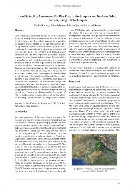
Study Area<br />
Sheikhupura and Nankana Sahib Districts are very<br />
important for our agricultural commodity and occupy an<br />
area of 5959 km squares. Fig. 1 shows the locati<strong>on</strong> of the<br />
study area in Pakistan, whereas the Fig. 2 shows the actual<br />
study area (curtsy Google Earth). About <strong>on</strong>e fourth of the<br />
total area (1602 km squares) is land with high potential<br />
under irrigati<strong>on</strong> and its dominant part is clayey (74%).<br />
About <strong>on</strong>e third (2010 km squares) c<strong>on</strong>sists of land with<br />
moderate and some high ec<strong>on</strong>omic potential under<br />
irrigati<strong>on</strong>. About 37 % is saline sodic, but with good<br />
structure. About <strong>on</strong>e tenth (577 km squares) of the area<br />
is land with poor grazing potential. More than half (62%)<br />
comprises dense, impervious str<strong>on</strong>gly saline-sodic soils,<br />
reclamati<strong>on</strong> of which is not c<strong>on</strong>sidered practical. The<br />
remainder (194 km squares) comprises rock outcrops,<br />
riverbed and urban land; which has not been c<strong>on</strong>sidered<br />
suitable for general agricultural development [7].<br />
Fig. (1) Locati<strong>on</strong> of the study area in Pakistan (highlighted in<br />
green color). [Curtsy Google Earth]<br />
39