Environmental Site Overview - East Hampton, Connecticut
Environmental Site Overview - East Hampton, Connecticut
Environmental Site Overview - East Hampton, Connecticut

You also want an ePaper? Increase the reach of your titles
YUMPU automatically turns print PDFs into web optimized ePapers that Google loves.
SECTION 4 INITIAL ENVIRONMENTAL CONCERNS<br />
Tighe&Bond<br />
Based on the general topography of the area, groundwater flow within the surficial unit<br />
is inferred to flow in a general southeasterly direction. The direction of groundwater<br />
flow is influenced by a number of conditions. Therefore, the local groundwater flow<br />
may vary throughout the area.<br />
The quality of groundwater beneath the subject area is classified by the <strong>Connecticut</strong><br />
Department of <strong>Environmental</strong> Protection as “GA, GAA may not meet current<br />
standards” Such groundwater may not meet the GA or GAA water quality standards,<br />
which presume that groundwater is suitable for drinking without treatment. However,<br />
CTDEP’s goal is to restore groundwater in this area to background quality.<br />
In November 2004, the Maguire Group completed the Initial Water Supply Plan for the<br />
Town of <strong>East</strong> <strong>Hampton</strong>. This plan identified the area as impacted volatile organic<br />
compound (VOCs) contamination. A conversation with Vincent Susco, Public Utilities<br />
Administrator of the Colchester <strong>East</strong> <strong>Hampton</strong> WPCF, confirmed the presence of these<br />
chemicals in the groundwater proximate to the area.<br />
The nearest aquifer protection area is the Glastonbury Road Wellfield in the Town of<br />
Portland. The <strong>East</strong> <strong>Hampton</strong> Village Center is over 5 miles to the southeast of the<br />
aquifer protection area (<strong>Environmental</strong> GIS Data for <strong>Connecticut</strong>, 2003).<br />
4.4.2 Surface Water Classifications<br />
Based on a review of the Natural Drainage Basins in <strong>Connecticut</strong> Map and Leachate<br />
and Wastewater Discharge Sources for the <strong>Connecticut</strong> River Major Basin Map, the<br />
area is located within the Pine Brook Drainage Basin (#4709). Drainage from the area<br />
would eventually discharge to the Pine Brook, located approximately three miles south<br />
of the area. The Pine Brook has been designated by the CTDEP as having a Class B<br />
surface water classification. The B classification indicates that the water body is<br />
suitable for bathing and other recreational purposes. It may also be suitable for<br />
agricultural or industrial processes and cooling.<br />
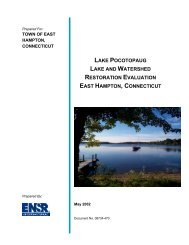
The majority of the sites included in this report are located adjacent to the Pocotopaug<br />
Creek. Historic maps indicate that many of the former industrial complexes used the<br />
Creek for power generation and waste discharge. The Pocotopaug Creek is classified<br />
by the State of <strong>Connecticut</strong> as C/B. Inland surface waters classified by the CTDEP as<br />
C/B are those that, due to point or non-point sources of pollution, currently do not meet<br />
certain Class B Water Quality Criteria for one or more designated uses. The water<br />
quality goal is achievement of Class B criteria and attainment designated uses.<br />
<strong>Environmental</strong> <strong>Site</strong> <strong>Overview</strong> 4-12