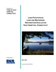
Environmental Site Overview - East Hampton, Connecticut
Environmental Site Overview - East Hampton, Connecticut
Environmental Site Overview - East Hampton, Connecticut

You also want an ePaper? Increase the reach of your titles
YUMPU automatically turns print PDFs into web optimized ePapers that Google loves.
SECTION 6 REFERENCES<br />
Tighe&Bond<br />
Topographic Maps<br />
United States Geological Survey, 1992, Middle Haddam Quadrangle <strong>Connecticut</strong>-<br />
Middlesex County, 7.5-Minute Series Topographic Map: United States Department of<br />
the Interior, U.S. Geologic Survey, 1968, Photo revised 1992.<br />
United States Geological Survey, 1992, Moodus Quadrangle <strong>Connecticut</strong>-Middlesex<br />
County, 7.5-Minute Series Topographic Map: United States Department of the Interior,<br />
U.S. Geologic Survey, 1968, Photo revised 1992.<br />
University of New Hampshire Dimond Library, Documents Department & Data Center<br />
On-line Collection of United States Geologic Survey Maps 7.5-Minure Series.<br />
• Middle Haddam 1945 (Surveyed in 1942 and 1943)<br />
1952 (Surveyed in 1942, 1943, and 1952)<br />
• Moodus 1946 (Surveyed in 1942 and 1943)<br />
Geologic Maps<br />
1952 (Surveyed 1941 (aerial photographs), 1942, 1943,<br />
1952 (revised))<br />
<strong>Connecticut</strong> Department of <strong>Environmental</strong> Protection. “Surficial Materials Map of<br />
<strong>Connecticut</strong>” .Stone, et al. 1992.<br />
<strong>Connecticut</strong> Geological and Natural Survey. “Bedrock Map of <strong>Connecticut</strong>” Rogers.<br />
1995.<br />
<strong>Connecticut</strong> Department of <strong>Environmental</strong> Protection. “Leachate and Wastewater<br />
Discharge Sources for the Upper <strong>Connecticut</strong> River Basin” dated December, 1992.<br />
<strong>Connecticut</strong> Department of <strong>Environmental</strong> Protection. “<strong>Environmental</strong> GIS Data for<br />
<strong>Connecticut</strong> 2003 Edition”. 2003 edition.<br />
Aerial Photography<br />
University of <strong>Connecticut</strong> Map and Geographic Information Center and <strong>Connecticut</strong><br />
State Library, 1934 Fairchild Aerial Survey of <strong>East</strong> <strong>Hampton</strong>.<br />
University of <strong>Connecticut</strong> Map and Geographic Information Center, 1970 and 1986,<br />
digitized aerial photographs provided courtesy of Bill Miller, University of<br />
<strong>Connecticut</strong>, Map and Geographic Information Center.<br />
<strong>Environmental</strong> <strong>Site</strong> <strong>Overview</strong> 6-1