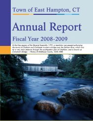
Environmental Site Overview - East Hampton, Connecticut
Environmental Site Overview - East Hampton, Connecticut
Environmental Site Overview - East Hampton, Connecticut

Create successful ePaper yourself
Turn your PDF publications into a flip-book with our unique Google optimized e-Paper software.
SECTION 3 SITE DATABASE<br />
Tighe&Bond<br />
3.1 DATABASE CREATION<br />
All of the research gathered during this process was compiled into a Microsoft Access<br />
database. There are many advantages to creating a database of this type:<br />
• Information in the database can be shared easily;<br />
• The database can be queried for specific information;<br />
• The data can be updated quickly;<br />
• The information can be integrated with a Geographic Information System (GIS) to<br />
display information spatially; and<br />
• Future site-priority matrices can be easily weighted and quantified in a database<br />
format.<br />
The majority of the information contained in the database has been provided in report<br />
format in Appendix A.<br />
Several quality control procedures were implemented prior to inclusion into this report.<br />
These quality control measures included:<br />
• Cross-referencing information with existing town records;<br />
• Comparing data provided in electronic file searches with existing documentation at<br />
the CT DEP file room;<br />
• Reviewing current and historic maps to verify historic use of properties;<br />
• Comparing information contained in the database with previous environmental<br />
assessments;<br />
• Verifying building locations and site use through windshield surveys;<br />
• Draft review by steering committee; and<br />
• Final review by project manager.<br />
The information contained in the database will be updated as new information becomes<br />
available.<br />
3.2 GEOGRAPHIC INFORMATION SYSTEMS<br />
An ArcView GIS database was created for this report. The site boundaries were<br />
reproduced from digitized tax assessor’s maps. The site boundaries were then georectified<br />
using 2001 SBC Aerial Photographs. The sites have been projected into<br />
<strong>Connecticut</strong> State Plane – 1983 North American Datum. Each site boundary contains an<br />
<strong>Environmental</strong> <strong>Site</strong> <strong>Overview</strong> 3-1