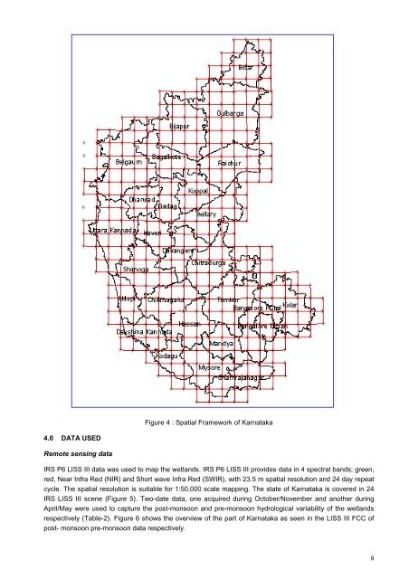
South-Eastern dry zone, South dry zone, North-Eastern transition zone, Southern transition zone, Northern transition zone, Hilly zone <strong>and</strong> Coastal zone. Soil The <strong>Karnataka</strong> state forms a part <strong>of</strong> Deccan plateau <strong>and</strong> the soils are mainly derived from granite, gneises <strong>and</strong> basalts. Besides these some part is having laterite <strong>and</strong> alluvial soils. The major soils founds are black soils, red soils, reddish brown soils, laterite soils, <strong>and</strong> coastal alluvial soils. Surface Drainage <strong>Karnataka</strong> is blessed with numerous rivers <strong>and</strong> streams. By virtue <strong>of</strong> its varied terrain, climate <strong>and</strong> geographical position, it supports a rich diversity <strong>of</strong> inl<strong>and</strong> <strong>and</strong> coastal wetl<strong>and</strong>s, there are seven river basins, which drain the <strong>Karnataka</strong> state namely, Cauvery, Krishna, Godavari, West flowing rivers, North pennar, South pennar <strong>and</strong> Palar. Major area <strong>of</strong> the state lies in the Krishna basin. In the Western Ghats <strong>and</strong> Malnad regions, the drainage network is dense. Rivers Krishna <strong>and</strong> Godavari flow from Maharashtra state, whereas river Cauvery, Palar <strong>and</strong> Pennar originate in the state. The West-flowing rivers originate in the western ghats, finally find their way into the Arabian sea. The major rivers include Krishna, Bhima, Dudganga, Tungabhadra, Hirenyakeshi, Ghataprabha, Malaprabha, Cauvery, Godavari, Manjra, Karanja, Uttarpinakini, Dakshinpinakini, Palar, Kali, Aghanashini (Tadri), Netravati,Sharavati <strong>and</strong> Gangavali (Bedti), Mahadai, ChakranadiVarahi, Barapole (Valapattanam), Arkavaty, Shimhsa, Lakshmanathirtha, Suvarnavathy, Kabini, Hemavathy. Apart from these rivers, <strong>Karnataka</strong> is bestowed with several reservoirs/barrages, lakes <strong>and</strong> backwater lagoons <strong>and</strong> beaches. The important wetl<strong>and</strong>-types <strong>of</strong> <strong>Karnataka</strong> are Tanks/Ponds, Reservoir/Barrages <strong>and</strong> Rivers/Streams. The others are Tadri creek, Gurpur, Talakadu Jaladhama, Honnemaradu, Holebaagilu, Brahmavara, Kabini river, Uppina Kudru <strong>and</strong> Harangi. The <strong>Karnataka</strong> state has finest beaches like Karwar, Gokarna (in gokarna Om, Gokarna, Kudle, Half-moon <strong>and</strong> Paradise), Murdeshwar, Kurumgod, Maravanthe Malpe, Kaup, Suratkal, Panamboor <strong>and</strong> Ullal. Ecologically Important coastal areas in <strong>Karnataka</strong> are Honnavara–estuarine mangroves ecosystem <strong>and</strong> Coondapur–estuarine ecosystem. Reservoirs are the major wetl<strong>and</strong>s that form the source <strong>of</strong> electricity. Major reservoirs include Tungabhadra, Kadra, Karanja, Alamatti, Hidkal, Narayanapura, Linganamakki, Chakra Supa. As mentioned earlier, the <strong>Karnataka</strong> state has 27 districts <strong>and</strong> is covered by 317 Survey <strong>of</strong> India (SOI) topographical maps on 1:50,000 scale that form the spatial frame work for mapping (Figure 4) prepared using 15’ x 15’ grid. A detail <strong>of</strong> district information followed in the atlas is given in Annexure-II. Figure 3: Location Map 8
Figure 4: Spatial framework <strong>of</strong> <strong>Karnataka</strong> Figure 4 : Spatial Framework <strong>of</strong> <strong>Karnataka</strong> 4.0 DATA USED Remote sensing data IRS P6 LISS III data was used to map the wetl<strong>and</strong>s. IRS P6 LISS III provides data in 4 spectral b<strong>and</strong>s; green, red, Near Infra Red (NIR) <strong>and</strong> Short wave Infra Red (SWIR), with 23.5 m spatial resolution <strong>and</strong> 24 day repeat cycle. The spatial resolution is suitable for 1:50,000 scale mapping. The state <strong>of</strong> <strong>Karnataka</strong> is covered in 24 IRS LISS III scene (Figure 5). Two-date data, one acquired during October/November <strong>and</strong> another during April/May were used to capture the post-monsoon <strong>and</strong> pre-monsoon hydrological variability <strong>of</strong> the wetl<strong>and</strong>s respectively (Table-2). Figure 6 shows the overview <strong>of</strong> the part <strong>of</strong> <strong>Karnataka</strong> as seen in the LISS III FCC <strong>of</strong> post- monsoon pre-monsoon data respectively. 9