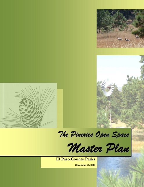
Pineries Open Space Master Plan
Pineries Open Space Master Plan
Pineries Open Space Master Plan

Create successful ePaper yourself
Turn your PDF publications into a flip-book with our unique Google optimized e-Paper software.
The <strong>Pineries</strong> <strong>Open</strong> <strong>Space</strong><br />
<strong>Master</strong> <strong>Plan</strong><br />
El Paso County Parks<br />
December 21, 2010
Acknowledgements<br />
The El Paso County Board of County Commissioners approved the acceptance of the <strong>Pineries</strong> <strong>Open</strong><br />
<strong>Space</strong> parcel on August 19, 2010 which makes this holding the largest parcel in the El Paso County park<br />
system at 1,070 acres.<br />
First and foremost, we appreciate the leadership and support from the Board of County Commissioners<br />
for the continued development of parks, trails, and open space in El Paso County.<br />
El Paso County Board of County Commissioners<br />
Dennis Hisey, Chair<br />
Amy Lathen, Vice Chair<br />
Wayne Williams<br />
Sallie Clark<br />
Jim Bensberg<br />
<strong>Plan</strong>ning for public access to this resource required the interaction of diverse interests. I wish to<br />
acknowledge the following individuals and organizations that have helped to create the vision for this<br />
wonderful resource.<br />
The Park Advisory Board committed significant time and effort to the oversight of the <strong>Pineries</strong> <strong>Open</strong><br />
<strong>Space</strong> acceptance process and the coordination of the master planning process.<br />
El Paso County Park Advisory Board<br />
Jane Fredman, Chair<br />
Robert Altenbernd<br />
Barbara Remy<br />
Chris Meyer<br />
James Mariner<br />
Warren Hill<br />
Jeff Cramer<br />
Martha Johnson<br />
Michael Straub<br />
Direction and citizen input for the <strong>Pineries</strong> <strong>Open</strong> <strong>Space</strong> <strong>Master</strong> <strong>Plan</strong> was provided by a citizens planning<br />
committee. Members of the <strong>Master</strong> <strong>Plan</strong> Committee, listed below, gave valuable input to County staff<br />
and to the consultant team, and generated thoughtful ideas that are incorporated into the <strong>Plan</strong>.<br />
<strong>Pineries</strong> <strong>Open</strong> <strong>Space</strong> <strong>Master</strong> <strong>Plan</strong> Committee Members<br />
Jane Fredman<br />
Lisa Dorr<br />
Judy Tobias<br />
Terry Taylor<br />
Anthony Wenger<br />
Leif Garrison<br />
Tim Kealy<br />
Barbara Remy<br />
Pamela Deveraux
The Palmer Land Trust holds a conservation easement on most of the <strong>Pineries</strong> <strong>Open</strong> <strong>Space</strong>. Nathan<br />
Moyer, Stewardship Program Manager of the Palmer Land Trust, provided guidelines for use of the<br />
conservation easement and coordinated the review of the master plan by the Palmer Land Trust, a<br />
requirement of the conservation easement.<br />
Funding for the <strong>Pineries</strong> <strong>Open</strong> <strong>Space</strong> <strong>Master</strong> <strong>Plan</strong> was provided by a grant from Great Outdoors<br />
Colorado and a contribution by El Paso County.<br />
County staff played a significant role in the preparation of the <strong>Pineries</strong> <strong>Open</strong> <strong>Space</strong> <strong>Plan</strong>. The following<br />
staff members deserve recognition for their contributions:<br />
<br />
<br />
<br />
<br />
<br />
Elaine Kleckner, <strong>Plan</strong>ning Manager<br />
Jerry Westling, Park Operations Manager<br />
Bill Campbell, North District Maintenance Supervisor<br />
Kent Timmerman, Park Maintenance III<br />
Jason Meyer, Park <strong>Plan</strong>ner<br />
The County was also fortunate to have a diverse and highly professional <strong>Master</strong> <strong>Plan</strong> Consultant Team<br />
that was led by N.E.S. Inc. We were very pleased with their outreach efforts, extensive research, and<br />
creativity when developing this plan.<br />
<strong>Master</strong> <strong>Plan</strong> Consultant Team<br />
N.E.S. Inc. Lead Consultant- John Maynard, Ron Bevans<br />
Land Stewardship Consultants, Inc. – Alan Carpenter<br />
Tapis Associates, Inc. – Priscilla Marbaker<br />
Drexel, Barrell & Co, Civil Engineers – Tim McConnell<br />
CTL Thompson Inc., Geotechnical Consultants – Jon Lovekin<br />
Steve Spalding, Forestry Specialist<br />
Jim Coffman Studios, Equestrian Trail Specialist<br />
Finally, we thank the many citizens who committed the time and effort to provide input on the<br />
development of the master plan. This input was extremely helpful in ensuring that we are meeting the<br />
needs of park users.<br />
Tim Wolken<br />
Director of Community Services
Table of Contents<br />
Introduction...............................................................................................................................1<br />
Goals...........................................................................................................................................3<br />
<strong>Plan</strong>ning Parameters .................................................................................................................4<br />
Historical Use of the <strong>Pineries</strong> Ranch .....................................................................................7<br />
Public Process and Outreach ..................................................................................................9<br />
Site Inventory and Analysis .....................................................................................................12<br />
The <strong>Plan</strong>......................................................................................................................................25<br />
Recommendations ....................................................................................................................37<br />
Design Guidelines.....................................................................................................................40<br />
List of Resources.......................................................................................................................47<br />
Appendix....................................................................................................................................49
I. Introduction<br />
The <strong>Pineries</strong> <strong>Open</strong> <strong>Space</strong> is located in the Black Forest area of El Paso County, Colorado,<br />
northeast of the intersection of Vollmer Road and Shoup Road. At the present time, the only<br />
access to the approximately 1070 acre <strong>Open</strong> <strong>Space</strong> is from Shoup Road via a partially<br />
constructed subdivision road and from Vollmer Road via privately owned land.<br />
The <strong>Pineries</strong> <strong>Open</strong> <strong>Space</strong><br />
Site Location<br />
The purpose of this master plan is to set forth the parameters for public access to and use of<br />
the property, and to create a vision for its preservation as a unique asset. The <strong>Pineries</strong> <strong>Open</strong><br />
<strong>Space</strong> is the largest open space holding under County ownership. It contains a variety of unique<br />
vegetation habitats, including plants rare and unusual in Colorado and mature Ponderosa Pine<br />
forest that is considered to be classified as old growth. The <strong>Pineries</strong> <strong>Open</strong> <strong>Space</strong> was acquired<br />
by El Paso County as a result of dedication by the developer of adjacent land. The property,<br />
with the exception of approximately 30 acres, is subject to a conservation easement held by the<br />
Palmer Land Trust.<br />
The intent of the conservation easement held by the Palmer Land Trust is to insure that the<br />
property will be preserved in its natural condition. By preservation of the property in its natural<br />
condition scenic, wildlife and ecological values that currently exist on the property will also be<br />
preserved and maintained. The conservation easement allows for conditional public access and<br />
for controlled educational access.<br />
1
The <strong>Pineries</strong> <strong>Open</strong> <strong>Space</strong> is surrounded by existing rural residential subdivisions. There are<br />
limited opportunities for access to the <strong>Open</strong> <strong>Space</strong> from these subdivisions, and conservation<br />
values of the conservation easement preclude allowing direct access from individual lots.<br />
Interior to the <strong>Pineries</strong> <strong>Open</strong> <strong>Space</strong>, zoning and first phase subdivision approval has been<br />
granted for 389 homes sites. No homes have been constructed within the land interior to the<br />
<strong>Pineries</strong> <strong>Open</strong> <strong>Space</strong>. The configuration of the <strong>Pineries</strong> <strong>Open</strong> <strong>Space</strong> can be described as a<br />
donut defined by the existing lots surrounding it, and with the planned lots as the “hole”.<br />
The <strong>Pineries</strong> <strong>Open</strong> <strong>Space</strong> <strong>Master</strong> <strong>Plan</strong> was influenced by an extensive public participation<br />
process. Inputs from adjacent property owners, residents of the Black Forest, and residents of<br />
the County at large were taken into account in the preparation of the <strong>Plan</strong>.<br />
Hodgen Road<br />
Vollmer Road<br />
Meridian Road<br />
Black Forest Reserve<br />
Pine Cone Ranch<br />
Black Forest Road<br />
Pine Glen<br />
Future<br />
Subdivision<br />
Forest<br />
Highland<br />
Shoup Road<br />
High Acres<br />
Blue Spruce Estates<br />
Sylvan Meadows<br />
Regional Context<br />
2
II.<br />
Goals<br />
Broadly stated, the goal of the <strong>Pineries</strong> <strong>Open</strong> <strong>Space</strong> <strong>Master</strong> <strong>Plan</strong> is to balance the preservation<br />
of the property’s unique resources with managed public use. In order to accomplish this broad<br />
goal, directional statements, called <strong>Plan</strong>ning Parameters, were established that set boundaries for<br />
the balance of public use with preservation. These <strong>Plan</strong>ning Parameters recognize that the<br />
property will change over time as natural processes take effect. The <strong>Pineries</strong> <strong>Open</strong> <strong>Space</strong> offers<br />
the opportunity to study this unique environment, and to manage it in a natural state. Even<br />
limited public access will have some impact, but the <strong>Plan</strong>ning Parameters used to develop this<br />
plan are intended to minimize that impact.<br />
General goals were also established to guide development of the <strong>Master</strong> <strong>Plan</strong> and future use of<br />
the property. The goals and the <strong>Plan</strong>ning Parameters work together to provide direction and<br />
structure for the master planning process. The goals of the <strong>Pineries</strong> <strong>Open</strong> <strong>Space</strong> <strong>Master</strong> <strong>Plan</strong><br />
are:<br />
<br />
<br />
<br />
<br />
<br />
<br />
<br />
<br />
Provide a place for the recreational use and enjoyment of the citizens of El Paso<br />
County.<br />
Protect and enhance the natural features of the site and wildlife habitat, consistent with<br />
the provisions of the conservation easement (Palmer Land Trust and Morley-Howard<br />
Investments, LLC, 2006).<br />
Provide educational and interpretive opportunities in the design of facilities and the use<br />
of the property.<br />
Develop the site as a regional open space area, serving a variety of recreational needs<br />
with mixed use facilities, consistent with intent and standards of the Parks and Leisure<br />
Services Department <strong>Master</strong> <strong>Plan</strong> (2005).<br />
Adhere to the Goals, Policies and Proposed Actions of the Black Forest Preservation<br />
<strong>Plan</strong>.<br />
Respect the historical agricultural and ranching heritage and the cultural values of the<br />
property in the design and siting of facilities.<br />
Minimize impacts on adjacent residential properties in the design and management of<br />
facilities.<br />
Design, build and establish an operational budget for facilities in a way that is<br />
sustainable, allowing for future expansion as appropriate, providing adequate<br />
maintenance and management, and adjusting the <strong>Master</strong> <strong>Plan</strong> and management actions,<br />
if needed, to respect resource values and meet the needs of our citizens.<br />
3
III.<br />
<strong>Plan</strong>ning Parameters<br />
<strong>Plan</strong>ning parameters are direction<br />
setting statements that become the<br />
guidelines for preparation of the final<br />
plan recommendations. The <strong>Pineries</strong><br />
<strong>Open</strong> <strong>Space</strong> planning parameters<br />
consist of physical determinants<br />
dictated by the specific characteristics of<br />
the property; by guidelines established<br />
by the Palmer Land Trust as holder of<br />
the conservation easement; by inputs<br />
from adjacent property owners; and by<br />
operational requirements imposed by<br />
development and maintenance concerns<br />
of the parks staff. The following<br />
planning parameters were employed in<br />
the development of the <strong>Pineries</strong> <strong>Open</strong><br />
<strong>Space</strong> <strong>Plan</strong>:<br />
Ranch Drainage<br />
<br />
<br />
<br />
<br />
<br />
<br />
<br />
<br />
<br />
<br />
<br />
<br />
<br />
<br />
<br />
The conservation easement property is divided into use zones as defined by the<br />
Palmer Land Trust, which regulate intensity of use.<br />
Guidelines found in the Parks and Leisure Services <strong>Master</strong> <strong>Plan</strong> provide<br />
context and direction.<br />
Provide a Tier 1 trail connection from the Section 16 trail at Vollmer and<br />
Shoup roads to the Woodlake Trail at the northeast corner of the property.<br />
Design trails to avoid drainage ways, ponds, wetland areas whenever possible.<br />
Cross drainage ways with trails; do not design trails parallel to drainages.<br />
Place trails at the edge of large expanses of open space.<br />
Provide restrooms at formal trailheads.<br />
Use interpretive signage to identify unique features of the <strong>Open</strong> <strong>Space</strong>.<br />
Control access to areas of rare plants, wildlife habitat, old growth forest, ponds<br />
and wetlands.<br />
Separate equestrian parking from parking areas to be used by others.<br />
Wherever possible, place trails 500 feet from existing residential lots.<br />
Provide trail access points from the proposed Sanctuary in the Pines<br />
subdivision.<br />
Design the trail system to discourage the development of social trails. Prohibit<br />
individual lot access to the <strong>Open</strong> <strong>Space</strong>.<br />
Prohibit motorized use, except for designated trailhead and active use areas,<br />
and maintenance and emergency use access.<br />
Fence the conservation easement to control unauthorized access, and to<br />
delineate boundaries between public and private property.<br />
4
Conservation Zones<br />
The Palmer Land Trust (PLT) has established Conservation Zones for the majority of The<br />
<strong>Pineries</strong> <strong>Open</strong> <strong>Space</strong> covered by their Conservation Easement. These zones, described in more<br />
detail below, restrict use based on conservation values of the various areas of the property.<br />
Zone 1. Highest non-recreational conservation values where public access will be<br />
limited to scientific study by approved groups and interpretive programs led by trained<br />
staff. This restriction on access shall not apply to trail corridors that may cross through<br />
such areas in appropriate circumstances.<br />
Zone 2. Significant conservation values where parties will consult on any proposed<br />
public access with a view to minimizing impairment of the non-recreational<br />
conservation values, i.e., secondary trail corridors allowed.<br />
Zone 3. Absence of unique habitat where public access will be permitted with a view<br />
to prevent only significant impairment of the non-recreational conservation values, i.e.<br />
primary trail corridors allowed.<br />
5
Zone 4. Facility zones where maintenance facilities, trail heads and parking, park<br />
purposes including active recreation uses shall be located. Within the primary facility<br />
Zone (4A), located in the western portion of the Property, the following uses will be<br />
permitted: sheds, shelters, caretaker’s residence, pavilions, restrooms, playgrounds,<br />
athletic facilities, barns, corrals, hitching posts, garage and maintenance facilities, nature<br />
center and other structures or improvements related to active recreation and<br />
environmental education on the property. The secondary facility zones (4B and 4C),<br />
located in the southern portion of the Property, will be limited to trailhead facilities,<br />
including benches, picnic facilities, kiosks, restrooms, trail signs, trail head parking areas<br />
and trail shelters. All Zone 4A improvements are subject to the provisions of the<br />
approved <strong>Master</strong> <strong>Plan</strong>. Non-park related County facilities will not be allowed on the<br />
Property.<br />
6
IV.<br />
Historical Use of the <strong>Pineries</strong> Ranch<br />
The <strong>Pineries</strong> Ranch was acquired by the Farrar<br />
family in 1958. At that time the ranch<br />
consisted of approximately 12,000 acres.<br />
During his lifetime, Mr. Farrar added parcels to<br />
the ranch, so that it eventually totaled<br />
approximately 16,000 acres. General<br />
boundaries of the ranch excluding numerous<br />
outparcels, were Shoup Road on the south,<br />
Black Forest Road on the west, Hodgen Road<br />
on the north and Meridian Road on the east.<br />
The land was originally used for the raising of<br />
cattle. Additional agricultural uses were added<br />
over time, including the treatment of wood<br />
with preservatives and the sale of posts and<br />
pole fencing along with the sale of<br />
miscellaneous supplies and fire wood to<br />
neighboring rural residential users.<br />
Ranch Landscape<br />
Changes to government regulations affected land use. An interesting negotiation with Public<br />
Service Company occurred in the 1960’s. Rather than have the electric utility condemn and<br />
purchase an electric easement for overhead transmission lines through the ranch, the Farrar’s<br />
agreed to grant the easement without charge if it could be moved to jog along the southern and<br />
eastern boundaries of the ranch. The easement was clear cut by Public Service, and was then<br />
used for the sale of transplant trees that eventually grew<br />
within the easement.<br />
The Farrar family members and son-in-law moved toward<br />
forestry rather than ranching. The cattle operation<br />
stopped in the mid to late 1970’s, replaced by forest<br />
management and the sale of forest products. Sale of<br />
transplant trees generated cash used to control mistletoe<br />
and pine bark beetles and enhance the forest.<br />
Corral Fencing<br />
After the death of Mr. Farrar in 1985, the ranch was<br />
divided into four parcels. The southern half of the ranch<br />
was jointly held by two sisters and managed by one sister<br />
and her husband. They established the first conservation<br />
easement on their property in 1985, in part to prevent<br />
Swan Road from bisecting the ranch. A second<br />
conservation easement was created in 1995. Both<br />
easements, totaling 1040 acres, are held by the Palmer<br />
Land Trust.<br />
7
The location of the easements was changed in 2006 as a part of a development proposal by<br />
Morley-Howard Investments, who purchased the property for residential subdivision. The<br />
subdivision, known as Sanctuary in the Pines, has been approved for 389 lots. Although no lots<br />
have been platted and no homes have been constructed to date, some development related<br />
infrastructure has been partially constructed for the initial phase. In conjunction with approval<br />
of the subdivision, the conservation easement land and approximately 30 additional acres were<br />
transferred to the El Paso County Parks Department in 2010 for establishment of an open<br />
space park.<br />
Erosion control dams were constructed<br />
on The <strong>Pineries</strong> <strong>Open</strong> <strong>Space</strong> by the<br />
Civilian Conservation Cops (CCC) in the<br />
1930’s.<br />
CCC Dams<br />
CCC Dams<br />
PLT Conservation Easement<br />
Ranch Windmill and Stock Pond<br />
8
V. Public Process and Outreach<br />
El Paso County uses a public process to<br />
gather input into the master plans for its<br />
parks. The <strong>Pineries</strong> <strong>Open</strong> <strong>Space</strong> public<br />
process consisted of several input<br />
opportunities.<br />
<strong>Master</strong> <strong>Plan</strong> Committee. A <strong>Master</strong><br />
<strong>Plan</strong> Committee consisting of ten<br />
individuals was appointed by the El Paso<br />
County Park Advisory Board as an<br />
advisory working committee. The<br />
<strong>Master</strong> <strong>Plan</strong> Committee members<br />
<strong>Master</strong> <strong>Plan</strong> Committee Meeting<br />
represented both the interests of the<br />
County park users as a whole as well as<br />
specific user types: hikers, equestrians, mountain bikers, conservation interests. Residents of<br />
neighboring subdivisions were also included in the <strong>Master</strong> <strong>Plan</strong> Committee membership. The<br />
Committee made a field visit to the site, and held four public work sessions to review the<br />
consultant’s work and make recommendations on potential facility uses, <strong>Plan</strong> alternatives and<br />
the draft <strong>Plan</strong>.<br />
County Web Site. The County maintained a web site throughout the process. The web site<br />
provided meeting minutes, draft alternative plans and a link so that interested parties could<br />
provide comments.<br />
9<br />
County Web Site
Neighborhood Meeting. The consultant met with several neighbors on site to discuss trail<br />
location concerns relative to the common property line between the neighbors and the <strong>Open</strong><br />
<strong>Space</strong>.<br />
Public Notice. Adjacent property owners were provided with written notice for public<br />
meetings. The notices described how to interface with the planning process via email,<br />
attendance at public meetings, or phone call communication with County staff. Press releases<br />
inviting participation in public meetings were sent to more than 30 publications. County staff<br />
also disseminated information and meeting notices via e-mail to interested parties, clubs and<br />
organizations.<br />
Public Hearings and Approval. Both the Park Board and the Board of County<br />
Commissioners held public hearings and took formal action to approve the <strong>Plan</strong>. Park Advisory<br />
Board and Board of County Commissioners meetings are open to the public.<br />
Public Meetings. The master plan consultant and the County hosted two public meetings to<br />
provide information about the planning process and to gain public input. At the first public<br />
meeting, the project was introduced, and two alternative plans were presented for comment. A<br />
dot survey exercise was employed to indicate preference for activities within the <strong>Pineries</strong> <strong>Open</strong><br />
<strong>Space</strong>. Public feedback through this exercise and from solicited comments yielded a strong<br />
preference for habitat preservation; for trail and trailhead construction for non-motorized multipurpose<br />
use; and winter trail use (snowshoeing and skiing). A comment sheet was distributed<br />
so that additional comments could be made individually. The second public meeting was an<br />
open house designed to provide participants with the draft plan, and solicit input to be<br />
incorporated into the final plan.<br />
10
VI.<br />
Site Inventory and Analysis<br />
The purpose of the site inventory and analysis was to develop a thorough knowledge base of<br />
existing conditions, both natural and cultural (man-made), and to use this baseline to recognize<br />
elements that might influence design decisions. The following narrative gives a synopsis of the<br />
inventory, analysis and several technical reports that have been prepared in the preparation of<br />
the <strong>Pineries</strong> <strong>Open</strong> <strong>Space</strong> <strong>Master</strong> <strong>Plan</strong> (reference Appendix).<br />
Natural Features<br />
1. Topography/Slope<br />
The site is characterized by gently rolling terrain, the majority of which lies in the 0-4%<br />
category of slope. In general, site topography will not present significant limitations with<br />
respect to development of the facilities within the <strong>Open</strong> <strong>Space</strong>. Areas where slopes exceed<br />
12% should be avoided or specific trail alignment and construction techniques implemented<br />
to minimize the trail slope and reduce the potential for erosion.<br />
12<br />
Slope Analysis
2. Soils and Geology<br />
CTL Thompson prepared a Geologic Hazard Investigation for the site with respect to the<br />
development of an open space recreational facility. A summary of these findings include:<br />
i. No geologic conditions are believed to be present that would preclude<br />
development of this site as an open space park. The occurrence of shallow<br />
bedrock may affect site grading, utility installation, and septic system design across<br />
the site and shallow ground water may affect grading and utility construction in<br />
isolated portions of the site. Expansive soils and bedrock may influence design<br />
and construction of site improvements and structures in some areas. Issues<br />
associated with shallow ground water and expansive materials can typically be<br />
mitigated using commonly employed design and construction techniques.<br />
ii. Subsurface materials found in exploratory borings drilled for previous<br />
investigations at the site consisted of between 2 and 10 feet of clean to silty or<br />
clayey sand underlain by sandstone and claystone bedrock of the Dawson<br />
Formation. The sandstone exhibited low swell potential or no movement. The<br />
clayey sand and claystone bedrock showed low measured swell upon wetting.<br />
iii. Ground water was encountered at depths of 7 to 32.5 feet below the ground<br />
surface during our previous investigation. Relatively shallow ground water was<br />
encountered in drainage areas. Seasonal conditions, heavy periods of precipitation,<br />
and irrigation of landscaping associated with the development may raise ground<br />
water levels or create “perched” ground water on the surface of the bedrock.<br />
iv. It is believed that site grading that may be necessary for the pavilion and<br />
restrooms can be accomplished with conventional earthmoving equipment.<br />
3. Vegetation<br />
The property harbors the native plant communities, including ponderosa pine woodland,<br />
foothill prairie, and wet meadow. The wet meadow community is a wetland and is found in<br />
the bottoms of certain drainages. Four plant species that are rare in Colorado occur on the<br />
property, along with several other plant species that are rare locally. The property harbors<br />
at least five species of noxious weeds; however, noxious weeds are not common on the<br />
<strong>Open</strong> <strong>Space</strong>.<br />
Ponderosa pine woodland:<br />
This community occurs on most<br />
of the property. This is by far<br />
the most abundant plant<br />
community on the property.<br />
The dominant plant species is<br />
ponderosa pine (Pinus ponderosa).<br />
An occasional aspen (Populus<br />
tremuloides) is also present in the<br />
tree layer on moister sites. The<br />
understory is usually poorly<br />
developed due to low light<br />
conditions. Shrubs are generally<br />
Ponderosa Pine Woodland<br />
13
sparse, with kinninkinnick (Arctstaphylos uva-ursi) being the most common shrub species<br />
present. Herbaceous species are likewise usually sparse in the ponderosa pine<br />
woodland community. The most common species are Ross sedge (Carex rossii), spike<br />
fescue (Leucopoa kingii), and fescue (Festuca saximontana). Pine needles and small tree<br />
branches typically cover most of the soil surface. Little of the soil surface is bare soil.<br />
The ponderosa pines on much of the property were thinned about 20 years ago (K.<br />
Timmerman, pers. comm.). The areas that were thinned have much lower tree density<br />
than areas that have not been thinned; un-thinned areas would benefit from thinning.<br />
The ponderosa pine woodland in the northeast quarter of Section 12 along Snipe Creek<br />
has some old-growth characteristics, namely relatively large trees with relatively low tree<br />
density.<br />
A small area of ponderosa pine woodland along the western boundary burned recently.<br />
This has not created any resource management problems. In fact, the fire and followup<br />
tree removal have thinned the number of trees substantially, which is conducive to<br />
better forest health.<br />
Foothill prairie: This<br />
community occurs as inclusions<br />
in larger areas of ponderosa pine<br />
woodland on sites with<br />
somewhat deeper fine-textured<br />
soils compared to the woodland<br />
areas. The cleared area under the<br />
high-voltage power lines is<br />
classified as foothill prairie, even<br />
though it was formerly<br />
ponderosa pine woodland. The<br />
foothill prairie is dominated by<br />
graminoids, including native blue<br />
grama (Chondrosum gracile =<br />
Bouteloua gracilis), narrowleaf<br />
sedge (Carex eleocharis ssp.<br />
stenophylla), and six-weeks fescue<br />
(Vulpia octoflora), and seeded<br />
reclamation species (mostly<br />
smooth brome - Bromopsis inermis<br />
= Bromus inermis) under the<br />
power lines. Forbs are also<br />
common, including fringed sage<br />
(Artemisia frigida) and hairy<br />
goldenaster (Heterotheca villosa).<br />
Wood’s rose (Rosa woodsii) is the<br />
Foothill Prairie<br />
Wet Meadow<br />
14
most common shrub in this community. (Carpenter)<br />
Wet meadow: Small areas of this community occur along the bottoms of drainages.<br />
This wetland community is supported by ground water discharge. Wet meadows are<br />
dominated by graminoids, including grasses, such as slender wheatgrass (Elymus<br />
trachycaulus = Agropyron trachycaulum) and mannagrass (Glyceria sp.), sedges, such as<br />
Nebraska sedge (Carex nebrascensis) and clustered field sedge (Carex praegracilis), and<br />
rushes, such as Baltic rush (Juncus balticus ssp. ater). The soil surface is covered by living<br />
plants and plant litter. (Carpenter)<br />
Rare plants<br />
The property harbors four native plant<br />
species that are tracked by the Colorado<br />
Natural Heritage Program (CNHP). These<br />
are plants that are demonstrably secure<br />
globally, but are rare in Colorado. In<br />
addition, several other species that are not<br />
tracked by CNHP, but which are rare<br />
locally are found on the property. These<br />
species include porcupine grass (Hesperostipa<br />
spartea = Stipa spartea), prairie dropseed<br />
Rare <strong>Plan</strong>t- Krigia biflora<br />
(Sporobolus heterolepis), and lilac penstemon<br />
(Penstemon gracilis). Richardson’s alum-root<br />
(Heuchera richardsonii) and birdsfoot violet (Viola pedatifida) are found in wetlands and wet<br />
prairie meadows. Krigia (Krigia biflora) is found in foothill prairie, while frostweed<br />
(Crocanthemum bicknelli) is found in ponderosa pine woodland. (Carpenter)<br />
Noxious weeds<br />
The property has a relatively low abundance<br />
of noxious weeds. Field surveys of the<br />
property have revealed five species of noxious<br />
weeds on the property, including Canada<br />
thistle (Breea arvensis = Cirsium arvense),<br />
cheatgrass (Anisantha tectorum = Bromus<br />
tectorum), common mullein (Verbascum thapsus),<br />
leafy spurge (Tythymalus esula = Euphorbia<br />
esula), and yellow toadflax (also known as<br />
butter-and-eggs), (Linaria vulgaris). The field<br />
surveys were not exhaustive, and additional<br />
species of noxious weeds, e.g., diffuse<br />
Canada Thistle<br />
knapweed, may be present. A Noxious Weed<br />
Management <strong>Plan</strong> has been prepared to<br />
address the current and future needs in the control of noxious weeds. (Carpenter)<br />
15
4. Forest Conditions<br />
The forest within the <strong>Pineries</strong><br />
<strong>Open</strong> <strong>Space</strong> is a biologically<br />
diverse area where one can enjoy<br />
communing with nature by<br />
observing old-growth trees, unique<br />
plants and a myriad of wildlife<br />
species. The Black Forest region is<br />
an excellent location for growing<br />
ponderosa pine, and that is just<br />
one of issues facing this forest.<br />
While relatively healthy, the forest<br />
Old Growth Forest<br />
is overcrowded by too many trees.<br />
While the rule of ‘survival of the<br />
fittest’ is being played out, with the strongest trees getting bigger, the remaining trees are<br />
setting the stage for two potential catastrophic events. The dramatic one is the potential for<br />
a wildfire. There is a high level of fuel available to burn that could entirely replace the forest<br />
as we know today.<br />
The second event is one that was experienced in the Black Forest from the late 1970’s to<br />
mid 1980’s and that was an epidemic of mountain pine beetle. The forest condition of the<br />
area has not changed sufficiently to deter a widespread beetle infestation. The larger trees<br />
have only grown larger and more prone to successful attack by this insect. The prevalence<br />
of bigger ponderosa pines coupled with an extensive dwarf mistletoe infection throughout<br />
the <strong>Open</strong> <strong>Space</strong> ensures a high probability of tree loss from this forest pest.<br />
A forest is a living entity and a dynamic ecosystem that will change over time. A ‘hands-off’<br />
approach will not keep the forest in a healthy condition and could result in catastrophic<br />
loss. Active forest management must become a priority to help remedy the issues the <strong>Open</strong><br />
<strong>Space</strong> faces so as to ensure a forest remains for of the county residents to enjoy. (Spaulding)<br />
5. Wildlife<br />
White-tailed deer (Odocoileus virginianus), mule deer (Odocoileus hemionus), elk (Cervus elaphus),<br />
black bear (Ursus americanus), and mountain lion (Felis concolor) are the primary big game<br />
species that use the property. Many piles of elk and deer scat was evident during the field<br />
visits. The Colorado Division of Wildlife (CDOW) has mapped the entire property as<br />
within the overall range for black bear, mule deer, and mountain lion. (Carpenter)<br />
It is likely that the adjacent <strong>Pineries</strong> residential development, as well as other development<br />
adjacent to or near the property, will affect these big game species due to loss of habitat and<br />
increased human presence. However, these species are able to adapt, at least to some<br />
16
degree, to human presence, particularly if it is predictable. Restricting human use of<br />
<strong>Pineries</strong> <strong>Open</strong> <strong>Space</strong> (with the exception to the main access area east of Vollmer Road) to<br />
on-trail, day use will help offset the adverse effects of visitors in big game species at the<br />
<strong>Open</strong> <strong>Space</strong>. Furthermore, the elk that live in the vicinity of the <strong>Open</strong> <strong>Space</strong> are relatively<br />
sparse, move around quite a bit, having alternative locations where they routinely go.<br />
Realignment of the conservation easement in 2005 was accomplished, in part, to preserve<br />
habitat for the east side elk herd and other migratory species. The realigned easement<br />
created wider corridors for migration and preservation of a more diversified habitat,<br />
including water sources.<br />
The property provides habitat for many species of small mammals, including mice, voles,<br />
chipmunks, Abert’s squirrel, badger, and coyote. The CDOW has mapped the southern<br />
portion of the property as within the overall range for the Texas horned lizard, although the<br />
property does not have large patches<br />
of bare ground that this species<br />
prefers (Hammerson 1988). The<br />
easternmost edge of the property has<br />
also been mapped by CDOW as<br />
within the historic range for the lesser<br />
prairie chicken, although the property<br />
does not now possess significant<br />
prairie chicken habitat. Numerous<br />
other bird species have been witnessed<br />
on site or the habitat is conducive for<br />
these species, as noted in the<br />
supplemental Ecological Resources /<br />
Environmental Baseline report.<br />
Wild Turkey On-site<br />
(Carpenter)<br />
6. Drainage and Wetlands<br />
The <strong>Pineries</strong> <strong>Open</strong> <strong>Space</strong> <strong>Master</strong> <strong>Plan</strong> Drainage Study provides drainage analysis for the entire<br />
<strong>Master</strong> <strong>Plan</strong> area in conjunction with the Sanctuary in the Pines Residential Development.<br />
The analysis should be utilized to help in the design of trail crossings of drainageways located<br />
on the site. Developed runoff rates were figured utilizing the rational method which is<br />
extremely conservative for this site due to the size of the drainage basins. More detailed<br />
analysis should be completed for specific crossings once the proposed trail locations are firmly<br />
determined.<br />
Water quality is also addressed in the study for the Sanctuary in the Pines and the open space.<br />
A water quality concern for the <strong>Open</strong> <strong>Space</strong> are the existing detention/water quality ponds<br />
located on the Sanctuary in the Pines Development that outfall directly onto CE/<strong>Open</strong> <strong>Space</strong><br />
property. These are of concern because the four ponds that have been constructed to date are<br />
only partially complete and expose the CE/<strong>Open</strong> <strong>Space</strong> property to the risk of sedimentation,<br />
17
scour and flooding. Water Quality requirements for the <strong>Open</strong> <strong>Space</strong> will be limited to the<br />
more intensive use areas such as the equestrian and pedestrian trailheads where higher runoff,<br />
sediment transport and contaminant potential will be of concern and should be analyzed once<br />
final layouts are determined. (Drexel, Barell & Co.)<br />
7. Visual Resources<br />
Due to the wooded nature of the site, the preponderance of visual amenities are related to<br />
on-site features, such as vegetation, wildlife and water features. Specific trail alignment<br />
should be accomplished in the field with the intent to incorporate off-site vista and where<br />
present and take advantage of unique natural features in the trail experience. The primary<br />
entrance drive from the south and the area of the existing ranch facilities offers the best<br />
panoramic views of Pikes Peak and the Rampart range.<br />
Off-site Views<br />
Unique Vegetation<br />
8. Climate/Microclimates<br />
Located mostly on the southern side of the Palmer Divide with the majority of drainages<br />
tending south, the <strong>Open</strong> <strong>Space</strong> has a generally southern aspect that benefits <strong>Open</strong> <strong>Space</strong> use<br />
and trail development.<br />
The typical weather experienced in the area shows a yearly temperature average of 48<br />
degrees. The average daily maximum reaches approximately 62 degrees with the average<br />
daily minimum temperature falling to 35 degrees. There is an approximate growing season<br />
of 126 days per year.<br />
18
Precipitation levels range from 15 to 23 inches per year. The last spring frost usually occurs<br />
around the middle of May with the first freeze in the fall occurring around the first part of<br />
October.<br />
Cultural Features<br />
1. Man-made Structures- Man-made structures on the site include ranch buildings, a single<br />
family residence, drainage facilities, stable/corral, ranch roads and a tree nursery. One of the<br />
existing ranch buildings is proposed to be removed. The remainder of the ranch buildings<br />
can be re-purposed to serve <strong>Open</strong> <strong>Space</strong> functions. An existing maintenance building is<br />
located in the northeast area of the <strong>Open</strong> <strong>Space</strong>, and access to this structure in its current<br />
location is difficult. It is recommended this structure be dis- assembled and relocated on or<br />
off-site to meet County facility needs. The corral provides a unique element to the site and<br />
would be beneficial to integrate into the program. Corral fencing could be used for different<br />
purposes if the existing fencing is to be modified from its current configuration.<br />
Ranch residence<br />
Ranch buildings<br />
Building to be removed<br />
Access to be closed/removed<br />
Tree nursery<br />
Stable/corral<br />
Access to Vollmer Road<br />
<strong>Open</strong> space access<br />
Existing Ranch Facilities<br />
The current access from Vollmer Road along the ranch drive is to be closed or removed. If<br />
removed, the existing road should be restored/revegetated with locally indigenous plant<br />
materials. The ranch residence will remain for the foreseeable future. Buffering/screening<br />
of <strong>Open</strong> <strong>Space</strong> facilities from the residence is appropriate. The tree nursery is proposed to<br />
be removed, with existing healthy trees transplanted on-site or used at other park facilities.<br />
19
Ranch Shed to be Removed<br />
Ranch Shop<br />
Ranch Shed<br />
Stable/Corral<br />
Tree Nursery<br />
Drainage Feature<br />
2. Preliminary/Future Development<br />
The future Sanctuary in the Pines development<br />
lies internal to the <strong>Pineries</strong> <strong>Open</strong> <strong>Space</strong>, which<br />
is approved for up to 389 single family<br />
residences on 2.5 acre and greater lots. The<br />
master plan designates access points to the<br />
<strong>Pineries</strong>’ trail network. Access to the trails will<br />
be limited to the trailhead areas and designated<br />
Maintenance Building<br />
20
access points. No access will be permitted to<br />
individual lots. Upon development of these lots,<br />
fencing would be installed as a condition of the<br />
conservation easement.<br />
3. Power line<br />
The east and southeast boundary is encumbered by a<br />
300’ utility easement to contain an overhead electric<br />
transmission line owned by Xcel Energy (formerly<br />
Public Service Company). The easement does contain<br />
a service road that can be utilized as part of the trail<br />
network, functioning as a Tier II trail in the County’s<br />
hierarchy. As the power line tends to diminish the trail<br />
experience, the primary trail route should be located<br />
adjacent to the corridor, within the forest cover.<br />
Power line<br />
easement<br />
4. Regional Context<br />
Much of the perimeter of the <strong>Open</strong> <strong>Space</strong> boundary is<br />
currently developed as residential in 5 acre plus lots.<br />
Power Line<br />
Through the public process concerns were expressed<br />
relative to the proximity of trail and open space<br />
facilities to the existing residential properties. To address these concerns trails routes<br />
should be located in such a manner to minimize any potential conflict with the adjacent<br />
properties.<br />
The following Natural Features and Cultural Features Analysis plan graphically depicts many of<br />
the existing conditions and analysis referenced above. This plan was used as a basis for<br />
determining many of the <strong>Master</strong> <strong>Plan</strong> recommendations.<br />
21
The <strong>Plan</strong><br />
<strong>Master</strong> <strong>Plan</strong><br />
The <strong>Pineries</strong> <strong>Open</strong> <strong>Space</strong> <strong>Master</strong> <strong>Plan</strong> was developed through a collaborative, inclusive effort<br />
that sought out input from several diverse interest groups. Through this process, the preferred<br />
alternative was derived from two alternatives that generally represented different levels of<br />
intensity with respect to facility and trail development within the <strong>Open</strong> <strong>Space</strong> area. Through the<br />
outreach process, with input from the public, the El Paso County Parks Board, the <strong>Master</strong> <strong>Plan</strong><br />
Committee, Parks staff and the consultant team, elements of these alternatives were combined<br />
to arrive at The <strong>Pineries</strong> <strong>Open</strong> <strong>Space</strong> <strong>Master</strong> <strong>Plan</strong>. The <strong>Master</strong> <strong>Plan</strong> identifies key functional<br />
uses that are incorporated into the open space network:<br />
Access Points<br />
Vehicular access to the <strong>Open</strong> <strong>Space</strong> is limited initially to 2 points: one off Vollmer<br />
Road from the west that will provide access to the primary equestrian and<br />
hiking/biking trailheads via a future subdivision road; the second being access from<br />
Shoup Road in the southwest corner of the site, again this access point will be a future<br />
subdivision road. A third vehicular access point with trailhead is planned in the<br />
southeast area of the site. This access point is contingent upon the completion of a<br />
road network within the proposed subdivision to the south.<br />
Future access via proposed<br />
Seclusion subdivision<br />
Vollmer Road access<br />
Shoup Road<br />
access<br />
Vehicular Access<br />
<br />
Trail Head Locations and Facilities<br />
Principal trailhead facilities are located off the primary vehicular access points. The<br />
main trailhead (Vollmer Road trailhead) will serve both equestrian and hiking/biking<br />
users, with vehicular parking and trailer parking.<br />
25
Internal access points have been designated on the <strong>Master</strong> <strong>Plan</strong>. These would provide<br />
points of trail access within the open space from the future planned subdivision, but no<br />
facilities would be provided.<br />
Vollmer Road trailhead<br />
Southeast trailhead<br />
Shoup Road trailhead<br />
Trailhead Locations<br />
Regional Trail Connectivity<br />
An important component of the trail network planned for The <strong>Pineries</strong> <strong>Open</strong> <strong>Space</strong> is<br />
connectivity to a regional trail network. The primary Tier I multi-use trail planned for<br />
the <strong>Pineries</strong> will provide and important linkage from Section 16 to the southwest to the<br />
Woodlake Trail to the northeast. Ultimately this may became part of a trail network<br />
that could link the Santa Fe Trail to the west to the Homestead Ranch Regional Park to<br />
the northeast and the Rock Island Trail.<br />
Homestead Ranch Regional Park<br />
Fox Run Park<br />
Woodlake Trail<br />
Santa Fe Trail<br />
Black Forest Park<br />
The <strong>Pineries</strong> <strong>Open</strong> <strong>Space</strong><br />
Section 16 (State Land Board)<br />
Rock Island Trail<br />
Regional Park, Trail & <strong>Open</strong> <strong>Space</strong> Facilities<br />
26
Trail Hierarchy and Conceptual Layout<br />
The initial and primary recreational activity at the <strong>Pineries</strong> <strong>Open</strong> <strong>Space</strong> will be trail use.<br />
Following El Paso County's well establish approach, the trail system will be nonmotorized<br />
multi-use including hikers, runners, mountain bikers and equestrians. The<br />
<strong>Pineries</strong> trail system is essentially a figure 8 with connections off-site to other Black<br />
Forest regional trails at the top and bottom of the "8." One out and back trail will<br />
provide access to a scenic pond and meadow area. (Tapis)<br />
The <strong>Pineries</strong> <strong>Open</strong> <strong>Space</strong> has the opportunity to become the touchstone regional trail<br />
system standard by simultaneously embodying Trail Sustainability and Trail Experience.<br />
Trail Experience is each trail user’s individual subconscious interaction has with the<br />
environment that thoughtful trail design embodies. Trail Sustainability includes<br />
consideration and attention to trail safety, sustainability, construction cost, structural<br />
integrity, and maintenance. (Tapis)<br />
Three trail types are proposed with the <strong>Pineries</strong> <strong>Open</strong> <strong>Space</strong>: Tier I, Tier II and Tier IV<br />
as defined by County standards (see trail standards in the Design Guidelines section).<br />
The Tier I trail will provide regional connectivity to the southwest corner of the <strong>Open</strong><br />
<strong>Space</strong>, providing connectivity to Section 16, and the northeast corner of the site,<br />
providing future connectivity to the Woodlake Trail. The Tier 4 trails are proposed for<br />
sensitive areas within the conservation easement where the single track Tier 4 trail will<br />
have the least amount of impact. The Tier II trail, a double track trail, would utilize the<br />
existing service road within the power line easement.<br />
The trail layout as shown on the master plan is diagrammatic and is only intended to<br />
indicate a general location of trails and trail facilities. Final design work would entail a<br />
site specific design with field work to determine the specific trail location. The<br />
following parameters would apply in locating the final trails:<br />
- Maintain a minimum<br />
Existing Adjacent<br />
50’<br />
separation of 500’<br />
Residential<br />
from adjacent<br />
residential properties<br />
along the north and<br />
west boundaries as<br />
500’<br />
site conditions permit<br />
Future <strong>Plan</strong>ned<br />
per an agreement<br />
Residential<br />
with these residents<br />
and county staff. A<br />
Trail Alignment<br />
500’ separation may<br />
be provided in other locations only if the integrity of the conservation<br />
easement can be maintained.<br />
- Maintain a minimum 50’ separation from the future internal residential<br />
properties internal to the <strong>Open</strong> <strong>Space</strong>.<br />
27
- Avoiding sensitive ecological areas, including areas of rare plants and perennial<br />
or seasonally wet areas.<br />
- Trails should meander through forested areas and meadow edges. Lengthy,<br />
straight sections should be avoided.<br />
- Drainage crossings should be designed to minimize impact and<br />
erosion/sedimentation. (See Design Guidelines Section)<br />
Interpretive Nodes<br />
The interpretive nodes are located throughout the primary trail loop with the intent to<br />
provide educational information specific to the natural systems of The <strong>Pineries</strong> as well as<br />
providing a rest area. These nodes are intended to be low impact with respect to overall<br />
trail development. Interpretive nodes will have a sign and bench as furnishings. (see<br />
Design Guidelines Section)<br />
Trailhead <strong>Plan</strong>s<br />
Conceptual layout plans were developed for the primary equestrian and hiking/biking trailhead<br />
facilities that lie within the 4A Zone of the conservation easement at the Vollmer Trailhead. The<br />
plans show a Phase 1 to provide basic facilities in association with the trailhead, and a plan at<br />
build-out where more facilities will be provided. The initial phase will consist of:<br />
the equestrian trailhead, to include<br />
- parking that will accommodate vehicles with trailers,<br />
- a round pen constructed with on-site corral fencing<br />
- hitching rails<br />
- mounting blocks<br />
- equestrian trail access<br />
the hiking/biking trailhead, to include<br />
- parking area<br />
- hiking/biking trail access<br />
Centrally located to each trailhead would be a restroom facility that would serve all users. The<br />
existing stable building is proposed to be adapted to accommodate restrooms, with further<br />
architectural, structural and engineering analysis required to verify adaptability. The existing<br />
corral facility would be modified to serve as an area suitable for group functions.<br />
At build-out, facilities would be added in the 4A Zone, to include:<br />
- for rent pavilions (3 total)<br />
- a pond/water feature that could potentially support fishing<br />
- additional trail resources to support the additional facilities<br />
28
The Shoup Road Trailhead and the Southeast Trailhead will have parking, restrooms and<br />
wayfinding signage.<br />
Phasing<br />
The initial phase of The <strong>Pineries</strong> <strong>Open</strong> <strong>Space</strong> development will concentrate on the construction<br />
of the Phase 1 facilities at the Vollmer Trailhead, the complete Tier I trail section, and the Tier<br />
IV trail in the southwest area of the site to complete a loop. This would include the Interpretive<br />
Nodes if funding is available.<br />
Future phases to complete the trail network and trailhead facilities would be determined as<br />
funding becomes available.<br />
<strong>Master</strong> <strong>Plan</strong><br />
Shoup Road<br />
Trailhad<br />
Phase 1 Development<br />
29
VII. Recommendations<br />
<br />
<br />
HCB Sanctuary (HCB Sanctuary is the ownership<br />
entity of Sanctuary in the Pines) – Acquire access<br />
and trail easements. 1) Access from Vollmer<br />
Road to Park Boundary; 2) Trail easements in OS<br />
along Vollmer Road; 3) on road from Shoup for<br />
TH north of Shoup; 4) adjacent to School/park<br />
areas.<br />
HCB Sanctuary - Acquire easements for public<br />
use, or acquire the land shown as HOA owned,<br />
in Sanctuary in the Pines Subdivision.<br />
4<br />
1<br />
2<br />
3<br />
Access/Trail Easements<br />
Easement/Acquisition<br />
<br />
<br />
HCB Sanctuary – Acquire easement, or dedication<br />
of “Tract L”, located in Phase 3 of Sanctuary in the<br />
Pines north of Snipe Creek. Tract L is shown as<br />
open space on Sanctuary in the Pines PUD <strong>Plan</strong>. It<br />
would facilitate access to the Tier 4 Trail from the<br />
Sanctuary in the Pines Subdivision.<br />
Develop Friends Group for:<br />
a. Maintenance Projects<br />
b. Construction Projects<br />
c. Identify projects for Eagle Scouts, volunteers –<br />
Tract L<br />
37
i. Construct warm-up area in equestrian trailhead from coral materials on site<br />
ii. See Volunteer Project List below as well<br />
d. Adoption of memorial benches or other site furniture<br />
e. Monitor trails for appropriate use<br />
In conjunction with Palmer Land Trust, develop cooperative monitoring program to<br />
minimize social trail development and encroachment on Park/CE.<br />
Develop list of volunteer projects<br />
o Survey all areas of Yellow Toadflax<br />
o Break off and bag Mullen plant seed heads in the fall to prevent spread<br />
Establish hours for <strong>Open</strong> <strong>Space</strong> use. (BOCC Action Required)<br />
Retain a trail design specialist prior to trail construction to flag specific trail location prior<br />
to construction.<br />
Coordinate with adjacent interested neighbors during specific trail design prior to<br />
construction.<br />
Retain architect to evaluate use of<br />
the existing stable building for<br />
conversion to restrooms;<br />
interpretive center; public meeting<br />
space; research station.<br />
Relocate the metal building, or sell<br />
it, that is located near the north<br />
boundary of the <strong>Open</strong> <strong>Space</strong> near<br />
the water tank.<br />
Transplant nursery trees in Zone 4a<br />
area to appropriate locations in the<br />
<strong>Open</strong> <strong>Space</strong>, or to other County<br />
Parks. Trees can be used in areas of<br />
mistletoe mitigation where clear<br />
cutting is recommended as a<br />
mitigation measure.<br />
Work with residents of the Pine<br />
Cone Subdivision and the owners of<br />
Black Forest Reserve to provide a<br />
walk-in neighborhood access to the<br />
northwest portion of <strong>Pineries</strong> <strong>Open</strong><br />
<strong>Space</strong>.<br />
Investigate potential for an<br />
Potential Acquisition<br />
easement for walk-in access to the<br />
southeastern corner of <strong>Pineries</strong><br />
<strong>Open</strong> <strong>Space</strong>.<br />
Work with HCB Sanctuary to complete work on the four detention ponds that outfall into<br />
the <strong>Pineries</strong> <strong>Open</strong> <strong>Space</strong> to prevent erosion and sediment deposition.<br />
38
Several old fences previously used to control cattle grazing should be removed to facilitate<br />
wildlife movement within the <strong>Open</strong> <strong>Space</strong>.<br />
Emergency Access will be evaluated by construction phase and emergency service<br />
providers notified for familiarization and input.<br />
Neighborhood groups may request walk-in access to the perimeter trail where it can be<br />
shown that there is a public use easement through private property. Each request will be<br />
evaluated by El Paso County and the Palmer Land Trust prior to consideration of<br />
agreement of access.<br />
HCB Sanctuary - Acquire proposed Lots 7-19; 22; 26-28; 61 & 62 in Phase 4 of Sanctuary<br />
in the Pines (19 Lots) to provide adequate buffer to the Snipe Creek Drainage and Cantrell<br />
Pond.<br />
39
VIII. Design Guidelines<br />
The intent of the Design Guidelines is to develop standards that are unique to the site and<br />
character of The <strong>Pineries</strong> <strong>Open</strong> <strong>Space</strong> as well as consistent with County park facilities.<br />
Trail Experience<br />
Trail Experience is each trail user's individual subconscious interaction with the environment<br />
that thoughtful trail design embodies. This means each trail decision and the final trail design<br />
should:<br />
• Be fun and rejuvenating;<br />
• Provide Passageway - not simply a transportation route;<br />
• Provide Compatibility for various trail user types – hikers, cyclists,<br />
equestrians, elderly, children, and physically challenged individuals;<br />
• Integrate with the Land, Vegetation, Wildlife;<br />
• Interact with the Environment; and<br />
• Stimulate Inquisitiveness - with view opportunities, alignment<br />
– it’s interpretation without signs along the entire corridor.<br />
Two components effecting trail user experience are<br />
unique because of conditions on the <strong>Pineries</strong> <strong>Open</strong><br />
<strong>Space</strong>. The first is Trail Flow and Rhythm . Together,<br />
flow and rhythm, are key components for trails popular<br />
with cyclist and equestrians. The experience of travelling<br />
where one turn leads to the next, oncoming obstacles and<br />
trail traffic are visible, and one rise leads to a similar<br />
descent not only create enjoyable trail, but also create a<br />
durable trail requiring less braking, no abrupt turning,<br />
while controlling speed and minimizing startling user<br />
encounters. (http://www.imba.com/resources/trailbuilding/twists-and-turns)<br />
The second is Visual<br />
Separation. Trail users should be able to enjoy the<br />
natural forest environment without viewing the surround<br />
residences, the future internal residences, the easement<br />
mandated perimeter fencing or the electrical transmission<br />
lines. While trail users anticipate interacting with traffic<br />
and residences at intersections and crossings, a rural trail<br />
is compromised by continually exposing trail users to<br />
residences, utilities and perimeter fencing. The property<br />
lends itself to a reclusive escape into the Black Forest -<br />
this is both its beauty and its uniqueness.<br />
40
Both trail design components - Trail Flow and Visual Separation - are typically accommodated<br />
by thoughtful trail alignment and the physical and<br />
topographical diversity of this property allow both<br />
these Trail Experience components to be achieved.<br />
Certain conditions of the conservation easement<br />
will restrict optimal Trail Experience and optimal<br />
Trail Sustainability. This will be discussed further in<br />
the Trail Sustainability section below. (Tapis)<br />
Trail Sustainability<br />
Trail Sustainability includes consideration and<br />
attention to trail safety, sustainability, construction<br />
cost, structural integrity, and maintenance.<br />
Compliance with the design standards noted above<br />
will best ensure durable, safe - sustainable - trails.<br />
Many drainage crossings will be necessary to<br />
circumnavigate the property. Drainage crossing<br />
always require careful consideration. Most of the<br />
drainages are characterized by seasonal or storm<br />
related dampness. These crossings will be best<br />
stabilized by constructing armored crossings.<br />
Depending on the site condition, one of the two<br />
details can be applied.<br />
1. Foundation Modification<br />
www.imba.com/resources/trail-building/all-weather-trails<br />
IMBA World Summit 2010 Resources - All Weather Trails<br />
Foundation Modification<br />
o<br />
o<br />
o<br />
o<br />
o<br />
This method requires trailbuilders to excavate the area to be reinforced, install a layer of<br />
stone, and then cover the stone foundation with native soil.<br />
Stone foundations improve drainage beneath the trail and provide a hard under-layer,<br />
while maintaining the look and feel of the local surroundings.<br />
You may need to bring in stone from a quarry for foundation. Rock size depends on<br />
trail user weight.<br />
Put rocks close together to create an interlocking puzzle.<br />
The foundation should be wide enough to accommodate drift in the trail, as riders find<br />
the true line.<br />
41
2. Rock Underdrain<br />
http://www.fhwa.dot.gov/environment/fspubs/07232806/page10.htm#rock Rock<br />
Underdrains<br />
Rock underdrains (often called French drains) are ditches filled with gravel.<br />
o They can be used to drain a spring or seep running across the trail.<br />
o Wrap the gravel with geotextile to help prevent silt from clogging the rock voids.<br />
o Start with larger pieces of rock and gravel at the bottom, topping off with smaller<br />
aggregate.<br />
o Finish the drain with 150 millimeters (6 inches) of tread material so that the surface<br />
matches the rest of the trail.<br />
Wrapping rock underdrains with geotextile helps prevent them from<br />
clogging. Rock underdrains are used to drain low-flow springs and seeps.<br />
Other drainages are characterized by steep embankments and perennial or constant water flow.<br />
These crossings will be best achieved by culvert crossings<br />
(www.fhwa.dot.gov/environment/fspubs/07232816/page08a.htm#culv,<br />
www.fhwa.dot.gov/environment/fspubs/07232806/page11.htm#culv)or bridges<br />
(www.fhwa.dot.gov/environment/fspubs/07232816/page10.htm#bridg,<br />
www.fs.fed.us/eng/pubs/htmlpubs/htm10232808/ Locating Your Trail Bridge for<br />
Longevity).<br />
<strong>Pineries</strong> Trail System trails are recommended to remain at a slope of less than 10% in<br />
accordance with the Equestrian Design Guidebook with the proper outslope to facilitate<br />
drainage. Coupled with grade reversals and proper alignment and construction, the trails will be<br />
sustainable for generations.<br />
It is recognized that the optimal alignment will not always be possible given the alignment<br />
restrictions imposed by current agreements with the surrounding residents and the restrictions<br />
of the conservation easement. In the following situations , it is recommended that the County<br />
pursue negotiations in order to achieve sustainable and safe trails that balance trail user, resident<br />
and conservation concerns. Negotiations are recommend in cases when trail alignment<br />
restrictions cause:<br />
• unsafe visibility because of sight distance;<br />
• significant grade compromise that impacts long term tread durability, erosion and<br />
sedimentation;<br />
• additional drainage crossings;<br />
• drainage crossing in less desirable locations;<br />
residences or utilities to be visible when visual screening from both perimeter and interior<br />
properties and fencing is possible outside the prescribed trail corridor.<br />
42
Trail Standards<br />
Trail hierarchy of the site will be consistent with<br />
standards developed for use throughout the El<br />
Paso County parks network. Four trail standards<br />
are in place, of which three will be utilized to<br />
form the trail network within the <strong>Pineries</strong> <strong>Open</strong><br />
<strong>Space</strong>.<br />
Tier I Trail<br />
Tier II Trail<br />
Tier IV Trail<br />
All trails will be designed and constructed in<br />
compliance with a few well tested existing trail<br />
construction standards including:<br />
• El Paso County Trail Hierarchy<br />
Tier I Regional Trail, Tier II<br />
Double-track Trail and Tier IV<br />
Single-Track Trail<br />
• Equestrian Design Guidebook for<br />
Trails, Trailheads, and<br />
Campgrounds , USFS and USDOT<br />
http://www.fhwa.dot.gov/environ<br />
ment/fspubs/07232816/index.htm<br />
• Trail Construction and Maintenance<br />
Notebook, USFS and USDOT<br />
http://www.fhwa.dot.gov/environ<br />
ment/fspubs/07232806/index.htm<br />
• Trail Solutions: IMBA's Guide to<br />
Building Sweet Singletrack, IMBA<br />
http://www.imba.com/catalog/bo<br />
ok-trail-solutions<br />
• Other references are cited when<br />
relevant to specific conditions and<br />
discussions that follow.<br />
43
Interpretive nodes<br />
The <strong>Pineries</strong> <strong>Open</strong> <strong>Space</strong> will offer many<br />
opportunities for educational experiences<br />
related to specific natural and cultural feature of<br />
the site. To take advantage of this opportunity,<br />
interpretive nodes have been defined on the<br />
<strong>Master</strong> <strong>Plan</strong> that will provide educational<br />
information specific to a given area of the site.<br />
These nodes have been identified as:<br />
Fire ecology<br />
Palmer Divide<br />
Lightning Strikes<br />
Forest Management<br />
Old Growth Forest<br />
Drainage/Water<br />
Rare <strong>Plan</strong>ts<br />
Wetlands/Aquatics<br />
Interpretive Node<br />
The interpretive nodes would consist of a bench and informational signage located immediately<br />
adjacent to the trail.<br />
Site Furnishings<br />
Site furnishings would consist primarily of benches and picnic tables. The intent would be to<br />
use standard County furnishings. These site furnishings should reflect the ranch and rural<br />
character of the <strong>Open</strong> <strong>Space</strong>. Materials should be durable and low maintenance in either a<br />
perforated metal or recycled plastic. Colors should be dark green, brown or black.<br />
44<br />
Site Furnishings
Fencing<br />
Fencing on the site will generally be limited to delineating the <strong>Open</strong> <strong>Space</strong>/Conservation<br />
Easement from adjacent residential development, both internally and externally. Currently, the<br />
external perimeter is fenced with a<br />
variety of materials, but generally 4-5<br />
strand smooth wire. The intent is<br />
that this fencing will remain in place.<br />
Access from the perimeter is to be<br />
limited to those points designated on<br />
the <strong>Master</strong> <strong>Plan</strong>. Any alternate access<br />
points or gates installed in the<br />
perimeter fence should be removed<br />
and access directed to the<br />
appropriate trailheads.<br />
Fencing will ultimately delineate the<br />
Alternative Fencing<br />
boundary from the future residential<br />
subdivision and the conservation<br />
easement. This fencing should occur prior to the construction of homes, but can be phased<br />
with home construction. This fencing should be installed by the developer. This fencing would<br />
be wildlife friendly and can be either a smooth wire fence or alternative 3-4 rail wood pole or<br />
Teton fence. The alternative fence should use materials consistent with those found on-site.<br />
Trailheads<br />
The three principal trailheads will consist of gravel parking areas, seating and picnic facilities for<br />
the trail users, restrooms, and wayfinding signage.<br />
Signage<br />
Two forms of signage should be implemented into the <strong>Open</strong> <strong>Space</strong> program:<br />
<br />
<br />
Wayfinding- This type signage would generally include trail maps and directional<br />
signage specific to the trail system and features of the <strong>Open</strong> <strong>Space</strong>.<br />
Operational- This type signage would specify rules of use. Of particular importance<br />
would be the use of the trail system within the <strong>Open</strong> <strong>Space</strong> and discouraging the<br />
creation of social trails throughout the conservation easement.<br />
45
Parking<br />
Trailheads identified in the master plan will typically provide for vehicular parking, both singular<br />
vehicles and large vehicles with trailers. Parking areas should be delineated through partially<br />
buried timbers at the perimeter and in areas to define parking stalls, where appropriate. General<br />
parking criteria:<br />
Equestrian Trailhead.<br />
Hiking/Biking Trailhead<br />
28’ two-way access drives<br />
Pull through spaces- 20’ X 60’<br />
20’ wide parallel pull-offs<br />
24’ two-way access drive<br />
9’ X 18’ stalls<br />
Accessible parking<br />
Equestrian/Trailer Parking<br />
Hiking/Biking Parking<br />
46
List of Resources<br />
Preliminary Habitat Assessment of Wetlands, T&E Species and State-Listed Species of<br />
Concern– Walsh Environmental Scientists and Engineers, LLC July 31, 2006<br />
Forest and Wildlife Management <strong>Plan</strong> – Len Lankford March 1996<br />
Preliminary Geotechnical Investigation Spahn Property – CTL Thompson Inc. June 2006<br />
Wildfire Hazard & Mitigation Report Stephen J. Spaulding August 1, 2006<br />
<strong>Master</strong> <strong>Plan</strong>ning Recommendations and Considerations for the <strong>Pineries</strong> Ranch <strong>Open</strong> <strong>Space</strong> by<br />
J. McConnaughy, T. Kelso, & A. Markstein August 2008<br />
<strong>Pineries</strong> Ranch Baseline Documentation Report Biohabitats, Inc. March 2007<br />
Vegetation of the <strong>Pineries</strong> Ranch, Black Forest, CO by Amy Markstein and Tass Kelso August<br />
2008<br />
Biological Diversity and Conservation Values of the <strong>Pineries</strong> Ranch by Dr. Judith P. von<br />
Ahlefeldt, Dr. Tass Kelso, and Kent Timmerman June 5, 2006<br />
El Paso County Parks and Leisure Services <strong>Master</strong> <strong>Plan</strong><br />
Conservation Easement Agreement between Palmer Land Trust and Morley Howard<br />
Investments, LLC, 2006<br />
Black Forest Preservation <strong>Plan</strong>, 1997<br />
Amended Park Lands Agreement, 2010<br />
47
Appendix<br />
Geologic Hazard Evaluation <strong>Pineries</strong> <strong>Open</strong> <strong>Space</strong> <strong>Master</strong> <strong>Plan</strong> by CTL Thompson<br />
Incorporated October 11, 2010<br />
<strong>Pineries</strong> <strong>Open</strong> <strong>Space</strong> <strong>Master</strong> <strong>Plan</strong> Findings and Existing Conditions Analysis Report by Drexel,<br />
Barrell & Co. November 2010<br />
<strong>Pineries</strong> <strong>Open</strong> <strong>Space</strong> Drainage Study by Drexel, Barrell & Co. November 2010<br />
Ecological Resources – Environmental Baseline Report of the <strong>Pineries</strong> <strong>Open</strong> <strong>Space</strong> by Land<br />
Stewardship Consulting, Inc. November 2010<br />
Noxious Weed Management <strong>Plan</strong> for the <strong>Pineries</strong> <strong>Open</strong> <strong>Space</strong> by Land Stewardship Consulting,<br />
Inc. , November 2010<br />
Forest Management <strong>Plan</strong> by Stephen J. Spaulding November 2010<br />
49