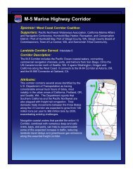
M-5 Marine Highway Corridor - Maritime Administration - U.S. ...
M-5 Marine Highway Corridor - Maritime Administration - U.S. ...
M-5 Marine Highway Corridor - Maritime Administration - U.S. ...

Create successful ePaper yourself
Turn your PDF publications into a flip-book with our unique Google optimized e-Paper software.
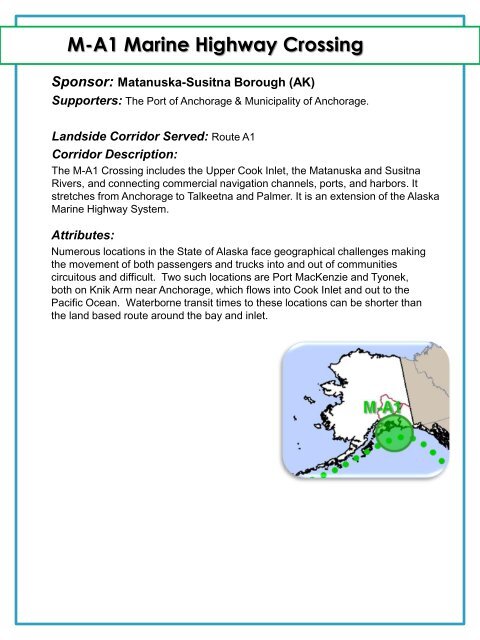
M-A1 <strong>Marine</strong> <strong>Highway</strong> Crossing<br />
Sponsor: Matanuska-Susitna Borough (AK)<br />
Supporters: The Port of Anchorage & Municipality of Anchorage.<br />
Landside <strong>Corridor</strong> Served: Route A1<br />
<strong>Corridor</strong> Description:<br />
The M-A1 Crossing includes the Upper Cook Inlet, the Matanuska and Susitna<br />
Rivers, and connecting commercial navigation channels, ports, and harbors. It<br />
stretches from Anchorage to Talkeetna and Palmer. It is an extension of the Alaska<br />
<strong>Marine</strong> <strong>Highway</strong> System.<br />
Attributes:<br />
Numerous locations in the State of Alaska face geographical challenges making<br />
the movement of both passengers and trucks into and out of communities<br />
circuitous and difficult. Two such locations are Port MacKenzie and Tyonek,<br />
both on Knik Arm near Anchorage, which flows into Cook Inlet and out to the<br />
Pacific Ocean. Waterborne transit times to these locations can be shorter than<br />
the land based route around the bay and inlet.