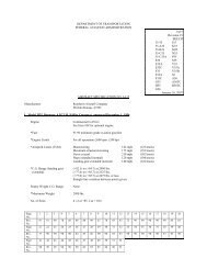
THE OFFICIAL PUBLICATION FOR BONANZA, BARON & TRAVEl ...
THE OFFICIAL PUBLICATION FOR BONANZA, BARON & TRAVEl ...
THE OFFICIAL PUBLICATION FOR BONANZA, BARON & TRAVEl ...

Create successful ePaper yourself
Turn your PDF publications into a flip-book with our unique Google optimized e-Paper software.
Golden Age of Exploration<br />
The navigators during the golden age of exploration, after<br />
accurate timepieces were developed, did the calculations with<br />
pen and paper, a process that required a great deal of computation<br />
time. But that was all OK since the vessel was moving<br />
very slowly. At 450-plus knots in the 707, the math was in tabular<br />
form in the above-mentioned publications. Good thing,<br />
too, since the first handheld calculators (Casio Personal M-l)<br />
did not appear until about a year after I started navigating. And<br />
although we all learned to use the sight reduction tables, there<br />
would have been few or none who would have been able to<br />
handle the manual method of the necessary computations.<br />
By knowing the approximate position of the aircraft, we<br />
would take an assumed position (AP) on the chart that was fairly<br />
close (maybe 100 miles maximum) to our estimated position.<br />
By using the sight reduction tables and air almanac, we<br />
would be able to determine that IF we were at the assumed<br />
position, we would see the selected body at a certain altitude<br />
at the exact desired time of the fix. Since<br />
we actually were not at the AP, we<br />
would see the body either higher or<br />
lower than the computed height.<br />
Let's assume we determined that<br />
we should see the body 40 degrees<br />
above the horizon if we were actually at<br />
the AP at the desired time of the fix.<br />
(Refer to my previous article in the<br />
August issue on page 10372 on how the<br />
Kollsman Periscopic Sextant functioned.) However, with the<br />
sextant we measure the altitude as 41 degrees. Now, the only<br />
way we can see it higher is to be closer to the SP of the body.<br />
Picture yourself in a room with a light fixture mounted on the<br />
ceiling. As you enter the room, the light fixture appears at<br />
some low angle of elevation. As you get closer, it gains altitude<br />
until you are directly under it, at which time it is at your zeni th<br />
or 90 degrees above the horizon.<br />
Since in our example we see the body one degree higher<br />
than we should have seen it at the AP, our actual position is 60<br />
nm toward the body. Since we know the direction we took the<br />
observation, we can plot a line out of the AP for 60 nm, draw<br />
a line at right angles to that plotted line and we now know our<br />
actual position is somewhere on that 90-degree line.<br />
By doing the same procedure for one or two other bodies<br />
and crossing the first line of position (LOP) with the second<br />
LOP, we can get an actual position for the time of the fix. If<br />
three stars or other bodies are used, and the three LOPs do not<br />
form a pinpoint on the chart but rather a triangle of hopefully<br />
small dimensions, the triangle is bisected so the center is located<br />
and that is the fix position.<br />
I have read accaunts of pilots<br />
going to the rear lavatory of a DC-4<br />
or other such airplane or window,<br />
taking a celestial observation from<br />
the porthole and claiming to get<br />
an accurate LOP from such a<br />
sighting location. I really doubt the<br />
result would have much accuracy.<br />
Techniques taught in navigation schools<br />
Of course, there were many techniques taught in the very<br />
fine Pan American World Airways (gone but not forgotten)<br />
Navigation School and many others developed by the individual<br />
navigators as they gained experience to make all the monkey<br />
motion described in this article take a relatively short time.<br />
There were also needed corrections to the observed altitude<br />
that might need to be used in these computations. These<br />
might include refraction caused by the bending of light as it<br />
passes through the earth's atmosphere (you can see about 3<br />
degrees over the horizon at low body elevations) when shooting<br />
bodies at very low elevations; the semi-diameter of the<br />
earth when shooting close Objects such as the sun, moon or<br />
planets (stars are considered to be an infinite distance away,<br />
and the fact we are not taking the observation from the center<br />
of the earth is negligible for stars and only comes into play<br />
with close-in bodies when they begin to get rather low in elevation);<br />
and many other such corrections as necessary to make<br />
the resultant computations as accurate as<br />
possible within the capability of the navigator's<br />
equipment to determine angles.<br />
I have read accounts of pilots going<br />
to the rear lavatory of a DC-4 or other<br />
such airplane or window (Beech 18s,<br />
Cessna 172s, etc.) and taking a celestial<br />
observation from the porthole and claiming<br />
to be able to get an accurate LOP<br />
from such a sighting location. I really<br />
doubt the result would have much accuracy. Although being able<br />
to accomplish reliable fixing using celestial observations does<br />
not take more than an average working brain, one needs proper<br />
training and a suitable place to take the observations and equipment.<br />
A three-star fix could be computed, shot and plotted in<br />
about 15 minutes and would provide a definite position for the<br />
navigator. Hopefully the position would be on the flightplanned<br />
track drawn on the navigation chart, proving that the<br />
heading slips being passed up to the pilots were good ones and<br />
that the pilots were able to fly those headings.<br />
That last concern was a real issue at times. I have had very<br />
senior captains fly off the posted heading as much as 20<br />
degrees for no other reason than that they misread the compass.<br />
Well, we had to make allowances for those really old<br />
guys. After all, some were pushing past 55 on their way to 60!<br />
ABS Life Member l ewis C. Gage has AlP multiengine land with<br />
Boeing 707/720/747 {Airbus-3tO rotings. Commerciol singleengine<br />
land: flight instructor MEl/SEl airplanes and instruments;<br />
ground instructor advanced and instrument: flight navigator:<br />
flight engineer; mechanic-airplane and engine: and FAA parts<br />
manufacturing authorization. Flight time: 15,QOO-plus hours. Lew<br />
may be contacted at 2255 Sunrise Dr., Reno, NV 89509.<br />
Phone/ Fax: 775-826-7184. E-mail: sunrisereno@gmail.com