

Arizona Geological Survey OPEN-FILE REPORT OFR 08-06
Arizona Geological Survey OPEN-FILE REPORT OFR 08-06
Arizona Geological Survey OPEN-FILE REPORT OFR 08-06

You also want an ePaper? Increase the reach of your titles
YUMPU automatically turns print PDFs into web optimized ePapers that Google loves.
<strong>Arizona</strong> <strong>Geological</strong> <strong>Survey</strong><br />
of the 20<strong>06</strong> debris‐flow deposits adjacent to the Mount Lemmon Short Road are based mainly on<br />
photographs taken by the USGS and AZGS in August and September of 20<strong>06</strong>. Deposits denoted with a<br />
question mark (Y4?) have debris‐flow characteristics but may be flood‐related or re‐worked.<br />
Figures 6 and 7. Figure 6 (left) An example of a boulder levee (unit Y2) from Linda Vista canyon. Figure 7<br />
(right) An example of a debris‐flow deposit (unit Y3) in Pontatoc Wash.<br />
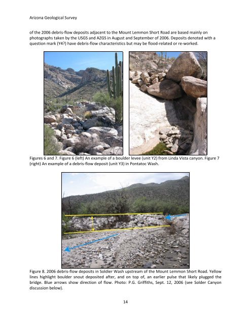
Figure 8. 20<strong>06</strong> debris‐flow deposits in Soldier Wash upstream of the Mount Lemmon Short Road. Yellow<br />
lines highlight boulder snout deposited after, and on top of, an earlier pulse that likely plugged the<br />
bridge. Blue arrows show direction of flow. Photo: P.G. Griffiths, Sept. 12, 20<strong>06</strong> (see Solder Canyon<br />
discussion below).<br />
14


