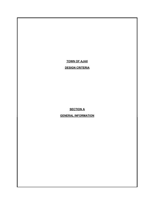
town of ajax design criteria section a general information
town of ajax design criteria section a general information
town of ajax design criteria section a general information

You also want an ePaper? Increase the reach of your titles
YUMPU automatically turns print PDFs into web optimized ePapers that Google loves.
TOWN OF AJAX<br />
DESIGN CRITERIA<br />
SECTION A<br />
GENERAL INFORMATION
TOWN OF AJAX DESIGN CRITERIA<br />
A1<br />
SECTION A - GENERAL INFORMATION REVISED JANUARY 2011<br />
A 1.00<br />
A 1.01<br />
INTRODUCTION<br />
THE TOWN OF AJAX<br />
The Town <strong>of</strong> Ajax is part <strong>of</strong> a two tier municipal governance model. The Town <strong>of</strong> Ajax is a lower<br />
tier municipality and, as such, is responsible for all roadways, storm sewers, and stormwater<br />
management infrastructure that are to be installed within all Town <strong>of</strong> Ajax road allowances and<br />
registered easements within The Town <strong>of</strong> Ajax. The Town is also responsible for all parks and<br />
open space on municipally owned lands.<br />
A 1.02<br />
REGIONAL MUNICIPALITY OF DURHAM<br />
The Regional Municipality <strong>of</strong> Durham is responsible for all sanitary sewers and watermains plus<br />
appurtenances that are to be installed on all road allowances and registered easements within<br />
the Region <strong>of</strong> Durham. The Region <strong>of</strong> Durham is responsible for storm sewers within the<br />
Regional road allowance.<br />
The Consultant shall contact the Region <strong>of</strong> Durham Works Department to obtain copies <strong>of</strong> the<br />
Regional Design Standards for sewers and watermains.<br />
A 1.03<br />
PURPOSE OF DESIGN CRITERIA<br />
The purpose <strong>of</strong> this document is to provide a clear and concise description <strong>of</strong> the Town <strong>of</strong> Ajax’s<br />
Engineering review processes and Engineering <strong>design</strong> standards. All development-related<br />
Engineering <strong>design</strong> proposals are to be prepared in a manner that conforms to the <strong>design</strong><br />
<strong>criteria</strong> contained in this document. This document will be periodically updated to include<br />
revisions where required. All submissions will be required to conform to the latest revision. The<br />
latest revision can be viewed by accessing the Town <strong>of</strong> Ajax website at<br />
http://www.<strong>town</strong><strong>of</strong><strong>ajax</strong>.com.<br />
A 1.04<br />
SUBMISSIONS<br />
Submission and circulation <strong>of</strong> engineering drawings related to planning approval is co-ordinated<br />
through the Town’s Planning and Development Services Department. The developer is<br />
required to make the initial contact with the Manager <strong>of</strong> Planning or <strong>design</strong>ate prior to<br />
submission <strong>of</strong> the Engineering drawings.<br />
Approval <strong>of</strong> engineering drawings must be obtained from the Town’s Engineering Section prior<br />
to commencement <strong>of</strong> any and all development works.<br />
DEFINITIONS<br />
“CONSULTING ENGINEER” or “DEVELOPER’S ENGINEER” means a pr<strong>of</strong>essional engineer<br />
possessing a current certificate <strong>of</strong> authorization to practice pr<strong>of</strong>essional engineering as required<br />
by the Pr<strong>of</strong>essional Engineers Act. The consulting firm should also be a member in good<br />
standing <strong>of</strong> the Consulting Engineers <strong>of</strong> Ontario (CEO).<br />
“DRAFT PLAN APPROVAL” means approval <strong>of</strong> a draft plan <strong>of</strong> subdivision by the Town <strong>of</strong> Ajax<br />
subject to certain conditions in accordance with the Planning Act. The conditions <strong>of</strong> approval are<br />
to be fulfilled in part by the Owner before entering into a subdivision agreement with the Town <strong>of</strong><br />
Ajax.
TOWN OF AJAX DESIGN CRITERIA<br />
A2<br />
SECTION A - GENERAL INFORMATION REVISED JANUARY 2010<br />
“FUNCTIONAL ACCEPTANCE” shall be the terminology used to describe the date when the<br />
underground services within the subdivision have been constructed and are without deficiencies<br />
that prevent them from operating as intended to the satisfaction <strong>of</strong> the Town.<br />
“PRELIMINARY ACCEPTANCE” shall be the terminology used to describe the date when the<br />
services are complete and acceptable to the Town <strong>of</strong> Ajax subject to the maintenance<br />
requirements <strong>of</strong> the Subdivision Agreement.<br />
“FINAL ACCEPTANCE” shall be the terminology used to describe the date when the Owner's<br />
maintenance requirements have been fulfilled and the services are acceptable to the Town <strong>of</strong><br />
Ajax.<br />
“FORMAL ASSUMPTION” shall be the terminology used to describe the date when the Town<br />
<strong>of</strong> Ajax’s Council agrees by Bylaw that all the conditions <strong>of</strong> the Subdivision Agreement have<br />
been fulfilled and all the maintenance requirements have been completed.<br />
“SOILS CONSULTING ENGINEER” - is a geotechnical engineering firm whose services have<br />
been engaged by the Developer or the Developer’s Engineer, usually to provide<br />
predevelopment soils investigations as well as a quality control function through the servicing/<br />
construction phase.<br />
A 2.00<br />
FAMILIARIZATION<br />
Prior to commencement <strong>of</strong> the engineering <strong>design</strong>, the Consultant shall obtain up to date copies<br />
<strong>of</strong> the Town <strong>of</strong> Ajax Design Criteria and Standard Detail Drawings and the Design Services<br />
Standard Details Manual to familiarize themselves with the requirements <strong>of</strong> a subdivision and<br />
site plan <strong>design</strong> in the Town <strong>of</strong> Ajax. Meetings shall be held with Engineering and Planning staff<br />
to confirm external drainage areas, draft conditions and other data prior to commencement <strong>of</strong><br />
the Engineering Design.<br />
A 2.01<br />
FUNCTIONAL REPORT<br />
A functional report (feasibility study) is required in accordance with the Planning Act and the<br />
Town <strong>of</strong> Ajax’s Official Plan for the draft approval <strong>of</strong> any plans <strong>of</strong> subdivision. A functional<br />
report may also be required, for other mid to large-scale developments potentially having an<br />
impact on servicing, grading, drainage, and traffic at the discretion <strong>of</strong> the Manager <strong>of</strong><br />
Engineering.<br />
Prior to the commencement <strong>of</strong> the Engineering Design and the Functional Report, the Owner’s<br />
Engineer shall meet with the Engineering staff to discuss the Town's requirements and with the<br />
Region's Works Department to discuss the Region's requirements. It is suggested that when<br />
possible this be a joint meeting.<br />
The functional report shall provide all details, calculations, costs, alternatives and<br />
recommendations necessary that decisions can be logically made.<br />
In cases where the subdivision development under consideration forms part <strong>of</strong> a larger area set<br />
aside for future development, the functional report shall demonstrate that the servicing <strong>design</strong><br />
will accommodate and allow for orderly and efficient future development.<br />
The functional report shall be signed and sealed by a pr<strong>of</strong>essional engineer.<br />
The functional report shall include, all relevant background <strong>information</strong> with respect to Site
TOWN OF AJAX DESIGN CRITERIA<br />
A3<br />
SECTION A - GENERAL INFORMATION REVISED JANUARY 2010<br />
Constraints and Existing Conditions such as, but not limited to:<br />
• Topography and drainage<br />
• All pipelines (Trans Canada, Enbridge, Union Gas etc.)<br />
• Hydro easements / corridors<br />
• Trunk sewers and watermains<br />
• Utilities<br />
• Environmental features (protected watercourses, top <strong>of</strong> bank, terrestrials)<br />
• Road Networks<br />
The Functional Report shall address, but will not necessarily be limited to, the following<br />
considerations:<br />
(a)<br />
(b)<br />
(c)<br />
(d)<br />
(e)<br />
(f)<br />
(g)<br />
(h)<br />
(i)<br />
(j)<br />
(k)<br />
(l)<br />
(m)<br />
(n)<br />
(o)<br />
(p)<br />
(q)<br />
(r)<br />
(s)<br />
The Draft Plan <strong>of</strong> Subdivision<br />
Topography and drainage<br />
Site Servicing<br />
Stormwater Management Report, external drainage areas, overland flow routes<br />
watershed drainage areas and watercourse improvements and channelization<br />
Storm drainage systems, including Hydraulic Grade Line (HGL) constraints<br />
Soils Report/Geotechnical Investigations<br />
Major roadway alignments, cross-<strong>section</strong>s, right <strong>of</strong> way width, and inter<strong>section</strong>s<br />
Traffic Impact Study<br />
Roadway structures<br />
Railway crossings<br />
Parkland development<br />
Major trunk sewers<br />
Sanitary drainage systems<br />
Water distribution systems<br />
Lot grading <strong>design</strong>, including overland flow route<br />
Pumping station locations<br />
Phasing<br />
Adjacent developments<br />
Environmental Impact Study (EIS)<br />
The Functional Report shall contain the following:<br />
(a)<br />
The Draft Plan <strong>of</strong> Subdivision<br />
The Draft Plan must be in a form acceptable to the Planning Departments <strong>of</strong> the<br />
Regional Municipality <strong>of</strong> Durham and the Town <strong>of</strong> Ajax.<br />
(b)<br />
Contour Plan<br />
This plan shall be a plan at a scale <strong>of</strong> no larger than 1:1000 giving contour lines at<br />
sufficient intervals to permit assessment <strong>of</strong> existing surface drainage patterns. This<br />
plan is to extend to the limits <strong>of</strong> the drainage area to be served by proposed sanitary<br />
and storm sewer systems, including lands beyond the boundaries <strong>of</strong> the subdivision.<br />
All elevations shall refer to NAD 83 Geodetic Datum.<br />
(c)<br />
Conceptual Grading Plan<br />
This plan shall be at a scale <strong>of</strong> no larger than 1:500 showing a <strong>general</strong> outline <strong>of</strong><br />
proposed grading, including overland flow routes.
TOWN OF AJAX DESIGN CRITERIA<br />
A4<br />
SECTION A - GENERAL INFORMATION REVISED JANUARY 2010<br />
(d)<br />
General Servicing Plan<br />
This plan shall be at a scale <strong>of</strong> no larger than 1:1000 and will be based on the Draft<br />
Plan <strong>of</strong> Subdivision. The plan shall schematically show the proposed underground<br />
services and their connection to existing systems. Direction <strong>of</strong> flow must be<br />
indicated on all sewers. This plan is to be accompanied by engineering calculations<br />
indicating the quantity <strong>of</strong> stormwater flow at the connection to existing systems<br />
and/or at proposed outfalls. Consideration must be given to the whole catchment<br />
area to ultimately be developed. Overland flow routing, proposed stormwater<br />
management facilities, blocks and easements for storm drainage systems shall also<br />
be shown.<br />
(e)<br />
Soils Report/Geotechnical Investigation<br />
A preliminary soils investigation and report from an independent Soils Consultant will<br />
be required by the Town. The soils report should include sufficient <strong>information</strong> so as<br />
to assess constructability <strong>of</strong> sewer systems, founding levels for buildings, engineered<br />
fill requirements, water table <strong>information</strong> and a recommended pavement structure<br />
(f)<br />
Stormwater Management Report<br />
This report must address the quality and quantity <strong>criteria</strong> for the watershed or subwatershed<br />
within the proposed development. This report must also address any<br />
concerns from the area Conservation Authority and Ministry <strong>of</strong> Environment <strong>design</strong><br />
<strong>criteria</strong> for stormwater management (Stormwater Management Planning and Design<br />
Manual, 2003). Minor and major storm systems and flow routes must be identified<br />
within the report. The pond block must be adequately sized such that the stormwater<br />
management facility meets all Town <strong>of</strong> Ajax <strong>criteria</strong> (Refer to Section C).<br />
(g)<br />
Tree Inventory and Preservation Report<br />
This report will clearly identify all existing plant material with a calliper <strong>of</strong> 60mm or<br />
greater by providing species, quantity, size, height, and condition. Indicate if the<br />
existing plant material is to be saved, removed or relocated. The location <strong>of</strong> existing<br />
plant material is to be surveyed and located on the plan by an Ontario Land<br />
Surveyor. The extent <strong>of</strong> the survey will be a minimum <strong>of</strong> 10m beyond the limits <strong>of</strong><br />
the site. Details <strong>of</strong> how the plant material will be successfully preserved during<br />
construction and post construction must be clearly identified. This report shall be<br />
prepared by a certified arborist or licensed landscape architect.<br />
(h)<br />
Additional Reports<br />
The Town <strong>of</strong> Ajax may require a study and report which evaluates the geographical<br />
and hydro- geological characteristics <strong>of</strong> a rural area where private services are<br />
proposed. This study shall identify the suitability <strong>of</strong> the development area and its<br />
component sub-areas to safely accommodate private water supply and sewage<br />
disposal systems.<br />
(i)<br />
Conditions Of Draft Approval<br />
Through the evaluation <strong>of</strong> the draft plan <strong>of</strong> subdivision, the Town may impose<br />
conditions on a draft approval related to engineering <strong>design</strong>, phasing, construction<br />
requirements from submitted reports and other requirements. Through the review <strong>of</strong><br />
detailed engineering submissions, the <strong>design</strong> <strong>of</strong> the draft plan may change to
TOWN OF AJAX DESIGN CRITERIA<br />
A5<br />
SECTION A - GENERAL INFORMATION REVISED JANUARY 2010<br />
address proposed conditions. Applicants are advised that the Town may impose<br />
changes to the draft plan <strong>design</strong> in order to accommodate such circumstances<br />
subject to processing and notice requirements under the Planning Act.<br />
(j)<br />
Street Naming<br />
The Town <strong>of</strong> Ajax has a street name registry for all the new public and private streets<br />
and lanes in Ajax. New street names must be selected from that registry. Please<br />
contact the <strong>of</strong>fice <strong>of</strong> the Town <strong>of</strong> Ajax CAO for the latest registry.<br />
A 3.00<br />
SUBMISSIONS<br />
Engineering drawings shall be submitted simultaneously to the Region <strong>of</strong> Durham and to the<br />
Town <strong>of</strong> Ajax. The Consulting Engineer is advised to review the Region <strong>of</strong> Durham's <strong>design</strong><br />
<strong>criteria</strong> to determine the requirements for submission <strong>of</strong> engineering drawings to the Region's<br />
Works Department.<br />
A 3.01<br />
FIRST SUBMISSION TO THE TOWN OF AJAX<br />
After approval <strong>of</strong> a planning application, the initial submission <strong>of</strong> engineering drawings for<br />
review by the Engineering <strong>section</strong> shall contain the following <strong>information</strong>:<br />
A copy <strong>of</strong> a Geotechnical Investigation report prepared by a qualified Soils Consulting Engineer.<br />
The initial submission <strong>of</strong> engineering drawings to the Town <strong>of</strong> Ajax shall contain:<br />
(a)<br />
(b)<br />
(c)<br />
(d)<br />
(e)<br />
One copy <strong>of</strong> the approved draft plan, functional servicing report and approved Traffic<br />
Management Plan,<br />
Three copies <strong>of</strong> the proposed 40M- and 40R- Plans showing all lot and block<br />
numbering and dimensioning,<br />
A declaration from the Consulting Engineer indicating that he has been retained to<br />
<strong>design</strong> and supervise the construction <strong>of</strong> the work in the subdivision according to the<br />
terms <strong>of</strong> the Subdivision Agreement,<br />
Two sets containing just the General Plan <strong>of</strong> Services,<br />
Six complete sets <strong>of</strong> Engineering Drawings that include:<br />
• Cover Page<br />
• General Notes<br />
• General Plan <strong>of</strong> Services<br />
• Plan/Pr<strong>of</strong>iles for each street<br />
• Lot Grading Plan<br />
• Sediment and Erosion Control Plan<br />
• Storm Drainage Plan<br />
• External Storm Drainage Plan<br />
• Storm Sewer Design sheets<br />
• Detailed Stormwater Management Report<br />
• Stormwater Facility Operational Manual,
TOWN OF AJAX DESIGN CRITERIA<br />
A6<br />
SECTION A - GENERAL INFORMATION REVISED JANUARY 2010<br />
(f)<br />
(g)<br />
(h)<br />
(i)<br />
(j)<br />
(k)<br />
Three copies <strong>of</strong> a soils report/geotechnical investigation prepared by a qualified Soils<br />
Consulting Engineer,<br />
Three copies <strong>of</strong> the Noise Report,<br />
Three copies <strong>of</strong> the Tree Preservation Report and Plan,<br />
All detail drawings other than the O.P.S. Detail Drawings,<br />
All drawings pertinent to the <strong>design</strong>,<br />
All other calculations necessary to check the <strong>design</strong>.<br />
The above <strong>information</strong> will be reviewed by the Town <strong>of</strong> Ajax once all required <strong>information</strong> has<br />
been submitted. One set <strong>of</strong> drawings and calculations will then be returned to the Consultant<br />
with any required revisions noted.<br />
A 3.02<br />
SUBSEQUENT SUBMISSIONS<br />
Subsequent submissions <strong>of</strong> Items (d) through (j) inclusive shall be made until the engineering<br />
drawings and <strong>design</strong> is acceptable to the Town. These submissions shall contain the previous<br />
comments and mark-ups from the Town and:<br />
• Two complete sets <strong>of</strong> revised Engineering Drawings<br />
• Two copies <strong>of</strong> a Hydro Distribution System and Street Lighting<br />
• Two copies <strong>of</strong> a Photometrics Plan<br />
• Two copies <strong>of</strong> a Traffic Management Implementation Plan (TMIP)<br />
• Two copies <strong>of</strong> the Revised Stormwater Design Sheets<br />
• Three copies <strong>of</strong> the Landscape Drawings and Park Grading Plan, if necessary<br />
• Two copies <strong>of</strong> the Utility Coordination Plan<br />
• Two copies <strong>of</strong> any revised reports<br />
The <strong>design</strong> <strong>of</strong> the electrical distribution system and street lighting shall be completed by the<br />
Owner's Electrical Consultant. This <strong>design</strong> shall be submitted to the Manager <strong>of</strong> Engineering<br />
and shall be approved prior to the final approval <strong>of</strong> the engineering drawings. The streetlight<br />
poles, standards, and lamps shall be to the Town <strong>of</strong> Ajax standards and approved by the Town.<br />
The location <strong>of</strong> the streetlight poles and transformers shall also be shown on the Utility<br />
Coordination Plan.<br />
The consultant must also coordinate the planning and construction <strong>of</strong> the other utilities involved<br />
with the subdivision.<br />
A 3.03<br />
MINISTRY OF THE ENVIRONMENT APPLICATIONS<br />
After the engineering <strong>design</strong> and drawings are in a state acceptable to the Town <strong>of</strong> Ajax, four<br />
copies <strong>of</strong> the Ministry <strong>of</strong> the Environment application form for the storm sewer system and one<br />
complete set <strong>of</strong> engineering drawings shall be submitted to the Manager <strong>of</strong> Engineering. Three<br />
copies <strong>of</strong> this application shall be signed by the Town <strong>of</strong> Ajax and shall be returned to the<br />
Consultant. The Consultant shall make application to the Region <strong>of</strong> Durham for the Ministry <strong>of</strong><br />
the Environment approvals for the sanitary and water systems.<br />
A 3.04<br />
OTHER APPROVALS<br />
The Consultant shall be required to make all submissions and representations necessary to
TOWN OF AJAX DESIGN CRITERIA<br />
A7<br />
SECTION A - GENERAL INFORMATION REVISED JANUARY 2010<br />
obtain approval from all other authorities affected (Ministry <strong>of</strong> Natural Resources, Ministry <strong>of</strong><br />
Transportation, Conservation Authorities, Fire Marshall, Medical Officer <strong>of</strong> Health, etc.). The<br />
Town <strong>of</strong> Ajax shall be kept informed <strong>of</strong> the progress <strong>of</strong> these submissions by copies <strong>of</strong> all<br />
correspondence.<br />
A 3.05<br />
ORIGINAL DRAWINGS<br />
After all approvals have been received from all necessary agencies, the original drawings shall<br />
be submitted to the Town. These drawings shall be signed and dated by the Town indicating<br />
they have been reviewed by the Town <strong>of</strong> Ajax and returned to the Consultant. No changes or<br />
revisions may be made to the drawings after the signature <strong>of</strong> the Town has been affixed unless<br />
the revisions have been formally reviewed and accepted by the Town and initialled by the Town<br />
in the Revision Block.<br />
If, after two years from the date <strong>of</strong> the original approval <strong>of</strong> the engineering drawings by<br />
the Town, the Developer fails to enter into a Subdivision Agreement with the Town <strong>of</strong><br />
Ajax, the Town reserves the right to revoke all approvals related to the engineering<br />
drawings.<br />
A 3.06<br />
PREPARATION OF SUBDIVISION AGREEMENT<br />
The draft <strong>of</strong> the Subdivision Agreement, as prepared by the Town <strong>of</strong> Ajax, will be completed and<br />
forwarded to the Owner upon written request to the Manager <strong>of</strong> Planning or <strong>design</strong>ate. The final<br />
Subdivision Agreement will be prepared under the direction <strong>of</strong> the Manager <strong>of</strong> Planning or<br />
<strong>design</strong>ate and will be executed by the Mayor and Clerk only after the receipt <strong>of</strong> all payments<br />
and securities to the satisfaction <strong>of</strong> the Finance Department.<br />
The engineering drawings must be approved by the Town prior to the finalization <strong>of</strong> the<br />
Subdivision Agreement Schedules. Prior to commencement <strong>of</strong> preparation <strong>of</strong> the subdivision<br />
agreement the owner shall provide the Town <strong>of</strong> Ajax with the following:<br />
(a)<br />
(b)<br />
(c)<br />
(d)<br />
Ministry <strong>of</strong> Environment certificates <strong>of</strong> approval for Town services to be constructed<br />
for the proposed subdivision.<br />
The name <strong>of</strong> the person and/or company with whom the Subdivision Agreement will<br />
be executed.<br />
The name, address and telephone number <strong>of</strong> the Owner’s lawyer.<br />
A breakdown <strong>of</strong> the number <strong>of</strong> units proposed within the subdivision, i.e.:<br />
• Single detached units<br />
• Semi detached units<br />
• Townhouse units<br />
• Apartment units<br />
- One bedroom and bachelor<br />
- Two or more bedrooms<br />
(e)<br />
(f)<br />
Six copies <strong>of</strong> the legal description <strong>of</strong> the subdivision based on the Reference Plan<br />
and approved by the Land Registry Office.<br />
Six full size and six legal size copies <strong>of</strong> the proposed final plan for registration (40M-<br />
Plan) complete with the street names, lot numbers, surveyor's certificate, owner's<br />
certificate, and all other pertinent <strong>information</strong> required by the Registry Office.
TOWN OF AJAX DESIGN CRITERIA<br />
A8<br />
SECTION A - GENERAL INFORMATION REVISED JANUARY 2010<br />
(g)<br />
(h)<br />
(i)<br />
(j)<br />
(k)<br />
(l)<br />
(m)<br />
Six full size and six legal size copies <strong>of</strong> the Reference (40R-) Plans for any easement<br />
to be granted to the Town.<br />
Six copies <strong>of</strong> the General Plan <strong>of</strong> Services.<br />
Six copies <strong>of</strong> a detailed cost estimate prepared by a pr<strong>of</strong>essional engineer for<br />
services to be constructed for the subdivision. The cost estimate shall be signed and<br />
sealed by the pr<strong>of</strong>essional engineer. A draft copy <strong>of</strong> the cost estimate shall be<br />
submitted to the Town for approval prior to preparation <strong>of</strong> the above noted copies.<br />
This cost estimate will be used as a basis for calculation <strong>of</strong> the security deposit<br />
(Schedule A <strong>of</strong> the subdivision agreement).<br />
One copy <strong>of</strong> the final tendered contract schedule <strong>of</strong> unit prices and specifications<br />
Six copies <strong>of</strong> a schedule identifying lands and easements to be deeded to the Town.<br />
A draft copy <strong>of</strong> the schedule shall be submitted to the Manager <strong>of</strong> Engineering for<br />
approval prior to preparation <strong>of</strong> the above noted copies (Schedule B <strong>of</strong> the<br />
subdivision agreement).<br />
Proposed phasing.<br />
List <strong>of</strong> all drawings required (Schedule H <strong>of</strong> the subdivision agreement).<br />
A 4.00<br />
A 4.01<br />
A 4.02<br />
A 4.03<br />
A 4.04<br />
A 4.05<br />
A 4.06<br />
A 4.07<br />
A 4.08<br />
ENGINEERING DRAWING REQUIREMENTS<br />
All engineering drawings shall be prepared in a neat and legible fashion. The <strong>design</strong><br />
<strong>information</strong> presented on these drawings shall be completed in metric.<br />
All original engineering drawings shall be prepared on 3 mil drafting film (Mylar) with<br />
a matte surface on the working side. As constructed drawings shall also be<br />
submitted in electronic format, AutoCad 2006 or later, and PDF format for the<br />
archives.<br />
The reference Geodetic Bench Mark and the Site Bench Marks to be used for<br />
construction shall be identified on the General Plan <strong>of</strong> Services and in the General<br />
Notes. All elevations shown on the engineering drawings are to be <strong>of</strong> Geodetic<br />
origin NAD 83. A minimum <strong>of</strong> 2 benchmarks <strong>of</strong> geodetic origin are to be shown on<br />
the plans<br />
A Key Plan at a scale <strong>of</strong> 1:10,000 shall be shown on the top right hand corner <strong>of</strong> all<br />
drawings, and the area covered by the drawing shall be clearly identified.<br />
The standard Town <strong>of</strong> Ajax title block as shown in the detail drawings shall be used<br />
on all engineering drawings (see AS-500).<br />
All drawings shall be prepared on standard A1 sheets (594 mm x 841 mm).<br />
Stamps, tapes, and stick-on labels shall not be used except for the Pr<strong>of</strong>essional<br />
Engineer's stamp.<br />
The lot numbering and block identification on all engineering drawings shall be the<br />
same as shown on the Registered Plan for the area. All road allowances, lots,
TOWN OF AJAX DESIGN CRITERIA<br />
A9<br />
SECTION A - GENERAL INFORMATION REVISED JANUARY 2010<br />
blocks, easements and reserves shall be shown and identified on all engineering<br />
drawings in the same manner as the corresponding Registered Plans.<br />
A 4.09<br />
A 4.10<br />
A 4.11<br />
When the <strong>information</strong> presented exceeds the limits <strong>of</strong> the page and requires more<br />
than one drawing, match lines and corresponding reference drawing number shall be<br />
used with no overlapping <strong>of</strong> <strong>information</strong>.<br />
A north arrow shall be referenced on all drawings.<br />
All final approved engineering drawings shall be stamped and signed by a<br />
pr<strong>of</strong>essional engineer.<br />
A 5.00<br />
A 5.01<br />
COVER PAGE<br />
The Cover Page shall list the name and phase <strong>of</strong> the development, Town <strong>of</strong> Ajax file<br />
number, Regional file number, list <strong>of</strong> drawings, key plan <strong>of</strong> site, and consultant’s<br />
name.<br />
A 6.00<br />
A 6.01<br />
A 6.02<br />
A 6.03<br />
A 6.04<br />
A 6.05<br />
A 6.06<br />
A 6.07<br />
A 6.08<br />
A 6.09<br />
A 6.10<br />
A 6.11<br />
A 6.12<br />
GENERAL PLAN OF SERVICES<br />
A General Plan <strong>of</strong> Services Drawing shall be prepared for all developments at a<br />
scale <strong>of</strong> 1:1,000 maximum.<br />
When more than one General Plan <strong>of</strong> Services Drawing is required for any<br />
development, then the division <strong>of</strong> drawings shall reflect the limits <strong>of</strong> the Registered<br />
Plans as closely as possible.<br />
An index <strong>of</strong> all drawings associated with the development shall be shown on the<br />
Cover Page.<br />
All road allowances, street names, lots, blocks, easements and reserves shall be<br />
shown and identified in the same manner as the Registered Plan.<br />
All existing services, utilities and abutting properties shall be shown in dotted lines.<br />
All services to be constructed shall be shown in solid lines.<br />
All storm and sanitary sewers shall be shown, identifying length, size, grade, type<br />
and direction <strong>of</strong> flow (<strong>of</strong> existing and proposed).<br />
All manholes and catchbasins are to be shown and numbered in accordance with the<br />
<strong>design</strong> sheets.<br />
All watermains, valves, hydrants, and blow-<strong>of</strong>fs shall be shown. Watermains shall be<br />
identified by size.<br />
All curbs and sidewalks shall be shown.<br />
All fencing is to be indicated by the height and type <strong>of</strong> fence.<br />
Dimensioning <strong>of</strong> utilities and roadways is not required.
TOWN OF AJAX DESIGN CRITERIA<br />
A10<br />
SECTION A - GENERAL INFORMATION REVISED JANUARY 2010<br />
A 6.13<br />
A 6.14<br />
A 6.15<br />
A 6.16<br />
Registered Plan number must be shown on the As-Constructed General Plan <strong>of</strong><br />
Services Drawings.<br />
All sites for parks, schools, churches, commercial, and industrial development must<br />
be shown and identified by use.<br />
If a subdivision encroaches on an existing floodplain, the approved screening limit<br />
restrictions must be shown, as specified by the local conservation authority.<br />
The reference Geodetic Bench Marks and the Site Bench Marks to be used for<br />
construction shall be identified.<br />
A 7.00<br />
PLAN AND PROFILE DRAWINGS<br />
It should be understood that whereas the following specifies Ajax’s requirements, it should be<br />
understood that all infrastructure regardless <strong>of</strong> final ownership shall be shown on the<br />
Plan/pr<strong>of</strong>ile drawings.<br />
A 7.01<br />
A 7.02<br />
A 7.03<br />
A 7.04<br />
A 7.05<br />
A 7.06<br />
A 7.07<br />
A 7.08<br />
A 7.09<br />
A 7.10<br />
All Plan and Pr<strong>of</strong>ile Drawings shall be prepared at a scale <strong>of</strong> 1:500 horizontally and<br />
1:50 vertically.<br />
Plan and Pr<strong>of</strong>ile Drawings are required for all roadways, blocks and easements<br />
within the development, for all outfalls beyond the development to the permanent<br />
outlet, for all boundary roadways abutting the development, and for other areas<br />
where utilities are being installed below grade.<br />
All Plan and Pr<strong>of</strong>ile Drawings shall be prepared so that each street can be filed<br />
separately. The street names shall be identified on the plan portion <strong>of</strong> the drawings.<br />
The reference drawing numbers for all intersecting streets and match lines shall be<br />
shown on all Plan and Pr<strong>of</strong>ile Drawings.<br />
All existing or future services, utilities, and abutting properties shall be shown in<br />
dotted or dashed lines.<br />
All services to be constructed shall be shown in solid lines.<br />
The pr<strong>of</strong>ile portion <strong>of</strong> the drawing shall be a vertical projection <strong>of</strong> the centre line<br />
whenever possible.<br />
All road allowances, pavement widths, lots, blocks, easements and reserves,<br />
including dimensions, shall be shown and identified in the same manner as the<br />
Registered Plan. Lot and block frontages shall be shown.<br />
All curb and gutter (to be shown with a double line) and sidewalks shall be shown<br />
and dimensioned on the plan portion <strong>of</strong> the drawing.<br />
All storm sewers shall be shown and dimensioned on the plan and shall also be<br />
plotted on the pr<strong>of</strong>ile <strong>of</strong> the drawings. The sewers shall have a complete description<br />
on the pr<strong>of</strong>ile portion <strong>of</strong> the drawing including length, grade, material, class <strong>of</strong> pipe<br />
and bedding requirements. The plan portion <strong>of</strong> the drawing shall indicate size and<br />
direction <strong>of</strong> flow. The size <strong>of</strong> the pipe shall be plotted to full scale on the pr<strong>of</strong>ile. The<br />
sanitary sewers and watermains are the responsibility <strong>of</strong> the Region <strong>of</strong> Durham and
TOWN OF AJAX DESIGN CRITERIA<br />
A11<br />
SECTION A - GENERAL INFORMATION REVISED JANUARY 2010<br />
will require the approval <strong>of</strong> the Region's Works Department.<br />
A 7.11<br />
A 7.12<br />
A 7.13<br />
A 7.14<br />
A 7.15<br />
A 7.16<br />
A 7.17<br />
A 7.18<br />
A 7.19<br />
A 7.20<br />
A 7.21<br />
All storm sewer manholes shall be shown on the plan and on the pr<strong>of</strong>ile portion <strong>of</strong><br />
the drawing. The manholes shall be identified by number and shall make reference<br />
to the applicable OPSD or to a special detail on the pr<strong>of</strong>ile portion <strong>of</strong> the drawing. All<br />
invert elevations shall be shown on the pr<strong>of</strong>ile with each having reference to the<br />
north arrow.<br />
All catchbasins and catchbasin leads shall be shown. Pipe diameter for catchbasin<br />
leads shall be identified on the plan portion <strong>of</strong> the drawing if it differs from the<br />
standard.<br />
Safety platforms and corresponding proposed elevations to be noted in the pr<strong>of</strong>ile<br />
portion <strong>of</strong> the drawings for all storm sewer manholes requiring them.<br />
All drop connections shall be noted and referenced to the Standard Detail Drawing,<br />
including sizing and inverts.<br />
All rim and invert elevations for rear lot catchbasins and catchbasin/manholes shall<br />
be shown. Provide RLCB lead detail, showing the slope line <strong>of</strong> influence using a 1:1<br />
slope from the bottom <strong>of</strong> the pipe.<br />
Storm sewer manhole benching details shall be shown at a scale <strong>of</strong> 1:50 whenever<br />
the OPSD are not applicable.<br />
All sanitary sewers and watermains, including any/all appurtenances, to be shown,<br />
described and dimensioned on the portion <strong>of</strong> the drawing as per the <strong>design</strong> <strong>criteria</strong><br />
requirements <strong>of</strong> the Region's Works Department. In addition, the watermains shall<br />
be plotted to full scale size on the pr<strong>of</strong>ile portion <strong>of</strong> the drawing and described.<br />
Notwithstanding, the above location <strong>of</strong> all storm, water and sanitary service<br />
connections shall be shown on the plan portion <strong>of</strong> the drawing using different<br />
symbols for each service. These services need only to be dimensioned when the<br />
location differs from the standard location as shown on the Town <strong>of</strong> Ajax Standard<br />
Detail Drawings. The connections to all blocks in the development shall be fully<br />
described and dimensioned (size, length, grade, invert elevations, materials, class <strong>of</strong><br />
pipe, bedding, etc.).<br />
The centre line <strong>of</strong> construction with the 20 m stations noted by a small cross shall be<br />
shown on the plan portion <strong>of</strong> the drawing.<br />
The original ground at centre line and the proposed centre line road grade shall be<br />
plotted on the pr<strong>of</strong>ile. The proposed centre line road grade shall be fully described<br />
including: length, grade, P.V.I. station and elevation, vertical curve data (K-value,<br />
length, P.V.I., B.V.C., E.V.C., high point and/or low point station, and elevations). In<br />
addition, intermediate stations and elevations shall be labeled on the pr<strong>of</strong>ile at 5<br />
metre intervals through all vertical curves.<br />
Chainages for the centre line <strong>of</strong> construction shall be shown on the plan portion and<br />
pr<strong>of</strong>ile portion <strong>of</strong> the drawing. The horizontal curve B.H.C., E.H.C., chainages shall<br />
be noted. The curve data (angular deflection, radius, tangent, length and chord)<br />
shall be noted also.
TOWN OF AJAX DESIGN CRITERIA<br />
A12<br />
SECTION A - GENERAL INFORMATION REVISED JANUARY 2010<br />
A 7.22<br />
A 7.23<br />
A 7.24<br />
A 7.25<br />
A 7.26<br />
A 7.27<br />
A 7.28<br />
The proposed pavement <strong>design</strong> shall be noted on the plan portion <strong>of</strong> each road<br />
drawing.<br />
Special notes necessary to detail construction procedures or requirements shall be<br />
shown.<br />
Basement elevations for all existing dwellings to be shown and noted on the pr<strong>of</strong>ile<br />
portion <strong>of</strong> the drawings. Proposed minimum basement elevations to be determined<br />
for all lots created through the development and noted on the Lot Grading Plans.<br />
All existing services, utilities and features shall be shown on the plan portion <strong>of</strong> the<br />
drawing. Those services and utilities below grade that are critical to the new<br />
construction shall also be shown in the pr<strong>of</strong>ile. Test holes may be required to<br />
determine actual elevation <strong>of</strong> these services and utilities.<br />
The curb radii at all inter<strong>section</strong>s shall be shown on the plan portion <strong>of</strong> the drawing.<br />
Pr<strong>of</strong>iles <strong>of</strong> roadways shall be produced sufficiently beyond the limits <strong>of</strong> the proposed<br />
road, to confirm the feasibility <strong>of</strong> possible future extensions.<br />
Details showing gutter grades for all inter<strong>section</strong>s, cul-de-sacs, 90 degree crescents<br />
and horizontal curves where the centreline grade is less than 1%, shall be provided<br />
on the plan portion <strong>of</strong> the drawing as a separate detail at a scale <strong>of</strong> 1:500.<br />
A 8.00<br />
A 8.01<br />
OTHER DRAWINGS<br />
LOT GRADING PLANS<br />
All lot grading plans shall be prepared in accordance with the <strong>criteria</strong> given in Section E.<br />
A 8.02<br />
STORM DRAINAGE PLANS<br />
All drainage plans for storm sewer <strong>design</strong> shall be prepared in accordance with the <strong>criteria</strong> given<br />
in Section C.<br />
A 8.03<br />
LANDSCAPE PLANS<br />
All landscape plans shall be prepared in accordance with Sections G and H <strong>of</strong> this manual<br />
utilizing graphic media as described in sub-<strong>section</strong>s A3.01 and A3.02. All landscape plans are<br />
to be prepared and stamped by a licensed Landscape Architect registered with the Ontario<br />
Association <strong>of</strong> Landscape Architects (O.A.L.A.).<br />
A 8.04<br />
TREE INVENTORY AND PRESERVATION PLAN<br />
All tree inventory and preservation plans shall be prepared by a certified arborist or by a<br />
licensed Landscape Architect registered with the Ontario Association <strong>of</strong> Landscape Architects.<br />
The plan shall incorporate all requirements <strong>of</strong> the tree preservation report and include all details<br />
and notes.<br />
A 8.05<br />
DETAIL DRAWINGS<br />
The Town <strong>of</strong> Ajax Standard Detail Drawings shall be utilized whenever applicable. The use <strong>of</strong><br />
the latest revision <strong>of</strong> the Ontario Provincial Standard Drawings may be utilized when approved
TOWN OF AJAX DESIGN CRITERIA<br />
A13<br />
SECTION A - GENERAL INFORMATION REVISED JANUARY 2010<br />
by the Manager <strong>of</strong> Engineering. These drawings need not be reproduced as part <strong>of</strong> the<br />
engineering drawings for the development, but must be referred to by number on the affected<br />
Plan and Pr<strong>of</strong>ile Drawings. The Consultant shall be responsible for checking the suitability <strong>of</strong><br />
the details provided on the Town <strong>of</strong> Ajax Standard Detail Drawings for the application proposed.<br />
Individual details shall be provided by the Consultant for all special features not covered by the<br />
Town <strong>of</strong> Ajax Standard Detail Drawings.<br />
These special details shall be drawn on standard sized sheets and shall be included as part <strong>of</strong><br />
the engineering drawings. The minimum scale to be used for any manhole or sewer detail shall<br />
be 1:50.<br />
A 8.06<br />
SEDIMENT AND EROSION CONTROL PLAN<br />
All Sediment and Erosion Control Plans shall be prepared in accordance with the <strong>criteria</strong> given<br />
in Section L.<br />
A 8.07<br />
UTILITY COORDINATION PLAN<br />
All Utility Coordination Plans shall be prepared in accordance with the <strong>criteria</strong> given in Section<br />
M.<br />
A 8.08<br />
TRAFFIC MANAGEMENT IMPLEMENTATION PLAN (TMIP)<br />
All Traffic Management Implementation Plans shall be prepared at a scale <strong>of</strong> 1:500 and in<br />
accordance with the <strong>criteria</strong> given in Section F.<br />
A 8.09<br />
CROSS SECTION PLANS<br />
Cross <strong>section</strong>s will be required along all external roads when adjacent to proposed<br />
developments.<br />
All Cross Section Plans shall be limited to 10 <strong>section</strong>s per sheet, at a scale <strong>of</strong> 1:50 vertical,<br />
1:200 horizontal.<br />
Cross <strong>section</strong>s will be required every 20 m and at every driveway.<br />
Cross <strong>section</strong>s will indicate all right <strong>of</strong> way limits, grading limits, driveway restoration limits, all<br />
above ground features (such as trees, hydro poles, etc), culverts, and existing and proposed<br />
roads, including road make-up.<br />
A 8.10<br />
REMOVAL PLANS<br />
All Removal Plans shall be prepared at a scale <strong>of</strong> 1:500.<br />
Removal Plan will indicate area <strong>of</strong> full depth road excavation and sidewalk, asphalt, curb,<br />
culvert, tree, etc. removals.<br />
A 9.00<br />
REQUIREMENTS PRIOR TO COMMENCEMENT OF CONSTRUCTION<br />
Prior to commencement <strong>of</strong> construction, the Owner’s Consulting Engineer shall submit the<br />
following <strong>information</strong> to the Manager <strong>of</strong> Engineering:<br />
a) Four sets <strong>of</strong> all approved engineering, landscaping, and electrical drawings (one full
TOWN OF AJAX DESIGN CRITERIA<br />
A14<br />
SECTION A - GENERAL INFORMATION REVISED JANUARY 2010<br />
size and three at 50% reduction) and one digital copy <strong>of</strong> the plan<br />
b) One copy <strong>of</strong> the construction specifications<br />
c) The proposed contractor.<br />
d) Copy <strong>of</strong> the signed contract between Contractor and Owner.<br />
e) All other <strong>information</strong> specified in the Subdivision Agreement as a requirement prior to<br />
commencement <strong>of</strong> construction or other <strong>information</strong> required by the Manager <strong>of</strong><br />
Engineering.<br />
Following submission <strong>of</strong> these materials, a pre-construction meeting shall be arranged and held<br />
prior to commencement <strong>of</strong> construction.<br />
A 10.00<br />
A 10.01<br />
ACCEPTANCE<br />
FUNCTIONAL ACCEPTANCE<br />
The term Functional Acceptance shall be used to describe the date when the underground<br />
services within the subdivision have been constructed and are without deficiencies that prevent<br />
them from operating as intended to the satisfaction <strong>of</strong> the Town.<br />
The following must be completed to the satisfaction <strong>of</strong> the Town prior to issuance <strong>of</strong> the<br />
Functional Acceptance Certificate:<br />
a) A certificate from the Consulting Engineer that the services included in this<br />
agreement have been constructed and installed in accordance with the approved<br />
<strong>design</strong> drawings, specifications, standards, and requirements,<br />
b) Storm sewers shall be flushed, cleaned, and inspected by CCTV with reports and<br />
video(s) submitted to the Town for review,<br />
c) Rear yard catch basins have been certified by an O.L.S. that they have been<br />
installed in the correct location,<br />
d) Storm water management facilities are constructed as <strong>design</strong>ed,<br />
e) Roads have been constructed with base curb, base asphalt, and connect to an<br />
existing publicly maintained road,<br />
f) Installation <strong>of</strong> Street name and traffic control signs,<br />
g) Installation <strong>of</strong> unassumed road and utility <strong>information</strong> signs,<br />
h) Construction <strong>of</strong> emergency access routes,<br />
i) Overland flow routes have been graded and fenced to prevent them from being<br />
blocked by excavated material or building materials,<br />
j) The Town has been notified by the Region <strong>of</strong> Durham that the sanitary sewer and<br />
watermain systems are functional, and<br />
k) The plan <strong>of</strong> subdivision has been registered and a mylar copy has been received by<br />
the Town from the registry <strong>of</strong>fice
TOWN OF AJAX DESIGN CRITERIA<br />
A15<br />
SECTION A - GENERAL INFORMATION REVISED JANUARY 2010<br />
The Engineering <strong>section</strong> will issue a Functional Acceptance Certificate to the Chief Building<br />
Official indicating the conditions for Functional Acceptance have been met for the purposes <strong>of</strong><br />
building permit issuance.<br />
A 10.02<br />
PRELIMINARY ACCEPTANCE<br />
The term Preliminary Acceptance shall be used to describe the date when the services are<br />
complete and acceptable to the Town <strong>of</strong> Ajax subject to the maintenance requirements <strong>of</strong> the<br />
Subdivision Agreement.<br />
The date for Preliminary Acceptance <strong>of</strong> the sanitary sewers and watermains installed in all new<br />
developments shall be established by the Region <strong>of</strong> Durham.<br />
Underground Services<br />
When the underground services are completed and cleaned to the satisfaction <strong>of</strong> the Consulting<br />
Engineer, they shall advise the Town <strong>of</strong> Ajax in writing that the work is ready for inspection. The<br />
Town shall carry out their inspection and advise the Consulting Engineer <strong>of</strong> any items <strong>of</strong> work<br />
requiring further rectification. When all deficiencies have been corrected to the satisfaction <strong>of</strong><br />
the Town, and upon receipt <strong>of</strong>:<br />
a) Statutory Declaration from the Owner certifying that all accounts have been paid,<br />
b) As-built sketches for all storm sewers, foundation drain collectors, ro<strong>of</strong> drain<br />
collectors, and connections along with paper prints showing all as-constructed<br />
inverts and lengths for the storm sewers, and<br />
c) Revised storm sewers <strong>design</strong> sheets and hydraulic grade line calculations to reflect<br />
the as-constructed inverts lengths and grades for the storm sewers.<br />
The Town will issue to the Owner a Certificate <strong>of</strong> Preliminary Acceptance for underground<br />
services.<br />
The Certificate <strong>of</strong> Preliminary Acceptance for underground services will identify the start date for<br />
the maintenance period.<br />
The developer will be responsible for the maintenance <strong>of</strong> the underground services until final<br />
acceptance.<br />
Aboveground Services<br />
When the above ground services are completed to the satisfaction <strong>of</strong> the Consulting Engineer,<br />
he shall advise the Town <strong>of</strong> Ajax in writing that the work is ready for inspection. The Town shall<br />
carry out their inspection and advise the Consulting Engineer <strong>of</strong> any items <strong>of</strong> work requiring<br />
further rectification.<br />
Preliminary Acceptance for aboveground services cannot be given until one year has past since<br />
Preliminary Acceptance <strong>of</strong> underground services, all works on the project are completed, at<br />
least 85% <strong>of</strong> the dwellings are occupied, and all vacant blocks are topsoiled and seeded.<br />
When all deficiencies have been corrected to the satisfaction <strong>of</strong> the Town, and upon receipt <strong>of</strong>:<br />
a) Lot grading certificates for all developed lots,
TOWN OF AJAX DESIGN CRITERIA<br />
A16<br />
SECTION A - GENERAL INFORMATION REVISED JANUARY 2010<br />
b) Certification <strong>of</strong> all retaining walls,<br />
c) Test results for driveways,<br />
d) Electrical Safety Authority (ESA) final report for the streetlight system,<br />
e) A topographic survey <strong>of</strong> all stormwater management ponds indicating that they have<br />
been cleaned out to <strong>design</strong> grades,<br />
f) Completion certificate from the Engineering, Landscape, and Electrical Consultants,<br />
g) Certification <strong>of</strong> acoustic control measures,<br />
h) A statement by a registered land surveyor that they have located and/or properly reestablished<br />
all standard iron bars as shown on the Plan and any reference plan<br />
prepared as a result <strong>of</strong> the subdivision,<br />
i) Drawings in reproducible form showing the as-constructed <strong>information</strong> on all<br />
engineering drawings for the site, and<br />
j) Statutory Declaration from the Owner certifying that all accounts have been paid<br />
the Town will issue to the Owner a Certificate <strong>of</strong> Preliminary Acceptance <strong>of</strong> Aboveground<br />
services.<br />
The Certificate <strong>of</strong> Preliminary Acceptance <strong>of</strong> aboveground services cannot be issued until at<br />
least one year after the issuance <strong>of</strong> the Certificate <strong>of</strong> Preliminary Acceptance <strong>of</strong> underground<br />
services, and will identify the start date for the two year aboveground maintenance period. The<br />
developer will be responsible for the maintenance <strong>of</strong> the aboveground services until final<br />
acceptance.<br />
A 10.03<br />
FINAL ACCEPTANCE<br />
Final Acceptance shall be the terminology used to describe the date when the Owner's<br />
maintenance requirements have been fulfilled and the services are acceptable to the Town <strong>of</strong><br />
Ajax.<br />
At the end <strong>of</strong> the two year maintenance period for above ground services and when all services<br />
are completed to the satisfaction <strong>of</strong> the Consulting Engineer, the Town <strong>of</strong> Ajax shall be advised<br />
in writing that the work is ready for inspection. The Town shall carry out their inspection and<br />
advise the Consulting Engineer <strong>of</strong> any items <strong>of</strong> work requiring further rectification. When all<br />
deficiencies have been corrected to the satisfaction <strong>of</strong> the Town, and upon receipt <strong>of</strong>:<br />
a) a statutory declaration the Owner certifying that all accounts have been paid, and<br />
b) a letter from the Owner's Consulting Engineer and other outside agencies that<br />
services included in the Subdivision Agreement have been constructed and installed<br />
in accordance with the approved <strong>design</strong> drawings, and Town specifications,<br />
standards and requirements,<br />
the Town will issue to the Owner a Certificate <strong>of</strong> Final Acceptance.
TOWN OF AJAX DESIGN CRITERIA<br />
A17<br />
SECTION A - GENERAL INFORMATION REVISED JANUARY 2010<br />
A 10.04<br />
FORMAL ASSUMPTION<br />
Formal Assumption <strong>of</strong> the subdivision shall be the date on which the Town <strong>of</strong> Ajax’s Council<br />
agrees by Bylaw that all the conditions <strong>of</strong> the Subdivision Agreement have been fulfilled and all<br />
maintenance requirements have been completed.<br />
For clarification, Formal Assumption <strong>of</strong> the Subdivision refers to the transfer <strong>of</strong> maintenance<br />
responsibilities for works and services (as outlined in the Subdivision Agreement and the<br />
approved Plans) from the Owner to the Town. Assumption does not relieve or diminish the<br />
Owner from further obligations and/or responsibilities associated with the Development should<br />
problems arise which require additional action/rectification. The Owner's obligations will be<br />
terminated or reduced by the release <strong>of</strong> his funds/letters <strong>of</strong> credit by the Town, which occurs<br />
after the assumption process.<br />
A 11.00<br />
A 11.01<br />
AS CONSTRUCTED DRAWINGS<br />
GENERAL<br />
The ‘As Constructed’ Drawings constitute the original engineering drawings which have been<br />
amended to incorporate the construction changes and variances in order to provide accurate<br />
<strong>information</strong> on the works as installed in the development. The Registered 40M- Plan Number<br />
must be clearly shown on all ‘As Constructed’ General Plan <strong>of</strong> Services Drawings.<br />
A 11.02<br />
DRAWING REQUIREMENTS<br />
‘As Constructed’ Revisions shall be based upon a final survey <strong>of</strong> all the subdivision services and<br />
the Consultant's construction records. The final survey <strong>of</strong> the subdivision services shall include<br />
a field check <strong>of</strong> the following items:<br />
(a)<br />
(b)<br />
(c)<br />
(d)<br />
(e)<br />
(f)<br />
(g)<br />
(h)<br />
(i)<br />
(j)<br />
(k)<br />
(l)<br />
Location and invert elevations <strong>of</strong> all sewer manholes.<br />
Distances and grades <strong>of</strong> pipes between all sewer manholes.<br />
Location <strong>of</strong> all roadway catchbasins.<br />
Location, and rim and invert elevations for all rear yard and lot catchbasins.<br />
Location <strong>of</strong> all sidewalks and curbs.<br />
Location <strong>of</strong> all valve boxes and valve chambers.<br />
Location <strong>of</strong> all hydrants.<br />
Location <strong>of</strong> all blow-<strong>of</strong>fs and other special watermain appurtenances.<br />
Road centre line elevations as shown on drawings.<br />
Geodetic bench marks used for construction.<br />
Changes in sewer pipe sizes and material or class plus revised sewer <strong>design</strong> sheet.<br />
Location <strong>of</strong> all fencing constructed as part <strong>of</strong> the subdivision services.
TOWN OF AJAX DESIGN CRITERIA<br />
A18<br />
SECTION A - GENERAL INFORMATION REVISED JANUARY 2010<br />
(m)<br />
(n)<br />
(o)<br />
Location <strong>of</strong> all driveways, boulevard tree plantings, streetlight poles and transformers<br />
shall be shown on the Utility Coordination Plan.<br />
Location <strong>of</strong> all service connection to all lots and blocks and location <strong>of</strong> connection<br />
from nearest downstream connection.<br />
Location <strong>of</strong> all streetlight poles and transformers shall be shown on the Plan and<br />
Pr<strong>of</strong>iles and General Plan <strong>of</strong> Services.<br />
The original drawings shall be revised to incorporate all changes and variances found during the<br />
field survey and to provide the ties and additional <strong>information</strong> to readily locate all underground<br />
services. As an interim measure until the original ‘As Constructed’ drawings have been<br />
received by the Town, one set <strong>of</strong> prints <strong>of</strong> the approved engineering drawings shall be<br />
submitted, which show the approved figures with the changed figures in coloured pencil. All<br />
sewer grades shall be recalculated to two decimal places.<br />
All street line invert elevations <strong>of</strong> storm and sanitary service connections to each block shall be<br />
noted on the drawing.<br />
All pencil notations on the drawings shall be removed and shall be replaced in ink.<br />
All screening shall be removed.<br />
All street names, lot numbers, and block identification shall be checked against the Registered<br />
Plan and corrected if required.<br />
The ‘As Constructed’ Revision note shall be placed on all drawings in the revision block.<br />
The Contract Number (Regional or Municipal only) shall be added to the drawings, if applicable.<br />
A 11.03<br />
TOLERANCES<br />
A maximum vertical plotting tolerance <strong>of</strong> 0.2 m on the 1:50 vertical pr<strong>of</strong>ile portion <strong>of</strong> the<br />
drawings and a maximum horizontal plotting tolerance <strong>of</strong> 2 m on the 1:500 scale drawing shall<br />
be considered acceptable without re-plotting.<br />
All sewer lengths shall be shown to the nearest 0.1 m.<br />
The <strong>information</strong> shown on the ‘As Constructed’ Drawings may be checked by the Town <strong>of</strong> Ajax<br />
at any time up to two years after final acceptance <strong>of</strong> the subdivision, and if discrepancies are<br />
found between the <strong>information</strong> shown on the drawings and the field conditions, the drawings will<br />
be returned to the Consultant for rechecking and revisions.<br />
The Consultant shall be responsible to explain, in writing, any major difference between the<br />
<strong>design</strong> and the ‘As Constructed’ data and to provide verification that alteration does not<br />
adversely affect the <strong>design</strong> <strong>of</strong> the subdivision services.<br />
A 11.04<br />
SUBMISSIONS<br />
Upon completion <strong>of</strong> all construction work and the ‘As Constructed’ Revisions, the original<br />
drawings shall be submitted to the Town <strong>of</strong> Ajax for their permanent records.<br />
The submission <strong>of</strong> the ‘As Constructed’ Drawings on paper prints to the Town <strong>of</strong> Ajax must be<br />
completed before Preliminary Acceptance <strong>of</strong> the above ground works will be given.
TOWN OF AJAX DESIGN CRITERIA<br />
A19<br />
SECTION A - GENERAL INFORMATION REVISED JANUARY 2010<br />
The submission <strong>of</strong> the As-Constructed drawings in AutoCad R2006 (or later), PDF, and Mylar<br />
prints have to be submitted before Final Acceptance.
TOWN OF AJAX DESIGN CRITERIA<br />
A20<br />
SECTION A - GENERAL INFORMATION REVISED JANUARY 2010<br />
Checklist For Subdivision Design shall be submitted with every engineering submission<br />
A. APPROVALS AND PLANNING ISSUES<br />
• Review approved draft plan and conditions <strong>of</strong> draft approval ....................................... ( )<br />
• Tree preservation report and recommendation ............................................................. ( )<br />
• Fencing requirements .................................................................................................. ( )<br />
• EIS, buffer screening or planting................................................................................... ( )<br />
• Traffic report and recommendations ............................................................................. ( )<br />
• SWM report ................................................................................................................. ( )<br />
• Functional servicing report ............................................................................................ ( )<br />
• Noise report ................................................................................................................. ( )<br />
• Phasing <strong>information</strong><br />
• Construction access ..................................................................................................... ( )<br />
• Potential approval agencies - CA, Region <strong>of</strong> Durham, MOE, MNR, MTO,<br />
Utility companies ......................................................................................................... ( )<br />
B. GENERAL<br />
• Check submission documents in accordance with requirements in Town<br />
Standard Section A2.01 ................................................................................................ ( )<br />
• Check all drawings meet requirements in Town Standards Sections<br />
A3.00 to A8.00 ............................................................................................................. ( )<br />
• List <strong>of</strong> drawings and key plan on cover page ............................................................... ( )<br />
• Standard notes shown ................................................................................................. ( )<br />
• Compare Draft plan with engineering drawings and M-Plan ensure<br />
compatibility.................................................................................................................. ( )<br />
• Services to lands/lots adjacent to subdivision .............................................................. ( )<br />
• Easement widths to be adequate for maintenance ....................................................... ( )<br />
• Walkway widths and pedestrian conductivity ............................................................... ( )<br />
C. ROADS<br />
• Review traffic report ..................................................................................................... ( )<br />
• Check pavement structures with soils report................................................................. ( )<br />
• Check geometrics (same as draft plan) ....................................................................... ( )<br />
• Check minimum curb radii ............................................................................................ ( )<br />
• Check correct R.O.W. cross <strong>section</strong>, services at correct location,<br />
pavement and R.O.W. dimensions on plan .................................................................. ( )<br />
• Pr<strong>of</strong>ile - gradients, vertical curves (spot check elevations) ............................................ ( )<br />
• Road centreline station at 20 metre on the plan ........................................................... ( )<br />
• Catchbasin locations/spacing ....................................................................................... ( )<br />
• Traffic Calming Initiatives<br />
• Depressed curb at inter<strong>section</strong>s and walkway crossings .............................................. ( )
TOWN OF AJAX DESIGN CRITERIA<br />
A21<br />
SECTION A - GENERAL INFORMATION REVISED JANUARY 2010<br />
D. STORM DRAINAGE SYSTEM<br />
• Review drainage system and drainage area drawings (ensure external<br />
areas accounted for) .................................................................................................... ( )<br />
• Review servicing report ................................................................................................ ( )<br />
• Compare sewer calculations and drainage area drawings ........................................... ( )<br />
• Check calculation sheets (sewer and MH hydraulics) ................................................... ( )<br />
• Check manhole spacing and location - pipe location/alignment ................................... ( )<br />
• Alignment <strong>of</strong> CB and lot connections ............................................................................ ( )<br />
• Sewer pr<strong>of</strong>ile - spot check pipe size and gradient with calculation sheets,<br />
minimum pipe cover and house connections, minimum grade, velocity ....................... ( )<br />
• Pipe strength and bedding, special bedding requirements for pipe in fill areas ............. ( )<br />
• Check for conflicts <strong>of</strong> pipe crossings (especially at inter<strong>section</strong>s) ................................ ( )<br />
• Check overland flow calculations and compare the flow routing with lot grading ........... ( )<br />
• Check 25 Yr. HGL computations and compare with the Plan Pr<strong>of</strong>ile drawings............. ( )<br />
• Manhole benching details - structural <strong>information</strong> if applicable ..................................... ( )<br />
• Check radius pipe data ................................................................................................ ( )<br />
E. STORMWATER MANAGEMENT<br />
• Review recommendations in Stormwater Management Report - ............................... ( )<br />
• Compare Rational Method on sewer calculations to Stormwater Management<br />
Report to ensure compatibility ...................................................................................... ( )<br />
• Check detention pond volume, hydraulics <strong>of</strong> inflow and outflow structures ................... ( )<br />
• Stormwater quality issues - siltation basin and future maintenance access ................. ( )<br />
• Use the “Reviewer’s Checklist” on the MOE 2003 SWMP Manual to<br />
review the <strong>design</strong> concept <strong>of</strong> various Stormwater management control<br />
facilities and measures ................................................................................................. ( )<br />
• Operational Manual ...................................................................................................... ( )<br />
F. LOT GRADING<br />
• Overland flow route & capacity - check street cross <strong>section</strong> and swale<br />
capacity calculations, compare swale and road grades to OTTSWM<br />
report where appropriate ............................................................................................. ( )<br />
• Park and SWM pond grading drawings to include details <strong>of</strong> landscaping<br />
and planting prepared by the landscape architect ........................................................ ( )<br />
• Overland flow easement and swale cross <strong>section</strong> shown ............................................. ( )<br />
• Check all lots:<br />
• As per standards .......................................................................................................... ( )<br />
• Street line, high lot corner elevations ........................................................................... ( )<br />
• Specified house grade<br />
• Side and rear lot line elevations .................................................................................... ( )<br />
• Retaining wall heights (fence required) ........................................................................ ( )<br />
• Check minimum basement elevations - to be minimum 0.3 m<br />
above 25 Yr. HGL ......................................................................................................... ( )<br />
• Ensure boundary elevations compatible with adjacent properties -<br />
overland flow routes maintained (e.g. watercourse/creeks) - ponding not<br />
created - lot swales not discharging to adjacent properties<br />
• Compare to plan/pr<strong>of</strong>iles to ensure compatibility ......................................................... ( )
TOWN OF AJAX DESIGN CRITERIA<br />
A22<br />
SECTION A - GENERAL INFORMATION REVISED JANUARY 2010<br />
• Noise barriers and vibration mitigation as per noise report ........................................... ( )<br />
• Check ‘Erosion & Sedimentation Plan’ drawing. to ensure natural drainage<br />
is maintained and requirements as per environmental report ........................................ ( )<br />
G. UTILITY COORDINATING DRAWING<br />
• Driveway locations compared to lot grading plan drawings ........................................... ( )<br />
• Compare with electrical plans re: light poles, transformers and<br />
aboveground site services ............................................................................................ ( )<br />
• Highlight potential conflict with street tree plantings ...................................................... ( )