Floods and Health in Gambella region, Ethiopia: An ... - lumes
Floods and Health in Gambella region, Ethiopia: An ... - lumes
Floods and Health in Gambella region, Ethiopia: An ... - lumes

Create successful ePaper yourself
Turn your PDF publications into a flip-book with our unique Google optimized e-Paper software.
2. MATERIALS AND METHODS<br />
2.1 Study Area<br />
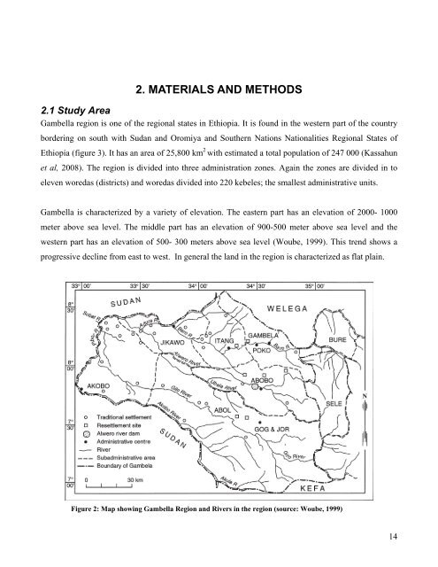
<strong>Gambella</strong> <strong>region</strong> is one of the <strong>region</strong>al states <strong>in</strong> <strong>Ethiopia</strong>. It is found <strong>in</strong> the western part of the country<br />
border<strong>in</strong>g on south with Sudan <strong>and</strong> Oromiya <strong>and</strong> Southern Nations Nationalities Regional States of<br />
<strong>Ethiopia</strong> (figure 3). It has an area of 25,800 km 2 with estimated a total population of 247 000 (Kassahun<br />
et al, 2008). The <strong>region</strong> is divided <strong>in</strong>to three adm<strong>in</strong>istration zones. Aga<strong>in</strong> the zones are divided <strong>in</strong> to<br />
eleven woredas (districts) <strong>and</strong> woredas divided <strong>in</strong>to 220 kebeles; the smallest adm<strong>in</strong>istrative units.<br />
<strong>Gambella</strong> is characterized by a variety of elevation. The eastern part has an elevation of 2000- 1000<br />
meter above sea level. The middle part has an elevation of 900-500 meter above sea level <strong>and</strong> the<br />
western part has an elevation of 500- 300 meters above sea level (Woube, 1999). This trend shows a<br />
progressive decl<strong>in</strong>e from east to west. In general the l<strong>and</strong> <strong>in</strong> the <strong>region</strong> is characterized as flat pla<strong>in</strong>.<br />
Figure 2: Map show<strong>in</strong>g <strong>Gambella</strong> Region <strong>and</strong> Rivers <strong>in</strong> the <strong>region</strong> (source: Woube, 1999)<br />
14